merci de vos réponses🙂
Visite de Los Angeles et hôtel proche de l'aéroport
by Fred06
This discussion is in French, the community’s main language.
Original post
Bonjour, 😉
Nous allons arriver à L.A (tard dans la soirée) pour 2 nuits avec entre les deux une journée complète que nous allons consacrer a la visite " trés sommaire" de la ville.
Que me conseillez vous, pour cette visite express?
Où me conseillez vous de dormir ? pas trop loin de l'aéroport car aprés le vol nous serons surement fatigué(décalage horaire ).
merci de vos réponses🙂
Ca dépend de beaucoup de chose : de ton budget, de ton niveau d'exigence, etc.
Tu ne nous en as pas dit assez, si ce n'est que tu voulais un truc proche de l'aéroport.
Dans ce cas, tu as une enfilade de motels/hotels pile à la sortie de LAX. Je n'ai pas la carte de la cité des anges sous les yeux, mais si mes souvenirs sont bons, ça s'appelle Century boulevard. Si je dis une connerie, quelqu'un rectifiera. 😐 Il y a toute la palette des prix.
Bon, au niveau quartier, c'est pas l'éclate (ce sont les faubourgs d'Inglewood), mais ce n'est pas un coup de gorge non plus.
Un peu dans le même genre (mais plus loin de l'aéroport) il y a une série de motel dans downtown.
Laurent
Un peu dans le même genre (mais plus loin de l'aéroport) il y a une série de motel dans downtown.
Laurent
Nous sommes arrivés tard le soir (23 h 00) à Los Angeles et j'avais réservé à l'agence Nouvelles Frontières le "sheraton four points" à... 63 euros la nuit pour une chambre avec 2 grands lits le 16 avril ! (peut-être qu'au mois d'août, c'est plus cher !!).
Je te mets le lien : http://www.fourpointslax.com/index.asp
C'est un très bel hôtel avec une belle et grande piscine qui est situé à environ 3 km de l'aéroport.
De plus, il y a des navettes gratuites qui t'emmenes à l'hôtel et quand tu es crevé et un peu désorienté, c'est bien pratique !
Il y a un parking sur place, mais il est payant : 10 dollars la nuit ! Il y a aussi de quoi manger à coté (hormis le restau. de l'hôtel, mais assez cher) du style Mac Do ! 😉
Je te mets le lien : http://www.fourpointslax.com/index.asp
C'est un très bel hôtel avec une belle et grande piscine qui est situé à environ 3 km de l'aéroport.
De plus, il y a des navettes gratuites qui t'emmenes à l'hôtel et quand tu es crevé et un peu désorienté, c'est bien pratique !
Il y a un parking sur place, mais il est payant : 10 dollars la nuit ! Il y a aussi de quoi manger à coté (hormis le restau. de l'hôtel, mais assez cher) du style Mac Do ! 😉
Bonne journée ! Une Corse... de Marseille
Après avoir fouillé mes archives, j'ai retrouvé que j'avais dormi au :
Tivoli Motor Hotel, 4861 W Century Blvd, Inglewood, CA 90304.
De mémoire, moins de 80$ la nuit pour deux personnes en octobre dernier (pas de peti-dèj, si mes souvenirs sont bons). Propre. Accueil folklorique mais soigné. Chambres pas hyper-spacieuses, mais ça va. Et pour le quartier, voir ce que je disais plus haut... 🤪
Voici un lien : http://www.travelhero.com/prophome.cfm/id/64239/aid/300/index.html
A+
PS : un hotel "correct", je ne sais pas non plus ce que ça veut dire 😕. Ce qui est "correct" pour toi ne l'est pas forcément pour moi... et inversement. 😐
De mémoire, moins de 80$ la nuit pour deux personnes en octobre dernier (pas de peti-dèj, si mes souvenirs sont bons). Propre. Accueil folklorique mais soigné. Chambres pas hyper-spacieuses, mais ça va. Et pour le quartier, voir ce que je disais plus haut... 🤪
Voici un lien : http://www.travelhero.com/prophome.cfm/id/64239/aid/300/index.html
A+
PS : un hotel "correct", je ne sais pas non plus ce que ça veut dire 😕. Ce qui est "correct" pour toi ne l'est pas forcément pour moi... et inversement. 😐
de retour hier . pour la visire expresse on a aimé le tour des studio à universal mais adultes et enfants ont trouvé les autres attractions sans interet. balade sur hollywood boulevard et sans doute un petit bain a venice si tu aimes les musées il y a 3 beaux musée getty lacma et modern. pour le reste penses à prendre les highways, j'ai trop souvent pris les rues et sur peu de temps on en perd beaucoup.
on logeait au cadillac à venice avantage, parking gratuit, le bain du matin et du soir plus petit dej en terrasse près de la plage, il sont en train de refaire l'hotel les chambres sont donc inégale.il y a un site internet.
sur century BLV a 2 km de l'aeroport il y a plein de motel a partir de 50 $
va sur roomsaver.com
Pour ton circuit telecharge sur emule microsoft streets equivalent de autoroute express europe
bonjour, l'ouest americain est le pay ou il est le plus facile de vivre ont trouve vite ses repairesTu peux organiser ton voyage seule et je te deconseil de retenir les hotels avant de partir contrainte importante et ont trouve des motel et hotel partout, il y a aussi le camping en self service dans les national park 300 m2 avec table et barbecue 15 l'emplacement pour 16 pers et 1 vehicule.Voie sur place en fonction de la meteo et des points interressant; l'avion avec le comparateur de prix easyvol.com du 1 au 23 juin 2006 depart de paris/san francisco 581 € ttc, location de voiture par nouvelles frontières eco tableau A 309 € pour 23 jours ass cdw inclus et kms illimite Chevrolet cavalier ou pontiac AM
pour ma part je te conseil de partir de SF et de revenir par salt lake la visite de LA n'est pas indispensable par rapport aux richesses des parks en 25 jours c'est largement faisable env 7000 a 8000 kms moi cela fait 7 fois que je fait l'ouest et a chaque fois je fait du camping sauvage et je dort dans la voiture mais a 3 c'est pas possible les campings sont en self service 15$ pour un emplacement avec maximun de 16 pers et 1 vehicule avec table et barbrcue 300 m2 env c'et la meilleur solution les motel sont a 60 80$ le nombre ideal c'est a 4. ont a le droit sur les compagnies americaine a deux valises de 32 kg et un bag a main par personne. moi j'enmêne aussi la bouf car extremement cher aux US et pas terrible. je prends des conserves style plats cuisine individuel que je gfait rechaufer au bain marie. la meilleur période c'est de mi mai a fin septembre l'itineraire que je te conseil SF /yosemite entre sud pour les sequoias et glacier point, la valley faire la rando j'usqu'a glacier point/ tioga pass si ferme sonora pass/ death valley/las vegas/grand canyon/petrified forest/canyon de chelly/monument valley/moab, cayonland, arches, capitol reef (la route 95 entre hanksville et blanding est super mais ca fait un detour)/bryce/zion/salt lake/grand teton/yollowstone/et retour de salt lake ou jackson hole. le lac Powell en juin 2005 etaint a moitié vide et antelope canyon 50$ entre par pers contre 5 $ pour monument valley. a cette epoque le tioga pass est ferme voir le site mais le sonora pass au nord est surement ouvert a ta place je zapperais LA rien a voir mais a cette epoque the needles le desert est en fleurs super et atention a yosemite passe par l'entre sud pou voir les sequoias geant de mariposa grove la route de glacier point dera fermer mais possite de le faire en rando a partir de la vallée 10 h AR facile et super vu sur toutes les chutes du parks sortir par le nord le sonora pass 150 km de detour superbe route et dir death valley pour ma part je te conseil de partir de SF et de revenir par salt lake la visite de LA n'est pas indispensable par rapport aux richesses des parkshttp://voyageforum.com/...sa%20mode%20;#311502 voici le liens pour les meilleurs site sur l'ouest usa et cherche gillou02 si tu veux d'autre conseil
OUEST USA MODE D’EMPLOI
Texte Gaubry@infonie.fr
PHOTOS : http://jlbedel.club.fr/planche_cal/FrameSet.htm PHOTOS : http://www.usanature.com/html/frameset%20_presentation.html Copier ce texte sur une disquette ou clé USB. Ouvrez le fichier avec Word, connectez vous a Internet et il suffit de cliquer sur les liens ou de faire copier coller dans la barre d’adresse pour accéder directement au site .Vous pouvez rajouter des informations des liens, des astuces pour en faire profiter le plus grand nombre etc …. http://www.usatourist.com/francais/ = tous les renseignements sur les parcs et villes en français
Si vous êtes un amoureux des sites naturels hors du commun, une géologie incroyable formé par 150 millions d'années d'érosion, des espaces immense, point de vue a 150 Kms .Des américains qui vous surprendront par leur "cool attitude" et leur serviabilité . Vous aimerez sans aucun doute l'ouest américain. En effet dans un rayon de 500 km, un grand nombre de parcs nationaux ont été créés ou la nature et la faune ont été préservées. Vous serez aussi surpris par l'aménagement et la propreté des lieux. De France la vision des USA est très différente du ressenti sur place
SAISON ET DUREE DU VOYAGE
La meilleure saison est de mi-mai à fin octobre, les mois de juillet et août sont a éviter, hôtel et camping souvent complet, trop de monde et beaucoup de moustiques, un anti-moustique ordinaire suffit. Dans les parcs comme le grand canyon, de Bryce canyon ou l'altitude est élevée, les nuits sont fraîches, il peut parfois geler. L'entrée EST du parc Yosemite par le tioga passe est à 3000 m d'altitude donc il faut absolument se renseigner pour savoir si le col est ouvert, autrement passé par le nord. http://www.nps.gov/yose/now/conditions.htm#trails
Durée minimum de 15 jours en partant de Las Vegas 3 semaines 1 mois c’est l’idéal départ de LA, SF billet d’avion moins cher que de Las Vegas. Possibilité départ de LA et retour de Salt Lake ou Las Vegas, frais d’abandon du véhicule mais moins de kms.
-15 jours 2800 Kms au départ de Las Vegas avec 100 Kms de rando : Lac Mead, Grand Canyon rive sud rando plateau point18 Kms AR 9h, Météor crater, Petrified Forest entrée sud, Canyon de Chelly, Monument Valley, Canyonland sud rando 30 Kms 8h, Moab, Arches NT Park rando, Death horse point, Canyonland, Capitol reef de Moab a gauche avant le pont longer le colorado par le nord autoroute 10 Cisco puis dir Capitol reef, Escalante rando Calf Creek 2h 10 Kms facile, Bryce Cayon rando 20 Kms 8h, Cedar Breaks NT park, Zion Nt park, Lac Powell, Antélope Canyon, Las Vegas.
Possible en 15 j ou 23 jours 5900 Kms : Départ LA, Santa Monica, Santa Barbara, Solvang, Carmel, SF, Yosemite (entrée sud)si sortie EST fermé passer par le nord, Bodie, Mono Lake, Death Valley, LV, Lac Mead, Grand Canyon rive sud rando plateau point 18 Kms AR 9h, Lac Powell, Antélope Cayon, Zion Nt park, Cedar Breaks Nt park, Bryce Cayon rando 20 kms 8h, Escalante rando Calf Creek 2h 10 Kms facile, Capitol reef, Arches Nt park rando, Death point horse, Canyonland, Moab, Canyonland sud the Needles rando 30 Kms 8h, Monument Valley, Canyon de Chelly, Petified Forest, route 180 sud puis 61 sud direction Globe, évité Phoenix, Yuma, Un tour au Mexique a pied, San Diego (sea world), LA http://www.usatourist.com/francais/ = tous les renseignements sur les parks et villes en français
CONSEIL Important : Le climat est très sec risque de déshydratation. Penser à boire régulièrement. Il est intéressant et rentable de payer votre voyage pour toute la famille avec une VISA PREMIER 45€ l’année par la banque ACCORD sans changer de banque. Pour les assurances annulation, santé, voiture, perte de baguage, responsabilité civile, etc … http://www.banque-accord.fr/direct/public?task=visapremier&process=visapremiertablo Sécurité : je suis aller 10 fois aux USA ouest, New York et je n’ai jamais eu de problème .Je n’ai pas ressenti d’insécurité sauf le soir dans les quartiers Est de LA et a SF beaucoup de clochard en centre ville. Prévoir un téléphone tri bande pour la rando. Toujours avoir 30 a 50 pièces de 25 c pour les park mètre a LA et SF et pour les douches payante, téléphone, laverie. Prendre un tube de Super glue, un nécessaire de couture, cordelette. Crème solaire et anti-moustique. Oreiller gonflable. Adaptateur de courant prise plate. Au pire si vous ne trouvez pas d’hôtel ou de camping vous dormirez dans la voiture - Organiser votre circuit en fonction de la météo du moment et il est important pour la beauté des paysages de conduire si possible le soleil dans le dos. Le matin Est/ Ouest, le soir Ouest/Est.
VETEMENTS Chaud dans le désert et LA, frais dans les parks la nuit et a SF .Voyager léger autrement tout ne tiendra pas dans la voiture. Laverie automatique partout dans les villes et dans les parks. Un poncho pour les randos, une couverture de survie par per,
AVION Pour LA et SF il faut compter 520 € TTC avec escale 14h / 16h et 630 € TTC vol direct 11h hors saisons et 880€ en été. De Las Vegas 600 € TTC hors saisons, 920 € en été http://www.easyvols.fr: Comparateur de prix de six groupes d'achat, SNCF voyages, Anyway, Ebookers etc. Droit de douanes : http://www.douane.gouv.fr/
VOITURE OU CAMPING CAR
Les distances sont très importantes aux États-Unis, Les routes larges en bons états, Autoroute gratuite. On trouve des cartes routières et livre gratuit des états dans les offices du tourisme. Acheter les cartes de LA, SF, LV dans les station Ess. La location de voitures est le moyen le plus pratique, le plus économique et sans contrainte pour visiter les USA, les tarifs sont deux fois moins chère de France .Les distances sont en Mille 1 mille=1, 6 km, l'essence du régular 1 gallon = 3, 8 L= tarif 12/2004 de 1.87$ a 2.50$ le Gal Tarifs ess en direct : http://www.fuelgaugereport.com/sbsavg.asp http://www.californiagasprices.com/ Ne pas oublier de faire le plein avant d’entrée a Death Vallée 180 km sans station et a Moab/ Capitol Reef 160 km ou si station, ess très chère dans les endroits désertique. http://gocalif.ca.gov/tourism/pdfs/LA_OC_Map.pdf : plan de LA http://www.aaccessmaps.com/show/map/lametro : plan de LA http://maps.yahoo.com/dd : distance, temps de conduite, plan http://www.maporama.com/share/ :calcul des distances http://maps.yahoo.com/beta/index.php# : calcul des distances http://www.sitesatlas.com/Maps/usstates.htm : Cartes de tous les états US http://www.lib.utexas.edu/Libs/PCL/Map_collection/united_states.html http://www.mappoint.com/ http://www.randmcnally.com/ http://www.lib.utexas.edu/maps/national_parks.html : Plan des NT Parks http://maps.google.com/maps?ll=40.747905, -73.985667&spn=0.007217, 0.014179&hl=en Les agences Nouvelles frontières souvent bien placé au niveau tarifs en 2005. 89 € la semaine +18€ par jour sup = 297€ pour 21J tableau A économique, assurance CDW incluse, km illimité pour une Chevrolet cavalier 2 portes régulateur de vitesse, boite auto, clim, air bag, ABS, cd, grand coffre. Chez ALAMO rendre la voiture avec le réservoir vide. Consommation environ 7 / 8 L au 100. Les taxes locales ne sont pas incluses. Si vous avez la Visa Premier, le rachat de franchise est inclu ainsi que l’assurance voiture CDW que vous pouvez faire déduire. L’assurance LIS augmente la responsabilité civile a 1 million de $ mais le pris de la location est double. Les policiers sont intransigeants si, vous vous garer sur une place d' handicapé, vous ne respecter pas les limitations de vitesse, jeter des papiers sur la chaussée l'amende pourra être salée. La prison pour les grands excès de vitesse. Les campings car sont légion au USA et immense. Il consomme beaucoup d’essence 16 L au 100 km et le kilométrage n’est pas illimité. Possibilité de dormir sur des parkings de supermarché, Loc Camping Car : http://www.camperusa.com/rates.htm
HOTEL MOTEL Ne pas réserver a l’avance de France trop de contrainte cela vous oblige a respecter un planning, On trouve des hôtels et motel partout sur la route, plus chère les week-end, faire la réservation 2 jours avant selon votre itinéraire. Dans les parks nationaux très chère. Découper les coupons dans les revues gratuites dispo dans les offices du tourisme, hôtel, Kiosque a journaux dans la rue.
Los Angeles Adventurer Hotel Tél: (888) 434-593140 $ +tax la nuit pour 2 petit dej compris 4200 W Century Blvd, Inglewood, CA Hwy/Exit:405 / Century Blvd Très bon hôtel bon marché pour l’arriver et le départ de LA avec piscine proche aréoport avec navette gratuite. Imprimer le coupon de réduction sur http://www.roomsaver.com Beaucoup d’autre hotel a prix abordable sur Century boulevard et a Hamanien http://www.roomsaver.com Hôtel discount tous les USA imprimé les coupons http://www.motel6.com : chaîne d’hôtel http://www.super8.com/Super8/control/home : chaîne d’hôtel
CAMPING
Solution idéal et économique proche des centres d’intérêts. Pour 4 prévoir 2 tentes dôme, sac de couchage chaud terrain dans les parks parfois a 2000/ 2400 m d’altitude il fait frais la nuit. Acheter un réchaud sur place 17$ + 3$ deux grosses cartouches, ou emporter système de ration militaire français pastille d’allume barbecue avec petite plaque réchaud, avantage ça prend pas de place et très léger. Un jerricane d’eau 2, 5 gal réutilisable on en trouve partout Wal-mart meilleur tarif les prix sont prohibitifs a l’intérieur des parks. Plusieurs terrains de camping dans tous les parks nationaux très bien aménagé et bien équipé, douche, laverie, market.. Emplacement 100 a 400m carré avec table de 10$ a 15$ pour 16 personnes, barbecue. Système self service .A l’entrée une urne avec des enveloppes mettez la somme demandée et détacher le coupon que vous accrocherez sur votre emplacement. En été réservé tôt le matin, si non faite le tour du terrain regarder les places vides vérifier la date inscrite sur le ticket .Si pas de place libre demander à partager un emplacement.
NOURRITURE / ACHAT DIVERS Récupérez les coupons réduction dans les magasins, hôtel, office du tourisme vous aurez des réductions pour la nourriture, park d’attraction, Hôtel Chaîne de magasin Wal-Mart (style Carrefour) meilleur rapport qualité prix pour tout La nourriture pas terrible au USA et très chère, le café est infecte. Je vous conseil d’emmenez des plats cuisiné en conserve, café soluble, du pâté, tu thon en boite pour les randos. Ca n’existe pas aux USA. A l’entrée du premier park demander la Golden Eagle Pass 50$ vite rentable, elle donne accès a tous les NT PARKS par véhicule pendent 1 an (n’est pas accepter pour Monument Valley 5$ per, Death Pt Horse 7$ per, Antélope Canyon 30$ per Guide National Park : http://www.lib.utexas.edu/maps/national_parks/nps_guide99.pdf
TELEPHONE INTERNET
Sur place carte prépayé dans les supermarchés 10$ 100 mn pour Internet dans les bibliothèques c'est gratuit et certain office du tourisme comme a Blanding, ou au Lodge de ZION. Carte prépayer dans tous les magasins (connexion free Carte France Télécom international plus chere accessible avec un code de m’importe quel téléphone dans la plus part des pays du monde.
A VOIR DANS L’ORDRE
CALIFORNIE
Carte de la CALIFORNIE : http://www.sitesatlas.com/Maps/Maps/CA1.htm
LOS ANGELES Acheter un plan de la ville dans une station ess Palissade Av, Venice Beach ou vous pourrez louer des rollers ou vélo, Grifftit park, Observatoire, Old LA, ULCA, Hollywood blv, Rodeo Drive, Beverlly Hill, Sunset Blv etc... Tombe de Marilyne Monro, Jo Dassin, Michael London Site en français LA http://www.usatourist.com/...rnia/losangeles.html Site en français Californie : http://www.usatourist.com/francais/places/california/index.html Webcam Laguna beach: http://www.earthcam.com/usa/california/laguna/ Webcam Hollywood: http://www.earthcam.com/usa/california/losangeles/hollywood/ Webcam Venice beach: http://www.westland.net/beachcam/ Webcam Venice beach:http://www.earthcam.com/...ifornia/venicebeach/ Météo 10 j : http://weather.yahoo.com/forecast/USCA0638_c.html?force_units=1
SANTA MONICA Plage eau a 17° en juin 20° en septembre pas très chaud ! Site en français :
Webcam plage : http://www.hermosawave.net/webcam/ Météo 10 j : http://weather.yahoo.com/forecast/USCA1024_c.html?force_units=1
SANTA BARBARA Beau centre ville, Jeter Site : http://www.usatourist.com/...ia/santabarbara.html Météo 10 j : http://weather.yahoo.com/forecast/USCA1017_c.html?force_units=1
SOLVANG Très beau village d’origine Danoise avec des moulins a vent Météo 10 J : http://weather.yahoo.com/forecast/USCA1072_c.html?force_units=1
COTE PASSIFIQUE Très longue 1 journée de route sinueuse. Hearst Castle : sans grand intérêt entrée très chère 24$ et architecture hétéroclite. Site :http://translate.google.com/translate?hl=fr&sl=en&u=http://www.hearstcastle.org/&prev=/search%3Fq%3Dheart%2Bcastle%26hl%3Dfr%26lr%3D%26sa%3DG Aquarium de Monterrey Chère allez plutôt à Sea World San Diego
CARMEL Très jolie ville avec une belle plage, Clint Iswood Bulding, 17 mille Drive 8$ Météo 10 j : http://weather.yahoo.com/forecast/USCA0183_c.html?force_units=1
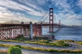
SAN FRANSICO Acheter un plan de la ville dans une station ess Tes jolie ville avec des maisons victorienne, Alamo park, golden gate, Pier 39, Pour alcatraz, prenez le ferry qui va a Saulsalito il passe devant .Route des 59 mille indiquer par des panneaux Site en français : http://www.usatourist.com/francais/places/california/sanfrancisco.html Webcam golden Bridge http://www.mapwest.com/...am/ggbridge_cam.html Webcam : http://moon.kpix.com/live/BayCam.html Webcam Sausalito vue de SF: http://www.rntl.net/sausalitocam.htm Plan Ville 1 : http://jlbedel.club.fr/ouest/plan_grd_frisco.gif Plan centre Ville : http://jlbedel.club.fr/ouest/plan_centre_frisco.gif Photos : http://jlbedel.club.fr/planche_sf/FrameSet.htm Météo 10 j : http://weather.yahoo.com/forecast/USCA0987_c.html?force_units=1
YOSEMITE Il faut entrée par le sud du park route 41, par Mariposa grove, Séquoia Géant .Glacier point vue sur 4 cascades dont une de 739 m de haut.il faut aller stationner sa voiture dans yosemite vallée près du visitor center prendre la navette le matin a 8h 10 et 13h pour 15$ aller a glacier point et faire le chemin de 11 km jusqu'à la vallée tout en descente ou yosemite valley, rando 10 Kms trail John Muir Trail facile 2 cascades nevada fall, sortir du park par rt 120 Est Tioga pass, si fermé passé par le nord Sonora pass 150 kms de détour plus court que par Bakersfield. Site en français : http://www.usatourist.com/...fornia/yosemite.html Entée sortie EST du park Col a 3200 m du Tioga Pass regarder si ouvert ou fermé Route Tioga Pass : http://www.nps.gov/yose/now/conditions.htm#trails Webcam : http://www.yosemite.org/vryos/index.htm Carte du park : http://www.lib.utexas.edu/...arks/yose_vist94.jpg Carte globale du park : http://www.lib.utexas.edu/maps/national_parks/yosemite_park98.pdf Météo 10 j : http://weather.yahoo.com/forecast/USCA1269_c.html?force_units=1
MONO LAKE
BODIE A l'est du parc du Yosemite se trouve la ville fantôme de Bodie Site en français : http://www.chez.com/parcsusa/bodie.html Météo 10 j : http://weather.yahoo.com/forecast/USCA0601_c.html?force_units=1
DEATH VALLEY Site en français : http://www.usatourist.com/francais/places/california/deathvalley.html Ne pas oublier de faire le plein d’essence a Lone Pine ou shoshone. Station a Stovepipe et Fumace Creek mais très chère Photo : Carte du park :http://www.lib.utexas.edu/maps/national_parks/death_valley_park97.pdf Méréo 10 j: http://weather.yahoo.com/...c.html?force_units=1
NEVADA
Carte du NEVADA : http://www.sitesatlas.com/Maps/Maps/NV1.htm
LAS VEGAS Acheter un plan de la ville dans une station ess. Si vous êtes intéressé par un spectacle réserver 5 jours a l’avance. Hôtel et restaurant pas chères. Prendre les journaux gratuits comme Las Vegas TODAY tous y est indiqué Site en français : http://www.usatourist.com/francais/places/lasvegas/index.html Webcam live : http://www.earthcam.com/usa/nevada/lasvegas/ Photos : http://thierry.lagarde1.free.fr/LAS%20VEGAS/index.html Photos : http://jlbedel.club.fr/...e_vegas/FrameSet.htm Carte : http://www.hot-maps.de/...as_vegas/homeen.html Carte : http://www.pcap.com/et-map-strip.htm Shopping : http://www.fashionoutletlasvegas.com/ Météo 10 j : http://weather.yahoo.com/forecast/USNV0049_c.html?force_units=1
ARIZONA
Carte de L’ARIZONA : http://www.sitesatlas.com/Maps/Maps/AZ1.htm
GRAND CANYON SUD Rando plateau point. Ne vous charger pas .Prévoir aliment nutritif (barre de céréale) boire 4 L d’eau autrement déshydratation, 4 point d’eau sur le parcourt de 18 Kms AR remonté difficile. 7h / 9h de marche. Prendre la navette pour visiter les différents points, puis la voiture direct Lac powel. Site en français : http://www.usatourist.com/francais/places/grandcanyon/index.html Carte du park :http://www.lib.utexas.edu/maps/national_parks/grand_canyon_park97.pdf http://www.lib.utexas.edu/maps/national_parks/grand_canyon_village_vis.cn.jpg Carte générale : http://www.lib.utexas.edu/maps/national_parks/grand_canyon_ns_map.jpg Carte relief du park :http://www.lib.utexas.edu/maps/national_parks/grand_canyon.jpg Photos: http://jlbedel.club.fr/..._canyon/FrameSet.htm Sur vol en Avion : http://www.grandcanyonairlines.com/ Météo 10 j : http://weather.yahoo.com/...c.html?force_units=1
PAGE / ANTELOPE CANYON / LAC POWELL
A visiter le barrage (gratuit), la marina, en mai 2004 le lac était à moitié vide ? Visite en bateau très cher. Site en français : http://www.i-oyages.net/dossiers/dossiers.php?id_dossier=192&idparent=174 Photos: http://thierry.lagarde1.free.fr/lac%20powell/index.html Photos: http://jlbedel.club.fr/planche_powel/FrameSet.htm Canyon étroit et profond A visité le midi si il y a du soleil, entée 29.5$ par personne, enfants 18.25$, très cher par rapport au 5 $ d'entrée de Monument valley. Canyon situer à la sortie de Page à 5 Kms sur la route 89 en direction de kenyenta entrée juste avant la centrale électrique Navajo sur la gauche. http://www.powellmuseum.org/CanyonTours.html Site en français : Photos Antelope Canyon : http://thierry.lagarde1.free.fr/...%20canyon/index.html Météo 10 j : http://weather.yahoo.com/...c.html?force_units=1
THE WAVE / COYOTE BUTTES Butte de sable pétrifié, Entré du park limité a 20 per par jours. Ont peut Retenir 2 places 6 mois a l’avance avec beaucoup de chance. Photos : http://thierry.lagarde1.free.fr/...%20buttes/index.html Site en Français :http://perso.wanadoo.fr/chamouse/wave/index.htm
UTAH
Carte de L’UTAH : http://www.sitesatlas.com/Maps/Maps/UT1.htm
ZION NT PARK Rando visite du park avec navette Site en français : http://www.usatourist.com/francais/places/zion/index.htmll Photos : http://thierry.lagarde1.free.fr/zion/index.html Carte du park : http://www.lib.utexas.edu/maps/national_parks/zion_park00.pdf Carte de la région : http://www.lib.utexas.edu/maps/national_parks/zion_area00.pdf Météo 10 j : http://weather.yahoo.com/...c.html?force_units=1
CEDAR BREAK Photos: http://thierry.lagarde1.free.fr/...0monument/index.html
BRYCE NT PARK Le plus beau des parks a mon avis. Passé une journée a marché dans les dédales de roches. Point de vue a 130 km. Pour les photos BRYCE POINT au levé du soleil. Voir photos Site en français : http://www.usatourist.com/...tah/brycecanyon.html Carte rando : http://www.lib.utexas.edu/...arks/bryc_vist94.jpg Carte du park : http://www.lib.utexas.edu/...al_parks/bryc_94.jpg Photos : http://thierry.lagarde1.free.fr/...%20canyon/index.html Photos :http://jlbedel.club.fr/...e_bryce/FrameSet.htm M��téo 10 j : http://weather.yahoo.com/...c.html?force_units=1
ESCALANTE Très belle route entre Capitol Reef et bryce canyon 17 mi avant d’arriver a la ville d’Escalante faire la rando de calf creek 10 km AR facile dans un canyon et une belle cascade au bout du chemin. Photos : http://thierry.lagarde1.free.fr/calf%20creek/index.html
CAPITOL REEF Pour les passionner de géologie Site en français : Photos :http://thierry.lagarde1.free.fr/...ol%20reef/index.html Carte du park : http://www.lib.utexas.edu/...itol_reef_park97.pdf Météo 10 j : http://weather.yahoo.com/...c.html?force_units=1
ROUTE 95 Cette route entre Hanksville et Blanding longue de 160 km vaut a elle seule un détour par la beauté et la diversité de ses paysages, a faire de préférence le matin Est Ouest l’après midi Ouest Est
ARCHES NT PARK Délicate arches Rando 5 km AR et les autres ½ journée Site en français : http://www.usatourist.com/francais/places/utah/arches.html Photos: http://thierry.lagarde1.free.fr/arches/index.html Carte du park : http://www.lib.utexas.edu/...ks/arches_park98.pdf Météo 10 j : http://weather.yahoo.com/...c.html?force_units=1
DEATH HORSE POINT STATE PARK A faire le matin de bonne heure .State park payant 7$ personne. Très beau panorama sur le colorado, Site en français : Photos :http://thierry.lagarde1.free.fr/...te%20park/index.html Météo 10 j : http://weather.yahoo.com/...c.html?force_units=1
CANYONLAND NORD A faire après death horse point le même jour que death point horse. avant la sotie possibilité de prendre la piste impressionnante qui longe le Colorado jusqu’a MOAB seulement si vous êtes un bon conducteur. 3 a 4h de piste. Je l’ai fait 4 fois avec le véhicule de loc. Site en français : http://www.usatourist.com/francais/places/utah/arches.html Photos : http://thierry.lagarde1.free.fr/...the%20sky/index.html Carte :http://perso.wanadoo.fr/sergioweb/usa/cartes/map_parcs_canyonland.pdf Cartes 2 :http://perso.wanadoo.fr/sergioweb/usa/cartes/map_parcs_canyonland_island_in_the_sky.jpg Météo 10 j : http://weather.yahoo.com/...c.html?force_units=1
MOAB Ville étape pour aches et canyonland, Camping tout le long du Colorado. Rafting, vélo, escalade etc. … Possibilité si vous êtes un bon conducteur de faire la piste de terre de 32 km le long du colorado avec la voiture de loc 3h. Depuis Moab a 1 mille sur la gauche après le pont, prendre dir Potash 17 mil de route puis chemin 27 mil 3h de piste et après la monté en lacet vous arriver a canyonland. ( film Telma et Louise). Je l’ai fait 4 fois avec le véhicule de loc.
Site en français : Météo 10 j : http://weather.yahoo.com/...c.html?force_units=1
CANYONLAND SUD THE NEEDLES Pas d’hôtel que des campings, pour ceux qui aime la marche paysages fabuleux. Faire le plein d’eau au camping prévoir 3L par pers et aliment nutritif. Téléphone portable tri bande pour la sécurité. Rando 10 a 30kms et plus. Site en français : Photos : http://thierry.lagarde1.free.fr/...20needles/index.html Carte :http://perso.wanadoo.fr/sergioweb/usa/cartes/map_parcs_canyonland_the_needles.jpg Météo 10 j : http://weather.yahoo.com/...c.html?force_units=1
ARIZONA
Carte de L’ARIZONA : http://www.sitesatlas.com/Maps/Maps/AZ1.htm
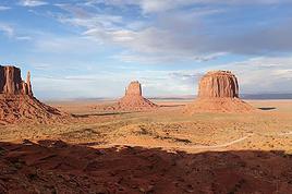
MONUMENT VALLEY 5 $ par personne, faire les 32 Kms de piste avec sa propre voiture, super Site en français : http://www.usatourist.com/francais/places/utah/monumentvalley.html Photos :http://thierry.lagarde1.free.fr/...%20valley/index.html Météo 10 j : http://weather.yahoo.com/...c.html?force_units=1
CANYON DE CHELLY Très beau canyon, faire la rive sud d’où sont les plus beaux points de vues Site en français : Carte : http://data2.itc.nps.gov/parks/cach/ppMaps/CACHmap1%2Epdf Photos :http://jlbedel.club.fr/best_of/chelly/1.htm Météo 10 j : http://weather.yahoo.com/forecast/USAZ0036_c.html?force_units=1
PRTRIFIED FOREST Foret pétrifié sur 40 Kms de long avec de super paysages vers le nord du park voir horaire d’ouverture Site en français : http://www.arizona-dream.com/Usa/Fotos/Themes/petrified.php Carte du Park : http://www.lib.utexas.edu/maps/national_parks/petrified_forest_park99.pdf Météo 10 j : http://weather.yahoo.com/...c.html?force_units=1
METEOR CRATER Carter de 1, 186 km de diamètre, age cause par la chute d’un météore il y a 49000 années Photo : http://www.solarviews.com/raw/earth/meteor.jpg
CALIFORNIE
Carte de la CALIFORNIE : http://www.sitesatlas.com/Maps/Maps/CA1.htm
SAN DIEGO Le vieux cartier Old, L’hôtel coronado, plage, Sea world 51$ enfants 41$, Zoo, le vieux port avec ses boutiques Webcam live: http://live.net/sandiego/ Webcam live Zoo: http://www.sandiegozoo.org/.../pandacam/index.html Webcam Sea World live: http://www.shamu.com/ca/shamu-cam/index.htm Site en français : http://www.usatourist.com/francais/places/california/sandiego.html Site Seaworld : http://www.seaworld.com/...orld/ca/default.aspx Météo 10 j : http://weather.yahoo.com/forecast/USCA0982_c.html?force_units=1
SUNDANCE RESORT Station de ski appartenant a Robert Redford. De Provo prenez la route 189 Nord, Sundance, environ a 23 milles. Site sur la station : http://www.snow-guide.com/overview.cfm/ut14.htm Météo 10 j : http://weather.yahoo.com/...c.html?force_units=1
SALT LAKE CITY Capital Mormon, a visité, Palais du gouverneur, Tabernacle, Musé Webcam live: http://www.earthcam.com/usa/utah/saltlakecity/ Météo 10 j : http://weather.yahoo.com/...c.html?force_units=1
JACKSON HOLE Webcam centre ville live : http://www.jacksontradingco.com/webcam/current_cam2.php
WYOMING
Carte du WYOMING : http://www.sitesatlas.com/Maps/Maps/WY1.htmGRAND TETON
GRAND TETON NT PARK Webcam live: http://www.springcreekranch.com/webcam.html Site : http://www.usatourist.com/...ming/grandteton.html Site : http://www.lib.utexas.edu/...al_parks/teton94.jpg Météo 10 j :http://weather.yahoo.com/...c.html?force_units=1
YELLOWSTONES NT PARK Compter 11h de route de Moab 2500 km AR retour par Bryce Canyon Webcam live: http://www.tsl.org/...tric_peak_webcam.asp Webcam live: http://www.nps.gov/yell/mammothcam.htm Webcam live: http://www.yellowstone.net/webcamlive.htm
Site en français : http://www.usatourist.com/...llowstone/index.html Carte du park : http://www.lib.utexas.edu/maps/national_parks/yellowstone_park98.pdf Météo 10 j : http://weather.yahoo.com/...c.html?force_units=1
LIENS Site avec beaucoup de renseignement : http://www.vazyvite.com PHOTOS : http://jlbedel.club.fr/planche_cal/FrameSet.htm Site Photo : http://thierry.lagarde1.free.fr Site Photo : http://perso.wanadoo.fr/chamouse/usa/ Site Photo : http://www.arizona-dream.com/Usa/Accueil.php Site Photo et plan : http://edelille.club.fr/park_usa.htm 1- http://www.chez.com/wildwest Wildwest 2- http://perso.club-internet.fr/edelille/index.htm Parcs Nationaux 3- http://www.visite-usa.com Bien Venue au pays de l'oncle Sam 4- http://www.parcs.net Ouest Magique 5- http://www.multimania.com/etatsunis/ Les États Unis6- http://www.multimania.com/ouestusa Ouest USA Gregory 7-http://ourworld.compuserve.com/homepages/PLongfils/usaf.htm 9-http://sylvestre.ledru.info/canada 10-http://tdemange.club.fr/present_usa.htm 11-http://andre.molinet.free.fr/USA2001/ 12-http://perso.wanadoo.fr/sergioweb/pays_ouest.htm 13-http://fuhrig.free.fr/OuestUSA/Ouest_USA.html 14-http://www.aftphoto.com/usa.html 15-http://www.participez.com/reportage.php?id=105 16-http://www.participez.com/reportage.php?id=106 16-http://www.aroundtheworlds.com/francais/usac97.htm 17-http://www.america-dreamz.com/ 18-http://perso.wanadoo.fr/sergioweb/usa/p_usa_parc_petrified.htm 19-http://www.chez.com/parcsusa/ 20-http://www.mackoo.com/usawest/bodie.htm 21-http://www.rando-trek.com/wallpaper.php 22-http://www.abm.fr/fiche/usaficf.html Météo ville et park nationaux 10 jours : http://weather.yahoo.com/ Météo : http://french.wunderground.com/
FORUM USA http://voyageforum.com/voyage/ :reconnais les liens hypertexte http://forum.tourdumonde.be/ http://www.routard.com/comm_forum_accueil.asp
GUIDES http://www.routard.com/ http://www.lonelyplanet.com/ http://www.letsgo.com/
TRADUCTION DE SITE WEB ANGLAIS / FRANCAIS
http://tr.voila.fr/ http://babelfish.altavista.com/ http://www.systransoft.com/ http://www.google.fr/language_tools?hl=fr
Sites (F) Gorp (Utah) URL http://www.gorp.com/gorp/location/ut/ut.htm (G) John Donohues URL http://www.serve.com/wizjd/parks/parks.html (H) Park Vision URL http://www.shannontech.com/ParkVision (I) The American South West URL http://www.americansouthwest.net/ (J) Southern Utah URL http://www.so-utah.com (K) Desert USA URL http://www.desertusa.com

Pour ton circuit telecharge sur emule microsoft streets equivalent de autoroute express europe
bonjour, l'ouest americain est le pay ou il est le plus facile de vivre ont trouve vite ses repairesTu peux organiser ton voyage seule et je te deconseil de retenir les hotels avant de partir contrainte importante et ont trouve des motel et hotel partout, il y a aussi le camping en self service dans les national park 300 m2 avec table et barbecue 15 l'emplacement pour 16 pers et 1 vehicule.Voie sur place en fonction de la meteo et des points interressant; l'avion avec le comparateur de prix easyvol.com du 1 au 23 juin 2006 depart de paris/san francisco 581 € ttc, location de voiture par nouvelles frontières eco tableau A 309 € pour 23 jours ass cdw inclus et kms illimite Chevrolet cavalier ou pontiac AM
pour ma part je te conseil de partir de SF et de revenir par salt lake la visite de LA n'est pas indispensable par rapport aux richesses des parks en 25 jours c'est largement faisable env 7000 a 8000 kms moi cela fait 7 fois que je fait l'ouest et a chaque fois je fait du camping sauvage et je dort dans la voiture mais a 3 c'est pas possible les campings sont en self service 15$ pour un emplacement avec maximun de 16 pers et 1 vehicule avec table et barbrcue 300 m2 env c'et la meilleur solution les motel sont a 60 80$ le nombre ideal c'est a 4. ont a le droit sur les compagnies americaine a deux valises de 32 kg et un bag a main par personne. moi j'enmêne aussi la bouf car extremement cher aux US et pas terrible. je prends des conserves style plats cuisine individuel que je gfait rechaufer au bain marie. la meilleur période c'est de mi mai a fin septembre l'itineraire que je te conseil SF /yosemite entre sud pour les sequoias et glacier point, la valley faire la rando j'usqu'a glacier point/ tioga pass si ferme sonora pass/ death valley/las vegas/grand canyon/petrified forest/canyon de chelly/monument valley/moab, cayonland, arches, capitol reef (la route 95 entre hanksville et blanding est super mais ca fait un detour)/bryce/zion/salt lake/grand teton/yollowstone/et retour de salt lake ou jackson hole. le lac Powell en juin 2005 etaint a moitié vide et antelope canyon 50$ entre par pers contre 5 $ pour monument valley. a cette epoque le tioga pass est ferme voir le site mais le sonora pass au nord est surement ouvert a ta place je zapperais LA rien a voir mais a cette epoque the needles le desert est en fleurs super et atention a yosemite passe par l'entre sud pou voir les sequoias geant de mariposa grove la route de glacier point dera fermer mais possite de le faire en rando a partir de la vallée 10 h AR facile et super vu sur toutes les chutes du parks sortir par le nord le sonora pass 150 km de detour superbe route et dir death valley pour ma part je te conseil de partir de SF et de revenir par salt lake la visite de LA n'est pas indispensable par rapport aux richesses des parkshttp://voyageforum.com/...sa%20mode%20;#311502 voici le liens pour les meilleurs site sur l'ouest usa et cherche gillou02 si tu veux d'autre conseil
OUEST USA MODE D’EMPLOI
Texte Gaubry@infonie.fr
PHOTOS : http://jlbedel.club.fr/planche_cal/FrameSet.htm PHOTOS : http://www.usanature.com/html/frameset%20_presentation.html Copier ce texte sur une disquette ou clé USB. Ouvrez le fichier avec Word, connectez vous a Internet et il suffit de cliquer sur les liens ou de faire copier coller dans la barre d’adresse pour accéder directement au site .Vous pouvez rajouter des informations des liens, des astuces pour en faire profiter le plus grand nombre etc …. http://www.usatourist.com/francais/ = tous les renseignements sur les parcs et villes en français
Si vous êtes un amoureux des sites naturels hors du commun, une géologie incroyable formé par 150 millions d'années d'érosion, des espaces immense, point de vue a 150 Kms .Des américains qui vous surprendront par leur "cool attitude" et leur serviabilité . Vous aimerez sans aucun doute l'ouest américain. En effet dans un rayon de 500 km, un grand nombre de parcs nationaux ont été créés ou la nature et la faune ont été préservées. Vous serez aussi surpris par l'aménagement et la propreté des lieux. De France la vision des USA est très différente du ressenti sur place
SAISON ET DUREE DU VOYAGE
La meilleure saison est de mi-mai à fin octobre, les mois de juillet et août sont a éviter, hôtel et camping souvent complet, trop de monde et beaucoup de moustiques, un anti-moustique ordinaire suffit. Dans les parcs comme le grand canyon, de Bryce canyon ou l'altitude est élevée, les nuits sont fraîches, il peut parfois geler. L'entrée EST du parc Yosemite par le tioga passe est à 3000 m d'altitude donc il faut absolument se renseigner pour savoir si le col est ouvert, autrement passé par le nord. http://www.nps.gov/yose/now/conditions.htm#trails
Durée minimum de 15 jours en partant de Las Vegas 3 semaines 1 mois c’est l’idéal départ de LA, SF billet d’avion moins cher que de Las Vegas. Possibilité départ de LA et retour de Salt Lake ou Las Vegas, frais d’abandon du véhicule mais moins de kms.
-15 jours 2800 Kms au départ de Las Vegas avec 100 Kms de rando : Lac Mead, Grand Canyon rive sud rando plateau point18 Kms AR 9h, Météor crater, Petrified Forest entrée sud, Canyon de Chelly, Monument Valley, Canyonland sud rando 30 Kms 8h, Moab, Arches NT Park rando, Death horse point, Canyonland, Capitol reef de Moab a gauche avant le pont longer le colorado par le nord autoroute 10 Cisco puis dir Capitol reef, Escalante rando Calf Creek 2h 10 Kms facile, Bryce Cayon rando 20 Kms 8h, Cedar Breaks NT park, Zion Nt park, Lac Powell, Antélope Canyon, Las Vegas.
Possible en 15 j ou 23 jours 5900 Kms : Départ LA, Santa Monica, Santa Barbara, Solvang, Carmel, SF, Yosemite (entrée sud)si sortie EST fermé passer par le nord, Bodie, Mono Lake, Death Valley, LV, Lac Mead, Grand Canyon rive sud rando plateau point 18 Kms AR 9h, Lac Powell, Antélope Cayon, Zion Nt park, Cedar Breaks Nt park, Bryce Cayon rando 20 kms 8h, Escalante rando Calf Creek 2h 10 Kms facile, Capitol reef, Arches Nt park rando, Death point horse, Canyonland, Moab, Canyonland sud the Needles rando 30 Kms 8h, Monument Valley, Canyon de Chelly, Petified Forest, route 180 sud puis 61 sud direction Globe, évité Phoenix, Yuma, Un tour au Mexique a pied, San Diego (sea world), LA http://www.usatourist.com/francais/ = tous les renseignements sur les parks et villes en français
CONSEIL Important : Le climat est très sec risque de déshydratation. Penser à boire régulièrement. Il est intéressant et rentable de payer votre voyage pour toute la famille avec une VISA PREMIER 45€ l’année par la banque ACCORD sans changer de banque. Pour les assurances annulation, santé, voiture, perte de baguage, responsabilité civile, etc … http://www.banque-accord.fr/direct/public?task=visapremier&process=visapremiertablo Sécurité : je suis aller 10 fois aux USA ouest, New York et je n’ai jamais eu de problème .Je n’ai pas ressenti d’insécurité sauf le soir dans les quartiers Est de LA et a SF beaucoup de clochard en centre ville. Prévoir un téléphone tri bande pour la rando. Toujours avoir 30 a 50 pièces de 25 c pour les park mètre a LA et SF et pour les douches payante, téléphone, laverie. Prendre un tube de Super glue, un nécessaire de couture, cordelette. Crème solaire et anti-moustique. Oreiller gonflable. Adaptateur de courant prise plate. Au pire si vous ne trouvez pas d’hôtel ou de camping vous dormirez dans la voiture - Organiser votre circuit en fonction de la météo du moment et il est important pour la beauté des paysages de conduire si possible le soleil dans le dos. Le matin Est/ Ouest, le soir Ouest/Est.
VETEMENTS Chaud dans le désert et LA, frais dans les parks la nuit et a SF .Voyager léger autrement tout ne tiendra pas dans la voiture. Laverie automatique partout dans les villes et dans les parks. Un poncho pour les randos, une couverture de survie par per,
AVION Pour LA et SF il faut compter 520 € TTC avec escale 14h / 16h et 630 € TTC vol direct 11h hors saisons et 880€ en été. De Las Vegas 600 € TTC hors saisons, 920 € en été http://www.easyvols.fr: Comparateur de prix de six groupes d'achat, SNCF voyages, Anyway, Ebookers etc. Droit de douanes : http://www.douane.gouv.fr/
VOITURE OU CAMPING CAR
Les distances sont très importantes aux États-Unis, Les routes larges en bons états, Autoroute gratuite. On trouve des cartes routières et livre gratuit des états dans les offices du tourisme. Acheter les cartes de LA, SF, LV dans les station Ess. La location de voitures est le moyen le plus pratique, le plus économique et sans contrainte pour visiter les USA, les tarifs sont deux fois moins chère de France .Les distances sont en Mille 1 mille=1, 6 km, l'essence du régular 1 gallon = 3, 8 L= tarif 12/2004 de 1.87$ a 2.50$ le Gal Tarifs ess en direct : http://www.fuelgaugereport.com/sbsavg.asp http://www.californiagasprices.com/ Ne pas oublier de faire le plein avant d’entrée a Death Vallée 180 km sans station et a Moab/ Capitol Reef 160 km ou si station, ess très chère dans les endroits désertique. http://gocalif.ca.gov/tourism/pdfs/LA_OC_Map.pdf : plan de LA http://www.aaccessmaps.com/show/map/lametro : plan de LA http://maps.yahoo.com/dd : distance, temps de conduite, plan http://www.maporama.com/share/ :calcul des distances http://maps.yahoo.com/beta/index.php# : calcul des distances http://www.sitesatlas.com/Maps/usstates.htm : Cartes de tous les états US http://www.lib.utexas.edu/Libs/PCL/Map_collection/united_states.html http://www.mappoint.com/ http://www.randmcnally.com/ http://www.lib.utexas.edu/maps/national_parks.html : Plan des NT Parks http://maps.google.com/maps?ll=40.747905, -73.985667&spn=0.007217, 0.014179&hl=en Les agences Nouvelles frontières souvent bien placé au niveau tarifs en 2005. 89 € la semaine +18€ par jour sup = 297€ pour 21J tableau A économique, assurance CDW incluse, km illimité pour une Chevrolet cavalier 2 portes régulateur de vitesse, boite auto, clim, air bag, ABS, cd, grand coffre. Chez ALAMO rendre la voiture avec le réservoir vide. Consommation environ 7 / 8 L au 100. Les taxes locales ne sont pas incluses. Si vous avez la Visa Premier, le rachat de franchise est inclu ainsi que l’assurance voiture CDW que vous pouvez faire déduire. L’assurance LIS augmente la responsabilité civile a 1 million de $ mais le pris de la location est double. Les policiers sont intransigeants si, vous vous garer sur une place d' handicapé, vous ne respecter pas les limitations de vitesse, jeter des papiers sur la chaussée l'amende pourra être salée. La prison pour les grands excès de vitesse. Les campings car sont légion au USA et immense. Il consomme beaucoup d’essence 16 L au 100 km et le kilométrage n’est pas illimité. Possibilité de dormir sur des parkings de supermarché, Loc Camping Car : http://www.camperusa.com/rates.htm
HOTEL MOTEL Ne pas réserver a l’avance de France trop de contrainte cela vous oblige a respecter un planning, On trouve des hôtels et motel partout sur la route, plus chère les week-end, faire la réservation 2 jours avant selon votre itinéraire. Dans les parks nationaux très chère. Découper les coupons dans les revues gratuites dispo dans les offices du tourisme, hôtel, Kiosque a journaux dans la rue.
Los Angeles Adventurer Hotel Tél: (888) 434-593140 $ +tax la nuit pour 2 petit dej compris 4200 W Century Blvd, Inglewood, CA Hwy/Exit:405 / Century Blvd Très bon hôtel bon marché pour l’arriver et le départ de LA avec piscine proche aréoport avec navette gratuite. Imprimer le coupon de réduction sur http://www.roomsaver.com Beaucoup d’autre hotel a prix abordable sur Century boulevard et a Hamanien http://www.roomsaver.com Hôtel discount tous les USA imprimé les coupons http://www.motel6.com : chaîne d’hôtel http://www.super8.com/Super8/control/home : chaîne d’hôtel
CAMPING
Solution idéal et économique proche des centres d’intérêts. Pour 4 prévoir 2 tentes dôme, sac de couchage chaud terrain dans les parks parfois a 2000/ 2400 m d’altitude il fait frais la nuit. Acheter un réchaud sur place 17$ + 3$ deux grosses cartouches, ou emporter système de ration militaire français pastille d’allume barbecue avec petite plaque réchaud, avantage ça prend pas de place et très léger. Un jerricane d’eau 2, 5 gal réutilisable on en trouve partout Wal-mart meilleur tarif les prix sont prohibitifs a l’intérieur des parks. Plusieurs terrains de camping dans tous les parks nationaux très bien aménagé et bien équipé, douche, laverie, market.. Emplacement 100 a 400m carré avec table de 10$ a 15$ pour 16 personnes, barbecue. Système self service .A l’entrée une urne avec des enveloppes mettez la somme demandée et détacher le coupon que vous accrocherez sur votre emplacement. En été réservé tôt le matin, si non faite le tour du terrain regarder les places vides vérifier la date inscrite sur le ticket .Si pas de place libre demander à partager un emplacement.
NOURRITURE / ACHAT DIVERS Récupérez les coupons réduction dans les magasins, hôtel, office du tourisme vous aurez des réductions pour la nourriture, park d’attraction, Hôtel Chaîne de magasin Wal-Mart (style Carrefour) meilleur rapport qualité prix pour tout La nourriture pas terrible au USA et très chère, le café est infecte. Je vous conseil d’emmenez des plats cuisiné en conserve, café soluble, du pâté, tu thon en boite pour les randos. Ca n’existe pas aux USA. A l’entrée du premier park demander la Golden Eagle Pass 50$ vite rentable, elle donne accès a tous les NT PARKS par véhicule pendent 1 an (n’est pas accepter pour Monument Valley 5$ per, Death Pt Horse 7$ per, Antélope Canyon 30$ per Guide National Park : http://www.lib.utexas.edu/maps/national_parks/nps_guide99.pdf
TELEPHONE INTERNET
Sur place carte prépayé dans les supermarchés 10$ 100 mn pour Internet dans les bibliothèques c'est gratuit et certain office du tourisme comme a Blanding, ou au Lodge de ZION. Carte prépayer dans tous les magasins (connexion free Carte France Télécom international plus chere accessible avec un code de m’importe quel téléphone dans la plus part des pays du monde.
A VOIR DANS L’ORDRE
CALIFORNIE
Carte de la CALIFORNIE : http://www.sitesatlas.com/Maps/Maps/CA1.htm
LOS ANGELES Acheter un plan de la ville dans une station ess Palissade Av, Venice Beach ou vous pourrez louer des rollers ou vélo, Grifftit park, Observatoire, Old LA, ULCA, Hollywood blv, Rodeo Drive, Beverlly Hill, Sunset Blv etc... Tombe de Marilyne Monro, Jo Dassin, Michael London Site en français LA http://www.usatourist.com/...rnia/losangeles.html Site en français Californie : http://www.usatourist.com/francais/places/california/index.html Webcam Laguna beach: http://www.earthcam.com/usa/california/laguna/ Webcam Hollywood: http://www.earthcam.com/usa/california/losangeles/hollywood/ Webcam Venice beach: http://www.westland.net/beachcam/ Webcam Venice beach:http://www.earthcam.com/...ifornia/venicebeach/ Météo 10 j : http://weather.yahoo.com/forecast/USCA0638_c.html?force_units=1
SANTA MONICA Plage eau a 17° en juin 20° en septembre pas très chaud ! Site en français :
Webcam plage : http://www.hermosawave.net/webcam/ Météo 10 j : http://weather.yahoo.com/forecast/USCA1024_c.html?force_units=1
SANTA BARBARA Beau centre ville, Jeter Site : http://www.usatourist.com/...ia/santabarbara.html Météo 10 j : http://weather.yahoo.com/forecast/USCA1017_c.html?force_units=1
SOLVANG Très beau village d’origine Danoise avec des moulins a vent Météo 10 J : http://weather.yahoo.com/forecast/USCA1072_c.html?force_units=1
COTE PASSIFIQUE Très longue 1 journée de route sinueuse. Hearst Castle : sans grand intérêt entrée très chère 24$ et architecture hétéroclite. Site :http://translate.google.com/translate?hl=fr&sl=en&u=http://www.hearstcastle.org/&prev=/search%3Fq%3Dheart%2Bcastle%26hl%3Dfr%26lr%3D%26sa%3DG Aquarium de Monterrey Chère allez plutôt à Sea World San Diego
CARMEL Très jolie ville avec une belle plage, Clint Iswood Bulding, 17 mille Drive 8$ Météo 10 j : http://weather.yahoo.com/forecast/USCA0183_c.html?force_units=1
SAN FRANSICO Acheter un plan de la ville dans une station ess Tes jolie ville avec des maisons victorienne, Alamo park, golden gate, Pier 39, Pour alcatraz, prenez le ferry qui va a Saulsalito il passe devant .Route des 59 mille indiquer par des panneaux Site en français : http://www.usatourist.com/francais/places/california/sanfrancisco.html Webcam golden Bridge http://www.mapwest.com/...am/ggbridge_cam.html Webcam : http://moon.kpix.com/live/BayCam.html Webcam Sausalito vue de SF: http://www.rntl.net/sausalitocam.htm Plan Ville 1 : http://jlbedel.club.fr/ouest/plan_grd_frisco.gif Plan centre Ville : http://jlbedel.club.fr/ouest/plan_centre_frisco.gif Photos : http://jlbedel.club.fr/planche_sf/FrameSet.htm Météo 10 j : http://weather.yahoo.com/forecast/USCA0987_c.html?force_units=1
YOSEMITE Il faut entrée par le sud du park route 41, par Mariposa grove, Séquoia Géant .Glacier point vue sur 4 cascades dont une de 739 m de haut.il faut aller stationner sa voiture dans yosemite vallée près du visitor center prendre la navette le matin a 8h 10 et 13h pour 15$ aller a glacier point et faire le chemin de 11 km jusqu'à la vallée tout en descente ou yosemite valley, rando 10 Kms trail John Muir Trail facile 2 cascades nevada fall, sortir du park par rt 120 Est Tioga pass, si fermé passé par le nord Sonora pass 150 kms de détour plus court que par Bakersfield. Site en français : http://www.usatourist.com/...fornia/yosemite.html Entée sortie EST du park Col a 3200 m du Tioga Pass regarder si ouvert ou fermé Route Tioga Pass : http://www.nps.gov/yose/now/conditions.htm#trails Webcam : http://www.yosemite.org/vryos/index.htm Carte du park : http://www.lib.utexas.edu/...arks/yose_vist94.jpg Carte globale du park : http://www.lib.utexas.edu/maps/national_parks/yosemite_park98.pdf Météo 10 j : http://weather.yahoo.com/forecast/USCA1269_c.html?force_units=1
MONO LAKE
BODIE A l'est du parc du Yosemite se trouve la ville fantôme de Bodie Site en français : http://www.chez.com/parcsusa/bodie.html Météo 10 j : http://weather.yahoo.com/forecast/USCA0601_c.html?force_units=1
DEATH VALLEY Site en français : http://www.usatourist.com/francais/places/california/deathvalley.html Ne pas oublier de faire le plein d’essence a Lone Pine ou shoshone. Station a Stovepipe et Fumace Creek mais très chère Photo : Carte du park :http://www.lib.utexas.edu/maps/national_parks/death_valley_park97.pdf Méréo 10 j: http://weather.yahoo.com/...c.html?force_units=1
NEVADA
Carte du NEVADA : http://www.sitesatlas.com/Maps/Maps/NV1.htm
LAS VEGAS Acheter un plan de la ville dans une station ess. Si vous êtes intéressé par un spectacle réserver 5 jours a l’avance. Hôtel et restaurant pas chères. Prendre les journaux gratuits comme Las Vegas TODAY tous y est indiqué Site en français : http://www.usatourist.com/francais/places/lasvegas/index.html Webcam live : http://www.earthcam.com/usa/nevada/lasvegas/ Photos : http://thierry.lagarde1.free.fr/LAS%20VEGAS/index.html Photos : http://jlbedel.club.fr/...e_vegas/FrameSet.htm Carte : http://www.hot-maps.de/...as_vegas/homeen.html Carte : http://www.pcap.com/et-map-strip.htm Shopping : http://www.fashionoutletlasvegas.com/ Météo 10 j : http://weather.yahoo.com/forecast/USNV0049_c.html?force_units=1
ARIZONA
Carte de L’ARIZONA : http://www.sitesatlas.com/Maps/Maps/AZ1.htm
GRAND CANYON SUD Rando plateau point. Ne vous charger pas .Prévoir aliment nutritif (barre de céréale) boire 4 L d’eau autrement déshydratation, 4 point d’eau sur le parcourt de 18 Kms AR remonté difficile. 7h / 9h de marche. Prendre la navette pour visiter les différents points, puis la voiture direct Lac powel. Site en français : http://www.usatourist.com/francais/places/grandcanyon/index.html Carte du park :http://www.lib.utexas.edu/maps/national_parks/grand_canyon_park97.pdf http://www.lib.utexas.edu/maps/national_parks/grand_canyon_village_vis.cn.jpg Carte générale : http://www.lib.utexas.edu/maps/national_parks/grand_canyon_ns_map.jpg Carte relief du park :http://www.lib.utexas.edu/maps/national_parks/grand_canyon.jpg Photos: http://jlbedel.club.fr/..._canyon/FrameSet.htm Sur vol en Avion : http://www.grandcanyonairlines.com/ Météo 10 j : http://weather.yahoo.com/...c.html?force_units=1
PAGE / ANTELOPE CANYON / LAC POWELL
A visiter le barrage (gratuit), la marina, en mai 2004 le lac était à moitié vide ? Visite en bateau très cher. Site en français : http://www.i-oyages.net/dossiers/dossiers.php?id_dossier=192&idparent=174 Photos: http://thierry.lagarde1.free.fr/lac%20powell/index.html Photos: http://jlbedel.club.fr/planche_powel/FrameSet.htm Canyon étroit et profond A visité le midi si il y a du soleil, entée 29.5$ par personne, enfants 18.25$, très cher par rapport au 5 $ d'entrée de Monument valley. Canyon situer à la sortie de Page à 5 Kms sur la route 89 en direction de kenyenta entrée juste avant la centrale électrique Navajo sur la gauche. http://www.powellmuseum.org/CanyonTours.html Site en français : Photos Antelope Canyon : http://thierry.lagarde1.free.fr/...%20canyon/index.html Météo 10 j : http://weather.yahoo.com/...c.html?force_units=1
THE WAVE / COYOTE BUTTES Butte de sable pétrifié, Entré du park limité a 20 per par jours. Ont peut Retenir 2 places 6 mois a l’avance avec beaucoup de chance. Photos : http://thierry.lagarde1.free.fr/...%20buttes/index.html Site en Français :http://perso.wanadoo.fr/chamouse/wave/index.htm
UTAH
Carte de L’UTAH : http://www.sitesatlas.com/Maps/Maps/UT1.htm
ZION NT PARK Rando visite du park avec navette Site en français : http://www.usatourist.com/francais/places/zion/index.htmll Photos : http://thierry.lagarde1.free.fr/zion/index.html Carte du park : http://www.lib.utexas.edu/maps/national_parks/zion_park00.pdf Carte de la région : http://www.lib.utexas.edu/maps/national_parks/zion_area00.pdf Météo 10 j : http://weather.yahoo.com/...c.html?force_units=1
CEDAR BREAK Photos: http://thierry.lagarde1.free.fr/...0monument/index.html
BRYCE NT PARK Le plus beau des parks a mon avis. Passé une journée a marché dans les dédales de roches. Point de vue a 130 km. Pour les photos BRYCE POINT au levé du soleil. Voir photos Site en français : http://www.usatourist.com/...tah/brycecanyon.html Carte rando : http://www.lib.utexas.edu/...arks/bryc_vist94.jpg Carte du park : http://www.lib.utexas.edu/...al_parks/bryc_94.jpg Photos : http://thierry.lagarde1.free.fr/...%20canyon/index.html Photos :http://jlbedel.club.fr/...e_bryce/FrameSet.htm M��téo 10 j : http://weather.yahoo.com/...c.html?force_units=1
ESCALANTE Très belle route entre Capitol Reef et bryce canyon 17 mi avant d’arriver a la ville d’Escalante faire la rando de calf creek 10 km AR facile dans un canyon et une belle cascade au bout du chemin. Photos : http://thierry.lagarde1.free.fr/calf%20creek/index.html
CAPITOL REEF Pour les passionner de géologie Site en français : Photos :http://thierry.lagarde1.free.fr/...ol%20reef/index.html Carte du park : http://www.lib.utexas.edu/...itol_reef_park97.pdf Météo 10 j : http://weather.yahoo.com/...c.html?force_units=1
ROUTE 95 Cette route entre Hanksville et Blanding longue de 160 km vaut a elle seule un détour par la beauté et la diversité de ses paysages, a faire de préférence le matin Est Ouest l’après midi Ouest Est
ARCHES NT PARK Délicate arches Rando 5 km AR et les autres ½ journée Site en français : http://www.usatourist.com/francais/places/utah/arches.html Photos: http://thierry.lagarde1.free.fr/arches/index.html Carte du park : http://www.lib.utexas.edu/...ks/arches_park98.pdf Météo 10 j : http://weather.yahoo.com/...c.html?force_units=1
DEATH HORSE POINT STATE PARK A faire le matin de bonne heure .State park payant 7$ personne. Très beau panorama sur le colorado, Site en français : Photos :http://thierry.lagarde1.free.fr/...te%20park/index.html Météo 10 j : http://weather.yahoo.com/...c.html?force_units=1
CANYONLAND NORD A faire après death horse point le même jour que death point horse. avant la sotie possibilité de prendre la piste impressionnante qui longe le Colorado jusqu’a MOAB seulement si vous êtes un bon conducteur. 3 a 4h de piste. Je l’ai fait 4 fois avec le véhicule de loc. Site en français : http://www.usatourist.com/francais/places/utah/arches.html Photos : http://thierry.lagarde1.free.fr/...the%20sky/index.html Carte :http://perso.wanadoo.fr/sergioweb/usa/cartes/map_parcs_canyonland.pdf Cartes 2 :http://perso.wanadoo.fr/sergioweb/usa/cartes/map_parcs_canyonland_island_in_the_sky.jpg Météo 10 j : http://weather.yahoo.com/...c.html?force_units=1
MOAB Ville étape pour aches et canyonland, Camping tout le long du Colorado. Rafting, vélo, escalade etc. … Possibilité si vous êtes un bon conducteur de faire la piste de terre de 32 km le long du colorado avec la voiture de loc 3h. Depuis Moab a 1 mille sur la gauche après le pont, prendre dir Potash 17 mil de route puis chemin 27 mil 3h de piste et après la monté en lacet vous arriver a canyonland. ( film Telma et Louise). Je l’ai fait 4 fois avec le véhicule de loc.
Site en français : Météo 10 j : http://weather.yahoo.com/...c.html?force_units=1
CANYONLAND SUD THE NEEDLES Pas d’hôtel que des campings, pour ceux qui aime la marche paysages fabuleux. Faire le plein d’eau au camping prévoir 3L par pers et aliment nutritif. Téléphone portable tri bande pour la sécurité. Rando 10 a 30kms et plus. Site en français : Photos : http://thierry.lagarde1.free.fr/...20needles/index.html Carte :http://perso.wanadoo.fr/sergioweb/usa/cartes/map_parcs_canyonland_the_needles.jpg Météo 10 j : http://weather.yahoo.com/...c.html?force_units=1
ARIZONA
Carte de L’ARIZONA : http://www.sitesatlas.com/Maps/Maps/AZ1.htm
MONUMENT VALLEY 5 $ par personne, faire les 32 Kms de piste avec sa propre voiture, super Site en français : http://www.usatourist.com/francais/places/utah/monumentvalley.html Photos :http://thierry.lagarde1.free.fr/...%20valley/index.html Météo 10 j : http://weather.yahoo.com/...c.html?force_units=1
CANYON DE CHELLY Très beau canyon, faire la rive sud d’où sont les plus beaux points de vues Site en français : Carte : http://data2.itc.nps.gov/parks/cach/ppMaps/CACHmap1%2Epdf Photos :http://jlbedel.club.fr/best_of/chelly/1.htm Météo 10 j : http://weather.yahoo.com/forecast/USAZ0036_c.html?force_units=1
PRTRIFIED FOREST Foret pétrifié sur 40 Kms de long avec de super paysages vers le nord du park voir horaire d’ouverture Site en français : http://www.arizona-dream.com/Usa/Fotos/Themes/petrified.php Carte du Park : http://www.lib.utexas.edu/maps/national_parks/petrified_forest_park99.pdf Météo 10 j : http://weather.yahoo.com/...c.html?force_units=1
METEOR CRATER Carter de 1, 186 km de diamètre, age cause par la chute d’un météore il y a 49000 années Photo : http://www.solarviews.com/raw/earth/meteor.jpg
CALIFORNIE
Carte de la CALIFORNIE : http://www.sitesatlas.com/Maps/Maps/CA1.htm
SAN DIEGO Le vieux cartier Old, L’hôtel coronado, plage, Sea world 51$ enfants 41$, Zoo, le vieux port avec ses boutiques Webcam live: http://live.net/sandiego/ Webcam live Zoo: http://www.sandiegozoo.org/.../pandacam/index.html Webcam Sea World live: http://www.shamu.com/ca/shamu-cam/index.htm Site en français : http://www.usatourist.com/francais/places/california/sandiego.html Site Seaworld : http://www.seaworld.com/...orld/ca/default.aspx Météo 10 j : http://weather.yahoo.com/forecast/USCA0982_c.html?force_units=1
SUNDANCE RESORT Station de ski appartenant a Robert Redford. De Provo prenez la route 189 Nord, Sundance, environ a 23 milles. Site sur la station : http://www.snow-guide.com/overview.cfm/ut14.htm Météo 10 j : http://weather.yahoo.com/...c.html?force_units=1
SALT LAKE CITY Capital Mormon, a visité, Palais du gouverneur, Tabernacle, Musé Webcam live: http://www.earthcam.com/usa/utah/saltlakecity/ Météo 10 j : http://weather.yahoo.com/...c.html?force_units=1
JACKSON HOLE Webcam centre ville live : http://www.jacksontradingco.com/webcam/current_cam2.php
WYOMING
Carte du WYOMING : http://www.sitesatlas.com/Maps/Maps/WY1.htmGRAND TETON
GRAND TETON NT PARK Webcam live: http://www.springcreekranch.com/webcam.html Site : http://www.usatourist.com/...ming/grandteton.html Site : http://www.lib.utexas.edu/...al_parks/teton94.jpg Météo 10 j :http://weather.yahoo.com/...c.html?force_units=1
YELLOWSTONES NT PARK Compter 11h de route de Moab 2500 km AR retour par Bryce Canyon Webcam live: http://www.tsl.org/...tric_peak_webcam.asp Webcam live: http://www.nps.gov/yell/mammothcam.htm Webcam live: http://www.yellowstone.net/webcamlive.htm
Site en français : http://www.usatourist.com/...llowstone/index.html Carte du park : http://www.lib.utexas.edu/maps/national_parks/yellowstone_park98.pdf Météo 10 j : http://weather.yahoo.com/...c.html?force_units=1
LIENS Site avec beaucoup de renseignement : http://www.vazyvite.com PHOTOS : http://jlbedel.club.fr/planche_cal/FrameSet.htm Site Photo : http://thierry.lagarde1.free.fr Site Photo : http://perso.wanadoo.fr/chamouse/usa/ Site Photo : http://www.arizona-dream.com/Usa/Accueil.php Site Photo et plan : http://edelille.club.fr/park_usa.htm 1- http://www.chez.com/wildwest Wildwest 2- http://perso.club-internet.fr/edelille/index.htm Parcs Nationaux 3- http://www.visite-usa.com Bien Venue au pays de l'oncle Sam 4- http://www.parcs.net Ouest Magique 5- http://www.multimania.com/etatsunis/ Les États Unis6- http://www.multimania.com/ouestusa Ouest USA Gregory 7-http://ourworld.compuserve.com/homepages/PLongfils/usaf.htm 9-http://sylvestre.ledru.info/canada 10-http://tdemange.club.fr/present_usa.htm 11-http://andre.molinet.free.fr/USA2001/ 12-http://perso.wanadoo.fr/sergioweb/pays_ouest.htm 13-http://fuhrig.free.fr/OuestUSA/Ouest_USA.html 14-http://www.aftphoto.com/usa.html 15-http://www.participez.com/reportage.php?id=105 16-http://www.participez.com/reportage.php?id=106 16-http://www.aroundtheworlds.com/francais/usac97.htm 17-http://www.america-dreamz.com/ 18-http://perso.wanadoo.fr/sergioweb/usa/p_usa_parc_petrified.htm 19-http://www.chez.com/parcsusa/ 20-http://www.mackoo.com/usawest/bodie.htm 21-http://www.rando-trek.com/wallpaper.php 22-http://www.abm.fr/fiche/usaficf.html Météo ville et park nationaux 10 jours : http://weather.yahoo.com/ Météo : http://french.wunderground.com/
FORUM USA http://voyageforum.com/voyage/ :reconnais les liens hypertexte http://forum.tourdumonde.be/ http://www.routard.com/comm_forum_accueil.asp
GUIDES http://www.routard.com/ http://www.lonelyplanet.com/ http://www.letsgo.com/
TRADUCTION DE SITE WEB ANGLAIS / FRANCAIS
http://tr.voila.fr/ http://babelfish.altavista.com/ http://www.systransoft.com/ http://www.google.fr/language_tools?hl=fr
Sites (F) Gorp (Utah) URL http://www.gorp.com/gorp/location/ut/ut.htm (G) John Donohues URL http://www.serve.com/wizjd/parks/parks.html (H) Park Vision URL http://www.shannontech.com/ParkVision (I) The American South West URL http://www.americansouthwest.net/ (J) Southern Utah URL http://www.so-utah.com (K) Desert USA URL http://www.desertusa.com
C'est super cher le motel indiqué par Clint Eastwood à 80 $ la nuit...
Je t'ai trouvé sur le site http://www.motel6.com/
une chambre à 66$ et c'est super bien placé sur Century Boulevard (aéroport tout droit)
voir capture écran ci-joint
J'étais à LAX il y a une semaine, j'étais au Holiday Inn LAX à 90$ la nuit résa internet
L'hôtel Marina Del Rey est bien mais déjà plus loin, et sans doute assez cher
N'hésites pas si tu as d'autres questions
You're welcome...
LOLO TAHITI - blog > http://samsontahiti.blogspot.com/
Antelope Canyon à 50$ par personne????? tu as vu jouer ça où?
Info erronée😠😐😐😐😐
Info erronée😠😐😐😐😐
Travel is fatal to prejudice, bigotry and narrow mindedness, all foes to real understanding. Likewise, tolerance, or broad, wholesome, charitable views of men and things cannot be acquired by vegetating in our little corner of the earth all one's lifetime. -- Mark Twain
C'est clair, c'est maximum 30 Us par personne
Benoit Seigneur : Tous mes recits et photos de voyage sur ce site
http://www.photos2voyage.com/
Et s'il n'y avait que ça qui est faux dans tout ce fatras😉😛
Travel is fatal to prejudice, bigotry and narrow mindedness, all foes to real understanding. Likewise, tolerance, or broad, wholesome, charitable views of men and things cannot be acquired by vegetating in our little corner of the earth all one's lifetime. -- Mark Twain
J'en sais rien, j'ai pas tout lu, trop de liens pour moi !!!!
Au fait, on te remercie pour tes réponses, notre voyage s'est très bien passé !!!
Benoit Seigneur : Tous mes recits et photos de voyage sur ce site
http://www.photos2voyage.com/
Mais de rien mon bon mossieur!😊
Le principal c'est que tu sois ravi!🙂
Travel is fatal to prejudice, bigotry and narrow mindedness, all foes to real understanding. Likewise, tolerance, or broad, wholesome, charitable views of men and things cannot be acquired by vegetating in our little corner of the earth all one's lifetime. -- Mark Twain
C'est vrai pour anthelope canyon le prix n'est pas de 50 $ mais de 45, 38
http://www.antelopecanyon.com/extended_tour.html
tu es vraiment de mauvaise foie
Non, je ne suis pas du tout de mauvaise foi!!
Le tour dont tu donnes le lien, n'est pas le tour habituel dans Antelope, alors évidemment...
ce n'est donc toujours pas le bon prix😛
Travel is fatal to prejudice, bigotry and narrow mindedness, all foes to real understanding. Likewise, tolerance, or broad, wholesome, charitable views of men and things cannot be acquired by vegetating in our little corner of the earth all one's lifetime. -- Mark Twain
Log in first, then come back to this page.
You might also like
More discussions
Hello! The itinerary is pretty much set for August 2026. Yeah, I know it’s gonna be *super* hot. But it’s the only time we can get away.
So, here’s the plan: Montpellier-CDG-Dallas.
Stay from July 31 to August 26, 2026: Car rental – check, Hotels – check, Itinerary – almost check, Photo gear – check, Budget – check, 🤪 Meal planning – meh, we’ll see... Walmart, of course, for the cooler when we arrive.
And now, without too much detail...
Fort Worth: The Longhorns and the Stockyards; JR’s ranch (for the missus); Medal of Honor Museum – Arlington.
Houston and NASA Space Center: See the Gulf of Mexico/America.
San Antonio and the missions.
Fort Stockton for an overnight stop.
El Paso via Guadalupe Mountains: El Paso and White Sands.
Tucson and the Pima Air & Space Museum: Tombstone, Bisbee.
Phoenix:
Still working on the program.
Sedona: Round trip around the area via Flagstaff and Williams, or the Grand Canyon (already done) – we’ll decide on the spot.
Albuquerque: Santa Fe, Turquoise Trail, Los Alamos.
Amarillo via Route 66: Old Route 66 in the city; Big Texas Ranch Steak 😏.
Dallas: JFK Museum; Perot Museum; West End district.
And through it all – the road, the road, and more road!!!
We’ll adapt day by day based on our mental and physical state (we’re not exactly spring chickens).
Return to France: Dallas-Montpellier via CDG.
Cheers!
So, here’s the plan: Montpellier-CDG-Dallas.
Stay from July 31 to August 26, 2026: Car rental – check, Hotels – check, Itinerary – almost check, Photo gear – check, Budget – check, 🤪 Meal planning – meh, we’ll see... Walmart, of course, for the cooler when we arrive.
And now, without too much detail...
Fort Worth: The Longhorns and the Stockyards; JR’s ranch (for the missus); Medal of Honor Museum – Arlington.
Houston and NASA Space Center: See the Gulf of Mexico/America.
San Antonio and the missions.
Fort Stockton for an overnight stop.
El Paso via Guadalupe Mountains: El Paso and White Sands.
Tucson and the Pima Air & Space Museum: Tombstone, Bisbee.
Phoenix:
Still working on the program.
Sedona: Round trip around the area via Flagstaff and Williams, or the Grand Canyon (already done) – we’ll decide on the spot.
Albuquerque: Santa Fe, Turquoise Trail, Los Alamos.
Amarillo via Route 66: Old Route 66 in the city; Big Texas Ranch Steak 😏.
Dallas: JFK Museum; Perot Museum; West End district.
And through it all – the road, the road, and more road!!!
We’ll adapt day by day based on our mental and physical state (we’re not exactly spring chickens).
Return to France: Dallas-Montpellier via CDG.
Cheers!
hi everyone
I’m planning a world trip and I’m looking for great tips on accommodation in the United States.
Do you have any good deals to share, please?
thanks
Hello everyone! Really damaged due to flooding caused by runoff after forest fires (a total mess!), does anyone in this friendly forum have any updates on the Apache Trail between Apache Junction and Roosevelt Dam? Is there still a section of the road that’s tough to navigate?
Best,
Best,
Hi there,
We're leaving at the end of June and will be driving the route between Buffalo and Cody. We’ve already booked our accommodations and a rodeo in Cody, but during the day, we’ll be driving between the two and I’m unsure about the itinerary. Which route do you think is the most pleasant, interesting, or scenic between: - The northern route via Highway 14 with Sheridan, Lowell, etc. - The southern route with Highways 16/20/14, passing by Loaf Mountain Overlook, Powder River Pass, Ten Sleep Canyon...
We’ll be in a car, so we should be able to drive on any road. Thanks for your input!
Laura
We're leaving at the end of June and will be driving the route between Buffalo and Cody. We’ve already booked our accommodations and a rodeo in Cody, but during the day, we’ll be driving between the two and I’m unsure about the itinerary. Which route do you think is the most pleasant, interesting, or scenic between: - The northern route via Highway 14 with Sheridan, Lowell, etc. - The southern route with Highways 16/20/14, passing by Loaf Mountain Overlook, Powder River Pass, Ten Sleep Canyon...
We’ll be in a car, so we should be able to drive on any road. Thanks for your input!
Laura
Hi everyone! 🙂
I’m almost done planning our September road trip. After our 3-night visit to Sequoia, we’ll have a stopover night in Coalinga (to break up the drive). We’ll be staying two nights in Monterey and would like to stop along the way to visit one side of Pinnacles National Park. We’re torn between the West entrance and the East entrance, and we’d like to do a short hike of no more than 2 hours since we don’t want to arrive too late in Monterey.
This park is split into two distinct zones with no connection between them, and the mileage from Coalinga to Monterey is pretty much the same for both. Which area do you recommend visiting—east or west? And which route is the most scenic?
I’ve spotted two short hikes: - East: Moses Spring to Rim Trail Loop - West: Balconies Cliffs Cave Loop
Has anyone been there, or do you have another hike to suggest?
Thanks in advance, and have a great afternoon! Marcalamar 🙂
I’m almost done planning our September road trip. After our 3-night visit to Sequoia, we’ll have a stopover night in Coalinga (to break up the drive). We’ll be staying two nights in Monterey and would like to stop along the way to visit one side of Pinnacles National Park. We’re torn between the West entrance and the East entrance, and we’d like to do a short hike of no more than 2 hours since we don’t want to arrive too late in Monterey.
This park is split into two distinct zones with no connection between them, and the mileage from Coalinga to Monterey is pretty much the same for both. Which area do you recommend visiting—east or west? And which route is the most scenic?
I’ve spotted two short hikes: - East: Moses Spring to Rim Trail Loop - West: Balconies Cliffs Cave Loop
Has anyone been there, or do you have another hike to suggest?
Thanks in advance, and have a great afternoon! Marcalamar 🙂
Hi there,
We’re heading to Las Vegas this summer and would love to rent a classic convertible Cadillac or something similar. Any recommendations? Thanks.
Hello everyone,
After our first trip as a young couple to the West in 2007 (yes, that doesn’t make us any younger!), we’re planning to go back in 2028, but this time as a family of four! (We have two boys who’ll be 5½ and 13 years old in the summer of 2028.)
Our plan is to combine a few big cities (SF and LA, maybe San Diego) with national parks and state parks, mostly! Ideally, we’d like to leave at the end of June and head back to France around July 19–20, so we can enjoy the first week of the Olympic Games in Los Angeles.
Since we already did the "loop" in 2007, there are must-see places we absolutely want to revisit—and especially share with our kids: Bryce Canyon, Yosemite, and above all, the Grand Canyon, which is still the most incredible thing I’ve ever seen on Earth!
On the other hand, some places didn’t leave a big impression on us for various reasons, so we’re not making them a priority: Antelope Canyon, Monument Valley, for example.
We’re planning ahead, but might as well be smart about it😏
Do you have any tips for a fun and doable itinerary over about 20–25 days with kids, without rushing?
Thanks in advance for your feedback😉
After our first trip as a young couple to the West in 2007 (yes, that doesn’t make us any younger!), we’re planning to go back in 2028, but this time as a family of four! (We have two boys who’ll be 5½ and 13 years old in the summer of 2028.)
Our plan is to combine a few big cities (SF and LA, maybe San Diego) with national parks and state parks, mostly! Ideally, we’d like to leave at the end of June and head back to France around July 19–20, so we can enjoy the first week of the Olympic Games in Los Angeles.
Since we already did the "loop" in 2007, there are must-see places we absolutely want to revisit—and especially share with our kids: Bryce Canyon, Yosemite, and above all, the Grand Canyon, which is still the most incredible thing I’ve ever seen on Earth!
On the other hand, some places didn’t leave a big impression on us for various reasons, so we’re not making them a priority: Antelope Canyon, Monument Valley, for example.
We’re planning ahead, but might as well be smart about it😏
Do you have any tips for a fun and doable itinerary over about 20–25 days with kids, without rushing?
Thanks in advance for your feedback😉
Hi everyone! 🙂
Just a quick question about King Canyon and Sequoia National Park.
Before our night in Miramonte, we plan to visit King Canyon. The next stop will be two nights in Three Rivers to explore Sequoia National Park. I wanted to go all the way to Roaring River Falls on the King Canyon Scenic Byway and then turn back to head to Miramonte. Since we’re coming from Oakhurst, Google Maps says it’s 300 km and 5 hours of driving. Since we also want to hike to see the sequoias (Big Stump Area and Grand Grove) before tackling the King Canyon Scenic Byway, the timing’s going to be tight. How far do you recommend going before turning back to miss as few points of interest as possible on the King Canyon Scenic Byway? Thanks for your advice, and have a great evening!
Marcalamar 🙂
Hi everyone!
After years of hoping, waiting, planning, then changing, saving, and searching for the best possible route... we're FINALLY off this summer for a 5-week road trip in the West.
I had planned a trip to Colorado in 2021 but canceled due to COVID, so with time passing and my eldest’s high school graduation approaching fast, I figured it was now or never!
Anyway, the itinerary has been modified and extended to please everyone (I’m no longer the only one making decisions!!)
Here’s our final route: Day 1 - 7/12/2026 - Brussels / Los Angeles Day 2 - 7/13/2026 - Los Angeles Day 3 - 7/14/2026 - Los Angeles Day 4 - 7/15/2026 - Los Angeles Day 5 - 7/16/2026 - Los Angeles Day 6 - 7/17/2026 - Los Angeles / Kingman Day 7 - 7/18/2026 - Kingman / Grand Canyon Day 8 - 7/19/2026 - Grand Canyon / Page Day 9 - 7/20/2026 - Page Day 10 - 7/21/2026 - Page / Monument Valley Day 11 - 7/22/2026 - Monument Valley / Durango Day 12 - 7/23/2026 - Durango Day 13 - 7/24/2026 - Durango Day 14 - 7/25/2026 - Durango Day 15 - 7/26/2026 - Durango / Glenwood Springs Day 16 - 7/27/2026 - Glenwood Springs Day 17 - 7/28/2026 - Glenwood Springs / Moab Day 18 - 7/29/2026 - Moab Day 19 - 7/30/2026 - Moab Day 20 - 7/31/2026 - Moab Day 21 - 8/1/2026 - Moab Day 22 - 8/2/2026 - Moab / Vernal Day 23 - 8/3/2026 - Vernal / Grand Teton Day 24 - 8/4/2026 - Grand Teton Day 25 - 8/5/2026 - Grand Teton / Cody Day 26 - 8/6/2026 - Cody / Yellowstone Day 27 - 8/7/2026 - Yellowstone Day 28 - 8/8/2026 - Yellowstone Day 29 - 8/9/2026 - Yellowstone Day 30 - 8/10/2026 - Yellowstone / Salt Lake City Day 31 - 8/11/2026 - Salt Lake City / Bryce Canyon Day 32 - 8/12/2026 - Bryce Canyon / Zion Day 33 - 8/13/2026 - Zion Day 34 - 8/14/2026 - Zion Day 35 - 8/15/2026 - Zion / Las Vegas Day 36 - 8/16/2026 - Las Vegas Day 37 - 8/17/2026 - Las Vegas / Los Angeles Day 38 - 8/18/2026 - Los Angeles Day 39 - 8/19/2026 - Los Angeles / Brussels Day 40 - 8/20/2026 - Brussels / Home
We’ll be alternating between house swaps, motels, and campgrounds. I’ve booked all the accommodations (except the campground at Bryce since sunset bookings open only 14 days in advance) and the first activities, as well as the most touristy ones.
I’m currently putting together my day-by-day roadbook and having some trouble planning certain days, like in LA or Las Vegas. Choosing hikes isn’t easy either—it’s tough to decide!
We’re really excited but could definitely use your help with choices and optimizations!!
I had planned a trip to Colorado in 2021 but canceled due to COVID, so with time passing and my eldest’s high school graduation approaching fast, I figured it was now or never!
Anyway, the itinerary has been modified and extended to please everyone (I’m no longer the only one making decisions!!)
Here’s our final route: Day 1 - 7/12/2026 - Brussels / Los Angeles Day 2 - 7/13/2026 - Los Angeles Day 3 - 7/14/2026 - Los Angeles Day 4 - 7/15/2026 - Los Angeles Day 5 - 7/16/2026 - Los Angeles Day 6 - 7/17/2026 - Los Angeles / Kingman Day 7 - 7/18/2026 - Kingman / Grand Canyon Day 8 - 7/19/2026 - Grand Canyon / Page Day 9 - 7/20/2026 - Page Day 10 - 7/21/2026 - Page / Monument Valley Day 11 - 7/22/2026 - Monument Valley / Durango Day 12 - 7/23/2026 - Durango Day 13 - 7/24/2026 - Durango Day 14 - 7/25/2026 - Durango Day 15 - 7/26/2026 - Durango / Glenwood Springs Day 16 - 7/27/2026 - Glenwood Springs Day 17 - 7/28/2026 - Glenwood Springs / Moab Day 18 - 7/29/2026 - Moab Day 19 - 7/30/2026 - Moab Day 20 - 7/31/2026 - Moab Day 21 - 8/1/2026 - Moab Day 22 - 8/2/2026 - Moab / Vernal Day 23 - 8/3/2026 - Vernal / Grand Teton Day 24 - 8/4/2026 - Grand Teton Day 25 - 8/5/2026 - Grand Teton / Cody Day 26 - 8/6/2026 - Cody / Yellowstone Day 27 - 8/7/2026 - Yellowstone Day 28 - 8/8/2026 - Yellowstone Day 29 - 8/9/2026 - Yellowstone Day 30 - 8/10/2026 - Yellowstone / Salt Lake City Day 31 - 8/11/2026 - Salt Lake City / Bryce Canyon Day 32 - 8/12/2026 - Bryce Canyon / Zion Day 33 - 8/13/2026 - Zion Day 34 - 8/14/2026 - Zion Day 35 - 8/15/2026 - Zion / Las Vegas Day 36 - 8/16/2026 - Las Vegas Day 37 - 8/17/2026 - Las Vegas / Los Angeles Day 38 - 8/18/2026 - Los Angeles Day 39 - 8/19/2026 - Los Angeles / Brussels Day 40 - 8/20/2026 - Brussels / Home
We’ll be alternating between house swaps, motels, and campgrounds. I’ve booked all the accommodations (except the campground at Bryce since sunset bookings open only 14 days in advance) and the first activities, as well as the most touristy ones.
I’m currently putting together my day-by-day roadbook and having some trouble planning certain days, like in LA or Las Vegas. Choosing hikes isn’t easy either—it’s tough to decide!
We’re really excited but could definitely use your help with choices and optimizations!!
Hello.
I’d like to travel along I-15N from San Diego to Las Vegas with my mom, who’s 67. We’ve explored Northern California and the California Coast over the past two years and now want to continue through the desert.
There are several attractions along the way: - Mormon Rocks - Desert Discovery Center and visit the Old Woman meteorite - Joshua Tree National Park - Mojave Desert - Mojave National Preserve - Anza-Borrego Desert State Park - Silverwood Lake
My mom has back issues that prevent her from hiking or walking on trails with elevation changes. Is it possible to visit these places by car, or are the routes flat enough?
I’d love for her to experience the desert with an itinerary adapted to her condition. I’m also open to other points of interest that aren’t mentioned. We have 3-4 days for the trip, so we’re not in a rush—just want to explore.
Thanks so much. The trip would be in fall 2026
There are several attractions along the way: - Mormon Rocks - Desert Discovery Center and visit the Old Woman meteorite - Joshua Tree National Park - Mojave Desert - Mojave National Preserve - Anza-Borrego Desert State Park - Silverwood Lake
My mom has back issues that prevent her from hiking or walking on trails with elevation changes. Is it possible to visit these places by car, or are the routes flat enough?
I’d love for her to experience the desert with an itinerary adapted to her condition. I’m also open to other points of interest that aren’t mentioned. We have 3-4 days for the trip, so we’re not in a rush—just want to explore.
Thanks so much. The trip would be in fall 2026
Hi there,
I’d love to take a road trip and visit Nova Scotia. I’d appreciate some info on the best cities to see and the most interesting spots. The trip should last about 10 to 15 days, staying in hotels or motels. Thanks in advance!
Hi everyone,
Quick question—I’m heading to New York soon and I’d love to know if you guys have any recommendations for websites where I can buy concert tickets?
Hi there,
We’re being relocated to Saint Pierre and Miquelon. We’ll be taking the flight from Nantes to Montreal and then from Montreal to Saint Pierre. Could you recommend a hotel near the departure terminal that allows dogs?
Thanks!
We’re being relocated to Saint Pierre and Miquelon. We’ll be taking the flight from Nantes to Montreal and then from Montreal to Saint Pierre. Could you recommend a hotel near the departure terminal that allows dogs?
Thanks!
Hi,
My 16-year-old son is flying to Grand Rapids with other kids his age. There’s a layover in Detroit. There’s no unaccompanied minor service available. Is it pretty easy to navigate Detroit Airport to catch the connecting flight to Grand Rapids (domestic flight)? There are several of them who speak English well.
Thanks for your replies,
Good evening, everyone! 🙂
Just a few last questions to wrap up our Lake Tahoe visit plans.
**Parking:** We’d like to walk to Eagle Falls and then Eagle Lake. I’ve spotted two parking lots that seem close to each other and give access to the trailhead. Where and how do we pay for entry to Emerald Bay State Park and Inspiration Point?
**Viewpoints on the East Side:** Are most of the viewpoints (Balancing Rock, Granite Cave, Bonsai Rock, etc.) right by the road, or do you have to hike to reach them?
**Donner Memorial State Park:** Is it worth making a detour to Truckee to visit this park and the Truckee historic downtown?
Thanks in advance for your tips! 🙂
**Parking:** We’d like to walk to Eagle Falls and then Eagle Lake. I’ve spotted two parking lots that seem close to each other and give access to the trailhead. Where and how do we pay for entry to Emerald Bay State Park and Inspiration Point?
**Viewpoints on the East Side:** Are most of the viewpoints (Balancing Rock, Granite Cave, Bonsai Rock, etc.) right by the road, or do you have to hike to reach them?
**Donner Memorial State Park:** Is it worth making a detour to Truckee to visit this park and the Truckee historic downtown?
Thanks in advance for your tips! 🙂
Hi there. I'm shocked by the price of the Upper Antelope Canyon tour—$175 for less than an hour… You might say, "if you can’t afford it…" But the real question is whether it’s really worth it, because $350 for two makes me feel like I’m getting ripped off. For those who’ve done both Lower and Upper, can you tell me if the price difference is really justified? Thanks
Hi everyone! 🙂
As you can see, we're heading back from September 6th to the 27th.
Everything’s booked for September—flights, accommodations, and the car. As I plan, I’ll be asking the experts for help. This is our second trip to California, but most of the stops are new to us.
We’ll start directly from San Francisco to our first overnight stop, Davis, before heading to Lassen Volcanic Park for 4 nights. Our flight lands at 12:50 PM.
Here’s our itinerary: Day 1: Davis – overnight stop Day 2: Red Bluff – exploring Lassen Volcanic Park (scenic drive to Lake Helen) Day 3: Susanville – scenic drive through the park via the South Entrance, points of interest, and hikes Day 4: Susanville – Cinder Cone and Painted Dunes hike Day 5: Susanville – Warner Valley (hikes) Day 6: South Lake Tahoe Day 7: South Lake Tahoe Day 8: Mammoth Lake Day 9: Mammoth Lake Day 10: El Portal via Tioga Road Day 11: El Portal Day 12: El Portal Day 13: Oakhurst Day 14: Miramonte Day 15: Three Rivers Day 16: Three Rivers Day 17: Coalinga Day 18: Monterey Day 19: Monterey Day 20: San Francisco Day 21: San Francisco Day 22: Departure
For hikes in Lassen Volcanic Park, I’ve planned: Bumpass Hell, Cold Boiling Lake (Day 2) Paradise Meadow (maybe not going all the way), Devastated Area, and the loop around Reflection and Manzanita Lakes (Day 3) Cinder Cone and Painted Dunes (Day 4) Devil’s Kitchen and Boiling Spring Lake (Day 5)
I’ve read there are trails to access the trailheads for Cinder Cone (11 km) and Warner Valley. Are these easy trails for an SUV? Are there any other must-see spots or things we shouldn’t miss?
That’s where I’m at for now. Thanks for your replies, and have a great evening! Marcalamar 🙂
Here’s our itinerary: Day 1: Davis – overnight stop Day 2: Red Bluff – exploring Lassen Volcanic Park (scenic drive to Lake Helen) Day 3: Susanville – scenic drive through the park via the South Entrance, points of interest, and hikes Day 4: Susanville – Cinder Cone and Painted Dunes hike Day 5: Susanville – Warner Valley (hikes) Day 6: South Lake Tahoe Day 7: South Lake Tahoe Day 8: Mammoth Lake Day 9: Mammoth Lake Day 10: El Portal via Tioga Road Day 11: El Portal Day 12: El Portal Day 13: Oakhurst Day 14: Miramonte Day 15: Three Rivers Day 16: Three Rivers Day 17: Coalinga Day 18: Monterey Day 19: Monterey Day 20: San Francisco Day 21: San Francisco Day 22: Departure
For hikes in Lassen Volcanic Park, I’ve planned: Bumpass Hell, Cold Boiling Lake (Day 2) Paradise Meadow (maybe not going all the way), Devastated Area, and the loop around Reflection and Manzanita Lakes (Day 3) Cinder Cone and Painted Dunes (Day 4) Devil’s Kitchen and Boiling Spring Lake (Day 5)
I’ve read there are trails to access the trailheads for Cinder Cone (11 km) and Warner Valley. Are these easy trails for an SUV? Are there any other must-see spots or things we shouldn’t miss?
That’s where I’m at for now. Thanks for your replies, and have a great evening! Marcalamar 🙂
Here's a tip for future visitors!
https://www.foxnews.com/travel/3-national-parks-slash-red-tape-americans-boldly-transforming-visitor-entry
Hi everyone,
I’m a total USA addict. I’ve already done several road trips, including the East Coast and West Coast. I’m here today because I’m planning to go back for another road trip on the West Coast. Possibly with one of my sisters and a couple of friends. It’s still just a plan for now, but I’m working on an itinerary in the meantime. Ideally, I’d leave in 2026, but I don’t have the exact dates yet—maybe April-May or September-October. My last trip to the West Coast was in September 2014. We went for 2 weeks, but this time it’d be 3 weeks. What made me want to go back was simply a colleague who just left today. As I’m writing this, he’s on the plane. I’m so happy for him, but now all I can think about is going back.
Since I recently went to NY, I noticed that prices have really gone up. I assume the same is true for the West Coast? For 2 people over 3 weeks, what budget should I expect? We’re the type to watch our spending and find great tips. I think we’ll arrive in San Francisco like the first time and leave from either Los Angeles or Las Vegas.
Thanks to everyone for your advice and help.
I’m a total USA addict. I’ve already done several road trips, including the East Coast and West Coast. I’m here today because I’m planning to go back for another road trip on the West Coast. Possibly with one of my sisters and a couple of friends. It’s still just a plan for now, but I’m working on an itinerary in the meantime. Ideally, I’d leave in 2026, but I don’t have the exact dates yet—maybe April-May or September-October. My last trip to the West Coast was in September 2014. We went for 2 weeks, but this time it’d be 3 weeks. What made me want to go back was simply a colleague who just left today. As I’m writing this, he’s on the plane. I’m so happy for him, but now all I can think about is going back.
Since I recently went to NY, I noticed that prices have really gone up. I assume the same is true for the West Coast? For 2 people over 3 weeks, what budget should I expect? We’re the type to watch our spending and find great tips. I think we’ll arrive in San Francisco like the first time and leave from either Los Angeles or Las Vegas.
Thanks to everyone for your advice and help.
Thanks for advising me on the booking—should I reserve a room in the hotel or go for a cabin for the best view?
Should I get breakfast or not?
What do you think of the restaurant?
Hello, if the off-the-beaten-path enthusiasts are still around 😉, I’d love some info on tackling these trails. I’m not super familiar with the rules, risks, or what to expect—I’m looking for firsthand experience from folks who’ve done it on their own once or multiple times.
Hi everyone!
I’m planning a week-long family trip to NYC in October 2026. The focus is on museums and soaking up the New York vibe. I’ve been checking Airbnb, but the prices in Manhattan are through the roof. Since I don’t know NYC well, is it "wise" to look outside Manhattan? Any neighborhoods you’d recommend?
Hello,
After our first trip to the West, we’d love to go back to see other must-see spots!
The stay would be from May 11 to 20, 2026—it’s short, but hey...
M11: Lyon to Las Vegas (overnight in Vegas) T12: Route 66 – overnight in Grand Canyon (GC) W13: Visit GC – overnight in Page Th14: Visit Antelope Canyon / Horseshoe Bend – overnight in Monument Valley (MV) F15: Visit MV – overnight in Moab Sa16: Visit Arches / Dead Horse Point – overnight in Bryce Su17: Visit Bryce – overnight in Zion M18: Visit Zion / Valley of Fire – overnight in Vegas Tu19: Return flight
What do you think? Could we add one more night somewhere? We’re not big hikers, so we’ll mostly explore the parks using shuttles.
Also, we’re all set—passports are good. Do you think one classic Visa card and one premium Visa card will be enough for coverage?
Thanks so much for your feedback, and happy holidays!
Christophe
After our first trip to the West, we’d love to go back to see other must-see spots!
The stay would be from May 11 to 20, 2026—it’s short, but hey...
M11: Lyon to Las Vegas (overnight in Vegas) T12: Route 66 – overnight in Grand Canyon (GC) W13: Visit GC – overnight in Page Th14: Visit Antelope Canyon / Horseshoe Bend – overnight in Monument Valley (MV) F15: Visit MV – overnight in Moab Sa16: Visit Arches / Dead Horse Point – overnight in Bryce Su17: Visit Bryce – overnight in Zion M18: Visit Zion / Valley of Fire – overnight in Vegas Tu19: Return flight
What do you think? Could we add one more night somewhere? We’re not big hikers, so we’ll mostly explore the parks using shuttles.
Also, we’re all set—passports are good. Do you think one classic Visa card and one premium Visa card will be enough for coverage?
Thanks so much for your feedback, and happy holidays!
Christophe
Hi North America forum crew,
Just a little post that might interest some of you:
Travelers to the United States | Photo Now Mandatory Upon Entry and Exit | La Presse
Hi everyone.
I assume many of you already know, but the America the Beautiful annual pass, which was $80, will increase to $250 starting January 1, 2026.
So if you're planning to travel before the end of December 2026, it's in your best interest to buy your pass in December 2025, since it will still cost $80 and be valid until the end of December 2026 if you purchase it in December 2025.
This price increase only applies to non-U.S. residents.
Additionally, for those who planned to visit just one park, a $100 surcharge per person will apply to access a list of 11 national parks... For example, if there are 4 of you in a car, you’ll have to pay $35 + $400, which comes to $435 to visit one of the 11 parks on the list (I don’t have all of them... Bryce, Zion, Grand Canyon, Yellowstone, Grand Teton, etc.). Total madness.
The goal is to push people who only visit one park into buying the annual pass.
Last point: free entry days are over for non-residents!
That’s all for now.
I assume many of you already know, but the America the Beautiful annual pass, which was $80, will increase to $250 starting January 1, 2026.
So if you're planning to travel before the end of December 2026, it's in your best interest to buy your pass in December 2025, since it will still cost $80 and be valid until the end of December 2026 if you purchase it in December 2025.
This price increase only applies to non-U.S. residents.
Additionally, for those who planned to visit just one park, a $100 surcharge per person will apply to access a list of 11 national parks... For example, if there are 4 of you in a car, you’ll have to pay $35 + $400, which comes to $435 to visit one of the 11 parks on the list (I don’t have all of them... Bryce, Zion, Grand Canyon, Yellowstone, Grand Teton, etc.). Total madness.
The goal is to push people who only visit one park into buying the annual pass.
Last point: free entry days are over for non-residents!
That’s all for now.
Hi everyone, I’m traveling to Los Angeles and would like to rent a vehicle at the airport. However, I have a Boursobank Ultim deferred debit card, so I’d love to know if it’s possible for those who’ve experienced this recently. Thanks for the info!
Hi VF community,
I’m planning a week in S.F. in April 2026 and I can’t figure out how to tell the cable cars—of which I understand there are three lines—apart from the trams, which I think number seven. I can’t find their individual numbers or routes anywhere.
Could someone shed some light on this for me? Thanks in advance.
Wishing you all a Merry Christmas and a wonderful 2026 full of amazing travels. Cheers, Régine
I’m planning a week in S.F. in April 2026 and I can’t figure out how to tell the cable cars—of which I understand there are three lines—apart from the trams, which I think number seven. I can’t find their individual numbers or routes anywhere.
Could someone shed some light on this for me? Thanks in advance.
Wishing you all a Merry Christmas and a wonderful 2026 full of amazing travels. Cheers, Régine
Hi,
I’m planning a road trip through the American national parks starting from Denver in June 2026.
The price of the pass is jumping from 80 € to 250 € on January 1st, 2026!!!
Is it possible to buy the pass online before the end of the year to lock in the 80 € rate? If so, where and how do I go about it?
Thanks for your tips.
Arnale
Hi there,
I’m planning a road trip for July 2026 in northern Florida. Could you let me know if my itinerary makes sense? Day 1: Orlando Day 2: Amelia Island Day 3: Amelia Island Day 4: Tallahassee Day 5: Panama City Beach Day 6: Panama City Beach (visit to Destin) Day 7: Crystal River (stop in Cedar Key on the way) Day 8: Crystal River Day 9: Anna Maria (stop in Clearwater) Day 10: Anna Maria (St. Pete) Day 11: Anna Maria Day 12: Orlando Day 13: Orlando Day 14: Orlando Day 15: Departure
Thanks in advance for your tips!
I’m planning a road trip for July 2026 in northern Florida. Could you let me know if my itinerary makes sense? Day 1: Orlando Day 2: Amelia Island Day 3: Amelia Island Day 4: Tallahassee Day 5: Panama City Beach Day 6: Panama City Beach (visit to Destin) Day 7: Crystal River (stop in Cedar Key on the way) Day 8: Crystal River Day 9: Anna Maria (stop in Clearwater) Day 10: Anna Maria (St. Pete) Day 11: Anna Maria Day 12: Orlando Day 13: Orlando Day 14: Orlando Day 15: Departure
Thanks in advance for your tips!
Hey everyone!
We just finished 9 days in the American West and wanted to share our experience because we had an amazing time.
I know some of you might ask, why use an agency? Honestly, we didn’t really feel like doing all the driving and planning, especially since we didn’t know the area at all. And since our English isn’t great, having French-speaking guides was a big comfort.
We found Emmanuelle and Isabelle, and wow, they were fantastic. It was just the two of us with them, so it was a truly VIP, ultra-personalized experience. They treated us like royalty from start to finish. These two live in Las Vegas and know the region like the back of their hand. They told us they’ve spent over 15 years exploring every corner of the American West, and it really shows. Their knowledge of geology, park history, and local anecdotes is just impressive. It’s nothing like someone reciting a memorized script. They answer all your questions and really adapt to what you want to see or do.
What we really loved: the vehicle was super comfortable, and the little details made a difference—like snacks and even a homemade cake! Though, to be fair, we devoured the cake right away, so that counts.
Since they know the sites inside out, they took us at the right times to avoid crowds. So we could enjoy peaceful picnics at Grand Canyon viewpoints without being packed in with 200 people. Plus, on top of the must-see spots, they showed us some hidden gems that were absolutely stunning—places we never would’ve found on our own. They’re true locals who know all the best tips.
The service was really personalized. They adapted to our pace and preferences, and we could stop whenever we wanted to take photos. It’s the luxury of being in a small private group—you’re not just a number on a big bus. In short, we really felt like we were traveling with friends rather than professional guides. Everything’s included in the price (hotel pickup, meals, park entries, etc.), so the value for money is fair.
We loved it so much that we’re already planning to come back next year to explore other areas with them. I think we’ve caught the American West bug—it’s all we can think about, and we can’t wait to return.
If you’re looking for a French-speaking tour with real personalized service and guides who know the region like no one else, we highly recommend them. We had unforgettable moments. They also design road trips for those who don’t want a guide. And they handled our hotel reservations in Las Vegas too. If you want genuine advice from friendly locals, we’re giving them a 200% recommendation!
We just finished 9 days in the American West and wanted to share our experience because we had an amazing time.
I know some of you might ask, why use an agency? Honestly, we didn’t really feel like doing all the driving and planning, especially since we didn’t know the area at all. And since our English isn’t great, having French-speaking guides was a big comfort.
We found Emmanuelle and Isabelle, and wow, they were fantastic. It was just the two of us with them, so it was a truly VIP, ultra-personalized experience. They treated us like royalty from start to finish. These two live in Las Vegas and know the region like the back of their hand. They told us they’ve spent over 15 years exploring every corner of the American West, and it really shows. Their knowledge of geology, park history, and local anecdotes is just impressive. It’s nothing like someone reciting a memorized script. They answer all your questions and really adapt to what you want to see or do.
What we really loved: the vehicle was super comfortable, and the little details made a difference—like snacks and even a homemade cake! Though, to be fair, we devoured the cake right away, so that counts.
Since they know the sites inside out, they took us at the right times to avoid crowds. So we could enjoy peaceful picnics at Grand Canyon viewpoints without being packed in with 200 people. Plus, on top of the must-see spots, they showed us some hidden gems that were absolutely stunning—places we never would’ve found on our own. They’re true locals who know all the best tips.
The service was really personalized. They adapted to our pace and preferences, and we could stop whenever we wanted to take photos. It’s the luxury of being in a small private group—you’re not just a number on a big bus. In short, we really felt like we were traveling with friends rather than professional guides. Everything’s included in the price (hotel pickup, meals, park entries, etc.), so the value for money is fair.
We loved it so much that we’re already planning to come back next year to explore other areas with them. I think we’ve caught the American West bug—it’s all we can think about, and we can’t wait to return.
If you’re looking for a French-speaking tour with real personalized service and guides who know the region like no one else, we highly recommend them. We had unforgettable moments. They also design road trips for those who don’t want a guide. And they handled our hotel reservations in Las Vegas too. If you want genuine advice from friendly locals, we’re giving them a 200% recommendation!