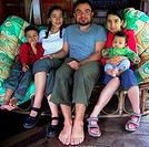
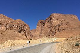
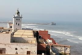
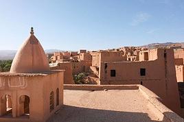
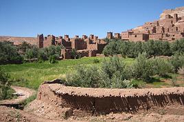
Je viens faire un coup de pub au guide Brahim - guide Marocain - qui m'a fait découvrir l'Atlas en famille en 2009 et qui a monté 5 mois après, une expédition pour que j'aille tourner mon dernier film documentaire sur l'ethnie des Aït Ouzighimts dans le Haut Atlas (la vallée du M'goun) en Janvier / Février dernier (je suis documentariste).
Je l'ai eu au téléphone hier et il n'a pas bossé depuis 2 mois !
C'est un guide exceptionnel qui a bossé 20 ans pour des agences (club aventure), il parle parfaitement français, il est extrêmement sérieux, il est guide de haute montagne agréé (diplômé en France à Chambéry).
Il est à son compte depuis plus d'un an.
Il a des tarifs très intéressants et surtout vous proposera des itinéraires à la carte... des vrais itinéraires à la carte.... suivant votre condition physique, vos attentes, avec vos enfants, en dehors des sentiers battus ou non...(il en reste encore).
Il gère la logistique, commande les muletiers, le matos aussi si besoin, il vient vous chercher à l'aéroport...
Voilà si vous voulez des renseignements n'hésitez pas à m'écrire...
Je ne gagne à faire à faire ça, sinon à donner un coup de main à un homme généreux et surtout très PRO (un ami aussi).
Voir des photos de mes 2 documentaires au Maroc (avec lui) :
j'ai parcouru vos reportages photos sur le maroc, très beau.
je n'ai pas pu voire (tout noir) le diaporama sur les hommes de casablanca, dommage, car j'y suis allée passer quelques jours en mars, j'ai parcouru la ville à pied de long en large, (c'est grand :) !)j'ai beaucoup aimé casa. Dans la pluspart des endroits non touristiques, je n'ai pas osé - voulu - prendre de photos - malgré mon envie, alors j'aurais aimé voire les votres.
merci de la ballade
béatrice
Voici 2 liens vers ce petit clip vidéo, suite de portraits d'hommes qui travaillent dans la rue.
Il n'est pas facile de réaliser des portraits "posés" des gens dans la rue. Il faut négocier, il faut prendre le temps de discuter...
Il ne faut pas sortir son boitier trop vite. Je n'aime pas les photos volées... j'aime les portraits posés, lorsque les gens se laissent découvrir, lorsque leur visage raconte un peu qui ils sont...
Extrêmement difficile de photographier des femmes dans la rue (portraits posés).
j'ai un peu retrouvé le casa du quartier des grossistes, qui vibre tout au long de la journée, les grands marchés, les foules sur les trottoirs qui entourent les femmes vendant des vêtements ou des cosmétiques (qu'elles achètent chez les grossistes pas loin!!) dans leurs grands sac "tati", les grands marchés, les galeries couvertes, les innombrables petits restaus, à viandes et à poissons grillés.
des hommes à leurs machines dans les échoppes d'artisanat, de réparation ect.... hommes qui casse-croutent accroupis sur le trottoir entre les motos, vélos, porteurs, camions , autour d'un thé, avec du pain trempé dans l'huile d'olive , le mélange dans les souks des marchands "installés", des marchands à voitures à bas et des marchands à même le sol, ect...
un monde pas croyable (je ne connaissais pas les grandes villes du sud), ou l'on se ballade à touche-touche, et pas un geste ou un mot désagréable.
je me suis perdue, balladée, j'ai beaucoup, beaucoup aimé.
alors je n'ai pas sorti l'appareil, c'est sur, car je pense que j'aurais brisé qq chose, souvent.
je me souviens d'avoir été quasiment la seule "touriste" dans ces quartiers.
casa gagne à être connue autrement que par la grande mosquée.
j'ai aussi passé deux bonnes heures assise sur la plage face au marabout sidiabderraman (la photo de mon avatar), à dessiner et écrire : atmosphère très étrange des femmes qui prient à même les rochers de la plage à marée basse, les "boutiques" de thé, ou escargots, sur le sable, .... j'ai pas osé entrer dans l'ilot... suis un peu bêta surement, mais parfois, y'a des choses ou on se dit "touche pas".
aussi le musée du judaïsme marocain, avec une super guide (celle du musée)... musulmane, érudite et chaleureuse, gardé par deux policiers bien bonasses, ça existe :)
la petite médina pas loin du port ne vaut pas à mon avis le même intérêt que de de parcourir les grands marchés de mohamed VI (ou V je sais plus, elles se prolongent), mais faut y aller aussi.
les architectures art déco, avec les galeries et leurs cafés, la rue piétonnière, les crèmeries et restaus du parc de la ligue arabe : 20 DH le tajine dans un délicieux décor, avec une clientèle totalement marocaine.
un chauffeur de taxi écrivain, adorable, serviable sans mercantilité.
le port, ses chalutiers et ses mouettes, comme tous les ports atlantiques.
casa, l'alternance du luxe et de la misère....
l'atlantique....
je me présente stéphane, isabelle mon épouse adrien et clara nos deux enfants, nous souhaiterions faire un trek en famille
au maroc au mois de décembre. nous avons beaucoup aimé votre parcours, je voudrais savoir si le guide que tu nous conseille serait disponible ce mois là, et est ce la bonne période pour découvrir le vrai maroc, sinon toute les destinations que vous avez fait font rever.
merci et au plasir de se recontacter
Avec mon ami, nous cherchons un guide de montagne pour un trek d'environ 4 jours pour la traversée du massif Mgoun ( montagne, gorges, marche dans l'oued) dans les environs du 22 aout. Nous n'avons pas un grand budget...Est-ce que votre ami pourrais me contacter ou pouvez vous me donner ses coordonnées?
Bonsoir, nous projetons de visiter le maroc à 2 familles de 5 ( à Paques prochain)et sommes intéressés par le guide dont vous parlez: Brahim. Pouvez-vous nous communiquer ses coordonnées ?
Merci
Cordialement
OD
je t'écris pour te rendre compte de notre trek au maroc avec brahim.
nous sommes partis 15 jours dont 10 jours dans le désert, le parcours était très variés et assez intérressant
mais je vais juste te dire deux mots sur brahim, je ne partage pas ton point de vue sur lui puisque tu dis dans ton blog
que c'est une personne sérieure et qui mérite de travailler.
durant le séjour j'ai était très déçu de son comportement en général, et il n'a pas tenu certains engagements
pour moi ce n'est pas un homme de parole, et je suis vraiment très déçu du personnage.
ceci dit je respecte tes impressions que tu as eu sur lui
excuse moi de ne pas t'avoir répondu, mais je viens de m'appercevoir que tu m'avais répondu en suivant
je vais t'appeler ce soir si tu est disponible
a tout a l'heure.
j'ai vu ton site personnel avec les photos et les videos que j'ai trouvés excelentes.
la video sur les habitants du mgoun est très bien faite et je vous dis bravo pour la qualité de la réalisation.
tu parle souvent de brahim le guide, je crois que je vais te demander ses coordonées un jour pour faire un tour dans l'atlas.
mais je dois attendre encore pour arriver à ce niveau de randonnées puisque je commence à peine à decouvrir cette discipline.
bravo encore pour ce que vous faites.
salut
samad
J'ai hâte de retourner et de retrouver les Aït Ouzighimts dans la vallée du M'goun.
J'ai passé un mois d'hiver avec eux pour réaliser ce documentaire, j'ai partagé leur quotidien, et ce mois de neige et de froid a été un moment très fort.
C'est vrai que ce n'est pas facile d'y aller, surtout en hiver (c'est presque impossible). Mais doucement, l'été et bien guidé, une fois passé les 3 000 mètres du col, une fois dans la vallée, ça devient de la promenade un peine sportive.
Bien à toi.
Francis
Découvrez notre site Internet :
Documentaires photo : francisfrenkel.com/
Bonjour,
Si votre message est toujours d'actualité j'aimerai bien connaitre les coordonnées de votre guide Brahim pour préparer mes futures vacances : une randonnée en famille au Maroc.
Merci d'avance🙂
Nous partons au Maroc fin Mars pendant 1 semaine. Nous arrivons à Fez et allons directement à Casablanca chez des amis par le train... 1ère question: de…
J'ai prévu de faire un trek de 5 jours en avril dans le désert marocain de zagora jusqu'à l'erg chegaga. j'ai contacté l'agence desertmaroc ou acacia voyage…
Je recherche des informations pour faire un treck d'environ une semaine au maroc le mois prochain; je dois partir seul. est ce la bonne saison? à qui dois je…
Du 3 au 12 juin, je pars en trek, j'arriverai à Marrakech vers le 20 mai. Merci de me donner des tuyaux sur un itinéraire de 15 jours dans des endroits sympas,…
Quelle est la meilleure période pour faire un trek à pied dans le sud marocain? on veut partir à 4 avec un guide local (cout moins élevé); qui connait un…
Hi everyone,
I’m leaving on Monday, August 3rd for my very first long-distance trek: the GR223 from Coutances to Mont Saint-Michel, over 6-7 days (~11-14 miles/day), solo.
I’m looking for tips from people who know this section well (Coutances → Regnéville-sur-Mer → Hauteville-sur-Mer → Bréhal → Granville → Genêts → bay crossing):
Budget-friendly accommodations: I’m struggling to find affordable stopover lodgings (a lot of what I find online are expensive vacation rentals, not really suited for a solo hiker). If you have any great spots (hostels, hiker-friendly B&Bs, nice campgrounds), I’d love to hear them!
Bay crossing: Any feedback on guides/providers leaving from Genêts for the final crossing?
General tips for a first long-distance trek: What you wish you’d known before your first time, pitfalls to avoid, etc.
Hi,
We’re planning to do the 4-day trek from Mestia to Ushguli without an agency. The descriptions mention that there are accommodations at each stop, but we can’t find any details about them. Has anyone got info or feedback on this route?
I'm developing a free and open-source web app for planning walking and cycling trips (and even car trips). You can create a route by clicking directly on the map to add waypoints, and it can consist of multiple stages. The app provides tools to edit the stages and the overall route, and to display useful information (distances, altitudes, and elevation changes). A relief profile can be shown as a graph for a specific stage or the entire route.
Once the route is ready, it can be exported as a GPX file, which can then be used with a GPS or a mobile navigation app.
The app is built in JavaScript and runs entirely in the web browser. It uses the Leaflet library and several OpenStreetMap-based services. Initially developed for my personal needs (I enjoy hiking and cycle touring), I’d be happy to share it with anyone who might find it useful. It’s free to use, doesn’t require an account, and the source code is available.
New to this forum, I’m planning a pretty big project for 2028.
I’m heading to Nepal to do a trek from Kathmandu all the way to Everest Base Camp (a cool 5,300 m 😄).
This trek is a bit special because even though I’ll be part of a group, I’m going solo (so far, no problem—I’m used to it). But it’s my first real trek, and it’s also a humanitarian one: once I reach base camp, I’ll stay an extra week to help clean up the waste left by tens of thousands of climbers! Since I’m originally from South America, from two countries that share the Andes, I have a deep respect for mountains—they fascinate me. So Everest… it’s kind of the trip of a lifetime!
So, a little question for those who’ve done treks to Everest before… any tips for good mental preparation (I’m already working on the physical side)?
We're planning to trek in Peru and Bolivia and would love to find some local agencies.
If you know any, could you share details on prices and, of course, the names of the agencies?
Which trek would you recommend?
Elocine
I'm heading out on a fully self-sufficient trek in Morocco (10 days) from Imilchil to Aghbalou.
Can I find screw-on gas canisters (Coleman, Primus) in Marrakech (any addresses?) or in villages between Imilchil and Aghbalou?
If not, are Butagaz canisters for camping gas (small 230g size) available?
Thanks in advance for your tips!
Hello, I’d like to embark on a little trip in my home country, Switzerland. I’ll start walking from La Cure, heading toward Le Noirmont first, then I’ll improvise my route—but it’ll probably follow the French border... at least as far as Lac de Joux.
I’ll decide day by day how much farther to go after that. My goal is to stay in nature as much as possible, wander around for as long as I can, and restock food in villages or towns along the way.
I’m thinking of mostly camping, but we’ll see if I end up in a hotel or another campsite depending on my route.
I’d love to reach La Chaux-de-Fonds on foot... maybe even Delémont.
The whole thing should take about a week, give or take.
I’ll be bringing my dog, and I’m preparing for this as soon as I’m ready.
Any tips to make sure everything goes smoothly for us? Things I should know—or avoid? What about shepherds with their flocks of sheep? And isn’t hunting season open right now?
I’m not sure if what I’m planning is even doable, which is why I’m asking around.
This’ll be my first time doing something like this—wandering in nature *and* with a dog. I’m really excited for this adventure... and I need it. Thanks!
We’re really keen on ecosystems and want to hike in "natural" ancient forests—not planted woods or areas heavily degraded by human activity. Travel guides (like Lonely Planet) don’t provide much info on this. Could you point us to the most interesting spots?
Thanks in advance for your tips.
We wish you happy holidays and a fantastic 2026, full of discoveries!
Claire and Albert
Hi, this might not be the right section, but I’d like to know if it’s possible to start mountaineering with another person without necessarily hiring a guide. We’ve done quite a bit of hiking but not mountaineering—we’ll just do a half-day glacier course. After that, we were thinking of starting with La Grande Motte and the Pointe de la Traversière, which were recommended to us. Honestly, for things like roping up and knots, I’ll learn at home with lots of videos and a book.
I’d love to know if anyone has done treks in the Rwenzori Mountains and how much it costs on average, what the infrastructure is like, the landscapes, and safety in the area. Thanks so much! I’m really looking forward to your replies.
We’re leaving in 9 days for a two-week trip to Madeira, mainly to hike.
From my research, I’ve found that since last year, access to most trails—and systematically for the most popular ones—is now paid. You have to pay an access fee of 4.50 € per person per classified hike in 2026, and even 10.50 € for the most iconic hike: Pico Arieiro to Pico Ruivo. When paying, you also have to choose a day and a 30-minute time slot for your start time. Of course, this reservation is neither changeable nor refundable, even if the weather that day is terrible.
Personally, given the massive influx of tourists to the island in recent years, I don’t mind paying a fee to help maintain the trails. Similarly, setting a limit on the number of people who can hike them per day is certainly preferable to preserve this priceless heritage.
However, what’s much less fair is that in reality, most of the available spots are reserved: 1/ for Madeira residents (which is normal); 2/ for "economic operators" (meaning local tour operators). For example, if you’re a non-resident (independent tourist), no booking is possible for the Pico Arieiro hike for an early morning start before September! So, unfortunately, we’ll have to skip this hike.
It’s the same issue for Ponta de São Lourenço, the 25 Fontes, Pico Ruivo... in short, all the most popular hikes. Oh well, we’ll skip those too!
So my question is: which hikes do you recommend where we won’t face the huge crowds that the others get? And where we can book the day before for the next day, taking the weather into account?
Finally, a quick accommodation question: we’ve booked the first week in Funchal, but I haven’t decided yet for the second week. Do you have any advice on where to stay in the south or north, preferably avoiding overly concrete-heavy and touristy spots?
I’m reposting about the logistics for Samaria Gorge.
I’d love to get recent info, especially about whether it’s possible to park my car in Omalos, do the hike, and then catch a bus back to my vehicle.
In theory, it’s doable, but when you check the KTEL website, there aren’t any feasible schedules listed. If anyone has recently organized this with reliable, verified details, I’d really appreciate it. Thanks in advance!
Hi there,
We’re flying from Montreal to Lyon this August to go hiking in the French Alps. We’ve rented a car and will be staying at campgrounds. We’re planning to do day hikes and want to stay a few days in one spot, do a few hikes, then move on to our next camping spot. Could you share your favorite spots or any recommendations for places to spend a few days with great hikes?
A few details:
We arrive in early August and leave in early September.
We’re looking for day hikes (or shorter), moderate difficulty, with a cumulative elevation gain of no more than 1000m, and of course, beautiful scenery!
We’d prefer not to drive too much—maybe it’s best not to head too far south and deal with unnecessary heat?
Along the same lines, if you know of any great campgrounds where we can start our hike directly without needing the car, we’d love to hear your suggestions!
Hi there,
I’m planning to go hiking on this island and would like to know the best time to do it. I visited for a few days in November 2018—not for hiking but just to explore—and the weather wasn’t great, especially in the mountains. So, is a star-shaped itinerary doable if I rent a car and maybe use two different accommodations?
I’m not planning to join an organized group—just traveling with one other person and organizing things ourselves—unless you’d recommend a local agency or guide. Finally, even though I’ll be getting maps, a topo guide, and a GPS, I’d really appreciate your top hiking recommendations.
Thanks so much for your tips!
I’m planning to do the Mercantour crossing following the Randoxygène route in mid-July.
I’m used to hiking in the mountains, but I sometimes get vertigo, for example on ridges with drops on both sides. I wanted to check if there are any T4 or T3-T4 sections and find out if there are any very exposed passages—and if so, where—so I can plan an alternative route.
Can anyone give me some info on this?
Thanks!
I’m planning a trip around Cap Corse and the AGRIATES in 2026, from May 8th to 15th (there are still 2 spots left, by the way! Just DM me if you're interested).
I’d love to know which hikes are worth prioritizing in the AGRIATES. We’ll be staying in SALECCIA for two days as our base—what should we focus on from there?
A round trip to IGNHU beach? Any other suggestions?
For Ostricano, I think it’s too far for a round trip...
Thanks for your tips!
Have a great day,
Anie, Toulouse
I’d like to get some info about the GR10 Pyrenees traverse. I need help planning the daily stages and accommodations—my wife isn’t an experienced hiker but walks a lot, so I’d like to schedule shorter walking days and thus a longer overall trip in terms of number of days.
Could anyone give me some help and advice?
Best regards,
Hi there, I’m planning the Annapurna Circuit for March 2027 and I’m looking for a local agency with a local guide—preferably French-speaking—to arrange this trek for us. Any suggestions? Thanks
Hello!
We’re spending a few days in Toraja country at the end of May. We’d love to do a day trek—taking our time—on a route that’s stunning in terms of scenery, but not a level 5 in difficulty!
Any suggestions you can share, please?
Thanks in advance
I’d like to do the Mare a Mare Sud in May over 4 days. I’ve found quite a few places to stay along the route, but I’m stuck on the start and finish.
I’ll be arriving by plane on Sunday evening and would like to start pretty early on Monday morning. Ideally, accommodation right at the trailhead (Alzu di Gallina) would be amazing, but I can’t find anything. Any tips?
Also, for the transfer from Figari Airport to Porto Vecchio or Alzu di Gallina?
At the end, I’d like to pick up a rental car—any advice on that too?
I’m traveling solo by plane to Catania in May and plan to hike the northern side of Etna, starting from Linguaglossa where I’ll arrive by bus. After that, I’d love some info on how to get up to Piano Provenzana (shuttles or hitchhiking), since it seems there’s no public transport except in the summer. Can you sleep there in a free or cheap refuge, or camp? And how far up can you go without having to hire a guide? Thanks in advance. Bernard.
Hi everyone,
I’m heading to Morocco in August and we’ll start with a stop in Chefchaouen (we’re driving).
My question: can anyone suggest a 5-to-7-day loop hiking route from Chefchaouen in Talassemtane Park, ideally passing by the God’s Bridge? Or a paper guidebook that covers a few options?
We prefer wild camping and guesthouses.
Thanks in advance
Hi there, for those who’ve been recently—is it possible to find other solo travelers in March on the island to share transport or room costs? It doesn’t seem easy to travel on a budget.
If you have any recommendations for simple lodgings or places with dorms, I’d love to hear them.
For those who’ve done multi-day treks while moving around: do you need to bring your own sleeping bag? I’d love to hear about itineraries you’ve done without a guide, just with a map and GPS.
Thanks, and have a great day!
Hi everyone!
We’re planning a 15-day road trip to Scotland this summer, specifically to explore and hike on Lewis and Harris—places we’ve never been before. We’ve visited other islands on previous road trips in Scotland (we usually go in April for a week). This would be our first time in Scotland in the summer and for 15 days. We’re looking at late August to early September.
I’m currently drafting the itinerary. We’d be crossing from Ullapool and were thinking of spending 3 nights on Harris and 4 nights on Lewis.
Does that sound balanced to you? Is it better to keep the same accommodation on Harris and the same on Lewis to explore the area? I’d love to hear about any past experiences you’ve had on these islands.
Thanks!
Hi there, I’m trying to leave for 15 days very soon to São Vicente. I’m either looking to join an agency or figure things out on my own to go hiking on one of these islands or both. From what I’ve seen, it’s not easy to organize with local transport, so it gets expensive. Can I use the services of a small local agency? I’m looking for the simplest way to hike for several days. Also, how do you get from São Vicente to São Nicolau? Thanks in advance and have a great day!
Aichatou
I’ve been wanting to do this for several years, and this year’s the one. Next September, I’ll be trekking in Tusheti (Georgia), from Omalo to Shatili.
Of course, I won’t be renting a vehicle that’d just sit unused. No problem getting to Pshaveli, but from there to Omalo, it’s a dirt road (still the case?)
There must be some form of public transport since there are so many guesthouses, and not all travelers come in a 4x4.
If any of you have been to Omalo, could you confirm that these shared transports exist and how often they run?
we’re planning a trip to Yellowstone and hoping to do a three-day backcountry hike if we get a permit.
if any of you have done this before, could you let me know if it’s possible to find water along the way? And if we can transport it, are we allowed to use a stove?