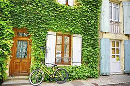
Cet été je projette de partir avec un ami à Nantes au départ de Lille en vélo. Cette rando vient à le suite d'une série de balade dont les distances n'ont fait qu’accroître : au départ, lille > Hardelot puis Rennes > La Baulle et l'été dernier Lille > Amsterdam. L'expérience de ces trajets m'a montré à quel point l'itinéraire jouait un rôle important dans la gestion du temps au long du voyage. Je vous demande donc à vous les cyclistes des routes du monde entier comment vous préparez votre itinéraire ? sur quel support ? Parvenez vous à le respecter ?
Ensuite je recherche les lieux d'hébergement qui se trouvent sur l'itinéraire ou a promimité sur les sites campings http://www.camping-municipal.org/camping-france.htm et/ou auberges de jeunesse http://www.fuaj.org/L-Irlande-du-nord-au-sud-a-velo-ou), qui sont les modes d'hébergement que je j'utilise le plus souvent, et je détermine comme cela les villes-étape, en fonction du kilométrage intermédiaIre, des centres d'intérêt de la ville etc...
Et sur le terrain j'utilise toujours une carte en complément du topo.
Je pratique comme cela depuis très longtemps et globalement j'ai toujours pu respecter le projet initial du voyage.
J'ai mis sur mon blog (ci-dessous) des randos et voyages prévus et réalisés selon ce principe.
PS: pour info la 1ère semaine d'août à Nantes va se dérouler la "Semaine Fédérale" de cyclotourisme, qui va rassembler 10 à 15.000 cyclistes !
Merci pour vos réponses mais apparemment un itinéraire pour aller jusque Nantes semble couper tous les grands itinéraires existant puisqu'ils se dirigent vers Paris et éviter la capitale me ferait gagner de précieux jours. Je pense jouer la carte des petites et moyennes villes de province... Je sais que google maps a récemment rendu public le tracé des voies cyclables dans le monde.
Bon au vu de nos voisins hollandais la France semble bien vide de ces voies cyclables représentées en verts sur les cartes de google mais il faut que la sauce prenne et que les français les mettent à jour.
Ce site (http://www.calculitineraires.fr) semble correct mais je n'y ait jamais créer des cartes. Le connaissez vous ? Est-il fiable ?
Bon au vu de nos voisins hollandais la France semble bien vide de ces voies cyclables
En même temps, les pistes cyclables c'est très sympa pour la ballade du dimanche mais pas forcément ce qu'il y'a de mieux pour voyager sur de longues distances. Personnellement, je préfère les petites départementales en jaune sur la carte ou mieux, en blanc.
Bonjour, merci pour cette référence de site, j'irai faire un tour pour plus de détails.
Personnellement j'ai déjà emprunté les voies cyclables hollandaises pendant une bonne semaine et il est très facile de s'orienté vers une destination sans carte très précise. Chaque tronçon est fléché avec à chaque panneau les kilomètres restant jusqu'à la prochaine ville-étape. Bon certes on croise beaucoup d'hollandais sur le selle poilue le dimanche après midi mais les routes y sont très bien entretenues avec un effort de distinction avec les voies automobiles et cyclistes rendant la randonnée plus qu'agréable.
Oui en Hollande c'est le principe des "Knoopuunt" (point-noeuds) http://translate.google.fr/translate?hl=fr&sl=nl&tl=fr&u=http%3A%2F%2Fwww.fietsnet.be%2Frouteplanner%2Fdefault.aspx inventé en Flandre et étendu aux Pays-Bas, Allemagne. C'est le système de planification de parcours cycliste le plus ingénieux que je connaisse, et tellement pratique et simple à utiliser pour naviguer sur le terrain. La Hollande est le paradis des cyclotouristes !
Mais en attendant d'en arriver là il faut se contenter de ce que l'on a en France, qui n'est quand-même pas si mal, reconnaissons-le, en matière de réseau routier de petites voies et véloroutes/voies vertes. En reliant entre elles les véloroutes, les voies-vertes et les chemins vicinaux et autres voies ordinaires, il y a de quoi faire... Bonne péraparation.
Tu ne peux pas faire d'itinéraire sur ce site ? Il permet de voir des tracés existants de routes cyclables mais pas de créer un itinéraire d'un point A vers un point B ?
J'ai fait une première esquisse d'itinéraire sur google maps et je me rend compte que le logiciel me fait passer pas beaucoup de routes de sentiers qui semblent intéressantes mais beaucoup plus difficiles à suivre sur une carte. Je veux donc tenter l'expérience de ce tracé quitte à revenir sur un itinéraire plus commun en cours de route.
Il faudrait donc un gps pour m'aider à me guider. J'ai créé un fichier .kml sur google maps qui peut me servir (notamment à la convertir en gpx, une extension qui peut s'ouvrir sur les gps). Cependant, j'ai l'application de google maps sur mon portable ou je peux suivre l'itinéraire créé sur mon ordinateur et le suivre le long de la route (dans l'idéal)
donc deux questions me turlupinent : sachant que j'ai deux gigas de connexion par mois, aurais-je assez de crédit pour suivre ma route sur google maps pendant disons deux semaines de routes, application ouverte le temps de route.
seconde question, le réseau de données des téléphone portable (je suis chez orange) passe-t-il partout en France (dans le cas contraire je serais bien embêté, perdu au milieu de tout..)
Salut,
Mon expérience en vélo avec Google Maps: NUL
Il me fait passer par des routes nationales à grande circulation et ensuite par des sentiers
impraticables en forêt, quand il ne m'envoie pas dans des voies privées.
J'ai renoncé à l'utiliser, ou alors, juste pour dégrossir les grandes lignes du parcours.
Pour ma part, j'utilise OpenRunner en paralèle avec une carte papier de type Blay Foldex,
cartes précises et indéchirable et qui supporte l'eau. J'utilise la sérire 200.
Je note les villes principales et les numéros des routes sur un papier posé sur mon sac
de guidon. Disposé par quart de feuille.
J'ai auparavant créer mon parcours avec OpenRunner et transférer sur mon Gps Etrex 30.
Egalement mis en mémoire par Waypoint certains campings sur le parcours, au cas ou ...
bonjour à tous. voila la préparation avance plutôt bien, j'essaye d'allier dans l'itinéraire voies vertes locales, camping intéressants et sites magnifiques, le tout sur une carte informatique que j'ai au format .kml. Petit soucis technique donc car je souhaite maintenant, simplement mettre ce fichier si précieux sur un gps fixé au vélo (chargeur dynamo pour le coup). J'ai un gps mappy qui lit les kml apparemment sauf que c'est la galère pour le lire sur le gps, les données s'affolent, plus rien ne correspond. J'ai quand même bien envie de tenter l'expérience du gps car ca nous donnerais un sacré coup de main et un gain de temps précieux, en évitant donc de chercher la bonne ou de rebrousser chemin avant de faire des détours. du coup je me demandais quel mathos de géolocalisation vous utilisez et à quel format sont vos cartes ?
bien à vous !
Je prépare mes itinéraires attention. Je privilégie les vélo-routes avec des jonctions avec des routes les plus petites possibles. En ce qui concerne votre plan, il y a un magnifique itinéraire cyclable entre Le Tréport et le Havre (je l'ai fait l'été dernier), qui vaut vraiment la peine, même si ce n'est pas de tout repos. Le passage après le Havre pose problème cependant.
Pour le planning, j'achète les cartes IGN (1 cm=1 km) et je vais quelques vérifications avec Map view. Le fait d'avoir une bonne planification et de la bonne documentation facilite l'improvisation une fois sur le terrain.
Cet été pour moi ce sera Belgique, Lorraine, Alsace.
Bonne rando !
Bonsoir à tous,
Cet été je projette de partir avec un ami à Nantes au départ de Lille en vélo. Cette rando vient à le suite d'une série de balade dont les distances n'ont fait qu’accroître : au départ, lille > Hardelot puis Rennes > La Baulle et l'été dernier Lille > Amsterdam. L'expérience de ces trajets m'a montré à quel point l'itinéraire jouait un rôle important dans la gestion du temps au long du voyage. Je vous demande donc à vous les cyclistes des routes du monde entier comment vous préparez votre itinéraire ? sur quel support ? Parvenez vous à le respecter ?
Bonjour,
Question matériel, j'utilise un Gps Garmin Etrex30
avec en complément des cartes Blay Foldex série 200.
Je prévisualise mon parcours avant sur OpenRunner.
Mes déplacements ne durent guère plus d'une ou deux semaines.
En général je pratique selon la vieille méthode du trait droit entre les deux points à relier et à partir de là en recourant à une carte Michelin, ou sur le net à ViaMichelin qui me donne une vue d'ensemble, en parallèle je trace mon itinéraire en évitant tout ce qui est grosse route et grosse ville sur openrunner. Puis report sur une carte papier dont je fais des photocopies. C'est ainsi que je pratiquerais pour un aller Lille-Nantes. Bien sûr j'affine en fonction des difficultés (je grimpe mal), des nécessités du couchage, car en général je recours aux chambres d'hôtes ; ce dernier point ne me permet donc pas de me laisser aller à l'"aventure" en cours de route : c'est un choix que l'on peut ne pas partager.
Je ne me focalise pas sur les voies vertes ou pistes cyclables et j'en tiens peu compte, à moins que mon "voyage" soit la Loire à vélo par ex. ; s'il se trouve sur mon itinéraire une voie verte je peux la prendre mais pas spécialement car cela dépend de son état : une ancienne voie ferrée encaissée n'est pas toujours très intéressante pour la vue qu'elle ne permet pas d'avoir sur le paysage ! mais j'ai aussi traversé la Belgique en utilisant le Ravel et dans votre cas j'irais à coup sûr chercher les voies vertes Flers/Domfront puis le canal de la Mayenne afin de gagner Angers et la Loire jusqu'à Nantes.
D'ailleurs je rejoindrais assez vite le littoral (Abbeville ou pourquoi pas Hardelot) et descendrais sans grande difficulté sur Yvetot, le pont de Brotonne et Flers....
A mon sens un cyclotouriste, un voyageur doit être en mesure - et en sécurité - de rouler sur des routes normales. Il ne faudrait pas qu'on en vienne à nous parquer un jour sur des espaces réservés, i.e. des pistes cyclables. Les pistes cyclables mal entretenues, et d'abord mal dessinées parfois, incitent souvent à ne pas les emprunter. Mais ceci est une autre question !
Je suis de Lille aussi, et je vais faire Cherbourg-Nantes en vélo en Aout (je passe en train le nord de la france et donc la pluie :-)
Perso, pour l'itinéraire je le génère automatiquement sur google maps en mode vélo. Puis j'y jette un oeil et le modifie, pour le faire passer vers des coins et des routes / pistes sympa conseillées par les internautes sur pleins de sites différents.
Ensuite j'exporte le tracé KML sur mon gps vélo (dakota 20 étanche, acheté 150 euros) qui marche a pile (autonomie 20h), et je peux suivre l'itinéraire tranquillement sans regarder les cartes papiers (que je prend quand même au cas ou)
Après il y a des applications gps vélo pour smartphone assez bien faites, mais en cas de pluie, un portable, c'est ch.... Et les chargeurs dynamo c'est pas vraiment fiable (sauf dynamo moyeu)
Pour le moment (depuis quelques mois et pour quelques mois) il y a beaucoup de travaux pour la construction du chu et 2-3 lignes de tram. Savez/es tu/vous,…
Voyager à vélo › France › Bretagne / Ouest · 2 replies
Nous partons de redon à vélo en suivant le canal de nantes à Brest jusqu'à chateaulin. Nous voulons prendre le train à chateaulin pour le retour, est ce que…
Voyager à vélo › Suisse / France › Ouest · 9 replies
Je suis nouveau sur ce site et j'ai une petite question!! Il y a 2 ans j'ai fait l'Eurodyssée depuis Nantes jusqu'à l'Espagne avec un VTT Orbéa sur lequel…
I’m planning to cycle from Morlaix to Brest (via Roscoff and the V45 coastal route). We’ll start riding on August 16th for 13 days (with stops for island visits, surfing, etc.). Is there a lot of traffic at this time of year? I’ve got two kids, 11 and 13, and we don’t like riding in the middle of cars (we’ve already done the Vélomaritime—Caen to Cherbourg—the Loire route from Orléans to Saumur, the Vélodyssée from Nantes to Royans, and the canals like the Nivernais and Bourgogne, where there were plenty of bike-only lanes, which isn’t the case on this route).
Thanks for your help if you’ve already done this route in late August!
Virginie
I’ve got my flight ticket sorted—departing in mid-November and returning in mid-March. I’ll arrive in Santiago and leave from Buenos Aires.
I’ve already been to southern Argentina, specifically Torres del Paine National Park, and I’d love to go back to do the full W trek (I only did the shorter version last time).
I also want to do some hiking and maybe even tackle a summit. I climb and occasionally do some mountaineering, so I’ll definitely be going with a guide.
I plan to start around Temuco in Chile, with the idea of heading toward the lakes, then taking the Carretera Austral.
I’m not sure if I’ll go all the way to Ushuaia—it’s supposed to not be *that* worth it, except for the bragging rights of saying you’ve been to the end of the world.
I saw there are lakes in Argentina too.
I don’t have a precise itinerary, but what I’d love is, once I reach the southernmost point of my trip, to take a mini-cruise to see some wildlife. Any tips for that?
What kind of sleeping bag did you take? Is a 0°C (32°F) one enough?
And one last question: white gas stove or can I get by with my gas stove?
This summer, we’re planning to cycle along the EV 19 that follows the Meuse River from Langres all the way to Rotterdam.
My question is about getting back to Nantes.
Do any of you know what the best return option might be? I’d love to hear about your experiences.
I saw that FlixBus doesn’t take bikes.
By train, I think it’s possible but would involve multiple local trains.
We were also wondering if there’s a boat from Rotterdam to Saint-Nazaire that could take passengers with bikes.
Any tips or experiences you can share would be really helpful—thanks in advance!
Have a great evening
Hi there,
I’ve been road cycling for several years, and I’m about to switch to gravel in the next few days—I’m waiting for my bike, which should arrive this week.
I’m planning a bikepacking trip in a few weeks along the Véloroute V81, also known as the Vélosud, from Biarritz to Le Barcarès.
Has anyone here already done this route? Any info is welcome, whether it’s about the route itself, gear, or accommodation. I’ll prioritize staying with locals as much as possible. On that note, I just signed up for the brand-new site *Guidon et Couette* ((www.guidon-et-couette.fr)), which offers free accommodation between cyclists across the country, but there’s almost no one listed along my route!
Thanks in advance.
Laurent.
I’m planning to build a new touring bike.
I want to prioritize lightness.
That said, I’m tempted by a suspension fork that could offer some comfort on rougher roads.
The recent appearance of gravel suspension forks on the market might meet my needs—at least on paper.
I’m particularly considering the RockShox Rudy Ultimate XPLR fork.
Unlike MTB forks, its travel is short: either 30 mm or 40 mm.
It weighs 1400 g, which is 400/500 g more than a steel fork.
Any thoughts or real-world feedback on this?
I’m also wondering about the durability of magnesium (lower leg) for long-distance bike touring.
And what’s the impact of skipping the manufacturer-recommended maintenance every 50 and 200 hours? That’s bound to happen on a long trip unless you carry extra gear.
More generally, how reliable are these kinds of forks?
Hi everyone,
I wanted to share with you the incredible feat my friend José, who’s 72 years old, is currently undertaking. He left Auterive near Toulouse on Monday, May 18, 2026, on his non-electric bike, heading for the North Cape in Norway!
You can follow his route on the link below—he’s currently in Sweden:
https://thierry-thomas.travelmap.net/jose-de-toulouse-a-nord-cap-2026
You can zoom in on the map and click on each stopover town to see the photos
I’m making an exception and creating a separate post this time, since it’s all about France. In May, we spent a week in Provence, specifically in the Luberon, exploring the cycling routes *Autour du Luberon à Vélo*, the *Véloroute du Calavon* (part of EuroVelo 8), and the shorter *Les Ocres à Vélo* route. Together, they gave us an amazing journey through rolling hills, vineyards, lavender fields still green in spring, and some of the most stunning landscapes in southern France.
It was, of course, the perched villages that impressed us the most. We visited Gordes, Roussillon, Bonnieux, Lacoste, Lourmarin, Ménerbes, Oppède-le-Vieux, Cucuron, and Lauris. Many of them are among the most beautiful villages in Provence, and it’s hard not to agree with that reputation.
One interesting point is the route of EuroVelo 8 in this part of the region. The official path mainly follows the old railway line of the *Véloroute du Calavon*, which is very comfortable and safe. But in our opinion, cyclists traveling EuroVelo 8 around the Mediterranean would discover even more treasures if the route passed through villages like Bonnieux, Lacoste, or Oppède-le-Vieux.
We were also pleasantly surprised by how safe cycling felt. Most of the route takes small local roads, but traffic is light, drivers are respectful, and road design really takes cyclists into account. It’s one of those places where you can ride peacefully even without separated bike lanes.
Our full story:
Around Luberon by bicycle - the most beautiful villages of Provence
You can also find all our cycling travel stories on the forum:
Cycling Thread - Europe’s most beautiful bike routes
Hi there, we’re a group of 4 cyclists looking to get from Treviso in Italy to Munich with our 4 non-folding bikes. It seems complicated! Are there any solutions? Thanks so much.
hello fellow cycling enthusiasts
here’s a travel journal of the cycling tour through the Rhône-Alpes Auvergne region by Claudio
zouli
it was the plan
http://cbandiera.free.fr/parcours/auvergne-Ralpes/
the trip was completed
story being posted online soon
1100 km in 11 days
beautiful and varied regions
Hi there, we’re planning a Munich to Venice bike trip at the end of June 2026. Getting back from Venice to Toulouse by train with 4 bikes isn’t straightforward. What return options have others who’ve done this trip chosen? Any tips or great deals would be much appreciated. Thanks a bunch! !
Hi everyone,
Happy owner of a Pegasus Estremo bike with a Rohloff hub, which is giving me trouble with the SF11-NCX-FT-E-LITE 700C TS 300/0 fork (serial number TD01329060). It’s starting to show its age, and I’d like to repair it to extend the life of my beloved bike.
The suspension is gone, and there’s an oil leak from the seals.
Does anyone know how to repair it? Where can I find parts that are about fifteen years old? Or where to find an identical replacement fork? Just to clarify, the Magura HS11 brakes are mounted using Firm Tech, meaning they’re on pivots behind the fork, facing the frame.
Hi, I'd like to know if anyone has done this route recently or has reliable info.
Does the track exist, and most importantly, is there sand (for biking)?
Any info is welcome.
Cheers,
diego ambilobe: mangaoka, manondro, ramena
vohemar sambava: masondrono, tanambao
Hi there,
New to bike touring,
I’d love to start with a section of the Via Rhona to explore and share (route to be decided).
Looking forward to exchanging tips!
I’m landing in Madagascar with a buddy before the end of April 2026. We’re planning to bike around for about twenty days or so. We don’t have a specific goal other than exploring the country and meeting the locals.
Ideally, we’d prefer a loop route starting from Antananarivo with a good chunk of it along the coast. On the bike side, we’re used to riding 6 to 8 hours a day, depending on the needs, encounters, and mood 😉 Any feedback or tips from trips around this length?
A big thank you to Lazarou for all the info you share in this forum!
I'm passionate about Morocco, which I cycled through back in 2009.
Last year, my wife and I explored the High Atlas by tandem. Completely smitten, we're heading back in April (Anti Atlas) and May (High and Middle Atlas), still on our tandem.
Do you have any info on the track between Amezri and Ali Ait Nito? Are the river crossings in the Tessaout still there? It's not easy to navigate with a loaded tandem... especially if the river level is high due to this year's heavy snowmelt!
Thanks in advance for any tips you might have, and best wishes for health in this new year!
Claudio specializes in the route of the Savoie lakes
Here are his travels
Between Bornes, Chartreuse, the Savoie foothills, and Dauphiné
Five lakes: Léman, Annecy, Paladru, Aiguebelette, Bourget, not to mention a few ponds along the way
Plenty of accommodation options: camping, hotels, and more...
A lovely route not far from his place
Rural and quite peaceful
A road cycling route created by Serge B...
Tout d'abord... bonne année ! De belles routes à vous en 2017 !
Je voyage depuis quelques années avec un VTT de très bonne qualité mais équipé de freins à disques hydrauliques. Je vis (pédale) avec l'inquiétude d'avoir une panne (fuite, bulle d'air, chaleur qui fait que le liquide...). Mon vélociste me dit qu'il est impossible de les changer pour des V brakes.
Qu'en pensez-vous ? Est-ce que je prends un gros risque à continuer (seule) avec ces freins ? D'avance je vous remercie pour vos bonnes idées.
First post here to share a quick recap of our west-to-east bike trip along Algeria’s coast in January 2025.
It was just the two of us—my partner and I—with French passports and not a word of Arabic. No friends or welcoming hosts in the country.
Under those conditions, we’d strongly advise against going.
Our original plan was to follow the coast from Algiers to Tunis. We ended up cycling from Algiers to Béjaia, then took the train from Béjaia to Annaba (with a stop in Constantine), and finally biked to the border.
We were tailed by police the whole way—whether on our bikes, on the train, or even on foot while exploring towns. On top of that, we couldn’t wild camp and were limited to the few state-approved hotels that accept foreigners. Under those circumstances, connecting with locals was especially tough.
With such an omnipresent and intrusive police presence, we’d definitely recommend against this destination for bike touring. A really sad situation that completely cuts you off from the local population...
We’d been warned, we went to check it out, and we weren’t disappointed!
Hi there,
I’m planning the route to cycle from Lille to Nordkapp with my partner.
Duration: 3 months, from May 1st to July 31st, 2026.
In the attached details below, I need to add some "non-riding" days (rest days, basically).
So I’m looking to "shorten" the trip by taking ferries or trains for some stretches. Which areas could I skip?
Thanks in advance for your great tips.
Have a good evening.
https://www.komoot.com/fr-fr/collection/4023980/-lille-cap-nord-1er-mai-au-31-juillet-2026?ref=collection
I’m planning to bike back from Poland this summer. Does anyone know a way to ship it there without having to take it apart? Otherwise, it’s a real hassle to fine-tune all the settings before departure!
Thanks in advance.
Hi, has anyone recently bought Primus or Butagaz gas, possibly puncture-style, in Dubrovnik or the surrounding area? Same question for Albania... thanks. aichatou
Just a few words about the loop I did by bike in Yunnan.
Entry and exit
I entered China through the Sino-Vietnamese border crossing at Lào Cai / Hekou under the 30-day visa exemption currently available to French nationals and others.
The process was simple and quick. A Chinese police officer even helped me complete my electronic pre-registration at a computer kiosk. I wasn’t aware this formality was required—it’s similar to Thailand’s TM6.
No issues with the bike.
I left the country via the Sino-Laotian border crossing at Mohan / Boten.
The atmosphere was a bit chaotic there, but again, no problems with the bike.
The timing
I visited Yunnan in February 2026.
Weather-wise, at higher altitudes (between 1,500 and 2,000 meters), it was around ten degrees at night and in the mornings, and around twenty degrees at the hottest part of the day.
I had two days of rain, so I took the bus to keep moving. Otherwise, clear blue skies.
Culturally, Chinese New Year fell on February 17th (and the 15 days following), right in the middle of my trip. Because of this, my take on the traffic might be off.
Accommodation and food
I always found a hotel to stay in for prices ranging from 8 to 15 €. Except in Kunming (the capital), where many hotels were fully booked (Chinese New Year). I ended up at a 100 € hotel with great value for money.
A bowl of noodles costs about 1.5 € on average.
Onboard electronics
Since my smartphone doesn’t support eSIMs, I subscribed to a China plan with my carrier. Otherwise, for much cheaper, Alipay offers eSIMs for foreigners that allow access to services usually blocked for Chinese users (WhatsApp, Facebook, etc.).
An internet connection is essential for paying with Alipay or WeChat, as this payment method is widespread.
I only managed to use Alipay.
Either way, always carry cash because sometimes there’s no signal, or the merchant only accepts WeChat.
Also, it’s best to bring a power adapter when you arrive rather than struggling to find one.
Traffic and roads
The Chinese aren’t reckless drivers. They follow traffic rules and watch out for cyclists. This is slightly less true in Xishuangbanna (the region bordering Myanmar and Laos).
In urban areas, there are almost always wide bike lanes, separated from other roads, where bikes, electric mini-scooters, and scooters share the space pretty harmoniously.
The roads are in great condition, and traffic is generally manageable—even light—except for one stretch (Eshan -> Yangwu).
Most traffic is absorbed by expressways, China’s equivalent of highways: toll roads that are off-limits to slow vehicles.
You’re never far from these expressways; sometimes you even ride alongside them, which can be noisy at times.
The climbs are usually reasonable, around 5% to 6%. From what I remember, the steepest section was between Menglun and Mengla, with gradients of 8% to 10%, sometimes more.
Riding at these altitudes—though modest—took a bit of getting used to.
The route
I didn’t plan anything in advance. My only goal was to reach Kunming. I don’t know why, but just hearing the name of that city, like Yunnan, always felt dreamy to me.
Hi! I’m planning to visit the Stockholm Archipelago by bike in early April.
Do you know if the boats will be running between the different islands at that time of year? For those who’ve already been, all your tips and recommendations are welcome—accommodation, etc. Also, do you know where I can rent a bike in Stockholm? Thanks so much in advance for your help!
Hello there, pedal-powered Young Boys!
Claudio (still from Faverges)
dreaming about a cycling getaway in Italy from Faverges (train all the way to Turin)
from Turin down to Venice along the Po River and back via the Padana (Alta Italia da attraversare – Northern Italy to cross)
The tricky part is getting from Chioggia to Venice.
I read it’s possible by hopping on a boat from island to island,
but it sounds a bit stressful.
Has anyone already tackled this route?
I’m currently looking for a bike to do my first bike trip across France, with the ultimate goal of cycling through Latin America. I’ve got a lot of questions and I’d love to hear if you have any answers or advice to share.
First off, I’ve been through this before with hiking. I want to get top-quality gear right away. When I started hiking, I ended up buying everything three times—first beginner gear, then intermediate, then expert, etc.
For biking, I’d prefer to skip that process and invest right now in a bike that could ideally handle Latin America.
I’ve set a total max budget of around 5000 € (roughly 4000–4500 € for the bike and the rest for accessories: panniers, helmet, cycling shorts, etc.).
So, I’ve got quite a few questions:
* I’ve read in several places that some people recommend buying the bike directly in Latin America. Since I need a first bike to train in Europe, would it be better to buy an entry-level bike in France (and sell it before the big departure)? Or is it preferable to start right away with my final bike to get used to it? Is buying it there just to save a bit of money?
* For a long-term trip (around six months) in Latin America, is it better to go for a gravel bike or a mountain bike?
* Should I buy a new bike or a refurbished one? Even more so given that I’m planning a long trip—could a refurbished bike end up causing more breakdowns?
If you have any advice on models, technical features to prioritize, or recommended sellers or resellers, I’d love to hear it. I’m a total beginner—I’ve only just started watching videos and reading up on the subject, and all the technical specs are new to me!
Calling all travelers.
We’ll be landing at Lyon Airport and want to bike to La Verpillière train station (with panniers and camping gear, etc.) to catch a TER to Voreppe.
What’s the safest route for this bike trip?
Thanks in advance
hi,
I'm planning a recumbent bike trip from the Pyrenees to Greece. On the EuroVelo 8 route, it doesn't specify the path through the Alps.
Are there any experienced cyclists here who can tell me where they go to avoid climbing too high?
Also, is there another traveler/bike forum better suited for broadening the responses?
thanks