- Salar de Uyuni à pied (Bolivie 2011) - Népal : Annapurna, Everest - Lofoten
Népal: petit récit de mon voyage aux Annapurnas en octobre-novembre 2009
by Rm
This discussion is in French, the community’s main language.
Original post
Panoramiques : http://nanor44.free.fr
- Salar de Uyuni à pied (Bolivie 2011) - Népal : Annapurna, Everest - Lofoten
superbes photos!!
Bonjour,
Bravo pour ton blog, aussi bien pour la sobriété du texte que la qualité des photos (pour info, certaines ne peuvent s'afficher😉)
Ah, étonnant, le chargement des pages peut être assez long étant donné la taille des photos.
Si tu continues à rencontrer ce problème, pourrais tu m'indiquer sur quelle page ?
Merci.
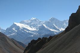
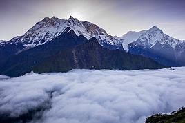
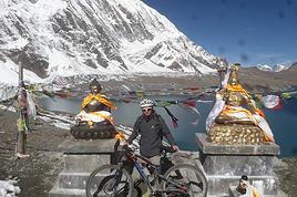
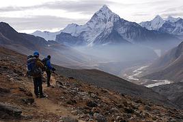
Sinon, un aperçu de quelques photos :


Et beaucoup d'autres......
Si tu continues à rencontrer ce problème, pourrais tu m'indiquer sur quelle page ?
Merci.
Sinon, un aperçu de quelques photos :


Et beaucoup d'autres......
Panoramiques : http://nanor44.free.fr
- Salar de Uyuni à pied (Bolivie 2011) - Népal : Annapurna, Everest - Lofoten
... en ce qui me concerne, et à l'instant même, à partir de Pisang et la photo du rapace (page 1) ... (en fait, tu as raison : c'est le chargement des photos qui est très lent ... mais c'est une bonne leçon de patience ! 😛)
... tes photos sont superbes ! 🙂
... mais elles coincent vraiment trop ! 😕
... mais 'tain qu'c'est beau ! 😊
... un bémol : le ton parfois inutilement moralisateur du commentaire ! 😕
... tes photos sont superbes ! 🙂
... mais elles coincent vraiment trop ! 😕
... mais 'tain qu'c'est beau ! 😊
... un bémol : le ton parfois inutilement moralisateur du commentaire ! 😕
Non, tout est OK. Mais j'ai cet après-midi un débit assez m....
De plus, sur un laptop 15", c'est pas l'idéal pour apprécier. A l'occasion, j'essaierai de visionner sur un LCD 40".
Avec quel appareil as-tu pris ces merveilles ?
Bravo encore.
Avec quel appareil as-tu pris ces merveilles ?
cf. le "P.S. 4" en bas de la page 6...
Panoramiques : http://nanor44.free.fr
- Salar de Uyuni à pied (Bolivie 2011) - Népal : Annapurna, Everest - Lofoten
Merci !
Compte tenu de l'attente, je n'avais pas été jusqu'au bout.
A vrai dire, je m'attendais à ce qu'on me réponde "avec le mien" ou "avec le sien"😉
Tu viens de m'enlever 2 heures de sommeil ...j'étais vraiment ko ce soir ...
"pas de chance" ... je suis tombé sur ton récit au Népal !
Vraiment super ton compte rendu , et les photos UNE MERVEILLE !
FELICITATIONS
je me suis régalé
MERCI 😉
chris06
😉 Hello rm,
🙂 superbement belles tes photos, l' ivresse des sommets, les couleurs que tu as su si bien rendre, les visages expressifs d' enfants, d' hommes, de femmes... ... tout cela a contribué à me faire passer un très agréable moment en parcourant ton blog.🙂 Thanks 😏
""Le voyage pour moi, ce n' est pas arriver, c' est partir. C' est l' imprévu de la prochaine escale, c' est le désir jamais comblé de connaître sans cesse autre chose, c' est demain, éternellement demain"" Roland Dorgelès.
A+++ Lisa
A+++ Lisa
Je suis très heureux que ce récit de voyage vous plaise, cela m'incitera à en faire d'autres pour les prochains voyage....
Encore merci pour vos commentaires encourageants 🙂
Panoramiques : http://nanor44.free.fr
- Salar de Uyuni à pied (Bolivie 2011) - Népal : Annapurna, Everest - Lofoten
Bravo pour ce récit et surtout ces magnifiques photos !
Et vivement le prochain voyage pour avoir un aussi beau compte-rendu !
Bonne continuation.
Christine
Tous nos fabuleux voyages : http://sites.google.com/site/fabuleuxvoyageskrikrietherve/
SUBLIMISSIMES photos !
Merci de les avoir partagees avec nous !
J -10 pour moi, j'ai trop hate d'y etre...
Hali.
A cette époque de l'année, il ne doit pas faire très chaud.
Panoramiques : http://nanor44.free.fr
- Salar de Uyuni à pied (Bolivie 2011) - Népal : Annapurna, Everest - Lofoten
C'est vrai, mais je ne vais pas monter aussi haut que toi, c'est juste un "reperage" de 10 jours !
(ps: je t'ai envoye un MP)
Hali.
Superbes photos et en plus le Népal j'adore !!!!😄
Bravo Ronan pour tes photos, elles sont magnifiques et empreintes d'une grande sensibilité. Nous partons au Népal en février mars et ça nous mets l'eau à la bouche
Daniel
Daniel
Le vrai voyage ce n’est pas de chercher des nouveaux paysages mais un nouveau regard.
Salut Ronan
Bravo pour l'effort de presenter ton tour.
Je suis allé 5 fois au Nepal , 3 fois aux Annapurnas et deux fois sur le Khumbu/Everest .
J'ai commencé en 1991 les Annapurnas .
En 1999 , j'y suis retourné pour la dernière fois . L'electricité faisait quasiment le tour , alors qu'elle n'existait pas après Bessi-Sahar ( hormis Chame ) en 1991 .
J'avais un peu decroché du Nepal depuis 1999 , et les maoïstes .
Mais voilà que que ce pays se rappelle à mon souvenir et on m'a demandé d'accompagner un groupe aux ANNA pour Octobre 2010.
Je m'interesse à nouveau de près à ce "petit bijou de trek" et là , la douche froide !!
La piste, les bus , les jeeps , etc ..
En 1991 la route etait vers Beni ou Kusma ou plus loin encore , je sais plus , et en 1999 on la recuperait à Naya Pul à la descente de Gorephani .
Sur ton recit+photos , tu dis avoir dormi à Jomosom , puis Marpha ( que j'adore ) mais on a pas de photos sur cette partie ( ou alors elles coincent à cause du PC ? )
Pourrais tu ns donner quelques details sur la partie Muktinath-Tatopani ?
j'ai lu sur ce forum et aussi ailleurs des infos comme 3-4 bus à l'heure ? on marche avec l'odeur du diesel ?
J'ai même lu que ça ne valait plus le coup de marcher les 3 jours ( trek standard ) entre Muktin et Tatop.. ?
Alors c'est devenu intrekkable ? Surtout que j'y vais dans 1 an !
Et Tatopani , où il etait hyper ralaxant de prendre son bain chaud aux sources , c'est quoi désormais ? Un terminal de Bus non stop ??
Coté Bessi Sahar , en te lisant , je comprend que les bus et la piste vont jusqu'à bhulbhule ? Donc la premiere demi etape avec les bus dans le dos ou c'est calme ?
Franchement , pour l'avoir fait il y' presque 20 ans , voir ces pistes et ces bus ça tue mon plaisir . Sans faire la polemique "pour ou contre" , je m"interroge sur 1/ le rôle d'un parc Annapurna Project et de la conservation ? 2/ Ne viennent ils pas de tuer la poule aux oeufs d'or ??
Au fait , parmis les lecteur du forum , qui revient de JIRI/LUKLA/NAMCHE POUR NS DIRE SI ON A UNE ROUTE ENTRE JIRI ET LUKLA par exemple ?? Ce serait le "pompon !
Une dernière question Ronan. Quelles sont les nouvelles des maoïstes ? Je sais qu'ils ont pris le pouvoir , plus de roi , etc... mais l'impôt revolutionnaire payé par les trekkers sur le chemin , c'est fini ?? il est tjs dangereux de former des jeunes à trouver de l'argent facilement sur les touristes . La tentation est grande par la suite car le premier pas a été fait .. Merci de tes infos et de celles des autres trekkers 😉 Pascal
Et Tatopani , où il etait hyper ralaxant de prendre son bain chaud aux sources , c'est quoi désormais ? Un terminal de Bus non stop ??
Coté Bessi Sahar , en te lisant , je comprend que les bus et la piste vont jusqu'à bhulbhule ? Donc la premiere demi etape avec les bus dans le dos ou c'est calme ?
Franchement , pour l'avoir fait il y' presque 20 ans , voir ces pistes et ces bus ça tue mon plaisir . Sans faire la polemique "pour ou contre" , je m"interroge sur 1/ le rôle d'un parc Annapurna Project et de la conservation ? 2/ Ne viennent ils pas de tuer la poule aux oeufs d'or ??
Au fait , parmis les lecteur du forum , qui revient de JIRI/LUKLA/NAMCHE POUR NS DIRE SI ON A UNE ROUTE ENTRE JIRI ET LUKLA par exemple ?? Ce serait le "pompon !
Une dernière question Ronan. Quelles sont les nouvelles des maoïstes ? Je sais qu'ils ont pris le pouvoir , plus de roi , etc... mais l'impôt revolutionnaire payé par les trekkers sur le chemin , c'est fini ?? il est tjs dangereux de former des jeunes à trouver de l'argent facilement sur les touristes . La tentation est grande par la suite car le premier pas a été fait .. Merci de tes infos et de celles des autres trekkers 😉 Pascal
Salut,
Ben dit donc, ça en fait des questions ! (j'ai le double en message privé) 😉
Dans mon récit je écris avoir dormi à Jomsom à cause de mon problème de genou mais que j'aurai préféré dormir à Marpha. Après coup je me dis que j'aurai du passer une nuit à Marpha, mais bon... . Toujours à cause de mon genou qu'il fallait que je ménage je n'ai pas essayé de marcher sur le sentier alternatif à la piste qui se trouve de l'autre coté de la Kali Gandaki, d'autres t'en diront plus. J'ai marché coté piste en essayant tout de même de m'en éloigner le plus possible ce qui parfois n'est pas possible, c'est pas la meilleure partie du trek c'est pour cela que je ne m'y suis pas trop attardé dans mon récit.
Zapper cette partie (en la faisant en bus), c'est aussi zapper les magnifiques vues qui vont avec, c'est dommage. Et c'est rentrer dans le jeu du plus de jeeps, c'est dommage (bis).
Je me suis arrêté à Dana avant Tatopani justement pour rester assez loin de la piste. J'ai juste traversé Tatopani, il semble effectivement y avoir un petit business de bus, mais j'en sais pas plus.
Sur le tour je n'ai rencontré aucun maoïste pour l'impôt révolutionnaire.
Coté Besisahar, il y a aussi des quelques bus, ça m'a pas trop gêné.
C'est sur que 20 ans après, tu risques d'être déçu, maintenant il faut savoir trouver quelques parades aux désagréments causés par cette affluence...
Je passe la parole aux autres..........................
Ben dit donc, ça en fait des questions ! (j'ai le double en message privé) 😉
Dans mon récit je écris avoir dormi à Jomsom à cause de mon problème de genou mais que j'aurai préféré dormir à Marpha. Après coup je me dis que j'aurai du passer une nuit à Marpha, mais bon... . Toujours à cause de mon genou qu'il fallait que je ménage je n'ai pas essayé de marcher sur le sentier alternatif à la piste qui se trouve de l'autre coté de la Kali Gandaki, d'autres t'en diront plus. J'ai marché coté piste en essayant tout de même de m'en éloigner le plus possible ce qui parfois n'est pas possible, c'est pas la meilleure partie du trek c'est pour cela que je ne m'y suis pas trop attardé dans mon récit.
Zapper cette partie (en la faisant en bus), c'est aussi zapper les magnifiques vues qui vont avec, c'est dommage. Et c'est rentrer dans le jeu du plus de jeeps, c'est dommage (bis).
Je me suis arrêté à Dana avant Tatopani justement pour rester assez loin de la piste. J'ai juste traversé Tatopani, il semble effectivement y avoir un petit business de bus, mais j'en sais pas plus.
Sur le tour je n'ai rencontré aucun maoïste pour l'impôt révolutionnaire.
Coté Besisahar, il y a aussi des quelques bus, ça m'a pas trop gêné.
C'est sur que 20 ans après, tu risques d'être déçu, maintenant il faut savoir trouver quelques parades aux désagréments causés par cette affluence...
Je passe la parole aux autres..........................
Panoramiques : http://nanor44.free.fr
- Salar de Uyuni à pied (Bolivie 2011) - Népal : Annapurna, Everest - Lofoten
la route ne passe pas dans tatopani mais "en bas de tatopani". d'ailleurs je n'appellerais pas ça vraiment une route. c'est plutôt un gros chemin avec des gros caillots sur lequel quelques vehicules passent. je n'ai pas fait le tour des annapurna (ce sera une prochaine fois), juste le trek de jomson (jusqu'à mukthinat) et pour moi c'était super! la route n'est pas vraiment gênante, à certains endroits il suffit de passer un pont pour se retrouver sur le chemin de trek. je pense qu'il faut d'avantage craindre le nombre de touristes à faire le trek plutôt que le nombre de jeep/bus!
à propos de marpha, c'est comme à tatopani, la route ne passe pas dans le village mais à côt�� (assez loin en fait).
mais bon ça n'est que mon avis personnel; je me doute que les anti-route diront que c'est nul, qu'on respire les pots d'échappements, qu'il n'y a plus aucun interêt à faire se trek etc... (je ne partage pas cet avis, vous l'aurez compris!)
bonne reflexion!
à propos de marpha, c'est comme à tatopani, la route ne passe pas dans le village mais à côt�� (assez loin en fait).
mais bon ça n'est que mon avis personnel; je me doute que les anti-route diront que c'est nul, qu'on respire les pots d'échappements, qu'il n'y a plus aucun interêt à faire se trek etc... (je ne partage pas cet avis, vous l'aurez compris!)
bonne reflexion!
Bonjour,
Pour "l'impot révolutionaire" ce n'est pas fini. Des amis ont du payé sur le tour du Manaslu le mois dernier: 100 roupies par jour de treck et par personne ( ils étaient sept, ce qui fait donc une coquette somme, compte tenu du niveau de vie là-bas)
Lors de mon dernier trek il y a 2 ans dans le Kumbu, le guide avait du payer aussi mais je ne sais pas combien il avait versé.
Pour eux c'est simple en effet: Pourquoi arrêter un système qui permet de gagner de l'argent facilement.
Ne pas oublier qu'ils rackettent aussi les népalais, propriétaires de lodges et autres, même ceux ne vivant pas du tourisme. Le montant dépend des biens possédés. Je connaissais des intituteurs obligés de verser 1/4 de leur salaire( l'un d'eux a fini par refuser mais a du quitter le village la nuit même pour descendre se cacher dans Ktm). Une ONG pour pouvoir construire un petit dispensaire ( entre Jiri et Lukla) a du aussi verser sa contribution...etc...etc...Et pour les népalais qui refusent de payer ça finit plutôt mal. Sylvie
Pour "l'impot révolutionaire" ce n'est pas fini. Des amis ont du payé sur le tour du Manaslu le mois dernier: 100 roupies par jour de treck et par personne ( ils étaient sept, ce qui fait donc une coquette somme, compte tenu du niveau de vie là-bas)
Lors de mon dernier trek il y a 2 ans dans le Kumbu, le guide avait du payer aussi mais je ne sais pas combien il avait versé.
Pour eux c'est simple en effet: Pourquoi arrêter un système qui permet de gagner de l'argent facilement.
Ne pas oublier qu'ils rackettent aussi les népalais, propriétaires de lodges et autres, même ceux ne vivant pas du tourisme. Le montant dépend des biens possédés. Je connaissais des intituteurs obligés de verser 1/4 de leur salaire( l'un d'eux a fini par refuser mais a du quitter le village la nuit même pour descendre se cacher dans Ktm). Une ONG pour pouvoir construire un petit dispensaire ( entre Jiri et Lukla) a du aussi verser sa contribution...etc...etc...Et pour les népalais qui refusent de payer ça finit plutôt mal. Sylvie
" Je me révolte donc je suis "
Albert Camus
Il y'a presque 30 ans , nous etions allés 1 an en Amerique du SUD pour en faire le tour .La colombie faisait bien peur aux routards à l'epoque
à cause des vols et agressions . Un "ancien gringo " m'avait expliqué que tt cela venait des anciens de la guerilla des années 60/70 qui avaient continué par la suite à "rançonner" "racketter" .
A ma decouverte du Nepal en 91 , c'etait un havre de paix sans violence .Quasiment aucune histoire de vol en trek .*
Qd les impots maoistes st apparus , il est clair que le souvenir de la Colombie a refait surface .
J'aime le Nepal et ses treks , mais ta reponse a confirmé ce que je craignais. ils y ont pris gout et comment tt cela va t-il evoluer ??
pascal
Salut "particcvital" .
Qd tu dis "en bas " de Tatopani , c'est le lit de la rivière ?
Car si j'ai bonne memoire, Tatopani est assez etroite surplombant la rivière , non ?
Et les bains chauds ? C'est tjs d'actualité ? C'etait le grand pied ( encore en 99 lors de mon dernier passage )
pour les trekkers de se delasser dans ces bains chauds .
Merci de tes infos et merci à ts ceux qui repondent .
Pascal
la route est au dessus des bains mais en dessous le village, on ne voit pas la route du village de tatopani. pendant mon bain, je n'ai pas vu de voiture. j'ai essayé de vous trouver une photo de la route mais je n'ai pas vraiment trouvé au niveau de tatopani. j'ai une photo après tatopani.
j'ai juste "un bain" pour vous rassurez sur sa présence! celui-là c'était le bain "tiède" (ajout d'eau froide) et à côté (pas sur la photo) le bain chaud, sans eau froide. y-avait-il 2 bains il y a 20ans? ah j'allais oublié de préciser, les bains sont payants (20 roupies il me semble), je suppose qu'ils ne l'étaient pas il y a 20ans.
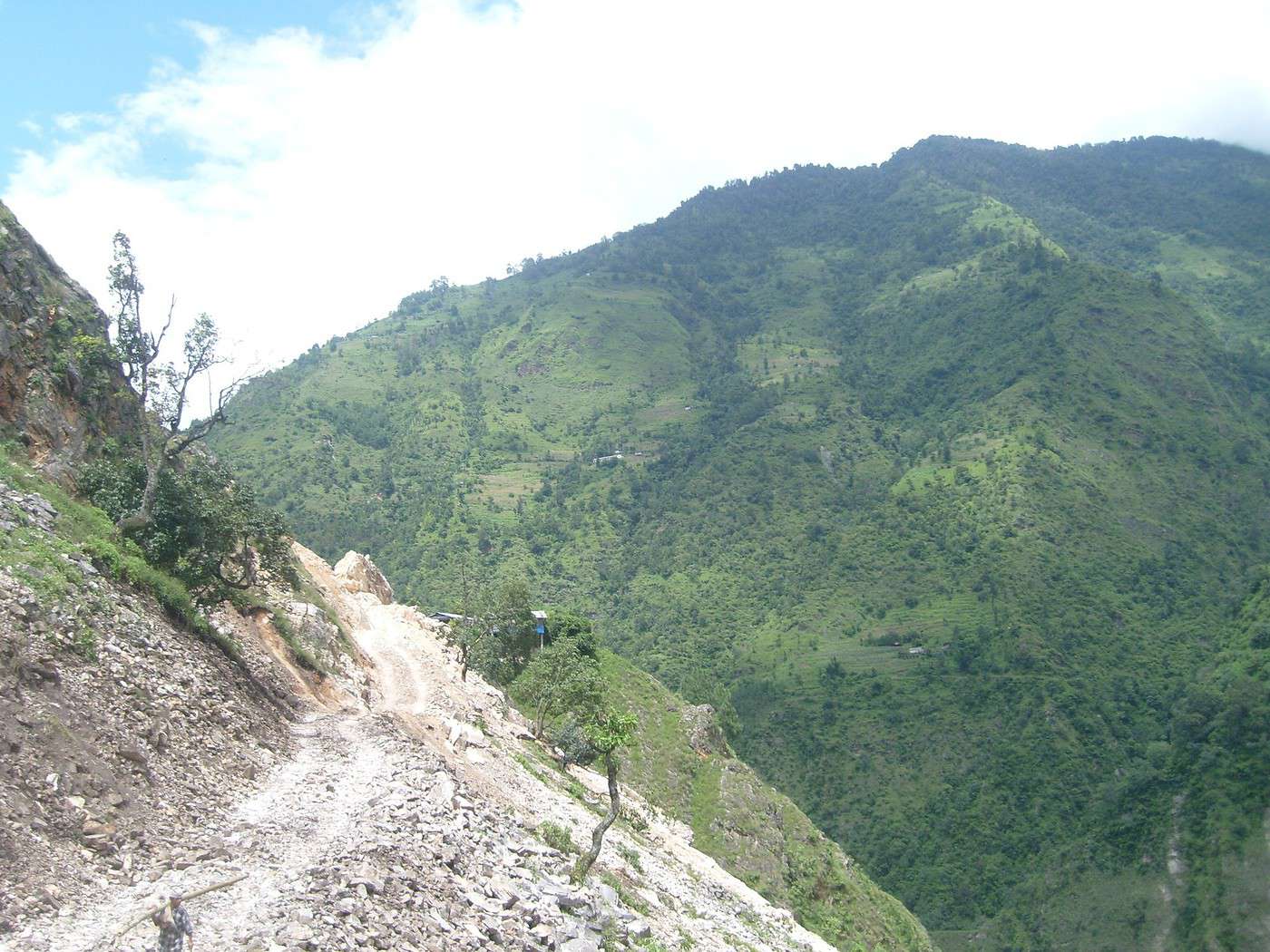
la 3ème photo est la route en construction vers gorepani (elle en est encore très loin mais peut-être que d'ici un an elle sera à gorepani (cela dit je me demande franchement comment la route pourra allez jusque-là étant donné la topographie du terrain!))
voilà j'espère vous avoir éclairé un peu!
...Pas très bien pour les népalais je pense. Surtout que les maoïstes ont quitté le gouvernement, les généraux refusant de les enroler dans l'armée même s'ils déposaient les armes, contrairement à ce qui était convenu. Alors c'est reparti pour un tour, appels à la grève ( banth), paralysie des transports, violence...
Pour les touristes, je ne sais pas. J'y suis allée 5 fois en période troublée, j'ai vu la situation se dégrader un peu plus à chaque voyage. "L'avantage": la chute de la fréquentation touristique, avait fait dégringoler les prix, Ktm était plus calme y compris en octobre. Beaucoup d'hôtels même en centre ville étaient au 3/4 vides. Plus de lodges que de trekkers sur certains circuits. Mais je ne m'éloignais pas de Ktm sans être accompagnée par un de mes amis Sherpas et je me tenais informée de ce qui se passait. Je ne me suis trouvée bloquée qu'une fois en montagne pour cause de grève, donc je n'avais pas de bus pour regagner la capitale. Et franchement, pour eux, je préfère payer plus cher mais les voir, travailler et sourire...Et tant pis s'il faut quelquefois se serrer dans les lodges.
Les travaux pour la "route" partant de Jiri avaient été arrêtés à cause des maoïstes. Si on voyait les militaires patrouiller dans un véhicule dans Jiri, dès qu'on prenait le sentier, plus un treillis en vue jusqu'à Lukla. Les maoïstes étaient ( sont?) les maîtres du terrain. Plus qu' à croiser les doigts pour ne pas payer, mais difficile de ne pas en croiser à un moment ou à un autre. Mais peut-être quelqu'un d'autre peut-il te donner des infos plus récentes sur cette route.
J'envisageais d'y retourner en octobre 2010...on verra...
Sylvie
Pour les touristes, je ne sais pas. J'y suis allée 5 fois en période troublée, j'ai vu la situation se dégrader un peu plus à chaque voyage. "L'avantage": la chute de la fréquentation touristique, avait fait dégringoler les prix, Ktm était plus calme y compris en octobre. Beaucoup d'hôtels même en centre ville étaient au 3/4 vides. Plus de lodges que de trekkers sur certains circuits. Mais je ne m'éloignais pas de Ktm sans être accompagnée par un de mes amis Sherpas et je me tenais informée de ce qui se passait. Je ne me suis trouvée bloquée qu'une fois en montagne pour cause de grève, donc je n'avais pas de bus pour regagner la capitale. Et franchement, pour eux, je préfère payer plus cher mais les voir, travailler et sourire...Et tant pis s'il faut quelquefois se serrer dans les lodges.
Les travaux pour la "route" partant de Jiri avaient été arrêtés à cause des maoïstes. Si on voyait les militaires patrouiller dans un véhicule dans Jiri, dès qu'on prenait le sentier, plus un treillis en vue jusqu'à Lukla. Les maoïstes étaient ( sont?) les maîtres du terrain. Plus qu' à croiser les doigts pour ne pas payer, mais difficile de ne pas en croiser à un moment ou à un autre. Mais peut-être quelqu'un d'autre peut-il te donner des infos plus récentes sur cette route.
J'envisageais d'y retourner en octobre 2010...on verra...
Sylvie
" Je me révolte donc je suis "
Albert Camus
...cela dit je me demande franchement comment la route pourra allez jusque-là étant donné la topographie du terrain!...
Je me permet de poster ici des photos que j'ai déjà posté ailleurs concernant ce qui est faisable en matière de route :
http://www.flickr.com/photos/elgregein/505248309/
http://www.flickr.com/photos/david_thyberg/2160246846/
A mon avis, s'ils décident de faire une piste tout autour des Annapurnas, elle finira par exister.
Je me permet de poster ici des photos que j'ai déjà posté ailleurs concernant ce qui est faisable en matière de route :
http://www.flickr.com/photos/elgregein/505248309/
http://www.flickr.com/photos/david_thyberg/2160246846/
A mon avis, s'ils décident de faire une piste tout autour des Annapurnas, elle finira par exister.
Panoramiques : http://nanor44.free.fr
- Salar de Uyuni à pied (Bolivie 2011) - Népal : Annapurna, Everest - Lofoten
plutôt impressionnantes ces routes!
Bjr,
merci pour tes infos .
En Janv 91 , à Tatopani , il n 'y avait qu'un seul " carré pour se baigner et c'était du chaud . avec un petit robinet avant pour se "nettoyer" .
Et c'etait gratuit . Il faut dire qu 'on était qu 'une petite poignée de trekkers ds tt le village , en hiver ....
La même année mais en Oct , c'était payant , plus de monde .
En 99 , le bac etait bcp plus grand , mieux fait, et je crois même me souvenir de la presence d 'un petit bac à coté plutôt utilisé par les locaux .
Mais pas de bac eau tiède . Un coin buvette avait même fait son apparition !
Merci pour tes photos . La piste que tu as photographiée après Tatopani , elle est comme cela jusqu'à Muktinath ?? Large ?? Par contre , tu m'a surpris en ecrivant qu 'ils construisaient une route montante à gorephani !! je n'en avais pas entendu parler et je pensais que ce coin resterait à l'ecart ( y compris le sanctuaire ) , en dehors de la voie commercante possible vers le mustang/tibet . Hé bien je me trompais . La DDE népalaise se lance ds ses grand travaux !!!
la buvette est toujours là!
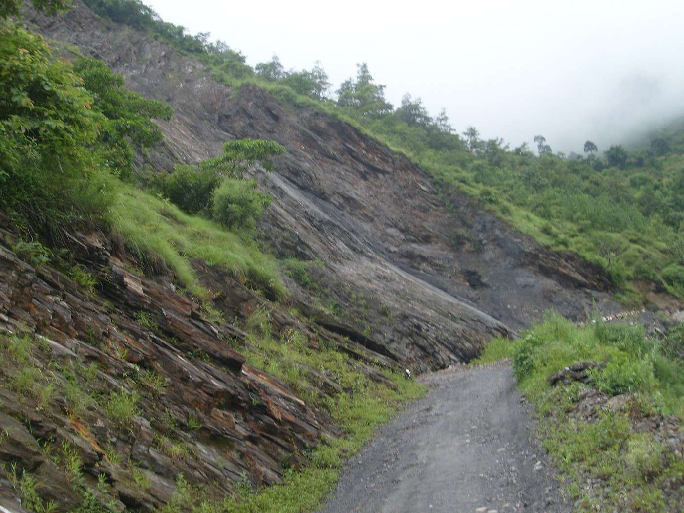
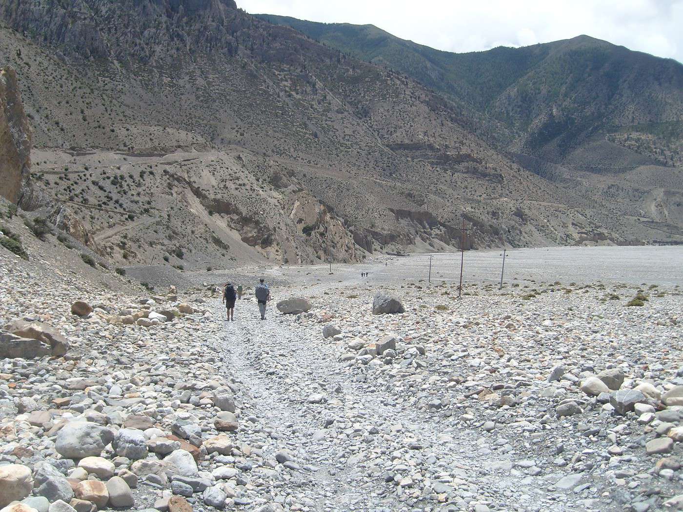
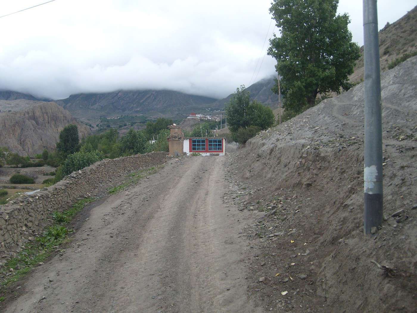
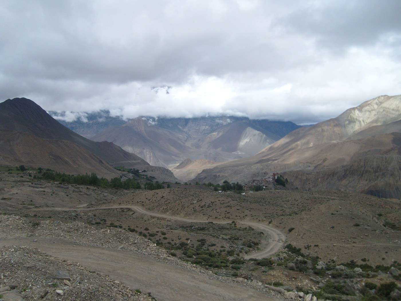
la route fait la largeur d'une jeep, bien souvent pour en croisée une autre il faut reculé jusqu'à trouver un endroit ou "stationner". mais cet été il y a eu de GROS glissement de terrain sur cette route... il était devenu totalement impossible pour un vehicule de passer. je ne sais pas si ça a été "réparé" depuis!
je vous mets quelques photos de la route après jomsom en direction de muktinath. la 1ère a été prise dans le lit de la kali
gandaki (je penses que vous avez reconnu), les 2 dernières ont été prises entre kagbeni (SUPER) et muktinath.
Je ne pense pas que ces routes en construction aient spécialement une vocation commerciale. Il y a également une route en construction le long de la mardi khola qui aboutit (ou aboutira) je ne sais pas trop où (pas au tibet ni au mustang) puisque les montagnes se trouvent juste en face! Je ne sais pas pourquoi ils construisent ces routes! peut-être tout simplement pour ce faciliter la vie.
en tout cas j'espère que vous garderez un très bon souvenir de ce nouveau voyage au nepal quelques années après votre dernière venue même si le pays à probablement beaucoup changer depuis!
Je ne pense pas que ces routes en construction aient spécialement une vocation commerciale. Il y a également une route en construction le long de la mardi khola qui aboutit (ou aboutira) je ne sais pas trop où (pas au tibet ni au mustang) puisque les montagnes se trouvent juste en face! Je ne sais pas pourquoi ils construisent ces routes! peut-être tout simplement pour ce faciliter la vie.
en tout cas j'espère que vous garderez un très bon souvenir de ce nouveau voyage au nepal quelques années après votre dernière venue même si le pays à probablement beaucoup changer depuis!
Bonjour Franck,
réponse faite en MP.
A+, Ronan.
réponse faite en MP.
A+, Ronan.
Panoramiques : http://nanor44.free.fr
- Salar de Uyuni à pied (Bolivie 2011) - Népal : Annapurna, Everest - Lofoten
... c'est le chargement des photos qui est très lent ... mais c'est une bonne leçon de patience ! 😛)
2010, l'année de l'optimisation ! 😎
http://nanor44.free.fr/forum/nepal-2009
2010, l'année de l'optimisation ! 😎
http://nanor44.free.fr/forum/nepal-2009
Panoramiques : http://nanor44.free.fr
- Salar de Uyuni à pied (Bolivie 2011) - Népal : Annapurna, Everest - Lofoten
2010, l'année de l'optimisation ! 😎
http://nanor44.free.fr/forum/nepal-2009
Après avoir ajouté le principe "vignettes/grands formats", avec préchargement des grandes photos.
Voici le scrolling des grands formats par survol de la souris, c'est beaucoup plus sympa surtout quand on est en plein écran (F11).
http://nanor44.free.fr/forum/nepal-2009
Après avoir ajouté le principe "vignettes/grands formats", avec préchargement des grandes photos.
Voici le scrolling des grands formats par survol de la souris, c'est beaucoup plus sympa surtout quand on est en plein écran (F11).
Panoramiques : http://nanor44.free.fr
- Salar de Uyuni à pied (Bolivie 2011) - Népal : Annapurna, Everest - Lofoten
Un petit bonus pour le fun.
En voyant cette vidéo http://vimeo.com/8309258 ça m'a donné l'idée d'en faire une à partir de l'une de mes photos panoramiques en essayant d'avoir le même rendu (tremblements pour le "réalisme") : http://www.vimeo.com/10044203 (en plein écran c'est plus sympa).
Panoramiques : http://nanor44.free.fr
- Salar de Uyuni à pied (Bolivie 2011) - Népal : Annapurna, Everest - Lofoten
Merci beaucoup pour ce splendide site!!!
Magnifique!
Quel talent de photographe, quel voyage, quel pays!!
Et plein de bons souvenirs pour moi et plein d'autres :-)
ValerieM
Que dire Ronan????
Merci
Superbe voyage et magnifiques, sublimes photos....
Merveilleux
merci
marine
Merci, les amies Belges ! 😉
Panoramiques : http://nanor44.free.fr
- Salar de Uyuni à pied (Bolivie 2011) - Népal : Annapurna, Everest - Lofoten
Ce récit a un nouveau petit frère, c'est par ici :
http://voyageforum.com/v.f?post=3884147
Panoramiques : http://nanor44.free.fr
- Salar de Uyuni à pied (Bolivie 2011) - Népal : Annapurna, Everest - Lofoten
C´est déjà la magie du voyage, sans y être,
Super belles photos et commentaires.
Merci, rm
Super belles photos et commentaires.
Merci, rm
C´est déjà la magie du voyage, sans y être,
Super belles photos et commentaires.
Merci, rm
Merci, c'est très sympa.
Super belles photos et commentaires.
Merci, rm
Merci, c'est très sympa.
Panoramiques : http://nanor44.free.fr
- Salar de Uyuni à pied (Bolivie 2011) - Népal : Annapurna, Everest - Lofoten
Log in first, then come back to this page.
You might also like
More discussions
We went on a safari in Tanzania from February 7th, 2026, to February 17th, 2026. It remains a wonderful memory. There were six of us in the group. Here’s the itinerary and the images that are still etched in our minds:
02/07/2026 – 6:40 AM – 8:30 PM – Flight from LYON to ARUSHA
02/08/2026 – Day 2 – MATURENI Waterfall – Coffee making and tasting at a plantation – Day 2 video (you may need to click "BROWSE YOUTUBE")
02/09/2026 – Day 3 – Maasai village of BOMA – https://youtu.be/9lwBONmBIVU
Visit to local schools and the dispensary – Donation of school supplies.
02/10/2026 – Day 4 – TARANGIRE National Park – https://youtu.be/OPpTgUECj0Q
02/11/2026 – Day 5 – Lake Manyara National Park – https://youtu.be/ZFt3tLtum5A
02/12/2026 – Day 6 – SERENGETI Park – https://youtu.be/5TYJE-3IO4w and https://youtu.be/t08g-XJlmdY
02/13/2026 – Day 7 – SERENGETI National Park (continued) – https://youtu.be/ZQkD1YmPzY0
02/14/2026 – Day 8 – Access to Ngorongoro National Park – https://youtu.be/1F__NeCRxhg
02/15/2026 – Day 9 – Ngorongoro Crater – https://youtu.be/BFw7tbjuO5s, then https://youtu.be/WdbHtPcYu8o and https://youtu.be/RBp_H9OMJxY
02/16/2026 – Day 10 – Visit to Arusha
02/17/2026 – Day 10 – 1:30 AM – Transfer to Kilimanjaro Airport
FINANCIAL SUMMARY FLIGHTS 1,500 €
SEJOUIR PACKAGE 1,526 €
TIPS AND MISC. 100 €
TOTAL 3,126 €
Trip duration: from 02/07/26 to 02/17/26 => 11 days total, or 9 days excluding travel time.
1- FLIGHT DURATION WITH AIR FRANCE OUTBOUND: from 6:40 AM to 8:30 PM => 12 hours (plus 2-hour time difference in Arusha) RETURN: from 2:45 AM to 2:00 PM => 13 hours 15 minutes (not including a 1-hour 15-minute departure delay)
FINANCIAL SUMMARY FLIGHTS 1,500 €
SEJOUIR PACKAGE 1,526 €
TIPS AND MISC. 100 €
TOTAL 3,126 €
Trip duration: from 02/07/26 to 02/17/26 => 11 days total, or 9 days excluding travel time.
1- FLIGHT DURATION WITH AIR FRANCE OUTBOUND: from 6:40 AM to 8:30 PM => 12 hours (plus 2-hour time difference in Arusha) RETURN: from 2:45 AM to 2:00 PM => 13 hours 15 minutes (not including a 1-hour 15-minute departure delay)
This city has been described a thousand times, but never in such an irreverent way.
Daring to drop Christian Lacroix, his *arlésiennes*, his boleros, his matadors, and the baroque style of his native Camargue right into the heart of Hoi An—it took some guts to draw that parallel.
https://thefabworld.com/hoi-an-en-christian-lacroix/
The second article on Hoi An is just as punchy:
https://thefabworld.com/hoi-an-en-robe-de-chambre/
Happy reading! !
Daring to drop Christian Lacroix, his *arlésiennes*, his boleros, his matadors, and the baroque style of his native Camargue right into the heart of Hoi An—it took some guts to draw that parallel.
https://thefabworld.com/hoi-an-en-christian-lacroix/
The second article on Hoi An is just as punchy:
https://thefabworld.com/hoi-an-en-robe-de-chambre/
Happy reading! !

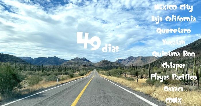
Hey fellow travelers! For those of you drawn to Mexico, I put together this little site to share our 49-day trip in January 2026. (Give it a few seconds to fully load—you’ll see there are tons of photos, tips, and more!) Happy travels! https://noemarphil6.wixsite.com/voyagesdenoemarphil
Hi there! I’m Simon, and for years I’ve been exploring some of Europe’s most beautiful and well-equipped bike paths. My passion for cycling led me to start a blog where I share my travel impressions, practical tips, and photos taken along the way. I ride both well-known routes like the Alpe-Adria, the Loire à Vélo, and the Rhein Route, as well as lesser-known but equally charming regions.

In my stories, I pay special attention to the quality of infrastructure, cyclist safety, and route accessibility—for young and old, experienced riders and beginners alike. I love discovering and sharing spots that are truly welcoming for cycle tourists: well-marked, with rest areas and easy train access.
On the blog, you’ll find ready-to-follow route suggestions, tips for preparing your bike trips, and plenty of inspiration for your next adventures. I travel with my panniers, a camera in the front bag, and always keep an eye out for what’s around me. Feel free to check out my blog, Cycling Thread—you might find some ideas for your next bike getaway! :-)
* * *
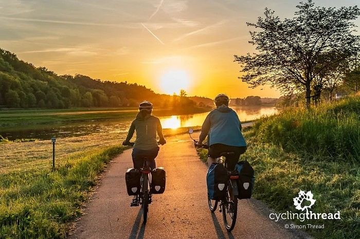
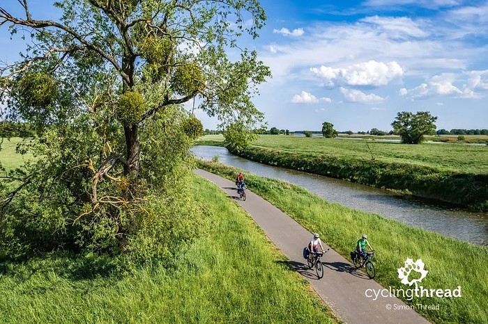
I hope this won’t just be a one-off post—I’ll try to share our bike trips with you here regularly. To start: our May trip on the Elberadweg, the queen of German bike paths, between the stunning city of Dresden and Magdeburg. I invite you to visit:
Elberadweg in Germany – From Dresden to Magdeburg
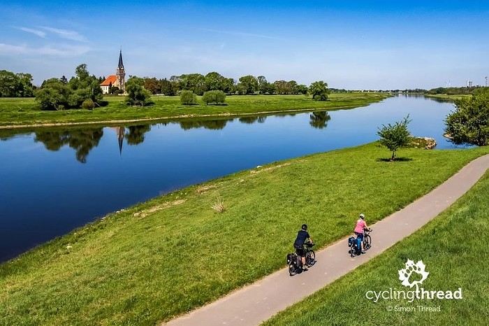
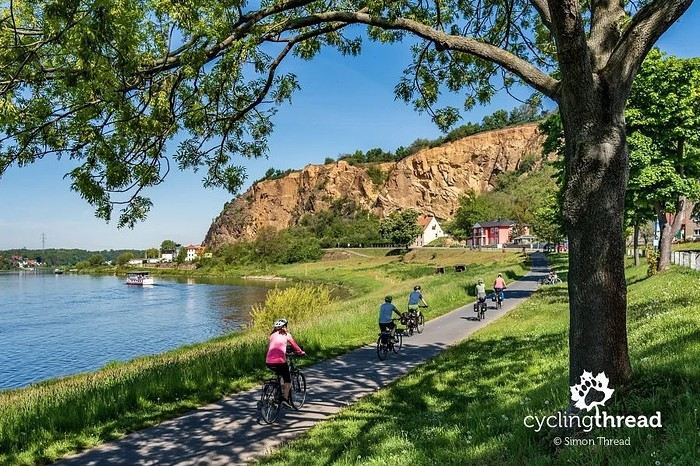
The Elbe bike path is about 1200 km long, following the river from its source in the Giant Mountains in the Czech Republic to its mouth in Cuxhaven, on the North Sea. The route crosses a variety of landscapes: mountain valleys, vineyards, open plains, and coastline. As is often the case in Germany, the signage is excellent and the route easy to follow.
But what surprised us was the number of cobblestone sections! Sure, the cobblestones are well-laid and fairly smooth—but they’re still cobblestones. And when they disappear, they’re often replaced by concrete slabs, typical of river dikes. That’s just part of the face of this 30-year-old "queen"—a heritage that’s hard to replace entirely with fresh asphalt.
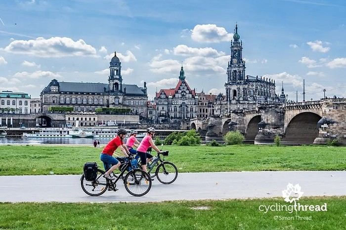
Along the way, don’t miss the many cultural highlights. Dresden impresses with its restored old town, the Frauenkirche, and the Brühl Terraces along the Elbe—it’s one of Germany’s most elegant cities. In Meissen, you can visit the famous porcelain factory and its Gothic cathedral. Wittenberg is a must-stop to follow in Martin Luther’s footsteps, with its castle church and Reformation Museum. And to finish, in Dessau-Roßlau, besides the Bauhaus, don’t miss the stunning Dessau-Wörlitz landscape gardens—one of the oldest English-style parks in Europe.
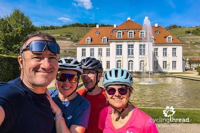
A few photos to give you a feel for the route and inspire you to check out our blog! :-)


Happy cycling!
Simon

In my stories, I pay special attention to the quality of infrastructure, cyclist safety, and route accessibility—for young and old, experienced riders and beginners alike. I love discovering and sharing spots that are truly welcoming for cycle tourists: well-marked, with rest areas and easy train access.
On the blog, you’ll find ready-to-follow route suggestions, tips for preparing your bike trips, and plenty of inspiration for your next adventures. I travel with my panniers, a camera in the front bag, and always keep an eye out for what’s around me. Feel free to check out my blog, Cycling Thread—you might find some ideas for your next bike getaway! :-)
* * *
I hope this won’t just be a one-off post—I’ll try to share our bike trips with you here regularly. To start: our May trip on the Elberadweg, the queen of German bike paths, between the stunning city of Dresden and Magdeburg. I invite you to visit:
Elberadweg in Germany – From Dresden to Magdeburg
The Elbe bike path is about 1200 km long, following the river from its source in the Giant Mountains in the Czech Republic to its mouth in Cuxhaven, on the North Sea. The route crosses a variety of landscapes: mountain valleys, vineyards, open plains, and coastline. As is often the case in Germany, the signage is excellent and the route easy to follow.
But what surprised us was the number of cobblestone sections! Sure, the cobblestones are well-laid and fairly smooth—but they’re still cobblestones. And when they disappear, they’re often replaced by concrete slabs, typical of river dikes. That’s just part of the face of this 30-year-old "queen"—a heritage that’s hard to replace entirely with fresh asphalt.
Along the way, don’t miss the many cultural highlights. Dresden impresses with its restored old town, the Frauenkirche, and the Brühl Terraces along the Elbe—it’s one of Germany’s most elegant cities. In Meissen, you can visit the famous porcelain factory and its Gothic cathedral. Wittenberg is a must-stop to follow in Martin Luther’s footsteps, with its castle church and Reformation Museum. And to finish, in Dessau-Roßlau, besides the Bauhaus, don’t miss the stunning Dessau-Wörlitz landscape gardens—one of the oldest English-style parks in Europe.
A few photos to give you a feel for the route and inspire you to check out our blog! :-)


Happy cycling!
Simon
Hi there, I’m sharing my hiking itineraries on the sea-to-sea trails in Corsica. Perfect for those who want to discover Corsica on foot and are looking for multi-day hikes without major difficulties. That’s right—Corsica isn’t just about the GR 20! My travel journals are all written day by day.
🐻 Mare a Mare Sud + Mare è Monti Sud 👍🏼 TRAVEL JOURNAL A 175-kilometer route with 6,694 meters of elevation gain over 10 stages on the Mare a Mare Sud and Mare è Monti Sud trails in Corsica 🇨🇵 🐻 Mare a Mare Centre 👍🏼 TRAVEL JOURNAL A 106-kilometer route with 4,415 meters of elevation gain over 6 stages on the Mare a Mare Centre trails in Corsica 🇨🇵
🐻 Mare a Mare Nord 👍🏼 TRAVEL JOURNAL A 165-kilometer route with 7,004 meters of elevation gain over 7 stages on the Mare a Mare Nord trails in Corsica 🇨🇵
🐻 Mare a Mare Sud + Mare è Monti Sud 👍🏼 TRAVEL JOURNAL A 175-kilometer route with 6,694 meters of elevation gain over 10 stages on the Mare a Mare Sud and Mare è Monti Sud trails in Corsica 🇨🇵 🐻 Mare a Mare Centre 👍🏼 TRAVEL JOURNAL A 106-kilometer route with 4,415 meters of elevation gain over 6 stages on the Mare a Mare Centre trails in Corsica 🇨🇵
🐻 Mare a Mare Nord 👍🏼 TRAVEL JOURNAL A 165-kilometer route with 7,004 meters of elevation gain over 7 stages on the Mare a Mare Nord trails in Corsica 🇨🇵
Hi there! 😊
We just got back from two weeks in Madagascar, and before we left, we had *so* many practical questions. Between the sometimes contradictory info online and the lack of recent updates on certain topics, it wasn’t always easy to know what to expect for a first trip there.
So, after returning, I put together an article with all the info I wish I’d had before heading to Madagascar—just concrete tips based on our experience there.
I cover: • Visa and arrival at Antananarivo airport • Currency exchange, withdrawals, and payments on the ground • Transportation and real travel times • Health and trip prep • SIM cards, budget, and general organization • Mistakes and little hassles you can easily avoid on your first trip
The goal was to create a practical, honest guide to help people planning their trip and avoid a few unpleasant surprises once they’re there! 😊
If this can help some of you: https://aventures-sans-mesaventure.com/preparatif-pour-un-voyage-a-madagascar/
Happy travels! !
So, after returning, I put together an article with all the info I wish I’d had before heading to Madagascar—just concrete tips based on our experience there.
I cover: • Visa and arrival at Antananarivo airport • Currency exchange, withdrawals, and payments on the ground • Transportation and real travel times • Health and trip prep • SIM cards, budget, and general organization • Mistakes and little hassles you can easily avoid on your first trip
The goal was to create a practical, honest guide to help people planning their trip and avoid a few unpleasant surprises once they’re there! 😊
If this can help some of you: https://aventures-sans-mesaventure.com/preparatif-pour-un-voyage-a-madagascar/
Happy travels! !
Hi there,
We’ve just returned from 2 weeks in Madagascar, and I wanted to share our experience since we struggled quite a bit to plan our itinerary before leaving. The country is huge, the journeys are long, and with only two weeks, you really have to make choices.
For our part, we opted for a fairly realistic itinerary for a first-time visit: Antananarivo, Andasibe, Île aux Nattes, and then Sainte-Marie. The idea was to mix a bit of nature, lemurs, tropical forest, and then a few quieter days by the water—without trying to cross the entire country.
In Andasibe, we spent several days between the Analamazaotra Reserve and Mantadia Park. We were able to spot lemurs, especially the indris, went on a night walk to see chameleons, geckos, and other small animals, and then did a wilder hike in Mantadia. This was probably the stop that felt the most exotic to us, with that humid forest atmosphere, animal sounds, and dense vegetation.
After Andasibe, we headed back to Antananarivo to catch a flight to Sainte-Marie, then took a boat to Île aux Nattes. It’s a tiny car-free island where you get around on foot between beaches, sandy paths, villages, and coconut trees. We mostly slowed down the pace: walking around the island, snorkeling in front of the hotel, meals at Fafana and Coco Sud, swimming, and much simpler moments. It was one of our absolute highlights of the trip.
We wrapped up with a few days in Sainte-Marie, in a more comfortable setting. The island is larger and more developed than Île aux Nattes, with more accommodations and activities. For us, it was mostly about relaxing, enjoying the pool, biking, paddleboarding, snorkeling, and a few short walks. Looking back, we might’ve spent a little less time in Sainte-Marie and a bit more on Île aux Nattes, which left a bigger impression on us.
I’ve tried to break down our itinerary day by day, including travel times, budget, accommodations, transportation, our thoughts on each stop, the pros and cons, and what we’d change if we did it again. I also cover arriving in Antananarivo, the road to Andasibe, the domestic flight to Sainte-Marie, returning to Tana, and our airport experience—where it’s best to allow plenty of extra time. Here’s the link if it helps with your planning:
https://aventures-sans-mesaventure.com/madagascar-itineraire-pour-2-semaines-de-voyage/
In short, our main advice would be not to try to see everything in two weeks. Madagascar requires time, flexibility, and some breathing room. It’s better to pick fewer stops but really enjoy them.

In Andasibe, we spent several days between the Analamazaotra Reserve and Mantadia Park. We were able to spot lemurs, especially the indris, went on a night walk to see chameleons, geckos, and other small animals, and then did a wilder hike in Mantadia. This was probably the stop that felt the most exotic to us, with that humid forest atmosphere, animal sounds, and dense vegetation.
After Andasibe, we headed back to Antananarivo to catch a flight to Sainte-Marie, then took a boat to Île aux Nattes. It’s a tiny car-free island where you get around on foot between beaches, sandy paths, villages, and coconut trees. We mostly slowed down the pace: walking around the island, snorkeling in front of the hotel, meals at Fafana and Coco Sud, swimming, and much simpler moments. It was one of our absolute highlights of the trip.
We wrapped up with a few days in Sainte-Marie, in a more comfortable setting. The island is larger and more developed than Île aux Nattes, with more accommodations and activities. For us, it was mostly about relaxing, enjoying the pool, biking, paddleboarding, snorkeling, and a few short walks. Looking back, we might’ve spent a little less time in Sainte-Marie and a bit more on Île aux Nattes, which left a bigger impression on us.
I’ve tried to break down our itinerary day by day, including travel times, budget, accommodations, transportation, our thoughts on each stop, the pros and cons, and what we’d change if we did it again. I also cover arriving in Antananarivo, the road to Andasibe, the domestic flight to Sainte-Marie, returning to Tana, and our airport experience—where it’s best to allow plenty of extra time. Here’s the link if it helps with your planning:
https://aventures-sans-mesaventure.com/madagascar-itineraire-pour-2-semaines-de-voyage/
In short, our main advice would be not to try to see everything in two weeks. Madagascar requires time, flexibility, and some breathing room. It’s better to pick fewer stops but really enjoy them.
Hi there,
We passed through Guilin during our trip to China, arriving by train from Beijing. The journey is quite long, but it actually became part of the experience: watching the landscapes gradually change, taking the Chinese high-speed train, and getting a better sense of the country’s vast distances. It was already a step of the journey in itself.
Once there, Guilin seemed like a nice place to catch our breath between big cities. The city isn’t huge, and there isn’t an endless list of things to see, but the atmosphere around the lakes, the Li River, and the karst mountains is really special.
In 3 days, you can already see the highlights without rushing: the Sun and Moon Pagodas, walks around the lakes, Seven Star Park with its monkeys, and possibly Elephant Trunk Hill—though we were a bit disappointed by the latter. Guilin is also a good base for heading to Yangshuo or the Longji rice terraces if you have more time.
We’ve put together our feedback, prices, visit times, and what we’d do (or skip) next time in this article, in case it helps you plan your stop: https://aventures-sans-mesaventure.com/que-faire-a-guilin-en-3-jours/
We passed through Guilin during our trip to China, arriving by train from Beijing. The journey is quite long, but it actually became part of the experience: watching the landscapes gradually change, taking the Chinese high-speed train, and getting a better sense of the country’s vast distances. It was already a step of the journey in itself.
Once there, Guilin seemed like a nice place to catch our breath between big cities. The city isn’t huge, and there isn’t an endless list of things to see, but the atmosphere around the lakes, the Li River, and the karst mountains is really special.
In 3 days, you can already see the highlights without rushing: the Sun and Moon Pagodas, walks around the lakes, Seven Star Park with its monkeys, and possibly Elephant Trunk Hill—though we were a bit disappointed by the latter. Guilin is also a good base for heading to Yangshuo or the Longji rice terraces if you have more time.
We’ve put together our feedback, prices, visit times, and what we’d do (or skip) next time in this article, in case it helps you plan your stop: https://aventures-sans-mesaventure.com/que-faire-a-guilin-en-3-jours/
Check out my blog about Crete and Gavdos:
https://iledecrete.wordpress.com/
You’ll find ideas for getaways and discoveries
Hi everyone,
I’ve just returned from a trip through the national parks of southern Ethiopia, and I wanted to share an encounter that will stay with me forever: that of the Ethiopian Wolf.
Spotting this canid—the rarest in the world—on the barren Sanetti plateaus at over 13,000 feet is a breathtaking experience (literally, given the oxygen levels!). Beyond the luck of photographing it in its fiery red coat, it was the mystical atmosphere of these highlands—the "Roof of Africa"—that left its mark on me.
I’ve posted a detailed account with my photo series on my travel journal for anyone planning a trip to the Bale region or simply curious about this magnificent and endangered species.
You can find the full report here: 👉 https://www.toucan-photo.com/fr/le-loup-ethiopie-le-loup-sur-le-toit-de-lafrique/
Don’t hesitate to ask if you have questions about accessing the park or spotting local wildlife—I’d be happy to chat! !
I’ve just returned from a trip through the national parks of southern Ethiopia, and I wanted to share an encounter that will stay with me forever: that of the Ethiopian Wolf.
Spotting this canid—the rarest in the world—on the barren Sanetti plateaus at over 13,000 feet is a breathtaking experience (literally, given the oxygen levels!). Beyond the luck of photographing it in its fiery red coat, it was the mystical atmosphere of these highlands—the "Roof of Africa"—that left its mark on me.
I’ve posted a detailed account with my photo series on my travel journal for anyone planning a trip to the Bale region or simply curious about this magnificent and endangered species.
You can find the full report here: 👉 https://www.toucan-photo.com/fr/le-loup-ethiopie-le-loup-sur-le-toit-de-lafrique/
Don’t hesitate to ask if you have questions about accessing the park or spotting local wildlife—I’d be happy to chat! !
Hi there! As a big travel enthusiast, I’d love for you to check out my blog:
https://allegria750110.wixsite.com/pascalevoyage
https://allegria750110.wixsite.com/pascalevoyage/blog
Feel free to leave a comment! !
Hello everyone,
First off: before posting, I took the time to contact the moderation team to check if this message complied with the forum rules. Since I didn’t get a response and didn’t want to go against them, I’m posting without naming the site, including links, or any promotional intent.
For the past two years, I’ve been working solo on a website project designed to help organize a trip from A to Z, whether traveling alone or with others.
The idea is to make trip planning easier by bringing together all the useful elements in one place (regions, accommodations, activities, restaurants, hidden gems, etc.).
With development nearing completion, I’m now looking for a few people interested in joining a beta testing phase and giving me honest feedback on the experience, how clear the concept is, and what could be improved.
This isn’t a promotional effort: I’m not representing a company, I’m developing this project on my own, and I’m only looking for constructive input from fellow travelers.
A few details: — No payment is required; — No banking information is needed; — It’s simply a test to gather user feedback.
If anyone wants to know more or is up for testing, feel free to reply here or send me a private message.
Thanks so much to those who take the time to read this.
First off: before posting, I took the time to contact the moderation team to check if this message complied with the forum rules. Since I didn’t get a response and didn’t want to go against them, I’m posting without naming the site, including links, or any promotional intent.
For the past two years, I’ve been working solo on a website project designed to help organize a trip from A to Z, whether traveling alone or with others.
The idea is to make trip planning easier by bringing together all the useful elements in one place (regions, accommodations, activities, restaurants, hidden gems, etc.).
With development nearing completion, I’m now looking for a few people interested in joining a beta testing phase and giving me honest feedback on the experience, how clear the concept is, and what could be improved.
This isn’t a promotional effort: I’m not representing a company, I’m developing this project on my own, and I’m only looking for constructive input from fellow travelers.
A few details: — No payment is required; — No banking information is needed; — It’s simply a test to gather user feedback.
If anyone wants to know more or is up for testing, feel free to reply here or send me a private message.
Thanks so much to those who take the time to read this.
Hello,
Well, this trip to Tanzania in the southern parks—Ruaha and Nyerere (formerly Selous)—finally happened in late February to early March.
It was a bit more complicated to organize than usual, with a few hiccups. As I’ve mentioned elsewhere (link), the ban on booking domestic flights in Tanzania through a French agency made things a little tricky.
However, my friend Vincent Beccaro from Objectif Nature found a solution by having a local ground operator step in—one I’d recommend if you run into similar issues.
With flight tickets secured through Kenya Airways (after Rwandair canceled our outbound flight), we easily made it to Dar es Salaam on February 22. Side note: my dealings with Rwandair to get a refund for the flights they canceled are still ongoing. This airline is dragging its feet, constantly pushing back the refund date every time I check in (which is about once a week). I won’t back down.
Back to our 10-night trip: we spent our first night in Dar es Salaam before heading to Ruaha with Auric Air.
We stayed in some incredible lodges—4 nights at Ikuka Safari Camp in Ruaha, then 4 nights at Laba Siwada in Nyerere, before returning to Dar es Salaam.

Before I share a full recap with photos, I’ve just finished editing a video I’d like to show you.
You’ll see beautiful lodges, rainy safaris, and some amazing wildlife encounters, like wild dogs and bat-eared foxes.
Sorting and identifying all the animals (especially the birds) from the thousands of photos I took will take a bit of time. Bear with me!
Watch the video here
Well, this trip to Tanzania in the southern parks—Ruaha and Nyerere (formerly Selous)—finally happened in late February to early March.
It was a bit more complicated to organize than usual, with a few hiccups. As I’ve mentioned elsewhere (link), the ban on booking domestic flights in Tanzania through a French agency made things a little tricky.
However, my friend Vincent Beccaro from Objectif Nature found a solution by having a local ground operator step in—one I’d recommend if you run into similar issues.
With flight tickets secured through Kenya Airways (after Rwandair canceled our outbound flight), we easily made it to Dar es Salaam on February 22. Side note: my dealings with Rwandair to get a refund for the flights they canceled are still ongoing. This airline is dragging its feet, constantly pushing back the refund date every time I check in (which is about once a week). I won’t back down.
Back to our 10-night trip: we spent our first night in Dar es Salaam before heading to Ruaha with Auric Air.
We stayed in some incredible lodges—4 nights at Ikuka Safari Camp in Ruaha, then 4 nights at Laba Siwada in Nyerere, before returning to Dar es Salaam.
Before I share a full recap with photos, I’ve just finished editing a video I’d like to show you.
You’ll see beautiful lodges, rainy safaris, and some amazing wildlife encounters, like wild dogs and bat-eared foxes.
Sorting and identifying all the animals (especially the birds) from the thousands of photos I took will take a bit of time. Bear with me!
Watch the video here
Hi everyone!
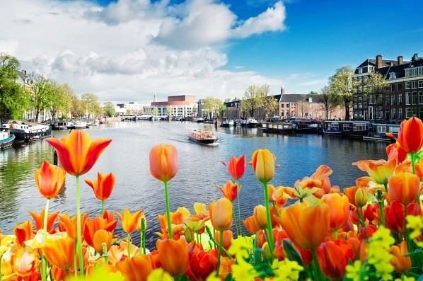
I wanted to share my experience from a trip to Amsterdam. Spring is coming, and it’s one of my favorite destinations for this season, especially with the Keukenhof in bloom.
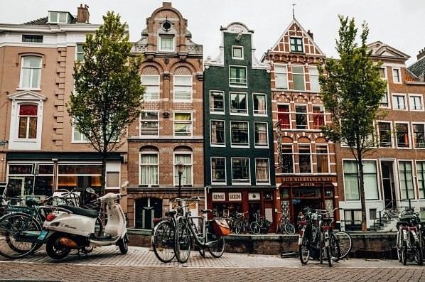
There are so many museums to visit and places to see, like Dam Square, the Royal Palace, Museum Square, the Red Light District... Some spots, like the Anne Frank House, require reservations. You can also take walks along the canals or even go on canal cruises.
For museums, I really enjoyed the Rijksmuseum for works by Rembrandt and Vermeer, as well as the Van Gogh Museum (combo tickets are available).

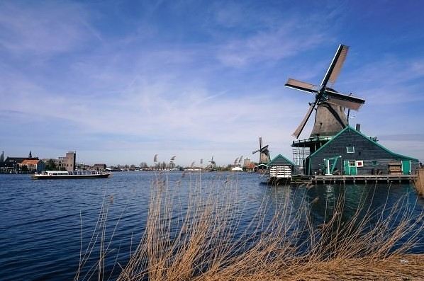
For more nature-focused outings, there’s Vondelpark, Keukenhof Park, and the windmills at Zaanse Schans...
You can find all my photos and details about my trip budget on my travel journal for Amsterdam.


I wanted to share my experience from a trip to Amsterdam. Spring is coming, and it’s one of my favorite destinations for this season, especially with the Keukenhof in bloom.
There are so many museums to visit and places to see, like Dam Square, the Royal Palace, Museum Square, the Red Light District... Some spots, like the Anne Frank House, require reservations. You can also take walks along the canals or even go on canal cruises.

For museums, I really enjoyed the Rijksmuseum for works by Rembrandt and Vermeer, as well as the Van Gogh Museum (combo tickets are available).

For more nature-focused outings, there’s Vondelpark, Keukenhof Park, and the windmills at Zaanse Schans...
You can find all my photos and details about my trip budget on my travel journal for Amsterdam.we just got back from 3 weeks in Cambodia with a custom trip organized by the Siem Reap agency; from the start, the agency understood our way of traveling and created an itinerary perfectly tailored to our needs. Of course, we visited tourist spots, but we also stayed with locals, met artisans, and explored markets where not a single tourist goes. We were pampered from beginning to end—the agency responded quickly to our questions throughout the trip. The French-speaking guides were fantastic: attentive, highly knowledgeable, and always accompanied by punctual drivers with little thoughtful touches. The hotels they chose matched our preferences, and the pace we wanted was respected, with some more relaxed days. If you'd like to check out my blog, here's the link: https://www.myatlas.com/blogueusedesbaous/le-cambodge-une-immersion-en-indochine.
And don’t hesitate to reach out if you need anything!
Honestly, taking the train in Sri Lanka is no walk in the park. Between tickets disappearing in minutes, platforms that aren’t always very clear, and that infamous “full” sign displayed weeks in advance, you quickly feel like you’re playing the lottery. There’s even a real black market for tickets on the island: some seats are resold at higher prices through middlemen or agencies, which makes things even trickier. Everyone knows someone who knows someone who sells tickets. But we learned the hard way that this isn’t the safest way to get them, and we had to find another solution at the last minute.
We definitely went through a bit of an obstacle course to manage the booking. But once on the train, riding through the tea plantations between Kandy and Ella, we understood why everyone raves about it. Tea plantations, misty mountains, little bridges, and breathtaking valleys. To make the most of the scenery on the Kandy → Ella route, it’s best to sit on the right side of the train (and on the left if you’re going Ella → Kandy). As for the class, 2nd class reserved is, in our opinion, the best compromise: authentic vibe, open windows and doors, but with a guaranteed seat. Remember to pack enough water, snacks, and toilet paper for this 7-hour journey that somehow flies by.
I’ve gone into more detail about all this in the article for those who’d rather plan a bit better than we did. https://aventures-sans-mesaventure.com/prendre-le-train-au-sri-lanka-guide-complet/ Happy travels! :)
We definitely went through a bit of an obstacle course to manage the booking. But once on the train, riding through the tea plantations between Kandy and Ella, we understood why everyone raves about it. Tea plantations, misty mountains, little bridges, and breathtaking valleys. To make the most of the scenery on the Kandy → Ella route, it’s best to sit on the right side of the train (and on the left if you’re going Ella → Kandy). As for the class, 2nd class reserved is, in our opinion, the best compromise: authentic vibe, open windows and doors, but with a guaranteed seat. Remember to pack enough water, snacks, and toilet paper for this 7-hour journey that somehow flies by.
I’ve gone into more detail about all this in the article for those who’d rather plan a bit better than we did. https://aventures-sans-mesaventure.com/prendre-le-train-au-sri-lanka-guide-complet/ Happy travels! :)
Hello 😊
If you're planning 10 days in Madeira and feeling unsure about the itinerary, my first tip would be: don’t try to “tick everything off.” The island is compact, but the roads are winding and hikes take time.
For 10 days, I’d structure the trip into 3 zones:
East (Ponta de São Lourenço + Pico do Arieiro) for spectacular volcanic landscapes
Central (levadas + Fanal forests) for hiking
West (Porto Moniz, cliffs, sunsets) for raw panoramas And save Funchal for early mornings or late afternoons.
A car is essential, and checking the weather ahead is key—it changes quickly with altitude. I’ve broken all this down (optimized route, travel times, parking spots, hike difficulty, what to do based on weather, mistakes to avoid…) in this post: 👉 https://aventures-sans-mesaventure.com/visiter-madere-1-semaine/ Even though it’s built for a week, it adapts easily to 10 days by adding more hikes or slowing the pace. If you’re looking for a balance between breathtaking nature, hiking, and quieter moments, Madeira is a real safe bet.
East (Ponta de São Lourenço + Pico do Arieiro) for spectacular volcanic landscapes
Central (levadas + Fanal forests) for hiking
West (Porto Moniz, cliffs, sunsets) for raw panoramas And save Funchal for early mornings or late afternoons.
A car is essential, and checking the weather ahead is key—it changes quickly with altitude. I’ve broken all this down (optimized route, travel times, parking spots, hike difficulty, what to do based on weather, mistakes to avoid…) in this post: 👉 https://aventures-sans-mesaventure.com/visiter-madere-1-semaine/ Even though it’s built for a week, it adapts easily to 10 days by adding more hikes or slowing the pace. If you’re looking for a balance between breathtaking nature, hiking, and quieter moments, Madeira is a real safe bet.
Here are my two blogs dedicated to travel, especially in France.
If you have any topics you'd like me to cover, I'm all ears!
Villes.fr Top-Vacances.com
Thanks, and have a great day
If you have any topics you'd like me to cover, I'm all ears!
Villes.fr Top-Vacances.com
Thanks, and have a great day
Hello everyone!
To learn all about Argentina, over 1,000 articles are already waiting for you on my site.
https://www.petitherge.com/ See you soon!
Herge!
To learn all about Argentina, over 1,000 articles are already waiting for you on my site.
https://www.petitherge.com/ See you soon!
Herge!
Hi there,
I often travel solo, and like many women, I get asked the same questions over and over:
“Aren’t you scared?”
“Do you feel safe?”
“Do you really dare to go that far alone?”
Recently, during a trip along the Kenyan coast, I had an experience that made me think differently about solo female travel.
At Wasini Kenya, on paper, everything seemed simple: a boat ride, then some snorkeling.
But on the boat, the sea was rough. It was rocking hard. And then that familiar little inner voice came back—the one that doubts, that overthinks, that wants to stay in control.
Traveling solo is often like that too:
being responsible for yourself, your decisions, and your limits.
Then, once underwater, everything changed.
The noise disappeared. There was nothing left to prove, nothing to control.
Just breathing, trusting your body, and letting yourself be carried.
That moment reminded me that solo female travel isn’t just about destinations or external safety.
It’s also an inner journey: learning to listen to yourself, to recognize your fears, and sometimes to overcome them without forcing it.
I took the time to share this experience in more detail here, for anyone it might help or reassure:
👉 https://noirenvoyage.com/wasini-kenya-apprendre-a-faire-confiance-sous-leau/
And I’d love to hear your thoughts:
👉 For those of you who travel solo, has travel ever taught you something about yourself?
👉 And for those who are still hesitant: what’s holding you back the most right now?
Looking forward to chatting! 🌊
I just got back from a week in Mirleft, south of Agadir, and I felt like I’d stumbled upon an "off-the-beaten-path" Morocco: a raw Atlantic coastline, cliffs, endless beaches... and that slow pace that helps you unplug within 24 hours.
We had a house with a pool (the perfect combo when the wind picks up and the ocean cools the air), and then we alternated between: - Wandering the souk and alleyways (local vibe, regional products, and the big Monday souk if you can make it) - Surf sessions / scouting spots (depending on the swell and wind, it makes all the difference) - Wild beaches + viewpoints where you can settle far from the crowds - Legzira at sunset: the orange rock, the deep roar of the Atlantic, and that natural arch that seems to hold "by magic" - A little detour to Tiznit (45 min away): medina, silver craftsmanship, and an unexpected blue spring in the heart of the city - The mandatory "reset": hammam + massage after salt, sand, and road trips
I especially noted a bunch of details to avoid hassles: when to go (wind/weather), how to get around (a car is pretty much essential), what to watch out for on the road at night, and even super practical tips for summer accommodations.
If you want the full article with all the practical info + must-sees (and our tips to avoid mishaps), it’s here: https://aventures-sans-mesaventure.blogspot.com/2026/01/que-faire-mirleft-au-maroc-en-7-jours.html
Happy reading and/or safe travels! :)
We had a house with a pool (the perfect combo when the wind picks up and the ocean cools the air), and then we alternated between: - Wandering the souk and alleyways (local vibe, regional products, and the big Monday souk if you can make it) - Surf sessions / scouting spots (depending on the swell and wind, it makes all the difference) - Wild beaches + viewpoints where you can settle far from the crowds - Legzira at sunset: the orange rock, the deep roar of the Atlantic, and that natural arch that seems to hold "by magic" - A little detour to Tiznit (45 min away): medina, silver craftsmanship, and an unexpected blue spring in the heart of the city - The mandatory "reset": hammam + massage after salt, sand, and road trips
I especially noted a bunch of details to avoid hassles: when to go (wind/weather), how to get around (a car is pretty much essential), what to watch out for on the road at night, and even super practical tips for summer accommodations.
If you want the full article with all the practical info + must-sees (and our tips to avoid mishaps), it’s here: https://aventures-sans-mesaventure.blogspot.com/2026/01/que-faire-mirleft-au-maroc-en-7-jours.html
Happy reading and/or safe travels! :)
Hi there,
I just got back from a week-long trip to Marrakech, Morocco, with a stop in Essaouira, and I’ve put together my itinerary, some great tips, and my thoughts on the trip. Hope this helps you plan your own adventure and get excited about it!
https://aventures-sans-mesaventure.blogspot.com/2026/01/visiter-marrakech-en-1-semaine.html
Happy travels! :)
Happy travels! :)
The Great Jura Crossing on foot is a long-distance hiking trail (GR) that winds through the Jura Mountains, from Mandeure, near Montbéliard (in the north), to Culoz in the Ain region (in the south). The GTJ fully crosses the Haut-Jura Regional Nature Park and offers a detour into neighboring Switzerland. Inaugurated in 2004, the GTJ on foot follows the GR GTJ long-distance trails and sometimes the GR 5 and GR 9.
The full GTJ hike takes 15 to 20 days. Since my vacation time isn’t unlimited, I opted for a 10-day trek from Pont-de-Roide to Bellegarde-sur-Valserine, covering nearly 320 kilometers (so about 60 kilometers short) with 10,000 meters of elevation gain—and just as much descent. The route is classic, except for the must-do variant via the Colomby de Gex (Balcon du Léman).
Accommodations include mountain huts, step lodges, and guest rooms with tables loaded with Morbier cheese gratin, Morteau sausages, rösti, and michons... Oh, and I almost forgot: I’m hiking solo...
http://lerandonneurfou.blogspot.fr/2014/05/la-grande-traversee-du-jura-gtj.html
The full GTJ hike takes 15 to 20 days. Since my vacation time isn’t unlimited, I opted for a 10-day trek from Pont-de-Roide to Bellegarde-sur-Valserine, covering nearly 320 kilometers (so about 60 kilometers short) with 10,000 meters of elevation gain—and just as much descent. The route is classic, except for the must-do variant via the Colomby de Gex (Balcon du Léman).
Accommodations include mountain huts, step lodges, and guest rooms with tables loaded with Morbier cheese gratin, Morteau sausages, rösti, and michons... Oh, and I almost forgot: I’m hiking solo...
http://lerandonneurfou.blogspot.fr/2014/05/la-grande-traversee-du-jura-gtj.html
Hi everyone,
I just published an article with our itinerary for visiting Copenhagen in 4 days during winter (December): day-by-day schedule, practical info (budget, weather, transport, Copenhagen Card), where to stay, plus our thoughts on the must-sees (Nyhavn, The Little Mermaid, Amalienborg, contemporary art museum, botanical garden) and a balanced take on Christiania.
If it can help those planning a city trip: https://aventures-sans-mesaventure.blogspot.com/2026/01/visiter-copenhague-en-4-jours-que-faire.html
Happy planning, and if you have any questions, I’m happy to answer! !
Hi there,
We went on a 10-day road trip through Andalusia in October 2024, traveling independently.
Our itinerary took us through Seville, Ronda, Guadix, and Granada, with a few nature detours and manageable driving distances.
We took the time to put together our day-by-day route and some feedback (pace, distances, what we’d do again or skip) in an article, in case it helps other travelers:
https://aventures-sans-mesaventure.blogspot.com/2026/01/andalousie-itineraire-road-trip-10-jours.html
Happy planning to those heading out soon!
Hi there,
We just got back from a 7-day trip to Malta in winter 2025, organized independently.
Itinerary: Valletta, Mdina, Mellieħa, cliffs, and natural sites, with generally pleasant but sometimes changeable weather.
We’ve put together our day-by-day itinerary and some practical feedback (pace, getting around, what’s really worth it in winter) here:
https://aventures-sans-mesaventure.blogspot.com/2026/01/malte-hiver-itineraire-7-jours.html
Happy travels to those planning their trip!
Hi there,
We just got back from a 2-week trip to Sri Lanka in April 2024, organized independently.
Our itinerary took us to: Sigiriya (sunrise from Pidurangala), Kandy, Ella (train), Udawalawe, and Tangalle.
We’ve put together our day-by-day itinerary, our experiences from this trip, and some practical tips here:
https://aventures-sans-mesaventure.blogspot.com/2026/01/sri-lanka-itineraire-2-semaines.html
Happy travels to those planning their trip! !
Hi,
We just got back from a two-week independent trip to China in April 2025. The country can seem intimidating at first (language, transportation, payments), and the language barrier is very real, even in big cities.
Our itinerary took us to Beijing, the Great Wall (Mutianyu), then to Guilin, the Longji Rice Terraces (Dazhai), and Wuhan. All travel was by train, subway, and DiDi (local Uber).
We’ve put together our day-by-day itinerary and some practical tips based on our experience in this post—hope it helps for a first trip to China:
https://aventures-sans-mesaventure.blogspot.com/2026/01/chine-itineraire-2-semaines.html
Happy travels to those planning their trip!
Hi everyone.
Even though my blog has been online for nearly 18 years, I wanted to tweak the navigation a bit. The homepage still features a selection of "miscellaneous" photos on various wildlife subjects I’ve photographed or trips I’ve taken. https://www.toucan-photo.com/fr/
Toucan’s photos
From each photo, you can navigate to the selection for that country, a specific category (birds, night skies, etc.), or the year the photo was taken.
And of course, from the main menu, you can access an interactive map with articles or different selections from the site, all plotted on a map.
What do you think? Does the map work properly for you? Any navigation issues on smartphones and/or tablets?
Thanks in advance for your feedback
Even though my blog has been online for nearly 18 years, I wanted to tweak the navigation a bit. The homepage still features a selection of "miscellaneous" photos on various wildlife subjects I’ve photographed or trips I’ve taken. https://www.toucan-photo.com/fr/
Toucan’s photos
From each photo, you can navigate to the selection for that country, a specific category (birds, night skies, etc.), or the year the photo was taken.
And of course, from the main menu, you can access an interactive map with articles or different selections from the site, all plotted on a map.
What do you think? Does the map work properly for you? Any navigation issues on smartphones and/or tablets?
Thanks in advance for your feedback
Hi there,
I just published a 2025 retrospective on NoirEnVoyage: “when travel becomes an inner journey”.
I’ve grouped the articles by major stages (Rajasthan, nature, Côte d’Ivoire, Kenya) and the most commented-on content.
📖 If you had to pick just one destination from 2025, which would it be and why?
https://noirenvoyage.com/retrospective-2025-quand-le-voyage-devient-un-chemin-interieur/