Bonjour, bonjour
Voilà, je pars faire le tour des annapurnas en Avril, en 21 jours pour mon premier trek. Alors, je m'adresse particulièrement à ceux qui l'ont déjà pratiqué. Comme tout le monde je suppose, je me pose beaucoup de questions. Tout d'abord je me demandais au niveau de la difficulté physique à quoi je devais m'attendre. On va passé le col de 5400 d'altitude (encore une première fois pour moi) et (ne pas rire s'il vous plait) je suis plutôt du genre à avoir le vertige!!...??
Au niveau de l'équipement, faut il vraiment prendre un sac de couchage qui peut aller jusqu'à -15 (nous allons être dans des lodges)? J'ai regardé plusieurs blogs de personne qui étaient partis et ils parlent tous de matos de marque. Je n'ai pas trop les moyens, est ce que du materiel "grandes randonnées" trek de decathlon ca suffit? Voilà, sinon si quelqu'un a des nouvelles de la situation politique après les élections (ont elles eu lieu?) cela m'interesse bcp.
Merci d'avance pour vos réponses,
kateline
en réponse à tes interrogations, voici quelques renseignements
Au niveau physique, c'est 4 à 5 heures de marche par jour . Donc, pas de quoi paniquer si tu as un niveau acceptable de marcheur . Le passage à 5400 n'est pas une difficulté insurmontable dans la mesure où ton corps s'est habitué à l'altitude aprés plusieurs jours de marche . Le b a ba de la haute montagne est l'acclimatation . Et dans ce trek, on aborde les choses progressivement .
Quant au matériel, decathlon est bien positionné pour t'apporter satisfaction
Il y a plusieurs régles à respecter :un bon sac de couchage qui accepte le - 10 ° des chaussures de marche corrects sans cramponnage une polaire une veste en gore tex et surtout des sous vêtements qui ne soient pas en coton car, tu transpîres beaucoup et, l'idéal est de changer de tee shirt toutes les 2 heures Donc du Damard, de l'Odlo ......
A part cela, pars cool car tu verras que tes interrogations fondent trés vite tellement c'est beau
Bon vent
KIet
coucou
info de ma cousine qui revient d'1 an en inde, Nepal, les lodges sont très correctes pour dormir mais les fenetres ne possèdent pas de vitres pour la plupart et donc laissent passer l'air, et surtout le froid. Elle m'a dit qu'elle avait souvent eu froid la nuit!
Sac a viande + sac de couchage, ca devrait qd même suffir
bonne route!
leebelule est tombée raide dingue de la perle de l'océan indien.... le Sri Lanka !!
Merci a tous pour les renseignements!!D'après ce que je lis, on se pose tous les mêmes questions! Du coup j'ai rêvé de ca toute la nuit.
J'ai encore une autre question mais là, je ne sais pas si vous allez pouvoir me répondre: en fait nous partons à 13 et nous allons apporter des médicaments et des stylos dans certains villages et écoles des montagnes, nous nous sommes renseignés auprès d'une association franco-népalaise basée à Avignon. D'après ce que j'entend, il est "risqué" d'emmener des médocs car là-bas ils sont une monnaie d'échange, parfois de "traffic" et ils ne serviront pas dans au sens premier du terme. Est ce que quelqu'un a des infos à ce propos, savez vous ce qu'il est intelligent d'emporter?
Merci encore d'avoir été si rapide à répondre, je ne m'attendais pas à ca!
Salut!
Kat
Coucou, j'ai fais le tour des Annapurnas (sans guide ni proteur) et je n'avais aucun matos approprié (pas de blouson, juste 1 gros pull, 1 sac de couchage pas assez chaud et des chaussures de merdes....), j'ai réussi sans problème et c'était vraiment super mais j'ai eu très froid les soirs et les nuits et y a des moments où c'est 1 peu dur dur de ne jamais pouvoir se réchauffer mais on en meurt pas. Moi j'avais rien de chaud parce que je faisais 1 voyage de 3 mois et je ne voulais pas proter des trucs lourds ou volumineux (genre blouson) alors que j'allais juste les utiliser 3 semaines..... moralité cette année je parts pour 1 an et je compte trekker dans le nord de l'inde 2 ou 3 mois et ben je vais prendre 1 blouson même si il reste 9 mois au fond de mon sac à dos !!
Un p'tit conseil si tu veux en profiter 1 max, évites de t'arrêter systématiquement aux étapes données par les guides de voyage (moi j'avais le Footprint mais le Lonely c'est idem) parce que tout le monde s'y arrête. Tu croises des villages toutes les heures à peu près et tu peux généralement dormir chez l'habitant sans soucis. C'est + roots que les lodges mais vachement + sympa aussi et t'as pas tous les touristes avec toi (parce que y a du monde sur le trek !!!)
Pour les médocs (je suis infirmière) je te mets en garde de surtout éviter de donner des médicaments aux gens que tu croises comme ça, parce que bien souvent même si tu leur expliques pour quoi c'est fait, ils risquent de mal les utiliser, alors attention !!!!!!
bon voyage
Je suis parti de Pokhara au moi d'Avril.Ma premiere etape a ete Naudanda au dessus de Pokhara.
J'avais loue des chaussures de marche (de montagne) car dans ma naivete pour moi Hymalaya voulais dire equipement minimum.
e suis arrive a Naudanda pied nu car je ne supportais plus ces grosses chaussures.J'ai achete des baskets basses made in China et j'ai fait tout mon treck avec(Carre, Garopani, Tatopani jusqu'a Jomosson, )
Je suis revenu par la vallee de la Kali Gandaki et Beni et Kusma.
LE BONHEUR.
Des marches de 5h a 6 h environs et des paysages a couper le souffle.
Je n'avais qu'un sac a dos et une couverture.
Voila mon experience de l'Himalaya.
Namasté
Tour des Annapurnas en octobre: tout s'est bien passé en montant régulièrement mais
prise de Diamox à Manang cause maux de tête.
Le sac couchage est utile ( les 3 dernières étapes avant le col + couverture du lodge )
Un blouson Gore Tex, polaire chaude et sous vêtement Damart sont recommandés
à partir de Manang : le + froid étant Base Camp. Demander une gourde d'eau chaude
pour s'endormir...
Voyager à 12 ou 13 me semble un peu lourd à gérer: il n'y a aucune difficulté technique,
un porteur pour 2 suffit à condition de ne pas le prendre pour une "mule".
Pour les médicaments, il y a quelques antennes médicales en montant à condition d'y
trouver quelqu'un...
On peut donner les médicaments à KTM à l'ambassade de France ou à l' Unicef : jamais
aux habitants sauf pommade anti impétigo aux mères dont les enfants en sont couverts
FUCIDINE 2°°
Bon trek et après un 5416m on ne pense qu'à un 6000 !!!!!
Encore merci à tous! Chacun a l'air d'avoir eu de belles experiences, ca donne envie!
Encore et encore des questions: comment faire pour les assurances:je suppose qu'il faut prendre une assurance rapatriement (hélico?), y a t-il des choses à prévoir à ce niveau? Je suis étudiante et je sais qu'avec mon assurance je peux être rapatriée du monde entier mais y a t-il des conditions particulières?
Pour les médics, on va les donner dans des centres spécialisés mais merci pour les infos car d'ici ce n'est pas facile de s'en rendre compte.
Dernière question, sans doute stupide, sur le trek y a t-il moyen de donner des nouvelles ou pas?
salut!kat
juste un point sur les assurances "rapatriement - secours en montagne - héliportage ..." Il y a eu un sujet il y a qqs temps - à chercher éventeullement - sinon : 1/ voir avec son assurance "RC - habitation - famille ..." la mienne (MAIF) assurait ça, mais j'avais pris la précaution de leur demander confirmation par écrit (attestation ...) 2/ sinon le "Vieux Campeur" vend aussi ce genre d'assurance - de même le CAF peut assurer (en plus qqs avantages pour des incursions en montagne plus proches ...) - De toute façon, il vaut mieux partir avec (le coût d'une intervention hélico suite MAM -mal des montagnes- cas assez fréquent - est prohibitif ...) Bon trek !!!
Si tu as une bonne assurance: il faut poser la question précise pour un
trek et l'éventuel rapatriement hélico et surtout te le faire confirmer par écrit.
Tu dois avant de partir en trek déposer un dossier à l'ambassade de France
avec photocopie du passeport, du visa et d'attestation d'assurance.
En fonction de tout ça un hélico viendra peut être.....
Au pire tu peux te faire descendre en mule ! (aéroport à Humde)
Sur le trek on peut donner des nouvelles : net à Manang et Jomosom +
quelques points téléphone.
Mais il ne faut pas se faire de soucis: il y a du monde partout, tu traverses plein
de villages habités jusqu'à Tenghi après Manang .
C'est une belle balade en altitude pas une expédition. Avec neige au dessus de Manang,
en octobre la neige est tombée au col après notre passage.
Il y a moins de monde en rando dans les Pyrénées....
Bon trek!
Chantal
salut
arrête de te poser des questions d'assurance, de rapatriement en hélico, de médicaments .................... Laisse parler ton instinct et ta soif de découvrir . Les Annapurnas en trek, ce n'est pas le K2 donc kool et tu verras que j'ai raison .
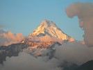
Si tu veux faire un voyage aseptisé, tu pars avec le club med à Val d'Isére . Ce n'est pas ton truc ? Vive la vie et ouvre grand tes yeux car un lever de soleil sur les annapurnas ça vaut beaucoup de discours
Bye
Kiet
qui parle de voyage aseptisé, ou de Club Med, (repoussoir suprême ??) - ces réflexions sont à côté de la plaque ... essayons de donner à nos "nouveaux voyageurs" des renseignements plus utiles ... il est peut-être bon de les rassurer, mais il est inutile d'écarter toutes les précautions élémentaires ... Pour moi, je suis le plus souvent très "cool", mais je regarde quand même où je mets les pieds ... bons voyages à tous !!!
Bonjour,
Rassure toi, altitude et vertige ne vont pas forcéement ensemble. Le tour des Annapurnas suit plusieurs vallées (logique puisqu'on en fait le tour), et les cols bien que situés en altitude ne présentent pas de vide. Pour le sac de couchage, c'est un peu embetant. Hélas les sacs coutent cher, ceci dit, un collant et plusieurs couches de vêtements, et surtout de bonnes chaussettes chaudes permettent de garder de la chaleur. Pense aussi à un petit bonnet doux, c'est bien agréable. Dans les lodges la chaleur humaine fait en général qu'il ne fait pas trop froid.
Voilà, profite bien de cette magnifique expérience et n'hésite pas à me poser d'autres questions
PS : tu pars faire le tour des annapurnas avec Juliette ?
Fred
En complement, il peut faire froid au Thoron La, et on peut rencontrer de la pluie durant le tour. Bonnet bonne paire de gant, veste imper respirante, pancho, un haut chaud. Vetement de rechange. Je confirme un bon sac de couchage.
Pour l'altitude attention on passe tres vite de 3 à 4000m apres Manang donc l'acclimation n'est pas parfaite, prevoir de rester un peu en altitude.
Je suis tres sensble au MAM et j'e n étais pas assez acclimaté on passe pas assez de temps reel en altitude en marchant tous les jours, on monte d'un coup sur 2 ou 3 jours. C'est valable si tu es sensible, ma femme n'a rien resentie.
Je suis allé plus haut que ce col sans probleme mais bien acclimataté et RAS.
attention au DIAMOX, ce n'est pas un médoc contre le mal de l'altitude mais un diurétique... le seul médoc contre le mal de l'atitude c'est de monter doucement et, dans le cas d'un mal de crane de prendre de l'aspirine (douleur & sang fluide). Si tu dors mal et que tu décide de monter plus haut pour encore dormir... tu prend des risques. Mieux vaut s'arrêter un jour (s'acclimater) et de reprendre le lendemain.
le PB avec les "groupes" c'est qu'on se sent forcé de suivre... alors que la règle du MAM c'est totalement individuel... faut donc faire le deuil du groupe pour se recentrer sur ses propres ressentis physiques.
Le Diamox n'est pas un médicament contre le MAM mais c'est le seul médicament qui peut aider en altitude. Celà premet une avancé en altitude comme un col 1 jour mais en aucun cas d'aide à l'acclimatation.
Faire un test avant car il y a des effets secondaires, picotement au bout des doigts, drole de gout quant on boit du coca.
Je me souviens plus de la posologie, 24 h avant + le jour J, à voir avec un médecin de toute facon il faut une ordonnance.
Le Diamox est conseillé par le médecin de l'ENSA ( école Nationale de Ski et d'Alpinisne à Chamonix ) spécialiste dans ce type de patologie.
Le Diamox n'est à prendre qu'en cas de maux de tête résistantà l'Aspirine,
perte d'appétit, de sommeil et s'il y a un oedème
( tu le vois vite à ton visage le matin)
En tout: 3 jours de Diamox jusqu'au col, en buvant, ne pose pas de problème
( conseil de toubib )
Prévoir de s'arrêter 2 jours à Manang pour s'acclimater...
Avant de partir, une explication précise de ton toubib est nécessaire !!
Si le MAM persiste, il faut redescendre...
Après tous ces conseils, tout se passe bien...
Bon trek!!!
Chantal
FAUX le DIAMOX aussi en prevention.
Si vous voulez des infos; allez voir vers L 'ENSA
J'ai passé un test d'ipoxie il y a quelques années avec le Dc de l' ENSA, je tiens mes d'infos de ce médecin.
Rapatriement en hélico, assurance ceci, assurance cela, garantie truc, pourquoi pas une assurance contre les coups de soleil ou la turista? Je suis entièrement d'accord avec kiet, quel est votre intérêt de partir faire un trek, avec une petite idée d'aventure et de vivre quelque chose d'extraordinaire, s'il vous faut vous entourer de l'ordinaire, de la protection totale d'un pauvre occidental qui ne peut pas sortir sans que tout soit assuré? Les riches occidentaux ne savent plus sortir sans avoir peur!
((Si vous devez avoir peur de quelque chose c'est peut-être de la petite guerre civile qui sévit là-bas. Méfiez-vous des rassemblements et manifestations qui peuvent dégénérer en combats de rues avec coups de feu. Et donnez aux Maoïstes votre dû, votre droit de passage réglementé, c'est pour la bonne cause, encouragez-les dans leur combat pour la démocratie et la chute d'un pouvoir autoritaire et sanguinaire.))
En ce qui concerne le MAM, il suffit d'écouter votre corps, de savoir vous arrêter de monter, voire de redescendre de quelques centaines de mètres en altitude si vous sentez que les maux de tête et l'appétit deviennent difficiles à gérer. Vous pourrez alors remonter plein d'ardeur le lendemain. A quoi vous sert de vous comporter en ridicules humains trop occuper de leurs petites personnes, et prêts à téléphoner (tél cellulaires par transmission sattélite pourquoi pas!) pour appeler un hélico à l'aide. Voyons un peu de retenue, sachez profiter du moment, vous qui n'êtes là-bas que de passage, pour vous en mettre plein la vue, et pour revenir dans votre monde tout sécurisé! Je n'ai rien contre les trekkeurs, bien au contraire, mais il faut faire quelquefois faire preuve de bon sens: votre assurance personnelle suffit généralement pour vous couvrir des petits bobos, mais n'oubliez quand même pas (et là je ne plaisante pas) le bob ou le chèche, ou tout autre couvre-chef, la crème solaire, et indispensable, le bonnet!
Curieux raisonnement .... un trek sur le tour des annapurnas n'a rien d'aventureux ou de particulièrement extraordinaire, du moins pas plus qu'un trek (une rando, en fait ...) sur nos montagnes "à vaches" - l'intérêt d'une assurance est le même qu'en France : ne pas avoir à subir les conséquences financières d'un pb, qui, même mineur, risque de déclencher des opérations onéreuses ... Il n'y a rien qui différencie une assurance rapatriement - frais de secours dans ce genre de circonstances que contracter une assurance auto avant de prendre la route .... Par ailleurs, les agences de Trek "sérieuses" demandent aux gens une attestation spécifique ...
Pour le reste, je suis assez d'accord : qqs précautions élémentaires vis à vis des risques liés à la guerre civile qui frappe ce malheureux pays - profiter des rencontres, aider et apprécier les népalais (mes plus beaux souvenirs ...) - et s'écouter un peu pour ne pas avoir besoin d'artifices pour passer "le col" - Mais il est déplacé de traiter de "ridicule" nos confrères en randonnées qui sont moins "aguerris" ou un peu plus anxieux ... ils ne le seront peut-être pas toujours ....
Slt Kateline,
je suis actuelement en Thailande ms j'etais au Nepal pdt 6 semanines fin 2005 debt 2006
On a fait le treck des Annapurnas, un truc de fou...
Meme pdt l'hiver qd le col du Thorung La est accessible, le treck est accessible, c'est meme mieux car en 16 jrs de treck, on a croise 10 touristes sur la 1er partie...
Pr le pass, comme on te l'a dit, le treck monte progressivement en altitude et on inclue en general une journee a manang pr l'acclimatation avt d'attaquer le col.
pr l'equipement prend l'essentiel ms de tte facon tu trouveras ton bonheur ds les boutiques de Pohkara a des prix defiants ttes concurences...
Il y a des lodges tt le long du parcours mais au niveau de la bouffe les prix montent afur et mesure que tu montes en altitude, normal, il faut l'amener la bouffe !!!
Mets toi en plein les yeux
A+
J'ai lu rapidement les réponses tout est dit, nous l'avons fait l'année dernière c'est un trek magnifique et très bien équipé tout du long, c'est même impressionnant.
Il faut bien s'acclimater ie monter lentement, faire des poses. En général tout le monde s'arrête à Manang pour la fameuse journée d'acclimatation, mais juste après à une heure de marche il y a un superbe lodge avec vue magnifique. Honnêtement à Manang tout est cher, pas acceuillant, trop touristique, seule la partie vieux village est sympa.
Par contre de mon point de vue prévoit une grosse journée pour le passage du col, ceux qui disent "facile" prend des réserves et la descente est très longue.
Part léger sac 11, 12 kg max rien ne sert de se charger et 5000 les kg sont lourd ..... prévoir gant et bonnet.
Juste en fait ce que je voulais ajouter, pense que tu auras certainement la taxe (donnation ...) maoiste à payer 100Rps par jour de trek, par contre tu peux leur dire ce que tu veux en nombre de jours ... Ils sont en général au début du trek vers le 3 ou 4ième jour je ne me rappelle plus et vers Punhill de l'autre côté. Ils sont en général courtois, tu payes tu passes, tu payes pas tu ne passes pas.
L'avantage en ce moment c'est qu'il n'y a pas trop de monde, enfin bref c'est le moment pour y aller.
Je me presente yves 47 ans depuis plusieurs mois lecteur assidus des discussions "nepal" j intervient directement pour la 1er fois. je prepare depuis de…
Namasté Je connais bien le Népal mais je désire faire le tour des Annapurnas sans guide et sans porteur du 20 avril au 09 mai 2009. Je voudrais savoir ou nous…
Je serai au Népal le 19 avril 2013 pour 3 semaines. J'organise un trek (départ le 21 de Katmandou) de 16 jours avec une agence locale recommandée par des…
Et bonne année, je pars 3 mois (mars-mai) pour le népal, et projettes de faire le tour des annapurnas (3 semaines) en avril. est-ce que certains d'entre vous…
Je pars avec un groupe pour le tour des Annapurnas. Est-ce que parmi vous quelqu'un en revient et peut me donner des infos sur l'état actuel du Thorong la:…
Hi,
Since I can't take on long treks, I'd love to know if there are any nice hikes around Pokhara—or maybe in another region of Nepal. Day hikes or two-day trips would be perfect.
Thanks in advance for your tips!
Hi everyone,
I’m leaving on Monday, August 3rd for my very first long-distance trek: the GR223 from Coutances to Mont Saint-Michel, over 6-7 days (~11-14 miles/day), solo.
I’m looking for tips from people who know this section well (Coutances → Regnéville-sur-Mer → Hauteville-sur-Mer → Bréhal → Granville → Genêts → bay crossing):
Budget-friendly accommodations: I’m struggling to find affordable stopover lodgings (a lot of what I find online are expensive vacation rentals, not really suited for a solo hiker). If you have any great spots (hostels, hiker-friendly B&Bs, nice campgrounds), I’d love to hear them!
Bay crossing: Any feedback on guides/providers leaving from Genêts for the final crossing?
General tips for a first long-distance trek: What you wish you’d known before your first time, pitfalls to avoid, etc.
Hi,
We’re planning to do the 4-day trek from Mestia to Ushguli without an agency. The descriptions mention that there are accommodations at each stop, but we can’t find any details about them. Has anyone got info or feedback on this route?
I'm developing a free and open-source web app for planning walking and cycling trips (and even car trips). You can create a route by clicking directly on the map to add waypoints, and it can consist of multiple stages. The app provides tools to edit the stages and the overall route, and to display useful information (distances, altitudes, and elevation changes). A relief profile can be shown as a graph for a specific stage or the entire route.
Once the route is ready, it can be exported as a GPX file, which can then be used with a GPS or a mobile navigation app.
The app is built in JavaScript and runs entirely in the web browser. It uses the Leaflet library and several OpenStreetMap-based services. Initially developed for my personal needs (I enjoy hiking and cycle touring), I’d be happy to share it with anyone who might find it useful. It’s free to use, doesn’t require an account, and the source code is available.
New to this forum, I’m planning a pretty big project for 2028.
I’m heading to Nepal to do a trek from Kathmandu all the way to Everest Base Camp (a cool 5,300 m 😄).
This trek is a bit special because even though I’ll be part of a group, I’m going solo (so far, no problem—I’m used to it). But it’s my first real trek, and it’s also a humanitarian one: once I reach base camp, I’ll stay an extra week to help clean up the waste left by tens of thousands of climbers! Since I’m originally from South America, from two countries that share the Andes, I have a deep respect for mountains—they fascinate me. So Everest… it’s kind of the trip of a lifetime!
So, a little question for those who’ve done treks to Everest before… any tips for good mental preparation (I’m already working on the physical side)?
We're planning to trek in Peru and Bolivia and would love to find some local agencies.
If you know any, could you share details on prices and, of course, the names of the agencies?
Which trek would you recommend?
Elocine
I'm heading out on a fully self-sufficient trek in Morocco (10 days) from Imilchil to Aghbalou.
Can I find screw-on gas canisters (Coleman, Primus) in Marrakech (any addresses?) or in villages between Imilchil and Aghbalou?
If not, are Butagaz canisters for camping gas (small 230g size) available?
Thanks in advance for your tips!
Hello, I’d like to embark on a little trip in my home country, Switzerland. I’ll start walking from La Cure, heading toward Le Noirmont first, then I’ll improvise my route—but it’ll probably follow the French border... at least as far as Lac de Joux.
I’ll decide day by day how much farther to go after that. My goal is to stay in nature as much as possible, wander around for as long as I can, and restock food in villages or towns along the way.
I’m thinking of mostly camping, but we’ll see if I end up in a hotel or another campsite depending on my route.
I’d love to reach La Chaux-de-Fonds on foot... maybe even Delémont.
The whole thing should take about a week, give or take.
I’ll be bringing my dog, and I’m preparing for this as soon as I’m ready.
Any tips to make sure everything goes smoothly for us? Things I should know—or avoid? What about shepherds with their flocks of sheep? And isn’t hunting season open right now?
I’m not sure if what I’m planning is even doable, which is why I’m asking around.
This’ll be my first time doing something like this—wandering in nature *and* with a dog. I’m really excited for this adventure... and I need it. Thanks!
We’re really keen on ecosystems and want to hike in "natural" ancient forests—not planted woods or areas heavily degraded by human activity. Travel guides (like Lonely Planet) don’t provide much info on this. Could you point us to the most interesting spots?
Thanks in advance for your tips.
We wish you happy holidays and a fantastic 2026, full of discoveries!
Claire and Albert
Hi, this might not be the right section, but I’d like to know if it’s possible to start mountaineering with another person without necessarily hiring a guide. We’ve done quite a bit of hiking but not mountaineering—we’ll just do a half-day glacier course. After that, we were thinking of starting with La Grande Motte and the Pointe de la Traversière, which were recommended to us. Honestly, for things like roping up and knots, I’ll learn at home with lots of videos and a book.
I’d love to know if anyone has done treks in the Rwenzori Mountains and how much it costs on average, what the infrastructure is like, the landscapes, and safety in the area. Thanks so much! I’m really looking forward to your replies.
We’re leaving in 9 days for a two-week trip to Madeira, mainly to hike.
From my research, I’ve found that since last year, access to most trails—and systematically for the most popular ones—is now paid. You have to pay an access fee of 4.50 € per person per classified hike in 2026, and even 10.50 € for the most iconic hike: Pico Arieiro to Pico Ruivo. When paying, you also have to choose a day and a 30-minute time slot for your start time. Of course, this reservation is neither changeable nor refundable, even if the weather that day is terrible.
Personally, given the massive influx of tourists to the island in recent years, I don’t mind paying a fee to help maintain the trails. Similarly, setting a limit on the number of people who can hike them per day is certainly preferable to preserve this priceless heritage.
However, what’s much less fair is that in reality, most of the available spots are reserved: 1/ for Madeira residents (which is normal); 2/ for "economic operators" (meaning local tour operators). For example, if you’re a non-resident (independent tourist), no booking is possible for the Pico Arieiro hike for an early morning start before September! So, unfortunately, we’ll have to skip this hike.
It’s the same issue for Ponta de São Lourenço, the 25 Fontes, Pico Ruivo... in short, all the most popular hikes. Oh well, we’ll skip those too!
So my question is: which hikes do you recommend where we won’t face the huge crowds that the others get? And where we can book the day before for the next day, taking the weather into account?
Finally, a quick accommodation question: we’ve booked the first week in Funchal, but I haven’t decided yet for the second week. Do you have any advice on where to stay in the south or north, preferably avoiding overly concrete-heavy and touristy spots?
I’m reposting about the logistics for Samaria Gorge.
I’d love to get recent info, especially about whether it’s possible to park my car in Omalos, do the hike, and then catch a bus back to my vehicle.
In theory, it’s doable, but when you check the KTEL website, there aren’t any feasible schedules listed. If anyone has recently organized this with reliable, verified details, I’d really appreciate it. Thanks in advance!
Hi there,
We’re flying from Montreal to Lyon this August to go hiking in the French Alps. We’ve rented a car and will be staying at campgrounds. We’re planning to do day hikes and want to stay a few days in one spot, do a few hikes, then move on to our next camping spot. Could you share your favorite spots or any recommendations for places to spend a few days with great hikes?
A few details:
We arrive in early August and leave in early September.
We’re looking for day hikes (or shorter), moderate difficulty, with a cumulative elevation gain of no more than 1000m, and of course, beautiful scenery!
We’d prefer not to drive too much—maybe it’s best not to head too far south and deal with unnecessary heat?
Along the same lines, if you know of any great campgrounds where we can start our hike directly without needing the car, we’d love to hear your suggestions!
Hi there,
I’m planning to go hiking on this island and would like to know the best time to do it. I visited for a few days in November 2018—not for hiking but just to explore—and the weather wasn’t great, especially in the mountains. So, is a star-shaped itinerary doable if I rent a car and maybe use two different accommodations?
I’m not planning to join an organized group—just traveling with one other person and organizing things ourselves—unless you’d recommend a local agency or guide. Finally, even though I’ll be getting maps, a topo guide, and a GPS, I’d really appreciate your top hiking recommendations.
Thanks so much for your tips!
I’m planning to do the Mercantour crossing following the Randoxygène route in mid-July.
I’m used to hiking in the mountains, but I sometimes get vertigo, for example on ridges with drops on both sides. I wanted to check if there are any T4 or T3-T4 sections and find out if there are any very exposed passages—and if so, where—so I can plan an alternative route.
Can anyone give me some info on this?
Thanks!
I’m planning a trip around Cap Corse and the AGRIATES in 2026, from May 8th to 15th (there are still 2 spots left, by the way! Just DM me if you're interested).
I’d love to know which hikes are worth prioritizing in the AGRIATES. We’ll be staying in SALECCIA for two days as our base—what should we focus on from there?
A round trip to IGNHU beach? Any other suggestions?
For Ostricano, I think it’s too far for a round trip...
Thanks for your tips!
Have a great day,
Anie, Toulouse
I’d like to get some info about the GR10 Pyrenees traverse. I need help planning the daily stages and accommodations—my wife isn’t an experienced hiker but walks a lot, so I’d like to schedule shorter walking days and thus a longer overall trip in terms of number of days.
Could anyone give me some help and advice?
Best regards,
Hi there, I’m planning the Annapurna Circuit for March 2027 and I’m looking for a local agency with a local guide—preferably French-speaking—to arrange this trek for us. Any suggestions? Thanks
Hello!
We’re spending a few days in Toraja country at the end of May. We’d love to do a day trek—taking our time—on a route that’s stunning in terms of scenery, but not a level 5 in difficulty!
Any suggestions you can share, please?
Thanks in advance
I’d like to do the Mare a Mare Sud in May over 4 days. I’ve found quite a few places to stay along the route, but I’m stuck on the start and finish.
I’ll be arriving by plane on Sunday evening and would like to start pretty early on Monday morning. Ideally, accommodation right at the trailhead (Alzu di Gallina) would be amazing, but I can’t find anything. Any tips?
Also, for the transfer from Figari Airport to Porto Vecchio or Alzu di Gallina?
At the end, I’d like to pick up a rental car—any advice on that too?
I’m traveling solo by plane to Catania in May and plan to hike the northern side of Etna, starting from Linguaglossa where I’ll arrive by bus. After that, I’d love some info on how to get up to Piano Provenzana (shuttles or hitchhiking), since it seems there’s no public transport except in the summer. Can you sleep there in a free or cheap refuge, or camp? And how far up can you go without having to hire a guide? Thanks in advance. Bernard.
Hi everyone,
I’m heading to Morocco in August and we’ll start with a stop in Chefchaouen (we’re driving).
My question: can anyone suggest a 5-to-7-day loop hiking route from Chefchaouen in Talassemtane Park, ideally passing by the God’s Bridge? Or a paper guidebook that covers a few options?
We prefer wild camping and guesthouses.
Thanks in advance
Hi there, for those who’ve been recently—is it possible to find other solo travelers in March on the island to share transport or room costs? It doesn’t seem easy to travel on a budget.
If you have any recommendations for simple lodgings or places with dorms, I’d love to hear them.
For those who’ve done multi-day treks while moving around: do you need to bring your own sleeping bag? I’d love to hear about itineraries you’ve done without a guide, just with a map and GPS.
Thanks, and have a great day!
Hi everyone!
We’re planning a 15-day road trip to Scotland this summer, specifically to explore and hike on Lewis and Harris—places we’ve never been before. We’ve visited other islands on previous road trips in Scotland (we usually go in April for a week). This would be our first time in Scotland in the summer and for 15 days. We’re looking at late August to early September.
I’m currently drafting the itinerary. We’d be crossing from Ullapool and were thinking of spending 3 nights on Harris and 4 nights on Lewis.
Does that sound balanced to you? Is it better to keep the same accommodation on Harris and the same on Lewis to explore the area? I’d love to hear about any past experiences you’ve had on these islands.
Thanks!
Hi there, I’m trying to leave for 15 days very soon to São Vicente. I’m either looking to join an agency or figure things out on my own to go hiking on one of these islands or both. From what I’ve seen, it’s not easy to organize with local transport, so it gets expensive. Can I use the services of a small local agency? I’m looking for the simplest way to hike for several days. Also, how do you get from São Vicente to São Nicolau? Thanks in advance and have a great day!
Aichatou
I’ve been wanting to do this for several years, and this year’s the one. Next September, I’ll be trekking in Tusheti (Georgia), from Omalo to Shatili.
Of course, I won’t be renting a vehicle that’d just sit unused. No problem getting to Pshaveli, but from there to Omalo, it’s a dirt road (still the case?)
There must be some form of public transport since there are so many guesthouses, and not all travelers come in a 4x4.
If any of you have been to Omalo, could you confirm that these shared transports exist and how often they run?