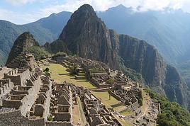
Je souhaitai juste savoir s'il était possible encore de monter au Machu Picchu à pied ?
J'ai entendu et lu différente versions donc je souhaitais avoir votre avis pour ceux d'entre vous qui y sont allé ou qui ont des renseignement sur cela !
Se rendre au MP à pied: tu parles du trek de l'Inca? du trajet entre Aguas Calientes et le site? de marcher le long de la voie ferrée depuis Santa Maria? de la montée sur le sommet appelé "Macchu Pichu" depuis le site? du trek de Choqueqirao au site? 🤪
Se rendre au MP à pied : tu parles du trek de l'Inca? du trajet entre Aguas Calientes et le site ? de marcher le long de la voie ferrée depuis Santa Maria ? de la montée sur le sommet appelé "Macchu Pichu" depuis le site ? du trek de Choqueqirao au site ?
Et quelle que soit la ou les questions que tu te poses parmi celles-ci,
on (= ceux d'entre Nous qui y sont allé ou qui ont des renseignements sur cela) a déjà fourni moult fois la réponse... 😇
Alors, un petit effort ! La fonction RECHERCHER du forum,
avec les indications suivantes :
destination : Pérou
mots-clés : machu pichu macchu picchu
rubrique : Voyager à pied
(même avec l'option "titre seulement", tu devrais trouver un paquet de discussions portant dessus !!)
"Nous méritons toutes nos rencontres ; elles sont accordées à notre destin, et ont une signification qu'il nous appartient de déchiffrer." Mauriac
Monter cela veut dire aller du bas vers le haut donc dans ce cas c'est d'aller de aguas calientes au site du Machu Picchu:
Oui c'est possible. C'est rude et long, mais c'est faisable. Ceci dit, il est preferable de prendre le bus le matin de bonne heure pour arrivée à 6 heures, heure d'ouverture du site. Tu seras en pleine forme pour parcourir le site, escalader le huayna Picchu, si tu le desires.
Pour aller de Cuzco a aguas calientes c'est "descendre " qui est le plus adapté etant donné les altitudes respectives
Je trouve aussi que t'as question n'est pas très claire, montée à Macchu depuis Aguas, aller a Aguas a pied, Treck de l'inca... pas mal d'interprétations possibles. Précise svp, je suis aller à Aguas á pied et je suis monté d'Aguas au Macchu à pied, tous cela il y a environ 3 mois. Par ailleurs je suis plutôt d'accord avec Wapiti et je comprend son post, pénible de redonner des infos déjà données moults fois sur le forum et qui donc existent déjà. Il y en a qui ne font pas l'effort de chercher, et donc cela revient à demander aux autres de faire l'effort de repondre, un peu facile. Mais bon, tu mets que tu as lu différents avis, donc j'en conclu que ce n'est pas ton cas, que tu as cherché et que tu n'as pas trouvé ta réponse. Dis moi ce que tu veux savoir exactement !
Un voyage ne se calcule pas en terme d'heures d'avion... on peut aller bien souvent plus loin avec une bonne paire de chaussures.
Tout d'abord je ne force personne à me répondre !
Comme tu l'a dit, j'ai déjà effectué des recherches et je n'ai pas eu de réponses concrète !!!
Je souhaite simplement savoir si à partir de Cuzco, je peux allé jusqu'au Machu Picchu à pied entièrement ? voilà ma question, je en peux pas faire plus clair !
La première réponse qui à été apporté m'a semblé precise, j'en remercie l'auteur.
Les gens était plus cool y'a pas si longtemps que ça sur ce site !!!
Je comprend pas bien quel plaisir vous avez a répondre ce genre de choses !!!😠 Autant ne rien répondre, personne ne vous force à le faire !!!
Plus cool? Je ne comprends pas et ne vois pas ce qu'il y a de pas cool dans ces messages. Pour info, je suis sur VF depuis plus de 4 ans et je prends des infos autant que j'essaie d'en donner. Et il est vrai que pas mal de question reviennent souvent, essayons donc de faire un petit effort de recherche précis avant de reposer une question soit imprécise, soit déjà répondue.... Cela permet de garder tout l'intérêt de ce super forum.
En l'occurence demander si on peut faire Cuzco - machu picchu à pied c'est vraiment que l'on a pas regardé du tout le sujet. Donc question comique = réponse comique. Tant que l'on est sur le registre de l'humour c'est plutot plaisant.
Enfin, un message qui commence par bonjour, finit par merci et au revoir, c'est pas mal non plus.
Bonjour Jeremw ....
S'il te plait prends la vie d'un côté plus zen ...avec un peu plus de modestie et
d'humour 😉
C'est vrai que ta question n'est pas claire .... affine pour avoir des réponses
positives ... Merci
Au revoir et bonne route !!
On se défend entre Toulousain à ce que je vois !😉
Ok, désolé pour les messages d'avant, j'ai vite pris la mouche !!! Mais en même temps c'est pas très cool de répondre comme ça no plus !!!
Sincèrement je ne pensait pas ma question si vague mais bon apparement elle l'est !!!
Bref, j'ai eu des réponses qui me convienne qd meme donc je n'insite pas!
Merci à ceux qui ont répondu et à la prochaine... On se rencontrera pi etre sur le chemin du Machu Picchu !
1 Cusco/Macchu Pichu, rien de particulièrement prevus á pied a ma connaissance... mais tout peut se faire à pied en voyage, avec du temps et de la motivation. En tappotant "mappa valle sagrado" dans une recherche google image tu tomberaas sur plusieurs cartes schematiques pour te repérer, dont celle-ci : http://www.cuscoperu.com.pe/espanol/qosqo/imagenes/mp5g_valle.gif
Si tu as le temps de t'organiser un treck de plusieurs jours, ma fois pourquoi pas, c'est faisable et la region est belle. Tu pourras visiter quelques sites de la vallée sacrée en route. pour cela il te faudra d'abord rejoindre Ollantaytambo.
Pour cela tu peux passer par les sites de Moray et de las Salinas, cela vaut le coup (j'ai fais Moray/Urubamba a pied en passant par les Salinas, tout nickel !). Sinon Ollantaytambo c'est accessible en combi depuis Cusco pour une bouchée de pain.
2 Depuis Ollantaytambo, pareil, c'est du testé :
Tu as le treck de l'Inca qui commence au "km 82" (pas fait) et pour lequel tu dois obligatoirement passer par une agence, c'est interdit sans guide.
Sinon tu peux rejoindre Aguas Calientes à pied oui. Depuis Ollantaytambo, tu longes la piste vers l'aval de la vallée de l'Urubamba jusqu'au km 82 (fin de la piste) ou tu prends un combi jusqu'au km 82... Toujours pour une bouchée de pain (ce que nous avons fait). Puis tu longes la voie ferrée jusqu'à Aguas Calientes, soit environ 30km de marche assez chiante car sur le balast. Tu seras heureux d'arriver ! Ne pas trop trainer en route pour arriver avant la nuit et prevoir des lampes au cas où. Faire attention aux trains... mais ils sont lent (vitesse max 35km/h) et en faisant gaffe y'a pas de soucis, on les entends de loin et cela laisse le temps de se pousser. Faire gaffe aux tunnels par contre. Il y en a un assez long qui se contourne par la gauche (de toute manière pas trop le choix). Au debut de la vallée il y a pleins de petits chemins qui permettent d'eviter de marcher sur la voie ferrée, tu passes a coté de site incas en cours de fouille, ou dans la vegetation... bref, les 6 premiers km on s'est dit super, c'est un itineraire magnifique. Apres 6km environ, le chemin est moins evident et tu en vois un beau en face sur la rive gauche de l'Urubamba, qui passe en plus vers des sites incas qui ont l'air superbe. On decide de traverser, on trouve un petit escalier incas bien abrupte qui conduit vers un pont... et juste avant le pont on tombe sur un poste de gardes du parc. ils nous stoppent. Super sympa, très polis et tout et tout, ils commence par nous serrer la main... mais nous sommes dans l'illegalité ! Nous sommes en plein parc et il est interdit de se balader comme ca tout seul, il faut un billet special et être accompagné d'un guide. Vous l'aurez compris, il faut passer par une agence, ce n'est pas le treck de l'inca mais un itineraire alternatif, obligatoirement payant lui aussi... et oui tout est fait pour te faire payer dans le coin ! Petite frayeur, on se voyait deja devoir faire demi tour. Mais en discutant (quand même bien de parler espagnol !) On lui arrache du bout des lèvres qu'effectivement on peu continuer mais uniquement sur la voie ferrée et à nos risques et perils. Et interdit de camper dans le parc, ils nous demandent si nous avons du matos de camping... heureusement il est resté a Cusco, ouf, on peut continuer sur le balast, et comme je l'ai dis tu es heureux d'arriver a Aguas Calientes ! Pour le retour nous avons pris le train... pas envie de se retapper 30 bornes de balast dans l'autre sens, surtout qu'on avait prevu une journée de rando juste après entre Moray et Urubamba. Y aller à pied depuis Ollantaytambo nous a deja fait economiser pas mal d'argent + en combi jusqu'a Ollantaytambo (en 2 jours et en visitant Pisac et Ollantaytambo au passage bien sûr !)
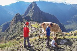
3 Enfin Aguas Calientes a Macchu pichu à pied : aucun soucis, c'est prevu ! Suivre la piste vers Macchu Pichu (vers l'aval... de toute manière guère le choix) (20 minutes env), un petit chemin qui recoupe la route d'accés à plusieurs reprises part apres le pont en aval d'aguas calientes, juste au debut de la montée. Il est bien indiqué par un panneau. La montée est soutenue, la plupart du temps c'est plus un escalier aménagé en pierre. Compte environ 1h/1h30 pour la montée suivant ta forme, ce dans une forêt de nuage bien humide et très chouette. Nous on a fait l'ensemble du trajet en 1h... mais il ne faut pas s'y fier on est des bourrins. compte 1h30 voir 2h si tu y vas tranquille au total depuis Aguas Calientes. L'aller retour à pied te fait quand même économiser 14 USD (7 montée/7 descente) de bus. Vu comme tu raques au total pour le Macchu Pichu, tu seras bien content d'avoir gagné au moins cela !
Voila pour ta reponse. Sinon il existe un autre itineraire alternatif pour eviter le train. Il passe par le nord depuis Ollantaytambo, c'est plus long, il y a pas mal de bus mais ca marche bien apparement. il est même proposé par des agences maintenant. Je ne m'étends pas dessus, je ne l'ai pas pratiqué et il existe des post la dessus sur cve même forum.
Bonne preparation et bonne marche !
Un voyage ne se calcule pas en terme d'heures d'avion... on peut aller bien souvent plus loin avec une bonne paire de chaussures.
En fait, ce qu'il y a eu de désagréable dans ta réaction, c'est que tu as répondu assez violemment à celui qui te demandait de faire des recherches, mais sans répondre en même temps à ceux et celles qui voulaient t'aider et te demandaient d'être simplement plus précis...avant de critiquer les gens du forum en son ensemble...
Bref...ce n'est pas si grave, et je te souhaite de belles randonnées, mais pense à répondre à ceux qui veulent t'aider aussi...
bonjour
oui tu peux faire aguas caleintes -machu picchu ... c'est assez facile ne fait
je l'ai fait en 1h15... mais pas beaucou de pause... ca monte pas mal, mais bon... prends-toi 2h00 avec plsuieurs petites pause et le tour est joué
ca vaut la peine de le faire... le bus est chere 50 soles et tu manque la belle vue!
belle hotel pas trop chere avec les meilleurs lit: sur la plaza en hauteur... tu dois modifier les prix... j'ai payé 18 soles... le nom de l'hotel est : hostal bromelias
A partir d'Aqua calientes, il est effectivement possible de monter à pied au Machu Pichu. Le chemin est raide et le paysage pas spécialement très intéressant. A la limite, il est préférable de prendre la navette pour monter et descendre à pied.
Bon voyage
Bonjour,
Je part aussi au Pérou en Aout et je souhaite vraiment aller au Machu Picchu, sans me ruiner.
Si je fais un petit résumé :
La solution est de faire Cuzco Ollantaytambo en bus, puis Ollamtaytambo aguas calientes en train, de la tu marches jusqu'au site de Machu picchu?
Combien cela coute en tout ?
ESt ce possible de la de rejoindre la route des incas à partir km 104, sans passer par une agance?
Merci
J'apporte mon expérience à ce post pour ceux que cela peut intéresser :
Pour aller de aguas calientes a machu picchu, je ne dirais pas que c'est raide ! On commence par marcher 20 minutes le long de la rivière depuis le centre de la ville, puis au pont les billets sont contrôlés une première fois. On prend le sentier à droite (alors que les bus tournent à gauche pour prendre les lacets).
À partir de ce moment j'ai pris 1h exactement jusqu'à l'endroit où arrivent les bus, en prenant plusieurs pauses et en suant pas mal, mais sachant que je marche peu, je suis pas sportif et que je me traîne une bonne trentaine de kilos en trop :) le chemin est très agréable contrairement à ce qui a été dit avant, sensation d'être en pleine jungle puis plusieurs points de vue super sympa sur la vallée !
Une fois dans le machu picchu ca va mais c'est pour le wayna picchu que ca se gâte ! Vous avez le choix d'acheter les billets pour le machu picchu seul, ou rajouter l'un des deux : wayna picchu ou machu picchu montaña.
Le wayna picchu c'est 300m de dénivelé supplémentaires très raides, on fini quasiment à 4 pattes sur des escaliers à la verticale ! Je l'ai fait en 1h30 en ayant perdu 3l de transpiration mais ca se fait carrément ! (Et encore une fois je ne suis pas sportif !!)
Détails pratiques divers :
- au moment de notre visite la regle était de 3 passages à l'entrée du site sur la meme journee, pour permettre d'aller au restaurant (hors de prix) ou au bar (pareil) ou aux toilettes (1 sol).
- prenez de l'eau avant de monter et un sac de 20l maxi
- en théorie pas le droit de manger sur le site, si vous amenez le picnic comme nous ayez l'intelligence de ne pas le faire devant un garde et de récupérer tous les déchets en résultant.
- il y a de l'eau en vente au point de passage du wayna picchu et celui du pont inca, 5 soles la bouteille de 600ml soit une fortune pour le coin (prix d'une bouteille de 2,5l)
- nous sommes arrivés vers 9h du matin, tres bien, et sommes restés jusqu'à 16h30, sachant qu'après 15h/15h30 le gros du monde est parti.
- a priori tout le monde pense avoir inventé l'eau chaude en se pointant avec le premier bus, cohue et file d'attente assurée, je n'ai pas l'impression que ce soit le bon plan ! A pied nous étions une dizaine sur le trajet à tout casser, tranquille !
- si vous voulez voir le wayna picchu (en fait surtout si vous voulez profiter de la vue depuis le wayna picchu - c'est le seul intérêt), réservez à l'avance
- si on a plusieurs cb Visa et MasterCard il est facile de réserver en ligne sur le site officiel, personnellement ça a marché direct, il faut être concentré et comprendre leur fonctionnement : on réserve pour obtenir un code qu'on utilise ensuite pour valider le paiement et recevoir le billet. Ca m'a pris 10 minutes.
Je crois avoir résumé notre expérience qui date du 1er mai 2016, n'hésitez pas si besoin de précisions :)
Dans 3 semaines je serais au pérou et je prévois avec des amis de me rendre au Machu Picchu. Ayant entendu parler d'alternatives moins chères que la route des…
Le ministère des affaires étrangères vient de publier avant-hier un communiqué, déconseillant aux randonneurs d'aller aux ruines du Choquequirao, pour cause…
Hi,
We’re planning to do the 4-day trek from Mestia to Ushguli without an agency. The descriptions mention that there are accommodations at each stop, but we can’t find any details about them. Has anyone got info or feedback on this route?
We're planning to trek in Peru and Bolivia and would love to find some local agencies.
If you know any, could you share details on prices and, of course, the names of the agencies?
Which trek would you recommend?
Elocine
I'm heading out on a fully self-sufficient trek in Morocco (10 days) from Imilchil to Aghbalou.
Can I find screw-on gas canisters (Coleman, Primus) in Marrakech (any addresses?) or in villages between Imilchil and Aghbalou?
If not, are Butagaz canisters for camping gas (small 230g size) available?
Thanks in advance for your tips!
Hello, I’d like to embark on a little trip in my home country, Switzerland. I’ll start walking from La Cure, heading toward Le Noirmont first, then I’ll improvise my route—but it’ll probably follow the French border... at least as far as Lac de Joux.
I’ll decide day by day how much farther to go after that. My goal is to stay in nature as much as possible, wander around for as long as I can, and restock food in villages or towns along the way.
I’m thinking of mostly camping, but we’ll see if I end up in a hotel or another campsite depending on my route.
I’d love to reach La Chaux-de-Fonds on foot... maybe even Delémont.
The whole thing should take about a week, give or take.
I’ll be bringing my dog, and I’m preparing for this as soon as I’m ready.
Any tips to make sure everything goes smoothly for us? Things I should know—or avoid? What about shepherds with their flocks of sheep? And isn’t hunting season open right now?
I’m not sure if what I’m planning is even doable, which is why I’m asking around.
This’ll be my first time doing something like this—wandering in nature *and* with a dog. I’m really excited for this adventure... and I need it. Thanks!
We’re really keen on ecosystems and want to hike in "natural" ancient forests—not planted woods or areas heavily degraded by human activity. Travel guides (like Lonely Planet) don’t provide much info on this. Could you point us to the most interesting spots?
Thanks in advance for your tips.
We wish you happy holidays and a fantastic 2026, full of discoveries!
Claire and Albert
Hi, this might not be the right section, but I’d like to know if it’s possible to start mountaineering with another person without necessarily hiring a guide. We’ve done quite a bit of hiking but not mountaineering—we’ll just do a half-day glacier course. After that, we were thinking of starting with La Grande Motte and the Pointe de la Traversière, which were recommended to us. Honestly, for things like roping up and knots, I’ll learn at home with lots of videos and a book.
I’d love to know if anyone has done treks in the Rwenzori Mountains and how much it costs on average, what the infrastructure is like, the landscapes, and safety in the area. Thanks so much! I’m really looking forward to your replies.
We’re leaving in 9 days for a two-week trip to Madeira, mainly to hike.
From my research, I’ve found that since last year, access to most trails—and systematically for the most popular ones—is now paid. You have to pay an access fee of 4.50 € per person per classified hike in 2026, and even 10.50 € for the most iconic hike: Pico Arieiro to Pico Ruivo. When paying, you also have to choose a day and a 30-minute time slot for your start time. Of course, this reservation is neither changeable nor refundable, even if the weather that day is terrible.
Personally, given the massive influx of tourists to the island in recent years, I don’t mind paying a fee to help maintain the trails. Similarly, setting a limit on the number of people who can hike them per day is certainly preferable to preserve this priceless heritage.
However, what’s much less fair is that in reality, most of the available spots are reserved: 1/ for Madeira residents (which is normal); 2/ for "economic operators" (meaning local tour operators). For example, if you’re a non-resident (independent tourist), no booking is possible for the Pico Arieiro hike for an early morning start before September! So, unfortunately, we’ll have to skip this hike.
It’s the same issue for Ponta de São Lourenço, the 25 Fontes, Pico Ruivo... in short, all the most popular hikes. Oh well, we’ll skip those too!
So my question is: which hikes do you recommend where we won’t face the huge crowds that the others get? And where we can book the day before for the next day, taking the weather into account?
Finally, a quick accommodation question: we’ve booked the first week in Funchal, but I haven’t decided yet for the second week. Do you have any advice on where to stay in the south or north, preferably avoiding overly concrete-heavy and touristy spots?
I’m reposting about the logistics for Samaria Gorge.
I’d love to get recent info, especially about whether it’s possible to park my car in Omalos, do the hike, and then catch a bus back to my vehicle.
In theory, it’s doable, but when you check the KTEL website, there aren’t any feasible schedules listed. If anyone has recently organized this with reliable, verified details, I’d really appreciate it. Thanks in advance!
Hi there,
We’re flying from Montreal to Lyon this August to go hiking in the French Alps. We’ve rented a car and will be staying at campgrounds. We’re planning to do day hikes and want to stay a few days in one spot, do a few hikes, then move on to our next camping spot. Could you share your favorite spots or any recommendations for places to spend a few days with great hikes?
A few details:
We arrive in early August and leave in early September.
We’re looking for day hikes (or shorter), moderate difficulty, with a cumulative elevation gain of no more than 1000m, and of course, beautiful scenery!
We’d prefer not to drive too much—maybe it’s best not to head too far south and deal with unnecessary heat?
Along the same lines, if you know of any great campgrounds where we can start our hike directly without needing the car, we’d love to hear your suggestions!
Hi there,
I’m planning to go hiking on this island and would like to know the best time to do it. I visited for a few days in November 2018—not for hiking but just to explore—and the weather wasn’t great, especially in the mountains. So, is a star-shaped itinerary doable if I rent a car and maybe use two different accommodations?
I’m not planning to join an organized group—just traveling with one other person and organizing things ourselves—unless you’d recommend a local agency or guide. Finally, even though I’ll be getting maps, a topo guide, and a GPS, I’d really appreciate your top hiking recommendations.
Thanks so much for your tips!
I’m planning to do the Mercantour crossing following the Randoxygène route in mid-July.
I’m used to hiking in the mountains, but I sometimes get vertigo, for example on ridges with drops on both sides. I wanted to check if there are any T4 or T3-T4 sections and find out if there are any very exposed passages—and if so, where—so I can plan an alternative route.
Can anyone give me some info on this?
Thanks!
I’m planning a trip around Cap Corse and the AGRIATES in 2026, from May 8th to 15th (there are still 2 spots left, by the way! Just DM me if you're interested).
I’d love to know which hikes are worth prioritizing in the AGRIATES. We’ll be staying in SALECCIA for two days as our base—what should we focus on from there?
A round trip to IGNHU beach? Any other suggestions?
For Ostricano, I think it’s too far for a round trip...
Thanks for your tips!
Have a great day,
Anie, Toulouse
I’d like to get some info about the GR10 Pyrenees traverse. I need help planning the daily stages and accommodations—my wife isn’t an experienced hiker but walks a lot, so I’d like to schedule shorter walking days and thus a longer overall trip in terms of number of days.
Could anyone give me some help and advice?
Best regards,
New to this forum, I’m planning a pretty big project for 2028.
I’m heading to Nepal to do a trek from Kathmandu all the way to Everest Base Camp (a cool 5,300 m 😄).
This trek is a bit special because even though I’ll be part of a group, I’m going solo (so far, no problem—I’m used to it). But it’s my first real trek, and it’s also a humanitarian one: once I reach base camp, I’ll stay an extra week to help clean up the waste left by tens of thousands of climbers! Since I’m originally from South America, from two countries that share the Andes, I have a deep respect for mountains—they fascinate me. So Everest… it’s kind of the trip of a lifetime!
So, a little question for those who’ve done treks to Everest before… any tips for good mental preparation (I’m already working on the physical side)?
Hi there, I’m planning the Annapurna Circuit for March 2027 and I’m looking for a local agency with a local guide—preferably French-speaking—to arrange this trek for us. Any suggestions? Thanks
Hello!
We’re spending a few days in Toraja country at the end of May. We’d love to do a day trek—taking our time—on a route that’s stunning in terms of scenery, but not a level 5 in difficulty!
Any suggestions you can share, please?
Thanks in advance
I’d like to do the Mare a Mare Sud in May over 4 days. I’ve found quite a few places to stay along the route, but I’m stuck on the start and finish.
I’ll be arriving by plane on Sunday evening and would like to start pretty early on Monday morning. Ideally, accommodation right at the trailhead (Alzu di Gallina) would be amazing, but I can’t find anything. Any tips?
Also, for the transfer from Figari Airport to Porto Vecchio or Alzu di Gallina?
At the end, I’d like to pick up a rental car—any advice on that too?
I’m traveling solo by plane to Catania in May and plan to hike the northern side of Etna, starting from Linguaglossa where I’ll arrive by bus. After that, I’d love some info on how to get up to Piano Provenzana (shuttles or hitchhiking), since it seems there’s no public transport except in the summer. Can you sleep there in a free or cheap refuge, or camp? And how far up can you go without having to hire a guide? Thanks in advance. Bernard.
Hi everyone,
I’m heading to Morocco in August and we’ll start with a stop in Chefchaouen (we’re driving).
My question: can anyone suggest a 5-to-7-day loop hiking route from Chefchaouen in Talassemtane Park, ideally passing by the God’s Bridge? Or a paper guidebook that covers a few options?
We prefer wild camping and guesthouses.
Thanks in advance
Hi there, for those who’ve been recently—is it possible to find other solo travelers in March on the island to share transport or room costs? It doesn’t seem easy to travel on a budget.
If you have any recommendations for simple lodgings or places with dorms, I’d love to hear them.
For those who’ve done multi-day treks while moving around: do you need to bring your own sleeping bag? I’d love to hear about itineraries you’ve done without a guide, just with a map and GPS.
Thanks, and have a great day!
Hi everyone!
We’re planning a 15-day road trip to Scotland this summer, specifically to explore and hike on Lewis and Harris—places we’ve never been before. We’ve visited other islands on previous road trips in Scotland (we usually go in April for a week). This would be our first time in Scotland in the summer and for 15 days. We’re looking at late August to early September.
I’m currently drafting the itinerary. We’d be crossing from Ullapool and were thinking of spending 3 nights on Harris and 4 nights on Lewis.
Does that sound balanced to you? Is it better to keep the same accommodation on Harris and the same on Lewis to explore the area? I’d love to hear about any past experiences you’ve had on these islands.
Thanks!
Hi there, I’m trying to leave for 15 days very soon to São Vicente. I’m either looking to join an agency or figure things out on my own to go hiking on one of these islands or both. From what I’ve seen, it’s not easy to organize with local transport, so it gets expensive. Can I use the services of a small local agency? I’m looking for the simplest way to hike for several days. Also, how do you get from São Vicente to São Nicolau? Thanks in advance and have a great day!
Aichatou
I’ve been wanting to do this for several years, and this year’s the one. Next September, I’ll be trekking in Tusheti (Georgia), from Omalo to Shatili.
Of course, I won’t be renting a vehicle that’d just sit unused. No problem getting to Pshaveli, but from there to Omalo, it’s a dirt road (still the case?)
There must be some form of public transport since there are so many guesthouses, and not all travelers come in a 4x4.
If any of you have been to Omalo, could you confirm that these shared transports exist and how often they run?
we’re planning a trip to Yellowstone and hoping to do a three-day backcountry hike if we get a permit.
if any of you have done this before, could you let me know if it’s possible to find water along the way? And if we can transport it, are we allowed to use a stove?
Hello,
I’ll be in Nepal from March 6th to 29th (we’re flying into Kathmandu via Varanasi and leaving via Delhi).
I’m a bit confused about the regulations requiring a guide.
My wife and I (we’re 63 and 64) aren’t experienced trekkers—we’re more used to walking on terrain with very moderate elevation changes. I’m looking for fairly easy hikes, possibly day trips.
Here are my questions:
- Does the Poon Hill trek from Pokhara require a guide, or is it better to go through a local agency? (I’ve seen a lot of them offering 4-day packages)
- I’d like to do a few multi-day hikes around Jomsom (Kagbeni, Mukitinath, Lupra, Marpha)... Do you need a guide for those, and can you find accommodations easily without booking in advance?
Last question—I’m really hesitant to lug around a sleeping bag or down jacket during our 6 weeks in India. Can you easily find these kinds of items at reasonable prices in Pokhara?
Thanks in advance for any tips you can share!
Yann
I’m a 56-year-old man who’s done several treks in Nepal and elsewhere. Also passionate about photography.
I’m looking for one or more people to form a group for a trek in Nepal. The trek is the Annapurna and Manaslu circuit (24 days), including a stop at Tilicho Lake. I’ve got a great itinerary and the local company seems solid. The price is around $1600.
I’ll be in Nepal from April 5 to May 12, 2026, so the trek would need to happen within those dates.