Bonjour,
j'aurais voulu savoir si des personnes avaient deja fait le Dingle Way..la rando qui fait le tour de la peninsule de Dingle. Quel est le temps/climat pour la periode de fin octobre? Une bonne semaine permet-il de realiser ce projet? Y'a t il moyen de camper parce que les logements n'ont pas l'air économiques..?
Merci d'avance!
Vincent
Heps!
Je reviens tout juste de faire la Dingle Way donc je peux t'expliquer un peu mon expérience si tu veux... Je suis parti à deux avec pour intention de faire la Dingle Way de facon précise(de Tralee à Dingle) en 1semaine et de faire un max de camping sauvage. Mais très vite on a adapté notre programme car on s'est rendu compte qu'on allait manquer de temps. Il faut savoir que c'était notre toute première randonnée(15 kg sur le dos c'est lourd!!!) et que l'on ne voulait pas se stresser avec des objectifs précis chaque jour.
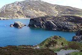
C'est vraimment une belle péninsule avec pleins de magnifique paysages(mer, Brandon Mountain, des moutons partout...), je n'ai que des bons souvenirs. Une bonne carte est quand meme indispensable car les balises ne sont pas toujours visibles surtout le long de la mer. De plus, plusieurs fois, on a croisé des balises qui indiquaient la Dingle Way là on on ne la trouvait pas sur carte. Sinon, impossible de se perdre les chemins sont fort peu nombreux et on sait donc toujours lequel prendre...
J'ai fait Tralee-Camp-Castlegregory(là je suis passé en dessous du lac)-Brandon puis j'ai quitté la Dingle Way en prenant plus au sud en passant quand meme par Ballydavid, l' oratorus et puis directement Dingle en me faisant un chemin dans la campagne. Ca m' a pris 6 jours de marche cool de 9h du mat à 16h à peu près. Donc si tu as une bonne semaine devant toi(pas moins) et un sac pas trop lourd tu devrais pouvoir la faire entièrement.
La météo était variable avec beaucoup de vents en certains endroits et pas mal de pluie, on a aussi eu des coups de soleil(!), mais c' était à la mi-septembre!
Pour le camping sauvage aucun problème, une fois on nous a indiqué une place, une autre fois j'ai vu le propriétaire du champ près m'etre installé et il n' a rien dit, on a aussi campé à la base de la Brandon Mountain... Je pense que tant qu' on laisse l' endroit propre ils sont d'accord...
Sinon un camping classique est assez cher, au moins 8-9 euros.
Un peu à l' extérieur de Dingle, je peux te conseiller une chouette auberge de jeunesse, le Rainbow Hostel, c'est 8 euros pour mettre sa tente dans le jardin et tu peux profiter de tous les communs(accès internet possible, douches gratuites, grande cuisine toute équipée...). C' est toujours bien après plusieurs jours sans se laver...De plus Dingle est une chouette petite ville qui mérite un arret.
Après on a pris un bus en direction de Killarney qui c'est avérée beaucoup trop touristique et limitant a notre gout(28 euro pour faire le lac en bateau puis le gap de dunloe à pied et retour vers la ville en bus...).
Si t' as d'autres questions ou veux plus de précisions, n' hésites pas, c'est encore tout frais dans ma tete et ca aideras
les autres...
Bonne préparation😉
salut.... et whaouh pour ton message a propos du Dingle Way!! Merci de partager ton experience c'est vraiment sympa. Voici mes quelques questions supplementaires si tu peux m'aider:
1/ A propos de la carte, est-il possible de la trouver sur place..a Tralee par exemple?
2/ Penses-tu qu'une boussole soit recommandé en cas de brouillard/mauvais temps?
3/ Nous arrivons par avion a Shannon...et comptons dormir le soir meme a Tralee... as-tu une bonne adresse pas trop cher pour dormir la-bas? J'ai vu sur le Lonely Planet qu'il existe un camping?
4/ Est-ce que la portion Tralee-Camp vaut le coup a pied?? on pensait peut etre la faire en bus ou en stop pour pas perdre trop de temps et aller a l'essentiel.
5/ C'est pas trop la tempete pour planter la tente en camping sauvage? Il y a des coins abrités?
Bon et puis je pense que pour un trip du 19 octobre au 28 octobre, il faut qu'on s'equipe chaudement et surtout contre la pluie! Si tu as d'autres conseils a propos de la marche, du camping sauvage, des bons plans pour dormir au chaud, je suis preneur....
en tout cas, un grand merci deja pour tes infos! J'ai hate d'y aller sur cette peninsule de Dingle!
Salut!
Hé bien je vais répondre à tout ca...
Moi aussi je suis arrivé par Shannon et j'ai été dormir à Tralee le soir meme.
C'est une bonne idée pour éviter de perdre trop de temps dans les trajets. On avait regardé les horaires sur internet mais en fait sur place ca correspond pas trop, soit le bus est en avance soit il y a des bus que l'on connait pas... Le mieux c'est de demander au chauffeur si il va dans ta direction car souvent c'est juste la destination finale qui est indiquée. Pose des questions bien précises car les chauffeurs de bus n' étaient pas les personnes les plus sympa que l'on a rencontré en irlande... Ils répondent à ta question et puis c'est tout.
A Tralee j'ai dormi près de l'aquadome dans un camping assez bien à 8eur/personne, tu dois traverser la ville et c'est à une vingtaine de minutes de la station de bus. Pour le nom et l'adresse, il faudra que je retourne voir mes papiers!
Tralee est petit mais on sait trouver ce qu'on veut pour démarrer la rando. Il y a un grand magasin, en demandant on a trouvé un vendeur de cartouches Camping Gaz... Il y a aussi un office du tourisme ou j'ai acheté des bonnes cartes. Si tu veux avoir toute la péninsule sur carte, tu devras acheter une qui concerne tout ce qui est à droite de Castlegregory et une qui concerne tout ce qui est à gauche... Vu que Castlegregory n'était qu'à 1.5 jours de marche, je me suis contenté d' un dépliant pour la première partie!
Pour la boussole, je pense que ca sert à rien. Je n'ai pas du tout utilisé la mienne. Comme je t' ai dit, c' est quand meme petit la bas et il y a peu de routes. Donc en gros il suffisait de regarder les monts autour de nous, de les comparer avec les courbes de niveaux de la carte et on savait toujours dire où on était! Au pire il y a des villages on peu partout..
Pour la portion Tralee Camp, moi je l'ai trouvé chouette. C'est vrai qu'elle est très rectiligne mais au moins tu ne dois pas te préoccuper du chemin. Tu est la plupart de la journée à flancs de montagnes et tu rencontres des moutons partout... C'est un vrai sentier où il y a des zones bien humides, attention aux pieds! Et puis les jours suivant sont plus le long de la mer donc ca change. Mais n'oublie pas que moi j'ai pas fait le fond de la péninsule alors à toi de voir où tu places "l'essentiel". Le stop nous on n'a pas essayé en tous cas.
Pour le camping sauvage, c' est sur qu' il y a des endroits où ca souffle pas mal... A brandon Mountain la tente c'est en partie détachée, J'ai du ressortir pendant la nuit pour la refixer! Pour les coins abrités, compte pas trop dessus, tout est fort dégagé, il y très peu(pas) d'arbre par là... Si tu plantes correctement tous tes piquets, t'inquiètes, on survit😉. Et puis il y a des moments plus calme que d'autres...
Sinon pour les conseils généraux, je sais pas si tu a déjà fait de la rando mais penses surtout à diminuer le poids de ton sac un maximum en pensant meme aux petites choses(moins de savon possible...).
Voilà, je penses que c'est bon, non?
Thomas
Rem: Dans Brandon Mountain, il y a aussi pas mal d' humidité, mais c'est normal c'est une des sections les plus sauvages, mais quels paysages!..
C'est bien joli de s'orienter en comparant les monts avec la carte topographique, mais s'il pleut à verse, ou qu'il y a un brouillard à couper au couteau, ou que les nuages soient très très bas, bonne chance sans boussole ... c'est qd même assez grand à marcher l'Irlande, quand on n'y voit rien et qu'on est perdus!
Tel je vis, tel je voyage: sans attaches, sans attentes, et avec bonheur :)
J'ai logé à Ballintaggart House, , à 20 min. à pied de Dingle. Un ancien pavillon de chasse, construit en 1703 et qui a servi de soupe populaire durant la Famine (énorme marmite toujours dans la cour). Tu peux y loger en petit dortoir pour €7 par personne. On peut aussi y camper. Cuisine très bien équipée. Si tu y arrives en bus, demande au conducteur de t'arrêter là, tu peux éviter le 20 min.de marche si désiré.
À Dúnquin, se trouve l'auberge de jeunesse la plus à l'ouest d'Irlande, et à proximité, tu pourras éventuellement prendre le bateau pour Great Blasket Island, si le temps est bon. Ma-gni-fi-que, et superbe vue sur la côte de là. Y aller le + tôt possible en journée, car s'il y a traversée, comme ce sera hors-saison, le capitaine effectuera le nombre de traversées dont il aura envie: traverser plus tard en journée t'expose à te faire dire qu'il reviendra te chercher dans 1h30, dernière traversée de la journée (ça m'est arrivé au printemps), à prendre ou à laisser. Tu voudras au minimum 2 heures pour marcher le tour de l'île. J'y ai marché pour la 1ère fois à en avoir littéralement la tête dans les nuages...
Tel je vis, tel je voyage: sans attaches, sans attentes, et avec bonheur :)
Merci beaucoup pour toutes ces experiences et infos que vous partagez! Mon depart approche, c'est dans 9 jours! Dans tous les cas, on s'équipe pour faire du camping sauvage, contre la pluie, et contre le froid..on verra sur place comment ca se passe!!
Il me manque une derniere info:
Où peut-on trouver a coup sur des recharges de gaz pour le camping avant de partir pour la Dingle Way? Je passerais pas l'aeroport de Shannon, puis Limmerick, puis Tralee avant d'entamer la DingleWay.
Sinon, avez-vous une VILLE proche et accessible à me conseiller pour le ou les derniers jour de mon periple: Killarney, Cork, ..... ???
Re: achat de rechanges de gaz: un de mes copains est arrivé d'Irlande hier, il est originaire de Limerick -- je lui demande l'info et inscrirai la réponse ici
Re: ma suggestion de Ballintaggart House: super chouette endroit, mais je ne suis pas sûre qu'ils soient encore ouverts en octobre
Re: ville pour terminer le périple: D'où le retour s'effectuera-t-il? De Shannon ou de dublin? Killarney est une ville touristique que j'abhorre personnellement, et où un séjour peut se justifier pour le seul motif de s'y baser pour explorer le Parc National, Muckross House, etc. Autrement, c'est une trappe à touristes, bourré de boutiques partout et sans âme (c'est mon avis, hein! ... et je le partage 😉). Cork peut faire du sens si le départ devait s'effectuer de Dublin. Sinon, moi j'opterais pour Galway (les bus convergent tous là, et la ville est fort agréable - on peut même se gâter et aller à Inis Mór, la 1ère des 3 îles d'Arran, à partit de là. Il y a une AJ sur le quai!), ou plus proche encore de Shannon: Ennis.
Tel je vis, tel je voyage: sans attaches, sans attentes, et avec bonheur :)
Le copain originaire de Limerick m'a répondu: "afraid not", à la question: est-il possible de trouver des recharges de gaz pour le camping.
Si personne ne vous répond d'ici à votre départ, demandez dès l'arrivée, à l'aéroport. Cela sera peut-être disponible uniquement dans les moyennes et grandes villes, auquel cas vous devrez peut-être faire un détour imprévu avant de commencer la randonnée.
Juste pour information: quelle marque et/ou quel type de recharge aurez-vous besoin? Je suis membre d'un autre forum de voyage, en anglais, et la branche "Irlande" est autrement plus fréquentée que celle sur ce forum-ci. Je peux y demander pour toi l'info avec spécifications plus précises, et revenir avec une ou des réponses assez vite.
Tel je vis, tel je voyage: sans attaches, sans attentes, et avec bonheur :)
argh, une autre question me traverse la tête! il y a vraiment un sens recommandé pour parcourir la Dingle Way?? Parce que je comptais faire:
Tralee-Camp-Castelgregory-Cloghane-Ballycurrane-Duquin-Dingle-Anascaul ...
Mais les infos que je trouve sur internet raconte souvent le parcours dans l'autre sens!
Bon salut! Les réponses ont commencé à entrer là où j'ai posté tes questions.
Magasins d'équipement de plein air (je ne peux confirmer pour sûr ce qu'ils ont, ou n'ont pas, comme combustible, mais au moins avec une telle liste, tu as le choix des emplacements), liste fournie par odecar :
South West
Ashcoast Ltd, T/A Radar Stores, 7 Fox's Bow, Limerick 10%
Call of the Wild, Ivy Terrace, Tralee, Co. Kerry
10%
Great Outdoors, Daunt Square, Grand Parade, Cork 10%
Hillwalkers @ Union Chandlery, 10 Clontarf Street, Cork
Discount does not apply to maps and books 10%
Landers Leisure Lines, Courthouse Lane, Tralee 10%
Maher's Sports, Oliver Plunkett St / Maylor St, Cork & 25 High Street, Killarney 10%
Matthews Centre, Academy Street, Cork 10%
Mountain Man, Strand Street, Dingle 10%
The Tent Shop/Outside World, 7 Parnell Place, Cork
Discount is on normal price of clothing and footwear only
==
From: Mountaineering.ie website
Autre réponse reçue, de loeren, une membre du forum qui est bonne marcheuse:
I walked the Dingle Way a few years back when it was first opened and I did it the clockwise direction - Tralee, Camp, Anascaul. Dingle, Dunquin, Brandon, Castlegregory, Tralee.
There aren't any rules, but I would prefer my route because firstly the scenery is much more varied and interesting before you reach the 'highlight' part of the Way around Dingle to Dunquin and secondly if you do it anti-clockwise you will have several miles of beach walking to do and then the climb over Masatiompan on Brandon mountain, which is the 'crux', or hardest part of the Way, before reaching the most scenic part. If your friends are inclined to abandon the walk before finishing, then at least if they do it the clockwise traditional direction they will be getting the good scenery in the first few days.
Traduction libre:
J'ai marché la Dingle Way lors de son ouverture il y a plusieurs années, et l'ai marchée dans le sens des aiguilles d'une montre - Tralee, Camp, Anascaul, Dingle, Dúnquin, Brandon, Castlegregory, Tralee. Il n'y a pas de règle en tant que tel, mais je préfère la route dans l'ordre où je l'ai marchée d'abord parce que le paysage est beaucoup plus varié et intéressant avant d'atteindre le "top" (le point marquant) du sentier vers Dúnquin et Dingle, et ensuite si tu la marches dans le sens contraire des aiguilles d'une montre, tu devras marcher pas mal de milles sur la plage pour ensuite devoir escalader le mont Brandon, qui constitue la partie la + difficile du sentier, pour enfin atteindre la partie la plus belle. Si tes amis ont envie d'interrompre la randonnée avant la fin, au moins s'ils l'ont marchée dans le sens des aiguilles d'une montre ils auront vu la partie la plus belle dans les 1ères journées.
Voilà. Si tu veux vérifier si d'autres réponses arrivent d'ici ton départ - ne pas oublier qu'en Irlande, la fin de semaine est consacrée davantage à des activités sociales qu'à consulter un forum de voyage :)..., voici les 2 liens: ICI et ICI
Bonne route!
Tel je vis, tel je voyage: sans attaches, sans attentes, et avec bonheur :)
Salut 😉,
Ton départ approche et moi je rentre d'un mois de rando en Irlande, Kerry, Dingle et ainsi de suite en remontant jusqu'à Galway. Vraiment superbe et magnifique, le bout du bout du monde parfois.
J'ai aussi résidé au Rainbow Hostel à Dingle et à l'AJ de Dunquin. Je te conseille aussi Blasket Island depuis Dunquin si tu as le temps, c'est vraiment incroyable et j'ai trouvé très interressante la visite du centre consacré à cette île à Dunquin avec une belle cafétaria, il n'y a pas grand chose d'autre dans le coin... et par un dimanche très brouillardeux cela a été très sympa.
Je n'ai pas beaucoup aimé Innis mais j'ai devié sur Kilkee ou tu découvres presque 30 kms de falaises magnifiques puis continué sur Doolin ou j'ai aussi logé dans une AJ du nom de Rainbow ou Mattie le propriétaire est absolument génial. J'ai eu un gros coup de coeur pour Innis Mor, c'est trop top et si tu peux va découvrir cet endroit, c'est magique et si l'on craque...on y laisse un bout de son coeur. Après cela, le retour sur Galway est rude, personnellement je n'aime pas beaucoup cette ville.
En tout cas je te souhaite un magnifique séjour et me réjouis si tu le fais de lire tes commentaires sur le forum à ton retour. A bientôt. Ticky
Travaille comme si tu n'avais pas besoin d'argent - Aime comme si personne ne t'avais jamais fait souffrir - Danse comme si personne ne te regardait - chante comme si personne ne t'écoutait - Vis comme si le paradis était sur la terre.
argh oui J-4!! Trop bien vos experiences de periples en Ireland et vos infos..je compte bien vous racontez des choses a mon tour des mon retour!!
une derniere question trotte dans ma tete. Nous arrivons a Shannon et devrions arriver le soir sur Tralee. Je crois savoir qu''il y a un camping a 2km au nord mais je doute qu'il soit ouvert le 19octobre?? Avez vous un autre plan pas trop de cher..ou une bonnne adresse pour juste passer une nuit sur Tralee sans se ruiner??
merci encore!!
Vincent.
Désolée du retard mais j'étais en promenade ! Je ne me suis pas arrêtée à Tralee mais je te donne l'adresse d'un hostel ouvert toute l'année :
Finnegans hostel - 17 Denny Street, Tralee tél. 066/712 76 10 finneganshostel@eircom.ercom.net tarif indiqué en dortoir 17 à 20 euros mais tu peux aussi camper. Bonne suite. Ticky
Travaille comme si tu n'avais pas besoin d'argent - Aime comme si personne ne t'avais jamais fait souffrir - Danse comme si personne ne te regardait - chante comme si personne ne t'écoutait - Vis comme si le paradis était sur la terre.
whaouh merci pour ta reponse!!
j'ai contacté le camping bay view de tralee et ils sont fermé en octobre!! du coup je commencais a deserperer mais ton adresse a l'air pas mal... si vous avez d'autres adresses sur Tralee ou Limerick sur le retour pour prendre notre avion..merci d'avance!
Bon de toute facon je vous raconte tout ca d'ici peu car on pars demain!! J'ai trop hate!
a bientot et un grand merci a tous les gens qui m'ont répondu et donné des informations!
Vincent
bonjour à tous!! je viens de rentrer voilà 2 jours de la péninsule de Dingle! Endroit vraiment magnifique, des personnes vraiment agréables et le coeur sur la main. vraiment rien à redire sur l'ensemble. Mais les seules voies par lesquelles on ne peut pas passer en voiture soit en gros la partie blennerville camp et brandon-beenfaman au nord de ballycurrane. tout le reste c'est de la route et que de la route, je suis randonneur et j'aime les sentiers boisés et des chemins pierré avec des risques de se tordre une cheville à chaque pas, et ce que je repproche à ceux qui ont écrit sur ce site ou d'autre forum c'est de n'avoir pas préciser que le mieux c'est de posséder une moto ou une voiture pour faire la dingle way! heureusement que par moment nous avons coupé à travers quelques montagnes ou prés pour ce changer du bitume.
Mise à part cet "petite déception" cette péninsule est magnifique
voilà
Si tu avais lu mon carnet de voyage : http://voyageforum.com/v.f?post=2116960;#2116960
j'y faisais la même réflexion que toi :
Pour ceux qui voudraient faire les « Ways » (Dingle Way, Kerry Way, Burren Way ): bien planifier le parcours car il nous a semblé qu'ils suivaient assez souvent la route!
Merci Marie en effet je n'avais pas lu ton message sur le forum! mais bon je ne regrette pas grand chose quand même je n'ai eu que 2 jours de pluie et grand soleil tout le reste du parcours!!
A+
Zaza
En effet, ma fille est rentrée d'Irlande il y a 2 jours, toute bronzée. Elle a même eu des coups de soleil, on n'avait pas prévu la crème solaire!
C'est peut-être pour ça qu'il a fait beau!
Aurais-tu qq part des photos à nous montrer?
Marie
salut je suis nouveau sur le site j'ai 59 ans et je viens de faire lyon fistera par le chemin de compostelle 2000kms j ai envie de voir du pays je veux visiter l irlande et &1 mois me parait bien peux tu me doner des explicatios sur le parcours, a pied bien sur merci astorga
Ce fil de discussion m’a été bien utile pour monter mon périple dans le Kerry et ma grande rando-itinérante autour de la péninsule de Dingle. Je le remonte donc pour permettre aux suivants de profiter de cette très belle nature.
Mes quelques impressions à chaud :
- oui, les paysages de la péninsule de Dingle sont magnifiques et méritent le détour. Je conseille tout de même de vous dépêcher de dépasser Annascaul car la première étape de la voie n’a que peu d’intérêt et s’avère difficilement praticable après plusieurs jours de pluie (en raison de la forte fréquentation en bétail.
- oui, on marche essentiellement sur du goudron. C’est le point qui m’a le plus déçu lors de mon voyage. Je m’attendais à marcher sur de la piste qui est synonyme pour moi de lieu isolé mais pas ici ! Prévoyez donc de bonnes chaussures et de quoi soulager vos pieds s’ils sont fragiles
- oui, la météo irlandaise peut être capricieuse. C’est même cliché que le mentionner. Prévoyez une bonne tenue de pluie et de vent. La crème solaire est aussi fortement appréciée pour l’été ! Petite ruse de sioux : le soleil qui cogne puis le vent humide qui fouette sont très mauvais pour la peau, prenez de quoi l’hydrater !
- oui, il est possible de faire la Dingleway en autonomie et en camping sauvage. N’hesitez pas à demander aux propriétaires des terrains traversés ; il est fort peu problable qu’ils disent non. J’ai rencontré juste une petite difficulté à trouver un point de bivouac au niveau d’Annascaul. Pour le reste ça se fait très bien.
- vous trouverez peu de cours d’eau inspirant la confiance le long de votre route, n’hesitez pas à demander autour de vous.
- le rainbow hostel de Dingle est un lieu extrèmement accueillant.
- le O’connor pub de Cloghane est un lieu chaleureux et confortable pour partager ses aventures après avoir passé le Connor Pass ou avoir gravi la Brandon Mountain (Je conseille d’ailleurs l’usage des batons de marche pour ces deux opérations !!!)
- Pour toute autres questions, n’hesitez pas à me demander, je me ferais un plaisir d’y répondre.
Vous pouvez aussi trouver plus d’info sur Dingle et le Kerry sur mon blog qui relate mon séjour dans le sud-ouest irlandais : http://k-ribou.tumblr.com
Bonne lecture et pensez à nous faire profiter de vos photos ;)
Maintenant je m'appelle Karibou, mais c'était plus pratique de ne rien changer
Nous partons 10jours en mai pour faire la Dingle Way! J'aurais voulu savoir s'il y a beaucoup de monde à cette période sur cette rando? Faut-il obligatoirement…
En vu de la préparation d'un voyage en Irlande de 3 semaines, je commence mon parcour par une partie la Dingle Way en 3 jours de randonnée, contant que…
Voilà, j'aimerais faire la dingle way debut septembre avec quelques amis (on serait plus ou moins 6). Je fais régulièrement des trekking donc je n'ai pas peur…
Je compte me faire une petite semaine de rando en solitaire en Irlande en aout. Etant une marcheuse "basique" (je fais environ 45 min de marche par jour pour…
Je suis en trein de préparer mon 2iéme voyage en Irlande; j'ai trois sujets qui me posent problémes: le premier c'est que paraît-il le stop ne marche pas aussi…
I’m planning to do the Mercantour crossing following the Randoxygène route in mid-July.
I’m used to hiking in the mountains, but I sometimes get vertigo, for example on ridges with drops on both sides. I wanted to check if there are any T4 or T3-T4 sections and find out if there are any very exposed passages—and if so, where—so I can plan an alternative route.
Can anyone give me some info on this?
Thanks!
hi how can I get internet when I arrive at Haneda? I mean in areas without free wifi. Is it more interesting to buy a SIM card? If so, at the airport? thanks for your help
We're planning to go at the end of November/beginning of December to visit (with a rental car) and hike on La Palma and El Hierro for 15 full days, including 1 day for inter-island ferry transfers. What’s the best split between the two islands—8 days on La Palma and 6 on El Hierro, or even more time for La Palma? Should we have one or two home bases on La Palma? Thanks for your tips!
Annie
Hi there,
I’m planning to cross the Gourgs Blancs Pass at the end of the month, from La Soula Refuge to Portillon Refuge. On this section near the pass, I don’t have any trail marked on my IGN map. Is the path well signposted, or should I use a compass?
Also, beyond the physical effort, are there any technical, exposed, or vertigo-inducing sections on this part?
Since I’m finding very little info, I’m being thorough with my questions.
I'm developing a free and open-source web app for planning walking and cycling trips (and even car trips). You can create a route by clicking directly on the map to add waypoints, and it can consist of multiple stages. The app provides tools to edit the stages and the overall route, and to display useful information (distances, altitudes, and elevation changes). A relief profile can be shown as a graph for a specific stage or the entire route.
Once the route is ready, it can be exported as a GPX file, which can then be used with a GPS or a mobile navigation app.
The app is built in JavaScript and runs entirely in the web browser. It uses the Leaflet library and several OpenStreetMap-based services. Initially developed for my personal needs (I enjoy hiking and cycle touring), I’d be happy to share it with anyone who might find it useful. It’s free to use, doesn’t require an account, and the source code is available.
hi there
I’m heading to Uzbekistan for three weeks from mid-September to mid-October 2026—a country I haven’t visited yet.
I’d love to do a few multi-day hikes in the mountains without going through a tour operator or hiring a guide. Has anyone here done this?
It doesn’t have to be all trekking; day hikes are great too.
I’m open to any tips!
Also, I see there are lots of train options if you book well in advance—does that only apply to the "fast" trains? Are there buses as well?
Hello,
In mid-November, we’ll be in Mindelo and Santo Antão.
We’ve booked transportation with Kapverden Tours.
One trip is from Porto Novo to Ponta do Sol, including the hike from Corda to Coculi.
What’s the trail like?
Then we’ll be staying in Ponta do Sol,
Here’s what we’re planning:
A hike to Fontainhas—what’s the best direction, considering we’re not great with climbs? No problem with flat terrain or descents.
Take an aluguer to Ribeira Grande and continue along the coastal road.
With the agency:
An excursion to Cruzinha with a short walk.
Return to Porto Novo via the path from Cova to… I’m not sure where yet, to pick up the car for Porto Novo, since we’ll be taking the ferry that evening.
We’ll have a guide for this hike.
We’d love to spend a day in Tarrafal, but getting back requires a boat or taxi, and it’s really expensive!
We’re a couple, 78 and 76 years old.
What do you think of this itinerary?
Not very well known: Hokkaido Island has national parks that rival those in North America. Hiking there is free (even many mountain huts) and requires no formalities. These treks are described in the LP *Hiking in Japan* guide—you can just buy the Hokkaido PDF. It’s way better than Mount Fuji. Of course, everything depends on the weather, which is very unstable in the Japanese mountains (frequent strong winds). The trails are often obstacle courses.
The Daisetsu Zan traverse is a stunning hike through volcanic terrain with a remote section in the middle that requires at least one night of camping (there are basic huts for the rest, which is popular with Japanese hikers): 4 to 6 days.
The Shiretoko traverse takes 2 days with views including an island in Russia, but the ridge is brown bear territory—there are even more here than in Denali National Park in Alaska (brown bears and grizzlies are the same). I ran into 7 in just 6 hours of hiking!
Hi everyone,
I’m leaving on Monday, August 3rd for my very first long-distance trek: the GR223 from Coutances to Mont Saint-Michel, over 6-7 days (~11-14 miles/day), solo.
I’m looking for tips from people who know this section well (Coutances → Regnéville-sur-Mer → Hauteville-sur-Mer → Bréhal → Granville → Genêts → bay crossing):
Budget-friendly accommodations: I’m struggling to find affordable stopover lodgings (a lot of what I find online are expensive vacation rentals, not really suited for a solo hiker). If you have any great spots (hostels, hiker-friendly B&Bs, nice campgrounds), I’d love to hear them!
Bay crossing: Any feedback on guides/providers leaving from Genêts for the final crossing?
General tips for a first long-distance trek: What you wish you’d known before your first time, pitfalls to avoid, etc.
Hi,
We’re planning to do the 4-day trek from Mestia to Ushguli without an agency. The descriptions mention that there are accommodations at each stop, but we can’t find any details about them. Has anyone got info or feedback on this route?
New to this forum, I’m planning a pretty big project for 2028.
I’m heading to Nepal to do a trek from Kathmandu all the way to Everest Base Camp (a cool 5,300 m 😄).
This trek is a bit special because even though I’ll be part of a group, I’m going solo (so far, no problem—I’m used to it). But it’s my first real trek, and it’s also a humanitarian one: once I reach base camp, I’ll stay an extra week to help clean up the waste left by tens of thousands of climbers! Since I’m originally from South America, from two countries that share the Andes, I have a deep respect for mountains—they fascinate me. So Everest… it’s kind of the trip of a lifetime!
So, a little question for those who’ve done treks to Everest before… any tips for good mental preparation (I’m already working on the physical side)?
We're planning to trek in Peru and Bolivia and would love to find some local agencies.
If you know any, could you share details on prices and, of course, the names of the agencies?
Which trek would you recommend?
Elocine
I'm heading out on a fully self-sufficient trek in Morocco (10 days) from Imilchil to Aghbalou.
Can I find screw-on gas canisters (Coleman, Primus) in Marrakech (any addresses?) or in villages between Imilchil and Aghbalou?
If not, are Butagaz canisters for camping gas (small 230g size) available?
Thanks in advance for your tips!
Hello, I’d like to embark on a little trip in my home country, Switzerland. I’ll start walking from La Cure, heading toward Le Noirmont first, then I’ll improvise my route—but it’ll probably follow the French border... at least as far as Lac de Joux.
I’ll decide day by day how much farther to go after that. My goal is to stay in nature as much as possible, wander around for as long as I can, and restock food in villages or towns along the way.
I’m thinking of mostly camping, but we’ll see if I end up in a hotel or another campsite depending on my route.
I’d love to reach La Chaux-de-Fonds on foot... maybe even Delémont.
The whole thing should take about a week, give or take.
I’ll be bringing my dog, and I’m preparing for this as soon as I’m ready.
Any tips to make sure everything goes smoothly for us? Things I should know—or avoid? What about shepherds with their flocks of sheep? And isn’t hunting season open right now?
I’m not sure if what I’m planning is even doable, which is why I’m asking around.
This’ll be my first time doing something like this—wandering in nature *and* with a dog. I’m really excited for this adventure... and I need it. Thanks!
We’re really keen on ecosystems and want to hike in "natural" ancient forests—not planted woods or areas heavily degraded by human activity. Travel guides (like Lonely Planet) don’t provide much info on this. Could you point us to the most interesting spots?
Thanks in advance for your tips.
We wish you happy holidays and a fantastic 2026, full of discoveries!
Claire and Albert
Hi, this might not be the right section, but I’d like to know if it’s possible to start mountaineering with another person without necessarily hiring a guide. We’ve done quite a bit of hiking but not mountaineering—we’ll just do a half-day glacier course. After that, we were thinking of starting with La Grande Motte and the Pointe de la Traversière, which were recommended to us. Honestly, for things like roping up and knots, I’ll learn at home with lots of videos and a book.
I’d love to know if anyone has done treks in the Rwenzori Mountains and how much it costs on average, what the infrastructure is like, the landscapes, and safety in the area. Thanks so much! I’m really looking forward to your replies.
We’re leaving in 9 days for a two-week trip to Madeira, mainly to hike.
From my research, I’ve found that since last year, access to most trails—and systematically for the most popular ones—is now paid. You have to pay an access fee of 4.50 € per person per classified hike in 2026, and even 10.50 € for the most iconic hike: Pico Arieiro to Pico Ruivo. When paying, you also have to choose a day and a 30-minute time slot for your start time. Of course, this reservation is neither changeable nor refundable, even if the weather that day is terrible.
Personally, given the massive influx of tourists to the island in recent years, I don’t mind paying a fee to help maintain the trails. Similarly, setting a limit on the number of people who can hike them per day is certainly preferable to preserve this priceless heritage.
However, what’s much less fair is that in reality, most of the available spots are reserved: 1/ for Madeira residents (which is normal); 2/ for "economic operators" (meaning local tour operators). For example, if you’re a non-resident (independent tourist), no booking is possible for the Pico Arieiro hike for an early morning start before September! So, unfortunately, we’ll have to skip this hike.
It’s the same issue for Ponta de São Lourenço, the 25 Fontes, Pico Ruivo... in short, all the most popular hikes. Oh well, we’ll skip those too!
So my question is: which hikes do you recommend where we won’t face the huge crowds that the others get? And where we can book the day before for the next day, taking the weather into account?
Finally, a quick accommodation question: we’ve booked the first week in Funchal, but I haven’t decided yet for the second week. Do you have any advice on where to stay in the south or north, preferably avoiding overly concrete-heavy and touristy spots?
I’m reposting about the logistics for Samaria Gorge.
I’d love to get recent info, especially about whether it’s possible to park my car in Omalos, do the hike, and then catch a bus back to my vehicle.
In theory, it’s doable, but when you check the KTEL website, there aren’t any feasible schedules listed. If anyone has recently organized this with reliable, verified details, I’d really appreciate it. Thanks in advance!
Hi there,
We’re flying from Montreal to Lyon this August to go hiking in the French Alps. We’ve rented a car and will be staying at campgrounds. We’re planning to do day hikes and want to stay a few days in one spot, do a few hikes, then move on to our next camping spot. Could you share your favorite spots or any recommendations for places to spend a few days with great hikes?
A few details:
We arrive in early August and leave in early September.
We’re looking for day hikes (or shorter), moderate difficulty, with a cumulative elevation gain of no more than 1000m, and of course, beautiful scenery!
We’d prefer not to drive too much—maybe it’s best not to head too far south and deal with unnecessary heat?
Along the same lines, if you know of any great campgrounds where we can start our hike directly without needing the car, we’d love to hear your suggestions!
Hi there,
I’m planning to go hiking on this island and would like to know the best time to do it. I visited for a few days in November 2018—not for hiking but just to explore—and the weather wasn’t great, especially in the mountains. So, is a star-shaped itinerary doable if I rent a car and maybe use two different accommodations?
I’m not planning to join an organized group—just traveling with one other person and organizing things ourselves—unless you’d recommend a local agency or guide. Finally, even though I’ll be getting maps, a topo guide, and a GPS, I’d really appreciate your top hiking recommendations.
Thanks so much for your tips!
I’m planning a trip around Cap Corse and the AGRIATES in 2026, from May 8th to 15th (there are still 2 spots left, by the way! Just DM me if you're interested).
I’d love to know which hikes are worth prioritizing in the AGRIATES. We’ll be staying in SALECCIA for two days as our base—what should we focus on from there?
A round trip to IGNHU beach? Any other suggestions?
For Ostricano, I think it’s too far for a round trip...
Thanks for your tips!
Have a great day,
Anie, Toulouse
I’d like to get some info about the GR10 Pyrenees traverse. I need help planning the daily stages and accommodations—my wife isn’t an experienced hiker but walks a lot, so I’d like to schedule shorter walking days and thus a longer overall trip in terms of number of days.
Could anyone give me some help and advice?
Best regards,
Hi there, I’m planning the Annapurna Circuit for March 2027 and I’m looking for a local agency with a local guide—preferably French-speaking—to arrange this trek for us. Any suggestions? Thanks
Hello!
We’re spending a few days in Toraja country at the end of May. We’d love to do a day trek—taking our time—on a route that’s stunning in terms of scenery, but not a level 5 in difficulty!
Any suggestions you can share, please?
Thanks in advance
I’d like to do the Mare a Mare Sud in May over 4 days. I’ve found quite a few places to stay along the route, but I’m stuck on the start and finish.
I’ll be arriving by plane on Sunday evening and would like to start pretty early on Monday morning. Ideally, accommodation right at the trailhead (Alzu di Gallina) would be amazing, but I can’t find anything. Any tips?
Also, for the transfer from Figari Airport to Porto Vecchio or Alzu di Gallina?
At the end, I’d like to pick up a rental car—any advice on that too?
I’m traveling solo by plane to Catania in May and plan to hike the northern side of Etna, starting from Linguaglossa where I’ll arrive by bus. After that, I’d love some info on how to get up to Piano Provenzana (shuttles or hitchhiking), since it seems there’s no public transport except in the summer. Can you sleep there in a free or cheap refuge, or camp? And how far up can you go without having to hire a guide? Thanks in advance. Bernard.