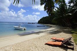
During these three big weeks in Madagascar, one week in Sainte Marie, a few days for a little loop in the west/south, and the rest in Tana.
This loop I’m talking about covers an area I’d never taken the time to visit before. A recent road in good condition, the chance to pass through beautiful highland landscapes, and a few free days made it the perfect opportunity. Destination: Ampefy, west of Tana via the RN1, then a turn south onto the recently rehabilitated RN43 to reach Antsirabe before heading back to Tana. Four days planned—perfect, since an extra day wouldn’t have been a problem given all the activities in Ampefy.
First day: a relaxed and fairly late departure for Ampefy. We weren’t in a rush and took our time. Traffic leaving Tana to get back on the RN1 cost us the head start we had on our original schedule. An hour and a half bumper-to-bumper with the *buxis*, inching painfully toward the roundabout and then the bridge that acts as a bottleneck—we dove in like all our fellow sufferers. It’s not our everyday reality, and we were early, so no big deal, but man, it’s long and slow. Once past that obstacle, traffic flowed smoothly, and the road was good (all the way to Ampefy). We moved through highland landscapes, bustling villages full of activity, and countless agricultural supply shops—clear proof, if any were needed, that we were crossing a prime farming region. Around Arivonimamo, we passed through a forest with a Mediterranean vibe: a single-species forest of stout little trees with glossy, elongated light-green leaves—these are *tapia*. An endemic tree in Madagascar, and a pretty unique forest as a result (you can see them elsewhere, like between Antsirabe and Ambositra). There are efforts to protect it from illegal logging because the wood is fire-resistant, which helps shield the forest from wildfires. Beyond its biodiversity value, the *tapia* hosts silkworms, giving it economic and cultural importance.
As we kept going, we started spotting a lake and mountains with the rounded shapes typical of extinct volcanoes worn down by time and the elements. We were approaching Lake Itasy and, by extension, Ampefy. We stopped at a *hotely* for a plate of *tongon’kisoa*—pig’s trotters caramelized by cooking, with thick, flavorful skin—along with the obligatory portion of rice, which we took the time to drizzle with cooking juices to make it a bit more appetizing. Full, we turned left to reach Ampefy and our hotel. The landscape was dotted with collapsed, dormant volcanic cones, and suddenly, the view opened up onto the lake. Shallow and expansive, we followed it, losing sight of it now and then before finding it again in Ampefy itself, which we entered after crossing the Lily, a beautiful river that drains the lake. Lots of hotels and restaurants, with plenty of options at all price points. We chose the *Farihy*, about 5 km past Ampefy. A gorgeous spot by the lake, with a pool and lovely bungalows—some with picture windows overlooking the lake. Really nice. In the evening, a drink and some *sak sak* for aperitif on the terrace. It wasn’t warm, there was a lot of wind, and a storm was brewing. Off to bed quickly to start the next day’s visits.
After buying some lychees—we hadn’t seen many this year, and these were fresh from the field, picked in Ampefy—we headed to the Lily Falls. Well signposted, with a paved road in great condition, we stopped at the kiosk for the entrance fee and parking (1 euro for one *vahiny* and 10 cents for one Malagasy). We set off down the path and quickly reached the first waterfall, then continued for maybe 1 km on a well-marked trail to the second. A guide led us to the third, which is harder to spot and isn’t actually on the Lily itself. Beautiful countryside scenery: fishermen straight out of *Tom Sawyer*, straw hats on their heads, lying down with one foot hooked to a fragile bamboo rod, their line dipping into the calm river. Men preparing rice paddies with their *angady*, women transplanting rice, bent over the water. At some points, we walked along the dikes between paddies almost ready for harvest. It’s peaceful and beautiful when you’re strolling or fishing, but working the paddies is grueling, especially under that beating sun. A really nice walk—2 hours and a bit, going at a leisurely pace. A guide isn’t mandatory; only the entrance fee is. We took one because it provides a bit of work and puts money in the hands of locals, giving them more incentive to protect the site. But you can easily skip it, like most people do. Lots of visitors since it was the weekend—Tananarivians with family or groups of young people, scout groups organized under their chaperones’ direction. Very few foreign tourists, though—that’s a general observation. It’s great to see this growth in domestic tourism, giving Malagasy people the chance to discover their own country and allowing those in the sector to rely less on foreign visitors, who’ve been scarce for years.
Next, we headed to the "geysers" (which aren’t actually geysers, but whatever). We had to go back to the RN1, head toward Tsiroanomandidy, and a few kilometers later, a well-marked sign and a newly paved track led us to a pretty site. Again, lots of people, another kiosk, more fees to pay, and guides available. This time, we skipped the guide. A downpour caught us in front of the "geysers," so we took shelter under a little shop, grabbing an ice cream and some drinks. We didn’t stay long—we weren’t interested in a massage or a dip in the thermal water. The countryside and barren mountain landscapes were stunning on the way back to the hotel. We noticed you could go paragliding right in front of the bungalow, so we booked a session for the next morning. After eating at the *Auberge* in the town center (it was good), we headed back to the hotel to turn in early. Once again, a storm rolled in during the afternoon, and the temperature dropped significantly.
The next morning, around 8 a.m., we walked to the takeoff zone near the hotel. Towed by a small boat, we took off for a flight over the lake and the volcanic domes before landing back at the same spot. Two companies handle this. I’m no expert, but it seemed safe and well-organized.
Since the start of this trip to Ampefy set off something insane—an avalanche of reactions and so much enthusiasm—let’s keep this loop going so the momentum doesn’t fade.
We’re now on the third day after a journey from Tana to Ampefy that took us through a unique tapia forest before reaching the heart of Madagascar’s central highlands, then catching sight of Lake Itasy and Ampefy. The second day was spent wandering along the Lily River and toward the geysers before deciding on a morning paraglider flight. The third day began with a paragliding trip over the lake and extinct volcanoes before heading to Antsirabe. That’s where this post picks up from the previous one.
We hit the road around 10:30/11:00 AM for Antsirabe, leaving Ampefy and the Farihy Hotel after grabbing a quick breakfast in the village. The weather’s still nice, so we soak up the last bits of sunshine and blue sky before the afternoon storms roll in. We take the RN43 until Sambaina, where we join the RN7. It was rehabilitated not too long ago, and the stretch between Faratsiho and Sambaina is even excellent. That said, the first few kilometers from Ampefy to Soavinadriana are a bit of a purgatory—the road’s untouched, just like they say, "authentic." Not great, but thankfully it’s a short stretch that gradually climbs toward Soavinadriana, overlooking rice paddies and, at the start, plenty of chayote plantations (also called christophine or chouchou). This veggie acts like a passion fruit with its tendrils and vertical growth along bamboo trellises. It’s delicious with peanut sauce and also makes jam for pigs that seem to love it.
Once in Soavinadriana, we get back on the rehabilitated portion—it’s not *amazing*, but it’s still really good. Hardly any potholes or badly degraded sections that force you to slow down too much. Until Faratsiho, we cross the Kitsamby Valley, where the river has carved its way through the highlands. We descend steeply at first, with the Kitsamby far below to our left, then cross it on a narrow one-way bridge before climbing higher than we descended to reach Faratsiho, the highest town in Madagascar, in the heart of Vakinankatra. Besides the stunning escarpment of the Kitsamby Valley, this stretch lets you drive kilometers along high moors and hills with likely peaty, poor soil where what’s called *tanety* farming is practiced. The recurring village names with *Tanety* (like Antanety, Tanetibe) confirm it: rainfed crops on slopes or hilltops—upland rice, corn, cassava (which doesn’t yield much here), sweet potatoes, and potatoes (*ovimbazaha*, or "vazaha’s eggs"). Thorny thickets dot the gentle slopes and hills, and the dark soil gives the landscape a somewhat somber tone, especially on cloudy days. In the valleys where it’s possible, newly planted rice paddies brighten the scene with their tender green. We then enter the side of a valley before arriving at a vast irrigated plain fed by several rivers—fifty shades of green. A harlequin checkerboard of fields, canals, rice nurseries, and *dobo* (small dikes), where industrious farmers have used all their know-how to connect every plot in an infernal puzzle. It’s just stunning. We climb a bit more, passing one or two waterfalls, including one dedicated to the Virgin, before continuing to Sambaina. Another area of highlands and peatier soil, the kingdom of corn and forests destined for massive charcoal production. The agricultural landscapes are once again gorgeous, leading to the immense irrigated perimeter of Ambohibory, which signals the junction with the RN7 (we actually drive alongside it on the RN7).
Then we’re back on the RN7—its potholes, traffic, struggling trucks coughing pathetically with every bump, and drivers swerving their minibuses or SUVs to find the best path through the chaos of pedestrians, panicked animals, and frustrated vehicles. Less than 40 kilometers takes over an hour to reach Antsirabe and the Couleur Café Hotel. Well-located on the ring road and just steps from downtown, it has a beautiful garden, spacious bungalows, and large rooms in lovely colonial-style houses. A touch of the past in today’s Madagascar. The large dining room serves family-style meals with Malagasy influences and typical dishes. It’s good but not mind-blowing—slightly disappointing given the hotel’s promise for its cuisine.
The next day, a peaceful walk on the paved streets toward downtown, passing old villas—some restored, some crumbling—the Hôtel des Thermes with its huge garden, grand staircase, and woodwork, the suite where the King of Morocco lived in exile, and the 21st-century wreck of a palace from times gone by. If you look closely, you might find Sleeping Beauty and her slumbering court around a corner. A melancholic stroll that continues to the Baths building and its small lake before heading back to the cathedral via little alleys. It’s beautiful like what once was, and sad like what could be. But there’s no time for nostalgia—life goes on, and it’s the Malagasy who are writing their own history now, as they wish or at least as they can. The lake is now used for washing vehicles, and near the Hôtel des Thermes, there are spaces for kids’ games, money-making, and eating *masikito* with a THB or other drinks. Further on, a bigger festival with countless stalls and human-powered merry-go-rounds where kids play and dream.
We prepare to leave this mirage of the past wrapped in modernity, hoping the journey continues in Antsirabe, a town proud of its history but also of what it will become.
As for the RN7, we’ve seen it all—disastrous sections, especially leaving Antsirabe, and nothing remarkable until Tana anyway. The road alternates between completely wrecked and just not great. Heavy traffic slows everything down in the worst stretches. We stop in Behenjy for some foie gras and in Ambatolampy for a bit of handicrafts before arriving in Tana after 5 hours of driving. Long.
All in all, this 4-day loop is worth trying either as a weekend or 3-day trip just for Ampefy and its activities (there’s *so* much more to do beyond what we did), or for the loop itself to then continue beyond Ampefy via the RN43. In my opinion, this stretch offers the best way to discover the highlands’ countryside and its diverse agricultural landscapes in the most comfortable conditions over such a distance.
I even think the RN7 descent should now include Ampefy—whether you stop there or not—because it lets you arrive in Antsirabe after seeing landscapes you won’t find elsewhere, and in conditions that are easier on fragile backs and vehicles. Instead of Tana-Ambatolampy-Antsirabe, a Tana-Ampefy-Antsirabe route (with or without a stop) might be a good alternative to consider now (and probably even more so after the RN7 takes another cyclone or rainy season).
That’s all for this time—have a great weekend, everyone!
Yeah, I really love the Ampefy area. The good, well-maintained RN1 road, which was in great shape during my last visit (which makes you wonder why some roads stay in good condition while others don’t—RN 2, 4, 5, 6, 7; probably fewer trucks and better construction). It’s got beautiful landscapes with interesting sites all along the way. And the road to Antsirabe is stunning, with what I think is the highest road pass in Madagascar. I thought it was fully finished, but apparently there’s still a rough stretch left. Either way, it’s definitely worth taking if you’ve got the time for the Tana–Antsirabe route.
Hello, great description of Antsirabé—a town I’d kind of forgotten about. It’s exactly like that… like the sleeping beauty, going back to the early 20th century.
hi there,
I took this route 25 years ago, and this time I’ll be leaving from Tamatave heading south to Fort Dauphin.
How far can you realistically get by bush taxi these days? Any firsthand experience or tips are welcome (just to clarify: we’re traveling on foot with backpacks, not by motorbike!).
Thanks! !
hi,
Do you have one or—even better—several addresses for exchanging euros to ariary? Aside from Jmy Exchange, that is.
What’s the current exchange rate we can expect? Thanks!
Has anyone been to this base camp in the Diego area towards the west coast (Mozambique Channel)? The trip starts from Diego Suarez by 4x4 and boat,
with a visit to Nosy Hara and a few nearby islands.
Possible big-game fishing and diving.
Thanks in advance if anyone has info!
Hi everyone, I’m heading to Île aux Nattes in a few weeks and I’d like to know if euros are accepted in the island’s restaurants.
At the hotel where I’ll be staying, they take card payments, but for activities, I can’t find any reliable info.
Could anyone tell me the approximate cost in euros and/or ariary for a week (food outside the hotel) on the island for two people?
Also, has anyone ever exchanged money at the Paris Magenta exchange bureau?
Thanks!
Hello,
After asking questions on the site, here’s a little feedback on our trip in March and April.
Marseille/Antananarivo flight with Ethiopian Airlines was great both ways. I’d recommend it.
Domestic flights with Madagascar Airlines were just as smooth.
We had to change our plans because I was the victim of a snatch-theft attempt at Ivato... patellar fracture... so I ended up with a brace and more rest than hikes.
This let us spend more time in the same areas and make some connections.
We loved Tulear. Stayed with Alain—excellent value for money.
Mangily, where we stayed for 15 days. Hotel Bella Dona due to my little handicap. The pool replaced sea swims.
Mangily gets a bad rap for being very touristy. True, you get approached a lot on the beach—you have to play along and buy some trinkets, but after that, you get royal peace and lots of exchanges with locals. The village and its lively street are nice too. Don’t hesitate to eat with fishermen or at local bars.
Anakao, a big favorite. Just the journey there is worth it. Watching dozens of pirogues set off between 5 and 6 AM is a magical moment.
Stayed at Peter Pan’s place. Lots of chats with Dario since we were the only guests.
Planned a 4-day Antananarivo–Soniara–Ivango road trip with a driver.
Cut to 2 days because the boat to Sainte Marie was moved up due to weather. I don’t remember the company’s name, but it wasn’t great for safety—plus, we brought back fleas.
Visited Andasibe Park along the way. Quick tip: go in the morning.
A little over 2 weeks on Sainte Marie at Hôtel Mantis Soanambo—total luxury negotiated at a price that defied all competition because it was low season.
Meals were at little local eateries nearby.
We chose not to sleep on Île aux Nattes but went there several times during the day (crossing: 4000 ariary for 2).
You have to take a pirogue tour—it’s like stepping into a postcard.
Sainte Marie is a special place. A tropical island that feels like the Caribbean ones we’ve lived on. No security issues at all. We rented a scooter because we found tuk-tuk prices a bit steep. You can leave the scooter with helmet and keys and come back 4 hours later.
More amazing encounters here too.
Last part of our trip in Ampefy, a beautiful volcanic region with a very welcoming population.
Stayed with a friend of our driver.
Hotels in Ivato are plentiful and vary a lot in quality.
Les 12 Collines is a bit out of the way but only 21 € per night.
La Chato... very expensive for what you get.
I tried to keep it short.
Madagascar is a wonderful island with so many facets. Always so many emotions when I think back on this trip.
The extreme poverty... don’t hesitate to buy food for the kids on the beach, for example. It doesn’t cost much, but it means a lot to them.
The kindness of the people and, above all, those SMILES.
We’re hooked—we’re going back in November for 6 months... because yes, you can buy a 3-month visa at the airport (a question I’d asked), and you can extend it for another 3 months... if you apply in time at a police station.
We didn’t take Malarone either. We’d brought some, but there were few mosquitoes, and "Insect Écran" worked really well.
Hi everyone, we’re planning a trip to Réunion for 6 nights and Mauritius for 7 nights in March 2027. I’m starting to look into it now. We’re not hikers, so I’d love to hear your thoughts!
Should we book flights and small hotels separately, or go for a flight-and-stay package? We don’t want to blow our budget (around 2800 € per person). Thanks!
Gigi
Hello,
We’ll be on vacation in the Seychelles in July and will visit La Digue, Praslin, and then Mahé in that order. Our 21-year-old daughter will have to leave earlier than us while we’re still on Praslin.
We’re hesitating between the following options for her return:
Option 1:
- July 9: ferry from Praslin at 2:00 PM – arrives in Mahé at 3:15 PM.
- International flight departing at 7:30 PM.
- The connection is very tight, leaving a 1- to 2-hour safety margin in case the ferry is delayed.
Option 2:
- July 9: ferry from Praslin at 8:00 AM – arrives in Mahé at 9:15 AM.
- International flight departing at 7:30 PM.
- This is safer than Option 1, but it means she’d lose the whole day, spending it alone. We’d pay for a day pass giving her access to a hotel pool to kill time.
From experience, what do you think? Are significant ferry delays (2 hours or more) common, especially in July with the swell, making Option 1 too risky?
Or is even Option 2 too risky, and should our daughter take a ferry the day before (though that would mean missing a lot of time with us)?
Or should she take an Air Seychelles flight the same day instead of the ferry? Is that safer than the ferry? But it’s much more expensive…
I know no one can give me certainty on this, but I’d just love to hear your gut feeling from those who have experience with inter-island transfers in the Seychelles.
Thanks so much in advance!
Christophe
Hello,
Our trip is taking shape.
We’re leaving on February 28th. We’ll start by flying to Tulear, then make our way up to Tana at a relaxed pace before catching another flight to Diego Suarez.
We’d love to end our stay on Sainte Marie Island.
Is there a way to make the trip by land? By sea?
Just to clarify, we’re not pressed for time.
Thanks!
Hello everyone,
Thanks for this amazing forum—I’ve spent hours browsing through it.
I’m reaching out to ask for your help as we’re looking for a destination for our honeymoon.
We never travel outside Europe, so we’re total newbies, but we want to treat ourselves for this special occasion.
Dates: June 23 → July 8 (possibly until July 12)
Duration: 2 to 3 weeks
Budget: Not really an issue for this trip
Our plan:
- A seaside destination first and foremost, with beautiful beaches
- We’d like to do some hiking or at least go on walks with scenic viewpoints
- A relaxing trip with sunshine, lush greenery, and stunning landscapes
- A safe destination
Our thoughts so far:
- New Zealand: our dream, but it seems like the wrong time of year weather-wise ++
- Azores: ruled out due to unpredictable weather—what do you think?
- Mauritius/Reunion combo: vetoed by my future wife ^^
- Seychelles: seems like it could work, but I’ve read about a few downsides (no shops to buy food, snorkeling not always amazing, occasional weather/tide issues making swimming tricky)
Other options:
- French Polynesia: we’re really dreaming of it, but is 2 weeks too short for such a long trip?
- Hawaii: same question—too far?
- Sardinia?
Thanks so much for your help, and have a great weekend!
Every year, we love escaping the autumn season—I really can’t stand it—by heading somewhere sunny during the All Saints' holiday.
This year, we were thinking of Mauritius... We’d found a place to stay, but after digging deeper, I realized it’s 40% cheaper in July. And the flights with Emirates aren’t more expensive in the summer, even though it’s peak season for them, compared to October.
Yet, after checking a bunch of sites, I don’t get the impression the weather is bad there in July—maybe just a *tiny* bit less hot than in October, but nothing major...
So we’re tempted to go this summer after all.
This big price jump for All Saints' compared to summer is a mystery to me... Did I miss something?
If you’ve got any firsthand experience traveling to Mauritius in July or early August, I’d love to hear about it.
Hi! Recently, the domestic-flight terminal at Ivato has been moved to the old "international" airport, complete with its own scanner. On October 13th, I checked my luggage (which I had inspected before leaving my hotel in Tana) for a flight to Sambava. It wasn’t until I arrived at my accommodation in Antalaha and opened it that I discovered it had been searched (normal before boarding a plane), but to my surprise, the case containing my GPS fishfinder had been opened—likely mistaken for a laptop due to the scanner’s open access to all kinds of theft—and three SD cards were stolen. Luckily, two of the SD cards had their micro SDs inserted into the device, so I still had the Navionics micro card (300 €) essential for fishing. Of course, I’m not asking for compensation, just urging caution with checked luggage on "domestic" flights. (This is a copy-paste of my post on *Le Routard*.)
Hello,
I’m continuing the Antalaha–Maroantsetra discussion but for some info in the other direction, specifically about hiking from Maroantsetra to Antalaha.
In mid-December, I plan to take it easy from Tamatave to Antalaha. I’m thinking of making a few stops, like Nosy Atafana—has anyone snorkeled there? Is it nice? Can you find bush taxis on the Soniera–Ivongo / Maroantsetra stretch?
After that, I’m considering walking from Maroantsetra to Antalaha and figuring things out as I go, since the path seems well-used, so I’m not planning on a guide. Good idea or totally foolish? Should I bring a tent and some camping gear, or, as I’ve read multiple times, are there several villages with lodging and food options along the way? Any spots worth stopping at or nothing special to see?
In Antalaha, I saw the recommendation for Villa Malaza in the previous discussion, so I’m keeping that in mind. If there’s space, I’ll plan to stay there. In Antalaha itself, are there any places to visit, things to see, or activities you’d recommend?
Thanks in advance to everyone for any tips—they’ll be really helpful!
Well, I still feel a bit lonely about this destination—no requests for info, no travel journals, or trip reports since I last posted over a year ago. A little disheartening.
That said, I did cross paths with slightly more tourists this time. Not a ton, but enough to notice compared to my last stay. Beyond that, not much has changed—the people are just as lovely, and every interaction, whether at the market, in the medinas, in town, or in the countryside, was positive. It was so pleasant; my "alert meter" stayed at zero the whole time (which is pretty different from some other places I visit now and then). The roads outside the cities remain dangerous, and the accident rate seems high. Best to drive during the day and take it easy (on some rough stretches, you don’t really have a choice anyway). The scattered plastic and metal waste hasn’t magically disappeared, and it’s still pretty discouraging to see the most beautiful beaches surrounded by empty bottles, straws, diapers, and rusted carcasses of an old Xantia or a skeletal Espace. When it’s not on the beach itself (since those are cleaned), it’s just a few meters away. Usually, there’s not much in the water or close to shore—the seabeds are gorgeous, with coral and a wide variety of scaly friends... But stepping back onto the hardened lava, you dodge a chip bag or a shriveled battery. Such a paradox. Honestly, it’s like this almost everywhere except on hotel beaches or those far from human settlements. But otherwise, in places like Chomoni, Bouni, Itsandra, Moya, and Domoni (on Anjouan), Nioumachoua (on Mohéli, and even on the nearby islets), it’s hard to ignore. And it unfortunately tarnishes the beauty of these otherwise stunning spots.
That said, you can still find secluded micro-bays, protected and remote, where this isn’t an issue. And where there are hotels—like in Petite Itsandra in Moroni, in front of Laka Lodge in Nioumachoua, Trou du Prophète, or even Chomoni (though the surrounding areas are so littered...)—the beaches are cleaned, so...
So why go? Why still love it despite all this?
Well, first, the Comorians themselves—that’s already essential and probably the main reason.
Then there’s the breathtaking topography: the imposing Karthala, the dizzying peaks and cliffs of Anjouan, vast ravines, a tortured geology covered in lush nature, and Mohéli, much more serene and gentle, blanketed in spice plants and trees with names that make you dream, like an open-air spice market.
The flora across the islands—the fields, trees, scents: clove trees, cinnamon trees, lychee, mango, cardamom, nutmeg, vanilla, coconut palms, banana trees, coffee plants, cocoa... A profusion of green dotted with red, white, and yellow berries and flowers...
The seabeds are stunning in many places, and there are some beautiful beaches/oceanfront spots, especially near Trou du Prophète (but not only there).
The history and culture—between traditional festivals, but especially the medinas with their staircases, covered passages, palaces, and mosques that create Escher-like constructions. I love wandering through them for hours, stumbling upon an unlikely shop, a more or less philosophical saying like "pain is a warning," "a promise is a debt," or the less original "little by little, the bird makes its nest." A grocery store, women negotiating freshly caught fish (usually tuna, immediately cut and ready to sell), kids playing, old men playing checkers, a call to prayer... In Moroni, Mutsamudu, and Domoni, I spent most of my "urban" time.
If anyone’s interested—though given the hype about Comoros on the forum, I doubt it—but if you need info on accommodation across the three islands, some restaurants, or sites to visit, don’t hesitate to ask.
This message is another message in a bottle (one more, if I dare...) for the Comoros destination.
I’ll be in Antalaha in October and need to get to Maroantsetra.
I’ve heard it’s possible by boat, but I can’t find any info about it.
So I’m wondering if I’ll have to arrange something with local fishing boats or something else, and whether it’s a risky trip since the sea can get rough on Madagascar’s east coast.
Has anyone done this before, or just know anything about it?
What do you think?
Hello, we’re heading to Mauritius for two weeks at the end of October. We’ll be staying in Trou aux Biches. We’d like to explore the island by bus if possible, so if you have any tips, we’d love to hear them. We’re on half-board, so we’ll also be checking out some nice, typical little restaurants and snack spots. Thanks in advance for your help!
Hi, is it possible to find out? How can I stay for 3 consecutive months in Madagascar, based on a fixed-date flight ticket? In short, how do I get a visa stamped at the airport??
Does anyone know if there’s maritime transport from the southern tip of Africa to a port in MADAGASCAR?
CHEAPER THAN A FLIGHT, see you soon, fellow traveler!!
Hi there,
We’ve booked accommodation at Digwa Beach Chalet on La Digue. We’ll be arriving and leaving by ferry.
We’re only a 20-minute walk from our rental.
I was wondering if anyone has stayed at this place before and knows if they pick you up from the ferry? Is it free? How much does it cost?
My husband has reduced mobility and with the luggage, it’s not going to be easy. I’ve sent a message to the accommodation but haven’t heard back yet... Thanks so much for your help!
hi, does anyone have any recent info on the condition of this RN6 route? roadworks? maintenance?
and of course, about the two river crossings at Gué between Ambanja and Ambilobe on the Ifatsy and Mahavavy rivers (at the entrance to Ambilobe)
condition of the ferries, possible start of work on the bridges (with the addition of Bailey bridges)
any info after the rainy season, meaning after April 2025
thanks
Can you tell me how long (on average...) the Tana to Tamatave trip takes with local minibus transport?
Which reliable company do you recommend for booking?
Hi there,
We’re thinking of doing the train journey from Fianarantsoa to Manakara again. Is the train still running? After that, we’re planning to go from Manakara to Fort Dauphin by 4x4. Thanks for any tips you can share!
Hello,
After over 40 years of traveling, I’ve never used a driver-guide before.
Given my age, this time I’d like to avoid being squeezed into a bush taxi. I’ve never rented a 4x4 but usually go for sedans.
So, for my upcoming trip to Madagascar, I decided to hire a 4x4 with a driver. I contacted about ten agencies and guides listed in the GR, LP, and travel forums. The quotes I got for 20 days range from 6000 € to 1300 €, with or without fuel included. Most ask for either a full bank transfer upfront or a mobile wallet payment (30%, etc.) from France.
Personally, I’d prefer to see the vehicle and the driver before making any payment.
Also, I’d rather pay at the end of my trip.
Is it possible to find a provider in Tana upon arrival for around 50 or 60 € per day, including fuel, with short notice, some flexibility in my itinerary, and without being forced to accept the dictates of agencies or drivers recommended on certain forums?
Thanks for your replies.
My wife and I (Quebecers, 63 years old, retired, celebrating our 45 years together this year, including 20 years of marriage) have chosen to mark the occasion with a trip to Dubai, Réunion, and Mauritius (4 days in Dubai, then 24 days on the islands).
We have a lot of experience planning road trips (scouting routes, visits, hotels, and restaurants of interest), but we travel without reservations to keep the freedom to follow our instincts and tips we get on the spot. We’re moderately active physically and prefer the countryside and beaches over big cities. Our only fixed dates: arrival in Réunion on October 5th and departure from Mauritius on October 29th.
After lots of reading and with the help of an AI (super useful for drafting a first outline!), here’s a possible itinerary framework. Nothing is set in stone—I’d love your suggestions, comments, and thoughts on what’s worth adding or avoiding. Are the proposed bases optimal? Also, if you have recommendations for hotels (mid-range budget of 100–200 euros per night), restaurants, etc., I’m all ears! ;-)
Thanks! 😊
🌴 Réunion (October 5–13, 9 days)
Base 1 – Saint-Gilles / L’Hermitage (October 5–8, 3 nights)
Oct 5 (Sun): Settle in, relax at L’Hermitage beach.
Oct 6 (Mon): Saint-Paul market (morning), beach + sunset at Boucan Canot.
Oct 7 (Tue): Excursion to Maïdo (view of Mafate), return via Saint-Leu (Stella Matutina).
Oct 8 (Wed): Beach + dolphin/whale-watching boat trip.
Base 2 – Cilaos (October 8–10, 2 nights)
Oct 9 (Thu): Route des 400 virages, stroll through the village and Roche Merveilleuse.
Oct 10 (Fri): Hike to Bras Rouge (3–4h) or the Chapelle canyon. Creole inn evening.
Base 3 – Plaine des Cafres / Bourg-Murat (October 10–13, 3 nights)
Oct 11 (Sat): Road to the volcano → Plaine des Sables → Piton de la Fournaise.
Oct 12 (Sun): Wild south coast at Cap Méchant, lava flows, Jardin Parfums, Grande Anse beach.
Oct 13 (Mon): Relaxed morning, flight from Réunion to Mauritius.
🏝️ Mauritius (October 13–29, 16 days)
Base 1 – Grand Baie / Pereybère (October 13–18, 5 nights)
Oct 13 (Mon): Settle in, swim at Mont Choisy.
Oct 14 (Tue): Boat excursion to Île Plate & Coin de Mire.
Oct 15 (Wed): Pamplemousses Garden + L’Aventure du Sucre. Evening in Grand Baie.
Oct 16 (Thu): Trou aux Biches beach, snorkeling.
Oct 17 (Fri): Free day, relaxation/shopping.
Base 2 – Flic-en-Flac / Tamarin (October 18–23, 5 nights)
Oct 18 (Sat): Drive to the west, settle in, beach.
Oct 19 (Sun): Dolphin excursion in Tamarin, relax in the afternoon.
Oct 20 (Mon): Chamarel: Terres 7 Couleurs + rum distillery.
Oct 21 (Tue): Black River Gorges (hike + waterfalls).
Oct 22 (Wed): Snorkeling + sunset.
Base 3 – Belle Mare / Trou d’Eau Douce (October 23–26, 3 nights)
Oct 23 (Thu): Settle in, Belle Mare beach.
Oct 24 (Fri): Catamaran excursion to Île aux Cerfs.
Oct 25 (Sat): Flacq market (morning), beach in the afternoon.
Base 4 – Mahébourg / Blue Bay (October 26–29, 3 nights)
Oct 26 (Sun): Settle in, snorkeling at Blue Bay Marine Park.
Oct 27 (Mon): Pointe d’Esny + Île aux Aigrettes.
Oct 28 (Tue): Free beach day + Mahébourg village.
Oct 29 (Wed): Morning swim, return flight at 4 PM (airport is 15 min away).
Hey there,
I’m moving to Réunion Island in September and I’d love to hear about your experiences there. What’s there to do and what should I avoid?
Do you have any great tips for budget-friendly accommodation or places to stay?
Any advice on how to save money while I’m there?
Thanks in advance!
Hi everyone,
My friend and I are heading to Madagascar in March, and we were wondering if it’s possible to bring some cash and top up once we’re there (specifically in Tana).
Is it worth exchanging money if euros are accepted everywhere?
Thanks for your always super helpful tips on VF!
Hi there,
How do you get from Tamatave or Foulpointe to Sainte Marie Island? We’re heading to Madagascar from July 16 to 29, 2025.
How many days should we stay to explore the area?
What’s there to do in Tamatave, Foulpointe, or Sainte Marie Island?
What should we visit?
Thanks everyone!