Bonjour,
Je pars en mai en Inde du Nord avec une amie pendant un mois. Nous aimerions visiter la région et faire un trek dans le Ladakh. Nous sommes de bonnes marcheuses mais pas des athlètes non plus! Que me suggérez-vous? Peut-on facilement faire un trek sans passer par une agence?
pas besoin d'agence, mais de guide surement...de manali vous allez à keylong, et de keylong à dartcha....et là les guides locaux, vous attendent....(très peu cher ) bon voyage
En mai, de nombreux treks sont encore fermés sans doute; je n'ai pas d'expérience de cette époque. Moi j'ai fait plusieurs treks seul sac à dos en campant, mais il faut être 100 % autonome. Donc porter un sac à dos d'au moins 18 kg.
Sinon vous pouvez simplement engager un muletier, qui vous servira de guide.
Bonjour,
L'avion est le plus sur moyen pour aller au Ladakh en mai. La route de Manali a peu de chance d'être ouverte, même en 4x4. La route de Srinagar est ouverte plus tôt, mais en mai c'est encore aléatoire. Il faut se renseigner sur place. L'an dernier, il a beaucoup neigé très tard et les routes ont été ouvertes début juin. J'espère que le ciel vous sera plus favorable cette année.
Pour les treks, il ne faut pas viser les grands cols. La traversée du Zanskar est impossible. Je pense qu'en mai, le plus sur est de faire le trek du Sham, c'est à dire : Phyang, Likir, Rizong, HemisShukpachan, Temisgang.
Il gèle encore toutes les nuits (alors que la température est à peine supportable dans le reste de l'Inde).
Voir le le Ladakh sans touristes est un privilège qui se mérite.
Jean-Louis.
Je l'ai fait il y a quelques années en été.
Il y a un petit col à passer chaque jour pour changer de vallée. On arrive chaque jour dans une nouvelle petite vallée où on trouve un village et un monastère parfois très beau, comme Likir et Rizong.
On peut décider d'arrêter à tout moment et rejoindre la route en descendant la vallée. Là, on arrête le premier bus.
Ce n'est pas du tout un trek engagé où il faut plusieurs jours pour trouver du secours en cas de pépin.
Il y a un hébergement chaque jour.
Pour la nourriture, tu risques de manger beaucoup de farine d'orge. Il n'y plus de ravitaillement depuis fin octobre, et les prochains convois de camions reprennent en juin dès que la route est praticable pour les poids lourds.
On tient très bien rien qu'avec de l'orge. (mais on n'engraisse pas !)
Le dépaysement et l'hospitalité des habitants en font un voyage inoubliable.
Jean-Louis.
Le trek du Sham est facile et beau, c'est pas de la haute montagne, tout entre 3500 et 4000, pas de gros dénivelé. Les étapes sont courtes, et tu peux choisir d'en moduler la durée en effectuant ou non des randos en boucle autour du trajet principal (par exemple entre YangTang et RiZong comme tu l'écris Djullé84). De plus, tu as des guesthouses dans tous les bleds (pension complète), ce qui veut dire un sac très léger puisque ni bouffe ni tente à trimballer.
Salut, et merci pour ta réponse. Question bête: Pourquoi la plupart des treks vont être fermés en mai? A cause de quoi? Penses-tu que ce soit une mauvaise idée d'y aller à cette période?
A cause de la neige : la plupart des treks du Ladakh comprennent des passages de cols à plus de 5000. Pas celui du Sham, voilà pourquoi on te l'a conseillé plus haut.
Connais tu un autre trek, dans le style du Sham, que je pourrais faire début mai. Si je fais appele à toi, c'est que j'aime assez ta vision du voyage dans ce que j'ai pu lire.. Pour ma part, dépaysement et hospitalité sont mes mots d'ordres. Manger de la farine d'orge ne me dérange pas. Je suis bien d'accord que le ladadk sans touristes est un privilége qui se mérite. A tout hazard, aurais tu un contact du style "chaman" que tu voudrais bien partager?
Merci de ta réponse
Pierre
Si la demande continue à augmenter, les ladakhis vont s'organiser pour faire des treks en mai et juin. De toutes façons, un certain nombre d'agences restent ouvertes toute l'année, même en plein hiver pour le fameux trek du Chaddar sur la rivi��re Zanskar gelée.
En mai, il faut descendre pour avoir plus chaud. Je pense au trek Lamayuru-Chilling, encore peu fréquenté, exposé en versant sud mais avec un col à presque 5000m ! Il faut se renseigner sur place pour savoir si on peut passer. Pour revenir de Chilling, il y a un bus seulement le dimanche, sinon réserver un taxi avant de quitter Leh.
Il y a une femme Lhamo (=chaman) à Leh dans les rues de la vieille ville au pied du palais. Je crois qu'il y en a d'autres maintenant. Il faut demander à tout le monde pour tout savoir.
Bons préparatifs.
Jean-Louis.
P.S.: Je continue à penser que le Sham est ce qu'il y a de mieux pour le mois de mai.
Si le Lamayuru-Chilling passe en mai (douteux), y a aussi possibilité de bifurquer en le transformant en Lamayuru-Alchi. C'est plus court (5 jours) mais les étapes sont longues et il y a un passage à 5200. Mais bon, en cette saison, ça me paraît bien haut quand même (on dort quasiment toujours à plus de 4000, ça doit peler sous la tente, les cols doivent être enneigés, je pense). L'avantage de cette version, c'est qu'en arrivant à Alchi, on voit le gompa déjà, et surtout on est qu'à 3km de la grande route où il y a beaucoup de transports (par rapport à Chilling).
Je trouve Lamayuru-Alchi plus difficile que Lamayuru-Chilling. Le Tar La est un col terrible et le début de la descente sur Tar en versant nord est très raide sans aucun sentier vraiment marqué. Et la neige ne doit pas arranger les choses.
Il n'y a pas besoin de tente sur ce parcours, on peut se faire héberger chez l'habitant à chaque étape : Wanla, Urtsi, Tar, Mangyu et hôtel ou guesthouse à Alchi. Bien entendu, faut pas arriver à 10, ce sont des familles et pas des guesthouses ! Dans la journée, s'il y a du soleil, il fait chaud.
Mais en cette saison il vaut mieux éviter le Tar La, dont le cheminement n'est pas facile à trouver. Le Kungski La vers la vallée de Sumdah et Chilling a une pente plus douce et plus régulière.
De Chilling, on peut rejoindre la route de Leh dans la journée, mais c'est de la marche forcée contre la montre pour arriver avant 17h00 et attraper un des derniers bus.
En fait je pensais à l'autre parcours qui passe par le Stakspi La, je sais que le Tar La est réputé très dur, mais c'est le parcours classique donc j'aurais dû préciser. Ceci dit, ce trajet alternatif est aussi un parcours difficile : 3 étapes longues sur 5, et à la suite en fin de trek, nuit à priori sous tente, mais peut-être jouable chez l'habitant si "hors saison", mais bon, les villages ne sont pas le meilleur endroit pour bivouaquer car éloignés de l'attaque des cols, en particulier avant le Stakspi La, ce dernier étant dur et au milieu d'une très longue étape (une dizaine d'heures).
Merci pour ta réponse et celle de "Cupda".
Une autre petite question, je sais qu'il n'y a pas de carte et qu'il est difficile d'en trouver.
Mais peux tu me donner les références d'une carte accessible qu'il faudrait pour cette partie du Ladakh et où je peux la trouver avec la plus petite échelle possible ?
Bonsoir,
Depuis l'an dernier, il existe de très belles cartes du Ladakh éditées par Olizane (Genève).
Elles couvrent la même surface que leur ancienne carte (épuisée) au 1/350 000°, mais en trois cartes : Nord, Centre et Sud au 1/150 000°.
Mauvais hazard : Leh est à la limite de la carte "Centre" et le trek du Sham est sur la carte "Nord".
Si je me souviens bien, elles coûtent entre 15 et 16 euros chacune.
On les trouve sur www.olizane.ch, sur www.amazon.fr, et certainement sur d'autres boutiques en ligne.
Tu ne devrais pas avoir de difficultés pour les trouver.
Jean-Louis.
Si c'est juste pour avoir des cartes, tu peux en trouver des gratos sur ce site :
http://mapy.mk.cvut.cz/index_e.html
au 1:500000 dans la rubrique central asia/topo maps 500k
au 1:250000 dans la rubrique india
Si c'est pour trekker, ça risque néanmoins d'être juste à cette échelle, regarde donc les Olizanes que te conseille Jean-Louis (je ne connais que l'ancienne au 1:350000, je ne sais pas si les nouvelles sont biens) ou prends toi un guide où les treks sont bien décrits, Trailblazer ou encore le Olizane (que je trouve moins bien personnellement, mais il est en français).
Super, je te remercie pour la precision et la rapidité. Et bonne nouvelle, c'est plus précis que tout ce que j'avais jusqu'a présent et je n'imaginais pas trouver des cartes comme celles là. A voir sur le terrain ?
Et vive le Forum pour toutes ces infos, c'est pas trop mal quelques fois le progrés!
Comme tu dis, à voir sur le terrain... j'ai oublié de te dire, mais tu as dû le voir, que les cartes topos que je t'indiquais hier datent un peu. Les montagnes bougent pas en quelques dizaines d'années, mais le reste ?
... je confirme : les cartes Olizane au 1/150000° sont très bien faites et suffisent largement à ton projet ...
... puisqu'on en parle, je suis à la recherche d'une carte topo exploitable pour la région qui part du Tsomoriri plein sud jusqu'à Kyber/Kaza (en dehors des cartes de l'armée américaine s/un site tchèque dont il est question plus haut ...)
... comme tu dis si bien : à voir sur le terrain ...
par expérience personnelle de cette région, je préfère avoir un petit topo avec moi que me fier aux indications de vieilles cartes approximatives : sur la partie qui m'intéresse, il y a tout de même un petit col avec glacier à 5600 m ...
Je n'ai pas de carte de ce coin, mais il me semble avoir en magasin un descriptif assez précis de trajet de trek entre tso moriri et kaza (avec carto faite à la main). Si ça t'intéresse, je peux vérifier et te faire parvenir ça. Enfin, si ça correspond au parcours que tu veux faire : l'ennui avec les descriptifs de trek, c'est qu'on a le trajet précis, et rien autour...
Tu as effectivement tout compris, et dans ce genre de coin comme tu le sais, rien ne ressemble plus à un chemin qu'un autre chemin, à un col qu'un autre col, ... et à une vallée qu'une autre vallée !
... et c'est comme ça qu'on se retrouve avec une rallonge de 2 jours de marche prévus ni dans l'itinéraire ni dans le calendrier !
Mon chemin sur cette partie-là du trek est très classique :
Kyangdam (village sud Tsomoriri) puis 3 jours et 3 camps dans la vallée de la Parang Chu (Norbu Sumdo, Gyapshanglung et Tarang Yongma) avant de franchir le Parang La et redescendre vers Jukstak, Dumla, Kyber et Kaza ...
Si ce que tu as te paraît plus exploitable que la carte NI 44-13 des séries U502 de l'armée US, dis-moi en messages privés sous quel format tu peux me l'envoyer et je t'enverrai mes coordonnées ...
Bonjour à tous,
je viens peut etre trop tard pour cette discussion, mais je peux vous renseigner sur le trek tso morriri kibber
je l'ai fait l'an passé. A Leh on me l'avait décris comme l'un des plus beaux à faire, et force est de constater que c'est incroyable
l'arrivée sur kibber est gravée dans ma mémoire a tout jamais
alors comment faire tout ca
je l'ai fait avec deux autre personne que j'ai rencontré à leh, donc on était trois, avec deux muletiers, cook... et 4 chevaux
petite caravane trop sympa ralié au bout de deux jours par un vieux nomades qui allait vendre sa laine dans la vallé
il faut environ huit jours pour faire le trek
départ de Korzok, un jour de marche en longeant le lac pour arrivé a kiangdom, puis ca part pour 4 jours de marche tranquille, à plat, en montant réguliérement mais pas de gros dénivéllé ( 4600m -> 5200m), attention, des gués à franchir donc impossible de les passer le soir, d'ou certaines fois des étape courtes (4h) mais pas possible des les doubler
puis ensuite le 6 eme jour c'est la parang la, mieux vaut pas le faire avant le 14 juillet kan meme ( se renseigner sur l'enneigment) départ super tot ( 4h du mat), sur les topos ils est annoncés comme glaciers mais aucun problème pas besoin de matos spécifiques, chaussur de montagne suffisent
puis redescente sur kibber tres facile, passage dans un canyon incroyable, est arrivé sur le spiti, so beatiful,
on peut finir le trek en autant de jour que l'on veut puisqu'il y a des villages
par contre de korzok jusqu'au passage de parang la, autonomie complete obligée
tsampa et thé suffiront!!!
enfin je raconte ca vite fait, dsl,
ms si vous voulez des infos, des photos, ....
hésitez pas, j'aurais plus de temps ds la soirée
++
francois
Alors si j'ai une petite carte ou il y a tout les itinéraires de treks, mais vraiment pa détaillé, c'est une carte qui est vendu dans leh avec un guide . Mais il y a un petit topo qui est assez explicatif, je vais essayer de te le scanner si tu veux et de le mettre en ligne. Ca indique vite fait sur quel versant il faut marcher, ou traverser les gués de la meilleure manière ...
Sinon, il faut voir comment tu veux faire le trek. Seul ou avec des chevaux et des horses mans?
Je pense que c'est vraiment plus intéréssant de partir avec des chevaux, contact plus faciles avec les nomades...
Par contre, a tout prix éviter les anes ( plus petit, donc plus de mal à traversé les rivières...) enfin je ne sais pas si tu as déja fait des treks au ladakh ou ailleurs de cette facon mais c tjs les memes précautions à prendre.
Je pense qu'il n'est pas nécéssaire de passer par une agence de voyage. Si tu as un peu de temps, il faut aller à Korzok et à partir de la bas traiter avec des gens locaux pour qu'il trouve des chevaux et des horse mans. Il n'y a pas besoin de guide selon moi ni de cook. Les cooks mans sont souvent géniaux, ils se débrouillent bien, connaissent parfaitement l'itinéraire. Par contre c'est à toi de monter la tente, de faire la vaisselle, chacun participe. Enfin je considère cette option bien mieux que d'etre assisté et ne rien faire pendant 8 jours. A noter, les étapes peuvent paraitre tres courtes ( 4-5h par jour jamais plus) mais en plus du prolème des gués, il ne faut pas négliger l'altitude. Meme avec une tres bonne acclimatation, il ne faut pas trop en faire pour etre en forme au moment du passage du col.
Je m'égare un peu
Donc à Korzok demander des horses et des horses man, le tarif est d'environ 200 Rs par jour et par chevaux, donc c'est vraiment rien comparé a ce que demanderais une agence de voyage. Ensuite il faut acheter soi meme la nouriture et un cooker et hop c'est parti.
Point important, bien fixé les conditions avec les horse men pour le retour
en effet eux ils faut qu'il retourne sur Korzok ensuite. Souvent ils te font payer deux jours supplémentaires memes si ils ne reviennent pas à vide.
Les nuits sont assez fraiches en été, mais c vraiment génial, en plus ce trek est proposé nulle part, dc vraiment seuls au monde, tu croise des nomades et leur troupeaux de yaks, une tente une famille et pres de 200 chèvres.... un régal
Encore une chose
Pour aller à Korzok, les jeeps prennent pres de 6000 RS pour une jeep, a partager selon le nombre de passager. Mais contrairement à ce qui est écrit sur certains guide, il y a bien des bus qui vont à Korzok.
Les bus partent de Leh le 1, le 10 et le 20 de chaque mois, c 200Rs l'aller. Et c'est génial!!!! Pour ceux qui veulent juste voir Tso Moriri, ils repartent de Korzok le lendemain donc ca laisse le temps de passer l'apres midi au lac et la nuit la bas, c'est une solution.
Donc je conseille le bus pour aller à Korzok, par ailleurs, il y a aussi des guest house a korzok, spous forme de tentes collectives, 50 RS la nuit, des grosse couvertures toute chaudes, tu mange tes noodles au lit.....hum
A raconter tout ca j'y retournerais bien ce soir!!!!
Bref, posez des questions, c'est un plaisir de partager tout ca
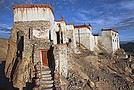
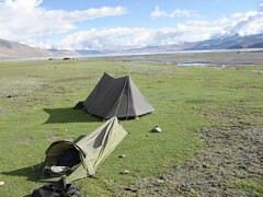
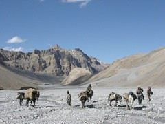
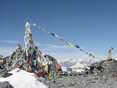
Je joint quelques photos, dans l'ordre, le camping au bord du lac a kiangdom, la remontée dans le vallée avant parang la, les drapeux a prière à 5800m et enfin le bijoux de gompa à Ki en dessous de Kibber
d'ailleurs, je ne vous parle meme pas du spiti car il me faudrai encore cinq pages pour décrire combien c'est beau la bas!!
... pour le descriptif scanné, je t'envoie mon adresse e-mail en messages privés (voir "mes messages privés" en haut d'écran sous le bandeau VoyageForum, et à côté de Mon profil) ...
... pour l'organisation sur place, tout est déjà prévu : nous faisons le maximum par nous-mêmes hors agence et serons partis à pied d'Hémis 15 jours plus tôt avec muletier, chevaux, matériel et toute la bouffe pour un début de trek du côté de la Markha puis descente plein sud vers le Yar La avant remontée nord/nord-est vers Spanchen, Thukje, le Tso Kar et le Tso Moriri ...
Salut
Non finalement je ne suis pas allée ds le Ladakh car apparemment en mai toutes les pistes de trek n'étaient pas encore ouvertes. Pa contre, je suis allée dans le Sikkim, petite enclave entre le Nepal, la Chine et le Bouthan. Magnifique! Je te le recommande. C'est un endroit très préservé, la nature à l'état pure. Tu te promènes ds les rizières, la petite jungle, les champs de maïs, les bambous, les rhododendrons, ... je ne suis pas montée au-delà de 3000m parce que je n'étais pas équipée mais il y a vraiment de super treks à faire!
Bon voyage
Dey
Bonjour.
Merci pour le tuyau. J'ai effectivement lu que le Sikkim est un endroit lui aussi extraordinaire.
Personnellement, après le Ladakh, j'irai cherché un autre coin "typé" mais différent, pour changer.
Faut il amener du matériel: crampons, piolet et autre matériel de montagne d'autre part, faut il amener une tente? un bivouac perso est il envisageable,…
Bjour, j'aimerai faire un treking dans le ladakh sans passer par une agence, auriez vous des noms et adresses de guide sympa et pas cher? des itinairaires de…
Ayant déjà fait un trek dans la Markha l'année dernière, je souhaiterais renouveler l'expérience sur un autre parcours du même type et dans la même région.…
Je pars au Ladakh au mois de juillet et j'aimerai (avec 4 amies) faire le trek de la vallée de la markha. Etant toutes les cinq étudiantes nous avons des…
Hi,
We’re planning to do the 4-day trek from Mestia to Ushguli without an agency. The descriptions mention that there are accommodations at each stop, but we can’t find any details about them. Has anyone got info or feedback on this route?
We're planning to trek in Peru and Bolivia and would love to find some local agencies.
If you know any, could you share details on prices and, of course, the names of the agencies?
Which trek would you recommend?
Elocine
I'm heading out on a fully self-sufficient trek in Morocco (10 days) from Imilchil to Aghbalou.
Can I find screw-on gas canisters (Coleman, Primus) in Marrakech (any addresses?) or in villages between Imilchil and Aghbalou?
If not, are Butagaz canisters for camping gas (small 230g size) available?
Thanks in advance for your tips!
Hello, I’d like to embark on a little trip in my home country, Switzerland. I’ll start walking from La Cure, heading toward Le Noirmont first, then I’ll improvise my route—but it’ll probably follow the French border... at least as far as Lac de Joux.
I’ll decide day by day how much farther to go after that. My goal is to stay in nature as much as possible, wander around for as long as I can, and restock food in villages or towns along the way.
I’m thinking of mostly camping, but we’ll see if I end up in a hotel or another campsite depending on my route.
I’d love to reach La Chaux-de-Fonds on foot... maybe even Delémont.
The whole thing should take about a week, give or take.
I’ll be bringing my dog, and I’m preparing for this as soon as I’m ready.
Any tips to make sure everything goes smoothly for us? Things I should know—or avoid? What about shepherds with their flocks of sheep? And isn’t hunting season open right now?
I’m not sure if what I’m planning is even doable, which is why I’m asking around.
This’ll be my first time doing something like this—wandering in nature *and* with a dog. I’m really excited for this adventure... and I need it. Thanks!
We’re really keen on ecosystems and want to hike in "natural" ancient forests—not planted woods or areas heavily degraded by human activity. Travel guides (like Lonely Planet) don’t provide much info on this. Could you point us to the most interesting spots?
Thanks in advance for your tips.
We wish you happy holidays and a fantastic 2026, full of discoveries!
Claire and Albert
Hi, this might not be the right section, but I’d like to know if it’s possible to start mountaineering with another person without necessarily hiring a guide. We’ve done quite a bit of hiking but not mountaineering—we’ll just do a half-day glacier course. After that, we were thinking of starting with La Grande Motte and the Pointe de la Traversière, which were recommended to us. Honestly, for things like roping up and knots, I’ll learn at home with lots of videos and a book.
I’d love to know if anyone has done treks in the Rwenzori Mountains and how much it costs on average, what the infrastructure is like, the landscapes, and safety in the area. Thanks so much! I’m really looking forward to your replies.
We’re leaving in 9 days for a two-week trip to Madeira, mainly to hike.
From my research, I’ve found that since last year, access to most trails—and systematically for the most popular ones—is now paid. You have to pay an access fee of 4.50 € per person per classified hike in 2026, and even 10.50 € for the most iconic hike: Pico Arieiro to Pico Ruivo. When paying, you also have to choose a day and a 30-minute time slot for your start time. Of course, this reservation is neither changeable nor refundable, even if the weather that day is terrible.
Personally, given the massive influx of tourists to the island in recent years, I don’t mind paying a fee to help maintain the trails. Similarly, setting a limit on the number of people who can hike them per day is certainly preferable to preserve this priceless heritage.
However, what’s much less fair is that in reality, most of the available spots are reserved: 1/ for Madeira residents (which is normal); 2/ for "economic operators" (meaning local tour operators). For example, if you’re a non-resident (independent tourist), no booking is possible for the Pico Arieiro hike for an early morning start before September! So, unfortunately, we’ll have to skip this hike.
It’s the same issue for Ponta de São Lourenço, the 25 Fontes, Pico Ruivo... in short, all the most popular hikes. Oh well, we’ll skip those too!
So my question is: which hikes do you recommend where we won’t face the huge crowds that the others get? And where we can book the day before for the next day, taking the weather into account?
Finally, a quick accommodation question: we’ve booked the first week in Funchal, but I haven’t decided yet for the second week. Do you have any advice on where to stay in the south or north, preferably avoiding overly concrete-heavy and touristy spots?
I’m reposting about the logistics for Samaria Gorge.
I’d love to get recent info, especially about whether it’s possible to park my car in Omalos, do the hike, and then catch a bus back to my vehicle.
In theory, it’s doable, but when you check the KTEL website, there aren’t any feasible schedules listed. If anyone has recently organized this with reliable, verified details, I’d really appreciate it. Thanks in advance!
Hi there,
We’re flying from Montreal to Lyon this August to go hiking in the French Alps. We’ve rented a car and will be staying at campgrounds. We’re planning to do day hikes and want to stay a few days in one spot, do a few hikes, then move on to our next camping spot. Could you share your favorite spots or any recommendations for places to spend a few days with great hikes?
A few details:
We arrive in early August and leave in early September.
We’re looking for day hikes (or shorter), moderate difficulty, with a cumulative elevation gain of no more than 1000m, and of course, beautiful scenery!
We’d prefer not to drive too much—maybe it’s best not to head too far south and deal with unnecessary heat?
Along the same lines, if you know of any great campgrounds where we can start our hike directly without needing the car, we’d love to hear your suggestions!
Hi there,
I’m planning to go hiking on this island and would like to know the best time to do it. I visited for a few days in November 2018—not for hiking but just to explore—and the weather wasn’t great, especially in the mountains. So, is a star-shaped itinerary doable if I rent a car and maybe use two different accommodations?
I’m not planning to join an organized group—just traveling with one other person and organizing things ourselves—unless you’d recommend a local agency or guide. Finally, even though I’ll be getting maps, a topo guide, and a GPS, I’d really appreciate your top hiking recommendations.
Thanks so much for your tips!
I’m planning to do the Mercantour crossing following the Randoxygène route in mid-July.
I’m used to hiking in the mountains, but I sometimes get vertigo, for example on ridges with drops on both sides. I wanted to check if there are any T4 or T3-T4 sections and find out if there are any very exposed passages—and if so, where—so I can plan an alternative route.
Can anyone give me some info on this?
Thanks!
I’m planning a trip around Cap Corse and the AGRIATES in 2026, from May 8th to 15th (there are still 2 spots left, by the way! Just DM me if you're interested).
I’d love to know which hikes are worth prioritizing in the AGRIATES. We’ll be staying in SALECCIA for two days as our base—what should we focus on from there?
A round trip to IGNHU beach? Any other suggestions?
For Ostricano, I think it’s too far for a round trip...
Thanks for your tips!
Have a great day,
Anie, Toulouse
I’d like to get some info about the GR10 Pyrenees traverse. I need help planning the daily stages and accommodations—my wife isn’t an experienced hiker but walks a lot, so I’d like to schedule shorter walking days and thus a longer overall trip in terms of number of days.
Could anyone give me some help and advice?
Best regards,
New to this forum, I’m planning a pretty big project for 2028.
I’m heading to Nepal to do a trek from Kathmandu all the way to Everest Base Camp (a cool 5,300 m 😄).
This trek is a bit special because even though I’ll be part of a group, I’m going solo (so far, no problem—I’m used to it). But it’s my first real trek, and it’s also a humanitarian one: once I reach base camp, I’ll stay an extra week to help clean up the waste left by tens of thousands of climbers! Since I’m originally from South America, from two countries that share the Andes, I have a deep respect for mountains—they fascinate me. So Everest… it’s kind of the trip of a lifetime!
So, a little question for those who’ve done treks to Everest before… any tips for good mental preparation (I’m already working on the physical side)?
Hi there, I’m planning the Annapurna Circuit for March 2027 and I’m looking for a local agency with a local guide—preferably French-speaking—to arrange this trek for us. Any suggestions? Thanks
Hello!
We’re spending a few days in Toraja country at the end of May. We’d love to do a day trek—taking our time—on a route that’s stunning in terms of scenery, but not a level 5 in difficulty!
Any suggestions you can share, please?
Thanks in advance
I’d like to do the Mare a Mare Sud in May over 4 days. I’ve found quite a few places to stay along the route, but I’m stuck on the start and finish.
I’ll be arriving by plane on Sunday evening and would like to start pretty early on Monday morning. Ideally, accommodation right at the trailhead (Alzu di Gallina) would be amazing, but I can’t find anything. Any tips?
Also, for the transfer from Figari Airport to Porto Vecchio or Alzu di Gallina?
At the end, I’d like to pick up a rental car—any advice on that too?
I’m traveling solo by plane to Catania in May and plan to hike the northern side of Etna, starting from Linguaglossa where I’ll arrive by bus. After that, I’d love some info on how to get up to Piano Provenzana (shuttles or hitchhiking), since it seems there’s no public transport except in the summer. Can you sleep there in a free or cheap refuge, or camp? And how far up can you go without having to hire a guide? Thanks in advance. Bernard.
Hi everyone,
I’m heading to Morocco in August and we’ll start with a stop in Chefchaouen (we’re driving).
My question: can anyone suggest a 5-to-7-day loop hiking route from Chefchaouen in Talassemtane Park, ideally passing by the God’s Bridge? Or a paper guidebook that covers a few options?
We prefer wild camping and guesthouses.
Thanks in advance
Hi there, for those who’ve been recently—is it possible to find other solo travelers in March on the island to share transport or room costs? It doesn’t seem easy to travel on a budget.
If you have any recommendations for simple lodgings or places with dorms, I’d love to hear them.
For those who’ve done multi-day treks while moving around: do you need to bring your own sleeping bag? I’d love to hear about itineraries you’ve done without a guide, just with a map and GPS.
Thanks, and have a great day!
Hi everyone!
We’re planning a 15-day road trip to Scotland this summer, specifically to explore and hike on Lewis and Harris—places we’ve never been before. We’ve visited other islands on previous road trips in Scotland (we usually go in April for a week). This would be our first time in Scotland in the summer and for 15 days. We’re looking at late August to early September.
I’m currently drafting the itinerary. We’d be crossing from Ullapool and were thinking of spending 3 nights on Harris and 4 nights on Lewis.
Does that sound balanced to you? Is it better to keep the same accommodation on Harris and the same on Lewis to explore the area? I’d love to hear about any past experiences you’ve had on these islands.
Thanks!
Hi there, I’m trying to leave for 15 days very soon to São Vicente. I’m either looking to join an agency or figure things out on my own to go hiking on one of these islands or both. From what I’ve seen, it’s not easy to organize with local transport, so it gets expensive. Can I use the services of a small local agency? I’m looking for the simplest way to hike for several days. Also, how do you get from São Vicente to São Nicolau? Thanks in advance and have a great day!
Aichatou
I’ve been wanting to do this for several years, and this year’s the one. Next September, I’ll be trekking in Tusheti (Georgia), from Omalo to Shatili.
Of course, I won’t be renting a vehicle that’d just sit unused. No problem getting to Pshaveli, but from there to Omalo, it’s a dirt road (still the case?)
There must be some form of public transport since there are so many guesthouses, and not all travelers come in a 4x4.
If any of you have been to Omalo, could you confirm that these shared transports exist and how often they run?
we’re planning a trip to Yellowstone and hoping to do a three-day backcountry hike if we get a permit.
if any of you have done this before, could you let me know if it’s possible to find water along the way? And if we can transport it, are we allowed to use a stove?
Hello,
I’ll be in Nepal from March 6th to 29th (we’re flying into Kathmandu via Varanasi and leaving via Delhi).
I’m a bit confused about the regulations requiring a guide.
My wife and I (we’re 63 and 64) aren’t experienced trekkers—we’re more used to walking on terrain with very moderate elevation changes. I’m looking for fairly easy hikes, possibly day trips.
Here are my questions:
- Does the Poon Hill trek from Pokhara require a guide, or is it better to go through a local agency? (I’ve seen a lot of them offering 4-day packages)
- I’d like to do a few multi-day hikes around Jomsom (Kagbeni, Mukitinath, Lupra, Marpha)... Do you need a guide for those, and can you find accommodations easily without booking in advance?
Last question—I’m really hesitant to lug around a sleeping bag or down jacket during our 6 weeks in India. Can you easily find these kinds of items at reasonable prices in Pokhara?
Thanks in advance for any tips you can share!
Yann
I’m a 56-year-old man who’s done several treks in Nepal and elsewhere. Also passionate about photography.
I’m looking for one or more people to form a group for a trek in Nepal. The trek is the Annapurna and Manaslu circuit (24 days), including a stop at Tilicho Lake. I’ve got a great itinerary and the local company seems solid. The price is around $1600.
I’ll be in Nepal from April 5 to May 12, 2026, so the trek would need to happen within those dates.