Il fait chaud, je m'occupe en triant des photos et je tombe sur les photos d'un trek que j'ai fait avec des amis (7 personnes pas très jeunes) en 2009. Ce n'est pas moi qui ai fait les photos, donc je peux me permettre de dire que c'est dommage qu'elles restent à dormir au fond de mon disque dur, sans que d'autres en profitent. Alors je vais vous raconter ça, même si ça date.
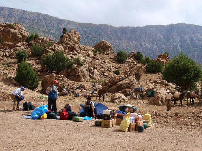
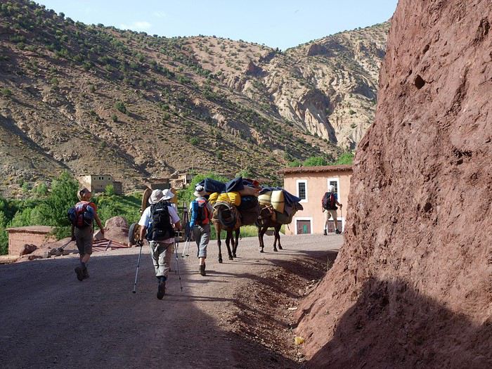
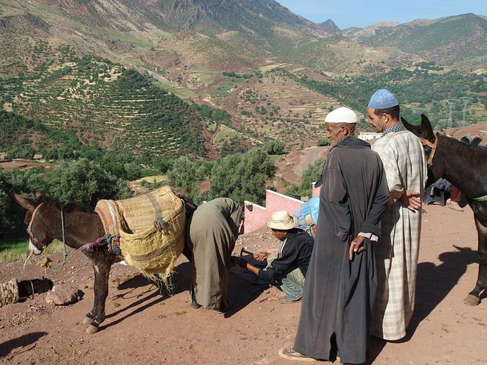
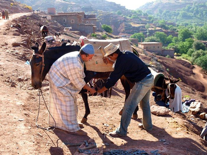
Nous sommes en mai 2009, arrivée à Marrakech, petit tour dans les souks et nuit dans un petit ryad que j'aime bien tout près de la place Jemaa el-fna. Le lendemain, une voiture nous emmène à Azilal, puis à Agouti, entrée de la vallée perchée des Ait Bou Guemmaz. Là, guide et muletiers nous attendent
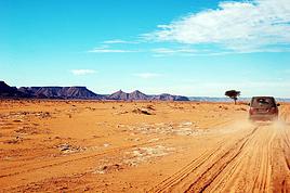
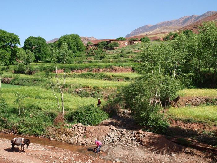
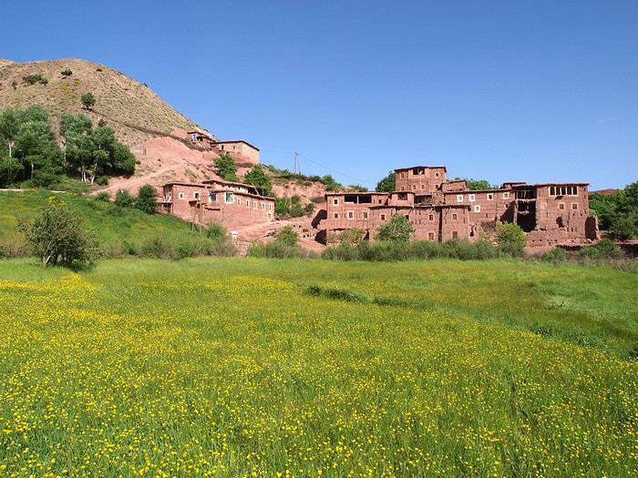
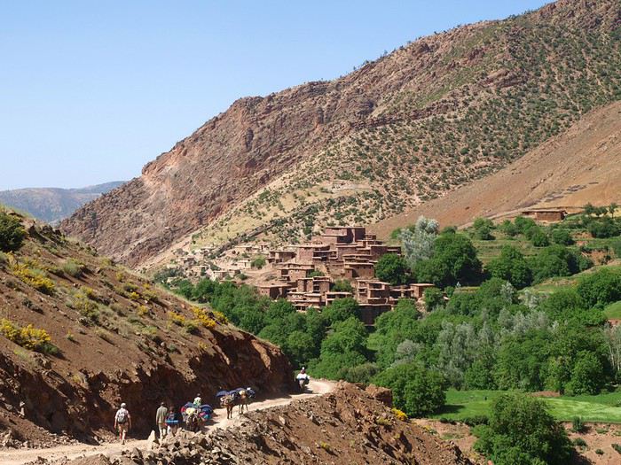
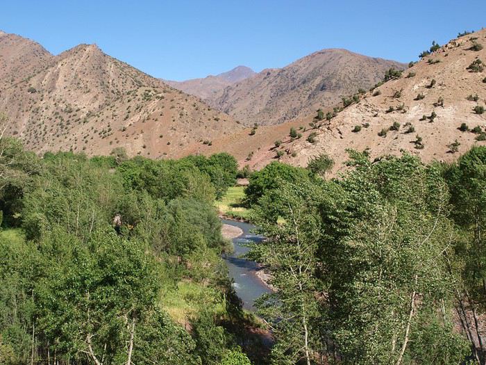
la caravane quitte cette vallée (assez touristique, il faut le dire) et descend vers la vallée de l'oued Lakhdar (la "rivière verte" en arabe) pour se diriger vers le caïdat des Ait Bou Oulli (les "gens des chèvres" en berbère) : ici, le Créateur avait le pinceau inspiré !
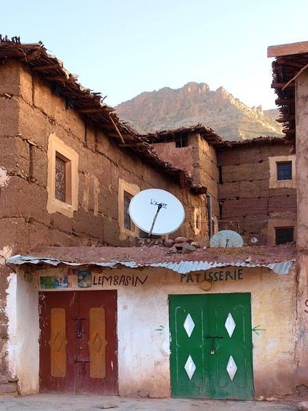
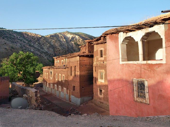
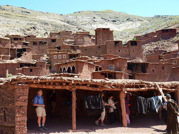
Vers 17h, nous arrivons au "centre-ville" avec ses magasins :
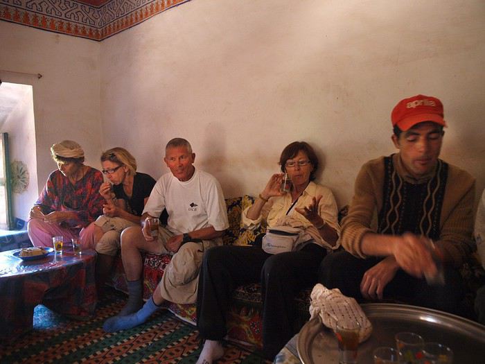
Un thé à la menthe (it's tea-time) en apéro, un couscous et une bonne nuit
Et le lendemain matin, on repart pour une longue journée,
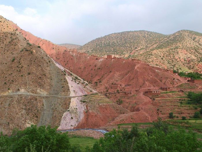
qui commence par un petit tour chez les Ait Bou Oulli (Abachkou, notamment) et leurs jardins cultivés,
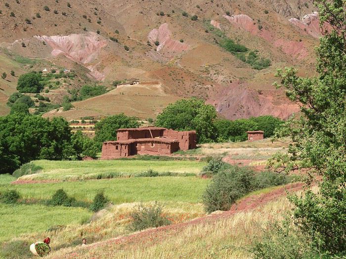
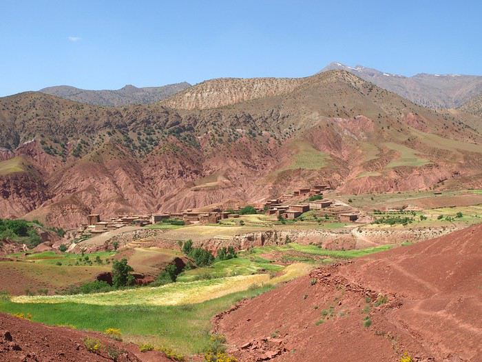
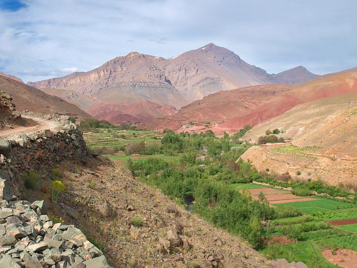
puis en montant, la vue se dégage :
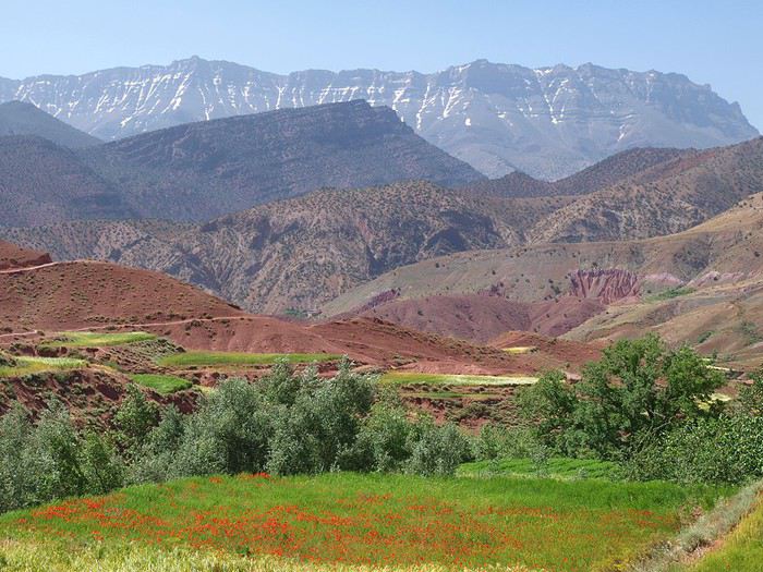
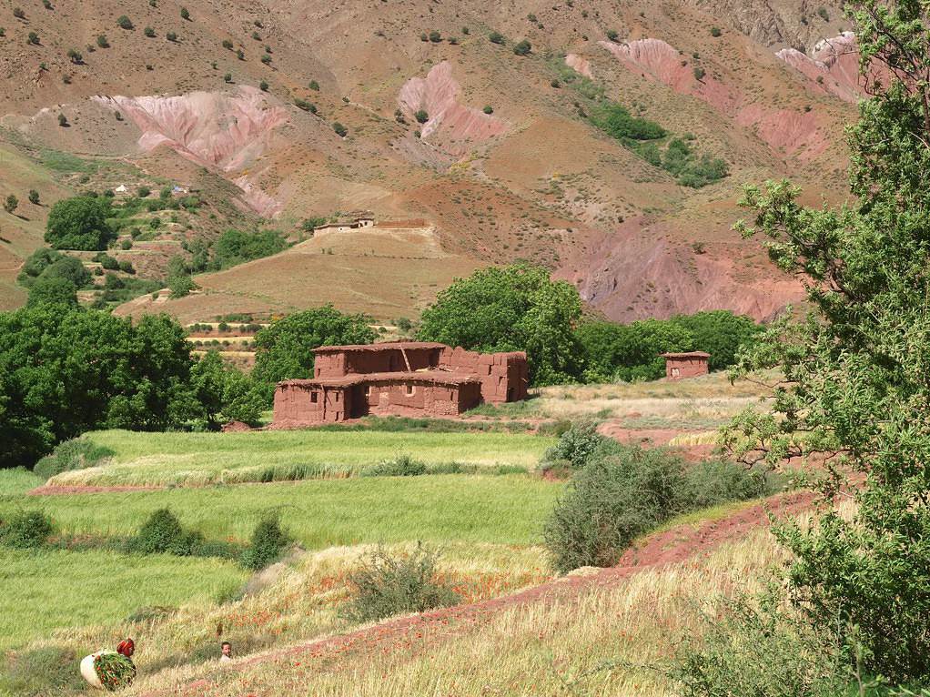
il y a encore des coquelicots (servent de colorants et de médicaments), au fond le Jbel Rhat qui culmine à 3800m.
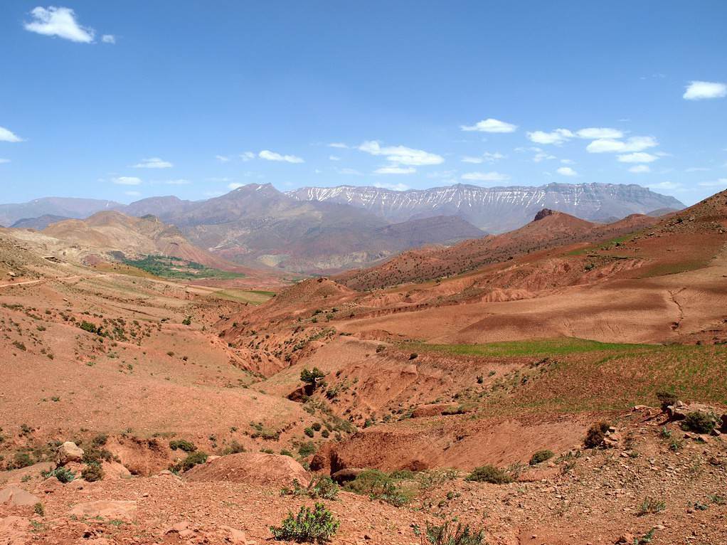
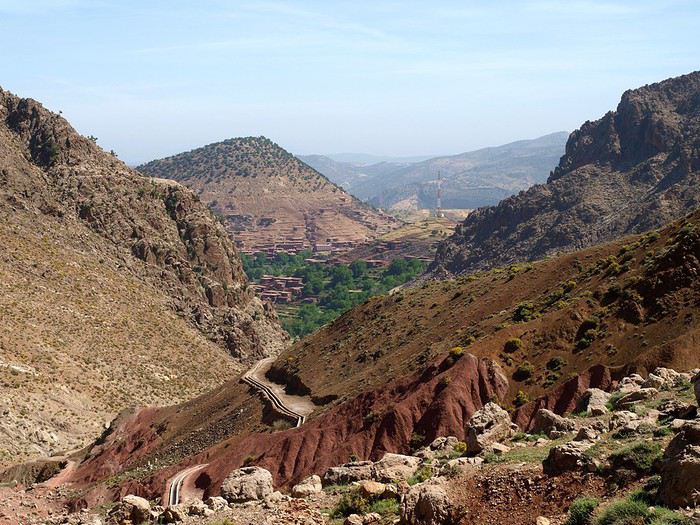
et enfin on grimpe vers un col de plus en plus aride qui domine les Ait Bou Oulli.
Ensuite ça va descendre vers un autre gros centre : Tizi n'oubadou et Ait Blal (avec son souk)
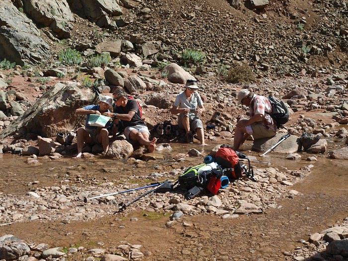
Dans la descente, un village et un bain de pieds...
Les jardins de Tizi n'oubadou (le village est dans un col, à gauche)
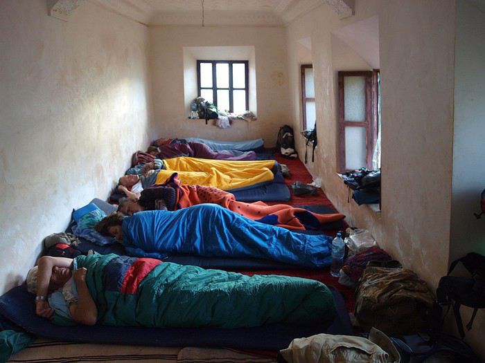
En arrivant, quelques difficultés pour trouver un gîte, le gîte "officiel" pour éventuels touristes (ils sont rares par ici) étant déjà plein de gens du cru venant pour le souk du lendemain. Alors notre guide nous trouve un toit : on entre par l'écurie et l'étable avec leurs lots d'odeurs, à côté les lieux d'aisance avec eux aussi des odeurs au moins aussi violentes, quelques marches nous élèvent vers la "beyt d'dyaf" le salon des invités, simple mais inodore ! La nuit fut difficile pour celles et ceux qui durent se lever pour se soulager, qui pour ne pas déranger la mule la vache, durent sortir dans le noir et uriner sous les étoiles.
A suivre
3 ème jour : c'est jour de souk à Ait Blal, le goudron venait juste d'y arriver à cette époque et donc le souk était encore très blédard, donc l'ambiance et le décor étaient à la hauteur de la nuit...
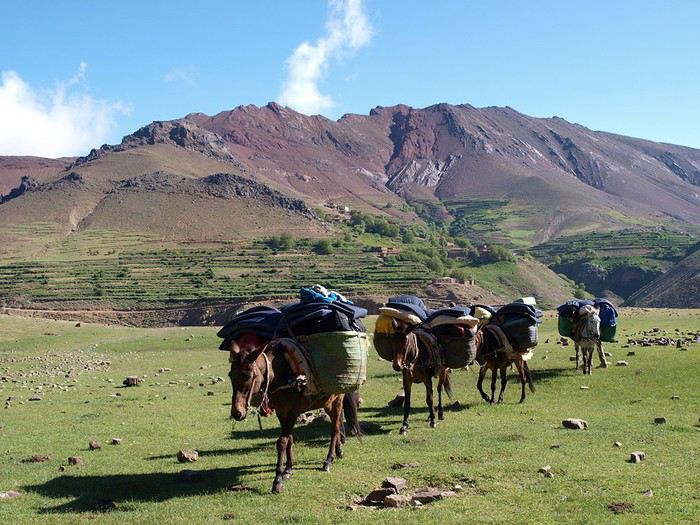
Au travail, maintenant ! on doit atteindre Tarbat n'Tirsal au pied du Jbel Rhat, quasiment en ligne droite. Ce qui oblige d'abord à monter sur un plateau d'altitude, où bientôt monteront moutons, vaches et bergers pour trouver une herbe moins sèche.
On rencontre quelques jeunes filles montées glaner des coquelicots et de l'herbe pour la vache (car les vaches restent à l'étable : il n'y a pas de prés ici).
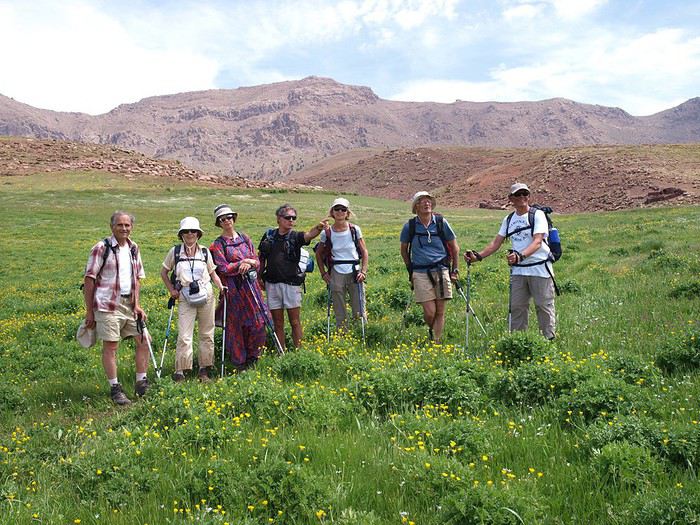
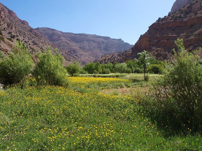
Et voilà les prairies d'altitude :
en cette saisonn, l'herbe est haute, il y a des fleurs, quelques touristes (la preuve), mais pas de gens d'ici qui doivent attendre une date choisie par les anciens avant d'avoir le droit de monter là-haut avec leurs bêtes.
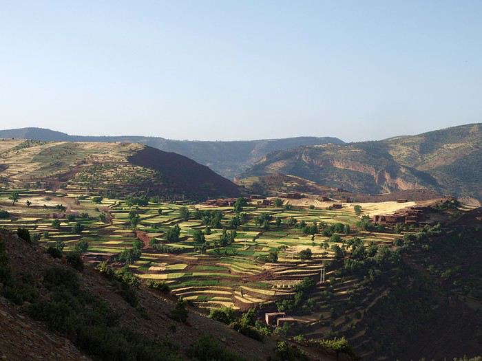
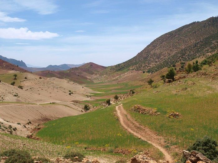
On arrive en bordure du plateau et on se met à descendre dans les terrasses.
En bas, un oued, une piste (sans doute une route aujourd'hui) et un village Imi n'Waqqa (=l'entrée de la gorge")
mais la gorge , on l'évite et remonte une longue piste
jusqu'à notre gîte. Le village est au pied des falaises du Chat et la lumière du soir met en valeur les couleurs.
Plus tard, il fait encore jour mais les randonneurs se couchent avant les poules !
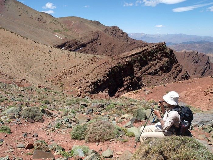
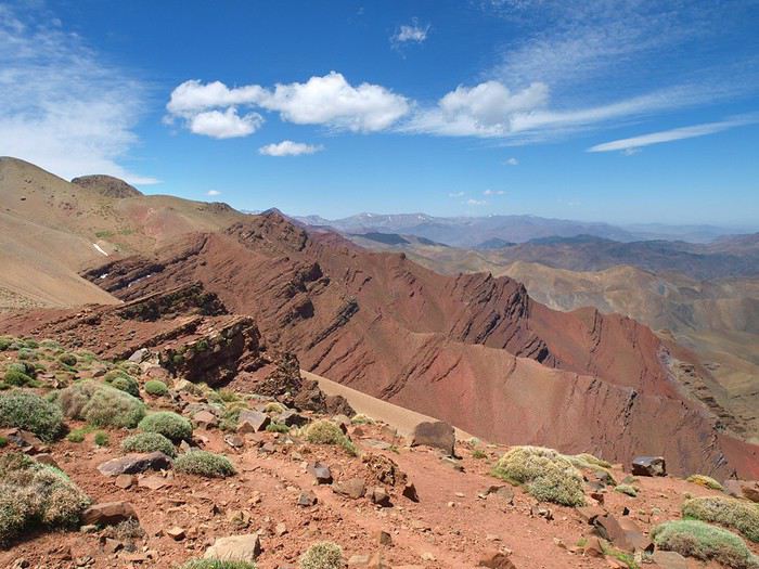
4eme jour : au menu, le balcon du Rhat : un chemin qui court dans les flancs terminaux du Rhat, à 3000m environ, et qui offre des vues inoubliables sur les vallées alentour et sur des jebels secondaires mais aux couleurs tranchées : noir, rouge sang, orange, rose...
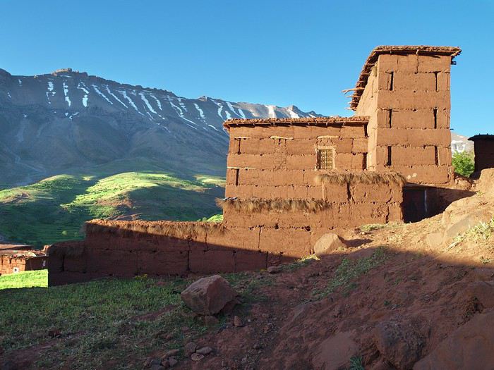
D'abord notre photographe profite des premiers rayons de soleil pour mettre en valeur le village :
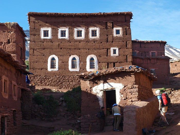
C'est la maison aux fenêtres fardées où la chaux a remplacé le khôl...
Une montée assez longue et nous arrivons au "balcon" :
Et là c'est l'éblouissement :
Remarquer en bas le village dans son écrin de verdure créé par les Berbères qui ont su profiter d'une source...
Et puis ça descend, retour vers les villages et leur verdure.
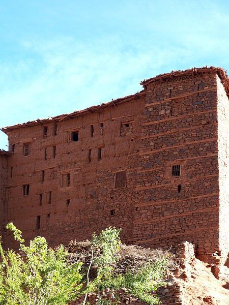
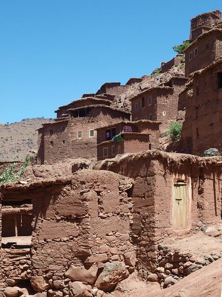
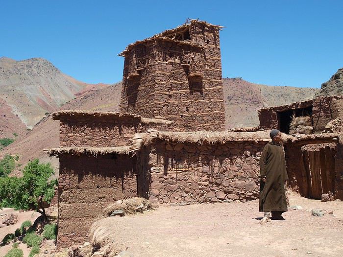
Une tighermt (maison fortifiée) :
Et la caravane arrive à l'hôtel Terminus du bled... Un repos bien mérité une fois de plus.
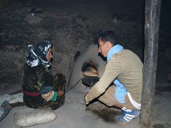
Au rez-de-chaussée, domaine des animaux et des femmes, voici la boulangère et son four :
5ème jour. L'objectif : rejoindre la Tessaout (oued important) un peu en amont de Toufghine, à Ait Ali n'Ito pour être précis, où un gîte de qualité nous attend. Ce gîte existait déjà il y a 30 ans, mais était alors beaucoup plus fruste.
En sortant du village, je ne fais pas attention et le guide nous emmène sur le chemin le plus rapide pour atteindre notre but, alors que je connais un autre chemin qui fait un petit détour et passe par des "terrains de golf", des prairies dignes de l'Ecosse ou de la Normandie. Je m'en rends compte trop tard, tant pis!
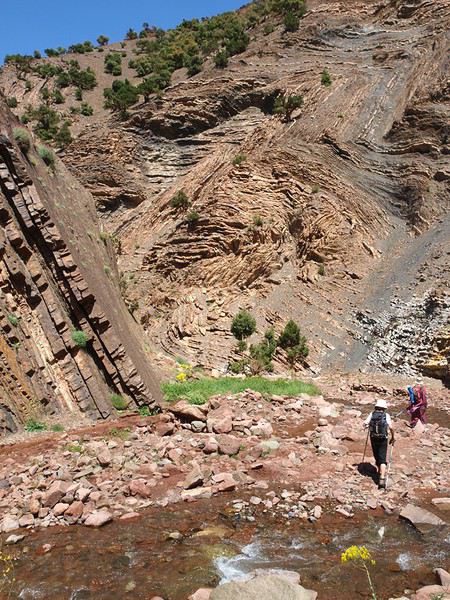
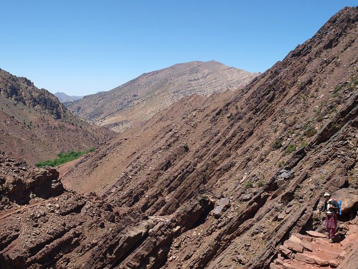
Une bonne heure plus tard, nous sommes à un col : de l'autre côté, c'est assez aride et le chemin s'enfonce dans une gorge de schistes.
Quelques villages perdus dans longue gorge en pente douce...
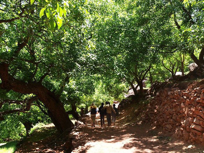
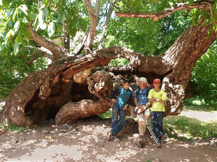
Et puis la gorge s'ouvre, l'eau devient plus abondante, et voilà les magnifiques noyers de Imi n'Tisgui, qui donnent fraîcheur et ombre aux randonneurs.
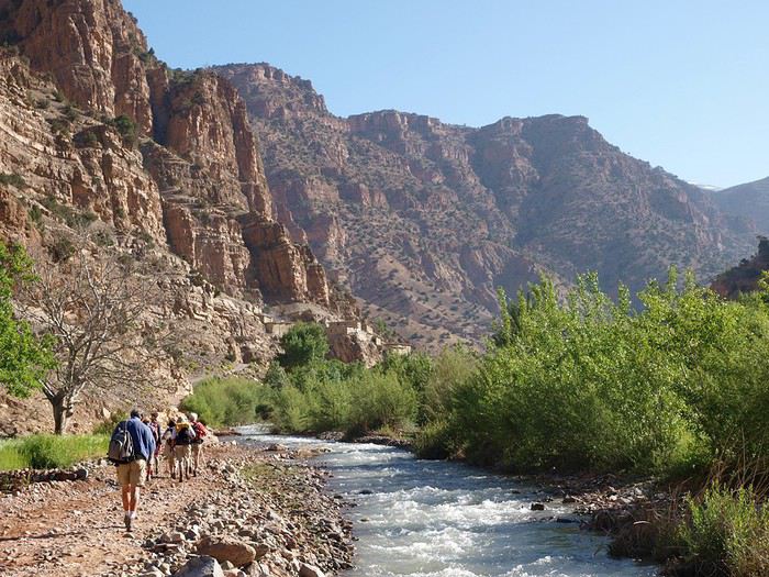
Ensuite on suit l'oued qui va se jeter dans la Tessaout, qui coule à gros bouillons ; en effet, là-haut où elle naît, il y a encore de la neige et cette neige fond assez vite sous ce beau soleil.
Il nous reste 20mn pour remonter cet oued jusqu'à notre auberge : luxe ! car il y a de l'eau chaude, de vraies toilettes, du carrelage dans le couloir et les sanitaires...
Demain sera une journée de semi-repos, journée-tampon permettant de rattraper des retards éventuels et permettant aussi aux jambes de nos retraités d'avoir quelques instants de répit.
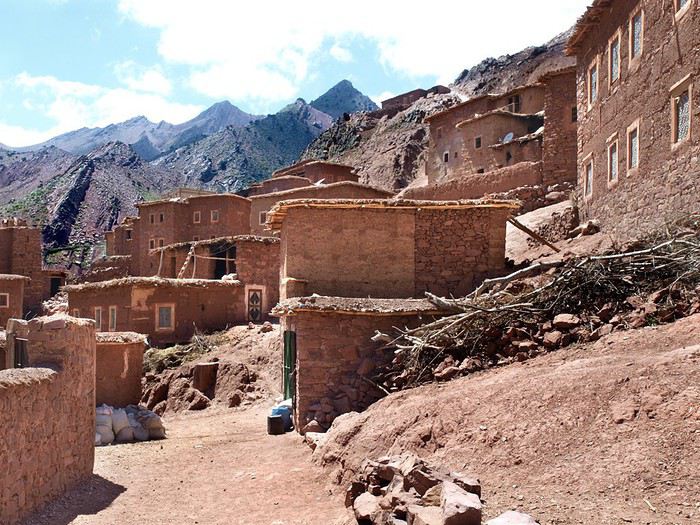
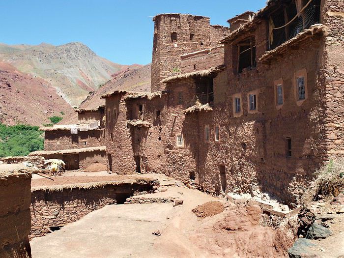
le village d'Ait Ali n'Ito, vu de l'auberge avec son grenier fortifié au centre.
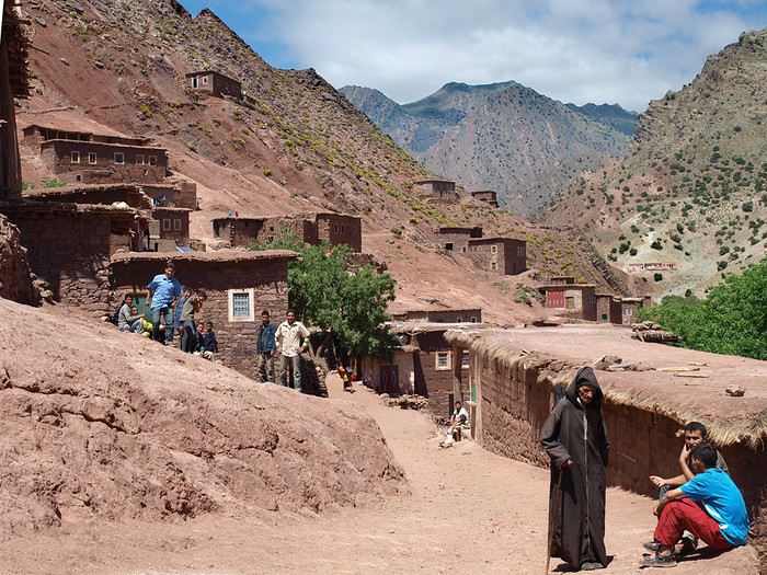
6ème jour : à 3-4km du gîte, se trouve Magdaz, un des plus beaux villages de l'Atlas, où une maison sur 2 est une tighermt, une maison en forme de tour à 4 ou 5 étages. Bien sûr, on se dérouille les jambes et on y va :
Vue du village depuis le toit- terrasse d'une tighermt;
Le soir, apéro : nous avions pensé à emporter une bouteille de pastis et on colorait l'eau avec le Ricard, eh, fallait tenir 7 jours à 7 sur une bouteille !
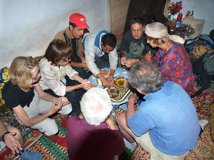
puis le repas : couscous ou tajine suivant les jours; heureusement il y a plusieurs recettes de tajines !
7ème jour : le jour le plus long et le plus monotone. Au programme, remontée des gorges de la Tessaout jusqu'à Amezri, ça fait pas loin de 20k ! et pas simples : souvent obligés de marcher sur les galets (ce qui est pénible), très nombreuses traversées (donc se déchausser, traverser avec l'eau jusqu'aux genoux qui cherche à vous faire tomber, les galets qui blessent les pieds.)
Au milieu, Ichbaken, village qui a de la gueule lui aussi.
Et un événement qui m'a profondément touché. Notre guide nous dit qu'il a rendez-vous avec des gens, nous emmène à leur maison, encore une tighermt à 5 étages, on nous fait visiter, on nous offre le thé et on nous amène la jeune fille de la maison, 15-16 ans, joli minois, bien habillée. Explication ; les parents se proposaient d'envoyer leur fille à Casa chez des gens riches pour y devenir servante, la "bonne" quoi ! Et notre Mohamed servait d'intermédiaire, d'agent de placement. Pour le profane, rien d'anormal. Mais quand on connait mieux le système, la jolie petite bonne va devenir esclave (payée à un demi-Sic) et presque sûrement se faire déflorer par le maître de maison et ses fils ! Inconscience des parents ? j'en doute ! Ce qui n'a pas fait remonter le Mohamed dans mon estime...
Sur la terrasse de la maison de ces gens :
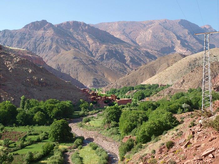
Enfin, vers 17h, la vallée s'élargit, les cultures et les terres rouges reviennent, voilà Amezri, dernier village sur la Tessaout. Un peu plus haut, elle sort d'un canyon large de quelques dizaines de mètres, haut de 600 ou 800m, long de qq km, qui débute tout près de sa source à 3300m d'altitude.
Et sous la butte rouge, notre gîte ; le propriétaire habite la tighermt d'à-côté.
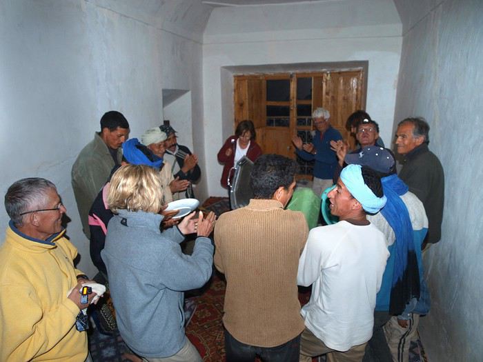
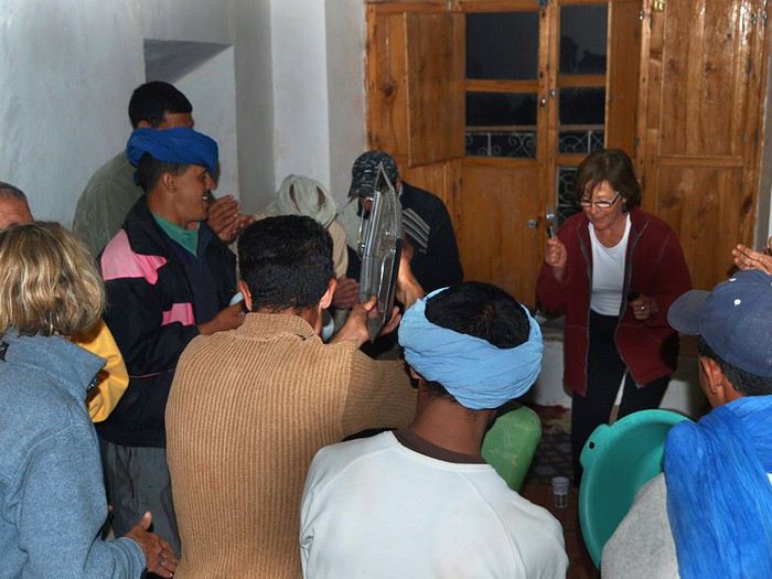
La soirée a été animée ; sitôt avalés le tajine et les inévitables tranches d'orange à la cannelle, le patron débarque avec le cuistot et les muletiers, armés d'ustensiles de cuisine, et se mettent à nous jouer de la musique berbère, l'ahouach, la danse berbère. En fait de musique, ce sont des percussions qui donnent le rythme et bientôt certains se lancent dans des mélopées ; traditionnellement, les paroles sont improvisées par le chanteur et souvent sont ironiques, m'a-t-on dit. En tout cas, eux se sont bien amusés, nous aussi à un degré moindre ne saisissant pas le sens de ces chansons. On a presque eu du mal à les virer pour pouvoir se coucher.
Un mot sur nos rapports avec les muletiers, le cuisinier ou les tenanciers : ces gens-là ne parlent pas ou très peu le fran��ais, de plus notre groupe comme le leur est suffisamment important pour ne pas avoir besoin de communiquer avec l'autre. Donc des gens très gentils, très attentionnés, mais pas de vrais contacts. Il en est de même avec les gens des villages ou les bergers : notre groupe de 7 est trop gros pour qu'ils essaient de communiquer. Ayant souvent marché dans ces montagnes à 2 ou 3 , j'ai eu de très nombreuses occasions de contacts avec des gamins, des bergers, des vieux dans les villages ou des muletiers qui suivaient la même route... Quelques morts de français de leur part, un peu d'arabe du mien, savoir parler par gestes et on se comprend.
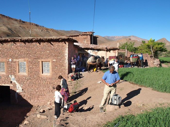
Les préparatifs du départ comme chaque matin :
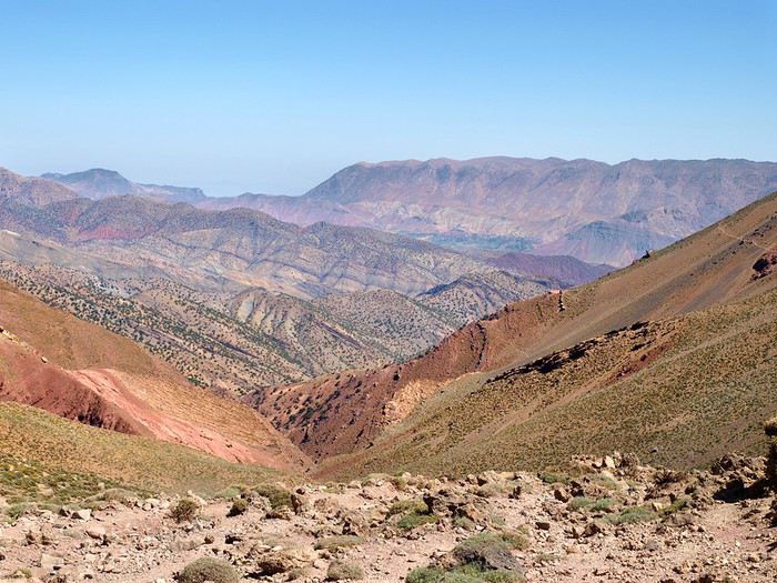
Et c'est le dernier jour : d'abord un col à gravir, le Tizi n'Rougoult, un bel effort mais récompensé par de beaux paysages.
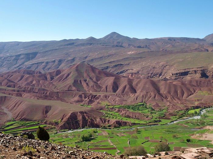
Amezri, à la fois rouge et verte !
Un cimetière au passage : sous chaque pierre, un macchabée. On enterre, on dit au revoir et on n'y revient plus. mais hommes et bêtes respectent ces lieux.
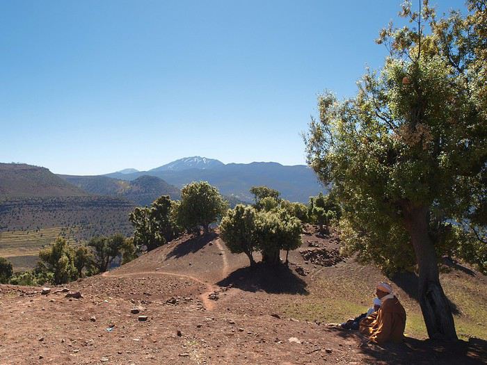
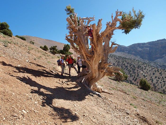
Des genévriers tourières , rares arbres à pouvoir vivre au-dessus de 2500m, même 3000... Ce genre d'ancêtre peut bien avoir 400 ou 500 ans, c'est un bois très très dur, qui brûle en dégageant une odeur genre encens. Ceux-là sont encore bien vivants, s'ils n'ont pas beaucoup de feuilles, c'est parce qu'on s'acharne à leur couper les branches les moins vieilles pour le feu de la cuisine. Allah s'arrangera pour qu'il survive ! et il survit !
Et nous voilà au col : là-bas dans le fond, cette tache de verdure, c'est le val Ait Bou Oulli, d'où nous sommes partis; et au dessus à gauche, on voit le premier col de la randonnée. maintenant reste plus qu'à descendre jusque là-bas.
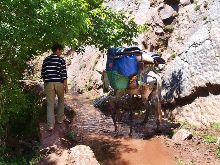
S'ensuit une longue descente en suivant un petit torrent qu'on va traverser cinquante fois dans un décor assez aride au début
plus verdoyant ensuite, et... on voit là-bas au bout la piste qu'on a remontée le 1er jour pour atteindre le gîte. Ouf...
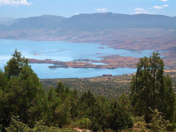
Pour bien finir, notre minibus passe par le lac de Bin el Ouidane
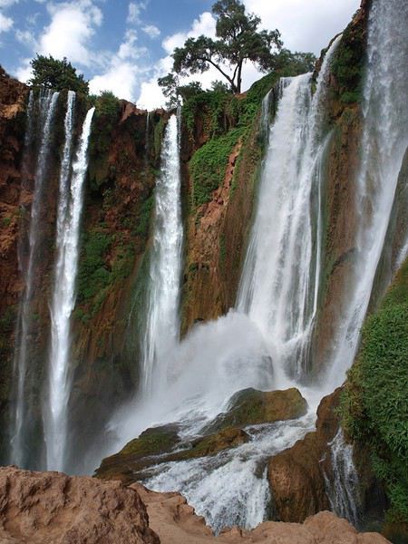
pour atterrir aux cascades d'Ouzoud
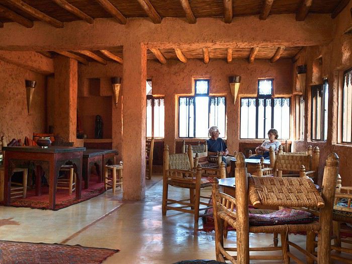
et y dormir dans un joli Ryad bien mérité.
le lendemain retour à Marrakech et avion de retour.
Une dernière image de sérénité et de beauté :
En mai 2009 j’arrivais à Agouti pour la première fois , j’avais entendu parler des Ait Bougmez , c'était Les deux derniers jours de mon séjour .
J’ai toujours regretté de ne pas avoir prévu plus de temps , cette vallée a été ma découverte 2009 . Par la suite j’y suis revenue mais je n’ai pas retrouvé le charme de cette première approche , même si je l’aime toujours autant .
Tes photos sont parlantes , notamment au niveau des couleurs , ces verts et ces ocres je ne m’en lasse pas .
Merci d’avoir fait remonter ce séjour .
Nous prévoyons de faire le trek de la vallee des roses sans guide. De quel village faut il débuter le trek? L'itineraire est il facile a trouver? 3 a 4 jours…
On va voyager au maroc le mois d’avril pour faire un trek. On a 10 jours. On est habitués à faire la rando, ski rando et un peu d’alpinisme. On est en bonne…
Nous avons prévu de partir 2 semaines faire un trek par nos propres moyens (histoire d'être une peu plus libre) dans le Haut Atlas et nous aimerions monter le…
Nous sommes actuellement en train de finaliser un parcours de voyage au Maroc. Nous avons prévu de monter au M'goun depuis Agouti (vallée Ait Bougmez). Après…
Hi,
We’re planning to do the 4-day trek from Mestia to Ushguli without an agency. The descriptions mention that there are accommodations at each stop, but we can’t find any details about them. Has anyone got info or feedback on this route?
We're planning to trek in Peru and Bolivia and would love to find some local agencies.
If you know any, could you share details on prices and, of course, the names of the agencies?
Which trek would you recommend?
Elocine
I'm heading out on a fully self-sufficient trek in Morocco (10 days) from Imilchil to Aghbalou.
Can I find screw-on gas canisters (Coleman, Primus) in Marrakech (any addresses?) or in villages between Imilchil and Aghbalou?
If not, are Butagaz canisters for camping gas (small 230g size) available?
Thanks in advance for your tips!
Hello, I’d like to embark on a little trip in my home country, Switzerland. I’ll start walking from La Cure, heading toward Le Noirmont first, then I’ll improvise my route—but it’ll probably follow the French border... at least as far as Lac de Joux.
I’ll decide day by day how much farther to go after that. My goal is to stay in nature as much as possible, wander around for as long as I can, and restock food in villages or towns along the way.
I’m thinking of mostly camping, but we’ll see if I end up in a hotel or another campsite depending on my route.
I’d love to reach La Chaux-de-Fonds on foot... maybe even Delémont.
The whole thing should take about a week, give or take.
I’ll be bringing my dog, and I’m preparing for this as soon as I’m ready.
Any tips to make sure everything goes smoothly for us? Things I should know—or avoid? What about shepherds with their flocks of sheep? And isn’t hunting season open right now?
I’m not sure if what I’m planning is even doable, which is why I’m asking around.
This’ll be my first time doing something like this—wandering in nature *and* with a dog. I’m really excited for this adventure... and I need it. Thanks!
We’re really keen on ecosystems and want to hike in "natural" ancient forests—not planted woods or areas heavily degraded by human activity. Travel guides (like Lonely Planet) don’t provide much info on this. Could you point us to the most interesting spots?
Thanks in advance for your tips.
We wish you happy holidays and a fantastic 2026, full of discoveries!
Claire and Albert
Hi, this might not be the right section, but I’d like to know if it’s possible to start mountaineering with another person without necessarily hiring a guide. We’ve done quite a bit of hiking but not mountaineering—we’ll just do a half-day glacier course. After that, we were thinking of starting with La Grande Motte and the Pointe de la Traversière, which were recommended to us. Honestly, for things like roping up and knots, I’ll learn at home with lots of videos and a book.
I’d love to know if anyone has done treks in the Rwenzori Mountains and how much it costs on average, what the infrastructure is like, the landscapes, and safety in the area. Thanks so much! I’m really looking forward to your replies.
We’re leaving in 9 days for a two-week trip to Madeira, mainly to hike.
From my research, I’ve found that since last year, access to most trails—and systematically for the most popular ones—is now paid. You have to pay an access fee of 4.50 € per person per classified hike in 2026, and even 10.50 € for the most iconic hike: Pico Arieiro to Pico Ruivo. When paying, you also have to choose a day and a 30-minute time slot for your start time. Of course, this reservation is neither changeable nor refundable, even if the weather that day is terrible.
Personally, given the massive influx of tourists to the island in recent years, I don’t mind paying a fee to help maintain the trails. Similarly, setting a limit on the number of people who can hike them per day is certainly preferable to preserve this priceless heritage.
However, what’s much less fair is that in reality, most of the available spots are reserved: 1/ for Madeira residents (which is normal); 2/ for "economic operators" (meaning local tour operators). For example, if you’re a non-resident (independent tourist), no booking is possible for the Pico Arieiro hike for an early morning start before September! So, unfortunately, we’ll have to skip this hike.
It’s the same issue for Ponta de São Lourenço, the 25 Fontes, Pico Ruivo... in short, all the most popular hikes. Oh well, we’ll skip those too!
So my question is: which hikes do you recommend where we won’t face the huge crowds that the others get? And where we can book the day before for the next day, taking the weather into account?
Finally, a quick accommodation question: we’ve booked the first week in Funchal, but I haven’t decided yet for the second week. Do you have any advice on where to stay in the south or north, preferably avoiding overly concrete-heavy and touristy spots?
I’m reposting about the logistics for Samaria Gorge.
I’d love to get recent info, especially about whether it’s possible to park my car in Omalos, do the hike, and then catch a bus back to my vehicle.
In theory, it’s doable, but when you check the KTEL website, there aren’t any feasible schedules listed. If anyone has recently organized this with reliable, verified details, I’d really appreciate it. Thanks in advance!
Hi there,
We’re flying from Montreal to Lyon this August to go hiking in the French Alps. We’ve rented a car and will be staying at campgrounds. We’re planning to do day hikes and want to stay a few days in one spot, do a few hikes, then move on to our next camping spot. Could you share your favorite spots or any recommendations for places to spend a few days with great hikes?
A few details:
We arrive in early August and leave in early September.
We’re looking for day hikes (or shorter), moderate difficulty, with a cumulative elevation gain of no more than 1000m, and of course, beautiful scenery!
We’d prefer not to drive too much—maybe it’s best not to head too far south and deal with unnecessary heat?
Along the same lines, if you know of any great campgrounds where we can start our hike directly without needing the car, we’d love to hear your suggestions!
Hi there,
I’m planning to go hiking on this island and would like to know the best time to do it. I visited for a few days in November 2018—not for hiking but just to explore—and the weather wasn’t great, especially in the mountains. So, is a star-shaped itinerary doable if I rent a car and maybe use two different accommodations?
I’m not planning to join an organized group—just traveling with one other person and organizing things ourselves—unless you’d recommend a local agency or guide. Finally, even though I’ll be getting maps, a topo guide, and a GPS, I’d really appreciate your top hiking recommendations.
Thanks so much for your tips!
I’m planning to do the Mercantour crossing following the Randoxygène route in mid-July.
I’m used to hiking in the mountains, but I sometimes get vertigo, for example on ridges with drops on both sides. I wanted to check if there are any T4 or T3-T4 sections and find out if there are any very exposed passages—and if so, where—so I can plan an alternative route.
Can anyone give me some info on this?
Thanks!
I’m planning a trip around Cap Corse and the AGRIATES in 2026, from May 8th to 15th (there are still 2 spots left, by the way! Just DM me if you're interested).
I’d love to know which hikes are worth prioritizing in the AGRIATES. We’ll be staying in SALECCIA for two days as our base—what should we focus on from there?
A round trip to IGNHU beach? Any other suggestions?
For Ostricano, I think it’s too far for a round trip...
Thanks for your tips!
Have a great day,
Anie, Toulouse
I’d like to get some info about the GR10 Pyrenees traverse. I need help planning the daily stages and accommodations—my wife isn’t an experienced hiker but walks a lot, so I’d like to schedule shorter walking days and thus a longer overall trip in terms of number of days.
Could anyone give me some help and advice?
Best regards,
New to this forum, I’m planning a pretty big project for 2028.
I’m heading to Nepal to do a trek from Kathmandu all the way to Everest Base Camp (a cool 5,300 m 😄).
This trek is a bit special because even though I’ll be part of a group, I’m going solo (so far, no problem—I’m used to it). But it’s my first real trek, and it’s also a humanitarian one: once I reach base camp, I’ll stay an extra week to help clean up the waste left by tens of thousands of climbers! Since I’m originally from South America, from two countries that share the Andes, I have a deep respect for mountains—they fascinate me. So Everest… it’s kind of the trip of a lifetime!
So, a little question for those who’ve done treks to Everest before… any tips for good mental preparation (I’m already working on the physical side)?
Hi there, I’m planning the Annapurna Circuit for March 2027 and I’m looking for a local agency with a local guide—preferably French-speaking—to arrange this trek for us. Any suggestions? Thanks
Hello!
We’re spending a few days in Toraja country at the end of May. We’d love to do a day trek—taking our time—on a route that’s stunning in terms of scenery, but not a level 5 in difficulty!
Any suggestions you can share, please?
Thanks in advance
I’d like to do the Mare a Mare Sud in May over 4 days. I’ve found quite a few places to stay along the route, but I’m stuck on the start and finish.
I’ll be arriving by plane on Sunday evening and would like to start pretty early on Monday morning. Ideally, accommodation right at the trailhead (Alzu di Gallina) would be amazing, but I can’t find anything. Any tips?
Also, for the transfer from Figari Airport to Porto Vecchio or Alzu di Gallina?
At the end, I’d like to pick up a rental car—any advice on that too?
I’m traveling solo by plane to Catania in May and plan to hike the northern side of Etna, starting from Linguaglossa where I’ll arrive by bus. After that, I’d love some info on how to get up to Piano Provenzana (shuttles or hitchhiking), since it seems there’s no public transport except in the summer. Can you sleep there in a free or cheap refuge, or camp? And how far up can you go without having to hire a guide? Thanks in advance. Bernard.
Hi everyone,
I’m heading to Morocco in August and we’ll start with a stop in Chefchaouen (we’re driving).
My question: can anyone suggest a 5-to-7-day loop hiking route from Chefchaouen in Talassemtane Park, ideally passing by the God’s Bridge? Or a paper guidebook that covers a few options?
We prefer wild camping and guesthouses.
Thanks in advance
Hi there, for those who’ve been recently—is it possible to find other solo travelers in March on the island to share transport or room costs? It doesn’t seem easy to travel on a budget.
If you have any recommendations for simple lodgings or places with dorms, I’d love to hear them.
For those who’ve done multi-day treks while moving around: do you need to bring your own sleeping bag? I’d love to hear about itineraries you’ve done without a guide, just with a map and GPS.
Thanks, and have a great day!
Hi everyone!
We’re planning a 15-day road trip to Scotland this summer, specifically to explore and hike on Lewis and Harris—places we’ve never been before. We’ve visited other islands on previous road trips in Scotland (we usually go in April for a week). This would be our first time in Scotland in the summer and for 15 days. We’re looking at late August to early September.
I’m currently drafting the itinerary. We’d be crossing from Ullapool and were thinking of spending 3 nights on Harris and 4 nights on Lewis.
Does that sound balanced to you? Is it better to keep the same accommodation on Harris and the same on Lewis to explore the area? I’d love to hear about any past experiences you’ve had on these islands.
Thanks!
Hi there, I’m trying to leave for 15 days very soon to São Vicente. I’m either looking to join an agency or figure things out on my own to go hiking on one of these islands or both. From what I’ve seen, it’s not easy to organize with local transport, so it gets expensive. Can I use the services of a small local agency? I’m looking for the simplest way to hike for several days. Also, how do you get from São Vicente to São Nicolau? Thanks in advance and have a great day!
Aichatou
I’ve been wanting to do this for several years, and this year’s the one. Next September, I’ll be trekking in Tusheti (Georgia), from Omalo to Shatili.
Of course, I won’t be renting a vehicle that’d just sit unused. No problem getting to Pshaveli, but from there to Omalo, it’s a dirt road (still the case?)
There must be some form of public transport since there are so many guesthouses, and not all travelers come in a 4x4.
If any of you have been to Omalo, could you confirm that these shared transports exist and how often they run?
we’re planning a trip to Yellowstone and hoping to do a three-day backcountry hike if we get a permit.
if any of you have done this before, could you let me know if it’s possible to find water along the way? And if we can transport it, are we allowed to use a stove?
Hello,
I’ll be in Nepal from March 6th to 29th (we’re flying into Kathmandu via Varanasi and leaving via Delhi).
I’m a bit confused about the regulations requiring a guide.
My wife and I (we’re 63 and 64) aren’t experienced trekkers—we’re more used to walking on terrain with very moderate elevation changes. I’m looking for fairly easy hikes, possibly day trips.
Here are my questions:
- Does the Poon Hill trek from Pokhara require a guide, or is it better to go through a local agency? (I’ve seen a lot of them offering 4-day packages)
- I’d like to do a few multi-day hikes around Jomsom (Kagbeni, Mukitinath, Lupra, Marpha)... Do you need a guide for those, and can you find accommodations easily without booking in advance?
Last question—I’m really hesitant to lug around a sleeping bag or down jacket during our 6 weeks in India. Can you easily find these kinds of items at reasonable prices in Pokhara?
Thanks in advance for any tips you can share!
Yann
I’m a 56-year-old man who’s done several treks in Nepal and elsewhere. Also passionate about photography.
I’m looking for one or more people to form a group for a trek in Nepal. The trek is the Annapurna and Manaslu circuit (24 days), including a stop at Tilicho Lake. I’ve got a great itinerary and the local company seems solid. The price is around $1600.
I’ll be in Nepal from April 5 to May 12, 2026, so the trek would need to happen within those dates.
 la caravane quitte cette vallée (assez touristique, il faut le dire) et descend vers la vallée de l'oued Lakhdar (la "rivière verte" en arabe) pour se diriger vers le caïdat des Ait Bou Oulli (les "gens des chèvres" en berbère) : ici, le Créateur avait le pinceau inspiré !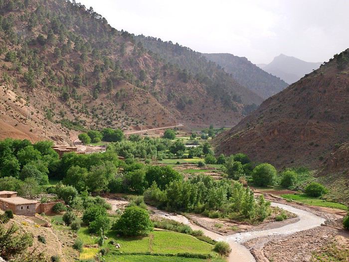
 puis en montant, la vue se dégage :
il y a encore des coquelicots (servent de colorants et de médicaments), au fond le Jbel Rhat qui culmine à 3800m.
puis en montant, la vue se dégage :
il y a encore des coquelicots (servent de colorants et de médicaments), au fond le Jbel Rhat qui culmine à 3800m.
 On rencontre quelques jeunes filles montées glaner des coquelicots et de l'herbe pour la vache (car les vaches restent à l'étable : il n'y a pas de prés ici).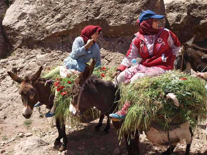
 On arrive en bordure du plateau et on se met à descendre dans les terrasses.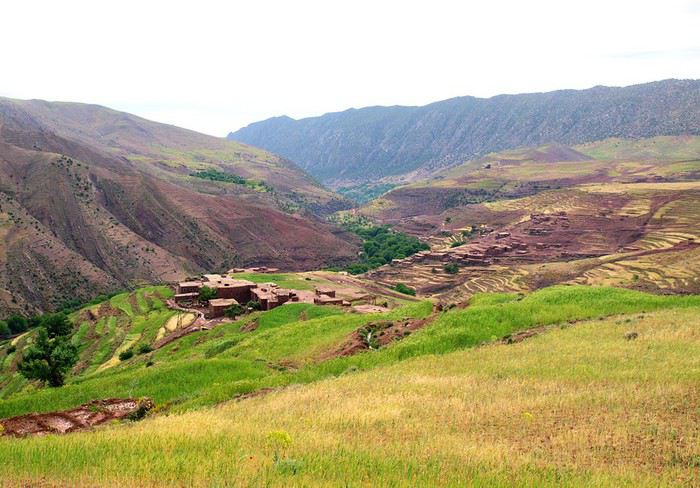
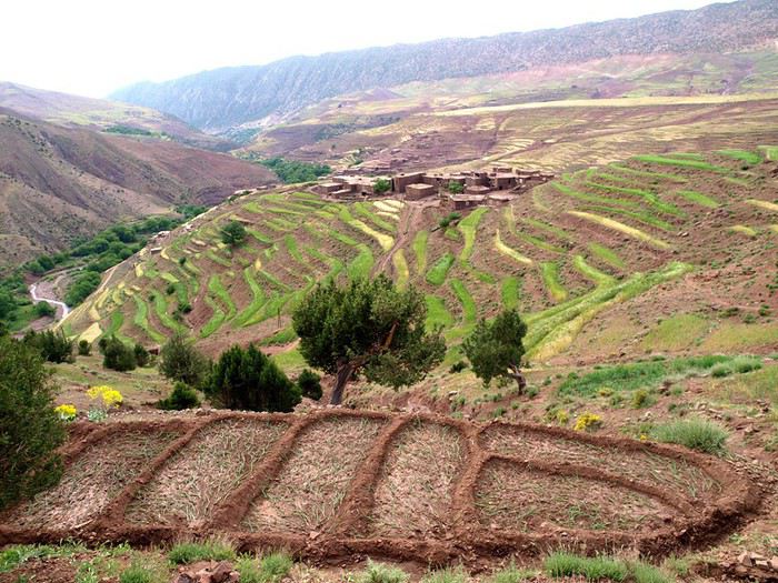 En bas, un oued, une piste (sans doute une route aujourd'hui) et un village Imi n'Waqqa (=l'entrée de la gorge")
mais la gorge , on l'évite et remonte une longue piste
En bas, un oued, une piste (sans doute une route aujourd'hui) et un village Imi n'Waqqa (=l'entrée de la gorge")
mais la gorge , on l'évite et remonte une longue piste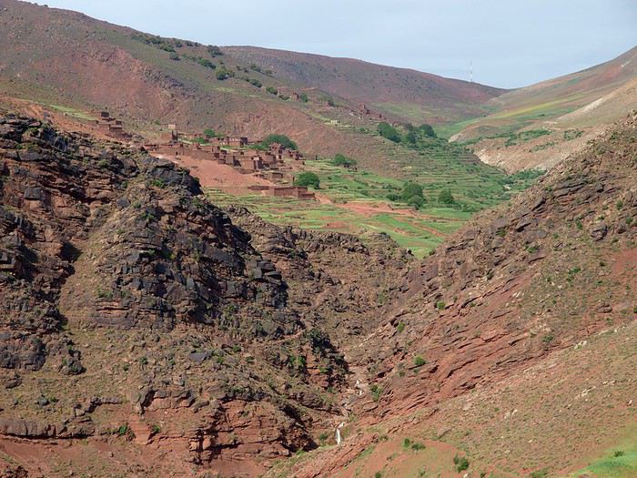
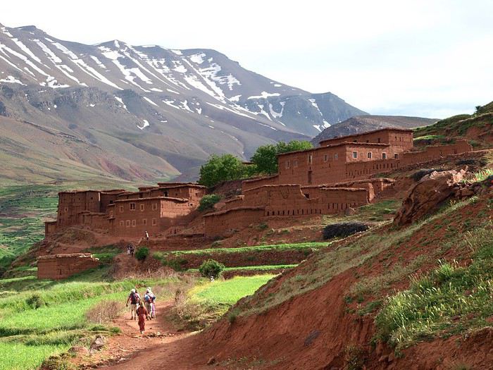
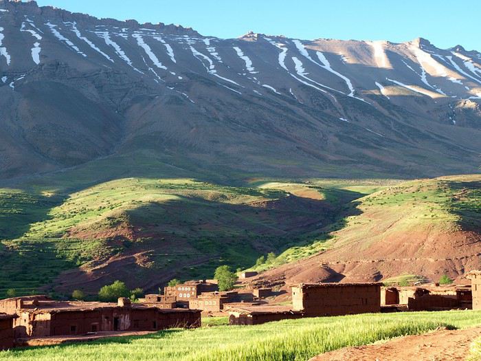
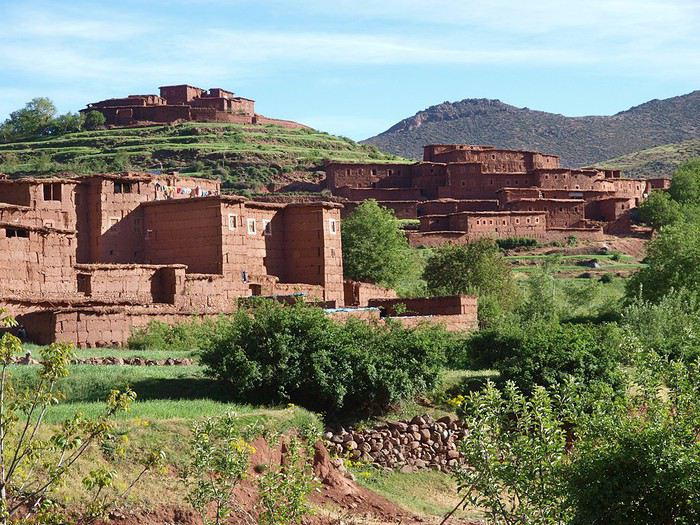
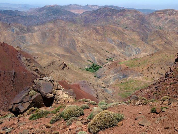
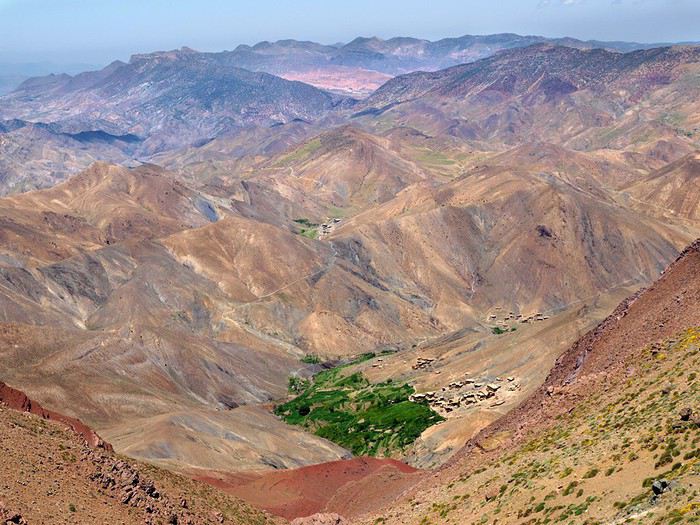
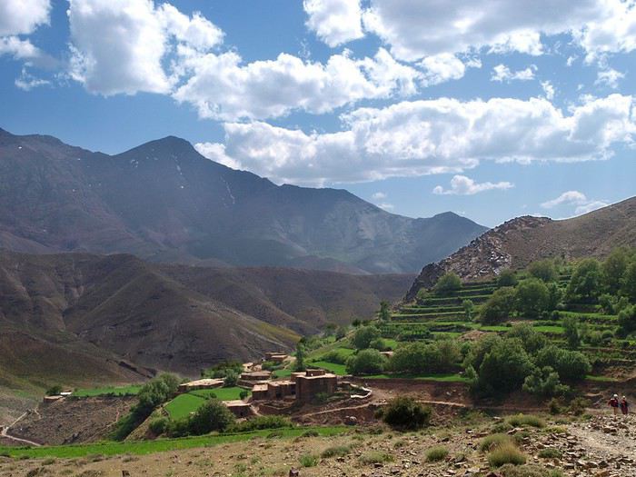
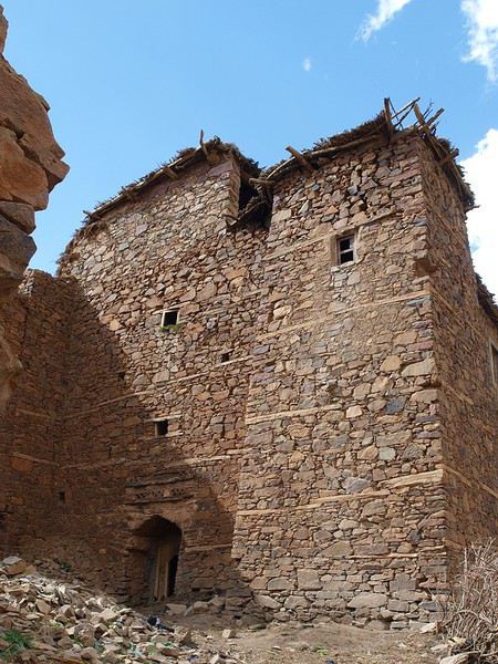
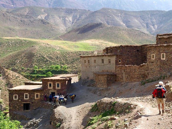
 Quelques villages perdus dans longue gorge en pente douce...
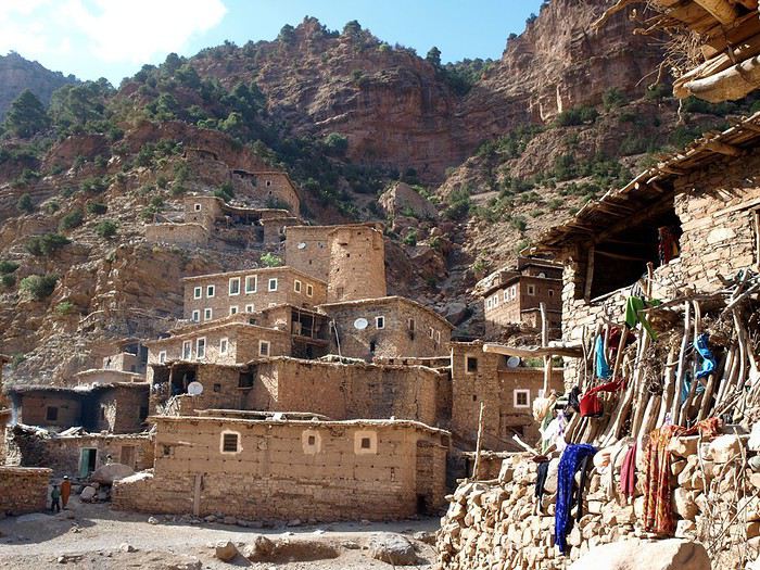 le village d'Ait Ali n'Ito, vu de l'auberge avec son grenier fortifié au centre.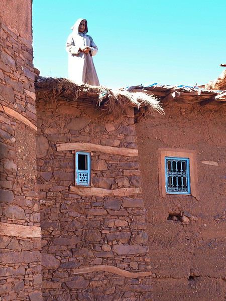
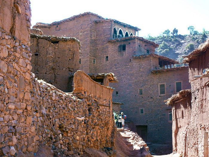
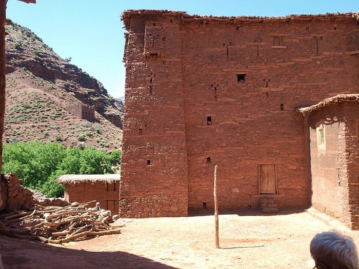
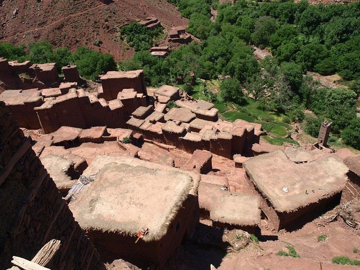 Vue du village depuis le toit- terrasse d'une tighermt;
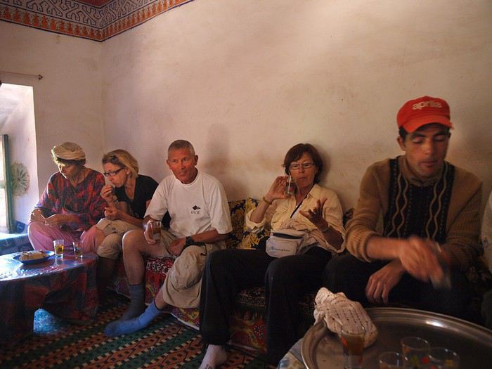 puis le repas : couscous ou tajine suivant les jours; heureusement il y a plusieurs recettes de tajines !
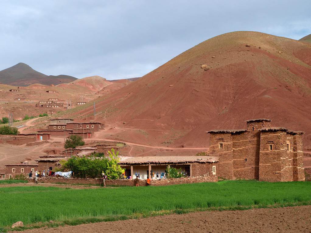
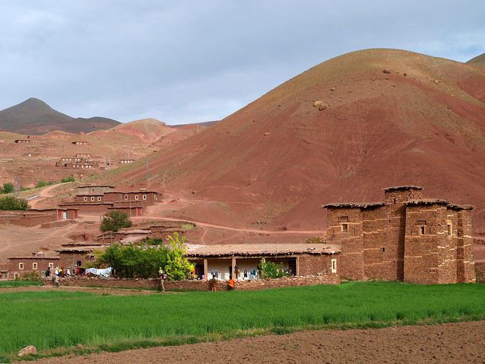
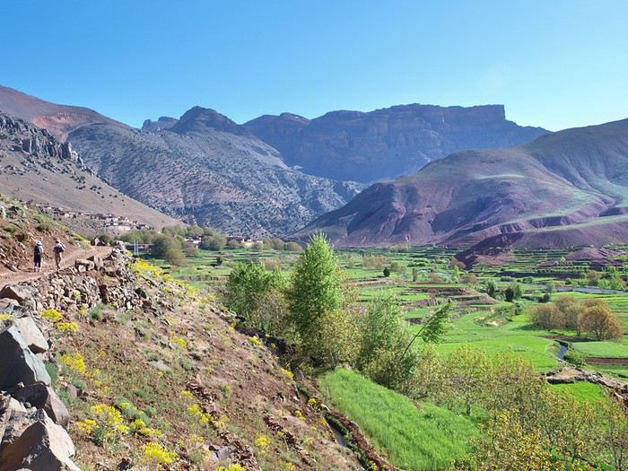 Amezri, à la fois rouge et verte !
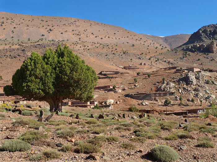 Un cimetière au passage : sous chaque pierre, un macchabée. On enterre, on dit au revoir et on n'y revient plus. mais hommes et bêtes respectent ces lieux.
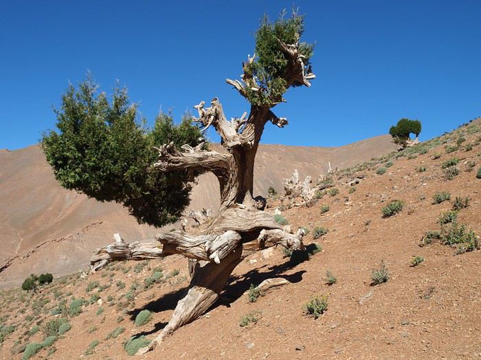 Des genévriers tourières , rares arbres à pouvoir vivre au-dessus de 2500m, même 3000... Ce genre d'ancêtre peut bien avoir 400 ou 500 ans, c'est un bois très très dur, qui brûle en dégageant une odeur genre encens. Ceux-là sont encore bien vivants, s'ils n'ont pas beaucoup de feuilles, c'est parce qu'on s'acharne à leur couper les branches les moins vieilles pour le feu de la cuisine. Allah s'arrangera pour qu'il survive ! et il survit !
 Et nous voilà au col : là-bas dans le fond, cette tache de verdure, c'est le val Ait Bou Oulli, d'où nous sommes partis; et au dessus à gauche, on voit le premier col de la randonnée. maintenant reste plus qu'à descendre jusque là-bas.