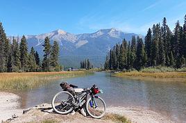
Par curiosité, je viens de regarder sur google maps. En cliquant sur le logo du vélo, il est indiqué 244 heures via la Transcanadienne. En prenant cette route, il y a 4677 km de Vancouver à Montréal. En dessous, google maps montre un schéma avec les dénivelés, c'est surtout dans les Rocheuses.
Je ne connais pas le climat en avril. En Juillet, on a eu de la grêle à Calgary. Regardez cet article concernant la météo à Banff où vous passerez sûrement. En regardant les tableaux qui sont en bas de la page, on constate que les mois sans neige sont uniquement Juillet et Août : http://www.pc.gc.ca/fra/pn-np/ab/banff/visit/meteo-weather.aspx
Il y a des motels, mais vous n'en trouverez peut-être pas aussi fréquemment que vous le souhaitez. A Hope, qui est sur votre route, il y a le "Quality Inn". A Kamloops, vous avez le "Hampton Inn". Tous les deux incluent le petit-déjeuner dans le prix de la chambre. Ensuite, nous sommes passés plus au nord, mais cela vous rallongerait.
C'est très difficile de répondre aux questions suivantes.
Magnifique projet que je t'envie!
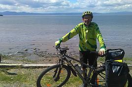
J'ai fais une partie de ce trajet. Lake Louise à Kamloops. Petite explication. j'étais randonneur longues distances après avoir dû abandonner les marathons ( problèmes de genoux) Un problème cardiaque (stent) fait qu'il ne serait plus raisonnable de me lancer sur des BRM 1200 Km en moins de 90 Hr ou 1400 en moins de 116 Hr comme par le passé. En juillet 2012, j'étais sur la Rocky Mountain, un 1200 au départ de Kamloops. Nous étions 102 cyclos. 50 abandons dont 48 sur hypothermie, j'étais du lot. Abandon au contrôle de Jasper, mes mains partaient dans tous les sens, mais impossible d'enlever mes gants ou de saisir la tirette de mon blouson. Il avait plu 2345 hr sur les 24 premières heures, on prévoyait la même chose pour les 24Hr suivantes. Au programme des étapes de plus de 100 Km, sans aucun service, rien, avec deux passages à plus de 2000m. Abandon raisonné.
L'an dernier, j'ai décidé de refaire le parcours en solo, mais en 10 jours. C'est comme cela que j'ai roulé de Lake louise à Kamloops, en juillet 2015.
Mes étapes étaient LL-Golden 85 Km passage du Kicking Horse pass ( 1658m) - Golden
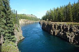
- Revelstoke 150 Km Passage de la Roger Pass 1330 m Pour la suite, il y avait deux étapes en faisant un crochet vers le sud ( nécessité d'arriver à 1200 Km)
Pour toi, il me semble que Salmon Arm est le bon endroit pour faire étape entre Kamloops et Revelstoke. J'ai logé en hôtels, mes vieux os de 68 ans le méritent bien.
Les prix des hôtels sont abordables, je travaille avec boooking.com (choix avec annulation gratuite possible). A Lake Louise, les prix sont élevés, je pense que Banf ne doit pas être en reste.
Attention : dans la descente de Roger Pass, sur la transcanadienne (autoroute) tu vas rouler dans des tunnels, ouverts de ton côté. C'est très impressionnant, j'étais de l'autre côté, en côte, les 300 premiers mètres, la peur de ma vie. Il y a une bordure très élevée, à ne pas toucher, sinon du rebondis vers le centre. Il y fait sombre, donc prudence, il y a des cailloux et parfois des bouts de sangles ou pièces métalliques perdues par les camions. En montant, il y avaient les camions qui montent à pleine puissance, ceux qui descendent de l'autre côté, avec le frein moteur, et les motards qui trouvent un malin plaisir à faire beaucoup de bruit, flippant, mais finalement on gère.
Circulation sur l'autoroute, pas de problème, à certains endroits il y a parfois assez bien de cailloux qui sont tombés du talus, des bouts de sangles ou pièces métalliques, avec un peu d'attention, c'est relativement facile à gérer. Les camions, pas de problème, ils savent prendre l'écart nécessaire pour te dépasser, ralentir pour ne pas te gêner à l'abord du franchissement d'un pont, là où il n'y a pas de bande pneus crevés. Les dangereux sont les camions qui ravitaillent les chantiers où les locaux, ce ne sont pas les vrais truckers.
Climat, j'ai tout vécu, 35/38° les deux premiers jours. Grosses pluies dans la montagne entre Jasper et Lake Louise, même un peu de neige fondante un matin ( avant le départ). Pour le reste, sec entre LL et Kamloops ou j'ai terminé sous 42.3°, très fort vent de face, 15 Km/h sur les 10 derniers Km, mais c'était la fin!
Timing, du 15 avril au 01 juillet, cela me semble largement suffisant pour relier Vancouver à Montréal. Départ le 15 avril me semble un peu tôt pour le franchissement des montagnes avant Hope et Kamloops, ça doit être la Coquilat hyghway. J'ai des amis grands randonneurs à Vancouver, je vais les contacter pour avoir leur avis ( Ils organisent le 1200 cette année).
Mon ordi s'est crasché la semaine dernière, y figurait (sur earth Google) mon projet et mes étapes de....Vancouver - Montréal - Gaspésie en 35/40 jours, et encore d'autres... Je vais chercher dans mes papiers.
Avec ces pertes de données, je suis occupé à refaire mes parcours 2016, en juin Nantes-Hendaye-Irun 9/21 juin en compagnie de mon épouse (ex marathonienne également), puis Budapest/Bouillon du 03 au /15 août.
Bonne préparation, je me renseigne pour les montagnes en direction de Kamloops.
@+
Bonjour,
Mes amis de Vancouver viennent de répondre aux questions concernant le calendrier et de là, la météo dans la traversée des Rocheuses Canadiennes.
En général les cyclos qui entreprennent ce genre de voyage, partent début juin. Pour eux, un départ à la mi-avril est possible, mais osé.
Si vous rejoignez Kamloops par la Hyghway 1, c'est possible car elle est moins "haut perchée" que la route directe, donc la météo devrait être plus favorable.
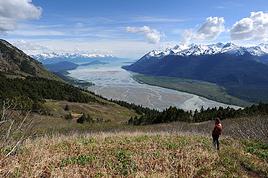
Entre Kamloops et Lake-Louise, il faut franchir la Roger pass et le Kicking Horse pass. S'il fait très beau temps, cela sera possible, mais il devrait rester de la neige sur les côtés. La bande réservée aux vélos ( bande d'arrêt d'urgence pour nous européen) sera soit enneigée ou jonchée de débris, pierres, sable, éléments métalliques perdus par les camions. Cette zone n'est balayée que fin juin, début juillet, car avant, il y a toujours des chutes de neige possibles.
Voilà les infos, personnellement, j'ai essuyé des chutes de neige, qui fondait de suite, fin juin, lors de l'étape Sunwapta pass - Lake-Louise. Après mon arrivée, il s'est mis à neiger, comme ma chambre donnait sur la piscine, je n'ai pas trop assisté au spectacle, je n'y tenais guère. Le lendemain matin, les sommets voisins couverts de neige, contrairement à la veille. Je n'ai rencontré aucune difficulté sur la route, mais brrr, la descente de Kiking Horse pass, congelé.
Bonne préparation, je suivrai votre périple avec beaucoup d'intérêt, ce trajet m'intéresse un peu, qui sait l'an prochain peut-être. @+ Cl@ude
salut en complément des réponses précédentes oui dans les Rocheuses il risque d'y avoir encore de la neige.
Et ne pas perdre de vue que Vancouver est une ville pluvieuse donc en avril s'attendre à des jours arrosés.
A partir de Hope c'est un climat plus de montagne.
Ensuite ily a la traversée des Prairies, l'est de l'Alberta, la Saskatchewan, la Manitoba à ce que je sais c'est assez venteux comme pays quelqu'un confirmera..
donc idéalement il vaudrait mieux faire le chemin inverse ! 😉
Partir en avril de Montréal c'est largement faisable il n'y a quasiment plus de neige sauf peut-être certaines années mais en général le printemps arrive toujours en avril
Bonjour, es ce qu'il y a moyen d'éviter l'autoroute notamment au niveau des cols? y a t'il des pistes ?
à ma connaissance non c'est pas possible ; il n'y a pas de routes secondaires dans les Rocheuses.
Rien qu'à Lake Louise il n'y a qu'une seule route qui traverse la localité.
La différence entre les Alpes et les Rocheuses c'est qu'il n' y pas des localités dissiminées sur les hauteurs des montagnes comme dans les Alpes ( françaises ) .
Les localités sont à fond de vallée il y a une highway qui passe et c'est tout.
une fois j'ai voulu partir de Hope pour rejoindre un sentier qui part dans les montagnes , il a fallu que je marche le long de la route jusqu'au départ du sentier
Je suis de l'avis de Mathew, pour y être passé à vélo et en voiture, je n'ai vu aucune route secondaire qui permette d'éviter la highway 1 entre Salmon Arm et Lake Louise.
Je suis coureur d'orientation, donc la carte c'est mon dada, je l'ai épluchée dans les moindres détails, rien trouvé d'autre que la highway, idem sur Google.
Cette highway traverse des parcs nationaux, si on quitte la highway, il faut d'office s'acquitter du droit d'entrée dans le parc national.
Pour exemple, mon circuit à partir de Kamloops, via Jasper et Lake Louise empruntait le parc national de Jasper, 18 dollars pour un vélo, on n'y coupe pas.
@+ Cl@ude.
Bonjour, merci pour vos réponses qui ne m'étonnent pas en fait. si on veut éviter le col routier très fréquenté c'est pas possible même en faisant un détour.
Une petite question me vient à l'esprit.
As tu pris tes renseignements concernant la durée du séjour maximum sur le sol canadien.
En 2004, j'avais le projet de traverser les USA à vélo de San Francisco à New-York, avec à la clé, les marathons de SF et NY. Mais on ne peut rester aux USA plus de 90 jours en une seule fois.
San Francisco qui organisait son marathon fin juillet, l'a avancé de une puis de deux semaines. Le marathon de N-Y ayant lieu le premier w-e de novembre, j'ai dû renoncer à mon projet.
Au départ, je projetait de faire une incursion au Canada de Sault-Ste-Marie à Niagara Falls, mais on m'a expliqué que ce n'était pas valable, le passage par le Canada n'interrompt pas le séjour.
Peut-être que ces dispositions ont été revues, ou ne sont pas d'application au Canada, mais souvent ils travaillent de pair. Renseignes toi avant le départ, car aux Amériques, les contrôles sont autrement plus sérieux que dans notre moulin européen.
}+ Cl@ude
Voyager à vélo › Québec › Montréal et Laval / Canada · 2 replies
Je suis entrain de planifier un voyage à vélo pour l'été prochain et je voudrais savoir si il serais mieu de faire Montréal-Vancouver ou vancouver-Montréal? Je…
Voyager à vélo › Québec › Montréal et Laval / Canada · 1 reply
Bien le bonjour à tous et toutes! Cet été, je compte partir sur le pouce vers Vancouver dans le but de faire du plantage d'arbre. Après la saison, je compte me…
Voyager à vélo › Québec › Montréal et Laval / Canada · 7 replies
Je prépare un voyage Vancouver-Montréal à vélo avec mon coloc. Je voudrais savoir si quelqu'un connait un endroit à Montréal ou un site internet pour se…
Voyager à vélo › Québec › Montréal et Laval / Canada · 4 replies
Le 15 mai je part traverser le canada à vélo (montreal vanvouver). j'aimerai avoir des info sur les coins sympa? et il difficile de faire du camping sauvage?…
Voyager à vélo › Canada/ Québec › Montréal et Laval · 15 replies
Je souhaite partir au canada pour une duree de 6 mois avec un visa touriste, j aimerai partir au mois de mai, départ de Vancouver direction Montreal, pour…
I’m planning to cycle from Morlaix to Brest (via Roscoff and the V45 coastal route). We’ll start riding on August 16th for 13 days (with stops for island visits, surfing, etc.). Is there a lot of traffic at this time of year? I’ve got two kids, 11 and 13, and we don’t like riding in the middle of cars (we’ve already done the Vélomaritime—Caen to Cherbourg—the Loire route from Orléans to Saumur, the Vélodyssée from Nantes to Royans, and the canals like the Nivernais and Bourgogne, where there were plenty of bike-only lanes, which isn’t the case on this route).
Thanks for your help if you’ve already done this route in late August!
Virginie
I’ve got my flight ticket sorted—departing in mid-November and returning in mid-March. I’ll arrive in Santiago and leave from Buenos Aires.
I’ve already been to southern Argentina, specifically Torres del Paine National Park, and I’d love to go back to do the full W trek (I only did the shorter version last time).
I also want to do some hiking and maybe even tackle a summit. I climb and occasionally do some mountaineering, so I’ll definitely be going with a guide.
I plan to start around Temuco in Chile, with the idea of heading toward the lakes, then taking the Carretera Austral.
I’m not sure if I’ll go all the way to Ushuaia—it’s supposed to not be *that* worth it, except for the bragging rights of saying you’ve been to the end of the world.
I saw there are lakes in Argentina too.
I don’t have a precise itinerary, but what I’d love is, once I reach the southernmost point of my trip, to take a mini-cruise to see some wildlife. Any tips for that?
What kind of sleeping bag did you take? Is a 0°C (32°F) one enough?
And one last question: white gas stove or can I get by with my gas stove?
This summer, we’re planning to cycle along the EV 19 that follows the Meuse River from Langres all the way to Rotterdam.
My question is about getting back to Nantes.
Do any of you know what the best return option might be? I’d love to hear about your experiences.
I saw that FlixBus doesn’t take bikes.
By train, I think it’s possible but would involve multiple local trains.
We were also wondering if there’s a boat from Rotterdam to Saint-Nazaire that could take passengers with bikes.
Any tips or experiences you can share would be really helpful—thanks in advance!
Have a great evening
Hi there,
I’ve been road cycling for several years, and I’m about to switch to gravel in the next few days—I’m waiting for my bike, which should arrive this week.
I’m planning a bikepacking trip in a few weeks along the Véloroute V81, also known as the Vélosud, from Biarritz to Le Barcarès.
Has anyone here already done this route? Any info is welcome, whether it’s about the route itself, gear, or accommodation. I’ll prioritize staying with locals as much as possible. On that note, I just signed up for the brand-new site *Guidon et Couette* ((www.guidon-et-couette.fr)), which offers free accommodation between cyclists across the country, but there’s almost no one listed along my route!
Thanks in advance.
Laurent.
I’m planning to build a new touring bike.
I want to prioritize lightness.
That said, I’m tempted by a suspension fork that could offer some comfort on rougher roads.
The recent appearance of gravel suspension forks on the market might meet my needs—at least on paper.
I’m particularly considering the RockShox Rudy Ultimate XPLR fork.
Unlike MTB forks, its travel is short: either 30 mm or 40 mm.
It weighs 1400 g, which is 400/500 g more than a steel fork.
Any thoughts or real-world feedback on this?
I’m also wondering about the durability of magnesium (lower leg) for long-distance bike touring.
And what’s the impact of skipping the manufacturer-recommended maintenance every 50 and 200 hours? That’s bound to happen on a long trip unless you carry extra gear.
More generally, how reliable are these kinds of forks?
Hi everyone,
I wanted to share with you the incredible feat my friend José, who’s 72 years old, is currently undertaking. He left Auterive near Toulouse on Monday, May 18, 2026, on his non-electric bike, heading for the North Cape in Norway!
You can follow his route on the link below—he’s currently in Sweden:
https://thierry-thomas.travelmap.net/jose-de-toulouse-a-nord-cap-2026
You can zoom in on the map and click on each stopover town to see the photos
I’m making an exception and creating a separate post this time, since it’s all about France. In May, we spent a week in Provence, specifically in the Luberon, exploring the cycling routes *Autour du Luberon à Vélo*, the *Véloroute du Calavon* (part of EuroVelo 8), and the shorter *Les Ocres à Vélo* route. Together, they gave us an amazing journey through rolling hills, vineyards, lavender fields still green in spring, and some of the most stunning landscapes in southern France.
It was, of course, the perched villages that impressed us the most. We visited Gordes, Roussillon, Bonnieux, Lacoste, Lourmarin, Ménerbes, Oppède-le-Vieux, Cucuron, and Lauris. Many of them are among the most beautiful villages in Provence, and it’s hard not to agree with that reputation.
One interesting point is the route of EuroVelo 8 in this part of the region. The official path mainly follows the old railway line of the *Véloroute du Calavon*, which is very comfortable and safe. But in our opinion, cyclists traveling EuroVelo 8 around the Mediterranean would discover even more treasures if the route passed through villages like Bonnieux, Lacoste, or Oppède-le-Vieux.
We were also pleasantly surprised by how safe cycling felt. Most of the route takes small local roads, but traffic is light, drivers are respectful, and road design really takes cyclists into account. It’s one of those places where you can ride peacefully even without separated bike lanes.
Our full story:
Around Luberon by bicycle - the most beautiful villages of Provence
You can also find all our cycling travel stories on the forum:
Cycling Thread - Europe’s most beautiful bike routes
Hi there, we’re a group of 4 cyclists looking to get from Treviso in Italy to Munich with our 4 non-folding bikes. It seems complicated! Are there any solutions? Thanks so much.
hello fellow cycling enthusiasts
here’s a travel journal of the cycling tour through the Rhône-Alpes Auvergne region by Claudio
zouli
it was the plan
http://cbandiera.free.fr/parcours/auvergne-Ralpes/
the trip was completed
story being posted online soon
1100 km in 11 days
beautiful and varied regions
Hi there, we’re planning a Munich to Venice bike trip at the end of June 2026. Getting back from Venice to Toulouse by train with 4 bikes isn’t straightforward. What return options have others who’ve done this trip chosen? Any tips or great deals would be much appreciated. Thanks a bunch! !
Hi everyone,
Happy owner of a Pegasus Estremo bike with a Rohloff hub, which is giving me trouble with the SF11-NCX-FT-E-LITE 700C TS 300/0 fork (serial number TD01329060). It’s starting to show its age, and I’d like to repair it to extend the life of my beloved bike.
The suspension is gone, and there’s an oil leak from the seals.
Does anyone know how to repair it? Where can I find parts that are about fifteen years old? Or where to find an identical replacement fork? Just to clarify, the Magura HS11 brakes are mounted using Firm Tech, meaning they’re on pivots behind the fork, facing the frame.
Hi, I'd like to know if anyone has done this route recently or has reliable info.
Does the track exist, and most importantly, is there sand (for biking)?
Any info is welcome.
Cheers,
diego ambilobe: mangaoka, manondro, ramena
vohemar sambava: masondrono, tanambao
Hi there,
New to bike touring,
I’d love to start with a section of the Via Rhona to explore and share (route to be decided).
Looking forward to exchanging tips!
I’m landing in Madagascar with a buddy before the end of April 2026. We’re planning to bike around for about twenty days or so. We don’t have a specific goal other than exploring the country and meeting the locals.
Ideally, we’d prefer a loop route starting from Antananarivo with a good chunk of it along the coast. On the bike side, we’re used to riding 6 to 8 hours a day, depending on the needs, encounters, and mood 😉 Any feedback or tips from trips around this length?
A big thank you to Lazarou for all the info you share in this forum!
I'm passionate about Morocco, which I cycled through back in 2009.
Last year, my wife and I explored the High Atlas by tandem. Completely smitten, we're heading back in April (Anti Atlas) and May (High and Middle Atlas), still on our tandem.
Do you have any info on the track between Amezri and Ali Ait Nito? Are the river crossings in the Tessaout still there? It's not easy to navigate with a loaded tandem... especially if the river level is high due to this year's heavy snowmelt!
Thanks in advance for any tips you might have, and best wishes for health in this new year!
Claudio specializes in the route of the Savoie lakes
Here are his travels
Between Bornes, Chartreuse, the Savoie foothills, and Dauphiné
Five lakes: Léman, Annecy, Paladru, Aiguebelette, Bourget, not to mention a few ponds along the way
Plenty of accommodation options: camping, hotels, and more...
A lovely route not far from his place
Rural and quite peaceful
A road cycling route created by Serge B...
Tout d'abord... bonne année ! De belles routes à vous en 2017 !
Je voyage depuis quelques années avec un VTT de très bonne qualité mais équipé de freins à disques hydrauliques. Je vis (pédale) avec l'inquiétude d'avoir une panne (fuite, bulle d'air, chaleur qui fait que le liquide...). Mon vélociste me dit qu'il est impossible de les changer pour des V brakes.
Qu'en pensez-vous ? Est-ce que je prends un gros risque à continuer (seule) avec ces freins ? D'avance je vous remercie pour vos bonnes idées.
First post here to share a quick recap of our west-to-east bike trip along Algeria’s coast in January 2025.
It was just the two of us—my partner and I—with French passports and not a word of Arabic. No friends or welcoming hosts in the country.
Under those conditions, we’d strongly advise against going.
Our original plan was to follow the coast from Algiers to Tunis. We ended up cycling from Algiers to Béjaia, then took the train from Béjaia to Annaba (with a stop in Constantine), and finally biked to the border.
We were tailed by police the whole way—whether on our bikes, on the train, or even on foot while exploring towns. On top of that, we couldn’t wild camp and were limited to the few state-approved hotels that accept foreigners. Under those circumstances, connecting with locals was especially tough.
With such an omnipresent and intrusive police presence, we’d definitely recommend against this destination for bike touring. A really sad situation that completely cuts you off from the local population...
We’d been warned, we went to check it out, and we weren’t disappointed!
Hi there,
I’m planning the route to cycle from Lille to Nordkapp with my partner.
Duration: 3 months, from May 1st to July 31st, 2026.
In the attached details below, I need to add some "non-riding" days (rest days, basically).
So I’m looking to "shorten" the trip by taking ferries or trains for some stretches. Which areas could I skip?
Thanks in advance for your great tips.
Have a good evening.
https://www.komoot.com/fr-fr/collection/4023980/-lille-cap-nord-1er-mai-au-31-juillet-2026?ref=collection
I’m planning to bike back from Poland this summer. Does anyone know a way to ship it there without having to take it apart? Otherwise, it’s a real hassle to fine-tune all the settings before departure!
Thanks in advance.
Hi, has anyone recently bought Primus or Butagaz gas, possibly puncture-style, in Dubrovnik or the surrounding area? Same question for Albania... thanks. aichatou
Just a few words about the loop I did by bike in Yunnan.
Entry and exit
I entered China through the Sino-Vietnamese border crossing at Lào Cai / Hekou under the 30-day visa exemption currently available to French nationals and others.
The process was simple and quick. A Chinese police officer even helped me complete my electronic pre-registration at a computer kiosk. I wasn’t aware this formality was required—it’s similar to Thailand’s TM6.
No issues with the bike.
I left the country via the Sino-Laotian border crossing at Mohan / Boten.
The atmosphere was a bit chaotic there, but again, no problems with the bike.
The timing
I visited Yunnan in February 2026.
Weather-wise, at higher altitudes (between 1,500 and 2,000 meters), it was around ten degrees at night and in the mornings, and around twenty degrees at the hottest part of the day.
I had two days of rain, so I took the bus to keep moving. Otherwise, clear blue skies.
Culturally, Chinese New Year fell on February 17th (and the 15 days following), right in the middle of my trip. Because of this, my take on the traffic might be off.
Accommodation and food
I always found a hotel to stay in for prices ranging from 8 to 15 €. Except in Kunming (the capital), where many hotels were fully booked (Chinese New Year). I ended up at a 100 € hotel with great value for money.
A bowl of noodles costs about 1.5 € on average.
Onboard electronics
Since my smartphone doesn’t support eSIMs, I subscribed to a China plan with my carrier. Otherwise, for much cheaper, Alipay offers eSIMs for foreigners that allow access to services usually blocked for Chinese users (WhatsApp, Facebook, etc.).
An internet connection is essential for paying with Alipay or WeChat, as this payment method is widespread.
I only managed to use Alipay.
Either way, always carry cash because sometimes there’s no signal, or the merchant only accepts WeChat.
Also, it’s best to bring a power adapter when you arrive rather than struggling to find one.
Traffic and roads
The Chinese aren’t reckless drivers. They follow traffic rules and watch out for cyclists. This is slightly less true in Xishuangbanna (the region bordering Myanmar and Laos).
In urban areas, there are almost always wide bike lanes, separated from other roads, where bikes, electric mini-scooters, and scooters share the space pretty harmoniously.
The roads are in great condition, and traffic is generally manageable—even light—except for one stretch (Eshan -> Yangwu).
Most traffic is absorbed by expressways, China’s equivalent of highways: toll roads that are off-limits to slow vehicles.
You’re never far from these expressways; sometimes you even ride alongside them, which can be noisy at times.
The climbs are usually reasonable, around 5% to 6%. From what I remember, the steepest section was between Menglun and Mengla, with gradients of 8% to 10%, sometimes more.
Riding at these altitudes—though modest—took a bit of getting used to.
The route
I didn’t plan anything in advance. My only goal was to reach Kunming. I don’t know why, but just hearing the name of that city, like Yunnan, always felt dreamy to me.
Hi! I’m planning to visit the Stockholm Archipelago by bike in early April.
Do you know if the boats will be running between the different islands at that time of year? For those who’ve already been, all your tips and recommendations are welcome—accommodation, etc. Also, do you know where I can rent a bike in Stockholm? Thanks so much in advance for your help!
Hello there, pedal-powered Young Boys!
Claudio (still from Faverges)
dreaming about a cycling getaway in Italy from Faverges (train all the way to Turin)
from Turin down to Venice along the Po River and back via the Padana (Alta Italia da attraversare – Northern Italy to cross)
The tricky part is getting from Chioggia to Venice.
I read it’s possible by hopping on a boat from island to island,
but it sounds a bit stressful.
Has anyone already tackled this route?
I’m currently looking for a bike to do my first bike trip across France, with the ultimate goal of cycling through Latin America. I’ve got a lot of questions and I’d love to hear if you have any answers or advice to share.
First off, I’ve been through this before with hiking. I want to get top-quality gear right away. When I started hiking, I ended up buying everything three times—first beginner gear, then intermediate, then expert, etc.
For biking, I’d prefer to skip that process and invest right now in a bike that could ideally handle Latin America.
I’ve set a total max budget of around 5000 € (roughly 4000–4500 € for the bike and the rest for accessories: panniers, helmet, cycling shorts, etc.).
So, I’ve got quite a few questions:
* I’ve read in several places that some people recommend buying the bike directly in Latin America. Since I need a first bike to train in Europe, would it be better to buy an entry-level bike in France (and sell it before the big departure)? Or is it preferable to start right away with my final bike to get used to it? Is buying it there just to save a bit of money?
* For a long-term trip (around six months) in Latin America, is it better to go for a gravel bike or a mountain bike?
* Should I buy a new bike or a refurbished one? Even more so given that I’m planning a long trip—could a refurbished bike end up causing more breakdowns?
If you have any advice on models, technical features to prioritize, or recommended sellers or resellers, I’d love to hear it. I’m a total beginner—I’ve only just started watching videos and reading up on the subject, and all the technical specs are new to me!
Calling all travelers.
We’ll be landing at Lyon Airport and want to bike to La Verpillière train station (with panniers and camping gear, etc.) to catch a TER to Voreppe.
What’s the safest route for this bike trip?
Thanks in advance
hi,
I'm planning a recumbent bike trip from the Pyrenees to Greece. On the EuroVelo 8 route, it doesn't specify the path through the Alps.
Are there any experienced cyclists here who can tell me where they go to avoid climbing too high?
Also, is there another traveler/bike forum better suited for broadening the responses?
thanks