Hello,
I’ll be in Nepal from March 6th to 29th (we’re flying into Kathmandu via Varanasi and leaving via Delhi).
I’m a bit confused about the regulations requiring a guide.
My wife and I (we’re 63 and 64) aren’t experienced trekkers—we’re more used to walking on terrain with very moderate elevation changes. I’m looking for fairly easy hikes, possibly day trips.
Here are my questions:
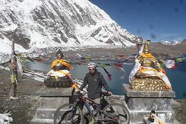
- Does the Poon Hill trek from Pokhara require a guide, or is it better to go through a local agency? (I’ve seen a lot of them offering 4-day packages)
- I’d like to do a few multi-day hikes around Jomsom (Kagbeni, Mukitinath, Lupra, Marpha)... Do you need a guide for those, and can you find accommodations easily without booking in advance?
Last question—I’m really hesitant to lug around a sleeping bag or down jacket during our 6 weeks in India. Can you easily find these kinds of items at reasonable prices in Pokhara?
Thanks in advance for any tips you can share!
Yann
Hi everyone!
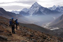
New to this forum, I’m planning a pretty big project for 2028. I’m heading to Nepal to do a trek from Kathmandu all the way to Everest Base Camp (a cool 5,300 m 😄). This trek is a bit special because even though I’ll be part of a group, I’m going solo (so far, no problem—I’m used to it). But it’s my first real trek, and it’s also a humanitarian one: once I reach base camp, I’ll stay an extra week to help clean up the waste left by tens of thousands of climbers! Since I’m originally from South America, from two countries that share the Andes, I have a deep respect for mountains—they fascinate me. So Everest… it’s kind of the trip of a lifetime!
So, a little question for those who’ve done treks to Everest before… any tips for good mental preparation (I’m already working on the physical side)?
Thanks in advance for your advice! 🙂
Hi there,
We’re heading to South Africa in August 2025 and planning a classic loop that I’d love to finish with the Drakensberg (I’m a big hiking fan) before returning to Johannesburg to catch our flight.
I’ve got 3 nights for this part of our trip. But I’m wondering if it’s actually a good idea to hike in the Drakensberg in August, since it’s the Southern Hemisphere winter (I’m from Réunion and we hike year-round there, but I don’t know what the climate’s like in South Africa, especially the Drakensberg).
I’m particularly worried about getting stuck because of snow and missing our flight... ;)
I’ve read so many different things that I’m totally confused!
If it’s okay to hike at this time of year, what would you recommend? I’m torn between Champagne Valley and Royal Natal National Park.
Thanks in advance for your firsthand tips!
Malijp
Hi there, my partner and I want to hike the GR34 over several years, in stages of 8 to 10 days of walking during May or June.
We're 53 and 55, pretty fit, and used to hiking.
Our goal is to complete the whole trail starting from Mont Saint-Michel, but maybe some sections aren’t worth it?
So I’ve got a few questions about logistics:
- backpack size and what essentials to pack
- where to sleep affordably (camping, hotels, or a mix?)
Thanks for your tips!
Hello, I’d like to embark on a little trip in my home country, Switzerland. I’ll start walking from La Cure, heading toward Le Noirmont first, then I’ll improvise my route—but it’ll probably follow the French border... at least as far as Lac de Joux.
I’ll decide day by day how much farther to go after that. My goal is to stay in nature as much as possible, wander around for as long as I can, and restock food in villages or towns along the way.
I’m thinking of mostly camping, but we’ll see if I end up in a hotel or another campsite depending on my route.
I’d love to reach La Chaux-de-Fonds on foot... maybe even Delémont. The whole thing should take about a week, give or take.
I’ll be bringing my dog, and I’m preparing for this as soon as I’m ready.
Any tips to make sure everything goes smoothly for us? Things I should know—or avoid? What about shepherds with their flocks of sheep? And isn’t hunting season open right now?
I’m not sure if what I’m planning is even doable, which is why I’m asking around.
This’ll be my first time doing something like this—wandering in nature *and* with a dog. I’m really excited for this adventure... and I need it. Thanks!
Hi! In March, we’ll be spending two weeks in the Drakensberg region and Golden Highlands National Park (Clarens). From what I understand, you have to pay to hike if you're in a national park. I can’t find the rates or info on whether there are multi-day passes if we hike for several days. Could you help me out, please?
Thanks
I’m heading to Nepal at the end of April 2026 with my brother, the two kids, and my mom.
My mom is 75, in good shape, she walks but isn’t a big sports enthusiast. My daughter is 16, she’s not really into hiking but with the right vibe, she’ll step up.
I’m looking for a 5-6 day trek that’s not too difficult—around 4-5 hours of walking and 500-600m of elevation gain per day. What’s our goal?
Well, like everyone, we’d love something not too crowded. We want to experience Nepali village life away from the main routes—terraced fields, all that. Some encounters, authenticity, sharing... And if we can catch a glimpse of some high peaks, even better.
Any suggestions?
Hi,
I'd love to know where we can observe wildlife, birds, and nature in Colombia... Like going on a hike without a guide, immersing ourselves in the forest, far from tourist spots. I want to avoid places that are specially set up, since you usually don’t see much there.
Thanks in advance!
Bernard
Hello.
I’m a 56-year-old man who’s done several treks in Nepal and elsewhere. Also passionate about photography. I’m looking for one or more people to form a group for a trek in Nepal. The trek is the Annapurna and Manaslu circuit (24 days), including a stop at Tilicho Lake. I’ve got a great itinerary and the local company seems solid. The price is around $1600. I’ll be in Nepal from April 5 to May 12, 2026, so the trek would need to happen within those dates.
Daniel, Québec, Canada
Hey everyone!
I’m heading to Morocco in 2 weeks to climb M'Goun.
Which side is the most practical for logistics, please? I’ll be hiring a muleteer/cook.
I’m torn between starting from the Happy Valley (Agouti, Aït Bouguemez) or the southern slope (Skoura, Kalaat El M'Gouna).
I tried to go 5 years ago, 2 weeks before COVID, and ended up switching to Siroua based on Willempsie’s advice, given the season... but mid-May should be fine now, right?
Thanks for your help,
Pacoloco
Hi there, I’m struggling to get back into hiking and I’m considering tackling the GR5 from Lake Geneva to the Mediterranean shores in August-September.
Since I can’t plan daily distances in advance, I’ll be bringing gear to bivouac.
I’m not familiar with this route and wanted to get an idea of water resupply options before setting off: are sources and streams still flowing easily in late summer on this GR, or should I prepare for long dry stretches? 😐
Hi there,
Could anyone give me some tips on 2-day treks in these areas? We're heading there in November...
Thanks so much!
Hi everyone,
Here’s my dilemma:
I’m planning a hike between Le Bonhomme and the Gîte des 3 Fours at the Col de la Schlucht.
Between the two, I need a hostel, a gîte, or a farm inn for Wednesday, September 10th.
My gîte at the pass is only open on Thursday, so I need a stop between Le Bonhomme and the pass.
On Wednesday, everything’s closed—no half-board, nothing at all.
Would you have any solutions? I’ve already called the tourist office, and they confirmed there’s no possibility.
No tent—it’s too heavy for me at my age.
Thanks for your ideas!
Hi there,
This August, I hiked the Vosges section (Vosges massif) of the GR5 (Lauterbourg-Wissembourg-gr53-gr5-Belfort) using the TopoGuide "Traversée du Massif des Vosges" (ref 502, April 2024 edition). My experience was partly ruined by a few things I feel I should share here to help others avoid the same pitfalls—or at least disappointments.
Having used "TopoGuide" books before, I’d always trusted them for organizing treks lasting several weeks, or even months.
Beyond the satisfactory mapping (reproductions of IGN 1:25,000 maps), these guides include route descriptions that are usually enough to find your way. On that point, I have no serious criticism of the Vosges crossing guide.
In addition to the route details, the guide provides "average" time estimates for traveling from point A to point B—useful info for gauging effort and planning likely stages. However, I eventually realized I couldn’t rely on these time estimates. I’d assumed they were calculated by the FFRP, considering that 100m of positive elevation gain roughly equals 1km on flat terrain, with an average walking speed of 4km/h. So, I’d recommend anyone using this guide to recalculate all the time estimates to avoid nasty surprises on tight stages. 🤪
Another key feature of the guide, in my opinion, is its info on accommodation options—especially budget-friendly ones suited for long-distance hikers on a tight budget. A section called "préparation des étapes" includes a table with a column meant to highlight "refuges" and "gîtes d'étapes." That column had me feeling optimistic: these budget accommodations were listed as plentiful along the route. After all, we were in the territory of the famous Club Vosgien—it made sense there’d be plenty of hiker-friendly lodging options. The reality on the ground was quite different. The TopoGuide wasn’t really to blame here, except that a serious warning wouldn’t have hurt. First, regarding the "refuges," most were run by associations. With rare exceptions, the volunteers only opened them on weekends. You can’t really blame people for not volunteering on weekdays, but it makes things tricky when the info about weekend-only openings often turns out to be wrong. As for the "gîtes d'étape," I was mostly disappointed when I was told that a place was booked for weeks: the vast majority of what was listed as a "gîte d'étape" turned out to be "gîtes ruraux." The advice here? If you don’t want to—or can’t—camp, double-check all the accommodation details before you set off. It’s time-consuming and tedious, but if you can, camping is still the best option. 😐 On a brighter note, during the first part of my trip, I came across several cabins that offered alternatives to camping. 🙂
P.S.: Even the youth hostel in Saverne was closed in the middle of August... 😕
hi there,
I’m planning a trip around Cap Corse and the AGRIATES in 2026, from May 8th to 15th (there are still 2 spots left, by the way! Just DM me if you're interested).
I’d love to know which hikes are worth prioritizing in the AGRIATES. We’ll be staying in SALECCIA for two days as our base—what should we focus on from there? A round trip to IGNHU beach? Any other suggestions? For Ostricano, I think it’s too far for a round trip... Thanks for your tips! Have a great day, Anie, Toulouse
Hi there,
We’re flying from Montreal to Lyon this August to go hiking in the French Alps. We’ve rented a car and will be staying at campgrounds. We’re planning to do day hikes and want to stay a few days in one spot, do a few hikes, then move on to our next camping spot. Could you share your favorite spots or any recommendations for places to spend a few days with great hikes?
A few details: We arrive in early August and leave in early September. We’re looking for day hikes (or shorter), moderate difficulty, with a cumulative elevation gain of no more than 1000m, and of course, beautiful scenery! We’d prefer not to drive too much—maybe it’s best not to head too far south and deal with unnecessary heat? Along the same lines, if you know of any great campgrounds where we can start our hike directly without needing the car, we’d love to hear your suggestions!
Thanks! :-)
Hi,
We’re planning to spend 3 nights (4 days) in the Banaue area. We’ve booked 1 night in Banaue, 1 in Batad, and the 3rd back in Banaue. We’d like to get from one village to the other on our own (tricycle + hiking). Does that sound doable? Where can we find a hiking route so we don’t get lost (is Maps.me enough?)? The 2-day trek offered by guides is a bit tough and, above all, too expensive for us (83 €/person). Thanks for your feedback and experiences!
Hi there, we're heading to Nepal in a few weeks and planning a relaxed trek from Jomsom to Tatopani along the left bank of the Kali Gandaki. Starting from Kokhetanti, we'd like to do a day loop to Sekong Lake, then head to Naurikot and return (possibly by road). We’ve found—well, *found* might be a strong word—a path to the lake, but we can’t see any route continuing to Naurikot. Can anyone help us out? Thanks so much! !
hi,
is there (still) a ferry route between southern Turkey (Iskenderun) and Haifa?
direct or not?
hi,
we’d like to do a trek in Nepal, and we’re thinking of the Annapurna Circuit—it’s cheaper than the Everest trek.
Our plan is to do it without a guide or porter. We’re used to the mountains, not so much to high altitude, but if we acclimate well, there’s no reason it should go wrong ;)
No guide = handling permits, transport, and accommodation on our own...
So my question is: is it possible to book lodges in advance before departure? Or, even better, day by day?
I’ve read some older posts, so I’m asking again to get up-to-date info on what’s happening now. We’re planning to go mid-November 2026 or March 2027.
Thanks for your tips! :)
Hi there,
We’re spending a month in northern Vietnam this coming November and we’d love to do some day hikes around the village of Mu Cang Chai to see the famous spiral terraced rice fields. We’ll most likely be staying in Mu Cang Chai itself and we don’t have a car.
It’s really tough to find a route online. Any tips would be great.
Thanks in advance.
Hello,
A few years ago, I visited Nepal. I have wonderful memories of it. My friend (77) and I (73) would like to go back. We’re still in good shape! But let’s not exaggerate either. So, we’re looking for a relaxed trek in the mid-mountains, in touch with the local people, passing near monasteries, and with beautiful views of the peaks. And no agencies!
Can you give us some tips?
Thanks a million
Hi there, I’m trying to leave for 15 days very soon to São Vicente. I’m either looking to join an agency or figure things out on my own to go hiking on one of these islands or both. From what I’ve seen, it’s not easy to organize with local transport, so it gets expensive. Can I use the services of a small local agency? I’m looking for the simplest way to hike for several days. Also, how do you get from São Vicente to São Nicolau? Thanks in advance and have a great day!
Aichatou
Hi everyone,
I’m just at the very beginning of my research, so I’m coming straight to you for some info. I’d like to visit Morocco to discover a bit of the country. I’ve just found out about the Toubkal circuit, which I’d love to do in January/February. I’m open to going independently with a tent, food, etc., and also open to whatever other possibilities this circuit offers that I don’t know about yet... Could you share any random tips or info? I’d also love to hear your opinions? What I like about this circuit is that it’s fairly accessible and seems interesting for many reasons. I’ll leave it to you to share your thoughts—thanks in advance for your help! 🙂 Wishing you all lots of exciting plans for the new year ahead!
Nicolas
Hi there, for those who’ve been recently—is it possible to find other solo travelers in March on the island to share transport or room costs? It doesn’t seem easy to travel on a budget.
If you have any recommendations for simple lodgings or places with dorms, I’d love to hear them.
For those who’ve done multi-day treks while moving around: do you need to bring your own sleeping bag? I’d love to hear about itineraries you’ve done without a guide, just with a map and GPS.
Thanks, and have a great day!
Hello,
I’m heading to Réunion in early October with my girlfriend for two weeks.
Out of the 15 days, we’d like to do about 5 days of hiking—maybe a 3-day/2-night trek and two day hikes.
I’ve seen tons of hiking options online, but I’m a bit overwhelmed when it comes to choosing. Hikes like the Tour de Mafate trek, Piton des Neiges, Piton de la Fournaise… we’d love to do those too.
We’ll have a rental car if needed. No problem walking for 6 hours a day (we’re pretty active).
Which hikes would you recommend?
Thanks in advance!
Hello everyone, dear Globetrotters,
Just a quick message to ask what the roads and trails are like in Sikkim in July and August, please?
I’m quite familiar with India during the monsoon since I’ve already slogged through it (Kolkata and the Ganges plain), and I live in Réunion where I do trail running, so I’m not too worried about walking in the rain... but my question is more about access and feasibility.
Do you think it’s still possible to get around easily in Sikkim (not too many roads closed) and have a chance of occasional clear views?
Ideally, I’d love to explore the north and west of Sikkim with views of Kanchenjunga. It’s not a big deal if I have to wait for moments when it clears—I’ll have time.
What do you think?
If you’ve got good reasons to check out the east of Sikkim, I’m all ears... ;-)
Have a great day, everyone, and thanks in advance,
Nico
Hi everyone, we’re heading to Java in August, specifically to KAWAH IJEN. I’ve seen that there are new requirements like a medical certificate since 2024—is this still the case? Can our 6-year-old daughter do the ascent? Can she go down to see the blue flames at night with gas masks? If not, is it better during the day? Thanks for your feedback!
Hello,
I'm planning to travel from Matsumoto to Tsumago to hike to Magome. Is it reasonable to leave early in the morning from Matsumoto by train, stop in Narai for a stroll (knowing we'll have our big backpacks, I hope there's a luggage locker at the station), and then continue to Tsumago to do the hike to Magome?
Or is it better to stop and sleep halfway in Kiso-Fukushima? (I looked for accommodations in Narai but couldn't find any.)
Thanks in advance for your advice.
Hi, this might not be the right section, but I’d like to know if it’s possible to start mountaineering with another person without necessarily hiring a guide. We’ve done quite a bit of hiking but not mountaineering—we’ll just do a half-day glacier course. After that, we were thinking of starting with La Grande Motte and the Pointe de la Traversière, which were recommended to us. Honestly, for things like roping up and knots, I’ll learn at home with lots of videos and a book.