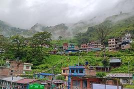
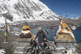
I’m heading to Nepal at the end of April 2026 with my brother, the two kids, and my mom.
My mom is 75, in good shape, she walks but isn’t a big sports enthusiast. My daughter is 16, she’s not really into hiking but with the right vibe, she’ll step up.
I’m looking for a 5-6 day trek that’s not too difficult—around 4-5 hours of walking and 500-600m of elevation gain per day. What’s our goal?
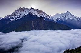
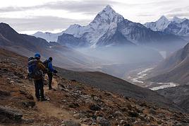
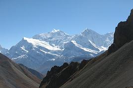
Well, like everyone, we’d love something not too crowded. We want to experience Nepali village life away from the main routes—terraced fields, all that. Some encounters, authenticity, sharing... And if we can catch a glimpse of some high peaks, even better.
Any suggestions?
Hello,
We’re planning a family trip (4 strong hikers, all adults) to Kashmir-Ladakh in August 2026!
We’d like to explore and do some treks—challenging but without technical difficulty (we’re not mountaineers).
To start, do you have any tips or recommendations for 4- to 6-day treks in Himalayan landscapes? Which town or village should we start from? We’ll figure out how to get there later. Should we hire a local guide?
We’re just starting to organize, so we’re open to all your advice. Is it possible to spend a few days in a monastery?
Thanks so much for your replies! See you soon,
Laurent
To start, do you have any tips or recommendations for 4- to 6-day treks in Himalayan landscapes? Which town or village should we start from? We’ll figure out how to get there later. Should we hire a local guide?
We’re just starting to organize, so we’re open to all your advice. Is it possible to spend a few days in a monastery?
Thanks so much for your replies! See you soon,
Laurent
Hi there,
I’m looking for half-day hikes near Karakol (not Jety-Oguz, since I’ll be heading there separately—max 30 minutes’ drive to the trailhead).
I can find longer treks, but nothing for a short outing!
So, if you’ve got any ideas...
Thanks! :)
I’m looking for half-day hikes near Karakol (not Jety-Oguz, since I’ll be heading there separately—max 30 minutes’ drive to the trailhead).
I can find longer treks, but nothing for a short outing!
So, if you’ve got any ideas...
Thanks! :)
Hello,
We’re planning a 3-week trip to Laos, focusing solely on the north. Our main goal is to do two 4-day treks in two different areas of Northern Laos.
We land in Bangkok on December 12th and will head straight to Chiang Mai before crossing into northern Laos at Huay Xai. Our journey will start there, ending in Vientiane, with a stop in Luang Prabang and the surrounding area. We’ll then take a night train from Udon Thani on December 30th to catch our flight back in Bangkok.
Right now, we’re mainly looking for reliable contacts to organize our two treks. From what we’ve read so far, trekking options exist around Luang Namtha, Phongsali (if it’s not too cold during that period, since we’ll have our 3-year-old daughter with us), or near Muang Ngoi and Nong Khiaw, as we’ve seen there are possibilities in that area too.
If we can organize both treks with the same contact, that would be perfect.
We’d prefer to avoid big agencies with a high-street presence and instead work directly with a local who knows their stuff and can give us good advice. We want to combine stunning landscapes (we love hiking) with cultural encounters in local villages.
We’d love to hear your tips and experiences—maybe some areas are better than others, less crowded, or more challenging (though we’re keeping in mind our 3-year-old, who’s used to hiking but we don’t want to put her in any danger).
That’s the gist of our plans for now! Looking forward to hearing from you, fellow travelers
We’re planning a 3-week trip to Laos, focusing solely on the north. Our main goal is to do two 4-day treks in two different areas of Northern Laos.
We land in Bangkok on December 12th and will head straight to Chiang Mai before crossing into northern Laos at Huay Xai. Our journey will start there, ending in Vientiane, with a stop in Luang Prabang and the surrounding area. We’ll then take a night train from Udon Thani on December 30th to catch our flight back in Bangkok.
Right now, we’re mainly looking for reliable contacts to organize our two treks. From what we’ve read so far, trekking options exist around Luang Namtha, Phongsali (if it’s not too cold during that period, since we’ll have our 3-year-old daughter with us), or near Muang Ngoi and Nong Khiaw, as we’ve seen there are possibilities in that area too.
If we can organize both treks with the same contact, that would be perfect.
We’d prefer to avoid big agencies with a high-street presence and instead work directly with a local who knows their stuff and can give us good advice. We want to combine stunning landscapes (we love hiking) with cultural encounters in local villages.
We’d love to hear your tips and experiences—maybe some areas are better than others, less crowded, or more challenging (though we’re keeping in mind our 3-year-old, who’s used to hiking but we don’t want to put her in any danger).
That’s the gist of our plans for now! Looking forward to hearing from you, fellow travelers
hi there
I live near Dole, so not too far away, and I sometimes go hiking (Camino de Santiago, Saint-Guilhem-le-Désert, etc.), and I’d love it if someone could suggest a trek in the Vosges—I really don’t know the area well. (Yeah, I know, I’m a little embarrassed about that.)
If you could recommend a nice route.
Arrival by car or train, doesn’t matter.
Thanks so much!
Hi there,
I’m planning to do the Mercantour crossing following the Randoxygène route in mid-July. I’m used to hiking in the mountains, but I sometimes get vertigo, for example on ridges with drops on both sides. I wanted to check if there are any T4 or T3-T4 sections and find out if there are any very exposed passages—and if so, where—so I can plan an alternative route. Can anyone give me some info on this? Thanks!
I’m planning to do the Mercantour crossing following the Randoxygène route in mid-July. I’m used to hiking in the mountains, but I sometimes get vertigo, for example on ridges with drops on both sides. I wanted to check if there are any T4 or T3-T4 sections and find out if there are any very exposed passages—and if so, where—so I can plan an alternative route. Can anyone give me some info on this? Thanks!
Hi there,
This August, I hiked the Vosges section (Vosges massif) of the GR5 (Lauterbourg-Wissembourg-gr53-gr5-Belfort) using the TopoGuide "Traversée du Massif des Vosges" (ref 502, April 2024 edition). My experience was partly ruined by a few things I feel I should share here to help others avoid the same pitfalls—or at least disappointments.
Having used "TopoGuide" books before, I’d always trusted them for organizing treks lasting several weeks, or even months.
Beyond the satisfactory mapping (reproductions of IGN 1:25,000 maps), these guides include route descriptions that are usually enough to find your way. On that point, I have no serious criticism of the Vosges crossing guide.
In addition to the route details, the guide provides "average" time estimates for traveling from point A to point B—useful info for gauging effort and planning likely stages. However, I eventually realized I couldn’t rely on these time estimates. I’d assumed they were calculated by the FFRP, considering that 100m of positive elevation gain roughly equals 1km on flat terrain, with an average walking speed of 4km/h. So, I’d recommend anyone using this guide to recalculate all the time estimates to avoid nasty surprises on tight stages. 🤪
Another key feature of the guide, in my opinion, is its info on accommodation options—especially budget-friendly ones suited for long-distance hikers on a tight budget. A section called "préparation des étapes" includes a table with a column meant to highlight "refuges" and "gîtes d'étapes." That column had me feeling optimistic: these budget accommodations were listed as plentiful along the route. After all, we were in the territory of the famous Club Vosgien—it made sense there’d be plenty of hiker-friendly lodging options. The reality on the ground was quite different. The TopoGuide wasn’t really to blame here, except that a serious warning wouldn’t have hurt. First, regarding the "refuges," most were run by associations. With rare exceptions, the volunteers only opened them on weekends. You can’t really blame people for not volunteering on weekdays, but it makes things tricky when the info about weekend-only openings often turns out to be wrong. As for the "gîtes d'étape," I was mostly disappointed when I was told that a place was booked for weeks: the vast majority of what was listed as a "gîte d'étape" turned out to be "gîtes ruraux." The advice here? If you don’t want to—or can’t—camp, double-check all the accommodation details before you set off. It’s time-consuming and tedious, but if you can, camping is still the best option. 😐 On a brighter note, during the first part of my trip, I came across several cabins that offered alternatives to camping. 🙂
P.S.: Even the youth hostel in Saverne was closed in the middle of August... 😕
Having used "TopoGuide" books before, I’d always trusted them for organizing treks lasting several weeks, or even months.
Beyond the satisfactory mapping (reproductions of IGN 1:25,000 maps), these guides include route descriptions that are usually enough to find your way. On that point, I have no serious criticism of the Vosges crossing guide.
In addition to the route details, the guide provides "average" time estimates for traveling from point A to point B—useful info for gauging effort and planning likely stages. However, I eventually realized I couldn’t rely on these time estimates. I’d assumed they were calculated by the FFRP, considering that 100m of positive elevation gain roughly equals 1km on flat terrain, with an average walking speed of 4km/h. So, I’d recommend anyone using this guide to recalculate all the time estimates to avoid nasty surprises on tight stages. 🤪
Another key feature of the guide, in my opinion, is its info on accommodation options—especially budget-friendly ones suited for long-distance hikers on a tight budget. A section called "préparation des étapes" includes a table with a column meant to highlight "refuges" and "gîtes d'étapes." That column had me feeling optimistic: these budget accommodations were listed as plentiful along the route. After all, we were in the territory of the famous Club Vosgien—it made sense there’d be plenty of hiker-friendly lodging options. The reality on the ground was quite different. The TopoGuide wasn’t really to blame here, except that a serious warning wouldn’t have hurt. First, regarding the "refuges," most were run by associations. With rare exceptions, the volunteers only opened them on weekends. You can’t really blame people for not volunteering on weekdays, but it makes things tricky when the info about weekend-only openings often turns out to be wrong. As for the "gîtes d'étape," I was mostly disappointed when I was told that a place was booked for weeks: the vast majority of what was listed as a "gîte d'étape" turned out to be "gîtes ruraux." The advice here? If you don’t want to—or can’t—camp, double-check all the accommodation details before you set off. It’s time-consuming and tedious, but if you can, camping is still the best option. 😐 On a brighter note, during the first part of my trip, I came across several cabins that offered alternatives to camping. 🙂
P.S.: Even the youth hostel in Saverne was closed in the middle of August... 😕
Hi there,
We’ve just returned from 15 days in Cape Verde, including 8 days of hiking in Santo Antão. It was a fantastic trip with great weather and heat that stayed manageable. Everything was organized by a highly competent local agency that really listened to our requests. I’m happy to share more details about the hikes, hotels, etc. if you’d like!
Because of a miscalculation on extra costs (non-hotel expenses and transfers), I’ve got 18,000 escudos left—I’d be more than happy to exchange them for a more widely used currency!
We’ve just returned from 15 days in Cape Verde, including 8 days of hiking in Santo Antão. It was a fantastic trip with great weather and heat that stayed manageable. Everything was organized by a highly competent local agency that really listened to our requests. I’m happy to share more details about the hikes, hotels, etc. if you’d like!
Because of a miscalculation on extra costs (non-hotel expenses and transfers), I’ve got 18,000 escudos left—I’d be more than happy to exchange them for a more widely used currency!
I’m traveling solo by plane to Catania in May and plan to hike the northern side of Etna, starting from Linguaglossa where I’ll arrive by bus. After that, I’d love some info on how to get up to Piano Provenzana (shuttles or hitchhiking), since it seems there’s no public transport except in the summer. Can you sleep there in a free or cheap refuge, or camp? And how far up can you go without having to hire a guide? Thanks in advance. Bernard.
I want to do sections of the Collioure-Cadaqués trail. I plan to stay in Collioure first to hike the paths on the French side using the bus. Speaking of which, I’m wondering if it’ll be easy to find a seat on the buses at the end of April, beginning of May.
After that, I’ll head to Figueres to do sections of the trail on the Spanish side. I’m worried the buses might not be too crowded at the end of April.
Here’s what I’m interested in: Llanca - Port de la Selva: Figueres - Llanca by train in the morning and Port de la Selva - Figueres on the way back Port de la Selva - Cadaqués: Figueres - Port de la Selva in the morning and Cadaqués - Figueres on the return trip
I’d also like to go to Cadaqués from Figueres as a day trip. I’m concerned about how busy this route might be at the end of April.
I’m wondering if I need to get tickets in advance and where to buy them.
After that, I’ll head to Figueres to do sections of the trail on the Spanish side. I’m worried the buses might not be too crowded at the end of April.
Here’s what I’m interested in: Llanca - Port de la Selva: Figueres - Llanca by train in the morning and Port de la Selva - Figueres on the way back Port de la Selva - Cadaqués: Figueres - Port de la Selva in the morning and Cadaqués - Figueres on the return trip
I’d also like to go to Cadaqués from Figueres as a day trip. I’m concerned about how busy this route might be at the end of April.
I’m wondering if I need to get tickets in advance and where to buy them.
Hi there,
I’m planning a 6-day trip from Orléans to Tours.
There are very few detailed maps to figure out the main stages and what you’ll find along the way. Even though I’ve downloaded the Miam Miam Dodo app, it’s pretty tedious (everything is split into small map sections).
I’ve settled on the first leg: Orléans to Meung-sur-Loire, about 18 km. For the next one, I’m hesitating because I’d like to do around 20–25 km, but I see Beaugency is only about 10 km away, and Mer is almost 30 km. So, I’m stuck.
On top of that, I’m torn between taking the GR 3 route or the GR 655 (south).
If any of you know the area or have already done this hike/pilgrimage, I’d love to hear your tips for this section that goes through Blois and ends in Tours.
For the last legs, I’ve planned Blois -> ? Chaumont (no accommodations) -> Amboise -> Tours, knowing the final stage is about 30 km.
Thanks in advance for your help! 😉
Thanks in advance for your help! 😉
Hi there,
I’m planning a trip to Rwanda with a focus on hiking and using local transport.
Could anyone share or confirm the entrance fees for the national parks?
- Volcanoes National Park: Is it possible to visit without the $1,500 gorilla trek?
- Nyungwe Forest National Park
- Akagera National Park: $100 per person per day + $40 for a car
Is there an entrance fee for the Congo Nile Trail? If anyone has great tips or recommendations for this trail and other hikes in the country, I’d love to hear them. Thanks so much!
Is there an entrance fee for the Congo Nile Trail? If anyone has great tips or recommendations for this trail and other hikes in the country, I’d love to hear them. Thanks so much!
Hi,
I’m interested in hiking in the city of Sefar.
Has anyone here been there?
Thanks for your replies.
Didier
hi everyone,
we’re a group of 10 adults who hike together every year, and we’re looking for our next destination for October. Our main criterion is avoiding crowds, even if it means not being at the most wow-worthy spot. Is there still a chance to find some solitude in Madeira, or has it become difficult? Would Cape Verde be a better bet if we pick the right islands?
I know it’s a very personal opinion—super subjective depending on how much company you can tolerate—but it’s really our top priority.
Thanks for any recent insights; it seems like tourism in Madeira is really booming!
have a great day,
Sandra
we’re a group of 10 adults who hike together every year, and we’re looking for our next destination for October. Our main criterion is avoiding crowds, even if it means not being at the most wow-worthy spot. Is there still a chance to find some solitude in Madeira, or has it become difficult? Would Cape Verde be a better bet if we pick the right islands?
I know it’s a very personal opinion—super subjective depending on how much company you can tolerate—but it’s really our top priority.
Thanks for any recent insights; it seems like tourism in Madeira is really booming!
have a great day,
Sandra
Hi everyone,
I’ve planned a little day trip with my kids (12 and 16 years old) to Venice. The goal is to go for a walk through the city’s streets rather than visiting museums, which would take way too much time. We’d like to pass by the main landmarks, so I’ve put together a small 15 km hike... (thanks to Komoot and visioRando). Could you take a quick look and let me know if I’ve missed anything or made any mistakes?
1. Start at Santa Lucia Train Station 2. Ponte Degli Scalzi 3. Ponte dei Pugni 4. squero de San Trovaso 5 Le rio della Salute 6. Accademia Bridge 7. St. Mark’s Square 8. St. Mark’s Basilica 9. Ponte de la Canonica 10. Ponte de la Pietà 11. Ponte de la Tana 12. The Arsenale 13. Bridge of Sighs 14. Doge’s Palace Then return to the Rialto Bridge via Marzaria dell’Orologio
Also, could you tell me if the Doge’s Palace courtyard is paid entry? Thanks for your help and feedback!
Stéphane.
I’ve planned a little day trip with my kids (12 and 16 years old) to Venice. The goal is to go for a walk through the city’s streets rather than visiting museums, which would take way too much time. We’d like to pass by the main landmarks, so I’ve put together a small 15 km hike... (thanks to Komoot and visioRando). Could you take a quick look and let me know if I’ve missed anything or made any mistakes?
1. Start at Santa Lucia Train Station 2. Ponte Degli Scalzi 3. Ponte dei Pugni 4. squero de San Trovaso 5 Le rio della Salute 6. Accademia Bridge 7. St. Mark’s Square 8. St. Mark’s Basilica 9. Ponte de la Canonica 10. Ponte de la Pietà 11. Ponte de la Tana 12. The Arsenale 13. Bridge of Sighs 14. Doge’s Palace Then return to the Rialto Bridge via Marzaria dell’Orologio
Also, could you tell me if the Doge’s Palace courtyard is paid entry? Thanks for your help and feedback!
Stéphane.
Hello,
I'm planning to travel from Matsumoto to Tsumago to hike to Magome. Is it reasonable to leave early in the morning from Matsumoto by train, stop in Narai for a stroll (knowing we'll have our big backpacks, I hope there's a luggage locker at the station), and then continue to Tsumago to do the hike to Magome?
Or is it better to stop and sleep halfway in Kiso-Fukushima? (I looked for accommodations in Narai but couldn't find any.)
Thanks in advance for your advice.
I'm planning to travel from Matsumoto to Tsumago to hike to Magome. Is it reasonable to leave early in the morning from Matsumoto by train, stop in Narai for a stroll (knowing we'll have our big backpacks, I hope there's a luggage locker at the station), and then continue to Tsumago to do the hike to Magome?
Or is it better to stop and sleep halfway in Kiso-Fukushima? (I looked for accommodations in Narai but couldn't find any.)
Thanks in advance for your advice.
hi
we’re planning a trip to Yellowstone and hoping to do a three-day backcountry hike if we get a permit. if any of you have done this before, could you let me know if it’s possible to find water along the way? And if we can transport it, are we allowed to use a stove?
thanks for any tips!
sandra
we’re planning a trip to Yellowstone and hoping to do a three-day backcountry hike if we get a permit. if any of you have done this before, could you let me know if it’s possible to find water along the way? And if we can transport it, are we allowed to use a stove?
thanks for any tips!
sandra
Hi there,
I go on mountain hikes lasting about ten days with a backpack that doesn’t exceed 11 kg. I’d like to switch to a different category of shoes now. Up until now, I’ve been using semi-rigid leather mid-height models, but I’ve had major after-sales service issues with them. They’ve been sent back for repairs three times—5 months, then 6 months of waiting—because the toe cap came unstuck. It just doesn’t hold up.
I’m thinking of switching to mid-height or even low-cut models. But I’m wondering if this change comes with any risks. Also, which category would be best suited: trail shoes, approach shoes, or mid-height? Thanks in advance for your insights!
I go on mountain hikes lasting about ten days with a backpack that doesn’t exceed 11 kg. I’d like to switch to a different category of shoes now. Up until now, I’ve been using semi-rigid leather mid-height models, but I’ve had major after-sales service issues with them. They’ve been sent back for repairs three times—5 months, then 6 months of waiting—because the toe cap came unstuck. It just doesn’t hold up.
I’m thinking of switching to mid-height or even low-cut models. But I’m wondering if this change comes with any risks. Also, which category would be best suited: trail shoes, approach shoes, or mid-height? Thanks in advance for your insights!
Hi there,
I’m looking for a hiking guide for Quebec (Laurentides, Gaspésie, Saguenay).
Do you know any professionals for one or more of these regions?
This is for September 2025.
Thanks in advance!
Hi everyone,
Here’s my dilemma:
I’m planning a hike between Le Bonhomme and the Gîte des 3 Fours at the Col de la Schlucht.
Between the two, I need a hostel, a gîte, or a farm inn for Wednesday, September 10th.
My gîte at the pass is only open on Thursday, so I need a stop between Le Bonhomme and the pass.
On Wednesday, everything’s closed—no half-board, nothing at all.
Would you have any solutions? I’ve already called the tourist office, and they confirmed there’s no possibility.
No tent—it’s too heavy for me at my age.
Thanks for your ideas!
Hey everyone,
I’m planning a hiking trip to India in 2025 with my wife and another couple.
We’ll most likely be leaving at the end of April (TBC).
This isn’t my first time hiking abroad, and I’ve often run into parasites that take advantage of the night to bother you (you know what I’m talking about, haha).
I’ve dealt with flies, mosquitoes, and all kinds of critters during my sleep before, but for this trip to India—which could already be pretty hectic—I really want to be prepared and avoid this issue.
If you know where I can find effective mosquito nets that won’t give me any trouble with mosquitoes, I’m all ears!
If you’re selling some yourself, feel free to reply to this post—we can chat about it!
In the meantime, I’ll keep looking for mosquito nets on my end.
Thanks! !
I’m planning a hiking trip to India in 2025 with my wife and another couple.
We’ll most likely be leaving at the end of April (TBC).
This isn’t my first time hiking abroad, and I’ve often run into parasites that take advantage of the night to bother you (you know what I’m talking about, haha).
I’ve dealt with flies, mosquitoes, and all kinds of critters during my sleep before, but for this trip to India—which could already be pretty hectic—I really want to be prepared and avoid this issue.
If you know where I can find effective mosquito nets that won’t give me any trouble with mosquitoes, I’m all ears!
If you’re selling some yourself, feel free to reply to this post—we can chat about it!
In the meantime, I’ll keep looking for mosquito nets on my end.
Thanks! !
Hi there,
I’m reposting about the logistics for Samaria Gorge. I’d love to get recent info, especially about whether it’s possible to park my car in Omalos, do the hike, and then catch a bus back to my vehicle. In theory, it’s doable, but when you check the KTEL website, there aren’t any feasible schedules listed. If anyone has recently organized this with reliable, verified details, I’d really appreciate it. Thanks in advance!
I’m reposting about the logistics for Samaria Gorge. I’d love to get recent info, especially about whether it’s possible to park my car in Omalos, do the hike, and then catch a bus back to my vehicle. In theory, it’s doable, but when you check the KTEL website, there aren’t any feasible schedules listed. If anyone has recently organized this with reliable, verified details, I’d really appreciate it. Thanks in advance!
Hi there, my partner and I want to hike the GR34 over several years, in stages of 8 to 10 days of walking during May or June.
We're 53 and 55, pretty fit, and used to hiking.
Our goal is to complete the whole trail starting from Mont Saint-Michel, but maybe some sections aren’t worth it?
So I’ve got a few questions about logistics:
- backpack size and what essentials to pack
- where to sleep affordably (camping, hotels, or a mix?)
Thanks for your tips!
Hi everyone! 😊
I’m currently working on a school project about hiking, and I’d really love to hear about your experiences. I’ve put together a short survey (3 minutes max) to better understand hikers’ habits.
👉 Survey link: forms.gle/JyJi8MWKy6aKZyy...
Your participation would help me so much, and all responses will remain anonymous. A huge thank you in advance to anyone who takes the time to fill it out! 🙏 Happy hiking to all! 🦥🌿
P.S.: I’ll delete this post if it doesn’t fit the forum rules.
I’m currently working on a school project about hiking, and I’d really love to hear about your experiences. I’ve put together a short survey (3 minutes max) to better understand hikers’ habits.
👉 Survey link: forms.gle/JyJi8MWKy6aKZyy...
Your participation would help me so much, and all responses will remain anonymous. A huge thank you in advance to anyone who takes the time to fill it out! 🙏 Happy hiking to all! 🦥🌿
P.S.: I’ll delete this post if it doesn’t fit the forum rules.
Hi,
I’m planning the Switzerland-Paris hike for 2026. If any of you know a route where I can stay with locals or in other lodging (no camping), I’d really appreciate your tips.
Thanks!
M Brunner
Hi there!
I’m heading out in August for a two-day trek in the Vale do Pati. Do I need proper hiking boots, or will trail-running shoes do the job?
Thanks in advance for your feedback!
😊😃
Hi, I’m looking for a hiking partner (18–25 years old) for a multi-day hike in the Massif Central this summer (date and route to be decided).
I live in Puy-de-Dôme, so I know the area well.
hi there
I’m heading to Uzbekistan for three weeks from mid-September to mid-October 2026—a country I haven’t visited yet.
I’d love to do a few multi-day hikes in the mountains without going through a tour operator or hiring a guide. Has anyone here done this?
It doesn’t have to be all trekking; day hikes are great too.
I’m open to any tips!
Also, I see there are lots of train options if you book well in advance—does that only apply to the "fast" trains? Are there buses as well?
Thanks, community! 🙂
Also, I see there are lots of train options if you book well in advance—does that only apply to the "fast" trains? Are there buses as well?
Thanks, community! 🙂
Hi, this might not be the right section, but I’d like to know if it’s possible to start mountaineering with another person without necessarily hiring a guide. We’ve done quite a bit of hiking but not mountaineering—we’ll just do a half-day glacier course. After that, we were thinking of starting with La Grande Motte and the Pointe de la Traversière, which were recommended to us. Honestly, for things like roping up and knots, I’ll learn at home with lots of videos and a book.
Hello,
I’ll be in Nepal from March 6th to 29th (we’re flying into Kathmandu via Varanasi and leaving via Delhi).
I’m a bit confused about the regulations requiring a guide.
My wife and I (we’re 63 and 64) aren’t experienced trekkers—we’re more used to walking on terrain with very moderate elevation changes. I’m looking for fairly easy hikes, possibly day trips. Here are my questions: - Does the Poon Hill trek from Pokhara require a guide, or is it better to go through a local agency? (I’ve seen a lot of them offering 4-day packages) - I’d like to do a few multi-day hikes around Jomsom (Kagbeni, Mukitinath, Lupra, Marpha)... Do you need a guide for those, and can you find accommodations easily without booking in advance?
Last question—I’m really hesitant to lug around a sleeping bag or down jacket during our 6 weeks in India. Can you easily find these kinds of items at reasonable prices in Pokhara?
Thanks in advance for any tips you can share! Yann
My wife and I (we’re 63 and 64) aren’t experienced trekkers—we’re more used to walking on terrain with very moderate elevation changes. I’m looking for fairly easy hikes, possibly day trips. Here are my questions: - Does the Poon Hill trek from Pokhara require a guide, or is it better to go through a local agency? (I’ve seen a lot of them offering 4-day packages) - I’d like to do a few multi-day hikes around Jomsom (Kagbeni, Mukitinath, Lupra, Marpha)... Do you need a guide for those, and can you find accommodations easily without booking in advance?
Last question—I’m really hesitant to lug around a sleeping bag or down jacket during our 6 weeks in India. Can you easily find these kinds of items at reasonable prices in Pokhara?
Thanks in advance for any tips you can share! Yann