Hey everyone,
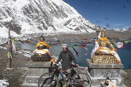
My plan for next November is to head back (yet again) to the Annapurnas to complete a route I’d always promised myself I’d do one day. Here’s the breakdown:
1. Start from Sikles and join the Annapurna Circuit by first going through Kori, then the Namun La (or Namun Bhanjyang). It’s a bit of a forgotten route, and I haven’t found much info on it—no .gpx files or firsthand accounts. Still, I’ve roughly mapped it out using different sources.
2. After that, I plan to head up to Phu to do the direct Phu Pass/Naar Pass traverse to Naar. It’s doable in 2 days, but why not in 1 if the weather’s good and I set off early enough?
3. Finally, I’ll head toward the Mesokanto North Pass (after a short camp at Tilicho North BC) to descend the entire Gandaki Valley down to Nayapul.
I’m obviously looking for any tips or feedback (if you’ve got any), and maybe a travel buddy who’s up for a little off-the-beaten-path adventure. 😄
Hi everyone,
I’m just at the very beginning of my research, so I’m coming straight to you for some info. I’d like to visit Morocco to discover a bit of the country. I’ve just found out about the Toubkal circuit, which I’d love to do in January/February. I’m open to going independently with a tent, food, etc., and also open to whatever other possibilities this circuit offers that I don’t know about yet... Could you share any random tips or info? I’d also love to hear your opinions? What I like about this circuit is that it’s fairly accessible and seems interesting for many reasons. I’ll leave it to you to share your thoughts—thanks in advance for your help! 🙂 Wishing you all lots of exciting plans for the new year ahead!
Nicolas
I wanted to share an incredible experience I had recently that really left an impression on me: hiking the Mercantour independently. It’s an absolutely stunning mountain range, with varied landscapes that go from lush forests to rocky ridges, passing through high-altitude lakes with unbelievable colors. I chose a one-week route, sleeping under the stars in a bivouac.
It was a pretty demanding adventure, with significant elevation changes and sometimes unpredictable weather. But every effort was rewarded with breathtaking views. I was lucky enough to spot marmots, chamois, and even ibex in the distance. It’s truly a total immersion in nature!
A little tip for those tempted by the adventure: plan your route and gear carefully. Independence requires good preparation. I particularly appreciated having a good water filtration system and lightweight cookware. And for safety, aside from a map and compass (or GPS), I never leave without my two-way radio. In these remote areas where there’s no mobile signal, it’s a real safety net in case of trouble or just to communicate with other hikers if you’re in a group. It can really make a difference!
If any of you have already hiked in the Mercantour or have questions about my experience, don’t hesitate to ask. I’d love to chat with you about this beautiful range or other hiking destinations.
See you on the trails! 🙂
Hi there,
We’re planning to hike the GRR2 this summer with a local agency that offers a self-guided south-to-north route. We’re active and hike regularly, but we’ve never done a trek just the two of us without a guide.
I’d love to know if this trail has any dangerous areas? Drop-offs? Are there spots where it’s easy to lose the path?
I’ve seen that some agencies offer a GPS app—does the signal even reach everywhere inland? 🤪
Thanks! 😄
Looking forward to hearing from you! !
Hi there, for those who’ve been recently—is it possible to find other solo travelers in March on the island to share transport or room costs? It doesn’t seem easy to travel on a budget.
If you have any recommendations for simple lodgings or places with dorms, I’d love to hear them.
For those who’ve done multi-day treks while moving around: do you need to bring your own sleeping bag? I’d love to hear about itineraries you’ve done without a guide, just with a map and GPS.
Thanks, and have a great day!
I’m heading to Nepal at the end of April 2026 with my brother, the two kids, and my mom.
My mom is 75, in good shape, she walks but isn’t a big sports enthusiast. My daughter is 16, she’s not really into hiking but with the right vibe, she’ll step up.
I’m looking for a 5-6 day trek that’s not too difficult—around 4-5 hours of walking and 500-600m of elevation gain per day. What’s our goal?
Well, like everyone, we’d love something not too crowded. We want to experience Nepali village life away from the main routes—terraced fields, all that. Some encounters, authenticity, sharing... And if we can catch a glimpse of some high peaks, even better.
Any suggestions?
Hi there, my partner and I want to hike the GR34 over several years, in stages of 8 to 10 days of walking during May or June.
We're 53 and 55, pretty fit, and used to hiking.
Our goal is to complete the whole trail starting from Mont Saint-Michel, but maybe some sections aren’t worth it?
So I’ve got a few questions about logistics:
- backpack size and what essentials to pack
- where to sleep affordably (camping, hotels, or a mix?)
Thanks for your tips!
Hi there,
I’ll be in Nepal in October. I’m planning to do the Annapurna trek and climb Mera Peak. From what I’ve heard, it’s one of the most accessible 6,000m peaks and doesn’t require a mandatory guide? The info I’ve found is pretty scattered—mostly just travel agency blogs. :-) Has anyone here already done this climb? I’ve heard you can find guides in Khare for just the final part of the ascent (which is way cheaper).
Thanks for your feedback!
Can’t wait to be there! :-)
Hi everyone! 😊
I’m currently working on a school project about hiking, and I’d really love to hear about your experiences. I’ve put together a short survey (3 minutes max) to better understand hikers’ habits.
👉 Survey link: forms.gle/JyJi8MWKy6aKZyy...
Your participation would help me so much, and all responses will remain anonymous. A huge thank you in advance to anyone who takes the time to fill it out! 🙏 Happy hiking to all! 🦥🌿
P.S.: I’ll delete this post if it doesn’t fit the forum rules.
Hi, how did you all organize your luggage for your excursions?
For example, if we plan a hike to Palccoyo by taxi, can the driver keep our suitcases and then drive us to Puno?
Thanks for your feedback. »
Hi everyone,
I’ve planned a little day trip with my kids (12 and 16 years old) to Venice. The goal is to go for a walk through the city’s streets rather than visiting museums, which would take way too much time. We’d like to pass by the main landmarks, so I’ve put together a small 15 km hike... (thanks to Komoot and visioRando). Could you take a quick look and let me know if I’ve missed anything or made any mistakes?
1. Start at Santa Lucia Train Station 2. Ponte Degli Scalzi 3. Ponte dei Pugni 4. squero de San Trovaso 5 Le rio della Salute 6. Accademia Bridge 7. St. Mark’s Square 8. St. Mark’s Basilica 9. Ponte de la Canonica 10. Ponte de la Pietà 11. Ponte de la Tana 12. The Arsenale 13. Bridge of Sighs 14. Doge’s Palace Then return to the Rialto Bridge via Marzaria dell’Orologio
Also, could you tell me if the Doge’s Palace courtyard is paid entry? Thanks for your help and feedback!
Stéphane.
Hi there,
Once again, I’m turning to VoyageForum to kick off my trip planning—this time, it’s Croatia!
I’m treating my 29-year-old daughter to a trip where we’d love to combine hiking and snorkelling. I’m not sure if we can focus on just one region, but that’d be ideal since we’ll only have 10–15 days in August this year.
Could anyone point me in the right direction for a first lead?
Are transport links easy to navigate? Is it better to go with Airbnb or a hostel?
Thanks in advance for your tips!
Laurence from Bayonne
Hi there,
I’d like to hike The Narrows in mid-June. Has anyone done this hike and can share their feedback? I’ll be hiking up to the narrowing, and I saw there’s an outfitter that rents the right gear—I plan to get equipped. Though it depends on a lot of factors, what’s the average water level like at that time of year?
Thanks
Hi there!
Discussions are rare and not recent, so I’m giving this a little bump—hope some folks are still around! ;-)
I’d love to head to Wamena and trek south through the Valley over 5-6 days on foot.
From what I’ve seen, finding your way isn’t exactly straightforward, and it seems best to hire a guide. I’ve never done that before because the encounters just aren’t the same...
Has anyone here explored the area? Is it feasible to trek down along the Baliem River, from Sogokmo to Kulise, then to Wamerek, cross over, and head back up along the river?
I’ve heard you should bring supplies to offer your hosts, which I’m happy to do!
What do you all think? The carefree spirit of my 20s is long gone, but I’d love to find it again, even just for a little while. ;-)
Thanks so much in advance for any tips or advice! Juliette
Hi there,
I’m planning to do the Mercantour crossing following the Randoxygène route in mid-July. I’m used to hiking in the mountains, but I sometimes get vertigo, for example on ridges with drops on both sides. I wanted to check if there are any T4 or T3-T4 sections and find out if there are any very exposed passages—and if so, where—so I can plan an alternative route. Can anyone give me some info on this? Thanks!
I’m planning to do the Mercantour crossing following the Randoxygène route in mid-July. I’m used to hiking in the mountains, but I sometimes get vertigo, for example on ridges with drops on both sides. I wanted to check if there are any T4 or T3-T4 sections and find out if there are any very exposed passages—and if so, where—so I can plan an alternative route. Can anyone give me some info on this? Thanks!
Hi there,
We’re heading to South Africa in August 2025 and planning a classic loop that I’d love to finish with the Drakensberg (I’m a big hiking fan) before returning to Johannesburg to catch our flight.
I’ve got 3 nights for this part of our trip. But I’m wondering if it’s actually a good idea to hike in the Drakensberg in August, since it’s the Southern Hemisphere winter (I’m from Réunion and we hike year-round there, but I don’t know what the climate’s like in South Africa, especially the Drakensberg).
I’m particularly worried about getting stuck because of snow and missing our flight... ;)
I’ve read so many different things that I’m totally confused!
If it’s okay to hike at this time of year, what would you recommend? I’m torn between Champagne Valley and Royal Natal National Park.
Thanks in advance for your firsthand tips!
Malijp
Hi everyone.
I’m planning a trip to Thailand for November.
We loved the treks we did in Laos, Vietnam, and Myanmar so much that we’d like to repeat the experience in Northern Thailand.
Most travelers who go trekking do it around Chiang Mai. But wouldn’t it be better to do it somewhere else (Chiang Rai?) to get a bit more authenticity?
Any tips would be welcome (agency, guide, route, etc.).
Thanks for your feedback!
Hi there,
We’re flying from Montreal to Lyon this August to go hiking in the French Alps. We’ve rented a car and will be staying at campgrounds. We’re planning to do day hikes and want to stay a few days in one spot, do a few hikes, then move on to our next camping spot. Could you share your favorite spots or any recommendations for places to spend a few days with great hikes?
A few details: We arrive in early August and leave in early September. We’re looking for day hikes (or shorter), moderate difficulty, with a cumulative elevation gain of no more than 1000m, and of course, beautiful scenery! We’d prefer not to drive too much—maybe it’s best not to head too far south and deal with unnecessary heat? Along the same lines, if you know of any great campgrounds where we can start our hike directly without needing the car, we’d love to hear your suggestions!
Thanks! :-)
Hi there.
I’ve hiked the GR trail mentioned in the title from Wissembourg all the way to Menton.
Now I’ve got the section from Wissembourg to Rotterdam left.
But I can’t find any maps for this route—I’m looking for someone who’s done this part of the trail.
Thanks in advance! 😊
Hi everyone!
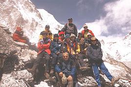
New to this forum, I’m planning a pretty big project for 2028. I’m heading to Nepal to do a trek from Kathmandu all the way to Everest Base Camp (a cool 5,300 m 😄). This trek is a bit special because even though I’ll be part of a group, I’m going solo (so far, no problem—I’m used to it). But it’s my first real trek, and it’s also a humanitarian one: once I reach base camp, I’ll stay an extra week to help clean up the waste left by tens of thousands of climbers! Since I’m originally from South America, from two countries that share the Andes, I have a deep respect for mountains—they fascinate me. So Everest… it’s kind of the trip of a lifetime!
So, a little question for those who’ve done treks to Everest before… any tips for good mental preparation (I’m already working on the physical side)?
Thanks in advance for your advice! 🙂
Hello,
We’re planning a 3-week trip to Laos, focusing solely on the north. Our main goal is to do two 4-day treks in two different areas of Northern Laos.
We land in Bangkok on December 12th and will head straight to Chiang Mai before crossing into northern Laos at Huay Xai. Our journey will start there, ending in Vientiane, with a stop in Luang Prabang and the surrounding area. We’ll then take a night train from Udon Thani on December 30th to catch our flight back in Bangkok.
Right now, we’re mainly looking for reliable contacts to organize our two treks. From what we’ve read so far, trekking options exist around Luang Namtha, Phongsali (if it’s not too cold during that period, since we’ll have our 3-year-old daughter with us), or near Muang Ngoi and Nong Khiaw, as we’ve seen there are possibilities in that area too.
If we can organize both treks with the same contact, that would be perfect.
We’d prefer to avoid big agencies with a high-street presence and instead work directly with a local who knows their stuff and can give us good advice. We want to combine stunning landscapes (we love hiking) with cultural encounters in local villages.
We’d love to hear your tips and experiences—maybe some areas are better than others, less crowded, or more challenging (though we’re keeping in mind our 3-year-old, who’s used to hiking but we don’t want to put her in any danger).
That’s the gist of our plans for now! Looking forward to hearing from you, fellow travelers
My husband and I are planning a 10-day trip to Northern Vietnam in November, traveling independently (no agency organizing everything) and using local buses. We’d like to spend at least 3 days in each place (including Meo Vac). We’re wondering if it’s possible to find local guides for day hikes, and if so, in which towns/villages (Meo Vac plus one or two other spots to explore the surrounding area).
Thanks!
I want to do sections of the Collioure-Cadaqués trail. I plan to stay in Collioure first to hike the paths on the French side using the bus. Speaking of which, I’m wondering if it’ll be easy to find a seat on the buses at the end of April, beginning of May.
After that, I’ll head to Figueres to do sections of the trail on the Spanish side. I’m worried the buses might not be too crowded at the end of April.
Here’s what I’m interested in: Llanca - Port de la Selva: Figueres - Llanca by train in the morning and Port de la Selva - Figueres on the way back Port de la Selva - Cadaqués: Figueres - Port de la Selva in the morning and Cadaqués - Figueres on the return trip
I’d also like to go to Cadaqués from Figueres as a day trip. I’m concerned about how busy this route might be at the end of April.
I’m wondering if I need to get tickets in advance and where to buy them.
Hi there,
We’re planning a two-week couple’s trip hopping between the Cape Verde islands at the end of November 2025.
Our arrival and departure airport will be on the island of SAL.
We’ve got some hikes lined up.
Based on your experiences, what recommendations and suggestions do you have?
Thanks in advance for your valuable tips!
Hey everyone!
I’d like to explore the northeast of Madagascar, using bush taxis, boats, and my own two feet.
I already have an ideal itinerary in mind, but I’d love to know if it’s doable at a relaxed pace in one month. The goal, of course, is to avoid being constantly focused on time and days and to travel spontaneously.
I’m aware that the roads are rough and there are a lot of unexpected delays, which isn’t a problem in itself. I just struggle to estimate the *time* it takes to get between stops.
Potential itinerary:
Tana – Sainte Marie Island (4 days) – Maroantsetra (3 days) – Masoala Park (8-day trek?) – Antalaha – Marojejy Park (3 days) – Ambilobe – Nosy Be (5 days) – Tana
The days listed are just rough averages. Cities don’t interest me, and I don’t plan to visit Tana.
I’d really appreciate any info or tips from you all! 😊
Thanks in advance,
Romain
A message in a bottle:
For a three-week trip in November... is it possible to go hiking without a guide in northern Vietnam, getting around to the hiking sites by public transport, bikes, or on foot? And if so, which areas specifically?
Thanks to anyone who replies!8
Hello,
I’m heading to Réunion in early October with my girlfriend for two weeks.
Out of the 15 days, we’d like to do about 5 days of hiking—maybe a 3-day/2-night trek and two day hikes.
I’ve seen tons of hiking options online, but I’m a bit overwhelmed when it comes to choosing. Hikes like the Tour de Mafate trek, Piton des Neiges, Piton de la Fournaise… we’d love to do those too.
We’ll have a rental car if needed. No problem walking for 6 hours a day (we’re pretty active).
Which hikes would you recommend?
Thanks in advance!
hi there,
I’m planning a trip around Cap Corse and the AGRIATES in 2026, from May 8th to 15th (there are still 2 spots left, by the way! Just DM me if you're interested).
I’d love to know which hikes are worth prioritizing in the AGRIATES. We’ll be staying in SALECCIA for two days as our base—what should we focus on from there? A round trip to IGNHU beach? Any other suggestions? For Ostricano, I think it’s too far for a round trip... Thanks for your tips! Have a great day, Anie, Toulouse
Hi there!
I’m heading out in August for a two-day trek in the Vale do Pati. Do I need proper hiking boots, or will trail-running shoes do the job?
Thanks in advance for your feedback!
😊😃
Hello everyone,
We’re planning to spend 15 days in early May in La Gomera, solely for hiking and exploring the island. We like to take our time and not rush to see everything. We’ve booked small hostels or hotels, and our itinerary will be: San Sebastian -> Playa Santiago -> Valle Gran Rey -> Vallehermoso -> back to San Sebastian
We’re hesitating about renting a car—it would certainly give us more flexibility compared to buses, but it also comes with a budget and responsibilities (parking, getting back to the car after a hike, driving fatigue, distances, etc.). Since hiking is our main focus, the ROTHER guidebook shows mostly hikes that are accessible by bus. Is the bus network reliable? Is it restrictive to go without a car, with 2 or 3 nights in each location?
Thanks for your feedback—we can’t decide!
Best, Thomas