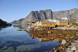
Hello fellow cycle-tourers!
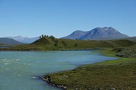
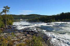
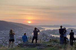
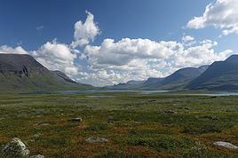
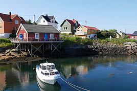
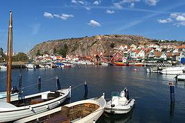
First post on this site for our first big family cycling adventure with our two teens (12 and 16 years old) over 2 months. We're preparing to leave in June/July from Erdeven by bike, then take the train from Auray to Paris, followed by a FlixBus from Paris to Copenhagen with our 4 bikes. After that, we're looking to refine our route: Should we go to Sweden via Helsingborg and then head up to Stockholm along the west or east coast? Maybe passing through the Gotland islands, then via the Åland Islands, why not Turku? Then off to Estonia to Tallinn, ride a bit along the coast, and return by bus if we can find one that takes 4 bikes. :))
Could you share any tips on routes in Sweden: west coast or east coast to prioritize in the south? We’ve heard it’s a shame not to go up to Norway, but we’re worried about the elevation and don’t see how to make a loop work in our 2 months / 1500 km. Any ideas? And the southern Finnish coast: should we go all the way to Helsinki or not? Maybe at the expense of Estonia?
In short, we know choosing means giving something up, but if we can do it with advice from fellow cyclists, that would be amazing!
Thanks in advance for your tips!
Anne-Sophie and the whole Breton family: David, Axel, and Maude
Hi there!
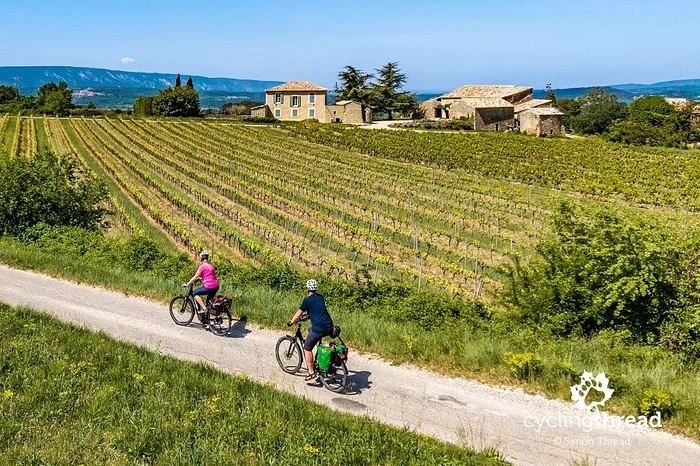
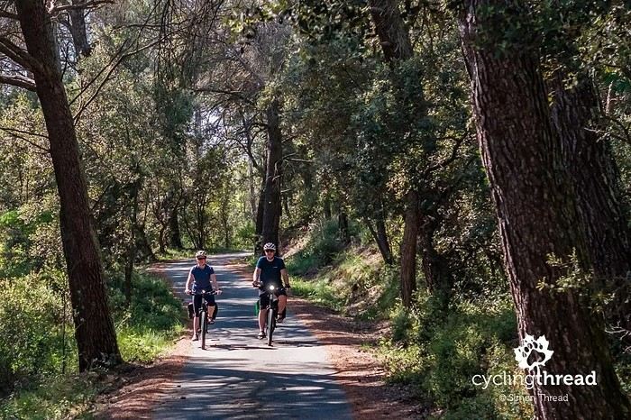
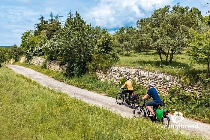
I’m making an exception and creating a separate post this time, since it’s all about France. In May, we spent a week in Provence, specifically in the Luberon, exploring the cycling routes *Autour du Luberon à Vélo*, the *Véloroute du Calavon* (part of EuroVelo 8), and the shorter *Les Ocres à Vélo* route. Together, they gave us an amazing journey through rolling hills, vineyards, lavender fields still green in spring, and some of the most stunning landscapes in southern France.
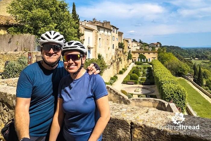
It was, of course, the perched villages that impressed us the most. We visited Gordes, Roussillon, Bonnieux, Lacoste, Lourmarin, Ménerbes, Oppède-le-Vieux, Cucuron, and Lauris. Many of them are among the most beautiful villages in Provence, and it’s hard not to agree with that reputation.
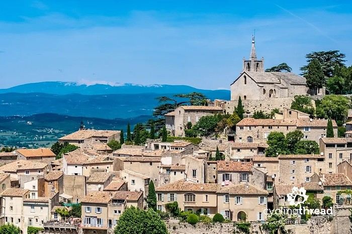
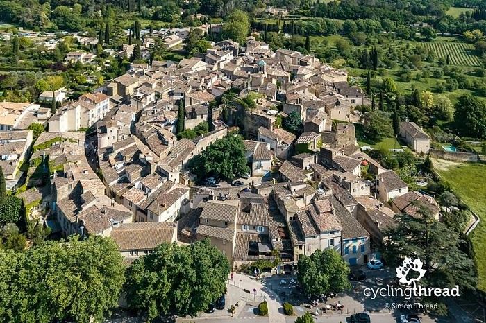
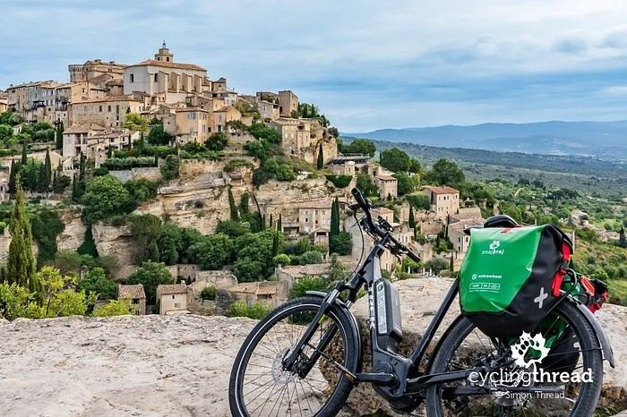
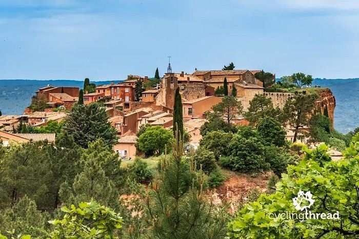
One interesting point is the route of EuroVelo 8 in this part of the region. The official path mainly follows the old railway line of the *Véloroute du Calavon*, which is very comfortable and safe. But in our opinion, cyclists traveling EuroVelo 8 around the Mediterranean would discover even more treasures if the route passed through villages like Bonnieux, Lacoste, or Oppède-le-Vieux.
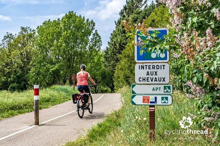
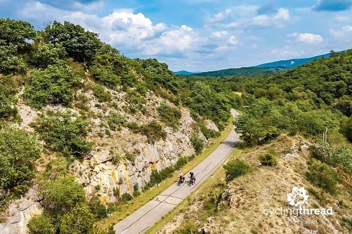
We were also pleasantly surprised by how safe cycling felt. Most of the route takes small local roads, but traffic is light, drivers are respectful, and road design really takes cyclists into account. It’s one of those places where you can ride peacefully even without separated bike lanes.
Our full story:
Around Luberon by bicycle - the most beautiful villages of Provence
You can also find all our cycling travel stories on the forum:
Cycling Thread - Europe’s most beautiful bike routes
S.
I’m making an exception and creating a separate post this time, since it’s all about France. In May, we spent a week in Provence, specifically in the Luberon, exploring the cycling routes *Autour du Luberon à Vélo*, the *Véloroute du Calavon* (part of EuroVelo 8), and the shorter *Les Ocres à Vélo* route. Together, they gave us an amazing journey through rolling hills, vineyards, lavender fields still green in spring, and some of the most stunning landscapes in southern France.
It was, of course, the perched villages that impressed us the most. We visited Gordes, Roussillon, Bonnieux, Lacoste, Lourmarin, Ménerbes, Oppède-le-Vieux, Cucuron, and Lauris. Many of them are among the most beautiful villages in Provence, and it’s hard not to agree with that reputation.
One interesting point is the route of EuroVelo 8 in this part of the region. The official path mainly follows the old railway line of the *Véloroute du Calavon*, which is very comfortable and safe. But in our opinion, cyclists traveling EuroVelo 8 around the Mediterranean would discover even more treasures if the route passed through villages like Bonnieux, Lacoste, or Oppède-le-Vieux.
We were also pleasantly surprised by how safe cycling felt. Most of the route takes small local roads, but traffic is light, drivers are respectful, and road design really takes cyclists into account. It’s one of those places where you can ride peacefully even without separated bike lanes.
Our full story:
Around Luberon by bicycle - the most beautiful villages of Provence
You can also find all our cycling travel stories on the forum:
Cycling Thread - Europe’s most beautiful bike routes
S.
Hi there,
We’re leaving from Montreal and planning to bike the Petit Train du Nord route.
Any ideas for loops so we don’t have to return the same way?
We’re thinking of a one-week trip.
Thanks in advance for your tips!
Rachel
Coming soon:
https://www.Biclou.com/parcours/durance/
Starting from Faverges: 900 km over 9 days
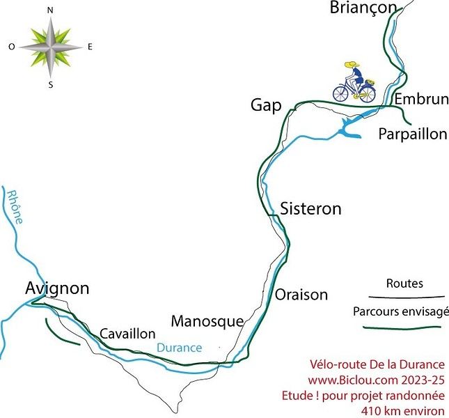
Here’s the detailed Durance route starting from Briançon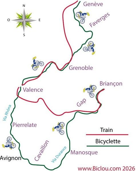
Here’s the detailed Durance route starting from Briançon
Hi everyone,
I’m trying to figure out how to get from Paris to Marseille or Montpellier with non-disassembled bikes by train in early July 2025... and it’s a total flop!!! Can’t find any trains that offer the bike-on-board option! It’s so complicated between SNCF-CONNECT, OUIGO, and TER INTERCITÉS!!! Nothing’s simple! I want to take my teens and their cousins on a bike trip to the Camargue, but I’ll have to start planning way ahead to sort out bike transport!!! So glad I found VoyageForum for tips! !
I’m trying to figure out how to get from Paris to Marseille or Montpellier with non-disassembled bikes by train in early July 2025... and it’s a total flop!!! Can’t find any trains that offer the bike-on-board option! It’s so complicated between SNCF-CONNECT, OUIGO, and TER INTERCITÉS!!! Nothing’s simple! I want to take my teens and their cousins on a bike trip to the Camargue, but I’ll have to start planning way ahead to sort out bike transport!!! So glad I found VoyageForum for tips! !
Good evening everyone,
Since the forum came back, it's been a bit quiet—no one's sharing their adventures yet. I know it's the start of the season, so let's hope it picks up!
Last Saturday, my buddy Jean Paul (who’ll be 84 next month) and I rode through the cedar forest between Cavaillon and Bonnieux—I highly recommend it! I already knew the area. We started from Pont Royal: me on my latest women’s FUN RIDE SOLO mountain bike (kept it as simple as possible), and him on a road bike with gravel tires. The road starting near Cheval Blanc, called the Vidauque route, is paved but completely wrecked—full of potholes, abandoned for ages, and technically off-limits to cars (though 4x4s still use it). The views over the Cavaillon plain are stunning, but we had to push our bikes a few times. After that, we did 10 km through the gorgeous cedar forest, followed by all downhill and flat terrain through the Lourmarin valley, then Cadenet, before heading toward La Roque-d'Anthéron. From there, we tackled the dirt paths of Provence by bike—beautiful trails—and made our way back to Mallemort and Pont Royal. A great loop: 81.51 km with 908 m of elevation gain. And Jean Paul? Fresh as a daisy at the finish—what an impressive guy!
Now, the real reason for this post: At the start, we followed the Carpentras Canal, which runs from Mallemort to Travaillan (69 km total). I’ve seen some photos on Komoot, and it looks amazing—apparently, there’s always a towpath.
**HAS ANYONE DONE THIS BY BIKE BEFORE? COULD YOU SHARE YOUR EXPERIENCE? THANKS IN ADVANCE!** Serge
Since the forum came back, it's been a bit quiet—no one's sharing their adventures yet. I know it's the start of the season, so let's hope it picks up!
Last Saturday, my buddy Jean Paul (who’ll be 84 next month) and I rode through the cedar forest between Cavaillon and Bonnieux—I highly recommend it! I already knew the area. We started from Pont Royal: me on my latest women’s FUN RIDE SOLO mountain bike (kept it as simple as possible), and him on a road bike with gravel tires. The road starting near Cheval Blanc, called the Vidauque route, is paved but completely wrecked—full of potholes, abandoned for ages, and technically off-limits to cars (though 4x4s still use it). The views over the Cavaillon plain are stunning, but we had to push our bikes a few times. After that, we did 10 km through the gorgeous cedar forest, followed by all downhill and flat terrain through the Lourmarin valley, then Cadenet, before heading toward La Roque-d'Anthéron. From there, we tackled the dirt paths of Provence by bike—beautiful trails—and made our way back to Mallemort and Pont Royal. A great loop: 81.51 km with 908 m of elevation gain. And Jean Paul? Fresh as a daisy at the finish—what an impressive guy!
Now, the real reason for this post: At the start, we followed the Carpentras Canal, which runs from Mallemort to Travaillan (69 km total). I’ve seen some photos on Komoot, and it looks amazing—apparently, there’s always a towpath.
**HAS ANYONE DONE THIS BY BIKE BEFORE? COULD YOU SHARE YOUR EXPERIENCE? THANKS IN ADVANCE!** Serge
I’m planning a journey of about 2500 km starting from San Pedro de Atacama (duration: max. 2 months). This trip, almost entirely on remote trails, promises to be an extraordinary adventure.
Highlights of the trip - Crossing the Florido Desert (during the blooming season: October 15–30) - Hiking ascents of legendary volcanoes: - Ojos del Salado (6879 m) - Llullaillaco (6739 m) - Uturuncu (6008 m, with 5820 m reachable by mountain bike!) - A 300 km stage through the heart of the desert, with no resupply or habitation: the ultimate experience of solitude and self-transcendence.
Practical details - Daily distance: max. 100 km and 1000 m elevation gain per day - Average altitude: 4000 m (between 3500 and 5000 m) - Temperatures: ~15 °C during the day, down to -25 °C at night (in a tent) - Accommodation: ~50% in villages (with locals or small hostels), ~50% camping
Estimated budget - 1400 € for the flight ticket (including bike supplement) - 1000 € for on-the-ground expenses
Required equipment - Fatbike (essential for deep sand) - -25 °C comfort sleeping bag - Single-wheel trailer (indispensable for these tough terrains)
My experience In 2022, I completed a similar 1200 km trip north of San Pedro de Atacama: - Full crossing of the Salar de Uyuni (170 km) - Ascents of the Ollague (5868 m) and Aucanquilcha (6176 m) volcanoes - Two 200 km stages with no resupply or human presence Videos available for a glimpse of the adventure: - Atacama Crossing 2022 - Part 1 - Atacama Crossing 2022 - Part 2
Next steps If this adventure interests you, I suggest: 1. A first phone call to get to know each other 2. A meet-up over a drink or a test ride in the Bardenas Reales (similar terrain, and I live 100 km away)
Don’t hesitate to contact me for more info or to discuss the details!
Highlights of the trip - Crossing the Florido Desert (during the blooming season: October 15–30) - Hiking ascents of legendary volcanoes: - Ojos del Salado (6879 m) - Llullaillaco (6739 m) - Uturuncu (6008 m, with 5820 m reachable by mountain bike!) - A 300 km stage through the heart of the desert, with no resupply or habitation: the ultimate experience of solitude and self-transcendence.
Practical details - Daily distance: max. 100 km and 1000 m elevation gain per day - Average altitude: 4000 m (between 3500 and 5000 m) - Temperatures: ~15 °C during the day, down to -25 °C at night (in a tent) - Accommodation: ~50% in villages (with locals or small hostels), ~50% camping
Estimated budget - 1400 € for the flight ticket (including bike supplement) - 1000 € for on-the-ground expenses
Required equipment - Fatbike (essential for deep sand) - -25 °C comfort sleeping bag - Single-wheel trailer (indispensable for these tough terrains)
My experience In 2022, I completed a similar 1200 km trip north of San Pedro de Atacama: - Full crossing of the Salar de Uyuni (170 km) - Ascents of the Ollague (5868 m) and Aucanquilcha (6176 m) volcanoes - Two 200 km stages with no resupply or human presence Videos available for a glimpse of the adventure: - Atacama Crossing 2022 - Part 1 - Atacama Crossing 2022 - Part 2
Next steps If this adventure interests you, I suggest: 1. A first phone call to get to know each other 2. A meet-up over a drink or a test ride in the Bardenas Reales (similar terrain, and I live 100 km away)
Don’t hesitate to contact me for more info or to discuss the details!
Bonjour,
Je prévois de faire la partie hollandaise de l'Eurovélo 19, de Maastricht à Rotterdam.
Comme c'est trop compliqué d'amener mon vélo en train, je cherche à louer un vélo sur place.
Je suis preneuse de conseils ou d'adresses de loueurs de vélos, j'ai du mal à en trouver même à Rotterdam.
L'idée serait de le louer à Rotterdam, de partir avec en train jusqu'à Maastricht, pour faire Maastricht/Rotterdam à vélo
Merci d'avance pour vos conseils ou suggestions.
Nath
Hello fellow cycling friends,
I’m heading out very soon for a few weeks in France and elsewhere on my trusty two-wheeled steel steed, with a total of me + luggage = around 120 kg gross weight, and I’ve never really tackled mountain passes before—something I’ll definitely be facing this time...
Currently, I’m running 700c wheels and a Deore XT 10-speed drivetrain (long-cage derailleur) with a 26/36/48 chainring setup and an 11-36 cassette. I’m considering two options (and possible modifications) to get a lower gear ratio (currently 0.72) and spin more easily on steep and mountainous climbs...
1 – Install an 11-42 cassette This would give me a gear ratio of 0.61. Would this be feasible with my current rear derailleur, please?
I have several new chains with 116 links—would these work for this cassette, which would have 6 more teeth on the largest cog, or would I need a longer chain?
2 – Swap the 26-tooth small chainring for a 24-tooth one This would give me a gear ratio of 0.66. Would this be feasible, please?
When switching to a 24T, will the gap be accepted by the 36-tooth middle chainring, and will shifting remain as smooth as it is now? Will this setup (24/36/48 + 11-36 cassette) still work well together, in your opinion?
Which of these two options do you think would be more feasible and preferable?
What drivetrain and gearing do you use on your bikes for loaded touring that sometimes involves climbing mountain passes and other steep ascents?
So many questions... Thanks for your answers and advice! Have a great day,
Spady
I’m heading out very soon for a few weeks in France and elsewhere on my trusty two-wheeled steel steed, with a total of me + luggage = around 120 kg gross weight, and I’ve never really tackled mountain passes before—something I’ll definitely be facing this time...
Currently, I’m running 700c wheels and a Deore XT 10-speed drivetrain (long-cage derailleur) with a 26/36/48 chainring setup and an 11-36 cassette. I’m considering two options (and possible modifications) to get a lower gear ratio (currently 0.72) and spin more easily on steep and mountainous climbs...
1 – Install an 11-42 cassette This would give me a gear ratio of 0.61. Would this be feasible with my current rear derailleur, please?
I have several new chains with 116 links—would these work for this cassette, which would have 6 more teeth on the largest cog, or would I need a longer chain?
2 – Swap the 26-tooth small chainring for a 24-tooth one This would give me a gear ratio of 0.66. Would this be feasible, please?
When switching to a 24T, will the gap be accepted by the 36-tooth middle chainring, and will shifting remain as smooth as it is now? Will this setup (24/36/48 + 11-36 cassette) still work well together, in your opinion?
Which of these two options do you think would be more feasible and preferable?
What drivetrain and gearing do you use on your bikes for loaded touring that sometimes involves climbing mountain passes and other steep ascents?
So many questions... Thanks for your answers and advice! Have a great day,
Spady
Hi everyone,
First post here to share a quick recap of our west-to-east bike trip along Algeria’s coast in January 2025. It was just the two of us—my partner and I—with French passports and not a word of Arabic. No friends or welcoming hosts in the country.
Under those conditions, we’d strongly advise against going.
Our original plan was to follow the coast from Algiers to Tunis. We ended up cycling from Algiers to Béjaia, then took the train from Béjaia to Annaba (with a stop in Constantine), and finally biked to the border. We were tailed by police the whole way—whether on our bikes, on the train, or even on foot while exploring towns. On top of that, we couldn’t wild camp and were limited to the few state-approved hotels that accept foreigners. Under those circumstances, connecting with locals was especially tough.
With such an omnipresent and intrusive police presence, we’d definitely recommend against this destination for bike touring. A really sad situation that completely cuts you off from the local population...
We’d been warned, we went to check it out, and we weren’t disappointed!
You’ve been warned.
First post here to share a quick recap of our west-to-east bike trip along Algeria’s coast in January 2025. It was just the two of us—my partner and I—with French passports and not a word of Arabic. No friends or welcoming hosts in the country.
Under those conditions, we’d strongly advise against going.
Our original plan was to follow the coast from Algiers to Tunis. We ended up cycling from Algiers to Béjaia, then took the train from Béjaia to Annaba (with a stop in Constantine), and finally biked to the border. We were tailed by police the whole way—whether on our bikes, on the train, or even on foot while exploring towns. On top of that, we couldn’t wild camp and were limited to the few state-approved hotels that accept foreigners. Under those circumstances, connecting with locals was especially tough.
With such an omnipresent and intrusive police presence, we’d definitely recommend against this destination for bike touring. A really sad situation that completely cuts you off from the local population...
We’d been warned, we went to check it out, and we weren’t disappointed!
You’ve been warned.
Hey fellow cyclists,
Cyclists on trails, paths, or greenways—why do so few (if any) of you use your bells to warn walkers, runners, and other pedestrians when they’re moving in the same direction as you?
I exercise every day (brisk walking) among you in France and abroad, and it’s something I’ve noticed—often with a few scares (and I’m guessing some accidents between cyclists or with pedestrians).
Personally, I always stick to the rules, walking on the left (facing traffic) so I can see you coming, but not everyone does that—neither pedestrians nor cyclists, and let’s be honest, it’s a bit of a free-for-all. 🤪
Your bikes make little to no noise, so why take risks and put others at risk too?
A quick, light *ding-ding* would be enough to warn people—what do you think? 😅
When you're trying to travel with your bike, SNCF sometimes tells you there's no solution, even though you could combine TGVs, TETs, and TERs.
- We used to check the Swiss CFF website https://www.sbb.ch/fr,
but it’s become useless since the "bike" option for France was removed.
- Next, we go to the Deutsche Bahn website https://www.bahn.com/fr, which has a "bike" option that combines TGVs, TETs (IC), and TERs. Then, you can either: - Buy the ticket directly on the Deutsche Bahn site, or - Note all the trains in the itinerary and, to use your discount cards, go to the SNCF website to purchase all the necessary tickets. The Deutsche Bahn site lets you adjust connection times in the "details" of an itinerary if the suggested one seems too short. I’ve found that 10 minutes is really risky—delays, crowds on the platform making it hard to move quickly, not to mention the line for the elevator and navigating an unfamiliar station. Still, it’s best to double-check that each train allows bikes.
- Now, thanks to the site "Biclous et bidouilles," check it out here:
https://biclousetbidouilles.com/un-site-en-or-pour-voyager-en-ter/
I discovered this site, which helps calculate bike-friendly routes in France:
https://www.horaires-de-trains.fr/horaires-ter.html
I gave it a quick test, but it seems limited to TERs—too bad, since the ideal is to combine all available train options.
One pitfall to avoid: always make sure you’re still on https://www.horaires-de-trains.fr/horaires-ter.html and haven’t accidentally switched to https://www.horaires-de-trains.fr/.
These days, SNCF is gradually converting all its TGVs to INOUI. Normally, they all have bike spaces, so these workarounds might not be needed much longer.
- We used to check the Swiss CFF website https://www.sbb.ch/fr,
but it’s become useless since the "bike" option for France was removed.
- Next, we go to the Deutsche Bahn website https://www.bahn.com/fr, which has a "bike" option that combines TGVs, TETs (IC), and TERs. Then, you can either: - Buy the ticket directly on the Deutsche Bahn site, or - Note all the trains in the itinerary and, to use your discount cards, go to the SNCF website to purchase all the necessary tickets. The Deutsche Bahn site lets you adjust connection times in the "details" of an itinerary if the suggested one seems too short. I’ve found that 10 minutes is really risky—delays, crowds on the platform making it hard to move quickly, not to mention the line for the elevator and navigating an unfamiliar station. Still, it’s best to double-check that each train allows bikes.
- Now, thanks to the site "Biclous et bidouilles," check it out here:
https://biclousetbidouilles.com/un-site-en-or-pour-voyager-en-ter/
I discovered this site, which helps calculate bike-friendly routes in France:
https://www.horaires-de-trains.fr/horaires-ter.html
I gave it a quick test, but it seems limited to TERs—too bad, since the ideal is to combine all available train options.
One pitfall to avoid: always make sure you’re still on https://www.horaires-de-trains.fr/horaires-ter.html and haven’t accidentally switched to https://www.horaires-de-trains.fr/.
These days, SNCF is gradually converting all its TGVs to INOUI. Normally, they all have bike spaces, so these workarounds might not be needed much longer.
Hi there,
I’m planning to cycle the Vélodyssée from Hendaye to Saint-Brevin in July 2026. My issue: how do I get to Hendaye with my bike? FlixBus doesn’t take bikes, and SNCF is complicated. Any ideas? Has anyone got a solution to suggest? Thanks in advance! Cheers, Patrig
I’m planning to cycle the Vélodyssée from Hendaye to Saint-Brevin in July 2026. My issue: how do I get to Hendaye with my bike? FlixBus doesn’t take bikes, and SNCF is complicated. Any ideas? Has anyone got a solution to suggest? Thanks in advance! Cheers, Patrig
Hi there,
I’m cycling around the world and will soon arrive in Thailand. Is it easy to park my bike at hotels? If so, what are the usual arrangements? Thanks in advance!
Jean Michel
I’m cycling around the world and will soon arrive in Thailand. Is it easy to park my bike at hotels? If so, what are the usual arrangements? Thanks in advance!
Jean Michel
Hello, I spent a month cycling in Thailand earlier this year with a touring bike equipped with two rear panniers. I loved being able to ride and stop at a hotel every night, and eat just about anywhere. I tried India two months ago but gave up because of the road conditions and chaotic traffic.
I’m looking for countries where I can cycle "without autonomy"—so no tent, no stove, just the bare minimum. Ideally, I’d like to stop at hotels or similar accommodations regularly, without having to cover 200 km a day!
I’d love to hear from your experiences—what countries make it easy to travel this way? Thanks!
I’m looking for countries where I can cycle "without autonomy"—so no tent, no stove, just the bare minimum. Ideally, I’d like to stop at hotels or similar accommodations regularly, without having to cover 200 km a day!
I’d love to hear from your experiences—what countries make it easy to travel this way? Thanks!
For map lovers, bike routes, cycle touring all over the planet, and long-haul trips...
I had fun compiling in one place ALL the routes my partner and I have biked across the planet since 1996: Quebec far and wide, of course, but also Canada, the USA (crossed completely by bike 3 times), Mexico, and all the way to Ushuaia—basically the entire Americas.
In Europe, the Balkans, Turkey; and more recently (2024: Taiwan, Korea, and 4 months in Japan!) You can check out a global map with all the routes by continent, more detailed maps by country, and others that focus on a region, like the Balkans in Eastern Europe. In short, there’s something for everyone!
I’ve included 3 photos here, but the originals (via the link above) let you zoom in infinitely. Plus, many of my routes are represented by lines with a different color for each day of biking. Hope some of you enjoy browsing through all this as much as I enjoyed compiling it. Until the snow comes, skiing... and spring!
https://www.crazyguyonabike.com/doc/TDM_en_Tandem_Trajets_Maps
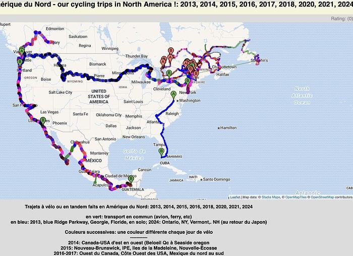
I had fun compiling in one place ALL the routes my partner and I have biked across the planet since 1996: Quebec far and wide, of course, but also Canada, the USA (crossed completely by bike 3 times), Mexico, and all the way to Ushuaia—basically the entire Americas.
In Europe, the Balkans, Turkey; and more recently (2024: Taiwan, Korea, and 4 months in Japan!) You can check out a global map with all the routes by continent, more detailed maps by country, and others that focus on a region, like the Balkans in Eastern Europe. In short, there’s something for everyone!
I’ve included 3 photos here, but the originals (via the link above) let you zoom in infinitely. Plus, many of my routes are represented by lines with a different color for each day of biking. Hope some of you enjoy browsing through all this as much as I enjoyed compiling it. Until the snow comes, skiing... and spring!
https://www.crazyguyonabike.com/doc/TDM_en_Tandem_Trajets_Maps
The RandoCamping site is free for users and hosts.
Its goal is to help trekkers find accommodations (usually by the night) all across France and to promote hosts who welcome trekkers satisfactorily.
Check it out here: https://randocamping.touteslatitudes.fr
The site is collaborative and supported by associations like Cyclo-Camping International or AF3V.
It lets you plan a trip or trek (on foot or by bike) by searching for accommodations along a route. The accommodations come from the DataTourisme platform (which aggregates information from Tourist Offices) and from users (trekkers & hosts).
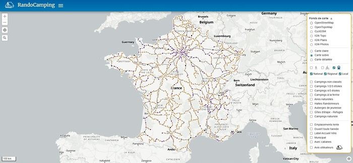
Train lines and passenger stations are also listed. Clicking on a station can show you (if the data is available) how accessible the platforms are with a non-dismantled bike. Bike and hiking routes come from Waymarked Trails (which is based on OpenStreetMap).
You can find more details about the site’s features on this page (version 1.0): https://randovelo.touteslatitudes.fr/randocamping-v1/
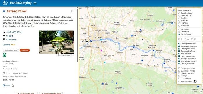
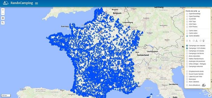
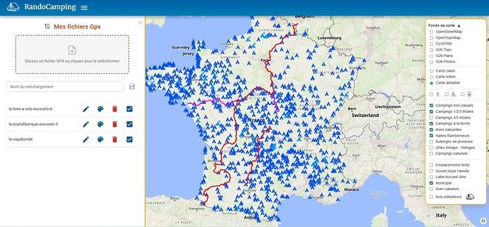
Its goal is to help trekkers find accommodations (usually by the night) all across France and to promote hosts who welcome trekkers satisfactorily.
Check it out here: https://randocamping.touteslatitudes.fr
The site is collaborative and supported by associations like Cyclo-Camping International or AF3V.
It lets you plan a trip or trek (on foot or by bike) by searching for accommodations along a route. The accommodations come from the DataTourisme platform (which aggregates information from Tourist Offices) and from users (trekkers & hosts).
Train lines and passenger stations are also listed. Clicking on a station can show you (if the data is available) how accessible the platforms are with a non-dismantled bike. Bike and hiking routes come from Waymarked Trails (which is based on OpenStreetMap).
You can find more details about the site’s features on this page (version 1.0): https://randovelo.touteslatitudes.fr/randocamping-v1/
Hi everyone,
I’m planning to bike around the Mediterranean. I’m supposed to go through North Africa, but it seems a bit complicated. Visas and travel in Algeria and Egypt only work if you book a hotel (no nights spent outside?). Libya is generally very unclear, and it seems you can only travel there with a local guide (which doesn’t exist for bike trips). If necessary, I’d skip Libya, but neither a bus ride nor a boat detour seems possible to enter Egypt.
Does anyone have tips on how to get around these issues and secure a visa?
Thanks for any advice!
I’m planning to bike around the Mediterranean. I’m supposed to go through North Africa, but it seems a bit complicated. Visas and travel in Algeria and Egypt only work if you book a hotel (no nights spent outside?). Libya is generally very unclear, and it seems you can only travel there with a local guide (which doesn’t exist for bike trips). If necessary, I’d skip Libya, but neither a bus ride nor a boat detour seems possible to enter Egypt.
Does anyone have tips on how to get around these issues and secure a visa?
Thanks for any advice!
Hi there,
My friend and I are planning to bike down to Tierra del Fuego starting from Santiago, Chile, in early February. The big question is: "Is it possible to find decent and reasonably priced bikes in Santiago?" Are there local resale sites like Leboncoin, or any second-hand spots worth knowing about there? If anyone’s done this before, I’d love to hear your tips! ;)
Thanks! !
Best wishes to all you bike travelers—I hope you have extraordinary journeys.
Safe travels and happy planning! 😉
Hi everyone,
I’m planning a cycling trip in Algeria and looking for concrete firsthand accounts from cyclists who’ve recently traveled there (or residents who know the terrain well). My goal is to map out a realistic 2–4 week itinerary that prioritizes discovery, safety, and solid water/bivouac management.
My profile and gear
Semi-bivouac autonomous cyclist (light tent + sleeping bag + stove), with the option of simple accommodations in towns.
All-road/gravel bike with a rear rack, 40–45 mm tires (I can go up to 47–50 mm if needed).
Compact drivetrain with a small gear range for climbing while loaded.
Modular water capacity of 4–7 liters (soft flasks + bottles), plus a filter and purification tablets as backup.
Navigation via offline maps + GPS, GPX tracks if available.
Planned period
Late winter/early spring (timing to be refined based on your feedback about weather, wind, and day/night temperature swings). I’d love a seasonal breakdown: which areas are more pleasant/rideable during this time? Are there zones to avoid while others become ideal?
Preferred itinerary style
High plateaus and accessible Saharan fringes for a loaded bike, alternating between secondary roads and rideable tracks.
Moderate pace (60–90 km/day depending on terrain and wind), with stops in resource towns to restock, shower, and rest.
Safety and logistics (water/supplies) take priority over pure athletic performance.
My specific questions for those who’ve cycled in Algeria 1) Routes and areas
Which roads/tracks did you enjoy for their scenery and interest without being too rough for a loaded gravel bike?
If you’ve ridden the high plateaus: which connections do you recommend to avoid traffic and stick to small roads?
Saharan fringes: which sections are realistic for partial autonomy (reasonably spaced water points, rideable tracks, not too much soft sand)?
Areas to avoid by bike (recently) due to security, road conditions, katabatic winds, construction, etc.?
2) Water and supplies
How frequent were water points on your routes: reliable wells? taps? sources in towns/villages?
In “desert” sections, how many liters did you carry between secure points? Does a 6–7 L capacity seem comfortable, or should I aim for more on certain stretches?
Food: small shops, markets, availability of basics (semolina, sardines, dates, biscuits, powdered milk, etc.) — how often can you reasonably restock?
Filtration: did a filter + tablets suffice? Are there areas where you’d advise against filtering from unprotected wells?
3) Bivouacking and accommodations
Tolerance for discreet bivouacking (far from dwellings, leave-no-trace): recent experiences?
Simple alternatives: guesthouses, small hotels/hostels, campgrounds (if any), municipal lodgings?
Practical stopover towns for restocking, resting, and securing your bike overnight: reliable spots or neighborhoods to prioritize/avoid?
4) Roads, tracks, and weather
Road surface quality on secondary routes: generally decent or highly variable?
Tracks: rideable (compact gravel, laterite) or sometimes sand/washboard? At what tire width would you recommend switching (45 vs. 50 mm)?
Prevailing winds this season: direction, strength, most exposed hours; do you adjust your departures to ride “before the wind” in the morning?
Temperatures: day/night range; sun protection (long gloves, buff, sunscreen, sunglasses), managing nighttime cold at altitude or in the open desert.
5) Safety, formalities, and connectivity
Recently discouraged zones (please note the date if possible).
Roadside checks: which documents to keep handy; are there specific registrations or declarations required upon arrival or when moving between wilayas?
Local SIM/data: which operators work well on the routes you took; tips for recharging/buying credit.
Useful apps/maps on the ground (and reliable offline maps) for locating water, grocery stores, garages, accommodations, rideable segments, etc.
Bike security: how did you handle anti-theft and parking during errands/overnight stays?
6) Gear and adjustments
Recommended minimum gearing for loaded climbs on local roads/tracks.
Ideal tire width and casing (puncture resistance on gravel and rocks).
“Sweet spot” water capacity based on your experience (and tips: frame bags, extra bottles on the fork, bladders in frame bags, etc.).
Maintenance: dust/sand — greases/seals, drivetrain cleaning frequency, breathable filters, protective socks for zipped panniers.
Sample itinerary outline (to validate with your feedback)
Week 1: Arrival, adjustments, high plateaus, linking resource towns to get into the rhythm, test supplies and water.
Week 2: Accessible Saharan fringes, alternating road/track, nights in discreet bivouac when possible + simple accommodations every 3–4 days.
Week 3–4 (optional): Extend toward a second Saharan area or head back to a more temperate zone depending on weather/wind, prioritizing routes known to cyclists.
If you have GPX tracks (even partial), waypoints (water, grocery stores, accommodations), or a travel journal with dates, I’d love to see them. Dated info (year/month) will help me weigh what may have changed recently.
What I can share in return
After the trip, I’ll publish a detailed report with:
Final itinerary + cleaned GPX tracks,
List of confirmed water points and open supply spots,
Gear review (tires, gearing, water capacity),
Notes on bivouacking/accommodations and safety,
Budget and daily distances, to help future travelers.
Thanks in advance for your tips, warnings, good addresses, and updated feedback. Your experience is invaluable for planning a safe, smooth, and enjoyable cycling route in Algeria. Happy trails! 🚴
I’m planning a cycling trip in Algeria and looking for concrete firsthand accounts from cyclists who’ve recently traveled there (or residents who know the terrain well). My goal is to map out a realistic 2–4 week itinerary that prioritizes discovery, safety, and solid water/bivouac management.
My profile and gear
Semi-bivouac autonomous cyclist (light tent + sleeping bag + stove), with the option of simple accommodations in towns.
All-road/gravel bike with a rear rack, 40–45 mm tires (I can go up to 47–50 mm if needed).
Compact drivetrain with a small gear range for climbing while loaded.
Modular water capacity of 4–7 liters (soft flasks + bottles), plus a filter and purification tablets as backup.
Navigation via offline maps + GPS, GPX tracks if available.
Planned period
Late winter/early spring (timing to be refined based on your feedback about weather, wind, and day/night temperature swings). I’d love a seasonal breakdown: which areas are more pleasant/rideable during this time? Are there zones to avoid while others become ideal?
Preferred itinerary style
High plateaus and accessible Saharan fringes for a loaded bike, alternating between secondary roads and rideable tracks.
Moderate pace (60–90 km/day depending on terrain and wind), with stops in resource towns to restock, shower, and rest.
Safety and logistics (water/supplies) take priority over pure athletic performance.
My specific questions for those who’ve cycled in Algeria 1) Routes and areas
Which roads/tracks did you enjoy for their scenery and interest without being too rough for a loaded gravel bike?
If you’ve ridden the high plateaus: which connections do you recommend to avoid traffic and stick to small roads?
Saharan fringes: which sections are realistic for partial autonomy (reasonably spaced water points, rideable tracks, not too much soft sand)?
Areas to avoid by bike (recently) due to security, road conditions, katabatic winds, construction, etc.?
2) Water and supplies
How frequent were water points on your routes: reliable wells? taps? sources in towns/villages?
In “desert” sections, how many liters did you carry between secure points? Does a 6–7 L capacity seem comfortable, or should I aim for more on certain stretches?
Food: small shops, markets, availability of basics (semolina, sardines, dates, biscuits, powdered milk, etc.) — how often can you reasonably restock?
Filtration: did a filter + tablets suffice? Are there areas where you’d advise against filtering from unprotected wells?
3) Bivouacking and accommodations
Tolerance for discreet bivouacking (far from dwellings, leave-no-trace): recent experiences?
Simple alternatives: guesthouses, small hotels/hostels, campgrounds (if any), municipal lodgings?
Practical stopover towns for restocking, resting, and securing your bike overnight: reliable spots or neighborhoods to prioritize/avoid?
4) Roads, tracks, and weather
Road surface quality on secondary routes: generally decent or highly variable?
Tracks: rideable (compact gravel, laterite) or sometimes sand/washboard? At what tire width would you recommend switching (45 vs. 50 mm)?
Prevailing winds this season: direction, strength, most exposed hours; do you adjust your departures to ride “before the wind” in the morning?
Temperatures: day/night range; sun protection (long gloves, buff, sunscreen, sunglasses), managing nighttime cold at altitude or in the open desert.
5) Safety, formalities, and connectivity
Recently discouraged zones (please note the date if possible).
Roadside checks: which documents to keep handy; are there specific registrations or declarations required upon arrival or when moving between wilayas?
Local SIM/data: which operators work well on the routes you took; tips for recharging/buying credit.
Useful apps/maps on the ground (and reliable offline maps) for locating water, grocery stores, garages, accommodations, rideable segments, etc.
Bike security: how did you handle anti-theft and parking during errands/overnight stays?
6) Gear and adjustments
Recommended minimum gearing for loaded climbs on local roads/tracks.
Ideal tire width and casing (puncture resistance on gravel and rocks).
“Sweet spot” water capacity based on your experience (and tips: frame bags, extra bottles on the fork, bladders in frame bags, etc.).
Maintenance: dust/sand — greases/seals, drivetrain cleaning frequency, breathable filters, protective socks for zipped panniers.
Sample itinerary outline (to validate with your feedback)
Week 1: Arrival, adjustments, high plateaus, linking resource towns to get into the rhythm, test supplies and water.
Week 2: Accessible Saharan fringes, alternating road/track, nights in discreet bivouac when possible + simple accommodations every 3–4 days.
Week 3–4 (optional): Extend toward a second Saharan area or head back to a more temperate zone depending on weather/wind, prioritizing routes known to cyclists.
If you have GPX tracks (even partial), waypoints (water, grocery stores, accommodations), or a travel journal with dates, I’d love to see them. Dated info (year/month) will help me weigh what may have changed recently.
What I can share in return
After the trip, I’ll publish a detailed report with:
Final itinerary + cleaned GPX tracks,
List of confirmed water points and open supply spots,
Gear review (tires, gearing, water capacity),
Notes on bivouacking/accommodations and safety,
Budget and daily distances, to help future travelers.
Thanks in advance for your tips, warnings, good addresses, and updated feedback. Your experience is invaluable for planning a safe, smooth, and enjoyable cycling route in Algeria. Happy trails! 🚴
Hi everyone, could someone give me info on the track that starts from Tafraout toward M’harch Pass and then continues to Mcissi to join the national road heading west to Alnif? I’m planning to go in April 2025 by gravel bike/MTB. Is it doable? Is there a lot of soft sand??? How many km???? Thanks for any tips, and happy end of the year to all! Best, Rv.
Hi fellow bike-packers,
so I’m heading out solo by bike this spring, like I do every year—around 1,500 to 2,000 km in total.
This time I want to explore the south of France.
I’ll start by meeting up with a buddy in Ariège, and after that the road’s wide open toward the east, aiming for Drôme.
If anyone has route ideas—especially quiet backroads, places I can wild-camp pretty much anywhere, and climbs that aren’t too steep—I’m all ears!
Thanks, and see you around here or on the road.
Take care.
Hi everyone,
I don’t bike much, but I live on the VéloRoute 6, and I dream of adventure. I’m 51 and my old hybrid bike from 20 years ago no longer suits me.
I’d like to get a new bike at a reasonable price, but I don’t know where to look besides Decathlon and Intersport. I’m not after a racing bike—I want something a bit comfortable in terms of riding position (not recumbent) and with a luggage rack. 🙂
All your tips are welcome, with a budget of... let’s say 800 € max.
Looking forward to reading your suggestions!
Richard
I don’t bike much, but I live on the VéloRoute 6, and I dream of adventure. I’m 51 and my old hybrid bike from 20 years ago no longer suits me.
I’d like to get a new bike at a reasonable price, but I don’t know where to look besides Decathlon and Intersport. I’m not after a racing bike—I want something a bit comfortable in terms of riding position (not recumbent) and with a luggage rack. 🙂
All your tips are welcome, with a budget of... let’s say 800 € max.
Looking forward to reading your suggestions!
Richard
Hi fellow travelers! I’m planning a trip to Japan from March 22 to April 12 and really want to bike the Shimanami Kaido starting from Onomichi, but I don’t cycle regularly. Has anyone here done it and could share their experience or tips? Is the weather in March-April favorable? Should I plan for 2 or 3 days? Electric or regular bike? What’s better—having my luggage forwarded along the route or leaving it in a locker? Any recommendations for accommodations or bike rentals? Thanks in advance for your replies!
I'm planning a 3-day weekend with my wife on this cycle path. The articles about this route are old, so if anyone has traveled it recently and can give me an update on its condition, that'd be great. We're riding 1994 ROCKRIDER 340 mountain bikes but with 1.5-inch tires suited for road touring—will that work, or should I switch back to MTB tires? Thanks for your replies!
A bit disappointed with the forum's revival—there isn’t much activity or shared travel stories anymore.
A bit disappointed with the forum's revival—there isn’t much activity or shared travel stories anymore.
Hello, I have a TX400. We're heading to the Andes this spring, and I wanted to see about changing my cassette to switch from an 11-35 to an 11-42 so I can tackle the big climbs more easily. So far, I've only found discussions from cyclists who switched from a 48-36-26 chainring to a 44-32-22. Has anyone kept the original chainring and just changed to a larger sprocket?
Hi there,
I’m planning to bike back from Poland this summer. Does anyone know a way to ship it there without having to take it apart? Otherwise, it’s a real hassle to fine-tune all the settings before departure! Thanks in advance.
I’m planning to bike back from Poland this summer. Does anyone know a way to ship it there without having to take it apart? Otherwise, it’s a real hassle to fine-tune all the settings before departure! Thanks in advance.
Good evening,
I’m planning a solo bike road trip along the EuroVelo 6, starting from Orléans all the way to Budapest, beginning May 1st, 2026!
Question: Have any of you used the Warmshowers site, and if so, I’d love to hear your thoughts on using this app—whether responses to hosting requests are generally satisfying, especially for the different countries I’ll be crossing!
Thanks in advance for your tips!
Philippe
Hi there,
I’m planning to cycle around Taiwan in 2026 and I’d love to know if it’s possible to do the whole island on bike paths, how many kilometers that would be, whether wild camping is easy, and so on…