j'ai l'habitude de partir avec les portes de l'aventure. son mail infos@portesaventure.com ou sur google : les portes de l' aventure
c'est une agence francophone .
cordialement
chrystelle
Bonjour.
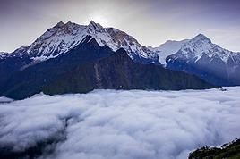
Il n'est pas nécessaire de s'attacher les services d'une agence pour le tour des Annapurna. C'est presque une autoroute, les trekkeurs y fleurissent et se perdre demande beaucoup, mais vraiment beaucoup de bonne volonté....
Une bonne carte (vendue n'importe où àThamel) un sac de 10 kgs (maxi) et c'est parti.
Vous aurez des lodges où dormir et manger tout du long du chemin, surcapacité hôtelière garantie.
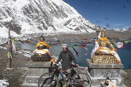
Pour le passage du Thorong pass vous trouverez suffisamment de gens voyageant dans les mêmes conditions que vous pour former un groupe. Sinon vous accrocherez vos pas derrière un groupe déja en partance, et tout se passera bien, croyez moi sur parole, ce trek je l'ai effectué 5 fois.
Si vous désirez un complément d'infos sur le sujet contactez moi en message privé en me donnant votre adresse courriel.
Ce sera un grand plaisir pour moi de vous donner un itinéraire de base (que vous pourrez sans peine modifier) ainsi qu'un calendrier que vous adapterez.Et d'autres infos d'ordre pratique.
Cordialement.
Richard
marcheur de longue haleine, et à pleine charge....
nous sommes un couple de quinqua + et nous partons au Népal fin octobre pour 17 jours. nous avons prévu de faire le tour des Anapurnas sans agence et votre message me confirme que c'est faisable.
nous avions l'intention de partir de Katmandou en bus jusqu'à Besi sahar;
je me posais quelques questions :
fait il très froid au col Thorung, faut il amener des sacs de couchage ?
nous avions imaginer rentre en jeep de Muktinath ou Jomson et de prendre l'avion de Pokhara à Ktm
merci pour tous vos conseils que vous proposer de nous donner
beatrice et gil
Bonjour.
Je dois m'absenter quelques heures. Je vous ferai la réponse via votre boîte courriel.
En objet sera noté "Annapurnas"
Á cet après-midi.
Cordialement.
Richard.
marcheur de longue haleine, et à pleine charge....
Djalma > Le trek au Mustang dont je parle est dans le departs fixes pour 2014 :
Effectivement Jomsom Mukhtinath le Gyu la, Chele en une seule étape ça demande une bonne forme physique! Et sans acclimatation dur dur! ( 1400m de dénivelé positifs le premier jour et sans acclimatation!!)
D'autre part Ils donnent 21 jours ( au total KTM-KTM)dans l'annonce du trek mais le J20 on est dans l'avion pour Paris!!😏 et pour info ça ne fait que 9 jours au nord Mustang au lieu des 10 jours prévus par n'importe quelle agence!! Mais peut-être que je ne sais pas lire...
En novembre 2013 j'ai fait un trek identique (même boucle en sens inverse) mais avec en plus 2 jours au nord de Lho Manthang( boucle Chhoser Niphu Thinggar) pour 1330 eurosTTC.
Ils feraient bien de remettre un peu d'ordre dans leurs descriptifs avant de le proposer à leurs clients!!
Bonjour,
Oui bien sûr c'est possible vous ne serez pas les seuls! Dans tous les lodges il y a des couvertures épaisses (couettes) mais un sac de couchage est un plus, surtout un sac à viande car les couvertures ne sont pas lavées tous les jours.
Il y a des jeeps Muktinath Jomsom .Pourtant ça vaut le coup de le faire à pied ( villages de Jarkot Kagbeni Jhong etc..) Pour la suite aussi il y a des jeeps mais c'est pas donné! En tous cas vaut mieux partager avec d'autres voyageurs car sinon ça reviendra au même prix que l'avion. Les jeeps de Jomsom à Beni ne font jamais le trajet en entier il faut en prendre une Jomsom Ghasa puis une autre Ghasa Beni..
Il existe aussi des bus bien moins chers! Vous pouvez aussi faire une partie à pied jusqu'à Ghasa par exemple en évitant la piste ( rive droite) et en utilisant les chemins alternatifs ( rive gauche) jusqu'à Ghasa ( 1 ou 2? jours) ça vaut le coup car on traverse de beaux villages :Marpha Tukuche...
A Ghassa prendre un bus ... où jeep jusqu'à Beni et à Beni ( goudron) Bus pour Pokhara.
j'ai été fortement retardé, je viens juste de rentrer à la maison (19h) je vous envoie ça demain matin sans faute.
Encore toutes mes excuses.
Cordialement.
Richard.
marcheur de longue haleine, et à pleine charge....
Bonjour.
Tout est parti sur votre boîte courriel. N'hésitez pas pour d'autres questions, il n'y en a pas de ridicule ni d'inutile.
Cordialement.
Richard
marcheur de longue haleine, et à pleine charge....
Dans un premier temps il eut été poli de commencer votre adresse par un "bonjour" de bon aloi et de la conclure par une formule de politesse passe-partout...
Cela mis à part je ne comprends pas un traître mot de ce que vous écrivez, soyez explicite merci.
Et pour terminer (en ce qui me concerne) au revoir.
marcheur de longue haleine, et à pleine charge....
Les réponses tout public exposent au risque de se retrouver marchant en compagnie de gens qu'on aurait peut-être préféré éviter.... tandis qu'une réponse privée permet de choisir ses correspondants et quelques fois ses équipiers et équipières.
S'ils sont polis et courtois c'est un plaisir que d'essayer de les renseigner, dans le cas contraire je les ignore comme vous serez ignoré dès cet instant
J'ai répondu à ce message par seul souci de politesse. Ne vous fatiguez pas inutilement il n'y aura pas d'autre réponse
Salutations et sans rancune.
"La politesse est le résultat d'une éducation de qualité, élévé avec les veaux on en prend la mentalité, en épouse la condition et en partage l'étable et l'auge"
Mao Tsé Toung.
marcheur de longue haleine, et à pleine charge....
Quand on n'a su garder de l'éducation et de la politesse que l'apparence et l'hypocrisie, il est surtout évident, tout le monde l'aura compris, que jouer les offusqués sur le thème de la politesse évite d'aborder les vraies questions, et accessoirement celle de la pertinence de leurs réponses.
Les premières d'entre elles étaient celles de Beathom sur son/leur projet de (mini)tour des Annapurnas : le froid au Thorong La, le sac de couchage, etc ... après qu'il/elle(s) aient découvert, sur la base d'un témoignage précédent, que "ce trek est tout à fait faisable sans agence".
Cette dernière information n'est pas fausse, elle est cependant beaucoup plus juste si elle s'accompagne du complément suivant "pour quelqu'un ayant déjà un minimum d'expérience de la marche en haute montagne sur plusieurs jours et de connaissance du parcours envisagé", ce que rien dans le message d'origine ne laisse penser, bien au contraire ...
Le Thorong La se situe en effet à une altitude de 5400 m et le plus proche refuge pour y passer la dernière nuit à 4800 m. Il est donc facile d'imaginer qu'il fait froid là-haut ... avec même un risque de neige (plus extrême expérience vécue à mi-octobre : -15° dehors sans vent).
Quant au sac de couchage, il s'impose pour au moins deux bonnes raisons : le froid (voir ci-dessus) et la certitude de savoir dans quoi on dort. Si on connaît l'importance de la qualité du sommeil dans ce genre d'effort et à cette altitude, on comprend mieux ...
Ces deux questions ne sont pas idiotes : elles montrent juste (aucun reproche) que leur auteur ne sait pas grand chose de ce qui l'attend et/ou qu'il ne s'est pas beaucoup renseigné !
C'est pourquoi il me semble plus cohérent (j'espèce que c'est bien ce qu'il fera) de ne pas se contenter d'une seule source d'informations, fussent-elles privées et diffusées (ou justement !) par l'auto-proclamé "marcheur de longue haleine et à pleine charge" de service, qui a certainement beaucoup plus d'expérience et de connaissance mais ne semble pas s'être imaginé un seul instant qu'il puisse s'adresser à des débutants ou des amateurs qui "ont très envie mais ne savent pas forcément".
Et puis, je ne vois pas du tout l'intérêt de participer à ce forum si sur ce genre de questions "standard" (ou d'autres comme celles posées à l'origine) aux réponses accessibles à la première recherche, l'intérêt de l'enrichissement de l'information par les échanges de réponses publiques (donc profitables au plus grand nombre) disparaît au profit d'échanges privés dans lesquels, au demeurant, la qualité de la communication des informations est loin d'être garantie.
La montagne est pourtant censée nous enseigner l'humilité ...
Je ne te salue pas ... et cela m'indiffère.
Je prépare le Tour des Annapurnas pour Mars 2027, je recherche une agence locale avec un guide local, si possible francophone pour nous proposer ce trek.…
Je suis en train de m'engager pour un trek avec l'agence Napoléon trekking. Cette agence me demande un acompte, ce que je comprends parfaitement, mais ne me…
Ces dernières années ont été développés plusieurs treks destinés à renouveler l'attrait de la région des Annapurnas, pénalisée d'une part par la progression…
Avec mon compagnon nous allons partir au mois de mars-avril pour une durée de 10 jours faire le trek des annapurnas (je n'inclue pas l'arrivée à Katmandou, les…
Bonjour,
Nous souhaitons faire le trek de 4 jours reliant Mestia à Ushguli sans agence. Il est précisé dans les descriptifs qu'il existe des hébergement à chaque étape, mais on ne trouve pas d'info sur ces hébergements. Quelqu'un a-t-il des infos et un avis sur ce parcours?
We're planning to trek in Peru and Bolivia and would love to find some local agencies.
If you know any, could you share details on prices and, of course, the names of the agencies?
Which trek would you recommend?
Elocine
Je pars en autonomie totale sur un trek au Maroc (10jrs) Imilchil - Aghbalou.
Trouve t-on des cartouches gaz à vis (Coleman, Primus) à Marrakech (adresse) ou villages entre Imilchil - Aghbalou ?
Si non , trouve-t-on des cartouches Butagaz pour camping-gaz (petit volume 230 gr ...)
Merci d' avance pour vos réponses
Hello, I’d like to embark on a little trip in my home country, Switzerland. I’ll start walking from La Cure, heading toward Le Noirmont first, then I’ll improvise my route—but it’ll probably follow the French border... at least as far as Lac de Joux.
I’ll decide day by day how much farther to go after that. My goal is to stay in nature as much as possible, wander around for as long as I can, and restock food in villages or towns along the way.
I’m thinking of mostly camping, but we’ll see if I end up in a hotel or another campsite depending on my route.
I’d love to reach La Chaux-de-Fonds on foot... maybe even Delémont.
The whole thing should take about a week, give or take.
I’ll be bringing my dog, and I’m preparing for this as soon as I’m ready.
Any tips to make sure everything goes smoothly for us? Things I should know—or avoid? What about shepherds with their flocks of sheep? And isn’t hunting season open right now?
I’m not sure if what I’m planning is even doable, which is why I’m asking around.
This’ll be my first time doing something like this—wandering in nature *and* with a dog. I’m really excited for this adventure... and I need it. Thanks!
We’re really keen on ecosystems and want to hike in "natural" ancient forests—not planted woods or areas heavily degraded by human activity. Travel guides (like Lonely Planet) don’t provide much info on this. Could you point us to the most interesting spots?
Thanks in advance for your tips.
We wish you happy holidays and a fantastic 2026, full of discoveries!
Claire and Albert
Hi, this might not be the right section, but I’d like to know if it’s possible to start mountaineering with another person without necessarily hiring a guide. We’ve done quite a bit of hiking but not mountaineering—we’ll just do a half-day glacier course. After that, we were thinking of starting with La Grande Motte and the Pointe de la Traversière, which were recommended to us. Honestly, for things like roping up and knots, I’ll learn at home with lots of videos and a book.
Hi,
I don’t know Switzerland at all and was wondering if Vallée des Joux and especially Dent de Vaulion are packed early in the morning or late in the afternoon in July and September?
If so, do you have any quieter spots to recommend in the area, or in Luxembourg (yes, I know it’s not the same country 😉)?
Thanks a lot!
Jaimerais savoir si quelqu'un aurait fait des treks sur le Ruwenzori et combien ça coute en moyenne, les infrastructures, les paysages la sécurité sur les lieux, merci beaucoup. J'attends avec impatience vos réponses.
We’re leaving in 9 days for a two-week trip to Madeira, mainly to hike.
From my research, I’ve found that since last year, access to most trails—and systematically for the most popular ones—is now paid. You have to pay an access fee of 4.50 € per person per classified hike in 2026, and even 10.50 € for the most iconic hike: Pico Arieiro to Pico Ruivo. When paying, you also have to choose a day and a 30-minute time slot for your start time. Of course, this reservation is neither changeable nor refundable, even if the weather that day is terrible.
Personally, given the massive influx of tourists to the island in recent years, I don’t mind paying a fee to help maintain the trails. Similarly, setting a limit on the number of people who can hike them per day is certainly preferable to preserve this priceless heritage.
However, what’s much less fair is that in reality, most of the available spots are reserved: 1/ for Madeira residents (which is normal); 2/ for "economic operators" (meaning local tour operators). For example, if you’re a non-resident (independent tourist), no booking is possible for the Pico Arieiro hike for an early morning start before September! So, unfortunately, we’ll have to skip this hike.
It’s the same issue for Ponta de São Lourenço, the 25 Fontes, Pico Ruivo... in short, all the most popular hikes. Oh well, we’ll skip those too!
So my question is: which hikes do you recommend where we won’t face the huge crowds that the others get? And where we can book the day before for the next day, taking the weather into account?
Finally, a quick accommodation question: we’ve booked the first week in Funchal, but I haven’t decided yet for the second week. Do you have any advice on where to stay in the south or north, preferably avoiding overly concrete-heavy and touristy spots?
I’m reposting about the logistics for Samaria Gorge.
I’d love to get recent info, especially about whether it’s possible to park my car in Omalos, do the hike, and then catch a bus back to my vehicle.
In theory, it’s doable, but when you check the KTEL website, there aren’t any feasible schedules listed. If anyone has recently organized this with reliable, verified details, I’d really appreciate it. Thanks in advance!
Hi there,
We’re flying from Montreal to Lyon this August to go hiking in the French Alps. We’ve rented a car and will be staying at campgrounds. We’re planning to do day hikes and want to stay a few days in one spot, do a few hikes, then move on to our next camping spot. Could you share your favorite spots or any recommendations for places to spend a few days with great hikes?
A few details:
We arrive in early August and leave in early September.
We’re looking for day hikes (or shorter), moderate difficulty, with a cumulative elevation gain of no more than 1000m, and of course, beautiful scenery!
We’d prefer not to drive too much—maybe it’s best not to head too far south and deal with unnecessary heat?
Along the same lines, if you know of any great campgrounds where we can start our hike directly without needing the car, we’d love to hear your suggestions!
Bonjour
Souhaitant faire de la randonnée sur cette île, je voudrais d'abord savoir quelle serait la période la plus favorable sachant que j'avais passé quelques jours en novembre 2018 pas pour cette activité mais plus pour une simple découverte de l'île et le temps n'était pas top notamment en montagne. Donc peut on choisir une organisation en étoile sachant que je louerai un véhicule avec éventuellement 2 points d'hébergement.
Je n'envisage pas d'intégrer une structure mais de partir à 2 et de s'organiser sauf si vous me conseillez une agence locale ou un guide local. Enfin même si je compte me procurer les différents supports, carte et topo guide plus gps je vous remercie de bien vouloir me communiquer les randos à faire en priorité
Merci beaucoup pour vos informations
I’m planning to do the Mercantour crossing following the Randoxygène route in mid-July.
I’m used to hiking in the mountains, but I sometimes get vertigo, for example on ridges with drops on both sides. I wanted to check if there are any T4 or T3-T4 sections and find out if there are any very exposed passages—and if so, where—so I can plan an alternative route.
Can anyone give me some info on this?
Thanks!
I’m planning a trip around Cap Corse and the AGRIATES in 2026, from May 8th to 15th (there are still 2 spots left, by the way! Just DM me if you're interested).
I’d love to know which hikes are worth prioritizing in the AGRIATES. We’ll be staying in SALECCIA for two days as our base—what should we focus on from there?
A round trip to IGNHU beach? Any other suggestions?
For Ostricano, I think it’s too far for a round trip...
Thanks for your tips!
Have a great day,
Anie, Toulouse
I’d like to get some info about the GR10 Pyrenees traverse. I need help planning the daily stages and accommodations—my wife isn’t an experienced hiker but walks a lot, so I’d like to schedule shorter walking days and thus a longer overall trip in terms of number of days.
Could anyone give me some help and advice?
Best regards,
New to this forum, I’m planning a pretty big project for 2028.
I’m heading to Nepal to do a trek from Kathmandu all the way to Everest Base Camp (a cool 5,300 m 😄).
This trek is a bit special because even though I’ll be part of a group, I’m going solo (so far, no problem—I’m used to it). But it’s my first real trek, and it’s also a humanitarian one: once I reach base camp, I’ll stay an extra week to help clean up the waste left by tens of thousands of climbers! Since I’m originally from South America, from two countries that share the Andes, I have a deep respect for mountains—they fascinate me. So Everest… it’s kind of the trip of a lifetime!
So, a little question for those who’ve done treks to Everest before… any tips for good mental preparation (I’m already working on the physical side)?
Hi there, I’m planning the Annapurna Circuit for March 2027 and I’m looking for a local agency with a local guide—preferably French-speaking—to arrange this trek for us. Any suggestions? Thanks
Hello!
We’re spending a few days in Toraja country at the end of May. We’d love to do a day trek—taking our time—on a route that’s stunning in terms of scenery, but not a level 5 in difficulty!
Any suggestions you can share, please?
Thanks in advance
I’d like to do the Mare a Mare Sud in May over 4 days. I’ve found quite a few places to stay along the route, but I’m stuck on the start and finish.
I’ll be arriving by plane on Sunday evening and would like to start pretty early on Monday morning. Ideally, accommodation right at the trailhead (Alzu di Gallina) would be amazing, but I can’t find anything. Any tips?
Also, for the transfer from Figari Airport to Porto Vecchio or Alzu di Gallina?
At the end, I’d like to pick up a rental car—any advice on that too?
I’m traveling solo by plane to Catania in May and plan to hike the northern side of Etna, starting from Linguaglossa where I’ll arrive by bus. After that, I’d love some info on how to get up to Piano Provenzana (shuttles or hitchhiking), since it seems there’s no public transport except in the summer. Can you sleep there in a free or cheap refuge, or camp? And how far up can you go without having to hire a guide? Thanks in advance. Bernard.
Bonjour a tous,
je pars en voyage au Maroc en aout et nous allons commencer par nous arrêter a Chefchaouen(nous sommes en voiture).
Ma question: quelqu'un peut il m'indiquer un itinéraire de rando en boucle d'entre 5 et 7 jours aux départ de Chefchaouen dans le parc de Talassemtane passant si possible par le pont de dieux?Ou un guide papier qui en reunis quelques uns?
Nous privilégions le camping sauvage et les gites.
Merci d'avance
Hi there, for those who’ve been recently—is it possible to find other solo travelers in March on the island to share transport or room costs? It doesn’t seem easy to travel on a budget.
If you have any recommendations for simple lodgings or places with dorms, I’d love to hear them.
For those who’ve done multi-day treks while moving around: do you need to bring your own sleeping bag? I’d love to hear about itineraries you’ve done without a guide, just with a map and GPS.
Thanks, and have a great day!
Hi everyone!
We’re planning a 15-day road trip to Scotland this summer, specifically to explore and hike on Lewis and Harris—places we’ve never been before. We’ve visited other islands on previous road trips in Scotland (we usually go in April for a week). This would be our first time in Scotland in the summer and for 15 days. We’re looking at late August to early September.
I’m currently drafting the itinerary. We’d be crossing from Ullapool and were thinking of spending 3 nights on Harris and 4 nights on Lewis.
Does that sound balanced to you? Is it better to keep the same accommodation on Harris and the same on Lewis to explore the area? I’d love to hear about any past experiences you’ve had on these islands.
Thanks!
Hi there, I’m trying to leave for 15 days very soon to São Vicente. I’m either looking to join an agency or figure things out on my own to go hiking on one of these islands or both. From what I’ve seen, it’s not easy to organize with local transport, so it gets expensive. Can I use the services of a small local agency? I’m looking for the simplest way to hike for several days. Also, how do you get from São Vicente to São Nicolau? Thanks in advance and have a great day!
Aichatou
I’ve been wanting to do this for several years, and this year’s the one. Next September, I’ll be trekking in Tusheti (Georgia), from Omalo to Shatili.
Of course, I won’t be renting a vehicle that’d just sit unused. No problem getting to Pshaveli, but from there to Omalo, it’s a dirt road (still the case?)
There must be some form of public transport since there are so many guesthouses, and not all travelers come in a 4x4.
If any of you have been to Omalo, could you confirm that these shared transports exist and how often they run?
we’re planning a trip to Yellowstone and hoping to do a three-day backcountry hike if we get a permit.
if any of you have done this before, could you let me know if it’s possible to find water along the way? And if we can transport it, are we allowed to use a stove?
Hello,
I’ll be in Nepal from March 6th to 29th (we’re flying into Kathmandu via Varanasi and leaving via Delhi).
I’m a bit confused about the regulations requiring a guide.
My wife and I (we’re 63 and 64) aren’t experienced trekkers—we’re more used to walking on terrain with very moderate elevation changes. I’m looking for fairly easy hikes, possibly day trips.
Here are my questions:
- Does the Poon Hill trek from Pokhara require a guide, or is it better to go through a local agency? (I’ve seen a lot of them offering 4-day packages)
- I’d like to do a few multi-day hikes around Jomsom (Kagbeni, Mukitinath, Lupra, Marpha)... Do you need a guide for those, and can you find accommodations easily without booking in advance?
Last question—I’m really hesitant to lug around a sleeping bag or down jacket during our 6 weeks in India. Can you easily find these kinds of items at reasonable prices in Pokhara?
Thanks in advance for any tips you can share!
Yann