Not very well known: Hokkaido Island has national parks that rival those in North America. Hiking there is free (even many mountain huts) and requires no formalities. These treks are described in the LP *Hiking in Japan* guide—you can just buy the Hokkaido PDF. It’s way better than Mount Fuji. Of course, everything depends on the weather, which is very unstable in the Japanese mountains (frequent strong winds). The trails are often obstacle courses.
The Daisetsu Zan traverse is a stunning hike through volcanic terrain with a remote section in the middle that requires at least one night of camping (there are basic huts for the rest, which is popular with Japanese hikers): 4 to 6 days.
The Shiretoko traverse takes 2 days with views including an island in Russia, but the ridge is brown bear territory—there are even more here than in Denali National Park in Alaska (brown bears and grizzlies are the same). I ran into 7 in just 6 hours of hiking!
For someone visiting Japan for the first time, I’d suggest spending two or three days near Fuji instead of planning a longer, more logistically challenging itinerary in Hokkaido...
il lui suffisait de voir une carte pour se mettre à l'étudier avec passion, puis, invariablement, il commençait à projeter quelque nouveau voyage impossible, qui, parfois, se transformait en réalité. »
PAUL BOWLES : « Un Thé au Sahara »
Crossing Shiretoko—better than Mount Fuji? As Kujila said, they’re really different, so not quite comparable. But anyway, only someone who’s done both can really say.
And since I haven’t done either...
Could you tell me a bit more about this trail?
Is there a mountain hut at the trailhead? Is it close to Iwaobetsu Onsen? (Is this onsen open to the public?)
We’re heading to Hokkaido in a few days—this’ll be my third trip to the island, but the first two were in winter.
I’m hoping to spot one or two *higuma* (is that the right word?) but at this time of year, they should be closer to the sea, near salmon rivers.
Thanks.
PS: In Alaska, the highest density of brown bears isn’t in Denali NP but in Katmai NP and on Kodiak Island. But the world’s highest density is debated between Alaska and the Russian Far East...
Yes, there's a free onsen in the wild at Iwaboetsu, and also a mountain hut, but I didn't stay there. To cross over to Io Zan, you'll need to camp for one night. At the bottom, when you arrive, you can also bathe for free in the warm waterfalls.
At the Nature Centre, they give out a trek map in Japanese.
Thanks!
Sorry to ask for more details,
If you remember:
Is the hut Kinoshita Hut?
But is the trailhead several kilometers further on?
And the warm waterfalls are at the end, so on the other side: Kumano Yu, near the Rausu onsen? There’s something I don’t get: IoZan isn’t the traverse, it’s a round-trip from Rausu Dake, right?
So if we add that round-trip, is it still two days?
Yes, the Kinoshita Hut—it’s right by the trail, but it’s a one-hour walk from the main road and the bus stop.
You’re not talking about the same traverse. Climbing Rausudake and descending to Rausu is doable in a day.
I did the wild ridge traverse at the summit, with bears, on IoZan, then descended to Kamuiwakka Falls, just like the LP hiking guide describes.
In the meantime, I also visited Akan National Park, Lake Akan, and Mount Oakan—it was less impressive. I preferred Lake Kussharo, which is more preserved, with free hot springs.
I’ve now also climbed the volcano on Rishiri Island, doing the traverse—really great (in good weather).
Right!
I understand better now. But I thought this crossing was no longer allowed, since the climb from Kamuiwakka Falls has been closed to the public a few hundred meters above.
And then the 10 km access trail from the junction to the Five Lakes—would it only be open to hikers and cyclists?
Quite a challenge overall, with a good bit of elevation gain!
Meanwhile, I also visited Akan National Park, Lake Akan, and Mount Oakan—it was less impressive. I preferred Lake Kussharo, which is more pristine, with free hot springs.
Oh yes, of course, I already know the Wakoto onsen—at -17°C in the early morning, amazing!
And I definitely plan to go back.
I’ve now also climbed the volcano on Rishiri Island, doing the traverse—really great (in good weather).
I’ve heard great things about it, but it’ll have to wait for another time. Between Daisetsuzan NP, Shiretoko, Akan, and Kussharo, we’ve got plenty to explore.
This hike is open. The descent from Iozan doesn’t reach the waterfalls but ends 500 meters further on. The road to the waterfalls is open to cars, and the bus service only runs during high season, including the mid-September holiday week. I hitched a ride back to the Five Lakes.
The descent from Iozan doesn’t reach the waterfalls but ends 500 meters further on.
Thanks, because that’s a "detail" that can make a difference!
The road to the waterfalls is open to cars, but the bus service only runs in high season, including the mid-September holiday week. I hitchhiked back to the Five Lakes.
Actually, based on what I found online (http://www.japan-guide.com/e/e6851.html), the buses only run from August 1 to 25 and from September 16 to 23. During that period, car access is banned (I guess having both cars and buses at the same time would be too much).
We’ll plan accordingly.
Enjoy the rest of your trip in Hokkaido! Where’s your next trail headed?
Hello!
Thanks for these photos.
But the bear picture is really blurry.
I can see a shape on the left, very close to the trail, and two others on the right.
Are those the bears?
I guess your camera gear was super lightweight, though.
This time of year and on that terrain, I think they were "berry picking"?
Practical info: at Asahikawa Station there’s a great AEON supermarket. Much better than at Sapporo Station, where there’s a small shop selling expensive imported goods, including pasta, Italian sauces, Belgian chocolate, etc.
For gas, there’s a Montbell store 5 minutes from Sapporo Station. They also sell maps, but for those, there’s a big bookstore 2 minutes to the right of the station.
Hey,
Got it about the tablet...
About the bears:
I think up there they were eating berries, which should be plentiful in late summer.
Did you notice if there were berries like blueberries or lingonberries?
That’s what surprised me when you said you saw quite a few bears on the ridges, because usually during the salmon runs (I think that’s the season in Hokkaido), bears gather by the rivers where the salmon swim upstream, so near the sea.
But I might be totally wrong since I know Alaska bears pretty well, but I still don’t know anything about the ones in Japan
(and I hope to fill that gap soon).
Hi!
Thanks for these practical tips.
So far, I’ve only had experience with Seicomart and 7-Eleven...
Especially for Asahikawa, since we’re not going through Sapporo: we land in Kushiro the day after tomorrow.
I spent 5 days in the mountains at Murodo and Kamikochi, including ascents of Tateyama, Tsurugidake, and Yarigatake. If you're interested, feel free to ask me any questions here.
I’m planning a 2–3 month solo hike this summer (2016) and Hokkaido has caught my eye. I’m a big fan of spots that stay off the beaten path and feel authentic, and what you’ve described sounds amazing! Could you tell me where I might find reliable hiking maps for the region to prep for my trip? Is it possible to do a non-stop trek (like a loop or a traverse) for 2–3 months on Hokkaido?
No, there isn't enough wilderness for 2 or 3 months in Hokkaido—it's more for all of Japan. You can buy the LP *Hiking in Japan* guide. As for Japanese trekking maps, it seems tough to get them anywhere but Japan.
In the Japanese Alps, there are *tons* of hikers, though.
A country where you can find no one and long hikes: Tajikistan.
This year, I went on several more hikes in the Northern and Southern Japanese Alps (including Hakusan, Kitadake, and Shiroumadake), as well as the Kohechi route of the Kumano Kodo. I might write a separate report about them—feel free to ask me questions, especially since it seems the *Hiking in Japan* guide PDFs are no longer available.
Your Japan updates are so interesting—it’s making me want to go if I can find a spot in my schedule! He he
Did you go in August or September? Does October seem doable?
Hi Pierre,
Under family pressure (...) I’m starting to think about a trip to Japan.
I hate cities, and I’ve been really interested in your post about Hokkaido, where you also mention the Japanese Alps.
For a 3-week stay, do you think it’s feasible to explore a bit of all these regions? My gut tells me it’d be better to focus on just one... but which one? Given that we’re not into temples or overly manicured nature, and we’re claustrophobic in forests—preferring open landscapes.
For the season, anything’s possible...
Finally, a slightly provocative question: if we’re mostly interested in nature and not very receptive to cultural differences, is it still worth going all that way?
Thanks for your reply!
Marie
Given that we’re pretty averse to temples and overly manicured nature, and we’re claustrophobic in forests
That’s quite a few constraints for Japan 😉!
Forests are plentiful and very dense. Most of the time, it’s more like a jungle. It’s often downright impossible to walk through them off the roads.
When there are trails, they’re usually somewhat developed... But hey, Japan is a very natural country, but also very forested (and very mountainous too).
One last slightly provocative question: if we’re mainly interested in nature and not very receptive to cultural change, is it really worth going so far?
One of the appeals of Japan for us Europeans is obviously the cultural change... If that’s not what you’re looking for, you might want to aim for Ardèche, Périgord, or Corsica instead...
Just heading to Corsica in a few days!
You’ve reinforced my idea that you need to be open to cultural immersion to really enjoy a trip to Japan—and that nature alone might disappoint us (though I could be wrong...).
Anyway, I’ll keep looking into it...
Thanks for your input!
Marie
Hiking in Hokkaido is way quieter than in the Japanese Alps, where there are lots of mountain huts and crowds of Japanese hikers. In both cases, the hikes follow the open ridge tops with great views—the forest is lower down. So I’d recommend the Daisetsu Zan traverse, Shiretoko, and possibly Rishiri and Rebun.
Japan is still a cultural change of scenery, even if that’s not the main goal of the trip.
You might want to look into Alaska.
Thanks Pierre! Based on my initial reading, the spots you mentioned are the ones I’d probably prefer.
We went to Alaska a few years ago, after considering Kamchatka, actually. But Kamchatka seemed too complicated/adventurous for a family trip without speaking Russian, and too expensive/restrictive when going through a local agency.
I hope you don’t mind me jumping into your conversation. We went to Japan this summer—not Hokkaido, but partly in the Japanese Alps. We loved it, especially for the cultural change of scenery. We visited Kamikochi, which is really pretty but *super* developed—definitely not the kind of place you usually go. Okay, fine, we just did a walk along the river, and you *can* do more challenging stuff there, but I still think it’s way more developed than what you’re used to.
One idea to look into: Shikoku, with the pilgrimage trail (no idea how much forest there is, though 😉).
Good luck with your research!
Hi Cécile,
Thanks for your input!
So I gather I should approach Japan with different expectations than I usually have...
Not sure I can find the motivation to endure a 12-hour flight for a trip that only moderately appeals to me so far.
But I remember Fred had to insist for our first trip to the US—I didn’t want to go!
Do you plan to make a travel journal for Japan?
Cheers,
Marie
Hello,
Sorry to barge in like this...
I’ve been to Hokkaido three times—twice in winter and once in September with my wife—and I completely agree with Willemspie’s point of view.
Whether at Daisezutsan or Shiretoko, it was crowded. Maybe for them, it was actually peak season ("Autumn leaves").
But in Shiretoko, the crowds stopped at the famous "Five Lakes" site, and as soon as you moved toward the ridges, you were pretty much alone. Maybe because of the real bear paranoia (we did run into some).
Around lakes Mashu, Akan, or Kussharo, though, it was very peaceful.
And the cultural change of scenery alone could justify the trip.
If you just want to do a short trek in the Japanese Alps to take a look, I’d suggest the Southern Alps—Kitodake, Ainodake, or Mt. Houou, because
- they’re close and quick to get to from Tokyo
- great views of Mt. Fuji.
No camper van—you’ve got to hike the ridges and either camp there or stay in a mountain hut (for the Daisetsu Zan traverse, one night of camping is mandatory, and the Iosan to Shiretoko traverse also has no huts).
Actually, I was thinking of using a camper van as a base camp for day hikes or even occasional 1- to 3-day treks, rather than renting a car so we’d have more freedom to adapt our route based on the weather.
I get that the heart of the parks is only accessible on foot.
Hello Marie,
Yes, based on our limited experience, I’d say this island is actually a great fit for that.
We saw very few classic camper vans (European or American style), but a lot more large minivans and station wagons that were more or less converted. Because we discovered that sleeping in your vehicle is a really common and totally accepted way to travel here. Some parking lots, like in Utoro, are packed with over a dozen vehicles by evening, where people spend the night and then use the super comfortable and spotlessly clean public restrooms in the morning.
Even the tiny 600cc cars that are everywhere are sometimes cleverly turned into "camper vans" for one person.
Renting a proper camper van is possible, but it’s not very common on Hokkaido (except apparently in Sapporo). That said, it has the same downside as anywhere else: the great independence it gives you also means you might miss out on connecting with locals. And skipping the experience of minshuku (kind of like B&Bs) and ryokan (fancier, with onsens), or even hostels, would be a real shame in my opinion.
We mixed it up: hostels, minshuku, camping, and sleeping in our rental car, depending on the place and the weather. And we’ll definitely do it again with just as much joy on our next trip.
P.S. Thanks for your kind words about the photos.
I forgot the captions:
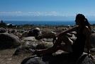
No. 1 Lake Kussharo
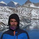
No. 2 Asahi Dake and its fumaroles
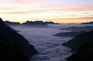
No. 3 in the heart of Daisetsuzan National Park
No. 4 the rare Blakiston’s fish owl (Shiretoko NP).
Japan is so different from what we know that we spent our whole trip with our eyes wide open. The Japanese are also super friendly. And you’ll have plenty of opportunities for great photos.
Just a heads-up, traveling as a family can be quite expensive. I’m not talking about our trip, where I splurged on a few unreasonable extras 😉 (I found myself plenty of excuses for that😛 ), but in general. The main reason is that, unlike other countries, accommodation for four is almost double the price of accommodation for two (within 10%), even with family rooms.
Otherwise, yes, I’m thinking of keeping a travel journal, but as you know, I’m really slow. So when... If you have any questions, don’t hesitate.
Also, don’t hesitate to learn a few Japanese words (there’s a course for foreigners on the NHK website). Guaranteed success!!
Thanks Cheechako for this new info.
These mini RVs don’t really excite me. I think if I’m not going to be fully self-sufficient, I’d rather camp (car + tent) to have a bit more space, alternating with a few solid accommodations...
Hey Cécile,
Well, I’ll wait as patiently as I can (not my strong suit!) for your future travel journal!
For now, I still haven’t had that "aha moment" to decide to go to Japan...
Gotta keep researching!
I’ve been thinking about Hokkaido for a while now—that’s why I came to "check it out."
On the other hand, Patagonia or even Ethiopia (where we were in October) fit your criteria better 😉
This year, I did several more hikes in the Northern and Southern Japanese Alps (including Hakusan, Kitadake, and Shiroumadake), as well as the Kohechi route of the Kumano Kodo. I might write a separate report about them—feel free to ask me questions, especially since the *Hiking in Japan* guide PDFs seem to no longer be available.
Hi Willemspie! We’re heading to Japan in July and are really excited about the Kohechi route. Could you tell us a bit more about it? Is the hike worth it? How did you handle accommodations? How many stages are there? What’s the weather like, and what’s the best time to go? Basically, anything that could help us out.
Thanks in advance
In July, it's really hot. Except when it rains heavily.
All the info, including maps for the 4 stages and accommodations, is on the site http://www.tb-kumano.jp/fr/. I booked through them (even though they charge a commission). For the night in Koyasan before the hike, it's a different site.
There’s no choice for the first and second nights—it’s 100% typically Japanese.
It’s very remote; I didn’t meet anyone. But the environment isn’t exceptional—just secondary forest the whole way.
If you’re only planning one hike, I’d recommend the Japanese Alps instead.
Thanks for your quick reply. You're right, the site is really well done. Thanks, it's perfect. For the Japanese Alps, we weren't super motivated since we live in the French Alps (in Savoie). So, we wanted to see something different. Can you tell me how many stages you did and, the icing on the cake, the elevation gain?
Thanks again.
Lors de mon voyage en aout, je souhaite faire deux petites randonnées au Japon, celle entre Magome et Tsumago et une autre petite à Kamikochi (essentiellement…
Je suis étourdie devant mes livres sur le Japon et tous les sites web que je consulte. Suite aux commentaires sur ce forum nous avons changé notre destination…
Je vais découvrir le Japon du 14 au 25 Avril, et, en tant qu'amateur de randonnées, je compte faire quelques marches (style Mt Takao et promenades autour de…
Pars faire un peu de rando au Japon cet été et j'essaye de planifier mes destinations. Avez-vous des tuyaux sur les rando autour de Kyoto ou autour de Nagano…
Nous désirons aller à Okinawa et autres îles du sud du Japon au printemps 2020 (Taketomi-jima, Miyakojima, etc.). Avant de commencer à planifier le trajet…
Bonjour,
Mi novembre nous serons à Mindelo er San Antao.
Nous avons réservé des transports avec Kapverden tours.
Un pour aller de Portonovo à Ponte da Sol en faisant la rando de Corda à Coculi.
Comment est le chemin?
Puis nous logerons à Ponte do Sol,
Par nous mène :
Une rando prévue à Fontainhas, dans quel sens la faire sachant que nous sommes pas très bons pour les montées. Pas de problème en plat et descente.
Aller à Ribeira Grande, en aluguer et continuer la route du bord de mer.
Avec l'agence:
Une excursion vers cruznhas avec une petite balade à pieds.
Retour vers Portonovo en prenant le chemin de Cova à ? Je ne sais pas encore où, pour récupérer la voiture pour Portonovo , sachant que nous prendrons le ferry le soir.
Nous aurons un guide pour cette randonnée.
Nous aimerions aller à Terrafal pour la journée, mais il faut rentrer en bateau ou taxi et c'est très cher!
Nius somles un couple de 78 et 76 ans.
Que pensez vous de ce programme?
bonjour comment avoir internet quand on arrive à haneda ? je parle dans les zones sans wifi gratuit . Est il plus interressant d acheter une carte sim ? si oui à l aeroport ? merci de votre aide
bonjour nous partons pour un trek de 12 jours dans les alpes japonaises. Nous emmenons des lyo comme à chaque fois. On vient de voir que l import de viande est interdite meme dans les lyo. C est vrai ? on les a achetés. Ce sont des lyo du commerce. Sur le net ce n ai pas précisé "du commerce" car on peut faire ses propres lyo. Et comme on a vu qu ils ne rigolaient pas au japon. Quelqu un peut nous répondre ? merci
Hi,
Since I can't take on long treks, I'd love to know if there are any nice hikes around Pokhara—or maybe in another region of Nepal. Day hikes or two-day trips would be perfect.
Thanks in advance for your tips!
Hi everyone,
I’m leaving on Monday, August 3rd for my very first long-distance trek: the GR223 from Coutances to Mont Saint-Michel, over 6-7 days (~11-14 miles/day), solo.
I’m looking for tips from people who know this section well (Coutances → Regnéville-sur-Mer → Hauteville-sur-Mer → Bréhal → Granville → Genêts → bay crossing):
Budget-friendly accommodations: I’m struggling to find affordable stopover lodgings (a lot of what I find online are expensive vacation rentals, not really suited for a solo hiker). If you have any great spots (hostels, hiker-friendly B&Bs, nice campgrounds), I’d love to hear them!
Bay crossing: Any feedback on guides/providers leaving from Genêts for the final crossing?
General tips for a first long-distance trek: What you wish you’d known before your first time, pitfalls to avoid, etc.
Hi,
We’re planning to do the 4-day trek from Mestia to Ushguli without an agency. The descriptions mention that there are accommodations at each stop, but we can’t find any details about them. Has anyone got info or feedback on this route?
I'm developing a free and open-source web app for planning walking and cycling trips (and even car trips). You can create a route by clicking directly on the map to add waypoints, and it can consist of multiple stages. The app provides tools to edit the stages and the overall route, and to display useful information (distances, altitudes, and elevation changes). A relief profile can be shown as a graph for a specific stage or the entire route.
Once the route is ready, it can be exported as a GPX file, which can then be used with a GPS or a mobile navigation app.
The app is built in JavaScript and runs entirely in the web browser. It uses the Leaflet library and several OpenStreetMap-based services. Initially developed for my personal needs (I enjoy hiking and cycle touring), I’d be happy to share it with anyone who might find it useful. It’s free to use, doesn’t require an account, and the source code is available.
New to this forum, I’m planning a pretty big project for 2028.
I’m heading to Nepal to do a trek from Kathmandu all the way to Everest Base Camp (a cool 5,300 m 😄).
This trek is a bit special because even though I’ll be part of a group, I’m going solo (so far, no problem—I’m used to it). But it’s my first real trek, and it’s also a humanitarian one: once I reach base camp, I’ll stay an extra week to help clean up the waste left by tens of thousands of climbers! Since I’m originally from South America, from two countries that share the Andes, I have a deep respect for mountains—they fascinate me. So Everest… it’s kind of the trip of a lifetime!
So, a little question for those who’ve done treks to Everest before… any tips for good mental preparation (I’m already working on the physical side)?
We're planning to trek in Peru and Bolivia and would love to find some local agencies.
If you know any, could you share details on prices and, of course, the names of the agencies?
Which trek would you recommend?
Elocine
I'm heading out on a fully self-sufficient trek in Morocco (10 days) from Imilchil to Aghbalou.
Can I find screw-on gas canisters (Coleman, Primus) in Marrakech (any addresses?) or in villages between Imilchil and Aghbalou?
If not, are Butagaz canisters for camping gas (small 230g size) available?
Thanks in advance for your tips!
Hello, I’d like to embark on a little trip in my home country, Switzerland. I’ll start walking from La Cure, heading toward Le Noirmont first, then I’ll improvise my route—but it’ll probably follow the French border... at least as far as Lac de Joux.
I’ll decide day by day how much farther to go after that. My goal is to stay in nature as much as possible, wander around for as long as I can, and restock food in villages or towns along the way.
I’m thinking of mostly camping, but we’ll see if I end up in a hotel or another campsite depending on my route.
I’d love to reach La Chaux-de-Fonds on foot... maybe even Delémont.
The whole thing should take about a week, give or take.
I’ll be bringing my dog, and I’m preparing for this as soon as I’m ready.
Any tips to make sure everything goes smoothly for us? Things I should know—or avoid? What about shepherds with their flocks of sheep? And isn’t hunting season open right now?
I’m not sure if what I’m planning is even doable, which is why I’m asking around.
This’ll be my first time doing something like this—wandering in nature *and* with a dog. I’m really excited for this adventure... and I need it. Thanks!
We’re really keen on ecosystems and want to hike in "natural" ancient forests—not planted woods or areas heavily degraded by human activity. Travel guides (like Lonely Planet) don’t provide much info on this. Could you point us to the most interesting spots?
Thanks in advance for your tips.
We wish you happy holidays and a fantastic 2026, full of discoveries!
Claire and Albert
Hi, this might not be the right section, but I’d like to know if it’s possible to start mountaineering with another person without necessarily hiring a guide. We’ve done quite a bit of hiking but not mountaineering—we’ll just do a half-day glacier course. After that, we were thinking of starting with La Grande Motte and the Pointe de la Traversière, which were recommended to us. Honestly, for things like roping up and knots, I’ll learn at home with lots of videos and a book.
I’d love to know if anyone has done treks in the Rwenzori Mountains and how much it costs on average, what the infrastructure is like, the landscapes, and safety in the area. Thanks so much! I’m really looking forward to your replies.
We’re leaving in 9 days for a two-week trip to Madeira, mainly to hike.
From my research, I’ve found that since last year, access to most trails—and systematically for the most popular ones—is now paid. You have to pay an access fee of 4.50 € per person per classified hike in 2026, and even 10.50 € for the most iconic hike: Pico Arieiro to Pico Ruivo. When paying, you also have to choose a day and a 30-minute time slot for your start time. Of course, this reservation is neither changeable nor refundable, even if the weather that day is terrible.
Personally, given the massive influx of tourists to the island in recent years, I don’t mind paying a fee to help maintain the trails. Similarly, setting a limit on the number of people who can hike them per day is certainly preferable to preserve this priceless heritage.
However, what’s much less fair is that in reality, most of the available spots are reserved: 1/ for Madeira residents (which is normal); 2/ for "economic operators" (meaning local tour operators). For example, if you’re a non-resident (independent tourist), no booking is possible for the Pico Arieiro hike for an early morning start before September! So, unfortunately, we’ll have to skip this hike.
It’s the same issue for Ponta de São Lourenço, the 25 Fontes, Pico Ruivo... in short, all the most popular hikes. Oh well, we’ll skip those too!
So my question is: which hikes do you recommend where we won’t face the huge crowds that the others get? And where we can book the day before for the next day, taking the weather into account?
Finally, a quick accommodation question: we’ve booked the first week in Funchal, but I haven’t decided yet for the second week. Do you have any advice on where to stay in the south or north, preferably avoiding overly concrete-heavy and touristy spots?
I’m reposting about the logistics for Samaria Gorge.
I’d love to get recent info, especially about whether it’s possible to park my car in Omalos, do the hike, and then catch a bus back to my vehicle.
In theory, it’s doable, but when you check the KTEL website, there aren’t any feasible schedules listed. If anyone has recently organized this with reliable, verified details, I’d really appreciate it. Thanks in advance!
Hi there,
We’re flying from Montreal to Lyon this August to go hiking in the French Alps. We’ve rented a car and will be staying at campgrounds. We’re planning to do day hikes and want to stay a few days in one spot, do a few hikes, then move on to our next camping spot. Could you share your favorite spots or any recommendations for places to spend a few days with great hikes?
A few details:
We arrive in early August and leave in early September.
We’re looking for day hikes (or shorter), moderate difficulty, with a cumulative elevation gain of no more than 1000m, and of course, beautiful scenery!
We’d prefer not to drive too much—maybe it’s best not to head too far south and deal with unnecessary heat?
Along the same lines, if you know of any great campgrounds where we can start our hike directly without needing the car, we’d love to hear your suggestions!
Hi there,
I’m planning to go hiking on this island and would like to know the best time to do it. I visited for a few days in November 2018—not for hiking but just to explore—and the weather wasn’t great, especially in the mountains. So, is a star-shaped itinerary doable if I rent a car and maybe use two different accommodations?
I’m not planning to join an organized group—just traveling with one other person and organizing things ourselves—unless you’d recommend a local agency or guide. Finally, even though I’ll be getting maps, a topo guide, and a GPS, I’d really appreciate your top hiking recommendations.
Thanks so much for your tips!
I’m planning to do the Mercantour crossing following the Randoxygène route in mid-July.
I’m used to hiking in the mountains, but I sometimes get vertigo, for example on ridges with drops on both sides. I wanted to check if there are any T4 or T3-T4 sections and find out if there are any very exposed passages—and if so, where—so I can plan an alternative route.
Can anyone give me some info on this?
Thanks!
I’m planning a trip around Cap Corse and the AGRIATES in 2026, from May 8th to 15th (there are still 2 spots left, by the way! Just DM me if you're interested).
I’d love to know which hikes are worth prioritizing in the AGRIATES. We’ll be staying in SALECCIA for two days as our base—what should we focus on from there?
A round trip to IGNHU beach? Any other suggestions?
For Ostricano, I think it’s too far for a round trip...
Thanks for your tips!
Have a great day,
Anie, Toulouse
I’d like to get some info about the GR10 Pyrenees traverse. I need help planning the daily stages and accommodations—my wife isn’t an experienced hiker but walks a lot, so I’d like to schedule shorter walking days and thus a longer overall trip in terms of number of days.
Could anyone give me some help and advice?
Best regards,
Hi there, I’m planning the Annapurna Circuit for March 2027 and I’m looking for a local agency with a local guide—preferably French-speaking—to arrange this trek for us. Any suggestions? Thanks
Hello!
We’re spending a few days in Toraja country at the end of May. We’d love to do a day trek—taking our time—on a route that’s stunning in terms of scenery, but not a level 5 in difficulty!
Any suggestions you can share, please?
Thanks in advance
I’d like to do the Mare a Mare Sud in May over 4 days. I’ve found quite a few places to stay along the route, but I’m stuck on the start and finish.
I’ll be arriving by plane on Sunday evening and would like to start pretty early on Monday morning. Ideally, accommodation right at the trailhead (Alzu di Gallina) would be amazing, but I can’t find anything. Any tips?
Also, for the transfer from Figari Airport to Porto Vecchio or Alzu di Gallina?
At the end, I’d like to pick up a rental car—any advice on that too?
I’m traveling solo by plane to Catania in May and plan to hike the northern side of Etna, starting from Linguaglossa where I’ll arrive by bus. After that, I’d love some info on how to get up to Piano Provenzana (shuttles or hitchhiking), since it seems there’s no public transport except in the summer. Can you sleep there in a free or cheap refuge, or camp? And how far up can you go without having to hire a guide? Thanks in advance. Bernard.
Hi everyone,
I’m heading to Morocco in August and we’ll start with a stop in Chefchaouen (we’re driving).
My question: can anyone suggest a 5-to-7-day loop hiking route from Chefchaouen in Talassemtane Park, ideally passing by the God’s Bridge? Or a paper guidebook that covers a few options?
We prefer wild camping and guesthouses.
Thanks in advance

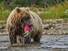


 Two photos of Rishiri Island, from below and from the summit, and one photo with three bears in the clearing right on the ridge trail in Shiretoko.

 More photos of the scenery on the hikes in Daisetsuzan and Shiretoko