J'ai fouiller un peu partout, mais les informations vari d'un endroit à l'autre.
Si je pars de Saint-jean-pied-de-port à Compostelle.
Quelle est le total de km entre c'est deux point, car je veux faire le trajet en un seul séjour et je veux planifier le nombre de jours que ca va me prendre.
Je planifie que ca vas me prendre 31 jours, mais certain disent 700 km et d'autre 800 km, quelle est le chiffre exact?
Je pars en septembre pour faire les walking notes d'une partie du parcours pour la compagnie d'un pote qui vend des walking holidays.
St jean pied de port-Pamplona = 75kms
Pamplona to logrono=98km
Logrono-Burgos=124km
Burgos-Sahagun=125kms
Sahagun-Leon=72kms
Leon-Ponferrada=102kms
Ponferrada-Sarria=103kms
Sarria-Santiago=118kms
Au bureau de tourisme de Logrono on nous remet un dépliant qui indique 732, 5 Km de Roncesvalles à Santiago. Mais, Est-ce que le calcul inclut ce que tu marches en ville ??? par exemple, à Burgos il y a une dizaine de km à l'intérieur de la ville; est-ce que la distance calculée comprend ces km ???
Si tu le désires, je pourrais te numériser ce document qui est un must et qui te permettrait de te faire une idée.
oui ca serait le fun si tu pouvait m'envoyer ce document :)
je prevoit faire le chemin de compostelle en mai 2010
je sais pas s'il compte les 10 km, mais c'est ca qui est bizzare pour le même trajet personne ne donne le même kilometrage, mais je crois que je vais suivre les étapes sur le site duquebecacompostelle.org. Il y a 33 jours de marche.
Maintenant il me reste 2 ans pour décider si j'y vais seul ou avec qqn. Ca serait quand même bien de le faire avec mon père, on pourrait se retrouver juste moi et lui, ce qui est rare.
Oui, ça serait merveilleux si tu pouvais effectuer ce voyage avec ton père. Sinon tu ne seras jamais seul si tu le désires; sur le Camino, les pèlerins forment une grande famille.
En ce qui concerne le document, il semblerait que l'image est trop grosse et je ne sais pas comment l'alléger...; envoie-moi ton email en mp et je te l'enverrai directement.
Salut
Sur un site espagnol "camino de santiago", j'ai noté 757 kms pour St Jean-Santiago. Quant au nombre de jours nécessaires, donne toi de la marge, ce n'est pas une course, et ton chemin t'appartient.
Pepita
Bonjour.
Voici le détail de mes étapes entre St jean et Santiago, si cela peut vous aider.
St jean Pied de Port - Espinal 32 kms
Espinal - Pampelune 35 kms
Pampelune - Villatuerta 45 kms
Villatuerta - Los Arcos 26kms500
Los Arcos -Navarette 40 kms
Navarette - San Domingo 37kms500
San domingo -Villafranca 40 kms
Villafranca - Burgos 36kms500
Burgos - Castrojeritz 41 kms
Castrojeritz - Carrion 44 kms
Carrion - Sahagun 35 kms
Sahagun - Mansilla 34 kms
Mansilla - Leon 18kms500
Leon- Hospital 31 kms
Hospital - Rabanal 33 kms
Rabanal - Pontferrada 34kms
Pontferrada - Trabanello 26 kms
Trabanello - Biduedo 33 kms
Biduedo - Portomarin 47 kms
Portomarin - Melide 39 kms
Melide - Arca 34 kms
Arca - Santiago 22 kms
TOTAL : 764kms500
Il y a, en Espagne, quelques variantes qui peuvent modifier légèrement, ce kilométrage. La distance journalière dépend beaucoup de chacun et des conditons météo .j'ai marché du 20 avril au 5 juin (Le puy- Santiago)
Bonjour, et bienvenue sur le Camino.
En Avril 2006, je suis partis de Quimper en Bretagne et suis arrive a Compostelle le 23 Mai 2006.
Je te confirme que la distance de st jean pied de port a compostelle et bien de 750 km.
Je suis partis seul de chez moi.
Ma moyenne journalière était de 35 km par jour.
Aujourd'hui, j'ai 66 ans.
Si tu a besoin de renseignements pour ton projet, je suis prêt a t'aider.
Buen Camino
Je suis partis de quimper en Bretagne le 1er Avril 2006 et suis arrivé a Compostelle le 23 Mai 2006 avec 15 jours d'avance sur mon programme.
La distance, que j'ai parcourue depuis st jean pied de port a compostelle est de 750 km, traversée des villes comprises. La partie Française a été faite en autonomie complète. La partie Espagnole, en profitant des gites.
J'avais 64 ans a l'époque.
Si tu as besoin de renseignements, je peux t'en donner.
Amicalement et BUEN CAMINO
Je te file ce lien où tu verras que la distance annoncée est de 775, 3 km.... c'est de la précision ça, pas vrai... ?
Je te conseille de bien visiter ce site qui me semble être un des plus "documenté" du Net.
En, plus en imprimant ces 2 pages, ça te suffit pour entreprendrele voyage.
Ah oui, tu apprendras à emporter le moins possible, car il faut ...porter pendant ces 775, 3 km.... rires
Voici le lien : http://pagesperso-orange.fr/gerard-du-camino/Mon_site_web/fichierhtm/itineraire.htm
Buen Camino
Je voudrais avoir une petite confirmation s'il vous plaît...🙂
On n'est donc pas obligé de partir du Puy en Velay ou de Tours, Arles, Vézelay? Le point de départ du pèlerinage peut être n'importe où sur le chemin si j'ai bien compris ?😊
Merci pour votre réponse
Absolument pas, ton pèlerinage t'appartient et tu prends le départ d'où tu veux.
C'est toi qui décide le temps que tu vas y consacrer, ainsi que ton chemin....
Mais par "facilité" par son parfait balisage, la majorité choisit encore le "Camino Francès" qui perd de + en + son âme...
Beaucoup doivent "morceler" ce pèlerinage et le faire en plusieurs années, par manque de temps.
Je l'ai fait 2 fois,
À vélo en partant de mon domicile, et par des petites routes choisies pour leur calme.
Et à pied, en partant de St. Jean-Pied-de-Port, via le Camino Francès...
Essaye d'entrer en contact avec une association, des "Amis de Saint Jacques" de ta région ....
Voici quelques liens trouvés sur le Net...Mais je ne les ai pas lus....
Bonjour.
Si effectivement, tu peux partir du Puy, d'Arles, de Vezelay, le plus sympa est quand même de partir de chez soi.
Buen Camino et a plus si tu as besoin d'un complément d' infos.
Amitiés
la majorité choisit encore le "Camino Francès" qui perd de + en + son âme...
Je le pense aussi, pour être revenu de St Jacques par le camino frances. Nous avons même vu dans le Leon des tags "mort aux pèlerins". Je crois qu'il y a tellement de monde que les espagnols commencent à être saturés. (sauf bien sur ceux qui en vivent😕).
Pour notre part, nous avions choisi le camino del norte qui suit la côte. Il est beaucoup plus calme, moins fréquenté et pour mon goût plus joli. On y fait peut-être moins de rencontres de pèlerin, mais elles nous ont semblé plus authentiques, sans doute parce que nous n'avions pas la hantise de la chasse à la place en Albergue.
De plus nous y étions en septembre.
Buen Camino.
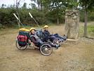
Sur le chemin piéton lui-même, je ne peux pas dire, car nous avons pris le bitume avec les tricycles, mais au plus près du chemin quand même. Ca monte plus sur le camino del Norte, ou plutôt ça monte moins haut, mais tous les jours. Sur le camino francés, il y a de gros coul de cul, comme Roncevaux ou les monts du Leon, mais aussi du long plat monotone, par exemple, tout droit dans les céréales entre Burgos et Leon. Alors il faut voir si tu penses qu'un petit effort supplémentaire sur le camino del norte, ça vaut le coup. Nous on le croit vraiment, pis on aime la mer, na!😏😏
A+. Buen Camino (del norte😉)
J'aimerais savoir si le chemin par la côte est aussi sécuritaire, je voyage seule en avril prochain. Est-ce que les auberges seront ouvertes ou je risque de rencontrer des difficultés à me loger,
... combien de jours ou kilomètres pour ce chemin?
Excuse le retard, mais ça fait 3 mois qu'on est sur les routes. Perso, je pense que le camino del norte est plus sécuritaire que le frances. Il y a moins de monde, et les espagnols ont l'air moins stressés par le nombre de pélerins. Nous avons été surpris de voir sur le camino frances des tags peu engageant envers les pélerins (mais sans doute est-ce le fait d'une minorité).
En septembre, les auberges pour pélerins étaient toutes ouvertes. Je suppose qu'il en sera de même en avril. Donc, tu devrait pouvoir te loger sans trop de difficultés. En partant de l'ile d'oléron, nous avions 1500 km au compteur. Donc en gros 8-900 km depuis Hendaye (à vérifier).
Si tu veux plus de précision, envoie ton mail en mp.
Buen Camino.
Arnaud
Peu importe le nombre de km du Camino frances. Arrivé à Sarria, il y aura tellement de cyclistes et de touristes que tu seras content d'arriver au bout. Je suis partis de chez moi en Suisse et j'ai tellement été dégouté à la fin par le nombre de gens, que j'ai marché de Barbadello (environ 115 km) à Santiago sans dormir, en 33 heures. Mon étape favorite fût Genève-Le Puy...
En revenant de St Jacques par le camoni frances, j'ai compté 50 pélerins au 100 m, c'était au mois d'octobre, et ils en avaient encore pour au moins 10 jours avant d'arriver.
Le camino del norte, c'est quand même plus calme, à ce point de vue.
Bonjour
Nous avons marché de San Sebastian et parcouru, en avril 2007 jusqu'à Santiago 784 kms.
Pour répondre à la personne qui cherchait le kilométrage entre SJPDP et Santiago, c'est 791 kms (faits en avril mai 2006)
Le lien ci-dessous avec notre site ne fonctionne pas car arrêté par l'hébergeur du fait de hacking. Il fonctionnera à nouveau en cours de semaine prochaine.
Je voudrais juste poser une question à ceux qui sont déjà partis.
J'ai fait une partie du Chemin entre Le Puy et Figeac en septembre dernier. Depuis, le Virus m'a piqué et je n'attends qu'une seule chose: repartir 😎😎.
Ne pouvant faire la suite du chemin et la variante vers Rocamadour en une fois, je compte faire une variante à ma façon: partir de Rocamadour pour remonter vers Figeac et de là reprendre le GR65.
Qu'en pensez-vous ? Rocamadour vaut-elle vraiment le détour ? Tout le monde en parle comme un des plus beaux villages de France ...
Je ne donnerai qu'une réponse de principe n'ayant pas parcouru ce chemin en France mais, pour des raisons géographiques évidentes, le Chemin du Piémont Pyrénéen.
Ma réponse sera : Passes par où bon te semble du moment que tu progresses vers ton but. N'écoutes pas les "idéologues" que l'on peut lire sur certains sites spécialisés sur le pèlerinage, qui, orthodoxes, disent qu'il faut suivre telle ou telle route.
Chaque pèlerin, dans le passé, partait de chez lui pour éventuellement rejoindre un point de ralliement, tel Le Puy, Arles ou ailleurs. Il marchait donc sur son "propre" chemin avant de rejoindre un groupe qui assurait la sécurité des uns et des autres.
Celles et ceux qui connaissent bien cette région répondront précisément. J'ai répondu sur le principe.
Salut,
J'ai l'intention de partir le 24 juillet prochain faire une partie du chemin de compostelle entre Genève-Le Puy.
Je viens de voir que c'est la "portion du chemin" que tu as préférée ...
J'ai parcouru le chemin deux ans de suite entre Le Puy-> Conques et Conques->Moissac.
J'ai adoré traverser l'Aubrac ... j'ai trouvé magnifique.
Genève -> Le Puy est encore plus beau ?
Pourrais-tu me dire à peu près quelles étaient tes étapes pour aller jusqu'au Puy ?
Hi,
Since I can't take on long treks, I'd love to know if there are any nice hikes around Pokhara—or maybe in another region of Nepal. Day hikes or two-day trips would be perfect.
Thanks in advance for your tips!
Hi everyone,
I’m leaving on Monday, August 3rd for my very first long-distance trek: the GR223 from Coutances to Mont Saint-Michel, over 6-7 days (~11-14 miles/day), solo.
I’m looking for tips from people who know this section well (Coutances → Regnéville-sur-Mer → Hauteville-sur-Mer → Bréhal → Granville → Genêts → bay crossing):
Budget-friendly accommodations: I’m struggling to find affordable stopover lodgings (a lot of what I find online are expensive vacation rentals, not really suited for a solo hiker). If you have any great spots (hostels, hiker-friendly B&Bs, nice campgrounds), I’d love to hear them!
Bay crossing: Any feedback on guides/providers leaving from Genêts for the final crossing?
General tips for a first long-distance trek: What you wish you’d known before your first time, pitfalls to avoid, etc.
Hi,
We’re planning to do the 4-day trek from Mestia to Ushguli without an agency. The descriptions mention that there are accommodations at each stop, but we can’t find any details about them. Has anyone got info or feedback on this route?
I'm developing a free and open-source web app for planning walking and cycling trips (and even car trips). You can create a route by clicking directly on the map to add waypoints, and it can consist of multiple stages. The app provides tools to edit the stages and the overall route, and to display useful information (distances, altitudes, and elevation changes). A relief profile can be shown as a graph for a specific stage or the entire route.
Once the route is ready, it can be exported as a GPX file, which can then be used with a GPS or a mobile navigation app.
The app is built in JavaScript and runs entirely in the web browser. It uses the Leaflet library and several OpenStreetMap-based services. Initially developed for my personal needs (I enjoy hiking and cycle touring), I’d be happy to share it with anyone who might find it useful. It’s free to use, doesn’t require an account, and the source code is available.
New to this forum, I’m planning a pretty big project for 2028.
I’m heading to Nepal to do a trek from Kathmandu all the way to Everest Base Camp (a cool 5,300 m 😄).
This trek is a bit special because even though I’ll be part of a group, I’m going solo (so far, no problem—I’m used to it). But it’s my first real trek, and it’s also a humanitarian one: once I reach base camp, I’ll stay an extra week to help clean up the waste left by tens of thousands of climbers! Since I’m originally from South America, from two countries that share the Andes, I have a deep respect for mountains—they fascinate me. So Everest… it’s kind of the trip of a lifetime!
So, a little question for those who’ve done treks to Everest before… any tips for good mental preparation (I’m already working on the physical side)?
We're planning to trek in Peru and Bolivia and would love to find some local agencies.
If you know any, could you share details on prices and, of course, the names of the agencies?
Which trek would you recommend?
Elocine
I'm heading out on a fully self-sufficient trek in Morocco (10 days) from Imilchil to Aghbalou.
Can I find screw-on gas canisters (Coleman, Primus) in Marrakech (any addresses?) or in villages between Imilchil and Aghbalou?
If not, are Butagaz canisters for camping gas (small 230g size) available?
Thanks in advance for your tips!
Hello, I’d like to embark on a little trip in my home country, Switzerland. I’ll start walking from La Cure, heading toward Le Noirmont first, then I’ll improvise my route—but it’ll probably follow the French border... at least as far as Lac de Joux.
I’ll decide day by day how much farther to go after that. My goal is to stay in nature as much as possible, wander around for as long as I can, and restock food in villages or towns along the way.
I’m thinking of mostly camping, but we’ll see if I end up in a hotel or another campsite depending on my route.
I’d love to reach La Chaux-de-Fonds on foot... maybe even Delémont.
The whole thing should take about a week, give or take.
I’ll be bringing my dog, and I’m preparing for this as soon as I’m ready.
Any tips to make sure everything goes smoothly for us? Things I should know—or avoid? What about shepherds with their flocks of sheep? And isn’t hunting season open right now?
I’m not sure if what I’m planning is even doable, which is why I’m asking around.
This’ll be my first time doing something like this—wandering in nature *and* with a dog. I’m really excited for this adventure... and I need it. Thanks!
We’re really keen on ecosystems and want to hike in "natural" ancient forests—not planted woods or areas heavily degraded by human activity. Travel guides (like Lonely Planet) don’t provide much info on this. Could you point us to the most interesting spots?
Thanks in advance for your tips.
We wish you happy holidays and a fantastic 2026, full of discoveries!
Claire and Albert
Hi, this might not be the right section, but I’d like to know if it’s possible to start mountaineering with another person without necessarily hiring a guide. We’ve done quite a bit of hiking but not mountaineering—we’ll just do a half-day glacier course. After that, we were thinking of starting with La Grande Motte and the Pointe de la Traversière, which were recommended to us. Honestly, for things like roping up and knots, I’ll learn at home with lots of videos and a book.
I’d love to know if anyone has done treks in the Rwenzori Mountains and how much it costs on average, what the infrastructure is like, the landscapes, and safety in the area. Thanks so much! I’m really looking forward to your replies.
We’re leaving in 9 days for a two-week trip to Madeira, mainly to hike.
From my research, I’ve found that since last year, access to most trails—and systematically for the most popular ones—is now paid. You have to pay an access fee of 4.50 € per person per classified hike in 2026, and even 10.50 € for the most iconic hike: Pico Arieiro to Pico Ruivo. When paying, you also have to choose a day and a 30-minute time slot for your start time. Of course, this reservation is neither changeable nor refundable, even if the weather that day is terrible.
Personally, given the massive influx of tourists to the island in recent years, I don’t mind paying a fee to help maintain the trails. Similarly, setting a limit on the number of people who can hike them per day is certainly preferable to preserve this priceless heritage.
However, what’s much less fair is that in reality, most of the available spots are reserved: 1/ for Madeira residents (which is normal); 2/ for "economic operators" (meaning local tour operators). For example, if you’re a non-resident (independent tourist), no booking is possible for the Pico Arieiro hike for an early morning start before September! So, unfortunately, we’ll have to skip this hike.
It’s the same issue for Ponta de São Lourenço, the 25 Fontes, Pico Ruivo... in short, all the most popular hikes. Oh well, we’ll skip those too!
So my question is: which hikes do you recommend where we won’t face the huge crowds that the others get? And where we can book the day before for the next day, taking the weather into account?
Finally, a quick accommodation question: we’ve booked the first week in Funchal, but I haven’t decided yet for the second week. Do you have any advice on where to stay in the south or north, preferably avoiding overly concrete-heavy and touristy spots?
I’m reposting about the logistics for Samaria Gorge.
I’d love to get recent info, especially about whether it’s possible to park my car in Omalos, do the hike, and then catch a bus back to my vehicle.
In theory, it’s doable, but when you check the KTEL website, there aren’t any feasible schedules listed. If anyone has recently organized this with reliable, verified details, I’d really appreciate it. Thanks in advance!
Hi there,
We’re flying from Montreal to Lyon this August to go hiking in the French Alps. We’ve rented a car and will be staying at campgrounds. We’re planning to do day hikes and want to stay a few days in one spot, do a few hikes, then move on to our next camping spot. Could you share your favorite spots or any recommendations for places to spend a few days with great hikes?
A few details:
We arrive in early August and leave in early September.
We’re looking for day hikes (or shorter), moderate difficulty, with a cumulative elevation gain of no more than 1000m, and of course, beautiful scenery!
We’d prefer not to drive too much—maybe it’s best not to head too far south and deal with unnecessary heat?
Along the same lines, if you know of any great campgrounds where we can start our hike directly without needing the car, we’d love to hear your suggestions!
Hi there,
I’m planning to go hiking on this island and would like to know the best time to do it. I visited for a few days in November 2018—not for hiking but just to explore—and the weather wasn’t great, especially in the mountains. So, is a star-shaped itinerary doable if I rent a car and maybe use two different accommodations?
I’m not planning to join an organized group—just traveling with one other person and organizing things ourselves—unless you’d recommend a local agency or guide. Finally, even though I’ll be getting maps, a topo guide, and a GPS, I’d really appreciate your top hiking recommendations.
Thanks so much for your tips!
I’m planning to do the Mercantour crossing following the Randoxygène route in mid-July.
I’m used to hiking in the mountains, but I sometimes get vertigo, for example on ridges with drops on both sides. I wanted to check if there are any T4 or T3-T4 sections and find out if there are any very exposed passages—and if so, where—so I can plan an alternative route.
Can anyone give me some info on this?
Thanks!
I’m planning a trip around Cap Corse and the AGRIATES in 2026, from May 8th to 15th (there are still 2 spots left, by the way! Just DM me if you're interested).
I’d love to know which hikes are worth prioritizing in the AGRIATES. We’ll be staying in SALECCIA for two days as our base—what should we focus on from there?
A round trip to IGNHU beach? Any other suggestions?
For Ostricano, I think it’s too far for a round trip...
Thanks for your tips!
Have a great day,
Anie, Toulouse
I’d like to get some info about the GR10 Pyrenees traverse. I need help planning the daily stages and accommodations—my wife isn’t an experienced hiker but walks a lot, so I’d like to schedule shorter walking days and thus a longer overall trip in terms of number of days.
Could anyone give me some help and advice?
Best regards,
Hi there, I’m planning the Annapurna Circuit for March 2027 and I’m looking for a local agency with a local guide—preferably French-speaking—to arrange this trek for us. Any suggestions? Thanks
Hello!
We’re spending a few days in Toraja country at the end of May. We’d love to do a day trek—taking our time—on a route that’s stunning in terms of scenery, but not a level 5 in difficulty!
Any suggestions you can share, please?
Thanks in advance
I’d like to do the Mare a Mare Sud in May over 4 days. I’ve found quite a few places to stay along the route, but I’m stuck on the start and finish.
I’ll be arriving by plane on Sunday evening and would like to start pretty early on Monday morning. Ideally, accommodation right at the trailhead (Alzu di Gallina) would be amazing, but I can’t find anything. Any tips?
Also, for the transfer from Figari Airport to Porto Vecchio or Alzu di Gallina?
At the end, I’d like to pick up a rental car—any advice on that too?
I’m traveling solo by plane to Catania in May and plan to hike the northern side of Etna, starting from Linguaglossa where I’ll arrive by bus. After that, I’d love some info on how to get up to Piano Provenzana (shuttles or hitchhiking), since it seems there’s no public transport except in the summer. Can you sleep there in a free or cheap refuge, or camp? And how far up can you go without having to hire a guide? Thanks in advance. Bernard.
Hi everyone,
I’m heading to Morocco in August and we’ll start with a stop in Chefchaouen (we’re driving).
My question: can anyone suggest a 5-to-7-day loop hiking route from Chefchaouen in Talassemtane Park, ideally passing by the God’s Bridge? Or a paper guidebook that covers a few options?
We prefer wild camping and guesthouses.
Thanks in advance
Hi there, for those who’ve been recently—is it possible to find other solo travelers in March on the island to share transport or room costs? It doesn’t seem easy to travel on a budget.
If you have any recommendations for simple lodgings or places with dorms, I’d love to hear them.
For those who’ve done multi-day treks while moving around: do you need to bring your own sleeping bag? I’d love to hear about itineraries you’ve done without a guide, just with a map and GPS.
Thanks, and have a great day!
Hi everyone!
We’re planning a 15-day road trip to Scotland this summer, specifically to explore and hike on Lewis and Harris—places we’ve never been before. We’ve visited other islands on previous road trips in Scotland (we usually go in April for a week). This would be our first time in Scotland in the summer and for 15 days. We’re looking at late August to early September.
I’m currently drafting the itinerary. We’d be crossing from Ullapool and were thinking of spending 3 nights on Harris and 4 nights on Lewis.
Does that sound balanced to you? Is it better to keep the same accommodation on Harris and the same on Lewis to explore the area? I’d love to hear about any past experiences you’ve had on these islands.
Thanks!
Hi there, I’m trying to leave for 15 days very soon to São Vicente. I’m either looking to join an agency or figure things out on my own to go hiking on one of these islands or both. From what I’ve seen, it’s not easy to organize with local transport, so it gets expensive. Can I use the services of a small local agency? I’m looking for the simplest way to hike for several days. Also, how do you get from São Vicente to São Nicolau? Thanks in advance and have a great day!
Aichatou
I’ve been wanting to do this for several years, and this year’s the one. Next September, I’ll be trekking in Tusheti (Georgia), from Omalo to Shatili.
Of course, I won’t be renting a vehicle that’d just sit unused. No problem getting to Pshaveli, but from there to Omalo, it’s a dirt road (still the case?)
There must be some form of public transport since there are so many guesthouses, and not all travelers come in a 4x4.
If any of you have been to Omalo, could you confirm that these shared transports exist and how often they run?