Bonjours, je pars bientôt dans la région des lacs au Chili pour la traversal de Villarica entre autre, je me pose la question de l'utilité d'amener mon réchaux à bois car le feu n'est pas autorisé?
Merci Eric.
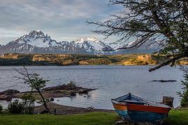
Le feu est STRICTEMENT interdit dans les parcs de Patagonie (sauf dans certaines zones de camping/bivouac). Et le réchaud à bois est considéré comme un feu.
Le feu a causer déjà de grave dégâts dans les parcs (notamment à Torres del Paine, il y a quelques années) que les gardes parcs ne rigolent pas avec ca. Ca serait une très mauvaise idée que d'essayer.
Tu trouveras du gaz à Pucon sans souci.
Sinon, très bon choix de parc 🙂 La traversée de Villarica à Lanin est superbe ! Je te conseil de faire la boucle supplémentaire qui passe au pied du Lanin : www.patagonie.dubuis.net
hello Simon, merci pour ta réponse rapide, je vais donc laisser le buchfire à la maison.Je me demande si je ne vais pas partir de "juan del andes" en Argentine et redescendre à Pucon, c'est ptet mieux dans ce sens.je verrais ça à Pucon, de toute façon j'y passe en partant de Santiago.
je suis tes périples depuis pas mal de temps déjà, nous nous croiseront bien un de ces jours😉
En partant de Juan de los Andes pour rejoindre Pucon, tu vas avoir un problème de ravitaillement. Il te faudra partir avec plus de 10 jours de nourriture ou faire un aller/retour à Junin de los Andes à mi chemin. Facilement faisable en haute saison en bus ou stop au niveau de Ecu Fue ou du camp de base du Lanin.
A savoir que :
Villarrica n'est pas facilement accessible de Pucon. Il y a 12 km de piste (pas de sentier à ma connaissance). Mais tu peux faire du stop au petit matin à l'entrée de la piste qui monte vers la station de ski (en haute saison, il y a du passage)
Pour Juan de los Andes, il vaut mieux partir (ou arriver suivant le sens du trek) de Lolog. Ca se trouve à 12 km au Nord de Juan de los Andes (bus ou stop). Car idem, c'est une route inintéressante.
Le seul point de passage légal entre le parc Villarrica (Chili) et Lanin (Argentine) se trouve sur la piste qui passe au Nord du Lanin (camp de base du Lanin). Il y a un poste de douane.
Le sentier qui permet de passer du versant Nord du volcan Lanin au versant Sud est à sens unique (sentier entre le camp de base du Lanin et environ de Ecu Fue).
Ce qu'un garde parc m'a dit : Il ne peut se faire que dans le sens Sud-Nord et avec autorisation des communautés Mapuche qui habitent la vallée. Ils n'aimeraient pas trop les visites et il faudrait demander la permission à chaque communautés que tu traverses. Donc, on peut se faire bloquer à mi chemin si une communauté refuse.
Perso, j'en pense tout autre chose même si je ne suis pas passé... Les Mapuches ne sont pas fermés, bien au contraire. Pour info le garde parque était un blanc et il faut savoir que les Mapuches sont une minorité aujourd'hui mal reconnue et parquée bien souvent.
A Junin de los Andes (toute petite ville), il y a tout ce qu'il faut pour se ravitailler et un petit camping très agréable pour se reposer un bord d'une rivière 🙂
En dehors de la haute saison (décembre, janvier, février) il peut être très difficile de circuler dans le secteur. Quasi plus de bus et peu de monde (en vacances) pour faire du stop.
je parlais de Junin de los andes pour le départ, excuse moi.
Je pense possible de prendre un bus depuis Pucon, alors ou je fais a pieds jusqu'a la fontiere Chilienne mais le soucis est de monter le volcan Lanin par le sud et là y a un probleme de ravitaillement...ou je navigue qq jours autour de Junin et chope un bus pour le Lanin a coté du lac... je me rappelle plus le nom!Mais bon je reste un mois et demie alors j'ai surement le temps e plus naviguer, maintenant ce n'est pas mon seul treck de prévu dans l'année alors question budget je vais pas trop passer mon temps et mon argent dans les transports.
Ton site est super! J'y suis déjà et finalement j'ai pas besoin d'y aller ;)
Je confirme les dires de Simon, très bon choix de parc! Nous avions rencontré seulement un groupe de personnes en trois jours de marches fin décembre, La plupart des gens partent au sommet du Villarrica et donc la tranquillité est assuré. Le stop fonctionne bien dans la zone 😛.
Vois-tu Simon je pense que le volcan Lanin du sud au nord à l'air péchu!
Le refuge au sud est détruit apparement, il est quand même plus abordable que dans le sens nord sud, le sendero chilian à un dénivelé impressionant!
maintenant je n'ai pas de carte coté Argentine et ma question est de savoir si je peux m'en procurer à Junin del andes.Dans le cas contraire il me faudra descendre jusqu'à Saint Martin del Andes.
De Juin de los Andes, tu prends un bus pour Pucon et tu te fais déposer juste de l'autre côté de la frontière à la lagune Quilleihue. De là, tu démarres le trek vers Pucon (compter 6 jours)
Si tu veux en plus découvrir la partie Sud du volcan Lanin (superbe), il te faut prendre un bus de Junin de los Andes pour Ecu Fue, magnifique petit air de bivouac/camping tranquille tenu par des Mapuches au bord d'un lac face au Lanin. Rando à la journée possible, notamment vers le mirador.
Après pour rejoindre le Chili, soit tu retournes à Junin de los Andes pour prendre le bus pour Pucon, soit t'y vas à pied pour rejoindre le camp de base du Lanin sur le versant Nord par la vallée que je parlais dans mon poste précédent (il faut bien 2 jours je pense)
Attention, si tu souhaites faire l'ascension du Lanin, il y a des restrictions. Si tu ne remplis pas toutes les obligations demandées, tu ne pourras pas y grimper. En fouillant sur le net, tu devrais trouver facilement.
Il existe un sentier qui contourne le Lanin par l'Ouest et qui permet de rejoindre directement le parc de Villarrica, mais il n'y a aucun poste frontière 🙁
Comme dit au dessus, le Lanin est soumis a une réglementation strict, si tu n'as pas la liste d'équipement minimum imposé, on ne te laissera pas monter. Oui, les crampons en font partis, mais une radio aussi par exemple.
Equipo obligatorio requerido por la Intendencia del Parque Nacional Lanin
Grampones y piquetas (no se autorizan equipos caseros),
VHF (Frecuencia 155675) con bateria adicional (NO hay senal para celulares),
Calzado para hielo y nieve,
Abrigo para monta,
Guantes,
Lentes UV,
Linterna y bateria de repuesto,
Casco,
Botiquin (de 1º auxilios: gasas, vendas, antiseptico, crema para quemaduras, colirio, tela adhesiva, maxima pantalla solar, etc.),
Bolsa de dormir,
Un aislante y calentador cada cuatro personas.
En mars, prévois plus de temps pour te deplacer, les transports sont déjà bien moins nombreux à l’intérieur des parcs, genre 2 par semaines au lieu de 2 par jour.
Merci pour tes précisions Simon, c'est un plaisir de converser avec toi.
Ce voyage prend forme et commencer de Junin de los Andes me parait judicieux donc.
Essayer l'option caminendo jusqu'a Pucon va me prendre une bonne partie de mon séjour, des lacs, des volcans, des sources chaudes, apparement de belles rencontres, houla mais que demande le peuple, Eric.
ok c'est donc bien péchu, de tout facon ce n'est pas envisageable pour moi en etant seul. je dois pouvoir y contourner, je prends juste les quatre pointes; voire même pas!
J’aimerais bien parcourir la Carratera Australe en voiture de Puerto Montt à Villa O Higgins. J’aimerais faire du camping le long du chemin et aller faire de…
Je pars en février au Chili, pour 3 semaines, 2 semaines en Patagonie et 1 semaine à l'Île de Pâques. J'aimerai savoir s'il est facile de faire des randonnées…
Notre départ pour le Chili approche. L'un de vous pourrait-il me renseigner sur les randos dans les parcs nationaux, Conguillo, Huequehue, Villarrica. J'ai lu…
Je cherche un trek d' altitude et à franchir les 6000 m sans pour autant devoir être trop dans l'alpinisme dont j'ai peu d'expérience. A mon actif, le Toubkal,…
Bonjour,
Nous souhaitons faire le trek de 4 jours reliant Mestia à Ushguli sans agence. Il est précisé dans les descriptifs qu'il existe des hébergement à chaque étape, mais on ne trouve pas d'info sur ces hébergements. Quelqu'un a-t-il des infos et un avis sur ce parcours?
We're planning to trek in Peru and Bolivia and would love to find some local agencies.
If you know any, could you share details on prices and, of course, the names of the agencies?
Which trek would you recommend?
Elocine
Je pars en autonomie totale sur un trek au Maroc (10jrs) Imilchil - Aghbalou.
Trouve t-on des cartouches gaz à vis (Coleman, Primus) à Marrakech (adresse) ou villages entre Imilchil - Aghbalou ?
Si non , trouve-t-on des cartouches Butagaz pour camping-gaz (petit volume 230 gr ...)
Merci d' avance pour vos réponses
Hello, I’d like to embark on a little trip in my home country, Switzerland. I’ll start walking from La Cure, heading toward Le Noirmont first, then I’ll improvise my route—but it’ll probably follow the French border... at least as far as Lac de Joux.
I’ll decide day by day how much farther to go after that. My goal is to stay in nature as much as possible, wander around for as long as I can, and restock food in villages or towns along the way.
I’m thinking of mostly camping, but we’ll see if I end up in a hotel or another campsite depending on my route.
I’d love to reach La Chaux-de-Fonds on foot... maybe even Delémont.
The whole thing should take about a week, give or take.
I’ll be bringing my dog, and I’m preparing for this as soon as I’m ready.
Any tips to make sure everything goes smoothly for us? Things I should know—or avoid? What about shepherds with their flocks of sheep? And isn’t hunting season open right now?
I’m not sure if what I’m planning is even doable, which is why I’m asking around.
This’ll be my first time doing something like this—wandering in nature *and* with a dog. I’m really excited for this adventure... and I need it. Thanks!
We’re really keen on ecosystems and want to hike in "natural" ancient forests—not planted woods or areas heavily degraded by human activity. Travel guides (like Lonely Planet) don’t provide much info on this. Could you point us to the most interesting spots?
Thanks in advance for your tips.
We wish you happy holidays and a fantastic 2026, full of discoveries!
Claire and Albert
Hi, this might not be the right section, but I’d like to know if it’s possible to start mountaineering with another person without necessarily hiring a guide. We’ve done quite a bit of hiking but not mountaineering—we’ll just do a half-day glacier course. After that, we were thinking of starting with La Grande Motte and the Pointe de la Traversière, which were recommended to us. Honestly, for things like roping up and knots, I’ll learn at home with lots of videos and a book.
Hi,
I don’t know Switzerland at all and was wondering if Vallée des Joux and especially Dent de Vaulion are packed early in the morning or late in the afternoon in July and September?
If so, do you have any quieter spots to recommend in the area, or in Luxembourg (yes, I know it’s not the same country 😉)?
Thanks a lot!
Jaimerais savoir si quelqu'un aurait fait des treks sur le Ruwenzori et combien ça coute en moyenne, les infrastructures, les paysages la sécurité sur les lieux, merci beaucoup. J'attends avec impatience vos réponses.
We’re leaving in 9 days for a two-week trip to Madeira, mainly to hike.
From my research, I’ve found that since last year, access to most trails—and systematically for the most popular ones—is now paid. You have to pay an access fee of 4.50 € per person per classified hike in 2026, and even 10.50 € for the most iconic hike: Pico Arieiro to Pico Ruivo. When paying, you also have to choose a day and a 30-minute time slot for your start time. Of course, this reservation is neither changeable nor refundable, even if the weather that day is terrible.
Personally, given the massive influx of tourists to the island in recent years, I don’t mind paying a fee to help maintain the trails. Similarly, setting a limit on the number of people who can hike them per day is certainly preferable to preserve this priceless heritage.
However, what’s much less fair is that in reality, most of the available spots are reserved: 1/ for Madeira residents (which is normal); 2/ for "economic operators" (meaning local tour operators). For example, if you’re a non-resident (independent tourist), no booking is possible for the Pico Arieiro hike for an early morning start before September! So, unfortunately, we’ll have to skip this hike.
It’s the same issue for Ponta de São Lourenço, the 25 Fontes, Pico Ruivo... in short, all the most popular hikes. Oh well, we’ll skip those too!
So my question is: which hikes do you recommend where we won’t face the huge crowds that the others get? And where we can book the day before for the next day, taking the weather into account?
Finally, a quick accommodation question: we’ve booked the first week in Funchal, but I haven’t decided yet for the second week. Do you have any advice on where to stay in the south or north, preferably avoiding overly concrete-heavy and touristy spots?
I’m reposting about the logistics for Samaria Gorge.
I’d love to get recent info, especially about whether it’s possible to park my car in Omalos, do the hike, and then catch a bus back to my vehicle.
In theory, it’s doable, but when you check the KTEL website, there aren’t any feasible schedules listed. If anyone has recently organized this with reliable, verified details, I’d really appreciate it. Thanks in advance!
Hi there,
We’re flying from Montreal to Lyon this August to go hiking in the French Alps. We’ve rented a car and will be staying at campgrounds. We’re planning to do day hikes and want to stay a few days in one spot, do a few hikes, then move on to our next camping spot. Could you share your favorite spots or any recommendations for places to spend a few days with great hikes?
A few details:
We arrive in early August and leave in early September.
We’re looking for day hikes (or shorter), moderate difficulty, with a cumulative elevation gain of no more than 1000m, and of course, beautiful scenery!
We’d prefer not to drive too much—maybe it’s best not to head too far south and deal with unnecessary heat?
Along the same lines, if you know of any great campgrounds where we can start our hike directly without needing the car, we’d love to hear your suggestions!
Bonjour
Souhaitant faire de la randonnée sur cette île, je voudrais d'abord savoir quelle serait la période la plus favorable sachant que j'avais passé quelques jours en novembre 2018 pas pour cette activité mais plus pour une simple découverte de l'île et le temps n'était pas top notamment en montagne. Donc peut on choisir une organisation en étoile sachant que je louerai un véhicule avec éventuellement 2 points d'hébergement.
Je n'envisage pas d'intégrer une structure mais de partir à 2 et de s'organiser sauf si vous me conseillez une agence locale ou un guide local. Enfin même si je compte me procurer les différents supports, carte et topo guide plus gps je vous remercie de bien vouloir me communiquer les randos à faire en priorité
Merci beaucoup pour vos informations
I’m planning to do the Mercantour crossing following the Randoxygène route in mid-July.
I’m used to hiking in the mountains, but I sometimes get vertigo, for example on ridges with drops on both sides. I wanted to check if there are any T4 or T3-T4 sections and find out if there are any very exposed passages—and if so, where—so I can plan an alternative route.
Can anyone give me some info on this?
Thanks!
I’m planning a trip around Cap Corse and the AGRIATES in 2026, from May 8th to 15th (there are still 2 spots left, by the way! Just DM me if you're interested).
I’d love to know which hikes are worth prioritizing in the AGRIATES. We’ll be staying in SALECCIA for two days as our base—what should we focus on from there?
A round trip to IGNHU beach? Any other suggestions?
For Ostricano, I think it’s too far for a round trip...
Thanks for your tips!
Have a great day,
Anie, Toulouse
I’d like to get some info about the GR10 Pyrenees traverse. I need help planning the daily stages and accommodations—my wife isn’t an experienced hiker but walks a lot, so I’d like to schedule shorter walking days and thus a longer overall trip in terms of number of days.
Could anyone give me some help and advice?
Best regards,
New to this forum, I’m planning a pretty big project for 2028.
I’m heading to Nepal to do a trek from Kathmandu all the way to Everest Base Camp (a cool 5,300 m 😄).
This trek is a bit special because even though I’ll be part of a group, I’m going solo (so far, no problem—I’m used to it). But it’s my first real trek, and it’s also a humanitarian one: once I reach base camp, I’ll stay an extra week to help clean up the waste left by tens of thousands of climbers! Since I’m originally from South America, from two countries that share the Andes, I have a deep respect for mountains—they fascinate me. So Everest… it’s kind of the trip of a lifetime!
So, a little question for those who’ve done treks to Everest before… any tips for good mental preparation (I’m already working on the physical side)?
Hi there, I’m planning the Annapurna Circuit for March 2027 and I’m looking for a local agency with a local guide—preferably French-speaking—to arrange this trek for us. Any suggestions? Thanks
Hello!
We’re spending a few days in Toraja country at the end of May. We’d love to do a day trek—taking our time—on a route that’s stunning in terms of scenery, but not a level 5 in difficulty!
Any suggestions you can share, please?
Thanks in advance
I’d like to do the Mare a Mare Sud in May over 4 days. I’ve found quite a few places to stay along the route, but I’m stuck on the start and finish.
I’ll be arriving by plane on Sunday evening and would like to start pretty early on Monday morning. Ideally, accommodation right at the trailhead (Alzu di Gallina) would be amazing, but I can’t find anything. Any tips?
Also, for the transfer from Figari Airport to Porto Vecchio or Alzu di Gallina?
At the end, I’d like to pick up a rental car—any advice on that too?
I’m traveling solo by plane to Catania in May and plan to hike the northern side of Etna, starting from Linguaglossa where I’ll arrive by bus. After that, I’d love some info on how to get up to Piano Provenzana (shuttles or hitchhiking), since it seems there’s no public transport except in the summer. Can you sleep there in a free or cheap refuge, or camp? And how far up can you go without having to hire a guide? Thanks in advance. Bernard.
Bonjour a tous,
je pars en voyage au Maroc en aout et nous allons commencer par nous arrêter a Chefchaouen(nous sommes en voiture).
Ma question: quelqu'un peut il m'indiquer un itinéraire de rando en boucle d'entre 5 et 7 jours aux départ de Chefchaouen dans le parc de Talassemtane passant si possible par le pont de dieux?Ou un guide papier qui en reunis quelques uns?
Nous privilégions le camping sauvage et les gites.
Merci d'avance
Hi there, for those who’ve been recently—is it possible to find other solo travelers in March on the island to share transport or room costs? It doesn’t seem easy to travel on a budget.
If you have any recommendations for simple lodgings or places with dorms, I’d love to hear them.
For those who’ve done multi-day treks while moving around: do you need to bring your own sleeping bag? I’d love to hear about itineraries you’ve done without a guide, just with a map and GPS.
Thanks, and have a great day!
Hi everyone!
We’re planning a 15-day road trip to Scotland this summer, specifically to explore and hike on Lewis and Harris—places we’ve never been before. We’ve visited other islands on previous road trips in Scotland (we usually go in April for a week). This would be our first time in Scotland in the summer and for 15 days. We’re looking at late August to early September.
I’m currently drafting the itinerary. We’d be crossing from Ullapool and were thinking of spending 3 nights on Harris and 4 nights on Lewis.
Does that sound balanced to you? Is it better to keep the same accommodation on Harris and the same on Lewis to explore the area? I’d love to hear about any past experiences you’ve had on these islands.
Thanks!
Hi there, I’m trying to leave for 15 days very soon to São Vicente. I’m either looking to join an agency or figure things out on my own to go hiking on one of these islands or both. From what I’ve seen, it’s not easy to organize with local transport, so it gets expensive. Can I use the services of a small local agency? I’m looking for the simplest way to hike for several days. Also, how do you get from São Vicente to São Nicolau? Thanks in advance and have a great day!
Aichatou
I’ve been wanting to do this for several years, and this year’s the one. Next September, I’ll be trekking in Tusheti (Georgia), from Omalo to Shatili.
Of course, I won’t be renting a vehicle that’d just sit unused. No problem getting to Pshaveli, but from there to Omalo, it’s a dirt road (still the case?)
There must be some form of public transport since there are so many guesthouses, and not all travelers come in a 4x4.
If any of you have been to Omalo, could you confirm that these shared transports exist and how often they run?
we’re planning a trip to Yellowstone and hoping to do a three-day backcountry hike if we get a permit.
if any of you have done this before, could you let me know if it’s possible to find water along the way? And if we can transport it, are we allowed to use a stove?
Hello,
I’ll be in Nepal from March 6th to 29th (we’re flying into Kathmandu via Varanasi and leaving via Delhi).
I’m a bit confused about the regulations requiring a guide.
My wife and I (we’re 63 and 64) aren’t experienced trekkers—we’re more used to walking on terrain with very moderate elevation changes. I’m looking for fairly easy hikes, possibly day trips.
Here are my questions:
- Does the Poon Hill trek from Pokhara require a guide, or is it better to go through a local agency? (I’ve seen a lot of them offering 4-day packages)
- I’d like to do a few multi-day hikes around Jomsom (Kagbeni, Mukitinath, Lupra, Marpha)... Do you need a guide for those, and can you find accommodations easily without booking in advance?
Last question—I’m really hesitant to lug around a sleeping bag or down jacket during our 6 weeks in India. Can you easily find these kinds of items at reasonable prices in Pokhara?
Thanks in advance for any tips you can share!
Yann
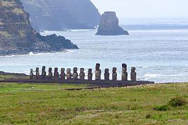 Séjour au Chili et à l'île de PâquesFR
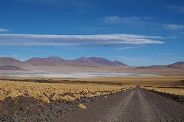 Northern Chile, Andean impressions.
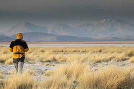 Le nord Chili de Calama à AricaFR
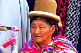 18 jours intenses pour trois pays magnifiques en Amérique du SudFR
 Un mois dans la région d'Aysén au ChiliFR
 A Bold Combo: Southern Peru, Bolivia, and Northern Chile
 Safari animalier au ChiliFR
 Trek dans la réserve de Altos de Lircay au ChiliFR