FOREWORD
In July 2018, we decided to go on a road trip to Prince Edward Island. We had four days off, so it was the perfect opportunity to set off on an adventure.
This time, I hadn’t had much time to prepare an itinerary. I’d only done a bit of research online to try and find tourist attractions that might interest us.
I should say that it wasn’t our first visit to the island, and since our stay was quite short, we decided to complete the island loop by making stops along the coast to admire the lighthouses, small fishing villages, beaches, and the stunning steep cliffs.
We also made a few stops at lookouts along the road and even went for a hike in Greenwich National Park.
Our trip was more of an escape into nature. When we travel, we feel best when we’re far from the noise and crowds.
So, I invite you to discover the fabulous landscapes of Prince Edward Island.
To get there, we had to cover nearly 1,000 km. It took us a full day, and we had to cross parts of Quebec and New Brunswick.
The roads are beautiful. However, there isn’t much to see except the vast forests lining the highways.
The Confederation Bridge, which is 12.9 kilometers long, connects New Brunswick to Prince Edward Island.
There’s no fee to enter the island when you cross this bridge. However, a toll must be paid when leaving the island.
https://www.confederationbridge.com/fr/tolls-fees
https://youtu.be/UWhn5bqLONU
Travel journals · North America
Travel journals, memorable souvenir descriptions, reports, travel reviews, etc.
Showing 31–48 of 48 discussions in English.
← Travel journals: all destinations
The context:
The urge to return to the USA, to explore a new part of the country. I don’t need much convincing to go back to Uncle Sam’s land. My wife’s on board too.
So, off we go for my 9th trip to the USA! (I didn’t take notes, so this is from memory)
Day 1: The departure: Flight with two layovers. I usually avoid layovers in the US before the final destination because of immigration. This time, my flight was Lyon/Munich, then Munich/Chicago, and finally Chicago/New Orleans. The layover in Chicago was 3 hours, and since I’d been through this airport twice before and found it super efficient both times, I wasn’t too worried when I booked my tickets—especially with Lufthansa. Unfortunately, there were several flight changes before departure, the last one leaving us with only a 2h14 layover in Chicago. I called Lufthansa to check if that would be enough, and they told me immigration in Chicago takes about an hour and 45 minutes (according to their calculations). So, I left feeling confident. A 15-minute delay leaving Lyon, then a 1-hour delay leaving Munich—now I’m starting to worry. When we arrived in Chicago, we rushed, cut in line, and made it to immigration. And then—an impossible queue. Game over, we missed our last flight. Of course, Lufthansa rebooked us for the next morning, arriving around 10 AM, and booked us a hotel. I found someone to call Alamo in New Orleans to make sure my rental car would still be there. Everything’s sorted—except our luggage, which we have no idea where it is! My little worry is that we land at 9:45 AM the next morning, and we’ve booked a tour at 11 AM at Laura Plantation, which is about an hour’s drive away! Wait and see…
The +: We're back in the USA The -: Once again, flight delays
Ah! This trip to Texas, postponed so many times because of Covid. I wanted to discover this state, but not in the summer due to the temperatures.
I’ll try to dig into my memories since I didn’t take any notes.
Day 1: Departure
Early morning flight from Lyon to Frankfurt (I often fly with Lufthansa). We only have a 50-minute layover, but I trust German organization—it’s not just talk, since it took us only 30 minutes to get to the boarding gate. Arriving in Houston, we’re excited because it’s been 3 years since we last visited the USA, and we’ve missed it.
Everything goes smoothly with the formalities and the car rental, so 1.5 hours after landing, I park near Sam Houston Park to start our discovery. The park is pretty, clean, and has the unique feature of housing some well-preserved Victorian houses. The sun is shining, and it’s always fun to see old wooden houses surrounded by gleaming skyscrapers. A quick drive to the Rothko Chapel, which is dedicated to all faiths. There are also modern artworks in an annex building and outside. Then we head to Pasadena to reach our hotel and go to bed since we’ve been awake for a while!
Hotel: A classic Days Inn. It’s standard, but the beds are comfortable, and it’s a quiet place. The + of the day: We're back in the USA The -: Nothing
Day 2: NASA and then Galveston
Of course, we wake up super early. A quick trip to the nearby Walmart for the usual small purchases. Surprise—I can’t buy a bottle of California white wine because in Texas, there are set hours for buying alcohol. Talk about a bummer for my apéro! Next, we head to Kemah, a small, hyper-touristy port where everything is kitschy but clean and nice. It’s a bit overdone, but since NASA doesn’t open until 10 AM and it’s still early, we might as well enjoy the good weather in a pleasant spot.
We arrive at the NASA Houston center without any issues. It’s smaller than the one in Florida and organized a bit differently. There are trains that take passengers to the different sites, but you need to get tickets (included in the price), and once you’ve finished visiting one site, you have to return to the center to get a ticket for another. Not very practical.
We choose to visit the training center and the rockets, skipping the control room, which, based on the photos, looks like the one at Cape Canaveral. The training center is a cool place because it’s still in use. Engineers are working on machines and computers. We don’t see any astronauts training, but we see the space chair, the shuttle’s robotic arm, and lots of gadgets—this hangar is like Gyro Gearloose’s or Doc’s domain!
Next, we head to the rocket hangar, featuring the Saturn V, the same one as at Cape Canaveral. Finally, we wrap up our tour by returning to the center, where a Boeing 747 with a shuttle attached to its back dominates the outside. We can visit the shuttle, and we don’t miss the chance.
A few exhibits inside complete the experience and satisfy our thirst for knowledge. I love the space exploration era, and gotta say, the Americans do it right. Then we drive to Galveston, about 100 km away. Why Galveston? It’s by the sea, so swimming in late October isn’t unpleasant, and there’s a neighborhood called East End Historic District filled with stunning Victorian houses, each more beautiful than the last. Plus, it’s Halloween season, so the decorations are over the top! They really go all out!
Madame takes a swim, but I find the water too cold for my taste. Apéro (they didn’t trick me twice—I had time to go back to another Walmart!) Dinner + bedtime
Hotel: A classic Quality Inn. No issues. The +: NASA, even if it’s smaller than Cape Canaveral The -: I would’ve preferred the water in the Gulf of Mexico to be a bit warmer
After two rather rainy kayaking experiences in Alaska at the end of summer in recent years, we chose a slightly drier destination for this late August 2018: the west coast of Greenland. The temperature will certainly be a bit colder, especially at this time of year, but we’re betting on a beautiful end to the season. According to temperature charts, it should be around 5 to 10°C with a few night frosts. The tundra will already have its autumn colors, and by the end of the trip, we might be lucky enough to see the northern lights when the nights get darker.
We’re setting off as a group of three in two inflatable double-seater kayaks (Gumotex) brought from France. The plan is to spend two weeks circumnavigating Arve Princess Island, located north of Ilulissat in Disko Bay, with a possible boat drop-off at the southern tip of the island.
This seems like a fairly classic route in the area—we found several descriptions online (thanks to the authors). With their help and Google Earth, we identified all potential campsites and entered their coordinates into a GPS. The western part of the island, facing the bay, seems ideal for whale watching, while the more rugged eastern side offers access to several glacial walls. We’re somewhat familiar with the area from two winter expeditions on skis and pulkas.
Plus, the commitment is limited due to the island’s proximity to several small villages, including Qeqertaq, Oqaatsut, and even Ilulissat. In fact, we saw fishing boats almost every day. The distance suits us well: 200 kilometers in 16 full days on site, which should leave some leeway in case of bad weather or for hiking.
We booked our flights in June with Air Greenland to Ilulissat for the last week of August and the first week of September. On both the outbound and return trips, we stayed overnight in Copenhagen. The France-Copenhagen flight was with Air France.
We were allowed 3 x 20 kg in the hold. Each kayak with its accessories fits into a 20 kg bag; the last hold bag is for shared gear: tent, stoves, dry bags… We only brought 1.5 kg of semolina for food. In the end, we had 61 kg of gear, and no excess baggage was charged.
Individual gear (clothes and sleeping bags…) was distributed in the cabin luggage.
For the boat transfer, we contacted an agency: Blue Jay, which gave us a number to call upon arrival.
Day 0: Wednesday, August 22 Departure day. After work, I drove from Gap to Marseille’s Marignane Airport for the first leg of the trip to Copenhagen. I enjoyed the rather mild local temperatures: 35°C in the shade. After a layover in Paris, I arrived at the Copenhagen hotel, located two train stops from the airport, where my companions were already settled. No issues—everyone was on time with their luggage.
Day 1 The flight to Greenland was at 9 AM. We had a layover in Kangerlussuaq, where we changed planes, then stopped in Aasiaat before reaching Ilulissat Airport at 3 PM under beautiful sunshine.
We called Blue Jay for the boat transfer: they could take us to the island as early as 6 PM; otherwise, we’d have to wait until the next day. That left us 3 hours to prepare our gear and, most importantly, do our shopping for the two-week trip—it seemed tight, but we gave it a shot.
A quick taxi ride took us to Pisiffik, where we easily found everything we needed: bread, butter, cheese, cold cuts, rice, pasta, jam, muesli… There was no C fuel or methylated spirits for the stoves, but this time we knew the trick: at Stark, a bit uphill from the town, we found the precious liquids. Two hours later, we filled our dry bags and containers with our purchases, and by 5:30 PM, we met Klaus, the Blue Jay manager, directly at the port.
The vacation seemed to truly begin as we sped by boat through the icebergs toward Arve Princess Island. Forty-five minutes later, we spotted a beach lined with rocks where Klaus dropped us off quickly (he had another transfer to make right after).
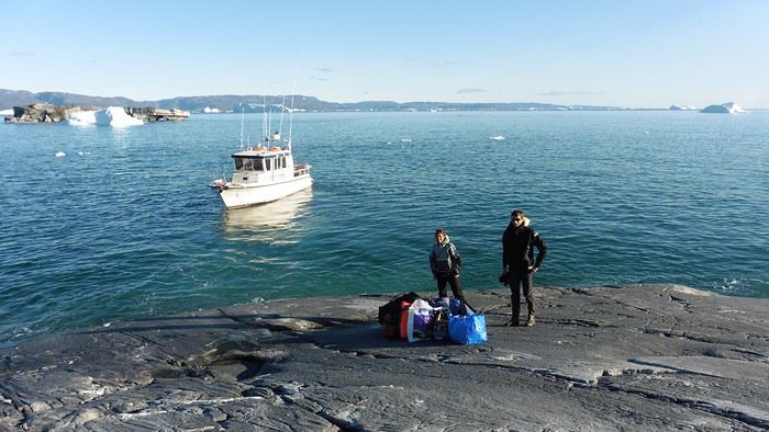
Here we were on the island, in the middle of nowhere, with all our luggage and food to organize, the tent to set up, and the kayaks to inflate—just 10 hours after leaving the Copenhagen hotel. We got to work, bothered by the flies. Despite our head nets, it was barely tolerable—there were so many of them. They swarmed by the dozens into every bag we opened. It was quite mild: 10°C.
Everything was ready by evening, and we were very happy to have completed all these transfers (planes and boat in a single day) as we slipped into our sleeping bags.
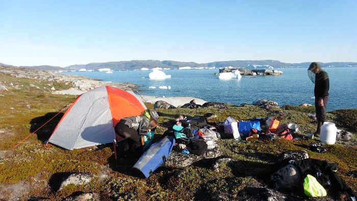
During the night, the wind picked up, and we went out several times to check the tent and kayak anchors. We noticed how bright it was—it was still quite twilight even at 1 AM.
Day 2 5:30 AM wake-up—the south wind was still strong, but since we were heading north, we decided to give it a try anyway.
This was also the moment we loaded the kayaks: since there were only three of us for two double-seater kayaks, we filled the hatch of one kayak, which allowed us to fit all our food. It would have been very difficult if there had been four of us for two kayaks.
Finally, we set off north along the western coast of the island. The conditions were far from ideal—the sea was rough, and the kayaks had a lot of wind resistance. But the main problem was the spray skirt: the gear on deck weighed it down, and the skirt kept coming off… We’d have to deal with it. Barely underway, and whales were already breaking the surface—it was our first time seeing them, and we were very impressed. Too bad the wind didn’t allow for longer contemplation; stopping paddling was impossible with such strong gusts.
We passed a few headlands and even considered stopping due to the conditions. To find some semblance of shelter, we had to hug the coast closely without cutting across the numerous bays, which significantly lengthened the journey. But as the morning went on, the wind died down, and the sea calmed. We spotted several whales and our first seals. It was almost pleasant during the picnic break. By late afternoon, we reached Kangerup Sarqâ Bay, where we had identified a great campsite with a very large beach and a river. But the wind had shifted—it was now coming from the north, making the last hour difficult due to fatigue and headwinds.
The campsite was ideal and beautiful, facing numerous icebergs grounded in the bay.
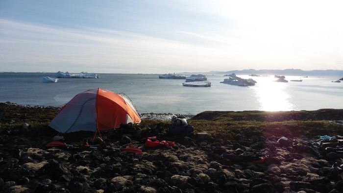
The GPS alerted us to another major drawback of inflatable kayaks: their slowness. It took us 7.5 hours of actual paddling (excluding breaks) to cover 28 km, averaging 3.7 km/h—somewhat disappointing. But we knew this before leaving, and once again, we’d have to make do!
Day 3 Surprise: at 6 AM wake-up, it was raining, foggy, with a south wind, and the sea was choppy even in the bay. It seemed wise to skip paddling, even though stopping on the second day was tough on morale. We went back to sleep, especially since the travel fatigue and the harsh conditions of the previous day had taken their toll.
At 11 AM, the navigation conditions weren’t any better—at the ends of the bay, we saw huge waves crashing onto the rocks, and giving up for the day became obvious. However, the rain had stopped, so we set off for a hike along the large lake bordering the bay. The wind hadn’t let up, and it was quite cold.
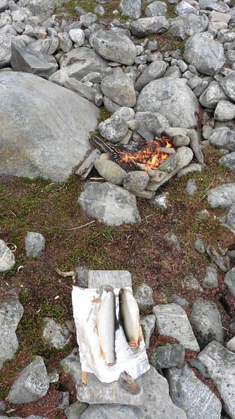
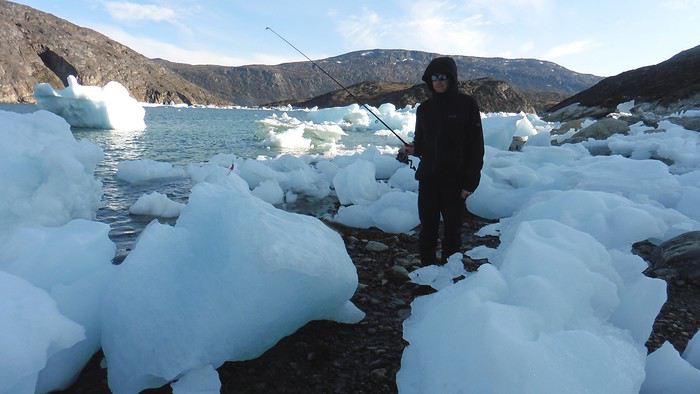
The tundra was starting to take on its autumn colors, and the contrast between the white lichens and the red vegetation was stunning. At the lake, we took out the fishing rods and quickly caught two beautiful Arctic char over 50 cm long.
As the afternoon wore on, the sun seemed closer. Along the beach, we gathered driftwood (mostly old planks) to cook our catch in foil over a fire. Eating our own food in such a beautiful place next to a good fire was comforting after the day’s setback.
In the middle of the night, an Arctic fox entered the tent’s rear awning. It seemed barely intimidated when we shooed it away with loud shouts and then with stones.
Day 4 6:15 AM wake-up—3°C. We were on the water by 8 AM. The wind had dropped significantly, but the sea was shrouded in fog, and it was very cold in these damp conditions.
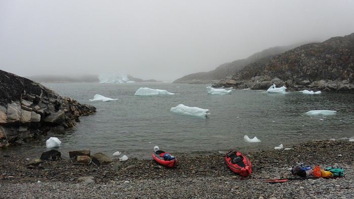
We passed the bay’s headland, Kangea, and headed toward the abandoned village of Agpat. The atmosphere was very austere—we hugged black rocks in fog that limited visibility to 50 meters, revealing large icebergs as we went.
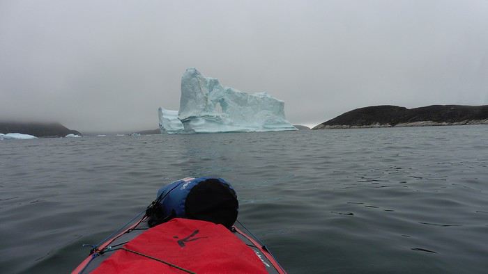
Suddenly, the water’s surface stirred in front of my kayak, and a huge gray back emerged from the sea. The collision was inevitable, but the whale seemed to understand and dove immediately, passing under the kayak and resurfacing a few meters away. I felt the kayak rock in the white foam and quickly paddled to escape the turbulence. What an emotion!
A light wind began to clear the fog, and the sun made beautiful appearances. Despite the cold, we stopped to visit the abandoned village, which left a strange impression. All the houses were still in good condition and wide open—some must have been very spacious in their time. We went back to sea, and in front of the large Kaangerdluk Bay, we hesitated—the headwind was strong, and large waves split the water. The next beach, from the island of Nua where we stopped to think, was over 8 km away. It was barely 2 PM, but caution led us to stop here for the day. We had covered 12 km—exactly the distance needed to stay on schedule. The afternoon was spent hiking on the island’s hills and gathering mussels and wood.
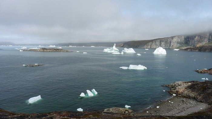
In the evening, we cooked these large Greenlandic mussels over a wood fire and savored them under the beautiful evening light. The weather was now fine, but the thermometer read -5°C in the sun…
Day 5 Bright sunshine, a glassy sea, and -8°C at 6 AM. Everything was green for setting off, even if putting on damp kayaking gear was a bit unpleasant in the cold. It was the first time we’d paddled on a flat sea since the start of the trip, and our average speed increased slightly.
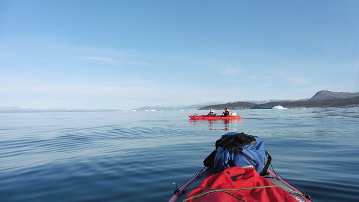
We entered the Smallesund Strait, marking the end of the island’s west coast. We were close to the large Torssukatak Fjord, where two glaciers flow. The access pass to the fjord was very narrow, and numerous ice chunks blocked access to the beaches. The wind had picked up and was now hitting us head-on (again). Just before entering the fjord, we landed on a steep beach made of large pebbles on Oqaitsut Island. It was very cold with the wind, and moving forward became difficult. We decided to stop for the day both because of the conditions and because the next campsite was far away, given how rugged the fjord was.
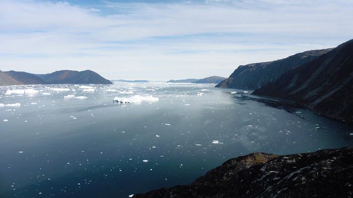
We eventually found a flat spot for the tent despite the steep slope. Even with the wind, the weather was beautiful, and we set off on foot for the northeastern cape of the island, overlooking the fjord. The view was far-reaching and exceptional—up close, the large fjord filled with ice and its steep granite cliffs, and in the distance, the ice cap and glacial walls.
We spotted the village of Qeqertaq, whose network we could pick up, allowing us to check the weather forecast, which was rather good. While securing the kayaks in the evening, I noticed the strange behavior of one kayak at the end of the stage was due to the loss of the skeg—impossible to know where it detached. We’d have to do without it.
Day 6 Still that icy headwind from the northeast. We set off anyway for a long stage to reach the large pass connecting the Torssukatak and Ata Fjords.
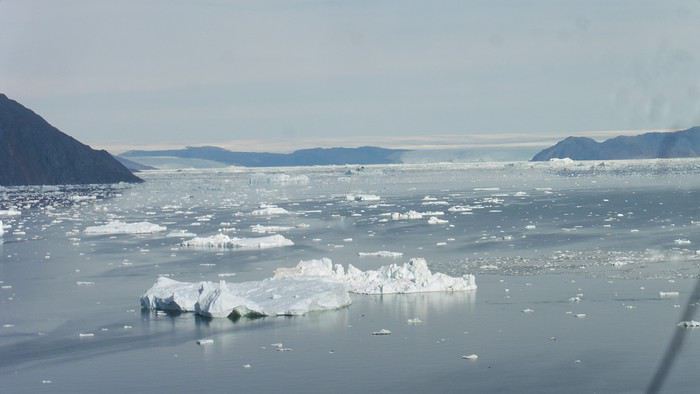
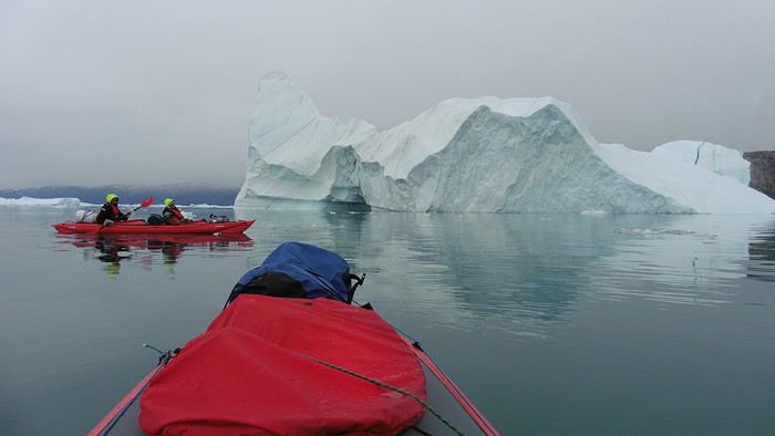
We advanced laboriously along the high cliffs of the fjord’s southern shore. They faced due north and blocked the sun. We felt the cold and dampness of the rock. It was really cold, especially in the extremities. We picnicked on the western cape of Qeqertakavasak Island. The cold didn’t allow us to stop for more than 20 minutes… But the wind dropped, and the sea was now very smooth. It was heavily cluttered with ice between the icebergs and old pack ice. The goal was to reach the large rocky promontory of Anapnuna, wedged between the Kujatdleq and Kangilerngata Glaciers, but the ice made progress difficult. We stopped to gain height on a small island and spot a passage of open water, but all we saw was white—passing seemed impossible. The currents were very complex, and entire sections of ice were being swept in one direction and then another at an impressive speed.
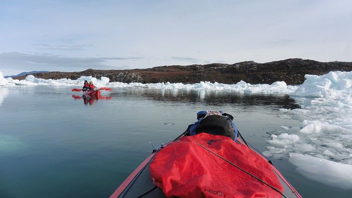
We wandered through this labyrinth until landing on a beach on the small island of Takissut, where we set up camp, exhausted from the 30 km covered and the vigilance required by the abundance of ice. The place was sublime under the evening sun—we were surrounded by ice and mountains, with the Kangilerngata Glacier in the distance. The summer contrasts were striking between the water, icebergs, sky, and flaming tundra—all colors were represented. Absolute calm reigned.
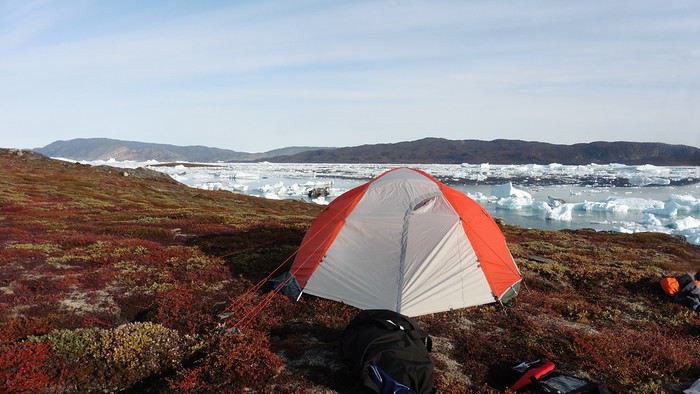
The lack of drinking water at this spot wasn’t too much of a constraint: as soon as we arrived on the beach, we placed containers under the icebergs stranded in the intertidal zone. They were all full by the time we finished setting up.
Day 7 We had to change our plans: we wouldn’t reach the rocky promontory, too well protected by the ice. We set off under the sun for Igdluluarssuit Island. Although we had spotted a passage just before launching, we quickly found ourselves surrounded by ice. It was everywhere, and finding water to paddle became complicated. We tried to force our way in every direction, even retracing our steps. Everything moved at an impressive speed—we were in the middle of a whirlpool of ice.
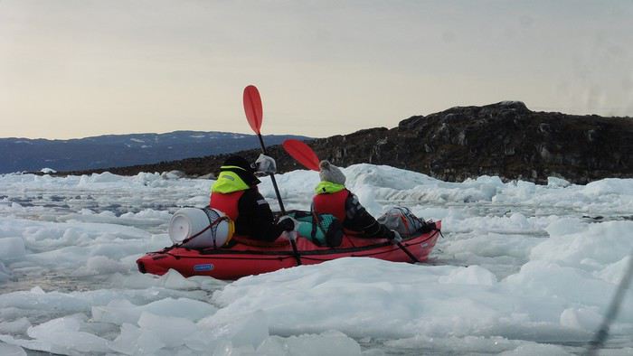
The tension rose, and each boat had its share of big scares. I was trapped against ice floes that dragged me toward an iceberg—the pressure on the kayak was enormous; it was going to capsize or puncture! But with a few strong strokes and paddling against the ice, I managed to free myself from the trap. Barely 10 minutes later, my companions were sandwiched perpendicularly between two icebergs that were closing in. The situation was desperate—the kayak was bending and twisting more and more, but with some strong paddle strokes, it finally freed itself. After these particularly unpleasant moments, we were completely blocked. The drifting ice floes had tightened, and the kayaks were no longer even in the water… The only solution: wait with the kayaks on these floes, which were too thin to walk on (even though we didn’t try). Within minutes, the situation cleared—a waterway opened, and we rushed into it. We paddled with one goal: find a larger pool of water. After going back and forth, our path took shape—we had to force the passage several times, attacking the ice directly with the kayaks, and finally, we escaped the worst of the labyrinth. We reached land on the west side of the island and saw that the rest would be easier. To reach the island, we just had to cross the Arsiviup Ikera Strait, which was lightly cluttered. We reached the eastern cape of the island, ideal for camping, even though we had only paddled for 3 hours. We set up camp and hiked to the island’s summit, which overlooks the entire pass and the glaciers.
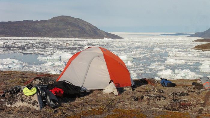
Everything was magnificent, no matter the direction. At 2 PM, we were at the summit—the beauty of the place and the picnic facing the glacier in the sun without wind made us forget the near-disaster from a few hours earlier. It would be impossible to approach the glacier by kayak, but from our summit on foot, it seemed so close, and contemplating it safely on solid ground was a great moment.
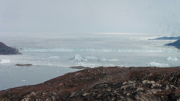
The pass was incredibly complex—everything was in motion, and an impassable passage could become open water within minutes. We were delighted when we returned to camp. A slightly lost whale among the ice accompanied us along the shore. The place was truly beautiful, but the temperature dropped again under the clear sky, preventing us from eating outside.
Day 8 Clear and cold at wake-up: -9°C. The sea had frozen in many places. We hesitated about the rest of the trip—should we start heading back to Ilulissat or linger in the pass, especially to approach the Eqi Glacier? After the incidents of the previous day, we decided to think carefully and paddled to the southern cape of our island to check the ice conditions toward Eqi. The weather had clouded over in the meantime, and the sky was quite gray. At the cape, we spotted the glacier’s wall, still 15 km away.
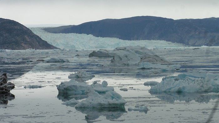
The fjord was quite cluttered, but it seemed passable. However, there was no guarantee the view would be much better 1 km from the glacier than 15 km away, especially since the front was quite active and therefore dangerous. We decided to head south without passing by the glacier. The cold temperatures encountered in the pass also motivated us to move away from the glaciers and the ice cap. We navigated under a threatening sky but without wind. The kayaks cut through the thin layer of ice on the surface with a crinkling paper sound. We reached the Ata campsite in the late afternoon after 5 hours of rowing without a single break…
The wind had picked up, and we discovered a nice surprise: a refuge with a table and a comfortable bench lined with mattresses. Facing the worsening weather, we settled in comfortably. The kerosene stove was too complex for our three brains—we couldn’t get it started, too bad, as it was 0°C inside. The rest of the afternoon was spent fishing in the large lake, where we landed a beautiful Arctic char, more than enough for three. A good night’s sleep without the risk of foxes or the sound of a tent shaking in the wind.
Day 9 6 AM wake-up to the sound of rain hitting the cabin. The decision was made looking out the window—wind, rain, and fog obscured the sea: we went back to sleep.
New wake-up, and the rain had stopped—we could go out and stock up on fish. We set off on foot toward the lake, following its western shore. It was very overcast, and the wind encouraged us to keep moving. We made our way to a smaller lake at the end of the large one, where we caught a huge Arctic char. A small clearing brightened the picnic, and we headed back to our cabin.
This 20 km hike kept us busy all day: walking on slippery scree and the micro-relief of the peat bogs took time.
Day 10 The sky was clear, but a light south wind made paddling intense. We set off southeast to reach the opposite shore of the fjord. It was very cold, and it was impossible to stop paddling for even a moment without immediately losing ground due to the wind. We crossed the Kangerluarsuk Fjord. I recognized the cape I had reached on skis in the winter of 2017. We found a nice campsite on the southern shore of the fjord: Uiartag. It wasn’t even noon, but facing this headwind, we preferred to stop here rather than exhaust ourselves for a few extra kilometers. Like the previous ones, this campsite was very comfortable: the ground was covered with a thick layer of lichens and mosses, very pleasant to lie on.
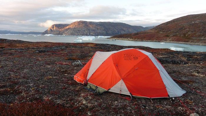
We set off on a hike to the heights of the cape, where the weather alternated between large clearings and snow showers. We noticed the loss of the thermometer, poorly attached to the backpack. On the way back, in the small bay of our beach, a whale swam calmly 10 meters from the shore—a beautiful surprise.
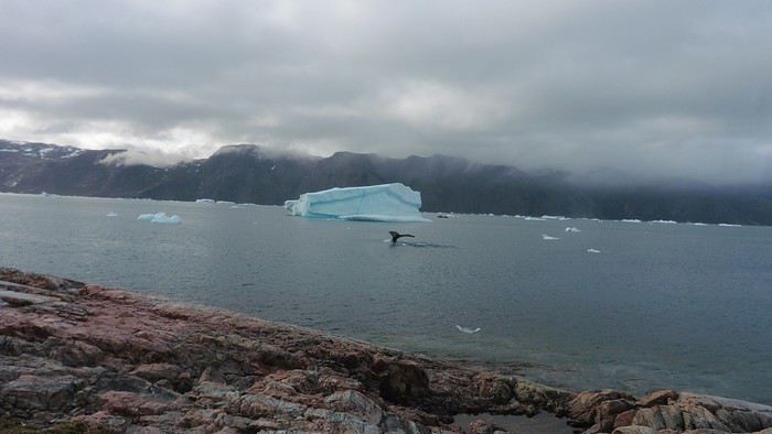
The sky cleared completely, and the temperature dropped as night approached.
We’re setting off as a group of three in two inflatable double-seater kayaks (Gumotex) brought from France. The plan is to spend two weeks circumnavigating Arve Princess Island, located north of Ilulissat in Disko Bay, with a possible boat drop-off at the southern tip of the island.
This seems like a fairly classic route in the area—we found several descriptions online (thanks to the authors). With their help and Google Earth, we identified all potential campsites and entered their coordinates into a GPS. The western part of the island, facing the bay, seems ideal for whale watching, while the more rugged eastern side offers access to several glacial walls. We’re somewhat familiar with the area from two winter expeditions on skis and pulkas.
Plus, the commitment is limited due to the island’s proximity to several small villages, including Qeqertaq, Oqaatsut, and even Ilulissat. In fact, we saw fishing boats almost every day. The distance suits us well: 200 kilometers in 16 full days on site, which should leave some leeway in case of bad weather or for hiking.
We booked our flights in June with Air Greenland to Ilulissat for the last week of August and the first week of September. On both the outbound and return trips, we stayed overnight in Copenhagen. The France-Copenhagen flight was with Air France.
We were allowed 3 x 20 kg in the hold. Each kayak with its accessories fits into a 20 kg bag; the last hold bag is for shared gear: tent, stoves, dry bags… We only brought 1.5 kg of semolina for food. In the end, we had 61 kg of gear, and no excess baggage was charged.
Individual gear (clothes and sleeping bags…) was distributed in the cabin luggage.
For the boat transfer, we contacted an agency: Blue Jay, which gave us a number to call upon arrival.
Day 0: Wednesday, August 22 Departure day. After work, I drove from Gap to Marseille’s Marignane Airport for the first leg of the trip to Copenhagen. I enjoyed the rather mild local temperatures: 35°C in the shade. After a layover in Paris, I arrived at the Copenhagen hotel, located two train stops from the airport, where my companions were already settled. No issues—everyone was on time with their luggage.
Day 1 The flight to Greenland was at 9 AM. We had a layover in Kangerlussuaq, where we changed planes, then stopped in Aasiaat before reaching Ilulissat Airport at 3 PM under beautiful sunshine.
We called Blue Jay for the boat transfer: they could take us to the island as early as 6 PM; otherwise, we’d have to wait until the next day. That left us 3 hours to prepare our gear and, most importantly, do our shopping for the two-week trip—it seemed tight, but we gave it a shot.
A quick taxi ride took us to Pisiffik, where we easily found everything we needed: bread, butter, cheese, cold cuts, rice, pasta, jam, muesli… There was no C fuel or methylated spirits for the stoves, but this time we knew the trick: at Stark, a bit uphill from the town, we found the precious liquids. Two hours later, we filled our dry bags and containers with our purchases, and by 5:30 PM, we met Klaus, the Blue Jay manager, directly at the port.
The vacation seemed to truly begin as we sped by boat through the icebergs toward Arve Princess Island. Forty-five minutes later, we spotted a beach lined with rocks where Klaus dropped us off quickly (he had another transfer to make right after).

Here we were on the island, in the middle of nowhere, with all our luggage and food to organize, the tent to set up, and the kayaks to inflate—just 10 hours after leaving the Copenhagen hotel. We got to work, bothered by the flies. Despite our head nets, it was barely tolerable—there were so many of them. They swarmed by the dozens into every bag we opened. It was quite mild: 10°C.
Everything was ready by evening, and we were very happy to have completed all these transfers (planes and boat in a single day) as we slipped into our sleeping bags.

During the night, the wind picked up, and we went out several times to check the tent and kayak anchors. We noticed how bright it was—it was still quite twilight even at 1 AM.
Day 2 5:30 AM wake-up—the south wind was still strong, but since we were heading north, we decided to give it a try anyway.
This was also the moment we loaded the kayaks: since there were only three of us for two double-seater kayaks, we filled the hatch of one kayak, which allowed us to fit all our food. It would have been very difficult if there had been four of us for two kayaks.
Finally, we set off north along the western coast of the island. The conditions were far from ideal—the sea was rough, and the kayaks had a lot of wind resistance. But the main problem was the spray skirt: the gear on deck weighed it down, and the skirt kept coming off… We’d have to deal with it. Barely underway, and whales were already breaking the surface—it was our first time seeing them, and we were very impressed. Too bad the wind didn’t allow for longer contemplation; stopping paddling was impossible with such strong gusts.
We passed a few headlands and even considered stopping due to the conditions. To find some semblance of shelter, we had to hug the coast closely without cutting across the numerous bays, which significantly lengthened the journey. But as the morning went on, the wind died down, and the sea calmed. We spotted several whales and our first seals. It was almost pleasant during the picnic break. By late afternoon, we reached Kangerup Sarqâ Bay, where we had identified a great campsite with a very large beach and a river. But the wind had shifted—it was now coming from the north, making the last hour difficult due to fatigue and headwinds.
The campsite was ideal and beautiful, facing numerous icebergs grounded in the bay.

The GPS alerted us to another major drawback of inflatable kayaks: their slowness. It took us 7.5 hours of actual paddling (excluding breaks) to cover 28 km, averaging 3.7 km/h—somewhat disappointing. But we knew this before leaving, and once again, we’d have to make do!
Day 3 Surprise: at 6 AM wake-up, it was raining, foggy, with a south wind, and the sea was choppy even in the bay. It seemed wise to skip paddling, even though stopping on the second day was tough on morale. We went back to sleep, especially since the travel fatigue and the harsh conditions of the previous day had taken their toll.
At 11 AM, the navigation conditions weren’t any better—at the ends of the bay, we saw huge waves crashing onto the rocks, and giving up for the day became obvious. However, the rain had stopped, so we set off for a hike along the large lake bordering the bay. The wind hadn’t let up, and it was quite cold.
The tundra was starting to take on its autumn colors, and the contrast between the white lichens and the red vegetation was stunning. At the lake, we took out the fishing rods and quickly caught two beautiful Arctic char over 50 cm long.
As the afternoon wore on, the sun seemed closer. Along the beach, we gathered driftwood (mostly old planks) to cook our catch in foil over a fire. Eating our own food in such a beautiful place next to a good fire was comforting after the day’s setback.

In the middle of the night, an Arctic fox entered the tent’s rear awning. It seemed barely intimidated when we shooed it away with loud shouts and then with stones.
Day 4 6:15 AM wake-up—3°C. We were on the water by 8 AM. The wind had dropped significantly, but the sea was shrouded in fog, and it was very cold in these damp conditions.

We passed the bay’s headland, Kangea, and headed toward the abandoned village of Agpat. The atmosphere was very austere—we hugged black rocks in fog that limited visibility to 50 meters, revealing large icebergs as we went.

Suddenly, the water’s surface stirred in front of my kayak, and a huge gray back emerged from the sea. The collision was inevitable, but the whale seemed to understand and dove immediately, passing under the kayak and resurfacing a few meters away. I felt the kayak rock in the white foam and quickly paddled to escape the turbulence. What an emotion!
A light wind began to clear the fog, and the sun made beautiful appearances. Despite the cold, we stopped to visit the abandoned village, which left a strange impression. All the houses were still in good condition and wide open—some must have been very spacious in their time. We went back to sea, and in front of the large Kaangerdluk Bay, we hesitated—the headwind was strong, and large waves split the water. The next beach, from the island of Nua where we stopped to think, was over 8 km away. It was barely 2 PM, but caution led us to stop here for the day. We had covered 12 km—exactly the distance needed to stay on schedule. The afternoon was spent hiking on the island’s hills and gathering mussels and wood.

In the evening, we cooked these large Greenlandic mussels over a wood fire and savored them under the beautiful evening light. The weather was now fine, but the thermometer read -5°C in the sun…
Day 5 Bright sunshine, a glassy sea, and -8°C at 6 AM. Everything was green for setting off, even if putting on damp kayaking gear was a bit unpleasant in the cold. It was the first time we’d paddled on a flat sea since the start of the trip, and our average speed increased slightly.

We entered the Smallesund Strait, marking the end of the island’s west coast. We were close to the large Torssukatak Fjord, where two glaciers flow. The access pass to the fjord was very narrow, and numerous ice chunks blocked access to the beaches. The wind had picked up and was now hitting us head-on (again). Just before entering the fjord, we landed on a steep beach made of large pebbles on Oqaitsut Island. It was very cold with the wind, and moving forward became difficult. We decided to stop for the day both because of the conditions and because the next campsite was far away, given how rugged the fjord was.

We eventually found a flat spot for the tent despite the steep slope. Even with the wind, the weather was beautiful, and we set off on foot for the northeastern cape of the island, overlooking the fjord. The view was far-reaching and exceptional—up close, the large fjord filled with ice and its steep granite cliffs, and in the distance, the ice cap and glacial walls.

We spotted the village of Qeqertaq, whose network we could pick up, allowing us to check the weather forecast, which was rather good. While securing the kayaks in the evening, I noticed the strange behavior of one kayak at the end of the stage was due to the loss of the skeg—impossible to know where it detached. We’d have to do without it.
Day 6 Still that icy headwind from the northeast. We set off anyway for a long stage to reach the large pass connecting the Torssukatak and Ata Fjords.

We advanced laboriously along the high cliffs of the fjord’s southern shore. They faced due north and blocked the sun. We felt the cold and dampness of the rock. It was really cold, especially in the extremities. We picnicked on the western cape of Qeqertakavasak Island. The cold didn’t allow us to stop for more than 20 minutes… But the wind dropped, and the sea was now very smooth. It was heavily cluttered with ice between the icebergs and old pack ice. The goal was to reach the large rocky promontory of Anapnuna, wedged between the Kujatdleq and Kangilerngata Glaciers, but the ice made progress difficult. We stopped to gain height on a small island and spot a passage of open water, but all we saw was white—passing seemed impossible. The currents were very complex, and entire sections of ice were being swept in one direction and then another at an impressive speed.

We wandered through this labyrinth until landing on a beach on the small island of Takissut, where we set up camp, exhausted from the 30 km covered and the vigilance required by the abundance of ice. The place was sublime under the evening sun—we were surrounded by ice and mountains, with the Kangilerngata Glacier in the distance. The summer contrasts were striking between the water, icebergs, sky, and flaming tundra—all colors were represented. Absolute calm reigned.

The lack of drinking water at this spot wasn’t too much of a constraint: as soon as we arrived on the beach, we placed containers under the icebergs stranded in the intertidal zone. They were all full by the time we finished setting up.
Day 7 We had to change our plans: we wouldn’t reach the rocky promontory, too well protected by the ice. We set off under the sun for Igdluluarssuit Island. Although we had spotted a passage just before launching, we quickly found ourselves surrounded by ice. It was everywhere, and finding water to paddle became complicated. We tried to force our way in every direction, even retracing our steps. Everything moved at an impressive speed—we were in the middle of a whirlpool of ice.

The tension rose, and each boat had its share of big scares. I was trapped against ice floes that dragged me toward an iceberg—the pressure on the kayak was enormous; it was going to capsize or puncture! But with a few strong strokes and paddling against the ice, I managed to free myself from the trap. Barely 10 minutes later, my companions were sandwiched perpendicularly between two icebergs that were closing in. The situation was desperate—the kayak was bending and twisting more and more, but with some strong paddle strokes, it finally freed itself. After these particularly unpleasant moments, we were completely blocked. The drifting ice floes had tightened, and the kayaks were no longer even in the water… The only solution: wait with the kayaks on these floes, which were too thin to walk on (even though we didn’t try). Within minutes, the situation cleared—a waterway opened, and we rushed into it. We paddled with one goal: find a larger pool of water. After going back and forth, our path took shape—we had to force the passage several times, attacking the ice directly with the kayaks, and finally, we escaped the worst of the labyrinth. We reached land on the west side of the island and saw that the rest would be easier. To reach the island, we just had to cross the Arsiviup Ikera Strait, which was lightly cluttered. We reached the eastern cape of the island, ideal for camping, even though we had only paddled for 3 hours. We set up camp and hiked to the island’s summit, which overlooks the entire pass and the glaciers.

Everything was magnificent, no matter the direction. At 2 PM, we were at the summit—the beauty of the place and the picnic facing the glacier in the sun without wind made us forget the near-disaster from a few hours earlier. It would be impossible to approach the glacier by kayak, but from our summit on foot, it seemed so close, and contemplating it safely on solid ground was a great moment.

The pass was incredibly complex—everything was in motion, and an impassable passage could become open water within minutes. We were delighted when we returned to camp. A slightly lost whale among the ice accompanied us along the shore. The place was truly beautiful, but the temperature dropped again under the clear sky, preventing us from eating outside.
Day 8 Clear and cold at wake-up: -9°C. The sea had frozen in many places. We hesitated about the rest of the trip—should we start heading back to Ilulissat or linger in the pass, especially to approach the Eqi Glacier? After the incidents of the previous day, we decided to think carefully and paddled to the southern cape of our island to check the ice conditions toward Eqi. The weather had clouded over in the meantime, and the sky was quite gray. At the cape, we spotted the glacier’s wall, still 15 km away.

The fjord was quite cluttered, but it seemed passable. However, there was no guarantee the view would be much better 1 km from the glacier than 15 km away, especially since the front was quite active and therefore dangerous. We decided to head south without passing by the glacier. The cold temperatures encountered in the pass also motivated us to move away from the glaciers and the ice cap. We navigated under a threatening sky but without wind. The kayaks cut through the thin layer of ice on the surface with a crinkling paper sound. We reached the Ata campsite in the late afternoon after 5 hours of rowing without a single break…

The wind had picked up, and we discovered a nice surprise: a refuge with a table and a comfortable bench lined with mattresses. Facing the worsening weather, we settled in comfortably. The kerosene stove was too complex for our three brains—we couldn’t get it started, too bad, as it was 0°C inside. The rest of the afternoon was spent fishing in the large lake, where we landed a beautiful Arctic char, more than enough for three. A good night’s sleep without the risk of foxes or the sound of a tent shaking in the wind.
Day 9 6 AM wake-up to the sound of rain hitting the cabin. The decision was made looking out the window—wind, rain, and fog obscured the sea: we went back to sleep.
New wake-up, and the rain had stopped—we could go out and stock up on fish. We set off on foot toward the lake, following its western shore. It was very overcast, and the wind encouraged us to keep moving. We made our way to a smaller lake at the end of the large one, where we caught a huge Arctic char. A small clearing brightened the picnic, and we headed back to our cabin.
This 20 km hike kept us busy all day: walking on slippery scree and the micro-relief of the peat bogs took time.
Day 10 The sky was clear, but a light south wind made paddling intense. We set off southeast to reach the opposite shore of the fjord. It was very cold, and it was impossible to stop paddling for even a moment without immediately losing ground due to the wind. We crossed the Kangerluarsuk Fjord. I recognized the cape I had reached on skis in the winter of 2017. We found a nice campsite on the southern shore of the fjord: Uiartag. It wasn’t even noon, but facing this headwind, we preferred to stop here rather than exhaust ourselves for a few extra kilometers. Like the previous ones, this campsite was very comfortable: the ground was covered with a thick layer of lichens and mosses, very pleasant to lie on.

We set off on a hike to the heights of the cape, where the weather alternated between large clearings and snow showers. We noticed the loss of the thermometer, poorly attached to the backpack. On the way back, in the small bay of our beach, a whale swam calmly 10 meters from the shore—a beautiful surprise.

The sky cleared completely, and the temperature dropped as night approached.

This year, we hadn’t planned on going to the United States. After two trips in 2012 and 2014, we needed to refill the piggy bank...
But we didn’t count on luck: one late September afternoon in 2014, while randomly browsing the web, I stumbled upon flight tickets for $753 per person for July 2015! After some calculations and hesitation, we decided to shorten the trip compared to the previous year (22 days this time), cut down on hotel costs (80 € per night on average), and skip expensive activities (no helicopter rides, rafting, or guided tours with outfitters, etc.), but we couldn’t pass up such a great opportunity!
Here’s the budget breakdown: - Flight tickets: 3,012 € for 4 (booked directly on AA’s website). One layover on the way out (CDG / Charlotte / Phoenix) and one on the way back (LAX / London / CDG). - Hotels: 1,685 € for 22 nights, averaging 76.60 € per night. We stuck to our budget (and even did better!), thanks to affordable hotels in NM, bookings made when the exchange rate was still favorable, and 2 free nights used on Hotels.com. - Car: 952 € for 22 days renting a standard SUV (Jeep Grand Cherokee). We went through AutoEurope, and the rental company was Dollar. - Gas: Around $20 per day on average (for 5,440 km). - Food: Just under $70 per day on average (for 4 people). We did a lot of grocery shopping for picnics, ate a lot of fast food, and only went to restaurants a few times. - America the Beautiful Pass: Free (the one we bought in July 2014 was still valid until the end of July 2015). - Not covered by the pass: $175 (entry fees for State Parks, a guided tour at Mesa Verde, Pow Wow entry, etc.).
In total, we spent 7,760 € for 4 people over 22 days. On top of that, we added $50 for the NYNY roller coaster (a gift for Hugo) and $135 for the *Mystère* show (a gift for Calista and me).
Here’s the itinerary: - Lost Dutchman SP, Goldfield Ghost Town, and Apache Trail - Chiricahua NM - White Sands NM - White Sands NM, Valley of Fires SP, and Old Town Albuquerque - Taos Pueblo, Pow Wow, and Chimayo - Bandelier NM and Santa Fe - Kasha Katuwe Tent Rocks NM - Shiprock and Mesa Verde NP - Bluff, Gooseneck SP, Road Canyon, and UT95 - Little Wild Horse Canyon and Goblin Valley SP - Capitol Reef NP (Cohab Canyon and Sulphur Creek) - Burr Trail - Zebra Slot Canyon and Lower Calf Creek Falls - Mossy Cave and Cedar Breaks NM - Kanarra Creek and Zion NP (Kolob Canyons) - Coyote Buttes South (Paw Hole) - Zion NP (Progeny Peak) - Snow Canyon SP - Lake Mead and Las Vegas - Las Vegas - Las Vegas - Los Angeles and the trip back
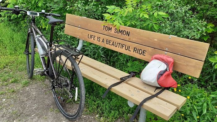
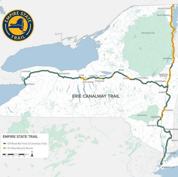
From Buffalo to New York City, the Empire State Trail is a 900 km route specifically designed for biking, with 75% on dedicated bike paths.

A special train with bike spaces runs almost the entire route. First along the Erie Canal to Albany, then through the Hudson Valley all the way to the tip of Manhattan. This lets you skip sections and also return to your starting point without having to take a flight. Just be aware that bike spaces need to be reserved and can fill up during peak times. In June, no problem though.
This aspect really appealed to me, since my last trip had kinda put me off biking in the US. But here, 75% on dedicated paths, plus that legendary finish in NYC with your bike—I couldn’t resist celebrating my 70th birthday this way.
https://empiretrail.ny.gov/map
Two branches to reach NYC: from Buffalo (mostly on dedicated paths) or from Montreal (mostly on roads)
The route was developed in just three years. While it’s popular with cyclists on certain stretches near cities, those who bike the whole thing are still pretty rare.
It’s true that the scenery isn’t exactly breathtaking, and some sections—especially along the Erie Canal—can feel a bit tedious, though they’re very easy since there’s no elevation.
The trail starts in Buffalo, but since my bus from Toronto goes straight to Niagara, I’ll be starting at the falls instead. Plus, that’s where the direct train to NYC departs from (and arrives at).

A special train with bike spaces runs almost the entire route. First along the Erie Canal to Albany, then through the Hudson Valley all the way to the tip of Manhattan. This lets you skip sections and also return to your starting point without having to take a flight. Just be aware that bike spaces need to be reserved and can fill up during peak times. In June, no problem though.
This aspect really appealed to me, since my last trip had kinda put me off biking in the US. But here, 75% on dedicated paths, plus that legendary finish in NYC with your bike—I couldn’t resist celebrating my 70th birthday this way.
https://empiretrail.ny.gov/map
Two branches to reach NYC: from Buffalo (mostly on dedicated paths) or from Montreal (mostly on roads)
The route was developed in just three years. While it’s popular with cyclists on certain stretches near cities, those who bike the whole thing are still pretty rare.
It’s true that the scenery isn’t exactly breathtaking, and some sections—especially along the Erie Canal—can feel a bit tedious, though they’re very easy since there’s no elevation.The trail starts in Buffalo, but since my bus from Toronto goes straight to Niagara, I’ll be starting at the falls instead. Plus, that’s where the direct train to NYC departs from (and arrives at).
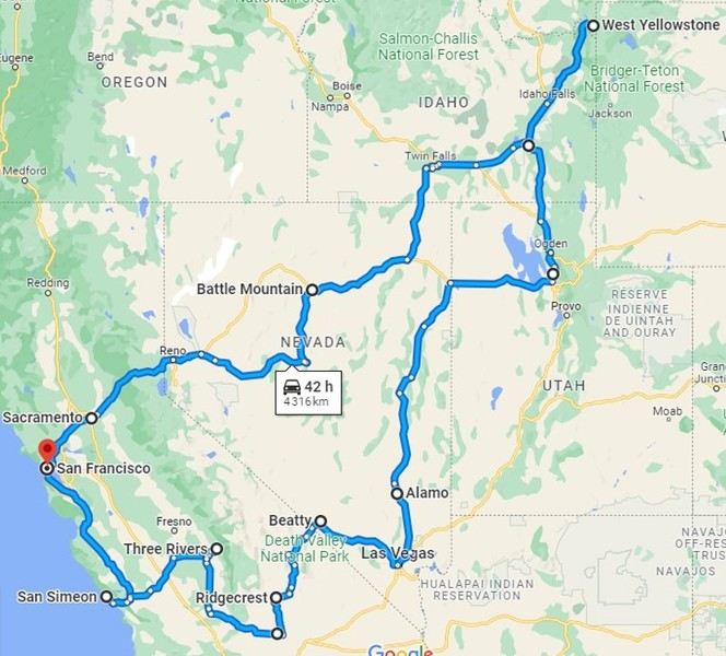
After our first trip discovering the American West with our teens, Cécile asked me to go back for a romantic getaway to this wonderful destination. Whatever my wife wants, so here we are on a plane in September 2022, heading to San Francisco. Since we’d already visited the main parks two years earlier, this time we took the scenic route:

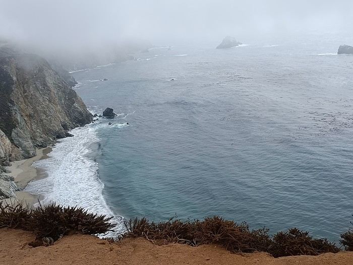
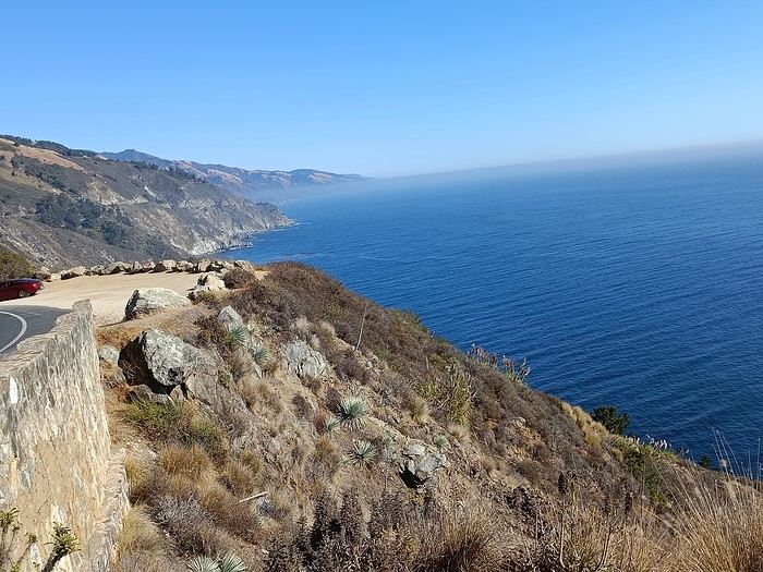
We arrived late in the evening, spent a short night at the hotel, and picked up our rental car to hit Highway 1 and the Pacific coast. The sky was gray, foggy, and a bit disappointing for now.

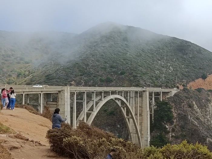
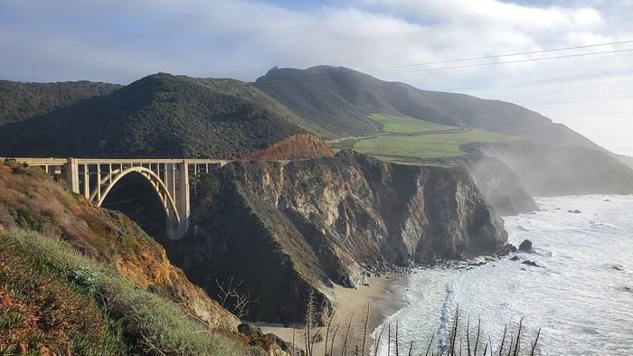
As Brittany lovers, we know coastal weather can change quickly... but no! Bixby Bridge was just a quick view from the car, and it was only 11°C outside.

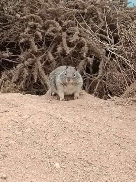
We had a quick picnic on the spot, quickly bothered by the local wildlife.

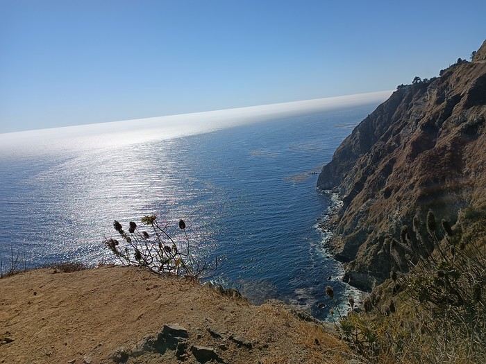
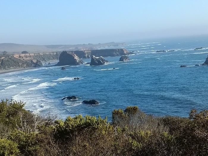
And then—miracle! This charming animal made the wind shift and brought us sunshine. So this coast is absolutely worth the trip—it’s just stunning.

Only the sound of the wind and the seals’ calls disturbed the tranquility of the moment.


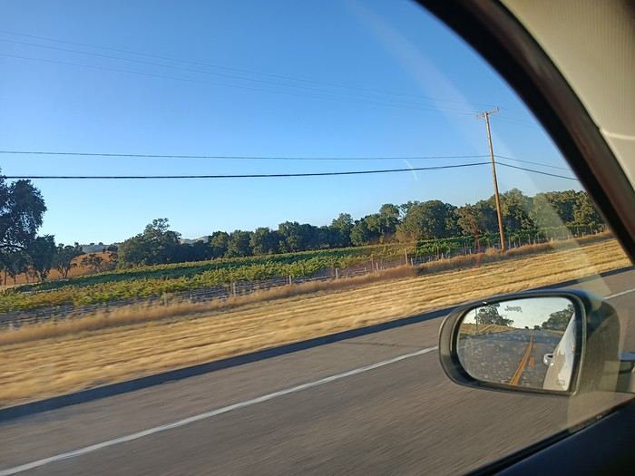
But even the best things come to an end, and we turned inland toward the sequoias. We drove through a long plain with fruit trees, vineyards, and endless straight roads.


First night at the hotel, tired but happy! !
After five trips to the American West, we had planned to switch countries and continents to visit Turkey. However, by the time we made up our minds, flight ticket prices had nearly doubled, reaching 400 € for a round-trip ticket. A bit disappointed, I started looking at transatlantic flight prices and stumbled upon discounted tickets from Basel-Mulhouse to Dallas—at the same price as our tickets to Turkey!
No hesitation needed; we bought the five tickets for a total of 1,860 € excluding baggage!
From Fort Worth Airport, we had two options: - Head west on a loop through Texas, New Mexico, and southern Colorado - Head east to change the scenery and explore East Texas, Louisiana, with a possible detour into Florida.
The latter option won unanimously, so here we are, off to discover new states, mainly Louisiana and Texas.
One of the main post-COVID challenges is finding a reasonably priced car rental. After an initial booking around 1,300 €, we kept an eye on prices a few weeks before departure and managed to snag a better deal at around 900 € for a comfortable sedan.
Yes, this summer will also be a first: no 4x4, no camping, and plenty of restaurants!
As always, I’ve planned a packed itinerary, ready to adjust on the go. A few weeks before departure, we learned we’d be at full capacity—our eldest son, Maxime, got his first-year med school results. By finishing as a top admit, he avoided the mandatory July-August internship that would’ve kept him from joining us. Instead, he wrapped up his internship at the last minute the night before our big departure.
We’ll get to savor these special moments together.
The itinerary: Day 1 - 07/15: Fort Worth Day 2: Dallas Day 3: Jefferson - Caddo Lake Day 4: Black Bayou Lake - Natchez - Stanton Hall and Rosalie Mansion Day 5: St. Francisville - Rosedown Plantation - Cat Island Wildlife Refuge Day 6: Mobile - USS Alabama Battleship Memorial Park Day 7 - 8: Pensacola Beach Day 9: Bellingrath Gardens - New Orleans Day 10 - 11: New Orleans Day 12: Plantation Route Day 13: Jungle Gardens - Tabasco Factory - Vermilionville - Lake Martin Day 14: Baton Rouge - USS Kidd Day 15: Houma - Cajun Man's Swamp Tour Day 16: Galveston, Texas Day 17: Space Center Houston - Painted Churches Day 18: San Antonio Day 19: Texas Hill Country Day 20: Texas Hill Country and evening in San Antonio Day 21: Austin and Waco
Day 0 - 07/14: The departure timing isn’t exactly relaxing. On Thursday late afternoon, we hit the road to Alsace, aiming to drop off our two cockers with family before reaching the airport at 2 AM for a 3-hour power nap. Not exactly fresh, we arrive at the terminal looking for a British Airways counter. None in sight, so we try our luck at a United Airlines counter—who knows, maybe it’ll work out. And bingo! The agent checks us in. We didn’t quite understand why, but maybe there’s some agreement between airlines. For the first time, we’re traveling without checked baggage, so no extra fees. Not a huge feat, given the scorching temperatures awaiting us!
The connecting flight to London goes smoothly.
During the layover, liquid checks get stricter—now requiring small bottles to be in a pre-approved clear bag, with only one bag allowed per passenger. Normally, no big deal, but between deodorant, sunscreen, after-sun lotion, hand sanitizer, contact lens solution, etc., we spend 20 minutes optimizing the arrangement! When we finally succeed, one of the security staff bursts out laughing and congratulates us!
With our stomachs growling, we grab an American breakfast before browsing the airport shops.
We then discover our plane for the long-haul flight and are thrilled to see it’s an A380—a first for Laetitia, though the rest of the family experienced it during our winter getaway. Still just as impressive!
With a hint of uncertainty, we take off for the States—my third trip in barely 12 months. This time, no endless badlands, canyons, slot canyons, hoodoos, or brain rocks, but a journey through five states (Texas, Louisiana, a quick stop in Mississippi, Alabama, and the northwest tip of Florida), where we hope to soak up a unique vibe... with a packed schedule of diverse visits.
Arrival at Fort Worth Airport and customs go smoothly. Since we have no checked baggage, we’re first in line at the Dollar counter. In just 3 minutes, the formalities are done. We decline the Toll Pass, which I don’t think we’ll need based on my "calculations," and head to the Dollar parking lot, where an employee tells us we can pick any car we want!
There are about thirty cars waiting. Too many choices!
After last year’s mishap in Oakland, where our 4x4’s trunk was broken into, we’re looking for a sedan to hide our luggage this time. Unfortunately, there are none—only SUVs. We finally settle on a comfortable 7-seater Ford SUV with a massive trunk when set up for five.
On the road from Fort Worth to Dallas, we accidentally take a toll highway without realizing until it’s too late to exit. Let’s hope Dollar doesn’t charge us a week’s worth of their pricey Toll Pass for a $2 toll. We’ll see... In the meantime, Maxime sets up Google Maps to avoid toll roads.
Since it’s not too late, we stop by the nearest Walmart for groceries before checking into our hotel room for three nights in East Dallas suburb.
Hey there, VoyageForum!!!
I’ve combed through this site up, down, and sideways to plan our two-month road trip across the American Southwest during the summer of 2022, so it only feels right to give back and revive the USA travel journal section—helping others prep, travel, or relive their own memories! 😏
A quick intro to the stars of this trip is coming soon... in an upcoming post!
Table of Contents:
Road trip introduction Day 1 & 2: the days we double-checked all our papers... Day 3 & 3 bis: The day we discovered Denver... Day 4: The day of the race, the carriage, and the little one’s cough... Day 5: the day the road trip truly began... Day 6 & 6 bis: the day of Nature’s first wonders... Day 7: the day the sky fell on our heads... Day 8 & 8 bis: the day we saw ghosts... Day 9: the day we climbed the mountain... Day 10: the day the theme song from "The Last Picture Show" played on loop in my head... Day 11: the day we lived like Native Americans... Day 12: the day we left civilization behind... Day 13 & 13 bis: the day we explored another planet... Day 14 & 14 bis: the day Caro reunited with HER rocks... Day 15 & 15 bis: the day of the fantastic ride... Day 16: the day we cooled off in Lake Powell... Day 17: the day the Colorado River’s meanders were all ours... Day 18: the day we dipped our feet in the Colorado... Day 19: the day the guys discovered true vastness... Day 20 & 20 bis: the day we covered a few acres of Route 66 before sunset... Day 21: the day the credit card said stop... right before the STRIP... Day 22: the day we finally discovered Cirque du Soleil... Day 23: the day we returned to calm... well, almost... Day 24: the day we reached our home base for 6 nights: Saint George Day 25: the day we should’ve explored Yant Flat... Day 26: the day it was 13°C at Cedar Breaks... Day 27: the day we explored The Narrows in Zion NP... Day 28: the day we discovered Snow Canyon... Day 29: the day we hiked to the "SUBWAY"... Day 30: the day we encountered the abyss—from the north this time... Day 31: the day we arrived in a place where dreams begin... Kanab... Day 32: the day we discovered the first treasures along House Rock Valley... 2nd part: the second part of the journey... Day 33: the day we discovered a magical place... Edmaier's Secret... Day 34: the day Cottonwood Road didn’t open up to us... Day 35: the day of the classic Queen’s Garden + Navajo Loop—and another event that became a classic... Day 36: the second day in Bryce... pure bliss!!! Day 37: the day we swam at the foot of Calf Creek Falls... Day 38: the day we took the Burr Trail, even with storms lurking... Day 39: The day of the goblins... Day 40: the day we enjoyed the peaceful Capitol Reef NP... Day 41: the day of the Rim Overlook and another letdown... Day 42: the day we arrived in... Moab... Day 43: the first day in Arches National Park... Day 44: the day of the Fisher Towers... Day 45: the day of Bow Tie & Corona Arches... Day 46: The day of Shafer Trail + Potash Road... Day 47: The second day in Arches NP... Day 48: the day we discovered Colorado NM in a flash... Day 49: the day of Black Canyon... Day 50: the day we passed through Durango before falling for Silverton... Day 51: the day we went through Ouray and ended up in Gunnison... Day 52: the day of Kebler Pass and arriving at the hot springs... Day 53: the day of hot springs II, then the road back to Denver... Day 54: the last day... Day 55: back home and the RECAP...
Hi everyone!
So, I’m putting into action an idea I had two years ago... I’m inviting anyone who’s interested to help build a beautiful collaborative project—a shared travel journal!!!
The concept: one post =
a photo you’ve taken in the American West that means something to you and your thoughts on that photo or about it: where and when it was taken, the story behind it, why it’s special to you...
Grab your pens!!!! (And I hope this doesn’t flop, but if it does, at least I’ll have tried!!!)
And I’ll kick things off in the next post!
Hello! 🙂
In 2017, struck by western addiction, our first road trip gave us an irresistible urge to return, which we did from September 2nd to 24th, 2019, on a loop from Denver to Denver via Yellowstone. The westernmost point of this journey, which took us through the geographical center of the USA, brought us within about a hundred kilometers of Moab, which had been the easternmost point of our last trip.
We’ve been back for over a month now, and I realize I’m starting to forget some details—it’s high time I started my travel journal before my brain turns into Swiss cheese and lets everything slip away. As I mentioned in my last story, it’ll take me quite a while to finish, so if any travelers have specific questions, don’t hesitate to message me privately. Once again, I’d like to thank everyone who helped me (and there were many!) prepare our road trip, with a special shout-out to Disneydiddl, Hiacinthe, and Titou (ladies first) as well as Fred and Itat, whom I bombarded with questions for months and who always kindly and patiently gave me tons of great tips. It’s thanks to all of you that this trip was such a success. I was a little worried I wouldn’t recapture the emotion and enthusiasm of our 2017 trip, but this one was just as "Wow" as the last.
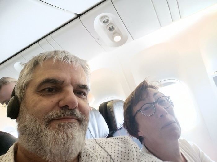
For those who don’t know us, let me introduce our little group. We’re four friends in our sixties (this time, everyone made it, which let us score some "senior" discounts...). We live in the Var region, have known each other for over 20 years, and this was our second trip together to this magical West.
Mimi (Michèle): always the smallest and the funniest. Thank goodness she was there to speak English! Maumau (Maurice): her husband, always with his white hair, his Gallic mustache, his humor, and his Southern accent. He drove every other day. DD (André): the one with the beard, with whom I celebrated our 41st wedding anniversary at Yellowstone. Our second driver appreciated having a peaceful mind since he’s been retired since July. Marcalamar (Martine): that’s me—still blonde with glasses, still talking a lot, and still terrified of messing up the organization of this trip despite all the hours spent on the forum.
Recognize us? Ha ha ha!!!! No, just kidding!!!!
That’s us!!!
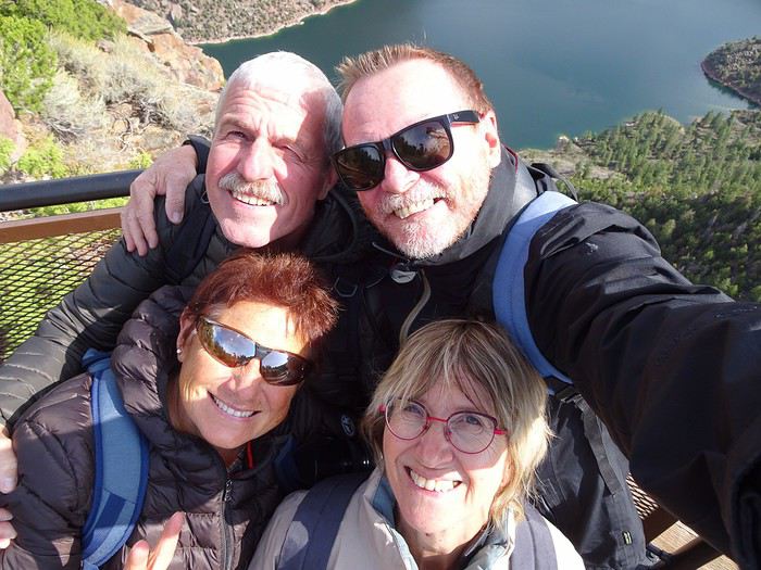
In 2017, struck by western addiction, our first road trip gave us an irresistible urge to return, which we did from September 2nd to 24th, 2019, on a loop from Denver to Denver via Yellowstone. The westernmost point of this journey, which took us through the geographical center of the USA, brought us within about a hundred kilometers of Moab, which had been the easternmost point of our last trip.
We’ve been back for over a month now, and I realize I’m starting to forget some details—it’s high time I started my travel journal before my brain turns into Swiss cheese and lets everything slip away. As I mentioned in my last story, it’ll take me quite a while to finish, so if any travelers have specific questions, don’t hesitate to message me privately. Once again, I’d like to thank everyone who helped me (and there were many!) prepare our road trip, with a special shout-out to Disneydiddl, Hiacinthe, and Titou (ladies first) as well as Fred and Itat, whom I bombarded with questions for months and who always kindly and patiently gave me tons of great tips. It’s thanks to all of you that this trip was such a success. I was a little worried I wouldn’t recapture the emotion and enthusiasm of our 2017 trip, but this one was just as "Wow" as the last.
For those who don’t know us, let me introduce our little group. We’re four friends in our sixties (this time, everyone made it, which let us score some "senior" discounts...). We live in the Var region, have known each other for over 20 years, and this was our second trip together to this magical West.
Mimi (Michèle): always the smallest and the funniest. Thank goodness she was there to speak English! Maumau (Maurice): her husband, always with his white hair, his Gallic mustache, his humor, and his Southern accent. He drove every other day. DD (André): the one with the beard, with whom I celebrated our 41st wedding anniversary at Yellowstone. Our second driver appreciated having a peaceful mind since he’s been retired since July. Marcalamar (Martine): that’s me—still blonde with glasses, still talking a lot, and still terrified of messing up the organization of this trip despite all the hours spent on the forum.
Recognize us? Ha ha ha!!!! No, just kidding!!!!
That’s us!!!
Hi everyone,
We traveled between Christmas and New Year’s to visit our son in San Francisco. We’d already seen the parks during a 2008 vacation but hadn’t had time to drive Highway 1 between San Francisco and Los Angeles, so we decided to do it this time. At this time of year, the days are short—it gets dark by 5 PM, which limits sightseeing time. Weather-wise, we had temperatures between 11°C and 20°C (52°F and 68°F) during the week, so it was pretty pleasant. There was a bit of rain one day and some gray skies or fog in the mornings. Financially, California is *very* expensive! Prices listed don’t include tax or tips. Taxes are automatically added to restaurant bills or supermarket receipts, but *you* add the tip. Americans always leave a tip, no matter if they’re happy with the service or not (except at self-service places). The absolute minimum is 15%, but 20% is more common. Here’s how it works: First, the server brings the bill with the tax already added, then takes your card and the bill. They come back after charging your card, leaving you a new bill and a pen. You write down the tip (tips) you want to leave, add it up, and sign. You leave the paper and pen on the table and go. In some restaurants, the server brings the card reader to your table, and there are preset tip percentages to choose from. On your bank statement, the total amount (including tax) shows up as “pending.” A few days later, the transaction is finalized with the tip included. The 9-hour time difference isn’t trivial, especially as we get older 😉. Keep it in mind when planning—don’t overdo it in the first few days.
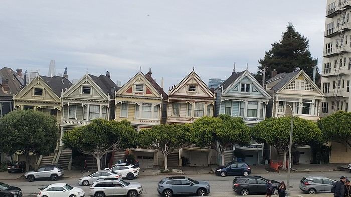
Here’s our itinerary: 12/25/2024: Flight from Lyon (7 AM) to San Francisco (11:50 AM): 1-hour layover in Amsterdam—way too tight. The airport is huge, and flights to the U.S. are at the far end. You also have to go through customs. We had to run! Luckily, there’s a special line for tight connections, and our flight was delayed! Reunited with our son and walked to the Painted Ladies (Victorian houses) and then through Alamo Square. Return trip via Waymo—a driverless Uber. Surprising, but the ride was super smooth, and we felt safe.
12/26/2024: San Francisco Walking tour of the city: Lombard Street, Pier 39 (sea lions), Coit Tower via the Filbert Steps (great view of the city), Chinatown, and Union Square (ice rink and Christmas tree).
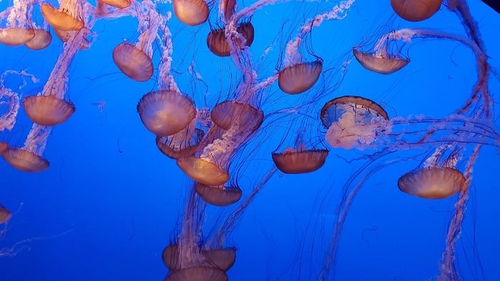
12/27/2024: Monterey It took us about 2.5 hours to drive straight from SF to Monterey (to save time, we skipped the start of Highway 1). The goal for this stop was visiting the aquarium. It’s in an old sardine cannery, and there’s an interesting room showing the machinery and explaining the process. The aquarium features all the local fish and plant species, plus a stunning jellyfish exhibit. We spent about 2.5 hours there. Entry is pricey at $65, and it was packed when we went. For parking, you can use meters or day lots. The cheapest we found was $25 for the day, with in-and-out privileges. We saw some closer lots charging $80, so it’s worth shopping around before parking and walking a bit more. Afterward, we stopped by the Monarch Butterfly Sanctuary—a small, free park where these butterflies land, along with some wild deer. We ended the day at Lover’s Point, a park with an ocean view and surfers. That evening, we tried clam chowder in a sourdough bread bowl. Stayed overnight in Monterey.
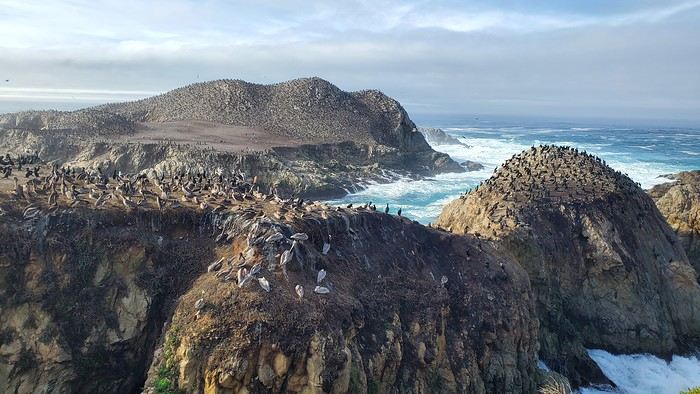
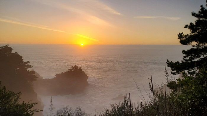
12/28/2024: Big Sur Parks The Big Sur area has many state parks. Entry is $10 per car for the day (valid for any number of parks visited that same day). Pro tip: If you park outside and walk in, you don’t pay. We chose to visit Point Lobos Reserve. We hiked the trails along the ocean. Two must-do (short and easy) trails: “Sea Lion Point,” where massive waves crash onto the rocks, and “Bird Island Lookout,” where you can see thousands of pelicans and cormorants on the rocks, plus a few elephant seals. It’s truly stunning. We spent about 3 hours there. After driving along Garrapata State Park and crossing the famous Bixby Bridge, we went to Pfeiffer Big Sur State Park to do the short Valley View Trail + Pfeiffer Falls hike. It was nice being among the redwoods, but the waterfall was underwhelming. Maybe it’s more impressive in the summer when the river is flowing better. We ended the day at McWay Falls, a waterfall that flows directly into the ocean—super photogenic, especially at sunset. Returned to Monterey for the night.


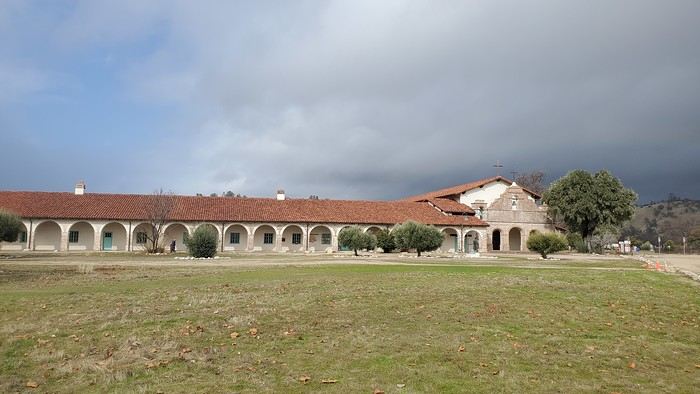
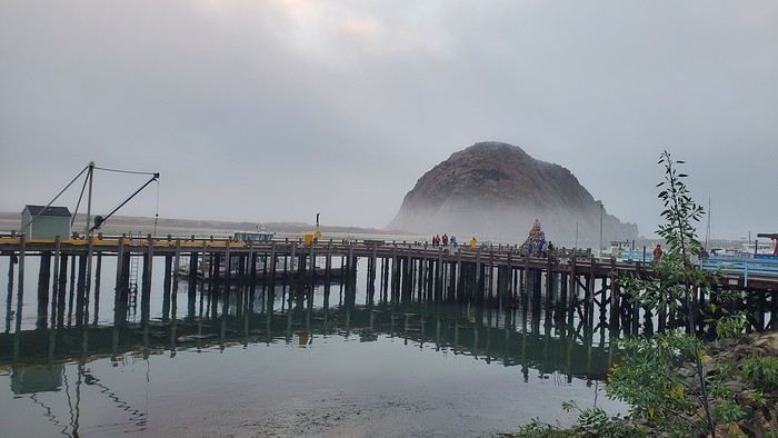
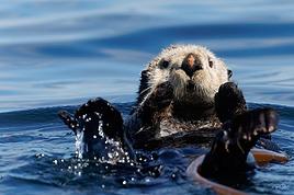
12/29/2024: Drive to Morro Bay Highway 1 is currently closed near Gorda, so we had to take the inland route from Monterey, adding extra miles. It was raining, so we skipped the planned stop at Carmel-by-the-Sea. Instead, we detoured to Mission San Antonio de Padua, the 3rd mission (out of 21) built by the Spanish in 1773 to evangelize the region. It’s less famous than others, so there were fewer people, and it felt more “authentic” (free to visit). With fog adding to the rain, we headed straight to Morro Bay, our stop for the day, instead of continuing up Highway 1 to San Simeon. Took a short evening walk to Morro Rock—saw a few otters in the harbor. Stayed overnight in Morro Bay.

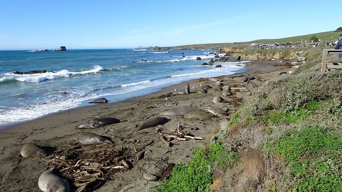
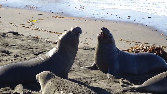
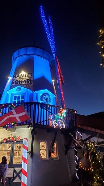
12/30/2024: Elephant Seals at Piedras Blancas The sun came back! We took a quick walk on the pier to see the otters in daylight, then drove back up Highway 1 to Piedras Blancas (near San Simeon), a famous spot for elephant seals. It’s birthing season, so there were lots of pups, plus males fighting for the females’ attention—what a show! We couldn’t get enough. We walked to the Piedras Blancas Lighthouse, with a few viewpoints of beaches where elephant seals were lounging (though far fewer than at the beach near the parking lot). We continued to Santa Barbara, our stop for the day. Stopped in San Luis Obispo for lunch and a quick city tour (Bubblegum Alley, the theater facade, and the mission). Since it was getting late, we skipped Los Alamos and went straight to Solvang, a charming Danish-style town (windmills, typical Danish houses) with lots of holiday lights (it’s their Julefest). Stayed overnight in Santa Barbara.


We traveled between Christmas and New Year’s to visit our son in San Francisco. We’d already seen the parks during a 2008 vacation but hadn’t had time to drive Highway 1 between San Francisco and Los Angeles, so we decided to do it this time. At this time of year, the days are short—it gets dark by 5 PM, which limits sightseeing time. Weather-wise, we had temperatures between 11°C and 20°C (52°F and 68°F) during the week, so it was pretty pleasant. There was a bit of rain one day and some gray skies or fog in the mornings. Financially, California is *very* expensive! Prices listed don’t include tax or tips. Taxes are automatically added to restaurant bills or supermarket receipts, but *you* add the tip. Americans always leave a tip, no matter if they’re happy with the service or not (except at self-service places). The absolute minimum is 15%, but 20% is more common. Here’s how it works: First, the server brings the bill with the tax already added, then takes your card and the bill. They come back after charging your card, leaving you a new bill and a pen. You write down the tip (tips) you want to leave, add it up, and sign. You leave the paper and pen on the table and go. In some restaurants, the server brings the card reader to your table, and there are preset tip percentages to choose from. On your bank statement, the total amount (including tax) shows up as “pending.” A few days later, the transaction is finalized with the tip included. The 9-hour time difference isn’t trivial, especially as we get older 😉. Keep it in mind when planning—don’t overdo it in the first few days.
Here’s our itinerary: 12/25/2024: Flight from Lyon (7 AM) to San Francisco (11:50 AM): 1-hour layover in Amsterdam—way too tight. The airport is huge, and flights to the U.S. are at the far end. You also have to go through customs. We had to run! Luckily, there’s a special line for tight connections, and our flight was delayed! Reunited with our son and walked to the Painted Ladies (Victorian houses) and then through Alamo Square. Return trip via Waymo—a driverless Uber. Surprising, but the ride was super smooth, and we felt safe.

12/26/2024: San Francisco Walking tour of the city: Lombard Street, Pier 39 (sea lions), Coit Tower via the Filbert Steps (great view of the city), Chinatown, and Union Square (ice rink and Christmas tree).
12/27/2024: Monterey It took us about 2.5 hours to drive straight from SF to Monterey (to save time, we skipped the start of Highway 1). The goal for this stop was visiting the aquarium. It’s in an old sardine cannery, and there’s an interesting room showing the machinery and explaining the process. The aquarium features all the local fish and plant species, plus a stunning jellyfish exhibit. We spent about 2.5 hours there. Entry is pricey at $65, and it was packed when we went. For parking, you can use meters or day lots. The cheapest we found was $25 for the day, with in-and-out privileges. We saw some closer lots charging $80, so it’s worth shopping around before parking and walking a bit more. Afterward, we stopped by the Monarch Butterfly Sanctuary—a small, free park where these butterflies land, along with some wild deer. We ended the day at Lover’s Point, a park with an ocean view and surfers. That evening, we tried clam chowder in a sourdough bread bowl. Stayed overnight in Monterey.

12/28/2024: Big Sur Parks The Big Sur area has many state parks. Entry is $10 per car for the day (valid for any number of parks visited that same day). Pro tip: If you park outside and walk in, you don’t pay. We chose to visit Point Lobos Reserve. We hiked the trails along the ocean. Two must-do (short and easy) trails: “Sea Lion Point,” where massive waves crash onto the rocks, and “Bird Island Lookout,” where you can see thousands of pelicans and cormorants on the rocks, plus a few elephant seals. It’s truly stunning. We spent about 3 hours there. After driving along Garrapata State Park and crossing the famous Bixby Bridge, we went to Pfeiffer Big Sur State Park to do the short Valley View Trail + Pfeiffer Falls hike. It was nice being among the redwoods, but the waterfall was underwhelming. Maybe it’s more impressive in the summer when the river is flowing better. We ended the day at McWay Falls, a waterfall that flows directly into the ocean—super photogenic, especially at sunset. Returned to Monterey for the night.


12/29/2024: Drive to Morro Bay Highway 1 is currently closed near Gorda, so we had to take the inland route from Monterey, adding extra miles. It was raining, so we skipped the planned stop at Carmel-by-the-Sea. Instead, we detoured to Mission San Antonio de Padua, the 3rd mission (out of 21) built by the Spanish in 1773 to evangelize the region. It’s less famous than others, so there were fewer people, and it felt more “authentic” (free to visit). With fog adding to the rain, we headed straight to Morro Bay, our stop for the day, instead of continuing up Highway 1 to San Simeon. Took a short evening walk to Morro Rock—saw a few otters in the harbor. Stayed overnight in Morro Bay.


12/30/2024: Elephant Seals at Piedras Blancas The sun came back! We took a quick walk on the pier to see the otters in daylight, then drove back up Highway 1 to Piedras Blancas (near San Simeon), a famous spot for elephant seals. It’s birthing season, so there were lots of pups, plus males fighting for the females’ attention—what a show! We couldn’t get enough. We walked to the Piedras Blancas Lighthouse, with a few viewpoints of beaches where elephant seals were lounging (though far fewer than at the beach near the parking lot). We continued to Santa Barbara, our stop for the day. Stopped in San Luis Obispo for lunch and a quick city tour (Bubblegum Alley, the theater facade, and the mission). Since it was getting late, we skipped Los Alamos and went straight to Solvang, a charming Danish-style town (windmills, typical Danish houses) with lots of holiday lights (it’s their Julefest). Stayed overnight in Santa Barbara.


After a first trip with her teens to the West during Easter 2019 and then to New York at All Saints' Day that same year, Cécile has only one idea in 2022: to go back!!!! So, we’re planning a loop from SF to SF, passing through the sequoias, LV, Death Valley, and Yellowstone.

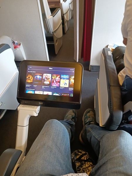
Off we go, full of joy and good spirits, heading to San Francisco. To make the flight more comfortable, I’d booked a seat with extra legroom.

Really nice!

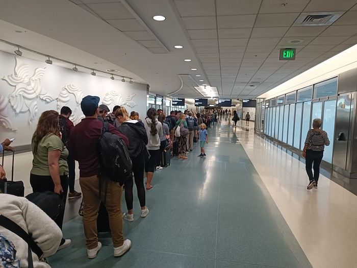
Anyway, everything went smoothly until we arrived—1h30 of waiting at customs!!!
But no matter, around 11 PM, we took the shuttle to a hotel, tired but happy

Off we go, full of joy and good spirits, heading to San Francisco. To make the flight more comfortable, I’d booked a seat with extra legroom.

Really nice!

Anyway, everything went smoothly until we arrived—1h30 of waiting at customs!!!

But no matter, around 11 PM, we took the shuttle to a hotel, tired but happy
Last trip in September 2022 with my new wife.
Third trip to the States for her, sixth for me...
LA, the Pacific coast, then we head east toward the sequoias and that’s when... fever, shivers... sick—"honey, pass me some Doliprane, I’ve got COVID." We go up into the forest, nap for 2 hours, then hit the road again—feeling a bit better... I’m thirsty, I’m *always* thirsty, everything I drink tastes awful... I’m exhausted, I go to bed around 6:30 PM. Once we get to the hotels, I’m up 6 or 7 times a night to pee. I pull over on the side of the road to empty my bladder... glug-glug pee, glug-glug pee.
We barely scratch the surface of sightseeing—I spend a whole day in SF sleeping... we head home, I sleep for 4 days straight. Doctor, ER. Nearly diabetic coma + pulmonary embolism + an 18 cm piece of *well-done* meat... 15 days in the hospital... antibiotic treatment, 2 shots a day for a month + insulin.
But we had a great trip:
https://youtu.be/dLRJ1kY9q1M?feature=shared
It all started last December, after another price alert from Gilou for United/Lufthansa flights at 250 € from Paris to San Francisco. Meanwhile, I was planning to spend a week alone with our three kids (Maxime, 14, Rachel, 12, and Timéo, 8) somewhere in France for the February break.
But this time, Gilou really outdid himself—way too tempting! 😮 His great tip worked for both the February and Easter breaks. I know April is the ideal month, especially if you love hiking! But for family reasons, only February would work for us.
Isn’t February a month to avoid for the Southwest? To keep our summer trip budget intact, I was thinking of camping as much as possible. After checking weather sites for temperature histories in key spots (Furnace Creek, Saint George, Page, Sedona), nighttime temps over the past two years ranged from +5 to -2°C. So, it seemed doable...
I started discussing (aka negotiating, even begging) with my better half. The kids caught on fast that there was a chance we’d go, and they were thrilled! She finally gave her consent to make the kids happy 😎. I quickly checked that our ESTAs were still valid, and 48 hours later, I had the tickets in hand 😎😎. But five days later, Laetitia changed her mind—her "Yes" turned back into a "No." No way were we going without her to her favorite country!!
Damn it 🤪! I had to tell her I’d already bought the four tickets (without bringing it up again, of course—a "Yes" is a "Yes," right?). And since the tickets were non-refundable, there was no going back... Apparently, with women, some "Yeses" mean *really* yes, but others mean, "I said yes in principle, but I wasn’t actually on board—and I never thought you’d have the nerve to buy the tickets without telling me!!" I had no idea 🤪!
Us guys? We’re way more straightforward—binary, even monetary... Yes means yes! And no can mean yes too 😏!! Anyway, in a lovely family atmosphere, I opened a thread to start planning and thanked Trois14 and Bluemesa for their help. On Trois14’s advice, I booked 5 nights in motels around St. George-Page at super tempting rates—around $35-40 a night...
On that note, Christmas cost me an arm and a leg... Gotta try to make up for it 😛!
Here’s the theoretical itinerary:
Death Valley (2 days) Valley of Fire The White Dome (hike up and down via Squirrel Canyon) 4 nights in the Kanab-Page area Sedona (2 days) Route 66 Alabama Hills / Trona Pinnacles Drive back to SFO via Highway 1
That’s the plan, at least...
In reality, it turned into a whole different story. I learned that in February, you’ve got to be flexible—*very* flexible sometimes—to dodge the weather. Halfway through, a cold snap made our second week (planned 100% camping) impossible, completely upending the itinerary.
So, a huge thanks to PapJ59, Noyellebis, and especially Caribou44 and Simonic. 🙂 A thousand thanks for your quick responses, availability, and sound advice, which let us have an original and unforgettable second week—Organ Pipe Cactus NM, Yuma, Salvation Mountain, Anza Borrego SP, a palm grove in Joshua Tree, then back to SFO!! Without you, we’d have been miserable on the spot, but instead... 😇
A big shout-out to Thibaut and his famous blog (rightfully praised on VF—it’s one of the few that details Organ Pipe), to travel journal writers for inspiration in general, and to those who helped me prep or during the trip (journals by Pong, Hiacinthe, Zitounet, and Laetitia).
Now, for the story...

Nine Bretons in the USA from June 24 to July 20, 2018: Greenery and mosquitoes in the North, heat and storms in the South
Choosing the trip:
After returning from the USA in 2014 (travel journal here), it was clear we’d go back, this time with the firm intention of bringing our kids. 😇
2015 was the year of Scotland (travel journal here), 2016 was a work year, and 2017 was the discovery of Aragon in Spain (travel journal here)… Meanwhile, our kids’ age still seemed like a hurdle for this kind of trip. The long wait turned out to be an advantage, letting us refine the project and rally others: what started as a two-week trip for four turned into three weeks for nine!! JF’s parents (M&P, who’d already been in 2014) and JF’s brother (C&D&Y) joined our little family (C&JF&A&L)!!😎 After plenty of family discussions, route tweaks, travel journal reads, and advice from VF (plus some specialized books like Photographing the Southwest by Laurent Martrès), we made up our minds—fully aware of the constraints—and split the trip in two:
- First week, just the four of us in an SUV + hotels, looping from LV (Valley of Fire, Saint George, Bryce, Kanab), focusing on rocky, sandy, and colorful hikes:
- Followed by two weeks with nine people in 2 RVs + campgrounds, as close to nature as possible in the parks (Snow Canyon, Kodachrome, Yellowstone, Arches, Canyonlands, Dead Horse, Monument Valley, Grand Canyon):
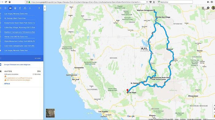
🙂Before going further, we want to thank the forum members who took the time to answer our questions. Your patience and kindness are amazing! We might forget someone, but thank you all: Jpg13, Mlefebvre, Kast13,Glll2012New, PCecile, Aquilegia, Adumas4, Ju45, Mycovtt, Natb72, Soula1, Orionide, Simonic, Hiacinthe, etc.Traveling with nine people (ages 9 to 76, including three kids!!) requires some serious logistics and near-perfect timing to avoid wasting time. The plan went off without a hitch😎… well, almost—we’ll get into the details later…😛🏴☠️🙂 In the end, we came back enchanted and happy!! 🙂The family aspect played a big part, but we also discovered spots that were much less crowded, definitely less known to the general public and the hordes of Asian tourists… The kids returned with stars in their eyes, and the adults with just as many memories (plus around 1,200 photos and 130 GB of GoPro video to sort through)!!😎 We’re already feeling the itch to go back—a Denver loop is starting to take shape…😇
Thoughts on the Americans we met and places we visited: They haven’t changed since 2014… Still cool, optimistic, and smiling, always ready to strike up a conversation and offer help—even without the lure of our tourist dollars. (Only two cold locals at Monument Valley clearly made little effort to help us.) We noticed a few changes in the parks😕: some infrastructure was less well-maintained (wobbly wooden walkways, for example), French info pamphlets disappeared from entrance huts, and there were fewer rangers (Lee’s Ferry ranger station was closed). These changes are likely due to Trump’s restrictive policies toward national parks. On the economic side, gas prices rose by 30% since 2014, now around 0.85 € per liter, and with the current exchange rate, conditions are much less favorable for European tourists than in 2014. But this area is so beautiful—too bad Americans have such an idiot for a president!😠
The flights: Round-trip Paris CDG to Las Vegas LAS Roissy to Los Angeles with Air Tahiti Nui, then American Airlines for Los Angeles to Las Vegas. The A340s were impeccable, and service was great with Air Tahiti Nui (the tiare flower given at boarding), and no complaints about AA either.🙂
The hotels: All booked in advance, either through Hotels.com or directly on the hotel’s website (like the Planet Hollywood in Las Vegas). No surprises, everything met expectations.🙂 It’s a real plus for a family of four to have two beds in every room… Still rare in France.
The campgrounds: Except for one night at Lee’s Ferry, all were booked from France through NPS, Xanterra, and KOA sites. No surprises here either—everything met expectations and was well-organized (fire rings and tables at every site, for example).🙂
The vehicles:
First week: Four people in a GMC Yukon XL from HERTZ, at Las Vegas airport for 327 €, unlimited miles, second driver, and insurance. A typically American beast—355 hp, seven seats: it’s long, big, wide, and tall😮😎😎!! Impeccable condition, quiet, super comfortable with tons of safety features and gadgets (like weather updates tied to GPS!!), and it averaged about 12 L/100 km in 2WD (in 4WD, we nearly hit 19 L on the Stukumpah Road…). A total win thanks to the HERTZ GOLD card, following Jpg13’s advice (Jean-Pierre, you’re my idol!!😎). It let us skip the counter lines (we didn’t even stop there!), pick up the car, and leave the parking lot in under seven minutes… Even less time for the return!
Second and third weeks: Nine people in two RVs. A 30-foot RV + a 25-foot RV from CRUISE AMERICA in Las Vegas for 5000 €, unlimited miles, kitchenware, and linens/towels/comforters.
A love story in 2014 with this same agency, but unfortunately, this year was much more mixed: aging RVs, ineffective AC in the C30, a leak in the C25’s skylight, a leak in the C25’s toilet drain valve (imagine the dump every time we opened the drain plug…😠🙁), late delivery of both RVs (after 5 PM, though the contract said 4 PM max), abnormal wear on the front tires (we’d discover that later😠), trouble closing the door, etc.In short, a disappointment.😠
Note that other rental companies (El Monte and Road Bear) are probably gaining market share—we saw a lot of their vehicles on the road, and they offer much newer models (at least on the outside) for similar prices…🙂
But setting aside those issues, the vehicles still did their job: letting us sleep as close to nature as possible in the parks and enjoy beautiful sunrises/sunsets with family campfires and marshmallows flambéed with Jack Daniel’s Tennessee Honey😇!!😎 Also worth noting: Cruise America’s solid roadside assistance (we’ll talk more about that later), and how easy it was to drive these beasts—nearly 10 meters long! (Our walkie-talkies were super handy for communication between the two RVs.)
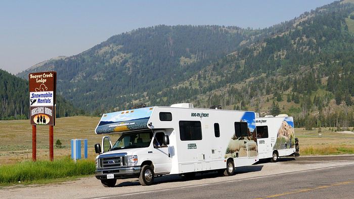
And for the last day, a Ford Transit 12-seater from Hertz, at Las Vegas airport for 145 € for 24 hours. Perfect for a day with nine people and nine suitcases + nine bags!! Everything fit in the trunk, and it let us explore LV independently (including a trip to the outlet) for less than three taxis would’ve cost…😎There you have it—the scene is set! If you’re interested in the rest, feel free to join in. The travel journal is done on the computer, and we’re up to day 11 for photos… We should be posting daily!!🙂
See you soon. Christelle & JF
After nearly 2 years of waiting (yeah, like many of you, we wanted to hit the road again as soon as we got back to France... but first, we had to fill up the piggy bank!), here we are at last—July, the month we’ve been waiting for!
We’ve got 30 days of exploring new places ahead of us, as well as revisiting some spots we loved back in 2012.
Here’s the plan: - Joshua Tree NP - Las Vegas - Valley of Fire SP - Yant Flat - Zion NP (Angel’s Landing) - Bryce Canyon NP (Fairyland Loop trail) - Devils Garden on the HITTR - Capitol Reef NP - Grand Teton NP - Yellowstone NP: Old Faithful - Yellowstone NP: Norris Geyser Basin and Mammoth Hot Springs - Yellowstone NP: Grand Canyon of the Yellowstone - West Thumb and Grand Teton NP - Flaming Gorge - Colorado NM and Fisher Towers - Moab: Arches - Moab: Canyonlands and Corona Arch - Moab: Canyonlands - Moab: rafting and Dead Horse Point SP - Natural Bridges NM and Valley of the Gods - Monument Valley and Horseshoe Bend - Coyote Buttes South - Grand Canyon NP (North Rim) - Grand Canyon NP (North Rim) and Navajo Bridge - Sedona - From Sedona to Tucson - Arizona-Sonora Desert Museum and Saguaro NP - Tombstone
Practical details:
- I’d read that it was better to book flight tickets directly on an airline’s website rather than through a comparison site. So, I spent months searching for reasonably priced tickets for two adults and two kids from Paris to Las Vegas for the outbound trip and from Tucson to Paris for the return. I mostly checked Air France, KLM, and British Airways, but prices were always around 4600 €. Not finding anything, we eventually went through a comparison site: Ebookers. We bought our tickets in mid-December: Paris/Atlanta with Air France, then Atlanta/Los Angeles with Delta for the outbound trip, and Tucson/Atlanta with Delta, then Atlanta/Paris with Air France for the return. Total cost: 4300 €. The layover on the outbound trip made me a little nervous because it was only 2 hours and 15 minutes. A month later, we got an email from Ebookers saying the layover had been reduced to 1 hour and 40 minutes! And a few months after that, it was down to just 1 hour and 30 minutes... So, we called Air France directly (we didn’t go through Ebookers, and it wasn’t a problem), and they put us on different flights. The new layover was 2 hours and 10 minutes—still not a ton of time, but I felt better than with 1 hour and 30 minutes. And anyway, we figured we’d see how it went!
- For the car, we tried several comparison sites, and in the end, AutoEurope won this year: 808 € for a 30-day rental of a Chevrolet Impala through Thrifty. The second driver was free for the entire trip since we picked up the car in California.
- We didn’t rent a GPS or buy one—we just downloaded Sygic on our two phones and bought the US map. I don’t remember the exact amount, but it cost us around 30 €.
- For hotels, I either booked directly on the sites (Xanterra, Grand Canyon Lodge, etc.) or used Hotels.com (to earn nights through their Welcome Rewards program) or Booking.com (when hotels weren’t available on Hotels.com). I always compared the price on Hotels.com with the hotel’s direct rate, but they were usually the same. So, for the same price, I’d rather earn a night with Welcome Rewards! We’d set a budget of 100 € per night on average, and we stuck to it pretty well—the final average came out to 101.20 € when including everything (nights + taxes + any nightly fees + parking fees + bank fees).
- As for luggage, we didn’t want to overpack! So, we left with one medium suitcase for Calista, one for me, one large suitcase for Hugo and Yannick, and a sports bag with Calista’s booster seat (we could’ve taken it on the plane with us, but I didn’t want to lug it around the airport during the layover). That sports bag came in handy on the way back, too—because, as everyone knows, you always come back with more than you left with! Each of us also had a backpack as a carry-on.
Before wrapping up this intro and getting into the real details, I’d like to thank everyone who contributed to my discussions and helped me improve our itinerary!
Quick intro for those who don’t know us: Yannick (36), Peggy (36), Hugo (11), and Calista (8).

It was exactly 1 year ago today. 22 days in the American West, a beautiful loop starting from San Francisco, with just one place we passed through twice (Death Valley).
Since my first travel journal, recently completed, was very chatty and included lots of photos, I made a big decision this time: 1 day = 1 photo with a comment, that's it!
Before I start, here’s a quick overview of our trip: - San Francisco
- The Pacific Coast (Highway One) from Monterey to Cambria - Death Valley - West Grand Canyon - South Grand Canyon - Vermillion Cliffs - Page (Horseshoe Bend, Antelope Canyon) - Monument Valley
- Moab (Arches Park, Canyonlands) - Bryce Canyon (via Capitol Reef) - Zion Park - Las Vegas - Lone Pine / Alabama Hills (passing through Death Valley again) - Mammoth Lakes - Yosemite - Return to San Francisco via Sonoma.
Here we go! Below are the first 4 photos, for the first 4 days in San Francisco.
Day 1 – Saturday, April 30, around 5:30 PM – Embarcadero, San Francisco

This photo was taken on the long promenade of "The Embarcadero," not far from the Ferry Building. It perfectly captures our state of mind at that moment: the weather is gorgeous, we’ve just dropped off our luggage at the hotel just steps away, and we’re strolling with light hearts, though our eyelids are heavy...
The gleaming vintage trams of the historic line pass by on the boulevard. Soon, the day will fade, and the silhouette of the Bay Bridge spanning the bay will be outlined by thousands of tiny lights... A flavor explosion awaits us nearby at "La Mar Cevicheria," with a delicious local white wine... This trip is off to a great start!
Day 2 - Sunday, May 1, around 3:30 PM, San Francisco Bay

The sun is shining brightly, and we’re on the ferry returning from Sausalito. In this silvery-blue light, everything sparkles, even the steep streets in the background... We’re still amazed to be here.
Day 3 - Monday, May 2, around 4 PM, atop Twin Peaks

A bus line from Haight Ashbury takes you almost to the top of Twin Peaks, winding through incredibly twisty streets. The day has been beautiful again. But the cold wind that just picked up is bringing clouds from the ocean—quick, we’re heading back down...
Tonight, we’re going to see Keith Jarrett at Davies Symphony Hall...
Day 4 - Tuesday, May 3, around 10 AM, National Historical Park

Our first national park! It’s the "Maritime National Historical Park," near Fisherman’s Wharf. Really lovely. Afterward, we’ll grab some delicious fish and chips under the envious gaze of seagulls...
In the afternoon, we pick up our rental car and head to Monterey. Less than 2 hours’ drive.
To be continued!
Recommended for you
Louisiana: The American South Between Wild Nature, Vibrant Culture, and an Inspiring Road Trip
The "Must-Sees" of the American West
Photographic Discovery of Vancouver Island
A Few Days in Turkmenistan from Uzbekistan
Slovak travel journal
14 Days in Japan – September-October 2026
Hiking in Norway: Jotunheimen and Dovrefjell, you’ll adapt to the rain...
CARIBBEAN: The island of SAINT-MARTIN, a different perspective
879 more discussions in this forum are in French. Browse them on the French forum