After our amazing experience in the Lofoten Islands in summer 2023, I suggested to Jean Marie another trek I’d been wanting to do for a long time: the Skye Trail in Scotland.
A few photos of this stunning island and he was sold and ready to go.
The route is available on the excellent WalkHighlands site HERE (there’s also a Cicerone guide on the subject).
And since I thought it was a shame it avoided the Black Cuillins, I added a 3-day detour in that area.
We took advantage of the May bank holidays in 2024, partly to avoid the peak tourist season and also the midge period—because for some reason, mosquitoes love me 😠!!
27/04 – Day 1 – Transfer to Skye and start of the trek: Rubha Hunish - Flodigarry
28/04 – Day 2 – Flodigarry – just before the Old Man of Storr
29/04 – Day 3 – Old Man of Storr – Portree, then bus to Sligachan
30/04 - Day 4 - Sligachan - Glenbrittle campsite via the Fairy Pools
01/05 – Day 5 – Round trip to Sgùrr na Banachdich from Glenbrittle campsite
02/05 – Day 6 – Round trip to Coire Lagan and walk on the Rubh an Dùnain peninsula
03/05 – Day 7 – Return (hitchhiking) to Sligachan campsite and hike in the Red Cuillins
04/05 – Day 8 – Resuming the Skye Trail – Sligachan – Elgol
05/05 – Day 9 – Elgol – Somewhere on the climb to Bla Bheinn
06/05 – Day 10 – Somewhere on the climb to Bla Bheinn - Broadford
07/05 – Day 11 – Visit to the Armadale Castle and park
08 & 09/05 – Return to Glasgow, visit the city, and return flight
And here’s the summary
Travel journals · Western Europe
Travel journals, memorable souvenir descriptions, reports, travel reviews, etc.
Showing 31–60 of 72 discussions in English.
← Travel journals: all destinations
Travel Journal: 21 Days in La Gomera and La Palma
From February 6 to February 26, 2024
Tuesday, February 6 We left around 9 AM with our car, along with Pierre-Paul and Patricia, heading to the Bluepark parking lot in Bartenheim. As expected, we were awaited and left promptly for EuroAirport Basel. Took off at 12:25 PM for a 4-hour-15-minute flight under excellent conditions. Beautiful arrival in Tenerife with Teide in sight under a clear blue sky. Fifteen minutes later, we waited for bus No. 40 to Los Cristianos with quite a few other tourists, but we managed to find four seats. From the bus station, it was a 20-minute walk to our hotel. We checked into a lovely apartment for the four of us, complete with all the comforts. Outside, it was quite warm—at least 25°C! After dropping off our luggage, we went for a stroll. The immediate surroundings of the hotel held no interest for us: a modern, concrete area filled with hotels, bars, tourist agencies, and unappealing restaurants all offering the same bland international cuisine. Pat went to cool off at the pool, unfortunately overrun by loud, drunk English tourists. I took a walk to the paseo maritimo that leads to the port, skirting the seafront. The promenade was pleasant, but it could have been any seaside resort in the world—same old scene: a succession of bars with blaring music where many elderly people sipped cold beers waiting for the sunset, the backdrop a wall of resort-style hotels resembling rabbit hutches! Upon reaching the port, I scouted the route we’d take the next day to the Fred Olsen ferry. Back at the apartment, in the early evening, we looked for a non-touristy restaurant for dinner. Monique stopped a woman to ask her opinion! In this area, she told us, there’s no restaurant that serves Canarian or Spanish cuisine! The only place with decent restaurants is at the port. Off we went to the port, where we sat down at Al Bordo restaurant and ordered a seafood paella for four. Excellent, and at a very reasonable price (36 € for two). We returned to the hotel along the seafront.
Wednesday, February 7
Woke up at 6 AM. Had breakfast in the apartment with what we’d bought the day before at a supermarket. It was still dark when we left on foot toward the port, walking along the calm seafront at this early hour. Forty minutes later, we arrived and waited 10 minutes before the ferry docked. At 9:30 AM, we left the port of Los Cristianos for a 50-minute crossing on a calm sea under a beautiful blue sky. There were quite a few people on this large ferry, but many had no luggage, meaning they were visiting La Gomera for the day and would take the ferry back in the evening. Upon disembarking, we went straight to our rental car agency to pick up the car we’d booked online a few months earlier. It was a nice Peugeot 2008, spacious enough for the four of us and our luggage. We immediately took the beautiful road from San Sebastián that climbs directly into the mountains toward our rental in Vallehermoso. The road was in perfect condition—it seemed brand new, like all the others we’d take on this island later. This side of the island is very arid with little vegetation, and the terrain is particularly rugged, as it is throughout the island. We stopped at our first miradors, which would be followed by many more throughout our Canarian trip. Our first visit was to the small village of Agulo, perched on a promontory above the sea and at the foot of a high cliff. The village features typical Canarian houses with windows flush with the façade and black volcanic stone masonry on white or reddish-brown walls. The first recommended restaurant was already booked for a group, so we settled for the shaded terrace of the excellent El Alameda bar-restaurant. From Agulo, you can access the Abrante viewpoint via a winding road, where the view of Agulo, 600 meters below, is exceptional. A glass ledge over the void lets you test your fear of heights!
We drove to Vallehermoso to do our grocery shopping at the supermarket—a habit that would continue until the end of the trip. Our little house, "Casa rural El Encatadora," is located in a beautiful flower-filled valley a few kilometers west of Vallehermoso. Each of us had a bedroom with an en-suite bathroom, plus a living room, kitchen, and a small terrace overlooking the quiet street at the valley’s end, which didn’t bother us at all.
Thursday, February 8 The good weather seemed to follow us since our arrival in the Canary Islands. This morning, we took the road—still as beautiful and new—toward Arure, high up to the west. The landscape was magnificent, with breathtaking glimpses of the sea far below. In Arure, we parked in front of Conchita’s bar, where a hike (Rother No. 30) starts toward two viewpoints: Alojera, which we reached after 45 minutes on a lovely path. Monique, tired from the first steep climb, stopped at the first viewpoint and hitchhiked back to Arure. Meanwhile, we continued toward the second viewpoint, Los Barranquillos, where the view of the surroundings was partially hidden by misty clouds rising from the sea. The entire mountain is sculpted by ancient, endless terraces climbing until the slope becomes too steep for construction—visible traces of the hard work of past inhabitants trying to survive in a harsh environment. We had a decent lunch at La Conchita bar, then drove to the small seaside town of Puerto la Caleta, sheltered by an immense cliff plunging into the sea. Black sand beach, rough sea—despite our encouragement, Pat didn’t dare to swim! As for the old village of Caleta, it’s perched on the mountainside, and visiting it requires climbing steep, stair-filled alleys to discover a few traditional houses. Back at the casa, dinner in, and card games...
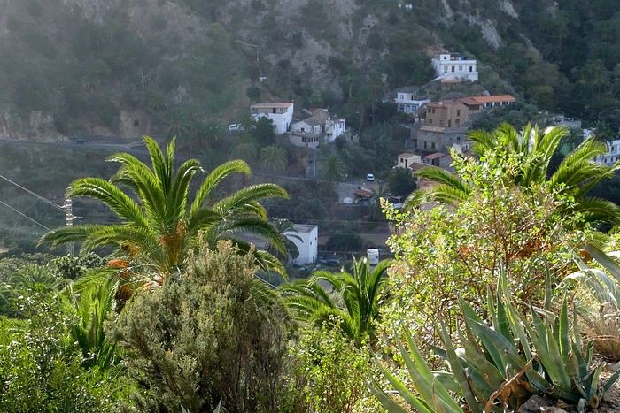
Vallehermoso
Friday, February 9 This morning, the sky was overcast, and the peaks around us were shrouded in clouds. We took the same road as yesterday to hike Las Creces. Quickly gaining altitude, we entered a thick fog—visibility was very limited. We stopped at the Las Creces parking lot; visibility improved, and the sun wasn’t far off. The hike is entirely within a beautiful laurel forest, with the sun playing hide-and-seek, but it wasn’t cold despite the altitude. After finishing the loop trail, we decided to picnic—not there, as it was too chilly—but on Vallehermoso’s beach, where we found a nice picnic area sheltered by large black rocks. A short digestive walk on the surrounding hill to admire the little beach from above. Back in Vallehermoso, we did some grocery shopping, then tried to return to the casa—only to find ourselves locked out because we’d left the key in the lock inside! After several attempts and with the help of Yéli, a relative of the owner we called for help, we were finally able to get back in!
Saturday, February 10
It rained last night, and the sky remained overcast. Monique decided to rest this morning. PP, Pat, and I set off on the hike that starts from the house toward the Marichal reservoir. The sun wasn’t far off, and by 11 AM, it was fully out. The pleasant hike passed by many flower-filled gardens and orchards—orange, lemon, and mandarin trees in fruit. The path climbed gently toward the reservoir, where the view of the Cano rock dominating the landscape was magnificent. The last part of the climb was a bit tough, overgrown with lush vegetation, and the trail was slippery from last night’s rain. We descended via a different, much more pleasant path and returned to the casa just in time for lunch, prepared by Monique. This valley is rich with its many farmers and market gardeners who’ve cultivated the entire valley, taking advantage of the water flowing down from the mountain, captured upstream and redistributed through countless pipes snaking along the paths. Numerous tanks also store water during dry periods. The houses are scattered across both sides of the valley, and these colorful little homes add a beautiful touch to the landscape. The many palm trees give this valley a distinctly tropical feel—you could almost imagine yourself in the Caribbean. Add to that some salsa music drifting from a hut where farmers were working, and the picture is complete. A well-chilled beer apéro capped off a lovely morning. The afternoon was dedicated to rest, relaxation, reading, and games.
Sunday, February 11 The blue sky returned, though a few clouds still capped the highest peaks. Today, we visited Garajonay National Park, which covers the highest central mountains. Up there, we were above the clouds, and the panoramas from the various viewpoints were stunning: first, Cherelepin, accessible from the Laguna Grande parking lot, then Alto de Garajonay, offering an exceptional view of Teide—over 3,000 meters high—emerging from the clouds on Tenerife, far in the distance. We continued to the Los Roques viewpoints, then stopped for lunch at the Degollada de Peraza restaurant, where the view of the barranco was impressive. We descended toward San Sebastián and checked into our new lodging, La Cabezada, located in the countryside about 3 km above San Sebastián. It’s a small apartment adjacent to the owner’s, with a lovely terrace overlooking the surrounding mountains and surrounded by a beautiful garden. Apéro, then dinner on our beautiful terrace.
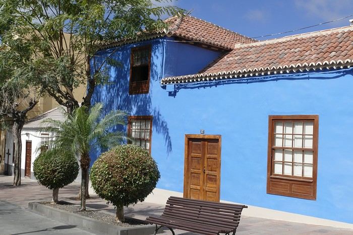
Monday, February 12 This morning, we went down to visit San Sebastián de La Gomera: its old tower, main street with some beautiful traditional houses, and the Church of the Assumption. Back at the casa for lunch. In the afternoon, Pat, PP, and I set off on the short hike from San Sebastián beach to La Guancha beach. We drove down and parked on the beach. The path climbs along the hill overlooking San Sebastián, passes by the tall Christ statue dominating the landscape, and roughly follows the coast down to the isolated Guancha beach. A beautiful hike under a hot sun, and a swim was welcome, even if the beach and sea access weren’t very comfortable due to large pebbles and quickly deepening water. Apart from two nudist bathers, there was no one on this beach. We returned the same way.
Tuesday, February 13 Rest day. We went down to town to stroll and do some shopping. I took the opportunity to visit the parador, beautifully situated above the city in a lovely garden overlooking the port and town. Together, we went for a cuba libre at the "Cuba Libre" bar, then had lunch at Breñusca (mediocre paella!). Back at the casa, then we went back down to town to see a carnival parade, a "passacalles," which actually passed an hour earlier than scheduled. Oh well.
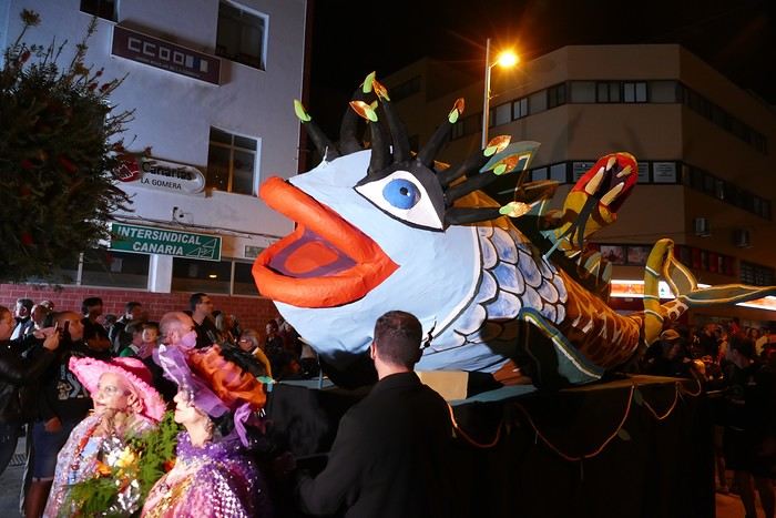
Wednesday, February 14 Each to their own program this morning. Pat went swimming at San Sebastián beach, Monique rested at the casa, and PP and I set off on the hike from Playa de Avalos to the Ermita de Guadalupe on Playa del Cangrejo. It wasn’t easy to find the right road or the parking spot, but we managed. The path seemed to have suffered landslides, according to a sign at the trailhead! We decided to check it out, ready to turn back if it seemed too dangerous. In the end, apart from one or two slightly tricky spots where we had to climb a pile of rocks, the trail remained passable, though a bit vertigo-inducing in places. The narrow path clings to very vertical cliffs nearly 300 meters above sea level! But what a magnificent view. At one point, the trail runs alongside a wall of basaltic pipes. We returned via the drivable track that parallels the trail a bit lower. Back at the house for lunch. In the late afternoon, we returned to town to attend the "Entierro de las Sardinas" (Burial of the Sardine), which closes the Canarian carnival festivities. While waiting, we strolled through the parador’s gardens and had mojitos in town. Around 9 PM, we heard the noise and cries of the mourners. The procession advanced, led by a large papier-mâché sardine on a float, surrounded by wailing mourners. The procession headed toward the sea, where the sardine was burned, and a mini fireworks display ended the procession. It was all very good-natured, and everyone had fun. We ended the evening with dinner at a good fish restaurant, El Pajar.
Entierro de la Sardina in San Sebastián de La Gomera
Thursday, February 15
Woke up at 5:15 AM. The only suitable ferry was at 7 AM, which would get us to La Palma by late morning rather than evening. We packed our bags, had breakfast, then headed to the port, left our rental car, and boarded the ferry to Tenerife, from where we’d continue to La Palma. Calm sea, beautiful sun—by 10:30 AM, we disembarked in La Palma. We picked up our car and immediately headed to our new apartment in Breña Alta. It’s a large apartment with a superb terrace facing the sea, fully equipped and very comfortable. The hosts recommended Casa Goyo restaurant, near the airport and close to us. It’s a restaurant with many small rooms, some of which can be reserved for families. The fish-based cuisine (chipirones, pulpo) was excellent, hearty, and reasonably priced. Since it’s in the airport’s flight path, we occasionally heard planes landing. Quick and efficient service. Afterward, we visited Santa Cruz de La Palma, which reminded us of the historic quarters of La Orotava in Tenerife or the capital of Gran Canaria.
Friday, February 16
Beautiful weather, blue sky. We headed to the San Bartolo viewpoint toward the northeast coast, then to the lovely village of San Andrés, which we explored. From there, we walked along the shore to the natural pools of Charco Azul, where we swam in the cool but "swimmable" sea. Back in San Andrés for lunch at the "San Andrés" restaurant on the beautiful church square. Very good fish-based meal. We got back in the car and continued along the north coast to the port of Espindola and the natural pools of Fajana near the Cumplida lighthouse. A fairly strong wind whipped up beautiful waves crashing onto the rocky coast in bursts of foam. Back in Santa Cruz, we stopped at the Mercadona supermarket to buy fresh shrimp for dinner.
San Andrés
Saturday, February 17
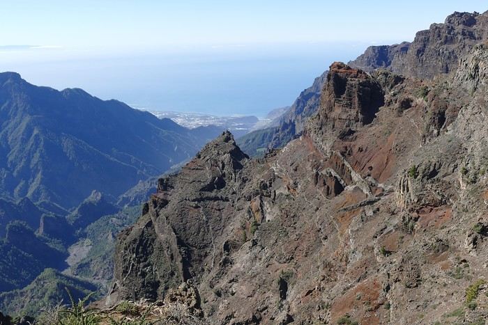
Uniform blue sky, even on the heights. We took the beautiful road that winds up to the summit of the Caldera de Taburiente. Several viewpoints offer 360° views of the entire island and beyond: you can make out La Gomera, El Hierro, and, of course, Tenerife with the perfect triangle of Teide. We parked at the Los Andes viewpoint parking lot and started our hike to Pico de la Cruz along a trail following the ridge, offering superb views into the caldera. We got back in the car and passed by the Roque de los Muchachos astronomical complex, composed of numerous observatories, some with very aesthetic mirror telescopes. We hiked from the Roque de los Muchachos parking lot to the various viewpoints, always as impressive. Picnic on site, then back to Santa Cruz. We stopped by our car dealer because the oil warning light came on—better safe than sorry. The representative reassured us but preferred to give us a Fiat Cross SUV instead.
The Caldera de Taburiente
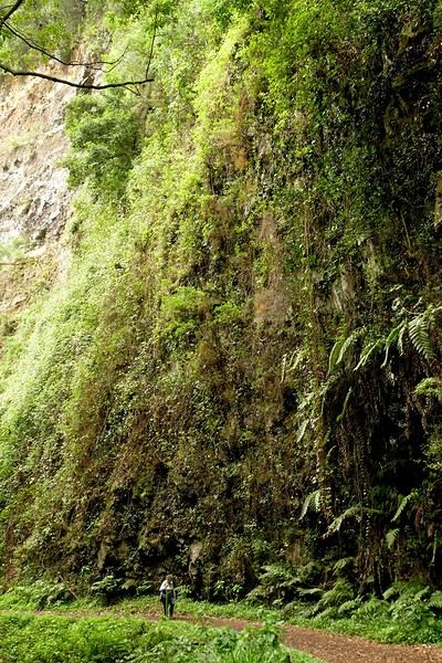
Sunday, February 18 The weather was a bit mixed, with cloudy patches. We set off to hike the Barranco de la Cuba de Galga. Unfortunately, the Los Tilos trail had been closed for several months due to a major landslide. The parking lot by the road was already quite full, and indeed, we crossed paths with many hikers along the way—it’s an easy hike with little elevation gain, which is rare here in La Palma! The beautiful path winds through a very narrow, deep gorge covered in lush tropical vegetation—you’d think you were in a Southeast Asian forest, especially with the humidity in the gorge bringing out earthy and floral scents. Halfway through, Monique turned back while the rest of us continued to the Cuba de Galga. A light drizzle accompanied us on the return. For lunch, we went to Chipi Chipi restaurant in the heights of Santa Cruz. The cool air forced us to leave the lovely terrace for the slightly noisy dining room. The meal was very good and hearty. Afternoon spent resting at our house.
La Cuba de la Galga
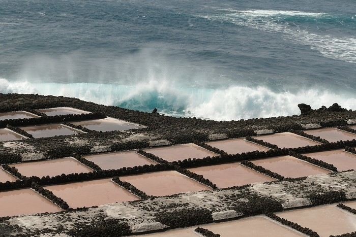
Monday, February 19 A few clouds still clung to the nearby mountain peaks. We headed south to Los Canarios. We stopped in front of the small San Antonio Abad church, where a path leads to the viewpoint in 15 minutes. Then we visited the San Antonio Volcano Interpretation Center and climbed to the viewpoint via the trail along the crater’s edge, offering a plunging view into the crater. Then PP, Pat, and I headed toward the Teneguía volcano but turned back given the remaining distance and the intense heat bearing down on us! Plus, the landscape was rather arid and not very interesting. We got back in the car and drove down to the salt flats at the island’s southern tip. The ocean crashes here in large waves, exploding against the volcanic rocks and feeding a "blowhole" carved into the rock. We stopped for drinks at the salt flats restaurant, then headed home.
The salt flats in Fuencaliente
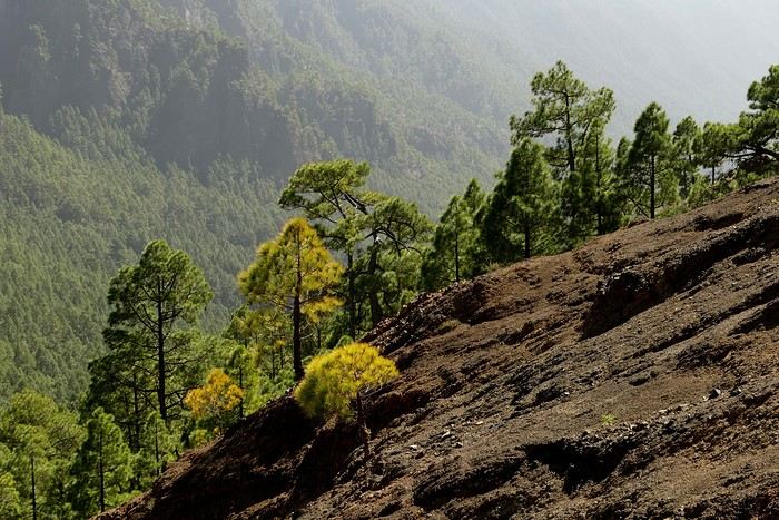
Tuesday, February 20 Beautiful weather with a few clouds clinging to the mountains, as usual. A relaxed morning since my parking reservation at La Cumbrecita didn’t start until 1 PM. It takes about 30 minutes from Santa Cruz to reach the valley floor via a beautiful but narrow road toward the end, though there’s very little traffic. Meanwhile, the clouds had disappeared, and the view from the La Cumbrecita viewpoint was superb. We recognized Pico de la Cruz in the distance, where we’d been a few days earlier. We then took the path leading to the Las Chozas viewpoint through a magnificent Canarian pine forest. We picnicked on site, then took the path to the Los Roques viewpoint. We returned the same way since the direct route was closed for construction. Back in Santa Cruz, we visited the Sanctuary of Las Nieves, with its beautiful golden Baroque altar.
Hike from La Cumbrecita
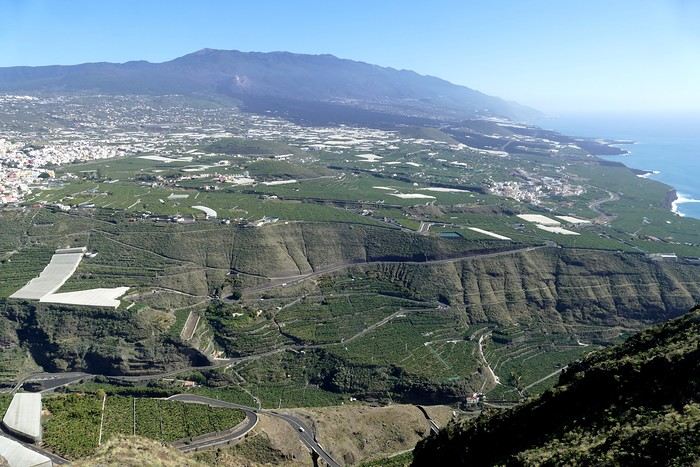
Wednesday, February 21 After packing our things and loading the car, we left Santa Cruz under a very blue sky for Los Llanos de Aridane, where we stopped to visit this lovely town. The Church of Nuestra Señora de los Remedios has a beautiful coffered ceiling and an original papier-mâché Christ statue from the 16th century. Around it, colorful old Canarian houses brighten the streets of the town center. We took the opportunity to stroll, do some shopping, and finally sat down at La Pergola restaurant for a mediocre lunch. We got back in the car to check into our new house in Arecida. On the way, we stopped at the Mirador del Time, which once again offered an impressive panorama, allowing us—for the first time—to see the damage caused by the Tajogaite volcano eruption in 2021. You can clearly see the still-smoking crater and the large black lava flow covering the landscape down to the sea. We really liked our new accommodation: a local house that’s been renovated on the heights of Arecida, not far from the Canarian pine forest. From several terraces, we have a 360° view of the sea and mountains. We even have a private pool! There are two beautiful, brand-new bedrooms, each with its own bathroom—the best. Plus, we’re on the GR 131 trail that runs along the Barranco de las Angustias toward the northeast.
Los Llanos de Aridane
Thursday, February 22 Once again, beautiful weather greeted us when we woke up. We started the GR 131 with the goal of reaching the Torre del Time viewpoint—about 400 meters of elevation gain. The path, quite steep at first, winds through a superb Canarian pine forest. A few viewpoints let you appreciate the sheer drop of the Barranco de las Angustias—watch out for vertigo! At the Torre del Time viewpoint, there’s a nearly 1,000-meter vertical drop. We returned via another path, the PLP1, which meanders first through this beautiful forest, then along lovely flower-filled gardens adjacent to beautiful properties that cascade from the forest down to the road serving these neighborhoods. This afternoon, we tried to get closer to the area devastated by the 2021 lava flows. Several roads are still closed or reserved for residents, while others—brand new—have been rebuilt to open up this densely populated and cultivated region. In some places, the lava flow slightly diverted, sparing some properties that logically should have disappeared. Now, they’re encircled by a massive cooled lava field. In other spots, twisted and charred metal scraps or greenhouse remains protrude from the lava—all that’s left of the former banana plantations. A little higher up, you can see the slightly smoking crater of Tajogaite, responsible for this disaster. Back to Casa Barreros.
View of Los Llanos and, in the background, the 2021 lava flow
Friday, February 23
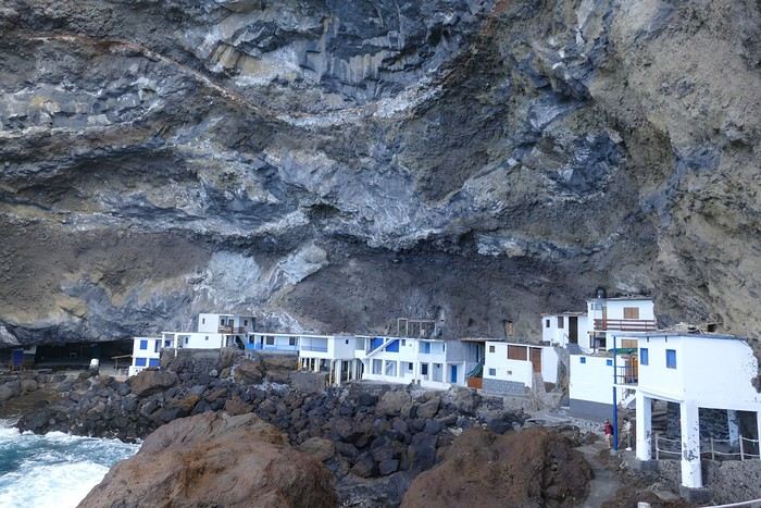
Though the sky was still blue, the temperature had dropped due to a chilly wind. By midday, it still rose to 22°C. Today, we headed north, specifically to the town of Tijarafe, where a very narrow road descends to the small port, Porís de Candelaria. The 3.7-kilometer road drops 700 meters in elevation, with gradients up to 30%—it was going to be intense! Indeed, the descent was scary, with the void right next to the very narrow road where passing was impossible except at a few rare spots. Everything went well—there was little traffic at this early hour. From the parking lot at the bottom, a path leads to Porís de Candelaria. It’s surprising to see this small fishing hamlet nestled in the shelter of an immense cave opening onto the sea, which was quite rough today. The sun, at this time of year, would appear late in the cave, which remained in shadow for much of the day. We returned via the same road, strolled through the small town of Puntagorda, and had lunch at El Jardín de los Naranjos restaurant—excellent meal.
Fishing hamlet of Candelaria
Saturday, February 24 The air was still cool, but the sun was beautiful. While Monique stayed home to rest, the three of us headed to the village of Las Tricias to hike the Buracas Caves trail. We left the car parked on the LP1 road and took the small paved road down to the sign marking the trail’s start. The signage for all the trails we took here, as in La Gomera, was very well done. The path descended steadily, then more steeply toward the caves where the island’s first inhabitants lived—some petroglyphs are still visible in certain caves. The path then climbed back up, passing magnificent dragon trees and more or less elaborate huts occupied by Germans who’ve lived here for many years. Back at Casa Barreros for some rest.
Sunday, February 25 The weather once again blessed us with a beautiful day. This morning, we visited the local produce market held on weekends in Puntagorda. You’ll find agricultural products, crafts, and food to keep you going. A little further on, there’s a glass viewpoint overlooking the barranco plunging toward the sea, with a view of the thrill-seekers trying the zip line right next to it. Lunch at Naranjos—definitely a good spot—with their shrimp and spice tagliatelle. Back home for an afternoon of relaxation.
Monday, February 26 We left Arecida under a cloudy sky. Driving up from Los Llanos de Aridane toward the east, an enormous cascade of clouds poured from the mountain peaks into the Los Llanos plain—very impressive. Arriving in Santa Cruz, we went for a stroll, did some last-minute shopping, then had a final good-quality paella at La Chalana on the paseo maritimo. We left the car in the parking lot and took the 5 PM Olsen ferry to Tenerife on a slightly choppy sea, but the ferry didn’t rock too much. Arriving at 7:15 PM, we dropped off our things near the port in our reserved apartment and went for dinner at Abordo—rubbery chipirones. A digestive stroll among the ever-increasing number of tourists in Los Cristianos—restaurants were packed to the brim, the season is in full swing here. Gone is the calm of La Gomera and La Palma, and the laid-back tourism of German hikers among whom a few French were hiding!
Tuesday, February 27 To make our homemade breakfast more enjoyable, we went to buy pastries at the local bakery, then took one last walk on the paseo along the beaches, mingling with the many mobility scooters driven by elderly or disabled people, joggers, and tourists. Last apéro near the bus station, then off to the airport. After a smooth 4-hour-30-minute flight, we arrived in Basel-Mulhouse at 10:20 PM.
THE END
Conclusion A fantastic trip to two islands with magnificent and diverse nature, where landscapes range from desert-like to tropical depending on exposure to winds and clouds. Thanks to the many beautiful viewpoints, you can truly appreciate these exceptionally dynamic reliefs. A hiker’s paradise, the trails are all very well marked, though the choice of easy or moderate paths for "casual walkers" is quite limited. Another notable advantage, in our opinion, is that these islands are very lightly developed—you’ll hardly see any of those ugly hotel blocks that spoil the landscapes of some other Canary Islands. It’s true that the beaches on these two islands don’t meet traditional international tourism criteria: they’re small, with black sand, and often difficult to access. Special mention for the quality of the road network (except for a few small local roads), which seems brand new, well-paved, and well-signposted. We also enjoyed exceptional weather for February, with fewer than three days of gray or rainy weather out of 21.
Almost all the accommodations we chose met or exceeded our expectations, often at reasonable prices: an average of 98 € per night for an apartment or house with two bedrooms for four people.
All photos can be viewed by clicking this link: https://photos.app.goo.gl/G44pPk4g9PW1rNzg8
Tuesday, February 6 We left around 9 AM with our car, along with Pierre-Paul and Patricia, heading to the Bluepark parking lot in Bartenheim. As expected, we were awaited and left promptly for EuroAirport Basel. Took off at 12:25 PM for a 4-hour-15-minute flight under excellent conditions. Beautiful arrival in Tenerife with Teide in sight under a clear blue sky. Fifteen minutes later, we waited for bus No. 40 to Los Cristianos with quite a few other tourists, but we managed to find four seats. From the bus station, it was a 20-minute walk to our hotel. We checked into a lovely apartment for the four of us, complete with all the comforts. Outside, it was quite warm—at least 25°C! After dropping off our luggage, we went for a stroll. The immediate surroundings of the hotel held no interest for us: a modern, concrete area filled with hotels, bars, tourist agencies, and unappealing restaurants all offering the same bland international cuisine. Pat went to cool off at the pool, unfortunately overrun by loud, drunk English tourists. I took a walk to the paseo maritimo that leads to the port, skirting the seafront. The promenade was pleasant, but it could have been any seaside resort in the world—same old scene: a succession of bars with blaring music where many elderly people sipped cold beers waiting for the sunset, the backdrop a wall of resort-style hotels resembling rabbit hutches! Upon reaching the port, I scouted the route we’d take the next day to the Fred Olsen ferry. Back at the apartment, in the early evening, we looked for a non-touristy restaurant for dinner. Monique stopped a woman to ask her opinion! In this area, she told us, there’s no restaurant that serves Canarian or Spanish cuisine! The only place with decent restaurants is at the port. Off we went to the port, where we sat down at Al Bordo restaurant and ordered a seafood paella for four. Excellent, and at a very reasonable price (36 € for two). We returned to the hotel along the seafront.
Wednesday, February 7
Woke up at 6 AM. Had breakfast in the apartment with what we’d bought the day before at a supermarket. It was still dark when we left on foot toward the port, walking along the calm seafront at this early hour. Forty minutes later, we arrived and waited 10 minutes before the ferry docked. At 9:30 AM, we left the port of Los Cristianos for a 50-minute crossing on a calm sea under a beautiful blue sky. There were quite a few people on this large ferry, but many had no luggage, meaning they were visiting La Gomera for the day and would take the ferry back in the evening. Upon disembarking, we went straight to our rental car agency to pick up the car we’d booked online a few months earlier. It was a nice Peugeot 2008, spacious enough for the four of us and our luggage. We immediately took the beautiful road from San Sebastián that climbs directly into the mountains toward our rental in Vallehermoso. The road was in perfect condition—it seemed brand new, like all the others we’d take on this island later. This side of the island is very arid with little vegetation, and the terrain is particularly rugged, as it is throughout the island. We stopped at our first miradors, which would be followed by many more throughout our Canarian trip. Our first visit was to the small village of Agulo, perched on a promontory above the sea and at the foot of a high cliff. The village features typical Canarian houses with windows flush with the façade and black volcanic stone masonry on white or reddish-brown walls. The first recommended restaurant was already booked for a group, so we settled for the shaded terrace of the excellent El Alameda bar-restaurant. From Agulo, you can access the Abrante viewpoint via a winding road, where the view of Agulo, 600 meters below, is exceptional. A glass ledge over the void lets you test your fear of heights!
We drove to Vallehermoso to do our grocery shopping at the supermarket—a habit that would continue until the end of the trip. Our little house, "Casa rural El Encatadora," is located in a beautiful flower-filled valley a few kilometers west of Vallehermoso. Each of us had a bedroom with an en-suite bathroom, plus a living room, kitchen, and a small terrace overlooking the quiet street at the valley’s end, which didn’t bother us at all.
Thursday, February 8 The good weather seemed to follow us since our arrival in the Canary Islands. This morning, we took the road—still as beautiful and new—toward Arure, high up to the west. The landscape was magnificent, with breathtaking glimpses of the sea far below. In Arure, we parked in front of Conchita’s bar, where a hike (Rother No. 30) starts toward two viewpoints: Alojera, which we reached after 45 minutes on a lovely path. Monique, tired from the first steep climb, stopped at the first viewpoint and hitchhiked back to Arure. Meanwhile, we continued toward the second viewpoint, Los Barranquillos, where the view of the surroundings was partially hidden by misty clouds rising from the sea. The entire mountain is sculpted by ancient, endless terraces climbing until the slope becomes too steep for construction—visible traces of the hard work of past inhabitants trying to survive in a harsh environment. We had a decent lunch at La Conchita bar, then drove to the small seaside town of Puerto la Caleta, sheltered by an immense cliff plunging into the sea. Black sand beach, rough sea—despite our encouragement, Pat didn’t dare to swim! As for the old village of Caleta, it’s perched on the mountainside, and visiting it requires climbing steep, stair-filled alleys to discover a few traditional houses. Back at the casa, dinner in, and card games...
VallehermosoFriday, February 9 This morning, the sky was overcast, and the peaks around us were shrouded in clouds. We took the same road as yesterday to hike Las Creces. Quickly gaining altitude, we entered a thick fog—visibility was very limited. We stopped at the Las Creces parking lot; visibility improved, and the sun wasn’t far off. The hike is entirely within a beautiful laurel forest, with the sun playing hide-and-seek, but it wasn’t cold despite the altitude. After finishing the loop trail, we decided to picnic—not there, as it was too chilly—but on Vallehermoso’s beach, where we found a nice picnic area sheltered by large black rocks. A short digestive walk on the surrounding hill to admire the little beach from above. Back in Vallehermoso, we did some grocery shopping, then tried to return to the casa—only to find ourselves locked out because we’d left the key in the lock inside! After several attempts and with the help of Yéli, a relative of the owner we called for help, we were finally able to get back in!
Saturday, February 10
It rained last night, and the sky remained overcast. Monique decided to rest this morning. PP, Pat, and I set off on the hike that starts from the house toward the Marichal reservoir. The sun wasn’t far off, and by 11 AM, it was fully out. The pleasant hike passed by many flower-filled gardens and orchards—orange, lemon, and mandarin trees in fruit. The path climbed gently toward the reservoir, where the view of the Cano rock dominating the landscape was magnificent. The last part of the climb was a bit tough, overgrown with lush vegetation, and the trail was slippery from last night’s rain. We descended via a different, much more pleasant path and returned to the casa just in time for lunch, prepared by Monique. This valley is rich with its many farmers and market gardeners who’ve cultivated the entire valley, taking advantage of the water flowing down from the mountain, captured upstream and redistributed through countless pipes snaking along the paths. Numerous tanks also store water during dry periods. The houses are scattered across both sides of the valley, and these colorful little homes add a beautiful touch to the landscape. The many palm trees give this valley a distinctly tropical feel—you could almost imagine yourself in the Caribbean. Add to that some salsa music drifting from a hut where farmers were working, and the picture is complete. A well-chilled beer apéro capped off a lovely morning. The afternoon was dedicated to rest, relaxation, reading, and games.
Sunday, February 11 The blue sky returned, though a few clouds still capped the highest peaks. Today, we visited Garajonay National Park, which covers the highest central mountains. Up there, we were above the clouds, and the panoramas from the various viewpoints were stunning: first, Cherelepin, accessible from the Laguna Grande parking lot, then Alto de Garajonay, offering an exceptional view of Teide—over 3,000 meters high—emerging from the clouds on Tenerife, far in the distance. We continued to the Los Roques viewpoints, then stopped for lunch at the Degollada de Peraza restaurant, where the view of the barranco was impressive. We descended toward San Sebastián and checked into our new lodging, La Cabezada, located in the countryside about 3 km above San Sebastián. It’s a small apartment adjacent to the owner’s, with a lovely terrace overlooking the surrounding mountains and surrounded by a beautiful garden. Apéro, then dinner on our beautiful terrace.
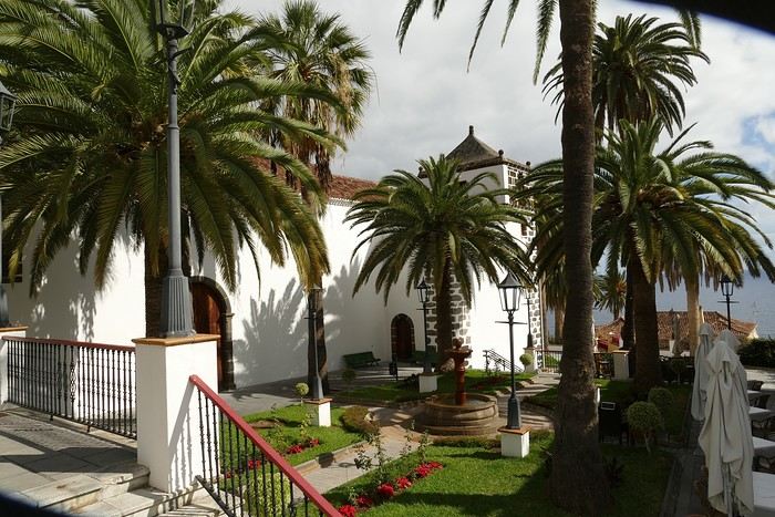
Monday, February 12 This morning, we went down to visit San Sebastián de La Gomera: its old tower, main street with some beautiful traditional houses, and the Church of the Assumption. Back at the casa for lunch. In the afternoon, Pat, PP, and I set off on the short hike from San Sebastián beach to La Guancha beach. We drove down and parked on the beach. The path climbs along the hill overlooking San Sebastián, passes by the tall Christ statue dominating the landscape, and roughly follows the coast down to the isolated Guancha beach. A beautiful hike under a hot sun, and a swim was welcome, even if the beach and sea access weren’t very comfortable due to large pebbles and quickly deepening water. Apart from two nudist bathers, there was no one on this beach. We returned the same way.
Tuesday, February 13 Rest day. We went down to town to stroll and do some shopping. I took the opportunity to visit the parador, beautifully situated above the city in a lovely garden overlooking the port and town. Together, we went for a cuba libre at the "Cuba Libre" bar, then had lunch at Breñusca (mediocre paella!). Back at the casa, then we went back down to town to see a carnival parade, a "passacalles," which actually passed an hour earlier than scheduled. Oh well.
Wednesday, February 14 Each to their own program this morning. Pat went swimming at San Sebastián beach, Monique rested at the casa, and PP and I set off on the hike from Playa de Avalos to the Ermita de Guadalupe on Playa del Cangrejo. It wasn’t easy to find the right road or the parking spot, but we managed. The path seemed to have suffered landslides, according to a sign at the trailhead! We decided to check it out, ready to turn back if it seemed too dangerous. In the end, apart from one or two slightly tricky spots where we had to climb a pile of rocks, the trail remained passable, though a bit vertigo-inducing in places. The narrow path clings to very vertical cliffs nearly 300 meters above sea level! But what a magnificent view. At one point, the trail runs alongside a wall of basaltic pipes. We returned via the drivable track that parallels the trail a bit lower. Back at the house for lunch. In the late afternoon, we returned to town to attend the "Entierro de las Sardinas" (Burial of the Sardine), which closes the Canarian carnival festivities. While waiting, we strolled through the parador’s gardens and had mojitos in town. Around 9 PM, we heard the noise and cries of the mourners. The procession advanced, led by a large papier-mâché sardine on a float, surrounded by wailing mourners. The procession headed toward the sea, where the sardine was burned, and a mini fireworks display ended the procession. It was all very good-natured, and everyone had fun. We ended the evening with dinner at a good fish restaurant, El Pajar.
Entierro de la Sardina in San Sebastián de La GomeraThursday, February 15
Woke up at 5:15 AM. The only suitable ferry was at 7 AM, which would get us to La Palma by late morning rather than evening. We packed our bags, had breakfast, then headed to the port, left our rental car, and boarded the ferry to Tenerife, from where we’d continue to La Palma. Calm sea, beautiful sun—by 10:30 AM, we disembarked in La Palma. We picked up our car and immediately headed to our new apartment in Breña Alta. It’s a large apartment with a superb terrace facing the sea, fully equipped and very comfortable. The hosts recommended Casa Goyo restaurant, near the airport and close to us. It’s a restaurant with many small rooms, some of which can be reserved for families. The fish-based cuisine (chipirones, pulpo) was excellent, hearty, and reasonably priced. Since it’s in the airport’s flight path, we occasionally heard planes landing. Quick and efficient service. Afterward, we visited Santa Cruz de La Palma, which reminded us of the historic quarters of La Orotava in Tenerife or the capital of Gran Canaria.
Friday, February 16
Beautiful weather, blue sky. We headed to the San Bartolo viewpoint toward the northeast coast, then to the lovely village of San Andrés, which we explored. From there, we walked along the shore to the natural pools of Charco Azul, where we swam in the cool but "swimmable" sea. Back in San Andrés for lunch at the "San Andrés" restaurant on the beautiful church square. Very good fish-based meal. We got back in the car and continued along the north coast to the port of Espindola and the natural pools of Fajana near the Cumplida lighthouse. A fairly strong wind whipped up beautiful waves crashing onto the rocky coast in bursts of foam. Back in Santa Cruz, we stopped at the Mercadona supermarket to buy fresh shrimp for dinner.
San AndrésSaturday, February 17
Uniform blue sky, even on the heights. We took the beautiful road that winds up to the summit of the Caldera de Taburiente. Several viewpoints offer 360° views of the entire island and beyond: you can make out La Gomera, El Hierro, and, of course, Tenerife with the perfect triangle of Teide. We parked at the Los Andes viewpoint parking lot and started our hike to Pico de la Cruz along a trail following the ridge, offering superb views into the caldera. We got back in the car and passed by the Roque de los Muchachos astronomical complex, composed of numerous observatories, some with very aesthetic mirror telescopes. We hiked from the Roque de los Muchachos parking lot to the various viewpoints, always as impressive. Picnic on site, then back to Santa Cruz. We stopped by our car dealer because the oil warning light came on—better safe than sorry. The representative reassured us but preferred to give us a Fiat Cross SUV instead.
The Caldera de TaburienteSunday, February 18 The weather was a bit mixed, with cloudy patches. We set off to hike the Barranco de la Cuba de Galga. Unfortunately, the Los Tilos trail had been closed for several months due to a major landslide. The parking lot by the road was already quite full, and indeed, we crossed paths with many hikers along the way—it’s an easy hike with little elevation gain, which is rare here in La Palma! The beautiful path winds through a very narrow, deep gorge covered in lush tropical vegetation—you’d think you were in a Southeast Asian forest, especially with the humidity in the gorge bringing out earthy and floral scents. Halfway through, Monique turned back while the rest of us continued to the Cuba de Galga. A light drizzle accompanied us on the return. For lunch, we went to Chipi Chipi restaurant in the heights of Santa Cruz. The cool air forced us to leave the lovely terrace for the slightly noisy dining room. The meal was very good and hearty. Afternoon spent resting at our house.
La Cuba de la GalgaMonday, February 19 A few clouds still clung to the nearby mountain peaks. We headed south to Los Canarios. We stopped in front of the small San Antonio Abad church, where a path leads to the viewpoint in 15 minutes. Then we visited the San Antonio Volcano Interpretation Center and climbed to the viewpoint via the trail along the crater’s edge, offering a plunging view into the crater. Then PP, Pat, and I headed toward the Teneguía volcano but turned back given the remaining distance and the intense heat bearing down on us! Plus, the landscape was rather arid and not very interesting. We got back in the car and drove down to the salt flats at the island’s southern tip. The ocean crashes here in large waves, exploding against the volcanic rocks and feeding a "blowhole" carved into the rock. We stopped for drinks at the salt flats restaurant, then headed home.
The salt flats in FuencalienteTuesday, February 20 Beautiful weather with a few clouds clinging to the mountains, as usual. A relaxed morning since my parking reservation at La Cumbrecita didn’t start until 1 PM. It takes about 30 minutes from Santa Cruz to reach the valley floor via a beautiful but narrow road toward the end, though there’s very little traffic. Meanwhile, the clouds had disappeared, and the view from the La Cumbrecita viewpoint was superb. We recognized Pico de la Cruz in the distance, where we’d been a few days earlier. We then took the path leading to the Las Chozas viewpoint through a magnificent Canarian pine forest. We picnicked on site, then took the path to the Los Roques viewpoint. We returned the same way since the direct route was closed for construction. Back in Santa Cruz, we visited the Sanctuary of Las Nieves, with its beautiful golden Baroque altar.
Hike from La CumbrecitaWednesday, February 21 After packing our things and loading the car, we left Santa Cruz under a very blue sky for Los Llanos de Aridane, where we stopped to visit this lovely town. The Church of Nuestra Señora de los Remedios has a beautiful coffered ceiling and an original papier-mâché Christ statue from the 16th century. Around it, colorful old Canarian houses brighten the streets of the town center. We took the opportunity to stroll, do some shopping, and finally sat down at La Pergola restaurant for a mediocre lunch. We got back in the car to check into our new house in Arecida. On the way, we stopped at the Mirador del Time, which once again offered an impressive panorama, allowing us—for the first time—to see the damage caused by the Tajogaite volcano eruption in 2021. You can clearly see the still-smoking crater and the large black lava flow covering the landscape down to the sea. We really liked our new accommodation: a local house that’s been renovated on the heights of Arecida, not far from the Canarian pine forest. From several terraces, we have a 360° view of the sea and mountains. We even have a private pool! There are two beautiful, brand-new bedrooms, each with its own bathroom—the best. Plus, we’re on the GR 131 trail that runs along the Barranco de las Angustias toward the northeast.
Los Llanos de AridaneThursday, February 22 Once again, beautiful weather greeted us when we woke up. We started the GR 131 with the goal of reaching the Torre del Time viewpoint—about 400 meters of elevation gain. The path, quite steep at first, winds through a superb Canarian pine forest. A few viewpoints let you appreciate the sheer drop of the Barranco de las Angustias—watch out for vertigo! At the Torre del Time viewpoint, there’s a nearly 1,000-meter vertical drop. We returned via another path, the PLP1, which meanders first through this beautiful forest, then along lovely flower-filled gardens adjacent to beautiful properties that cascade from the forest down to the road serving these neighborhoods. This afternoon, we tried to get closer to the area devastated by the 2021 lava flows. Several roads are still closed or reserved for residents, while others—brand new—have been rebuilt to open up this densely populated and cultivated region. In some places, the lava flow slightly diverted, sparing some properties that logically should have disappeared. Now, they’re encircled by a massive cooled lava field. In other spots, twisted and charred metal scraps or greenhouse remains protrude from the lava—all that’s left of the former banana plantations. A little higher up, you can see the slightly smoking crater of Tajogaite, responsible for this disaster. Back to Casa Barreros.
View of Los Llanos and, in the background, the 2021 lava flowFriday, February 23
Though the sky was still blue, the temperature had dropped due to a chilly wind. By midday, it still rose to 22°C. Today, we headed north, specifically to the town of Tijarafe, where a very narrow road descends to the small port, Porís de Candelaria. The 3.7-kilometer road drops 700 meters in elevation, with gradients up to 30%—it was going to be intense! Indeed, the descent was scary, with the void right next to the very narrow road where passing was impossible except at a few rare spots. Everything went well—there was little traffic at this early hour. From the parking lot at the bottom, a path leads to Porís de Candelaria. It’s surprising to see this small fishing hamlet nestled in the shelter of an immense cave opening onto the sea, which was quite rough today. The sun, at this time of year, would appear late in the cave, which remained in shadow for much of the day. We returned via the same road, strolled through the small town of Puntagorda, and had lunch at El Jardín de los Naranjos restaurant—excellent meal.
Fishing hamlet of CandelariaSaturday, February 24 The air was still cool, but the sun was beautiful. While Monique stayed home to rest, the three of us headed to the village of Las Tricias to hike the Buracas Caves trail. We left the car parked on the LP1 road and took the small paved road down to the sign marking the trail’s start. The signage for all the trails we took here, as in La Gomera, was very well done. The path descended steadily, then more steeply toward the caves where the island’s first inhabitants lived—some petroglyphs are still visible in certain caves. The path then climbed back up, passing magnificent dragon trees and more or less elaborate huts occupied by Germans who’ve lived here for many years. Back at Casa Barreros for some rest.
Sunday, February 25 The weather once again blessed us with a beautiful day. This morning, we visited the local produce market held on weekends in Puntagorda. You’ll find agricultural products, crafts, and food to keep you going. A little further on, there’s a glass viewpoint overlooking the barranco plunging toward the sea, with a view of the thrill-seekers trying the zip line right next to it. Lunch at Naranjos—definitely a good spot—with their shrimp and spice tagliatelle. Back home for an afternoon of relaxation.
Monday, February 26 We left Arecida under a cloudy sky. Driving up from Los Llanos de Aridane toward the east, an enormous cascade of clouds poured from the mountain peaks into the Los Llanos plain—very impressive. Arriving in Santa Cruz, we went for a stroll, did some last-minute shopping, then had a final good-quality paella at La Chalana on the paseo maritimo. We left the car in the parking lot and took the 5 PM Olsen ferry to Tenerife on a slightly choppy sea, but the ferry didn’t rock too much. Arriving at 7:15 PM, we dropped off our things near the port in our reserved apartment and went for dinner at Abordo—rubbery chipirones. A digestive stroll among the ever-increasing number of tourists in Los Cristianos—restaurants were packed to the brim, the season is in full swing here. Gone is the calm of La Gomera and La Palma, and the laid-back tourism of German hikers among whom a few French were hiding!
Tuesday, February 27 To make our homemade breakfast more enjoyable, we went to buy pastries at the local bakery, then took one last walk on the paseo along the beaches, mingling with the many mobility scooters driven by elderly or disabled people, joggers, and tourists. Last apéro near the bus station, then off to the airport. After a smooth 4-hour-30-minute flight, we arrived in Basel-Mulhouse at 10:20 PM.
THE END
Conclusion A fantastic trip to two islands with magnificent and diverse nature, where landscapes range from desert-like to tropical depending on exposure to winds and clouds. Thanks to the many beautiful viewpoints, you can truly appreciate these exceptionally dynamic reliefs. A hiker’s paradise, the trails are all very well marked, though the choice of easy or moderate paths for "casual walkers" is quite limited. Another notable advantage, in our opinion, is that these islands are very lightly developed—you’ll hardly see any of those ugly hotel blocks that spoil the landscapes of some other Canary Islands. It’s true that the beaches on these two islands don’t meet traditional international tourism criteria: they’re small, with black sand, and often difficult to access. Special mention for the quality of the road network (except for a few small local roads), which seems brand new, well-paved, and well-signposted. We also enjoyed exceptional weather for February, with fewer than three days of gray or rainy weather out of 21.
Almost all the accommodations we chose met or exceeded our expectations, often at reasonable prices: an average of 98 € per night for an apartment or house with two bedrooms for four people.
All photos can be viewed by clicking this link: https://photos.app.goo.gl/G44pPk4g9PW1rNzg8
Hi everyone,
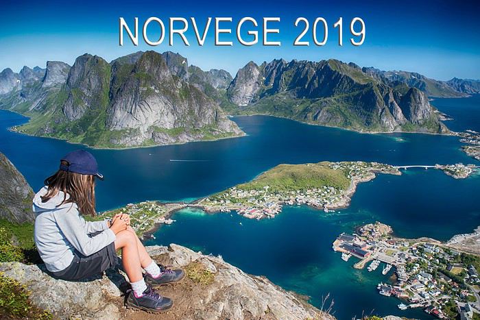
Well, the time to head back has come, so it’s time to share the 3 weeks we spent in Norway this year 🙂

Right, here are a few details before we dive in!
Who: My husband, me, and our daughter, who turned 8 during the trip
When: From July 5 to 28, 2019—three full weeks there
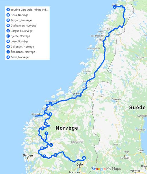
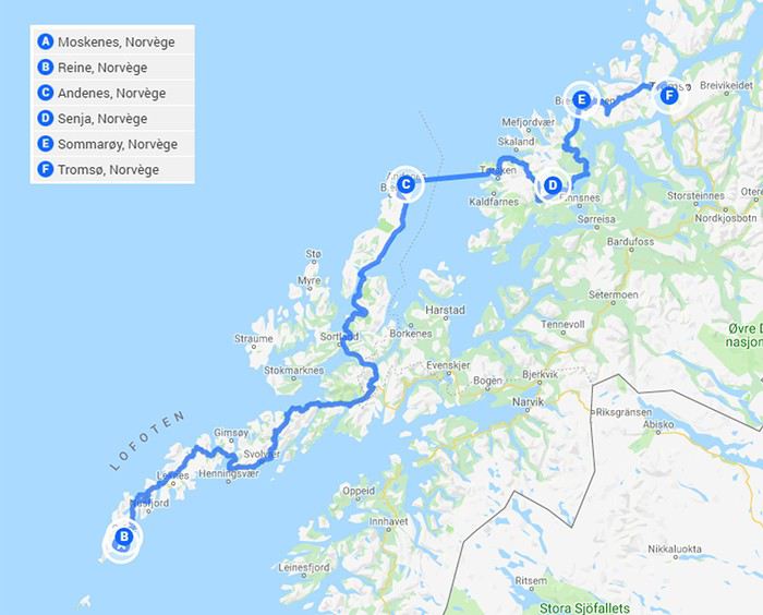
What: A one-way trip from Oslo to Tromsø, with fjords, the Lofoten Islands, and so much more on the itinerary! Since you have to make choices—and because the country is huge—we decided to skip the south around Stavanger (we thought the hikes there might be too tough for us). We also chose not to go all the way to Bergen. Our goal was to spend time in the northern islands.
The route to Bodø:

The route from Lofoten to Tromsø

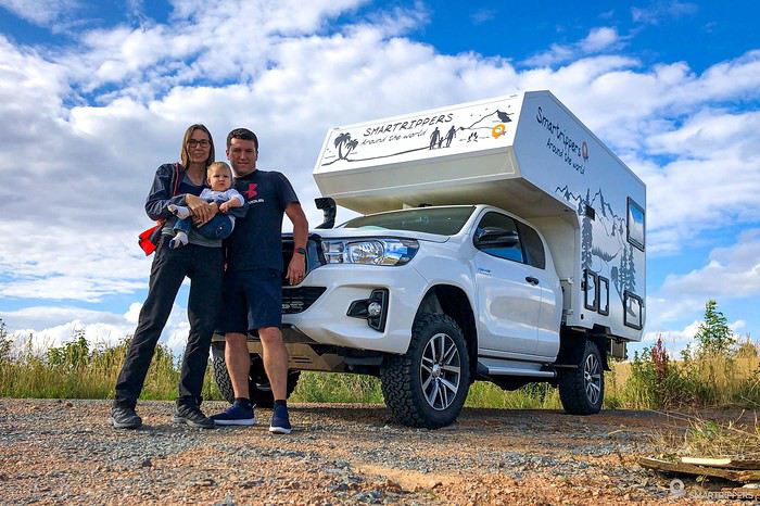
How: By camper van. Even though it’s not exactly budget-friendly, it’s really the ideal way to explore this country—especially for wild camping and adapting your route based on the weather and your mood. I’d recommend it 200%. It was our first time, and we loved it. Being able to wait out a downpour in warmth or shower after a long hike was super practical!! That said, we did have a few hiccups. The auxiliary battery (which powers the back) died, so we had to find a garage to replace it. And the biggest issue: on a narrow road, I smashed the mirror while passing another camper van 🏴☠️
Budget: Oh boy, that’s a big topic! To be honest, I didn’t tally it all up… because I didn’t want to! Everything is more expensive there, obviously. At the supermarket, for example. So I didn’t keep track—this was a vacation, we weren’t there to count every cent, even if we’re not exactly rolling in money! Ferries are pretty pricey, especially with a camper van, but there’s not much choice. Lots of toll roads too. Basically, when you go there, be prepared to open your wallet!!!
The weather: We weren’t sure what to expect before leaving—or rather, we were expecting bad weather. We were pleasantly surprised: we had almost nothing but great weather, with just a bit of rain toward the end. So the hiking trails weren’t muddy (at all?). Otherwise, it would’ve been a real pain and super slippery! Temperature-wise, we were lucky. It hovered between 15 and 21°C. Sounds chilly, but honestly, with the sun, it warms up nicely, and it was enough to wear shorts and a T-shirt almost the whole time—something I didn’t expect before we left. That said, the water temperature is freezing. The Arctic Ocean lives up to its name!! We could barely keep our feet in the water, even though those turquoise beaches were so tempting!!!
A few tips for preparation:
For wild camping: Use Park4Night—the app is amazing for finding spots and sharing our discoveries. We never would’ve dared to venture down some of those roads or trails without it.
For hikes: It’s not always easy to find hikes in the fjords that are manageable in terms of elevation, difficulty, and time. We still found some through blogs and tourist office websites. But we mostly focused on hikes in the Lofoten Islands, thanks to sites like rando-lofoten, 68north, and outt. Unsurprisingly, the level is pretty challenging. But by sticking to the “easy” ones, we managed just fine without being super trained, and we saw some incredible views!
Alright, no more waiting—let’s go! Follow me!
For those who want the "moving version," check out the video here, on page 3: https://voyageforum.com/v.f?post=9817074;live=1;#9817074
4 years... it’s been so long!!!
What a pleasure to be back on VF and, most of all, to see all the forum members again 🙂
And what a joy to read the travel journals of those travel addicts who were quicker than their own shadow to share their discoveries. Their keyboards and mice must’ve been itching
I’ll admit I’m feeling a bit of that itch too, but I’m way too lazy to dive into the story of our latest trip—last summer in the northwest USA. I’ll probably get to it later, but it might take a while! So, I’m jumping into the short recap of our *way* too short trip to Iceland at the end of April 2024. And even though it’s not the done thing, I’m going to spoil it and start with the conclusion: it was *amazing*!!!
Back in February, on the eve of leaving for a few days’ holiday in Alsace, we started wondering what we could do for Easter break. Scotland and Iceland were the top contenders. The boys are growing up, but they still travel with us often, and they tipped the scales in favor of Iceland. Since we decided a bit late, before booking the flights, I took a quick look at available accommodations. There wasn’t much left, and some were at crazy prices, but I managed to line up a decent itinerary with places that seemed like good value for money. I read travel journals on VF and blogs I could find, picked up bits of info from Facebook groups, and the route quickly took shape—even if I struggled with the place names, mixing them up and forgetting them. The dream could begin...

Bookings
Flight tickets bought directly from Fly Play’s website: 1520 € for the four of us (adult fare), with just two checked bags and one carry-on each. It was the compromise we found to keep costs down while still fitting all the bulky clothes we’d need. Late April isn’t quite winter anymore, but it’s not quite spring either, so we packed for chilly weather. Fly Play is Icelandair’s low-cost airline. No complaints: check-in was quick, service was efficient, and the flights were on time.
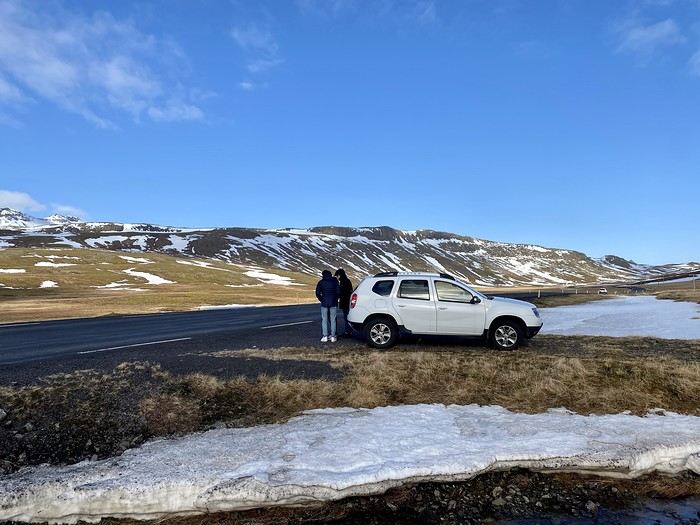
The car. Booked with Golden Circle car rental, a small family-run business with offices just 5 minutes from the airport. I’d read good things about them, and I can confirm everything went smoothly with our Dacia Duster—it wasn’t brand new, but it was reliable and spacious. We paid 463 € for the week, with full insurance included. The manager picked us up at the airport 10 minutes after I messaged him on WhatsApp to say we’d arrived. For the return trip, since our flight was super early and the agency wasn’t open yet, we agreed to leave the car in the airport parking lot and sent him a photo of the spot so he could find it. Super convenient! I read *so* many questions on Facebook groups about insurance: *Should I get the max coverage or not? I’ve got a Visa Premier, I’ve never had an accident, it adds 100 €...* Between sandstorms that can damage the bodywork and skidding off the road due to bad weather (we saw a few cars in ditches!), we decided to go for the rental company’s max insurance to be safe. It was also a requirement for leaving the car in the airport parking lot on our way back, since we couldn’t do the final inspection.
Accommodations were all booked on Booking.com and Hotels.com: - 2 nights in a cottage at Fossatun Country Hotel, near Borgarnes (we rented the sunset cottage—great spot, with a nice view and separate from the other lodgings) - 1 night in an apartment at Bakki Hostel and Apartments, in Eyrarbakki (top-notch) - 1 night in a gorgeous (and pricey!) apartment at Vik Apartments - 2 nights in a family room at Adventure Hof Hotel (perfect location) - 1 night at Blue Viking Studio near the airport (meh, but fine for a few hours’ sleep before an early flight) Total: 1234 €, averaging 176 € per night for 4-person accommodations.
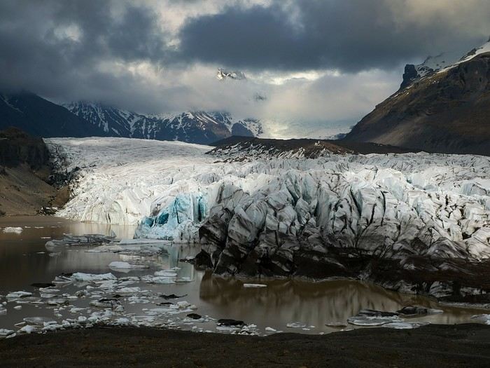
The itinerary Day 1: Arrival around noon at the airport - Hraunfossar / Night at Fossatun Country Hotel Day 2: Snæfellsnes Peninsula / Night at Fossatun Country Hotel Day 3: Bruarfoss - Geysir - Gullfoss - Reykjadalur hot springs / Night in Eyrarbakki Day 4: Seljalandsfoss and Gljúfrafoss - DC-3 wreck (the one near Seljalandsfoss) - Skógafoss - Kvernufoss - Sólheimajökull (hike to the foot of the glacier) - Dyrhólaey - Reynisfjara Beach / Night in Vík Day 5: Fjaðrárgljúfur Canyon - Vatnajökull (3-hour hike to Svartifoss and Skaftafell) / Night in Hof Day 6: Múlagljúfur Canyon (2h45 hike) - Fjallsárlón - Jökulsárlón and Diamond Beach - Svínafellsjökull / Night in Hof Day 7: Drive back - Reykjavik - Sky Lagoon / Night in Keflavík Day 8: Flight back at 6 AM
That’s the practical side covered. I’ll leave you with a photo of our trusty steed.

My first trip to Iceland, in 1974.
Yes, you might be surprised: my first trip to Iceland dates back to July 1974. It’s been a little over 50 years since I first set foot on Icelandic soil. I was 23 years old. At the time, I was a geography student. I had just earned my bachelor’s degree and was finishing my master’s (what we’d now call a "master’s 2") in physical geography, with two specialties: glaciology and volcanology. In both fields, professors showed us slides of Iceland—glaciers and volcanoes—and in tutorials, we worked on maps and documents related to the physical geography of Iceland. So there you have it: ice and fire, in Icelandic « ís og eldur », I learned that year that it was Iceland’s national motto, and that’s what drew me there for my first big trip.
Iceland in 1974 was very different from today. It wasn’t a common destination. There were practically no tourists or tourist infrastructure. Some sites now famous and overcrowded were only accessible after hours of hiking on rough, unmarked trails. GPS didn’t exist, but I had managed to get local 1:100,000 maps that were pretty well done. I took my time to circle the entire island, camping in the wild. Most of my meager budget went toward the flight ticket and renting a Volkswagen "Beetle."
There were no paved roads in the country except in central Reykjavík and the main street of Akureyri. What’s now called Route 1 was everywhere dirt and gravel, pretty bumpy in places. According to my maps, this road didn’t allow for a full loop around Iceland: a section of about a hundred kilometers was missing on the south coast. But when I arrived in that area, I learned at a gas station that the last missing section had just been completed, finally allowing a full loop without backtracking. It was the section crossing the vast Skeiðarársandur, southwest of Vatnajökull. The new road was just a bulldozer track through this black ash desert. We crossed the multiple channels of the sandur on long single-lane wooden bridges. On these long pilings, the road was made of roughly nailed thick planks that made an awful racket when the car drove over them.
A nasty surprise: the cost of living. The difference with France seemed huge—everything was two to three times more expensive than back home. Prices were way beyond my tiny budget, and I wondered how I’d manage to get by.
The Icelanders back then were very different from today. From the start, I felt like a real outsider, ostracized, even outright rejected. Several times, when I asked for permission to pitch my small tent near a farm, the door would slam shut as soon as I asked (in English). Without a word… *Bam!*
So I struggled to feed myself, lacking money. I mostly bought loaves of sliced bread and corn flakes (unknown in France at the time), which I ate with cold, sugary milk. It was the cheapest and most filling thing I could find.
In Reykjavík, my only luxury was daring to enter a snack bar. There, I’d treat myself to a coffee or tea, having quickly learned that after paying for a cup once, you could go back to the counter and have it refilled as much as you wanted. I dreaded being asked if I wanted something to eat because I couldn’t afford it. Luckily, no one asked. So, alone in my corner, I’d pull out my loaf of sliced bread from my backpack and make sandwiches with the contents of the two plastic bottles on every table—one red, one yellow: ketchup and sweet mustard. I avoided the sideways glances from other customers. I’d eat my sandwiches and leave, both full and warmed up.
One time, near Selfoss, I saw a truck stop by the road and pick up two large aluminum cans left at the end of a farm track. A little further down the road, two more similar cans. I realized these cans were there to be collected by… well, I didn’t know who. No one in sight for miles. So, I’ll admit it: I stopped and opened one of those large cans, which contained a dairy product—a kind of very dense, compact white cheese (I later learned it was skyr). I scooped a nice layer from the top, smoothed the surface with my spoon, and carefully closed the can again. Yes, I know it wasn’t right, but that was over fifty years ago, and I can admit it now since the statute of limitations has surely passed, right? Another time, I boiled a piece of dried fish, hard as wood, for a long time on my camping stove—fish I’d taken from huge outdoor drying racks by the side of the road. On the road heading north from Reykjavík, the Akranes underwater tunnel didn’t exist yet. To get to Borgarnes and Snæfellsnes, you had to go around Hvalfjörður. Following the shore of this long fjord, I stumbled upon a whaling station in full operation. Intrigued by the plumes of steam and the sounds of machinery from the road, I stopped, and surprisingly, no one stopped me from entering the vast platform where workers were butchering a large whale. I’ll never forget the acrid smell of those huge piles of meat and bones, fat and guts, the screams of saws and winches, the steam from the boilers… A monstrous, hallucinatory sight that would shape a major interest for the rest of my life: whales.
At the end of my journey, I spent three days in the Westman Islands. The famous eruption of the Eldfell volcano had happened just months earlier, in 1973, and was barely over. Visiting Heimaey was one of the goals of my trip to Iceland, given my volcanology studies. Part of the fishing port was filled in by lava flows, and the entrance channel was reduced to just a few meters wide. Most of the village was covered by a layer of black, hot ash eight to ten meters thick. I walked on the roofs of houses—every now and then, a chimney or skylight would stick out. In the rain, this hot ash released intense steam; you couldn’t see twenty meters ahead. It felt like being in a giant outdoor sauna. The entire population had been evacuated during the eruption, but some residents were starting to return. Bulldozers and excavators were gradually clearing this gigantic mass of ash, street by street, layer by layer, avoiding demolishing the buried houses. A constant stream of trucks dumped these millions of tons of ash into the sea from a cliff. To finish clearing the houses, it was done with shovels and wheelbarrows, and this task was left to the homeowners. One day, I had the chance to lend a hand (or rather, a shovel) to a couple finishing clearing their house. They offered to let me pitch my tent near their place, on a thick layer of warm ash (I’d never experienced such comfort through my sleeping mat), and I’ll never forget that they gave me a big bowl of delicious soup they’d just made. The best meal I had during that trip. The next day, climbing the volcano, which was still smoking and spewing furiously, I nearly suffocated from sulfur dioxide and almost melted the soles of my shoes. So it was during this initiatory trip, 50 years ago, that my addiction to Iceland was born. The following year in Paris, by sheer chance—and perhaps helped by the magic of my amazing Kodachrome slides—I met a young woman who would become my wife. Very quickly, she became as hooked as I was on "the island of the world’s creation" (as I called it back then), and later, it was often her who’d say, "So… how about going back to Iceland this year?" We went back many times, in every season, summer and winter, and in every region of the country. And every time, when the plane starts its descent toward Keflavík Airport, we look at each other like kids invited to a birthday party, discovering the cake buffet… "Here we are… we’re back!"
Our travel conditions changed a lot afterward. With a better budget but still traveling independently, renting well-equipped 4x4s that let us go almost anywhere, at our own pace, including the highlands of the country’s interior. But always taking our time, dedicating each trip to fully exploring one region rather than rushing through kilometers. And leaving time for beautiful hikes or simply doing nothing—sitting at a viewpoint and just watching, observing the wild nature, in contemplative mode… Always staying with locals in the countryside, preferably on real farms with animals, thanks to an association of farmers offering accommodations. We speak fluent English and have learned a few common Icelandic phrases and expressions over time. With a bit of experience, we developed our little techniques for starting interesting conversations with Icelanders… who, thankfully, are no longer as distant as they were in 1974! We even made friends there.
We particularly loved the rugged, wild Iceland—not necessarily the desolate highlands of the interior, but rather the isolated regions where a few very old families still cling to their land and roots. With a soft spot for the Snæfellsnes Peninsula and especially the Westfjords, the "Vestfirðir," as the Icelanders call them. But we also love the Northeast, and even the far Northeast, so remote and where almost no one goes. Over time, we’ve done a lot of reading. We’ve learned a great deal about Iceland—its painful history, its tormented geography, its economy, its incredible medieval literature (the Sagas), and some quirks of its culture. And we greatly appreciate its contemporary authors, whose books fill several shelves in our library.
In 2008, on a return trip to Iceland, we went to the Westman Islands, to Heimaey. I hadn’t been back since my first trip in 1974, right after the Eldfell eruption. It was a pilgrimage for me, so many years later! An emotional moment seeing the huge frozen lava flow again. On the trails now set up to explore this vast chaos, people have put up signs indicating the names of the streets buried under the lava and the nature of the crushed buildings fifteen meters below. Plaques mark the locations of public buildings—here was the school, down there was the hospital… The part of the town that was under ash has been cleared, but not entirely—two streets were left partially buried, probably to show tourists. The volcano is still hot at the top. We climbed it, but this time I didn’t melt my soles.
We often talk about Iceland. We still call it "the island of the world’s creation" and tell our traveler friends how much this country fascinated and enchanted us. Those who’ve never been find it a bit odd, but everyone who’s been there understands.
You may have noticed I’m talking about it in the past tense… Indeed, I’ll admit that for several years now, we haven’t been back to Iceland, and I don’t think we’ll return. What we see on social media and in the news puts us off a bit. Mass tourism has arrived, and many developments have been made—not always for the best. Now, with two and a half million visitors a year, Iceland welcomes nearly six times its population. Tourism has become a key source of income for Icelanders. Good for them, maybe, but we don’t like it at all. We’re a bit wild, perhaps. And besides… the world is vast… We loved Iceland passionately, but we’ve always been inveterate travelers in general. So over the past fifty years, we’ve certainly explored all of Iceland’s regions, but also in the North Atlantic—the beautiful Norway, the stunning Lofoten Islands, the Shetland archipelago, the rugged and grand Faroe Islands, and then further north in the Arctic—the icy Greenland, Svalbard at the edge of the world, and even the Sjuøyane, the last islands before the North Pole, with small groups of enthusiasts and scientists on expedition ships. And many other regions of the world, but always with a taste for slightly offbeat places, both in terms of landscapes and nature and ways of life. Central Asia, the Azores, Peru, Bolivia, the Andes, Chile, Argentina, the vast Patagonia, Tierra del Fuego… and other little secret gems we won’t reveal. Not even on Voyage Forum.
But everywhere—yes, I mean everywhere—wherever you are, wherever you go, there’s always a moment when you think of Iceland…
Chris 51 - November 2025.
So happy the forum reopened last October!!!
I’ve started reading again (posts, travel journals) and chiming in on a few discussions. Now I’m stepping it up by writing a new travel journal—I’ve already posted a few between 2018 and 2020.
My latest trip was to Italy from August 27 to September 26, 2024. As the title says, it was a wander through Tuscany in parts of the region that aren’t the most visited. No Firenze-Siena-Pisa trilogy, no San Gimignano; there’ll be a quick detour into Siena, but I’ll skip the best-known sights. That choice, plus traveling in September, should help dodge overtourism. It worked out—crowds were light, sometimes very light, the whole way. Here’s the practical rundown: - a long trip outside peak season (ah, retirees!) - solo camping (caravan) - a mix of activities (hiking, mountain biking, sightseeing) in places that aren’t always packed with tourists. Still, I don’t feel like I ended up in some hidden-away spots. Not sure if this will draw any readers.
DAY 1: Tuesday, August 27, 2024 The heat was intense on the drive in across the plain; two big storms—more rain and hail than lightning and thunder—threw the weather off, the first near Imola, the second on the four-lane road up the Savio valley. I left the Cesena-Roma four-lane at the Verghereto exit and climbed up to Balze (1,100 meters). The campsite is even higher (1,200 meters), in the forest near the source of the Tevere (Tiber). Staying up here will cut down on driving for the first part of the trip: a route through the Appennino (Apennines) on the border between Toscana and Emilia-Romagna. The temperature was surprisingly mild for the altitude, the air thick with moisture by late afternoon. I drove back down from the campsite to Balze (2 km on the road) to grab groceries (it’s doable) and scout tomorrow’s hike. .
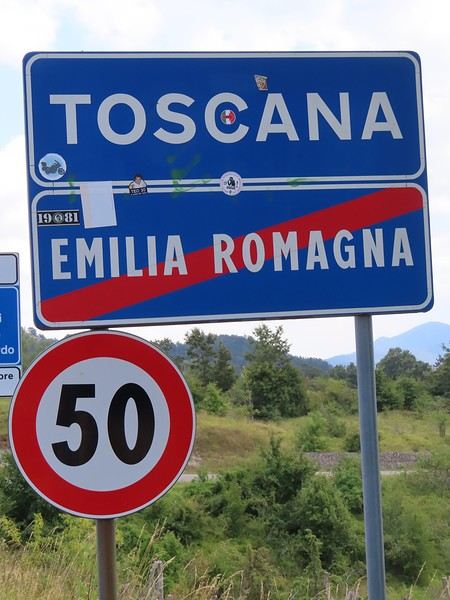
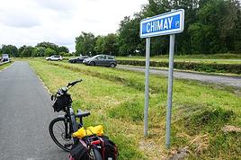
The endpoint of the planned hike is just a few meters from this sign (the trail crosses this road about 3 km from Balze). I realized Balze and the source of the Tevere (Tiber) are actually in Emilia-Romagna, not Toscana. I always thought the Tevere (Tiber), which flows toward Roma (Tyrrhenian side), started in Toscana! I’ll come back to this quirk in Day 3’s write-up.
My latest trip was to Italy from August 27 to September 26, 2024. As the title says, it was a wander through Tuscany in parts of the region that aren’t the most visited. No Firenze-Siena-Pisa trilogy, no San Gimignano; there’ll be a quick detour into Siena, but I’ll skip the best-known sights. That choice, plus traveling in September, should help dodge overtourism. It worked out—crowds were light, sometimes very light, the whole way. Here’s the practical rundown: - a long trip outside peak season (ah, retirees!) - solo camping (caravan) - a mix of activities (hiking, mountain biking, sightseeing) in places that aren’t always packed with tourists. Still, I don’t feel like I ended up in some hidden-away spots. Not sure if this will draw any readers.
DAY 1: Tuesday, August 27, 2024 The heat was intense on the drive in across the plain; two big storms—more rain and hail than lightning and thunder—threw the weather off, the first near Imola, the second on the four-lane road up the Savio valley. I left the Cesena-Roma four-lane at the Verghereto exit and climbed up to Balze (1,100 meters). The campsite is even higher (1,200 meters), in the forest near the source of the Tevere (Tiber). Staying up here will cut down on driving for the first part of the trip: a route through the Appennino (Apennines) on the border between Toscana and Emilia-Romagna. The temperature was surprisingly mild for the altitude, the air thick with moisture by late afternoon. I drove back down from the campsite to Balze (2 km on the road) to grab groceries (it’s doable) and scout tomorrow’s hike. .

The endpoint of the planned hike is just a few meters from this sign (the trail crosses this road about 3 km from Balze). I realized Balze and the source of the Tevere (Tiber) are actually in Emilia-Romagna, not Toscana. I always thought the Tevere (Tiber), which flows toward Roma (Tyrrhenian side), started in Toscana! I’ll come back to this quirk in Day 3’s write-up.
Hi there,
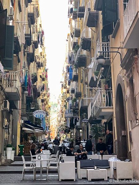
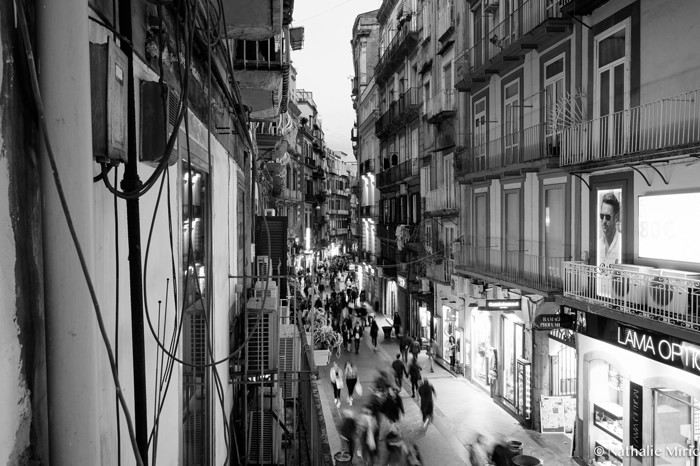
There have already been quite a few travel journals about Naples, so this is more of a photographic stroll. There aren’t too many practical tips, but feel free to ask! This trip took place in May 2019.
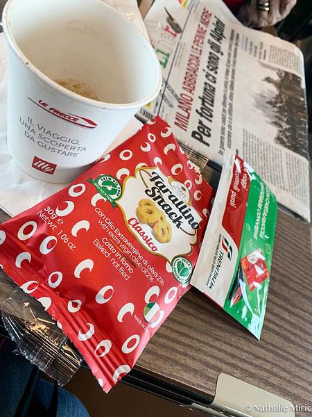
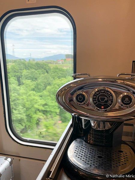
It’s the day before departure, and I’m excited as can be! I’ve wanted to see Naples and its region for a while—this city everyone calls bubbling with life. While I’m packing my bags, I get a message from the airline saying there’s going to be an air traffic controllers’ strike and my flight might not take off... What? How? You’re kidding, right? I’ve been waiting for this trip for weeks. I check online, and yes, it’s true... What to do?!? I look up the train schedule and find out the train leaves a few hours earlier, with a stop in Milan and then straight to Naples. Decision made—I’m taking the train; it’s a new experience. I leave at 5 AM on an almost empty train, arrive in Milan 4.5 hours later, and rush to catch the train to Naples. This is my first time taking the train in Italy, and I love it. After an hour of travel, a gentleman arrives with a small cart and an authentic coffee machine on top. He asks me: *caffè, signora?* Si, si, si! And he starts the machine—here’s my first Italian espresso with little biscuits.

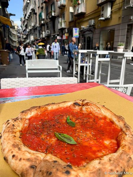
I arrive in Naples in the early afternoon. The station is packed, cars everywhere, and I’m already soaking up the atmosphere. I drop my things off at the B&B and head out to explore the city. There are incredible crowds everywhere, noise, food on every street corner, and every scene is a real photographic delight :) I’m in the Chiaia neighborhood and try my first street pizza, made right in front of me—how can I say it? Excellent. In the late afternoon, I wander through the streets before grabbing an aperitivo on one of the many terraces.


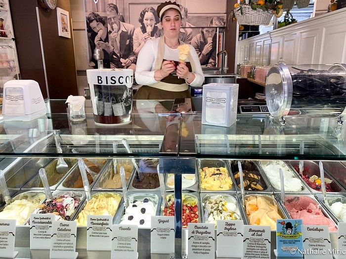
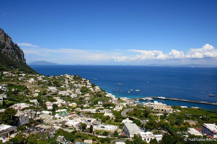
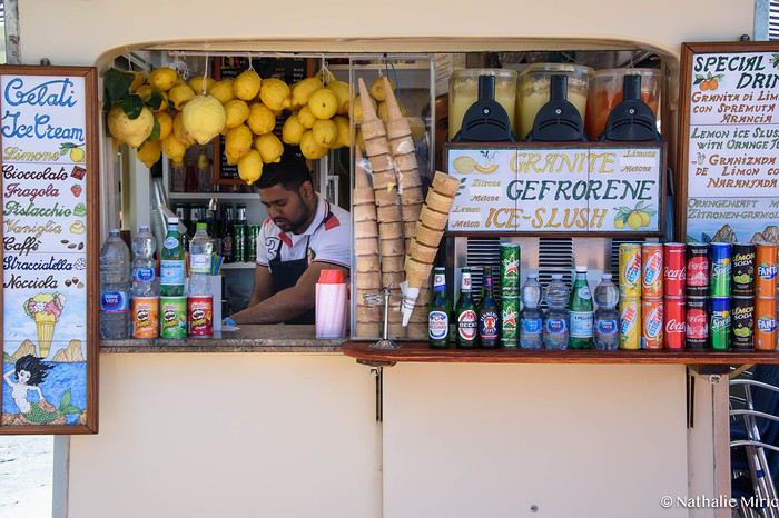
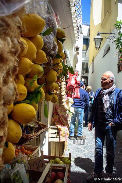
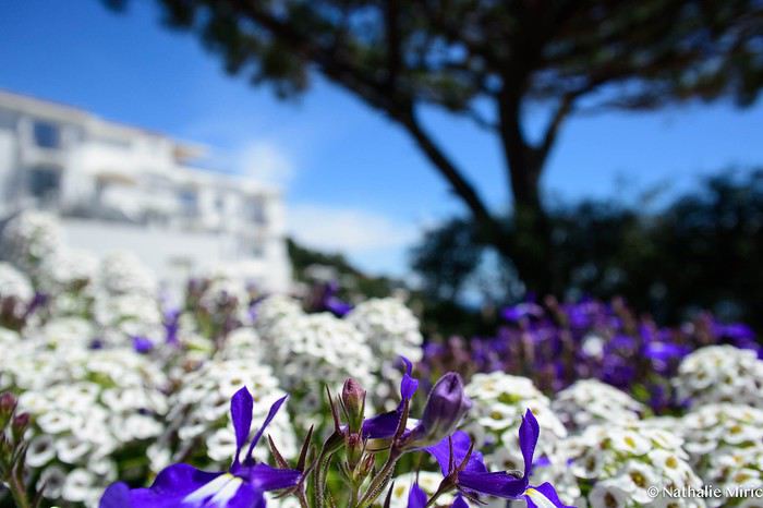
The next day, I head to Capri... It’s true, Capri is very touristy, but it’s worth seeing once in your life. After a choppy crossing, I’ve earned a good shower, a plate of pasta, and a limoncello. Then I set off for a walk through the little streets that go up and down endlessly. The view is stunning, and the kilometers add up... I’ve definitely earned a break by the pool with a gelato :)


Off on new adventures!!!
For my wife’s 60th birthday, I’m really making her happy. While I usually pick warm, sunny destinations, she’s more tempted by places where you don’t suffer from the heat.
So, it’s off to Norway!! A real challenge for me—a southern guy who’s as cold-sensitive as they come.
I keep telling anyone who’ll listen (well, just myself, really) that these aren’t the countries for me, that rain will be our travel companion, that we’ll have to face polar bears, navigate between icebergs, that there are still Vikings around, and all sorts of other things.
Of course, not wanting to make it easy, we’re driving from the Lyon area where we live.
Friends who’ve visited the country told us it’s pretty expensive to eat out (among other things), so we’re bringing supplies—especially enough for apéritifs the whole trip!!!
It’s not a camper van, but a "hotel-car" we’ll be doing! We’ll see how it goes!
As usual, I’ll try to narrate the journey with my two-cent comments, plus some little tips to avoid our mistakes—assuming I don’t lose any fingers to the cold!
Every night, I’ll count them to make sure I still have all ten! We’re not in *Ch’tis* territory but even farther Noooorth (as Galabru would say).
Note that I’m traveling with a synovial effusion in my knee! The old man’s not in great shape!!
Here we go!!
PS: As always, I’m a filmmaker, so I’ve made an effort with a few photos from my phone.
IRELAND - INTRODUCTION
We planned our 15-day trip to Ireland several months in advance to create an itinerary that would let us see a multitude of tourist attractions across various regions of the Republic of Ireland and Northern Ireland.
We researched the main attractions in each region and noted their GPS coordinates.
After that, we used Google Maps to create a packed but realistic daily route. We printed all the itineraries, and they proved extremely useful since some attractions weren’t listed on the GPS a friend lent us, and some roads aren’t clearly marked.
This way, we were able to stick to our daily schedule.
Three months before our departure, we rented a car directly from Autoescape’s website for 136.44 € over 14 days. The rental was with BUDGET, and the car we got was a ŠKODA Citigo.
This rate includes unlimited mileage, collision damage waiver (CDW), theft protection (TP) with a 1,500 € excess, and unlimited third-party liability coverage.
Some roads in Ireland are very narrow, so a compact car is much appreciated. Don’t forget that driving is on the left, and there are plenty of roundabouts.
Luckily, my partner finds driving this way easy, and our travels went smoothly.
It’s worth mentioning how courteous and patient Irish drivers are—it’s truly phenomenal.
Two weeks before our trip, we booked our accommodations at various places like B&Bs, hotels, and university campuses through Hotels.com. We’ll talk more about each of them later.
When we arrived at Dublin Airport, going through customs was quite tedious. There are two lines: one for EU citizens and another for other foreigners. The wait for non-EU travelers is significantly longer.
The car rental isn’t directly at the terminal. You have to take a shuttle to the rental center. Once there, a company representative finalizes the contract and hands over the keys to our rental car.
And off we went on our adventure!
It’s also important to note that some roads have tolls. For most of them, you pay directly at a toll booth, and the fees are usually under 2 €.
However, the M50 motorway around Dublin works differently—it’s a prepaid toll. You’re charged when you drive between Junction 6 (N3 Blanchardstown) and Junction 7 (N4 Lucan). A large purple sign warns you as you approach one of these junctions.
Cameras automatically record your license plate, and fees are applied based on your vehicle category. For a standard car, the fee is 3.10 €.
You have until 8:00 PM the next day to pay at an authorized retailer or online at https://www.eflow.ie/.
We prepaid these fees directly on the site mentioned above.
If you don’t pay within the required time, you’ll be charged substantial penalties.
For dining, most grocery stores and gas stations offer a great selection of hot and cold meals at very reasonable prices. That’s why we mostly bought our food at places like SuperValu, Lidl, Spar, and Centra.
We invite you to keep reading about our adventure in the next section.
Spitsbergen, 80° North latitude. A lost archipelago on the edge of the world, northeast of Greenland, the last lands before the pole. I’m aboard the *Grigoriy Mikheev*, a Russian ship from the Murmansk Polar Research Institute. Russian flag, Russian crew. Chartered by OceanWide Expeditions.
Last night, we were stuck in drifting pack ice in the long Hinlopen Strait. This incident led to an unforgettable barbecue and party on the ship’s foredeck, but we had to abandon our plan to head south and circle Spitsbergen. This summer, there’s too much ice in the strait, and it’s too thick. At dawn, the tide turned, allowing us to break free and head north again. The ship is now moving slowly through sea ice density that satellite maps estimate at around five-tenths. Our progress is punctuated by dull thuds: the ship’s bow constantly shoves and fractures enormous ice floes.
At breakfast, Tarik, our expedition leader, informs us that our program will be significantly altered. Since we can’t cross the strait, we’ll turn back and head north. To kick off our Plan B, Tarik plans a landing tonight on the small island of Låg (Lågøya), at 80°10' North. Last summer, he saw a large walrus colony there and hopes we’ll find them again. The weather is perfect—glorious sunshine—and walruses are truly addicted to sunbathing on the beaches.
We’ve now exited the strait and are sailing far from the coast. In case the walrus colony is there, we don’t want the ship’s approach to scare them into the water before we even see them. So, we scan the shore methodically with binoculars. We pass several bays, round a cape, and examine several shorelines littered with driftwood, but no walruses in sight. Several times, clusters of large rounded rocks trigger false alarms… but no, they’re just rocks…
Suddenly, Tarik spots them through his binoculars! On an isolated peninsula, our expedition leader’s highly trained eye has picked out, among those brown masses, the shape and white color of the enormous tusks of what he calls "the heavyweights of the Arctic!" Now, fifteen or twenty pairs of binoculars are pointed in the indicated direction… Sure enough, I see them now! They’re there, huge, sprawled in the sun on the beach. Without Tarik’s sharp eye, we might have missed them. They’re so tightly packed together that they really look like a mass of brown rocks. Only the white, saber-shaped tusks and the occasional furtive movements hint that they’re animals.
It’s 11 PM, and on the deck of the *Grigoriy Mikheev*, as you can imagine, excitement has ramped up several notches. Several of us have already rushed to our cabins to gear up, pulling on boots and life jackets in anticipation of a landing that promises to be absolutely amazing. Tarik reins in our enthusiasm a bit: Okay, so we were lucky to find them, but now we need to think about how to approach them. Not that they’re dangerous—at least not on land… Their enormous bulk and their pseudo-feet (flippers) only allow for very limited mobility. But when they feel threatened, their first instinct is to head for the water, where their perfect ease keeps them safe. So, the challenge will be not to scare them off, to avoid them bolting into the water in the first few seconds! That’s exactly what would happen if we arrived by Zodiac right in front of them.
So, Tarik decides we’ll make a wide detour to land on the other side of the peninsula where they are. From there, we’ll leave the Zodiacs on the beach and cross the peninsula on foot, about a kilometer and a half. That way, we’ll approach the herd from behind. This approach will also keep us downwind of them. There you go—with a few precautions, they shouldn’t hear us coming or catch our scent.
Everyone is geared up now and practically bursting with impatience… While the Zodiacs are being lowered into the water, Tarik and Delphine recap the approach rules: absolute silence, communication only by signs, no dragging feet on the rocks, watch your step, and strict coordination with slow movements.
Here we go… we’re off now! Spray flying from the Zodiac’s bow, icy air whipping our faces, gloves gripping the side ropes, freezing splashes, pure emotion… Ahh, I love this! We describe a wide curve offshore to round the peninsula. Ahead of us, the magnificent landscape of this intensely blue sea unfolds, with the hills of Lågøya and, in the distance, the ice-covered mountains of Nordaustlandet under the sun. It’s midnight now. In July, at 80 degrees North, the sun is just like midday.
This navigation takes us far from the walruses, on the other side of the cape. Easy landing on a shoreline of large pebbles covered in giant seaweed brought in by the currents. They look like long strips of plastic—sometimes translucent, sometimes white, beige, or orange. In places, there are huge tangled layers of it. Our boots sink into this material, which gives off a strong iodine smell. Unfortunately, there’s also some plastic waste—fishing floats and net debris. Seeing this here is crazy… A little farther on, in a cove, tides and storms have piled up numerous tree trunks from Siberia.
We begin crossing the peninsula on foot, staying close together. We’re walking on a nearly deserted polar tundra. We’re only ten degrees of latitude from the North Pole here. The violent winds and extreme temperatures that dominate this island for nine months of the year allow only a few rare plants to grow, close to the ground, between the rocks. In places, rocks are covered with large patches of black lichen.
Gérard, rifle slung over his shoulder, constantly scans the terrain. Tarik and Delphine are also very vigilant. We know no one ever lands here, and although this environment isn’t ideal for bears, you never know—better to be cautious. The terrain is mostly flat, but whenever a small rise blocks our view, Gérard moves ahead and only signals us to proceed when he’s sure there’s no "big man in fur" (tradition dictates we don’t name the polar bear).
After a few hundred meters, we find an enormous whale vertebra. Judging by the state of the bone, it’s likely a relic from the whaling era that ravaged this area in the 17th century and all over northern Spitsbergen. A little farther on, the remains of a grave catch our attention. The only human trace on this remote island, this burial is surely very old, also likely dating from the whalers’ time. But this whaler’s final resting place didn’t shelter him for long—there’s not much left, just a piece of skull and a few broken bones. Due to the permafrost, the body could only be buried a few dozen centimeters deep, between some planks held in place by large stones. This makeshift grave was probably ravaged by a bear shortly after the burial. Several stone blocks are overturned, the planks are broken open. We only linger for a minute to pay our respects to this whaler, whose poor remains now merge with the mineral landscape.
A slight rise bulges in the center of the peninsula, and here we are at the highest point. If our orientation is correct, we’re heading straight for the walrus colony. A moment of emotion… my heart’s pounding. Yes, they’re there, about three hundred meters ahead of us! They haven’t moved since we spotted them from the *Grigoriy Mikheev*’s deck. They’re sprawled in a heap, packed tightly together in the sun, on the shingle beach. The light breeze blowing in our faces confirms we’re on the right track—not to be sniffed out from afar by the big beasts.
By signs, Tarik tells us we’ll approach slowly, in stages, moving about thirty meters at a time, making as little noise as possible with our boots, then freezing completely for a minute or two, crouching down to let them forget us. This strategy proves excellent. We’re now less than a hundred meters away, and it doesn’t seem like our presence is perceived as a threat by the "heavyweights of the Arctic." At this distance, let’s not kid ourselves: we’re certainly spotted, but our way of approaching must seem reassuring—or at least manageable—since they’re only a few meters from the water and know they could dash into it in seconds if they felt the need.
We now advance in shorter stages—twenty meters at a time, then just ten, crouching, then freezing like statues, our breathing nearly held from emotion and concentration. We’re now thirty meters from the mastodons. Our presence must be starting to stress them because they’re moving more. While still sprawled against each other, some suddenly rear up on their flipper-feet, grunting and snorting like monstrous pigs. Their head shakes make their two enormous ivory sabers sway. They jab them into the fat of their neighbors, who in turn stir and emit irritated snorts.
At Tarik’s signal, we move a few more meters, "on velvet paws"… We’re right there now. I hold my breath, throat tight… Intense emotion, a fantastic spectacle—these enormous Arctic animals sprawled in the sun, with the magnificent backdrop of snow-covered mountains across the sound. I think to myself: *I’m here… this can’t be real!* It’s nearly 2 AM now, the air is crystal clear, and the Arctic sun bathes this scene in what might be the most beautiful light I’ve ever seen. We’re about fifteen meters away now. Tarik signals that we won’t go any closer. The walruses are still lying down, but occasionally, our close presence and the clicking of cameras trigger bouts of agitation that ripple through the herd, causing some jostling. They’re so tightly packed and tangled that it’s a bit hard to count them. In the end, we tally sixteen, plus one "little one," half-crushed in the general mass.
Seen from here, they’re truly impressive! The "sumo wrestlers of the Arctic!" According to Tarik, they must weigh about a ton—slightly more for the males than the females—and the "little one" must already be around 200 kg. When the weather’s nice like today, they love sprawling on the beaches to soak up the sun.
Walruses are marvels of Arctic adaptation. They can modify their blood circulation depending on thermal conditions. They withstand extreme cold by directing most of their circulation to vital organs (heart, lungs) and minimizing peripheral blood flow (skin and limbs) to prevent heat loss. Conversely, when they sunbathe, they direct most of their blood flow to the skin, turning themselves into true solar collectors.
At this latitude, there’s practically no difference in sunlight between day and night. Noon or midnight, the sun’s angle barely changes. Walruses make the most of these fair-weather phases by sprawling in the sun 23 hours out of 24… Enough to make siesta lovers dream, right? Twenty-three hours of lounging… and the twenty-fourth for eating!
And when we say "eating," what a feast! The proverb *"Who sleeps dines"* is fully justified here: when a walrus decides to feed, it gulps down between 50 and 60 kg of shellfish in an hour! Its food consists of large bivalve mollusks, which it tears from the seabed with its tusks and sucks up nonstop! A 50 kg meal certainly justifies a 23-hour nap for digestion, right? And speaking of digestion—it’s what the "big guys" in front of us are doing right now! You might wonder how we know this… Well, I’ll tell you: if you were here, downwind (or should I say *down the winds!*) of these marine giants, you’d have no doubt! Pfft… what flatulence! I can confirm that today’s scent is called *"Morsanus, from the North"* (*"Because I’m worth it!"*). Mmm, yeah… Tarik, you had a great idea putting us upwind… at least *they* can’t smell us, but we sure can!
But… heepp! Delphine discreetly signals to get our attention—she’s just spotted something: in the smooth water of the bay, a small V-shaped ripple runs along the beach, then turns toward the shore… So the colony wasn’t complete on the beach… Here’s an 800 kg bather stepping ashore now, right before our astonished eyes! She lifts her head and stays like that for a long moment, her enormous tusks half out of the water. She looks exhausted, resting a bit before coming out. Or more likely, she’s hesitating to climb onto the beach because she’s seen us… The shapeless head stays still for a moment, then violently snorts like a clogged drain! A misshapen head where you can’t make out anything that usually makes a head! No eyes, no ears, no mouth… A sort of monstrous cabbage! But the temptation to join the warmth of the "sunbathers" is too strong! Here’s our pachyderm bather climbing the few meters of the shore and sprawling right in the middle of her companions, who greet her with jostling, grunts, and tusk jabs! Then everything settles back into order—800 kg of fat and flesh added to the fifteen or so tons of local biomass. Welcome to the club!
It seems the walruses have gotten a bit used to us now. They’re moving and grunting much less. I realize it wasn’t obvious to approach them like this without scaring them into the water… It’s thanks to Tarik and Delphine’s advice that we managed it. It’s also, let’s be honest, because we’re all passionate here, and there’s been total discipline and cohesion from the start of this approach.
It’s past 2 AM now—time to head back… We’ll leave them to their wild world, to their life at the beginning of the world. We’re happy to have disturbed them as little as possible and not to have disrupted their nap too much. We leave stealthily, first backing up a few meters, then turning around and crossing the peninsula again, walking slowly, avoiding making noise with our boots as long as we’re still close.
We find the Zodiacs on the shoreline with the giant kelp. The sea is like a lake—easy boarding. We make another wide loop to round the cape, passing offshore. The sharp cold stings my cheeks and ears again—I put my hat back on. The cold—I hadn’t thought about it at all during our encounter with the walruses. In the Zodiac, with the engine noise, no one speaks. The faces and smiles are those of men and women who’ve just crossed an inner frontier—the one that separates dream from reality. But tonight, that frontier was porous, and the dream entered reality.
We return to the *Grigoriy Mikheev*, waiting at anchor. It’s past 3 AM, but I don’t feel any fatigue. A few minutes later, I’m in my bunk, rocked by a gentle swell and the hum of the engines. In the soft warmth of the blanket, a strange sleep overtakes me… A sleep filled with luminous, icy landscapes, with large beasts bearing saber-like tusks. Large beasts that sleep, snore, snort, grunt, and jostle in their sleep… in *my* sleep. An unforgettable memory. It was July 2004, in Spitsbergen.
Chris51.
Tuesday, September 12
We had to get up early that day to leave our house at 3:30 AM, as our flight from Lyon Saint-Exupéry was scheduled for 6:35 AM. In the end, our Transavia flight took off with a delay.

I’d found a round-trip flight from Lyon to Porto on the Transavia website for 58 € per person, including only a carry-on bag.

Before landing at Porto Airport, we flew over the Douro River and the famous bridge between Porto and Vila Nova de Gaia.

The Douro flows into the Atlantic Ocean.
From the airport, we took the metro, which starts above ground before diving into Porto’s underground.

Once we’d dropped off our bags at the hotel, we set off to explore Porto.


You can’t go to Portugal without riding a tram—it’s a must! So we took an old tram (Line 1) to the beach.


The Guindais Funicular connects Praça da Batalha, high up in the city, to Ribeira in the historic center near the quays.

We didn’t take it—going down the stairs was fine. A one-way ticket costs 2.5 €.


The Dom Luís I Bridge is one of the city’s icons. Built between 1881 and 1886 by engineer Théophile Seyrig, a disciple of Gustave Eiffel,


The historic Ribeira district, once run-down, is undergoing an urban revival. Porto is gradually regaining its former splendor.

Old mansions with crests are being restored, splendid façades adorned with azulejos, Baroque-style churches, yellow trams, ancient shops, trendy restaurants, hip bars, boutiques, and design hotels!


Perched at 1,200 meters above sea level in the Spanish Pyrenees, right on the border with France, the monumental Canfranc Station was inaugurated in 1928. It fell into decline in the 1970s after being abandoned by the SNCF, but it’s been restored by the Spanish hotel group Barceló, which transformed it into a luxurious five-star palace. Nicknamed the “Titanic of the Pyrenees” with its 241-meter length,


Made it safely to Portugal, can’t wait to start sightseeing and sketching—enjoying the milder weather compared to my next stop, Scotland. :) If it rains, I’ll share my great tips for sketching indoors! 😊
While planning a trip to the LOFOTEN for summer 2023 using the excellent guide *Hiking in the Lofoten*, we discovered this trek.
Sure, it’s rated as difficult, but it lets you cross the LOFOTEN on foot from north to south in 11 stages, covering 160 km and 9,193 m of elevation gain (or the reverse, of course).
So, it’s a multi-day hike, with wild camping, and no need to rent a car. Perfect...
What’s making us hesitate a bit are the island transfers (okay, I’ll admit, the difficulty is also a factor for me). These transfers require taking public transport and/or hitchhiking. But the stages are designed with this in mind, and the transfers are well explained. Plus, water isn’t an issue, and you can resupply several times, which helps keep the pack weight down.
For Jean Marie, my partner, this will be his first multi-day trek, but he’s an experienced and hardy hiker. As for me, even though I’m not as tough, I’ve already done some multi-day hikes. So, we should complement each other well.
So, are we going for it? Sold!!
Here’s the trek map: HERE
03/08 – Day 1 - Delp – Sandsletta 04/08 - Day 2 – Sandsletta – Svolvaer 05/08 - Day 3 – Svolvaer – Kleppstad + transfer to the start of Day 4 06/08 – Day 4 – Vikjorda hamlet – Store Lake 07/08 – Day 5 – Store Lake – Leknes - Transfer to Napp on Flakstadøya Island 08/08 – Day 6 – Napp – Nusfjord 09/08 – Day 7 – Nusfjord – Ramberg 10/08 – Day 8 – Ramberg – Selfjord Bay (Moskenesøya Island) 11/08 – Day 9 - Selfjord – Bunes Beach 12/08 – Day 10 - Bunes Beach - Krokvatnet Lake 13/08 – Day 11 - Krokvatnet Lake – Moskenes (campsite) and round trip to Å by bus 14/08 – Day 12 – Hike up Reinebringen – Reine – Tour of Agvatnet Lake 15/08 – Return to Bodø - flight back to France on 16/08 And here’s the inevitable recap
Introduction
We stayed on the island of Gran Canaria during the first three months of 2024. It’s the third Canary Island we’ve visited, after Tenerife and Lanzarote.
We rented an apartment in Temisas. By staying in the same place for such a long period, the total price dropped by 50%.
We also rented a vehicle to make getting around the island easier.
Why the Canary Islands, and Gran Canaria in particular? For its pleasant climate, the nature and diversity of its landscapes, the charming villages, and especially the beauty of its many beaches.
In this travel journal, you’ll find a list of the many activities we did during our stay to explore the different attractions of this island.
These attractions are categorized to make it easier to find what interests you.
Videos are included throughout the summary. Click on the image to start the video.
To jump to a specific post, here are the relevant links:
HIKES:
Roque Nublo Maspalomas Dunes - Part 1 Maspalomas Dunes - Part 2 Los Azulejos de Veneguera Barranco de Las Vacas Ventana del Bentayga (Arco del Aserrador) Caves of the King Ventana de Morro (Ventana de la Ganifa) The Dog of Bentayga Cave of the Four Doors Ventana del Nublo Artenera - Caves of Acusa Seca Temisas - El Gigante Cave Fortress of Ansite Puerto de Las Nieves - Roque de Las Nieves Temisas - Cuevas de la Audiencia Roque Bentayga Guayadeque Ravine (Guayadeque Hermitage) Guayadeque Ravine (Cueva de Bartalo) El Zumacal - Barranco Tauco Casablanca Dam (Los Dolores Dam) Ayagaures - La Angostura Dam & Gambuesa Dam Santa Brígida - Alonso Ravine & Centennial Dragon Tree Pino Santo Hike in the Azuaje Ravine Gáldar - Red Lands of Samarrita Tejeda - Charco de La Paloma Bandama Boiler (Camino Borde de Caldera Bandama) Teror - Alamo Ravine Trail – SL-4 Telde - Calasio Caves Special Natural Reserve of Los Tilos de Moya Los Azulejos - Charco de Las Aneas Fataga Ravine Arinaga Military Battery Trail Maspalomas - Las Fuentes and del Canizo Ravines Mogán - Tauro Mountain Trail Tamabada - Llanos de La Mimbre & Sobre la Cueva Viewpoints Trail Hike to the Coronadero Arch via Barranco Hondo Barranco de Silva - Hike to the Jerez Caves Gáldar - Samson Cave - La Atalaya Peak Agaete - Roque Guayedra and Guayedra Ravine Artenara - Caballero Caves Arucas - Bufadero Salt Flats Barranco de Pino Gordo - Natural Pools Telde - Los Cernícalos Ravine Las Cruces - Toba Caves & Picón Puerto de Las Nieves - Moro Cave Agüimes - Morros de Ávila Caves Juncalillo del Sur - Laguna & Salinas de Abajo Caves of Camino de San Felipe Cruz de Tejeda, Cruz Chico and Degollada Viewpoint Hike on the Patalavaca Circuit Motor Grande - Puerto Rico Arch El Montañón - Los Hornos Dam Seafront Walk - Amadores Beach – Puerto Rico Beach Las Niñas Dam El Hornillo - Omega & Omicron Caves Arteara Necropolis Mogán - El Mulato Dam Las Garzas - El Regante Dam La Plata Route - Cho Flores Dam & El Charco Hondo Vega de Acusa - La Candelaria Dam Candelaria Hermitage – Acusa Seca Viewpoint Valsequillo de Gran Canaria – Roque La Vela Ayagaures Dam – GC-602 Lomo del Palo - Monte Pavón Trail Lugar La Laguna - Levada Fataga Dam & Ravine
BEACHES:
Mogán Beach Taurito Beach Tauro Beach Amadores Beach Puerto Rico Beach Anfi del Mar Beach Patalavaca Beach Meloneras Beach Maspalomas Beach English Beach (Playa del Inglés) Las Burras Beach San Agustin Beach Las Alcaravaneras Beach Las Canteras Beach (La Cicer) Las Canteras Beach (La Puntilla) Las Canteras Beach (Santa Catalina) Aquamarina Beach El Agujero - Bocabarranco Beach Hoya Del Pozo Beach Hoya Del Pozo Beach - Lizard with amputated tail El Cabron Beach Ojos de Garza Beach El Burrero Beach
NATURAL POOLS:
Charco Azul - El Risco Agaete Salt Flats Charco de Los Espejos - Sardina del Norte Natural Pools of Punta de Gáldar Snorkeling in the natural pool of Punta de Gáldar Natural Pool La Furnia o El Clavo - Gáldar Natural Pool of Los Dos Roques Emiliano Natural Pool - El Agujero Natural Pool of El Agujero Natural Pools of Roque Prieto Natural Pool El Altillo Los Charcones de Bañaderos – Arucas Natural Pools of El Charco de Las Palomas – Arucas Natural Pools of La Laja - Las Palmas de Gran Canaria Cueva de la Reina Mora - La Garita Natural Pools of Castillo del Romeral
TOWNS:
Center
Santa Brigida Vega de San Mateo Tejeda Artenara Vallesco Teror
Southwest
Santa Lucia de Tirajana Fataga San Bartolomé de Tirajana Puerto de Mogán La Aldea de San Nicolas
North
Arucas Firgas Moya Santa Maria de Guia Gáldar Agaete Puerto de Las Nieves
East
Vegueta - Las Palmas de Gran Canaria Triana - Las Palmas de Gran Canaria Ciudad Jardin - Las Palmas de Gran Canaria Canteras - Las Palmas de Gran Canaria Telde Valsequillo de Gran Canaria Ingenio Agüimes Temisas
VIEWPOINTS:
GC-60 Route (or nearby) GC-210 Route (or nearby) GC-210 Route between the tunnel and La Aldea de San Nicolás GC-215 & GC-65 Routes (or nearby) GC-200 Route (or nearby) GC-130 Route (or nearby) & GC-605 GC-70 Route (or nearby) & GC-21 Sheep herd on GC-70 Route GC-150, GC-240, GC-305, GC-350 & GC-301 Routes GC-606, GC-295, GC-231 and GC-41 Routes (or nearby) Viewpoints – GC-1 Route (or nearby) Viewpoints - Las Palmas de Gran Canaria Viewpoints - GC-2, GC-21, GC-15, GC-216 and GC-132 Routes (or nearby) Viewpoints - GC-503 & GC-217 Routes Viewpoints - GC-604, GC-505, GC-132, GC-42 and GC-802 Routes
MISCELLANEOUS:
San Rafael Aqueduct - Telde Abandoned San Rafael Estate - La Higuera Cenobio de Valerón La Cesta - Tejeda Puerto de la Aldea Scenic Route GC-671 to El Espinillo Scenic Route GC-607 to El Chorrillo The Galdar Cube (Santiago Quarry) Scenic Route GC-504 to Ayagaures Abandoned seaside resort in the Azuaje Ravine El Bufadero de La Garita – Telde GC-505 Route Abandoned Finca Las Haciendas (Los Mocanes) – Las Vegas de Valsequillo Ruins of San Juan Battery - Las Palmas de Gran Canaria Viera y Clavijo Canarian Botanical Garden - Las Palmas de Gran Canaria Tenefé Salt Flats Los Pérez, Lugarejos & Las Hoyas Dams Monte Pavón, Gran Canaria’s little Ireland Valleseco Lagoon Recreational Area Climbing - Fataga Ravine Surfing – El Agujero El Cairete Restaurant - Carrizal de Tejeda Paragliding flight observation - Los Giles La Cuevita Ayagaures Restaurant Statues and Murals - Cruce de Arinaga Aviation Monument (Las Majoreras) & Murals – Carrizal Artistic recycling by Antonio Peñita - Ojos de Garza Rainbows
Hello,
First attempt at a travel journal for me and first post after 7 years away from this forum. 😮 I went to the island of La Palma for 15 days in September 2025. After visiting Lanzarote in February, I was looking for a different and greener island. Well, I wasn’t disappointed. 😎
We stayed in Breña Baja on the east coast of the island, 5 minutes from the airport. This choice was mainly motivated by the desire not to change accommodation during the stay and to be in a "central" location close to amenities. It worked out well, but if I were to do it again, I’d split the stay in two by getting another place in the north of the island to explore that area, which really appeals to me. Note that the island is "climatically divided in two": the west coast is sunnier and drier, while the east coast is often foggy or cloudy. It’s quite impressive when you come out of the LP-3 road tunnel connecting the two sides—you feel like you’ve changed regions even though it’s less than 3 km apart.
Flight options weren’t plentiful (no direct flights from France), so I went with Iberia, connecting in Madrid for 250 € round-trip per person excluding checked baggage (80 € round-trip for one 23 kg suitcase on this route). Make sure to buy the checked baggage at the same time as your flight, as it’ll cost about 15 € more if you add it later. I booked the tickets 5 months in advance directly on Iberia’s website. You could also take a low-cost airline to Tenerife or Gran Canaria and then a flight with a Canarian carrier, but in my opinion, that only makes sense if you’re visiting one of those islands first, as the connection isn’t "guaranteed." The ferry is an option from Tenerife (about 2.5 hours crossing).
Our departure from Lyon was initially scheduled for 6 AM but took off at 9 AM so the crew could rest after the late arrival of the previous flight. This let us grab breakfast on the airline’s dime—thanks, EU Regulation (EC) No 261/2004. 😉 Iberia took a week to reimburse me after I submitted my passport, receipts, and bank details via their online claim form.
Our small but spacious CRJ-1000 Air Nostrum
Bye-bye, Bugey nuclear plant
And hello, Madrid—or rather, its very dry region.
Our layover was initially 4 hours but shrank to 1 hour due to the previous flight’s delay. That worked out for us because Terminal 4 at Barajas is way less comfortable for resting than Lyon’s T1.

Landing with a view of Playa de la Cangrejera and del Pozo. When I say the east coast is often cloudy... 😇
First sight of "plátano" plantations. Banana farming makes up 50% of the island’s GDP!

More to come soon. [;]
Hi everyone,
There haven’t been many recent stories about Norway in winter, and since I had trouble finding info on winter hikes, I thought I’d share a little travel journal.
Back in September 2024, while planning our summer 2025 trip to Norway, I joined some Facebook groups dedicated to travel in Scandinavia and started reading travel blogs. Since winter trips were being planned at the time, I came across posts with stunning photos of northern Norway in winter. I’d always pictured monotonous landscapes of pine forests and frozen lakes, so I was pleasantly surprised to see fjords, mountain ranges, and charming colorful cabins—just like in the Lofoten Islands. Turns out, the vast pine forests are more typical of Finnish Lapland. Norway, north of the Arctic Circle, is actually much more diverse. That was all it took to suggest this destination to my three guys for our winter vacation. After some research, early March seemed ideal—good weather, long enough daylight, and great chances for northern lights. A direct flight from Paris to Tromsø sealed the deal. The only downside? The cost of cars, accommodations, and activities nearly made us back out! Everything except flights is really expensive.
Since our oldest son had an important school deadline in June, he decided to skip the trip, so we ended up going as a trio. We took a Transavia round-trip flight from Orly to Tromsø for an amazing trip from March 1st to 8th.
Want to come along?

Sunday, April 21
Everything starts with a slightly delayed boarding (due to a broken seat requiring immediate repair).
Then comes takeoff—everything goes smoothly.
1:35 PM, finally in Porto with beautiful sunshine.
The journey from the airport to the youth hostel is really cheap compared to the Rhône Express (2.60 € vs. 21.40 € round trip...). I settle into my room, which is only with girls—really friendly ones (plus a private bathroom and a small balcony).
I decide to check out a restaurant for that same evening (a 2-minute walk away) for 12.90 €, specializing in Portuguese tripe.
The night is pretty restless because I’m not used to the time difference.
Monday
I had planned to do World of Discovery but ended up skipping it. Since the youth hostel is near Trindade metro station, I walk down to Ribeira (same for the six bridges cruise—given the price, it wasn’t worth it...). I also pass by Aliados. São Bento train station is magnificent. (I’ll post the photos a bit later...)
After wandering around, I find a pretty cheap restaurant (6 €) (A Poco), but I’m still a bit hungry. I grab some churros (the vendor spoke French), and I got attacked by seagulls—it was pretty funny, though. Then I decide to walk up slowly to Graham’s cellars—it’s doable on foot.
A tour in French with a simple tasting (17 €).
The return trip is by bus (2 €). I finally get back to the youth hostel and want to try a second restaurant that isn’t listed in the *Guide du Routard* (the place is called Sai Cao). Well, I’m not disappointed at all! The waiter, who spoke English, advised me to get soup, and the owner recommended the meat. It was excellent, and the value for money was incredible (9 € total...).
Back to the youth hostel.
Tuesday—terrible weather (rain, changing conditions...).
I decide to head to the ocean anyway, but given the uncertain weather, I prefer to come back to the city. The Sé Cathedral (3 €) is magnificent and really cheap.
Then I had booked on Booking.com for the bookstore (better to buy the ticket yourself)—not disappointed either.
I finally decide to visit the Clérigos Tower—I go all the way to the top, but bad luck, it starts raining (seriously, not my day...). I walk back and take a good break.
In the evening, last restaurant at the same place as Monday, and honestly, the owner gives me a special price for my last night (5 €—yes, really...).
There was so much more to do, but with only 2 days (1 with rain...), I couldn’t do everything.
Even the language barrier wasn’t an issue. The Portuguese are incredibly kind.
PS: Photos will come later.
Flight anecdote on the way there: I thought my eardrums were going to burst...
It’s Wednesday, 9:47 AM—I won’t be long before heading to the metro for the airport...
🎭 She wanted to see Auxerre, we saw Auxerre
I wanted to see Spain, we saw Iceland
As always... 🎭
That’s how this Icelandic adventure could begin. Choosing, did you say?
Indeed, while we’d planned for months to go to Spain, while the volunteer gigs had been sorted (and for 4 months before the date), I one day announced, “I don’t want to. I don’t find any meaning in it.” Meaning, a word I’ve been using a lot for months. What’s the meaning of life? What’s the meaning of MY life? For a long time, I’ve felt this need for adventures—adventures with a capital A. For a change of scenery with a sense of the unknown. To feel that thrill of events you can’t control, of people you meet and don’t understand, and customs you don’t know.
I still announced it properly, though. Not by saying: No, we’re not going to Spain. I did it with a certain class—not sure Mélanie would say that…
I chose a country she’d dreamed of going to: Iceland was high on the list. I sent volunteer requests on the site helpx.net before telling her, so I could be proactive and not just the person who complains and whines all the time.
We’d decided that September and October would be dedicated to traveling outside France and volunteering. A method I love for traveling. Discovering locals, the culture, cool places while helping and being housed and fed. What could be better?! After volunteering for a few days in Morocco last year on a lemon plantation, after 15 days on an organic market garden in the South Morvan this August, we really appreciate this way of traveling—which is why it was the plan: Volunteering in Spain at a Buddhist meditation center, with a short volunteer stint somewhere else beforehand.

Photo taken at the Kadampa Center France in April 2025 Well, I’d be lying if I said the responses to my requests came quickly. No. They took their time. I even had to follow up with everyone I’d contacted. Internet connection issues in Iceland? But miraculously, a week later, on a Friday in Auvergne, while I’m talking to my dad, the answer arrives. “Yes, it’s okay.” My heart skips a beat. My lungs relax. Finally, I find meaning in this trip. Me, always searching for meaning—my meaning, not the universal one—I’m going to explore distant lands with a culture different from France’s. He said YES! Indeed, the person who said yes—Björn*—lives in northwestern Iceland, an area known for its fjords, and which seems a bit remote. Proof: in the ad, it says the nearest town is 35 km away, and only two buses, one on Friday and one on Sunday, go there or leave. PERFECT! It also mentions taking a kayak to collect feathers from eider duck nests and taking care of rainbow trout. Things I don’t know how to do! And She said yes! So I tell Mélanie, who’d known about my last-minute change of mind since the day before—for the umpteenth time, I must admit. A little dilemma: our month of volunteering in Spain had just been sorted, so should we cancel it? Yes! The pull of Iceland and adventure is stronger! Change of plans, then. Normally, we’d continue our route to Montauban for the 400 Coups festival with friends, then stay in the south for the Mantra festival before heading to southern Spain toward Malaga. Now, the migration will be more northward since we’re returning to Rennes Monday morning (after the 400 Coups festival, which we wouldn’t have missed for the world!!) to change our wardrobe. Indeed, the weather won’t be the same between southern Spain and northern Iceland. It was September 12, and we were leaving on the 20th! Because, yes, that same evening, after arriving at our friends’ place and quickly summarizing the situation—even trying to convince one of them to join us—we start looking at bookings.
First thing: flight tickets—which I’d already more or less looked at and knew weren’t that expensive, thanks to low-cost airlines—,
Second thing: train tickets to Paris, and oh, miracle, they’re not expensive at all. 25 € per person one way! What’s happening at SNCF?!
Third thing: accommodation for Saturday night so we could take the bus on Sunday—which I hadn’t looked at and seemed quite pricey for just a bed in a dorm—.
Sometimes, we spend months and months planning a vacation (only to change everything at the last minute… We still remember the trip to Churchill…), and here, in one day, it’s almost done. Welcome to my life. Build, deconstruct, and rebuild. Why don’t I plan ahead? You have the answer. The week in Rennes does us good. Coming back to a familiar place after a month and a half of wandering around France. Resting because we’re accumulating fatigue. I also take the opportunity to have sessions with the few people who contacted me during our August road trip, see some friends, binge on galettes (5 galette meals in 9 meals—I went all out!), and realize we really need to take winter clothes—5°C expected in Iceland—. And boom, Saturday arrives. Like a calm river? Boom ??? No, that would’ve been too simple, too idyllic. Indeed, on Wednesday, a little message from Björn—who’s the intermediary between the volunteer site owner and us—tells us the owner no longer wants to host volunteers, so it’s off for us, and he’s really sorry. And that he can try to see with a friend if they can host us, if we want. What?! Uh, that’s not possible. Me, who changed all the plans at the last minute, how do I tell Mélanie we’ve got nothing left? That’ll teach me to never be satisfied with what I have and to always plan everything at the last minute. Take a breath: after all, the situation isn’t ruined. He has a friend who might host us, and maybe there are other ads I haven’t seen. So I tell him yes, and a few minutes later, he confirms it’s good, his friend is okay to take us starting October 1st, and he’ll host us until September 30th. Phew!!! The plan seems twisted, we still don’t know what we’ll be doing, or with whom, or where, but at least we haven’t thrown money out the airplane windows. After double-checking that I understood everything correctly, after confirming we still need to go to H in northwestern Iceland, it’s good, the clouds are clearing again.

EDITOR’S NOTE: As with every travel journal I publish, I won’t force anyone to agree with my comments—they’re my own, I share my feelings, and that’s it. Your comments are, of course, welcome, but I’ll refrain from responding to any hint of controversy, as has happened in the past.
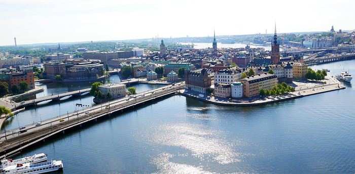
For the summer holidays of 2018, we decided to take a break from long-haul, transcontinental trips. They’re expensive and exhausting, and this year, we also had to consider our young student’s limited vacation days. So, it was a short 14-day circuit in Scandinavia. Very quickly, I had to abandon the unrealistic idea of driving door-to-door with our personal car (unlike last year—see my "Balkan Stroll" story). Too many kilometers and stops. Still, crossing Poland, Lithuania, Estonia, and Latvia before taking a ferry from Tallinn to Helsinki and Finland was tempting—what a shame.
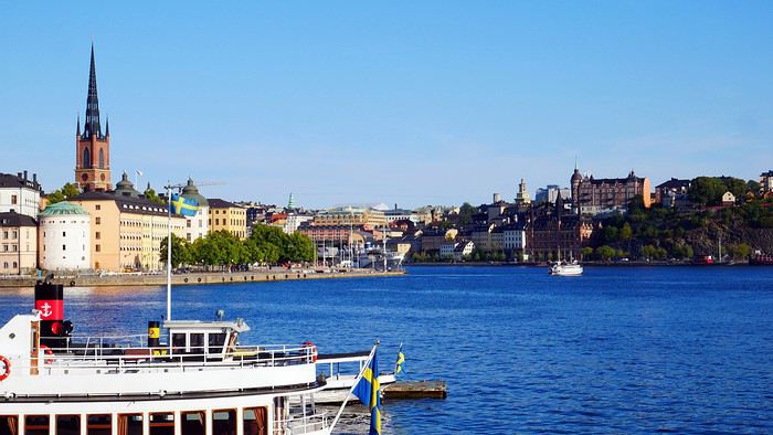
As usual, I planned ahead and started booking in early February for a mid-July departure, typically the best time weather-wise for this destination. Browsing tour operator catalogs didn’t offer much insight—just the usual circuits. Most aim for the North Cape, but we didn’t have time for that. First, via Expedia, we booked our flight tickets: Paris to Stockholm, Helsinki to Paris for the return (880 euros for three), plus a domestic flight from Oulu to Helsinki in Finland (220 euros). The unanimous advice was that there’s not much to see between the two cities, so this saved us a night’s accommodation and a day of car rental. However, the "drop-off" fees (not returning the car to the country of origin) were unavoidable. Out of 1,100 euros for 12 days of rental, this fee was significant—I say this from memory because I never received a detailed document or even the contract itself after picking up the car, despite my complaints. That said, Holiday Autos offered the best rates at the time with Hertz. Plus, I think we were unknowingly upgraded to a Volvo XC 40 T5 automatic, packed with electronics and an incredibly efficient GPS (so I lugged around my updated TomTom for nothing). I wasn’t used to it, and I’ll come back to that. For 50 euros, I also booked one of the many mandatory ferry crossings in Norway—unless you want to drive kilometers around the countless fjords. Specifically, the Bognes-Lødingen route to reach the Lofoten Islands, a must-see in Norway (though not necessarily the best choice I made—I’ll come back to that). Then, gradually via Booking.com, I reserved hotel accommodations, which wasn’t easy at reasonable prices. For three people, it’s nearly impossible to find a room with three real beds—often a sofa bed or even two separate rooms!!!! Norway isn’t a budget-friendly destination for us, yet French tourists are everywhere—groups or families traveling independently. Okay, you’re probably wondering when I’ll get started—I’m getting there... First up, Stockholm, a two-hour flight from Paris. A first for us: we’d gotten used to online check-in within 30 hours of the flight and sometimes printing our boarding passes. But, as progress never stops, at Roissy, we now also print our baggage tags at a kiosk, then place them on the conveyor belt ourselves, scan the barcode with the handheld scanner, and watch the luggage disappear—hoping it doesn’t get misrouted. With all this reduced staff, I hope ticket prices will drop. What? Huh? I’m naive... Okay, fine! Plus, during the flight, don’t expect any snacks—everything’s paid for now, except for water and coffee. I didn’t think I was on a low-cost flight!!! Picking up the car at Arlanda Airport went smoothly, except the contract signed on a tablet (progress, right?) was never emailed to me as promised—too bad... The Volvo SUV packed with electronics: as usual, aside from adjusting the mirrors and seat, I didn’t bother learning all the features and accessories for better handling. So, from the start, I felt jerky movements in the steering, independent of my control. The white-line detection was activated and corrected my direction whenever I got too close... And that’s not all—there’s also driving assistance. Besides the speed limiter, the car accelerates or brakes on its own based on the distance from the vehicle ahead. You still have to keep your hands on the wheel, though—too bad, we could’ve played cards and let it drive itself. When you slow down, if you signal to overtake and turn the wheel, it accelerates to pass. Soon, we won’t even need a driver’s license... Not to mention the little light in the side mirror to signal vehicles in the "blind spot"—very useful. But given the excessively strict speed limits in these parts, it’s still handy. I’ll unfortunately come back to this later!!!!!! In the end, we covered 4,700 km in 8 days of actual travel—no small feat!!!!!! Stockholm: still loyal to the hop-on-hop-off sightseeing buses (or the reverse), I booked our tickets online with a discount. It remains (for us) one of the best ways to visit and get around big cities. The tourist attractions aren’t that numerous. Forty kilometers from the airport, we reached our hotel, Clarion Amaranten. At reception, we were told our reservation was for four days, not two. I insisted, and they told me to call Booking.com to fix it—they couldn’t do anything themselves. Luckily, a nice blonde understood the situation and asked where we were from to lighten the mood. For me, it worked... After a few minutes of back-and-forth, we realized a namesake had booked at the same time. I think the intern got mixed up—oh well. We finally dropped off our bags and headed out under the sun for the included boat tour. It’s beautiful and relaxing under 26°C. We glided past massive cruise ships, very common in these Nordic countries, especially for fjord tours.
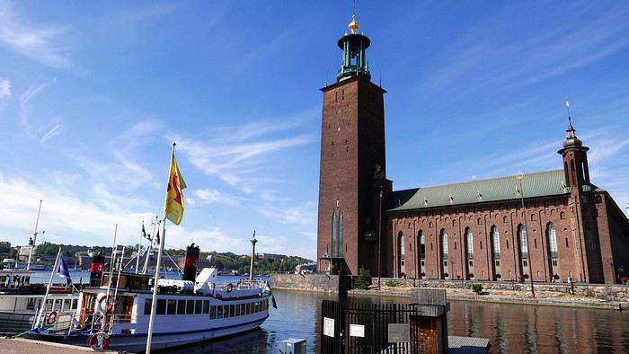
We passed Djurgården, one of the city’s 14 islands, home to the Tivoli amusement park and several museums, including the ABBA Museum and the Vasa Museum. I’m not talking about the crispy sandwiches sold since 1919 but the infamous warship that sank in the harbor on its maiden voyage in 1628 after sailing just a few hundred meters. Its intact hull was salvaged in 1961, and since then, it’s one of Sweden’s most visited museums. The country is a quarter smaller than France and has 10 million inhabitants, mostly in the three big cities (Stockholm, Gothenburg, Malmö). The rest is empty, filled with lakes and forests. The currency is the krona, with 1 euro worth about 10 SEK. Dinner in the Old Town consisted of a so-called Viking burger (more like a kebab) and meatballs—the famous Swedish meatballs with potatoes, just like at IKEA... I have to say, here, it seems the Vikings have long been just blond heads—I get it... It still cost us 550 SEK. A beer alone costs at least 9 euros!!!!
DAY 2. Sunny skies. After a hearty buffet breakfast with salmon, herring in all forms, eggs, cold cuts, bread, and pastries (don’t worry, the classics are there), we started the day by visiting the City Hall tower, famous for hosting the Nobel Prizes (except the Peace Prize, awarded in Oslo). At 106 meters tall, with 365 steps and 9 clocks, it weighs twice as much as the Eiffel Tower. Access is at fixed times in small groups for safety. You can climb up to 73 meters for a 360° view of the city. Next, we visited the Royal Palace, still the official residence of the King of Sweden, and its Treasury (entry: 160 SEK). We skipped the 12:15 PM changing of the guard—three-quarters of an hour before, dozens of onlookers were already crowding the front rows in the sun.
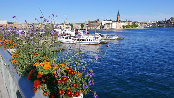
So, we took our favorite bus to rest a bit and tour the city. We also took the subway to see several "decorated" stations—love it or hate it, but it’s original. In the late afternoon, we returned to the Old Town and its Gamla Stan to find some souvenirs, even if it feels more like Bollywood than Viking country, complete with music in the shops—a nice sign of integration... One of the first things that surprised us was the very light car traffic—no traffic jams in this capital. But there are tons of electric and regular bikes, skateboards, and scooters. Also, lots of roadwork and housing construction—apparently a big need. For dinner (our only meal of the day), we treated ourselves to something local at Borgmästaren (Stora Nygatan 35). DECIDEDLY, I’M TELLING YOU EVERYTHING...
DAYS 3 & 4. Contrary to what I was told upon arrival, the hotel parking (700 SEK for 2 nights) didn’t open at 7:00 AM but at 9:00 AM on Saturday. After having to call myself (the French-speaking African receptionist couldn’t do it for me, especially after I told him I thought Croatia would win against France in the World Cup final), the kind parking attendant (partnered with the hotel—there’s the catch) arrived early and let us leave at 8:30 AM to start our east-to-west route to Norway and Oslo, 530 km away, finally beginning our summer adventure. At the border, absolutely no checks, and on the road, aside from lakes and forests, not much to see. However, tolls are very common—don’t overlook this in your budget. In Sweden, everything’s covered by the rental company, but not in other countries. In Norway, there are many automatic toll sections—cameras film your license plate and send you the bill later. So, you must register online at www.epcplc.com/rental, with or without your credit card details, and wait for the final bill. As of now, I haven’t received it, but after noting almost all of them, it should easily reach 200 euros. Roads, tunnels, and bridges are often toll-based to fund maintenance or new constructions. We reached the Norwegian capital at 3:00 PM and checked into our room. Small hiccup: the hotel parking, not reservable, was full on Saturday. Parking meters only take coins for a max of 2 hours. Luckily, tomorrow’s Sunday—free parking from 8:00 PM until Monday morning. After circling the neighborhood, I finally found a spot for my little car—even if it’s not mine, I still care about it...
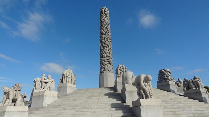
The Thon Slottsparken Hotel is slightly off-center, but a little walking won’t hurt. The nearby Hertz agency was closed—too bad, I would’ve liked to complain about still not receiving my rental contract by email... With the nice weather, we started with a walking tour of the main sights: the palace, Karl Johans gate (the main street), and some souvenir shopping to fill the display cases back home—if there’s space. We also visited the deserted Akershus Fortress, where two poor young soldiers stood guard in the scorching sun. Below it, the World Cup final fan zone was being set up. Dinner was at Rorbua for 90 euros—ouch. Hard to find, tucked away from the harbor pier. We skipped the paid ascent of the city’s only "tower" with a panoramic view—tickets had to be paid by credit card, and given the fees my bank charges, I’d had enough. Note that card payments are widely accepted here, even for small amounts. When I tried to get change in cash for a 50-euro equivalent bill, some café owners were embarrassed.
DAY 4. After discussion, we planned the day: first up, one of Oslo’s must-sees, the Vigeland Sculpture Park, featuring bronze, granite, and cast-iron works by Gustav Vigeland (1869–1943). Given the distance, we took the tram—some cars still had their old-school charm!!!! Despite the early hour, hordes of Asian tourists were already there, making photo-taking a nightmare—same everywhere they go. The park is a matter of taste... The 17-meter monolith with 121 intertwined bodies is remarkable, and rightly so. Lazy, we took the tram again to save time—same name, tight schedule. I stopped by the Hertz agency, where the overwhelmed employee promised to try to help. Given his enthusiasm, I doubted it. From the start, I’ve really felt the welcome here, at least for French visitors, isn’t great. Remember my previous reports—it’s becoming a habit. Tourist brochures aren’t available in French here either—strange... Anyway, we took a relaxing fjord cruise. Besides the quirky opera house, the beautiful summer homes on the islands were really tempting. Next, with another paid boat, we headed to the Bygdøy peninsula and its museums. We skipped the Viking Ship Museum in favor of the Norwegian Folk Museum. It features different buildings from across the country, by era and region. Unfortunately, few actors in period costumes—common in this type of tourist attraction. Its real highlight is the stave church, very beautiful. On this late Sunday afternoon, bars and restaurants competed to become World Cup 2018 fan zones—crowds everywhere. So, we decided to head back to rest and catch a glimpse of the African French team against Croatia. It’ll go down in history: a 4-2 victory, with a beautiful goal by Lloris... Go "Les Bleus"—I get it...
DAY 5. Oslo to Bergen: 450 km, but with detours, it was nearly 550. The real journey begins. Departure at 7:00 AM after sleeping in and a mediocre breakfast. Arrival at 5:00 PM—yes, driving’s slow... More tolls, but under 26°C, the real beauty starts around Geilo. First real fjord—it’s stunning. Then those houses with vegetated roofs blending perfectly into the landscape, sometimes nearly invisible... (Not bad, right? And it’s all me!!!)
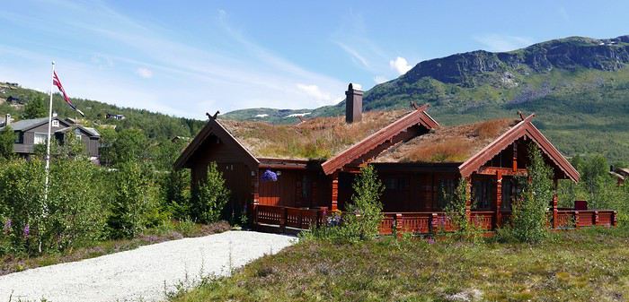
We also discovered tunnels with "indoor roundabouts" and underground roads crossing—never seen that before!! We followed the shores of Lake Tyrifjord and the Hallingdal valleys. After Geilo, views of the Hardangerjøkulen glacier (achoo!) and the Vøringfossen waterfall (Norway’s highest at 163 meters) and Steinsdalsfossen in the Hardangerfjord (the country’s second-longest). Bergen, Norway’s second city, is built between seven mountains. Aside from the colorful old docks along the wharf, there’s not much to see. At the market, stalls of fresh fish, jars of various fish eggs (all called "caviar" here), and cold cuts made from reindeer, moose, and whale.
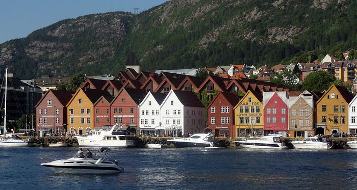
For 10 euros per person, we queued for the steep funicular for a great view of the city. Dinner was at "Fish Me," very busy. The salmon looked appetizing, and my first whale steak for 27 euros was... interesting. Our hotel, Augustin, is near the center. They charged me 150 NOK to park in the nearby public lot...
DAY 6. Bøverdalen, our evening stop, was less than 300 km away, but along the way, we had our first two scenic routes and first ferry crossing. When I got back in the car, I noticed the seagulls—rightful tenants of the harbor—had turned it into a Picasso painting overnight... First stop in Voss to peek inside its Vangskyrkja church (for a fee). The mural icons all have a marked squint, making the angels on the ceiling smile—quite the original touch. In 1277, it shocked people.
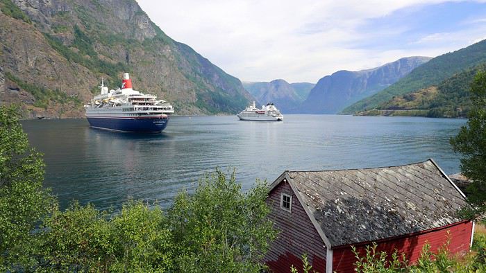
Gudvangen at the end of the Nærøyfjord offers beautiful views and a waterfall. An 11 km tunnel took us to Aurland and the Sognefjord, the king of fjords at 180 km long. Then we took Route 243 to Lærdal instead of a second long tunnel. A 47 km very narrow road with no passing except in designated spots. Buses, RVs, and trailers were in the mix—between backing up and moving forward, how do you expect me to... pass? At some spots, I had to "burn some oil" (non-edible). The beautiful viewpoints along Jotunheimen Park and its high peaks were hard-earned.
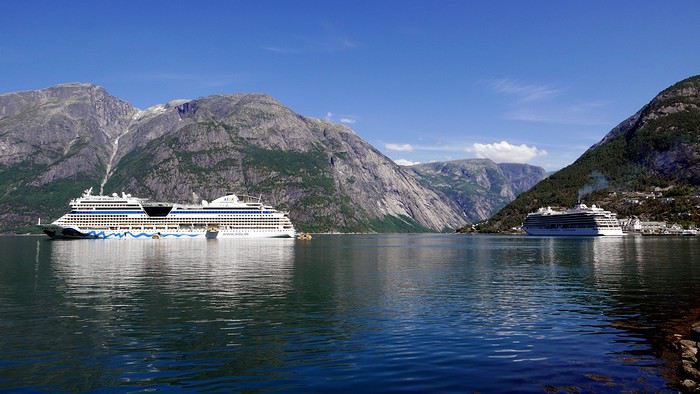
By midday, the 26°C of previous days gave way to 11°C with downpours and gusts. To reach Kaupanger, its stave church, and Route 55 (108 km), we took the Fodnes-Mannheller ferry for 119 kr (about 13 euros) for a 20-minute crossing. For these short trips, rotations are frequent, and wait times are short. The Sognefjellet route took us along lakes and snow-capped peaks—too bad the weather wasn’t cooperating. In Bøverdalen, in the middle of nowhere, we reached the Elveseter Hotel, the only one in the area, and it was packed. Luckily, it’s big. Recent reviews had us a bit worried, but personally, all the well-maintained wooden buildings gave the place charm. Our two small, simple rooms had character, and the common areas’ decor was interesting—a pile of antiques... Unless you dine on-site (reservations required for one of two sittings), the only option is to drive 20 km to Lom to see its beautiful stave church—but we didn’t go in (7 euros per person, and that’s enough). Dinner was three pizzas for 70 euros—yes, it’s expensive here.
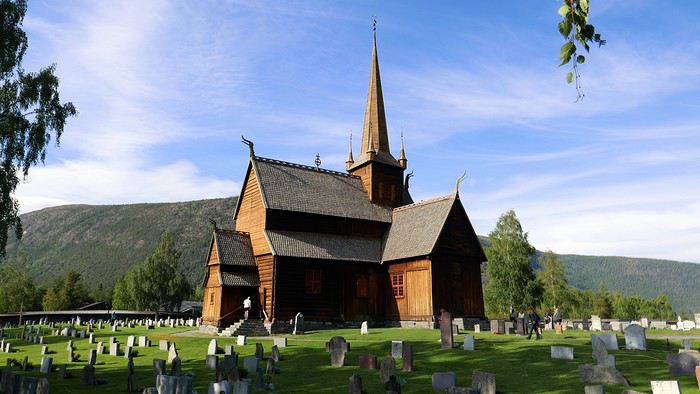
Note that in most establishments, bars, or restaurants, you have to order and pay at the counter yourself. A *stavkirke* or *stavkyrkje* (in Norwegian Bokmål and Nynorsk) is a medieval wooden church typical of Norway, though excavations suggest similar churches may have existed elsewhere in Northern Europe. About 1,300 medieval churches were recorded, with 28 preserved in Norway. In French, they’re called "églises en bois debout" (standing wood churches) because masts or posts support the roof and nave elevation, as well as the walls. The stave church is one of the most elaborate and technically advanced types of wooden construction in Northwestern Europe during the Middle Ages. This technique is represented by the Urnes Stave Church (a UNESCO World Heritage Site), Borgund (the best-preserved in its medieval form), and 25 others—from the largest, Heddal, to the smallest, Undredal, in the stunning Sognefjord, plus a few others in Northwestern Europe.
DAY 7. Heading to Trondheim—supposedly 320 km, but with detours, it was nearly 550. Unpredictable weather until about 1:00 PM, but it’s better because it’s the day of the "triples": 3 scenic routes, 3 ferries, and 3 "underwater" tunnels. No rush—here, there’s no need to "hurry to arrive before night" because as you head north, the sun lingers and sets less and less, eventually not setting at all. First, in Grotli, we took the 27 km of Route 258, *Gamle Strynefjellsvegen* (achoo), also very narrow and unpaved in the first section. Luckily, campers and RVs aren’t early risers—otherwise, I’d have had to make not just oil but olives this time. We only passed four other users. However, despite the early hour, local road workers were already on the job, and we had to ask the excavators to move several times to let us pass. At Langvatnet, we joined Route 63, called the Eagle Road here—mediocre, except for Geiranger at the end of the narrowest fjord in the country. A cruise ship had just unloaded its passengers, who rushed into the few shops. After the Eidsdal-Linge ferry (10 minutes) and Gudbrandsjuvet with its waterfalls, we tackled the famous Trollstigen (Troll’s Path), winding and very touristy. Coming from the south, we descended it. Mandatory photo stop at the tourist center and its impressive walkway. The descent into the valley was tough—the bus driver ahead of us must’ve been disabled, blind, and quadriplegic, taking two tries at every hairpin turn, causing a traffic jam behind and for those "going up" waiting at passing spots!!!
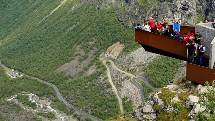
On Route 64, we took the Åfarnes-Solnes ferry instead of the initially planned 660 because my young passenger insisted on part of the "Atlantic Road." From what we’d read on blogs, only the last 11 km are spectacular, with arched bridges connecting islets. So, in Molde, we headed to Eide, then Vevang—beautiful but nothing more. The rain spoiled the scenery. Quick photo stop in Kristiansund, then a long underwater tunnel and the Kanestraum-Halsa ferry (7 km, 20 minutes) to reach the E39 toward Trondheim.
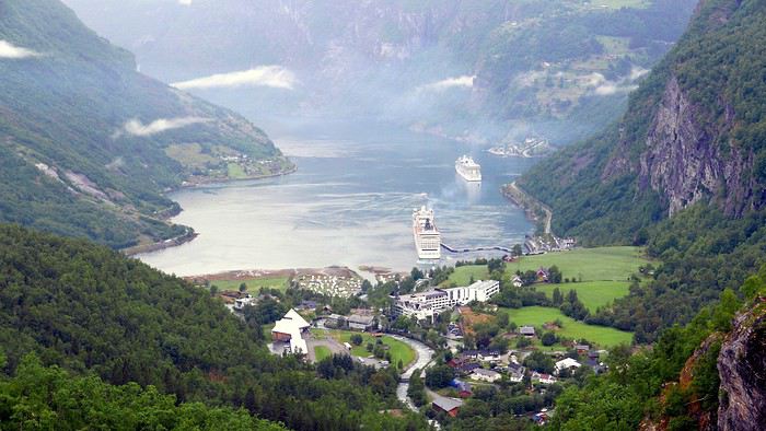
We all agreed that all these wooden houses and churches reminded us of the U.S. in their architecture—especially since, like there, a flagpole with the national flag often stands in front of homes. Trondheim, Norway’s third city, doesn’t have much to see. A university town in the country’s center, aside from its Nidaros Cathedral (closed when we arrived late), its wooden bridge, and colorful old docks on pilings—nothing else. Even finding food was complicated. As for accommodation, Booking.com had forgotten to mention that the Nidaros Pilgrimsgard is a "pilgrim hostel" on the Camino de Santiago. Monastic atmosphere and spartan rooms for reflection—same for the frugal breakfast in silence... Anyway... Luckily, the night before, in a kitschy place run by hip youngsters, I’d stocked up on a hearty assortment of marinated herring with aquavit that burned the rest of my esophagus. (BAKLANDET SKYDSSTATION) I’m really doing all the work for you...
DAY 8. Heading to Mo i Rana—633 km actually covered instead of the planned 480 through Nord-Trøndelag!!! After Steinkjer and its fjord, we decided to take Route 763, parallel to the E6, for less traffic and to see pretty mountain villages. We also stopped in Bola to see a petroglyph (Stone Age rock carving) of a reindeer. After Medja, we skipped Kjerringfoss and Europe’s largest salmon ladder (paid access). Instead, via the Holm-Vennesund ferry, we took a bit of the scenic Route 17 before reaching Mosjøen and Mo i Rana (too many ferries if you do the whole route). Along the way, we saw reindeer and moose relaxing on the road several times. Mo i Rana is small. The Ole Tobias Hotel was packed, and parking was complicated. For dinner, we crossed the street to "No. 3," the only option. Two spicy bacalao and a whale steak cost us 90 euros... At this rate, I had to find an ATM to finish the Norwegian stay properly. The 2,000 euros exchanged before leaving (at 9.28) were already partially gone. Cigarettes cost 13 euros a pack here—twice as much as in Sweden—while unleaded gas is 1.85 euros per liter.
DAY 9. Heading to the main event of the trip: the Lofoten Islands. First programming mistake: not studying the subject well, I preferred a shorter ferry crossing from further north on the mainland. But that also meant arriving further north on the islands.
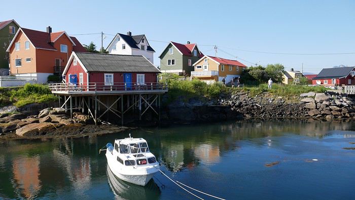
I booked for 50 euros (vehicle, driver, and two passengers included on the official Torghatten Nord site) for Bognes-Lødingen—a one-hour crossing. I should’ve left from Bodø to Leknes or better yet Moskenes and the town of Å for three hours—it would’ve saved time by avoiding the drive north and crossing to the south before heading back up the islands. Luckily, we still managed two different routes. Fortunately, the great weather returned, and I have to say, IT’S REALLY, REALLY, REALLY... BEAUTIFUL... Memory cards are melting—not just from the heat.
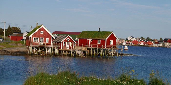
Two things worked in our favor, if I may say so, and countered my little blunder: first, I’d booked the 2:30 PM ferry, but arriving at the departure at noon, we easily took the earlier one—two hours saved. With the longer crossings, rotations with only two boats are much less frequent (8 to 12 per day depending on the season, vs. 6 to 8 for the southern route). Second, after Mo i Rana, we crossed the Arctic Circle, and today, the sun only "sets" from 12:20 AM to 1:50 AM. What luck! With a 7:40 AM departure (after sleeping in), I could drive until 11:00 PM easy!!!!!! And cover only 740 km!!!!!! Here, winters don’t drop below zero, but from early November to late January, it’s night almost all the time, with a supposed daylight clarity from 10:00 AM to 2:00 PM like a rainy day back home. But apparently, the northern lights and reflections on the snow also provide light!! I’d love to see that, but I’ll have to come back... We crisscrossed everything humanly possible, sometimes stopping abruptly in the middle of the road for photos—much to the locals’ dismay, but they’re used to the madness of temporary invaders enchanted by the place... These steep mountains "falling" into the water with all those colorful "rorbu" villages are magnificent. Rorbu are traditional fishermen’s cabins on stilts by the water, which over time have become the must-stay accommodation here—many have never housed any fishermen!!! The villages follow one after another, each more beautiful than the last. In Nusfjord, in season, pedestrians are even charged an access fee between 10:00 AM and 6:00 PM. At 7:00 PM, the booth was closed—lucky us, no crowd. The ochre wooden facades are beautiful, but don’t get too close—the seagulls nest there and see any approach as aggression. The result? Bomb-like droppings that can leave unpleasant memories. Go peek inside the grocery store—it’s kept its old-world charm. With the season, the many cod drying racks are empty. The hour turned, and our southward journey stopped in Reine—too bad for Å, not far, but fatigue got the better of me. We had to "go back up" to Kabelvåg for our rorbu at Nyvågar. We’d stocked up on groceries to eat quietly in this cozy little place (very small single beds upstairs).
DAY 10. We headed back north on the islands to reach Tromsø (grandiosely nicknamed the "Paris of the North"), with a late 7:50 AM departure despite 450 km to cover—things are getting lax at the end of the trip!!! However, this stop didn’t reveal much of interest—it’s the lake region, but meh. Tour operators include it as the last stop toward the far north. Aside from the Målselvfossen waterfall and its (paid) salmon ladder, nothing to report. We arrived at 3:00 PM, and the second room in our Quality Saga Hotel wasn’t ready yet. Plus, the parking we’d requested wasn’t accessible—the eight spots were taken. Even in this small town, free and easy parking is rare. Two souvenir shops and a main street (Storgata)—that’s it. Not to mention a nice storm that cooled things down. The only curiosity is the church, but it’s closed and under renovation—the exterior scaffolding ruins the only photo opportunity here. Otherwise, the Arctic Cathedral is visible from afar—that’s enough for us. The sun only sets for 20 minutes, from 12:40 AM to 1:00 AM!!!!! Last note before leaving this country: every morning at the breakfast buffet with all those eggs, I asked for a Norwegian omelet. Believe it or not, they don’t know the recipe for a Norwegian omelet!!!! 😏😛😉
DAY 11. Heading to Finland (with an extra hour time difference) and Rovaniemi, self-proclaimed official Santa Claus Village—it’s not nice to play on kids’ heartstrings for money!!!! On the 400 km of road (that or avoiding the Lofoten), nothing to see except two sad "Sami" shops. But there’s also AND ESPECIALLY: The run-in with a police radar mounted on the dashboard to welcome me to this country: alone, on a straight, flat road in the middle of the forest, I had this privilege—especially at a spot limited to 80 km/h instead of 100 as I thought. Of course, most well-meaning readers will think: serves him right... Only here’s the thing: in Finland, for years, speeding fines depend on the "Päiväsakko," meaning based on your income and number of children, a subtle calculation of average daily money is made and multiplied proportionally to the estimated severity of the offense... Ignorant of this, I naively but honestly answered the questions. The result? The fine was enormous—I won’t say the amount out of shame, but especially out of hatred for this country that ruined my vacation. Others like me, potential murderers, have been fined up to 170,000 euros (I wrote ONE HUNDRED SEVENTY THOUSAND EUROS) for a 40 km/h speeding offense!!!! I hope the clowns running France quickly adopt this particularly SOCIAL measure. Let the lazy and parasites of the country freely enjoy the road in their BMWs and MERCs!!! Let me tell you, I’ll spend my savings elsewhere in the future. So, a tip: be as dishonest as these conscientious police—say you’re unemployed with five kids, and maybe they’ll give you money!!!!! I’m really disgusted. No wonder in this nothing-to-see town, drivers sheepishly drive in a "little train" at 40 behind an RV without anyone daring to overtake. I think sometimes human stupidity should have limits, and the word freedom should regain its meaning!!! To those who understand, cheers. And as written at the start: trolls, abstain. I stand by what I said and sign it. After this brutal introduction to Finnish discriminatory laws, you can imagine Rovaniemi and its two-bit Santa Claus—I couldn’t care less. Even under the storm, at 6:00 PM on Sunday, even in summer, the scammer shops and profiteers of the Santa Claus Village (conveniently located on the Arctic Circle...) were already closed. Good riddance!!! The Arctic City Hotel is fine. I struggled to swallow my Tex-Mex at Pancho Villa (local chain).
DAY 12. Toward Oulu via Tornio, 200 km, and again, nothing to see in this land of lakes and forests. Detour and only photo stop in Tervola for a wooden church—my vacation is officially ruined... The Cumulus City Hotel is fine in this pleasant but empty and dull city, though it’s a university and tech hub. To cheer myself up, we splurged on a supposedly Viking meal at Harald—don’t know if the recipes are authentic, but my "Viking" knowledge stops at Vik, the animated boobs... Anyway, it’s good, unusual, and hearty.
DAY 13. After struggling to fill the tank (no station open with cash payment, only cards), we returned the chariot at the airport. The offices weren’t open yet at this early hour (8:35 AM flight), so I left the key in a mailbox without any inspection—I didn’t like that at all. I thought we’d get a propeller plane, but it was a well-filled Airbus. One-hour flight to Helsinki, the capital. Impossible to get clear information on buses to the city center, 40 km away. So, for 37 euros, we took a taxi with a trunk big enough for our three suitcases and three "cabin" bags. I’m not counting the cost anymore. At 10:00 AM, we could finally check into our large triple room at the Cumulus City Hotel on Hakaniemi Square—again, despite the size, with a fold-out armchair bed. Off to visit our last city, with the obvious purchase—you guessed it—a 24-hour bus ticket with a 1.5-hour mini-cruise for 43 euros per person...
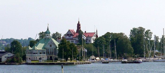
The boat tour showed that the standard of living seems high here too—summer homes (or not) on the islands are very beautiful. A small canal was even dug to save these lucky owners time on maritime transport. Apartments sell for a fortune. Back at Market Square, we grabbed a snack at the market—a reindeer kebab with dried reindeer, cheese, and a mini cracker—simple but delicious. No time to waste—ours is limited. Even if there’s not much to see tourist-wise. Four churches compete: the very busy and beautiful Helsinki Cathedral (better outside than in), its direct rival the Orthodox Uspenski Cathedral (same), the Rock Church (Temppeliaukio) and the Wooden Church (Kampin)—both as beautiful inside as out!!! Here too, very little car traffic, but tons of people—tourists or not—and joggers. In the evening, a bit tired, we headed to the off-center hotel to try the Scandinavian Hesburger chain. For connoisseurs and 29 euros, decent fries and burgers resembling Burger King’s—while the other American giant is left behind. Personal taste, I guess. The next day, we took the bus tour again, passing the Parliament and the controversial Sibelius Monument—a 24-ton pile of clanging iron pipes. Then, to kill time, we headed to Linnanmäki amusement park, on a hill overlooking the city. Rides are packed together, and a new one appears every year. Mostly family-oriented, but two or three thrill rides were packed. Despite my advancing age, I gave it a try—obviously regretted it afterward... Europe’s oldest wooden roller coaster (1950) shows the genius of its creators, with a brakeman at the back—worth the detour and passes the time. We ate (if you can call it that) on-site for 19 euros. Back "in town," classic shopping centers are numerous, but souvenir shops can be counted on one hand. No matter—we had to pack because tomorrow’s the return. We ate burgers again near the hotel and Hes... but served at the table for 67 euros. The next morning, to kill time before the 4:00 PM flight, we went to the port and its tourist market, where I splurged 15 euros on a cap to add to (or clutter) my already well-stocked collection. We finally learned that bus 615 goes to the airport, with a stop in front of our hotel where the luggage was left in storage after checking out. Still, count 40 minutes with this indirect route. Via an Air France flight operated by Finnair, after 3 hours, we returned to Roissy CDG—our vacation is truly over!!!!!!
CONCLUSION (if I may) Among the three capitals we visited, our unanimous ranking is: Oslo, Helsinki, and Stockholm—period. Despite a few imperfections in my itinerary, I’d say the Lofoten Islands are really worth it—two days on-site is a minimum. Finland, and not just because of the radars, is way below—nothing to see tourist-wise. I didn’t say nothing to do for those with time—nuance... Norwegian fjords, even if once you’ve seen one, you’ve seen them all, are really beautiful, though this destination is quite expensive for us. Norway, thanks to its oil and gas, is very wealthy, near full employment, with an annual GDP per capita of 70,000 euros!!! A pack of cigarettes at 13 euros and beer at 10 euros doesn’t make this a dream destination for an addict like me. We were very lucky with the weather—only two and a half days of rain over 14, unlike many bloggers whose stories I read before leaving. The welcome wasn’t always what we expected. Despite the massive French presence, we’re not always as welcome as Asian conquerors, to whom the West, racing to its doom, continues to roll out the red carpet—literally! I don’t regret our choice—it’s worth seeing once, but only once. At least now we know what we’re talking about!!!!! Finally, as always, here’s the link to my public slideshow on YouTube. For the private one, some spicy scenes (especially with Santa and a troll) could cause me more problems—I’ve had enough!!! www.youtube.com/...zbIgZC6Pk&t=165s See you soon, maybe for new adventures and getaways. DJ93.

For the summer holidays of 2018, we decided to take a break from long-haul, transcontinental trips. They’re expensive and exhausting, and this year, we also had to consider our young student’s limited vacation days. So, it was a short 14-day circuit in Scandinavia. Very quickly, I had to abandon the unrealistic idea of driving door-to-door with our personal car (unlike last year—see my "Balkan Stroll" story). Too many kilometers and stops. Still, crossing Poland, Lithuania, Estonia, and Latvia before taking a ferry from Tallinn to Helsinki and Finland was tempting—what a shame.

As usual, I planned ahead and started booking in early February for a mid-July departure, typically the best time weather-wise for this destination. Browsing tour operator catalogs didn’t offer much insight—just the usual circuits. Most aim for the North Cape, but we didn’t have time for that. First, via Expedia, we booked our flight tickets: Paris to Stockholm, Helsinki to Paris for the return (880 euros for three), plus a domestic flight from Oulu to Helsinki in Finland (220 euros). The unanimous advice was that there’s not much to see between the two cities, so this saved us a night’s accommodation and a day of car rental. However, the "drop-off" fees (not returning the car to the country of origin) were unavoidable. Out of 1,100 euros for 12 days of rental, this fee was significant—I say this from memory because I never received a detailed document or even the contract itself after picking up the car, despite my complaints. That said, Holiday Autos offered the best rates at the time with Hertz. Plus, I think we were unknowingly upgraded to a Volvo XC 40 T5 automatic, packed with electronics and an incredibly efficient GPS (so I lugged around my updated TomTom for nothing). I wasn’t used to it, and I’ll come back to that. For 50 euros, I also booked one of the many mandatory ferry crossings in Norway—unless you want to drive kilometers around the countless fjords. Specifically, the Bognes-Lødingen route to reach the Lofoten Islands, a must-see in Norway (though not necessarily the best choice I made—I’ll come back to that). Then, gradually via Booking.com, I reserved hotel accommodations, which wasn’t easy at reasonable prices. For three people, it’s nearly impossible to find a room with three real beds—often a sofa bed or even two separate rooms!!!! Norway isn’t a budget-friendly destination for us, yet French tourists are everywhere—groups or families traveling independently. Okay, you’re probably wondering when I’ll get started—I’m getting there... First up, Stockholm, a two-hour flight from Paris. A first for us: we’d gotten used to online check-in within 30 hours of the flight and sometimes printing our boarding passes. But, as progress never stops, at Roissy, we now also print our baggage tags at a kiosk, then place them on the conveyor belt ourselves, scan the barcode with the handheld scanner, and watch the luggage disappear—hoping it doesn’t get misrouted. With all this reduced staff, I hope ticket prices will drop. What? Huh? I’m naive... Okay, fine! Plus, during the flight, don’t expect any snacks—everything’s paid for now, except for water and coffee. I didn’t think I was on a low-cost flight!!! Picking up the car at Arlanda Airport went smoothly, except the contract signed on a tablet (progress, right?) was never emailed to me as promised—too bad... The Volvo SUV packed with electronics: as usual, aside from adjusting the mirrors and seat, I didn’t bother learning all the features and accessories for better handling. So, from the start, I felt jerky movements in the steering, independent of my control. The white-line detection was activated and corrected my direction whenever I got too close... And that’s not all—there’s also driving assistance. Besides the speed limiter, the car accelerates or brakes on its own based on the distance from the vehicle ahead. You still have to keep your hands on the wheel, though—too bad, we could’ve played cards and let it drive itself. When you slow down, if you signal to overtake and turn the wheel, it accelerates to pass. Soon, we won’t even need a driver’s license... Not to mention the little light in the side mirror to signal vehicles in the "blind spot"—very useful. But given the excessively strict speed limits in these parts, it’s still handy. I’ll unfortunately come back to this later!!!!!! In the end, we covered 4,700 km in 8 days of actual travel—no small feat!!!!!! Stockholm: still loyal to the hop-on-hop-off sightseeing buses (or the reverse), I booked our tickets online with a discount. It remains (for us) one of the best ways to visit and get around big cities. The tourist attractions aren’t that numerous. Forty kilometers from the airport, we reached our hotel, Clarion Amaranten. At reception, we were told our reservation was for four days, not two. I insisted, and they told me to call Booking.com to fix it—they couldn’t do anything themselves. Luckily, a nice blonde understood the situation and asked where we were from to lighten the mood. For me, it worked... After a few minutes of back-and-forth, we realized a namesake had booked at the same time. I think the intern got mixed up—oh well. We finally dropped off our bags and headed out under the sun for the included boat tour. It’s beautiful and relaxing under 26°C. We glided past massive cruise ships, very common in these Nordic countries, especially for fjord tours.

We passed Djurgården, one of the city’s 14 islands, home to the Tivoli amusement park and several museums, including the ABBA Museum and the Vasa Museum. I’m not talking about the crispy sandwiches sold since 1919 but the infamous warship that sank in the harbor on its maiden voyage in 1628 after sailing just a few hundred meters. Its intact hull was salvaged in 1961, and since then, it’s one of Sweden’s most visited museums. The country is a quarter smaller than France and has 10 million inhabitants, mostly in the three big cities (Stockholm, Gothenburg, Malmö). The rest is empty, filled with lakes and forests. The currency is the krona, with 1 euro worth about 10 SEK. Dinner in the Old Town consisted of a so-called Viking burger (more like a kebab) and meatballs—the famous Swedish meatballs with potatoes, just like at IKEA... I have to say, here, it seems the Vikings have long been just blond heads—I get it... It still cost us 550 SEK. A beer alone costs at least 9 euros!!!!
DAY 2. Sunny skies. After a hearty buffet breakfast with salmon, herring in all forms, eggs, cold cuts, bread, and pastries (don’t worry, the classics are there), we started the day by visiting the City Hall tower, famous for hosting the Nobel Prizes (except the Peace Prize, awarded in Oslo). At 106 meters tall, with 365 steps and 9 clocks, it weighs twice as much as the Eiffel Tower. Access is at fixed times in small groups for safety. You can climb up to 73 meters for a 360° view of the city. Next, we visited the Royal Palace, still the official residence of the King of Sweden, and its Treasury (entry: 160 SEK). We skipped the 12:15 PM changing of the guard—three-quarters of an hour before, dozens of onlookers were already crowding the front rows in the sun.

So, we took our favorite bus to rest a bit and tour the city. We also took the subway to see several "decorated" stations—love it or hate it, but it’s original. In the late afternoon, we returned to the Old Town and its Gamla Stan to find some souvenirs, even if it feels more like Bollywood than Viking country, complete with music in the shops—a nice sign of integration... One of the first things that surprised us was the very light car traffic—no traffic jams in this capital. But there are tons of electric and regular bikes, skateboards, and scooters. Also, lots of roadwork and housing construction—apparently a big need. For dinner (our only meal of the day), we treated ourselves to something local at Borgmästaren (Stora Nygatan 35). DECIDEDLY, I’M TELLING YOU EVERYTHING...
DAYS 3 & 4. Contrary to what I was told upon arrival, the hotel parking (700 SEK for 2 nights) didn’t open at 7:00 AM but at 9:00 AM on Saturday. After having to call myself (the French-speaking African receptionist couldn’t do it for me, especially after I told him I thought Croatia would win against France in the World Cup final), the kind parking attendant (partnered with the hotel—there’s the catch) arrived early and let us leave at 8:30 AM to start our east-to-west route to Norway and Oslo, 530 km away, finally beginning our summer adventure. At the border, absolutely no checks, and on the road, aside from lakes and forests, not much to see. However, tolls are very common—don’t overlook this in your budget. In Sweden, everything’s covered by the rental company, but not in other countries. In Norway, there are many automatic toll sections—cameras film your license plate and send you the bill later. So, you must register online at www.epcplc.com/rental, with or without your credit card details, and wait for the final bill. As of now, I haven’t received it, but after noting almost all of them, it should easily reach 200 euros. Roads, tunnels, and bridges are often toll-based to fund maintenance or new constructions. We reached the Norwegian capital at 3:00 PM and checked into our room. Small hiccup: the hotel parking, not reservable, was full on Saturday. Parking meters only take coins for a max of 2 hours. Luckily, tomorrow’s Sunday—free parking from 8:00 PM until Monday morning. After circling the neighborhood, I finally found a spot for my little car—even if it’s not mine, I still care about it...

The Thon Slottsparken Hotel is slightly off-center, but a little walking won’t hurt. The nearby Hertz agency was closed—too bad, I would’ve liked to complain about still not receiving my rental contract by email... With the nice weather, we started with a walking tour of the main sights: the palace, Karl Johans gate (the main street), and some souvenir shopping to fill the display cases back home—if there’s space. We also visited the deserted Akershus Fortress, where two poor young soldiers stood guard in the scorching sun. Below it, the World Cup final fan zone was being set up. Dinner was at Rorbua for 90 euros—ouch. Hard to find, tucked away from the harbor pier. We skipped the paid ascent of the city’s only "tower" with a panoramic view—tickets had to be paid by credit card, and given the fees my bank charges, I’d had enough. Note that card payments are widely accepted here, even for small amounts. When I tried to get change in cash for a 50-euro equivalent bill, some café owners were embarrassed.
DAY 4. After discussion, we planned the day: first up, one of Oslo’s must-sees, the Vigeland Sculpture Park, featuring bronze, granite, and cast-iron works by Gustav Vigeland (1869–1943). Given the distance, we took the tram—some cars still had their old-school charm!!!! Despite the early hour, hordes of Asian tourists were already there, making photo-taking a nightmare—same everywhere they go. The park is a matter of taste... The 17-meter monolith with 121 intertwined bodies is remarkable, and rightly so. Lazy, we took the tram again to save time—same name, tight schedule. I stopped by the Hertz agency, where the overwhelmed employee promised to try to help. Given his enthusiasm, I doubted it. From the start, I’ve really felt the welcome here, at least for French visitors, isn’t great. Remember my previous reports—it’s becoming a habit. Tourist brochures aren’t available in French here either—strange... Anyway, we took a relaxing fjord cruise. Besides the quirky opera house, the beautiful summer homes on the islands were really tempting. Next, with another paid boat, we headed to the Bygdøy peninsula and its museums. We skipped the Viking Ship Museum in favor of the Norwegian Folk Museum. It features different buildings from across the country, by era and region. Unfortunately, few actors in period costumes—common in this type of tourist attraction. Its real highlight is the stave church, very beautiful. On this late Sunday afternoon, bars and restaurants competed to become World Cup 2018 fan zones—crowds everywhere. So, we decided to head back to rest and catch a glimpse of the African French team against Croatia. It’ll go down in history: a 4-2 victory, with a beautiful goal by Lloris... Go "Les Bleus"—I get it...
DAY 5. Oslo to Bergen: 450 km, but with detours, it was nearly 550. The real journey begins. Departure at 7:00 AM after sleeping in and a mediocre breakfast. Arrival at 5:00 PM—yes, driving’s slow... More tolls, but under 26°C, the real beauty starts around Geilo. First real fjord—it’s stunning. Then those houses with vegetated roofs blending perfectly into the landscape, sometimes nearly invisible... (Not bad, right? And it’s all me!!!)

We also discovered tunnels with "indoor roundabouts" and underground roads crossing—never seen that before!! We followed the shores of Lake Tyrifjord and the Hallingdal valleys. After Geilo, views of the Hardangerjøkulen glacier (achoo!) and the Vøringfossen waterfall (Norway’s highest at 163 meters) and Steinsdalsfossen in the Hardangerfjord (the country’s second-longest). Bergen, Norway’s second city, is built between seven mountains. Aside from the colorful old docks along the wharf, there’s not much to see. At the market, stalls of fresh fish, jars of various fish eggs (all called "caviar" here), and cold cuts made from reindeer, moose, and whale.

For 10 euros per person, we queued for the steep funicular for a great view of the city. Dinner was at "Fish Me," very busy. The salmon looked appetizing, and my first whale steak for 27 euros was... interesting. Our hotel, Augustin, is near the center. They charged me 150 NOK to park in the nearby public lot...
DAY 6. Bøverdalen, our evening stop, was less than 300 km away, but along the way, we had our first two scenic routes and first ferry crossing. When I got back in the car, I noticed the seagulls—rightful tenants of the harbor—had turned it into a Picasso painting overnight... First stop in Voss to peek inside its Vangskyrkja church (for a fee). The mural icons all have a marked squint, making the angels on the ceiling smile—quite the original touch. In 1277, it shocked people.

Gudvangen at the end of the Nærøyfjord offers beautiful views and a waterfall. An 11 km tunnel took us to Aurland and the Sognefjord, the king of fjords at 180 km long. Then we took Route 243 to Lærdal instead of a second long tunnel. A 47 km very narrow road with no passing except in designated spots. Buses, RVs, and trailers were in the mix—between backing up and moving forward, how do you expect me to... pass? At some spots, I had to "burn some oil" (non-edible). The beautiful viewpoints along Jotunheimen Park and its high peaks were hard-earned.

By midday, the 26°C of previous days gave way to 11°C with downpours and gusts. To reach Kaupanger, its stave church, and Route 55 (108 km), we took the Fodnes-Mannheller ferry for 119 kr (about 13 euros) for a 20-minute crossing. For these short trips, rotations are frequent, and wait times are short. The Sognefjellet route took us along lakes and snow-capped peaks—too bad the weather wasn’t cooperating. In Bøverdalen, in the middle of nowhere, we reached the Elveseter Hotel, the only one in the area, and it was packed. Luckily, it’s big. Recent reviews had us a bit worried, but personally, all the well-maintained wooden buildings gave the place charm. Our two small, simple rooms had character, and the common areas’ decor was interesting—a pile of antiques... Unless you dine on-site (reservations required for one of two sittings), the only option is to drive 20 km to Lom to see its beautiful stave church—but we didn’t go in (7 euros per person, and that’s enough). Dinner was three pizzas for 70 euros—yes, it’s expensive here.

Note that in most establishments, bars, or restaurants, you have to order and pay at the counter yourself. A *stavkirke* or *stavkyrkje* (in Norwegian Bokmål and Nynorsk) is a medieval wooden church typical of Norway, though excavations suggest similar churches may have existed elsewhere in Northern Europe. About 1,300 medieval churches were recorded, with 28 preserved in Norway. In French, they’re called "églises en bois debout" (standing wood churches) because masts or posts support the roof and nave elevation, as well as the walls. The stave church is one of the most elaborate and technically advanced types of wooden construction in Northwestern Europe during the Middle Ages. This technique is represented by the Urnes Stave Church (a UNESCO World Heritage Site), Borgund (the best-preserved in its medieval form), and 25 others—from the largest, Heddal, to the smallest, Undredal, in the stunning Sognefjord, plus a few others in Northwestern Europe.
DAY 7. Heading to Trondheim—supposedly 320 km, but with detours, it was nearly 550. Unpredictable weather until about 1:00 PM, but it’s better because it’s the day of the "triples": 3 scenic routes, 3 ferries, and 3 "underwater" tunnels. No rush—here, there’s no need to "hurry to arrive before night" because as you head north, the sun lingers and sets less and less, eventually not setting at all. First, in Grotli, we took the 27 km of Route 258, *Gamle Strynefjellsvegen* (achoo), also very narrow and unpaved in the first section. Luckily, campers and RVs aren’t early risers—otherwise, I’d have had to make not just oil but olives this time. We only passed four other users. However, despite the early hour, local road workers were already on the job, and we had to ask the excavators to move several times to let us pass. At Langvatnet, we joined Route 63, called the Eagle Road here—mediocre, except for Geiranger at the end of the narrowest fjord in the country. A cruise ship had just unloaded its passengers, who rushed into the few shops. After the Eidsdal-Linge ferry (10 minutes) and Gudbrandsjuvet with its waterfalls, we tackled the famous Trollstigen (Troll’s Path), winding and very touristy. Coming from the south, we descended it. Mandatory photo stop at the tourist center and its impressive walkway. The descent into the valley was tough—the bus driver ahead of us must’ve been disabled, blind, and quadriplegic, taking two tries at every hairpin turn, causing a traffic jam behind and for those "going up" waiting at passing spots!!!

On Route 64, we took the Åfarnes-Solnes ferry instead of the initially planned 660 because my young passenger insisted on part of the "Atlantic Road." From what we’d read on blogs, only the last 11 km are spectacular, with arched bridges connecting islets. So, in Molde, we headed to Eide, then Vevang—beautiful but nothing more. The rain spoiled the scenery. Quick photo stop in Kristiansund, then a long underwater tunnel and the Kanestraum-Halsa ferry (7 km, 20 minutes) to reach the E39 toward Trondheim.

We all agreed that all these wooden houses and churches reminded us of the U.S. in their architecture—especially since, like there, a flagpole with the national flag often stands in front of homes. Trondheim, Norway’s third city, doesn’t have much to see. A university town in the country’s center, aside from its Nidaros Cathedral (closed when we arrived late), its wooden bridge, and colorful old docks on pilings—nothing else. Even finding food was complicated. As for accommodation, Booking.com had forgotten to mention that the Nidaros Pilgrimsgard is a "pilgrim hostel" on the Camino de Santiago. Monastic atmosphere and spartan rooms for reflection—same for the frugal breakfast in silence... Anyway... Luckily, the night before, in a kitschy place run by hip youngsters, I’d stocked up on a hearty assortment of marinated herring with aquavit that burned the rest of my esophagus. (BAKLANDET SKYDSSTATION) I’m really doing all the work for you...
DAY 8. Heading to Mo i Rana—633 km actually covered instead of the planned 480 through Nord-Trøndelag!!! After Steinkjer and its fjord, we decided to take Route 763, parallel to the E6, for less traffic and to see pretty mountain villages. We also stopped in Bola to see a petroglyph (Stone Age rock carving) of a reindeer. After Medja, we skipped Kjerringfoss and Europe’s largest salmon ladder (paid access). Instead, via the Holm-Vennesund ferry, we took a bit of the scenic Route 17 before reaching Mosjøen and Mo i Rana (too many ferries if you do the whole route). Along the way, we saw reindeer and moose relaxing on the road several times. Mo i Rana is small. The Ole Tobias Hotel was packed, and parking was complicated. For dinner, we crossed the street to "No. 3," the only option. Two spicy bacalao and a whale steak cost us 90 euros... At this rate, I had to find an ATM to finish the Norwegian stay properly. The 2,000 euros exchanged before leaving (at 9.28) were already partially gone. Cigarettes cost 13 euros a pack here—twice as much as in Sweden—while unleaded gas is 1.85 euros per liter.
DAY 9. Heading to the main event of the trip: the Lofoten Islands. First programming mistake: not studying the subject well, I preferred a shorter ferry crossing from further north on the mainland. But that also meant arriving further north on the islands.

I booked for 50 euros (vehicle, driver, and two passengers included on the official Torghatten Nord site) for Bognes-Lødingen—a one-hour crossing. I should’ve left from Bodø to Leknes or better yet Moskenes and the town of Å for three hours—it would’ve saved time by avoiding the drive north and crossing to the south before heading back up the islands. Luckily, we still managed two different routes. Fortunately, the great weather returned, and I have to say, IT’S REALLY, REALLY, REALLY... BEAUTIFUL... Memory cards are melting—not just from the heat.

Two things worked in our favor, if I may say so, and countered my little blunder: first, I’d booked the 2:30 PM ferry, but arriving at the departure at noon, we easily took the earlier one—two hours saved. With the longer crossings, rotations with only two boats are much less frequent (8 to 12 per day depending on the season, vs. 6 to 8 for the southern route). Second, after Mo i Rana, we crossed the Arctic Circle, and today, the sun only "sets" from 12:20 AM to 1:50 AM. What luck! With a 7:40 AM departure (after sleeping in), I could drive until 11:00 PM easy!!!!!! And cover only 740 km!!!!!! Here, winters don’t drop below zero, but from early November to late January, it’s night almost all the time, with a supposed daylight clarity from 10:00 AM to 2:00 PM like a rainy day back home. But apparently, the northern lights and reflections on the snow also provide light!! I’d love to see that, but I’ll have to come back... We crisscrossed everything humanly possible, sometimes stopping abruptly in the middle of the road for photos—much to the locals’ dismay, but they’re used to the madness of temporary invaders enchanted by the place... These steep mountains "falling" into the water with all those colorful "rorbu" villages are magnificent. Rorbu are traditional fishermen’s cabins on stilts by the water, which over time have become the must-stay accommodation here—many have never housed any fishermen!!! The villages follow one after another, each more beautiful than the last. In Nusfjord, in season, pedestrians are even charged an access fee between 10:00 AM and 6:00 PM. At 7:00 PM, the booth was closed—lucky us, no crowd. The ochre wooden facades are beautiful, but don’t get too close—the seagulls nest there and see any approach as aggression. The result? Bomb-like droppings that can leave unpleasant memories. Go peek inside the grocery store—it’s kept its old-world charm. With the season, the many cod drying racks are empty. The hour turned, and our southward journey stopped in Reine—too bad for Å, not far, but fatigue got the better of me. We had to "go back up" to Kabelvåg for our rorbu at Nyvågar. We’d stocked up on groceries to eat quietly in this cozy little place (very small single beds upstairs).
DAY 10. We headed back north on the islands to reach Tromsø (grandiosely nicknamed the "Paris of the North"), with a late 7:50 AM departure despite 450 km to cover—things are getting lax at the end of the trip!!! However, this stop didn’t reveal much of interest—it’s the lake region, but meh. Tour operators include it as the last stop toward the far north. Aside from the Målselvfossen waterfall and its (paid) salmon ladder, nothing to report. We arrived at 3:00 PM, and the second room in our Quality Saga Hotel wasn’t ready yet. Plus, the parking we’d requested wasn’t accessible—the eight spots were taken. Even in this small town, free and easy parking is rare. Two souvenir shops and a main street (Storgata)—that’s it. Not to mention a nice storm that cooled things down. The only curiosity is the church, but it’s closed and under renovation—the exterior scaffolding ruins the only photo opportunity here. Otherwise, the Arctic Cathedral is visible from afar—that’s enough for us. The sun only sets for 20 minutes, from 12:40 AM to 1:00 AM!!!!! Last note before leaving this country: every morning at the breakfast buffet with all those eggs, I asked for a Norwegian omelet. Believe it or not, they don’t know the recipe for a Norwegian omelet!!!! 😏😛😉
DAY 11. Heading to Finland (with an extra hour time difference) and Rovaniemi, self-proclaimed official Santa Claus Village—it’s not nice to play on kids’ heartstrings for money!!!! On the 400 km of road (that or avoiding the Lofoten), nothing to see except two sad "Sami" shops. But there’s also AND ESPECIALLY: The run-in with a police radar mounted on the dashboard to welcome me to this country: alone, on a straight, flat road in the middle of the forest, I had this privilege—especially at a spot limited to 80 km/h instead of 100 as I thought. Of course, most well-meaning readers will think: serves him right... Only here’s the thing: in Finland, for years, speeding fines depend on the "Päiväsakko," meaning based on your income and number of children, a subtle calculation of average daily money is made and multiplied proportionally to the estimated severity of the offense... Ignorant of this, I naively but honestly answered the questions. The result? The fine was enormous—I won’t say the amount out of shame, but especially out of hatred for this country that ruined my vacation. Others like me, potential murderers, have been fined up to 170,000 euros (I wrote ONE HUNDRED SEVENTY THOUSAND EUROS) for a 40 km/h speeding offense!!!! I hope the clowns running France quickly adopt this particularly SOCIAL measure. Let the lazy and parasites of the country freely enjoy the road in their BMWs and MERCs!!! Let me tell you, I’ll spend my savings elsewhere in the future. So, a tip: be as dishonest as these conscientious police—say you’re unemployed with five kids, and maybe they’ll give you money!!!!! I’m really disgusted. No wonder in this nothing-to-see town, drivers sheepishly drive in a "little train" at 40 behind an RV without anyone daring to overtake. I think sometimes human stupidity should have limits, and the word freedom should regain its meaning!!! To those who understand, cheers. And as written at the start: trolls, abstain. I stand by what I said and sign it. After this brutal introduction to Finnish discriminatory laws, you can imagine Rovaniemi and its two-bit Santa Claus—I couldn’t care less. Even under the storm, at 6:00 PM on Sunday, even in summer, the scammer shops and profiteers of the Santa Claus Village (conveniently located on the Arctic Circle...) were already closed. Good riddance!!! The Arctic City Hotel is fine. I struggled to swallow my Tex-Mex at Pancho Villa (local chain).
DAY 12. Toward Oulu via Tornio, 200 km, and again, nothing to see in this land of lakes and forests. Detour and only photo stop in Tervola for a wooden church—my vacation is officially ruined... The Cumulus City Hotel is fine in this pleasant but empty and dull city, though it’s a university and tech hub. To cheer myself up, we splurged on a supposedly Viking meal at Harald—don’t know if the recipes are authentic, but my "Viking" knowledge stops at Vik, the animated boobs... Anyway, it’s good, unusual, and hearty.
DAY 13. After struggling to fill the tank (no station open with cash payment, only cards), we returned the chariot at the airport. The offices weren’t open yet at this early hour (8:35 AM flight), so I left the key in a mailbox without any inspection—I didn’t like that at all. I thought we’d get a propeller plane, but it was a well-filled Airbus. One-hour flight to Helsinki, the capital. Impossible to get clear information on buses to the city center, 40 km away. So, for 37 euros, we took a taxi with a trunk big enough for our three suitcases and three "cabin" bags. I’m not counting the cost anymore. At 10:00 AM, we could finally check into our large triple room at the Cumulus City Hotel on Hakaniemi Square—again, despite the size, with a fold-out armchair bed. Off to visit our last city, with the obvious purchase—you guessed it—a 24-hour bus ticket with a 1.5-hour mini-cruise for 43 euros per person...

The boat tour showed that the standard of living seems high here too—summer homes (or not) on the islands are very beautiful. A small canal was even dug to save these lucky owners time on maritime transport. Apartments sell for a fortune. Back at Market Square, we grabbed a snack at the market—a reindeer kebab with dried reindeer, cheese, and a mini cracker—simple but delicious. No time to waste—ours is limited. Even if there’s not much to see tourist-wise. Four churches compete: the very busy and beautiful Helsinki Cathedral (better outside than in), its direct rival the Orthodox Uspenski Cathedral (same), the Rock Church (Temppeliaukio) and the Wooden Church (Kampin)—both as beautiful inside as out!!! Here too, very little car traffic, but tons of people—tourists or not—and joggers. In the evening, a bit tired, we headed to the off-center hotel to try the Scandinavian Hesburger chain. For connoisseurs and 29 euros, decent fries and burgers resembling Burger King’s—while the other American giant is left behind. Personal taste, I guess. The next day, we took the bus tour again, passing the Parliament and the controversial Sibelius Monument—a 24-ton pile of clanging iron pipes. Then, to kill time, we headed to Linnanmäki amusement park, on a hill overlooking the city. Rides are packed together, and a new one appears every year. Mostly family-oriented, but two or three thrill rides were packed. Despite my advancing age, I gave it a try—obviously regretted it afterward... Europe’s oldest wooden roller coaster (1950) shows the genius of its creators, with a brakeman at the back—worth the detour and passes the time. We ate (if you can call it that) on-site for 19 euros. Back "in town," classic shopping centers are numerous, but souvenir shops can be counted on one hand. No matter—we had to pack because tomorrow’s the return. We ate burgers again near the hotel and Hes... but served at the table for 67 euros. The next morning, to kill time before the 4:00 PM flight, we went to the port and its tourist market, where I splurged 15 euros on a cap to add to (or clutter) my already well-stocked collection. We finally learned that bus 615 goes to the airport, with a stop in front of our hotel where the luggage was left in storage after checking out. Still, count 40 minutes with this indirect route. Via an Air France flight operated by Finnair, after 3 hours, we returned to Roissy CDG—our vacation is truly over!!!!!!
CONCLUSION (if I may) Among the three capitals we visited, our unanimous ranking is: Oslo, Helsinki, and Stockholm—period. Despite a few imperfections in my itinerary, I’d say the Lofoten Islands are really worth it—two days on-site is a minimum. Finland, and not just because of the radars, is way below—nothing to see tourist-wise. I didn’t say nothing to do for those with time—nuance... Norwegian fjords, even if once you’ve seen one, you’ve seen them all, are really beautiful, though this destination is quite expensive for us. Norway, thanks to its oil and gas, is very wealthy, near full employment, with an annual GDP per capita of 70,000 euros!!! A pack of cigarettes at 13 euros and beer at 10 euros doesn’t make this a dream destination for an addict like me. We were very lucky with the weather—only two and a half days of rain over 14, unlike many bloggers whose stories I read before leaving. The welcome wasn’t always what we expected. Despite the massive French presence, we’re not always as welcome as Asian conquerors, to whom the West, racing to its doom, continues to roll out the red carpet—literally! I don’t regret our choice—it’s worth seeing once, but only once. At least now we know what we’re talking about!!!!! Finally, as always, here’s the link to my public slideshow on YouTube. For the private one, some spicy scenes (especially with Santa and a troll) could cause me more problems—I’ve had enough!!! www.youtube.com/...zbIgZC6Pk&t=165s See you soon, maybe for new adventures and getaways. DJ93.

Back from a week in the Algarve.
The goal was to get some fresh air, walk at a relaxed pace (80 km in 6 days), and visit friends.
Transavia flight: No issues YorCar rental: No issues (and cheap) B&B 1: Quinta do Mocho Turismo Rural in Estoy: Good, even if a bit remote B&B 2: Casa Luma B&B in Lagos: Disappointed (and really disappointed with room #3)
Day 1: Flight, rental car, stop at São Lourenço in Almancil, and visit to Loulé Day 2: Olhão, walk at Praia do Barril, Tavira, and evening in Faro’s old town (park at São Francisco parking lot) Day 3: Walk on the boardwalks at Quinto do Ludo, Falesia beaches, Carvoeiro Day 4: The boardwalks in Alvor, Praia da Rocha in Portimão, Ferragudo, and the boardwalks around Algar Seco Day 5: Ponta da Piedade in Lagos, walk to Praia de Luz from Praia Camilho Day 6: Burgau, Cape Sagres, Cape St. Vincent, Carrapateira, and Praia da Bordeira Day 7: "Sete Vales Suspensos" hike from Marinha Beach
Our highlights: - The Vincentine Coast (Carrapateira), much nicer than the concrete of the southern coast - The fish restaurants and Cataplana (A Barrigada in Lagos, Ribeira do Poço in Vila do Bispo...) - The boardwalks everywhere (Quinto do Ludo, Alvor, Algar Seco...) - The sun on the cliffs and Falesia Beach (it’s the local Bryce Canyon) - Chatting with the fishermen perched on the cliffs of Carrapateira - The weather (we were lucky for early March)
Our disappointments: - The towns and villages (Tavira and Lagos stand out) - The traffic off the highway - The English, the English, and more English everywhere

A travel journal—it’s been a while!
I must say, my personal situation has "changed a bit" since my last journals (my 3 kids are grown up + a divorce finalized in early 2021). So, no more long-haul family trips; now I’m focusing on multi-day hikes for my vacations. I found a hiking buddy in 2021 to join me on the Laugavegur trek in Iceland, but this year, no one was available.
That’s how the idea of a solo trek in Lapland took root—a region I’ve been dreaming about ever since I read Marie Lefevre’s 2012 journal on the topic.
Marie, who I hiked with for the first time in 2015 during my very first multi-day trek, and whom I can never thank enough for sharing her knowledge and saving me so much time.
To build my confidence for this solo trek, I hiked around Cantal in May (okay, I’m capable of spending nights alone in the middle of nowhere without being overly terrified) and camped in the Mercantour in July, where a massive storm made me realize I still had room for improvement in managing wet conditions...
After some research, I bought 2 Nylofume bags—large, ultra-lightweight ones to protect my gear in my backpack—and a set of 4 Aloksak bags in different sizes for my passport, camera, battery, etc. (and I’m so glad I did!!)
Well, I think I’m all set...
My 16/08 - Day 1 - Ritsem – Gisuris (well, almost) Wed 17/08 – Day 2 - Partly in the tent + minimal progress toward Gisuris Thu 18/08 – Day 3 - Gisuris – Laddejakha (23 km) Fri 19/08 – Day 4 – Laddejakha – Arasluokta (13 km) Sat 20/08 - Day 5 - Arasluokta – Staloluokta (12 km) Sun 21/08 – Day 6 - Staloluokta – Duottar (18 km) Mon 22/08 Day 7 - Duottar – Dareluoppal (10 km) Sammarlappa (15.3 km) Tue 23/08 - Day 8 - Sammarlappa – Tarrekaise (12 km) + halfway to Tarrekaise-Nunjes (approx. 3 km) Wed 24/08 – Day 9 – Finish Tarrekaise-Nunjes (approx. 4 km) Kvikkjokk (12.6 km) Thu 25/08 and Fri 26/08 – Around Kvikkjokk Food and gear summary
Berlin in May is really nice.
Day 1: Flight from Orly to Berlin. We had a bit of a struggle finding the train or RER to get to "Mitte". The Berliners were quite helpful in trying to guide us. Settled into our hotel, we took some time to explore the northern part of "Mitte". Dinner at a pizzeria and off to bed.
Day 2: A 3-hour guided tour of Berlin East’s must-see spots. Great idea—it helped us plan the rest of our stay. After a quick lunch at a kebab place, we set off on foot to check out the graffitied Berlin Wall, including the Swiss Army Knife mural. We stopped by some cool bars along the way (we love walking). Back by metro—we’re starting to figure out how it works. Dinner near our hotel at a Chinese restaurant.
Day 3: We visited the Jewish quarter, walked to Charlottenburg, and then headed to the Memorial Museum, a must-see. Grabbed a snack with a slightly spicy Berlin sausage and made our way to the Jewish Museum. Since we’re not Jewish, we didn’t fully grasp its content, despite the richness of the exhibits. Walked back and had dinner at a traditional restaurant.
Day 4: Back in 1968, as a high school student, I stayed with a German family to improve my German—which I’ve since forgotten. I wanted to revisit Kurfürstendamm, but it was a mistake. This West Berlin neighborhood, with its bars, nightclubs, and luxury shops, has lost all its charm. It’s now just a residential area. We headed back through one of Berlin’s many beautiful parks.
Day 5: Our last day included a visit to Charlottenburg Palace—a mini Versailles—and a stroll around the Reichstag. The cherry on top of this trip was getting to visit the dome. Luckily, I’d read that you need to book in advance to access it. Three weeks before our departure, I logged on and—surprise—I got two spots for the day before we left at 6:30 PM. I confirmed right away. It’s true that on-site, buses drop off tourists who could crowd the dome, so booking early is *totally* worth it.
Day 6: Heading home. If we’d gotten a 72-hour metro pass, we could’ve saved a day. Sure, we walked a lot, but like in Paris, being outside lets you appreciate the city’s architecture even more.
Welcome everyone!
It’s been a while since I last wrote a travel journal, but this recent trip to Iceland reignited my urge to write—both for the breathtaking landscapes we discovered and our adventure full of twists and turns!
This Iceland trip is part of our world tour, which we started back in August 2019. We (Sandrine and Flo) left by plane with our baby, Lena, who was barely 5 months old at the time. We backpacked around the Pacific for 5 months before returning home for a short break to see family. That was just before COVID hit, in late January 2020.
What followed was a bit chaotic... For the second part of our world tour, we were supposed to pick up a new vehicle: a brand-new pickup with a camper cell we planned to live in for several years. Due to lockdown, we received the cell weeks late, and with borders closing, we had to rethink all our plans.
So, we postponed our Iceland departure by over a month and a half, jumping on the first ferry accessible to French travelers after lockdown! Our goal is to spend 3 months there, from early July to late September, in our new camper cell. Our base vehicle is a Toyota Hilux we bought new, fitted with a flatbed where the cell sits, and we’ve prepped it for this trip (reinforced springs + airbags, snorkel, chassis protection, and off-road tires...). The aim is to tackle as many off-road tracks in Iceland as possible, knowing this is already our 3rd trip there (3 weeks in summer 2016 with a Durango, then 1 week in winter 2018).

I’m kicking off our travel journal here! Along with photos, I’ll also include our vlogs, which we’ve been posting weekly since our departure in June—hope you enjoy them too! :-)
TRAVEL JOURNAL SUMMARY The journey up to Denmark The horrible ferry crossing The south of the Eastern Fjords
Following my first trip from May 1st to 11th, 2025:
-Flight: easyJet Geneva-Olbia 11:50 AM-1:20 PM (306 € for 2) + 102 € for checked baggage (408 € total)
-Flight: easyJet Cagliari-Geneva 12:45 PM-2:25 PM (308 € for 2)
-Car rental: Olbia-Cagliari (rental: 338.31 € + 120 € for one-way drop-off) + 320 € mandatory insurance imposed by Centauro) 778.31 € total
*May 1st: ***OLBIA: arrived at the airport at 3:15 PM: 1-hour delay with EasyJet! 😕 Car rental issue** Big scam with B Rent (hard to find their counter because of poor signage—they demanded an extra 320 €! But after 5.5 hours, Centauro also charged 320 € for insurance!!!) On top of that, we only got the car at 6:30 PM. Due to the delay, we went straight to our accommodation after grocery shopping. -Bandi House via Mastru Giogliu, San Teodoro 0039 338 852 8569 70 € (very nice apartment, spacious, great welcome from Paola but hard to find) -Nearby: San Teodoro: stagno (birds) Lonely Planet p.159
*May 2nd: -Heading to Isola Tavolara: boat from San Paolo. It was a holiday weekend, and all the Sardinians plus tourists were heading to the island. Everyone wanted to visit the cave and all the beaches—so crowded we gave up. Plus, we had to wait for the first departure at 11 AM with a return no earlier than 2 PM, and all boats left at the same time, so everyone ended up at the cave simultaneously! GUIDES: Green Guide p.140 and Lonely Planet p.158 -Capo Coda Cavallo: beautiful spot with a stunning beach (reserve) -EAST COAST: Budoni, Posada, La Caletta (port) with many white sand beaches
*Orosei (Green Guide p.102, Lonely Planet p.201) and Galtelli (lovely medieval village) *Dorgali (Green Guide p.96, Lonely Planet p.205): don’t skip Pasticceria Mulas (exceptional pastries at very reasonable prices) -Agriturismo Nennelle in Loculi: great welcome at this fairly new site—a farm with sheep. Large room with private bathroom and outdoor tables/chairs. Small fridge, kettle, and coffee machine. 54 0039 3495343765 €
***May 3rd:*** -Hike to Gola Su Gorropu: magnificent 4-hour trek (Lonely Planet p.205, Green Guide p.96)
-Arbatax: Rocce Rosse: stunning red porphyry rocks at the end of the port (Green Guide p.87, Lonely Planet p.210) -Aer Sana in Arzana: a remote village with a very narrow, picturesque road (there’s actually a second one). Via Don Bosco No. 12. 68.60 € 0039 347 9601599 Great welcome from Bruna/message—decorated with lots of taste and care. One room with private bathroom and a super well-equipped shared kitchen.
***May 4th:*** -Supramonte National Park and Gulf of Orosei (Green Guide p.98, Lonely Planet p.201) -Arzana-Ussassai-Seui-Sadali-Goldoni -Aritzo: small village on a slope—very friendly locals -Antonio Mura Museum: Sardinian expressionist painter -Ethnographic Museum: quite comprehensive -Spanish Prison "Sa Bovida" (prison under Spanish rule where people were imprisoned for witchcraft) -Antico Restauro: Via Umberto 38, Fonni. Small Sardinian house in the village with little light but tastefully decorated. Warm welcome from Mario Loddo. 65.02 €
*May 5th: Gennargentu Massif and Supramonte -Orgosolo: Lonely Planet p.190, Green Guide p.123 -Nuraghe di Tiscali (Green Guide p.122, Lonely Planet p.207): allow over 1 hour of hiking to reach a slope with a cave (good shoes required) -Arrival in Nuoro: large city. Via Salvatore Manniri 39 (0039 33118617847). French expat living in Sardinia—very large, well-designed apartment on the 5th floor. 73 €
*May 6th: -NUORO (Lonely Planet p.186, Green Guide p.112) .Museum of Sardinian writer Grazia Deledda (1871-1936), Nobel Prize in Literature 1927 .Sardinian Ethnographic Museum -Ulassai: Stazione dell’Arte Maria Lai (1919-2013) (Lonely Planet p.212, Green Guide p.85). Major climbing spot in a charming little village -Jerzu: "La Finestra sulla Volla" Via Umberto I 551 0039 3403754751 72 € apartment with 1 bedroom, 1 bathroom, and 1 kitchen
*May 7th: OGLIASTRA: -Jerzu to Tortolì via Barisardo: quite difficult route through narrow streets in various villages! Return to Porto Corallo, Capo Ferrato (Green Guide p.64) -Hotel in San Vito: "Su Furriadroxiu" Via Lamarmora 35/37 0039 3501041432 61.20 € (Green Guide p.65)
*May 8th: -San Vito -Armungia (Green Guide p.65): small village at 566 m with nuraghe and museum + fresco "Homage to the Sassari Brigade" -Goni: cork oak forests and Nuraghe di Pranu Muteddu (60 aligned menhirs and tombs) (Green Guide p.66, Lonely Planet p.197) -San Vito: restaurant "La Capinera" Via Nazionale 80, 09040: very good -From Villasimius to Costa Rei: Lonely Planet p.65, Green Guide p.60 .Punta Molentis: white sand, rocks, but very touristy -Capo Carbonara: military zone, not much to see -Accommodation in Cagliari: Villa Volta 18, Monserrato 0039 3480640592: 74.70 € Well-equipped studio, city center, quiet
*May 9th: -Visit to Cagliari with underground tunnels Regina at the foot of the citadel (elevator) (Lonely Planet p.48, Green Guide p.32) .Castello, prefecture, San Maria church .Charming and picturesque Villanova district -Barumini (Green Guide p.70, Lonely Planet p.90): Nuraghe di Su Nuraxi, 1500 BC with its tower and fortifications—the largest Sardinian site (UNESCO) Entry: 15 € with mandatory guided tour -Parco della Giara di Gesturi (basaltic plateau): great for hiking Presence of the Sardinian pony: small Sardinian horse -Accommodation in Sanluri: 2 Via Giacomo Mozart 0039 3495343765: 80 €
*May 10th: -Beautiful Isola di San Pietro: ferry from Portovesme to Carloforte (round trip) 33.50 € with car (Green Guide p.318, Lonely Planet p.81) 15 km long and 15 km wide .Carloforte: peaceful little town with its palazzi and colorful houses .Tonnara della Punta: former tuna cannery—can be visited by reservation .Capo Sandalo: with its lighthouse (nice little trail to hike) .La Caletta: beaches and cliffs .Punta delle Colonne: 2 trachyte formations—very pretty
-TOTAL: 2432 € for 2 -1400 km by car: 160 € for gas (between 1.60 and 1.76 €/L) -Food, including 2 restaurants: 265 € -Accommodation via Booking: 685 € -Flights: 614 € for 2 -Car: 708.50 € + one-way drop-off: 120 € + mandatory insurance of 320 € (not planned!)
We stayed in Iceland from August 27 to September 13, 2023. Actually, this was our second trip to the island.
During our first visit, we rented a camper van from Snail Motorhome Rental, a family-run business that provided outstanding service.
Unfortunately, we discovered that this company no longer exists.
So, we rented a camper van through a third party, specifically via the Nordic Travel Group website.
We chose City Car Rental, located near Keflavik Airport, because the rental cost was really appealing.
Apart from the quality of the sleeping bags and the size of the pillows we rented, our experience with this company was very positive.
We noticed a significant increase in tourism since our last trip in 2015.
Several sites have been redeveloped, and parking is now paid in many places.
Accommodations have multiplied, not only near major cities but also in remote areas.
One notable advantage, however, was discovering the wide variety of food products available in supermarkets. In 2015, the selection was very limited.
I invite you to continue reading this travel journal and watch the videos that will let you explore this destination, which has everything to charm outdoor enthusiasts.
Videos are embedded throughout the summary. Click on the image to start the video.
To jump to a specific post, here are the relevant links:
Hlauptungufoss, Midfoss and Bruarfoss Geysir, Blesi and Strokkur Gullfoss Brúarhlöð Canyon Faxafoss Kiðjabergsvöllur – Belvedere Kerið Crater Reykjadalur Valley – Hike to the hot springs Seljalandsfoss Gljúfrabúi Waterfall Seljavallalaug – One of Iceland’s oldest geothermal pools Skógafoss – Fimmvörðuháls hiking trail (partial) Kvernufoss Plane wreck at Solheimasandur Dyrhólaey Peninsula Reynisfjara Beach – Puffins and seals Vík í Mýrdal Fjaðrárgljúfur Canyon Skaftafell National Park – Svartifoss, Magnusarfoss & Hundafoss Svínafellsjökull Glacier Hofskirkja Church Fjallsárlón Glacial Lagoon (West) Fjallsárlón Glacial Lagoon (East) Jökulsárlón Glacial Lagoon Litlanefsfoss and Hengifoss Rjúkandi (Rjúkandafoss) Stuðlagil Canyon Selfoss and Dettifoss Krafla – Viti Crater Lake Krafla – Leirhnjúkur Lava Field Hverir Geothermal Site (Námafjall) Hverir – Hverarönd Geothermal Site – Blue Lagoon Grjótagjá – Hot Spring Cave Stóragjá – Hot Spring Cave Goðafoss Akureyri Zipline Hofsós – Pool by the Skagafjörður Fjord Víðimýrarkirkja Church Hvítserkur Rock – The Troll of Northwest Iceland Gislahellir (Gisli's Cave) Dynjandi (Fjallfoss) – One of Iceland’s most beautiful waterfalls Hellulaug (Natural hot spring pool) Stykkishólmur – Stykkishólmshöfn Port Kirkjufell & Kirkjufellsfoss Ólafsvík – Bugsfoss Lóndrangar Basalt Columns Arnarstapi Ytri-Tunga Farm – Seal watching Deildartunguhver Hot Spring Hraunfossar & Barnafoss Exploring Reykjavik Reykjavik – Whale Safari – Whale watching Raufarholshellir Lava Tunnel Gígvatnsvatn Lake (Green Lake/Graenevatn) Seltún Geothermal Site (Krýsuvík) Kleifarvatn Lake Blue Lagoon Thermal Spa Gunnuhver Geothermal Site Reykjanes Peninsula – Reykjanesviti Lighthouse Reykjanes Peninsula – Valahnúkamöl – Reykjanestá Ægissíðufoss Super Jeep excursion to Landmannalaugar Hiking in Landmannalaugar Scenery along the way
Introduction
We arrived on the island of Madeira (Portugal) at the beginning of May 2023 and stayed for 5 weeks.
This island is renowned for its rich cultural heritage, its famous hikes through lush landscapes, and its seaside resorts. It offers an unforgettable experience for nature lovers.
In this travel journal, you’ll find a list of the many activities we did during our stay to explore the different attractions of this magnificent island.
These attractions are categorized to make it easier to search based on your interests, if needed.
Videos are included throughout the summary. Please click on the image to start the video.
To jump to a specific post, here are the appropriate links:
HIKES:
Calheta - PR19 Caminho Real do Paúl do Mar Santana - Ribeiro Frio - PR11 Vereda dos Balcões Sao Vicente - Gingas - PR16 Levada Fajã do Rodrigues Rabaçal - PR6.1 Levada do Risco & PR6 Levada das 25 fontes Rabaçal - PR6.2 Levada do Alecrim & PR6.3 Vereda da Lagoa do Vento Caniçal - PR8 Vereda da Ponta de São Lourenço São Jorge - PR18 Levada do Rei Ponta do Sol - PR7 modified - Levada Nova & Levada do Moinho Machico - PR5 Vereda das Funduras Funchal - PR1 Vereda do Areeiro (Pico do Areeiro to Pico Ruivo) Funchal - PR1 Vereda do Areeiro (Pico Ruivo to Pico do Areeiro) Funchal - PR1.2 Vereda do Pico Ruivo (outbound) Funchal - PR1.2 Vereda do Pico Ruivo (return) Porto Moniz - Fanal Forest Porto Moniz - PR14 Levada dos Cedros Ribeira Brava - PR17 Caminho do Pináculo e Folhadal (Encumeada) Ribeira Brava - PR17 Caminho do Pináculo e Folhadal (Lombo do Mouro) Ribeira Brava - PR17 Caminho do Pináculo e Folhadal (Bica da Cana) Santana - PR9 Levada do Caldeirão Verde Lamaceiros - Levada Ribeira da Janela Ribeiro Frio - PR10 Levada do Furado Tabua - Levada da Nova (Eastern Sector) Tabua - Levada da Nova (Western Sector) Boa Morte - Levada do Norte Verada da Levada do Facho - Levada do Norte (South) Vale Paraiso - Levada da Serra do Faial Porto Moniz - PR13 Vereda do Fanal Referta - Levada do Castelejo Porto da Cruz - Levada do Castelejo Estanquinhos - Pico Ruivo do Paul da Serra Boaventura - Levada de Cima & Levada da Acha Grande
SEASIDE RESORTS & NATURAL POOLS:
Natural pools of Seixal Seixal Naval Club Seaside Resort - Natural pool Natural pools of Porto Moniz Funchal - Lido Seaside Resort Santana - Foz da Ribeira do Faial Seaside Resort Câmara de Lobos - Salinas Seaside Resort Porto Moniz - Aquário/Cachalote Natural Pools Funchal - Doca do Cavacas Seaside Resort Funchal - Ponta Gorda Seaside Resort Caniço - Roca Mar Hotel Seaside Resort Caniço - Lido Galoma Seaside Resort Calhau de São Jorge Seaside Resort Ribeira Brava Seaside Resort
BEACHES:
São Jorge Beach Calheta Beach Seixal - Laje Beach (Jamaica) Porto de Seixal Beach Caniço - Reis Magos Beach Machico - Machico Beach (Banda d'Além) Machico - São Roque Beach Machico - Ribeira Natal Beach Caniçal - Prainha Beach Porto da Cruz - Alagoa Beach
TOWNS:
Stroll through the town of Ponta do Sol Stroll through the town of Câmara de Lobos Stroll through the town of Ribeira Brava Stroll through the town of Funchal Funchal - Wicker toboggan ride Stroll through the town of Machico Stroll through the town of Santana Stroll through the town of São Vicente São Vicente Caves Park
VIEWPOINTS:
Calheta Region Ponta do Sol Region Ribeira Brava Region Câmara de Lobos Region Funchal Region Santa Cruz Region Porto Moniz Region São Vicente Region Santana Region Machico Region On the road in Madeira
WATERFALLS ALONG THE WAY
Ponta do Sol - Anjos Waterfall Sao Vicente - Água d'Alto Waterfall Seixal - Córrego da Furna Waterfall
Hi there,
In spring 2023, I headed to Romania by motorcycle. I’ve been going there for over 20 years—by car, bike, and plane—and I’ve really fallen for this country. I feel so at home there. The big difference this time? I had all the time in the world, no constraints at all.
I left the Paris region (IDF) and headed for the Sundgau, avoiding the motorways. I know a little hotel tucked away in the countryside there. The next day, I followed the Swiss border on a small road along the Lucelle River, which acts as the frontier. Around a bend, you cross to the other side and then back into France—kind of fun.

I crossed Switzerland via the motorway—I know the route well, so no sightseeing. I arrived in Austria, which I also know pretty well, and took the Arlberg Pass. It was deserted, everything was closed, and there was still snow.

The weather wasn’t great—it was raining—so I stopped for the night at a remote inn. Perfect for drying off! I set off in the rain the next morning and kept going. Gradually, the rain stopped. I took a detour through the Trentino-Alto Adige region and the Sella Pass. Up there, it was rain, snow, and a bit of black ice in a tunnel (wind + rain + sub-zero temps = skating rink).

I arrived in Burgenland to see the famous giant glass-and-metal grape cluster, the largest in Europe. The region is hilly, full of tiny roads, and covered in vineyards.

Burgenland

Then into Slovenia.

I stopped for the night at a winegrower’s B&B perched on a ridge straddling the Croatian border. The welcome was fantastic—I spent the evening with the owners and their friends who arrived later. The white wine was amazing! The next day, I hit the road again.

I headed for Vukovar, on the Danube, a symbol of resistance during the Balkan War. I found a really comfortable B&B by the river and stayed for two nights to explore. What a strange monument!

I visited the water tower, which you can go inside—it’s riddled with bullet holes. There’s an exhibition inside. I also checked out a museum of equipment used during the Balkan War. Since it’s in a barracks, it’s guarded. I asked if I could bring my motorcycle in, and a Croatian officer came to meet me and gave me permission, along with a sticker to put on the bike. I met some fellow bikers from Marseille riding beautiful vintage bikes.

I left Vukovar following the Danube toward Serbia. The rain caught up with me. The roads were busy, with construction causing mud everywhere and crazy truck drivers. At one point, I cut through the construction zone! I stopped for coffee in a village—it had a *Deliverance* vibe. Total silence when I walked in, and the owner gave me a suspicious look. Finally, the Romanian border... and the sun came out! The Romanian customs officer asked if I had anything to declare. "Yes—just happy to be back in Romania!" I stopped for the night at a *cabana* (mountain hut) lost in the forest. Chaos ensued—a tourist! So they rushed to get supplies, quench my thirst, give me a room, and then the owner took charge: țuică (plum brandy), omelette, beers... Everyone bent over backwards to make me happy.
I love these Romanian roads!


I passed through Băile Herculane, which isn’t as beautiful as it once was—everything’s run-down. What are they waiting for to restore this *Mittel Europa*-style spa town that’s still active?
I stopped at the birthplace of Constantin Brâncuși.

Keep your eyes peeled on the roads!

Via the Jiu Valley, I arrived in Craiova to visit my in-laws. A few days of laughs and outings. I picked up my wife at the airport.
My favorite brand

We took a trip to Horezu, a village famous for its beautiful ceramics.


After those few days together, I dropped my wife off at the airport, and the next day, I set off for Dobrogea, a region split in two after the war with Bulgaria. The road was dull—flat as far as the eye could see—but the sun was out. I followed a military convoy of about fifty vehicles, with orders not to overtake. I stopped by the roadside for some homemade *ciorbă* (sour soup). That evening, I stopped in Călărași. The next day, I crossed the Danube by ferry. There are two ferries—one goes to Bulgaria, the other stays in Romania.

A priest on board came over to bless the motorcycle, the rider, and the ferry. I arrived on the other side with some traffic. Dobrogea

It’s like that all the way to the Bulgarian border—no restaurants, hotels, or gas stations, just old collective farms. And it’s the same in Bulgaria! I stopped at Adamclisi, site of a major battle in Moesia (now Dobrogea) in 101–102 BC, one of Trajan’s most important Dacian Wars.

An oasis in the agricultural steppe.

I arrived at the Bulgarian border.

A customs officer—built like a weightlifter, shaved head, thick neck, and as square as a truck—saw me take this photo and came over to ask me to delete it. I did... but I didn’t empty the trash! The weather turned stormy. I arrived in Balchik, a resort town where the last queen of Romania, Maria, used to vacation.
The Black Sea and the Bulgarian coast

The weather wasn’t great, so I headed back to Romania to follow the coastline. Constanța and its casino

Then came the seaside resorts—just as ugly as each other: Neptun, Mangalia, Eforie Nord, Eforie Sud. I stopped at a B&B near the Danube Delta, in some random village. The welcome was nice. The next day, I headed for Dunavățu de Jos, the last stretch of tarmac in Romania. After that, it’s the Danube Delta. The area is flat and sandy, with typical houses featuring reed roofs.

Now, I’m following the Ukrainian border. I passed the last active quarantine station in Europe. I came across a funeral procession—it’s customary to honk as you pass. If you’re on foot, you cross yourself. When I arrived in Galați, it was raining. I boarded the ferry in a downpour. On board, we were packed in like sardines. As soon as the ramp hit land, the drivers rushed out, revving their engines and honking. I let them go and exited calmly. I continued toward the Székely Land. These are Hungarians who, back in the day, were border guards for the king. They’ve kept their own script (it looks like runes), their flag, and their independence streak. For them, Romania is Hungarian, despite the Treaty of Sèvres in 1920. There are still clashes between Romanians and Székely Hungarians now and then. Since I speak a bit of Romanian, I used it—logical, since it’s the language there—and it put everyone in a good mood! Székely flag

I passed through Bicaz Chei, arriving via one of my favorite kinds of roads. During a break, a bear came to check me out from a distance.

Bicaz Chei

I arrived at the "Heart of Jesus" monument, built by public subscription to thank God for sparing the village from severe flooding.

Now, I’m heading west—next stop, Transylvania, with the in-laws. On the road

Roma house

Bozorka—a Hungarian specialty... 450 grams of meat!
I made it back to France without any issues, already thinking about my next trip. Actually, I just got back from one!
I left the Paris region (IDF) and headed for the Sundgau, avoiding the motorways. I know a little hotel tucked away in the countryside there. The next day, I followed the Swiss border on a small road along the Lucelle River, which acts as the frontier. Around a bend, you cross to the other side and then back into France—kind of fun.

I crossed Switzerland via the motorway—I know the route well, so no sightseeing. I arrived in Austria, which I also know pretty well, and took the Arlberg Pass. It was deserted, everything was closed, and there was still snow.

The weather wasn’t great—it was raining—so I stopped for the night at a remote inn. Perfect for drying off! I set off in the rain the next morning and kept going. Gradually, the rain stopped. I took a detour through the Trentino-Alto Adige region and the Sella Pass. Up there, it was rain, snow, and a bit of black ice in a tunnel (wind + rain + sub-zero temps = skating rink).

I arrived in Burgenland to see the famous giant glass-and-metal grape cluster, the largest in Europe. The region is hilly, full of tiny roads, and covered in vineyards.

Burgenland

Then into Slovenia.

I stopped for the night at a winegrower’s B&B perched on a ridge straddling the Croatian border. The welcome was fantastic—I spent the evening with the owners and their friends who arrived later. The white wine was amazing! The next day, I hit the road again.

I headed for Vukovar, on the Danube, a symbol of resistance during the Balkan War. I found a really comfortable B&B by the river and stayed for two nights to explore. What a strange monument!

I visited the water tower, which you can go inside—it’s riddled with bullet holes. There’s an exhibition inside. I also checked out a museum of equipment used during the Balkan War. Since it’s in a barracks, it’s guarded. I asked if I could bring my motorcycle in, and a Croatian officer came to meet me and gave me permission, along with a sticker to put on the bike. I met some fellow bikers from Marseille riding beautiful vintage bikes.

I left Vukovar following the Danube toward Serbia. The rain caught up with me. The roads were busy, with construction causing mud everywhere and crazy truck drivers. At one point, I cut through the construction zone! I stopped for coffee in a village—it had a *Deliverance* vibe. Total silence when I walked in, and the owner gave me a suspicious look. Finally, the Romanian border... and the sun came out! The Romanian customs officer asked if I had anything to declare. "Yes—just happy to be back in Romania!" I stopped for the night at a *cabana* (mountain hut) lost in the forest. Chaos ensued—a tourist! So they rushed to get supplies, quench my thirst, give me a room, and then the owner took charge: țuică (plum brandy), omelette, beers... Everyone bent over backwards to make me happy.
I love these Romanian roads!


I passed through Băile Herculane, which isn’t as beautiful as it once was—everything’s run-down. What are they waiting for to restore this *Mittel Europa*-style spa town that’s still active?
I stopped at the birthplace of Constantin Brâncuși.

Keep your eyes peeled on the roads!

Via the Jiu Valley, I arrived in Craiova to visit my in-laws. A few days of laughs and outings. I picked up my wife at the airport.
My favorite brand

We took a trip to Horezu, a village famous for its beautiful ceramics.


After those few days together, I dropped my wife off at the airport, and the next day, I set off for Dobrogea, a region split in two after the war with Bulgaria. The road was dull—flat as far as the eye could see—but the sun was out. I followed a military convoy of about fifty vehicles, with orders not to overtake. I stopped by the roadside for some homemade *ciorbă* (sour soup). That evening, I stopped in Călărași. The next day, I crossed the Danube by ferry. There are two ferries—one goes to Bulgaria, the other stays in Romania.

A priest on board came over to bless the motorcycle, the rider, and the ferry. I arrived on the other side with some traffic. Dobrogea

It’s like that all the way to the Bulgarian border—no restaurants, hotels, or gas stations, just old collective farms. And it’s the same in Bulgaria! I stopped at Adamclisi, site of a major battle in Moesia (now Dobrogea) in 101–102 BC, one of Trajan’s most important Dacian Wars.

An oasis in the agricultural steppe.

I arrived at the Bulgarian border.

A customs officer—built like a weightlifter, shaved head, thick neck, and as square as a truck—saw me take this photo and came over to ask me to delete it. I did... but I didn’t empty the trash! The weather turned stormy. I arrived in Balchik, a resort town where the last queen of Romania, Maria, used to vacation.
The Black Sea and the Bulgarian coast

The weather wasn’t great, so I headed back to Romania to follow the coastline. Constanța and its casino

Then came the seaside resorts—just as ugly as each other: Neptun, Mangalia, Eforie Nord, Eforie Sud. I stopped at a B&B near the Danube Delta, in some random village. The welcome was nice. The next day, I headed for Dunavățu de Jos, the last stretch of tarmac in Romania. After that, it’s the Danube Delta. The area is flat and sandy, with typical houses featuring reed roofs.

Now, I’m following the Ukrainian border. I passed the last active quarantine station in Europe. I came across a funeral procession—it’s customary to honk as you pass. If you’re on foot, you cross yourself. When I arrived in Galați, it was raining. I boarded the ferry in a downpour. On board, we were packed in like sardines. As soon as the ramp hit land, the drivers rushed out, revving their engines and honking. I let them go and exited calmly. I continued toward the Székely Land. These are Hungarians who, back in the day, were border guards for the king. They’ve kept their own script (it looks like runes), their flag, and their independence streak. For them, Romania is Hungarian, despite the Treaty of Sèvres in 1920. There are still clashes between Romanians and Székely Hungarians now and then. Since I speak a bit of Romanian, I used it—logical, since it’s the language there—and it put everyone in a good mood! Székely flag

I passed through Bicaz Chei, arriving via one of my favorite kinds of roads. During a break, a bear came to check me out from a distance.

Bicaz Chei

I arrived at the "Heart of Jesus" monument, built by public subscription to thank God for sparing the village from severe flooding.

Now, I’m heading west—next stop, Transylvania, with the in-laws. On the road

Roma house

Bozorka—a Hungarian specialty... 450 grams of meat!

I made it back to France without any issues, already thinking about my next trip. Actually, I just got back from one!
Hi there,
I'm starting a new travel journal with my itinerary and memories in mind, and maybe a few photos if I can find some.
The context:
April 2020, I was supposed to go to Uzbekistan, and October 2020 to Texas: both canceled due to COVID. Summer vacations in 2020 weren’t gonna be fun. Optimistic, I’d rescheduled both trips for roughly the same dates in 2021: the first was canceled again because of COVID, the second due to U.S. entry conditions (still COVID-related!). Summer vacations in 2021 *had* to be more fun, or I was gonna lose it!!! Plus, our parents are dealing with health issues, which is weighing us down—we really need to get away!
So I looked into where we could go, somewhere we could live almost normally. I saw that Madeira had implemented strict COVID measures but that life on the island was pretty chill afterward. For me, Madeira = sun + hiking + landscapes. BINGO.
Day 1: The flight and arrival on the island
Flight with TAP via Lisbon, departing around noon. We wore our masks properly on the plane. (My last flight was to Portugal, and I told myself I’d break the jinx and leave COVID behind us.) Layover in Lisbon, then an afternoon flight to Madeira. The landing went smoothly, no wind. Cristiano Ronaldo Airport in Funchal is known for being one of the trickiest in the world due to crosswinds. The checks were standard, except COVID added an extra step. Before the trip, I had to fill out a questionnaire (Madeira Safe). Once there, a group of young people—probably students—greeted us, each with a tablet. The health questionnaire and vaccine check were super quick. Then we saw a doctor, and just like that, we were wished a great stay. Honestly, it was so well organized that it only took 10 minutes. We wouldn’t put our masks back on until we returned!
A taxi took us to our hotel in the hills above Funchal—a pretty upscale place, which isn’t our usual style, but we needed it this time! Dinner on the hotel terrace with the city at our feet. Amazing!
HOTEL: Quinta da Bela Vista
The +: We’re traveling!!! The -: Nothing.
Hi everyone,
So glad this forum is back up! Here’s a recap of our three little weeks in the Azores in August 2024, camping on Terceira, Flores/Corvo, and São Miguel, with a special focus on the camping side—something I struggled to find info on before we left.
As others have mentioned, a trip to the Azores isn’t something you can improvise last-minute, especially in August. The rental car fleet is limited, so prices go up as availability drops, and vacation rentals/hotels are scarce. Plus, inter-island flights and ferries aren’t exactly frequent. I picked our destination in mid-April, and there were already few rental car options left (some local companies had nothing), and no accommodations on Flores for our dates—or only very expensive ones requiring multiple location changes. Since we love camping, we decided to bring our gear without really knowing what to expect.
Flight with TAP (426 €): Outbound: Lyon → Lisbon → Terceira Return: São Miguel → Lisbon (9-hour stopover for a quick visit) → Lyon
Inter-island flights with SATA: Terceira → Flores (via Horta): 87 € Flores → São Miguel: 90 €
I rented all three cars from the same local company, Ilha Grande—they weren’t picky about the car’s condition. For a Clio (or similar): Terceira (4 days): 461 € Flores (5 days): 623 € São Miguel (8 days): 730 €
Weather: The first two weeks were gorgeous—blue skies, no rain, and even hotter than we expected, around 30°C (temperatures barely dropped at night). The last week of August brought more fine rain (mostly at night) and temps between 20 and 25°C (a light jacket was nice in the mornings and evenings).
TERCEIRA: A great introduction! When I looked at what each island had to offer, Terceira wasn’t at the top of my list, but flying into Terceira cut costs and fit our schedule well, so we spent 4 days there. It turned out to be a lovely start.
For camping, we stayed at Salga Campismo in Porto Judeu, 20 minutes from the airport. We discovered that the island’s campsites were packed with locals—extended families or groups of friends having big, festive gatherings with barbecues and long tables. They spend their summers camping instead of at home, and some even commute to work from there. They had huge tents for sleeping, plus tarps for cooking and relaxing—way more gear than the tourists. Since the week of August 15th is peak vacation time (like in France), we struggled to find a spot, and the nights were pretty noisy. This was the only campsite of the trip with numbered pitches. It’s right by the ocean, next to natural pools. Facilities were decent, with hot showers and picnic tables. Lots of shaded spots. Cost: 4 € per small tent + 2 € per person. Electrical outlets were free (20 € deposit). During our explorations, we passed by Cinco Ribeiras campsite (west coast), which seemed similar.
Camping gas: Always ask the campsite reception if any travelers left a gas canister before buying a new one! Before the trip, I emailed each island’s tourism office, and they gave me addresses for Campingaz bottles. On Terceira, No. 13 Rua João Vaz Corte Real in Angra do Heroísmo (an agricultural store in the industrial zone). CV300 cartridge: 10 €. Note: The tourism office gave me the name of the neighboring store, which didn’t carry that brand.
Fridge: No fridges at any campsite on any island. We had a foldable cooler and found bags of crushed ice in supermarkets’ fish sections.
Things to see: Key takeaway: Do the must-see spots early in your stay in case the weather doesn’t cooperate. We were lucky and saw all the viewpoints without clouds—apparently not always the case!
Our main visits/hikes on Terceira: Miradouro Serra do Cume (a must—*the* iconic Terceira photo)
Furnas do Enxofre (free): Few fumaroles, but a pretty 1 km walk through moss and endemic plants. Hike PRC01 TER – Misterios Negros (some acrobatic sections, but a very scenic path). Monte Brasil + Angra do Heroísmo: Lovely town. Hike PR02 TER – Baía da Agualva: Nice, but not much shade (along the coast). Quatro Ribeiras: Church and swimming in natural pools. Biscoitos natural pools: Too touristy (but still free).


FLORES: Our favorite! This was the island I *had* to visit, and we weren’t disappointed—no mass tourism, just stunning nature.
For camping, we chose Santa Cruz campsite. Unlike Terceira, it was only tourists here. Very little shade, but ocean views. Modern facilities with hot showers, clotheslines, and a charging station. A big area with picnic tables, each with a barbecue and sink, all sheltered. Right across from gorgeous natural pools. FREE (you can leave a tip for the caretaker).
For Campingaz, the campsite manager stores canisters and gear left by campers. Otherwise, you can find them at Movipesca.
During a hike, we passed by Fajã Grande campsite (campsites here double as picnic spots for everyone). It’s terraced, with no shade, but very clean facilities and a small bar/restaurant nearby. Natural pools across the street. When we stopped by midday, there were only a few tents. Fajã Grande felt even quieter than Santa Cruz, with just one supermarket.
We also picnicked at Ponta Delgada campsite in the north. Impeccable facilities, lots of picnic tables with barbecues. Empty when we were there. A bit out of the way.
Rental car or not on Flores? Given the high cost, I really debated whether we needed a car. In Santa Cruz, the port, airport, and supermarkets are walkable, and the most famous hikes are one-way, not loops. So I contacted a taxi (the tourism office emails a list of drivers—they don’t wait for customers; you have to call). Prices were around 20 € for Santa Cruz to Fajã Grande, for example. That means you could take several taxi trips before the rental car (over 100 €/day) pays off. But it does mean planning your route and schedule in advance, leaving little room for spontaneity. The taxi I contacted was already booked solid in July, so I decided to keep the car and adjust our hikes to make loops. (FYI, we’re in our 50s, two couples splitting costs—maybe a different calculation if we were 25!) No regrets—it gave us way more freedom.
Our main visits/hikes:
Hike (amazing): Poço da Ribeira do Ferreiro (the iconic waterfalls) → Fajã Grande → Poço do Bacalhau (swim in the waterfall) → Aldeia da Cuada → Poço da Ribeira do Ferreiro. Hike PR04: Loop from Miradouro da Fajã de Lopo Vaz, then down to the beach via the trail. Return along the pebble beach before climbing back up. Worth it, but the descent and ascent are steep.
By car: Miradouro do Portal (great view of the coast to Fajã Grande) – Rocha dos Bordões (basalt columns) – Miradouro das Lagoas Rasa e Funda (a must) – Miradouro da Fajã do Conde.
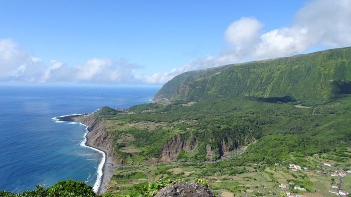
Hike: Miradouro das Lagoas Funda e Comprida, Lagoa Negra, Seca e Branda, Lagoa Branca. A bit muddy and not as memorable as other hikes. The best part (a must) is the view from the starting miradouro.
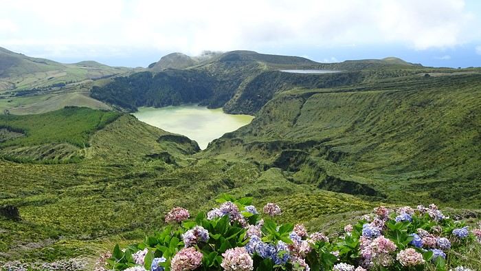
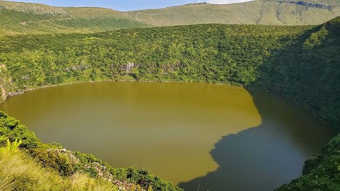
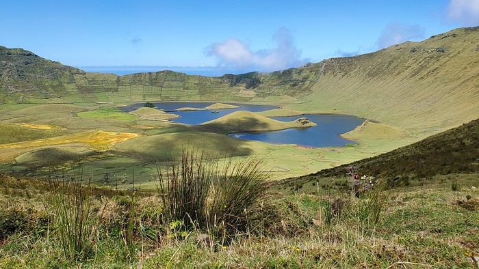
By car: The north of the island.
CORVO: Stunning!!
No spots left on the ferry (12 seats), so we took a tourist zodiac (booked a few weeks ahead by email, but there were still spots the day of—several boats make the trip). On the way out, we cruised along Flores’ coast to see waterfalls and caves. On the return, they looked for dolphins (we saw some! 🙂 ). Boat price: 35 € per person. At Corvo, minibuses shuttle between the port and the top of the caldera (10 € round-trip per person). Lots of people just stop at the viewpoint when the shuttle arrives, so we weren’t too crowded on the caldera hike. But it’s too tight on time to walk back down to the port. If you really want to, I think you’d need to stay overnight. All boats spend the same amount of time on the island.

SÃO MIGUEL: Back to civilization—but not just that! São Miguel is way more touristy than the other islands (though still nothing compared to other destinations), but it’s worth it for all the natural sites.
For camping, to avoid long drives, we started at Sete Cidades campsite on the west side. A big, free, terraced campsite with some shade. We were there the last week of August, when crowds start thinning, so there was space—a mix of tourists and locals. A few picnic tables with barbecues. For facilities, one side for men, one for women, each with one toilet (cleaned regularly) and three outdoor cold showers (swimsuits recommended). You can charge your phone in the caretaker’s hut.
After exploring the west, we moved to Furnas for the rest of the trip. We arrived on a Friday night, and the campsite was packed with locals spending the weekend. It emptied out Sunday afternoon. A large, shady campsite with several bathroom blocks (hot showers). There’s a restaurant, but only two picnic tables. Cost: 3.5 € per small tent + 3.5 € per person.
Campingaz: We bought canisters at Decathlon in Ponta Delgada (next to Decathlon, there’s a big shopping center for groceries). Didn’t ask at Sete Cidades, but at Furnas, there was a closet full of gas bottles of all sizes left by campers.
Main visits/hikes: Sete Cidades and the surrounding lakes (lots of viewpoints and short hikes): Beautiful.

Swimming in the hot springs at Ponta da Ferraria (west side of the island).

Furnas: The lake, fumaroles, and parks (like Terra Nostra).

Lagoa do Fogo (gorgeous).

Gorreana tea factory (nice hike through the tea fields + guided tour), Ribeira Grande, Ermida de Nossa Senhora da Paz. The east coast and Ribeira dos Caldeirões park. Ponta Delgada.
Final thoughts: The Azores are a fantastic discovery for nature lovers—lakes, waterfalls, and tranquility. Almost all sites are accessible without hiking (though it’s a shame not to). The “miradouros” (viewpoints) have parking, often with toilets and picnic tables (always very clean), which helps protect nature. Camping is totally doable and really enjoyable! Our only disappointment: Not finding good fruits and veggies (except for São Miguel’s delicious but expensive pineapples).
If you have any questions, I’d be happy to help! Christine
So glad this forum is back up! Here’s a recap of our three little weeks in the Azores in August 2024, camping on Terceira, Flores/Corvo, and São Miguel, with a special focus on the camping side—something I struggled to find info on before we left.
As others have mentioned, a trip to the Azores isn’t something you can improvise last-minute, especially in August. The rental car fleet is limited, so prices go up as availability drops, and vacation rentals/hotels are scarce. Plus, inter-island flights and ferries aren’t exactly frequent. I picked our destination in mid-April, and there were already few rental car options left (some local companies had nothing), and no accommodations on Flores for our dates—or only very expensive ones requiring multiple location changes. Since we love camping, we decided to bring our gear without really knowing what to expect.
Flight with TAP (426 €): Outbound: Lyon → Lisbon → Terceira Return: São Miguel → Lisbon (9-hour stopover for a quick visit) → Lyon
Inter-island flights with SATA: Terceira → Flores (via Horta): 87 € Flores → São Miguel: 90 €
I rented all three cars from the same local company, Ilha Grande—they weren’t picky about the car’s condition. For a Clio (or similar): Terceira (4 days): 461 € Flores (5 days): 623 € São Miguel (8 days): 730 €
Weather: The first two weeks were gorgeous—blue skies, no rain, and even hotter than we expected, around 30°C (temperatures barely dropped at night). The last week of August brought more fine rain (mostly at night) and temps between 20 and 25°C (a light jacket was nice in the mornings and evenings).
TERCEIRA: A great introduction! When I looked at what each island had to offer, Terceira wasn’t at the top of my list, but flying into Terceira cut costs and fit our schedule well, so we spent 4 days there. It turned out to be a lovely start.
For camping, we stayed at Salga Campismo in Porto Judeu, 20 minutes from the airport. We discovered that the island’s campsites were packed with locals—extended families or groups of friends having big, festive gatherings with barbecues and long tables. They spend their summers camping instead of at home, and some even commute to work from there. They had huge tents for sleeping, plus tarps for cooking and relaxing—way more gear than the tourists. Since the week of August 15th is peak vacation time (like in France), we struggled to find a spot, and the nights were pretty noisy. This was the only campsite of the trip with numbered pitches. It’s right by the ocean, next to natural pools. Facilities were decent, with hot showers and picnic tables. Lots of shaded spots. Cost: 4 € per small tent + 2 € per person. Electrical outlets were free (20 € deposit). During our explorations, we passed by Cinco Ribeiras campsite (west coast), which seemed similar.
Camping gas: Always ask the campsite reception if any travelers left a gas canister before buying a new one! Before the trip, I emailed each island’s tourism office, and they gave me addresses for Campingaz bottles. On Terceira, No. 13 Rua João Vaz Corte Real in Angra do Heroísmo (an agricultural store in the industrial zone). CV300 cartridge: 10 €. Note: The tourism office gave me the name of the neighboring store, which didn’t carry that brand.
Fridge: No fridges at any campsite on any island. We had a foldable cooler and found bags of crushed ice in supermarkets’ fish sections.
Things to see: Key takeaway: Do the must-see spots early in your stay in case the weather doesn’t cooperate. We were lucky and saw all the viewpoints without clouds—apparently not always the case!
Our main visits/hikes on Terceira: Miradouro Serra do Cume (a must—*the* iconic Terceira photo)
Furnas do Enxofre (free): Few fumaroles, but a pretty 1 km walk through moss and endemic plants. Hike PRC01 TER – Misterios Negros (some acrobatic sections, but a very scenic path). Monte Brasil + Angra do Heroísmo: Lovely town. Hike PR02 TER – Baía da Agualva: Nice, but not much shade (along the coast). Quatro Ribeiras: Church and swimming in natural pools. Biscoitos natural pools: Too touristy (but still free).


FLORES: Our favorite! This was the island I *had* to visit, and we weren’t disappointed—no mass tourism, just stunning nature.
For camping, we chose Santa Cruz campsite. Unlike Terceira, it was only tourists here. Very little shade, but ocean views. Modern facilities with hot showers, clotheslines, and a charging station. A big area with picnic tables, each with a barbecue and sink, all sheltered. Right across from gorgeous natural pools. FREE (you can leave a tip for the caretaker).
For Campingaz, the campsite manager stores canisters and gear left by campers. Otherwise, you can find them at Movipesca.
During a hike, we passed by Fajã Grande campsite (campsites here double as picnic spots for everyone). It’s terraced, with no shade, but very clean facilities and a small bar/restaurant nearby. Natural pools across the street. When we stopped by midday, there were only a few tents. Fajã Grande felt even quieter than Santa Cruz, with just one supermarket.
We also picnicked at Ponta Delgada campsite in the north. Impeccable facilities, lots of picnic tables with barbecues. Empty when we were there. A bit out of the way.
Rental car or not on Flores? Given the high cost, I really debated whether we needed a car. In Santa Cruz, the port, airport, and supermarkets are walkable, and the most famous hikes are one-way, not loops. So I contacted a taxi (the tourism office emails a list of drivers—they don’t wait for customers; you have to call). Prices were around 20 € for Santa Cruz to Fajã Grande, for example. That means you could take several taxi trips before the rental car (over 100 €/day) pays off. But it does mean planning your route and schedule in advance, leaving little room for spontaneity. The taxi I contacted was already booked solid in July, so I decided to keep the car and adjust our hikes to make loops. (FYI, we’re in our 50s, two couples splitting costs—maybe a different calculation if we were 25!) No regrets—it gave us way more freedom.
Our main visits/hikes:
Hike (amazing): Poço da Ribeira do Ferreiro (the iconic waterfalls) → Fajã Grande → Poço do Bacalhau (swim in the waterfall) → Aldeia da Cuada → Poço da Ribeira do Ferreiro. Hike PR04: Loop from Miradouro da Fajã de Lopo Vaz, then down to the beach via the trail. Return along the pebble beach before climbing back up. Worth it, but the descent and ascent are steep.
By car: Miradouro do Portal (great view of the coast to Fajã Grande) – Rocha dos Bordões (basalt columns) – Miradouro das Lagoas Rasa e Funda (a must) – Miradouro da Fajã do Conde.
Hike: Miradouro das Lagoas Funda e Comprida, Lagoa Negra, Seca e Branda, Lagoa Branca. A bit muddy and not as memorable as other hikes. The best part (a must) is the view from the starting miradouro.
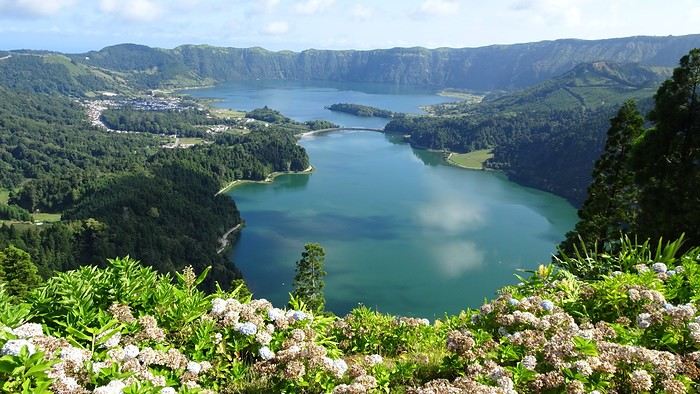
By car: The north of the island.
CORVO: Stunning!!
No spots left on the ferry (12 seats), so we took a tourist zodiac (booked a few weeks ahead by email, but there were still spots the day of—several boats make the trip). On the way out, we cruised along Flores’ coast to see waterfalls and caves. On the return, they looked for dolphins (we saw some! 🙂 ). Boat price: 35 € per person. At Corvo, minibuses shuttle between the port and the top of the caldera (10 € round-trip per person). Lots of people just stop at the viewpoint when the shuttle arrives, so we weren’t too crowded on the caldera hike. But it’s too tight on time to walk back down to the port. If you really want to, I think you’d need to stay overnight. All boats spend the same amount of time on the island.

SÃO MIGUEL: Back to civilization—but not just that! São Miguel is way more touristy than the other islands (though still nothing compared to other destinations), but it’s worth it for all the natural sites.
For camping, to avoid long drives, we started at Sete Cidades campsite on the west side. A big, free, terraced campsite with some shade. We were there the last week of August, when crowds start thinning, so there was space—a mix of tourists and locals. A few picnic tables with barbecues. For facilities, one side for men, one for women, each with one toilet (cleaned regularly) and three outdoor cold showers (swimsuits recommended). You can charge your phone in the caretaker’s hut.
After exploring the west, we moved to Furnas for the rest of the trip. We arrived on a Friday night, and the campsite was packed with locals spending the weekend. It emptied out Sunday afternoon. A large, shady campsite with several bathroom blocks (hot showers). There’s a restaurant, but only two picnic tables. Cost: 3.5 € per small tent + 3.5 € per person.
Campingaz: We bought canisters at Decathlon in Ponta Delgada (next to Decathlon, there’s a big shopping center for groceries). Didn’t ask at Sete Cidades, but at Furnas, there was a closet full of gas bottles of all sizes left by campers.
Main visits/hikes: Sete Cidades and the surrounding lakes (lots of viewpoints and short hikes): Beautiful.

Swimming in the hot springs at Ponta da Ferraria (west side of the island).

Furnas: The lake, fumaroles, and parks (like Terra Nostra).

Lagoa do Fogo (gorgeous).

Gorreana tea factory (nice hike through the tea fields + guided tour), Ribeira Grande, Ermida de Nossa Senhora da Paz. The east coast and Ribeira dos Caldeirões park. Ponta Delgada.
Final thoughts: The Azores are a fantastic discovery for nature lovers—lakes, waterfalls, and tranquility. Almost all sites are accessible without hiking (though it’s a shame not to). The “miradouros” (viewpoints) have parking, often with toilets and picnic tables (always very clean), which helps protect nature. Camping is totally doable and really enjoyable! Our only disappointment: Not finding good fruits and veggies (except for São Miguel’s delicious but expensive pineapples).
If you have any questions, I’d be happy to help! Christine
Recommended for you
Palermo street art
She Sees Giants Everywhere! (Ducasse of Ath, Belgium, August 2018)
Storm in the Canary Islands
Two weeks under the Puglia sun
Kattegat Tour and Norway’s Majestic Fjords – 32 Days (Denmark, Sweden, Norway)
Off we go on an adventure in Puglia!
Biking and Beer in Belgium
Swedish Lapland - Padjelantaledden solo trek
666 more discussions in this forum are in French. Browse them on the French forum