Come discover Ireland with us
FR

Translated into English.

Original post
PI
IRELAND - INTRODUCTION

We planned our 15-day trip to Ireland several months in advance to create an itinerary that would let us see a multitude of tourist attractions across various regions of the Republic of Ireland and Northern Ireland.

We researched the main attractions in each region and noted their GPS coordinates.

After that, we used Google Maps to create a packed but realistic daily route. We printed all the itineraries, and they proved extremely useful since some attractions weren’t listed on the GPS a friend lent us, and some roads aren’t clearly marked.

This way, we were able to stick to our daily schedule.

Three months before our departure, we rented a car directly from Autoescape’s website for 136.44 € over 14 days. The rental was with BUDGET, and the car we got was a ŠKODA Citigo.

This rate includes unlimited mileage, collision damage waiver (CDW), theft protection (TP) with a 1,500 € excess, and unlimited third-party liability coverage.

Some roads in Ireland are very narrow, so a compact car is much appreciated. Don’t forget that driving is on the left, and there are plenty of roundabouts.

Luckily, my partner finds driving this way easy, and our travels went smoothly.

It’s worth mentioning how courteous and patient Irish drivers are—it’s truly phenomenal.

Two weeks before our trip, we booked our accommodations at various places like B&Bs, hotels, and university campuses through Hotels.com. We’ll talk more about each of them later.

When we arrived at Dublin Airport, going through customs was quite tedious. There are two lines: one for EU citizens and another for other foreigners. The wait for non-EU travelers is significantly longer.

The car rental isn’t directly at the terminal. You have to take a shuttle to the rental center. Once there, a company representative finalizes the contract and hands over the keys to our rental car.

And off we went on our adventure!

It’s also important to note that some roads have tolls. For most of them, you pay directly at a toll booth, and the fees are usually under 2 €.

However, the M50 motorway around Dublin works differently—it’s a prepaid toll. You’re charged when you drive between Junction 6 (N3 Blanchardstown) and Junction 7 (N4 Lucan). A large purple sign warns you as you approach one of these junctions.

Cameras automatically record your license plate, and fees are applied based on your vehicle category. For a standard car, the fee is 3.10 €.

You have until 8:00 PM the next day to pay at an authorized retailer or online at https://www.eflow.ie/.

We prepaid these fees directly on the site mentioned above.

If you don’t pay within the required time, you’ll be charged substantial penalties.

For dining, most grocery stores and gas stations offer a great selection of hot and cold meals at very reasonable prices. That’s why we mostly bought our food at places like SuperValu, Lidl, Spar, and Centra.

We invite you to keep reading about our adventure in the next section.
Anne Blogue: https://deuxnomades.blogspot.com/ YouTube: https://www.youtube.com/c/SouthAngelVideo?sub_confirmation=1
PI Pinacoladada Globetrotter ·
OUR LANDING IN DUBLIN

A favorable sky that lets us appreciate the beauty of this country as soon as we arrive.

The lush green nature is on full display, alongside magnificent white sandy beaches and turquoise waters that already make us dream even before we’ve set foot on them.

Welcome to Ireland!

Anne Blogue: https://deuxnomades.blogspot.com/ YouTube: https://www.youtube.com/c/SouthAngelVideo?sub_confirmation=1
PI Pinacoladada Globetrotter ·
Ireland - Day 1

Videos are embedded in the text. Please click on the image or link to start the video.

Distance to cover: 118.7 km Estimated driving time: 02h15 Estimated time for activities: 05h45 Attractions visited: Lough Tay, Glenmacnass Waterfall, Glendalough Valley, and the monastic site of Glendalough

As soon as we arrived, we left Dublin to head to County Wicklow to visit some of the region’s tourist attractions and embark on a several-kilometer hike in Glendalough Valley.

1. Dublin - Lough Tay (53°06'24.8"N 6°15'21.9"W) https://goo.gl/maps/wRixuKp56WU2 63.8 km - 00h57 - Duration: 00h30 - Free

Lough Tay is a small glacial lake located in the Wicklow Mountains in Ireland.

You can admire it from the mountaintops along the R759 road. The lake is situated more precisely between Djouce Mountain and Luggala Mountain.

It has served as a filming location for several movies and TV series, including one of our favorites: *Vikings*.

It must be said that this region offers a breathtaking panorama.

Another way to discover this lake is to hike the Wicklow Way, a 127 km marked trail that passes near the JB Malone memorial.

This trail can be done in sections or in its entirety, depending on the time you have, and allows you to discover, among other things, Powerscourt House and its gardens, the village of Enniskerry, one of the highest waterfalls in Ireland, and the Glendalough Valley with its monastic village dating back to the 6th century.

2. Lough Tay Lake - Glenmacnass Waterfall (53°03'53.7"N 6°20'11.5"W) goo.gl/maps/dH3zSeh3Bz12 17.6 km - 00h27 - Duration: 00h15 - Free

Glenmacnass Waterfall is located on the R115 road (an old military route) between Sally Gap and Laragh, in County Wicklow, Ireland.

It flows through a stunning valley adorned with a multitude of yellow-flowering shrubs.

During our visit, dogs were busy herding a flock of sheep in the valley below.

3. Glenmacnass Waterfall - Glendalough Lower Car Park (53°00'37.1"N 6°19'19.6"W) goo.gl/maps/oA2L7ny5faF2 9 km - 00h14 - Duration: 04h00 - Free

Hike in Glendalough Valley, which was carved long ago by a series of glaciers.

In total, there are nine marked trails in this valley. They vary in duration and difficulty level. The only common point is that all walks start and end at the national park information office near Upper Lake.

Each trail is identified by a color. For more info, please refer to the following site: www.wicklowmountainsnationalpark.ie/?page_id=17

We decided to take the Spinc and Glenealo Valley trail (white markers), which is 9 km long. The specified duration is about 3 hours.

From the parking lot, follow the main trail leading to the ruins of an old medieval village (see video).

After that, the trail heads toward Poulanass Waterfall. From there, we had to climb a wooden staircase of 600 steps, which quickly offers a stunning view of Upper Lake and the entire valley.

Since the weather was unstable, heavy showers mixed with sunshine allowed us to see multiple rainbows forming over the valley. It was truly magical!

The trail then follows the cliffs, and the hike continues on a wooden boardwalk that crosses a bog and leads to the beautiful Glendalough Valley. We spotted many deer there.

The trail descends and takes us to a small bridge that crosses the stream, bringing us to the other side of the valley.

From there, we took a rocky trail that led us back to our starting point. It must be said that this part of the hike is more challenging since the terrain is downhill and covered with stones of various sizes.

One of my knees really took a hit! Fortunately, I had some painkillers that quickly eased the pain.

The trail then leads to the ruins of a mining village before crossing a Scots pine forest and following the lake to the national park information office.

In summary, this is a fantastic hike in a completely enchanting setting. Since the weather in Ireland changes quickly, it’s best to have a rain jacket to protect yourself from sudden showers.

It was recommended to wear a windbreaker because the wind can be very strong in some places. As for us, there was no wind at all during our hike.

Visit to the ancient monastic city of Glendalough

This monastic site is one of the most important in Ireland. The first settlement was founded by Saint Kevin in the 6th century, and the monastic city later developed.

Other buildings were erected over time. Today, a few ruins remain, including a cathedral, Saint Kevin’s Church, and a 30 m high round tower. These buildings date from the 10th to the 12th century.

You’ll find several gravestones in the cemetery, as well as Celtic crosses, including the massive Saint Kevin’s Cross.

4. Our first sheep - Wicklow - Ireland

Of course, there’s no shortage of sheep in Ireland. Just like in Iceland, which we visited two years ago, they’re everywhere in this country.

You don’t just find them in fields. Some wander freely on the road, completely ignoring our presence.

After all, we’re the strangers. We’re on their land.

They’re simply adorable!

You’ll see paint marks on their bodies to indicate which farmer in the area they belong to.

5. Glendalough Lower Car Park - Clone House (52°50'08.7"N 6°18'21.0"W) goo.gl/maps/z14M77uSb5w 28.3 km - 00h37

We spent our first night in this historic home located in Aughrim, about an hour south of Dublin. It’s ideally situated for visiting the Wicklow region, and more specifically, Glendalough Valley.

It’s set in an enchanting location. There’s a garden with ponds and a waterfall, as well as a wide variety of flowers, plants, and shrubs.

The house is tastefully decorated, and the hosts are very welcoming.

Our room is spacious, and the bed is very comfortable. There’s even a fireplace.

In an adjoining room, there’s a clawfoot bathtub, a shower, and the bathroom.

For dinner, we bought a baguette and some cheeses at the grocery store, which we enjoyed while cozily sitting in front of a warm fireplace—it made for a very cozy atmosphere.

A hearty breakfast is served. It includes fresh fruit juice, fruits, breads, muffins, and scones.

We highly recommend this place without any hesitation.

Anne Blogue: https://deuxnomades.blogspot.com/ YouTube: https://www.youtube.com/c/SouthAngelVideo?sub_confirmation=1
PI Pinacoladada Globetrotter ·
Ireland - Day 2

Videos are embedded in the text. Please click on the image or link to start the video.

Distance to cover: 401 km Estimated driving time: 06h30 Estimated time for activities: 06h15

Attractions visited: Rock of Cashel, Hore Abbey, Kinsale Charles Fort, Gap of Dunloe.

1. Clone House - Rock of Cashel (51°53'48.5"N 8°29'11.9"W) goo.gl/maps/2LiWwdYbjgE2 149 km - 02h04 - Duration: 01h00 - Price: 8 € (credit card accepted)

The Rock of Cashel is a major historical site in Ireland. It's part of tourist circuits, so you'll encounter several guided tour groups there.

It's located on a rocky outcrop that rises 60 m, overlooking the small town of Cashel.

At the entrance to the fortress, you'll find the Hall of the Vicars Choral, built in the 15th century. This is where the ticket office is located. It was used as a rehearsal space for the choir and also houses a museum that presents the history of the site along with numerous crosses.

Saint Patrick's Cathedral is Gothic in style and dates back to the 13th century. A square tower stands at its center.

Another tower, dating from the 15th century and commonly called the Archbishop's Residence, is attached to the cathedral and was once the residence of the archbishop.

Cormac's Chapel dates from the 12th century and is considered one of the most beautiful Romanesque chapels in Ireland. This chapel even houses a tomb believed to be that of King Cormac.

There's also a 28 m-high round tower built in the 12th century. It was used not only to monitor the surroundings of the fortress but also to store manuscripts and religious relics.

2. Rock of Cashel - Hore Abbey (52°31'07.0"N 7°53'53.3"W) goo.gl/maps/17u66PhBqe42 1.3 km - 00h04 - Duration: 00h15 - Price: Free

Hore Abbey is a ruined monastery located 1 km from the Rock of Cashel. It was built in the 13th century.

Despite the centuries that have passed since its construction, the remaining ruins give us a good idea of what it must have looked like back then, as the walls are still standing and the windows and vaults are still visible.

What's more, from this spot, you get a fantastic view of the Rock of Cashel.

3. Hore Abbey - Kinsale Charles Fort (51°41'52.2"N 8°29'55.2"W) goo.gl/maps/gwypVtBrK5R2 119 km - 01h22 - Duration: 01h00 - Price: 5 € (cash only)

This star-shaped medieval fort was built in the 17th century. It features two bastions facing the sea, among other things. Several buildings were constructed inside the fort, forming a small town protected by its ramparts. The English occupied this fort until 1922.

One of the buildings houses an exhibition that lets you discover the fort's history. You'll find clothing, rifles, and other objects from that era.

It also offers a stunning view of the bay and the village of Kinsale.

4. Kinsale Charles Fort - Gap of Dunloe (52°02'24.5"N 9°37'54.9"W) goo.gl/maps/oRiHBwTRmDz 118 km - 01h44 - Duration: 03h00 - Price: Free

The Gap of Dunloe, located in Killarney National Park, is without a doubt one of Ireland's most beautiful valleys.

A very narrow paved road winds through the pass of this stunning glacial valley. Several lakes follow one another, enhancing the beauty of the landscape. In fact, this road is very popular with hikers.

To give you an idea, the entrance to the site is located between the towns of Killarney and Killorglin. There's a parking lot near Kate Kearney's Cottage. The GPS position corresponds to this parking lot.

If you want to reach the top of the pass, allow 3 to 4 hours for the round trip.

We arrived at this spot in the late afternoon. The weather was uncertain. It's worth noting that this region is quite humid, and the climate changes rapidly.

We started our hike, but after a while, it started raining heavily.

Since we noticed that cars were also using this road, we asked a woman we met along the way if it was allowed to drive our car on it. She confirmed that it was indeed possible.

So we went back to the parking lot and decided to drive instead, which saved us a lot of time given how late it was when we arrived.

We only encountered a few hikers and a few cars. Given how narrow the road is, it's impossible for two cars to pass each other. However, there are often small spaces to pull over and let others pass if needed.

Sheep and horses share this valley. We also had the chance to see a deer strolling slowly along the road.

In high season, unless you go very early in the morning or early evening, driving is definitely not recommended—not only because of the high number of visitors but also because horse-drawn carriage rides are offered.

Also, be aware that some agencies offer excursions to this spot from Killarney. They take you by bus to Kate Kearney's Cottage, where you hike to Lord Brandon's Cottage.

After that, you take a boat to cross the three lakes of Killarney and reach Ross Castle, where a bus is waiting to take you back to Killarney.

Note that this excursion can also be done in the opposite direction.

Without further ado, we invite you to discover the Gap of Dunloe in this video.

5. Kate Kearney's Cottage - 3 Lakes Hostel Killarney (52°03'36.6"N 9°29'01.3"W) goo.gl/maps/PoxWxztn9gw 13.7 km - 00h16

We booked our second night at this hostel located in the town of Killarney. Its location is ideal for exploring the Ring of Kerry and Killarney National Park.

It's a modern accommodation offering different types of dormitories that can accommodate couples, families, and even groups.

Wi-Fi is free, and there's also a common area with a lounge, a play area for kids, a dining room, and a kitchen that guests can use.

The reception is open 24 hours. The young woman who welcomed us when we arrived was smiling and extremely kind.

We were assigned a room with two single beds. We asked if it was possible to get a room with a double bed, and she agreed to our request.

The bed was comfortable, and there were also two bunk beds in our room. The bathroom was spacious and included a toilet, sink, and shower.

There are several restaurants nearby, as well as a supermarket (SuperValu) for those who want to buy ready-made meals or prefer to cook their own.

Breakfast is included. It's pretty minimalist compared to other experiences we had during our stay in Ireland.

There was only instant coffee, no juice since the vending machine was out of order, cereal, and sliced bread.

Well, for us, that was fine since even at home, our breakfast is usually just... a coffee and one or two slices of toast.

Anne Blogue: https://deuxnomades.blogspot.com/ YouTube: https://www.youtube.com/c/SouthAngelVideo?sub_confirmation=1
PI Pinacoladada Globetrotter ·
Ireland - Day 3 - Part 1

Videos are embedded in the text. Please click on the image or link to start the video.

Distance to cover: 162.1 km Estimated driving time: 03h39 Estimated time for activities: 06h45

Attractions visited: Ring of Kerry (Torc Waterfall, Ladies View, Sneem, Abbey Island, Cahersiveen), Skellig Ring (Ballinskelligs Strand and its castle, Ballinskelligs Abbey, Kerry Cliffs, Portmagee), Valentia Island (Geokaun Mountain, Old Slate Quarry, Tetrapod Trackway, Knishgstown).

3.1 Ring of Kerry

1. Lakes Hostel Killarney - Torc Waterfall (52°00'21.3"N 9°30'24.7"W) https://goo.gl/maps/gposzGua6wA2 8.4 km - 00h12 - Duration: 00h30 - Price: Free

Torc Waterfall is an impressive 20-meter-high waterfall located at the foot of Torc Mountain in Killarney National Park, Ireland.

It’s one of the must-see attractions when traveling along the Ring of Kerry. The Ring of Kerry is actually a tourist circuit in County Kerry that loops around the Iveragh Peninsula.

There’s a large parking lot by the roadside. The waterfall is just 200 meters from the parking lot and is easily accessible via a forest trail that runs alongside a small river leading to the waterfall. A staircase near the waterfall leads to different trails, one of which offers a stunning viewpoint over Middle Lake.

2. Torc Waterfall - Ladies View (51°58'02.2"N 9°35'35.9"W) https://goo.gl/maps/MAueFGFVBuD2 9.7 km - 00h12 - Duration: 00h15 - Price: Free

Ladies View is a spot on the Ring of Kerry, specifically in Killarney National Park, Ireland. It offers a breathtaking panorama of Killarney’s lakes and mountains.

Its name refers to Queen Victoria, who visited Ireland in 1861. While traveling along this road to Muckross House, the queen was reportedly so charmed by the stunning landscape that she ordered a stop so her ladies-in-waiting could admire the view with her.

Ever since, this place has been called Ladies View, in reference to that historic moment.

3. Ladies View - Sneem (51°50'13.2"N 9°54'01.1"W) https://goo.gl/maps/jEtSR4CEut22 29.2 km - 00h32 - Duration: 01h00 - Price: Free

Sneem is a picturesque coastal village on the Ring of Kerry in Ireland.

It’s filled with colorful storefronts, bars, and restaurants. The surrounding landscape features a beautiful river and an estuary set against majestic mountains.

Behind St. Michael’s Church, there’s a small trail along the estuary where you’ll find little pyramids created by artist James Scanlon.

4. Sneem - Abbey Island (51°45'37.8"N 10°08'31.8"W) https://goo.gl/maps/4ZarWJprZ412 24.8 km - 00h30 - Duration: 01h00 - Price: Free

Located in Derrynane National Park, Abbey Island offers a spectacular setting for Ahamore Abbey, which dates back to the 6th century. The abbey overlooks the stunning Derrynane Bay.

Abbey Island is near Derrynane Bay. At low tide, you can walk to this small island, but when the tide is high, the path fills with seawater, making it inaccessible.

The ruins of the abbey are still very visible. You’ll also find several Celtic crosses and gravestones, including that of Marie O’Connell, wife of Irish politician Daniel O’Connell, who passed away in the 19th century.

5. Ring of Kerry - Different viewpoints

The Ring of Kerry (Anneau du Kerry in French) is a 180 km circuit ranked among Ireland’s most scenic routes, offering exceptional panoramic views of cliffs and coastlines.

Several bus companies regularly operate this route for those who prefer not to rent a car.

It’s important to note that the roads on this circuit are very narrow, and in summer, buses travel counterclockwise.

For our part, we left Killarney via the N71 road, then joined the N70 and completed the circuit clockwise.

There are often spaces on the side of the road where you can park and take photos.

We were pleasantly surprised to find that drivers were very patient and respectful.

The images in this video were taken between Killarney National Park and the small town of Waterville.

Anne Blogue: https://deuxnomades.blogspot.com/ YouTube: https://www.youtube.com/c/SouthAngelVideo?sub_confirmation=1
PI Pinacoladada Globetrotter ·
Ireland - Day 3 - Part 2

Videos are embedded in the text. Please click on the image or link to start the video.

3.2 Skellig Ring

1. Abbey Island - Ballinskelligs Castle (baile an sceilig) (51°49'16.3"N 10°16'26.4"W) https://goo.gl/maps/AomDjEndyJ32 26.5 km - 00:35 - Duration: 00:30 - Price: Free

This tower, located on Ballinskelligs Beach in Ireland, is said to have been built in the 16th century by McCarthy Mór to protect the bay from pirates.

It’s situated on an isthmus connected to Ballinskelligs Bay by a small pedestrian bridge. The visit is short but pleasant. A small stone staircase leads to the top of the tower.

The viewpoint from the top of this tower is exceptional. We have a magnificent view of Ballinskelligs Bay with its white sandy beach and turquoise waters.

2. Ballinskelligs Beach - Ballinskelligs Abbey (51°48'56.3"N 10°16'17.3"W) https://goo.gl/maps/eCTV6nm3CQP2 0.9 km - 00:02 - Duration: 00:15 - Price: Free

Located on the Skellig Ring, you can easily reach it by car or on foot via the beach from the Ballinskelligs Beach parking lot.

This abbey is said to have been founded in the 12th century by monks who abandoned Skellig Michael after suffering numerous Viking attacks.

Some parts of the cloister and a large domestic hall are still visible.

This site is one of many important spiritual places in the region dedicated to Saint Michael.

Its location offers a stunning view of the castle and Ballinskelligs Bay in the background.

3. Ballinskelligs Abbey - Cliff Experience (51°52'06.0"N 10°23'07.9"W) https://goo.gl/maps/fxH9q43SY6o 13.8 km - 00:24 - Duration: 01:00 - Price: 4 € in cash only

This site is located along the Skellig Ring behind the Blasket View House B&B. There’s a large parking lot and a campsite. A fee of 4 € per person in cash is required to access the site.

You’ll need to walk about ten minutes to reach the various viewpoints overlooking the Kerry Cliffs.

These cliffs, which rise over 300 m above the Atlantic, were formed over 400 million years ago.

The spot offers an exceptional viewpoint not only of the spectacular Kerry Cliffs but also of the entire surrounding valley.

Due to its location, the area is very windy. It’s best to wear a windbreaker so you can fully enjoy the panoramic views and the different bird colonies that inhabit these cliffs.

4. Skellig Ring - Other viewpoints

We leave the Ring of Kerry (Kerry Ring) for a few hours to drive instead on the Skellig Ring, a very narrow scenic road that starts between Waterville and Ballinskelligs and runs along the coast of the Iveragh Peninsula, eventually reaching the village of Portmagee.

There are several must-see attractions in this region. We’ve shared a few of them in the previous videos.

The scenery is truly exceptional. The viewpoints follow one after another. In fact, 2 km before "Cliff Experience," you can stop at a small parking lot to admire Portmagee, a small fishing village, as well as Valentia Island, which is accessible by ferry or via a bridge connecting the island to the Iveragh Peninsula at Portmagee.

Here are the GPS coordinates for this viewpoint: 51°51'22.5"N 10°22'01.9"W.

We then cross the small village of Portmagee to reach Valentia Island, where we’ll do more activities.

Anne Blogue: https://deuxnomades.blogspot.com/ YouTube: https://www.youtube.com/c/SouthAngelVideo?sub_confirmation=1
PI Pinacoladada Globetrotter ·
Ireland - Day 3 - Part 3

Videos are embedded in the text. Please click on the image or link to start the video.

3.3 Valentia Island

1. Cliff Experience - Geokaun Mountain (51°54'55.5"N 10°20'59.5"W) https://goo.gl/maps/LzPt2rhUwCv 5.1 miles - 00:13 - Duration: 01:00 - Price: 5 € per car

At this site, you can either walk or drive to the summit. There are three parking areas at different levels, making it accessible for everyone to enjoy the various viewpoints.

At the first level, a short trail leads to an observation terrace where you can admire the Fogher Cliffs.

Several informational panels have been installed to provide details about the history, mythology, geography, and wildlife of the region.

At the second level, a 1-mile loop trail circles the mountain. Even at this height, the panorama is truly breathtaking.

The third and final level is at the summit, which peaks at 873 feet. The view from the top is absolutely spectacular, allowing you to see not only the lighthouse and cliffs of Valentia Island but also the Dingle Peninsula, Carrauntoohil Mountain, and the Skellig Islands.

You can bring your lunch and eat on-site, as several picnic tables are available in different spots.

Please note there’s an entry fee of 5 € per car or 2 € per pedestrian/cyclist.

2. Geokaun Mountain Summit - Grotto Slate Quarry (51°55'30.9"N 10°20'33.6"W) https://goo.gl/maps/tNndjd6hqo92 2.6 miles - 00:10 - Duration: 00:15 - Price: Free

This is actually a quarry where slate is extracted. It opened in 1816 but was closed in 1910 after a rockfall.

It remained abandoned until 1954, when statues of Bernadette and Our Lady were placed above the quarry entrance, and several events were held there.

The quarry was reopened a few years ago. Famous for its high-quality slate, it’s been used in places like the Paris Opera, the chambers of the London Parliament, and even for billiard tables, including one made for Queen Victoria and the Duke of Wellington.

Today, the slate is also used for making tables, countertops, and roofing.

3. Grotto Slate Quarry - Tetrapod Trackway (51°55'45.7"N 10°20'45.4"W) https://goo.gl/maps/9U8dYmyvgJm 1.7 miles - 00:06 - Duration: 00:30 - Price: Free

Tetrapods are vertebrate animals that include reptiles, amphibians, birds, and mammals. Many of these species have undergone physical changes over time to better adapt to their evolving environment.

On Valentia Island, footprints of a tetrapod dating back nearly 385 million years were discovered. This is an important find because these footprints represent the transition from aquatic to terrestrial life for these animals.

At that time, they lived in water. However, their environment changed, and there was almost no oxygen left in the water.

Their bodies adapted as their fins turned into legs, and they developed the ability to breathe air outside of water.

They looked like large lizards, about a meter long.

The fossils you can see here were formed when the tetrapod walked on damp ground, and another layer of sediment buried the footprints before the water could wash them away. Over time, these prints dried and were compacted into the rocks.

You can also observe fossilized ripple marks created by coastal erosion from that same distant era.

4. Tetrapod Trackway - Cromwell Point Lighthouse (51°55'55.2"N 10°19'22.1"W) https://goo.gl/maps/TAiP3hWyEXq 1.4 miles - 00:05 - Duration: 00:15 - Price: 5 €

Cromwell Point Lighthouse guides ships to the northern entrance of Valentia Harbor. It once housed a fort built in the 16th century.

The first light was operational in February 1841. Originally, the lighthouse keeper lived on-site with his family.

Nowadays, a part-time attendant takes care of the station, as the light was automated in November 1947.

We didn’t visit the lighthouse, but you can get a glimpse of it in the three previous videos.

5. Cromwell Point Lighthouse - Knightstown (51°55'35.2"N 10°17'16.6"W) https://goo.gl/maps/3NiSVDmVHgT2 2.8 miles - 00:11 - Duration: 00:15 - Price: Free

The small village of Knightstown on Valentia Island was built by slate quarry workers in the early 1840s.

Peter Street and Jane Street were named in honor of the Knight of Kerry and his wife.

You’ll find the Royal Hotel Valentia, which also dates back to the 18th century. This hotel has rooms with panoramic views of the island.

Several other buildings were constructed around the same time, including the Coffee Dock and the Coffee Shop.

A ferry connects Valentia Island to mainland Ireland, running between Knightstown on Valentia Island and Renard Point in Cahersiveen. The crossing takes just 5 minutes.

You can also reach Valentia Island by car, as it’s connected to the town of Portmagee by a bridge.

This video gives you a little preview of the place.

Anne Blogue: https://deuxnomades.blogspot.com/ YouTube: https://www.youtube.com/c/SouthAngelVideo?sub_confirmation=1
PI Pinacoladada Globetrotter ·
Ireland - Day 3 - Part 4

Videos are embedded in the text. Please click on the image or link to start the video.

3.4 Ring of Kerry

1. Knightstown - Strand's-End House B&B, Cahersiveen (51°57'47.6"N 10°10'41.8"W) https://goo.gl/maps/F9VTDwZca552 27 km - 00h27

After leaving Valentia Island, we got back on the N70, which is part of the Ring of Kerry. We headed straight to Strand's-End House B&B in Cahersiveen, where we’ll be spending the night.

When we arrived, we were warmly welcomed, and our room was ready very quickly.

The room is tastefully decorated, the bed is very comfortable, and there’s plenty of storage space. There’s a TV in the room, and Wi-Fi is free. The private bathroom includes all the essentials.

Breakfast is complimentary and truly hearty and delicious. It includes omelets, bacon, cereals, fresh fruit, cheeses, yogurt, fresh bread and jam, juice, and coffee.

It’s usually served starting at 8:00 AM, but since we wanted to leave earlier due to a packed schedule, our hosts agreed to serve it at 7:00 AM instead.

We enjoyed our short stay here and especially loved our hosts—they’re genuinely warm and attentive to our needs.

2. Cahersiveen (51°56'52.7"N 10°13'15.3"W)

Cahersiveen is a small village on the west side of the Iveragh Peninsula, thriving on tourism and fishing. It’s close to major attractions like Valentia Island and the Skellig Islands.

There are plenty of businesses here: hotels, B&Bs, supermarkets, restaurants, pubs, etc. Its narrow streets and colorful building facades give this community an undeniable charm.

Anne Blogue: https://deuxnomades.blogspot.com/ YouTube: https://www.youtube.com/c/SouthAngelVideo?sub_confirmation=1
PI Pinacoladada Globetrotter ·
Ireland - Day 4 - Part 1

Videos are embedded in the text. Please click on the image or link to start the video.

Distance to cover: 182.85 km Estimated driving time: 04h11 Estimated time for activities: 07h50

Attractions visited: Ballycarbery Castle, Rossbeigh Beach, Fermoyle Beach, Brandon Point, Connor Pass, Dingle, Slea Head, Coumeenoole Beach, Dunmore Head, Dunquin Harbour, Clogher Head, Clogher Beach, Smerwick Beach, Kilmalkedar Church, Caherdorgan Stone Fort.

We’ll continue our journey along the Ring of Kerry before heading to the Dingle Peninsula.

We’ll pass through Camp to reach Brandon Point, then cross the Connor Pass to get to Dingle.

From Dingle, we’ll take the Slea Head Drive (R559), a scenic coastal route, to visit the various attractions in the area before returning to Dingle for the night.

Ring of Kerry

4.1 Strand's-End House B&B- Ballycarbery Castle (51°56'55.6"N 10°15'30.5"W) https://goo.gl/maps/kzxebKz2dsv 7.3 km - 00h10 - Duration: 00h15 - Price: Free

This 16th-century castle sits on a small hill in Ballycarbery. It was heavily damaged by cannon fire during a battle and has never been restored.

Despite its ruined state, the ivy covering its walls gives it a certain charm.

You can go inside the castle, where you’ll find several rooms and even a staircase leading to the upper floors.

The place seems to be rarely visited. During our trip, a light fog gave us the illusion of being transported to a distant era.

4.2 Ballycarbery Castle - Rossbeigh Beach (52°03'15.8"N 9°58'34.0"W) https://goo.gl/maps/c9q8N3eofc12 28.1 km - 00h31 - Duration: 00h30 - Price: Free

The stunning Rossbeigh Beach is located about 2 km from the village of Glenbeigh on the Ring of Kerry.

It’s easily accessible with plenty of parking spaces.

At low tide, the beach stretches a long way and is topped by a pebble embankment and beautiful large dunes. It’s perfect for long walks.

When we visited, the weather was rather gloomy. Still, the scenery was truly enchanting.

On a sunny day, this place is simply gorgeous.

4.3 Rossbeigh Beach - Ring of Kerry Viewpoint (52°04'11.7"N 9°53'14.6"W) https://goo.gl/maps/gQ6UqRmxxuj 6.9 km - 00h09 - Duration: 00h10

We had planned to go straight to Fermoyle Beach, but our curiosity was piqued when we saw a few buses parked by the roadside.

We decided to stop and discovered that artisans were displaying their work there.

There was also Tim with his donkey, little dog, and goat. You could take photos, but I chose to capture it all on video instead.

The landscape here is truly spectacular. A beautiful river flows at the foot of the mountains.

Dingle Peninsula

4.4 Ring of Kerry Viewpoint - Fermoyle Strand (52°14'37.1"N 10°07'22.6"W) https://goo.gl/maps/qBMXDToyBUC2 55.4 km - 01h04 - Duration: 00h15 - Price: Free

At 11 km long, Fermoyle Strand is Ireland’s longest beach. It’s ideal for surfing or long hikes.

It’s bordered by a row of dunes and beautiful mountains. The panorama is truly breathtaking.

4.5 Fermoyle Strand - Brandon Point (52°17'16.2"N 10°09'38.2"W) https://goo.gl/maps/KxSvXVmmCjx 12.5 km - 00h21 - Duration: 01h00 - Price: Free

Located on the Dingle Peninsula, Brandon Point is a great spot for birdwatching. You might also spot dolphins and whales.

It’s also the starting point for a several-kilometer hiking trail up Mount Brandon, Ireland’s second-highest mountain at 950 m. This hike is for experienced walkers only.

Just a few meters from the start, we already had a stunning view of the bay.

We took a short hike on this trail to get a glimpse of the surrounding landscape. The wind was blowing incredibly hard.

We chatted with a man who had ventured to the top of a cliff at the very beginning of the hike but couldn’t stand upright because of the wind’s strength.

We kept walking until the trail turned into a steep climb toward a high summit, then turned back.

We did, however, spot a few lone hikers who had already made it halfway up. The view from the top must be absolutely stunning.

We felt infinitely small in the face of this vast landscape.

4.6 Brandon Point - Connor Pass 1 (52°11'12.9"N 10°11'24.6"W) https://goo.gl/maps/hRob2A6VsyA2 14 km - 00h20 - Duration: 00h15 - Price: Free

Connor Pass is a mountain pass on the Dingle Peninsula in County Kerry. It connects Brandon Bay to Dingle.

To cross it, you’ll drive along a very narrow, winding road that hugs the cliffside. The view is simply stunning.

We made our first stop at a small parking lot by the roadside. There’s a beautiful waterfall flowing there.

There’s also a small trail that leads higher up into the mountain.

From this spot, we had a splendid view of Brandon Bay surrounded by mountains, with a beautiful valley filled with lakes at their feet.

4.7 Connor Pass 1 - Connor Pass 2 (52°10'54.7"N 10°12'26.3"W) https://goo.gl/maps/iYVayyNFm6Q2 1.5 km - 00h02 - Duration: 00h15 - Price: Free

We made a second stop at another parking lot 1.5 km from the first viewpoint. The view was just as exceptional, overlooking Dingle Bay.

The wind was so strong it was hard to stay still for photos.

I’ll admit, we had a lot of fun watching people struggle to take pictures of their loved ones.

We then continued our journey toward Dingle.

4.8 Connor Pass 2 - Dingle Town (52°08'19.6"N 10°16'16.5"W) https://goo.gl/maps/Cwy73tCyJSx 7.2 km - 00h10 - Duration: 00h30 - Price: Free

The port town of Dingle is also located on the Dingle Peninsula in County Kerry.

Built by the sea, this lively town has a charming vibe with its colorful facades.

You’ll find plenty of shops, pubs, and restaurants. There’s even an aquarium that houses several species of sharks from Ireland.

We only made a quick stop in town to grab lunch at SuperValu.

However, we drove around a few streets of this pretty town, so you’ll still get a glimpse of it in this video.

Anne Blogue: https://deuxnomades.blogspot.com/ YouTube: https://www.youtube.com/c/SouthAngelVideo?sub_confirmation=1
PI Pinacoladada Globetrotter ·
Ireland - Day 4 - Part 2

Videos are embedded in the text. Please click on the image or link to start the video.

Dingle Peninsula (continued)

From Dingle, we take the Slea Head Drive (R559), a scenic route that runs along the coast and forms a loop, bringing us back to Dingle where we’ll spend the night.

4.9 Dingle Town - Ventry Beach (52°07'57.7"N 10°21'36.9"W) https://goo.gl/maps/bd7aPTq4yRq 7.7 km - 00:11 - Duration: 00:15 - Cost: Free

This crescent-shaped sandy beach is located southwest of the village of Ventry. Its dunes and marshes are rich in flora and fauna.

During our visit, the wind was very strong. For this reason, some were preparing to brave the ocean with their windsurfing boards.

4.10 Ventry Beach - Stonehouse Restaurant (52°06'18.9"N 10°24'35.7"W) https://goo.gl/maps/H418G7swr212 5.6 km - 00:09 - Duration: 00:05 - Cost: Free

This restaurant is truly unique because its walls and roof are entirely made of stacked stones. It’s located on the famous Slea Head Drive and overlooks the Atlantic Ocean.

We didn’t eat here. We only made a quick photo stop. However, the reviews seem really excellent.

In the following video, we show you some footage taken during our drive along the Dingle Peninsula, including Brandon Bay, the beaches of Inch and Ventry, and the Stonehouse Restaurant.

4.11 Stonehouse Restaurant - Cross at Slea Head (52°05'53.6"N 10°27'18.1"W) https://goo.gl/maps/kDPnXd8zb4w 3.6 km - 00:07 - Duration: 00:15 - Cost: Free

This is a small parking area on the Slea Head Drive that offers, among other things, a panoramic view of Dingle Bay and the Blasket Islands.

At this spot, a cross bearing Christ has been erected on the cliff.

When we passed by, the wind was extremely strong. So, be careful and hold your car door tightly when you open it, just in case...

4.12 Cross at Slea Head - Coumeenoole Beach ViewPoint (52°06'18.0"N 10°27'19.4"W) https://goo.gl/maps/B3Agit3E8oD2 0.8 km - 00:02 - Duration: 00:05 - Cost: Free

A parking area has been set up along the Slea Head Drive. It offers a breathtaking view of Coumeenoole Beach, nestled at the foot of steep cliffs, as well as Dunmore Head, a promontory that is the westernmost point in Europe.

When we passed by, the sea was very rough, and the waves were crashing onto the beach, making it almost invisible. Only a small part of the beach was visible.

However, when the weather is favorable, the panorama is completely different. The sandy beach, with its light brown color, stretches along the cliffs, and the water takes on a turquoise hue.

4.13 Coumeenoole Beach ViewPoint - Coumeenoole Beach (52°06'36.0"N 10°27'55.0"W) https://goo.gl/maps/etvFt99kf4G2 1.1 km - 00:03 - Duration: 00:30 - Cost: Free

This is a wild beach located at the foot of high cliffs along the Slea Head Drive.

There are parking areas at the top of the cliff, but you can access the beach via a small lane and a staircase from the parking lot.

The crashing waves are ideal for surfers but rather dangerous for swimming.

However, it’s pleasant to walk along this beach and observe the different rock formations.

This beach was the filming location for several movies, including *Ryan’s Daughter*, released in 1970.

4.14 Coumeenoole Beach - Dunmore Head (52°06'30.9"N 10°28'54.9"W) On foot - Duration: 00:45 - Cost: Free

Dunmore Head is a promontory located right next to Coumeenoole Beach. It’s the westernmost point in Europe.

A trail runs along the cliff and leads to its summit. When we ventured there, the wind was so strong that it was really hard to keep our balance.

However, the view from the top is exceptional, offering a panoramic view of the cliffs, Coumeenoole Beach, and even the Blasket Islands in the distance.

At the top of this hill, there’s an intact Ogham stone.

4.15 Coumeenoole Beach - Dunquin Harbour PointView (52°07'19.3"N 10°27'32.1"W) https://goo.gl/maps/mieiT7cWj4t 2 km - 00:04 - Duration: 00:10 - Cost: Free

We first made a stop on the small road leading to Dunquin Harbour. Instead of going directly to Dunquin Harbour, we turned left onto a small road that runs along the sea.

We stopped in front of a small cemetery because we knew that from this spot, we’d have a panoramic view of Dunquin Harbour, a very photogenic little port in the area.

The view is undeniably stunning. The cliffs have eroded, and rocks have formed here and there in the sea. You can even spot a huge cave in one of the cliffs.

4.16 Dunquin Harbour PointView - Dunquin Harbour (52°07'31.6"N 10°27'35.7"W) https://goo.gl/maps/DEN5zXA7r4n 0.4 km - 00:01 - Duration: 00:30 - Cost: Free

Dunquin Harbour is a small port nestled at the foot of towering cliffs, and it’s a departure point for the Blasket Islands.

You’ll need to leave your car at the top of the cliff and walk down to the pier via a very narrow, winding, and steep road.

It’s located in a beautiful bay with steep cliffs and turquoise waters.

This site became famous, among other things, when a driver attempted to descend this road with an SUV and got stuck between the concrete walls (http://www.breakingnews.ie/discover/a-driver-got-himself-very-stuck-along-a-very-narrow-kerry-road-749080.html).

Anne Blogue: https://deuxnomades.blogspot.com/ YouTube: https://www.youtube.com/c/SouthAngelVideo?sub_confirmation=1
PI Pinacoladada Globetrotter ·
Ireland - Day 4 - Part 3

Videos are embedded in the text. Please click on the image or link to start the video.

According to the original itinerary, Dunquin Harbour was supposed to be the last activity of the day. However, since the weather was mild and we would have had to retrace several kilometers the next morning to return to this area, we decided to visit a few tourist attractions planned for the following day.

Dingle Peninsula (continued)

4.17 Dunquin Harbour - Clogher Head (52°08'58.2"N 10°27'59.7"W) https://goo.gl/maps/NG61Pi1wT922 3.6 km - 00h07 - Duration: 01h00 - Price: Free

We continued our journey along the Slea Head Drive to reach Clogher Head, a headland that, due to its height, offers a splendid panorama of the entire region, and especially of Clogher Beach.

We were captivated by the beauty of the lush green plains, the rugged cliffs, and the mountains with their varied shapes.

We went for a hike on the different trails that crisscross this rather wild territory. A strong wind blows constantly.

Some episodes of the *Star Wars* series were filmed in this region. A sign clearly indicates the filming locations.

4.18 Clogher Head - Clogher Beach (52°09'24.4"N 10°27'34.5"W) https://goo.gl/maps/H5R7YkrfVUr 1.9 km - 00h03 - Duration: 00h15 - Price: Free

A beautiful sandy beach that we first admired from the headland of Clogher Head on the Slea Head Drive.

We also went down to this beach. It’s a lovely beach surrounded by cliffs.

A peaceful spot for a short walk or even a picnic, but swimming is not recommended as the currents are dangerous.

4.19 Clogher Beach - Smerwick Beach (52°10'45.6"N 10°24'19.3"W) https://goo.gl/maps/V95AHSRoUEF2 5.7 km - 00h11 - Duration: 00h10 - Price: Free

We spent little time here, but this beach is worth the detour because the scenery is truly enchanting. The hills and mountains in the background enhance the landscape. It’s also great for a long walk.

Several bird species can also be observed in this area.

4.20 Smerwick Beach - Kilmalkedar Church (52°11'05.3"N 10°20'10.4"W) https://goo.gl/maps/ZmjELTUj6iD2 8.5 km - 00h13 - Duration: 00h30 - Price: Free

Kilmalkedar is a monastery built in the 7th century. Today, you can still see the ruins of a 12th-century Romanesque church, a stone with Ogham inscriptions, a paleo-Christian cross, a sundial, and a small cemetery where some graves are said to date back to the 15th century.

Near the church, there’s another building known as Saint Brendan’s House or the Priest’s House. Saint Brendan’s Well is located near this structure.

Behind the site, there’s also a hiking trail spanning several kilometers, specifically a pilgrimage route leading to Mount Brandon.

I ventured a little way along the trail and spotted several sheep in a lush green field. I noticed one of them seemed interested in me.

So I called out to it in my sweetest voice! I’ll admit, I sounded a bit silly! It (or she? Is it a ewe?!?) came toward me with two little lambs until a slightly grumpy voice rang out, startling the sheep and dampening its enthusiasm.

It was my partner reminding me it was time to go. And he was right! :)

4.21 Kilmalkedar Church - Caherdorgan Stone Fort (52°10'45.2"N 10°20'20.9"W) https://goo.gl/maps/2Q2dpKR3bF32 0.65 km - 00h01 - Duration: 00h10 - Price: Free

Less than a kilometer from Kilmalkedar Church, there’s a fort made up of five small stone huts surrounded by a circular wall. This site likely dates back to the 8th or 9th century.

At the time, an underground passage was said to have been built, but it’s no longer accessible. Its entrance has been blocked.

Its location gave it an excellent view of the entire region.

Right next to it, there’s a ruined 14th-century building that may have been the Chancellor’s House, a diocesan official who collected fees from the residents of the Kilmalkedar parish.

4.22 Caherdorgan Stone Fort - Hillgrove Hotel (52°08'35.8"N 10°15'46.4"W) https://goo.gl/maps/ERRacTaAuwt 8.4 km - 00h12

This establishment is very well located as it’s close to Dingle town center. We had booked a room with a double bed, but when we arrived, we found two twin beds instead.

We immediately informed the receptionist, and since there were no other rooms available, they agreed to lower the price for the night.

The beds are very comfortable, and the place is spotless. Complimentary coffee, tea, and two bottles of water are provided. There’s a TV, and the WiFi is free.

In the bathroom, besides the toilet and sink, there’s also a bathtub and a shower.

The hotel also has a nightclub, but we didn’t go.

The old-fashioned furniture and woodwork give it a certain charm.

Breakfast isn’t included in the room price. An additional 8 € per person is charged if you want it.

As for us, we didn’t have breakfast at the hotel. Instead, we bought some croissants at the supermarket.

Anne Blogue: https://deuxnomades.blogspot.com/ YouTube: https://www.youtube.com/c/SouthAngelVideo?sub_confirmation=1
PI Pinacoladada Globetrotter ·
Ireland - Day 5 - Part 1

Videos are embedded in the text. Please click on the image or link to start the video.

Distance to cover: 180.65 km Estimated driving time: 03h18 Estimated time for activities: 05h45

Attractions visited: Annascaul Lake, Inch Beach, Banna Strand, Rattoo Round Tower, Adare Augustinian Friary, Adare Trinitarian Priory, Adare Desmond Castle, Limerick City.

We’ll still visit a few more tourist attractions in the Dingle Peninsula before leaving the coast and heading toward County Limerick in the southwest of Ireland, where you’ll find several medieval castles and churches.

5.1 Hillgrove Hotel - Annascaul Lake (52°10'48.2"N 10°04'25.5"W) https://goo.gl/maps/qaubB7eJrtR2 18.9 km - 00h27 - Duration: 00h30 - Price: Free

Annascaul Lake is located in the Dingle Peninsula in County Kerry. It’s in a secluded spot and can be tricky to find.

This deep-water lake is accessible via a small road winding through the Irish countryside.

Just before reaching the lake, there’s a barrier blocking the road. Don’t worry—it’s a public road. Just open it and close it again after we pass.

The natural setting is stunning. The lake sits at the foot of impressive mountains where sheep graze out of sight.

Alone in the world... Just us and the sheep... That’s the feeling you get when faced with such a vast landscape.

The spot is mainly frequented by hikers and locals. It’s also part of the 153 km Dingle Way trail that loops around the peninsula.

Annascaul Lake is located in the Dingle Peninsula in County Kerry. It’s in a secluded spot and can be tricky to find.

This deep-water lake is accessible via a small road winding through the Irish countryside.

Just before reaching the lake, there’s a barrier blocking the road. Don’t worry—it’s a public road. Just open it and close it again after we pass.

The natural setting is stunning. The lake sits at the foot of impressive mountains where sheep graze out of sight.

Alone in the world... Just us and the sheep... That’s the feeling you get when faced with such a vast landscape.

The spot is mainly frequented by hikers and locals. It’s also part of the 153 km Dingle Way trail that loops around the peninsula.

5.2 Annascaul Lake - Inch Beach (52°08'32.7"N 9°58'50.2"W) https://goo.gl/maps/MtZc8sk5Wmu 11.2 km - 00h17 - 00h15 - Price: Free

A lovely 4 km beach perfect for hiking. Also located in the Dingle Peninsula, it’s a hotspot for surfers.

Of course, the scenery changes with the weather. On sunny days, the view is simply breathtaking—the colors of the water, dunes, and distant mountains are incredible.

Unfortunately, when we passed through, the sky was gloomy, which didn’t do the beauty of the place justice. But we still really enjoyed the setting.

5.3 Inch Beach - Banna Beach (52°20'19.0"N 9°50'04.6"W) https://goo.gl/maps/k8QCB8CZVKU2 42.9 km - 00h46 - Duration: 00h15 - Price: Free

This beach is located west of Tralee in County Kerry. It’s made up of very fine sand and offers an idyllic setting for hiking, with views of the mountains in the Dingle Peninsula.

It’s surrounded by sand dunes that form a conservation area for flora and fauna.

A popular spot for surfers—lessons are even offered here.

5.4 Banna Beach - Rattoo Round Tower (52°26'33.9"N 9°39'00.9"W) https://goo.gl/maps/8G2iXZnenun 21.3 km - 00h25 - Duration: 00h15 - Price: Free

This round tower belongs to the ruined Ballyduff Monastery in County Kerry. It’s believed to have been built in the 12th century, much later than the monastery’s founding, which dates back to around the 5th century.

The tower is still in excellent condition, while only the ruins of the church, built in the 15th century, remain.

The site is very well maintained. There’s a lovely cemetery with beautiful Celtic crosses and several tombs.

It’s a peaceful place. We left with a sense of inner peace.

Anne Blogue: https://deuxnomades.blogspot.com/ YouTube: https://www.youtube.com/c/SouthAngelVideo?sub_confirmation=1
PI Pinacoladada Globetrotter ·
Ireland - Day 5 - Part 2

Videos are embedded in the text. Please click on the image or link to start the video.

We temporarily leave the west coast to head towards Adare in County Limerick.

Adare is reputed to be one of Ireland’s most beautiful villages. With its thatched-roof houses adorned with pretty gardens and historic monuments, its reputation is well-deserved.
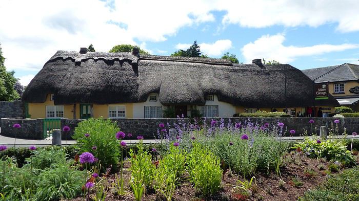
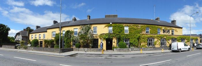


We went for lunch at the café-bistro The Good Room, located near the Trinitarian Abbey.
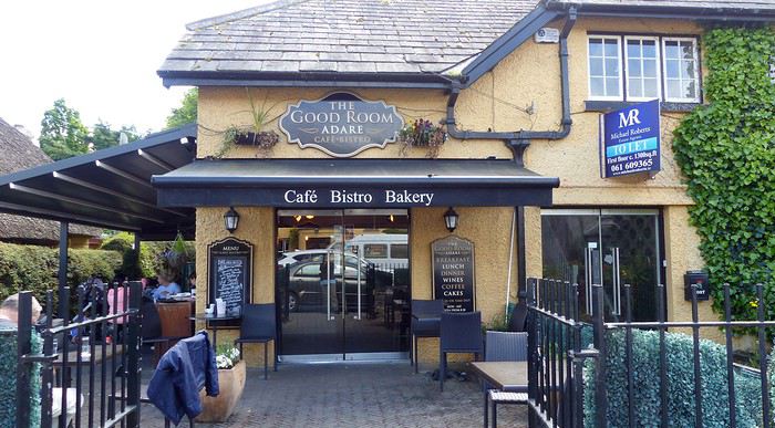


The restaurant was packed, and since the weather was nice, we decided to sit on the outdoor terrace.

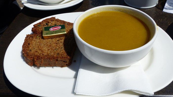
We started with soup, served with bread and butter.


Then we shared the main dish: thinly sliced beef with chili and red onion on a slice of bread, accompanied by a small salad and pine nuts.
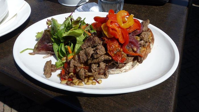


Everything was absolutely delicious!

With full stomachs, we continued exploring the various attractions in the area.

5.5 Rattoo Round Tower - Adare Trinitarian Priory (52°33'53.5"N 8°47'21.7"W) https://goo.gl/maps/2Yu1yWRaC8M2 70.1 km - 1h05 - Duration: 00h30 - Price: Free

A neo-Gothic-style monastery built in the 13th century. It suffered significant damage during the reign of King Henry VIII.

However, it was restored in the 19th century and divided into two parts, which still serve as a Roman Catholic church and a convent today.

The interior of the church features magnificent architectural elements and stunning stained-glass windows depicting various biblical scenes.

5.6 Adare Trinitarian Priory - Adare Augustinian Friary (52°34'04.1"N 8°47'05.3"W) https://goo.gl/maps/7cMGa71DzRo 0.55 km - 00h01 - Duration: 00h30 - Price: Free

This Augustinian monastery was founded in the 14th century by John Fitzthomas Fitzgerald. It’s located near the banks of the River Maigue, halfway between the Trinitarian Abbey and Desmond Castle.

It’s also known as the Black Abbey. It was restored in the 19th century, with the tower and cloister preserved, and has since been used as the local Protestant church.

You’ll find beautiful stained-glass windows, a monumental organ, and a 15th-century cloister that’s still in excellent condition. Several other architectural features are also worth discovering.

The former refectory was roofed and converted into a school.

5.7 Augustinian Friary - Adare Desmond Castle (52°34'10.2"N 8°46'55.3"W) 0.2 km - Duration: 00h15 - Price: 8 €

Desmond Castle is located 200 meters from the Augustinian Friary, along the River Maigue.

We walked there, but be careful—the road is very narrow, and traffic is quite heavy.

During our visit, the castle was closed, so we didn’t spend much time there.

However, from June to September, the castle is open for visits. You’ll need to book in advance on their website or at the Adare Heritage Centre reception.

The guided tour is in English and lasts about 90 minutes. Multilingual options are available upon request.

The castle was built in the early 13th century, and its location made it a strategic fortress.

Even though it’s now in ruins, it’s worth a visit. You can explore the remains of old rooms that once housed bedrooms, a kitchen, and a bakery.

The site also includes a square keep and a fortified area surrounded by a moat.

The castle belonged to the Earls of Kildare for nearly three centuries, until the 1536 rebellion, when it was confiscated and granted to the Earls of Desmond—hence its current name.

5.8 Adare Augustinian Friary - Courtbrack Accommodation, Limerick (52°39'19.1"N 8°38'53.3"W) https://goo.gl/maps/Mb52QEUMgDM2 15.7 km - 00h19 - Duration: 00h15

This is actually student accommodation during the school year, but in the summer months, it opens to the public at a very affordable price.

The place is about a 20-minute walk from Limerick city center, so we decided to check in, leave our car in the parking lot, and walk to the city center.

Our room has two single beds, a wardrobe, a desk, and a sink. It’s very clean.

The building is secure—we need a keycard to access the section where our room is, and the same card opens our room door.

The shared bathrooms include a shower, toilet, and sink.

The accommodation provides a fully equipped kitchen, an internet room, and laundry service ($).

WiFi is free and available throughout the building. A continental breakfast (cereal and toast) is also included.

We highly recommend this place—it offers great value for money. We slept really well because it’s so peaceful.

5.9 Exploring Limerick - On Foot - Duration: 03h00

Limerick is Ireland’s third-largest city. It’s dynamic and packed with cultural and historical buildings.

We decided to take a 3-hour walk to explore the city’s streets.

We set off on foot from our hotel and walked along Dock Road. Then we strolled along a lovely promenade by the River Shannon.

The area is peaceful, and many people come to feed the swans, which are plentiful here.

Following the River Shannon, you get a nice view of King John’s Castle, one of Limerick’s major attractions.

This 13th-century castle is located in the city’s medieval quarter. Entry costs 10.50 €, but we couldn’t visit because we arrived after closing time.

We stopped by St. Mary’s Cathedral, built in 1168, making it the oldest building in the city.

Unfortunately, we arrived late, and the cathedral doors were locked, so we had to settle for an exterior visit.

Next to the cathedral, the cemetery has some vaults dating back centuries, along with beautiful Celtic crosses.

It’s a shame we couldn’t go inside—the cathedral is famous for its stunning stained-glass windows.

We continued to King John’s Castle, where you’ll find other historic houses in the area.

We crossed Bridge Street to the other side of the River Shannon for a picturesque view of King John’s Castle and Thomond Bridge.

Near the river stands the famous limestone block on a pedestal where the Treaty of Limerick was allegedly signed in 1691.

An information panel explains the treaty’s significance.

Nearby, you’ll also find St. Munchin’s Church, built in the early 19th century.

We retraced our steps and spotted a section of wall from Bourke’s House, an old medieval manor—one of the city’s oldest sites.

We also saw St. Mary’s Church, built around 1930, and the Hunt Museum, an art and antiquities museum.

For dinner, we went to a small Asian restaurant that offers takeaway. It’s called "The Lantern Asian Bistro & Take Away" (GPS coordinates: 52°37'17.8"N 8°38'56.4"W).

We ordered sweet and sour chicken and pad thai, both served with egg fried rice. Absolutely delicious! The portions are huge, and the staff is super friendly. We highly recommend it!


Anne Blogue: https://deuxnomades.blogspot.com/ YouTube: https://www.youtube.com/c/SouthAngelVideo?sub_confirmation=1
SI Sissi57 Globetrotter ·
Hi, This new travel journal is just like the previous ones: all you have to do is hop in your car and follow your tips!
Je n'aurai pas le temps...
PI Pinacoladada Globetrotter ·
Ireland - Day 6 - Part 1

Videos are embedded in the text. Please click on the image or link to start the video.

Distance to cover: 184.4 km Estimated driving time: 03h17 Estimated time for activities: 08h25

Attractions visited: Quin Abbey, Cliffs of Moher, Doonagore Castle, Doolin Fisher Street, Doolin Killilagh Church, The Burren, Killonaghan Church, Pinnacle Well, Kilmacduagh Monastery.

6.1 Courtbrack Accommodation - Quin Abbey (52°49'04.0"N 8°51'51.0"W) goo.gl/maps/BHQpbRrnKDB2 34.2 km - 0h28 - Duration: 00h30 - Price: Free
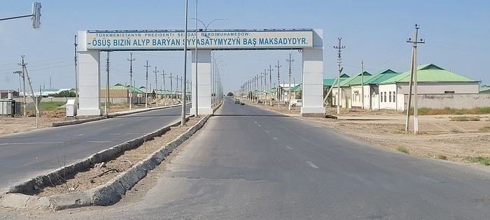
This abbey, founded in the 15th century, is located in the village of Quin, near the modern Catholic church.

It was built on the ruins of an Anglo-Norman castle constructed around 1280, but destroyed six years later by the Irish.

The castle remained in ruins until the McNamara family asked the Franciscan Order to establish an abbey there.

Even today, the building is very well preserved. Several gravestones date back to a very distant time, making the epitaphs difficult to read as they have faded over the years.

It’s possible to climb the tall square tower for a panoramic view of the region. When we visited, it was perhaps too early in the morning, and access wasn’t possible.

Near this abbey, you’ll also find the ruins of St. Finghin’s Church.

6.2 Quin Abbey - St. Finghin's Church (52°49'07.9"N 8°51'52.2"W) On foot - Duration: 00h30 - Price: Free

Very close to Quin Abbey are the ruins of St. Finghin’s Church, built in the 13th century, more precisely between 1278 and 1287.

The rectangular shape of this building is quite unique. Three walls are still standing, leaving the interior open to the sky, where old gravestones mix with more recent ones.

Judging by the church’s current appearance, it’s likely that the alcoves on either side of the three large windows in the east wall once held statues.

The interior of the church would have been divided into two parts by a chancel (wooden balustrade): the nave where the faithful gathered and the liturgical choir reserved for the priest.

The bell tower (square tower) would have been added much later, in the 15th century.

6.3 Quin Abbey - Parking Moher Fort Site Telegraph Station (52°56'36.5"N 9°27'14.9"W) goo.gl/maps/8mj3byQnFgk 53 km - 00h56 - Duration: 05h00 - Price: 2 € for parking.

We parked our car in a small private parking lot belonging to a residence.

This parking lot is about 1 km from Moher Tower (Moher Tower), and the cost is 2 € per car.

However, this means walking about 7 km to reach the Visitor Centre, for a total of 14 km round trip.

There’s a parking lot near the Visitor Centre, costing 6 € per person (GPS coordinates: 52°58'20.9"N 9°25'23.0"W).

Since we planned to do this long hike, we opted for the cheaper parking option.

When we started our hike, a very dense fog surrounded us. We decided to continue, knowing that the weather in Ireland changes quickly and there was still hope.

And sure enough, the fog lifted—not completely, but enough to see these gigantic cliffs and capture them in photos and videos.

In fact, the Cliffs of Moher stretch over 8 km and reach up to 214 m in height. They were formed over 319 million years ago and are among Ireland’s most beautiful cliffs, which explains their high tourist appeal.

The ocean waves crash against these steep, dark cliffs, shaped by erosion.

A safer path, protected by large concrete blocks, has been built. However, it’s still possible to hike along the trail that runs right along the edge of the cliffs—this is the one we took.

But caution is advised, as there are many landslide warnings posted along the route.

Not only does this hike let you admire these sheer cliffs, but you also get the chance to observe the flora and fauna of this stunning region. You’ll find several species of seabirds, such as cormorants, guillemots, puffins, and even Atlantic puffins.

Near the Visitor Centre stands O’Brien’s Tower (O’Brien Tower), built in 1835. It’s actually the highest viewpoint on the site. You can climb to the top of the tower for a superb panoramic view of the area (cost: 2 €).

When we visited, the tower was shrouded in thick fog, making visibility almost zero.

The Visitor Centre, located near O’Brien’s Tower, includes a restaurant, a small museum, and several shops.

This site has been protected by the Irish State since 1989 to ensure it’s developed for tourism while preserving its authenticity and not disrupting the surrounding nature.

It’s worth noting that summer months see heavy crowds. It’s even recommended to arrive after 4:00 PM to avoid temporary access closures due to overcapacity.

For more info on this place, I invite you to visit the following website: www.cliffsofmoher.ie/

6.4 Parking Moher Fort Site Telegraph Station - Doonagore Castle (53°00'13.9"N 9°23'14.9"W) goo.gl/maps/DsxNhNuFVVM2 9.7 km - 00h15 - Duration: 00h20 - Price: Free

Doonagore Castle, built in the 16th century, stands on a small hill by the ocean, near the village of Doolin.

At the end of that century, when Spain attempted to invade England, a Spanish ship is said to have wrecked near the castle.

Over 170 survivors were reportedly taken prisoner and hanged at Doonagore Castle. Their bodies were then buried near Doolin.

The interior of the castle is off-limits to the public since it has been owned by the O’Gorman family since 1970 and is used as a secondary residence.

However, you can visit the castle grounds and enjoy a stunning view of the coastline.

6.5 Doonagore Castle - Doolin Fisher Street (53°00'44.4"N 9°23'05.4"W) goo.gl/maps/dq8X95YBJjK2 1.2 km - 00h02 - Duration: 00h15 - Price: Free

The small town of Doolin is known for its pubs, where local musicians gather to play traditional Irish music.

Gus O’Connor’s Pub is one of them. It’s located on Fisher Street, a charming little street that runs alongside a river flowing into the Atlantic Ocean. You’ll also find a few shops and restaurants there.

6.6 Doolin Fisher Street - Doolin Killilagh Church (53°01'19.8"N 9°22'32.7"W) goo.gl/maps/PotcuAueqQK2 1.7 km - 00h03 - Duration: 00h15 - Price: Free

This church was built in the 17th century atop a small hill overlooking the sea and the Doolin countryside. You can even see the Cliffs of Moher in the distance.

The site is entered through the cemetery, where you’ll find several striking gravestones and old Celtic crosses.

The gravestones date from 1860 to 1985.

Near the church, there’s a stone mausoleum that once served as a prison during the War of Independence.

Anne Blogue: https://deuxnomades.blogspot.com/ YouTube: https://www.youtube.com/c/SouthAngelVideo?sub_confirmation=1
PI Pinacoladada Globetrotter ·
Ireland - Day 6 - Part 2

Videos are embedded in the text. Please click on the image or link to start the video.

6.7 Doolin Killilagh Church - Burren Stop 1 (53°03'38.7"N 9°21'43.5"W) https://goo.gl/maps/11tWDbdcmkp 7 km - 00h10 - Duration: 00h30 - Price: Free

The Burren is a vast desert-like plateau stretching over several hundred kilometers in the northwest of County Clare.

Burren National Park is on the UNESCO World Heritage tentative list.

Its name comes from the Gaelic *Boireann*, meaning "place of stone." It lives up to its name.

This plateau is made up of rocky crevices and fissures, mainly caused by rainwater runoff and repeated freeze-thaw cycles.

This limestone layer formed nearly 340 million years ago at the bottom of a shallow sea. However, agricultural activity here is estimated to have started over 6,000 years ago.

Several flowers grow through the rocky cracks. You can even find a plant that usually grows in the Alps—the blue gentian, which is the symbol of the Burren.

The region is home to many Celtic and prehistoric remains, such as dolmens, menhirs, stone circles, and ancient forts.

Legends abound in Ireland. One of them tells that the Burren is actually the result of a quarrel between a giant couple who lived on the moon.

The man had drunk too much and lashed out at his wife, who hid behind some rocks. Enraged, the man lifted his wife and the rocks and threw them into the sky.

Naturally, everything landed on Earth—in Ireland. The rocks shattered into a thousand pieces, forming the Burren.

6.8 Burren Stop 1 - Burren Stop 2 (53°04'09.7"N 9°21'30.3"W) https://goo.gl/maps/53FWmZjJT6M2 1 km - 00h01 - Duration: 00h30

6.9 Climbing in the Burren

The Burren is known for its rocky limestone landscape, making it an excellent spot for climbing.

During our visit, we saw a man doing just that.

I looked it up online and found that a local company offers safe climbing experiences with qualified guides and proper equipment like ropes and harnesses.

Climbing sessions can be tailored to all levels, whether you're a beginner or more experienced.

For more info, check out this website: http://www.burrenoec.com/rock-climbing-in-co-clare.html

6.10 Burren Stop 2 - Killonaghan Church Ruins (53°05'59.3"N 9°17'52.4"W) https://goo.gl/maps/eY3rjMUCcVJ2 5.4 km - 00h06 - Duration: 00h15 - Price: Free

This church was founded in the 11th century by Saint Onchu. Today, only a few ruins remain, but it’s still worth visiting. It’s set in a lovely meadow, and the pretty cemetery still has several Celtic crosses and old gravestones.

6.11 Killonaghan Church Ruin - Pinnacle Well (53°07'58.9"N 9°11'39.7"W) https://goo.gl/maps/1gFvjV1sLBt 12.1 km - 00h14 - Duration: 00h05 - Price: Free

Pinnacle Well is a small roadside shrine in the Burren. Inside, you’ll find spring water gently flowing into a small basin. The water is said to be drinkable.

The site is considered sacred, and offerings have been left inside the shrine.

6.12 On the Road in the Burren

We invite you to explore this stone desert with us by car in this video.

6.13 Pinnacle Well - Kilmacduagh Abbey (53°02'52.4"N 8°53'16.7"W) https://goo.gl/maps/zuEKYsJVMck 31.3 km - 00h34 - Duration: 00h30 - Price: Free

Kilmacduagh Monastery was built in the 7th century in County Galway, about 5 km from the town of Gort.

This monastery has Ireland’s tallest round tower (30 m high) and is one of the country’s most important sites.

Like the Leaning Tower of Pisa, this tower is slightly tilted.

You’ll also find the remains of a cathedral, a few churches, and an abbot’s house.

The cathedral walls are still standing, giving us a glimpse of what this place of worship once looked like.

There’s a beautiful cemetery with graves and Celtic crosses, some dating back to the monastery’s founding.

Saint Colman, son of Duagh and patron of the diocese, who lived in the 7th century, is said to be buried behind the cathedral.

Don’t miss this serene spot—it’s truly special.

6.14 Kilmacduagh Abbey - Auburn Lodge Hotel (52°51'55.7"N 8°58'50.3"W) https://goo.gl/maps/3sXqz6k3Zuo 27.8 km - 00h28

This is a charming hotel with excellent front desk service.

The room is spacious, featuring two very comfortable double beds, bedside tables, a pedestal table, three armchairs, a desk, a flat-screen TV, a coffee maker, and plenty of storage space.

The bathroom has both a shower and a bathtub, and complimentary toiletries are provided.

Bonus: There’s a supermarket right next to the hotel.

Anne Blogue: https://deuxnomades.blogspot.com/ YouTube: https://www.youtube.com/c/SouthAngelVideo?sub_confirmation=1
PI Pinacoladada Globetrotter ·
Ireland - Day 7 - Part 1

Videos are embedded in the text. Please click on the image or link to start the video.

Distance to cover: 281.3 km Estimated driving time: 04h34 Estimated time for activities: 06h15

Attractions visited: Killinaboy Church, Leamaneh Castle, Kilfenora Cathedral, Lisdoonvarna, Poulnabrone Dolmen, Corcomroe Abbey, Dunguaire Castle, Shannonbridge, Clonmacnoise Abbey, Clonfert Cathedral, Clontuskert Abbey, Galway.

7.1 Auburn Lodge Hotel - Killinaboy Church (52°58'14.3"N 9°05'10.3"W) https://goo.gl/maps/7dY3cDYgTLH2 18.9 km - 00h22 - Duration: 00h15 - Price: Free

This small medieval church dates back to the 11th century. Some features of this church are truly unique.

Here, you’ll find a Lorraine cross on the gable of its front façade, while on another wall, the body of a seated woman with legs apart was once carved into the stone. It’s believed to be a fertility symbol (Sheela na Gig).

A round tower is located near this church. It was also built in the 11th century.

7.2 Killinaboy Church - Leamaneh Castle (52°59'16.1"N 9°08'23.8"W) https://goo.gl/maps/o9pxkotGTjG2 4.3 km - 00h04 - Duration: 00h15 - Price: Free

This ruined castle isn’t open to the public, but you can still observe it as it’s located near the main road.

It consists of a five-story tower built in the 15th century and a four-story manor house that was added to the tower nearly two centuries later.

A legend is tied to this castle. It tells the story of Mary McMahon, nicknamed Red Mary because of her flamboyant red hair, who lost her husband Conor O'Brien, lord of the castle, in 1651.

Hoping to keep her lands, she immediately proposed marriage to an officer in Cromwell’s army. Captain Cooper accepted her offer.

However, a few days later, she had an argument with her new husband, and he was pushed out of one of the castle’s windows. He didn’t survive.

Red Mary was known for her violence and cruelty. She quickly gained a reputation as a witch.

The legend also says she had over 25 husbands. After killing her last one, she was allegedly walled up alive inside a hollow tree by her enemies and starved to death.

They say Red Mary’s ghost still haunts Leamaneh Castle.

7.3 Leamaneh Castle - Kilfenora Cathedral (52°59'26.6"N 9°13'00.8"W) https://goo.gl/maps/cHB9zy5Sd7M2 6 km - 00h07 - Duration: 00h15 - Price: Free

Kilfenora Cathedral dates back to the 12th century and was dedicated to Saint Fachtna in 1189.

Several tombs from the 17th century can still be found there.

Many high crosses are displayed in the cathedral. The oldest, the Doorty Cross, was reconstructed and placed in the choir. It dates back to 1152.

On one side of this cross, you’ll see the figure of Christ above someone riding a donkey. On the other side, Saint Peter is shown giving his blessing to a bishop and an abbot.

7.4 Kilfenora Cathedral - Lisdoonvarna (53°01'40.7"N 9°17'23.7"W) https://goo.gl/maps/tRg8nsNcLaB2 8.2 km - 00h09 - Duration: 00h15 - Price: Free

Lisdoonvarna is a charming little village in County Clare, Ireland. Its houses and signs are very colorful, making it a picturesque spot.

Every September, the village hosts a unique event: the Lisdoonvarna Matchmaker Festival. Singles come to join the festivities and, who knows, maybe meet their soulmate. Irish music is on the menu, and people dance and have fun in the streets and pubs.

The village is also known for its health establishments offering massages, bubbling baths, and even sulfur baths.

7.5 Lisdoonvarna - Poulnabrone Dolmen (53°02'49.0"N 9°08'27.7"W) https://goo.gl/maps/BnNxnD4TSTy 18.4 km - 00h25 - Duration: 00h30 - Price: Free

Arguably one of the most famous dolmens in all of Ireland. It’s located in a desert-like region, specifically on the Burren plateau in County Clare. It’s believed to have been created nearly 6,000 years ago.

This 2-meter-high dolmen is made up of 7 massive stone slabs. It’s thought to have served as a funeral altar.

Archaeological excavations suggest that religious ceremonies took place at this sacred site. Many human bones were found, leading experts to believe that bodies of the deceased were burned here.

7.6 Poulnabrone Dolmen - Corcomroe Abbey (53°07'36.7"N 9°03'15.7"W) https://goo.gl/maps/j4FA1WQEh9o 17.4 km - 00h25 - Duration: 00h30 - Price: Free

This abbey is located in a field near the village of Ballyvaughan, north of the Burren region. It was built at the end of the 12th century using the limestone found in the Burren.

Even today, it remains remarkably well-preserved. Its vaults and sculptures are stunning. The site is very well-maintained.

Several gravestones lie on the ground. Some are very old, dating back centuries. The inscriptions are still visible and bear witness to the past.

A legend says that King Conor Siudane Ua Briain of Thomond County commissioned the construction of this abbey. In fact, his funerary sculpture is still present in one of the choir walls.

Fearing that the masons would build an even more beautiful and larger abbey for a rival clan, he allegedly demanded that the masons responsible for the abbey’s construction be executed.

However, research suggests it’s more likely that his grandfather commissioned the building, as he had already funded several other religious constructions in the area. Many monks are said to have participated in its creation.

7.7 Corcomroe Abbey - Dunguaire Castle (53°08'32.0"N 8°55'34.0"W) https://goo.gl/maps/xNs9DEW8p3U2 13.1 km - 00h16 - Duration: 00h15 - Price: 7 € (visit), 50 € (banquet)

Dunguaire Castle was built in 1520 by a family that had ruled the region for centuries. It’s located in the small village of Kinvara, on the southeastern shore of Galway Bay in Ireland.

The castle consists of a large square tower surrounded by a high wall, which helped defend against enemy attacks.

From the castle, you get a beautiful view of Galway Bay.

We only visited the outside of the castle. However, the interior is open for visits from April to mid-September, costing around 7 € per person.

Medieval banquets are also held in the evenings. Reservations are required in advance. The cost is 52 € per person.

Anne Blogue: https://deuxnomades.blogspot.com/ YouTube: https://www.youtube.com/c/SouthAngelVideo?sub_confirmation=1
PI Pinacoladada Globetrotter ·
Ireland - Day 7 - Part 2

Videos are embedded in the text. Please click on the image or link to start the video.

7.8 Dungaire Castle - Shannonbridge (53°16'45.2"N 8°02'57.5"W) https://goo.gl/maps/uRZkax53GQ22 76 km - 01h00 - Duration: 00h15 - Price: Free

The first two things we noticed when we arrived in Shannonbridge were the Old Fort Restaurant and the magnificent stone bridge spanning the River Shannon.

The restaurant, which is very popular, is located in a fort built in the early 19th century. It has just been restored.

The arched bridge dates back to 1757 and is located near the fort. Needless to say, the place is very picturesque!

We made a short stop there, just long enough for a little walk along the riverbank. River Shannon cruises are offered here.

The town has a few authentically Irish bars where traditional music is a highlight.

7.9 Dungaire Castle - Clonmacnoise Abbey (53°19'33.9"N 7°59'13.5"W) https://goo.gl/maps/zro9ZXSoPLs 4.5 miles - 00h10 - Duration: 00h45 - Price: 8 €

This monastery is located in Athlone in County Offaly. Its origins date back to the 6th century.

A church was first built. Over the centuries, several other buildings were erected around the church, forming a small village that became an important university and religious center until the 12th century.

The monastery was so renowned that many kings chose to be buried on this site.

As soon as we arrived, we could already get a great sense of the splendor this center must have had in such a distant era.

Moreover, the monastery was built on the banks of the River Shannon, which adds to the charm of the place.

The site includes a cathedral, several churches, two round towers, three high Celtic crosses, and several other features.

There’s also a small museum in the visitor center. Don’t miss it. They show a short film about the site’s history, among other things.

7.10 Clonmacnoise Abbey - Clonfert Cathedral (53°14'26.5"N 8°03'30.6"W) https://goo.gl/maps/dMuYWHdhviz 19.8 miles - 00h34 - Duration: 00h30 - Price: Free

Without a doubt, one of the most beautiful monasteries we’ve seen in Ireland. It was founded in the 6th century by the evangelist Saint Brendan and became a cathedral in the 12th century.

A very small cathedral, but an unparalleled architectural gem.

Its porch is adorned with motifs representing human heads, animals, and other decorative elements. You’ll also find sculptures of mermaids and dragons.

It also has magnificent stained-glass windows, some of which date back to the 13th century.

The pulpit was finely carved from oak wood—a precision craftsmanship that makes it a remarkable masterpiece.

The cathedral is also surrounded by a lovely cemetery, with some gravestones dating back to the 17th century.

A sacred place, a place of peace, a stunning spot you shouldn’t miss if you’re in the area.

7.11 Clonfert Church - Clontuskert Abbey (53°16'45.9"N 8°12'59.2"W) https://goo.gl/maps/P8cqCQ56Rgw 8.9 miles - 00h14 - Duration: 00h30 - Price: Free

This monastery, built in the 12th century, is now a national monument. It’s located in a field, about 350 meters from the parking lot, which is right by the road.

Today, the land where it was built is used for farming, but access to the monastery is allowed.

In the early 15th century, the monastery suffered a fire but was restored in the following years.

The building is quite deteriorated, but the place remains attractive.

The entrance door is adorned with beautiful sculptures. At the top of the door, you can see four saints, while on either side, the sculptures depict a mermaid, a rose, a dog, a star, birds, and more.

The decorative arches of the cloister and the large window on the east wall are truly magnificent.

An unusual feature caught our attention: the statue of Jesus’ body, without arms, placed along the low wall surrounding the monastery.

You’ll also find old gravestones, some dating back to the 17th century.

7.12 Clontuskert Abbey - Corrib Village (53°17'17.3"N 9°03'59.3"W) https://goo.gl/maps/87gxu9trmzq 40.7 miles - 00h48

After visiting Clontuskert Abbey, we headed toward Galway, specifically to Corrib Village, a university campus about a 20-minute walk from the city center. This is where we spent the night.

The building housing the reception isn’t easy to find. It’s a blue building located across from another building that contains a small grocery store, a restaurant, a dining hall, and a lounge with several armchairs and a pool table.

The reception staff were very friendly.

We chose this type of accommodation because the price was very appealing. We got a small room with just the basics: a bed, desk, lamp, phone, and a few shelves for storage, which suited us perfectly since we were only staying one night.

The room was clean, the bed was comfortable, and it was quiet.

The toilet and shower are in another room and are shared with other occupants of the building if needed.

Breakfast is included. You’ll find bread, cereal, fruit, marmalade, coffee, juice, and milk, among other things.

A free shuttle service is offered for those who want to go into town. As for us, we preferred to walk there via the small path along the River Corrib, which is near the campus.

We were satisfied with all the services offered by this campus.

7.13 Walking tour of Galway Duration: 02h00 - Price: Free

We walked along a path following the River Corrib, which runs through the city and then flows into Galway Bay.

Several bridges span the river, but Bridge Mills is definitely worth a visit. Entirely made of stone, it’s said to have been built in the 16th century. A beautiful waterfall flows right next to this bridge.

Spanish Arch is another tourist attraction in Galway. It’s actually a defensive wall along the River Corrib. This old gate was built in 1584 and was meant to protect the city’s port.

Several festivals take place in this city. During our visit, the Claddagh Traditional Boats Festival was underway. Many people were gathered along the quays to watch these magnificent Viking boats. Traditional music set the rhythm for the event.

Galway is without a doubt a very dynamic city. Its streets are lively.

Quay Street is one of them. It’s popular and very busy with tourists. You’ll find many restaurants, Irish pubs, shops, museums, and other businesses and tourist spots.

During our walk, we also stopped on the path to watch the salmon trying to swim up the River Corrib. We had the chance to see a few jumping out of the water.

Some fishermen had also cast their lines. We even saw one of them catch a salmon.

Anne Blogue: https://deuxnomades.blogspot.com/ YouTube: https://www.youtube.com/c/SouthAngelVideo?sub_confirmation=1
PI Pinacoladada Globetrotter ·
Ireland - Day 8 - Part 1

Videos are embedded in the text. Please click on the image or link to start the video.

Distance to cover: 178.9 km Estimated driving time: 03h37 Estimated time for activities: 06h20

Attractions visited: Aughnanure Castle, Quiet Man Bridge, Loughaunierin, Carna, Derryclare Lough, John D'Arcy Monument, Clifden Castle, Sky Road, Omey Island, Connemara National Park.

8.1 Corrib Village - Aughnanure Castle (53°25'10.9"N 9°16'27.7"W) https://goo.gl/maps/d4x2sEq8c8H2 47.2 km - 00h60 - Duration: 00h30 - Price: 5 €

This castle was built in the 16th century on an island in the Corrib River by the O’Flaherty clan.

It’s actually a rectangular six-story tower accessible via a bridge leading to the fort’s entrance. It’s surrounded by a stone wall and watchtowers.

Above the entrance, there’s a machicolation—a small balcony with openings through which defenders could shoot arrows or even drop stones on enemies.

The castle’s interior can be visited. Several panels provide details about life in the castle during that era.

A spiral stone staircase leads to the upper floors. Some floors were reserved for the clan chief, while others were allocated to family members and servants.

You’ll also discover a secret chamber that likely served as a dungeon.

The site once included a large banquet hall. Today, only one wall remains.

8.2 Aughnanure Castle - Quiet Man Bridge (53°25'37.5"N 9°25'21.4"W) https://goo.gl/maps/DkJif3h7T1L2 11.2 km - 00h14 - Duration: 00h15 - Price: Free

This bridge became famous thanks to the 1952 film *The Quiet Man*, starring John Wayne and Maureen O’Hara. The film even won two Oscars.

In one scene, the actor stands on this stone bridge, taking in the stunning Irish landscape.

The bridge is still intact. A photo of the actor has been placed near the bridge to commemorate the event.

Additionally, a marked hiking trail starts here, allowing walkers to retrace the most important filming locations from the movie.

8.3 Quiet Man Bridge - Loughaunierin (53°27'03.9"N 9°28'59.1"W) https://goo.gl/maps/wg3KpwzU7L72 5.4 km - 00h06 - 00h05 - Price: Free

We stopped briefly at Loughaunierin Lake along the N59 road. The spot is truly charming—the lake sits at the foot of a stunning mountain range.

You’ll get a glimpse of it at the start of the next video.

8.4 Loughaunierin - Texaco N59 Roadside Stop (53°28'01.4"N 9°44'21.2"W) https://goo.gl/maps/rT1JTfpFXs22 18 km - 00h15 - Duration: 00h15 - Price: Free

We continued to the Texaco N59 roadside stop in Lissoughter. Right now, the road is lined with beautiful purple flowers.

This stop is very popular. There’s a stunning viewpoint overlooking the lake and the fully bloomed valley.

You’ll find a small grocery store, a gas station, and a souvenir shop here.

Here’s a quick glimpse of the landscape in this area.

8.5 Loughaunierin - Carna (53°19'29.6"N 9°49'23.5"W) https://goo.gl/maps/awzFbHWzoA92 20.7 km - 00h21 - Duration: 00h15 - Price: Free

We temporarily left the N59 to take the R340 toward Carna. We made the round trip for the breathtaking scenery.

This coastal road runs along Kilkerian Bay. The landscape is quite wild—rocky terrain dotted with boulders and coves covered in orange seaweed.

On the way back, we enjoyed a splendid view of the mountains, which light up when the sun comes out and darken again as clouds pass.

8.6 Carna - Derryclare Lough (53°27'44.3"N 9°47'44.6"W) https://goo.gl/maps/GotUddieKpG2 19.7 km - 00h19 - Duration: 00h15 - Price: Free

Derryclare Lough, a peaceful oasis, is located on the N59, about 16 km from Clifden.

In the middle of the lake, there’s a small island covered in trees, and behind the lake stretches the majestic Twelve Bens mountain range.

A stone walkway crosses the lake, allowing access to the island.

The site is easily accessible, and the wild beauty of this region is well worth a stop.

Anne Blogue: https://deuxnomades.blogspot.com/ YouTube: https://www.youtube.com/c/SouthAngelVideo?sub_confirmation=1
PI Pinacoladada Globetrotter ·
Ireland - Day 8 - Part 2

Videos are embedded in the text. Please click on the image or link to start the video.

8.7 Derryclare Lough - John D'Arcy Monument (53°29'16.6"N 10°02'05.1"W) https://goo.gl/maps/ytU4CBNsCMR2 17 km - 00h17 - Duration: 00h30 - Price: Free

Clifden is a charming little town located on the west coast of Ireland. It is said to have been founded in the 19th century by John D'Arcy, a member of a prominent Galway family.

A monument was dedicated to him. It sits at the very top of a small hill overlooking the town of Clifden.

A short trail leads to the top of this hill. The starting point is from a very small parking lot located by the side of the road. There’s a sign for this site, but it’s not very visible.

The access is fenced. You’ll need to open the gate and close it right away. In the distance, beautiful white horses watch us.

At the summit, the panoramic view is truly exceptional. We can see not only the town of Clifden but also the magnificent bay with its turquoise waters and white sandy beaches.

On the way back, the horses were waiting for us. Alain went to pet them, and they accompanied him to the edge of the road.

8.8 John D'Arcy Monument - Clifden Castle (53°29'31.1"N 10°02'53.5"W) https://goo.gl/maps/iaujzUHnMXE2 1.1 km - 00h02 - Duration: 01h00 - Price: Free

This castle is a former 19th-century manor. It was built by John D'Arcy, also the founder of the town of Clifden.

It’s located in a beautiful green meadow and faces Clifden Bay.

To get there, you’ll need to leave your car in the designated parking lot by the Sky Road and then embark on a hike of about 1 km along a path that leads directly to the gate with two large towers. The path then winds through a stunning valley all the way to the castle.

You can spot a few standing stones in this valley. It seems one of them was carved by prehistoric people.

This is one of the most beautiful castles in Ireland we’ve had the chance to visit so far. Several towers add to the grandeur of this imposing building.

The interior of this neo-Gothic manor is in ruins, but the exterior is still in very good condition.

There are also other buildings near the castle that are worth seeing. To access them, you can either go through the archway in the wall next to the castle or take the road behind the castle.

8.9 Clifden Castle - Sky Road Wild Atlantic View Point (53°30'02.4"N 10°05'47.2"W) https://goo.gl/maps/Kr5G3wetKwS2 3.5 km - 00h07 - Duration: 00h15 - Price: Free

There are several scenic routes in Ireland, and the Sky Road is one of them. This narrow, winding road stretches for about ten kilometers.

It crosses green hills and offers several exceptional viewpoints along the coastline.

There’s a roadside stop on this route. I highly recommend making a stop here because the panorama is truly spectacular.

You can see a string of islets scattered here and there in an ocean of turquoise waters, as well as beautiful white sandy beaches.

8.10 Sky Road Wild Atlantic View Point - Omey Island (53°32'16.4"N 10°08'38.8"W) https://goo.gl/maps/SgxcRBCrniQ2 17.2 km - 00h25 - Duration: 00h30 - Price: Free

Omey Island is a very small island located near Claddaghduff. It’s only accessible at low tide. The sea recedes, and it’s then possible to reach the island on foot or by car by crossing the sandy beach that connects it to the small town of Claddaghduff.

Out of curiosity, we decided to make the crossing by car. The ground is firm. Just follow the posts installed in the sand that mark the path to take.

However, you still need to be careful because there are huge puddles in some places. It’s impossible to gauge either the depth or the stability of the ground.

We took the plunge anyway, and everything went well both ways.

It’s important to know the tide schedule because the crossing could be compromised. At high tide, the water is deep enough to cover a car.

Nearly 400 people lived on this island in the 19th century. However, the famine led them to leave this place.

Today, the island is abandoned. Only a few residents stay there in the summer.

At the end of the island, the path comes to an end near a long white sandy beach.

The ruins of a medieval church, a small sanctuary, and a holy well are still visible on the island. However, we didn’t visit them.

8.11 Omey Island - Connemara National Park Visitor Centre (53°33'00.5"N 9°56'43.3"W) https://goo.gl/maps/5EpqMobG6162 16.7 km - 00h28 - Duration: 02h30 - Price: Free

To end the day on a high note, we embarked on a hike of about 7 km round trip (loop) to the summit of Diamond Hill, which rises to a height of 445 meters.

This mountain is located in Connemara National Park and is part of the Twelve Bens range.

The trail is very well marked. It starts at the visitor center and takes us directly to the summit... with some effort, of course.

The landscape is breathtaking and changes constantly. Sometimes we walk on wooden bridges that allow us to cross the bogs, and sometimes we climb each stone placed on the trail one by one.

In some places, the trail is really steep, and the higher we go, the stronger the wind gets.

At every turn, we think we’ve reached the summit, but that’s not the case. So, we continue on our way, dazzled by the beauty and vastness of this magnificent region.

We’re truly rewarded when we reach the summit of Diamond Hill. We have a splendid 360-degree view of Connemara: green valleys, lakes, russet moors, and bogs.

We completed this hike in 2h30, including photo stops.

For more information about Connemara National Park, here’s the link to their website: http://www.connemaranationalpark.ie/

8.12 Connemara National Park Visitor Centre - Cloverfox Connemara (53°33'12.7"N 9°56'52.3"W) https://goo.gl/maps/TDhKptiJY9D2 1.2 km - 00h03

When we made the reservation, the place was called Bard Dens Hostel. The name has changed since then.

We received a very warm welcome. Our room had three single beds, two of which had been pushed together, and a bathroom with a shower. We slept very well there.

We had access to a common room with a small living area and a fully equipped kitchen.

Breakfast was included in the cost of the reservation. It consisted of various fruits, cereals, bread, coffee, and juice.

There were tables outside for having a drink or a meal. We ate a club sandwich, and it was really delicious.

The Wi-Fi is free. However, it wasn’t accessible from our room. We had to go into the hallway to get a signal.

We only spent one night there. However, for those who want to spend more time in this region, this hotel is a really great choice given its proximity to Connemara National Park.

Anne Blogue: https://deuxnomades.blogspot.com/ YouTube: https://www.youtube.com/c/SouthAngelVideo?sub_confirmation=1
PI Pinacoladada Globetrotter ·
Ireland - Day 9 - Part 1

Videos are embedded in the text. Please click on the image or link to start the video.

Distance to cover: 282.3 km Estimated driving time: 05h56 Estimated time for activities: 05h35

Attractions visited: Kylemore Castle, Lough Inagh, Cong Abbey, Ashford Castle, Aasleagh Falls, Doolough Memorial, Bunlahinch Bridge, Silver Strand, Bertra Strand, Famine National Monument, Murrisk Abbey, Burrishoole Abbey, Rockfleet Castle, Kildownet Cemetery, Kildavnet Tower, White Cliffs of Ashleam, Doogea Beach, Minaun Mount.

9.1 The Bard Dens Hostel - Kylemore Castle (53°33'34.2"N 9°53'31.2"W) https://goo.gl/maps/byWtQUBB9Sr 4.4 km - 00h06 - Duration: 00h15 - Price: 13 €

Kylemore Castle, a neo-classical style castle, was built in the 19th century. It’s located on the shores of a lake and surrounded by dense forest. It’s a major tourist site.

The site also includes a 3-hectare garden and a Benedictine abbey.

The castle has a tragic past. Henry Mitchell is said to have built it for his wife, Margaret. Shortly after its completion, the couple tragically lost their daughter. Margaret was so heartbroken that she passed away, leaving her husband in deep despair.

He had a miniature cathedral built in her memory, as well as a mausoleum where he buried her body. He asked to be buried near his wife when he died.

However, he sold the estate, unable to live in a place that reminded him of such sad memories.

The castle was abandoned for several years until the Benedictine Sisters took it over and opened a Catholic school for girls.

To fund the restoration and upkeep of the estate, they also allowed visits to some rooms in the castle, the garden, and the abbey. A fee of 13 € per person is required.

The suggested time for the visit is about 1h30. For us, we only made a short stop. The site was closed when we passed by because it was very early in the morning.

For photography lovers, there are currently renovation works underway outside the castle, and several scaffolds are installed, covering a large part of the castle.

9.2 Kylemore Castle - Cong Abbey (53°32'25.2"N 9°17'12.4"W) https://goo.gl/maps/gj58D8HPMKB2 63.3 km - 01h08 - Duration: 01h00 - Price: Free

After visiting Kylemore Castle, we took the N59 road, which runs along Lough Kylemore, one of the largest lakes in the Connemara region.

We then took the R344 road, which winds through the Inagh Valley, offering stunning landscapes.

Lough Inagh (53°31'00.6"N 9°44'15.0"W) is a beautiful lake located in this valley, nestled at the foot of the Twelve Bens mountain range.

We got back on the N59 and made a short stop in Recess. I took the opportunity to photograph the Connemara Giant monument. It’s located in the parking lot facing Joyce’s Craft Shop.

Legend has it that if you touch the giant’s hand, he’ll protect you.

We then continued our journey (via the R336 and R345 roads) toward Cong to visit the abbey and Ashford Castle.

Cong Abbey was founded in the 12th century by Turlough O’Connor, the High King of Ireland. A monastic site had already been established in the same location in the 7th century.

The ruins still showcase the magnificence the site once had. Finely sculpted arches remain in the four corners of the inner courtyard.

Over time, Cong Abbey served multiple purposes. It was used as a hospital, a refuge for the poor, and even as a hiding place for the O’Connor family.

A small path starts from the back courtyard of the monastery and leads to the ruins of the monks’ fishing house. It’s actually a small stone house built on a platform above the river.

A trapdoor was installed in the floor to allow the monks to fish, and a small fireplace was even set up to keep them warm in winter.

Ashford Castle (53°32'04.7"N 9°17'02.7"W)

You can reach Ashford Castle via a path that starts near Cong Abbey.

A river flows behind the abbey. Just cross the pedestrian bridge over the river and turn left. A small path runs along the river and quickly leads to the castle.

This impressive medieval-style castle was built in the 13th century on the shores of Lough Corrib. It has since been converted into a luxury hotel.

It has hosted many famous figures, including King George V and his wife, writer Oscar Wilde, U.S. President Ronald Reagan, and Prince Rainier III and his wife.

The castle has belonged to several notable families and was later purchased by investors for the hefty sum of 50 million €.

It has undergone several transformations and expansions over the centuries.

The interior of the castle is only accessible to guests.

Several activities are offered, such as golf, fishing, and a visit to Ireland’s falconry school. Cruises on Lough Corrib are also available.

9.3 Cong Abbey - Aasleagh Falls (53°37'06.0"N 9°40'15.6"W) https://goo.gl/maps/JZoQLyCtpJA2 39.5 km - 00h50 - Duration: 00h15 - Price: Free

This lovely waterfall is located near the village of Leenane, specifically on the Erriff River, just before it flows into Killary Harbour fjord.

There’s a small parking lot near the waterfall on the R335 road.

You can view it from the bridge over the river, but there’s also a path that takes you right to the base of the falls.

It’s set in an enchanting landscape—a great spot to wander around or have a picnic.

9.4 Aasleagh Falls - Doolough Memorial (53°39'58.2"N 9°46'53.7"W) https://goo.gl/maps/cJoWiFJzNb82 14 km - 00h17 - Duration: 00h15 - Price: Free

Killary Harbour, located in County Mayo, is Ireland’s longest fjord. The R335 road runs along it, offering breathtaking views.

However, be cautious—this road is quite narrow, and there are plenty of sheep grazing by the roadside.

We drove to the Doolough Memorial, which honors a tragic event that took place on the night of March 30, 1849.

That night, over 400 Irish people died during the Great Famine. They had been summoned to appear at an old hunting lodge the next day, and if they refused, they would lose all state aid.

They had to walk 20 km to get there. But exhaustion, hunger, cold, and illness took their toll. They perished.

To commemorate this event, a stone cross was erected by the lake, bearing a quote from Gandhi:

« How can men feel themselves honoured by the humiliation of their fellow beings? » (How can men feel honored by the humiliation of their fellow human beings?)

9.5 Doolough Memorial - Bunlahinch Bridge (53°43'06.2"N 9°53'19.2"W) https://goo.gl/maps/PgrTowRjKB12 11.4 km - 00h17 - 00h05 - Price: Free

This stone bridge is located near the village of Killadoon. It served as a footbridge for pedestrians who wanted to cross the shallow river at this spot.

It’s the largest slab-stone pedestrian bridge in Ireland, measuring 50 meters long.

It likely dates back to the mid-19th century, which may coincide with the arrival of a Protestant evangelist colony that built a church and school by the river.

9.6 Bunlahinch Bridge - Silver Strand (53°38'59.0"N 9°52'51.5"W) https://goo.gl/maps/JsZjwcJMXK52 9.8 km - 00h17 - 00h30 - Price: Free

Silver Strand is a stunning sandy beach near Killadoon. It’s considered one of Ireland’s most beautiful beaches.

Surrounded by mountains and high sand dunes, it’s very popular with families.

From the parking lot, you’ll need to walk several hundred meters across the soft sand to reach the sea.

This spot offers a magnificent view of the Inishtruk, Inishbofin, and Clare islands.

We didn’t get to see the sunset over Clew Bay, but it’s said to be the perfect place to watch it.

Anne Blogue: https://deuxnomades.blogspot.com/ YouTube: https://www.youtube.com/c/SouthAngelVideo?sub_confirmation=1
PI Pinacoladada Globetrotter ·
Ireland - Day 9 - Part 2

9.7 Silver Strand - Bertra Strand (53°47'18.3"N 9°39'40.6"W) https://goo.gl/maps/KAL9GYHdMnR2 17.3 miles - 00:34 - Duration: 00:15 - Price: Free

We just passed through the small town of Louisburgh (53°45'46.5"N 9°48'33.9"W), which is located on the banks of the Bunowen River, as our next destination was Bertra Beach.

However, I took the opportunity to shoot a short video of the colorful houses and shops lining the main street.

Legend has it that the town was named in memory of the founder’s uncle, who fought in the Battle of Louisbourg in Nova Scotia in 1758.

Bertra Strand is very popular for hiking, birdwatching, and kitesurfing.

It’s actually a crescent-shaped beach that juts out into the ocean. This year, it was awarded the Blue Flag, a symbol of outstanding environmental quality.

We were supposed to walk to the end of the beach to get a view of the sea on both sides, but the rain and wind got the better of us.

Instead, we admired it from a distance.

9.8 Bertra Beach - Famine National Monument (53°46'48.6"N 9°38'23.0"W) https://goo.gl/maps/9rmLD2hc9EP2 1.9 miles - 00:05 - Duration: 00:15 - Price: Free

This monument is located in Murrisk, near the Croagh Patrick Visitor Centre. It honors the Irish who left their country during the Great Famine around 1840 in hopes of finding a better life.

It’s a symbolic sculpture of a ship carrying a multitude of human skeletons. Their suffering is strikingly real.

At the time, Irish emigrants were required to bring their own food, though no more than 6.6 lbs per person. The crossing could take over a week.

Unfortunately, most were too poor to afford food.

Hunger, exhaustion, and disease led to the deaths of many passengers.

9.9 Famine National Monument - Murrisk Abbey (53°46'46.8"N 9°38'20.4"W) Duration: 00:15 - Price: Free

A short road (maybe a hundred meters), perpendicular to the R335, starts near the Famine Monument and leads directly to this abbey. It faces Clew Bay.

This 15th-century abbey is now partly in ruins.

Our visit was cut short by heavy rain, but we still explored the site and discovered, among other things, a section of wall with a lovely pointed window.

Several old gravestones remain in the cemetery, including those of the O’Malley family, the abbey’s founders.

9.10 Famine National Monument - Burrishoole Abbey (53°53'54.4"N 9°34'17.3"W) https://goo.gl/maps/ECq2n6hyGUm 14.8 miles - 00:29 - Duration: 00:45 - Price: Free

After visiting Murrisk Abbey, we hit the road toward Burrishoole Abbey.

However, we made a quick stop in Newport, a small village on the shores of Clew Bay, founded in the 18th century.

Just before entering the village, there’s a small parking lot (GPS coordinates: 53°52'59.8"N 9°32'47.9"W) offering a stunning view of the Brown Oak River flowing gently under an impressive viaduct with several arches.

We could also see a large church built in 1914 atop a hill overlooking Newport.

Burrishoole Abbey is definitely one of our favorite spots. It’s set back from the main road, near the Burrishoole River. The place is incredibly peaceful—you can really feel a sense of inner calm.

This abbey was founded in the 15th century by Sir Richard de Burgo, surprisingly without the Pope’s approval. He had the archbishop’s consent but didn’t realize he needed the Pope’s seal of approval.

He built it for a Dominican order, became a friar himself, and lived there until his death a few years later.

By the 18th century, the abbey had fallen into disrepair, and the roof even collapsed. However, the building’s structure is still well-preserved, and you can see the choir, nave, low tower, south transept, and the cloister where the monks walked and meditated.

The cemetery is also lovely, with several gravestones dating back centuries—the oldest from the early 17th century.

9.11 Burrishoole Abbey - Rockfleet Castle (53°53'45.7"N 9°37'37.6"W) https://goo.gl/maps/ihuqVYNH1YE2 3.4 miles - 00:07 - Duration: 00:15 - Price: Free

Rockfleet Castle (also known as Carrickahowley) is a 4-story fortified tower built in the mid-16th century.

Standing 59 feet tall, it was restored in the mid-20th century. It’s located on the shores of Clew Bay in County Mayo.

It once belonged to Richard Burke, who had to give it up to his ex-wife, Grace O’Malley, a famous Irish pirate, after their divorce.

It seems you can visit the inside of the castle. As for us, the door was locked when we went.

However, after some online research, I gathered that you can get the key from a nearby farm.

9.12 Rockfleet Castle - Kildownet Cemetery (53°53'01.2"N 9°56'41.6"W) https://goo.gl/maps/uEriTpqY5oD2 26.9 miles - 00:50 - Duration: 00:15 - Price: Free

The drive between Mulranny and Kildownet Cemetery offers stunning views. You’ll see beautiful secluded beaches and countless small islands.

In some places, the road is lined with dense shrubs forming a hedge adorned with gorgeous rhododendrons.

Sheep are everywhere on this narrow, winding road—they’re often right in the middle of the road. Drive carefully!

The old Kildownet Cemetery is located on the Atlantic Drive, a road along the southern coast of Achill Island. Its seaside location offers a breathtaking panorama of the bay.

You’ll also find a ruined church that’s been partially restored. It’s said to have been founded in the 7th century.

In 1894, thirty young Irishmen traveling by steamship to Scotland for the potato harvest drowned in Clew Bay when their boat capsized in a sudden gust. They were buried in this cemetery.

A memorial was also erected here in memory of 10 young men from Achill Island who died in a fire in Scotland in 1937.

They had also gone to Scotland for the potato harvest. During the night, their cabin caught fire, and since the door was padlocked from the outside, they all perished.

Anne Blogue: https://deuxnomades.blogspot.com/ YouTube: https://www.youtube.com/c/SouthAngelVideo?sub_confirmation=1
PI Pinacoladada Globetrotter ·
Ireland - Day 9 - Part 3

9.13 Kildownet Cemetery - Kildavnet Tower (53°52'51.2"N 9°56'45.3"W) https://goo.gl/maps/zyipC4VxRjN2 0.3 km - 00:01 - Duration: 00:15 - Price: Free

Kildavnet Tower is located 300 m from Kildownet Cemetery. It is said to have been built in the 15th century by the O'Malley clan, a famous family from Achill Island.

Grace O'Malley is said to have taken advantage of the tower's strategic location in Clew Bay to grow wealthy by imposing taxes on ships passing through her waters, earning her the title of pirate queen.

9.14 Kildavnet Tower - Viewpoint (53°52'38.0"N 9°57'59.2"W) https://goo.gl/maps/JV7fPPhW7Eu 1.8 km - 00:04 - Duration: 00:15 - Price: Free

We continued our journey along the Atlantic Drive toward Ashleam Bay.

We stopped by the side of the road to admire the southern coast of Achill Island. This area is incredibly wild.

The cliffs have been eroded by a raging sea, and the green pastures are dotted with rocks that must have crumbled over the years.

There are few houses, but plenty of sheep.

9.15 Viewpoint - White Cliffs of Ashleam (53°53'56.4"N 9°59'50.0"W) https://goo.gl/maps/zNeLHVq38RE2 3.5 km - 00:07 - Duration: 00:15 - Price: Free

A few stops are possible along the Atlantic Drive to admire Ashleam Bay.

This bay is actually made up of steep rocky cliffs that jut out into the ocean. You can also admire a lovely little pebble beach nestled at the foot of the cliffs.

And, oh surprise, sheep... spotted with pink, blue... Sheep fighting over a pretty ewe...

9.16 White Cliffs of Ashleam - Doogea Beach (53°55'10.2"N 10°01'01.0"W) https://goo.gl/maps/EEa1nG6bWwP2 3.7 km - 00:06 - Duration: 00:15 - Price: Free

There’s a small parking area by the road that offers a stunning view of Dooega, an old fishing village, and its beach, which was awarded the Blue Flag in 2017.

You can see it all at the end of the video in section 9.15.

9.17 Doogea Beach - Minaun Mount (53°57'26.7"N 10°01'35.5"W) https://goo.gl/maps/JZa9wGruTon 10.1 km - 00:15 - Duration: 00:15 - Price: Free

The summit of this cliff, standing at 466 m, offers a splendid panorama of Achill Island. You can see Croaghaun and Slievemore mountains, Achill Head, Keel Bay, and Trawmore Strand.

However, to reach the summit, you have to take a very narrow road (with a rather steep slope) that winds along the edge of a precipice.

There’s no escaping the sheep... They’re everywhere on the road.

When we passed through, visibility was partially reduced by the fog that was starting to envelop us. Still, we really enjoyed the view of this beautiful region.

9.18 - Minaun Mount - West Coast House B&B (53°58'33.9"N 10°06'47.5"W) https://goo.gl/maps/Z7LYzoxtPZo 17 km - 00:23

This B&B is actually a large bungalow situated on a small hill overlooking the village of Dooagh.

Its privileged location offers an unparalleled view of Croaghaun Mountain and the rugged landscape of Achill Island.

The establishment has 5 rooms. Ours was clean and comfortable. Small, but with all the amenities and enough storage space.

The toilet, shower, and sink were located in a separate room within our bedroom.

Wi-Fi and breakfast are offered free of charge. The breakfast provided is said to be very hearty and varied: traditional Irish breakfast, smoked salmon, scrambled eggs, etc.

However, since we had to leave the next morning before the scheduled breakfast time, our host quickly prepared a tray with sandwiches, cereal, and juice for us.

We obviously really appreciated this kind gesture.

We’re definitely more than satisfied with all the services offered by this establishment.

Anne Blogue: https://deuxnomades.blogspot.com/ YouTube: https://www.youtube.com/c/SouthAngelVideo?sub_confirmation=1
PI Pinacoladada Globetrotter ·
Ireland - Day 10 - Part 1

Videos are embedded in the text. Please click on the image or link to start the video.

Distance to cover: 264.2 km Estimated driving time: 04h44 Estimated time for activities: 05h15

Attractions visited: Keel Strand, Keem Bay, Moyne Abbey, Rosserk Friary, Enniscrone Cliff Baths, Queen Maeve's Tomb, Glencar Waterfall.

10.1 West Coast House B&B - Keel Strand (Trawmore Strand) (53°58'27.4"N 10°04'36.6"W) https://goo.gl/maps/NbM3Y6rtXBk 3.1 km - 00h06 - Duration: 00h15 - Price: Free

Keel Strand, also known as Trawmore Strand, is a 4 km-long beach.

It’s popular with water sports enthusiasts, including surfers who come to ride the crashing waves.

Signs indicate that swimming is only allowed in certain parts of the beach due to the possible presence of powerful rip currents.

10.2 Keel Strand - Keem Strand Viewpoint (53°58'09.9"N 10°11'36.2"W) https://goo.gl/maps/oPP4xmZgJh82 8.3 km - 00h14 - Duration: 00h15 - Price: Free

A few viewpoints along the way, including this one, offer stunning views of Keem Bay. You’ll see it for yourself in the video in the next section.

10.3 Keem Strand Viewpoint - Keem Bay (53°58'02.5"N 10°11'44.2"W) https://goo.gl/maps/YsyuXPLg5vu 0.5 km - 00h02 - Duration: 00h15 - Price: Free

Keem Bay is accessible via a narrow, winding road. This part of Achill Island feels truly authentic and almost uninhabited. We were alone on the road, seeing nothing but sheep.

The stunning Keem Beach is nestled at the foot of towering cliffs, including Croaghaun Mountain to the east and Moyteoge Head to the west.

Its stretch of white sand contrasting with the turquoise ocean waters leaves no one indifferent. It’s always a joy for us to discover such beautiful places.

Note that there are also a few hiking trails in this area.

Basking shark fishing was thriving here in the 1950s and 60s. Their liver oil was exported for use as a lubricant in the aerospace industry. Fishing was done using traditional boats called *currachs*.

10.4 Keem Bay - Moyne Abbey (54°12'08.1"N 9°10'37.4"W) https://goo.gl/maps/Yb6oRvdHxjp 106 km - 01h48 - Duration: 01h00 - Price: Free

One of the routes we took from Keem Bay to Moyne Abbey was absolutely spectacular. Both sides of the road were lined with towering rhododendron hedges. The purple flowers made the landscape even more beautiful.

This majestic abbey is located in a field behind a farm. For some, it might be tricky to find, but a small sign by the road points out its location.

There’s no official parking space, so we left our car on the shoulder.

To get there, you first have to cross a pen with a few animals. A sign on the fence clearly warns to watch out for the bull. Not exactly reassuring!

I couldn’t tell if the bull was among the animals. I certainly wasn’t going to be the one to take the first step into what I already considered an arena.

Alain went first. I hugged the stone wall and followed closely behind, trying to be as discreet as possible.

In my head, I’d already planned it all! If the bull was there and came toward us, I’d climb the wall.

Luckily, we made it through without any issues. The animals were pretty laid-back and just watched us.

Was the bull in the pen? I have no idea, and since we had to take the same path back, I preferred to pretend it didn’t exist.

It was raining heavily when we visited, but we were determined to see this abbey, which is still in remarkable condition despite being built in the 15th century.

It’s actually a Franciscan monastery, built in the Gothic style by the powerful de Burgo family. You’ll find a church, a cloister, and living quarters.

You can explore the inside of the abbey. There are two floors that are still accessible today, but since it’s a ruin, caution is advised.

You can’t help but marvel at the beauty and serenity of this place. The cloister walkways, where the brothers prayed and meditated, are among the most beautiful in Ireland.

In 1590, Sir Richard Bingham, the English governor of Connacht, set fire to the monastery. The brothers were persecuted.

Despite this sad event, the community of brothers lived there until the end of the 18th century.

Anne Blogue: https://deuxnomades.blogspot.com/ YouTube: https://www.youtube.com/c/SouthAngelVideo?sub_confirmation=1
PI Pinacoladada Globetrotter ·
Ireland - Day 10 - Part 2

10.5 Moyne Abbey - Rosserk Friary (54°10'18.1"N 9°08'35.4"W) https://goo.gl/maps/geMVGAF48Zu 3.1 miles - 00h09 - Duration: 00h30 - Price: Free

This Franciscan monastery, built in the Gothic style, was founded in 1440 by the Joyce family. Like Moyne Abbey, it was burned down by Sir Richard Bingham in 1590.

Despite the fire and the ravages of time, it’s remarkably well preserved.

The monastery consists of a nave, two chapels, and a bell tower. Several rooms can be visited, including the dormitory, refectory, and kitchen, which are located on the second floor.

10.6 Rosserk Friary - Enniscrone Cliff Baths (54°12'59.3"N 9°05'42.2"W) https://goo.gl/maps/iz5Tg5f6ifJ2 15.2 miles - 00h28 - Duration: 00h30 - Price: Free

The stunning Enniscrone Beach, over 3 miles long, is popular not only for the healing properties of its waters but also for its seaweed, which is renowned for its therapeutic qualities.

Along the edge of this beach, a white building with "Cliff Baths" written on it catches visitors' attention.

Built in 1850 by the Orme family, it looks like a castle.

However, it actually served as thermal baths. At the front of the building, there was a large pool carved into the rock, which filled with water at every tide.

During the hot summer months, mothers would bring their children to bathe there, earning it the nickname "The Baby Rock."

It’s no longer in use today.

10.7 Enniscrone Cliff Baths - Queen Maeve's Tomb Car Park (54°16'13.5"N 8°35'05.4"W) https://goo.gl/maps/unzFw6SZnfQ2 35.2 miles - 00h51 - Duration: 02h00 - Price: Free

This is actually a prehistoric cairn located at the top of a tall mountain. The cairn is a massive pile of stones over 33 feet high, containing a tomb.

Legend has it that this is the tomb of Queen Maeve, a famous figure in Irish mythology.

There are two trails to get there. We chose the easier one since steps and walkways were built to make the climb to the top of the mountain easier.

Apparently, the other trail is steeper and slippery.

However, "easy" doesn’t mean the summit is easily accessible. It’s actually about a 2-hour round-trip hike with a steady climb.

When we were there, the fog was very dense, and the wind was clearly raging. That didn’t stop us from continuing the climb to the top.

On a clear day, the view is simply stunning. At the summit, the fog was so thick we felt lost in it.

On our way back, the fog had mostly cleared at the base, allowing us to enjoy the beauty of the surroundings.

10.8 Queen Maeve's Tomb Car Park - Glencar Waterfall (54°20'19.3"N 8°22'09.1"W) https://goo.gl/maps/it8W78FDaTv 12.7 miles - 00h24 - Duration: 00h30 - Price: Free

Glencar Waterfall is located near Glencar Lough. It’s easily accessible via a short wooded trail.

At 49 feet high, it’s truly impressive and is considered one of Ireland’s most beautiful waterfalls.

Nearby, there’s a staircase that takes you to a higher level, allowing you to view the waterfall from a different angle.

The place is absolutely enchanting, with lush greenery all around.

10.9 Glencar Waterfall - Erne Manor B&B (54°28'41.7"N 8°08'17.5"W) https://goo.gl/maps/4zesZRYEFbJ2 24.6 miles - 00h42

We spent the night at this Bed & Breakfast near Ballyshannon. It’s a beautiful large house secured by a gate requiring an entry code.

The interior of the house is stunning and very well designed. Our room was tastefully decorated, the bed was very comfortable, and it had an en-suite bathroom.

Breakfast is included in the cost of the stay, as is Wi-Fi. The meal is served on the second floor.

There’s also a lounge area with several armchairs, a pool table, and an outdoor terrace offering a great view of the area.

I have to share a little anecdote about our arrival. We had just finished a long hike in the fog, and our shoes and clothes were soaked.

When we arrived at the B&B, our host immediately came out and invited us inside.

I insisted that we change our clothes and shoes before going in, but our host asked us to come in anyway.

So we did. When she offered to show us around the house, I took off my boots. That’s when I experienced the most embarrassing moment of my life.

My socks were wet and smelled really bad. Every step I took left a mark on the spotless floor.

The smell was so strong it filled the air around us.

I’ve never been so mortified in my entire life!

After that impromptu tour, I quickly headed back to the car to get rid of those smelly boots and socks, then took a shower to regain my dignity!

Anne Blogue: https://deuxnomades.blogspot.com/ YouTube: https://www.youtube.com/c/SouthAngelVideo?sub_confirmation=1
PI Pinacoladada Globetrotter ·
Ireland - Day 11 - Part 1

Videos are embedded in the text. Please click on the image or link to start the video.

Distance to cover: 255.3 km Estimated driving time: 05h30 Estimated time for activities: 06h45

Attractions visited: Duff River, Creevykeel Court Tomb, Classiebawn Castle, Rossnowlagh Beach, Fintra Beach, Muckross Head, Muckross Beach, Slieve League Cliffs, Glencolmcille Folk Village, Malin Beg, Glengesh Pass, Assaranca Waterfall, Maghera Beach and Caves, Ardara Mountains.

11.1 Erne Manor B&B - Duff River (54°27'36.8"N 8°22'47.5"W) https://goo.gl/maps/Sr6k4QDWivy 18.9 km - 00h16 - Duration: 00h30 - Price: Free

We made a short stop here to admire the waterfalls along this river. There’s a parking area by the side of the N15 road near the bridge.

The trail starts on the other side of the road, close to the bridge, and follows the Duff River. The first waterfalls are accessible after a short walk.

This river is popular among kayakers. It’s 23 km long and features class 2 and 3 rapids over a 500 m stretch, as well as a 3 m waterfall.

The Duff River is also well-known for salmon fishing.

11.2 Duff River - Creevykeel Court Tomb (54°26'20.6"N 8°26'01.7"W) https://goo.gl/maps/dZPBocvDNDp 4.2 km - 00h03 - Duration: 00h15 - Price: Free

This site is easily accessible since it’s located near the N15 road, with a large parking area.

It’s actually a monument dating back to the Neolithic period, several thousand years BC.

This cairn, about 50 m long, consists of an oval courtyard, a burial chamber, and three other chambers where prehistoric bones and tools were found.

You’ll notice that at the entrance to the small path leading to the site, ribbons, scarves, and similar items have been hung from the tree branches.

11.3 Creevykeel Court Tomb - Classiebawn Castle Viewpoint (54°27'48.4"N 8°27'58.2"W) https://goo.gl/maps/k7h96Af7JZ42 17.3 km - 00h22 - Duration: 00h30 - Price: Free

This Victorian-style castle was built in the 19th century and sits on a hill along the Atlantic coastline. Behind the castle stands the majestic Ben Bulben mountain.

It features, among other things, 4 reception rooms, 10 bedrooms, and 5 bathrooms, with the rest of the buildings reserved for kitchens and staff quarters.

It’s closed to visitors, but given its enchanting setting, a quick detour is a must for photos.

11.4 Classiebawn Castle Viewpoint - Rossnowlagh Beach Viewpoint (54°32'51.1"N 8°12'47.4"W) https://goo.gl/maps/SvvhHKPZcjq 30.9 km - 00h28 - Duration: 00h15 - Price: Free

Rossnowlagh Beach, stretching 3.5 km, is one of Ireland’s best surfing beaches. It’s also been awarded the Blue Flag for its excellent water quality.

Since the bay is funnel-shaped, waves can reach up to 7 meters high, especially in winter.

You can park your car directly on the beach, but be careful—your car might get stuck in some spots, and the incoming tide can quickly cover the beach.

11.5 Rossnowlagh Beach Viewpoint - Fintra Beach (54°38'07.1"N 8°29'17.9"W) https://goo.gl/maps/r7s9XsVQciF2 51.5 km - 00h50 - Duration: 00h15 - Price: Free

Fintra is a stunning 1 km-long beach accessible via a very steep road that offers a magnificent view of Donegal Bay.

There’s a parking lot at the bottom of the road, right next to the beach.

It’s surrounded by high dunes.

It recently received the Blue Flag certification, awarded when the following criteria are met: environmental education and information, water quality, environmental management, and safety and services.

11.6 Fintra Beach - Muckross Head (54°36'31.0"N 8°35'29.8"W) https://goo.gl/maps/ogd3fgFns8y 8.5 km - 00h15 - Duration: 00h30 - Price: Free

Muckross Head is located at the end of a very small peninsula. You’ll find a rocky platform that’s accessible at low tide.

It’s actually rocky cliffs formed by horizontal layers of sandstone and stones that have eroded to different degrees, creating an overhanging structure—making it an excellent spot for climbing.

Anne Blogue: https://deuxnomades.blogspot.com/ YouTube: https://www.youtube.com/c/SouthAngelVideo?sub_confirmation=1
PI Pinacoladada Globetrotter ·
Ireland - Day 11 - Part 2

11.7 Muckross Head - Muckross Beach (54°36'52.5"N 8°34'39.1"W) https://goo.gl/maps/is1gFEfc3xQ2 0.9 miles - 00:04 - Duration: 00:15 - Cost: Free

There are two beaches on the Muckross Head peninsula, located close to each other.

This one has parking and restrooms and is ideal for swimming. When we were there, there was a paddleboarder.

11.8 Muckross Beach - Muckross Beach 2 Viewpoint (54°37'02.3"N 8°35'03.0"W) https://goo.gl/maps/oSbQgzX6EFp 0.5 miles - 00:02 - Duration: 00:15 - Cost: Free

This second beach at Muckross Head is in a wilder setting. It’s perfect for surfing.

We didn’t go directly to this beach. Instead, we observed it from two viewpoints along the road.

Here are the GPS coordinates for the second viewpoint: 54°37'02.5"N 8°35'24.1"W.

11.9 Muckross Beach 2 Viewpoint - Slieve League Cliffs (54°37'38.8"N 8°41'04.4"W) https://goo.gl/maps/Ec51VixNo152 9.3 miles - 00:32 - Duration: 02:00 - Cost: Free

The Slieve League Cliffs, over 600 meters high, are the second-highest cliffs in all of Europe. They plunge dramatically into the Atlantic Ocean.

There are two parking areas: one at the base and another at the top of the cliffs. When we arrived at the first parking lot, the road was blocked by a barrier. We just opened it and closed it behind us.

Not all vehicles can access this road to the top of the cliffs—it’s very narrow, and you have to navigate tight turns.

We took this road and parked at the second lot at the top. There’s a small restaurant on-site.

A viewpoint has been set up, offering a breathtaking panoramic view of these massive cliffs.

Two large rocks jut out into the small bay. They’re nicknamed the Giant’s Chair and his Table.

Actually, we weren’t quite at the top of the cliffs here. However, a trail starts near the viewpoint, running along the cliff tops and leading to the highest point.

We hiked a large part of this trail but didn’t go all the way to One Man’s Pass, a narrow ridge leading to the cliffs’ highest point.

One Man’s Pass is not recommended in strong winds—there’s no safety barrier or railing along the edge of the drop.

Our efforts to climb toward the summit were truly rewarded with spectacular views of the entire area: the cliffs, the ocean, the lakes, and Donegal Bay.

An experience just as enriching, if not more so, than the Cliffs of Moher. We were charmed by this typically Irish landscape.

Near the parking lot, there were also sheep in a small pen, and we could interact with them. I had a lot of fun holding one and feeding another with a bottle.

11.10 Slieve League Cliffs - Glencolmcille Folk Village (54°42'25.2"N 8°44'28.4"W) https://goo.gl/maps/KUAqQhBXdzp 9.8 miles - 00:27 - Duration: 00:15 - Cost: 5 €

This is a reconstruction of a small, typically Irish village from past centuries, showing the daily life of people from that era—like agricultural work and household chores.

The village houses have thatched roofs and are exact replicas of homes from the 18th to the 20th century.

Just to clarify, we didn’t go inside the site. Instead, we headed to the other side of the street, across from the village, where there’s a stunning beach.

A trail has been set up there, and the hike is very pleasant in this area because the scenery is truly exceptional.

11.11 Glencolmcille Folk Village - Silver Strand - Malin Beg (54°39'55.8"N 8°46'38.2"W) https://goo.gl/maps/qAHB2hk6TVH2 4.7 miles - 00:12 - Duration: 00:15 - Cost: Free

If this is paradise, then we’d love to linger a while.

Malin Beg is undoubtedly a stunning bay in a natural and rather wild setting.

The beach is worth the effort. You have to descend a long staircase to walk on the white sand of this magnificent beach. It’s surrounded by high, green hills.

The turquoise water is incredibly clear!

11.12 Malin Beg - Glengesh Pass (54°43'14.1"N 8°29'04.5"W) https://goo.gl/maps/7RppK9CCSYp 16.2 miles - 00:38 - Duration: 00:15 - Cost: Free

The R230 road winds through a mountain pass connecting the towns of Glencolmcille and Ardara.

Actually, this road is really narrow, and the tight turns keep coming one after another.

Fortunately, there are a few stops along the way where you can fully enjoy the stunning landscape.

Anne Blogue: https://deuxnomades.blogspot.com/ YouTube: https://www.youtube.com/c/SouthAngelVideo?sub_confirmation=1
PI Pinacoladada Globetrotter ·
Ireland - Day 11 - Part 3

11.13 Glengesh Pass - Assaranca Waterfall (54°45'30.6"N 8°30'49.0"W) https://goo.gl/maps/FVtGZRw7ZXo 7.6 miles - 00h18 - Duration: 00h15 - Price: Free

When heading to Maghera Beach, you can admire this lovely waterfall since it's easily accessible, located right by the road.

It's not very impressive compared to other waterfalls we've seen earlier in Ireland, but if you're in the area, it's worth checking out.

11.14 Assaranca Waterfall - Maghera Beach and Caves (54°45'44.3"N 8°31'37.6"W) https://goo.gl/maps/HwGEoMwfXeG2 0.7 miles - 00h02 - Duration: 00h45 - Price: 3 € (parking)

After visiting Assaranca Waterfall, we continued our journey (about 0.6 miles) to Maghera Caves.

A 3 € parking fee is required. A local family manages the parking lot.

It's best to check the tide times before heading there because if the tide is high, the caves might not be accessible.

Before starting our hike, we put on our rubber boots just in case there was water in the caves.

Our walk begins on a trail that winds through huge white sand dunes and first takes us to the beautiful Maghera Beach.

As soon as we arrived, we noticed the tide was quite low, and we’d get to explore a few caves. They’re located to the left of the beach.

Apparently, there are over twenty caves, as well as several arches and tunnels. Most of them can be visited by kayak.

We entered one of them. A long tunnel led us into the darkness. We could stand upright inside this tunnel.

Since we hadn’t brought our flashlights, we knew we couldn’t continue exploring in total darkness.

We walked along the beach by the cliffs. Some sections are truly stunning with their shapes and colors.

11.15 Maghera Beach and Caves - Ardara Mountains (54°44'45.4"N 8°33'34.5"W) https://goo.gl/maps/qMwioZEHwWE2 2 miles - 00h07 - Duration: 00h15 - Price: Free

Most people who visit Maghera Caves turn back once they’re done.

But we continued on a narrow little road that winds up into the Ardara Mountains.

We made it to the mine at the top of the mountain and came back down the same way.

The valley is lush and green, with a beautiful river featuring a series of small waterfalls flowing near the road.

Be careful—the road is very narrow and steep. However, traffic is light. We were the only ones on the road.

On our way down, we spotted the sand dunes and Maghera Beach in the distance at the foot of the valley.

11.16 Ardara Mountains - The River House Hostel (54°57'02.9"N 8°21'30.3"W) https://goo.gl/maps/PAFKQ8E53V82 25.2 miles - 00h56

We only spent one night at this place. The welcome was very warm, and we immediately felt at home.

We got a nice big family room even though it was just my partner and me.

The bathroom is en-suite and includes a toilet, sink, shower, and toiletries.

There’s a large hallway with comfortable sofas. Games and books are available for those who want them.

There’s a kitchenette with all the necessary amenities. A continental breakfast was included in the price of our package.

Free Wi-Fi is available.

There are restaurants and supermarkets nearby.

11.17 Different landscapes along the way

Here are some images we captured from the car during our 11th day of exploring Ireland.

We didn’t note exactly where they were taken, but you’ll see not only typical Irish landscapes but also a big hare, some sheep, and a ram that took its time letting us pass on the road.

Anne Blogue: https://deuxnomades.blogspot.com/ YouTube: https://www.youtube.com/c/SouthAngelVideo?sub_confirmation=1
PI Pinacoladada Globetrotter ·
Ireland - Day 12 - Part 1

Videos are embedded in the text. Please click on the image or link to start the video.

Distance to cover: 199.95 km Estimated driving time: 03h41 Estimated time for activities: 08h00

Attractions visited: Errigal Mountain, Dunlewey Church, Grianan Aileach, Benone Beach, Downhill Beach, Downhill Demesne & Mussenden Temple, Tunnel Brae, Dunluce Castle, Giant's Causeway.

12.1 The River House Hostel - Errigal Mountain Viewpoint (55°01'23.3"N 8°09'01.1"W) https://goo.gl/maps/3R4A92RjNEK2 22.8 km - 00h25 - Duration: 00h15 - Price: Free

This mountain, standing at 749 m, is part of the Derryveagh mountain range. It’s located in the northwest of the island, right in the heart of Glenveagh National Park.

You can see it from very far away on the road. It looks like an extinct volcano. We can go around this mountain range via two roads, either the N56 or the R251. We chose the latter since it offers an excellent view of the mountain and the lakes at the foot of the range.

Once we reached the village of Money Beg, we turned right onto a small road that runs along Dunlewey Lake. We were content to observe it from the side of this road.

However, it’s possible to reach the summit of Mount Errigal via the southern slope. The trail has a fairly steep elevation gain and is mainly recommended for experienced hikers.

12.2 View Point Errigal Mountains - Dunlewey Church (55°01'09.5"N 8°06'42.0"W) https://goo.gl/maps/ju3yLTyaR5n 3.8 km - 00h09 - Duration: 00h15 - Price: Free

This 19th-century church sits at the base of Mount Errigal in a stunning valley. It’s surrounded by a multitude of rhododendrons that enhance the landscape.

Today, only the ruins remain, but since the structure is well-preserved, it’s still possible to fall under the charm of this church.

Built from white marble and blue quartzite, it was reportedly erected by Jane Smith Russell in memory of her late husband.

Its location offers a superb panoramic view of the mountain range, the valley, and the surrounding lakes.

12.3 Dunlewey Church - Dunlewey Viewpoint (55°01'29.2"N 8°06'56.1"W) https://goo.gl/maps/tCmYGCVGsA52 1.4 km - 00h04 - Duration: 00h15 - Price: Free

This viewpoint is located on the R251 road at the foot of Mount Errigal. It offers a splendid panoramic view of Poisoned Glen valley, where Dunlewey Church is located, the Derryveagh mountain range, and Dunlewey Lake.

Why does such a beautiful valley have such a name? It seems a translation error caused this mix-up—the Irish word *neamh* means "heaven," while *neimhe* means "poison."

12.4 Dunlevy Viewpoint - Grianan Aileach (55°01'25.1"N 7°25'38.9"W) https://goo.gl/maps/fb49q3dsH4o 65 km - 00h58 - Duration: 00h30 - Price: Free

This is actually a prehistoric circular fort, commonly called a "ringfort." It has undergone many transformations over time and is said to have belonged to a royal dynasty.

The fort was occupied until the 12th century, until it was invaded by the Normans. The fortress was later destroyed by the King of Munster.

In the 19th century, an archaeologist discovered the ruins of this fort, and a restoration of the site followed. Since the site remained intact, all that was needed was to reinforce the foundations using the stones that had fallen around the fort.

The fort’s enclosure is accessible through a small opening in the walls. Stairs then lead to the upper levels of the fort.

Since the fort is located on a high hill, it offers a panoramic view of the entire region.

12.5 Grianan Aileach - Benone Beach (55°10'06.6"N 6°52'32.1"W) https://goo.gl/maps/kKc3z698D5G2 54 km - 00h55 - Duration: 00h15 - Price: Free

Benone Strand is a very popular beach in Northern Ireland because it’s easily accessible. You can enjoy several water activities here.

It’s located between Downhill and Magilligan beaches. These three beaches form an 11 km stretch.

This beach has been awarded the Blue Flag certification for the quality of its services and environment.

Lifeguards are present during the high season.

When we passed by, it was raining heavily. So, the video doesn’t really do justice to the beauty of this beach, which is exceptional in good weather.

12.6 Benone Beach - Downhill Beach (55°09'58.2"N 6°49'16.7"W) https://goo.gl/maps/dRASo3BXJVM2 4.8 km - 00h06 - Duration: 00h15 - Price: Free

Downhill Beach is located at the foot of the cliffs where Mussenden Temple stands.

In fact, it’s part of an 11 km beach stretch that also includes Benone and Magilligan beaches. These beaches are Blue Flag certified.

Behind this beach is Tunnel Brae, which was built into the cliff to allow trains to pass through. There’s even a viewpoint where you can see this famous tunnel.

When we passed by, it was raining heavily. So, the video doesn’t really capture the beauty of this beach, which is exceptional in good weather.

This beach was a filming location for *Game of Thrones*. In the series, the place is known as Dragonstone.

It’s here that the Seven Idols of Westeros were burned by the Red Priestess Melisandre.

Anne Blogue: https://deuxnomades.blogspot.com/ YouTube: https://www.youtube.com/c/SouthAngelVideo?sub_confirmation=1
PI Pinacoladada Globetrotter ·
Ireland - Day 12 - Part 2

12.7 Downhill Beach - Downhill Demesne & Mussenden Temple (55°09'51.1"N 6°48'37.7"W) https://goo.gl/maps/Y52QvrHjrAw 0.75 km - 00h02 - Duration: 02h00 - Price: £5

There are two entrances to access this park. The first is located 750 m from Downhill Beach and is easily recognizable by its two immense columns topped with lions (Lion's Gate).

The second, Bishop's Gate (55°09'36.2"N 6°48'24.3"W), is about 1.3 km from the same beach.

The site is managed by the National Trust of Downhill Demesne, and the entry fee is £5.

We went to Bishop's Gate to start our visit. The weather was gloomy when we were there. It was raining heavily, but since we had an umbrella, we decided to brave the bad weather.

I imagine it must be really pleasant to walk through these meadows when the sun is shining. But with the rain and wind, the walk was rather quick, and our exploration was more rushed.

The first building we saw was a manor built at the end of the 18th century for the 4th Earl of Bristol: Downhill House.

In 1851, a fire destroyed a large part of the building, but reconstruction work took place about twenty years later.

However, after World War II, the site fell into disrepair. It was the National Trust that acquired the manor in 1980. Work was undertaken to make the place safe and accessible to the public.

The manor is truly imposing, and even though only ruins remain, the structure still standing gives a sense of the grandeur this building must have had in its day.

We then continued our hike to Mussenden Temple. It sits on the edge of a cliff, facing the Atlantic Ocean, and offers a magnificent panorama of the surrounding beaches.

It was built in 1785. Based on the Temple of Vesta in Italy, it served as a library.

Next, we visited the walled garden. In the past, fruits, vegetables, and flowers were grown here. Today, only apple trees and a picnic area remain.

Near the garden stands a round tower that was once used as a dovecote.

We then retraced our steps and took a slight detour to the cenotaph, a memorial erected for the brother of the Earl Bishop.

12.8 Mussenden Temple - Tunnel Brae ViewPoint (55°10'01.4"N 6°47'44.4"W) https://goo.gl/maps/5uzuNFdnsyq 3.7 km - 00h06 - Duration: 00h30 - Price: Free

We took a short hike along a small trail on the cliff edge to get a stunning panoramic view of not only the west side of Tunnel Brae—a tunnel carved into the cliff for trains—but also Mussenden Temple, Downhill Manor, and the beach.

12.9 Tunnel Brae Viewpoint - Dunluce Castle (55°12'38.5"N 6°34'46.7"W) https://goo.gl/maps/D4Uk1gcLqkA2 23.2 km - 00h28 - Duration: 00h45 - Price: £5

This castle was built in the early 16th century by the MacQuillan family. However, by the mid-16th century, the MacDonnells had driven them out and taken possession of the castle.

They further fortified the castle by installing cannons and other defenses.

In the early 17th century, Dunluce became the seat of the Earls of Antrim, and a small town grew up around it.

The castle was built on the steep edges of a rocky promontory. A bridge connected it to the mainland, making it nearly invulnerable.

Unfortunately, in 1639, a storm partially destroyed the castle. Some rooms, including the kitchen, collapsed into the ocean. The castle’s owners decided to abandon the site.

Today, only ruins remain, but several rooms, towers, and ramparts are still standing.

The view of the coast and cliffs from the castle is truly spectacular. It’s a dreamy place.

This castle was used as a filming location for *Game of Thrones*. In the series, it’s Pyke Castle, home of the Greyjoy family.

12.10 Dunluce Castle - Giant's Causeway (55°14'00.3"N 6°30'59.9"W) https://goo.gl/maps/EZfBFEfAnG52 7.2 km - 00h09 - Duration: 03h00 - Price: £10.5 (see note below)

The Giant’s Causeway is a major geological formation featuring over 40,000 basalt columns. Some reach up to 12 m in height. This site is a UNESCO World Heritage Site.

The highest concentration of these formations starts at the shoreline, at the foot of the cliffs. At low tide, you can walk on this stone pathway for several hundred meters until it disappears underwater.

According to legend, an Irish giant once wanted to fight a Scottish giant. Since there were no boats large enough to transport them, the Irish giant built a causeway using stone columns to connect the two countries.

The Scottish giant accepted the challenge and crossed the sea to Ireland via the causeway.

Since the Scottish giant was much larger and stronger, the Irish giant’s wife had a brilliant idea: she disguised him as a baby.

When the Scottish giant arrived in Ireland and saw the "baby," he thought, *If the child is this big, what must the father be like?*

Terrified, he immediately returned to Scotland, taking care to destroy the causeway behind him.

Today, only these stones remain, forming the Giant’s Causeway.

Several other basalt formations are grouped around the main causeway. Be careful—the columns are uneven and can be slippery.

You can walk to the Giant’s Causeway (about 800 m) or take the shuttle service for £1 per trip.

We followed a small trail that gradually climbs the cliff to see more basalt formations. The view was just as enchanting on the other side.

We reached a viewpoint called the Amphitheatre, in the heart of the red cliffs. It’s named that because the cliff, with its multiple basalt columns, forms a semicircle.

We had to turn back because significant erosion had closed the trail.

From the main path, you can access the top of the cliff via a long staircase, but it was closed during our visit.

We returned toward the Visitor Centre and took the trail along the top of the cliffs. It offers a different but equally interesting view of the Giant’s Causeway and the surrounding cliffs. Worth doing if you have time and energy left! :)

P.S. Access to the site itself is free. However, if you use the site’s parking lot, it’ll cost £10.5 per person, which also gives you access to their shop and a 15-minute film.

So, following the advice of others who visited before us, we parked at the Bushmill’s Railway parking lot for £6.60, saving £14.40—about $24 CAD in our pockets.

12.11 Giant's Causeway - Portrush Holiday Hostel (55°12'33.1"N 6°39'27.2"W) https://goo.gl/maps/a77AXKbgWg82 13.8 km - 00h19

We only spent one night here and had a double room with a shared bathroom. However, we did have a sink in our room.

It’s a hostel offering comfortable and budget-friendly accommodation. Several types of rooms are available, including double rooms, family rooms, and dormitories that can sleep up to 10 people.

The location is great—just a few minutes’ walk from beaches, restaurants, shops, and several popular attractions in the area.

Free Wi-Fi is available throughout the property, and street parking is free.

Breakfast is free and includes bread, cereals, milk, jams, orange juice, tea, and coffee.

The shared kitchen is fully equipped, so you can prepare meals on-site.

There’s also a dining room and a lounge with leather sofas and a large digital TV.

The property is secured with a keypad entry system.

Anne Blogue: https://deuxnomades.blogspot.com/ YouTube: https://www.youtube.com/c/SouthAngelVideo?sub_confirmation=1
PI Pinacoladada Globetrotter ·
Ireland - Day 13 - Part 1

Videos are embedded in the text. Please click on the image or link to start the video.

Distance to cover: 181.4 km Estimated driving time: 03h45 Estimated time for activities: 09h45

Attractions visited: White Park Bay, Ballintoy Harbour, Carrick-a-Rede Rope Bridge, Larrybane Quarry, Kinbane Castle, The Dark Edges, Torr Head, Caves of Cushendun, Glenariff Waterfalls, Hidden Village of Galboly, Cranny Falls, Belfast.

13.1 Portrush Holiday Hostel - White Park Bay Viewpoint (55°13'48.8"N 6°23'32.9"W) goo.gl/maps/4Pe65WtwNo32 21.9 km - 00h30 - Duration: 00h15 - Free

The coastal route of the Giant’s Causeway (Causeway Coastal Road) offers multiple opportunities to admire breathtaking landscapes.

About twenty kilometers from Portrush, two viewpoints (Magheracross and White Park Bay Viewpoints) have been set up, offering a stunning view of White Park Bay.

This bay features a long white sand beach bordered by high dunes and steep cliffs.

The valley, with its deep green hue, stretches out to the horizon.

The White Park Bay Youth Hostel is located in this bay.

This site has been under the care of the National Trust since 1938 and remains one of the most natural spots on Northern Ireland’s coastline.

13.2 White Park Bay Viewpoint - Ballintoy Harbour (55°14'39.7"N 6°22'08.3"W) goo.gl/maps/meQaJwA5xgu 2.6 km - 00h03 - Duration: 00h45 - Free

The road leading to Ballintoy Harbour is really narrow. Though it’s not very long, it’s quite steep with lots of tight curves.

We went there very early in the morning, so we were the only ones on the road. I doubt two vehicles could pass each other there.

It’s only at the very end of this road that you finally catch sight of Ballintoy Harbour, one of the most picturesque spots we saw in Northern Ireland.

We’re not the only ones who’ve been charmed by this landscape’s beauty. This place was used as a filming location for *Game of Thrones* Season 2.

In the series, it’s actually the port of Lordsport on the Isle of Pyke, where Theon Greyjoy lands to reunite with his father.

Several basalt islands have formed, giving the landscape a supernatural feel.

The huge cave in the cliff was reportedly used for building and repairing boats.

Sheep Island, across from the harbour, was once used in the summer to graze sheep. Nowadays, seabirds have taken over the island. We spotted quite a few during our visit.

Among others, we saw a common eider with its chicks, another eider, and some birds I couldn’t identify. Maybe you can tell me? :)

13.3 Ballintoy Harbour - Carrick-a-Rede Rope Bridge Car Park (55°14'22.4"N 6°20'53.9"W) goo.gl/maps/MmPFf2o3et42 2.3 km - 00h05 - Duration: 01h00 - Price: £7

This pedestrian rope bridge connects Carrick Island to the mainland of County Antrim. It’s a hugely popular attraction, drawing over 300,000 visitors annually.

At 20 meters long, it hangs 30 meters above the ocean.

The bridge has existed for over 350 years and was originally used by fishermen who discovered that Carrick Island was a key spot for salmon migration.

In its early days, the bridge consisted of just a handrail and a few wooden planks spaced out here and there. Fortunately, the National Trust has invested a significant amount of money to modernize it and make it safer.

When we visited, it was raining quite a bit. We arrived early, and the site wasn’t open yet.

From the car park, a trail runs along the cliff and leads to the bridge. Along the way, we stopped often to admire the view. The steep cliffs meet the emerald-colored sea, and birds constantly swoop around while their cries echo in the distance.

We only explored the site and didn’t cross to Carrick Island. However, I filmed some crossings from the Portaneevy viewpoint (GPS coordinates: 55°14'02.2"N 6°19'42.2"W) near the site.

Access to the site is free. Crossing the bridge costs £7. Since this year (2017), it’s no longer possible to book in advance—you have to buy a ticket at the entrance starting at 09:30, and it’s valid for a specific time slot on the day of purchase.

13.4 Carrick-a-Rede - Larrybane Quarry (55°14'28.1"N 6°21'04.3"W) On foot - Follow the trail to the left of the car park when facing the sea. 0.25 km - 00h04 - Duration: 00h15 - Free

After visiting the Carrick-a-Rede Rope Bridge, we headed to Larrybane Quarry, about 250 meters from the main car park. Actually, this quarry serves as extra parking during peak times.

It was formed by numerous dynamite blasts in the area. In the 19th century, limestone was extracted here and burned in kilns that can still be seen along the coast today.

The site’s natural beauty is surprising.

The path continues toward the sea. I ventured there and discovered incredible cliffs. I wonder how they’re still standing with all the fractures time and erosion have caused.

This site, like many others in Northern Ireland, was a filming location for *Game of Thrones*. It was actually Renly Baratheon’s war camp in Season 2, Episode 3.

In that episode, Catelyn Stark meets King Renly. You can see King Renly and his wife Margaery sitting while watching a fight between Brienne of Tarth and the queen’s brother.

13.5 Carrick-a-Rede - Kinbane Castle (55°13'45.5"N 6°17'29.1"W) goo.gl/maps/HniYMiTefsS2 6.6 km - 00h09 - Duration: 01h00 - Free

This castle was built in 1547 on a strategic promontory. Despite its strong position, it was besieged multiple times, and each time, the fortress’s occupants were unfortunately massacred.

Today, only ruins remain. However, the castle is listed as a historic monument and is protected.

To reach the castle, you have to descend a long staircase and then follow a small path leading to it.

The castle itself isn’t very impressive due to its ruined state, but its location is what truly amazes you.

The promontory juts out into the sea, and you can see a huge cave that was reportedly used to hide the castle’s occupants.

The promontory sits at the foot of magnificent steep green cliffs. This site is relatively unknown and not very crowded, but its location makes it well worth a visit.

13.6 Kinbane Castle - The Dark Edges (55°08'04.7"N 6°22'50.3"W) goo.gl/maps/bGzhKFib8M62 15.4 km - 00h16 - Duration: 00h30 - Free

Dark Edges is a small road lined with strangely shaped trees. Their branches and leaves intertwine to form a dome over the road. The place is truly fascinating.

Actually, these trees are beech trees planted by the Stuart family in the 18th century to impress visitors approaching their Georgian manor.

There’s even a legend that says at dusk, a ghost—the Grey Lady—walks the road and disappears after passing the last tree. Many believe it could be Cross Peggy, James Stuart’s daughter, or one of their servants, both of whom died mysteriously.

This avenue was also used as a filming location in *Game of Thrones* Season 2, Episode 1.

It’s on this avenue, the Kingsroad, that Arya Stark fled King’s Landing disguised as a boy. She boards a wagon with Yoren, Gendry, Hot Pie, and others heading to join the Night’s Watch.

Anne Blogue: https://deuxnomades.blogspot.com/ YouTube: https://www.youtube.com/c/SouthAngelVideo?sub_confirmation=1
PI Pinacoladada Globetrotter ·
Ireland - Day 13 - Part 2

13.7 The Dark Edges - Torr Head (55°11'45.5"N 6°03'48.5"W) https://goo.gl/maps/WnwyiXoc3nG2 15.8 miles - 00:31 - Duration: 00:45 - Price: Free

In this area, the roads are quite narrow. One of these roads leads to Torr Head. It actually ends at the foot of this hill.

At the top of the hill stands a coastguard station. Built in 1822, it was abandoned in the 1920s.

We took the path leading to this station. The hike is short but requires some effort since the slope is quite steep.

I don’t know if it’s always like this in this region, but I can tell you the wind was blowing very hard during our visit.

At the top, the view is truly spectacular. You can see the Scottish coast when you look out toward the ocean.

When you look inland, you can only marvel at the lush green meadows and the steep cliffs lining the coastline.

The ruined building near the parking area is an old customs post.

13.8 Torr Head - Cushendun Parking (55°07'40.5"N 6°02'35.5"W) https://goo.gl/maps/fZcBh1QJksA2 6.5 miles - 00:19 - Duration: 00:15 - Price: Free

I invite you to join us as we explore a few sections of the Torr Road (Torr Rd) from Torr Head toward the town of Cushendun. The landscapes are simply breathtaking.

The village of Cushendun is located at the mouth of the Dun River at the foot of the Glendun glacial valley.

This picturesque coastal village was created by architect Clough Williams-Ellis at the request of Ronald McNeill, an MP who became the first Baron of Cushendun in 1927. Many artists have been inspired by the beauty of this place.

It faces Scotland. A distance of about 14 miles by sea separates Cushendun from the Mull of Kintyre, a Scottish headland.

The village has a long white sand beach, perfect for a walk or a picnic.

A large part of Cushendun village and its coastline has belonged to the National Trust since 1954. In 1980, the site became a conservation area.

A statue near the bridge pays tribute to a goat named Johann. The story goes that this goat always grazed in that spot. Unfortunately, in 2001, foot-and-mouth disease struck, affecting agriculture and tourism. This goat was the last to die from it.

13.9 Cushendun Parking - Caves of Cushendun (55°07'27.1"N 6°02'14.0"W) https://goo.gl/maps/V43oRJqJe982 0.5 miles - 00:03 - Duration: 00:30 - Price: Free

The Cushendun Caves are very old, formed by erosion over a period of more than 400 million years.

Easy to access, they can be explored freely, and there’s no entry fee. To get there, just take the small path to the right of the bridge. The site is at the end of this path.

Among other things, you’ll find two gigantic rock cavities. Their height is truly impressive—you can easily stand up inside them.

The tunnel of one of these caves leads to another opening facing the sea.

The second cave also has an opening at the other end, but access is blocked by a barrier. So, you’ll have to turn back.

This site was also used as a filming location for episode 4 of season 2 of *Game of Thrones*.

You can see Melisandre, the Red Priestess, in a cave near Renly Baratheon’s camp. She gives birth to a shadow creature that quickly disappears in a cloud of black smoke.

13.10 Caves of Cushendun - Glenariff Waterfalls (55°01'04.7"N 6°05'53.9"W) https://goo.gl/maps/uvnEoXEf5pS2 9.4 miles - 00:22 - Duration: 01:00 - Price: Free

Here are some images of different panoramas seen along the road between Cushendun and the Glenariff Waterfalls.

There seem to be two options for hiking to the Glenariff Waterfalls: starting near the Glenariff Forest Park Visitor Centre (paid parking) or from the trail behind Larah Lodge (free parking).

For our part, we started our hike on the trail beginning at Larah Lodge.

We first crossed a small bridge and took the first trail on the left to reach the first waterfall.

Actually, it’s more like small cascades flowing gently along a rock. The site is very pretty.

We then backtracked to take another well-maintained trail that follows the Glenariff River. The hike takes place in a lush forest. Other waterfalls can be seen along the way.

However, the Ess na Larach waterfall is the most impressive. It’s located toward the end of the trail, in a completely enchanting setting.

13.11 Glenariff Waterfalls - Hidden Village of Galboly (55°03'21.7"N 6°00'38.5"W) https://goo.gl/maps/Qh6PMsV7YnM2 6 miles - 00:12 - Duration: 01:00

Various panoramas seen along the road between the Glenariff Waterfalls and the hidden village of Galboly.

This village is located in the Glencloy Valley. It’s not visible from the road since it’s surrounded by trees.

In the mid-19th century, about sixty people lived there, mainly farmers. A hundred years later, only six inhabitants remained.

The villagers are said to have abandoned the village due to changes in farming practices and mechanization.

Additionally, the supply of drinking water was a real problem since residents had to fetch water from a source near the coastal road.

We left our vehicle in the parking area along Garron Road (A2) and continued on foot into the valley to reach the village.

The hike starts opposite the parking area. Just follow the path traced in the valley. There’s a gate that you must open and close immediately behind you to prevent the sheep from escaping.

We first climbed a rather steep slope. At the top of this slope, there’s another gate. During our visit, it was open. We entered this section of the valley and followed the stone wall.

After a few minutes of walking, we finally spotted the first building (Lower Galboly), which was a farm. As we approached, the other buildings of the village were revealed one by one.

The buildings no longer have their original roofs. At the time, they had thatched roofs.

Even though this village is in ruins, it has a certain charm. You just have to look beyond appearances and imagine what life was like here nearly two centuries ago.

For those who wish, the hike can continue to the top of the mountain. I walked a little further, enough to get an overview of the village.

The higher you go, the more sensational the panorama becomes, offering a magnificent view of the entire region.

13.12 Hidden Village of Galboly - Cranny Falls (54°59'50.8"N 6°00'51.7"W) https://goo.gl/maps/czk9kpZhSGP2 7.7 miles - 00:14 - Duration: 00:30

Various panoramas seen along the road between the hidden village of Galboly and Cranny Falls.

I read that the trail leading to Cranny Falls, about 2.5 miles round trip, starts in the town of Carnlough, right next to the Harbour Light Café (GPS coordinates: 54°59'34.5"N 5°59'23.2"W).

Actually, I think you have to go over the wall overlooking the main road and head toward the hill.

After some research, I also understood that there’s another parking area closer to the waterfall (GPS coordinates: 54°59'37.3"N 5°59'39.8"W).

For our part, we drove there via Waterfall Road. We parked along the road since there’s no available parking.

There’s a sign indicating the location of the waterfall. We just had to follow a short marked trail along the river.

The waterfall is located in a beautiful forest. The vegetation is very dense.

It flows into a limestone ravine, and the water gently cascades over several tiers.

13.13 Cranny Falls - Etap Hotel Belfast (54°35'31.3"N 5°55'57.6"W) https://goo.gl/maps/6myi7TdZcuu 36.4 miles - 00:57

Various panoramas seen along the road between Cranny Falls and the Etap Hotel in Belfast.

We stopped, among other places, on a road where a *Game of Thrones* billboard had been placed along the side.

It explains that some scenes from episode 7 of season 6 were filmed in this area (Sallagh Braes).

In this episode, it’s the Riverlands region. You see a group of peasants led by Septon Meribald building a wooden sept.

Sandor Clegane, whom Arya Stark had left for dead, was taken in by the septon and is seen participating in the work.

However, he wanders off to cut wood in the forest. Suddenly, he hears screams coming from the camp. He rushes to the scene to find the group massacred and the septon hanged.

That’s when he uses his axe not to cut wood but to seek justice.

We arrived at the Etap Hotel in Belfast at the end of the day. We were very well received by the staff present upon our arrival. We spent one night there.

It offers excellent value for money and is located in the city center, close to several tourist attractions.

We managed to find free parking near the hotel. They’re a rare commodity. However, the hotel can give you the address of a parking space at a preferential rate.

Our room is small, sure, but it suits us perfectly. The bed is comfortable, and all amenities are available: bathroom, shower, air conditioning, TV, and Wi-Fi.

The hotel has 146 rooms spread over 6 floors. The reception is open 24 hours.

Pets are allowed for an additional £5 per animal per day.

Breakfast buffet is available for an extra charge.

Visit to Belfast Duration: 02:00

Belfast is the capital of Northern Ireland.

Since we arrived in the city late in the day, we had little time to visit it. However, we fell in love with it.

We set off on foot from the Etap Hotel, where we would spend the night, to explore the surroundings.

Historic buildings follow one another at a rapid pace. Many of them date from the 19th and 20th centuries and are Victorian in style, with unparalleled beauty.

We would have loved to have the opportunity to explore this magnificent city further, but at least what we saw completely charmed us.

Anne Blogue: https://deuxnomades.blogspot.com/ YouTube: https://www.youtube.com/c/SouthAngelVideo?sub_confirmation=1
PI Pinacoladada Globetrotter ·
Ireland - Day 14

Videos are embedded in the text. Please click on the image or link to start the video.

Distance to cover: 177 km Estimated driving time: 01h50 Estimated time for activities: 08h00

14.1 Etap Hotel Belfast - Ibis Hotel Dublin (53°19'06.2"N 6°22'19.9"W) https://goo.gl/maps/5bjgU8oFNdp 177 km - 01h50

Our last day in Ireland. We left Belfast very early to head to the Ibis Hotel in Dublin. We’ll spend our last night in Ireland there.

Since it was early, our room wasn’t ready yet. However, we were able to leave our car in the hotel’s parking space since the reception gave us a pass to hang on the rearview mirror.

We took the tram from the station near the hotel to get to Dublin’s city center.

Of course, you can’t explore all of Dublin in just one day. Still, we managed to discover part of this charming city on foot, by boat, and by bus.

14.2 Exploring Dublin on foot

The city of Dublin is split in two by the River Liffey, which runs through it. A promenade has even been built along this waterway.

Several bridges span the river, but the Ha'penny Bridge—officially called the Liffey Bridge—is the oldest metal bridge in the city. It was built in 1816.

Back then, crossings were made by ferry. However, since they were poorly maintained and needed renovations, William Walsh, who managed the fleet, decided to build this bridge instead. He was allowed to charge half a penny to each person who crossed it. The toll was abolished three years later.

We strolled along O'Connell Street, one of the main thoroughfares in the city center and one of the widest avenues in all of Europe.

Highly frequented, it features not only many historical monuments but also restaurants, bars, and various types of accommodation.

A sculpture stands right in the middle of this street. It’s actually the Spire, a gigantic 120-meter-tall column that’s said to be the tallest sculpture in the world. Its height helps us get our bearings in the city!

We also visited Temple Bar, a famous district in Dublin’s historic center that includes many bars, restaurants, cultural centers, and shops. Very touristy, the area is perfect for getting a taste of Dublin’s cultural scene.

14.3 Exploring Dublin by boat

To get a different view of Dublin, we decided to take a cruise on the River Liffey.

Tickets can be bought directly on-site at the ticket office on the promenade (Bachelor Walk) or on the Dublin Discovered Boat Tours website at: http://www.dublindiscovered.ie/. The ticket costs 15 € per person.

We sat comfortably, and the large windows gave us an excellent panoramic view.

The cruise lasts about 45 minutes. A guide is present, narrating the tour with fun facts and pointing out various landmarks and buildings along the river.

14.4 Exploring Dublin with the Hop On Hop Off bus

What better way to discover Dublin’s most popular attractions than by hopping on this bus?

The ticket costs 25 € per person and allows you to board and disembark as many times as you want within 48 hours.

The ticket also gives you discounts at certain establishments and even a free beer in some bars.

The tour of the different attractions is narrated in several languages.

Since we were short on time, we did the full route without any stops. Still, it allowed us to see Dublin’s main tourist spots.

The route takes nearly 3 hours and covers around twenty attractions.

For more info, here’s their website: https://citysightseeingdublin.ie/.

14.5 The Temple Bar

Located in the Temple Bar district, this Irish pub is a must-visit in Dublin. We went there during the day, and it was already packed.

The decor is typically Irish and very cozy. A musician was already warming up the atmosphere for the many listeners during our visit.

14.6 Ibis Hotel Dublin

After spending a wonderful day in Dublin’s city center, we took the tram back to our hotel.

The Ibis Hotel Dublin is located near the highway, making it easy to get to the airport or reach the city center by tram. It has ample parking.

The hotel’s decor is very modern. Our room was comfortable and included a bathroom with a shower.

The hotel also has a restaurant and a bar.

Wi-Fi is available free of charge throughout the property. However, breakfast is not included in the package price.

We can recommend this hotel without hesitation. The staff is very attentive and quick to respond to our needs.

-- END --
Anne Blogue: https://deuxnomades.blogspot.com/ YouTube: https://www.youtube.com/c/SouthAngelVideo?sub_confirmation=1
PI Pinacoladada Globetrotter ·
Hi there! 🙂

It really did take a lot of prep before, during, and after the trip.

I hope all the effort I put into this summary will be helpful for anyone planning to visit Ireland.

Have a great day!
Anne Blogue: https://deuxnomades.blogspot.com/ YouTube: https://www.youtube.com/c/SouthAngelVideo?sub_confirmation=1
IT ITW88 Regular ·
Wow, so much info!

Thanks for this travel journal—I’m planning a trip to Ireland for mid-April, and I’m sure I’ll find tons of useful tips in your post. 😉
PI Pinacoladada Globetrotter ·
Hi ITW88,

Thanks so much for your interest in my travel journal! I hope it’ll be really helpful as you plan your next trip! 🙂

Have a great day!
Anne Blogue: https://deuxnomades.blogspot.com/ YouTube: https://www.youtube.com/c/SouthAngelVideo?sub_confirmation=1
BB Bbayle Regular ·
Amazing travel journal!! Truly a journey in itself from your armchair—enough to inspire plenty of trips. I’ve visited this country twice (well, I’m closer than you are), but these pages and videos really make me want to go back.

Incredible work, but I’m sure it’s done with passion and joy.

Best regards,

Bernard_BAYLE
Bernard_Bayle -- http://www.bbayle.com/voyages
PI Pinacoladada Globetrotter ·
Hi Bernard,

Thank you so much for your kind comments!

Absolutely, if the distance weren’t so great, Ireland is a country I’d definitely revisit—it has so many amazing attractions.

But there are so many other places to discover too!

And yes, it takes a lot of passion and perseverance to summarize and turn such a trip into videos.

Still, as you put it so well, it’s pure joy to rediscover the places we’d visited.

Have a great day! 🙂

Anne
Anne Blogue: https://deuxnomades.blogspot.com/ YouTube: https://www.youtube.com/c/SouthAngelVideo?sub_confirmation=1
CH Charlotte643 ·
What a fantastic travel journal! Since I’m currently planning our upcoming trip to Ireland for next summer, I feel like I’m going to get tons of great tips from this. Thanks in advance! :)
Charlotte
PI Pinacoladada Globetrotter ·
Hi Charlotte,

I hope you’ll find all the information in this travel journal. Don’t hesitate to reach out if you need any additional details.

I’ll do my best to help!

Have a great day!

Anne
Anne Blogue: https://deuxnomades.blogspot.com/ YouTube: https://www.youtube.com/c/SouthAngelVideo?sub_confirmation=1
RO Rouquine38 Globetrotter ·
Hi, Wow! What amazing work! A travel journal to keep close for a trip to Ireland—following in your footsteps will be a breeze 🙂. Thanks so much for sharing this! Isabelle
"Voyager est un triple plaisir : l'attente, l'éblouissement et le souvenir." Ilka Chase
PI Pinacoladada Globetrotter ·
Hello Isabelle,

It’s me who should be thanking you! 🙂

Have a wonderful day!

Anne
Anne Blogue: https://deuxnomades.blogspot.com/ YouTube: https://www.youtube.com/c/SouthAngelVideo?sub_confirmation=1
AD Adamat ·
I’m so excited and happy for you, my dear! I’m also planning a trip to Ireland right now, but I don’t know enough about this beautiful country.
Mes sincères remerciements et salutations au personnel qui ont accepté mon adhésion a ce forum
CH Champagne200 Regular ·
Good evening Pinacoladada, Wow! I just spent a wonderful evening sitting in my living room discovering Ireland through your fascinating, well-structured, and well-documented story. Thank you for all the incredible work you put into those references. I’m moving this country—the homeland of my partner’s ancestors—back to the top of my list. Lyse
Lyse
PI Pinacoladada Globetrotter ·
Thanks so much, Lyse.

We have something in common: my partner’s ancestors are Irish too. 🙂

Have a great day!

Anne
Anne Blogue: https://deuxnomades.blogspot.com/ YouTube: https://www.youtube.com/c/SouthAngelVideo?sub_confirmation=1
PI Pinacoladada Globetrotter ·
So I invite you to read my story. I hope it’ll help you a lot with planning your trip to Ireland. 🙂

Have a wonderful day!

Anne
Anne Blogue: https://deuxnomades.blogspot.com/ YouTube: https://www.youtube.com/c/SouthAngelVideo?sub_confirmation=1
AD Adamat ·
A huge thank you to Miss Pinacoladada for your help and transparency. Thanks to your tips, I'm this close to making my trip happen in great conditions!
Mes sincères remerciements et salutations au personnel qui ont accepté mon adhésion a ce forum
SY SylvieNeige ·
Congratulations!!!!! You did an amazing job capturing your trip. I’ve been to Ireland too, and you’re making me want to go back. Well done!!
PI Pinacoladada Globetrotter ·
Thanks Sylvie!

So glad to hear my story inspired you to return to Ireland.

Hopefully the opportunity comes up for you again.

We discovered so many attractions, but it’s still just a drop in the bucket compared to everything Ireland has to offer.

Have a great day!

Anne
Anne Blogue: https://deuxnomades.blogspot.com/ YouTube: https://www.youtube.com/c/SouthAngelVideo?sub_confirmation=1
MA Mapi450crf ·
Thanks Anne for this amazing travel journal about your stay in Ireland. I just spent my evening reading your stories and watching your stunning videos. I’m planning a motorcycle trip with my partner along the Wild Atlantic Way in September 2018. All your tips will be really helpful for organizing this trip, which I hope will be incredible and stay etched in our memories. Best regards, Pascal

Similar discussions

You might also like