Skip to content
Brittany

Travel guide

Brittany

★ 4 · last edited Dec 11, 2019

Beyond a few persistent clichés, Brittany remains a region of strong culture and wild landscapes often born from the meeting of land and sea. It’s a destination for nature lovers and those seeking a certain "tranquility"...
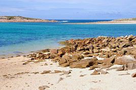
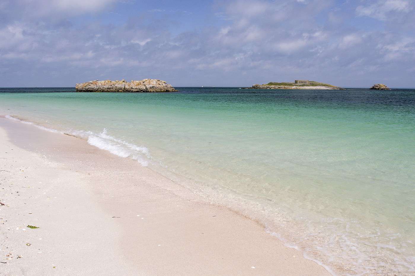
Archipel des Glénan, Finistère, France
Archipel des Glénan, Finistère, France · © VoyageForum

Further reading on VoyageForum

What to See in Brittany

Despite its natural and cultural wealth, Brittany has no sites listed as UNESCO World Heritage Sites. Fort-la-Latte Castle ★★ Built on a rocky spur facing the sea and Cap Fréhel, in the commune of Plévenon, this beautiful 14th-century fortress has served as a…

Read the full guide: What to See in Brittany

Introduction to Brittany

Overview

Key facts

  • Type of place: tourist region.
  • Location: at the far west of France.
  • Local time: Heure : 12832
  • Administrative region: Brittany (prefecture: Rennes).
  • Departments: Côtes d'Armor (22), Finistère (29), Ille et Vilaine (35) and Morbihan (56).
  • Main cities: Brest, Lorient, Quimper, Rennes, St-Brieuc, Vannes...
  • Population: 3,273,000 inhabitants (2014).
  • Area: 27,208 km².
  • Density: 120 inhabitants/km².
  • Highest point: Roc'h Ruz (385 m) in Finistère.
  • Lowest point: sea level.
  • Coastline:

Tourism

Beyond a few persistent clichés, Brittany remains a region with a strong culture and wild landscapes often born from the meeting of land and sea. It’s a destination made for nature lovers but also for those seeking a certain "tranquillity"...

Where to get information?

Departmental Tourism Committees

Travel essentials

  • Backpacker daily budget:
  • Best for accommodation:
  • Best for getting around:
  • Best time for climate/crowds/prices:
  • Highlights (out of ): Nature ; Culture / ; Relaxation-holidays
  • Website:
View guide page: Introduction to Brittany

Geography and Environment of Brittany

Physical Features of the Region

Natural Areas, Wildlife and Flora

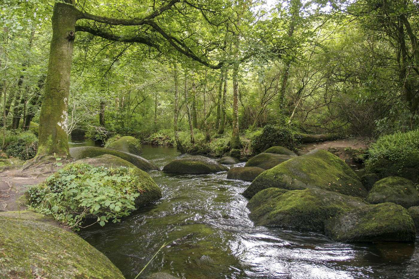
Forêt du Huelgoat, Finistère, France
Forêt du Huelgoat, Finistère, France · © VoyageForum
View guide page: Geography and Environment of Brittany

Climate and Weather in Brittany

Climate Overview

Best Time to Visit Brittany

Jan.Feb.Mar.Apr.MayJun.Jul.Aug.Sep.Oct.Nov.Dec.
Climate

: very favourable | : favourable | : moderately favourable | : unfavourable.

Sea Temperature Throughout the Year

The water temperature in Brittany is never particularly warm. As you might expect, swimming is most pleasant at the heart of the summer season.

Jan.Feb.Mar.Apr.MayJun.Jul.Aug.Sep.Oct.Nov.Dec.
Benodet10910111214161716151311

Climate and Weather by Location

Coastal Areas (Brest)

Inland (Rennes)

Additional Information

View guide page: Climate and Weather in Brittany

Culture, Society, and Customs of Brittany

Key Historical Dates

Arts and Architecture

Society

Population

Economy

Customs and Traditions

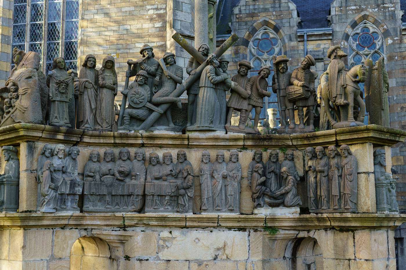
Plougastel-Daoulas, Finistère, France
Plougastel-Daoulas, Finistère, France · © VoyageForum

Local Traditions

Regional Languages

Festivals and Celebrations

Books, Films, and Music

View guide page: Culture, Society, and Customs of Brittany

Things to Do in Brittany

Interests (rated ★★★★ ) : Nature ★★★ ; Culture ★★ / ★★★ ; Relaxation-holidays ★★★ Interest level for each department: Nature Culture Relaxation-Holidays Côtes-d'Armor ★★★ ★★ ★★★ Finistère ★★★ ★★★ ★★★ Ille-et-Vilaine ★★ ★★ ★★ Morbihan ★★★ ★★ ★★★ Highlights and…

Read the full guide: Things to Do in Brittany

Other Practical Information for Brittany

Luggage and Equipment to Bring

Budget

Precautions

Opening Hours

Laundromats

Local Tourist Offices

View guide page: Other Practical Information for Brittany

Finistère

It’s an excellent holiday compromise. Here, you’ll find stunning wild nature that shifts between the sea (islands, "pointes"...) and "reliefs" (Monts d'Arrée and others), a rich historical and cultural heritage (small towns, parish closes...), and plenty of…

Read the full guide: Finistère

Côtes-d'Armor

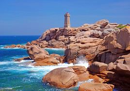
The Côtes-d'Armor's main tourist appeal lies in its wild and sometimes spectacular coastline, particularly the Pink Granite Coast and especially Cap Fréhel, widely regarded as one of Brittany's most beautiful spots, with its cliffs and seascapes. There are also some lovely beaches and traces of Breton history and culture, such as in Dinan or Tréguier.

Overview

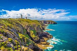
Cap Fréhel, Côtes d'Armor, France
Cap Fréhel, Côtes d'Armor, France · © VoyageForum

Key facts

  • Type of place: department.
  • Location: on the northern coast of Brittany.
  • Department code: 22.
  • Bordering departments: Finistère, Ille-et-Vilaine, and Morbihan.
  • Sub-prefectures: Dinan, Guingamp, Lannion.
  • Number of communes: 356.
  • Population: 598,814 inhabitants (2017).
  • Area: 6,878 km².
  • Highest point: Mont Bel-Air (339 m).
  • Lowest point: sea level.
  • Coastline: 347 km.
  • Highlights (out of ): Nature ; Culture ; Relaxation-holidays

History of the Côtes-d'Armor

Geography and environment

Culture and economy

What to see in the Côtes-d'Armor

The Côtes-d'Armor's main tourist appeal lies in its wild and sometimes spectacular coastline, particularly the Pink Granite Coast and especially the Cape Fréhel, widely regarded as one of Brittany's most beautiful spots, with its cliffs and seascapes. There are also some lovely beaches and traces of Breton history and culture, such as in Dinan or Tréguier.

What to do in the Côtes-d'Armor

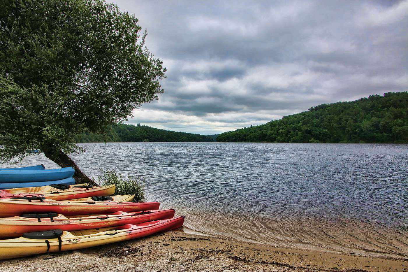
Lac de Guerlédan, Côtes d'Armor, France
Lac de Guerlédan, Côtes d'Armor, France · © VoyageForum

Climate and weather

Sea temperature throughout the year

The water temperature is never particularly warm in Brittany. As you might expect, swimming is most pleasant in the heart of summer.

Jan.Feb.Mar.Apr.MayJun.Jul.Aug.Sep.Oct.Nov.Dec.
Côtes-d'Armor10910111214161716151311

Transport

Getting there

Getting around

Accommodation

Food

Further reading

View guide page: Côtes-d'Armor

Fort-la-Latte Castle

Built on a rocky spur facing the sea and Cap Fréhel, in the commune of Plévenon, this beautiful 14th-century fortress has served as a filming location for many movies.

Overview of the castle

Built on a rocky spur facing the sea and Cape Fréhel, in the commune of Plévenon, this beautiful 14th-century fortress has served as a filming location for many movies.

  • Tourist interest: (worth seeing).

History of the castle

What to see and do

Practical information

  • Location:
  • Address: 22240 Plévenon.
  • Opening hours:
  • Price:
  • How to get there:

What to see nearby

Additional information

View guide page: Fort-la-Latte Castle

Quintin Castle

A large 17th- and 18th-century castle and its park, located in the town of the same name.

Overview of the castle

This is a large 17th- and 18th-century castle and its park, located in the town of the same name.

  • Tourist interest: (worth a stop if you are in the area).

History of the castle

What to see and do

Practical information

  • Location:
  • Address: Impasse de la Pompe, 22800 Quintin.
  • Opening hours:
  • Admission fee:
  • How to get there:

What to see nearby

  1. == En complément
View guide page: Quintin Castle

Château de la Roche-Jagu

This is an imposing 15th-century building located in Ploëzal, east of Lannion.

Overview of the château

This is an imposing 15th-century building located in Ploëzal, east of Lannion.

  • Tourist interest: (worth a stop if you are in the area).

History of the château

What to see and do

Practical information

  • Location:
  • Address: 22260 Ploëzal.
  • Opening hours:
  • Price:
  • How to get there:

What to see nearby

  1. == In addition
View guide page: Château de la Roche-Jagu

Rosanbo Castle

A large park and a beautiful medieval castle in the commune of Lanvellec.

Overview of the castle

A large park and a beautiful medieval castle in the commune of Lanvellec.

  • Tourist interest: (worth seeing).

History of the castle

What to see and do

Practical information

  • Location:
  • Address: 22420 Lanvellec.
  • Opening hours:
  • Price:
  • How to get there:

What to see nearby

  1. == In addition
View guide page: Rosanbo Castle

Tonquédec Castle

Surrounded by a lake and forest, this well-preserved medieval fortress is one of the most visited sites in the department. It is located south of Lannion.

Overview of the castle

Surrounded by a lake and forest, this well-preserved medieval fortress is one of the most visited sites in the department. It is located south of Lannion.

  • Tourist interest: (worth seeing).

History of the castle

What to see and do

Practical information

  • Location:
  • Address: 22140 Tonquédec.
  • Opening hours:
  • Price:
  • How to get there:

Nearby attractions

  1. == In addition
View guide page: Tonquédec Castle

Dinan

A beautiful medieval town with its ramparts, castle, and half-timbered houses. It is one of the prettiest towns in Brittany.

Overview of Dinan

Dinan is a beautiful medieval town with its ramparts, castle, and half-timbered houses. It is one of the prettiest towns in Brittany.

Key Facts

  • Type de lieu: small town.
  • Intérêt touristique: (recommended).
  • Localisation: in the eastern part of the Côtes d'Armor department, not far from Saint-Malo.
  • Distances:
  • Heure locale: Heure : 17805.
  • Population: 14,222 inhabitants (2016).
  • Superficie: 3.98 km².
  • Altitude: from 7 to 92 m.

History of Dinan

What to See and Do in Dinan

Ramparts, a 14th-century castle, and numerous historic mansions, along with half-timbered houses lining narrow streets, make up the town center. With its well-preserved medieval heritage, Dinan is one of the prettiest towns in Brittany.

Port de Dinan, Dinan, Côtes d'Armor, France
Dinan Harbour
Below the medieval town. You can take boat trips on the Rance from the picturesque Dinan Harbour or visit the Maison de la Rance, which showcases the heritage and setting of this river and its valley.

Musées de Dinan:

Artist's House of La Grande Vigne
The place showcases paintings and drawings by artist Yvonne Jean-Haffen.
Dinan Castle Museum
Inside the castle, well worth a visit, the history of the Dinan region and various antique collections.
Dinan Railway Museum
Housed in the train station, it showcases the history of the regional railway and collections of posters, models, and more.
Dinan WWII Museum
This is a private military museum dedicated to World War II in the region.

In the Surrounding Area

Climate and Weather in Dinan

Like the rest of the coast, the town has a temperate oceanic climate with fairly high rainfall spread throughout the year. Temperature variations are relatively low, with neither very cold winters nor very hot summers.

Transportation

Getting There

Getting Around

Accommodation

Dining

Useful Addresses

Further Information

View guide page: Dinan

Dinan Harbour

Below the medieval town. You can take boat trips on the Rance from the picturesque Dinan Harbour or visit the Maison de la Rance, which showcases the heritage and setting of this river and its valley.

Overview of Dinan Harbour

Below the medieval town. You can take boat trips on the Rance from the picturesque Dinan Harbour or visit the Maison de la Rance, which showcases the heritage and setting of this river and its valley.

  • Tourist interest: (worth seeing).

History of the harbour

What to see and do

Events and entertainment

Practical information

  • Location:
  • How to get there:
  • How to get around:

Eating

Sleeping

What to see nearby

  1. == Further information
View guide page: Dinan Harbour

Artist's House of La Grande Vigne

The place showcases paintings and drawings by artist Yvonne Jean-Haffen.

Overview of the Place

The place showcases paintings and drawings by artist Yvonne Jean-Haffen.

  • Tourist interest: (worth a stop if you are in the area).

History of the Museum

Museum Collections

Practical Information

  • Location:
  • Address: 103 rue du Quai, 22100 Dinan.
  • Opening hours:
  • Price:
  • How to get there:

What to See Nearby

  1. == En complément
View guide page: Artist's House of La Grande Vigne

Dinan Castle Museum

Inside the castle, well worth a visit, the history of the Dinan region and various antique collections.

Museum Overview

Inside the castle, well worth a visit, the history of the Dinan region and various antique collections.

  • Tourist interest: (worth a stop if you are in the area).

Museum History

Museum Collections

Practical Information

  • Location:
  • Address: Rue du Château, 22100 Dinan.
  • Opening hours:
  • Admission fee:
  • How to get there:

Nearby Attractions

  1. == In addition
View guide page: Dinan Castle Museum

Dinan Railway Museum

Housed in the train station, it showcases the history of the regional railway and collections of posters, models, and more.

Overview

Housed in the train station, it showcases the history of the regional railway and collections of posters, models, and more.

  • Tourist interest: (worth a stop if you are in the area).

Museum history

Museum collections

Practical information

  • Location:
  • Address: Dinan Station, 22100 Dinan.
  • Opening hours:
  • Price:
  • How to get there:

Nearby attractions

  1. == In addition
View guide page: Dinan Railway Museum

Dinan WWII Museum

This is a private military museum dedicated to World War II in the region.

Overview of the museum

This is a private military museum dedicated to World War II in the region.

  • Tourist interest: (worth a stop if you are in the area).

History of the museum

Collections on display

Practical information

  • Location:
  • Address: 16 rue du Pont de la Haye, 22100 Léhon.
  • Opening hours:
  • Price:
  • How to get there:

What to see nearby

  1. == In addition
View guide page: Dinan WWII Museum

Guingamp

The small town, between Saint-Brieuc and Lannion, is a sub-prefecture of the department.

Overview of Guingamp

The small town, between Saint-Brieuc and Lannion, is a sub-prefecture of the department.

Key Facts

  • Type of place: small town.
  • Tourist interest: (worth a stop if you are in the area).
  • Location:
  • Distances:
  • Local time: Heure : 17806.
  • Population: 6,899 inhabitants (2016).
  • Area: 3.41 km².
  • Altitude: from 62 to 126 m.

History of Guingamp

What to See and Do

In the Surrounding Area

Climate and Weather in Guingamp

Transport

Getting There

Getting Around

Accommodation

Food and Drink

Useful Addresses

Further Information

View guide page: Guingamp

Bréhat Island

Off the coast of Paimpol, this island (with its islets) is a popular destination for its landscapes, especially in summer when its population nevertheless increases tenfold. You can go sea kayaking and enjoy beautiful walks.

Overview of the island

Off the coast of Paimpol, this island (with its islets) is a popular destination for its landscapes, especially in summer when its population nevertheless increases tenfold. You can go sea kayaking and enjoy beautiful walks.

Key facts

  • Tourist interest: (recommended).
  • Location:
  • Local time: Heure : 17807
  • Main locality:
  • Population: 364 inhabitants (2016).
  • Area: 2.90 km².
  • Highest point: Crec'h Simon (35 m).
  • Coastline:

History of Bréhat Island

Environment

Wildlife and flora

Precautions

What to see and do on Bréhat Island

In the surrounding area

Climate and weather

Sea temperature throughout the year

Jan.Feb.Mar.Apr.MayJun.Jul.Aug.Sep.Oct.Nov.Dec.
Bréhat10910111214161716151311

Transport

Getting there

Getting around

Accommodation

Eating

Useful addresses

Further information

View guide page: Bréhat Island

Lannion

Located near the Pink Granite Coast, the second-largest town in the Côtes d'Armor offers a charming centre with its churches and old half-timbered buildings.

Overview of Lannion

Lannion is located near the Pink Granite Coast. The second-largest town in the Côtes d'Armor offers a charming centre with its churches and old half-timbered buildings.

Key facts

  • Type of place: small town.
  • Tourist interest: (worth a stop if you are in the area).
  • Location: in the north of the Côtes d'Armor department.
  • Distances:
  • Local time: Heure : 17808.
  • Population: 19,831 inhabitants (2016).
  • Area: 43.91 km².
  • Altitude: sea level.

History of Lannion

What to see and do in Lannion

With its churches and chapels, along with its old half-timbered buildings, the centre of the second-largest town in the Côtes d'Armor is quite charming.

In the surrounding area

Côte de Granit rose, Côtes d'Armor, France
Pink Granite Coast
This coastal stretch of about forty kilometres between Plestin and Louannec is characterised by the pink colour of its granite rocks.

Climate and weather in Lannion

Transport

Getting there

Getting around

Accommodation

Food

Useful addresses

Further information

View guide page: Lannion

Paimpol

This small fishing and pleasure port is home to the remains of a 13th-century abbey. It is also, and above all, a town where sea shanties and maritime music are part of the traditions and feature in various cultural events.

Overview of Paimpol

This small fishing and pleasure port is home to the remains of a 13th-century abbey. But Paimpol is also, and above all, a town where sea shanties and maritime music are part of the traditions and feature in various cultural events.

Key facts

  • Type of place: small town.
  • Tourist interest: (worth a stop if you are in the area).
  • Location: in the north of the Côtes d'Armor department, not far from Saint-Brieuc.
  • Distances:
  • Local time: Heure : 17809.
  • Population: 7,186 inhabitants (2016).
  • Area: 23.61 km².
  • Altitude: sea level.

History of Paimpol

What to see and do in Paimpol

The remains of Beauport Abbey and a few old houses around the port form the main architectural attractions of the town, which is better known for its sea shanties.

Trieux Steam Train
A small seasonal tourist train running between Paimpol and Pontrieux along the Trieux estuary.

In the surrounding area

Climate and weather in Paimpol

Like the rest of the coast, the town has a "changeable" oceanic climate—mild, humid, and quite windy all year round, with relatively low temperature variations: neither too cold in winter nor too hot in summer. Rainfall (less heavy than inland) is spread throughout the year, with a peak in autumn and winter.

Sea temperature throughout the year

Jan.Feb.Mar.Apr.MayJun.Jul.Aug.Sep.Oct.Nov.Dec.
Paimpol10910111214161716151311

Transport

Getting there

Getting around

Accommodation

Food

Useful addresses

Further information

View guide page: Paimpol

Trieux Steam Train

A small seasonal tourist train running between Paimpol and Pontrieux along the Trieux estuary.

Overview of the Trieux Steam Train

It's a small seasonal tourist train running between Paimpol and Pontrieux along the Trieux estuary.

Key Details

  • Type of place: tourist train.
  • Tourist interest: (worth a stop if you are in the area).
  • Theme:
  • Location:
  • Local time: Heure : 22173
  • Main towns:
  • Length:

The Line

Route

What to See and Do

Nearby Attractions

Climate and Weather

Sleeping and Eating

View guide page: Trieux Steam Train

Pléneuf-Val André

A seaside resort not far from Saint-Brieuc.

Overview of Pléneuf-Val André

It's a seaside resort not far from Saint-Brieuc.

Key Facts

  • Type of place: small town.
  • Tourist interest: (worth a stop if you are in the area).
  • Location:
  • Distances:
  • Local time: Heure : 17811.
  • Population: 4,069 inhabitants (2016).
  • Area: 17.07 km².
  • Altitude: sea level.

History of Pléneuf-Val André

Climate and Weather

Like the rest of the coast, the area has a "changeable" oceanic climate—mild, humid, and quite windy in all seasons, with relatively low temperature variation: neither too cold in winter nor too hot in summer. Rainfall (less intense than inland) is spread throughout the year, with a peak in autumn and winter.

Sea Temperature Throughout the Year

Jan.Feb.Mar.Apr.MayJun.Jul.Aug.Sep.Oct.Nov.Dec.
Pléneuf10910111214161716151311

What to See and Do

Nearby

Getting Around

How to Get There

Getting Around

Where to Stay

Where to Eat

Useful Addresses

Further Reading

View guide page: Pléneuf-Val André

Pleumeur-Bodou

Near Trebeurden, this small town also offers beaches, menhirs and dolmens, small chapels, a reconstructed Gallic village, and the Cité-Musée des Télécoms.

Overview of Pleumeur-Bodou

Near Trebeurden, the small town of Pleumeur-Bodou offers beaches, menhirs and dolmens, small chapels, a reconstructed Gallic village, and the Cité-Musée des Télécoms.

Key Facts

  • Type of place: small town.
  • Tourist interest: (worth seeing).
  • Location: at the northwestern tip of the Côtes-d'Armor department.
  • Distances:
  • Local time: Heure : 17812.
  • Population: 3,968 inhabitants (2016).
  • Area: 26.71 km².
  • Altitude:

History of Pleumeur-Bodou

What to see and do in Pleumeur-Bodou

Spread out, the village of Pleumeur-Bodou consists of hamlets, small ports, churches or chapels, and the Kerduel castle. However, more than the built environment, it’s the natural surroundings (Île-Grande, Bringuiller moors, Kervoalant marshes, etc.) that offer the most interest.

Telecoms City
Europe’s largest park dedicated to telecommunications, from their beginnings to the present day. It features permanent and temporary exhibitions, as well as a giant radome.
Megaliths of Pleumeur-Bodou
Like other Breton towns, Pleumeur-Bodou has its share of dolmens, tumuli, and menhirs, including the "Allée couverte de l'Île-Grande".
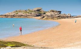
Plages de Pleumeur-Bodou, Pleumeur-Bodou, Côtes d'Armor, France
Beaches of Pleumeur-Bodou
The town has several pretty, quiet beaches nestled at the head of a bay.
Gallic Village of Pleumeur-Bodou
This is a reconstruction of a Gallic village, blending an open-air museum with an amusement park.

In the surrounding area

Climate and weather

Transport

Getting there

Getting around

Accommodation

Eating

Useful addresses

Further information

View guide page: Pleumeur-Bodou

Telecoms City

Europe’s largest park dedicated to telecommunications, from their beginnings to the present day. It features permanent and temporary exhibitions, as well as a giant radome.

Overview of Telecoms City

Europe’s largest park dedicated to telecommunications, from their beginnings to the present day. It features permanent and temporary exhibitions, as well as a giant radome.

  • Tourist interest: (worth seeing).

Museum history

Collections on display

Practical information

  • Location:
  • Address: Parc du Radôme, Noterigou, 22560 Pleumeur-Bodou.
  • Opening hours:
  • Price:
  • How to get there:

Nearby attractions

  1. == In addition
View guide page: Telecoms City

Megaliths of Pleumeur-Bodou

Like other Breton towns, Pleumeur-Bodou has its share of dolmens, tumuli, and menhirs, including the "Allée couverte de l'Île-Grande".

Overview of the site

Like other Breton towns, Pleumeur-Bodou has its share of dolmens, tumuli, and menhirs, including the "Allée couverte de l'Île-Grande" attached to the commune.

  • Tourist interest: (worth a stop if you are in the area).

History of the megaliths

What to see and do

Practical information

  • Location:
  • Local time: Heure : 22157.
  • Opening hours:
  • Price:

Transport

Sleeping and eating

What to see nearby

  1. == In addition
View guide page: Megaliths of Pleumeur-Bodou

Beaches of Pleumeur-Bodou

The town has several pretty, quiet beaches nestled at the head of a bay.

Overview of the beach

The town has several pretty, quiet beaches nestled at the head of a bay.

  • Tourist interest: (worth seeing).
  • Features:
  • Length:

Environment

Precautions

What to see and do

Practical information

  • Location:
  • Website:
  • How to get there:
  • Distances:

Sleeping and eating

Nearby attractions

  1. == In addition
View guide page: Beaches of Pleumeur-Bodou

Gallic Village of Pleumeur-Bodou

This is a reconstruction of a Gallic village, blending an open-air museum with an amusement park.

Overview of the Gallic Village

This is a reconstruction of a Gallic village, blending an open-air museum with an amusement park.

  • Tourist interest: (worth a stop if you are in the area).

Attractions

Facilities

Practical information

  • Location:
  • Number of visitors:
  • Address: Parc du Radôme, 22560 Pleumeur-Bodou, France.
  • Opening hours:
  • Price:
  • How to get there:

Nearby sights

  1. == In addition
View guide page: Gallic Village of Pleumeur-Bodou

Sables d'Or les Pins

A large beach and dunes for this resort, straddling two municipalities, on the edge of Cap Fréhel.

Overview of Sables-d'Or-les-Pins

A large beach and dunes for this resort, straddling two municipalities (Fréhel and Plurien), on the edge of Cape Fréhel.

Key details

  • Tourist interest: (worth seeing).
  • Features:
  • Location:
  • Length:

Environment

Precautions

What to see and do

In the surrounding area

Climate and weather

Like the rest of the coast, Sables d'Or has a "changeable" oceanic climate—mild, humid, and quite windy year-round, with relatively low temperature variation: neither too cold in winter nor too hot in summer. Rainfall (less intense than inland) is spread throughout the year, peaking in autumn and winter.

Sea temperature throughout the year

Jan.Feb.Mar.Apr.MayJun.Jul.Aug.Sep.Oct.Nov.Dec.
Sables d'Or les Pins10910111214161716151311

Transport

Getting there

Getting around

Accommodation

Food

  1. == Additional information
View guide page: Sables d'Or les Pins

Saint-Brieuc

It's the prefecture of Côtes d'Armor, not necessarily one of the most tourist-focused.

Overview of Saint-Brieuc

It's the prefecture of Côtes d'Armor, not necessarily one of the most tourist-focused.

Key facts

  • Type of place: small town.
  • Tourist interest: (worth a stop if you are in the area).
  • Location:
  • Distances:
  • Local time: Heure : 17814.
  • Population: 44,999 inhabitants (2016).
  • Area: 21.88 km².
  • Altitude: sea level.

History of Saint-Brieuc

What to see and do

In the surrounding area

Climate and weather

Like the rest of the coast, the town has a "changeable" oceanic climate—mild, humid, and quite windy year-round, with relatively low temperature variation: neither too cold in winter nor too hot in summer. Rainfall (less intense than inland) is spread throughout the year, peaking in autumn and winter.

Transport

Getting there

Getting around

Accommodation

Eating

Useful addresses

Further information

View guide page: Saint-Brieuc

Saint-Cast-le-Guildo

The town is best known for its seven fine-sand beaches and coves stretching for several kilometres along its peninsula.

Overview of Saint-Cast-le-Guildo

The town is best known for its seven fine-sand beaches and coves stretching for several kilometres along its peninsula.

Key facts

  • Type of place: small town.
  • Tourist interest: (worth a stop if you are in the area).
  • Distances:
  • Local time: Heure : 17815.
  • Population: 3,432 inhabitants (2014).
  • Area: 22.63 km².
  • Altitude: sea level.

History of Saint-Cast-le-Guildo

What to see and do in Saint-Cast

In the surrounding area

Côte d'Emeraude, Côtes d'Armor, France
Emerald Coast
From Cap Fréhel to Cancale, straddling two departments (22 and 35), this coastal area owes its name to the green hue the sea can take on here. It features several seaside resorts and some beautiful landscapes.

Climate and weather

Like the rest of the coast, the town has a "changeable" oceanic climate—mild, humid, and quite windy in all seasons, with relatively low temperature variation: neither too cold in winter nor too hot in summer. Rainfall (less intense than inland) is spread throughout the year, peaking in autumn and winter.

Sea temperature throughout the year

Jan.Feb.Mar.Apr.MayJun.Jul.Aug.Sep.Oct.Nov.Dec.
Saint-Cast10910111214161716151311

Transport

Getting there

Getting around

Accommodation

Food

Useful addresses

  1. == Further information
View guide page: Saint-Cast-le-Guildo

Saint-Quay Portrieux

A major fishing port between Paimpol and Saint-Brieuc.

Overview of Saint-Quay Portrieux

It’s a major fishing port between Paimpol and Saint-Brieuc.

Key facts

  • Type of place: small town.
  • Tourist interest: (worth a stop if you are in the area).
  • Location:
  • Distances:
  • Local time: Heure : 17816.
  • Population: 2,937 inhabitants (2014).
  • Area: 3.87 km².
  • Altitude: sea level.

History of Saint-Quay Portrieux

What to see and do

In the surrounding area

Climate and weather

Like the rest of the coast, the town has a "changeable" oceanic climate—mild, humid, and quite windy year-round, with relatively low temperature variation: neither too cold in winter nor too hot in summer. Rainfall (lighter than inland) is spread throughout the year, peaking in autumn and winter.

Sea temperature throughout the year

Jan.Feb.Mar.Apr.MayJun.Jul.Aug.Sep.Oct.Nov.Dec.
Saint-Quay Portrieux10910111214161716151311

Getting around

How to get there

Getting around

Where to stay

Where to eat

Useful addresses

  1. == Additional information
View guide page: Saint-Quay Portrieux

Trebeurden

A seaside resort on the Côte de Granit Rose with around ten beaches.

Overview of Trebeurden

Trebeurden is a seaside resort in Pink Granite Coast with around ten beaches.

Key facts

  • Type of place: small town.
  • Tourist interest: (worth a stop if you are in the area).
  • Location: at the entrance to Lannion Bay, in the Côtes-d'Armor department.
  • Distances:
  • Local time: Heure : 17817.
  • Population: 3,664 inhabitants (2016).
  • Area: 13.4 km².
  • Altitude: sea level.

History of Trebeurden

What to see and do in Trebeurden

Beyond a few scattered megaliths and its marina, the town still has a small seaside heritage with some late 19th-century villas. It also boasts around ten beaches, some offering a rather pretty view of the coast and surrounding islets.

In the surrounding area

Côte de Granit rose, Côtes d'Armor, France
Pink Granite Coast
This coastal stretch of about forty kilometres between Plestin and Louannec is characterised by the pink colour of its granite rocks.

Climate and weather

Like the rest of the coast, the town has an oceanic climate—mild, humid, and quite windy year-round, with relatively low temperature variation: neither too cold in winter nor too hot in summer. Rainfall (less heavy than inland) is spread throughout the year, peaking in autumn and winter.

Sea temperature throughout the year

Jan.Feb.Mar.Apr.MayJun.Jul.Aug.Sep.Oct.Nov.Dec.
Trebeurden10910111214161716151311

Getting around

Getting there

Getting around

Accommodation

Food

Useful addresses

  1. == Further information
View guide page: Trebeurden

Trégastel

At the heart of the Pink Granite Coast, this seaside resort is a summer favourite for its beaches and landscapes.

Overview of Trégastel

At the heart of the Pink Granite Coast, the seaside resort of Trégastel is a summer favourite for its beaches and landscapes.

Key facts

  • Type de lieu: small town.
  • Intérêt touristique: (worth seeing).
  • Distances:
  • Heure locale: Heure : 17818.
  • Population: 2,447 inhabitants (2016)
  • Superficie: 7 km².
  • Altitude: sea level.

History of Trégastel

What to see and do in Trégastel

While the town has some religious heritage, its setting is what makes it most interesting.

Trégastel Marine Aquarium
A chance to explore the underwater world of the Breton coast, featuring fish, crustaceans, and other coastal species from the English Channel.
Megaliths of Trégastel
Like many towns in the region, Trégastel has its share of menhirs and dolmens, including the "Kergüntuil Covered Alley".
Plages de Trégastel, Trégastel, Côtes d'Armor, France
Beaches of Trégastel
A total of 12 sandy beaches stretching over 17 kilometres among the pink granite rocks, some offering beautiful views of the coast and nearby islets, which can also be explored via the Customs Officers' Path that runs through the area.

In the surrounding area

Côte de Granit rose, Côtes d'Armor, France
Pink Granite Coast
This coastal stretch of about forty kilometres between Plestin and Louannec is characterised by the pink colour of its granite rocks.

Climate and weather in Trégastel

Like the rest of the coast, the area has an oceanic climate—mild, humid, and quite windy year-round, with relatively low temperature variation: neither too cold in winter nor too hot in summer. Rainfall (less intense than inland) is spread throughout the year, peaking in autumn and winter.

Sea temperature throughout the year

Jan.Feb.Mar.Apr.MayJun.Jul.Aug.Sep.Oct.Nov.Dec.
Trégastel10910111214161716151311

Transport

Getting there

Getting around

Accommodation

Food

Useful addresses

Further reading

View guide page: Trégastel

Beaches of Trégastel

A total of 12 sandy beaches stretching over 17 kilometres among the pink granite rocks, some offering beautiful views of the coast and nearby islets, which can also be explored via the Customs Officers' Path that runs through the area.

Overview of the Beaches of Trégastel

There are a total of 12 sandy beaches stretching over 17 kilometres among the pink granite rocks, some offering beautiful views of the coast and nearby islets, which can also be explored via the Customs Officers' Path that runs through the area.

Key Details

  • Type of place: beach.
  • Tourist interest: (worth seeing).
  • Features:
  • Location:
  • Length:
  • Website:

Environment

Precautions

What to See and Do

Climate and Weather

Sea Temperature Throughout the Year

Jan.Feb.Mar.Apr.MayJun.Jul.Aug.Sep.Oct.Nov.Dec.
Trégastel10910111214161716151311

Practical Information

Getting There

Accommodation and Dining

Nearby Attractions

  1. == In addition
View guide page: Beaches of Trégastel

Megaliths of Trégastel

Like many towns in the region, Trégastel has its share of menhirs and dolmens, including the "Kergüntuil Covered Alley".

Overview of the site

Like many towns in the region, Trégastel has its share of menhirs and dolmens, including the "Kergüntuil Covered Alley".

  • Tourist interest: (worth a stop if you are in the area).

History of the site

What to see and do

Practical information

  • Location:
  • Address:
  • Opening hours:
  • Price:
  • Website:
  • How to get there:

What to see nearby

  1. == En complément
View guide page: Megaliths of Trégastel

Trégastel Marine Aquarium

A chance to explore the underwater world of the Breton coast, featuring fish, crustaceans, and other coastal species from the English Channel.

Overview of the Aquarium

A chance to explore the underwater world of the Breton coast, featuring fish, crustaceans, and other coastal species from the English Channel.

  • Tourist interest: (worth a stop if you are in the area).

History of the Aquarium

What to See and Do

Practical Information

  • Location:
  • Address: 37 boulevard du Coz-Pors, 22730 Trégastel.
  • Opening hours:
  • Price:
  • How to get there:

Nearby Attractions

  1. == In addition
View guide page: Trégastel Marine Aquarium

Tréguier

The historic capital of the Trégor region and a former episcopal city, Tréguier features a beautiful cathedral and old half-timbered houses along its narrow streets.

Overview of Tréguier

Tréguier, the historic capital of the Trégor region and a former episcopal city, features a beautiful cathedral and old half-timbered houses along its narrow streets in the town centre.

Key facts

  • Type of place: small town.
  • Tourist interest: (worth seeing).
  • Location: on the road from Lannion to Paimpol, in the Côtes-d'Armor department.
  • Distances:
  • Local time: Heure : 17819.
  • Population: 2,473 inhabitants (2014).
  • Area: 1.52 km²
  • Altitude: sea level.

History of Tréguier

What to see and do in Tréguier

The centre of Tréguier boasts a beautiful cathedral and old half-timbered houses along its narrow streets, giving it a distinct charm.

Ernest Renan Museum
The birthplace of this Breton writer has been turned into a dedicated museum.

In the surrounding area

Climate and weather in Tréguier

Transport

Getting there

Getting around

Accommodation

Eating

Useful addresses

Further information

View guide page: Tréguier

Ernest Renan Museum

The birthplace of this Breton writer has been turned into a dedicated museum.

Overview of the Museum

The birthplace of this Breton writer has been turned into a dedicated museum.

  • Tourist interest: (worth a stop if you are in the area).

History of the Museum

Museum Collections

Practical Information

  • Location:
  • Address: 20 rue Ernest Renan, 22220 Tréguier.
  • Opening hours:
  • Price:
  • How to get there:

What to See Nearby

  1. == In addition
View guide page: Ernest Renan Museum

Cape Fréhel

This peninsula is one of the most beautiful in Brittany, with its cliffs and coastal landscapes. You can enjoy short hikes here.

Overview of Cape Fréhel

This peninsula is one of the most beautiful in Brittany, with its cliffs and coastal landscapes. You can enjoy short hikes here.

  • Tourist interest: (recommended).
  • Location:
  • Area:
  • Altitude: from 0 to 70 m.

Environment of Cape Fréhel

Wildlife and flora

Precautions

What to see and do

Nearby

Climate and weather

Transport

Getting there

Getting around

Accommodation

Food

Additional information

View guide page: Cape Fréhel

Emerald Coast

From Cap Fréhel to Cancale, straddling two departments (22 and 35), this coastal area owes its name to the green hue the sea can take on here. It features several seaside resorts and some beautiful landscapes.

Overview of the coast

From Cape Fréhel to Cancale, straddling two departments (22 and 35), this coastal area owes its name to the green hue the sea can take on here. It features several seaside resorts and some beautiful landscapes.

  • Tourist interest: (worth seeing).
  • Location:
  • Main towns:
  • Length:
  • Population:

History of the Emerald Coast

Environment

Precautions

What to see and do

In the surrounding area

Climate and weather

Sea temperature throughout the year

Jan.Feb.Mar.Apr.MayJun.Jul.Aug.Sep.Oct.Nov.Dec.
Emerald Coast10910111214161716151311

Transport

Getting there

Getting around

Accommodation

Food

Further reading

View guide page: Emerald Coast

Pink Granite Coast

This coastal stretch of about forty kilometres between Plestin and Louannec is characterised by the pink colour of its granite rocks.

Overview of the coast

This coastal stretch of about forty kilometres between Plestin and Louannec is characterised by the pink colour of its granite rocks.

  • Tourist interest: (recommended).
  • Location:
  • Main towns:
  • Length: approximately 40 km.
  • Population:

History of the Pink Granite Coast

Environment

Precautions

What to see and do

In the surrounding area

Climate and weather

Sea temperature throughout the year

Jan.Feb.Mar.Apr.MayJun.Jul.Aug.Sep.Oct.Nov.Dec.
Pink Granite Coast10910111214161716151311

Transport

Getting there

Getting around

Accommodation

Food

Further information

View guide page: Pink Granite Coast

Lake Guerlédan

This large artificial lake straddling Morbihan and the Côtes d'Armor is a major water sports hub in the region. You can also hike all around it.

Overview of the lake

This large artificial lake straddling Morbihan and the Côtes d'Armor is a major water sports hub in the region. You can also hike all around it.

  • Tourist interest: (worth a stop if you are in the area).
  • Features: artificial lake.
  • Surface area: 4 km².
  • Altitude: 121 m.

Environment

Precautions

What to see and do

Practical information

  • Location:
  • How to get there:
  • Distances:

Sleeping and eating

What to see nearby

Additional information

View guide page: Lake Guerlédan

Sept-Îles Nature Reserve

Opposite Perros-Guirec, to which it is linked, this small uninhabited archipelago is home to numerous seabird species and seals. Visitors are only permitted to land on Île aux Moines, which also features a lighthouse and the remains of an old fort.

Overview of the reserve

Opposite Perros-Guirec, to which it is linked, this small uninhabited archipelago of five main islands is home to numerous seabird species and seals. Visitors are only permitted to land on Île aux Moines (not to be confused with its namesake in Morbihan), which also features a lighthouse and the remains of an old fort.

Key details

  • Type of place: nature reserve.
  • Tourist interest: (worth seeing).
  • Features:
  • Local time: Heure : 17824
  • Area: 3.20 km².
  • Altitude: sea level.

Environment

Wildlife and flora

Precautions

What to see and do

In the surrounding area

Climate and weather

Practical information

  • Location:
  • Distances:
  • Opening period:
  • Rates:

Transport

Getting there

Getting around

Accommodation and dining

View guide page: Sept-Îles Nature Reserve

Talbert Spit

A nature reserve and geological curiosity, featuring a mix of sand and pebbles extending into the sea. It serves as a habitat for numerous bird species.

Overview of Talbert Spit

A nature reserve and geological curiosity, featuring a mix of sand and pebbles extending into the sea. It serves as a habitat for numerous bird species.

Key Details

  • Type of place: nature reserve.
  • Tourist interest: (worth a stop if you are in the area).
  • Features: coastal shingle and sand spit.
  • Local time: Heure : 17825
  • Area: 0.19 km².
  • Elevation: 10 m.

Environment

Landscape of the Reserve

Wildlife and Flora

Climate and Weather

Precautions

What to See and Do

Practical Information

  • Location:
  • Distances:
  • Opening period:
  • Rates:

Getting There

Getting Around

Accommodation and Dining

Nearby Attractions

  1. == En complément
View guide page: Talbert Spit

Perros-Guirec

This is a well-known seaside resort in the department, particularly with its hamlet of Ploumanac'h. Located on the Pink Granite Coast, it still boasts several sandy beaches. Facing the town, which it belongs to, the Sept-Îles archipelago is a bird sanctuary.…

Read the full guide: Perros-Guirec

Plougrescant

This coastal village owes its "fame" to a small house built between two enormous rocks by the sea, an image that has traveled the world.

Overview of Plougrescant

This coastal village of Plougrescant owes its "fame" to a small house built between two enormous rocks by the sea, an image that has traveled the world.

Key facts

  • Type de lieu: village.
  • Intérêt touristique: (worth a stop if you are in the area).
  • Distances:
  • Heure locale: Heure : 17923.
  • Population: 1,232 inhabitants (2014).
  • Superficie: 15.54 km².
  • Altitude: sea level.

History of Plougrescant

What to see and do

Castel Meur
This is the small house between two large rocks against a sea backdrop, an image that has traveled the world but remains a private property that is not open to visitors.

In the surrounding area

Climate and weather

Like the rest of the coast, the area has an oceanic climate—mild, humid, and quite windy in all seasons, with relatively low temperature variation, neither too cold in winter nor too hot in summer. Rainfall (less intense than inland) is spread throughout the year, with a peak in autumn and winter.

Sea temperature throughout the year

Jan.Feb.Mar.Apr.MayJun.Jul.Aug.Sep.Oct.Nov.Dec.
Plougrescant10910111214161716151311

Transportation

Getting there

Getting around

Accommodation

Food

Useful addresses

Further reading

View guide page: Plougrescant

Castel Meur

This is the small house between two large rocks against a sea backdrop, an image that has traveled the world but remains a private property that is not open to visitors.

Overview of Castel Meur

This is the small house between two large rocks against a sea backdrop, an image that has traveled the world but remains a private property that is not open to visitors.

  • Tourist interest: (worth a stop if you are in the area).

History of Castel Meur

What to see and do

Practical information

  • Location:
  • Local time: Heure : 22161.
  • Opening hours: closed to the public.

Transportation

Sleeping and eating

What to see nearby

  1. == In addition
View guide page: Castel Meur

Morbihan

Facing the sea with its seaside resorts, fishing or pleasure ports, islands (including Belle-Île-en-Mer), the Gulf of Morbihan, and the Quiberon peninsula, this department will delight enthusiasts. You can also discover traces of the past with numerous…

Read the full guide: Morbihan

Ille-et-Vilaine

Alongside Saint-Malo, Ille-et-Vilaine is home to one of the most visited sites in western France. And while the Malouin city tends to overshadow the rest of the department in terms of tourism, it still has plenty more to offer. Starting with its beaches and…

Read the full guide: Ille-et-Vilaine

Something wrong or out of date? Report this page