Skip to content
Finistère

Travel guide

Finistère

★ 3 · last edited Aug 13, 2020 · 6 versions

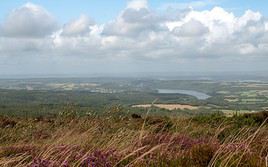
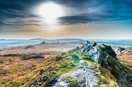
It’s an excellent holiday compromise. Here, you’ll find stunning wild nature that shifts between the sea (islands, "pointes"...) and "reliefs" (Monts d'Arrée and others), a rich historical and cultural heritage (small towns, parish closes...), and plenty of relaxation opportunities, not least with the countless beaches and activities you can enjoy there.

Overview

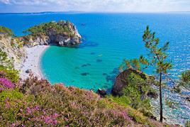
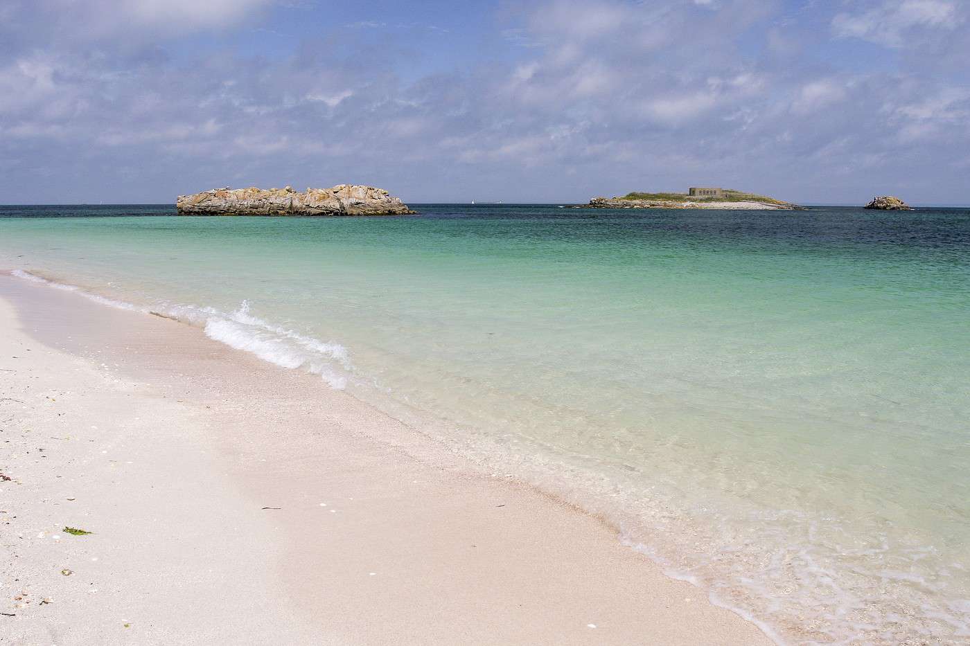
Archipel des Glénan, Finistère, France
Archipel des Glénan, Finistère, France · © VoyageForum

Key Facts

  • Type of place: department.
  • Location: at the westernmost tip of Brittany.
  • Department code: 29.
  • Bordering departments: Côtes d'Armor and Morbihan.
  • Sub-prefectures: Brest, Châteaulin, Morlaix.
  • Number of municipalities: 282.
  • Population: 909,028 inhabitants (2017).
  • Area: 6,733 km².
  • Highest point: Roc'h Ruz (385 m).
  • Lowest point: sea level.
  • Coastline: 1,430 km.
  • Highlights (out of ): Nature ; Culture ; Relaxation-holidays

History of Finistère

Geography and Environment

Culture and Economy

What to See in Finistère

The westernmost department of Brittany offers an excellent overall holiday compromise. Here, you’ll find stunning wild nature that shifts between the sea (islands, "pointes"...) and "reliefs" (Monts d'Arrée and others), a rich historical and cultural heritage (small towns, parish closes...), and plenty of relaxation opportunities, not least with the countless beaches along the coast and the activities you can enjoy there.

What to Do in Finistère
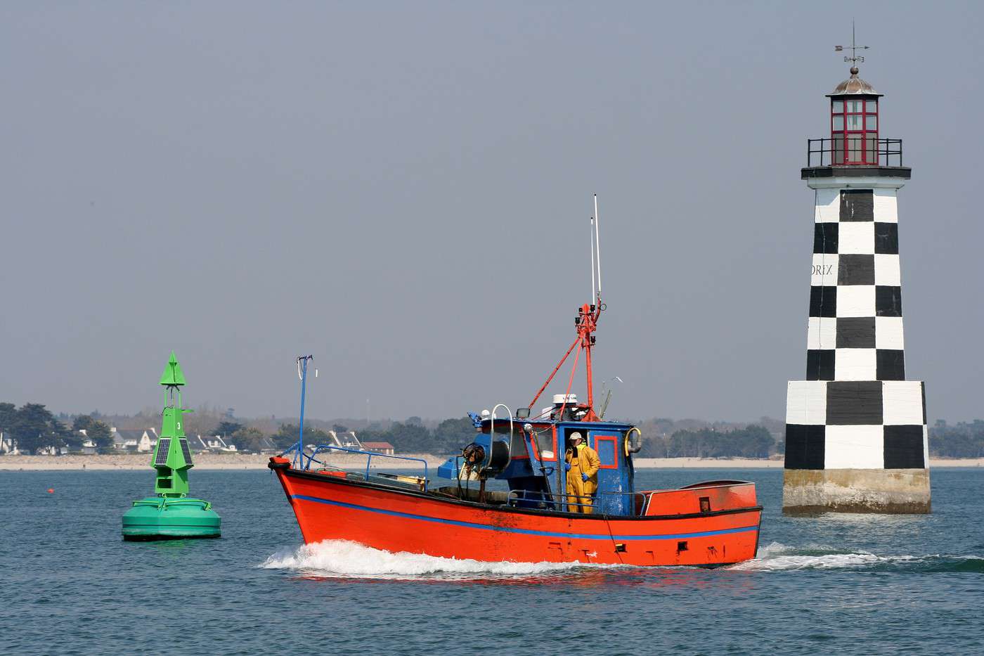
Loctudy, Finistère, France
Loctudy, Finistère, France · © VoyageForum

- Water activities: sea outings, diving, sailing, canoeing, paddleboarding, kitesurfing, land sailing, and more to discover along nearly 1,200 km of coastline (see details).

- Horseback riding: equestrian centers as well as opportunities for rides and hikes for all levels and durations, including the 850 km of marked trails in the Equibreizh network. Other options: horse-drawn carriage rides or donkey treks (see details).

- Fishing: available both at sea, in freshwater rivers and lakes, and through what’s known as "rockpool fishing" in tidal pools or along rocky shores (see details).

- Beaches: Finistère is France’s leading department for coastline length, featuring beautiful sandy beaches, small coves, and vast stretches of pebbles (see details).

- Hiking: whether along the coast or inland, the department offers 5,300 km of marked hiking trails for all levels, including several GR routes (34, 37, 38...) (see details).

- Surfing: two well-known spots among others: La Torche and La Palue (see details).

- Cycling and mountain biking: coastal roads, urban paths, greenways through the countryside or forests, or even 2,500 km of "mountain bike-specific" trails—plenty of options for rides or longer trips for cycling enthusiasts (see details).

Climate and Weather

The department has the characteristics of a temperate oceanic (windy) climate, with generally mild winters and cool summers. Rainfall is fairly abundant and spread throughout the year, peaking during the winter months. Precipitation increases noticeably inland and in higher elevations.

Sea Temperature Throughout the Year

The water temperature is never particularly warm in Brittany. As expected, swimming is most pleasant at the heart of the summer season.

Jan.Feb.Mar.Apr.MayJun.Jul.Aug.Sep.Oct.Nov.Dec.
Finistère10910111214161716151311

Transport

Getting There

Getting Around

Accommodation

Food

Further Information

Brest

Largely destroyed during the war, Brest has a modern architecture. It is a sub-prefecture of the department and a maritime prefecture. Overview of Brest Climate and Weather in Brest What to See in Brest Things to Do in Brest Flying to Brest Getting to Brest by Land or Sea Getting Around in Brest Accommodation and Dining in Brest Living in Brest

Further Information

View guide page: Brest

Overview of Brest

Overview of Brest

Largely destroyed during the war, Brest has a modern architecture. It is a sub-prefecture and a maritime prefecture.

Key Facts

  • Type of place: large city.
  • Tourist interest: (worth a stop if you are in the area).
  • Location:
  • Distances:
  • Local time: Heure : 17799.
  • Population: 140,064 inhabitants and around 325,000 for the metropolitan area (2017).
  • Area: 49.51 km².
  • Altitude: sea level.

History of Brest

Useful Addresses

  • Tourist Office:

Services

  • Local agencies:
  • Banks:
  • Hospital:
  • Internet:
  • Laundromats:
  • Vehicle rental:
  • Post office:
View guide page: Overview of Brest

Climate and Weather in Brest

Climate Overview

Best Climate Period for Brest

Jan.Feb.Mar.Apr.MayJun.Jul.Aug.Sep.Oct.Nov.Dec.
Climate

Sea Temperature Throughout the Year

Jan.Feb.Mar.Apr.MayJun.Jul.Aug.Sep.Oct.Nov.Dec.
Brest10910111214161716151311

Climate and Forecast

Like the rest of the coast, the city has an oceanic climate—mild, humid, and quite windy year-round, with relatively low temperature variation: neither too cold in winter nor too hot in summer. Rainfall (less intense than inland) is spread throughout the year, peaking in autumn and winter.

Additional Information

View guide page: Climate and Weather in Brest

What to See in Brest

Naval Base ★ Brest is home to France’s second-largest naval base, after Toulon. In summer, free guided tours (EU or NATO nationals only) are offered, allowing visitors to explore part of the Arsenal and learn about the site’s history. Commercial Port ★ Beyond…

Read the full guide: What to See in Brest

Flying to Brest

Brest Airport

Airport details

  • Name: Brest-Bretagne Airport.
  • IATA code: BES.
  • Hub:
  • Number of terminals: 1.
  • Annual passenger capacity:
  • Passenger traffic: 1,011,650 (2016).
  • Distance to city centre:

Services

Sleeping at the airport

Transport to the city centre

Other nearby airports

From the rest of the country

From elsewhere

Additional information

View guide page: Flying to Brest

Argol

This commune at the entrance to the Crozon peninsula has a beautiful church with a very pretty parish close and a calvary.

Introduction to Argol

Argol, a small commune at the entrance to the Crozon Peninsula, has a beautiful church with a very pretty parish close and a calvary.

Key details

  • Type of place: village.
  • Tourist interest: (worth a stop if you are in the area).
  • Location: at the entrance to the Crozon peninsula, in the Finistère department.
  • Distances:
  • Local time: Heure : 17826.
  • Population: 1,010 inhabitants (2016).
  • Area: 31.73 km².
  • Altitude: sea level.

History of Argol

What to see and do in Argol

A beautiful 16th-century church and its parish close, a few fountains, and the Morvarc'h Argol statue (a monumental equestrian statue of King Gradlon) make up the main tourist attractions of the commune.

Brittany Cider House
In a farm on the road to Brest, 1,600 m² of exhibits on cider and apples.
Argol Old Trades Museum
In a farm at the heart of the village, this museum showcases the trades and activities once practiced in the region.

In the surrounding area

Parc naturel d'Armorique, Finistère, France
Armorique Regional Nature Park
This is a vast park stretching from the Crozon peninsula to the Monts d'Arrée in the center of the department. It blends various marine and terrestrial natural environments with more urbanized areas.
Presqu'île de Crozon, Finistère, France
Crozon Peninsula
Opposite Brest, this peninsula is a major tourist destination. Visitors come for its stunning landscapes (especially the "pointes") and, secondarily, the remnants of various fortifications (from Vauban to World War II). The peninsula can be explored on foot.

Climate and weather in Argol

The commune has an oceanic climate, mild and humid, with relatively low temperature variation—neither too cold in winter nor too hot in summer. Rainfall is spread throughout the year, with a peak in autumn and winter.

Transport

Getting there

Getting around

Accommodation

Food

Useful addresses

  1. == Further information
View guide page: Argol

Argol Old Trades Museum

In a farm at the heart of the village, this museum showcases the trades and activities once practiced in the region.

Overview of the museum

In a farm at the heart of the village, this museum showcases the trades and activities once practiced in the region.

  • Tourist interest: (worth a stop if you are in the area).

History of the museum

Collections on display

Practical information

  • Location:
  • Address: Place des Anciens Combattants, 29560 Argol.
  • Opening hours:
  • Price:
  • Website:
  • How to get there:

What to see nearby

  1. == In addition
View guide page: Argol Old Trades Museum

Brittany Cider House

In a farm on the road to Brest, 1,600 m² of exhibits on cider and apples.

About the Museum

In a farm on the road to Brest, there are 1,600 m² of exhibits on cider and apples.

  • Tourist interest: (worth a stop if you are in the area).

Museum History

Collections

Practical Information

  • Location:
  • Address: Ferme de Kermarzin, 29560 Argol.
  • Opening hours:
  • Price:
  • How to get there:

Nearby Attractions

  1. == En complément
View guide page: Brittany Cider House

Bénodet

A seaside resort with a marina and some beautiful historic villas.

Overview of Bénodet

Bénodet is a seaside resort with a marina and some beautiful historic villas.

Key Facts

  • Type of place: small town.
  • Tourist interest: (worth a stop if you are in the area).
  • Location: on the southern coast of the Finistère department.
  • Distances:
  • Local time: Heure : 17827.
  • Population: 3,534 inhabitants (2016).
  • Area: 10.53 km².
  • Altitude: sea level.

History of Bénodet

What to See and Do in Bénodet

The town of Bénodet is home to some beautiful historic villas, a chapel and its church, plus the Pyramide lighthouse, standing 48 metres tall.

Bénodet Seaside Museum
A place that captures the atmosphere of seaside bathing and boating along the Odet.
Beaches of Bénodet
The town has four beaches, including Letty Beach, located at the outlet of the Mer Blanche, a "lagoon" between the towns of Fouesnant and Bénodet.

In the Surrounding Area

Climate and Weather in Bénodet

Like the rest of the coast, the area has an oceanic climate—mild, humid, and quite windy year-round, with relatively low temperature variation: neither too cold in winter nor too hot in summer. Rainfall (less intense than inland) is spread throughout the year, peaking in autumn and winter.

Sea Temperature Throughout the Year

Jan.Feb.Mar.Apr.MayJun.Jul.Aug.Sep.Oct.Nov.Dec.
Bénodet10910111214161716151311

Transport

Getting There

Getting Around

Accommodation

Dining

Useful Addresses

Further Information

View guide page: Bénodet

Bénodet Seaside Museum

A place that captures the atmosphere of seaside bathing and boating along the Odet.

Overview of the museum

This place captures the atmosphere of seaside bathing and boating along the Odet.

  • Tourist interest: (worth a stop if you are in the area).

History of the museum

Collections on display

Practical information

  • Location:
  • Address: 29 avenue de la Mer, 29950 Bénodet.
  • Opening hours:
  • Price:
  • Website:
  • How to get there:

What to see nearby

  1. == En complément
View guide page: Bénodet Seaside Museum

Beaches of Bénodet

The town has four beaches, including Letty Beach, located at the outlet of the Mer Blanche, a "lagoon" between the towns of Fouesnant and Bénodet.

Overview of Bénodet's Beaches

The town has four beaches, including Letty Beach, located at the outlet of the Mer Blanche, a "lagoon" between the towns of Fouesnant and Bénodet.

Key Details

  • Type of place: beach.
  • Tourist interest: (worth a stop if you are in the area).
  • Features:
  • Location:
  • Length:

Environment

Precautions

What to See and Do

Climate and Weather

Practical Information

Getting There

Sleeping and Eating

What to See Nearby

  1. == En complément
View guide page: Beaches of Bénodet

Plounéour-Brignogan Plages

A seaside resort nestled in its bay, with beautiful beaches along the northern coast of Finistère.

Overview of the Commune

In 2017, the commune of Brignogan-Plages merged with Plounéour-Trez to form the new commune of Plounéour-Brignogan Plages. It is now a seaside resort nestled in its bay, with beautiful beaches along the northern coast of Finistère.

Key Details

  • Type de lieu: village.
  • Intérêt touristique: (worth seeing).
  • Localisation: on the northern coast of the Finistère department.
  • Distances:
  • Heure locale: Heure : 17828.
  • Population: 1,928 inhabitants (2016).
  • Superficie: 3.60 km²
  • Altitude: sea level.

History of Plounéour-Brignogan Plages

What to See and Do

Brignogan
With its beaches, the former commune is nestled at the head of its bay, giving it a certain charm. Its chapel, church, and the Pontusval lighthouse are its main architectural attractions.
Menhir of Men Marz
Standing at 8.50 m tall and weighing 80 tonnes, this is one of the tallest menhirs in France.
Shellfish and Marine Animal Museum
Also known as Brigoudou, this museum showcases animals living in the English Channel and the Atlantic, along with a large collection of exotic shells.

In the Surrounding Area

Climate and Weather

Like the rest of the coast, the commune has an oceanic climate—mild, humid, and quite windy year-round, with relatively low temperature variation, neither too cold in winter nor too hot in summer. Rainfall (less intense than inland) is spread throughout the year, with a peak in autumn and winter.

Sea Temperature Throughout the Year

Jan.Feb.Mar.Apr.MayJun.Jul.Aug.Sep.Oct.Nov.Dec.
Brignognan10910111214161716151311

Transportation

Getting There

Getting Around

Accommodation

Dining

Useful Addresses

Additional Information

View guide page: Plounéour-Brignogan Plages

Shellfish and Marine Animal Museum

Also known as Brigoudou, this museum showcases animals living in the English Channel and the Atlantic, along with a large collection of exotic shells.

Overview of the Museum

Also known as Brigoudou, this museum showcases animals living in the English Channel and the Atlantic, along with a large collection of exotic shells.

  • Tourist interest: (worth a stop if you are in the area).

History of the Museum

Collections on Display

Practical Information

  • Location:
  • Address: Rue Méchou Gweilhou, 29890 Brignogan-Plage.
  • Opening hours:
  • Price:
  • How to get there:

What to See Nearby

  1. == In addition
View guide page: Shellfish and Marine Animal Museum

Menhir of Men Marz

Standing at 8.50 m tall and weighing 80 tonnes, this is one of the tallest menhirs in France.

Overview of the Menhir of Men Marz

Standing at 8.50 m tall and weighing 80 tonnes, this is one of the tallest menhirs in France.

  • Tourist interest: (worth a stop if you are in the area).

History of the Menhir of Men Marz

What to see and do

Practical information

  • Location:
  • Local time: Heure : 22093.
  • Address: 10 rue du Menhir, 29890 Brignogan-Plage.
  • Opening hours:
  • Price:
  • Website:

Transport

Sleeping and eating

What to see nearby

  1. == En complément
View guide page: Menhir of Men Marz

Brignogan

With its beaches, the former commune is nestled at the head of its bay, giving it a certain charm. Its chapel, church, and the Pontusval lighthouse are its main architectural attractions.

Overview of Brignogan

With its beaches, the former commune is nestled at the head of its bay, giving it a certain charm. Its chapel, church, and the Pontusval lighthouse are its main architectural attractions.

Key Details

  • Type of place: neighbourhood.
  • Tourist interest: (worth seeing).
  • Location:
  • Distances:
  • Local time: Heure : 22094.
  • Population:
  • Area:
  • Altitude: sea level.
  • Website:

History of Brignogan

What to See and Do in Brignogan

In the Surrounding Area

Climate and Weather in Brignogan

Transportation

Getting There

Getting Around

Accommodation

Dining

Useful Addresses

  1. == Additional Information
View guide page: Brignogan

Camaret

At the tip of the Crozon peninsula, this port has become a seaside resort. Due to its location, it also boasts a significant military heritage (from Vauban to the Second World War), numerous megaliths, and several "points" (including Pointe de Pen-Hir) that…

Read the full guide: Camaret

Concarneau

A major fishing port (with a museum on the subject) and shipbuilding hub, Concarneau is also a walled city surrounded by some of France’s most beautiful ramparts.

Overview of Concarneau

A major fishing port (with a museum on the subject) and shipbuilding hub, Concarneau is also a walled city surrounded by some of France’s most beautiful ramparts.

Key facts

  • Type of place: small town.
  • Tourist interest: (recommended).
  • Location: on the southern coast of Finistère, between Quimper and Lorient.
  • Distances:
  • Local time: Heure : 17830.
  • Population: 19,199 inhabitants (2014).
  • Area: 41.08 km².
  • Altitude: sea level.

History of Concarneau

What to see and do in Concarneau

Kériolet Castle
This is a magnificent 19th-century neo-Gothic building on the outskirts of the city, tracing the destiny and history of the Youssoupov princely family, who once owned it.
Marinarium, Concarneau, Finistère, France
Marinarium
It’s the showcase of the marine biology station in Concarneau, one of the oldest in the world. Here you’ll explore the biodiversity of the seas and oceans.
Concarneau Fishing Museum
Located in the walled city, it showcases a rich collection of boats, models, and everyday objects from the fishermen who made the city famous.
Ville Close de Concarneau, Concarneau, Finistère, France
Walled Town of Concarneau
Enclosed by its ramparts and gates, the old walled town is one of the most beautiful in France with its granite buildings.

In the surrounding area

Climate and weather in Concarneau

Like the rest of the coast, the town has an oceanic climate—mild, humid, and quite windy year-round, with relatively low temperature variation: neither too cold in winter nor too hot in summer. Rainfall (less intense than inland) is spread throughout the year, peaking in autumn and winter.

Sea temperature throughout the year

Jan.Feb.Mar.Apr.MayJun.Jul.Aug.Sep.Oct.Nov.Dec.
Concarneau10910111214161716151311

Transport

Getting there

Getting around

Where to stay

Where to eat

Useful addresses

Further information

View guide page: Concarneau

Walled Town of Concarneau

Enclosed by its ramparts and gates, the old walled town is one of the most beautiful in France with its granite buildings.

Overview of the Walled Town of Concarneau

Enclosed by its ramparts and gates, the old walled town is one of the most beautiful in France with its granite buildings.

  • Tourist interest: (recommended).

History of the Walled Town

What to See and Do

Events and Activities

Practical Information

  • Location:
  • How to get there:
  • How to get around:

Eating

Sleeping

What to See Nearby

  1. == Further reading
View guide page: Walled Town of Concarneau

Concarneau Fishing Museum

Located in the walled city, it showcases a rich collection of boats, models, and everyday objects from the fishermen who made the city famous.

Overview of the museum

Located in the walled city, it showcases a rich collection of boats, models, and everyday objects from the fishermen who made the city famous.

  • Tourist interest: (worth seeing).

History of the museum

Collections on display

Practical information

  • Location:
  • Address: 3 rue Vauban, 29900 Concarneau.
  • Opening hours:
  • Admission:
  • How to get there:

Nearby attractions

  1. == In addition
View guide page: Concarneau Fishing Museum

Marinarium

It’s the showcase of the marine biology station in Concarneau, one of the oldest in the world. Here you’ll explore the biodiversity of the seas and oceans.

Overview of the Marinarium

It’s the showcase of the marine biology station in Concarneau, one of the oldest in the world. Here you’ll explore the biodiversity of the seas and oceans.

  • Tourist interest: (worth seeing).

History of the Marinarium

What to see and do

Practical information

  • Location:
  • Address: Quai de la Croix, 29900 Concarneau.
  • Opening hours:
  • Price:
  • How to get there:

Nearby attractions

  1. == In addition
View guide page: Marinarium

Kériolet Castle

This is a magnificent 19th-century neo-Gothic building on the outskirts of the city, tracing the destiny and history of the Youssoupov princely family, who once owned it.

Overview of the castle

This is a magnificent 19th-century neo-Gothic building on the outskirts of the city, tracing the destiny and history of the Youssoupov princely family, who once owned it.

  • Tourist interest: (worth a stop if you are in the area).

History of Kériolet Castle

What to see and do

Practical information

  • Location:
  • Opening hours:
  • Price:
  • How to get there:

What to see nearby

  1. == In addition
View guide page: Kériolet Castle

Crozon

It is the "town" of the peninsula of the same name, featuring a seaside area in the hamlet of Morgat, which also boasts stunning cliffs and sea caves. Crozon is the "town" of the peninsula of the same name, featuring a seaside area in the hamlet of Morgat,…

Read the full guide: Crozon

Douarnenez

It's a major marina and still a small sardine-fishing port in southern Finistère. You can visit the "floating boat museum" here.

Overview of Douarnenez

It's a major marina and still a small sardine-fishing port in southern Finistère. You can visit the "floating boat museum" here.

Key Facts

  • Type of place: small town.
  • Tourist interest: (worth a stop if you are in the area).
  • Location:
  • Distances:
  • Local time: Heure : 17832.
  • Population: 14,483 inhabitants (2014).
  • Area: 24.94 km².
  • Altitude: sea level.

History of Douarnenez

Climate and Weather in Douarnenez

Like the rest of the coast, the town has an oceanic climate—mild, humid, and quite windy year-round, with relatively low temperature variation: neither too cold in winter nor too hot in summer. Rainfall (less intense than inland) is spread throughout the year, peaking in autumn and winter.

Sea Temperature Throughout the Year

Jan.Feb.Mar.Apr.MayJun.Jul.Aug.Sep.Oct.Nov.Dec.
Douarnenez10910111214161716151311

What to See and Do

In the Surrounding Area

Transportation

Getting There

Getting Around

Accommodation

Dining

Useful Addresses

Further Reading

View guide page: Douarnenez

Fouesnant

A seaside resort between Quimper and Concarneau, right next to Port-la-Forêt, one of the region's largest marinas.

Overview of Fouesnant

It's a seaside resort between Quimper and Concarneau, right next to Port-la-Forêt, one of the region's most important marinas.

Key facts

  • Type of place: small town.
  • Tourist interest: (worth a stop if you are in the area).
  • Location:
  • Distances:
  • Local time: Heure : 17833.
  • Population: 9,437 inhabitants (2014).
  • Area: 32.76 km².
  • Altitude: sea level.

History of Fouesnant

Climate and weather in Fouesnant

What to see and do

In the surrounding area

Getting around

How to get there

Getting around

Where to stay

Where to eat

Useful addresses

Further information

View guide page: Fouesnant

Guimiliau

This small village is home to one of the most beautiful parish enclosures and its calvary in all of Brittany.

Overview of Guimiliau

The small village of Guimiliau is home to one of the most beautiful parish enclosures and its calvary in all of Brittany.

Key Facts

  • Type of place: village.
  • Tourist interest: (worth seeing).
  • Location: in northern Finistère, roughly between Brest and Morlaix.
  • Distances:
  • Local time: Heure : 17834.
  • Population: 1,016 inhabitants (2016).
  • Area: 11.22 km².
  • Altitude: from 63 to 159 m.

History of Guimiliau

What to see and do in Guimiliau

It’s the church and its enclosure that draw tourists to the village more than the town itself.

Enclos paroissial de Guimiliau, Guimiliau, Finistère, France
Guimiliau Parish Close
This magnificent 16th-century complex, with its calvary featuring 200 figures and its "triumphal gate," is one of the most beautiful parish closes in all of Brittany.

In the surrounding area

Parc naturel d'Armorique, Finistère, France
Armorique Regional Nature Park
This is a vast park stretching from the Crozon peninsula to the Monts d'Arrée in the center of the department. It blends various marine and terrestrial natural environments with more urbanized areas.

Climate and weather in Guimiliau

Transport

Getting there

Getting around

Accommodation

Food

Useful addresses

  1. == Additional information
View guide page: Guimiliau

Guimiliau Parish Close

This magnificent 16th-century complex, with its calvary featuring 200 figures and its "triumphal gate," is one of the most beautiful parish closes in all of Brittany.

Overview of the Close

This magnificent 16th-century complex, with its calvary featuring 200 figures and its "triumphal gate," is one of the most beautiful parish closes in all of Brittany.

  • Tourist interest: (worth seeing).

History of the Guimiliau Parish Close

What to See and Do

Practical Information

  • Location:
  • Opening hours:
  • Admission:
  • How to get there:

Nearby Attractions

  1. == In addition
View guide page: Guimiliau Parish Close

Lampaul-Guimiliau

Another Breton village between Brest and Morlaix, with a stunning parish close.

Overview of Lampaul-Guimiliau

Lampaul-Guimiliau is a Breton village between Brest and Morlaix, home to a stunning parish close.

Key Facts

  • Type of place: small town.
  • Tourist interest: (worth a stop if you are in the area).
  • Location: in northern Finistère, roughly between Brest and Morlaix.
  • Distances:
  • Local time: Heure : 17835.
  • Population: 2,077 inhabitants (2014).
  • Area: 17.48 km².
  • Altitude: from 39 to 172 m.

History of Lampaul-Guimiliau

What to See and Do in Lampaul-Guimiliau

Like many other towns in the region, Lampaul-Guimiliau’s main draw is its 16th-century church and its stunning parish close.

In the Surrounding Area

Parc naturel d'Armorique, Finistère, France
Armorique Regional Nature Park
This is a vast park stretching from the Crozon peninsula to the Monts d'Arrée in the center of the department. It blends various marine and terrestrial natural environments with more urbanized areas.

Climate and Weather

The village has an oceanic climate—mild and humid—with relatively low temperature variation, avoiding extreme cold in winter or excessive heat in summer. Rainfall is spread throughout the year, peaking in autumn and winter.

Transportation

Getting There

Getting Around

Accommodation

Dining

Useful Addresses

  1. == Additional Information
View guide page: Lampaul-Guimiliau

Landerneau

A few old houses and small manors characterise this town, primarily known for being mentioned in several French expressions and as the birthplace of Édouard Leclerc.

Introduction to Landerneau

A few old houses and small manors characterise this town, primarily known for being mentioned in several French expressions and as the birthplace of Édouard Leclerc.

Key Facts

  • Type of place: small town.
  • Tourist interest: (worth a stop if you are in the area).
  • Location: in the Finistère department, a few kilometres northeast of Brest.
  • Distances:
  • Local time: Heure : 17836.
  • Population: 15,402 inhabitants (2014).
  • Area: 13.19 km².
  • Altitude: 21 m.

History of Landerneau

What to See and Do in Landerneau

The old houses and churches or chapels in the town centre can be discovered along the Elorn River and its banks.

In the Surrounding Area

Climate and Weather in Landerneau

The town has an oceanic climate, mild and humid, with relatively low temperature variation—neither too cold in winter nor too hot in summer. Rainfall is spread throughout the year, with a peak in autumn and winter.

Transport

Getting There

Getting Around

Accommodation

Dining

Useful Addresses

  1. == Additional Information
View guide page: Landerneau

Le Conquet

On the Iroise Sea, it’s a fishing port, secondarily a seaside resort, and above all the departure point for Ouessant and Molène.

Overview of Le Conquet

On the Iroise Sea, Le Conquet is a fishing port, secondarily a seaside resort, and above all the departure point for Ouessant and Molène.

Key Facts

  • Type de lieu: small town.
  • Intérêt touristique: (worth a stop if you are in the area).
  • Localisation: in Finistère, Le Conquet is the westernmost municipality of mainland France.
  • Distances:
  • Heure locale: Heure : 17837.
  • Population: 2,678 inhabitants (2016).
  • Superficie: 8.45 km²
  • Altitude: sea level.

History of Le Conquet

What to See and Do in Le Conquet

A few military remains, several old buildings, a beautiful church and chapels, plus a maritime vocation for fishing, boating, and shuttles to Ouessant in particular shape the village of Le Conquet.

Beaches of Le Conquet
The municipality has seven beaches within its territory.
Kermorvan Peninsula
A walk on this peninsula takes you to Blancs-Sablons beach and the Kermorvan lighthouse.

In the Surrounding Area

Climate and Weather in Le Conquet

Like the rest of the coast, the municipality has an oceanic climate, mild, humid, and quite windy in all seasons, with relatively low temperature variation—neither too cold in winter nor too hot in summer. Rainfall (less heavy than inland) is spread throughout the year, with a peak in autumn and winter.

Sea Temperature Throughout the Year

Jan.Feb.Mar.Apr.MayJun.Jul.Aug.Sep.Oct.Nov.Dec.
Le Conquet10910111214161716151311

Transportation

Getting There

Getting Around

Accommodation

Dining

Useful Addresses

Further Information

View guide page: Le Conquet

Beaches of Le Conquet

The municipality has seven beaches within its territory.

Overview of the beaches

The municipality of Le Conquet has seven beaches within its territory.

  • Tourist interest: (worth a stop if you are in the area).
  • Features:
  • Length:

Environment

Precautions

What to see and do

Practical information

  • Location:
  • Website:
  • How to get there:
  • Distances:

Accommodation and dining

Nearby attractions

  1. ==
View guide page: Beaches of Le Conquet

Kermorvan Peninsula

A walk on this peninsula takes you to Blancs-Sablons beach and the Kermorvan lighthouse.

Overview of the Kermorvan Peninsula

A walk on this peninsula takes you to Blancs-Sablons beach and the Kermorvan lighthouse.

Key Details

  • Type of place: peninsula.
  • Tourist interest: (worth a stop if you are in the area).
  • Location:
  • Area: 1.51 km².
  • Highest point:
  • Website:

Environment of the Peninsula

Wildlife and Flora

What to See and Do

Nearby

Climate and Weather

Precautions

Transport

Getting There

Getting Around

Accommodation and Dining

  1. == En complément
View guide page: Kermorvan Peninsula

Le Faou

The village was once part of the "Most Beautiful Villages of France" with its old half-timbered houses and various religious buildings.

Introduction to Le Faou

Le Faou was once part of the "Most Beautiful Villages of France" with its old half-timbered houses and various religious buildings.

Key Facts

  • Type of place: small town.
  • Tourist interest: (worth a stop if you are in the area).
  • Location: in the Finistère department, on the route between Brest and Quimper.
  • Distances:
  • Local time: Heure : 17838.
  • Population: 1,717 inhabitants (2016).
  • Area: 11.85 km².
  • Altitude: sea level.

History of Le Faou

What to See and Do in Le Faou

The center of Le Faou is home to many beautiful corbelled houses dating from the 16th century, as well as a charming church from the same period and a few other religious buildings. The village was once listed among the "Most Beautiful Villages of France."

In the Surrounding Area

Parc naturel d'Armorique, Finistère, France
Armorique Regional Nature Park
This is a vast park stretching from the Crozon peninsula to the Monts d'Arrée in the center of the department. It blends various marine and terrestrial natural environments with more urbanized areas.
Presqu'île de Crozon, Finistère, France
Crozon Peninsula
Opposite Brest, this peninsula is a major tourist destination. Visitors come for its stunning landscapes (especially the "pointes") and, secondarily, the remnants of various fortifications (from Vauban to World War II). The peninsula can be explored on foot.

Climate and Weather in Le Faou

Transportation

Getting There

Getting Around

Accommodation

Dining

Useful Addresses

  1. == Additional Information
View guide page: Le Faou

Le Folgoët

This commune north of Brest features a beautiful 14th-century basilica.

Overview of Le Folgoët

The commune of Le Folgoët, north of Brest, is home to a beautiful 14th-century basilica.

Key Facts

  • Type of place: small town.
  • Tourist interest: (worth a stop if you are in the area).
  • Location: in the northern part of the Finistère department.
  • Distances:
  • Local time: Heure : 17839.
  • Population: 3,172 inhabitants (2016).
  • Area: 9.77 km².
  • Altitude:

History of Le Folgoët

What to See and Do in Le Folgoët

The main attraction is the Basilica of Notre-Dame du Folgoët, a masterpiece of Flamboyant Gothic architecture from the 14th–15th centuries.

In the Surrounding Area

Climate and Weather in Le Folgoët

The commune enjoys an oceanic climate—mild and humid—with relatively low temperature variation, avoiding extremes in both winter and summer. Rainfall is spread throughout the year, peaking in autumn and winter.

Transportation

Getting There

Getting Around

Accommodation

Dining

Useful Addresses

  1. == Additional Information
View guide page: Le Folgoët

Le Guilvinec

Although the town has fewer than 3,000 inhabitants, it is France’s third-largest fishing port.

Overview of Le Guilvinec

Although the town has fewer than 3,000 inhabitants, Le Guilvinec is France’s third-largest fishing port.

Key facts

  • Type of place: small town.
  • Tourist interest: (worth a stop if you are in the area).
  • Location: on the southern coast of the Finistère department, south of Quimper.
  • Distances:
  • Local time: Heure : 17840.
  • Population: 2,684 inhabitants (2016).
  • Area: 2.46 km²
  • Altitude: sea level.

History of Le Guilvinec

What to see and do in Le Guilvinec

In the surrounding area

Climate and weather in Le Guilvinec

Like the rest of the coast, the town has an oceanic climate—mild, humid, and quite windy year-round, with relatively low temperature variation, neither too cold in winter nor too hot in summer. Rainfall (lighter than inland) is spread throughout the year, peaking in autumn and winter.

Sea temperature throughout the year

Jan.Feb.Mar.Apr.MayJun.Jul.Aug.Sep.Oct.Nov.Dec.
Le Guilvinec10910111214161716151311

Getting around

How to get there

Getting around

Where to stay

Where to eat

Useful addresses

  1. == Further information
View guide page: Le Guilvinec

Locronan

With its old centre and "typical" architecture, this is one of Brittany’s most beautiful villages, having also served as a filming location for numerous movies. Locronan is rightfully labelled one of the "Most Beautiful Villages of France". With its old…

Read the full guide: Locronan

Loctudy

On the southern coast, it is both a fishing port, a marina, and a seaside resort.

Overview of Loctudy

On the southern coast, it is both a fishing port, a marina, and a seaside resort.

Key Facts

  • Type of place: small town.
  • Tourist interest: (worth a stop if you are in the area).
  • Location:
  • Distances:
  • Local time: Heure : 17842.
  • Population: 4,008 inhabitants (2014).
  • Area: 12.73 km².
  • Altitude: sea level.

History of Loctudy

Climate and Weather in Loctudy

Like the rest of the coast, the town has an oceanic climate—mild, humid, and quite windy year-round, with relatively low temperature variation, neither too cold in winter nor too hot in summer. Rainfall (less intense than inland) is spread throughout the year, with a peak in autumn and winter.

Sea Temperature Throughout the Year

Jan.Feb.Mar.Apr.MayJun.Jul.Aug.Sep.Oct.Nov.Dec.
Loctudy10910111214161716151311

What to See and Do

In the Surrounding Area

Getting Around

How to Get There

Getting Around

Where to Stay

Where to Eat

Useful Addresses

  1. == Additional Information
View guide page: Loctudy

Morlaix

This sub-prefecture in the north of the department is recognisable by its viaduct towering over the town. It has a charming centre with many medieval houses.

Overview of Morlaix

This sub-prefecture in the north of the department is recognisable by its viaduct towering over the town. Morlaix also has a charming centre with many medieval houses.

Key facts

  • Type of place: small town.
  • Tourist interest: (worth seeing).
  • Location: in northern Finistère, nestled at the head of its estuary.
  • Distances:
  • Local time: Heure : 17843.
  • Population: 14,837 inhabitants (2014).
  • Area: 24.82 km².
  • Altitude: from sea level to 104 m.

History of Morlaix

What to see and do in Morlaix

Dominated by its viaduct, the urban centre of Morlaix boasts several fine residences and characterful buildings that give it a certain charm, further enhanced by the town’s "sunken" appearance.

Morlaix Museum
Exhibitions of both ancient and modern paintings in a former convent and an old townhouse in the city centre.

In the surrounding area

Monts d'Arrée, Finistère, France
Arrée Mountains
In Armorique Park, at the heart of Brittany, this ancient mountain range, primarily made up of wild moorlands, attracts many hiking enthusiasts.

Climate and weather in Morlaix

Transport

Getting there

Getting around

Accommodation

Food and drink

Useful addresses

Further information

View guide page: Morlaix

Morlaix Museum

Exhibitions of both ancient and modern paintings in a former convent and an old townhouse in the city centre.

Overview of the Museum

Exhibitions of both ancient and modern paintings in a former convent and an old townhouse in the city centre.

  • Tourist interest: (worth a stop if you are in the area).

History of the Museum

Collections on Display

Practical Information

  • Location:
  • Address: Place des Jacobins, 29600 Morlaix.
  • Opening hours:
  • Price:
  • How to get there:

What to See Nearby

  1. == In addition
View guide page: Morlaix Museum

Nevez

In southern Finistère, this is a seaside resort located along a rugged coastline where cliffs and small coves blend together.

Overview of Nevez

In southern Finistère, Nevez is a seaside resort located along a rugged coastline where cliffs and small coves blend together.

Key details

  • Type de lieu: small town.
  • Intérêt touristique: (worth seeing).
  • Localisation: in the south of the Finistère department, between Concarneau and Lorient.
  • Distances:
  • Heure locale: Heure : 17844.
  • Population: 2,648 inhabitants (2014).
  • Superficie: 25.37 km².
  • Altitude: sea level.

History of Nevez

What to see and do in Nevez

Kerascoët Hamlet
A collection of (more or less) old thatched-roof houses known as the "Chaumières de Kerascoët". The same can be found in the neighboring hamlet of Kercanic.
Beaches of Névez
The municipality has 12 kilometres of beautiful beaches scattered along a rugged coastline where cliffs and small coves blend together. Port Manec'h, a holiday destination since the Belle Époque, is one of the best known.

In the surrounding area

Climate and weather in Nevez

Like the rest of the coast, the area has an oceanic climate—mild, humid, and quite windy year-round, with relatively low temperature variation, neither too cold in winter nor too hot in summer. Rainfall (less intense than inland) is spread throughout the year, peaking in autumn and winter.

Sea temperature throughout the year

Jan.Feb.Mar.Apr.MayJun.Jul.Aug.Sep.Oct.Nov.Dec.
Nevez10910111214161716151311

Transportation

Getting there

Getting around

Accommodation

Dining

Useful addresses

Additional information

View guide page: Nevez

Kerascoët Hamlet

A collection of (more or less) old thatched-roof houses known as the "Chaumières de Kerascoët". The same can be found in the neighboring hamlet of Kercanic.

Overview of Kerascoët Hamlet

A collection of (more or less) old thatched-roof houses known as the "Chaumières de Kerascoët". The same can be found in the neighboring hamlet of Kercanic.

Key Details

  • Type of place: neighbourhood.
  • Tourist interest: (worth a stop if you are in the area).
  • Location:
  • Distances:
  • Local time: Heure : 22110.
  • Population:
  • Area:
  • Altitude:
  • Website:

History of Kerascoët Hamlet

What to See and Do

What to See Nearby

Climate and Weather

Transportation

Getting There

Getting Around

Accommodation

Dining

  1. == Additional Information
View guide page: Kerascoët Hamlet

Beaches of Névez

The municipality has 12 kilometres of beautiful beaches scattered along a rugged coastline where cliffs and small coves blend together. Port Manec'h, a holiday destination since the Belle Époque, is one of the best known.

Overview of the beaches

The municipality has 12 kilometres of beautiful beaches scattered along a rugged coastline where cliffs and small coves blend together. Port Manec'h beach, a holiday destination since the Belle Époque, is one of the best known.

  • Tourist interest: (worth seeing).
  • Features:
  • Length: 12 kilometres.

Environment

Precautions

What to see and do

Practical information

  • Location:
  • Website:
  • How to get there:
  • Distances:

Accommodation and dining

What to see nearby

  1. == In addition
View guide page: Beaches of Névez

Penmarc'h

At the tip of Audierne Bay, this large commune with its fishing and pleasure ports is known for its much-visited Eckmühl Lighthouse. Penmarc'h is located at the tip of Audierne Bay. This large commune, with its fishing and pleasure ports, is known for its…

Read the full guide: Penmarc'h

Pleyben

This chief town of the canton boasts a lovely parish close and its calvary.

Overview of Pleyben

This chief town of the canton boasts a lovely parish close and its calvary.

Key Facts

  • Type of place: small town.
  • Tourist interest: (worth a stop if you are in the area).
  • Distances:
  • Local time: Heure : 17846.
  • Population: 3,828 inhabitants (2014).
  • Area: 76.04 km².
  • Altitude: from 14 to 176 m.

History of Pleyben

What to See and Do in Pleyben

The parish close of the Saint-Germain church, along with the seven chapels and the crosses and other calvaries scattered throughout the town, make up the main tourist attractions of the area.

In the Surrounding Area

Parc naturel d'Armorique, Finistère, France
Armorique Regional Nature Park
This is a vast park stretching from the Crozon peninsula to the Monts d'Arrée in the center of the department. It blends various marine and terrestrial natural environments with more urbanized areas.

Climate and Weather in Pleyben

The town has an oceanic climate, mild and humid, with relatively low temperature variation—neither too cold in winter nor too hot in summer. Rainfall is spread throughout the year, with a peak in autumn and winter.

Transportation

Getting There

Getting Around

Accommodation

Dining

Useful Addresses

Further Information

View guide page: Pleyben

Plouescat

A well-known seaside resort on the northern coast, quite popular with a lot of visitors in season.

Overview of Plouescat

Plouescat is a well-known seaside resort on the northern coast, quite popular with a lot of visitors in season.

Key details

  • Type of place: small town.
  • Tourist interest: (worth a stop if you are in the area).
  • Location: in the northern part of the Finistère department.
  • Distances:
  • Local time: Heure : 17847.
  • Population: 3,453 inhabitants (2016).
  • Area: 14.79 km²
  • Altitude: sea level.

History of Plouescat

What to see and do in Plouescat

The town of Plouescat grew up around its covered market (16th century) and church, with a few 18th-century houses still standing.

Plages de Plouescat, Plouescat, Finistère, France
Plouescat Beaches
At the heart of the Côte des Sables, the town is home to several popular beaches, each suited for swimming, rock pooling, kitesurfing, or land sailing.

In the surrounding area

Climate and weather in Plouescat

Like the rest of the coast, the area has an oceanic climate—mild, humid, and quite windy all year round, with relatively low temperature variation: neither too cold in winter nor too hot in summer. Rainfall (less intense than inland) is spread throughout the year, peaking in autumn and winter.

Sea temperature throughout the year

Jan.Feb.Mar.Apr.MayJun.Jul.Aug.Sep.Oct.Nov.Dec.
Plouescat10910111214161716151311

Getting around

How to get there

Getting around

Accommodation

Food

Useful addresses

Further information

View guide page: Plouescat

Plouescat Beaches

Preview temporarily unavailable.

Plougastel-Daoulas

This commune in the Brest Roadstead, on a beautiful peninsula perfect for hiking, is famous for its strawberries and especially its stunning calvary, one of the most beautiful in the region. The town is also home to numerous small chapels in its surroundings.

Overview of Plougastel-Daoulas

This commune in the Brest Roadstead, on a beautiful peninsula perfect for hiking, is famous for its strawberries and especially its stunning calvary, one of the most beautiful in the region. Plougastel-Daoulas is also home to numerous small chapels in its surroundings.

Key Facts

  • Type of place: small town.
  • Tourist interest: (worth seeing).
  • Location: in the Brest Roadstead, in the Finistère department.
  • Distances:
  • Local time: Heure : 17848.
  • Population: 13,349 inhabitants (2019).
  • Area: 46.83 km².
  • Altitude: from 0 to 145 m.

History of Plougastel-Daoulas

What to See and Do in Plougastel-Daoulas

The commune’s stunning calvary, along with the eight chapels scattered across the town, forms the core of Plougastel’s built heritage.

Plougastel Strawberry and Heritage Museum
Local heritage through its costumes, furniture, architecture, and agricultural history, particularly the strawberry cultivation that is a major local specialty.
Plougastel Peninsula
Between land and sea, the commune offers beautiful panoramas (including the one at Kéraménez), moorland landscapes perfect for hiking, beaches with small harbors (7 in total), and large rocks ideal for climbing.

In the Surrounding Area

Climate and Weather

The commune enjoys an oceanic climate—mild and humid—with relatively low temperature variation, neither too cold in winter nor too hot in summer. Rainfall is spread throughout the year, peaking in autumn and winter.

Transport

Getting There

Getting Around

Accommodation

Food

Useful Addresses

Further Information

View guide page: Plougastel-Daoulas

Plougastel Peninsula

Preview temporarily unavailable.

Plougastel Strawberry and Heritage Museum

Preview temporarily unavailable.

Pont-Aven

Nicknamed the "City of Painters," this small town welcomed several artists in the late 19th century (including Gauguin). Besides a fine arts museum, you can see a few old houses and several mills.

Overview of Pont-Aven

Nicknamed the "City of Painters", the small town of Pont-Aven indeed welcomed several artists in the late 19th century (including Gauguin). Besides a fine arts museum, you can also see a few old houses and several mills.

Key Facts

  • Type of place: small town.
  • Tourist interest: (worth seeing).
  • Distances:
  • Local time: Heure : 17849.
  • Population: 2,824 inhabitants (2016).
  • Area: 28.63 km²
  • Altitude: from 0 to 102 m.

History of Pont-Aven

What to See and Do in Pont-Aven

A few old houses, mills, and chapels make up this town, which formed around the Aven River in a rather pretty setting.

Pont-Aven Museum of Fine Arts
Its mission is to showcase the painters who stayed in the town and established the reputation of the Pont-Aven School in the late 19th century. It is the main reason most visitors come to the town.

In the Surrounding Area

Climate and Weather

The town has an oceanic climate, mild and humid, with relatively low temperature variation—neither too cold in winter nor too hot in summer. Rainfall is spread throughout the year, with a peak in autumn and winter.

Transportation

Getting There

Getting Around

Accommodation

Food

Useful Addresses

Further Information

View guide page: Pont-Aven

Pont-Aven Museum of Fine Arts

Preview temporarily unavailable.

Pont-l'Abbé

The "capital" of Pays Bigouden boasts charming churches and a castle-museum.

Introduction to Pont-l'Abbé

Pont-l'Abbé is the "capital" of Pays Bigouden. It features charming churches and a castle-museum.

Key Details

  • Type de lieu: small town.
  • Intérêt touristique: (worth a stop if you are in the area).
  • Localisation: in Pays Bigouden, south of Finistère and not far from Quimper.
  • Distances:
  • Heure locale: Heure : 17850.
  • Population: 8,183 inhabitants (2016).
  • Superficie: 18.21 km².
  • Altitude: sea level.

History of Pont-l'Abbé

What to See and Do in Pont-l'Abbé

A few old houses and religious buildings, the Bigouden monument, and the castle of the barons of the bridge—now housing the town hall and museum—make up the heart of Pont-l'Abbé.

Towpath Trail in Pont-l'Abbé
This is a 4-kilometre walking path that winds along the Pont-l'Abbé river, offering great birdwatching opportunities.
Bigouden Museum of Pont-l'Abbé
Bigouden life and traditions, featuring collections of the famous headdresses.

In the Surrounding Area

Climate and Weather

Transport

Getting There

Getting Around

Accommodation

Food

Useful Addresses

Further Information

View guide page: Pont-l'Abbé

Bigouden Museum of Pont-l'Abbé

Preview temporarily unavailable.

Towpath Trail in Pont-l'Abbé

Preview temporarily unavailable.

Quimper

It is the prefecture of Finistère and the "capital" of Cornouaille. The city boasts an old town center and an impressive cathedral. Vieux Quimper, Finistère, France · © VoyageForum It is the prefecture of Finistère and the "capital" of…

Read the full guide: Quimper

Roscoff

Both a seaside resort and, most importantly, the departure point for ferries to the United Kingdom or Île de Batz.

Overview of Roscoff

Roscoff is both a seaside resort and, most importantly, the departure point for ferries to the United Kingdom or Isle of Batz.

Key facts

  • Type de lieu: small town.
  • Tourist interest: (worth a stop if you are in the area).
  • Location: in the northern part of the Finistère department.
  • Distances:
  • Local time: Heure : 17852.
  • Population: 3,363 inhabitants (2016).
  • Area: 6.19 km².
  • Altitude: sea level.

History of Roscoff

What to see and do in Roscoff

A church and its calvary, several chapels, and a few old houses built around the port make up the town of Roscoff.

Roscoff Exotic Garden
It features collections of plants primarily from the Southern Hemisphere.
Johnnies House
A house-museum about the history of the onion merchants who crossed the Channel to sell their produce in the 19th and 20th centuries.
Beaches of Roscoff
The municipality of Roscoff has several beaches.

In the surrounding area

Climate and weather in Roscoff

Like the rest of the coast, the area has an oceanic climate—mild, humid, and quite windy in all seasons, with relatively low temperature variation, neither too cold in winter nor too hot in summer. Rainfall (less intense than inland) is spread throughout the year, with a peak in autumn and winter.

Sea temperature throughout the year

Jan.Feb.Mar.Apr.MayJun.Jul.Aug.Sep.Oct.Nov.Dec.
Roscoff10910111214161716151311

Transport

Getting there

Getting around

Accommodation

Food

Useful addresses

Further information

View guide page: Roscoff

Beaches of Roscoff

Preview temporarily unavailable.

Roscoff Exotic Garden

Preview temporarily unavailable.

Johnnies House

Preview temporarily unavailable.

Saint-Jean-Trolimon

A small commune with a chapel and one of the oldest sculpted calvaries in Brittany.

Overview of Saint-Jean-Trolimon

Saint-Jean-Trolimon is a small commune with a chapel and one of the oldest sculpted calvaries in Brittany.

Key details

  • Type of place: village.
  • Tourist interest: (worth a stop if you are in the area).
  • Location: in southern Finistère, not far from Quimper.
  • Distances:
  • Local time: Heure : 17853.
  • Population: 1,003 inhabitants (2014)
  • Area: 14.68 km².
  • Altitude: sea level.

History of Saint-Jean-Trolimon

What to see and do in Saint-Jean-Trolimon

Tronoën Calvary and Chapel
This is the main attraction of the commune, a 15th-century chapel primarily in the Gothic style, along with its parish close featuring a calvary considered one of the oldest in Brittany.

In the surrounding area

Climate and weather

Transport

Getting there

Getting around

Accommodation

Food

Useful addresses

Further information

View guide page: Saint-Jean-Trolimon

Tronoën Calvary and Chapel

Preview temporarily unavailable.

Saint-Nic

A seaside resort at the entrance to the Crozon peninsula.

Overview of Saint-Nic

It’s a seaside resort at the entrance to the Crozon Peninsula.

Key facts

  • Type of place: village.
  • Tourist interest: (worth a stop if you are in the area).
  • Location:
  • Distances:
  • Local time: Heure : 17854.
  • Population: 765 inhabitants (2014).
  • Area: 18.03 km².
  • Altitude: sea level.

History of Saint-Nic

What to see and do

In the surrounding area

Climate and weather in Saint-Nic

Sea temperature throughout the year

Jan.Feb.Mar.Apr.MayJun.Jul.Aug.Sep.Oct.Nov.Dec.
Saint-Nic10910111214161716151311

Transport

Getting there

Getting around

Accommodation

Eating

Useful addresses

  1. == Additional information
View guide page: Saint-Nic

Saint-Pol-de-Léon

Below Roscoff, the town boasts a cathedral and several chapels or churches, along with various Breton manors and old houses. Its coastline also offers a lovely panorama and is popular with rockpool fishermen, birdwatchers, and windsurfers.

Overview of Saint-Pol-de-Léon

Below Roscoff, the town of Saint-Pol-de-Léon boasts a cathedral and several chapels or churches, along with various Breton manors and old houses. Its coastline also offers a lovely panorama and is popular with rockpool fishermen, birdwatchers, and windsurfers.

Key facts

  • Type of place: small town.
  • Tourist interest: (worth seeing).
  • Location: in northern Finistère, just below Roscoff.
  • Distances:
  • Local time: Heure : 17855.
  • Population: 6,589 inhabitants (2016).
  • Area: 23 km².
  • Altitude: sea level.

History of Saint-Pol-de-Léon

What to see and do

The town of Saint-Pol-de-Léon is rich in 16th- and 17th-century heritage, with Saint-Paul-Aurélien Cathedral and several chapels or churches, as well as various Breton manors and old houses.

Beaches of Saint-Pol-de-Léon
13 kilometres of sandy beaches, coves, and shorelines along a pretty coastline offering beautiful panoramas that you can explore along a hiking trail.

In the surrounding area

Climate and weather

Like the rest of the coast, the area has an oceanic climate—mild, humid, and quite windy year-round, with relatively low temperature variation, neither too cold in winter nor too hot in summer. Rainfall (less intense than inland) is spread throughout the year, peaking in autumn and winter.

Sea temperature throughout the year

Jan.Feb.Mar.Apr.MayJun.Jul.Aug.Sep.Oct.Nov.Dec.
Saint-Pol-de-Léon10910111214161716151311

Transport

Getting there

Getting around

Accommodation

Eating

Useful addresses

Further information

View guide page: Saint-Pol-de-Léon

Beaches of Saint-Pol-de-Léon

Preview temporarily unavailable.

Saint-Renan

A few kilometres west of Brest, this small town has several old 15th- and 16th-century houses in its centre.

Overview of Saint-Renan

A few kilometres west of Brest, the small town of Saint-Renan has several old 15th- and 16th-century houses in its centre.

Key details

  • Type de lieu: small town.
  • Intérêt touristique: (worth a stop if you are in the area).
  • Localisation: in the Finistère department, a few kilometres west of Brest.
  • Distances:
  • Heure locale: Heure : 17856.
  • Population: 8,097 inhabitants (2016).
  • Superficie: 13.31 km².
  • Altitude: from 27 to 95 m.

History of Saint-Renan

What to see and do

The old 15th- and 16th-century houses on the old market square are the main attraction of this small town.

Ponant Museum of Saint-Renan
The site features typical Breton furniture from the Léon region.

In the surrounding area

Climate and weather

The town has an oceanic climate, mild and humid, with relatively low temperature variation—neither too cold in winter nor too hot in summer. Rainfall is spread throughout the year, with a peak in autumn and winter.

Transport

Getting there

Getting around

Accommodation

Food

Useful addresses

Further information

View guide page: Saint-Renan

Ponant Museum of Saint-Renan

Preview temporarily unavailable.

Saint-Thegonnec Loc-Eguiner

A commune near Morlaix with a stunning parish close among the "7 monumental calvaries of Brittany" and the ruins of a 13th-century castle.

Overview of the Commune

In 2016, the commune of Saint-Thegonnec merged with Loc-Eguiner-Saint-Thégonnec to form the new commune of Saint-Thegonnec Loc-Eguiner. Here, you can see a beautiful parish close belonging to the "7 monumental calvaries of Brittany" and the ruins of a 13th-century castle.

Key Details

  • Type of place: small town.
  • Tourist interest: (worth seeing).
  • Location: in northern Finistère, not far from Morlaix.
  • Distances:
  • Local time: Heure : 17857.
  • Population: 3,013 inhabitants (2016).
  • Area: 49.78 km².
  • Altitude: from 7 to 216 m.

History of Saint-Thegonnec Loc-Eguiner

What to See and Do

Parish Close of Saint-Thégonnec
It is one of the most beautiful in the region and one of the "7 monumental calvaries of Brittany". The locality also features 32 crosses and other calvaries.
Saint-Thégonnec
This is the most "interesting" part of the new municipality, with the ruins of its medieval castle, a few old buildings, and above all a rich religious heritage, foremost among which is a stunning parish close.

In the Surrounding Area

Parc naturel d'Armorique, Finistère, France
Armorique Regional Nature Park
This is a vast park stretching from the Crozon peninsula to the Monts d'Arrée in the center of the department. It blends various marine and terrestrial natural environments with more urbanized areas.

Climate and Weather

Transport

Getting There

Getting Around

Accommodation

Food

Useful Addresses

Further Information

View guide page: Saint-Thegonnec Loc-Eguiner

Saint-Thégonnec

Preview temporarily unavailable.

Parish Close of Saint-Thégonnec

Preview temporarily unavailable.

Glénan Archipelago

This uninhabited archipelago (partially inhabited in summer) off the southern coast of the department is renowned for its sailing school, stunning marine landscapes, and remarkably translucent waters. Diving is possible here.

Overview of the Glénan

This uninhabited archipelago (partially inhabited in summer) off the southern coast of the department is renowned for its sailing school, stunning marine landscapes, and remarkably translucent waters. Diving is possible here.

Key Facts

  • Tourist interest: (must-see or highly recommended).
  • Location:
  • Local time: Heure : 17858
  • Population: Uninhabited.
  • Area: 505 km² for 9 islands and several islets and rocks.
  • Highest point: 19 m.
  • Coastline:

History of the Glénan Archipelago

Environment

Wildlife and flora

Precautions

What to see and do in the Glénan

In the surrounding area

Climate and weather

Transport

Accommodation and dining

  1. == Further information
View guide page: Glénan Archipelago

Isle of Batz

A small farming island off the coast of Roscoff with partly wild shorelines and a few beaches.

Overview of the Isle of Batz

A small farming island off the coast of Roscoff with partly wild shorelines and a few beaches.

Key facts

  • Tourist interest: (worth seeing).
  • Location:
  • Local time: Heure : 17859
  • Main locality:
  • Population: 482 inhabitants (2014).
  • Area: 3.2 km².
  • Density: 151 inhabitants/km².
  • Highest point: 23 m.
  • Coastline:

History of the Isle of Batz

Environment

Wildlife and flora

Precautions

What to see and do

In the surrounding area

Climate and weather on the Isle of Batz

Sea temperature throughout the year

Jan.Feb.Mar.Apr.MayJun.Jul.Aug.Sep.Oct.Nov.Dec.
Batz10910111214161716151311

Transport

Getting there

Getting around

Accommodation

Food

Useful addresses

Further reading

View guide page: Isle of Batz

Molène Island

Between the mainland and Ouessant, Molène is far less visited than the latter. It is home to the Iroise Sea nature reserve, which hosts many birds.

Overview of Molène

Between the mainland and Ouessant, Molène is far less visited than the latter. It is home to the Iroise Sea nature reserve, which hosts many birds.

Key details

  • Tourist interest: (worth a stop if you are in the area).
  • Location:
  • Local time: Heure : 17860
  • Main locality:
  • Population: 169 inhabitants (2014).
  • Area:
  • Highest point:
  • Coastline:

History of Molène Island

Environment

Wildlife and flora

Precautions

What to see and do on Molène

In the surrounding area

Climate and weather

Transport

Getting there

Getting around

Accommodation

Food

Useful addresses

Further information

View guide page: Molène Island

Ouessant Island

Around twenty kilometres off the coast, this partly wild island boasts beautiful landscapes and is especially popular with visitors in season for the walks you can take there.

Overview of Ouessant

Around twenty kilometres off the coast, this partly wild island boasts beautiful landscapes and is especially popular with visitors in season for the walks you can take there.

Key facts

  • Tourist interest: (must-see or highly recommended).
  • Location:
  • Local time: Heure : 17861
  • Main locality:
  • Population: 862 inhabitants (2014).
  • Area: 15.58 km².
  • Highest point: 64 m.
  • Coastline:

History of Ouessant Island

Environment

Wildlife and flora

Precautions

What to see and do on Ouessant

In the surrounding area

Climate and weather

Sea temperature throughout the year

Jan.Feb.Mar.Apr.MayJun.Jul.Aug.Sep.Oct.Nov.Dec.
Ouessant10910111214161716151311

Transport

Getting there

Getting around

Accommodation

Eating

Useful addresses

Further information

View guide page: Ouessant Island

Isle of Sein

Opposite Pointe du Raz, it’s a charming little island that gets quite busy in season.

Overview of the Isle of Sein

Opposite Pointe du Raz, it’s a charming little island that gets quite busy in season.

Key facts

  • Tourist interest: (worth seeing).
  • Location:
  • Local time: Heure : 17862
  • Main locality:
  • Population: 216 inhabitants (2014).
  • Area: 0.58 km².
  • Highest point: 15 m.
  • Coastline:

History of the Isle of Sein

Environment

Wildlife and flora

Precautions

What to see and do

In the area

Climate and weather on the Isle of Sein

Transport

Getting there

Getting around

Accommodation

Food

Useful addresses

  1. == Additional information
View guide page: Isle of Sein

Barnenez Cairn

In the municipality of Plouezoc'h, which is also home to the Château du Taureau, this is a large tumulus with several burial chambers.

Overview of the Megalith

In the municipality of Plouezoc'h, which is also home to Château du Taureau, this is a large tumulus with several burial chambers.

  • Tourist interest: (worth a stop if you are in the area).

History of the Megalith

What to See and Do

Practical Information

  • Location:
  • Address: 6 993C Route de Barnenez, 29252 Plouezoc'h.
  • Opening hours:
  • Price:
  • How to get there:

Nearby Attractions

  1. == In addition
View guide page: Barnenez Cairn

Kerjean Castle

In Saint-Vougay, a lovely 16th-century castle with a large park.

Overview of the castle

In Saint-Vougay, a lovely 16th-century castle with a large park.

  • Tourist interest: (worth a stop if you are in the area).

History of the castle

What to see and do

Practical information

  • Location:
  • Address: Kerjean, 29440 Saint-Vougay.
  • Opening hours:
  • Price:
  • Website:
  • How to get there:

What to see nearby

  1. == En complément
View guide page: Kerjean Castle

Château du Taureau

Located on a small island in the Bay of Morlaix, "like Fort Boyard," this 16th-century fortress has been open to the public for a few years.

Overview of the Castle

Located on a small island in the Bay of Morlaix, "like Fort Boyard," this 16th-century fortress has been open to the public for a few years.

  • Tourist interest: (worth seeing).

History of Château du Taureau

What to See and Do

Practical Information

  • Location:
  • Address: Bay of Morlaix, 29252 Plouezoc'h.
  • Opening hours:
  • Price:
  • How to get there:

Nearby Attractions

  1. == In addition
View guide page: Château du Taureau

Trévarez Castle

In Saint-Goazec. A stunning castle with gardens dating back to the late 19th century.

Overview of the castle

In Saint-Goazec. A stunning castle with gardens dating back to the late 19th century.

  • Tourist interest: (worth seeing).

History of the castle

What to see and do

Practical information

  • Location:
  • Address: Domaine de Trévarez, 29520 Saint-Goazec.
  • Opening hours:
  • Price:
  • How to get there:

Nearby attractions

  1. == In addition
View guide page: Trévarez Castle

Nantes-Brest Canal

This small canal linking the two cities via southern Brittany is a tourist attraction. You can navigate it (in part) on small boats or explore it on foot or by bike along the towpaths.

Overview of the canal

This small canal linking the two cities via southern Brittany is a tourist attraction. You can navigate it (in part) on small boats or explore it on foot or by bike along the towpaths.

Key details

  • Tourist interest: (worth seeing).
  • Features: Lock canal (238 locks).
  • Location:
  • Length: 364 km.
  • Altitude:

Environment

Wildlife and flora

Precautions

What to see and do

Nearby

Climate and weather

Transport

Getting there

Getting around

Accommodation

Food

Further information

View guide page: Nantes-Brest Canal

Cape Sizun

This is the westernmost point of Cornouaille, below the Crozon peninsula. The landscapes are stunning, with high cliffs. You can also see many birds in the Cape Sizun nature reserve. The area is perfect for hiking.

Overview of Cape Sizun

This is the westernmost point of Cornouaille, below the Crozon Peninsula. The landscapes are stunning, with high cliffs. You can also see many birds in the Cape Sizun nature reserve. The area is perfect for hiking.

  • Type of place: cape.
  • Tourist interest: (must-see or highly recommended).
  • Location:
  • Area:
  • Altitude:

Environment

Wildlife and flora

Precautions

What to see and do

In the surrounding area

Climate and weather

Like the rest of the coast, Cape Sizun has an oceanic climate—mild, humid, and quite windy year-round, with relatively low temperature variation: neither too cold in winter nor too hot in summer. Rainfall (less intense than inland) is spread throughout the year, with a peak in autumn and winter.

Sea temperature throughout the year

Jan.Feb.Mar.Apr.MayJun.Jul.Aug.Sep.Oct.Nov.Dec.
Cape Sizun10910111214161716151311

Transport

Getting there

Getting around

Accommodation

Food

Additional resources

View guide page: Cape Sizun

Huelgoat Forest

This forest in the Armorique Park features beautiful granite rock formations and a few caves. It's great for hiking.

Overview of the forest

This forest in the Armorique Park features beautiful granite rock formations and a few caves. It's great for hiking.

  • Tourist interest: (worth seeing).
  • Characteristics:
  • Area: 10 km2.
  • Altitude:

Environment

Wildlife and flora

Climate and weather

Precautions

What to see and do

Practical information

  • Location:
  • Website:
  • How to get there:
  • Distances:

Sleeping and eating

What to see nearby

Further information

View guide page: Huelgoat Forest

The Abers

These are small estuaries along the coast, particularly north of Brest, offering stunning landscapes.

Overview of the Abers

These are small estuaries along the coast, particularly north of Brest, offering stunning landscapes.

  • Tourist interest: (worth seeing).
  • Location:
  • Main localities:
  • Length:

Environment

Precautions

What to see and do

In the surrounding area

Climate and weather

This part of the Finistère coast has an oceanic climate—mild, humid, and quite windy year-round, with relatively low temperature variation: neither too cold in winter nor too hot in summer. Rainfall (less intense than inland) is spread throughout the year, peaking in autumn and winter.

Transport

Getting there

Getting around

Sleep

Eat

  1. == Further information
View guide page: The Abers

Ménez Hom

Less than 6 km from the sea, at the entrance to the Crozon Peninsula, this 330-metre-high mount holds sacred significance in the history of Armorica. It’s a great spot for hiking and also popular for paragliding.

Overview of Ménez Hom

Less than 6 kilometres from the sea, at the entrance to the Crozon Peninsula, this 330-metre-high mount holds sacred significance in the history of Armorica. It’s a great spot for hiking and also popular for paragliding.

  • Tourist interest: (worth seeing).
  • Features:
  • Massif: Montagnes Noires.
  • Summit: 330 m.

Environment

Wildlife and flora

Precautions

Climate and weather

What to see and do

Practical information

  • Location:
  • How to get there:
  • Distances:

Getting around

Accommodation and dining

Nearby attractions

  1. == En complément
View guide page: Ménez Hom

Arrée Mountains

In Armorique Park, at the heart of Brittany, this ancient mountain range, primarily made up of wild moorlands, attracts many hiking enthusiasts.

Overview of the Arrée Mountains

In the Armorique Park, at the heart of Brittany, this ancient mountain range, primarily made up of wild moorlands, attracts many hiking enthusiasts.

Key Facts

  • Tourist interest: (recommended).
  • Characteristics:
  • Location:
  • Area:
  • Summit: Roc'h Ruz (385 m).

Environment

Wildlife and flora

Population and economic activity

Precautions

What to see and do

In the surrounding area

Climate and weather

Transport

Getting there

Getting around

Accommodation

Food

Further information

View guide page: Arrée Mountains

Armorique Regional Nature Park

This is a vast park stretching from the Crozon peninsula to the Monts d'Arrée in the center of the department. It blends various marine and terrestrial natural environments with more urbanized areas.

Overview of the park

This is a vast park stretching from the Crozon peninsula to the Arrée Mountains in the center of the department. It blends various marine and terrestrial natural environments with more urbanized areas.

Key details

  • Tourist interest: (recommended).
  • Features:
  • Location:
  • Area: 1,250 km².
  • Altitude:

Environment

Landscape of the park

Wildlife and flora

Precautions

What to see and do

In the surrounding area

Climate and weather

Transportation

Getting there

Getting around

Accommodation

Food

Additional information

View guide page: Armorique Regional Nature Park

Pointe de la Torche

South of Audierne Bay, this stunning site is also renowned for surfing, windsurfing, and other watersports.

Overview of Pointe de la Torche

South of Audierne Bay, this stunning site is also renowned for surfing, windsurfing, and other watersports.

  • Tourist interest: (worth seeing).
  • Location:
  • Area:
  • Altitude: from 0 to 16 m.
  • Website:

Environment

Wildlife and flora

Precautions

What to see and do

In the surrounding area

Climate and weather

Like the rest of the coast, the site has an oceanic climate—mild, humid, and quite windy year-round, with relatively low temperature variation: neither too cold in winter nor too hot in summer. Rainfall (less intense than inland) is spread throughout the year, with a peak in autumn and winter.

Transport

Getting there

Getting around

Sleeping and eating

Further information

View guide page: Pointe de la Torche

Pointe du Raz

At the tip of Cap Sizun, in the municipality of Plogoff, this is one of Brittany’s most visited natural sites for the majesty of its landscapes.

Overview of Pointe du Raz

At the tip of Cape Sizun, in the municipality of Plogoff, this is one of Brittany’s most visited natural sites for the majesty of its landscapes.

  • Tourist interest: (must-see or highly recommended).
  • Location:
  • Area:
  • Altitude: from 0 to 72 m.

Environment

Wildlife and flora

Precautions

What to see and do

In the surrounding area

Climate and weather

Transport

Getting there

Getting around

Sleeping and eating

Further information

View guide page: Pointe du Raz

Crozon Peninsula

Opposite Brest, this peninsula is a major tourist destination. Visitors come for its stunning landscapes (especially the "pointes") and, secondarily, the remnants of various fortifications (from Vauban to World War II). The peninsula can be explored on foot.…

Read the full guide: Crozon Peninsula

Vénec Nature Reserve

This is a peat bog area in the municipality of Brennilis where you can go hiking.

Overview of the Reserve

This is a peat bog area in the municipality of Brennilis where you can go hiking.

  • Tourist interest: (worth a stop if you are in the area).
  • Features: peat bog area.
  • Area: 0.48 km².
  • Altitude:

Environment

Precautions

What to see and do

Practical information

  • Location:
  • Opening hours:
  • Price:
  • Website:
  • How to get there:

Sleeping and eating

What to see nearby

  1. == In addition
View guide page: Vénec Nature Reserve

Parish Close Route

Typical of Breton towns, parish closes (mostly built between the 15th and 17th centuries) are part of Brittany’s culture and history. Those in Finistère can be explored along three routes between Brest, the Monts d’Arrée, and Morlaix.

Overview of the Parish Close Route

Guimiliau, Finistère, France
Guimiliau, Finistère, France · © VoyageForum

Typical of Breton towns, parish closes (mostly built between the 15th and 17th centuries) are part of Brittany’s culture and history. Those in Finistère can be explored along three routes between Brest, the Arrée Mountains, and Morlaix.

Key details

  • Type of place: scenic route.
  • Tourist interest: (worth seeing).
  • Theme: history and religion.
  • Location:
  • Local time: Heure : 17799
  • Main towns:
  • Length: around 200 km
  • Altitude:

The route

What to see and do

Itinerary

Nearby

Climate and weather

Transport

Getting there

Getting around

Sleep

Eat

Additional information

View guide page: Parish Close Route

Something wrong or out of date? Report this page