Skip to content
Morbihan

Travel guide

Morbihan

★ 3 · last edited Aug 10, 2020 · 5 versions

Facing the sea with its seaside resorts, fishing or pleasure ports, islands (including Belle-Île-en-Mer), the Gulf of Morbihan, and the Quiberon peninsula, this department will delight enthusiasts. You can also discover traces of the past with numerous megalithic sites (including Carnac) and several medieval castles and buildings.

Overview

Alignements de Carnac, Carnac, Morbihan, France
Alignements de Carnac, Carnac, Morbihan, France · © VoyageForum

Key facts

  • Type of place: department.
  • Department code: 56.
  • Bordering departments: Côtes-d'Armor, Finistère, Ille-et-Vilaine, Loire-Atlantique.
  • Sub-prefectures: Lorient and Pontivy.
  • Number of municipalities: 253.
  • Population: 751,309 inhabitants (2019).
  • Area: 6,823 km².
  • Highest point:
  • Lowest point: sea level.
  • Coastline: 905 km.
  • Highlights (out of ): Nature ; Culture ; Relaxation-holidays .

History of Morbihan

Geography and environment

Culture and economy

What to see in Morbihan

Primarily facing the sea with its seaside resorts, fishing or pleasure ports, islands (including Belle-Île-en-Mer), the Gulf of Morbihan or the Quiberon Peninsula, the department will delight enthusiasts. Additionally, you can discover traces of the past, starting with numerous megalithic sites (including Carnac) and several medieval castles and buildings.

What to do in Morbihan

Climate and weather

Morbihan has a temperate oceanic climate with some microclimates, such as in Quiberon. It is characterized by mild winters and summers. In summer, the heat generally remains moderate. In winter, frosts are rare, especially on the islands and along the coast. Rainfall is quite abundant year-round, with a peak in winter. The coastline and the eastern part of the department are the least rainy areas.

Sea temperature throughout the year

The water temperature is never very warm in Brittany. Naturally, swimming is most pleasant in the heart of the summer season.

Jan.Feb.Mar.Apr.MayJun.Jul.Aug.Sep.Oct.Nov.Dec.
Morbihan10910111214161716151311

Transport

Getting there

Getting around

Accommodation

Food

Additional information

Arzon

A seaside resort located at the entrance to the Gulf of Morbihan, at the tip of the beautiful Rhuys peninsula.

Overview of Arzon

Arzon is a seaside resort located at the entrance to the Gulf of Morbihan, at the tip of the beautiful Rhuys peninsula.

Key Facts

  • Type of place: small town.
  • Tourist interest: (worth a stop if you are in the area).
  • Location: at the entrance to the Gulf of Morbihan, at the end of the Rhuys peninsula, in the department of the same name.
  • Distances:
  • Local time: Heure : 17894.
  • Population: 2,101 inhabitants (2014).
  • Area: 8.93 km².
  • Altitude: sea level.

History of Arzon

What to See and Do in Arzon

Arzon Beaches
On the Rhuys peninsula (popular for hiking), the town is home to two seaside resorts and their beaches: Port-Navalo and Le Crouesty, also known for its marina.

In the Surrounding Area

Climate and Weather in Arzon

Like the rest of the coast, the town has an oceanic climate, mild and humid in all seasons, with relatively low temperature variation—neither too cold in winter nor too hot in summer. Rainfall (less intense than inland) is spread throughout the year, with a peak in autumn and winter.

Transportation

Getting There

Getting Around

Accommodation

Dining

Useful Addresses

Further Reading

View guide page: Arzon

Arzon Beaches

On the Rhuys peninsula (popular for hiking), the town is home to two seaside resorts and their beaches: Port-Navalo and Le Crouesty, also known for its marina.

Overview of Arzon Beaches

On the Rhuys peninsula (popular for hiking), the town is home to two seaside resorts and their beaches: Port-Navalo and Le Crouesty, also known for its marina.

Key Details

  • Type de lieu: beach.
  • Intérêt touristique: (worth a stop if you are in the area).
  • Caractéristiques:
  • Localisation:
  • Longueur:

Environment

Precautions

What to See and Do

Climate and Weather

Practical Information

Getting There

Accommodation and Dining

Nearby Attractions

  1. == En complément
View guide page: Arzon Beaches

Carnac

This small seaside town between Vannes and Quiberon is famous for its alignments of nearly 3,000 standing stones. The Museum of Prehistory, which logically specialises in megaliths, is also well worth a visit.

Overview of Carnac

A small seaside town between Vannes and Quiberon, Carnac is famous for its alignments of nearly 3,000 standing stones. The Museum of Prehistory, logically specialising in megaliths, is also well worth a visit.

Key facts

  • Type de lieu: small town.
  • Intérêt touristique: (recommended).
  • Distances:
  • Heure locale: Heure : 17895.
  • Population: 4,212 inhabitants (2014).
  • Superficie: 32.71 km².
  • Altitude: sea level.

History of Carnac

What to see and do in Carnac

Alignements de Carnac, Carnac, Morbihan, France
Carnac Alignments
With several thousand stones aligned over nearly four kilometres, this is one of the world's most famous sites of its kind. Other menhirs, dolmens, and tumuli in the town or surrounding area.
Carnac-Plage
At the locality of Carnac-Plage, you can still discover a few distinctive villas facing the sea, dating from the late 19th century. Also worth seeing are the four or five chapels and churches in the area.
Beaches of Carnac
The town isn’t just about its standing stones—it also offers five sandy beaches.

In the surrounding area

Climate and weather in Carnac

Like the rest of the coast, the town has an oceanic climate—mild, humid, and quite windy in all seasons, with relatively low temperature variation, neither too cold in winter nor too hot in summer. Rainfall (less intense than inland) is spread throughout the year, peaking in autumn and winter.

Transport

Getting there

Getting around

Accommodation

Food

Useful addresses

Further information

View guide page: Carnac

Carnac Alignments

With several thousand stones aligned over nearly four kilometres, this is one of the world's most famous sites of its kind. Other menhirs, dolmens, and tumuli in the town or surrounding area.

Overview of the alignments

With several thousand stones aligned over nearly four kilometres, this is one of the world's most famous sites of its kind. Other menhirs, dolmens, and tumuli in the town or surrounding area.

  • Tourist interest: (recommended).

History of the Carnac alignments

What to see and do

Practical information

  • Location:
  • Local time: Heure : 17895.
  • Address: Hamlet of Le Ménec, 56340 Carnac.
  • Opening hours:
  • Price:

Transport

Sleeping and eating

What to see nearby

  1. == En complément
View guide page: Carnac Alignments

Beaches of Carnac

The town isn’t just about its standing stones—it also offers five sandy beaches.

Overview of Carnac's Beaches

The town isn’t just about its standing stones—it also offers five sandy beaches.

Key Details

  • Type of place: beach.
  • Tourist interest: (worth a stop if you are in the area).
  • Features:
  • Location:
  • Length:

Environment

Precautions

What to See and Do

Climate and Weather

Practical Information

Getting There

Accommodation and Dining

Nearby Attractions

  1. == En complément
View guide page: Beaches of Carnac

Carnac-Plage

At the locality of Carnac-Plage, you can still discover a few distinctive villas facing the sea, dating from the late 19th century. Also worth seeing are the four or five chapels and churches in the area.

Overview of Carnac-Plage

At the locality of Carnac-Plage, you can still discover a few distinctive villas facing the sea, dating from the late 19th century. Also worth seeing are the four or five chapels and churches in the area.

  • Tourist interest: (worth a stop if you are in the area).

History of Carnac-Plage

What to see and do

Events and entertainment

Practical information

  • Location:
  • Website:
  • How to get there:
  • How to get around:

Eating

Sleeping

What to see nearby

  1. == Further information
View guide page: Carnac-Plage

Damgan

A seaside resort southeast of Vannes.

Overview of Damgan

It’s a seaside resort southeast of Vannes.

Key facts

  • Tourist interest: (worth a stop if you are in the area).
  • Location:
  • Distances:
  • Local time: Heure : 17896.
  • Population: 1,679 inhabitants (2014).
  • Area: 10.16 km².
  • Altitude: sea level.

History of Damgan

Climate and weather in Damgan

Like the rest of the coast, the town has an oceanic climate, mild and humid year-round, with relatively low temperature variation—neither too cold in winter nor too hot in summer. Rainfall (less intense than inland) is spread throughout the year, peaking in autumn and winter.

Sea temperature throughout the year

Jan.Feb.Mar.Apr.MayJun.Jul.Aug.Sep.Oct.Nov.Dec.
Damgan10910111214161716151311

Getting around

How to get there

Getting around

Accommodation and dining

Useful addresses

What to see and do

In the surrounding area

  1. == Further information
View guide page: Damgan

Notre-Dame de Kernascleden Church

A very beautiful Gothic church in the commune of Kernascleden, north of Lorient.

Overview of the church

This is a very beautiful Gothic church in the commune of Kernascleden, north of Lorient.

  • Tourist interest: (worth a stop if you are in the area).

History of the church

What to see and do

Practical information

  • Location:
  • Address: Place de l'Église, 56540 Kernascléden.
  • Opening hours:
  • Price:
  • Website:
  • How to get there:

What to see nearby

  1. == En complément
View guide page: Notre-Dame de Kernascleden Church

Josselin

With its river and medieval houses nestled between the basilica and the imposing Château de Rohan, Josselin is one of the most beautiful towns in the department.

Overview of Josselin

With its river and medieval houses nestled between the basilica and the imposing Château de Rohan, Josselin is one of the most beautiful towns in the department.

Key details

  • Type de lieu: small town.
  • Intérêt touristique: (worth seeing).
  • Localisation: in the Morbihan department, on the route from Lorient to Rennes.
  • Distances:
  • Heure locale: Heure : 17898.
  • Population: 2,486 inhabitants (2014).
  • Superficie: 4.48 km²
  • Altitude: from 32 to 93 m.

History of Josselin

What to see and do in Josselin

Built along the river, the town of Josselin is a collection of medieval houses nestled between the Basilica of Notre-Dame du Roncier and the imposing Château de Rohan, making it one of the most beautiful towns in the department.

Château de Josselin, Josselin, Morbihan, France
Josselin Castle
With its three towers overlooking the valley and its Gothic façade, it is considered one of the most beautiful in Brittany. Visitors can explore both its furnished interior and its lovely French-style park.

In the surrounding area

Climate and weather in Josselin

Transport

Getting there

Getting around

Accommodation

Dining

Useful addresses

Further information

View guide page: Josselin

Josselin Castle

With its three towers overlooking the valley and its Gothic façade, it is considered one of the most beautiful in Brittany. Visitors can explore both its furnished interior and its lovely French-style park.

Presentation of Josselin Castle

With its three towers overlooking the valley and its Gothic façade, it is considered one of the most beautiful in Brittany. Visitors can explore both its furnished interior and its lovely French-style park.

  • Tourist interest: (worth seeing).

History of Josselin Castle

What to see and do

Practical information

  • Location:
  • Local time: Heure : 22133.
  • Address: Place de la Congrégation, 56120 Josselin.
  • Opening hours:
  • Price:

Transport

Sleeping and eating

Nearby attractions

  1. == En complément
View guide page: Josselin Castle

Trinity-sur-Mer

This seaside resort with beautiful beaches is located near Carnac. Trinity is also a major marina at the heart of the Quiberon Bay.

Overview of Trinity-sur-Mer

This seaside resort with beautiful beaches is located next to Carnac. Trinity-sur-Mer is also a major marina at the heart of the Quiberon Bay.

Key Facts

  • Type of place: small town.
  • Tourist interest: (worth a stop if you are in the area).
  • Location: on the southern coast of Morbihan, below Vannes.
  • Distances:
  • Local time: Heure : 17899.
  • Population: 1,613 inhabitants (2016).
  • Area: 6.2 km².
  • Altitude: sea level.

History of Trinity-sur-Mer

What to See and Do in Trinity-sur-Mer

While the town has a few old Breton houses and megalithic alignments, its reputation comes primarily from its marina and its role in sailing and regattas. The municipality also features beaches in its southern part, overlooking the Quiberon Bay.

In the Surrounding Area

Climate and Weather

Like the rest of the coast, the town has an oceanic climate, mild and humid year-round, with relatively low temperature variation—neither too cold in winter nor too hot in summer. Rainfall (less intense than inland) is spread throughout the year, with a peak in autumn and winter.

Sea Temperature Throughout the Year

Jan.Feb.Mar.Apr.MayJun.Jul.Aug.Sep.Oct.Nov.Dec.
Trinity-sur-Mer10910111214161716151311

Transportation

Getting There

Getting Around

Accommodation

Dining

Useful Addresses

Further Information

View guide page: Trinity-sur-Mer

Locmariaquer

A seaside resort that is also home to a very large number of megaliths (menhirs, dolmens, tumuli).

Overview of Locmariaquer

Locmariaquer is a seaside resort that is also home to a very large number of megaliths (menhirs, dolmens, tumuli).

Key details

  • Type de lieu: village.
  • Intérêt touristique: (worth a stop if you are in the area).
  • Localisation: at the entrance to Gulf of Morbihan, in the department of the same name.
  • Distances:
  • Heure locale: Heure : 17900.
  • Population: 1,566 inhabitants (2016).
  • Superficie: 11 km².
  • Altitude: sea level.

History of Locmariaquer

What to see and do in Locmariaquer

A few old houses, a small religious heritage, and a picturesque port on the Quiberon Bay make up the heart of the village.

Mégalithes de Locmariaquer, Locmariaquer, Morbihan, France
Megaliths of Locmariaquer
Like other nearby towns, Locmariaquer has its share of dolmens, tumuli, and menhirs, including the Grand Menhir Brisé d'Er Grah, the largest in the world at nearly 20 m long... but broken into four pieces.
Beaches of Locmariaquer
The commune is home to half a dozen sandy beaches facing the ocean or the Gulf of Morbihan.

In the surrounding area

Climate and weather

Like the rest of the coast, the area has an oceanic climate, mild and humid year-round, with relatively low temperature variation—neither too cold in winter nor too hot in summer. Rainfall (less intense than inland) is spread throughout the year, with a peak in autumn and winter.

Sea temperature throughout the year

Jan.Feb.Mar.Apr.MayJun.Jul.Aug.Sep.Oct.Nov.Dec.
Locmariaquer10910111214161716151311

Transportation

Getting there

Getting around

Accommodation

Food

Useful addresses

Additional information

View guide page: Locmariaquer

Megaliths of Locmariaquer

Like other nearby towns, Locmariaquer has its share of dolmens, tumuli, and menhirs, including the Grand Menhir Brisé d'Er Grah, the largest in the world at nearly 20 m long... but broken into four pieces.

Overview of the Megaliths

Like other nearby towns, Locmariaquer has its share of dolmens, tumuli, and menhirs, including the Grand Menhir Brisé d'Er Grah, the largest in the world at nearly 20 m long... but broken into four pieces.

  • Tourist interest: (worth seeing).

History of the Megaliths of Locmariaquer

What to See and Do

Practical Information

  • Location:
  • Local time: Heure : 22143.
  • Address: Route de Kerlogonan, 56740 Locmariaquer.
  • Opening hours:
  • Price:

Transport

Sleeping and Eating

What to See Nearby

  1. == En complément
View guide page: Megaliths of Locmariaquer

Beaches of Locmariaquer

The commune is home to half a dozen sandy beaches facing the ocean or the Gulf of Morbihan.

Overview of Locmariaquer Beaches

The commune is home to half a dozen sandy beaches facing the ocean or the Gulf of Morbihan.

Key Details

  • Type de lieu: beach.
  • Intérêt touristique: (worth a stop if you are in the area).
  • Caractéristiques:
  • Localisation:
  • Longueur:
  • Site internet:

Environment

Precautions

What to See and Do

Climate and Weather

Sea Temperature Throughout the Year

Jan.Feb.Mar.Apr.MayJun.Jul.Aug.Sep.Oct.Nov.Dec.
Locmariaquer10910111214161716151311

Practical Information

Getting There

Accommodation and Dining

Nearby Attractions

  1. == En complément
View guide page: Beaches of Locmariaquer

Lorient

Almost razed in 1944, Lorient remains an important port city, best known for its annual Interceltic Festival held every August. With neighboring towns like Larmor-Plage and Guidel, Lorient also offers beautiful beaches and a wide range of water activities.…

Read the full guide: Lorient

Malestroit

This large village on the Nantes-Brest canal has a rather pretty centre.

Introduction to Malestroit

Malestroit, a large village on the Nantes-Brest Canal, has a rather pretty centre.

Key details

  • Type of place: small town.
  • Tourist interest: (worth a stop if you are in the area).
  • Location: in the Morbihan department, between Vannes and Rennes.
  • Distances:
  • Local time: Heure : 17902.
  • Population: 2,458 inhabitants (2016).
  • Area: 5.81 km².
  • Altitude: from 10 to 95 m.

History of Malestroit

What to see and do in Malestroit

The few beautiful half-timbered houses on the central square give the place a certain charm.

In the surrounding area

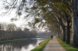
Canal de Nantes à Brest, Finistère, France
Nantes-Brest Canal
This small canal linking the two cities via southern Brittany is a tourist attraction. You can navigate it (in part) on small boats or explore it on foot or by bike along the towpaths.

Climate and weather in Malestroit

Transport

Getting there

Getting around

Accommodation

Eating

Useful addresses

Further information

View guide page: Malestroit

Pénestin

It is the southernmost seaside resort in Morbihan.

Overview of Pénestin

It is the southernmost seaside resort in Morbihan.

Key Facts

  • Type of place: village.
  • Tourist interest: (worth a stop if you are in the area).
  • Location:
  • Distances:
  • Local time: Heure : 17903.
  • Population: 1,788 inhabitants (2014).
  • Area: 21.69 km²
  • Altitude: sea level.

History of Pénestin

Climate and Weather in Pénestin

Like the rest of the coast, the town has an oceanic climate, mild and humid year-round, with relatively low temperature variation—neither too cold in winter nor too hot in summer. Rainfall (less intense than inland) is spread throughout the year, with a peak in autumn and winter.

Sea Temperature Throughout the Year

Jan.Feb.Mar.Apr.MayJun.Jul.Aug.Sep.Oct.Nov.Dec.
Pénestin10910111214161716151311

What to See and Do

In the Surrounding Area

Getting Around

How to Get There

Getting Around

Where to Stay

Where to Eat

Useful Addresses

  1. == Additional Information
View guide page: Pénestin

Plouharnel

This municipality near Carnac also boasts a significant number of menhirs and dolmens, as well as several religious buildings (chapels and abbeys). Its territory is also home to one of Brittany’s most extensive dune areas.

Introduction to Plouharnel

Plouharnel, a municipality near Carnac, also has a large number of menhirs and dolmens, as well as several religious buildings (chapels and abbeys). Its territory is also home to one of Brittany’s most significant dune areas.

Key Details

  • Type de lieu: village.
  • Intérêt touristique: (worth a stop if you are in the area).
  • Distances:
  • Heure locale: Heure : 17904.
  • Population: 2,148 inhabitants (2016).
  • Superficie: 18.32 km².
  • Altitude: sea level.

History of Plouharnel

What to See and Do in Plouharnel

Old hamlets (Le Vieux Bourg, Sainte Barbe), a small religious heritage, and remnants of the Atlantic Wall make up the main built heritage of the municipality.

Megaliths of Plouharnel
Like other nearby towns, Plouharnel has its share of dolmens, menhirs, tumuli, and alignments dating from the Neolithic period.
Chouannerie Museum
Housed in a former World War II bunker, the site traces the history of the wars in the West in Brittany and the Vendée during the Revolution.
Plages de Plouharnel, Plouharnel, Morbihan, France
Plouharnel Beaches
These are long beaches and one of the most significant dune areas in Brittany.

In the Surrounding Area

Climate and Weather in Plouharnel

Like the rest of the coast, the municipality has an oceanic climate, mild and humid year-round, with relatively low temperature variation—neither too cold in winter nor too hot in summer. Rainfall (less intense than inland) is spread throughout the year, with a peak in autumn and winter.

Sea Temperature Throughout the Year

Jan.Feb.Mar.Apr.MayJun.Jul.Aug.Sep.Oct.Nov.Dec.
Plouharnel10910111214161716151311

Transportation

Getting There

Getting Around

Accommodation

Dining

Useful Addresses

Additional Information

View guide page: Plouharnel

Megaliths of Plouharnel

Like other nearby towns, Plouharnel has its share of dolmens, menhirs, tumuli, and alignments dating from the Neolithic period.

Overview of the Megaliths

Like other nearby towns, Plouharnel has its share of dolmens, menhirs, tumuli, and alignments dating from the Neolithic period.

  • Tourist interest: (worth a stop if you are in the area).

History of Plouharnel’s Megaliths

What to See and Do

Practical Information

  • Location:
  • Local time: Heure : 22135.
  • Address: 4 avenue de l'Océan, 56340 Plouharnel.
  • Opening hours:
  • Price:

Transport

Accommodation and Dining

What to See Nearby

  1. == En complément
View guide page: Megaliths of Plouharnel

Chouannerie Museum

Housed in a former World War II bunker, the site traces the history of the wars in the West in Brittany and the Vendée during the Revolution.

Overview of the Chouannerie Museum

Housed in a former World War II bunker, the site traces the history of the wars in the West in Brittany and the Vendée during the Revolution.

  • Tourist interest: (worth a stop if you are in the area).

Museum History

Collections on Display

Practical Information

  • Location:
  • Address: Bois du Bégo, 56340 Plouharnel.
  • Opening hours:
  • Admission:
  • How to get there:

Nearby Attractions

  1. == In addition
View guide page: Chouannerie Museum

Plouharnel Beaches

These are long beaches and one of the most significant dune areas in Brittany.

Overview of Plouharnel Beaches

These are long beaches and one of the most significant dune areas in Brittany.

Key Details

  • Type of place: beach.
  • Tourist interest: (worth seeing).
  • Features:
  • Location:
  • Length:

Environment

Precautions

What to See and Do

Climate and Weather

Practical Information

Getting There

Sleeping and Eating

Nearby Attractions

  1. == In Addition
View guide page: Plouharnel Beaches

Port-Louis (56)

Located opposite Lorient, the town has always played a defensive role. It is home to a fine 16th-century citadel as well as various bastions and fortifications.

Overview of Port-Louis

Located opposite Lorient, the town of Port-Louis has always played a defensive role. It is home to a fine 16th-century citadel as well as various bastions and fortifications.

Key Facts

  • Type of place: small town.
  • Tourist interest: (worth seeing).
  • Location: directly opposite Lorient, at the entrance to its harbour, in the Morbihan department.
  • Distances:
  • Local time: Heure : 2416.
  • Population: 2,644 inhabitants (2014).
  • Area: 1 km².
  • Altitude: sea level.

History of Port-Louis

What to see and do in Port-Louis

Port-Louis Citadel
With its bastion and fortifications, this well-preserved 16th-century citadel is the city's main attraction. It also houses two museums: the Museum of the French East India Company and a branch of the National Maritime Museum.

In the surrounding area

Climate and weather

Like the rest of the coast, the town has an oceanic climate—mild, humid, and quite windy in all seasons, with relatively low temperature variation, neither too cold in winter nor too hot in summer. Rainfall (less heavy than inland) is spread throughout the year, with a peak in autumn and winter.

Transport

Getting there

Getting around

Accommodation

Food

Useful addresses

Further information

View guide page: Port-Louis (56)

Port-Louis Citadel

With its bastion and fortifications, this well-preserved 16th-century citadel is the city's main attraction. It also houses two museums: the Museum of the French East India Company and a branch of the National Maritime Museum.

Overview of the citadel

With its bastion and fortifications, this well-preserved 16th-century citadel is the city's main attraction. It also houses two museums: the Museum of the French East India Company and a branch of the National Maritime Museum.

  • Tourist interest: (worth seeing).

History of the Port-Louis Citadel

What to see and do

Practical information

  • Location:
  • Local time: Heure : 22146.
  • Address: Avenue du Fort de l'Aigle, 56290 Port-Louis.
  • Opening hours:
  • Admission:

Transport

Accommodation and dining

Nearby attractions

  1. == In addition
View guide page: Port-Louis Citadel

Pontivy

This town in the northern part of the department features a beautiful 15th-century castle (the Château de Rohan) as well as various remnants of its medieval past in its town centre.

Overview of Pontivy

Pontivy, in the northern part of the department, boasts a beautiful 15th-century castle (the Château de Rohan) as well as various remnants of its medieval past in its town centre.

Key Facts

  • Type de lieu: small town.
  • Intérêt touristique: (worth seeing).
  • Localisation: in the northern part of the Morbihan department.
  • Distances:
  • Heure locale: Heure : 17906.
  • Population: 14,491 inhabitants (2016).
  • Superficie: 24.85 km².
  • Altitude: from 48 to 192 m.

History of Pontivy

What to See and Do in Pontivy

Pontivy’s town centre has preserved numerous half-timbered houses dating from the Middle Ages and the Renaissance, along with a religious heritage of churches and chapels.

Château de Pontivy, Pontivy, Morbihan, France
Pontivy Castle
Also known as the Château des Rohan, this imposing 15th-century structure is closely tied to the history and identity of the town and its surroundings.

In the Surrounding Area

Climate and Weather in Pontivy

The area has an oceanic climate, mild and humid, with relatively low temperature variation—neither too cold in winter nor too hot in summer. Rainfall is spread throughout the year, with a peak in autumn and winter.

Transport

Getting There

Getting Around

Accommodation

Food

Useful Addresses

Further Information

View guide page: Pontivy

Pontivy Castle

Also known as the Château des Rohan, this imposing 15th-century structure is closely tied to the history and identity of the town and its surroundings.

Overview of the castle

Also known as the Château des Rohan, this imposing 15th-century structure is closely tied to the history and identity of the town and its surroundings.

  • Tourist interest: (worth seeing).

History of the castle

What to see and do

Practical information

  • Location:
  • Address: 1 rue de Lourmel, 56300 Pontivy.
  • Opening hours:
  • Admission:
  • Website:
  • How to get there:

What to see nearby

  1. == In addition
View guide page: Pontivy Castle

Quiberon

At the tip of its stunning peninsula, Quiberon and its beaches are primarily a great base for exploring the surrounding area on foot, by bike, on horseback, or even by sea kayak.

Overview of Quiberon

At the tip of its stunning peninsula, Quiberon and its beaches are primarily a great base for exploring the surrounding area on foot, by bike, on horseback, or even by sea kayak.

Key facts

  • Type of place: small town.
  • Tourist interest: (worth a stop if you are in the area).
  • Location:
  • Distances:
  • Local time: Heure : 17907.
  • Population: 4,963 inhabitants (2014).
  • Area: 8.83 km².
  • Altitude: sea level.

History of Quiberon

Climate and weather in Quiberon

Like the rest of the coast, the area has an oceanic climate—mild, humid, and quite windy year-round, with relatively low temperature variation, neither too cold in winter nor too hot in summer. Rainfall (lighter than inland) is spread throughout the year, peaking in autumn and winter.

Sea temperature throughout the year

Jan.Feb.Mar.Apr.MayJun.Jul.Aug.Sep.Oct.Nov.Dec.
Quiberon10910111214161716151311

What to see and do

In the surrounding area

Getting around

Getting there

Getting around locally

Where to stay

Where to eat

Useful addresses

Further reading

View guide page: Quiberon

Rochefort-en-Terre

Rochefort is a village with historic houses, a collegiate church, a castle, and calvaries. It is one of the "Most Beautiful Villages of France."

Overview of Rochefort-en-Terre

Rochefort-en-Terre is a village with historic houses, a collegiate church, a castle, and calvaries. It is one of the "Most Beautiful Villages of France."

Key Details

  • Type de lieu: village.
  • Intérêt touristique: (worth seeing).
  • Localisation: east of Vannes, in the Morbihan department.
  • Distances:
  • Heure locale: Heure : 17908.
  • Population: 627 inhabitants (2016).
  • Superficie: 1.22 km².
  • Altitude: from 22 to 80 m.

History of Rochefort-en-Terre

What to See and Do in Rochefort-en-Terre

The village of Rochefort-en-Terre is stunning, with its half-timbered or granite houses, small townhouses, and its collegiate church. The village is also beautifully flowered and is part of the "Most Beautiful Villages of France."

Rochefort-en-Terre Castle
This neo-Gothic manor has housed the Naïa Museum, a contemporary art museum, since 2015.

In the Surrounding Area

Climate and Weather

Transportation

Getting There

Getting Around

Accommodation

Dining

Useful Addresses

Additional Information

View guide page: Rochefort-en-Terre

Rochefort-en-Terre Castle

This neo-Gothic manor has housed the Naïa Museum, a contemporary art museum, since 2015.

Overview of the castle

This neo-Gothic manor has housed the Naïa Museum, a contemporary art museum, since 2015.

  • Tourist interest: (worth a stop if you are in the area).

History of Rochefort-en-Terre Castle

What to see and do

Practical information

  • Location:
  • Local time: Heure : 22148.
  • Address: 14 Le Château, 56220 Rochefort-en-Terre.
  • Opening hours:
  • Price:

Transport

Sleeping and eating

What to see nearby

  1. == In addition
View guide page: Rochefort-en-Terre Castle

Sarzeau

Seaside resort in the southern part of the Gulf of Morbihan. In addition to its beaches and long coastline, the town offers a beautiful 13th-century fortress (Château de Suscinio) and numerous megaliths to visit. Sarzeau is a seaside resort in the southern…

Read the full guide: Sarzeau

Vannes

The capital of Morbihan has a fortified historic centre, a large marina, and several beaches. The capital of Morbihan has a fortified historic centre, a large marina, and several beaches. Type of place: small town. Tourist interest : ★★ (worth seeing).…

Read the full guide: Vannes

Belle-Île-en-Mer

It is the largest of the Breton islands. With its rugged coastline and cliffs, it offers beautiful landscapes, beaches, opportunities for water activities (sailing, kayaking, surfing, diving), a stunning citadel, and great hiking options that make the place very popular in summer.

Overview of Belle-Île-en-Mer

It is the largest of the Breton islands. With its rugged coastline and cliffs, it offers beautiful landscapes, as well as beaches, opportunities for water activities (sailing, kayaking, surfing, diving), a stunning citadel, and great hiking options that make the place very popular in summer.

Key facts

  • Tourist interest: (must-see or highly recommended).
  • Location:
  • Local time: Heure : 17911
  • Main town: Le Palais.
  • Population: 5,293 inhabitants (2014).
  • Area: 85.63 km².
  • Highest point: Croix du Run (71 m).
  • Coastline: 80 km.

History of Belle-Île-en-Mer

Environment

Wildlife and flora

Precautions

What to see and do on Belle-Île

Nearby

Climate and weather

Sea temperature throughout the year

Jan.Feb.Mar.Apr.MayJun.Jul.Aug.Sep.Oct.Nov.Dec.
Belle-Île-en-Mer10910111214161716151311

Transport

Getting there

Getting around

Accommodation

Food

Useful addresses

Further information

View guide page: Belle-Île-en-Mer

Île d'Arz

It's an island off Vannes in the Gulf of Morbihan.

Overview of Île d'Arz

It's an island off Vannes in the Gulf of Morbihan.

Key facts

  • Tourist interest: (worth a stop if you are in the area).
  • Location:
  • Local time: Heure : 17912
  • Main locality:
  • Population: 242 inhabitants (2014).
  • Area: 3.3 km².
  • Highest point: 17 m.
  • Coastline:

History of Île d'Arz

Environment

Wildlife and flora

Precautions

What to see and do on Île d'Arz

Nearby

Climate and weather on Île d'Arz

Transport

Getting there

Getting around

Accommodation

Food

Useful addresses

Further information

View guide page: Île d'Arz

Groix Island

Opposite Lorient, Groix is rather pretty and pleasant, home to several small hamlets.

Overview of Groix Island

Opposite Lorient, Groix is rather pretty and pleasant, home to several small hamlets.

Key facts

  • Tourist interest: (worth seeing).
  • Location:
  • Local time: Heure : 17913
  • Main locality:
  • Population: 2,247 inhabitants (2014).
  • Area: 14.82 km².
  • Highest point: 48 m.
  • Coastline:

History of Groix Island

Environment

Wildlife and flora

Precautions

What to see and do on Groix Island

Nearby

Climate and weather on Groix Island

Sea temperature throughout the year

Jan.Feb.Mar.Apr.MayJun.Jul.Aug.Sep.Oct.Nov.Dec.
Groix10910111214161716151311

Transport

Getting there

Getting around

Accommodation

Food

Useful addresses

Further information

View guide page: Groix Island

Houat Island

Off the coast of Quiberon, this is an island covered in heathland, popular with visitors and boaters in summer for its beautiful landscapes.

Overview of Houat Island

Off the coast of Quiberon, this is an island covered in heathland, popular with visitors and boaters in summer for its beautiful landscapes.

Key facts

  • Tourist interest: (worth seeing).
  • Location:
  • Local time: Heure : 17914
  • Main locality:
  • Population: 242 inhabitants (2014).
  • Area: 2.91 km².
  • Highest point: 42 m.
  • Coastline:

History of Houat Island

Environment

Wildlife and flora

Precautions

What to see and do on Houat Island

Nearby

Climate and weather on Houat Island

Transport

Getting there

Getting around

Accommodation

Food

Useful addresses

  1. == Additional information
View guide page: Houat Island

Hoëdic Island

Just 5 km southeast of Houat, this small island also attracts many visitors and boaters during the season.

Overview of Hoëdic Island

Just 5 km southeast of Houat, this small island also attracts many visitors and boaters during the season.

Key Facts

  • Tourist interest: (worth a stop if you are in the area).
  • Location:
  • Local time: Heure : 17915
  • Main locality:
  • Population: 113 inhabitants (2014).
  • Area: 2.08 km².
  • Highest point: 22 m.
  • Coastline:

History of Hoëdic Island

Environment

Wildlife and flora

Precautions

What to see and do on Hoëdic Island

In the surrounding area

Climate and weather on Hoëdic Island

Transport

Getting there

Getting around

Accommodation

Food

Useful addresses

Further information

View guide page: Hoëdic Island

Île aux Moines

It is the largest island in the Gulf of Morbihan. You can see megaliths and several pretty Breton calvaries here.

Overview of Île aux Moines

It is the largest island in the Gulf of Morbihan. You can see megaliths and several pretty Breton calvaries here.

Key facts

  • Tourist interest: (worth seeing).
  • Location:
  • Local time: Heure : 17916
  • Main locality:
  • Population: 606 inhabitants (2014).
  • Area: 3.20 km².
  • Highest point: 31 m.
  • Coastline:

History of Île aux Moines

Environment

Wildlife and flora

Precautions

What to see and do

Nearby

Climate and weather

Transport

Getting there

Getting around

Accommodation

Food

Useful addresses

  1. == Additional information
View guide page: Île aux Moines

Gulf of Morbihan

Opposite Vannes, this is essentially an inland sea surrounded by heathland and marshes, with numerous islands (including Arz and Île-aux-Moines). The area offers stunning landscapes and is very popular with sailors and kayakers.

Overview of the Gulf

Opposite Vannes, this is essentially an inland sea surrounded by heathland and marshes, with numerous islands (including Arz and Île-aux-Moines). The area offers stunning landscapes and is very popular with sailors and kayakers.

  • Tourist interest: (recommended).
  • Features:
  • Area: 115 km².

Environment

Wildlife and flora

Precautions

Climate and weather

Sea temperature throughout the year

Jan.Feb.Mar.Apr.MayJun.Jul.Aug.Sep.Oct.Nov.Dec.
Gulf of Morbihan10910111214161716151311

What to see and do

Practical information

  • Location:
  • How to get there:
  • Distances:

Accommodation and dining

Nearby attractions

Additional information

View guide page: Gulf of Morbihan

Quiberon Peninsula

This is a stunning peninsula ending in the town of the same name. It offers beautiful coastal landscapes, featuring either beaches or cliffs depending on the area. You can explore it on foot, by bike, on horseback, or even by sea kayak.

Overview of the Quiberon Peninsula

This is a stunning peninsula ending in the town of the same name. It offers beautiful coastal landscapes, featuring either beaches or cliffs depending on the area. You can explore it on foot, by bike, on horseback, or even by sea kayak.

  • Tourist interest: (recommended).
  • Location:
  • Area:
  • Altitude:

Environment of the Peninsula

Wildlife and Flora

What to See and Do

In the Surrounding Area

Climate and Weather

Like the rest of the coast, the peninsula has an oceanic climate—mild, humid, and quite windy year-round, with relatively low temperature variation: neither too cold in winter nor too hot in summer. Rainfall (less intense than inland) is spread throughout the year, peaking in autumn and winter.

Sea Temperature Throughout the Year

Jan.Feb.Mar.Apr.MayJun.Jul.Aug.Sep.Oct.Nov.Dec.
Quiberon Peninsula10910111214161716151311

Precautions

Transportation

Getting There

Getting Around

Accommodation and Dining

Additional Information

View guide page: Quiberon Peninsula

Séné Salt Marsh Nature Reserve

South of Vannes, in the municipality of the same name and part of the Gulf of Morbihan, this reserve is home to many migratory and local birds.

Overview of the Reserve

South of Vannes, in the municipality of the same name and an integral part of the Gulf of Morbihan, this reserve is home to many migratory and local birds.

  • Tourist interest: (worth a stop if you are in the area).
  • Features:
  • Area: 5.3 km².
  • Altitude: sea level.

Environment

Site Physiognomy

Wildlife and Flora

Climate and Weather

Precautions

What to See and Do

Practical Information

  • Location:
  • Opening period:
  • How to get there:
  • Distances:

Accommodation and Dining

Nearby Attractions

  1. == En complément
View guide page: Séné Salt Marsh Nature Reserve

Something wrong or out of date? Report this page