Sparsely populated and nestled in the mountains, the Hautes-Alpes combine nature (Queyras, Écrins...), heritage (Briançon, Fort Queyras, etc.), and year-round outdoor activities with numerous ski resorts. In short, a paradise for ecotourism enthusiasts.
Overview of the Hautes-Alpes
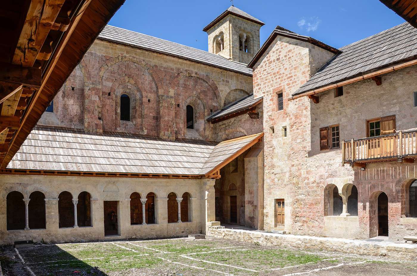
Abbaye Notre-Dame de Boscodon, Hautes-Alpes, France · © VoyageForum Key facts
Type de lieu: department.Intérêt touristique: ★★★ Heure locale: Heure : Hautes-Alpes Départements limitrophes: Population: 141,284 inhabitants (2017).Densité: 25 inhabitants/km².Point le plus haut: Barre des Écrins (4,102 m).Point le plus bas: Ribiers (470 m).Littoral: 0 km, no coastline.Intérêts (on ★★★★ ★★★★ ★ ★★ ★★ History of the Hautes-Alpes
Geography and environment
Culture and economy
What to see in the Hautes-Alpes
Sparsely populated and nestled in the mountains, the Hautes-Alpes combine nature (Queyras, Écrins...), heritage (Briançon, Fort Queyras, etc.), and year-round outdoor activities with numerous ski resorts. In short, a paradise for ecotourism enthusiasts.
What to do in the Hautes-Alpes
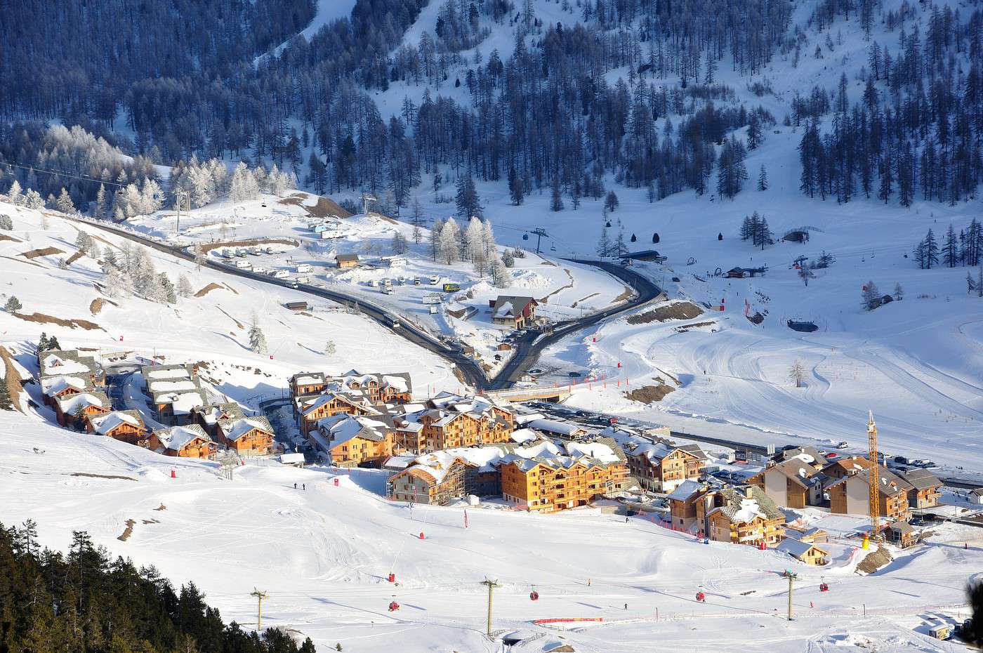
Montgenèvre, Hautes-Alpes, France · © VoyageForum Climate and weather
Given its average altitude, the department has a mountain climate—cold (even very cold in the highest areas) and fairly dry throughout the year. However, sunshine is abundant, and day/night temperature differences are significant. While winters can be harsh, summers remain very pleasant without excessive temperatures.
Transport
Getting there
Getting around
Accommodation
Food
Additional information
Gap It is the capital of the Hautes-Alpes department. The town is dominated by a pretty château and its park: the Domaine de Charance.
Overview of Gap
It is the capital of the Hautes-Alpes department. The town is dominated by a pretty château and its park: the Domaine de Charance.
Key facts
Type of place: small town.Tourist interest : ★ Local time: Heure : 18094 .Population: 40,225 inhabitants (2014).Altitude: from 625 to 2,361 m.History of Gap
What to see and do in Gap
In the surrounding area
Climate and weather in Gap
Transport
Getting there
Getting around
Accommodation
Eating
Useful addresses
Further information
View guide page: Gap Boscodon Abbey Located near the town of Crots, this is a 12th-century abbey and one of the most visited monuments in the department.
Overview of the Abbey
Located near the town of Crots, this is a 12th-century abbey and one of the most visited monuments in the department.
Tourist interest: ★★ History of the Abbey
What to See and Do
Practical Information
Address: Boscodon, 05200 Crots.Nearby Attractions
Additional Information
View guide page: Boscodon Abbey Argentière-la-Bessée This commune south of Briançon is home to old silver mines that can be visited.
Overview of Argentière
This commune south of Briançon is home to old silver mines that can be visited.
Key details
Type of place: small town.Tourist interest : ★ Local time: Heure : 18120 .Population: 2,317 inhabitants (2014).Altitude: from 945 to 3,243 m.History of Argentière-la-Bessée
What to see and do in Argentière
In the surrounding area
Climate and weather in Argentière
Transport
Getting there
Getting around
Accommodation
Food
Useful addresses
Further information
View guide page: Argentière-la-Bessée Briançon The highest town in the E.U. at 1,326 m above sea level. It boasts significant military heritage, notably due to Vauban, part of whose French works are UNESCO-listed. The Serre Chevalier ski resort is partly within the town. It is the highest town in the E.U.…
Read the full guide: Briançon Embrun This small town between Gap and Briançon has a beautiful cathedral and a few other interesting civil or religious buildings.
Overview of Embrun
This small town between Gap and Briançon has a beautiful cathedral and a few other interesting civil or religious buildings.
Key Facts
Type of place: small town.Tourist interest : ★ Local time: Heure : 18122 .Population: 6,150 inhabitants (2014).Altitude: from 778 to 2,800 m.History of Embrun
What to see and do in Embrun
In the surrounding area
Climate and weather in Embrun
Transport
Getting there
Getting around
Accommodation
Food
Useful addresses
Further information
View guide page: Embrun The White Forest One of the main ski resorts in the department following the merger of Vars and Risoul.
Overview of the resort
It is one of the main ski resorts in the region following the merger of Vars and Risoul.
Key facts
Tourist interest: ★★ Altitude: from 1,650 to 2,750 m.Environment
Climate and weather
Precautions
Facilities and activities
Ski area
Length of slopes: 185 km.Cross-country ski trails: 7 km.Other winter activities
Summer activities
Practical information
Accommodation and dining
Events
What to see and do nearby
== Further information View guide page: The White Forest Fort Queyras In the municipality of Château-Ville-Vieille, this is a medieval fortress perched in the heart of the Queyras region.
Overview
In the municipality of Château-Ville-Vieille, this is a medieval fortress perched in the heart of the Queyras region.
Tourist interest: ★★ History of Fort Queyras
What to see and do
Practical information
Address: 05350 Château-Ville-Vieille.Nearby attractions
Additional information
View guide page: Fort Queyras La Grave It's one of the "most beautiful villages in France," with tourism focused on skiing, mountaineering, and hiking.
Overview of La Grave
It's one of the "most beautiful villages in France," with tourism focused on skiing, mountaineering, and hiking.
Key Details
Tourist interest : ★ Local time: Heure : 18125 .Population: 487 inhabitants (2014).Altitude: from 1,135 to 3,983 m.History of La Grave
What to See and Do in La Grave
In the Surrounding Area
Climate and Weather in La Grave
Transportation
Getting There
Getting Around
Accommodation
Dining
Useful Addresses
== Additional Information View guide page: La Grave Les Orres In the south of the Hautes-Alpes department, it is one of the main winter sports resorts in the area.
Overview of the resort
In the south of the Hautes-Alpes department, it is one of the main winter sports resorts in the area.
Key details
Tourist interest: ★ Mountain range: Southern Alps.Altitude: from 1,650 to 2,720 mEnvironment
Climate and weather
Precautions
Facilities and activities
Ski area
Length of slopes: 100 km.Cross-country ski trails: 40 km.Other winter activities
Summer activities
Practical information
Accommodation and dining
Events
What to see and do nearby
Additional information
View guide page: Les Orres Dévoluy Massif This small mountain range north of Gap is home to several ski resorts like SuperDévoluy and La Joue du Loup. You can also go climbing here.
Overview of the Dévoluy Massif
This small mountain range north of Gap is home to several ski resorts like SuperDévoluy and La Joue du Loup. You can also go climbing here.
Key Facts
Tourist interest: ★ Summit: L'Obiou (2,789 m).Environment
Wildlife and flora
Population and economic activity
Precautions
Climate and weather
What to see and do
Practical information
Getting there
Getting around
Accommodation and dining
Nearby attractions
Further reading
View guide page: Dévoluy Massif Mont-Dauphin A small fortified village designed by Vauban and listed as a UNESCO World Heritage site.
Overview of Mont-Dauphin
A small fortified village designed by Vauban and listed as a UNESCO World Heritage site.
Key Facts
Tourist interest : ★★ Local time: Heure : 18128 .Population: 151 inhabitants (2014).Altitude: from 898 to 1,035 m.History of Mont-Dauphin
What to See and Do in Mont-Dauphin
In the Surrounding Area
Climate and Weather in Mont-Dauphin
Transportation
Getting There
Getting Around
Accommodation
Dining
Useful Addresses
Further Information
View guide page: Mont-Dauphin Montgenèvre This fortified village on the Italian border is also a ski resort—and even the oldest in France.
Overview of the resort
This fortified village on the Italian border is also, and above all, a ski resort—and even the oldest in France.
Key facts
Tourist interest: ★ Associated resorts: none.Altitude: from 1,860 to 2,650 m.Environment
Climate and weather
Precautions
Facilities and activities
Ski area
Cross-country ski trails: 77 km.Other winter activities
Summer activities
Practical information
Accommodation and dining
Events
What to see and do nearby
Additional information
View guide page: Montgenèvre Orcières-Merlette One of the main ski resorts located in the Écrins National Park.
Overview of the resort
It is one of the main ski resorts located in the Écrins National Park .
Key details
Tourist interest: ★ Mountain range: Southern Alps.Altitude: from 1,850 to 2,725 m.Environment
Climate and weather
Precautions
Facilities and activities
Ski area
Cross-country ski trails: 43 km.Other winter activities
Summer activities
Practical information
Accommodation and dining
Events
What to see and do nearby
Additional information
View guide page: Orcières-Merlette Saint-Véran This charming little village in the Queyras Park, at over 2,000 metres above sea level, is one of the highest municipalities in Europe. It has a nearby ski resort.
Overview of Saint-Véran
This charming little village in the Queyras Park , at over 2,000 metres above sea level, is one of the highest municipalities in Europe. It has a nearby ski resort.
Key facts
Tourist interest : ★ Local time: Heure : 18131 .Population: 249 inhabitants (2014).Altitude: from 1,756 to 3,175 m.History of Saint-Véran
What to see and do in Saint-Véran
In the surrounding area
Climate and weather in Saint-Véran
Transport
Getting there
Getting around
Accommodation
Food
Useful addresses
Further information
View guide page: Saint-Véran Serre Chevalier Located in the municipality of Briançon and its neighboring areas, Serre Chevalier is the largest winter sports resort in the Southern Alps.
Overview of the resort
Located in the municipality of Briançon and its neighboring areas, Serre Chevalier is the largest winter sports resort in the Southern Alps.
Key facts
Tourist interest: ★★ Mountain range: Southern Alps.Altitude: from 1,200 to 2,830 m.Environment
Precautions
Climate and weather
Facilities and activities
Ski area
Length of slopes: 250 km.Cross-country ski trails: 35 km.Other winter activities
Summer activities
Practical information
Accommodation and dining
Events
What to see and do nearby
Additional information
View guide page: Serre Chevalier Durance This river, originating in the Hautes-Alpes department, offers excellent opportunities for rafting and kayaking.
Overview of the river
This river, originating in the Hautes-Alpes department, offers excellent opportunities for rafting and kayaking.
Key points
Tourist interest: ★ Altitude: from 2,300 to 24 m.Environment
What to see and do
Practical information
Accommodation and dining
Nearby attractions
Additional information
View guide page: Durance Lake Serre-Ponçon Europe's third-largest artificial lake. Several lakeside towns have developed its shores into leisure bases.
Overview of the lake
Europe's third-largest artificial lake. Several lakeside towns have developed its shores into leisure bases.
Key facts
Tourist interest: ★ Characteristics: artificial lake.Environment
Precautions
What to see and do
Practical information
Sleeping and eating
What to see nearby
Additional information
View guide page: Lake Serre-Ponçon Écrins National Park Straddling the Hautes-Alpes and Isère departments, this stunning park boasts numerous high peaks and glaciers. It is home to populations of chamois, ibex, and occasionally wolves. Naturally, skiing, mountaineering, and hiking are popular activities here.…
Read the full guide: Écrins National Park Queyras Regional Nature Park Backed by the Italian border, this is a mountainous area with many peaks over 3,000 metres, passes, lakes, and stunning landscapes. Skiing, mountaineering, and hiking are popular activities here.
Overview of the park
Backed by the Italian border , this is a mountainous area with many peaks over 3,000 metres, passes, lakes, and stunning landscapes. Skiing, mountaineering, and hiking are popular activities here.
Key facts
Tourist interest: ★★★ Environment
Wildlife and flora
Precautions
What to see and do
In the surrounding area
Climate and weather
Transport
Getting there
Getting around
Accommodation
Food
Useful addresses
Further information
View guide page: Queyras Regional Nature Park Saorge A small medieval village dominated by a 17th-century Franciscan monastery.
Overview of Saorge
A small medieval village dominated by a 17th-century Franciscan monastery.
Key Details
Tourist interest : ★★ Local time: Heure : 18160 .Population: 449 inhabitants (2014).Altitude: from 319 to 2,680 m.History of Saorge
What to See and Do in Saorge
In the Surrounding Area
Climate and Weather in Saorge
Transportation
Getting There
Getting Around
Accommodation
Dining
Useful Addresses
Further Information
View guide page: Saorge Something wrong or out of date? Report this page