Skip to content
Manche

Travel guide

Manche

★ 2 · last edited Aug 10, 2020 · 4 versions

Manche is home to one of France’s most visited sites, Mont Saint-Michel and its bay. While this can sometimes overshadow the department’s other attractions, it still offers a range of seaside resorts (including the Côte des Havres), several medieval abbeys, and, in places, beautiful coastal or bocage landscapes.

Overview

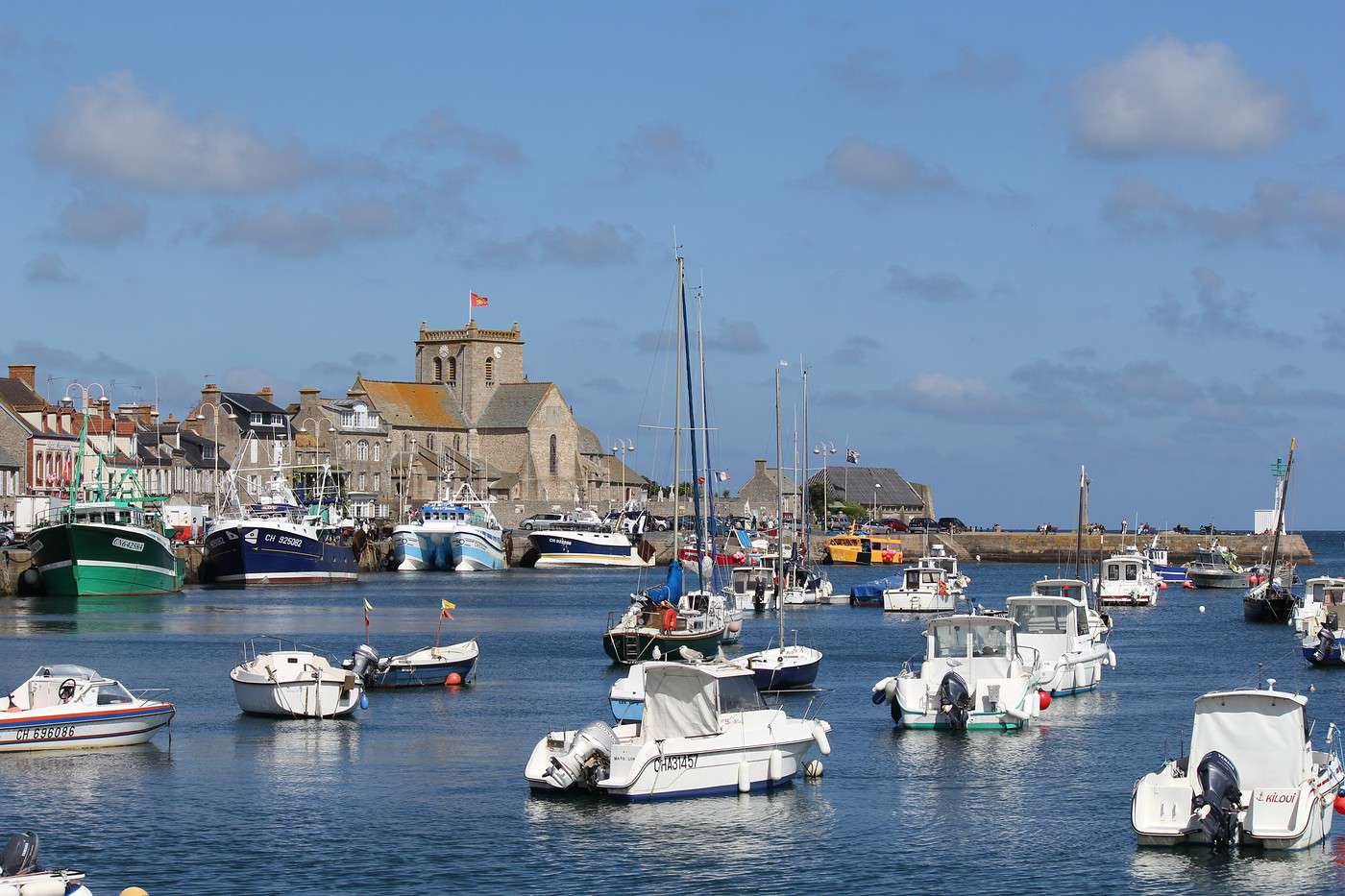
Barfleur, Manche, France
Barfleur, Manche, France · © VoyageForum

Key facts

  • Type of place: department.
  • Location: It is the large peninsula jutting into the English Channel in northwestern France.
  • Department code: 50.
  • Bordering departments: Calvados, Ille-et-Vilaine, Mayenne, Orne.
  • Sub-prefectures: Avranches, Cherbourg-en-Cotentin, Coutances.
  • Number of communes: 477.
  • Population: 496,883 inhabitants (2017).
  • Area: 5,938 km².
  • Density: 84 inhabitants/km².
  • Highest point: Gathemo (367 m).
  • Lowest point: sea level.
  • Coastline: 350 km.
  • Highlights (out of ): Nature ; Culture ; Relaxation-holidays

History of Manche

Geography and environment

Culture and economy

What to see in Manche

Manche is home to one of France’s most visited sites, the Mont Saint-Michel and its bay. While this can sometimes overshadow the department’s other attractions, it still offers a range of seaside resorts (including the Côte des Havres), several medieval abbeys, and, in places, beautiful coastal or bocage landscapes.

What to do in Manche

Climate and weather

Manche has an oceanic climate. Winters are mild, and summers are cool, making it one of the French departments with the lowest summer temperatures. It is also a region where rain is very common, especially inland, often in the form of drizzle. The wind blows regularly along the coast (sometimes as storms), contributing, along with the tides, to rapid weather changes within a single day.

Sea temperature throughout the year

Jan.Feb.Mar.Apr.MayJun.Jul.Aug.Sep.Oct.Nov.Dec.
Manche7779111316171614119

Transport

Getting there

Getting around

Accommodation

Food

Further reading

Mont Saint-Michel

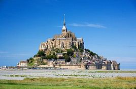
Perched on a rocky islet in the middle of its bay and dominated by its abbey, this is a unique place. Mont Saint-Michel is also one of France’s most visited sites, classified as a UNESCO World Heritage site.

Overview of Mont Saint-Michel

Perched on a rocky islet in the middle of its bay and dominated by its abbey, this is a unique place. Mont Saint-Michel is also one of France’s most visited sites, classified as a UNESCO World Heritage site.

Key facts

  • Type de lieu: village.
  • Intérêt touristique: (must-see or highly recommended).
  • Localisation:
  • Distances:
  • Heure locale: Heure : 17978.
  • Population: 30 permanent residents (2016).
  • Superficie: 4 km².
  • Altitude: from sea level to 80 m.

History of Mont Saint-Michel

What to see and do at Mont Saint-Michel

In the surrounding area

Climate and weather at Mont Saint-Michel

Like the rest of the coast, the area has a temperate oceanic climate with fairly high rainfall spread throughout the year. Temperature variations are relatively small, with neither very low winter temperatures nor very high summer ones.

Sea temperature throughout the year

Jan.Feb.Mar.Apr.MayJun.Jul.Aug.Sep.Oct.Nov.Dec.
Mont Saint-Michel10910111214161716151311

Transport

Getting there

Getting around

You can only get around on foot within the site and its main street.

Accommodation

Food

Useful addresses

Further information

View guide page: Mont Saint-Michel

Cotentin and Bessin Marshes Nature Park

A vast area of hedgerows and marshes perfect for hiking.

Overview of the park

This is a vast area of hedgerows and marshes where you can go hiking.

Key facts

  • Tourist interest: (worth a stop if you are in the area).
  • Features:
  • Area: 1,466 km².
  • Altitude: sea level.

Environment

Landscape of the park

Wildlife and flora

Precautions

Climate and weather

What to see and do

Practical information

  • Location:
  • How to get there:
  • Distances:

Sleeping and eating

What to see nearby

  1. == En complément
View guide page: Cotentin and Bessin Marshes Nature Park

Cerisy-la-Forêt Abbey

Not far from Caen, an 11th-century abbey at the edge of a small forest in the village of Cerisy.

Overview of the Abbey

Not far from Caen, this is an 11th-century abbey at the edge of a small forest in the village of Cerisy.

  • Tourist interest: (worth a stop if you are in the area).

History of the Abbey

What to See and Do

Practical Information

  • Location:
  • Address: Rue des Sangles, 50680 Cerisy-la-Forêt.
  • Opening hours:
  • Admission fee:
  • How to get there:

Nearby Attractions

  1. == In addition
View guide page: Cerisy-la-Forêt Abbey

Hambye Abbey

Between Avranches and Saint-Lô, Hambye is a well-preserved Benedictine abbey.

Overview of the Abbey

Between Avranches and Saint-Lô, Hambye is a well-preserved Benedictine abbey.

  • Tourist interest: (worth a stop if you are in the area).

History of the Abbey

What to See and Do

Practical Information

  • Location:
  • Address: 7 route de l'Abbaye, 50450 Hambye.
  • Opening hours:
  • Admission:
  • Website:
  • How to get there:

Nearby Attractions

  1. == In addition
View guide page: Hambye Abbey

La Lucerne Abbey

A beautiful abbey in the Manche department, near Avranches.

Overview of the Abbey

A beautiful abbey in the Manche department, near Avranches.

  • Tourist interest: (worth a stop if you are in the area).

History of the Abbey

What to See and Do

Practical Information

  • Location:
  • Address: 50320 La Lucerne-d'Outremer.
  • Opening hours:
  • Price:
  • How to get there:

Nearby Attractions

  1. == En complément
View guide page: La Lucerne Abbey

Avranches

Avranches is a small town on the southwest coast of the Manche department with a few medieval remnants.

Overview of Avranches

Avranches is a small town on the southwest coast of the Manche department with a few medieval remnants.

Key facts

  • Type of place: small town.
  • Tourist interest: (worth a stop if you are in the area).
  • Location: on the southern coast of the Manche department.
  • Distances:
  • Local time: Heure : 18052.
  • Population: 7,813 inhabitants (2014).
  • Area: 4.50 km².
  • Altitude: from 7 to 108 m.

History of Avranches

What to see and do in Avranches

While not "transcendent," a few medieval remnants like the Keep and several religious buildings make up Avranches' main attractions.

Avranches Museum of Art and History
Housed in a former episcopal enclosure, this museum features archaeological collections, religious sculptures, paintings, and rooms dedicated to local folk arts and traditions and World War II.
Scriptorial
This is the Museum of Manuscripts of Mont Saint-Michel, featuring over 200 medieval volumes on display.

In the surrounding area

Mont Saint-Michel, Manche, France
Mont Saint-Michel
Perched on a rocky islet in the middle of its bay and dominated by its abbey, this is a unique place. Mont Saint-Michel is also one of France’s most visited sites, classified as a UNESCO World Heritage site.

Climate and weather in Avranches

Like the rest of the coast, the town has a "changeable" oceanic climate—mild and humid, with relatively low temperature variation, neither too cold in winter nor too hot in summer. Rainfall is spread throughout the year, with a peak in autumn and winter.

Transport

Getting there

Getting around

Accommodation

Food

Useful addresses

Further information

View guide page: Avranches

Avranches Museum of Art and History

Housed in a former episcopal enclosure, this museum features archaeological collections, religious sculptures, paintings, and rooms dedicated to local folk arts and traditions and World War II.

Overview of the Museum

Housed in a former episcopal enclosure, the museum features archaeological collections, religious sculptures, paintings, as well as rooms dedicated to local folk arts and traditions and World War II.

  • Tourist interest: (worth a stop if you are in the area).

History of the Museum

Collections on Display

Practical Information

  • Location:
  • Address: Place Jean de Saint-Avit, 50300 Avranches.
  • Opening hours:
  • Admission fee:
  • How to get there:

Nearby Attractions

  1. == En complément
View guide page: Avranches Museum of Art and History

Scriptorial

This is the Museum of Manuscripts of Mont Saint-Michel, featuring over 200 medieval volumes on display.

Overview of the Scriptorial

This is the Museum of Manuscripts of Mont Saint-Michel, featuring over 200 medieval volumes on display.

  • Tourist interest: (worth a stop if you are in the area).

History of the museum

Collections on display

Practical information

  • Location:
  • Address: Place d'Estouteville, 50300 Avranches.
  • Opening hours:
  • Price:
  • How to get there:

Nearby attractions

  1. == In addition
View guide page: Scriptorial

Barfleur

This charming little port east of Cherbourg is listed among "the most beautiful villages in France".

Overview of Barfleur

Barfleur is a charming little port east of Cherbourg. It is listed among "the most beautiful villages in France".

Key Facts

  • Type of place: village.
  • Tourist interest: (worth seeing).
  • Location: in the northeast of the Manche department, not far from Cherbourg.
  • Distances:
  • Local time: Heure : 18053.
  • Population: 600 inhabitants (2014).
  • Area: 0.60 km².
  • Altitude: sea level.

History of Barfleur

What to See and Do in Barfleur

The village features a charming little typical fishing port, with old granite houses and slate-roofed buildings arranged around the bay.

In the Surrounding Area

Climate and Weather in Barfleur

Like the rest of the coast, the area has a "changeable" oceanic climate—mild and very humid, with relatively low temperature variation, neither too cold in winter nor too hot in summer. Rainfall is spread throughout the year, with a peak in autumn and winter.

Sea Temperature Throughout the Year

Jan.Feb.Mar.Apr.MayJun.Jul.Aug.Sep.Oct.Nov.Dec.
Barfleur7779111316171614119

Transportation

Getting There

Getting Around

Accommodation

Dining

Useful Addresses

Further Information

View guide page: Barfleur

Gratot Castle

A 14th-century castle that attracts many visitors in the town of the same name.

Overview of the Castle

This is a 14th-century castle that attracts many visitors in the town of the same name.

  • Tourist interest: (worth seeing).

History of the Castle

What to See and Do

Practical Information

  • Location:
  • Address: 80 rue d'Argouges, 50200 Gratot.
  • Opening hours:
  • Price:
  • How to get there:

Nearby Attractions

  1. == En complément
View guide page: Gratot Castle

Havre Coast

This is a coastal area on the western shore roughly stretching from Granville to Carteret. It features several beaches and seaside resorts such as Agon-Coutainville, Bréhal, Gouville, and Barneville-Carteret.

Overview of the Havre Coast

This is a coastal area on the western shore of the English Channel, roughly stretching from Granville to Carteret. It features several beaches and seaside resorts such as Agon-Coutainville, Bréhal, Gouville, and Barneville-Carteret.

Key Details

  • Type of place: coast.
  • Tourist interest: (worth a stop if you are in the area).
  • Location:
  • Main towns:
  • Length:
  • Population:

History of the Havre Coast

Environment

Precautions

What to See and Do

In the Area

Climate and Weather

Like the rest of the coast, the region has a "changeable" oceanic climate—mild and humid—with relatively low temperature variation, neither too cold in winter nor too hot in summer. Rainfall is spread throughout the year, with a peak in autumn and winter.

Transport

Getting There

Getting Around

Accommodation

Food

  1. == Further Information
View guide page: Havre Coast

Coutances

This sub-prefecture is home to a beautiful cathedral.

Overview of Coutances

Coutances, a sub-prefecture, is home to a beautiful cathedral.

Key Facts

  • Type of place: small town.
  • Tourist interest: (worth a stop if you are in the area).
  • Location: in western Cotentin, in the Manche department.
  • Distances:
  • Local time: Heure : 18057.
  • Population: 8,789 inhabitants (2014).
  • Area: 12.51 km².
  • Altitude: from 12 to 150 m.

History of Coutances

What to See and Do in Coutances

Coutances Cathedral
Dominating the town, it is the primary tourist attraction.
Quesnel-Morinière Museum
The fine arts and archaeology museum of Coutances.

In the Surrounding Area

Climate and Weather in Coutances

Like the rest of the coast, the area has a temperate oceanic climate with fairly high rainfall spread throughout the year. Temperature variations are relatively mild, with neither very low winter temperatures nor very high summer ones.

Transportation

Getting There

Getting Around

Accommodation

Dining

Useful Addresses

Further Information

View guide page: Coutances

Quesnel-Morinière Museum

The fine arts and archaeology museum of Coutances.

Overview of the Quesnel-Morinière Museum

This is the fine arts and archaeology museum of Coutances.

  • Tourist interest: (worth a stop if you are in the area).

History of the museum

Collections on display

Practical information

  • Location:
  • Address: 2 rue Quesnel Morinière, 50200 Coutances.
  • Opening hours:
  • Admission:
  • How to get there:

Nearby attractions

  1. == In addition
View guide page: Quesnel-Morinière Museum

Coutances Cathedral

Dominating the town, it is the primary tourist attraction.

Overview of Coutances Cathedral

Dominating the town of Coutances, it is the primary tourist attraction.

  • Tourist interest: (worth a stop if you are in the area).

History of the cathedral

What to see and do

Practical information

  • Location:
  • Address: 1 rue du Puits Notre Dame, 50200 Coutances.
  • Opening hours:
  • Admission fee:
  • How to get there:

Nearby attractions

  1. == En complément
View guide page: Coutances Cathedral

Granville

One of the main seaside resorts on the west coast, featuring an "upper town", beaches, and the small (tourist) Chausey archipelago just offshore. Granville is one of the main seaside resorts on the west coast of the English Channel, featuring an "upper town",…

Read the full guide: Granville

Saint-Lô

The prefecture of Manche has preserved part of its old ramparts as well as a small religious heritage.

Overview of Saint-Lô

Saint-Lô is the prefecture of Manche. It has preserved part of its old ramparts as well as a small religious heritage.

Key Facts

  • Type de lieu: small town.
  • Intérêt touristique: (worth a stop if you are in the area).
  • Localisation: in the heart of the Manche department.
  • Distances: Caen (57 km), Cherbourg (78 km), Rennes (119 km).
  • Heure locale: Heure : 18059.
  • Population: 19,426 inhabitants (2014).
  • Superficie: 23.19 km².
  • Altitude: from 7 to 134 m.

History of Saint-Lô

What to See and Do in Saint-Lô

Of this city, destroyed by 90% in 1944, remnants of the ramparts and a certain religious heritage still remain.

Saint-Lô Museum of Fine Arts
Located in the heart of the city centre, the museum offers a dive into the art and history of Saint-Lô from its origins to the present day.
Normandy Hedgerow Museum
In a 19th-century farmhouse on the outskirts of the city, the museum traces the history and ethnography of agriculture in the Norman hedgerow countryside since the 18th century.

In the Surrounding Area

Climate and Weather in Saint-Lô

Transportation

Getting There

Getting Around

Accommodation

Dining

Useful Addresses

  1. == Additional Information
View guide page: Saint-Lô

Saint-Lô Museum of Fine Arts

Located in the heart of the city centre, the museum offers a dive into the art and history of Saint-Lô from its origins to the present day.

Overview of the Museum of Fine Arts

Located in the heart of the city centre, this museum offers a dive into the art and history of Saint-Lô from its origins to the present day.

  • Tourist interest: (worth a stop if you are in the area).

History of the museum

Collections on display

Practical information

  • Location:
  • Address: 5 Place du Champ de Mars, 50000 Saint-Lô.
  • Opening hours:
  • Price:
  • How to get there:

What to see nearby

  1. == In addition
View guide page: Saint-Lô Museum of Fine Arts

Normandy Hedgerow Museum

In a 19th-century farmhouse on the outskirts of the city, the museum traces the history and ethnography of agriculture in the Norman hedgerow countryside since the 18th century.

Overview of the Normandy Hedgerow Museum

In a 19th-century farmhouse on the outskirts of the city, the museum traces the history and ethnography of agriculture in the Norman hedgerow countryside since the 18th century.

  • Tourist interest: (worth a stop if you are in the area).

Museum history

Collections on display

Practical information

  • Location:
  • Address: Boulevard de la Commune, 50000 Saint-Lô.
  • Opening hours:
  • Admission:
  • How to get there:

Nearby attractions

  1. == In addition
View guide page: Normandy Hedgerow Museum

Valognes

A small town in the northern part of the department, locally known for the remains of its Gallo-Roman baths.

Overview of Valognes

Valognes is a small town in the northern part of the department, locally known for the remains of its Gallo-Roman baths.

Key Details

  • Type of place: small town.
  • Tourist interest: (worth a stop if you are in the area).
  • Location: in the northern part of the Manche department, about twenty kilometers from Cherbourg.
  • Distances:
  • Local time: Heure : 18060.
  • Population: 6,779 inhabitants (2014).
  • Area: 15.63 km².
  • Altitude: from 19 to 87 m.

History of Valognes

What to See and Do in Valognes

Alauna
The archaeological site of the ancient city of Alauna is located in the municipality. Here you can see the last remains of the Roman baths and theatre.

In the Surrounding Area

Climate and Weather in Valognes

The town has a "changeable" oceanic climate, mild and very humid, with relatively low temperature variation—neither too cold in winter nor too hot in summer. Rainfall is spread throughout the year, with a peak in autumn and winter.

Transportation

Getting There

Getting Around

Accommodation

Dining

Useful Addresses

Further Information

View guide page: Valognes

Alauna

The archaeological site of the ancient city of Alauna is located in the municipality. Here you can see the last remains of the Roman baths and theatre.

Overview of Alauna

The archaeological site of the ancient city of Alauna is located in the municipality of Valognes. Here you can see the last remains of the Roman baths and theatre.

Key Details

  • Type de lieu: archaeological site.
  • Intérêt touristique: (worth a stop if you are in the area).
  • Caractéristiques:
  • Superficie:
  • Altitude:

History of Alauna

What to See and Do

Practical Information

  • Localisation:
  • Adresse: 50700 Valognes.
  • Heures d'ouverture:
  • Tarif:
  • Site internet:
  • How to Get There:

Nearby Attractions

  1. == En complément
View guide page: Alauna

Cape Carteret

On the west coast of the department, a coastal area with long beaches, dunes, and cliffs for the cape itself.

Overview of Cape Carteret

On the west coast of the Manche department. It’s a coastal area with long beaches, dunes, and cliffs for the cape itself.

Key details

  • Type of place: cape.
  • Tourist interest: (worth seeing).
  • Location:
  • Area:
  • Altitude:

Surroundings of Cape Carteret

Wildlife and flora

Precautions

What to see and do

In the area

Climate and weather

Like the rest of the coast, the site has a "changeable" oceanic climate—mild and humid, with relatively low temperature variation, neither too cold in winter nor too hot in summer. Rainfall is spread throughout the year, with a peak in autumn and winter.

Transport

Getting there

Getting around

Accommodation and dining

Additional information

View guide page: Cape Carteret

Cape de la Hague

This is the northwest tip of the Cotentin peninsula. It offers beautiful coastal landscapes (cliffs like those at Nez de Jobourg, dunes, beaches), charming small harbours, and great hiking opportunities. It is also home to the La Hague reprocessing plant.

Overview of Cape de la Hague

This is the northwest tip of the Cotentin peninsula. It offers beautiful coastal landscapes (cliffs like those at Nez de Jobourg, dunes, beaches), charming small harbours, and great hiking opportunities. It is also home to the La Hague reprocessing plant.

Key details

  • Type of place: cape.
  • Tourist interest: (worth seeing).
  • Location:
  • Area:
  • Altitude:

Environment

Wildlife and flora

Precautions

What to see and do

In the surrounding area

Climate and weather

Cape de la Hague has a "changeable" oceanic climate—mild and very humid, with relatively low temperature variation, neither too cold in winter nor too hot in summer. Rainfall is spread throughout the year, with a peak in autumn and winter.

Transport

Getting there

Getting around

Sleeping and eating

Further information

View guide page: Cape de la Hague

Ham Cliffs

A high cliff over 100 m tall south of Saint-Lô, known for climbing and hiking in the surrounding area.

Overview of the Cliff

This is a high cliff over 100 m tall south of Saint-Lô, known for climbing and hiking in the surrounding area.

Landmarks

  • Tourist interest: (worth a stop if you are in the area).
  • Features:
  • Height: 105 m.
  • Altitude:

Site Environment

Wildlife and Flora

Precautions

Climate and Weather

What to See and Do

Practical Information

  • Location:
  • Website:
  • How to get there:
  • Distances:

Sleeping and Eating

Nearby Attractions

  1. == Additional Information ==
View guide page: Ham Cliffs

Cherbourg-en-Cotentin

The (new) major city at the tip of the Cotentin peninsula. Primarily a port city (with ferries to England, among others), nestled in the world's largest artificial harbour.

Overview of Cherbourg-en-Cotentin

Cherbourg-en-Cotentin is the (new) major city at the tip of the Cotentin peninsula. It was formed in 2016 by the merger of the five municipalities that made up the former urban community of Cherbourg. Primarily a port city (with ferries to England, among others), it is nestled in the world's largest artificial harbour.

Key facts

  • Type of place: city.
  • Tourist interest: (worth a stop if you are in the area).
  • Location:
  • Distances:
  • Local time: Heure : 22247.
  • Population: 80,959 inhabitants (2014).
  • Area: 68.54 km²
  • Altitude: sea level.

History of Cherbourg-en-Cotentin

What to see and do in Cherbourg

In the surrounding area

Climate and weather in Cherbourg

Cherbourg has a "changeable" oceanic climate, mild and very humid, with relatively low temperature variation—neither too cold in winter nor too hot in summer. Rainfall is spread throughout the year, with a peak in autumn and winter.

Sea temperature throughout the year

Jan.Feb.Mar.Apr.MayJun.Jul.Aug.Sep.Oct.Nov.Dec.
Cherbourg7779111316171614119

Transport

Getting there

Getting around

Accommodation

Food

Useful addresses

Further information

View guide page: Cherbourg-en-Cotentin

Something wrong or out of date? Report this page