

Travel guide
Normandy
A favourite weekend getaway for Parisians seeking countryside or seaside, Normandy also boasts plenty of other attractions that can easily fill much longer stays. From the iconic Mont Saint-Michel to the D-Day Landing Beaches, via charming towns (Rouen, Honfleur...) and the Norman bocage dotted with abbeys and castles, the region has plenty to offer...
Introduction to Normandy
Overview
Key Facts
- Type of place: tourist region.
- Location: along the English Channel, northwest of Paris.
- Local time:
- Administrative region: Normandy (prefecture: Rouen).
- Departments: Calvados (14), Eure (27), Manche (50), Orne (61) and Seine-Maritime (76).
- Main cities: Alençon, Caen, Cherbourg, Évreux, Le Havre, Rouen...
- Population: 3,328,000 inhabitants (2014).
- Area: 29,906 km².
- Density: 111 inhabitants/km².
- Highest point:
- Lowest point: sea level.
- Coastline:
Tourism
A favourite weekend getaway for Parisians seeking countryside or seaside, Normandy also boasts numerous other attractions that can easily extend a stay. From the iconic Mont Saint-Michel to the D-Day Landing Beaches, charming towns (Rouen, Honfleur...) and the Norman countryside dotted with abbeys and castles, the region has plenty to offer.
Where to get information?
Departmental Tourism Committees
Travel Essentials
- Backpacker daily budget:
- Best for accommodation:
- Best for getting around:
- Best time for weather/crowds/prices:
- Highlights (out of ): Nature ; Adventure ; Culture /; Relaxation/Holidays
- Website:
Geography and Environment of Normandy
Geography of the Region
Natural Areas, Wildlife and Flora

Climate and Weather in Normandy
Climate Overview
Best Time to Visit Normandy
| Jan. | Feb. | Mar. | Apr. | May | Jun. | Jul. | Aug. | Sep. | Oct. | Nov. | Dec. | |
|---|---|---|---|---|---|---|---|---|---|---|---|---|
| Climate |
: very favorable | : favorable | : moderately favorable | : unfavorable.
Sea Temperature Throughout the Year
The sea temperature in Normandy is never particularly warm. Swimming is most pleasant in the heart of the summer season.
| Jan. | Feb. | Mar. | Apr. | May | Jun. | Jul. | Aug. | Sep. | Oct. | Nov. | Dec. | |
|---|---|---|---|---|---|---|---|---|---|---|---|---|
| Deauville | 9 | 9 | 9 | 10 | 11 | 13 | 16 | 16 | 15 | 14 | 12 | 11 |
Climate and Weather by Location
Coastal Area (Le Havre)
Inland (Evreux)
Additional Information
Culture, Society, and Customs of Normandy
Key Historical Dates

Arts and Architecture
Society
Population
Economy
Customs and Traditions
Local Traditions
Regional Languages
Festivals and Celebrations
Books, Films, and Music
What to See in Normandy
Normandy has two sites listed as UNESCO World Heritage Sites: Le Havre ★ (2005) Almost completely destroyed during the last war, Le Havre was rebuilt by architect Auguste Perret and is a UNESCO World Heritage site for "its innovative use of concrete". The…
Things to Do in Normandy
Interests (out of ★★★★ ) : Nature ★★ ; Culture ★★ / ★★★ ; Relaxation-holidays ★★ Interest level for each department: Nature Culture Relaxation-Holidays Calvados ★ / ★★ ★★★ ★★★ Eure ★ ★★ ⊘ / ★ Manche ★★ ★★ ★★ Orne ★★ ★ ★ Seine-Maritime ★★ ★★ ★★ Highlights and…
Other practical information for Normandy
Luggage and equipment to bring
Budget
Precautions
Opening hours
Laundromats
Local tourist offices
Calvados
While Calvados is the department of the *Côte Fleurie*, Honfleur, Cabourg, Deauville, and a few other well-known seaside resorts, it is also a major site for remembrance tourism, with the D-Day landing beaches and numerous memorials and museums dedicated to World War II. Visitors come for history as much as for the seaside, but far less for landscapes or outdoor activities—though the *bocage* and *Suisse normande* are still worth a detour.
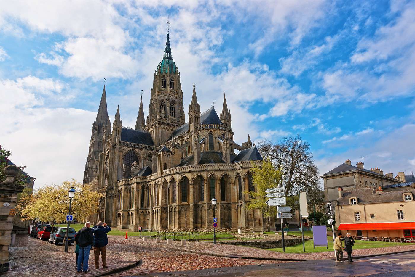
Bayeux, Calvados, France · © VoyageForum
View guide page: CalvadosOverview
Key facts
- Type of place: department.
- Location: along the English Channel, roughly between Rennes and Rouen.
- Department code: 14.
- Bordering departments: Seine-Maritime to the northeast, Eure to the east, Orne to the south, and Manche to the west.
- Prefecture: Caen.
- Sub-prefectures: Bayeux, Lisieux, Vire-Normandie.
- Number of municipalities: 538.
- Population: 694,002 inhabitants (2017).
- Area: 5,548 km².
- Density: 125 inhabitants/km².
- Highest point: Le Plessis-Grimoult (361 m).
- Lowest point: sea level.
- Coastline:
- Highlights (out of ): Nature / ; Culture ; Relaxation-holidays
- Website: http://www.calvados-tourisme.com
History of Calvados
Geography and environment
Culture and economy
What to see in Calvados
While Calvados is the department of the Flower Coast, Honfleur, Cabourg, Deauville, and a few other well-known seaside resorts, it is also a major site for remembrance tourism, with the D-Day Landing Beaches and numerous memorials and museums dedicated to World War II. Visitors come for history as much as for the seaside, but far less for landscapes or outdoor activities—though the *bocage* and Norman Switzerland are still worth a detour.
What to do in Calvados
Climate and weather
Sea temperature throughout the year
| Jan. | Feb. | Mar. | Apr. | May | Jun. | Jul. | Aug. | Sep. | Oct. | Nov. | Dec. | |
|---|---|---|---|---|---|---|---|---|---|---|---|---|
| Calvados | 7 | 7 | 7 | 9 | 11 | 13 | 16 | 17 | 16 | 14 | 11 | 9 |
Transport
Getting there
Getting around
Accommodation
Food
Further reading
D-Day Landing Beaches
Preview temporarily unavailable.
Bayeux
Preview temporarily unavailable.
Beuvron-en-Auge
Preview temporarily unavailable.
Cabourg
Preview temporarily unavailable.
Crèvecoeur Castle
Preview temporarily unavailable.
Vendeuvre Castle
Preview temporarily unavailable.
Colleville-Montgomery
Preview temporarily unavailable.
Flower Coast
Preview temporarily unavailable.
Nacre Coast
Preview temporarily unavailable.
Deauville
Preview temporarily unavailable.
Falaise
Preview temporarily unavailable.
Honfleur
Preview temporarily unavailable.
Houlgate
Preview temporarily unavailable.
Lisieux
Preview temporarily unavailable.
Ouistreham
Preview temporarily unavailable.
Trouville-sur-Mer
Preview temporarily unavailable.
Villers-sur-Mer
Preview temporarily unavailable.
Norman Switzerland
Preview temporarily unavailable.
Vire Normandy
Preview temporarily unavailable.
Manche
Manche is home to one of France’s most visited sites, Mont Saint-Michel and its bay. While this can sometimes overshadow the department’s other attractions, it still offers a range of seaside resorts (including the Côte des Havres), several medieval abbeys, and, in places, beautiful coastal or bocage landscapes.

Barfleur, Manche, France · © VoyageForum
View guide page: MancheOverview
Key facts
- Type of place: department.
- Location: It is the large peninsula jutting into the English Channel in northwestern France.
- Department code: 50.
- Bordering departments: Calvados, Ille-et-Vilaine, Mayenne, Orne.
- Prefecture: Saint-Lô.
- Sub-prefectures: Avranches, Cherbourg-en-Cotentin, Coutances.
- Number of communes: 477.
- Population: 496,883 inhabitants (2017).
- Area: 5,938 km².
- Density: 84 inhabitants/km².
- Highest point: Gathemo (367 m).
- Lowest point: sea level.
- Coastline: 350 km.
- Highlights (out of ): Nature ; Culture ; Relaxation-holidays
- Website: http://www.manchetourisme.com
History of Manche
Geography and environment
Culture and economy
What to see in Manche
Manche is home to one of France’s most visited sites, the Mont Saint-Michel and its bay. While this can sometimes overshadow the department’s other attractions, it still offers a range of seaside resorts (including the Côte des Havres), several medieval abbeys, and, in places, beautiful coastal or bocage landscapes.
What to do in Manche
Climate and weather
Manche has an oceanic climate. Winters are mild, and summers are cool, making it one of the French departments with the lowest summer temperatures. It is also a region where rain is very common, especially inland, often in the form of drizzle. The wind blows regularly along the coast (sometimes as storms), contributing, along with the tides, to rapid weather changes within a single day.
Sea temperature throughout the year
| Jan. | Feb. | Mar. | Apr. | May | Jun. | Jul. | Aug. | Sep. | Oct. | Nov. | Dec. | |
|---|---|---|---|---|---|---|---|---|---|---|---|---|
| Manche | 7 | 7 | 7 | 9 | 11 | 13 | 16 | 17 | 16 | 14 | 11 | 9 |
Transport
Getting there
Getting around
Accommodation
Food
Further reading
Mont Saint-Michel
Perched on a rocky islet in the middle of its bay and dominated by its abbey, this is a unique place. Mont Saint-Michel is also one of France’s most visited sites, classified as a UNESCO World Heritage site.
View guide page: Mont Saint-MichelOverview of Mont Saint-Michel
Perched on a rocky islet in the middle of its bay and dominated by its abbey, this is a unique place. Mont Saint-Michel is also one of France’s most visited sites, classified as a UNESCO World Heritage site.
Key facts
- Type de lieu: village.
- Intérêt touristique: (must-see or highly recommended).
- Localisation:
- Distances:
- Heure locale: .
- Population: 30 permanent residents (2016).
- Superficie: 4 km².
- Altitude: from sea level to 80 m.
- Site internet: http://www.ot-montsaintmichel.com
History of Mont Saint-Michel
What to see and do at Mont Saint-Michel
In the surrounding area
Climate and weather at Mont Saint-Michel
Like the rest of the coast, the area has a temperate oceanic climate with fairly high rainfall spread throughout the year. Temperature variations are relatively small, with neither very low winter temperatures nor very high summer ones.
Sea temperature throughout the year
| Jan. | Feb. | Mar. | Apr. | May | Jun. | Jul. | Aug. | Sep. | Oct. | Nov. | Dec. | |
|---|---|---|---|---|---|---|---|---|---|---|---|---|
| Mont Saint-Michel | 10 | 9 | 10 | 11 | 12 | 14 | 16 | 17 | 16 | 15 | 13 | 11 |
Transport
Getting there
Getting around
You can only get around on foot within the site and its main street.
Accommodation
Food
Useful addresses
Further information
Cotentin and Bessin Marshes Nature Park
A vast area of hedgerows and marshes perfect for hiking.
View guide page: Cotentin and Bessin Marshes Nature ParkOverview of the park
This is a vast area of hedgerows and marshes where you can go hiking.
Key facts
- Tourist interest: (worth a stop if you are in the area).
- Features:
- Area: 1,466 km².
- Altitude: sea level.
Environment
Landscape of the park
Wildlife and flora
Precautions
Climate and weather
What to see and do
Practical information
- Location:
- Website: http://www.parc-cotentin-bessin.fr
- How to get there:
- Distances:
Sleeping and eating
What to see nearby
- == En complément
Cerisy-la-Forêt Abbey
Not far from Caen, an 11th-century abbey at the edge of a small forest in the village of Cerisy.
View guide page: Cerisy-la-Forêt AbbeyOverview of the Abbey
Not far from Caen, this is an 11th-century abbey at the edge of a small forest in the village of Cerisy.
- Tourist interest: (worth a stop if you are in the area).
History of the Abbey
What to See and Do
Practical Information
- Location:
- Address: Rue des Sangles, 50680 Cerisy-la-Forêt.
- Opening hours:
- Admission fee:
- Website: https://www.abbaye-cerisy.fr
- How to get there:
Nearby Attractions
- == In addition
Hambye Abbey
Between Avranches and Saint-Lô, Hambye is a well-preserved Benedictine abbey.
View guide page: Hambye AbbeyOverview of the Abbey
Between Avranches and Saint-Lô, Hambye is a well-preserved Benedictine abbey.
- Tourist interest: (worth a stop if you are in the area).
History of the Abbey
What to See and Do
Practical Information
- Location:
- Address: 7 route de l'Abbaye, 50450 Hambye.
- Opening hours:
- Admission:
- Website:
- How to get there:
Nearby Attractions
- == In addition
La Lucerne Abbey
A beautiful abbey in the Manche department, near Avranches.
View guide page: La Lucerne AbbeyOverview of the Abbey
A beautiful abbey in the Manche department, near Avranches.
- Tourist interest: (worth a stop if you are in the area).
History of the Abbey
What to See and Do
Practical Information
- Location:
- Address: 50320 La Lucerne-d'Outremer.
- Opening hours:
- Price:
- Website: http://www.abbaye-lucerne.fr
- How to get there:
Nearby Attractions
- == En complément
Avranches
Avranches is a small town on the southwest coast of the Manche department with a few medieval remnants.

View guide page: AvranchesOverview of Avranches
Avranches is a small town on the southwest coast of the Manche department with a few medieval remnants.
Key facts
- Type of place: small town.
- Tourist interest: (worth a stop if you are in the area).
- Location: on the southern coast of the Manche department.
- Distances:
- Local time: .
- Population: 7,813 inhabitants (2014).
- Area: 4.50 km².
- Altitude: from 7 to 108 m.
- Website: http://www.avranches.fr
History of Avranches
What to see and do in Avranches
While not "transcendent," a few medieval remnants like the Keep and several religious buildings make up Avranches' main attractions.
Avranches Museum of Art and History
Housed in a former episcopal enclosure, this museum features archaeological collections, religious sculptures, paintings, and rooms dedicated to local folk arts and traditions and World War II.
Housed in a former episcopal enclosure, this museum features archaeological collections, religious sculptures, paintings, and rooms dedicated to local folk arts and traditions and World War II.
Scriptorial
This is the Museum of Manuscripts of Mont Saint-Michel, featuring over 200 medieval volumes on display.
This is the Museum of Manuscripts of Mont Saint-Michel, featuring over 200 medieval volumes on display.
In the surrounding area
Mont Saint-Michel
Perched on a rocky islet in the middle of its bay and dominated by its abbey, this is a unique place. Mont Saint-Michel is also one of France’s most visited sites, classified as a UNESCO World Heritage site.
Perched on a rocky islet in the middle of its bay and dominated by its abbey, this is a unique place. Mont Saint-Michel is also one of France’s most visited sites, classified as a UNESCO World Heritage site.
Climate and weather in Avranches
Like the rest of the coast, the town has a "changeable" oceanic climate—mild and humid, with relatively low temperature variation, neither too cold in winter nor too hot in summer. Rainfall is spread throughout the year, with a peak in autumn and winter.
Transport
Getting there
Getting around
Accommodation
Food
Useful addresses
Further information
Avranches Museum of Art and History
Preview temporarily unavailable.
Scriptorial
Preview temporarily unavailable.
Barfleur
This charming little port east of Cherbourg is listed among "the most beautiful villages in France".
View guide page: BarfleurOverview of Barfleur
Barfleur is a charming little port east of Cherbourg. It is listed among "the most beautiful villages in France".
Key Facts
- Type of place: village.
- Tourist interest: (worth seeing).
- Location: in the northeast of the Manche department, not far from Cherbourg.
- Distances:
- Local time: .
- Population: 600 inhabitants (2014).
- Area: 0.60 km².
- Altitude: sea level.
- Website: http://www.barfleur.fr
History of Barfleur
What to See and Do in Barfleur
The village features a charming little typical fishing port, with old granite houses and slate-roofed buildings arranged around the bay.
In the Surrounding Area
Climate and Weather in Barfleur
Like the rest of the coast, the area has a "changeable" oceanic climate—mild and very humid, with relatively low temperature variation, neither too cold in winter nor too hot in summer. Rainfall is spread throughout the year, with a peak in autumn and winter.
Sea Temperature Throughout the Year
| Jan. | Feb. | Mar. | Apr. | May | Jun. | Jul. | Aug. | Sep. | Oct. | Nov. | Dec. | |
|---|---|---|---|---|---|---|---|---|---|---|---|---|
| Barfleur | 7 | 7 | 7 | 9 | 11 | 13 | 16 | 17 | 16 | 14 | 11 | 9 |
Transportation
Getting There
Getting Around
Accommodation
Dining
Useful Addresses
Further Information
Gratot Castle
A 14th-century castle that attracts many visitors in the town of the same name.
View guide page: Gratot CastleOverview of the Castle
This is a 14th-century castle that attracts many visitors in the town of the same name.
- Tourist interest: (worth seeing).
History of the Castle
What to See and Do
Practical Information
- Location:
- Address: 80 rue d'Argouges, 50200 Gratot.
- Opening hours:
- Price:
- Website: http://www.chateaugratot.com
- How to get there:
Nearby Attractions
- == En complément
Havre Coast
This is a coastal area on the western shore roughly stretching from Granville to Carteret. It features several beaches and seaside resorts such as Agon-Coutainville, Bréhal, Gouville, and Barneville-Carteret.
View guide page: Havre CoastOverview of the Havre Coast
This is a coastal area on the western shore of the English Channel, roughly stretching from Granville to Carteret. It features several beaches and seaside resorts such as Agon-Coutainville, Bréhal, Gouville, and Barneville-Carteret.
Key Details
- Type of place: coast.
- Tourist interest: (worth a stop if you are in the area).
- Location:
- Main towns:
- Length:
- Population:
History of the Havre Coast
Environment
Precautions
What to See and Do
In the Area
Climate and Weather
Like the rest of the coast, the region has a "changeable" oceanic climate—mild and humid—with relatively low temperature variation, neither too cold in winter nor too hot in summer. Rainfall is spread throughout the year, with a peak in autumn and winter.
Transport
Getting There
Getting Around
Accommodation
Food
- == Further Information
Coutances
This sub-prefecture is home to a beautiful cathedral.
View guide page: CoutancesOverview of Coutances
Coutances, a sub-prefecture, is home to a beautiful cathedral.
Key Facts
- Type of place: small town.
- Tourist interest: (worth a stop if you are in the area).
- Location: in western Cotentin, in the Manche department.
- Distances:
- Local time: .
- Population: 8,789 inhabitants (2014).
- Area: 12.51 km².
- Altitude: from 12 to 150 m.
- Website: http://www.tourisme-coutances.fr
History of Coutances
What to See and Do in Coutances
In the Surrounding Area
Climate and Weather in Coutances
Like the rest of the coast, the area has a temperate oceanic climate with fairly high rainfall spread throughout the year. Temperature variations are relatively mild, with neither very low winter temperatures nor very high summer ones.
Transportation
Getting There
Getting Around
Accommodation
Dining
Useful Addresses
Further Information
Quesnel-Morinière Museum
Preview temporarily unavailable.
Coutances Cathedral
Preview temporarily unavailable.
Granville
One of the main seaside resorts on the west coast, featuring an "upper town", beaches, and the small (tourist) Chausey archipelago just offshore. Granville is one of the main seaside resorts on the west coast of the English Channel, featuring an "upper town",…
Saint-Lô
The prefecture of Manche has preserved part of its old ramparts as well as a small religious heritage.
View guide page: Saint-LôOverview of Saint-Lô
Saint-Lô is the prefecture of Manche. It has preserved part of its old ramparts as well as a small religious heritage.
Key Facts
- Type de lieu: small town.
- Intérêt touristique: (worth a stop if you are in the area).
- Localisation: in the heart of the Manche department.
- Distances: Caen (57 km), Cherbourg (78 km), Rennes (119 km).
- Heure locale: .
- Population: 19,426 inhabitants (2014).
- Superficie: 23.19 km².
- Altitude: from 7 to 134 m.
- Site internet: http://www.ot-saintloagglo.fr
History of Saint-Lô
What to See and Do in Saint-Lô
Of this city, destroyed by 90% in 1944, remnants of the ramparts and a certain religious heritage still remain.
Saint-Lô Museum of Fine Arts
Located in the heart of the city centre, the museum offers a dive into the art and history of Saint-Lô from its origins to the present day.
Located in the heart of the city centre, the museum offers a dive into the art and history of Saint-Lô from its origins to the present day.
Normandy Hedgerow Museum
In a 19th-century farmhouse on the outskirts of the city, the museum traces the history and ethnography of agriculture in the Norman hedgerow countryside since the 18th century.
In a 19th-century farmhouse on the outskirts of the city, the museum traces the history and ethnography of agriculture in the Norman hedgerow countryside since the 18th century.
In the Surrounding Area
Climate and Weather in Saint-Lô
Transportation
Getting There
Getting Around
Accommodation
Dining
Useful Addresses
- == Additional Information
Saint-Lô Museum of Fine Arts
Preview temporarily unavailable.
Normandy Hedgerow Museum
Preview temporarily unavailable.
Valognes
A small town in the northern part of the department, locally known for the remains of its Gallo-Roman baths.
View guide page: ValognesOverview of Valognes
Valognes is a small town in the northern part of the department, locally known for the remains of its Gallo-Roman baths.
Key Details
- Type of place: small town.
- Tourist interest: (worth a stop if you are in the area).
- Location: in the northern part of the Manche department, about twenty kilometers from Cherbourg.
- Distances:
- Local time: .
- Population: 6,779 inhabitants (2014).
- Area: 15.63 km².
- Altitude: from 19 to 87 m.
- Website: http://www.otbv.fr
History of Valognes
What to See and Do in Valognes
Alauna
The archaeological site of the ancient city of Alauna is located in the municipality. Here you can see the last remains of the Roman baths and theatre.
The archaeological site of the ancient city of Alauna is located in the municipality. Here you can see the last remains of the Roman baths and theatre.
In the Surrounding Area
Climate and Weather in Valognes
The town has a "changeable" oceanic climate, mild and very humid, with relatively low temperature variation—neither too cold in winter nor too hot in summer. Rainfall is spread throughout the year, with a peak in autumn and winter.
Transportation
Getting There
Getting Around
Accommodation
Dining
Useful Addresses
Further Information
Alauna
Preview temporarily unavailable.
Cape Carteret
On the west coast of the department, a coastal area with long beaches, dunes, and cliffs for the cape itself.
View guide page: Cape CarteretOverview of Cape Carteret
On the west coast of the Manche department. It’s a coastal area with long beaches, dunes, and cliffs for the cape itself.
Key details
- Type of place: cape.
- Tourist interest: (worth seeing).
- Location:
- Area:
- Altitude:
- Website: http://www.manchetourisme.com
Surroundings of Cape Carteret
Wildlife and flora
Precautions
What to see and do
In the area
Climate and weather
Like the rest of the coast, the site has a "changeable" oceanic climate—mild and humid, with relatively low temperature variation, neither too cold in winter nor too hot in summer. Rainfall is spread throughout the year, with a peak in autumn and winter.
Transport
Getting there
Getting around
Accommodation and dining
Additional information
Cape de la Hague
This is the northwest tip of the Cotentin peninsula. It offers beautiful coastal landscapes (cliffs like those at Nez de Jobourg, dunes, beaches), charming small harbours, and great hiking opportunities. It is also home to the La Hague reprocessing plant.
View guide page: Cape de la HagueOverview of Cape de la Hague
This is the northwest tip of the Cotentin peninsula. It offers beautiful coastal landscapes (cliffs like those at Nez de Jobourg, dunes, beaches), charming small harbours, and great hiking opportunities. It is also home to the La Hague reprocessing plant.
Key details
- Type of place: cape.
- Tourist interest: (worth seeing).
- Location:
- Area:
- Altitude:
- Website: http://www.lahague-tourisme.com
Environment
Wildlife and flora
Precautions
What to see and do
In the surrounding area
Climate and weather
Cape de la Hague has a "changeable" oceanic climate—mild and very humid, with relatively low temperature variation, neither too cold in winter nor too hot in summer. Rainfall is spread throughout the year, with a peak in autumn and winter.
Transport
Getting there
Getting around
Sleeping and eating
Further information
Ham Cliffs
A high cliff over 100 m tall south of Saint-Lô, known for climbing and hiking in the surrounding area.
View guide page: Ham CliffsOverview of the Cliff
This is a high cliff over 100 m tall south of Saint-Lô, known for climbing and hiking in the surrounding area.
Landmarks
- Tourist interest: (worth a stop if you are in the area).
- Features:
- Height: 105 m.
- Altitude:
Site Environment
Wildlife and Flora
Precautions
Climate and Weather
What to See and Do
Practical Information
- Location:
- Website:
- How to get there:
- Distances:
Sleeping and Eating
Nearby Attractions
- == Additional Information ==
Cherbourg-en-Cotentin
The (new) major city at the tip of the Cotentin peninsula. Primarily a port city (with ferries to England, among others), nestled in the world's largest artificial harbour.
View guide page: Cherbourg-en-CotentinOverview of Cherbourg-en-Cotentin
Cherbourg-en-Cotentin is the (new) major city at the tip of the Cotentin peninsula. It was formed in 2016 by the merger of the five municipalities that made up the former urban community of Cherbourg. Primarily a port city (with ferries to England, among others), it is nestled in the world's largest artificial harbour.
Key facts
- Type of place: city.
- Tourist interest: (worth a stop if you are in the area).
- Location:
- Distances:
- Local time: .
- Population: 80,959 inhabitants (2014).
- Area: 68.54 km²
- Altitude: sea level.
- Website: http://www.cherbourgtourisme.com
History of Cherbourg-en-Cotentin
What to see and do in Cherbourg
In the surrounding area
Climate and weather in Cherbourg
Cherbourg has a "changeable" oceanic climate, mild and very humid, with relatively low temperature variation—neither too cold in winter nor too hot in summer. Rainfall is spread throughout the year, with a peak in autumn and winter.
Sea temperature throughout the year
| Jan. | Feb. | Mar. | Apr. | May | Jun. | Jul. | Aug. | Sep. | Oct. | Nov. | Dec. | |
|---|---|---|---|---|---|---|---|---|---|---|---|---|
| Cherbourg | 7 | 7 | 7 | 9 | 11 | 13 | 16 | 17 | 16 | 14 | 11 | 9 |
Transport
Getting there
Getting around
Accommodation
Food
Useful addresses
Further information
Seine-Maritime
While not exceptional compared to others, Seine-Maritime offers a good balance of attractions. You can enjoy its beaches and resorts on the Alabaster Coast, discover beautiful coastal landscapes, starting with the famous Étretat Cliffs, visit numerous castles and abbeys, or explore two "characterful" yet very different cities: Le Havre and Rouen.

Caen, Seine-Maritime, France · © VoyageForum
View guide page: Seine-MaritimeOverview
Key Facts
- Type of place: department.
- Location: in Normandy, at the mouth of the Seine.
- Department code: 76.
- Bordering departments: Calvados, Eure, Oise, Somme.
- Prefecture: Rouen.
- Sub-prefectures: Dieppe, Le Havre.
- Number of communes: 710.
- Population: 1,254,378 inhabitants (2017).
- Area: 6,278 km².
- Density: 200 inhabitants/km².
- Highest point:
- Lowest point: sea level.
- Coastline:
- Highlights (out of ): Nature ; Culture ; Relaxation-holidays .
History of Seine-Maritime
Geography and Environment
Culture and Economy
What to See in Seine-Maritime
While not exceptional compared to others, Seine-Maritime offers a good balance of attractions. You can enjoy its beaches and resorts on the Alabaster Coast, discover beautiful coastal landscapes, starting with the famous Étretat Cliffs, visit numerous castles and abbeys, or explore two "characterful" yet very different cities: Le Havre and Rouen.
What to Do in Seine-Maritime
Climate and Weather
Seine-Maritime has an oceanic climate with temperature differences between the coast and the inland areas. In winter, temperatures on the coast are milder than those further east. In summer, the opposite is true. The wind can sometimes blow as a storm in autumn and winter. A little snow is also possible in winter on the inland hills, and rain can occur year-round (especially in autumn).
Sea Temperature Throughout the Year
| Jan. | Feb. | Mar. | Apr. | May | Jun. | Jul. | Aug. | Sep. | Oct. | Nov. | Dec. | |
|---|---|---|---|---|---|---|---|---|---|---|---|---|
| Seine-Maritime | 7 | 7 | 7 | 9 | 11 | 13 | 16 | 17 | 16 | 14 | 11 | 9 |
Transport
Getting There
Getting Around
Accommodation
Food
Additional Information
Barentin
The town is known for "collecting" statues that it then erects in various locations. Among the 160 visible, the most famous is a replica of the Statue of Liberty used in the film *Le Cerveau*. You can also see an impressive railway viaduct dating from the 1850s.
View guide page: BarentinOverview of Barentin
Barentin has the unique feature of "collecting" statues that it then erects in various locations. Out of the 160 visible, the most famous is a replica of the Statue of Liberty used in the film *Le Cerveau*. You can also see an impressive railway viaduct dating from the 1850s.
Key Facts
- Type of place: small town.
- Tourist interest: (worth a stop if you are in the area).
- Location: in the Seine-Maritime department, northwest of Rouen.
- Distances:
- Local time: .
- Population: 12,053 inhabitants (2014).
- Area: 12.74 km².
- Altitude: from 30 to 128 m.
- Website: https://www.ville-barentin.fr
History of Barentin
What to See and Do in Barentin
Open-Air Museum
This is a program of installing statues in various locations around the city. Of the 160 on display, the most famous is a replica of the Statue of Liberty used in the film "Le Cerveau".
This is a program of installing statues in various locations around the city. Of the 160 on display, the most famous is a replica of the Statue of Liberty used in the film "Le Cerveau".
In the Surrounding Area
Climate and Weather in Barentin
Transportation
Getting There
Getting Around
Accommodation
Dining
Useful Addresses
Further Information
Barentin Viaduct
Preview temporarily unavailable.
Open-Air Museum
Preview temporarily unavailable.
Dieppe
Dieppe is a seaside resort that also boasts a castle and a few "historic" buildings.
View guide page: DieppeOverview of Dieppe
Dieppe is a seaside resort that also boasts a castle and a few "historic" buildings.
Key facts
- Type de lieu: small town.
- Intérêt touristique: (worth a stop if you are in the area).
- Localisation: on the Normandy coast, in the Seine-Maritime department.
- Distances:
- Heure locale: .
- Population: 30,086 inhabitants (2014).
- Superficie: 11.67 km².
- Altitude: sea level.
- Site internet: http://www.dieppetourisme.com
History of Dieppe
What to see and do in Dieppe
The seafront with its houses, buildings, and esplanade, the quays, and beyond, the 15th-century Château de Dieppe are the main attractions of the town.
Museums in Dieppe:
Estran Cité de the Sea
Shipbuilding, sea fishing, coastal environment, and marine aquariums are the main themes of this 1,600 m² space dedicated to the richness of the Upper Normandy coastline.
Shipbuilding, sea fishing, coastal environment, and marine aquariums are the main themes of this 1,600 m² space dedicated to the richness of the Upper Normandy coastline.
Memorial of 19 August 1942
The site is dedicated to the (failed) Anglo-Canadian landing of 19 August 1942 in Dieppe.
The site is dedicated to the (failed) Anglo-Canadian landing of 19 August 1942 in Dieppe.
Dieppe Museum
It is located in the castle and features collections of ivory, paintings, and an exploration of Dieppe's maritime history.
It is located in the castle and features collections of ivory, paintings, and an exploration of Dieppe's maritime history.
In the surrounding area
Climate and weather in Dieppe
The town has a "changeable" oceanic climate—mild and humid—with relatively low temperature variation, neither too cold in winter nor too hot in summer. Rainfall is spread throughout the year. The best time to visit is from late May to mid-September.
Sea temperature throughout the year
| Jan. | Feb. | Mar. | Apr. | May | Jun. | Jul. | Aug. | Sep. | Oct. | Nov. | Dec. | |
|---|---|---|---|---|---|---|---|---|---|---|---|---|
| Dieppe | 7 | 7 | 7 | 9 | 11 | 13 | 16 | 17 | 16 | 14 | 11 | 9 |
Transport
Getting there
Getting around
Accommodation
Food
Useful addresses
Further information
Dieppe Museum
Preview temporarily unavailable.
Estran Cité de the Sea
Preview temporarily unavailable.
Memorial of 19 August 1942
Preview temporarily unavailable.
Étretat
North of Le Havre, this small town is internationally famous for its stunning cliffs plunging into the sea. The village is home to several grand manors and villas.

View guide page: ÉtretatOverview of Étretat
North of Le Havre, the small town of Étretat is internationally renowned for its stunning cliffs plunging into the sea. The village is home to several grand manors and villas.
Key Facts
- Type de lieu: village.
- Intérêt touristique: (worth seeing).
- Localisation: northeast of Le Havre, on the Normandy coastline in the Seine-Maritime department.
- Distances:
- Heure locale: .
- Population: 1,398 inhabitants (2014).
- Superficie: 4.07 km².
- Altitude: sea level.
- Site internet: http://www.etretat.net
History of Étretat
What to See and Do in Étretat
While the cliffs are by far the main attraction, the town also boasts several grand manors and villas, in addition to its beaches.
Étretat Cliffs
North of Le Havre, these magnificent cliffs plunging into the sea make this one of Normandy’s most visited sites.
North of Le Havre, these magnificent cliffs plunging into the sea make this one of Normandy’s most visited sites.
In the Surrounding Area
Climate and Weather in Étretat
The town has a "changeable" oceanic climate—mild and humid—with relatively low temperature variation, neither too cold in winter nor too hot in summer. Rainfall is spread throughout the year. The best time to visit is from late May to mid-September.
Sea Temperature Throughout the Year
| Jan. | Feb. | Mar. | Apr. | May | Jun. | Jul. | Aug. | Sep. | Oct. | Nov. | Dec. | |
|---|---|---|---|---|---|---|---|---|---|---|---|---|
| Étretat | 7 | 7 | 7 | 9 | 11 | 13 | 16 | 17 | 16 | 14 | 11 | 9 |
Transportation
Getting There
Getting Around
Accommodation
Dining
Useful Addresses
Further Information
Fécamp
This former cod-fishing port, whose history is traced in the Terre-Neuvas Museum, boasts a beautiful abbey church and a long beach.
View guide page: FécampOverview of Fécamp
Fécamp is a former cod-fishing port whose history is traced in the Terre-Neuvas Museum. The town also has a beautiful abbey church and a long beach.
Key facts
- Type of place: small town.
- Tourist interest: (worth a stop if you are in the area).
- Distances:
- Local time: .
- Population: 19,344 inhabitants (2014).
- Area: 15.07 km².
- Altitude: sea level.
- Website: http://www.fecamptourisme.com
History of Fécamp
What to see and do in Fécamp
The town is built around its port (and beach), between two cliffs, giving it a certain charm even though it has few truly "remarkable" buildings.
Bénédictine Palace Museum
Housed in a stunning 19th-century building blending Neo-Gothic and Neo-Renaissance styles. The site is dedicated to Bénédictine liqueur and its production.
Housed in a stunning 19th-century building blending Neo-Gothic and Neo-Renaissance styles. The site is dedicated to Bénédictine liqueur and its production.
Newfoundland Fisheries Museum
It is a testament to the maritime history of Fécamp, a former cod-fishing port, when fishing boats set sail for months at a time to the waters of Newfoundland.
It is a testament to the maritime history of Fécamp, a former cod-fishing port, when fishing boats set sail for months at a time to the waters of Newfoundland.
In the surrounding area
Climate and weather in Fécamp
The town has a "changeable" oceanic climate, mild and humid, with relatively low temperature variation—neither too cold in winter nor too hot in summer. Rainfall is spread throughout the year. The best time to visit is from late May to mid-September.
Sea temperature throughout the year
| Jan. | Feb. | Mar. | Apr. | May | Jun. | Jul. | Aug. | Sep. | Oct. | Nov. | Dec. | |
|---|---|---|---|---|---|---|---|---|---|---|---|---|
| Fécamp | 7 | 7 | 7 | 9 | 11 | 13 | 16 | 17 | 16 | 14 | 11 | 9 |
Transport
Getting there
Getting around
Accommodation
Food
Useful addresses
Additional information
Newfoundland Fisheries Museum
Preview temporarily unavailable.
Bénédictine Palace Museum
Preview temporarily unavailable.
Le Havre
Almost completely destroyed during the last war, Le Havre was rebuilt by architect Auguste Perret and is a UNESCO World Heritage site for "its innovative use of concrete". The city also has a beach.
Overview of Le Havre
Climate and Weather in Le Havre
What to see in Le Havre
Things to Do in Le Havre
Getting to Le Havre
Getting Around Le Havre
Sleeping and Eating in Le Havre
Living in Le Havre
View guide page: Le HavreFurther Information
Overview of Le Havre
Preview temporarily unavailable.
Climate and Weather in Le Havre
Preview temporarily unavailable.
What to see in Le Havre
Preview temporarily unavailable.
Things to Do in Le Havre
Preview temporarily unavailable.
Getting to Le Havre
Preview temporarily unavailable.
Getting Around Le Havre
Preview temporarily unavailable.
Sleeping and Eating in Le Havre
Preview temporarily unavailable.
Living in Le Havre
Preview temporarily unavailable.
Le Tréport
A small port, a pebble beach, and cliffs for this town, one of the "Three Sister Cities" (Mers, Eu, Le Tréport).
View guide page: Le TréportOverview of Le Tréport
A small port, a pebble beach, and cliffs for the town of Le Tréport, which is one of the "Three Sister Cities" (Mers, Eu, Le Tréport).
Key Facts
- Type of place: small town.
- Tourist interest: (worth a stop if you are in the area).
- Location: one of the three "Sister Cities" (Mers, Eu, Le Tréport), in Seine-Maritime but bordering Somme.
- Distances:
- Local time: .
- Population: 5,025 inhabitants (2014).
- Area: 6.77 km².
- Altitude: sea level.
- Website: http://www.letreport-tourisme.fr
History of Le Tréport
What to See and Do in Le Tréport
Beyond the quays and their many restaurants or its beach, the town has some charming neighborhoods like Les Cordiers and its old "Belle Époque" houses.
Tréport Funicular
Inaugurated in 1908 and refurbished a century later, it provides access to the town's heights and has since become a tourist attraction.
Inaugurated in 1908 and refurbished a century later, it provides access to the town's heights and has since become a tourist attraction.
Military Heritage of Le Tréport
The two Commonwealth cemeteries, air-raid shelters, the Kalhburg and its underground network carved into the cliff, plus a commemorative trail through the town—all references to the two world wars.
The two Commonwealth cemeteries, air-raid shelters, the Kalhburg and its underground network carved into the cliff, plus a commemorative trail through the town—all references to the two world wars.
In the Surrounding Area
Climate and Weather in Le Tréport
The town has a "changeable" oceanic climate, mild and humid, with relatively low temperature variation—neither too cold in winter nor too hot in summer. Rainfall is spread throughout the year. The best time to visit is from late May to mid-September.
Sea Temperature Throughout the Year
| Jan. | Feb. | Mar. | Apr. | May | Jun. | Jul. | Aug. | Sep. | Oct. | Nov. | Dec. | |
|---|---|---|---|---|---|---|---|---|---|---|---|---|
| Le Tréport | 7 | 7 | 7 | 9 | 11 | 13 | 16 | 17 | 16 | 14 | 11 | 9 |
Transportation
Getting There
Getting Around
Accommodation
Food
Useful Addresses
Additional Information
Old Tréport Museum
Preview temporarily unavailable.
Military Heritage of Le Tréport
Preview temporarily unavailable.
Tréport Funicular
Preview temporarily unavailable.
Rouen
The capital of Seine-Maritime is a very beautiful city with a rich architectural heritage and pleasant narrow streets in its old quarter.
Introduction to Rouen
Rouen Weather and Climate
What to See in Rouen
Things to Do in Rouen
Flying to Rouen
Getting to Rouen by Land or River
Getting Around Rouen
Sleeping and Eating in Rouen
Living in Rouen
View guide page: RouenFurther information
Introduction to Rouen
Preview temporarily unavailable.
Rouen Weather and Climate
Preview temporarily unavailable.
What to See in Rouen
Preview temporarily unavailable.
Things to Do in Rouen
Preview temporarily unavailable.
Flying to Rouen
Preview temporarily unavailable.
Getting to Rouen by Land or River
Preview temporarily unavailable.
Getting Around Rouen
Preview temporarily unavailable.
Sleeping and Eating in Rouen
Preview temporarily unavailable.
Living in Rouen
Preview temporarily unavailable.
Saint-Valery-en-Caux
Saint-Valery-en-Caux is a seaside resort located between Dieppe and Fécamp.
View guide page: Saint-Valery-en-CauxOverview of Saint-Valery-en-Caux
Saint-Valery-en-Caux is a seaside resort between Dieppe and Fécamp.
Key facts
- Type of place: small town.
- Tourist interest: (worth a stop if you are in the area).
- Distances:
- Local time: .
- Population: 4,230 inhabitants (2014).
- Area: 10.47 km²
- Altitude: sea level.
- Website: http://www.plateaudecauxmaritime.com
History of Saint-Valery-en-Caux
What to see and do
Between its two cliffs, the small seaside resort with its pebble beach offers just a modest religious heritage and a rather photogenic 16th-century half-timbered house.
In the surrounding area
Climate and weather
The town has a "changeable" oceanic climate—mild and humid, with relatively low temperature variation, neither too cold in winter nor too hot in summer. Rainfall is spread throughout the year. The best time to visit is from late May to mid-September.
Sea temperature throughout the year
| Jan. | Feb. | Mar. | Apr. | May | Jun. | Jul. | Aug. | Sep. | Oct. | Nov. | Dec. | |
|---|---|---|---|---|---|---|---|---|---|---|---|---|
| Saint-Valery-en-Caux | 7 | 7 | 7 | 9 | 11 | 13 | 16 | 17 | 16 | 14 | 11 | 9 |
Transport
Getting there
Getting around
Accommodation
Food
Useful addresses
Further information
Tancarville
This commune on the banks of the Seine is known for its suspension bridge, which was once one of the longest in Europe.
View guide page: TancarvilleOverview of Tancarville
The commune of Tancarville, on the banks of the Seine, is known for its suspension bridge, which was once one of the longest in Europe.
Key Facts
- Type of place: village.
- Tourist interest: (worth a stop if you are in the area).
- Location: on the Seine (hence the famous bridge), not far from Le Havre, in the Seine-Maritime department.
- Distances:
- Local time: .
- Population: 1,325 inhabitants (2014).
- Area: 7.42 km².
- Altitude: sea level.
- Website: http://www.tancarville.fr
History of Tancarville
What to see and do in Tancarville
Tancarville Bridge
It’s something of the town’s emblem, with its picturesque view. Right next to it, the Vivier de Tancarville is a natural marshland reserve perfect for a stroll.
It’s something of the town’s emblem, with its picturesque view. Right next to it, the Vivier de Tancarville is a natural marshland reserve perfect for a stroll.
In the surrounding area
Climate and weather in Tancarville
The town has a "changeable" oceanic climate, mild and humid, with relatively low temperature variation—neither too cold in winter nor too hot in summer. Rainfall is spread throughout the year. The best time to visit is from late May to mid-September.
Transport
Getting there
Getting around
Accommodation
Food
Useful addresses
Further information
Tancarville Bridge
Preview temporarily unavailable.
Normandy Seine Loops Natural Park
Or more specifically the Seine Estuary Nature Reserve, which extends the park along its maritime section.
View guide page: Normandy Seine Loops Natural ParkOverview of the park
Or more specifically the Seine Estuary Nature Reserve, which extends the park along its maritime section.
Key facts
- Tourist interest: (worth a stop if you are in the area).
- Characteristics:
- Area: 810 km².
- Altitude: sea level.
Environment
Landscape of the park
Wildlife and flora
Precautions
Climate and weather
What to see and do
Practical information
- Location:
- Website: http://www.pnr-seine-normande.com
- How to get there:
- Distances:
Sleeping and eating
What to see nearby
- == In addition
Etelan Castle
This 15th-century castle overlooks the loops of the Seine.
View guide page: Etelan CastleOverview of the castle
This 15th-century castle overlooks the loops of the Seine.
- Tourist interest: (worth a stop if you are in the area).
History of the castle
What to see and do
Practical information
- Location:
- Address: 76330 Saint-Maurice-d'Ételan.
- Opening hours:
- Price:
- Website: http://www.chateau-etelan.fr
- How to get there:
What to see nearby
- == In addition
Fillières Castle
This is a large historic residence located in the commune of Gommerville, not far from Le Havre.
View guide page: Fillières CastleOverview of the castle
This is a large historic residence located in the commune of Gommerville, not far from Le Havre. The castle is no longer open to the public.
- Tourist interest: (worth a stop if you are in the area).
History of the castle
What to see and do
Practical information
- Location:
- Address: Fillières Castle, 76430 Gommerville.
- Opening hours:
- Price:
- Website:
- How to get there:
What to see nearby
- == En complément
Martainville Castle
A castle-museum (of Norman traditions and arts) located in the town of the same name.
View guide page: Martainville CastleOverview of the castle
A castle-museum (of Norman traditions and arts) located in the town of the same name.
- Tourist interest: (worth seeing).
History of the castle
What to see and do
Practical information
- Location:
- Address: 76116 Martainville-Épreville.
- Opening hours:
- Price:
- Website: http://www.chateaudemartainville.fr
- How to get there:
What to see nearby
- == In addition
Miromesnil Castle
This grand residence in Tourville-sur-Arques is where Guy de Maupassant was born in 1850.
View guide page: Miromesnil CastleOverview of the castle
This grand residence in Tourville-sur-Arques is where Guy de Maupassant was born in 1850.
- Tourist interest: (worth seeing).
History of the castle
What to see and do
Practical information
- Location:
- Address: Terres de Miromesnil, 76550 Tourville-sur-Arques.
- Opening hours:
- Price:
- Website: http://www.chateaumiromesnil.com
- How to get there:
What to see nearby
- == In addition
Château du Taillis
Located in Duclair, in the Normandy Seine Loops Natural Park, this is a charming 16th-century château and its grounds.
View guide page: Château du TaillisOverview of the château
Located in Duclair, in the Normandy Seine Loops Natural Park, this is a charming 16th-century château and its grounds.
- Tourist interest: (worth a stop if you are in the area).
History of the château
What to see and do
Practical information
- Location:
- Address: Hameau de Saint-Paul, 76480 Duclair.
- Opening hours:
- Admission:
- Website: http://chateaudutaillis.com
- How to get there:
What to see nearby
- == En complément
Norman Abbeys Route
Preview temporarily unavailable.
Alabaster Coast
Preview temporarily unavailable.
Étretat Cliffs
Preview temporarily unavailable.
Caen
Preview temporarily unavailable.
Eu (76)
Preview temporarily unavailable.
Eure
Eure is primarily a department for lovers of cultural and historical discoveries, especially for a weekend getaway. You’ll visit several abbeys (including Mortemer Abbey), castles from various eras (Beaumesnil, Gaillon, etc.), and a few notable towns like Les Andelys and, above all, Giverny, internationally renowned thanks to Claude Monet and other Impressionist painters.

Abbaye de Mortemer, Eure, France · © VoyageForum
View guide page: EureOverview of Eure
Key Facts
- Type of place: department.
- Tourist interest: (worth a stop if you are in the area).
- Location:
- Local time:
- Department code: 27.
- Bordering departments:
- Prefecture: Évreux
- Sub-prefectures: Bernay, Les Andelys.
- Number of municipalities: 602.
- Population: 598,347 (2014).
- Area: 6,040 km².
- Density: 99 inhabitants/km².
- Highest point: Mesnil-Rousset (243 m).
- Lowest point: Seine estuary (0 m).
- Coastline: 0 km, no maritime access.
- Highlights (out of ): Nature ; Culture ; Relaxation-holidays /
- Website: https://www.eure-tourisme.fr
Climate and Weather
Tourism
Eure is primarily a department for lovers of cultural and historical discoveries, especially for a weekend getaway. You’ll visit several abbeys (including Mortemer Abbey), castles from various eras (Beaumesnil, Gaillon, etc.), and a few notable towns like Les Andelys and, above all, Giverny, internationally renowned thanks to Claude Monet and other Impressionist painters.
Évreux
The prefecture of Eure features an impressive cathedral and several other religious buildings.
View guide page: ÉvreuxOverview of Évreux
The prefecture of Eure boasts an impressive cathedral and several other religious buildings.
Key facts
- Type of place: small town.
- Tourist interest: (worth a stop if you are in the area).
- Location:
- Distances:
- Local time: .
- Population: 49,461 inhabitants (2014).
- Area: 26.45 km².
- Altitude: from 58 to 146 m.
- Website: http://www.grandevreuxtourisme.fr
History of Évreux
What to see and do in Évreux
In the surrounding area
Climate and weather in Évreux
Transport
Getting there
Getting around
Accommodation
Eating out
Useful addresses
Further information
Bec-Hellouin
A small village with a Benedictine abbey, Notre-Dame du Bec, surrounded by beautiful half-timbered houses.
View guide page: Bec-HellouinOverview of Bec-Hellouin
It's a small village with a Benedictine abbey, Notre-Dame du Bec, surrounded by beautiful half-timbered houses.
Key Facts
- Tourist interest: (worth a stop if you are in the area).
- Location:
- Distances:
- Local time: .
- Population: 421 inhabitants (2014).
- Area: 9.55 km².
- Altitude: from 46 to 141 m.
- Website: http://www.lebechellouin.fr
History of Bec-Hellouin
What to See and Do in Bec-Hellouin
In the Surrounding Area
Climate and Weather in Bec-Hellouin
Transportation
Getting There
Getting Around
Accommodation
Dining
Useful Addresses
Further Information
Bernay
This town in the western part of the department has a rather pretty centre, notably featuring several half-timbered houses.
View guide page: BernayOverview of Bernay
This town in the western part of the department has a rather pretty centre, notably featuring several half-timbered houses.
Key facts
- Type of place: small town.
- Tourist interest: (worth a stop if you are in the area).
- Location:
- Distances:
- Local time: .
- Population: 10,435 inhabitants (2014).
- Area: 24.03 km².
- Altitude: from 87 to 173 m.
- Website: http://www.bernaytourisme.fr
History of Bernay
What to see and do in Bernay
In the surrounding area
Climate and weather in Bernay
Transport
Getting there
Getting around
Accommodation
Food
Useful addresses
Further information
Gisors
The town has a medieval castle and a few religious buildings that might just be worth a visit.
View guide page: GisorsOverview of Gisors
The town has a medieval castle and a few religious buildings that might just be worth a visit.
Key Facts
- Type of place: small town.
- Tourist interest: (worth a stop if you are in the area).
- Location:
- Distances:
- Local time: .
- Population: 11,369 inhabitants (2014).
- Area: 16.67 km²
- Altitude: from 47 to 142 m.
- Website: http://www.tourisme-gisors.fr
History of Gisors
What to See and Do in Gisors
In the Surrounding Area
Climate and Weather in Gisors
Transportation
Getting There
Getting Around
Accommodation
Dining
Useful Addresses
Further Information
Giverny
This village near Vernon is internationally known as the home of Claude Monet and other Impressionist painters, to whom the village has also dedicated a museum.
View guide page: GivernyOverview of Giverny
This village near Vernon is internationally known as the home of Claude Monet and other Impressionist painters, to whom the village has also dedicated a museum.
Key facts
- Tourist interest: (worth seeing).
- Location:
- Distances:
- Local time: .
- Population: 514 inhabitants (2014).
- Area: 6.46 km².
- Altitude: from 10 to 139 m
- Website: http://www.giverny.fr
History of Giverny
What to see and do in Giverny
In the surrounding area
Climate and weather in Giverny
Transport
Getting there
Getting around
Accommodation
Eating
Useful addresses
Further information
Les Andelys
A small town nestled in the loops of the Seine, featuring a beautiful 13th-century collegiate church and an imposing medieval fortress called Château Gaillard overlooking the river.
View guide page: Les AndelysOverview of Les Andelys
This is a small town nestled in the loops of the Seine. It boasts a beautiful 13th-century collegiate church and an imposing medieval fortress called Château Gaillard, overlooking the river.
Key Facts
- Type of place: small town.
- Tourist interest: (worth seeing).
- Location:
- Distances:
- Local time: .
- Population: 8,186 inhabitants (2014).
- Area: 40.62 km².
- Altitude: from 7 to 161 m.
- Website: http://www.lesandelys-tourisme.fr
History of Les Andelys
What to See and Do in Les Andelys
In the Surrounding Area
Climate and Weather in Les Andelys
Transportation
Getting There
Getting Around
Accommodation
Dining
Useful Addresses
Further Information
Lyons-la-Forêt
This village is part of the "Most Beautiful Villages of France" for its charming houses and public buildings.
View guide page: Lyons-la-ForêtOverview of Lyons-la-Forêt
This village is part of the "Most Beautiful Villages of France" for its charming houses and public buildings.
Key Facts
- Tourist interest: (worth a stop if you are in the area).
- Location:
- Distances:
- Local time: .
- Population: 743 inhabitants (2014).
- Area: 26.99 km².
- Altitude: from 67 to 178 m.
History of Lyons-la-Forêt
What to See and Do
In the Surrounding Area
Climate and Weather
Transportation
Getting There
Getting Around
Accommodation
Dining
Useful Addresses
Further Information
Pont-Audemer
A large town in northwestern Eure with many half-timbered houses that give it a certain charm.
View guide page: Pont-AudemerOverview of Pont-Audemer
A large town in northwestern Eure with many half-timbered houses that give it a certain charm.
Key Facts
- Type of place: small town.
- Tourist interest: (worth a stop if you are in the area).
- Location:
- Distances:
- Local time: .
- Population: 9,008 inhabitants (2014)
- Area: 9.35 km².
- Altitude: from 2 to 115 m.
- Website: http://www.ville-pont-audemer.fr
History of Pont-Audemer
What to see and do in Pont-Audemer
In the surrounding area
Climate and weather in Pont-Audemer
Transportation
Getting there
Getting around
Accommodation
Food
Useful addresses
Further information
Vernon
This town located between Rouen and Paris has preserved a small medieval center around its collegiate church.
View guide page: VernonOverview of Vernon
This town located between Rouen and Paris has preserved a small medieval center around its collegiate church.
Key Facts
- Type of place: small town.
- Tourist interest: (worth a stop if you are in the area).
- Location:
- Distances:
- Local time: .
- Population: 23,951 inhabitants (2014).
- Area: 34.92 km².
- Altitude: from 10 to 148 m.
- Website: http://www.vernon27.fr
History of Vernon
What to See and Do in Vernon
In the Surrounding Area
Climate and Weather in Vernon
Transportation
Getting There
Getting Around
Accommodation
Dining
Useful Addresses
Further Information
Mortemer Abbey
A 12th-century Cistercian abbey located in the village of Lisors. It now houses a museum of legends and ghosts.
View guide page: Mortemer AbbeyOverview of the Abbey
A 12th-century Cistercian abbey located in the village of Lisors. It now houses a museum of legends and ghosts.
- Tourist interest: (worth seeing).
History of the Abbey
What to See and Do
Practical Information
- Location:
- Address: 27440 Lisors.
- Opening hours:
- Price:
- Website: http://www.abbaye-de-mortemer.fr
- How to get there:
Nearby Attractions
- == Further Information
Fontaine-Guérard Abbey
These are the remains of a 13th-century abbey.
View guide page: Fontaine-Guérard AbbeyOverview of the Abbey
These are the remains of a 13th-century abbey.
- Tourist interest: (worth a stop if you are in the area).
History of the Abbey
What to See and Do
Practical Information
- Location:
- Address: CD 714, 27380 Radepont.
- Opening hours:
- Price:
- Website: http://www.abbayefontaineguerard.fr
- How to get there:
Nearby Attractions
- == En complément
Beaumesnil Castle
A charming 17th-century castle located in the village of the same name.
View guide page: Beaumesnil CastleOverview of the castle
This is a charming 17th-century castle located in the village of the same name.
- Tourist interest: (worth seeing).
History of the castle
What to see and do
Practical information
- Location:
- Address: 2 rue des Forges, 27410 Beaumesnil.
- Opening hours:
- Admission:
- Website: https://www.chateaubeaumesnil.com
- How to get there:
Nearby attractions
- == En complément
Château du Champ de Bataille
A grand 17th-century château surrounded by beautiful gardens, located in the commune of Neubourg.
View guide page: Château du Champ de BatailleOverview of the château
A grand 17th-century château surrounded by beautiful gardens, located in the commune of Neubourg.
- Tourist interest: (worth seeing).
History of the château
What to see and do
Practical information
- Location:
- Address: 8 route du Château, 27110 Sainte-Opportune-du-Bosc.
- Opening hours:
- Price:
- How to get there:
What to see nearby
- == En complément
Gaillon Castle
Located in Gaillon, this is a castle blending medieval and Renaissance architecture.
View guide page: Gaillon CastleOverview of the castle
Located in Gaillon, this is a castle blending medieval and Renaissance architecture.
- Tourist interest: (worth a stop if you are in the area).
History of the castle
What to see and do
Practical information
- Location:
- Address: Allée de l'Ermitage, 27600 Gaillon.
- Opening hours:
- Price:
- Website:
- How to get there:
What to see nearby
- == In addition
Harcourt Castle
This is a beautiful medieval fortress built in the village of the same name.
View guide page: Harcourt CastleOverview of the Castle
This is a beautiful medieval fortress built in the village of the same name.
- Tourist interest: (worth a stop if you are in the area).
History of the Castle
What to See and Do
Practical Information
- Location:
- Address: Harcourt Estate, 13 rue du Château, 27800 Harcourt.
- Opening hours:
- Price:
- Website: http://www.harcourt-normandie.fr
- How to get there:
What to See Nearby
Additional Information
Orne
A few châteaux, one or two tourist spots (Bagnoles-de-l'Orne, Saint-Céneri), and above all a natural setting perfect for green tourism (Perche, Alpes mancelles, Suisse normande) make up the main attractions of the department.

Bagnoles-de-l'Orne, Orne, France · © VoyageForum
View guide page: OrneOverview of Orne
Key Facts
- Type de lieu: department.
- Intérêt touristique: (worth a stop if you are in the area).
- Localisation:
- Heure locale:
- Code département: 61.
- Départements limitrophes:
- Préfecture: Alençon
- Sous-préfectures: Argentan, Mortagne-au-Perche.
- Nombre de communes: 412.
- Population: 287,750 inhabitants (2014).
- Superficie: 6,103 km².
- Densité: 47 inhabitants/km².
- Point le plus haut: Signal d'Écouves (413 m).
- Point le plus bas:
- Littoral: 0 km, no maritime access.
- Intérêts (rated ): Nature ; Culture ; Relaxation-holidays
- Site internet: http://www.ornetourisme.com
Climate and Weather
Tourism
A few châteaux, one or two tourist spots (Bagnoles-de-l'Orne, Saint-Céneri), and above all a natural setting perfect for green tourism (Perche, Alpes mancelles, Suisse normande) make up the main attractions of the department.
Normandy-Maine Regional Nature Park
Straddling the Pays de la Loire and Lower Normandy, this vast park is partly covered by forests where hiking is possible.
View guide page: Normandy-Maine Regional Nature ParkOverview of the park
Straddling the Pays de la Loire and Lower Normandy, this vast park is partly covered by forests where hiking is possible.
Key facts
- Tourist interest: (worth a stop if you are in the area).
- Characteristics:
- Area: 2,572 km².
- Altitude:
Environment
Landscape of the park
Wildlife and flora
Precautions
Climate and weather
What to see and do
Practical information
- Location:
- How to get there:
- Distances:
Sleeping and eating
What to see nearby
- == In addition
Alençon
The prefecture of Orne has a few historic buildings, such as the Château des Ducs d'Alençon.
View guide page: AlençonOverview of Alençon
The prefecture of Orne has a few historic buildings, such as the Château des Ducs d'Alençon.
Key facts
- Type of place: small town.
- Tourist interest: (worth a stop if you are in the area).
- Location:
- Distances:
- Local time: .
- Population: 26,028 inhabitants (2014).
- Area: 10.68 km².
- Altitude: from 127 to 152 m.
- Website: https://www.visitalencon.com
History of Alençon
What to see and do in Alençon
Nearby
Climate and weather in Alençon
Transport
Getting there
Getting around
Accommodation
Food
Useful addresses
Further information
Bagnoles-de-l'Orne
A small spa town, quite touristy, known for its Art Deco and "Belle Époque" architecture.
View guide page: Bagnoles-de-l'OrneOverview of Bagnoles-de-l'Orne
This is a small spa town, quite touristy, known for its Art Deco and "Belle Époque" architecture.
Key Facts
- Type of place: small town.
- Tourist interest: (worth seeing).
- Location:
- Distances:
- Local time: .
- Population: 2,359 inhabitants (2014).
- Area: 9.26 km².
- Altitude: from 145 to 242 m.
- Website: http://www.bagnolesdelorne.com
History of Bagnoles-de-l'Orne
What to See and Do
In the Surrounding Area
Climate and Weather
Transport
Getting There
Getting Around
Accommodation
Food
Useful Addresses
Further Information
Camembert
This small town is the birthplace of the cheese of the same name. A museum is dedicated to it.
View guide page: CamembertOverview of Camembert
This small town is the birthplace of the cheese of the same name. A museum is dedicated to it.
Key Facts
- Tourist interest: (worth a stop if you are in the area).
- Location:
- Distances:
- Local time: .
- Population: 190 inhabitants (2014).
- Area: 10.30 km².
- Altitude: from 111 to 237 m.
- Website: http://www.camembert.eu
History of Camembert
What to See and Do in Camembert
In the Surrounding Area
Climate and Weather in Camembert
Transportation
Getting There
Getting Around
Accommodation
Dining
Useful Addresses
Further Information
Carrouges Castle
This is a medieval castle located in the village of the same name.
View guide page: Carrouges CastleOverview of the castle
This is a medieval castle located in the village of the same name.
- Tourist interest: (worth a stop if you are in the area).
History of the castle
What to see and do
Practical information
- Location:
- Address: 61320 Carrouges.
- Opening hours:
- Admission fee:
- Website: http://www.chateau-carrouges.fr
- How to get there:
Nearby attractions
Additional information
O Castle
This is a beautiful Renaissance building in the middle of a pond, located in the commune of Mortrée.
View guide page: O CastleOverview of the castle
This is a beautiful Renaissance building in the middle of a pond, located in the commune of Mortrée.
- Tourist interest: (worth seeing).
History of the castle
What to see and do
Practical information
- Location:
- Address: 61570 Mortrée.
- Opening hours:
- Price:
- Website:
- How to get there:
Nearby attractions
- == En complément
Sassy Castle
A park and a beautiful 18th-century castle in the commune of Saint-Christophe-le-Jajolet.
View guide page: Sassy CastleOverview of the castle
A park and a beautiful 18th-century castle in the commune of Saint-Christophe-le-Jajolet.
- Tourist interest: (worth seeing).
History of the castle
What to see and do
Practical information
- Location:
- Address: 61570 Saint-Christophe-le-Jajolet.
- Opening hours:
- Price:
- How to get there:
What to see nearby
- == In addition
Haras du Pin
This is the oldest national stud farm open to the public and also the most visited site in the Orne department.
View guide page: Haras du PinOverview of Haras du Pin
This is the oldest national stud farm open to the public and also the most visited site in the Orne department.
- Tourist interest: (worth a stop if you are in the area).
History of Haras du Pin
Activities and Events
Practical Information
- Location:
- Address: Le Haras national du Pin, RD926, 61310 Le Pin-au-Haras.
- Opening hours:
- Rates:
- Website: http://www.haras-national-du-pin.com
- How to get there:
Nearby
Additional Information
Domfront
A small town in the heart of the Normandy-Maine Natural Park, with the remains of an old fortress and some ramparts encircling the town.
View guide page: DomfrontOverview of Domfront
It's a small town in the heart of the Normandy-Maine Natural Park, with the remains of an old fortress and some ramparts encircling the town.
Key Facts
- Type of place: small town.
- Tourist interest: (worth a stop if you are in the area).
- Location:
- Distances:
- Local time: .
- Population: 4,401 inhabitants (2014).
- Area: 65.49 km².
- Altitude: from 115 to 256 m.
- Website: http://www.ot-domfront.com
History of Domfront
What to see and do in Domfront
In the surrounding area
Climate and weather in Domfront
Transport
Getting there
Getting around
Accommodation
Eating out
Useful addresses
Further information
Flers
A small town with a beautiful 16th-century château surrounded by an extensive park.
View guide page: FlersOverview of Flers
It's a small town with a beautiful 16th-century château surrounded by an extensive park.
Key Facts
- Type of place: small town.
- Tourist interest: (worth a stop if you are in the area).
- Location:
- Distances:
- Local time: .
- Population: 14,736 inhabitants (2014).
- Area: 21.15 km².
- Altitude: 182 to 276 m.
- Website: http://www.flerstourisme.fr
History of Flers
What to See and Do in Flers
In the Surrounding Area
Climate and Weather in Flers
Transportation
Getting There
Getting Around
Accommodation
Dining
Useful Addresses
Further Information
Saint-Céneri-le-Gérei
This hilltop village is listed among the "most beautiful villages in France" for its setting.
View guide page: Saint-Céneri-le-GéreiOverview of Saint-Céneri
This hilltop village is listed among the "most beautiful villages in France" for its setting.
Key facts
- Tourist interest: (worth seeing).
- Location:
- Distances:
- Local time: .
- Population: 121 inhabitants (2014).
- Area: 3.86 km².
- Altitude: from 115 to 193 m.
- Website: http://www.saintceneri.org
History of Saint-Céneri-le-Gérei
What to see and do in Saint-Céneri
In the surrounding area
Climate and weather in Saint-Céneri
Transport
Getting there
Getting around
Accommodation
Eating out
Useful addresses
Further information
Sées
The small town north of Alençon is known for its religious heritage (Notre-Dame Cathedral, Saint Martin Abbey, churches).
View guide page: SéesOverview of Sées
The small town north of Alençon is known for its religious heritage (Notre-Dame Cathedral, Saint Martin Abbey, churches).
Key Facts
- Type of place: small town.
- Tourist interest: (worth a stop if you are in the area).
- Location:
- Distances:
- Local time: .
- Population: 4,236 inhabitants (2014).
- Area: 40.31 km²
- Altitude: from 170 to 321 m.
- Website: http://tourisme-sees.fr
History of Sées
What to See and Do in Sées
In the Surrounding Area
Climate and Weather in Sées
Transportation
Getting There
Getting Around
Accommodation
Dining
Useful Addresses
Further Information
Mancelles Alps
Spanning Sarthe, Orne, and Mayenne, this charming hilly area lies partly within the Normandy-Maine Park. It’s a popular destination for its beautiful landscapes and, above all, its hiking, mountain biking, and canoeing opportunities.
View guide page: Mancelles AlpsOverview of the Mancelles Alps
Spanning Sarthe, Orne, and Mayenne, this charming hilly area lies partly within the Normandy-Maine Park. It’s a popular destination for its beautiful landscapes and, above all, its hiking, mountain biking, and canoeing opportunities.
Key facts
- Tourist interest: (worth seeing).
- Characteristics:
- Massif: Armorican Massif.
- Length: 38 km.
- Width: 14 km.
- Summit: Mont du Haut-Fourché (217 m).
Environment
Wildlife and flora
Population and economic activity
Precautions
Climate and weather
What to see and do
Practical information
- Location:
- How to get there:
- Distances:
Getting around
Accommodation and dining
What to see nearby
Further reading
Perche Regional Nature Park
This is a protected area spanning Orne and Eure-et-Loir. It is home to the Senonches forest, one of the largest in France.
View guide page: Perche Regional Nature ParkOverview of the park
This is a protected area spanning Orne and Eure-et-Loir. It is home to the Senonches forest, one of the largest in France.
Key facts
- Tourist interest: (worth a stop if you are in the area).
- Characteristics:
- Area: 1,820 km².
- Altitude:
Environment
Wildlife and flora
Precautions
Climate and weather
What to see and do
Practical information
- Location:
- Website: http://www.parc-naturel-perche.fr
- How to get there:
- Distances:
Accommodation and dining
Nearby attractions
Further information
Roche d'Oëtre
A cliff roughly 120 m high in the heart of Swiss Normandy and a major tourist attraction in the region. Hiking is possible in the surrounding area.
View guide page: Roche d'OëtreOverview of the cliff
This is a cliff roughly 120 metres high in the heart of Norman Switzerland and a major tourist attraction in the region. Hiking is possible in the surrounding area.
Landmarks
- Tourist interest: (worth seeing).
- Features:
- Height: 118 m.
- Altitude:
Site environment
Wildlife and flora
Precautions
Climate and weather
What to see and do
Practical information
- Location:
- Website: http://www.roche-doetre.fr
- How to get there:
- Distances:
Sleeping and eating
What to see nearby
- == Further information
Something wrong or out of date? Report this page