Skip to content
South Island

Travel guide · New Zealand

South Island

★ 4 · last edited Dec 11, 2019

Larger but far less populated, wilder, and more contrasting than its northern neighbour with its glaciers, fjords, and towering peaks, the South Island is home to many of the country’s must-see natural sites. Starting with Te Wahipounamu, which brings together four of the main parks in the "Southern Alps" and nearly the full range of outdoor activities you could imagine.

Overview

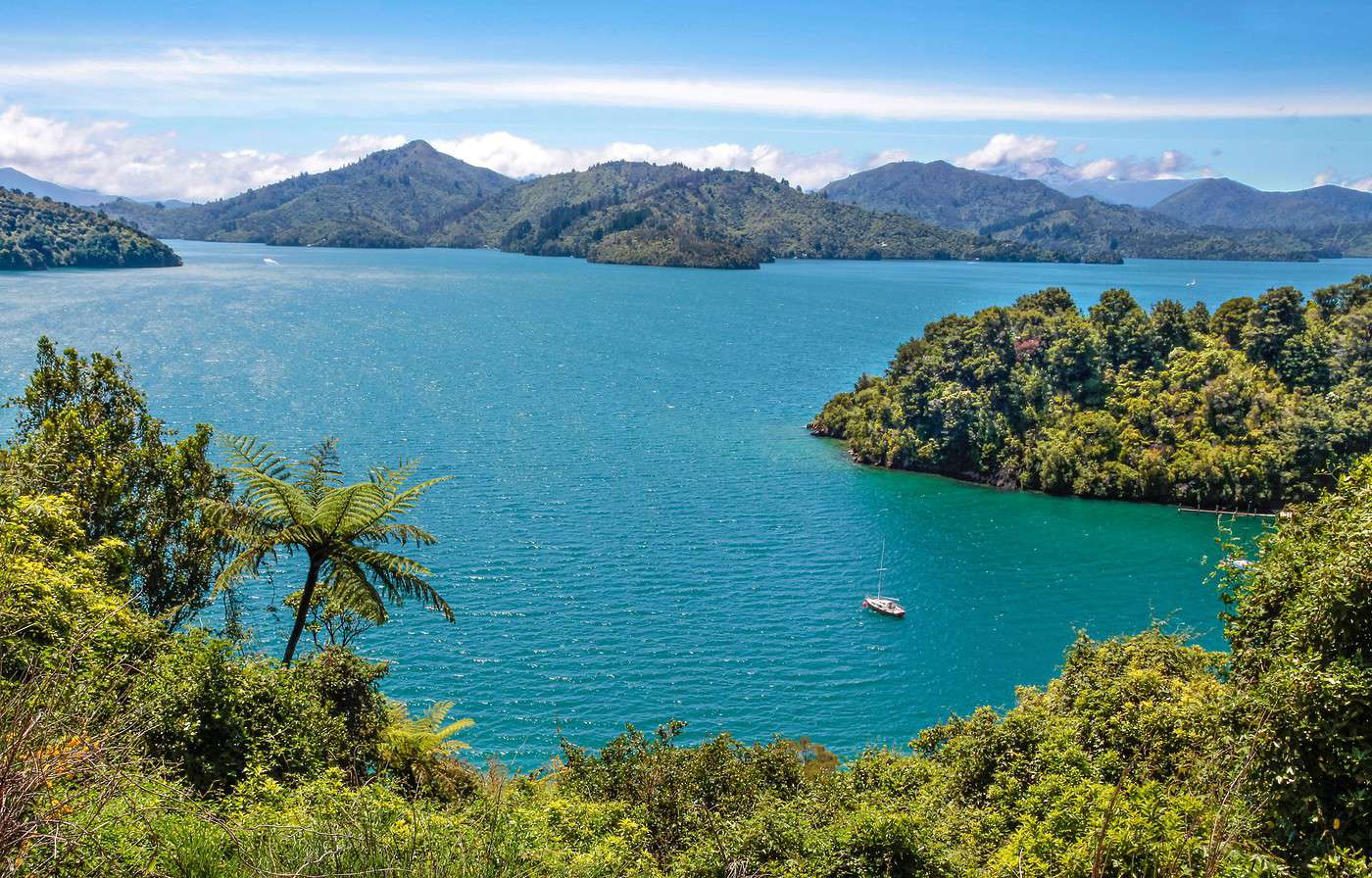
Marlborough Sounds, Nouvelle-Zélande
Marlborough Sounds, Nouvelle-Zélande · © VoyageForum

Larger but far less populated, wilder, and more contrasting than its northern neighbour with its glaciers, fjords, and towering peaks, the South Island is home to many of the country’s must-see natural sites. Starting with Te Wahipounamu, which brings together four of the main parks in the "Southern Alps" and nearly the full range of outdoor activities you could imagine.

Key facts

  • Type de lieu: tourist region.
  • Localisation: one of the country’s two main islands, separated from the North Island by Cook Strait.
  • Heure locale: Heure : South Island
  • Population: 1,096,200 (2016).
  • Superficie: 150,737 km²
  • Point le plus haut: Mount Cook (3,724 m).
  • Point le plus bas: sea level.
  • Littoral:
  • Intérêts (rated ): Nature ; Adventure ; Culture ; Relaxation-holidays
  • Site internet:

Tourist attractions

Cities and their heritage

Beaches and coastline

Nature and activities

Climate and weather on the South Island

Blenheim

The "big city" of the northern part of the South Island, at the heart of the Sauvignon Blanc wine region. Beaches and a few short hikes nearby, plus the Marlborough Sounds not far away.

Overview of Blenheim

It’s the "big city" of the northern part of the South Island, at the heart of the Sauvignon Blanc wine region. Beaches and a few short hikes on its outskirts, not to mention the nearby Marlborough Sounds.

Key facts

  • Type of place: small town.
  • Tourist interest: (worth a stop if you are in the area).
  • Location:
  • Distances:
  • Local time: Heure : 17000.
  • Population: 31,300 inhabitants (2017).
  • Area: 103.89 km².
  • Altitude:

History of Blenheim

What to see and do in Blenheim

Nearby

Climate and weather in Blenheim

Transport

Getting there

Getting around

Accommodation

Eating out

Useful addresses

  1. == Additional information
View guide page: Blenheim

Chatham Islands

A small archipelago 800 km off the coast, consisting of just two inhabited islands. Beautiful landscapes, birdlife, local traditions, and one of the most remote places in the world...

Overview of the Chatham Islands

This is a small archipelago 800 km off the coast, consisting of just two inhabited islands (Chatham, the largest, and Pitt). The area offers beautiful landscapes, birdlife, local traditions, and is one of the most remote places in the world...

Key facts

  • Type of place: archipelago.
  • Tourist interest: (worth seeing).
  • Location:
  • Local time: Heure : 17001
  • Number of islands:
  • Main island:
  • Population: 600 inhabitants (2013).
  • Area: 966 km².
  • Highest point: 299 m.
  • Coastline:

History of the Chatham Islands

Environment of the archipelago

Wildlife and flora

Precautions

What to see and do in the Chatham Islands

In the surrounding area

Climate and weather of the Chatham Islands

Transport

Getting there

Getting around

Accommodation

Food

Useful addresses

Further information

View guide page: Chatham Islands

Christchurch

The largest urban area on New Zealand’s South Island, with a charming city centre recovering from the severe earthquakes of recent years.

Overview of Christchurch

The largest urban area on the South Island with a charming city centre recovering from the severe earthquakes of recent years.

Key facts

  • Type of place: city.
  • Tourist interest: (worth a stop if you are in the area).
  • Location:
  • Distances:
  • Local time: Heure : 17002.
  • Population: 396,700 (2017).
  • Area: 452 km².
  • Altitude: sea level.

History of Christchurch

What to see and do in Christchurch

In the surrounding area

Climate and weather in Christchurch

Transport

Getting there

Getting around

Accommodation

Eating out

Useful addresses

Further information

View guide page: Christchurch

Dunedin

The second city of the South Island, with Scottish roots. It's primarily a lively university city and a gateway to exploring the surrounding areas, including the Otago Peninsula.

Overview of Dunedin

It's the second city of the South Island, with Scottish roots. Above all, it's a lively university city and a gateway to exploring the surrounding areas, including the Otago Peninsula.

Key Facts

  • Type of place: city.
  • Tourist interest: (worth a stop if you are in the area).
  • Location:
  • Distances:
  • Local time: Heure : 17003.
  • Population: 128,800 inhabitants (2017).
  • Area: 255 km².
  • Altitude: sea level.

History of Dunedin

What to See and Do in Dunedin

In the Surrounding Area

Climate and Weather in Dunedin

Transportation

Getting There

Getting Around

Accommodation

Food

Useful Addresses

Further Information

View guide page: Dunedin

Greymouth

It’s the town on the West Coast and primarily a base for discovering the "Pancake Rocks" in Paparoa Park, the recreated mining town of Shantytown, or trying rafting or kayaking.

Overview of Greymouth

Even with fewer than 10,000 residents, it’s THE town on the West Coast. It’s also—and above all—a base for discovering the "Pancake Rocks" in Paparoa Park, the recreated mining town of Shantytown, or trying rafting or kayaking.

Key Details

  • Type of place: small town.
  • Tourist interest: (worth a stop if you are in the area).
  • Location:
  • Distances:
  • Local time: Heure : 17004.
  • Population: 9,690 residents (2017).
  • Area:
  • Altitude: sea level.

History of Greymouth

What to See and Do in Greymouth

Nearby

Climate and Weather in Greymouth

Transportation

Getting There

Getting Around

Accommodation

Dining

Useful Addresses

Additional Information

View guide page: Greymouth

Hanmer Springs

A small thermal village north of Christchurch. All around, plenty of hiking, mountain biking trails, and skiing at the Hanmer Springs Ski Area.

Overview of Hanmer Springs

A small thermal village north of Christchurch. All around, plenty of hiking, mountain biking trails, and skiing at the Hanmer Springs Ski Area.

Key Details

  • Type of place: village.
  • Tourist interest: (worth a stop if you are in the area).
  • Location:
  • Distances:
  • Local time: Heure : 17005.
  • Population: 840 inhabitants (2013).
  • Area:
  • Altitude: 338 m.

History of Hanmer Springs

What to See and Do in Hanmer Springs

In the Surrounding Area

Climate and Weather in Hanmer Springs

Transportation

Getting There

Getting Around

Accommodation

Dining

Useful Addresses

  1. == Additional Information
View guide page: Hanmer Springs

Invercargill

The southernmost city in New Zealand, at the gateway to Fiordland.

Overview of Invercargill

It’s the southernmost city in New Zealand, at the gateway to Fiordland.

Key Facts

  • Type of place: city.
  • Tourist interest: (worth a stop if you are in the area).
  • Location:
  • Distances:
  • Local time: Heure : 17006.
  • Population: 54,800 inhabitants (2017).
  • Area: 389 km².
  • Altitude: sea level.

History of Invercargill

What to See and Do in Invercargill

In the Surrounding Area

Climate and Weather in Invercargill

Transportation

Getting There

Getting Around

Accommodation

Dining

Useful Addresses

  1. == Additional Information
View guide page: Invercargill

Kaikoura

The only settlement along the northeast coast between Christchurch and Blenheim. Beyond being a stop on this route, the town, with its small peninsula, is known for its colonies of seals, dolphins, and especially whales that visit its shores.

Overview of Kaikoura

It is the only settlement along the northeast coast between Christchurch and Blenheim. Beyond being a stop on this route, the town, with its small peninsula, is famous for its colonies of seals, dolphins, and especially whales that visit its shores.

Key Facts

  • Type of place: village.
  • Tourist interest: (worth seeing).
  • Location:
  • Distances:
  • Local time: Heure : 17007.
  • Population: 2,080 inhabitants (2017).
  • Area: 6.78 km².
  • Altitude: sea level.

History of Kaikoura

What to See and Do in Kaikoura

In the Surrounding Area

Climate and Weather in Kaikoura

Transportation

Getting There

Getting Around

Accommodation

Food

Useful Addresses

Additional Information

View guide page: Kaikoura

Nelson

One of New Zealand’s two oldest cities, Nelson features several Victorian buildings in its centre. Thanks to its climate, it attracts many visitors who also come to enjoy its beaches and surroundings (vineyards, natural parks, Marlborough Sounds...).

Overview of Nelson

One of New Zealand’s two oldest cities, Nelson features several Victorian buildings in its centre. Thanks to its climate, it attracts many visitors who also come to enjoy its beaches and surroundings (vineyards, natural parks, Marlborough Sounds...).

Key Facts

  • Type of place: city.
  • Tourist interest: (worth a stop if you are in the area).
  • Location:
  • Distances:
  • Local time: Heure : 17008.
  • Population: 51,400 inhabitants (2017).
  • Area: 445 km².
  • Altitude: sea level.

History of Nelson

What to See and Do in Nelson

In the Surroundings

Climate and Weather in Nelson

Transportation

Getting There

Getting Around

Accommodation

Dining

Useful Addresses

  1. == Additional Information
View guide page: Nelson

Picton

This locality is both the arrival point for ferry lines from the North Island (departing from Wellington) and the gateway to the Marlborough Sounds.

Overview of Picton

This locality is both the arrival point for ferry lines from the North Island (departing from Wellington) and the gateway to the Marlborough Sounds.

Key Facts

  • Type of place: small town.
  • Tourist interest: (worth a stop if you are in the area).
  • Location:
  • Distances:
  • Local time: Heure : 17009.
  • Population: 4,360 inhabitants (2017).
  • Area: 33.79 km².
  • Altitude: sea level.

History of Picton

What to See and Do in Picton

In the Surrounding Area

Climate and Weather in Picton

Transportation

Getting There

Getting Around

Accommodation

Dining

Useful Addresses

Additional Information

View guide page: Picton

Stewart Island

A large, sparsely populated island facing Invercargill, connected by air and ferries. It is home to Rakiura National Park, known for its birdlife and herds of deer, which are hunted here. You can also hike, kayak, or fish.

Overview of Stewart Island

It's a large, sparsely populated island facing Invercargill, connected by air and ferries. It is home to Rakiura National Park, known for its birdlife and herds of deer, which are hunted here. You can also hike, kayak, or fish.

Key Facts

  • Type of place: island.
  • Tourist interest: (worth seeing).
  • Location:
  • Local time: Heure : 17010
  • Main (and only) town: Oban.
  • Population: 381 inhabitants (2013).
  • Area: 1,746 km².
  • Density: 0.22 inhabitants/km².
  • Highest point: Mount Anglem (980 m).
  • Coastline:

History of Stewart Island

Environment of the Island

Wildlife and Flora

Precautions

What to See and Do

In the Surrounding Area

Climate and Weather

Transport

Getting There

Getting Around

Accommodation

Eating Out

Useful Addresses

Further Information

View guide page: Stewart Island

Wanaka

On the shores of the lake of the same name, the town is both a summer (hiking, fishing, rafting, canyoning, and outdoor activities in general) and winter (skiing) tourist resort. It is also the gateway to Mount Aspiring National Park.

Overview of Wanaka

On the shores of the lake of the same name, the town is both a summer (hiking, fishing, rafting, canyoning, and outdoor activities in general) and winter (skiing) tourist resort. It is also the gateway to Mount Aspiring National Park.

Key facts

  • Type of place: small town.
  • Tourist interest: (worth a stop if you are in the area).
  • Location:
  • Distances:
  • Local time: Heure : 17011.
  • Population: 8,460 inhabitants (2017).
  • Area: 28.61 km².
  • Altitude: 290 m.

History of Wanaka

What to see and do in Wanaka

In the surrounding area

Climate and weather in Wanaka

Transport

Getting there

Getting around

Accommodation

Eating

Useful addresses

Further information

View guide page: Wanaka

Abel Tasman National Park

This small coastal reserve on the north coast offers stunning beaches that are highly popular with visitors. Kayaking and hiking along the forested coastline or inland are also possible.

Overview of Abel Tasman National Park

This small coastal reserve on the north coast offers stunning beaches that are highly popular with visitors. Kayaking and hiking along the forested coastline or inland are also possible.

Key details

  • Type of place: national park.
  • Tourist interest: (recommended).
  • Features:
  • Local time: Heure : 17012
  • Annual visitors:
  • Area: 237.1 km².
  • Altitude:

Environment

Landscape of the park

Wildlife and flora

Precautions

Climate and weather

What to see and do

Nearby attractions

Practical information

  • Location:
  • Distances:
  • Opening period:
  • Rates:

Transport

Getting there

Getting around

Accommodation

Food

Additional resources

View guide page: Abel Tasman National Park

Aoraki/Mount Cook National Park

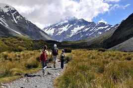
One of the four parks in Te Wahipounamu listed as a UNESCO World Heritage site. It is home to the country's highest peaks and numerous glaciers, including the Tasman Glacier, the largest of New Zealand's nearly 400 glaciers. It is naturally a highly popular destination for its landscapes and outdoor activities (hiking, mountaineering, skiing, etc.).

Overview of Aoraki/Mount Cook National Park

This is one of the four parks in Te Wahipounamu listed as a UNESCO World Heritage site. It is home to the country's highest peaks and numerous glaciers, including the Tasman Glacier, the largest of New Zealand's nearly 400 glaciers. It is naturally a highly popular destination for its landscapes and outdoor activities (hiking, mountaineering, skiing, etc.).

Key Facts

  • Type of place: national park.
  • Tourist interest: (must-see or highly recommended).
  • Features:
  • Local time: Heure : 17013
  • Annual visitors:
  • Area: 707 km².
  • Altitude:

Environment

Landscape of the Park

Wildlife and Flora

Climate and Weather

Precautions

What to See

What to Do

Practical Information

  • Location:
  • Distances:
  • Opening period:
  • Rates:

Getting There

Getting Around

Accommodation and Dining

Nearby Attractions

Additional Information

View guide page: Aoraki/Mount Cook National Park

Arthur's Pass National Park

A beautiful mountainous park in the heart of the island, known for trekking, skiing, and mountaineering.

Overview of Arthur's Pass National Park

This is a beautiful mountainous park in the heart of the island, renowned for trekking, skiing, and mountaineering.

Key Details

  • Type of place: national park.
  • Tourist interest: (worth seeing).
  • Features:
  • Local time: Heure : 17014
  • Annual visitors:
  • Area: 1,184.7 km².
  • Altitude:

Environment

Landscape

Wildlife and flora

Precautions

Climate and weather

What to see and do

Practical information

  • Location:
  • Distances:
  • Opening period:
  • Rates:

Getting there

Getting around

Accommodation and dining

Nearby attractions

  1. == En complément
View guide page: Arthur's Pass National Park

Fiordland National Park

This is the largest and southernmost of the four Te Wahipounamu UNESCO-listed parks. It's a stunning area of fjords (including the famous Milford Sound), along with lakes, waterfalls, and cliffs perfect for hiking, climbing, or hunting.

Overview of Fiordland National Park

This is the largest and southernmost of the four Te Wahipounamu UNESCO-listed parks. It's a stunning area of fjords (including the famous Milford Sound), along with lakes, waterfalls, and cliffs perfect for hiking, climbing, or hunting.

Key Facts

  • Type of place: national park.
  • Tourist interest: (must-see or highly recommended).
  • Features:
  • Local time: Heure : 17015
  • Annual visitors:
  • Area: 12,607 km².
  • Altitude:

Environment

Landscape of the Park

Wildlife and Flora

Climate and Weather

Precautions

What to See

What to Do

Practical Information

  • Location:
  • Distances:
  • Opening period:
  • Rates:

Getting There

Getting Around

Accommodation and Dining

Nearby Attractions

  1. == Additional Information
View guide page: Fiordland National Park

Kahurangi National Park

The second-largest national park in the country. Visitors come for hiking, rafting, and caving.

Overview of Kahurangi Park

It is the second-largest park in New Zealand. Visitors come for hiking, rafting, and caving.

Key Facts

  • Type of place: national park.
  • Tourist interest: (worth seeing).
  • Features:
  • Local time: Heure : 17016
  • Annual visitors:
  • Area: 4,529 km².
  • Altitude:

Environment

Landscape of the Park

Wildlife and Flora

Climate and Weather

Precautions

What to See

What to Do

Practical Information

  • Location:
  • Distances:
  • Opening period:
  • Rates:

Getting There

Getting Around

Accommodation and Dining

Nearby Attractions

  1. == En complément
View guide page: Kahurangi National Park

Marlborough Sounds

A labyrinth of islands (Arapawa, d'Urville...), channels, and peninsulas (Queen Charlotte...) at the northern tip, offering stunning wild landscapes. You can take small cruises, kayak, hike, or spot dolphins and birds.

Overview of Marlborough Sounds

It’s a labyrinth of islands (Arapawa, d'Urville...), channels, and peninsulas (Queen Charlotte...) at the northern tip, offering stunning wild landscapes. You can take small cruises, kayak, hike, or spot dolphins and birds.

Key Details

  • Type of place: sea inlet.
  • Tourist interest: (recommended).
  • Features:
  • Location:
  • Area: 4,000 km².

Environment

What to See and Do

Nearby Attractions

Climate and Weather

Practical Information

Getting There

Getting Around

Accommodation and Dining

Further Reading

View guide page: Marlborough Sounds

Milford Sound

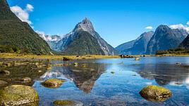
One of the country's top attractions. Located in the UNESCO-listed Fiordland National Park, this stunning fjord draws over half a million visitors each year for its landscapes, whale, dolphin, and seal watching, boat or kayak trips, and numerous hikes, including the famous Milford Track.

Overview of Milford Sound

This is one of the country's top attractions. Located in the UNESCO-listed Fiordland National Park, this stunning fjord draws over half a million visitors each year for its landscapes, whale, dolphin, and seal watching, boat or kayak trips, and numerous hikes, including the famous Milford Track.

Key facts

  • Type of place: fjord.
  • Tourist interest: (recommended).
  • Features:
  • Length: 15 km.
  • Depth:

Fjord environment

Precautions

Climate and weather

What to see and do

Practical information

  • Location:
  • Distances:

Getting there

Getting around

Accommodation and dining

Nearby attractions

Further reading

View guide page: Milford Sound

Mount Aspiring National Park

This mountainous park on the west coast, not far from Wanaka, is part of the Te Wahipounamu UNESCO World Heritage area. Hiking and climbing are popular here, set against a stunning backdrop of mountains, forests, and waterfalls.

Overview of Mount Aspiring National Park

This mountainous park on the west coast, not far from Wanaka, is part of the Te Wahipounamu UNESCO World Heritage area. Hiking and climbing are popular here, set against a stunning backdrop of mountains, forests, and waterfalls.

Key facts

  • Type of place: national park.
  • Tourist interest: (worth seeing).
  • Features:
  • Local time: Heure : 17019
  • Annual visitors:
  • Area: 3,562 km².
  • Altitude:

Environment

Landscape of the park

Wildlife and flora

Climate and weather

Precautions

What to see

What to do

Practical information

  • Location:
  • Distances:
  • Opening period:
  • Rates:

Getting there

Getting around

Accommodation and dining

Nearby attractions

  1. == En complément
View guide page: Mount Aspiring National Park

Nelson Lakes National Park

South of the city of the same name, two large lakes and smaller ones popular for fishing, hiking, and camping. You can also ski at Rainbow Ski Area.

Overview of Nelson Lakes Park

South of the city of the same name, these are two large lakes and smaller ones popular for fishing, hiking, and camping. You can also ski at Rainbow Ski Area.

Key Details

  • Type of place: national park.
  • Tourist interest: (worth a stop if you are in the area).
  • Features:
  • Local time: Heure : 17020
  • Annual visitors:
  • Area: 1,018.8 km².
  • Altitude:

Environment

Landscape of the Park

Wildlife and Flora

Climate and Weather

Precautions

What to See

What to Do

Practical Information

  • Location:
  • Distances:
  • Opening period:
  • Rates:

Getting There

Getting Around

Accommodation and Dining

Nearby Attractions

  1. == En complément
View guide page: Nelson Lakes National Park

Paparoa National Park

This park on the northwest coast is famous for its "Pancake Rocks", spectacular rock formations, and numerous caves. You can hike and go caving here.

Overview of Paparoa Park

This park on the northwest coast is famous for its "Pancake Rocks", spectacular rock formations, and numerous caves. You can hike and go caving here.

Key Details

  • Type of place: national park.
  • Tourist interest: (worth seeing).
  • Features:
  • Local time: Heure : 17022
  • Annual visitors:
  • Area: 429.7 km².
  • Altitude:

Environment

Landscape of the Park

Wildlife and Flora

Climate and Weather

Precautions

What to See

What to Do

Practical Information

  • Location:
  • Distances:
  • Opening period:
  • Rates:

Getting There

Getting Around

Accommodation and Dining

Nearby Attractions

  1. == En complément
View guide page: Paparoa National Park

Te Wahipounamu

This name encompasses four natural parks in the Southern Alps of the South Island: Fiordland, Mount Cook, Mount Aspiring, and Westland. The area is a UNESCO World Heritage site, renowned for its stunning mountain landscapes, forests, glaciers, waterfalls, lakes, and fjords. A wide range of outdoor and nature-based activities are available here. Introduction to Te Wahipounamu Climate and Weather in Te Wahipounamu Things to See and Do in Te Wahipounamu Practical Information for Te Wahipounamu

Further Information

View guide page: Te Wahipounamu

Introduction to Te Wahipounamu

Overview

This name brings together four natural parks in the Southern Alps of the South Island: Fiordland, Mount Cook, Mount Aspiring, and Westland. The area is a UNESCO World Heritage site for its stunning mountain landscapes, forests, glaciers, waterfalls, lakes, and fjords. Plenty of outdoor and nature-based activities are available here.

Key Details

  • Type de lieu: major national park.
  • Intérêt touristique: (must-see or highly recommended).
  • Caractéristiques:
  • Localisation:
  • Distances:
  • Heure locale: Heure : 17023
  • Fréquentation annuelle:
  • Superficie: 26,000 km².

The Four Parks

Parc national Aoraki/Mont Cook, Nouvelle-Zélande
Aoraki/Mount Cook National Park
One of the four parks in Te Wahipounamu listed as a UNESCO World Heritage site. It is home to the country's highest peaks and numerous glaciers, including the Tasman Glacier, the largest of New Zealand's nearly 400 glaciers. It is naturally a highly popular destination for its landscapes and outdoor activities (hiking, mountaineering, skiing, etc.).
Parc national de Fiordland, Nouvelle-Zélande
Fiordland National Park
This is the largest and southernmost of the four Te Wahipounamu UNESCO-listed parks. It's a stunning area of fjords (including the famous Milford Sound), along with lakes, waterfalls, and cliffs perfect for hiking, climbing, or hunting.
Parc national du mont Aspiring, Nouvelle-Zélande
Mount Aspiring National Park
This mountainous park on the west coast, not far from Wanaka, is part of the Te Wahipounamu UNESCO World Heritage area. Hiking and climbing are popular here, set against a stunning backdrop of mountains, forests, and waterfalls.
Parc national Westland Tai Poutini, Nouvelle-Zélande
Westland Tai Poutini National Park
One of the four parks in Te Wahipounamu listed as a UNESCO World Heritage site. Stunning mountain and glacier landscapes (Franz Josef Glacier, Fox Glacier) and opportunities for hiking or outdoor sports. Also, on its outskirts, a few former gold-rush mining towns.

Environment

Landscape of the Parks

Wildlife and Flora

Precautions

View guide page: Introduction to Te Wahipounamu

Climate and Weather in Te Wahipounamu

Climate Overview

Best Climate Period

Jan.Feb.Mar.Apr.MayJun.Jul.Aug.Sep.Oct.Nov.Dec.
Climate

: very favorable | : favorable | : moderately favorable | : unfavorable.

Climate and Forecasts

Further Information

View guide page: Climate and Weather in Te Wahipounamu

Practical Information for Te Wahipounamu

Practical Info

  • Opening period:
  • Rates:
  • Website:

Getting There

Distances

Getting Around

Sleeping

Eating

View guide page: Practical Information for Te Wahipounamu

The Catlins

This is the small region in the far south-east of the island, between Dunedin and Invercargill. Sparsely populated, with rolling hills and forests, it offers stunning coastal scenery, caves, and opportunities for trekking or surfing. You can also observe many bird species as well as seals, sea lions, and more.

Overview of The Catlins

This is the small region in the far south-east of the island, between Dunedin and Invercargill. Sparsely populated, with rolling hills and forests, it offers stunning coastal scenery, caves, and opportunities for trekking or surfing. You can also observe many bird species as well as seals, sea lions, and more.

Key Facts

  • Type of place: secondary tourist region.
  • Tourist interest: (worth seeing).
  • Location:
  • Local time: Heure : 17024
  • Main town: Owaka.
  • Population: approx. 1,200 inhabitants.
  • Area: 1,900 km².
  • Highest point:
  • Lowest point: sea level.
  • Coastline:

Climate and Weather

Main Towns

Tourist Attractions

Towns and Heritage

Beaches and Coastline

Nature and Activities

Transport

Getting There

Getting Around

Accommodation

Food

Further Information

View guide page: The Catlins

Westland Tai Poutini National Park

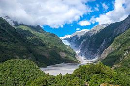
One of the four parks in Te Wahipounamu listed as a UNESCO World Heritage site. Stunning mountain and glacier landscapes (Franz Josef Glacier, Fox Glacier) and opportunities for hiking or outdoor sports. Also, on its outskirts, a few former gold-rush mining towns.

Overview of Westland Tai Poutini Park

One of the four parks in Te Wahipounamu listed as a UNESCO World Heritage site. Stunning mountain and glacier landscapes (Franz Josef Glacier, Fox Glacier) and opportunities for hiking or outdoor sports. Also, on its outskirts, a few former gold-rush mining towns.

Key Facts

  • Type of place: national park.
  • Tourist interest: (recommended).
  • Features:
  • Local time: Heure : 17025
  • Annual visitors:
  • Area: 1,175 km².
  • Altitude:

Environment

Landscape of the park

Wildlife and flora

Precautions

Climate and weather

What to see and do

Nearby

Practical information

  • Location:
  • Distances:
  • Opening period:
  • Rates:

Transport

Getting there

Getting around

Accommodation

Food

Further reading

View guide page: Westland Tai Poutini National Park

Queenstown (New Zealand)

A small town on the shores of Lake Wakatipu that has developed an "adventure tourism" scene. You can try bungee jumping, rafting, aerial sports, skiing (at four resorts), and of course hiking in its stunning mountainous surroundings.

Overview of Queenstown

A small town on the shores of Lake Wakatipu that has developed an "adventure tourism" scene. You can try bungee jumping, rafting, aerial sports, skiing (at four resorts), and of course hiking in its stunning mountainous surroundings.

Key facts

  • Type of place: small town.
  • Tourist interest: (worth a stop if you are in the area).
  • Location:
  • Distances:
  • Local time: Heure : 17026.
  • Population: 15,300 inhabitants (2017).
  • Area: 25.55 km².
  • Altitude: 310 m.

History of Queenstown

What to see and do in Queenstown

In the surrounding area

Climate and weather in Queenstown

Transport

Getting there

Getting around

Accommodation

Food

Useful addresses

Further information

View guide page: Queenstown (New Zealand)

Otago Peninsula

This peninsula near Dunedin offers stunning coastal scenery and abundant marine wildlife, including seals, penguins, and elephant seals.

Overview of the Otago Peninsula

This peninsula near Dunedin has beautiful coastal landscapes and a rich marine wildlife, including seals, penguins, and elephant seals.

Key Details

  • Type of place: peninsula.
  • Tourist interest: (worth a stop if you are in the area).
  • Location:
  • Local time: Heure : 19806.
  • Area:
  • Altitude:

Environment of the Peninsula

Wildlife and Flora

Precautions

What to See and Do

Nearby

Climate and Weather

Transportation

Getting There

Getting Around

Accommodation and Dining

Additional Information

View guide page: Otago Peninsula

Banks Peninsula

The peninsula is located next to Christchurch, with the sea, cliffs, beautiful landscapes, and small villages along a coastal road.

Overview of Banks Peninsula

The peninsula is located next to Christchurch, with the sea, cliffs, beautiful landscapes, and small villages along a coastal road.

Key Features

  • Type of place: peninsula.
  • Tourist interest: (worth seeing).
  • Location:
  • Local time: Heure : 19807.
  • Area: 1,150 km².
  • Altitude:

Environment of Banks Peninsula

Wildlife and flora

Precautions

What to see and do

In the surrounding area

Climate and weather

Transportation

Getting there

Getting around

Accommodation and dining

Additional information

View guide page: Banks Peninsula

Something wrong or out of date? Report this page