Skip to content
What to See in Venezuela

Travel guide · Venezuela

What to See in Venezuela

last edited Dec 11, 2019

UNESCO World Heritage Sites

Venezuela has 3 sites listed as UNESCO World Heritage Sites:

University City of Caracas (2000)
The site is a UNESCO World Heritage Site for its modern architectural and urban planning quality.
Coro (1993)
It was the country's first capital. From that era, it has preserved magnificent colorful colonial architecture, which has earned it UNESCO World Heritage status. Nearby, the Coro Dunes and the Paraguaná Peninsula are worth visiting.
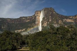
Parc national Canaima, Venezuela
Canaima National Park (1994)
This vast and stunning UNESCO-listed park on the borders of Brazil and Guyana requires a guide to visit. It is also home to the famous Angel Falls.

The Coast and Islands

Caracas
Venezuela’s capital is a modern city with a few historic buildings, parks, and museums. Its university, founded in 1721, is a UNESCO World Heritage site. On a less positive note, the city is also known for its high levels of danger and crime.
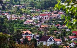
Colonia Tovar, Venezuela
Colonia Tovar
In the mountains around Caracas, this small tourist town at 1,800 meters above sea level, founded by Germans in the 19th century, recreates the atmosphere, traditions, culture, and architecture of a Bavarian village—so much so that it has become quite touristy.
Coro
It was the country's first capital. From that era, it has preserved magnificent colorful colonial architecture, which has earned it UNESCO World Heritage status. Nearby, the Coro Dunes and the Paraguaná Peninsula are worth visiting.
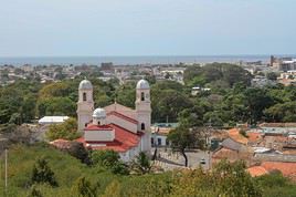
Cumana, Venezuela
Cumaná
The first European settlement on the South American continent. The city, surrounded by beautiful beaches, still preserves an old Spanish fort and various other traces of its colonial past.
Maracaibo
It is the country’s second-largest urban area. Built on the shores of the lagoon of the same name, it sees few tourists despite its small historic centre.
Maracay
It is one of the country's largest cities, with around one million inhabitants. It is located west of Caracas.
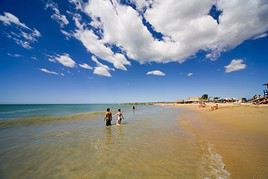
Margarita, Venezuela
Margarita Island
A major tourist destination, Margarita Island still attracts some visitors despite the country's current context, thanks to its beautiful beaches and landscapes, water activities, charming colonial-style capital, and its duty-free shopping opportunities. The island is large, so you'll find both busy areas and wilder spots.
Puerto Colombia
A fishing village west of Caracas known for the beauty of its beaches, including those in Choroni.
Puerto la Cruz
Along with its neighbor Barcelona, the city forms the largest urban area on the eastern coast. It’s a destination for beaches or exploring the nearby islands.
Valencia
It is the third-largest city in Venezuela with around 2 million inhabitants.

Natural Heritage

Los Roques, Venezuela
Los Roques
Off the coast, facing Caracas, this archipelago, which is also a national park, is a stunning spot for beaches, diving, or observing turtles and local wildlife.
Lake Maracaibo
This is the largest lake in Latin America, on the shores of which the city of the same name is built. The oil industry here is nothing short of thriving.
El Avila National Park
This mountain overlooking the capital is accessible by cable car. It’s a popular spot for panoramic views and hiking.
El Guacharo National Park
This is a vast cave known for housing a unique bird species, the oilbird.
Henri Pittier National Park
Just a few dozen kilometres west of Caracas, this stunning small park where sea, mountains, and tropical forest meet is home to a rich variety of wildlife (birds, snakes, pumas, etc.).
Los Medanos de Coro National Park
This strip of land separating the city of Coro and the Paraguana Peninsula is a sand desert with towering dunes like those in the Sahara.
Mochima National Park
A lovely terrestrial and marine park near Puerto la Cruz. It blends jungle, cliff, and beach landscapes. Scuba diving is available.
Morrocoy National Park
A stunning coastal park with beautiful beaches, small islands, and boat trips.
Paraguaná Peninsula
This arid peninsula north of Coro offers beautiful beaches and great opportunities for water activities. The area is also duty-free for shopping.
Paria Peninsula
At the far east of Venezuela, facing Trinidad and Tobago, this peninsula is known for its magnificent beaches and landscapes.

The Interior and Plains

Ciudad Bolívar
A large city in the south with some colonial buildings located on the Orinoco River. It's primarily a stopover on the way to Brazil or Angel Falls.
Ciudad Guayana
It’s the major city (industrial) in the south, on the Orinoco Delta.
Puerto Ayacucho
On the Colombian border, this town steeped in indigenous culture serves as a base for exploring the surrounding area and the forest, or for boat trips on the Orinoco and other rivers.
Santa Elena
Officially called Santa Elena de Uairén, it is a town on the border with Brazil from where you can set off to explore Canaima National Park.

Natural Heritage
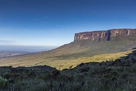
Gran Sabana, Venezuela
Gran Sabana
This sparsely populated high plateau in the southeast is one of Venezuela’s most spectacular regions, with its famous tepuis (table-top mountains). It is home to stunning sites like Canaima National Park, Angel Falls, and Mount Roraima.
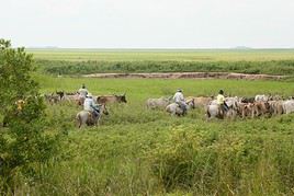
Llanos, Venezuela
Llanos
This is a vast expanse of grasslands and marshes covering much of the west-central part of the country. Beyond herds of livestock, you can spot a fairly rich local wildlife (anacondas, crocodiles, birds…).
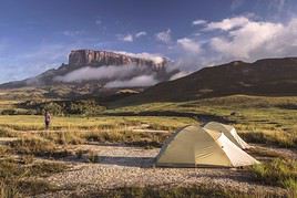
Mont Roraima, Venezuela
Mount Roraima
This large table mountain (flat-topped) is located at the intersection of Guyana, Venezuela, and Brazil. You can reach its summit (2,810 m) via a multi-day trek (from Venezuela only) and enjoy an extraordinary panorama from the top.
Parc national Canaima, Venezuela
Canaima National Park
This vast and stunning UNESCO-listed park on the borders of Brazil and Guyana requires a guide to visit. It is also home to the famous Angel Falls.
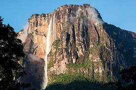
Salto Angel, Venezuela
Angel Falls
At 979 m, these are the world's tallest waterfalls. They are accessible after a stunning journey through Canaima National Park.

The Andes

Mérida
The main city in the Andes, at an altitude of 1,600 m. While it has beautiful parks, museums, and colonial buildings, its appeal lies primarily in its surroundings, including Pico Bolívar and several stunning natural parks (Sierra Nevada, La Culata, Tapo-Caparo) ideal for outdoor activities like trekking.
San Cristóbal
It's the second-largest city in the Venezuelan Andes, near the Colombian border.

Natural Heritage

Parc national Sierra Nevada, Venezuela
Sierra Nevada National Park
This is the site of Pico Bolívar (4,972 m), right next to Mérida. It is also a traditional habitat for pumas and spectacled bears.
Pico Bolívar
The summit of the Venezuelan Andes is (almost) accessible by cable car from the city of Mérida. It can also be reached on foot.

Must-see & highly recommended

★★★★

Gran Sabana

This sparsely populated high plateau in the southeast is one of Venezuela’s most spectacular regions, with its famous tepuis…
★★★★

Mount Roraima

This large table mountain (flat-topped) is located at the intersection of Guyana, Venezuela, and Brazil. You can reach its summit (2,810 m)…
★★★★

Canaima National Park

This vast and stunning UNESCO-listed park on the borders of Brazil and Guyana requires a guide to visit. It is also home to the famous…
★★★★

Angel Falls

At 979 m, these are the world's tallest waterfalls. They are accessible after a stunning journey through Canaima National Park.

Recommended

★★★

Coro

It was the country's first capital. From that era, it has preserved magnificent colorful colonial architecture, which has earned it UNESCO…
★★★

Los Roques

Off the coast, facing Caracas, this archipelago, which is also a national park, is a stunning spot for beaches, diving, or observing…
★★★

Margarita Island

A major tourist destination, Margarita Island still attracts some visitors despite the country's current context, thanks to its beautiful…
★★★

Henri Pittier National Park

Just a few dozen kilometres west of Caracas, this stunning small park where sea, mountains, and tropical forest meet is home to a rich…
★★★

Sierra Nevada National Park (Venezuela)

This is the site of Pico Bolívar (4,972 m), right next to Mérida. It is also a traditional habitat for pumas and spectacled bears.

Worth a look / Other

★★

Colonia Tovar

In the mountains around Caracas, this small tourist town at 1,800 meters above sea level, founded by Germans in the 19th century, recreates…
★★

Cumaná

The first European settlement on the South American continent. The city, surrounded by beautiful beaches, still preserves an old Spanish…
★★

Llanos

This is a vast expanse of grasslands and marshes covering much of the west-central part of the country. Beyond herds of livestock, you can…
★★

Mérida (Venezuela)

The main city in the Andes, at an altitude of 1,600 m. While it has beautiful parks, museums, and colonial buildings, its appeal lies…
★★

Morrocoy National Park

A stunning coastal park with beautiful beaches, small islands, and boat trips.
★★

Los Medanos de Coro National Park

This strip of land separating the city of Coro and the Paraguana Peninsula is a sand desert with towering dunes like those in the Sahara.
★★

Mochima National Park

A lovely terrestrial and marine park near Puerto la Cruz. It blends jungle, cliff, and beach landscapes. Scuba diving is available.
★★

Paraguaná Peninsula

This arid peninsula north of Coro offers beautiful beaches and great opportunities for water activities. The area is also duty-free for…
★★

Paria Peninsula

At the far east of Venezuela, facing Trinidad and Tobago, this peninsula is known for its magnificent beaches and landscapes.
★★

Pico Bolívar

The summit of the Venezuelan Andes is (almost) accessible by cable car from the city of Mérida. It can also be reached on foot.
★★

Puerto Colombia

A fishing village west of Caracas known for the beauty of its beaches, including those in Choroni.
★

Caracas

Venezuela’s capital is a modern city with a few historic buildings, parks, and museums. Its university, founded in 1721, is a UNESCO…
★

University City of Caracas

The site is a UNESCO World Heritage Site for its modern architectural and urban planning quality.
★

Ciudad Bolívar

A large city in the south with some colonial buildings located on the Orinoco River. It's primarily a stopover on the way to Brazil or…
★

Ciudad Guayana

It’s the major city (industrial) in the south, on the Orinoco Delta.
★

Lake Maracaibo

This is the largest lake in Latin America, on the shores of which the city of the same name is built. The oil industry here is nothing…
★

Maracaibo

It is the country’s second-largest urban area. Built on the shores of the lagoon of the same name, it sees few tourists despite its…
★

Maracay

It is one of the country's largest cities, with around one million inhabitants. It is located west of Caracas.
★

El Avila National Park

This mountain overlooking the capital is accessible by cable car. It’s a popular spot for panoramic views and hiking.
★

El Guacharo National Park

This is a vast cave known for housing a unique bird species, the oilbird.
★

Puerto Ayacucho

On the Colombian border, this town steeped in indigenous culture serves as a base for exploring the surrounding area and the forest, or for…
★

Puerto la Cruz

Along with its neighbor Barcelona, the city forms the largest urban area on the eastern coast. It’s a destination for beaches or…
★

San Cristóbal (Venezuela)

It's the second-largest city in the Venezuelan Andes, near the Colombian border.
★

Santa Elena

Officially called Santa Elena de Uairén, it is a town on the border with Brazil from where you can set off to explore Canaima National Park.
★

Valencia (Venezuela)

It is the third-largest city in Venezuela with around 2 million inhabitants.

Margarita Island

A major tourist destination, Margarita Island still attracts some visitors despite the country's current context, thanks to its beautiful beaches and landscapes, water activities, charming colonial-style capital, and its duty-free shopping opportunities. The island is large, so you'll find both busy areas and wilder spots.

Overview of Margarita Island

A major tourist destination, Margarita Island, nicknamed the "Pearl of the Caribbean", still attracts some visitors despite the country's current context, thanks to its beautiful beaches and landscapes, water activities, charming small colonial-style capital, and its duty-free shopping opportunities. The island is large, so you'll find both busy areas and wilder spots.

Key Facts

  • Type of place: island.
  • Tourist interest: (recommended).
  • Location:
  • Local time: Heure : 2774
  • Main locality: Porlamar (145,000 inhabitants).
  • Population: 676,454 inhabitants (2017).
  • Area: 1,020 km².
  • Highest point: Cerro Grande (920 m).
  • Coastline:

History of Margarita Island

Island Environment

Wildlife and Flora

Precautions

What to See and Do on Margarita Island

In the Surrounding Area

Climate and Weather on Margarita Island

Transportation

Getting There

Getting Around

Accommodation

Dining

Useful Addresses

Further Reading

View guide page: Margarita Island

Mount Roraima

This large table mountain (flat-topped) is located at the intersection of Guyana, Venezuela, and Brazil. You can reach its summit (2,810 m) via a multi-day trek (from Venezuela only) and enjoy an extraordinary panorama from the top.

Overview of Mount Roraima

This large table mountain (flat-topped) is located at the intersection of Guyana, Venezuela, and Brazil. You can reach its summit (2,810 m) via a multi-day trek (from Venezuela only) and enjoy an extraordinary panorama from the top.

Key details

  • Type of place: mountain.
  • Tourist interest: (must-see or highly recommended).
  • Features:
  • Massif:
  • Summit: 2,810 m.

Mount Roraima's environment

Wildlife and flora

Climate and weather

Precautions

What to see and do

Practical information

  • Location:
  • Distances:

Getting there

Accommodation and dining

What to see nearby

Further reading

View guide page: Mount Roraima

Caracas

Venezuela’s capital is a modern city with a few historic buildings, parks, and museums. Its university, founded in 1721, is a UNESCO World Heritage site. On a less positive note, the city is also known for its high levels of danger and crime. Overview of Caracas Climate and Weather in Caracas What to See in Caracas Things to Do in Caracas Flying to Caracas Getting to Caracas by Land Getting Around Caracas Sleeping and Eating in Caracas Living in Caracas

Further Information

View guide page: Caracas

Overview of Caracas

Overview of Caracas

Venezuela’s capital is a modern city with a few historic buildings, parks, and museums. Its university, founded in 1721, is a UNESCO World Heritage site. On a less positive note, the city is also known for its high levels of danger and crime.

Key Facts

  • Type of place: city.
  • Tourist interest: (worth a stop if you are in the area).
  • Location:
  • Distances:
  • Local time: Heure : 20547.
  • Population: 1,943,901 inhabitants and 2.4 million for the metropolitan area (2012).
  • Area: 777.1 km².
  • Altitude: from 870 to 1,400 m.

History of Caracas

Precautions

Useful Addresses

  • Tourist Office:

Services

  • Local agencies:
  • Banks:
  • Hospital:
  • Internet:
  • Laundries:
  • Vehicle rental:
  • Post office:
View guide page: Overview of Caracas

Climate and Weather in Caracas

Climate Overview

Best Time to Visit Caracas

Jan.Feb.Mar.Apr.MayJun.Jul.Aug.Sep.Oct.Nov.Dec.
Climate

Climate and Forecast

Additional Information

View guide page: Climate and Weather in Caracas

What to See in Caracas

Overview

UNESCO World Heritage Sites

University City of Caracas
The site is a UNESCO World Heritage Site for its modern architectural and urban planning quality.

Neighborhoods

Sites, Monuments, and Architectural Ensembles

Religious Buildings

Museums

Parks and Gardens

In the Surrounding Area

Further Reading

View guide page: What to See in Caracas

University City of Caracas

The site is a UNESCO World Heritage Site for its modern architectural and urban planning quality.

Overview of the University City of Caracas

The site is a UNESCO World Heritage Site for its modern architectural and urban quality.

  • Tourist interest: (worth a stop if you are in the area).

History of the University City of Caracas

What to see and do

Practical information

  • Location:
  • Local time: Heure : 20580.
  • Opening hours:
  • Price: free.

Transport

Accommodation and dining

Nearby attractions

  1. == En complément
View guide page: University City of Caracas

Flying to Caracas

Caracas Airport

Airport details

  • Name: Aeropuerto Internacional de Maiquetía-Simón Bolívar.
  • IATA code: CCS
  • Hub:
  • Number of terminals: 1.
  • Annual passenger capacity:
  • Passenger traffic: 5,000,000 (2015).
  • Distance from city centre: 21 km north of the city.

Services

Sleeping at the airport

Transport to the city centre

Other nearby airports

From the rest of the country

From the rest of the Americas

From Europe

Additional information

View guide page: Flying to Caracas

Colonia Tovar

In the mountains around Caracas, this small tourist town at 1,800 meters above sea level, founded by Germans in the 19th century, recreates the atmosphere, traditions, culture, and architecture of a Bavarian village—so much so that it has become quite touristy.

Overview of Colonia Tovar

In the mountains around Caracas, this small tourist town at 1,800 meters above sea level, founded by Germans in the 19th century, recreates the atmosphere, traditions, culture, and architecture of a Bavarian village—so much so that it has become quite touristy.

Key Facts

  • Type of place: village.
  • Tourist interest: (worth seeing).
  • Location:
  • Distances:
  • Local time: Heure : 20548.
  • Population: 21,000 inhabitants (2016).
  • Area: 250 km².
  • Altitude: 1,800 m.

History of Colonia Tovar

What to See and Do in Colonia Tovar

In the Surrounding Area

Climate and Weather

Transportation

Getting There

Getting Around

Accommodation

Dining

Useful Addresses

Further Reading

View guide page: Colonia Tovar

Coro

It was the country's first capital. From that era, it has preserved magnificent colorful colonial architecture, which has earned it UNESCO World Heritage status. Nearby, the Coro Dunes and the Paraguaná Peninsula are worth visiting.

Overview of Coro

It was the first capital of Venezuela. From that era, it has preserved magnificent colorful colonial architecture, which has earned it UNESCO World Heritage status. Nearby, the Coro Dunes and the Paraguaná Peninsula are worth visiting.

Key Facts

  • Type of place: city.
  • Tourist interest: (recommended).
  • Location:
  • Distances:
  • Local time: Heure : 20549.
  • Population: 284,266 inhabitants (2012).
  • Area: 44 km².
  • Altitude: 17 m.

History of Coro

What to See and Do in Coro

In the Surrounding Area

Climate and Weather in Coro

Transportation

Getting There

Getting Around

Accommodation

Food

Useful Addresses

Additional Information

View guide page: Coro

Cumaná

The first European settlement on the South American continent. The city, surrounded by beautiful beaches, still preserves an old Spanish fort and various other traces of its colonial past.

Overview of Cumaná

This was once the first European settlement on the South American continent. The city, surrounded by beautiful beaches, still preserves an old Spanish fort and various other traces of its colonial past.

Key facts

  • Type of place: city.
  • Tourist interest: (worth seeing).
  • Location:
  • Distances:
  • Local time: Heure : 20550.
  • Population: 423,546 inhabitants (2016).
  • Area: 598 km².
  • Altitude: sea level.

History of Cumaná

What to see and do in Cumaná

In the surrounding area

Climate and weather in Cumaná

Transportation

Getting there

Getting around

Accommodation

Eating

Useful addresses

Further reading

View guide page: Cumaná

Maracaibo

It is the country’s second-largest urban area. Built on the shores of the lagoon of the same name, it sees few tourists despite its small historic centre.

Overview of Maracaibo

It is the second-largest urban area in Venezuela. Built on the shores of the lagoon of the same name, it sees few tourists despite its small historic centre.

Key facts

  • Type of place: large city.
  • Tourist interest: (worth a stop if you are in the area).
  • Location:
  • Distances:
  • Local time: Heure : 20551.
  • Population: 1,653,000 inhabitants (2015).
  • Area: 1,393 km².
  • Altitude: 6 m.

History of Maracaibo

What to see and do in Maracaibo

In the surrounding area

Climate and weather

Transport

Getting there

Getting around

Where to stay

Where to eat

Useful addresses

Further information

View guide page: Maracaibo

Maracay

It is one of the country's largest cities, with around one million inhabitants. It is located west of Caracas.

Overview of Maracay

It is one of the country's largest cities, with around one million inhabitants. It is located west of Caracas.

Key Facts

  • Type of place: landmark town.
  • Tourist interest: (worth a stop if you are in the area).
  • Location:
  • Distances:
  • Local time: Heure : 20552.
  • Population: 955,362 inhabitants (2012).
  • Area: 911.57 km².
  • Altitude: 436 m.
  • Website:

History of Maracay

What to See and Do in Maracay

In the Surrounding Area

Climate and Weather in Maracay

Transportation

Getting There

Getting Around

Accommodation

Dining

Useful Addresses

Further Information

View guide page: Maracay

Puerto Colombia

A fishing village west of Caracas known for the beauty of its beaches, including those in Choroni.

Overview of Puerto Colombia

A fishing village west of Caracas known for the beauty of its beaches, including those in Choroni.

Key Details

  • Type of place: village.
  • Tourist interest: (worth seeing).
  • Location:
  • Distances:
  • Local time: Heure : 20553.
  • Population:
  • Area:
  • Altitude: sea level.
  • Website:

History of Puerto Colombia

What to See and Do in Puerto Colombia

In the Surrounding Area

Climate and Weather

Transportation

Getting There

Getting Around

Accommodation

Dining

Useful Addresses

Further Information

View guide page: Puerto Colombia

Puerto la Cruz

Along with its neighbor Barcelona, the city forms the largest urban area on the eastern coast. It’s a destination for beaches or exploring the nearby islands.

Overview of Puerto la Cruz

Along with its neighbor Barcelona, the city forms the largest urban area on the eastern coast of Venezuela. It’s a destination for beaches or exploring the nearby islands.

Key Facts

  • Type of place: city.
  • Tourist interest: (worth a stop if you are in the area).
  • Location:
  • Distances:
  • Local time: Heure : 20554.
  • Population: 454,312 inhabitants (2014)
  • Area: 244 km².
  • Altitude: sea level.

History of Puerto la Cruz

What to See and Do

In the Surrounding Area

Climate and Weather

Transportation

Getting There

Getting Around

Accommodation

Food

Useful Addresses

Further Information

View guide page: Puerto la Cruz

Valencia (Venezuela)

It is the third-largest city in Venezuela with around 2 million inhabitants.

Overview of Valencia

Valencia is the third-largest city in Venezuela with around 2 million inhabitants.

Key Facts

  • Type of place: landmark town.
  • Tourist interest: (worth a stop if you are in the area).
  • Location:
  • Distances:
  • Local time: Heure : 20555.
  • Population: 1,827,165 inhabitants (2010).
  • Area: 1,578 km².
  • Altitude: 520 m.

History of Valencia

What to See and Do in Valencia

In the Surrounding Area

Climate and Weather in Valencia

Transportation

Getting There

Getting Around

Where to Stay

Where to Eat

Useful Addresses

Further Information

View guide page: Valencia (Venezuela)

Los Roques

Off the coast, facing Caracas, this archipelago, which is also a national park, is a stunning spot for beaches, diving, or observing turtles and local wildlife.

Overview of Los Roques

Off the coast, facing Caracas, this archipelago, which is also a national park, is a stunning spot for beaches, diving, or observing turtles and local wildlife.

Key Details

  • Type of place: archipelago.
  • Tourist interest: (recommended).
  • Location:
  • Local time: Heure : 20556
  • Number of islands: around 350.
  • Main island: Cayo Grande.
  • Population: 3,100 inhabitants, mainly on Gran Roque (2014).
  • Area: 40.61 km².
  • Highest point:
  • Coastline:

History of Los Roques

Environment of the Archipelago

Wildlife and Flora

Precautions

What to See and Do in Los Roques

In the Surrounding Area

Climate and Weather

Transportation

Getting There

Getting Around

Accommodation

Food

Useful Addresses

Further Information

View guide page: Los Roques

Lake Maracaibo

This is the largest lake in Latin America, on the shores of which the city of the same name is built. The oil industry here is nothing short of thriving.

Overview of Lake Maracaibo

This is the largest lake in Latin America, on the shores of which the city of the same name is built. The oil industry here is nothing short of thriving.

Key facts

  • Type de lieu: lake.
  • Intérêt touristique: (worth a stop if you are in the area).
  • Caractéristiques:
  • Superficie: 13,210 km².
  • Altitude: sea level.

Lake environment

Wildlife and vegetation

Climate and weather

Precautions

What to see and do

Practical information

  • Localisation:
  • Distances:
  • Site internet:

Getting there

Sleeping and eating

What to see nearby

Further reading

View guide page: Lake Maracaibo

El Avila National Park

This mountain overlooking the capital is accessible by cable car. It’s a popular spot for panoramic views and hiking.

Overview of El Avila National Park

This mountain overlooking the capital is accessible by cable car. It’s a popular spot for panoramic views and hiking.

Key Details

  • Type of place: national park.
  • Tourist interest: (worth a stop if you are in the area).
  • Features:
  • Local time: Heure : 20558
  • Annual visitors:
  • Area: 819 km².
  • Summit: 2,765 m.

Environment

Landscape of the Park

Wildlife and Flora

Climate and Weather

Precautions

What to See

What to Do

Practical Information

  • Location:
  • Distances:
  • Opening period:
  • Rates:

Getting There

Getting Around

Sleeping and Eating

Nearby Attractions

  1. == In Addition
View guide page: El Avila National Park

El Guacharo National Park

This is a vast cave known for housing a unique bird species, the oilbird.

Overview of El Guacharo Park

This is a vast cave known for housing a unique bird species, the oilbird.

Key facts

  • Type of place: national park.
  • Tourist interest: (worth a stop if you are in the area).
  • Features:
  • Local time: Heure : 20559
  • Annual visitors:
  • Area: 627 km².
  • Altitude:

Environment

Site features

Wildlife and vegetation

Climate and weather

Precautions

What to see and do

Practical information

  • Location:
  • Distances:
  • Opening period:
  • Rates:

Getting there

Getting around

Sleeping and eating

Nearby attractions

  1. == In addition
View guide page: El Guacharo National Park

Henri Pittier National Park

Just a few dozen kilometres west of Caracas, this stunning small park where sea, mountains, and tropical forest meet is home to a rich variety of wildlife (birds, snakes, pumas, etc.).

Overview of Henri Pittier National Park

Just a few dozen kilometres west of Caracas, this stunning small park where sea, mountains, and tropical forest meet is home to a rich variety of wildlife (birds, snakes, pumas, etc.).

Key facts

  • Type of place: national park.
  • Tourist interest: (recommended).
  • Features:
  • Local time: Heure : 20560
  • Annual visitors:
  • Area: 1,078 km².
  • Altitude:

Environment

Landscape of the park

Wildlife and flora

Climate and weather

Precautions

What to see

What to do

Practical information

  • Location:
  • Distances:
  • Opening period:
  • Rates:

Getting there

Getting around

Accommodation and dining

What to see nearby

  1. == En complément
View guide page: Henri Pittier National Park

Los Medanos de Coro National Park

This strip of land separating the city of Coro and the Paraguana Peninsula is a sand desert with towering dunes like those in the Sahara.

Overview of Los Medanos de Coro Park

This strip of land separating the city of Coro and the Paraguana Peninsula is a sand desert with towering dunes like those in the Sahara.

Key Details

  • Type of place: national park.
  • Tourist interest: (worth seeing).
  • Features:
  • Local time: Heure : 20561
  • Annual visitors:
  • Area: 91 km².
  • Altitude: sea level.

Environment

Park Landscape

Wildlife and Vegetation

Climate and Weather

Precautions

What to See

What to Do

Practical Information

  • Location:
  • Distances:
  • Opening period:
  • Rates:

Getting There

Getting Around

Sleeping and Eating

Nearby Attractions

  1. == In Addition
View guide page: Los Medanos de Coro National Park

Mochima National Park

A lovely terrestrial and marine park near Puerto la Cruz. It blends jungle, cliff, and beach landscapes. Scuba diving is available.

Overview of Mochima National Park

This is a lovely terrestrial and marine park near Puerto la Cruz. It blends jungle, cliff, and beach landscapes. Scuba diving is available.

Key Details

  • Type of place: national park.
  • Tourist interest: (worth seeing).
  • Features:
  • Local time: Heure : 20562
  • Annual visitors:
  • Area: 949.35 km².
  • Altitude:

Environment

Park Landscape

Wildlife and Flora

Climate and Weather

Precautions

What to See

What to Do

Practical Information

  • Location:
  • Distances:
  • Opening period:
  • Rates:

Getting There

Getting Around

Sleeping and Eating

Nearby Attractions

Additional Information

View guide page: Mochima National Park

Morrocoy National Park

A stunning coastal park with beautiful beaches, small islands, and boat trips.

Overview of Morrocoy Park

This is a stunning coastal park with beautiful beaches, small islands, and boat trips.

Key Details

  • Type of place: national park.
  • Tourist interest: (worth seeing).
  • Features:
  • Local time: Heure : 20563
  • Annual visitors:
  • Area: 320.9 km².
  • Altitude:

Environment

Park Landscape

Wildlife and Flora

Climate and Weather

Precautions

What to See

What to Do

Practical Information

  • Location:
  • Distances:
  • Opening period:
  • Rates:

Getting There

Getting Around

Sleeping and Eating

Nearby Attractions

Additional Information

View guide page: Morrocoy National Park

Paraguaná Peninsula

This arid peninsula north of Coro offers beautiful beaches and great opportunities for water activities. The area is also duty-free for shopping.

Overview of the Paraguaná Peninsula

This arid peninsula north of Coro has beautiful beaches and great opportunities for water activities. The area is also duty-free for shopping.

Key Details

  • Type de lieu: peninsula.
  • Intérêt touristique: (worth seeing).
  • Localisation:
  • Heure locale: Heure : 20564.
  • Superficie: 3,405 km².
  • Point le plus haut:

Site Environment

Wildlife and Flora

What to See and Do

Nearby Attractions

Climate and Weather

Precautions

Transportation

Getting There

Getting Around

Accommodation and Dining

  1. == En complément
View guide page: Paraguaná Peninsula

Paria Peninsula

At the far east of Venezuela, facing Trinidad and Tobago, this peninsula is known for its magnificent beaches and landscapes.

Overview of the Paria Peninsula

At the far east of Venezuela, facing Trinidad and Tobago, this peninsula is known for its magnificent beaches and landscapes.

Key details

  • Type of place: peninsula.
  • Tourist interest: (worth seeing).
  • Location:
  • Local time: Heure : 20565.
  • Area: 2,438 km².
  • Highest point:

Environment of the peninsula

Wildlife and flora

What to see and do

In the surrounding area

Climate and weather

Precautions

Transportation

Getting there

Getting around

Accommodation and dining

Additional information

View guide page: Paria Peninsula

Mérida (Venezuela)

The main city in the Andes, at an altitude of 1,600 m. While it has beautiful parks, museums, and colonial buildings, its appeal lies primarily in its surroundings, including Pico Bolívar and several stunning natural parks (Sierra Nevada, La Culata, Tapo-Caparo) ideal for outdoor activities like trekking.

Overview of Mérida

This is the main city in the Venezuelan Andes, at an altitude of 1,600 m. While it boasts beautiful parks, museums, and colonial buildings, its appeal lies primarily in its surroundings, including Pico Bolívar and several stunning natural parks (Sierra Nevada, La Culata, Tapo-Caparo) ideal for outdoor activities like trekking.

Key Facts

  • Type of place: city.
  • Tourist interest: (worth seeing).
  • Location:
  • Distances:
  • Local time: Heure : 20566.
  • Population: 330,287 inhabitants (2013).
  • Area: 59.39 km².
  • Altitude: 1,630 m.

History of Mérida

What to See and Do in Mérida

In the Surroundings

Climate and Weather

Transportation

Getting There

Getting Around

Accommodation

Food

Useful Addresses

Additional Information

View guide page: Mérida (Venezuela)

Ciudad Bolívar

A large city in the south with some colonial buildings located on the Orinoco River. It's primarily a stopover on the way to Brazil or Angel Falls.

Overview of Ciudad Bolívar

It's a large city in southern Venezuela with some colonial buildings located on the Orinoco River. It's primarily a stopover on the way to Brazil or the Angel Falls waterfalls.

Key Facts

  • Type of place: city.
  • Tourist interest: (worth a stop if you are in the area).
  • Location:
  • Distances:
  • Local time: Heure : 20570.
  • Population: 407,452 inhabitants (2015).
  • Area: 209.52 km².
  • Altitude: 54 m.

History of Ciudad Bolívar

What to See and Do in Ciudad Bolívar

In the Surrounding Area

Climate and Weather

Transportation

Getting There

Getting Around

Where to Stay

Where to Eat

Useful Addresses

Further Information

View guide page: Ciudad Bolívar

Gran Sabana

This sparsely populated high plateau in the southeast is one of Venezuela’s most spectacular regions, with its famous tepuis (table-top mountains). It is home to stunning sites like Canaima National Park, Angel Falls, and Mount Roraima.

Overview of Gran Sabana

This sparsely populated high plateau in the southeast is one of the most spectacular regions of Venezuela, with its famous tepuis (table-top mountains). It is home to stunning sites like Canaima National Park, Angel Falls, and Mount Roraima.

Key Details

  • Type of place: plateau or plain.
  • Tourist interest: (must-see or highly recommended).
  • Features:
  • Location:
  • Area: 10,820 km².
  • Altitude:

Environment

Wildlife and flora

What to see and do

Nearby

Climate and weather

Precautions

Getting there

Sleeping and eating

Further information

View guide page: Gran Sabana

Puerto Ayacucho

On the Colombian border, this town steeped in indigenous culture serves as a base for exploring the surrounding area and the forest, or for boat trips on the Orinoco and other rivers.

Overview of Puerto Ayacucho

On the border with Colombia, this town steeped in indigenous culture serves as a base for exploring the surrounding area and the forest, or for boat trips on the Orinoco and other rivers.

Key facts

  • Type of place: city.
  • Tourist interest: (worth a stop if you are in the area).
  • Location:
  • Distances:
  • Local time: Heure : 20573.
  • Population: 83,500 inhabitants (2012).
  • Area: 727.85 km².
  • Altitude: 74 m.

History of Puerto Ayacucho

What to see and do in Puerto Ayacucho

In the surrounding area

Climate and weather

Transport

Getting there

Getting around

Accommodation

Food

Useful addresses

Further reading

View guide page: Puerto Ayacucho

Santa Elena

Officially called Santa Elena de Uairén, it is a town on the border with Brazil from where you can set off to explore Canaima National Park.

Overview of Santa Elena

Officially called Santa Elena de Uairén, it is a town on the border with Brazil from where you can set off to explore the Canaima National Park.

Key Facts

  • Type of place: small town.
  • Tourist interest: (worth a stop if you are in the area).
  • Location:
  • Distances:
  • Local time: Heure : 20574.
  • Population: 30,000 inhabitants (2011).
  • Area:
  • Altitude: 900 m.
  • Website:

History of Santa Elena

What to See and Do in Santa Elena

In the Surrounding Area

Climate and Weather in Santa Elena

Transportation

Getting There

Getting Around

Accommodation

Food

Useful Addresses

Further Information

View guide page: Santa Elena

Llanos

This is a vast expanse of grasslands and marshes covering much of the west-central part of the country. Beyond herds of livestock, you can spot a fairly rich local wildlife (anacondas, crocodiles, birds…).

Overview of the Llanos

This is a vast expanse of grasslands and marshes covering much of the west-central part of Venezuela. Beyond herds of livestock, you can spot a fairly rich local wildlife (anacondas, crocodiles, birds…).

Key Facts

  • Type of place: plateau or plain.
  • Tourist interest: (worth seeing).
  • Features:
  • Area: 375,787 km².
  • Altitude: from sea level to 450 m.

Environment

Wildlife and flora

Climate and weather

Precautions

What to see

What to do

Practical information

  • Location:
  • Distances:
  • Website:

Getting there

Getting around

Accommodation and dining

What to see nearby

Further reading

View guide page: Llanos

Angel Falls

At 979 m, these are the world's tallest waterfalls. They are accessible after a stunning journey through Canaima National Park.

Overview of Angel Falls

At 979 m, these are the world's tallest waterfalls. They are accessible after a stunning journey through Canaima National Park.

Key Facts

  • Type of place: waterfall.
  • Tourist interest: (must-see or highly recommended).
  • Features:
  • Height: 979 m.
  • Altitude: 2,058 m.

Surroundings of the Falls

Wildlife and Vegetation

Precautions

Climate and Weather

What to See and Do

Practical Information

  • Location:
  • Distances:

Getting There

Accommodation and Dining

Nearby Attractions

Further Reading

View guide page: Angel Falls

Canaima National Park

This vast and stunning UNESCO-listed park on the borders of Brazil and Guyana requires a guide to visit. It is also home to the famous Angel Falls.

Overview of Canaima National Park

This vast and stunning park on the borders of Brazil and Guyana is a UNESCO World Heritage site. It must be visited with a guide. It is also home to the famous Angel Falls falls.

Key details

  • Type of place: national park.
  • Tourist interest: (must-see or highly recommended).
  • Features:
  • Local time: Heure : 20579
  • Annual visitors:
  • Area: 30,000 km².
  • Altitude:

Environment

Landscape of the park

Wildlife and flora

Climate and weather

Precautions

What to see

What to do

Practical information

  • Location:
  • Distances:
  • Opening period:
  • Rates:

Getting there

Getting around

Sleeping and eating

Nearby attractions

Further reading

View guide page: Canaima National Park

San Cristóbal (Venezuela)

It's the second-largest city in the Venezuelan Andes, near the Colombian border.

Overview of San Cristóbal

It's the second-largest city in the Venezuelan Andes, near the border with Colombia.

Key facts

  • Type of place: landmark town.
  • Tourist interest: (worth a stop if you are in the area).
  • Location:
  • Distances:
  • Local time: Heure : 20581.
  • Population: 645,925 inhabitants (2011).
  • Area: 247 km².
  • Altitude: 860 m.
  • Website:

History of San Cristóbal

What to see and do in San Cristóbal

In the surrounding area

Climate and weather

Getting around

Getting there

Getting around

Where to stay

Where to eat

Useful addresses

Further reading

View guide page: San Cristóbal (Venezuela)

Sierra Nevada National Park (Venezuela)

This is the site of Pico Bolívar (4,972 m), right next to Mérida. It is also a traditional habitat for pumas and spectacled bears.

Overview of Sierra Nevada National Park

This is the site of Pico Bolívar (4,978 m), right next to Mérida. It is also a traditional habitat for pumas and spectacled bears.

Key details

  • Type of place: national park.
  • Tourist interest: (recommended).
  • Features:
  • Local time: Heure : 20582
  • Annual visitors:
  • Area: 2,764.46 km².
  • Altitude:

Environment

Landscape of the park

Wildlife and flora

Climate and weather

Precautions

What to see

What to do

Practical information

  • Location:
  • Distances:
  • Opening period:
  • Rates:
  • Website:

Getting there

Getting around

Accommodation and dining

Nearby attractions

  1. == Further reading
View guide page: Sierra Nevada National Park (Venezuela)

Pico Bolívar

The summit of the Venezuelan Andes is (almost) accessible by cable car from the city of Mérida. It can also be reached on foot.

Overview of Pico Bolívar

The summit of the Venezuelan Andes is (almost) accessible by cable car from the city of Mérida. It can also be reached on foot.

Key details

  • Type of place: mountain.
  • Tourist interest: (worth seeing).
  • Features:
  • Mountain range: Sierra Nevada de Mérida (Andes).
  • Summit: 4,978 m.

Pico Bolívar’s surroundings

Wildlife and vegetation

Climate and weather

Precautions

What to see and do

Practical information

  • Location:
  • Distances:

Getting there

Sleeping and eating

Nearby attractions

  1. == Further reading
View guide page: Pico Bolívar

Ciudad Guayana

It’s the major city (industrial) in the south, on the Orinoco Delta.

Overview of Ciudad Guayana

It’s the major (industrial) city in southern Venezuela, on the Orinoco Delta.

Key Facts

  • Type of place: landmark town.
  • Tourist interest: (worth a stop if you are in the area).
  • Location:
  • Distances:
  • Local time: Heure : 25057.
  • Population: 877,547 inhabitants (2015).
  • Area: 440.4 km².
  • Altitude: 13 m.

History of Ciudad Guayana

What to See and Do in Ciudad Guayana

In the Surrounding Area

Climate and Weather

Transportation

Getting There

Getting Around

Accommodation

Dining

Useful Addresses

  1. == Additional Information
View guide page: Ciudad Guayana

Something wrong or out of date? Report this page