
Travel guide · Brazil
Brazil
Rio, Salvador, Iguaçu Falls, the Amazon rainforest, Atlantic beaches, football, music—Brazil is a legendary destination in its own right on the continent, one that rarely disappoints travellers...
Overview of Brazil
Two distinct regions make up this vast country, the fifth-largest in the world by area: in the North, the Amazon Basin (7,000,000 km²) with its forest and low-relief terrain (< 3,000 m) bordering the Guianas, and in the South, a vast inland plateau,…
Regions of Brazil
The Coast

This is the coastal part of the territory and its "hinterland" stretching from the border with Uruguay in the south to nearly the mouth of the Amazon in the north. With cities like Rio de Janeiro, São Paulo, Fortaleza, Salvador, and Recife, it is by far the most populated and tourist-heavy area of the country, which in many ways bears little resemblance to Brazil’s Amazonian region.
Brazilian Amazon

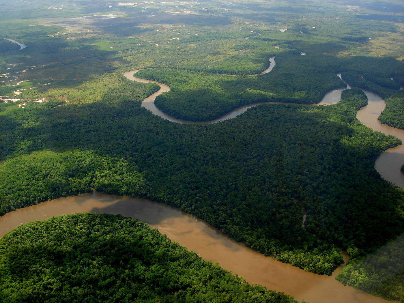
The Brazilian Amazon covers about 40% of the country’s surface area but is home to less than 10% of its population. The region holds 80% of Brazil’s freshwater thanks to the Amazon River, which crosses it from west to east before emptying into the Atlantic near Belém. More than in any other country, the ecosystem and indigenous populations have suffered—and continue to suffer—from the overexploitation of its natural resources. Unsurprisingly, Brazil also offers the widest range of Amazonian discoveries and adventures of all kinds. Beyond the forest itself, neighboring regions like the sertão and especially the Pantanal are also of interest to nature and adventure enthusiasts.
Brazilian Coast
This is the coastal part of the country and its "hinterland," stretching from the border with Uruguay in the south to nearly the mouth of the Amazon in the north. With cities like Rio de Janeiro, São Paulo, Fortaleza, Salvador, and Recife, it is by far the most populated and tourist-heavy region of the country, differing in many ways from the Amazon region of Brazil.

Ilha Grande, Brésil · © VoyageForum
View guide page: Brazilian CoastOverview
This is the coastal part of the country and its "hinterland," stretching from the border with Uruguay in the south to nearly the mouth of the Amazon in the north. With cities like Rio de Janeiro, São Paulo, Fortaleza, Salvador, and Recife, it is by far the most populated and tourist-heavy region of the country, differing in many ways from the Amazon region of Brazil.
Major Cities
Tourist Attractions
Cities and Heritage
Beaches and Coastline
Nature and Activities
Climate and Weather on the Brazilian Coast
Best Time to Visit the Coast
| Jan. | Feb. | Mar. | Apr. | May | Jun. | Jul. | Aug. | Sep. | Oct. | Nov. | Dec. | |
|---|---|---|---|---|---|---|---|---|---|---|---|---|
| Northern Coast | ||||||||||||
| Southern Coast |
: highly favorable | : favorable | : moderately favorable | : unfavorable.
Sea Temperatures Throughout the Year
As expected, while ocean temperatures are pleasant year-round near Salvador, the same isn’t true for the southern coast, where swimming is best enjoyed during the austral summer.
| Jan. | Feb. | Mar. | Apr. | May | Jun. | Jul. | Aug. | Sep. | Oct. | Nov. | Dec. | |
|---|---|---|---|---|---|---|---|---|---|---|---|---|
| North (Salvador) | 27 | 27 | 27 | 27 | 26 | 26 | 25 | 25 | 24 | 25 | 26 | 26 |
| South (Sta Catarina) | 23 | 24 | 23 | 22 | 21 | 19 | 18 | 16 | 17 | 18 | 20 | 22 |
Climate and Weather by Region
Northern Coast (Fortaleza)
Central Coast (Rio)
Southern Coast (Porto Alegre)
Brasília
Brazil’s capital, founded in 1960. Designed and conceived by the architects and urban planners of the time, it is unique in its kind (though not universally loved) and entirely listed as a UNESCO World Heritage site.
Overview of Brasília
Climate and Weather in Brasília
What to See in Brasília
Things to Do in Brasília
Flying to Brasília
Getting to Brasília by Land
Getting Around Brasília
Sleeping and Eating in Brasília
Living in Brasília
View guide page: BrasíliaFurther Information
Overview of Brasília
Preview temporarily unavailable.
Climate and Weather in Brasília
Preview temporarily unavailable.
What to See in Brasília
Preview temporarily unavailable.
Things to Do in Brasília
Preview temporarily unavailable.
Flying to Brasília
Preview temporarily unavailable.
Getting to Brasília by Land
Preview temporarily unavailable.
Getting Around Brasília
Preview temporarily unavailable.
Sleeping and Eating in Brasília
Preview temporarily unavailable.
Living in Brasília
Preview temporarily unavailable.
Goiânia
Not exactly a tourist hotspot, this city of one and a half million people is the capital of the state of Goiás.
View guide page: GoiâniaOverview of Goiânia
Not exactly a tourist hotspot, this city of one and a half million people is the capital of the state of Goiás.
Key Facts
- Type of place: landmark town.
- Tourist interest: (worth a stop if you are in the area).
- Location:
- Distances:
- Local time: .
- Population: 1,466,105 inhabitants (2016).
- Area: 739 km².
- Altitude: 749 m.
- Website: visitbrasil.com/goiania.html
History of Goiânia
What to See and Do in Goiânia
In the Surrounding Area
Climate and Weather in Goiânia
Transportation
Getting There
Getting Around
Accommodation
Dining
Useful Addresses
Further Information
Goiás
Also called Goiás Velho, this small town has preserved its colonial architecture so well that its historic center is a UNESCO World Heritage site.
View guide page: GoiásOverview of Goiás
Also called Goiás Velho, this small town has preserved its colonial architecture so well that its historic center is a UNESCO World Heritage site.
Key facts
- Type of place: small town.
- Tourist interest: (recommended).
- Location:
- Distances:
- Local time: .
- Population: 24,439 (2015).
- Area: 3,108 km².
- Altitude: 496 m.
- Website: visitbrasil.com/cidade-de-goias.html
History of Goiás
What to see and do in Goiás
In the surrounding area
Climate and weather in Goiás
Transportation
Getting there
Getting around
Where to stay
Where to eat
Useful addresses
- == Additional information
Pirenópolis
A historic town with colonial architecture surrounded by around twenty waterfalls. It is located west of Brasília.
View guide page: PirenópolisOverview of Pirenópolis
A historic town with colonial architecture surrounded by around twenty waterfalls. It is located west of Brasília.
Key Facts
- Type of place: small town.
- Tourist interest: (worth seeing).
- Location:
- Distances:
- Local time: .
- Population: 24,279 (2014).
- Area: 2,227 km².
- Altitude: 770 m.
- Website: visitbrasil.com/pirenopolis.html
History of Pirenópolis
What to See and Do in Pirenópolis
In the Surrounding Area
Climate and Weather in Pirenópolis
Transportation
Getting There
Getting Around
Where to Stay
Where to Eat
Useful Addresses
- == Additional Information
Blumenau
This city, founded by Germans, has preserved its Germanic architecture with its half-timbered houses, as well as the customs of its founders, including a major beer festival.
View guide page: BlumenauOverview of Blumenau
This city, founded by Germans, has preserved its Germanic architecture with its half-timbered houses, as well as the customs of its founders, including a major beer festival.
Key Facts
- Type of place: city.
- Tourist interest: (worth a stop if you are in the area).
- Location:
- Distances:
- Local time: .
- Population: 334,002 inhabitants (2014).
- Area: 519.837 km².
- Altitude: 21 m.
- Website: visitbrasil.com/blumenau.html
History of Blumenau
What to See and Do in Blumenau
In the Surrounding Area
Climate and Weather
Transportation
Getting There
Getting Around
Accommodation
Dining
Useful Addresses
- == Additional Information
Foz do Iguaçu
This is the Brazilian city closest to the Iguazu Falls. That said, Puerto Iguazú on the Argentine side is a much nicer base for visiting.
View guide page: Foz do IguaçuOverview of Foz do Iguaçu
This is the Brazilian city closest to the Iguazu Falls. That said, Puerto Iguazú, on the Argentine side, is a much nicer base for visiting.
Key Facts
- Type of place: city.
- Tourist interest: (worth a stop if you are in the area).
- Location:
- Distances:
- Local time: .
- Population: 264,044 (2017).
- Area: 617.70 km².
- Altitude: 164 m.
- Website: visitbrasil.com/foz-do-iguacu.htm
History of Foz do Iguaçu
What to see and do in Foz do Iguaçu
In the surrounding area
Climate and weather
Transport
Getting there
Getting around
Accommodation
Food
Useful addresses
Further information
Garopaba
One of the main beach resorts in the state of Santa Catarina. A variety of activities are practiced here, such as surfing and windsurfing.
View guide page: GaropabaOverview of Garopaba
One of the main beach resorts in the state of Santa Catarina. A variety of activities are practiced here, such as surfing and windsurfing.
Key Facts
- Type of place: small town.
- Tourist interest: (worth a stop if you are in the area).
- Location:
- Distances:
- Local time: .
- Population: 18,138 inhabitants (2012).
- Area: 114.7 km².
- Altitude: sea level.
- Website: visitbrasil.com/garopaba.html
History of Garopaba
What to See and Do in Garopaba
In the Surrounding Area
Climate and Weather in Garopaba
Transportation
Getting There
Getting Around
Accommodation
Dining
Useful Addresses
- == Additional Information
Ilha do Mel
A small island off Paranaguá in the state of Paraná. It is popular for its landscapes, beaches, ecotourism, and hiking.
View guide page: Ilha do MelOverview of Ilha do Mel
It’s a small island off Paranaguá in the state of Paraná. It is popular for its landscapes, beaches, ecotourism, and hiking.
Key facts
- Type of place: island.
- Tourist interest: (worth seeing).
- Location:
- Local time:
- Main locality:
- Population:
- Area: 27.62 km².
- Highest point:
- Coastline: 25 km.
History of Ilha do Mel
Island environment
Wildlife and flora
Precautions
What to see and do
In the area
Climate and weather
Transport
Getting there
Getting around
Accommodation
Eating
Useful addresses
Further information
Morretes
A small colonial town near Curitiba. You can also reach it by train from there on the historic Serra Verde Express.
View guide page: MorretesOverview of Morretes
It's a small town near Curitiba. You can also reach it by train from there on the "historic" train Serra Verde Express.
Key Facts
- Type of place: small town.
- Tourist interest: (worth seeing).
- Location:
- Distances:
- Local time: .
- Population: 15,718 (2011).
- Area: 684.58 km².
- Altitude: 8 m.
- Website: visitbrasil.com/morretes.html
History of Morretes
What to See and Do in Morretes
In the Surrounding Area
Climate and Weather in Morretes
Transportation
Getting There
Getting Around
Where to Stay
Where to Eat
Useful Addresses
Further Information
Paranaguá
A coastal city with colorful colonial remnants along its harbor. It is also the terminus of the Serra Verde Express tourist train line connecting it to Curitiba.
View guide page: ParanaguáOverview of Paranaguá
This is a coastal city with colorful colonial remnants along its harbor. It is also the terminus of the tourist train line Serra Verde Express connecting it to Curitiba.
Key Facts
- Type of place: city.
- Tourist interest: (worth a stop if you are in the area).
- Location:
- Distances:
- Local time: .
- Population: 151,829 (2016).
- Area: 827 km².
- Altitude: sea level.
- Website: visitbrasil.com/paranaguá
History of Paranaguá
What to See and Do in Paranaguá
In the Surrounding Area
Climate and Weather in Paranaguá
Transportation
Getting There
Getting Around
Accommodation
Dining
Useful Addresses
Additional Information
Pontal do Paraná
This coastal locality is home to many beautiful beaches that make it a popular destination.
View guide page: Pontal do ParanáOverview of Pontal do Paraná
This coastal locality is home to many beautiful beaches that make it a popular destination.
Key Information
- Type of place: small town.
- Tourist interest: (worth a stop if you are in the area).
- Location:
- Distances:
- Local time: .
- Population: 20,920 inhabitants (2011).
- Area: 199.84 km².
- Altitude: sea level.
- Website:
History of Pontal do Paraná
What to See and Do in Pontal do Paraná
In the Surrounding Area
Climate and Weather
Transportation
Getting There
Getting Around
Accommodation
Dining
Useful Addresses
- == Additional Information
Porto Alegre
While not a top-tier tourist destination, the large southern metropolis remains pleasant to visit thanks to its architectural blend of styles.
View guide page: Porto AlegreOverview of Porto Alegre
While not a top-tier tourist destination, the large southern Brazilian metropolis remains pleasant to visit thanks to its architectural blend of styles.
Key Facts
- Type of place: large city.
- Tourist interest: (worth a stop if you are in the area).
- Location:
- Distances:
- Local time: .
- Population: 1,481,019 (2017).
- Area: 497 km².
- Altitude: sea level.
- Website: visitbrasil.com/porto-alegre.html
History of Porto Alegre
What to See and Do in Porto Alegre
In the Surrounding Area
Climate and Weather in Porto Alegre
Transportation
Getting There
Getting Around
Accommodation
Dining
Useful Addresses
Additional Information
Santa Catarina
This large island off the southern coast (the main one in an archipelago of about twenty) is connected to the mainland. It is popular for its landscapes, beaches, water activities (including surfing and diving), nightlife, and, secondarily, hiking opportunities.

View guide page: Santa CatarinaOverview of Santa Catarina
This large island off the southern coast of Brazil (the main one in an archipelago of about twenty) is connected to the mainland. It is popular for its landscapes, beaches, water activities (including surfing and diving), nightlife, and, secondarily, hiking opportunities.
Key Facts
- Type de lieu: island.
- Intérêt touristique: (recommended).
- Localisation:
- Heure locale:
- Locality: Florianopolis.
- Population: 461,524 inhabitants (2014).
- Area: 424 km².
- Highest point: Morro do Ribeirão (532 m).
- Coastline:
- Website: http://turismo.sc.gov.br/fr/
History of Santa Catarina
Island Environment
Wildlife and Flora
Precautions
What to See and Do in Santa Catarina
Florianopolis
Located on the island of Santa Catarina, of which it is the capital, Florianopolis boasts a beautiful historic center, several Portuguese forts, and numerous nearby beaches and seaside resorts.
Located on the island of Santa Catarina, of which it is the capital, Florianopolis boasts a beautiful historic center, several Portuguese forts, and numerous nearby beaches and seaside resorts.
In the Surrounding Area
Climate and Weather in Santa Catarina
Transportation
Getting There
Getting Around
Accommodation
Food
Useful Addresses
Further Reading
Florianopolis
Preview temporarily unavailable.
São Francisco do Sul
One of Brazil’s oldest cities, founded in 1504. It has preserved its colonial charm.
View guide page: São Francisco do SulOverview of São Francisco do Sul
One of the oldest cities in Brazil, founded in 1504. It has preserved its colonial charm.
Key facts
- Type of place: small town.
- Tourist interest: (worth seeing).
- Location:
- Distances:
- Local time: .
- Population: 42,569 (2011).
- Area: 540 km².
- Altitude: sea level.
- Website:
History of São Francisco do Sul
What to see and do in São Francisco do Sul
In the surrounding area
Climate and weather
Transportation
Getting there
Getting around
Accommodation
Food
Useful addresses
- == Additional information
Romantic Route
A tourist route (180 km) in Rio Grande do Sul, through the picturesque rolling hills of the Serra Gaucha region. It lets you discover a dozen villages strongly marked by German presence in the area.
View guide page: Romantic RouteOverview of the Romantic Route
This is a tourist route (180 km) in Rio Grande do Sul, through the picturesque rolling hills of the Serra Gaucha, north of Porto Alegre. It lets you discover a dozen villages strongly marked by German presence in the area.
Key details
- Type of place: scenic route.
- Tourist interest: (worth seeing).
- Theme: ethno-cultural route.
- Location: between São Leopoldo and São Francisco de Paula.
- Local time:
- Main towns:
- Length: 184 km.
- Altitude:
- Website: http://www.rotaromantica.com.br/
The route
What to see and do
Itinerary
Nearby
Climate and weather
Transport
Getting there
Getting around
Sleep
Eat
- == Additional information
Serra Gaucha
This mountainous region of Rio Grande do Sul offers a beautiful mid-mountain environment and trekking opportunities.
View guide page: Serra GauchaOverview of Serra Gaucha
This mountainous region of Rio Grande do Sul offers a beautiful mid-mountain environment and trekking opportunities. It is also home to the Romantic Route, which allows you to discover several "typical" villages of German immigration in Brazil.
Key Details
- Type of place: mountain range.
- Tourist interest: (worth seeing).
- Characteristics:
- Mountain range:
- Area:
- Summit: 1,403 m.
Environment of Serra Gaucha
Wildlife and flora
Population and economic activity
Climate and weather
Precautions
What to see
What to do
Practical information
- Location:
- Distances:
- Website: http://www.portalserragaucha.com.br/
Getting there
Getting around
Accommodation and dining
Nearby attractions
- == En complément
Angra dos Reis
In addition to its countless beautiful beaches, often nestled in picturesque settings, Angra benefits from its connection to Ilha Grande, located just across the way.
View guide page: Angra dos ReisOverview of Angra dos Reis
In addition to its countless beautiful beaches, often nestled in picturesque settings, Angra benefits from its connection to Ilha Grande, located just across the way.
Key Facts
- Type of place: city.
- Tourist interest: (worth seeing).
- Location:
- Distances:
- Local time: .
- Population: 188,276 (2015).
- Area: 816 km².
- Altitude: sea level.
- Website: visitbrasil.com/angra-dos-reis.html
History of Angra dos Reis
What to See and Do in Angra dos Reis
In the Surrounding Area
Climate and Weather
Transportation
Getting There
Getting Around
Accommodation
Dining
Useful Addresses
Further Information
Belo Horizonte
Brazil’s third-largest city and the capital of Minas Gerais, Belo Horizonte is known for its American-style urban planning and modern architecture, particularly the UNESCO-listed Pampulha district.
Overview of Belo Horizonte
Climate and Weather in Belo Horizonte
What to See in Belo Horizonte
Things to Do in Belo Horizonte
Flying to Belo Horizonte
Getting to Belo Horizonte by Land
Getting Around Belo Horizonte
Sleeping and Eating in Belo Horizonte
Living in Belo Horizonte
View guide page: Belo HorizonteFurther Information
Overview of Belo Horizonte
Preview temporarily unavailable.
Climate and Weather in Belo Horizonte
Preview temporarily unavailable.
What to See in Belo Horizonte
Preview temporarily unavailable.
Things to Do in Belo Horizonte
Preview temporarily unavailable.
Flying to Belo Horizonte
Preview temporarily unavailable.
Getting to Belo Horizonte by Land
Preview temporarily unavailable.
Getting Around Belo Horizonte
Preview temporarily unavailable.
Sleeping and Eating in Belo Horizonte
Preview temporarily unavailable.
Living in Belo Horizonte
Preview temporarily unavailable.
Buzios
Brazil’s Saint-Tropez, not far from Rio, known for its beaches and nightlife.
View guide page: BuziosIntroduction to Buzios
Brazil’s Saint-Tropez, not far from Rio, is known for its beaches and nightlife.
Key facts
- Type of place: small town.
- Tourist interest: (worth seeing).
- Location:
- Distances:
- Local time: .
- Population: 30,439 inhabitants (2014).
- Area: 69 km².
- Altitude: sea level.
- Website: www.buziosonline.com.br/
History of Buzios
What to see and do in Buzios
In the surrounding area
Climate and weather in Buzios
Transport
Getting there
Getting around
Where to stay
Where to eat
Useful addresses
Further reading
Cabo Frio
A renowned seaside resort located between Rio and Buzios. It’s a popular destination for beaches, diving, surfing, and nightlife.
View guide page: Cabo FrioOverview of Cabo Frio
A renowned seaside resort located between Rio and Buzios. It’s a popular destination for beaches, diving, surfing, and nightlife.
Key Facts
- Type of place: city.
- Tourist interest: (worth seeing).
- Location:
- Distances:
- Local time: .
- Population: 216,030 (2017).
- Area: 400 km².
- Altitude: sea level.
- Website: visitbrasil.com/cabo-frio.htm
History of Cabo Frio
What to See and Do in Cabo Frio
In the Surrounding Area
Climate and Weather in Cabo Frio
Transportation
Getting There
Getting Around
Where to Stay
Where to Eat
Useful Addresses
Additional Information
Campos do Jordão
A charming high-altitude town known for its German-Swiss architecture, scenic landscapes, and outdoor activities in the surrounding area (hiking, horseback riding, climbing).
View guide page: Campos do JordãoOverview of Campos do Jordão
This is a charming high-altitude town known for its German-Swiss architecture, scenic landscapes, and outdoor activities in the surrounding area (hiking, horseback riding, climbing).
Key Facts
- Type of place: city.
- Tourist interest: (worth a stop if you are in the area).
- Location:
- Distances:
- Local time: .
- Population: 51,454 (2017).
- Area: 289 km².
- Altitude: 1,628 m.
History of Campos do Jordão
What to See and Do in Campos do Jordão
In the Surrounding Area
Climate and Weather in Campos do Jordão
Transportation
Getting There
Getting Around
Accommodation
Dining
Useful Addresses
- == Additional Information
Congonhas
This colonial city in Minas Gerais is a UNESCO World Heritage site for its beautiful Baroque-style basilica built in 1757.

View guide page: CongonhasOverview of Congonhas
This colonial city in Minas Gerais is a UNESCO World Heritage site for its beautiful Baroque-style basilica built in 1757.
Key Facts
- Type de lieu: small town.
- Intérêt touristique: (worth seeing).
- Localisation:
- Distances:
- Heure locale: .
- Population: 52,827 inhabitants (2015).
- Superficie: 305 km².
- Altitude:
- Site internet: visitbrasil.com/congonhas.html
History of Congonhas
What to See and Do in Congonhas
Basilica of the Good Jesus of Congonhas
A beautiful UNESCO-listed Baroque church built in 1757 in the colonial city of Congonhas.
A beautiful UNESCO-listed Baroque church built in 1757 in the colonial city of Congonhas.
In the Surrounding Area
Climate and Weather in Congonhas
Transportation
Getting There
Getting Around
Where to Stay
Where to Eat
Useful Addresses
Further Reading
Basilica of the Good Jesus of Congonhas
Preview temporarily unavailable.
Diamantina
Like Ouro Preto, Diamantina is a jewel of 18th-century Baroque colonial architecture and a UNESCO World Heritage site.
View guide page: DiamantinaOverview of Diamantina
Like Ouro Preto, Diamantina (which has nothing to do with the Chapada Diamantina park much further north) is a jewel of 18th-century Baroque colonial architecture and a UNESCO World Heritage site.
Key facts
- Type of place: small town.
- Tourist interest: (recommended).
- Location:
- Distances:
- Local time: .
- Population: 48,230 inhabitants (2017).
- Area: 3,869 km².
- Altitude: 1,280 m.
History of Diamantina
What to see and do in Diamantina
In the surrounding area
Climate and weather in Diamantina
Transport
Getting there
Getting around
Where to stay
Where to eat
Useful addresses
- == Additional information
Domingos Martins
A small town founded by Germans in the 19th century, known for its Germanic architecture and traditions.
View guide page: Domingos MartinsOverview of Domingos Martins
A small town founded by Germans in the 19th century, known for its Germanic architecture and traditions.
Key Facts
- Type of place: small town.
- Tourist interest: (worth a stop if you are in the area).
- Location:
- Distances:
- Local time: .
- Population: 34,329 (2014).
- Area: 1,225 km².
- Altitude: 542 m.
History of Domingos Martins
What to See and Do in Domingos Martins
Nearby
Climate and Weather in Domingos Martins
Transportation
Getting There
Getting Around
Accommodation
Dining
Useful Addresses
- == Additional Information
Guarujá
This Atlantic coast city is the favorite beach of São Paulo residents.
View guide page: GuarujáOverview of Guarujá
This Atlantic coast city is the favorite beach of São Paulo residents.
Key Facts
- Type of place: city.
- Tourist interest: (worth a stop if you are in the area).
- Location:
- Distances:
- Local time: .
- Population: 315,563 (2017).
- Area: 142 km².
- Altitude: sea level.
- Website: visitbrasil.com/guaruja.html
History of Guarujá
What to See and Do in Guarujá
In the Surrounding Area
Climate and Weather in Guarujá
Transportation
Getting There
Getting Around
Accommodation
Dining
Useful Addresses
Further Information
Ilhabela
It’s a large island (and its eponymous town) not far from São Paulo. Visitors love it for its landscapes, beautiful beaches, diving, whale watching, sailing, and hiking.
View guide page: IlhabelaOverview of Ilhabela
It’s a large island (and its eponymous town) not far from São Paulo. Visitors love it for its landscapes, beautiful beaches, diving, whale watching, sailing, and hiking.
Key Facts
- Type of place: island.
- Tourist interest: (worth seeing).
- Location:
- Local time:
- Main locality:
- Population: 32,197 (2015)
- Area: 347 km².
- Density: 93 inhabitants/km².
- Highest point: 378 m.
- Coastline:
- Website: visitbrasil.com/ilhabela.html
History of Ilhabela
Island Environment
Wildlife and Flora
Precautions
What to See and Do in Ilhabela
In the Surrounding Area
Climate and Weather in Ilhabela
Transportation
Getting There
Getting Around
Accommodation
Dining
Useful Addresses
Further Information
Ilha Grande
This large, well-preserved tropical island (car-free) between Rio and São Paulo is loved for its stunning landscapes blending sea, forests, and mountains, its beaches, and opportunities for diving or hiking.
View guide page: Ilha GrandeOverview of Ilha Grande
This large, well-preserved tropical island (car-free) between Rio and São Paulo is loved for its stunning landscapes blending sea, forests, and mountains, its beaches, and opportunities for diving or hiking.
Key facts
- Type of place: island.
- Tourist interest: (must-see or highly recommended).
- Location:
- Local time:
- Main locality: Vila do Abraão (3,000 inhabitants)
- Population: 5,000 inhabitants (2014).
- Area: 193 km².
- Highest point: Pico da Pedra d'Agua (1,031 m).
- Coastline:
- Website: visitbrasil.com/ilha-grande.html
History of Ilha Grande
Island environment
Wildlife and flora
Precautions
What to see and do in Ilha Grande
In the area
Climate and weather
Transport
Getting there
Getting around
Sleep
Eat
Useful addresses
Further reading
Itaunas
A small locality on the northern coast of Espírito Santo state, known for its beaches and dunes.
View guide page: ItaunasOverview of Itaunas
A small locality on the northern coast of Espírito Santo state, known for its beaches and dunes.
Key details
- Type of place: small town.
- Tourist interest: (worth a stop if you are in the area).
- Location:
- Distances:
- Local time: .
- Population:
- Area:
- Altitude: sea level.
- Website:
History of Itaunas
What to see and do in Itaunas
In the surrounding area
Climate and weather in Itaunas
Transport
Getting there
Getting around
Accommodation
Food
Useful addresses
Further information
Mariana
It is one of the beautiful colonial Baroque cities from the 17th–18th centuries in the state of Minas Gerais. It is located a few kilometers east of Ouro Preto.
View guide page: MarianaOverview of Mariana
The town is one of the beautiful colonial Baroque cities from the 17th–18th centuries in the state of Minas Gerais. It is located a few kilometers east of Ouro Preto.
Key Facts
- Type of place: city.
- Tourist interest: (worth seeing).
- Location:
- Distances:
- Local time: .
- Population: 58,233 (2015).
- Area: 1,194 km².
- Altitude: from 598 to 1,772 m.
- Website: visitbrasil.com/mariana.html
History of Mariana
What to See and Do in Mariana
In the Surrounding Area
Climate and Weather in Mariana
Transportation
Getting There
Getting Around
Accommodation
Dining
Useful Addresses
- == Additional Information
Niterói
Across the bay from Rio, Niterói offers stunning beaches and a beautiful view of Rio de Janeiro.
View guide page: NiteróiOverview of Niterói
Across the bay from Rio, Niterói offers stunning beaches and a beautiful view of Rio de Janeiro.
Key Facts
- Type of place: large city.
- Tourist interest: (worth a stop if you are in the area).
- Location:
- Distances:
- Local time: .
- Population: 496,696 (2014).
- Area: 129 km².
- Altitude: sea level.
- Website: www.guiadoturismobrasil.com/niteroi
History of Niterói
What to See and Do in Niterói
In the Surrounding Area
Climate and Weather in Niterói
Transportation
Getting There
Getting Around
Accommodation
Dining
Useful Addresses
- == Additional Information
Ouro Preto
Surrounded by mountains, the city is considered the most beautiful colonial town in Brazil. It is also a UNESCO World Heritage site for this reason.
View guide page: Ouro PretoOverview of Ouro Preto
Surrounded by mountains, the city is considered the most beautiful colonial town in Brazil. It is also a UNESCO World Heritage site for this reason.
Key Facts
- Type of place: city.
- Tourist interest: (must-see or highly recommended).
- Location:
- Distances:
- Local time: .
- Population: 74,036 (2015).
- Area: 1,248.64 km².
- Altitude: 1,179 m.
- Website: visitbrasil.com/ouro-preto.html
History of Ouro Preto
What to See and Do in Ouro Preto
In the Surrounding Area
Climate and Weather in Ouro Preto
Transportation
Getting There
Getting Around
Accommodation
Dining
Useful Addresses
Additional Information
Paraty
This small historic coastal town, with its stunning 17th- and 18th-century architecture, is surrounded by hills, islands, beaches, and waterfalls, making it a unique destination. The area is a UNESCO World Heritage site.
View guide page: ParatyOverview of Paraty
Also spelled Paraty, this small historic coastal town boasts beautiful 17th- and 18th-century architecture and is surrounded by hills, islands, beaches, and waterfalls, making it a unique destination. The area is a UNESCO World Heritage site.
Key Facts
- Type of place: small town.
- Tourist interest: (must-see or highly recommended).
- Location:
- Distances:
- Local time: .
- Population: 39,062 inhabitants (2014).
- Area: 928 km².
- Altitude: sea level.
- Website: visitbrasil.com/paraty.html
History of Paraty
What to See and Do in Paraty
In the Surrounding Area
Climate and Weather in Paraty
Transportation
Getting There
Getting Around
Accommodation
Dining
Useful Addresses
Additional Information
Penedo
This municipality in Alagoas offers a charming blend of Portuguese and Dutch colonial architecture.
View guide page: PenedoOverview of Penedo
This municipality in Alagoas offers a charming blend of Portuguese and Dutch colonial architecture.
Key Facts
- Type of place: city.
- Tourist interest: (worth a stop if you are in the area).
- Location:
- Distances:
- Local time: .
- Population: 64,497 inhabitants (2017)
- Area: 689 km².
- Altitude: 27 m.
- Website: visitbrasil.com/penedo.html
History of Penedo
What to See and Do in Penedo
In the Surrounding Area
Climate and Weather in Penedo
Transportation
Getting There
Getting Around
Where to Stay
Where to Eat
Useful Addresses
- == Additional Information
Petropolis
Known as the "Imperial City of Brazil". Founded in the 19th century near Rio, it is home to the summer palace of Brazil's emperors and is also valued for its natural setting.
View guide page: PetropolisOverview of Petropolis
Known as the "Imperial City of Brazil". Founded in the 19th century near Rio, it is home to the summer palace of Brazil's emperors and is also valued for its natural setting.
Key Facts
- Type of place: city.
- Tourist interest: (worth seeing).
- Location:
- Distances:
- Local time: .
- Population: 298,235 (2017).
- Area: 796 km².
- Altitude: 838 m.
- Website: visitbrasil.com/petropolis.html
History of Petropolis
What to See and Do in Petropolis
Nearby
Climate and Weather in Petropolis
Transportation
Getting There
Getting Around
Where to Stay
Where to Eat
Useful Addresses
- == Additional Information
Rio de Janeiro
With its Bay, beaches, Sugarloaf Mountain, favelas, Christ the Redeemer, monuments, and Carnival, Rio is a must-see on any trip and the symbol of Brazil. It has been a UNESCO World Heritage site since 2012.
Overview of Rio de Janeiro
Neighbourhoods of Rio de Janeiro
History, Culture, and Society of Rio de Janeiro
Rio de Janeiro Cuisine
Climate and Weather in Rio de Janeiro
What to See in Rio de Janeiro
Things to Do in Rio de Janeiro
Tips for Rio de Janeiro
Flying to Rio de Janeiro
Getting to Rio de Janeiro by Land or Sea
Getting Around Rio de Janeiro
Accommodation in Rio de Janeiro
Other practical info for Rio de Janeiro
Living in Rio de Janeiro
View guide page: Rio de JaneiroFurther information
Overview of Rio de Janeiro
Preview temporarily unavailable.
Neighbourhoods of Rio de Janeiro
Preview temporarily unavailable.
History, Culture, and Society of Rio de Janeiro
Preview temporarily unavailable.
Rio de Janeiro Cuisine
Preview temporarily unavailable.
Climate and Weather in Rio de Janeiro
Preview temporarily unavailable.
What to See in Rio de Janeiro
Preview temporarily unavailable.
Things to Do in Rio de Janeiro
Preview temporarily unavailable.
Tips for Rio de Janeiro
Preview temporarily unavailable.
Flying to Rio de Janeiro
Preview temporarily unavailable.
Getting to Rio de Janeiro by Land or Sea
Preview temporarily unavailable.
Getting Around Rio de Janeiro
Preview temporarily unavailable.
Accommodation in Rio de Janeiro
Preview temporarily unavailable.
Other practical info for Rio de Janeiro
Preview temporarily unavailable.
Living in Rio de Janeiro
Preview temporarily unavailable.
São João del Rei
This mining town in Minas Gerais has preserved its beautiful 18th-century architecture, including countless churches. A small tourist steam train connects the city to its neighbor Tiradentes (13 km).
View guide page: São João del ReiOverview of São João del Rei
This mining town in Minas Gerais has preserved its beautiful 18th-century architecture, including countless churches. A small tourist steam train connects the city to its neighbor Tiradentes (13 km).
Key Facts
- Type of place: city.
- Tourist interest: (worth seeing).
- Location:
- Distances:
- Local time: .
- Population: 90,263 inhabitants (2017).
- Area: 1,463 km².
- Altitude: 898 m.
History of São João del Rei
What to See and Do in São João del Rei
In the Surrounding Area
Climate and Weather
Transportation
Getting There
Getting Around
Accommodation
Dining
Useful Addresses
Further Information
São Paulo
This vast metropolis (over 20 million inhabitants) is Brazil’s largest city. It offers a blend of races and cultures, along with a small historic centre featuring a few remarkable buildings amid fairly unbridled urban development.
Overview of São Paulo
Neighbourhoods of São Paulo
History, Culture, and Society of São Paulo
São Paulo Gastronomy
Climate and Weather in São Paulo
What to See in São Paulo
Things to Do in São Paulo
Tips for São Paulo
Flying to São Paulo
Getting to São Paulo by Land
Getting Around São Paulo
Accommodation in São Paulo
Other practical information for São Paulo
Living in São Paulo
View guide page: São PauloFurther Information
Overview of São Paulo
Preview temporarily unavailable.
Neighbourhoods of São Paulo
Preview temporarily unavailable.
History, Culture, and Society of São Paulo
Preview temporarily unavailable.
São Paulo Gastronomy
Preview temporarily unavailable.
Climate and Weather in São Paulo
Preview temporarily unavailable.
What to See in São Paulo
Preview temporarily unavailable.
Things to Do in São Paulo
Preview temporarily unavailable.
Tips for São Paulo
Preview temporarily unavailable.
Flying to São Paulo
Preview temporarily unavailable.
Getting to São Paulo by Land
Preview temporarily unavailable.
Getting Around São Paulo
Preview temporarily unavailable.
Accommodation in São Paulo
Preview temporarily unavailable.
Other practical information for São Paulo
Preview temporarily unavailable.
Living in São Paulo
Preview temporarily unavailable.
Tiradentes
One of Brazil’s best-preserved colonial towns. You can reach it from São João del Rei by tourist train.
View guide page: TiradentesOverview of Tiradentes
It's one of the best-preserved colonial towns in Brazil. You can reach it from São João del Rei by tourist train.
Key facts
- Type of place: small town.
- Tourist interest: (recommended).
- Location:
- Distances:
- Local time: .
- Population: 7,002 (2011).
- Area: 83.5 km².
- Altitude: 927 m
- Website: visitbrasil.com/tiradentes.html
History of Tiradentes
What to see and do in Tiradentes
In the surrounding area
Climate and weather in Tiradentes
Transport
Getting there
Getting around
Where to stay
Where to eat
Useful addresses
Further reading
Vitória
The capital of Espírito Santo state is renowned for its beaches.
View guide page: VitóriaOverview of Vitória
The capital of Espírito Santo state is renowned for its beaches.
Key Facts
- Type of place: city.
- Tourist interest: (worth a stop if you are in the area).
- Location:
- Distances:
- Local time: .
- Population: 355,875 inhabitants (2015).
- Area: 93 km².
- Altitude: sea level.
- Website: visitbrasil.com/vitoria.html
History of Vitória
What to See and Do in Vitória
In the Surrounding Area
Climate and Weather in Vitória
Transportation
Getting There
Getting Around
Accommodation
Dining
Useful Addresses
Further Information
Caparaó National Park
Beautiful landscapes and hiking opportunities in this park shared by the states of Minas Gerais and Espírito Santo.
View guide page: Caparaó National ParkOverview of Caparaó National Park
Beautiful landscapes and hiking opportunities in this park shared by the states of Minas Gerais and Espírito Santo.
Key Facts
- Type of place: national park.
- Tourist interest: (worth seeing).
- Features:
- Local time:
- Annual visitors:
- Area: 318 km².
- Altitude: Pico da Bandeira (2,891 m).
Environment
Landscape of the Park
Wildlife and Flora
Climate
Precautions
What to See and Do
Practical Information
- Location:
- Distances:
- Opening period:
- Rates:
Getting There
Getting Around
Sleeping and Eating
Nearby Attractions
Additional Information
Itatiaia National Park
A beautiful region of forests, hills, lakes, and waterfalls where you can hike or go climbing.
View guide page: Itatiaia National ParkOverview of Itatiaia National Park
A beautiful region of forests, hills, lakes, and waterfalls where you can hike or go climbing.
Key details
- Type of place: national park.
- Tourist interest: (worth seeing).
- Features:
- Local time:
- Annual visitors:
- Area: 281 km².
- Altitude: Pico das Agulhas Negras (2,790 m).
Environment
Landscape of the park
Wildlife and flora
Climate
Precautions
What to see and do
Practical information
- Location:
- Distances:
- Opening period:
- Rates:
Getting there
Getting around
Accommodation and dining
Nearby attractions
Additional information
Serra da Canastra National Park
Located in Minas Gerais, this rolling park is known for its landscapes and waterfalls.
View guide page: Serra da Canastra National ParkOverview of Serra da Canastra Park
Located in Minas Gerais, this rolling park is known for its landscapes and waterfalls.
Key details
- Type of place: national park.
- Tourist interest: (worth a stop if you are in the area).
- Features:
- Local time:
- Annual visitors:
- Area: 1,978 km².
- Altitude:
Environment
Park landscape
Wildlife and flora
Climate and weather
Precautions
What to see and do
Practical information
- Location:
- Distances:
- Opening period:
- Rates:
Getting there
Getting around
Accommodation and dining
Nearby attractions
- == Further reading
Serra dos Órgãos National Park
A small mountainous area near Rio. Rock climbing and hiking are popular activities here.
View guide page: Serra dos Órgãos National ParkOverview of Serra dos Órgãos National Park
A small mountainous area near Rio. Rock climbing and hiking are popular activities here.
Key details
- Type of place: national park.
- Tourist interest: (worth seeing).
- Features:
- Local time:
- Annual visitors:
- Area: 110 km².
- Altitude: Pedra do Sino (2,263 m).
Environment
Landscape of the park
Wildlife and vegetation
Climate and weather
Precautions
What to see and do
Practical information
- Location:
- Distances:
- Opening period:
- Rates:
Getting there
Getting around
Accommodation and dining
Nearby attractions
Additional information
Serra da Mantiqueira
This mountain range in southern Brazil peaks at 2,798 m and attracts hiking, mountain biking, and climbing enthusiasts.
View guide page: Serra da MantiqueiraOverview of the Serra da Mantiqueira
This mountain range in southern Brazil peaks at 2,798 m and attracts hiking, mountain biking, and climbing enthusiasts.
Key facts
- Type of place: mountain range.
- Tourist interest: (worth seeing).
- Features:
- Massif:
- Length: 500 km.
- Width:
- Summit: Pedra da Mina (2,798 m).
Environment
Wildlife and flora
Population and economic activity
Climate and weather
Precautions
What to see and do
Practical information
- Location:
- Distances:
- Website:
Getting there
Getting around
Accommodation and dining
Nearby attractions
- == En complément
Cabo de Santo Agostinho
South of Recife, the town offers beautiful beaches and the remains of some sugarcane plantations.
View guide page: Cabo de Santo AgostinhoOverview of Cabo de Santo Agostinho
South of Recife, the town offers beautiful beaches and the remains of some sugarcane plantations.
Key Facts
- Type of place: city.
- Tourist interest: (worth a stop if you are in the area).
- Location:
- Distances:
- Local time: .
- Population: 204,653 inhabitants (2017).
- Area: 448 km².
- Altitude: 29 m.
History of Cabo de Santo Agostinho
What to See and Do in Cabo de Santo Agostinho
In the Surrounding Area
Climate and Weather
Transportation
Getting There
Getting Around
Accommodation
Dining
Useful Addresses
- == Additional Information
Cachoeira
Known first and foremost for candomblé, the city also boasts numerous traces of its colonial past.
View guide page: CachoeiraOverview of Cachoeira
Known first and foremost for candomblé, the city also boasts numerous traces of its colonial past.
Key Facts
- Type of place: small town.
- Tourist interest: (worth seeing).
- Location:
- Distances:
- Local time: .
- Population: 35,013 (2016).
- Area: 395 km².
- Altitude: 50 m.
- Website:
History of Cachoeira
What to See and Do in Cachoeira
In the Surrounding Area
Climate and Weather in Cachoeira
Transportation
Getting There
Getting Around
Where to Stay
Where to Eat
Useful Addresses
- == Additional Information
Fernando de Noronha
This archipelago off the coast of Natal is a UNESCO-listed marine national park. It offers stunning landscapes, beautiful beaches, sea turtles, and marine life to discover while diving.
View guide page: Fernando de NoronhaOverview of Fernando de Noronha
This archipelago off the coast of Natal is a UNESCO-listed marine national park. It offers stunning landscapes, beautiful beaches, sea turtles, and marine life to discover while diving.
Key Facts
- Type of place: archipelago.
- Tourist interest: (recommended).
- Location:
- Local time:
- Number of islands: 21.
- Main locality:
- Population: 2,930 inhabitants (2015).
- Area: 17 km².
- Highest point:
- Coastline:
- Website: http://www.noronha.pe.gov.br
History of Fernando de Noronha
Environment of the Archipelago
Wildlife and Flora
Precautions
What to See and Do in Fernando de Noronha
In the Surrounding Area
Climate and Weather
Transportation
Getting There
Getting Around
Accommodation
Dining
Useful Addresses
Additional Information
Fortaleza
Brazil’s fourth-largest city has restored its colonial architecture. It also offers several beaches and surfing opportunities.
Introduction to Fortaleza
Fortaleza Climate and Weather
What to See in Fortaleza
Things to Do in Fortaleza
Flying to Fortaleza
Getting to Fortaleza by Land or Sea
Getting Around Fortaleza
Sleeping and Eating in Fortaleza
Living in Fortaleza
View guide page: FortalezaFurther information
Introduction to Fortaleza
Preview temporarily unavailable.
Fortaleza Climate and Weather
Preview temporarily unavailable.
What to See in Fortaleza
Preview temporarily unavailable.
Things to Do in Fortaleza
Preview temporarily unavailable.
Flying to Fortaleza
Preview temporarily unavailable.
Getting to Fortaleza by Land or Sea
Preview temporarily unavailable.
Getting Around Fortaleza
Preview temporarily unavailable.
Sleeping and Eating in Fortaleza
Preview temporarily unavailable.
Living in Fortaleza
Preview temporarily unavailable.
Itaparica
Located in the bay of Salvador, the large island boasts lush vegetation and stunning beaches.
View guide page: ItaparicaOverview of Itaparica
Located in the bay of Salvador, the large island boasts lush vegetation and stunning beaches.
Key Facts
- Type of place: island.
- Tourist interest: (worth seeing).
- Location:
- Local time:
- Main town: Vera Cruz.
- Population: 55,000 inhabitants (2010).
- Area: 239 km².
- Highest point: 15 m.
- Coastline:
History of Itaparica
Island Environment
Wildlife and Flora
Precautions
What to See and Do in Itaparica
In the Surrounding Area
Climate and Weather in Itaparica
Transportation
Getting There
Getting Around
Accommodation
Dining
Useful Addresses
Further Information
Jericoacoara
This small fishing village in the heart of a natural park is home to one of Brazil’s most beautiful beaches. The spot is also renowned for windsurfing and attracts quite a crowd.
View guide page: JericoacoaraIntroduction to Jericoacoara
This small fishing village in the heart of a natural park is home to one of the most beautiful beaches in Brazil. The spot is also renowned for windsurfing and attracts quite a crowd.
Key Facts
- Type of place: small town.
- Tourist interest: (worth seeing).
- Location:
- Distances:
- Local time: .
- Population: 17,002 inhabitants (2010).
- Area: 202 km².
- Altitude: sea level.
History of Jericoacoara
What to See and Do in Jericoacoara
In the Surrounding Area
Climate and Weather
Transportation
Getting There
Getting Around
Accommodation
Food
Useful Addresses
Further Reading
Joao Pessoa
The easternmost city in the Americas boasts a well-preserved historic center and beautiful beaches.
View guide page: Joao PessoaOverview of Joao Pessoa
The easternmost city in the Americas boasts a well-preserved historic center and beautiful beaches.
Key Facts
- Type of place: large city.
- Tourist interest: (worth a stop if you are in the area).
- Location:
- Distances:
- Local time: .
- Population: 811,598 (2017).
- Area: 211 km².
- Altitude: sea level.
- Website: visitbrasil.com/joao-pessoa.html
History of Joao Pessoa
What to See and Do in Joao Pessoa
In the Surrounding Area
Climate and Weather
Transportation
Getting There
Getting Around
Accommodation
Food
Useful Addresses
Further Reading
Lençóis
This town typically serves as the base for exploring Chapada Diamantina park. Geographically, it has no connection with Lençóis Maranhenses National Park, which is much farther north.
View guide page: LençóisOverview of Lençóis
This town typically serves as the base for exploring the Chapada Diamantina park. Geographically, it has no connection with Lençóis Maranhenses National Park, which is much farther north.
Key facts
- Type of place: small town.
- Tourist interest: (worth a stop if you are in the area).
- Location:
- Distances:
- Local time: .
- Population: 11,445 inhabitants (2015).
- Area: 1,240 km².
- Altitude:
- Website: http://www.guialencois.com.br
History of Lençóis
What to see and do in Lençóis
In the surrounding area
Climate and weather in Lençóis
Transportation
Getting there
Getting around
Accommodation
Eating
Useful addresses
Further information
Maceio
The capital of Alagoas state boasts not only some beautiful historic buildings but also stunning beaches offering opportunities for surfing or diving.
View guide page: MaceioOverview of Maceio
The capital of Alagoas state boasts not only some beautiful historic buildings but also stunning beaches offering opportunities for surfing or diving.
Key facts
- Type of place: large city.
- Tourist interest: (worth a stop if you are in the area).
- Location:
- Distances:
- Local time: .
- Population: 1,029,129 inhabitants (2017).
- Area: 509.6 km².
- Altitude: from sea level to 300 m.
- Website: visitbrasil.com/maceio.html
History of Maceio
What to see and do in Maceio
In the surrounding area
Climate and weather in Maceio
Transport
Getting there
Getting around
Where to stay
Where to eat
Useful addresses
Further information
Olinda
A stunning colonial city facing Recife, with which it is associated. Olinda's historic centre, with its colourful buildings and sloping streets, is a UNESCO World Heritage site.
View guide page: OlindaOverview of Olinda
It's a stunning colonial city facing Recife, with which it is associated. Olinda's historic centre, with its colourful buildings and sloping streets, is a UNESCO World Heritage site.
Key facts
- Type of place: city.
- Tourist interest: (recommended).
- Location:
- Distances:
- Local time: .
- Population: 389,494 (2015).
- Area: 29 km².
- Altitude: sea level.
- Website: visitbrasil.com/olinda.html
History of Olinda
What to see and do in Olinda
In the surrounding area
Climate and weather
Transport
Getting there
Getting around
Where to stay
Where to eat
Useful addresses
Further information
Serra da Capivara National Park
A UNESCO-listed archaeological site in Piauí with over 30,000 prehistoric inscriptions.
View guide page: Serra da Capivara National ParkOverview of Serra da Capivara
A UNESCO-listed archaeological site in Piauí with over 30,000 prehistoric inscriptions.
- Type of place: archaeological site.
- Tourist interest: (worth a stop if you are in the area).
- Features:
- Area: 918.5 km².
- Altitude:
History of the site
What to see and do
Practical information
- Location:
- Opening hours:
- Admission fee:
- Website: whc.unesco.org/
- How to get there:
Nearby attractions
- == En complément
Porto de Galinhas
South of the city of Recife, this is one of Brazil’s most beautiful beaches.
View guide page: Porto de GalinhasOverview of Porto de Galinhas
South of the city of Recife, this is one of the most beautiful beaches in Brazil.
Key Details
- Type of place: beach.
- Tourist interest: (worth seeing).
- Features:
- Location:
- Length:
Environment
Precautions
What to See and Do
Climate and Weather
Practical Information
Getting There
Accommodation and Dining
Nearby Attractions
Additional Information
Porto Seguro
Preview temporarily unavailable.
Recife
Preview temporarily unavailable.
São Cristóvão
Preview temporarily unavailable.
São Luís
Preview temporarily unavailable.
Sete Cidades National Park
Preview temporarily unavailable.
Chapada Diamantina National Park
Preview temporarily unavailable.
Lençóis Maranhenses National Park
Preview temporarily unavailable.
Abrolhos Marine National Park
Preview temporarily unavailable.
Curitiba
Preview temporarily unavailable.
Serra Verde Express
Preview temporarily unavailable.
São Miguel das Missões Mission
Preview temporarily unavailable.
Joinville
Preview temporarily unavailable.
Vila Velha Park
Preview temporarily unavailable.
Alcântara (Brazil)
Preview temporarily unavailable.
Salvador da Bahia
Preview temporarily unavailable.
Natal (Brazil)
Preview temporarily unavailable.
Brazilian Amazon
The Brazilian Amazon covers 40% of the country's area but is home to less than 10% of its population. The region holds 80% of Brazil's freshwater thanks to the Amazon River, which flows from west to east before emptying into the Atlantic. Logically, Brazil…
Geography and Environment of Brazil
Country Physiognomy
Natural Zones
Wildlife and Flora
Climate and Weather in Brazil
Climate Overview
Best Time to Visit Brazil
| Jan. | Feb. | Mar. | Apr. | May | Jun. | Jul. | Aug. | Sep. | Oct. | Nov. | Dec. | |
|---|---|---|---|---|---|---|---|---|---|---|---|---|
| Northern coast | ||||||||||||
| Southern coast | ||||||||||||
| Amazon |
: very favorable | : favorable | : moderately favorable | : unfavorable.
Sea Temperatures Throughout the Year
As you’d expect, while ocean temperatures are very pleasant year-round near Salvador, the same isn’t true along the southern coast, where the best time for swimming is during the austral summer.
| Jan. | Feb. | Mar. | Apr. | May | Jun. | Jul. | Aug. | Sep. | Oct. | Nov. | Dec. | |
|---|---|---|---|---|---|---|---|---|---|---|---|---|
| North (Salvador) | 27 | 27 | 27 | 27 | 26 | 26 | 25 | 25 | 24 | 25 | 26 | 26 |
| South (Sta Catarina) | 23 | 24 | 23 | 22 | 21 | 19 | 18 | 16 | 17 | 18 | 20 | 22 |
Climate and Weather by Region
Northern Coast (Fortaleza)
Central Region (Rio)
Southern Coast (Porto Alegre)
Amazon (Manaus)
Additional Information
History of Brazil
The History of Brazil

Key Dates
Brazilian Society
Population
Political Institutions
Economy
Religion

Culture and Customs of Brazil
Arts, Crafts, and Architecture
Arts
Crafts
Architecture
Museums
Customs and Traditions
Local Traditions
Etiquette
Dress and Behavior
Sensitive or Taboo Topics
Languages
Glossary
A few local words or expressions useful to know when traveling:
Festivals and Celebrations
Major Events and Public Holidays
Books, Films, and Music
What to See in Brazil
Brazil has around twenty sites inscribed on the UNESCO World Heritage list: Southern region: Iguazu Falls ★★★★ (1984) These world-famous falls straddle Argentina and Brazil. They lie within the eponymous national park, a UNESCO World Heritage site. São Miguel…
Things to Do in Brazil
Angra dos Reis, Brésil · © VoyageForum While Brazil’s image is often tied to Rio and its famous beaches like Copacabana, Ipanema, and Leblon, the city is far from the only place to swim in the country. It’s just perhaps the most "mythical." In…
Types of Travel in Brazil
Travel Themes
- Interests (rated ): Nature ; Adventure ; Culture / ; Relaxation-holidays
Nature-Adventure
Culture
Relaxation-Holidays
Independent Travel
While not necessarily the most challenging, Brazil may still require certain safety precautions in various places or situations. Similarly, if you venture off the beaten path—especially in the Amazon region—local infrastructure can be limited. In short, the destination is best suited for travelers with some experience.
Organized Travel
All-Inclusive
Family
To Do
To Avoid
Senior Travelers
Women Travelers
LGBTQ+ Travelers
Travelers with Disabilities
When and Where to Go in Brazil
Best Times to Visit Brazil
Finding the best time to visit means balancing climate conditions with crowd levels and the most attractive prices for travel and on-site expenses.
| Jan. | Feb. | Mar. | Apr. | May | Jun. | Jul. | Aug. | Sep. | Oct. | Nov. | Dec. | |
|---|---|---|---|---|---|---|---|---|---|---|---|---|
| Coast Climate | ||||||||||||
| Amazon Climate | ||||||||||||
| Avoid Crowds | ||||||||||||
| Low Prices |
: very favorable | : favorable | : moderately favorable | : unfavorable.
Where to Go by Travel Type and Interest
Flying to Brazil
With 500 public airports and airfields, Brazil is one of the best-equipped countries in the world, with many of them handling significant traffic. Around fifty handle over 250,000 passengers annually, forty exceed 500,000, and about thirty are "million-plus"…
Getting to Brazil by Land or Sea
By Land
Borders
Apart from two (Chile and Ecuador), all South American countries share a border with Brazil. These are: Argentina (1,261 km), Bolivia (3,423 km), Colombia (1,644 km), Guyana (1,606 km), French Guiana (730 km), Paraguay (1,365 km), Peru (2,995 km), Suriname (593 km), Uruguay (1,068 km), and Venezuela (2,200 km).
From Neighboring Countries
By Sea
Ferries
Cargo
Cities like Rio de Janeiro, Belém, Salvador da Bahia, and other ports, including Manaus on the Amazon, can be reached by cargo ship with quite a few options.
Sailboats
Cruises
Getting Around Brazil
Road Network, Traffic
Car Rental
Buses
By Bike
Hitchhiking
Hitchhiking in the country is generally discouraged for safety reasons, especially for women travellers.
Trains

Boats
Domestic Flights
In Town
Taxis
Other Options
What to Choose for Getting Around?
Entry Requirements and Visa for Brazil
For tourist travel, no visa is required for stays of up to 3 months within a 180-day period. However, your passport must be valid for at least six months beyond your entry date, and each traveler must have a return or onward ticket. Note that the yellow fever…
Money, Budget, and Shopping in Brazil
Devise: Real, plural réis (100 centavos). Bills: 2, 5, 10, 20, 50, 100, and 200 R$. Coins: 5, 10, 25, and 50 centavos + 1 R$. Exchange: Major foreign currencies are easily exchanged in the country. You’ll find exchange counters in most large banks in cities…
Health and Safety in Brazil
In France, for both individuals and professionals, the "travel advice" from the Ministry of Foreign Affairs regarding precautions for each country has legal value. A similar online travel advice system exists in several countries: Foreign Affairs Belgium…
Other Practical Information for Brazil
Luggage and Equipment to Bring
Communications
Phone
Internet
Time Difference
Local time: .
Electricity
127 or 220 V depending on the location (60 Hz) with sockets often "French-style" (officially type N; no grounding) and occasionally American ones as well.
Opening Hours
Laundromats
Local Tourist Offices
Weights and Measures
French Language Use
Press and Media
Something wrong or out of date? Report this page