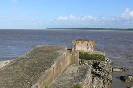
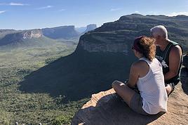
J'ai eu l'occasion de me rendre en guyane en novembre 2005 pour rendre visite à un ami qui travaillait là - bas. Nous avons eu la chance de pouvoir faire la descente du Maroni depuis Maripassoula (escale à Loka, Apatou, Papaichton, Grand Santi dans le désordre je crois...). Bref un enchantement pour moi qui adore les rivières.
Nous nous sommes aussi balladé sur le marais de Kaw, la conté (2 nuits en carbet à écouter les singes hurleurs et aller à la pêche...). Une magnifique expérience de cette région dont je suis tombé amoureux.
L'idée de me faire la rando Saùl - Camopi est venue lors d'une conversation là - bas. Et j'avoue que ça me tente beaucoup... Je sais que deux français se sont perdu sur cet itinéraire et j'ai eu un grand soulagement quand j'ai appri qu'ils étaient saufs. Leur mésaventure ne m'a par contre pas démotivé... et oui... J'ai très envie de me faire cette rando...
Je dois me retourner en Guyane en sepembre pour des raisons professionnelles. J'ai de la chance, j'en profiterai pour me renseigner sur cette rando. En attendant je cherche le contact de personnes qui auraient pu avoir l'occasion de l'effectuer.
Je cherche aussi des renseignements sur les GPS de rando, le matériel nécessaire pour une telle expédition, éventuellement des compagnons de route sérieux...
je précise que je ne suis pas un écervelé. Je compte préparer ce projet de manière tout à fait sérieuse. J'ai une toute petite expérience de la forêt guyanaise. Je sais que l'on y fait pas n'importe quoi mais aussi que beaucoup de bétises sont écrites sur ce soit disant enfer vert ! Je suis habitué au randonnées hors piste, je suis calme et très réceptif lorsque je suis en forêt. Bref, sans être un béret vert je me sens tout à fait capable de faire cette rando accompagné de deux ou trois personnes.
Votre avis ? Merci d'avance !
Niko
J'ai des projets, j'attends le moment, l'opportunité ou... le pognon !
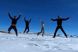
Super souvenir de ce voyage il a quelques années. Nous étions 10 personnes avec Louis comme guide amérindien.
Regarde le site horizo.com de mon copain Yann.
Bon treck.
yvon
Pour ton info, contrairement à ce que tu crois, les deux réscapés étaient parti de Grand Saut Kanori sur le fleuve Approuague, pas de Camopi sur le fleuve Oyapok.
Nous n'héritons pas de la Terre, nous l'empruntons à nos enfants.
Avec un amis naturaliste, nous partons du 20 Septembre au 13 octobre 2007 pour une rando canoë & pedestre. Une immersion en forêt en autonomie totale d'un peu plus d'une quinzaine de jours.
Un colègue réalisateur souhaite profiter de notre organisation pour filmer un documentaire.
Pour des raisons de logistique, de convivialité et de sécurité, nous souhaiterions élargir notre équipe à un ou deux autre participant. Alors, si vous ressenter l'appel de la forêt faire battre votre coeur n'hésitez pas à prendre contacte avec nous.
Info dispo par mail (ou téléphone fixe). Mettre en "OBJET" : "GAYANA TRIP".
Adresse mail par Texto au: tel 0672327323
Réponse souhaitable avant le 20 août 2007.
Gros dossier dispo sur clef USB classé par theme. Rencontre possibe si interessé sur Paris jusqu'à la mi septembre ou à Cacao en Guyane le 21 Septembre.
salut je vais faire le contraire camopi...saul...maripasoula!!!!
je part le 26 aout pour 7 semaines
la foret quand tu nous tien§§§§§§§§§§§§§§§§§§§
et en autonomie complete
je vous dirai vers le 15 octobre si ce fut un reve ou un cauchemar
a +
bernard
Salut. Alors? il est pas encore sorti de la jungle depuis ? 😕.
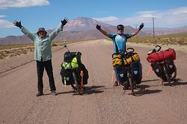
Je vais surement faire une traversée cayenne-Saul prochainement et je cherche un partenaire au moins (je trouve tres imprudent de partir seul en jungle). J'y ai vécu 2 ans en faisant plusieurs missions profondes. J'ai exercé également comme infirmier militaire (j'aurais une trousse de soins). Carte, boussole, gps et telephone satelitte seront egalement presents. Le retour Saul-Cayenne se fera par avion. Le trajet devrait se faire en 15 jours environ.
Je n'ai pas encore fixé de date (a voir ensemble).
Voila, si ca tente quelqu'un!
Cordialement
Patrick
Salut Niko, je vais m'installer en Guyane d'ici à la fin 2009, c'est une aventure pour moi qui y vais en famille mais j'ai pas mal d'expérience et la vie de la forêt me plait énormément. Si je peux me permettre de te donner un tuyau, pour ne pas se perdre en forêt le meilleur c'est le bon sens (sans jeu de mot) à savoir les GPS et tout ce que la technologie peut t'apporter ne remplaceront jamais la logique alliée à la réflexion et à la connaissance du milieu. Les pygmées du Congo n'ont pas de GPS!!! Je pense qu'il faut être honnête avec toi-même et rester prudent et pragmatique en toute circonstance. La forêt tropicale est à mon sens l'endroit le plus difficile pour s'orienter sans quand on n'y est pas né. Le GPS est sans nul doute une aide non négligeable mais jamais de confiance en ces appareils!!! Suerte. On peut discuter sur www.lavache.com christian.cesco@lavache.com BYE
C'est complètement dingue... Ton message m'a fait m'apercevoir que j'avais pleins de réponses à ce post et des mp qui ne m'avaient jamais été notifiés... C'est rigolo car je retourne (car j'ai déjà fais deux sejours en guyane depuis 2007) à Cayenne dans une quinzaine de jours... Non sans être trop content !
Merci pour ton message donc !
Tu as raison pour ton analyse concernant le GPS. Ne pas s'en remettre ! Il est bien pratique quand même ! Je suis allé me ballader avec un pote autours de Saùl l'année dernière. Le GPS nous a un peu aidé sur des croisements de sentiers mal balisés ("mont la fumé" notamment). On a fait toutes les boucles sauf "gros arbres". On s'est arrêté à Popotte avec beaucoup de plaisir... Christian va bien ?... Bref.... c'est toujours avec autant de plaisir que je retourne là - bas !
J'ai fais une petite incursion seul en forêt hors piste... C'est impressionnant. J'ai l'habitude de m'orienter au feeling en forêt métropolitaine mais là c'est pas du tout pareil !!!! Les arbres se ressemblent tous, pas de point de repère, pas d'horizon bref... faut pas déconner ! J'arrêtais pas de me faire des marques à la machette ! C'est très très impressionnant cette forêt. Un gars de Saùl m'a dis une fois que se perdre est très flippant. ça lui était arrivé (pendant deux jours)... ça fait pas envie !!!
Je souhaitais étudier la possibilité de me rendre à Carbet Maïs ce coup-ci (j'ai pas encore fais le grand saut de la grosse rando !). Je suis pas trop préparé... Le voyage étant un peu improvisé je me tate un peu... On verra... Sinon un truc plus simple comme les chutes voltaires mais c'est pas pareil.
En tout les cas j'irai pêcher !
Merci à tous pour vos messages, j'ai l'impression que j'ai paumé plein de bonnes occase de faire de bonne rencontre...
Niko
PS : Cayennois, manifestez vous... J'arrive !
J'ai des projets, j'attends le moment, l'opportunité ou... le pognon !
Mon amie et moi allons faire un voyage en guyane début octobre et nous aimerions faire un saut par Saül en Guyane pour une randonée. Le problème est qu'il est…
Je pars en guyane pour des raisons professionelles fin fevrier début mars (24/02-12/03), pendant quinze jours, dont une semaine de vacances. Parmis les idées…
J'espère que vous allez pouvoir m'aider? Nous partons à deux en septembre 2008 en Guyane et nous attendions la réponse du guide Stéphane Plaine "Guyane…
J'aurais voulu avoir vos avis sur les randonnées en Guyane, Je sais qu'il y a pas mal de chemins balisées avec plus ou moins de difficultés, mais se trouvent…
J'ai eu l'occasion de me rendre en guyane en novembre 2005 pour rendre visite à un ami qui travaillait là - bas. Nous avons eu la chance de pouvoir faire la…
Bonjour,
Nous souhaitons faire le trek de 4 jours reliant Mestia à Ushguli sans agence. Il est précisé dans les descriptifs qu'il existe des hébergement à chaque étape, mais on ne trouve pas d'info sur ces hébergements. Quelqu'un a-t-il des infos et un avis sur ce parcours?
We're planning to trek in Peru and Bolivia and would love to find some local agencies.
If you know any, could you share details on prices and, of course, the names of the agencies?
Which trek would you recommend?
Elocine
Je pars en autonomie totale sur un trek au Maroc (10jrs) Imilchil - Aghbalou.
Trouve t-on des cartouches gaz à vis (Coleman, Primus) à Marrakech (adresse) ou villages entre Imilchil - Aghbalou ?
Si non , trouve-t-on des cartouches Butagaz pour camping-gaz (petit volume 230 gr ...)
Merci d' avance pour vos réponses
Hello, I’d like to embark on a little trip in my home country, Switzerland. I’ll start walking from La Cure, heading toward Le Noirmont first, then I’ll improvise my route—but it’ll probably follow the French border... at least as far as Lac de Joux.
I’ll decide day by day how much farther to go after that. My goal is to stay in nature as much as possible, wander around for as long as I can, and restock food in villages or towns along the way.
I’m thinking of mostly camping, but we’ll see if I end up in a hotel or another campsite depending on my route.
I’d love to reach La Chaux-de-Fonds on foot... maybe even Delémont.
The whole thing should take about a week, give or take.
I’ll be bringing my dog, and I’m preparing for this as soon as I’m ready.
Any tips to make sure everything goes smoothly for us? Things I should know—or avoid? What about shepherds with their flocks of sheep? And isn’t hunting season open right now?
I’m not sure if what I’m planning is even doable, which is why I’m asking around.
This’ll be my first time doing something like this—wandering in nature *and* with a dog. I’m really excited for this adventure... and I need it. Thanks!
We’re really keen on ecosystems and want to hike in "natural" ancient forests—not planted woods or areas heavily degraded by human activity. Travel guides (like Lonely Planet) don’t provide much info on this. Could you point us to the most interesting spots?
Thanks in advance for your tips.
We wish you happy holidays and a fantastic 2026, full of discoveries!
Claire and Albert
Hi, this might not be the right section, but I’d like to know if it’s possible to start mountaineering with another person without necessarily hiring a guide. We’ve done quite a bit of hiking but not mountaineering—we’ll just do a half-day glacier course. After that, we were thinking of starting with La Grande Motte and the Pointe de la Traversière, which were recommended to us. Honestly, for things like roping up and knots, I’ll learn at home with lots of videos and a book.
Hi,
I don’t know Switzerland at all and was wondering if Vallée des Joux and especially Dent de Vaulion are packed early in the morning or late in the afternoon in July and September?
If so, do you have any quieter spots to recommend in the area, or in Luxembourg (yes, I know it’s not the same country 😉)?
Thanks a lot!
Jaimerais savoir si quelqu'un aurait fait des treks sur le Ruwenzori et combien ça coute en moyenne, les infrastructures, les paysages la sécurité sur les lieux, merci beaucoup. J'attends avec impatience vos réponses.
We’re leaving in 9 days for a two-week trip to Madeira, mainly to hike.
From my research, I’ve found that since last year, access to most trails—and systematically for the most popular ones—is now paid. You have to pay an access fee of 4.50 € per person per classified hike in 2026, and even 10.50 € for the most iconic hike: Pico Arieiro to Pico Ruivo. When paying, you also have to choose a day and a 30-minute time slot for your start time. Of course, this reservation is neither changeable nor refundable, even if the weather that day is terrible.
Personally, given the massive influx of tourists to the island in recent years, I don’t mind paying a fee to help maintain the trails. Similarly, setting a limit on the number of people who can hike them per day is certainly preferable to preserve this priceless heritage.
However, what’s much less fair is that in reality, most of the available spots are reserved: 1/ for Madeira residents (which is normal); 2/ for "economic operators" (meaning local tour operators). For example, if you’re a non-resident (independent tourist), no booking is possible for the Pico Arieiro hike for an early morning start before September! So, unfortunately, we’ll have to skip this hike.
It’s the same issue for Ponta de São Lourenço, the 25 Fontes, Pico Ruivo... in short, all the most popular hikes. Oh well, we’ll skip those too!
So my question is: which hikes do you recommend where we won’t face the huge crowds that the others get? And where we can book the day before for the next day, taking the weather into account?
Finally, a quick accommodation question: we’ve booked the first week in Funchal, but I haven’t decided yet for the second week. Do you have any advice on where to stay in the south or north, preferably avoiding overly concrete-heavy and touristy spots?
I’m reposting about the logistics for Samaria Gorge.
I’d love to get recent info, especially about whether it’s possible to park my car in Omalos, do the hike, and then catch a bus back to my vehicle.
In theory, it’s doable, but when you check the KTEL website, there aren’t any feasible schedules listed. If anyone has recently organized this with reliable, verified details, I’d really appreciate it. Thanks in advance!
Hi there,
We’re flying from Montreal to Lyon this August to go hiking in the French Alps. We’ve rented a car and will be staying at campgrounds. We’re planning to do day hikes and want to stay a few days in one spot, do a few hikes, then move on to our next camping spot. Could you share your favorite spots or any recommendations for places to spend a few days with great hikes?
A few details:
We arrive in early August and leave in early September.
We’re looking for day hikes (or shorter), moderate difficulty, with a cumulative elevation gain of no more than 1000m, and of course, beautiful scenery!
We’d prefer not to drive too much—maybe it’s best not to head too far south and deal with unnecessary heat?
Along the same lines, if you know of any great campgrounds where we can start our hike directly without needing the car, we’d love to hear your suggestions!
Bonjour
Souhaitant faire de la randonnée sur cette île, je voudrais d'abord savoir quelle serait la période la plus favorable sachant que j'avais passé quelques jours en novembre 2018 pas pour cette activité mais plus pour une simple découverte de l'île et le temps n'était pas top notamment en montagne. Donc peut on choisir une organisation en étoile sachant que je louerai un véhicule avec éventuellement 2 points d'hébergement.
Je n'envisage pas d'intégrer une structure mais de partir à 2 et de s'organiser sauf si vous me conseillez une agence locale ou un guide local. Enfin même si je compte me procurer les différents supports, carte et topo guide plus gps je vous remercie de bien vouloir me communiquer les randos à faire en priorité
Merci beaucoup pour vos informations
I’m planning to do the Mercantour crossing following the Randoxygène route in mid-July.
I’m used to hiking in the mountains, but I sometimes get vertigo, for example on ridges with drops on both sides. I wanted to check if there are any T4 or T3-T4 sections and find out if there are any very exposed passages—and if so, where—so I can plan an alternative route.
Can anyone give me some info on this?
Thanks!
I’m planning a trip around Cap Corse and the AGRIATES in 2026, from May 8th to 15th (there are still 2 spots left, by the way! Just DM me if you're interested).
I’d love to know which hikes are worth prioritizing in the AGRIATES. We’ll be staying in SALECCIA for two days as our base—what should we focus on from there?
A round trip to IGNHU beach? Any other suggestions?
For Ostricano, I think it’s too far for a round trip...
Thanks for your tips!
Have a great day,
Anie, Toulouse
I’d like to get some info about the GR10 Pyrenees traverse. I need help planning the daily stages and accommodations—my wife isn’t an experienced hiker but walks a lot, so I’d like to schedule shorter walking days and thus a longer overall trip in terms of number of days.
Could anyone give me some help and advice?
Best regards,
New to this forum, I’m planning a pretty big project for 2028.
I’m heading to Nepal to do a trek from Kathmandu all the way to Everest Base Camp (a cool 5,300 m 😄).
This trek is a bit special because even though I’ll be part of a group, I’m going solo (so far, no problem—I’m used to it). But it’s my first real trek, and it’s also a humanitarian one: once I reach base camp, I’ll stay an extra week to help clean up the waste left by tens of thousands of climbers! Since I’m originally from South America, from two countries that share the Andes, I have a deep respect for mountains—they fascinate me. So Everest… it’s kind of the trip of a lifetime!
So, a little question for those who’ve done treks to Everest before… any tips for good mental preparation (I’m already working on the physical side)?
Hi there, I’m planning the Annapurna Circuit for March 2027 and I’m looking for a local agency with a local guide—preferably French-speaking—to arrange this trek for us. Any suggestions? Thanks
Hello!
We’re spending a few days in Toraja country at the end of May. We’d love to do a day trek—taking our time—on a route that’s stunning in terms of scenery, but not a level 5 in difficulty!
Any suggestions you can share, please?
Thanks in advance
I’d like to do the Mare a Mare Sud in May over 4 days. I’ve found quite a few places to stay along the route, but I’m stuck on the start and finish.
I’ll be arriving by plane on Sunday evening and would like to start pretty early on Monday morning. Ideally, accommodation right at the trailhead (Alzu di Gallina) would be amazing, but I can’t find anything. Any tips?
Also, for the transfer from Figari Airport to Porto Vecchio or Alzu di Gallina?
At the end, I’d like to pick up a rental car—any advice on that too?
I’m traveling solo by plane to Catania in May and plan to hike the northern side of Etna, starting from Linguaglossa where I’ll arrive by bus. After that, I’d love some info on how to get up to Piano Provenzana (shuttles or hitchhiking), since it seems there’s no public transport except in the summer. Can you sleep there in a free or cheap refuge, or camp? And how far up can you go without having to hire a guide? Thanks in advance. Bernard.
Bonjour a tous,
je pars en voyage au Maroc en aout et nous allons commencer par nous arrêter a Chefchaouen(nous sommes en voiture).
Ma question: quelqu'un peut il m'indiquer un itinéraire de rando en boucle d'entre 5 et 7 jours aux départ de Chefchaouen dans le parc de Talassemtane passant si possible par le pont de dieux?Ou un guide papier qui en reunis quelques uns?
Nous privilégions le camping sauvage et les gites.
Merci d'avance
Hi there, for those who’ve been recently—is it possible to find other solo travelers in March on the island to share transport or room costs? It doesn’t seem easy to travel on a budget.
If you have any recommendations for simple lodgings or places with dorms, I’d love to hear them.
For those who’ve done multi-day treks while moving around: do you need to bring your own sleeping bag? I’d love to hear about itineraries you’ve done without a guide, just with a map and GPS.
Thanks, and have a great day!
Hi everyone!
We’re planning a 15-day road trip to Scotland this summer, specifically to explore and hike on Lewis and Harris—places we’ve never been before. We’ve visited other islands on previous road trips in Scotland (we usually go in April for a week). This would be our first time in Scotland in the summer and for 15 days. We’re looking at late August to early September.
I’m currently drafting the itinerary. We’d be crossing from Ullapool and were thinking of spending 3 nights on Harris and 4 nights on Lewis.
Does that sound balanced to you? Is it better to keep the same accommodation on Harris and the same on Lewis to explore the area? I’d love to hear about any past experiences you’ve had on these islands.
Thanks!
Hi there, I’m trying to leave for 15 days very soon to São Vicente. I’m either looking to join an agency or figure things out on my own to go hiking on one of these islands or both. From what I’ve seen, it’s not easy to organize with local transport, so it gets expensive. Can I use the services of a small local agency? I’m looking for the simplest way to hike for several days. Also, how do you get from São Vicente to São Nicolau? Thanks in advance and have a great day!
Aichatou
I’ve been wanting to do this for several years, and this year’s the one. Next September, I’ll be trekking in Tusheti (Georgia), from Omalo to Shatili.
Of course, I won’t be renting a vehicle that’d just sit unused. No problem getting to Pshaveli, but from there to Omalo, it’s a dirt road (still the case?)
There must be some form of public transport since there are so many guesthouses, and not all travelers come in a 4x4.
If any of you have been to Omalo, could you confirm that these shared transports exist and how often they run?
we’re planning a trip to Yellowstone and hoping to do a three-day backcountry hike if we get a permit.
if any of you have done this before, could you let me know if it’s possible to find water along the way? And if we can transport it, are we allowed to use a stove?
Hello,
I’ll be in Nepal from March 6th to 29th (we’re flying into Kathmandu via Varanasi and leaving via Delhi).
I’m a bit confused about the regulations requiring a guide.
My wife and I (we’re 63 and 64) aren’t experienced trekkers—we’re more used to walking on terrain with very moderate elevation changes. I’m looking for fairly easy hikes, possibly day trips.
Here are my questions:
- Does the Poon Hill trek from Pokhara require a guide, or is it better to go through a local agency? (I’ve seen a lot of them offering 4-day packages)
- I’d like to do a few multi-day hikes around Jomsom (Kagbeni, Mukitinath, Lupra, Marpha)... Do you need a guide for those, and can you find accommodations easily without booking in advance?
Last question—I’m really hesitant to lug around a sleeping bag or down jacket during our 6 weeks in India. Can you easily find these kinds of items at reasonable prices in Pokhara?
Thanks in advance for any tips you can share!
Yann