Bonjour.
C'est fait, j'ai mes billets!!😎
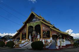
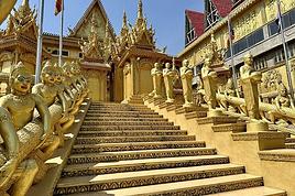
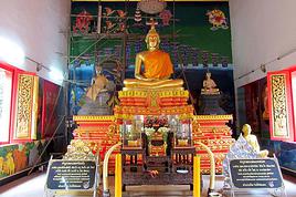
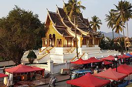
Je serais au Laos du 16 décembre au 4 janvier.
J'envisage une petite rando de plusieurs jours aux alentours de paksé (Saravan, Champasak..).
Je consulte un peu aussi ce qui se fait dans la zone du nord (pour ses villages notament).
Je suis donc à la recherche de carte assez précises sur ces régions (au 1/50000 par exemple).
Le but, étant d'avoir les petits chemins, et surtout les différents villages de ces régions, pour s'orienter, et se rapprocher de la population un peu plus isolée. 🙂
Connaissez vous un endroit ou acheter de tels cartes:
- En magasin sur Paris?
- En boutique en ligne (sur le web).
- Sur Ventiane, et donc à mon arrivée labas?
- Si vous en avez vous même à refourguer?
Sinon, si vous avez des conseils sur des itinéraires de rando (même en dehors des zones citées) je suis preneur (quelque chose d'accessible pour ma petite soeur que j'emmène avec moi ;)
recherche de carte assez précises sur ces régions (au 1/50000 par exemple).
Accessibles au grand public : ça n'existe pas.
En France tu trouveras, au mieux, des cartes généralistes (ITMB, etc.) au 1/1 000 000 environ minimum, et donc totalement inadaptées à la rando.
Sur place les services administratifs provinciaux (agriculture, forêts, etc.) en possèdent de très précises mais les fonctionnaires refusent catégoriquement de les céder aux étrangers. J'ai tout essayé pour en obtenir des copies, dont les pires tentatives de corruptions, y'a rien à faire. Pourquoi ? Probablement parce que c'est trop tôt, parce qu'il y a encore une volonté politique de préserver certaines populations non encore suffisamment préparées à l'arrivée de flots de touristes.
Sur le web tu peux aussi trouver des cartes américaines au 1/250 000 mais qui datent des années... 1950/60. Au mieux elles te donnent de vagues informations sur la topographie des régions traversées, car les quelques chemins et villages mentionnés ont eu le temps de disparaître et/ou transmigrer plusieurs fois depuis ce temps-là.
Bref, les cartes, il faut se les réaliser soi-même, au fur et à mesure des balades.
A +
321
une petite rando de plusieurs jours aux alentours de paksé (Saravan, Champasak..).
PS. Tu es sûr de vouloir randonner dans ces plaines du sud ? Ca va être d'un ennui monotonement mortel...
200 jours à pied,
seul, sans guide,
aux confins du Laos : CLIC
Ben les plaines du sud que tu vises, c'est le plus souvent de la savane, ou une sorte de brousse. Très monotone et pas très vert.
Pas loin, il y a le plateau des Bolovens, beaucoup y vont et semblent apprécier. Je n'y suis jamais allé mais je ne suis pas sûr que ce soit bien adapté à la rando, peut-être plus à la moto.
Puis il y a l'extrême sud-est, l'est du Sékong ou de l'Attapeu par exemple. Là c'est montagneux, mais très reculé. Ce n'est pas vraiment adapté à un premier séjour.
Tu as visité quel coin toi?
Presque tout le nord montagneux, avec une prédilection pour l'extrême nord, la province de Pongsaly. C'est décrit ci-dessous, dans mes signatures.
A +
321
200 jours à pied,
seul, sans guide,
aux confins du Laos : CLIC
Si tu veux vraiment partir à l'aventure, je peux te conseiller d'aller dans le Pongsaly tout au nord, et les montagnes à la frontière vietnamienne sont absolument superbes et préservées, d'autant plus que les routes sont très souvent impraticables donc les villages sont vraiment isolés et l'idéal est de se déplacer à pied. Le principal problème est de trouver des cartes, en effet il n'y pas eu de cartes détaillées avec le nom des villages éditées depuis la colonisation, autant te dire que les villages sont changés de nom, d'emplacement, et que même les chemins sont différents. En fait tu devras te déplacer d'un village à l'autre en demandant à chaque fois ton chemin aux locaux (apprends quelques mots de vocabulaire simples...).
Tu peux remonté la rivière NAMOU depuis le village de Hat Sa. Attention, la route entre Luang Prabang et Hat Sa est souvent coupé pendant la saison des pluies.
Tu peux t'arranger avec les propriétaires de bateaux qui remontent la rivière pour approvisionner les villages isolés, ils te laisseront monter à bord si tu leur paye le carburant. Tu pourras alors descendre où tu veux le long de la rivière. Une tente peut-être utile...
Tient moi au courant si tu trouves une carte à jour, car ça m'intéresse, et puis dans le cas contraire, n'oublie pas de prendre des notes sur les emplacement et les chemins praticables quand tu sera sur place.
Un récit très intéressant sur la région à été publié sur ce site il y a quelques temps, fouille un peu tu trouvera des infos en or.
bon voyage!
Un récit très intéressant sur la région à été publié sur ce site il y a quelques temps,
Ca m'intéresserait de le lire. Pourrais-tu retrouver le lien ?
Et si tu t'intéresses à cette région de Pongsaly, dans mes signatures tu peux avoir un aperçu de mes expériences là-bas.
A +
321
PS. As-tu passé beaucoup de temps au nord de Hat Sa ? J'en reviens juste à nouveau : 3 jours de navigation en amont de Hat Sa, puis 30 jours à me promener là-haut, à l'est de Utay...
200 jours à pied,
seul, sans guide,
aux confins du Laos : CLIC
Je suis donc à la recherche de carte assez précises sur ces régions (au 1/50000 par exemple).
Le 1/50000 faut peut être pas rèver 😉
Je ne connais pas le Laos mais il a l'air assez bien couvert par les cartes russes jusqu'au 1/200000 : http://mapstor.com/...untry-maps/laos.html
Tu peux télécharger toutes les cartes (payant mais pas très cher) ou les télécharger une par une (gratuit mais pénible)
Elles sont en cyrillique et pas toutes de première jeunesse mais la topographie est bien lisible
En cliquant tout en bas de la page du lien indiqué par Clauvis, on aboutit là :
http://en.poehali.org/maps
Tu choisis ta zone et tu télécharges, y'a pas plus simple.
Tu peux même prendre la géoréférence pour utilisation avec GPS 🙂
Par contre je n'ai pas trouvé le moyen d'en prendre une gratuitement pour voir à quoi elles ressemblent.
Une fois que tu connais les références d'une carte russe, une recherche Google avec le n° conduit parfois à des sites plus simples que Poehali et gratuits. Deux sites avec pas mal de choses trouvés au fil de mes recherches :
http://maps.vlasenko.net/ liens avec les échelles en bas à gauche de la page d'accueil
http://nav.lom.name/maps_scan/
Sur les 2 sites, les fichiers de calibration pour OziExplorer sont disponibles en plus des cartes
Merci pour ces infos.
J'ai pioché un peu dans les cartes russes pour avoir une idée de ce qui était dispo.
Le but de mon voyage n'est pas de faire une rando de 20 jours, mais de mixer entre 2 petites randos de 3/4 jours, des visites, un peu de bateau...
J'imprimerai les morceaux de cartes quand je serai exactement sur quelle secteur je vais marcher.
Par contre, d'une manière générale, je suis content des infos que vous m'avez donné, car je ne connaissais pas l'existence de ce genre de site. :)
Pour le sud du laos et le secteur que je connais bien : la province de khammouane je touve ces cartes pas très à jour, il y a eu quelques nouvelles routes goudronnées et pas mal de modifications. En plus les noms des villages sont vraiment approximatifs , ne compte pas demander ton chemin à partir de ces noms.
A mon avis le pb n'est pas là, en fait il n'y a pas de "sentier" au Laos , il y a soit des chemins non goudronnées et très poussièreux , en moto t'es couvert de poussière en 5 mn et quand un camion te double tu eternue pendant un quart d'heure...pendant la saison sèche évidemment, pendant la saison humide ça devient des bourbiers quasiment impraticables et je vois pas trop l'interet de marcher sur ces chemins et ensuite il n'y a rien que de vagues sentes qui partent en foret pour arriver en cul de sac dans un champ ou une coupe d'arbre.
L'autre pb qui fait qu'on ne trouve pas de carte c'est qu'il reste pas mal de mines de la guerre du Vietnam, surtout dans les Bolovens, un des secteurs les plus bombardé à cause de la fameuse "piste Ho Chimin" Le gouvernement du Laos a engagé des entreprises australiennes pour déminer et ils le font mais lentement...
Hi,
We’re planning to do the 4-day trek from Mestia to Ushguli without an agency. The descriptions mention that there are accommodations at each stop, but we can’t find any details about them. Has anyone got info or feedback on this route?
We're planning to trek in Peru and Bolivia and would love to find some local agencies.
If you know any, could you share details on prices and, of course, the names of the agencies?
Which trek would you recommend?
Elocine
Je pars en autonomie totale sur un trek au Maroc (10jrs) Imilchil - Aghbalou.
Trouve t-on des cartouches gaz à vis (Coleman, Primus) à Marrakech (adresse) ou villages entre Imilchil - Aghbalou ?
Si non , trouve-t-on des cartouches Butagaz pour camping-gaz (petit volume 230 gr ...)
Merci d' avance pour vos réponses
Hello, I’d like to embark on a little trip in my home country, Switzerland. I’ll start walking from La Cure, heading toward Le Noirmont first, then I’ll improvise my route—but it’ll probably follow the French border... at least as far as Lac de Joux.
I’ll decide day by day how much farther to go after that. My goal is to stay in nature as much as possible, wander around for as long as I can, and restock food in villages or towns along the way.
I’m thinking of mostly camping, but we’ll see if I end up in a hotel or another campsite depending on my route.
I’d love to reach La Chaux-de-Fonds on foot... maybe even Delémont.
The whole thing should take about a week, give or take.
I’ll be bringing my dog, and I’m preparing for this as soon as I’m ready.
Any tips to make sure everything goes smoothly for us? Things I should know—or avoid? What about shepherds with their flocks of sheep? And isn’t hunting season open right now?
I’m not sure if what I’m planning is even doable, which is why I’m asking around.
This’ll be my first time doing something like this—wandering in nature *and* with a dog. I’m really excited for this adventure... and I need it. Thanks!
We’re really keen on ecosystems and want to hike in "natural" ancient forests—not planted woods or areas heavily degraded by human activity. Travel guides (like Lonely Planet) don’t provide much info on this. Could you point us to the most interesting spots?
Thanks in advance for your tips.
We wish you happy holidays and a fantastic 2026, full of discoveries!
Claire and Albert
Hi, this might not be the right section, but I’d like to know if it’s possible to start mountaineering with another person without necessarily hiring a guide. We’ve done quite a bit of hiking but not mountaineering—we’ll just do a half-day glacier course. After that, we were thinking of starting with La Grande Motte and the Pointe de la Traversière, which were recommended to us. Honestly, for things like roping up and knots, I’ll learn at home with lots of videos and a book.
Hi,
I don’t know Switzerland at all and was wondering if Vallée des Joux and especially Dent de Vaulion are packed early in the morning or late in the afternoon in July and September?
If so, do you have any quieter spots to recommend in the area, or in Luxembourg (yes, I know it’s not the same country 😉)?
Thanks a lot!
Jaimerais savoir si quelqu'un aurait fait des treks sur le Ruwenzori et combien ça coute en moyenne, les infrastructures, les paysages la sécurité sur les lieux, merci beaucoup. J'attends avec impatience vos réponses.
We’re leaving in 9 days for a two-week trip to Madeira, mainly to hike.
From my research, I’ve found that since last year, access to most trails—and systematically for the most popular ones—is now paid. You have to pay an access fee of 4.50 € per person per classified hike in 2026, and even 10.50 € for the most iconic hike: Pico Arieiro to Pico Ruivo. When paying, you also have to choose a day and a 30-minute time slot for your start time. Of course, this reservation is neither changeable nor refundable, even if the weather that day is terrible.
Personally, given the massive influx of tourists to the island in recent years, I don’t mind paying a fee to help maintain the trails. Similarly, setting a limit on the number of people who can hike them per day is certainly preferable to preserve this priceless heritage.
However, what’s much less fair is that in reality, most of the available spots are reserved: 1/ for Madeira residents (which is normal); 2/ for "economic operators" (meaning local tour operators). For example, if you’re a non-resident (independent tourist), no booking is possible for the Pico Arieiro hike for an early morning start before September! So, unfortunately, we’ll have to skip this hike.
It’s the same issue for Ponta de São Lourenço, the 25 Fontes, Pico Ruivo... in short, all the most popular hikes. Oh well, we’ll skip those too!
So my question is: which hikes do you recommend where we won’t face the huge crowds that the others get? And where we can book the day before for the next day, taking the weather into account?
Finally, a quick accommodation question: we’ve booked the first week in Funchal, but I haven’t decided yet for the second week. Do you have any advice on where to stay in the south or north, preferably avoiding overly concrete-heavy and touristy spots?
I’m reposting about the logistics for Samaria Gorge.
I’d love to get recent info, especially about whether it’s possible to park my car in Omalos, do the hike, and then catch a bus back to my vehicle.
In theory, it’s doable, but when you check the KTEL website, there aren’t any feasible schedules listed. If anyone has recently organized this with reliable, verified details, I’d really appreciate it. Thanks in advance!
Hi there,
We’re flying from Montreal to Lyon this August to go hiking in the French Alps. We’ve rented a car and will be staying at campgrounds. We’re planning to do day hikes and want to stay a few days in one spot, do a few hikes, then move on to our next camping spot. Could you share your favorite spots or any recommendations for places to spend a few days with great hikes?
A few details:
We arrive in early August and leave in early September.
We’re looking for day hikes (or shorter), moderate difficulty, with a cumulative elevation gain of no more than 1000m, and of course, beautiful scenery!
We’d prefer not to drive too much—maybe it’s best not to head too far south and deal with unnecessary heat?
Along the same lines, if you know of any great campgrounds where we can start our hike directly without needing the car, we’d love to hear your suggestions!
Bonjour
Souhaitant faire de la randonnée sur cette île, je voudrais d'abord savoir quelle serait la période la plus favorable sachant que j'avais passé quelques jours en novembre 2018 pas pour cette activité mais plus pour une simple découverte de l'île et le temps n'était pas top notamment en montagne. Donc peut on choisir une organisation en étoile sachant que je louerai un véhicule avec éventuellement 2 points d'hébergement.
Je n'envisage pas d'intégrer une structure mais de partir à 2 et de s'organiser sauf si vous me conseillez une agence locale ou un guide local. Enfin même si je compte me procurer les différents supports, carte et topo guide plus gps je vous remercie de bien vouloir me communiquer les randos à faire en priorité
Merci beaucoup pour vos informations
I’m planning to do the Mercantour crossing following the Randoxygène route in mid-July.
I’m used to hiking in the mountains, but I sometimes get vertigo, for example on ridges with drops on both sides. I wanted to check if there are any T4 or T3-T4 sections and find out if there are any very exposed passages—and if so, where—so I can plan an alternative route.
Can anyone give me some info on this?
Thanks!
I’m planning a trip around Cap Corse and the AGRIATES in 2026, from May 8th to 15th (there are still 2 spots left, by the way! Just DM me if you're interested).
I’d love to know which hikes are worth prioritizing in the AGRIATES. We’ll be staying in SALECCIA for two days as our base—what should we focus on from there?
A round trip to IGNHU beach? Any other suggestions?
For Ostricano, I think it’s too far for a round trip...
Thanks for your tips!
Have a great day,
Anie, Toulouse
I’d like to get some info about the GR10 Pyrenees traverse. I need help planning the daily stages and accommodations—my wife isn’t an experienced hiker but walks a lot, so I’d like to schedule shorter walking days and thus a longer overall trip in terms of number of days.
Could anyone give me some help and advice?
Best regards,
New to this forum, I’m planning a pretty big project for 2028.
I’m heading to Nepal to do a trek from Kathmandu all the way to Everest Base Camp (a cool 5,300 m 😄).
This trek is a bit special because even though I’ll be part of a group, I’m going solo (so far, no problem—I’m used to it). But it’s my first real trek, and it’s also a humanitarian one: once I reach base camp, I’ll stay an extra week to help clean up the waste left by tens of thousands of climbers! Since I’m originally from South America, from two countries that share the Andes, I have a deep respect for mountains—they fascinate me. So Everest… it’s kind of the trip of a lifetime!
So, a little question for those who’ve done treks to Everest before… any tips for good mental preparation (I’m already working on the physical side)?
Hi there, I’m planning the Annapurna Circuit for March 2027 and I’m looking for a local agency with a local guide—preferably French-speaking—to arrange this trek for us. Any suggestions? Thanks
Hello!
We’re spending a few days in Toraja country at the end of May. We’d love to do a day trek—taking our time—on a route that’s stunning in terms of scenery, but not a level 5 in difficulty!
Any suggestions you can share, please?
Thanks in advance
I’d like to do the Mare a Mare Sud in May over 4 days. I’ve found quite a few places to stay along the route, but I’m stuck on the start and finish.
I’ll be arriving by plane on Sunday evening and would like to start pretty early on Monday morning. Ideally, accommodation right at the trailhead (Alzu di Gallina) would be amazing, but I can’t find anything. Any tips?
Also, for the transfer from Figari Airport to Porto Vecchio or Alzu di Gallina?
At the end, I’d like to pick up a rental car—any advice on that too?
I’m traveling solo by plane to Catania in May and plan to hike the northern side of Etna, starting from Linguaglossa where I’ll arrive by bus. After that, I’d love some info on how to get up to Piano Provenzana (shuttles or hitchhiking), since it seems there’s no public transport except in the summer. Can you sleep there in a free or cheap refuge, or camp? And how far up can you go without having to hire a guide? Thanks in advance. Bernard.
Bonjour a tous,
je pars en voyage au Maroc en aout et nous allons commencer par nous arrêter a Chefchaouen(nous sommes en voiture).
Ma question: quelqu'un peut il m'indiquer un itinéraire de rando en boucle d'entre 5 et 7 jours aux départ de Chefchaouen dans le parc de Talassemtane passant si possible par le pont de dieux?Ou un guide papier qui en reunis quelques uns?
Nous privilégions le camping sauvage et les gites.
Merci d'avance
Hi there, for those who’ve been recently—is it possible to find other solo travelers in March on the island to share transport or room costs? It doesn’t seem easy to travel on a budget.
If you have any recommendations for simple lodgings or places with dorms, I’d love to hear them.
For those who’ve done multi-day treks while moving around: do you need to bring your own sleeping bag? I’d love to hear about itineraries you’ve done without a guide, just with a map and GPS.
Thanks, and have a great day!
Hi everyone!
We’re planning a 15-day road trip to Scotland this summer, specifically to explore and hike on Lewis and Harris—places we’ve never been before. We’ve visited other islands on previous road trips in Scotland (we usually go in April for a week). This would be our first time in Scotland in the summer and for 15 days. We’re looking at late August to early September.
I’m currently drafting the itinerary. We’d be crossing from Ullapool and were thinking of spending 3 nights on Harris and 4 nights on Lewis.
Does that sound balanced to you? Is it better to keep the same accommodation on Harris and the same on Lewis to explore the area? I’d love to hear about any past experiences you’ve had on these islands.
Thanks!
Hi there, I’m trying to leave for 15 days very soon to São Vicente. I’m either looking to join an agency or figure things out on my own to go hiking on one of these islands or both. From what I’ve seen, it’s not easy to organize with local transport, so it gets expensive. Can I use the services of a small local agency? I’m looking for the simplest way to hike for several days. Also, how do you get from São Vicente to São Nicolau? Thanks in advance and have a great day!
Aichatou
I’ve been wanting to do this for several years, and this year’s the one. Next September, I’ll be trekking in Tusheti (Georgia), from Omalo to Shatili.
Of course, I won’t be renting a vehicle that’d just sit unused. No problem getting to Pshaveli, but from there to Omalo, it’s a dirt road (still the case?)
There must be some form of public transport since there are so many guesthouses, and not all travelers come in a 4x4.
If any of you have been to Omalo, could you confirm that these shared transports exist and how often they run?
we’re planning a trip to Yellowstone and hoping to do a three-day backcountry hike if we get a permit.
if any of you have done this before, could you let me know if it’s possible to find water along the way? And if we can transport it, are we allowed to use a stove?
Hello,
I’ll be in Nepal from March 6th to 29th (we’re flying into Kathmandu via Varanasi and leaving via Delhi).
I’m a bit confused about the regulations requiring a guide.
My wife and I (we’re 63 and 64) aren’t experienced trekkers—we’re more used to walking on terrain with very moderate elevation changes. I’m looking for fairly easy hikes, possibly day trips.
Here are my questions:
- Does the Poon Hill trek from Pokhara require a guide, or is it better to go through a local agency? (I’ve seen a lot of them offering 4-day packages)
- I’d like to do a few multi-day hikes around Jomsom (Kagbeni, Mukitinath, Lupra, Marpha)... Do you need a guide for those, and can you find accommodations easily without booking in advance?
Last question—I’m really hesitant to lug around a sleeping bag or down jacket during our 6 weeks in India. Can you easily find these kinds of items at reasonable prices in Pokhara?
Thanks in advance for any tips you can share!
Yann