Hi everyone,
I noticed the forum could use more recommendations for visiting Madagascar, so I thought I’d share my experience.
I arrived on the Big Island last March. I moved there as part of a contract with a friend who started a tech business. A quick note about Madagascar: this country is full of talent. The young people are incredibly ambitious, dynamic, and creative.
After visiting some of the more well-known tourist spots like Mahajanga (Majunga) and Toamasina (Tamatave), the place that really stood out to me was Morondava, in the southwest of the island.
To get there, we left Tananarive (Antananarivo) in the evening, heading to Antsirabe, where we spent the night. By the way, Antsirabe is worth lingering in—it’s a charming town with lots of pleasant spots, and you’ll often run into French travelers there.
The next day, we left at 4:00 AM for Morondava. Our goal was to arrive around 3:00 PM, driving at a relaxed pace to enjoy the scenery. We stopped in Miandrivazo for lunch—there, the tilapia and grilled prawns are a must.
Before Miandrivazo, the road isn’t great (like many roads in Madagascar, unfortunately), but the stunning landscapes more than make up for it. The vegetation, typical of African savannas, is fascinating. However, bushfires—unfortunately common on the island—leave visible scars on the scenery.
About 50 kilometers from Morondava, near Mahabo, the magic begins: majestic baobabs line the road, and the sunset turns this scene into a real postcard. It’s a moment I’ll never forget.
Once there, we stayed near Nosy Kely. It was very hot, but the warmth of the locals, the Sakalava, and their incredible culinary skills quickly made us forget the heat. The seafood and fish are prepared with impressive mastery… so good!
I’d love to recommend some great spots, but I’d rather not accidentally promote anything here. What I *can* say is that Morondava is absolutely worth the detour, if only for its unique atmosphere and breathtaking landscapes.
The next day, we set off to explore the famous Avenue of the Baobabs. This place is simply mind-blowing, one of a kind. As the name suggests, it’s an avenue lined with giant baobabs, with a dusty red-dirt road running through the middle. The whole scene has an almost mystical vibe.
We were planning to visit the Tsingy de Bemaraha on the fly, but it turned out to be too ambitious. According to our guide, we would’ve had to cross two rivers, at Belo and Bekopaka, which would’ve taken a lot more time. That’ll definitely be my next big adventure in Madagascar.
If you get the chance, I’d recommend going even farther than the Avenue of the Baobabs—about two hours by road. There, you can catch a glimpse of a real baobab forest in the distance. Some friends in another car were lucky enough to go, and their stories made me dream. They experienced a magical moment, one of those things you have to see to believe.
I’m no travel journal expert, but I hope this little glimpse inspires you to discover this little slice of paradise in Madagascar.
278 similar discussions in English
I got into music with the will
To light up many hearths like Che could do,
To circulate ideas, to advance utopia
Alternating barricades, sharp thought, and poetry.
Mc Solaar, Guérilla
Subscribing without a fight to the slightest line of my itinerary sometimes feels like an illusion. Because there are countries where, despite the fever and enthusiasm, despite the triumphant revolution, certain elements block my path. And if I had planned, for F. and me, a beautiful ascent up Tabouret Hill (Loma del Taburete, 453m), it was without accounting for vegetation as dense as it was thorny, which barred our way after just a few quarters of an hour of walking. Exhausted, I had to face the facts: we wouldn’t go any further. I needed to come up with some kind of Plan B.
But what is this country, an unwitting laboratory of the worst that white civilization has done during its reign? What is this magnificent place—yet another—entrusted to the care of oblivion, just 150 km from the land of freedom? According to Donald Trump, a country supporting terrorism; according to the locals, the vast battlefield of 20th-century ideologies; according to the average tourist, a hot country, a beautiful country, a country where the last illusions of a lost paradise are dying.
On the other side of Havana Bay, we love that statue of Christ blessing the city. There’s something gentle, soothing, in that patriarchal gesture. You’d almost be tempted to forget that at the dawn of the 16th century, those who claimed to represent the Church had no scruples about eradicating the Ciboney and Taíno populations. Worse, you’ll find magnificent this cathedral dedicated to the Virgin Mary, right in the heart of the old city. Under the guise of a civilizing necessity, Havana became, like so many other places, the gilded seat of European pretensions, at the expense of local populations doomed to extermination, then enslaved populations—more or less indigenous—who, you can imagine, didn’t often set foot in this holy place.
Lost in my thoughts, I try to push through this tangled vegetation. Nature reclaims its rights; nature abhors a vacuum. Yes, the well-trodden path of revolution couldn’t stay free of weeds! The road is buried. We give up and turn back, until that fork I’d noted before leaving, which would let us reach the top of the hill by skirting its northern slope.
So the white man arrives, settles, and gets rid of everything that bothers him. He has two unstoppable forces at his disposal: gunpowder and the spiritual certainty of being on the side of an all-powerful god. While the first gives him an unmatched material advantage over his new enemy, the second lets him use the first without feeling too guilty. That’s the magic of this supreme Church: it condemns all forms of pleasure—calling them impurity—while promoting plunder and crime under the cover of evangelization.
Walking through the city, you find a bit of Algiers, except that here, the decay is almost irreversible. You feel the splendor of the past, a disconcerting image of all vanity, from an era when men knew how to build beauty—especially if they didn’t have to share it. We’ll debate the benefits of colonialism for a long time, while glossing over the fact that those benefits often stopped at the city limits, limits all too obvious to the indigenous people. Havana isn’t just one or a few buildings; it’s an impressive collection of works of art built one after another, in what I think was a spirit of healthy competition. Yes, you find Algiers in this exuberance. As if these distant cities were the receptacle of everything that was best in the lands of origin. Atlantes and lintels, golds, blues, ogives, and monumental windows—exceptional architecture in an exceptional place.
Some streets are clean, swept with care; others are not, scattered here and there with potholes filled with water. A rather persistent smell of urine invades us regularly. We move on. And we look up: Havana is visited with your nose in the air. Because the beauty is truly up there, on those magnificent balconies and terracotta arches. Also because it’s not impossible that a piece of that balcony might suddenly detach, hurling our ends into an overseas tragedy we’d rather avoid. On the ground, here and there, rubble. Inexorably, this city is returning to dust.
My Plan B turns out to be no more successful than the first attempt. After a cheerful progression of a few hundred meters, same outcome, same struggle—the vegetation opposes any revolution: impossible to go around the hill! Once again, we have to turn back. We’ll try Plan C. I reassure myself by convincing myself to stay in the logic of this country: Cuba has been searching for itself for five centuries.
Coffee, tobacco, and sugarcane—the green gold of the colonies—so that money could flow and Europe could enjoy itself. Cuba’s history isn’t original. In reality, all the hot lands at these latitudes suffer the same fate: to serve the white man. While waiting for the awakening of consciences, UN Resolution 1514 and more or less affirmed revolutionary desires. Except that—and this reflection is just my own—if the awakening of consciences and the revolutionary will don’t play into what Resolution 1514 hides, there’s a good chance the said state will become a pariah. Those who don’t follow the American doctrine risk a lot; those who decide to follow Moscow risk everything. Independence was only the barely discreet instrument of American views. Patrice Lumumba will gladly enlighten us on the subject.
Turning back is good. Setting up Plan C is better. I won’t deviate from my goal: we will reach the top of Tabouret, whatever the cost! Near a small country road, I hesitate to change the program. Time is ticking—is it really reasonable to attempt the ascent? Then a tricycle taxi appears, a kind of tuk-tuk powered by an electric moped. I take it as a sign from fate, and we board for the starting point of Plan C.
In Cuba, even before Resolution 1514, independence was assured by a pawn of the United States, Fulgencio Batista. There’s no need to go over the whole history here; we’ll just remember that if you know how to give without counting to your former masters, you can enjoy a facade of freedom. Fidel Castro, on the other hand, didn’t know how to give. It never even occurred to him. That’s why the United States harbors such terrible hatred for this rebellious state, opposed to capitalist values and political prostitution. From there to slowly killing its people for nearly seventy years, one can legitimately cry injustice. But there are other priorities. Oh yes! Greenland...
Do Cubans eat their fill? Does seeing overweight people mean opulence? Food grows, no doubt about it. The soil is fertile, the climate favorable. No, what shocks here is the absolute precarity, the feeling of a people living in survival mode, and the decay of both goods and hope. Where to go? What’s the point? The stubbornness of the United States in wanting to impose its views on the Cuban government is felt much more by an overwhelmed people than by those few elites—caricatures of communism—who instill their vision of happiness with a crowbar. The embargo imposed in 1960; the false-flag attacks—American planes flying the colors of the Cuban revolution during the Bay of Pigs invasion in 1961—the exasperation of placing Cuba on the list of countries supporting terrorism. More recently, Donald Trump decided to heavily tax countries supplying Cuba with fuel. The last time I saw such long lines near gas stations was during my first trip to Romania... in 1991. It’s not for me to judge whether Raúl and his clique are playing fair by thumbing their noses at the West. I don’t hold the ins and outs of this war of egos that keeps the world’s great powers awake. I only caught a glimpse of the poverty of an island in 2026, while we in Europe are buried under an avalanche of the useless and superficial.
At the start of the San Juan baths, we find the trailhead. It climbs steeply. But the weather is relatively mild, thanks to a cold wave hitting higher up in the United States. Dallas is under snow; we’re walking in 16°C, a stroke of luck. We climb over rocks, under fairly decent vegetation, sometimes low but passable. And we succeed in the ascent in an hour. Up there, the top of the hill is somewhat maintained, at a minimum, but maintained, as if to honor Che through an awful monument erected in his glory—a stubborn specimen from those years when good taste was inversely proportional to the delusional ideas of those being honored. Birds of prey (raptors?) circle overhead; the monument is dying, crumbling, falling into ruin. *Hasta siempre*—forever—will be for the words. Nature, erosion, life itself will have the last word over all revolutions.
Back at the foot of the hill, just before a memorable swim, we talk with a family living there in miserable shacks whose stability wasn’t unlike that of the Leaning Tower of Pisa. The grandmother holds an animal, a rodent, by its feet. The grandfather has just killed it; she’s plucking its fur. A few steps away, water boils in a pot. She plunges the beast into the container. Tonight, the family will eat ragondin stew. Further on, another shack where, in a disorder rivaling the filth, a mother breastfeeds while sitting on the edge of a bed. Then, on the way down, we’ll meet a middle-aged man carrying a large jerrycan of water on his shoulder. Are these people happy here, far from the cities and their stakes? Is it too much to ask that they at least have access to electricity, running water, and decent, safe housing?
Outside the old city, Havana reveals wide avenues serving imposing institutions here and there. But whether in the colorful alleys of the old town or on the majestic and austere Plaza de la Revolución, the same feeling moves me: sadness. Seeing that only chaos has come from ideas crushes me. We praise, we sing the revolution—above all, we impose it in people’s minds as a necessity, when it’s nothing of the sort. Revolution is just the fruit of a few tortured minds who, once in power, do nothing better than all those before them. Enjoy power. Impose their views. It’s just a matter of color. Fidel saw red and knew how to persuade—or silence forever—his many detractors. The West sees everything in white, through the prism of human rights, and also knows how to persuade and silence its slightest detractors forever.
Paradoxically, Cuba survives largely thanks to tourism, a key element—let’s not be afraid to say it—of capitalism. And when a few players pick up the crumbs from transactions, the lion’s share and the foreign currency go to the government. So we won’t go to Varadero, the high place of relaxation overrun by Canadians. Instead, we’ll limit ourselves to crossing the ocean 30 minutes from the capital, at Santa María del Mar, to get an idea of cheaper tourism and to splash around for a few minutes in turquoise water invaded by sargassum. At the heart of the tourist season, we’ll meet few people. Like Havana, and according to its inhabitants, the high season is rather dead. But we won’t have come for nothing: we particularly love this return where, feverish, the taxi driver pushes his Moskvitch 2140 to the max on the highway, singing karaoke versions of hits at the top of his lungs from an onboard DVD player. East/West, the culture clash with a hint of Latino.
It’s time to leave this country of resourcefulness where extremes are very present. We’re leaving a 5-star hotel in front of yet another crumbling building. We’ve known restaurants at 40,000 pesos while in the street people eat for 400. We’ve seen those countless cars from another era and another culture—Pontiac, Lada, Chevrolet, Moskvitch—being overtaken by gleaming Mercedes and other Porsche Cayennes, the prerogative—if it still needed to be demonstrated—of the newly rich in search of recognition. Boarding the plane, we also understand that we’re not just traveling with tourists: there’s undoubtedly a rich and prosperous diaspora, just as there are relatively wealthy Cubans—well, wealthy enough to travel comfortably in the front of the aircraft. Meanwhile, on all the country’s roads, other Cubans try hitchhiking, their wives and children perched on a suitcase by the roadside. The father holds out his arm and holds a few bills in his hand like a card game. Where are they going? Who will pick them up?
Behind me, the gold of the Capitol. I’m told this gold comes from Russia. Like Marx and Lenin’s smoky theories? Like Stalin’s subtle and delicate paternalism? Let’s bet that, like the other buildings crumbling around it, the Capitol will also collapse one day, to avenge the Indians who perished from the diseases and guns of the whites, to avenge the Africans who obliterated their lives so Europeans could enjoy themselves, finally, to avenge all this abandoned people, left to the arbitrariness of democratic or non-democratic elections.
A sign in the street: We understand history. This is the revolution! We understand history. That’s the revolution.
No comment.
Subscribing without a fight to the slightest line of my itinerary sometimes feels like an illusion. Because there are countries where, despite the fever and enthusiasm, despite the triumphant revolution, certain elements block my path. And if I had planned, for F. and me, a beautiful ascent up Tabouret Hill (Loma del Taburete, 453m), it was without accounting for vegetation as dense as it was thorny, which barred our way after just a few quarters of an hour of walking. Exhausted, I had to face the facts: we wouldn’t go any further. I needed to come up with some kind of Plan B.
But what is this country, an unwitting laboratory of the worst that white civilization has done during its reign? What is this magnificent place—yet another—entrusted to the care of oblivion, just 150 km from the land of freedom? According to Donald Trump, a country supporting terrorism; according to the locals, the vast battlefield of 20th-century ideologies; according to the average tourist, a hot country, a beautiful country, a country where the last illusions of a lost paradise are dying.
On the other side of Havana Bay, we love that statue of Christ blessing the city. There’s something gentle, soothing, in that patriarchal gesture. You’d almost be tempted to forget that at the dawn of the 16th century, those who claimed to represent the Church had no scruples about eradicating the Ciboney and Taíno populations. Worse, you’ll find magnificent this cathedral dedicated to the Virgin Mary, right in the heart of the old city. Under the guise of a civilizing necessity, Havana became, like so many other places, the gilded seat of European pretensions, at the expense of local populations doomed to extermination, then enslaved populations—more or less indigenous—who, you can imagine, didn’t often set foot in this holy place.
Lost in my thoughts, I try to push through this tangled vegetation. Nature reclaims its rights; nature abhors a vacuum. Yes, the well-trodden path of revolution couldn’t stay free of weeds! The road is buried. We give up and turn back, until that fork I’d noted before leaving, which would let us reach the top of the hill by skirting its northern slope.
So the white man arrives, settles, and gets rid of everything that bothers him. He has two unstoppable forces at his disposal: gunpowder and the spiritual certainty of being on the side of an all-powerful god. While the first gives him an unmatched material advantage over his new enemy, the second lets him use the first without feeling too guilty. That’s the magic of this supreme Church: it condemns all forms of pleasure—calling them impurity—while promoting plunder and crime under the cover of evangelization.
Walking through the city, you find a bit of Algiers, except that here, the decay is almost irreversible. You feel the splendor of the past, a disconcerting image of all vanity, from an era when men knew how to build beauty—especially if they didn’t have to share it. We’ll debate the benefits of colonialism for a long time, while glossing over the fact that those benefits often stopped at the city limits, limits all too obvious to the indigenous people. Havana isn’t just one or a few buildings; it’s an impressive collection of works of art built one after another, in what I think was a spirit of healthy competition. Yes, you find Algiers in this exuberance. As if these distant cities were the receptacle of everything that was best in the lands of origin. Atlantes and lintels, golds, blues, ogives, and monumental windows—exceptional architecture in an exceptional place.
Some streets are clean, swept with care; others are not, scattered here and there with potholes filled with water. A rather persistent smell of urine invades us regularly. We move on. And we look up: Havana is visited with your nose in the air. Because the beauty is truly up there, on those magnificent balconies and terracotta arches. Also because it’s not impossible that a piece of that balcony might suddenly detach, hurling our ends into an overseas tragedy we’d rather avoid. On the ground, here and there, rubble. Inexorably, this city is returning to dust.
My Plan B turns out to be no more successful than the first attempt. After a cheerful progression of a few hundred meters, same outcome, same struggle—the vegetation opposes any revolution: impossible to go around the hill! Once again, we have to turn back. We’ll try Plan C. I reassure myself by convincing myself to stay in the logic of this country: Cuba has been searching for itself for five centuries.
Coffee, tobacco, and sugarcane—the green gold of the colonies—so that money could flow and Europe could enjoy itself. Cuba’s history isn’t original. In reality, all the hot lands at these latitudes suffer the same fate: to serve the white man. While waiting for the awakening of consciences, UN Resolution 1514 and more or less affirmed revolutionary desires. Except that—and this reflection is just my own—if the awakening of consciences and the revolutionary will don’t play into what Resolution 1514 hides, there’s a good chance the said state will become a pariah. Those who don’t follow the American doctrine risk a lot; those who decide to follow Moscow risk everything. Independence was only the barely discreet instrument of American views. Patrice Lumumba will gladly enlighten us on the subject.
Turning back is good. Setting up Plan C is better. I won’t deviate from my goal: we will reach the top of Tabouret, whatever the cost! Near a small country road, I hesitate to change the program. Time is ticking—is it really reasonable to attempt the ascent? Then a tricycle taxi appears, a kind of tuk-tuk powered by an electric moped. I take it as a sign from fate, and we board for the starting point of Plan C.
In Cuba, even before Resolution 1514, independence was assured by a pawn of the United States, Fulgencio Batista. There’s no need to go over the whole history here; we’ll just remember that if you know how to give without counting to your former masters, you can enjoy a facade of freedom. Fidel Castro, on the other hand, didn’t know how to give. It never even occurred to him. That’s why the United States harbors such terrible hatred for this rebellious state, opposed to capitalist values and political prostitution. From there to slowly killing its people for nearly seventy years, one can legitimately cry injustice. But there are other priorities. Oh yes! Greenland...
Do Cubans eat their fill? Does seeing overweight people mean opulence? Food grows, no doubt about it. The soil is fertile, the climate favorable. No, what shocks here is the absolute precarity, the feeling of a people living in survival mode, and the decay of both goods and hope. Where to go? What’s the point? The stubbornness of the United States in wanting to impose its views on the Cuban government is felt much more by an overwhelmed people than by those few elites—caricatures of communism—who instill their vision of happiness with a crowbar. The embargo imposed in 1960; the false-flag attacks—American planes flying the colors of the Cuban revolution during the Bay of Pigs invasion in 1961—the exasperation of placing Cuba on the list of countries supporting terrorism. More recently, Donald Trump decided to heavily tax countries supplying Cuba with fuel. The last time I saw such long lines near gas stations was during my first trip to Romania... in 1991. It’s not for me to judge whether Raúl and his clique are playing fair by thumbing their noses at the West. I don’t hold the ins and outs of this war of egos that keeps the world’s great powers awake. I only caught a glimpse of the poverty of an island in 2026, while we in Europe are buried under an avalanche of the useless and superficial.
At the start of the San Juan baths, we find the trailhead. It climbs steeply. But the weather is relatively mild, thanks to a cold wave hitting higher up in the United States. Dallas is under snow; we’re walking in 16°C, a stroke of luck. We climb over rocks, under fairly decent vegetation, sometimes low but passable. And we succeed in the ascent in an hour. Up there, the top of the hill is somewhat maintained, at a minimum, but maintained, as if to honor Che through an awful monument erected in his glory—a stubborn specimen from those years when good taste was inversely proportional to the delusional ideas of those being honored. Birds of prey (raptors?) circle overhead; the monument is dying, crumbling, falling into ruin. *Hasta siempre*—forever—will be for the words. Nature, erosion, life itself will have the last word over all revolutions.
Back at the foot of the hill, just before a memorable swim, we talk with a family living there in miserable shacks whose stability wasn’t unlike that of the Leaning Tower of Pisa. The grandmother holds an animal, a rodent, by its feet. The grandfather has just killed it; she’s plucking its fur. A few steps away, water boils in a pot. She plunges the beast into the container. Tonight, the family will eat ragondin stew. Further on, another shack where, in a disorder rivaling the filth, a mother breastfeeds while sitting on the edge of a bed. Then, on the way down, we’ll meet a middle-aged man carrying a large jerrycan of water on his shoulder. Are these people happy here, far from the cities and their stakes? Is it too much to ask that they at least have access to electricity, running water, and decent, safe housing?
Outside the old city, Havana reveals wide avenues serving imposing institutions here and there. But whether in the colorful alleys of the old town or on the majestic and austere Plaza de la Revolución, the same feeling moves me: sadness. Seeing that only chaos has come from ideas crushes me. We praise, we sing the revolution—above all, we impose it in people’s minds as a necessity, when it’s nothing of the sort. Revolution is just the fruit of a few tortured minds who, once in power, do nothing better than all those before them. Enjoy power. Impose their views. It’s just a matter of color. Fidel saw red and knew how to persuade—or silence forever—his many detractors. The West sees everything in white, through the prism of human rights, and also knows how to persuade and silence its slightest detractors forever.
Paradoxically, Cuba survives largely thanks to tourism, a key element—let’s not be afraid to say it—of capitalism. And when a few players pick up the crumbs from transactions, the lion’s share and the foreign currency go to the government. So we won’t go to Varadero, the high place of relaxation overrun by Canadians. Instead, we’ll limit ourselves to crossing the ocean 30 minutes from the capital, at Santa María del Mar, to get an idea of cheaper tourism and to splash around for a few minutes in turquoise water invaded by sargassum. At the heart of the tourist season, we’ll meet few people. Like Havana, and according to its inhabitants, the high season is rather dead. But we won’t have come for nothing: we particularly love this return where, feverish, the taxi driver pushes his Moskvitch 2140 to the max on the highway, singing karaoke versions of hits at the top of his lungs from an onboard DVD player. East/West, the culture clash with a hint of Latino.
It’s time to leave this country of resourcefulness where extremes are very present. We’re leaving a 5-star hotel in front of yet another crumbling building. We’ve known restaurants at 40,000 pesos while in the street people eat for 400. We’ve seen those countless cars from another era and another culture—Pontiac, Lada, Chevrolet, Moskvitch—being overtaken by gleaming Mercedes and other Porsche Cayennes, the prerogative—if it still needed to be demonstrated—of the newly rich in search of recognition. Boarding the plane, we also understand that we’re not just traveling with tourists: there’s undoubtedly a rich and prosperous diaspora, just as there are relatively wealthy Cubans—well, wealthy enough to travel comfortably in the front of the aircraft. Meanwhile, on all the country’s roads, other Cubans try hitchhiking, their wives and children perched on a suitcase by the roadside. The father holds out his arm and holds a few bills in his hand like a card game. Where are they going? Who will pick them up?
Behind me, the gold of the Capitol. I’m told this gold comes from Russia. Like Marx and Lenin’s smoky theories? Like Stalin’s subtle and delicate paternalism? Let’s bet that, like the other buildings crumbling around it, the Capitol will also collapse one day, to avenge the Indians who perished from the diseases and guns of the whites, to avenge the Africans who obliterated their lives so Europeans could enjoy themselves, finally, to avenge all this abandoned people, left to the arbitrariness of democratic or non-democratic elections.
A sign in the street: We understand history. This is the revolution! We understand history. That’s the revolution.
No comment.
A horseback ride by the sea on the Caribbean island of Saint Martin
or ... on the beach, but at a walk and trot!
It was probably these visions that gave me the irresistible urge to do this horseback trek—to walk on the sand, but as a rider, and also enjoy a swim that was anything but ordinary.
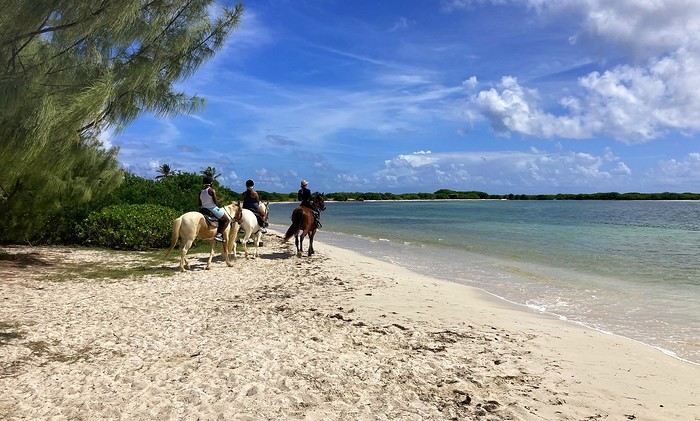
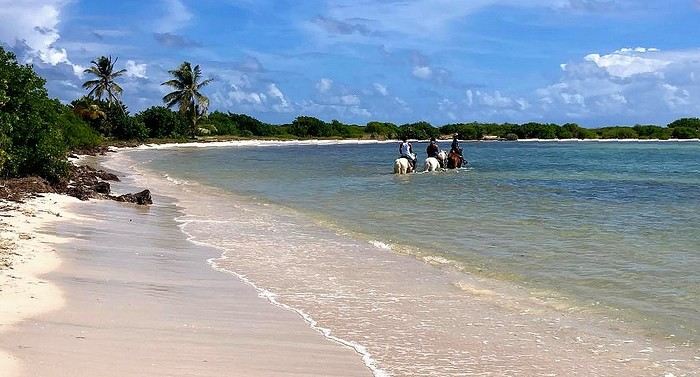
From wish to reality ... all it took was heading to Ranch du Galion. Here we are, on the heights of the east coast of the charming island of Saint Martin, in the heart of the Caribbean.
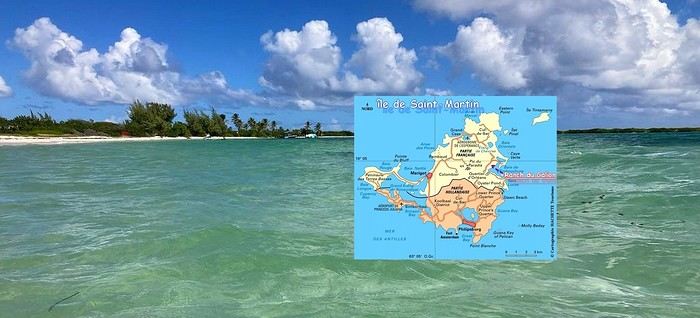
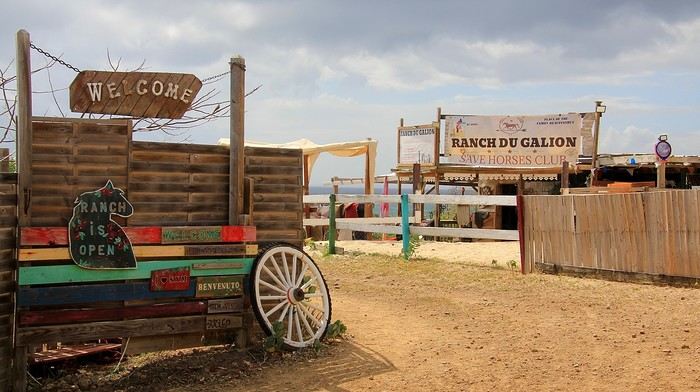
After a first horseback ride that we really enjoyed, with a simple trip to the beach, it didn’t take much to make us want to repeat the pleasant experience. My daughter Emma had been dreaming of it too—so why not share this change of scenery, but this time opting for a slightly longer trek? It’s the big day. And Jess is there to greet us this morning with a big smile. Jess—or Jessica—is the one who runs this tropical ranch with passion; she looks after a whole little family of horses. This morning, she’ll be our guide and companion for this seaside horseback ride.
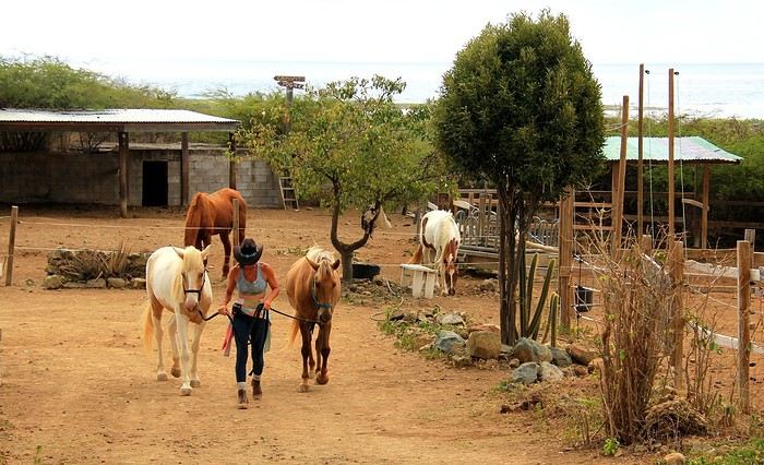
So, we set off along the wild shores of the stunning Anse du Galion.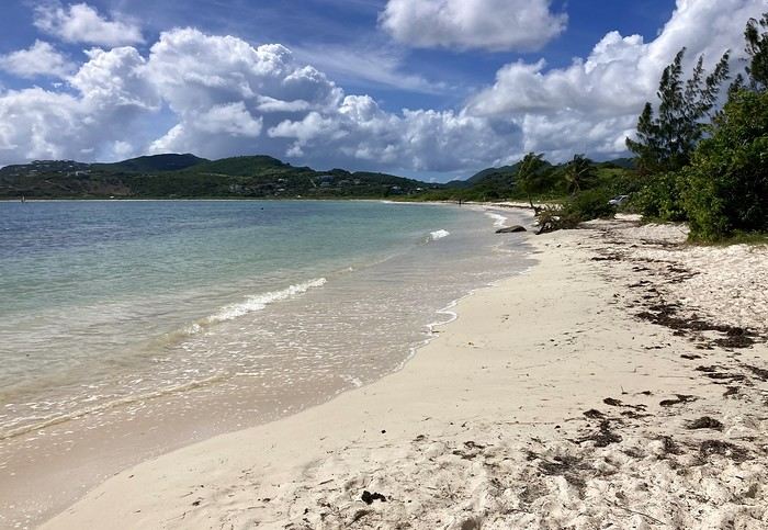
In the enclosures, behind the fences and ropes, some stallions already seem impatient to stretch their legs! They know the place, the routines, and the trails ... and the soothing reward halfway through—a dip in the sea. Maybe that’s what’s causing a little excitement among these mounts!
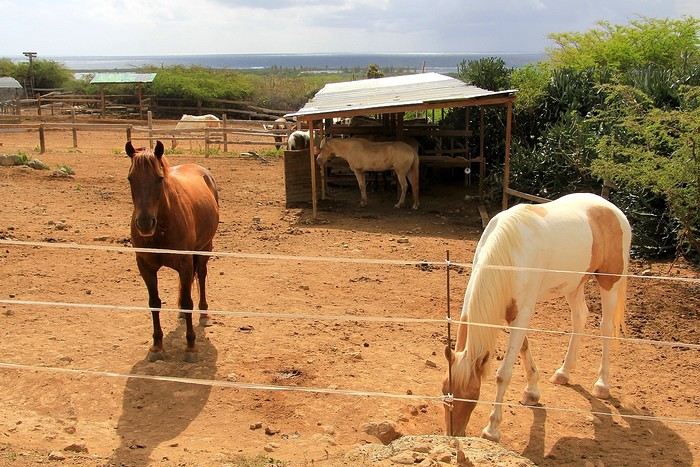
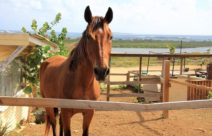
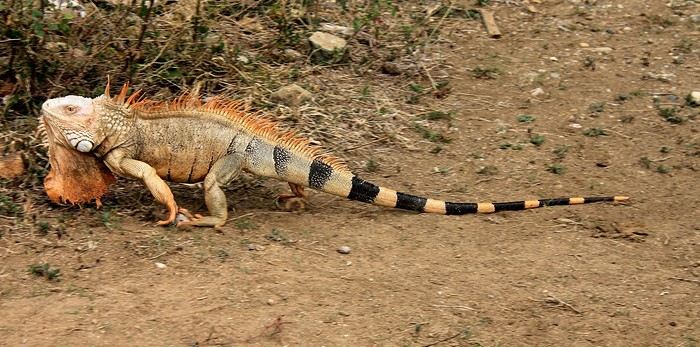
Horses and ... an iguana slipping into the bushes. Given its appearance—its crest, its parched skin, and the dewlap hanging under its head—you’d think it wasn’t exactly young.
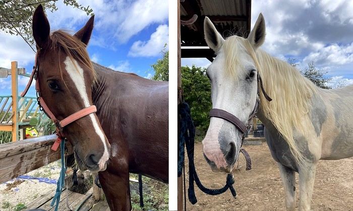
Anyway, back to the horses. Among the mares and stallions, I try to spot "Avenir" and his elegant gait—he was "my" horse during my last trek here, on the trails and sands of Galion. Well, spotting him isn’t going to be easy! My memories are a bit fuzzy, and several of these horses look like him ... -- Before setting off on the trek, it’s time for Jess to choose our mounts. For riders with little experience ... it’ll be calm horses, well-used to trekking—definitely easier and more enjoyable. Titia, a beautiful white mare for my daughter, and Prince, a gentle stallion for me. A little anecdote along the way: we’re really staying in the family for this horseback ride—these two horses are actually related: "my" Prince is the son of the lovely Titia!
to be continued -->
From wish to reality ... all it took was heading to Ranch du Galion. Here we are, on the heights of the east coast of the charming island of Saint Martin, in the heart of the Caribbean.
After a first horseback ride that we really enjoyed, with a simple trip to the beach, it didn’t take much to make us want to repeat the pleasant experience. My daughter Emma had been dreaming of it too—so why not share this change of scenery, but this time opting for a slightly longer trek? It’s the big day. And Jess is there to greet us this morning with a big smile. Jess—or Jessica—is the one who runs this tropical ranch with passion; she looks after a whole little family of horses. This morning, she’ll be our guide and companion for this seaside horseback ride.
So, we set off along the wild shores of the stunning Anse du Galion.
In the enclosures, behind the fences and ropes, some stallions already seem impatient to stretch their legs! They know the place, the routines, and the trails ... and the soothing reward halfway through—a dip in the sea. Maybe that’s what’s causing a little excitement among these mounts!
Horses and ... an iguana slipping into the bushes. Given its appearance—its crest, its parched skin, and the dewlap hanging under its head—you’d think it wasn’t exactly young.
Anyway, back to the horses. Among the mares and stallions, I try to spot "Avenir" and his elegant gait—he was "my" horse during my last trek here, on the trails and sands of Galion. Well, spotting him isn’t going to be easy! My memories are a bit fuzzy, and several of these horses look like him ... -- Before setting off on the trek, it’s time for Jess to choose our mounts. For riders with little experience ... it’ll be calm horses, well-used to trekking—definitely easier and more enjoyable. Titia, a beautiful white mare for my daughter, and Prince, a gentle stallion for me. A little anecdote along the way: we’re really staying in the family for this horseback ride—these two horses are actually related: "my" Prince is the son of the lovely Titia!
to be continued -->
5-day cruise around Komodo
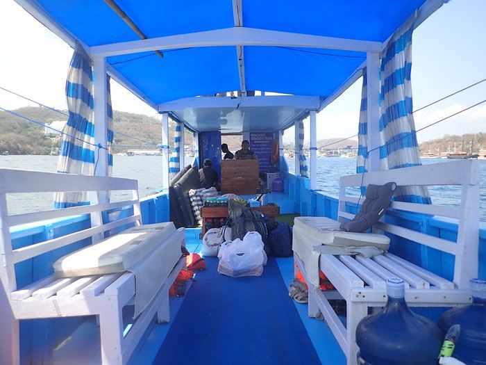 Not usually a fan of organized trips, during my stay in Labuan Bajo on Flores in May 2024, I started looking for a fisherman who could show me the islands around Komodo. At the port, I met Ari, a former freediver who knows the islands well, especially the best spots for fish and coral.
At the Bohême guest house, I proposed this outing, and one of the activity leaders was happy to join. We headed to Angel Island, where Ari took us snorkeling around the island. During this beautiful day, we appreciated his professionalism, and I suggested coming back the following year for a 5-day cruise. We had to agree on a budget and the period to consider.
Over the next year, we kept in touch via WhatsApp.
However, a month before departure, Ari told me he had lent his boat to a friend, who ran it aground on a rock, causing it to sink. No boat, no cruise! Since we had an agreement, I asked him to find another solution. His searches in the port, where everyone knows each other, turned out to be fruitful.
A certain "Captain" Kambar agreed to take us. He sometimes charters his boat for local travel agencies and could free up the requested period.
There will be six of us on board, as in the meantime, my daughter’s friend, Amandine, could join us for the cruise. Ari will act as a guide, and a mechanic will also be present. To reserve the boat for September 4th, Ari asked me to transfer a deposit of 5 million IDR to his account. After some hesitation, I decided to trust him and made the transfer. A few days later, he confirmed receipt of the amount.
In early September, we arrived in Labuan Bajo. Our first mission was to check the boat’s condition, the presence of life jackets, what we would eat, and if there were any restrictions on drinks. Everything was in order and met our expectations.
The day before departure, we met a 26-year-old Czech woman traveling alone after a stay in New Zealand. The description of our cruise excited her, and she got Ari’s number. That evening, at the restaurant, while we discussed the final preparations, Thérèsa joined us and asked if she could come along for the five-day cruise. Since she seemed like good company, I gladly accepted. However, following Indonesian custom, I negotiated firmly with Ari for a discount, and he agreed to lower the price by 2 million.
On September 4th, we set sail to explore the islands of Komodo and, above all, the seabeds, equipped with fins, masks, and snorkels. We had brought a board game for the trips between islands or for the evenings. In the end, it wasn’t used: the crossings rarely lasted more than an hour, except for two two-hour trips, and the conditions on board weren’t suitable for playing.
 The first island we visited is north of Labuan Bajo: Seraya Small.
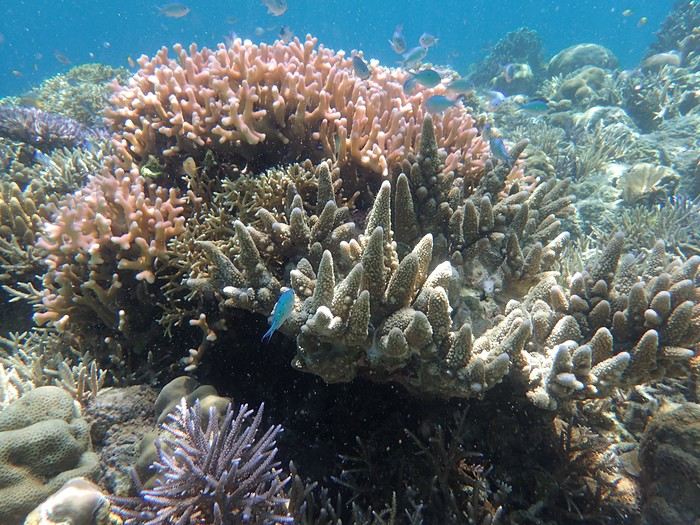
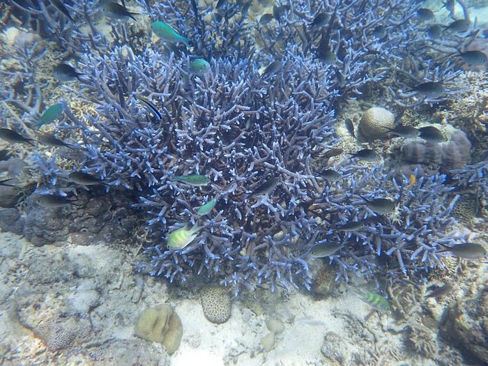
We didn’t disembark but anchored a short distance away. The coral reef, between 5 and 10 meters deep, offered visibility of 8 to 10 meters. We started with a few dives from the boat, as the water was so inviting. As with most of the upcoming sites, we were the only ones enjoying this little paradise.
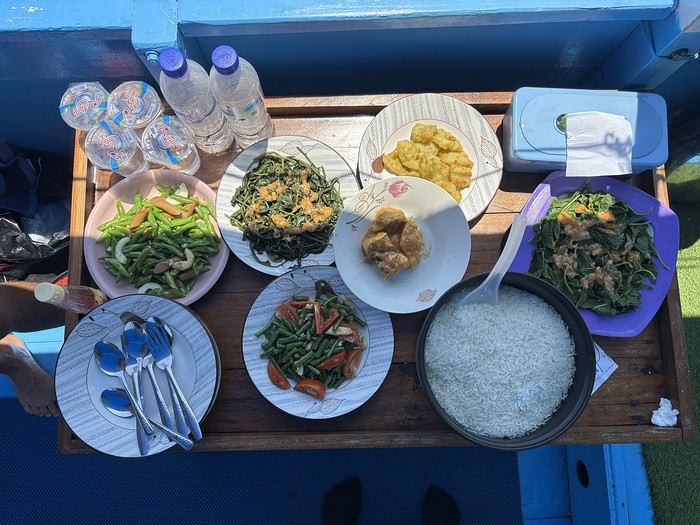
Over about a kilometer along the drop-off, colorful corals and fish abound. As long as you don’t go past the rocky point on the right, the currents remain very weak, and the spot is accessible to beginners. After enjoying the sea enough, we returned to the boat, where Ari had prepared a good meal of rice, chicken, and vegetables. It was simple but excellent after all that effort.
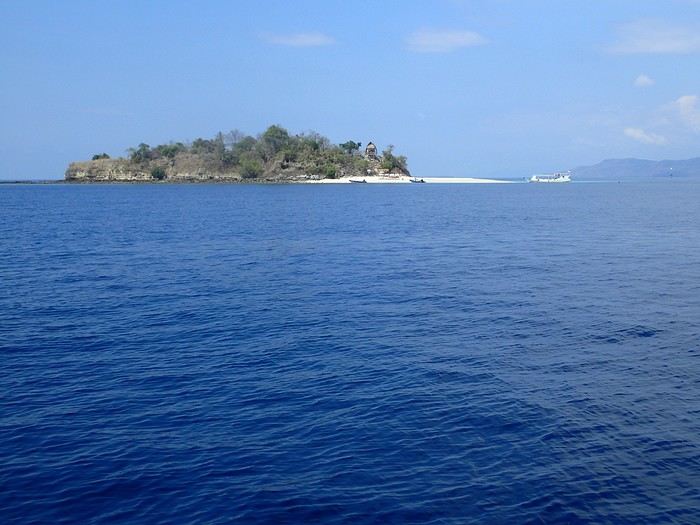 In the afternoon, we discovered Bero Island, where it was very hot. There were fewer fish and corals than at Seraya, but the corals were on white sand, allowing for beautiful, bright photos.
 In the evening, we visited Hatamin, a fishing village. The population is very young and curious about our visit. At our request, we could have watched a local dance, but it would have taken some time to organize, and we didn’t plan to return. Ari asked if we wanted to take a shower, as on the boat, we could only rinse off with a little water from a basin.
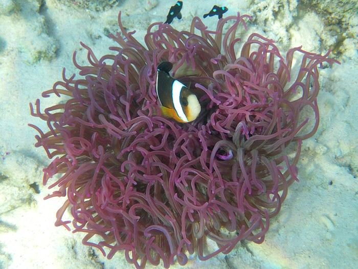
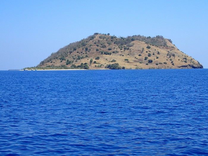
On the second day, snorkeling near Hatamin, a small paradise island with white sand like in a travel brochure. A small temple is located in the middle of the island. In the water, we saw our first small reef sharks, some clownfish, and a sergeant major fish that followed us throughout our swim. The most beautiful part to explore is opposite the beach. Many corals and fish of all colors. A sailboat was anchored a short distance away, but we didn’t see anyone except an old man who apparently lived in the temple above.
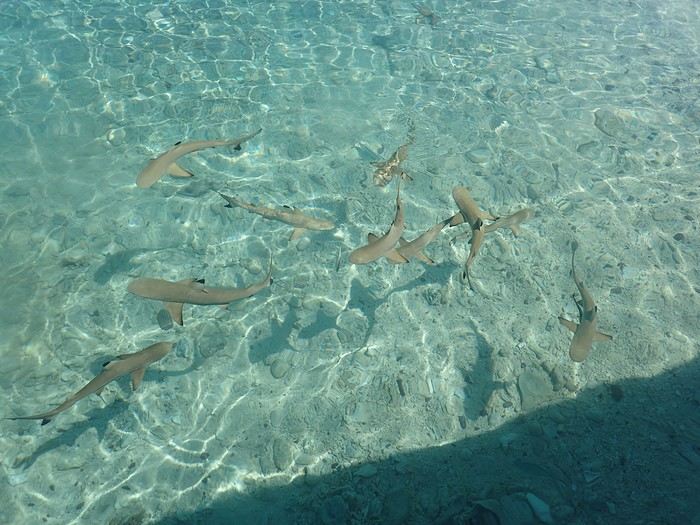
In the afternoon, we headed to the nearby island of Sabolong Besar. It’s a pretty little island with a harmonious resort made up of luxury huts that don’t spoil the landscape. In some places, the water is very clear with good visibility, and some schools of very young blacktip reef sharks swirl near the boat. There are beautiful corals on the left side of the resort and a bit of current when you approach the drop-off. Since the area to explore wasn’t very large, we had time to head to Sabolong Kecil. Then we went to the fishing village of Messah, where a Muslim celebration was taking place. There were people everywhere with many food offerings—what activity! It was like an anthill.
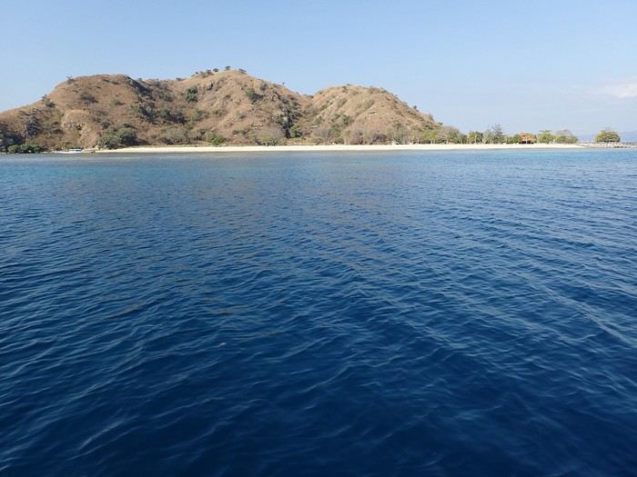
And at the end of the day, we anchored near Kanawa with a beautiful sunset.
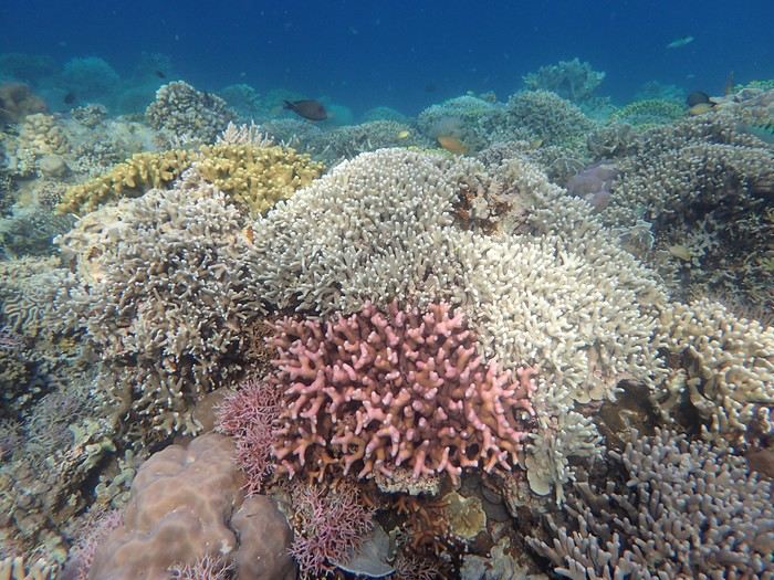 On the third day, we discovered Kanawa and some hawksbill turtles. There were many colorful corals, but we didn’t stay long. During this day, the stops were close together, making it intense with four visits.
Then we arrived at Sebayur Besar with a different snorkeling approach: Ari dropped us in the current, and we drifted for over a kilometer before he came to pick us up. At first, it seemed a bit worrying to see the boat move away while we were offshore, but we were quickly carried by the current and passed almost too quickly by so many corals and fish to see. What a pleasure to drift and freedive with little effort.
The drift lasted a good hour, and we reached Siaba Island, where the water was colder. There were many boats, and we had quickly lost the habit of seeing other tourists. Visibility was average—it was a nice spot, but after the drift at Sebayur, we liked it less. Around 1 p.m., we anchored with other boats because Ari met up with some friends, and we ate heartily since the cool water had whetted our appetites.
In the afternoon, we were at Manta Point. The water was cool, and there was a lot of excitement trying to follow the giant manta rays. We managed to dive down and get close to them, but it took a lot of effort and breath because, despite their leisurely appearance, they move quite fast for us little swimmers. Here, they come to feed and then return to the depths, and it’s not always certain you’ll encounter them. We ended the day at Makassar with a two-hour sail. There was a lot of wind and swell, the boat rocked, and we hoped there wouldn’t be an engine breakdown. We had to take down the tent on the boat’s roof, which had also been used for sleeping. Makassar’s beach is pink, caused by microorganisms called foraminifera. There are many beach huts along the shore, and we were alone, though it must get busy here during the day. On the fourth day, we visited Padar Island for its viewpoint amid hordes of tourists, then headed to Rinca and its Komodo dragons. Rinca is much less crowded than Komodo, which is why we chose this visit. We saw a few and took the usual photos. In the late afternoon, we snorkeled at Pempend Island, where the sea was choppy and the water a bit murky. And on the last day, we visited Strawberry Rock, named after the reddish rock overlooking the sea. There were many corals, but the water was rough with reduced visibility, and then we went to Kelor with its tourist "bars" and the pretty viewpoint.
In conclusion, we shared amazing moments and managed to complete our program. Luckily, the weather was very kind, and not a drop of rain fell in early September, except just upon returning to the port. It’s worth noting that after five intense days in the water from morning to night, we were glad to return to dry land because we were exhausted.
My daughter and her friend were so thrilled that, in return, they developed a website for Ari to help him get known, and I can share the link if you’d like. I visit Voyage Forum from time to time, so if you have any questions, don’t hesitate—I’ll answer them.
Not usually a fan of organized trips, during my stay in Labuan Bajo on Flores in May 2024, I started looking for a fisherman who could show me the islands around Komodo. At the port, I met Ari, a former freediver who knows the islands well, especially the best spots for fish and coral.
At the Bohême guest house, I proposed this outing, and one of the activity leaders was happy to join. We headed to Angel Island, where Ari took us snorkeling around the island. During this beautiful day, we appreciated his professionalism, and I suggested coming back the following year for a 5-day cruise. We had to agree on a budget and the period to consider.
Over the next year, we kept in touch via WhatsApp.
However, a month before departure, Ari told me he had lent his boat to a friend, who ran it aground on a rock, causing it to sink. No boat, no cruise! Since we had an agreement, I asked him to find another solution. His searches in the port, where everyone knows each other, turned out to be fruitful.
A certain "Captain" Kambar agreed to take us. He sometimes charters his boat for local travel agencies and could free up the requested period.There will be six of us on board, as in the meantime, my daughter’s friend, Amandine, could join us for the cruise. Ari will act as a guide, and a mechanic will also be present. To reserve the boat for September 4th, Ari asked me to transfer a deposit of 5 million IDR to his account. After some hesitation, I decided to trust him and made the transfer. A few days later, he confirmed receipt of the amount.
In early September, we arrived in Labuan Bajo. Our first mission was to check the boat’s condition, the presence of life jackets, what we would eat, and if there were any restrictions on drinks. Everything was in order and met our expectations.
The day before departure, we met a 26-year-old Czech woman traveling alone after a stay in New Zealand. The description of our cruise excited her, and she got Ari’s number. That evening, at the restaurant, while we discussed the final preparations, Thérèsa joined us and asked if she could come along for the five-day cruise. Since she seemed like good company, I gladly accepted. However, following Indonesian custom, I negotiated firmly with Ari for a discount, and he agreed to lower the price by 2 million.
On September 4th, we set sail to explore the islands of Komodo and, above all, the seabeds, equipped with fins, masks, and snorkels. We had brought a board game for the trips between islands or for the evenings. In the end, it wasn’t used: the crossings rarely lasted more than an hour, except for two two-hour trips, and the conditions on board weren’t suitable for playing.
The first island we visited is north of Labuan Bajo: Seraya Small.
We didn’t disembark but anchored a short distance away. The coral reef, between 5 and 10 meters deep, offered visibility of 8 to 10 meters. We started with a few dives from the boat, as the water was so inviting. As with most of the upcoming sites, we were the only ones enjoying this little paradise.
Over about a kilometer along the drop-off, colorful corals and fish abound. As long as you don’t go past the rocky point on the right, the currents remain very weak, and the spot is accessible to beginners. After enjoying the sea enough, we returned to the boat, where Ari had prepared a good meal of rice, chicken, and vegetables. It was simple but excellent after all that effort.
In the afternoon, we discovered Bero Island, where it was very hot. There were fewer fish and corals than at Seraya, but the corals were on white sand, allowing for beautiful, bright photos.
In the evening, we visited Hatamin, a fishing village. The population is very young and curious about our visit. At our request, we could have watched a local dance, but it would have taken some time to organize, and we didn’t plan to return. Ari asked if we wanted to take a shower, as on the boat, we could only rinse off with a little water from a basin.On the second day, snorkeling near Hatamin, a small paradise island with white sand like in a travel brochure. A small temple is located in the middle of the island. In the water, we saw our first small reef sharks, some clownfish, and a sergeant major fish that followed us throughout our swim. The most beautiful part to explore is opposite the beach. Many corals and fish of all colors. A sailboat was anchored a short distance away, but we didn’t see anyone except an old man who apparently lived in the temple above.
In the afternoon, we headed to the nearby island of Sabolong Besar. It’s a pretty little island with a harmonious resort made up of luxury huts that don’t spoil the landscape. In some places, the water is very clear with good visibility, and some schools of very young blacktip reef sharks swirl near the boat. There are beautiful corals on the left side of the resort and a bit of current when you approach the drop-off. Since the area to explore wasn’t very large, we had time to head to Sabolong Kecil. Then we went to the fishing village of Messah, where a Muslim celebration was taking place. There were people everywhere with many food offerings—what activity! It was like an anthill.
And at the end of the day, we anchored near Kanawa with a beautiful sunset.
On the third day, we discovered Kanawa and some hawksbill turtles. There were many colorful corals, but we didn’t stay long. During this day, the stops were close together, making it intense with four visits.
Then we arrived at Sebayur Besar with a different snorkeling approach: Ari dropped us in the current, and we drifted for over a kilometer before he came to pick us up. At first, it seemed a bit worrying to see the boat move away while we were offshore, but we were quickly carried by the current and passed almost too quickly by so many corals and fish to see. What a pleasure to drift and freedive with little effort.The drift lasted a good hour, and we reached Siaba Island, where the water was colder. There were many boats, and we had quickly lost the habit of seeing other tourists. Visibility was average—it was a nice spot, but after the drift at Sebayur, we liked it less. Around 1 p.m., we anchored with other boats because Ari met up with some friends, and we ate heartily since the cool water had whetted our appetites.
In the afternoon, we were at Manta Point. The water was cool, and there was a lot of excitement trying to follow the giant manta rays. We managed to dive down and get close to them, but it took a lot of effort and breath because, despite their leisurely appearance, they move quite fast for us little swimmers. Here, they come to feed and then return to the depths, and it’s not always certain you’ll encounter them. We ended the day at Makassar with a two-hour sail. There was a lot of wind and swell, the boat rocked, and we hoped there wouldn’t be an engine breakdown. We had to take down the tent on the boat’s roof, which had also been used for sleeping. Makassar’s beach is pink, caused by microorganisms called foraminifera. There are many beach huts along the shore, and we were alone, though it must get busy here during the day. On the fourth day, we visited Padar Island for its viewpoint amid hordes of tourists, then headed to Rinca and its Komodo dragons. Rinca is much less crowded than Komodo, which is why we chose this visit. We saw a few and took the usual photos. In the late afternoon, we snorkeled at Pempend Island, where the sea was choppy and the water a bit murky. And on the last day, we visited Strawberry Rock, named after the reddish rock overlooking the sea. There were many corals, but the water was rough with reduced visibility, and then we went to Kelor with its tourist "bars" and the pretty viewpoint.
In conclusion, we shared amazing moments and managed to complete our program. Luckily, the weather was very kind, and not a drop of rain fell in early September, except just upon returning to the port. It’s worth noting that after five intense days in the water from morning to night, we were glad to return to dry land because we were exhausted.
My daughter and her friend were so thrilled that, in return, they developed a website for Ari to help him get known, and I can share the link if you’d like. I visit Voyage Forum from time to time, so if you have any questions, don’t hesitate—I’ll answer them.
My first trip to Iceland, in 1974.
Yes, you might be surprised: my first trip to Iceland dates back to July 1974. It’s been a little over 50 years since I first set foot on Icelandic soil. I was 23 years old. At the time, I was a geography student. I had just earned my bachelor’s degree and was finishing my master’s (what we’d now call a "master’s 2") in physical geography, with two specialties: glaciology and volcanology. In both fields, professors showed us slides of Iceland—glaciers and volcanoes—and in tutorials, we worked on maps and documents related to the physical geography of Iceland. So there you have it: ice and fire, in Icelandic « ís og eldur », I learned that year that it was Iceland’s national motto, and that’s what drew me there for my first big trip.
Iceland in 1974 was very different from today. It wasn’t a common destination. There were practically no tourists or tourist infrastructure. Some sites now famous and overcrowded were only accessible after hours of hiking on rough, unmarked trails. GPS didn’t exist, but I had managed to get local 1:100,000 maps that were pretty well done. I took my time to circle the entire island, camping in the wild. Most of my meager budget went toward the flight ticket and renting a Volkswagen "Beetle."
There were no paved roads in the country except in central Reykjavík and the main street of Akureyri. What’s now called Route 1 was everywhere dirt and gravel, pretty bumpy in places. According to my maps, this road didn’t allow for a full loop around Iceland: a section of about a hundred kilometers was missing on the south coast. But when I arrived in that area, I learned at a gas station that the last missing section had just been completed, finally allowing a full loop without backtracking. It was the section crossing the vast Skeiðarársandur, southwest of Vatnajökull. The new road was just a bulldozer track through this black ash desert. We crossed the multiple channels of the sandur on long single-lane wooden bridges. On these long pilings, the road was made of roughly nailed thick planks that made an awful racket when the car drove over them.
A nasty surprise: the cost of living. The difference with France seemed huge—everything was two to three times more expensive than back home. Prices were way beyond my tiny budget, and I wondered how I’d manage to get by.
The Icelanders back then were very different from today. From the start, I felt like a real outsider, ostracized, even outright rejected. Several times, when I asked for permission to pitch my small tent near a farm, the door would slam shut as soon as I asked (in English). Without a word… *Bam!*
So I struggled to feed myself, lacking money. I mostly bought loaves of sliced bread and corn flakes (unknown in France at the time), which I ate with cold, sugary milk. It was the cheapest and most filling thing I could find.
In Reykjavík, my only luxury was daring to enter a snack bar. There, I’d treat myself to a coffee or tea, having quickly learned that after paying for a cup once, you could go back to the counter and have it refilled as much as you wanted. I dreaded being asked if I wanted something to eat because I couldn’t afford it. Luckily, no one asked. So, alone in my corner, I’d pull out my loaf of sliced bread from my backpack and make sandwiches with the contents of the two plastic bottles on every table—one red, one yellow: ketchup and sweet mustard. I avoided the sideways glances from other customers. I’d eat my sandwiches and leave, both full and warmed up.
One time, near Selfoss, I saw a truck stop by the road and pick up two large aluminum cans left at the end of a farm track. A little further down the road, two more similar cans. I realized these cans were there to be collected by… well, I didn’t know who. No one in sight for miles. So, I’ll admit it: I stopped and opened one of those large cans, which contained a dairy product—a kind of very dense, compact white cheese (I later learned it was skyr). I scooped a nice layer from the top, smoothed the surface with my spoon, and carefully closed the can again. Yes, I know it wasn’t right, but that was over fifty years ago, and I can admit it now since the statute of limitations has surely passed, right? Another time, I boiled a piece of dried fish, hard as wood, for a long time on my camping stove—fish I’d taken from huge outdoor drying racks by the side of the road. On the road heading north from Reykjavík, the Akranes underwater tunnel didn’t exist yet. To get to Borgarnes and Snæfellsnes, you had to go around Hvalfjörður. Following the shore of this long fjord, I stumbled upon a whaling station in full operation. Intrigued by the plumes of steam and the sounds of machinery from the road, I stopped, and surprisingly, no one stopped me from entering the vast platform where workers were butchering a large whale. I’ll never forget the acrid smell of those huge piles of meat and bones, fat and guts, the screams of saws and winches, the steam from the boilers… A monstrous, hallucinatory sight that would shape a major interest for the rest of my life: whales.
At the end of my journey, I spent three days in the Westman Islands. The famous eruption of the Eldfell volcano had happened just months earlier, in 1973, and was barely over. Visiting Heimaey was one of the goals of my trip to Iceland, given my volcanology studies. Part of the fishing port was filled in by lava flows, and the entrance channel was reduced to just a few meters wide. Most of the village was covered by a layer of black, hot ash eight to ten meters thick. I walked on the roofs of houses—every now and then, a chimney or skylight would stick out. In the rain, this hot ash released intense steam; you couldn’t see twenty meters ahead. It felt like being in a giant outdoor sauna. The entire population had been evacuated during the eruption, but some residents were starting to return. Bulldozers and excavators were gradually clearing this gigantic mass of ash, street by street, layer by layer, avoiding demolishing the buried houses. A constant stream of trucks dumped these millions of tons of ash into the sea from a cliff. To finish clearing the houses, it was done with shovels and wheelbarrows, and this task was left to the homeowners. One day, I had the chance to lend a hand (or rather, a shovel) to a couple finishing clearing their house. They offered to let me pitch my tent near their place, on a thick layer of warm ash (I’d never experienced such comfort through my sleeping mat), and I’ll never forget that they gave me a big bowl of delicious soup they’d just made. The best meal I had during that trip. The next day, climbing the volcano, which was still smoking and spewing furiously, I nearly suffocated from sulfur dioxide and almost melted the soles of my shoes. So it was during this initiatory trip, 50 years ago, that my addiction to Iceland was born. The following year in Paris, by sheer chance—and perhaps helped by the magic of my amazing Kodachrome slides—I met a young woman who would become my wife. Very quickly, she became as hooked as I was on "the island of the world’s creation" (as I called it back then), and later, it was often her who’d say, "So… how about going back to Iceland this year?" We went back many times, in every season, summer and winter, and in every region of the country. And every time, when the plane starts its descent toward Keflavík Airport, we look at each other like kids invited to a birthday party, discovering the cake buffet… "Here we are… we’re back!"
Our travel conditions changed a lot afterward. With a better budget but still traveling independently, renting well-equipped 4x4s that let us go almost anywhere, at our own pace, including the highlands of the country’s interior. But always taking our time, dedicating each trip to fully exploring one region rather than rushing through kilometers. And leaving time for beautiful hikes or simply doing nothing—sitting at a viewpoint and just watching, observing the wild nature, in contemplative mode… Always staying with locals in the countryside, preferably on real farms with animals, thanks to an association of farmers offering accommodations. We speak fluent English and have learned a few common Icelandic phrases and expressions over time. With a bit of experience, we developed our little techniques for starting interesting conversations with Icelanders… who, thankfully, are no longer as distant as they were in 1974! We even made friends there.
We particularly loved the rugged, wild Iceland—not necessarily the desolate highlands of the interior, but rather the isolated regions where a few very old families still cling to their land and roots. With a soft spot for the Snæfellsnes Peninsula and especially the Westfjords, the "Vestfirðir," as the Icelanders call them. But we also love the Northeast, and even the far Northeast, so remote and where almost no one goes. Over time, we’ve done a lot of reading. We’ve learned a great deal about Iceland—its painful history, its tormented geography, its economy, its incredible medieval literature (the Sagas), and some quirks of its culture. And we greatly appreciate its contemporary authors, whose books fill several shelves in our library.
In 2008, on a return trip to Iceland, we went to the Westman Islands, to Heimaey. I hadn’t been back since my first trip in 1974, right after the Eldfell eruption. It was a pilgrimage for me, so many years later! An emotional moment seeing the huge frozen lava flow again. On the trails now set up to explore this vast chaos, people have put up signs indicating the names of the streets buried under the lava and the nature of the crushed buildings fifteen meters below. Plaques mark the locations of public buildings—here was the school, down there was the hospital… The part of the town that was under ash has been cleared, but not entirely—two streets were left partially buried, probably to show tourists. The volcano is still hot at the top. We climbed it, but this time I didn’t melt my soles.
We often talk about Iceland. We still call it "the island of the world’s creation" and tell our traveler friends how much this country fascinated and enchanted us. Those who’ve never been find it a bit odd, but everyone who’s been there understands.
You may have noticed I’m talking about it in the past tense… Indeed, I’ll admit that for several years now, we haven’t been back to Iceland, and I don’t think we’ll return. What we see on social media and in the news puts us off a bit. Mass tourism has arrived, and many developments have been made—not always for the best. Now, with two and a half million visitors a year, Iceland welcomes nearly six times its population. Tourism has become a key source of income for Icelanders. Good for them, maybe, but we don’t like it at all. We’re a bit wild, perhaps. And besides… the world is vast… We loved Iceland passionately, but we’ve always been inveterate travelers in general. So over the past fifty years, we’ve certainly explored all of Iceland’s regions, but also in the North Atlantic—the beautiful Norway, the stunning Lofoten Islands, the Shetland archipelago, the rugged and grand Faroe Islands, and then further north in the Arctic—the icy Greenland, Svalbard at the edge of the world, and even the Sjuøyane, the last islands before the North Pole, with small groups of enthusiasts and scientists on expedition ships. And many other regions of the world, but always with a taste for slightly offbeat places, both in terms of landscapes and nature and ways of life. Central Asia, the Azores, Peru, Bolivia, the Andes, Chile, Argentina, the vast Patagonia, Tierra del Fuego… and other little secret gems we won’t reveal. Not even on Voyage Forum.
But everywhere—yes, I mean everywhere—wherever you are, wherever you go, there’s always a moment when you think of Iceland…
Chris 51 - November 2025.
Yes, you might be surprised: my first trip to Iceland dates back to July 1974. It’s been a little over 50 years since I first set foot on Icelandic soil. I was 23 years old. At the time, I was a geography student. I had just earned my bachelor’s degree and was finishing my master’s (what we’d now call a "master’s 2") in physical geography, with two specialties: glaciology and volcanology. In both fields, professors showed us slides of Iceland—glaciers and volcanoes—and in tutorials, we worked on maps and documents related to the physical geography of Iceland. So there you have it: ice and fire, in Icelandic « ís og eldur », I learned that year that it was Iceland’s national motto, and that’s what drew me there for my first big trip.
Iceland in 1974 was very different from today. It wasn’t a common destination. There were practically no tourists or tourist infrastructure. Some sites now famous and overcrowded were only accessible after hours of hiking on rough, unmarked trails. GPS didn’t exist, but I had managed to get local 1:100,000 maps that were pretty well done. I took my time to circle the entire island, camping in the wild. Most of my meager budget went toward the flight ticket and renting a Volkswagen "Beetle."
There were no paved roads in the country except in central Reykjavík and the main street of Akureyri. What’s now called Route 1 was everywhere dirt and gravel, pretty bumpy in places. According to my maps, this road didn’t allow for a full loop around Iceland: a section of about a hundred kilometers was missing on the south coast. But when I arrived in that area, I learned at a gas station that the last missing section had just been completed, finally allowing a full loop without backtracking. It was the section crossing the vast Skeiðarársandur, southwest of Vatnajökull. The new road was just a bulldozer track through this black ash desert. We crossed the multiple channels of the sandur on long single-lane wooden bridges. On these long pilings, the road was made of roughly nailed thick planks that made an awful racket when the car drove over them.
A nasty surprise: the cost of living. The difference with France seemed huge—everything was two to three times more expensive than back home. Prices were way beyond my tiny budget, and I wondered how I’d manage to get by.
The Icelanders back then were very different from today. From the start, I felt like a real outsider, ostracized, even outright rejected. Several times, when I asked for permission to pitch my small tent near a farm, the door would slam shut as soon as I asked (in English). Without a word… *Bam!*
So I struggled to feed myself, lacking money. I mostly bought loaves of sliced bread and corn flakes (unknown in France at the time), which I ate with cold, sugary milk. It was the cheapest and most filling thing I could find.
In Reykjavík, my only luxury was daring to enter a snack bar. There, I’d treat myself to a coffee or tea, having quickly learned that after paying for a cup once, you could go back to the counter and have it refilled as much as you wanted. I dreaded being asked if I wanted something to eat because I couldn’t afford it. Luckily, no one asked. So, alone in my corner, I’d pull out my loaf of sliced bread from my backpack and make sandwiches with the contents of the two plastic bottles on every table—one red, one yellow: ketchup and sweet mustard. I avoided the sideways glances from other customers. I’d eat my sandwiches and leave, both full and warmed up.
One time, near Selfoss, I saw a truck stop by the road and pick up two large aluminum cans left at the end of a farm track. A little further down the road, two more similar cans. I realized these cans were there to be collected by… well, I didn’t know who. No one in sight for miles. So, I’ll admit it: I stopped and opened one of those large cans, which contained a dairy product—a kind of very dense, compact white cheese (I later learned it was skyr). I scooped a nice layer from the top, smoothed the surface with my spoon, and carefully closed the can again. Yes, I know it wasn’t right, but that was over fifty years ago, and I can admit it now since the statute of limitations has surely passed, right? Another time, I boiled a piece of dried fish, hard as wood, for a long time on my camping stove—fish I’d taken from huge outdoor drying racks by the side of the road. On the road heading north from Reykjavík, the Akranes underwater tunnel didn’t exist yet. To get to Borgarnes and Snæfellsnes, you had to go around Hvalfjörður. Following the shore of this long fjord, I stumbled upon a whaling station in full operation. Intrigued by the plumes of steam and the sounds of machinery from the road, I stopped, and surprisingly, no one stopped me from entering the vast platform where workers were butchering a large whale. I’ll never forget the acrid smell of those huge piles of meat and bones, fat and guts, the screams of saws and winches, the steam from the boilers… A monstrous, hallucinatory sight that would shape a major interest for the rest of my life: whales.
At the end of my journey, I spent three days in the Westman Islands. The famous eruption of the Eldfell volcano had happened just months earlier, in 1973, and was barely over. Visiting Heimaey was one of the goals of my trip to Iceland, given my volcanology studies. Part of the fishing port was filled in by lava flows, and the entrance channel was reduced to just a few meters wide. Most of the village was covered by a layer of black, hot ash eight to ten meters thick. I walked on the roofs of houses—every now and then, a chimney or skylight would stick out. In the rain, this hot ash released intense steam; you couldn’t see twenty meters ahead. It felt like being in a giant outdoor sauna. The entire population had been evacuated during the eruption, but some residents were starting to return. Bulldozers and excavators were gradually clearing this gigantic mass of ash, street by street, layer by layer, avoiding demolishing the buried houses. A constant stream of trucks dumped these millions of tons of ash into the sea from a cliff. To finish clearing the houses, it was done with shovels and wheelbarrows, and this task was left to the homeowners. One day, I had the chance to lend a hand (or rather, a shovel) to a couple finishing clearing their house. They offered to let me pitch my tent near their place, on a thick layer of warm ash (I’d never experienced such comfort through my sleeping mat), and I’ll never forget that they gave me a big bowl of delicious soup they’d just made. The best meal I had during that trip. The next day, climbing the volcano, which was still smoking and spewing furiously, I nearly suffocated from sulfur dioxide and almost melted the soles of my shoes. So it was during this initiatory trip, 50 years ago, that my addiction to Iceland was born. The following year in Paris, by sheer chance—and perhaps helped by the magic of my amazing Kodachrome slides—I met a young woman who would become my wife. Very quickly, she became as hooked as I was on "the island of the world’s creation" (as I called it back then), and later, it was often her who’d say, "So… how about going back to Iceland this year?" We went back many times, in every season, summer and winter, and in every region of the country. And every time, when the plane starts its descent toward Keflavík Airport, we look at each other like kids invited to a birthday party, discovering the cake buffet… "Here we are… we’re back!"
Our travel conditions changed a lot afterward. With a better budget but still traveling independently, renting well-equipped 4x4s that let us go almost anywhere, at our own pace, including the highlands of the country’s interior. But always taking our time, dedicating each trip to fully exploring one region rather than rushing through kilometers. And leaving time for beautiful hikes or simply doing nothing—sitting at a viewpoint and just watching, observing the wild nature, in contemplative mode… Always staying with locals in the countryside, preferably on real farms with animals, thanks to an association of farmers offering accommodations. We speak fluent English and have learned a few common Icelandic phrases and expressions over time. With a bit of experience, we developed our little techniques for starting interesting conversations with Icelanders… who, thankfully, are no longer as distant as they were in 1974! We even made friends there.
We particularly loved the rugged, wild Iceland—not necessarily the desolate highlands of the interior, but rather the isolated regions where a few very old families still cling to their land and roots. With a soft spot for the Snæfellsnes Peninsula and especially the Westfjords, the "Vestfirðir," as the Icelanders call them. But we also love the Northeast, and even the far Northeast, so remote and where almost no one goes. Over time, we’ve done a lot of reading. We’ve learned a great deal about Iceland—its painful history, its tormented geography, its economy, its incredible medieval literature (the Sagas), and some quirks of its culture. And we greatly appreciate its contemporary authors, whose books fill several shelves in our library.
In 2008, on a return trip to Iceland, we went to the Westman Islands, to Heimaey. I hadn’t been back since my first trip in 1974, right after the Eldfell eruption. It was a pilgrimage for me, so many years later! An emotional moment seeing the huge frozen lava flow again. On the trails now set up to explore this vast chaos, people have put up signs indicating the names of the streets buried under the lava and the nature of the crushed buildings fifteen meters below. Plaques mark the locations of public buildings—here was the school, down there was the hospital… The part of the town that was under ash has been cleared, but not entirely—two streets were left partially buried, probably to show tourists. The volcano is still hot at the top. We climbed it, but this time I didn’t melt my soles.
We often talk about Iceland. We still call it "the island of the world’s creation" and tell our traveler friends how much this country fascinated and enchanted us. Those who’ve never been find it a bit odd, but everyone who’s been there understands.
You may have noticed I’m talking about it in the past tense… Indeed, I’ll admit that for several years now, we haven’t been back to Iceland, and I don’t think we’ll return. What we see on social media and in the news puts us off a bit. Mass tourism has arrived, and many developments have been made—not always for the best. Now, with two and a half million visitors a year, Iceland welcomes nearly six times its population. Tourism has become a key source of income for Icelanders. Good for them, maybe, but we don’t like it at all. We’re a bit wild, perhaps. And besides… the world is vast… We loved Iceland passionately, but we’ve always been inveterate travelers in general. So over the past fifty years, we’ve certainly explored all of Iceland’s regions, but also in the North Atlantic—the beautiful Norway, the stunning Lofoten Islands, the Shetland archipelago, the rugged and grand Faroe Islands, and then further north in the Arctic—the icy Greenland, Svalbard at the edge of the world, and even the Sjuøyane, the last islands before the North Pole, with small groups of enthusiasts and scientists on expedition ships. And many other regions of the world, but always with a taste for slightly offbeat places, both in terms of landscapes and nature and ways of life. Central Asia, the Azores, Peru, Bolivia, the Andes, Chile, Argentina, the vast Patagonia, Tierra del Fuego… and other little secret gems we won’t reveal. Not even on Voyage Forum.
But everywhere—yes, I mean everywhere—wherever you are, wherever you go, there’s always a moment when you think of Iceland…
Chris 51 - November 2025.
Hello,
Who among us hasn’t dreamed of having a ticket to Tahiti, Bora Bora, or the Marquesas in their pocket—preferably a one-way ticket to “paradise”?
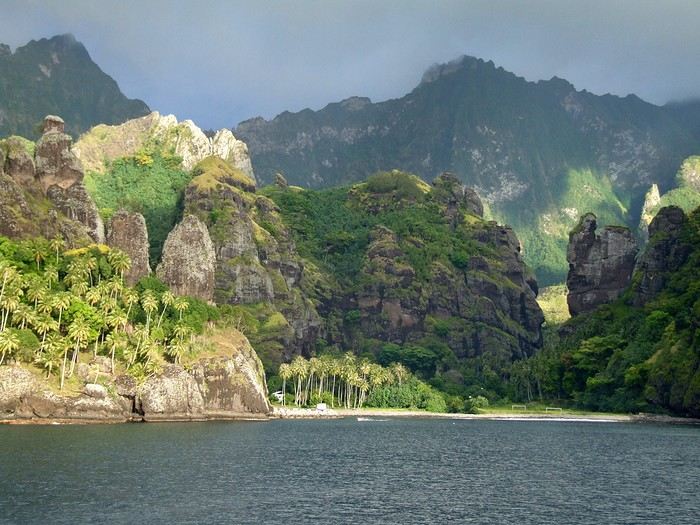 Idyllic landscape of a dream island, but difficult to access: the Bay of Virgins in Fatu Hiva, Marquesas Islands
Among the values conveyed by literature, tourism, and advertising is the quest for “elsewhere,” for a change of scenery, in the truest sense of the word—that is, the need to leave one’s country. This need for otherness, for difference, is projected onto dreamlike, idealized, even mythicized places. In our imaginary world, the island is often that place.
Yet we forget that islands have also been ideal prisons. The examples are numerous: Elba and Saint Helena, Alcatraz and Poulo Condor, If and Yeu, the Devil’s Islands and Leros. The latter, located in Greece in the Dodecanese, hosted a sinister forced labor camp during the colonels’ dictatorship as well as a psychiatric hospital. Despite the beauty of its bay, tourism has remained marginal there due to its bad reputation, unlike the neighboring island of Patmos.
I’d like to share a selection of about a dozen islands from across the world’s seas and oceans. For dreaming...
°°°°°°°°°°°°°°°
SANTORINI
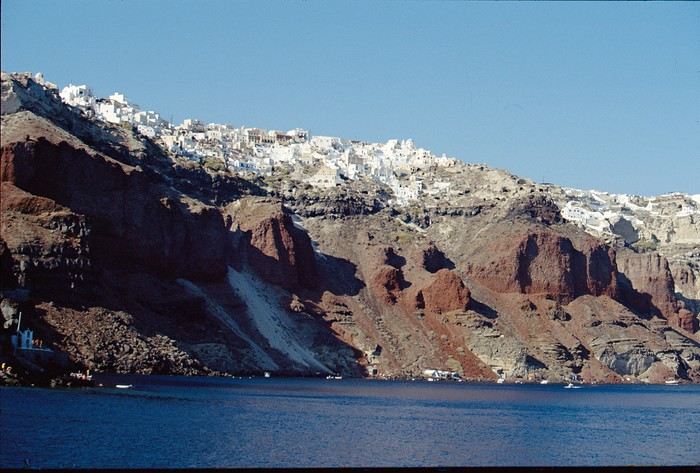
July 27, 1967
At dawn, the ferry from Agios Nikolaos (Crete) enters the immense caldera of Santorini. From the ship’s deck, Rainer, my travel companion, and I are left in awe by the sight of these towering, multicolored cliffs looming over us. We disembark and begin the steep climb on foot via the winding mule path up to the village of Fira, the capital perched above the cliff. Though it’s still very early, we head to the youth hostel. There wasn’t a soul in the alleys that morning—or rather, there were only cats! I have a fond memory of that encounter with Santorini: a sensory shock, a breathtaking volcanic site, a harmony of blue, ochre-red, and white. A welcoming island, as it was traditional to welcome the xénou, an island that hadn’t yet fully recovered from the terrible 1956 earthquake, a Cycladic architectural marvel where local life was still preserved.
It’s easy to see why, in antiquity, the island was named Kallisté (καλλίστη), “the most beautiful,” as it’s nearly impossible to resist gazing at this landscape shaped by tectonic forces. Indeed, a massive volcanic cataclysm—the Minoan eruption—shaped this scenery in the 17th century BCE, creating a caldera that was quickly filled by the sea. The enormous tsunamis that followed reached Crete, leading to the disappearance of the Minoan civilization.
A cliffside path along the caldera leads us to the peaceful village of Oia, at the northern tip of the island. Blue-domed churches and flower-filled villages with whitewashed houses line the way. This walk is a continuous marvel, offering splendid views of the caldera and the neighboring islands formed by the breakup of the ancient volcano (Thirissa, Nea Kameni). Oia is a large, picturesque village, like Fira perched on the cliff’s edge, which was severely damaged by the 1956 earthquake, and its scars are still visible. Its cave-like houses with vaulted roofs haven’t yet been turned into luxury hotels or shops. Absolute tranquility reigns here.
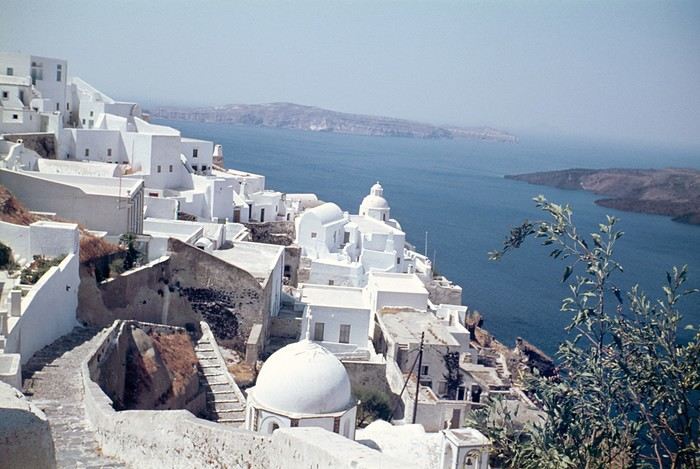 Oia in 1967—a peaceful village overlooking the caldera. But where are the pools and trendy bars?
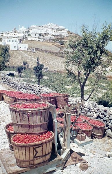
A lush countryside covered in olive trees and vineyards welcomes us for a pleasant hike, interrupted by the kindness of a friendly islander who gives us a lift in his truck for a few kilometers. He’s off to harvest his tomatoes, which he grows at the foot of Pyrgos Hill. The delicious little cherry tomato of Santorini earned an EU Protected Designation of Origin (PDO) in 2013. We climb up to the village of Pyrgos, perched on a hill and dominated by the elegant bell tower of its church. Finally, we reach the black sand beach of Kamari on the island’s eastern coast to enjoy a swim.
{...} To be continued

°°°°°°°°°°°°°°°°°
RAIVAVAE (French Polynesia)
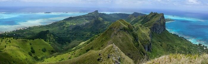
November 15, 2007
Éléonore from Pension Tama welcomes us with traditional flower leis, as if she’d been waiting for old friends she hadn’t seen in ages. The small airport terminal is lively, the atmosphere warm—people hugging, rejoicing in reunions, all under kilos of flowers. Then, just as quickly, the place empties until the next flight... in a few days.
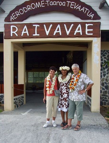
In the Austral Islands, a ninety-minute flight from Tahiti, Raivavae is a world away from the frenetic pace of Papeete or the tourist crowds of the Leeward Islands. The true paradise of the South Seas can still be savored here—it’s a bit like Bora Bora half a century ago. Our first feeling upon arriving on this island is wonder, with smiles that could melt even the gloomiest among us, landscapes so stunning they take your breath away, and above all, a sense of disorientation and fulfillment. Picture a mountainous island, about ten kilometers by three and a half, encircled by a coral reef and wild motu, cradling a lagoon with shades of blue that would make Bora Bora green with envy.
The roughly one thousand inhabitants of Raivavae are spread across four villages around the island. Children are everywhere, as is typical in Polynesia, and they greet you with open, genuine smiles. Here, ancestral values have survived progress. The predominantly Protestant population is very devout, as evidenced by the several temples built across the island. Religious fervor sets the rhythm of daily life. Sundays are reserved for worship and Sunday school (catechism). Work is forbidden on that day, and tourist activities are suspended. These rules are strict and respected.
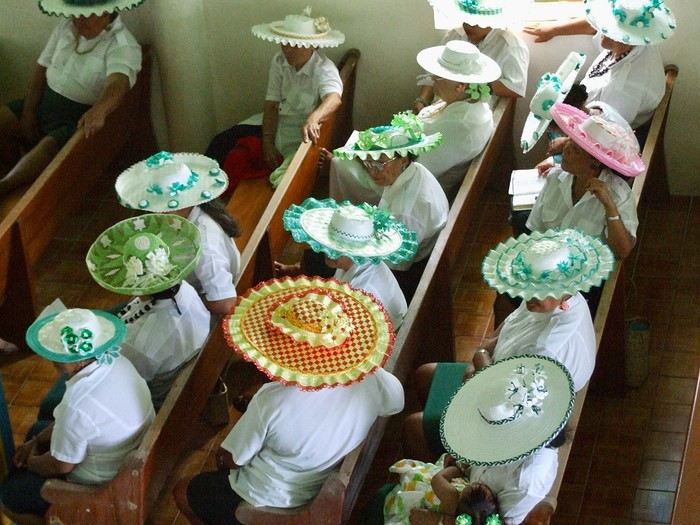 Hat contest for the worship celebration
Yet a sense of resignation is ever-present. The people of Raivavae know they are—and will remain—isolated. Despite the construction of an airstrip in 2004 and a few weekly flights to Tahiti and its nearest neighbor, Tubuai (200 km away), the island remains on the fringes of the world. One painful aspect is the separation of children from their parents when they leave for middle school in Tubuai starting in fifth grade. Television brings daily images of a world the islanders will likely never know, but one they often aspire to.
We are privileged. We have the pristine white-sand beaches of the motu and some of the most beautiful bays in Polynesia all to ourselves. The jewel in the crown, the island’s emblematic spot, is the “motu-pool,” about twenty minutes by boat. A natural, exquisite basin with crystal-clear water, gradients of blue, and white sand. And best of all, there’s almost no one there. In fact, lounging on the beach is frowned upon, especially for young women. Religion looks very unfavorably on sunbathing and lazing around. And yet, everything here leans toward that philosophy of life.
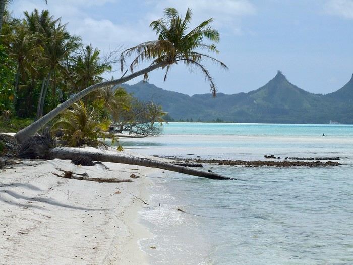
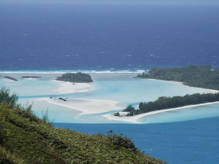 The "motu-pool"
{...} To be continued
Who among us hasn’t dreamed of having a ticket to Tahiti, Bora Bora, or the Marquesas in their pocket—preferably a one-way ticket to “paradise”?
Idyllic landscape of a dream island, but difficult to access: the Bay of Virgins in Fatu Hiva, Marquesas IslandsAmong the values conveyed by literature, tourism, and advertising is the quest for “elsewhere,” for a change of scenery, in the truest sense of the word—that is, the need to leave one’s country. This need for otherness, for difference, is projected onto dreamlike, idealized, even mythicized places. In our imaginary world, the island is often that place.
Yet we forget that islands have also been ideal prisons. The examples are numerous: Elba and Saint Helena, Alcatraz and Poulo Condor, If and Yeu, the Devil’s Islands and Leros. The latter, located in Greece in the Dodecanese, hosted a sinister forced labor camp during the colonels’ dictatorship as well as a psychiatric hospital. Despite the beauty of its bay, tourism has remained marginal there due to its bad reputation, unlike the neighboring island of Patmos.
I’d like to share a selection of about a dozen islands from across the world’s seas and oceans. For dreaming...
°°°°°°°°°°°°°°°
SANTORINI
July 27, 1967
At dawn, the ferry from Agios Nikolaos (Crete) enters the immense caldera of Santorini. From the ship’s deck, Rainer, my travel companion, and I are left in awe by the sight of these towering, multicolored cliffs looming over us. We disembark and begin the steep climb on foot via the winding mule path up to the village of Fira, the capital perched above the cliff. Though it’s still very early, we head to the youth hostel. There wasn’t a soul in the alleys that morning—or rather, there were only cats! I have a fond memory of that encounter with Santorini: a sensory shock, a breathtaking volcanic site, a harmony of blue, ochre-red, and white. A welcoming island, as it was traditional to welcome the xénou, an island that hadn’t yet fully recovered from the terrible 1956 earthquake, a Cycladic architectural marvel where local life was still preserved.
It’s easy to see why, in antiquity, the island was named Kallisté (καλλίστη), “the most beautiful,” as it’s nearly impossible to resist gazing at this landscape shaped by tectonic forces. Indeed, a massive volcanic cataclysm—the Minoan eruption—shaped this scenery in the 17th century BCE, creating a caldera that was quickly filled by the sea. The enormous tsunamis that followed reached Crete, leading to the disappearance of the Minoan civilization.
A cliffside path along the caldera leads us to the peaceful village of Oia, at the northern tip of the island. Blue-domed churches and flower-filled villages with whitewashed houses line the way. This walk is a continuous marvel, offering splendid views of the caldera and the neighboring islands formed by the breakup of the ancient volcano (Thirissa, Nea Kameni). Oia is a large, picturesque village, like Fira perched on the cliff’s edge, which was severely damaged by the 1956 earthquake, and its scars are still visible. Its cave-like houses with vaulted roofs haven’t yet been turned into luxury hotels or shops. Absolute tranquility reigns here.
Oia in 1967—a peaceful village overlooking the caldera. But where are the pools and trendy bars?A lush countryside covered in olive trees and vineyards welcomes us for a pleasant hike, interrupted by the kindness of a friendly islander who gives us a lift in his truck for a few kilometers. He’s off to harvest his tomatoes, which he grows at the foot of Pyrgos Hill. The delicious little cherry tomato of Santorini earned an EU Protected Designation of Origin (PDO) in 2013. We climb up to the village of Pyrgos, perched on a hill and dominated by the elegant bell tower of its church. Finally, we reach the black sand beach of Kamari on the island’s eastern coast to enjoy a swim.
{...} To be continued
°°°°°°°°°°°°°°°°°
RAIVAVAE (French Polynesia)
November 15, 2007
Éléonore from Pension Tama welcomes us with traditional flower leis, as if she’d been waiting for old friends she hadn’t seen in ages. The small airport terminal is lively, the atmosphere warm—people hugging, rejoicing in reunions, all under kilos of flowers. Then, just as quickly, the place empties until the next flight... in a few days.
In the Austral Islands, a ninety-minute flight from Tahiti, Raivavae is a world away from the frenetic pace of Papeete or the tourist crowds of the Leeward Islands. The true paradise of the South Seas can still be savored here—it’s a bit like Bora Bora half a century ago. Our first feeling upon arriving on this island is wonder, with smiles that could melt even the gloomiest among us, landscapes so stunning they take your breath away, and above all, a sense of disorientation and fulfillment. Picture a mountainous island, about ten kilometers by three and a half, encircled by a coral reef and wild motu, cradling a lagoon with shades of blue that would make Bora Bora green with envy.
The roughly one thousand inhabitants of Raivavae are spread across four villages around the island. Children are everywhere, as is typical in Polynesia, and they greet you with open, genuine smiles. Here, ancestral values have survived progress. The predominantly Protestant population is very devout, as evidenced by the several temples built across the island. Religious fervor sets the rhythm of daily life. Sundays are reserved for worship and Sunday school (catechism). Work is forbidden on that day, and tourist activities are suspended. These rules are strict and respected.
Hat contest for the worship celebrationYet a sense of resignation is ever-present. The people of Raivavae know they are—and will remain—isolated. Despite the construction of an airstrip in 2004 and a few weekly flights to Tahiti and its nearest neighbor, Tubuai (200 km away), the island remains on the fringes of the world. One painful aspect is the separation of children from their parents when they leave for middle school in Tubuai starting in fifth grade. Television brings daily images of a world the islanders will likely never know, but one they often aspire to.
We are privileged. We have the pristine white-sand beaches of the motu and some of the most beautiful bays in Polynesia all to ourselves. The jewel in the crown, the island’s emblematic spot, is the “motu-pool,” about twenty minutes by boat. A natural, exquisite basin with crystal-clear water, gradients of blue, and white sand. And best of all, there’s almost no one there. In fact, lounging on the beach is frowned upon, especially for young women. Religion looks very unfavorably on sunbathing and lazing around. And yet, everything here leans toward that philosophy of life.
The "motu-pool"{...} To be continued
Hi everyone,
In mid-July 2025, we were lucky enough to spend about ten days in Bulgaria. We did a 10-day road trip exploring this beautiful and underrated Balkan country! Since planning a trip isn’t always easy, we’re sharing our original itinerary (different from the "classic" loop offered by travel agencies) and our feedback on the various places we visited.
With a few photos to illustrate each day, we hope to wow you 🙂 and, most importantly, inspire you to visit Bulgaria!
Here’s our loop itinerary starting from Sofia (a varied program that allowed us to enjoy some summer swimming on the beaches of the Black Sea):
Day 1 - The Rila Monastery, Bulgaria’s emblem
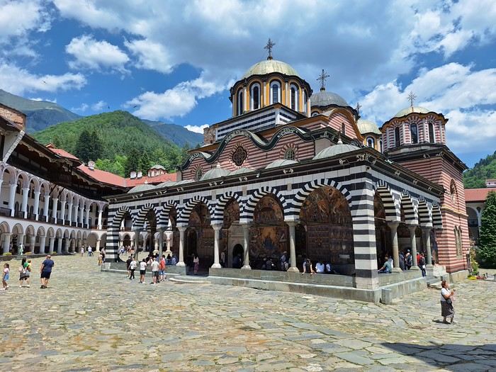 Day 2 - The picturesque village of Koprivshtitsa, the Russian Church of Shipka, and the listed village of Bozhentsi
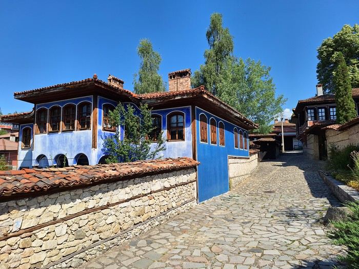
 Day 3 - The small town of Tryavna and Sozopol, a little gem on the Bulgarian coast
Day 4 - Sinemorets and the wild Veleka beach, the stunning Silistar beach, and the small port of Ahtopol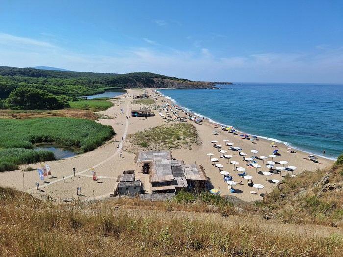
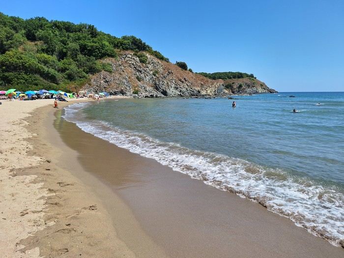
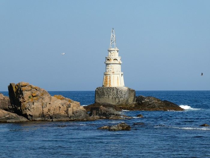
Day 2 - The picturesque village of Koprivshtitsa, the Russian Church of Shipka, and the listed village of Bozhentsi
Day 3 - The small town of Tryavna and Sozopol, a little gem on the Bulgarian coast
Day 4 - Sinemorets and the wild Veleka beach, the stunning Silistar beach, and the small port of Ahtopol
Hi everyone, I’m stopping just giving advice on new topics to others and leading by example.
Here’s a quick recap of my Manakara–Fort Dauphin route via the ferry + 10 track (RN12). The road is changing: bridges are being built, some sections are being paved.
 By bike, it’s doable, though some sandy stretches are still pretty tough if you’re as overloaded as I was... Left Manakara’s Hôtel Les Délices on the 11th with my pretty beat-up blue bike...
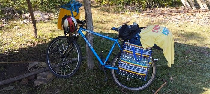
Evening of the 11th: Ivohipeno Hôtel La Source.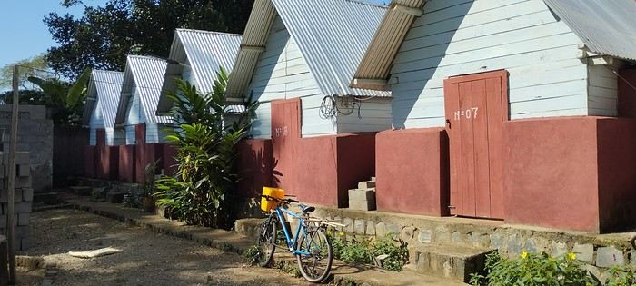
12th–15th: Farafangana’s must-visit Hôtel Concombre Masqué, bike prep. 16th: Vangaindrano—Hôtel Chez Huguette was full, so I went to Tropic Hôtel, which is nice even with plumbing issues. Did my shopping since it’s the last real town. 17th: Chez Flavienne—her real job is singer/dancer, and she has cute little bungalows before the village of... I never found it on GPS or maps. A bit basic but welcoming, with Flavienne taking great care of me. 18th: Manombondro—the "friends’ spot," yikes, avoid! The restaurant’s okay, but the room is really rough: sketchy shower, the room opens right onto the main road where all the 4x4s gather. Good for tips, but better to sleep elsewhere...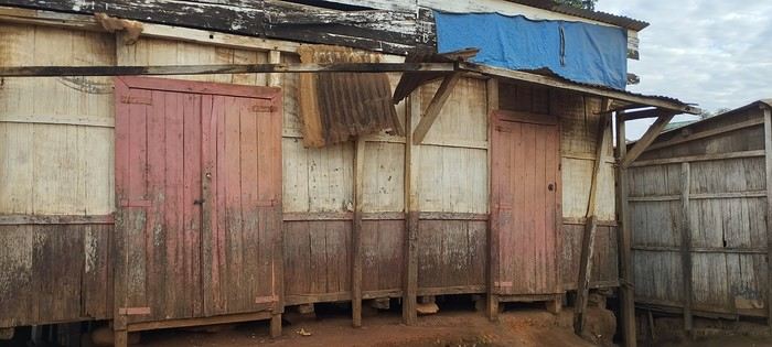
20th: Taking one of the many alternative tracks, I got lost and camped under my tent less than 5 km from Sandravinany. 21st: Sandravinany—first day at Mamie Louise’s, average hotel. Vesslasse, the manager, is great. 22nd: The next day, I went back to the fisherman’s cabin I’d thought was closed the day before—awesome! Perfect location with a lagoon view.
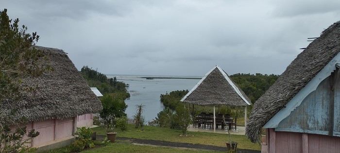
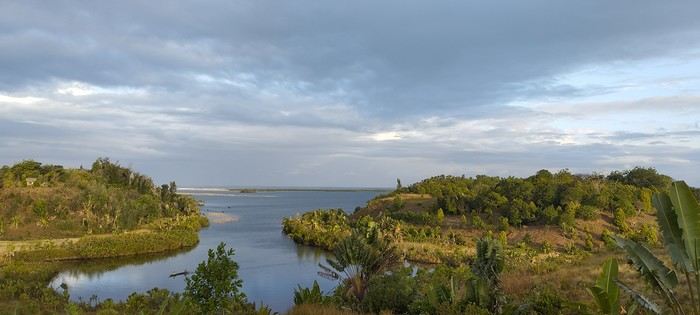
Vesslasse stops by regularly to offer his services—he knows everyone, is efficient, and super friendly. I treated myself to a few days of contemplative relaxation before taking a pirogue toward the coastal track on the morning of the 25th—big mistake! Hardly anyone around to ask for directions, so I got lost multiple times, did a bunch of backtracking, and dealt with a lot of sand... Check out this YouTube video: From Sandravinany to the Sand Track 25th: Maroroy—chez Louisette, can’t miss it: right after the ferry, by the water, super relaxing. By the water, super relaxing. 26th: Manantenina—the very nice (and for me, too expensive) bungalows of Jean-Philippe were full, so I stayed at Hôtel Le Bleu, small bungalows with a restaurant on the main road. 27th: Sainte Luce—I got a ride from a UNICEF 4x4, so I *had* to stay at Hôtel Vah’inn—expensive but right on the water, with a pool table and good food. 28th: Fort Dauphin—Hôtel Nepenthes: central (steep climb to get there!) but nice bungalows.
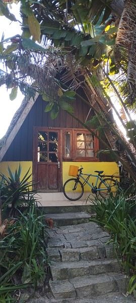
Fort Dauphin has plenty of very affordable hotels. After that, I headed back to Tulear in a shared 4x4 (Godzilla)—two pretty grueling days, but the driver was really nice.
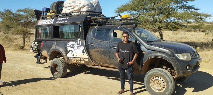
You can find all the details of this adventure and many others in my book, but I’m not allowed to talk about it on the forum... Too bad. A video of this route That’s it—I’ll post about other tracks I did that same year in other threads. Have a great day!
By bike, it’s doable, though some sandy stretches are still pretty tough if you’re as overloaded as I was... Left Manakara’s Hôtel Les Délices on the 11th with my pretty beat-up blue bike...
Evening of the 11th: Ivohipeno Hôtel La Source.
12th–15th: Farafangana’s must-visit Hôtel Concombre Masqué, bike prep. 16th: Vangaindrano—Hôtel Chez Huguette was full, so I went to Tropic Hôtel, which is nice even with plumbing issues. Did my shopping since it’s the last real town. 17th: Chez Flavienne—her real job is singer/dancer, and she has cute little bungalows before the village of... I never found it on GPS or maps. A bit basic but welcoming, with Flavienne taking great care of me. 18th: Manombondro—the "friends’ spot," yikes, avoid! The restaurant’s okay, but the room is really rough: sketchy shower, the room opens right onto the main road where all the 4x4s gather. Good for tips, but better to sleep elsewhere...
20th: Taking one of the many alternative tracks, I got lost and camped under my tent less than 5 km from Sandravinany. 21st: Sandravinany—first day at Mamie Louise’s, average hotel. Vesslasse, the manager, is great. 22nd: The next day, I went back to the fisherman’s cabin I’d thought was closed the day before—awesome! Perfect location with a lagoon view.
Vesslasse stops by regularly to offer his services—he knows everyone, is efficient, and super friendly. I treated myself to a few days of contemplative relaxation before taking a pirogue toward the coastal track on the morning of the 25th—big mistake! Hardly anyone around to ask for directions, so I got lost multiple times, did a bunch of backtracking, and dealt with a lot of sand... Check out this YouTube video: From Sandravinany to the Sand Track 25th: Maroroy—chez Louisette, can’t miss it: right after the ferry, by the water, super relaxing. By the water, super relaxing. 26th: Manantenina—the very nice (and for me, too expensive) bungalows of Jean-Philippe were full, so I stayed at Hôtel Le Bleu, small bungalows with a restaurant on the main road. 27th: Sainte Luce—I got a ride from a UNICEF 4x4, so I *had* to stay at Hôtel Vah’inn—expensive but right on the water, with a pool table and good food. 28th: Fort Dauphin—Hôtel Nepenthes: central (steep climb to get there!) but nice bungalows.
Fort Dauphin has plenty of very affordable hotels. After that, I headed back to Tulear in a shared 4x4 (Godzilla)—two pretty grueling days, but the driver was really nice.
You can find all the details of this adventure and many others in my book, but I’m not allowed to talk about it on the forum... Too bad. A video of this route That’s it—I’ll post about other tracks I did that same year in other threads. Have a great day!