INTRODUCTION
Trip taken in 2021, but still relevant for exploring the island of Newfoundland.
We went on multiple hikes in this Canadian province, which offers a unique and breathtaking landscape.
GPS coordinates: 46.20884, -60.24498 Marine Atlantic Ferry
To do this, we traveled to North Sydney, Nova Scotia, to board a Marine Atlantic ferry that took us to Port aux Basques in Newfoundland. The crossing takes about 7 hours.
The ferry *Highlanders* features spacious cabins for two or four people, a restaurant, a retail store, and a play area for kids.
The reclining seats are comfortable and include a headphone jack and a USB charging port.
We went out on the open-air panoramic observation deck several times to admire the Atlantic Ocean, hoping to spot some marine wildlife. Unfortunately, we didn’t see any.
This short video gives you an overview of the facilities. For more details, I invite you to check out Marine Atlantic’s website at the following address: https://www.marineatlantique.ca/.
https://youtu.be/oV9_7AcJnEQ
278 similar discussions in English
The context:
The urge to return to the USA, to explore a new part of the country. I don’t need much convincing to go back to Uncle Sam’s land. My wife’s on board too.
So, off we go for my 9th trip to the USA! (I didn’t take notes, so this is from memory)
Day 1: The departure: Flight with two layovers. I usually avoid layovers in the US before the final destination because of immigration. This time, my flight was Lyon/Munich, then Munich/Chicago, and finally Chicago/New Orleans. The layover in Chicago was 3 hours, and since I’d been through this airport twice before and found it super efficient both times, I wasn’t too worried when I booked my tickets—especially with Lufthansa. Unfortunately, there were several flight changes before departure, the last one leaving us with only a 2h14 layover in Chicago. I called Lufthansa to check if that would be enough, and they told me immigration in Chicago takes about an hour and 45 minutes (according to their calculations). So, I left feeling confident. A 15-minute delay leaving Lyon, then a 1-hour delay leaving Munich—now I’m starting to worry. When we arrived in Chicago, we rushed, cut in line, and made it to immigration. And then—an impossible queue. Game over, we missed our last flight. Of course, Lufthansa rebooked us for the next morning, arriving around 10 AM, and booked us a hotel. I found someone to call Alamo in New Orleans to make sure my rental car would still be there. Everything’s sorted—except our luggage, which we have no idea where it is! My little worry is that we land at 9:45 AM the next morning, and we’ve booked a tour at 11 AM at Laura Plantation, which is about an hour’s drive away! Wait and see…
The +: We're back in the USA The -: Once again, flight delays
Day 1: The departure: Flight with two layovers. I usually avoid layovers in the US before the final destination because of immigration. This time, my flight was Lyon/Munich, then Munich/Chicago, and finally Chicago/New Orleans. The layover in Chicago was 3 hours, and since I’d been through this airport twice before and found it super efficient both times, I wasn’t too worried when I booked my tickets—especially with Lufthansa. Unfortunately, there were several flight changes before departure, the last one leaving us with only a 2h14 layover in Chicago. I called Lufthansa to check if that would be enough, and they told me immigration in Chicago takes about an hour and 45 minutes (according to their calculations). So, I left feeling confident. A 15-minute delay leaving Lyon, then a 1-hour delay leaving Munich—now I’m starting to worry. When we arrived in Chicago, we rushed, cut in line, and made it to immigration. And then—an impossible queue. Game over, we missed our last flight. Of course, Lufthansa rebooked us for the next morning, arriving around 10 AM, and booked us a hotel. I found someone to call Alamo in New Orleans to make sure my rental car would still be there. Everything’s sorted—except our luggage, which we have no idea where it is! My little worry is that we land at 9:45 AM the next morning, and we’ve booked a tour at 11 AM at Laura Plantation, which is about an hour’s drive away! Wait and see…
The +: We're back in the USA The -: Once again, flight delays
Hello there,

As mentioned in the title, this is a travel journal focused on St. Lucia and iSimangaliso ("this place is miraculous" in Zulu) over various trips spanning about twenty years.
The Elephant Coast stretches from Hluhluwe Umfolozi, through St. Lucia and iSimangaliso, all the way to the Mozambique border near Kosi Bay and Tembe. This region was conquered by the Zulus (for context, in the 19th century, the Zulus were just one Bantu group among many—it was a local Napoleon, Shaka, who was both cruel and inventive, conquering and subjugating all other groups to form the Zulu nation). The Tonga were the big losers in this area, and a certain "animosity" is still very noticeable... With our two guides (one Zulu and the other Tonga), we ran into some Tonga folks—definitely not a warm atmosphere. The Tonga were pushed back into the marshes. Fish traps are their main source of wealth. (iSimangaliso is a lagoon and marshland area with several interconnected lakes—it used to be called Vetland Park, and for good reason.) So, lakes, fishing with fish traps...
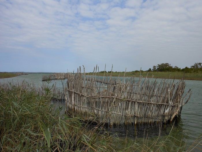
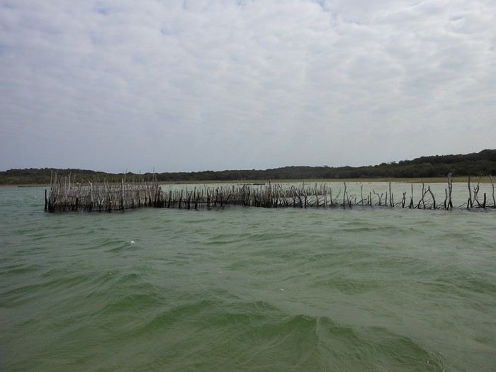
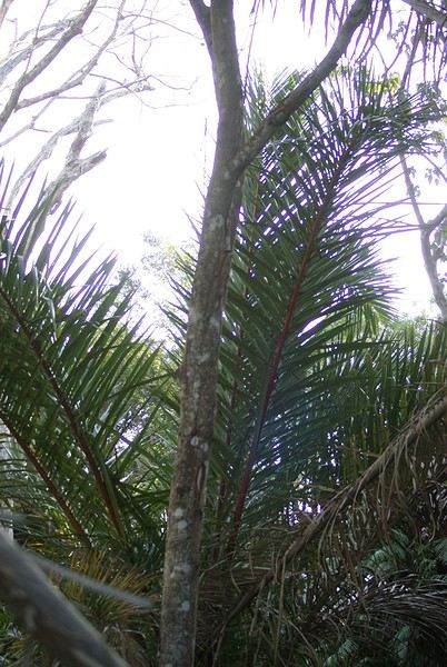
Traditionally done with raffia boats
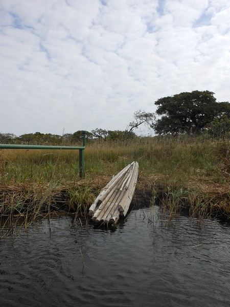
Made from forest raffia
Where we spotted a particularly rare and endemic bird (whose name I can’t remember... and I can’t be bothered to dig through my notes)
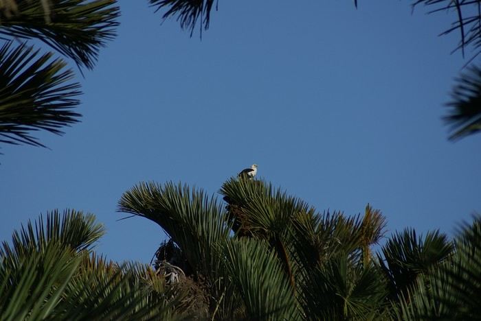 Here, those are eagles
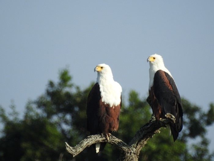
And they’re pretty brave because... they’re not far away...
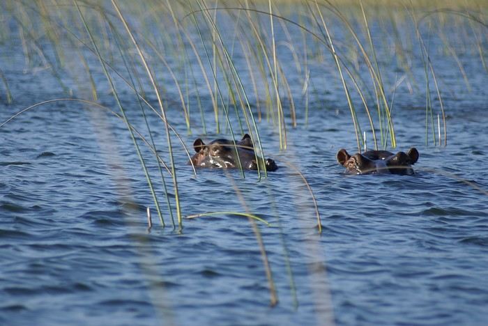
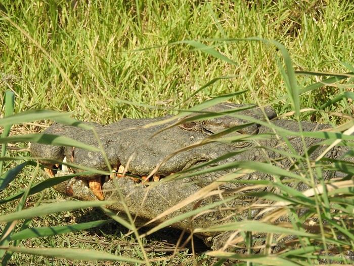
Yet we still swim there... with supervision...
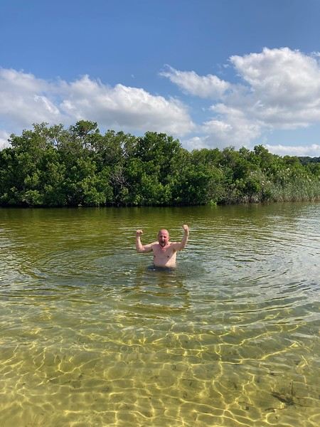
So, between St. Lucia and Mozambique, you’ll find marshes, lagoons, lakes, and coastline, with our Tonga friends, Zulu friends, and—just a bit further up—the Tembe... and their king. (I’m showing off a bit because I got to see a king up close, ate in the same room as him, and even talked to him!)
Originally, the Boers tried to farm there... including sugarcane...
But... between the hippos, snakes, crocs, and malaria-carrying mosquitoes... They lost count of the deaths and disappearances.
The story goes that when Madiba (Mandela) came to power, he passed through the area and convinced them to turn it into a natural space that would attract tourists—and that’s when the big change happened.
And it’s pretty incredible to see how this place has evolved, going from extreme poverty to a certain level of gentrification... How this once "chaotic" area saw shops, roads, and housing spring up (I’m mainly talking about Mtubatuba, the nearby Black town). In fact, in St. Lucia now, the homes that aren’t tourist accommodations can be counted on one hand.
St. Lucia has become a "seaside resort"... very busy during school holidays and certain weekends, increasingly cosmopolitan (20 years ago, speaking French was exotic—now it’s completely ordinary).
As mentioned in the title, this is a travel journal focused on St. Lucia and iSimangaliso ("this place is miraculous" in Zulu) over various trips spanning about twenty years.
The Elephant Coast stretches from Hluhluwe Umfolozi, through St. Lucia and iSimangaliso, all the way to the Mozambique border near Kosi Bay and Tembe. This region was conquered by the Zulus (for context, in the 19th century, the Zulus were just one Bantu group among many—it was a local Napoleon, Shaka, who was both cruel and inventive, conquering and subjugating all other groups to form the Zulu nation). The Tonga were the big losers in this area, and a certain "animosity" is still very noticeable... With our two guides (one Zulu and the other Tonga), we ran into some Tonga folks—definitely not a warm atmosphere. The Tonga were pushed back into the marshes. Fish traps are their main source of wealth. (iSimangaliso is a lagoon and marshland area with several interconnected lakes—it used to be called Vetland Park, and for good reason.) So, lakes, fishing with fish traps...
Traditionally done with raffia boats
Made from forest raffia
Where we spotted a particularly rare and endemic bird (whose name I can’t remember... and I can’t be bothered to dig through my notes)
Here, those are eagles
And they’re pretty brave because... they’re not far away...
Yet we still swim there... with supervision...
So, between St. Lucia and Mozambique, you’ll find marshes, lagoons, lakes, and coastline, with our Tonga friends, Zulu friends, and—just a bit further up—the Tembe... and their king. (I’m showing off a bit because I got to see a king up close, ate in the same room as him, and even talked to him!)
Originally, the Boers tried to farm there... including sugarcane...
But... between the hippos, snakes, crocs, and malaria-carrying mosquitoes... They lost count of the deaths and disappearances.
The story goes that when Madiba (Mandela) came to power, he passed through the area and convinced them to turn it into a natural space that would attract tourists—and that’s when the big change happened.
And it’s pretty incredible to see how this place has evolved, going from extreme poverty to a certain level of gentrification... How this once "chaotic" area saw shops, roads, and housing spring up (I’m mainly talking about Mtubatuba, the nearby Black town). In fact, in St. Lucia now, the homes that aren’t tourist accommodations can be counted on one hand.
St. Lucia has become a "seaside resort"... very busy during school holidays and certain weekends, increasingly cosmopolitan (20 years ago, speaking French was exotic—now it’s completely ordinary).
Thursday, November 9, 2023
Cairns
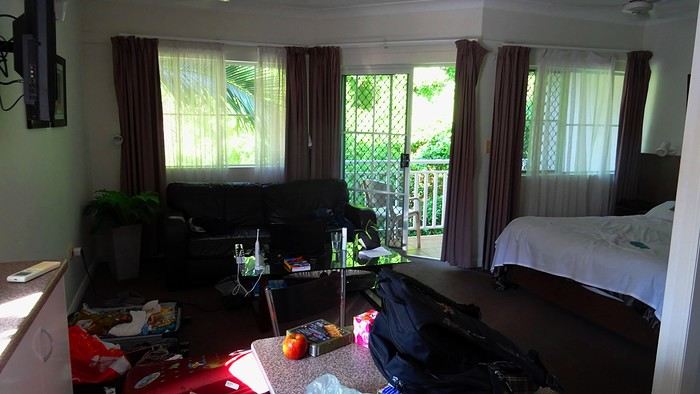
TV scriptwriters are a funny bunch. As soon as their ordinary mug starts becoming recognizable on the street thanks to success, their egos start swelling. They walk on clouds. So, one of the guys who worked on the script for our trip—the one who specifically came up with the bit about the SD card being ejected into the great beyond—has built himself a nice little reputation. The kind that can sometimes launch a real career. Then, inevitably, they just can’t stop. That’s how this guy had the poor idea of adding one last twist to the sequence that made him a one-day star. An idea that’s basically about squeezing the lemon until the very last drop, if you know what I mean. The little bag I take everywhere with my essentials—car keys, camera, phone—has also hosted a bunch of secondary items over time. Tissues, a book, city maps... whatever. It became a mess! So I finally decided to sort it out. I empty it onto a table. And there, stunned, I find the memory card that Dom and I desperately searched for on all fours on Cahill’s Crossing walkway, remember? Under the shocked gaze of a little Australian girl. It had ejected straight into my bag! What do you think? Should we fire the scriptwriter? It’s way too improbable! Stuff like that doesn’t happen in real life, right?
We head out to explore Cairns. The city is mostly about the waterfront, the Esplanade. You’ll find tons of bronze plaques there, most of them in memory of a deceased loved one. All you have to do is shell out a few hundred euros, and one day, a bewildered tourist will read your prose, charmed by your lovely turns of phrase. Vanity is a thriving business!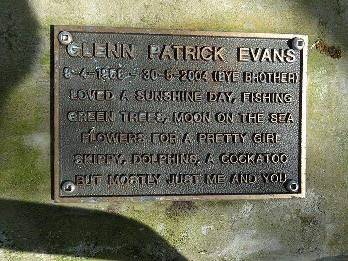
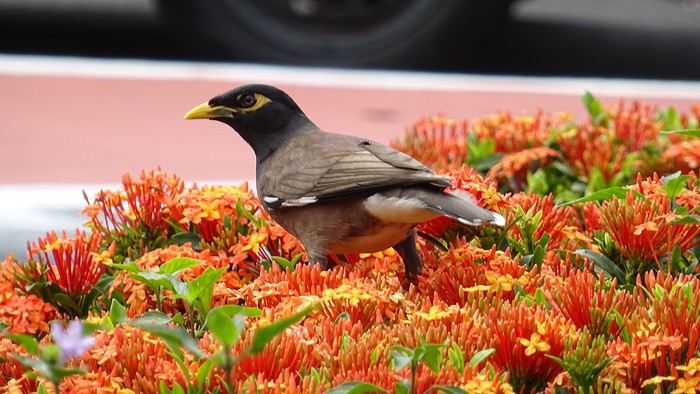
It makes for some reading... We spot our parakeets again... What were they called? Oh right, in abundance! Everywhere, banyan fig trees provide shade from a sun that never seems to tire. Parks... Here, kids are king.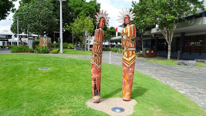 Luxury hotels with their infinity pools...
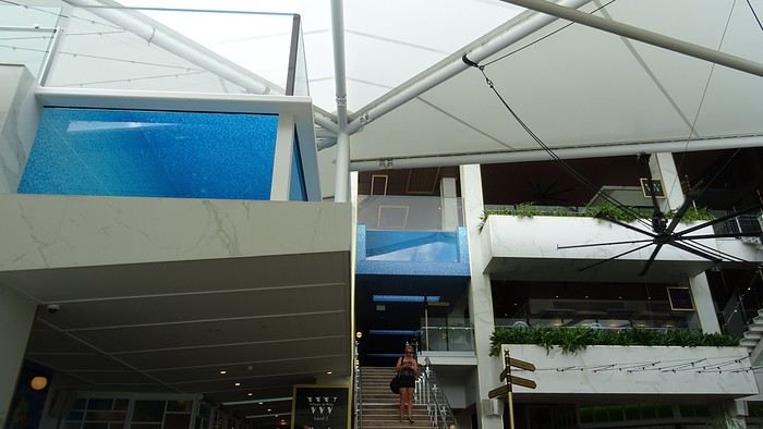
 You don’t know where to look first... You’ve got to go all out. Google... Where can we rent bikes? When we finally track down the only operator in town, we find the place closed. A bit further on, a Visitor’s Center might find us an alternative? We meet a charming young guy, super dynamic and a great communicator. We leave without bikes but with a full snorkeling package for the day after tomorrow! I call the shop that let us down... Well done! The owner was at the doctor’s; he’s back now, and we can make a deal!
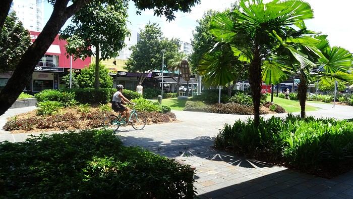
- Oh, Dominique, where are you off to like that, so proudly and at full speed? - Me? To the Botanic Garden, of course! It’s huge and free!
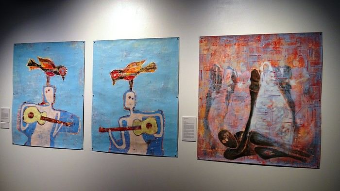
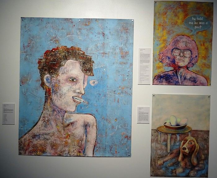
They’ve recycled oil tanks into art galleries!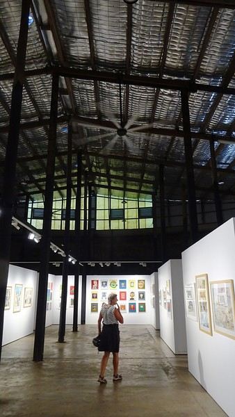
TV scriptwriters are a funny bunch. As soon as their ordinary mug starts becoming recognizable on the street thanks to success, their egos start swelling. They walk on clouds. So, one of the guys who worked on the script for our trip—the one who specifically came up with the bit about the SD card being ejected into the great beyond—has built himself a nice little reputation. The kind that can sometimes launch a real career. Then, inevitably, they just can’t stop. That’s how this guy had the poor idea of adding one last twist to the sequence that made him a one-day star. An idea that’s basically about squeezing the lemon until the very last drop, if you know what I mean. The little bag I take everywhere with my essentials—car keys, camera, phone—has also hosted a bunch of secondary items over time. Tissues, a book, city maps... whatever. It became a mess! So I finally decided to sort it out. I empty it onto a table. And there, stunned, I find the memory card that Dom and I desperately searched for on all fours on Cahill’s Crossing walkway, remember? Under the shocked gaze of a little Australian girl. It had ejected straight into my bag! What do you think? Should we fire the scriptwriter? It’s way too improbable! Stuff like that doesn’t happen in real life, right?
We head out to explore Cairns. The city is mostly about the waterfront, the Esplanade. You’ll find tons of bronze plaques there, most of them in memory of a deceased loved one. All you have to do is shell out a few hundred euros, and one day, a bewildered tourist will read your prose, charmed by your lovely turns of phrase. Vanity is a thriving business!
It makes for some reading... We spot our parakeets again... What were they called? Oh right, in abundance! Everywhere, banyan fig trees provide shade from a sun that never seems to tire. Parks... Here, kids are king.
Luxury hotels with their infinity pools...
You don’t know where to look first... You’ve got to go all out. Google... Where can we rent bikes? When we finally track down the only operator in town, we find the place closed. A bit further on, a Visitor’s Center might find us an alternative? We meet a charming young guy, super dynamic and a great communicator. We leave without bikes but with a full snorkeling package for the day after tomorrow! I call the shop that let us down... Well done! The owner was at the doctor’s; he’s back now, and we can make a deal!
- Oh, Dominique, where are you off to like that, so proudly and at full speed? - Me? To the Botanic Garden, of course! It’s huge and free!
They’ve recycled oil tanks into art galleries!
Travel Journal: 21 Days in La Gomera and La Palma
From February 6 to February 26, 2024
Tuesday, February 6 We left around 9 AM with our car, along with Pierre-Paul and Patricia, heading to the Bluepark parking lot in Bartenheim. As expected, we were awaited and left promptly for EuroAirport Basel. Took off at 12:25 PM for a 4-hour-15-minute flight under excellent conditions. Beautiful arrival in Tenerife with Teide in sight under a clear blue sky. Fifteen minutes later, we waited for bus No. 40 to Los Cristianos with quite a few other tourists, but we managed to find four seats. From the bus station, it was a 20-minute walk to our hotel. We checked into a lovely apartment for the four of us, complete with all the comforts. Outside, it was quite warm—at least 25°C! After dropping off our luggage, we went for a stroll. The immediate surroundings of the hotel held no interest for us: a modern, concrete area filled with hotels, bars, tourist agencies, and unappealing restaurants all offering the same bland international cuisine. Pat went to cool off at the pool, unfortunately overrun by loud, drunk English tourists. I took a walk to the paseo maritimo that leads to the port, skirting the seafront. The promenade was pleasant, but it could have been any seaside resort in the world—same old scene: a succession of bars with blaring music where many elderly people sipped cold beers waiting for the sunset, the backdrop a wall of resort-style hotels resembling rabbit hutches! Upon reaching the port, I scouted the route we’d take the next day to the Fred Olsen ferry. Back at the apartment, in the early evening, we looked for a non-touristy restaurant for dinner. Monique stopped a woman to ask her opinion! In this area, she told us, there’s no restaurant that serves Canarian or Spanish cuisine! The only place with decent restaurants is at the port. Off we went to the port, where we sat down at Al Bordo restaurant and ordered a seafood paella for four. Excellent, and at a very reasonable price (36 € for two). We returned to the hotel along the seafront.
Wednesday, February 7
Woke up at 6 AM. Had breakfast in the apartment with what we’d bought the day before at a supermarket. It was still dark when we left on foot toward the port, walking along the calm seafront at this early hour. Forty minutes later, we arrived and waited 10 minutes before the ferry docked. At 9:30 AM, we left the port of Los Cristianos for a 50-minute crossing on a calm sea under a beautiful blue sky. There were quite a few people on this large ferry, but many had no luggage, meaning they were visiting La Gomera for the day and would take the ferry back in the evening. Upon disembarking, we went straight to our rental car agency to pick up the car we’d booked online a few months earlier. It was a nice Peugeot 2008, spacious enough for the four of us and our luggage. We immediately took the beautiful road from San Sebastián that climbs directly into the mountains toward our rental in Vallehermoso. The road was in perfect condition—it seemed brand new, like all the others we’d take on this island later. This side of the island is very arid with little vegetation, and the terrain is particularly rugged, as it is throughout the island. We stopped at our first miradors, which would be followed by many more throughout our Canarian trip. Our first visit was to the small village of Agulo, perched on a promontory above the sea and at the foot of a high cliff. The village features typical Canarian houses with windows flush with the façade and black volcanic stone masonry on white or reddish-brown walls. The first recommended restaurant was already booked for a group, so we settled for the shaded terrace of the excellent El Alameda bar-restaurant. From Agulo, you can access the Abrante viewpoint via a winding road, where the view of Agulo, 600 meters below, is exceptional. A glass ledge over the void lets you test your fear of heights!
We drove to Vallehermoso to do our grocery shopping at the supermarket—a habit that would continue until the end of the trip. Our little house, "Casa rural El Encatadora," is located in a beautiful flower-filled valley a few kilometers west of Vallehermoso. Each of us had a bedroom with an en-suite bathroom, plus a living room, kitchen, and a small terrace overlooking the quiet street at the valley’s end, which didn’t bother us at all.
Thursday, February 8 The good weather seemed to follow us since our arrival in the Canary Islands. This morning, we took the road—still as beautiful and new—toward Arure, high up to the west. The landscape was magnificent, with breathtaking glimpses of the sea far below. In Arure, we parked in front of Conchita’s bar, where a hike (Rother No. 30) starts toward two viewpoints: Alojera, which we reached after 45 minutes on a lovely path. Monique, tired from the first steep climb, stopped at the first viewpoint and hitchhiked back to Arure. Meanwhile, we continued toward the second viewpoint, Los Barranquillos, where the view of the surroundings was partially hidden by misty clouds rising from the sea. The entire mountain is sculpted by ancient, endless terraces climbing until the slope becomes too steep for construction—visible traces of the hard work of past inhabitants trying to survive in a harsh environment. We had a decent lunch at La Conchita bar, then drove to the small seaside town of Puerto la Caleta, sheltered by an immense cliff plunging into the sea. Black sand beach, rough sea—despite our encouragement, Pat didn’t dare to swim! As for the old village of Caleta, it’s perched on the mountainside, and visiting it requires climbing steep, stair-filled alleys to discover a few traditional houses. Back at the casa, dinner in, and card games...
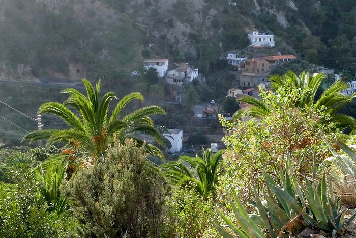 Vallehermoso
Friday, February 9 This morning, the sky was overcast, and the peaks around us were shrouded in clouds. We took the same road as yesterday to hike Las Creces. Quickly gaining altitude, we entered a thick fog—visibility was very limited. We stopped at the Las Creces parking lot; visibility improved, and the sun wasn’t far off. The hike is entirely within a beautiful laurel forest, with the sun playing hide-and-seek, but it wasn’t cold despite the altitude. After finishing the loop trail, we decided to picnic—not there, as it was too chilly—but on Vallehermoso’s beach, where we found a nice picnic area sheltered by large black rocks. A short digestive walk on the surrounding hill to admire the little beach from above. Back in Vallehermoso, we did some grocery shopping, then tried to return to the casa—only to find ourselves locked out because we’d left the key in the lock inside! After several attempts and with the help of Yéli, a relative of the owner we called for help, we were finally able to get back in!
Saturday, February 10
It rained last night, and the sky remained overcast. Monique decided to rest this morning. PP, Pat, and I set off on the hike that starts from the house toward the Marichal reservoir. The sun wasn’t far off, and by 11 AM, it was fully out. The pleasant hike passed by many flower-filled gardens and orchards—orange, lemon, and mandarin trees in fruit. The path climbed gently toward the reservoir, where the view of the Cano rock dominating the landscape was magnificent. The last part of the climb was a bit tough, overgrown with lush vegetation, and the trail was slippery from last night’s rain. We descended via a different, much more pleasant path and returned to the casa just in time for lunch, prepared by Monique. This valley is rich with its many farmers and market gardeners who’ve cultivated the entire valley, taking advantage of the water flowing down from the mountain, captured upstream and redistributed through countless pipes snaking along the paths. Numerous tanks also store water during dry periods. The houses are scattered across both sides of the valley, and these colorful little homes add a beautiful touch to the landscape. The many palm trees give this valley a distinctly tropical feel—you could almost imagine yourself in the Caribbean. Add to that some salsa music drifting from a hut where farmers were working, and the picture is complete. A well-chilled beer apéro capped off a lovely morning. The afternoon was dedicated to rest, relaxation, reading, and games.
Sunday, February 11 The blue sky returned, though a few clouds still capped the highest peaks. Today, we visited Garajonay National Park, which covers the highest central mountains. Up there, we were above the clouds, and the panoramas from the various viewpoints were stunning: first, Cherelepin, accessible from the Laguna Grande parking lot, then Alto de Garajonay, offering an exceptional view of Teide—over 3,000 meters high—emerging from the clouds on Tenerife, far in the distance. We continued to the Los Roques viewpoints, then stopped for lunch at the Degollada de Peraza restaurant, where the view of the barranco was impressive. We descended toward San Sebastián and checked into our new lodging, La Cabezada, located in the countryside about 3 km above San Sebastián. It’s a small apartment adjacent to the owner’s, with a lovely terrace overlooking the surrounding mountains and surrounded by a beautiful garden. Apéro, then dinner on our beautiful terrace.
Monday, February 12 This morning, we went down to visit San Sebastián de La Gomera: its old tower, main street with some beautiful traditional houses, and the Church of the Assumption. Back at the casa for lunch. In the afternoon, Pat, PP, and I set off on the short hike from San Sebastián beach to La Guancha beach. We drove down and parked on the beach. The path climbs along the hill overlooking San Sebastián, passes by the tall Christ statue dominating the landscape, and roughly follows the coast down to the isolated Guancha beach. A beautiful hike under a hot sun, and a swim was welcome, even if the beach and sea access weren’t very comfortable due to large pebbles and quickly deepening water. Apart from two nudist bathers, there was no one on this beach. We returned the same way.
Tuesday, February 13 Rest day. We went down to town to stroll and do some shopping. I took the opportunity to visit the parador, beautifully situated above the city in a lovely garden overlooking the port and town. Together, we went for a cuba libre at the "Cuba Libre" bar, then had lunch at Breñusca (mediocre paella!). Back at the casa, then we went back down to town to see a carnival parade, a "passacalles," which actually passed an hour earlier than scheduled. Oh well.
Wednesday, February 14 Each to their own program this morning. Pat went swimming at San Sebastián beach, Monique rested at the casa, and PP and I set off on the hike from Playa de Avalos to the Ermita de Guadalupe on Playa del Cangrejo. It wasn’t easy to find the right road or the parking spot, but we managed. The path seemed to have suffered landslides, according to a sign at the trailhead! We decided to check it out, ready to turn back if it seemed too dangerous. In the end, apart from one or two slightly tricky spots where we had to climb a pile of rocks, the trail remained passable, though a bit vertigo-inducing in places. The narrow path clings to very vertical cliffs nearly 300 meters above sea level! But what a magnificent view. At one point, the trail runs alongside a wall of basaltic pipes. We returned via the drivable track that parallels the trail a bit lower. Back at the house for lunch. In the late afternoon, we returned to town to attend the "Entierro de las Sardinas" (Burial of the Sardine), which closes the Canarian carnival festivities. While waiting, we strolled through the parador’s gardens and had mojitos in town. Around 9 PM, we heard the noise and cries of the mourners. The procession advanced, led by a large papier-mâché sardine on a float, surrounded by wailing mourners. The procession headed toward the sea, where the sardine was burned, and a mini fireworks display ended the procession. It was all very good-natured, and everyone had fun. We ended the evening with dinner at a good fish restaurant, El Pajar.
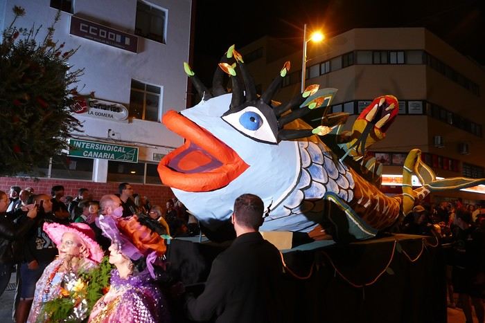 Entierro de la Sardina in San Sebastián de La Gomera
Thursday, February 15
Woke up at 5:15 AM. The only suitable ferry was at 7 AM, which would get us to La Palma by late morning rather than evening. We packed our bags, had breakfast, then headed to the port, left our rental car, and boarded the ferry to Tenerife, from where we’d continue to La Palma. Calm sea, beautiful sun—by 10:30 AM, we disembarked in La Palma. We picked up our car and immediately headed to our new apartment in Breña Alta. It’s a large apartment with a superb terrace facing the sea, fully equipped and very comfortable. The hosts recommended Casa Goyo restaurant, near the airport and close to us. It’s a restaurant with many small rooms, some of which can be reserved for families. The fish-based cuisine (chipirones, pulpo) was excellent, hearty, and reasonably priced. Since it’s in the airport’s flight path, we occasionally heard planes landing. Quick and efficient service. Afterward, we visited Santa Cruz de La Palma, which reminded us of the historic quarters of La Orotava in Tenerife or the capital of Gran Canaria.
Friday, February 16
Beautiful weather, blue sky. We headed to the San Bartolo viewpoint toward the northeast coast, then to the lovely village of San Andrés, which we explored. From there, we walked along the shore to the natural pools of Charco Azul, where we swam in the cool but "swimmable" sea. Back in San Andrés for lunch at the "San Andrés" restaurant on the beautiful church square. Very good fish-based meal. We got back in the car and continued along the north coast to the port of Espindola and the natural pools of Fajana near the Cumplida lighthouse. A fairly strong wind whipped up beautiful waves crashing onto the rocky coast in bursts of foam. Back in Santa Cruz, we stopped at the Mercadona supermarket to buy fresh shrimp for dinner.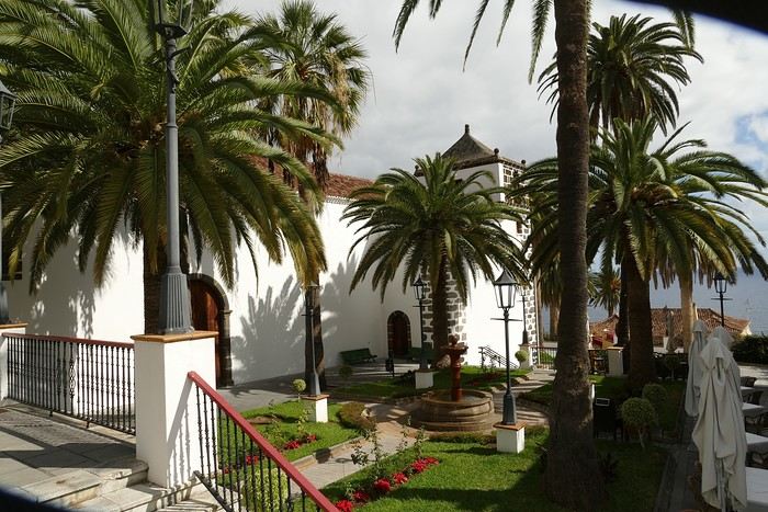 San Andrés
Saturday, February 17
Uniform blue sky, even on the heights. We took the beautiful road that winds up to the summit of the Caldera de Taburiente. Several viewpoints offer 360° views of the entire island and beyond: you can make out La Gomera, El Hierro, and, of course, Tenerife with the perfect triangle of Teide. We parked at the Los Andes viewpoint parking lot and started our hike to Pico de la Cruz along a trail following the ridge, offering superb views into the caldera. We got back in the car and passed by the Roque de los Muchachos astronomical complex, composed of numerous observatories, some with very aesthetic mirror telescopes. We hiked from the Roque de los Muchachos parking lot to the various viewpoints, always as impressive. Picnic on site, then back to Santa Cruz. We stopped by our car dealer because the oil warning light came on—better safe than sorry. The representative reassured us but preferred to give us a Fiat Cross SUV instead.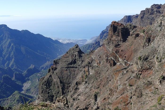 The Caldera de Taburiente
Sunday, February 18 The weather was a bit mixed, with cloudy patches. We set off to hike the Barranco de la Cuba de Galga. Unfortunately, the Los Tilos trail had been closed for several months due to a major landslide. The parking lot by the road was already quite full, and indeed, we crossed paths with many hikers along the way—it’s an easy hike with little elevation gain, which is rare here in La Palma! The beautiful path winds through a very narrow, deep gorge covered in lush tropical vegetation—you’d think you were in a Southeast Asian forest, especially with the humidity in the gorge bringing out earthy and floral scents. Halfway through, Monique turned back while the rest of us continued to the Cuba de Galga. A light drizzle accompanied us on the return. For lunch, we went to Chipi Chipi restaurant in the heights of Santa Cruz. The cool air forced us to leave the lovely terrace for the slightly noisy dining room. The meal was very good and hearty. Afternoon spent resting at our house.
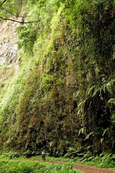 La Cuba de la Galga
Monday, February 19 A few clouds still clung to the nearby mountain peaks. We headed south to Los Canarios. We stopped in front of the small San Antonio Abad church, where a path leads to the viewpoint in 15 minutes. Then we visited the San Antonio Volcano Interpretation Center and climbed to the viewpoint via the trail along the crater’s edge, offering a plunging view into the crater. Then PP, Pat, and I headed toward the Teneguía volcano but turned back given the remaining distance and the intense heat bearing down on us! Plus, the landscape was rather arid and not very interesting. We got back in the car and drove down to the salt flats at the island’s southern tip. The ocean crashes here in large waves, exploding against the volcanic rocks and feeding a "blowhole" carved into the rock. We stopped for drinks at the salt flats restaurant, then headed home.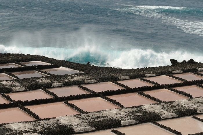 The salt flats in Fuencaliente
Tuesday, February 20 Beautiful weather with a few clouds clinging to the mountains, as usual. A relaxed morning since my parking reservation at La Cumbrecita didn’t start until 1 PM. It takes about 30 minutes from Santa Cruz to reach the valley floor via a beautiful but narrow road toward the end, though there’s very little traffic. Meanwhile, the clouds had disappeared, and the view from the La Cumbrecita viewpoint was superb. We recognized Pico de la Cruz in the distance, where we’d been a few days earlier. We then took the path leading to the Las Chozas viewpoint through a magnificent Canarian pine forest. We picnicked on site, then took the path to the Los Roques viewpoint. We returned the same way since the direct route was closed for construction. Back in Santa Cruz, we visited the Sanctuary of Las Nieves, with its beautiful golden Baroque altar.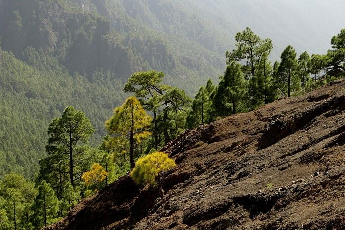 Hike from La Cumbrecita
Wednesday, February 21 After packing our things and loading the car, we left Santa Cruz under a very blue sky for Los Llanos de Aridane, where we stopped to visit this lovely town. The Church of Nuestra Señora de los Remedios has a beautiful coffered ceiling and an original papier-mâché Christ statue from the 16th century. Around it, colorful old Canarian houses brighten the streets of the town center. We took the opportunity to stroll, do some shopping, and finally sat down at La Pergola restaurant for a mediocre lunch. We got back in the car to check into our new house in Arecida. On the way, we stopped at the Mirador del Time, which once again offered an impressive panorama, allowing us—for the first time—to see the damage caused by the Tajogaite volcano eruption in 2021. You can clearly see the still-smoking crater and the large black lava flow covering the landscape down to the sea. We really liked our new accommodation: a local house that’s been renovated on the heights of Arecida, not far from the Canarian pine forest. From several terraces, we have a 360° view of the sea and mountains. We even have a private pool! There are two beautiful, brand-new bedrooms, each with its own bathroom—the best. Plus, we’re on the GR 131 trail that runs along the Barranco de las Angustias toward the northeast.
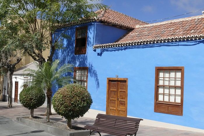 Los Llanos de Aridane
Thursday, February 22 Once again, beautiful weather greeted us when we woke up. We started the GR 131 with the goal of reaching the Torre del Time viewpoint—about 400 meters of elevation gain. The path, quite steep at first, winds through a superb Canarian pine forest. A few viewpoints let you appreciate the sheer drop of the Barranco de las Angustias—watch out for vertigo! At the Torre del Time viewpoint, there’s a nearly 1,000-meter vertical drop. We returned via another path, the PLP1, which meanders first through this beautiful forest, then along lovely flower-filled gardens adjacent to beautiful properties that cascade from the forest down to the road serving these neighborhoods. This afternoon, we tried to get closer to the area devastated by the 2021 lava flows. Several roads are still closed or reserved for residents, while others—brand new—have been rebuilt to open up this densely populated and cultivated region. In some places, the lava flow slightly diverted, sparing some properties that logically should have disappeared. Now, they’re encircled by a massive cooled lava field. In other spots, twisted and charred metal scraps or greenhouse remains protrude from the lava—all that’s left of the former banana plantations. A little higher up, you can see the slightly smoking crater of Tajogaite, responsible for this disaster. Back to Casa Barreros.
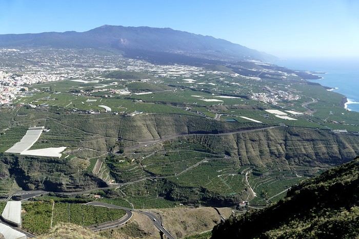 View of Los Llanos and, in the background, the 2021 lava flow
Friday, February 23
Though the sky was still blue, the temperature had dropped due to a chilly wind. By midday, it still rose to 22°C. Today, we headed north, specifically to the town of Tijarafe, where a very narrow road descends to the small port, Porís de Candelaria. The 3.7-kilometer road drops 700 meters in elevation, with gradients up to 30%—it was going to be intense! Indeed, the descent was scary, with the void right next to the very narrow road where passing was impossible except at a few rare spots. Everything went well—there was little traffic at this early hour. From the parking lot at the bottom, a path leads to Porís de Candelaria. It’s surprising to see this small fishing hamlet nestled in the shelter of an immense cave opening onto the sea, which was quite rough today. The sun, at this time of year, would appear late in the cave, which remained in shadow for much of the day. We returned via the same road, strolled through the small town of Puntagorda, and had lunch at El Jardín de los Naranjos restaurant—excellent meal.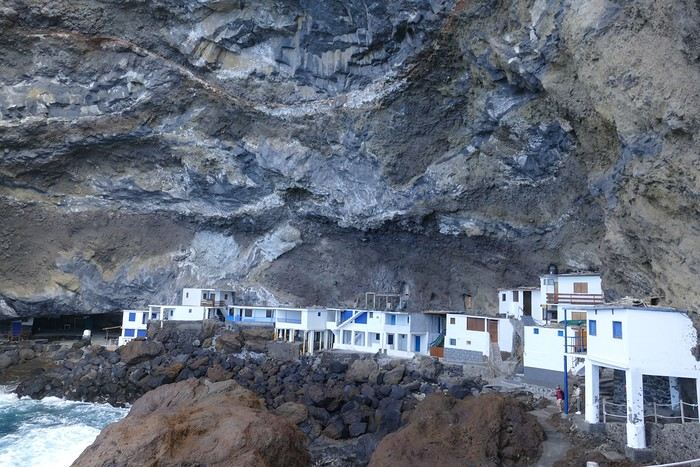 Fishing hamlet of Candelaria
Saturday, February 24 The air was still cool, but the sun was beautiful. While Monique stayed home to rest, the three of us headed to the village of Las Tricias to hike the Buracas Caves trail. We left the car parked on the LP1 road and took the small paved road down to the sign marking the trail’s start. The signage for all the trails we took here, as in La Gomera, was very well done. The path descended steadily, then more steeply toward the caves where the island’s first inhabitants lived—some petroglyphs are still visible in certain caves. The path then climbed back up, passing magnificent dragon trees and more or less elaborate huts occupied by Germans who’ve lived here for many years. Back at Casa Barreros for some rest.
Sunday, February 25 The weather once again blessed us with a beautiful day. This morning, we visited the local produce market held on weekends in Puntagorda. You’ll find agricultural products, crafts, and food to keep you going. A little further on, there’s a glass viewpoint overlooking the barranco plunging toward the sea, with a view of the thrill-seekers trying the zip line right next to it. Lunch at Naranjos—definitely a good spot—with their shrimp and spice tagliatelle. Back home for an afternoon of relaxation.
Monday, February 26 We left Arecida under a cloudy sky. Driving up from Los Llanos de Aridane toward the east, an enormous cascade of clouds poured from the mountain peaks into the Los Llanos plain—very impressive. Arriving in Santa Cruz, we went for a stroll, did some last-minute shopping, then had a final good-quality paella at La Chalana on the paseo maritimo. We left the car in the parking lot and took the 5 PM Olsen ferry to Tenerife on a slightly choppy sea, but the ferry didn’t rock too much. Arriving at 7:15 PM, we dropped off our things near the port in our reserved apartment and went for dinner at Abordo—rubbery chipirones. A digestive stroll among the ever-increasing number of tourists in Los Cristianos—restaurants were packed to the brim, the season is in full swing here. Gone is the calm of La Gomera and La Palma, and the laid-back tourism of German hikers among whom a few French were hiding!
Tuesday, February 27 To make our homemade breakfast more enjoyable, we went to buy pastries at the local bakery, then took one last walk on the paseo along the beaches, mingling with the many mobility scooters driven by elderly or disabled people, joggers, and tourists. Last apéro near the bus station, then off to the airport. After a smooth 4-hour-30-minute flight, we arrived in Basel-Mulhouse at 10:20 PM.
THE END
Conclusion A fantastic trip to two islands with magnificent and diverse nature, where landscapes range from desert-like to tropical depending on exposure to winds and clouds. Thanks to the many beautiful viewpoints, you can truly appreciate these exceptionally dynamic reliefs. A hiker’s paradise, the trails are all very well marked, though the choice of easy or moderate paths for "casual walkers" is quite limited. Another notable advantage, in our opinion, is that these islands are very lightly developed—you’ll hardly see any of those ugly hotel blocks that spoil the landscapes of some other Canary Islands. It’s true that the beaches on these two islands don’t meet traditional international tourism criteria: they’re small, with black sand, and often difficult to access. Special mention for the quality of the road network (except for a few small local roads), which seems brand new, well-paved, and well-signposted. We also enjoyed exceptional weather for February, with fewer than three days of gray or rainy weather out of 21.
Almost all the accommodations we chose met or exceeded our expectations, often at reasonable prices: an average of 98 € per night for an apartment or house with two bedrooms for four people.
All photos can be viewed by clicking this link: https://photos.app.goo.gl/G44pPk4g9PW1rNzg8
Tuesday, February 6 We left around 9 AM with our car, along with Pierre-Paul and Patricia, heading to the Bluepark parking lot in Bartenheim. As expected, we were awaited and left promptly for EuroAirport Basel. Took off at 12:25 PM for a 4-hour-15-minute flight under excellent conditions. Beautiful arrival in Tenerife with Teide in sight under a clear blue sky. Fifteen minutes later, we waited for bus No. 40 to Los Cristianos with quite a few other tourists, but we managed to find four seats. From the bus station, it was a 20-minute walk to our hotel. We checked into a lovely apartment for the four of us, complete with all the comforts. Outside, it was quite warm—at least 25°C! After dropping off our luggage, we went for a stroll. The immediate surroundings of the hotel held no interest for us: a modern, concrete area filled with hotels, bars, tourist agencies, and unappealing restaurants all offering the same bland international cuisine. Pat went to cool off at the pool, unfortunately overrun by loud, drunk English tourists. I took a walk to the paseo maritimo that leads to the port, skirting the seafront. The promenade was pleasant, but it could have been any seaside resort in the world—same old scene: a succession of bars with blaring music where many elderly people sipped cold beers waiting for the sunset, the backdrop a wall of resort-style hotels resembling rabbit hutches! Upon reaching the port, I scouted the route we’d take the next day to the Fred Olsen ferry. Back at the apartment, in the early evening, we looked for a non-touristy restaurant for dinner. Monique stopped a woman to ask her opinion! In this area, she told us, there’s no restaurant that serves Canarian or Spanish cuisine! The only place with decent restaurants is at the port. Off we went to the port, where we sat down at Al Bordo restaurant and ordered a seafood paella for four. Excellent, and at a very reasonable price (36 € for two). We returned to the hotel along the seafront.
Wednesday, February 7
Woke up at 6 AM. Had breakfast in the apartment with what we’d bought the day before at a supermarket. It was still dark when we left on foot toward the port, walking along the calm seafront at this early hour. Forty minutes later, we arrived and waited 10 minutes before the ferry docked. At 9:30 AM, we left the port of Los Cristianos for a 50-minute crossing on a calm sea under a beautiful blue sky. There were quite a few people on this large ferry, but many had no luggage, meaning they were visiting La Gomera for the day and would take the ferry back in the evening. Upon disembarking, we went straight to our rental car agency to pick up the car we’d booked online a few months earlier. It was a nice Peugeot 2008, spacious enough for the four of us and our luggage. We immediately took the beautiful road from San Sebastián that climbs directly into the mountains toward our rental in Vallehermoso. The road was in perfect condition—it seemed brand new, like all the others we’d take on this island later. This side of the island is very arid with little vegetation, and the terrain is particularly rugged, as it is throughout the island. We stopped at our first miradors, which would be followed by many more throughout our Canarian trip. Our first visit was to the small village of Agulo, perched on a promontory above the sea and at the foot of a high cliff. The village features typical Canarian houses with windows flush with the façade and black volcanic stone masonry on white or reddish-brown walls. The first recommended restaurant was already booked for a group, so we settled for the shaded terrace of the excellent El Alameda bar-restaurant. From Agulo, you can access the Abrante viewpoint via a winding road, where the view of Agulo, 600 meters below, is exceptional. A glass ledge over the void lets you test your fear of heights!
We drove to Vallehermoso to do our grocery shopping at the supermarket—a habit that would continue until the end of the trip. Our little house, "Casa rural El Encatadora," is located in a beautiful flower-filled valley a few kilometers west of Vallehermoso. Each of us had a bedroom with an en-suite bathroom, plus a living room, kitchen, and a small terrace overlooking the quiet street at the valley’s end, which didn’t bother us at all.
Thursday, February 8 The good weather seemed to follow us since our arrival in the Canary Islands. This morning, we took the road—still as beautiful and new—toward Arure, high up to the west. The landscape was magnificent, with breathtaking glimpses of the sea far below. In Arure, we parked in front of Conchita’s bar, where a hike (Rother No. 30) starts toward two viewpoints: Alojera, which we reached after 45 minutes on a lovely path. Monique, tired from the first steep climb, stopped at the first viewpoint and hitchhiked back to Arure. Meanwhile, we continued toward the second viewpoint, Los Barranquillos, where the view of the surroundings was partially hidden by misty clouds rising from the sea. The entire mountain is sculpted by ancient, endless terraces climbing until the slope becomes too steep for construction—visible traces of the hard work of past inhabitants trying to survive in a harsh environment. We had a decent lunch at La Conchita bar, then drove to the small seaside town of Puerto la Caleta, sheltered by an immense cliff plunging into the sea. Black sand beach, rough sea—despite our encouragement, Pat didn’t dare to swim! As for the old village of Caleta, it’s perched on the mountainside, and visiting it requires climbing steep, stair-filled alleys to discover a few traditional houses. Back at the casa, dinner in, and card games...
VallehermosoFriday, February 9 This morning, the sky was overcast, and the peaks around us were shrouded in clouds. We took the same road as yesterday to hike Las Creces. Quickly gaining altitude, we entered a thick fog—visibility was very limited. We stopped at the Las Creces parking lot; visibility improved, and the sun wasn’t far off. The hike is entirely within a beautiful laurel forest, with the sun playing hide-and-seek, but it wasn’t cold despite the altitude. After finishing the loop trail, we decided to picnic—not there, as it was too chilly—but on Vallehermoso’s beach, where we found a nice picnic area sheltered by large black rocks. A short digestive walk on the surrounding hill to admire the little beach from above. Back in Vallehermoso, we did some grocery shopping, then tried to return to the casa—only to find ourselves locked out because we’d left the key in the lock inside! After several attempts and with the help of Yéli, a relative of the owner we called for help, we were finally able to get back in!
Saturday, February 10
It rained last night, and the sky remained overcast. Monique decided to rest this morning. PP, Pat, and I set off on the hike that starts from the house toward the Marichal reservoir. The sun wasn’t far off, and by 11 AM, it was fully out. The pleasant hike passed by many flower-filled gardens and orchards—orange, lemon, and mandarin trees in fruit. The path climbed gently toward the reservoir, where the view of the Cano rock dominating the landscape was magnificent. The last part of the climb was a bit tough, overgrown with lush vegetation, and the trail was slippery from last night’s rain. We descended via a different, much more pleasant path and returned to the casa just in time for lunch, prepared by Monique. This valley is rich with its many farmers and market gardeners who’ve cultivated the entire valley, taking advantage of the water flowing down from the mountain, captured upstream and redistributed through countless pipes snaking along the paths. Numerous tanks also store water during dry periods. The houses are scattered across both sides of the valley, and these colorful little homes add a beautiful touch to the landscape. The many palm trees give this valley a distinctly tropical feel—you could almost imagine yourself in the Caribbean. Add to that some salsa music drifting from a hut where farmers were working, and the picture is complete. A well-chilled beer apéro capped off a lovely morning. The afternoon was dedicated to rest, relaxation, reading, and games.
Sunday, February 11 The blue sky returned, though a few clouds still capped the highest peaks. Today, we visited Garajonay National Park, which covers the highest central mountains. Up there, we were above the clouds, and the panoramas from the various viewpoints were stunning: first, Cherelepin, accessible from the Laguna Grande parking lot, then Alto de Garajonay, offering an exceptional view of Teide—over 3,000 meters high—emerging from the clouds on Tenerife, far in the distance. We continued to the Los Roques viewpoints, then stopped for lunch at the Degollada de Peraza restaurant, where the view of the barranco was impressive. We descended toward San Sebastián and checked into our new lodging, La Cabezada, located in the countryside about 3 km above San Sebastián. It’s a small apartment adjacent to the owner’s, with a lovely terrace overlooking the surrounding mountains and surrounded by a beautiful garden. Apéro, then dinner on our beautiful terrace.
Monday, February 12 This morning, we went down to visit San Sebastián de La Gomera: its old tower, main street with some beautiful traditional houses, and the Church of the Assumption. Back at the casa for lunch. In the afternoon, Pat, PP, and I set off on the short hike from San Sebastián beach to La Guancha beach. We drove down and parked on the beach. The path climbs along the hill overlooking San Sebastián, passes by the tall Christ statue dominating the landscape, and roughly follows the coast down to the isolated Guancha beach. A beautiful hike under a hot sun, and a swim was welcome, even if the beach and sea access weren’t very comfortable due to large pebbles and quickly deepening water. Apart from two nudist bathers, there was no one on this beach. We returned the same way.
Tuesday, February 13 Rest day. We went down to town to stroll and do some shopping. I took the opportunity to visit the parador, beautifully situated above the city in a lovely garden overlooking the port and town. Together, we went for a cuba libre at the "Cuba Libre" bar, then had lunch at Breñusca (mediocre paella!). Back at the casa, then we went back down to town to see a carnival parade, a "passacalles," which actually passed an hour earlier than scheduled. Oh well.
Wednesday, February 14 Each to their own program this morning. Pat went swimming at San Sebastián beach, Monique rested at the casa, and PP and I set off on the hike from Playa de Avalos to the Ermita de Guadalupe on Playa del Cangrejo. It wasn’t easy to find the right road or the parking spot, but we managed. The path seemed to have suffered landslides, according to a sign at the trailhead! We decided to check it out, ready to turn back if it seemed too dangerous. In the end, apart from one or two slightly tricky spots where we had to climb a pile of rocks, the trail remained passable, though a bit vertigo-inducing in places. The narrow path clings to very vertical cliffs nearly 300 meters above sea level! But what a magnificent view. At one point, the trail runs alongside a wall of basaltic pipes. We returned via the drivable track that parallels the trail a bit lower. Back at the house for lunch. In the late afternoon, we returned to town to attend the "Entierro de las Sardinas" (Burial of the Sardine), which closes the Canarian carnival festivities. While waiting, we strolled through the parador’s gardens and had mojitos in town. Around 9 PM, we heard the noise and cries of the mourners. The procession advanced, led by a large papier-mâché sardine on a float, surrounded by wailing mourners. The procession headed toward the sea, where the sardine was burned, and a mini fireworks display ended the procession. It was all very good-natured, and everyone had fun. We ended the evening with dinner at a good fish restaurant, El Pajar.
Entierro de la Sardina in San Sebastián de La GomeraThursday, February 15
Woke up at 5:15 AM. The only suitable ferry was at 7 AM, which would get us to La Palma by late morning rather than evening. We packed our bags, had breakfast, then headed to the port, left our rental car, and boarded the ferry to Tenerife, from where we’d continue to La Palma. Calm sea, beautiful sun—by 10:30 AM, we disembarked in La Palma. We picked up our car and immediately headed to our new apartment in Breña Alta. It’s a large apartment with a superb terrace facing the sea, fully equipped and very comfortable. The hosts recommended Casa Goyo restaurant, near the airport and close to us. It’s a restaurant with many small rooms, some of which can be reserved for families. The fish-based cuisine (chipirones, pulpo) was excellent, hearty, and reasonably priced. Since it’s in the airport’s flight path, we occasionally heard planes landing. Quick and efficient service. Afterward, we visited Santa Cruz de La Palma, which reminded us of the historic quarters of La Orotava in Tenerife or the capital of Gran Canaria.
Friday, February 16
Beautiful weather, blue sky. We headed to the San Bartolo viewpoint toward the northeast coast, then to the lovely village of San Andrés, which we explored. From there, we walked along the shore to the natural pools of Charco Azul, where we swam in the cool but "swimmable" sea. Back in San Andrés for lunch at the "San Andrés" restaurant on the beautiful church square. Very good fish-based meal. We got back in the car and continued along the north coast to the port of Espindola and the natural pools of Fajana near the Cumplida lighthouse. A fairly strong wind whipped up beautiful waves crashing onto the rocky coast in bursts of foam. Back in Santa Cruz, we stopped at the Mercadona supermarket to buy fresh shrimp for dinner.
San AndrésSaturday, February 17
Uniform blue sky, even on the heights. We took the beautiful road that winds up to the summit of the Caldera de Taburiente. Several viewpoints offer 360° views of the entire island and beyond: you can make out La Gomera, El Hierro, and, of course, Tenerife with the perfect triangle of Teide. We parked at the Los Andes viewpoint parking lot and started our hike to Pico de la Cruz along a trail following the ridge, offering superb views into the caldera. We got back in the car and passed by the Roque de los Muchachos astronomical complex, composed of numerous observatories, some with very aesthetic mirror telescopes. We hiked from the Roque de los Muchachos parking lot to the various viewpoints, always as impressive. Picnic on site, then back to Santa Cruz. We stopped by our car dealer because the oil warning light came on—better safe than sorry. The representative reassured us but preferred to give us a Fiat Cross SUV instead.
The Caldera de TaburienteSunday, February 18 The weather was a bit mixed, with cloudy patches. We set off to hike the Barranco de la Cuba de Galga. Unfortunately, the Los Tilos trail had been closed for several months due to a major landslide. The parking lot by the road was already quite full, and indeed, we crossed paths with many hikers along the way—it’s an easy hike with little elevation gain, which is rare here in La Palma! The beautiful path winds through a very narrow, deep gorge covered in lush tropical vegetation—you’d think you were in a Southeast Asian forest, especially with the humidity in the gorge bringing out earthy and floral scents. Halfway through, Monique turned back while the rest of us continued to the Cuba de Galga. A light drizzle accompanied us on the return. For lunch, we went to Chipi Chipi restaurant in the heights of Santa Cruz. The cool air forced us to leave the lovely terrace for the slightly noisy dining room. The meal was very good and hearty. Afternoon spent resting at our house.
La Cuba de la GalgaMonday, February 19 A few clouds still clung to the nearby mountain peaks. We headed south to Los Canarios. We stopped in front of the small San Antonio Abad church, where a path leads to the viewpoint in 15 minutes. Then we visited the San Antonio Volcano Interpretation Center and climbed to the viewpoint via the trail along the crater’s edge, offering a plunging view into the crater. Then PP, Pat, and I headed toward the Teneguía volcano but turned back given the remaining distance and the intense heat bearing down on us! Plus, the landscape was rather arid and not very interesting. We got back in the car and drove down to the salt flats at the island’s southern tip. The ocean crashes here in large waves, exploding against the volcanic rocks and feeding a "blowhole" carved into the rock. We stopped for drinks at the salt flats restaurant, then headed home.
The salt flats in FuencalienteTuesday, February 20 Beautiful weather with a few clouds clinging to the mountains, as usual. A relaxed morning since my parking reservation at La Cumbrecita didn’t start until 1 PM. It takes about 30 minutes from Santa Cruz to reach the valley floor via a beautiful but narrow road toward the end, though there’s very little traffic. Meanwhile, the clouds had disappeared, and the view from the La Cumbrecita viewpoint was superb. We recognized Pico de la Cruz in the distance, where we’d been a few days earlier. We then took the path leading to the Las Chozas viewpoint through a magnificent Canarian pine forest. We picnicked on site, then took the path to the Los Roques viewpoint. We returned the same way since the direct route was closed for construction. Back in Santa Cruz, we visited the Sanctuary of Las Nieves, with its beautiful golden Baroque altar.
Hike from La CumbrecitaWednesday, February 21 After packing our things and loading the car, we left Santa Cruz under a very blue sky for Los Llanos de Aridane, where we stopped to visit this lovely town. The Church of Nuestra Señora de los Remedios has a beautiful coffered ceiling and an original papier-mâché Christ statue from the 16th century. Around it, colorful old Canarian houses brighten the streets of the town center. We took the opportunity to stroll, do some shopping, and finally sat down at La Pergola restaurant for a mediocre lunch. We got back in the car to check into our new house in Arecida. On the way, we stopped at the Mirador del Time, which once again offered an impressive panorama, allowing us—for the first time—to see the damage caused by the Tajogaite volcano eruption in 2021. You can clearly see the still-smoking crater and the large black lava flow covering the landscape down to the sea. We really liked our new accommodation: a local house that’s been renovated on the heights of Arecida, not far from the Canarian pine forest. From several terraces, we have a 360° view of the sea and mountains. We even have a private pool! There are two beautiful, brand-new bedrooms, each with its own bathroom—the best. Plus, we’re on the GR 131 trail that runs along the Barranco de las Angustias toward the northeast.
Los Llanos de AridaneThursday, February 22 Once again, beautiful weather greeted us when we woke up. We started the GR 131 with the goal of reaching the Torre del Time viewpoint—about 400 meters of elevation gain. The path, quite steep at first, winds through a superb Canarian pine forest. A few viewpoints let you appreciate the sheer drop of the Barranco de las Angustias—watch out for vertigo! At the Torre del Time viewpoint, there’s a nearly 1,000-meter vertical drop. We returned via another path, the PLP1, which meanders first through this beautiful forest, then along lovely flower-filled gardens adjacent to beautiful properties that cascade from the forest down to the road serving these neighborhoods. This afternoon, we tried to get closer to the area devastated by the 2021 lava flows. Several roads are still closed or reserved for residents, while others—brand new—have been rebuilt to open up this densely populated and cultivated region. In some places, the lava flow slightly diverted, sparing some properties that logically should have disappeared. Now, they’re encircled by a massive cooled lava field. In other spots, twisted and charred metal scraps or greenhouse remains protrude from the lava—all that’s left of the former banana plantations. A little higher up, you can see the slightly smoking crater of Tajogaite, responsible for this disaster. Back to Casa Barreros.
View of Los Llanos and, in the background, the 2021 lava flowFriday, February 23
Though the sky was still blue, the temperature had dropped due to a chilly wind. By midday, it still rose to 22°C. Today, we headed north, specifically to the town of Tijarafe, where a very narrow road descends to the small port, Porís de Candelaria. The 3.7-kilometer road drops 700 meters in elevation, with gradients up to 30%—it was going to be intense! Indeed, the descent was scary, with the void right next to the very narrow road where passing was impossible except at a few rare spots. Everything went well—there was little traffic at this early hour. From the parking lot at the bottom, a path leads to Porís de Candelaria. It’s surprising to see this small fishing hamlet nestled in the shelter of an immense cave opening onto the sea, which was quite rough today. The sun, at this time of year, would appear late in the cave, which remained in shadow for much of the day. We returned via the same road, strolled through the small town of Puntagorda, and had lunch at El Jardín de los Naranjos restaurant—excellent meal.
Fishing hamlet of CandelariaSaturday, February 24 The air was still cool, but the sun was beautiful. While Monique stayed home to rest, the three of us headed to the village of Las Tricias to hike the Buracas Caves trail. We left the car parked on the LP1 road and took the small paved road down to the sign marking the trail’s start. The signage for all the trails we took here, as in La Gomera, was very well done. The path descended steadily, then more steeply toward the caves where the island’s first inhabitants lived—some petroglyphs are still visible in certain caves. The path then climbed back up, passing magnificent dragon trees and more or less elaborate huts occupied by Germans who’ve lived here for many years. Back at Casa Barreros for some rest.
Sunday, February 25 The weather once again blessed us with a beautiful day. This morning, we visited the local produce market held on weekends in Puntagorda. You’ll find agricultural products, crafts, and food to keep you going. A little further on, there’s a glass viewpoint overlooking the barranco plunging toward the sea, with a view of the thrill-seekers trying the zip line right next to it. Lunch at Naranjos—definitely a good spot—with their shrimp and spice tagliatelle. Back home for an afternoon of relaxation.
Monday, February 26 We left Arecida under a cloudy sky. Driving up from Los Llanos de Aridane toward the east, an enormous cascade of clouds poured from the mountain peaks into the Los Llanos plain—very impressive. Arriving in Santa Cruz, we went for a stroll, did some last-minute shopping, then had a final good-quality paella at La Chalana on the paseo maritimo. We left the car in the parking lot and took the 5 PM Olsen ferry to Tenerife on a slightly choppy sea, but the ferry didn’t rock too much. Arriving at 7:15 PM, we dropped off our things near the port in our reserved apartment and went for dinner at Abordo—rubbery chipirones. A digestive stroll among the ever-increasing number of tourists in Los Cristianos—restaurants were packed to the brim, the season is in full swing here. Gone is the calm of La Gomera and La Palma, and the laid-back tourism of German hikers among whom a few French were hiding!
Tuesday, February 27 To make our homemade breakfast more enjoyable, we went to buy pastries at the local bakery, then took one last walk on the paseo along the beaches, mingling with the many mobility scooters driven by elderly or disabled people, joggers, and tourists. Last apéro near the bus station, then off to the airport. After a smooth 4-hour-30-minute flight, we arrived in Basel-Mulhouse at 10:20 PM.
THE END
Conclusion A fantastic trip to two islands with magnificent and diverse nature, where landscapes range from desert-like to tropical depending on exposure to winds and clouds. Thanks to the many beautiful viewpoints, you can truly appreciate these exceptionally dynamic reliefs. A hiker’s paradise, the trails are all very well marked, though the choice of easy or moderate paths for "casual walkers" is quite limited. Another notable advantage, in our opinion, is that these islands are very lightly developed—you’ll hardly see any of those ugly hotel blocks that spoil the landscapes of some other Canary Islands. It’s true that the beaches on these two islands don’t meet traditional international tourism criteria: they’re small, with black sand, and often difficult to access. Special mention for the quality of the road network (except for a few small local roads), which seems brand new, well-paved, and well-signposted. We also enjoyed exceptional weather for February, with fewer than three days of gray or rainy weather out of 21.
Almost all the accommodations we chose met or exceeded our expectations, often at reasonable prices: an average of 98 € per night for an apartment or house with two bedrooms for four people.
All photos can be viewed by clicking this link: https://photos.app.goo.gl/G44pPk4g9PW1rNzg8
December 13 - Day 1
"How about a Christmas market this year, huh? A little romantic weekend getaway... - Yes! That’d be cool! Strasbourg? Colmar? - Feels a bit déjà vu, doesn’t it? Plus, slim chance of snow there... And I’d love something a bit more exotic with a touch of originality..."
"Okay, Google, give me the list of the five most beautiful Christmas markets in Europe. - In fifth place, the Christmas market in Vilnius, the capital of Lithuania. - Save your breath! Lithuania, here we come!"
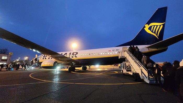
We wanted cold, and cold is exactly what we got the moment we set foot in this new, unknown land. As for landscapes, forests and lakes stretch as far as the eye can see across this vast plain, its vegetation scorched by the frost of a winter that’s clearly already well underway here.
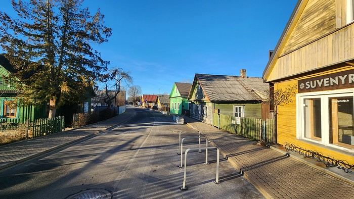
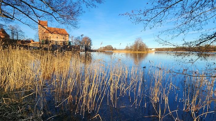
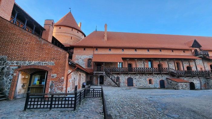
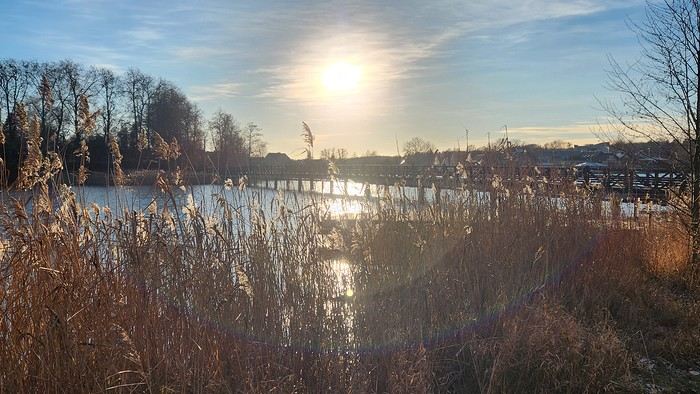
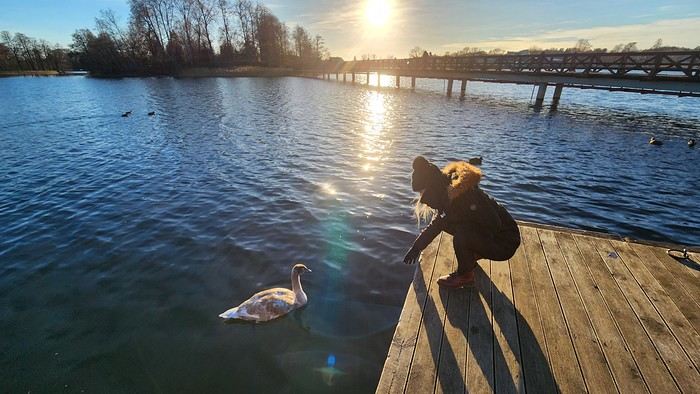
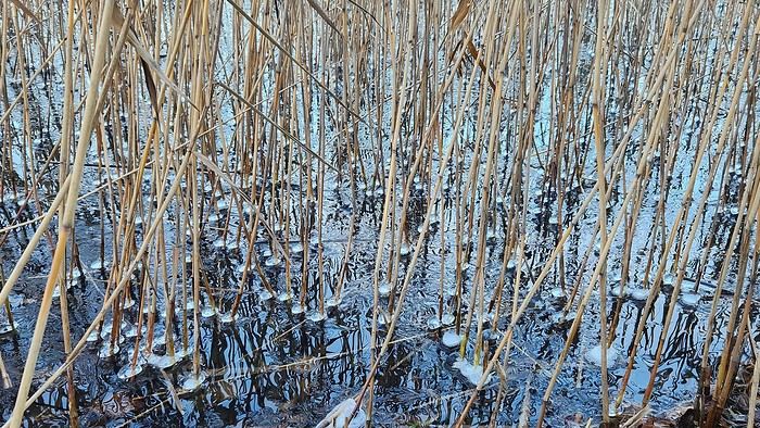
Lakes, in fact, set the scene for our first visit to Trakai Castle, whose brick-red towers and walls rise proudly against the azure sky of our first day. Lakes, because this castle was built on an island and is only accessible on foot via a series of walkways spanning half-frozen lake offshoots. I couldn’t have picked a better spot to build my castle! Translation: We’re totally sold! Proof is we spend two hours hiking around the area, alternating between forests, reeds, and cozy houses tastefully decorated for Christmas.
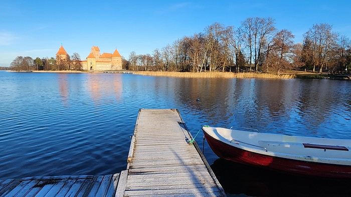
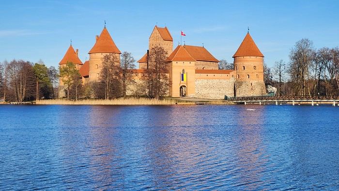
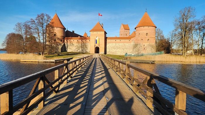
"How about a Christmas market this year, huh? A little romantic weekend getaway... - Yes! That’d be cool! Strasbourg? Colmar? - Feels a bit déjà vu, doesn’t it? Plus, slim chance of snow there... And I’d love something a bit more exotic with a touch of originality..."
"Okay, Google, give me the list of the five most beautiful Christmas markets in Europe. - In fifth place, the Christmas market in Vilnius, the capital of Lithuania. - Save your breath! Lithuania, here we come!"
We wanted cold, and cold is exactly what we got the moment we set foot in this new, unknown land. As for landscapes, forests and lakes stretch as far as the eye can see across this vast plain, its vegetation scorched by the frost of a winter that’s clearly already well underway here.
Lakes, in fact, set the scene for our first visit to Trakai Castle, whose brick-red towers and walls rise proudly against the azure sky of our first day. Lakes, because this castle was built on an island and is only accessible on foot via a series of walkways spanning half-frozen lake offshoots. I couldn’t have picked a better spot to build my castle! Translation: We’re totally sold! Proof is we spend two hours hiking around the area, alternating between forests, reeds, and cozy houses tastefully decorated for Christmas.
After staying in Aruba in November 2023, we picked up our camper van, which we had left in a hotel parking lot in Miami, Florida.
This isn’t our first road trip across the United States. Since we’re retired, we took the opportunity to travel along the American West Coast, starting with the Everglades in Florida to visit a few parks where we could spot alligators.
We also made a few stops in Mississippi and Texas to explore the most important cities in those states.
Did you know that Austin is home to the world’s largest urban bat colony? It’s truly impressive to see thousands of them take flight at dusk.
I invite you to keep reading this travel journal and watch the videos that’ll give you a little more insight into these different destinations.
Videos are embedded throughout the summary. Just click on the image to start the video.
To jump to a specific post, here are the relevant links:
FLORIDA:
Big Cypress National Preserve - Ochopee Captain Mitch's Everglades Airboat Tours Marco Island
MISSISSIPPI:
Exploring Biloxi
TEXAS:
Downtown Houston Corpus Christi San Antonio Attractions McNutt Sculpture Garden - San Antonio Mission San José - San Antonio Austin Attractions The World’s Largest Urban Bat Colony - Austin Downtown Fort Worth Attractions Downtown Dallas
This isn’t our first road trip across the United States. Since we’re retired, we took the opportunity to travel along the American West Coast, starting with the Everglades in Florida to visit a few parks where we could spot alligators.
We also made a few stops in Mississippi and Texas to explore the most important cities in those states.
Did you know that Austin is home to the world’s largest urban bat colony? It’s truly impressive to see thousands of them take flight at dusk.
I invite you to keep reading this travel journal and watch the videos that’ll give you a little more insight into these different destinations.
Videos are embedded throughout the summary. Just click on the image to start the video.
To jump to a specific post, here are the relevant links:
FLORIDA:
Big Cypress National Preserve - Ochopee Captain Mitch's Everglades Airboat Tours Marco Island
MISSISSIPPI:
Exploring Biloxi
TEXAS:
Downtown Houston Corpus Christi San Antonio Attractions McNutt Sculpture Garden - San Antonio Mission San José - San Antonio Austin Attractions The World’s Largest Urban Bat Colony - Austin Downtown Fort Worth Attractions Downtown Dallas
I would wish never to go to bed where I had woken up, to wander my tent from the shores of Egypt to those of the Persian Gulf; to have no goal for the evening other than the evening itself; to traverse on foot, with my eyes and my heart, all these unknown lands, all these races of people so different from my own; to contemplate humanity, God’s finest creation, in all its forms.
Lamartine in Fatalla Sayeghir’s Account (1861)
As soon as it’s about flying, I lose all willpower. Being reasonable and thoughtful, I still lose all my composure at the mere possibility of a flight—especially if it’s piloted by F.—and even more so if that flight can take me to unexplored lands. I’ve long wanted to unravel the mystery of animal tourism, and why not in Tanzania, following up on my trip from four years ago, when I was already questioning the glaring inequalities in Zanzibar: the coastal strip sacrificed to capitalism, and the inland areas, just a hundred meters from the waves, where you find—though a bit more peaceful than elsewhere on the continent—the chaos of Africa.
I’m an adventurer at heart. When it comes to the terrain, though, it’s a whole different story. I see people setting off for months at a time; I know my endurance doesn’t last beyond three days. It’s not that I’m afraid of this unfamiliar environment when it comes to embracing different realities. I’m mostly afraid of myself—of this heightened sensitivity that makes me see things I’d rather not see and understand others that sometimes overwhelm me.
After an absolutely fantastic daytime flight, I land in Zanzibar and have to resign myself—this is the whole point of the trip—to what feels like a real spacewalk. I’m alone. My lucky star, backed up by my phone, will serve as my lifeline. I step out of the airport and breathe in the scent of Africa full-on: a mix of exotic perfumes, baked earth, and poorly refined fuel, inevitably mingled with the smell of wood smoke. So many images come flooding back. So many stories. Another world.
I head to Arusha the very next day. The gateway to the country’s northern national parks, this city of half a million offers one of those rare breath-holding dives that Africa keeps secret. As the only white person walking the streets, I know I’m visible and vulnerable, yet I move forward confidently, barely bothered. But where are all my fellow Westerners? While this city draws countless tourists, I only cross paths with one white couple in nearly three hours of walking. Because you have to hold on tight to wander here. You have to stay alert. The traffic is dense and erratic—don’t even trust the fact that in Tanzania, people drive on the left. That can change from one minute to the next, especially with motorbikes. With barely centimeters between vehicles, I weave my way through the urban jungle, trying not to stumble into the huge ditch on my left or get sideswiped by cars brushing past me on the right. Speakers blare music, ads, or political speeches at will—the explosion of yellow and green tells us we’re on the eve of the presidential election—but they barely compete with the calls to prayer, nearly nonstop on this holy Friday. The vital space is as saturated as the sound. Imagine an unbroken line of shops and stalls of every kind—supermarkets haven’t made it here yet—where you can find just about anything: phones, copper pipes, Chinese-made hardware, shoes, clothes, basins, and professional tools… The luckiest own a big store; others spend their lives trying to survive on the profits from selling toothbrushes one at a time on the streets. But maybe it’s more lucrative than spending the day slumped on the sidewalk, preferably missing a limb, trusting your survival to the mercy of passersby.
I think I’ll escape the street by slipping into the narrow alleys of the central market. Here, I know I won’t run into anyone like me! The vendors’ stalls start at waist height; the sellers, perched higher up, haggle or not while discussing prices. Here, colorful fruits and vegetables; there, huge piles of dried fish. Spices, seeds, roots. Smells. Noises. Africa. Life. Further on, the fresh fish aisle makes a right angle with the butchers’. Everywhere, flies—everywhere, the same gesture from vendors swatting blindly at these relentless pests. Aware that I’ll be eating this same meat within the hour, displayed with total disregard for basic hygiene, I reassure myself that Arusha sits at 1400m altitude. Yes, we can probably do without a fridge.
*
It’s time to leave the city and go wildlife spotting in the surrounding parks. To that end, I’ve negotiated a package deal with a local agency that prides itself on grouping solo travelers into a vehicle meant for seven. We leave behind the imposing masses of Mount Meru and Kilimanjaro, peaking at 4565m and 5895m respectively, and head west to conquer Tarangire and Ngorongoro parks. I’ve been promised a spectacle; I remain cautious. I’ve read rave reviews; I know how to temper my expectations. Above all, I know what I came for—and paradoxically, my hopes are less about animals than strictly anthropological. So I’m sure I won’t go home disappointed.
I’m in the thick of it. Since 2021, tourism has been booming: I’m one of the two million tourists who come here every year seeking thrills. I also contribute, in a small way, to the 20% of the country’s GDP generated by tourism revenue. Around 3 billion € annually… Tanzania has 16 national parks, twice as many reserves; it charges meticulously for every entry, every night, every activity, to the tune of several dozen euros. I calculated that Tarangire Park alone rakes in around 15 million € a year. Mind-boggling. Yet to get there, a dusty, rickety old track is used daily by hundreds of vehicles that literally saturate the surrounding area with white dust and exhaust fumes. At the park entrance, we wait a good hour while the driver pays the entry fees. Then it’s a free-for-all: dozens of 4x4s try to enter at the same time through the single access point, to the left of the building, while the three barriers are stuck due to a computer glitch. It’s pure chaos: no way to buy your ticket in advance—the QR code revolution hasn’t arrived; no smart layout before the barriers; nothing smooth, nothing practical, everything improvised.
So, the animals? Given the time and money involved, I’d be tempted to say it’s not worth the hassle and there’s really no need to break five legs off one of the too-many zebras we pass. Hours and hours of travel to get to Tanzania, specifically Arusha; hours and hours on the road—up to 12 hours a day—to spend barely three in the parks; at least 200 € per day for the most basic option, so 400 € in my case, and up to several thousand for those wealthy couples opting for the luxury package with a private vehicle. Sure, I saw zebras and elephants in their natural habitat, wildebeest, buffalo, and a few hippos, but I didn’t feel the thrill touted in the articles or even by my two-day trip organizer. Would I have been more satisfied if I’d seen the lion, the leopard, and the rhino? Maybe. But the story won’t be rewritten in light of those assumptions.
Yet I’m not disappointed. As I said earlier: I know what I came for. I wanted to see the world as it is with my own eyes. And the safari world fascinates me more for its anthropological aspect than for what it offers. Yes, the fact that people from all over the world come here, juggling hotels and big 4x4s—while notably avoiding the streets of cities and villages—truly fascinates me. Two worlds coexist on either side of a barely porous border. As soon as the tourist sets foot in the airport, they’re whisked away, sight unseen, into a tourist vehicle. Dropped off at the hotel, they rest there, shielded from view, until the 4x4 departs. Then they speed through those same cities and villages they scorn out of fear or disdain, leaving on the roadside the Maasai herding their flocks and all those poignant or mundane scenes that make up daily African life. In the evening, in their lodge, far from the city’s pulse, they fall asleep thinking about the images they’ve collected, those long hours on the road, the wait for the animals. And the days go by… Maybe the term *luxury*, whether for food or accommodation, refers to what we experience as utterly ordinary in the West? Forgetting that you’re there, in Africa, just steps away from poverty and a certain arbitrariness. And at the end of the journey: back to the airport, back to normal life.
Maybe we need to take a broader view. All that money seems invisible, yet it must serve the population at some point, right? The main roads are passable, the power grid seems well-maintained—I can tell by the excellent condition of the high-voltage transmission towers. Is it really too expensive to significantly improve all the infrastructure? I hoped this windfall would truly serve the people’s interests. The driver taking me back to the airport on the last evening dashes my sweet illusions: « All this is bad. Africa is bad. But you have no choice. The hospitals don’t work, the schools don’t work, the roads don’t work (just as he says this, roadworks force us onto a terrible detour for several kilometers—a rutted track, in fact), and if you say anything, if you speak up too much, they come for you and then you disappear. » That’s just one opinion. Nothing empirical. But I don’t need to be a West Point graduate to realize how rampant corruption is in these regions: while the muezzin bellows the greatness of Allah, I consider the dilapidated equipment and the energy expended by the masses just to survive here. But maybe all that money keeps the country afloat by paying civil servants’ salaries? Meanwhile, one thing is certain: regardless of where the profits go, tourism supports millions of people, and I’m in no position to judge this system too harshly. Maybe I’m too much of an aesthete to appreciate the almost exclusive use of corrugated iron at its true value…
*
I’ll give this system credit for one thing: the chance to set foot in spaces impossible to visit otherwise. At one point, in the heart of the Ngorongoro Crater—a vast 20km-wide plain topped by a 600m-high caldera—I was simply happy to be there. Barely bothered by the constant ballet of 4x4s—the space is vast—I contemplate the simple life of the local animals. Buffalo, wildebeest, zebras as numerous as the flamingos patiently standing on one leg, waiting for the day to pass. Over there, you can make out a few hyenas with vultures circling above. Finally, in a large body of water, hippos surface at regular intervals. I’m aware of my luck. I’m especially aware that, unlike all the people I’ve met there, a lot of money and a little resourcefulness greatly favor the luck factor.
I’m heading home. I soak up the last images of this improbable Africa as night falls quickly over the countryside. I’m fascinated by the number of Maasai herding their livestock along the main road. Some pass the time, globalization obliges, on an old phone; others, sometimes as young as my eldest—barely 10 years old—watch us pass, indifferent. We overtake or are overtaken; the two-lane road is the stage for a majestic ballet of semi-trailers, *dalas-dalas*, and other 4x4s, as numerous as the names of their companies: Leopard Tours, Climbing Kilimanjaro, Smiling Zebra, Nomad Life Enhanced, Elephant Roaming, Mountain Warrior, Master of the Ambush… They drop me off at the hotel, where I have an hour to shower and change into clean clothes before my return flight. Already, I’m slipping back into my own world without really seeing it, leaving behind the hotel’s glass window that African life to which nothing truly binds me. Then that chaotic, suffocating nighttime drive to the airport. Check-in; the stupid questions (« Where are you going? »); the slow police officer who, in the end, stamps my passport anywhere; the idiocy of the security agent (my empty 33cl bottle is forbidden); the rather shabby lounge at Kilimanjaro Airport. Then the return to the vessel—to the Air France plane that left Zanzibar an hour earlier—after this 72-hour spacewalk without a real lifeline. I’ve never been so happy to see F. again.
As soon as it’s about flying, I lose all willpower. Being reasonable and thoughtful, I still lose all my composure at the mere possibility of a flight—especially if it’s piloted by F.—and even more so if that flight can take me to unexplored lands. I’ve long wanted to unravel the mystery of animal tourism, and why not in Tanzania, following up on my trip from four years ago, when I was already questioning the glaring inequalities in Zanzibar: the coastal strip sacrificed to capitalism, and the inland areas, just a hundred meters from the waves, where you find—though a bit more peaceful than elsewhere on the continent—the chaos of Africa.
I’m an adventurer at heart. When it comes to the terrain, though, it’s a whole different story. I see people setting off for months at a time; I know my endurance doesn’t last beyond three days. It’s not that I’m afraid of this unfamiliar environment when it comes to embracing different realities. I’m mostly afraid of myself—of this heightened sensitivity that makes me see things I’d rather not see and understand others that sometimes overwhelm me.
After an absolutely fantastic daytime flight, I land in Zanzibar and have to resign myself—this is the whole point of the trip—to what feels like a real spacewalk. I’m alone. My lucky star, backed up by my phone, will serve as my lifeline. I step out of the airport and breathe in the scent of Africa full-on: a mix of exotic perfumes, baked earth, and poorly refined fuel, inevitably mingled with the smell of wood smoke. So many images come flooding back. So many stories. Another world.
I head to Arusha the very next day. The gateway to the country’s northern national parks, this city of half a million offers one of those rare breath-holding dives that Africa keeps secret. As the only white person walking the streets, I know I’m visible and vulnerable, yet I move forward confidently, barely bothered. But where are all my fellow Westerners? While this city draws countless tourists, I only cross paths with one white couple in nearly three hours of walking. Because you have to hold on tight to wander here. You have to stay alert. The traffic is dense and erratic—don’t even trust the fact that in Tanzania, people drive on the left. That can change from one minute to the next, especially with motorbikes. With barely centimeters between vehicles, I weave my way through the urban jungle, trying not to stumble into the huge ditch on my left or get sideswiped by cars brushing past me on the right. Speakers blare music, ads, or political speeches at will—the explosion of yellow and green tells us we’re on the eve of the presidential election—but they barely compete with the calls to prayer, nearly nonstop on this holy Friday. The vital space is as saturated as the sound. Imagine an unbroken line of shops and stalls of every kind—supermarkets haven’t made it here yet—where you can find just about anything: phones, copper pipes, Chinese-made hardware, shoes, clothes, basins, and professional tools… The luckiest own a big store; others spend their lives trying to survive on the profits from selling toothbrushes one at a time on the streets. But maybe it’s more lucrative than spending the day slumped on the sidewalk, preferably missing a limb, trusting your survival to the mercy of passersby.
I think I’ll escape the street by slipping into the narrow alleys of the central market. Here, I know I won’t run into anyone like me! The vendors’ stalls start at waist height; the sellers, perched higher up, haggle or not while discussing prices. Here, colorful fruits and vegetables; there, huge piles of dried fish. Spices, seeds, roots. Smells. Noises. Africa. Life. Further on, the fresh fish aisle makes a right angle with the butchers’. Everywhere, flies—everywhere, the same gesture from vendors swatting blindly at these relentless pests. Aware that I’ll be eating this same meat within the hour, displayed with total disregard for basic hygiene, I reassure myself that Arusha sits at 1400m altitude. Yes, we can probably do without a fridge.
*
It’s time to leave the city and go wildlife spotting in the surrounding parks. To that end, I’ve negotiated a package deal with a local agency that prides itself on grouping solo travelers into a vehicle meant for seven. We leave behind the imposing masses of Mount Meru and Kilimanjaro, peaking at 4565m and 5895m respectively, and head west to conquer Tarangire and Ngorongoro parks. I’ve been promised a spectacle; I remain cautious. I’ve read rave reviews; I know how to temper my expectations. Above all, I know what I came for—and paradoxically, my hopes are less about animals than strictly anthropological. So I’m sure I won’t go home disappointed.
I’m in the thick of it. Since 2021, tourism has been booming: I’m one of the two million tourists who come here every year seeking thrills. I also contribute, in a small way, to the 20% of the country’s GDP generated by tourism revenue. Around 3 billion € annually… Tanzania has 16 national parks, twice as many reserves; it charges meticulously for every entry, every night, every activity, to the tune of several dozen euros. I calculated that Tarangire Park alone rakes in around 15 million € a year. Mind-boggling. Yet to get there, a dusty, rickety old track is used daily by hundreds of vehicles that literally saturate the surrounding area with white dust and exhaust fumes. At the park entrance, we wait a good hour while the driver pays the entry fees. Then it’s a free-for-all: dozens of 4x4s try to enter at the same time through the single access point, to the left of the building, while the three barriers are stuck due to a computer glitch. It’s pure chaos: no way to buy your ticket in advance—the QR code revolution hasn’t arrived; no smart layout before the barriers; nothing smooth, nothing practical, everything improvised.
So, the animals? Given the time and money involved, I’d be tempted to say it’s not worth the hassle and there’s really no need to break five legs off one of the too-many zebras we pass. Hours and hours of travel to get to Tanzania, specifically Arusha; hours and hours on the road—up to 12 hours a day—to spend barely three in the parks; at least 200 € per day for the most basic option, so 400 € in my case, and up to several thousand for those wealthy couples opting for the luxury package with a private vehicle. Sure, I saw zebras and elephants in their natural habitat, wildebeest, buffalo, and a few hippos, but I didn’t feel the thrill touted in the articles or even by my two-day trip organizer. Would I have been more satisfied if I’d seen the lion, the leopard, and the rhino? Maybe. But the story won’t be rewritten in light of those assumptions.
Yet I’m not disappointed. As I said earlier: I know what I came for. I wanted to see the world as it is with my own eyes. And the safari world fascinates me more for its anthropological aspect than for what it offers. Yes, the fact that people from all over the world come here, juggling hotels and big 4x4s—while notably avoiding the streets of cities and villages—truly fascinates me. Two worlds coexist on either side of a barely porous border. As soon as the tourist sets foot in the airport, they’re whisked away, sight unseen, into a tourist vehicle. Dropped off at the hotel, they rest there, shielded from view, until the 4x4 departs. Then they speed through those same cities and villages they scorn out of fear or disdain, leaving on the roadside the Maasai herding their flocks and all those poignant or mundane scenes that make up daily African life. In the evening, in their lodge, far from the city’s pulse, they fall asleep thinking about the images they’ve collected, those long hours on the road, the wait for the animals. And the days go by… Maybe the term *luxury*, whether for food or accommodation, refers to what we experience as utterly ordinary in the West? Forgetting that you’re there, in Africa, just steps away from poverty and a certain arbitrariness. And at the end of the journey: back to the airport, back to normal life.
Maybe we need to take a broader view. All that money seems invisible, yet it must serve the population at some point, right? The main roads are passable, the power grid seems well-maintained—I can tell by the excellent condition of the high-voltage transmission towers. Is it really too expensive to significantly improve all the infrastructure? I hoped this windfall would truly serve the people’s interests. The driver taking me back to the airport on the last evening dashes my sweet illusions: « All this is bad. Africa is bad. But you have no choice. The hospitals don’t work, the schools don’t work, the roads don’t work (just as he says this, roadworks force us onto a terrible detour for several kilometers—a rutted track, in fact), and if you say anything, if you speak up too much, they come for you and then you disappear. » That’s just one opinion. Nothing empirical. But I don’t need to be a West Point graduate to realize how rampant corruption is in these regions: while the muezzin bellows the greatness of Allah, I consider the dilapidated equipment and the energy expended by the masses just to survive here. But maybe all that money keeps the country afloat by paying civil servants’ salaries? Meanwhile, one thing is certain: regardless of where the profits go, tourism supports millions of people, and I’m in no position to judge this system too harshly. Maybe I’m too much of an aesthete to appreciate the almost exclusive use of corrugated iron at its true value…
*
I’ll give this system credit for one thing: the chance to set foot in spaces impossible to visit otherwise. At one point, in the heart of the Ngorongoro Crater—a vast 20km-wide plain topped by a 600m-high caldera—I was simply happy to be there. Barely bothered by the constant ballet of 4x4s—the space is vast—I contemplate the simple life of the local animals. Buffalo, wildebeest, zebras as numerous as the flamingos patiently standing on one leg, waiting for the day to pass. Over there, you can make out a few hyenas with vultures circling above. Finally, in a large body of water, hippos surface at regular intervals. I’m aware of my luck. I’m especially aware that, unlike all the people I’ve met there, a lot of money and a little resourcefulness greatly favor the luck factor.
I’m heading home. I soak up the last images of this improbable Africa as night falls quickly over the countryside. I’m fascinated by the number of Maasai herding their livestock along the main road. Some pass the time, globalization obliges, on an old phone; others, sometimes as young as my eldest—barely 10 years old—watch us pass, indifferent. We overtake or are overtaken; the two-lane road is the stage for a majestic ballet of semi-trailers, *dalas-dalas*, and other 4x4s, as numerous as the names of their companies: Leopard Tours, Climbing Kilimanjaro, Smiling Zebra, Nomad Life Enhanced, Elephant Roaming, Mountain Warrior, Master of the Ambush… They drop me off at the hotel, where I have an hour to shower and change into clean clothes before my return flight. Already, I’m slipping back into my own world without really seeing it, leaving behind the hotel’s glass window that African life to which nothing truly binds me. Then that chaotic, suffocating nighttime drive to the airport. Check-in; the stupid questions (« Where are you going? »); the slow police officer who, in the end, stamps my passport anywhere; the idiocy of the security agent (my empty 33cl bottle is forbidden); the rather shabby lounge at Kilimanjaro Airport. Then the return to the vessel—to the Air France plane that left Zanzibar an hour earlier—after this 72-hour spacewalk without a real lifeline. I’ve never been so happy to see F. again.
Hi everyone,
We’re just back from a month-long trip to Morocco in our camper van.
After crossing France (we left from the Nantes area) and Spain, we arrived in Algeciras where we bought our boat tickets to Tangier. When we got to Tangier, as we were going through customs, you can imagine our surprise when the customs officer took our road map of Morocco and pointed out the label "Western Sahara" (just like in the forum’s destination section, by the way!).
He wanted it to say "Moroccan Sahara" instead!!! But there was nothing we could do—it was an old map... He wouldn’t listen, and after long discussions with the other (younger) customs officers, he finally gave it back and let us through... Unbelievable! Later, we heard that other travelers had their maps confiscated outright.
So, hide it well if you want to keep yours!!!
Anyway, we skirted around Tangier’s suburbs—pretty grim—and finally arrived in Asilah.
Following the coast and the long promenade along the beach, we reached the campsite. It was a bit crowded, not much shade, but it wasn’t far from the medina or the beach, and it wasn’t expensive. There’s some life here: Moroccan families seem to live on-site, in tents or basic bungalows. A woman was cooking tagine on a brazier—we were right in the atmosphere! The night was quiet, and we slept well. We set off on foot, walking along the seafront to the medina... We’d already been here in 2009. It was less touristy back then! Still, at this early hour, the little streets inside were very quiet. The walls had been freshly whitewashed, and there were even more murals than before. Around 11:30 AM, we strolled along the ramparts by the sea. There was a nice breeze! And a lot more people around. We enjoyed a milkshake on the terrace of a café overlooking the beach that stretches out at the foot of the medina. Some young guys were having fun diving off the rocks—and even off the top of the wall!
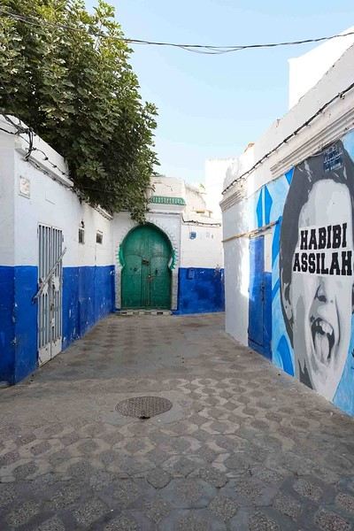
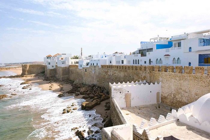
Anyway, we skirted around Tangier’s suburbs—pretty grim—and finally arrived in Asilah.
Following the coast and the long promenade along the beach, we reached the campsite. It was a bit crowded, not much shade, but it wasn’t far from the medina or the beach, and it wasn’t expensive. There’s some life here: Moroccan families seem to live on-site, in tents or basic bungalows. A woman was cooking tagine on a brazier—we were right in the atmosphere! The night was quiet, and we slept well. We set off on foot, walking along the seafront to the medina... We’d already been here in 2009. It was less touristy back then! Still, at this early hour, the little streets inside were very quiet. The walls had been freshly whitewashed, and there were even more murals than before. Around 11:30 AM, we strolled along the ramparts by the sea. There was a nice breeze! And a lot more people around. We enjoyed a milkshake on the terrace of a café overlooking the beach that stretches out at the foot of the medina. Some young guys were having fun diving off the rocks—and even off the top of the wall!
Four days of beach relaxation in this truly curious place let me unwind 15 years ago after trekking through Asia or Africa: swimming in clear, clean water and easing jet lag was my goal; seeing that mirage in the middle of the desert also piqued my curiosity... And then Dubai developed, and now I go there once a year for 15 days without ever getting bored!! My backpacker budget doesn’t stop me from enjoying what I love about travel: discovering cultures, architecture, and beaches with turquoise waters.
I’m sharing my favorite spots here for those who love simplicity and the thrill of being amazed! Dubai stretches over 50 km long. I stay in the historic Bur Dubai neighborhood, which is very "Indian" and separated from Deira (the more "Arab/African" district) by a creek.
You cross from one side to the other on abras, small traditional wooden boats that run all day. My hotel is 4 minutes from the Al Ghubaiba bus station, 5 minutes from the Al Ghubaiba metro, and 6 minutes from the Al Ghubaiba boat station!!! It’s easy to get around from here, and at night, it’s lively—safe to go out, with few tourists but mostly the local middle class who built (and are still building) Dubai. It’s simple and very international.
- **Transport:** ...**Getting there:** I fly with Emirates from Paris. Taking the 9:30 PM flight, I sleep on the plane, land at 6:35 AM, exchange 200 euros once I’ve picked up my luggage, change in the restroom, grab a taxi to the hotel, drop off my suitcase, and head straight to the beach! ...**On the ground:** I buy a silver NOL card, which works for buses, metro, and boats. I top it up as needed—it’s valid for 2 years. ...**Taxis:** They have reliable meters. Pink ones are driven by women. Airport-to-hotel fare: 12 €. You’ll find them everywhere, and they don’t complain about short trips. Between 3 PM and 4 PM, it’s trickier because of shift changes.
- **Best times to visit:** For me, it’s April-May and October-November: not too hot for walking but warm enough to swim! Watch out for air conditioning—your worst enemy. It’s everywhere, even at bus stops. Bring a big scarf or sarong to cover your throat and head—going from 32°C to 16°C when you enter a mall, bus, or taxi is pretty harsh!
- **Hotel:** I stay at the Grand Astoria (Fahidi Street) because the value for price and location is great. It’s very clean, and I skip breakfast because near the bus station, there’s a big Carrefour hypermarket where I buy breakfast supplies, water, camel milk, and picnic snacks. There are two nightclubs downstairs—bring earplugs if you want to sleep before 2 AM. Wi-Fi is spotty; you have to change the password every two days. The staff is lovely. Rooms have a TV (4 Indian channels + BBC), a kettle with tea/coffee sachets, and a mini-fridge you fill yourself.
- **Bur Dubai: "My neighborhood"** In the morning, you can see kids in uniforms waiting for the school bus with their parents—second-generation migrants who’ve settled here. They speak English, Arabic, and their mother tongue, have great education, and are in high demand (I see job ads in the local newspapers in the hotel lobby). From the U.S. to the Middle East, Singapore to South Africa, they have bright futures. In the evenings, families stroll along the creek, and it’s common for bench neighbors to ask where you’re from. The whole world crosses paths here. Even with basic English, it’s friendly and warm—the "take care" as people go their separate ways is a nice touch.
Bur Dubai has plenty to explore if you don’t feel like going far: along the creek, there’s a cluster of reconstructed houses forming the Al Shindagha Museum. One ticket lets you visit all the houses, each with a theme tied to the history of the seven emirates (Dubai is one). It takes a full day, but if you stop for lunch, there are tons of restaurants for all budgets, some right by the water.
Walking in the opposite direction, you reach Al Seef, a reconstruction of old Dubai as a small pearl-fishing port. The architecture is lovely, with souvenir shops. My favorite is the Iranian grocery store, where you’ll find camel milk chocolate, black lemon, and sweets with rose, pistachio, and candied apricot. It’s peaceful to walk around here, even as a solo woman. There are free restrooms everywhere, wooden or stone benches, and a nice breeze in the evening. Plenty of waterfront restaurants or places to grab a drink, plus a few towers across the way—nothing spectacular, but they’re prettily lit. There’s a souk with souvenir shops for those who like that!
- **Restaurants:** Bur Dubai has restaurants representing regions of India and the Indian subcontinent. My favorites: Across from the hotel, Paklyari—a Pakistani spot with excellent mutton biryani for 5 €. At Al Seef, Nablus has a great setting by the water. Across in Deira, the Italian restaurant on the 18th floor of the Rotana—go half an hour before sunset for an amazing view of the creek and skyline. The truffle pizza is 24 €. You can take a taxi from Bur, and after dinner, get dropped off at Al Seef to walk back along the creek. For a great thali, Kathhiyawadi is a 10-minute walk from Burjuman metro. My latest discovery: Bordomavi (near the Rashid Al Hadees Masjid 1 bus stop). One of the servers is Algerian and speaks French. You can swim at the small beach with showers/toilets, then have lunch at the restaurant (57 € for two, with starter, main, dessert, and drinks). The setting is peaceful, in a little fishing port with a cool photo op—traditional boats with the modern skyline in the background!
- **Sunset drinks:** The terrace at Concorde Creek View (Bur Dubai) has a creek view, and Canopy by Hilton (Al Seef) overlooks the creek and skyline. You can get a day pass for the pool, including meals and drinks.
- **Lassi:** Near the hotel, SreeRaj Lassi Bar has great ice cream and lassi. *Tip: Everything is takeout-friendly, including leftovers—great for a picnic the next day.
- **Market:** Don’t miss the Waterfront Market—a huge hall where locals buy fish, meat, fruits, and vegetables from all over the world. I love buying fish, shrimp, and cuttlefish, then having it prepared at Yahya’s waterfront restaurant (grilled, in sauce, fried, etc.) with salad, hummus, tabbouleh, and rice. It’s on the way between "my" beach and the hotel, so I stop by easily. I stock up on fruit, and at the Lulu supermarket upstairs, I grab yogurt, water, etc. No need to carry everything—a taxi (available at the main exit) will drop me right at the hotel!
- **Beach:** My favorite: Al Mamzar Park (15-minute taxi ride, 9 €). It has four lifeguarded beaches with showers and restrooms. Opens at 8 AM, but note: Mondays and Wednesdays are for women and young children only! Entry is 1.50 €. On Beach #2, you can rent sun loungers and umbrellas. Beach #3 (the prettiest) has stone tables with benches under big umbrellas—free! I arrive at 8 AM, set up, and walk for an hour along the water, spotting starfish, colorful fish, birds, and occasionally small jellyfish. From bikinis to burkinis, everyone swims as they like! Dubai is judgment-free—no side-eye, just smiles and greetings. I love seeing joyful, full-figured women on women-only days, playing darbuka and singing. Indian women do yoga (even headstands!), Chinese women practice tai chi... I read a lot and swim far out to the buoy limits. Lifeguards keep watch. It’s safe on land too. Once, a 4x4 driver gave me a dirty look for "serving whisky" to my mom from a plastic bottle—until I made him smell it. It was mint tea! Embarrassed, he immediately called his brother, a gym teacher in Poitiers, to apologize in French! People in Dubai are smiley, polite, and very respectful of elders. On weekends, the park is packed with groups and families barbecuing—joyful chaos in every language!
By 1:30 PM, depending on my mood, I’ll get dropped off at the Waterfront Market for fish or a thali restaurant. Sometimes I take the bus—it stops near the abras on the Deira side. Just cross by boat, then it’s a 3-minute walk to the hotel. Takes 45 minutes (vs. 15 by taxi).
For a treat, try Kite Beach (Abu Manara Masjid bus stop). The SoleMio section offers comfy sun loungers, fluffy towels, and umbrellas for 80 € for two in the front row. Go early—you’ll feel like you have the place to yourself, with the Burj Al Arab in the background. It gets busy on weekends.
From there, you can take a taxi to Dubai Mall (not far) to check out the dancing fountains at sunset, for example.
You can also buy day passes at some hotels with sun loungers, towels, pool access, and lunch credit. I tried the Ritz-Carlton—decent (170 € for two, including meals). Lunch was fine, and the view of the lit-up towers at sunset, with the giant wheel, was stunning. I took the metro back in the evening.
There are plenty of free beaches too, like La Mer—worth seeing more for the decor than the beach itself.
- **Even though my main "sightseeing" involves walking around with my head up, admiring the towers in DIFC (amazing), visiting the stunning Mohammed bin Rashid Library (near Creek metro), wandering the souks (including Little India in Bur and the Iranian mosque), or the spice souks in Deira (go early when it’s quiet),** A day trip to Abu Dhabi is worth it. Take the Bur Dubai-Abu Dhabi bus (pay with your NOL card). If you leave early, you’ll see the sunrise over the desert. At the station, buy a bus ticket to the Louvre, cross the footbridge over the highway, and wait for the bus. After the museum, take a taxi to the Grand Mosque, then another taxi back to the bus station. A full but doable day—no need to stay overnight!
In the evening, I love taking the metro (mostly above ground) and passing between the towering, lit-up skyscrapers—it feels like a sci-fi movie. Just missing flying taxis (they’re in the works!)
Sharjah, the closest emirate, has a fantastic Orientalist museum. From Bur Dubai’s maritime station, boats go to Sharjah in 30 minutes, near the aquarium and maritime museum.
- **Shopping:** I buy Indian chai tea spices, incense, camel milk chocolate, Iranian sweets, and fabric from Indian shops selling saris and fabric by the meter. I have a tailor make shirts, tunics, etc. Some shops sell buttons and trimmings to jazz things up.
- **Malls:** To attract customers, mall owners come up with wild ideas: a ski slope at Dubai Mall (worth seeing once), pretty wooden souks at Madinat, and a giant aquarium at Dubai Mall. At sunset, you can watch the dancing fountains to popular global tunes at the foot of the world’s tallest tower. At its base, there’s an excellent Iraqi restaurant, Samad Al Iraki, where the tea server is Tunisian and speaks French! The Ibn Battuta Mall is unique—you can go there straight from Abu Dhabi by bus, for example. Malls have plenty of dining options and are a place to (finally) see locals... though they’re not that interesting. Malls are served by the metro, while buses run along the coast. In Burjuman Mall, there’s a cybercafé on the ground floor where you can print.
A few helpful sites: Visit Dubai - Official Tourism Site RTA (Roads and Transport Authority) - RTA Services
"But what do *you* do in Dubai?" my friends ask, surprised... Yes, I love traveling to countries where I ride on bumpy roads in buses that break down, sleep in places with mosquitoes and cockroaches, and swelter in heat and humidity. But even far from that kind of travel, Dubai has an exotic charm. There’s something for every taste and budget—once you get past the flight ticket (around 680 €, probably cheaper with a layover). Dubai is about relaxing, swimming, being amazed, chatting, and tasting... A safe, clean vacation with no rudeness, and as a woman, it’s a relief to let your guard down. You come back refreshed and at peace!
Hope my experience helps... Next trip: March 2026, with plans to visit the Guggenheim in Abu Dhabi and whatever other curiosities pop up like magic...
Feel free to add to my experience with your own! Happy travels, Laurence
I’m sharing my favorite spots here for those who love simplicity and the thrill of being amazed! Dubai stretches over 50 km long. I stay in the historic Bur Dubai neighborhood, which is very "Indian" and separated from Deira (the more "Arab/African" district) by a creek.
You cross from one side to the other on abras, small traditional wooden boats that run all day. My hotel is 4 minutes from the Al Ghubaiba bus station, 5 minutes from the Al Ghubaiba metro, and 6 minutes from the Al Ghubaiba boat station!!! It’s easy to get around from here, and at night, it’s lively—safe to go out, with few tourists but mostly the local middle class who built (and are still building) Dubai. It’s simple and very international.
- **Transport:** ...**Getting there:** I fly with Emirates from Paris. Taking the 9:30 PM flight, I sleep on the plane, land at 6:35 AM, exchange 200 euros once I’ve picked up my luggage, change in the restroom, grab a taxi to the hotel, drop off my suitcase, and head straight to the beach! ...**On the ground:** I buy a silver NOL card, which works for buses, metro, and boats. I top it up as needed—it’s valid for 2 years. ...**Taxis:** They have reliable meters. Pink ones are driven by women. Airport-to-hotel fare: 12 €. You’ll find them everywhere, and they don’t complain about short trips. Between 3 PM and 4 PM, it’s trickier because of shift changes.
- **Best times to visit:** For me, it’s April-May and October-November: not too hot for walking but warm enough to swim! Watch out for air conditioning—your worst enemy. It’s everywhere, even at bus stops. Bring a big scarf or sarong to cover your throat and head—going from 32°C to 16°C when you enter a mall, bus, or taxi is pretty harsh!
- **Hotel:** I stay at the Grand Astoria (Fahidi Street) because the value for price and location is great. It’s very clean, and I skip breakfast because near the bus station, there’s a big Carrefour hypermarket where I buy breakfast supplies, water, camel milk, and picnic snacks. There are two nightclubs downstairs—bring earplugs if you want to sleep before 2 AM. Wi-Fi is spotty; you have to change the password every two days. The staff is lovely. Rooms have a TV (4 Indian channels + BBC), a kettle with tea/coffee sachets, and a mini-fridge you fill yourself.
- **Bur Dubai: "My neighborhood"** In the morning, you can see kids in uniforms waiting for the school bus with their parents—second-generation migrants who’ve settled here. They speak English, Arabic, and their mother tongue, have great education, and are in high demand (I see job ads in the local newspapers in the hotel lobby). From the U.S. to the Middle East, Singapore to South Africa, they have bright futures. In the evenings, families stroll along the creek, and it’s common for bench neighbors to ask where you’re from. The whole world crosses paths here. Even with basic English, it’s friendly and warm—the "take care" as people go their separate ways is a nice touch.
Bur Dubai has plenty to explore if you don’t feel like going far: along the creek, there’s a cluster of reconstructed houses forming the Al Shindagha Museum. One ticket lets you visit all the houses, each with a theme tied to the history of the seven emirates (Dubai is one). It takes a full day, but if you stop for lunch, there are tons of restaurants for all budgets, some right by the water.
Walking in the opposite direction, you reach Al Seef, a reconstruction of old Dubai as a small pearl-fishing port. The architecture is lovely, with souvenir shops. My favorite is the Iranian grocery store, where you’ll find camel milk chocolate, black lemon, and sweets with rose, pistachio, and candied apricot. It’s peaceful to walk around here, even as a solo woman. There are free restrooms everywhere, wooden or stone benches, and a nice breeze in the evening. Plenty of waterfront restaurants or places to grab a drink, plus a few towers across the way—nothing spectacular, but they’re prettily lit. There’s a souk with souvenir shops for those who like that!
- **Restaurants:** Bur Dubai has restaurants representing regions of India and the Indian subcontinent. My favorites: Across from the hotel, Paklyari—a Pakistani spot with excellent mutton biryani for 5 €. At Al Seef, Nablus has a great setting by the water. Across in Deira, the Italian restaurant on the 18th floor of the Rotana—go half an hour before sunset for an amazing view of the creek and skyline. The truffle pizza is 24 €. You can take a taxi from Bur, and after dinner, get dropped off at Al Seef to walk back along the creek. For a great thali, Kathhiyawadi is a 10-minute walk from Burjuman metro. My latest discovery: Bordomavi (near the Rashid Al Hadees Masjid 1 bus stop). One of the servers is Algerian and speaks French. You can swim at the small beach with showers/toilets, then have lunch at the restaurant (57 € for two, with starter, main, dessert, and drinks). The setting is peaceful, in a little fishing port with a cool photo op—traditional boats with the modern skyline in the background!
- **Sunset drinks:** The terrace at Concorde Creek View (Bur Dubai) has a creek view, and Canopy by Hilton (Al Seef) overlooks the creek and skyline. You can get a day pass for the pool, including meals and drinks.
- **Lassi:** Near the hotel, SreeRaj Lassi Bar has great ice cream and lassi. *Tip: Everything is takeout-friendly, including leftovers—great for a picnic the next day.
- **Market:** Don’t miss the Waterfront Market—a huge hall where locals buy fish, meat, fruits, and vegetables from all over the world. I love buying fish, shrimp, and cuttlefish, then having it prepared at Yahya’s waterfront restaurant (grilled, in sauce, fried, etc.) with salad, hummus, tabbouleh, and rice. It’s on the way between "my" beach and the hotel, so I stop by easily. I stock up on fruit, and at the Lulu supermarket upstairs, I grab yogurt, water, etc. No need to carry everything—a taxi (available at the main exit) will drop me right at the hotel!
- **Beach:** My favorite: Al Mamzar Park (15-minute taxi ride, 9 €). It has four lifeguarded beaches with showers and restrooms. Opens at 8 AM, but note: Mondays and Wednesdays are for women and young children only! Entry is 1.50 €. On Beach #2, you can rent sun loungers and umbrellas. Beach #3 (the prettiest) has stone tables with benches under big umbrellas—free! I arrive at 8 AM, set up, and walk for an hour along the water, spotting starfish, colorful fish, birds, and occasionally small jellyfish. From bikinis to burkinis, everyone swims as they like! Dubai is judgment-free—no side-eye, just smiles and greetings. I love seeing joyful, full-figured women on women-only days, playing darbuka and singing. Indian women do yoga (even headstands!), Chinese women practice tai chi... I read a lot and swim far out to the buoy limits. Lifeguards keep watch. It’s safe on land too. Once, a 4x4 driver gave me a dirty look for "serving whisky" to my mom from a plastic bottle—until I made him smell it. It was mint tea! Embarrassed, he immediately called his brother, a gym teacher in Poitiers, to apologize in French! People in Dubai are smiley, polite, and very respectful of elders. On weekends, the park is packed with groups and families barbecuing—joyful chaos in every language!
By 1:30 PM, depending on my mood, I’ll get dropped off at the Waterfront Market for fish or a thali restaurant. Sometimes I take the bus—it stops near the abras on the Deira side. Just cross by boat, then it’s a 3-minute walk to the hotel. Takes 45 minutes (vs. 15 by taxi).
For a treat, try Kite Beach (Abu Manara Masjid bus stop). The SoleMio section offers comfy sun loungers, fluffy towels, and umbrellas for 80 € for two in the front row. Go early—you’ll feel like you have the place to yourself, with the Burj Al Arab in the background. It gets busy on weekends.
From there, you can take a taxi to Dubai Mall (not far) to check out the dancing fountains at sunset, for example.
You can also buy day passes at some hotels with sun loungers, towels, pool access, and lunch credit. I tried the Ritz-Carlton—decent (170 € for two, including meals). Lunch was fine, and the view of the lit-up towers at sunset, with the giant wheel, was stunning. I took the metro back in the evening.
There are plenty of free beaches too, like La Mer—worth seeing more for the decor than the beach itself.
- **Even though my main "sightseeing" involves walking around with my head up, admiring the towers in DIFC (amazing), visiting the stunning Mohammed bin Rashid Library (near Creek metro), wandering the souks (including Little India in Bur and the Iranian mosque), or the spice souks in Deira (go early when it’s quiet),** A day trip to Abu Dhabi is worth it. Take the Bur Dubai-Abu Dhabi bus (pay with your NOL card). If you leave early, you’ll see the sunrise over the desert. At the station, buy a bus ticket to the Louvre, cross the footbridge over the highway, and wait for the bus. After the museum, take a taxi to the Grand Mosque, then another taxi back to the bus station. A full but doable day—no need to stay overnight!
In the evening, I love taking the metro (mostly above ground) and passing between the towering, lit-up skyscrapers—it feels like a sci-fi movie. Just missing flying taxis (they’re in the works!)
Sharjah, the closest emirate, has a fantastic Orientalist museum. From Bur Dubai’s maritime station, boats go to Sharjah in 30 minutes, near the aquarium and maritime museum.
- **Shopping:** I buy Indian chai tea spices, incense, camel milk chocolate, Iranian sweets, and fabric from Indian shops selling saris and fabric by the meter. I have a tailor make shirts, tunics, etc. Some shops sell buttons and trimmings to jazz things up.
- **Malls:** To attract customers, mall owners come up with wild ideas: a ski slope at Dubai Mall (worth seeing once), pretty wooden souks at Madinat, and a giant aquarium at Dubai Mall. At sunset, you can watch the dancing fountains to popular global tunes at the foot of the world’s tallest tower. At its base, there’s an excellent Iraqi restaurant, Samad Al Iraki, where the tea server is Tunisian and speaks French! The Ibn Battuta Mall is unique—you can go there straight from Abu Dhabi by bus, for example. Malls have plenty of dining options and are a place to (finally) see locals... though they’re not that interesting. Malls are served by the metro, while buses run along the coast. In Burjuman Mall, there’s a cybercafé on the ground floor where you can print.
A few helpful sites: Visit Dubai - Official Tourism Site RTA (Roads and Transport Authority) - RTA Services
"But what do *you* do in Dubai?" my friends ask, surprised... Yes, I love traveling to countries where I ride on bumpy roads in buses that break down, sleep in places with mosquitoes and cockroaches, and swelter in heat and humidity. But even far from that kind of travel, Dubai has an exotic charm. There’s something for every taste and budget—once you get past the flight ticket (around 680 €, probably cheaper with a layover). Dubai is about relaxing, swimming, being amazed, chatting, and tasting... A safe, clean vacation with no rudeness, and as a woman, it’s a relief to let your guard down. You come back refreshed and at peace!
Hope my experience helps... Next trip: March 2026, with plans to visit the Guggenheim in Abu Dhabi and whatever other curiosities pop up like magic...
Feel free to add to my experience with your own! Happy travels, Laurence
We stayed in Iceland from August 27 to September 13, 2023. Actually, this was our second trip to the island.
During our first visit, we rented a camper van from Snail Motorhome Rental, a family-run business that provided outstanding service.
Unfortunately, we discovered that this company no longer exists.
So, we rented a camper van through a third party, specifically via the Nordic Travel Group website.
We chose City Car Rental, located near Keflavik Airport, because the rental cost was really appealing.
Apart from the quality of the sleeping bags and the size of the pillows we rented, our experience with this company was very positive.
We noticed a significant increase in tourism since our last trip in 2015.
Several sites have been redeveloped, and parking is now paid in many places.
Accommodations have multiplied, not only near major cities but also in remote areas.
One notable advantage, however, was discovering the wide variety of food products available in supermarkets. In 2015, the selection was very limited.
I invite you to continue reading this travel journal and watch the videos that will let you explore this destination, which has everything to charm outdoor enthusiasts.
Videos are embedded throughout the summary. Click on the image to start the video.
To jump to a specific post, here are the relevant links:
Hlauptungufoss, Midfoss and Bruarfoss Geysir, Blesi and Strokkur Gullfoss Brúarhlöð Canyon Faxafoss Kiðjabergsvöllur – Belvedere Kerið Crater Reykjadalur Valley – Hike to the hot springs Seljalandsfoss Gljúfrabúi Waterfall Seljavallalaug – One of Iceland’s oldest geothermal pools Skógafoss – Fimmvörðuháls hiking trail (partial) Kvernufoss Plane wreck at Solheimasandur Dyrhólaey Peninsula Reynisfjara Beach – Puffins and seals Vík í Mýrdal Fjaðrárgljúfur Canyon Skaftafell National Park – Svartifoss, Magnusarfoss & Hundafoss Svínafellsjökull Glacier Hofskirkja Church Fjallsárlón Glacial Lagoon (West) Fjallsárlón Glacial Lagoon (East) Jökulsárlón Glacial Lagoon Litlanefsfoss and Hengifoss Rjúkandi (Rjúkandafoss) Stuðlagil Canyon Selfoss and Dettifoss Krafla – Viti Crater Lake Krafla – Leirhnjúkur Lava Field Hverir Geothermal Site (Námafjall) Hverir – Hverarönd Geothermal Site – Blue Lagoon Grjótagjá – Hot Spring Cave Stóragjá – Hot Spring Cave Goðafoss Akureyri Zipline Hofsós – Pool by the Skagafjörður Fjord Víðimýrarkirkja Church Hvítserkur Rock – The Troll of Northwest Iceland Gislahellir (Gisli's Cave) Dynjandi (Fjallfoss) – One of Iceland’s most beautiful waterfalls Hellulaug (Natural hot spring pool) Stykkishólmur – Stykkishólmshöfn Port Kirkjufell & Kirkjufellsfoss Ólafsvík – Bugsfoss Lóndrangar Basalt Columns Arnarstapi Ytri-Tunga Farm – Seal watching Deildartunguhver Hot Spring Hraunfossar & Barnafoss Exploring Reykjavik Reykjavik – Whale Safari – Whale watching Raufarholshellir Lava Tunnel Gígvatnsvatn Lake (Green Lake/Graenevatn) Seltún Geothermal Site (Krýsuvík) Kleifarvatn Lake Blue Lagoon Thermal Spa Gunnuhver Geothermal Site Reykjanes Peninsula – Reykjanesviti Lighthouse Reykjanes Peninsula – Valahnúkamöl – Reykjanestá Ægissíðufoss Super Jeep excursion to Landmannalaugar Hiking in Landmannalaugar Scenery along the way
During our first visit, we rented a camper van from Snail Motorhome Rental, a family-run business that provided outstanding service.
Unfortunately, we discovered that this company no longer exists.
So, we rented a camper van through a third party, specifically via the Nordic Travel Group website.
We chose City Car Rental, located near Keflavik Airport, because the rental cost was really appealing.
Apart from the quality of the sleeping bags and the size of the pillows we rented, our experience with this company was very positive.
We noticed a significant increase in tourism since our last trip in 2015.
Several sites have been redeveloped, and parking is now paid in many places.
Accommodations have multiplied, not only near major cities but also in remote areas.
One notable advantage, however, was discovering the wide variety of food products available in supermarkets. In 2015, the selection was very limited.
I invite you to continue reading this travel journal and watch the videos that will let you explore this destination, which has everything to charm outdoor enthusiasts.
Videos are embedded throughout the summary. Click on the image to start the video.
To jump to a specific post, here are the relevant links:
Hlauptungufoss, Midfoss and Bruarfoss Geysir, Blesi and Strokkur Gullfoss Brúarhlöð Canyon Faxafoss Kiðjabergsvöllur – Belvedere Kerið Crater Reykjadalur Valley – Hike to the hot springs Seljalandsfoss Gljúfrabúi Waterfall Seljavallalaug – One of Iceland’s oldest geothermal pools Skógafoss – Fimmvörðuháls hiking trail (partial) Kvernufoss Plane wreck at Solheimasandur Dyrhólaey Peninsula Reynisfjara Beach – Puffins and seals Vík í Mýrdal Fjaðrárgljúfur Canyon Skaftafell National Park – Svartifoss, Magnusarfoss & Hundafoss Svínafellsjökull Glacier Hofskirkja Church Fjallsárlón Glacial Lagoon (West) Fjallsárlón Glacial Lagoon (East) Jökulsárlón Glacial Lagoon Litlanefsfoss and Hengifoss Rjúkandi (Rjúkandafoss) Stuðlagil Canyon Selfoss and Dettifoss Krafla – Viti Crater Lake Krafla – Leirhnjúkur Lava Field Hverir Geothermal Site (Námafjall) Hverir – Hverarönd Geothermal Site – Blue Lagoon Grjótagjá – Hot Spring Cave Stóragjá – Hot Spring Cave Goðafoss Akureyri Zipline Hofsós – Pool by the Skagafjörður Fjord Víðimýrarkirkja Church Hvítserkur Rock – The Troll of Northwest Iceland Gislahellir (Gisli's Cave) Dynjandi (Fjallfoss) – One of Iceland’s most beautiful waterfalls Hellulaug (Natural hot spring pool) Stykkishólmur – Stykkishólmshöfn Port Kirkjufell & Kirkjufellsfoss Ólafsvík – Bugsfoss Lóndrangar Basalt Columns Arnarstapi Ytri-Tunga Farm – Seal watching Deildartunguhver Hot Spring Hraunfossar & Barnafoss Exploring Reykjavik Reykjavik – Whale Safari – Whale watching Raufarholshellir Lava Tunnel Gígvatnsvatn Lake (Green Lake/Graenevatn) Seltún Geothermal Site (Krýsuvík) Kleifarvatn Lake Blue Lagoon Thermal Spa Gunnuhver Geothermal Site Reykjanes Peninsula – Reykjanesviti Lighthouse Reykjanes Peninsula – Valahnúkamöl – Reykjanestá Ægissíðufoss Super Jeep excursion to Landmannalaugar Hiking in Landmannalaugar Scenery along the way
Hi everyone,
We're back in India for the 7th time (for the other trips, check here:
https://www.unendroitoualler.fr/asie/) ... But this time, no more exploring or trekking! With age, we're just spending a quiet month in southern India, a country we particularly love...
Our journey starts in Kovalam, then Monroe Island, Varkala, Kochi, Kannur, Udupi, and finally, as in recent years, Gokarna.
No problem getting around—there’s the train all along the coast...
Night in Trivandrum
Prepaid taxi to the « Safire Residency », where we stayed last year. This hotel is still just as nice and welcoming (980 INR). Then, dinner at the restaurant « Ariya Niwas » where we enjoyed those delicious dosas again! (We missed them!)
Night in Trivandrum
Prepaid taxi to the « Safire Residency », where we stayed last year. This hotel is still just as nice and welcoming (980 INR). Then, dinner at the restaurant « Ariya Niwas » where we enjoyed those delicious dosas again! (We missed them!)
Sunday, November 26, 2023
Melbourne - Hobart
Flawless journey to Hobart. Our stay in the southernmost land we’ve ever visited. And indeed, everything’s different. The climate—14°C, rain that varies in intensity but never stops, the landscapes… It’s a shock! But, apart from the bad weather, Dom is thrilled.
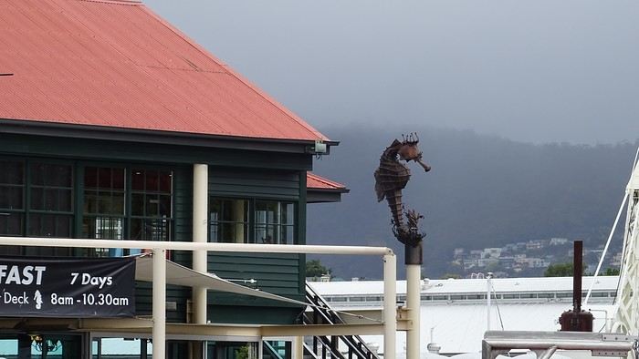
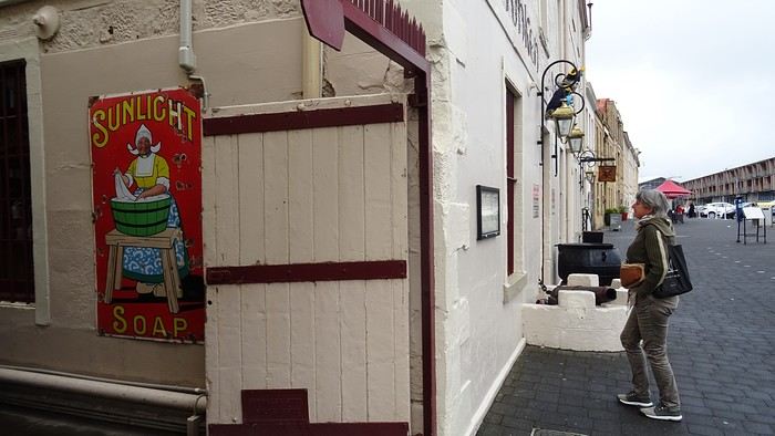
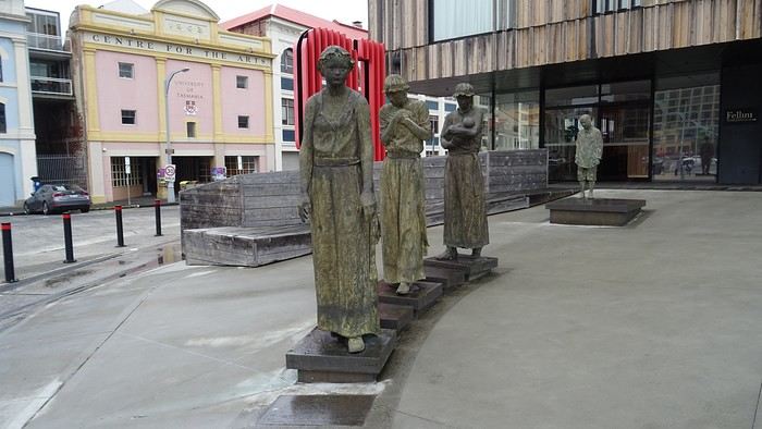
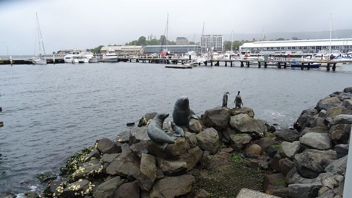
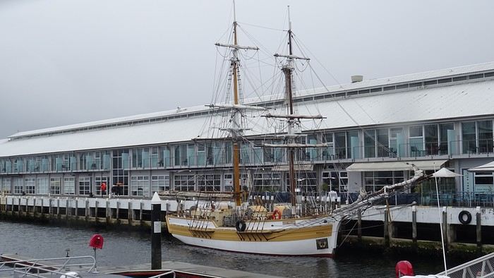
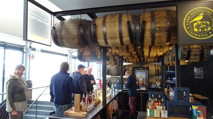
We’ve also downgraded our accommodations. We’ve got a tiny room, and the bathroom—private, at least—is two hallways away… But the price is reasonable (under 100 €) and the location is central.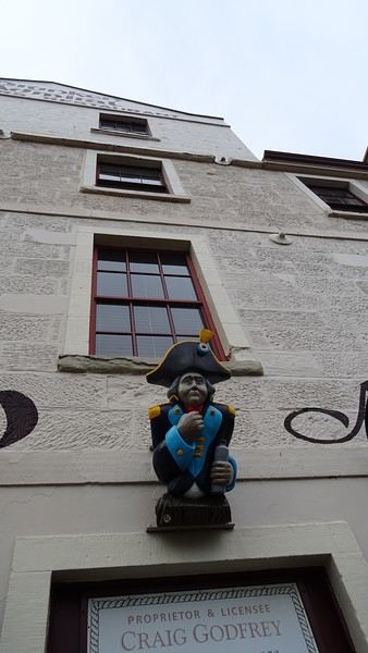
We cheered ourselves up by dining at *The Drunken Admiral* (reservations are a must—we barely snagged a table for 8 PM!). The decor is straight out of an old ship, complete with cheeky statues in the style of *Pirates of the Caribbean*… We had fun! The food was decent, but pricey. Dom loved it; I was less impressed.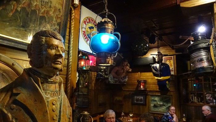
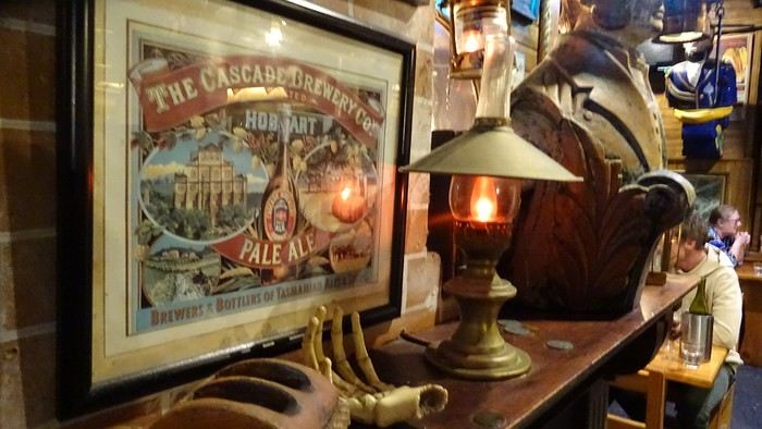
We bailed on the British series *Emma*, based on Jane Austen. We couldn’t take it anymore. The boredom was so intense that the specter of a collective suicide loomed over us. This show, where the world’s most insufferable bourgeoisie—the English nobility—lives out love stories with such improbable naivety that I wanted to scream, is pure torture. Mercy, I surrender! I’ll tell you anything you want, just make it stop! We got rid of it. We’re safe now!
We’ve also downgraded our accommodations. We’ve got a tiny room, and the bathroom—private, at least—is two hallways away… But the price is reasonable (under 100 €) and the location is central.
We cheered ourselves up by dining at *The Drunken Admiral* (reservations are a must—we barely snagged a table for 8 PM!). The decor is straight out of an old ship, complete with cheeky statues in the style of *Pirates of the Caribbean*… We had fun! The food was decent, but pricey. Dom loved it; I was less impressed.
We bailed on the British series *Emma*, based on Jane Austen. We couldn’t take it anymore. The boredom was so intense that the specter of a collective suicide loomed over us. This show, where the world’s most insufferable bourgeoisie—the English nobility—lives out love stories with such improbable naivety that I wanted to scream, is pure torture. Mercy, I surrender! I’ll tell you anything you want, just make it stop! We got rid of it. We’re safe now!
For a long time, the Yukon had been one of those dream travel destinations for us. Its vast wilderness, majestic mountains, and fascinating history tied to the gold rush irresistibly drew us in.
We finally made this ambitious project a reality: a road trip across Canada heading toward the Yukon.
Since the journey from Quebec is considerable, we chose to turn the trip itself into a series of adventures.
Instead of just racking up the kilometers, we made plenty of stops to discover several tourist attractions spread across different provinces.
Along the way, each province offered its share of landscapes and discoveries. We crossed vast forests, admired beautiful lakes, explored historic sites, and visited several local attractions that helped us better appreciate Canada’s diversity.
These breaks made the trip much more enjoyable and allowed us to take the time to fully enjoy each region we visited.
One of the great pleasures of a road trip is the freedom it provides. We could adjust our itinerary based on our mood, extend a visit we particularly enjoyed, or stop spontaneously at a spectacular viewpoint.
Often, it’s these unexpected discoveries that become the best memories.
As we moved northwest, the landscapes became more and more impressive. The roads seemed endless, the mountains drew closer, and nature took on an even greater presence. Traffic gradually thinned out, giving way to a sense of freedom that’s hard to describe.
Arriving in the Yukon marked the culmination of several days of travel. From the first kilometers, we were amazed by the vastness of the territory.
The breathtaking panoramas, the wildlife everywhere, and the unique atmosphere of the Canadian North more than made up for all the kilometers we’d covered.
This road trip to the Yukon reminded us that the destination is important, but the journey is just as much a part of it.
The many stops we made along the way allowed us to discover extraordinary places we probably never would’ve visited otherwise.
Every province we crossed helped make this adventure even more memorable.
The Yukon will certainly remain one of the highlights of our travels, but the memories we gathered along the way hold a special place in our hearts too.
That’s what makes a great Canadian road trip so magical: every kilometer tells a story.
In the upcoming posts, you’ll discover the places that caught our attention throughout this road trip.
Don’t hesitate to watch the videos to complete the experience and explore these attractions as if you were there.
To jump to a specific post, here are the appropriate links:
Roland Lake Falls - Lac-Pythonga (Quebec) | First Stop on the Way to the Yukon Must-See Stops in Ontario Stop at the Center of Canada | Manitoba Stop in Winnipeg (Manitoba) Discovering Regina (Saskatchewan) Stops in Moose Jaw, Chaplin & Saskatoon (Saskatchewan) Stops in Vegreville & Edmonton (Alberta) Stop at West Edmonton Mall, a World of Attractions Under One Roof Stops in Beaverlodge (AB) & Dawson Creek (BC) Adventure on the Alaska Highway: Between Dawson Creek and Liard River (BC) Discovering Liard River Hot Springs (BC) The Sign Post Forest (Watson Lake) Stops at Rancheria Falls, Teslin, and Tagish Discovering Carcross and Its Must-See Spots Carcross Desert Yukon: A Surprising Desert in the Heart of Canada Must-See Stop at Emerald Lake (Yukon) Hike at Miles Canyon (Whitehorse) - Yukon Discovering Whitehorse Spectacular Northern Lights - Fish Lake - Whitehorse (Yukon) Must-See Stops Between Whitehorse and Dawson City Road Trip on the Dempster Highway (Yukon) - 100 km of Adventure Complete Visit of the Historic Town of Dawson City in the Yukon Midnight Dome Dawson City - Magical Northern Lights in the Yukon
We finally made this ambitious project a reality: a road trip across Canada heading toward the Yukon.
Since the journey from Quebec is considerable, we chose to turn the trip itself into a series of adventures.
Instead of just racking up the kilometers, we made plenty of stops to discover several tourist attractions spread across different provinces.
Along the way, each province offered its share of landscapes and discoveries. We crossed vast forests, admired beautiful lakes, explored historic sites, and visited several local attractions that helped us better appreciate Canada’s diversity.
These breaks made the trip much more enjoyable and allowed us to take the time to fully enjoy each region we visited.
One of the great pleasures of a road trip is the freedom it provides. We could adjust our itinerary based on our mood, extend a visit we particularly enjoyed, or stop spontaneously at a spectacular viewpoint.
Often, it’s these unexpected discoveries that become the best memories.
As we moved northwest, the landscapes became more and more impressive. The roads seemed endless, the mountains drew closer, and nature took on an even greater presence. Traffic gradually thinned out, giving way to a sense of freedom that’s hard to describe.
Arriving in the Yukon marked the culmination of several days of travel. From the first kilometers, we were amazed by the vastness of the territory.
The breathtaking panoramas, the wildlife everywhere, and the unique atmosphere of the Canadian North more than made up for all the kilometers we’d covered.
This road trip to the Yukon reminded us that the destination is important, but the journey is just as much a part of it.
The many stops we made along the way allowed us to discover extraordinary places we probably never would’ve visited otherwise.
Every province we crossed helped make this adventure even more memorable.
The Yukon will certainly remain one of the highlights of our travels, but the memories we gathered along the way hold a special place in our hearts too.
That’s what makes a great Canadian road trip so magical: every kilometer tells a story.
In the upcoming posts, you’ll discover the places that caught our attention throughout this road trip.
Don’t hesitate to watch the videos to complete the experience and explore these attractions as if you were there.
To jump to a specific post, here are the appropriate links:
Roland Lake Falls - Lac-Pythonga (Quebec) | First Stop on the Way to the Yukon Must-See Stops in Ontario Stop at the Center of Canada | Manitoba Stop in Winnipeg (Manitoba) Discovering Regina (Saskatchewan) Stops in Moose Jaw, Chaplin & Saskatoon (Saskatchewan) Stops in Vegreville & Edmonton (Alberta) Stop at West Edmonton Mall, a World of Attractions Under One Roof Stops in Beaverlodge (AB) & Dawson Creek (BC) Adventure on the Alaska Highway: Between Dawson Creek and Liard River (BC) Discovering Liard River Hot Springs (BC) The Sign Post Forest (Watson Lake) Stops at Rancheria Falls, Teslin, and Tagish Discovering Carcross and Its Must-See Spots Carcross Desert Yukon: A Surprising Desert in the Heart of Canada Must-See Stop at Emerald Lake (Yukon) Hike at Miles Canyon (Whitehorse) - Yukon Discovering Whitehorse Spectacular Northern Lights - Fish Lake - Whitehorse (Yukon) Must-See Stops Between Whitehorse and Dawson City Road Trip on the Dempster Highway (Yukon) - 100 km of Adventure Complete Visit of the Historic Town of Dawson City in the Yukon Midnight Dome Dawson City - Magical Northern Lights in the Yukon
In the summer of 2026, we packed our backpacks again to wander around Jotunheimen National Park in Norway.
We’d never heard of this park just a few months earlier—we discovered it by following threads online.
It’s billed as the most mountainous park in the country, which really appealed to us after scrapping our original plan further north.
Unfortunately, it’s also the most crowded, which immediately made it less appealing! The presence of the highest peak in the Scandinavian Alps and the "famous" Bessengen ridge (famous because it’s apparently well-known across the country) probably has a lot to do with that.
Since we’d managed to avoid the crowds on the Kungsleden trails by camping away from the huts and timing our hike to miss the biggest groups of walkers, we figured we had the formula down and gave in to the call of the Norwegian mountains.
It’s the most mountainous park, sure, but also quite challenging in terms of progress, as we’d soon discover during the trek. And with uncooperative weather, we got the winning combo of a demanding hike. But I’m getting ahead of myself...
For the end of the trip, we planned a few days in Dovrefjell National Park—these two parks are easily connected by public transport—to see something different and, most importantly, to try and spot the musk oxen that live there.
My 04/08 - Arrival in Oslo Wed 05/08 - Bygdin – Torfinsbu Thu 06/08 - Torfinsbu - Gjendebu Fri 07/08 - Gjendebu - Fondsbu Sat 08/08 - Day hike to Slotafjellet Sun 09/08 - Day hike to Lake Kvitevatnet Mon 10/08 - Fondsbu - Gjendebu Tue 11/08 - Gjendebu - Before the Bessengen ridge Wed 12/08 - Bessengen ridge – Maurvangen campsite Thu 13/08 - Knutshoe ridge Fri 14/08 - Bus transfer to Spiterstulen hut via Lom Sat 15/08 - Day hike to Galdhøpiggen Sun 16/08 to Wed 19/08: Dovrefjell End of the trip and wrap-up
We’d never heard of this park just a few months earlier—we discovered it by following threads online.
It’s billed as the most mountainous park in the country, which really appealed to us after scrapping our original plan further north.
Unfortunately, it’s also the most crowded, which immediately made it less appealing! The presence of the highest peak in the Scandinavian Alps and the "famous" Bessengen ridge (famous because it’s apparently well-known across the country) probably has a lot to do with that.
Since we’d managed to avoid the crowds on the Kungsleden trails by camping away from the huts and timing our hike to miss the biggest groups of walkers, we figured we had the formula down and gave in to the call of the Norwegian mountains.
It’s the most mountainous park, sure, but also quite challenging in terms of progress, as we’d soon discover during the trek. And with uncooperative weather, we got the winning combo of a demanding hike. But I’m getting ahead of myself...
For the end of the trip, we planned a few days in Dovrefjell National Park—these two parks are easily connected by public transport—to see something different and, most importantly, to try and spot the musk oxen that live there.
My 04/08 - Arrival in Oslo Wed 05/08 - Bygdin – Torfinsbu Thu 06/08 - Torfinsbu - Gjendebu Fri 07/08 - Gjendebu - Fondsbu Sat 08/08 - Day hike to Slotafjellet Sun 09/08 - Day hike to Lake Kvitevatnet Mon 10/08 - Fondsbu - Gjendebu Tue 11/08 - Gjendebu - Before the Bessengen ridge Wed 12/08 - Bessengen ridge – Maurvangen campsite Thu 13/08 - Knutshoe ridge Fri 14/08 - Bus transfer to Spiterstulen hut via Lom Sat 15/08 - Day hike to Galdhøpiggen Sun 16/08 to Wed 19/08: Dovrefjell End of the trip and wrap-up
Introduction:
As has become a habit, I’ve organized a trip for late October—a surprise trip for my poor wife, who follows along without saying much (or almost nothing).
She knows she’s going away, when, but not where!
Our friends and family keep bombarding me with questions to get the info, but I’m holding strong.
The guesses are flying, the best one being, “Knowing him, he’s definitely heading somewhere sunny, even if all the southern destinations have already been done for a short stay.”
It makes me laugh because there are still a few places I haven’t discovered yet.
So yes, choosing to go to Belgium at the end of October—especially for someone as sensitive to the cold as I am—is bold.
I’m not quite at Philippe Abrams’ level, but still, heading *Noooorth* from me is pretty daring.
So, contrary to my friends’ predictions, I’m not flying south but taking my car, turning the wheel north, and off we go!
Day 1: The outbound trip When I say I’m not flying, it’s only half true because we’re leaving the day French media—with their signature doom-and-gloom—announce a terrible storm. While Storm Austen is indeed forecasted, the Belgians are reporting it as the first storm of the year with a bit more restraint. The drive won’t be entirely smooth as we reach the Hauts-de-France region: the wind is strong, the rain is heavy, but it’s not the apocalypse. Just drive carefully and slow down—sounds like a road safety message! We left Lyon at 8 AM and arrived in Bruges at 4 PM, “...and that’s even with the trucks at the entrance to Angoulême!” What’s he talking about—going through Angoulême? French cinephiles will get the reference. We got a warm welcome at our B&B, and since it was barely drizzling, we took a quick stroll around town to stretch our legs. Headed to the Markt, visited the Prinsenhof, the Palace of the Dukes of Flanders. We actually went in because it started pouring. It’s free, a first taste of Flemish culture, and it’s great.
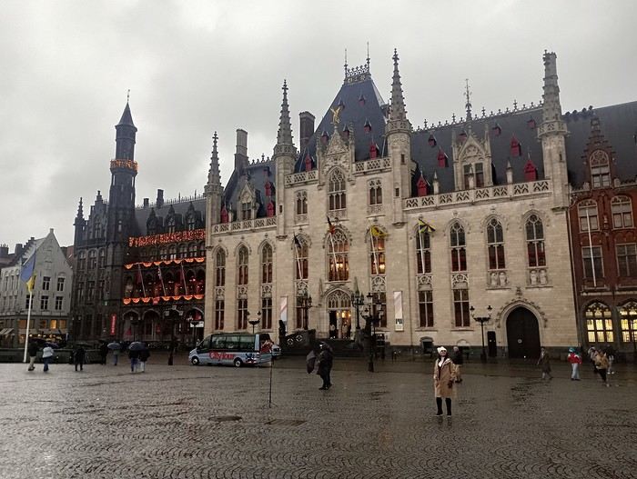
A little tired, we headed back to our B&B, mostly because the heavy rain forced us to. We got soaked (some people must be laughing). After drying off, we went to the nearest restaurant, Parazzar, typically Bruges-style, and my wife tried her first beer. Personally, I don’t like beer—*What the heck was I thinking?*—so I had a red wine, a Tinto, which would’ve been local back in Charles V’s time. First fries—because I *love* them—and it’s time to call it a night. A good night’s sleep awaits.
The +: We made it! The -: It’s raining, it’s windy, it’s wet—party at the...
Day 1: The outbound trip When I say I’m not flying, it’s only half true because we’re leaving the day French media—with their signature doom-and-gloom—announce a terrible storm. While Storm Austen is indeed forecasted, the Belgians are reporting it as the first storm of the year with a bit more restraint. The drive won’t be entirely smooth as we reach the Hauts-de-France region: the wind is strong, the rain is heavy, but it’s not the apocalypse. Just drive carefully and slow down—sounds like a road safety message! We left Lyon at 8 AM and arrived in Bruges at 4 PM, “...and that’s even with the trucks at the entrance to Angoulême!” What’s he talking about—going through Angoulême? French cinephiles will get the reference. We got a warm welcome at our B&B, and since it was barely drizzling, we took a quick stroll around town to stretch our legs. Headed to the Markt, visited the Prinsenhof, the Palace of the Dukes of Flanders. We actually went in because it started pouring. It’s free, a first taste of Flemish culture, and it’s great.
A little tired, we headed back to our B&B, mostly because the heavy rain forced us to. We got soaked (some people must be laughing). After drying off, we went to the nearest restaurant, Parazzar, typically Bruges-style, and my wife tried her first beer. Personally, I don’t like beer—*What the heck was I thinking?*—so I had a red wine, a Tinto, which would’ve been local back in Charles V’s time. First fries—because I *love* them—and it’s time to call it a night. A good night’s sleep awaits.
The +: We made it! The -: It’s raining, it’s windy, it’s wet—party at the...
Hello,
We’re a couple in our sixties and we’ve just spent 22 days in Brazil, from October 29th to November 21st.
We flew from Marseille via Lisbon—outbound to Rio, and back from Recife.
Our itinerary:
4 days in Rio
4 days on Ilha Grande
2 days in Paraty
4 days in Salvador
4 days on Boïpeba
4 days in Olinda
The transfer between Boïpeba and Recife took us 2 days—boats, taxis, and a flight.
We stayed in Airbnbs except in Paraty, where we were in a pousada, and during the Boïpeba–Recife transfer, when we booked a hotel near the airport.
Our flights were with Gol and Azul.
Transfers from Rio were arranged through Paraty Tour.
In Rio, we used a local agency to visit Corcovado and Sugarloaf Mountain.
Happy to answer any questions! Marc
Happy to answer any questions! Marc
Arrival at Luang Prabang Airport: Got my visa on the spot in under 5 minutes, but it cost me $40 + $1 for some "processing fee" and a photo.
First ATM withdrawal of the maximum allowed—about 82 €! Luckily, I had euros on me because each withdrawal comes with a fixed fee of 30,000 kips (like in Thailand, where it’s 200 baht per withdrawal, but here you can take out up to 800 €!).
Then I took the airport taxi service for 100,000 kips per person. It’s a minivan that drops passengers (8–10) at their hotels. The ticket booth is right at the exit—easy to spot with a sign that says "Taxi Service."
I left Luang Prabang for Nong Khiaw by minivan, paying 180,000 kips. A big tuk-tuk taxi picked us up at the hotel at 8:40 AM, and we picked up more people along the way until we reached a small minivan station. Our "minivan" was *very* mini—we still managed to squeeze in 12 people, with 2 up front + the driver, even though there wasn’t really space for 2 full seats—more like 1.5! Luggage was strapped to the roof under a tarp for the trip. Scheduled to leave at 9 AM, we finally took off at 9:30. The ride took 4 hours and 15 minutes from station to station—roads were rough, sometimes unpaved, and always full of potholes. This route is mostly used by trucks registered in China. We passed the dam that now blocks boat traffic between Luang Prabang and Nong Khiaw. About 40 km from Nong Khiaw, we turned off the main road onto a smaller one, less crowded with trucks but still rough. At the Nong Khiaw bus station, a shared taxi was waiting to drop everyone off at their hotels. I walked to mine—the Nam Ou View Villa, about 600 meters from the station. Nice room with a great view of the river.
Nong Khiaw is easy to explore on foot. One unpaved road runs along the river, lined with hotels and restaurants with terraces, while a parallel paved road has little traffic and all the shops. I loved the vibe and tranquility of the town. There are plenty of guesthouses, especially on the other side of the bridge. Restaurants everywhere, all in a calm atmosphere. I hiked up to the highest viewpoint—there are several. The climb is supposed to take 1.5 hours, but it took me 2. Time to enjoy the nature and catch my breath! No real difficulty, just a *lot* of uphill. There’s a small toll at the start of the climb—I don’t remember the exact amount, but it wasn’t expensive. The view at the top is stunning—360°! Mornings are cloudy, midday is usually clear, and evenings are all about the sunset ☀️. The descent was tougher for me—guaranteed sore muscles!
I also walked along the Nam Ou toward Muang Ngoi. The road is quiet and unpaved but often narrow with no views. Small villages along the way. In town, you can rent canoes, and agencies offer day trips or multi-day excursions. There are shops, a bank, and 2 ATMs.
Departure for Muang Ngoi—a village only accessible by private or public boat. I took the 11:30 AM public boat (sold as 11 AM) for 70,000 kips. There were so many of us that two boats were needed, and we were still packed in! We left 40 minutes late because the ticket collector didn’t check anything, and one ticket was missing. Of course, everyone insisted they’d paid—which was probably true, given the general disorganization. The trip took 1 hour and 5 minutes, going upstream against the current. Gorgeous.
Arriving at Muang Ngoi’s tiny dock, hotel owners were waiting for their guests or offering rooms to those without reservations. I’d booked the Riverview Bungalows & GH. The room was a bit worn but comfortable, and the view was amazing!
Muang Ngoi has ONE recently paved main street—all other paths are red dirt and dusty, perfect for unguided day hikes. I *loved* this village. People live their lives without worrying much about tourists, who aren’t too numerous yet. There’s no bank or ATM, and dollars are accepted (even preferred) for transport and hotels. Watch the condition of your bills—the hotelier refused one with a tiny stain I hadn’t even noticed! There are travel agencies for excursions, small shops... I often ate at Gecko (Western food, I admit) and across the street at Vita, which serves a delicious local dish called *Suzy*—a curry-like specialty. From Muang Ngoi, there are plenty of easy hikes. The trails are simple to find and follow, except for those crossing rice fields. Maps.Me helped me stay on track.
If you don’t want to walk, there are very local transport options: modified tractors with platforms for passengers and luggage. I took an excursion to Sopchem, a small village 40 minutes away by boat. I paid $20 round-trip for two people on a private boat. The ride was stunning—the river cuts through mountains in this section. Sopchem is tiny but charming, especially for buying textiles. Every house has a loom out front and a display selling their work. I bought two scarves for 60,000 kips each without bargaining—it seemed like a steal. Back in Luang Prabang, I saw the same scarves in a fancy boutique for 55,000 kips each—9 or 10 times the price!!!!
I also tried the village laundry service—everywhere lists the price as 25,000 kips per kilo. I picked the closest one to my hotel and watched from my balcony as the woman washed my clothes in the river, then hung them on her fence all day in the dust! Turns out only hotels have washing machines. Better to postpone laundry or do it yourself—my clothes didn’t smell great afterward!
For the return to Luang Prabang, I splurged on a private transfer. An agency at the dock arranged it for $100. I took the public boat to Nong Khiaw, where a driver was waiting. His vehicle was a pickup truck, and the trip took 4 hours total to my hotel in the city center. I recommend this agency (Lattanavongsa Tour Adventure)—very professional. They also run a hotel (same name) that looked nice from the outside, though not riverfront.
In Luang Prabang, I did the Mekong sunset cruise. Departed at 4:30 PM with Sasa Sunset Cruise for 245,000 kips, including one drink and spring rolls. I was lucky to see a beautiful sunset—I don’t regret it. I also visited the tiny Traditional Arts and Ethnology Centre—very interesting for learning about Laos’ ethnic groups and textile traditions, but *very* small. Of course, I visited the temples and wandered the alleys to admire the stunning houses. The sunset at Mount Phousi was nice, but *so* crowded! The night market is fun but not super interesting—vendors sell pretty much the same things you’ll find in daytime shops at the same prices. There are two food courts, one huge at the end of the market. I love the concept, but the quality of the stalls is debatable.
Luang Prabang The morning alms-giving ceremony for monks is called *Tak Bat*. This ritual has turned into a circus for Chinese tourists. I’d visited Luang Prabang 15 years ago and didn’t find the same serenity in the ceremony. In Luang Prabang, I exchanged euros at BFL BRED Bank (recommended in the *Routard* guide). Good rates and a smooth transaction. The employee spoke excellent French and offered me deals on the Sasa sunset cruise (with dinner) and a taxi to the airport. I took her up on the taxi—it was much cheaper. She explained that she works evenings at Sasa Sunset Cruise and the taxi driver is her husband.
Hope this gives you some practical tips for your next trip!
I left Luang Prabang for Nong Khiaw by minivan, paying 180,000 kips. A big tuk-tuk taxi picked us up at the hotel at 8:40 AM, and we picked up more people along the way until we reached a small minivan station. Our "minivan" was *very* mini—we still managed to squeeze in 12 people, with 2 up front + the driver, even though there wasn’t really space for 2 full seats—more like 1.5! Luggage was strapped to the roof under a tarp for the trip. Scheduled to leave at 9 AM, we finally took off at 9:30. The ride took 4 hours and 15 minutes from station to station—roads were rough, sometimes unpaved, and always full of potholes. This route is mostly used by trucks registered in China. We passed the dam that now blocks boat traffic between Luang Prabang and Nong Khiaw. About 40 km from Nong Khiaw, we turned off the main road onto a smaller one, less crowded with trucks but still rough. At the Nong Khiaw bus station, a shared taxi was waiting to drop everyone off at their hotels. I walked to mine—the Nam Ou View Villa, about 600 meters from the station. Nice room with a great view of the river.
Nong Khiaw is easy to explore on foot. One unpaved road runs along the river, lined with hotels and restaurants with terraces, while a parallel paved road has little traffic and all the shops. I loved the vibe and tranquility of the town. There are plenty of guesthouses, especially on the other side of the bridge. Restaurants everywhere, all in a calm atmosphere. I hiked up to the highest viewpoint—there are several. The climb is supposed to take 1.5 hours, but it took me 2. Time to enjoy the nature and catch my breath! No real difficulty, just a *lot* of uphill. There’s a small toll at the start of the climb—I don’t remember the exact amount, but it wasn’t expensive. The view at the top is stunning—360°! Mornings are cloudy, midday is usually clear, and evenings are all about the sunset ☀️. The descent was tougher for me—guaranteed sore muscles!
I also walked along the Nam Ou toward Muang Ngoi. The road is quiet and unpaved but often narrow with no views. Small villages along the way. In town, you can rent canoes, and agencies offer day trips or multi-day excursions. There are shops, a bank, and 2 ATMs.
Departure for Muang Ngoi—a village only accessible by private or public boat. I took the 11:30 AM public boat (sold as 11 AM) for 70,000 kips. There were so many of us that two boats were needed, and we were still packed in! We left 40 minutes late because the ticket collector didn’t check anything, and one ticket was missing. Of course, everyone insisted they’d paid—which was probably true, given the general disorganization. The trip took 1 hour and 5 minutes, going upstream against the current. Gorgeous.
Arriving at Muang Ngoi’s tiny dock, hotel owners were waiting for their guests or offering rooms to those without reservations. I’d booked the Riverview Bungalows & GH. The room was a bit worn but comfortable, and the view was amazing!
Muang Ngoi has ONE recently paved main street—all other paths are red dirt and dusty, perfect for unguided day hikes. I *loved* this village. People live their lives without worrying much about tourists, who aren’t too numerous yet. There’s no bank or ATM, and dollars are accepted (even preferred) for transport and hotels. Watch the condition of your bills—the hotelier refused one with a tiny stain I hadn’t even noticed! There are travel agencies for excursions, small shops... I often ate at Gecko (Western food, I admit) and across the street at Vita, which serves a delicious local dish called *Suzy*—a curry-like specialty. From Muang Ngoi, there are plenty of easy hikes. The trails are simple to find and follow, except for those crossing rice fields. Maps.Me helped me stay on track.
If you don’t want to walk, there are very local transport options: modified tractors with platforms for passengers and luggage. I took an excursion to Sopchem, a small village 40 minutes away by boat. I paid $20 round-trip for two people on a private boat. The ride was stunning—the river cuts through mountains in this section. Sopchem is tiny but charming, especially for buying textiles. Every house has a loom out front and a display selling their work. I bought two scarves for 60,000 kips each without bargaining—it seemed like a steal. Back in Luang Prabang, I saw the same scarves in a fancy boutique for 55,000 kips each—9 or 10 times the price!!!!
I also tried the village laundry service—everywhere lists the price as 25,000 kips per kilo. I picked the closest one to my hotel and watched from my balcony as the woman washed my clothes in the river, then hung them on her fence all day in the dust! Turns out only hotels have washing machines. Better to postpone laundry or do it yourself—my clothes didn’t smell great afterward!
For the return to Luang Prabang, I splurged on a private transfer. An agency at the dock arranged it for $100. I took the public boat to Nong Khiaw, where a driver was waiting. His vehicle was a pickup truck, and the trip took 4 hours total to my hotel in the city center. I recommend this agency (Lattanavongsa Tour Adventure)—very professional. They also run a hotel (same name) that looked nice from the outside, though not riverfront.
In Luang Prabang, I did the Mekong sunset cruise. Departed at 4:30 PM with Sasa Sunset Cruise for 245,000 kips, including one drink and spring rolls. I was lucky to see a beautiful sunset—I don’t regret it. I also visited the tiny Traditional Arts and Ethnology Centre—very interesting for learning about Laos’ ethnic groups and textile traditions, but *very* small. Of course, I visited the temples and wandered the alleys to admire the stunning houses. The sunset at Mount Phousi was nice, but *so* crowded! The night market is fun but not super interesting—vendors sell pretty much the same things you’ll find in daytime shops at the same prices. There are two food courts, one huge at the end of the market. I love the concept, but the quality of the stalls is debatable.
Luang Prabang The morning alms-giving ceremony for monks is called *Tak Bat*. This ritual has turned into a circus for Chinese tourists. I’d visited Luang Prabang 15 years ago and didn’t find the same serenity in the ceremony. In Luang Prabang, I exchanged euros at BFL BRED Bank (recommended in the *Routard* guide). Good rates and a smooth transaction. The employee spoke excellent French and offered me deals on the Sasa sunset cruise (with dinner) and a taxi to the airport. I took her up on the taxi—it was much cheaper. She explained that she works evenings at Sasa Sunset Cruise and the taxi driver is her husband.
Hope this gives you some practical tips for your next trip!
Quick recap of a getaway to Sicily (June 3–13, 2022).
Day 1: Transavia flight to Palermo from Lyon Day 2: Zingaro Reserve (14 km coastal trail round-trip, about 4 hours of hiking + coves) / Evening in Scopello Day 3: Segesta + Erice via cable car + evening in Trapani (free parking at Piazza Vit. Emmanuele) Day 3: Bike day in Favignana (Cala Rosa, Cala Azzurra) Day 4: Marsala (quick stop at the salt flats), Selinunte, and sleepover in Agrigento Day 5: Day in Agrigento: Valley of the Temples, Temple of Concordia, Temple of Hercules, Temple of Juno, Temple of Castor and Pollux Day 6: Villa Romana del Casale and Cefalù in the late afternoon Day 7: Relaxing beach day in Cefalù Day 8: Mosaics in Monreale Cathedral, then Palermo Day 9: Palermo Day 10: Return to Lyon
8 days on the ground covering 650 km, scorching heat all week (37°C in Zingaro), and a ridiculously expensive car rental (Sicily by Car).
Some truly great accommodations:
- Tre Giummare in Scopello (despite the AC breaking down the night before) - Laurus Apartments in Trapani (perfect for the Favignana ferry) - Terrazze di Montelusa in Agrigento (worth seeing—very unique!) - Rurale, Via Lancenia 22 in Cefalù (for the pool view!) - Il Giardino di Ballarò in Palermo (charming and right in the heart of the city)
Our top picks:
- Favignana (by far the highlight of the trip) - The temples in Agrigento - Palermo - The food here is amazing
No real disappointments, but Erice didn’t quite live up to expectations, and we were frustrated by the car rental prices.
Side note: make sure to specify that your card is a *credit* card (not debit). Ours was a deferred debit card, and our bank had the sense to label it "credit card"—otherwise, you’d be on the hook for an extra 200 €... those Southern Italians!
Hike in Zingaro:
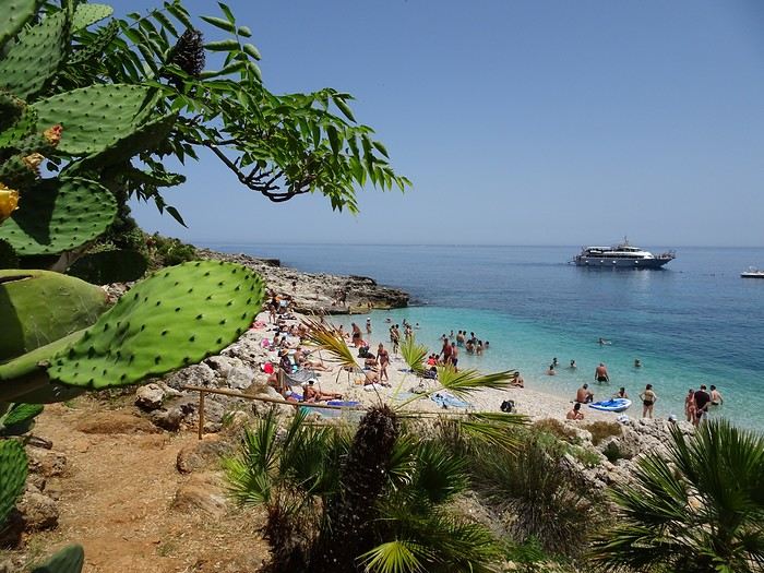
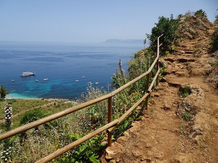
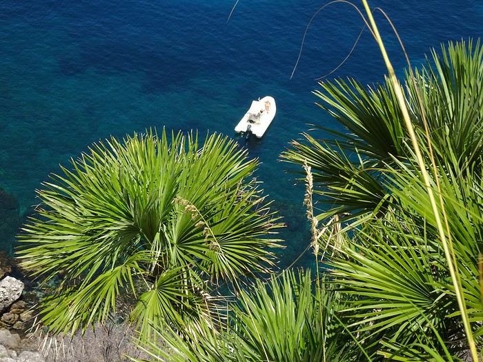
Segesta:
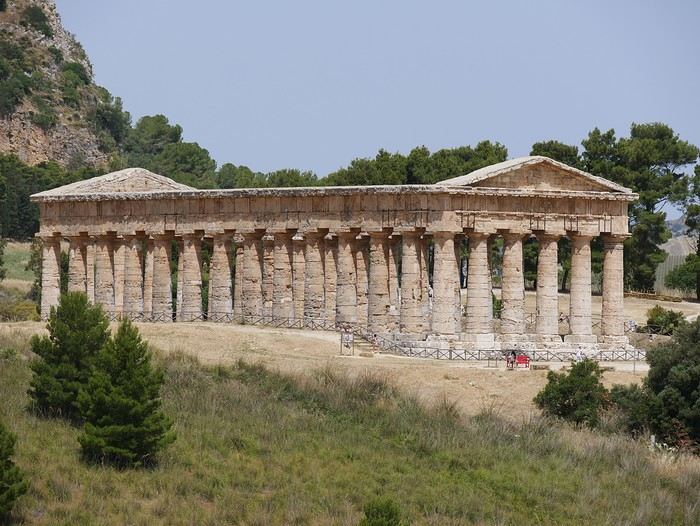
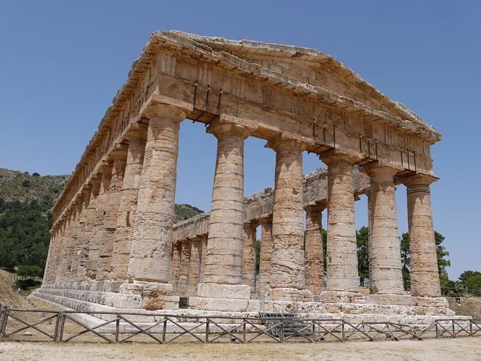
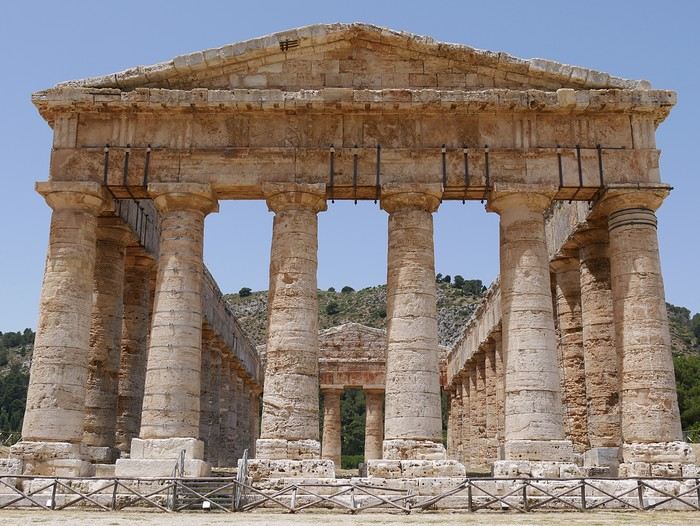
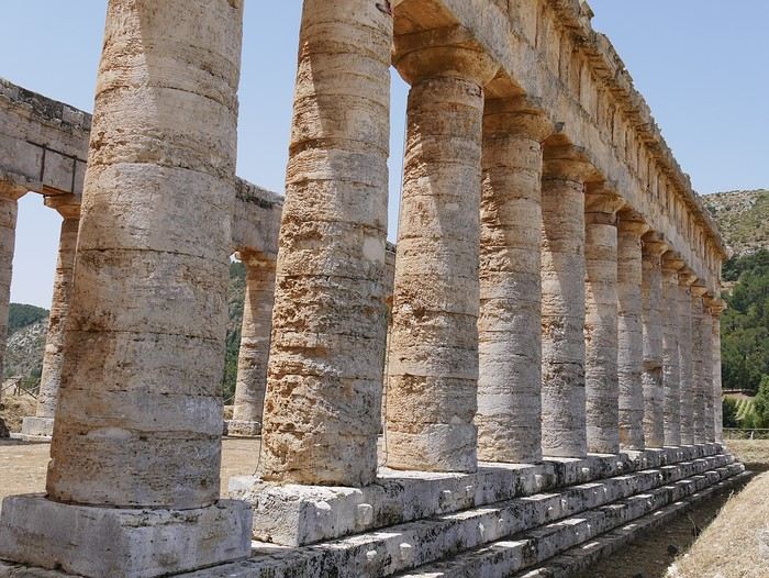
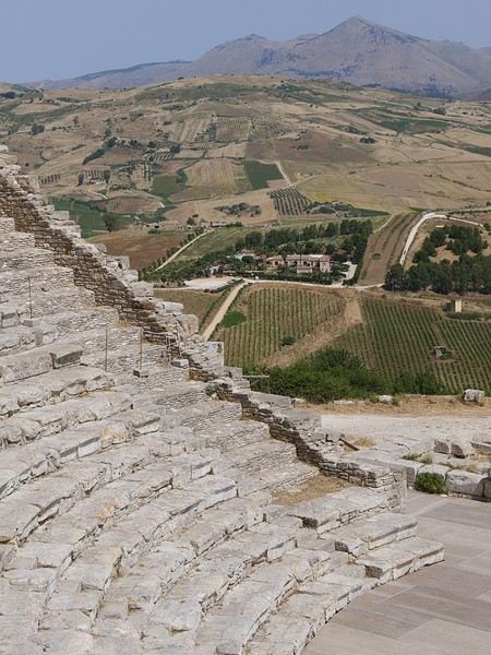
Day 1: Transavia flight to Palermo from Lyon Day 2: Zingaro Reserve (14 km coastal trail round-trip, about 4 hours of hiking + coves) / Evening in Scopello Day 3: Segesta + Erice via cable car + evening in Trapani (free parking at Piazza Vit. Emmanuele) Day 3: Bike day in Favignana (Cala Rosa, Cala Azzurra) Day 4: Marsala (quick stop at the salt flats), Selinunte, and sleepover in Agrigento Day 5: Day in Agrigento: Valley of the Temples, Temple of Concordia, Temple of Hercules, Temple of Juno, Temple of Castor and Pollux Day 6: Villa Romana del Casale and Cefalù in the late afternoon Day 7: Relaxing beach day in Cefalù Day 8: Mosaics in Monreale Cathedral, then Palermo Day 9: Palermo Day 10: Return to Lyon
8 days on the ground covering 650 km, scorching heat all week (37°C in Zingaro), and a ridiculously expensive car rental (Sicily by Car).
Some truly great accommodations:
- Tre Giummare in Scopello (despite the AC breaking down the night before) - Laurus Apartments in Trapani (perfect for the Favignana ferry) - Terrazze di Montelusa in Agrigento (worth seeing—very unique!) - Rurale, Via Lancenia 22 in Cefalù (for the pool view!) - Il Giardino di Ballarò in Palermo (charming and right in the heart of the city)
Our top picks:
- Favignana (by far the highlight of the trip) - The temples in Agrigento - Palermo - The food here is amazing
No real disappointments, but Erice didn’t quite live up to expectations, and we were frustrated by the car rental prices.
Side note: make sure to specify that your card is a *credit* card (not debit). Ours was a deferred debit card, and our bank had the sense to label it "credit card"—otherwise, you’d be on the hook for an extra 200 €... those Southern Italians!
Hike in Zingaro:
Segesta:
Hi everyone!
I’m just back from two weeks in southern Kazakhstan. I went with a friend, and we organized everything ourselves. We came back absolutely enchanted by the trip: stunning landscapes, lots of animals spotted in the parks, and above all, amazing hospitality and a warm welcome.
I’m just back from two weeks in southern Kazakhstan. I went with a friend, and we organized everything ourselves. We came back absolutely enchanted by the trip: stunning landscapes, lots of animals spotted in the parks, and above all, amazing hospitality and a warm welcome.
I just got back from Sardinia 2 and wanted to share my little recap with you.
It’s a stunning country, and the people are so welcoming.
We were lucky to see it at the end of April—I wouldn’t go in July or August because it gets overcrowded and loses its charm!!!
SARDINIA 2: 10 days
-Departure from Geneva to Olbia on Friday, 04/12/24 with EasyJet: 1h30 flight -Return from Cagliari to Geneva on Sunday, 04/21/24 with EasyJet: 1h40 flight (Round-trip price: 314 €) -Car rental with Locauto: 250 €, including 51 € for "full" insurance + 87 € (drop-off at a different airport) -Accommodation every night via Booking 13: room + kitchen *OLBIA: Arrival at the airport… wasted time at Locauto because there was only one person at the desk (you can check in online and send the driver’s license and ID, but it was impossible to do!) Headed to our lodging. *COSTA SMERALDA: The part we liked the least… everything feels artificial since the billionaires moved in (Porto Rotondo, Porto Cervo, Baia di Sardinia). We regret not stopping at Golfo Aranci to see its underwater art museum, Mumart. *ARZACHENA and its archaeological park (Tomba dei Giganti: Coddu Ecchju, Li Muri, Nuraghe la Prisgiona) to see in beautiful nature. Coastal road toward Palau (lagoons with lots of birds). *PALAU: Ferries to La Maddalena Island every 15/30 minutes (37 € for 2 people + 1 car). *** La Maddalena is part of an archipelago with 7 large islands and small islets… absolutely stunning… views of Corsica! *** -La Maddalena: A charming little town with narrow streets. -Follow the scenic coastal road that loops around the island for 21 km (gorgeous). -On the east side of the island, take a 600m bridge to Caprera Island (lots of great hiking trails). -Lots of beaches with granite rocks and wild coves. -Return by ferry to Palau. *SANTA TERESA GALLURA: Departure for Bonifacio 2, 4 km to Capo Testa (cape with a lighthouse… granite rocks). Here, there were Roman quarries. *Drive down a beautiful road along the Costa Paradiso (red trachyte). *CASTELSARDO: A fortified hilltop town worth seeing. *PORTO TORRES: Visit the Basilica San Gavino. *STINTINO and its beaches, including La Pelosa with its Genoese tower… too crowded for us! *Viewpoint at Capo Falcone with a view of Parco dell’Asinara (we didn’t have time to go, but it’s a must). *Drive down to Argentiera via small coastal roads (old lead, zinc, and silver mines). A "ghost town" with a museum that’s apparently only open on weekends at this time of year. *Small road (with stunning sea views) toward Grotta di Nettuno (you get there by a long staircase, but it was too windy and closed!). Capo Caccia. *Drive down (along lagoons with birds, including pink flamingos) toward Alghero (historic center: ramparts, bell tower, churches). The city of coral and lobsters! *Drive along the sea to Bosa, a colorful little town (Malvasia vineyards) between the Temo River and the sea. *Road to Montiferru Castle on a volcanic massif—ruins of the castle with a beautiful panorama of rolling hills (cork oak forests, chestnut trees, oaks) and cultivated plots. *** Cuglieri: Olive oil museum *** *Santa Caterina di Pittinuri, S’Archittu (many beaches with limestone cliffs) (many archaeological sites). *SINIS PENINSULA: Cabras and its lagoons with lots of pink flamingos. Archaeological museum with its Nuragic giants. *Archaeological site of Tharros. *ORISTANO: Not much visited, but it has some beautiful buildings. A traditional Sardinian pastry shop—an absolute delight (DELIGIA, Via Figoli 61). *Road surrounded by marshes, along the coast with beautiful little beaches. *Arrival at Costa Verde: The Piscinas dunes and beaches are stunning. Miniera Montevecchio and the surrounding old mines (Iglesiente road) (Naracauli, Ingurtosu). *** Near Guspini, in the mountains, visit the village of Arbus, where many Sardinian knife makers are based. But make the detour to meet Paolo Pusceddu, the master knife maker who opens his workshop and created the *Museo del Coltello Sardo* Via Roma, 15 · +39 349 053 7765. Absolutely fascinating and super interesting… he also sells his knives at very reasonable prices. *Masua (mines) then Pan di Zucchero. *Porto Flavia: Transport of minerals from a port carved into the cliff with two 600m tunnels… the visit is a must. *IGLESIAS: Worth visiting. *ISOLA DI SANT’ANTIOCO: A bridge connects it to Sardinia 2. Drive around the island via small roads. Calasetta (white and blue houses), Nido del Passeri, Cala Lunga, Capo Sperone, Turri. Beautiful beaches and stunning views. *Road to Teulada, then Chia (see the small road from Chia to Tuerredda). *PULA: Archaeological site of Nora. *CAPOTERRA: We ended our trip with a night at an agriturismo in the middle of olive groves, "Azienda Agricola Corte degli Ulivi" (Pixina Sa Murta, Marco: +39 347 246 2361). Unforgettable welcome, eco-friendly place (wooden house with water and electricity self-sufficiency). *Cagliari airport. In total, 1000 km, and we still didn’t finish exploring (the area south of Olbia and the interior are still on the list). The Sardinians are very welcoming. Sardinia 2 is diverse (beaches, countryside, towns, archaeological sites…). We were lucky to visit at the end of April—summer must be awful with the heat and tourist crowds! Easy to visit with kids.
-Departure from Geneva to Olbia on Friday, 04/12/24 with EasyJet: 1h30 flight -Return from Cagliari to Geneva on Sunday, 04/21/24 with EasyJet: 1h40 flight (Round-trip price: 314 €) -Car rental with Locauto: 250 €, including 51 € for "full" insurance + 87 € (drop-off at a different airport) -Accommodation every night via Booking 13: room + kitchen *OLBIA: Arrival at the airport… wasted time at Locauto because there was only one person at the desk (you can check in online and send the driver’s license and ID, but it was impossible to do!) Headed to our lodging. *COSTA SMERALDA: The part we liked the least… everything feels artificial since the billionaires moved in (Porto Rotondo, Porto Cervo, Baia di Sardinia). We regret not stopping at Golfo Aranci to see its underwater art museum, Mumart. *ARZACHENA and its archaeological park (Tomba dei Giganti: Coddu Ecchju, Li Muri, Nuraghe la Prisgiona) to see in beautiful nature. Coastal road toward Palau (lagoons with lots of birds). *PALAU: Ferries to La Maddalena Island every 15/30 minutes (37 € for 2 people + 1 car). *** La Maddalena is part of an archipelago with 7 large islands and small islets… absolutely stunning… views of Corsica! *** -La Maddalena: A charming little town with narrow streets. -Follow the scenic coastal road that loops around the island for 21 km (gorgeous). -On the east side of the island, take a 600m bridge to Caprera Island (lots of great hiking trails). -Lots of beaches with granite rocks and wild coves. -Return by ferry to Palau. *SANTA TERESA GALLURA: Departure for Bonifacio 2, 4 km to Capo Testa (cape with a lighthouse… granite rocks). Here, there were Roman quarries. *Drive down a beautiful road along the Costa Paradiso (red trachyte). *CASTELSARDO: A fortified hilltop town worth seeing. *PORTO TORRES: Visit the Basilica San Gavino. *STINTINO and its beaches, including La Pelosa with its Genoese tower… too crowded for us! *Viewpoint at Capo Falcone with a view of Parco dell’Asinara (we didn’t have time to go, but it’s a must). *Drive down to Argentiera via small coastal roads (old lead, zinc, and silver mines). A "ghost town" with a museum that’s apparently only open on weekends at this time of year. *Small road (with stunning sea views) toward Grotta di Nettuno (you get there by a long staircase, but it was too windy and closed!). Capo Caccia. *Drive down (along lagoons with birds, including pink flamingos) toward Alghero (historic center: ramparts, bell tower, churches). The city of coral and lobsters! *Drive along the sea to Bosa, a colorful little town (Malvasia vineyards) between the Temo River and the sea. *Road to Montiferru Castle on a volcanic massif—ruins of the castle with a beautiful panorama of rolling hills (cork oak forests, chestnut trees, oaks) and cultivated plots. *** Cuglieri: Olive oil museum *** *Santa Caterina di Pittinuri, S’Archittu (many beaches with limestone cliffs) (many archaeological sites). *SINIS PENINSULA: Cabras and its lagoons with lots of pink flamingos. Archaeological museum with its Nuragic giants. *Archaeological site of Tharros. *ORISTANO: Not much visited, but it has some beautiful buildings. A traditional Sardinian pastry shop—an absolute delight (DELIGIA, Via Figoli 61). *Road surrounded by marshes, along the coast with beautiful little beaches. *Arrival at Costa Verde: The Piscinas dunes and beaches are stunning. Miniera Montevecchio and the surrounding old mines (Iglesiente road) (Naracauli, Ingurtosu). *** Near Guspini, in the mountains, visit the village of Arbus, where many Sardinian knife makers are based. But make the detour to meet Paolo Pusceddu, the master knife maker who opens his workshop and created the *Museo del Coltello Sardo* Via Roma, 15 · +39 349 053 7765. Absolutely fascinating and super interesting… he also sells his knives at very reasonable prices. *Masua (mines) then Pan di Zucchero. *Porto Flavia: Transport of minerals from a port carved into the cliff with two 600m tunnels… the visit is a must. *IGLESIAS: Worth visiting. *ISOLA DI SANT’ANTIOCO: A bridge connects it to Sardinia 2. Drive around the island via small roads. Calasetta (white and blue houses), Nido del Passeri, Cala Lunga, Capo Sperone, Turri. Beautiful beaches and stunning views. *Road to Teulada, then Chia (see the small road from Chia to Tuerredda). *PULA: Archaeological site of Nora. *CAPOTERRA: We ended our trip with a night at an agriturismo in the middle of olive groves, "Azienda Agricola Corte degli Ulivi" (Pixina Sa Murta, Marco: +39 347 246 2361). Unforgettable welcome, eco-friendly place (wooden house with water and electricity self-sufficiency). *Cagliari airport. In total, 1000 km, and we still didn’t finish exploring (the area south of Olbia and the interior are still on the list). The Sardinians are very welcoming. Sardinia 2 is diverse (beaches, countryside, towns, archaeological sites…). We were lucky to visit at the end of April—summer must be awful with the heat and tourist crowds! Easy to visit with kids.
There exists a rare land where life expresses itself, a land where everything is destroyed, patched up, where everything is dirty and faded, yet paradoxically, each passing day is synonymous with light and joy. Seen from the sea, magnified by its translucent waters, the island is splendid; seen from inland, ochre and green dress a landscape one would wish to be pristine. As you approach the coast with the tides, countless boat wrecks never finish dying; returning from a hike, you know you’re nearing the city by the increasingly obvious proliferation of all kinds of trash. Overflowing the towns, makeshift homes made of corrugated iron stand here and there, wherever the eye lands; from a height, looking toward the horizon, you find the calm blue of the ocean and the beauty of infinity.
But where does all this corrugated iron come from? Blue, gray, red, or black, you find it pretty much everywhere—except, of course, on the island’s heights, where the heat is such that all life seems impossible. Yet, a few kilometers from the capital, more than an hour’s walk away, the corrugated iron is very much there, omnipresent, guaranteeing a land registry as hypothetical for us Europeans as it is very real for those who live there, far from civilization and comfort. I keep climbing. I’m precisely looking to meet these people who live on very little, if not nothing.
- Jéjé Mogné (Hello, sir in Shimahorais)! Where do you get water here, in this place? How do you drink, irrigate your plants?
- I wait for the rain. We have tanks that fill up well with each rainfall. But right now, it’s not raining much.
At the top of the next hill, lost in the bushes, it’s easier for me to guess the distant city, Mamoudzou, than the rest of the path, a remnant of a magnificent GR called the Island Tour, abandoned for the most part, sometimes maintained between two lost hamlets. The city, the pulse, water. Below, the ocean, running water, drinking water—despite regular interruptions; here, up high, an hour and a half’s walk away, tanks, arbitrariness. On other slopes, however, during another hike, I saw the water supply network, made of sturdy pipes tangled in the earth, right there by the path. It seems there are places where water climbs. Others not. Each to their own karma. In 2025. In a French department.
A path of misfortune, lost and regained, thanks to a sign, an inscription, or the compass’s directions. No one walks here anymore, except those who live here or come to harvest their crops. I remember that breathtaking hike in 2013, when I connected Bandrélé to Mamoudzou, passing by the peaks of Bénara (660m) and Bépilipili (643m), barely pausing at Tsararano and Vahibé: 34 km of intense effort on a rollercoaster path, along a trail that was still discernible. Today, it’s as if everything had disappeared. By also destroying the paths and vegetation, Chido* broke the last momentum of these cautious hikers: insecurity has made its way across the archipelago, and Sunday strolls are no longer the norm. Me, I keep going. I will have walked here and there during these three weeks to get an idea of the places, the people, the landscapes, and the superhuman effort required to move forward in over 40°C. To tell the truth, during my last hike, I cut my plans short and let myself be carried by a group of young people heading back to the city. The path is now just an inextricable network of small trails, the specter of Providence** comes to mind. True wisdom is knowing when to give up. I leave.
* A cyclone named "desire" (in Shona), which ravaged the island of Mayotte on December 14, 2024. ** June 2023, a very poorly prepared hike on Providence Island (Caribbean) from which I miraculously escaped.
On Petite-Terre, Marie takes me to visit some locals, white people who have lived there for a long time and make a living from their art; jewelry for her, all kinds of objects for him. We love this little shop, this oasis amid the chaos that embodies Dostoevsky’s phrase: "Beauty will save the world." It’s clean and tidy, beautiful, well-kept. Invariably, the question of insecurity resurfaces in the middle of the conversation. The woman says:
- I know someone who slipped in their bathtub. Still, I keep taking baths…
So, is this insecurity a myth or reality? I hear stories that are often true but sometimes seemingly exaggerated through the lens of misunderstanding and one-upmanship. Like that of this midwife assaulted one evening (it gets dark early) on her way home from work. Sometimes she was attacked on the path, dragged by the hair for several meters, sometimes she made it home, but it was her roommate who let the two men in. One version talks about a snatched phone and gratuitous violence, another about violence outright. In short, one thing is certain: walking around at night flaunting your phone isn’t a good idea, no more in Mamoudzou than in the rough neighborhoods of Nantes. Also, I played it safe: nothing flashy, nothing bling-bling, and always something to give if needed. I was never approached. It’s not easy to get a sense of the realities, between the hazy reports from journalists sensationalizing everything and the real lives of real people. But I know I can’t rely on these few ideas I’ve formed: I’m nobody, and above all, I don’t live here. What I do know, however, is that since my last visit to the island in 2017, over 80,000 babies have been born, and tens of thousands of immigrants have reached the archipelago’s shores. What’s also obvious is that poverty, hunger, and—let’s say it—indignity foster delinquency and insecurity. So, without taking journalists’ alarmist speeches at face value, we’ll try to keep in mind that a young person rendered orphaned by circumstances (parents expelled), poor and often hungry, involved more or less against their will in village wars and fueled by synthetic drugs*, will readily turn to violence when they truly have nothing to lose. We can trace the origin of this despair to the fact that in Mayotte, those without legal existence have virtually no hope of accessing anything.
* "Chimique" is a series of synthetic cannabinoids
Meanwhile, in the evening, it’s good to go home before the time of stone-throwing. From time to time, along the roads, gangs throw stones at vehicles and school buses, but mostly at police cars—almost all the white Dusters on the island! In front of the Mamoudzou police station, all parked vehicles—mostly Dusters—bear the scars of these attacks. Maybe it’s only at night that gangs unleash and all the burglaries happen? I saw nothing, heard nothing. I lived three weeks in a sort of bunker with no real access to outside light, protected by a fake wooden door doubled with a real metal door, both locked at all times. You don’t tempt fate. You endure it differently.
Today, extraordinarily, it’s raining. Yet, it’s the rainy season! But with my karma helping (what selfishness to want to walk dry when so many souls live off the rain) or is it climate change? The rain only falls once I’ve put on my horrible green pajamas. In front of the board outlining the program, I’m told that out of the six scheduled C-sections today (sic), they’ll probably only do two, maybe three. Because it’s raining. And when it rains, people don’t move around. Not for lack of will. Rather, for lack of means. And that ties into those sad days when the police patrol around the hospital: patients don’t come. They’ll come back tomorrow. To compensate, I’m happy at the thought of tackling the abscess program, but the sterilization unit is acting up and blocking the instrument trays. When it’s not the rain, it’s the unions. And when both finally quiet down, there’s always someone to find fault with the order of operations. You have to imagine an operating room where the question of urgency reigns supreme. Here, no surgery is scheduled more than 24 hours in advance—only emergencies, nothing but emergencies. So, following that reasonable adage that what’s done is no longer to be done, it’s sheer madness when the rain meets the interests of Force Ouvrière and the bad will of some combines with the laziness of others. To tell the truth, I’ve never seen so much energy expended to… do nothing. Hallucinating. But who am I, a small-time striver, an islander in my spare time, a temporary worker at the end of the world? I came, I saw, I was disappointed? Not really. Here again, I can’t judge a system in so little time. I can barely utter a few bitter words in front of obvious facts. But nothing will take away my joy of being here for three weeks. Here, they heal with somewhat outdated but still functional means. You do what you can with what you have, 8,000 km from the Métropole. Yes, the operating room doors hesitate, and the operating tables stutter, but in this blessed period, we lack neither medicines nor supplies. So we examine, anesthetize, and repair, far more undocumented people than French—if I may play with somewhat borderline statistics here; we deliver babies, dress wounds, and relieve pain in this hospital at the end of the world where neither white women nor Mahorais women would ever consider giving birth or getting treated.
What’s the solution? The obstetrician talks to the woman during a C-section under spinal anesthesia:
- Bouéni! (Madame, in Shimahorais) You need to think about tubal ligation. This is your fourth C-section. Your uterus is like tissue paper. Your next pregnancy will be very risky.
No answer. Culture. It’s all about culture. The funniest thing is that France also gets bogged down with the idea of other cultures’… cultures. The woman in question arrived illegally a few years ago to give birth to her first child. Since then, rejecting the very idea of contraception—her husband, for his part, will invoke God or Allah to refuse a vasectomy—she comes back every 12-14 months. And the obstetrician explains to me how his idea of making information about permanent contraception mandatory was deemed racist by associations. It’s always the same story. I suggest to the associations that they take charge of all these extra births, not only the medical costs but also the entire education, not just financial, of all these children doomed to live a life of misery on this forsaken archipelago. The probability that one of these offspring will emerge as a gifted, sensitive, and fiercely happy individual must truly be weighed against the degradation and abandonment that will invariably afflict the thousands of others living around him. In reality, simply mentioning a very real danger to the mother should be enough to impose sterilization. But we are a country whose greatness of soul is measured by the number of heads cut off to uphold the famous rights of man... Already a proponent at home of ending family allowances after the third child—you can’t subscribe to a certain idea of society and, at the same time, accept that tens of thousands of children are sacrificed on the altar of thoughtlessness and financial interest*—I will weakly advocate here for a controlled right to have children. Well, what will they say about me when I express the idea of imposing sterilization on women in irregular situations after the birth of their third child? National solidarity funds the noblest ideals? In Mayotte? Let’s be serious. It’s so much easier to hide behind the inalienable right of women to control their bodies than to acknowledge one’s own powerlessness to assume the consequences of such a policy. Because after 18 years of struggles as a second-class citizen, the young stateless person will have no choice but to live in hiding: faced with the impossibility of claiming birthright citizenship**, they will be deportable. In Mayotte, there aren’t enough schools, not enough housing, not enough projects for youth, not enough jobs, not enough money, not enough future… In Mayotte, an average of 5 children are born per woman. In reality, we never ask about the right of children to control their own lives.
* Single parent with 4 children: RSA at 1937 € + family allowances… ** Law of May 12, 2025 aiming to strengthen the conditions for accessing French nationality in Mayotte.
I live in the city in a clean apartment where air conditioning eases my aches and sweat, and where water flows abundantly, thanks to huge tanks that fill up between water cuts. On the hills of Koungou, I was struck by this image: there, women (a matriarchal society?) do the dishes in a miserable stream. Upstream of the same stream, the same image as downstream: disgusting water with bits of foam floating on it. A little further, however, there are taps with running water that children play with. Strange. In any case, water is a question. They tell me it’s drinkable; I doubt it. A system that’s regularly cut doesn’t seem reliable to me. In any case, I can’t help but think of the Canary Islands and their chronic water shortage, especially in Lanzarote. Without entering the debate on desalination plants—I’m quite ignorant about environmental repercussions—I’ll just say that in the Canary Islands, you can buy 8 L jugs of purified water for less than 2 €. Here, in Mayotte, the price of water—as is the price of gasoline—is the same everywhere: 0.65 € for a bottle of Cristaline (1 €/L)*. While I was walking up there with a couple of farmers shuttling between two remote spots, I know I hit the mark by offering them one of my two bottles I’d brought for the occasion.
* At home, we find Cristaline at 1.14 € for a 9 L pack, i.e., 0.13 € per liter.
Outside, everything is broken, abandoned, old, worn, torn, faded, heavy, dirty, forsaken. But life goes on. And that’s fascinating. At home, at 5:45 PM, people close their shutters and watch cable TV, sometimes late into the night, emptying the streets of any salutary clamor, unwittingly extinguishing the necessary pulse of life. At home, we die of boredom. In Mamoudzou, between two dying trash cans, metal frames laid on the ground are covered by the elements of a broken garden set. A bare concrete staircase, without railings, provides access to the upper floor of a dwelling. On the steps, you can read: Private space - Please take your trash with you. Metal rods protrude from the said dwelling. On the ground, it’s a festival of screws and nails… A cat passes by. It doesn’t look great. A madwoman crosses the street dancing. A slightly hurried driver brakes. A six- or seven-year-old boy comes out in his underwear from his low house made of corrugated iron. He smiles. He’s having fun doing acrobatic figures over an old mattress on the sidewalk. Forward roll, backward roll. You wonder if he eats enough. Different culture. Different customs.
I will remember for a long time this blinding morning light, a raw, vital, striking light. I almost forgot where I came from, the grayness and boredom of that continental European country where nothing really happens anymore. Here, I could join Camus, contemplating these people placed halfway between misery and the sun, resigned for the most part and, for the other part, not too unhappy with their lot. But the Mahorais discourse is unanimous: "France really screwed us over!" Today, more than half of the island’s inhabitants are undocumented; a tremendous amount of energy is spent expelling 20,000 to 25,000 of them each year; colossal sums are swallowed up to care for all these people, and the island is drifting. I talk with some gendarmes. One of them tells me:
- They intercept one kwassa* out of three… Can you explain to me why they can’t catch everyone? It’s 2025! Can’t they put the necessary boats in place?
Clearly, and this is also my opinion, this whole mess serves interests beyond us. For who can believe for a second that this glaring incompetence isn’t orchestrated? Shared interests between secret France and the Union of the Comoros? A desire to bring insecurity to its peak, either by the Comoros to eventually take back control of Mayotte, or by our own government, in a deliberate effort to see all the white people leave the archipelago and let the Mahorais fend for themselves? At one point, I’m even told about an extraordinary deposit beneath Mayotte’s soil, a promise of infinite wealth**. Not to infringe on human rights, to do some cleaning from time to time, to calm things down to avoid implosion, while waiting to go after this providential bounty? Decidedly, Mayotte hasn’t said its last word!
*What’s paradoxical is that in the early 2010s, to revive traditional fishing activity, the UN financed in Anjouan the construction of a factory to produce these light boats, 7-10m long and 1m wide, which largely served the interests of smugglers. This skiff owes its name to a Congolese dance known for being as rhythmic as it is jerky, much like the navigation experience offered during a crossing to Mayotte. ** A 2025 study revealed the existence of a gigantic magmatic reservoir located 23km beneath the archipelago. If the Icelandic experiment succeeds (Project KMT, see here), Mayotte will then possess almost unlimited energy.
Hell on earth. Paradise at sea. The world’s largest lagoon offering spectacular marine depths, Mayotte’s coral reef suffers less from the abundance of tourists* than from tropical storms**. So, let’s admit that Mayotte is best appreciated when approached from the lagoon. The heights are for old hands like me. The sea spray is rather for the snobs who shun the sun god Ra, risking too much exposure and ending up on sick leave for sunstroke! But I’m not exclusive: I twice don my snob attire and head out to tackle the waves, the seabeds, and the elusive. Because yes, underwater, we leave our landlubber reflexes behind, and flying over corals and other magnificent drop-offs, it’s as if we’re soaring, keeping in memory only what our eyes can store. Multicolored, even phosphorescent fish, sharks, rays, the immensity of the blue, and then, there, dolphins, just a few meters from me, underwater. Incredible.
* 70,000 tourists annually, mostly affinity tourism (links with family or an expatriate). ** Present almost at the water’s surface, the reefs were largely destroyed by Chido.
Paradise at sea? When you think that Mayotte comes from the Arabic Jazirat al Mawet—literally, Island of Death—because of its double coral barrier where many skiffs have run aground and continue to do so… Paradise. Eldorado. The Comoros now face an unprecedented influx of immigrants from the African Great Lakes. And Mayotte, for its part, continues to attract relentlessly, thanks to the evolution of the law*. In reality, whether hidden interests exist or not, France remains bound hand and foot by international, European, and French rules: it can’t do much. Barely has it boarded a kwassa when the one who flees by swimming cries attempted murder; barely has one been sent back to the Comoros when an association will look into their detention conditions and find a loophole; barely has one told a bouéni how her next pregnancy could be fatal when so-called human voices cry scandal.
* Regarding the Métropole, the rights of squatters and other bad payers against the notion of private property, legally violated in favor of the right to housing… ** You can read about France being condemned for its illegal practices of expelling Comorian minors. Inhumane treatment, arbitrary detention, collective expulsion.
Everyone forms their own idea of justice, and no one can claim a monopoly on good thinking. So, as long as I treat without prejudice, as long as my hands are sincerely guided by the love I bear for our humanity, I’ll allow myself to think what I think, understanding that I’m rather open to dialogue and that my opinions evolve with time and events. Today, Mayotte represents for me the failure of a model, a European one in this case, where opulence quickly meets its limits. For it’s not wrong to think that our society can’t share more than it produces, nor is it wrong to think that every human being has a right to their share of the pie; in Mayotte, you’ll find the proven result of our civilization: it doesn’t work. Exclusively financed by the right, the ideas of the left jam in Mayotte more than anywhere else: national solidarity coupled with a sense of guilt creates chaos. Political courage, or true social justice, would be to offer a future to those who have no choice—the one who’s already here, the child to be born—not to offer a present to those who can choose or to whom one can give keys to understanding—the woman of childbearing age, the candidate for exile. Ultimately, the Comoros’ coup d’état over France comes at the cost of many innocent victims, starting with the children*.
* Tens of thousands of deaths by drowning between Anjouan and Mayotte, tens of thousands of children left to fend for themselves and doomed to a non-existent future.
On the evening of the 31st, I go for my usual run and notice near a roundabout a fool in rags pedaling the wrong way. A police car passes by: the guy gets stopped. A rather quick identity check. The guy is taken away. Would he still be among us if he had ridden the right way? In the evening, the line is long in front of the club near the dock. Me, I’m just passing by, greeting my friends of the season, much more inclined to savor rest than to exhaust myself on an overheated dance floor. There, a man, thirty or forty years old, clearly in a world of his own, is searching the trash for something to eat. He’s barefoot. I console myself by thinking that at least he won’t die of cold. Out of ten children born in Mayotte, I can reasonably think that only one will be able to afford an existence that minimally meets any of our criteria.
It’s time to go home. After sweating and thinking so much about this gem of the Mozambique Channel, I spend peaceful hours by the pool at a hotel next to the airport. We checked out at 8 AM, and the flight is at 7 PM. The perfect opportunity to slack off and chat a bit more. I’m happy to get to know one of the co-pilots of tonight’s flight, staying at this hotel, while one of my flight attendant friends from this airline had already recommended me to the crew. But it’s not the captain’s day, who’s in a rather gloomy mood. I’ll travel in the back, up to the vertical of Cairo. Midnight has just struck; it’s January 2nd, my name day. Concerned about solving an unsolvable problem with a passenger, the crew asks me to give up my exit row seat and takes me to the front for the last four hours of the flight. In the end, the captain gave in? I laugh to myself: if there’s one thing I mustn’t forget, it’s that God never abandons me!
But where does all this corrugated iron come from? Blue, gray, red, or black, you find it pretty much everywhere—except, of course, on the island’s heights, where the heat is such that all life seems impossible. Yet, a few kilometers from the capital, more than an hour’s walk away, the corrugated iron is very much there, omnipresent, guaranteeing a land registry as hypothetical for us Europeans as it is very real for those who live there, far from civilization and comfort. I keep climbing. I’m precisely looking to meet these people who live on very little, if not nothing.
- Jéjé Mogné (Hello, sir in Shimahorais)! Where do you get water here, in this place? How do you drink, irrigate your plants?
- I wait for the rain. We have tanks that fill up well with each rainfall. But right now, it’s not raining much.
At the top of the next hill, lost in the bushes, it’s easier for me to guess the distant city, Mamoudzou, than the rest of the path, a remnant of a magnificent GR called the Island Tour, abandoned for the most part, sometimes maintained between two lost hamlets. The city, the pulse, water. Below, the ocean, running water, drinking water—despite regular interruptions; here, up high, an hour and a half’s walk away, tanks, arbitrariness. On other slopes, however, during another hike, I saw the water supply network, made of sturdy pipes tangled in the earth, right there by the path. It seems there are places where water climbs. Others not. Each to their own karma. In 2025. In a French department.
A path of misfortune, lost and regained, thanks to a sign, an inscription, or the compass’s directions. No one walks here anymore, except those who live here or come to harvest their crops. I remember that breathtaking hike in 2013, when I connected Bandrélé to Mamoudzou, passing by the peaks of Bénara (660m) and Bépilipili (643m), barely pausing at Tsararano and Vahibé: 34 km of intense effort on a rollercoaster path, along a trail that was still discernible. Today, it’s as if everything had disappeared. By also destroying the paths and vegetation, Chido* broke the last momentum of these cautious hikers: insecurity has made its way across the archipelago, and Sunday strolls are no longer the norm. Me, I keep going. I will have walked here and there during these three weeks to get an idea of the places, the people, the landscapes, and the superhuman effort required to move forward in over 40°C. To tell the truth, during my last hike, I cut my plans short and let myself be carried by a group of young people heading back to the city. The path is now just an inextricable network of small trails, the specter of Providence** comes to mind. True wisdom is knowing when to give up. I leave.
* A cyclone named "desire" (in Shona), which ravaged the island of Mayotte on December 14, 2024. ** June 2023, a very poorly prepared hike on Providence Island (Caribbean) from which I miraculously escaped.
On Petite-Terre, Marie takes me to visit some locals, white people who have lived there for a long time and make a living from their art; jewelry for her, all kinds of objects for him. We love this little shop, this oasis amid the chaos that embodies Dostoevsky’s phrase: "Beauty will save the world." It’s clean and tidy, beautiful, well-kept. Invariably, the question of insecurity resurfaces in the middle of the conversation. The woman says:
- I know someone who slipped in their bathtub. Still, I keep taking baths…
So, is this insecurity a myth or reality? I hear stories that are often true but sometimes seemingly exaggerated through the lens of misunderstanding and one-upmanship. Like that of this midwife assaulted one evening (it gets dark early) on her way home from work. Sometimes she was attacked on the path, dragged by the hair for several meters, sometimes she made it home, but it was her roommate who let the two men in. One version talks about a snatched phone and gratuitous violence, another about violence outright. In short, one thing is certain: walking around at night flaunting your phone isn’t a good idea, no more in Mamoudzou than in the rough neighborhoods of Nantes. Also, I played it safe: nothing flashy, nothing bling-bling, and always something to give if needed. I was never approached. It’s not easy to get a sense of the realities, between the hazy reports from journalists sensationalizing everything and the real lives of real people. But I know I can’t rely on these few ideas I’ve formed: I’m nobody, and above all, I don’t live here. What I do know, however, is that since my last visit to the island in 2017, over 80,000 babies have been born, and tens of thousands of immigrants have reached the archipelago’s shores. What’s also obvious is that poverty, hunger, and—let’s say it—indignity foster delinquency and insecurity. So, without taking journalists’ alarmist speeches at face value, we’ll try to keep in mind that a young person rendered orphaned by circumstances (parents expelled), poor and often hungry, involved more or less against their will in village wars and fueled by synthetic drugs*, will readily turn to violence when they truly have nothing to lose. We can trace the origin of this despair to the fact that in Mayotte, those without legal existence have virtually no hope of accessing anything.
* "Chimique" is a series of synthetic cannabinoids
Meanwhile, in the evening, it’s good to go home before the time of stone-throwing. From time to time, along the roads, gangs throw stones at vehicles and school buses, but mostly at police cars—almost all the white Dusters on the island! In front of the Mamoudzou police station, all parked vehicles—mostly Dusters—bear the scars of these attacks. Maybe it’s only at night that gangs unleash and all the burglaries happen? I saw nothing, heard nothing. I lived three weeks in a sort of bunker with no real access to outside light, protected by a fake wooden door doubled with a real metal door, both locked at all times. You don’t tempt fate. You endure it differently.
Today, extraordinarily, it’s raining. Yet, it’s the rainy season! But with my karma helping (what selfishness to want to walk dry when so many souls live off the rain) or is it climate change? The rain only falls once I’ve put on my horrible green pajamas. In front of the board outlining the program, I’m told that out of the six scheduled C-sections today (sic), they’ll probably only do two, maybe three. Because it’s raining. And when it rains, people don’t move around. Not for lack of will. Rather, for lack of means. And that ties into those sad days when the police patrol around the hospital: patients don’t come. They’ll come back tomorrow. To compensate, I’m happy at the thought of tackling the abscess program, but the sterilization unit is acting up and blocking the instrument trays. When it’s not the rain, it’s the unions. And when both finally quiet down, there’s always someone to find fault with the order of operations. You have to imagine an operating room where the question of urgency reigns supreme. Here, no surgery is scheduled more than 24 hours in advance—only emergencies, nothing but emergencies. So, following that reasonable adage that what’s done is no longer to be done, it’s sheer madness when the rain meets the interests of Force Ouvrière and the bad will of some combines with the laziness of others. To tell the truth, I’ve never seen so much energy expended to… do nothing. Hallucinating. But who am I, a small-time striver, an islander in my spare time, a temporary worker at the end of the world? I came, I saw, I was disappointed? Not really. Here again, I can’t judge a system in so little time. I can barely utter a few bitter words in front of obvious facts. But nothing will take away my joy of being here for three weeks. Here, they heal with somewhat outdated but still functional means. You do what you can with what you have, 8,000 km from the Métropole. Yes, the operating room doors hesitate, and the operating tables stutter, but in this blessed period, we lack neither medicines nor supplies. So we examine, anesthetize, and repair, far more undocumented people than French—if I may play with somewhat borderline statistics here; we deliver babies, dress wounds, and relieve pain in this hospital at the end of the world where neither white women nor Mahorais women would ever consider giving birth or getting treated.
What’s the solution? The obstetrician talks to the woman during a C-section under spinal anesthesia:
- Bouéni! (Madame, in Shimahorais) You need to think about tubal ligation. This is your fourth C-section. Your uterus is like tissue paper. Your next pregnancy will be very risky.
No answer. Culture. It’s all about culture. The funniest thing is that France also gets bogged down with the idea of other cultures’… cultures. The woman in question arrived illegally a few years ago to give birth to her first child. Since then, rejecting the very idea of contraception—her husband, for his part, will invoke God or Allah to refuse a vasectomy—she comes back every 12-14 months. And the obstetrician explains to me how his idea of making information about permanent contraception mandatory was deemed racist by associations. It’s always the same story. I suggest to the associations that they take charge of all these extra births, not only the medical costs but also the entire education, not just financial, of all these children doomed to live a life of misery on this forsaken archipelago. The probability that one of these offspring will emerge as a gifted, sensitive, and fiercely happy individual must truly be weighed against the degradation and abandonment that will invariably afflict the thousands of others living around him. In reality, simply mentioning a very real danger to the mother should be enough to impose sterilization. But we are a country whose greatness of soul is measured by the number of heads cut off to uphold the famous rights of man... Already a proponent at home of ending family allowances after the third child—you can’t subscribe to a certain idea of society and, at the same time, accept that tens of thousands of children are sacrificed on the altar of thoughtlessness and financial interest*—I will weakly advocate here for a controlled right to have children. Well, what will they say about me when I express the idea of imposing sterilization on women in irregular situations after the birth of their third child? National solidarity funds the noblest ideals? In Mayotte? Let’s be serious. It’s so much easier to hide behind the inalienable right of women to control their bodies than to acknowledge one’s own powerlessness to assume the consequences of such a policy. Because after 18 years of struggles as a second-class citizen, the young stateless person will have no choice but to live in hiding: faced with the impossibility of claiming birthright citizenship**, they will be deportable. In Mayotte, there aren’t enough schools, not enough housing, not enough projects for youth, not enough jobs, not enough money, not enough future… In Mayotte, an average of 5 children are born per woman. In reality, we never ask about the right of children to control their own lives.
* Single parent with 4 children: RSA at 1937 € + family allowances… ** Law of May 12, 2025 aiming to strengthen the conditions for accessing French nationality in Mayotte.
I live in the city in a clean apartment where air conditioning eases my aches and sweat, and where water flows abundantly, thanks to huge tanks that fill up between water cuts. On the hills of Koungou, I was struck by this image: there, women (a matriarchal society?) do the dishes in a miserable stream. Upstream of the same stream, the same image as downstream: disgusting water with bits of foam floating on it. A little further, however, there are taps with running water that children play with. Strange. In any case, water is a question. They tell me it’s drinkable; I doubt it. A system that’s regularly cut doesn’t seem reliable to me. In any case, I can’t help but think of the Canary Islands and their chronic water shortage, especially in Lanzarote. Without entering the debate on desalination plants—I’m quite ignorant about environmental repercussions—I’ll just say that in the Canary Islands, you can buy 8 L jugs of purified water for less than 2 €. Here, in Mayotte, the price of water—as is the price of gasoline—is the same everywhere: 0.65 € for a bottle of Cristaline (1 €/L)*. While I was walking up there with a couple of farmers shuttling between two remote spots, I know I hit the mark by offering them one of my two bottles I’d brought for the occasion.
* At home, we find Cristaline at 1.14 € for a 9 L pack, i.e., 0.13 € per liter.
Outside, everything is broken, abandoned, old, worn, torn, faded, heavy, dirty, forsaken. But life goes on. And that’s fascinating. At home, at 5:45 PM, people close their shutters and watch cable TV, sometimes late into the night, emptying the streets of any salutary clamor, unwittingly extinguishing the necessary pulse of life. At home, we die of boredom. In Mamoudzou, between two dying trash cans, metal frames laid on the ground are covered by the elements of a broken garden set. A bare concrete staircase, without railings, provides access to the upper floor of a dwelling. On the steps, you can read: Private space - Please take your trash with you. Metal rods protrude from the said dwelling. On the ground, it’s a festival of screws and nails… A cat passes by. It doesn’t look great. A madwoman crosses the street dancing. A slightly hurried driver brakes. A six- or seven-year-old boy comes out in his underwear from his low house made of corrugated iron. He smiles. He’s having fun doing acrobatic figures over an old mattress on the sidewalk. Forward roll, backward roll. You wonder if he eats enough. Different culture. Different customs.
I will remember for a long time this blinding morning light, a raw, vital, striking light. I almost forgot where I came from, the grayness and boredom of that continental European country where nothing really happens anymore. Here, I could join Camus, contemplating these people placed halfway between misery and the sun, resigned for the most part and, for the other part, not too unhappy with their lot. But the Mahorais discourse is unanimous: "France really screwed us over!" Today, more than half of the island’s inhabitants are undocumented; a tremendous amount of energy is spent expelling 20,000 to 25,000 of them each year; colossal sums are swallowed up to care for all these people, and the island is drifting. I talk with some gendarmes. One of them tells me:
- They intercept one kwassa* out of three… Can you explain to me why they can’t catch everyone? It’s 2025! Can’t they put the necessary boats in place?
Clearly, and this is also my opinion, this whole mess serves interests beyond us. For who can believe for a second that this glaring incompetence isn’t orchestrated? Shared interests between secret France and the Union of the Comoros? A desire to bring insecurity to its peak, either by the Comoros to eventually take back control of Mayotte, or by our own government, in a deliberate effort to see all the white people leave the archipelago and let the Mahorais fend for themselves? At one point, I’m even told about an extraordinary deposit beneath Mayotte’s soil, a promise of infinite wealth**. Not to infringe on human rights, to do some cleaning from time to time, to calm things down to avoid implosion, while waiting to go after this providential bounty? Decidedly, Mayotte hasn’t said its last word!
*What’s paradoxical is that in the early 2010s, to revive traditional fishing activity, the UN financed in Anjouan the construction of a factory to produce these light boats, 7-10m long and 1m wide, which largely served the interests of smugglers. This skiff owes its name to a Congolese dance known for being as rhythmic as it is jerky, much like the navigation experience offered during a crossing to Mayotte. ** A 2025 study revealed the existence of a gigantic magmatic reservoir located 23km beneath the archipelago. If the Icelandic experiment succeeds (Project KMT, see here), Mayotte will then possess almost unlimited energy.
Hell on earth. Paradise at sea. The world’s largest lagoon offering spectacular marine depths, Mayotte’s coral reef suffers less from the abundance of tourists* than from tropical storms**. So, let’s admit that Mayotte is best appreciated when approached from the lagoon. The heights are for old hands like me. The sea spray is rather for the snobs who shun the sun god Ra, risking too much exposure and ending up on sick leave for sunstroke! But I’m not exclusive: I twice don my snob attire and head out to tackle the waves, the seabeds, and the elusive. Because yes, underwater, we leave our landlubber reflexes behind, and flying over corals and other magnificent drop-offs, it’s as if we’re soaring, keeping in memory only what our eyes can store. Multicolored, even phosphorescent fish, sharks, rays, the immensity of the blue, and then, there, dolphins, just a few meters from me, underwater. Incredible.
* 70,000 tourists annually, mostly affinity tourism (links with family or an expatriate). ** Present almost at the water’s surface, the reefs were largely destroyed by Chido.
Paradise at sea? When you think that Mayotte comes from the Arabic Jazirat al Mawet—literally, Island of Death—because of its double coral barrier where many skiffs have run aground and continue to do so… Paradise. Eldorado. The Comoros now face an unprecedented influx of immigrants from the African Great Lakes. And Mayotte, for its part, continues to attract relentlessly, thanks to the evolution of the law*. In reality, whether hidden interests exist or not, France remains bound hand and foot by international, European, and French rules: it can’t do much. Barely has it boarded a kwassa when the one who flees by swimming cries attempted murder; barely has one been sent back to the Comoros when an association will look into their detention conditions and find a loophole; barely has one told a bouéni how her next pregnancy could be fatal when so-called human voices cry scandal.
* Regarding the Métropole, the rights of squatters and other bad payers against the notion of private property, legally violated in favor of the right to housing… ** You can read about France being condemned for its illegal practices of expelling Comorian minors. Inhumane treatment, arbitrary detention, collective expulsion.
Everyone forms their own idea of justice, and no one can claim a monopoly on good thinking. So, as long as I treat without prejudice, as long as my hands are sincerely guided by the love I bear for our humanity, I’ll allow myself to think what I think, understanding that I’m rather open to dialogue and that my opinions evolve with time and events. Today, Mayotte represents for me the failure of a model, a European one in this case, where opulence quickly meets its limits. For it’s not wrong to think that our society can’t share more than it produces, nor is it wrong to think that every human being has a right to their share of the pie; in Mayotte, you’ll find the proven result of our civilization: it doesn’t work. Exclusively financed by the right, the ideas of the left jam in Mayotte more than anywhere else: national solidarity coupled with a sense of guilt creates chaos. Political courage, or true social justice, would be to offer a future to those who have no choice—the one who’s already here, the child to be born—not to offer a present to those who can choose or to whom one can give keys to understanding—the woman of childbearing age, the candidate for exile. Ultimately, the Comoros’ coup d’état over France comes at the cost of many innocent victims, starting with the children*.
* Tens of thousands of deaths by drowning between Anjouan and Mayotte, tens of thousands of children left to fend for themselves and doomed to a non-existent future.
On the evening of the 31st, I go for my usual run and notice near a roundabout a fool in rags pedaling the wrong way. A police car passes by: the guy gets stopped. A rather quick identity check. The guy is taken away. Would he still be among us if he had ridden the right way? In the evening, the line is long in front of the club near the dock. Me, I’m just passing by, greeting my friends of the season, much more inclined to savor rest than to exhaust myself on an overheated dance floor. There, a man, thirty or forty years old, clearly in a world of his own, is searching the trash for something to eat. He’s barefoot. I console myself by thinking that at least he won’t die of cold. Out of ten children born in Mayotte, I can reasonably think that only one will be able to afford an existence that minimally meets any of our criteria.
It’s time to go home. After sweating and thinking so much about this gem of the Mozambique Channel, I spend peaceful hours by the pool at a hotel next to the airport. We checked out at 8 AM, and the flight is at 7 PM. The perfect opportunity to slack off and chat a bit more. I’m happy to get to know one of the co-pilots of tonight’s flight, staying at this hotel, while one of my flight attendant friends from this airline had already recommended me to the crew. But it’s not the captain’s day, who’s in a rather gloomy mood. I’ll travel in the back, up to the vertical of Cairo. Midnight has just struck; it’s January 2nd, my name day. Concerned about solving an unsolvable problem with a passenger, the crew asks me to give up my exit row seat and takes me to the front for the last four hours of the flight. In the end, the captain gave in? I laugh to myself: if there’s one thing I mustn’t forget, it’s that God never abandons me!
Hi everyone, we’re sharing our day-by-day travel journal from Quebec in December. 10 days in Montreal and Quebec City during the holiday season and deep winter.
Quebec in winter is something truly exceptional to experience. The Christmas period is magical, especially in Quebec City. We share our story in this travel journal.
Quebec in winter is something truly exceptional to experience. The Christmas period is magical, especially in Quebec City. We share our story in this travel journal.
Hi there,
In spring 2023, I headed to Romania by motorcycle. I’ve been going there for over 20 years—by car, bike, and plane—and I’ve really fallen for this country. I feel so at home there. The big difference this time? I had all the time in the world, no constraints at all.
I left the Paris region (IDF) and headed for the Sundgau, avoiding the motorways. I know a little hotel tucked away in the countryside there. The next day, I followed the Swiss border on a small road along the Lucelle River, which acts as the frontier. Around a bend, you cross to the other side and then back into France—kind of fun.

I crossed Switzerland via the motorway—I know the route well, so no sightseeing. I arrived in Austria, which I also know pretty well, and took the Arlberg Pass. It was deserted, everything was closed, and there was still snow.

The weather wasn’t great—it was raining—so I stopped for the night at a remote inn. Perfect for drying off! I set off in the rain the next morning and kept going. Gradually, the rain stopped. I took a detour through the Trentino-Alto Adige region and the Sella Pass. Up there, it was rain, snow, and a bit of black ice in a tunnel (wind + rain + sub-zero temps = skating rink).

I arrived in Burgenland to see the famous giant glass-and-metal grape cluster, the largest in Europe. The region is hilly, full of tiny roads, and covered in vineyards.

Burgenland

Then into Slovenia.

I stopped for the night at a winegrower’s B&B perched on a ridge straddling the Croatian border. The welcome was fantastic—I spent the evening with the owners and their friends who arrived later. The white wine was amazing! The next day, I hit the road again.

I headed for Vukovar, on the Danube, a symbol of resistance during the Balkan War. I found a really comfortable B&B by the river and stayed for two nights to explore. What a strange monument!

I visited the water tower, which you can go inside—it’s riddled with bullet holes. There’s an exhibition inside. I also checked out a museum of equipment used during the Balkan War. Since it’s in a barracks, it’s guarded. I asked if I could bring my motorcycle in, and a Croatian officer came to meet me and gave me permission, along with a sticker to put on the bike. I met some fellow bikers from Marseille riding beautiful vintage bikes.

I left Vukovar following the Danube toward Serbia. The rain caught up with me. The roads were busy, with construction causing mud everywhere and crazy truck drivers. At one point, I cut through the construction zone! I stopped for coffee in a village—it had a *Deliverance* vibe. Total silence when I walked in, and the owner gave me a suspicious look. Finally, the Romanian border... and the sun came out! The Romanian customs officer asked if I had anything to declare. "Yes—just happy to be back in Romania!" I stopped for the night at a *cabana* (mountain hut) lost in the forest. Chaos ensued—a tourist! So they rushed to get supplies, quench my thirst, give me a room, and then the owner took charge: țuică (plum brandy), omelette, beers... Everyone bent over backwards to make me happy.
I love these Romanian roads!


I passed through Băile Herculane, which isn’t as beautiful as it once was—everything’s run-down. What are they waiting for to restore this *Mittel Europa*-style spa town that’s still active?
I stopped at the birthplace of Constantin Brâncuși.

Keep your eyes peeled on the roads!

Via the Jiu Valley, I arrived in Craiova to visit my in-laws. A few days of laughs and outings. I picked up my wife at the airport.
My favorite brand

We took a trip to Horezu, a village famous for its beautiful ceramics.


After those few days together, I dropped my wife off at the airport, and the next day, I set off for Dobrogea, a region split in two after the war with Bulgaria. The road was dull—flat as far as the eye could see—but the sun was out. I followed a military convoy of about fifty vehicles, with orders not to overtake. I stopped by the roadside for some homemade *ciorbă* (sour soup). That evening, I stopped in Călărași. The next day, I crossed the Danube by ferry. There are two ferries—one goes to Bulgaria, the other stays in Romania.

A priest on board came over to bless the motorcycle, the rider, and the ferry. I arrived on the other side with some traffic. Dobrogea

It’s like that all the way to the Bulgarian border—no restaurants, hotels, or gas stations, just old collective farms. And it’s the same in Bulgaria! I stopped at Adamclisi, site of a major battle in Moesia (now Dobrogea) in 101–102 BC, one of Trajan’s most important Dacian Wars.

An oasis in the agricultural steppe.

I arrived at the Bulgarian border.

A customs officer—built like a weightlifter, shaved head, thick neck, and as square as a truck—saw me take this photo and came over to ask me to delete it. I did... but I didn’t empty the trash! The weather turned stormy. I arrived in Balchik, a resort town where the last queen of Romania, Maria, used to vacation.
The Black Sea and the Bulgarian coast

The weather wasn’t great, so I headed back to Romania to follow the coastline. Constanța and its casino

Then came the seaside resorts—just as ugly as each other: Neptun, Mangalia, Eforie Nord, Eforie Sud. I stopped at a B&B near the Danube Delta, in some random village. The welcome was nice. The next day, I headed for Dunavățu de Jos, the last stretch of tarmac in Romania. After that, it’s the Danube Delta. The area is flat and sandy, with typical houses featuring reed roofs.

Now, I’m following the Ukrainian border. I passed the last active quarantine station in Europe. I came across a funeral procession—it’s customary to honk as you pass. If you’re on foot, you cross yourself. When I arrived in Galați, it was raining. I boarded the ferry in a downpour. On board, we were packed in like sardines. As soon as the ramp hit land, the drivers rushed out, revving their engines and honking. I let them go and exited calmly. I continued toward the Székely Land. These are Hungarians who, back in the day, were border guards for the king. They’ve kept their own script (it looks like runes), their flag, and their independence streak. For them, Romania is Hungarian, despite the Treaty of Sèvres in 1920. There are still clashes between Romanians and Székely Hungarians now and then. Since I speak a bit of Romanian, I used it—logical, since it’s the language there—and it put everyone in a good mood! Székely flag

I passed through Bicaz Chei, arriving via one of my favorite kinds of roads. During a break, a bear came to check me out from a distance.

Bicaz Chei

I arrived at the "Heart of Jesus" monument, built by public subscription to thank God for sparing the village from severe flooding.

Now, I’m heading west—next stop, Transylvania, with the in-laws. On the road

Roma house

Bozorka—a Hungarian specialty... 450 grams of meat!
I made it back to France without any issues, already thinking about my next trip. Actually, I just got back from one!
I left the Paris region (IDF) and headed for the Sundgau, avoiding the motorways. I know a little hotel tucked away in the countryside there. The next day, I followed the Swiss border on a small road along the Lucelle River, which acts as the frontier. Around a bend, you cross to the other side and then back into France—kind of fun.
I crossed Switzerland via the motorway—I know the route well, so no sightseeing. I arrived in Austria, which I also know pretty well, and took the Arlberg Pass. It was deserted, everything was closed, and there was still snow.
The weather wasn’t great—it was raining—so I stopped for the night at a remote inn. Perfect for drying off! I set off in the rain the next morning and kept going. Gradually, the rain stopped. I took a detour through the Trentino-Alto Adige region and the Sella Pass. Up there, it was rain, snow, and a bit of black ice in a tunnel (wind + rain + sub-zero temps = skating rink).
I arrived in Burgenland to see the famous giant glass-and-metal grape cluster, the largest in Europe. The region is hilly, full of tiny roads, and covered in vineyards.
Burgenland
Then into Slovenia.
I stopped for the night at a winegrower’s B&B perched on a ridge straddling the Croatian border. The welcome was fantastic—I spent the evening with the owners and their friends who arrived later. The white wine was amazing! The next day, I hit the road again.
I headed for Vukovar, on the Danube, a symbol of resistance during the Balkan War. I found a really comfortable B&B by the river and stayed for two nights to explore. What a strange monument!
I visited the water tower, which you can go inside—it’s riddled with bullet holes. There’s an exhibition inside. I also checked out a museum of equipment used during the Balkan War. Since it’s in a barracks, it’s guarded. I asked if I could bring my motorcycle in, and a Croatian officer came to meet me and gave me permission, along with a sticker to put on the bike. I met some fellow bikers from Marseille riding beautiful vintage bikes.
I left Vukovar following the Danube toward Serbia. The rain caught up with me. The roads were busy, with construction causing mud everywhere and crazy truck drivers. At one point, I cut through the construction zone! I stopped for coffee in a village—it had a *Deliverance* vibe. Total silence when I walked in, and the owner gave me a suspicious look. Finally, the Romanian border... and the sun came out! The Romanian customs officer asked if I had anything to declare. "Yes—just happy to be back in Romania!" I stopped for the night at a *cabana* (mountain hut) lost in the forest. Chaos ensued—a tourist! So they rushed to get supplies, quench my thirst, give me a room, and then the owner took charge: țuică (plum brandy), omelette, beers... Everyone bent over backwards to make me happy.
I love these Romanian roads!
I passed through Băile Herculane, which isn’t as beautiful as it once was—everything’s run-down. What are they waiting for to restore this *Mittel Europa*-style spa town that’s still active?
I stopped at the birthplace of Constantin Brâncuși.
Keep your eyes peeled on the roads!
Via the Jiu Valley, I arrived in Craiova to visit my in-laws. A few days of laughs and outings. I picked up my wife at the airport.
My favorite brand
We took a trip to Horezu, a village famous for its beautiful ceramics.
After those few days together, I dropped my wife off at the airport, and the next day, I set off for Dobrogea, a region split in two after the war with Bulgaria. The road was dull—flat as far as the eye could see—but the sun was out. I followed a military convoy of about fifty vehicles, with orders not to overtake. I stopped by the roadside for some homemade *ciorbă* (sour soup). That evening, I stopped in Călărași. The next day, I crossed the Danube by ferry. There are two ferries—one goes to Bulgaria, the other stays in Romania.
A priest on board came over to bless the motorcycle, the rider, and the ferry. I arrived on the other side with some traffic. Dobrogea
It’s like that all the way to the Bulgarian border—no restaurants, hotels, or gas stations, just old collective farms. And it’s the same in Bulgaria! I stopped at Adamclisi, site of a major battle in Moesia (now Dobrogea) in 101–102 BC, one of Trajan’s most important Dacian Wars.
An oasis in the agricultural steppe.
I arrived at the Bulgarian border.
A customs officer—built like a weightlifter, shaved head, thick neck, and as square as a truck—saw me take this photo and came over to ask me to delete it. I did... but I didn’t empty the trash! The weather turned stormy. I arrived in Balchik, a resort town where the last queen of Romania, Maria, used to vacation.
The Black Sea and the Bulgarian coast
The weather wasn’t great, so I headed back to Romania to follow the coastline. Constanța and its casino
Then came the seaside resorts—just as ugly as each other: Neptun, Mangalia, Eforie Nord, Eforie Sud. I stopped at a B&B near the Danube Delta, in some random village. The welcome was nice. The next day, I headed for Dunavățu de Jos, the last stretch of tarmac in Romania. After that, it’s the Danube Delta. The area is flat and sandy, with typical houses featuring reed roofs.
Now, I’m following the Ukrainian border. I passed the last active quarantine station in Europe. I came across a funeral procession—it’s customary to honk as you pass. If you’re on foot, you cross yourself. When I arrived in Galați, it was raining. I boarded the ferry in a downpour. On board, we were packed in like sardines. As soon as the ramp hit land, the drivers rushed out, revving their engines and honking. I let them go and exited calmly. I continued toward the Székely Land. These are Hungarians who, back in the day, were border guards for the king. They’ve kept their own script (it looks like runes), their flag, and their independence streak. For them, Romania is Hungarian, despite the Treaty of Sèvres in 1920. There are still clashes between Romanians and Székely Hungarians now and then. Since I speak a bit of Romanian, I used it—logical, since it’s the language there—and it put everyone in a good mood! Székely flag
I passed through Bicaz Chei, arriving via one of my favorite kinds of roads. During a break, a bear came to check me out from a distance.
Bicaz Chei
I arrived at the "Heart of Jesus" monument, built by public subscription to thank God for sparing the village from severe flooding.
Now, I’m heading west—next stop, Transylvania, with the in-laws. On the road
Roma house
Bozorka—a Hungarian specialty... 450 grams of meat!
I made it back to France without any issues, already thinking about my next trip. Actually, I just got back from one!
We landed in Victoria Falls, Zimbabwe, and headed straight to Kasane in Botswana to pick up our car.
Our vehicle is a 4x4 because in Zambia, it's practically impossible to use anything else, especially in the national parks. I’ve already had the pleasure of visiting South Luangwa National Park—it’s one of the reasons for this trip, the main one being to travel in Africa with one of my sons.
First stop: Livingstone on the banks of the Zambezi River. Along the way, we discovered a lovely restaurant at Socrates with a super-friendly owner (we’ll actually stop there again on our way back). We spent our first night in the rooftop tent after a stunning sunset, accompanied by the grunting of hippos in the river.
The next day, we set off early, heading to Kafue NP. In fact, we’ll always leave early—waking up between 5:00 and 5:30 AM and hitting the road an hour later. Kafue is a lesser-known park, mostly forested, and the animals are skittish because they’re not used to human presence. We crossed the park from south to north and came across various antelopes. Near Lake Itezhi-Tezhi, there are plains where wildlife is easier to spot.
After Kafue, we headed to South Luangwa. This journey requires stops in Mumbwa and Petauke. Two pleasant stops where we found lodges (a nice change from the rooftop tent) at affordable prices and met welcoming people.
For me, South Luangwa is Zambia’s most beautiful park—the river is stunning, the landscapes are gorgeous, and there’s a wide variety of wildlife, including, of course, big cats. A tip for those, like us, who aren’t with a guide: if you’re staying near the park for several days, don’t hesitate to do a "game drive" to scout out where the animals are so you can return the next day with your own vehicle. Of course, in the dry season, you’ll want to focus on waterholes to see the animals—and you’ll need a bit of luck too. The elephant population is growing, and we were lucky enough to see around sixty elephants crossing the Luangwa at dawn, spread across several groups. South Luangwa is the westernmost point of our trip, and we’re now heading east to Lower Zambezi.
Lower Zambezi is Zambia’s side of Mana Pools on the Zimbabwe side. We took a boat ride on the Zambezi to see elephants, hippos, crocodiles, and a multitude of birds living along the water and on the river’s islands. The sunset there is also magnificent.
To explore the park, we followed the waterways parallel to the Zambezi, mostly on the western side (see our route). Lower Zambezi is the last park we visit, and the final leg of our trip will be Victoria Falls.
Victoria Falls—or Mosi-Oa-Tunya ("The Smoke That Thunders")—are truly impressive, even during the dry season. We saw the falls from both countries: in Zambia for the overall view and the bridge that serves as the border, and in Zimbabwe to get as close as possible to the most spectacular parts of the falls.
This marks the end of our trip, which, despite a blown tire on the road, went off without any major issues. Zambia is a beautiful country that immerses you in wild, still-preserved nature.
Hello everyone,
We’ve just returned from a few days in Cork with my partner, and we really wanted to share our experience with you. We loved the vibe of the city and its surroundings!
What we loved:
The highlight of our visit was definitely our guided walking tour of Cork City. We booked it through GetYourGuide with Dorren, and honestly, it was amazing. If you're looking for a guide in French, go for it—he’s the only one we found offering this service, and he does a remarkable job. He knows the city like the back of his hand and shared anecdotes we’d never have found in regular guidebooks.
We also spent ages at the English Market, a must-visit for food lovers. The atmosphere is authentic, the local products are excellent—it’s really the heart of the city.
A little stop in Cobh:
We also took the time to head down to Cobh. It’s a gorgeous town with its colorful houses climbing up the hill and its majestic cathedral overlooking the harbor. The maritime history is very present—it’s an emotional and very photogenic visit.
A few extra tips:
Must-see: St. Peter and Paul Church. It’s truly stunning, much more impressive and rich in detail than we expected.
Avoid: To be honest, we were a bit disappointed by St. Finbarr’s Cathedral. We’d heard so much about it, but inside, we felt the decor wasn’t really worth the entry fee. In my opinion, you can skip it or just admire it from the outside.
Food:
If you’re looking for somewhere to eat, we tried Market Lane. It was a real favorite! The ingredients are super fresh (they often use produce from the English Market), the menu is great, and the service is top-notch. Just remember to book ahead—it’s a popular spot, and now we understand why!
In short, Cork is a perfect destination for a city break. If you have any questions about the itinerary or the tour with Dorren, don’t hesitate!
Happy travels to those planning their trip! !
We’ve just returned from a few days in Cork with my partner, and we really wanted to share our experience with you. We loved the vibe of the city and its surroundings!
What we loved:
The highlight of our visit was definitely our guided walking tour of Cork City. We booked it through GetYourGuide with Dorren, and honestly, it was amazing. If you're looking for a guide in French, go for it—he’s the only one we found offering this service, and he does a remarkable job. He knows the city like the back of his hand and shared anecdotes we’d never have found in regular guidebooks.
We also spent ages at the English Market, a must-visit for food lovers. The atmosphere is authentic, the local products are excellent—it’s really the heart of the city.
A little stop in Cobh:
We also took the time to head down to Cobh. It’s a gorgeous town with its colorful houses climbing up the hill and its majestic cathedral overlooking the harbor. The maritime history is very present—it’s an emotional and very photogenic visit.
A few extra tips:
Must-see: St. Peter and Paul Church. It’s truly stunning, much more impressive and rich in detail than we expected.
Avoid: To be honest, we were a bit disappointed by St. Finbarr’s Cathedral. We’d heard so much about it, but inside, we felt the decor wasn’t really worth the entry fee. In my opinion, you can skip it or just admire it from the outside.
Food:
If you’re looking for somewhere to eat, we tried Market Lane. It was a real favorite! The ingredients are super fresh (they often use produce from the English Market), the menu is great, and the service is top-notch. Just remember to book ahead—it’s a popular spot, and now we understand why!
In short, Cork is a perfect destination for a city break. If you have any questions about the itinerary or the tour with Dorren, don’t hesitate!
Happy travels to those planning their trip! !
Here’s a little clip we filmed in November–December 2019 (just before Covid) of a trip from Hanoi to Cat Ba Bay and then on to Xishuangbanna via Luang Namtha.
https://youtu.be/suZYN3LvgkQ
https://youtu.be/suZYN3LvgkQ
We were invited to a friend’s wedding in this beautiful part of Brittany, so we took the opportunity to spend a few days there—first on the Pink Granite Coast and then in Cornwall.
Our friends, who are from the Trégor region, had found us a really nice little gîte in Tonquédec, just a stone’s throw from the coast. It was the perfect base for exploring the area’s iconic sites. We stayed in a lovely little house that combined authenticity, comfort, elegance, and tranquility.
Our first trip to the coast was to Ploumanac’h, a small village we discovered thanks to Stéphane Bern’s show. It’s an adorable little fishing port where we parked the car before continuing on foot along the sea. It’s charming—more than that, it’s magical!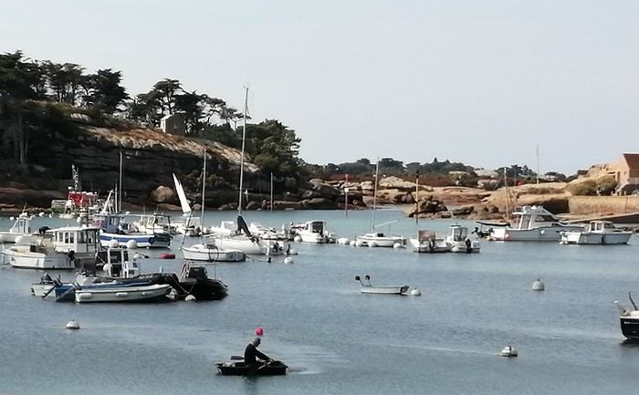
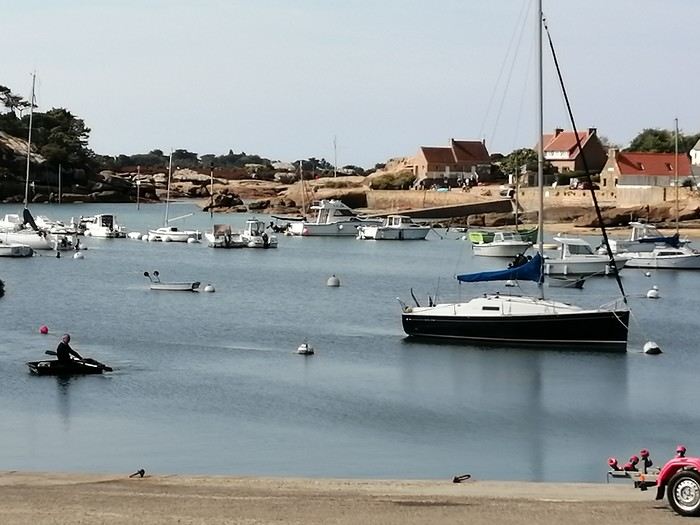
Our first walk, our first hike along the coastal path, and our first photos of these massive rocks bathed in light.
The views change with every turn, and so do the surprises—especially the view of the Château de Costaérès.
 The path through the woods leads us to the Chapel of Saint Guirec, which overlooks the beach.
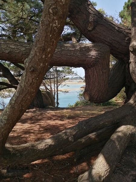
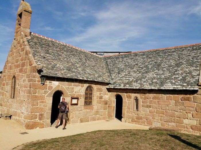
This pretty little beach is famous for its oratory, which sits in the middle of the sand and houses the statue of St. Guirec. In the past, young women hoping to marry within the year would often pray to him—they’d stick a needle into his nose! Today, the statue is made of stone, but back then, it was wooden, which must’ve made it easier.
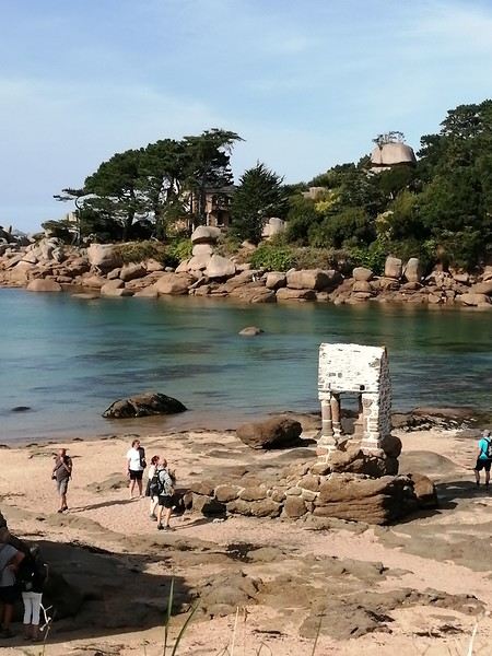
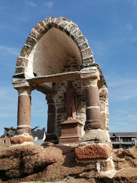
It’s really charming, well-sheltered, and the water is crystal clear. We noticed that everywhere we went!
Our first trip to the coast was to Ploumanac’h, a small village we discovered thanks to Stéphane Bern’s show. It’s an adorable little fishing port where we parked the car before continuing on foot along the sea. It’s charming—more than that, it’s magical!
Our first walk, our first hike along the coastal path, and our first photos of these massive rocks bathed in light.
The views change with every turn, and so do the surprises—especially the view of the Château de Costaérès.
The path through the woods leads us to the Chapel of Saint Guirec, which overlooks the beach.This pretty little beach is famous for its oratory, which sits in the middle of the sand and houses the statue of St. Guirec. In the past, young women hoping to marry within the year would often pray to him—they’d stick a needle into his nose! Today, the statue is made of stone, but back then, it was wooden, which must’ve made it easier.
It’s really charming, well-sheltered, and the water is crystal clear. We noticed that everywhere we went!
Tuesday, December 5, 2023
Melbourne – Lorne
We pick up the car 500 meters away, in a Chinatown parking lot that the hotel has a deal with, then it’s off with a *vroom vroom* while listening to a podcast about the victim of a compulsive mythomaniac—who also happens to be her husband—leading a completely compartmentalized double life. Later, he discovers, after contacting his alter-ego from this parallel universe, that he was actually living a *third* life... and maybe even more? We arrive in Torquay, where we stretch our legs along the Koorie Cultural Walk with a view of Bells Beach...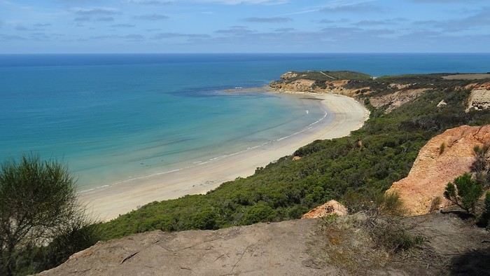
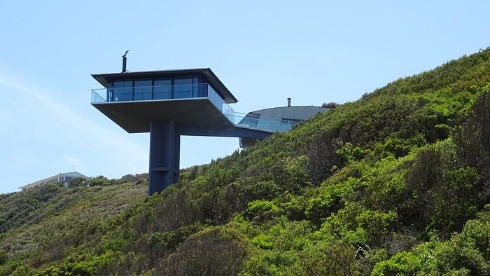
It’s here, just outside Lorne, that the Great Ocean Road officially begins...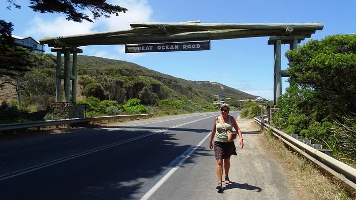
We arrive at our apartment, which is pretty nice—Dom and I are really particular about the quality of our terraces. I’ve never really talked about the practical quirks of daily life in Australia. For example, I could tell you that *every single* power outlet we used on this trip had a switch to turn it on or off. No exceptions, ever! Why? They must find it useful, but for us, it’s a total mystery... And of course, their power outlets require an adapter. Just one of many little peculiarities. Another odd observation: *every* toilet, even the most remote ones hidden deep in the bush, always had a roll of toilet paper available. No shortages here!
And then we’re greeted by a big family of cute sparrows...
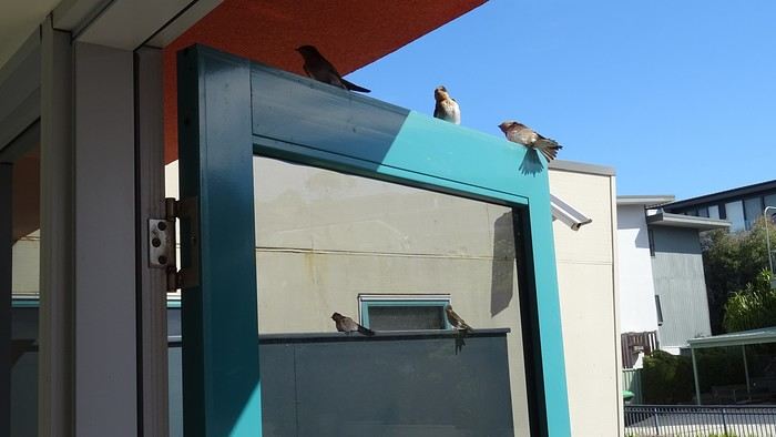
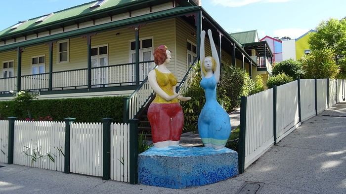
We spent a long time enjoying their pool before heading out for a walk—all the way to Erskine Falls, about ten kilometers away...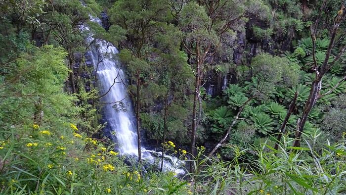
We pick up the car 500 meters away, in a Chinatown parking lot that the hotel has a deal with, then it’s off with a *vroom vroom* while listening to a podcast about the victim of a compulsive mythomaniac—who also happens to be her husband—leading a completely compartmentalized double life. Later, he discovers, after contacting his alter-ego from this parallel universe, that he was actually living a *third* life... and maybe even more? We arrive in Torquay, where we stretch our legs along the Koorie Cultural Walk with a view of Bells Beach...
It’s here, just outside Lorne, that the Great Ocean Road officially begins...
We arrive at our apartment, which is pretty nice—Dom and I are really particular about the quality of our terraces. I’ve never really talked about the practical quirks of daily life in Australia. For example, I could tell you that *every single* power outlet we used on this trip had a switch to turn it on or off. No exceptions, ever! Why? They must find it useful, but for us, it’s a total mystery... And of course, their power outlets require an adapter. Just one of many little peculiarities.
Another odd observation: *every* toilet, even the most remote ones hidden deep in the bush, always had a roll of toilet paper available. No shortages here!
And then we’re greeted by a big family of cute sparrows...We spent a long time enjoying their pool before heading out for a walk—all the way to Erskine Falls, about ten kilometers away...
As planned every year for quite some time now, here we are in Italy on the Ligurian Coast to spend a few days and celebrate New Year's 2024/2025.
Our base is in the charming town of Rapallo, between Genoa and La Spezia. We're right on the coast, with our hotel offering a sea view and access to the beach.
Not far from Rapallo, you can find, besides the Cinque Terre, Portofino, Santa Margherita Ligure, Chiavari, and others like Carrara and even Pisa. In short, there's plenty to do.
Five days there with so-so weather, and crowds but nothing overwhelming.
For the trip between home and our base, we're using an electric vehicle. It's manageable without any issues. The hotel has outlets, and otherwise, there are charging points all over Italy. And just to note, Tesla chargers are the best in terms of cost and charging speed.
There you have it.
Once we arrived on Sunday, December 29th, it was time to go for a walk, book a restaurant for Monday evening, and finalize the itinerary.
On Monday the 30th, we were lucky enough to see a beautiful sunrise from our window.
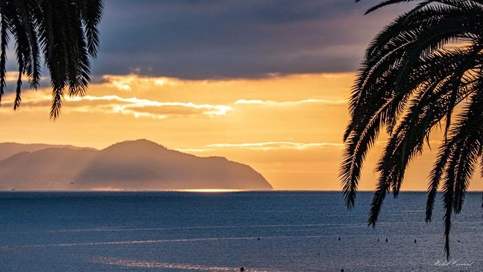

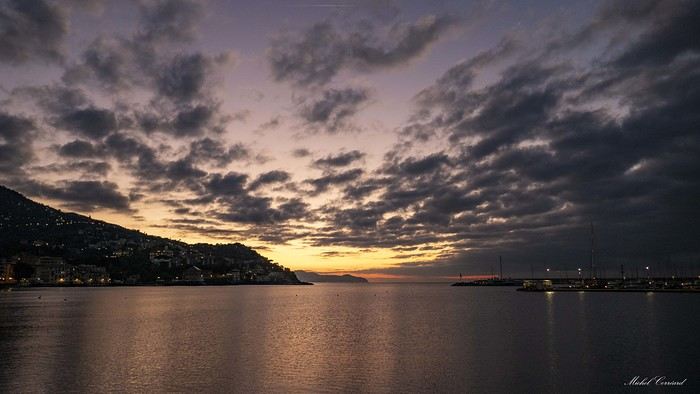
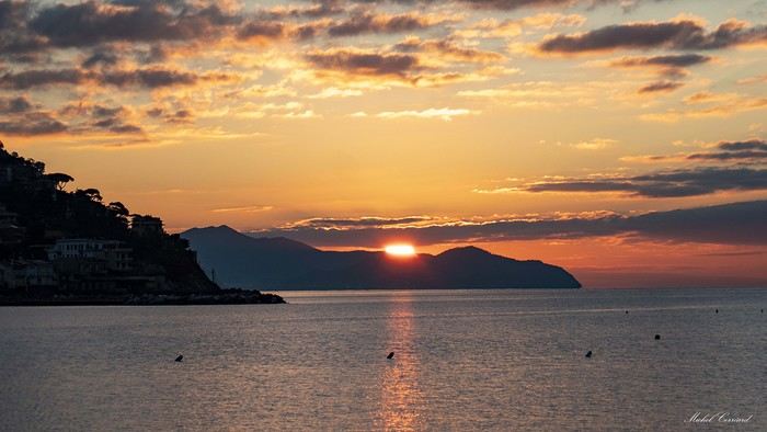
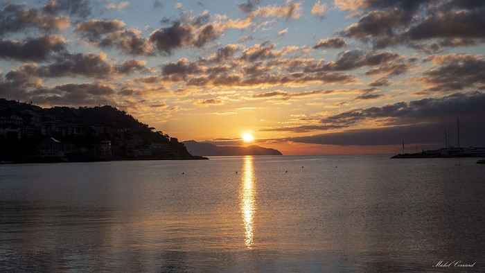
And the town of Rapallo in the early morning!
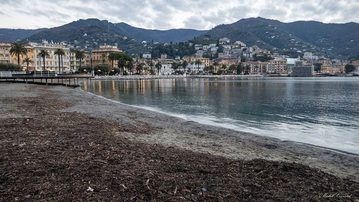
Our base is in the charming town of Rapallo, between Genoa and La Spezia. We're right on the coast, with our hotel offering a sea view and access to the beach.
Not far from Rapallo, you can find, besides the Cinque Terre, Portofino, Santa Margherita Ligure, Chiavari, and others like Carrara and even Pisa. In short, there's plenty to do.
Five days there with so-so weather, and crowds but nothing overwhelming.
For the trip between home and our base, we're using an electric vehicle. It's manageable without any issues. The hotel has outlets, and otherwise, there are charging points all over Italy. And just to note, Tesla chargers are the best in terms of cost and charging speed.
There you have it.
Once we arrived on Sunday, December 29th, it was time to go for a walk, book a restaurant for Monday evening, and finalize the itinerary.
On Monday the 30th, we were lucky enough to see a beautiful sunrise from our window.
And the town of Rapallo in the early morning!