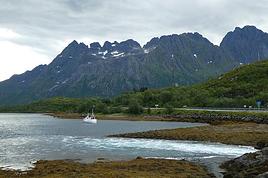
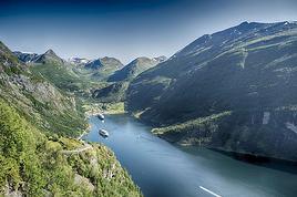
Hi there, we’re planning a trip to Norway next June. Since my partner gets vertigo, renting a car is out of the question. So, we’re thinking of doing the Bergen to Kirkenes route by cruise—6 nights, 7 days—with either Hurtigruten or Havila. Is this journey as amazing as it sounds? Is one provider better than the other?
Basically, any tips would be super helpful.
Thanks.
2,761 similar discussions in English
Hi there,
I’m getting ready for a classic tourist trip to China in May 2026.
The "Terres Lointaines" itinerary looks good to me, and the price is interesting.
Has anyone traveled with them before? Any feedback?
Is there a better option?
Thanks so much for sharing your experiences on this!
Michel
Hey there, community! Back this weekend, below is my travel journal from my adventure in Indonesia. Enjoy the read!!!
Day 1 - August 10, 2025 New life downloading for three weeks! And for that, Flo and I launched a public tender... A public tender? What’s that got to do with a travel journal???... Well, when you think about it, few destinations tick all the boxes for an August adventure: Meaning, finding a place that’s exotic in the middle of August, not too expensive, not too packed with tourists, warm but not *too* warm, with postcard-perfect landscapes, dreamy beaches, tasty cuisine with a hint of exoticism, friendly and welcoming locals, where you’re free to sleep under the stars among the mosquitos, take transport surrounded by chickens, and even eat from a pig trough if you feel like it—well, turns out it’s not that easy to find! I’d even say, given how thick the list of requirements is, there’s a big risk the tender could be declared unsuccessful for failing to meet just one criterion. Let’s just say the candidates better submit a rock-solid proposal!
After reviewing all the responses and presentations from the candidates, the obvious choice for us is... Indonesia! Except that trying to explore a country as vast as Indonesia and its 17,504 islands in less than five years is a bit like reading the summary of a Proust novel without taking the time to savor each of its 950 pages! Don’t worry, I won’t name them all here. Besides, do they even all have names? No! Only 7,870 have been named—their parents clearly ran out of ideas for the rest. Anyway, our society, which worships the "work more to earn more" mantra, unfortunately limits our adventure time. So we’ll only get to see a small part of Indonesia, and we’ll have to make a tough choice to head for the best of the best in this archipelago of over seventeen thousand islands. Each one has its own selling points: Sumatra, Sulawesi, Java, the Celebes, Bali, Borneo, Papua, Timor, the Moluccas... So many names that smell of adventure... Another tender, another list of requirements, another review of proposals... Drumroll... Splash splash... And the lucky winner is... Ta-da... Java, Bali’s big sister, where I’ve already been eight years ago... Java the programming language. The Java of Broadway. We’re gonna *do* the Java. Java the coffee. And yes, Java is also an island!
This island, four times smaller than France, is home to 136 million people, making it the most populated island in the world! Fun fact: Indonesia, with its 260 million inhabitants, is just shy of the podium for the world’s most populated countries, after the winning trio of India, China, and the United States. And it’s on this island of Java that you’ll find Jakarta, the (soon-to-be-former) capital and main airport of the country, where we’ll soon land after our nineteen-hour flight! Yep, nineteen hours! I mean, Indonesia in general—and Java in particular—is a *tad* farther than going on vacation to Grandma Yoyo’s! Not sure where it is? Easy. Grab a map. Plant your finger on the big island at the bottom right—aka Australia for those who struggle with geography—move it up two centimeters, and bam, welcome to Indonesia!
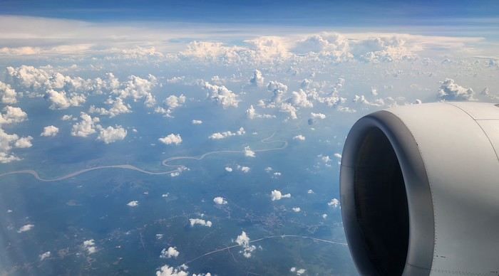
Nice transition, right? Because "Welcome to Indonesia" is exactly what the friendly flight attendant just said to me as we got off the plane! That’s it, our chakras are open, we’ve arrived at our (air)port. Time for rest, pool, cocktails, and a beach with our toes spread out... Wait, if you bought that, you clearly don’t know us yet! Since we still have energy to burn and need to adjust to the flight and time difference, we tackle the long administrative formalities to enter Indonesia, just to earn the right to hop in a 45-minute Grab taxi to the train station. The train station? What train station?... What do you usually do at a train station? Take a train, of course! Off we go for a three-hour train ride to Bandung, where we’ll officially start our adventure tomorrow after our first Indonesian night...
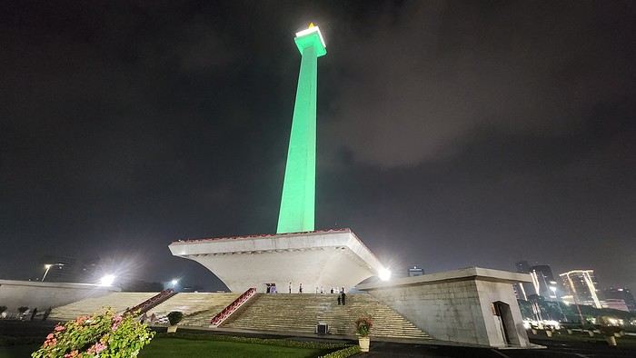
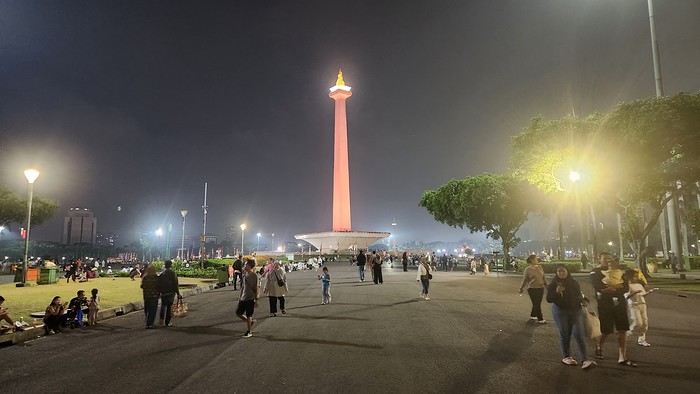
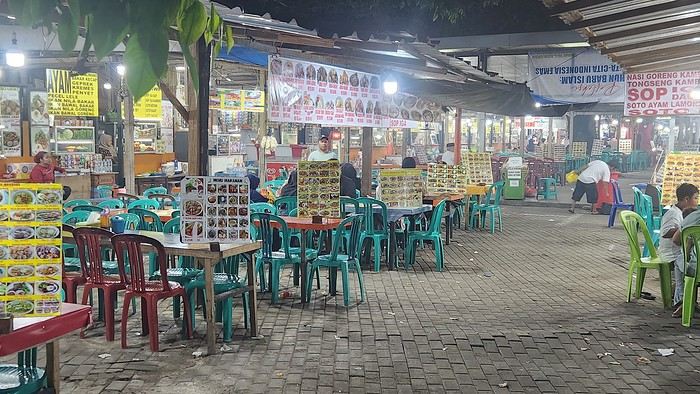
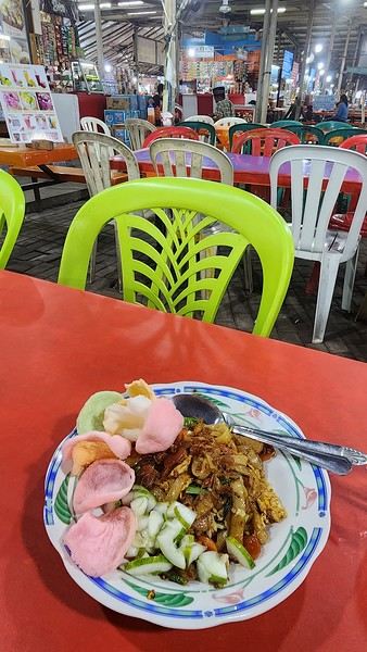
Unfortunately, we were a bit slow off the mark, which meant we missed the 6:25 PM train by two minutes. Oh well, we’ll have to wait until 11 PM. We take the opportunity to stretch our legs in Jakarta, soak up the atmosphere, and enjoy the delicious smells wafting from the *warungs*—those little typical street restaurants. A quick stop at the National Monument, a detour to a night market to devour our first *kwetiaw goreng* and *teh manis* for 60,000 rupiahs (that’s 3 € for two), and just like that, our penalty is lifted, and we’re allowed to hit the road again. Off to Bandung, where we arrive at 2 AM for... a *very* short night...
Day 1 - August 10, 2025 New life downloading for three weeks! And for that, Flo and I launched a public tender... A public tender? What’s that got to do with a travel journal???... Well, when you think about it, few destinations tick all the boxes for an August adventure: Meaning, finding a place that’s exotic in the middle of August, not too expensive, not too packed with tourists, warm but not *too* warm, with postcard-perfect landscapes, dreamy beaches, tasty cuisine with a hint of exoticism, friendly and welcoming locals, where you’re free to sleep under the stars among the mosquitos, take transport surrounded by chickens, and even eat from a pig trough if you feel like it—well, turns out it’s not that easy to find! I’d even say, given how thick the list of requirements is, there’s a big risk the tender could be declared unsuccessful for failing to meet just one criterion. Let’s just say the candidates better submit a rock-solid proposal!
After reviewing all the responses and presentations from the candidates, the obvious choice for us is... Indonesia! Except that trying to explore a country as vast as Indonesia and its 17,504 islands in less than five years is a bit like reading the summary of a Proust novel without taking the time to savor each of its 950 pages! Don’t worry, I won’t name them all here. Besides, do they even all have names? No! Only 7,870 have been named—their parents clearly ran out of ideas for the rest. Anyway, our society, which worships the "work more to earn more" mantra, unfortunately limits our adventure time. So we’ll only get to see a small part of Indonesia, and we’ll have to make a tough choice to head for the best of the best in this archipelago of over seventeen thousand islands. Each one has its own selling points: Sumatra, Sulawesi, Java, the Celebes, Bali, Borneo, Papua, Timor, the Moluccas... So many names that smell of adventure... Another tender, another list of requirements, another review of proposals... Drumroll... Splash splash... And the lucky winner is... Ta-da... Java, Bali’s big sister, where I’ve already been eight years ago... Java the programming language. The Java of Broadway. We’re gonna *do* the Java. Java the coffee. And yes, Java is also an island!
This island, four times smaller than France, is home to 136 million people, making it the most populated island in the world! Fun fact: Indonesia, with its 260 million inhabitants, is just shy of the podium for the world’s most populated countries, after the winning trio of India, China, and the United States. And it’s on this island of Java that you’ll find Jakarta, the (soon-to-be-former) capital and main airport of the country, where we’ll soon land after our nineteen-hour flight! Yep, nineteen hours! I mean, Indonesia in general—and Java in particular—is a *tad* farther than going on vacation to Grandma Yoyo’s! Not sure where it is? Easy. Grab a map. Plant your finger on the big island at the bottom right—aka Australia for those who struggle with geography—move it up two centimeters, and bam, welcome to Indonesia!
Nice transition, right? Because "Welcome to Indonesia" is exactly what the friendly flight attendant just said to me as we got off the plane! That’s it, our chakras are open, we’ve arrived at our (air)port. Time for rest, pool, cocktails, and a beach with our toes spread out... Wait, if you bought that, you clearly don’t know us yet! Since we still have energy to burn and need to adjust to the flight and time difference, we tackle the long administrative formalities to enter Indonesia, just to earn the right to hop in a 45-minute Grab taxi to the train station. The train station? What train station?... What do you usually do at a train station? Take a train, of course! Off we go for a three-hour train ride to Bandung, where we’ll officially start our adventure tomorrow after our first Indonesian night...
Unfortunately, we were a bit slow off the mark, which meant we missed the 6:25 PM train by two minutes. Oh well, we’ll have to wait until 11 PM. We take the opportunity to stretch our legs in Jakarta, soak up the atmosphere, and enjoy the delicious smells wafting from the *warungs*—those little typical street restaurants. A quick stop at the National Monument, a detour to a night market to devour our first *kwetiaw goreng* and *teh manis* for 60,000 rupiahs (that’s 3 € for two), and just like that, our penalty is lifted, and we’re allowed to hit the road again. Off to Bandung, where we arrive at 2 AM for... a *very* short night...
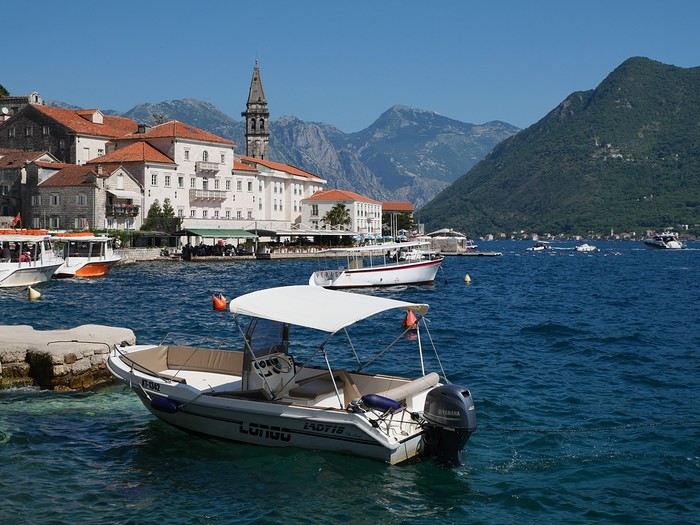
Mid-June, two Auvergnats on the starting blocks—off we go to the former Yugoslavia!
We’d already explored some nooks and crannies of northern Croatia back in 2019, so we’re keeping the momentum going by planning a trip to the south of the country and then Montenegro.
On the way back, we’ll drift into Bosnia-Herzegovina just to mix things up a bit!
We’re a little unsure about what to expect in terms of tourist crowds.
Dubrovnik has a reputation for being the hardest-hit city by overtourism, and Kotor and the whole Dalmatian coast aren’t exactly empty...
Luckily, most European countries haven’t started school holidays yet, and some measures seem to have been put in place to limit the flow (like restrictions on the number of cruise ships allowed to dock at the same time).
Maybe we’ll manage to escape the promised hell?
For now, we’re slamming the doors of the Scirocco and heading off to our first stop: northern Italy!
On the way back, we’ll drift into Bosnia-Herzegovina just to mix things up a bit!
We’re a little unsure about what to expect in terms of tourist crowds.
Dubrovnik has a reputation for being the hardest-hit city by overtourism, and Kotor and the whole Dalmatian coast aren’t exactly empty...
Luckily, most European countries haven’t started school holidays yet, and some measures seem to have been put in place to limit the flow (like restrictions on the number of cruise ships allowed to dock at the same time).
Maybe we’ll manage to escape the promised hell?
For now, we’re slamming the doors of the Scirocco and heading off to our first stop: northern Italy!
I really loved Thailand, but it was too touristy for my taste. So I'm hesitating about going back and wondering if Cambodia or Vietnam would be less crowded with tourists...
Hi there,
I’m planning a trip to Peru and have estimated how many days I’ll spend in each place.
Any advice on must-see sights and tourist traps to avoid?
September–October
5 days in Lima
Bus: 07:00→13:30 or 06:00 to 09:30 (express) (3 hr 30 min journey) 3 days in Paracas (beach)
3 days in Nazca
3 days in Arequipa
3 days in Puno (Lake Titicaca)
5 days in Cusco
Thanks in advance
5 days in Lima
Bus: 07:00→13:30 or 06:00 to 09:30 (express) (3 hr 30 min journey) 3 days in Paracas (beach)
3 days in Nazca
3 days in Arequipa
3 days in Puno (Lake Titicaca)
5 days in Cusco
Thanks in advance
Before I begin, I’d like to thank Michèle Buisson and her "Misha’s travel journals," which really helped me plan this trip. It’s tough to find information about this part of India, which is quite different from the "more traditional India." I’m so grateful to her for introducing me to a family who hosted me for 4 nights and 3 days. I can’t wait to return the favor and welcome you all to my place in early July!
Thursday, March 20th. The alarm goes off super early, but I’m already awake—I was too worried I’d sleep through it. I leave the house at 4:00 AM. The rain has stopped, and at this hour, there aren’t many trucks on the road. I arrive at Barcelona Airport easily by 6:20 AM, let the valet know I’m there, and he quickly picks up my car. This time, I’m flying with Etihad Airways again. I booked the ticket during my trip to Cambodia: Barcelona/Kolkata, Delhi/Barcelona for 567 €. At that price, I didn’t hesitate for long—I knew I had to take it. And I’m glad I did because, by the time I returned, the price had gone up to 700 €. I can already hear the reactions: "Wow, how’d you get a ticket for that price? What site did you use? You’re amazing, MarieJo!" One thing’s for sure—I’m really happy with this deal. The flights from Barcelona to Abu Dhabi and Abu Dhabi to Kolkata go smoothly, and we arrive on time at 2:55 AM. There aren’t many people at immigration, so I get through quickly. My luggage isn’t on the carousel yet. After collecting my bag, I check in for my next flight with IndiGo, a 5:40 AM flight to Guwahati, arriving at 7:00 AM. I’m starting to feel pretty tired, so I take a taxi from the airport to Gruham Sojourn Homestay. The house is upstairs, and the neighborhood seems quiet, with restaurants lining the street. The room won’t be ready until 10:00 AM, so I rest on the bench in the meantime. Once in the room, I take a shower—it really helps me feel refreshed. I need to exchange some euros, so I look up a nearby exchange bureau on Google and head out to find it. I locate it easily, and the staff are super friendly. I get a great rate (1 € = 90 INR). I wander around the neighborhood. The train station isn’t far, and small markets line the streets. I head back to my area, walking along the main avenue. About 500 meters from my street, I discover a museum. The visit is fascinating—I see the famous Majuli masks, among other things.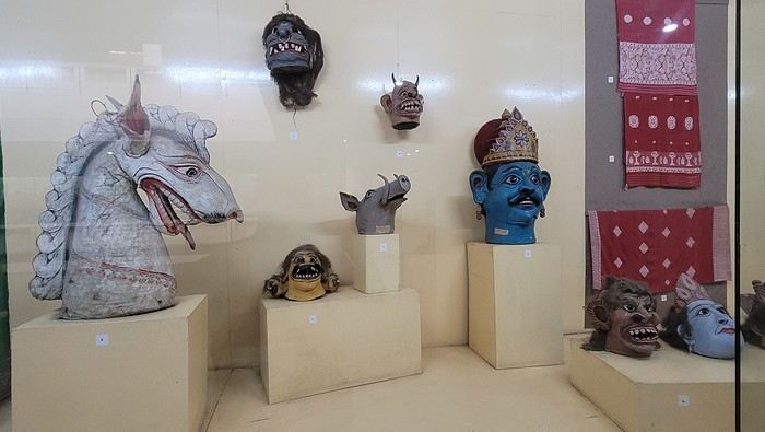

I’m not far from the Brahmaputra River, and the temptation to visit is too strong to resist. I’d hoped to find a promenade along the river, but that doesn’t exist here. I walk back calmly and notice several restaurants in my street. On the doorstep of my accommodation, I spot a pastry shop with cakes that look more like the ones we have in France than the typical ones here in India. A visit is a must, and I’m not disappointed!

Tonight, I’m dining at a restaurant in the street. The menu is a bit disappointing—burgers, pizzas, pasta—nothing very Indian. So, I’ll go with tomato pasta.
Thursday, March 20th. The alarm goes off super early, but I’m already awake—I was too worried I’d sleep through it. I leave the house at 4:00 AM. The rain has stopped, and at this hour, there aren’t many trucks on the road. I arrive at Barcelona Airport easily by 6:20 AM, let the valet know I’m there, and he quickly picks up my car. This time, I’m flying with Etihad Airways again. I booked the ticket during my trip to Cambodia: Barcelona/Kolkata, Delhi/Barcelona for 567 €. At that price, I didn’t hesitate for long—I knew I had to take it. And I’m glad I did because, by the time I returned, the price had gone up to 700 €. I can already hear the reactions: "Wow, how’d you get a ticket for that price? What site did you use? You’re amazing, MarieJo!" One thing’s for sure—I’m really happy with this deal. The flights from Barcelona to Abu Dhabi and Abu Dhabi to Kolkata go smoothly, and we arrive on time at 2:55 AM. There aren’t many people at immigration, so I get through quickly. My luggage isn’t on the carousel yet. After collecting my bag, I check in for my next flight with IndiGo, a 5:40 AM flight to Guwahati, arriving at 7:00 AM. I’m starting to feel pretty tired, so I take a taxi from the airport to Gruham Sojourn Homestay. The house is upstairs, and the neighborhood seems quiet, with restaurants lining the street. The room won’t be ready until 10:00 AM, so I rest on the bench in the meantime. Once in the room, I take a shower—it really helps me feel refreshed. I need to exchange some euros, so I look up a nearby exchange bureau on Google and head out to find it. I locate it easily, and the staff are super friendly. I get a great rate (1 € = 90 INR). I wander around the neighborhood. The train station isn’t far, and small markets line the streets. I head back to my area, walking along the main avenue. About 500 meters from my street, I discover a museum. The visit is fascinating—I see the famous Majuli masks, among other things.
I’m not far from the Brahmaputra River, and the temptation to visit is too strong to resist. I’d hoped to find a promenade along the river, but that doesn’t exist here. I walk back calmly and notice several restaurants in my street. On the doorstep of my accommodation, I spot a pastry shop with cakes that look more like the ones we have in France than the typical ones here in India. A visit is a must, and I’m not disappointed!
Tonight, I’m dining at a restaurant in the street. The menu is a bit disappointing—burgers, pizzas, pasta—nothing very Indian. So, I’ll go with tomato pasta.
Hi there,
Big travel year in Asia for me. I’m heading to Southeast Asia for a month in mid-July. The dates aren’t flexible since I’m going primarily for a wedding (Laos). So, I’ll start my trip in Laos for 4 days, then head off... where?
I’ve already done a trip exclusively in Laos a few years ago. I also visited Vietnam for the second time last year, so I’d love to explore something new. I was thinking of Cambodia (but only for Angkor) and northern Thailand, which I haven’t seen yet (Chiang Mai, Chiang Rai, Mae Hong Son, Nan, Phrae, Phayao, Pa Hin Ngam National Park), and wrapping up with a few nights in Koh Samui. My question is about the weather. From what I’ve seen, Koh Samui seems to be spared during this period. But for Angkor and northern Thailand, I’m not so sure—it feels like a gamble. And I’m really not in the mood for rainy vacations, since I already get enough gray skies where I live 😅.
So, I had another idea: after Laos, I could head to Bali (or another Indonesian island) where it’s supposedly the right season. The flight ticket price is exactly the same, including a one-way to Bali and the return from Bali (with a layover in Bangkok). For those who’ve traveled in July, what do you think? Is there a big risk in trying northern Thailand and Angkor?
Thanks in advance!
I’ve already done a trip exclusively in Laos a few years ago. I also visited Vietnam for the second time last year, so I’d love to explore something new. I was thinking of Cambodia (but only for Angkor) and northern Thailand, which I haven’t seen yet (Chiang Mai, Chiang Rai, Mae Hong Son, Nan, Phrae, Phayao, Pa Hin Ngam National Park), and wrapping up with a few nights in Koh Samui. My question is about the weather. From what I’ve seen, Koh Samui seems to be spared during this period. But for Angkor and northern Thailand, I’m not so sure—it feels like a gamble. And I’m really not in the mood for rainy vacations, since I already get enough gray skies where I live 😅.
So, I had another idea: after Laos, I could head to Bali (or another Indonesian island) where it’s supposedly the right season. The flight ticket price is exactly the same, including a one-way to Bali and the return from Bali (with a layover in Bangkok). For those who’ve traveled in July, what do you think? Is there a big risk in trying northern Thailand and Angkor?
Thanks in advance!
Hello,
We’ve just returned (2 senior couples) from 18 days in Cape Verde (21/01 to 7/02) that we really enjoyed. The temperature was great—20° to 27°—admittedly a bit windy at times, but the friendliness of the Cape Verdeans made up for it.
Paris Orly, direct flight with Transavia (cheap if you book in advance). We landed in São Vicente, with a 12 € city transfer. We had a fantastic 2-bedroom apartment in downtown Mindelo—Av. Fernando Ferreira Fortes, "Casa So Morabeza"—for 58 € per night. The owner lives in France and communicates instantly via WhatsApp.
We spent 2 days exploring the (beautiful) city of Mindelo and its port activity, plus a private taxi tour of the island (6000 CVE for the day).
Then we took the Armas ferry (recommended company—1500 CVE) to Santo Antão.
From there, a collectivo (450 CVE per person) took us to Ribeira Grande, a central base for hikes.
We stayed in a brand-new, modern, and well-equipped 2-bedroom apartment—*Apartamentos Modernos*—for 6770 CVE per night, staying 6 nights. I highly recommend it for its location in town and proximity to *aluguers* and *collectivos* for hiking.
The hikes were stunning:
- The coastal trail from Fontainhas to Cruzinha (taxi for 1500 CVE)
- The route from Corda to Coculi (taxi for 2000 CVE + 100 CVE per person for the return)
- The trail from Cova to Cidade de Pombas (taxi for 2000 CVE + 100 CVE per person for the return)
- The hike from Miradouro to Ribeira Grande (taxi for 2000 CVE)
- The coastal road from Ribeira Grande to Ponta do Sol (visit and lunch at *Mini Familiar* in the city center—excellent and affordable) for the round trip.
Ribeira Grande has plenty of restaurants, but avoid *5 de Julho*—it’s loud and slow.
We loved: *Bellcanto*, *Cantinho da Amizade*, and *Boca-Fina Churrasqueria*.
Meals with drinks cost around 800–1000 CVE.
Back to São Vicente by ferry (1500 CVE), then an airport transfer (12 €) and a flight (99 €) to Santiago’s Praia. The airport-to-city transfer was 15 €.
We stayed at *Kelly’s* in Plato, Praia, which was disappointing—not ideal for two couples—but well-located.
One day was spent visiting the massive *Suspicia* market, then a collectivo to Cidade Velha (2 x 200 CVE round trip per person). We hiked up to the fort, explored *Rua Banana*, and had lunch at *Praça do Mar* by the beach.
We rented a car for 6 days (29000 CVE) from *Slimpycar* in Praia.
On Saturday, we visited the huge *Assomada* market—don’t miss it!—then hiked to *Boa Entrada* and *Poilon*, the largest and most impressive tree we’ve ever seen.
We stayed for 2 nights (138 €) in a beautiful valley in *Picos*—a spacious, lovely house with 2 bedrooms, 2 bathrooms, and a large living area, surrounded by nature and animals.
Lina, the charming neighbor, prepared dinner (8.50 €) and breakfast (4.50 €) for us.
Next, we headed to *Tarrafal*, stopping to visit the concentration camp (500 CVE)—a must-see—before arriving.
We spent 3 nights (184 €) in a fantastic house called *"Maison Familiale"*—huge, with 3 bedrooms, 2 bathrooms, 2 kitchens, 5 toilets, and a large terrace with sea views. It was absolutely stunning and very close to the beach and numerous restaurants.
We did a beautiful 3.8 km hike to the *Farol da Ponta Preta* lighthouse.
Tarrafal’s beach is lively and pleasant, with bars, restaurants, and even acrobats!
We also explored *Ribeira da Prata* to see the *Piscina Natural de Cuba* (not easy to find).
We loved discovering isolated villages like *Ponta Furna*, *Ponta Labrão*, and *Fazenda*.
For food, I recommend *Mira Mar* at *Mama’s*.
On the way back to Praia, we took the east coast route via *Calheta de São Miguel*, *Pedra Badejo*, and *Praia Baixo*—nothing extraordinary, just a rugged, wild coastline with beaches that seemed a bit tricky to access.
Our last evening in Praia was nice. The seaside esplanade was lively, and many Cape Verdeans were swimming at *Prainha* beach, which seemed very accessible and safe.
If you’d like more info—addresses, etc.—feel free to message me privately. I’ll respond.
Jacquesler.
Route 66 in 30 days
From Chicago to Los Angeles with a few stops at sites near the route: a total of 6,800 km. Total trip cost: 8,600 € all-inclusive—flights, car rental, gas, meals (raw veggies and fruit for lunch, fast food in the evening), hotels, and little knick-knacks picked up here and there. British Airways flights from Basel-Mulhouse Midsize car from Dollar via AutoEurope. No issues on return. Accommodations booked through Booking
First off, we met really friendly people all along the way. Most attractions are free, and you can easily walk into bars, hotels, and gas stations without buying anything—though you might get kicked out.
The original Route 66 no longer exists in its entirety. Only sections remain, and signage varies by state. Plus, the route has changed over time. But with a good map or GPS, you can figure it out. I used the CoPilot app, which lets you download all the world’s maps for a small fee—so no data issues abroad. I’d noted the GPS coordinates of places to visit during my trip prep, which came in handy.
Along the route, you’ll find old gas stations, vintage motels (some renovated, some not) with their retro signs. The most famous is Bagdad Café. There are also tons of beautiful murals and the Muffler Men.
Chicago is an amazing city. We stayed for 2 days. The best move is to pick a hotel near a Blues Line metro station—it takes you straight from the airport to your hotel, then to downtown. At the end of the trip, the metro takes you back to the airport to pick up your rental car. The 72-hour pass is super convenient. Must-sees in Chicago: John Hancock Center (skip the Tilt option—it’s a rip-off), the Chicago Riverwalk all the way to Merchandise Mart, Picasso and Calder statues, The Bean and its reflections, and don’t miss the signs marking the start/end of Route 66.
Here’s a non-exhaustive list of things that surprised or delighted us (aside from major sites like Petrified Forest): - Joliet and its prison tied to the *Blues Brothers* story - Gardner and its jail cells - Abraham Lincoln’s tomb in Springfield - Country Classic Cars in Staunton (39.03066, -89.75145): a used car lot with everything from Ford Model Ts to classic American cars. You can walk freely through the three hangars - Old Chain of Rocks Bridge (38.76062, -90.47978) - St. Louis with its Gateway Arch and City Garden (full of sculptures and free to enter) - Philipsburg and its candy factory - Springfield: Bass Pro Shop outdoor store (37.179, -93.296) - Carthage: The Precious Moments Chapel (37.113, -94.345) - Foyil: Ed Galloway’s Totem Park - Tulsa: Harley Davidson dealership (36.111, -95.885) - Oklahoma City: Stockyards City—one of the trip’s highlights. Cattle auctions are wild; plan ahead for open days/hours (35.456, -97.552) - Centennial Land Run Monument (35.461, -97.504) - Amarillo: VW Slug Bug Ranch (35.191, -101.985) - Cadillac Ranch (35.191, -101.985) - Palo Duro Canyon State Park - Bandelier - El Morro, NM - Canyon de Chelly (detour) - Little Painted Desert (35.157608, -110.47105) - Winslow: *Standin’ on the Corner* (Eagles) - Oatman and its burros - Las Vegas: two days, one spent at Valley of the Fire and Red Rock Canyon. Pick a hotel near Fremont Avenue for nightlife - Rainbow Basin Area (35.012369, -117.03858) - The Bottle Tree Ranch (34.69113, -117.34206) - The Justice Private Automotive Collection in Duarte (34.13830, -117.94591) - Los Angeles: 4 days. Start at Griffith Observatory for a city overview and the Hollywood sign. Don’t forget to see the end of Route 66 in Santa Monica. Venice is worth a visit for a more authentic vibe. Check out the Walt Disney Concert Hall and surrounding buildings for the architecture. Distances are huge. We mixed driving with the metro. Avoid the Interstates—they’re packed with traffic and frequent jams. Stick to parallel roads
From Chicago to Los Angeles with a few stops at sites near the route: a total of 6,800 km. Total trip cost: 8,600 € all-inclusive—flights, car rental, gas, meals (raw veggies and fruit for lunch, fast food in the evening), hotels, and little knick-knacks picked up here and there. British Airways flights from Basel-Mulhouse Midsize car from Dollar via AutoEurope. No issues on return. Accommodations booked through Booking
First off, we met really friendly people all along the way. Most attractions are free, and you can easily walk into bars, hotels, and gas stations without buying anything—though you might get kicked out.
The original Route 66 no longer exists in its entirety. Only sections remain, and signage varies by state. Plus, the route has changed over time. But with a good map or GPS, you can figure it out. I used the CoPilot app, which lets you download all the world’s maps for a small fee—so no data issues abroad. I’d noted the GPS coordinates of places to visit during my trip prep, which came in handy.
Along the route, you’ll find old gas stations, vintage motels (some renovated, some not) with their retro signs. The most famous is Bagdad Café. There are also tons of beautiful murals and the Muffler Men.
Chicago is an amazing city. We stayed for 2 days. The best move is to pick a hotel near a Blues Line metro station—it takes you straight from the airport to your hotel, then to downtown. At the end of the trip, the metro takes you back to the airport to pick up your rental car. The 72-hour pass is super convenient. Must-sees in Chicago: John Hancock Center (skip the Tilt option—it’s a rip-off), the Chicago Riverwalk all the way to Merchandise Mart, Picasso and Calder statues, The Bean and its reflections, and don’t miss the signs marking the start/end of Route 66.
Here’s a non-exhaustive list of things that surprised or delighted us (aside from major sites like Petrified Forest): - Joliet and its prison tied to the *Blues Brothers* story - Gardner and its jail cells - Abraham Lincoln’s tomb in Springfield - Country Classic Cars in Staunton (39.03066, -89.75145): a used car lot with everything from Ford Model Ts to classic American cars. You can walk freely through the three hangars - Old Chain of Rocks Bridge (38.76062, -90.47978) - St. Louis with its Gateway Arch and City Garden (full of sculptures and free to enter) - Philipsburg and its candy factory - Springfield: Bass Pro Shop outdoor store (37.179, -93.296) - Carthage: The Precious Moments Chapel (37.113, -94.345) - Foyil: Ed Galloway’s Totem Park - Tulsa: Harley Davidson dealership (36.111, -95.885) - Oklahoma City: Stockyards City—one of the trip’s highlights. Cattle auctions are wild; plan ahead for open days/hours (35.456, -97.552) - Centennial Land Run Monument (35.461, -97.504) - Amarillo: VW Slug Bug Ranch (35.191, -101.985) - Cadillac Ranch (35.191, -101.985) - Palo Duro Canyon State Park - Bandelier - El Morro, NM - Canyon de Chelly (detour) - Little Painted Desert (35.157608, -110.47105) - Winslow: *Standin’ on the Corner* (Eagles) - Oatman and its burros - Las Vegas: two days, one spent at Valley of the Fire and Red Rock Canyon. Pick a hotel near Fremont Avenue for nightlife - Rainbow Basin Area (35.012369, -117.03858) - The Bottle Tree Ranch (34.69113, -117.34206) - The Justice Private Automotive Collection in Duarte (34.13830, -117.94591) - Los Angeles: 4 days. Start at Griffith Observatory for a city overview and the Hollywood sign. Don’t forget to see the end of Route 66 in Santa Monica. Venice is worth a visit for a more authentic vibe. Check out the Walt Disney Concert Hall and surrounding buildings for the architecture. Distances are huge. We mixed driving with the metro. Avoid the Interstates—they’re packed with traffic and frequent jams. Stick to parallel roads
Hey everyone who survived that killer rum that was supposed to take us all out...
I took a trip to Russia in August 2024—16 unforgettable days. Entered via KARSAVA, Ostrov, then Saint Petersburg, Moscow, Voronezh, Ostrov on the Don, and exited at VLADIKAVKAZ through Georgia, Turkey, etc... I’d love to know if anyone’s done the reverse route—entering via Vladikavkaz from Georgia by personal vehicle, car, or motorcycle—and how long the wait was to cross the border. At the Karsava crossing in Latvia last August, it took between 2 and 3 days. The holdup is on the Russian side due to lack of staff and equipment since the formalities are so complicated...
I’m looking for a smoother crossing point for 2025. Thanks for any tips!
Welcome everyone!
It’s been a while since I last wrote a travel journal, but this recent trip to Iceland reignited my urge to write—both for the breathtaking landscapes we discovered and our adventure full of twists and turns!
This Iceland trip is part of our world tour, which we started back in August 2019. We (Sandrine and Flo) left by plane with our baby, Lena, who was barely 5 months old at the time. We backpacked around the Pacific for 5 months before returning home for a short break to see family. That was just before COVID hit, in late January 2020.
What followed was a bit chaotic... For the second part of our world tour, we were supposed to pick up a new vehicle: a brand-new pickup with a camper cell we planned to live in for several years. Due to lockdown, we received the cell weeks late, and with borders closing, we had to rethink all our plans.
So, we postponed our Iceland departure by over a month and a half, jumping on the first ferry accessible to French travelers after lockdown! Our goal is to spend 3 months there, from early July to late September, in our new camper cell. Our base vehicle is a Toyota Hilux we bought new, fitted with a flatbed where the cell sits, and we’ve prepped it for this trip (reinforced springs + airbags, snorkel, chassis protection, and off-road tires...). The aim is to tackle as many off-road tracks in Iceland as possible, knowing this is already our 3rd trip there (3 weeks in summer 2016 with a Durango, then 1 week in winter 2018).
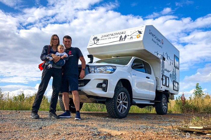
I’m kicking off our travel journal here! Along with photos, I’ll also include our vlogs, which we’ve been posting weekly since our departure in June—hope you enjoy them too! :-)
TRAVEL JOURNAL SUMMARY The journey up to Denmark The horrible ferry crossing The south of the Eastern Fjords
It’s been a while since I last wrote a travel journal, but this recent trip to Iceland reignited my urge to write—both for the breathtaking landscapes we discovered and our adventure full of twists and turns!
This Iceland trip is part of our world tour, which we started back in August 2019. We (Sandrine and Flo) left by plane with our baby, Lena, who was barely 5 months old at the time. We backpacked around the Pacific for 5 months before returning home for a short break to see family. That was just before COVID hit, in late January 2020.
What followed was a bit chaotic... For the second part of our world tour, we were supposed to pick up a new vehicle: a brand-new pickup with a camper cell we planned to live in for several years. Due to lockdown, we received the cell weeks late, and with borders closing, we had to rethink all our plans.
So, we postponed our Iceland departure by over a month and a half, jumping on the first ferry accessible to French travelers after lockdown! Our goal is to spend 3 months there, from early July to late September, in our new camper cell. Our base vehicle is a Toyota Hilux we bought new, fitted with a flatbed where the cell sits, and we’ve prepped it for this trip (reinforced springs + airbags, snorkel, chassis protection, and off-road tires...). The aim is to tackle as many off-road tracks in Iceland as possible, knowing this is already our 3rd trip there (3 weeks in summer 2016 with a Durango, then 1 week in winter 2018).
I’m kicking off our travel journal here! Along with photos, I’ll also include our vlogs, which we’ve been posting weekly since our departure in June—hope you enjoy them too! :-)
TRAVEL JOURNAL SUMMARY The journey up to Denmark The horrible ferry crossing The south of the Eastern Fjords
hi
thanks for sharing if you'd like, your photos and cool spots!
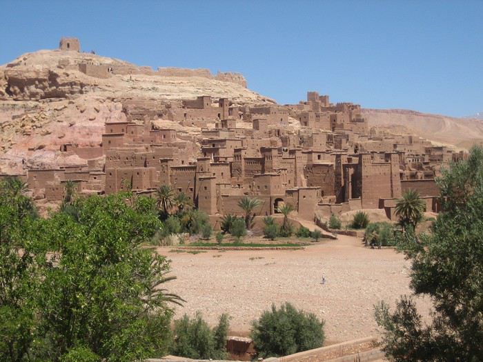
first up, obviously my favorite village!
Aït Benhaddou, discovered in 2015... 2 or 3 hostels back then! I stayed at La Baraka! at the entrance of the village! it was so cool at that time! I used to cook with Mohamed the cook, in the hostel's kitchen!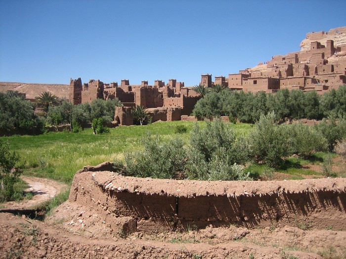
the team at the hostel "La Baraka"
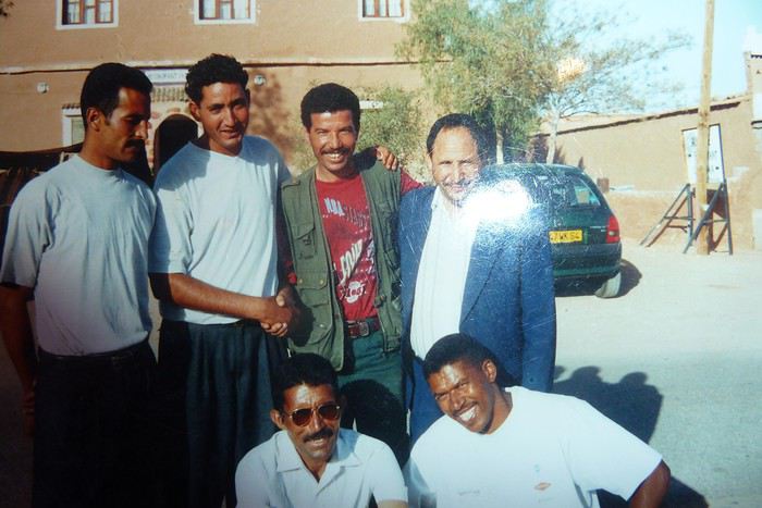 On the left, Brahim Bolkaid who's the owner of the current guesthouse "Maison d'Hôtes Panoramic"
at the bottom right, the cook!
I spent so many hours in that kitchen!
back then, there were huge buses of Germans who arrived with all their own food!
they barely consumed anything!
but we mostly served them fresh salads, drinks...
they'd stay for 3 hours: drinks, bathroom break, visit the ksar, and off they went!
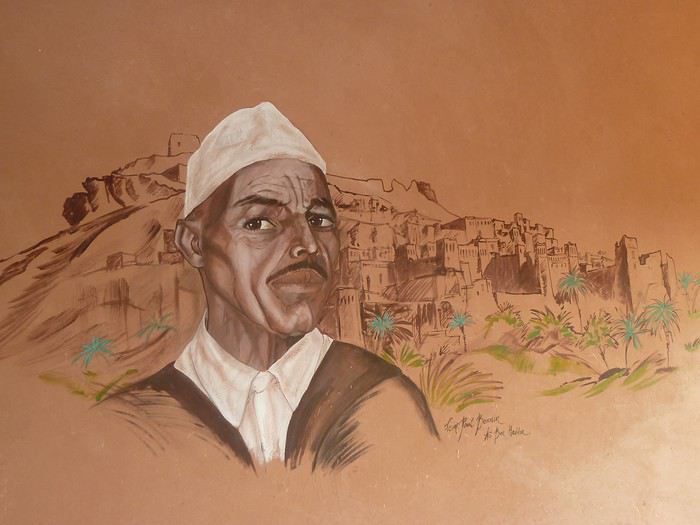
the mural at Brahim's!
Aït Benhaddou, discovered in 2015... 2 or 3 hostels back then! I stayed at La Baraka! at the entrance of the village! it was so cool at that time! I used to cook with Mohamed the cook, in the hostel's kitchen!
the team at the hostel "La Baraka"
On the left, Brahim Bolkaid who's the owner of the current guesthouse "Maison d'Hôtes Panoramic"
at the bottom right, the cook!
I spent so many hours in that kitchen!
back then, there were huge buses of Germans who arrived with all their own food!
they barely consumed anything!
but we mostly served them fresh salads, drinks...
they'd stay for 3 hours: drinks, bathroom break, visit the ksar, and off they went!the mural at Brahim's!
In early March, full of carefree joy and happy to return to Morocco, we landed in Marrakech under the sun.
We spent just one night in Marrakech at the Hôtel Toulousain, as we did on our previous trip. And we booked our 3 nights for the end of our trip, the second half of March... Ouch! Ouch! Ouch! But we’re not there yet...
Our first goal is to reach Magdaz, a mountain village in the Tessaout Valley, sometimes called the lost valley. We discovered the village of Magdaz on this forum, and we were charmed by the photos and comments from travelers who came before us. The road is easy—it’s dry, and the tarmac takes us right to the village gates at over 2,000 meters above sea level. We arrive in the afternoon and are left speechless by the beauty of the place. A jewel of Berber architecture! Perfectly restored granaries and kasbahs!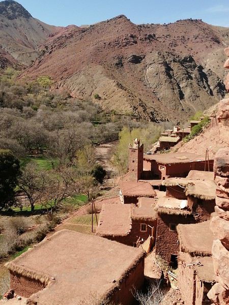
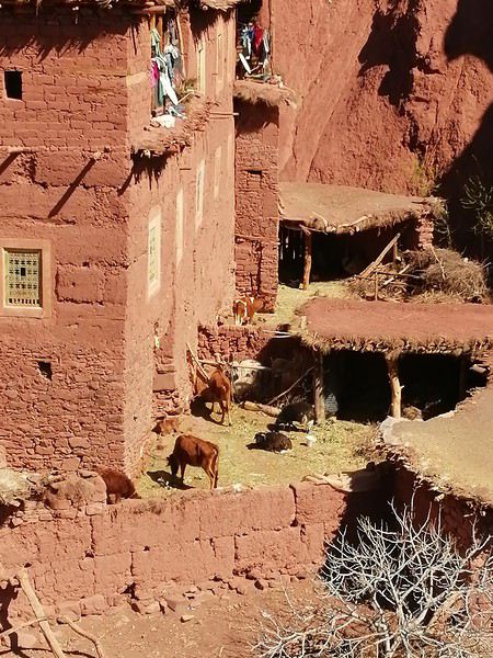
A young man from the village guides us on the visit and opens the doors to the terraces overlooking the village.
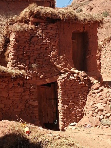 Several magnificent collective granaries have been beautifully restored. The warm colors of the stone capture the light wonderfully. It’s stunning!
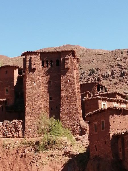
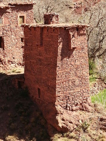
We won’t find anything decent to stay overnight there, so we head back down a bit and settle in at the Assounfou guesthouse. Lovely welcome. The place is in excellent condition and very clean. It’s spacious, but we’re the only ones there. First day full of promise!
Our first goal is to reach Magdaz, a mountain village in the Tessaout Valley, sometimes called the lost valley. We discovered the village of Magdaz on this forum, and we were charmed by the photos and comments from travelers who came before us. The road is easy—it’s dry, and the tarmac takes us right to the village gates at over 2,000 meters above sea level. We arrive in the afternoon and are left speechless by the beauty of the place. A jewel of Berber architecture! Perfectly restored granaries and kasbahs!
A young man from the village guides us on the visit and opens the doors to the terraces overlooking the village.
Several magnificent collective granaries have been beautifully restored. The warm colors of the stone capture the light wonderfully. It’s stunning!
We won’t find anything decent to stay overnight there, so we head back down a bit and settle in at the Assounfou guesthouse. Lovely welcome. The place is in excellent condition and very clean. It’s spacious, but we’re the only ones there. First day full of promise!
Preamble:
For summer 2019, the idea was to return to Africa. We had already been to Namibia in 2017 (+ a few days in Botswana and the end of the trip at Victoria Falls), which we loved, and a trip to Asia in 2018 (Borneo, Perhentian, and Singapore), a nature-focused trip but a bit disappointing due to environmental destruction. The desire to return to Africa was very strong. We wanted a change of scenery, nature, discoveries, to step out of our little comfort zone (a bit, anyway!) and experience travel differently. In short, we dreamed of authenticity, and we weren’t disappointed.
We traveled as a family of four with our daughters, aged 19 and 17. When the urge for Africa hit, Uganda quickly stood out, especially for the chance to see rare animals, particularly the famous mountain gorillas. When I looked into the budget, I was quickly disheartened. It’s really expensive. Too expensive… Then, after reading a few trip reports on "VoyageForum" (thanks Muriel J!), I decided to ask a local agency for a quote. The first contact was very friendly and responsive, and the initial offer for two weeks fit our budget :). A few images gathered from the internet (especially Sipi Falls) finally convinced us all. I asked for an adapted offer with a few more sites to extend the trip to three weeks and cover a fairly complete visit to the country (which, of course, increased the budget! To stay within an acceptable range, we prioritized activities over accommodations and regularly chose the cheapest options, with 2-3 nice lodges in between). It’s booked! We were in October 2018, and the first thing to do was reserve permits to see the gorillas and chimpanzees. Then, the agency took care of all the bookings except for the international flights, which we booked with Ethiopian Airlines. A few months of waiting to look forward to… and a little worry too! Two events didn’t reassure us: the kidnapping of an American tourist by four men at the DRC border and the Ebola outbreak in Congo, with confirmed cases in Uganda by mid-June…
Here we are in July, and departure is approaching. The suitcases are packed (warm clothes, long, short, dark, light, practical, sun, rain, hiking/trekking shoes, flip-flops—clothes for every situation! Don’t forget: headlamp (essential!), binoculars, cameras), and we’re ready.
One day before departure, our agency Mpolampola, through its manager Paul, informs us that he won’t be the one taking care of us during the trip but another guide named Moses. He has a big problem with a vehicle and can’t do otherwise. For us, as long as everything is okay, no worries, especially since I had read glowing reviews about Moses, who turned out to be a very pleasant guide, cautious (most important) on the road, clear about all the activities, and an expert on birds, his specialty. We briefly met Paul in the middle of the trip, who is also very friendly. In short, we 100% recommend this agency. Flights to Entebbe went smoothly; we arrived around 10:30 AM, filled out health forms (Ebola information signs everywhere), visas, baggage claim, and met Moses, who took us directly to the vehicle. It was in pretty good condition with huge tires (we’d understand why later!), but it had quite a few miles (400,000 on the odometer!). Just missing a seatbelt… Okay, it’s Africa!
Now, here’s our day-by-day itinerary, which I’ll summarize briefly with ratings for each activity: ****TOPISSIME (Amazing) ***Very good **Good *Meh
Day 1) Departure from the airport at 11:45 AM for some currency exchange. Stop along the way at the equator for a meal and souvenir photo! Arrival at Lake Mburo Park *** around 5:00 PM. Even before entering the park, we saw lots of antelopes, zebras, elks, etc.—it’s magnificent. On the way, we had already encountered many goats and cows, and we were impressed by their enormous horns. We enjoyed a nice game drive until about 7:00 PM, when we reached our lodge, one of the nicest of the trip, Eagle’s Nest ****, with a magnificent view, a tent with a nice bathroom/shower, and a very good meal.
Day 2) Departure at 7:00 AM for a game drive; we encountered many animals again, especially antelopes, zebras, and birds. There are no giraffes, lions, or cheetahs in this park. We didn’t get lucky enough to see a leopard… :-) Then, we continued to Lake Bunyonyi ***, where the road and views are very beautiful, but we were shocked to see locals (mostly women and children) breaking stones by hand on the mountainside in very precarious safety conditions. There are regularly dramatic accidents because, over time, entire sections detach and cause landslides. These stones are then used for road construction… Another world… This was the only place we saw this. Lake Bunyonyi is a nice stop (but less exotic in our opinion since we have many lakes back home too!). We took a boat to our accommodation, Byoona Amagara ***, which has a lot of charm. We stayed in huts called "geodomes," completely open to nature, so it was very cool at night. To reach the toilets located below, you had to be brave! The meal consisted of lake shrimp—good but a bit bland.
Day 3) After a good breakfast, departure at 9:00 AM to visit three islands. We took several nice walks with beautiful views of the lake and islands. A local meal was served on the last island. At 1:00 PM, we met Moses for the rest of the program and headed to Ruhija in Bwindi Forest****. The landscapes are breathtaking. After two hours of driving and many photo stops, we arrived at our accommodation near the trekking starting point, Ruhija Gorilla Friends Resort **. We stayed in a room instead of the initially planned tents, which was just as well because there was a lot of wind during the night. We still had time for an activity and decided to meet the Bwata pygmies despite the bad reviews in the guide… The first part of the visit was quite nice, with a visit to a school where the children gave us a very joyful welcome. We had a great time listening to them sing and dance! Then we met the Bwata pygmies who live on the edge of the forest. When Bwindi Forest was declared a national park, they had to leave their habitat because their activities weren’t compatible with nature and wildlife protection. We left on a somewhat sad note… The visit ended with a local doctor explaining different medicinal plants, and we watched the making of local beer from sorghum. Good meal. We had butterflies in our stomachs—tomorrow was a big day! I admit I was a bit stressed, not entirely confident in my physical abilities…
Day 4) After a short night due to excitement, breakfast, and departure at 7:30 AM. First, it started calmly with singing and dancing. Then, a 15-minute briefing and group assignments. No one asked if we had any physical problems or anything (when booking, I had inquired a bit, and they told me groups were assigned based on physical abilities). We were assigned to the Mukiza group. At first, I was pretty happy—it was a fairly large group with babies :). The ranger explained that for now, they didn’t know where the gorillas were… the trackers couldn’t find them… Oh… (that’s not a good sign!!!) We set off at a good pace, first on a reasonably sloped path. We were accompanied by a family of four Italians and five porters (four for us!). After an hour, the ranger stopped us and informed us they still couldn’t find them—they had fought with another group the day before and scattered throughout the forest, so they were very far away, and we needed to move faster… Hmm… we picked up the pace (we weren’t going slowly before!!!) and walked for another good hour—down, up, down again, up again, we kept going, but always more or less on paths. Then another stop. A 10-minute break waiting for news. The news wasn’t very precise, it seemed! The ranger decided to cut through the forest—machetes were used to clear the path. We descended unimaginable slopes, then climbed back up. Our stick kept getting stuck; luckily, our porter helped us, held our hands, and the terrain was vertical! An hour later, another stop: we heard gorilla cries (yay!!!). False hope—we waited again for news from the trackers, who informed our ranger that it was a non-habituated family, so we couldn’t see them. Cold shower—we had to go all the way back up and return to the starting point to maybe see another group. But time was running out… We arrived around 1:30 PM; all the other groups had already left long ago. Our guide was worried because we still had a long drive ahead. We quickly ate a banana, and off we went for another trek (I was exhausted!). Luckily, this group was close—about 45 minutes of steep descent (I was already thinking about the climb back and considering being adopted by a gorilla ). The forest was sublime, with magnificent tree ferns—the place was truly splendid. Finally, we were there. The porters stayed behind, we grabbed our cameras, and followed the ranger. The progress wasn’t easy, but suddenly, a female was in front of us, curled up in a little ball, eating—so cute. The emotion overwhelmed us. But she moved away—it’s hard to observe them; they move constantly, and the terrain is very steep and uneven. We saw a female descending from a tree with a baby on her back—too adorable. Then, here was the silverback, enormous, incredible, yet so calm and peaceful. He ate quietly and gave us a nice demonstration of nostril exploration! We could observe them for a good hour, but photographing them wasn’t easy because they kept moving, and we could barely stand! Toward the end, a large male (black back) suddenly stood up and decided to pass right where I was! I ended up in the bushes, and the male passed in front of me just a few centimeters away (he stepped on one of my daughters’ feet!) followed by the whole family. Just an exceptional moment. It was time to leave; we had to climb back up. I dreaded it because, I admit, I was exhausted. We finished the hike after 4:00 PM, exhausted but happy. The ranger gave us diplomas, and we didn’t linger because we still had a long drive—we needed to reach Ishasha before nightfall. Our guide was a bit stressed. If we were to do it again, we’d spend an extra night in Bwindi. However, it seems finishing so late is exceptional—it never happens, according to our guide! The road between Bwindi and Ishasha is sublime, with extraordinary landscapes, and despite the late hour, we regularly asked our guide to stop for photos. We arrived at Enjojo *** Lodge around 6:00 PM. The huts are located quite far from the reception and the bathrooms, a bit far from the huts, but otherwise, it was very nice.
Day 5) Departure at 8:00 AM after a good breakfast with the hope of seeing tree-climbing lions (no luck!). Overall, there weren’t many animals, and we arrived around 12:45 PM at our next stop, Parkview Safari Lodge ****, with a magnificent view, a beautiful family bungalow, and a good meal. We enjoyed a short relaxation by the lovely pool. At 4:00 PM, we left to see Kyambura Gorge *** and hike there. Unfortunately, this activity is no longer available, so we walked around the area—it was very beautiful. Back at the hotel, a little rest after the previous day wasn’t a bad idea! Reading, swimming, meals, and dances made the end of the day enjoyable.
Day 6) Departure at 6:30 AM—one of our daughters was sick (stomachache, cold sweats…). Safari in Queen Elizabeth ** (Kaseny Plains)—a bit disappointing. Stop by the salt lake with a nice view. A small market, but we weren’t thrilled by the crafts (overall, apart from some beautiful baskets/plates, there wasn’t much, and the wooden objects were, in our opinion, much less pretty than in Namibia). Then we took the crater road (27 km long) **** with magnificent landscapes. However, you absolutely must close the windows because it’s infested with tsetse flies. At noon, we arrived at Mweya, where we stayed in basic rooms, but the restaurant was well-placed with a beautiful view of the Kazinga Channel. At 2:00 PM, we enjoyed a magnificent cruise **** on the channel. Elephants, antelopes, crocodiles, hippos (including adorable babies), buffaloes, all kinds of birds. Wow!!! Two hours of pure bliss. Quiet end of the day playing cards with a view of the channel and elephants.
Day 7) Departure at 6:00 AM—still sick, we weren’t sure if it was due to the preventive treatment (Malarone) or something else… Another game drive in Queen Elizabeth (Kaseny Plains) and breakfast by the salt lake. Overall, we were a bit disappointed by this park. Then we took the road to Crater Lakes***, again with very beautiful landscapes. A hike of about an hour and a half allowed us to discover these beautiful crater lakes (the water mainly comes from the Rwenzoris). We crossed pretty villages and had nice encounters. End of the day at Tinka’s Home ****, with a family. We loved this place—very welcoming, where we took a cooking class with our hosts. A really great time. After the meal, we enjoyed African stories and dances. Really awesome.
Day 8) Departure at 7:30 AM for another highly anticipated discovery—the chimpanzees in Kibale Forest ****. We went to the meeting point and were split into groups of six, each with a guide. We saw three different groups, and for the last group, we followed a chimpanzee (slightly more comfortable running in the forest than we were!) that led us to the group. Their cries are very impressive, and we could observe them well, even though they were often high up in the trees. We were lucky enough to see two on the ground, very close to us. It was magnificent. End of the encounter and return to the starting point—it was noon. We went back to Tinka’s Home for the meal (delicious!). At 2:00 PM, we hiked in Bigodi Swamp ***, a marsh surrounded by beautiful vegetation, especially huge papyrus, and inhabited by many birds and monkeys. We saw, among others, black-and-white colobus monkeys, red colobus monkeys, and vervet monkeys. We also visited a basket-weaving workshop where we bought two beautiful baskets. Then a short stop in Fort Portal, where we stayed for two nights at Ruwenzori View Guesthouse ***, a nice place with a family room and very good communal meals.
Day 9) Departure at 8:00 AM for a hike in the Rwenzori****—it was a bit chaotic today. First, we had to exchange shillings because we wouldn’t have another chance in the following days. At the bank, employees went to get the bills by motorcycle from other buildings—it was quite surreal! And it took time! Then there was a misunderstanding between the organizer and me… I really wanted to see the region where chameleons are found in the Rwenzori—this region is south of the mountain range, and we were in the north! Anyway, the program included an ascent in the northern part with a positive elevation gain of over 1,500 meters… Talking to the guide scheduled for this hike (Noah), we explained that we really wanted to discover the vegetation and these famous chameleons, not necessarily achieve a physical feat… (we’d had enough!). The decision was made to go south, which meant quite a bit of driving. The hike was really enjoyable, with magnificent vegetation by the river. We saw three of the four chameleon species present, including the famous three-horned chameleon. The region is superb. We ended with a drink at Ruboni Camp, which has a magnificent view of the region (ideally, we should have stayed there). Two hours of driving to finish, and a good meal :).
Day 10) Departure at 8:00 AM—we had a long drive to Ziwa Rhino Ranch****. We passed through Hoima, had lunch in Masindi, and arrived in time for the rhino tracking walk. We could approach them closely on foot—it was impressive. We saw eight. Since we were staying on-site in the guesthouse **, we received precise safety instructions for moving between the rooms and the restaurant. And we quickly understood why!
Day 11) Departure at 6:00 AM for breakfast—surprise, in front of our room, several large rhinos were sleeping (we had also heard a lot of animal noises during the night—rhinos but also what seemed to be predators). So we had to take a detour to reach the restaurant! Second surprise—next to the restaurant, just three meters away at most, two mothers and their baby were also sleeping! Memorable! Then we had an appointment for the shoebill trek and canoe ride **** (package with the previous day’s walk). So there we were, in our boots, splashing through 30 cm of water in search of the shoebill (I really wanted to see one :))! It was really fun, and luck was on our side—a shoebill had just landed in the distance! We approached as best we could and observed it from afar. What a strange bird! There are very few left, and Uganda is one of the countries where the chances of seeing one are quite good. The tour continued with a canoe cruise where we saw a herd of cows (the famous ones with enormous horns) being swum as a dowry to the father of the future bride! A funny spectacle. This stop wasn’t the most anticipated, but we all thought it was really worth the detour. Road to Murchison Falls Park, and arrival around noon at Red Chili Rest Camp **, where we stayed for two nights (family banda). Good meal. Then a cruise to Murchison Falls*** where we disembarked and continued on foot. It was pretty. Back to Red Chili.
Day 12) This morning, early departure for a cruise in search of the shoebill*** (booked in case we didn’t see one at Ziwa). The landscapes were pretty, but there weren’t many birds in the end. We spotted the chosen one from afar after the first 10 minutes—so the suspense didn’t last long :-) It was a nice activity but quite long—5 hours. In the afternoon, safari in Murchison Park****—this park is sublime, the landscapes fabulous. Really one of our favorite parts of the trip. Lots of animals and even a leopard spotted with binoculars because it was far away! Night at Red Chili.
Day 13) Departure for the first morning ferry—it was drizzling, the sky was threatening at first, so the landscape was spectacular! Beautiful contrasts. In the middle of the morning, we were lucky to observe a whole group of lions, first from afar, then with a little patience, the whole group approached until they passed beside and in front of our vehicle. What emotion and excitement! We could then observe large groups of giraffes. They were magnificent. The morning was incredible. Then we headed to our lodge, Fort Murchison ****, and on the way, we saw a whole group of elephants—the view was magnificent. We had a very good meal and enjoyed the pool a bit. We also met Paul, the organizer of our trip. Very nice :). In the late afternoon, off for a short safari in the park. We slept in very well-equipped tents.
Day 14) Today, we had a long drive to Kidepo Park. It was raining, which didn’t help our guide—according to him, the tracks near Kidepo turn to mud with rain and become difficult to navigate. We saw, among other things, a bus in a bad situation in the ditch. Some sections were really tricky, and we were glad to have a driver. The end of the trip—the landscape was spectacular and original, and we saw some traditional villages. We arrived at Kidepo quite late. Short safari in the park before reaching the accommodation. We booked two simple bandas in the park camp**. It was clean but didn’t hold up well in the rain . The restaurant was very nice, though.
Day 15) The day was dedicated to discovering Kidepo Park **** where the landscapes were again superb. First encounter with a lioness resting on a rock. We saw other lions later and observed them for a long time. There were almost no other tourists in the park. Our daughter wasn’t feeling well, and by the time we arrived at the lodge, she had a temperature of 39.5°C (103.1°F)… A nap was necessary. In the late afternoon, we returned to the spot where we had seen the lions that morning, and they were still there—they weren’t happy because rain was threatening! It was a great photo opportunity. Then came the downpour, and our driver urged us to return quickly because the tracks were becoming impassable. Indeed, a jeep was in the ditch… The return was eventful, and several times we slid without being able to do anything… Wow, what a day!
Day 16) No safari this morning because of impassable tracks—the road to Kotido*** was longer than expected as we had to take a detour. The landscapes along the way were surprising. We finally arrived around 1:00 PM at the accommodation and left at 3:00 PM to visit the largest manyatta in East Africa with two translators. It was incredible—a very beautiful experience. The manyatta is immense and has 28,000 inhabitants. Night at Karamojaarts guesthouse*—very average meal.
Day 17) Departure for Moroto****—on the way, we saw many bird species. Moroto doesn’t look like other Ugandan cities. Life there seems very pleasant. We arrived at Kara-Tunga and had a bite to eat. At 4:00 PM, we left to visit a Karamojong village. We enjoyed beautiful dances and watched communal games—it was fun and so authentic. Then we headed to a kraal (where shepherds and herds are) to set up our camp. Moses had to get used to the idea of sleeping in the tribe in a tent! It was incredible to find ourselves in this universe. The place was beautiful, and we had a great time with the Karamojong. Some had never seen white people… had never been in a car… Their culture is incredible. During the evening, around the fire, to our guide’s dismay (a bird enthusiast), they grilled hornbills! On our side, we ate a meal prepared by Kara-Tunga for our sensitive stomachs! Night in a tent.
Day 18) Dawn wake-up in the fog—the atmosphere was quite strange. Our daughter was attacked by a cow—fortunately, more fear than harm, but she ended up with a lot of thorns in her buttocks and thighs ! Then we left for the Mount Elgon region, specifically Sipi Falls****. Lacam Lodge****, perched on the edge of the cliff with a direct view of one of the falls, was just magnificent. The view and landscapes were fabulous. Big favorite. We had dinner and then went for a hike to visit the three falls in the region, partly in the rain. The landscapes were breathtaking! Sunset at Lacam Lodge with the sun setting over the waterfall. We couldn’t get enough and stayed to admire until nightfall!
Day 19) Visit to coffee plantations*** where we were given all the useful explanations to understand the culture and the incredible work required for this product, which is ultimately not very glorified. The visit was very interesting, and we drank very good coffee with the owners. Last photos at Lacam Lodge, and then departure for Jinja, where we arrived in the middle of the afternoon. We took a small cruise to see the source of the Nile*. Very touristy and not at all to our taste… Then a meal at Jinja Base Camp** where we enjoyed guacamole. Our guide Moses left us because another group was waiting for him!
Day 20) Road to Kampala***, the market, the Gaddafi Mosque. Short but interesting visit. Last meal in Entebbe by Lake Victoria, where we almost felt like we were by the sea. Transfer to the airport and return to Switzerland…
Epilogue: All four of us were enchanted by this trip, which will undoubtedly remain one of the most beautiful we’ve ever taken. Talking about it gives me chills and brings tears to my eyes. It was simply a magnificent experience. However, I wouldn’t recommend this trip to everyone because you often have to overlook small inconveniences like toilets (the worst of my life) and certain comfort details that, for us, remain details but could be important to others.
Our favorites: - The gorilla trek - The cruise on Kazinga Channel - The Fort Portal region - The Rwenzori Mountains - The chimpanzee trek - Murchison Falls - Kidepo - Spending time with the Karamojong tribe - The Sipi Falls region - The accommodations: Eagle’s Nest, Byonna Amagara, Parkview Lodge, Tinka’s Home, Rwenzori Guesthouse, Fort Murchison, Night in the kraal, and Lacam Lodge
What we liked less: - Queen Elizabeth Park - Jinja - The accommodations: Ziwa Rhino Ranch, Karamojaarts Guesthouse
I’ll try to post some photos later. If you have any questions about a future trip, I’d be happy to answer them.
For summer 2019, the idea was to return to Africa. We had already been to Namibia in 2017 (+ a few days in Botswana and the end of the trip at Victoria Falls), which we loved, and a trip to Asia in 2018 (Borneo, Perhentian, and Singapore), a nature-focused trip but a bit disappointing due to environmental destruction. The desire to return to Africa was very strong. We wanted a change of scenery, nature, discoveries, to step out of our little comfort zone (a bit, anyway!) and experience travel differently. In short, we dreamed of authenticity, and we weren’t disappointed.
We traveled as a family of four with our daughters, aged 19 and 17. When the urge for Africa hit, Uganda quickly stood out, especially for the chance to see rare animals, particularly the famous mountain gorillas. When I looked into the budget, I was quickly disheartened. It’s really expensive. Too expensive… Then, after reading a few trip reports on "VoyageForum" (thanks Muriel J!), I decided to ask a local agency for a quote. The first contact was very friendly and responsive, and the initial offer for two weeks fit our budget :). A few images gathered from the internet (especially Sipi Falls) finally convinced us all. I asked for an adapted offer with a few more sites to extend the trip to three weeks and cover a fairly complete visit to the country (which, of course, increased the budget! To stay within an acceptable range, we prioritized activities over accommodations and regularly chose the cheapest options, with 2-3 nice lodges in between). It’s booked! We were in October 2018, and the first thing to do was reserve permits to see the gorillas and chimpanzees. Then, the agency took care of all the bookings except for the international flights, which we booked with Ethiopian Airlines. A few months of waiting to look forward to… and a little worry too! Two events didn’t reassure us: the kidnapping of an American tourist by four men at the DRC border and the Ebola outbreak in Congo, with confirmed cases in Uganda by mid-June…
Here we are in July, and departure is approaching. The suitcases are packed (warm clothes, long, short, dark, light, practical, sun, rain, hiking/trekking shoes, flip-flops—clothes for every situation! Don’t forget: headlamp (essential!), binoculars, cameras), and we’re ready.
One day before departure, our agency Mpolampola, through its manager Paul, informs us that he won’t be the one taking care of us during the trip but another guide named Moses. He has a big problem with a vehicle and can’t do otherwise. For us, as long as everything is okay, no worries, especially since I had read glowing reviews about Moses, who turned out to be a very pleasant guide, cautious (most important) on the road, clear about all the activities, and an expert on birds, his specialty. We briefly met Paul in the middle of the trip, who is also very friendly. In short, we 100% recommend this agency. Flights to Entebbe went smoothly; we arrived around 10:30 AM, filled out health forms (Ebola information signs everywhere), visas, baggage claim, and met Moses, who took us directly to the vehicle. It was in pretty good condition with huge tires (we’d understand why later!), but it had quite a few miles (400,000 on the odometer!). Just missing a seatbelt… Okay, it’s Africa!
Now, here’s our day-by-day itinerary, which I’ll summarize briefly with ratings for each activity: ****TOPISSIME (Amazing) ***Very good **Good *Meh
Day 1) Departure from the airport at 11:45 AM for some currency exchange. Stop along the way at the equator for a meal and souvenir photo! Arrival at Lake Mburo Park *** around 5:00 PM. Even before entering the park, we saw lots of antelopes, zebras, elks, etc.—it’s magnificent. On the way, we had already encountered many goats and cows, and we were impressed by their enormous horns. We enjoyed a nice game drive until about 7:00 PM, when we reached our lodge, one of the nicest of the trip, Eagle’s Nest ****, with a magnificent view, a tent with a nice bathroom/shower, and a very good meal.
Day 2) Departure at 7:00 AM for a game drive; we encountered many animals again, especially antelopes, zebras, and birds. There are no giraffes, lions, or cheetahs in this park. We didn’t get lucky enough to see a leopard… :-) Then, we continued to Lake Bunyonyi ***, where the road and views are very beautiful, but we were shocked to see locals (mostly women and children) breaking stones by hand on the mountainside in very precarious safety conditions. There are regularly dramatic accidents because, over time, entire sections detach and cause landslides. These stones are then used for road construction… Another world… This was the only place we saw this. Lake Bunyonyi is a nice stop (but less exotic in our opinion since we have many lakes back home too!). We took a boat to our accommodation, Byoona Amagara ***, which has a lot of charm. We stayed in huts called "geodomes," completely open to nature, so it was very cool at night. To reach the toilets located below, you had to be brave! The meal consisted of lake shrimp—good but a bit bland.
Day 3) After a good breakfast, departure at 9:00 AM to visit three islands. We took several nice walks with beautiful views of the lake and islands. A local meal was served on the last island. At 1:00 PM, we met Moses for the rest of the program and headed to Ruhija in Bwindi Forest****. The landscapes are breathtaking. After two hours of driving and many photo stops, we arrived at our accommodation near the trekking starting point, Ruhija Gorilla Friends Resort **. We stayed in a room instead of the initially planned tents, which was just as well because there was a lot of wind during the night. We still had time for an activity and decided to meet the Bwata pygmies despite the bad reviews in the guide… The first part of the visit was quite nice, with a visit to a school where the children gave us a very joyful welcome. We had a great time listening to them sing and dance! Then we met the Bwata pygmies who live on the edge of the forest. When Bwindi Forest was declared a national park, they had to leave their habitat because their activities weren’t compatible with nature and wildlife protection. We left on a somewhat sad note… The visit ended with a local doctor explaining different medicinal plants, and we watched the making of local beer from sorghum. Good meal. We had butterflies in our stomachs—tomorrow was a big day! I admit I was a bit stressed, not entirely confident in my physical abilities…
Day 4) After a short night due to excitement, breakfast, and departure at 7:30 AM. First, it started calmly with singing and dancing. Then, a 15-minute briefing and group assignments. No one asked if we had any physical problems or anything (when booking, I had inquired a bit, and they told me groups were assigned based on physical abilities). We were assigned to the Mukiza group. At first, I was pretty happy—it was a fairly large group with babies :). The ranger explained that for now, they didn’t know where the gorillas were… the trackers couldn’t find them… Oh… (that’s not a good sign!!!) We set off at a good pace, first on a reasonably sloped path. We were accompanied by a family of four Italians and five porters (four for us!). After an hour, the ranger stopped us and informed us they still couldn’t find them—they had fought with another group the day before and scattered throughout the forest, so they were very far away, and we needed to move faster… Hmm… we picked up the pace (we weren’t going slowly before!!!) and walked for another good hour—down, up, down again, up again, we kept going, but always more or less on paths. Then another stop. A 10-minute break waiting for news. The news wasn’t very precise, it seemed! The ranger decided to cut through the forest—machetes were used to clear the path. We descended unimaginable slopes, then climbed back up. Our stick kept getting stuck; luckily, our porter helped us, held our hands, and the terrain was vertical! An hour later, another stop: we heard gorilla cries (yay!!!). False hope—we waited again for news from the trackers, who informed our ranger that it was a non-habituated family, so we couldn’t see them. Cold shower—we had to go all the way back up and return to the starting point to maybe see another group. But time was running out… We arrived around 1:30 PM; all the other groups had already left long ago. Our guide was worried because we still had a long drive ahead. We quickly ate a banana, and off we went for another trek (I was exhausted!). Luckily, this group was close—about 45 minutes of steep descent (I was already thinking about the climb back and considering being adopted by a gorilla ). The forest was sublime, with magnificent tree ferns—the place was truly splendid. Finally, we were there. The porters stayed behind, we grabbed our cameras, and followed the ranger. The progress wasn’t easy, but suddenly, a female was in front of us, curled up in a little ball, eating—so cute. The emotion overwhelmed us. But she moved away—it’s hard to observe them; they move constantly, and the terrain is very steep and uneven. We saw a female descending from a tree with a baby on her back—too adorable. Then, here was the silverback, enormous, incredible, yet so calm and peaceful. He ate quietly and gave us a nice demonstration of nostril exploration! We could observe them for a good hour, but photographing them wasn’t easy because they kept moving, and we could barely stand! Toward the end, a large male (black back) suddenly stood up and decided to pass right where I was! I ended up in the bushes, and the male passed in front of me just a few centimeters away (he stepped on one of my daughters’ feet!) followed by the whole family. Just an exceptional moment. It was time to leave; we had to climb back up. I dreaded it because, I admit, I was exhausted. We finished the hike after 4:00 PM, exhausted but happy. The ranger gave us diplomas, and we didn’t linger because we still had a long drive—we needed to reach Ishasha before nightfall. Our guide was a bit stressed. If we were to do it again, we’d spend an extra night in Bwindi. However, it seems finishing so late is exceptional—it never happens, according to our guide! The road between Bwindi and Ishasha is sublime, with extraordinary landscapes, and despite the late hour, we regularly asked our guide to stop for photos. We arrived at Enjojo *** Lodge around 6:00 PM. The huts are located quite far from the reception and the bathrooms, a bit far from the huts, but otherwise, it was very nice.
Day 5) Departure at 8:00 AM after a good breakfast with the hope of seeing tree-climbing lions (no luck!). Overall, there weren’t many animals, and we arrived around 12:45 PM at our next stop, Parkview Safari Lodge ****, with a magnificent view, a beautiful family bungalow, and a good meal. We enjoyed a short relaxation by the lovely pool. At 4:00 PM, we left to see Kyambura Gorge *** and hike there. Unfortunately, this activity is no longer available, so we walked around the area—it was very beautiful. Back at the hotel, a little rest after the previous day wasn’t a bad idea! Reading, swimming, meals, and dances made the end of the day enjoyable.
Day 6) Departure at 6:30 AM—one of our daughters was sick (stomachache, cold sweats…). Safari in Queen Elizabeth ** (Kaseny Plains)—a bit disappointing. Stop by the salt lake with a nice view. A small market, but we weren’t thrilled by the crafts (overall, apart from some beautiful baskets/plates, there wasn’t much, and the wooden objects were, in our opinion, much less pretty than in Namibia). Then we took the crater road (27 km long) **** with magnificent landscapes. However, you absolutely must close the windows because it’s infested with tsetse flies. At noon, we arrived at Mweya, where we stayed in basic rooms, but the restaurant was well-placed with a beautiful view of the Kazinga Channel. At 2:00 PM, we enjoyed a magnificent cruise **** on the channel. Elephants, antelopes, crocodiles, hippos (including adorable babies), buffaloes, all kinds of birds. Wow!!! Two hours of pure bliss. Quiet end of the day playing cards with a view of the channel and elephants.
Day 7) Departure at 6:00 AM—still sick, we weren’t sure if it was due to the preventive treatment (Malarone) or something else… Another game drive in Queen Elizabeth (Kaseny Plains) and breakfast by the salt lake. Overall, we were a bit disappointed by this park. Then we took the road to Crater Lakes***, again with very beautiful landscapes. A hike of about an hour and a half allowed us to discover these beautiful crater lakes (the water mainly comes from the Rwenzoris). We crossed pretty villages and had nice encounters. End of the day at Tinka’s Home ****, with a family. We loved this place—very welcoming, where we took a cooking class with our hosts. A really great time. After the meal, we enjoyed African stories and dances. Really awesome.
Day 8) Departure at 7:30 AM for another highly anticipated discovery—the chimpanzees in Kibale Forest ****. We went to the meeting point and were split into groups of six, each with a guide. We saw three different groups, and for the last group, we followed a chimpanzee (slightly more comfortable running in the forest than we were!) that led us to the group. Their cries are very impressive, and we could observe them well, even though they were often high up in the trees. We were lucky enough to see two on the ground, very close to us. It was magnificent. End of the encounter and return to the starting point—it was noon. We went back to Tinka’s Home for the meal (delicious!). At 2:00 PM, we hiked in Bigodi Swamp ***, a marsh surrounded by beautiful vegetation, especially huge papyrus, and inhabited by many birds and monkeys. We saw, among others, black-and-white colobus monkeys, red colobus monkeys, and vervet monkeys. We also visited a basket-weaving workshop where we bought two beautiful baskets. Then a short stop in Fort Portal, where we stayed for two nights at Ruwenzori View Guesthouse ***, a nice place with a family room and very good communal meals.
Day 9) Departure at 8:00 AM for a hike in the Rwenzori****—it was a bit chaotic today. First, we had to exchange shillings because we wouldn’t have another chance in the following days. At the bank, employees went to get the bills by motorcycle from other buildings—it was quite surreal! And it took time! Then there was a misunderstanding between the organizer and me… I really wanted to see the region where chameleons are found in the Rwenzori—this region is south of the mountain range, and we were in the north! Anyway, the program included an ascent in the northern part with a positive elevation gain of over 1,500 meters… Talking to the guide scheduled for this hike (Noah), we explained that we really wanted to discover the vegetation and these famous chameleons, not necessarily achieve a physical feat… (we’d had enough!). The decision was made to go south, which meant quite a bit of driving. The hike was really enjoyable, with magnificent vegetation by the river. We saw three of the four chameleon species present, including the famous three-horned chameleon. The region is superb. We ended with a drink at Ruboni Camp, which has a magnificent view of the region (ideally, we should have stayed there). Two hours of driving to finish, and a good meal :).
Day 10) Departure at 8:00 AM—we had a long drive to Ziwa Rhino Ranch****. We passed through Hoima, had lunch in Masindi, and arrived in time for the rhino tracking walk. We could approach them closely on foot—it was impressive. We saw eight. Since we were staying on-site in the guesthouse **, we received precise safety instructions for moving between the rooms and the restaurant. And we quickly understood why!
Day 11) Departure at 6:00 AM for breakfast—surprise, in front of our room, several large rhinos were sleeping (we had also heard a lot of animal noises during the night—rhinos but also what seemed to be predators). So we had to take a detour to reach the restaurant! Second surprise—next to the restaurant, just three meters away at most, two mothers and their baby were also sleeping! Memorable! Then we had an appointment for the shoebill trek and canoe ride **** (package with the previous day’s walk). So there we were, in our boots, splashing through 30 cm of water in search of the shoebill (I really wanted to see one :))! It was really fun, and luck was on our side—a shoebill had just landed in the distance! We approached as best we could and observed it from afar. What a strange bird! There are very few left, and Uganda is one of the countries where the chances of seeing one are quite good. The tour continued with a canoe cruise where we saw a herd of cows (the famous ones with enormous horns) being swum as a dowry to the father of the future bride! A funny spectacle. This stop wasn’t the most anticipated, but we all thought it was really worth the detour. Road to Murchison Falls Park, and arrival around noon at Red Chili Rest Camp **, where we stayed for two nights (family banda). Good meal. Then a cruise to Murchison Falls*** where we disembarked and continued on foot. It was pretty. Back to Red Chili.
Day 12) This morning, early departure for a cruise in search of the shoebill*** (booked in case we didn’t see one at Ziwa). The landscapes were pretty, but there weren’t many birds in the end. We spotted the chosen one from afar after the first 10 minutes—so the suspense didn’t last long :-) It was a nice activity but quite long—5 hours. In the afternoon, safari in Murchison Park****—this park is sublime, the landscapes fabulous. Really one of our favorite parts of the trip. Lots of animals and even a leopard spotted with binoculars because it was far away! Night at Red Chili.
Day 13) Departure for the first morning ferry—it was drizzling, the sky was threatening at first, so the landscape was spectacular! Beautiful contrasts. In the middle of the morning, we were lucky to observe a whole group of lions, first from afar, then with a little patience, the whole group approached until they passed beside and in front of our vehicle. What emotion and excitement! We could then observe large groups of giraffes. They were magnificent. The morning was incredible. Then we headed to our lodge, Fort Murchison ****, and on the way, we saw a whole group of elephants—the view was magnificent. We had a very good meal and enjoyed the pool a bit. We also met Paul, the organizer of our trip. Very nice :). In the late afternoon, off for a short safari in the park. We slept in very well-equipped tents.
Day 14) Today, we had a long drive to Kidepo Park. It was raining, which didn’t help our guide—according to him, the tracks near Kidepo turn to mud with rain and become difficult to navigate. We saw, among other things, a bus in a bad situation in the ditch. Some sections were really tricky, and we were glad to have a driver. The end of the trip—the landscape was spectacular and original, and we saw some traditional villages. We arrived at Kidepo quite late. Short safari in the park before reaching the accommodation. We booked two simple bandas in the park camp**. It was clean but didn’t hold up well in the rain . The restaurant was very nice, though.
Day 15) The day was dedicated to discovering Kidepo Park **** where the landscapes were again superb. First encounter with a lioness resting on a rock. We saw other lions later and observed them for a long time. There were almost no other tourists in the park. Our daughter wasn’t feeling well, and by the time we arrived at the lodge, she had a temperature of 39.5°C (103.1°F)… A nap was necessary. In the late afternoon, we returned to the spot where we had seen the lions that morning, and they were still there—they weren’t happy because rain was threatening! It was a great photo opportunity. Then came the downpour, and our driver urged us to return quickly because the tracks were becoming impassable. Indeed, a jeep was in the ditch… The return was eventful, and several times we slid without being able to do anything… Wow, what a day!
Day 16) No safari this morning because of impassable tracks—the road to Kotido*** was longer than expected as we had to take a detour. The landscapes along the way were surprising. We finally arrived around 1:00 PM at the accommodation and left at 3:00 PM to visit the largest manyatta in East Africa with two translators. It was incredible—a very beautiful experience. The manyatta is immense and has 28,000 inhabitants. Night at Karamojaarts guesthouse*—very average meal.
Day 17) Departure for Moroto****—on the way, we saw many bird species. Moroto doesn’t look like other Ugandan cities. Life there seems very pleasant. We arrived at Kara-Tunga and had a bite to eat. At 4:00 PM, we left to visit a Karamojong village. We enjoyed beautiful dances and watched communal games—it was fun and so authentic. Then we headed to a kraal (where shepherds and herds are) to set up our camp. Moses had to get used to the idea of sleeping in the tribe in a tent! It was incredible to find ourselves in this universe. The place was beautiful, and we had a great time with the Karamojong. Some had never seen white people… had never been in a car… Their culture is incredible. During the evening, around the fire, to our guide’s dismay (a bird enthusiast), they grilled hornbills! On our side, we ate a meal prepared by Kara-Tunga for our sensitive stomachs! Night in a tent.
Day 18) Dawn wake-up in the fog—the atmosphere was quite strange. Our daughter was attacked by a cow—fortunately, more fear than harm, but she ended up with a lot of thorns in her buttocks and thighs ! Then we left for the Mount Elgon region, specifically Sipi Falls****. Lacam Lodge****, perched on the edge of the cliff with a direct view of one of the falls, was just magnificent. The view and landscapes were fabulous. Big favorite. We had dinner and then went for a hike to visit the three falls in the region, partly in the rain. The landscapes were breathtaking! Sunset at Lacam Lodge with the sun setting over the waterfall. We couldn’t get enough and stayed to admire until nightfall!
Day 19) Visit to coffee plantations*** where we were given all the useful explanations to understand the culture and the incredible work required for this product, which is ultimately not very glorified. The visit was very interesting, and we drank very good coffee with the owners. Last photos at Lacam Lodge, and then departure for Jinja, where we arrived in the middle of the afternoon. We took a small cruise to see the source of the Nile*. Very touristy and not at all to our taste… Then a meal at Jinja Base Camp** where we enjoyed guacamole. Our guide Moses left us because another group was waiting for him!
Day 20) Road to Kampala***, the market, the Gaddafi Mosque. Short but interesting visit. Last meal in Entebbe by Lake Victoria, where we almost felt like we were by the sea. Transfer to the airport and return to Switzerland…
Epilogue: All four of us were enchanted by this trip, which will undoubtedly remain one of the most beautiful we’ve ever taken. Talking about it gives me chills and brings tears to my eyes. It was simply a magnificent experience. However, I wouldn’t recommend this trip to everyone because you often have to overlook small inconveniences like toilets (the worst of my life) and certain comfort details that, for us, remain details but could be important to others.
Our favorites: - The gorilla trek - The cruise on Kazinga Channel - The Fort Portal region - The Rwenzori Mountains - The chimpanzee trek - Murchison Falls - Kidepo - Spending time with the Karamojong tribe - The Sipi Falls region - The accommodations: Eagle’s Nest, Byonna Amagara, Parkview Lodge, Tinka’s Home, Rwenzori Guesthouse, Fort Murchison, Night in the kraal, and Lacam Lodge
What we liked less: - Queen Elizabeth Park - Jinja - The accommodations: Ziwa Rhino Ranch, Karamojaarts Guesthouse
I’ll try to post some photos later. If you have any questions about a future trip, I’d be happy to answer them.
After two rather rainy kayaking experiences in Alaska at the end of summer in recent years, we chose a slightly drier destination for this late August 2018: the west coast of Greenland. The temperature will certainly be a bit colder, especially at this time of year, but we’re betting on a beautiful end to the season. According to temperature charts, it should be around 5 to 10°C with a few night frosts. The tundra will already have its autumn colors, and by the end of the trip, we might be lucky enough to see the northern lights when the nights get darker.
We’re setting off as a group of three in two inflatable double-seater kayaks (Gumotex) brought from France. The plan is to spend two weeks circumnavigating Arve Princess Island, located north of Ilulissat in Disko Bay, with a possible boat drop-off at the southern tip of the island.
This seems like a fairly classic route in the area—we found several descriptions online (thanks to the authors). With their help and Google Earth, we identified all potential campsites and entered their coordinates into a GPS. The western part of the island, facing the bay, seems ideal for whale watching, while the more rugged eastern side offers access to several glacial walls. We’re somewhat familiar with the area from two winter expeditions on skis and pulkas.
Plus, the commitment is limited due to the island’s proximity to several small villages, including Qeqertaq, Oqaatsut, and even Ilulissat. In fact, we saw fishing boats almost every day. The distance suits us well: 200 kilometers in 16 full days on site, which should leave some leeway in case of bad weather or for hiking.
We booked our flights in June with Air Greenland to Ilulissat for the last week of August and the first week of September. On both the outbound and return trips, we stayed overnight in Copenhagen. The France-Copenhagen flight was with Air France.
We were allowed 3 x 20 kg in the hold. Each kayak with its accessories fits into a 20 kg bag; the last hold bag is for shared gear: tent, stoves, dry bags… We only brought 1.5 kg of semolina for food. In the end, we had 61 kg of gear, and no excess baggage was charged.
Individual gear (clothes and sleeping bags…) was distributed in the cabin luggage.
For the boat transfer, we contacted an agency: Blue Jay, which gave us a number to call upon arrival.
Day 0: Wednesday, August 22 Departure day. After work, I drove from Gap to Marseille’s Marignane Airport for the first leg of the trip to Copenhagen. I enjoyed the rather mild local temperatures: 35°C in the shade. After a layover in Paris, I arrived at the Copenhagen hotel, located two train stops from the airport, where my companions were already settled. No issues—everyone was on time with their luggage.
Day 1 The flight to Greenland was at 9 AM. We had a layover in Kangerlussuaq, where we changed planes, then stopped in Aasiaat before reaching Ilulissat Airport at 3 PM under beautiful sunshine.
We called Blue Jay for the boat transfer: they could take us to the island as early as 6 PM; otherwise, we’d have to wait until the next day. That left us 3 hours to prepare our gear and, most importantly, do our shopping for the two-week trip—it seemed tight, but we gave it a shot.
A quick taxi ride took us to Pisiffik, where we easily found everything we needed: bread, butter, cheese, cold cuts, rice, pasta, jam, muesli… There was no C fuel or methylated spirits for the stoves, but this time we knew the trick: at Stark, a bit uphill from the town, we found the precious liquids. Two hours later, we filled our dry bags and containers with our purchases, and by 5:30 PM, we met Klaus, the Blue Jay manager, directly at the port.
The vacation seemed to truly begin as we sped by boat through the icebergs toward Arve Princess Island. Forty-five minutes later, we spotted a beach lined with rocks where Klaus dropped us off quickly (he had another transfer to make right after).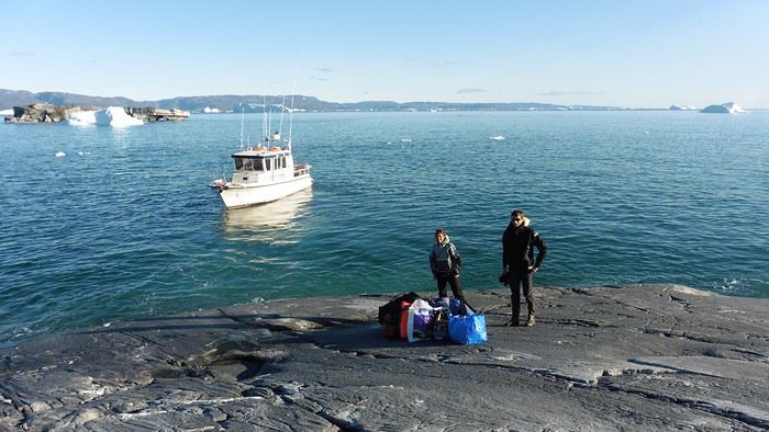
Here we were on the island, in the middle of nowhere, with all our luggage and food to organize, the tent to set up, and the kayaks to inflate—just 10 hours after leaving the Copenhagen hotel. We got to work, bothered by the flies. Despite our head nets, it was barely tolerable—there were so many of them. They swarmed by the dozens into every bag we opened. It was quite mild: 10°C.
Everything was ready by evening, and we were very happy to have completed all these transfers (planes and boat in a single day) as we slipped into our sleeping bags.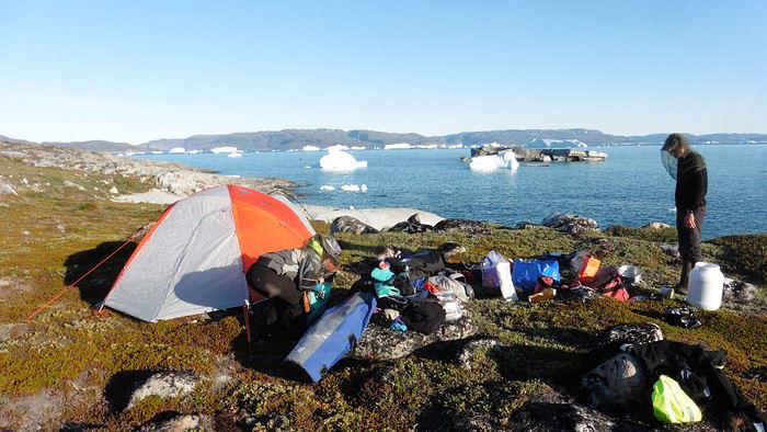
During the night, the wind picked up, and we went out several times to check the tent and kayak anchors. We noticed how bright it was—it was still quite twilight even at 1 AM.
Day 2 5:30 AM wake-up—the south wind was still strong, but since we were heading north, we decided to give it a try anyway.
This was also the moment we loaded the kayaks: since there were only three of us for two double-seater kayaks, we filled the hatch of one kayak, which allowed us to fit all our food. It would have been very difficult if there had been four of us for two kayaks.
Finally, we set off north along the western coast of the island. The conditions were far from ideal—the sea was rough, and the kayaks had a lot of wind resistance. But the main problem was the spray skirt: the gear on deck weighed it down, and the skirt kept coming off… We’d have to deal with it. Barely underway, and whales were already breaking the surface—it was our first time seeing them, and we were very impressed. Too bad the wind didn’t allow for longer contemplation; stopping paddling was impossible with such strong gusts.
We passed a few headlands and even considered stopping due to the conditions. To find some semblance of shelter, we had to hug the coast closely without cutting across the numerous bays, which significantly lengthened the journey. But as the morning went on, the wind died down, and the sea calmed. We spotted several whales and our first seals. It was almost pleasant during the picnic break. By late afternoon, we reached Kangerup Sarqâ Bay, where we had identified a great campsite with a very large beach and a river. But the wind had shifted—it was now coming from the north, making the last hour difficult due to fatigue and headwinds.
The campsite was ideal and beautiful, facing numerous icebergs grounded in the bay.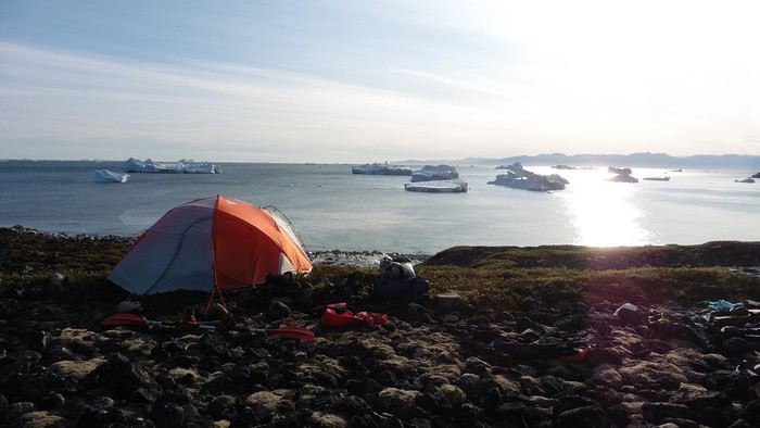
The GPS alerted us to another major drawback of inflatable kayaks: their slowness. It took us 7.5 hours of actual paddling (excluding breaks) to cover 28 km, averaging 3.7 km/h—somewhat disappointing. But we knew this before leaving, and once again, we’d have to make do!
Day 3 Surprise: at 6 AM wake-up, it was raining, foggy, with a south wind, and the sea was choppy even in the bay. It seemed wise to skip paddling, even though stopping on the second day was tough on morale. We went back to sleep, especially since the travel fatigue and the harsh conditions of the previous day had taken their toll.
At 11 AM, the navigation conditions weren’t any better—at the ends of the bay, we saw huge waves crashing onto the rocks, and giving up for the day became obvious. However, the rain had stopped, so we set off for a hike along the large lake bordering the bay. The wind hadn’t let up, and it was quite cold.
The tundra was starting to take on its autumn colors, and the contrast between the white lichens and the red vegetation was stunning. At the lake, we took out the fishing rods and quickly caught two beautiful Arctic char over 50 cm long.
As the afternoon wore on, the sun seemed closer. Along the beach, we gathered driftwood (mostly old planks) to cook our catch in foil over a fire. Eating our own food in such a beautiful place next to a good fire was comforting after the day’s setback.
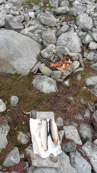
In the middle of the night, an Arctic fox entered the tent’s rear awning. It seemed barely intimidated when we shooed it away with loud shouts and then with stones.
Day 4 6:15 AM wake-up—3°C. We were on the water by 8 AM. The wind had dropped significantly, but the sea was shrouded in fog, and it was very cold in these damp conditions.
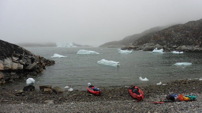
We passed the bay’s headland, Kangea, and headed toward the abandoned village of Agpat. The atmosphere was very austere—we hugged black rocks in fog that limited visibility to 50 meters, revealing large icebergs as we went.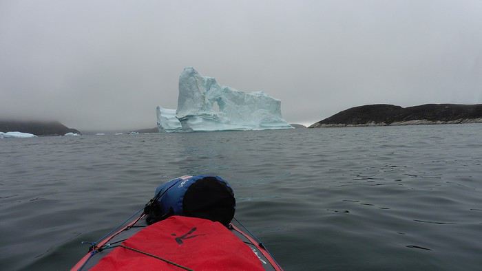
Suddenly, the water’s surface stirred in front of my kayak, and a huge gray back emerged from the sea. The collision was inevitable, but the whale seemed to understand and dove immediately, passing under the kayak and resurfacing a few meters away. I felt the kayak rock in the white foam and quickly paddled to escape the turbulence. What an emotion!
A light wind began to clear the fog, and the sun made beautiful appearances. Despite the cold, we stopped to visit the abandoned village, which left a strange impression. All the houses were still in good condition and wide open—some must have been very spacious in their time. We went back to sea, and in front of the large Kaangerdluk Bay, we hesitated—the headwind was strong, and large waves split the water. The next beach, from the island of Nua where we stopped to think, was over 8 km away. It was barely 2 PM, but caution led us to stop here for the day. We had covered 12 km—exactly the distance needed to stay on schedule. The afternoon was spent hiking on the island’s hills and gathering mussels and wood.
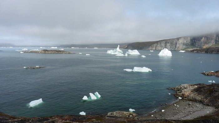
In the evening, we cooked these large Greenlandic mussels over a wood fire and savored them under the beautiful evening light. The weather was now fine, but the thermometer read -5°C in the sun…
Day 5 Bright sunshine, a glassy sea, and -8°C at 6 AM. Everything was green for setting off, even if putting on damp kayaking gear was a bit unpleasant in the cold. It was the first time we’d paddled on a flat sea since the start of the trip, and our average speed increased slightly.
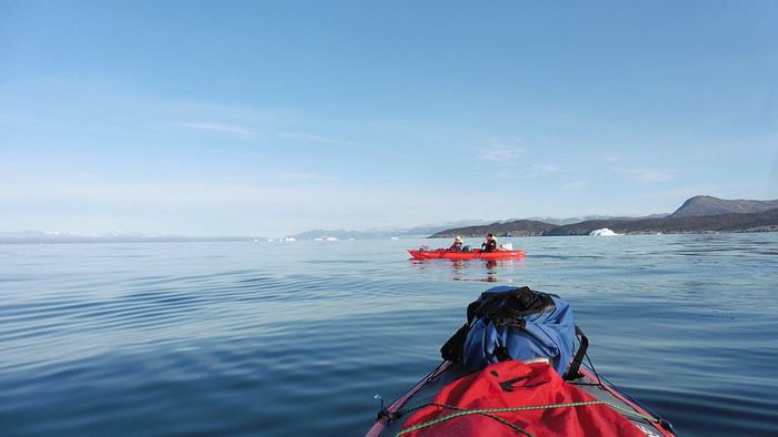
We entered the Smallesund Strait, marking the end of the island’s west coast. We were close to the large Torssukatak Fjord, where two glaciers flow. The access pass to the fjord was very narrow, and numerous ice chunks blocked access to the beaches. The wind had picked up and was now hitting us head-on (again). Just before entering the fjord, we landed on a steep beach made of large pebbles on Oqaitsut Island. It was very cold with the wind, and moving forward became difficult. We decided to stop for the day both because of the conditions and because the next campsite was far away, given how rugged the fjord was.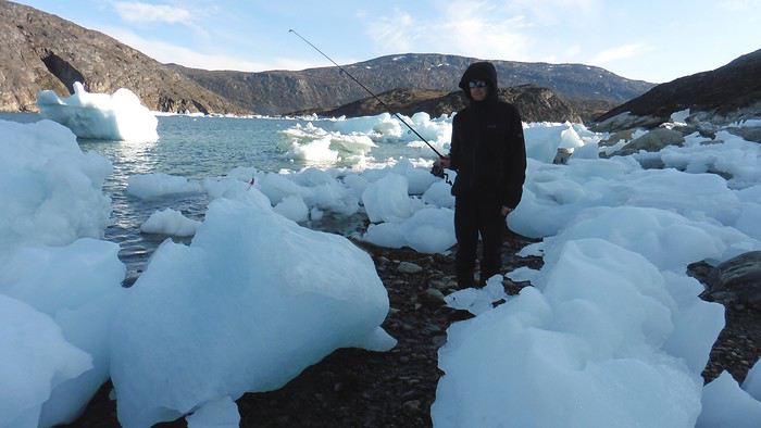
We eventually found a flat spot for the tent despite the steep slope. Even with the wind, the weather was beautiful, and we set off on foot for the northeastern cape of the island, overlooking the fjord. The view was far-reaching and exceptional—up close, the large fjord filled with ice and its steep granite cliffs, and in the distance, the ice cap and glacial walls.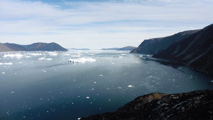
We spotted the village of Qeqertaq, whose network we could pick up, allowing us to check the weather forecast, which was rather good. While securing the kayaks in the evening, I noticed the strange behavior of one kayak at the end of the stage was due to the loss of the skeg—impossible to know where it detached. We’d have to do without it.
Day 6 Still that icy headwind from the northeast. We set off anyway for a long stage to reach the large pass connecting the Torssukatak and Ata Fjords.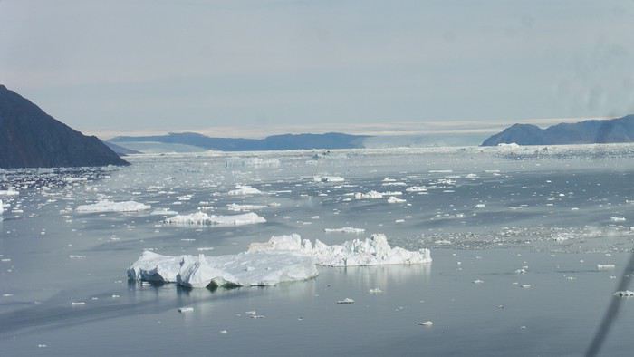
We advanced laboriously along the high cliffs of the fjord’s southern shore. They faced due north and blocked the sun. We felt the cold and dampness of the rock. It was really cold, especially in the extremities. We picnicked on the western cape of Qeqertakavasak Island. The cold didn’t allow us to stop for more than 20 minutes… But the wind dropped, and the sea was now very smooth. It was heavily cluttered with ice between the icebergs and old pack ice. The goal was to reach the large rocky promontory of Anapnuna, wedged between the Kujatdleq and Kangilerngata Glaciers, but the ice made progress difficult. We stopped to gain height on a small island and spot a passage of open water, but all we saw was white—passing seemed impossible. The currents were very complex, and entire sections of ice were being swept in one direction and then another at an impressive speed.
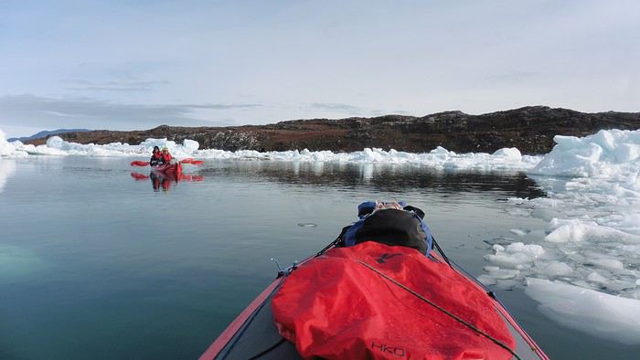
We wandered through this labyrinth until landing on a beach on the small island of Takissut, where we set up camp, exhausted from the 30 km covered and the vigilance required by the abundance of ice. The place was sublime under the evening sun—we were surrounded by ice and mountains, with the Kangilerngata Glacier in the distance. The summer contrasts were striking between the water, icebergs, sky, and flaming tundra—all colors were represented. Absolute calm reigned.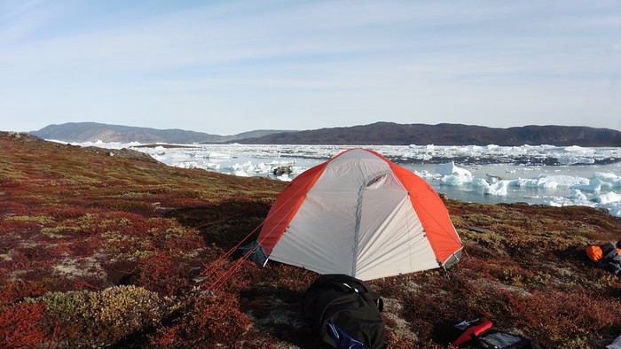
The lack of drinking water at this spot wasn’t too much of a constraint: as soon as we arrived on the beach, we placed containers under the icebergs stranded in the intertidal zone. They were all full by the time we finished setting up.
Day 7 We had to change our plans: we wouldn’t reach the rocky promontory, too well protected by the ice. We set off under the sun for Igdluluarssuit Island. Although we had spotted a passage just before launching, we quickly found ourselves surrounded by ice. It was everywhere, and finding water to paddle became complicated. We tried to force our way in every direction, even retracing our steps. Everything moved at an impressive speed—we were in the middle of a whirlpool of ice.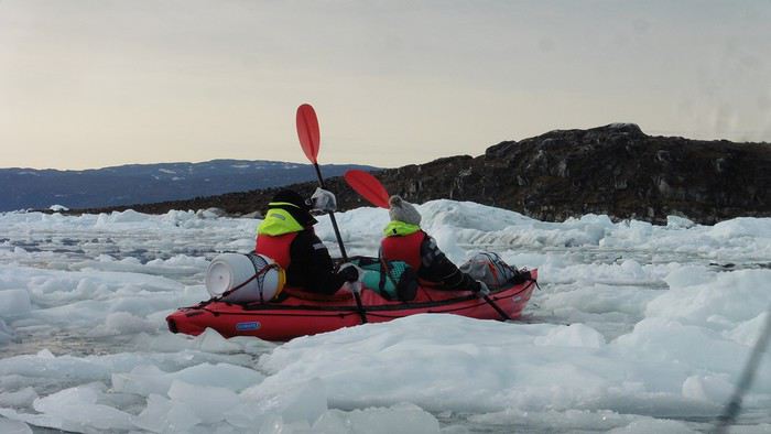
The tension rose, and each boat had its share of big scares. I was trapped against ice floes that dragged me toward an iceberg—the pressure on the kayak was enormous; it was going to capsize or puncture! But with a few strong strokes and paddling against the ice, I managed to free myself from the trap. Barely 10 minutes later, my companions were sandwiched perpendicularly between two icebergs that were closing in. The situation was desperate—the kayak was bending and twisting more and more, but with some strong paddle strokes, it finally freed itself. After these particularly unpleasant moments, we were completely blocked. The drifting ice floes had tightened, and the kayaks were no longer even in the water… The only solution: wait with the kayaks on these floes, which were too thin to walk on (even though we didn’t try). Within minutes, the situation cleared—a waterway opened, and we rushed into it. We paddled with one goal: find a larger pool of water. After going back and forth, our path took shape—we had to force the passage several times, attacking the ice directly with the kayaks, and finally, we escaped the worst of the labyrinth. We reached land on the west side of the island and saw that the rest would be easier. To reach the island, we just had to cross the Arsiviup Ikera Strait, which was lightly cluttered. We reached the eastern cape of the island, ideal for camping, even though we had only paddled for 3 hours. We set up camp and hiked to the island’s summit, which overlooks the entire pass and the glaciers.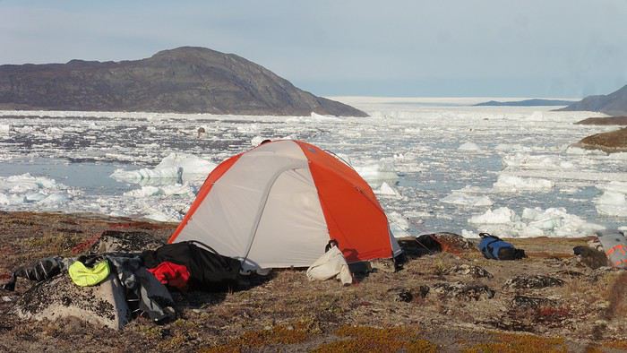
Everything was magnificent, no matter the direction. At 2 PM, we were at the summit—the beauty of the place and the picnic facing the glacier in the sun without wind made us forget the near-disaster from a few hours earlier. It would be impossible to approach the glacier by kayak, but from our summit on foot, it seemed so close, and contemplating it safely on solid ground was a great moment.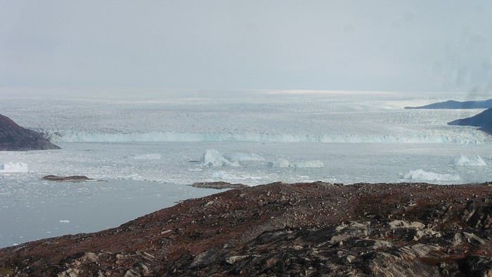
The pass was incredibly complex—everything was in motion, and an impassable passage could become open water within minutes. We were delighted when we returned to camp. A slightly lost whale among the ice accompanied us along the shore. The place was truly beautiful, but the temperature dropped again under the clear sky, preventing us from eating outside.
Day 8 Clear and cold at wake-up: -9°C. The sea had frozen in many places. We hesitated about the rest of the trip—should we start heading back to Ilulissat or linger in the pass, especially to approach the Eqi Glacier? After the incidents of the previous day, we decided to think carefully and paddled to the southern cape of our island to check the ice conditions toward Eqi. The weather had clouded over in the meantime, and the sky was quite gray. At the cape, we spotted the glacier’s wall, still 15 km away.
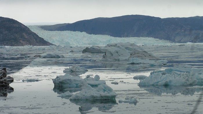
The fjord was quite cluttered, but it seemed passable. However, there was no guarantee the view would be much better 1 km from the glacier than 15 km away, especially since the front was quite active and therefore dangerous. We decided to head south without passing by the glacier. The cold temperatures encountered in the pass also motivated us to move away from the glaciers and the ice cap. We navigated under a threatening sky but without wind. The kayaks cut through the thin layer of ice on the surface with a crinkling paper sound. We reached the Ata campsite in the late afternoon after 5 hours of rowing without a single break…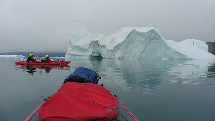
The wind had picked up, and we discovered a nice surprise: a refuge with a table and a comfortable bench lined with mattresses. Facing the worsening weather, we settled in comfortably. The kerosene stove was too complex for our three brains—we couldn’t get it started, too bad, as it was 0°C inside. The rest of the afternoon was spent fishing in the large lake, where we landed a beautiful Arctic char, more than enough for three. A good night’s sleep without the risk of foxes or the sound of a tent shaking in the wind.
Day 9 6 AM wake-up to the sound of rain hitting the cabin. The decision was made looking out the window—wind, rain, and fog obscured the sea: we went back to sleep.
New wake-up, and the rain had stopped—we could go out and stock up on fish. We set off on foot toward the lake, following its western shore. It was very overcast, and the wind encouraged us to keep moving. We made our way to a smaller lake at the end of the large one, where we caught a huge Arctic char. A small clearing brightened the picnic, and we headed back to our cabin.
This 20 km hike kept us busy all day: walking on slippery scree and the micro-relief of the peat bogs took time.
Day 10 The sky was clear, but a light south wind made paddling intense. We set off southeast to reach the opposite shore of the fjord. It was very cold, and it was impossible to stop paddling for even a moment without immediately losing ground due to the wind. We crossed the Kangerluarsuk Fjord. I recognized the cape I had reached on skis in the winter of 2017. We found a nice campsite on the southern shore of the fjord: Uiartag. It wasn’t even noon, but facing this headwind, we preferred to stop here rather than exhaust ourselves for a few extra kilometers. Like the previous ones, this campsite was very comfortable: the ground was covered with a thick layer of lichens and mosses, very pleasant to lie on.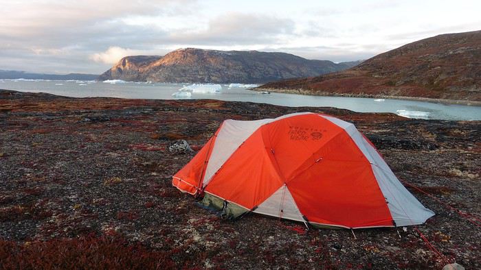
We set off on a hike to the heights of the cape, where the weather alternated between large clearings and snow showers. We noticed the loss of the thermometer, poorly attached to the backpack. On the way back, in the small bay of our beach, a whale swam calmly 10 meters from the shore—a beautiful surprise.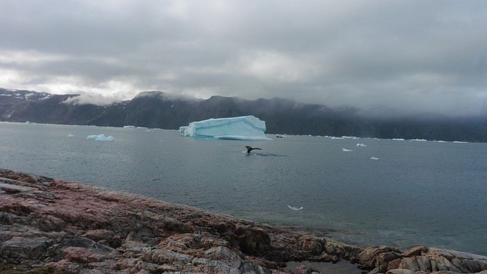
The sky cleared completely, and the temperature dropped as night approached.
We’re setting off as a group of three in two inflatable double-seater kayaks (Gumotex) brought from France. The plan is to spend two weeks circumnavigating Arve Princess Island, located north of Ilulissat in Disko Bay, with a possible boat drop-off at the southern tip of the island.
This seems like a fairly classic route in the area—we found several descriptions online (thanks to the authors). With their help and Google Earth, we identified all potential campsites and entered their coordinates into a GPS. The western part of the island, facing the bay, seems ideal for whale watching, while the more rugged eastern side offers access to several glacial walls. We’re somewhat familiar with the area from two winter expeditions on skis and pulkas.
Plus, the commitment is limited due to the island’s proximity to several small villages, including Qeqertaq, Oqaatsut, and even Ilulissat. In fact, we saw fishing boats almost every day. The distance suits us well: 200 kilometers in 16 full days on site, which should leave some leeway in case of bad weather or for hiking.
We booked our flights in June with Air Greenland to Ilulissat for the last week of August and the first week of September. On both the outbound and return trips, we stayed overnight in Copenhagen. The France-Copenhagen flight was with Air France.
We were allowed 3 x 20 kg in the hold. Each kayak with its accessories fits into a 20 kg bag; the last hold bag is for shared gear: tent, stoves, dry bags… We only brought 1.5 kg of semolina for food. In the end, we had 61 kg of gear, and no excess baggage was charged.
Individual gear (clothes and sleeping bags…) was distributed in the cabin luggage.
For the boat transfer, we contacted an agency: Blue Jay, which gave us a number to call upon arrival.
Day 0: Wednesday, August 22 Departure day. After work, I drove from Gap to Marseille’s Marignane Airport for the first leg of the trip to Copenhagen. I enjoyed the rather mild local temperatures: 35°C in the shade. After a layover in Paris, I arrived at the Copenhagen hotel, located two train stops from the airport, where my companions were already settled. No issues—everyone was on time with their luggage.
Day 1 The flight to Greenland was at 9 AM. We had a layover in Kangerlussuaq, where we changed planes, then stopped in Aasiaat before reaching Ilulissat Airport at 3 PM under beautiful sunshine.
We called Blue Jay for the boat transfer: they could take us to the island as early as 6 PM; otherwise, we’d have to wait until the next day. That left us 3 hours to prepare our gear and, most importantly, do our shopping for the two-week trip—it seemed tight, but we gave it a shot.
A quick taxi ride took us to Pisiffik, where we easily found everything we needed: bread, butter, cheese, cold cuts, rice, pasta, jam, muesli… There was no C fuel or methylated spirits for the stoves, but this time we knew the trick: at Stark, a bit uphill from the town, we found the precious liquids. Two hours later, we filled our dry bags and containers with our purchases, and by 5:30 PM, we met Klaus, the Blue Jay manager, directly at the port.
The vacation seemed to truly begin as we sped by boat through the icebergs toward Arve Princess Island. Forty-five minutes later, we spotted a beach lined with rocks where Klaus dropped us off quickly (he had another transfer to make right after).
Here we were on the island, in the middle of nowhere, with all our luggage and food to organize, the tent to set up, and the kayaks to inflate—just 10 hours after leaving the Copenhagen hotel. We got to work, bothered by the flies. Despite our head nets, it was barely tolerable—there were so many of them. They swarmed by the dozens into every bag we opened. It was quite mild: 10°C.
Everything was ready by evening, and we were very happy to have completed all these transfers (planes and boat in a single day) as we slipped into our sleeping bags.
During the night, the wind picked up, and we went out several times to check the tent and kayak anchors. We noticed how bright it was—it was still quite twilight even at 1 AM.
Day 2 5:30 AM wake-up—the south wind was still strong, but since we were heading north, we decided to give it a try anyway.
This was also the moment we loaded the kayaks: since there were only three of us for two double-seater kayaks, we filled the hatch of one kayak, which allowed us to fit all our food. It would have been very difficult if there had been four of us for two kayaks.
Finally, we set off north along the western coast of the island. The conditions were far from ideal—the sea was rough, and the kayaks had a lot of wind resistance. But the main problem was the spray skirt: the gear on deck weighed it down, and the skirt kept coming off… We’d have to deal with it. Barely underway, and whales were already breaking the surface—it was our first time seeing them, and we were very impressed. Too bad the wind didn’t allow for longer contemplation; stopping paddling was impossible with such strong gusts.
We passed a few headlands and even considered stopping due to the conditions. To find some semblance of shelter, we had to hug the coast closely without cutting across the numerous bays, which significantly lengthened the journey. But as the morning went on, the wind died down, and the sea calmed. We spotted several whales and our first seals. It was almost pleasant during the picnic break. By late afternoon, we reached Kangerup Sarqâ Bay, where we had identified a great campsite with a very large beach and a river. But the wind had shifted—it was now coming from the north, making the last hour difficult due to fatigue and headwinds.
The campsite was ideal and beautiful, facing numerous icebergs grounded in the bay.
The GPS alerted us to another major drawback of inflatable kayaks: their slowness. It took us 7.5 hours of actual paddling (excluding breaks) to cover 28 km, averaging 3.7 km/h—somewhat disappointing. But we knew this before leaving, and once again, we’d have to make do!
Day 3 Surprise: at 6 AM wake-up, it was raining, foggy, with a south wind, and the sea was choppy even in the bay. It seemed wise to skip paddling, even though stopping on the second day was tough on morale. We went back to sleep, especially since the travel fatigue and the harsh conditions of the previous day had taken their toll.
At 11 AM, the navigation conditions weren’t any better—at the ends of the bay, we saw huge waves crashing onto the rocks, and giving up for the day became obvious. However, the rain had stopped, so we set off for a hike along the large lake bordering the bay. The wind hadn’t let up, and it was quite cold.
The tundra was starting to take on its autumn colors, and the contrast between the white lichens and the red vegetation was stunning. At the lake, we took out the fishing rods and quickly caught two beautiful Arctic char over 50 cm long.
As the afternoon wore on, the sun seemed closer. Along the beach, we gathered driftwood (mostly old planks) to cook our catch in foil over a fire. Eating our own food in such a beautiful place next to a good fire was comforting after the day’s setback.
In the middle of the night, an Arctic fox entered the tent’s rear awning. It seemed barely intimidated when we shooed it away with loud shouts and then with stones.
Day 4 6:15 AM wake-up—3°C. We were on the water by 8 AM. The wind had dropped significantly, but the sea was shrouded in fog, and it was very cold in these damp conditions.
We passed the bay’s headland, Kangea, and headed toward the abandoned village of Agpat. The atmosphere was very austere—we hugged black rocks in fog that limited visibility to 50 meters, revealing large icebergs as we went.
Suddenly, the water’s surface stirred in front of my kayak, and a huge gray back emerged from the sea. The collision was inevitable, but the whale seemed to understand and dove immediately, passing under the kayak and resurfacing a few meters away. I felt the kayak rock in the white foam and quickly paddled to escape the turbulence. What an emotion!
A light wind began to clear the fog, and the sun made beautiful appearances. Despite the cold, we stopped to visit the abandoned village, which left a strange impression. All the houses were still in good condition and wide open—some must have been very spacious in their time. We went back to sea, and in front of the large Kaangerdluk Bay, we hesitated—the headwind was strong, and large waves split the water. The next beach, from the island of Nua where we stopped to think, was over 8 km away. It was barely 2 PM, but caution led us to stop here for the day. We had covered 12 km—exactly the distance needed to stay on schedule. The afternoon was spent hiking on the island’s hills and gathering mussels and wood.
In the evening, we cooked these large Greenlandic mussels over a wood fire and savored them under the beautiful evening light. The weather was now fine, but the thermometer read -5°C in the sun…
Day 5 Bright sunshine, a glassy sea, and -8°C at 6 AM. Everything was green for setting off, even if putting on damp kayaking gear was a bit unpleasant in the cold. It was the first time we’d paddled on a flat sea since the start of the trip, and our average speed increased slightly.
We entered the Smallesund Strait, marking the end of the island’s west coast. We were close to the large Torssukatak Fjord, where two glaciers flow. The access pass to the fjord was very narrow, and numerous ice chunks blocked access to the beaches. The wind had picked up and was now hitting us head-on (again). Just before entering the fjord, we landed on a steep beach made of large pebbles on Oqaitsut Island. It was very cold with the wind, and moving forward became difficult. We decided to stop for the day both because of the conditions and because the next campsite was far away, given how rugged the fjord was.
We eventually found a flat spot for the tent despite the steep slope. Even with the wind, the weather was beautiful, and we set off on foot for the northeastern cape of the island, overlooking the fjord. The view was far-reaching and exceptional—up close, the large fjord filled with ice and its steep granite cliffs, and in the distance, the ice cap and glacial walls.
We spotted the village of Qeqertaq, whose network we could pick up, allowing us to check the weather forecast, which was rather good. While securing the kayaks in the evening, I noticed the strange behavior of one kayak at the end of the stage was due to the loss of the skeg—impossible to know where it detached. We’d have to do without it.
Day 6 Still that icy headwind from the northeast. We set off anyway for a long stage to reach the large pass connecting the Torssukatak and Ata Fjords.
We advanced laboriously along the high cliffs of the fjord’s southern shore. They faced due north and blocked the sun. We felt the cold and dampness of the rock. It was really cold, especially in the extremities. We picnicked on the western cape of Qeqertakavasak Island. The cold didn’t allow us to stop for more than 20 minutes… But the wind dropped, and the sea was now very smooth. It was heavily cluttered with ice between the icebergs and old pack ice. The goal was to reach the large rocky promontory of Anapnuna, wedged between the Kujatdleq and Kangilerngata Glaciers, but the ice made progress difficult. We stopped to gain height on a small island and spot a passage of open water, but all we saw was white—passing seemed impossible. The currents were very complex, and entire sections of ice were being swept in one direction and then another at an impressive speed.
We wandered through this labyrinth until landing on a beach on the small island of Takissut, where we set up camp, exhausted from the 30 km covered and the vigilance required by the abundance of ice. The place was sublime under the evening sun—we were surrounded by ice and mountains, with the Kangilerngata Glacier in the distance. The summer contrasts were striking between the water, icebergs, sky, and flaming tundra—all colors were represented. Absolute calm reigned.
The lack of drinking water at this spot wasn’t too much of a constraint: as soon as we arrived on the beach, we placed containers under the icebergs stranded in the intertidal zone. They were all full by the time we finished setting up.
Day 7 We had to change our plans: we wouldn’t reach the rocky promontory, too well protected by the ice. We set off under the sun for Igdluluarssuit Island. Although we had spotted a passage just before launching, we quickly found ourselves surrounded by ice. It was everywhere, and finding water to paddle became complicated. We tried to force our way in every direction, even retracing our steps. Everything moved at an impressive speed—we were in the middle of a whirlpool of ice.
The tension rose, and each boat had its share of big scares. I was trapped against ice floes that dragged me toward an iceberg—the pressure on the kayak was enormous; it was going to capsize or puncture! But with a few strong strokes and paddling against the ice, I managed to free myself from the trap. Barely 10 minutes later, my companions were sandwiched perpendicularly between two icebergs that were closing in. The situation was desperate—the kayak was bending and twisting more and more, but with some strong paddle strokes, it finally freed itself. After these particularly unpleasant moments, we were completely blocked. The drifting ice floes had tightened, and the kayaks were no longer even in the water… The only solution: wait with the kayaks on these floes, which were too thin to walk on (even though we didn’t try). Within minutes, the situation cleared—a waterway opened, and we rushed into it. We paddled with one goal: find a larger pool of water. After going back and forth, our path took shape—we had to force the passage several times, attacking the ice directly with the kayaks, and finally, we escaped the worst of the labyrinth. We reached land on the west side of the island and saw that the rest would be easier. To reach the island, we just had to cross the Arsiviup Ikera Strait, which was lightly cluttered. We reached the eastern cape of the island, ideal for camping, even though we had only paddled for 3 hours. We set up camp and hiked to the island’s summit, which overlooks the entire pass and the glaciers.
Everything was magnificent, no matter the direction. At 2 PM, we were at the summit—the beauty of the place and the picnic facing the glacier in the sun without wind made us forget the near-disaster from a few hours earlier. It would be impossible to approach the glacier by kayak, but from our summit on foot, it seemed so close, and contemplating it safely on solid ground was a great moment.
The pass was incredibly complex—everything was in motion, and an impassable passage could become open water within minutes. We were delighted when we returned to camp. A slightly lost whale among the ice accompanied us along the shore. The place was truly beautiful, but the temperature dropped again under the clear sky, preventing us from eating outside.
Day 8 Clear and cold at wake-up: -9°C. The sea had frozen in many places. We hesitated about the rest of the trip—should we start heading back to Ilulissat or linger in the pass, especially to approach the Eqi Glacier? After the incidents of the previous day, we decided to think carefully and paddled to the southern cape of our island to check the ice conditions toward Eqi. The weather had clouded over in the meantime, and the sky was quite gray. At the cape, we spotted the glacier’s wall, still 15 km away.
The fjord was quite cluttered, but it seemed passable. However, there was no guarantee the view would be much better 1 km from the glacier than 15 km away, especially since the front was quite active and therefore dangerous. We decided to head south without passing by the glacier. The cold temperatures encountered in the pass also motivated us to move away from the glaciers and the ice cap. We navigated under a threatening sky but without wind. The kayaks cut through the thin layer of ice on the surface with a crinkling paper sound. We reached the Ata campsite in the late afternoon after 5 hours of rowing without a single break…
The wind had picked up, and we discovered a nice surprise: a refuge with a table and a comfortable bench lined with mattresses. Facing the worsening weather, we settled in comfortably. The kerosene stove was too complex for our three brains—we couldn’t get it started, too bad, as it was 0°C inside. The rest of the afternoon was spent fishing in the large lake, where we landed a beautiful Arctic char, more than enough for three. A good night’s sleep without the risk of foxes or the sound of a tent shaking in the wind.
Day 9 6 AM wake-up to the sound of rain hitting the cabin. The decision was made looking out the window—wind, rain, and fog obscured the sea: we went back to sleep.
New wake-up, and the rain had stopped—we could go out and stock up on fish. We set off on foot toward the lake, following its western shore. It was very overcast, and the wind encouraged us to keep moving. We made our way to a smaller lake at the end of the large one, where we caught a huge Arctic char. A small clearing brightened the picnic, and we headed back to our cabin.
This 20 km hike kept us busy all day: walking on slippery scree and the micro-relief of the peat bogs took time.
Day 10 The sky was clear, but a light south wind made paddling intense. We set off southeast to reach the opposite shore of the fjord. It was very cold, and it was impossible to stop paddling for even a moment without immediately losing ground due to the wind. We crossed the Kangerluarsuk Fjord. I recognized the cape I had reached on skis in the winter of 2017. We found a nice campsite on the southern shore of the fjord: Uiartag. It wasn’t even noon, but facing this headwind, we preferred to stop here rather than exhaust ourselves for a few extra kilometers. Like the previous ones, this campsite was very comfortable: the ground was covered with a thick layer of lichens and mosses, very pleasant to lie on.
We set off on a hike to the heights of the cape, where the weather alternated between large clearings and snow showers. We noticed the loss of the thermometer, poorly attached to the backpack. On the way back, in the small bay of our beach, a whale swam calmly 10 meters from the shore—a beautiful surprise.
The sky cleared completely, and the temperature dropped as night approached.
Hey everyone,
I booked a flight with RyanAir for next month, with the priority+ option and two cabin bags. So I can take a 10 kg bag with dimensions 55x40x20 in the cabin (plus another smaller one). The problem is that the smallest suitcase I have (which is supposed to be designed specifically for cabin size standards, according to the manual) has the following dimensions: 55x37x21, so it's just 1 cm over (wheels included) on one of the measurements.
I wasn’t too worried at first, but I’ve read dozens of stories about people’s misadventures and the hassles they’ve had with RyanAir.
Since I don’t want my suitcase to end up in the hold (that would waste time picking it up when I’m already arriving late and need to get to the city center), nor do I want to pay an extra fee (apparently 50 €) for the outbound and return flights for just 1 centimeter—especially since I paid for the "priority+" option and I’m not exactly rolling in money—I’d love some advice.
Have any of you been in the same situation? I’ve read that with this airline, they check bags in templates (testing them in different positions) and are completely uncompromising. I tried contacting customer service, who, as luck would have it, "don’t handle this kind of request," and a rep I spoke to wasn’t much help.
I know it’s a low-cost airline, and I don’t expect luxury or even kindness, but come on—just 1 cm on a short flight with the + option... I’m a bit overwhelmed by everything I’ve read...
Just to clarify, since I’m going for 8 days, I can’t just take one bag for my stuff. I’ve done that for shorter trips before, and it was a hassle—I even had to buy an extra bag for the return trip... Luckily, the inspector was nice about it!
Thanks so much! I’m a newbie when it comes to air travel :) Hope I posted this in the right section!
I booked a flight with RyanAir for next month, with the priority+ option and two cabin bags. So I can take a 10 kg bag with dimensions 55x40x20 in the cabin (plus another smaller one). The problem is that the smallest suitcase I have (which is supposed to be designed specifically for cabin size standards, according to the manual) has the following dimensions: 55x37x21, so it's just 1 cm over (wheels included) on one of the measurements.
I wasn’t too worried at first, but I’ve read dozens of stories about people’s misadventures and the hassles they’ve had with RyanAir.
Since I don’t want my suitcase to end up in the hold (that would waste time picking it up when I’m already arriving late and need to get to the city center), nor do I want to pay an extra fee (apparently 50 €) for the outbound and return flights for just 1 centimeter—especially since I paid for the "priority+" option and I’m not exactly rolling in money—I’d love some advice.
Have any of you been in the same situation? I’ve read that with this airline, they check bags in templates (testing them in different positions) and are completely uncompromising. I tried contacting customer service, who, as luck would have it, "don’t handle this kind of request," and a rep I spoke to wasn’t much help.
I know it’s a low-cost airline, and I don’t expect luxury or even kindness, but come on—just 1 cm on a short flight with the + option... I’m a bit overwhelmed by everything I’ve read...
Just to clarify, since I’m going for 8 days, I can’t just take one bag for my stuff. I’ve done that for shorter trips before, and it was a hassle—I even had to buy an extra bag for the return trip... Luckily, the inspector was nice about it!
Thanks so much! I’m a newbie when it comes to air travel :) Hope I posted this in the right section!
This trip is a more budget-friendly—and shorter—alternative to the 14-day Aranui 5 cruise, which includes a few days at sea and a detour to Bora Bora in the Leeward Islands on the way back. The advantage of the cruise is that it lets you see and visit (though far too quickly) the two islands of Tahuata and Fatu Hiva, which don’t have airports. By plane, you’ll only be able to land on 4 of the 6 islands. However, Tahuata is accessible from Hiva Oa via a day trip (or two-day trip) shuttle. Plan for two extra days in your total time dedicated to the Marquesas Islands (called *Fenua Enata* in Marquesan language).
Our itinerary is perfect for those who aren’t excited by cruises and prefer to get closer to the local communities. This 9-day trip cost us around 2500 € all-inclusive. For a 14-day cruise on the Aranui, expect to pay 2300 € per person for a basic cabin for four, or 3800 € per person for a superior double cabin.
Air Tahiti offers a 4-island Marquesas Pass (Nuku Hiva, Ua Pou, Ua Huka, and Hiva Oa) for 86,000 XPF (about 700 €). The journey is made on an ATR 72 from Tahiti to Nuku Hiva or Hiva Oa, and on a 19-seat Twin Otter between the islands (often only 13 or 15 seats are available due to cargo, so book well in advance). We’re traveling as a couple. We booked our family-run guesthouse stays at the Tourism Fair in early February, where you can meet the owners and make your choice. Stays are almost always half-board or breakfast-only. Transfers are usually included, but you can always book a car or taxi.
**NUKU HIVA**
**A LITTLE GEOGRAPHY** Nuku Hiva (NH) is located about 1,500 km from Tahiti, in the north of French Polynesia. At 387 km², it’s the second-largest island in French Polynesia after Tahiti. It was formed by incredible volcanic phenomena and cataclysms between 1 and 6 million years ago, which lifted the island thousands of meters above the sea. Even after millennia of slow erosion, collapses, and settling, NH remains the most majestic of the Marquesas, with its sheer cliffs, deep valleys featuring immense waterfalls, and black walls that were once the inner walls of enormous volcanoes.
**A LITTLE HISTORY** The first contact between NH’s inhabitants and Europeans was in 1595 with Spanish navigators who only stayed briefly. It wasn’t until the late 18th century that Europeans arrived in greater numbers on NH (and the other Marquesas Islands), disrupting a very fragile social and cultural balance. It’s believed that nearly 100,000 people lived on Nuku Hiva at that time—a population decimated over the decades by epidemics, diseases brought by Europeans, and alcohol used for barter. The disastrous result: by the 1930s, only 2,500 people remained, having largely lost their identity and living in poverty. Today, the island has about 2,600 inhabitants spread across several villages, with Taiohae as the main one.
**NUKU HIVA IN LITERATURE**
1 / One of the famous writers who visited NH and stayed there was Herman Melville, who arrived in July 1842, the author of *Moby Dick*. The island had just come under French protectorate. Seduced by the enchanting *vahinés* and dazzled by his paradisiacal vision of the place, Melville deserted his ship. He ended up a prisoner of a local tribe, the Taipi, in Taipivai, where he stayed for a month and a half until an Australian ship captain secured his release in exchange for a musket and a roll of cotton fabric! Melville wrote a novel about this tumultuous episode in his life, considered a classic of travel literature. The book, *Typee: A Peep at Polynesian Life*, published in 1846 in the United States, was a huge success.
2 / Another famous Scottish writer, Robert Louis Stevenson, arrived in NH aboard a yacht that anchored in Anaho Bay, the island’s most beautiful, in July 1888. Stevenson was already known for two magnificent novels that marked their era: *Treasure Island* and *Dr. Jekyll & Mr. Hyde*. Stevenson, too, was captivated by the island’s natural beauty, though he also noted the devastating decline in identity, socio-cultural life, and physical health of a population ravaged by disease and alcohol. His account of his stay, *In the South Seas: An Account of Experiences and Observations in the Marquesas, Paumotus, and Gilbert Islands During Two Cruises on the Yacht Casco (1888) and the Schooner Equator (1889)*, was published in 1896 in New York, four years after his death in Apia, Western Samoa, where he had settled. It was also published in London in 1900.
3 / In August 1903, Victor Segalen, a French naval doctor, ethnologist, and archaeologist, landed in NH from the ship *La Durance*, sent to Polynesia to recover the possessions of the painter Paul Gauguin, who had died in April of that year. He, too, was enthralled by the Marquesas but lamented the loss of identity, dignity, and pride of the Māori, alienated by a Christianization that destroyed their culture and customs, denied their gods, and erased their past. He wrote about his experience, doubts, and fears in *Les Immémoriaux*.
4 / In December 1907, Jack London arrived in NH aboard the sailboat *Stark*, following in the footsteps of his illustrious predecessor, Herman Melville. London was in poor physical condition, exhausted from his relentless travels that had taken him from the Klondike in Canada to Japan, Australia, and London in Europe. He was appalled and shocked by Nuku Hiva’s degraded health situation: where Melville had encountered over 2,000 vigorous and healthy Marquesan warriors, London found only 12 suffering from various diseases—the rest had been wiped out by tuberculosis! His approach remained humanistic, and he maintained a sharp geopolitical awareness of these traditional Polynesian cultures, weakened by the inexorable advance of modernity in the early 20th century. He continued his journey to the Tuamotu Islands and Tahiti, publishing *Martin Eden*, the moving account of his initiatory voyage in the South Pacific, in 1911.
5 / Finally, Alain Gerbault, a writer, linguist, ethnologist, and tireless traveler, arrived in the Marquesas via the Panama Canal in December 1933. He was completely exhausted after an endless crossing on a small sailboat, the *Firecrest*. Enthralled by his stay in the Marquesas, he continued to the Tuamotu Islands in 1934, then Tahiti in 1935. Gerbault fought for the preservation of traditions, as well as the songs and dances banned by the Churches and the French Administration (these bans lasted over 50 years, mind you...!!!). Bora Bora remained his favorite island. A staunch Pétainist during World War II, he was forced to flee Bora Bora for Samoa, then Tonga, and finally Timor, a half-Portuguese island and thus neutral during the war. His travel accounts, *In Pursuit of the Sun: Logbook from New York to Tahiti* and *A Paradise Is Dying*, were published in the late 1940s. He died in Timor in 1941, and his ashes were repatriated to Bora Bora.
Back to our trip and stay.
**Day 1: April 27**
Departure from Papeete at 6:30 AM—we had to wake up two hours earlier and reach the airport in the dark. Takeoff at dawn, good weather en route, flight duration: 4 hours.
Arrival around 10:30 AM in Nuku Hiva, the first stop of this trip. We booked two nights in half-board at Pension Koku’u, transfers included. Maybe not such a great idea, those included transfers, especially on this unique island where the airport is located on *Terre Déserte*, on the other side of the mountain, opposite and about 45 km from the main village of Taiohae. They’re charged at a steep price. Expect 6,000 XPF round-trip by taxi, but 15,000 XPF charged by guesthouses or hotels. The difference is notable. It wasn’t the best idea, but we can’t go back. Even for residents like us who know how to travel in Polynesia, the Air Tahiti employee who sold me the Pass couldn’t give any useful advice about the stay itself—probably because he’d never been to the Marquesas. It’s really annoying! In short, the good idea to remember is renting a car (like a Suzuki) to be free to manage your time and stop at leisure. The road signage is a bit basic, but you’ll manage just fine. Our host Alvane waits for us—without a sign (sic!)—and after searching for each other for 5 minutes, we’re off on a journey of over an hour (with photo stops) in a Land Rover with smooth tires (luckily, it’s not raining!). The recently paved and marked mountain road is impeccable. No time to catch our breath at the guesthouse; we leave immediately (not a great idea after waking up at dawn plus 4 hours on a plane) for a half-day hike that was also included in the prepaid stay. A sandwich was provided (really pathetic for the physical effort required), we have water, and we fill a few bottles at the spring near the ceremonial site of Taipivai, our first stop. Then the hike begins in the Hanaheu Valley, descending toward Anaho Bay and its namesake beach. A magnificent and wild spot, a few sailboats anchored, we swim—the water is really warm, over 30°C at the shore. That warm is rare and not necessarily pleasant. We then have to climb a very steep slope; this hike is actually quite tough. The air is still, humid, and stifling under the foliage, there’s a bit of mud, and tiny ants (which don’t bite, I’ll have you know), locally called *fofolles*, running over shoes, ankles, and calves. Not very pleasant...! On top of that, there are mosquitoes to protect against! In hindsight, it seems wise to bring energy bars from Papeete if you plan to hike on the afternoon of your arrival day. We weren’t careful... Result: a moment of weakness for me and a hyperventilation attack climbing back up from Anaho Bay!!! We return to the guesthouse at night. There we find Claudine and her four children—Marquesan-style atmosphere, friendly and casual. We share family life. Very simple room with a bathroom, no mosquitoes, we can sleep with the window open, but the night will be noisy, as is often the case in Polynesia. Roosters are everywhere and don’t sleep, dogs bark or whine. So we end up waking up early... like everyone else.
**Day 2: April 28**
We booked a full-day excursion with Thierry: it starts with a 45-minute boat ride to reach Hakatea Beach, hidden in a small secret bay like many along Nuku Hiva’s coasts. From there, the hike lasts all day—11 km round-trip on flat but also rugged terrain (ancient paved and elevated paths over 1,000 years old)—and river crossings. Bring the right shoes (like plastic Crocs with high socks—not very stylish but practical). We cross the former village of Hakaui, walk along the foundations of dwellings, and there are still weathered tikis in the lush vegetation. The ultimate goal of this hike is to reach the tall Vaipo waterfall. The place is magical, with openings in the vegetation and immense trees allowing photos of the treetops and caves where funeral canoes containing the bones of chiefs or great warriors were once placed. We return the same way to the beach and take another boat ride to reach Taihoae’s port. Back at the guesthouse after a glimpse of Taihoae’s waterfront.
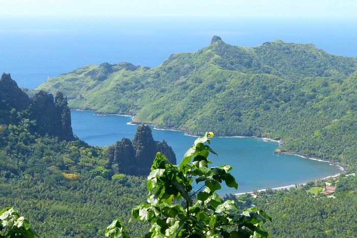
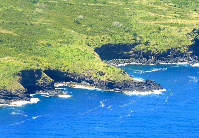
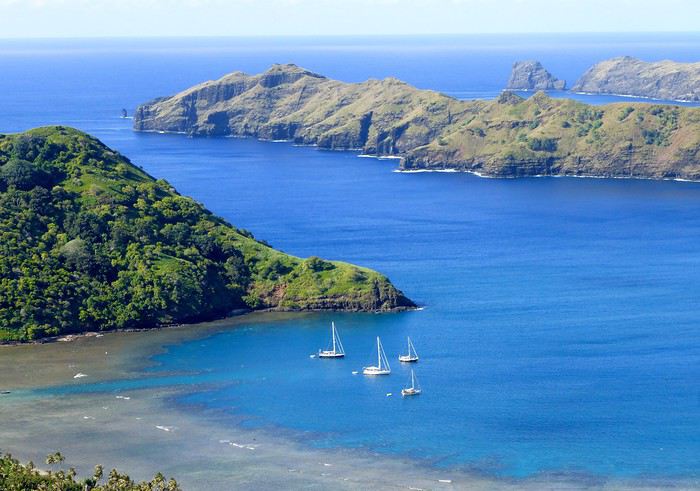
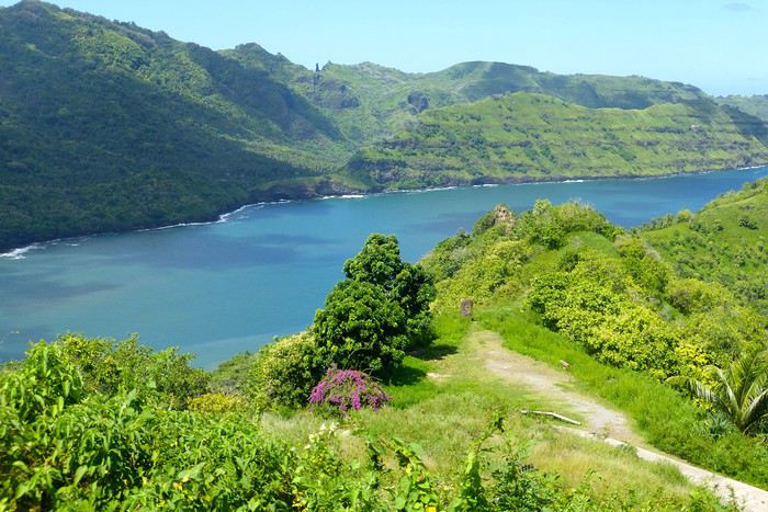
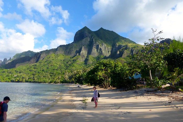
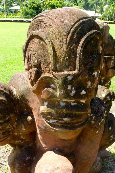
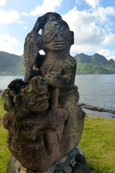
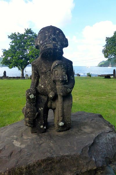
**UA POU**
**Day 3: April 29**
Back to the airport in the late morning for the second flight of the trip to Ua Pou. 20-minute crossing in a Twin Otter (18 seats but only 13 occupied due to cargo between the islands). Beautiful weather, blue sea, nice photos to take upon departure from NH and arrival in UP. We’re greeted by Jérôme, a former military man turned tourism professional, who runs Pension Pukue’e with his wife Elisa, a native of UP. We’re in for two exceptional days. The guesthouse is comfortable, Jérôme and Elisa are very professional and pleasant. Jérôme is also a professional hiker, and Elisa is an excellent cook. We leave quickly for a half-day excursion to Hohoi, after a stop at the archaeological, cultural, and religious site of Maui’a, the Tavaka tribe’s territory. Jérôme is there to explain how Marquesan society functioned at the time and the events that took place on a site still largely buried under vegetation. Then we visit a flower-stone sculptor he knows—the only place in the Marquesas where you’ll find these stones. They’re collected in the river flowing into the sea at Hohoi, sometimes on the beach itself. Back to the guesthouse.
**Day 4: April 30**
A nature hike in the mountains—moderately difficult—toward the Vaiea waterfall is on our program for a good 4 hours. It’s hot, there are mosquitoes, and the dip in the pool under the waterfall (24°C water) is a rare pleasure. Lunch at a friend of Jérôme’s, a former chef for French minister François Fillon, who prepares delicious food. Elisa picks us up by car to return to the guesthouse. Ua Pou is a beautiful and elegant island with its sharp peaks and wild nature. Our favorite, thanks to Jérôme and his wife.
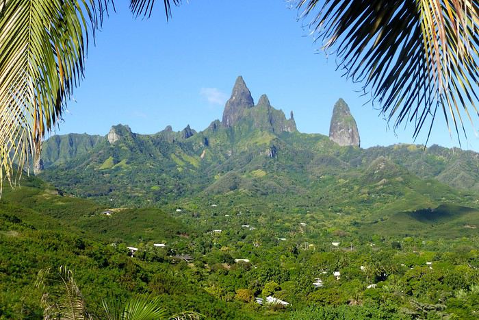
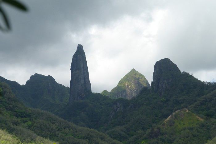
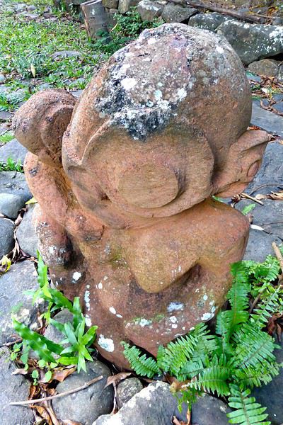
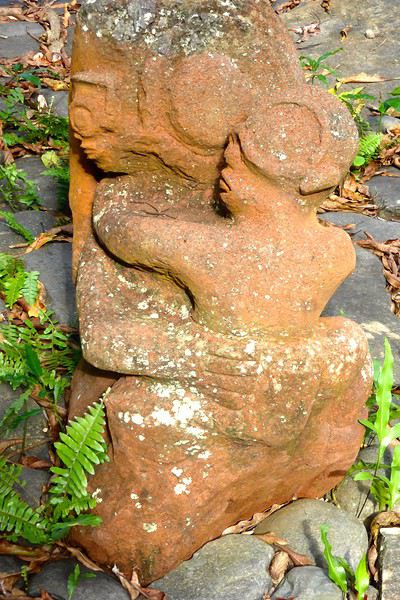
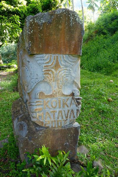
**UA HUKA**
**Day 4: May 1**
Departure for Ua Huka, the smallest inhabited island in the northern group of the Marquesas, located about 1,300 km northeast of Tahiti. Landing is at the oldest airfield in the Marquesas, built in 1972, between the villages of Vaipaee and Hane. Ua Huka has about 680 inhabitants, according to the last census, spread across 3 villages (since the 1870s): Vaipaee, Hane, and Hokatu. The island peaks at Mount Hitikau at only 884 meters. Its origin: a Hawaiian-type shield volcano that—over a few million years—collapsed to become a caldera (or elliptical depression) in which two small volcanoes appeared, the craters of Tahoatikiau and Teepoepo, now part of the Vaikivi Park. The island is rugged and wild, lower than the others, so less cloud-covered and drier. The bays are jagged, the coastline in ochre tones above the intense blue of the sea, and the beaches are constantly disturbed by the powerful surf. The village of Hokatu is only a few kilometers away (just 14 km of road on the island), but Maurice, our host, drives slowly, and it takes time to go up and down. The road is entirely paved or concreted, which isn’t the case on Ua Pou, for example. The guesthouse is disappointing, perched above the village and thus isolated. Beautiful view of the famous Hane motu and the sparkling sea under the bright sun. Apart from that, there are mosquitoes and cockroaches, the bungalow isn’t clean. Meals are taken with Maurice and Delphine in the village—fine dining isn’t on the menu! Ouch!!! We didn’t luck out...
**Day 5: May 2**
Early in the morning, after breakfast, Delphine takes us to the craft center, which turns out to be a letdown—the items for sale are, in my opinion, crude and poorly carved. Nothing like what’s offered at the Marquesas Fair, held twice a year in Papeete, where you can admire and buy small wonders: wood carvings, flower stone, and coral. Delphine is disappointed we’re not interested, and it shows... She’s a bit sulky! These are items meant for Aranui cruise passengers who land on Ua Huka once every two weeks... Solo travelers like us don’t seem to interest her much. The rest of the day—spent with Maurice—is dedicated to visiting cultural centers and small museums, like the Sea Museum in Hane with its ancient canoes, the municipal archaeological museum on the Te Tumu site above the airfield, the petroglyph house near Hokatu Beach, and finally the Papuakeikaraa arboretum, which gathers endemic plants from all over Polynesia and an impressive citrus collection. No excursion planned to Vaikivi Park, toward the previously mentioned craters that recall the island’s volcanic past. Also missing are the viewpoints, the unique endemic vegetation, and especially the petroglyphs. Too bad... at that price!!! Still, in the evening, we go fishing—with sandwiches and drinks in coolers—with other villagers from the dock at the end of the paved road. It’s cool, windy, no mosquitoes, lots of fish caught, and a great atmosphere. Plus, magnificently starry skies.
Ua Huka is one of the rare islands not invaded by the black rat, which has preserved its birdlife, particularly the ultramarine lorikeet (or *pihiti* in Marquesan), which feeds almost exclusively on flower nectar (banana, coconut, hibiscus, mango, guava trees). A dog imported from New Zealand has been specially trained to detect rats: it inspects cargo unloaded from boats and the docks.
I recommend spending two full days on the island—one for visiting the various museums, the other for hiking in the island’s center park, where the archaeological sites are in their raw state: foundations of agricultural terrace walls, gathering places (or *tohua*), dwelling pavements (or *paepae*), sacred sites (or *me’ae* in Marquesan, *marae* in Tahitian) with their tikis and petroglyphs.
To finish, a bit of info on the island’s name, tied to Marquesan oral culture: according to the legend of the creation of the six Marquesas Islands, Ua Huka is the one that puts the finishing touch on the construction of the god Oatea’s house, each island having a defined architectural function. Ua Huka represents the hole (*ua*) where the god deposits what’s left (*huka* in Marquesan) of the unused materials during construction.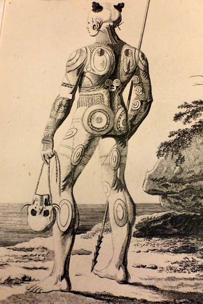
**HIVA OA**
**Day 6: May 3**
Departure in the late morning for Hiva Oa. Maurice—who had other things to do—dropped us off at the airfield 3 hours early... so this stop is a bit of a flop, even if we decided to stay positive! Hiva Oa is the third-largest island in French Polynesia after Tahiti and Nuku Hiva, and before Raiatea in the Leeward Islands. The island is beautiful, lush, verdant, and jagged. The mountains soar into the sky, the sea views are grand, the light is sublime—we’re lucky. Beautiful weather. Tania from Pension Kanahau waits for us at the airport. We’re in for two wonderful days with her. Tania is welcoming, smiling, and dynamic. What a pleasure to be with her, at her place—she cooks divinely and serves the best tuna in the world (the Big Eye reserved for the Japanese) and croquettes made with lobster, shrimp, and crab with breadfruit cubes, for example. Comfortable bungalow, no mosquitoes at night, we can sleep with the window open. It’s fantastic! After settling in, Tania takes us to town in Atuona, a pleasant and well-laid-out little village. We start with lunch—a delicious raw fish in coconut milk—then continue with the must-see attractions: the Catholic cemetery where Paul Gauguin and Jacques Brel’s graves are, overlooking the town; the abandoned Protestant cemetery, reclaimed by the bush, with impressive Marquesan warrior tombs made of huge coral slabs and adorned with a tiki head (harder to find, as no one goes there... ask for directions!); the craft center; the Gauguin Museum (and the Jacques Brel Museum); and the waterfront. While we stroll peacefully, Tania organizes an excursion for the next day, May 4, a full day with Pifa O’Connor, a 36-year-old who knows his island inside out, is passionate about local history, and with whom we’ll hit it off.
**Day 7: May 4**
Pifa arrives at 8 AM sharp at the guesthouse, and we immediately buy sandwiches and water at a small supermarket in Atuona. First, we make a brief stop by the roadside at an unmarked spot, from which we descend a small path through dense vegetation leading to the famous smiling tiki—the only one of its kind in the Marquesas and Polynesia. The place is improbable, the tiki isn’t huge, but it’s beautiful and impressive. Then we’re off on the road that, dizzyingly, runs along and overlooks the island’s northern coast, at the edge of the ancient volcano. Few vehicles pass, the road—now a rocky track—is full of potholes, and we proceed slowly. (Note that this road has been fully paved since 2018.) The panoramas are majestic, with every shade of green against the blue sea. We stop again at the top of a cliff adorned with a huge stone, the *sacrifice stone*, from which young virgin girls were once thrown into the sea to appease angry gods. Another pause for lunch this time, at a small restaurant near the exceptional archaeological site of Puamau. We’ll experience the highlights of this trip during this excursion with our guide, Pifa, who spares no explanations. We discover, on a vast esplanade, the ceremonial complexes of Ta’a Oa and Meae Te I’Ipona, the latter featuring superb tikis, particularly the reclining tiki—or *Maki Taua Pepe*—representing Motherhood, a woman giving birth in a squatting position, as was often the case in many civilizations. Also notable is the *Takaii*, the largest tiki recorded in Polynesia to date. There’s also a huge stone with a now-blunt edge, on which the circumcision of chiefs’ and notables’ pre-adolescent sons was performed. A tough ordeal! But that’s not all! It seems there are more on the mountainside rising steeply behind the archaeological site—overturned tikis, platforms, and, apparently, a giant tiki at the top, which must have fallen but was visible from afar on the sea 30 or 40 years ago, according to the island’s elders. This meeting, worship, and living place—it was actually a small town—is immense. Thousands of people once lived in this part of the island. The site—a religious, social, and cultural sanctuary—would be the size of the largest Mayan sites in Yucatán, but the few concerned owners—two or three families who own the mountainside—don’t want to hear about intensive clearing or tree cutting for now. UNESCO rightly asks for some compliance efforts to grant special treatment to Hiva Oa in particular and the Marquesas in general. We’re not there yet, unfortunately, due to insurmountable local rigidities! This kind of attitude is quite typical in Polynesia: people are afraid to uncover *marae* buried under vegetation—they’re taboo and sometimes said to emit negative and deadly waves, so it’s better not to disturb or anger the ancient spirits or gods who might take revenge. The old religion is never far away in Polynesia, despite the successes of the missionaries.
We return to the guesthouse in the late afternoon. Last night in the Marquesas with Tania, who prepares a fine and delicious meal. Note that dinner costs 2,500 XPF per person.
**Day 8: May 5**
We take the plane as planned, via Nuku Hiva (short stopover). Arrival on time in Papeete.
May this travel journal inspire many of you to visit the Marquesas one day. It’s far, it’s expensive, it’s the trip of a lifetime—it’s unforgettable and unmissable.
Our itinerary is perfect for those who aren’t excited by cruises and prefer to get closer to the local communities. This 9-day trip cost us around 2500 € all-inclusive. For a 14-day cruise on the Aranui, expect to pay 2300 € per person for a basic cabin for four, or 3800 € per person for a superior double cabin.
Air Tahiti offers a 4-island Marquesas Pass (Nuku Hiva, Ua Pou, Ua Huka, and Hiva Oa) for 86,000 XPF (about 700 €). The journey is made on an ATR 72 from Tahiti to Nuku Hiva or Hiva Oa, and on a 19-seat Twin Otter between the islands (often only 13 or 15 seats are available due to cargo, so book well in advance). We’re traveling as a couple. We booked our family-run guesthouse stays at the Tourism Fair in early February, where you can meet the owners and make your choice. Stays are almost always half-board or breakfast-only. Transfers are usually included, but you can always book a car or taxi.
**NUKU HIVA**
**A LITTLE GEOGRAPHY** Nuku Hiva (NH) is located about 1,500 km from Tahiti, in the north of French Polynesia. At 387 km², it’s the second-largest island in French Polynesia after Tahiti. It was formed by incredible volcanic phenomena and cataclysms between 1 and 6 million years ago, which lifted the island thousands of meters above the sea. Even after millennia of slow erosion, collapses, and settling, NH remains the most majestic of the Marquesas, with its sheer cliffs, deep valleys featuring immense waterfalls, and black walls that were once the inner walls of enormous volcanoes.
**A LITTLE HISTORY** The first contact between NH’s inhabitants and Europeans was in 1595 with Spanish navigators who only stayed briefly. It wasn’t until the late 18th century that Europeans arrived in greater numbers on NH (and the other Marquesas Islands), disrupting a very fragile social and cultural balance. It’s believed that nearly 100,000 people lived on Nuku Hiva at that time—a population decimated over the decades by epidemics, diseases brought by Europeans, and alcohol used for barter. The disastrous result: by the 1930s, only 2,500 people remained, having largely lost their identity and living in poverty. Today, the island has about 2,600 inhabitants spread across several villages, with Taiohae as the main one.
**NUKU HIVA IN LITERATURE**
1 / One of the famous writers who visited NH and stayed there was Herman Melville, who arrived in July 1842, the author of *Moby Dick*. The island had just come under French protectorate. Seduced by the enchanting *vahinés* and dazzled by his paradisiacal vision of the place, Melville deserted his ship. He ended up a prisoner of a local tribe, the Taipi, in Taipivai, where he stayed for a month and a half until an Australian ship captain secured his release in exchange for a musket and a roll of cotton fabric! Melville wrote a novel about this tumultuous episode in his life, considered a classic of travel literature. The book, *Typee: A Peep at Polynesian Life*, published in 1846 in the United States, was a huge success.
2 / Another famous Scottish writer, Robert Louis Stevenson, arrived in NH aboard a yacht that anchored in Anaho Bay, the island’s most beautiful, in July 1888. Stevenson was already known for two magnificent novels that marked their era: *Treasure Island* and *Dr. Jekyll & Mr. Hyde*. Stevenson, too, was captivated by the island’s natural beauty, though he also noted the devastating decline in identity, socio-cultural life, and physical health of a population ravaged by disease and alcohol. His account of his stay, *In the South Seas: An Account of Experiences and Observations in the Marquesas, Paumotus, and Gilbert Islands During Two Cruises on the Yacht Casco (1888) and the Schooner Equator (1889)*, was published in 1896 in New York, four years after his death in Apia, Western Samoa, where he had settled. It was also published in London in 1900.
3 / In August 1903, Victor Segalen, a French naval doctor, ethnologist, and archaeologist, landed in NH from the ship *La Durance*, sent to Polynesia to recover the possessions of the painter Paul Gauguin, who had died in April of that year. He, too, was enthralled by the Marquesas but lamented the loss of identity, dignity, and pride of the Māori, alienated by a Christianization that destroyed their culture and customs, denied their gods, and erased their past. He wrote about his experience, doubts, and fears in *Les Immémoriaux*.
4 / In December 1907, Jack London arrived in NH aboard the sailboat *Stark*, following in the footsteps of his illustrious predecessor, Herman Melville. London was in poor physical condition, exhausted from his relentless travels that had taken him from the Klondike in Canada to Japan, Australia, and London in Europe. He was appalled and shocked by Nuku Hiva’s degraded health situation: where Melville had encountered over 2,000 vigorous and healthy Marquesan warriors, London found only 12 suffering from various diseases—the rest had been wiped out by tuberculosis! His approach remained humanistic, and he maintained a sharp geopolitical awareness of these traditional Polynesian cultures, weakened by the inexorable advance of modernity in the early 20th century. He continued his journey to the Tuamotu Islands and Tahiti, publishing *Martin Eden*, the moving account of his initiatory voyage in the South Pacific, in 1911.
5 / Finally, Alain Gerbault, a writer, linguist, ethnologist, and tireless traveler, arrived in the Marquesas via the Panama Canal in December 1933. He was completely exhausted after an endless crossing on a small sailboat, the *Firecrest*. Enthralled by his stay in the Marquesas, he continued to the Tuamotu Islands in 1934, then Tahiti in 1935. Gerbault fought for the preservation of traditions, as well as the songs and dances banned by the Churches and the French Administration (these bans lasted over 50 years, mind you...!!!). Bora Bora remained his favorite island. A staunch Pétainist during World War II, he was forced to flee Bora Bora for Samoa, then Tonga, and finally Timor, a half-Portuguese island and thus neutral during the war. His travel accounts, *In Pursuit of the Sun: Logbook from New York to Tahiti* and *A Paradise Is Dying*, were published in the late 1940s. He died in Timor in 1941, and his ashes were repatriated to Bora Bora.
Back to our trip and stay.
**Day 1: April 27**
Departure from Papeete at 6:30 AM—we had to wake up two hours earlier and reach the airport in the dark. Takeoff at dawn, good weather en route, flight duration: 4 hours.
Arrival around 10:30 AM in Nuku Hiva, the first stop of this trip. We booked two nights in half-board at Pension Koku’u, transfers included. Maybe not such a great idea, those included transfers, especially on this unique island where the airport is located on *Terre Déserte*, on the other side of the mountain, opposite and about 45 km from the main village of Taiohae. They’re charged at a steep price. Expect 6,000 XPF round-trip by taxi, but 15,000 XPF charged by guesthouses or hotels. The difference is notable. It wasn’t the best idea, but we can’t go back. Even for residents like us who know how to travel in Polynesia, the Air Tahiti employee who sold me the Pass couldn’t give any useful advice about the stay itself—probably because he’d never been to the Marquesas. It’s really annoying! In short, the good idea to remember is renting a car (like a Suzuki) to be free to manage your time and stop at leisure. The road signage is a bit basic, but you’ll manage just fine. Our host Alvane waits for us—without a sign (sic!)—and after searching for each other for 5 minutes, we’re off on a journey of over an hour (with photo stops) in a Land Rover with smooth tires (luckily, it’s not raining!). The recently paved and marked mountain road is impeccable. No time to catch our breath at the guesthouse; we leave immediately (not a great idea after waking up at dawn plus 4 hours on a plane) for a half-day hike that was also included in the prepaid stay. A sandwich was provided (really pathetic for the physical effort required), we have water, and we fill a few bottles at the spring near the ceremonial site of Taipivai, our first stop. Then the hike begins in the Hanaheu Valley, descending toward Anaho Bay and its namesake beach. A magnificent and wild spot, a few sailboats anchored, we swim—the water is really warm, over 30°C at the shore. That warm is rare and not necessarily pleasant. We then have to climb a very steep slope; this hike is actually quite tough. The air is still, humid, and stifling under the foliage, there’s a bit of mud, and tiny ants (which don’t bite, I’ll have you know), locally called *fofolles*, running over shoes, ankles, and calves. Not very pleasant...! On top of that, there are mosquitoes to protect against! In hindsight, it seems wise to bring energy bars from Papeete if you plan to hike on the afternoon of your arrival day. We weren’t careful... Result: a moment of weakness for me and a hyperventilation attack climbing back up from Anaho Bay!!! We return to the guesthouse at night. There we find Claudine and her four children—Marquesan-style atmosphere, friendly and casual. We share family life. Very simple room with a bathroom, no mosquitoes, we can sleep with the window open, but the night will be noisy, as is often the case in Polynesia. Roosters are everywhere and don’t sleep, dogs bark or whine. So we end up waking up early... like everyone else.
**Day 2: April 28**
We booked a full-day excursion with Thierry: it starts with a 45-minute boat ride to reach Hakatea Beach, hidden in a small secret bay like many along Nuku Hiva’s coasts. From there, the hike lasts all day—11 km round-trip on flat but also rugged terrain (ancient paved and elevated paths over 1,000 years old)—and river crossings. Bring the right shoes (like plastic Crocs with high socks—not very stylish but practical). We cross the former village of Hakaui, walk along the foundations of dwellings, and there are still weathered tikis in the lush vegetation. The ultimate goal of this hike is to reach the tall Vaipo waterfall. The place is magical, with openings in the vegetation and immense trees allowing photos of the treetops and caves where funeral canoes containing the bones of chiefs or great warriors were once placed. We return the same way to the beach and take another boat ride to reach Taihoae’s port. Back at the guesthouse after a glimpse of Taihoae’s waterfront.
**UA POU**
**Day 3: April 29**
Back to the airport in the late morning for the second flight of the trip to Ua Pou. 20-minute crossing in a Twin Otter (18 seats but only 13 occupied due to cargo between the islands). Beautiful weather, blue sea, nice photos to take upon departure from NH and arrival in UP. We’re greeted by Jérôme, a former military man turned tourism professional, who runs Pension Pukue’e with his wife Elisa, a native of UP. We’re in for two exceptional days. The guesthouse is comfortable, Jérôme and Elisa are very professional and pleasant. Jérôme is also a professional hiker, and Elisa is an excellent cook. We leave quickly for a half-day excursion to Hohoi, after a stop at the archaeological, cultural, and religious site of Maui’a, the Tavaka tribe’s territory. Jérôme is there to explain how Marquesan society functioned at the time and the events that took place on a site still largely buried under vegetation. Then we visit a flower-stone sculptor he knows—the only place in the Marquesas where you’ll find these stones. They’re collected in the river flowing into the sea at Hohoi, sometimes on the beach itself. Back to the guesthouse.
**Day 4: April 30**
A nature hike in the mountains—moderately difficult—toward the Vaiea waterfall is on our program for a good 4 hours. It’s hot, there are mosquitoes, and the dip in the pool under the waterfall (24°C water) is a rare pleasure. Lunch at a friend of Jérôme’s, a former chef for French minister François Fillon, who prepares delicious food. Elisa picks us up by car to return to the guesthouse. Ua Pou is a beautiful and elegant island with its sharp peaks and wild nature. Our favorite, thanks to Jérôme and his wife.
**UA HUKA**
**Day 4: May 1**
Departure for Ua Huka, the smallest inhabited island in the northern group of the Marquesas, located about 1,300 km northeast of Tahiti. Landing is at the oldest airfield in the Marquesas, built in 1972, between the villages of Vaipaee and Hane. Ua Huka has about 680 inhabitants, according to the last census, spread across 3 villages (since the 1870s): Vaipaee, Hane, and Hokatu. The island peaks at Mount Hitikau at only 884 meters. Its origin: a Hawaiian-type shield volcano that—over a few million years—collapsed to become a caldera (or elliptical depression) in which two small volcanoes appeared, the craters of Tahoatikiau and Teepoepo, now part of the Vaikivi Park. The island is rugged and wild, lower than the others, so less cloud-covered and drier. The bays are jagged, the coastline in ochre tones above the intense blue of the sea, and the beaches are constantly disturbed by the powerful surf. The village of Hokatu is only a few kilometers away (just 14 km of road on the island), but Maurice, our host, drives slowly, and it takes time to go up and down. The road is entirely paved or concreted, which isn’t the case on Ua Pou, for example. The guesthouse is disappointing, perched above the village and thus isolated. Beautiful view of the famous Hane motu and the sparkling sea under the bright sun. Apart from that, there are mosquitoes and cockroaches, the bungalow isn’t clean. Meals are taken with Maurice and Delphine in the village—fine dining isn’t on the menu! Ouch!!! We didn’t luck out...
**Day 5: May 2**
Early in the morning, after breakfast, Delphine takes us to the craft center, which turns out to be a letdown—the items for sale are, in my opinion, crude and poorly carved. Nothing like what’s offered at the Marquesas Fair, held twice a year in Papeete, where you can admire and buy small wonders: wood carvings, flower stone, and coral. Delphine is disappointed we’re not interested, and it shows... She’s a bit sulky! These are items meant for Aranui cruise passengers who land on Ua Huka once every two weeks... Solo travelers like us don’t seem to interest her much. The rest of the day—spent with Maurice—is dedicated to visiting cultural centers and small museums, like the Sea Museum in Hane with its ancient canoes, the municipal archaeological museum on the Te Tumu site above the airfield, the petroglyph house near Hokatu Beach, and finally the Papuakeikaraa arboretum, which gathers endemic plants from all over Polynesia and an impressive citrus collection. No excursion planned to Vaikivi Park, toward the previously mentioned craters that recall the island’s volcanic past. Also missing are the viewpoints, the unique endemic vegetation, and especially the petroglyphs. Too bad... at that price!!! Still, in the evening, we go fishing—with sandwiches and drinks in coolers—with other villagers from the dock at the end of the paved road. It’s cool, windy, no mosquitoes, lots of fish caught, and a great atmosphere. Plus, magnificently starry skies.
Ua Huka is one of the rare islands not invaded by the black rat, which has preserved its birdlife, particularly the ultramarine lorikeet (or *pihiti* in Marquesan), which feeds almost exclusively on flower nectar (banana, coconut, hibiscus, mango, guava trees). A dog imported from New Zealand has been specially trained to detect rats: it inspects cargo unloaded from boats and the docks.
I recommend spending two full days on the island—one for visiting the various museums, the other for hiking in the island’s center park, where the archaeological sites are in their raw state: foundations of agricultural terrace walls, gathering places (or *tohua*), dwelling pavements (or *paepae*), sacred sites (or *me’ae* in Marquesan, *marae* in Tahitian) with their tikis and petroglyphs.
To finish, a bit of info on the island’s name, tied to Marquesan oral culture: according to the legend of the creation of the six Marquesas Islands, Ua Huka is the one that puts the finishing touch on the construction of the god Oatea’s house, each island having a defined architectural function. Ua Huka represents the hole (*ua*) where the god deposits what’s left (*huka* in Marquesan) of the unused materials during construction.
**HIVA OA**
**Day 6: May 3**
Departure in the late morning for Hiva Oa. Maurice—who had other things to do—dropped us off at the airfield 3 hours early... so this stop is a bit of a flop, even if we decided to stay positive! Hiva Oa is the third-largest island in French Polynesia after Tahiti and Nuku Hiva, and before Raiatea in the Leeward Islands. The island is beautiful, lush, verdant, and jagged. The mountains soar into the sky, the sea views are grand, the light is sublime—we’re lucky. Beautiful weather. Tania from Pension Kanahau waits for us at the airport. We’re in for two wonderful days with her. Tania is welcoming, smiling, and dynamic. What a pleasure to be with her, at her place—she cooks divinely and serves the best tuna in the world (the Big Eye reserved for the Japanese) and croquettes made with lobster, shrimp, and crab with breadfruit cubes, for example. Comfortable bungalow, no mosquitoes at night, we can sleep with the window open. It’s fantastic! After settling in, Tania takes us to town in Atuona, a pleasant and well-laid-out little village. We start with lunch—a delicious raw fish in coconut milk—then continue with the must-see attractions: the Catholic cemetery where Paul Gauguin and Jacques Brel’s graves are, overlooking the town; the abandoned Protestant cemetery, reclaimed by the bush, with impressive Marquesan warrior tombs made of huge coral slabs and adorned with a tiki head (harder to find, as no one goes there... ask for directions!); the craft center; the Gauguin Museum (and the Jacques Brel Museum); and the waterfront. While we stroll peacefully, Tania organizes an excursion for the next day, May 4, a full day with Pifa O’Connor, a 36-year-old who knows his island inside out, is passionate about local history, and with whom we’ll hit it off.
**Day 7: May 4**
Pifa arrives at 8 AM sharp at the guesthouse, and we immediately buy sandwiches and water at a small supermarket in Atuona. First, we make a brief stop by the roadside at an unmarked spot, from which we descend a small path through dense vegetation leading to the famous smiling tiki—the only one of its kind in the Marquesas and Polynesia. The place is improbable, the tiki isn’t huge, but it’s beautiful and impressive. Then we’re off on the road that, dizzyingly, runs along and overlooks the island’s northern coast, at the edge of the ancient volcano. Few vehicles pass, the road—now a rocky track—is full of potholes, and we proceed slowly. (Note that this road has been fully paved since 2018.) The panoramas are majestic, with every shade of green against the blue sea. We stop again at the top of a cliff adorned with a huge stone, the *sacrifice stone*, from which young virgin girls were once thrown into the sea to appease angry gods. Another pause for lunch this time, at a small restaurant near the exceptional archaeological site of Puamau. We’ll experience the highlights of this trip during this excursion with our guide, Pifa, who spares no explanations. We discover, on a vast esplanade, the ceremonial complexes of Ta’a Oa and Meae Te I’Ipona, the latter featuring superb tikis, particularly the reclining tiki—or *Maki Taua Pepe*—representing Motherhood, a woman giving birth in a squatting position, as was often the case in many civilizations. Also notable is the *Takaii*, the largest tiki recorded in Polynesia to date. There’s also a huge stone with a now-blunt edge, on which the circumcision of chiefs’ and notables’ pre-adolescent sons was performed. A tough ordeal! But that’s not all! It seems there are more on the mountainside rising steeply behind the archaeological site—overturned tikis, platforms, and, apparently, a giant tiki at the top, which must have fallen but was visible from afar on the sea 30 or 40 years ago, according to the island’s elders. This meeting, worship, and living place—it was actually a small town—is immense. Thousands of people once lived in this part of the island. The site—a religious, social, and cultural sanctuary—would be the size of the largest Mayan sites in Yucatán, but the few concerned owners—two or three families who own the mountainside—don’t want to hear about intensive clearing or tree cutting for now. UNESCO rightly asks for some compliance efforts to grant special treatment to Hiva Oa in particular and the Marquesas in general. We’re not there yet, unfortunately, due to insurmountable local rigidities! This kind of attitude is quite typical in Polynesia: people are afraid to uncover *marae* buried under vegetation—they’re taboo and sometimes said to emit negative and deadly waves, so it’s better not to disturb or anger the ancient spirits or gods who might take revenge. The old religion is never far away in Polynesia, despite the successes of the missionaries.
We return to the guesthouse in the late afternoon. Last night in the Marquesas with Tania, who prepares a fine and delicious meal. Note that dinner costs 2,500 XPF per person.
**Day 8: May 5**
We take the plane as planned, via Nuku Hiva (short stopover). Arrival on time in Papeete.
May this travel journal inspire many of you to visit the Marquesas one day. It’s far, it’s expensive, it’s the trip of a lifetime—it’s unforgettable and unmissable.
Hi there,
A year ago, I posted looking for a cycling route for a trip in Sicily with my partner and our two kids (3 and 4 years old) in a trailer—something calm, with nature and a bit of culture. I didn’t get many replies, so I’m sharing our itinerary, which we really enjoyed. We cycled from the southeast (Syracuse) to the northwest (Palermo).
**Note:** We had no issues on the road—drivers were very courteous, the welcome was exceptional (lots of invitations to eat and/or stay overnight), and there were very few people on the roads, even the big ones, since we were there from September 23 to October 7.
**Weather:** Apparently, the summer of 2014 had been awful (only 25°C...). We, on the other hand, had 3 days at 44°C—it was *brutal*, including one day at 35°C at 1,000m altitude in the center of the island on October 1st...
**Accommodation:** 15 days of wild camping, with just one really nice apartment after 7 days in Piazza Armerina. Wild camping was tough—rocky, dusty, hard to pitch tent stakes. Our tent got pierced by thorns (even the groundsheet) from one side to the other. We washed up at village fountains, and—let’s be honest—less often than we’d have liked. The kids’ clothes, which spent a lot of time on the ground, were pretty grimy since laundry was rare. Only one official campsite (otherwise, they’re all on the beaches): Da Vinci Camping, in the middle of lemon groves near the southeast (Rosolini). It’s well-known on social media for being very "roots."
**Water:** A real challenge—*very* tough. Off-season, many homes are abandoned, and on some days, we passed through few villages. Result: we always carried our max water (9L) and sometimes had to add extra bottles to last 2 days, covering the day’s ride, wild camping, and the next morning—that’s 15L on the bikes. So be careful with this!
**Itinerary**
We arrived by train in Messina from southern Italy (yes, the train goes onto the ferry—worth seeing!), then took the train to Syracuse. We decided the northeast coast was too dangerous to cycle, so we visited Syracuse and then picked the SP roads (the smallest ones, more or less following the coast) toward Noto. We were supposed to head southeast to Pachino, but since our ferry from Palermo was booked 15 days later, we cut the route short and headed toward Rosolini instead. Nothing exceptional until Modica, crossing the Ispica fault. Modica is a really pretty town to see. Then Ragusa’s old town via the SS 115—a quiet but very scenic road. The town is stunning, but getting through the modern part (Ragusa Alta) means 300–400m of elevation gain... Caltagirone: a lovely town (famous for ceramics), but the center is uphill. We took a bigger road, but there was hardly anyone around. Left via Mirabella, then visited Piazza Armerina and the Villa Romana. Took the SP 15 to Barrafranca, Pietraperzia, then Caltanissetta via the SP96 (choose carefully—there’s a bigger road nearby).
Then Serradifalco, Mussomeli (castle), San Giovanni Gemini—a series of hilltop villages with valleys in between. We climbed and descended 500m+ repeatedly. Santo Stefano Quisquina, Prizzi (passing at 1,000m altitude—really nice, no one around). Corleone (great road, some climbing, but it’s awesome); Ficuzza, Santa Cristina Gela, Altofonte, and Palermo (no traffic issues).
**Reminder:** This was off-season—no one on the roads. We found the route through Caltanissetta, Mussomeli, etc., *spectacular* and sometimes breathtaking. Sicily is a rugged place for rugged people (especially wild camping). We’d heard the center of Sicily was overrated (not at all...). After 4 months of traveling without always listening to others’ opinions, we confirm: central Sicily is amazing—rugged, dramatic, and perfect for what we were looking for (though we didn’t swim).
**Elevation:** People kept saying Sicily was a nightmare for climbing. We’ve done much tougher routes in the Black Forest or Slovenia. The tricky part in central Sicily is the constant ups and downs—you climb 300–600m in one go, then descend right after. We used "Ride with GPS" to test different routes and avoid unnecessary descents (or minimize them). With a few extra kilometers, we saved about 2,000m of elevation gain overall, especially around Caltanissetta, the Modica-Ragusa link, arriving in Modica, and leaving Ragusa.
Hope this helps someone...
A year ago, I posted looking for a cycling route for a trip in Sicily with my partner and our two kids (3 and 4 years old) in a trailer—something calm, with nature and a bit of culture. I didn’t get many replies, so I’m sharing our itinerary, which we really enjoyed. We cycled from the southeast (Syracuse) to the northwest (Palermo).
**Note:** We had no issues on the road—drivers were very courteous, the welcome was exceptional (lots of invitations to eat and/or stay overnight), and there were very few people on the roads, even the big ones, since we were there from September 23 to October 7.
**Weather:** Apparently, the summer of 2014 had been awful (only 25°C...). We, on the other hand, had 3 days at 44°C—it was *brutal*, including one day at 35°C at 1,000m altitude in the center of the island on October 1st...
**Accommodation:** 15 days of wild camping, with just one really nice apartment after 7 days in Piazza Armerina. Wild camping was tough—rocky, dusty, hard to pitch tent stakes. Our tent got pierced by thorns (even the groundsheet) from one side to the other. We washed up at village fountains, and—let’s be honest—less often than we’d have liked. The kids’ clothes, which spent a lot of time on the ground, were pretty grimy since laundry was rare. Only one official campsite (otherwise, they’re all on the beaches): Da Vinci Camping, in the middle of lemon groves near the southeast (Rosolini). It’s well-known on social media for being very "roots."
**Water:** A real challenge—*very* tough. Off-season, many homes are abandoned, and on some days, we passed through few villages. Result: we always carried our max water (9L) and sometimes had to add extra bottles to last 2 days, covering the day’s ride, wild camping, and the next morning—that’s 15L on the bikes. So be careful with this!
**Itinerary**
We arrived by train in Messina from southern Italy (yes, the train goes onto the ferry—worth seeing!), then took the train to Syracuse. We decided the northeast coast was too dangerous to cycle, so we visited Syracuse and then picked the SP roads (the smallest ones, more or less following the coast) toward Noto. We were supposed to head southeast to Pachino, but since our ferry from Palermo was booked 15 days later, we cut the route short and headed toward Rosolini instead. Nothing exceptional until Modica, crossing the Ispica fault. Modica is a really pretty town to see. Then Ragusa’s old town via the SS 115—a quiet but very scenic road. The town is stunning, but getting through the modern part (Ragusa Alta) means 300–400m of elevation gain... Caltagirone: a lovely town (famous for ceramics), but the center is uphill. We took a bigger road, but there was hardly anyone around. Left via Mirabella, then visited Piazza Armerina and the Villa Romana. Took the SP 15 to Barrafranca, Pietraperzia, then Caltanissetta via the SP96 (choose carefully—there’s a bigger road nearby).
Then Serradifalco, Mussomeli (castle), San Giovanni Gemini—a series of hilltop villages with valleys in between. We climbed and descended 500m+ repeatedly. Santo Stefano Quisquina, Prizzi (passing at 1,000m altitude—really nice, no one around). Corleone (great road, some climbing, but it’s awesome); Ficuzza, Santa Cristina Gela, Altofonte, and Palermo (no traffic issues).
**Reminder:** This was off-season—no one on the roads. We found the route through Caltanissetta, Mussomeli, etc., *spectacular* and sometimes breathtaking. Sicily is a rugged place for rugged people (especially wild camping). We’d heard the center of Sicily was overrated (not at all...). After 4 months of traveling without always listening to others’ opinions, we confirm: central Sicily is amazing—rugged, dramatic, and perfect for what we were looking for (though we didn’t swim).
**Elevation:** People kept saying Sicily was a nightmare for climbing. We’ve done much tougher routes in the Black Forest or Slovenia. The tricky part in central Sicily is the constant ups and downs—you climb 300–600m in one go, then descend right after. We used "Ride with GPS" to test different routes and avoid unnecessary descents (or minimize them). With a few extra kilometers, we saved about 2,000m of elevation gain overall, especially around Caltanissetta, the Modica-Ragusa link, arriving in Modica, and leaving Ragusa.
Hope this helps someone...
Hi there,
I’ll be spending a good month in New Caledonia, plus Maré, Lifou, Ouvéa, and the Isle of Pines, and I absolutely need to be reachable and make local and international calls. What’s the cheapest way to use a mobile phone?
Thanks for your tips!
Best regards, :-)
I'm looking for anyone who knew the old Amporaha holiday camp (north of Nosy Be).
Hi everyone, we're back from a DIY USA road trip we organized from July 31, 2026, to August 26, 2026.
The destination: The Southwest USA, including Texas, Arizona, and New Mexico. Roughly 7,000 kilometers covered.
The car: A Chevrolet Equinox for two, rented through BSP Auto and Avis. Inside, we had 2 suitcases, a travel bag, two carry-on bags, a Walmart cooler, photo gear, and water bottles (a 40-pack).
The route: Dallas DFW, Fort Worth, Houston, Austin, San Antonio, Alpine, El Paso, Tucson, Sedona, Albuquerque, Amarillo, and back to Dallas to finish with a departure from DFW.
The travelers: Two seniors well advanced in years (73 and 75) but still active (nothing too physically demanding—to stay alive and fund our trips), fully independent physically, though a bit less so mentally. Big USA fans, a country where anything is possible. More walkers than hikers, preferring 3-star hotels over roadside motels, Italian restaurants over US food, frequent stops for photos, museums over nothing, naps over forced marches. Not too whiny, just enough to stay French in the land of the "great Satan," as they say. Not great with languages—street English (but handy), and my Spanish is non-existent except for: "Hola! Una cerveza por favor!" That’s about it. My wife understands everything but refuses to speak.
The cost of the road trip: Around 12,000 €, including AF flights, the car, gas, gifts, visits, and everything else. Well managed, since we’d budgeted 13,500 € initially.
The positive side: A delight, with those endless open roads. Museums to discover. The realization of the Hispanic presence and its important history in this part of America. Lovely locals. Tourists who were more or less friendly. A terrible Texan accent that was hard to understand. Gas stations that were like real stores, with prepared food, alcohol sold in Arizona and New Mexico, and employees who were always up for a laugh!
The negative side: The heat throughout the trip... 43°C in Dallas at the end. Impossible to walk the streets. Lots of homeless people in downtown Dallas. Hotel breakfasts that were always the same. You get used to it.
So, it was positive overall, but the concept is starting to wear us out. We might rethink the DIY road trip model for next time. If the man upstairs grants us more time.
Next up, we’ll wait for the first batch of sorted photos to go through the wringer.
See you soon.
The destination: The Southwest USA, including Texas, Arizona, and New Mexico. Roughly 7,000 kilometers covered.
The car: A Chevrolet Equinox for two, rented through BSP Auto and Avis. Inside, we had 2 suitcases, a travel bag, two carry-on bags, a Walmart cooler, photo gear, and water bottles (a 40-pack).
The route: Dallas DFW, Fort Worth, Houston, Austin, San Antonio, Alpine, El Paso, Tucson, Sedona, Albuquerque, Amarillo, and back to Dallas to finish with a departure from DFW.
The travelers: Two seniors well advanced in years (73 and 75) but still active (nothing too physically demanding—to stay alive and fund our trips), fully independent physically, though a bit less so mentally. Big USA fans, a country where anything is possible. More walkers than hikers, preferring 3-star hotels over roadside motels, Italian restaurants over US food, frequent stops for photos, museums over nothing, naps over forced marches. Not too whiny, just enough to stay French in the land of the "great Satan," as they say. Not great with languages—street English (but handy), and my Spanish is non-existent except for: "Hola! Una cerveza por favor!" That’s about it. My wife understands everything but refuses to speak.
The cost of the road trip: Around 12,000 €, including AF flights, the car, gas, gifts, visits, and everything else. Well managed, since we’d budgeted 13,500 € initially.
The positive side: A delight, with those endless open roads. Museums to discover. The realization of the Hispanic presence and its important history in this part of America. Lovely locals. Tourists who were more or less friendly. A terrible Texan accent that was hard to understand. Gas stations that were like real stores, with prepared food, alcohol sold in Arizona and New Mexico, and employees who were always up for a laugh!
The negative side: The heat throughout the trip... 43°C in Dallas at the end. Impossible to walk the streets. Lots of homeless people in downtown Dallas. Hotel breakfasts that were always the same. You get used to it.
So, it was positive overall, but the concept is starting to wear us out. We might rethink the DIY road trip model for next time. If the man upstairs grants us more time.
Next up, we’ll wait for the first batch of sorted photos to go through the wringer.
See you soon.
Hello everyone! I’m heading off solo in February and wanted to share my rough itinerary with you. Does this sound doable?
PS: I’m not really into beaches.
D1 Departure on February 17, 2027 D2 Arrival in Kuala Lumpur – stroll through Chinatown and visit the Petronas Towers D3: Kuala Lumpur – Chow Kit Market, Batu Caves, Little India, Bukit Bintang downtown area D4: Early morning bus to Malacca. Explore Malacca in the afternoon and evening D5: Another 2–3 hours in Malacca in the morning, then bus back to Kuala Lumpur. Merdeka Square area. Stay in Chinatown D6: Bus trip to Kuala Tahan. Night tour D7: Morning – canopy walk and Bukit Terisek hike. Afternoon – off to Lata Berkoh D8 & D9: 2-day jungle trek in Taman Negara National Park D10: Head to Cameron Highlands D11: Morning hike through the plantations. Afternoon still to be decided D12: Morning – excursion to Mossy Forest and Sungei Plantation. Afternoon bus to Ipoh D13: Morning – Mirror Lake / Sam Poh Temple area. Afternoon – explore downtown Ipoh D14: Morning train to Penang. Afternoon – wander around Georgetown D15: Morning – Penang Hill and Keh Loh Temple. Afternoon – Georgetown D16: Bus to Butterfly Garden and Spice Garden. Late afternoon – Burmese and Thai temples D17: Morning flight to Singapore. Afternoon – Chinatown and Marina Bay tour D18: Morning – Gardens by the Bay area. Afternoon – Boat Quay, Clarke Quay, Kampong Glam D19: Morning – The Ridges area and Botanical Garden. Afternoon – Little India, then back to Chinatown before 11:15 PM return flight D20: Morning arrival
D1 Departure on February 17, 2027 D2 Arrival in Kuala Lumpur – stroll through Chinatown and visit the Petronas Towers D3: Kuala Lumpur – Chow Kit Market, Batu Caves, Little India, Bukit Bintang downtown area D4: Early morning bus to Malacca. Explore Malacca in the afternoon and evening D5: Another 2–3 hours in Malacca in the morning, then bus back to Kuala Lumpur. Merdeka Square area. Stay in Chinatown D6: Bus trip to Kuala Tahan. Night tour D7: Morning – canopy walk and Bukit Terisek hike. Afternoon – off to Lata Berkoh D8 & D9: 2-day jungle trek in Taman Negara National Park D10: Head to Cameron Highlands D11: Morning hike through the plantations. Afternoon still to be decided D12: Morning – excursion to Mossy Forest and Sungei Plantation. Afternoon bus to Ipoh D13: Morning – Mirror Lake / Sam Poh Temple area. Afternoon – explore downtown Ipoh D14: Morning train to Penang. Afternoon – wander around Georgetown D15: Morning – Penang Hill and Keh Loh Temple. Afternoon – Georgetown D16: Bus to Butterfly Garden and Spice Garden. Late afternoon – Burmese and Thai temples D17: Morning flight to Singapore. Afternoon – Chinatown and Marina Bay tour D18: Morning – Gardens by the Bay area. Afternoon – Boat Quay, Clarke Quay, Kampong Glam D19: Morning – The Ridges area and Botanical Garden. Afternoon – Little India, then back to Chinatown before 11:15 PM return flight D20: Morning arrival
I'm feeling a bit overwhelmed with all the scattered info out there and I'm struggling to organize my solo trip to French Polynesia. I'm all about snorkeling—no hiking for me—so it's all about the water, water, water... I'd love to meet whales (what's the best season?), stay with locals or in budget guesthouses (I'm pretty low-key, no worries about comfort), and most importantly, be as close to the coral reefs as possible (all day long...).
I'm retired, so I've got plenty of time... If you can help, it would mean the world to me. Thanks everyone! !
I'm retired, so I've got plenty of time... If you can help, it would mean the world to me. Thanks everyone! !
Hi,
While researching South Korea, I came across the term "templestay," which refers to a Korean program that lets you stay in a traditional temple to discover Buddhism and Korean culture by living like the temple residents and doing activities like making lanterns. A templestay isn’t just for foreign tourists—on the booking site, I saw that some temples are more geared toward foreigners, with English-speaking monks.
I was wondering if it’s still worth it, especially in temples where the monks don’t speak English?
While researching South Korea, I came across the term "templestay," which refers to a Korean program that lets you stay in a traditional temple to discover Buddhism and Korean culture by living like the temple residents and doing activities like making lanterns. A templestay isn’t just for foreign tourists—on the booking site, I saw that some temples are more geared toward foreigners, with English-speaking monks.
I was wondering if it’s still worth it, especially in temples where the monks don’t speak English?
Hello everyone,
Like Cedric13600, I’ve booked a flight ticket for 30 days / 29 nights in September 2026, from Beijing to Shanghai. We’re a couple in our sixties who love independent road trips.
I’d like to draw inspiration from the following private itinerary suggested by a travel agency:
Day 1: Arrival in Beijing Day 2 to 4: Beijing Day 5: Datong Day 6 & 7: Pingyao Day 8 to 10: Xi'an Day 11: Luoyang Day 12: Dengfeng flight Day 13 & 14: Chongqing flight Day 15 & 16: Lijiang Day 17: Dali Day 18: Kunming Day 19: Jianshui Day 20 & 21: Yuanyang Day 22: Travel via Guilin Day 23 & 24: Yangshuo Day 25: Guilin Day 26 & 27: Zhangjiajie flight Day 28 & 29: Shanghai Day 30: Departure from Shanghai
But to do this itinerary independently: 1. This schedule seems very ambitious to me—what do you think? 2. If it’s too packed, what would you remove as a priority? Thanks so much in advance for your help.
Day 1: Arrival in Beijing Day 2 to 4: Beijing Day 5: Datong Day 6 & 7: Pingyao Day 8 to 10: Xi'an Day 11: Luoyang Day 12: Dengfeng flight Day 13 & 14: Chongqing flight Day 15 & 16: Lijiang Day 17: Dali Day 18: Kunming Day 19: Jianshui Day 20 & 21: Yuanyang Day 22: Travel via Guilin Day 23 & 24: Yangshuo Day 25: Guilin Day 26 & 27: Zhangjiajie flight Day 28 & 29: Shanghai Day 30: Departure from Shanghai
But to do this itinerary independently: 1. This schedule seems very ambitious to me—what do you think? 2. If it’s too packed, what would you remove as a priority? Thanks so much in advance for your help.
Hey everyone!
I’m diving into planning a trip I’ve dreamed of for a long time: crossing Africa from North to South solo, with a departure planned for October 2025 for about 8-9 months. I’m leaving from Paris with a starting budget of around 7,000 €, aiming to supplement it with work along the way.
My planned route: Senegal → Gambia → Sierra Leone/Liberia (if logistics work out) → Côte d'Ivoire → Ghana → Togo → Benin → Cameroon → Gabon → Kenya (Masai Mara) → Uganda (Bwindi gorillas) → Rwanda → Tanzania (Kili + Serengeti + Zanzibar) → Mozambique → Malawi → Zambia (Victoria Falls) → Botswana → Namibia → South Africa (Cape Town). Madagascar as a bonus if timing/budget allows from Mozambique.
I’m not a backpacking newbie—I’ve done several trips in Europe and I’m familiar with the lifestyle, hostels, local transport, etc. But Africa is my first big adventure on this continent, and I’ve got some very concrete questions I’d love feedback on from people who’ve been there.
🎭 My big dilemma: flexibility vs. pre-organized work
What matters most to me is NOT rushing through. If I feel good somewhere, I’ll stay longer. If a region doesn’t click, I’ll cut it short. That seems totally incompatible with having pre-booked work or volunteer gigs, yet I need that income to stretch my budget.
I’m torn between two approaches:
Option A: The mixed rhythm: 3-4 weeks of volunteering in a country (free accommodation, full immersion), then 1-2 countries in classic backpacker "vacation" mode, then another mission somewhere, etc. This gives a breathing rhythm and avoids burnout from non-stop volunteering.
Option B: The continuous flow: finding gigs as I go, from the previous country, contacting hosts 2-3 weeks in advance with a flexible date range. Keeping maximum spontaneity but never arriving anywhere without a safety net.
Have you tried either? What actually works on the ground in Africa?
🌍 What I’m really looking for in this trip
Not just the classic tourist spots. I want to see the country as it is—eating at local joints, taking local transport (bush taxis, minibuses, sept-places), staying with locals when possible. The big reserves and safaris are part of the plan (Masai Mara, Serengeti, Okavango), but just as much as hanging out in a residential neighborhood in Dakar, understanding how people really live.
Volunteering or work interests me for that reason too (not just for free lodging, but because it’s the deepest way to dive into a country). Working at a school in Ghana, a lodge in Kenya, a permaculture farm in Mozambique—I see it as an immersion that classic tourism can’t offer.
🎒 My concrete questions
About Workaway and Worldpackers: I’ve read a lot but would love on-the-ground feedback, especially for West and East Africa. Are hosts really flexible with dates for long-term travelers? Do the advertised gigs match reality? Are there alternative platforms you’d recommend for Africa specifically (I’ve heard of Help Exchange, WWOOF Africa, local networks…)?
About "off-platform" jobs: Is it really doable to find informal work on the spot (bars, restaurants, lodges) without prior contacts? In which countries/cities is this most accessible for a French speaker without a local work permit?
About logistics between countries: For those who’ve done the West Coast (Senegal → Ghana → Benin), how did you cross borders? Direct buses or local shared taxis at each border? And for the jump from Central Africa → Kenya, is a flight mandatory, or are there feasible overland routes?
About Madagascar: I’m considering adding it from Mozambique (flight Maputo or Beira → Tana). Those who’ve done it backpacker-style on a tight budget—is 3-4 weeks doable, or is it too short to be worth it?
I’m open to all tips, experiences, warnings, and pleasant surprises. And if you’ve got trusted local contacts (Workaway hosts, associations, community lodges), I’m all ears!
I’ve got tons of questions and I’m eager for any advice or experiences you can share!!
I’m diving into planning a trip I’ve dreamed of for a long time: crossing Africa from North to South solo, with a departure planned for October 2025 for about 8-9 months. I’m leaving from Paris with a starting budget of around 7,000 €, aiming to supplement it with work along the way.
My planned route: Senegal → Gambia → Sierra Leone/Liberia (if logistics work out) → Côte d'Ivoire → Ghana → Togo → Benin → Cameroon → Gabon → Kenya (Masai Mara) → Uganda (Bwindi gorillas) → Rwanda → Tanzania (Kili + Serengeti + Zanzibar) → Mozambique → Malawi → Zambia (Victoria Falls) → Botswana → Namibia → South Africa (Cape Town). Madagascar as a bonus if timing/budget allows from Mozambique.
I’m not a backpacking newbie—I’ve done several trips in Europe and I’m familiar with the lifestyle, hostels, local transport, etc. But Africa is my first big adventure on this continent, and I’ve got some very concrete questions I’d love feedback on from people who’ve been there.
🎭 My big dilemma: flexibility vs. pre-organized work
What matters most to me is NOT rushing through. If I feel good somewhere, I’ll stay longer. If a region doesn’t click, I’ll cut it short. That seems totally incompatible with having pre-booked work or volunteer gigs, yet I need that income to stretch my budget.
I’m torn between two approaches:
Option A: The mixed rhythm: 3-4 weeks of volunteering in a country (free accommodation, full immersion), then 1-2 countries in classic backpacker "vacation" mode, then another mission somewhere, etc. This gives a breathing rhythm and avoids burnout from non-stop volunteering.
Option B: The continuous flow: finding gigs as I go, from the previous country, contacting hosts 2-3 weeks in advance with a flexible date range. Keeping maximum spontaneity but never arriving anywhere without a safety net.
Have you tried either? What actually works on the ground in Africa?
🌍 What I’m really looking for in this trip
Not just the classic tourist spots. I want to see the country as it is—eating at local joints, taking local transport (bush taxis, minibuses, sept-places), staying with locals when possible. The big reserves and safaris are part of the plan (Masai Mara, Serengeti, Okavango), but just as much as hanging out in a residential neighborhood in Dakar, understanding how people really live.
Volunteering or work interests me for that reason too (not just for free lodging, but because it’s the deepest way to dive into a country). Working at a school in Ghana, a lodge in Kenya, a permaculture farm in Mozambique—I see it as an immersion that classic tourism can’t offer.
🎒 My concrete questions
About Workaway and Worldpackers: I’ve read a lot but would love on-the-ground feedback, especially for West and East Africa. Are hosts really flexible with dates for long-term travelers? Do the advertised gigs match reality? Are there alternative platforms you’d recommend for Africa specifically (I’ve heard of Help Exchange, WWOOF Africa, local networks…)?
About "off-platform" jobs: Is it really doable to find informal work on the spot (bars, restaurants, lodges) without prior contacts? In which countries/cities is this most accessible for a French speaker without a local work permit?
About logistics between countries: For those who’ve done the West Coast (Senegal → Ghana → Benin), how did you cross borders? Direct buses or local shared taxis at each border? And for the jump from Central Africa → Kenya, is a flight mandatory, or are there feasible overland routes?
About Madagascar: I’m considering adding it from Mozambique (flight Maputo or Beira → Tana). Those who’ve done it backpacker-style on a tight budget—is 3-4 weeks doable, or is it too short to be worth it?
I’m open to all tips, experiences, warnings, and pleasant surprises. And if you’ve got trusted local contacts (Workaway hosts, associations, community lodges), I’m all ears!
I’ve got tons of questions and I’m eager for any advice or experiences you can share!!
Easily accessible from Sal or São Vicente, São Nicolau is the forgotten island of the Barlavento group. With two large villages, volcanoes, jagged peaks, lush valleys, and vast rocky expanses, it has nothing to envy its big sister Santo Antão. It’s slipped under travelers’ radar a bit (in January, there were probably fewer than a hundred European tourists on the whole island), and that’s just fine! Accommodations aren’t overrun by groups like in Santo Antão, and connecting with locals is even easier. But don’t come to São Nicolau for wild nightlife—it’s incredibly peaceful here, and on Sundays, it’s total silence!
A little favorite of mine: Pensão Jardim in Ribeira Brava, the capital; Residencial Palice in Queimadas; and especially Pousada d’Anna in Estância de Brás, where the raging sea crashes against the black lava spurs.
Weather-wise, it was chilly this year but perfect for hiking. If you’re up high (like Monte Gordo), dress warmly or wait for spring! Fog gusts can ground you completely. Trails are generally less marked than in Santo Antão; if you’re wary of apps, you can find a 1:50,000 map at the small travel agency in Tarrafal.
Those who enjoy sharing experiences with other travelers over a Strela or two in the evening might feel a bit frustrated on São Nicolau, but the island’s beauty, the resilience of its farmers in extreme conditions, and the kindness of its people make it a fantastic stop for any visitor to Cape Verde!
A little favorite of mine: Pensão Jardim in Ribeira Brava, the capital; Residencial Palice in Queimadas; and especially Pousada d’Anna in Estância de Brás, where the raging sea crashes against the black lava spurs.
Weather-wise, it was chilly this year but perfect for hiking. If you’re up high (like Monte Gordo), dress warmly or wait for spring! Fog gusts can ground you completely. Trails are generally less marked than in Santo Antão; if you’re wary of apps, you can find a 1:50,000 map at the small travel agency in Tarrafal.
Those who enjoy sharing experiences with other travelers over a Strela or two in the evening might feel a bit frustrated on São Nicolau, but the island’s beauty, the resilience of its farmers in extreme conditions, and the kindness of its people make it a fantastic stop for any visitor to Cape Verde!
Here’s my account of our trip to Thailand with my partner from November 22 to December 5, 2025.
First off, I’d like to wish all Voyageforum.com users a very happy 2026, full of happiness and amazing discoveries on your travels!
It’s thanks to the tips I gathered on this site that I planned the trip.
We traveled with Malaysia Airlines (the flight price was great, but no movies in French, not even subtitled) because we wanted to explore Kuala Lumpur and visit southern Thailand.
Our departure from Roissy was delayed because the plane had to go through the robotic de-icing trucks—pretty impressive!
After a 12-hour flight, we arrived at the beautiful Kuala Lumpur airport around 7 AM.
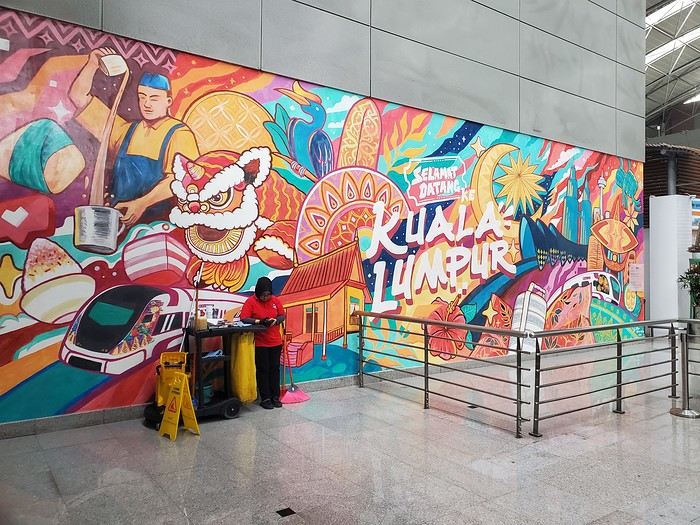
Don’t forget to fill out the immigration form requested by Malaysia 3 days before arrival. We left without any issues and took the Klia Ekspress train to KL Sentral station (30 minutes, 10 €). We’d booked accommodation in a tower near the station and had to communicate with the landlord to get the keys. But while we thought there’d be Wi-Fi at the station, there wasn’t—we asked the tourism office, and they said there wasn’t any. We didn’t want to buy a local SIM card since we were leaving the next day. Eventually, we went to a Starbucks to get online, but just as we decided to head to our place, a torrential downpour hit, and we couldn’t find a sidewalk to reach our destination. We went back to the station, took the elevated metro, and finally made it to our landlord and the room on the 45th floor.
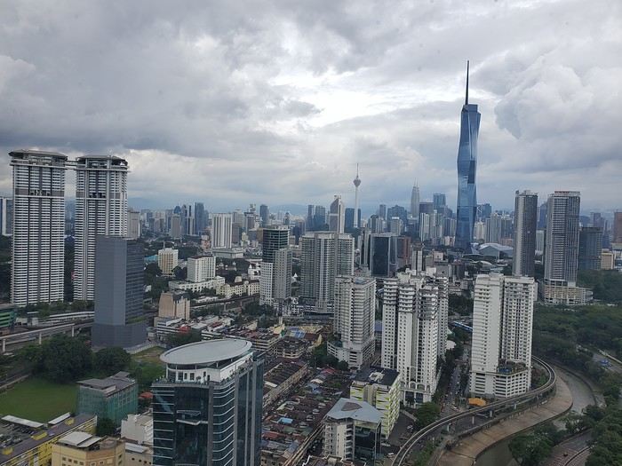
Don’t forget to fill out the immigration form requested by Malaysia 3 days before arrival. We left without any issues and took the Klia Ekspress train to KL Sentral station (30 minutes, 10 €). We’d booked accommodation in a tower near the station and had to communicate with the landlord to get the keys. But while we thought there’d be Wi-Fi at the station, there wasn’t—we asked the tourism office, and they said there wasn’t any. We didn’t want to buy a local SIM card since we were leaving the next day. Eventually, we went to a Starbucks to get online, but just as we decided to head to our place, a torrential downpour hit, and we couldn’t find a sidewalk to reach our destination. We went back to the station, took the elevated metro, and finally made it to our landlord and the room on the 45th floor.
struggling to find a decent flight to Thailand?????
Hi everyone, I’ve been traveling in Asia for over 30 years, often to Thailand, but only during the school holidays in February, April, and especially in the summer, departing from Marseille or Lyon.
For some time now, I’ve noticed it’s really hard to find a flight at a reasonable price (under 900 €) and, more importantly, with a decent itinerary (we’re often offered 2 or 3 layovers with total travel times of 40 or even 50 hours), and this is the case almost a year in advance. This is something we never saw even 4 years ago—I’m wondering: are there fewer flights available now...?
Marsyork
Hi everyone, I’ve been traveling in Asia for over 30 years, often to Thailand, but only during the school holidays in February, April, and especially in the summer, departing from Marseille or Lyon.
For some time now, I’ve noticed it’s really hard to find a flight at a reasonable price (under 900 €) and, more importantly, with a decent itinerary (we’re often offered 2 or 3 layovers with total travel times of 40 or even 50 hours), and this is the case almost a year in advance. This is something we never saw even 4 years ago—I’m wondering: are there fewer flights available now...?
Marsyork