Hey there, VoyageForum!!!
I’ve combed through this site up, down, and sideways to plan our two-month road trip across the American Southwest during the summer of 2022, so it only feels right to give back and revive the USA travel journal section—helping others prep, travel, or relive their own memories! 😏
A quick intro to the stars of this trip is coming soon... in an upcoming post!
Table of Contents:
Road trip introduction
Day 1 & 2: the days we double-checked all our papers...
Day 3 & 3 bis: The day we discovered Denver...
Day 4: The day of the race, the carriage, and the little one’s cough...
Day 5: the day the road trip truly began...
Day 6 & 6 bis: the day of Nature’s first wonders...
Day 7: the day the sky fell on our heads...
Day 8 & 8 bis: the day we saw ghosts...
Day 9: the day we climbed the mountain...
Day 10: the day the theme song from "The Last Picture Show" played on loop in my head...
Day 11: the day we lived like Native Americans...
Day 12: the day we left civilization behind...
Day 13 & 13 bis: the day we explored another planet...
Day 14 & 14 bis: the day Caro reunited with HER rocks...
Day 15 & 15 bis: the day of the fantastic ride...
Day 16: the day we cooled off in Lake Powell...
Day 17: the day the Colorado River’s meanders were all ours...
Day 18: the day we dipped our feet in the Colorado...
Day 19: the day the guys discovered true vastness...
Day 20 & 20 bis: the day we covered a few acres of Route 66 before sunset...
Day 21: the day the credit card said stop... right before the STRIP...
Day 22: the day we finally discovered Cirque du Soleil...
Day 23: the day we returned to calm... well, almost...
Day 24: the day we reached our home base for 6 nights: Saint George
Day 25: the day we should’ve explored Yant Flat...
Day 26: the day it was 13°C at Cedar Breaks...
Day 27: the day we explored The Narrows in Zion NP...
Day 28: the day we discovered Snow Canyon...
Day 29: the day we hiked to the "SUBWAY"...
Day 30: the day we encountered the abyss—from the north this time...
Day 31: the day we arrived in a place where dreams begin... Kanab...
Day 32: the day we discovered the first treasures along House Rock Valley...
2nd part: the second part of the journey...
Day 33: the day we discovered a magical place... Edmaier's Secret...
Day 34: the day Cottonwood Road didn’t open up to us...
Day 35: the day of the classic Queen’s Garden + Navajo Loop—and another event that became a classic...
Day 36: the second day in Bryce... pure bliss!!!
Day 37: the day we swam at the foot of Calf Creek Falls...
Day 38: the day we took the Burr Trail, even with storms lurking...
Day 39: The day of the goblins...
Day 40: the day we enjoyed the peaceful Capitol Reef NP...
Day 41: the day of the Rim Overlook and another letdown...
Day 42: the day we arrived in... Moab...
Day 43: the first day in Arches National Park...
Day 44: the day of the Fisher Towers...
Day 45: the day of Bow Tie & Corona Arches...
Day 46: The day of Shafer Trail + Potash Road...
Day 47: The second day in Arches NP...
Day 48: the day we discovered Colorado NM in a flash...
Day 49: the day of Black Canyon...
Day 50: the day we passed through Durango before falling for Silverton...
Day 51: the day we went through Ouray and ended up in Gunnison...
Day 52: the day of Kebler Pass and arriving at the hot springs...
Day 53: the day of hot springs II, then the road back to Denver...
Day 54: the last day...
Day 55: back home and the RECAP...
671 similar discussions in English
Hi there,
I’m diving into a recap of our loop—pretty classic, really—Denver-Yellowstone-Denver this past summer, from July 24 to August 17. Given the sheer number of trip reports already out there (or in the works), and since I don’t have the writing chops or the photography skills of many of you, I’ll keep it practical—well, I’ll try, at least—to share our take on some of the less-visited parks and spots.
First off, a huge thank you to everyone whose trip reports, blogs, websites, comments, and more helped us put together this itinerary. Looking back, it could’ve been even better optimized: a few disappointments when we missed out on some great discoveries, often because we were short on time. Plenty of reasons to come back to the area!
We’re traveling with our four (almost) teens—18, 16, 14, and nearly 12 years old. To keep the trip enjoyable for everyone, we had to make compromises on both sides: cutting a visit short to spend more time swimming, waking up at dawn, and so on. But logistics also played a big role—things like laundry, grocery shopping, and keeping luggage organized could’ve quickly become time-consuming without a little planning. And honestly, I think we visited every Walmart along the way! Blame it on the lack of fridges in some accommodations and, more importantly, the *very* limited space in the car, which made it impossible to bring a proper cooler. I’ll come back to the car saga later.
For accommodations, this year we alternated between basic cabins in KOA campgrounds and Yellowstone (when staying more than one night in the same place) and hotels. Always with a pool (except in Yellowstone, of course), which let the kids burn off energy—because they always have reserves, even after packed days!—and, let’s be honest, gave us a chance to relax. No Wi-Fi issues either; we all had plans with 25 GB of data (a big thanks to Gilles for the amazing deal at 0.99 €). It worked perfectly, even for texts and calls between phones—no extra charges.
Now, onto our route: as I mentioned, a classic Denver-Yellowstone-Denver loop. To avoid rushing through the parks or spending all our time on the road, we prioritized staying as close to them as possible, with at least two nights in each place. And I’ve got to say, it’s really nice to settle in, even if it’s just for two nights. It also helped us deal with the weather, which wasn’t always great during this trip. The trade-off? With vacation time being limited, some driving days ended up being long. We knew that going in, but since we kept a relaxed pace with no time constraints (don’t ask me for timings—I don’t keep track of the clock on vacation, except in the morning to get everyone up before noon!), we sometimes ended up with marathon days.
With that said, I’ll dive into the trip itself in the next post.
I’m diving into a recap of our loop—pretty classic, really—Denver-Yellowstone-Denver this past summer, from July 24 to August 17. Given the sheer number of trip reports already out there (or in the works), and since I don’t have the writing chops or the photography skills of many of you, I’ll keep it practical—well, I’ll try, at least—to share our take on some of the less-visited parks and spots.
First off, a huge thank you to everyone whose trip reports, blogs, websites, comments, and more helped us put together this itinerary. Looking back, it could’ve been even better optimized: a few disappointments when we missed out on some great discoveries, often because we were short on time. Plenty of reasons to come back to the area!
We’re traveling with our four (almost) teens—18, 16, 14, and nearly 12 years old. To keep the trip enjoyable for everyone, we had to make compromises on both sides: cutting a visit short to spend more time swimming, waking up at dawn, and so on. But logistics also played a big role—things like laundry, grocery shopping, and keeping luggage organized could’ve quickly become time-consuming without a little planning. And honestly, I think we visited every Walmart along the way! Blame it on the lack of fridges in some accommodations and, more importantly, the *very* limited space in the car, which made it impossible to bring a proper cooler. I’ll come back to the car saga later.
For accommodations, this year we alternated between basic cabins in KOA campgrounds and Yellowstone (when staying more than one night in the same place) and hotels. Always with a pool (except in Yellowstone, of course), which let the kids burn off energy—because they always have reserves, even after packed days!—and, let’s be honest, gave us a chance to relax. No Wi-Fi issues either; we all had plans with 25 GB of data (a big thanks to Gilles for the amazing deal at 0.99 €). It worked perfectly, even for texts and calls between phones—no extra charges.
Now, onto our route: as I mentioned, a classic Denver-Yellowstone-Denver loop. To avoid rushing through the parks or spending all our time on the road, we prioritized staying as close to them as possible, with at least two nights in each place. And I’ve got to say, it’s really nice to settle in, even if it’s just for two nights. It also helped us deal with the weather, which wasn’t always great during this trip. The trade-off? With vacation time being limited, some driving days ended up being long. We knew that going in, but since we kept a relaxed pace with no time constraints (don’t ask me for timings—I don’t keep track of the clock on vacation, except in the morning to get everyone up before noon!), we sometimes ended up with marathon days.
With that said, I’ll dive into the trip itself in the next post.
Back on the forum, I’m starting to write up two 3-week trips to Kenya in August 2021 and 2023.
In 2021, Quynh and I traveled with Régis (Rjulie95 on VF). Our son joined us in Baringo for the second half of the trip.
In 2023, we went with two friends who’d been dreaming of seeing wild animals ever since we got back from Kenya. We didn’t need much convincing to go with them!
The two itineraries are almost identical (well, when you love something...) but we did make a few tweaks.
- The first part of the trip was with a local driver/guide, Félix, who was recommended by Sylvie56. Sylvie and her husband Ben are Kenya enthusiasts—they’ve been there countless times, always with Félix... and for good reason! He’s fantastic!
- The second part was with Melting Pot Safari, an agency that adapted to our photography needs. Tony Crocetta, the co-founder (along with his Kenyan friend Simon Chebon), is a wildlife photographer himself.
Here are the itineraries for both trips, including accommodations:
In 2021: Day 0: Paris / Nairobi - 67 Airport Hotel Day 1: Nairobi / Amboseli - Simba Cottage Day 2: Amboseli - Simba Cottage Day 3: Amboseli / Aberdares - Fishing Lodge Day 4: Aberdares - Fishing Lodge Day 5: Aberdares - Fishing Lodge Day 6: Aberdares / Samburu - Riverside Camp Day 7: Samburu - Riverside Camp Day 8: Samburu - Riverside Camp Day 9: Samburu / Nakuru - Merica Hotel Day 10: Nakuru / Baringo - Tumbili Cliff Lodge Day 11: Baringo - Tumbili Cliff Lodge Day 12: Baringo - Tumbili Cliff Lodge Day 13: Baringo / Maasai Mara – Meltingpot Bush Camp Day 14 to 18: Maasai Mara – Meltingpot Bush Camp Day 19: Maasai Mara / Nairobi – Roussel Guest House Day 20: Nairobi / Paris
In 2023: Day 0: Lyon / Paris / Nairobi - 67 Airport Hotel Day 1: Nairobi / Meru - Ikweta Camp Day 2: Meru - Ikweta Camp Day 3: Meru - Ikweta Camp Day 4: Meru / Samburu - Riverside Camp Day 5: Samburu – Riverside Camp Day 6: Samburu / Buffalo Springs – Samburu Simba Day 7: Buffalo Springs / Ol Pejeta – Sweetwater Camp Day 8: Ol Pejeta / Amboseli - Simba Cottage Day 9: Amboseli - Simba Cottage Day 10: Amboseli - Simba Cottage Day 11: Amboseli / Nakuru – Lake Nakuru Lodge Day 12: Nakuru / Baringo - Tumbili Cliff Lodge Day 13: Baringo - Tumbili Cliff Lodge Day 14: Baringo - Tumbili Cliff Lodge Day 15: Baringo / Maasai Mara – Meltingpot Bush Camp Day 16 to 20: Maasai Mara – Meltingpot Bush Camp Day 21: Maasai Mara / Nairobi / Paris
Here’s an itinerary—it’s not exactly what we did, but a combination of both.
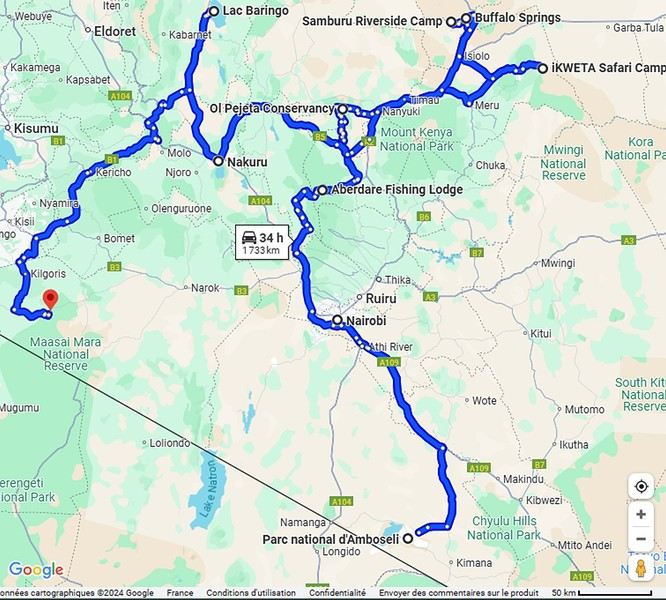
Ready to join us on safari to see some wild animals?
The two itineraries are almost identical (well, when you love something...) but we did make a few tweaks.
- The first part of the trip was with a local driver/guide, Félix, who was recommended by Sylvie56. Sylvie and her husband Ben are Kenya enthusiasts—they’ve been there countless times, always with Félix... and for good reason! He’s fantastic!
- The second part was with Melting Pot Safari, an agency that adapted to our photography needs. Tony Crocetta, the co-founder (along with his Kenyan friend Simon Chebon), is a wildlife photographer himself.
Here are the itineraries for both trips, including accommodations:
In 2021: Day 0: Paris / Nairobi - 67 Airport Hotel Day 1: Nairobi / Amboseli - Simba Cottage Day 2: Amboseli - Simba Cottage Day 3: Amboseli / Aberdares - Fishing Lodge Day 4: Aberdares - Fishing Lodge Day 5: Aberdares - Fishing Lodge Day 6: Aberdares / Samburu - Riverside Camp Day 7: Samburu - Riverside Camp Day 8: Samburu - Riverside Camp Day 9: Samburu / Nakuru - Merica Hotel Day 10: Nakuru / Baringo - Tumbili Cliff Lodge Day 11: Baringo - Tumbili Cliff Lodge Day 12: Baringo - Tumbili Cliff Lodge Day 13: Baringo / Maasai Mara – Meltingpot Bush Camp Day 14 to 18: Maasai Mara – Meltingpot Bush Camp Day 19: Maasai Mara / Nairobi – Roussel Guest House Day 20: Nairobi / Paris
In 2023: Day 0: Lyon / Paris / Nairobi - 67 Airport Hotel Day 1: Nairobi / Meru - Ikweta Camp Day 2: Meru - Ikweta Camp Day 3: Meru - Ikweta Camp Day 4: Meru / Samburu - Riverside Camp Day 5: Samburu – Riverside Camp Day 6: Samburu / Buffalo Springs – Samburu Simba Day 7: Buffalo Springs / Ol Pejeta – Sweetwater Camp Day 8: Ol Pejeta / Amboseli - Simba Cottage Day 9: Amboseli - Simba Cottage Day 10: Amboseli - Simba Cottage Day 11: Amboseli / Nakuru – Lake Nakuru Lodge Day 12: Nakuru / Baringo - Tumbili Cliff Lodge Day 13: Baringo - Tumbili Cliff Lodge Day 14: Baringo - Tumbili Cliff Lodge Day 15: Baringo / Maasai Mara – Meltingpot Bush Camp Day 16 to 20: Maasai Mara – Meltingpot Bush Camp Day 21: Maasai Mara / Nairobi / Paris
Here’s an itinerary—it’s not exactly what we did, but a combination of both.
Ready to join us on safari to see some wild animals?
During our first road trip across the United States, we covered 23,000 km and crossed 28 states in 53 days.
Originally, we had planned to drive Route 66 all the way to Oatman in Arizona and visit various national parks in the American West over a two-month period.
This itinerary was planned before our departure, and all the relevant information had been gathered to stick to the schedule.
Everything went so smoothly that we finished visiting the national parks well ahead of our planned return date.
It helped that having a bed, a portable toilet, and a cooler in our vehicle gave us some autonomy since we didn’t have to worry about accommodation.
So, we decided to extend our road trip to the cities of Nashville and Memphis in Tennessee.
We then headed to Louisiana to visit Baton Rouge and New Orleans.
We crossed Mississippi and Alabama before driving along Florida’s west coast all the way to Key West.
We returned via Florida’s east coast and then crossed the eastern U.S. states to get back to Quebec through the Jackman border crossing in Maine.
So, I invite you to keep reading this long recap, which will let you discover the different attractions we visited throughout this amazing journey.
Videos are included throughout the recap. Click on the image to start the video.
To jump to a specific post, here are the relevant links:
Route 66 - Illinois & Missouri Route 66 - St. Louis (Missouri) - Gateway Arch National Park Route 66 - Cuba (Missouri) - City Murals Route 66 - Springfield (Missouri) - Fantastic Caverns Route 66 - Kansas & Oklahoma Route 66 - Texas & Arizona Route 66 - Texas - The Stations of the Cross in Groom Route 66 - Texas - Panhandle - VW Slug Bug Ranch Texas - Palo Duro Canyon State Park - Juniper Trails Texas - Palo Duro Canyon State Park - The Lighthouse Trail Route 66 - Texas - Amarillo - Cadillac Ranch Route 66 - New Mexico - Santa Rosa Blue Hole New Mexico - Bandelier National Monument - Alcove House Trail via Main Loop Trail New Mexico - Bandelier National Monument - Tsankawi Ruins Trail New Mexico - White Rock Overlook Route 66 - New Mexico - Albuquerque - Old Town New Mexico - White Sands National Park New Mexico - White Sands National Park - Dune Life Nature Trail New Mexico - White Sands National Park - Playa Trail New Mexico - White Sands National Park - Interdune Boardwalk New Mexico - Gila Cliff Dwellings National Monument New Mexico - Grants - Ice Cave & Bandera Volcano New Mexico - Gallup - Pyramide Rock Trail & Church Rock Trail Arizona - Holbrook - Painted Desert Arizona - Petrified Forest National Park - Puerco Pueblo & Newspaper Rock Viewpoint Arizona - Petrified Forest National Park - Blue Mesa Arizona - Petrified Forest National Park - The Teepees, Agate Bridge & Jasper Forest Overlook Arizona - Petrified Forest National Park - Crystal Forest Trail Arizona - Petrified Forest National Park - Giant Logs Trail Arizona - Winslow - Two Guns Ghost Town Arizona - Cameron - Little Colorado River Gorge Overlooks Arizona - Grand Canyon National Park - Shoshone Point Trail Arizona - Grand Canyon National Park - Desert View Drive Arizona - Grand Canyon National Park - Rim Route (Orange) & Village Route (Blue) Arizona - Grand Canyon National Park - Hermit Route (Red Line) Route 66 - Arizona - Historic Town of Oatman Arizona - Bullhead City Community Park Nevada - Red Rock Canyon - Calico I & II & Sandstone Quarry Nevada - Red Rock Canyon - Willow Springs Nevada - Red Rock Canyon Lookouts Nevada - Valley of Fire State Park - White Domes Trail Nevada - Valley of Fire State Park - Seven Wonders Trail, Pink Canyon, Fire Wave Nevada - Valley of Fire State Park - Rainbow Vista Trail Nevada - Valley of Fire State Park - Mouse's Tank Trail Nevada - Valley of Fire State Park - Rock Formations Nevada - Valley of Fire State Park - Scenic Routes Nevada - Cathedral Gorge State Park - Slot Canyons Nevada - Cathedral Gorge State Park - Eagle Point & Miller Point Utah - Bryce Canyon National Park - Mossy Cave & Tropic Ditch Waterfall Trail Utah - Bryce Canyon National Park - Scenic Drive Utah - Zion National Park - Pa'rus Trail Utah - Zion National Park - Sand Bench Trail Utah - Zion National Park - Emerald Pools Trail Utah - Zion National Park - West Rim Trail (Trail connecting to Angels Landing) Utah - Zion National Park - Riverside Walk Utah - Zion National Park - Court of The Patriarchs & Big Bend Utah - Zion National Park - Mount Carmel Highway Scenic Drive Utah - Kanab - Jackson Flat Reservoir Utah - Toadstools Trail in Grand Staircase-Escalante National Monument Arizona - Page - Glen Canyon Dam Overlook Arizona - Page - Glen Canyon National Recreation Area Arizona - Page - Horseshoe Bend Overlook Arizona - Page - Upper Antelope Canyon Arizona - Page - Navajo Canyon Boat Tour at Lake Powell Arizona - Page - Antelope Canyon X Arizona - Canyon de Chelly National Monument - Chelly Canyon Arizona - Canyon de Chelly National Monument - Canyon del Muerto Arizona - Monument Valley Navajo Tribal Park Utah - Mexican Hat Utah - Mexican Hat - Goosenecks State Park Utah - Mexican Hat - Valley of the Gods Utah - The Moki Dugway Scenic Backway Utah - Blanding - Natural Bridges National Monument Utah - Lake Powell - Hite Crossing Bridge Utah - Lake Powell - Glen Canyon National Recreation Area - Hite Overlook Utah - Capitol Reef National Park - Chimney Rock Loop Trail Utah - Capitol Reef National Park - Hickman Bridge Trail Utah - Capitol Reef National Park - Grand Wash Trail Utah - Capitol Reef National Park - Sunset Point Trail Utah - Capitol Reef National Park - Goosenecks Trail Utah - Capitol Reef National Park - Viewpoints - Fruita Area Utah - Capitol Reef National Park - Viewpoints - Scenic Drive Utah - Capitol Reef National Park - Cassidy Arch Trail Utah - Capitol Reef National Park - On the way to Capitol Gorge Trailhead Utah - Capitol Reef National Park - Capitol Gorge Trailhead Utah - Monroe - Mystic Hot Springs Utah - Scenic Overlooks on UT-24, UT-119 & I-70 Utah - Arches National Park - Park Avenue Trail Utah - Arches National Park - Courthouse Towers Section's Viewpoints Utah - Arches National Park - Balanced Rock, Pothole Arch, Ham Rock & Garden of Eden Utah - Arches National Park - Double Arch Trail, Cove Arch, Cove of Caves & Panorama Point Utah - Arches National Park - Windows Loop & Turret Arch Trail Utah - Arches National Park - Delicate Arch Trail Utah - Arches National Park - Upper Delicate Arch Viewpoint Trail Utah - Arches National Park - Fiery Furnace Section - Viewpoints Utah - Arches National Park - Sand Dune Arch Trail Utah - Arches National Park - Skyline Arch Trail Utah - Arches National Park - Devils Garden Trail Utah - Dead Horse Point State Park - West Rim Trail Utah - Dead Horse Point State Park - East Rim Trail Utah - Moab - Utah State Route 279 (Potash Road) Utah - Moab - Shafer Trail - Potash Evaporation Ponds Utah - Moab - Potash Road Dinosaur Tracks and Petroglyphs Utah - Moab - Potash Road - Corona, Bowtie & Pinto Arches Trail Utah - Moab - Potash Road - Wall Street Climbing Area Utah - Moab - Kane Springs Road Utah - Moab - Kane Springs Road - Side By Side Adventure Utah - Moab - Kane Springs Road to Moab Utah - Canyonlands National Park - Island in the Sky - Mesa Arch Trail Utah - Canyonlands National Park - Island in the Sky - Aztec Butte Trail Utah - Canyonlands National Park - Island in the Sky - Whale Rock Trail Utah - Canyonlands National Park - Island in the Sky - Upheaval Dome Trail Utah - Canyonlands National Park - Island in the Sky - Grand View Point Overlook Trail Utah - Canyonlands National Park - Island in the Sky - White Rim Overlook Trail Utah - Canyonlands National Park - Island in the Sky - Overlooks Utah - Moab - Wilson Arch Utah - Monticello - Newspaper Rock State Historical Monument Utah - Canyonlands National Park - The Needles - Road Side Ruin Trail Utah - Canyonlands National Park - The Needles - Cave Spring Trail Utah - Canyonlands National Park - The Needles - Pothole Point Trail Utah - Canyonlands National Park - The Needles - Big Spring Canyon Overlook Trail Utah - Canyonlands National Park - The Needles - Overlooks Colorado - Mesa Verde National Park - Mesa Top Ruins Road Colorado - Mesa Verde National Park - Chapin Mesa Road Colorado - Mesa Verde National Park - Mesa Top Loop Colorado - Mesa Verde National Park - Wetherill Mesa Road Colorado - Great Sand Dunes National Park Colorado - Mosca - Zapata Falls Colorado - Colorado Springs - Garden of the Gods Colorado - Black Canyon of the Gunnison National Park Colorado - Gunnison - Curecanti National Recreation Area Colorado - Gunnison - Blue Mesa Dam & Reservoir Colorado - Lake Pueblo State Park (Pueblo Reservoir) Kentucky - Mayfield, 5 months after an EF4 tornado Tennessee - Nashville - Downtown Walking Tour Tennessee - Graceland Mansion - Home of Elvis Presley Tennessee - Graceland - Lisa Marie & Hound Dog II Jets Tennessee - Graceland - Elvis Presley Automobile Museum & Exhibits Tennessee - Exploring Memphis Louisiana - Exploring Baton Rouge Louisiana - Exploring Lafayette Louisiana - Exploring Houma Louisiana - New Orleans - French Quarter Tour Louisiana - New Orleans - Garden District Tour Louisiana - New Orleans - Creole Queen Mississippi River Cruise Florida - Clearwater Beach Florida - Sanibel Island - Bowman's Beach Florida - Siesta Key Beach Florida - Captiva Island - Turner Beach Florida - Key Largo - Sunset Florida - Key West - Smathers Beach Florida - Miami Beach - Art Deco District Florida - Miami Beach South Carolina - Myrtle Beach Virginia - Virginia Beach Maine - Scarborough - Pine Point Beach
Originally, we had planned to drive Route 66 all the way to Oatman in Arizona and visit various national parks in the American West over a two-month period.
This itinerary was planned before our departure, and all the relevant information had been gathered to stick to the schedule.
Everything went so smoothly that we finished visiting the national parks well ahead of our planned return date.
It helped that having a bed, a portable toilet, and a cooler in our vehicle gave us some autonomy since we didn’t have to worry about accommodation.
So, we decided to extend our road trip to the cities of Nashville and Memphis in Tennessee.
We then headed to Louisiana to visit Baton Rouge and New Orleans.
We crossed Mississippi and Alabama before driving along Florida’s west coast all the way to Key West.
We returned via Florida’s east coast and then crossed the eastern U.S. states to get back to Quebec through the Jackman border crossing in Maine.
So, I invite you to keep reading this long recap, which will let you discover the different attractions we visited throughout this amazing journey.
Videos are included throughout the recap. Click on the image to start the video.
To jump to a specific post, here are the relevant links:
Route 66 - Illinois & Missouri Route 66 - St. Louis (Missouri) - Gateway Arch National Park Route 66 - Cuba (Missouri) - City Murals Route 66 - Springfield (Missouri) - Fantastic Caverns Route 66 - Kansas & Oklahoma Route 66 - Texas & Arizona Route 66 - Texas - The Stations of the Cross in Groom Route 66 - Texas - Panhandle - VW Slug Bug Ranch Texas - Palo Duro Canyon State Park - Juniper Trails Texas - Palo Duro Canyon State Park - The Lighthouse Trail Route 66 - Texas - Amarillo - Cadillac Ranch Route 66 - New Mexico - Santa Rosa Blue Hole New Mexico - Bandelier National Monument - Alcove House Trail via Main Loop Trail New Mexico - Bandelier National Monument - Tsankawi Ruins Trail New Mexico - White Rock Overlook Route 66 - New Mexico - Albuquerque - Old Town New Mexico - White Sands National Park New Mexico - White Sands National Park - Dune Life Nature Trail New Mexico - White Sands National Park - Playa Trail New Mexico - White Sands National Park - Interdune Boardwalk New Mexico - Gila Cliff Dwellings National Monument New Mexico - Grants - Ice Cave & Bandera Volcano New Mexico - Gallup - Pyramide Rock Trail & Church Rock Trail Arizona - Holbrook - Painted Desert Arizona - Petrified Forest National Park - Puerco Pueblo & Newspaper Rock Viewpoint Arizona - Petrified Forest National Park - Blue Mesa Arizona - Petrified Forest National Park - The Teepees, Agate Bridge & Jasper Forest Overlook Arizona - Petrified Forest National Park - Crystal Forest Trail Arizona - Petrified Forest National Park - Giant Logs Trail Arizona - Winslow - Two Guns Ghost Town Arizona - Cameron - Little Colorado River Gorge Overlooks Arizona - Grand Canyon National Park - Shoshone Point Trail Arizona - Grand Canyon National Park - Desert View Drive Arizona - Grand Canyon National Park - Rim Route (Orange) & Village Route (Blue) Arizona - Grand Canyon National Park - Hermit Route (Red Line) Route 66 - Arizona - Historic Town of Oatman Arizona - Bullhead City Community Park Nevada - Red Rock Canyon - Calico I & II & Sandstone Quarry Nevada - Red Rock Canyon - Willow Springs Nevada - Red Rock Canyon Lookouts Nevada - Valley of Fire State Park - White Domes Trail Nevada - Valley of Fire State Park - Seven Wonders Trail, Pink Canyon, Fire Wave Nevada - Valley of Fire State Park - Rainbow Vista Trail Nevada - Valley of Fire State Park - Mouse's Tank Trail Nevada - Valley of Fire State Park - Rock Formations Nevada - Valley of Fire State Park - Scenic Routes Nevada - Cathedral Gorge State Park - Slot Canyons Nevada - Cathedral Gorge State Park - Eagle Point & Miller Point Utah - Bryce Canyon National Park - Mossy Cave & Tropic Ditch Waterfall Trail Utah - Bryce Canyon National Park - Scenic Drive Utah - Zion National Park - Pa'rus Trail Utah - Zion National Park - Sand Bench Trail Utah - Zion National Park - Emerald Pools Trail Utah - Zion National Park - West Rim Trail (Trail connecting to Angels Landing) Utah - Zion National Park - Riverside Walk Utah - Zion National Park - Court of The Patriarchs & Big Bend Utah - Zion National Park - Mount Carmel Highway Scenic Drive Utah - Kanab - Jackson Flat Reservoir Utah - Toadstools Trail in Grand Staircase-Escalante National Monument Arizona - Page - Glen Canyon Dam Overlook Arizona - Page - Glen Canyon National Recreation Area Arizona - Page - Horseshoe Bend Overlook Arizona - Page - Upper Antelope Canyon Arizona - Page - Navajo Canyon Boat Tour at Lake Powell Arizona - Page - Antelope Canyon X Arizona - Canyon de Chelly National Monument - Chelly Canyon Arizona - Canyon de Chelly National Monument - Canyon del Muerto Arizona - Monument Valley Navajo Tribal Park Utah - Mexican Hat Utah - Mexican Hat - Goosenecks State Park Utah - Mexican Hat - Valley of the Gods Utah - The Moki Dugway Scenic Backway Utah - Blanding - Natural Bridges National Monument Utah - Lake Powell - Hite Crossing Bridge Utah - Lake Powell - Glen Canyon National Recreation Area - Hite Overlook Utah - Capitol Reef National Park - Chimney Rock Loop Trail Utah - Capitol Reef National Park - Hickman Bridge Trail Utah - Capitol Reef National Park - Grand Wash Trail Utah - Capitol Reef National Park - Sunset Point Trail Utah - Capitol Reef National Park - Goosenecks Trail Utah - Capitol Reef National Park - Viewpoints - Fruita Area Utah - Capitol Reef National Park - Viewpoints - Scenic Drive Utah - Capitol Reef National Park - Cassidy Arch Trail Utah - Capitol Reef National Park - On the way to Capitol Gorge Trailhead Utah - Capitol Reef National Park - Capitol Gorge Trailhead Utah - Monroe - Mystic Hot Springs Utah - Scenic Overlooks on UT-24, UT-119 & I-70 Utah - Arches National Park - Park Avenue Trail Utah - Arches National Park - Courthouse Towers Section's Viewpoints Utah - Arches National Park - Balanced Rock, Pothole Arch, Ham Rock & Garden of Eden Utah - Arches National Park - Double Arch Trail, Cove Arch, Cove of Caves & Panorama Point Utah - Arches National Park - Windows Loop & Turret Arch Trail Utah - Arches National Park - Delicate Arch Trail Utah - Arches National Park - Upper Delicate Arch Viewpoint Trail Utah - Arches National Park - Fiery Furnace Section - Viewpoints Utah - Arches National Park - Sand Dune Arch Trail Utah - Arches National Park - Skyline Arch Trail Utah - Arches National Park - Devils Garden Trail Utah - Dead Horse Point State Park - West Rim Trail Utah - Dead Horse Point State Park - East Rim Trail Utah - Moab - Utah State Route 279 (Potash Road) Utah - Moab - Shafer Trail - Potash Evaporation Ponds Utah - Moab - Potash Road Dinosaur Tracks and Petroglyphs Utah - Moab - Potash Road - Corona, Bowtie & Pinto Arches Trail Utah - Moab - Potash Road - Wall Street Climbing Area Utah - Moab - Kane Springs Road Utah - Moab - Kane Springs Road - Side By Side Adventure Utah - Moab - Kane Springs Road to Moab Utah - Canyonlands National Park - Island in the Sky - Mesa Arch Trail Utah - Canyonlands National Park - Island in the Sky - Aztec Butte Trail Utah - Canyonlands National Park - Island in the Sky - Whale Rock Trail Utah - Canyonlands National Park - Island in the Sky - Upheaval Dome Trail Utah - Canyonlands National Park - Island in the Sky - Grand View Point Overlook Trail Utah - Canyonlands National Park - Island in the Sky - White Rim Overlook Trail Utah - Canyonlands National Park - Island in the Sky - Overlooks Utah - Moab - Wilson Arch Utah - Monticello - Newspaper Rock State Historical Monument Utah - Canyonlands National Park - The Needles - Road Side Ruin Trail Utah - Canyonlands National Park - The Needles - Cave Spring Trail Utah - Canyonlands National Park - The Needles - Pothole Point Trail Utah - Canyonlands National Park - The Needles - Big Spring Canyon Overlook Trail Utah - Canyonlands National Park - The Needles - Overlooks Colorado - Mesa Verde National Park - Mesa Top Ruins Road Colorado - Mesa Verde National Park - Chapin Mesa Road Colorado - Mesa Verde National Park - Mesa Top Loop Colorado - Mesa Verde National Park - Wetherill Mesa Road Colorado - Great Sand Dunes National Park Colorado - Mosca - Zapata Falls Colorado - Colorado Springs - Garden of the Gods Colorado - Black Canyon of the Gunnison National Park Colorado - Gunnison - Curecanti National Recreation Area Colorado - Gunnison - Blue Mesa Dam & Reservoir Colorado - Lake Pueblo State Park (Pueblo Reservoir) Kentucky - Mayfield, 5 months after an EF4 tornado Tennessee - Nashville - Downtown Walking Tour Tennessee - Graceland Mansion - Home of Elvis Presley Tennessee - Graceland - Lisa Marie & Hound Dog II Jets Tennessee - Graceland - Elvis Presley Automobile Museum & Exhibits Tennessee - Exploring Memphis Louisiana - Exploring Baton Rouge Louisiana - Exploring Lafayette Louisiana - Exploring Houma Louisiana - New Orleans - French Quarter Tour Louisiana - New Orleans - Garden District Tour Louisiana - New Orleans - Creole Queen Mississippi River Cruise Florida - Clearwater Beach Florida - Sanibel Island - Bowman's Beach Florida - Siesta Key Beach Florida - Captiva Island - Turner Beach Florida - Key Largo - Sunset Florida - Key West - Smathers Beach Florida - Miami Beach - Art Deco District Florida - Miami Beach South Carolina - Myrtle Beach Virginia - Virginia Beach Maine - Scarborough - Pine Point Beach
Hello everyone! 🙂
So many silent months, and now Voyage Forum is accessible again. That’s cool because we can pick up our discussions for our mutual enjoyment.
I hope everyone is doing well and that you’ve been able to take some great trips, whether to the USA or elsewhere.
In September 2020, we had planned a round trip to explore Colorado, but unfortunately, a nasty virus messed up our plans, closing borders and keeping us stuck at home. Luckily for us, canceling the car, flights, and accommodations didn’t cost us a thing—everything was refunded.
In 2023, a loop from Las Vegas let us revisit places we’d seen in 2017 and discover new ones, this time spending more time at each stop with some lovely hikes.
In 2024, we finally revisited the 2020 plan, and I’ll start with that.
However, unforeseen circumstances mean I have much less time than before, so I’ll keep my trip reports shorter (ha ha ha—you’ll have less of my prose to endure).
Another change: for those who remember the "Gang of Four crazy sixty-somethings," it was just DD and me this time. Our dear Mimi and Maumau left the Var to focus on raising horses and can’t leave their little green paradise to join us anymore. We were unfortunately much tamer without them.
We traveled from September 11 to October 3.
The itinerary
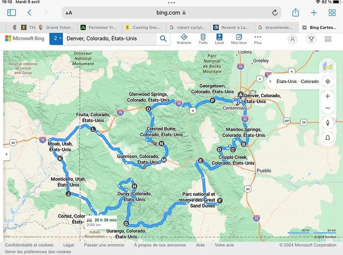
Day 1: Flight Marseille-Paris-Denver, then Manitou Springs (133 km) Day 2: Manitou Springs (49 km) Day 3: Cripple Creek (104 km) Day 4: Salida (254 km) Day 5: Great Sand Dunes (231 km) Day 6: Durango (283 km) Day 7: Durango (Durango-Silverton train) Day 8: Ouray (121 km) Day 9: Ouray (Perimeter Trail hike) Day 10: Cortez (213 km) Day 11: Cortez (Mesa Verde National Park, 134 km) Day 12: Monticello (268 km, detour to Chesler Park) Day 13: Moab (171 km, Delicate Arch) Day 14: Moab (98 km, Fisher Towers) Day 15: Moab (171 km, Canyonlands) Day 16: Fruita (210 km, Colorado National Monument) Day 17: Crested Butte (224 km via Kebler Pass) Day 18: Crested Butte (57 km) Day 19: Glenwood Springs (150 km) Day 20: Glenwood Springs (118 km, Rifle State Park) Day 21: Georgetown (258 km via Independence Pass) Day 22: Denver (123 km), then return flight
We speak very little English. We spent 21 nights there and covered a 3,400 km loop by car and 160 km on foot (we’re still trying to hike while we’re in shape) from Denver in September 2024. We wanted this road trip to help us explore Colorado a bit more—we’d only spent 6 nights there in 2019—and to see it during the fall foliage season. We also wanted to return to Utah (we love Moab) to enjoy its red rocks, which we adore.
In the prices you see (some in euros, others in dollars), I’ve included bank fees and exchange charges. The flights, car, and parking were paid by credit card when we booked in February. Usually, we book around November, but some obligations kept us from doing it earlier. We downloaded the MPC (Mobile Passport Control) app on our phone, which saved us time at immigration.
📊 **Budget: just under 8,500 € for both of us, all included**
📊 **Flights** Marseille-Paris (CDG)-Denver: 2,152 € for both of us, with one checked bag each
📊 **ESTA and America the Beautiful Pass** The ones from our 2023 road trip were still valid
📊 **Parking at Marseille airport: 122 €**
📊 **Car: Nissan Rogue (the French X-Trail) from Hertz: 1,165 €** By booking through Air France (and earning miles), we got a 15% discount. Hertz offers a free Hertz Gold Plus Rewards program, which gives us priority counter service.
📊 **Accommodation: 3,050 €** We stayed in motels and hotels of various ranges (from 100 € to 270 € per night, depending on the city), all booked through Hotels.com or Booking. Booking sometimes offers cheaper rates if you book via the "Booking mobile" app. We also got some preferential rates thanks to our Genius 2 status. Out of 21 nights, only one place didn’t include breakfast.
📊 **Other expenses (activities booked by credit card before leaving)** Durango-Silverton train: 210 € (we booked the enclosed vintage coach in March) Mesa Verde: Balcony House: 15.15 € (booked 14 days before the visit) Timed-entry passes for Arches National Park: 6 € for 3 days (booked June 1 for September entries via http://récreation.gov/). We booked three different days to play with the weather.
📊 **Supplementary insurance with AVA: 204 €** (due to our age 😅 and the high cost of medical consultations in the USA)
📊 **Cash: 1,540 €** We left with 1,000 € exchanged before departure and made two withdrawals (500 $ and 200 $). This cash was used to pay for: - Evening restaurants and tips (between 70 $ and 95 $ for two meals and two drinks) - Two state parks: Dead Horse State Park (20 $) and Rifle State Park (10 $) - The Monarch Pass gondola (24 $) - Midday picnics - Gas (slightly cheaper with cash): 204 $ for 3,400 km - Personal souvenirs and little treats.
Like in our previous road trips, we didn’t rent a GPS. We used the offline GPS app Here We Go, for which we’d downloaded maps of Colorado and Utah from France, as well as a new offline app called Organic Maps as a backup—though we didn’t end up needing it.
❤️❤️❤️ **Highlights (there are so many!)** 📍 The stunning landscapes of Colorado, especially with the fall colors 📍 A step back in time at the old farm in Florissant Fossil Beds National Monument 📍 The prairies of Cripple Creek and the mining remnants of the Vindicator Trail 📍 The cheeky chipmunks in the ghost town of St. Elmo 📍 Great Sand Dunes and its soft sand 📍 The steam train between Durango and Silverton: we’re glad we chose the round-trip because it rained heavily on the way there, but we got to enjoy the scenery on the way back when the sun came out 📍 The unexpected meet-up with Michèle from the group outside a restaurant in Durango 📍 The hot springs in Ouray 📍 Mesa Verde and its still-vibrant past 📍 The red rocks of Moab and Delicate Arch at sunset 📍 The lace-like Fisher Towers and the view from the end of the trail 📍 The gorgeous Route 128 leading to Colorado National Monument—small, easy to visit, and so beautiful 📍 The colors of the fabulous Kebler Pass, Crested Butte, and especially the hike through the golden aspens (Lower and Upper Loop) 📍 The waterfalls at Rifle State Park 📍 The tundra of Independence Pass 📍 The Halloween decorations in Georgetown and Idaho Springs
😞😞 **Flops (there are very few!)** 📍 The viewpoints we missed because they weren’t well-marked or we didn’t see the signs 📍 The closure of some hiking trails (Hanging Lake and parts of Canyonlands) and the Sal Mountain Loop road, which kept us from accessing it 📍😢 The Chesler Park hike we had to cut short due to poor time management—180 km between our stop in Cortez meant we didn’t arrive until 10:30 AM, way too late for a 17 km hike.
Hope this helps! Have a great evening, everyone, and see you soon! 😊
The itinerary
Day 1: Flight Marseille-Paris-Denver, then Manitou Springs (133 km) Day 2: Manitou Springs (49 km) Day 3: Cripple Creek (104 km) Day 4: Salida (254 km) Day 5: Great Sand Dunes (231 km) Day 6: Durango (283 km) Day 7: Durango (Durango-Silverton train) Day 8: Ouray (121 km) Day 9: Ouray (Perimeter Trail hike) Day 10: Cortez (213 km) Day 11: Cortez (Mesa Verde National Park, 134 km) Day 12: Monticello (268 km, detour to Chesler Park) Day 13: Moab (171 km, Delicate Arch) Day 14: Moab (98 km, Fisher Towers) Day 15: Moab (171 km, Canyonlands) Day 16: Fruita (210 km, Colorado National Monument) Day 17: Crested Butte (224 km via Kebler Pass) Day 18: Crested Butte (57 km) Day 19: Glenwood Springs (150 km) Day 20: Glenwood Springs (118 km, Rifle State Park) Day 21: Georgetown (258 km via Independence Pass) Day 22: Denver (123 km), then return flight
We speak very little English. We spent 21 nights there and covered a 3,400 km loop by car and 160 km on foot (we’re still trying to hike while we’re in shape) from Denver in September 2024. We wanted this road trip to help us explore Colorado a bit more—we’d only spent 6 nights there in 2019—and to see it during the fall foliage season. We also wanted to return to Utah (we love Moab) to enjoy its red rocks, which we adore.
In the prices you see (some in euros, others in dollars), I’ve included bank fees and exchange charges. The flights, car, and parking were paid by credit card when we booked in February. Usually, we book around November, but some obligations kept us from doing it earlier. We downloaded the MPC (Mobile Passport Control) app on our phone, which saved us time at immigration.
📊 **Budget: just under 8,500 € for both of us, all included**
📊 **Flights** Marseille-Paris (CDG)-Denver: 2,152 € for both of us, with one checked bag each
📊 **ESTA and America the Beautiful Pass** The ones from our 2023 road trip were still valid
📊 **Parking at Marseille airport: 122 €**
📊 **Car: Nissan Rogue (the French X-Trail) from Hertz: 1,165 €** By booking through Air France (and earning miles), we got a 15% discount. Hertz offers a free Hertz Gold Plus Rewards program, which gives us priority counter service.
📊 **Accommodation: 3,050 €** We stayed in motels and hotels of various ranges (from 100 € to 270 € per night, depending on the city), all booked through Hotels.com or Booking. Booking sometimes offers cheaper rates if you book via the "Booking mobile" app. We also got some preferential rates thanks to our Genius 2 status. Out of 21 nights, only one place didn’t include breakfast.
📊 **Other expenses (activities booked by credit card before leaving)** Durango-Silverton train: 210 € (we booked the enclosed vintage coach in March) Mesa Verde: Balcony House: 15.15 € (booked 14 days before the visit) Timed-entry passes for Arches National Park: 6 € for 3 days (booked June 1 for September entries via http://récreation.gov/). We booked three different days to play with the weather.
📊 **Supplementary insurance with AVA: 204 €** (due to our age 😅 and the high cost of medical consultations in the USA)
📊 **Cash: 1,540 €** We left with 1,000 € exchanged before departure and made two withdrawals (500 $ and 200 $). This cash was used to pay for: - Evening restaurants and tips (between 70 $ and 95 $ for two meals and two drinks) - Two state parks: Dead Horse State Park (20 $) and Rifle State Park (10 $) - The Monarch Pass gondola (24 $) - Midday picnics - Gas (slightly cheaper with cash): 204 $ for 3,400 km - Personal souvenirs and little treats.
Like in our previous road trips, we didn’t rent a GPS. We used the offline GPS app Here We Go, for which we’d downloaded maps of Colorado and Utah from France, as well as a new offline app called Organic Maps as a backup—though we didn’t end up needing it.
❤️❤️❤️ **Highlights (there are so many!)** 📍 The stunning landscapes of Colorado, especially with the fall colors 📍 A step back in time at the old farm in Florissant Fossil Beds National Monument 📍 The prairies of Cripple Creek and the mining remnants of the Vindicator Trail 📍 The cheeky chipmunks in the ghost town of St. Elmo 📍 Great Sand Dunes and its soft sand 📍 The steam train between Durango and Silverton: we’re glad we chose the round-trip because it rained heavily on the way there, but we got to enjoy the scenery on the way back when the sun came out 📍 The unexpected meet-up with Michèle from the group outside a restaurant in Durango 📍 The hot springs in Ouray 📍 Mesa Verde and its still-vibrant past 📍 The red rocks of Moab and Delicate Arch at sunset 📍 The lace-like Fisher Towers and the view from the end of the trail 📍 The gorgeous Route 128 leading to Colorado National Monument—small, easy to visit, and so beautiful 📍 The colors of the fabulous Kebler Pass, Crested Butte, and especially the hike through the golden aspens (Lower and Upper Loop) 📍 The waterfalls at Rifle State Park 📍 The tundra of Independence Pass 📍 The Halloween decorations in Georgetown and Idaho Springs
😞😞 **Flops (there are very few!)** 📍 The viewpoints we missed because they weren’t well-marked or we didn’t see the signs 📍 The closure of some hiking trails (Hanging Lake and parts of Canyonlands) and the Sal Mountain Loop road, which kept us from accessing it 📍😢 The Chesler Park hike we had to cut short due to poor time management—180 km between our stop in Cortez meant we didn’t arrive until 10:30 AM, way too late for a 17 km hike.
Hope this helps! Have a great evening, everyone, and see you soon! 😊
Hello! 🙂
January 2026 Here we go again for new adventures and the pleasure of sharing them with you here! First of all, I’d like to thank everyone who helped me with the preparations, even with some last-minute improvisations just days before departure. Thanks to Montagnard74, Jojoone1, Songsam, Attila, Dennis2, NadegerFERM, and the authors whose travel journals about Laos inspired me (Montagnard74, Muriel18, Mavietongs...).
In this story, written by Richard and illustrated by me, we’ll tell you about the journey of four friends: Catherine, Richard, Nathalie, and Bruno. A reinvented but overall successful trip, filled with discoveries and surprises, the scents of spices and frangipani flowers, (too) spicy food, sunsets, and... one big mess.
January 2026 Here we go again for new adventures and the pleasure of sharing them with you here! First of all, I’d like to thank everyone who helped me with the preparations, even with some last-minute improvisations just days before departure. Thanks to Montagnard74, Jojoone1, Songsam, Attila, Dennis2, NadegerFERM, and the authors whose travel journals about Laos inspired me (Montagnard74, Muriel18, Mavietongs...).
In this story, written by Richard and illustrated by me, we’ll tell you about the journey of four friends: Catherine, Richard, Nathalie, and Bruno. A reinvented but overall successful trip, filled with discoveries and surprises, the scents of spices and frangipani flowers, (too) spicy food, sunsets, and... one big mess.
Good evening everyone! 🙂
We’re back from our September 2025 road trip, this time to explore Arizona and New Mexico, and it’s time for me to start my travel journal—especially since everything’s already booked for another trip in September 2026 (to California), and I need to get started on the planning.
I was a little worried this new visit to Uncle Sam’s country might not be as "wow" as the others, but we still discovered some incredible places.
For those who don’t know us, we’re a couple in our seventies who speak very little English, but that didn’t stop us from fully enjoying our stay.
For this 6th road trip in the U.S., we spent 21 nights there, drove 4,160 km by car, and walked nearly 160 km in a loop starting from Phoenix.
We’d been to Arizona before (but not this side) and never to New Mexico. This whole road trip was a huge discovery for us.
In the prices mentioned (some in euros, others in dollars), bank fees and exchange charges are included. The flights, car rental, and parking were all paid for in December 2024 when we booked.
We’d downloaded the MPC (Mobile Passport Control) app, but there wasn’t a dedicated line at Phoenix Airport. Still, we got through quickly with friendly, smiling agents.
I don’t drive at all (I hate it), so the stops were chosen based on activities but also, for some, to limit daily mileage for the sole driver. The kilometers listed in the itinerary are the daily distances.
We traveled from September 9th to 22nd, unfortunately once again without our dear friends Mimi and Maumau.
The itinerary
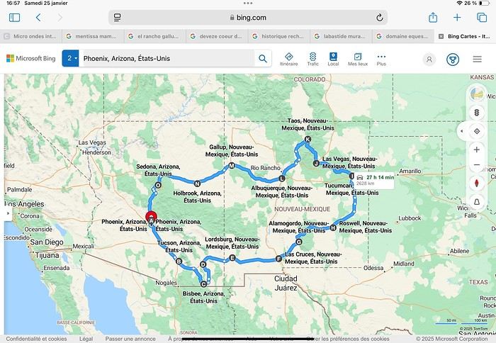
Day 1: Flight Marseille-Paris-Phoenix, then Gold Canyon (133 km) Day 2: Tucson (271 km) Lost Dutchman State Park Day 3: Tucson (155 km) Day 4: Tucson (34 km) Day 5: Bisbee (182 km) Day 6: Lordsburg (345 km) Day 7: Las Cruces (253 km) Day 8: Alamogordo (162 km) Day 9: Roswell (264 km) Day 10: Tucumcari (369 km) Day 11: Las Vegas (281 km) – the one in New Mexico Day 12: Taos (213 km) Day 13: Santa Fe (224 km) Day 14: Albuquerque (123 km) Day 15: Gallup (246 km) Day 16: Holbrook (224 km) Day 17: Flagstaff (179 km) Day 18: Sedona (118 km) Day 19: Sedona (48 km) Day 20: Sedona (41 km) Day 21: Phoenix (256 km) Day 22: Phoenix Airport (35 km)
📊 **Budget**: A little over 7,500 € for both of us, all included. The exchange rate was in our favor (1.17 dollars to 1 €). 📊 **Flights**: Marseille-Paris Charles de Gaulle-Phoenix: 1,787 € for two, with one checked bag each (Air France) 📊 **ESTA**: $42 📊 **America the Beautiful Pass**: $80 📊 **Parking**: 134 € (super eco at Marseille) 📊 **Car rental (Hertz)**: 865 €. Since there were no SUVs left in the reserved category (Nissan Rogue), we got an upgrade (4x4 Ford Explorer). We booked through Air France (15% discount). We’d originally reserved it in December for 1,140 €, but since prices dropped in March, we canceled and rebooked for 865 €. Hertz offers a free Hertz Gold Plus Rewards program, which gives you priority counter service when picking up the car. 📊 **Accommodation**: 2,400 € We stayed in hotels and motels of varying standards (from 60 to 203 € per night, depending on the city), all booked through Booking.com or Hotels.com. Out of 21 nights, only two didn’t include breakfast in the price. Booking.com sometimes offers slightly cheaper rates if you book by phone using the mobile app, and our Genius 3 status on the site also got us some preferential rates. 📊 **Supplementary insurance**: AVA 200 € for medical care if needed 📊 **Cash**: $2,078. We left with 1,000 € exchanged before departure and made two withdrawals of $500. This cash covered: - Evening restaurants and tips - Midday picnics - Gas: $298 for 4,160 km - Museum and private park entries (per person): - Lost Dutchman: $10 - Arizona-Sonora Desert Museum: $28 - Bird Cage Theater: $16 - Tombstone Shootout: $8 - New Mexico Farm & Ranch Museum: $12 - Roswell International UFO Museum: $5 - Billy the Kid Museum: $7 - Rancho de Taos: $22 - West Fork Oak Creek Trail entry: $15 We got a few discounts thanks to our senior age (+65). - Souvenirs and little treats
Like on our previous road trips, we didn’t rent a GPS. We got around using offline GPS apps Here WeGo and Organic Maps, with maps of the states we visited downloaded before we left (on our phones).
❤️❤️❤️ **Highlights** (there are so many!) 📍 Goldfield Ghost Town (even if it’s a reconstruction) 📍 The standing army of Saguaro cacti at Saguaro National Park West 📍 Diving into the cowboy universe of Tombstone 📍 The welcome from Rick and Henry at our guesthouse in Bisbee (Garden at Mile High Ranch) 📍 The tangled rocks of Chiricahua National Monument 📍 The flavored pistachios from Dwayne’s Fresh Jerky and Mac Ginnis Pistachioland 📍 Restaurants: La Posta (Las Cruces), Diner 66 (Albuquerque), and the Haunted Hamburger (Jerome) 📍 The old plazas of New Mexico 📍 The solitude and beauty of the white dunes at White Sands National Park 📍 Stepping back in time at the Billy the Kid Museum (Fort Stanton) 📍 Sections of historic Route 66 and the old motels of Tucumcari, especially at night when all the neon lights are on 📍 Taos Pueblo and diving into Native American culture 📍 After the Rio Grande Bridge, the descent via NM 567 to the very bottom of the Rio Grande Gorge, then the road along the riverbanks to Taos 📍 The tranquility of the Chimayo Sanctuary 📍 Discovering the ingenious native dwellings at Bandelier National Monument and Walnut Canyon National Park 📍 The small towns along the Turquoise Trail 📍 The red rocks of Red Rock Park and the Painted Desert 📍 The extraordinary colors of the petrified trees at Petrified Forest National Park 📍 Sedona, its red rocks, and the reward of the viewpoints at the end of hikes (Devil’s Bridge, The Subway, and West Fork Oak Creek) 📍 The immersion in Mexico when visiting Tlaquepaque 📍 The almost-ghost town of Jerome and its terraced streets 📍 The incredible kindness of Americans, always ready to help and up for a chat ❤️
☹️☹️☹️ **Flops** (there are very few) 📍 Several museums and churches being closed, so we couldn’t visit them 📍 Some museums and visitor centers opening late (10 AM) and closing early (4 PM) 📍 A 64 € phone roaming charge because we got near the Mexican border and picked up their cell tower 📍 The outrageous price ($5.99) for a gallon of gas at the Shell near Phoenix Airport
I hope this helps! Anyway, thanks for reading my long post. Don’t hesitate to reach out, even via PM, if you see I haven’t replied and you’d like more details. Have a great evening, everyone! 🙂
We’re back from our September 2025 road trip, this time to explore Arizona and New Mexico, and it’s time for me to start my travel journal—especially since everything’s already booked for another trip in September 2026 (to California), and I need to get started on the planning.
I was a little worried this new visit to Uncle Sam’s country might not be as "wow" as the others, but we still discovered some incredible places.
For those who don’t know us, we’re a couple in our seventies who speak very little English, but that didn’t stop us from fully enjoying our stay.
For this 6th road trip in the U.S., we spent 21 nights there, drove 4,160 km by car, and walked nearly 160 km in a loop starting from Phoenix.
We’d been to Arizona before (but not this side) and never to New Mexico. This whole road trip was a huge discovery for us.
In the prices mentioned (some in euros, others in dollars), bank fees and exchange charges are included. The flights, car rental, and parking were all paid for in December 2024 when we booked.
We’d downloaded the MPC (Mobile Passport Control) app, but there wasn’t a dedicated line at Phoenix Airport. Still, we got through quickly with friendly, smiling agents.
I don’t drive at all (I hate it), so the stops were chosen based on activities but also, for some, to limit daily mileage for the sole driver. The kilometers listed in the itinerary are the daily distances.
We traveled from September 9th to 22nd, unfortunately once again without our dear friends Mimi and Maumau.
The itinerary
Day 1: Flight Marseille-Paris-Phoenix, then Gold Canyon (133 km) Day 2: Tucson (271 km) Lost Dutchman State Park Day 3: Tucson (155 km) Day 4: Tucson (34 km) Day 5: Bisbee (182 km) Day 6: Lordsburg (345 km) Day 7: Las Cruces (253 km) Day 8: Alamogordo (162 km) Day 9: Roswell (264 km) Day 10: Tucumcari (369 km) Day 11: Las Vegas (281 km) – the one in New Mexico Day 12: Taos (213 km) Day 13: Santa Fe (224 km) Day 14: Albuquerque (123 km) Day 15: Gallup (246 km) Day 16: Holbrook (224 km) Day 17: Flagstaff (179 km) Day 18: Sedona (118 km) Day 19: Sedona (48 km) Day 20: Sedona (41 km) Day 21: Phoenix (256 km) Day 22: Phoenix Airport (35 km)
📊 **Budget**: A little over 7,500 € for both of us, all included. The exchange rate was in our favor (1.17 dollars to 1 €). 📊 **Flights**: Marseille-Paris Charles de Gaulle-Phoenix: 1,787 € for two, with one checked bag each (Air France) 📊 **ESTA**: $42 📊 **America the Beautiful Pass**: $80 📊 **Parking**: 134 € (super eco at Marseille) 📊 **Car rental (Hertz)**: 865 €. Since there were no SUVs left in the reserved category (Nissan Rogue), we got an upgrade (4x4 Ford Explorer). We booked through Air France (15% discount). We’d originally reserved it in December for 1,140 €, but since prices dropped in March, we canceled and rebooked for 865 €. Hertz offers a free Hertz Gold Plus Rewards program, which gives you priority counter service when picking up the car. 📊 **Accommodation**: 2,400 € We stayed in hotels and motels of varying standards (from 60 to 203 € per night, depending on the city), all booked through Booking.com or Hotels.com. Out of 21 nights, only two didn’t include breakfast in the price. Booking.com sometimes offers slightly cheaper rates if you book by phone using the mobile app, and our Genius 3 status on the site also got us some preferential rates. 📊 **Supplementary insurance**: AVA 200 € for medical care if needed 📊 **Cash**: $2,078. We left with 1,000 € exchanged before departure and made two withdrawals of $500. This cash covered: - Evening restaurants and tips - Midday picnics - Gas: $298 for 4,160 km - Museum and private park entries (per person): - Lost Dutchman: $10 - Arizona-Sonora Desert Museum: $28 - Bird Cage Theater: $16 - Tombstone Shootout: $8 - New Mexico Farm & Ranch Museum: $12 - Roswell International UFO Museum: $5 - Billy the Kid Museum: $7 - Rancho de Taos: $22 - West Fork Oak Creek Trail entry: $15 We got a few discounts thanks to our senior age (+65). - Souvenirs and little treats
Like on our previous road trips, we didn’t rent a GPS. We got around using offline GPS apps Here WeGo and Organic Maps, with maps of the states we visited downloaded before we left (on our phones).
❤️❤️❤️ **Highlights** (there are so many!) 📍 Goldfield Ghost Town (even if it’s a reconstruction) 📍 The standing army of Saguaro cacti at Saguaro National Park West 📍 Diving into the cowboy universe of Tombstone 📍 The welcome from Rick and Henry at our guesthouse in Bisbee (Garden at Mile High Ranch) 📍 The tangled rocks of Chiricahua National Monument 📍 The flavored pistachios from Dwayne’s Fresh Jerky and Mac Ginnis Pistachioland 📍 Restaurants: La Posta (Las Cruces), Diner 66 (Albuquerque), and the Haunted Hamburger (Jerome) 📍 The old plazas of New Mexico 📍 The solitude and beauty of the white dunes at White Sands National Park 📍 Stepping back in time at the Billy the Kid Museum (Fort Stanton) 📍 Sections of historic Route 66 and the old motels of Tucumcari, especially at night when all the neon lights are on 📍 Taos Pueblo and diving into Native American culture 📍 After the Rio Grande Bridge, the descent via NM 567 to the very bottom of the Rio Grande Gorge, then the road along the riverbanks to Taos 📍 The tranquility of the Chimayo Sanctuary 📍 Discovering the ingenious native dwellings at Bandelier National Monument and Walnut Canyon National Park 📍 The small towns along the Turquoise Trail 📍 The red rocks of Red Rock Park and the Painted Desert 📍 The extraordinary colors of the petrified trees at Petrified Forest National Park 📍 Sedona, its red rocks, and the reward of the viewpoints at the end of hikes (Devil’s Bridge, The Subway, and West Fork Oak Creek) 📍 The immersion in Mexico when visiting Tlaquepaque 📍 The almost-ghost town of Jerome and its terraced streets 📍 The incredible kindness of Americans, always ready to help and up for a chat ❤️
☹️☹️☹️ **Flops** (there are very few) 📍 Several museums and churches being closed, so we couldn’t visit them 📍 Some museums and visitor centers opening late (10 AM) and closing early (4 PM) 📍 A 64 € phone roaming charge because we got near the Mexican border and picked up their cell tower 📍 The outrageous price ($5.99) for a gallon of gas at the Shell near Phoenix Airport
I hope this helps! Anyway, thanks for reading my long post. Don’t hesitate to reach out, even via PM, if you see I haven’t replied and you’d like more details. Have a great evening, everyone! 🙂
After my trip to Oregon in 2018 (see Travel Journal "Oregon and Only Oregon"), I vaguely intended to return to the West (the western USA, of course—the west of France is where I almost live) someday, later... with no specific date or plan.
November 2018, I stumbled upon a promotion for round-trip flights from Paris to San Francisco. Well, I *stumbled*—they must’ve collected some "data" on me to make sure this deal crossed my path. And it worked! My ESTA was still valid, and two days later, it was decided: May 13, 2019 (departure from Paris) to June 15, 2019 (return to Paris).
The travel style? Just like last year: low-budget trip, rental car, and accommodation only in campgrounds, with no reservations to stay as free as possible.
Exceptions? 3 nights in a youth hostel upon arrival in downtown San Francisco, and 1 night on the way back (right before flying) in Montara, near Pacifica—a spot that seemed well-located for driving back to the airport in the middle of the night.
Now, to sketch out the rough itinerary. Here’s what it looked like after the trip:
Westernmost point: Montara Lighthouse on the coast, 30 km south of San Francisco (California); Easternmost point: Zion National Park (Utah). Northernmost point: Reno (Nevada). Southernmost point: Spring Mountain Ranch State Park in Blue Diamond, near Las Vegas (Nevada).
Another view:
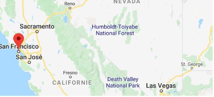
I’ll be spending 33 days in this little area! I’m a slow traveler.
Meanwhile, I realized that in some places I wanted to visit (Las Vegas and National Parks), it was better to book ahead. So, I added to my reservations: - 2 nights in a hostel in Las Vegas - 6 nights of camping in the national parks (2 at Zion NP, 2 at Yosemite NP, 2 at Sequoia-Kings Canyon NP). Between all these dated stops, it’s a choose-your-own-adventure from the ideas I found.
I’m also a slow writer—slow writer, slow traveler—so it’ll take me a while to wrap this up. I’ll start tomorrow.
November 2018, I stumbled upon a promotion for round-trip flights from Paris to San Francisco. Well, I *stumbled*—they must’ve collected some "data" on me to make sure this deal crossed my path. And it worked! My ESTA was still valid, and two days later, it was decided: May 13, 2019 (departure from Paris) to June 15, 2019 (return to Paris).
The travel style? Just like last year: low-budget trip, rental car, and accommodation only in campgrounds, with no reservations to stay as free as possible.
Exceptions? 3 nights in a youth hostel upon arrival in downtown San Francisco, and 1 night on the way back (right before flying) in Montara, near Pacifica—a spot that seemed well-located for driving back to the airport in the middle of the night.
Now, to sketch out the rough itinerary. Here’s what it looked like after the trip:
Westernmost point: Montara Lighthouse on the coast, 30 km south of San Francisco (California); Easternmost point: Zion National Park (Utah). Northernmost point: Reno (Nevada). Southernmost point: Spring Mountain Ranch State Park in Blue Diamond, near Las Vegas (Nevada).
Another view:
I’ll be spending 33 days in this little area! I’m a slow traveler.
Meanwhile, I realized that in some places I wanted to visit (Las Vegas and National Parks), it was better to book ahead. So, I added to my reservations: - 2 nights in a hostel in Las Vegas - 6 nights of camping in the national parks (2 at Zion NP, 2 at Yosemite NP, 2 at Sequoia-Kings Canyon NP). Between all these dated stops, it’s a choose-your-own-adventure from the ideas I found.
I’m also a slow writer—slow writer, slow traveler—so it’ll take me a while to wrap this up. I’ll start tomorrow.
Hello! 🙂
In 2017, struck by western addiction, our first road trip gave us an irresistible urge to return, which we did from September 2nd to 24th, 2019, on a loop from Denver to Denver via Yellowstone. The westernmost point of this journey, which took us through the geographical center of the USA, brought us within about a hundred kilometers of Moab, which had been the easternmost point of our last trip.
We’ve been back for over a month now, and I realize I’m starting to forget some details—it’s high time I started my travel journal before my brain turns into Swiss cheese and lets everything slip away. As I mentioned in my last story, it’ll take me quite a while to finish, so if any travelers have specific questions, don’t hesitate to message me privately. Once again, I’d like to thank everyone who helped me (and there were many!) prepare our road trip, with a special shout-out to Disneydiddl, Hiacinthe, and Titou (ladies first) as well as Fred and Itat, whom I bombarded with questions for months and who always kindly and patiently gave me tons of great tips. It’s thanks to all of you that this trip was such a success. I was a little worried I wouldn’t recapture the emotion and enthusiasm of our 2017 trip, but this one was just as "Wow" as the last.
For those who don’t know us, let me introduce our little group. We’re four friends in our sixties (this time, everyone made it, which let us score some "senior" discounts...). We live in the Var region, have known each other for over 20 years, and this was our second trip together to this magical West.
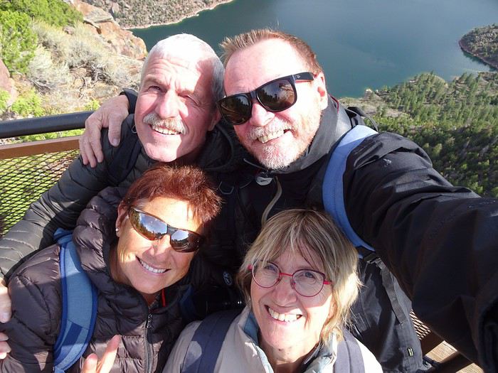
Mimi (Michèle): always the smallest and the funniest. Thank goodness she was there to speak English! Maumau (Maurice): her husband, always with his white hair, his Gallic mustache, his humor, and his Southern accent. He drove every other day. DD (André): the one with the beard, with whom I celebrated our 41st wedding anniversary at Yellowstone. Our second driver appreciated having a peaceful mind since he’s been retired since July. Marcalamar (Martine): that’s me—still blonde with glasses, still talking a lot, and still terrified of messing up the organization of this trip despite all the hours spent on the forum.
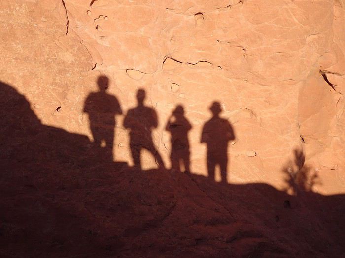 Recognize us? Ha ha ha!!!! No, just kidding!!!!
That’s us!!!
In 2017, struck by western addiction, our first road trip gave us an irresistible urge to return, which we did from September 2nd to 24th, 2019, on a loop from Denver to Denver via Yellowstone. The westernmost point of this journey, which took us through the geographical center of the USA, brought us within about a hundred kilometers of Moab, which had been the easternmost point of our last trip.
We’ve been back for over a month now, and I realize I’m starting to forget some details—it’s high time I started my travel journal before my brain turns into Swiss cheese and lets everything slip away. As I mentioned in my last story, it’ll take me quite a while to finish, so if any travelers have specific questions, don’t hesitate to message me privately. Once again, I’d like to thank everyone who helped me (and there were many!) prepare our road trip, with a special shout-out to Disneydiddl, Hiacinthe, and Titou (ladies first) as well as Fred and Itat, whom I bombarded with questions for months and who always kindly and patiently gave me tons of great tips. It’s thanks to all of you that this trip was such a success. I was a little worried I wouldn’t recapture the emotion and enthusiasm of our 2017 trip, but this one was just as "Wow" as the last.
For those who don’t know us, let me introduce our little group. We’re four friends in our sixties (this time, everyone made it, which let us score some "senior" discounts...). We live in the Var region, have known each other for over 20 years, and this was our second trip together to this magical West.
Mimi (Michèle): always the smallest and the funniest. Thank goodness she was there to speak English! Maumau (Maurice): her husband, always with his white hair, his Gallic mustache, his humor, and his Southern accent. He drove every other day. DD (André): the one with the beard, with whom I celebrated our 41st wedding anniversary at Yellowstone. Our second driver appreciated having a peaceful mind since he’s been retired since July. Marcalamar (Martine): that’s me—still blonde with glasses, still talking a lot, and still terrified of messing up the organization of this trip despite all the hours spent on the forum.
Recognize us? Ha ha ha!!!! No, just kidding!!!!
That’s us!!!I’ve never done a travel journal on VF before... so I’m giving it a go this year 😉. Just to share a bit of my 3-week trip around the West.
Since I couldn’t find anyone to share the trip with this year, I decided to go solo for 3 weeks at the last minute. So, it wasn’t a super organized or original trip—flight tickets booked last-minute, a loosely planned itinerary—but it was a choice I made.
I wanted to book zero hotels and just drive wherever I felt like. No set hikes or specific goals. Just a classic route through places I already knew for the most part, taking the time to soak in the landscapes. So, don’t expect a story about epic hikes leading to caves or hidden arches in unusual spots. It was more like a return to the roots of my first trip, with one twist: I wanted to explore some areas by mountain bike. Just to see things a little differently.
First up, instead of photos, I’ll share a little time-lapse I made during the trip.
Thursday, October 31: Left Nice early in the morning for Phoenix via London.
The trip was a bit long because I had to wait 5.5 hours in London. My flight ticket was booked kinda late, so I didn’t have much choice.
And then it hit me—when you’re prepping for a trip, you always think you’ll forget something. It was in London that I realized I’d left my driver’s license on my living room shelf. I searched everywhere, but nope, I didn’t bring it.🤪
Luckily, I had an international permit, but the rental contract clearly stated that both licenses had to be presented.
I called a friend to ask her to overnight it to my first hotel, crossing my fingers that the mail wouldn’t take two weeks to arrive.
The flight with British Airways went pretty well. Comfortable enough to watch two movies, eat, take a little nap, and boom—I was in Phoenix.
Around 8 PM local time, I got to the Alamo car rental agency, and surprise—they didn’t care about my license at all. They glanced at the international permit, told me to bring the other one when I got it (basically, they didn’t give a damn), and handed me my car! Woohoo! 😛

I headed to my hotel (the only one I’d booked for my first night), explained to the front desk that my license should arrive by mail so they’d be in the loop, and crashed for a well-deserved first night in the U.S.
Friday, November 1 (And yes! It was a holiday in France, which would complicate my mail situation later.)
I woke up super early with my first goal: find a decent mountain bike at a good price but sturdy enough to handle some national park trails.
As I mentioned earlier, I decided to switch things up this year and explore some mountain bike trails—or just ride whenever I got the chance 😉.
I checked two Walmarts before finally finding a solid bike for under $150. Some might wonder why I bought one—well, the reason’s simple. Renting a bike costs between $40 and $70 a day. My trip lasted 22 days. QED (that’s "quod erat demonstrandum" for those who didn’t get it).
I bought the bike, which fit in my Jeep Compass by folding down the back seats (not super convenient, but it worked).

Off I went on my first adventures.
I decided to head to Apache Junction.
First stop: the Apache Trail at Goldfield Ghost Town. Pretty cute, though super touristy. Some classic Western decor, a little chapel overlooking everything, a museum, a mine, a small Disneyland-style train, souvenir shops, and places to grab a snack. Nothing mind-blowing, but still a fun little visit—especially if you’ve got kids.


I got lucky and explored the ghost town with two school buses—about a hundred excited kids. Total chaos for a ghost town, but hilarious to watch from a distance 😎.
A little further down the Apache Trail, there’s Lost Dutchman State Park. I didn’t linger too long because my goal was to reach the lakes, and after my Walmart adventure and some driving, it was already almost 1 PM. I munched on a bag of chips and hit the road (lots of 20–25 mph speed limits).
I spotted N 1st Water Road along the way, planning to come back in a few days.
My plan to get to the lakes ASAP got derailed when I found a parking lot with a horse trail right in the middle of the saguaros.
I asked a ranger in the lot if I could ride the trail on my mountain bike. He said it’d probably be tough but gave me the green light.
Off I went in my padded shorts and helmet. First bike ride through the cacti with my trusty travel companion (my bike, obviously).

I started off super excited on what seemed like an easy trail, but I quickly realized horse trails don’t account for some key biking challenges 😎—like climbing rocks isn’t exactly a breeze on a mountain bike 😛. No biggie, I carried the bike a few times but got to see my first saguaros up close! A pretty cool way to explore—I don’t regret buying the bike at all!
I got back on the road after drinking 1.5 liters of water (even in November, the sun’s no joke) and headed toward Canyon Lake. With vibes like Lake Powell, I was blown away by the scenery and decided to hang out a bit—just to "soak it in" and enjoy the quiet to end my day. I didn’t see more of the Apache Trail because night falls fast, and for my first day, I figured that was plenty.


I’d decided not to stress about seeing everything at all costs since I’ve traveled a lot in the U.S. and plan to keep coming back. Whatever I missed, I’d catch next time—but I wanted to fully enjoy a few landscapes.
I drove back to Phoenix, grabbed a good burger, and spent the evening in my hotel room planning the next day. Originally, I was only supposed to stay one night in Phoenix, but with my license still MIA, I changed my plans. In the end, I was solo, no reservations anywhere, so I’d just take it day by day!
Saturday, November 2:
I decided to wake up early and head to Tucson for the day. The drive from Phoenix was pretty easy. About 2 hours later, I was at the entrance of Saguaro National Park.
And guess what? There was a little trail perfect for mountain biking. I parked my Jeep at the park entrance and hopped on my bike. I ended up biking the whole park from start to finish—about 20 kilometers, with a paved main road and a gorgeous central trail right through the saguaros! Stunning!

Even being careful, I still got a few cactus spines in my left arm from brushing too close (it stings!). Not easy to remove, so I’d advise anyone with the same idea to be more careful than I was. You’ll figure it out fast! 😉
I spent most of the day in this amazing park—it’s totally worth the detour. It feels like hundreds of chimneys all lined up at equal distances. A unique landscape you’ve gotta see.
Next, I headed to Tucson to check out the airplane boneyard. I’d seen it in a movie years ago and always wanted to see it for myself. Mission accomplished! It was pretty intense, but unfortunately, it didn’t seem possible to get to the most interesting plane alignments. There’s a museum with different types of planes and a guided tour. I settled for peeking through the fences at the planes guarded by military patrols.

I left around 6 PM and got back to Phoenix around 7:30–8 PM, super happy with my day of biking through the cacti!
Sunday, November 3:
Morning by the pool, lounging around—pure bliss. Around 11 AM, I headed to the Premium Outlets. Feeling pretty pleased with myself, I bought 5 pairs of Levi’s for the price of one in France. Just for that, I knew coming to the U.S. was worth it! After that, nothing super exciting—except a cotton field south of Phoenix that I couldn’t stop admiring for a good hour.

I drove around the city—pretty dead on a Sunday—and headed back to the Apache Trail to tackle N 1st Water Road, which I’d spotted two days earlier. A really fun trail to bike if you’ve got a mountain bike 😉. It gives access to several hikes and offers some great scenery. Highly recommend it.


Since I couldn’t find anyone to share the trip with this year, I decided to go solo for 3 weeks at the last minute. So, it wasn’t a super organized or original trip—flight tickets booked last-minute, a loosely planned itinerary—but it was a choice I made.
I wanted to book zero hotels and just drive wherever I felt like. No set hikes or specific goals. Just a classic route through places I already knew for the most part, taking the time to soak in the landscapes. So, don’t expect a story about epic hikes leading to caves or hidden arches in unusual spots. It was more like a return to the roots of my first trip, with one twist: I wanted to explore some areas by mountain bike. Just to see things a little differently.
First up, instead of photos, I’ll share a little time-lapse I made during the trip.
Thursday, October 31: Left Nice early in the morning for Phoenix via London.
The trip was a bit long because I had to wait 5.5 hours in London. My flight ticket was booked kinda late, so I didn’t have much choice.
And then it hit me—when you’re prepping for a trip, you always think you’ll forget something. It was in London that I realized I’d left my driver’s license on my living room shelf. I searched everywhere, but nope, I didn’t bring it.🤪
Luckily, I had an international permit, but the rental contract clearly stated that both licenses had to be presented.
I called a friend to ask her to overnight it to my first hotel, crossing my fingers that the mail wouldn’t take two weeks to arrive.
The flight with British Airways went pretty well. Comfortable enough to watch two movies, eat, take a little nap, and boom—I was in Phoenix.
Around 8 PM local time, I got to the Alamo car rental agency, and surprise—they didn’t care about my license at all. They glanced at the international permit, told me to bring the other one when I got it (basically, they didn’t give a damn), and handed me my car! Woohoo! 😛
I headed to my hotel (the only one I’d booked for my first night), explained to the front desk that my license should arrive by mail so they’d be in the loop, and crashed for a well-deserved first night in the U.S.
Friday, November 1 (And yes! It was a holiday in France, which would complicate my mail situation later.)
I woke up super early with my first goal: find a decent mountain bike at a good price but sturdy enough to handle some national park trails.
As I mentioned earlier, I decided to switch things up this year and explore some mountain bike trails—or just ride whenever I got the chance 😉.
I checked two Walmarts before finally finding a solid bike for under $150. Some might wonder why I bought one—well, the reason’s simple. Renting a bike costs between $40 and $70 a day. My trip lasted 22 days. QED (that’s "quod erat demonstrandum" for those who didn’t get it).
I bought the bike, which fit in my Jeep Compass by folding down the back seats (not super convenient, but it worked).
Off I went on my first adventures.
I decided to head to Apache Junction.
First stop: the Apache Trail at Goldfield Ghost Town. Pretty cute, though super touristy. Some classic Western decor, a little chapel overlooking everything, a museum, a mine, a small Disneyland-style train, souvenir shops, and places to grab a snack. Nothing mind-blowing, but still a fun little visit—especially if you’ve got kids.
I got lucky and explored the ghost town with two school buses—about a hundred excited kids. Total chaos for a ghost town, but hilarious to watch from a distance 😎.
A little further down the Apache Trail, there’s Lost Dutchman State Park. I didn’t linger too long because my goal was to reach the lakes, and after my Walmart adventure and some driving, it was already almost 1 PM. I munched on a bag of chips and hit the road (lots of 20–25 mph speed limits).
I spotted N 1st Water Road along the way, planning to come back in a few days.
My plan to get to the lakes ASAP got derailed when I found a parking lot with a horse trail right in the middle of the saguaros.
I asked a ranger in the lot if I could ride the trail on my mountain bike. He said it’d probably be tough but gave me the green light.
Off I went in my padded shorts and helmet. First bike ride through the cacti with my trusty travel companion (my bike, obviously).
I started off super excited on what seemed like an easy trail, but I quickly realized horse trails don’t account for some key biking challenges 😎—like climbing rocks isn’t exactly a breeze on a mountain bike 😛. No biggie, I carried the bike a few times but got to see my first saguaros up close! A pretty cool way to explore—I don’t regret buying the bike at all!
I got back on the road after drinking 1.5 liters of water (even in November, the sun’s no joke) and headed toward Canyon Lake. With vibes like Lake Powell, I was blown away by the scenery and decided to hang out a bit—just to "soak it in" and enjoy the quiet to end my day. I didn’t see more of the Apache Trail because night falls fast, and for my first day, I figured that was plenty.
I’d decided not to stress about seeing everything at all costs since I’ve traveled a lot in the U.S. and plan to keep coming back. Whatever I missed, I’d catch next time—but I wanted to fully enjoy a few landscapes.
I drove back to Phoenix, grabbed a good burger, and spent the evening in my hotel room planning the next day. Originally, I was only supposed to stay one night in Phoenix, but with my license still MIA, I changed my plans. In the end, I was solo, no reservations anywhere, so I’d just take it day by day!
Saturday, November 2:
I decided to wake up early and head to Tucson for the day. The drive from Phoenix was pretty easy. About 2 hours later, I was at the entrance of Saguaro National Park.
And guess what? There was a little trail perfect for mountain biking. I parked my Jeep at the park entrance and hopped on my bike. I ended up biking the whole park from start to finish—about 20 kilometers, with a paved main road and a gorgeous central trail right through the saguaros! Stunning!
Even being careful, I still got a few cactus spines in my left arm from brushing too close (it stings!). Not easy to remove, so I’d advise anyone with the same idea to be more careful than I was. You’ll figure it out fast! 😉
I spent most of the day in this amazing park—it’s totally worth the detour. It feels like hundreds of chimneys all lined up at equal distances. A unique landscape you’ve gotta see.
Next, I headed to Tucson to check out the airplane boneyard. I’d seen it in a movie years ago and always wanted to see it for myself. Mission accomplished! It was pretty intense, but unfortunately, it didn’t seem possible to get to the most interesting plane alignments. There’s a museum with different types of planes and a guided tour. I settled for peeking through the fences at the planes guarded by military patrols.
I left around 6 PM and got back to Phoenix around 7:30–8 PM, super happy with my day of biking through the cacti!
Sunday, November 3:
Morning by the pool, lounging around—pure bliss. Around 11 AM, I headed to the Premium Outlets. Feeling pretty pleased with myself, I bought 5 pairs of Levi’s for the price of one in France. Just for that, I knew coming to the U.S. was worth it! After that, nothing super exciting—except a cotton field south of Phoenix that I couldn’t stop admiring for a good hour.
I drove around the city—pretty dead on a Sunday—and headed back to the Apache Trail to tackle N 1st Water Road, which I’d spotted two days earlier. A really fun trail to bike if you’ve got a mountain bike 😉. It gives access to several hikes and offers some great scenery. Highly recommend it.
Sunday, October 1st, 2023
Mulhouse-London
We dumped our trash on our neighbors. We hugged, overflowing with emotion. Then Léa from Taxis S showed up. She knows us well. For ages, she’s been our driver. She was practically the official taxiwoman for the trips of the company where Dom and I met. She knew us when we were single! Almost teenagers! She knows everyone and fills in the biographies of people we’d forgotten.
 Across the street, while we loaded the luggage, S., perched in his window frame, waved a handkerchief. This wasn’t just any trip.
 Then things got tricky. It’s funny how fate sinks its teeth into our happy moments—there’s this whole intermediate phase where the poison seeps in unnoticed because you’re still in the dark...
First, there was a delay on our flight to London. Dom immediately went on high alert, while I stayed calm. In my mind, we had two hours. I knew we had to go from Terminal 5 to Terminal 4, but two hours—come on, that’s plenty, right?
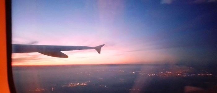
Bad calculation! Because those two hours were between the first flight’s landing and the second’s takeoff. But flights close at least half an hour before departure. Getting from one terminal to another means taking a shuttle bus. We waited for the one going to Terminal 4... until a young guy paid to direct people (who hadn’t seen us) informed us it was no longer possible to access Terminal 4 without going through Terminal 2 first for a connection! That really cranked up the pressure. We started installing a mental countdown with a programmed explosion at the end—guaranteed stress with added beads of sweat. The terminal bus was driven by a young Pakistani guy. We were *so* tense we bombarded him with our frantic, repetitive questions. “So? When are we getting there? What’s happening? Why aren’t we moving?” Our eyes were glued to our watches. The poor guy knew. Perfectly. Because it was obvious—no way around it. We weren’t going to make it. It was impossible. But Dom and I stubbornly refused to believe it. Then the kid stopped the bus. Me, hysterical: “What are you doing? What’s going on? Our plane takes off in... in... 4 minutes!!!! We’re gonna miss iiiiiit!” He wasn’t calm either. “You’ve already missed it!” He explained we had to cross a zone that required an escort car to clear a path through the runways. Impossible to do without. It’s forbidden. We had to WAIT (!!!). Then he got a radio call—he had to rush to Terminal 3 to pick up a passenger who was *super* tight on time. “Amir!!!! It’s RIGHT NOW!” they yelled in his already-red ears, thanks to the complaints of two hysterical Frenchies. Dom and I were in overdrive, hallucinating! We wanted to stop him, maybe even hit him to prevent him from turning around. He picked up the girl, whom we instantly hated like the most despicable witch. I turned on my data, searched for Malaysia Airlines’ number at Terminal 4, called, and actually got someone—quite a feat. A woman cut off my frantic rambling with a blunt “It’s over, the check-in is closed, the plane is about to take off.” I heard her but refused to accept it. I yelled, “We’re coming!” She shot back her monolithic “It’s over.” Finally at the doors of that damn Terminal 4, we ran—*really* ran—a marathon, Gate 6, security checks, pat-downs, “Take off your belts,” we asked questions, everyone seemed confident, we ran with one hand holding up our pants, the other clutching our belt, Gate 6—the room was empty. A girl was sitting there, calmly on the phone. We pounced on her. She calmed us down. Little by little, the light came back. Our brains rebooted. We finally understood it was over. We’d have to start crafting a new plan with the new reality. It started with a return to Terminal 5 to talk to British Airways, which took a good hour. With the same driver as before. We were alone with him. He took the time to apologize, to assure us it wasn’t his fault, that our problem had no solution, that nothing could’ve changed the outcome. At BA, we were exhausted. We were greeted by a handsome young man in a navy-blue uniform with gold stripes everywhere. We could’ve made a scene, but we were just relieved to find someone who’d take charge of our story. It was a minimal response, but it was *a* response. I suppose we could’ve demanded a business-class upgrade or a free trip, but we were just happy with a few vouchers for food, a hotel room with breakfast, and a little bag with plastic toys, a razor, toothbrush, hygiene products, and a T-shirt... Trinkets... But we were fine with it all—we said thank you eagerly because the essential was assured. He found us seats on flights tomorrow. *Tomorrow.* We were afraid to hope! We had the exact same flights but a day later. The same crappy times, but it was all good. We felt saved from the shipwreck, like survivors. - And what about the luggage? - .... !!!!
Monday, October 2nd, 2023 London - Kuala Lumpur
It wasn’t the Ritz, but with exhaustion on our side, we slept well. The continental breakfast was way better than we’d expected from an Ibis Budget. Still, it wasn’t enough to restore my joy for life. The course correction had turned into an arduous obstacle course. I scoured the car rental site every which way. Couldn’t reschedule the car. I’d done it before, but this time... Not to mention the laptop battery was complaining—the Brits have this quirk of making their power outlets incompatible with our chargers. Frustrated, I called them but ended up with a girl who declared herself incompetent and offered to have someone from Avis in Perth call me back—someone who’d supposedly handle rentals better. I decided to wait while taking a bath. Barely settled in, the phone rang. I was soaking wet, of course, and asked Dom to answer. Unfortunately, she’s known for disliking my phone, and in a clumsy move, she hung up. We got annoyed. She put dry towels on the edge of the bathtub, but—another false move—they fell in the water. The phone rang again... I completely redid the plans for the next two days, then transferred the files to my phone to consult them later offline. I plugged in my USB cable... *Plop!* The battery died abruptly—my PC shut down without any of the usual polite warnings! I looked around, hoping to find someone to strangle... Long story short, you can tell the day started under the worst omens. I was in a foul mood and spread my bad vibes to Dominique, who was initially in much better spirits... I called Mastercard, hoping to get a refund for the non-refundable night in Perth we’d already paid for. Same old song: “We’ll call you back”... Then... I’ll cut it short—buses, trains, lots of waiting... We rushed to reach the infamous Terminal 4.
We tried new options and convinced ourselves that a delayed departure flight is unrecoverable, no matter the scenario. We were furious that BA hadn’t bothered to tell us, leaving us to run around like rats in a burning house.
Tuesday, October 3rd, 2023 Kuala Lumpur-Perth
The flight was pretty nice. 13 hours, though. Dom and I were facing each other across the aisle. We could get up easily whenever we wanted without bothering anyone and chat when we felt like it. Besides, their chicken was amazing. They were kind enough to offer Dom a truly remarkable glass of rum. Good movies too, including the excellent *Prisoners* by Denis Villeneuve. At KL, during boarding, we developed a nagging worry about our luggage. We checked with some Malaysian Airlines staff. I sensed their hesitation. They made calls. Then changed their minds, giving us smiles and thumbs up...
Wednesday, October 4th, 2023 Perth
*Happy is the man who, like Ulysses, has had a fine voyage.* Well, for us, it wasn’t that. Finally arrived, we experienced the loneliness of tourists watching the baggage carousel spin, emptying of its precious containers one by one, until only a handful of travelers were left, staring at each other in disbelief. Without luggage, you’re kinda screwed. Not even a change of socks—our feet had been swimming in the same shoes for 3 days. No adapter, so no laptop. No toiletries. We could’ve cried! The lost luggage guy played his part. If you want compensation, fill out the disclaimer on the website made for that. And then, “Don’t worry, your luggage will arrive tomorrow!” “Don’t worry?!” From the start of the trip, we’ve been jerked around, fed lies. Tomorrow is the *absolute* last chance to get them back. Beyond that, we’d have to scramble a whole new trip. And lose a lot in the process! I have no idea how to go about it. Tomorrow... OMG... Tomorrow... We landed at 1 AM. Avis, the car rental place, opens at 6:30. Luckily, we found some decent breakfast. It cheered us up and gave us a second wind. Incorrigible, we started believing again! Well, then we just killed time. What else was there to do?

In front of Avis’s little shack, we were freezing. We’d been there since dawn. The girl who showed up, a Latina, immediately saw us as a nuisance who’d ruin her hopes of a peaceful start. Her face and tone were as unwelcoming as possible. You know us—it ended with hugs. She gave us a gorgeous, brand-new car! A hybrid with ultra-sophisticated features, all buttons you shouldn’t touch if you want to drive this thing without causing irreparable damage! We’re off! Driving on the left is easy at first. You think about it constantly. It’s counterintuitive, it takes effort. It’s later, when you get used to it and confidence sets in, that it becomes dangerous—old reflexes can send you into a wall. Anyway, the car and I immediately clicked.
In Perth, underground parking next to the hotel, friendly welcome—we ended up forgetting all the morning’s mishaps. Should we go sightseeing?
https://voyageforum.com/images/posts/small/1733767537-5Nwk6t3DsBZNOzf.jpg
Across the street, while we loaded the luggage, S., perched in his window frame, waved a handkerchief. This wasn’t just any trip.
Then things got tricky. It’s funny how fate sinks its teeth into our happy moments—there’s this whole intermediate phase where the poison seeps in unnoticed because you’re still in the dark...
First, there was a delay on our flight to London. Dom immediately went on high alert, while I stayed calm. In my mind, we had two hours. I knew we had to go from Terminal 5 to Terminal 4, but two hours—come on, that’s plenty, right?
Bad calculation! Because those two hours were between the first flight’s landing and the second’s takeoff. But flights close at least half an hour before departure. Getting from one terminal to another means taking a shuttle bus. We waited for the one going to Terminal 4... until a young guy paid to direct people (who hadn’t seen us) informed us it was no longer possible to access Terminal 4 without going through Terminal 2 first for a connection! That really cranked up the pressure. We started installing a mental countdown with a programmed explosion at the end—guaranteed stress with added beads of sweat. The terminal bus was driven by a young Pakistani guy. We were *so* tense we bombarded him with our frantic, repetitive questions. “So? When are we getting there? What’s happening? Why aren’t we moving?” Our eyes were glued to our watches. The poor guy knew. Perfectly. Because it was obvious—no way around it. We weren’t going to make it. It was impossible. But Dom and I stubbornly refused to believe it. Then the kid stopped the bus. Me, hysterical: “What are you doing? What’s going on? Our plane takes off in... in... 4 minutes!!!! We’re gonna miss iiiiiit!” He wasn’t calm either. “You’ve already missed it!” He explained we had to cross a zone that required an escort car to clear a path through the runways. Impossible to do without. It’s forbidden. We had to WAIT (!!!). Then he got a radio call—he had to rush to Terminal 3 to pick up a passenger who was *super* tight on time. “Amir!!!! It’s RIGHT NOW!” they yelled in his already-red ears, thanks to the complaints of two hysterical Frenchies. Dom and I were in overdrive, hallucinating! We wanted to stop him, maybe even hit him to prevent him from turning around. He picked up the girl, whom we instantly hated like the most despicable witch. I turned on my data, searched for Malaysia Airlines’ number at Terminal 4, called, and actually got someone—quite a feat. A woman cut off my frantic rambling with a blunt “It’s over, the check-in is closed, the plane is about to take off.” I heard her but refused to accept it. I yelled, “We’re coming!” She shot back her monolithic “It’s over.” Finally at the doors of that damn Terminal 4, we ran—*really* ran—a marathon, Gate 6, security checks, pat-downs, “Take off your belts,” we asked questions, everyone seemed confident, we ran with one hand holding up our pants, the other clutching our belt, Gate 6—the room was empty. A girl was sitting there, calmly on the phone. We pounced on her. She calmed us down. Little by little, the light came back. Our brains rebooted. We finally understood it was over. We’d have to start crafting a new plan with the new reality. It started with a return to Terminal 5 to talk to British Airways, which took a good hour. With the same driver as before. We were alone with him. He took the time to apologize, to assure us it wasn’t his fault, that our problem had no solution, that nothing could’ve changed the outcome. At BA, we were exhausted. We were greeted by a handsome young man in a navy-blue uniform with gold stripes everywhere. We could’ve made a scene, but we were just relieved to find someone who’d take charge of our story. It was a minimal response, but it was *a* response. I suppose we could’ve demanded a business-class upgrade or a free trip, but we were just happy with a few vouchers for food, a hotel room with breakfast, and a little bag with plastic toys, a razor, toothbrush, hygiene products, and a T-shirt... Trinkets... But we were fine with it all—we said thank you eagerly because the essential was assured. He found us seats on flights tomorrow. *Tomorrow.* We were afraid to hope! We had the exact same flights but a day later. The same crappy times, but it was all good. We felt saved from the shipwreck, like survivors. - And what about the luggage? - .... !!!!
Monday, October 2nd, 2023 London - Kuala Lumpur
It wasn’t the Ritz, but with exhaustion on our side, we slept well. The continental breakfast was way better than we’d expected from an Ibis Budget. Still, it wasn’t enough to restore my joy for life. The course correction had turned into an arduous obstacle course. I scoured the car rental site every which way. Couldn’t reschedule the car. I’d done it before, but this time... Not to mention the laptop battery was complaining—the Brits have this quirk of making their power outlets incompatible with our chargers. Frustrated, I called them but ended up with a girl who declared herself incompetent and offered to have someone from Avis in Perth call me back—someone who’d supposedly handle rentals better. I decided to wait while taking a bath. Barely settled in, the phone rang. I was soaking wet, of course, and asked Dom to answer. Unfortunately, she’s known for disliking my phone, and in a clumsy move, she hung up. We got annoyed. She put dry towels on the edge of the bathtub, but—another false move—they fell in the water. The phone rang again... I completely redid the plans for the next two days, then transferred the files to my phone to consult them later offline. I plugged in my USB cable... *Plop!* The battery died abruptly—my PC shut down without any of the usual polite warnings! I looked around, hoping to find someone to strangle... Long story short, you can tell the day started under the worst omens. I was in a foul mood and spread my bad vibes to Dominique, who was initially in much better spirits... I called Mastercard, hoping to get a refund for the non-refundable night in Perth we’d already paid for. Same old song: “We’ll call you back”... Then... I’ll cut it short—buses, trains, lots of waiting... We rushed to reach the infamous Terminal 4.
We tried new options and convinced ourselves that a delayed departure flight is unrecoverable, no matter the scenario. We were furious that BA hadn’t bothered to tell us, leaving us to run around like rats in a burning house.
Tuesday, October 3rd, 2023 Kuala Lumpur-Perth
The flight was pretty nice. 13 hours, though. Dom and I were facing each other across the aisle. We could get up easily whenever we wanted without bothering anyone and chat when we felt like it. Besides, their chicken was amazing. They were kind enough to offer Dom a truly remarkable glass of rum. Good movies too, including the excellent *Prisoners* by Denis Villeneuve. At KL, during boarding, we developed a nagging worry about our luggage. We checked with some Malaysian Airlines staff. I sensed their hesitation. They made calls. Then changed their minds, giving us smiles and thumbs up...
Wednesday, October 4th, 2023 Perth
*Happy is the man who, like Ulysses, has had a fine voyage.* Well, for us, it wasn’t that. Finally arrived, we experienced the loneliness of tourists watching the baggage carousel spin, emptying of its precious containers one by one, until only a handful of travelers were left, staring at each other in disbelief. Without luggage, you’re kinda screwed. Not even a change of socks—our feet had been swimming in the same shoes for 3 days. No adapter, so no laptop. No toiletries. We could’ve cried! The lost luggage guy played his part. If you want compensation, fill out the disclaimer on the website made for that. And then, “Don’t worry, your luggage will arrive tomorrow!” “Don’t worry?!” From the start of the trip, we’ve been jerked around, fed lies. Tomorrow is the *absolute* last chance to get them back. Beyond that, we’d have to scramble a whole new trip. And lose a lot in the process! I have no idea how to go about it. Tomorrow... OMG... Tomorrow... We landed at 1 AM. Avis, the car rental place, opens at 6:30. Luckily, we found some decent breakfast. It cheered us up and gave us a second wind. Incorrigible, we started believing again! Well, then we just killed time. What else was there to do?
In front of Avis’s little shack, we were freezing. We’d been there since dawn. The girl who showed up, a Latina, immediately saw us as a nuisance who’d ruin her hopes of a peaceful start. Her face and tone were as unwelcoming as possible. You know us—it ended with hugs. She gave us a gorgeous, brand-new car! A hybrid with ultra-sophisticated features, all buttons you shouldn’t touch if you want to drive this thing without causing irreparable damage! We’re off! Driving on the left is easy at first. You think about it constantly. It’s counterintuitive, it takes effort. It’s later, when you get used to it and confidence sets in, that it becomes dangerous—old reflexes can send you into a wall. Anyway, the car and I immediately clicked.
In Perth, underground parking next to the hotel, friendly welcome—we ended up forgetting all the morning’s mishaps. Should we go sightseeing?
https://voyageforum.com/images/posts/small/1733767537-5Nwk6t3DsBZNOzf.jpg
In January 2023, we started our second road trip across the United States. We stayed from January to mid-March, which gave us plenty of time to visit several cities, attractions, and parks in multiple states.
This travel journal will be split into two parts due to the considerable number of places we visited.
This first journal covers the following states: Ohio, Indiana, Missouri, Oklahoma, Texas, New Mexico, Arizona, Nevada, and California, and takes you through the outbound leg of our road trip.
The second journal will showcase the attractions we visited on the return trip, which mainly follows the famous Highway 1 along the Pacific coast.
So, I invite you to keep reading this first journal, which serves as a long recap to help you discover the various attractions we explored throughout this road trip.
Videos are included throughout the recap. Please click on the image to start the video.
Here are the links to jump to a specific post:
OHIO:
WinterLand - Christmas Lights at Cleveland Public Square Lake View Cemetery - Cleveland - Part 1 Lake View Cemetery - Cleveland - Part 2 Stroll through Columbus Upper Falls to Lower Falls via Buckeye Trail - Hocking Hills State Park – Logan Cedar Falls & Whispering Falls Hiking Trail - Hocking Hills State Park – Logan Ash Cave Hiking Trail - Hocking Hills State Park – Logan Exploring Cincinnati
INDIANA:
Visiting Indianapolis
MISSOURI:
Exploring St. Louis
OKLAHOMA:
Catoosa Blue Whale Discovering Tulsa Exploring Oklahoma City
TEXAS:
Exploring Shamrock Discovering McLean Exploring Amarillo
NEW MEXICO:
Ancestral Sites Trail - Pecos National Historical Park Discovering Santa Fe The Santuario de Chimayó Stroll through Los Cerrillos Walk through the village of Madrid San Francisco de Asis Catholic Church & The Bottle House - Golden Albuquerque Murals 66 Diner - Albuquerque Stroll through Old Town (Albuquerque) Rinconada Canyon Trail - Petroglyph National Monument Mesa Point Trail - Boca Negra Canyon - Petroglyph National Monument Macaw Trail - Boca Negra Canyon - Petroglyph National Monument Cliff Base Trail - Boca Negra Canyon - Petroglyph National Monument Piedras Marcadas Canyon - Petroglyph National Monument Sandstone Bluffs & Ventana Natural Arch - El Malpais National Monument
ARIZONA:
Stewart's Petrified Wood Shop – Holbrook Stroll through Holbrook Discovering Joseph City Exploring Winslow Grand Falls (The "Chocolate Falls") – Leupp Island Trail - Walnut Canyon National Monument Rim Trail - Walnut Canyon National Monument Wukoki Pueblo Trail – Wupatki National Monument Wupatki Pueblo Trail – Wupatki National Monument Doney Mountain Trail – Wupatki National Monument Citadel & Nalakihu Pueblos Trail – Wupatki National Monument Lomaki & Box Canyon Pueblos Trail – Wupatki National Monument Discovering Flagstaff On the way to Sedona Slide Rock State Park – Sedona Midgley Bridge Trail – Wilson Canyon – Sedona Tlaquepaque Arts & Shopping Village Walking Tour - Sedona Chapel of the Holy Cross - Sedona Hiking at Cathedral Rock - Sedona Hiking the Bell Rock Trail - Sedona Hiking the Airport Loop Trail - Sedona Amitabha Stupa and Peace Park - Sedona Hiking the Boynton Canyon Vortex Trail - Sedona Hiking the Devil's Bridge Trail - Sedona Hiking the Birthing Cave Trail - Sedona Bell Rock Inn - Sedona On the roads of Sedona - Part 1 On the roads of Sedona - Part 2 Keyhole Sink Hiking Trail - Kaibab National Forest Discovering Williams Exploring Ash Fork Discovering Kingman Ramada by Wyndham Kingman Davis Camp Park - Bullhead City Discovering Yucca Lake Havasu Boardwalk Tour A duck catches a lobster – Lake Havasu Boardwalk
CALIFORNIA:
Exploring Needles Discovering Goffs Discovering Amboy Visiting the famous Bagdad Cafe - Newberry Springs Exploring Barstow Vehicles from Hell (Mad Max Cars) - Barstow Peggy Sue's 50's Diner - Yermo Liberty Sculpture Park - Yermo Lake Dolores Water Park - Newberry Springs ZZYZX Road - Mojave National Preserve Alien Fresh Jerky - Baker Kelso Dunes Trail - Mojave National Preserve Hole-in-the-Wall Rings Trail - Mojave National Preserve Visiting Mitchell Caverns - Mojave National Preserve Dante's View - Death Valley National Park Zabriskie Point - Death Valley National Park Golden Canyon - Death Valley National Park Artists Drive & Artists Palette - Death Valley National Park Devil's Golf Course - Death Valley National Park Natural Bridge Trail - Death Valley National Park Badwater Basin - Death Valley National Park Harmony Borax Works - Death Valley National Park Devil's Cornfield - Death Valley National Park Mesquite Flat Sand Dunes - Death Valley National Park Mosaic Canyon Trail - Death Valley National Park On the road - Death Valley National Park
NEVADA:
Cleveland Clinic Lou Ruvo Center for Brain Health - Las Vegas Exploring Downtown Las Vegas SlotZilla Zipline - Fremont Street Experience – Downtown Las Vegas Viva Vision Light Show 1 - Fremont Street Experience - Downtown Las Vegas Viva Vision Light Show 2 - Fremont Street Experience - Downtown Las Vegas Viva Vision Light Show 3 - Fremont Street Experience - Downtown Las Vegas Viva Vision Light Show 4 - Fremont Street Experience - Downtown Las Vegas Free Live Music – Fremont Street Experience - Downtown Las Vegas Chucky – Fremont Street Experience - Downtown Las Vegas Las Vegas Strip - Part 1 Las Vegas Strip - Part 2 Las Vegas Strip - Part 3 Las Vegas Strip - Part 4 Las Vegas Strip - Part 5 Tom Devlin's Monster Museum - Boulder City Hoover Dam Lake Mead - Lakeview Overlook - Boulder City Nelson Ghost Town - Searchlight
CALIFORNIA:
Scenic Route through Joshua Tree National Park via the North Entrance Hidden Valley Trail - Joshua Tree National Park Barker Dam Trail - Joshua Tree National Park Cap Rock Trail - Joshua Tree National Park Keys View Trail - Joshua Tree National Park Hall of Horrors Trail - Joshua Tree National Park Skull Rock Trail - Joshua Tree National Park Arch Rock Trail - Joshua Tree National Park Cholla Cactus Garden Trail - Joshua Tree National Park Lone Pine - Owens Valley Miss Alabama & Shark Fin - Alabama Hills - Owens Valley Lone Ranger Canyon - Alabama Hills - Owens Valley Mobius Arch Loop Trail (Heart Arch & Lathe Arch) - Alabama Hills - Owens Valley Eye of the Alabama Hills Arch - Alabama Hills - Owens Valley Boot & Cyclops Arches - Alabama Hills - Owens Valley One Mile Arch, Bowling Ball and Pins & Gunga Din Area - Alabama Hills - Owens Valley Whitney Portal Arch Trailhead - Alabama Hills - Owens Valley Fish Rocks & Trona Pinnacles - Mojave Desert Red Cliffs Trail - Red Rock Canyon State Park Hagen Canyon Nature Trail - Red Rock Canyon State Park Tour of Historic Downtown Tehachapi View of the Tehachapi Loop – Monolith César E. Chávez National Monument – Keene Discovering Bakersfield Kern County Museum – Bakersfield Bravo Farms, Tree House & Petting Zoo - Traver Walking Tour of Kingsburg Exploring Fresno Simonian Farms & Soul Consoling Japanese Internment Tower - Fresno Duncan Ceramic Products (iLoveToCreate) - Fresno Walking Tour of Modesto Wat Dhammararam Buddhist Temple - Stockton Walking Tour of Stockton Discovering Stockton University of the Pacific - Stockton Visiting Lodi Sutter's Fort State Historic Park - Sacramento California State Capitol - Sacramento Walking Tour - Sacramento Walking Tour - Winters Walking Tour - Napa The Chandelier Tree In Drive-Thru Tree Park - Leggett One Log House - Garberville Grandfather Tree - Piercy The Living Chimney Tree - Avenue of the Giants Stephens Grove Loop Trail - Avenue of the Giants Gould Grove Nature Loop Trail - Avenue of the Giants Fleishmann Grove Trail - Avenue of the Giants Mahan Plaque Trail - Avenue of the Giants Founders Grove Nature Loop Trail - Avenue of the Giants Eternal Tree House & Immortal Tree - Avenue of the Giants Drury-Chaney Loop Trail - Avenue of the Giants Walking Tour - Redcrest
COMING UP NEXT:
USA Road Trip 2023 - Part 2
This travel journal will be split into two parts due to the considerable number of places we visited.
This first journal covers the following states: Ohio, Indiana, Missouri, Oklahoma, Texas, New Mexico, Arizona, Nevada, and California, and takes you through the outbound leg of our road trip.
The second journal will showcase the attractions we visited on the return trip, which mainly follows the famous Highway 1 along the Pacific coast.
So, I invite you to keep reading this first journal, which serves as a long recap to help you discover the various attractions we explored throughout this road trip.
Videos are included throughout the recap. Please click on the image to start the video.
Here are the links to jump to a specific post:
OHIO:
WinterLand - Christmas Lights at Cleveland Public Square Lake View Cemetery - Cleveland - Part 1 Lake View Cemetery - Cleveland - Part 2 Stroll through Columbus Upper Falls to Lower Falls via Buckeye Trail - Hocking Hills State Park – Logan Cedar Falls & Whispering Falls Hiking Trail - Hocking Hills State Park – Logan Ash Cave Hiking Trail - Hocking Hills State Park – Logan Exploring Cincinnati
INDIANA:
Visiting Indianapolis
MISSOURI:
Exploring St. Louis
OKLAHOMA:
Catoosa Blue Whale Discovering Tulsa Exploring Oklahoma City
TEXAS:
Exploring Shamrock Discovering McLean Exploring Amarillo
NEW MEXICO:
Ancestral Sites Trail - Pecos National Historical Park Discovering Santa Fe The Santuario de Chimayó Stroll through Los Cerrillos Walk through the village of Madrid San Francisco de Asis Catholic Church & The Bottle House - Golden Albuquerque Murals 66 Diner - Albuquerque Stroll through Old Town (Albuquerque) Rinconada Canyon Trail - Petroglyph National Monument Mesa Point Trail - Boca Negra Canyon - Petroglyph National Monument Macaw Trail - Boca Negra Canyon - Petroglyph National Monument Cliff Base Trail - Boca Negra Canyon - Petroglyph National Monument Piedras Marcadas Canyon - Petroglyph National Monument Sandstone Bluffs & Ventana Natural Arch - El Malpais National Monument
ARIZONA:
Stewart's Petrified Wood Shop – Holbrook Stroll through Holbrook Discovering Joseph City Exploring Winslow Grand Falls (The "Chocolate Falls") – Leupp Island Trail - Walnut Canyon National Monument Rim Trail - Walnut Canyon National Monument Wukoki Pueblo Trail – Wupatki National Monument Wupatki Pueblo Trail – Wupatki National Monument Doney Mountain Trail – Wupatki National Monument Citadel & Nalakihu Pueblos Trail – Wupatki National Monument Lomaki & Box Canyon Pueblos Trail – Wupatki National Monument Discovering Flagstaff On the way to Sedona Slide Rock State Park – Sedona Midgley Bridge Trail – Wilson Canyon – Sedona Tlaquepaque Arts & Shopping Village Walking Tour - Sedona Chapel of the Holy Cross - Sedona Hiking at Cathedral Rock - Sedona Hiking the Bell Rock Trail - Sedona Hiking the Airport Loop Trail - Sedona Amitabha Stupa and Peace Park - Sedona Hiking the Boynton Canyon Vortex Trail - Sedona Hiking the Devil's Bridge Trail - Sedona Hiking the Birthing Cave Trail - Sedona Bell Rock Inn - Sedona On the roads of Sedona - Part 1 On the roads of Sedona - Part 2 Keyhole Sink Hiking Trail - Kaibab National Forest Discovering Williams Exploring Ash Fork Discovering Kingman Ramada by Wyndham Kingman Davis Camp Park - Bullhead City Discovering Yucca Lake Havasu Boardwalk Tour A duck catches a lobster – Lake Havasu Boardwalk
CALIFORNIA:
Exploring Needles Discovering Goffs Discovering Amboy Visiting the famous Bagdad Cafe - Newberry Springs Exploring Barstow Vehicles from Hell (Mad Max Cars) - Barstow Peggy Sue's 50's Diner - Yermo Liberty Sculpture Park - Yermo Lake Dolores Water Park - Newberry Springs ZZYZX Road - Mojave National Preserve Alien Fresh Jerky - Baker Kelso Dunes Trail - Mojave National Preserve Hole-in-the-Wall Rings Trail - Mojave National Preserve Visiting Mitchell Caverns - Mojave National Preserve Dante's View - Death Valley National Park Zabriskie Point - Death Valley National Park Golden Canyon - Death Valley National Park Artists Drive & Artists Palette - Death Valley National Park Devil's Golf Course - Death Valley National Park Natural Bridge Trail - Death Valley National Park Badwater Basin - Death Valley National Park Harmony Borax Works - Death Valley National Park Devil's Cornfield - Death Valley National Park Mesquite Flat Sand Dunes - Death Valley National Park Mosaic Canyon Trail - Death Valley National Park On the road - Death Valley National Park
NEVADA:
Cleveland Clinic Lou Ruvo Center for Brain Health - Las Vegas Exploring Downtown Las Vegas SlotZilla Zipline - Fremont Street Experience – Downtown Las Vegas Viva Vision Light Show 1 - Fremont Street Experience - Downtown Las Vegas Viva Vision Light Show 2 - Fremont Street Experience - Downtown Las Vegas Viva Vision Light Show 3 - Fremont Street Experience - Downtown Las Vegas Viva Vision Light Show 4 - Fremont Street Experience - Downtown Las Vegas Free Live Music – Fremont Street Experience - Downtown Las Vegas Chucky – Fremont Street Experience - Downtown Las Vegas Las Vegas Strip - Part 1 Las Vegas Strip - Part 2 Las Vegas Strip - Part 3 Las Vegas Strip - Part 4 Las Vegas Strip - Part 5 Tom Devlin's Monster Museum - Boulder City Hoover Dam Lake Mead - Lakeview Overlook - Boulder City Nelson Ghost Town - Searchlight
CALIFORNIA:
Scenic Route through Joshua Tree National Park via the North Entrance Hidden Valley Trail - Joshua Tree National Park Barker Dam Trail - Joshua Tree National Park Cap Rock Trail - Joshua Tree National Park Keys View Trail - Joshua Tree National Park Hall of Horrors Trail - Joshua Tree National Park Skull Rock Trail - Joshua Tree National Park Arch Rock Trail - Joshua Tree National Park Cholla Cactus Garden Trail - Joshua Tree National Park Lone Pine - Owens Valley Miss Alabama & Shark Fin - Alabama Hills - Owens Valley Lone Ranger Canyon - Alabama Hills - Owens Valley Mobius Arch Loop Trail (Heart Arch & Lathe Arch) - Alabama Hills - Owens Valley Eye of the Alabama Hills Arch - Alabama Hills - Owens Valley Boot & Cyclops Arches - Alabama Hills - Owens Valley One Mile Arch, Bowling Ball and Pins & Gunga Din Area - Alabama Hills - Owens Valley Whitney Portal Arch Trailhead - Alabama Hills - Owens Valley Fish Rocks & Trona Pinnacles - Mojave Desert Red Cliffs Trail - Red Rock Canyon State Park Hagen Canyon Nature Trail - Red Rock Canyon State Park Tour of Historic Downtown Tehachapi View of the Tehachapi Loop – Monolith César E. Chávez National Monument – Keene Discovering Bakersfield Kern County Museum – Bakersfield Bravo Farms, Tree House & Petting Zoo - Traver Walking Tour of Kingsburg Exploring Fresno Simonian Farms & Soul Consoling Japanese Internment Tower - Fresno Duncan Ceramic Products (iLoveToCreate) - Fresno Walking Tour of Modesto Wat Dhammararam Buddhist Temple - Stockton Walking Tour of Stockton Discovering Stockton University of the Pacific - Stockton Visiting Lodi Sutter's Fort State Historic Park - Sacramento California State Capitol - Sacramento Walking Tour - Sacramento Walking Tour - Winters Walking Tour - Napa The Chandelier Tree In Drive-Thru Tree Park - Leggett One Log House - Garberville Grandfather Tree - Piercy The Living Chimney Tree - Avenue of the Giants Stephens Grove Loop Trail - Avenue of the Giants Gould Grove Nature Loop Trail - Avenue of the Giants Fleishmann Grove Trail - Avenue of the Giants Mahan Plaque Trail - Avenue of the Giants Founders Grove Nature Loop Trail - Avenue of the Giants Eternal Tree House & Immortal Tree - Avenue of the Giants Drury-Chaney Loop Trail - Avenue of the Giants Walking Tour - Redcrest
COMING UP NEXT:
USA Road Trip 2023 - Part 2
After exploring Dawson City, the final stop on our incredible road trip to the Yukon (see travel journal), it was time to head back to Quebec.
Instead of returning directly, we took advantage of this cross-country drive to make several stops in British Columbia and Alberta.
This part of the trip allowed us to discover some of the most beautiful attractions in Western Canada, from breathtaking landscapes to iconic natural sites that are must-sees in Canada.
Between majestic mountains, turquoise lakes, and jaw-dropping panoramas, every stop added a memorable touch to this already exceptional adventure.
A wonderful way to wrap up this journey across Canada while fully enjoying the richness and diversity of its vast landscapes.
In the upcoming posts, you’ll discover the highlights that marked our journey through Western Canada.
I invite you to watch the associated videos to fully experience the atmosphere, landscapes, and attractions we were lucky enough to explore.
To navigate to a specific post, here are the appropriate links:
Adventure on the Alaska Highway: Bald Eagles, Bison & Moose Adventure on the Alaska Highway: Bison, Caribou & Bears Yellowhead Highway (Alberta): Roche Miette, Jasper Lake & Emerald Pond Maligne Lake Road (Jasper) | Moose and Elk Exploring Mount Robson Provincial Park (BC) Must-Sees on the Icefields Parkway - Alberta David Thompson Highway11 (AB): A Stunning Scenic Route What to See in Yoho National Park (BC) Johnston Canyon: Hike to the Lower & Upper Falls Iconic Sites of East Kootenay, BC Lundbreck Falls - A Spectacular Waterfall in Southern Alberta Trails of Red Rock Canyon & Blakiston Falls - Waterton Waterton Village Under the Snow - A Unique Place Writing-on-Stone: A Park Famous for Its Hoodoos Red Rock Coulee Natural Area Alberta – A Supernatural Landscape Dinosaur Provincial Park Alberta - Mysterious Badlands Drumheller: Dinos, Hoodoos & Badlands Interpretive Trail Hike at Horsethief Canyon | Drumheller Badlands Red Deer: Public Art & Murals Downtown Calgary | Public Art, Skyline & Iconic Spots Medicine Hat | Public Art & Iconic Spots
Instead of returning directly, we took advantage of this cross-country drive to make several stops in British Columbia and Alberta.
This part of the trip allowed us to discover some of the most beautiful attractions in Western Canada, from breathtaking landscapes to iconic natural sites that are must-sees in Canada.
Between majestic mountains, turquoise lakes, and jaw-dropping panoramas, every stop added a memorable touch to this already exceptional adventure.
A wonderful way to wrap up this journey across Canada while fully enjoying the richness and diversity of its vast landscapes.
In the upcoming posts, you’ll discover the highlights that marked our journey through Western Canada.
I invite you to watch the associated videos to fully experience the atmosphere, landscapes, and attractions we were lucky enough to explore.
To navigate to a specific post, here are the appropriate links:
Adventure on the Alaska Highway: Bald Eagles, Bison & Moose Adventure on the Alaska Highway: Bison, Caribou & Bears Yellowhead Highway (Alberta): Roche Miette, Jasper Lake & Emerald Pond Maligne Lake Road (Jasper) | Moose and Elk Exploring Mount Robson Provincial Park (BC) Must-Sees on the Icefields Parkway - Alberta David Thompson Highway11 (AB): A Stunning Scenic Route What to See in Yoho National Park (BC) Johnston Canyon: Hike to the Lower & Upper Falls Iconic Sites of East Kootenay, BC Lundbreck Falls - A Spectacular Waterfall in Southern Alberta Trails of Red Rock Canyon & Blakiston Falls - Waterton Waterton Village Under the Snow - A Unique Place Writing-on-Stone: A Park Famous for Its Hoodoos Red Rock Coulee Natural Area Alberta – A Supernatural Landscape Dinosaur Provincial Park Alberta - Mysterious Badlands Drumheller: Dinos, Hoodoos & Badlands Interpretive Trail Hike at Horsethief Canyon | Drumheller Badlands Red Deer: Public Art & Murals Downtown Calgary | Public Art, Skyline & Iconic Spots Medicine Hat | Public Art & Iconic Spots
Hello, I have a TX400. We're heading to the Andes this spring, and I wanted to see about changing my cassette to switch from an 11-35 to an 11-42 so I can tackle the big climbs more easily. So far, I've only found discussions from cyclists who switched from a 48-36-26 chainring to a 44-32-22. Has anyone kept the original chainring and just changed to a larger sprocket?
Monday, August 21, 2023 - Rochefort - Marans
No journal for the first two days. Day 1 - CARCANS-ROYAN Day 2 - ROYAN - ROCHEFORT Tonight I'm in MARANS in the "dry marsh" according to the campsite manager—it’s the first time I’ve heard of a "dry marsh"?!
Photos from the first two days
 My gear
The Landes region—nothing extraordinary, but the calm and serenity are nice.

Le Verdon
The wild coast
This marsh isn’t dry, though.
Today is the third day of my trip, and I’m writing to you from a campsite in Marans. I’ve set out to bike from Carcans Maubuisson back to Plaisir. Why Carcans? Because we spent a week there as a family—a great week that lets everyone reconnect for a long stretch. Also, on Saturday, we all headed home—some by car, and me by bike. This journey is about 850 km via bike paths and small cycling roads. It’s not a sporting feat, just a nice long ride for fun. As the old Chinese sage says, "The destination doesn’t matter—it’s the journey that counts." But he also told me, "Traveling is great, but what’s the point if you don’t share it?" You see, this old sage has told me a lot of things—he often keeps me company when I’m biking. Of course, he doesn’t pedal, but we travel in harmony. Sure, he can be a bit annoying sometimes, but we still get along. All this to say I’ve created a group to share my story. I’d be happy to share this experience with you—it’s an adventure for me. On Saturday, I wasn’t sure I’d even leave because I’d been dealing with sciatica for days. Luckily, Juliette, a friend of the old Chinese sage, recommended a lifesaving remedy: Alternately stretching your legs with an elastic band under your foot. Obviously, a jam jar rubber band won’t cut it.
From Marans - The mosquitoes are attacking; time to head back to shelter.
The first two legs took me to Royan and then Rochefort. The Sèvre Niortaise flows nearby, and I followed a canal from La Rochelle. You could say the area is as dry as the marsh, judging by the state of the crops.
As I mentioned, it’s the third day, and if Jesus rose again on this day, for me it was more like the crucifixion. The scorching heat—only bearable when you’re moving—combined with rough trail conditions, and the old Chinese sage says, "Terrible roads, slow speed, and watch your limbs." I set out to do 60 km but ended up doing 80, and the last 20 were tough. I kept checking the GPS to see how much farther until the campsite. Today: Rochefort to Marans, sticking to the coast until La Rochelle, then no notable towns after that—just a constant canal. But since the sky isn’t too low, it hasn’t gotten lost. I’ve still got plenty of anecdotes to share, but it’s pitch black out, and the mosquitoes are still around. This morning, I counted ten in my tent, all full of my blood. Yesterday, at the end of the leg to Rochefort, I was really looking forward to crossing the Charente using the transporter bridge, but a sneaky GPS conspiracy led me far from it. I ended up crossing the Charente on a completely ordinary bridge, watching the transporter bridge in the distance with disappointment.
End of the first episode. Until tomorrow, if you’d like!
No journal for the first two days. Day 1 - CARCANS-ROYAN Day 2 - ROYAN - ROCHEFORT Tonight I'm in MARANS in the "dry marsh" according to the campsite manager—it’s the first time I’ve heard of a "dry marsh"?!
Photos from the first two days
My gearThe Landes region—nothing extraordinary, but the calm and serenity are nice.
Le Verdon
The wild coast
This marsh isn’t dry, though.
Today is the third day of my trip, and I’m writing to you from a campsite in Marans. I’ve set out to bike from Carcans Maubuisson back to Plaisir. Why Carcans? Because we spent a week there as a family—a great week that lets everyone reconnect for a long stretch. Also, on Saturday, we all headed home—some by car, and me by bike. This journey is about 850 km via bike paths and small cycling roads. It’s not a sporting feat, just a nice long ride for fun. As the old Chinese sage says, "The destination doesn’t matter—it’s the journey that counts." But he also told me, "Traveling is great, but what’s the point if you don’t share it?" You see, this old sage has told me a lot of things—he often keeps me company when I’m biking. Of course, he doesn’t pedal, but we travel in harmony. Sure, he can be a bit annoying sometimes, but we still get along. All this to say I’ve created a group to share my story. I’d be happy to share this experience with you—it’s an adventure for me. On Saturday, I wasn’t sure I’d even leave because I’d been dealing with sciatica for days. Luckily, Juliette, a friend of the old Chinese sage, recommended a lifesaving remedy: Alternately stretching your legs with an elastic band under your foot. Obviously, a jam jar rubber band won’t cut it.
From Marans - The mosquitoes are attacking; time to head back to shelter.
The first two legs took me to Royan and then Rochefort. The Sèvre Niortaise flows nearby, and I followed a canal from La Rochelle. You could say the area is as dry as the marsh, judging by the state of the crops.
As I mentioned, it’s the third day, and if Jesus rose again on this day, for me it was more like the crucifixion. The scorching heat—only bearable when you’re moving—combined with rough trail conditions, and the old Chinese sage says, "Terrible roads, slow speed, and watch your limbs." I set out to do 60 km but ended up doing 80, and the last 20 were tough. I kept checking the GPS to see how much farther until the campsite. Today: Rochefort to Marans, sticking to the coast until La Rochelle, then no notable towns after that—just a constant canal. But since the sky isn’t too low, it hasn’t gotten lost. I’ve still got plenty of anecdotes to share, but it’s pitch black out, and the mosquitoes are still around. This morning, I counted ten in my tent, all full of my blood. Yesterday, at the end of the leg to Rochefort, I was really looking forward to crossing the Charente using the transporter bridge, but a sneaky GPS conspiracy led me far from it. I ended up crossing the Charente on a completely ordinary bridge, watching the transporter bridge in the distance with disappointment.
End of the first episode. Until tomorrow, if you’d like!
This adventure began during Covid... Yep, Covid turned a lot of things upside down, but most of all, it kept us cooped up for a few months and stopped us from traveling for a while—even longer for a die-hard fan of the American West like me.
While borders were closed, I started imagining what an ideal itinerary might look like—one that would string together all the Southwest must-sees in just two weeks, during the best time of year: September and October. When the U.S. announced in September 2021 that borders would reopen in the coming weeks, I regained hope and began scouting flight tickets for a departure in September 2022.
But here’s the thing: tackling solo hikes, each one tougher than the last, right in the heart of the Wilderness, could be a risky—even reckless—endeavor for a father of three. After a quick chat with some virtual friends who are just as passionate about the Southwest as I am, with good physical condition and nearly the same list of must-visit spots, Franck and his brother Sullivan were in! 🙂
In November, we snagged flight tickets from Nice to San Francisco for the modest sum of 400 €, and a few days later, I booked a Toyota Tacoma pickup for 840 € !
It’s not cheap for just 15 days, and a pickup isn’t exactly ideal for luggage, but the prices for full-size 4x4s have become totally outrageous! Due to border closures, rental companies had to offload a lot of these big 4x4s, which tourists love. Then, supply and demand did the rest !
Franck and I spent the winter and spring trying to cram the equivalent of three weeks of hikes into two. But even with physical limits, we had to stay reasonable! Three to four months before departure, we entered the lotteries for different must-see spots: The Subway, Coyote Buttes North (home to the famous Wave), and Coyote Buttes South (CBS).
The Wave is the holy grail for any Southwest enthusiast. Since 2015, we’ve tried our luck with the online and on-site lotteries about ten times, but the spots are unfortunately limited: just 20 per day. A glimmer of hope, though—since early 2022, that number has increased to 64 people allowed per day, with 48 spots awarded via the online lottery.
After all three of us tried our luck for The Wave, on June 1st at exactly 5 PM, I got an email that started with, "Congratulations! You were successful in the Coyote Buttes North (The Wave) September 2022 Permit Lottery at Coyote Buttes North (The Wave)...". At 5:01 PM, I called Franck, whose dream it’s been for over 20 years—ever since the first photos were published in a travel magazine! He didn’t believe me when I told him, and I had to forward the email for him to finally accept the unbelievable: we were going to The Wave and all the incredible spots scattered across the protected area of Coyote Buttes North.
I’ve already been to Coyote Buttes South twice, but there are areas I couldn’t explore in the middle of summer because they were too remote. So, I had no trouble letting my buddies convince me to go back for a third time. Plus, given how hard it is to access, we had no trouble securing a permit online as long as we logged in at exactly 8 PM on the dot!
For The Subway, all three of us struck out. No big deal—we won at CBN and CBS!
Among the sites to visit, there are two that I’m particularly attached to because I know my chances of wanting to see them again are slim. The first is Angel Arch, one of the most legendary arches in the Southwest, due to its remoteness from any trace of civilization. To get there, the recommended hike is Upper Salt Creek, and you’re looking at a 50 km round-trip in an area with no water (in September) and populated by bears.
The second site is the Hopi Salt Trail, in Navajo land, which, after a very tough hike, lets you marvel at the turquoise-blue waters of the Little Colorado before it meets the Colorado River. The Hopi Salt Trail is, like The Wave, the holy grail for any Southwest enthusiast, and the windows of opportunity to see the water in that magical color are very short each year. For this, you have to monitor the Little Colorado’s gauges downstream from Cameron: if the level stays at its lowest for 10 consecutive days—meaning no rain—you can hope for turquoise water. The ideal period rarely exceeds 30 days a year, and it’s usually in June that all the stars align.
But unfortunately, one month before departure, while the flow rate at Cameron looked promising, several storms in September dashed our hopes of doing the Hopi Salt Trail, even at the end of the road trip.
We still had two consolation prizes, though:
After a last-minute cancellation, while keeping an eye out for available spots for The Subway, it turned out that three spots opened up exactly on the day we’d planned to go—so we rushed to grab them!! Regarding the 4x4 rental, the prices for full-size models dropped by several hundred dollars, and we ended up finding a Chevrolet Tahoe for less than $1000. A steal and a serious boost in comfort, so we could store all our gear and food without worry!
Here’s the initial plan in a perfect world: D1 The White Domes - Camping D2 Sunrise at The White Domes - The Subway D3 Coyote Buttes North D4 Coyote Buttes South - White Pocket D5 Wahweap Hoodoos - Sidestep Canyon - Colourful Canyon - White Rocks - Sunset at Yellow Rock D6 Broken Bow Arch - Reflection Canyon D7 Coyote Gulch D8 The Volcano (or The Oasis - Zebra Slot Canyon if the weather’s good) - North Caineville Mesa D9 The Needles: Squaw Canyon - Lost Canyon combo - Druid Arch - Chesler Park D10 Upper Salt Creek Day 1 - Camping D11 Upper Salt Creek Day 2 D12 Hopi-Navajo Territory: Ha Ho No Geh Canyon, Coal Mine Canyon, Bends of the Little Colorado D13 Grand Canyon: South Kaibab Trail and Bright Angel Trail D14 Upper East Zion: East Temple Loop, Jughandle Arch, Center of the Universe, and Checkerboard Mesa Summit And several backup options in case of bad weather, including Spencer Trail, West Cove, and Buffington Pockets.
Enough talking—time for action!
While borders were closed, I started imagining what an ideal itinerary might look like—one that would string together all the Southwest must-sees in just two weeks, during the best time of year: September and October. When the U.S. announced in September 2021 that borders would reopen in the coming weeks, I regained hope and began scouting flight tickets for a departure in September 2022.
But here’s the thing: tackling solo hikes, each one tougher than the last, right in the heart of the Wilderness, could be a risky—even reckless—endeavor for a father of three. After a quick chat with some virtual friends who are just as passionate about the Southwest as I am, with good physical condition and nearly the same list of must-visit spots, Franck and his brother Sullivan were in! 🙂
In November, we snagged flight tickets from Nice to San Francisco for the modest sum of 400 €, and a few days later, I booked a Toyota Tacoma pickup for 840 € !
It’s not cheap for just 15 days, and a pickup isn’t exactly ideal for luggage, but the prices for full-size 4x4s have become totally outrageous! Due to border closures, rental companies had to offload a lot of these big 4x4s, which tourists love. Then, supply and demand did the rest !
Franck and I spent the winter and spring trying to cram the equivalent of three weeks of hikes into two. But even with physical limits, we had to stay reasonable! Three to four months before departure, we entered the lotteries for different must-see spots: The Subway, Coyote Buttes North (home to the famous Wave), and Coyote Buttes South (CBS).
The Wave is the holy grail for any Southwest enthusiast. Since 2015, we’ve tried our luck with the online and on-site lotteries about ten times, but the spots are unfortunately limited: just 20 per day. A glimmer of hope, though—since early 2022, that number has increased to 64 people allowed per day, with 48 spots awarded via the online lottery.
After all three of us tried our luck for The Wave, on June 1st at exactly 5 PM, I got an email that started with, "Congratulations! You were successful in the Coyote Buttes North (The Wave) September 2022 Permit Lottery at Coyote Buttes North (The Wave)...". At 5:01 PM, I called Franck, whose dream it’s been for over 20 years—ever since the first photos were published in a travel magazine! He didn’t believe me when I told him, and I had to forward the email for him to finally accept the unbelievable: we were going to The Wave and all the incredible spots scattered across the protected area of Coyote Buttes North.
I’ve already been to Coyote Buttes South twice, but there are areas I couldn’t explore in the middle of summer because they were too remote. So, I had no trouble letting my buddies convince me to go back for a third time. Plus, given how hard it is to access, we had no trouble securing a permit online as long as we logged in at exactly 8 PM on the dot!
For The Subway, all three of us struck out. No big deal—we won at CBN and CBS!
Among the sites to visit, there are two that I’m particularly attached to because I know my chances of wanting to see them again are slim. The first is Angel Arch, one of the most legendary arches in the Southwest, due to its remoteness from any trace of civilization. To get there, the recommended hike is Upper Salt Creek, and you’re looking at a 50 km round-trip in an area with no water (in September) and populated by bears.
The second site is the Hopi Salt Trail, in Navajo land, which, after a very tough hike, lets you marvel at the turquoise-blue waters of the Little Colorado before it meets the Colorado River. The Hopi Salt Trail is, like The Wave, the holy grail for any Southwest enthusiast, and the windows of opportunity to see the water in that magical color are very short each year. For this, you have to monitor the Little Colorado’s gauges downstream from Cameron: if the level stays at its lowest for 10 consecutive days—meaning no rain—you can hope for turquoise water. The ideal period rarely exceeds 30 days a year, and it’s usually in June that all the stars align.
But unfortunately, one month before departure, while the flow rate at Cameron looked promising, several storms in September dashed our hopes of doing the Hopi Salt Trail, even at the end of the road trip.
We still had two consolation prizes, though:
After a last-minute cancellation, while keeping an eye out for available spots for The Subway, it turned out that three spots opened up exactly on the day we’d planned to go—so we rushed to grab them!! Regarding the 4x4 rental, the prices for full-size models dropped by several hundred dollars, and we ended up finding a Chevrolet Tahoe for less than $1000. A steal and a serious boost in comfort, so we could store all our gear and food without worry!
Here’s the initial plan in a perfect world: D1 The White Domes - Camping D2 Sunrise at The White Domes - The Subway D3 Coyote Buttes North D4 Coyote Buttes South - White Pocket D5 Wahweap Hoodoos - Sidestep Canyon - Colourful Canyon - White Rocks - Sunset at Yellow Rock D6 Broken Bow Arch - Reflection Canyon D7 Coyote Gulch D8 The Volcano (or The Oasis - Zebra Slot Canyon if the weather’s good) - North Caineville Mesa D9 The Needles: Squaw Canyon - Lost Canyon combo - Druid Arch - Chesler Park D10 Upper Salt Creek Day 1 - Camping D11 Upper Salt Creek Day 2 D12 Hopi-Navajo Territory: Ha Ho No Geh Canyon, Coal Mine Canyon, Bends of the Little Colorado D13 Grand Canyon: South Kaibab Trail and Bright Angel Trail D14 Upper East Zion: East Temple Loop, Jughandle Arch, Center of the Universe, and Checkerboard Mesa Summit And several backup options in case of bad weather, including Spencer Trail, West Cove, and Buffington Pockets.
Enough talking—time for action!
Preamble: Why La Gomera?
When we started looking for a summer destination a few months ago, our first criterion was to avoid extreme heat and heatwaves. We had already been to Norway two years ago and are considering going back in the future for other occasions. So, we had some fun asking ChatGPT which destinations enjoyed a mild climate during the summer without going too far. Among the list provided by the AI were the Canary Islands... The idea of a place we wouldn’t have thought of first, both not too far away and exotic enough, appealed to us: “Hmm, why not?”
This destination had never really attracted me, though Magali was a bit more interested. Five years earlier, COVID had caused a short break in my professional activity, and I had planned a trip because the flight price was attractive, and I was looking for a destination different from what usually appeals to me, more than out of deep interest. From a distance and with a social judgment I acknowledge (it’s not great, but it’s not completely wrong), I had the image of a destination for party-goers enjoying the sun without the slightest interest in local culture, with concrete coastlines and denatured landscapes—everything I detest the most. Still, I had done some quick research on the different islands and spotted Lanzarote for its beautiful volcanic landscapes, hiking trails, beaches, and the impression of a good balance between activity and fewer crowds than Tenerife or Gran Canaria. Then I dropped the idea of going, without ever reconsidering traveling to the Canaries...
Until now! Because we started researching the different islands of the archipelago to see which ones might appeal to us the most. It was La Gomera, the third smallest island of the archipelago, more praised for its hiking trails and preserved nature than for its beaches, away from mass tourism (fifty times fewer tourists than Tenerife) but still a bit more developed than its wild neighbor El Hierro, that caught our attention. Contrary to what might be suggested later, I’m not at all addicted to AI, but I use it from time to time to synthesize quick research or simply for experimentation. Since ChatGPT had started anticipating my tastes lately as if it had become my buddy (often successfully, sometimes off the mark), I asked which Canary Island would suit me best for a trip with my family. The tool answered first with... La Gomera. So, I tested it and teased it a bit to see if this suggestion was well-founded, as the method sometimes makes it contradict itself. But no luck: “You’d appreciate the wild nature of El Hierro, but with family, you’ll find little activity for the kids. You won’t like the touristy vibe of the big islands like Tenerife, Gran Canaria, Lanzarote, and Fuerteventura. You could consider La Palma, but it’s really La Gomera that will suit you best, based on your interests and the criteria given.” So, we dug deeper into our research and were convinced without a shadow of a doubt that this island was the one waiting for us.
Without knowing it, we had Canarians in our circle who revealed their origins when they heard about our travel plans. One from Tenerife insisted we’d be better off choosing Tenerife (obviously...) because it also has preserved spots and that La Gomera, “you can explore it in two or three days, you’ll get bored quickly...” The other, a colleague from Gran Canaria who had never visited La Gomera, still recommended it without hesitation because it turned out her parents had just gone there on vacation: they loved it and had encountered few tourists. She also tended to think this destination was usually the subject of short stays, but according to what her parents told her, taking your time there was also a great idea. However, in our research, the idea that La Gomera is an island you can explore in three or four days max kept coming up. So, we considered combining its visit with La Palma or El Hierro, the other two that caught our eye. But hopping between islands by ferry represents a significant budget for non-Canarians, even more so for a family of four. Then, scrutinizing Google Maps, it seemed obvious that two weeks were too short to discover two islands as they deserve, and that there seemed to be plenty to see in La Gomera, given its very unique culture. After all, we read that some people spend several months a year there, others never even leave... Finally, these landscapes and this atmosphere, which seemed to us a mix of Europe, North Africa, and Latin America, tempted us. So, it would be two weeks in La Gomera, deal!
La Gomera is therefore the second... well, the third smallest island of the Canaries since La Graciosa was recently recognized as a fully inhabited island. It has the shape of a rough circle about 20 to 25 kilometers in diameter and has just over 20,000 inhabitants, half of them in its capital, San Sebastián de la Gomera, the only real town. Like its Canarian sisters, La Gomera is a volcanic formation that rose about 10 million years ago. The island is very mountainous and rugged, covered with red and black rocky landscapes. Geological activity has shaped, between the sprawling massifs that end in steep cliffs in the ocean, six coastal valleys with tropical vegetation that have favored human settlement. They divide the island like slices of a cake; from the north clockwise: the agricultural Vallehermoso, the rustic Agulo, the green, humid, and fertile Hermigua, the sunny capital San Sebastián de la Gomera, the southern and isolated Alajeró-Santiago, and the seaside Valle Gran Rey. They constitute the six municipalities (more like cantons to our French understanding) of the territory.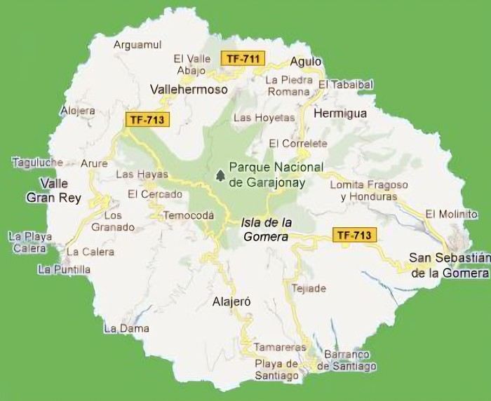 The large solidified magma massifs that shape the heart of the island have created a large depression more protected from the sun at its center, allowing the growth of a vast laurel forest, today grouped within the Garajonay National Park, La Gomera’s green lung, which has earned it the status of a World Biosphere Reserve. Its completely European appearance contrasts sharply with the rocky and tropical landscapes of the rest of the island. Thus, the climate varies greatly from one point to another on the island: in summer, you can quickly go from a dry and sunny valley at 35°C to a humid forest area at altitude at 18°C.
La Gomera was populated late. As with the rest of the Canaries, human presence is thought to have begun about 2,000 years ago. Groups of animist Berbers, probably fleeing persecution, gradually populated the archipelago, especially the western islands and La Gomera, becoming its small aboriginal population: the Guanches (or later Gomeros). The animist and pastoral civilization of the Guanches thrived until the Spanish takeover in the 15th century, which, after a short period of harmony and mixing with the indigenous people, suddenly ended in bloodshed... La Gomera later became the “Columbus Island” after Christopher Columbus’s stopover, increasing the blending of populations. In the 20th century, many Gomeros emigrated to Cuba and other Latin American countries in search of a better life, bringing back a mix of cultures and traits quite palpable in today’s Gomeran culture. It is, however, in La Gomera that the vestiges of Guanche culture seem to have left the most traces, in the language, gastronomy, social practices... Moreover, most Gomeros, especially in remote villages, have a particular identifiable type and proudly claim their ancestral roots, even making La Gomera a bit exotic in the eyes of other Canarians.
Perhaps that’s why it has never really wanted to develop its tourist infrastructure too much. If we set aside the tourists who visit for the day by bus or boat from Tenerife on a marked itinerary (and whom we ultimately rarely encounter), La Gomera has remained a hidden gem, a destination focused on nature discovery that attracts hikers, nature-loving divers, and scientists for its fauna and flora, and to a lesser extent, beachgoers who don’t seek overly developed coastlines. Tourist activity is therefore limited. Roughly speaking, you’ll find a majority of Spaniards, including a substantial number of residents from other Canary Islands, many Germans who have a particular fondness for La Gomera and spend long stays there or own second homes, to the point that the German cultural footprint is clearly noticeable in some places (it’s said to be Angela Merkel’s favorite holiday spot), and still quite a few French. The presence of other nationalities seemed negligible to us. Most travelers come mainly for hiking, but it’s also a prime spot for whale watching. Additionally, the seaside resorts of La Gomera—San Sebastián, Santiago, and especially Valle Gran Rey—are well-known destinations for hippies, especially German ones, ranging from chic boho hippies to old-school hippies who’ve been there for decades, quite similar to those you’d meet in India in Goa, Rishikesh, or Paharganj. Thus, practices like naturism, vegetarianism, and local organic production are quite well established in some areas.
Some practical info: - The round-trip flight from Paris to Tenerife cost us 365 € per person (outbound with Transavia, return with EasyJet), including checked luggage and three seats reserved side by side. - We chose two bases to explore the island: one week in Valle Gran Rey, reputed to be the most pleasant of the three seaside resorts, and one week in Hermigua, more mountainous and close to the natural park. We booked two houses with balconies and views: the first at 120 € per night, the second at 99 €. - The round-trip ferry between Tenerife and La Gomera cost us 270 € with the company Baleària Canarias, including discounts for children aged 4 and 12, but I don’t have the exact details. It was a bit cheaper than with the other company, Fred Olsen. - Finally, we rented a car through the agency Cicar for 360 € for 16 days, which comes to 22.50 € per day. - Apart from that, we didn’t plan anything and decided the day before or even the morning of what we wanted to do. We didn’t invest in any paper guide on the Canaries, as information on La Gomera was scarce, but we used the very comprehensive site La Gomera Travel, a travel guide published by the Canary Islands Tourism Council, a real goldmine of almost exhaustive information on the island.
Alright, off we go for 16 days of adventure discovering La Gomera!
And we start the trip with music!
We start the trip with music!
When we started looking for a summer destination a few months ago, our first criterion was to avoid extreme heat and heatwaves. We had already been to Norway two years ago and are considering going back in the future for other occasions. So, we had some fun asking ChatGPT which destinations enjoyed a mild climate during the summer without going too far. Among the list provided by the AI were the Canary Islands... The idea of a place we wouldn’t have thought of first, both not too far away and exotic enough, appealed to us: “Hmm, why not?”
This destination had never really attracted me, though Magali was a bit more interested. Five years earlier, COVID had caused a short break in my professional activity, and I had planned a trip because the flight price was attractive, and I was looking for a destination different from what usually appeals to me, more than out of deep interest. From a distance and with a social judgment I acknowledge (it’s not great, but it’s not completely wrong), I had the image of a destination for party-goers enjoying the sun without the slightest interest in local culture, with concrete coastlines and denatured landscapes—everything I detest the most. Still, I had done some quick research on the different islands and spotted Lanzarote for its beautiful volcanic landscapes, hiking trails, beaches, and the impression of a good balance between activity and fewer crowds than Tenerife or Gran Canaria. Then I dropped the idea of going, without ever reconsidering traveling to the Canaries...
Until now! Because we started researching the different islands of the archipelago to see which ones might appeal to us the most. It was La Gomera, the third smallest island of the archipelago, more praised for its hiking trails and preserved nature than for its beaches, away from mass tourism (fifty times fewer tourists than Tenerife) but still a bit more developed than its wild neighbor El Hierro, that caught our attention. Contrary to what might be suggested later, I’m not at all addicted to AI, but I use it from time to time to synthesize quick research or simply for experimentation. Since ChatGPT had started anticipating my tastes lately as if it had become my buddy (often successfully, sometimes off the mark), I asked which Canary Island would suit me best for a trip with my family. The tool answered first with... La Gomera. So, I tested it and teased it a bit to see if this suggestion was well-founded, as the method sometimes makes it contradict itself. But no luck: “You’d appreciate the wild nature of El Hierro, but with family, you’ll find little activity for the kids. You won’t like the touristy vibe of the big islands like Tenerife, Gran Canaria, Lanzarote, and Fuerteventura. You could consider La Palma, but it’s really La Gomera that will suit you best, based on your interests and the criteria given.” So, we dug deeper into our research and were convinced without a shadow of a doubt that this island was the one waiting for us.
Without knowing it, we had Canarians in our circle who revealed their origins when they heard about our travel plans. One from Tenerife insisted we’d be better off choosing Tenerife (obviously...) because it also has preserved spots and that La Gomera, “you can explore it in two or three days, you’ll get bored quickly...” The other, a colleague from Gran Canaria who had never visited La Gomera, still recommended it without hesitation because it turned out her parents had just gone there on vacation: they loved it and had encountered few tourists. She also tended to think this destination was usually the subject of short stays, but according to what her parents told her, taking your time there was also a great idea. However, in our research, the idea that La Gomera is an island you can explore in three or four days max kept coming up. So, we considered combining its visit with La Palma or El Hierro, the other two that caught our eye. But hopping between islands by ferry represents a significant budget for non-Canarians, even more so for a family of four. Then, scrutinizing Google Maps, it seemed obvious that two weeks were too short to discover two islands as they deserve, and that there seemed to be plenty to see in La Gomera, given its very unique culture. After all, we read that some people spend several months a year there, others never even leave... Finally, these landscapes and this atmosphere, which seemed to us a mix of Europe, North Africa, and Latin America, tempted us. So, it would be two weeks in La Gomera, deal!
La Gomera is therefore the second... well, the third smallest island of the Canaries since La Graciosa was recently recognized as a fully inhabited island. It has the shape of a rough circle about 20 to 25 kilometers in diameter and has just over 20,000 inhabitants, half of them in its capital, San Sebastián de la Gomera, the only real town. Like its Canarian sisters, La Gomera is a volcanic formation that rose about 10 million years ago. The island is very mountainous and rugged, covered with red and black rocky landscapes. Geological activity has shaped, between the sprawling massifs that end in steep cliffs in the ocean, six coastal valleys with tropical vegetation that have favored human settlement. They divide the island like slices of a cake; from the north clockwise: the agricultural Vallehermoso, the rustic Agulo, the green, humid, and fertile Hermigua, the sunny capital San Sebastián de la Gomera, the southern and isolated Alajeró-Santiago, and the seaside Valle Gran Rey. They constitute the six municipalities (more like cantons to our French understanding) of the territory.
The large solidified magma massifs that shape the heart of the island have created a large depression more protected from the sun at its center, allowing the growth of a vast laurel forest, today grouped within the Garajonay National Park, La Gomera’s green lung, which has earned it the status of a World Biosphere Reserve. Its completely European appearance contrasts sharply with the rocky and tropical landscapes of the rest of the island. Thus, the climate varies greatly from one point to another on the island: in summer, you can quickly go from a dry and sunny valley at 35°C to a humid forest area at altitude at 18°C.La Gomera was populated late. As with the rest of the Canaries, human presence is thought to have begun about 2,000 years ago. Groups of animist Berbers, probably fleeing persecution, gradually populated the archipelago, especially the western islands and La Gomera, becoming its small aboriginal population: the Guanches (or later Gomeros). The animist and pastoral civilization of the Guanches thrived until the Spanish takeover in the 15th century, which, after a short period of harmony and mixing with the indigenous people, suddenly ended in bloodshed... La Gomera later became the “Columbus Island” after Christopher Columbus’s stopover, increasing the blending of populations. In the 20th century, many Gomeros emigrated to Cuba and other Latin American countries in search of a better life, bringing back a mix of cultures and traits quite palpable in today’s Gomeran culture. It is, however, in La Gomera that the vestiges of Guanche culture seem to have left the most traces, in the language, gastronomy, social practices... Moreover, most Gomeros, especially in remote villages, have a particular identifiable type and proudly claim their ancestral roots, even making La Gomera a bit exotic in the eyes of other Canarians.
Perhaps that’s why it has never really wanted to develop its tourist infrastructure too much. If we set aside the tourists who visit for the day by bus or boat from Tenerife on a marked itinerary (and whom we ultimately rarely encounter), La Gomera has remained a hidden gem, a destination focused on nature discovery that attracts hikers, nature-loving divers, and scientists for its fauna and flora, and to a lesser extent, beachgoers who don’t seek overly developed coastlines. Tourist activity is therefore limited. Roughly speaking, you’ll find a majority of Spaniards, including a substantial number of residents from other Canary Islands, many Germans who have a particular fondness for La Gomera and spend long stays there or own second homes, to the point that the German cultural footprint is clearly noticeable in some places (it’s said to be Angela Merkel’s favorite holiday spot), and still quite a few French. The presence of other nationalities seemed negligible to us. Most travelers come mainly for hiking, but it’s also a prime spot for whale watching. Additionally, the seaside resorts of La Gomera—San Sebastián, Santiago, and especially Valle Gran Rey—are well-known destinations for hippies, especially German ones, ranging from chic boho hippies to old-school hippies who’ve been there for decades, quite similar to those you’d meet in India in Goa, Rishikesh, or Paharganj. Thus, practices like naturism, vegetarianism, and local organic production are quite well established in some areas.
Some practical info: - The round-trip flight from Paris to Tenerife cost us 365 € per person (outbound with Transavia, return with EasyJet), including checked luggage and three seats reserved side by side. - We chose two bases to explore the island: one week in Valle Gran Rey, reputed to be the most pleasant of the three seaside resorts, and one week in Hermigua, more mountainous and close to the natural park. We booked two houses with balconies and views: the first at 120 € per night, the second at 99 €. - The round-trip ferry between Tenerife and La Gomera cost us 270 € with the company Baleària Canarias, including discounts for children aged 4 and 12, but I don’t have the exact details. It was a bit cheaper than with the other company, Fred Olsen. - Finally, we rented a car through the agency Cicar for 360 € for 16 days, which comes to 22.50 € per day. - Apart from that, we didn’t plan anything and decided the day before or even the morning of what we wanted to do. We didn’t invest in any paper guide on the Canaries, as information on La Gomera was scarce, but we used the very comprehensive site La Gomera Travel, a travel guide published by the Canary Islands Tourism Council, a real goldmine of almost exhaustive information on the island.
Alright, off we go for 16 days of adventure discovering La Gomera!
And we start the trip with music!
We start the trip with music!
Hi everyone,
I’m starting to plan my next trip to Southeast Asia this winter (2.5 months, leaving in early December), and here’s a rough outline of my route—I’d love to share it with you and hear your thoughts and tips.
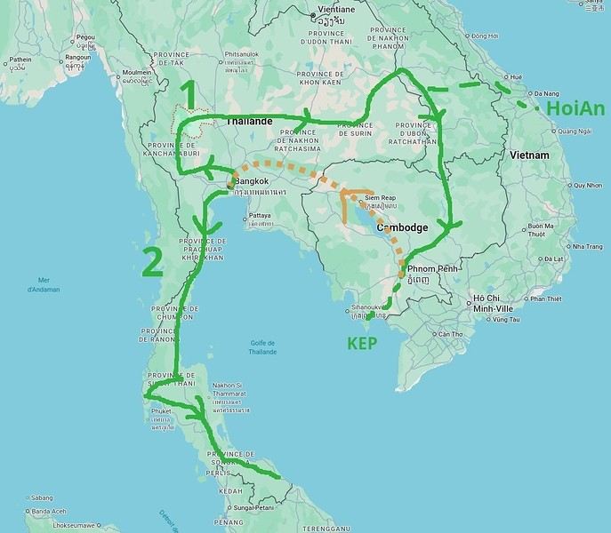
- I’ll start in Bangkok and already have three spots I’ve marked: Ayutthaya, Kanchanaburi, and Uthai Thani (I haven’t been to any of these places yet). - Next, I’d like to cross the country from west to east to reach the Laos border. I’d love suggestions for any interesting stops along this route—I don’t know this part of Thailand at all... - Then I’ll head into Laos, probably at Savannakhet (you can usually get a visa at the border). - > I’m tempted to spend a week in Hoi An, Vietnam, since I loved that city and the area when I visited two years ago. No visa needed for Vietnam now, so it could be a nice little detour. On the map, it doesn’t look too far, but I know you’ve got to be careful with these things, and I’m not sure if it’s a good idea. Any opinions on this? - Back to Laos (maybe via Dakta), and I’ll head south along the Mekong, probably doing the Bolaven Plateau loop that I missed last time. Then Paksé, the 4,000 Islands... I’ve been before, but I’d happily go back. - Crossing into Cambodia, I’ll follow the Mekong down to Phnom Penh (I know this area and love how untouristy it is). From there, I’ll probably spend a few days in Kep (quieter than Kampot). Still undecided, though. - Then back to Thailand (BKK), likely by plane from Phnom Penh since the borders between the two countries are currently closed (plus, let’s be honest, Cambodian roads... ;-). We’ll see how things look when the time comes. - After that, I’d like to explore southern Thailand, taking it slow with short hops. I’ve got my eye on Khao Sok National Park, and I’ve heard good things about Krabi... Again, I don’t know this region well, so any info or tips would be great.
So, I think this should be doable in 2.5 months, especially since I prefer short hops of 300 km max to avoid getting too tired, and I like staying 2-3 days in each place to explore. Plus, I’ll take a week off to relax if I find a spot I love—maybe by the sea for some real downtime.
Thanks for your feedback and for sharing your favorite spots! Pascal
- I’ll start in Bangkok and already have three spots I’ve marked: Ayutthaya, Kanchanaburi, and Uthai Thani (I haven’t been to any of these places yet). - Next, I’d like to cross the country from west to east to reach the Laos border. I’d love suggestions for any interesting stops along this route—I don’t know this part of Thailand at all... - Then I’ll head into Laos, probably at Savannakhet (you can usually get a visa at the border). - > I’m tempted to spend a week in Hoi An, Vietnam, since I loved that city and the area when I visited two years ago. No visa needed for Vietnam now, so it could be a nice little detour. On the map, it doesn’t look too far, but I know you’ve got to be careful with these things, and I’m not sure if it’s a good idea. Any opinions on this? - Back to Laos (maybe via Dakta), and I’ll head south along the Mekong, probably doing the Bolaven Plateau loop that I missed last time. Then Paksé, the 4,000 Islands... I’ve been before, but I’d happily go back. - Crossing into Cambodia, I’ll follow the Mekong down to Phnom Penh (I know this area and love how untouristy it is). From there, I’ll probably spend a few days in Kep (quieter than Kampot). Still undecided, though. - Then back to Thailand (BKK), likely by plane from Phnom Penh since the borders between the two countries are currently closed (plus, let’s be honest, Cambodian roads... ;-). We’ll see how things look when the time comes. - After that, I’d like to explore southern Thailand, taking it slow with short hops. I’ve got my eye on Khao Sok National Park, and I’ve heard good things about Krabi... Again, I don’t know this region well, so any info or tips would be great.
So, I think this should be doable in 2.5 months, especially since I prefer short hops of 300 km max to avoid getting too tired, and I like staying 2-3 days in each place to explore. Plus, I’ll take a week off to relax if I find a spot I love—maybe by the sea for some real downtime.
Thanks for your feedback and for sharing your favorite spots! Pascal
Preamble
June 2024. While hiking with my brother on the GR 36 Tour du Morvan, I catch sight now and then of strange rectangular markers fixed to tree trunks. Against a bright orange background, a deep black Greek tau topped with a white dove. My first encounter with the Assisi Way. The Way of St. Francis: a pilgrimage route linking Vézelay in Burgundy to Assisi in Italy, covering nearly 1,800 km. It felt like an obvious next step—I immediately knew I’d take it on, attempt the adventure solo.
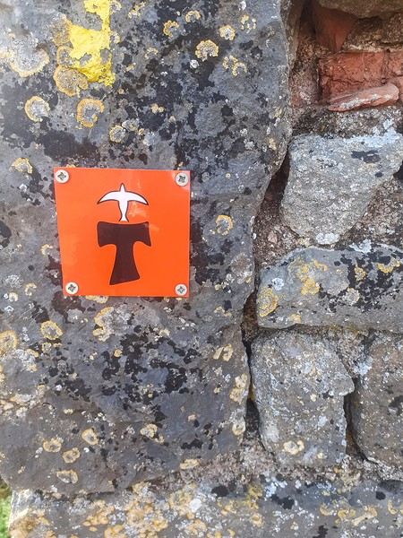
In the months that followed, I talked about my project to everyone—family, friends, my partner. An avalanche of comments, more or less the same but varying depending on each person’s character and life experiences. But deep down, it all boiled down to one legitimate question: why?
And the answers? Hesitant, awkward, partial, even confused. I quickly realized they weren’t so easy to find. It was as if my project seemed more like a whim, a kind of intimate caprice, rather than a well-thought-out plan. Of course, I knew the reasons that pushed me to leave—you always have to give some. Loved ones need to understand to feel reassured, and that’s understandable. But I fear that when I list them, they’ll sound like the same old checklist anyone embarking on this kind of journey might give. Of all the reasons I could mention, I’ll highlight just one here: the call of the road, the solo adventure that brings a powerful sense of freedom. A bit like Monsieur Seguin’s goat, who from her comfortable pen gazes longingly at the unconstrained horizon of the mountain. But if I’m being honest, I think I didn’t really know what I was looking for—or, more importantly, what I’d find. Deep down, when I reflect on it, one word keeps coming up that explains nothing and everything at once: desire.
Now well past sixty, I know that when I ask myself who I am or where I’m going, two things bring me fully back to myself: hiking and writing. And my intention was also to anchor this adventure through words, day by day. Writing down my feelings, emotions, discoveries, and reflections each evening. The famous travel journal that grounds the daily experience in reality. When I discovered the app "Polarstep," which was initially just meant to keep my loved ones updated and reassured, inform them of my progress, and maintain a connection, I found an opportunity to do it a little differently than usual. No retrospective notes polished up after returning, but spontaneous writing—recounting everything that crossed my mind during the day and publishing it immediately. A journey lived in real time.
This text is the exact transcription of my daily writings. Rereading them, I didn’t change a thing—just corrected a few mistakes and tweaked some awkward phrasing here and there. Short texts, fitting the format imposed by this kind of app. Writing as if addressing others.
Now, all that was left was to walk. April 18, 2026 – Vézelay.
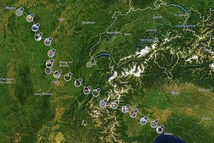
June 2024. While hiking with my brother on the GR 36 Tour du Morvan, I catch sight now and then of strange rectangular markers fixed to tree trunks. Against a bright orange background, a deep black Greek tau topped with a white dove. My first encounter with the Assisi Way. The Way of St. Francis: a pilgrimage route linking Vézelay in Burgundy to Assisi in Italy, covering nearly 1,800 km. It felt like an obvious next step—I immediately knew I’d take it on, attempt the adventure solo.
In the months that followed, I talked about my project to everyone—family, friends, my partner. An avalanche of comments, more or less the same but varying depending on each person’s character and life experiences. But deep down, it all boiled down to one legitimate question: why?
And the answers? Hesitant, awkward, partial, even confused. I quickly realized they weren’t so easy to find. It was as if my project seemed more like a whim, a kind of intimate caprice, rather than a well-thought-out plan. Of course, I knew the reasons that pushed me to leave—you always have to give some. Loved ones need to understand to feel reassured, and that’s understandable. But I fear that when I list them, they’ll sound like the same old checklist anyone embarking on this kind of journey might give. Of all the reasons I could mention, I’ll highlight just one here: the call of the road, the solo adventure that brings a powerful sense of freedom. A bit like Monsieur Seguin’s goat, who from her comfortable pen gazes longingly at the unconstrained horizon of the mountain. But if I’m being honest, I think I didn’t really know what I was looking for—or, more importantly, what I’d find. Deep down, when I reflect on it, one word keeps coming up that explains nothing and everything at once: desire.
Now well past sixty, I know that when I ask myself who I am or where I’m going, two things bring me fully back to myself: hiking and writing. And my intention was also to anchor this adventure through words, day by day. Writing down my feelings, emotions, discoveries, and reflections each evening. The famous travel journal that grounds the daily experience in reality. When I discovered the app "Polarstep," which was initially just meant to keep my loved ones updated and reassured, inform them of my progress, and maintain a connection, I found an opportunity to do it a little differently than usual. No retrospective notes polished up after returning, but spontaneous writing—recounting everything that crossed my mind during the day and publishing it immediately. A journey lived in real time.
This text is the exact transcription of my daily writings. Rereading them, I didn’t change a thing—just corrected a few mistakes and tweaked some awkward phrasing here and there. Short texts, fitting the format imposed by this kind of app. Writing as if addressing others.
Now, all that was left was to walk. April 18, 2026 – Vézelay.
After a pretty disastrous weather-wise trip to Gran Canaria, we’re hoping this time the sun will shine in Puglia.
It’s not a sure thing, though—the weather’s been awful all over Europe in early May.
For those who’d like to (re)read the story without the digressions, it’s here.
Saturday, May 16: This time we’re flying out of Charleroi (Brussels South): the ticket prices, flight times, and proximity all worked for us. The airport (Ryanair) was recently renovated... but it’s still not very well organized. There are hardly any seats in the boarding areas, and... the restrooms cost money!!! The flight goes smoothly, though, and we land in Bari a little late.
We quickly pick up our rental car, a very local-looking Pandina (even more so than the Fiat 500 in this region), and hit the Italian roads... and their unique driving quirks (like the fact that the countless road signs along the streets and in towns are purely decorative 😏, and that Italian cars don’t have turn signals 😮... except for rental cars).
About an hour later, we arrive at our first accommodation, right in the middle of the countryside near Monopoli. The owner isn’t there, but they’ve left us a ton of info via messages and even turned on the space heater, which is a nice touch. We explore the property:

And the next morning before breakfast, its immediate surroundings:


Sunday, May 17: After our "seaside" experience in Gran Canaria last weekend (packed with people and locals), we decide to start inland. After a hearty breakfast,

we head toward Alberobello, a super touristy village famous for its trulli—those stone houses with conical roofs. We easily find a free parking spot on a street near the Aia Piccola district, where some trulli are still lived in year-round.


We almost immediately come across the Trullo Sovrano (the only two-story one), which you can visit (but we skip it—it’s opening time, and there’s already a line).

From there, we head down toward the Basilica of Cosma e Damiano... but we don’t go in because there’s a mass.

Now we’re on the main Piazza del Popolo, which connects the two districts of Alberobello: Rione Aia Piccola and Rione Monti, the more touristy one.
For those who’d like to (re)read the story without the digressions, it’s here.
Saturday, May 16: This time we’re flying out of Charleroi (Brussels South): the ticket prices, flight times, and proximity all worked for us. The airport (Ryanair) was recently renovated... but it’s still not very well organized. There are hardly any seats in the boarding areas, and... the restrooms cost money!!! The flight goes smoothly, though, and we land in Bari a little late.
We quickly pick up our rental car, a very local-looking Pandina (even more so than the Fiat 500 in this region), and hit the Italian roads... and their unique driving quirks (like the fact that the countless road signs along the streets and in towns are purely decorative 😏, and that Italian cars don’t have turn signals 😮... except for rental cars).
About an hour later, we arrive at our first accommodation, right in the middle of the countryside near Monopoli. The owner isn’t there, but they’ve left us a ton of info via messages and even turned on the space heater, which is a nice touch. We explore the property:
And the next morning before breakfast, its immediate surroundings:
Sunday, May 17: After our "seaside" experience in Gran Canaria last weekend (packed with people and locals), we decide to start inland. After a hearty breakfast,
we head toward Alberobello, a super touristy village famous for its trulli—those stone houses with conical roofs. We easily find a free parking spot on a street near the Aia Piccola district, where some trulli are still lived in year-round.
We almost immediately come across the Trullo Sovrano (the only two-story one), which you can visit (but we skip it—it’s opening time, and there’s already a line).
From there, we head down toward the Basilica of Cosma e Damiano... but we don’t go in because there’s a mass.
Now we’re on the main Piazza del Popolo, which connects the two districts of Alberobello: Rione Aia Piccola and Rione Monti, the more touristy one.
Well, here we go,
despite the lack of info on Zambia, I managed to pull off this pretty special trip.
I’d posted asking for tips but got very few replies. So I leaned heavily on Giradhino’s travel journal to plan the route.
The context: After visiting Kenya, then Namibia, then Botswana, I wanted to see another Southern African country—hence Zambia. This time, we’re two couples: us (of course) and our friends we’ve traveled with to the last two countries mentioned. The idea was to do a self-drive trip, picking up a 4x4 at the airport and figuring it out as we went.
We rented our fully equipped vehicle from Hemingways, an agency in Livingstone. Great agency (really), I’ll talk more about them later. It came with rooftop tents and all the gear for cooking and everything... However, our goal was to sleep in lodges and only use the tents as a last resort. Mission accomplished—we never even unfolded the tents. Guess we’re getting old 🙂
The route (summary): Lusaka - Kasanka NP - Bangweulu NP - Mutinondo - Kapishya - North Luangwa - South Luangwa and back to Lusaka.
That said, let’s hit the road for this travel journal of a pretty lively trip. Reminder: I’m more of a filmmaker, so I’ve got tons of footage but very few photos. The ones I have were taken on my phone, so they’re not great quality. My wife’s the one who handles that side of things.
Day 1:
At 9 a.m. sharp (or close enough), we leave the Lyon area, heading to Paris CDG. Our flight’s at 9:30 p.m., but it’s a busy Saturday with holiday traffic, so we play it safe to avoid jams—especially since the Olympics (hosted in Paris, in case you didn’t know) are causing extra traffic issues.
We’re relaxed and happy to be on our way. The drive goes smoothly. We take the eastern route around Paris to reach a hotel with parking at a better price than the airport lots. We leave the car there, and a shuttle takes us to Terminal 2. Bad luck—we’re actually flying from Terminal 1! The transfer between terminals is quick, though, so no stress.
After the usual formalities (with Rwandair), we end up in the Duty Free.
A rare rant-free moment: Usually, I let off steam in my travel journals now and then, but this time it’s the opposite. I had a terrible memory of CDG and had been avoiding it for years. But this time—Olympics effect? A big change? What a pleasant surprise! The staff were plentiful and super friendly at every pre-flight step, making everything easier. Comfortable seats for waiting to board. Well done, CDG!
We buy Ricard, Jack Daniel’s, and Get 27 to handle any situation that might come up. We board on time, and that’s when our adventures with Rwandair really begin. Yep, the first hiccup!
We’d booked our tickets back in October and (since we don’t hold back!) had paid extra for preferred seats on all our flights. Since October, we’d received emails about schedule changes—just a few minutes here and there. Unfortunately, we never got an email saying that *on top of* the schedule change, the plane’s configuration had also changed. So when we boarded with our seats (all four of us together at row 25), we were furious to see that the preferred seats were now row 23. We’d been *completely* scammed. We’d paid extra to end up in seats we’d been trying to avoid! You could say Rwandair double-dipped on the same seats. What a rip-off! We tried to negotiate an upgrade, but the flight was full. So our flight to Kigali started with a real sense of anger.
The +: We’re on our way The -: Rwandair
The context: After visiting Kenya, then Namibia, then Botswana, I wanted to see another Southern African country—hence Zambia. This time, we’re two couples: us (of course) and our friends we’ve traveled with to the last two countries mentioned. The idea was to do a self-drive trip, picking up a 4x4 at the airport and figuring it out as we went.
We rented our fully equipped vehicle from Hemingways, an agency in Livingstone. Great agency (really), I’ll talk more about them later. It came with rooftop tents and all the gear for cooking and everything... However, our goal was to sleep in lodges and only use the tents as a last resort. Mission accomplished—we never even unfolded the tents. Guess we’re getting old 🙂
The route (summary): Lusaka - Kasanka NP - Bangweulu NP - Mutinondo - Kapishya - North Luangwa - South Luangwa and back to Lusaka.
That said, let’s hit the road for this travel journal of a pretty lively trip. Reminder: I’m more of a filmmaker, so I’ve got tons of footage but very few photos. The ones I have were taken on my phone, so they’re not great quality. My wife’s the one who handles that side of things.
Day 1:
At 9 a.m. sharp (or close enough), we leave the Lyon area, heading to Paris CDG. Our flight’s at 9:30 p.m., but it’s a busy Saturday with holiday traffic, so we play it safe to avoid jams—especially since the Olympics (hosted in Paris, in case you didn’t know) are causing extra traffic issues.
We’re relaxed and happy to be on our way. The drive goes smoothly. We take the eastern route around Paris to reach a hotel with parking at a better price than the airport lots. We leave the car there, and a shuttle takes us to Terminal 2. Bad luck—we’re actually flying from Terminal 1! The transfer between terminals is quick, though, so no stress.
After the usual formalities (with Rwandair), we end up in the Duty Free.
A rare rant-free moment: Usually, I let off steam in my travel journals now and then, but this time it’s the opposite. I had a terrible memory of CDG and had been avoiding it for years. But this time—Olympics effect? A big change? What a pleasant surprise! The staff were plentiful and super friendly at every pre-flight step, making everything easier. Comfortable seats for waiting to board. Well done, CDG!
We buy Ricard, Jack Daniel’s, and Get 27 to handle any situation that might come up. We board on time, and that’s when our adventures with Rwandair really begin. Yep, the first hiccup!
We’d booked our tickets back in October and (since we don’t hold back!) had paid extra for preferred seats on all our flights. Since October, we’d received emails about schedule changes—just a few minutes here and there. Unfortunately, we never got an email saying that *on top of* the schedule change, the plane’s configuration had also changed. So when we boarded with our seats (all four of us together at row 25), we were furious to see that the preferred seats were now row 23. We’d been *completely* scammed. We’d paid extra to end up in seats we’d been trying to avoid! You could say Rwandair double-dipped on the same seats. What a rip-off! We tried to negotiate an upgrade, but the flight was full. So our flight to Kigali started with a real sense of anger.
The +: We’re on our way The -: Rwandair
Hey there, VF crew!
After wrapping up our travel journal on Java (link below), we’re now diving into our recent adventure in Puglia! Happy reading... Off we go on an adventure in Java (and a bit of Bali) | Travel journal > Indonesia | Voyage Forum
Day 1 - October 19
When you tell your friends and family you’re itching to escape to the other side of the planet to mingle with the Mongols, you can usually expect a barrage of questionable jokes and terrible puns. For this new adventure, it’s a different destination but the same old story—this time, we’re visiting the "pouilleux" (the "scruffy" ones). We’re taking off straight for Puglia! If you need a cheat sheet to remember where this oddly named place is on a world map, just think of it this way: Puglia is the maiden name on the ID card of the heel of the Italian boot! Personally, I prefer to remember it as the land of creamy burrata, the smell of focaccia fresh from the oven, orecchiette shaped by mamas, golden olive oil that shines like the sun (which beams down here 300 days a year), amaretto that makes you happy, and those famous trulli—those little hobbit-like dry-stone houses straight out of a movie set...
But I’ll stop spoiling the rest of our trip and focus on a factual rundown of this first Puglian day. So, are you joining us on this new adventure beyond our Gallic borders? Either way, Sasha (my youngest) and Luna (Flo’s daughter) didn’t need much convincing to stick with us and keep up the pace!
Our plane drops our little crew in Bari, the site of a famously tragic battle lost in 1991. But revenge is sweet! After renting a motorized carriage, we escape the landing zone and head to our military base of operations: Ostuni, a strategic little town where we’ll set up camp for the next four days. Why Ostuni? First, for its central location, which lets us explore a region packed with must-see gems. Second, for its vibe and beauty, which have earned it quite the reputation. Perched high on a hill, the *città bianca* (the "White City") lives up to its nickname. It literally dazzles visitors. The reason? The whitewashed facades of its houses, a testament to the region’s rich architectural heritage.
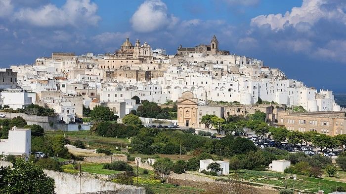
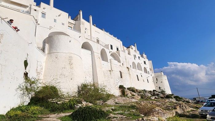
We arrived late last night, so only the two bravest soldiers volunteered to scout ahead at dawn, while the younger recruits stayed behind—for now. But not for long! After the first wave of streets and the next round of exploration, headquarters made the inevitable call to retreat. Reinforcements were needed! A few strategic errands, a breakfast ration, and our battalion marched in tight formation, flag held high, to conquer Ostuni the White! *Charge!* In my squadron leader’s memoirs, I’ll write that I didn’t expect Ostuni to put up such a fight. What I thought would take two hours to conquer turned into a humbling experience—we could only bow in respect to its beauty, its relentless charm. The alleys are whiter, more labyrinthine, narrower, and more photogenic than the last. *Veni, vidi, vici*—but what an entrance, my troops!
After wrapping up our travel journal on Java (link below), we’re now diving into our recent adventure in Puglia! Happy reading... Off we go on an adventure in Java (and a bit of Bali) | Travel journal > Indonesia | Voyage Forum
Day 1 - October 19
When you tell your friends and family you’re itching to escape to the other side of the planet to mingle with the Mongols, you can usually expect a barrage of questionable jokes and terrible puns. For this new adventure, it’s a different destination but the same old story—this time, we’re visiting the "pouilleux" (the "scruffy" ones). We’re taking off straight for Puglia! If you need a cheat sheet to remember where this oddly named place is on a world map, just think of it this way: Puglia is the maiden name on the ID card of the heel of the Italian boot! Personally, I prefer to remember it as the land of creamy burrata, the smell of focaccia fresh from the oven, orecchiette shaped by mamas, golden olive oil that shines like the sun (which beams down here 300 days a year), amaretto that makes you happy, and those famous trulli—those little hobbit-like dry-stone houses straight out of a movie set...
But I’ll stop spoiling the rest of our trip and focus on a factual rundown of this first Puglian day. So, are you joining us on this new adventure beyond our Gallic borders? Either way, Sasha (my youngest) and Luna (Flo’s daughter) didn’t need much convincing to stick with us and keep up the pace!
Our plane drops our little crew in Bari, the site of a famously tragic battle lost in 1991. But revenge is sweet! After renting a motorized carriage, we escape the landing zone and head to our military base of operations: Ostuni, a strategic little town where we’ll set up camp for the next four days. Why Ostuni? First, for its central location, which lets us explore a region packed with must-see gems. Second, for its vibe and beauty, which have earned it quite the reputation. Perched high on a hill, the *città bianca* (the "White City") lives up to its nickname. It literally dazzles visitors. The reason? The whitewashed facades of its houses, a testament to the region’s rich architectural heritage.
We arrived late last night, so only the two bravest soldiers volunteered to scout ahead at dawn, while the younger recruits stayed behind—for now. But not for long! After the first wave of streets and the next round of exploration, headquarters made the inevitable call to retreat. Reinforcements were needed! A few strategic errands, a breakfast ration, and our battalion marched in tight formation, flag held high, to conquer Ostuni the White! *Charge!* In my squadron leader’s memoirs, I’ll write that I didn’t expect Ostuni to put up such a fight. What I thought would take two hours to conquer turned into a humbling experience—we could only bow in respect to its beauty, its relentless charm. The alleys are whiter, more labyrinthine, narrower, and more photogenic than the last. *Veni, vidi, vici*—but what an entrance, my troops!
Hello,
A few months ago, I posted a message in the Southern Africa section about a family trip in July/August. In the end, since I had too much trouble deciding on the destination and procrastinated too much with the planning 😎, I changed my mind and we’re going for a completely different trip—to Madagascar, a country we already know a bit since we’ve traveled there several times for 4 to 6 months each time, though our last visit was back in 2012!
The tickets are booked: 19 days on the ground (excluding arrival and departure days in Tana), spanning July and August.
We’re not looking to rack up landscapes (and kilometers). The kids really want to see lots of animals, while we mostly want to show them what daily life is like in Malagasy villages. So ideally, we’d like a trip split into two parts: - For 8/10 days, a hiking portion. The idea isn’t to do a tough trek in very remote areas but rather to walk from one village to another. Let’s say 3-4 hours a day. And when we arrive in each village, we’d have time to explore a bit, chat with the locals, let our kids play with the village children, etc. Stay with locals when possible. Move to a new village every day or every 2-3 days. - A few days visiting 1 or 2 national parks (with lemurs if possible to keep everyone happy!) - With the inevitable travel days, we’ll quickly hit 19 days.
Does this kind of trip sound doable (and fun) to you? Do you know of any villages that would fit our hiking plans?
I don’t have a preferred region yet, except that very dry landscapes appeal to me less. My real love from past trips was the highlands and their bright green rice paddies against red earth, but I’m a bit worried about the cold at this time of year.
After my initial research (thanks to this forum), I get the impression that the Ambalavao/Ambohimahamasina area might meet our criteria. I saw there are "accueil paysan" (farm stays) in that area, which could match what we’re looking for and would let us visit Andringitra National Park and Ranomafana on the way there or back.
But I’m open to all your more original ideas!
For logistical questions (transport, guides, accommodations, etc.), I’ll tackle those later—it’ll depend on the area we choose.
Thanks in advance for your suggestions
A few months ago, I posted a message in the Southern Africa section about a family trip in July/August. In the end, since I had too much trouble deciding on the destination and procrastinated too much with the planning 😎, I changed my mind and we’re going for a completely different trip—to Madagascar, a country we already know a bit since we’ve traveled there several times for 4 to 6 months each time, though our last visit was back in 2012!
The tickets are booked: 19 days on the ground (excluding arrival and departure days in Tana), spanning July and August.
We’re not looking to rack up landscapes (and kilometers). The kids really want to see lots of animals, while we mostly want to show them what daily life is like in Malagasy villages. So ideally, we’d like a trip split into two parts: - For 8/10 days, a hiking portion. The idea isn’t to do a tough trek in very remote areas but rather to walk from one village to another. Let’s say 3-4 hours a day. And when we arrive in each village, we’d have time to explore a bit, chat with the locals, let our kids play with the village children, etc. Stay with locals when possible. Move to a new village every day or every 2-3 days. - A few days visiting 1 or 2 national parks (with lemurs if possible to keep everyone happy!) - With the inevitable travel days, we’ll quickly hit 19 days.
Does this kind of trip sound doable (and fun) to you? Do you know of any villages that would fit our hiking plans?
I don’t have a preferred region yet, except that very dry landscapes appeal to me less. My real love from past trips was the highlands and their bright green rice paddies against red earth, but I’m a bit worried about the cold at this time of year.
After my initial research (thanks to this forum), I get the impression that the Ambalavao/Ambohimahamasina area might meet our criteria. I saw there are "accueil paysan" (farm stays) in that area, which could match what we’re looking for and would let us visit Andringitra National Park and Ranomafana on the way there or back.
But I’m open to all your more original ideas!
For logistical questions (transport, guides, accommodations, etc.), I’ll tackle those later—it’ll depend on the area we choose.
Thanks in advance for your suggestions
An 80-Day Tour of Southern Africa
Back in South Africa
January 12, 2013, 5:30 AM, Flight BA043 London-Cape Town
Directly below, Windhoek glittered like a tangle of fairy lights still lit and tossed into a box.
The horizon, edged in purple, was setting up a backup fireworks display, and suddenly, like a cherry on the platter and with unbearable intensity, in less than two minutes the entire sun revealed a gray dam and then a vast, untouched massif.
A few more minutes and the glare to the east of the plane was total. In Africa, the sun is swift.
We still had a France to cross before landing, but it felt as if we were already there. To the west, the raking light revealed what looked like acne and long, swollen scars in a desert region that might be the Swartkloofberg. Further still, straight as far as the eye could see, the two parallel tracks of a dirt road.
At 11,500 meters altitude and 940 km/h, we had a sense of stillness until the Orange River appeared, an incongruous serpent, gray edged with green.
The first South African settlements were dotted with trees providing shade, then rivers highlighted by continuous lines of vegetation.
Water and shade that make life possible.
We’ll return here by the backroads.
Half an hour from Cape Town, the plane tilted toward the sea, crossing plantations (likely citrus) and then an explosion of cultivated greenery in circles on either side of an unruly river. Finally, the coastline was no longer just sand and water—a frothy hem, a suture?
A peninsula came into view, forming two magnificent bays, and... a flight attendant firmly instructed me to return to my seat: we’d arrived!
The Colors of Cape Town
The city was dressed up as I like them—deserted, fluid, free of its vendors.
In the parking lot of the endless beach next to the commercial port north of the city, about two hundred people were unloading their goods in front of their pickups or combis, none of which were from this century: mixed-race, ageless Black people, and white folks who looked like they’d stepped out of another era.
After a few minutes, intrigued, I played a game: first looking at the merchandise, then imagining who was selling it, and finally looking at who was actually manning the stall. Tall Black vendors were selling what they often sell in Europe—leather, sunglasses, watches; mixed-race folks offered discount bundles, and the tanned older white people seemed to have emptied their attics.
We left with an antique tin kettle for morning tea over an open fire, a pack of five exercise books (that’s 600 pages to fill), Bill Bryson’s earliest stories in English, some snoek rillettes (a local fish), and—never seen before—tuna biltong and snoek biltong.
In so-called advanced countries, Sunday is for sports: white cyclists dressed like pros sweating diligently, Black street vendors running in loops at red lights to sell trash bags that day; white golfers losing their balls, which a scantily clad Black man retrieves from the water; under the sails of kite surf boards, it’s all blondes, and in the foam, joyful splashes from a bunch of Black kids.
Searching for an unusual spot for lunch, we drove through the fishing port looking for a dive and, at the end of a dead-end road with no warning, we arrived at the Shimmy Beach Club—quite the program.
The place, open for just three weeks, aims to be ultra-trendy. You could be in San Francisco, Lisbon’s docks, or St. Barth. This time, the "visible" staff was diverse, but the clientele was exclusively white, except for one mixed-race couple.
For this Sunday lunch, the women had pulled out all the stops, and local starlets—who’d make ours look tame—were turning the terrace into a frenzy.
At Cape Town’s port, the girls have *port*. The trend seems to be crochet dresses over swimsuits.
For two hours, a team of employees watered and raked the sand, starting over when they finished. A child in a floaty pink dress and a gold headband, but a future adventurer, stepped onto the freshly raked artificial beach sand for the first time.
A lanky mixed-race man dragged a hose across the ground, followed by a white woman—enchanted?—who then started watering the sand herself, carelessly splashing the glass terrace her colleague had just swept. I suspect a tacit work arrangement to keep everyone employed.
A galleon packed with tourists (are there any in the hold? Does it take tourists to Robben Island?) left the port. A helicopter took off in its wake. Trawlers returned, cutting through a ballet of catamarans, their waterlines well above the water: a bad catch.
If there’s one country where you can’t pretend to ignore skin color, it’s this one. The question is in everyone’s mind, and here more than anywhere else, it’s a decisive economic and political factor.
Columbine of Brittany
200 km north of Cape Town and 9,000 km south of the Breton coast, but on the same cold ocean, we camped on the shore of the Columbine Cape Nature Reserve, sheltered by a rocky chaos that, at first light tomorrow, would transport us to Perros-Guirec.
Our first encounter with wild animals wouldn’t end well for them: it was crayfish season, and they were the size of lobsters at Lorient’s fish market. Bought for R60 (5.5 €) a pair from kids in Pater Noster, they’d end up between two rocks, over a fire. But first, we had to pair the Chenin blanc with some snoek biltong.
With no wood, I lit a fire at dawn with dried seaweed and kelp, as if petrified; it gave off a smell of court-bouillon and... tires. Two hundred fathoms away, on an outpost, an army of cormorants stood at attention, unmoved among the frolicking seals.
At the reserve’s exit, the guard spoke French; Patrick Mwanba had arrived from Congo three years earlier to study, but the cost of living here forced him to drop out. He’d like to return home because life is cheaper there, but the war made him hesitate.
Ding ding dong! Vroom! Arf arf, Woof! Buzz! (A night from hell!)
I’d long planned to visit Calvinia, the center of a region known for extensive sheep farming. An excellent provincial museum, run by an enthusiastic curator, kept us too late to start the drive north.
So we camped in a tiny, charming campsite set up in the garden of a house. A few trees, a patch of resilient grass, and a view of a pretty lit-up steeple—what else?
Well, it turned out to be a sound-and-light show, with the pretty steeple chiming the hours and half-hours. Then suddenly, we were in the VIP stands of the Karoo-Kalahari Truck Race: roaring trucks paraded under our canvas windows, and we realized we were on the main road through town. To top it off, we enjoyed an uninterrupted canine cacophony, from the *arf arf* of little dogs to the *woof* of a mastiff. Oh, and some mosquitoes—the first ones—insisted on keeping us company in the tent, and we hadn’t yet bought the arsenal to neutralize them.
I walked through Calvinia at night; the house gardens weren’t fenced, nor did they have the «Armed Response» signs so common in the country.
The Kalahari Trails
(No, no, I haven’t converted to hiking.)
North of Calvinia, in the south of the Northern Cape, small towns follow one another up to Upington, about a hundred kilometers apart—welcome havens. Between them, with no trees in sight, we stopped in the shade of a motionless cloud: the temperature exceeded 40°C in mid-January.
We were almost out of the High Karoo and into a region of pans drying up, until the first red dunes appeared, precursors of the Kalahari. In the sparse veld vegetation, gatherings of quiver trees in the kopjes, and a caravan of camels without a handler or packs, marching in perfect formation across a pan (no, I hadn’t overdone the Windhoek at the last stop, and no, I wasn’t dehydrated enough to hallucinate).
The historic part of these towns, European in style, was built on the same plans as those in the American Midwest or the Australian Outback: a grid of streets wide enough to turn a wagon pulled by eight pairs of oxen. The architecture was Dutch-inspired, tropicalized with awnings.
Then came more recent housing, functional in style, where the wealthier mixed-race people—who make up the majority of this state—lived, and further on, the township, an assemblage of corrugated iron and plastic, like everywhere else.
Orange, Right Bank
North of Augrabies Falls National Park, on the other side of the Orange River, stretches a rugged and wild territory the size of fifty Groix islands, crisscrossed by a few tracks—the Riemvasmaak.
The inhabitants were driven out half a century ago for a military base, and as soon as President Mandela was elected, he made it a symbol by allowing the exiled populations to return. Several ethnic groups live here on almost nothing, in government-built shacks.
A community camp is set up in a small cirque at the end of a canyon that, while not in the history books, offers a good descent. By mid-afternoon, the air was at 44°C, but luckily there was a spring... except it was a hot spring, with water at 38°C. And they haven’t invented a reversible spring yet. Once the birds and baboons had settled in, in absolute silence and far from any light pollution, we enjoyed the stars like nowhere else (well, that’s what they claim in the region).
The Orange didn’t choose the easy path: arriving from Lesotho, it was almost at the ocean. The terrain to the south and north of this massif seemed easier to cross. Was it to avoid the curse of the Okavango, whose waters disappear into the sands without ever seeing the sea, that it chose this rocky route, thinking that at least the granite wouldn’t steal its water?
I Love You, I Eat You
In the dry bed of the Auob, it lay panting, head raised, alert, between its paws but head-to-tail, a tawny springbok, motionless.
A few minutes earlier, their story had been written in a lightning-fast chase, captured in photos by the driver of the car that alerted us.
It would be a long time before it started eating at the groin without breaking its surveillance.
Earlier, there was a lion lounging in the shade and hundreds of antelopes: springboks and gemsboks (oryx) in herds, hartebeests and steenboks alone. Strange pairs, apart several times, formed by a springbok and a gemsbok.
A few solitary jackals moved slightly sideways, looking furtive. Ostriches, alone, looking a bit dazed.
It was a lucky morning in the Kgalagadi (KTP).
In and Out
Kgalagadi, Nossob Camp.
We were at the very end of the almost-empty camp, ten meters from the fence, whose structure wouldn’t resist an elephant (though there aren’t any here), but it was electrified.
At dusk, on the other side, ten meters away, three lions passed in a row, as if on parade, seemingly focused on their goal and indifferent to the camp, though they glanced at it.
A jackal had gotten into the camp and was trying to get out without success while scavenging. I offered it two pieces of snoek biltong (Don’t feed the animals!) from three meters away—it smelled strong and had bones (bones in biltong!). When it passed by again, it sniffed but didn’t dare approach. Curled up in the chair, motionless, by the faint moonlight, I finally saw it come closer, grab the nearest piece, and move ten meters away to enjoy it (how many jackals know the finer points of sea biltong?). A little reassured, it came back for the second piece.
Another Morning
By morning, the jackal was gone, but our luck hadn’t left us. Two cheetahs again, who found me in the way and slowly moved toward a calmer shadow. Enough birds of prey to form a squadron, but they’re solitary hunters. Two ostriches busy with their dozen unruly chicks. And while we’re at it, a group of four Kalahari lions, sprawled under a thorny bush. Lots of oryx crossing the dunes and herds of red hartebeest. Kori bustards and secretary birds.
It was the first time the Kgalagadi had spoiled us so much.
Back in South Africa
January 12, 2013, 5:30 AM, Flight BA043 London-Cape Town
Directly below, Windhoek glittered like a tangle of fairy lights still lit and tossed into a box.
The horizon, edged in purple, was setting up a backup fireworks display, and suddenly, like a cherry on the platter and with unbearable intensity, in less than two minutes the entire sun revealed a gray dam and then a vast, untouched massif.
A few more minutes and the glare to the east of the plane was total. In Africa, the sun is swift.
We still had a France to cross before landing, but it felt as if we were already there. To the west, the raking light revealed what looked like acne and long, swollen scars in a desert region that might be the Swartkloofberg. Further still, straight as far as the eye could see, the two parallel tracks of a dirt road.
At 11,500 meters altitude and 940 km/h, we had a sense of stillness until the Orange River appeared, an incongruous serpent, gray edged with green.
The first South African settlements were dotted with trees providing shade, then rivers highlighted by continuous lines of vegetation.
Water and shade that make life possible.
We’ll return here by the backroads.
Half an hour from Cape Town, the plane tilted toward the sea, crossing plantations (likely citrus) and then an explosion of cultivated greenery in circles on either side of an unruly river. Finally, the coastline was no longer just sand and water—a frothy hem, a suture?
A peninsula came into view, forming two magnificent bays, and... a flight attendant firmly instructed me to return to my seat: we’d arrived!
The Colors of Cape Town
The city was dressed up as I like them—deserted, fluid, free of its vendors.
In the parking lot of the endless beach next to the commercial port north of the city, about two hundred people were unloading their goods in front of their pickups or combis, none of which were from this century: mixed-race, ageless Black people, and white folks who looked like they’d stepped out of another era.
After a few minutes, intrigued, I played a game: first looking at the merchandise, then imagining who was selling it, and finally looking at who was actually manning the stall. Tall Black vendors were selling what they often sell in Europe—leather, sunglasses, watches; mixed-race folks offered discount bundles, and the tanned older white people seemed to have emptied their attics.
We left with an antique tin kettle for morning tea over an open fire, a pack of five exercise books (that’s 600 pages to fill), Bill Bryson’s earliest stories in English, some snoek rillettes (a local fish), and—never seen before—tuna biltong and snoek biltong.
In so-called advanced countries, Sunday is for sports: white cyclists dressed like pros sweating diligently, Black street vendors running in loops at red lights to sell trash bags that day; white golfers losing their balls, which a scantily clad Black man retrieves from the water; under the sails of kite surf boards, it’s all blondes, and in the foam, joyful splashes from a bunch of Black kids.
Searching for an unusual spot for lunch, we drove through the fishing port looking for a dive and, at the end of a dead-end road with no warning, we arrived at the Shimmy Beach Club—quite the program.
The place, open for just three weeks, aims to be ultra-trendy. You could be in San Francisco, Lisbon’s docks, or St. Barth. This time, the "visible" staff was diverse, but the clientele was exclusively white, except for one mixed-race couple.
For this Sunday lunch, the women had pulled out all the stops, and local starlets—who’d make ours look tame—were turning the terrace into a frenzy.
At Cape Town’s port, the girls have *port*. The trend seems to be crochet dresses over swimsuits.
For two hours, a team of employees watered and raked the sand, starting over when they finished. A child in a floaty pink dress and a gold headband, but a future adventurer, stepped onto the freshly raked artificial beach sand for the first time.
A lanky mixed-race man dragged a hose across the ground, followed by a white woman—enchanted?—who then started watering the sand herself, carelessly splashing the glass terrace her colleague had just swept. I suspect a tacit work arrangement to keep everyone employed.
A galleon packed with tourists (are there any in the hold? Does it take tourists to Robben Island?) left the port. A helicopter took off in its wake. Trawlers returned, cutting through a ballet of catamarans, their waterlines well above the water: a bad catch.
If there’s one country where you can’t pretend to ignore skin color, it’s this one. The question is in everyone’s mind, and here more than anywhere else, it’s a decisive economic and political factor.
Columbine of Brittany
200 km north of Cape Town and 9,000 km south of the Breton coast, but on the same cold ocean, we camped on the shore of the Columbine Cape Nature Reserve, sheltered by a rocky chaos that, at first light tomorrow, would transport us to Perros-Guirec.
Our first encounter with wild animals wouldn’t end well for them: it was crayfish season, and they were the size of lobsters at Lorient’s fish market. Bought for R60 (5.5 €) a pair from kids in Pater Noster, they’d end up between two rocks, over a fire. But first, we had to pair the Chenin blanc with some snoek biltong.
With no wood, I lit a fire at dawn with dried seaweed and kelp, as if petrified; it gave off a smell of court-bouillon and... tires. Two hundred fathoms away, on an outpost, an army of cormorants stood at attention, unmoved among the frolicking seals.
At the reserve’s exit, the guard spoke French; Patrick Mwanba had arrived from Congo three years earlier to study, but the cost of living here forced him to drop out. He’d like to return home because life is cheaper there, but the war made him hesitate.
Ding ding dong! Vroom! Arf arf, Woof! Buzz! (A night from hell!)
I’d long planned to visit Calvinia, the center of a region known for extensive sheep farming. An excellent provincial museum, run by an enthusiastic curator, kept us too late to start the drive north.
So we camped in a tiny, charming campsite set up in the garden of a house. A few trees, a patch of resilient grass, and a view of a pretty lit-up steeple—what else?
Well, it turned out to be a sound-and-light show, with the pretty steeple chiming the hours and half-hours. Then suddenly, we were in the VIP stands of the Karoo-Kalahari Truck Race: roaring trucks paraded under our canvas windows, and we realized we were on the main road through town. To top it off, we enjoyed an uninterrupted canine cacophony, from the *arf arf* of little dogs to the *woof* of a mastiff. Oh, and some mosquitoes—the first ones—insisted on keeping us company in the tent, and we hadn’t yet bought the arsenal to neutralize them.
I walked through Calvinia at night; the house gardens weren’t fenced, nor did they have the «Armed Response» signs so common in the country.
The Kalahari Trails
(No, no, I haven’t converted to hiking.)
North of Calvinia, in the south of the Northern Cape, small towns follow one another up to Upington, about a hundred kilometers apart—welcome havens. Between them, with no trees in sight, we stopped in the shade of a motionless cloud: the temperature exceeded 40°C in mid-January.
We were almost out of the High Karoo and into a region of pans drying up, until the first red dunes appeared, precursors of the Kalahari. In the sparse veld vegetation, gatherings of quiver trees in the kopjes, and a caravan of camels without a handler or packs, marching in perfect formation across a pan (no, I hadn’t overdone the Windhoek at the last stop, and no, I wasn’t dehydrated enough to hallucinate).
The historic part of these towns, European in style, was built on the same plans as those in the American Midwest or the Australian Outback: a grid of streets wide enough to turn a wagon pulled by eight pairs of oxen. The architecture was Dutch-inspired, tropicalized with awnings.
Then came more recent housing, functional in style, where the wealthier mixed-race people—who make up the majority of this state—lived, and further on, the township, an assemblage of corrugated iron and plastic, like everywhere else.
Orange, Right Bank
North of Augrabies Falls National Park, on the other side of the Orange River, stretches a rugged and wild territory the size of fifty Groix islands, crisscrossed by a few tracks—the Riemvasmaak.
The inhabitants were driven out half a century ago for a military base, and as soon as President Mandela was elected, he made it a symbol by allowing the exiled populations to return. Several ethnic groups live here on almost nothing, in government-built shacks.
A community camp is set up in a small cirque at the end of a canyon that, while not in the history books, offers a good descent. By mid-afternoon, the air was at 44°C, but luckily there was a spring... except it was a hot spring, with water at 38°C. And they haven’t invented a reversible spring yet. Once the birds and baboons had settled in, in absolute silence and far from any light pollution, we enjoyed the stars like nowhere else (well, that’s what they claim in the region).
The Orange didn’t choose the easy path: arriving from Lesotho, it was almost at the ocean. The terrain to the south and north of this massif seemed easier to cross. Was it to avoid the curse of the Okavango, whose waters disappear into the sands without ever seeing the sea, that it chose this rocky route, thinking that at least the granite wouldn’t steal its water?
I Love You, I Eat You
In the dry bed of the Auob, it lay panting, head raised, alert, between its paws but head-to-tail, a tawny springbok, motionless.
A few minutes earlier, their story had been written in a lightning-fast chase, captured in photos by the driver of the car that alerted us.
It would be a long time before it started eating at the groin without breaking its surveillance.
Earlier, there was a lion lounging in the shade and hundreds of antelopes: springboks and gemsboks (oryx) in herds, hartebeests and steenboks alone. Strange pairs, apart several times, formed by a springbok and a gemsbok.
A few solitary jackals moved slightly sideways, looking furtive. Ostriches, alone, looking a bit dazed.
It was a lucky morning in the Kgalagadi (KTP).
In and Out
Kgalagadi, Nossob Camp.
We were at the very end of the almost-empty camp, ten meters from the fence, whose structure wouldn’t resist an elephant (though there aren’t any here), but it was electrified.
At dusk, on the other side, ten meters away, three lions passed in a row, as if on parade, seemingly focused on their goal and indifferent to the camp, though they glanced at it.
A jackal had gotten into the camp and was trying to get out without success while scavenging. I offered it two pieces of snoek biltong (Don’t feed the animals!) from three meters away—it smelled strong and had bones (bones in biltong!). When it passed by again, it sniffed but didn’t dare approach. Curled up in the chair, motionless, by the faint moonlight, I finally saw it come closer, grab the nearest piece, and move ten meters away to enjoy it (how many jackals know the finer points of sea biltong?). A little reassured, it came back for the second piece.
Another Morning
By morning, the jackal was gone, but our luck hadn’t left us. Two cheetahs again, who found me in the way and slowly moved toward a calmer shadow. Enough birds of prey to form a squadron, but they’re solitary hunters. Two ostriches busy with their dozen unruly chicks. And while we’re at it, a group of four Kalahari lions, sprawled under a thorny bush. Lots of oryx crossing the dunes and herds of red hartebeest. Kori bustards and secretary birds.
It was the first time the Kgalagadi had spoiled us so much.
Hi there!
 I’m inviting you on a stroll through my drawings—a completely subjective, far from exhaustive, and totally personal take, since it’s based on my own sketches. I put this travel journal together after returning in late 2024, mostly using felt-tip pens and pencils, with a few collages thrown in. I worked from our personal photos.
Let’s start with the shotengai...
Our first "wow" moment came as we stepped out of the subway in Asakusa, the Tokyo neighborhood where we’d booked our hotel for our first five nights. Exhausted after our long flight, we finally arrived and took an exit that led straight into a shotengai—one of those covered shopping streets that pop up in city centers and flourished between the 1950s and 1980s.
It was an instant aesthetic shock, like a close encounter of the third kind between the modern city, a typical Asian market with its street stalls, the vintage vibe of the arcade, the sheer abundance of goods, and the bustling crowd—a mix of tourists, pilgrims (thanks to nearby Senso-ji Temple), and locals (it’s a very working-class area). In the end, it set the tone for a feeling we’d experience throughout the trip. Wherever we went, shotengai turned out to be fantastic spots for finding little restaurants, shops, or even fresh produce. Some are like real mazes, like in Kyoto, where we spent ages trying to relocate a restaurant we’d loved ;-)
In Kanazawa, the Omicho Market: And in Kyoto, Nishiki Market:
To be continued...
I’m inviting you on a stroll through my drawings—a completely subjective, far from exhaustive, and totally personal take, since it’s based on my own sketches. I put this travel journal together after returning in late 2024, mostly using felt-tip pens and pencils, with a few collages thrown in. I worked from our personal photos.Let’s start with the shotengai...
Our first "wow" moment came as we stepped out of the subway in Asakusa, the Tokyo neighborhood where we’d booked our hotel for our first five nights. Exhausted after our long flight, we finally arrived and took an exit that led straight into a shotengai—one of those covered shopping streets that pop up in city centers and flourished between the 1950s and 1980s.
It was an instant aesthetic shock, like a close encounter of the third kind between the modern city, a typical Asian market with its street stalls, the vintage vibe of the arcade, the sheer abundance of goods, and the bustling crowd—a mix of tourists, pilgrims (thanks to nearby Senso-ji Temple), and locals (it’s a very working-class area). In the end, it set the tone for a feeling we’d experience throughout the trip. Wherever we went, shotengai turned out to be fantastic spots for finding little restaurants, shops, or even fresh produce. Some are like real mazes, like in Kyoto, where we spent ages trying to relocate a restaurant we’d loved ;-)
In Kanazawa, the Omicho Market:
And in Kyoto, Nishiki Market:
To be continued...
We’re wrapping up our Sardinia tour by camper van. We stayed for 5 weeks, covered 2,150 km on this island, and will leave with mixed feelings!!
While the island is beautiful—especially for those who love beaches and all kinds of water sports—it’s also appealing for history buffs and archaeology enthusiasts. The mountains, scenic roads, and small villages are really lovely too.
That said, driving here can be pretty hazardous. Locals don’t respect speed limits or road rules, they roll through stops, zoom out of side streets, and often overtake without proper visibility. On top of that, the quality of roads and highways is really disappointing!! And service areas, whether paid or free, are few and far between and often poorly maintained.
One last thing: we’d heard Sardinians were welcoming... I don’t know if it’s because they’ve "endured" waves of tourists from all over during the summer months, but unfortunately, we didn’t find that to be true. Most seemed rather gloomy or even unwelcoming, with just a few exceptions saving Sardinia’s reputation!!
It’s a real shame for an island with so much potential. I think a serious review of how tourism is managed would be worth considering. That aside, we did notice some efforts and goodwill that were nice to see.
Hello everyone,
For our latest 3-week family trip (yes, the kids are growing up, and two of them are about to enter the working world), we’re heading to South America! For our first time on this continent, I had planned a classic 3-week loop in Peru.
But since we won’t be returning to this part of the world anytime soon, I thought: why not follow in the footsteps of Franck, aka Bibouns51, who, in 18 days, didn’t just stick to Peru but also added two of the planet’s most stunning landscapes to his itinerary... the Salar de Uyuni in Bolivia and its neighbor, the fabulous Atacama Desert in northern Chile !!
So, I set about the tricky task of limiting the regions we’d visit in Peru to those we considered must-sees, to avoid rushing too much. The visit schedules were optimized, including several comfortable overnight buses that have the huge advantage of letting us hop between regions.
So, we’re off on a somewhat adventurous trip with three domestic flights (two on the first day and one on the last), two overnight buses for quick hops, several car rentals, the services of a few drivers to make the trip more comfortable, and even a tour operator for crossing the Salar...
Our main concern is altitude sickness, and we’re bringing Diamox, aspirin, etc., just in case.
Our second worry before departure was not even getting off the ground... Yes, for once, we’re leaving from France—Marseille, to be exact. The week before our departure, with the surprise air traffic controllers’ strike, I remembered why we usually prefer to leave from abroad, like Turin or Barcelona... In the end, it wasn’t the air traffic controllers who made us nervous but the early July wildfires that paralyzed the airport a few days before our departure. Fortunately, the fires were quickly brought under control, and on the big day, everything was smooth sailing!
Detailed itinerary (which changed on Day 1 due to departure hiccups): Day 0: Flight Marseille - Madrid - Lima PERU Theoretical and abandoned Day 1: Flight Lima - Cuzco and visit Cuzco (Puka Pukara, Tambomachay, Cristo Blanco Observatory, Sacsayhuaman sunset) - Night in Cuzco Day 2: Taxi -> Chinchero - Moray - Maras Salt Mines - Ollantaytambo - Train to Aguas Calientes Day 3: Machu Picchu - Return train to Ollantaytambo Day 4: 2-day taxi -> Pisac - Tipon - Andahuaylillas - Huaro - Night in San Pedro Day 5: Palcoyo - Checacupe - Vinicunca - Return and night in Cuzco Day 6: Day in Cuzco (catch-up on Sacsayhuaman, San Blas district, Temple of the Sun) - Overnight bus to Arequipa Day 7: Rental car -> On the road to Colca Canyon, night in Cabanaconde Day 8: Descent to the bottom of Colca Canyon, night at Oasis Sangalle Day 9: Ascent from the canyon - Maca - Chivay - Return and night in Arequipa Day 10: Visit Arequipa (Santa Catalina Convent, La Recoleta Church and Monastery, La Compañía Church, Cathedral) - Overnight bus to Puno Day 11: Lake Titicaca - Night in Puno BOLIVIA Day 12: Shared taxi -> Road to La Paz, visit downtown La Paz - Night 1 in La Paz Day 13: Moon Valley and Las Animas Valley - Night 2 in La Paz Day 14: Day in La Paz - Night 3 in La Paz Day 15: Flight to Uyuni - Day 1 of Salar de Uyuni tour - Night at the edge of the Salar Day 16: Crossing the Lipez region and lagoons - Night near Laguna Colorada Day 17: Sol de Mañana CHILE Day 17 cont.: Pre-booked transfer to SPDA - 4x4 rental - Pukara de Quitor - Stargazing tour - Night 1 in SPDA Day 18: Death Valley and Moon Valley - Night 2 in SPDA Day 19: Miscanti and Miniques Lagoons, Salar de Aguas Calientes and its Piedra Roja, Tebenquiche Lagoon and Quebrada del Diablo - Night 3 in SPDA Day 20: Rainbow Valley and swim in the Puritama River - Night 4 in SPDA Day 21: Tebenquiche Lagoon - Bus to Calama - Flight to Santiago Day 22: Return Santiago - Madrid - Marseille
Day 0 - 11/07: Destination Lima
Our first flight from Marseille went smoothly to our Iberia layover in Madrid.
In Madrid, just after getting off the plane around 8 PM, and as we were walking through the terminal, we got a rude awakening!!
We saw the word "Cancelled" next to our flight number on the display boards. Thinking it must be a glitch, we checked another screen, but the system was stubborn, and the same dreaded word appeared !
So, we headed to the Iberia counter, where an agent confirmed that our Friday evening flight was canceled and rescheduled for the next morning. The reason? A breakdown and no replacement plane, even though we were in Madrid, Iberia’s home base!
To make matters worse, I remembered our super-tight schedule, planned to the minute, with no buffer day in Lima. Since I’m a bit phobic of megacities and hadn’t found anything appealing in the Peruvian capital in our guidebooks, we’d planned to leave Lima as soon as possible for Cusco, the heart of the Sacred Valley, to spend our first day there.
Bad idea, because we already knew the 4-hour buffer wouldn’t be enough, and we’d miss the domestic flight, which was, of course, non-refundable and non-changeable. So, we had to call LATAM from Madrid to find another flight for Saturday evening and negotiate a rate to recover some of our initial outlay.
After an hour on the phone with customer service, several endless holds, and three failed attempts to dictate our credit card number over the phone to a Spaniard speaking English with a thick accent, we finally managed to confirm the transaction, securing our new flight tickets for a moderate extra cost of just 150 € total.
At first, we were pretty bummed about losing a day and incurring extra fees to reschedule the domestic flight, but then, when we learned from an Iberia customer service rep that we’d receive the max compensation of 600 € per traveler, we even ended up grinning... because 3000 € in refunds for only losing the first day in Cusco? We’d sign up for that 10 times over!!
Iberia then took care of us, putting us up in a hotel where we had dinner before a short 5-hour night and an early morning departure. I took the opportunity to improvise a quick day of sightseeing in Lima, focusing on the Barranco and Miraflores districts.
For our latest 3-week family trip (yes, the kids are growing up, and two of them are about to enter the working world), we’re heading to South America! For our first time on this continent, I had planned a classic 3-week loop in Peru.
But since we won’t be returning to this part of the world anytime soon, I thought: why not follow in the footsteps of Franck, aka Bibouns51, who, in 18 days, didn’t just stick to Peru but also added two of the planet’s most stunning landscapes to his itinerary... the Salar de Uyuni in Bolivia and its neighbor, the fabulous Atacama Desert in northern Chile !!
So, I set about the tricky task of limiting the regions we’d visit in Peru to those we considered must-sees, to avoid rushing too much. The visit schedules were optimized, including several comfortable overnight buses that have the huge advantage of letting us hop between regions.
So, we’re off on a somewhat adventurous trip with three domestic flights (two on the first day and one on the last), two overnight buses for quick hops, several car rentals, the services of a few drivers to make the trip more comfortable, and even a tour operator for crossing the Salar...
Our main concern is altitude sickness, and we’re bringing Diamox, aspirin, etc., just in case.
Our second worry before departure was not even getting off the ground... Yes, for once, we’re leaving from France—Marseille, to be exact. The week before our departure, with the surprise air traffic controllers’ strike, I remembered why we usually prefer to leave from abroad, like Turin or Barcelona... In the end, it wasn’t the air traffic controllers who made us nervous but the early July wildfires that paralyzed the airport a few days before our departure. Fortunately, the fires were quickly brought under control, and on the big day, everything was smooth sailing!
Detailed itinerary (which changed on Day 1 due to departure hiccups): Day 0: Flight Marseille - Madrid - Lima PERU Theoretical and abandoned Day 1: Flight Lima - Cuzco and visit Cuzco (Puka Pukara, Tambomachay, Cristo Blanco Observatory, Sacsayhuaman sunset) - Night in Cuzco Day 2: Taxi -> Chinchero - Moray - Maras Salt Mines - Ollantaytambo - Train to Aguas Calientes Day 3: Machu Picchu - Return train to Ollantaytambo Day 4: 2-day taxi -> Pisac - Tipon - Andahuaylillas - Huaro - Night in San Pedro Day 5: Palcoyo - Checacupe - Vinicunca - Return and night in Cuzco Day 6: Day in Cuzco (catch-up on Sacsayhuaman, San Blas district, Temple of the Sun) - Overnight bus to Arequipa Day 7: Rental car -> On the road to Colca Canyon, night in Cabanaconde Day 8: Descent to the bottom of Colca Canyon, night at Oasis Sangalle Day 9: Ascent from the canyon - Maca - Chivay - Return and night in Arequipa Day 10: Visit Arequipa (Santa Catalina Convent, La Recoleta Church and Monastery, La Compañía Church, Cathedral) - Overnight bus to Puno Day 11: Lake Titicaca - Night in Puno BOLIVIA Day 12: Shared taxi -> Road to La Paz, visit downtown La Paz - Night 1 in La Paz Day 13: Moon Valley and Las Animas Valley - Night 2 in La Paz Day 14: Day in La Paz - Night 3 in La Paz Day 15: Flight to Uyuni - Day 1 of Salar de Uyuni tour - Night at the edge of the Salar Day 16: Crossing the Lipez region and lagoons - Night near Laguna Colorada Day 17: Sol de Mañana CHILE Day 17 cont.: Pre-booked transfer to SPDA - 4x4 rental - Pukara de Quitor - Stargazing tour - Night 1 in SPDA Day 18: Death Valley and Moon Valley - Night 2 in SPDA Day 19: Miscanti and Miniques Lagoons, Salar de Aguas Calientes and its Piedra Roja, Tebenquiche Lagoon and Quebrada del Diablo - Night 3 in SPDA Day 20: Rainbow Valley and swim in the Puritama River - Night 4 in SPDA Day 21: Tebenquiche Lagoon - Bus to Calama - Flight to Santiago Day 22: Return Santiago - Madrid - Marseille
Day 0 - 11/07: Destination Lima
Our first flight from Marseille went smoothly to our Iberia layover in Madrid.
In Madrid, just after getting off the plane around 8 PM, and as we were walking through the terminal, we got a rude awakening!!
We saw the word "Cancelled" next to our flight number on the display boards. Thinking it must be a glitch, we checked another screen, but the system was stubborn, and the same dreaded word appeared !
So, we headed to the Iberia counter, where an agent confirmed that our Friday evening flight was canceled and rescheduled for the next morning. The reason? A breakdown and no replacement plane, even though we were in Madrid, Iberia’s home base!
To make matters worse, I remembered our super-tight schedule, planned to the minute, with no buffer day in Lima. Since I’m a bit phobic of megacities and hadn’t found anything appealing in the Peruvian capital in our guidebooks, we’d planned to leave Lima as soon as possible for Cusco, the heart of the Sacred Valley, to spend our first day there.
Bad idea, because we already knew the 4-hour buffer wouldn’t be enough, and we’d miss the domestic flight, which was, of course, non-refundable and non-changeable. So, we had to call LATAM from Madrid to find another flight for Saturday evening and negotiate a rate to recover some of our initial outlay.
After an hour on the phone with customer service, several endless holds, and three failed attempts to dictate our credit card number over the phone to a Spaniard speaking English with a thick accent, we finally managed to confirm the transaction, securing our new flight tickets for a moderate extra cost of just 150 € total.
At first, we were pretty bummed about losing a day and incurring extra fees to reschedule the domestic flight, but then, when we learned from an Iberia customer service rep that we’d receive the max compensation of 600 € per traveler, we even ended up grinning... because 3000 € in refunds for only losing the first day in Cusco? We’d sign up for that 10 times over!!
Iberia then took care of us, putting us up in a hotel where we had dinner before a short 5-hour night and an early morning departure. I took the opportunity to improvise a quick day of sightseeing in Lima, focusing on the Barranco and Miraflores districts.
Hi there,
A group of 11 of us will be spending a week in Marrakech in May. I’d love your thoughts and advice on these excursions I’ve shortlisted—or any others I might not have considered:
- Visiting Marrakech: with or without a guide? Is one day enough for the main sights? - Essaouira: Is a day trip a good option? Is the journey scenic? - Ouzoud Waterfalls: Is the place worth the trip? - Agafay Desert: Any recommendations to avoid the tourist crowds? - Imlil Valley and Mount Toubkal: A worthwhile detour?
Of course, I don’t plan to do everything in one week, but your input will help me decide... Thanks in advance! !
A group of 11 of us will be spending a week in Marrakech in May. I’d love your thoughts and advice on these excursions I’ve shortlisted—or any others I might not have considered:
- Visiting Marrakech: with or without a guide? Is one day enough for the main sights? - Essaouira: Is a day trip a good option? Is the journey scenic? - Ouzoud Waterfalls: Is the place worth the trip? - Agafay Desert: Any recommendations to avoid the tourist crowds? - Imlil Valley and Mount Toubkal: A worthwhile detour?
Of course, I don’t plan to do everything in one week, but your input will help me decide... Thanks in advance! !
This three-week trip to Namibia was a big first for us:
- Visiting a country in winter, for someone who starts feeling comfortable at 25°C (77°F).
- Camping, when we usually feel at home in a starred hotel.
- Sleeping on the roof of a car—what an idea... when a comfy bed is waiting just a bit further.
- Grocery shopping, cooking, doing the dishes... all the things we usually avoid to fully enjoy our vacation.
- Washing up when and how we can, when we can’t imagine going a day without a shower.
- Driving a big 4x4 on the left, with a manual transmission, when we usually opt for an automatic for more comfort.
Yep! You guessed it—we stepped way out of our comfort zone during this trip.
I had quite a few doubts while planning this adventure, but the more I read travel journals about Namibia, the more I wanted to go.
Personally, without this forum, I never would’ve dared to hit the Namibian roads in a 4x4. I was really anxious during the planning, so I want to thank everyone who contributed with their journals and forum discussions for helping me leave more peacefully.
At first, I wasn’t even considering sleeping in a tent. But after my husband’s persuasion—and my own curiosity to experience what I’d read in those travel journals—I gave in. So off we went in a double-cab Hilux with a rooftop tent.
And of course, let’s talk about me—the big cold-weather wimp. One of the biggest pre-trip challenges was choosing a sleeping bag. After a while, sleeping bags had no more secrets for me: temperature ratings (comfort, limit, extreme), shapes (mummy, rectangular), fillings (synthetic, down), compression rate, and weight... all these factors were a real puzzle. In the end, to make sure I wouldn’t be put off camping in winter (Australian winter, mind you), I went for a sleeping bag with a comfort rating of -10°C. And just to be *extra* sure I wouldn’t get cold, I bought a liner (never knew what that was before) in Thermolite, which boosts the sleeping bag’s temperature by 11°C. There are liners that add up to 15°C, but let’s not exaggerate—we’re not heading to the North Pole! My husband, on the other hand, got a sleeping bag with a -5°C comfort rating and a silk liner.
Was it enough? You’ll find out soon. In the meantime, another big thank you to everyone who helped me make this choice with their advice and experience.
Over a year in advance, we planned a three-week itinerary for our first trip to Namibia—classic route, nothing too out there. We chose to do the circuit clockwise because we wanted to finish on a high note in Etosha and its wildlife. They say it’s like Noah’s Ark out there! And why not, the cherry on top... some big cats.
We used Tourmaline’s services to book our accommodations and the 4x4.
Here’s our planned itinerary with campsites and lodgings—yes, there are a few solid roofs in there; we didn’t want to push it too far.
Day 1: Windhoek – Windhoek Gardens Guesthouse Day 2: Kalahari Anib Campsite Day 3: Namibrand Family Hideout Day 4: Sesriem Camp Day 5: Sesriem Camp Day 6: Rostock Ritz Camp Day 7: Swakopmund - Sea Breeze Guesthouse Day 8: Swakopmund - Sea Breeze Guesthouse Day 9: Spitzkoppe Camp Tented Day 10: Brandberg White Lady Campsite Day 11: Grootberg Lodge Day 12: Opuwo Country Campsite Day 13: Epupa Camp Day 14: Hobatere Lodge Day 15: Etosha Olifantsrus Camp Day 16: Etosha Okaukuejo Camp Day 17: Etosha Halali Camp Day 18: Etosha Namutoni Camp Day 19: Cheetah Eco Lodge Day 20: Windhoek – Londiningi B&B
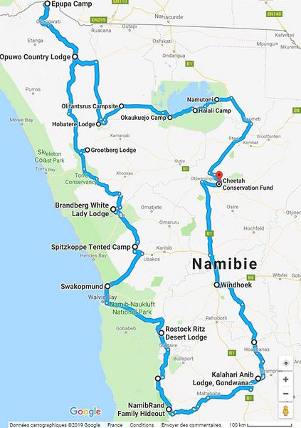
Alright! Are you ready to follow this adventure with us in our Hilux?
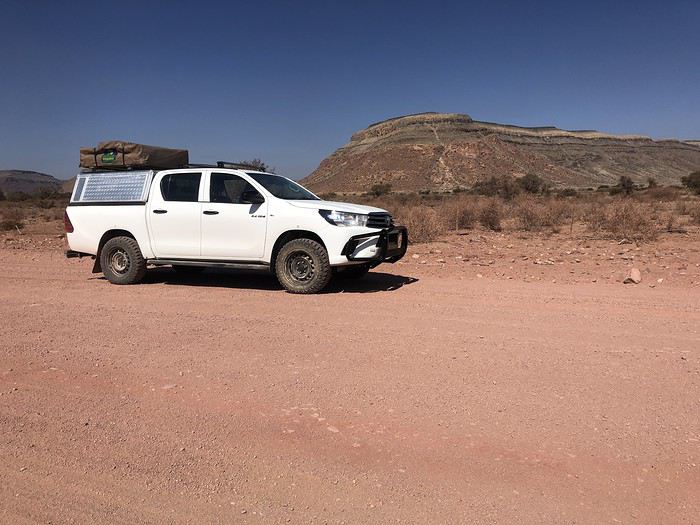
Yep! You guessed it—we stepped way out of our comfort zone during this trip.
I had quite a few doubts while planning this adventure, but the more I read travel journals about Namibia, the more I wanted to go.
Personally, without this forum, I never would’ve dared to hit the Namibian roads in a 4x4. I was really anxious during the planning, so I want to thank everyone who contributed with their journals and forum discussions for helping me leave more peacefully.
At first, I wasn’t even considering sleeping in a tent. But after my husband’s persuasion—and my own curiosity to experience what I’d read in those travel journals—I gave in. So off we went in a double-cab Hilux with a rooftop tent.
And of course, let’s talk about me—the big cold-weather wimp. One of the biggest pre-trip challenges was choosing a sleeping bag. After a while, sleeping bags had no more secrets for me: temperature ratings (comfort, limit, extreme), shapes (mummy, rectangular), fillings (synthetic, down), compression rate, and weight... all these factors were a real puzzle. In the end, to make sure I wouldn’t be put off camping in winter (Australian winter, mind you), I went for a sleeping bag with a comfort rating of -10°C. And just to be *extra* sure I wouldn’t get cold, I bought a liner (never knew what that was before) in Thermolite, which boosts the sleeping bag’s temperature by 11°C. There are liners that add up to 15°C, but let’s not exaggerate—we’re not heading to the North Pole! My husband, on the other hand, got a sleeping bag with a -5°C comfort rating and a silk liner.
Was it enough? You’ll find out soon. In the meantime, another big thank you to everyone who helped me make this choice with their advice and experience.
Over a year in advance, we planned a three-week itinerary for our first trip to Namibia—classic route, nothing too out there. We chose to do the circuit clockwise because we wanted to finish on a high note in Etosha and its wildlife. They say it’s like Noah’s Ark out there! And why not, the cherry on top... some big cats.
We used Tourmaline’s services to book our accommodations and the 4x4.
Here’s our planned itinerary with campsites and lodgings—yes, there are a few solid roofs in there; we didn’t want to push it too far.
Day 1: Windhoek – Windhoek Gardens Guesthouse Day 2: Kalahari Anib Campsite Day 3: Namibrand Family Hideout Day 4: Sesriem Camp Day 5: Sesriem Camp Day 6: Rostock Ritz Camp Day 7: Swakopmund - Sea Breeze Guesthouse Day 8: Swakopmund - Sea Breeze Guesthouse Day 9: Spitzkoppe Camp Tented Day 10: Brandberg White Lady Campsite Day 11: Grootberg Lodge Day 12: Opuwo Country Campsite Day 13: Epupa Camp Day 14: Hobatere Lodge Day 15: Etosha Olifantsrus Camp Day 16: Etosha Okaukuejo Camp Day 17: Etosha Halali Camp Day 18: Etosha Namutoni Camp Day 19: Cheetah Eco Lodge Day 20: Windhoek – Londiningi B&B
Alright! Are you ready to follow this adventure with us in our Hilux?
Hello everyone,
It’s been a little over a year and a half since we first set foot in South Africa, and ever since, we’ve been dreaming of returning to explore Southern Africa.
First of all, a big thank you to all the forum members—there are so many on this VoyageForum section, some of whom are unconditional and indispensable experts on the destination—for the amazing travel journals that only make you want one thing: to go and discover these stunning lands. The first journal I read was Bruno’s (Montagnard74), and I was completely captivated by the face in the colors of the rainbow nation.

Now it’s my turn to add my small contribution by recounting our two-week trip during the Christmas period in South Africa.
Even though Attila strongly advised against visiting South Africa during the South African summer holidays, we still gave it a try since my husband doesn’t have the option to choose his vacation dates.
So we went during the peak tourist season, with all its drawbacks: difficulties finding accommodations, crowds at certain sites... But on the bright side, it’s the beautiful season in South Africa while it’s gray and cold back home.
For this trip, we wanted to explore Cape Town and its surroundings, which are already packed with things to see. As a result, we didn’t have time to head north without rushing too much. So we planned the following itinerary, staying in the south:
J1: Lyon/Dubai J2: Dubai/Cape Town J3: Table Mountain – Cape Town J4: Botanic Garden - Robben Island J5: Cape Peninsula J6: Cape Agulhas - Gansbaai J7: De Hoop - Swellendam J8: Garden Route - Knysna J9: Garden Route - Addo NP J10: Addo NP J11: Oudtshoorn J12: Little Karoo J13: Wine Route - Cape Town/Dubai J14: Dubai/Lyon
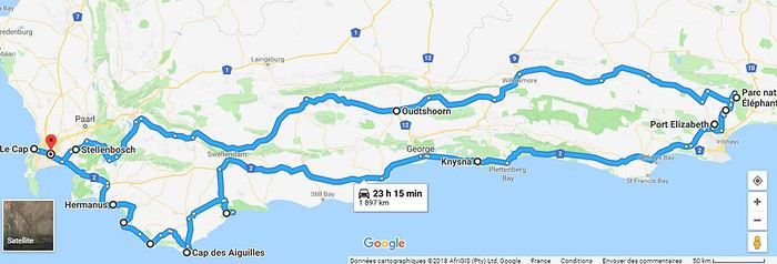
To give you a taste of what we experienced on the South African roads, here’s a little preview of the wildlife and flora we encountered, as well as the beaches and mountains we glimpsed.
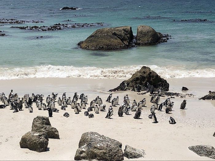
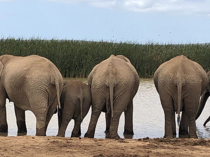
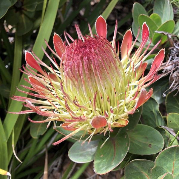
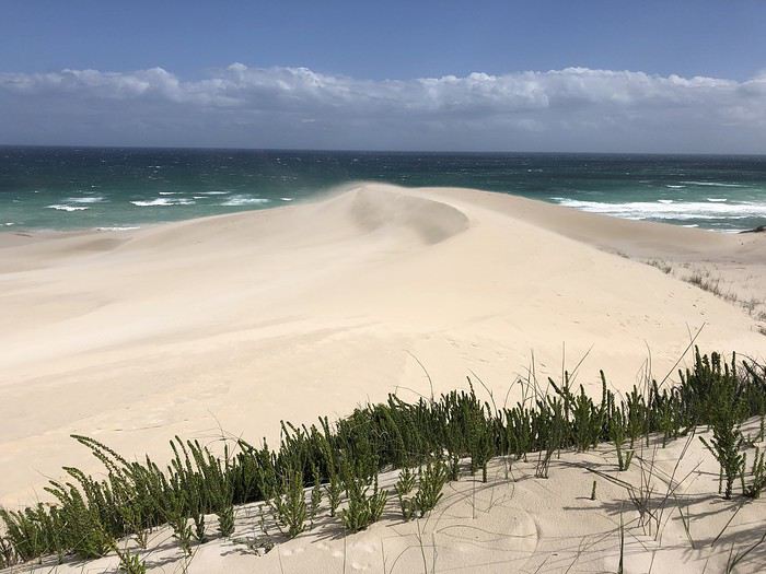
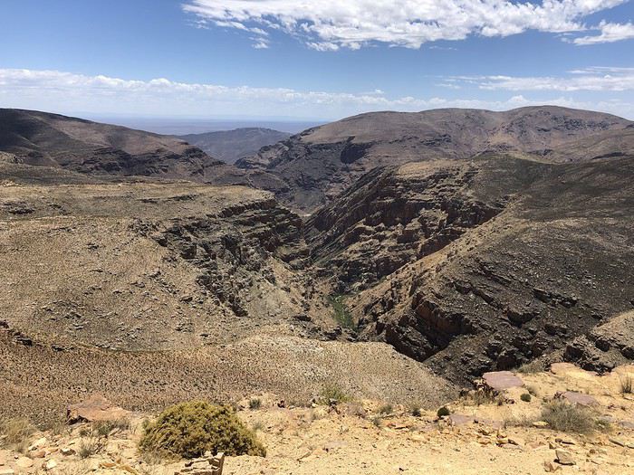
The rest here
First of all, a big thank you to all the forum members—there are so many on this VoyageForum section, some of whom are unconditional and indispensable experts on the destination—for the amazing travel journals that only make you want one thing: to go and discover these stunning lands. The first journal I read was Bruno’s (Montagnard74), and I was completely captivated by the face in the colors of the rainbow nation.
Now it’s my turn to add my small contribution by recounting our two-week trip during the Christmas period in South Africa.
Even though Attila strongly advised against visiting South Africa during the South African summer holidays, we still gave it a try since my husband doesn’t have the option to choose his vacation dates.
So we went during the peak tourist season, with all its drawbacks: difficulties finding accommodations, crowds at certain sites... But on the bright side, it’s the beautiful season in South Africa while it’s gray and cold back home.
For this trip, we wanted to explore Cape Town and its surroundings, which are already packed with things to see. As a result, we didn’t have time to head north without rushing too much. So we planned the following itinerary, staying in the south:
J1: Lyon/Dubai J2: Dubai/Cape Town J3: Table Mountain – Cape Town J4: Botanic Garden - Robben Island J5: Cape Peninsula J6: Cape Agulhas - Gansbaai J7: De Hoop - Swellendam J8: Garden Route - Knysna J9: Garden Route - Addo NP J10: Addo NP J11: Oudtshoorn J12: Little Karoo J13: Wine Route - Cape Town/Dubai J14: Dubai/Lyon
To give you a taste of what we experienced on the South African roads, here’s a little preview of the wildlife and flora we encountered, as well as the beaches and mountains we glimpsed.
The rest here