Hey everyone,
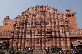
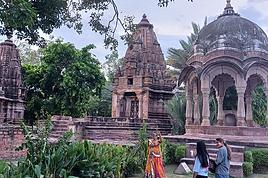
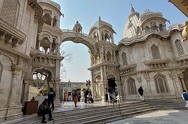
I’m planning a hiking trip to India in 2025 with my wife and another couple.
We’ll most likely be leaving at the end of April (TBC).
This isn’t my first time hiking abroad, and I’ve often run into parasites that take advantage of the night to bother you (you know what I’m talking about, haha).
I’ve dealt with flies, mosquitoes, and all kinds of critters during my sleep before, but for this trip to India—which could already be pretty hectic—I really want to be prepared and avoid this issue.
If you know where I can find effective mosquito nets that won’t give me any trouble with mosquitoes, I’m all ears!
If you’re selling some yourself, feel free to reply to this post—we can chat about it!
In the meantime, I’ll keep looking for mosquito nets on my end.
Thanks! !
hi,
we’d like to do a trek in Nepal, and we’re thinking of the Annapurna Circuit—it’s cheaper than the Everest trek.
Our plan is to do it without a guide or porter. We’re used to the mountains, not so much to high altitude, but if we acclimate well, there’s no reason it should go wrong ;)
No guide = handling permits, transport, and accommodation on our own...
So my question is: is it possible to book lodges in advance before departure? Or, even better, day by day?
I’ve read some older posts, so I’m asking again to get up-to-date info on what’s happening now. We’re planning to go mid-November 2026 or March 2027.
Thanks for your tips! :)
No guide = handling permits, transport, and accommodation on our own...
So my question is: is it possible to book lodges in advance before departure? Or, even better, day by day?
I’ve read some older posts, so I’m asking again to get up-to-date info on what’s happening now. We’re planning to go mid-November 2026 or March 2027.
Thanks for your tips! :)
Hi there,
We’re planning an 8-day backpacking trip on the island of São Nicolau. We’re torn between taking the boat from São Vicente or an inter-island flight. I’ve heard the boats don’t always run?
We’d like to make three homestay stops to travel in a star pattern from each of the three points.
First stop around Juncalinho, second stop near Cachaco, and finally a third leg near Tarrafal. We’re looking for simple but authentic guesthouses (no hotels). Any suggestions?
Thanks
Hi there,
I’m planning a 6-day trip from Orléans to Tours.
There are very few detailed maps to figure out the main stages and what you’ll find along the way. Even though I’ve downloaded the Miam Miam Dodo app, it’s pretty tedious (everything is split into small map sections).
I’ve settled on the first leg: Orléans to Meung-sur-Loire, about 18 km. For the next one, I’m hesitating because I’d like to do around 20–25 km, but I see Beaugency is only about 10 km away, and Mer is almost 30 km. So, I’m stuck.
On top of that, I’m torn between taking the GR 3 route or the GR 655 (south).
If any of you know the area or have already done this hike/pilgrimage, I’d love to hear your tips for this section that goes through Blois and ends in Tours.
For the last legs, I’ve planned Blois -> ? Chaumont (no accommodations) -> Amboise -> Tours, knowing the final stage is about 30 km.
Thanks in advance for your help! 😉
Thanks in advance for your help! 😉
Hi everyone,
I’m just at the very beginning of my research, so I’m coming straight to you for some info. I’d like to visit Morocco to discover a bit of the country. I’ve just found out about the Toubkal circuit, which I’d love to do in January/February. I’m open to going independently with a tent, food, etc., and also open to whatever other possibilities this circuit offers that I don’t know about yet... Could you share any random tips or info? I’d also love to hear your opinions? What I like about this circuit is that it’s fairly accessible and seems interesting for many reasons. I’ll leave it to you to share your thoughts—thanks in advance for your help! 🙂 Wishing you all lots of exciting plans for the new year ahead!
Nicolas
I’m just at the very beginning of my research, so I’m coming straight to you for some info. I’d like to visit Morocco to discover a bit of the country. I’ve just found out about the Toubkal circuit, which I’d love to do in January/February. I’m open to going independently with a tent, food, etc., and also open to whatever other possibilities this circuit offers that I don’t know about yet... Could you share any random tips or info? I’d also love to hear your opinions? What I like about this circuit is that it’s fairly accessible and seems interesting for many reasons. I’ll leave it to you to share your thoughts—thanks in advance for your help! 🙂 Wishing you all lots of exciting plans for the new year ahead!
Nicolas
Hi there,
We’re heading to South Africa in August 2025 and planning a classic loop that I’d love to finish with the Drakensberg (I’m a big hiking fan) before returning to Johannesburg to catch our flight.
I’ve got 3 nights for this part of our trip. But I’m wondering if it’s actually a good idea to hike in the Drakensberg in August, since it’s the Southern Hemisphere winter (I’m from Réunion and we hike year-round there, but I don’t know what the climate’s like in South Africa, especially the Drakensberg).
I’m particularly worried about getting stuck because of snow and missing our flight... ;)
I’ve read so many different things that I’m totally confused!
If it’s okay to hike at this time of year, what would you recommend? I’m torn between Champagne Valley and Royal Natal National Park.
Thanks in advance for your firsthand tips!
Malijp
Hi there,
I’d like to visit several islands in the Cyclades in late June - early July 2026 for about 15 days.
Stay 3 to 4 days on each one and do some hiking.
Your suggestions are welcome—islands, accommodation, hikes, or anything else.
Thanks in advance.
Twizzle
Hi there,
We’re planning a two-week couple’s trip hopping between the Cape Verde islands at the end of November 2025.
Our arrival and departure airport will be on the island of SAL.
We’ve got some hikes lined up.
Based on your experiences, what recommendations and suggestions do you have?
Thanks in advance for your valuable tips!
Hi there, my partner and I want to hike the GR34 over several years, in stages of 8 to 10 days of walking during May or June.
We're 53 and 55, pretty fit, and used to hiking.
Our goal is to complete the whole trail starting from Mont Saint-Michel, but maybe some sections aren’t worth it?
So I’ve got a few questions about logistics:
- backpack size and what essentials to pack
- where to sleep affordably (camping, hotels, or a mix?)
Thanks for your tips!
hi how can I get internet when I arrive at Haneda? I mean in areas without free wifi. Is it more interesting to buy a SIM card? If so, at the airport? thanks for your help
Hi there,
I’d like to spend a week in the Dolomites (4 days of trekking and a few day hikes). Unfortunately, it’ll be in August (no choice). My questions are:
- For a first time in the Dolomites, which 4-day trek should I pick? I’d love the most spectacular and varied landscapes possible. Around 1,000m elevation gain per day.
- Is it busier the first or last week of August?
- Will it still feel "quiet" while hiking? Not like a conga line in August...?
Thanks so much for your help! !
Thanks so much for your help! !
Hello, We’re heading to Laos in December 2025, and we want to do a multi-day trek—maybe even a week—to really take our time and make stops in villages since we’ll have our 3-year-old daughter with us.
We’re torn between the Luang Namtha region or Phongsaly for our big trek. We’re looking for the least touristy spot possible, we love mountains, so we’d like an area with varied landscapes, including rice paddies, and a chance to really connect with local ethnic groups. We’re after authenticity and only want to stay with locals. Which of the two should we prioritize? Any advice would be welcome to help us decide—it’s tough when you don’t know the area! Maybe there are other spots in the north worth considering for a beautiful week-long trek.
Thanks, fellow travelers
We’re torn between the Luang Namtha region or Phongsaly for our big trek. We’re looking for the least touristy spot possible, we love mountains, so we’d like an area with varied landscapes, including rice paddies, and a chance to really connect with local ethnic groups. We’re after authenticity and only want to stay with locals. Which of the two should we prioritize? Any advice would be welcome to help us decide—it’s tough when you don’t know the area! Maybe there are other spots in the north worth considering for a beautiful week-long trek.
Thanks, fellow travelers
Hello,
We’re planning a 3-week trip to Laos, focusing solely on the north. Our main goal is to do two 4-day treks in two different areas of Northern Laos.
We land in Bangkok on December 12th and will head straight to Chiang Mai before crossing into northern Laos at Huay Xai. Our journey will start there, ending in Vientiane, with a stop in Luang Prabang and the surrounding area. We’ll then take a night train from Udon Thani on December 30th to catch our flight back in Bangkok.
Right now, we’re mainly looking for reliable contacts to organize our two treks. From what we’ve read so far, trekking options exist around Luang Namtha, Phongsali (if it’s not too cold during that period, since we’ll have our 3-year-old daughter with us), or near Muang Ngoi and Nong Khiaw, as we’ve seen there are possibilities in that area too.
If we can organize both treks with the same contact, that would be perfect.
We’d prefer to avoid big agencies with a high-street presence and instead work directly with a local who knows their stuff and can give us good advice. We want to combine stunning landscapes (we love hiking) with cultural encounters in local villages.
We’d love to hear your tips and experiences—maybe some areas are better than others, less crowded, or more challenging (though we’re keeping in mind our 3-year-old, who’s used to hiking but we don’t want to put her in any danger).
That’s the gist of our plans for now! Looking forward to hearing from you, fellow travelers
We’re planning a 3-week trip to Laos, focusing solely on the north. Our main goal is to do two 4-day treks in two different areas of Northern Laos.
We land in Bangkok on December 12th and will head straight to Chiang Mai before crossing into northern Laos at Huay Xai. Our journey will start there, ending in Vientiane, with a stop in Luang Prabang and the surrounding area. We’ll then take a night train from Udon Thani on December 30th to catch our flight back in Bangkok.
Right now, we’re mainly looking for reliable contacts to organize our two treks. From what we’ve read so far, trekking options exist around Luang Namtha, Phongsali (if it’s not too cold during that period, since we’ll have our 3-year-old daughter with us), or near Muang Ngoi and Nong Khiaw, as we’ve seen there are possibilities in that area too.
If we can organize both treks with the same contact, that would be perfect.
We’d prefer to avoid big agencies with a high-street presence and instead work directly with a local who knows their stuff and can give us good advice. We want to combine stunning landscapes (we love hiking) with cultural encounters in local villages.
We’d love to hear your tips and experiences—maybe some areas are better than others, less crowded, or more challenging (though we’re keeping in mind our 3-year-old, who’s used to hiking but we don’t want to put her in any danger).
That’s the gist of our plans for now! Looking forward to hearing from you, fellow travelers
hi everyone, and so glad Voyage Forum is back up and running!
my partner and I, along with some friends, are planning a trip to Peru in May 2025.
I’ve got some questions about the Machu Picchu excursion.
we’re in our 60s and 70s, and while we’re pretty fit at European altitudes, I’m a bit worried about hiking above 2,500 m!
that’s why we didn’t hesitate to skip the 4-day Inca Trail trek.
but I’m wondering about the 2-day "short Inca Trail" offered by some agencies—basically one day of hiking with visits to a few sites, and the second day, the classic Machu Picchu visit.
has anyone done it? do you need to be in top shape?
thanks for your tips
I’m traveling solo by plane to Catania in May and plan to hike the northern side of Etna, starting from Linguaglossa where I’ll arrive by bus. After that, I’d love some info on how to get up to Piano Provenzana (shuttles or hitchhiking), since it seems there’s no public transport except in the summer. Can you sleep there in a free or cheap refuge, or camp? And how far up can you go without having to hire a guide? Thanks in advance. Bernard.
Hi there,
This August, I hiked the Vosges section (Vosges massif) of the GR5 (Lauterbourg-Wissembourg-gr53-gr5-Belfort) using the TopoGuide "Traversée du Massif des Vosges" (ref 502, April 2024 edition). My experience was partly ruined by a few things I feel I should share here to help others avoid the same pitfalls—or at least disappointments.
Having used "TopoGuide" books before, I’d always trusted them for organizing treks lasting several weeks, or even months.
Beyond the satisfactory mapping (reproductions of IGN 1:25,000 maps), these guides include route descriptions that are usually enough to find your way. On that point, I have no serious criticism of the Vosges crossing guide.
In addition to the route details, the guide provides "average" time estimates for traveling from point A to point B—useful info for gauging effort and planning likely stages. However, I eventually realized I couldn’t rely on these time estimates. I’d assumed they were calculated by the FFRP, considering that 100m of positive elevation gain roughly equals 1km on flat terrain, with an average walking speed of 4km/h. So, I’d recommend anyone using this guide to recalculate all the time estimates to avoid nasty surprises on tight stages. 🤪
Another key feature of the guide, in my opinion, is its info on accommodation options—especially budget-friendly ones suited for long-distance hikers on a tight budget. A section called "préparation des étapes" includes a table with a column meant to highlight "refuges" and "gîtes d'étapes." That column had me feeling optimistic: these budget accommodations were listed as plentiful along the route. After all, we were in the territory of the famous Club Vosgien—it made sense there’d be plenty of hiker-friendly lodging options. The reality on the ground was quite different. The TopoGuide wasn’t really to blame here, except that a serious warning wouldn’t have hurt. First, regarding the "refuges," most were run by associations. With rare exceptions, the volunteers only opened them on weekends. You can’t really blame people for not volunteering on weekdays, but it makes things tricky when the info about weekend-only openings often turns out to be wrong. As for the "gîtes d'étape," I was mostly disappointed when I was told that a place was booked for weeks: the vast majority of what was listed as a "gîte d'étape" turned out to be "gîtes ruraux." The advice here? If you don’t want to—or can’t—camp, double-check all the accommodation details before you set off. It’s time-consuming and tedious, but if you can, camping is still the best option. 😐 On a brighter note, during the first part of my trip, I came across several cabins that offered alternatives to camping. 🙂
P.S.: Even the youth hostel in Saverne was closed in the middle of August... 😕
Having used "TopoGuide" books before, I’d always trusted them for organizing treks lasting several weeks, or even months.
Beyond the satisfactory mapping (reproductions of IGN 1:25,000 maps), these guides include route descriptions that are usually enough to find your way. On that point, I have no serious criticism of the Vosges crossing guide.
In addition to the route details, the guide provides "average" time estimates for traveling from point A to point B—useful info for gauging effort and planning likely stages. However, I eventually realized I couldn’t rely on these time estimates. I’d assumed they were calculated by the FFRP, considering that 100m of positive elevation gain roughly equals 1km on flat terrain, with an average walking speed of 4km/h. So, I’d recommend anyone using this guide to recalculate all the time estimates to avoid nasty surprises on tight stages. 🤪
Another key feature of the guide, in my opinion, is its info on accommodation options—especially budget-friendly ones suited for long-distance hikers on a tight budget. A section called "préparation des étapes" includes a table with a column meant to highlight "refuges" and "gîtes d'étapes." That column had me feeling optimistic: these budget accommodations were listed as plentiful along the route. After all, we were in the territory of the famous Club Vosgien—it made sense there’d be plenty of hiker-friendly lodging options. The reality on the ground was quite different. The TopoGuide wasn’t really to blame here, except that a serious warning wouldn’t have hurt. First, regarding the "refuges," most were run by associations. With rare exceptions, the volunteers only opened them on weekends. You can’t really blame people for not volunteering on weekdays, but it makes things tricky when the info about weekend-only openings often turns out to be wrong. As for the "gîtes d'étape," I was mostly disappointed when I was told that a place was booked for weeks: the vast majority of what was listed as a "gîte d'étape" turned out to be "gîtes ruraux." The advice here? If you don’t want to—or can’t—camp, double-check all the accommodation details before you set off. It’s time-consuming and tedious, but if you can, camping is still the best option. 😐 On a brighter note, during the first part of my trip, I came across several cabins that offered alternatives to camping. 🙂
P.S.: Even the youth hostel in Saverne was closed in the middle of August... 😕
Spots where we can camp, bivouac, and find water sources
Spots where we could pitch the tent near a stream
Hello!
We’re spending a few days in Toraja country at the end of May. We’d love to do a day trek—taking our time—on a route that’s stunning in terms of scenery, but not a level 5 in difficulty!
Any suggestions you can share, please?
Thanks in advance
I want to do sections of the Collioure-Cadaqués trail. I plan to stay in Collioure first to hike the paths on the French side using the bus. Speaking of which, I’m wondering if it’ll be easy to find a seat on the buses at the end of April, beginning of May.
After that, I’ll head to Figueres to do sections of the trail on the Spanish side. I’m worried the buses might not be too crowded at the end of April.
Here’s what I’m interested in: Llanca - Port de la Selva: Figueres - Llanca by train in the morning and Port de la Selva - Figueres on the way back Port de la Selva - Cadaqués: Figueres - Port de la Selva in the morning and Cadaqués - Figueres on the return trip
I’d also like to go to Cadaqués from Figueres as a day trip. I’m concerned about how busy this route might be at the end of April.
I’m wondering if I need to get tickets in advance and where to buy them.
After that, I’ll head to Figueres to do sections of the trail on the Spanish side. I’m worried the buses might not be too crowded at the end of April.
Here’s what I’m interested in: Llanca - Port de la Selva: Figueres - Llanca by train in the morning and Port de la Selva - Figueres on the way back Port de la Selva - Cadaqués: Figueres - Port de la Selva in the morning and Cadaqués - Figueres on the return trip
I’d also like to go to Cadaqués from Figueres as a day trip. I’m concerned about how busy this route might be at the end of April.
I’m wondering if I need to get tickets in advance and where to buy them.
Hi everyone,
Here’s my dilemma:
I’m planning a hike between Le Bonhomme and the Gîte des 3 Fours at the Col de la Schlucht.
Between the two, I need a hostel, a gîte, or a farm inn for Wednesday, September 10th.
My gîte at the pass is only open on Thursday, so I need a stop between Le Bonhomme and the pass.
On Wednesday, everything’s closed—no half-board, nothing at all.
Would you have any solutions? I’ve already called the tourist office, and they confirmed there’s no possibility.
No tent—it’s too heavy for me at my age.
Thanks for your ideas!
Hi there,
I’ll be in Nepal in October. I’m planning to do the Annapurna trek and climb Mera Peak. From what I’ve heard, it’s one of the most accessible 6,000m peaks and doesn’t require a mandatory guide? The info I’ve found is pretty scattered—mostly just travel agency blogs. :-) Has anyone here already done this climb? I’ve heard you can find guides in Khare for just the final part of the ascent (which is way cheaper).
Thanks for your feedback!
Can’t wait to be there! :-)
I’ll be in Nepal in October. I’m planning to do the Annapurna trek and climb Mera Peak. From what I’ve heard, it’s one of the most accessible 6,000m peaks and doesn’t require a mandatory guide? The info I’ve found is pretty scattered—mostly just travel agency blogs. :-) Has anyone here already done this climb? I’ve heard you can find guides in Khare for just the final part of the ascent (which is way cheaper).
Thanks for your feedback!
Can’t wait to be there! :-)
I wanted to share an incredible experience I had recently that really left an impression on me: hiking the Mercantour independently. It’s an absolutely stunning mountain range, with varied landscapes that go from lush forests to rocky ridges, passing through high-altitude lakes with unbelievable colors. I chose a one-week route, sleeping under the stars in a bivouac.
It was a pretty demanding adventure, with significant elevation changes and sometimes unpredictable weather. But every effort was rewarded with breathtaking views. I was lucky enough to spot marmots, chamois, and even ibex in the distance. It’s truly a total immersion in nature!
A little tip for those tempted by the adventure: plan your route and gear carefully. Independence requires good preparation. I particularly appreciated having a good water filtration system and lightweight cookware. And for safety, aside from a map and compass (or GPS), I never leave without my two-way radio. In these remote areas where there’s no mobile signal, it’s a real safety net in case of trouble or just to communicate with other hikers if you’re in a group. It can really make a difference!
If any of you have already hiked in the Mercantour or have questions about my experience, don’t hesitate to ask. I’d love to chat with you about this beautiful range or other hiking destinations.
See you on the trails! 🙂
It was a pretty demanding adventure, with significant elevation changes and sometimes unpredictable weather. But every effort was rewarded with breathtaking views. I was lucky enough to spot marmots, chamois, and even ibex in the distance. It’s truly a total immersion in nature!
A little tip for those tempted by the adventure: plan your route and gear carefully. Independence requires good preparation. I particularly appreciated having a good water filtration system and lightweight cookware. And for safety, aside from a map and compass (or GPS), I never leave without my two-way radio. In these remote areas where there’s no mobile signal, it’s a real safety net in case of trouble or just to communicate with other hikers if you’re in a group. It can really make a difference!
If any of you have already hiked in the Mercantour or have questions about my experience, don’t hesitate to ask. I’d love to chat with you about this beautiful range or other hiking destinations.
See you on the trails! 🙂
Hi there,
I’m planning a short trek on the Haute Route des Pyrénées from Embalse de Baserca lake to Parzan.
I’ve seen there are cabins along the route. Do you know if it’s possible to sleep in them? On the other hand, in Parzan, apart from a hotel, I can’t find anything else. And the hotel requires a minimum of 2 nights, whereas I only want to stay for one. So, do you know where to stay in Parzan?
I’ve seen there are cabins along the route. Do you know if it’s possible to sleep in them? On the other hand, in Parzan, apart from a hotel, I can’t find anything else. And the hotel requires a minimum of 2 nights, whereas I only want to stay for one. So, do you know where to stay in Parzan?
Hi there,
My wife and I are heading to Norwegian Lapland for a week soon. We arrive in Tromsø on January 9th and plan to visit Senja Island. We’d love to go snowshoeing there and would appreciate some tips:
1. Is it possible to go snowshoeing without a guide this time of year on Senja Island? Are there well-marked trails? If not, could anyone recommend some good local guides?
2. We’d also love recommendations for great snowshoeing routes on the island if possible.
3. Is 5 days in Dovær in the northern part of the island too long at this time of year?
4. Renting snowshoeing gear in Norway is super expensive—does anyone know a good place to rent between Tromsø and Senja Island?
Thanks!
Hi there,
We’re planning to hike the GRR2 this summer with a local agency that offers a self-guided south-to-north route. We’re active and hike regularly, but we’ve never done a trek just the two of us without a guide.
I’d love to know if this trail has any dangerous areas? Drop-offs? Are there spots where it’s easy to lose the path?
I’ve seen that some agencies offer a GPS app—does the signal even reach everywhere inland? 🤪
Thanks! 😄
Looking forward to hearing from you! !
We’re planning to hike the GRR2 this summer with a local agency that offers a self-guided south-to-north route. We’re active and hike regularly, but we’ve never done a trek just the two of us without a guide.
I’d love to know if this trail has any dangerous areas? Drop-offs? Are there spots where it’s easy to lose the path?
I’ve seen that some agencies offer a GPS app—does the signal even reach everywhere inland? 🤪
Thanks! 😄
Looking forward to hearing from you! !
Hey everyone!
I’d like to explore the northeast of Madagascar, using bush taxis, boats, and my own two feet.
I already have an ideal itinerary in mind, but I’d love to know if it’s doable at a relaxed pace in one month. The goal, of course, is to avoid being constantly focused on time and days and to travel spontaneously.
I’m aware that the roads are rough and there are a lot of unexpected delays, which isn’t a problem in itself. I just struggle to estimate the *time* it takes to get between stops.
Potential itinerary:
Tana – Sainte Marie Island (4 days) – Maroantsetra (3 days) – Masoala Park (8-day trek?) – Antalaha – Marojejy Park (3 days) – Ambilobe – Nosy Be (5 days) – Tana
The days listed are just rough averages. Cities don’t interest me, and I don’t plan to visit Tana.
I’d really appreciate any info or tips from you all! 😊
Thanks in advance,
Romain
I’d like to explore the northeast of Madagascar, using bush taxis, boats, and my own two feet.
I already have an ideal itinerary in mind, but I’d love to know if it’s doable at a relaxed pace in one month. The goal, of course, is to avoid being constantly focused on time and days and to travel spontaneously.
I’m aware that the roads are rough and there are a lot of unexpected delays, which isn’t a problem in itself. I just struggle to estimate the *time* it takes to get between stops.
Potential itinerary:
Tana – Sainte Marie Island (4 days) – Maroantsetra (3 days) – Masoala Park (8-day trek?) – Antalaha – Marojejy Park (3 days) – Ambilobe – Nosy Be (5 days) – Tana
The days listed are just rough averages. Cities don’t interest me, and I don’t plan to visit Tana.
I’d really appreciate any info or tips from you all! 😊
Thanks in advance,
Romain
We're planning to go at the end of November/beginning of December to visit (with a rental car) and hike on La Palma and El Hierro for 15 full days, including 1 day for inter-island ferry transfers. What’s the best split between the two islands—8 days on La Palma and 6 on El Hierro, or even more time for La Palma? Should we have one or two home bases on La Palma? Thanks for your tips!
Annie
Hi,
We’re planning to do the 4-day trek from Mestia to Ushguli without an agency. The descriptions mention that there are accommodations at each stop, but we can’t find any details about them. Has anyone got info or feedback on this route?
Thanks
Cat, Bruno.
Thanks
Cat, Bruno.
Hi there,
I’m reposting about the logistics for Samaria Gorge. I’d love to get recent info, especially about whether it’s possible to park my car in Omalos, do the hike, and then catch a bus back to my vehicle. In theory, it’s doable, but when you check the KTEL website, there aren’t any feasible schedules listed. If anyone has recently organized this with reliable, verified details, I’d really appreciate it. Thanks in advance!
I’m reposting about the logistics for Samaria Gorge. I’d love to get recent info, especially about whether it’s possible to park my car in Omalos, do the hike, and then catch a bus back to my vehicle. In theory, it’s doable, but when you check the KTEL website, there aren’t any feasible schedules listed. If anyone has recently organized this with reliable, verified details, I’d really appreciate it. Thanks in advance!