Discussions similar to: Marchés Noël Alsace
FR

7 similar discussions in English

Northern to Southern Alsace
Here’s a travel journal with photos, different from the ones we usually share with you.

Some of you may have heard about the legendary charm of Alsace, this small region in eastern France, right next to Germany. For those who want to visit, we’re offering this journal. While it’s not exhaustive, it covers many of the most interesting sites, and we’d love to help make your trip a success—or maybe even inspire you to take a trip there.

Introduction

" HOW BEAU-TI-FUL OUR ALSACE IS WITH ITS FRESH VALLEYS IN SUMMER, IT RI-PENS THERE WHEAT, VINES, AND HOPS "

This is the start of a little tune our elementary school teacher used to make us sing in class. That was last century. This refrain and its melody have stayed in my heart because they perfectly capture this region. I know many tourists dream of the Christmas market and the magical snowy landscapes, which makes sense, especially for visitors from the south or those with young kids. As for me, I’d recommend visiting between June and September because everything is so much more pleasant and enjoyable during the warm season.

Alsace is a mix of German organization and French art de vivre. The result? A place beautifully shaped by nature, thoughtfully developed by people, and packed with exceptional restaurants and bakeries. Plus, tourists are generally welcomed with courtesy and expertise.

The heart of the region’s tourism lies between Strasbourg and Colmar, spanning the Haut-Rhin and Bas-Rhin departments. To the west of these cities, often on the slopes between the plain and the hills, winds the famous Wine Route. From north to south, it stretches about 150 to 170 kilometers. A proper visit to Alsace takes about five days to a week—or longer if you’re really into it. I think having a car is best, as the terrain isn’t flat.

Let’s start with northern Alsace, which is less known to tourists—except for the Germans, who love strolling around and enjoying good food there.

Wissembourg sits on the border with Germany, at the very north of the Bas-Rhin, about 60 km from Strasbourg. The tourist office has set up signs near the large free parking lot, so you can take a pleasant walk through this small town. Highlights include the Saint-Pierre Saint-Paul Church (the second-largest in Alsace), the 1741 town hall, the Salt House with its unusual roof, the ramparts, and some fascinating old houses.
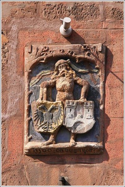
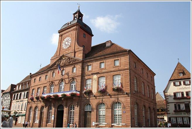


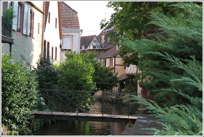
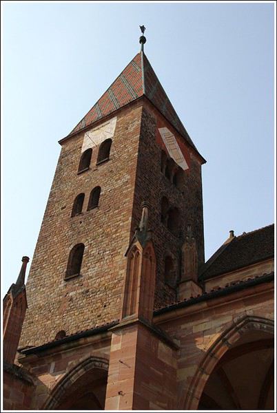
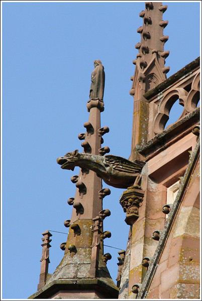


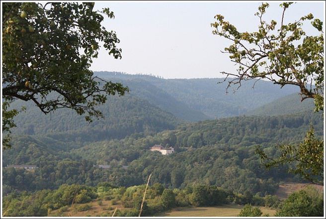
Hills border Alsace along its entire western frontier and also to the north. Countless hikes are possible in these low- and mid-altitude forests, where you can find chanterelles, sheep’s head mushrooms, and blueberries. Here’s a typical view taken above Wissembourg, near the Pigeonnier Pass:
Open
Looking for advice on GR53 route from Wissembourg to Rotterdam
Hi there. I’ve hiked the GR trail mentioned in the title from Wissembourg all the way to Menton. Now I’ve got the section from Wissembourg to Rotterdam left. But I can’t find any maps for this route—I’m looking for someone who’s done this part of the trail. Thanks in advance! 😊
Open
What are some good trekking routes in the Vosges?
hi there I live near Dole, so not too far away, and I sometimes go hiking (Camino de Santiago, Saint-Guilhem-le-Désert, etc.), and I’d love it if someone could suggest a trek in the Vosges—I really don’t know the area well. (Yeah, I know, I’m a little embarrassed about that.) If you could recommend a nice route. Arrival by car or train, doesn’t matter. Thanks so much!
Open
Warnings About the Vosges Massif Crossing with TopoGuide ref. 502
Hi there, This August, I hiked the Vosges section (Vosges massif) of the GR5 (Lauterbourg-Wissembourg-gr53-gr5-Belfort) using the TopoGuide "Traversée du Massif des Vosges" (ref 502, April 2024 edition). My experience was partly ruined by a few things I feel I should share here to help others avoid the same pitfalls—or at least disappointments.

Having used "TopoGuide" books before, I’d always trusted them for organizing treks lasting several weeks, or even months.

Beyond the satisfactory mapping (reproductions of IGN 1:25,000 maps), these guides include route descriptions that are usually enough to find your way. On that point, I have no serious criticism of the Vosges crossing guide.

In addition to the route details, the guide provides "average" time estimates for traveling from point A to point B—useful info for gauging effort and planning likely stages. However, I eventually realized I couldn’t rely on these time estimates. I’d assumed they were calculated by the FFRP, considering that 100m of positive elevation gain roughly equals 1km on flat terrain, with an average walking speed of 4km/h. So, I’d recommend anyone using this guide to recalculate all the time estimates to avoid nasty surprises on tight stages. 🤪

Another key feature of the guide, in my opinion, is its info on accommodation options—especially budget-friendly ones suited for long-distance hikers on a tight budget. A section called "préparation des étapes" includes a table with a column meant to highlight "refuges" and "gîtes d'étapes." That column had me feeling optimistic: these budget accommodations were listed as plentiful along the route. After all, we were in the territory of the famous Club Vosgien—it made sense there’d be plenty of hiker-friendly lodging options. The reality on the ground was quite different. The TopoGuide wasn’t really to blame here, except that a serious warning wouldn’t have hurt. First, regarding the "refuges," most were run by associations. With rare exceptions, the volunteers only opened them on weekends. You can’t really blame people for not volunteering on weekdays, but it makes things tricky when the info about weekend-only openings often turns out to be wrong. As for the "gîtes d'étape," I was mostly disappointed when I was told that a place was booked for weeks: the vast majority of what was listed as a "gîte d'étape" turned out to be "gîtes ruraux." The advice here? If you don’t want to—or can’t—camp, double-check all the accommodation details before you set off. It’s time-consuming and tedious, but if you can, camping is still the best option. 😐 On a brighter note, during the first part of my trip, I came across several cabins that offered alternatives to camping. 🙂

P.S.: Even the youth hostel in Saverne was closed in the middle of August... 😕
Open
Great Jura Crossing on foot
The Great Jura Crossing on foot is a long-distance hiking trail (GR) that winds through the Jura Mountains, from Mandeure, near Montbéliard (in the north), to Culoz in the Ain region (in the south). The GTJ fully crosses the Haut-Jura Regional Nature Park and offers a detour into neighboring Switzerland. Inaugurated in 2004, the GTJ on foot follows the GR GTJ long-distance trails and sometimes the GR 5 and GR 9.

The full GTJ hike takes 15 to 20 days. Since my vacation time isn’t unlimited, I opted for a 10-day trek from Pont-de-Roide to Bellegarde-sur-Valserine, covering nearly 320 kilometers (so about 60 kilometers short) with 10,000 meters of elevation gain—and just as much descent. The route is classic, except for the must-do variant via the Colomby de Gex (Balcon du Léman).

Accommodations include mountain huts, step lodges, and guest rooms with tables loaded with Morbier cheese gratin, Morteau sausages, rösti, and michons... Oh, and I almost forgot: I’m hiking solo...

http://lerandonneurfou.blogspot.fr/2014/05/la-grande-traversee-du-jura-gtj.html
Open
GR5 from Lake Geneva to Nice: Water availability in August
Hi there, I’m struggling to get back into hiking and I’m considering tackling the GR5 from Lake Geneva to the Mediterranean shores in August-September.

Since I can’t plan daily distances in advance, I’ll be bringing gear to bivouac.

I’m not familiar with this route and wanted to get an idea of water resupply options before setting off: are sources and streams still flowing easily in late summer on this GR, or should I prepare for long dry stretches? 😐
Open

You might also like