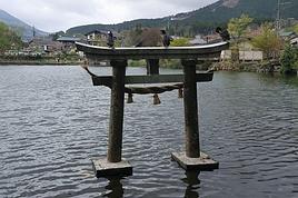
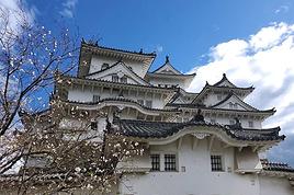
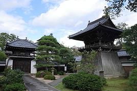
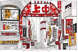
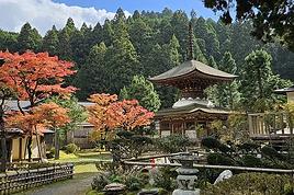
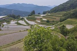
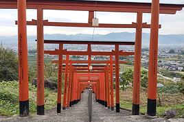
We're a family of five: one dad, one mom, and three kids aged 10, 15, and 18.
Before diving into each stop in more detail, here are a few general thoughts:
We wanted to sample a bit of everything Japan has to offer in terms of landscapes, accommodation, and transport. We were after walks, temples, restaurants, shopping, and some downtime—but no "all-inclusive experiences" or museums for this first visit.
Three medium-sized (60x42x25) canvas suitcases, plus a duffel bag and a few small backpacks. 23 kg in the hold on the way out, 60 kg on the way back. 36 kg of shopping, without even trying. I think this is the maximum suitcase size if you don’t want to stress on the Shinkansen: they fit easily in the overhead racks.
Round-trip with Cathay Pacific, layover in Hong Kong: no need to collect luggage in Hong Kong—we checked it in at departure and picked it up in Tokyo, and the same on the way back (checked in Osaka, picked up at our final destination). This let us explore Hong Kong without worrying about our bags. Food and entertainment were pretty good—meals included a little Häagen-Dazs on each flight, and the entertainment had way more Asian cinema than you’d find on a Western airline, which was a nice way to see how much weight Western culture carries in Asia.
Initial itinerary:
Tokyo (3 nights)
Hakone (2 nights)
Takayama (1 night)
Kanazawa (2 nights)
Kyoto (4 nights)
Osaka (1 night)
Ishigaki (3 nights)
The original plan was to fly directly from Ishigaki to Hong Kong, but due to Typhoon Dolphin, we had to cancel the Ishigaki leg. Cathay didn’t bat an eye about swapping the Ishigaki-HK flight for an Osaka-HK one, even though it was twice as long.
We were a bit too attached to the idea of ending the trip with some beach time and replaced Ishigaki with Shirahama. It was a mistake—we should’ve visited Hiroshima or spent a little more time in Tokyo instead.
526 similar discussions in English
I’ve been traveling regularly for over twenty years,
but this is the first time an airline has treated me as poorly as Air France.
Two trips, two problems. The latest:
Trip from Seoul to Rennes. Last leg from Paris CDG to Rennes with Air France.
I arrive in Paris and go straight to Air France to get my boarding pass to Rennes. They assure me my baggage is continuing to Rennes.
Arriving in Rennes, no baggage—same as five other people.
The Air France office is closed, and the airport staff tell me there’s rarely anyone there.
With the help of the airport staff, I file a claim online, and my baggage is almost immediately located. As a result, I’m told I’ll have it the next day.
Four days later, the baggage is still in the same place at CDG—nothing’s moving.
The problem is Air France has no customer service. What they call customer service is a department that takes an hour to answer and just repeats what’s on the online form. No coordination, no way to get things moving. I guess Air France would rather pay the compensation after 21 days than actually do something.
I’ve had lost baggage on other trips, but this is the first time I’ve seen such indifference and lack of professionalism.
but this is the first time an airline has treated me as poorly as Air France.
Two trips, two problems. The latest:
Trip from Seoul to Rennes. Last leg from Paris CDG to Rennes with Air France.
I arrive in Paris and go straight to Air France to get my boarding pass to Rennes. They assure me my baggage is continuing to Rennes.
Arriving in Rennes, no baggage—same as five other people.
The Air France office is closed, and the airport staff tell me there’s rarely anyone there.
With the help of the airport staff, I file a claim online, and my baggage is almost immediately located. As a result, I’m told I’ll have it the next day.
Four days later, the baggage is still in the same place at CDG—nothing’s moving.
The problem is Air France has no customer service. What they call customer service is a department that takes an hour to answer and just repeats what’s on the online form. No coordination, no way to get things moving. I guess Air France would rather pay the compensation after 21 days than actually do something.
I’ve had lost baggage on other trips, but this is the first time I’ve seen such indifference and lack of professionalism.
Hello everyone! I’m heading off solo in February and wanted to share my rough itinerary with you. Does this sound doable?
PS: I’m not really into beaches.
D1 Departure on February 17, 2027 D2 Arrival in Kuala Lumpur – stroll through Chinatown and visit the Petronas Towers D3: Kuala Lumpur – Chow Kit Market, Batu Caves, Little India, Bukit Bintang downtown area D4: Early morning bus to Malacca. Explore Malacca in the afternoon and evening D5: Another 2–3 hours in Malacca in the morning, then bus back to Kuala Lumpur. Merdeka Square area. Stay in Chinatown D6: Bus trip to Kuala Tahan. Night tour D7: Morning – canopy walk and Bukit Terisek hike. Afternoon – off to Lata Berkoh D8 & D9: 2-day jungle trek in Taman Negara National Park D10: Head to Cameron Highlands D11: Morning hike through the plantations. Afternoon still to be decided D12: Morning – excursion to Mossy Forest and Sungei Plantation. Afternoon bus to Ipoh D13: Morning – Mirror Lake / Sam Poh Temple area. Afternoon – explore downtown Ipoh D14: Morning train to Penang. Afternoon – wander around Georgetown D15: Morning – Penang Hill and Keh Loh Temple. Afternoon – Georgetown D16: Bus to Butterfly Garden and Spice Garden. Late afternoon – Burmese and Thai temples D17: Morning flight to Singapore. Afternoon – Chinatown and Marina Bay tour D18: Morning – Gardens by the Bay area. Afternoon – Boat Quay, Clarke Quay, Kampong Glam D19: Morning – The Ridges area and Botanical Garden. Afternoon – Little India, then back to Chinatown before 11:15 PM return flight D20: Morning arrival
D1 Departure on February 17, 2027 D2 Arrival in Kuala Lumpur – stroll through Chinatown and visit the Petronas Towers D3: Kuala Lumpur – Chow Kit Market, Batu Caves, Little India, Bukit Bintang downtown area D4: Early morning bus to Malacca. Explore Malacca in the afternoon and evening D5: Another 2–3 hours in Malacca in the morning, then bus back to Kuala Lumpur. Merdeka Square area. Stay in Chinatown D6: Bus trip to Kuala Tahan. Night tour D7: Morning – canopy walk and Bukit Terisek hike. Afternoon – off to Lata Berkoh D8 & D9: 2-day jungle trek in Taman Negara National Park D10: Head to Cameron Highlands D11: Morning hike through the plantations. Afternoon still to be decided D12: Morning – excursion to Mossy Forest and Sungei Plantation. Afternoon bus to Ipoh D13: Morning – Mirror Lake / Sam Poh Temple area. Afternoon – explore downtown Ipoh D14: Morning train to Penang. Afternoon – wander around Georgetown D15: Morning – Penang Hill and Keh Loh Temple. Afternoon – Georgetown D16: Bus to Butterfly Garden and Spice Garden. Late afternoon – Burmese and Thai temples D17: Morning flight to Singapore. Afternoon – Chinatown and Marina Bay tour D18: Morning – Gardens by the Bay area. Afternoon – Boat Quay, Clarke Quay, Kampong Glam D19: Morning – The Ridges area and Botanical Garden. Afternoon – Little India, then back to Chinatown before 11:15 PM return flight D20: Morning arrival
Hello! The itinerary is pretty much set for August 2026. Yeah, I know it’s gonna be *super* hot. But it’s the only time we can get away.
So, here’s the plan: Montpellier-CDG-Dallas.
Stay from July 31 to August 26, 2026: Car rental – check, Hotels – check, Itinerary – almost check, Photo gear – check, Budget – check, 🤪 Meal planning – meh, we’ll see... Walmart, of course, for the cooler when we arrive.
And now, without too much detail...
Fort Worth: The Longhorns and the Stockyards; JR’s ranch (for the missus); Medal of Honor Museum – Arlington.
Houston and NASA Space Center: See the Gulf of Mexico/America.
San Antonio and the missions.
Fort Stockton for an overnight stop.
El Paso via Guadalupe Mountains: El Paso and White Sands.
Tucson and the Pima Air & Space Museum: Tombstone, Bisbee.
Phoenix:
Still working on the program.
Sedona: Round trip around the area via Flagstaff and Williams, or the Grand Canyon (already done) – we’ll decide on the spot.
Albuquerque: Santa Fe, Turquoise Trail, Los Alamos.
Amarillo via Route 66: Old Route 66 in the city; Big Texas Ranch Steak 😏.
Dallas: JFK Museum; Perot Museum; West End district.
And through it all – the road, the road, and more road!!!
We’ll adapt day by day based on our mental and physical state (we’re not exactly spring chickens).
Return to France: Dallas-Montpellier via CDG.
Cheers!
So, here’s the plan: Montpellier-CDG-Dallas.
Stay from July 31 to August 26, 2026: Car rental – check, Hotels – check, Itinerary – almost check, Photo gear – check, Budget – check, 🤪 Meal planning – meh, we’ll see... Walmart, of course, for the cooler when we arrive.
And now, without too much detail...
Fort Worth: The Longhorns and the Stockyards; JR’s ranch (for the missus); Medal of Honor Museum – Arlington.
Houston and NASA Space Center: See the Gulf of Mexico/America.
San Antonio and the missions.
Fort Stockton for an overnight stop.
El Paso via Guadalupe Mountains: El Paso and White Sands.
Tucson and the Pima Air & Space Museum: Tombstone, Bisbee.
Phoenix:
Still working on the program.
Sedona: Round trip around the area via Flagstaff and Williams, or the Grand Canyon (already done) – we’ll decide on the spot.
Albuquerque: Santa Fe, Turquoise Trail, Los Alamos.
Amarillo via Route 66: Old Route 66 in the city; Big Texas Ranch Steak 😏.
Dallas: JFK Museum; Perot Museum; West End district.
And through it all – the road, the road, and more road!!!
We’ll adapt day by day based on our mental and physical state (we’re not exactly spring chickens).
Return to France: Dallas-Montpellier via CDG.
Cheers!
Hello from Quebec,
I’m a French-Canadian from Montreal. I’d love to go to Senegal during the Quebec winter to shorten this long season. Two people told me it’s not worth spending a lot of money to get there from Canada because there’s not much to discover. But I’m still skeptical. I’d love to read real testimonials from travelers who’ve been there, with as much info as possible. Thanks
It’s an understatement to say that Japan is a world apart. All around me, people exclaim: "How lucky you are to be able to go there! I’ve always dreamed of visiting, of finding myself in that culture blending tradition and technology!" Yes, they’re right. Until the moment their dreams become reality and things appear as they truly are, without the filter of fantasized preconceptions. Because in the collective unconscious, Japan indeed seems like a civilization—if not neutral—at least stripped of any social maturation. As if it had emerged all at once from its canonical ages, offering only the best of its traditions, and as if those traditions were undoubtedly the foundation of its extraordinary discipline. Yet, as always, the truth is far more complex. Modern Japan is likely shaped by its millennia-old traditions. But that Japan is also the result of its own uncertainties and contradictions. I’ve always been wary. I’ve never understood why the cleaning women on the platform bow when the train arrives. At some point, too much discipline, too much deference—it makes you smile, it raises questions.
Finally, thanks to F., a dream is coming true! Not the dream of going to Japan—a country I’ve visited more than any other, except for Réunion and the UK—but the dream of completing the fastest round-the-world trip of my career. Indeed, due to the restrictions imposed by the Russians*, the plane flies over the Caucasus and China on the way there; on the return, it gracefully heads toward the Arctic after skirting the Aleutian Islands, Alaska, and Greenland. So, in nearly 26 hours of flight, I complete my 6th round-the-world trip. A round-the-world trip with just one stopover. Or two, if you count our impromptu detour to Okinawa.
(* In response to Western sanctions, Russia closed its airspace to Western airlines on February 28, 2022, except for Air Serbia, Turkish Airlines, Pegasus, and Belavia. This decision adds 2 to 3 hours to flight times and, incidentally, increases operating costs.)
The empire of noise. The empire that dazzles. In Japan, the auditory and visual space is constantly fed. No respite. You have to be strong. Navigating public transport feels like playing the most advanced video game: moving between language barriers and a different organization, the hero tries to ignore the numerous visual and auditory distractions. Mostly auditory, though. Because in Japan, there’s a culture of noise that has undoubtedly inspired our national railways. Everything must be announced. So, here and there, all along the route, we find agents whose sole role is to endlessly repeat safety messages through megaphones more or less suited to the situation. The result is a constant murmur, a kind of tinnitus, a subtle but incessant buzz that fades only at bedtime and returns with a vengeance at first light, when we descend back into the supposedly sterile depths of Osaka’s subway. "To go right, please turn right, kudasaï. When descending the stairs, please mind the steps, kudasaï. To go straight, please take the left corridor, kudasaï." That *kudasaï* ("please" in Japanese), I assure you, has permanently lodged itself in my auditory cells.
Screens are no exception; the brain is constantly stimulated. But paradoxically, passengers massively retreat into their own worlds via their screens. Literally glued to their phones, earbuds firmly in place, people escape into the virtual aisles of a furniture store, a game, a movie... In the train cars, raised voices are rare. The field is clear for announcements and other jingles. Each stop is announced by a little tune unique to each station. Simply incredible.
If we usually judge a country by the welcome its inhabitants offer, in Japan, we’re left wanting. Indeed, the Lost in Translation* spirit doesn’t just apply to verbal exchanges—it applies to everything, especially non-verbal communication. In Japan, me, the slightly North African Corsican, I’m at a loss. I speak loudly, I gesture, in front of a hotel concierge just as lost. Each for our own reasons. Yes, he speaks some English, but we can’t seem to connect. It’s a losing battle trying to find a bit of compassion from a local who’s far from familiar with Western concerns. I try to buy tickets for the World Expo? I run into a systematization as rigid as it is abrupt, which the concierge can’t seem to navigate. While we might still have a shred of common sense, here in Japan, everything is digitized. Soon, no one will be surprised that a QR code becomes essential just to go to the bathroom.
(* Film by Sofia Coppola, released in 2003, which explores isolation, unease, Japanese culture, and language through the experiences of two protagonists.)
In the end, we get that ticket for the Expo. After providing personal information on yet another account created for the occasion, we buy electronic tickets—a QR code, then—to regulate the comings and goings, the souls and aspirations of all these wandering beings scattered across the globe. And it’s probably for the best... Because we’ll be tens of thousands of visitors—100,000 to 150,000 per day—walking the aisles of this enormous improvised amusement park, a kind of delirious superstructure surrounded by the Grand Ring, the largest wooden construction in the world. Inside the park, the pavilions, flagship vessels of their respective countries, compete in ingenuity, proportionate to their GDP, to attract visitors. But you have to wait up to two hours to visit the most popular ones! Fortunately, about a hundred countries can be explored without waiting in shared, more spacious areas. What will I remember from this adventure? The beauty of that wooden structure, despite any environmental or financial considerations—200M € for barely renewable elements; a certain poetry, even magic, in the expression of this event—conversing with Juliette Petit, the splendid representative of Vanuatu, had something indescribable; a close-up experience of Japanese discipline when it came time to return to the subway after that epic evening—thousands upon thousands of people converging at the same time toward a single place without any interruption in the flow.
But my real passion is the countryside. So, I’ll especially remember that brief escape, on the very first day, to the Mino-o waterfall, where the journey itself was already enchanting. Quickly leaving the underground lines, our train speeds through the city’s endless expanse and drops us at the foot of a hill, the abrupt edge of the urban sprawl. The slope was too steep to build anything? We leave behind an impressive hotel, a capitalist eyesore defying the laws of elevation to tackle the climb toward the waterfall. A bucolic walk where the stroller can choose between a paved path or more epic trails. Here and there, stalls, temples, everywhere, a certain serenity. The city’s pulse gives way to a magnificent spectacle magnified by giant sequoias. From the depths of a ravine, we try to glimpse the sky beyond the foliage. Everything is oversized. Here, you can breathe.
***
In reality, Japan has never undertaken any real work of memory. Aside from a few feeble gestures to appease Washington in its choice of Asian partners, one wonders if the Japanese have ever truly grasped the horror they were forced to participate in. While our Judeo-Christian society has more or less assimilated the notions of forgiveness and self-questioning, where does Japanese society stand, juggling a millennia-old Zen philosophy and the unabashed Machiavellianism of an emperor utterly possessed? Is it just me, or does there float in the atmosphere a kind of unease, a malaise, an awkward relationship with reality? For me, bowing to a train as it enters the station is just the result of a poorly directed moral dilemma...
Ah, how distant is the time of sakoku, that closure of the country—both concrete and ideological—that was in vogue for two centuries. Because if no one could enter, no one could leave either! A boon for neighboring countries. But from 1854, following the skirmishes of Commodore Matthew Perry, who demanded Japan’s participation in trade, the country suddenly became aware of the disparities separating it from the West. Bring Japan up to the level of other nations? Industrialization, competition, search for raw materials... Hirohito (1901–1989) emerges on the scene, a bit expansionist and willing to stop at nothing to achieve his goals. Above all, he knew how to use, in his own way, the incredible capacity for self-sacrifice of his people...
We protest, we condemn, we all rally behind an acceptable discourse when it comes to discussing the use of the atomic bomb. Yet, we forget one essential thing: Hiroshima wasn’t enough to make Hirohito yield. While we’re bombarded with anti-fascist elements, as if the sole purpose of school curricula were to prevent us from voting for the National Rally, we completely overlook those events of rare cruelty that took place on the other side of the globe at a time contemporary with Nazi atrocities. Why? Because it was farther away, on the other side of the world? Because we must both condemn the use of nuclear weapons and Nazism? What a dangerous game. Killing civilians is beyond comprehension, everyone agrees on that. But hasn’t Japan ever been guilty of such atrocities? Our empathy is legitimate; it won’t, however, remove from my mind the idea that there was no other solution. Nagasaki is the most telling proof of that.
At least in France, in school textbooks, Hitler will have completely overshadowed the existence of people crueler and more abject than him. Certainly, Adolf was a deeply disturbed man whom events propelled to power. But I’m justified in believing that his approach was probably more humane than that of Joseph Stalin at the height of his art*. And if Hirohito followed the same line as Hitler, in the sense that he represented the superior race, he would apply with conviction what was Stalin’s credo: contempt for his own people when sending them to slaughter, and an even fiercer contempt for the human race when it didn’t have the good fortune to be Japanese. Just look at how China was invaded and by what means millions of Chinese were annihilated, burned, deported, buried alive! Operation Scorched Earth or Three Alls Policy for kill all, burn all, loot all? No comment. Even today, the Japanese are convinced they waged a patriotic war, when clearly, that war served only vague ideological (and certainly economic) interests.
(* "In many ways, Hitler’s National Socialism was far more humane than Communism: it wasn’t unthinkable to speak to the SS or the Gestapo, and dissuading them from sending you to a prison camp wasn’t utopian. To some extent (compared to the Communists), you could still expect a semblance of justice. All those who lived under Hitler and under Communism will tell you: as the front lines shifted, they always managed to end up in Germany, where, though it was a strange place ruled by a madman, life went on. Under Communism, there was no life; totalitarianism was absolute. Probably, Hitler’s conservatism prevented him from fully imitating Bolshevism." Seraphim Rose in The Revolutions of the 19th and 20th Centuries (circa 1970))
In Naha, we visit two strategic sites: the Imperial Navy headquarters and Maeda Escarpment, in Urasoe, better known as Hacksaw Ridge. I love this confrontation with history. In the hand-dug tunnels of the headquarters, we meet Japanese people seeking information. They’re not responsible for this tragedy. Neither are we. I would have liked to tell them that, to hug them, to move on. To finally believe in those peace messages displayed here and there. Yes, it’s curious to read those calls for peace* when no real work of memory** has been undertaken. Two civilizations, two perspectives, a profound misunderstanding. When I analyze the waste of that war—and particularly the waste of those Pacific battles—like Peleliu in autumn 1944 and Okinawa in spring 1945—I can’t bring myself to share in the pathological patriotism that reigns within these walls. There, the room where the last message of Admiral Minoru Ōta was transmitted in Morse, praising the merits of the archipelago’s people. A tangled mix that, yes, is charged with positive emotions but, no, won’t remove from my mind the idea that this people was completely conditioned, completely disconnected from reality. Allying with the Axis powers? Invading the South Pacific? And finding that noble! Everyone sees things through their own lens.
(* Peace Declaration by Denny Tamaki, Governor of Okinawa, June 2020. ** "Recognizing the atrocities committed by one’s country requires a mix of democratic culture and self-confidence that is more the exception than the rule." Dominique Moïsi in Les Échos, April 30, 2015)
Okinawa. 200,000 dead. Stemming from bushido, the way of the warrior, this conditioning reached its peak with the kamikaze philosophy in particular and suicide in general. So, schematically, here’s how things went: as the island was encircled—Peleliu, Iwo Jima, Okinawa—and all hope was lost, the order was given to kill ten American soldiers before taking one’s own life. The deceit of this system, where surrender is synonymous with dishonor, involves creating tunnels and secret pockets where Japanese soldiers hide and from which they emerge. Long before the atomic bomb, the knell of their war had sounded. Hiroshima and Nagasaki are just the result of human pride, of which Hirohito’s reign is the finest example. Why was this henchman of Satan left in place until his death? I don’t understand. While the humiliation inflicted on Germany repeatedly was abject, especially for its people, the absence of any real and pressing accountability for Hirohito in this large-scale carnage he instigated leaves room for the wildest interpretations. As if to underscore my point, Emperor Naruhito visited Okinawa the same day we did, paying his respects to the inhabitants who fell in battle. I looked at the faces in the monorail serving the south of the island. There were elderly people who undoubtedly lost their parents eighty years ago. To what extent can they blame this tragedy on the delusional visions of their leaders?
On Maeda Escarpment, I salute the courage of Desmond Doss, that conscientious objector who fought to serve his country while refusing to ever carry a weapon. There, at the top of a steep ridge, you can see to the north the Allies’ advance, while to the south, the slope is gentler down to Shuri, in front of the headquarters. The underground is a Swiss cheese filled with enemies. Desmond works as a medic. He manages to save 75 wounded from certain death by evacuating them at night from the battlefield using makeshift ropes. Back in Osaka, far from the somewhat dilapidated tropical islands, I rediscover the splendor and grandeur of Japan’s second-largest city. To tell the truth, and this applies to Okinawa too, the density is so insane on this archipelago that you sometimes wonder if it’s not just one giant city spread across the vast territory. Because between Tokyo and Osaka, while there are some mountains and forests, it’s the city that dominates; during rush hour, a rapid train connects the two cities every five minutes. We get lost in rather quiet alleys parallel to the main streets, only to find ourselves in the covered and lively galleries of Dōtonbori. We’re looking for a place to eat—above all, we’re trying to navigate the unlimited options stretching endlessly along the sidewalks. It’s absolutely mind-blowing. And while I introduce F. to a part of history that our Western societies have quickly forgotten, he initiates me into Japanese gastronomy despite my well-known aversion to Asian food. But nothing beats having a master in the field! We feast on okonomiyaki, Japanese pancakes expertly prepared and served on a teppan embedded in our table.
Night falls on Japan, and I still haven’t found the answer. Like in Singapore, one can praise the calm and serenity of human relationships, the delicacy that may just be hypocrisy, the politeness, the discipline. But above all, we notice that in the absence of freedom, in the absence of madness, poetry struggles to take root, boredom looms, as does real madness. Bushido still exists, honor is there and must be preserved. But the youth drowns in electronics and in willingly sterile cults (otaku), unable to discern what’s essential, failing to believe in their dreams. You have to succeed? Young people commit suicide because of school bullying, the slightly older ones because of work-related difficulties or marital problems. Nothing exceptional, we might say—average*—but you’d expect better from a country so well-organized, a country that makes so many Westerners dream. Yes, night falls on Japan. Empire of noise, empire of the senses, a very strange land where you find clean toilets in subway corridors but where the very meaning of life seems stifled by the mirages of technology. Above all, a civilization deprived of a penance that would prove salutary. We’re caught between two waters. Those of a shallow modernity without depth or anchor; those of a past that was majestic but irreparably tainted by the demonic madness of an overly adored emperor.
How can one fully thrive when guilt has no outlet?
(* France and Japan share a common statistic of 17 suicides per 100,000 inhabitants, which, depending on density, means 30 per day in France and 70 in Japan...)
Finally, thanks to F., a dream is coming true! Not the dream of going to Japan—a country I’ve visited more than any other, except for Réunion and the UK—but the dream of completing the fastest round-the-world trip of my career. Indeed, due to the restrictions imposed by the Russians*, the plane flies over the Caucasus and China on the way there; on the return, it gracefully heads toward the Arctic after skirting the Aleutian Islands, Alaska, and Greenland. So, in nearly 26 hours of flight, I complete my 6th round-the-world trip. A round-the-world trip with just one stopover. Or two, if you count our impromptu detour to Okinawa.
(* In response to Western sanctions, Russia closed its airspace to Western airlines on February 28, 2022, except for Air Serbia, Turkish Airlines, Pegasus, and Belavia. This decision adds 2 to 3 hours to flight times and, incidentally, increases operating costs.)
The empire of noise. The empire that dazzles. In Japan, the auditory and visual space is constantly fed. No respite. You have to be strong. Navigating public transport feels like playing the most advanced video game: moving between language barriers and a different organization, the hero tries to ignore the numerous visual and auditory distractions. Mostly auditory, though. Because in Japan, there’s a culture of noise that has undoubtedly inspired our national railways. Everything must be announced. So, here and there, all along the route, we find agents whose sole role is to endlessly repeat safety messages through megaphones more or less suited to the situation. The result is a constant murmur, a kind of tinnitus, a subtle but incessant buzz that fades only at bedtime and returns with a vengeance at first light, when we descend back into the supposedly sterile depths of Osaka’s subway. "To go right, please turn right, kudasaï. When descending the stairs, please mind the steps, kudasaï. To go straight, please take the left corridor, kudasaï." That *kudasaï* ("please" in Japanese), I assure you, has permanently lodged itself in my auditory cells.
Screens are no exception; the brain is constantly stimulated. But paradoxically, passengers massively retreat into their own worlds via their screens. Literally glued to their phones, earbuds firmly in place, people escape into the virtual aisles of a furniture store, a game, a movie... In the train cars, raised voices are rare. The field is clear for announcements and other jingles. Each stop is announced by a little tune unique to each station. Simply incredible.
If we usually judge a country by the welcome its inhabitants offer, in Japan, we’re left wanting. Indeed, the Lost in Translation* spirit doesn’t just apply to verbal exchanges—it applies to everything, especially non-verbal communication. In Japan, me, the slightly North African Corsican, I’m at a loss. I speak loudly, I gesture, in front of a hotel concierge just as lost. Each for our own reasons. Yes, he speaks some English, but we can’t seem to connect. It’s a losing battle trying to find a bit of compassion from a local who’s far from familiar with Western concerns. I try to buy tickets for the World Expo? I run into a systematization as rigid as it is abrupt, which the concierge can’t seem to navigate. While we might still have a shred of common sense, here in Japan, everything is digitized. Soon, no one will be surprised that a QR code becomes essential just to go to the bathroom.
(* Film by Sofia Coppola, released in 2003, which explores isolation, unease, Japanese culture, and language through the experiences of two protagonists.)
In the end, we get that ticket for the Expo. After providing personal information on yet another account created for the occasion, we buy electronic tickets—a QR code, then—to regulate the comings and goings, the souls and aspirations of all these wandering beings scattered across the globe. And it’s probably for the best... Because we’ll be tens of thousands of visitors—100,000 to 150,000 per day—walking the aisles of this enormous improvised amusement park, a kind of delirious superstructure surrounded by the Grand Ring, the largest wooden construction in the world. Inside the park, the pavilions, flagship vessels of their respective countries, compete in ingenuity, proportionate to their GDP, to attract visitors. But you have to wait up to two hours to visit the most popular ones! Fortunately, about a hundred countries can be explored without waiting in shared, more spacious areas. What will I remember from this adventure? The beauty of that wooden structure, despite any environmental or financial considerations—200M € for barely renewable elements; a certain poetry, even magic, in the expression of this event—conversing with Juliette Petit, the splendid representative of Vanuatu, had something indescribable; a close-up experience of Japanese discipline when it came time to return to the subway after that epic evening—thousands upon thousands of people converging at the same time toward a single place without any interruption in the flow.
But my real passion is the countryside. So, I’ll especially remember that brief escape, on the very first day, to the Mino-o waterfall, where the journey itself was already enchanting. Quickly leaving the underground lines, our train speeds through the city’s endless expanse and drops us at the foot of a hill, the abrupt edge of the urban sprawl. The slope was too steep to build anything? We leave behind an impressive hotel, a capitalist eyesore defying the laws of elevation to tackle the climb toward the waterfall. A bucolic walk where the stroller can choose between a paved path or more epic trails. Here and there, stalls, temples, everywhere, a certain serenity. The city’s pulse gives way to a magnificent spectacle magnified by giant sequoias. From the depths of a ravine, we try to glimpse the sky beyond the foliage. Everything is oversized. Here, you can breathe.
***
In reality, Japan has never undertaken any real work of memory. Aside from a few feeble gestures to appease Washington in its choice of Asian partners, one wonders if the Japanese have ever truly grasped the horror they were forced to participate in. While our Judeo-Christian society has more or less assimilated the notions of forgiveness and self-questioning, where does Japanese society stand, juggling a millennia-old Zen philosophy and the unabashed Machiavellianism of an emperor utterly possessed? Is it just me, or does there float in the atmosphere a kind of unease, a malaise, an awkward relationship with reality? For me, bowing to a train as it enters the station is just the result of a poorly directed moral dilemma...
Ah, how distant is the time of sakoku, that closure of the country—both concrete and ideological—that was in vogue for two centuries. Because if no one could enter, no one could leave either! A boon for neighboring countries. But from 1854, following the skirmishes of Commodore Matthew Perry, who demanded Japan’s participation in trade, the country suddenly became aware of the disparities separating it from the West. Bring Japan up to the level of other nations? Industrialization, competition, search for raw materials... Hirohito (1901–1989) emerges on the scene, a bit expansionist and willing to stop at nothing to achieve his goals. Above all, he knew how to use, in his own way, the incredible capacity for self-sacrifice of his people...
We protest, we condemn, we all rally behind an acceptable discourse when it comes to discussing the use of the atomic bomb. Yet, we forget one essential thing: Hiroshima wasn’t enough to make Hirohito yield. While we’re bombarded with anti-fascist elements, as if the sole purpose of school curricula were to prevent us from voting for the National Rally, we completely overlook those events of rare cruelty that took place on the other side of the globe at a time contemporary with Nazi atrocities. Why? Because it was farther away, on the other side of the world? Because we must both condemn the use of nuclear weapons and Nazism? What a dangerous game. Killing civilians is beyond comprehension, everyone agrees on that. But hasn’t Japan ever been guilty of such atrocities? Our empathy is legitimate; it won’t, however, remove from my mind the idea that there was no other solution. Nagasaki is the most telling proof of that.
At least in France, in school textbooks, Hitler will have completely overshadowed the existence of people crueler and more abject than him. Certainly, Adolf was a deeply disturbed man whom events propelled to power. But I’m justified in believing that his approach was probably more humane than that of Joseph Stalin at the height of his art*. And if Hirohito followed the same line as Hitler, in the sense that he represented the superior race, he would apply with conviction what was Stalin’s credo: contempt for his own people when sending them to slaughter, and an even fiercer contempt for the human race when it didn’t have the good fortune to be Japanese. Just look at how China was invaded and by what means millions of Chinese were annihilated, burned, deported, buried alive! Operation Scorched Earth or Three Alls Policy for kill all, burn all, loot all? No comment. Even today, the Japanese are convinced they waged a patriotic war, when clearly, that war served only vague ideological (and certainly economic) interests.
(* "In many ways, Hitler’s National Socialism was far more humane than Communism: it wasn’t unthinkable to speak to the SS or the Gestapo, and dissuading them from sending you to a prison camp wasn’t utopian. To some extent (compared to the Communists), you could still expect a semblance of justice. All those who lived under Hitler and under Communism will tell you: as the front lines shifted, they always managed to end up in Germany, where, though it was a strange place ruled by a madman, life went on. Under Communism, there was no life; totalitarianism was absolute. Probably, Hitler’s conservatism prevented him from fully imitating Bolshevism." Seraphim Rose in The Revolutions of the 19th and 20th Centuries (circa 1970))
In Naha, we visit two strategic sites: the Imperial Navy headquarters and Maeda Escarpment, in Urasoe, better known as Hacksaw Ridge. I love this confrontation with history. In the hand-dug tunnels of the headquarters, we meet Japanese people seeking information. They’re not responsible for this tragedy. Neither are we. I would have liked to tell them that, to hug them, to move on. To finally believe in those peace messages displayed here and there. Yes, it’s curious to read those calls for peace* when no real work of memory** has been undertaken. Two civilizations, two perspectives, a profound misunderstanding. When I analyze the waste of that war—and particularly the waste of those Pacific battles—like Peleliu in autumn 1944 and Okinawa in spring 1945—I can’t bring myself to share in the pathological patriotism that reigns within these walls. There, the room where the last message of Admiral Minoru Ōta was transmitted in Morse, praising the merits of the archipelago’s people. A tangled mix that, yes, is charged with positive emotions but, no, won’t remove from my mind the idea that this people was completely conditioned, completely disconnected from reality. Allying with the Axis powers? Invading the South Pacific? And finding that noble! Everyone sees things through their own lens.
(* Peace Declaration by Denny Tamaki, Governor of Okinawa, June 2020. ** "Recognizing the atrocities committed by one’s country requires a mix of democratic culture and self-confidence that is more the exception than the rule." Dominique Moïsi in Les Échos, April 30, 2015)
Okinawa. 200,000 dead. Stemming from bushido, the way of the warrior, this conditioning reached its peak with the kamikaze philosophy in particular and suicide in general. So, schematically, here’s how things went: as the island was encircled—Peleliu, Iwo Jima, Okinawa—and all hope was lost, the order was given to kill ten American soldiers before taking one’s own life. The deceit of this system, where surrender is synonymous with dishonor, involves creating tunnels and secret pockets where Japanese soldiers hide and from which they emerge. Long before the atomic bomb, the knell of their war had sounded. Hiroshima and Nagasaki are just the result of human pride, of which Hirohito’s reign is the finest example. Why was this henchman of Satan left in place until his death? I don’t understand. While the humiliation inflicted on Germany repeatedly was abject, especially for its people, the absence of any real and pressing accountability for Hirohito in this large-scale carnage he instigated leaves room for the wildest interpretations. As if to underscore my point, Emperor Naruhito visited Okinawa the same day we did, paying his respects to the inhabitants who fell in battle. I looked at the faces in the monorail serving the south of the island. There were elderly people who undoubtedly lost their parents eighty years ago. To what extent can they blame this tragedy on the delusional visions of their leaders?
On Maeda Escarpment, I salute the courage of Desmond Doss, that conscientious objector who fought to serve his country while refusing to ever carry a weapon. There, at the top of a steep ridge, you can see to the north the Allies’ advance, while to the south, the slope is gentler down to Shuri, in front of the headquarters. The underground is a Swiss cheese filled with enemies. Desmond works as a medic. He manages to save 75 wounded from certain death by evacuating them at night from the battlefield using makeshift ropes. Back in Osaka, far from the somewhat dilapidated tropical islands, I rediscover the splendor and grandeur of Japan’s second-largest city. To tell the truth, and this applies to Okinawa too, the density is so insane on this archipelago that you sometimes wonder if it’s not just one giant city spread across the vast territory. Because between Tokyo and Osaka, while there are some mountains and forests, it’s the city that dominates; during rush hour, a rapid train connects the two cities every five minutes. We get lost in rather quiet alleys parallel to the main streets, only to find ourselves in the covered and lively galleries of Dōtonbori. We’re looking for a place to eat—above all, we’re trying to navigate the unlimited options stretching endlessly along the sidewalks. It’s absolutely mind-blowing. And while I introduce F. to a part of history that our Western societies have quickly forgotten, he initiates me into Japanese gastronomy despite my well-known aversion to Asian food. But nothing beats having a master in the field! We feast on okonomiyaki, Japanese pancakes expertly prepared and served on a teppan embedded in our table.
Night falls on Japan, and I still haven’t found the answer. Like in Singapore, one can praise the calm and serenity of human relationships, the delicacy that may just be hypocrisy, the politeness, the discipline. But above all, we notice that in the absence of freedom, in the absence of madness, poetry struggles to take root, boredom looms, as does real madness. Bushido still exists, honor is there and must be preserved. But the youth drowns in electronics and in willingly sterile cults (otaku), unable to discern what’s essential, failing to believe in their dreams. You have to succeed? Young people commit suicide because of school bullying, the slightly older ones because of work-related difficulties or marital problems. Nothing exceptional, we might say—average*—but you’d expect better from a country so well-organized, a country that makes so many Westerners dream. Yes, night falls on Japan. Empire of noise, empire of the senses, a very strange land where you find clean toilets in subway corridors but where the very meaning of life seems stifled by the mirages of technology. Above all, a civilization deprived of a penance that would prove salutary. We’re caught between two waters. Those of a shallow modernity without depth or anchor; those of a past that was majestic but irreparably tainted by the demonic madness of an overly adored emperor.
How can one fully thrive when guilt has no outlet?
(* France and Japan share a common statistic of 17 suicides per 100,000 inhabitants, which, depending on density, means 30 per day in France and 70 in Japan...)
There exists a rare land where life expresses itself, a land where everything is destroyed, patched up, where everything is dirty and faded, yet paradoxically, each passing day is synonymous with light and joy. Seen from the sea, magnified by its translucent waters, the island is splendid; seen from inland, ochre and green dress a landscape one would wish to be pristine. As you approach the coast with the tides, countless boat wrecks never finish dying; returning from a hike, you know you’re nearing the city by the increasingly obvious proliferation of all kinds of trash. Overflowing the towns, makeshift homes made of corrugated iron stand here and there, wherever the eye lands; from a height, looking toward the horizon, you find the calm blue of the ocean and the beauty of infinity.
But where does all this corrugated iron come from? Blue, gray, red, or black, you find it pretty much everywhere—except, of course, on the island’s heights, where the heat is such that all life seems impossible. Yet, a few kilometers from the capital, more than an hour’s walk away, the corrugated iron is very much there, omnipresent, guaranteeing a land registry as hypothetical for us Europeans as it is very real for those who live there, far from civilization and comfort. I keep climbing. I’m precisely looking to meet these people who live on very little, if not nothing.
- Jéjé Mogné (Hello, sir in Shimahorais)! Where do you get water here, in this place? How do you drink, irrigate your plants?
- I wait for the rain. We have tanks that fill up well with each rainfall. But right now, it’s not raining much.
At the top of the next hill, lost in the bushes, it’s easier for me to guess the distant city, Mamoudzou, than the rest of the path, a remnant of a magnificent GR called the Island Tour, abandoned for the most part, sometimes maintained between two lost hamlets. The city, the pulse, water. Below, the ocean, running water, drinking water—despite regular interruptions; here, up high, an hour and a half’s walk away, tanks, arbitrariness. On other slopes, however, during another hike, I saw the water supply network, made of sturdy pipes tangled in the earth, right there by the path. It seems there are places where water climbs. Others not. Each to their own karma. In 2025. In a French department.
A path of misfortune, lost and regained, thanks to a sign, an inscription, or the compass’s directions. No one walks here anymore, except those who live here or come to harvest their crops. I remember that breathtaking hike in 2013, when I connected Bandrélé to Mamoudzou, passing by the peaks of Bénara (660m) and Bépilipili (643m), barely pausing at Tsararano and Vahibé: 34 km of intense effort on a rollercoaster path, along a trail that was still discernible. Today, it’s as if everything had disappeared. By also destroying the paths and vegetation, Chido* broke the last momentum of these cautious hikers: insecurity has made its way across the archipelago, and Sunday strolls are no longer the norm. Me, I keep going. I will have walked here and there during these three weeks to get an idea of the places, the people, the landscapes, and the superhuman effort required to move forward in over 40°C. To tell the truth, during my last hike, I cut my plans short and let myself be carried by a group of young people heading back to the city. The path is now just an inextricable network of small trails, the specter of Providence** comes to mind. True wisdom is knowing when to give up. I leave.
* A cyclone named "desire" (in Shona), which ravaged the island of Mayotte on December 14, 2024. ** June 2023, a very poorly prepared hike on Providence Island (Caribbean) from which I miraculously escaped.
On Petite-Terre, Marie takes me to visit some locals, white people who have lived there for a long time and make a living from their art; jewelry for her, all kinds of objects for him. We love this little shop, this oasis amid the chaos that embodies Dostoevsky’s phrase: "Beauty will save the world." It’s clean and tidy, beautiful, well-kept. Invariably, the question of insecurity resurfaces in the middle of the conversation. The woman says:
- I know someone who slipped in their bathtub. Still, I keep taking baths…
So, is this insecurity a myth or reality? I hear stories that are often true but sometimes seemingly exaggerated through the lens of misunderstanding and one-upmanship. Like that of this midwife assaulted one evening (it gets dark early) on her way home from work. Sometimes she was attacked on the path, dragged by the hair for several meters, sometimes she made it home, but it was her roommate who let the two men in. One version talks about a snatched phone and gratuitous violence, another about violence outright. In short, one thing is certain: walking around at night flaunting your phone isn’t a good idea, no more in Mamoudzou than in the rough neighborhoods of Nantes. Also, I played it safe: nothing flashy, nothing bling-bling, and always something to give if needed. I was never approached. It’s not easy to get a sense of the realities, between the hazy reports from journalists sensationalizing everything and the real lives of real people. But I know I can’t rely on these few ideas I’ve formed: I’m nobody, and above all, I don’t live here. What I do know, however, is that since my last visit to the island in 2017, over 80,000 babies have been born, and tens of thousands of immigrants have reached the archipelago’s shores. What’s also obvious is that poverty, hunger, and—let’s say it—indignity foster delinquency and insecurity. So, without taking journalists’ alarmist speeches at face value, we’ll try to keep in mind that a young person rendered orphaned by circumstances (parents expelled), poor and often hungry, involved more or less against their will in village wars and fueled by synthetic drugs*, will readily turn to violence when they truly have nothing to lose. We can trace the origin of this despair to the fact that in Mayotte, those without legal existence have virtually no hope of accessing anything.
* "Chimique" is a series of synthetic cannabinoids
Meanwhile, in the evening, it’s good to go home before the time of stone-throwing. From time to time, along the roads, gangs throw stones at vehicles and school buses, but mostly at police cars—almost all the white Dusters on the island! In front of the Mamoudzou police station, all parked vehicles—mostly Dusters—bear the scars of these attacks. Maybe it’s only at night that gangs unleash and all the burglaries happen? I saw nothing, heard nothing. I lived three weeks in a sort of bunker with no real access to outside light, protected by a fake wooden door doubled with a real metal door, both locked at all times. You don’t tempt fate. You endure it differently.
Today, extraordinarily, it’s raining. Yet, it’s the rainy season! But with my karma helping (what selfishness to want to walk dry when so many souls live off the rain) or is it climate change? The rain only falls once I’ve put on my horrible green pajamas. In front of the board outlining the program, I’m told that out of the six scheduled C-sections today (sic), they’ll probably only do two, maybe three. Because it’s raining. And when it rains, people don’t move around. Not for lack of will. Rather, for lack of means. And that ties into those sad days when the police patrol around the hospital: patients don’t come. They’ll come back tomorrow. To compensate, I’m happy at the thought of tackling the abscess program, but the sterilization unit is acting up and blocking the instrument trays. When it’s not the rain, it’s the unions. And when both finally quiet down, there’s always someone to find fault with the order of operations. You have to imagine an operating room where the question of urgency reigns supreme. Here, no surgery is scheduled more than 24 hours in advance—only emergencies, nothing but emergencies. So, following that reasonable adage that what’s done is no longer to be done, it’s sheer madness when the rain meets the interests of Force Ouvrière and the bad will of some combines with the laziness of others. To tell the truth, I’ve never seen so much energy expended to… do nothing. Hallucinating. But who am I, a small-time striver, an islander in my spare time, a temporary worker at the end of the world? I came, I saw, I was disappointed? Not really. Here again, I can’t judge a system in so little time. I can barely utter a few bitter words in front of obvious facts. But nothing will take away my joy of being here for three weeks. Here, they heal with somewhat outdated but still functional means. You do what you can with what you have, 8,000 km from the Métropole. Yes, the operating room doors hesitate, and the operating tables stutter, but in this blessed period, we lack neither medicines nor supplies. So we examine, anesthetize, and repair, far more undocumented people than French—if I may play with somewhat borderline statistics here; we deliver babies, dress wounds, and relieve pain in this hospital at the end of the world where neither white women nor Mahorais women would ever consider giving birth or getting treated.
What’s the solution? The obstetrician talks to the woman during a C-section under spinal anesthesia:
- Bouéni! (Madame, in Shimahorais) You need to think about tubal ligation. This is your fourth C-section. Your uterus is like tissue paper. Your next pregnancy will be very risky.
No answer. Culture. It’s all about culture. The funniest thing is that France also gets bogged down with the idea of other cultures’… cultures. The woman in question arrived illegally a few years ago to give birth to her first child. Since then, rejecting the very idea of contraception—her husband, for his part, will invoke God or Allah to refuse a vasectomy—she comes back every 12-14 months. And the obstetrician explains to me how his idea of making information about permanent contraception mandatory was deemed racist by associations. It’s always the same story. I suggest to the associations that they take charge of all these extra births, not only the medical costs but also the entire education, not just financial, of all these children doomed to live a life of misery on this forsaken archipelago. The probability that one of these offspring will emerge as a gifted, sensitive, and fiercely happy individual must truly be weighed against the degradation and abandonment that will invariably afflict the thousands of others living around him. In reality, simply mentioning a very real danger to the mother should be enough to impose sterilization. But we are a country whose greatness of soul is measured by the number of heads cut off to uphold the famous rights of man... Already a proponent at home of ending family allowances after the third child—you can’t subscribe to a certain idea of society and, at the same time, accept that tens of thousands of children are sacrificed on the altar of thoughtlessness and financial interest*—I will weakly advocate here for a controlled right to have children. Well, what will they say about me when I express the idea of imposing sterilization on women in irregular situations after the birth of their third child? National solidarity funds the noblest ideals? In Mayotte? Let’s be serious. It’s so much easier to hide behind the inalienable right of women to control their bodies than to acknowledge one’s own powerlessness to assume the consequences of such a policy. Because after 18 years of struggles as a second-class citizen, the young stateless person will have no choice but to live in hiding: faced with the impossibility of claiming birthright citizenship**, they will be deportable. In Mayotte, there aren’t enough schools, not enough housing, not enough projects for youth, not enough jobs, not enough money, not enough future… In Mayotte, an average of 5 children are born per woman. In reality, we never ask about the right of children to control their own lives.
* Single parent with 4 children: RSA at 1937 € + family allowances… ** Law of May 12, 2025 aiming to strengthen the conditions for accessing French nationality in Mayotte.
I live in the city in a clean apartment where air conditioning eases my aches and sweat, and where water flows abundantly, thanks to huge tanks that fill up between water cuts. On the hills of Koungou, I was struck by this image: there, women (a matriarchal society?) do the dishes in a miserable stream. Upstream of the same stream, the same image as downstream: disgusting water with bits of foam floating on it. A little further, however, there are taps with running water that children play with. Strange. In any case, water is a question. They tell me it’s drinkable; I doubt it. A system that’s regularly cut doesn’t seem reliable to me. In any case, I can’t help but think of the Canary Islands and their chronic water shortage, especially in Lanzarote. Without entering the debate on desalination plants—I’m quite ignorant about environmental repercussions—I’ll just say that in the Canary Islands, you can buy 8 L jugs of purified water for less than 2 €. Here, in Mayotte, the price of water—as is the price of gasoline—is the same everywhere: 0.65 € for a bottle of Cristaline (1 €/L)*. While I was walking up there with a couple of farmers shuttling between two remote spots, I know I hit the mark by offering them one of my two bottles I’d brought for the occasion.
* At home, we find Cristaline at 1.14 € for a 9 L pack, i.e., 0.13 € per liter.
Outside, everything is broken, abandoned, old, worn, torn, faded, heavy, dirty, forsaken. But life goes on. And that’s fascinating. At home, at 5:45 PM, people close their shutters and watch cable TV, sometimes late into the night, emptying the streets of any salutary clamor, unwittingly extinguishing the necessary pulse of life. At home, we die of boredom. In Mamoudzou, between two dying trash cans, metal frames laid on the ground are covered by the elements of a broken garden set. A bare concrete staircase, without railings, provides access to the upper floor of a dwelling. On the steps, you can read: Private space - Please take your trash with you. Metal rods protrude from the said dwelling. On the ground, it’s a festival of screws and nails… A cat passes by. It doesn’t look great. A madwoman crosses the street dancing. A slightly hurried driver brakes. A six- or seven-year-old boy comes out in his underwear from his low house made of corrugated iron. He smiles. He’s having fun doing acrobatic figures over an old mattress on the sidewalk. Forward roll, backward roll. You wonder if he eats enough. Different culture. Different customs.
I will remember for a long time this blinding morning light, a raw, vital, striking light. I almost forgot where I came from, the grayness and boredom of that continental European country where nothing really happens anymore. Here, I could join Camus, contemplating these people placed halfway between misery and the sun, resigned for the most part and, for the other part, not too unhappy with their lot. But the Mahorais discourse is unanimous: "France really screwed us over!" Today, more than half of the island’s inhabitants are undocumented; a tremendous amount of energy is spent expelling 20,000 to 25,000 of them each year; colossal sums are swallowed up to care for all these people, and the island is drifting. I talk with some gendarmes. One of them tells me:
- They intercept one kwassa* out of three… Can you explain to me why they can’t catch everyone? It’s 2025! Can’t they put the necessary boats in place?
Clearly, and this is also my opinion, this whole mess serves interests beyond us. For who can believe for a second that this glaring incompetence isn’t orchestrated? Shared interests between secret France and the Union of the Comoros? A desire to bring insecurity to its peak, either by the Comoros to eventually take back control of Mayotte, or by our own government, in a deliberate effort to see all the white people leave the archipelago and let the Mahorais fend for themselves? At one point, I’m even told about an extraordinary deposit beneath Mayotte’s soil, a promise of infinite wealth**. Not to infringe on human rights, to do some cleaning from time to time, to calm things down to avoid implosion, while waiting to go after this providential bounty? Decidedly, Mayotte hasn’t said its last word!
*What’s paradoxical is that in the early 2010s, to revive traditional fishing activity, the UN financed in Anjouan the construction of a factory to produce these light boats, 7-10m long and 1m wide, which largely served the interests of smugglers. This skiff owes its name to a Congolese dance known for being as rhythmic as it is jerky, much like the navigation experience offered during a crossing to Mayotte. ** A 2025 study revealed the existence of a gigantic magmatic reservoir located 23km beneath the archipelago. If the Icelandic experiment succeeds (Project KMT, see here), Mayotte will then possess almost unlimited energy.
Hell on earth. Paradise at sea. The world’s largest lagoon offering spectacular marine depths, Mayotte’s coral reef suffers less from the abundance of tourists* than from tropical storms**. So, let’s admit that Mayotte is best appreciated when approached from the lagoon. The heights are for old hands like me. The sea spray is rather for the snobs who shun the sun god Ra, risking too much exposure and ending up on sick leave for sunstroke! But I’m not exclusive: I twice don my snob attire and head out to tackle the waves, the seabeds, and the elusive. Because yes, underwater, we leave our landlubber reflexes behind, and flying over corals and other magnificent drop-offs, it’s as if we’re soaring, keeping in memory only what our eyes can store. Multicolored, even phosphorescent fish, sharks, rays, the immensity of the blue, and then, there, dolphins, just a few meters from me, underwater. Incredible.
* 70,000 tourists annually, mostly affinity tourism (links with family or an expatriate). ** Present almost at the water’s surface, the reefs were largely destroyed by Chido.
Paradise at sea? When you think that Mayotte comes from the Arabic Jazirat al Mawet—literally, Island of Death—because of its double coral barrier where many skiffs have run aground and continue to do so… Paradise. Eldorado. The Comoros now face an unprecedented influx of immigrants from the African Great Lakes. And Mayotte, for its part, continues to attract relentlessly, thanks to the evolution of the law*. In reality, whether hidden interests exist or not, France remains bound hand and foot by international, European, and French rules: it can’t do much. Barely has it boarded a kwassa when the one who flees by swimming cries attempted murder; barely has one been sent back to the Comoros when an association will look into their detention conditions and find a loophole; barely has one told a bouéni how her next pregnancy could be fatal when so-called human voices cry scandal.
* Regarding the Métropole, the rights of squatters and other bad payers against the notion of private property, legally violated in favor of the right to housing… ** You can read about France being condemned for its illegal practices of expelling Comorian minors. Inhumane treatment, arbitrary detention, collective expulsion.
Everyone forms their own idea of justice, and no one can claim a monopoly on good thinking. So, as long as I treat without prejudice, as long as my hands are sincerely guided by the love I bear for our humanity, I’ll allow myself to think what I think, understanding that I’m rather open to dialogue and that my opinions evolve with time and events. Today, Mayotte represents for me the failure of a model, a European one in this case, where opulence quickly meets its limits. For it’s not wrong to think that our society can’t share more than it produces, nor is it wrong to think that every human being has a right to their share of the pie; in Mayotte, you’ll find the proven result of our civilization: it doesn’t work. Exclusively financed by the right, the ideas of the left jam in Mayotte more than anywhere else: national solidarity coupled with a sense of guilt creates chaos. Political courage, or true social justice, would be to offer a future to those who have no choice—the one who’s already here, the child to be born—not to offer a present to those who can choose or to whom one can give keys to understanding—the woman of childbearing age, the candidate for exile. Ultimately, the Comoros’ coup d’état over France comes at the cost of many innocent victims, starting with the children*.
* Tens of thousands of deaths by drowning between Anjouan and Mayotte, tens of thousands of children left to fend for themselves and doomed to a non-existent future.
On the evening of the 31st, I go for my usual run and notice near a roundabout a fool in rags pedaling the wrong way. A police car passes by: the guy gets stopped. A rather quick identity check. The guy is taken away. Would he still be among us if he had ridden the right way? In the evening, the line is long in front of the club near the dock. Me, I’m just passing by, greeting my friends of the season, much more inclined to savor rest than to exhaust myself on an overheated dance floor. There, a man, thirty or forty years old, clearly in a world of his own, is searching the trash for something to eat. He’s barefoot. I console myself by thinking that at least he won’t die of cold. Out of ten children born in Mayotte, I can reasonably think that only one will be able to afford an existence that minimally meets any of our criteria.
It’s time to go home. After sweating and thinking so much about this gem of the Mozambique Channel, I spend peaceful hours by the pool at a hotel next to the airport. We checked out at 8 AM, and the flight is at 7 PM. The perfect opportunity to slack off and chat a bit more. I’m happy to get to know one of the co-pilots of tonight’s flight, staying at this hotel, while one of my flight attendant friends from this airline had already recommended me to the crew. But it’s not the captain’s day, who’s in a rather gloomy mood. I’ll travel in the back, up to the vertical of Cairo. Midnight has just struck; it’s January 2nd, my name day. Concerned about solving an unsolvable problem with a passenger, the crew asks me to give up my exit row seat and takes me to the front for the last four hours of the flight. In the end, the captain gave in? I laugh to myself: if there’s one thing I mustn’t forget, it’s that God never abandons me!
But where does all this corrugated iron come from? Blue, gray, red, or black, you find it pretty much everywhere—except, of course, on the island’s heights, where the heat is such that all life seems impossible. Yet, a few kilometers from the capital, more than an hour’s walk away, the corrugated iron is very much there, omnipresent, guaranteeing a land registry as hypothetical for us Europeans as it is very real for those who live there, far from civilization and comfort. I keep climbing. I’m precisely looking to meet these people who live on very little, if not nothing.
- Jéjé Mogné (Hello, sir in Shimahorais)! Where do you get water here, in this place? How do you drink, irrigate your plants?
- I wait for the rain. We have tanks that fill up well with each rainfall. But right now, it’s not raining much.
At the top of the next hill, lost in the bushes, it’s easier for me to guess the distant city, Mamoudzou, than the rest of the path, a remnant of a magnificent GR called the Island Tour, abandoned for the most part, sometimes maintained between two lost hamlets. The city, the pulse, water. Below, the ocean, running water, drinking water—despite regular interruptions; here, up high, an hour and a half’s walk away, tanks, arbitrariness. On other slopes, however, during another hike, I saw the water supply network, made of sturdy pipes tangled in the earth, right there by the path. It seems there are places where water climbs. Others not. Each to their own karma. In 2025. In a French department.
A path of misfortune, lost and regained, thanks to a sign, an inscription, or the compass’s directions. No one walks here anymore, except those who live here or come to harvest their crops. I remember that breathtaking hike in 2013, when I connected Bandrélé to Mamoudzou, passing by the peaks of Bénara (660m) and Bépilipili (643m), barely pausing at Tsararano and Vahibé: 34 km of intense effort on a rollercoaster path, along a trail that was still discernible. Today, it’s as if everything had disappeared. By also destroying the paths and vegetation, Chido* broke the last momentum of these cautious hikers: insecurity has made its way across the archipelago, and Sunday strolls are no longer the norm. Me, I keep going. I will have walked here and there during these three weeks to get an idea of the places, the people, the landscapes, and the superhuman effort required to move forward in over 40°C. To tell the truth, during my last hike, I cut my plans short and let myself be carried by a group of young people heading back to the city. The path is now just an inextricable network of small trails, the specter of Providence** comes to mind. True wisdom is knowing when to give up. I leave.
* A cyclone named "desire" (in Shona), which ravaged the island of Mayotte on December 14, 2024. ** June 2023, a very poorly prepared hike on Providence Island (Caribbean) from which I miraculously escaped.
On Petite-Terre, Marie takes me to visit some locals, white people who have lived there for a long time and make a living from their art; jewelry for her, all kinds of objects for him. We love this little shop, this oasis amid the chaos that embodies Dostoevsky’s phrase: "Beauty will save the world." It’s clean and tidy, beautiful, well-kept. Invariably, the question of insecurity resurfaces in the middle of the conversation. The woman says:
- I know someone who slipped in their bathtub. Still, I keep taking baths…
So, is this insecurity a myth or reality? I hear stories that are often true but sometimes seemingly exaggerated through the lens of misunderstanding and one-upmanship. Like that of this midwife assaulted one evening (it gets dark early) on her way home from work. Sometimes she was attacked on the path, dragged by the hair for several meters, sometimes she made it home, but it was her roommate who let the two men in. One version talks about a snatched phone and gratuitous violence, another about violence outright. In short, one thing is certain: walking around at night flaunting your phone isn’t a good idea, no more in Mamoudzou than in the rough neighborhoods of Nantes. Also, I played it safe: nothing flashy, nothing bling-bling, and always something to give if needed. I was never approached. It’s not easy to get a sense of the realities, between the hazy reports from journalists sensationalizing everything and the real lives of real people. But I know I can’t rely on these few ideas I’ve formed: I’m nobody, and above all, I don’t live here. What I do know, however, is that since my last visit to the island in 2017, over 80,000 babies have been born, and tens of thousands of immigrants have reached the archipelago’s shores. What’s also obvious is that poverty, hunger, and—let’s say it—indignity foster delinquency and insecurity. So, without taking journalists’ alarmist speeches at face value, we’ll try to keep in mind that a young person rendered orphaned by circumstances (parents expelled), poor and often hungry, involved more or less against their will in village wars and fueled by synthetic drugs*, will readily turn to violence when they truly have nothing to lose. We can trace the origin of this despair to the fact that in Mayotte, those without legal existence have virtually no hope of accessing anything.
* "Chimique" is a series of synthetic cannabinoids
Meanwhile, in the evening, it’s good to go home before the time of stone-throwing. From time to time, along the roads, gangs throw stones at vehicles and school buses, but mostly at police cars—almost all the white Dusters on the island! In front of the Mamoudzou police station, all parked vehicles—mostly Dusters—bear the scars of these attacks. Maybe it’s only at night that gangs unleash and all the burglaries happen? I saw nothing, heard nothing. I lived three weeks in a sort of bunker with no real access to outside light, protected by a fake wooden door doubled with a real metal door, both locked at all times. You don’t tempt fate. You endure it differently.
Today, extraordinarily, it’s raining. Yet, it’s the rainy season! But with my karma helping (what selfishness to want to walk dry when so many souls live off the rain) or is it climate change? The rain only falls once I’ve put on my horrible green pajamas. In front of the board outlining the program, I’m told that out of the six scheduled C-sections today (sic), they’ll probably only do two, maybe three. Because it’s raining. And when it rains, people don’t move around. Not for lack of will. Rather, for lack of means. And that ties into those sad days when the police patrol around the hospital: patients don’t come. They’ll come back tomorrow. To compensate, I’m happy at the thought of tackling the abscess program, but the sterilization unit is acting up and blocking the instrument trays. When it’s not the rain, it’s the unions. And when both finally quiet down, there’s always someone to find fault with the order of operations. You have to imagine an operating room where the question of urgency reigns supreme. Here, no surgery is scheduled more than 24 hours in advance—only emergencies, nothing but emergencies. So, following that reasonable adage that what’s done is no longer to be done, it’s sheer madness when the rain meets the interests of Force Ouvrière and the bad will of some combines with the laziness of others. To tell the truth, I’ve never seen so much energy expended to… do nothing. Hallucinating. But who am I, a small-time striver, an islander in my spare time, a temporary worker at the end of the world? I came, I saw, I was disappointed? Not really. Here again, I can’t judge a system in so little time. I can barely utter a few bitter words in front of obvious facts. But nothing will take away my joy of being here for three weeks. Here, they heal with somewhat outdated but still functional means. You do what you can with what you have, 8,000 km from the Métropole. Yes, the operating room doors hesitate, and the operating tables stutter, but in this blessed period, we lack neither medicines nor supplies. So we examine, anesthetize, and repair, far more undocumented people than French—if I may play with somewhat borderline statistics here; we deliver babies, dress wounds, and relieve pain in this hospital at the end of the world where neither white women nor Mahorais women would ever consider giving birth or getting treated.
What’s the solution? The obstetrician talks to the woman during a C-section under spinal anesthesia:
- Bouéni! (Madame, in Shimahorais) You need to think about tubal ligation. This is your fourth C-section. Your uterus is like tissue paper. Your next pregnancy will be very risky.
No answer. Culture. It’s all about culture. The funniest thing is that France also gets bogged down with the idea of other cultures’… cultures. The woman in question arrived illegally a few years ago to give birth to her first child. Since then, rejecting the very idea of contraception—her husband, for his part, will invoke God or Allah to refuse a vasectomy—she comes back every 12-14 months. And the obstetrician explains to me how his idea of making information about permanent contraception mandatory was deemed racist by associations. It’s always the same story. I suggest to the associations that they take charge of all these extra births, not only the medical costs but also the entire education, not just financial, of all these children doomed to live a life of misery on this forsaken archipelago. The probability that one of these offspring will emerge as a gifted, sensitive, and fiercely happy individual must truly be weighed against the degradation and abandonment that will invariably afflict the thousands of others living around him. In reality, simply mentioning a very real danger to the mother should be enough to impose sterilization. But we are a country whose greatness of soul is measured by the number of heads cut off to uphold the famous rights of man... Already a proponent at home of ending family allowances after the third child—you can’t subscribe to a certain idea of society and, at the same time, accept that tens of thousands of children are sacrificed on the altar of thoughtlessness and financial interest*—I will weakly advocate here for a controlled right to have children. Well, what will they say about me when I express the idea of imposing sterilization on women in irregular situations after the birth of their third child? National solidarity funds the noblest ideals? In Mayotte? Let’s be serious. It’s so much easier to hide behind the inalienable right of women to control their bodies than to acknowledge one’s own powerlessness to assume the consequences of such a policy. Because after 18 years of struggles as a second-class citizen, the young stateless person will have no choice but to live in hiding: faced with the impossibility of claiming birthright citizenship**, they will be deportable. In Mayotte, there aren’t enough schools, not enough housing, not enough projects for youth, not enough jobs, not enough money, not enough future… In Mayotte, an average of 5 children are born per woman. In reality, we never ask about the right of children to control their own lives.
* Single parent with 4 children: RSA at 1937 € + family allowances… ** Law of May 12, 2025 aiming to strengthen the conditions for accessing French nationality in Mayotte.
I live in the city in a clean apartment where air conditioning eases my aches and sweat, and where water flows abundantly, thanks to huge tanks that fill up between water cuts. On the hills of Koungou, I was struck by this image: there, women (a matriarchal society?) do the dishes in a miserable stream. Upstream of the same stream, the same image as downstream: disgusting water with bits of foam floating on it. A little further, however, there are taps with running water that children play with. Strange. In any case, water is a question. They tell me it’s drinkable; I doubt it. A system that’s regularly cut doesn’t seem reliable to me. In any case, I can’t help but think of the Canary Islands and their chronic water shortage, especially in Lanzarote. Without entering the debate on desalination plants—I’m quite ignorant about environmental repercussions—I’ll just say that in the Canary Islands, you can buy 8 L jugs of purified water for less than 2 €. Here, in Mayotte, the price of water—as is the price of gasoline—is the same everywhere: 0.65 € for a bottle of Cristaline (1 €/L)*. While I was walking up there with a couple of farmers shuttling between two remote spots, I know I hit the mark by offering them one of my two bottles I’d brought for the occasion.
* At home, we find Cristaline at 1.14 € for a 9 L pack, i.e., 0.13 € per liter.
Outside, everything is broken, abandoned, old, worn, torn, faded, heavy, dirty, forsaken. But life goes on. And that’s fascinating. At home, at 5:45 PM, people close their shutters and watch cable TV, sometimes late into the night, emptying the streets of any salutary clamor, unwittingly extinguishing the necessary pulse of life. At home, we die of boredom. In Mamoudzou, between two dying trash cans, metal frames laid on the ground are covered by the elements of a broken garden set. A bare concrete staircase, without railings, provides access to the upper floor of a dwelling. On the steps, you can read: Private space - Please take your trash with you. Metal rods protrude from the said dwelling. On the ground, it’s a festival of screws and nails… A cat passes by. It doesn’t look great. A madwoman crosses the street dancing. A slightly hurried driver brakes. A six- or seven-year-old boy comes out in his underwear from his low house made of corrugated iron. He smiles. He’s having fun doing acrobatic figures over an old mattress on the sidewalk. Forward roll, backward roll. You wonder if he eats enough. Different culture. Different customs.
I will remember for a long time this blinding morning light, a raw, vital, striking light. I almost forgot where I came from, the grayness and boredom of that continental European country where nothing really happens anymore. Here, I could join Camus, contemplating these people placed halfway between misery and the sun, resigned for the most part and, for the other part, not too unhappy with their lot. But the Mahorais discourse is unanimous: "France really screwed us over!" Today, more than half of the island’s inhabitants are undocumented; a tremendous amount of energy is spent expelling 20,000 to 25,000 of them each year; colossal sums are swallowed up to care for all these people, and the island is drifting. I talk with some gendarmes. One of them tells me:
- They intercept one kwassa* out of three… Can you explain to me why they can’t catch everyone? It’s 2025! Can’t they put the necessary boats in place?
Clearly, and this is also my opinion, this whole mess serves interests beyond us. For who can believe for a second that this glaring incompetence isn’t orchestrated? Shared interests between secret France and the Union of the Comoros? A desire to bring insecurity to its peak, either by the Comoros to eventually take back control of Mayotte, or by our own government, in a deliberate effort to see all the white people leave the archipelago and let the Mahorais fend for themselves? At one point, I’m even told about an extraordinary deposit beneath Mayotte’s soil, a promise of infinite wealth**. Not to infringe on human rights, to do some cleaning from time to time, to calm things down to avoid implosion, while waiting to go after this providential bounty? Decidedly, Mayotte hasn’t said its last word!
*What’s paradoxical is that in the early 2010s, to revive traditional fishing activity, the UN financed in Anjouan the construction of a factory to produce these light boats, 7-10m long and 1m wide, which largely served the interests of smugglers. This skiff owes its name to a Congolese dance known for being as rhythmic as it is jerky, much like the navigation experience offered during a crossing to Mayotte. ** A 2025 study revealed the existence of a gigantic magmatic reservoir located 23km beneath the archipelago. If the Icelandic experiment succeeds (Project KMT, see here), Mayotte will then possess almost unlimited energy.
Hell on earth. Paradise at sea. The world’s largest lagoon offering spectacular marine depths, Mayotte’s coral reef suffers less from the abundance of tourists* than from tropical storms**. So, let’s admit that Mayotte is best appreciated when approached from the lagoon. The heights are for old hands like me. The sea spray is rather for the snobs who shun the sun god Ra, risking too much exposure and ending up on sick leave for sunstroke! But I’m not exclusive: I twice don my snob attire and head out to tackle the waves, the seabeds, and the elusive. Because yes, underwater, we leave our landlubber reflexes behind, and flying over corals and other magnificent drop-offs, it’s as if we’re soaring, keeping in memory only what our eyes can store. Multicolored, even phosphorescent fish, sharks, rays, the immensity of the blue, and then, there, dolphins, just a few meters from me, underwater. Incredible.
* 70,000 tourists annually, mostly affinity tourism (links with family or an expatriate). ** Present almost at the water’s surface, the reefs were largely destroyed by Chido.
Paradise at sea? When you think that Mayotte comes from the Arabic Jazirat al Mawet—literally, Island of Death—because of its double coral barrier where many skiffs have run aground and continue to do so… Paradise. Eldorado. The Comoros now face an unprecedented influx of immigrants from the African Great Lakes. And Mayotte, for its part, continues to attract relentlessly, thanks to the evolution of the law*. In reality, whether hidden interests exist or not, France remains bound hand and foot by international, European, and French rules: it can’t do much. Barely has it boarded a kwassa when the one who flees by swimming cries attempted murder; barely has one been sent back to the Comoros when an association will look into their detention conditions and find a loophole; barely has one told a bouéni how her next pregnancy could be fatal when so-called human voices cry scandal.
* Regarding the Métropole, the rights of squatters and other bad payers against the notion of private property, legally violated in favor of the right to housing… ** You can read about France being condemned for its illegal practices of expelling Comorian minors. Inhumane treatment, arbitrary detention, collective expulsion.
Everyone forms their own idea of justice, and no one can claim a monopoly on good thinking. So, as long as I treat without prejudice, as long as my hands are sincerely guided by the love I bear for our humanity, I’ll allow myself to think what I think, understanding that I’m rather open to dialogue and that my opinions evolve with time and events. Today, Mayotte represents for me the failure of a model, a European one in this case, where opulence quickly meets its limits. For it’s not wrong to think that our society can’t share more than it produces, nor is it wrong to think that every human being has a right to their share of the pie; in Mayotte, you’ll find the proven result of our civilization: it doesn’t work. Exclusively financed by the right, the ideas of the left jam in Mayotte more than anywhere else: national solidarity coupled with a sense of guilt creates chaos. Political courage, or true social justice, would be to offer a future to those who have no choice—the one who’s already here, the child to be born—not to offer a present to those who can choose or to whom one can give keys to understanding—the woman of childbearing age, the candidate for exile. Ultimately, the Comoros’ coup d’état over France comes at the cost of many innocent victims, starting with the children*.
* Tens of thousands of deaths by drowning between Anjouan and Mayotte, tens of thousands of children left to fend for themselves and doomed to a non-existent future.
On the evening of the 31st, I go for my usual run and notice near a roundabout a fool in rags pedaling the wrong way. A police car passes by: the guy gets stopped. A rather quick identity check. The guy is taken away. Would he still be among us if he had ridden the right way? In the evening, the line is long in front of the club near the dock. Me, I’m just passing by, greeting my friends of the season, much more inclined to savor rest than to exhaust myself on an overheated dance floor. There, a man, thirty or forty years old, clearly in a world of his own, is searching the trash for something to eat. He’s barefoot. I console myself by thinking that at least he won’t die of cold. Out of ten children born in Mayotte, I can reasonably think that only one will be able to afford an existence that minimally meets any of our criteria.
It’s time to go home. After sweating and thinking so much about this gem of the Mozambique Channel, I spend peaceful hours by the pool at a hotel next to the airport. We checked out at 8 AM, and the flight is at 7 PM. The perfect opportunity to slack off and chat a bit more. I’m happy to get to know one of the co-pilots of tonight’s flight, staying at this hotel, while one of my flight attendant friends from this airline had already recommended me to the crew. But it’s not the captain’s day, who’s in a rather gloomy mood. I’ll travel in the back, up to the vertical of Cairo. Midnight has just struck; it’s January 2nd, my name day. Concerned about solving an unsolvable problem with a passenger, the crew asks me to give up my exit row seat and takes me to the front for the last four hours of the flight. In the end, the captain gave in? I laugh to myself: if there’s one thing I mustn’t forget, it’s that God never abandons me!
I'm starting a new travel journal in Italy.
It's about a month-long trip (from September 3, 2025, to October 4, 2025), or rather a part of it. This section matches the title: an opera festival in Verona (one evening) and the Dolomites in the Veneto region.
I'm posting the part of the trip I think will interest French-speaking readers the most (since this is where I saw the most French travelers).
Here’s a quick summary:
- Trip in September 2025
- Solo travel with camping (caravan)
- Small geographic area: besides Verona, the surroundings of the Marmolada massif and Cortina d'Ampezzo.
- Main but not exclusive activity: hiking.
Since I have limited internet access where I am now, I’ll be writing slowly. Here we go!
Day 1: Thursday, September 4, 2025
I arrived in Veneto under the sun and with warm weather. I drove to Verona and tried to find a spot at the campsite (Verona Village) located south of the city. Unfortunately, it was full. Booking on the website was mandatory, but when I tried to reserve a few days ago, the site never moved from the "reservation" step to the "payment" step (I don’t know why—it’s always like that in these cases). I found another solution over the phone; the drive from southern Verona to the northeast was a bit long, but I finally settled at the "Oro Verde" campsite. It’s an "agricampeggio" (farm camping or rural campsite) on the outskirts of the city, and its name (green gold) suggests they produce olives there. Since it wasn’t late, I biked to the Adige River, following the recommended route into the city.
Since I have limited internet access where I am now, I’ll be writing slowly. Here we go!
Day 1: Thursday, September 4, 2025
I arrived in Veneto under the sun and with warm weather. I drove to Verona and tried to find a spot at the campsite (Verona Village) located south of the city. Unfortunately, it was full. Booking on the website was mandatory, but when I tried to reserve a few days ago, the site never moved from the "reservation" step to the "payment" step (I don’t know why—it’s always like that in these cases). I found another solution over the phone; the drive from southern Verona to the northeast was a bit long, but I finally settled at the "Oro Verde" campsite. It’s an "agricampeggio" (farm camping or rural campsite) on the outskirts of the city, and its name (green gold) suggests they produce olives there. Since it wasn’t late, I biked to the Adige River, following the recommended route into the city.
Here’s my account of our trip to Thailand with my partner from November 22 to December 5, 2025.
First off, I’d like to wish all Voyageforum.com users a very happy 2026, full of happiness and amazing discoveries on your travels!
It’s thanks to the tips I gathered on this site that I planned the trip.
We traveled with Malaysia Airlines (the flight price was great, but no movies in French, not even subtitled) because we wanted to explore Kuala Lumpur and visit southern Thailand.
Our departure from Roissy was delayed because the plane had to go through the robotic de-icing trucks—pretty impressive!
After a 12-hour flight, we arrived at the beautiful Kuala Lumpur airport around 7 AM.
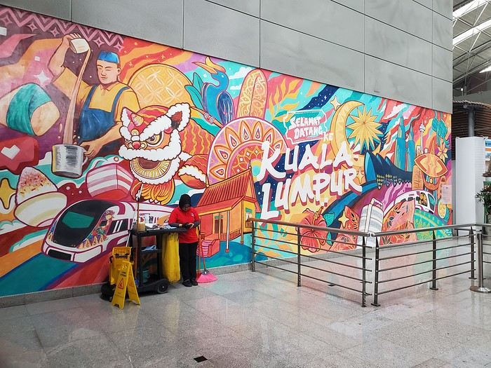
Don’t forget to fill out the immigration form requested by Malaysia 3 days before arrival. We left without any issues and took the Klia Ekspress train to KL Sentral station (30 minutes, 10 €). We’d booked accommodation in a tower near the station and had to communicate with the landlord to get the keys. But while we thought there’d be Wi-Fi at the station, there wasn’t—we asked the tourism office, and they said there wasn’t any. We didn’t want to buy a local SIM card since we were leaving the next day. Eventually, we went to a Starbucks to get online, but just as we decided to head to our place, a torrential downpour hit, and we couldn’t find a sidewalk to reach our destination. We went back to the station, took the elevated metro, and finally made it to our landlord and the room on the 45th floor.
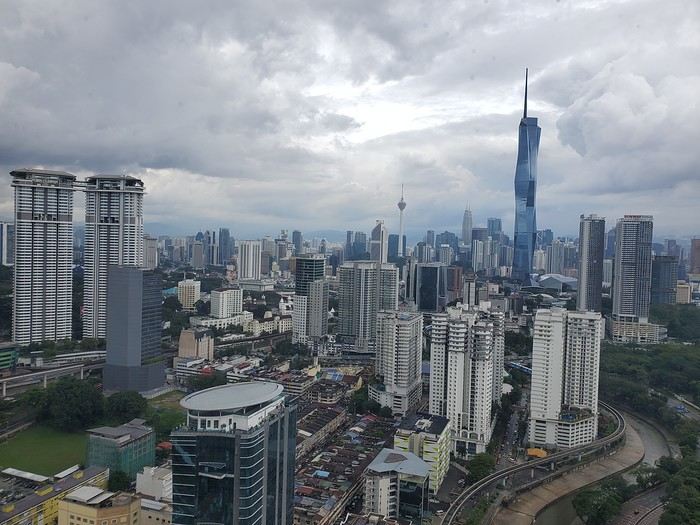
Don’t forget to fill out the immigration form requested by Malaysia 3 days before arrival. We left without any issues and took the Klia Ekspress train to KL Sentral station (30 minutes, 10 €). We’d booked accommodation in a tower near the station and had to communicate with the landlord to get the keys. But while we thought there’d be Wi-Fi at the station, there wasn’t—we asked the tourism office, and they said there wasn’t any. We didn’t want to buy a local SIM card since we were leaving the next day. Eventually, we went to a Starbucks to get online, but just as we decided to head to our place, a torrential downpour hit, and we couldn’t find a sidewalk to reach our destination. We went back to the station, took the elevated metro, and finally made it to our landlord and the room on the 45th floor.
Good evening everyone! 🙂
We’re back from our September 2025 road trip, this time to explore Arizona and New Mexico, and it’s time for me to start my travel journal—especially since everything’s already booked for another trip in September 2026 (to California), and I need to get started on the planning.
I was a little worried this new visit to Uncle Sam’s country might not be as "wow" as the others, but we still discovered some incredible places.
For those who don’t know us, we’re a couple in our seventies who speak very little English, but that didn’t stop us from fully enjoying our stay.
For this 6th road trip in the U.S., we spent 21 nights there, drove 4,160 km by car, and walked nearly 160 km in a loop starting from Phoenix.
We’d been to Arizona before (but not this side) and never to New Mexico. This whole road trip was a huge discovery for us.
In the prices mentioned (some in euros, others in dollars), bank fees and exchange charges are included. The flights, car rental, and parking were all paid for in December 2024 when we booked.
We’d downloaded the MPC (Mobile Passport Control) app, but there wasn’t a dedicated line at Phoenix Airport. Still, we got through quickly with friendly, smiling agents.
I don’t drive at all (I hate it), so the stops were chosen based on activities but also, for some, to limit daily mileage for the sole driver. The kilometers listed in the itinerary are the daily distances.
We traveled from September 9th to 22nd, unfortunately once again without our dear friends Mimi and Maumau.
The itinerary
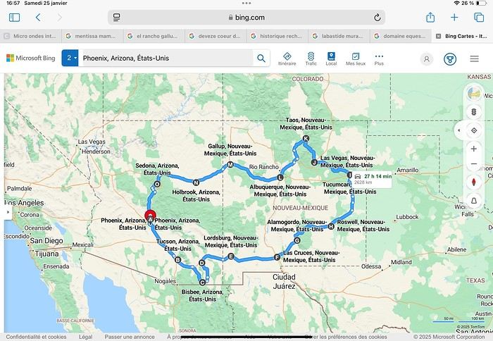
Day 1: Flight Marseille-Paris-Phoenix, then Gold Canyon (133 km) Day 2: Tucson (271 km) Lost Dutchman State Park Day 3: Tucson (155 km) Day 4: Tucson (34 km) Day 5: Bisbee (182 km) Day 6: Lordsburg (345 km) Day 7: Las Cruces (253 km) Day 8: Alamogordo (162 km) Day 9: Roswell (264 km) Day 10: Tucumcari (369 km) Day 11: Las Vegas (281 km) – the one in New Mexico Day 12: Taos (213 km) Day 13: Santa Fe (224 km) Day 14: Albuquerque (123 km) Day 15: Gallup (246 km) Day 16: Holbrook (224 km) Day 17: Flagstaff (179 km) Day 18: Sedona (118 km) Day 19: Sedona (48 km) Day 20: Sedona (41 km) Day 21: Phoenix (256 km) Day 22: Phoenix Airport (35 km)
📊 **Budget**: A little over 7,500 € for both of us, all included. The exchange rate was in our favor (1.17 dollars to 1 €). 📊 **Flights**: Marseille-Paris Charles de Gaulle-Phoenix: 1,787 € for two, with one checked bag each (Air France) 📊 **ESTA**: $42 📊 **America the Beautiful Pass**: $80 📊 **Parking**: 134 € (super eco at Marseille) 📊 **Car rental (Hertz)**: 865 €. Since there were no SUVs left in the reserved category (Nissan Rogue), we got an upgrade (4x4 Ford Explorer). We booked through Air France (15% discount). We’d originally reserved it in December for 1,140 €, but since prices dropped in March, we canceled and rebooked for 865 €. Hertz offers a free Hertz Gold Plus Rewards program, which gives you priority counter service when picking up the car. 📊 **Accommodation**: 2,400 € We stayed in hotels and motels of varying standards (from 60 to 203 € per night, depending on the city), all booked through Booking.com or Hotels.com. Out of 21 nights, only two didn’t include breakfast in the price. Booking.com sometimes offers slightly cheaper rates if you book by phone using the mobile app, and our Genius 3 status on the site also got us some preferential rates. 📊 **Supplementary insurance**: AVA 200 € for medical care if needed 📊 **Cash**: $2,078. We left with 1,000 € exchanged before departure and made two withdrawals of $500. This cash covered: - Evening restaurants and tips - Midday picnics - Gas: $298 for 4,160 km - Museum and private park entries (per person): - Lost Dutchman: $10 - Arizona-Sonora Desert Museum: $28 - Bird Cage Theater: $16 - Tombstone Shootout: $8 - New Mexico Farm & Ranch Museum: $12 - Roswell International UFO Museum: $5 - Billy the Kid Museum: $7 - Rancho de Taos: $22 - West Fork Oak Creek Trail entry: $15 We got a few discounts thanks to our senior age (+65). - Souvenirs and little treats
Like on our previous road trips, we didn’t rent a GPS. We got around using offline GPS apps Here WeGo and Organic Maps, with maps of the states we visited downloaded before we left (on our phones).
❤️❤️❤️ **Highlights** (there are so many!) 📍 Goldfield Ghost Town (even if it’s a reconstruction) 📍 The standing army of Saguaro cacti at Saguaro National Park West 📍 Diving into the cowboy universe of Tombstone 📍 The welcome from Rick and Henry at our guesthouse in Bisbee (Garden at Mile High Ranch) 📍 The tangled rocks of Chiricahua National Monument 📍 The flavored pistachios from Dwayne’s Fresh Jerky and Mac Ginnis Pistachioland 📍 Restaurants: La Posta (Las Cruces), Diner 66 (Albuquerque), and the Haunted Hamburger (Jerome) 📍 The old plazas of New Mexico 📍 The solitude and beauty of the white dunes at White Sands National Park 📍 Stepping back in time at the Billy the Kid Museum (Fort Stanton) 📍 Sections of historic Route 66 and the old motels of Tucumcari, especially at night when all the neon lights are on 📍 Taos Pueblo and diving into Native American culture 📍 After the Rio Grande Bridge, the descent via NM 567 to the very bottom of the Rio Grande Gorge, then the road along the riverbanks to Taos 📍 The tranquility of the Chimayo Sanctuary 📍 Discovering the ingenious native dwellings at Bandelier National Monument and Walnut Canyon National Park 📍 The small towns along the Turquoise Trail 📍 The red rocks of Red Rock Park and the Painted Desert 📍 The extraordinary colors of the petrified trees at Petrified Forest National Park 📍 Sedona, its red rocks, and the reward of the viewpoints at the end of hikes (Devil’s Bridge, The Subway, and West Fork Oak Creek) 📍 The immersion in Mexico when visiting Tlaquepaque 📍 The almost-ghost town of Jerome and its terraced streets 📍 The incredible kindness of Americans, always ready to help and up for a chat ❤️
☹️☹️☹️ **Flops** (there are very few) 📍 Several museums and churches being closed, so we couldn’t visit them 📍 Some museums and visitor centers opening late (10 AM) and closing early (4 PM) 📍 A 64 € phone roaming charge because we got near the Mexican border and picked up their cell tower 📍 The outrageous price ($5.99) for a gallon of gas at the Shell near Phoenix Airport
I hope this helps! Anyway, thanks for reading my long post. Don’t hesitate to reach out, even via PM, if you see I haven’t replied and you’d like more details. Have a great evening, everyone! 🙂
We’re back from our September 2025 road trip, this time to explore Arizona and New Mexico, and it’s time for me to start my travel journal—especially since everything’s already booked for another trip in September 2026 (to California), and I need to get started on the planning.
I was a little worried this new visit to Uncle Sam’s country might not be as "wow" as the others, but we still discovered some incredible places.
For those who don’t know us, we’re a couple in our seventies who speak very little English, but that didn’t stop us from fully enjoying our stay.
For this 6th road trip in the U.S., we spent 21 nights there, drove 4,160 km by car, and walked nearly 160 km in a loop starting from Phoenix.
We’d been to Arizona before (but not this side) and never to New Mexico. This whole road trip was a huge discovery for us.
In the prices mentioned (some in euros, others in dollars), bank fees and exchange charges are included. The flights, car rental, and parking were all paid for in December 2024 when we booked.
We’d downloaded the MPC (Mobile Passport Control) app, but there wasn’t a dedicated line at Phoenix Airport. Still, we got through quickly with friendly, smiling agents.
I don’t drive at all (I hate it), so the stops were chosen based on activities but also, for some, to limit daily mileage for the sole driver. The kilometers listed in the itinerary are the daily distances.
We traveled from September 9th to 22nd, unfortunately once again without our dear friends Mimi and Maumau.
The itinerary
Day 1: Flight Marseille-Paris-Phoenix, then Gold Canyon (133 km) Day 2: Tucson (271 km) Lost Dutchman State Park Day 3: Tucson (155 km) Day 4: Tucson (34 km) Day 5: Bisbee (182 km) Day 6: Lordsburg (345 km) Day 7: Las Cruces (253 km) Day 8: Alamogordo (162 km) Day 9: Roswell (264 km) Day 10: Tucumcari (369 km) Day 11: Las Vegas (281 km) – the one in New Mexico Day 12: Taos (213 km) Day 13: Santa Fe (224 km) Day 14: Albuquerque (123 km) Day 15: Gallup (246 km) Day 16: Holbrook (224 km) Day 17: Flagstaff (179 km) Day 18: Sedona (118 km) Day 19: Sedona (48 km) Day 20: Sedona (41 km) Day 21: Phoenix (256 km) Day 22: Phoenix Airport (35 km)
📊 **Budget**: A little over 7,500 € for both of us, all included. The exchange rate was in our favor (1.17 dollars to 1 €). 📊 **Flights**: Marseille-Paris Charles de Gaulle-Phoenix: 1,787 € for two, with one checked bag each (Air France) 📊 **ESTA**: $42 📊 **America the Beautiful Pass**: $80 📊 **Parking**: 134 € (super eco at Marseille) 📊 **Car rental (Hertz)**: 865 €. Since there were no SUVs left in the reserved category (Nissan Rogue), we got an upgrade (4x4 Ford Explorer). We booked through Air France (15% discount). We’d originally reserved it in December for 1,140 €, but since prices dropped in March, we canceled and rebooked for 865 €. Hertz offers a free Hertz Gold Plus Rewards program, which gives you priority counter service when picking up the car. 📊 **Accommodation**: 2,400 € We stayed in hotels and motels of varying standards (from 60 to 203 € per night, depending on the city), all booked through Booking.com or Hotels.com. Out of 21 nights, only two didn’t include breakfast in the price. Booking.com sometimes offers slightly cheaper rates if you book by phone using the mobile app, and our Genius 3 status on the site also got us some preferential rates. 📊 **Supplementary insurance**: AVA 200 € for medical care if needed 📊 **Cash**: $2,078. We left with 1,000 € exchanged before departure and made two withdrawals of $500. This cash covered: - Evening restaurants and tips - Midday picnics - Gas: $298 for 4,160 km - Museum and private park entries (per person): - Lost Dutchman: $10 - Arizona-Sonora Desert Museum: $28 - Bird Cage Theater: $16 - Tombstone Shootout: $8 - New Mexico Farm & Ranch Museum: $12 - Roswell International UFO Museum: $5 - Billy the Kid Museum: $7 - Rancho de Taos: $22 - West Fork Oak Creek Trail entry: $15 We got a few discounts thanks to our senior age (+65). - Souvenirs and little treats
Like on our previous road trips, we didn’t rent a GPS. We got around using offline GPS apps Here WeGo and Organic Maps, with maps of the states we visited downloaded before we left (on our phones).
❤️❤️❤️ **Highlights** (there are so many!) 📍 Goldfield Ghost Town (even if it’s a reconstruction) 📍 The standing army of Saguaro cacti at Saguaro National Park West 📍 Diving into the cowboy universe of Tombstone 📍 The welcome from Rick and Henry at our guesthouse in Bisbee (Garden at Mile High Ranch) 📍 The tangled rocks of Chiricahua National Monument 📍 The flavored pistachios from Dwayne’s Fresh Jerky and Mac Ginnis Pistachioland 📍 Restaurants: La Posta (Las Cruces), Diner 66 (Albuquerque), and the Haunted Hamburger (Jerome) 📍 The old plazas of New Mexico 📍 The solitude and beauty of the white dunes at White Sands National Park 📍 Stepping back in time at the Billy the Kid Museum (Fort Stanton) 📍 Sections of historic Route 66 and the old motels of Tucumcari, especially at night when all the neon lights are on 📍 Taos Pueblo and diving into Native American culture 📍 After the Rio Grande Bridge, the descent via NM 567 to the very bottom of the Rio Grande Gorge, then the road along the riverbanks to Taos 📍 The tranquility of the Chimayo Sanctuary 📍 Discovering the ingenious native dwellings at Bandelier National Monument and Walnut Canyon National Park 📍 The small towns along the Turquoise Trail 📍 The red rocks of Red Rock Park and the Painted Desert 📍 The extraordinary colors of the petrified trees at Petrified Forest National Park 📍 Sedona, its red rocks, and the reward of the viewpoints at the end of hikes (Devil’s Bridge, The Subway, and West Fork Oak Creek) 📍 The immersion in Mexico when visiting Tlaquepaque 📍 The almost-ghost town of Jerome and its terraced streets 📍 The incredible kindness of Americans, always ready to help and up for a chat ❤️
☹️☹️☹️ **Flops** (there are very few) 📍 Several museums and churches being closed, so we couldn’t visit them 📍 Some museums and visitor centers opening late (10 AM) and closing early (4 PM) 📍 A 64 € phone roaming charge because we got near the Mexican border and picked up their cell tower 📍 The outrageous price ($5.99) for a gallon of gas at the Shell near Phoenix Airport
I hope this helps! Anyway, thanks for reading my long post. Don’t hesitate to reach out, even via PM, if you see I haven’t replied and you’d like more details. Have a great evening, everyone! 🙂
Ah, Iceland and us—it’s quite the story, or rather, a long wait... The first time we considered going was already 7-8 years ago, after reading travel journals describing breathtaking landscapes, countless active and dormant volcanoes, glaciers, and waterfalls with extraordinary flows. In short, this island, made of fire and ice, right at Europe’s doorstep with its own unique culture, had nothing but advantages, and it was urgent to visit without delay 😇
My *Routard* guidebook is actually from 2016. So why did Iceland make us wait so long before we finally gave in to its charms? Yes, why indeed?
Simply because reading other travel journals revealed the cost of living there—and especially the harsh climate, even in the middle of July 🤪! Some journals described entire weeks of rain and foggy weather, making it tricky to explore the island. The budget wasn’t spared either, because in the most touristy areas, especially in the south and around Myvatn, accommodation prices are downright indecent—even outright robbery. 😕
Plus, in the Highlands, there’s literally no permanent lodging, and the only way to spend several nights there is to camp. And camping in winter conditions wasn’t exactly part of our plans... 😄
So, year after year, this trip kept getting postponed...
until August 2023, when prices for Southern Africa, North or South America, or even Asia were all way too high for summer 2024!
That’s when I turned my attention back to the Land of Fire and Ice and scoured all the comparison sites for the best accommodation deals across the country. Planning for 20 nights, I found 13 nights in "proper" lodging for 5 people at an average cost of under 200 €! A miracle, considering that in the southern glacier region, around Vik or Myvatn, prices range from 300 to 1000 € per night 😮 😮!
Still, that means we’ll have to camp for 7 nights, mostly in the Highlands, near Askja or Landmannalaugar. 😎
For once, I built the daily itinerary entirely around the decently priced lodgings I found 11 months in advance! The shortage of places to stay in some areas forced me to plan a few long transition days and make some tough choices. No big deal, though—there’s so much to do on this island 🙂!
Once the main itinerary was set, everyone agreed to the plan: 2/3 in proper lodging and 1/3 camping, even the most camping-averse among us! *Follow my gaze...*
By the time we bought the flight tickets, I had to tweak the itinerary a bit because one or two places were already booked! Plus, it was impossible to wait for a more refined plan to adjust reservations, since almost all bookings are non-refundable!! The harsh law of supply and demand...
For the car rental, we booked a Hyundai Tucson, approved for the Highlands, from Lava Car Rental—a company I’d read good reviews about in a Facebook group—for a cool 2500 € with full insurance. A real 4x4, like a Defender, would’ve been more than double...! Welcome to Iceland 😕...
Activities and excursions also required some tough choices. We had two must-dos: whale watching in Húsavík (60 € pp on Getyourguide) and a Glacier and Summer Treasure Glacier Walk with BlueIceland (165 € pp with discount codes on Getyourguide).
For the baths, we skipped the Blue Lagoon—too expensive—in favor of the Secret Lagoon and the Myvatn Baths, the Blue Lagoon’s equivalent but half the price.
Two baths for the price of one... and even more, since I spotted several free hot-water swimming spots.
Itinerary: Day 1: Arrival in Reykjavik - Hraunfossar Waterfall - Surtshellir Cave Day 2: Grábrók Crater - Snæfellsnes Peninsula Day 3: Stykkishólmur - Sturlungalaug Hot Springs Day 4: Northwest Coast - Akureyri - Goðafoss Day 5: Myvatn Day 6: Myvatn - Dettifoss - Selfoss - Rauðhólar Day 7: Húsavík Whale Watching - Dettifoss - Selfoss Day 8: Stuðlagil Canyon - Seyðisfjörður Day 9: Puffin colony - Störurð Hike Day 10: Hengifoss - East Fjords, Mjóifjörður Day 11: Viking Village - Jökulsárlón - Fjallsárlón Day 12: Glacier Excursion - Svartifoss Day 13: Fjaðrárgljúfur Canyon - Vík Day 14: Þakgil - Lava Show Vík Day 15: Southern Waterfalls Day Day 16: Landmannalaugar - Skalli Hike Day 17: Landmannalaugar - Bláhnjúkur - Brennisteinsalda Day 18: Secret Lagoon, Kerlingarfjöll, and Gullfoss Day 19: Geysir - Reykjavik Day 20: Bruarfoss - Þingvellir - Kerid Crater - Krýsuvík Geothermal Area Day 21: Reykjanes Peninsula
Friday, July 5, 2024, is our last workday before driving up to Alsace overnight to leave the cockers at Grandpa’s for boarding. Then, at 1:30 AM, we’ll head to Frankfurt, where a direct flight to Iceland awaits.
We arrive at 4 AM. Since we leave at 7 AM, the "night" will only last the equivalent of a 30-minute nap 🤪... just enough to get us in the road-trip mood 😏!!
My *Routard* guidebook is actually from 2016. So why did Iceland make us wait so long before we finally gave in to its charms? Yes, why indeed?
Simply because reading other travel journals revealed the cost of living there—and especially the harsh climate, even in the middle of July 🤪! Some journals described entire weeks of rain and foggy weather, making it tricky to explore the island. The budget wasn’t spared either, because in the most touristy areas, especially in the south and around Myvatn, accommodation prices are downright indecent—even outright robbery. 😕
Plus, in the Highlands, there’s literally no permanent lodging, and the only way to spend several nights there is to camp. And camping in winter conditions wasn’t exactly part of our plans... 😄
So, year after year, this trip kept getting postponed...
until August 2023, when prices for Southern Africa, North or South America, or even Asia were all way too high for summer 2024!
That’s when I turned my attention back to the Land of Fire and Ice and scoured all the comparison sites for the best accommodation deals across the country. Planning for 20 nights, I found 13 nights in "proper" lodging for 5 people at an average cost of under 200 €! A miracle, considering that in the southern glacier region, around Vik or Myvatn, prices range from 300 to 1000 € per night 😮 😮!
Still, that means we’ll have to camp for 7 nights, mostly in the Highlands, near Askja or Landmannalaugar. 😎
For once, I built the daily itinerary entirely around the decently priced lodgings I found 11 months in advance! The shortage of places to stay in some areas forced me to plan a few long transition days and make some tough choices. No big deal, though—there’s so much to do on this island 🙂!
Once the main itinerary was set, everyone agreed to the plan: 2/3 in proper lodging and 1/3 camping, even the most camping-averse among us! *Follow my gaze...*
By the time we bought the flight tickets, I had to tweak the itinerary a bit because one or two places were already booked! Plus, it was impossible to wait for a more refined plan to adjust reservations, since almost all bookings are non-refundable!! The harsh law of supply and demand...
For the car rental, we booked a Hyundai Tucson, approved for the Highlands, from Lava Car Rental—a company I’d read good reviews about in a Facebook group—for a cool 2500 € with full insurance. A real 4x4, like a Defender, would’ve been more than double...! Welcome to Iceland 😕...
Activities and excursions also required some tough choices. We had two must-dos: whale watching in Húsavík (60 € pp on Getyourguide) and a Glacier and Summer Treasure Glacier Walk with BlueIceland (165 € pp with discount codes on Getyourguide).
For the baths, we skipped the Blue Lagoon—too expensive—in favor of the Secret Lagoon and the Myvatn Baths, the Blue Lagoon’s equivalent but half the price.
Two baths for the price of one... and even more, since I spotted several free hot-water swimming spots.
Itinerary: Day 1: Arrival in Reykjavik - Hraunfossar Waterfall - Surtshellir Cave Day 2: Grábrók Crater - Snæfellsnes Peninsula Day 3: Stykkishólmur - Sturlungalaug Hot Springs Day 4: Northwest Coast - Akureyri - Goðafoss Day 5: Myvatn Day 6: Myvatn - Dettifoss - Selfoss - Rauðhólar Day 7: Húsavík Whale Watching - Dettifoss - Selfoss Day 8: Stuðlagil Canyon - Seyðisfjörður Day 9: Puffin colony - Störurð Hike Day 10: Hengifoss - East Fjords, Mjóifjörður Day 11: Viking Village - Jökulsárlón - Fjallsárlón Day 12: Glacier Excursion - Svartifoss Day 13: Fjaðrárgljúfur Canyon - Vík Day 14: Þakgil - Lava Show Vík Day 15: Southern Waterfalls Day Day 16: Landmannalaugar - Skalli Hike Day 17: Landmannalaugar - Bláhnjúkur - Brennisteinsalda Day 18: Secret Lagoon, Kerlingarfjöll, and Gullfoss Day 19: Geysir - Reykjavik Day 20: Bruarfoss - Þingvellir - Kerid Crater - Krýsuvík Geothermal Area Day 21: Reykjanes Peninsula
Friday, July 5, 2024, is our last workday before driving up to Alsace overnight to leave the cockers at Grandpa’s for boarding. Then, at 1:30 AM, we’ll head to Frankfurt, where a direct flight to Iceland awaits.
We arrive at 4 AM. Since we leave at 7 AM, the "night" will only last the equivalent of a 30-minute nap 🤪... just enough to get us in the road-trip mood 😏!!
Hi everyone.
Here’s my personal account (just my own opinion, of course):
My trip lasted 2 months (January to March 2025). Backpacking, solo, and on a very tight budget (15 € per day on average). I traveled from Havana to: Viñales, Santa Marta/Varadero, Cienfuegos, Trinidad, Sancti Spíritus, Camagüey, Bayamo, Santiago de Cuba, Guantánamo, Baracoa, Moa, Holguín, Santa Clara, Cienfuegos, and back to Havana.
In Cuba, if you stay in *casas particulares*, you’ll have plenty of options. They’re everywhere. When I did door-to-door, I negotiated prices based on my small budget. Not always accepted, but I still managed to find families willing to host me. The island has fewer and fewer tourists each year, so many now prefer to rent a room at a low price rather than leave it empty. Inflation is insane, and Cubans struggle to get by day to day.
Door-to-door works really well (look for the blue logo of a roof on the house, which means it’s licensed to rent to foreigners)—you’ll see them everywhere. If it makes you feel more secure, you can also book through Airb’n’b, but you won’t be able to negotiate there. Important: make sure to get a VPN subscription on your phone, otherwise you won’t be able to book anything (since Airbnb is a U.S. site).
Now, for the West:
- Viñales: very pretty but *super* touristy! So, food prices are a bit high… but it’s the cheapest place to stay I found in the whole country (3 €-4 per night!!!), because there’s so much competition with *casas* (you’ll find them on every street!).
- Cienfuegos: a human-scale city, I really liked it because it’s so peaceful. Waterfront, pretty square, good prices, wide and well-lit streets—very pleasant…
- Trinidad: very expensive and very touristy. Pretty (cobblestone streets, historic center, natural surroundings), but packed with people…
- Havana: easy to find cheap accommodation if you look in Chinatown. However, you shouldn’t mind the noise and street prostitution (getting approached every 10 meters)… Central Havana is the only well-maintained and upscale part of the city (so very expensive, for tourists with money). Outside of that, everything is run-down, in ruins, or very poor (and cheap as a result).
- Varadero: no interest at all. Very expensive, superficial, and ultra-touristy. Absolutely nothing Cuban about the place. If you still want to go, stay 3 km before in Santa Marta—it’s cheaper, and you can easily walk there.
- Santa Clara: a very pretty small city with its central square. Hard to find a good place to eat with electricity—if you can afford it, go to *El Sol* restaurant, no hesitation! Great welcome and a charming spot to enjoy a meal. For accommodation, I recommend a wonderful person, Juan Carlos. *Casa San Lorenzo* on Calle Martí! Always attentive, a great spirit, and good advice…
For the Center:
- Sancti Spíritus: nothing special… just a stopover city.
- Camagüey: a nice city with welcoming people (like everywhere else), but nothing particularly noteworthy.
For the Southeast:
- Bayamo: very small, nothing special.
- Santiago de Cuba: I loved it! It felt like San Francisco with its hilly layout! Lots of street life, musicians, affordable *casas*, easy to make friendly connections, quiet spots by the water, and lively areas downtown (despite the downside of being approached every 2 minutes). And always, a warm welcome from locals (shoutout to the adorable Erika, Souleydis, and her partner—I’m giving a shoutout to *Casa San Pedro* on Calle Princesa!).
- Guantánamo: no interest. Hard to find accommodation or even food. Nothing special and not very pretty either…
- Baracoa: very pretty, though! Kept in its own juice, very typical, authentic, a peaceful waterfront, and stunning natural surroundings… Easy to find cheap accommodation.
- Moa: the only small town where I stayed 3 days and couldn’t find bottled water… Not much interest, except to rest before hitting the road again.
- Holguín: one of the cities I loved! I stayed over 10 days. Human-scale, lots of places to stay and sleep. No one bothers you in the street (except money changers). It’s a great place to live, and the people are very friendly.
Overall positives: no need to worry—Cuba is ultra-safe, no aggression, no risks. Cubans are very welcoming, smiling, and always ready to help. Public transport everywhere—buses, trucks, *collectivos*, *taxi wha-wha*… The ice cream is to die for (just watch out for power outages and freezers). Great breakfasts in *casas*—hearty and delicious… Movie theaters are practically free (in Cuban pesos), so cheap it’d be a shame to skip them (they’re often empty, by the way). Chess clubs in every city, open to everyone and free (they’re really good!). The general vibe is warm and joyful despite the hardships…
Overall negatives: lots of scams, theft, and prostitution. Except in Havana, the rest of the island has no electricity for most of the day. Hard to find good cheap food (without going to big restaurants or hotels). Often mediocre: pasta or pizza usually have no taste. Paranoia among many people who fear crime, even though the country is very safe… Inflation is so bad that many Cubans struggle to eat or get healthcare (medicine is rare and expensive).
That’s a lot to say, but that’s the gist of it… 😊
Here’s my personal account (just my own opinion, of course):
My trip lasted 2 months (January to March 2025). Backpacking, solo, and on a very tight budget (15 € per day on average). I traveled from Havana to: Viñales, Santa Marta/Varadero, Cienfuegos, Trinidad, Sancti Spíritus, Camagüey, Bayamo, Santiago de Cuba, Guantánamo, Baracoa, Moa, Holguín, Santa Clara, Cienfuegos, and back to Havana.
In Cuba, if you stay in *casas particulares*, you’ll have plenty of options. They’re everywhere. When I did door-to-door, I negotiated prices based on my small budget. Not always accepted, but I still managed to find families willing to host me. The island has fewer and fewer tourists each year, so many now prefer to rent a room at a low price rather than leave it empty. Inflation is insane, and Cubans struggle to get by day to day.
Door-to-door works really well (look for the blue logo of a roof on the house, which means it’s licensed to rent to foreigners)—you’ll see them everywhere. If it makes you feel more secure, you can also book through Airb’n’b, but you won’t be able to negotiate there. Important: make sure to get a VPN subscription on your phone, otherwise you won’t be able to book anything (since Airbnb is a U.S. site).
Now, for the West:
- Viñales: very pretty but *super* touristy! So, food prices are a bit high… but it’s the cheapest place to stay I found in the whole country (3 €-4 per night!!!), because there’s so much competition with *casas* (you’ll find them on every street!).
- Cienfuegos: a human-scale city, I really liked it because it’s so peaceful. Waterfront, pretty square, good prices, wide and well-lit streets—very pleasant…
- Trinidad: very expensive and very touristy. Pretty (cobblestone streets, historic center, natural surroundings), but packed with people…
- Havana: easy to find cheap accommodation if you look in Chinatown. However, you shouldn’t mind the noise and street prostitution (getting approached every 10 meters)… Central Havana is the only well-maintained and upscale part of the city (so very expensive, for tourists with money). Outside of that, everything is run-down, in ruins, or very poor (and cheap as a result).
- Varadero: no interest at all. Very expensive, superficial, and ultra-touristy. Absolutely nothing Cuban about the place. If you still want to go, stay 3 km before in Santa Marta—it’s cheaper, and you can easily walk there.
- Santa Clara: a very pretty small city with its central square. Hard to find a good place to eat with electricity—if you can afford it, go to *El Sol* restaurant, no hesitation! Great welcome and a charming spot to enjoy a meal. For accommodation, I recommend a wonderful person, Juan Carlos. *Casa San Lorenzo* on Calle Martí! Always attentive, a great spirit, and good advice…
For the Center:
- Sancti Spíritus: nothing special… just a stopover city.
- Camagüey: a nice city with welcoming people (like everywhere else), but nothing particularly noteworthy.
For the Southeast:
- Bayamo: very small, nothing special.
- Santiago de Cuba: I loved it! It felt like San Francisco with its hilly layout! Lots of street life, musicians, affordable *casas*, easy to make friendly connections, quiet spots by the water, and lively areas downtown (despite the downside of being approached every 2 minutes). And always, a warm welcome from locals (shoutout to the adorable Erika, Souleydis, and her partner—I’m giving a shoutout to *Casa San Pedro* on Calle Princesa!).
- Guantánamo: no interest. Hard to find accommodation or even food. Nothing special and not very pretty either…
- Baracoa: very pretty, though! Kept in its own juice, very typical, authentic, a peaceful waterfront, and stunning natural surroundings… Easy to find cheap accommodation.
- Moa: the only small town where I stayed 3 days and couldn’t find bottled water… Not much interest, except to rest before hitting the road again.
- Holguín: one of the cities I loved! I stayed over 10 days. Human-scale, lots of places to stay and sleep. No one bothers you in the street (except money changers). It’s a great place to live, and the people are very friendly.
Overall positives: no need to worry—Cuba is ultra-safe, no aggression, no risks. Cubans are very welcoming, smiling, and always ready to help. Public transport everywhere—buses, trucks, *collectivos*, *taxi wha-wha*… The ice cream is to die for (just watch out for power outages and freezers). Great breakfasts in *casas*—hearty and delicious… Movie theaters are practically free (in Cuban pesos), so cheap it’d be a shame to skip them (they’re often empty, by the way). Chess clubs in every city, open to everyone and free (they’re really good!). The general vibe is warm and joyful despite the hardships…
Overall negatives: lots of scams, theft, and prostitution. Except in Havana, the rest of the island has no electricity for most of the day. Hard to find good cheap food (without going to big restaurants or hotels). Often mediocre: pasta or pizza usually have no taste. Paranoia among many people who fear crime, even though the country is very safe… Inflation is so bad that many Cubans struggle to eat or get healthcare (medicine is rare and expensive).
That’s a lot to say, but that’s the gist of it… 😊
Hi everyone,
I have a Ryanair flight scheduled for 10/14 (outbound, returning on the 16th) from Charleroi in Belgium. A strike is confirmed, and the airport will be closed on the 14th. But Ryanair is still saying the flight is confirmed. I get that they’re trying to make us change and pay extra fees rather than wait for the free compensation.
If I make a new booking, can I still claim a refund for the first one?
Thanks in advance for your help—this is the first time I’ve faced this situation.
I have a Ryanair flight scheduled for 10/14 (outbound, returning on the 16th) from Charleroi in Belgium. A strike is confirmed, and the airport will be closed on the 14th. But Ryanair is still saying the flight is confirmed. I get that they’re trying to make us change and pay extra fees rather than wait for the free compensation.
If I make a new booking, can I still claim a refund for the first one?
Thanks in advance for your help—this is the first time I’ve faced this situation.
Four days of beach relaxation in this truly curious place let me unwind 15 years ago after trekking through Asia or Africa: swimming in clear, clean water and easing jet lag was my goal; seeing that mirage in the middle of the desert also piqued my curiosity... And then Dubai developed, and now I go there once a year for 15 days without ever getting bored!! My backpacker budget doesn’t stop me from enjoying what I love about travel: discovering cultures, architecture, and beaches with turquoise waters.
I’m sharing my favorite spots here for those who love simplicity and the thrill of being amazed! Dubai stretches over 50 km long. I stay in the historic Bur Dubai neighborhood, which is very "Indian" and separated from Deira (the more "Arab/African" district) by a creek.
You cross from one side to the other on abras, small traditional wooden boats that run all day. My hotel is 4 minutes from the Al Ghubaiba bus station, 5 minutes from the Al Ghubaiba metro, and 6 minutes from the Al Ghubaiba boat station!!! It’s easy to get around from here, and at night, it’s lively—safe to go out, with few tourists but mostly the local middle class who built (and are still building) Dubai. It’s simple and very international.
- **Transport:** ...**Getting there:** I fly with Emirates from Paris. Taking the 9:30 PM flight, I sleep on the plane, land at 6:35 AM, exchange 200 euros once I’ve picked up my luggage, change in the restroom, grab a taxi to the hotel, drop off my suitcase, and head straight to the beach! ...**On the ground:** I buy a silver NOL card, which works for buses, metro, and boats. I top it up as needed—it’s valid for 2 years. ...**Taxis:** They have reliable meters. Pink ones are driven by women. Airport-to-hotel fare: 12 €. You’ll find them everywhere, and they don’t complain about short trips. Between 3 PM and 4 PM, it’s trickier because of shift changes.
- **Best times to visit:** For me, it’s April-May and October-November: not too hot for walking but warm enough to swim! Watch out for air conditioning—your worst enemy. It’s everywhere, even at bus stops. Bring a big scarf or sarong to cover your throat and head—going from 32°C to 16°C when you enter a mall, bus, or taxi is pretty harsh!
- **Hotel:** I stay at the Grand Astoria (Fahidi Street) because the value for price and location is great. It’s very clean, and I skip breakfast because near the bus station, there’s a big Carrefour hypermarket where I buy breakfast supplies, water, camel milk, and picnic snacks. There are two nightclubs downstairs—bring earplugs if you want to sleep before 2 AM. Wi-Fi is spotty; you have to change the password every two days. The staff is lovely. Rooms have a TV (4 Indian channels + BBC), a kettle with tea/coffee sachets, and a mini-fridge you fill yourself.
- **Bur Dubai: "My neighborhood"** In the morning, you can see kids in uniforms waiting for the school bus with their parents—second-generation migrants who’ve settled here. They speak English, Arabic, and their mother tongue, have great education, and are in high demand (I see job ads in the local newspapers in the hotel lobby). From the U.S. to the Middle East, Singapore to South Africa, they have bright futures. In the evenings, families stroll along the creek, and it’s common for bench neighbors to ask where you’re from. The whole world crosses paths here. Even with basic English, it’s friendly and warm—the "take care" as people go their separate ways is a nice touch.
Bur Dubai has plenty to explore if you don’t feel like going far: along the creek, there’s a cluster of reconstructed houses forming the Al Shindagha Museum. One ticket lets you visit all the houses, each with a theme tied to the history of the seven emirates (Dubai is one). It takes a full day, but if you stop for lunch, there are tons of restaurants for all budgets, some right by the water.
Walking in the opposite direction, you reach Al Seef, a reconstruction of old Dubai as a small pearl-fishing port. The architecture is lovely, with souvenir shops. My favorite is the Iranian grocery store, where you’ll find camel milk chocolate, black lemon, and sweets with rose, pistachio, and candied apricot. It’s peaceful to walk around here, even as a solo woman. There are free restrooms everywhere, wooden or stone benches, and a nice breeze in the evening. Plenty of waterfront restaurants or places to grab a drink, plus a few towers across the way—nothing spectacular, but they’re prettily lit. There’s a souk with souvenir shops for those who like that!
- **Restaurants:** Bur Dubai has restaurants representing regions of India and the Indian subcontinent. My favorites: Across from the hotel, Paklyari—a Pakistani spot with excellent mutton biryani for 5 €. At Al Seef, Nablus has a great setting by the water. Across in Deira, the Italian restaurant on the 18th floor of the Rotana—go half an hour before sunset for an amazing view of the creek and skyline. The truffle pizza is 24 €. You can take a taxi from Bur, and after dinner, get dropped off at Al Seef to walk back along the creek. For a great thali, Kathhiyawadi is a 10-minute walk from Burjuman metro. My latest discovery: Bordomavi (near the Rashid Al Hadees Masjid 1 bus stop). One of the servers is Algerian and speaks French. You can swim at the small beach with showers/toilets, then have lunch at the restaurant (57 € for two, with starter, main, dessert, and drinks). The setting is peaceful, in a little fishing port with a cool photo op—traditional boats with the modern skyline in the background!
- **Sunset drinks:** The terrace at Concorde Creek View (Bur Dubai) has a creek view, and Canopy by Hilton (Al Seef) overlooks the creek and skyline. You can get a day pass for the pool, including meals and drinks.
- **Lassi:** Near the hotel, SreeRaj Lassi Bar has great ice cream and lassi. *Tip: Everything is takeout-friendly, including leftovers—great for a picnic the next day.
- **Market:** Don’t miss the Waterfront Market—a huge hall where locals buy fish, meat, fruits, and vegetables from all over the world. I love buying fish, shrimp, and cuttlefish, then having it prepared at Yahya’s waterfront restaurant (grilled, in sauce, fried, etc.) with salad, hummus, tabbouleh, and rice. It’s on the way between "my" beach and the hotel, so I stop by easily. I stock up on fruit, and at the Lulu supermarket upstairs, I grab yogurt, water, etc. No need to carry everything—a taxi (available at the main exit) will drop me right at the hotel!
- **Beach:** My favorite: Al Mamzar Park (15-minute taxi ride, 9 €). It has four lifeguarded beaches with showers and restrooms. Opens at 8 AM, but note: Mondays and Wednesdays are for women and young children only! Entry is 1.50 €. On Beach #2, you can rent sun loungers and umbrellas. Beach #3 (the prettiest) has stone tables with benches under big umbrellas—free! I arrive at 8 AM, set up, and walk for an hour along the water, spotting starfish, colorful fish, birds, and occasionally small jellyfish. From bikinis to burkinis, everyone swims as they like! Dubai is judgment-free—no side-eye, just smiles and greetings. I love seeing joyful, full-figured women on women-only days, playing darbuka and singing. Indian women do yoga (even headstands!), Chinese women practice tai chi... I read a lot and swim far out to the buoy limits. Lifeguards keep watch. It’s safe on land too. Once, a 4x4 driver gave me a dirty look for "serving whisky" to my mom from a plastic bottle—until I made him smell it. It was mint tea! Embarrassed, he immediately called his brother, a gym teacher in Poitiers, to apologize in French! People in Dubai are smiley, polite, and very respectful of elders. On weekends, the park is packed with groups and families barbecuing—joyful chaos in every language!
By 1:30 PM, depending on my mood, I’ll get dropped off at the Waterfront Market for fish or a thali restaurant. Sometimes I take the bus—it stops near the abras on the Deira side. Just cross by boat, then it’s a 3-minute walk to the hotel. Takes 45 minutes (vs. 15 by taxi).
For a treat, try Kite Beach (Abu Manara Masjid bus stop). The SoleMio section offers comfy sun loungers, fluffy towels, and umbrellas for 80 € for two in the front row. Go early—you’ll feel like you have the place to yourself, with the Burj Al Arab in the background. It gets busy on weekends.
From there, you can take a taxi to Dubai Mall (not far) to check out the dancing fountains at sunset, for example.
You can also buy day passes at some hotels with sun loungers, towels, pool access, and lunch credit. I tried the Ritz-Carlton—decent (170 € for two, including meals). Lunch was fine, and the view of the lit-up towers at sunset, with the giant wheel, was stunning. I took the metro back in the evening.
There are plenty of free beaches too, like La Mer—worth seeing more for the decor than the beach itself.
- **Even though my main "sightseeing" involves walking around with my head up, admiring the towers in DIFC (amazing), visiting the stunning Mohammed bin Rashid Library (near Creek metro), wandering the souks (including Little India in Bur and the Iranian mosque), or the spice souks in Deira (go early when it’s quiet),** A day trip to Abu Dhabi is worth it. Take the Bur Dubai-Abu Dhabi bus (pay with your NOL card). If you leave early, you’ll see the sunrise over the desert. At the station, buy a bus ticket to the Louvre, cross the footbridge over the highway, and wait for the bus. After the museum, take a taxi to the Grand Mosque, then another taxi back to the bus station. A full but doable day—no need to stay overnight!
In the evening, I love taking the metro (mostly above ground) and passing between the towering, lit-up skyscrapers—it feels like a sci-fi movie. Just missing flying taxis (they’re in the works!)
Sharjah, the closest emirate, has a fantastic Orientalist museum. From Bur Dubai’s maritime station, boats go to Sharjah in 30 minutes, near the aquarium and maritime museum.
- **Shopping:** I buy Indian chai tea spices, incense, camel milk chocolate, Iranian sweets, and fabric from Indian shops selling saris and fabric by the meter. I have a tailor make shirts, tunics, etc. Some shops sell buttons and trimmings to jazz things up.
- **Malls:** To attract customers, mall owners come up with wild ideas: a ski slope at Dubai Mall (worth seeing once), pretty wooden souks at Madinat, and a giant aquarium at Dubai Mall. At sunset, you can watch the dancing fountains to popular global tunes at the foot of the world’s tallest tower. At its base, there’s an excellent Iraqi restaurant, Samad Al Iraki, where the tea server is Tunisian and speaks French! The Ibn Battuta Mall is unique—you can go there straight from Abu Dhabi by bus, for example. Malls have plenty of dining options and are a place to (finally) see locals... though they’re not that interesting. Malls are served by the metro, while buses run along the coast. In Burjuman Mall, there’s a cybercafé on the ground floor where you can print.
A few helpful sites: Visit Dubai - Official Tourism Site RTA (Roads and Transport Authority) - RTA Services
"But what do *you* do in Dubai?" my friends ask, surprised... Yes, I love traveling to countries where I ride on bumpy roads in buses that break down, sleep in places with mosquitoes and cockroaches, and swelter in heat and humidity. But even far from that kind of travel, Dubai has an exotic charm. There’s something for every taste and budget—once you get past the flight ticket (around 680 €, probably cheaper with a layover). Dubai is about relaxing, swimming, being amazed, chatting, and tasting... A safe, clean vacation with no rudeness, and as a woman, it’s a relief to let your guard down. You come back refreshed and at peace!
Hope my experience helps... Next trip: March 2026, with plans to visit the Guggenheim in Abu Dhabi and whatever other curiosities pop up like magic...
Feel free to add to my experience with your own! Happy travels, Laurence
I’m sharing my favorite spots here for those who love simplicity and the thrill of being amazed! Dubai stretches over 50 km long. I stay in the historic Bur Dubai neighborhood, which is very "Indian" and separated from Deira (the more "Arab/African" district) by a creek.
You cross from one side to the other on abras, small traditional wooden boats that run all day. My hotel is 4 minutes from the Al Ghubaiba bus station, 5 minutes from the Al Ghubaiba metro, and 6 minutes from the Al Ghubaiba boat station!!! It’s easy to get around from here, and at night, it’s lively—safe to go out, with few tourists but mostly the local middle class who built (and are still building) Dubai. It’s simple and very international.
- **Transport:** ...**Getting there:** I fly with Emirates from Paris. Taking the 9:30 PM flight, I sleep on the plane, land at 6:35 AM, exchange 200 euros once I’ve picked up my luggage, change in the restroom, grab a taxi to the hotel, drop off my suitcase, and head straight to the beach! ...**On the ground:** I buy a silver NOL card, which works for buses, metro, and boats. I top it up as needed—it’s valid for 2 years. ...**Taxis:** They have reliable meters. Pink ones are driven by women. Airport-to-hotel fare: 12 €. You’ll find them everywhere, and they don’t complain about short trips. Between 3 PM and 4 PM, it’s trickier because of shift changes.
- **Best times to visit:** For me, it’s April-May and October-November: not too hot for walking but warm enough to swim! Watch out for air conditioning—your worst enemy. It’s everywhere, even at bus stops. Bring a big scarf or sarong to cover your throat and head—going from 32°C to 16°C when you enter a mall, bus, or taxi is pretty harsh!
- **Hotel:** I stay at the Grand Astoria (Fahidi Street) because the value for price and location is great. It’s very clean, and I skip breakfast because near the bus station, there’s a big Carrefour hypermarket where I buy breakfast supplies, water, camel milk, and picnic snacks. There are two nightclubs downstairs—bring earplugs if you want to sleep before 2 AM. Wi-Fi is spotty; you have to change the password every two days. The staff is lovely. Rooms have a TV (4 Indian channels + BBC), a kettle with tea/coffee sachets, and a mini-fridge you fill yourself.
- **Bur Dubai: "My neighborhood"** In the morning, you can see kids in uniforms waiting for the school bus with their parents—second-generation migrants who’ve settled here. They speak English, Arabic, and their mother tongue, have great education, and are in high demand (I see job ads in the local newspapers in the hotel lobby). From the U.S. to the Middle East, Singapore to South Africa, they have bright futures. In the evenings, families stroll along the creek, and it’s common for bench neighbors to ask where you’re from. The whole world crosses paths here. Even with basic English, it’s friendly and warm—the "take care" as people go their separate ways is a nice touch.
Bur Dubai has plenty to explore if you don’t feel like going far: along the creek, there’s a cluster of reconstructed houses forming the Al Shindagha Museum. One ticket lets you visit all the houses, each with a theme tied to the history of the seven emirates (Dubai is one). It takes a full day, but if you stop for lunch, there are tons of restaurants for all budgets, some right by the water.
Walking in the opposite direction, you reach Al Seef, a reconstruction of old Dubai as a small pearl-fishing port. The architecture is lovely, with souvenir shops. My favorite is the Iranian grocery store, where you’ll find camel milk chocolate, black lemon, and sweets with rose, pistachio, and candied apricot. It’s peaceful to walk around here, even as a solo woman. There are free restrooms everywhere, wooden or stone benches, and a nice breeze in the evening. Plenty of waterfront restaurants or places to grab a drink, plus a few towers across the way—nothing spectacular, but they’re prettily lit. There’s a souk with souvenir shops for those who like that!
- **Restaurants:** Bur Dubai has restaurants representing regions of India and the Indian subcontinent. My favorites: Across from the hotel, Paklyari—a Pakistani spot with excellent mutton biryani for 5 €. At Al Seef, Nablus has a great setting by the water. Across in Deira, the Italian restaurant on the 18th floor of the Rotana—go half an hour before sunset for an amazing view of the creek and skyline. The truffle pizza is 24 €. You can take a taxi from Bur, and after dinner, get dropped off at Al Seef to walk back along the creek. For a great thali, Kathhiyawadi is a 10-minute walk from Burjuman metro. My latest discovery: Bordomavi (near the Rashid Al Hadees Masjid 1 bus stop). One of the servers is Algerian and speaks French. You can swim at the small beach with showers/toilets, then have lunch at the restaurant (57 € for two, with starter, main, dessert, and drinks). The setting is peaceful, in a little fishing port with a cool photo op—traditional boats with the modern skyline in the background!
- **Sunset drinks:** The terrace at Concorde Creek View (Bur Dubai) has a creek view, and Canopy by Hilton (Al Seef) overlooks the creek and skyline. You can get a day pass for the pool, including meals and drinks.
- **Lassi:** Near the hotel, SreeRaj Lassi Bar has great ice cream and lassi. *Tip: Everything is takeout-friendly, including leftovers—great for a picnic the next day.
- **Market:** Don’t miss the Waterfront Market—a huge hall where locals buy fish, meat, fruits, and vegetables from all over the world. I love buying fish, shrimp, and cuttlefish, then having it prepared at Yahya’s waterfront restaurant (grilled, in sauce, fried, etc.) with salad, hummus, tabbouleh, and rice. It’s on the way between "my" beach and the hotel, so I stop by easily. I stock up on fruit, and at the Lulu supermarket upstairs, I grab yogurt, water, etc. No need to carry everything—a taxi (available at the main exit) will drop me right at the hotel!
- **Beach:** My favorite: Al Mamzar Park (15-minute taxi ride, 9 €). It has four lifeguarded beaches with showers and restrooms. Opens at 8 AM, but note: Mondays and Wednesdays are for women and young children only! Entry is 1.50 €. On Beach #2, you can rent sun loungers and umbrellas. Beach #3 (the prettiest) has stone tables with benches under big umbrellas—free! I arrive at 8 AM, set up, and walk for an hour along the water, spotting starfish, colorful fish, birds, and occasionally small jellyfish. From bikinis to burkinis, everyone swims as they like! Dubai is judgment-free—no side-eye, just smiles and greetings. I love seeing joyful, full-figured women on women-only days, playing darbuka and singing. Indian women do yoga (even headstands!), Chinese women practice tai chi... I read a lot and swim far out to the buoy limits. Lifeguards keep watch. It’s safe on land too. Once, a 4x4 driver gave me a dirty look for "serving whisky" to my mom from a plastic bottle—until I made him smell it. It was mint tea! Embarrassed, he immediately called his brother, a gym teacher in Poitiers, to apologize in French! People in Dubai are smiley, polite, and very respectful of elders. On weekends, the park is packed with groups and families barbecuing—joyful chaos in every language!
By 1:30 PM, depending on my mood, I’ll get dropped off at the Waterfront Market for fish or a thali restaurant. Sometimes I take the bus—it stops near the abras on the Deira side. Just cross by boat, then it’s a 3-minute walk to the hotel. Takes 45 minutes (vs. 15 by taxi).
For a treat, try Kite Beach (Abu Manara Masjid bus stop). The SoleMio section offers comfy sun loungers, fluffy towels, and umbrellas for 80 € for two in the front row. Go early—you’ll feel like you have the place to yourself, with the Burj Al Arab in the background. It gets busy on weekends.
From there, you can take a taxi to Dubai Mall (not far) to check out the dancing fountains at sunset, for example.
You can also buy day passes at some hotels with sun loungers, towels, pool access, and lunch credit. I tried the Ritz-Carlton—decent (170 € for two, including meals). Lunch was fine, and the view of the lit-up towers at sunset, with the giant wheel, was stunning. I took the metro back in the evening.
There are plenty of free beaches too, like La Mer—worth seeing more for the decor than the beach itself.
- **Even though my main "sightseeing" involves walking around with my head up, admiring the towers in DIFC (amazing), visiting the stunning Mohammed bin Rashid Library (near Creek metro), wandering the souks (including Little India in Bur and the Iranian mosque), or the spice souks in Deira (go early when it’s quiet),** A day trip to Abu Dhabi is worth it. Take the Bur Dubai-Abu Dhabi bus (pay with your NOL card). If you leave early, you’ll see the sunrise over the desert. At the station, buy a bus ticket to the Louvre, cross the footbridge over the highway, and wait for the bus. After the museum, take a taxi to the Grand Mosque, then another taxi back to the bus station. A full but doable day—no need to stay overnight!
In the evening, I love taking the metro (mostly above ground) and passing between the towering, lit-up skyscrapers—it feels like a sci-fi movie. Just missing flying taxis (they’re in the works!)
Sharjah, the closest emirate, has a fantastic Orientalist museum. From Bur Dubai’s maritime station, boats go to Sharjah in 30 minutes, near the aquarium and maritime museum.
- **Shopping:** I buy Indian chai tea spices, incense, camel milk chocolate, Iranian sweets, and fabric from Indian shops selling saris and fabric by the meter. I have a tailor make shirts, tunics, etc. Some shops sell buttons and trimmings to jazz things up.
- **Malls:** To attract customers, mall owners come up with wild ideas: a ski slope at Dubai Mall (worth seeing once), pretty wooden souks at Madinat, and a giant aquarium at Dubai Mall. At sunset, you can watch the dancing fountains to popular global tunes at the foot of the world’s tallest tower. At its base, there’s an excellent Iraqi restaurant, Samad Al Iraki, where the tea server is Tunisian and speaks French! The Ibn Battuta Mall is unique—you can go there straight from Abu Dhabi by bus, for example. Malls have plenty of dining options and are a place to (finally) see locals... though they’re not that interesting. Malls are served by the metro, while buses run along the coast. In Burjuman Mall, there’s a cybercafé on the ground floor where you can print.
A few helpful sites: Visit Dubai - Official Tourism Site RTA (Roads and Transport Authority) - RTA Services
"But what do *you* do in Dubai?" my friends ask, surprised... Yes, I love traveling to countries where I ride on bumpy roads in buses that break down, sleep in places with mosquitoes and cockroaches, and swelter in heat and humidity. But even far from that kind of travel, Dubai has an exotic charm. There’s something for every taste and budget—once you get past the flight ticket (around 680 €, probably cheaper with a layover). Dubai is about relaxing, swimming, being amazed, chatting, and tasting... A safe, clean vacation with no rudeness, and as a woman, it’s a relief to let your guard down. You come back refreshed and at peace!
Hope my experience helps... Next trip: March 2026, with plans to visit the Guggenheim in Abu Dhabi and whatever other curiosities pop up like magic...
Feel free to add to my experience with your own! Happy travels, Laurence
“Hey, your Marker... - My Marker? - The one you used to make hitchhiking signs.”
The marker in question is sitting proudly on the kitchen table. Marielle found it at the bottom of a moving box.
I’ve been meaning to tell the long story of my love affair with hitchhiking for years. Here we go.
To be honest, I’m not quite sure when it started. My earliest memory goes back to a fair with a bike race in my maternal grandparents’ village. I was with my cousin, my little sister, and three girl cousins. There were six of us, ages ranging from six or seven to thirteen or fourteen. Our parents stayed at the fair, and we’d had enough. So we decided to walk home. Only it was four kilometers away. So we hitchhiked. A guy driving an old car picked us all up and dropped us off at the farm. He probably found it amusing to see us thumbing a ride by the side of the road, but maybe it also worried him a bit. With everything you read in the papers...
Around fifteen or sixteen, I started hitchhiking regularly, alone or with a friend, to go to the nearby town. But it was especially when I started boarding school in Orléans that it became more regular. The first year, I’d leave Monday morning and come back Saturday noon by bus. It was an old, uncomfortable bus where we froze in winter. To make matters worse, I often got motion sickness if, as was too often the case, I ended up sitting in the back. In the spring, a high school friend suggested I hitchhike back. It meant a slight detour, but the advantage was taking only national roads.
So that’s how, from the end of tenth grade to twelfth grade, I’d thumb a ride every Saturday on the Pont de Bourgogne. Drivers were used to seeing young people hitchhiking, and it worked pretty well. Our biggest fear? Soldiers! At that time, military service was still mandatory, and on weekends, it wasn’t rare to see them competing with us. They’d keep their uniforms on to go home. That gave people confidence—with everything you read in the papers—and they’d rarely wait more than five minutes. We, with our long hair, were definitely less popular. From time to time, three big red-faced guys in a van coming back from a construction site would flip us off, yelling things like “go get a haircut, you bums!” Those were the good old days.
We still had a good laugh, though. Patrice, the friend I’d hitchhike back from school with on Saturdays, is a musician—I’d later discover he’s an excellent composer. A die-hard Beatles fan, he knows their repertoire by heart and spends his time singing at the top of his lungs while we thumb a ride. One Saturday late morning, we’d been waiting for a while at the exit of Châteauneuf-sur-Loire when a little lady came up to him and asked if he could please sing a little quieter: a baby was sleeping in the house. He put on the most sorry face: “Oh, sorry ma’am, we didn’t realize.” No sooner had the lady gone back inside than he started again. Luckily, a car stopped just then, sparing me the embarrassment of seeing the lady come back out.
Saturday was also the day when the cigarette pack was dangerously low. So before leaving, we’d go buy some “Parisiennes,” the “P4s” as we called them back then. They were slightly thinner cigarettes with a mix of tobacco scraps. Sometimes they tasted like light tobacco, sometimes like dark. Not great, but by the end of the week, our pocket money was gone. They were sold in small packs of four, hence the name P4. We’d only pay 20 centimes. On Saturdays, it was rare for the two of us to manage to scrape together 1.50 F to buy a whole pack of Gauloises...
The last twenty kilometers, I’d usually do alone, Patrice having reached his destination. From time to time, luck would smile on me: an acquaintance would just happen to pass by and stop. One January Saturday, at the exit of Gien, I ran into another guy from Argenton whom I knew a little. That day, the weather was nice, but the temperature was well below zero. It was around noon, and it was the off-peak hour. We were shivering, stamping our feet by the side of the road, when a Citroën “Tube” arrived: it was his father’s boss’s, a mason. They were both sitting in the front, but since they were obese, they had us climb onto the open back. Even though we huddled against the cab to shelter from the wind, the twenty kilometers felt very long, especially since we were only going sixty kilometers an hour. Our hands and cheeks were blue when we finally arrived.
The year I took my baccalaureate, a friend with a 2CV would take me Monday mornings with one or two others we’d pick up in nearby villages. We’d share the gas costs, but it was still cheaper than the bus. And in winter, the bus was my nightmare. You had to get up at five to catch it at six. Not enough sleep, and outside it was freezing or raining—or both. The 2CV was luxury. Plus, Philippe would pick me up at home. On the other hand, since I didn’t have class Saturday mornings—well, I did, but we only had PE the first two hours and nothing after—I’d skip class and slip out right after breakfast to thumb a ride at the Pont de Bourgogne.
Those three high school years were formative in this optional subject that was hitchhiking. Little by little, I learned the rules of the game. First, you shouldn’t walk along the road while thumbing. Cars go too fast and can’t stop easily. Accepting a ride that’s too short is also a no-go. The guy who offers to take you a little way but drops you off at some vague crossroads in the middle of nowhere? No thanks. You need to get dropped off in a town. If it’s a fairly big city, you often have to cross it from one end to the other, but it’s better. At the exit, you have to choose your spot well. Actually, you have to put yourself in the driver’s shoes: they need to see you early enough, not be going too fast, and be able to stop easily without risking an accident. So when leaving a city, it’s better not to go too far. It’s wiser to find a spot where cars go slowly and can stop easily. And preferably near a café. The café is for when you still have a few coins for a coffee and need to warm up. From time to time, you’d run into someone nice who’d make a detour to drop you off at a better spot to start again. Finally, if possible, avoid hitchhiking on Sundays. Cars are packed with whole families who, most of the time, aren’t going far. And then there’s the little worry of those people who rarely leave home: with everything you read in the papers...
During those high school years, it was only short trips, rarely exceeding a hundred kilometers. Later, I aimed bigger, and things were a bit different. In 1973-74, I crossed part of France for the first time on two or three occasions, coming back from the German border or returning to Bordeaux, where we lived briefly. Since there weren’t many highways back then, we took national roads. It was during these trips that I realized it was better to leave in the evening. As I said earlier, Sunday is to be avoided, but on weekdays, there’s another problem: if you leave in the morning, you only make short hops. First, it often takes longer to get going because drivers are people going to work nearby. Which brings us back to those who drop you off in a bad spot, far from everything. There, you have to know how to refuse. You thank the driver for stopping—oh, if only everyone could be like you—while explaining why you’d rather stay put. People don’t take offense, by the way. Those who pick up hitchhikers often hitchhiked themselves when they were in the military or before they had a car. In the late afternoon, you’d often run into salespeople or truckers, in other words, people who drive a lot. At that time, salespeople no longer had appointments and were more relaxed. They wanted to talk about something other than the merits of their products. On the radio, it was time for *Les Grosses Têtes*. You’d also quite often run into small business owners, professionals, or even hippies. The conversations were pleasant and often enriching. A little later in the evening, truckers would take over. They’d already driven a few hundred kilometers, and the depot or customs was still far away. So they’d gladly take a hitchhiker to stay awake at the wheel and chat. The radio with Max Ménier’s show *Les routiers sont sympas*, you’d eventually get tired of it. So a hitchhiker was a change. Others, who’d hit the road at midnight to be at their destination by morning, were nice and offered to let you lie down on the bunk while they drove. When you’d been hitchhiking since six in the evening, freezing in the wind between two vehicles, you weren’t unhappy to take a little nap.
Speaking of Max Ménier, he’d often make announcements for hitchhikers. One evening, I called him. It was getting late, and I still had quite a way to go. No luck: the show had ended for good the day before!
In short, it’s better not to rush, sleep in, and leave after lunch, or better yet, in the late afternoon. Obviously, I’m talking about when you have several hundred kilometers to cover. That’s when you have to play it pro.
First thing, especially at night, but it also applies in the middle of summer when the light is blinding: dress to be seen from far away. I’ll admit I have an advantage over most other hitchhikers: I’m small and don’t scare people. To balance that out, racist drivers often take me for an Arab and are less likely to pick me up, but overall, the balance tips in my favor. Back to the need to be seen: at night, I wear light-colored clothes. In headlights, you can see me from far away.
Second thing: travel light. Forget the big backpack with a frame. Drivers don’t always have room in the trunk or on the back seat, especially if it’s rained and the ground is wet. Plus, it forces them to get out of the car. If they’re nice enough to pick up a hitchhiker, you shouldn’t ask for too much either.
Third thing: bring a cardboard sign and a big marker—like the ones in the photo at the start of this post—to write the name of your destination. In the early 80s, I ran a tourist house in the Cher, but I lived in the Netherlands. In the off-season, it was only open on weekends. On Fridays, I’d leave Holland and return on Mondays. 1200 km round trip. On the way there, in Paris, I’d stand at Porte de la Chapelle. At that spot, the road is very wide, and drivers could stop easily. Obviously, on the sign, I didn’t write Eindhoven, which not everyone knows, and even less Amsterdam because of its seedy reputation. In that case, you’d expect to see a police car stop and two officers in kepis ask for your papers. So as a first destination, I’d write Compiègne. We were well out of Paris, and since it wasn’t too far, a trucker or salesperson was less reluctant to stop. Once past Compiègne, I’d take out my Lille sign. Once in Belgium, it wasn’t really necessary to use a sign anymore, since everyone was going in the same direction. Usually, the guy who picked me up at Porte de la Chapelle would say he wasn’t going far but could take me a little way. Before that, I’d still ask if there was a gas station on the highway where he could drop me off before exiting. While talking, the guy would realize he wasn’t dealing with a dangerous criminal. He’d pretend to check his watch, think for a moment, then say that actually, he was going to Belgium and could take me to the border or a little beyond. To leave Paris on the way back, I’d take the train to Melun, where it was easier to hitchhike than at Porte d’Italie.
Over all those years, I think I was pretty lucky. Or maybe philosophical enough not to imagine a car would stop after a few minutes. An hour’s wait was average. Sure, I sometimes waited three, four, or five hours. Most often at odd hours and in terrible weather. When it doesn’t work, it doesn’t work. But there’s always a moment when things pick up. Sure, when you’re soaked in freezing rain in the early morning after a sleepless night, you’re less philosophical than when I’m writing these lines comfortably at my computer, but it still holds true.
Earlier, I mentioned clothing and the importance of being well-rested before leaving. When you’ve eaten well and just gotten out of the shower, shaved, you’re in a better mood. And somehow, drivers sense it. Or at least, that’s the impression I’ve always had. It’s better to look in shape than disgusted at standing there, half-heartedly thumbing a ride. In short, when I’d start to get fed up with waiting, I’d go into the first café I saw for a coffee. Coming back out, I’d be refreshed, and most of the time, a car would stop within minutes. I’ve often said that when I stood by the side of the road thumbing a ride, I felt a bit like a gambler in front of a slot machine. It was a matter of giving luck a chance. And well, it worked out pretty well.
Then, there are countries where hitchhiking works really well and others where it’s harder. In the 70s-80s, it worked best in Germany and England. In the late afternoon, it wasn’t rare to be invited for tea. Well, that was in England. Tea meant being offered room and board. In Germany, they’d offer you coffee. Once there, they’d first show you the guest room and point out the bathroom before sitting you down in front of a big plate of cold cuts. In the evening, they’d go out in town, and the next morning, they’d usually drop you off at a good spot for hitchhiking. On the other hand, in Mediterranean and Scandinavian countries, you’d better be patient. In Spain or Italy, it’s better to take the train, which was dirt cheap back then. However, if you’re a couple traveling light, it’s already easier in most countries.
In 1982, I went on a trip around Turkey with my girlfriend. We only had two small bags, which was plenty. It was November-December, and we wore our warm, bulky clothes. Leaving Eindhoven at nine in the morning, we arrived in Graz, near the Yugoslav border, at eleven at night. 1300 km in a day! In just four or five vehicles. One to the German border, about fifty kilometers from Eindhoven, the second to Hagen in the Ruhr, the third to Salzburg, and the last to Graz at the Yugoslav border. Record broken. During the night crossing of Yugoslavia, we ran into a trucker close to retirement who lent us the truck’s bunk. So we arrived fresh and rested near Skopje the next morning. We continued to Thessaloniki in northern Greece before taking the train to Istanbul. In Turkey, we traveled a good part of the country by hitchhiking too. With truckers in old, overloaded, slow trucks that climbed hills at fifteen kilometers an hour, but also in cars where five or six people were already crammed in. And every time, we were invited for tea. Once, we were even picked up by a big shot in his Mercedes with a chauffeur. Until then, the average speed was around fifty kilometers an hour. There, we were going two hundred. On a national road, not a nice European highway.
I’ve also hitchhiked in Nepal, from Lumbini, Buddha’s birthplace, to a village on the way to Pokhara. It must have been midday. No bus until the next day. I gave it a try. A small truck overloaded with rice sacks, with two or three young people already perched on top, stopped. I rode on the roof of the cab. At fifty kilometers an hour when it was going well, with a breathtaking view. Coming back from India, I also crossed part of Iran by hitchhiking, from Tehran to the Turkish border. I did this trip with an Austrian I met at the hotel who, like me, had to watch his pennies. We gave it a shot. There was almost no traffic, but to our great surprise, the first car that passed in the area would always stop. They’d just ask for a modest contribution for gas, and it cost next to nothing.
Sometimes, you get scared too. After leaving Turkey in early December 82, we spent about two weeks in the southern Peloponnese harvesting olives. A few days before Christmas, we hitchhiked back to Holland. A girl picked us up in her little Fiat 500. We were driving on a mountain road, and that morning there was a bit of black ice. After crossing a pass, we saw the old Ford Taunus ahead of us at fifty meters start to skid. The driver let out a “heeee!” while grabbing my knees. I reflexively grabbed the wheel. Finally, the Taunus got back on track. And we didn’t swerve. But those few seconds felt very long.
In January 77, while I’d been living in Germany for a few months, I decided to spend a few days in Italy. By hitchhiking, of course. I left in the early afternoon, and by ten at night, I wasn’t far from Frankfurt. I saw a big Mercedes stop. The four or five young people crammed inside were listening to Schlager at full volume. Beer cans littered the floor. They didn’t have a precise destination, and as long as they were going south, that was fine with me. They’d finished their military service that very day and had clearly already celebrated their discharge. The driver was going 160, zigzagging dangerously from one side of the highway to the other. I should have realized he wasn’t entirely sober either. Luckily, there was almost no traffic. Finally, I managed to get dropped off at a gas station just before Frankfurt, relieved. I hope their trip didn’t end tragically.
Another time, coming back from Holland with my wife, we were picked up early in the morning near Senlis by two guys from Lille. They were going to work near Tours and could drop us off at Porte d’Italie. Apparently, they were coworkers but barely knew each other. The driver offered us a beer—at six in the morning, sure!—before opening another can for himself. He was clearly having trouble staying in the right lane. We politely declined, the passenger too. Everyone was tense. Luckily, it was rush hour on the ring road, and we were going slowly. When we got out of the car, the passenger said goodbye with the look of a guy being offered the condemned man’s rum and cigarette.
Finally, there are the annoying remarks from drivers who are either gay when you’re alone or turned on by the sight of your girlfriend when you’re a couple. In those cases, I’d get in the back so the guy wouldn’t feel too confident. And if the conversation got a little too suggestive, we’d deflect until we got dropped off.
And luckily, there are the times, not so rare after all, when you run into really nice people who invite you to eat and sleep at their place and drive you to a good spot the next morning. In Germany and England, that was common. And then there are the big strokes of luck, like during our trip to Turkey when we crossed most of Germany in one car, or that other time when some Germans drove me from the exit of Geneva all the way to the Costa Brava.
Going back to “with everything you read in the papers” and its variant “with everything you see on TV”—and now on the internet—it’s always left me perplexed. Personally, I’ve never heard of hitchhikers assaulting drivers, even if it may have happened. On the other hand, what was most common were hitchhikers being assaulted, especially girls. Anyway, even armed, it seems a bit stupid to assault the driver—wouldn’t that risk causing an accident?
Finally, since that time, I’ve occasionally wanted to hitchhike somewhere far away in France. Most often, too busy with work, it never happened, but the nostalgia hasn’t completely disappeared.
* * *
Other Hitchhikers
And then one day, I... settled down to become a driver myself. Ten years had passed, and you saw fewer and fewer hitchhikers. Or maybe I saw fewer because I had a regular job and wasn’t traveling the same way. And then I understood a few things.
Several times, I was tempted to pick up a hitchhiker, but they didn’t meet the required conditions. They were walking along the road instead of staying at the exit of the previous town. Hard to stop without risking an accident. Or the guy looked really scruffy. Or he was sulking, if not both. Then you think of that famous “with everything you read in the papers.” Not that I was scared, but unfortunately, the few hitchhikers I did pick up later were rarely interesting.
A few years ago, we picked up a young guy at the exit of a small town in Sologne. Not an easy spot for hitchhiking. Bad luck, he was a pretentious little jerk. He was barely 20 or 25 and talked like a bitter old man. He was a waiter in a restaurant. According to him, it was lucky he was there, otherwise the boss would have closed up shop long ago. You’d think he had thirty or forty years of professional experience behind him. As we approached Blois, he started ranting about Arabs, blaming them for all evils. And he laid it on thick. That morning, we were going to a teenager’s funeral who had just committed suicide, so he really got on our nerves, Mr. Know-It-All. Out of anger, I dropped him off next to a shopping center a few kilometers from downtown. Not nice, but it felt good.
Some time ago, we were driving around the Limousin on a Sunday to try out the used Twingo we’d just bought. We picked up a guy in his forties. A German who spoke French well. He started talking about the environment. He was a green Khmer. He got worked up all by himself with his pseudo-eco rant and, after a few kilometers, was almost yelling at us. As we were about to leave the main road for a small one, I dropped him off at a crossroads in the middle of nowhere. Normally, I would have made a little detour to take him to a better spot, but this time, I didn’t feel like doing the... eco-warrior a favor.
On the other hand, I’ve still done my good deed a few times. One June morning, coming back from Orléans, I saw a man in his sixties hitchhiking. The poor guy had had a rough time. He was from Montpellier and was coming back from Caen, where he’d been promised a job. Once there, they bluntly told him the position was already taken, and he had to go back. Except he didn’t have enough money left for the train. He’d spent the night hitchhiking without success. I could only take him as far as Lamotte-Beuvron, where I dropped him off near the fire station. Apparently, there was some vague shelter there or something, but it only opened a few hours later. In the meantime, he settled on the grass in a corner to sleep a little. While he was doing that, I quickly went to the train station to check the price of a ticket to Montpellier. It was within my means. Since he was sound asleep, I slipped the train ticket and 100 francs into his pocket. I couldn’t imagine him continuing to hitchhike all the way to Montpellier. And I bet he didn’t even have a piece of cardboard and a marker!
When we go to Brazil, we usually rent a small car. One day, we were coming back from Paracuru to Fortaleza when we saw a whole family hitchhiking. Two adults and two or three small children. Here near the equator, the sun sets very quickly, and it would soon be night. There was little traffic, and trucks wouldn’t stop because there was no room in the cab. As for the rich people driving big 4x4s, they wouldn’t stoop to picking up the lower classes. The only hope for this kind of family was usually a farmer or artisan who’d let them ride in the back of his pickup. Obviously, they were a bit surprised to see us. Everyone crammed in as best they could in the back of our little car. When we dropped them off, we got a whole string of “Deus lhes abençõe”—God bless you.
Still in Brazil, we were on the road from Barreirinhas to São Luís do Maranhão. About 150 km of deserted road with an isolated mud house here and there. A young woman flagged us down. She was very pregnant and had to get to the clinic twenty or thirty kilometers away to give birth. Someone was supposed to drive her, but the first signs of labor started earlier than expected, and the driver was unavailable. Even driving fast, we weren’t feeling great: it would be just our luck if she gave birth in the car!
Today, we’re in the age of smartphones and carpooling apps. Safety. With everything you see on TV... Three or four years ago, we signed up on a platform. Our first, and only, “client” was a little jerk who didn’t say a word the whole trip. No hello, no goodbye, and certainly no thank you. The next day, we found his Ray-Bans in the car. We didn’t run after him to give them back. Ha!
Hi there!
Here’s a quick review of my cruise on the REGAL PRINCESS.
This was my 35th cruise and my second on the REGAL PRINCESS, which I first discovered in 2017 during a Caribbean cruise.
A few months ago, we received an email from PRINCESS changing the itinerary—DUBLIN and EDINBURGH were replaced by two Scottish islands. We were a little disappointed, but since we’d never sailed around the UK, we didn’t really know any of the ports anyway.
The itinerary was:
SOUTHAMPTON
AT SEA
KIRKWALL
INVERGORDON
AT SEA
STORNOWAY
GLASGOW
BELFAST
AT SEA
CORK
AT SEA
PORTLAND
LE HAVRE
SOUTHAMPTON
A 13-day/12-night cruise for 1350 € per person in a guaranteed deluxe balcony cabin. PRINCESS assigned us a balcony cabin on deck 8 with a large balcony. We ended up happy with our cabin, even though we’d initially preferred a higher deck. I’ll admit I hesitated to choose this cruise because of the weather—I love sunshine and good weather—but the desire to discover new ports won out, especially with the promise of heading to Corsica afterward to soak up some sun again 😉
On PRINCESS, as Catherine mentioned, there’s no card—everyone has a medallion! I loved this system, which unlocks your cabin door as you approach. It’s really well thought out!
We took the EUROSTAR from Lille to London, then a train from London to Southampton the day before. We stayed in a nice IHG hotel near the port.
EMBARKATION It’s Friday, August 1st. After a good breakfast and a quick check-out, we realize our UBER app isn’t working in England ;(. We have to go back to reception to ask for a taxi because, even though the hotel is close to the port, the ship is still over 2 km away—hardly ideal with luggage! The problem is that many hotel guests also requested taxis... so we wait a good 30 minutes before ours arrives! We get to the REGAL PRINCESS pretty quickly but are shocked to see a huge line outside!!! We hadn’t seen that in over a decade! Not the best start! 🙁
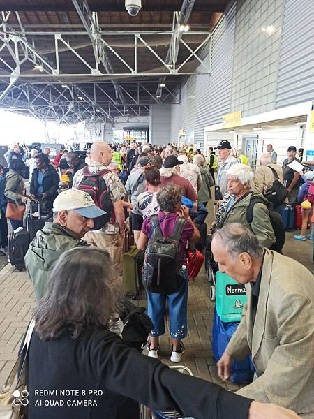
TO BE CONTINUED!
A 13-day/12-night cruise for 1350 € per person in a guaranteed deluxe balcony cabin. PRINCESS assigned us a balcony cabin on deck 8 with a large balcony. We ended up happy with our cabin, even though we’d initially preferred a higher deck. I’ll admit I hesitated to choose this cruise because of the weather—I love sunshine and good weather—but the desire to discover new ports won out, especially with the promise of heading to Corsica afterward to soak up some sun again 😉
On PRINCESS, as Catherine mentioned, there’s no card—everyone has a medallion! I loved this system, which unlocks your cabin door as you approach. It’s really well thought out!
We took the EUROSTAR from Lille to London, then a train from London to Southampton the day before. We stayed in a nice IHG hotel near the port.
EMBARKATION It’s Friday, August 1st. After a good breakfast and a quick check-out, we realize our UBER app isn’t working in England ;(. We have to go back to reception to ask for a taxi because, even though the hotel is close to the port, the ship is still over 2 km away—hardly ideal with luggage! The problem is that many hotel guests also requested taxis... so we wait a good 30 minutes before ours arrives! We get to the REGAL PRINCESS pretty quickly but are shocked to see a huge line outside!!! We hadn’t seen that in over a decade! Not the best start! 🙁
TO BE CONTINUED!
A travel journal—it’s been a while!
I must say, my personal situation has "changed a bit" since my last journals (my 3 kids are grown up + a divorce finalized in early 2021). So, no more long-haul family trips; now I’m focusing on multi-day hikes for my vacations. I found a hiking buddy in 2021 to join me on the Laugavegur trek in Iceland, but this year, no one was available.
That’s how the idea of a solo trek in Lapland took root—a region I’ve been dreaming about ever since I read Marie Lefevre’s 2012 journal on the topic.
Marie, who I hiked with for the first time in 2015 during my very first multi-day trek, and whom I can never thank enough for sharing her knowledge and saving me so much time.
To build my confidence for this solo trek, I hiked around Cantal in May (okay, I’m capable of spending nights alone in the middle of nowhere without being overly terrified) and camped in the Mercantour in July, where a massive storm made me realize I still had room for improvement in managing wet conditions...
After some research, I bought 2 Nylofume bags—large, ultra-lightweight ones to protect my gear in my backpack—and a set of 4 Aloksak bags in different sizes for my passport, camera, battery, etc. (and I’m so glad I did!!)
Well, I think I’m all set...
My 16/08 - Day 1 - Ritsem – Gisuris (well, almost) Wed 17/08 – Day 2 - Partly in the tent + minimal progress toward Gisuris Thu 18/08 – Day 3 - Gisuris – Laddejakha (23 km) Fri 19/08 – Day 4 – Laddejakha – Arasluokta (13 km) Sat 20/08 - Day 5 - Arasluokta – Staloluokta (12 km) Sun 21/08 – Day 6 - Staloluokta – Duottar (18 km) Mon 22/08 Day 7 - Duottar – Dareluoppal (10 km) Sammarlappa (15.3 km) Tue 23/08 - Day 8 - Sammarlappa – Tarrekaise (12 km) + halfway to Tarrekaise-Nunjes (approx. 3 km) Wed 24/08 – Day 9 – Finish Tarrekaise-Nunjes (approx. 4 km) Kvikkjokk (12.6 km) Thu 25/08 and Fri 26/08 – Around Kvikkjokk Food and gear summary
I must say, my personal situation has "changed a bit" since my last journals (my 3 kids are grown up + a divorce finalized in early 2021). So, no more long-haul family trips; now I’m focusing on multi-day hikes for my vacations. I found a hiking buddy in 2021 to join me on the Laugavegur trek in Iceland, but this year, no one was available.
That’s how the idea of a solo trek in Lapland took root—a region I’ve been dreaming about ever since I read Marie Lefevre’s 2012 journal on the topic.
Marie, who I hiked with for the first time in 2015 during my very first multi-day trek, and whom I can never thank enough for sharing her knowledge and saving me so much time.
To build my confidence for this solo trek, I hiked around Cantal in May (okay, I’m capable of spending nights alone in the middle of nowhere without being overly terrified) and camped in the Mercantour in July, where a massive storm made me realize I still had room for improvement in managing wet conditions...
After some research, I bought 2 Nylofume bags—large, ultra-lightweight ones to protect my gear in my backpack—and a set of 4 Aloksak bags in different sizes for my passport, camera, battery, etc. (and I’m so glad I did!!)
Well, I think I’m all set...
My 16/08 - Day 1 - Ritsem – Gisuris (well, almost) Wed 17/08 – Day 2 - Partly in the tent + minimal progress toward Gisuris Thu 18/08 – Day 3 - Gisuris – Laddejakha (23 km) Fri 19/08 – Day 4 – Laddejakha – Arasluokta (13 km) Sat 20/08 - Day 5 - Arasluokta – Staloluokta (12 km) Sun 21/08 – Day 6 - Staloluokta – Duottar (18 km) Mon 22/08 Day 7 - Duottar – Dareluoppal (10 km) Sammarlappa (15.3 km) Tue 23/08 - Day 8 - Sammarlappa – Tarrekaise (12 km) + halfway to Tarrekaise-Nunjes (approx. 3 km) Wed 24/08 – Day 9 – Finish Tarrekaise-Nunjes (approx. 4 km) Kvikkjokk (12.6 km) Thu 25/08 and Fri 26/08 – Around Kvikkjokk Food and gear summary
Introduction
In this travel journal, you’ll find a list of all the activities we did during our road trip through the Gaspésie.
Videos are embedded throughout the summary. Just click on the image to start the video.
To jump to a specific post, here are the relevant links:
Gaspé - Forillon National Park - Interpretation Center Gaspé - Forillon National Park - Mont-Saint-Alban Trail Gaspé - Forillon National Park - La Chute Trail Gaspé - Forillon National Park - Les Graves Trail Percé - Rivière-aux-Émeraudes Waterfall Percé - Bonaventure Island National Park Percé - Hike at the Foot of Percé Rock Percé Geopark - Suspended Glass Platform Percé Geopark - Magic Forest Loop Percé Geopark - Belvedere Trails Percé Geopark - Springs and Les Pieds Croches Trails Percé Geopark - Crevasse Trail Percé Geopark - Grande Coupe Trail Percé Geopark - Grotto Path Bonaventure - Le Malin de la Rivière Bonaventure Maria - Grand Sault Waterfall Carleton-sur-Mer - Les Saults Waterfall - Éperlan Trail Matapédia - Two Rivers Belvedere Saint-Alexis-de-Matapédia - Dream Horizon Belvedere Saint-André-de-Restigouche - Heart of the Plateaus Belvedere Saint-André-de-Restigouche - Picot Waterfalls Saint-Alexis-de-Matapédia - Robitaille Stream Waterfalls Trail Saint-Alexandre-des-Lacs - Philomène Waterfall Saint-Ulric - Ti-Mé Waterfall
In this travel journal, you’ll find a list of all the activities we did during our road trip through the Gaspésie.
Videos are embedded throughout the summary. Just click on the image to start the video.
To jump to a specific post, here are the relevant links:
Gaspé - Forillon National Park - Interpretation Center Gaspé - Forillon National Park - Mont-Saint-Alban Trail Gaspé - Forillon National Park - La Chute Trail Gaspé - Forillon National Park - Les Graves Trail Percé - Rivière-aux-Émeraudes Waterfall Percé - Bonaventure Island National Park Percé - Hike at the Foot of Percé Rock Percé Geopark - Suspended Glass Platform Percé Geopark - Magic Forest Loop Percé Geopark - Belvedere Trails Percé Geopark - Springs and Les Pieds Croches Trails Percé Geopark - Crevasse Trail Percé Geopark - Grande Coupe Trail Percé Geopark - Grotto Path Bonaventure - Le Malin de la Rivière Bonaventure Maria - Grand Sault Waterfall Carleton-sur-Mer - Les Saults Waterfall - Éperlan Trail Matapédia - Two Rivers Belvedere Saint-Alexis-de-Matapédia - Dream Horizon Belvedere Saint-André-de-Restigouche - Heart of the Plateaus Belvedere Saint-André-de-Restigouche - Picot Waterfalls Saint-Alexis-de-Matapédia - Robitaille Stream Waterfalls Trail Saint-Alexandre-des-Lacs - Philomène Waterfall Saint-Ulric - Ti-Mé Waterfall
Introduction
We stayed on the island of Gran Canaria during the first three months of 2024. It’s the third Canary Island we’ve visited, after Tenerife and Lanzarote.
We rented an apartment in Temisas. By staying in the same place for such a long period, the total price dropped by 50%.
We also rented a vehicle to make getting around the island easier.
Why the Canary Islands, and Gran Canaria in particular? For its pleasant climate, the nature and diversity of its landscapes, the charming villages, and especially the beauty of its many beaches.
In this travel journal, you’ll find a list of the many activities we did during our stay to explore the different attractions of this island.
These attractions are categorized to make it easier to find what interests you.
Videos are included throughout the summary. Click on the image to start the video.
To jump to a specific post, here are the relevant links:
HIKES:
Roque Nublo Maspalomas Dunes - Part 1 Maspalomas Dunes - Part 2 Los Azulejos de Veneguera Barranco de Las Vacas Ventana del Bentayga (Arco del Aserrador) Caves of the King Ventana de Morro (Ventana de la Ganifa) The Dog of Bentayga Cave of the Four Doors Ventana del Nublo Artenera - Caves of Acusa Seca Temisas - El Gigante Cave Fortress of Ansite Puerto de Las Nieves - Roque de Las Nieves Temisas - Cuevas de la Audiencia Roque Bentayga Guayadeque Ravine (Guayadeque Hermitage) Guayadeque Ravine (Cueva de Bartalo) El Zumacal - Barranco Tauco Casablanca Dam (Los Dolores Dam) Ayagaures - La Angostura Dam & Gambuesa Dam Santa Brígida - Alonso Ravine & Centennial Dragon Tree Pino Santo Hike in the Azuaje Ravine Gáldar - Red Lands of Samarrita Tejeda - Charco de La Paloma Bandama Boiler (Camino Borde de Caldera Bandama) Teror - Alamo Ravine Trail – SL-4 Telde - Calasio Caves Special Natural Reserve of Los Tilos de Moya Los Azulejos - Charco de Las Aneas Fataga Ravine Arinaga Military Battery Trail Maspalomas - Las Fuentes and del Canizo Ravines Mogán - Tauro Mountain Trail Tamabada - Llanos de La Mimbre & Sobre la Cueva Viewpoints Trail Hike to the Coronadero Arch via Barranco Hondo Barranco de Silva - Hike to the Jerez Caves Gáldar - Samson Cave - La Atalaya Peak Agaete - Roque Guayedra and Guayedra Ravine Artenara - Caballero Caves Arucas - Bufadero Salt Flats Barranco de Pino Gordo - Natural Pools Telde - Los Cernícalos Ravine Las Cruces - Toba Caves & Picón Puerto de Las Nieves - Moro Cave Agüimes - Morros de Ávila Caves Juncalillo del Sur - Laguna & Salinas de Abajo Caves of Camino de San Felipe Cruz de Tejeda, Cruz Chico and Degollada Viewpoint Hike on the Patalavaca Circuit Motor Grande - Puerto Rico Arch El Montañón - Los Hornos Dam Seafront Walk - Amadores Beach – Puerto Rico Beach Las Niñas Dam El Hornillo - Omega & Omicron Caves Arteara Necropolis Mogán - El Mulato Dam Las Garzas - El Regante Dam La Plata Route - Cho Flores Dam & El Charco Hondo Vega de Acusa - La Candelaria Dam Candelaria Hermitage – Acusa Seca Viewpoint Valsequillo de Gran Canaria – Roque La Vela Ayagaures Dam – GC-602 Lomo del Palo - Monte Pavón Trail Lugar La Laguna - Levada Fataga Dam & Ravine
BEACHES:
Mogán Beach Taurito Beach Tauro Beach Amadores Beach Puerto Rico Beach Anfi del Mar Beach Patalavaca Beach Meloneras Beach Maspalomas Beach English Beach (Playa del Inglés) Las Burras Beach San Agustin Beach Las Alcaravaneras Beach Las Canteras Beach (La Cicer) Las Canteras Beach (La Puntilla) Las Canteras Beach (Santa Catalina) Aquamarina Beach El Agujero - Bocabarranco Beach Hoya Del Pozo Beach Hoya Del Pozo Beach - Lizard with amputated tail El Cabron Beach Ojos de Garza Beach El Burrero Beach
NATURAL POOLS:
Charco Azul - El Risco Agaete Salt Flats Charco de Los Espejos - Sardina del Norte Natural Pools of Punta de Gáldar Snorkeling in the natural pool of Punta de Gáldar Natural Pool La Furnia o El Clavo - Gáldar Natural Pool of Los Dos Roques Emiliano Natural Pool - El Agujero Natural Pool of El Agujero Natural Pools of Roque Prieto Natural Pool El Altillo Los Charcones de Bañaderos – Arucas Natural Pools of El Charco de Las Palomas – Arucas Natural Pools of La Laja - Las Palmas de Gran Canaria Cueva de la Reina Mora - La Garita Natural Pools of Castillo del Romeral
TOWNS:
Center
Santa Brigida Vega de San Mateo Tejeda Artenara Vallesco Teror
Southwest
Santa Lucia de Tirajana Fataga San Bartolomé de Tirajana Puerto de Mogán La Aldea de San Nicolas
North
Arucas Firgas Moya Santa Maria de Guia Gáldar Agaete Puerto de Las Nieves
East
Vegueta - Las Palmas de Gran Canaria Triana - Las Palmas de Gran Canaria Ciudad Jardin - Las Palmas de Gran Canaria Canteras - Las Palmas de Gran Canaria Telde Valsequillo de Gran Canaria Ingenio Agüimes Temisas
VIEWPOINTS:
GC-60 Route (or nearby) GC-210 Route (or nearby) GC-210 Route between the tunnel and La Aldea de San Nicolás GC-215 & GC-65 Routes (or nearby) GC-200 Route (or nearby) GC-130 Route (or nearby) & GC-605 GC-70 Route (or nearby) & GC-21 Sheep herd on GC-70 Route GC-150, GC-240, GC-305, GC-350 & GC-301 Routes GC-606, GC-295, GC-231 and GC-41 Routes (or nearby) Viewpoints – GC-1 Route (or nearby) Viewpoints - Las Palmas de Gran Canaria Viewpoints - GC-2, GC-21, GC-15, GC-216 and GC-132 Routes (or nearby) Viewpoints - GC-503 & GC-217 Routes Viewpoints - GC-604, GC-505, GC-132, GC-42 and GC-802 Routes
MISCELLANEOUS:
San Rafael Aqueduct - Telde Abandoned San Rafael Estate - La Higuera Cenobio de Valerón La Cesta - Tejeda Puerto de la Aldea Scenic Route GC-671 to El Espinillo Scenic Route GC-607 to El Chorrillo The Galdar Cube (Santiago Quarry) Scenic Route GC-504 to Ayagaures Abandoned seaside resort in the Azuaje Ravine El Bufadero de La Garita – Telde GC-505 Route Abandoned Finca Las Haciendas (Los Mocanes) – Las Vegas de Valsequillo Ruins of San Juan Battery - Las Palmas de Gran Canaria Viera y Clavijo Canarian Botanical Garden - Las Palmas de Gran Canaria Tenefé Salt Flats Los Pérez, Lugarejos & Las Hoyas Dams Monte Pavón, Gran Canaria’s little Ireland Valleseco Lagoon Recreational Area Climbing - Fataga Ravine Surfing – El Agujero El Cairete Restaurant - Carrizal de Tejeda Paragliding flight observation - Los Giles La Cuevita Ayagaures Restaurant Statues and Murals - Cruce de Arinaga Aviation Monument (Las Majoreras) & Murals – Carrizal Artistic recycling by Antonio Peñita - Ojos de Garza Rainbows
We stayed on the island of Gran Canaria during the first three months of 2024. It’s the third Canary Island we’ve visited, after Tenerife and Lanzarote.
We rented an apartment in Temisas. By staying in the same place for such a long period, the total price dropped by 50%.
We also rented a vehicle to make getting around the island easier.
Why the Canary Islands, and Gran Canaria in particular? For its pleasant climate, the nature and diversity of its landscapes, the charming villages, and especially the beauty of its many beaches.
In this travel journal, you’ll find a list of the many activities we did during our stay to explore the different attractions of this island.
These attractions are categorized to make it easier to find what interests you.
Videos are included throughout the summary. Click on the image to start the video.
To jump to a specific post, here are the relevant links:
HIKES:
Roque Nublo Maspalomas Dunes - Part 1 Maspalomas Dunes - Part 2 Los Azulejos de Veneguera Barranco de Las Vacas Ventana del Bentayga (Arco del Aserrador) Caves of the King Ventana de Morro (Ventana de la Ganifa) The Dog of Bentayga Cave of the Four Doors Ventana del Nublo Artenera - Caves of Acusa Seca Temisas - El Gigante Cave Fortress of Ansite Puerto de Las Nieves - Roque de Las Nieves Temisas - Cuevas de la Audiencia Roque Bentayga Guayadeque Ravine (Guayadeque Hermitage) Guayadeque Ravine (Cueva de Bartalo) El Zumacal - Barranco Tauco Casablanca Dam (Los Dolores Dam) Ayagaures - La Angostura Dam & Gambuesa Dam Santa Brígida - Alonso Ravine & Centennial Dragon Tree Pino Santo Hike in the Azuaje Ravine Gáldar - Red Lands of Samarrita Tejeda - Charco de La Paloma Bandama Boiler (Camino Borde de Caldera Bandama) Teror - Alamo Ravine Trail – SL-4 Telde - Calasio Caves Special Natural Reserve of Los Tilos de Moya Los Azulejos - Charco de Las Aneas Fataga Ravine Arinaga Military Battery Trail Maspalomas - Las Fuentes and del Canizo Ravines Mogán - Tauro Mountain Trail Tamabada - Llanos de La Mimbre & Sobre la Cueva Viewpoints Trail Hike to the Coronadero Arch via Barranco Hondo Barranco de Silva - Hike to the Jerez Caves Gáldar - Samson Cave - La Atalaya Peak Agaete - Roque Guayedra and Guayedra Ravine Artenara - Caballero Caves Arucas - Bufadero Salt Flats Barranco de Pino Gordo - Natural Pools Telde - Los Cernícalos Ravine Las Cruces - Toba Caves & Picón Puerto de Las Nieves - Moro Cave Agüimes - Morros de Ávila Caves Juncalillo del Sur - Laguna & Salinas de Abajo Caves of Camino de San Felipe Cruz de Tejeda, Cruz Chico and Degollada Viewpoint Hike on the Patalavaca Circuit Motor Grande - Puerto Rico Arch El Montañón - Los Hornos Dam Seafront Walk - Amadores Beach – Puerto Rico Beach Las Niñas Dam El Hornillo - Omega & Omicron Caves Arteara Necropolis Mogán - El Mulato Dam Las Garzas - El Regante Dam La Plata Route - Cho Flores Dam & El Charco Hondo Vega de Acusa - La Candelaria Dam Candelaria Hermitage – Acusa Seca Viewpoint Valsequillo de Gran Canaria – Roque La Vela Ayagaures Dam – GC-602 Lomo del Palo - Monte Pavón Trail Lugar La Laguna - Levada Fataga Dam & Ravine
BEACHES:
Mogán Beach Taurito Beach Tauro Beach Amadores Beach Puerto Rico Beach Anfi del Mar Beach Patalavaca Beach Meloneras Beach Maspalomas Beach English Beach (Playa del Inglés) Las Burras Beach San Agustin Beach Las Alcaravaneras Beach Las Canteras Beach (La Cicer) Las Canteras Beach (La Puntilla) Las Canteras Beach (Santa Catalina) Aquamarina Beach El Agujero - Bocabarranco Beach Hoya Del Pozo Beach Hoya Del Pozo Beach - Lizard with amputated tail El Cabron Beach Ojos de Garza Beach El Burrero Beach
NATURAL POOLS:
Charco Azul - El Risco Agaete Salt Flats Charco de Los Espejos - Sardina del Norte Natural Pools of Punta de Gáldar Snorkeling in the natural pool of Punta de Gáldar Natural Pool La Furnia o El Clavo - Gáldar Natural Pool of Los Dos Roques Emiliano Natural Pool - El Agujero Natural Pool of El Agujero Natural Pools of Roque Prieto Natural Pool El Altillo Los Charcones de Bañaderos – Arucas Natural Pools of El Charco de Las Palomas – Arucas Natural Pools of La Laja - Las Palmas de Gran Canaria Cueva de la Reina Mora - La Garita Natural Pools of Castillo del Romeral
TOWNS:
Center
Santa Brigida Vega de San Mateo Tejeda Artenara Vallesco Teror
Southwest
Santa Lucia de Tirajana Fataga San Bartolomé de Tirajana Puerto de Mogán La Aldea de San Nicolas
North
Arucas Firgas Moya Santa Maria de Guia Gáldar Agaete Puerto de Las Nieves
East
Vegueta - Las Palmas de Gran Canaria Triana - Las Palmas de Gran Canaria Ciudad Jardin - Las Palmas de Gran Canaria Canteras - Las Palmas de Gran Canaria Telde Valsequillo de Gran Canaria Ingenio Agüimes Temisas
VIEWPOINTS:
GC-60 Route (or nearby) GC-210 Route (or nearby) GC-210 Route between the tunnel and La Aldea de San Nicolás GC-215 & GC-65 Routes (or nearby) GC-200 Route (or nearby) GC-130 Route (or nearby) & GC-605 GC-70 Route (or nearby) & GC-21 Sheep herd on GC-70 Route GC-150, GC-240, GC-305, GC-350 & GC-301 Routes GC-606, GC-295, GC-231 and GC-41 Routes (or nearby) Viewpoints – GC-1 Route (or nearby) Viewpoints - Las Palmas de Gran Canaria Viewpoints - GC-2, GC-21, GC-15, GC-216 and GC-132 Routes (or nearby) Viewpoints - GC-503 & GC-217 Routes Viewpoints - GC-604, GC-505, GC-132, GC-42 and GC-802 Routes
MISCELLANEOUS:
San Rafael Aqueduct - Telde Abandoned San Rafael Estate - La Higuera Cenobio de Valerón La Cesta - Tejeda Puerto de la Aldea Scenic Route GC-671 to El Espinillo Scenic Route GC-607 to El Chorrillo The Galdar Cube (Santiago Quarry) Scenic Route GC-504 to Ayagaures Abandoned seaside resort in the Azuaje Ravine El Bufadero de La Garita – Telde GC-505 Route Abandoned Finca Las Haciendas (Los Mocanes) – Las Vegas de Valsequillo Ruins of San Juan Battery - Las Palmas de Gran Canaria Viera y Clavijo Canarian Botanical Garden - Las Palmas de Gran Canaria Tenefé Salt Flats Los Pérez, Lugarejos & Las Hoyas Dams Monte Pavón, Gran Canaria’s little Ireland Valleseco Lagoon Recreational Area Climbing - Fataga Ravine Surfing – El Agujero El Cairete Restaurant - Carrizal de Tejeda Paragliding flight observation - Los Giles La Cuevita Ayagaures Restaurant Statues and Murals - Cruce de Arinaga Aviation Monument (Las Majoreras) & Murals – Carrizal Artistic recycling by Antonio Peñita - Ojos de Garza Rainbows
Hi, I’m looking for a solution for my flight—I’ll explain my situation.
I live in the French overseas territories, so I have a flight from St. Martin to Orly. Early September is cyclone season. If there’s an alert or cyclone, my flight could be postponed.
I’m considering connecting with a flight from CDG to Bangkok. I’d have to buy my second flight as open-ended, otherwise I’d lose it—it’s not the same airline. I found a good price on Oman Air, Economy Comfort option. Change fees are only 20 OMR—basically nothing. Then there’s the option for a paid upgrade: would that mean the price gets adjusted on the day of the flight?
If I’ve made myself clear, do you have any other solutions? Please—thanks!
I live in the French overseas territories, so I have a flight from St. Martin to Orly. Early September is cyclone season. If there’s an alert or cyclone, my flight could be postponed.
I’m considering connecting with a flight from CDG to Bangkok. I’d have to buy my second flight as open-ended, otherwise I’d lose it—it’s not the same airline. I found a good price on Oman Air, Economy Comfort option. Change fees are only 20 OMR—basically nothing. Then there’s the option for a paid upgrade: would that mean the price gets adjusted on the day of the flight?
If I’ve made myself clear, do you have any other solutions? Please—thanks!
Hi,
My friend is supposed to leave on June 26th for Philadelphia. American Airlines called him last night to ask him to cancel or postpone his flight because they’re canceling around a hundred flights from Europe, mainly due to fears of retaliatory attacks after the bombings in Iran. Their offer is either to postpone with compensation (the amount would be known once he accepts) or to cancel completely with a refund and the standard compensation for flights departing from Europe. The airline gave him until 24 hours before departure to decide. Otherwise, he can still go to the airport for now with no obligation to board since he’s traveling alone—they’re prioritizing families in case of overbooking due to some flight cancellations. The same goes for the return flight. In short, it’s total chaos. We’re waiting until tonight or tomorrow to decide whether to cancel outright.
My friend is supposed to leave on June 26th for Philadelphia. American Airlines called him last night to ask him to cancel or postpone his flight because they’re canceling around a hundred flights from Europe, mainly due to fears of retaliatory attacks after the bombings in Iran. Their offer is either to postpone with compensation (the amount would be known once he accepts) or to cancel completely with a refund and the standard compensation for flights departing from Europe. The airline gave him until 24 hours before departure to decide. Otherwise, he can still go to the airport for now with no obligation to board since he’s traveling alone—they’re prioritizing families in case of overbooking due to some flight cancellations. The same goes for the return flight. In short, it’s total chaos. We’re waiting until tonight or tomorrow to decide whether to cancel outright.
NAMIBIA TRIP 2025: April 24 to May 20: Feel free to comment or ask us any questions about this amazing journey.
>> Find all our photos and videos for each day on our website here: www.montagne-aventure.net
**DAY 1: Thursday, April 24, 2025: Outbound Flights from Lyon to Windhoek via Munich - Visit to Munich:**
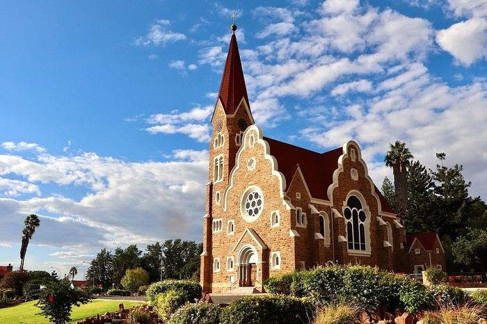
Off we go on a new adventure. The alarm rings at 6:30 AM, the travel bags are packed, and we head to Lyon Airport. We booked our flight tickets with Lufthansa. The first leg to Munich, Germany, is operated by AirBaltic. Departure at 1:05 PM for a 1-hour and 20-minute flight. We arrive at 2:30 PM.
**We now have a 7-hour layover, so we take the opportunity to get some fresh air and explore Munich.** We quickly exit Terminal 2 of the airport and head towards the subway. We buy a group day ticket "Airport-city Day Zone M-5," valid for 2 to 5 people at a price of 30.50 € (instead of 16.30 € per person). We take the S8 line to **Marienplatz** in 35 minutes. **This is the heart of the city.** The weather is overcast, quite cool, but dry. Perfect for a little city trip between two flights while leaving our large luggage in transit at the airport. **Munich is the third-largest German city after Berlin and Hamburg, in the Bavaria region.** **The center has a lot of charm and brings together several religious buildings, easy to explore on foot.** We are impressed by the number of people enjoying these 100% pedestrian streets, which are very pleasant. After Marienplatz, the most famous square with the town hall, we head to the Cathedral of Our Lady, a Gothic church, then continue to **Karlsplatz** and move on to **the food market offering a wide selection of high-end food products in an atmosphere where a certain art of living prevails.** We also visit St. Peter's Church before grabbing a bite to eat. Two good hours were enough for this 10 km city walk. It's time to take the subway back: by 6:30 PM, we are back at the airport. Now, it's time for a bit of waiting and rest. Our second flight is scheduled for 9:35 PM for a 9-hour and 30-minute journey to our final destination in Namibia: **Windhoek.**
> Round-trip flight tickets with Lufthansa from Lyon: 2029 €, or 1,014.50 € per person.
> Lyon Airport parking: 120 €
> Today's expenses: 7 € for 2 pizzas in France / 14 € for the restaurant in Munich / 30.50 € for the daily subway ticket in Munich.
**DAY 2: Friday, April 25, 2024: Arrival in Windhoek, Visit to the Namibian Capital:**
After a 9-hour and 30-minute overnight flight with Discover Airlines, we finally land on Namibian soil just before 7:30 AM. The day is breaking, and the colors are already stunning. We are eager despite the usual fatigue from the flight. The airline was punctual, with friendly staff and good meals, though a bit light. We are the first flight of the day to land, with no more than 15 flights per day here, from 7 AM to 8 PM. We disembark on the tarmac at this airport located in the middle of nowhere, **I finally set foot on African soil for the first time.** We exit among the first from the aircraft to go through the long formalities at the front of the line, as the wait can quickly become endless. Allow at least 5 minutes per person for e-visas. We still wait 45 minutes despite only about twenty people ahead of us. Phew, it's done. We collect our luggage and then withdraw money from an ATM. We make 4 withdrawals of the maximum amount, 2000 NAD $ per withdrawal, for a total of 380 €, or 95.33 € per withdrawal.
Our driver arrives at the same time, perfect timing, we were quick.
We leave the airport at 8:45 AM. By 9:30 AM, we arrive at the **Gracious Whisp vehicle rental agency**, located at the entrance of Windhoek, small and human-sized with a fleet of recent vehicles. More formalities, then a short wait as our vehicle is not yet ready. Time to decompress, catch our breath, and enjoy the very pleasant morning temperature. Not a cloud in sight. Next, a briefing on the vehicle, always with a bit of apprehension due to our approximate English. Allow 45 minutes of explanations, including setting up the roof tent, camping equipment, technical information in case of a flat tire, driving tips in Namibia, and a tour of the 4x4. We have all the necessary equipment for camping: mattresses, sleeping bags, pillows, table, chairs, gas stove, BBQ grill... as well as 2 spare tires, a compressor, a dual tank, and accessories for removing wheels. Off we go, it's time to muster our courage and get behind the wheel. **Heading to SuperSpar Maerua**, fortunately located less than 10 minutes away. We park with the help of a parking attendant; it's very crowded, the space is narrow, but everything goes well despite the cursed right-hand drive. Today's new mission: stock up on groceries. The store is well-stocked with local and imported products, catering to all tastes. We spend 114 € on groceries, from pasta to meat, BBQ lighters to dishwashing products. Two people load our groceries into two carts and transfer them to our vehicle; we feel compelled to leave a tip, 50 NAD $, as we don't have change yet. Now, we head to the hotel, 15 minutes away. Traffic is difficult at a complicated intersection; this will likely be the only traffic jam in Namibia. **We arrive at Kate's Nest Guesthouse & Backpackers around 1:15 PM, quite tired.** We take some well-deserved rest at this recent establishment, quite calm with secure private parking. After a short nap, we enjoy the quiet by the hotel pool. Night falls between 6:30 PM and 7 PM. We eat quietly in our room tonight before starting this long 4x4 road trip in camping mode in the heart of Namibia.
> Today's grocery expenses: 114 € at Super Spar Marua (2395.21 NAD $).
> Round-trip flight tickets with Lufthansa from Lyon: 2029 €, or 1,014.50 € per person.
> Vehicle rental: 4x4 Toyota with roof tent for 24 days: Gracious Whisp Car Rentals: 2,638 € (N$50,640) or **1,319 €** per person - (https://gwcarrentals.com/)
> Distance driven today: 15 km.
> Accommodation: Kate's Nest Guesthouse & Backpackers - 4 Aristotles Street Academia, 9000 Windhoek - 36 € for two for one night.
> Windhoek International Airport website: (https://www.airports.com.na/)
**DAY 3: Saturday, April 26, 2025: Windhoek to Hardap: Mariental Region - Kalahari Desert:**
After a good, restful night, we wake up leisurely around 7 AM. We enjoy the comfort provided by this first and last hotel before 24 nights under the tent.
**We leave Kate's Nest Guesthouse at 8:30 AM to tackle the Namibian roads.** We quickly leave the capital; in just 30 minutes, we find ourselves almost alone in the world. The landscape is dotted with small domes. We leave the **paved B1** quickly to turn left onto the **C15**. **From there, we won't see more than 10 vehicles all day.** After passing through the few houses of **Lekkerwaterpoort**, we tackle our first gravel road. These road sections are limited to 100 km/h, but even at 70 km/h, I find it already challenging. However, I quickly get used to it and gradually pick up speed to reach my cruising speed of around 80 to 90 km/h. **We are on immense straight lines crossing wild expanses as far as the eye can see.** **We come across two baboons, a few ostriches, and numerous cattle and sheep farms.** We pass through the charming village of **Uhlenhorst** with its typical houses and children with broad smiles waving at us. Life here is already very different from Windhoek. **The thermometer rises quickly from 16°C at 8:30 AM to over 28°C in the early afternoon.**
**We arrive at the Hardap Dam reserve at 2 PM.** We stop at the toll booth at the park entrance to pay the entrance fee: 250 NAD $ for 2 people and 1 vehicle. We continue to the dam and then the camp entrance, located a bit further. We had booked in advance, but this place remains little frequented by foreigners.
We take advantage of the hottest hours to rest by the large pool overlooking the immense lake, a very enjoyable moment. Would this be a bit of a vacation?
Around 4:30 PM, we head to the campsite. We overlook this vast water reserve. We arrive first; we will be only 3 vehicles spending the night here. It's time to get to work and set up our equipment for the first time. It takes us a good 20 minutes to set everything up, with a slight apprehension about unfolding the tent. Once this task is done, which we will have to repeat for almost a month, we will become much more efficient over time. Time for rest and contemplation in total silence. The sun gradually sets, and the heat quickly becomes bearable again. Bliss! **This dam is located 20 km northwest of Mariental in an area dotted with conical hills topped with dolerite buttons (Hardap means "hillock" in Nama). It captures the Fish River, which flows south, creating a large lake in the middle of an arid environment. The contrast is striking.** We enjoy our first sunset facing this 360° otherworldly landscape.
Around 7 PM, we start our first BBQ, or "braai" as it's called here. The temperature is perfect. The sun sets, giving way to a star-filled sky of incredible beauty thanks to the absence of any light pollution. The Milky Way will lull us throughout the evening. After some good sausages and potatoes on the BBQ, we head to our roof tent around 9:30 PM with a complete change of scenery in just 24 hours. France already seems so far away...
This campsite has shared showers and toilets, quite clean and functional, as well as a central area with several BBQs and tables. The sites are arranged in a semicircle, each with an electrical outlet. The sites are close to each other but spacious, some slightly shaded. We are only three vehicles tonight, so it's perfectly comfortable and quiet. Not to mention the large pool near the restaurant. Our trip is off to a great start.
> Today's road itinerary: Windhoek > Head south on the B1 to Rehoboth > Turn left onto the C25 then C15 to Stampriet > C20 to Hardap > Full north on the B1 > Then turn left onto the M93 - 5 hours of driving.
> Distance driven today: 354 km.
> Accommodation: Hardap Recreation Resort - 23.3 € for two - Large pool - GR6W+3M2, Hardap Game Reserve, Mariental, Namibia - (http://www.nwr.com.na/resorts/hardap-resort/)
**DAY 4: Sunday, April 27, 2025: Hardap - Brukkaros Volcano - Keetmanshoop - Quivertree Forest Rest Camp**
Our first night under the tent was very pleasant; the little wind quickly calmed down, giving way to absolute silence. The mattress is decent, more comfortable than some nights in Nepal. The length and width give us enough space for maximum comfort, despite my height (1.91 m). We wake up a little before 7 AM as the sun rises, and the lights dazzle us from the start of the day. We pack up the equipment in 30 minutes, quite easily. Then we enjoy the sun, which warms up quickly while we keep our light fleece on.
At 8:30 AM, **we hit the road again, heading south** to our first stop in **Mariental**. We want to do some shopping at SuperSpar, but once we arrive in the parking lot, a young local is fighting with the supermarket security guards and then threatens to throw stones. We don't want to take any risks right at the start, so despite the baton blows he receives, he doesn't stop. We leave empty-handed but fill up with fuel at the Shell station 1 km further. The price per liter is 21.33 NAD $, we fill our 107-liter tank for 107 €. In Namibia, you get served, and they bring the card machine to the window to pay. It's then customary to leave a tip.
We then take the B1 heading due south on a recently renovated road. Around 11:30 AM, we leave it on our right to take **a wild gravel road, the M98**. Just before **Berseba**, we turn right onto a small track, the **D3904 towards Brukkaros Crater up to a camp at 1588 m altitude**. The track then becomes too bumpy. We stop on the counter-slopes where **a wide panorama unfolds over these immense plains as far as the eye can see**. It's 12:15 PM, time for us to eat a rice and tuna salad facing this landscape.
**We are alone in the world until a vehicle arrives and parks next to us.** A bit of apprehension, 4 men head towards us. It turns out to be 4 shepherds looking for a lost foal. The conversation is pleasant, lost in the middle of nowhere. We find ourselves alone again in this absolute silence. **The heat becomes stifling with a good 30°C**. We get back on the road around 1 PM. Back on the B1, **we continue due south to Keetmanshoop**, which we reach around 3 PM. We stop there to do some shopping for 262 NAD $ (12 eggs, a can of tuna, a can of corn, bread, a soda, and a 5-liter water container), or 12.48 €. Two quite insistent children ask us for money or candy at the store exit, yet we give them a small tip, but they continue to cling to the car. Locals parked next to us tell them to leave us alone. Anyway, we finish the trip to **Quivertree Forest**, 15 km away. We will spend the night in this **pleasant farm run by a German**. Upon arrival, as the day before, and as I suppose in the future, we dive straight into the cool pool to relax after all these kilometers. A bliss. Then we take our 4x4 and choose a spot near these famous trees. After the 33°C this afternoon, once 4 PM passed, the temperature drops again and becomes very pleasant. **We are in the middle of the Kokerboom, one of the most interesting and characteristic plants of hot and arid regions. It's not really a tree but a variant of the aloe plant whose botanical name is Aloe Dichotoma. This Kokerboom has a smooth and thick trunk reaching up to 1 m in thickness and 9 m in height. They bloom for the first time at the age of 20 to 30 years.** The flowers are yellow and reach about thirty centimeters during the season between June and July. **They grow mainly in an environment with a high concentration of black rocks absorbing a large amount of heat (38°C). The rocks also serve to anchor the tree with its tentacle-like roots. It also resists frost. Each is between 200 and 300 years old.**
Around 5 PM, we walk to the farm reception to watch the feeding of **two cheetahs**. Magnificent carnivores taking their time to savor their piece of meat. **Then we return near our campsite to enjoy the sunset among these trees. The colors are sublime, as every evening apparently. A magnificent spectacle with colors evolving from yellow to orange then to pink, before giving way once again to a sky filled with thousands of stars.** Our campsite at Quiver Tree Forest Camp is very comfortable; we have a water supply, a stone table, a small lamp, an electrical outlet, a small tree for shade, and a BBQ that we won't use tonight; we'll cook on gas. The sites are far apart, with some shared facilities scattered around, a very beautiful setting. No reservation possible, no need, just show up directly. **The campsite accommodation for 2 people costs 28 €, including the reserve entrance fee of 5 €**. We finish this second bivouac evening around 9:30 PM, time for some reading and sleep in peaceful silence without wind.
> Today's road itinerary: Mariental > B1 heading south to Brukkaros > At Tses turn right towards Berseba via the M98 > Turn right onto the D3904 > 8 km > Brukkaros Volcano (stop at the lower camp as the track is difficult for 1 hour) > Keetmanshoop > Turn left onto the M29 > Quivertree Forest - 4 hours of driving.
> Distance driven today: 371 km.
> Distance walked today: 6 km.
> Today's expenses: Groceries for 12.48 € (262 NAD $) / Fuel for 107 € (1 liter of diesel for 21.33 NAD $).
> Accommodation: Quivertree Forest Rest Camp, P.O. Box 262, Keetmanshoop, Namibia - BBQ, hot showers, toilets, and electricity - No reservation - Pool - 18 €/Person (N$ 340.00 with park entrance) - (http://www.quivertreeforest.com/)
**DAY 5: Monday, April 28, 2025: Quivertree Forest Rest Camp - Giant's Playground - Keetmanshoop - Fish River Canyon - Canyon Roadhouse:**
After an excellent start to the night, we are woken up by the wind shortly before 6 AM, but the sunrise is not far off. We get up at 6:30 AM to enjoy it. The atmosphere is a bit cooler this morning, but the reward is already here.
The adventure continues. At 7:45 AM, we head towards **Giant's Playground**, 4 km away. We take a 3-kilometer walk through this expanse of blocks and igneous rocks.
We continue south at 8:45 AM, passing through Keetmanshoop again where we do some shopping for 25 €, a big stock-up for a good part of the trip: meats, canned goods, pasta, fruits... At 9:30 AM, we take the B4 to Fish River Canyon.
At 11:30 AM, we arrive at the entrance to the NWR park (350 NAD $ entrance for 2 people and 1 vehicle). The track becomes bumpy immediately upon entering the park. After about ten kilometers, we come upon this landscape carved by nature. In the end, it's well worth the detour. We were at the Grand Canyon in the USA exactly (https://www.montagne-aventure.net/2024/04/29/j21-3-juin-2024-grand-canyon-et-lac-powell/) and can thus confirm that this Fish River Canyon is comparable. We make several stops along the southern flank. **Here, nothing is developed; nature is almost in the wild state.** **With 160 km in length, up to 27 km in width, and a depth of 150 m, it is indeed the second-largest canyon in the world.** The history of the canyon is apparent in its different earth layers and stratification: the antiquity of the place is tangible, and the absence of vegetation is surprising. **It consists of two nested canyons, formed at distinct periods. The first distinct layer of schist, sandstone, and eruptive material surrounding the canyon was formed a few two billion years ago, then transformed due to heat and pressure into more solid rock such as gneiss. The inner canyon, carved more recently by the Fish River, has a depth of 270 m.**
We have a picnic once again alone in the world facing this grand panorama at the **Sulphur Spring View Point**. This is where the hiking trail begins, plunging into this narrow canyon, but it is forbidden to venture there alone without a guide. It's 30°C, but a slight wind makes the atmosphere bearable. At 1 PM, we retrace our steps and continue to the **Main View Point** then to the **Hikers View Point**.
In the south of Namibia, the Fish River Canyon, 160 km long, is a true geological wonder: a canyon nested within another canyon, one of the largest in the world. The first sedimentary layers formed two billion years ago; 500 million years ago, a period of tectonic activity caused these layers to crack and tilt, opening a vast canyon in the Earth's crust. The second canyon, with a depth of 270 m, was carved over time by the passage of the Fish River in this new valley.
At 3 PM, we arrive at our very charming camp for the evening, the **Canyon Road House**. We fill up with fuel right away because tomorrow we have a long day of isolated driving: 55 liters for 1240 NAD $. Then we settle into the campsite we had previously reserved in France. We are assigned site 2, very well set up under a tree with its BBQ and stone table just steps from the pool. We quickly set up the tent and jump straight into the pool for the relaxation moment of the day. As usual, the water is quite cool, but it's a real pleasure. Then we stroll around this Canyon Road House, which recreates the atmosphere of the roadside inns of the 1950s with old car wrecks and vintage gas pumps in a bygone era. **Around 5:45 PM, we start a short walk leading us to the top of a hill overlooking the wide plateau where we are to watch the sunset.**
And finally, to end this beautiful day, it's time for the braai, with grilled sausages and white beans on the evening menu.
> Park entrance: 150 DN/person + 50 DN/vehicle (18 € for two). It is possible to enter at two access points: Hobas in the north and Ai-Ais in the south.
> Today's road itinerary: M29 > Keetmanshoop > B1 > B4 > C12 (track) > After Holoog turn right onto the D601 (C37 track) > Accommodation on our right (stop just to check in before 6 PM) > Continue 30 km (30 minutes of track) to the viewpoints after Hobas where you must pay the entrance fee. Sunset View Point to the left > Return before sunset as the park closes (best lights at sunrise). 3 hours.
> Distance driven today: 228 km.
> Distance walked today: 10 km.
> Today's expenses: 25 € for groceries / 17 € for the Fish River Canyon park entrance / 58 € for fuel.
> Accommodation: Canyon Roadhouse, Gondwana Collection Namibia – 34.4 € for two - Pool - Near Hobas - (http://www.gondwana-collection.com/fr/accommodation/canyon-road-campsite)
**DAY 6: Tuesday, April 29, 2025: Canyon Roadhouse - Orange River - South African Border - Vista Trail - Gondwana Sperrgebiet Park - Aus:**
The night was excellent in this very comfortable campsite. **We wake up to the sound of birds** before the alarm at 6:45 AM. Our little morning routine starts as the sun rises. **A big day of driving awaits us to the South African border. This will be the southernmost point of our journey.** We hit the road at 8 AM via the C37, pass through **Hobas**, then turn onto the D207 to **Aussenkehr.** **We cross a mountainous barrier with some high peaks and perfect cones. The rock varies from orange to pink to black.**
We then cross a lunar desert as far as the eye can see on a giant dome; the track winds through nowhere without meeting anyone for hours. The landscapes are surprising. **We spot several ostriches and a gemsbok.** In the middle of this endless expanse, we come to an improbable intersection and continue right onto the D278.
In the middle of these arid lands, we come across a green zone: a vast vineyard. At 10:30 AM, **we come across a "Road closed" sign, fortunately, a local resident waves us to continue; a bit stressed, we proceed.** We start to follow the beautiful Orange River. On the other side of the bank, just a few meters away, South Africa is there. It is the second-longest river in Southern Africa, after the Zambezi. It flows over 2,000 km to the Atlantic. After passing through narrow gorges, we regain altitude before starting the descent, gently heading back north.
**We now cross and follow the Fish River, which joins the Orange River further south** **along this gorge dating back millennia.** At exactly noon, we take a lunch break by the Fish River, still without meeting a soul in this landscape between greenery and aridity. The temperature here is cooler with a pleasant 23°C on the banks, the perfect spot. **We continue on the track to Rosh Pinah**, where we find a paved road again. **The section along the Orange River and the Fish River was officially closed, but we were able to pass without any issues, avoiding a detour of at least 3 hours.** Phew. We now drive at high speed (limited to 120 km/h) through these vast spaces. We come across many ostriches after the **dozens of monkeys along the Fish River**. Around 3 PM, 3 km after the very small town of **Aus**, we reach **our campsite for the evening at Klein Aus Vista**. A new **small peaceful haven very well set up**. As usual, after checking in at reception, we jump straight into the beautiful pool to get our well-deserved dose of coolness, another good thermal shock that our bodies appreciate. Once this moment of relaxation is over, we take our 4x4 to reach the campsite located a bit higher, set apart at the foot of a hill that overlooks us.
After setting up, **around 5 PM, we head to the Vista Trail to climb to the top of a mountain overlooking the vast plain that surrounds us at 360°**. It takes about 30 minutes to climb. The place is just magical, **the perfect viewpoint to admire the sunset**. **We fully savor the moment. We also spot one of the few wild horses in the world capable of living in the desert.** Their numbers have decreased in recent years due to predation and drought (around 100 to 150). At 7 PM, we return to the camp, time for the braai and preparing the meal in this peaceful little camp.
In the south of Namibia, the Fish River Canyon, 160 km long, is a true geological wonder: a canyon nested within another canyon, one of the largest in the world. The first sedimentary layers formed two billion years ago; 500 million years ago, a period of tectonic activity caused these layers to crack and tilt, opening a vast canyon in the Earth's crust. The second canyon, with a depth of 270 m, was carved over time by the passage of the Fish River in this new valley.
> Today's road itinerary: 5 hours of driving: D324 heading south (track) > turn right onto the C10 (track) > D316 heading south > turn right onto the C13 > In Aus turn left onto the B4 > Campsite via a track on the left.
> Fuel station: Solitaire or Aus.
> Distance driven today: 398 km.
> Distance walked today: 7 km.
> Accommodation: Klein-Aus Vista Desert Horse Campsite - Farm Klein-Aus No 8 on the B4 main road to Luederitz Aus 9000, Aus, Namibia - (http://www.klein-aus-vista.com/accommodation/desert-horse-campsite/) 17908 420 DN - Water + Shared shower (hot water). No electricity.
**DAY 7: Wednesday, April 30, 2025: Aus - Kolmanskop - Diaz Point - Luderitz - Kanaan Desert:**
We wake up around 6:45 AM, with partly cloudy weather for once; we feel the ocean's influence gradually. But the sun isn't far off. At 7 AM, we leave the campsite heading west towards Luderitz via the B4. **First stop of the day: Kolmanskop, the ghost town we reach at 8:30 AM**, entry costs 180 NAD $ per person. We discover this **timeless place** in 1.5 hours, moving from building to building amidst violent sand-laden gusts of wind. There's a lot of charm in these different living spaces. **The sand quickly reclaimed the place after this mining town was abandoned.** This was once the headquarters of Consolidated Diamond Mines. It's hard to believe that this former town, where the diamond industry once flourished, had a hospital, a bowling alley, and a theater. The decline in diamond sales after World War II and the discovery of richer deposits put an end to this golden age. By 1956, the town was already completely deserted, and the sand had reclaimed its rights. **These dilapidated buildings swallowed by shifting dunes have something surreal about them.**
At 10:15 AM, we hit the road again **heading to Luderitz, 22 km away**, and first to **Diaz Point** **facing the Atlantic Ocean**. It's a wind-swept peninsula with its characteristic red and white lighthouse. There's a campsite and a coffee shop on site, but the place doesn't inspire rest without shade or shelter from the wind. We return to the city via the D701 track that runs along the ocean, be careful at low tide. We come across **a few fishermen and a fox as well as flamingos.**
We walk through the few streets of the city, much smaller than I imagined, then climb to the **famous little Lutheran church that overlooks the city, the Felsenkirchr.** **The wind blows very strongly here, and the sand is omnipresent, surrounded by the Namib Desert and the southern Atlantic coast.** **A German colonial relic barely touched by the 21st century, Luderitz seems frozen in the past, giving it both a gloomy and a certain charm. In short, it's certainly one of the most incongruous places in Africa.**
At 1:15 PM, just before leaving Luderitz, we do some shopping for 20.50 € and fill up with fuel: 61.50 €, 1290 NAD $ for 61 liters (21.18 $ per liter).
**We return via the B4 to Aus** (paved), **then via rougher tracks**, the C13 then the D707, magnificent as it runs along a mountain range with multiple colors on our right and an endless flat desert on the other side.
To access our campsite for the evening, we must take a **narrow private track for 7 km** on our right to emerge, in this total vastness, at the **isolated Kanaan Desert Retreat on a small hill**. I don't have time today to jump into the pool near the reception; we arrive at 5 PM at 8 small, isolated, and unique sites with a small kitchen, a shower, and a private toilet under a small tarp shelter. **A crazy charm with a unique view...** **This will be my favorite accommodation of this trip. The photos speak for themselves.** We jump into the outdoor shower while savoring the landscape, then prepare our evening braai while enjoying the colors fading, facing this plateau with bushes turning a vivid orange. **A moment that will remain etched for life.** **Savanna atmosphere under a thin emerging moon. Every minute offers different colors. Facing our meal, we have a natural giant screen.**
We end this day contemplating the stars and admire this thin orange moon setting on the horizon (8:42 PM).
**Ghost town just before Luderitz: Kolmanskop** (open from 8 AM to 3 PM - N$ 180 p.p – 9 €). Once, Kolmanskoppe was organized around diamond mining. After finding new, more prolific spots, the town was abandoned and is now a ghost town. The sand and dunes have reclaimed their rights and buried everything humans had built. Houses, train station, bakery, everything has been covered by sand, which passes through the windows, even though they are 1 meter high.
> Today's road itinerary: 5h30: B4 to Luderitz (paved) > Round trip > Kolmanskop on the left > Return via the previous campsite > Then C13 (track) > Turn left D707 (track) > Then track to the right to the campsite.
> Distance driven today: 438 km.
> Distance walked today: 8 km.
> Today's expenses: Groceries at the Spar in Luderitz for 20.50 € / Fuel fill-up in Luderitz for 61.50 €.
> Official Kolmanskop website: (https://kolmanskuppe.com) (open from 8 AM to 1 PM - N$ 180 p.p – 9 €).
> Accommodation: Night at the south of the Namibrand Nature Reserve: Kanaan Desert Retreat – 26.5 € for two - (http://www.kanaannamibia.com/) - Farm 104 Karas 9000 - Sanitary facilities + BBQ + Water + Pool - No electricity - My favorite accommodation of this trip.
**DAY 8: Thursday, May 1, 2025: Kanaan Desert Retreat - Namib Desert - Crossing the Namibrand Nature Reserve – Sesriem Canyon - Elim Dune - Little Sossus Lodge**
After a cooler night than the previous ones with about 10°C, we wake up around 7 AM. We admire, as usual, the sunrise between the desert and the mountains. **The spot from last night was truly perfect, isolated from the world, in total serenity, with a wake-up call to the sound of birds.**
We hit the road a little after 8 AM, heading north via the D707 to Spes Bona, then the gravel road C27 via Betta to Sesriem. **The landscapes roll by and dazzle us.** **We are right in the heart of the Namibrand reserve**, coming across numerous **zebras**, **impalas**, **ruminants that reproduce in large numbers**, and **gemsboks**. At noon, we stop in the shade of a tree to eat. The spot is so romantic facing orange arid mountains and a vast green plateau. **A landscape full of contrasts, timeless and silent.**
**The Namib Desert is the oldest on the planet; its name means "vast arid plain," and it also gave its name to the entire country: Namibia.** The majority of these arid and semi-arid lands dotted with viewpoints are part of the Namib-Naukluft National Park, which covers 23,000 km².
At 1 PM, we enter the Sossusvlei park. We start with the **Sesriem Canyon**, which is 3 km long and 30 m deep. We enter it with a short 1-hour hike into its depths. **It was carved by the Tsauchab River in an agglomerate of sand and pebbles over 15 million years old.** We retrace our steps back to Sesriem, which means "six belts," referring to the number of leather belts (from ox wagons) needed to draw water from the canyon. This remote locality is mainly the gateway to Sossusvlei but offers a gas station and some accommodations. For our part, we sleep 40 km away tonight.
**We then move on to Elim Dune.** It takes about 45 minutes of walking to reach its summit, and the climb is very breath-taking as we progress in the sand where we almost slide back with each step. **A first grand 360° panorama unfolds. The ochre color of the sand contrasts completely with the yellow plain and the brown and black mountains in the distance.**
At 3:15 PM, we start the descent facing Sesriem. We were completely alone once again on this dune. **These Namib dunes are composed of colored quartzite sand, presenting hues ranging from cream to orange and from red to purple. Unlike the ancient dunes of the Kalahari, these move with the wind and adopt distinct, ever-changing shapes.** Star dunes resemble stars seen from above, while transverse dunes, like those on the coast south of Walvis Bay, stand perpendicular to the prevailing southwest wind. The most stable dunes, which thus have the most vegetation, are parabolic dunes, due to the variability of the winds. Longitudinal (seif) dunes measure up to 100 m in height, while barchan dunes, crescent-shaped and predominant at the extreme north of the Skeleton Coast and south of Luderitz, are the most mobile, created by unidirectional winds.
**We get back on the road for 45 minutes to our campsite for the evening, Little Sossus, which we reach at 5 PM**, via C27 then right onto C19. As often upon our arrival, I jump into the cool pool to relax after all this driving, then we proceed to set up the camp. As the day before, the campsite consists of 10 fairly distant sites, with private sanitary facilities and a small roof. We are delighted with this crazy charm. The hot water for our shower is wood-heated: a Namibian lights it every evening around 5 PM.
For a change, or not, the menu features a small BBQ with pork ribs and pasta, facing another sunset, this time with partial cloud cover giving equally splendid colors. Time for a well-deserved rest after long corrugated tracks covered in our 4x4 today.
> Today's road itinerary: 4h45 of driving: Find the D707 and head north (track) > At Spesbona turn left onto the C27 (track) > At Sesriem after entering the park, turn left following View Point Sesriem > Continue 4.5 km to the Sesriem Canyon Parking > Return then head towards Elim Dune > Exit the park then take the D826 > Turn right onto the C19 heading SE > Turn right facing the D854 to the campsite (campsite closes at 7 PM).
> Distance driven today: 272 km.
> Distance walked today: 8 km.
> Today's expenses: Entry to the Sossusvlei Namib-Naukluft Park: 17 € for two (with one car).
> Accommodation: Little Sossus Lodge – 35 € for two - At the junction of the C19 and D854 roads Maltahohe 9000, Maltahohe, Namibia - (http://www.littlesossus.net/) - Pool + Private bathroom + Hot water + Electricity + BBQ + Grocery store (bread to order the day before).
**DAY 9: Friday, May 2, 2025: Little Sossus Lodge - Namib-Naukluft National Park – Sesriem - Sossusvlei - Big Daddy – Deadvlei - Tsauchab River Camp**
Today we start the day early to tackle **the famous dunes of Sossusvlei at first light**. The alarm goes off at 6 AM to leave the camp at 6:45 AM. The wind is blowing quite strongly in gusts this morning, but it only woke us up a quarter of an hour before sunrise. The park opens at 7:15 AM. We start with a small encounter: a friendly **jackal lounging by the roadside.**
We first have to cover the 40 km of track to Sesriem, pay the entrance fee (350 NAD $), and drive 65 km on a paved road this time to reach the **vast salt pan (a lake whose sediments are made of salts) of Sossusvlei**. **It appears amidst the gigantic red dunes that rise on either side. The wind constantly changes the shape of the dunes, as well as their colors, which vary with the light. The setting is breathtaking, giving an impression of immensity and timeless grandeur.**
The paved road ends; the last 4 kilometers become technical and are reserved for 4x4s. Phew, I pass without any problems, though not without stress, switching to L4 mode. **We start the ascent to Big Daddy at 8:45 AM, 325 m of elevation gain in the sand nonetheless.** We climb at an excellent speed despite the strong wind, in exactly 1 hour. At 9:45 AM, we are at the summit of what will remain etched for a long time. The 360° view is simply unimaginable; you have to experience it to believe it. The wind blows violently up there, **it feels like being in the high mountains, on a snow ridge, with a strong transport of sand. The atmosphere is magical.** We start the descent running barefoot in the steep sand.
**We then move on to its neighbor, Deadvlei.** **Here, petrified trees stand in the "vlei" (basin) with their dried branches casting desolate shadows on the white ground. The juxtaposition of the deep blue sky and the towering dunes is captivating.**
We return to the 4x4 parking at 11 AM, the stress rises again for the sandy track passage. We retrace our steps and stop at **Dune 45**.
At noon, we take the opportunity to picnic at the foot of **the beautiful Dune 40**, where there is already no one left. We enjoy the quiet again, well, almost, as the wind remains omnipresent.
At 1 PM, we return to **Sesriem**, where we fill up with fuel (21.15 NAD $ per liter), totaling 1630 for 77 liters (78 €), and do some shopping for 245 NAD $ (two nice pieces of pork, 2 cans, 2 sandwiches for tomorrow, and 1 soda), which is 12.48 €. It's 27°C. We hit the road again, heading to a new destination at 2 PM. We take the C19 back to Little Sossus where we spent the night, then turn left onto the gravel road D854 for about 40 km to **Tsauchab River camp**. Finally, we won't be sleeping here; we are redirected 7 km downstream to **Naukluft View Camp**, which also belongs to Tsauchab River Camp.
We arrive at 4 PM, and thankfully, the fatigue was starting to set in. **Our campsite is located under a small forest, providing some protection from the wind that blew strongly all day. The calm does us a world of good. Once again, a lot of charm**, with very spaced-out sites without any visibility. We can't wait to take our shower. It will be possible from 5 PM with, as the day before, water heated by a wood fire. Time to prepare the campsite for the night. And on the menu, a braai with two superb pieces of pork bought in Sesriem and fries!!!!
**The Namib Desert**
An impressive coastal desert stretching from the Atlantic to a high plateau inland, the narrow Namib Desert runs along the southwest African coast for about 1,300 km. **Considered one of the oldest deserts in the world**, it is bordered to the north by the Kaokoland Desert, which extends into Angola, and to the south by South Africa's Karoo. The narrow Namib is mostly less than 160 km wide. Despite this, it is considered to consist of three sections: the coastal strip influenced by the Atlantic; the Outer Namib, occupying what remains of the western half; and the Inner Namib, comprising the eastern half of the desert. Generally called the Skeleton Coast, the coastal Namib receives almost no rain and depends on regular marine fogs for moisture. From sea level, the terrain rises to 900 m, where the desert meets the base of the Great Escarpment to the east. In the Inner Namib, average annual rainfall is only about 50 mm.
The dryness is such a characteristic of the Namib that it is thought to have been in this arid state for at least 55 million years. It is all the more surprising to learn that animals such as vipers, geckos, zebras, and elephants live in this desert. Some areas of the Namib are also rich in flora, including Welwitschia mirabilis, which grows near the ground with seemingly exhausted leaves, extracting moisture from marine fogs and can live over 1,000 years. In the southern Namib, some dunes are up to 32 km long and 240 m high.
**The frequent fog of the Skeleton Coast:** Driving north along the coast of Namibia, the cold Benguela Current in the Atlantic cools the moist air above the ocean, which, upon meeting the warm desert air, leads to the formation of thick fog banks that drift up to 100 km into the center of the Namib before evaporating under the sun.
> Today's road itinerary: 4 hours of driving: C19 towards Sesriem (track) > D826 (paved) > Foot of Big Daddy via a technical sandy track > Return via the same route > D854 to Tsauchab.
> Gas station: Sesriem.
> Distance driven today: 254 km.
> Distance walked today: 12 km.
> Today's expenses: Park entry at Sesriem for 2 people: 17 € / Fuel fill-up: 78 € / Groceries at Sesriem gas station: 12 € (245 NAD $).
> Accommodation: Tsauchab River Camp - Naukluft View Camp - D054 & D850 GPS: S24 26' 37" E16 10' 11" Sossusvlei 22007, Maltahohe, Namibia - BBQ + Private sanitary facilities + Water - www.tsauchab.com
**DAY 10: Saturday, May 3, 2025: Tsauchab River Camp - Naukluft National Park - Olive Trail Hike (10 km) - Ababis Guest Farm**
We pack up the camp at 8 AM and continue our road trip north via the D854, a bumpy track with many corrugated sections. It's cool this morning, 12°C.
**We enter the Naukluft massif, discovering landscapes with very different terrain than before.** We first need to check in at the campsite, 13 km from the entrance at the end of the track: 350 NAD $ for 2 people and 1 vehicle, then return 4 km back. **On the agenda is the lovely Olive Trail, a 10 km hiking loop that starts 4 km northwest of the park office**, along the D854 that we follow. At 9:45 AM, the hike begins with a fairly steep ascent (about 45 minutes) among the **wild olive trees** from which the trail gets its name. **At the summit, we enjoy a view that embraces the Naukluft Valley.** We then turn east and gradually descend into a deep valley, passing over sometimes slippery rocks. We have a snack around 11:30 AM in these small gorges. **Further on, to cross the wall of a canyon in front of us, some chains are fixed to the rock to help us pass.** We finish this superb loop clockwise at 1:15 PM, taking 3.5 hours including 30 minutes of breaks. We only crossed a small group of 3 people on this wild adventure far from everything. At 1:45 PM, we exit the park and take the **D854 track north to Bullsport**. From there, we turn left and take the C14, which **runs along the bed of the Tsondab River.**
**We arrive at our campsite for the evening, Ababis Guest Farm, at 3 PM.** Quite early for once, allowing us to rest a bit in this peaceful farm where many sheep wander around us. We also enjoy the pool under a magnificent sun, less hot than the previous days, it's 22°C. The camp has only 4 spaced-out sites around shared sanitary facilities. **We are in the middle of a vast plain facing the Naukluft massif mountains.** We will have another beautiful sunset on these mountains. For the first time on this trip, **we will be completely alone at this campsite.** **We haven't encountered many people today**, just 3 during the hike and fewer than 10 vehicles all day.
> Today's road itinerary: Head north on the D854 (track) > Turn left to enter the Naukfluft National Park > Continue on the track then turn right to the Olive Trail hike parking lot (1 hour for 45 km). Return to the D854 and continue north > At Bullsport turn left onto the C14 to Ababis (still a track) > The camp is located on the left facing the D1261 (1 hour for 60 km from Olive Trail). Total: 2 hours of driving for 100 km.
> Gas station: No gas station on the route, except in Solitaire.
> Distance driven today: 115 km.
> Distance walked today: 13 km.
> Accommodation: Ababis Gaestefarm - Night booked by email – payment on site: (https://www.ababis-gaestefarm.de/) - P.O.Box 1004, Maltahöhe - N$ 300.00 per person
**DAY 11: Sunday, May 4, 2025: Ababis Gaestefarm - Namib-Naukluft National Park – Solitaire - Gaub Pass - Kuiseb Canyon - Moon Landscape - Walvis Bay**
The night was, for the first time since the start of this road trip, quite difficult. A strong wind accompanied us all night, making the tent flap constantly. A racket that drove us crazy. We still managed to sleep a few hours. The morning sun brings back our smiles. We hit the road for this new stage a little before 7:45 AM.
We start the day with a first stop less than 15 km away **on the C14 in Solitaire** at 8:15 AM. **This town is lost in the middle of nowhere with its small gas station with a western atmosphere adorned with rusted and sand-covered car wrecks.** After a quick supply stop: 86 NAD $, or 4 € for 1 water container and a box of cookies, we continue north still on the C14, **crossing the Tropic of Capricorn** then devouring this **magnificent track up to Gaub Pass**. **A succession of narrow gorges, turns, climbs, and descents breaking the monotony of the previous long straight lines.** We are right in the heart of no man's land for 200 km. We then start the descent to the **Kuiseb Canyon. It houses the wide bed of the eponymous river, dry almost all year.** Even when it flows for 2 to 3 weeks during the rainy season, it doesn't go beyond Gobabeb and then seeps into the sand. **The drinking water that supplies Walvis Bay is pumped at Rooibank from this underground water table.** **We now cross the Kuiseb Desert where impressive dunes roll down.** We make a short stop at a **natural rock arch** reminding us of our (https://www.montagne-aventure.net/2024/04/29/j19-1-juin-2024-canyonlands-national-park-et-arches-national-park/). Then we gradually descend towards **Walvis Bay** where we will spend the night. At noon, we enter the **Dorob National Park**. The thermometer drops 10°C in 10 minutes as we get closer to the Atlantic Ocean.
At 12:45 PM, much earlier than initially planned, we arrive at the **Moon Landscape** (View Point 4, free) to have a snack, via a very recent surprising dual carriageway in the middle of nowhere, then via the C28. We are again in the hinterlands, the temperature has soared: 30°C without a bit of shade. Even if the colors and the panorama must be exceptional at sunrise or sunset, the detour for this 360° panorama is still worth it. Extreme aridity as far as the eye can see. The place lives up to its name; it really feels like being on the moon. We get back on the road at 1:30 PM via the D1991, C28, then again the A2, which is very new. The latter runs along the beautiful dunes up to the **Dune 7**, where we make another stop.
Then we head towards our final destination of the day, **Walvis Bay. Its port is sheltered by a sand spit, a natural breakwater that protects the city from the powerful assaults of the ocean. Its port was long a strategic place: claimed by the Cape Colony in 1795, it was officially annexed by the British in 1878 to counter Germany's ambitions in the region. A colony of fur seals, pelicans, flamingos, and whale terns have made it their home.**
We do a big grocery shopping at the Spar located in the center for 66 €; it's very easy to park there. Then we fill up with fuel at an Engen station right across for 1117 NAD $ for 54 liters (20.6 NAD $ per liter), which is 54 €. We then **enjoy the seaside in the Lagoon neighborhood**, where it's also easy to park. After kilometers in the desert, **this cool break is more than welcome. The outside temperature is 22°C. In the distance, we can clearly see the clouds lingering over Swakopmund.**
We take the 4x4 one last time to the **Lagoon Chalets where we will spend the night**. The spot is well set up and surprising in the heart of a residential neighborhood. The sites are quite large, separated by fences around very comfortable shared sanitary facilities. BBQ, electricity, and shaded area. We settle in quietly before going out on foot to watch the **sunset over the Pacific Ocean along Lagoon Promenade Road**. We can still see this impressive persistent mist in the distance. The neighborhood is very peaceful, certainly without much charm, but with a very well-developed seafront that inspires relaxation after kilometers without meeting anyone in inhospitable lands. We end the day with our traditional braai: grilled chicken thighs and sautéed potatoes in the coolness of a starry sky.
> Today's road itinerary: 5h30 of driving (or 3h30 of driving for 250 km without the Moon Landscape): Head north on the C14 > Cross the Tropic of Capricorn > Gaub Pass > Kuiseb Canyon on our left in a round trip > Continue to Green Valley and leave the C14 to the right on the D1984 > Turn right on the C28 > Then left D1991 to Moon Landscape D1991 View Point 4 > Return via the same road and stop at Dune 7 for sunset > Walvis Bay.
> Gas station: Solitaire or Walvis Bay.
> Distance driven today: 372 km.
> Distance walked today: 5 km.
> Today's expenses: Fuel fill-up for 54 € + Groceries for 66 € at Spar.
> Accommodation: Walvis Bay: Lagoon Chalets – 36.6 € for two - (http://www.lagoonchaletswb.com/) - 8th Road West, Meersig Meersig 9000, Walvis Bay, Namibia - BBQ – Electricity – Shared sanitary facilities.
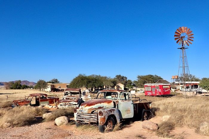
**DAY 12: Monday, May 5, 2025: Walvis Bay - Swakopmund - Round Trip to Cape Cross (seals) - Wreck of the Zeila en route - Henties Bay - Spitzkoppe Tented Camp & Campsite**
After an excellent night, a bit cooler and more humid than usual, we wake up around 7 AM and leave the camp at 7:45 AM to **follow the Atlantic coast heading north**. We thus leave **Walvis Bay**, a very pleasant stopover town, and follow the ocean via the B2. **We enter the mist and Swakopmund** at 8:40 AM, parking **near the lighthouse**. The atmosphere is very quiet, the streets seem dead with large empty parking lots and very little traffic, but the few open shops are filled with expatriates enjoying their breakfasts, French bakeries, cafes, travel agencies... **We are in this Benguela Current, a fast cold ocean current that flows from South Africa, up the coasts of Namibia and Angola, towards the northwest to join a warm equatorial current. Hence the supply of very fish-rich waters and this tenacious mist depending on the seasons. In the northern part of the Namib Desert, fogs are frequent during the southern winter. It's almost the only source of moisture since the city of Swakopmund receives, on average, only 11 liters of water per m² in December and January.**
**Swakopmund is wedged between the dunes and the Atlantic rollers. It is the Namibian capital of adventure activities and has a ghostly colonial remnant. With its German architecture, its seaside promenade, it resembles a seaside town of the North Sea or the Baltic.** It is also a bustling African city. **Nearly two-thirds of Swakopmund's population live in Mondesa, a township created during apartheid, northeast of the city center, a legacy of the South African mandate.** The heart of the city is located in the area of the pier, at the foot of the lighthouse, better known as the Mole. During the South African occupation of Swakopmund, the port took a back seat to Walvis Bay.
Continuing on this C34, sometimes on salt, we come across the famous **wreck of the Zeila, stranded in 2008**, on our left. We can see it through the thick fog, being very close to the beach. It's 10:15 AM. Further on, Henties Bay is a bay that attracts many fishermen; it's teeming with vehicles equipped with fishing rods. Besides its fish-rich waters, it enjoys a relaxed atmosphere and a large beach suitable for walks.
We continue further north, heading to Cape Cross, this time a round trip because we will turn off later here in Henties Bay to reach Spitzkoppe via good gravel roads that are quiet alternatives to the very busy paved B2 further south. **Henties Bay is part of the Dorob National Park, a multi-purpose park protecting coastal ecosystems and hosting the many renowned recreational activities of the region. The part of the coast north of Swakopmund up to the Ugab is particularly popular with fishermen who come in droves to fish for saltwater fish.** The small concrete buildings spaced at regular intervals are actually toilets for fishermen and campers. The coastline is also dotted with world-renowned surf spots.
Even before arriving, we can already smell it before we come across thousands of seals (population in 2021: 1.5 million). **The Cape Cross Seal Reserve, the most renowned on the Namibian coast, is home to the most famous breeding colony of fur seals, which seems to take full advantage of the high concentrations of fish present in the icy waters of the Benguela Current. We are impressed by the sight of these 100,000 pinnipeds lounging on the beach and frolicking in the waves.** We have a picnic a little away from the smells facing the ocean in the sun.
At 12:45 PM, it's time to hit the road again. We retrace our steps back to Henties Bay. We stop there to do another big grocery run before not encountering any big cities for many days. We will only buy fresh items day by day until the end of the trip; we have 23 € worth. **In the space of 30 minutes, we go from 15 to 36°C. The thermal shock with an amplitude of more than 20°C.** At 1:45 PM, we hit the road again via the D1918, then we try a very small track on our left, the D1925. It becomes narrow and rough; I have a bit of apprehension. We arrive at a gate to open in the middle of nowhere, then young children run up to us asking for water or food... We then drive to **Spitzkoppe. The arrival right in front of the mountains is majestic, off the beaten path. This mountain appears in the distance like a mirage above the dusty plains of southern Damaraland.** We come across a second gate held by a guard. We enter the "Community Camp" campsite without realizing it through the west entrance. We are given a small paper, then we go to the reception passing **at the foot of these gigantic, magnificent rocks.** Once at the reception, we are informed that this is not the camp we had booked. Ours is located just a little further, and in the end, it's better because the latter was packed. We were able to cross the park very close to these rocks without paying. We exit through the main entrance; 5 Himba children cling to our doors and trunk asking for bread and food again. We continue despite them staying attached, worried about hurting them. Phew, more fear than harm. We cross the few houses and arrive at the right camp at 4:30 PM, the Spitzkoppe Tented & Campsite. The spot is much quieter and well set up. We have site C12, cozy to perfection with its sink, a private shower and toilet, as well as electricity, under the shade of a tree and facing the mountains. The sunset and sunrise will be perfect. We set up the tent and, without delay, head to the pool for a big dose of coolness. Then it's time to prepare the BBQ and **contemplate the fading lights on the Spitzkoppe massif.**
> Today's road itinerary: 5 hours of driving: Head north on the B2 (paved) along the ocean > Swakopmund > C34 (paved) still heading north > On the left, the wreck of the Zeila before Henties Bay > Cape Cross round trip > Henties Bay > D1916 heading east (track) > Turn left onto D3716 > Turn left to the campsite.
> Gas station: Swakopmund or Henties Bay.
> Distance driven today: 344 km.
> Distance walked today: 6 km.
> Today's expenses: Groceries in Henties Bay: 23 € + Cape Cross park entry: 17 €.
> Accommodation: Spitzkoppe Tented Camp & Campsite - Spitzkoppe River Valley 00000, Spitzkoppe river valley, Namibia - (http://spitzkoppemountaincamp.com/) - 26 € - Pool - BBQ - Shower and toilet.
**DAY 13: Tuesday, May 6, 2025: Spitzkoppe - Rock Pools - Uis**
It's 6:45 AM, **we wake up at the foot of one of the most emblematic landscapes of the country, Spitzkoppe, which towers over the valley at 1,728 m.** **The Spitzkoppe massif, "pointed hat" in Afrikaans, is actually a set of three rock formations: Big Spitzkoppe, the granite domes of the Pontok Mountains that surround it, and Little Spitzkoppe, to the southwest. It was first climbed in 1946 and has never stopped attracting experienced climbers; it remains one of the most challenging ascents in the country. The climate in the region is hot**, so try to visit during the cooler months, as it can quickly reach 36°C in the sun in the afternoon. **Spitzkoppe is particularly striking at dusk, as it was last night, and at dawn this morning when the low light sets the rocks ablaze with red and orange hues. The spectacle is unique.**
We re-enter the park managed by the local community (160 NAD $ per person), then start with the **arch sector**. We quietly enjoy all the viewpoints under perfect orange colors. We leave this magnificent spot, reminding us of (https://www.montagne-aventure.net/2024/04/29/j19-1-juin-2024-canyonlands-national-park-et-arches-national-park/), but with much less crowding here. Around 10 AM, we head closer to these mythical peaks, including the main one nicknamed the Matterhorn of Namibia. Then we finish with the **ascent of the rock above Rock Pool. The 360° view of the park is a must-see. Small natural pools carved into the rock bring a bit of water to this arid and rocky landscape.** The wind blows strongly up there, and during a photo shoot with a tripod, it falls forward right onto the lens glass, cracking it... Frustration and shouts, these will be the last quality photos of this trip, and a new bill to pay when we return to replace it... Disgusted.
We continue to **Bushmans Paradise**, have a lunch break in the shade of a rock before hitting the road again around 12:30 PM after thoroughly exploring the park, feeling weakened and sad about my passion: photography...
We fill up with fuel as soon as we arrive in Uis at the price of 21 NAD $ per liter, a total of 1021 NAD $ for 50 liters (52 € by card). **Uis is a former mining town. Tin mining ceased in the early 1990s, but the high white mountain where the ore was dumped is clearly visible. The region is rich in amethysts, Brandberg crystals, and other semi-precious stones; we come across many vendors on the roadside.**
We then head to our final destination of the day, the **Daureb Isib Restcamp**. We arrive quite early for once at 2:45 PM in the heat, but the camp is just perfectly set up, surely the most upscale we will have during this trip. We are in a fortunately shaded area under palm leaves, with a table, chairs with cushions, a sink, a hot shower, toilets, a beautiful pool, and of course our private BBQ. Perfect for regaining a bit of a smile after the fall of my DSLR camera. **We are facing the Brandberg massif, the "fire mountain" in Afrikaans, dominated by Königstein (2,573 m), the highest peak in Namibia.** **The Brandberg owes its name to the reddish-orange glow that forms on its slopes at dawn and dusk, when the sun's rays awaken its red granite faces studded with crystals. It also hides a real treasure inside, as it contains an exceptional concentration of prehistoric rock art**, mainly paintings and some petroglyphs, including the most famous of them, the **White Lady in the Tsisab Gorge**. There are over 43,000 in total, dating back 2,000 to 4,000 years, scattered in hundreds of crevices around the mountain.
Time for the usual swim, laundry, and evening cooking. On the braai menu, local sausages with cheese pasta and leftovers for a good salad the next day.
> Today's road itinerary: 1h45: Head north on the D3716 > Then D1930 (gravel and sand track) to Uis.
> Gas station: Uis.
> Distance driven today: 113 km.
> Distance walked today: 6 km.
> Today's expenses: Fuel fill-up in Uis for 52 € (1,021 NAD $).
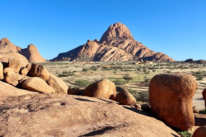
> Accommodation: Daureb Isib Restcamp - Erf 672 C/O 3rd & 4th Avenue Uis 9000, Uis, Namibia - (http://www.daurebisib.com/) – 31 € - Pool. Comfort with private bathroom + electricity + Wi-Fi at the restaurant. Clear sky for a beautiful starry night.
**DAY 14: Wednesday, May 7, 2025: Brandberg (Namibia's Highest Mountain) - Damaraland:**
**The Brandberg massif is an isolated, dome-shaped mountain, an inselberg, that towers over the gravel plains scorched by the sun of the Namib Desert to the northwest. It measures 23 km long and 20 km wide. It is the highest point in Namibia at 2,573 meters.**
This massif formed about 130 million years ago when a gigantic viscous mass of magma from deep within the Earth's crust rose through the surrounding rock layers before solidifying. Later, the granite mass was exposed by the erosion of the surrounding rocks.
**The Brandberg is the highest mountain in Namibia, peaking at an altitude of 2,573 m. The indigenous San people call it the "burning mountain," as it appears to glow with a red light at sunset. With its considerable height and width, this massif influences the local climate, attracting more rain on its slopes than the desert below.** The rain seeps through the springs. Unique animal and plant species thrive in this high-altitude environment, and prehistoric paintings adorn the rock faces hidden in the ravines around the base of the mountain.
The first night was also hot since the start of this trip, the thermometer did not drop below 20°C. We wake up gently around 8 AM, a pleasant sleep-in, the sun is already out. After a quick morning cleanup of the 4x4, we have time today, we hit the road at 9:30 AM, getting lost in the Brandberg massif. We are now in the **Damaraland, which stretches from the majestic rock formations of the Brandberg in the south, where we are today, to the bushy expanses at the foot of the rugged mountains of Sesfontein in the north, where we will be tomorrow. It is the perfect destination for wildlife and flora observation.**
We take the track heading towards the **White Lady**, but we want an alternative to this guided visit only. So, just before arriving, we turn right towards a viewpoint named on Google Maps **Rastplatz**. We come across **small Himba villages, living in extreme poverty with no natural resources; the inhabitants ask for water with every passing vehicle...** A bit further, we encounter about ten **ostriches** in the middle of the track, magnificent, as we get closer to the mountains in the background, and a few meters further, **a herd of Oryx**. Then we approach the **bed of the Ugab River**. We then go back and have a snack in the middle of nowhere, under the shade of our 4x4, facing the mountainous massif. We get back on the road around noon, while the temperature is at its peak in this very hot region, 35°C on the gauge with very dry air. We go up the C35 slightly then turn left onto the small track D2319 until we reach the Ugab bed again. Back to Uis in the mid-afternoon.
We did not book the same campsite as the previous night; today we are at the Brandberg Rest Camp. Unfortunately, the camp is not at the same level as the previous one, which was perfect. But the price is also much lower. The sites are next to each other, separated by small fences behind the main building. But it will do just fine. We have our BBQ and electricity, the shared sanitary facilities are decent. We then lounge in the large pool. We will then buy some water for 10 € at the supermarket located right across.
> Gas station: Uis.
> Distance driven today: 118 km.
> Today's expenses: Groceries in Uis: 10 €.
> Accommodation: Brandberg Rest Camp Uis - No 3 Uis Street Namibia 9000, Damaraland, Namibia - (http://www.brandbergrestcamp.com/) - Large pool – Shower – Electricity
**DAY 15: Thursday, May 8, 2025: Damaraland: Petrified Forest - Ugab Valley - Palmwag**
The night was excellent and slightly cooler than the previous one. We wake up around 7 AM and hit the road just before 7:45 AM heading to a new destination as we continue this Namibian road trip. **We cross Damaraland today from south to north.** First via the C35 to **Khorixas**, then turning left onto the C39. **We come across some villagers walking kilometers under the scorching sun with only a small water container in their hand... What a tough life, light-years away from ours.** About 40 km west of this town, we arrive at the **Petrified Forest National Monument**. It is a vast expanse of veld (open vegetation area), dotted with petrified tree trunks that can reach 34 m in length and 6 m in circumference, estimated to be over 260 million years old. These trees belonged to the Gymnospermae family, conifers among which we find today's cycads and welwitschias. The absence of roots and branches suggests that the trunks were deposited here during a significant flood. The site has about fifty trees, some half-buried in sandstone, others perfectly petrified in silica with their bark and growth rings. A guide is mandatory at the entrance to visit the site.
We then continue on this C39 due west to the junction of the D2612. We make a round trip to the south to **Twyfelfontein, which means "uncertain spring" or "bubbling spring" in Damara**. The site is a UNESCO World Heritage site, located at the entrance of the grassy Aba Huab Valley and houses one of the largest collections of rock art on the continent. More than **2,500 petroglyphs** have been discovered on over 200 stones, as well as some rock paintings. They date back about 6,000 years and others 2,500 years. Many engravings depict species that have since disappeared from the region, such as elephants, rhinoceroses, giraffes, and lions. The presence of a seal attests to the existence of links with the coastline at the time, now over 100 km away. It is here, as well as at Brandberg, that the human history of Namibia began with these testimonies of ritual and economic practices among hunter-gatherer peoples.
We continue a bit further south on the D3214 then D3254 to visit the **Organ Pipes, "organ pipes"**. The entrance is also paid, much to our regret... 500 NAD $ for two. We take a well-marked trail leading to a small gorge containing dolerite (coarse-grained basalt) columns 4 m high and aligned on an astonishing 100 m long wall. We are in a volcanic chain stretching over a dozen kilometers, a pile of scoria that seems to have been exposed to fire, the Burnt Mountain "burnt mountain" stands in a bleak and desolate landscape where almost nothing grows.
We head back north and return to the C39 then the C43 to **Palmwag where we will spend the night**. **This concession, covering an area of 5,500 km², is a region of red hills and plains, remarkable for its rolling landscapes as well as its rich fauna and flora**. The region serves as a **buffer zone between Etosha and the Skeleton Coast**. We have a good chance of encountering black rhinos, desert elephants, and lions, as well as spotted hyenas, giraffes, gemsboks, and other antelopes.
We pass the sanitary control barrier at 4 PM, just before entering Palmwag. In our direction, from south to north, we are simply asked about our future destinations and to present my French driver's license. A few meters further, there is a small gas station, then on our left our final destination of the day: the Palmwag Lodge Campsites. We are happy to arrive after this long journey. The welcome is very pleasant, and the site is very comfortable with a real brick shelter housing our shower and toilet, as well as water and electricity. We always have a BBQ available, but today we unfortunately no longer have meat due to concerns about the sanitary control, but we were not sure if it was rather in the other direction that the transport of fresh meat and dairy products is prohibited. We now cross our fingers to be able to observe some different animals, as the place is renowned for elephants, giraffes, and rhinos. We first take some time to relax in the pool before going for a walk around the reserve, without encountering anything unfortunately this evening, but the wake-up will be up to par... Time for the sunset, which is always one of the highlights of the day.
> Today's road itinerary: 5h30 of driving: C35 heading north > Then turn left onto the C39 > Petrified Forest > Go down on the D3612 in a round trip to Twyfelfontain (rock paintings and Organ Pipes) > Go back up on the C39 then C43 to Palmwag > Round trip on the C40 to Mount Grootberg Pass.
For info on the C43, there is a sanitary control at the entrance and exit (transporting raw meat is prohibited).
Palmwag: black rhinos (guided or free visit? at sunrise or sunset).
> Gas station: Twyfelfontain or Palmwag (07:00 – 19:00) – Tire repair in Palmwag.
> Distance driven today: 349 km.
> Distance walked today: km.
> Accommodation: North of Palmwag Lodge Campsites - GPS Coordinates -19.88556°, 13.93694° - Pool – Water and electricity – 34 € - (https://gondwana-collection.com/accommodation/palmwag-campsite?LodgeName=PALMWAG%20CAMPSITE)
**DAY 16: Friday, May 9, 2025: Palmwag - Sesfontein - Entry into Kaokoland - Opuwo**
This morning, we take our time watching for wildlife. We can finally observe our first **kudus** as the sun begins to illuminate the plain in front of us (see video and time-lapse of the day). A few minutes later, we also spot **a couple of giraffes with their calf**, moving calmly and serenely.
**We leave Palmwag** at 9 AM, heading to the northernmost point of Damaraland via the C43 to Sesfontein.
A few kilometers on the track, and we come across **a herd of zebras**, 11 to be exact, in the middle of green hills. Even further, it's more than twenty that cross right in front of us, a treat for our eyes. Their gait is majestic; they are very sensitive to noise. Some are more curious than others and don't hesitate to stay close if we remain quiet. We then cross numerous rough riverbeds. We must always stay very attentive at the wheel because we can drive at over 80 km/h on straight lines and then suddenly have to brake to cross these small streams, usually already dry at this time of year. Many antelopes are still present by the side of the track; the heat is already rising, and they are often lying on the ground at this hour.
**We arrive in Sesfontein at 11:15 AM**, just as the children are leaving school. Transportation is done by donkey-drawn carts. The villagers spend their time in the shade of the trees and in front of the few small shops. The atmosphere of its streets is dusty with a laid-back pace; this town has the feel of an oasis located **by the Hoanib River**, the town of six springs from which it gets its name. Founded in 1896, it was a military outpost built after a cattle plague epidemic. This page of its history is reflected in Fort Sesfontein, erected in 1905 to fight cattle diseases, arms smuggling, and poaching.
We take a lunch break at the exit of the village around 11:30 AM in the shade of a tree, so peaceful, it's 32°C. We continue further north, away from the usual tourist routes, and **enter the Kunene region, also called Kaokoland**. The track becomes narrower and more winding. **These are now vast solitary spaces largely devoid of roads, simply crossed by sandy tracks opened by the South African army just a few decades ago.** The fauna and flora have managed to adapt to this harsh and dry environment, like the desert elephant, an endangered species whose slender legs are perfectly suited to the long journeys the animal must make to find water, a rare resource. This region is also the territory of the Himba people, emblematic of the country. Its name comes from the Kunene River, which marks a narrow belt of vegetation at the Angolan border.
**We arrive in Opuwo at 3 PM**, **this town is the capital of the Kunene region**. Its name means "the end" in the Herero language, a fitting term for this dusty collection of commercial buildings surrounded by traditional huts with round thatched roofs.
**Opuwo is a strong cultural moment of this trip in Himba territory, this semi-nomadic people traditionally settles in an onganda (small village), moving if necessary to find access to water. Himba women are known for their ochre-colored cream, otjize, a mixture of butterfat and ochre powder, applied to protect and moisturize the skin and hair. Fire and smoke play an important role in their culture.** Smoke, often scented with herbs, is used by women for purification. It can also convey prayers to the supreme being, Muluru. In traditional celebrations, there is always a sacred fire that remains lit between the main hut and the animal enclosure, to maintain ties with the ancestors.
Right upon arrival, we fill up with fuel at the Shell station at the price of 21.48 NAD $ per liter, or 67 liters for 1454 NAD $ (72 €) by card. We then quickly stock up on meat at the Spar **where Himba women with bare breasts mix with us, the only white people shopping in the aisles**. **Since the beginning of this trip, this is where life is most bustling**. There are many people on these dusty streets, after kilometers without seeing anyone, the shock is brutal. There are small markets, poverty but also wealth. The town is quite spread out. There are no white people left, **we finally discover the true, harsh African life.**
We arrive at the **Opuwo Country Lodge at 3:30 PM**, located slightly on the heights. We have site 9 at the end of the property for maximum isolation as we like. Once again, we have private sanitary facilities, a BBQ, and electricity. Once settled, we walk 10 minutes to the reception where the pool is located to cool off. An infinity pool that is just magnificent facing the vast landscape before us. But this contrast between this little comfort and the town below makes us uneasy. The employees walk back down. A guard is present at the entrance of the lodge to ensure security; the park where we are is fenced. We enjoy a good braai, then enjoy the few lights of the town gradually lighting up. The night will be quite noisy for once with very loud music rising from a party below until 2:30 AM... And yet it comes from far away... Maybe a bar? In any case, we rule out what we thought was just a party during our visit here on Friday.
> Today's road itinerary: 4 hours of track: Return via the C43 heading south to Opuwo.
> Gas station: Okangwati or Opuwo
> Distance driven today: 261 km.
> Today's expenses: Fuel fill-up in Opuwo for 72 € + Groceries in Opuwo for 21 €.
> Accommodation: Opuwo Country Hotel - Opuwo Hilltop Opuwo 9000, Opuwo, Namibia - -18.044682 / 13.833861 - (http://www.opuwolodge.com/) - N$600.00 - Pool / Water / Private sanitary facilities / Electricity / BBQ.
**DAY 17: Saturday, May 10, 2025: Opuwo to Epupa Falls:**
We take our time this morning by the **Kunene River**, then we hit the road at 8:45 AM. This is our return trip to Opuwo.
After 4 good hours of driving, **we return to the bustling life of Opuwo**. We refill with fuel at the Shell station (21.48 NAD $ per liter) 820 NAD $ (40 €) for 38 liters and do a quick grocery run at the Spar for 488 NAD $ (24 €). We don't take any meat because we have the **sanitary barrier** to cross tomorrow before entering Etosha Park. We pay for these two expenses in cash for the first time; until now, the credit card was always accepted, so we now have to use the cash we withdrew at the airport. Then we head back to the Opuwo Country Lodge, arriving at the campsite at 2 PM. We are the first to arrive, we rest for a moment before heading to the pool and then end the day around our traditional BBQ with sausages and sautéed potatoes. The full moon accompanies us, perfect for nighttime observations in Etosha starting tomorrow.
The campsite's location should be avoided because we again have infernal music that gets louder from 7 PM to 2:30 AM... And yet it comes from far away... Maybe a bar? In any case, we eliminate what we thought was just a party during our visit here on Friday.
> Today's road itinerary: 4 hours of track: Return via the C43 heading south to Opuwo.
> Gas station: Okangwati or Opuwo
> Distance driven today: 180 km.
> Accommodation: Opuwo Country Hotel - Opuwo Hilltop Opuwo 9000, Opuwo, Namibia - -18.044682 / 13.833861 - (http://www.opuwolodge.com/) - N$600.00 - Pool / Water / Electricity / BBQ
**DAY 18: Sunday, May 11, 2025: Epupa Falls:**
Time for a "vacation" day; we wake up leisurely at 8 AM and take our time this morning. Breakfast and even coffee. The night was good, lulled by the sound of the waterfalls.
In the late morning, we head out on the small path along the banks of the Kunene River, which offers magnificent landscapes. We have a beautiful view of Angola from the opposite bank. The falls extend over about 1.5 km and flow over a series of promontories, the highest of which reaches 37 m.
At noon, we return to our campsite to eat in the shade of the palm trees. On the menu: fried eggs and pasta. We take advantage of this afternoon to rest before the last part of this road trip, with reading, writing, and pool time on the agenda.
In the late afternoon, we return to one of the viewpoints overlooking Epupa Falls to once again enjoy the sunset colors from a different angle. We are over the moon; our thoughts wander in all directions. We discuss future trips, adventures, reminisce about our memories, and think about the world around us... We savor the luck of being here. On the way back, a Himba woman asks if we can give her a ride in our 4x4 to Opuwo tomorrow.
Tonight, we dine on our traditional braai with white beans by the Kunene River. We are lulled by the sound of this powerful river flowing under the song of insects. The coolness sets in, and we fall asleep under the stars.
> Distance driven today: 0 km.
> Distance walked today: 10 km.
> Accommodation: Omarunga Lodge Campsites - 68 € for two nights - Site by the river - (https://gondwana-collection.com/fr/accommodation/omarunga-epupa-falls-campsite?LodgeName=OMARUNGA%20EPUPA-FALLS%20CAMPSITE&hsLang=en)
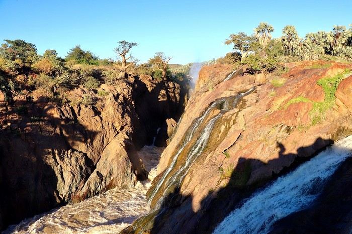
**DAY 19: Monday, May 12, 2025: Epupa to Opuwo**
We enjoy the morning a bit more by the **Kunene River**, then we hit the road at 8:45 AM. This is our return trip to Opuwo.
After 4 good hours on the road, **we return to the bustling life of Opuwo**. We refill with fuel at the Shell station (21.48 NAD $ per liter) for 820 NAD $ (40 €) for 38 liters and do a quick grocery run at the Spar for 488 NAD $ (24 €). We don't take any meat because we have the **sanitary barrier** to cross tomorrow before entering Etosha Park. We pay in cash for these two expenses for the first time; until now, the credit card was always accepted, so we have to use the cash we withdrew at the airport. Then we head back to the Opuwo Country Lodge, arriving at the campsite at 2:30 PM. We are the first to arrive, rest for a moment before heading to the pool, and then end the day with our traditional BBQ: sausages and sautéed potatoes. The full moon accompanies us, perfect for nighttime observations in Etosha starting tomorrow.
The campsite's location should be avoided, as we again have loud music until 2:30 AM... And it comes from far away... Maybe a bar? In any case, we rule out what we thought was just a party during our visit here on Friday.
> Today's road itinerary: 4 hours of track: Return via the C43 heading south to Opuwo.
> Gas station: Okangwati or Opuwo
> Distance driven today: 180 km.
> Accommodation: Opuwo Country Hotel - Opuwo Hilltop Opuwo 9000, Opuwo, Namibia - -18.044682 / 13.833861 - (http://www.opuwolodge.com/) - N$600.00 - Pool / Water / Private sanitary facilities / Electricity / BBQ
**DAY 20: Tuesday, May 13, 2025: Opuwo – Etosha - Olifantsrus**
We wake up before dawn around 6:30 AM. We pack up the camp at 7:15 AM heading to a first waterhole to watch the sunrise and start our day of observations and discoveries. It's 11°C, and as soon as we leave the campsite, we come across numerous zebras, foxes, and springboks with the sun rising on the horizon. Magnificent images.
**At 8:30 AM, we are still alone**, we witness **one of the most beautiful scenes of this trip: 3 lionesses hunting springboks**. It's thanks to the latter, slowing down, that we manage to spot 4 lionesses' heads barely above the tall grass. They hide, stand up, move slowly... We wait without moving. This is their perfect terrain for camouflage. **We are on the lookout and try to be discreet during this hunting scene**. We leave the area to let them finish their remarkable work and continue the track towards the East. The terrain becomes completely flat. It's now been 3 hours since we left the campsite without noticing the time passing, and especially without meeting anyone. Around 10 AM, near a waterhole, we come across a solitary elephant mixed with zebras, buffaloes, and springboks.
Around 11 AM, we take a lunch break; here, it's us who are enclosed in enclosures. Whether in the campsites or the few small equipped areas, we are fenced in by a gate. The animals are free on their territory. The wind has picked up again, just like the sun. We eat alone in absolute calm in the heart of this incredible, unique park; there are no words to describe what nature offers us here, far from any human activity. We start to see some safari vehicles arriving, but the attendance remains much lower than I had imagined. At most, a total of fifteen throughout the day.
Etosha is also a wonderful reserve of vegetation; you can find multiple mopane groves. But also acacias and other trees appreciated by ruminants. The south and east of the park have the most waterholes, which is where most animals gather. In the West, the vegetation is denser, and the wildlife is harder to spot, but it is well present, especially the black-faced impala and Hartmann's mountain zebra, which are found almost nowhere else. The area being less frequented, the bush feeling is more pronounced.
30 minutes of track after eating, **we come across a solitary male lion. The build compared to the females this morning is noticeable from afar**, even though this one is quite far from us unfortunately, unlike this morning when they were right on top of us.
**Etosha is the preferred habitat of lions in Namibia, with about 330 individuals roaming the park's plains, nearly half of the country's wild lions.** The big cats rest under the trees near waterholes, especially the one at Okaukuejo where we arrive today, but it's also a good spot for elephants and rhinos.
We then enter the territory of buffaloes, which we come across by the dozens now. Wow, the encounters keep coming. Then around 2 PM, we follow this immense **Etosha Pan** for the first time, which we will follow for a good part of tomorrow's day.
We arrive at our campsite at 3:30 PM after more than 8 hours of self-safari filled with discoveries. We sleep tonight at the **Olifantsrus Camp**, which we had previously booked in France. We had to wait and click several times for a spot to open up, as the camp has very few sites, and that's a good thing. It is located in one of the wildest areas of Etosha and has a practical observation tower overlooking a waterhole, offering us great opportunities to spot wildlife after nightfall (see photos). **The sunset is once again memorable.** In the guestbook at the reception, where each visitor can note their observations, 3 lions were seen the day before just a few steps from here (1 male, 1 female, and their cub), on a part of the track we didn't cover today; it will be on tomorrow morning's program. We cross our fingers for these predators.
> Today's road itinerary: 6 hours of driving: Leave Opuwo via the C41 (paved road) > Turn right onto the C35 (paved road) to the Galton Gate > Enter Etosha Park.
> Gas station: Opuwo.
> Distance driven today: 369 km.
> Accommodation: Olifantsrus Camping site - 53.4 € for two – Shared sanitary facilities – Electricity – BBQ – No grocery store - (https://www.etoshanationalpark.org/fr/accommodation/olifantsrus-camp)
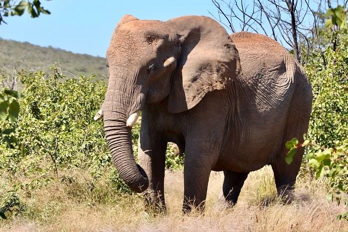
**DAY 21: Wednesday, May 14, 2025: Etosha National Park: From Olifantsrus to Okaukuejo:**
We wake up before dawn around 6:30 AM. We pack up the camp at 7:15 AM as the gates open, heading to a first waterhole to watch the sunrise and start our day of observations. It's 11°C, and just outside the campsite, we come across numerous zebras, foxes, and springboks with the sun rising on the horizon. Magnificent scenes.
**At 8:30 AM, we are still alone**, and we witness **one of the most beautiful moments of this trip: three lionesses hunting springboks**. Thanks to the springboks slowing down, we manage to spot four lionesses' heads barely above the tall grass. They hide, stand up, and move slowly... We wait without moving. This is their perfect terrain for camouflage. **We stay alert and try to be discreet during this hunting scene**. We leave the area to let them finish their remarkable work and continue the track towards the east. The terrain becomes completely flat. It's been 3 hours since we left the campsite without noticing the time, and especially without meeting anyone. Around 10 AM, near a waterhole, we come across a solitary elephant mixed with zebras, buffaloes, and springboks.
Around 11 AM, we take a lunch break; here, it's us who are enclosed in enclosures. Whether in the campsites or the few small equipped areas, we are fenced in by a gate. The animals are free on their territory. The wind has picked up again, just like the sun. We eat alone in absolute calm in the heart of this incredible, unique park; there are no words to describe what nature offers us here, far from any human activity. We start to see some safari vehicles arriving, but the attendance remains much lower than I had imagined. At most, a total of fifteen throughout the day.
Etosha is also a wonderful reserve of vegetation; you can find multiple mopane groves. But also acacias and other trees appreciated by ruminants. The south and east of the park have the most waterholes, which is where most animals gather. In the west, the vegetation is denser, and the wildlife is harder to spot, but it is well present, especially the black-faced impala and Hartmann's mountain zebra, which are found almost nowhere else. The area being less frequented, the bush feeling is more pronounced.
Thirty minutes of track after eating, **we come across a solitary male lion. The build compared to the females this morning is noticeable from afar**, even though this one is quite far from us unfortunately, unlike this morning when they were right on top of us.
**Etosha is the preferred habitat of lions in Namibia, with about 330 individuals roaming the park's plains, nearly half of the country's wild lions.** The big cats rest under the trees near waterholes, especially the one at Okaukuejo where we arrive today, but it's also a good spot for elephants and rhinos.
We then enter the territory of buffaloes, which we come across by the dozens now. Wow, the encounters keep coming. Then around 2 PM, we follow this immense **Etosha Pan** for the first time, which we will follow for a good part of tomorrow's day.
We arrive at our campsite at 3:30 PM after more than 8 hours of self-safari filled with discoveries. We sleep tonight at the **Okaukuejo Resort**. Upon arrival, this impression of a small town in the middle of hundreds of kilometers without infrastructure remains shocking. **The atmosphere is quite different from last night in our small wild campsite**. However, even though the attendance is higher, we are lucky to get a site in a corner (number 46). **The lit waterhole will also be a reward**. After checking in, we take advantage of the small grocery store to buy two meats for our next BBQs in the park, 3 pork chops and sausages, as well as a cold drink for 252 NAD $. This locality also offers a gas station, a restaurant, and a nice pool, but our goal during this park stay remains focused on the wildlife, so I won't give in this time. Time to set up, followed by a short rest, then our toilette before heading to the "waterhole" for the sunset around 6 PM. **A new grand spectacle unfolds before us, a hundred zebras come to hydrate right before our eyes at the water reserve facing the sunset in a cloud of dust. Then a couple of lions approach stealthily without managing to fill their stomachs. A third guest arrives, a second male lion also comes to drink. The waterhole now becomes the territory of the lions... We are speechless facing what nature offers us, we savor for over an hour scrutinizing the smallest details. What an intense day, images that will remain forever etched in our minds.** It's our turn to have our meal with three beautiful pork chops on the BBQ accompanied by curry vegetables.
At 9 PM, we decide to return to the waterhole, a wonderful idea because we find **an elephant and two black rhinos courting in the water. The male has a hard time seducing his sweetheart and eventually leaves, but a third rhino appears out of nowhere to join her. The scenes unfold under the spotlights** accompanied by a sky full of stars. We eventually go to bed. Looking forward to the rest of the story tomorrow.
> Today's road itinerary: Camp Olifantsrus > Camp Okaukuejo.
> Gas station: Okaukuejo camp.
> Distance driven today: 229 km. > Today's expenses: Groceries for 12 €.
> Accommodation: Okaukuejo Camping Site - 48.12 € for two - Pool - Gas station - Lit waterhole - Grocery store - (https://www.etoshanationalpark.org/fr/accommodation/okaukuejo)
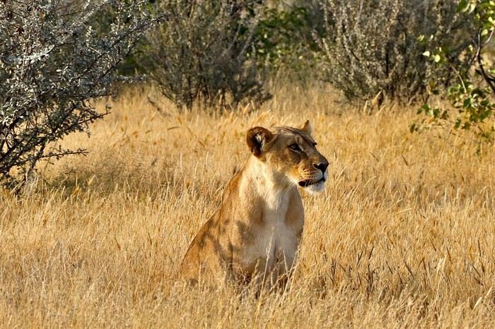
**DAY 22: Thursday, May 15, 2025: Etosha National Park: From Okaukuejo to Halali:**
We wake up around 5:30 AM to a strange noise getting closer, a few thunderclaps, then heavy rain pours down on us! The first since the start of this trip, we had forgotten its sound and smell. We leave the campsite quickly at 7:13 AM as the gates open, the rain stops just in time!
We are right in the heart of the park today. We arrive at the Etosha Pan, an immense flat salt desert that, a few days a year, transforms into a shallow expanse teeming with flamingos and pelicans. At the end of the dry season, everything, from elephants to grasslands, is covered in the white, chalky dust of Etosha.
Around noon, at the Riedfontein waterhole, we spot two male lions in this picturesque savannah. As we've noticed, the females hunt while the males protect the territory. The males and cubs will benefit first.
The day was less emotional than the previous one. We encounter far fewer animals, often at a greater distance. Is it because of the stormy rain we had at dawn this morning, or is it the area? The tracks were also more exhausting, especially the Rhino Drive without meeting a soul. But the view over the immense salt pan as far as the eye can see is worth seeing. Maybe the waterhole at the campsite will surprise us tonight as it did yesterday?
We arrive at 4 PM at the Halali Resort for our last night in the park. We still have a lit waterhole, more intimate than yesterday's, and we can walk around the park thanks to a hiking trail. The sanitary facilities are shared and quite recent, with each site offering its own BBQ and electrical outlet. After setting up and a quick wash, we head on foot to the Halali waterhole for sunset. Tonight's menu features local sausages (beef and pork) with curry pasta.
> Today's road itinerary: Camp Okaukuejo > Camp Halali.
> Gas station: Halali Camp.
> Distance driven today: 242 km.
> Accommodation: Halali Camping Site - 48.12 € for two - Pool - Gas station - Lit waterhole - Grocery store - (https://www.nwr.com.na/resorts/halali-resort/)
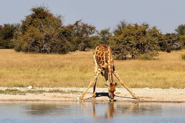
**DAY 23: Friday, May 16, 2025: Etosha National Park: From Halali to Namutoni - Waterberg Park:**
We pack up the camp at 7:15 AM as the gates open. It's 17°C, and the sun is out as usual. **We follow the Etosha Pan, still quite wet at this time of year.** The small track offers different viewpoints under a sun gradually rising higher.
The further east we go, the more we encounter gnus, kudus, and impalas. **We are once again spoiled and delighted by everything we discover this morning.** A majestic **giraffe** appears before our eyes just before arriving at **Namutoni** around 9:45 AM, quickly followed by 4 other companions. From there, we change plans, do the **Fischer's Pan** loop, and then decide to exit through the northern gate, allowing us to cover the entire park. Our last encounters will be with these tallest animals, the giraffes, and what a spectacle to see them spread their legs to hydrate, followed by gnus.
Just before the exit, we take a lunch break at an equipped area at 11:30 AM.
**We leave Etosha National Park with a touch of nostalgia through the King Nehale Iya Mpingana gate** at 12:30 PM. We find the beautiful paved B1 road, which is a great relief. Cows and goats take over; driving at 120 km/h on these single-lane, two-way roads with these animals we brush past requires constant vigilance. We fill up with fuel at 1:30 PM in **Oshivelo** (21.33 $ per liter), 93 liters for 99 € by card. Since we hadn't planned to go so far north out of Etosha, we are surprised to go through a **sanitary check** at the exit of the town, but it turns out to be even quicker than the previous one, a simple glance in the fridge by very smiling women, much more pleasant than the staff at the Etosha entrances and exits.
We pass **near Lake Otjikoto** ("deep hole" in Herero), which is **one of the only two natural lakes in Namibia along with its neighbor Lake Guinas**. In 1851, explorers Charles Andersson and Francis Galton came across this karst lake occupying a limestone cauldron 100 m long, 150 m wide, and 55 m deep. Its steep walls, about 20 m high, are the result of the collapse of the rock roof of the sinkhole under water pressure. This lake is also known for the large quantity of weapons and ammunition found in its depths. Remnants of the region's violent past, they were dumped there in 1915 by the retreating German army, refusing to let South African troops get their hands on them. Unfortunately, it's paid entry, and given the late hour, we continue on our way. To our great surprise, there is a lot of traffic on this B1, including many trucks, the first time we've seen so many people in this country. The landscapes change; we even discover deciduous trees taking on their autumn colors.
We pass through **Tsumeb**, and the road continues to **Otjiwarongo**, which means "pleasant place" in the Herero language, and the town lives up to its name. Prosperous and peaceful, with wide avenues and a relaxed atmosphere, we stop there to do some shopping. We buy some local meat to treat ourselves during these last two remaining camping nights: skewers, pork, and sausages, as well as biscuits, a last water tank, and yogurt for Mimi; 388 NAD $ - 20 €. We get back on the road heading south via the B1 for 15 minutes, then turn left onto the C42, still paved, for 30 minutes and 41 km, then left again onto the D2512, a wavy sandy track for 15 minutes.
**We enter the Waterberg National Park this evening.** The arrival facing this mountainous massif in the middle of the plains under the end-of-day lights of a deep red makes us even more eager to discover it. **Composed of impressive sandstone cliffs, tangles of vines, a canopy teeming with birds, elusive wildlife, and improbable dinosaur footprints. The Waterberg occupies a large sandstone plateau 50 km long and 16 km wide, at an altitude of 150 m above the plain.** It is possible to encounter elands, black wildebeests, roan antelopes, buffaloes, and red hartebeests, and with luck, leopards, as well as 200 identified bird species.
We arrive at the NWR campsite at 6 PM, the first time we arrive so late, just before nightfall. It's from here that various hiking trails start for tomorrow's day, including the **Mountain View Trail** that climbs to the edge of the plateau. We quickly settle into this peaceful camp where calm reigns, no more than 5 vehicles tonight. The place is shaded, with fairly recent shared sanitary facilities, electricity, and a BBQ for each. We savor our second-to-last braai under the stars, hearing our plane that brought us to Frankfurt fly over, every day at the same time over the Waterberg then Etosha. Very rare, as there are very few flights that land or fly over Namibian skies.
> Today's road itinerary: 10 hours of driving: B1 then C42 then D2512.
> Gas station: Exit of Etosha Park, Tsumeb, Otavi, or Waterberg Park.
> Distance driven today: 616 km.
> Accommodation: NWR Waterberg Camping Site - Pool - Water - 45 € for two - (https://www.nwr.com.na/resorts/waterberg-resort/#1577510913112-8f243e49-35a647e7-1997)
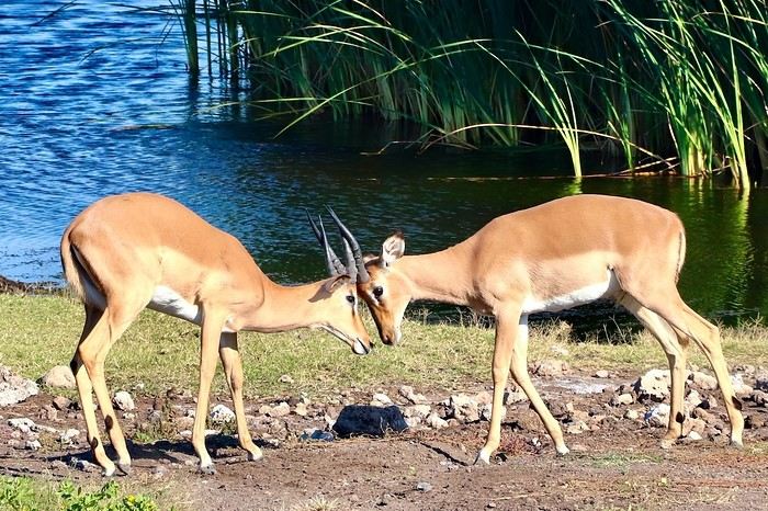
**DAY 24: Saturday, May 17, 2025: Waterberg Park - Otjiwa:**
We wake up around 7 AM after a very cool night.
**At sunrise, the cliffs appear even redder, and the cries of baboons echo around us.** We come across about thirty of them. We start the hike around 8:15 AM. **The Mountain View Trail will take us to the Waterberg Plateau.** The temperature is pleasant for walking. **The trail starts in a thick forest where the song of birds resonates.** The path is little frequented, so progress is slow and irregular; we regularly have to duck, step over, and climb rocks. However, in 35 minutes, we reach the top of the plateau. We are once again alone in the world in this Namibian nature. **The 360° panorama extends over a wide plain of green shrubs below, then over these steep red cliffs** giving access to this suspended plateau of the Waterberg. To enter, unfortunately, a special permit is required, and you must be accompanied by a guide. We savor the moment under the already hot sun at 9 AM. After an hour reminiscing about our journey on our rocky promontory, we start the descent at 10 AM, completing a loop back to our starting point. **At 10:30 AM, we pass by the small cemetery of German fighters who died in 1904**, then we hit the road back to the B1. We take a lunch break at noon at one of the tables scattered regularly along the paved roads. We are watched by **baboons** perched in their tree. We then decide to make a **detour through the town of Otjiwarongo**, which we didn't have time to explore properly yesterday. **A quick visit to the train station is a must to see locomotive No. 41, built in 1912 by the German company Henschel. It was transported to Namibia to carry ore between the mines of Tsumeb and the port of Swakopmund before being decommissioned in 1960 when the tracks were modified.**
We return to do some shopping and bring back some souvenirs for 300 NAD $ (14 €). We then take the road south on the B1. I start to feel the end of this immense loop through Namibia. Morale is gradually dropping. But we still have plenty of beautiful things to discover. We arrive at 3 PM at the **Otjiwa Safari Lodge. This will be our last night camping after 22 nights sleeping in the wild to the sound of animals.** The nostalgia is palpable. We enter this high-end private park; we don't really feel at home upon arrival. The reception, the pool, the restaurant, everything is very upscale, unlike anything we've experienced during this road trip. However, the reserve has its charm; we come across our beautiful antelopes again. The 10 sites are very comfortable, spaced apart under some bushes. Each has, of course, its BBQ, electricity, lighting, and sink. Before enjoying our last evening, we need to do a thorough dusting of the 4x4 and a good cleaning and organizing of our belongings. Then it's time for our last perfect braai: chicken and pork skewers, as well as tomato-flavored white beans.
> Today's road itinerary: 1h30 of driving: Waterberg > Otjiwarongo > Okonjima wildlife reserve - D2512 then C22 then B1 then turn right onto a 3 km track.
> Gas station: Waterberg Park.
> Distance driven today: 135 km.
> Distance walked today: 6 km.
> Today's expenses: Souvenirs for 14 €.
> Accommodation: Otjiwa Safari Lodge - B1 main road, west side Otjiwarongo 12001, Otjiwarongo, Namibia - (http://www.otjiwa.com.na/) – 40 € for two – From 3 PM.
**DAY 25: Sunday, May 18, 2025: Otjiwa - Windhoek:**
For this last leg of our Namibian journey, we complete the loop back to our starting point, Windhoek. We leave our last campsite at Otjiwa, later than usual, at 10 AM. We head due south on the B1 in less than 3 hours to the country's capital, not without a touch of nostalgia after all these kilometers traveled through Namibia. The landscapes roll by with a lot of melancholy. We make a stop 60 km north, in Okahandja. We take the opportunity to fill up with fuel (21.10 $ per liter), 500 NAD $ for 23 liters; the card machine wasn't working, so we had to withdraw from an ATM at the next gas station. A local was quite insistent at my window, asking for food or money. Anyway, after 15 minutes, we get back on the road.
From here, we take the new A1, a 2x2 lane highway limited, like the previous roads, to 120 km/h. Then we gradually see some of the country's industries before entering the capital in the blink of an eye. We arrive at 1:45 PM at Chameleon Backpackers. It's a small hostel-style hotel with a central pool, a shared kitchen, secure indoor parking, and a restaurant. They also organize tours (3 Day Express, 3 Day Link, 4 Days Etosha, 7 Day Norbert Adventure), very different from everything we've encountered so far, a kind of atmosphere like in Thailand. There are dormitories, rooms with shared bathrooms, and our little cocoon, the Love Bird, a room located alone on the upper floor with its small balcony, a swing, its bathroom, and its large bed with a thatched roof. A lot of charm while overlooking the pool. We eat before setting off to explore the capital.
Windhoek is a modern and well-maintained city, contrasting completely with the rest of the country. It is heavily influenced by its German colonial heritage, still very present in some streets of the capital. The architecture is colorful and surprising. The skyline is shared between the spires of a neo-baroque cathedral, the unusual silhouette of three castles from the German colonial era, and glass and steel skyscrapers. Office workers head to Zoo Park at lunchtime.
We enjoy the smell of grills at some street corners lined with small single-story houses with zinc roofs.
We first head to Windhoek's emblematic monument, its unofficial symbol: Christuskirche, just a 10-minute walk away. This German Lutheran church rises above the traffic at the center of an intersection. Built in 1907 with local sandstone. The roof and other elements were imported from Europe. The result evokes a gingerbread house.
We then walk along the pedestrian shopping street of **Post Street Mall** to admire African crafts, but on this Sunday, most shops are closed; we'll come back tomorrow. We return via the Wernhil shopping center.
> Today's road itinerary: Return to Windhoek in 3 hours via the B1 then the A1. In the capital, turn left onto Florence Nightingale, then right onto Beethoven Street then C28 then B6, then Bismarck Street. Take Church Street and Trift Street towards Voight Street.
> Gas station: Okahandja or Windhoek.
> Distance driven today: 245 km.
> Accommodation: Chameleon Backpackers & Guesthouse – 49 € for two - 5-7 Voigt St, North Windhoek Central, 9000 Windhoek
**DAY 26: Monday, May 19, 2025: Windhoek, Visit to the Namibian Capital:**
Our last sleep in Namibia... The wake-up is a bit sad; we still enjoy this return to comfort in a real bed. After a hearty breakfast, we check out of our little cocoon at 10 AM. We leave our vehicle in the secure parking lot and return for a walk in the center of Windhoek. On this Monday, the center is immediately livelier while still remaining extremely calm for a capital. The pace of life is slow; employees move slowly without rushing, each task is performed with a slowness that is almost surprising. A few skyscrapers further on, we quickly leave the hyper-center. We retrace our steps to the shopping gallery where we linger for a while. We eat around noon with African music in the background, making us even more nostalgic. Then the trip will gradually come to an end, unfortunately, until the moment when we will have to, not without regret, return our rental vehicle around 3 PM... We stop by the hotel again and then head to the rental agency and then to the airport by shuttle, included in our contract.
At 4:20 PM, we are back at the airport. We see ourselves upon arrival as if it were yesterday... Tears are not far off; we wait, the formalities are much quicker than upon arrival. **We board by walking across the tarmac on foot, escorted by about fifteen Namibians, facing the sunset. It will be there until the end, beautifully drawn on the horizon, to say goodbye to Namibia...**
> Round-trip flight tickets with Lufthansa from Lyon: 2029 €, or **1,014.50 €** per person.
> Vehicle rental: 4x4 Toyota with roof tent for 24 days: Gracious Whisp Car Rentals: 2,638 € (N$50,640) or **1,319 €** per person - (https://gwcarrentals.com/)
**DAY 27: Tuesday, May 20, 2025:** Flight FRA 8:15 AM -> 9:35 AM LYS (Air Dolomite No. 1074)
Total expenses including flight tickets + vehicle rental + visa + Lyon parking + food + fuel:
Cost per person: 3467 € Cost for two: 6935 €
>> All our photos and videos for each day on our website here: (https://www.montagne-aventure.net/voyages-découvertes/namibie-2025/)
>> Find all our photos and videos for each day on our website here: www.montagne-aventure.net
**DAY 1: Thursday, April 24, 2025: Outbound Flights from Lyon to Windhoek via Munich - Visit to Munich:**
Off we go on a new adventure. The alarm rings at 6:30 AM, the travel bags are packed, and we head to Lyon Airport. We booked our flight tickets with Lufthansa. The first leg to Munich, Germany, is operated by AirBaltic. Departure at 1:05 PM for a 1-hour and 20-minute flight. We arrive at 2:30 PM.
**We now have a 7-hour layover, so we take the opportunity to get some fresh air and explore Munich.** We quickly exit Terminal 2 of the airport and head towards the subway. We buy a group day ticket "Airport-city Day Zone M-5," valid for 2 to 5 people at a price of 30.50 € (instead of 16.30 € per person). We take the S8 line to **Marienplatz** in 35 minutes. **This is the heart of the city.** The weather is overcast, quite cool, but dry. Perfect for a little city trip between two flights while leaving our large luggage in transit at the airport. **Munich is the third-largest German city after Berlin and Hamburg, in the Bavaria region.** **The center has a lot of charm and brings together several religious buildings, easy to explore on foot.** We are impressed by the number of people enjoying these 100% pedestrian streets, which are very pleasant. After Marienplatz, the most famous square with the town hall, we head to the Cathedral of Our Lady, a Gothic church, then continue to **Karlsplatz** and move on to **the food market offering a wide selection of high-end food products in an atmosphere where a certain art of living prevails.** We also visit St. Peter's Church before grabbing a bite to eat. Two good hours were enough for this 10 km city walk. It's time to take the subway back: by 6:30 PM, we are back at the airport. Now, it's time for a bit of waiting and rest. Our second flight is scheduled for 9:35 PM for a 9-hour and 30-minute journey to our final destination in Namibia: **Windhoek.**
> Round-trip flight tickets with Lufthansa from Lyon: 2029 €, or 1,014.50 € per person.
> Lyon Airport parking: 120 €
> Today's expenses: 7 € for 2 pizzas in France / 14 € for the restaurant in Munich / 30.50 € for the daily subway ticket in Munich.
**DAY 2: Friday, April 25, 2024: Arrival in Windhoek, Visit to the Namibian Capital:**
After a 9-hour and 30-minute overnight flight with Discover Airlines, we finally land on Namibian soil just before 7:30 AM. The day is breaking, and the colors are already stunning. We are eager despite the usual fatigue from the flight. The airline was punctual, with friendly staff and good meals, though a bit light. We are the first flight of the day to land, with no more than 15 flights per day here, from 7 AM to 8 PM. We disembark on the tarmac at this airport located in the middle of nowhere, **I finally set foot on African soil for the first time.** We exit among the first from the aircraft to go through the long formalities at the front of the line, as the wait can quickly become endless. Allow at least 5 minutes per person for e-visas. We still wait 45 minutes despite only about twenty people ahead of us. Phew, it's done. We collect our luggage and then withdraw money from an ATM. We make 4 withdrawals of the maximum amount, 2000 NAD $ per withdrawal, for a total of 380 €, or 95.33 € per withdrawal.
Our driver arrives at the same time, perfect timing, we were quick.
We leave the airport at 8:45 AM. By 9:30 AM, we arrive at the **Gracious Whisp vehicle rental agency**, located at the entrance of Windhoek, small and human-sized with a fleet of recent vehicles. More formalities, then a short wait as our vehicle is not yet ready. Time to decompress, catch our breath, and enjoy the very pleasant morning temperature. Not a cloud in sight. Next, a briefing on the vehicle, always with a bit of apprehension due to our approximate English. Allow 45 minutes of explanations, including setting up the roof tent, camping equipment, technical information in case of a flat tire, driving tips in Namibia, and a tour of the 4x4. We have all the necessary equipment for camping: mattresses, sleeping bags, pillows, table, chairs, gas stove, BBQ grill... as well as 2 spare tires, a compressor, a dual tank, and accessories for removing wheels. Off we go, it's time to muster our courage and get behind the wheel. **Heading to SuperSpar Maerua**, fortunately located less than 10 minutes away. We park with the help of a parking attendant; it's very crowded, the space is narrow, but everything goes well despite the cursed right-hand drive. Today's new mission: stock up on groceries. The store is well-stocked with local and imported products, catering to all tastes. We spend 114 € on groceries, from pasta to meat, BBQ lighters to dishwashing products. Two people load our groceries into two carts and transfer them to our vehicle; we feel compelled to leave a tip, 50 NAD $, as we don't have change yet. Now, we head to the hotel, 15 minutes away. Traffic is difficult at a complicated intersection; this will likely be the only traffic jam in Namibia. **We arrive at Kate's Nest Guesthouse & Backpackers around 1:15 PM, quite tired.** We take some well-deserved rest at this recent establishment, quite calm with secure private parking. After a short nap, we enjoy the quiet by the hotel pool. Night falls between 6:30 PM and 7 PM. We eat quietly in our room tonight before starting this long 4x4 road trip in camping mode in the heart of Namibia.
> Today's grocery expenses: 114 € at Super Spar Marua (2395.21 NAD $).
> Round-trip flight tickets with Lufthansa from Lyon: 2029 €, or 1,014.50 € per person.
> Vehicle rental: 4x4 Toyota with roof tent for 24 days: Gracious Whisp Car Rentals: 2,638 € (N$50,640) or **1,319 €** per person - (https://gwcarrentals.com/)
> Distance driven today: 15 km.
> Accommodation: Kate's Nest Guesthouse & Backpackers - 4 Aristotles Street Academia, 9000 Windhoek - 36 € for two for one night.
> Windhoek International Airport website: (https://www.airports.com.na/)
**DAY 3: Saturday, April 26, 2025: Windhoek to Hardap: Mariental Region - Kalahari Desert:**
After a good, restful night, we wake up leisurely around 7 AM. We enjoy the comfort provided by this first and last hotel before 24 nights under the tent.
**We leave Kate's Nest Guesthouse at 8:30 AM to tackle the Namibian roads.** We quickly leave the capital; in just 30 minutes, we find ourselves almost alone in the world. The landscape is dotted with small domes. We leave the **paved B1** quickly to turn left onto the **C15**. **From there, we won't see more than 10 vehicles all day.** After passing through the few houses of **Lekkerwaterpoort**, we tackle our first gravel road. These road sections are limited to 100 km/h, but even at 70 km/h, I find it already challenging. However, I quickly get used to it and gradually pick up speed to reach my cruising speed of around 80 to 90 km/h. **We are on immense straight lines crossing wild expanses as far as the eye can see.** **We come across two baboons, a few ostriches, and numerous cattle and sheep farms.** We pass through the charming village of **Uhlenhorst** with its typical houses and children with broad smiles waving at us. Life here is already very different from Windhoek. **The thermometer rises quickly from 16°C at 8:30 AM to over 28°C in the early afternoon.**
**We arrive at the Hardap Dam reserve at 2 PM.** We stop at the toll booth at the park entrance to pay the entrance fee: 250 NAD $ for 2 people and 1 vehicle. We continue to the dam and then the camp entrance, located a bit further. We had booked in advance, but this place remains little frequented by foreigners.
We take advantage of the hottest hours to rest by the large pool overlooking the immense lake, a very enjoyable moment. Would this be a bit of a vacation?
Around 4:30 PM, we head to the campsite. We overlook this vast water reserve. We arrive first; we will be only 3 vehicles spending the night here. It's time to get to work and set up our equipment for the first time. It takes us a good 20 minutes to set everything up, with a slight apprehension about unfolding the tent. Once this task is done, which we will have to repeat for almost a month, we will become much more efficient over time. Time for rest and contemplation in total silence. The sun gradually sets, and the heat quickly becomes bearable again. Bliss! **This dam is located 20 km northwest of Mariental in an area dotted with conical hills topped with dolerite buttons (Hardap means "hillock" in Nama). It captures the Fish River, which flows south, creating a large lake in the middle of an arid environment. The contrast is striking.** We enjoy our first sunset facing this 360° otherworldly landscape.
Around 7 PM, we start our first BBQ, or "braai" as it's called here. The temperature is perfect. The sun sets, giving way to a star-filled sky of incredible beauty thanks to the absence of any light pollution. The Milky Way will lull us throughout the evening. After some good sausages and potatoes on the BBQ, we head to our roof tent around 9:30 PM with a complete change of scenery in just 24 hours. France already seems so far away...
This campsite has shared showers and toilets, quite clean and functional, as well as a central area with several BBQs and tables. The sites are arranged in a semicircle, each with an electrical outlet. The sites are close to each other but spacious, some slightly shaded. We are only three vehicles tonight, so it's perfectly comfortable and quiet. Not to mention the large pool near the restaurant. Our trip is off to a great start.
> Today's road itinerary: Windhoek > Head south on the B1 to Rehoboth > Turn left onto the C25 then C15 to Stampriet > C20 to Hardap > Full north on the B1 > Then turn left onto the M93 - 5 hours of driving.
> Distance driven today: 354 km.
> Accommodation: Hardap Recreation Resort - 23.3 € for two - Large pool - GR6W+3M2, Hardap Game Reserve, Mariental, Namibia - (http://www.nwr.com.na/resorts/hardap-resort/)
**DAY 4: Sunday, April 27, 2025: Hardap - Brukkaros Volcano - Keetmanshoop - Quivertree Forest Rest Camp**
Our first night under the tent was very pleasant; the little wind quickly calmed down, giving way to absolute silence. The mattress is decent, more comfortable than some nights in Nepal. The length and width give us enough space for maximum comfort, despite my height (1.91 m). We wake up a little before 7 AM as the sun rises, and the lights dazzle us from the start of the day. We pack up the equipment in 30 minutes, quite easily. Then we enjoy the sun, which warms up quickly while we keep our light fleece on.
At 8:30 AM, **we hit the road again, heading south** to our first stop in **Mariental**. We want to do some shopping at SuperSpar, but once we arrive in the parking lot, a young local is fighting with the supermarket security guards and then threatens to throw stones. We don't want to take any risks right at the start, so despite the baton blows he receives, he doesn't stop. We leave empty-handed but fill up with fuel at the Shell station 1 km further. The price per liter is 21.33 NAD $, we fill our 107-liter tank for 107 €. In Namibia, you get served, and they bring the card machine to the window to pay. It's then customary to leave a tip.
We then take the B1 heading due south on a recently renovated road. Around 11:30 AM, we leave it on our right to take **a wild gravel road, the M98**. Just before **Berseba**, we turn right onto a small track, the **D3904 towards Brukkaros Crater up to a camp at 1588 m altitude**. The track then becomes too bumpy. We stop on the counter-slopes where **a wide panorama unfolds over these immense plains as far as the eye can see**. It's 12:15 PM, time for us to eat a rice and tuna salad facing this landscape.
**We are alone in the world until a vehicle arrives and parks next to us.** A bit of apprehension, 4 men head towards us. It turns out to be 4 shepherds looking for a lost foal. The conversation is pleasant, lost in the middle of nowhere. We find ourselves alone again in this absolute silence. **The heat becomes stifling with a good 30°C**. We get back on the road around 1 PM. Back on the B1, **we continue due south to Keetmanshoop**, which we reach around 3 PM. We stop there to do some shopping for 262 NAD $ (12 eggs, a can of tuna, a can of corn, bread, a soda, and a 5-liter water container), or 12.48 €. Two quite insistent children ask us for money or candy at the store exit, yet we give them a small tip, but they continue to cling to the car. Locals parked next to us tell them to leave us alone. Anyway, we finish the trip to **Quivertree Forest**, 15 km away. We will spend the night in this **pleasant farm run by a German**. Upon arrival, as the day before, and as I suppose in the future, we dive straight into the cool pool to relax after all these kilometers. A bliss. Then we take our 4x4 and choose a spot near these famous trees. After the 33°C this afternoon, once 4 PM passed, the temperature drops again and becomes very pleasant. **We are in the middle of the Kokerboom, one of the most interesting and characteristic plants of hot and arid regions. It's not really a tree but a variant of the aloe plant whose botanical name is Aloe Dichotoma. This Kokerboom has a smooth and thick trunk reaching up to 1 m in thickness and 9 m in height. They bloom for the first time at the age of 20 to 30 years.** The flowers are yellow and reach about thirty centimeters during the season between June and July. **They grow mainly in an environment with a high concentration of black rocks absorbing a large amount of heat (38°C). The rocks also serve to anchor the tree with its tentacle-like roots. It also resists frost. Each is between 200 and 300 years old.**
Around 5 PM, we walk to the farm reception to watch the feeding of **two cheetahs**. Magnificent carnivores taking their time to savor their piece of meat. **Then we return near our campsite to enjoy the sunset among these trees. The colors are sublime, as every evening apparently. A magnificent spectacle with colors evolving from yellow to orange then to pink, before giving way once again to a sky filled with thousands of stars.** Our campsite at Quiver Tree Forest Camp is very comfortable; we have a water supply, a stone table, a small lamp, an electrical outlet, a small tree for shade, and a BBQ that we won't use tonight; we'll cook on gas. The sites are far apart, with some shared facilities scattered around, a very beautiful setting. No reservation possible, no need, just show up directly. **The campsite accommodation for 2 people costs 28 €, including the reserve entrance fee of 5 €**. We finish this second bivouac evening around 9:30 PM, time for some reading and sleep in peaceful silence without wind.
> Today's road itinerary: Mariental > B1 heading south to Brukkaros > At Tses turn right towards Berseba via the M98 > Turn right onto the D3904 > 8 km > Brukkaros Volcano (stop at the lower camp as the track is difficult for 1 hour) > Keetmanshoop > Turn left onto the M29 > Quivertree Forest - 4 hours of driving.
> Distance driven today: 371 km.
> Distance walked today: 6 km.
> Today's expenses: Groceries for 12.48 € (262 NAD $) / Fuel for 107 € (1 liter of diesel for 21.33 NAD $).
> Accommodation: Quivertree Forest Rest Camp, P.O. Box 262, Keetmanshoop, Namibia - BBQ, hot showers, toilets, and electricity - No reservation - Pool - 18 €/Person (N$ 340.00 with park entrance) - (http://www.quivertreeforest.com/)
**DAY 5: Monday, April 28, 2025: Quivertree Forest Rest Camp - Giant's Playground - Keetmanshoop - Fish River Canyon - Canyon Roadhouse:**
After an excellent start to the night, we are woken up by the wind shortly before 6 AM, but the sunrise is not far off. We get up at 6:30 AM to enjoy it. The atmosphere is a bit cooler this morning, but the reward is already here.
The adventure continues. At 7:45 AM, we head towards **Giant's Playground**, 4 km away. We take a 3-kilometer walk through this expanse of blocks and igneous rocks.
We continue south at 8:45 AM, passing through Keetmanshoop again where we do some shopping for 25 €, a big stock-up for a good part of the trip: meats, canned goods, pasta, fruits... At 9:30 AM, we take the B4 to Fish River Canyon.
At 11:30 AM, we arrive at the entrance to the NWR park (350 NAD $ entrance for 2 people and 1 vehicle). The track becomes bumpy immediately upon entering the park. After about ten kilometers, we come upon this landscape carved by nature. In the end, it's well worth the detour. We were at the Grand Canyon in the USA exactly (https://www.montagne-aventure.net/2024/04/29/j21-3-juin-2024-grand-canyon-et-lac-powell/) and can thus confirm that this Fish River Canyon is comparable. We make several stops along the southern flank. **Here, nothing is developed; nature is almost in the wild state.** **With 160 km in length, up to 27 km in width, and a depth of 150 m, it is indeed the second-largest canyon in the world.** The history of the canyon is apparent in its different earth layers and stratification: the antiquity of the place is tangible, and the absence of vegetation is surprising. **It consists of two nested canyons, formed at distinct periods. The first distinct layer of schist, sandstone, and eruptive material surrounding the canyon was formed a few two billion years ago, then transformed due to heat and pressure into more solid rock such as gneiss. The inner canyon, carved more recently by the Fish River, has a depth of 270 m.**
We have a picnic once again alone in the world facing this grand panorama at the **Sulphur Spring View Point**. This is where the hiking trail begins, plunging into this narrow canyon, but it is forbidden to venture there alone without a guide. It's 30°C, but a slight wind makes the atmosphere bearable. At 1 PM, we retrace our steps and continue to the **Main View Point** then to the **Hikers View Point**.
In the south of Namibia, the Fish River Canyon, 160 km long, is a true geological wonder: a canyon nested within another canyon, one of the largest in the world. The first sedimentary layers formed two billion years ago; 500 million years ago, a period of tectonic activity caused these layers to crack and tilt, opening a vast canyon in the Earth's crust. The second canyon, with a depth of 270 m, was carved over time by the passage of the Fish River in this new valley.
At 3 PM, we arrive at our very charming camp for the evening, the **Canyon Road House**. We fill up with fuel right away because tomorrow we have a long day of isolated driving: 55 liters for 1240 NAD $. Then we settle into the campsite we had previously reserved in France. We are assigned site 2, very well set up under a tree with its BBQ and stone table just steps from the pool. We quickly set up the tent and jump straight into the pool for the relaxation moment of the day. As usual, the water is quite cool, but it's a real pleasure. Then we stroll around this Canyon Road House, which recreates the atmosphere of the roadside inns of the 1950s with old car wrecks and vintage gas pumps in a bygone era. **Around 5:45 PM, we start a short walk leading us to the top of a hill overlooking the wide plateau where we are to watch the sunset.**
And finally, to end this beautiful day, it's time for the braai, with grilled sausages and white beans on the evening menu.
> Park entrance: 150 DN/person + 50 DN/vehicle (18 € for two). It is possible to enter at two access points: Hobas in the north and Ai-Ais in the south.
> Today's road itinerary: M29 > Keetmanshoop > B1 > B4 > C12 (track) > After Holoog turn right onto the D601 (C37 track) > Accommodation on our right (stop just to check in before 6 PM) > Continue 30 km (30 minutes of track) to the viewpoints after Hobas where you must pay the entrance fee. Sunset View Point to the left > Return before sunset as the park closes (best lights at sunrise). 3 hours.
> Distance driven today: 228 km.
> Distance walked today: 10 km.
> Today's expenses: 25 € for groceries / 17 € for the Fish River Canyon park entrance / 58 € for fuel.
> Accommodation: Canyon Roadhouse, Gondwana Collection Namibia – 34.4 € for two - Pool - Near Hobas - (http://www.gondwana-collection.com/fr/accommodation/canyon-road-campsite)
**DAY 6: Tuesday, April 29, 2025: Canyon Roadhouse - Orange River - South African Border - Vista Trail - Gondwana Sperrgebiet Park - Aus:**
The night was excellent in this very comfortable campsite. **We wake up to the sound of birds** before the alarm at 6:45 AM. Our little morning routine starts as the sun rises. **A big day of driving awaits us to the South African border. This will be the southernmost point of our journey.** We hit the road at 8 AM via the C37, pass through **Hobas**, then turn onto the D207 to **Aussenkehr.** **We cross a mountainous barrier with some high peaks and perfect cones. The rock varies from orange to pink to black.**
We then cross a lunar desert as far as the eye can see on a giant dome; the track winds through nowhere without meeting anyone for hours. The landscapes are surprising. **We spot several ostriches and a gemsbok.** In the middle of this endless expanse, we come to an improbable intersection and continue right onto the D278.
In the middle of these arid lands, we come across a green zone: a vast vineyard. At 10:30 AM, **we come across a "Road closed" sign, fortunately, a local resident waves us to continue; a bit stressed, we proceed.** We start to follow the beautiful Orange River. On the other side of the bank, just a few meters away, South Africa is there. It is the second-longest river in Southern Africa, after the Zambezi. It flows over 2,000 km to the Atlantic. After passing through narrow gorges, we regain altitude before starting the descent, gently heading back north.
**We now cross and follow the Fish River, which joins the Orange River further south** **along this gorge dating back millennia.** At exactly noon, we take a lunch break by the Fish River, still without meeting a soul in this landscape between greenery and aridity. The temperature here is cooler with a pleasant 23°C on the banks, the perfect spot. **We continue on the track to Rosh Pinah**, where we find a paved road again. **The section along the Orange River and the Fish River was officially closed, but we were able to pass without any issues, avoiding a detour of at least 3 hours.** Phew. We now drive at high speed (limited to 120 km/h) through these vast spaces. We come across many ostriches after the **dozens of monkeys along the Fish River**. Around 3 PM, 3 km after the very small town of **Aus**, we reach **our campsite for the evening at Klein Aus Vista**. A new **small peaceful haven very well set up**. As usual, after checking in at reception, we jump straight into the beautiful pool to get our well-deserved dose of coolness, another good thermal shock that our bodies appreciate. Once this moment of relaxation is over, we take our 4x4 to reach the campsite located a bit higher, set apart at the foot of a hill that overlooks us.
After setting up, **around 5 PM, we head to the Vista Trail to climb to the top of a mountain overlooking the vast plain that surrounds us at 360°**. It takes about 30 minutes to climb. The place is just magical, **the perfect viewpoint to admire the sunset**. **We fully savor the moment. We also spot one of the few wild horses in the world capable of living in the desert.** Their numbers have decreased in recent years due to predation and drought (around 100 to 150). At 7 PM, we return to the camp, time for the braai and preparing the meal in this peaceful little camp.
In the south of Namibia, the Fish River Canyon, 160 km long, is a true geological wonder: a canyon nested within another canyon, one of the largest in the world. The first sedimentary layers formed two billion years ago; 500 million years ago, a period of tectonic activity caused these layers to crack and tilt, opening a vast canyon in the Earth's crust. The second canyon, with a depth of 270 m, was carved over time by the passage of the Fish River in this new valley.
> Today's road itinerary: 5 hours of driving: D324 heading south (track) > turn right onto the C10 (track) > D316 heading south > turn right onto the C13 > In Aus turn left onto the B4 > Campsite via a track on the left.
> Fuel station: Solitaire or Aus.
> Distance driven today: 398 km.
> Distance walked today: 7 km.
> Accommodation: Klein-Aus Vista Desert Horse Campsite - Farm Klein-Aus No 8 on the B4 main road to Luederitz Aus 9000, Aus, Namibia - (http://www.klein-aus-vista.com/accommodation/desert-horse-campsite/) 17908 420 DN - Water + Shared shower (hot water). No electricity.
**DAY 7: Wednesday, April 30, 2025: Aus - Kolmanskop - Diaz Point - Luderitz - Kanaan Desert:**
We wake up around 6:45 AM, with partly cloudy weather for once; we feel the ocean's influence gradually. But the sun isn't far off. At 7 AM, we leave the campsite heading west towards Luderitz via the B4. **First stop of the day: Kolmanskop, the ghost town we reach at 8:30 AM**, entry costs 180 NAD $ per person. We discover this **timeless place** in 1.5 hours, moving from building to building amidst violent sand-laden gusts of wind. There's a lot of charm in these different living spaces. **The sand quickly reclaimed the place after this mining town was abandoned.** This was once the headquarters of Consolidated Diamond Mines. It's hard to believe that this former town, where the diamond industry once flourished, had a hospital, a bowling alley, and a theater. The decline in diamond sales after World War II and the discovery of richer deposits put an end to this golden age. By 1956, the town was already completely deserted, and the sand had reclaimed its rights. **These dilapidated buildings swallowed by shifting dunes have something surreal about them.**
At 10:15 AM, we hit the road again **heading to Luderitz, 22 km away**, and first to **Diaz Point** **facing the Atlantic Ocean**. It's a wind-swept peninsula with its characteristic red and white lighthouse. There's a campsite and a coffee shop on site, but the place doesn't inspire rest without shade or shelter from the wind. We return to the city via the D701 track that runs along the ocean, be careful at low tide. We come across **a few fishermen and a fox as well as flamingos.**
We walk through the few streets of the city, much smaller than I imagined, then climb to the **famous little Lutheran church that overlooks the city, the Felsenkirchr.** **The wind blows very strongly here, and the sand is omnipresent, surrounded by the Namib Desert and the southern Atlantic coast.** **A German colonial relic barely touched by the 21st century, Luderitz seems frozen in the past, giving it both a gloomy and a certain charm. In short, it's certainly one of the most incongruous places in Africa.**
At 1:15 PM, just before leaving Luderitz, we do some shopping for 20.50 € and fill up with fuel: 61.50 €, 1290 NAD $ for 61 liters (21.18 $ per liter).
**We return via the B4 to Aus** (paved), **then via rougher tracks**, the C13 then the D707, magnificent as it runs along a mountain range with multiple colors on our right and an endless flat desert on the other side.
To access our campsite for the evening, we must take a **narrow private track for 7 km** on our right to emerge, in this total vastness, at the **isolated Kanaan Desert Retreat on a small hill**. I don't have time today to jump into the pool near the reception; we arrive at 5 PM at 8 small, isolated, and unique sites with a small kitchen, a shower, and a private toilet under a small tarp shelter. **A crazy charm with a unique view...** **This will be my favorite accommodation of this trip. The photos speak for themselves.** We jump into the outdoor shower while savoring the landscape, then prepare our evening braai while enjoying the colors fading, facing this plateau with bushes turning a vivid orange. **A moment that will remain etched for life.** **Savanna atmosphere under a thin emerging moon. Every minute offers different colors. Facing our meal, we have a natural giant screen.**
We end this day contemplating the stars and admire this thin orange moon setting on the horizon (8:42 PM).
**Ghost town just before Luderitz: Kolmanskop** (open from 8 AM to 3 PM - N$ 180 p.p – 9 €). Once, Kolmanskoppe was organized around diamond mining. After finding new, more prolific spots, the town was abandoned and is now a ghost town. The sand and dunes have reclaimed their rights and buried everything humans had built. Houses, train station, bakery, everything has been covered by sand, which passes through the windows, even though they are 1 meter high.
> Today's road itinerary: 5h30: B4 to Luderitz (paved) > Round trip > Kolmanskop on the left > Return via the previous campsite > Then C13 (track) > Turn left D707 (track) > Then track to the right to the campsite.
> Distance driven today: 438 km.
> Distance walked today: 8 km.
> Today's expenses: Groceries at the Spar in Luderitz for 20.50 € / Fuel fill-up in Luderitz for 61.50 €.
> Official Kolmanskop website: (https://kolmanskuppe.com) (open from 8 AM to 1 PM - N$ 180 p.p – 9 €).
> Accommodation: Night at the south of the Namibrand Nature Reserve: Kanaan Desert Retreat – 26.5 € for two - (http://www.kanaannamibia.com/) - Farm 104 Karas 9000 - Sanitary facilities + BBQ + Water + Pool - No electricity - My favorite accommodation of this trip.
**DAY 8: Thursday, May 1, 2025: Kanaan Desert Retreat - Namib Desert - Crossing the Namibrand Nature Reserve – Sesriem Canyon - Elim Dune - Little Sossus Lodge**
After a cooler night than the previous ones with about 10°C, we wake up around 7 AM. We admire, as usual, the sunrise between the desert and the mountains. **The spot from last night was truly perfect, isolated from the world, in total serenity, with a wake-up call to the sound of birds.**
We hit the road a little after 8 AM, heading north via the D707 to Spes Bona, then the gravel road C27 via Betta to Sesriem. **The landscapes roll by and dazzle us.** **We are right in the heart of the Namibrand reserve**, coming across numerous **zebras**, **impalas**, **ruminants that reproduce in large numbers**, and **gemsboks**. At noon, we stop in the shade of a tree to eat. The spot is so romantic facing orange arid mountains and a vast green plateau. **A landscape full of contrasts, timeless and silent.**
**The Namib Desert is the oldest on the planet; its name means "vast arid plain," and it also gave its name to the entire country: Namibia.** The majority of these arid and semi-arid lands dotted with viewpoints are part of the Namib-Naukluft National Park, which covers 23,000 km².
At 1 PM, we enter the Sossusvlei park. We start with the **Sesriem Canyon**, which is 3 km long and 30 m deep. We enter it with a short 1-hour hike into its depths. **It was carved by the Tsauchab River in an agglomerate of sand and pebbles over 15 million years old.** We retrace our steps back to Sesriem, which means "six belts," referring to the number of leather belts (from ox wagons) needed to draw water from the canyon. This remote locality is mainly the gateway to Sossusvlei but offers a gas station and some accommodations. For our part, we sleep 40 km away tonight.
**We then move on to Elim Dune.** It takes about 45 minutes of walking to reach its summit, and the climb is very breath-taking as we progress in the sand where we almost slide back with each step. **A first grand 360° panorama unfolds. The ochre color of the sand contrasts completely with the yellow plain and the brown and black mountains in the distance.**
At 3:15 PM, we start the descent facing Sesriem. We were completely alone once again on this dune. **These Namib dunes are composed of colored quartzite sand, presenting hues ranging from cream to orange and from red to purple. Unlike the ancient dunes of the Kalahari, these move with the wind and adopt distinct, ever-changing shapes.** Star dunes resemble stars seen from above, while transverse dunes, like those on the coast south of Walvis Bay, stand perpendicular to the prevailing southwest wind. The most stable dunes, which thus have the most vegetation, are parabolic dunes, due to the variability of the winds. Longitudinal (seif) dunes measure up to 100 m in height, while barchan dunes, crescent-shaped and predominant at the extreme north of the Skeleton Coast and south of Luderitz, are the most mobile, created by unidirectional winds.
**We get back on the road for 45 minutes to our campsite for the evening, Little Sossus, which we reach at 5 PM**, via C27 then right onto C19. As often upon our arrival, I jump into the cool pool to relax after all this driving, then we proceed to set up the camp. As the day before, the campsite consists of 10 fairly distant sites, with private sanitary facilities and a small roof. We are delighted with this crazy charm. The hot water for our shower is wood-heated: a Namibian lights it every evening around 5 PM.
For a change, or not, the menu features a small BBQ with pork ribs and pasta, facing another sunset, this time with partial cloud cover giving equally splendid colors. Time for a well-deserved rest after long corrugated tracks covered in our 4x4 today.
> Today's road itinerary: 4h45 of driving: Find the D707 and head north (track) > At Spesbona turn left onto the C27 (track) > At Sesriem after entering the park, turn left following View Point Sesriem > Continue 4.5 km to the Sesriem Canyon Parking > Return then head towards Elim Dune > Exit the park then take the D826 > Turn right onto the C19 heading SE > Turn right facing the D854 to the campsite (campsite closes at 7 PM).
> Distance driven today: 272 km.
> Distance walked today: 8 km.
> Today's expenses: Entry to the Sossusvlei Namib-Naukluft Park: 17 € for two (with one car).
> Accommodation: Little Sossus Lodge – 35 € for two - At the junction of the C19 and D854 roads Maltahohe 9000, Maltahohe, Namibia - (http://www.littlesossus.net/) - Pool + Private bathroom + Hot water + Electricity + BBQ + Grocery store (bread to order the day before).
**DAY 9: Friday, May 2, 2025: Little Sossus Lodge - Namib-Naukluft National Park – Sesriem - Sossusvlei - Big Daddy – Deadvlei - Tsauchab River Camp**
Today we start the day early to tackle **the famous dunes of Sossusvlei at first light**. The alarm goes off at 6 AM to leave the camp at 6:45 AM. The wind is blowing quite strongly in gusts this morning, but it only woke us up a quarter of an hour before sunrise. The park opens at 7:15 AM. We start with a small encounter: a friendly **jackal lounging by the roadside.**
We first have to cover the 40 km of track to Sesriem, pay the entrance fee (350 NAD $), and drive 65 km on a paved road this time to reach the **vast salt pan (a lake whose sediments are made of salts) of Sossusvlei**. **It appears amidst the gigantic red dunes that rise on either side. The wind constantly changes the shape of the dunes, as well as their colors, which vary with the light. The setting is breathtaking, giving an impression of immensity and timeless grandeur.**
The paved road ends; the last 4 kilometers become technical and are reserved for 4x4s. Phew, I pass without any problems, though not without stress, switching to L4 mode. **We start the ascent to Big Daddy at 8:45 AM, 325 m of elevation gain in the sand nonetheless.** We climb at an excellent speed despite the strong wind, in exactly 1 hour. At 9:45 AM, we are at the summit of what will remain etched for a long time. The 360° view is simply unimaginable; you have to experience it to believe it. The wind blows violently up there, **it feels like being in the high mountains, on a snow ridge, with a strong transport of sand. The atmosphere is magical.** We start the descent running barefoot in the steep sand.
**We then move on to its neighbor, Deadvlei.** **Here, petrified trees stand in the "vlei" (basin) with their dried branches casting desolate shadows on the white ground. The juxtaposition of the deep blue sky and the towering dunes is captivating.**
We return to the 4x4 parking at 11 AM, the stress rises again for the sandy track passage. We retrace our steps and stop at **Dune 45**.
At noon, we take the opportunity to picnic at the foot of **the beautiful Dune 40**, where there is already no one left. We enjoy the quiet again, well, almost, as the wind remains omnipresent.
At 1 PM, we return to **Sesriem**, where we fill up with fuel (21.15 NAD $ per liter), totaling 1630 for 77 liters (78 €), and do some shopping for 245 NAD $ (two nice pieces of pork, 2 cans, 2 sandwiches for tomorrow, and 1 soda), which is 12.48 €. It's 27°C. We hit the road again, heading to a new destination at 2 PM. We take the C19 back to Little Sossus where we spent the night, then turn left onto the gravel road D854 for about 40 km to **Tsauchab River camp**. Finally, we won't be sleeping here; we are redirected 7 km downstream to **Naukluft View Camp**, which also belongs to Tsauchab River Camp.
We arrive at 4 PM, and thankfully, the fatigue was starting to set in. **Our campsite is located under a small forest, providing some protection from the wind that blew strongly all day. The calm does us a world of good. Once again, a lot of charm**, with very spaced-out sites without any visibility. We can't wait to take our shower. It will be possible from 5 PM with, as the day before, water heated by a wood fire. Time to prepare the campsite for the night. And on the menu, a braai with two superb pieces of pork bought in Sesriem and fries!!!!
**The Namib Desert**
An impressive coastal desert stretching from the Atlantic to a high plateau inland, the narrow Namib Desert runs along the southwest African coast for about 1,300 km. **Considered one of the oldest deserts in the world**, it is bordered to the north by the Kaokoland Desert, which extends into Angola, and to the south by South Africa's Karoo. The narrow Namib is mostly less than 160 km wide. Despite this, it is considered to consist of three sections: the coastal strip influenced by the Atlantic; the Outer Namib, occupying what remains of the western half; and the Inner Namib, comprising the eastern half of the desert. Generally called the Skeleton Coast, the coastal Namib receives almost no rain and depends on regular marine fogs for moisture. From sea level, the terrain rises to 900 m, where the desert meets the base of the Great Escarpment to the east. In the Inner Namib, average annual rainfall is only about 50 mm.
The dryness is such a characteristic of the Namib that it is thought to have been in this arid state for at least 55 million years. It is all the more surprising to learn that animals such as vipers, geckos, zebras, and elephants live in this desert. Some areas of the Namib are also rich in flora, including Welwitschia mirabilis, which grows near the ground with seemingly exhausted leaves, extracting moisture from marine fogs and can live over 1,000 years. In the southern Namib, some dunes are up to 32 km long and 240 m high.
**The frequent fog of the Skeleton Coast:** Driving north along the coast of Namibia, the cold Benguela Current in the Atlantic cools the moist air above the ocean, which, upon meeting the warm desert air, leads to the formation of thick fog banks that drift up to 100 km into the center of the Namib before evaporating under the sun.
> Today's road itinerary: 4 hours of driving: C19 towards Sesriem (track) > D826 (paved) > Foot of Big Daddy via a technical sandy track > Return via the same route > D854 to Tsauchab.
> Gas station: Sesriem.
> Distance driven today: 254 km.
> Distance walked today: 12 km.
> Today's expenses: Park entry at Sesriem for 2 people: 17 € / Fuel fill-up: 78 € / Groceries at Sesriem gas station: 12 € (245 NAD $).
> Accommodation: Tsauchab River Camp - Naukluft View Camp - D054 & D850 GPS: S24 26' 37" E16 10' 11" Sossusvlei 22007, Maltahohe, Namibia - BBQ + Private sanitary facilities + Water - www.tsauchab.com
**DAY 10: Saturday, May 3, 2025: Tsauchab River Camp - Naukluft National Park - Olive Trail Hike (10 km) - Ababis Guest Farm**
We pack up the camp at 8 AM and continue our road trip north via the D854, a bumpy track with many corrugated sections. It's cool this morning, 12°C.
**We enter the Naukluft massif, discovering landscapes with very different terrain than before.** We first need to check in at the campsite, 13 km from the entrance at the end of the track: 350 NAD $ for 2 people and 1 vehicle, then return 4 km back. **On the agenda is the lovely Olive Trail, a 10 km hiking loop that starts 4 km northwest of the park office**, along the D854 that we follow. At 9:45 AM, the hike begins with a fairly steep ascent (about 45 minutes) among the **wild olive trees** from which the trail gets its name. **At the summit, we enjoy a view that embraces the Naukluft Valley.** We then turn east and gradually descend into a deep valley, passing over sometimes slippery rocks. We have a snack around 11:30 AM in these small gorges. **Further on, to cross the wall of a canyon in front of us, some chains are fixed to the rock to help us pass.** We finish this superb loop clockwise at 1:15 PM, taking 3.5 hours including 30 minutes of breaks. We only crossed a small group of 3 people on this wild adventure far from everything. At 1:45 PM, we exit the park and take the **D854 track north to Bullsport**. From there, we turn left and take the C14, which **runs along the bed of the Tsondab River.**
**We arrive at our campsite for the evening, Ababis Guest Farm, at 3 PM.** Quite early for once, allowing us to rest a bit in this peaceful farm where many sheep wander around us. We also enjoy the pool under a magnificent sun, less hot than the previous days, it's 22°C. The camp has only 4 spaced-out sites around shared sanitary facilities. **We are in the middle of a vast plain facing the Naukluft massif mountains.** We will have another beautiful sunset on these mountains. For the first time on this trip, **we will be completely alone at this campsite.** **We haven't encountered many people today**, just 3 during the hike and fewer than 10 vehicles all day.
> Today's road itinerary: Head north on the D854 (track) > Turn left to enter the Naukfluft National Park > Continue on the track then turn right to the Olive Trail hike parking lot (1 hour for 45 km). Return to the D854 and continue north > At Bullsport turn left onto the C14 to Ababis (still a track) > The camp is located on the left facing the D1261 (1 hour for 60 km from Olive Trail). Total: 2 hours of driving for 100 km.
> Gas station: No gas station on the route, except in Solitaire.
> Distance driven today: 115 km.
> Distance walked today: 13 km.
> Accommodation: Ababis Gaestefarm - Night booked by email – payment on site: (https://www.ababis-gaestefarm.de/) - P.O.Box 1004, Maltahöhe - N$ 300.00 per person
**DAY 11: Sunday, May 4, 2025: Ababis Gaestefarm - Namib-Naukluft National Park – Solitaire - Gaub Pass - Kuiseb Canyon - Moon Landscape - Walvis Bay**
The night was, for the first time since the start of this road trip, quite difficult. A strong wind accompanied us all night, making the tent flap constantly. A racket that drove us crazy. We still managed to sleep a few hours. The morning sun brings back our smiles. We hit the road for this new stage a little before 7:45 AM.
We start the day with a first stop less than 15 km away **on the C14 in Solitaire** at 8:15 AM. **This town is lost in the middle of nowhere with its small gas station with a western atmosphere adorned with rusted and sand-covered car wrecks.** After a quick supply stop: 86 NAD $, or 4 € for 1 water container and a box of cookies, we continue north still on the C14, **crossing the Tropic of Capricorn** then devouring this **magnificent track up to Gaub Pass**. **A succession of narrow gorges, turns, climbs, and descents breaking the monotony of the previous long straight lines.** We are right in the heart of no man's land for 200 km. We then start the descent to the **Kuiseb Canyon. It houses the wide bed of the eponymous river, dry almost all year.** Even when it flows for 2 to 3 weeks during the rainy season, it doesn't go beyond Gobabeb and then seeps into the sand. **The drinking water that supplies Walvis Bay is pumped at Rooibank from this underground water table.** **We now cross the Kuiseb Desert where impressive dunes roll down.** We make a short stop at a **natural rock arch** reminding us of our (https://www.montagne-aventure.net/2024/04/29/j19-1-juin-2024-canyonlands-national-park-et-arches-national-park/). Then we gradually descend towards **Walvis Bay** where we will spend the night. At noon, we enter the **Dorob National Park**. The thermometer drops 10°C in 10 minutes as we get closer to the Atlantic Ocean.
At 12:45 PM, much earlier than initially planned, we arrive at the **Moon Landscape** (View Point 4, free) to have a snack, via a very recent surprising dual carriageway in the middle of nowhere, then via the C28. We are again in the hinterlands, the temperature has soared: 30°C without a bit of shade. Even if the colors and the panorama must be exceptional at sunrise or sunset, the detour for this 360° panorama is still worth it. Extreme aridity as far as the eye can see. The place lives up to its name; it really feels like being on the moon. We get back on the road at 1:30 PM via the D1991, C28, then again the A2, which is very new. The latter runs along the beautiful dunes up to the **Dune 7**, where we make another stop.
Then we head towards our final destination of the day, **Walvis Bay. Its port is sheltered by a sand spit, a natural breakwater that protects the city from the powerful assaults of the ocean. Its port was long a strategic place: claimed by the Cape Colony in 1795, it was officially annexed by the British in 1878 to counter Germany's ambitions in the region. A colony of fur seals, pelicans, flamingos, and whale terns have made it their home.**
We do a big grocery shopping at the Spar located in the center for 66 €; it's very easy to park there. Then we fill up with fuel at an Engen station right across for 1117 NAD $ for 54 liters (20.6 NAD $ per liter), which is 54 €. We then **enjoy the seaside in the Lagoon neighborhood**, where it's also easy to park. After kilometers in the desert, **this cool break is more than welcome. The outside temperature is 22°C. In the distance, we can clearly see the clouds lingering over Swakopmund.**
We take the 4x4 one last time to the **Lagoon Chalets where we will spend the night**. The spot is well set up and surprising in the heart of a residential neighborhood. The sites are quite large, separated by fences around very comfortable shared sanitary facilities. BBQ, electricity, and shaded area. We settle in quietly before going out on foot to watch the **sunset over the Pacific Ocean along Lagoon Promenade Road**. We can still see this impressive persistent mist in the distance. The neighborhood is very peaceful, certainly without much charm, but with a very well-developed seafront that inspires relaxation after kilometers without meeting anyone in inhospitable lands. We end the day with our traditional braai: grilled chicken thighs and sautéed potatoes in the coolness of a starry sky.
> Today's road itinerary: 5h30 of driving (or 3h30 of driving for 250 km without the Moon Landscape): Head north on the C14 > Cross the Tropic of Capricorn > Gaub Pass > Kuiseb Canyon on our left in a round trip > Continue to Green Valley and leave the C14 to the right on the D1984 > Turn right on the C28 > Then left D1991 to Moon Landscape D1991 View Point 4 > Return via the same road and stop at Dune 7 for sunset > Walvis Bay.
> Gas station: Solitaire or Walvis Bay.
> Distance driven today: 372 km.
> Distance walked today: 5 km.
> Today's expenses: Fuel fill-up for 54 € + Groceries for 66 € at Spar.
> Accommodation: Walvis Bay: Lagoon Chalets – 36.6 € for two - (http://www.lagoonchaletswb.com/) - 8th Road West, Meersig Meersig 9000, Walvis Bay, Namibia - BBQ – Electricity – Shared sanitary facilities.
**DAY 12: Monday, May 5, 2025: Walvis Bay - Swakopmund - Round Trip to Cape Cross (seals) - Wreck of the Zeila en route - Henties Bay - Spitzkoppe Tented Camp & Campsite**
After an excellent night, a bit cooler and more humid than usual, we wake up around 7 AM and leave the camp at 7:45 AM to **follow the Atlantic coast heading north**. We thus leave **Walvis Bay**, a very pleasant stopover town, and follow the ocean via the B2. **We enter the mist and Swakopmund** at 8:40 AM, parking **near the lighthouse**. The atmosphere is very quiet, the streets seem dead with large empty parking lots and very little traffic, but the few open shops are filled with expatriates enjoying their breakfasts, French bakeries, cafes, travel agencies... **We are in this Benguela Current, a fast cold ocean current that flows from South Africa, up the coasts of Namibia and Angola, towards the northwest to join a warm equatorial current. Hence the supply of very fish-rich waters and this tenacious mist depending on the seasons. In the northern part of the Namib Desert, fogs are frequent during the southern winter. It's almost the only source of moisture since the city of Swakopmund receives, on average, only 11 liters of water per m² in December and January.**
**Swakopmund is wedged between the dunes and the Atlantic rollers. It is the Namibian capital of adventure activities and has a ghostly colonial remnant. With its German architecture, its seaside promenade, it resembles a seaside town of the North Sea or the Baltic.** It is also a bustling African city. **Nearly two-thirds of Swakopmund's population live in Mondesa, a township created during apartheid, northeast of the city center, a legacy of the South African mandate.** The heart of the city is located in the area of the pier, at the foot of the lighthouse, better known as the Mole. During the South African occupation of Swakopmund, the port took a back seat to Walvis Bay.
Continuing on this C34, sometimes on salt, we come across the famous **wreck of the Zeila, stranded in 2008**, on our left. We can see it through the thick fog, being very close to the beach. It's 10:15 AM. Further on, Henties Bay is a bay that attracts many fishermen; it's teeming with vehicles equipped with fishing rods. Besides its fish-rich waters, it enjoys a relaxed atmosphere and a large beach suitable for walks.
We continue further north, heading to Cape Cross, this time a round trip because we will turn off later here in Henties Bay to reach Spitzkoppe via good gravel roads that are quiet alternatives to the very busy paved B2 further south. **Henties Bay is part of the Dorob National Park, a multi-purpose park protecting coastal ecosystems and hosting the many renowned recreational activities of the region. The part of the coast north of Swakopmund up to the Ugab is particularly popular with fishermen who come in droves to fish for saltwater fish.** The small concrete buildings spaced at regular intervals are actually toilets for fishermen and campers. The coastline is also dotted with world-renowned surf spots.
Even before arriving, we can already smell it before we come across thousands of seals (population in 2021: 1.5 million). **The Cape Cross Seal Reserve, the most renowned on the Namibian coast, is home to the most famous breeding colony of fur seals, which seems to take full advantage of the high concentrations of fish present in the icy waters of the Benguela Current. We are impressed by the sight of these 100,000 pinnipeds lounging on the beach and frolicking in the waves.** We have a picnic a little away from the smells facing the ocean in the sun.
At 12:45 PM, it's time to hit the road again. We retrace our steps back to Henties Bay. We stop there to do another big grocery run before not encountering any big cities for many days. We will only buy fresh items day by day until the end of the trip; we have 23 € worth. **In the space of 30 minutes, we go from 15 to 36°C. The thermal shock with an amplitude of more than 20°C.** At 1:45 PM, we hit the road again via the D1918, then we try a very small track on our left, the D1925. It becomes narrow and rough; I have a bit of apprehension. We arrive at a gate to open in the middle of nowhere, then young children run up to us asking for water or food... We then drive to **Spitzkoppe. The arrival right in front of the mountains is majestic, off the beaten path. This mountain appears in the distance like a mirage above the dusty plains of southern Damaraland.** We come across a second gate held by a guard. We enter the "Community Camp" campsite without realizing it through the west entrance. We are given a small paper, then we go to the reception passing **at the foot of these gigantic, magnificent rocks.** Once at the reception, we are informed that this is not the camp we had booked. Ours is located just a little further, and in the end, it's better because the latter was packed. We were able to cross the park very close to these rocks without paying. We exit through the main entrance; 5 Himba children cling to our doors and trunk asking for bread and food again. We continue despite them staying attached, worried about hurting them. Phew, more fear than harm. We cross the few houses and arrive at the right camp at 4:30 PM, the Spitzkoppe Tented & Campsite. The spot is much quieter and well set up. We have site C12, cozy to perfection with its sink, a private shower and toilet, as well as electricity, under the shade of a tree and facing the mountains. The sunset and sunrise will be perfect. We set up the tent and, without delay, head to the pool for a big dose of coolness. Then it's time to prepare the BBQ and **contemplate the fading lights on the Spitzkoppe massif.**
> Today's road itinerary: 5 hours of driving: Head north on the B2 (paved) along the ocean > Swakopmund > C34 (paved) still heading north > On the left, the wreck of the Zeila before Henties Bay > Cape Cross round trip > Henties Bay > D1916 heading east (track) > Turn left onto D3716 > Turn left to the campsite.
> Gas station: Swakopmund or Henties Bay.
> Distance driven today: 344 km.
> Distance walked today: 6 km.
> Today's expenses: Groceries in Henties Bay: 23 € + Cape Cross park entry: 17 €.
> Accommodation: Spitzkoppe Tented Camp & Campsite - Spitzkoppe River Valley 00000, Spitzkoppe river valley, Namibia - (http://spitzkoppemountaincamp.com/) - 26 € - Pool - BBQ - Shower and toilet.
**DAY 13: Tuesday, May 6, 2025: Spitzkoppe - Rock Pools - Uis**
It's 6:45 AM, **we wake up at the foot of one of the most emblematic landscapes of the country, Spitzkoppe, which towers over the valley at 1,728 m.** **The Spitzkoppe massif, "pointed hat" in Afrikaans, is actually a set of three rock formations: Big Spitzkoppe, the granite domes of the Pontok Mountains that surround it, and Little Spitzkoppe, to the southwest. It was first climbed in 1946 and has never stopped attracting experienced climbers; it remains one of the most challenging ascents in the country. The climate in the region is hot**, so try to visit during the cooler months, as it can quickly reach 36°C in the sun in the afternoon. **Spitzkoppe is particularly striking at dusk, as it was last night, and at dawn this morning when the low light sets the rocks ablaze with red and orange hues. The spectacle is unique.**
We re-enter the park managed by the local community (160 NAD $ per person), then start with the **arch sector**. We quietly enjoy all the viewpoints under perfect orange colors. We leave this magnificent spot, reminding us of (https://www.montagne-aventure.net/2024/04/29/j19-1-juin-2024-canyonlands-national-park-et-arches-national-park/), but with much less crowding here. Around 10 AM, we head closer to these mythical peaks, including the main one nicknamed the Matterhorn of Namibia. Then we finish with the **ascent of the rock above Rock Pool. The 360° view of the park is a must-see. Small natural pools carved into the rock bring a bit of water to this arid and rocky landscape.** The wind blows strongly up there, and during a photo shoot with a tripod, it falls forward right onto the lens glass, cracking it... Frustration and shouts, these will be the last quality photos of this trip, and a new bill to pay when we return to replace it... Disgusted.
We continue to **Bushmans Paradise**, have a lunch break in the shade of a rock before hitting the road again around 12:30 PM after thoroughly exploring the park, feeling weakened and sad about my passion: photography...
We fill up with fuel as soon as we arrive in Uis at the price of 21 NAD $ per liter, a total of 1021 NAD $ for 50 liters (52 € by card). **Uis is a former mining town. Tin mining ceased in the early 1990s, but the high white mountain where the ore was dumped is clearly visible. The region is rich in amethysts, Brandberg crystals, and other semi-precious stones; we come across many vendors on the roadside.**
We then head to our final destination of the day, the **Daureb Isib Restcamp**. We arrive quite early for once at 2:45 PM in the heat, but the camp is just perfectly set up, surely the most upscale we will have during this trip. We are in a fortunately shaded area under palm leaves, with a table, chairs with cushions, a sink, a hot shower, toilets, a beautiful pool, and of course our private BBQ. Perfect for regaining a bit of a smile after the fall of my DSLR camera. **We are facing the Brandberg massif, the "fire mountain" in Afrikaans, dominated by Königstein (2,573 m), the highest peak in Namibia.** **The Brandberg owes its name to the reddish-orange glow that forms on its slopes at dawn and dusk, when the sun's rays awaken its red granite faces studded with crystals. It also hides a real treasure inside, as it contains an exceptional concentration of prehistoric rock art**, mainly paintings and some petroglyphs, including the most famous of them, the **White Lady in the Tsisab Gorge**. There are over 43,000 in total, dating back 2,000 to 4,000 years, scattered in hundreds of crevices around the mountain.
Time for the usual swim, laundry, and evening cooking. On the braai menu, local sausages with cheese pasta and leftovers for a good salad the next day.
> Today's road itinerary: 1h45: Head north on the D3716 > Then D1930 (gravel and sand track) to Uis.
> Gas station: Uis.
> Distance driven today: 113 km.
> Distance walked today: 6 km.
> Today's expenses: Fuel fill-up in Uis for 52 € (1,021 NAD $).
> Accommodation: Daureb Isib Restcamp - Erf 672 C/O 3rd & 4th Avenue Uis 9000, Uis, Namibia - (http://www.daurebisib.com/) – 31 € - Pool. Comfort with private bathroom + electricity + Wi-Fi at the restaurant. Clear sky for a beautiful starry night.
**DAY 14: Wednesday, May 7, 2025: Brandberg (Namibia's Highest Mountain) - Damaraland:**
**The Brandberg massif is an isolated, dome-shaped mountain, an inselberg, that towers over the gravel plains scorched by the sun of the Namib Desert to the northwest. It measures 23 km long and 20 km wide. It is the highest point in Namibia at 2,573 meters.**
This massif formed about 130 million years ago when a gigantic viscous mass of magma from deep within the Earth's crust rose through the surrounding rock layers before solidifying. Later, the granite mass was exposed by the erosion of the surrounding rocks.
**The Brandberg is the highest mountain in Namibia, peaking at an altitude of 2,573 m. The indigenous San people call it the "burning mountain," as it appears to glow with a red light at sunset. With its considerable height and width, this massif influences the local climate, attracting more rain on its slopes than the desert below.** The rain seeps through the springs. Unique animal and plant species thrive in this high-altitude environment, and prehistoric paintings adorn the rock faces hidden in the ravines around the base of the mountain.
The first night was also hot since the start of this trip, the thermometer did not drop below 20°C. We wake up gently around 8 AM, a pleasant sleep-in, the sun is already out. After a quick morning cleanup of the 4x4, we have time today, we hit the road at 9:30 AM, getting lost in the Brandberg massif. We are now in the **Damaraland, which stretches from the majestic rock formations of the Brandberg in the south, where we are today, to the bushy expanses at the foot of the rugged mountains of Sesfontein in the north, where we will be tomorrow. It is the perfect destination for wildlife and flora observation.**
We take the track heading towards the **White Lady**, but we want an alternative to this guided visit only. So, just before arriving, we turn right towards a viewpoint named on Google Maps **Rastplatz**. We come across **small Himba villages, living in extreme poverty with no natural resources; the inhabitants ask for water with every passing vehicle...** A bit further, we encounter about ten **ostriches** in the middle of the track, magnificent, as we get closer to the mountains in the background, and a few meters further, **a herd of Oryx**. Then we approach the **bed of the Ugab River**. We then go back and have a snack in the middle of nowhere, under the shade of our 4x4, facing the mountainous massif. We get back on the road around noon, while the temperature is at its peak in this very hot region, 35°C on the gauge with very dry air. We go up the C35 slightly then turn left onto the small track D2319 until we reach the Ugab bed again. Back to Uis in the mid-afternoon.
We did not book the same campsite as the previous night; today we are at the Brandberg Rest Camp. Unfortunately, the camp is not at the same level as the previous one, which was perfect. But the price is also much lower. The sites are next to each other, separated by small fences behind the main building. But it will do just fine. We have our BBQ and electricity, the shared sanitary facilities are decent. We then lounge in the large pool. We will then buy some water for 10 € at the supermarket located right across.
> Gas station: Uis.
> Distance driven today: 118 km.
> Today's expenses: Groceries in Uis: 10 €.
> Accommodation: Brandberg Rest Camp Uis - No 3 Uis Street Namibia 9000, Damaraland, Namibia - (http://www.brandbergrestcamp.com/) - Large pool – Shower – Electricity
**DAY 15: Thursday, May 8, 2025: Damaraland: Petrified Forest - Ugab Valley - Palmwag**
The night was excellent and slightly cooler than the previous one. We wake up around 7 AM and hit the road just before 7:45 AM heading to a new destination as we continue this Namibian road trip. **We cross Damaraland today from south to north.** First via the C35 to **Khorixas**, then turning left onto the C39. **We come across some villagers walking kilometers under the scorching sun with only a small water container in their hand... What a tough life, light-years away from ours.** About 40 km west of this town, we arrive at the **Petrified Forest National Monument**. It is a vast expanse of veld (open vegetation area), dotted with petrified tree trunks that can reach 34 m in length and 6 m in circumference, estimated to be over 260 million years old. These trees belonged to the Gymnospermae family, conifers among which we find today's cycads and welwitschias. The absence of roots and branches suggests that the trunks were deposited here during a significant flood. The site has about fifty trees, some half-buried in sandstone, others perfectly petrified in silica with their bark and growth rings. A guide is mandatory at the entrance to visit the site.
We then continue on this C39 due west to the junction of the D2612. We make a round trip to the south to **Twyfelfontein, which means "uncertain spring" or "bubbling spring" in Damara**. The site is a UNESCO World Heritage site, located at the entrance of the grassy Aba Huab Valley and houses one of the largest collections of rock art on the continent. More than **2,500 petroglyphs** have been discovered on over 200 stones, as well as some rock paintings. They date back about 6,000 years and others 2,500 years. Many engravings depict species that have since disappeared from the region, such as elephants, rhinoceroses, giraffes, and lions. The presence of a seal attests to the existence of links with the coastline at the time, now over 100 km away. It is here, as well as at Brandberg, that the human history of Namibia began with these testimonies of ritual and economic practices among hunter-gatherer peoples.
We continue a bit further south on the D3214 then D3254 to visit the **Organ Pipes, "organ pipes"**. The entrance is also paid, much to our regret... 500 NAD $ for two. We take a well-marked trail leading to a small gorge containing dolerite (coarse-grained basalt) columns 4 m high and aligned on an astonishing 100 m long wall. We are in a volcanic chain stretching over a dozen kilometers, a pile of scoria that seems to have been exposed to fire, the Burnt Mountain "burnt mountain" stands in a bleak and desolate landscape where almost nothing grows.
We head back north and return to the C39 then the C43 to **Palmwag where we will spend the night**. **This concession, covering an area of 5,500 km², is a region of red hills and plains, remarkable for its rolling landscapes as well as its rich fauna and flora**. The region serves as a **buffer zone between Etosha and the Skeleton Coast**. We have a good chance of encountering black rhinos, desert elephants, and lions, as well as spotted hyenas, giraffes, gemsboks, and other antelopes.
We pass the sanitary control barrier at 4 PM, just before entering Palmwag. In our direction, from south to north, we are simply asked about our future destinations and to present my French driver's license. A few meters further, there is a small gas station, then on our left our final destination of the day: the Palmwag Lodge Campsites. We are happy to arrive after this long journey. The welcome is very pleasant, and the site is very comfortable with a real brick shelter housing our shower and toilet, as well as water and electricity. We always have a BBQ available, but today we unfortunately no longer have meat due to concerns about the sanitary control, but we were not sure if it was rather in the other direction that the transport of fresh meat and dairy products is prohibited. We now cross our fingers to be able to observe some different animals, as the place is renowned for elephants, giraffes, and rhinos. We first take some time to relax in the pool before going for a walk around the reserve, without encountering anything unfortunately this evening, but the wake-up will be up to par... Time for the sunset, which is always one of the highlights of the day.
> Today's road itinerary: 5h30 of driving: C35 heading north > Then turn left onto the C39 > Petrified Forest > Go down on the D3612 in a round trip to Twyfelfontain (rock paintings and Organ Pipes) > Go back up on the C39 then C43 to Palmwag > Round trip on the C40 to Mount Grootberg Pass.
For info on the C43, there is a sanitary control at the entrance and exit (transporting raw meat is prohibited).
Palmwag: black rhinos (guided or free visit? at sunrise or sunset).
> Gas station: Twyfelfontain or Palmwag (07:00 – 19:00) – Tire repair in Palmwag.
> Distance driven today: 349 km.
> Distance walked today: km.
> Accommodation: North of Palmwag Lodge Campsites - GPS Coordinates -19.88556°, 13.93694° - Pool – Water and electricity – 34 € - (https://gondwana-collection.com/accommodation/palmwag-campsite?LodgeName=PALMWAG%20CAMPSITE)
**DAY 16: Friday, May 9, 2025: Palmwag - Sesfontein - Entry into Kaokoland - Opuwo**
This morning, we take our time watching for wildlife. We can finally observe our first **kudus** as the sun begins to illuminate the plain in front of us (see video and time-lapse of the day). A few minutes later, we also spot **a couple of giraffes with their calf**, moving calmly and serenely.
**We leave Palmwag** at 9 AM, heading to the northernmost point of Damaraland via the C43 to Sesfontein.
A few kilometers on the track, and we come across **a herd of zebras**, 11 to be exact, in the middle of green hills. Even further, it's more than twenty that cross right in front of us, a treat for our eyes. Their gait is majestic; they are very sensitive to noise. Some are more curious than others and don't hesitate to stay close if we remain quiet. We then cross numerous rough riverbeds. We must always stay very attentive at the wheel because we can drive at over 80 km/h on straight lines and then suddenly have to brake to cross these small streams, usually already dry at this time of year. Many antelopes are still present by the side of the track; the heat is already rising, and they are often lying on the ground at this hour.
**We arrive in Sesfontein at 11:15 AM**, just as the children are leaving school. Transportation is done by donkey-drawn carts. The villagers spend their time in the shade of the trees and in front of the few small shops. The atmosphere of its streets is dusty with a laid-back pace; this town has the feel of an oasis located **by the Hoanib River**, the town of six springs from which it gets its name. Founded in 1896, it was a military outpost built after a cattle plague epidemic. This page of its history is reflected in Fort Sesfontein, erected in 1905 to fight cattle diseases, arms smuggling, and poaching.
We take a lunch break at the exit of the village around 11:30 AM in the shade of a tree, so peaceful, it's 32°C. We continue further north, away from the usual tourist routes, and **enter the Kunene region, also called Kaokoland**. The track becomes narrower and more winding. **These are now vast solitary spaces largely devoid of roads, simply crossed by sandy tracks opened by the South African army just a few decades ago.** The fauna and flora have managed to adapt to this harsh and dry environment, like the desert elephant, an endangered species whose slender legs are perfectly suited to the long journeys the animal must make to find water, a rare resource. This region is also the territory of the Himba people, emblematic of the country. Its name comes from the Kunene River, which marks a narrow belt of vegetation at the Angolan border.
**We arrive in Opuwo at 3 PM**, **this town is the capital of the Kunene region**. Its name means "the end" in the Herero language, a fitting term for this dusty collection of commercial buildings surrounded by traditional huts with round thatched roofs.
**Opuwo is a strong cultural moment of this trip in Himba territory, this semi-nomadic people traditionally settles in an onganda (small village), moving if necessary to find access to water. Himba women are known for their ochre-colored cream, otjize, a mixture of butterfat and ochre powder, applied to protect and moisturize the skin and hair. Fire and smoke play an important role in their culture.** Smoke, often scented with herbs, is used by women for purification. It can also convey prayers to the supreme being, Muluru. In traditional celebrations, there is always a sacred fire that remains lit between the main hut and the animal enclosure, to maintain ties with the ancestors.
Right upon arrival, we fill up with fuel at the Shell station at the price of 21.48 NAD $ per liter, or 67 liters for 1454 NAD $ (72 €) by card. We then quickly stock up on meat at the Spar **where Himba women with bare breasts mix with us, the only white people shopping in the aisles**. **Since the beginning of this trip, this is where life is most bustling**. There are many people on these dusty streets, after kilometers without seeing anyone, the shock is brutal. There are small markets, poverty but also wealth. The town is quite spread out. There are no white people left, **we finally discover the true, harsh African life.**
We arrive at the **Opuwo Country Lodge at 3:30 PM**, located slightly on the heights. We have site 9 at the end of the property for maximum isolation as we like. Once again, we have private sanitary facilities, a BBQ, and electricity. Once settled, we walk 10 minutes to the reception where the pool is located to cool off. An infinity pool that is just magnificent facing the vast landscape before us. But this contrast between this little comfort and the town below makes us uneasy. The employees walk back down. A guard is present at the entrance of the lodge to ensure security; the park where we are is fenced. We enjoy a good braai, then enjoy the few lights of the town gradually lighting up. The night will be quite noisy for once with very loud music rising from a party below until 2:30 AM... And yet it comes from far away... Maybe a bar? In any case, we rule out what we thought was just a party during our visit here on Friday.
> Today's road itinerary: 4 hours of track: Return via the C43 heading south to Opuwo.
> Gas station: Okangwati or Opuwo
> Distance driven today: 261 km.
> Today's expenses: Fuel fill-up in Opuwo for 72 € + Groceries in Opuwo for 21 €.
> Accommodation: Opuwo Country Hotel - Opuwo Hilltop Opuwo 9000, Opuwo, Namibia - -18.044682 / 13.833861 - (http://www.opuwolodge.com/) - N$600.00 - Pool / Water / Private sanitary facilities / Electricity / BBQ.
**DAY 17: Saturday, May 10, 2025: Opuwo to Epupa Falls:**
We take our time this morning by the **Kunene River**, then we hit the road at 8:45 AM. This is our return trip to Opuwo.
After 4 good hours of driving, **we return to the bustling life of Opuwo**. We refill with fuel at the Shell station (21.48 NAD $ per liter) 820 NAD $ (40 €) for 38 liters and do a quick grocery run at the Spar for 488 NAD $ (24 €). We don't take any meat because we have the **sanitary barrier** to cross tomorrow before entering Etosha Park. We pay for these two expenses in cash for the first time; until now, the credit card was always accepted, so we now have to use the cash we withdrew at the airport. Then we head back to the Opuwo Country Lodge, arriving at the campsite at 2 PM. We are the first to arrive, we rest for a moment before heading to the pool and then end the day around our traditional BBQ with sausages and sautéed potatoes. The full moon accompanies us, perfect for nighttime observations in Etosha starting tomorrow.
The campsite's location should be avoided because we again have infernal music that gets louder from 7 PM to 2:30 AM... And yet it comes from far away... Maybe a bar? In any case, we eliminate what we thought was just a party during our visit here on Friday.
> Today's road itinerary: 4 hours of track: Return via the C43 heading south to Opuwo.
> Gas station: Okangwati or Opuwo
> Distance driven today: 180 km.
> Accommodation: Opuwo Country Hotel - Opuwo Hilltop Opuwo 9000, Opuwo, Namibia - -18.044682 / 13.833861 - (http://www.opuwolodge.com/) - N$600.00 - Pool / Water / Electricity / BBQ
**DAY 18: Sunday, May 11, 2025: Epupa Falls:**
Time for a "vacation" day; we wake up leisurely at 8 AM and take our time this morning. Breakfast and even coffee. The night was good, lulled by the sound of the waterfalls.
In the late morning, we head out on the small path along the banks of the Kunene River, which offers magnificent landscapes. We have a beautiful view of Angola from the opposite bank. The falls extend over about 1.5 km and flow over a series of promontories, the highest of which reaches 37 m.
At noon, we return to our campsite to eat in the shade of the palm trees. On the menu: fried eggs and pasta. We take advantage of this afternoon to rest before the last part of this road trip, with reading, writing, and pool time on the agenda.
In the late afternoon, we return to one of the viewpoints overlooking Epupa Falls to once again enjoy the sunset colors from a different angle. We are over the moon; our thoughts wander in all directions. We discuss future trips, adventures, reminisce about our memories, and think about the world around us... We savor the luck of being here. On the way back, a Himba woman asks if we can give her a ride in our 4x4 to Opuwo tomorrow.
Tonight, we dine on our traditional braai with white beans by the Kunene River. We are lulled by the sound of this powerful river flowing under the song of insects. The coolness sets in, and we fall asleep under the stars.
> Distance driven today: 0 km.
> Distance walked today: 10 km.
> Accommodation: Omarunga Lodge Campsites - 68 € for two nights - Site by the river - (https://gondwana-collection.com/fr/accommodation/omarunga-epupa-falls-campsite?LodgeName=OMARUNGA%20EPUPA-FALLS%20CAMPSITE&hsLang=en)
**DAY 19: Monday, May 12, 2025: Epupa to Opuwo**
We enjoy the morning a bit more by the **Kunene River**, then we hit the road at 8:45 AM. This is our return trip to Opuwo.
After 4 good hours on the road, **we return to the bustling life of Opuwo**. We refill with fuel at the Shell station (21.48 NAD $ per liter) for 820 NAD $ (40 €) for 38 liters and do a quick grocery run at the Spar for 488 NAD $ (24 €). We don't take any meat because we have the **sanitary barrier** to cross tomorrow before entering Etosha Park. We pay in cash for these two expenses for the first time; until now, the credit card was always accepted, so we have to use the cash we withdrew at the airport. Then we head back to the Opuwo Country Lodge, arriving at the campsite at 2:30 PM. We are the first to arrive, rest for a moment before heading to the pool, and then end the day with our traditional BBQ: sausages and sautéed potatoes. The full moon accompanies us, perfect for nighttime observations in Etosha starting tomorrow.
The campsite's location should be avoided, as we again have loud music until 2:30 AM... And it comes from far away... Maybe a bar? In any case, we rule out what we thought was just a party during our visit here on Friday.
> Today's road itinerary: 4 hours of track: Return via the C43 heading south to Opuwo.
> Gas station: Okangwati or Opuwo
> Distance driven today: 180 km.
> Accommodation: Opuwo Country Hotel - Opuwo Hilltop Opuwo 9000, Opuwo, Namibia - -18.044682 / 13.833861 - (http://www.opuwolodge.com/) - N$600.00 - Pool / Water / Private sanitary facilities / Electricity / BBQ
**DAY 20: Tuesday, May 13, 2025: Opuwo – Etosha - Olifantsrus**
We wake up before dawn around 6:30 AM. We pack up the camp at 7:15 AM heading to a first waterhole to watch the sunrise and start our day of observations and discoveries. It's 11°C, and as soon as we leave the campsite, we come across numerous zebras, foxes, and springboks with the sun rising on the horizon. Magnificent images.
**At 8:30 AM, we are still alone**, we witness **one of the most beautiful scenes of this trip: 3 lionesses hunting springboks**. It's thanks to the latter, slowing down, that we manage to spot 4 lionesses' heads barely above the tall grass. They hide, stand up, move slowly... We wait without moving. This is their perfect terrain for camouflage. **We are on the lookout and try to be discreet during this hunting scene**. We leave the area to let them finish their remarkable work and continue the track towards the East. The terrain becomes completely flat. It's now been 3 hours since we left the campsite without noticing the time passing, and especially without meeting anyone. Around 10 AM, near a waterhole, we come across a solitary elephant mixed with zebras, buffaloes, and springboks.
Around 11 AM, we take a lunch break; here, it's us who are enclosed in enclosures. Whether in the campsites or the few small equipped areas, we are fenced in by a gate. The animals are free on their territory. The wind has picked up again, just like the sun. We eat alone in absolute calm in the heart of this incredible, unique park; there are no words to describe what nature offers us here, far from any human activity. We start to see some safari vehicles arriving, but the attendance remains much lower than I had imagined. At most, a total of fifteen throughout the day.
Etosha is also a wonderful reserve of vegetation; you can find multiple mopane groves. But also acacias and other trees appreciated by ruminants. The south and east of the park have the most waterholes, which is where most animals gather. In the West, the vegetation is denser, and the wildlife is harder to spot, but it is well present, especially the black-faced impala and Hartmann's mountain zebra, which are found almost nowhere else. The area being less frequented, the bush feeling is more pronounced.
30 minutes of track after eating, **we come across a solitary male lion. The build compared to the females this morning is noticeable from afar**, even though this one is quite far from us unfortunately, unlike this morning when they were right on top of us.
**Etosha is the preferred habitat of lions in Namibia, with about 330 individuals roaming the park's plains, nearly half of the country's wild lions.** The big cats rest under the trees near waterholes, especially the one at Okaukuejo where we arrive today, but it's also a good spot for elephants and rhinos.
We then enter the territory of buffaloes, which we come across by the dozens now. Wow, the encounters keep coming. Then around 2 PM, we follow this immense **Etosha Pan** for the first time, which we will follow for a good part of tomorrow's day.
We arrive at our campsite at 3:30 PM after more than 8 hours of self-safari filled with discoveries. We sleep tonight at the **Olifantsrus Camp**, which we had previously booked in France. We had to wait and click several times for a spot to open up, as the camp has very few sites, and that's a good thing. It is located in one of the wildest areas of Etosha and has a practical observation tower overlooking a waterhole, offering us great opportunities to spot wildlife after nightfall (see photos). **The sunset is once again memorable.** In the guestbook at the reception, where each visitor can note their observations, 3 lions were seen the day before just a few steps from here (1 male, 1 female, and their cub), on a part of the track we didn't cover today; it will be on tomorrow morning's program. We cross our fingers for these predators.
> Today's road itinerary: 6 hours of driving: Leave Opuwo via the C41 (paved road) > Turn right onto the C35 (paved road) to the Galton Gate > Enter Etosha Park.
> Gas station: Opuwo.
> Distance driven today: 369 km.
> Accommodation: Olifantsrus Camping site - 53.4 € for two – Shared sanitary facilities – Electricity – BBQ – No grocery store - (https://www.etoshanationalpark.org/fr/accommodation/olifantsrus-camp)
**DAY 21: Wednesday, May 14, 2025: Etosha National Park: From Olifantsrus to Okaukuejo:**
We wake up before dawn around 6:30 AM. We pack up the camp at 7:15 AM as the gates open, heading to a first waterhole to watch the sunrise and start our day of observations. It's 11°C, and just outside the campsite, we come across numerous zebras, foxes, and springboks with the sun rising on the horizon. Magnificent scenes.
**At 8:30 AM, we are still alone**, and we witness **one of the most beautiful moments of this trip: three lionesses hunting springboks**. Thanks to the springboks slowing down, we manage to spot four lionesses' heads barely above the tall grass. They hide, stand up, and move slowly... We wait without moving. This is their perfect terrain for camouflage. **We stay alert and try to be discreet during this hunting scene**. We leave the area to let them finish their remarkable work and continue the track towards the east. The terrain becomes completely flat. It's been 3 hours since we left the campsite without noticing the time, and especially without meeting anyone. Around 10 AM, near a waterhole, we come across a solitary elephant mixed with zebras, buffaloes, and springboks.
Around 11 AM, we take a lunch break; here, it's us who are enclosed in enclosures. Whether in the campsites or the few small equipped areas, we are fenced in by a gate. The animals are free on their territory. The wind has picked up again, just like the sun. We eat alone in absolute calm in the heart of this incredible, unique park; there are no words to describe what nature offers us here, far from any human activity. We start to see some safari vehicles arriving, but the attendance remains much lower than I had imagined. At most, a total of fifteen throughout the day.
Etosha is also a wonderful reserve of vegetation; you can find multiple mopane groves. But also acacias and other trees appreciated by ruminants. The south and east of the park have the most waterholes, which is where most animals gather. In the west, the vegetation is denser, and the wildlife is harder to spot, but it is well present, especially the black-faced impala and Hartmann's mountain zebra, which are found almost nowhere else. The area being less frequented, the bush feeling is more pronounced.
Thirty minutes of track after eating, **we come across a solitary male lion. The build compared to the females this morning is noticeable from afar**, even though this one is quite far from us unfortunately, unlike this morning when they were right on top of us.
**Etosha is the preferred habitat of lions in Namibia, with about 330 individuals roaming the park's plains, nearly half of the country's wild lions.** The big cats rest under the trees near waterholes, especially the one at Okaukuejo where we arrive today, but it's also a good spot for elephants and rhinos.
We then enter the territory of buffaloes, which we come across by the dozens now. Wow, the encounters keep coming. Then around 2 PM, we follow this immense **Etosha Pan** for the first time, which we will follow for a good part of tomorrow's day.
We arrive at our campsite at 3:30 PM after more than 8 hours of self-safari filled with discoveries. We sleep tonight at the **Okaukuejo Resort**. Upon arrival, this impression of a small town in the middle of hundreds of kilometers without infrastructure remains shocking. **The atmosphere is quite different from last night in our small wild campsite**. However, even though the attendance is higher, we are lucky to get a site in a corner (number 46). **The lit waterhole will also be a reward**. After checking in, we take advantage of the small grocery store to buy two meats for our next BBQs in the park, 3 pork chops and sausages, as well as a cold drink for 252 NAD $. This locality also offers a gas station, a restaurant, and a nice pool, but our goal during this park stay remains focused on the wildlife, so I won't give in this time. Time to set up, followed by a short rest, then our toilette before heading to the "waterhole" for the sunset around 6 PM. **A new grand spectacle unfolds before us, a hundred zebras come to hydrate right before our eyes at the water reserve facing the sunset in a cloud of dust. Then a couple of lions approach stealthily without managing to fill their stomachs. A third guest arrives, a second male lion also comes to drink. The waterhole now becomes the territory of the lions... We are speechless facing what nature offers us, we savor for over an hour scrutinizing the smallest details. What an intense day, images that will remain forever etched in our minds.** It's our turn to have our meal with three beautiful pork chops on the BBQ accompanied by curry vegetables.
At 9 PM, we decide to return to the waterhole, a wonderful idea because we find **an elephant and two black rhinos courting in the water. The male has a hard time seducing his sweetheart and eventually leaves, but a third rhino appears out of nowhere to join her. The scenes unfold under the spotlights** accompanied by a sky full of stars. We eventually go to bed. Looking forward to the rest of the story tomorrow.
> Today's road itinerary: Camp Olifantsrus > Camp Okaukuejo.
> Gas station: Okaukuejo camp.
> Distance driven today: 229 km. > Today's expenses: Groceries for 12 €.
> Accommodation: Okaukuejo Camping Site - 48.12 € for two - Pool - Gas station - Lit waterhole - Grocery store - (https://www.etoshanationalpark.org/fr/accommodation/okaukuejo)
**DAY 22: Thursday, May 15, 2025: Etosha National Park: From Okaukuejo to Halali:**
We wake up around 5:30 AM to a strange noise getting closer, a few thunderclaps, then heavy rain pours down on us! The first since the start of this trip, we had forgotten its sound and smell. We leave the campsite quickly at 7:13 AM as the gates open, the rain stops just in time!
We are right in the heart of the park today. We arrive at the Etosha Pan, an immense flat salt desert that, a few days a year, transforms into a shallow expanse teeming with flamingos and pelicans. At the end of the dry season, everything, from elephants to grasslands, is covered in the white, chalky dust of Etosha.
Around noon, at the Riedfontein waterhole, we spot two male lions in this picturesque savannah. As we've noticed, the females hunt while the males protect the territory. The males and cubs will benefit first.
The day was less emotional than the previous one. We encounter far fewer animals, often at a greater distance. Is it because of the stormy rain we had at dawn this morning, or is it the area? The tracks were also more exhausting, especially the Rhino Drive without meeting a soul. But the view over the immense salt pan as far as the eye can see is worth seeing. Maybe the waterhole at the campsite will surprise us tonight as it did yesterday?
We arrive at 4 PM at the Halali Resort for our last night in the park. We still have a lit waterhole, more intimate than yesterday's, and we can walk around the park thanks to a hiking trail. The sanitary facilities are shared and quite recent, with each site offering its own BBQ and electrical outlet. After setting up and a quick wash, we head on foot to the Halali waterhole for sunset. Tonight's menu features local sausages (beef and pork) with curry pasta.
> Today's road itinerary: Camp Okaukuejo > Camp Halali.
> Gas station: Halali Camp.
> Distance driven today: 242 km.
> Accommodation: Halali Camping Site - 48.12 € for two - Pool - Gas station - Lit waterhole - Grocery store - (https://www.nwr.com.na/resorts/halali-resort/)
**DAY 23: Friday, May 16, 2025: Etosha National Park: From Halali to Namutoni - Waterberg Park:**
We pack up the camp at 7:15 AM as the gates open. It's 17°C, and the sun is out as usual. **We follow the Etosha Pan, still quite wet at this time of year.** The small track offers different viewpoints under a sun gradually rising higher.
The further east we go, the more we encounter gnus, kudus, and impalas. **We are once again spoiled and delighted by everything we discover this morning.** A majestic **giraffe** appears before our eyes just before arriving at **Namutoni** around 9:45 AM, quickly followed by 4 other companions. From there, we change plans, do the **Fischer's Pan** loop, and then decide to exit through the northern gate, allowing us to cover the entire park. Our last encounters will be with these tallest animals, the giraffes, and what a spectacle to see them spread their legs to hydrate, followed by gnus.
Just before the exit, we take a lunch break at an equipped area at 11:30 AM.
**We leave Etosha National Park with a touch of nostalgia through the King Nehale Iya Mpingana gate** at 12:30 PM. We find the beautiful paved B1 road, which is a great relief. Cows and goats take over; driving at 120 km/h on these single-lane, two-way roads with these animals we brush past requires constant vigilance. We fill up with fuel at 1:30 PM in **Oshivelo** (21.33 $ per liter), 93 liters for 99 € by card. Since we hadn't planned to go so far north out of Etosha, we are surprised to go through a **sanitary check** at the exit of the town, but it turns out to be even quicker than the previous one, a simple glance in the fridge by very smiling women, much more pleasant than the staff at the Etosha entrances and exits.
We pass **near Lake Otjikoto** ("deep hole" in Herero), which is **one of the only two natural lakes in Namibia along with its neighbor Lake Guinas**. In 1851, explorers Charles Andersson and Francis Galton came across this karst lake occupying a limestone cauldron 100 m long, 150 m wide, and 55 m deep. Its steep walls, about 20 m high, are the result of the collapse of the rock roof of the sinkhole under water pressure. This lake is also known for the large quantity of weapons and ammunition found in its depths. Remnants of the region's violent past, they were dumped there in 1915 by the retreating German army, refusing to let South African troops get their hands on them. Unfortunately, it's paid entry, and given the late hour, we continue on our way. To our great surprise, there is a lot of traffic on this B1, including many trucks, the first time we've seen so many people in this country. The landscapes change; we even discover deciduous trees taking on their autumn colors.
We pass through **Tsumeb**, and the road continues to **Otjiwarongo**, which means "pleasant place" in the Herero language, and the town lives up to its name. Prosperous and peaceful, with wide avenues and a relaxed atmosphere, we stop there to do some shopping. We buy some local meat to treat ourselves during these last two remaining camping nights: skewers, pork, and sausages, as well as biscuits, a last water tank, and yogurt for Mimi; 388 NAD $ - 20 €. We get back on the road heading south via the B1 for 15 minutes, then turn left onto the C42, still paved, for 30 minutes and 41 km, then left again onto the D2512, a wavy sandy track for 15 minutes.
**We enter the Waterberg National Park this evening.** The arrival facing this mountainous massif in the middle of the plains under the end-of-day lights of a deep red makes us even more eager to discover it. **Composed of impressive sandstone cliffs, tangles of vines, a canopy teeming with birds, elusive wildlife, and improbable dinosaur footprints. The Waterberg occupies a large sandstone plateau 50 km long and 16 km wide, at an altitude of 150 m above the plain.** It is possible to encounter elands, black wildebeests, roan antelopes, buffaloes, and red hartebeests, and with luck, leopards, as well as 200 identified bird species.
We arrive at the NWR campsite at 6 PM, the first time we arrive so late, just before nightfall. It's from here that various hiking trails start for tomorrow's day, including the **Mountain View Trail** that climbs to the edge of the plateau. We quickly settle into this peaceful camp where calm reigns, no more than 5 vehicles tonight. The place is shaded, with fairly recent shared sanitary facilities, electricity, and a BBQ for each. We savor our second-to-last braai under the stars, hearing our plane that brought us to Frankfurt fly over, every day at the same time over the Waterberg then Etosha. Very rare, as there are very few flights that land or fly over Namibian skies.
> Today's road itinerary: 10 hours of driving: B1 then C42 then D2512.
> Gas station: Exit of Etosha Park, Tsumeb, Otavi, or Waterberg Park.
> Distance driven today: 616 km.
> Accommodation: NWR Waterberg Camping Site - Pool - Water - 45 € for two - (https://www.nwr.com.na/resorts/waterberg-resort/#1577510913112-8f243e49-35a647e7-1997)
**DAY 24: Saturday, May 17, 2025: Waterberg Park - Otjiwa:**
We wake up around 7 AM after a very cool night.
**At sunrise, the cliffs appear even redder, and the cries of baboons echo around us.** We come across about thirty of them. We start the hike around 8:15 AM. **The Mountain View Trail will take us to the Waterberg Plateau.** The temperature is pleasant for walking. **The trail starts in a thick forest where the song of birds resonates.** The path is little frequented, so progress is slow and irregular; we regularly have to duck, step over, and climb rocks. However, in 35 minutes, we reach the top of the plateau. We are once again alone in the world in this Namibian nature. **The 360° panorama extends over a wide plain of green shrubs below, then over these steep red cliffs** giving access to this suspended plateau of the Waterberg. To enter, unfortunately, a special permit is required, and you must be accompanied by a guide. We savor the moment under the already hot sun at 9 AM. After an hour reminiscing about our journey on our rocky promontory, we start the descent at 10 AM, completing a loop back to our starting point. **At 10:30 AM, we pass by the small cemetery of German fighters who died in 1904**, then we hit the road back to the B1. We take a lunch break at noon at one of the tables scattered regularly along the paved roads. We are watched by **baboons** perched in their tree. We then decide to make a **detour through the town of Otjiwarongo**, which we didn't have time to explore properly yesterday. **A quick visit to the train station is a must to see locomotive No. 41, built in 1912 by the German company Henschel. It was transported to Namibia to carry ore between the mines of Tsumeb and the port of Swakopmund before being decommissioned in 1960 when the tracks were modified.**
We return to do some shopping and bring back some souvenirs for 300 NAD $ (14 €). We then take the road south on the B1. I start to feel the end of this immense loop through Namibia. Morale is gradually dropping. But we still have plenty of beautiful things to discover. We arrive at 3 PM at the **Otjiwa Safari Lodge. This will be our last night camping after 22 nights sleeping in the wild to the sound of animals.** The nostalgia is palpable. We enter this high-end private park; we don't really feel at home upon arrival. The reception, the pool, the restaurant, everything is very upscale, unlike anything we've experienced during this road trip. However, the reserve has its charm; we come across our beautiful antelopes again. The 10 sites are very comfortable, spaced apart under some bushes. Each has, of course, its BBQ, electricity, lighting, and sink. Before enjoying our last evening, we need to do a thorough dusting of the 4x4 and a good cleaning and organizing of our belongings. Then it's time for our last perfect braai: chicken and pork skewers, as well as tomato-flavored white beans.
> Today's road itinerary: 1h30 of driving: Waterberg > Otjiwarongo > Okonjima wildlife reserve - D2512 then C22 then B1 then turn right onto a 3 km track.
> Gas station: Waterberg Park.
> Distance driven today: 135 km.
> Distance walked today: 6 km.
> Today's expenses: Souvenirs for 14 €.
> Accommodation: Otjiwa Safari Lodge - B1 main road, west side Otjiwarongo 12001, Otjiwarongo, Namibia - (http://www.otjiwa.com.na/) – 40 € for two – From 3 PM.
**DAY 25: Sunday, May 18, 2025: Otjiwa - Windhoek:**
For this last leg of our Namibian journey, we complete the loop back to our starting point, Windhoek. We leave our last campsite at Otjiwa, later than usual, at 10 AM. We head due south on the B1 in less than 3 hours to the country's capital, not without a touch of nostalgia after all these kilometers traveled through Namibia. The landscapes roll by with a lot of melancholy. We make a stop 60 km north, in Okahandja. We take the opportunity to fill up with fuel (21.10 $ per liter), 500 NAD $ for 23 liters; the card machine wasn't working, so we had to withdraw from an ATM at the next gas station. A local was quite insistent at my window, asking for food or money. Anyway, after 15 minutes, we get back on the road.
From here, we take the new A1, a 2x2 lane highway limited, like the previous roads, to 120 km/h. Then we gradually see some of the country's industries before entering the capital in the blink of an eye. We arrive at 1:45 PM at Chameleon Backpackers. It's a small hostel-style hotel with a central pool, a shared kitchen, secure indoor parking, and a restaurant. They also organize tours (3 Day Express, 3 Day Link, 4 Days Etosha, 7 Day Norbert Adventure), very different from everything we've encountered so far, a kind of atmosphere like in Thailand. There are dormitories, rooms with shared bathrooms, and our little cocoon, the Love Bird, a room located alone on the upper floor with its small balcony, a swing, its bathroom, and its large bed with a thatched roof. A lot of charm while overlooking the pool. We eat before setting off to explore the capital.
Windhoek is a modern and well-maintained city, contrasting completely with the rest of the country. It is heavily influenced by its German colonial heritage, still very present in some streets of the capital. The architecture is colorful and surprising. The skyline is shared between the spires of a neo-baroque cathedral, the unusual silhouette of three castles from the German colonial era, and glass and steel skyscrapers. Office workers head to Zoo Park at lunchtime.
We enjoy the smell of grills at some street corners lined with small single-story houses with zinc roofs.
We first head to Windhoek's emblematic monument, its unofficial symbol: Christuskirche, just a 10-minute walk away. This German Lutheran church rises above the traffic at the center of an intersection. Built in 1907 with local sandstone. The roof and other elements were imported from Europe. The result evokes a gingerbread house.
We then walk along the pedestrian shopping street of **Post Street Mall** to admire African crafts, but on this Sunday, most shops are closed; we'll come back tomorrow. We return via the Wernhil shopping center.
> Today's road itinerary: Return to Windhoek in 3 hours via the B1 then the A1. In the capital, turn left onto Florence Nightingale, then right onto Beethoven Street then C28 then B6, then Bismarck Street. Take Church Street and Trift Street towards Voight Street.
> Gas station: Okahandja or Windhoek.
> Distance driven today: 245 km.
> Accommodation: Chameleon Backpackers & Guesthouse – 49 € for two - 5-7 Voigt St, North Windhoek Central, 9000 Windhoek
**DAY 26: Monday, May 19, 2025: Windhoek, Visit to the Namibian Capital:**
Our last sleep in Namibia... The wake-up is a bit sad; we still enjoy this return to comfort in a real bed. After a hearty breakfast, we check out of our little cocoon at 10 AM. We leave our vehicle in the secure parking lot and return for a walk in the center of Windhoek. On this Monday, the center is immediately livelier while still remaining extremely calm for a capital. The pace of life is slow; employees move slowly without rushing, each task is performed with a slowness that is almost surprising. A few skyscrapers further on, we quickly leave the hyper-center. We retrace our steps to the shopping gallery where we linger for a while. We eat around noon with African music in the background, making us even more nostalgic. Then the trip will gradually come to an end, unfortunately, until the moment when we will have to, not without regret, return our rental vehicle around 3 PM... We stop by the hotel again and then head to the rental agency and then to the airport by shuttle, included in our contract.
At 4:20 PM, we are back at the airport. We see ourselves upon arrival as if it were yesterday... Tears are not far off; we wait, the formalities are much quicker than upon arrival. **We board by walking across the tarmac on foot, escorted by about fifteen Namibians, facing the sunset. It will be there until the end, beautifully drawn on the horizon, to say goodbye to Namibia...**
> Round-trip flight tickets with Lufthansa from Lyon: 2029 €, or **1,014.50 €** per person.
> Vehicle rental: 4x4 Toyota with roof tent for 24 days: Gracious Whisp Car Rentals: 2,638 € (N$50,640) or **1,319 €** per person - (https://gwcarrentals.com/)
**DAY 27: Tuesday, May 20, 2025:** Flight FRA 8:15 AM -> 9:35 AM LYS (Air Dolomite No. 1074)
Total expenses including flight tickets + vehicle rental + visa + Lyon parking + food + fuel:
Cost per person: 3467 € Cost for two: 6935 €
>> All our photos and videos for each day on our website here: (https://www.montagne-aventure.net/voyages-découvertes/namibie-2025/)
Aruba is a small island in the Dutch Caribbean located off the coast of Venezuela. It’s part of the ABC islands (Aruba, Bonaire, Curaçao).
After visiting the island of Curaçao a few years earlier, we decided to explore Aruba in November 2023.
We stayed for three weeks in an Airbnb-style accommodation and rented a vehicle for the entire period to visit the various tourist attractions on the island.
These are listed below.
You’ll find several supermarkets (Carrefour, Super Food, Jumbo, etc.) as well as a wide variety of restaurants.
*****
Note:
Please be aware that since July 2024, Aruba has implemented a $20 sustainable development tax for visitors arriving by air.
This tax is payable via the online ED Card platform during the ED card application process to enter Aruba.
I invite you to continue reading this travel journal and watch the videos that will help you discover this sunny destination.
*****
Videos are embedded throughout the summary. Click on the image to start the video.
To jump to a specific post, here are the relevant links:
Noord - California Lighthouse Noord - Bubali Bird Sanctuary Paradera - Casibari Rock Formations Santa Cruz - Ayo Rock Formations Bushiribana - New Natural Pool (Cave Pool) Noord - Bushiribana Gold Mill Ruins Santa Cruz - Natural Bridge Oranjestad - Hooiberg San Nicolas - Seroe Colorado Natural Bridge Spanish Lagoon Mangrove Trail Shoco Habitat - Spanish Lagoon Oranjestad - Balashi Gold Mill Ruins San Nicolas - Lourdes Grotto Arikok National Park - Daimari Beach, Boka Keto Beach (Moro), Conchi Natural Pool Arikok National Park - Boca Prins Beach Arikok National Park - Fontein Cave Arikok National Park – Quadirikiri Cave Arikok National Park – Hike to Sero Arikok Oranjestad & Noord - Walking tour San Nicolas and its murals San Nicolas and its mosaic street benches The famous seafood restaurant Zeerover Noord - Snorkeling around the Baboo shipwreck Noord - Arashi Beach Noord - Boca Catalina Beach Noord - Boca Catalina Beach - Snorkeling Noord - Snorkeling at Tres Tapi - Turtle and Ray Noord - Snorkeling at Malmok Beach - Flying gurnards Noord - Hadicurari Beach (Fishermen's Huts) Noord - Palm Beach Noord - Eagle Beach Noord – Manchebo Beach Oranjestad - Divi Beach Oranjestad - Druif Beach Oranjestad - Surfside Beach Pos Chiquito - Mangel Halto Beach Savaneta - Santo Largo Beach Savaneta - Battata Beach San Nicolas - Rodgers Beach San Nicolas - Baby Beach San Nicolas - Baby Beach - Snorkeling San Nicolas - Bachelor’s Beach (Boca Tabla) San Nicolas - Boca Grandi Beach San Nicolas - Colorado Point - Snorkeling at Bachelors Beach San Nicolas - Grapefield Beach Hike - Blackstone Beach via Natural Bridge Noord - Wariruri Beach
After visiting the island of Curaçao a few years earlier, we decided to explore Aruba in November 2023.
We stayed for three weeks in an Airbnb-style accommodation and rented a vehicle for the entire period to visit the various tourist attractions on the island.
These are listed below.
You’ll find several supermarkets (Carrefour, Super Food, Jumbo, etc.) as well as a wide variety of restaurants.
*****
Note:
Please be aware that since July 2024, Aruba has implemented a $20 sustainable development tax for visitors arriving by air.
This tax is payable via the online ED Card platform during the ED card application process to enter Aruba.
I invite you to continue reading this travel journal and watch the videos that will help you discover this sunny destination.
*****
Videos are embedded throughout the summary. Click on the image to start the video.
To jump to a specific post, here are the relevant links:
Noord - California Lighthouse Noord - Bubali Bird Sanctuary Paradera - Casibari Rock Formations Santa Cruz - Ayo Rock Formations Bushiribana - New Natural Pool (Cave Pool) Noord - Bushiribana Gold Mill Ruins Santa Cruz - Natural Bridge Oranjestad - Hooiberg San Nicolas - Seroe Colorado Natural Bridge Spanish Lagoon Mangrove Trail Shoco Habitat - Spanish Lagoon Oranjestad - Balashi Gold Mill Ruins San Nicolas - Lourdes Grotto Arikok National Park - Daimari Beach, Boka Keto Beach (Moro), Conchi Natural Pool Arikok National Park - Boca Prins Beach Arikok National Park - Fontein Cave Arikok National Park – Quadirikiri Cave Arikok National Park – Hike to Sero Arikok Oranjestad & Noord - Walking tour San Nicolas and its murals San Nicolas and its mosaic street benches The famous seafood restaurant Zeerover Noord - Snorkeling around the Baboo shipwreck Noord - Arashi Beach Noord - Boca Catalina Beach Noord - Boca Catalina Beach - Snorkeling Noord - Snorkeling at Tres Tapi - Turtle and Ray Noord - Snorkeling at Malmok Beach - Flying gurnards Noord - Hadicurari Beach (Fishermen's Huts) Noord - Palm Beach Noord - Eagle Beach Noord – Manchebo Beach Oranjestad - Divi Beach Oranjestad - Druif Beach Oranjestad - Surfside Beach Pos Chiquito - Mangel Halto Beach Savaneta - Santo Largo Beach Savaneta - Battata Beach San Nicolas - Rodgers Beach San Nicolas - Baby Beach San Nicolas - Baby Beach - Snorkeling San Nicolas - Bachelor’s Beach (Boca Tabla) San Nicolas - Boca Grandi Beach San Nicolas - Colorado Point - Snorkeling at Bachelors Beach San Nicolas - Grapefield Beach Hike - Blackstone Beach via Natural Bridge Noord - Wariruri Beach
We stayed in Iceland from August 27 to September 13, 2023. Actually, this was our second trip to the island.
During our first visit, we rented a camper van from Snail Motorhome Rental, a family-run business that provided outstanding service.
Unfortunately, we discovered that this company no longer exists.
So, we rented a camper van through a third party, specifically via the Nordic Travel Group website.
We chose City Car Rental, located near Keflavik Airport, because the rental cost was really appealing.
Apart from the quality of the sleeping bags and the size of the pillows we rented, our experience with this company was very positive.
We noticed a significant increase in tourism since our last trip in 2015.
Several sites have been redeveloped, and parking is now paid in many places.
Accommodations have multiplied, not only near major cities but also in remote areas.
One notable advantage, however, was discovering the wide variety of food products available in supermarkets. In 2015, the selection was very limited.
I invite you to continue reading this travel journal and watch the videos that will let you explore this destination, which has everything to charm outdoor enthusiasts.
Videos are embedded throughout the summary. Click on the image to start the video.
To jump to a specific post, here are the relevant links:
Hlauptungufoss, Midfoss and Bruarfoss Geysir, Blesi and Strokkur Gullfoss Brúarhlöð Canyon Faxafoss Kiðjabergsvöllur – Belvedere Kerið Crater Reykjadalur Valley – Hike to the hot springs Seljalandsfoss Gljúfrabúi Waterfall Seljavallalaug – One of Iceland’s oldest geothermal pools Skógafoss – Fimmvörðuháls hiking trail (partial) Kvernufoss Plane wreck at Solheimasandur Dyrhólaey Peninsula Reynisfjara Beach – Puffins and seals Vík í Mýrdal Fjaðrárgljúfur Canyon Skaftafell National Park – Svartifoss, Magnusarfoss & Hundafoss Svínafellsjökull Glacier Hofskirkja Church Fjallsárlón Glacial Lagoon (West) Fjallsárlón Glacial Lagoon (East) Jökulsárlón Glacial Lagoon Litlanefsfoss and Hengifoss Rjúkandi (Rjúkandafoss) Stuðlagil Canyon Selfoss and Dettifoss Krafla – Viti Crater Lake Krafla – Leirhnjúkur Lava Field Hverir Geothermal Site (Námafjall) Hverir – Hverarönd Geothermal Site – Blue Lagoon Grjótagjá – Hot Spring Cave Stóragjá – Hot Spring Cave Goðafoss Akureyri Zipline Hofsós – Pool by the Skagafjörður Fjord Víðimýrarkirkja Church Hvítserkur Rock – The Troll of Northwest Iceland Gislahellir (Gisli's Cave) Dynjandi (Fjallfoss) – One of Iceland’s most beautiful waterfalls Hellulaug (Natural hot spring pool) Stykkishólmur – Stykkishólmshöfn Port Kirkjufell & Kirkjufellsfoss Ólafsvík – Bugsfoss Lóndrangar Basalt Columns Arnarstapi Ytri-Tunga Farm – Seal watching Deildartunguhver Hot Spring Hraunfossar & Barnafoss Exploring Reykjavik Reykjavik – Whale Safari – Whale watching Raufarholshellir Lava Tunnel Gígvatnsvatn Lake (Green Lake/Graenevatn) Seltún Geothermal Site (Krýsuvík) Kleifarvatn Lake Blue Lagoon Thermal Spa Gunnuhver Geothermal Site Reykjanes Peninsula – Reykjanesviti Lighthouse Reykjanes Peninsula – Valahnúkamöl – Reykjanestá Ægissíðufoss Super Jeep excursion to Landmannalaugar Hiking in Landmannalaugar Scenery along the way
During our first visit, we rented a camper van from Snail Motorhome Rental, a family-run business that provided outstanding service.
Unfortunately, we discovered that this company no longer exists.
So, we rented a camper van through a third party, specifically via the Nordic Travel Group website.
We chose City Car Rental, located near Keflavik Airport, because the rental cost was really appealing.
Apart from the quality of the sleeping bags and the size of the pillows we rented, our experience with this company was very positive.
We noticed a significant increase in tourism since our last trip in 2015.
Several sites have been redeveloped, and parking is now paid in many places.
Accommodations have multiplied, not only near major cities but also in remote areas.
One notable advantage, however, was discovering the wide variety of food products available in supermarkets. In 2015, the selection was very limited.
I invite you to continue reading this travel journal and watch the videos that will let you explore this destination, which has everything to charm outdoor enthusiasts.
Videos are embedded throughout the summary. Click on the image to start the video.
To jump to a specific post, here are the relevant links:
Hlauptungufoss, Midfoss and Bruarfoss Geysir, Blesi and Strokkur Gullfoss Brúarhlöð Canyon Faxafoss Kiðjabergsvöllur – Belvedere Kerið Crater Reykjadalur Valley – Hike to the hot springs Seljalandsfoss Gljúfrabúi Waterfall Seljavallalaug – One of Iceland’s oldest geothermal pools Skógafoss – Fimmvörðuháls hiking trail (partial) Kvernufoss Plane wreck at Solheimasandur Dyrhólaey Peninsula Reynisfjara Beach – Puffins and seals Vík í Mýrdal Fjaðrárgljúfur Canyon Skaftafell National Park – Svartifoss, Magnusarfoss & Hundafoss Svínafellsjökull Glacier Hofskirkja Church Fjallsárlón Glacial Lagoon (West) Fjallsárlón Glacial Lagoon (East) Jökulsárlón Glacial Lagoon Litlanefsfoss and Hengifoss Rjúkandi (Rjúkandafoss) Stuðlagil Canyon Selfoss and Dettifoss Krafla – Viti Crater Lake Krafla – Leirhnjúkur Lava Field Hverir Geothermal Site (Námafjall) Hverir – Hverarönd Geothermal Site – Blue Lagoon Grjótagjá – Hot Spring Cave Stóragjá – Hot Spring Cave Goðafoss Akureyri Zipline Hofsós – Pool by the Skagafjörður Fjord Víðimýrarkirkja Church Hvítserkur Rock – The Troll of Northwest Iceland Gislahellir (Gisli's Cave) Dynjandi (Fjallfoss) – One of Iceland’s most beautiful waterfalls Hellulaug (Natural hot spring pool) Stykkishólmur – Stykkishólmshöfn Port Kirkjufell & Kirkjufellsfoss Ólafsvík – Bugsfoss Lóndrangar Basalt Columns Arnarstapi Ytri-Tunga Farm – Seal watching Deildartunguhver Hot Spring Hraunfossar & Barnafoss Exploring Reykjavik Reykjavik – Whale Safari – Whale watching Raufarholshellir Lava Tunnel Gígvatnsvatn Lake (Green Lake/Graenevatn) Seltún Geothermal Site (Krýsuvík) Kleifarvatn Lake Blue Lagoon Thermal Spa Gunnuhver Geothermal Site Reykjanes Peninsula – Reykjanesviti Lighthouse Reykjanes Peninsula – Valahnúkamöl – Reykjanestá Ægissíðufoss Super Jeep excursion to Landmannalaugar Hiking in Landmannalaugar Scenery along the way
Introduction
We arrived on the island of Madeira (Portugal) at the beginning of May 2023 and stayed for 5 weeks.
This island is renowned for its rich cultural heritage, its famous hikes through lush landscapes, and its seaside resorts. It offers an unforgettable experience for nature lovers.
In this travel journal, you’ll find a list of the many activities we did during our stay to explore the different attractions of this magnificent island.
These attractions are categorized to make it easier to search based on your interests, if needed.
Videos are included throughout the summary. Please click on the image to start the video.
To jump to a specific post, here are the appropriate links:
HIKES:
Calheta - PR19 Caminho Real do Paúl do Mar Santana - Ribeiro Frio - PR11 Vereda dos Balcões Sao Vicente - Gingas - PR16 Levada Fajã do Rodrigues Rabaçal - PR6.1 Levada do Risco & PR6 Levada das 25 fontes Rabaçal - PR6.2 Levada do Alecrim & PR6.3 Vereda da Lagoa do Vento Caniçal - PR8 Vereda da Ponta de São Lourenço São Jorge - PR18 Levada do Rei Ponta do Sol - PR7 modified - Levada Nova & Levada do Moinho Machico - PR5 Vereda das Funduras Funchal - PR1 Vereda do Areeiro (Pico do Areeiro to Pico Ruivo) Funchal - PR1 Vereda do Areeiro (Pico Ruivo to Pico do Areeiro) Funchal - PR1.2 Vereda do Pico Ruivo (outbound) Funchal - PR1.2 Vereda do Pico Ruivo (return) Porto Moniz - Fanal Forest Porto Moniz - PR14 Levada dos Cedros Ribeira Brava - PR17 Caminho do Pináculo e Folhadal (Encumeada) Ribeira Brava - PR17 Caminho do Pináculo e Folhadal (Lombo do Mouro) Ribeira Brava - PR17 Caminho do Pináculo e Folhadal (Bica da Cana) Santana - PR9 Levada do Caldeirão Verde Lamaceiros - Levada Ribeira da Janela Ribeiro Frio - PR10 Levada do Furado Tabua - Levada da Nova (Eastern Sector) Tabua - Levada da Nova (Western Sector) Boa Morte - Levada do Norte Verada da Levada do Facho - Levada do Norte (South) Vale Paraiso - Levada da Serra do Faial Porto Moniz - PR13 Vereda do Fanal Referta - Levada do Castelejo Porto da Cruz - Levada do Castelejo Estanquinhos - Pico Ruivo do Paul da Serra Boaventura - Levada de Cima & Levada da Acha Grande
SEASIDE RESORTS & NATURAL POOLS:
Natural pools of Seixal Seixal Naval Club Seaside Resort - Natural pool Natural pools of Porto Moniz Funchal - Lido Seaside Resort Santana - Foz da Ribeira do Faial Seaside Resort Câmara de Lobos - Salinas Seaside Resort Porto Moniz - Aquário/Cachalote Natural Pools Funchal - Doca do Cavacas Seaside Resort Funchal - Ponta Gorda Seaside Resort Caniço - Roca Mar Hotel Seaside Resort Caniço - Lido Galoma Seaside Resort Calhau de São Jorge Seaside Resort Ribeira Brava Seaside Resort
BEACHES:
São Jorge Beach Calheta Beach Seixal - Laje Beach (Jamaica) Porto de Seixal Beach Caniço - Reis Magos Beach Machico - Machico Beach (Banda d'Além) Machico - São Roque Beach Machico - Ribeira Natal Beach Caniçal - Prainha Beach Porto da Cruz - Alagoa Beach
TOWNS:
Stroll through the town of Ponta do Sol Stroll through the town of Câmara de Lobos Stroll through the town of Ribeira Brava Stroll through the town of Funchal Funchal - Wicker toboggan ride Stroll through the town of Machico Stroll through the town of Santana Stroll through the town of São Vicente São Vicente Caves Park
VIEWPOINTS:
Calheta Region Ponta do Sol Region Ribeira Brava Region Câmara de Lobos Region Funchal Region Santa Cruz Region Porto Moniz Region São Vicente Region Santana Region Machico Region On the road in Madeira
WATERFALLS ALONG THE WAY
Ponta do Sol - Anjos Waterfall Sao Vicente - Água d'Alto Waterfall Seixal - Córrego da Furna Waterfall
We arrived on the island of Madeira (Portugal) at the beginning of May 2023 and stayed for 5 weeks.
This island is renowned for its rich cultural heritage, its famous hikes through lush landscapes, and its seaside resorts. It offers an unforgettable experience for nature lovers.
In this travel journal, you’ll find a list of the many activities we did during our stay to explore the different attractions of this magnificent island.
These attractions are categorized to make it easier to search based on your interests, if needed.
Videos are included throughout the summary. Please click on the image to start the video.
To jump to a specific post, here are the appropriate links:
HIKES:
Calheta - PR19 Caminho Real do Paúl do Mar Santana - Ribeiro Frio - PR11 Vereda dos Balcões Sao Vicente - Gingas - PR16 Levada Fajã do Rodrigues Rabaçal - PR6.1 Levada do Risco & PR6 Levada das 25 fontes Rabaçal - PR6.2 Levada do Alecrim & PR6.3 Vereda da Lagoa do Vento Caniçal - PR8 Vereda da Ponta de São Lourenço São Jorge - PR18 Levada do Rei Ponta do Sol - PR7 modified - Levada Nova & Levada do Moinho Machico - PR5 Vereda das Funduras Funchal - PR1 Vereda do Areeiro (Pico do Areeiro to Pico Ruivo) Funchal - PR1 Vereda do Areeiro (Pico Ruivo to Pico do Areeiro) Funchal - PR1.2 Vereda do Pico Ruivo (outbound) Funchal - PR1.2 Vereda do Pico Ruivo (return) Porto Moniz - Fanal Forest Porto Moniz - PR14 Levada dos Cedros Ribeira Brava - PR17 Caminho do Pináculo e Folhadal (Encumeada) Ribeira Brava - PR17 Caminho do Pináculo e Folhadal (Lombo do Mouro) Ribeira Brava - PR17 Caminho do Pináculo e Folhadal (Bica da Cana) Santana - PR9 Levada do Caldeirão Verde Lamaceiros - Levada Ribeira da Janela Ribeiro Frio - PR10 Levada do Furado Tabua - Levada da Nova (Eastern Sector) Tabua - Levada da Nova (Western Sector) Boa Morte - Levada do Norte Verada da Levada do Facho - Levada do Norte (South) Vale Paraiso - Levada da Serra do Faial Porto Moniz - PR13 Vereda do Fanal Referta - Levada do Castelejo Porto da Cruz - Levada do Castelejo Estanquinhos - Pico Ruivo do Paul da Serra Boaventura - Levada de Cima & Levada da Acha Grande
SEASIDE RESORTS & NATURAL POOLS:
Natural pools of Seixal Seixal Naval Club Seaside Resort - Natural pool Natural pools of Porto Moniz Funchal - Lido Seaside Resort Santana - Foz da Ribeira do Faial Seaside Resort Câmara de Lobos - Salinas Seaside Resort Porto Moniz - Aquário/Cachalote Natural Pools Funchal - Doca do Cavacas Seaside Resort Funchal - Ponta Gorda Seaside Resort Caniço - Roca Mar Hotel Seaside Resort Caniço - Lido Galoma Seaside Resort Calhau de São Jorge Seaside Resort Ribeira Brava Seaside Resort
BEACHES:
São Jorge Beach Calheta Beach Seixal - Laje Beach (Jamaica) Porto de Seixal Beach Caniço - Reis Magos Beach Machico - Machico Beach (Banda d'Além) Machico - São Roque Beach Machico - Ribeira Natal Beach Caniçal - Prainha Beach Porto da Cruz - Alagoa Beach
TOWNS:
Stroll through the town of Ponta do Sol Stroll through the town of Câmara de Lobos Stroll through the town of Ribeira Brava Stroll through the town of Funchal Funchal - Wicker toboggan ride Stroll through the town of Machico Stroll through the town of Santana Stroll through the town of São Vicente São Vicente Caves Park
VIEWPOINTS:
Calheta Region Ponta do Sol Region Ribeira Brava Region Câmara de Lobos Region Funchal Region Santa Cruz Region Porto Moniz Region São Vicente Region Santana Region Machico Region On the road in Madeira
WATERFALLS ALONG THE WAY
Ponta do Sol - Anjos Waterfall Sao Vicente - Água d'Alto Waterfall Seixal - Córrego da Furna Waterfall
Hi there,
This summer, we’re heading to Bulgaria as a family (2 adults and 2 kids aged 15 and 12). Our flights and rental car are already booked, and our accommodations are pre-reserved (cancellable). Just so you know, we prefer nature over cities for our vacations.
I’d love your thoughts on our itinerary—specifically, any interesting sites, hikes, or nature activities you’d recommend. - Day 1: Arrival in Sofia at 11 PM - Day 2: Sofia - Day 3: Drive to Veliko Tarnovo, overnight there - Day 4: Drive to the Black Sea (we were supposed to go to Varna, but our booking was canceled) - Days 5–8: We were planning to stay in Varna and visit Balchik and Nesebar. But since our accommodation fell through, we’re wondering if we should spend only 2 nights in Varna and 3 in Nesebar instead. What do you think? - Day 9: Drive to Sinemorets - Days 10–11: Sinemorets, Strandja (3 nights in Sinemorets) - Days 12–13: Plovdiv - Days 14–16: Rhodopes, staying in Yagodina for 3 nights - Day 17: Melnik - Days 18–20: Bansko (Bansko Jazz Fest, hikes) - Day 21: Rila Monastery, then overnight in Sapareva Banya - Day 22: Seven Rila Lakes hike - Day 23: Return to Sofia and fly home
Does this route feel balanced, or too rushed? What do you think are the must-see spots along the way?
Thanks! PM
This summer, we’re heading to Bulgaria as a family (2 adults and 2 kids aged 15 and 12). Our flights and rental car are already booked, and our accommodations are pre-reserved (cancellable). Just so you know, we prefer nature over cities for our vacations.
I’d love your thoughts on our itinerary—specifically, any interesting sites, hikes, or nature activities you’d recommend. - Day 1: Arrival in Sofia at 11 PM - Day 2: Sofia - Day 3: Drive to Veliko Tarnovo, overnight there - Day 4: Drive to the Black Sea (we were supposed to go to Varna, but our booking was canceled) - Days 5–8: We were planning to stay in Varna and visit Balchik and Nesebar. But since our accommodation fell through, we’re wondering if we should spend only 2 nights in Varna and 3 in Nesebar instead. What do you think? - Day 9: Drive to Sinemorets - Days 10–11: Sinemorets, Strandja (3 nights in Sinemorets) - Days 12–13: Plovdiv - Days 14–16: Rhodopes, staying in Yagodina for 3 nights - Day 17: Melnik - Days 18–20: Bansko (Bansko Jazz Fest, hikes) - Day 21: Rila Monastery, then overnight in Sapareva Banya - Day 22: Seven Rila Lakes hike - Day 23: Return to Sofia and fly home
Does this route feel balanced, or too rushed? What do you think are the must-see spots along the way?
Thanks! PM
During our first road trip across the United States, we covered 23,000 km and crossed 28 states in 53 days.
Originally, we had planned to drive Route 66 all the way to Oatman in Arizona and visit various national parks in the American West over a two-month period.
This itinerary was planned before our departure, and all the relevant information had been gathered to stick to the schedule.
Everything went so smoothly that we finished visiting the national parks well ahead of our planned return date.
It helped that having a bed, a portable toilet, and a cooler in our vehicle gave us some autonomy since we didn’t have to worry about accommodation.
So, we decided to extend our road trip to the cities of Nashville and Memphis in Tennessee.
We then headed to Louisiana to visit Baton Rouge and New Orleans.
We crossed Mississippi and Alabama before driving along Florida’s west coast all the way to Key West.
We returned via Florida’s east coast and then crossed the eastern U.S. states to get back to Quebec through the Jackman border crossing in Maine.
So, I invite you to keep reading this long recap, which will let you discover the different attractions we visited throughout this amazing journey.
Videos are included throughout the recap. Click on the image to start the video.
To jump to a specific post, here are the relevant links:
Route 66 - Illinois & Missouri Route 66 - St. Louis (Missouri) - Gateway Arch National Park Route 66 - Cuba (Missouri) - City Murals Route 66 - Springfield (Missouri) - Fantastic Caverns Route 66 - Kansas & Oklahoma Route 66 - Texas & Arizona Route 66 - Texas - The Stations of the Cross in Groom Route 66 - Texas - Panhandle - VW Slug Bug Ranch Texas - Palo Duro Canyon State Park - Juniper Trails Texas - Palo Duro Canyon State Park - The Lighthouse Trail Route 66 - Texas - Amarillo - Cadillac Ranch Route 66 - New Mexico - Santa Rosa Blue Hole New Mexico - Bandelier National Monument - Alcove House Trail via Main Loop Trail New Mexico - Bandelier National Monument - Tsankawi Ruins Trail New Mexico - White Rock Overlook Route 66 - New Mexico - Albuquerque - Old Town New Mexico - White Sands National Park New Mexico - White Sands National Park - Dune Life Nature Trail New Mexico - White Sands National Park - Playa Trail New Mexico - White Sands National Park - Interdune Boardwalk New Mexico - Gila Cliff Dwellings National Monument New Mexico - Grants - Ice Cave & Bandera Volcano New Mexico - Gallup - Pyramide Rock Trail & Church Rock Trail Arizona - Holbrook - Painted Desert Arizona - Petrified Forest National Park - Puerco Pueblo & Newspaper Rock Viewpoint Arizona - Petrified Forest National Park - Blue Mesa Arizona - Petrified Forest National Park - The Teepees, Agate Bridge & Jasper Forest Overlook Arizona - Petrified Forest National Park - Crystal Forest Trail Arizona - Petrified Forest National Park - Giant Logs Trail Arizona - Winslow - Two Guns Ghost Town Arizona - Cameron - Little Colorado River Gorge Overlooks Arizona - Grand Canyon National Park - Shoshone Point Trail Arizona - Grand Canyon National Park - Desert View Drive Arizona - Grand Canyon National Park - Rim Route (Orange) & Village Route (Blue) Arizona - Grand Canyon National Park - Hermit Route (Red Line) Route 66 - Arizona - Historic Town of Oatman Arizona - Bullhead City Community Park Nevada - Red Rock Canyon - Calico I & II & Sandstone Quarry Nevada - Red Rock Canyon - Willow Springs Nevada - Red Rock Canyon Lookouts Nevada - Valley of Fire State Park - White Domes Trail Nevada - Valley of Fire State Park - Seven Wonders Trail, Pink Canyon, Fire Wave Nevada - Valley of Fire State Park - Rainbow Vista Trail Nevada - Valley of Fire State Park - Mouse's Tank Trail Nevada - Valley of Fire State Park - Rock Formations Nevada - Valley of Fire State Park - Scenic Routes Nevada - Cathedral Gorge State Park - Slot Canyons Nevada - Cathedral Gorge State Park - Eagle Point & Miller Point Utah - Bryce Canyon National Park - Mossy Cave & Tropic Ditch Waterfall Trail Utah - Bryce Canyon National Park - Scenic Drive Utah - Zion National Park - Pa'rus Trail Utah - Zion National Park - Sand Bench Trail Utah - Zion National Park - Emerald Pools Trail Utah - Zion National Park - West Rim Trail (Trail connecting to Angels Landing) Utah - Zion National Park - Riverside Walk Utah - Zion National Park - Court of The Patriarchs & Big Bend Utah - Zion National Park - Mount Carmel Highway Scenic Drive Utah - Kanab - Jackson Flat Reservoir Utah - Toadstools Trail in Grand Staircase-Escalante National Monument Arizona - Page - Glen Canyon Dam Overlook Arizona - Page - Glen Canyon National Recreation Area Arizona - Page - Horseshoe Bend Overlook Arizona - Page - Upper Antelope Canyon Arizona - Page - Navajo Canyon Boat Tour at Lake Powell Arizona - Page - Antelope Canyon X Arizona - Canyon de Chelly National Monument - Chelly Canyon Arizona - Canyon de Chelly National Monument - Canyon del Muerto Arizona - Monument Valley Navajo Tribal Park Utah - Mexican Hat Utah - Mexican Hat - Goosenecks State Park Utah - Mexican Hat - Valley of the Gods Utah - The Moki Dugway Scenic Backway Utah - Blanding - Natural Bridges National Monument Utah - Lake Powell - Hite Crossing Bridge Utah - Lake Powell - Glen Canyon National Recreation Area - Hite Overlook Utah - Capitol Reef National Park - Chimney Rock Loop Trail Utah - Capitol Reef National Park - Hickman Bridge Trail Utah - Capitol Reef National Park - Grand Wash Trail Utah - Capitol Reef National Park - Sunset Point Trail Utah - Capitol Reef National Park - Goosenecks Trail Utah - Capitol Reef National Park - Viewpoints - Fruita Area Utah - Capitol Reef National Park - Viewpoints - Scenic Drive Utah - Capitol Reef National Park - Cassidy Arch Trail Utah - Capitol Reef National Park - On the way to Capitol Gorge Trailhead Utah - Capitol Reef National Park - Capitol Gorge Trailhead Utah - Monroe - Mystic Hot Springs Utah - Scenic Overlooks on UT-24, UT-119 & I-70 Utah - Arches National Park - Park Avenue Trail Utah - Arches National Park - Courthouse Towers Section's Viewpoints Utah - Arches National Park - Balanced Rock, Pothole Arch, Ham Rock & Garden of Eden Utah - Arches National Park - Double Arch Trail, Cove Arch, Cove of Caves & Panorama Point Utah - Arches National Park - Windows Loop & Turret Arch Trail Utah - Arches National Park - Delicate Arch Trail Utah - Arches National Park - Upper Delicate Arch Viewpoint Trail Utah - Arches National Park - Fiery Furnace Section - Viewpoints Utah - Arches National Park - Sand Dune Arch Trail Utah - Arches National Park - Skyline Arch Trail Utah - Arches National Park - Devils Garden Trail Utah - Dead Horse Point State Park - West Rim Trail Utah - Dead Horse Point State Park - East Rim Trail Utah - Moab - Utah State Route 279 (Potash Road) Utah - Moab - Shafer Trail - Potash Evaporation Ponds Utah - Moab - Potash Road Dinosaur Tracks and Petroglyphs Utah - Moab - Potash Road - Corona, Bowtie & Pinto Arches Trail Utah - Moab - Potash Road - Wall Street Climbing Area Utah - Moab - Kane Springs Road Utah - Moab - Kane Springs Road - Side By Side Adventure Utah - Moab - Kane Springs Road to Moab Utah - Canyonlands National Park - Island in the Sky - Mesa Arch Trail Utah - Canyonlands National Park - Island in the Sky - Aztec Butte Trail Utah - Canyonlands National Park - Island in the Sky - Whale Rock Trail Utah - Canyonlands National Park - Island in the Sky - Upheaval Dome Trail Utah - Canyonlands National Park - Island in the Sky - Grand View Point Overlook Trail Utah - Canyonlands National Park - Island in the Sky - White Rim Overlook Trail Utah - Canyonlands National Park - Island in the Sky - Overlooks Utah - Moab - Wilson Arch Utah - Monticello - Newspaper Rock State Historical Monument Utah - Canyonlands National Park - The Needles - Road Side Ruin Trail Utah - Canyonlands National Park - The Needles - Cave Spring Trail Utah - Canyonlands National Park - The Needles - Pothole Point Trail Utah - Canyonlands National Park - The Needles - Big Spring Canyon Overlook Trail Utah - Canyonlands National Park - The Needles - Overlooks Colorado - Mesa Verde National Park - Mesa Top Ruins Road Colorado - Mesa Verde National Park - Chapin Mesa Road Colorado - Mesa Verde National Park - Mesa Top Loop Colorado - Mesa Verde National Park - Wetherill Mesa Road Colorado - Great Sand Dunes National Park Colorado - Mosca - Zapata Falls Colorado - Colorado Springs - Garden of the Gods Colorado - Black Canyon of the Gunnison National Park Colorado - Gunnison - Curecanti National Recreation Area Colorado - Gunnison - Blue Mesa Dam & Reservoir Colorado - Lake Pueblo State Park (Pueblo Reservoir) Kentucky - Mayfield, 5 months after an EF4 tornado Tennessee - Nashville - Downtown Walking Tour Tennessee - Graceland Mansion - Home of Elvis Presley Tennessee - Graceland - Lisa Marie & Hound Dog II Jets Tennessee - Graceland - Elvis Presley Automobile Museum & Exhibits Tennessee - Exploring Memphis Louisiana - Exploring Baton Rouge Louisiana - Exploring Lafayette Louisiana - Exploring Houma Louisiana - New Orleans - French Quarter Tour Louisiana - New Orleans - Garden District Tour Louisiana - New Orleans - Creole Queen Mississippi River Cruise Florida - Clearwater Beach Florida - Sanibel Island - Bowman's Beach Florida - Siesta Key Beach Florida - Captiva Island - Turner Beach Florida - Key Largo - Sunset Florida - Key West - Smathers Beach Florida - Miami Beach - Art Deco District Florida - Miami Beach South Carolina - Myrtle Beach Virginia - Virginia Beach Maine - Scarborough - Pine Point Beach
Originally, we had planned to drive Route 66 all the way to Oatman in Arizona and visit various national parks in the American West over a two-month period.
This itinerary was planned before our departure, and all the relevant information had been gathered to stick to the schedule.
Everything went so smoothly that we finished visiting the national parks well ahead of our planned return date.
It helped that having a bed, a portable toilet, and a cooler in our vehicle gave us some autonomy since we didn’t have to worry about accommodation.
So, we decided to extend our road trip to the cities of Nashville and Memphis in Tennessee.
We then headed to Louisiana to visit Baton Rouge and New Orleans.
We crossed Mississippi and Alabama before driving along Florida’s west coast all the way to Key West.
We returned via Florida’s east coast and then crossed the eastern U.S. states to get back to Quebec through the Jackman border crossing in Maine.
So, I invite you to keep reading this long recap, which will let you discover the different attractions we visited throughout this amazing journey.
Videos are included throughout the recap. Click on the image to start the video.
To jump to a specific post, here are the relevant links:
Route 66 - Illinois & Missouri Route 66 - St. Louis (Missouri) - Gateway Arch National Park Route 66 - Cuba (Missouri) - City Murals Route 66 - Springfield (Missouri) - Fantastic Caverns Route 66 - Kansas & Oklahoma Route 66 - Texas & Arizona Route 66 - Texas - The Stations of the Cross in Groom Route 66 - Texas - Panhandle - VW Slug Bug Ranch Texas - Palo Duro Canyon State Park - Juniper Trails Texas - Palo Duro Canyon State Park - The Lighthouse Trail Route 66 - Texas - Amarillo - Cadillac Ranch Route 66 - New Mexico - Santa Rosa Blue Hole New Mexico - Bandelier National Monument - Alcove House Trail via Main Loop Trail New Mexico - Bandelier National Monument - Tsankawi Ruins Trail New Mexico - White Rock Overlook Route 66 - New Mexico - Albuquerque - Old Town New Mexico - White Sands National Park New Mexico - White Sands National Park - Dune Life Nature Trail New Mexico - White Sands National Park - Playa Trail New Mexico - White Sands National Park - Interdune Boardwalk New Mexico - Gila Cliff Dwellings National Monument New Mexico - Grants - Ice Cave & Bandera Volcano New Mexico - Gallup - Pyramide Rock Trail & Church Rock Trail Arizona - Holbrook - Painted Desert Arizona - Petrified Forest National Park - Puerco Pueblo & Newspaper Rock Viewpoint Arizona - Petrified Forest National Park - Blue Mesa Arizona - Petrified Forest National Park - The Teepees, Agate Bridge & Jasper Forest Overlook Arizona - Petrified Forest National Park - Crystal Forest Trail Arizona - Petrified Forest National Park - Giant Logs Trail Arizona - Winslow - Two Guns Ghost Town Arizona - Cameron - Little Colorado River Gorge Overlooks Arizona - Grand Canyon National Park - Shoshone Point Trail Arizona - Grand Canyon National Park - Desert View Drive Arizona - Grand Canyon National Park - Rim Route (Orange) & Village Route (Blue) Arizona - Grand Canyon National Park - Hermit Route (Red Line) Route 66 - Arizona - Historic Town of Oatman Arizona - Bullhead City Community Park Nevada - Red Rock Canyon - Calico I & II & Sandstone Quarry Nevada - Red Rock Canyon - Willow Springs Nevada - Red Rock Canyon Lookouts Nevada - Valley of Fire State Park - White Domes Trail Nevada - Valley of Fire State Park - Seven Wonders Trail, Pink Canyon, Fire Wave Nevada - Valley of Fire State Park - Rainbow Vista Trail Nevada - Valley of Fire State Park - Mouse's Tank Trail Nevada - Valley of Fire State Park - Rock Formations Nevada - Valley of Fire State Park - Scenic Routes Nevada - Cathedral Gorge State Park - Slot Canyons Nevada - Cathedral Gorge State Park - Eagle Point & Miller Point Utah - Bryce Canyon National Park - Mossy Cave & Tropic Ditch Waterfall Trail Utah - Bryce Canyon National Park - Scenic Drive Utah - Zion National Park - Pa'rus Trail Utah - Zion National Park - Sand Bench Trail Utah - Zion National Park - Emerald Pools Trail Utah - Zion National Park - West Rim Trail (Trail connecting to Angels Landing) Utah - Zion National Park - Riverside Walk Utah - Zion National Park - Court of The Patriarchs & Big Bend Utah - Zion National Park - Mount Carmel Highway Scenic Drive Utah - Kanab - Jackson Flat Reservoir Utah - Toadstools Trail in Grand Staircase-Escalante National Monument Arizona - Page - Glen Canyon Dam Overlook Arizona - Page - Glen Canyon National Recreation Area Arizona - Page - Horseshoe Bend Overlook Arizona - Page - Upper Antelope Canyon Arizona - Page - Navajo Canyon Boat Tour at Lake Powell Arizona - Page - Antelope Canyon X Arizona - Canyon de Chelly National Monument - Chelly Canyon Arizona - Canyon de Chelly National Monument - Canyon del Muerto Arizona - Monument Valley Navajo Tribal Park Utah - Mexican Hat Utah - Mexican Hat - Goosenecks State Park Utah - Mexican Hat - Valley of the Gods Utah - The Moki Dugway Scenic Backway Utah - Blanding - Natural Bridges National Monument Utah - Lake Powell - Hite Crossing Bridge Utah - Lake Powell - Glen Canyon National Recreation Area - Hite Overlook Utah - Capitol Reef National Park - Chimney Rock Loop Trail Utah - Capitol Reef National Park - Hickman Bridge Trail Utah - Capitol Reef National Park - Grand Wash Trail Utah - Capitol Reef National Park - Sunset Point Trail Utah - Capitol Reef National Park - Goosenecks Trail Utah - Capitol Reef National Park - Viewpoints - Fruita Area Utah - Capitol Reef National Park - Viewpoints - Scenic Drive Utah - Capitol Reef National Park - Cassidy Arch Trail Utah - Capitol Reef National Park - On the way to Capitol Gorge Trailhead Utah - Capitol Reef National Park - Capitol Gorge Trailhead Utah - Monroe - Mystic Hot Springs Utah - Scenic Overlooks on UT-24, UT-119 & I-70 Utah - Arches National Park - Park Avenue Trail Utah - Arches National Park - Courthouse Towers Section's Viewpoints Utah - Arches National Park - Balanced Rock, Pothole Arch, Ham Rock & Garden of Eden Utah - Arches National Park - Double Arch Trail, Cove Arch, Cove of Caves & Panorama Point Utah - Arches National Park - Windows Loop & Turret Arch Trail Utah - Arches National Park - Delicate Arch Trail Utah - Arches National Park - Upper Delicate Arch Viewpoint Trail Utah - Arches National Park - Fiery Furnace Section - Viewpoints Utah - Arches National Park - Sand Dune Arch Trail Utah - Arches National Park - Skyline Arch Trail Utah - Arches National Park - Devils Garden Trail Utah - Dead Horse Point State Park - West Rim Trail Utah - Dead Horse Point State Park - East Rim Trail Utah - Moab - Utah State Route 279 (Potash Road) Utah - Moab - Shafer Trail - Potash Evaporation Ponds Utah - Moab - Potash Road Dinosaur Tracks and Petroglyphs Utah - Moab - Potash Road - Corona, Bowtie & Pinto Arches Trail Utah - Moab - Potash Road - Wall Street Climbing Area Utah - Moab - Kane Springs Road Utah - Moab - Kane Springs Road - Side By Side Adventure Utah - Moab - Kane Springs Road to Moab Utah - Canyonlands National Park - Island in the Sky - Mesa Arch Trail Utah - Canyonlands National Park - Island in the Sky - Aztec Butte Trail Utah - Canyonlands National Park - Island in the Sky - Whale Rock Trail Utah - Canyonlands National Park - Island in the Sky - Upheaval Dome Trail Utah - Canyonlands National Park - Island in the Sky - Grand View Point Overlook Trail Utah - Canyonlands National Park - Island in the Sky - White Rim Overlook Trail Utah - Canyonlands National Park - Island in the Sky - Overlooks Utah - Moab - Wilson Arch Utah - Monticello - Newspaper Rock State Historical Monument Utah - Canyonlands National Park - The Needles - Road Side Ruin Trail Utah - Canyonlands National Park - The Needles - Cave Spring Trail Utah - Canyonlands National Park - The Needles - Pothole Point Trail Utah - Canyonlands National Park - The Needles - Big Spring Canyon Overlook Trail Utah - Canyonlands National Park - The Needles - Overlooks Colorado - Mesa Verde National Park - Mesa Top Ruins Road Colorado - Mesa Verde National Park - Chapin Mesa Road Colorado - Mesa Verde National Park - Mesa Top Loop Colorado - Mesa Verde National Park - Wetherill Mesa Road Colorado - Great Sand Dunes National Park Colorado - Mosca - Zapata Falls Colorado - Colorado Springs - Garden of the Gods Colorado - Black Canyon of the Gunnison National Park Colorado - Gunnison - Curecanti National Recreation Area Colorado - Gunnison - Blue Mesa Dam & Reservoir Colorado - Lake Pueblo State Park (Pueblo Reservoir) Kentucky - Mayfield, 5 months after an EF4 tornado Tennessee - Nashville - Downtown Walking Tour Tennessee - Graceland Mansion - Home of Elvis Presley Tennessee - Graceland - Lisa Marie & Hound Dog II Jets Tennessee - Graceland - Elvis Presley Automobile Museum & Exhibits Tennessee - Exploring Memphis Louisiana - Exploring Baton Rouge Louisiana - Exploring Lafayette Louisiana - Exploring Houma Louisiana - New Orleans - French Quarter Tour Louisiana - New Orleans - Garden District Tour Louisiana - New Orleans - Creole Queen Mississippi River Cruise Florida - Clearwater Beach Florida - Sanibel Island - Bowman's Beach Florida - Siesta Key Beach Florida - Captiva Island - Turner Beach Florida - Key Largo - Sunset Florida - Key West - Smathers Beach Florida - Miami Beach - Art Deco District Florida - Miami Beach South Carolina - Myrtle Beach Virginia - Virginia Beach Maine - Scarborough - Pine Point Beach
Hi there,
Just back from 25 days in May 2025 in the American West—here are some practical tips that might help you plan your trip.
Flight: 2 tickets for 1270 € with British Airways (Lyon-LA, SF-Lyon) SIM card: 12GB from Sim USA for 39 €. Useful for looking up accommodation every late afternoon. 12GB was enough for us. Car rental: Booked with BSP Autos. 21 days = 538 € for a Jeep Compass SUV picked up at LA airport and dropped off at SF airport. An SUV isn’t essential at all, but since we had one, we did take some easy dirt roads. Driving is straightforward, highways are toll-free. Gas: Averaged $3.80/gallon = 1 €/liter. We drove 6700 km and spent $500 on gas. Big price differences between states, and even between stations in the same state. We checked Google Maps/fuel for the best deals. Water: Not recommended to drink tap water. We refilled two 3L bottles regularly at visitor centers in the parks and froze two 1L bottles overnight to keep water cool during the day. Money: Bring cash for tips and gas—sometimes cheaper when paying in cash. Accommodation: Averaged $100/night. Only the first night in LA was booked in advance. For the rest of the trip, we found places to stay (mostly motels outside the parks) near where we were each late afternoon by checking availability on Booking, among others. No issues finding places in May—the advantage was the freedom to improvise. For example, we’d planned to do the loop counterclockwise: LA, Joshua Tree, Grand Canyon. But seeing the forecast (3 days of snow and freezing temps at GC), we headed straight from JT to Las Vegas, did the loop clockwise, and by the time we got back to GC, the weather was perfect. Weather: Aside from the first 3 mixed days, we had perfect weather—20-30°C, except Death Valley (37°C) and SF (15°C). Food: Depends on your appetite. For us, snacks during the day, a bigger meal in the evening, plus miscellaneous extras—our budget was $40/day. Miscellaneous: The "America the Beautiful" pass is a must—80 $. Website: For us, the best site was roadtrippin’. Our itinerary: LA, Joshua Tree, Las Vegas, Zion, Bryce Canyon, Capitol Reef, Canyonlands, Arches, Colorado National Monument, Black Canyon of the Gunnison, Mesa Verde, Natural Bridges, Gooseneck Point, Canyon de Chelly, Painted Desert Park, Petrified Forest Park, Sedona, Grand Canyon, Route 66, LV, Red Rock Canyon Park, Death Valley, Sequoia Park, Yosemite Park, Big Sur-Monterey, San Francisco. 25 days—we didn’t lounge around, but we didn’t rush either. We took time in each park to drive the scenic routes, visit viewpoints, and do at least one hike (max 2 hours) per park.
Happy travels!
Flight: 2 tickets for 1270 € with British Airways (Lyon-LA, SF-Lyon) SIM card: 12GB from Sim USA for 39 €. Useful for looking up accommodation every late afternoon. 12GB was enough for us. Car rental: Booked with BSP Autos. 21 days = 538 € for a Jeep Compass SUV picked up at LA airport and dropped off at SF airport. An SUV isn’t essential at all, but since we had one, we did take some easy dirt roads. Driving is straightforward, highways are toll-free. Gas: Averaged $3.80/gallon = 1 €/liter. We drove 6700 km and spent $500 on gas. Big price differences between states, and even between stations in the same state. We checked Google Maps/fuel for the best deals. Water: Not recommended to drink tap water. We refilled two 3L bottles regularly at visitor centers in the parks and froze two 1L bottles overnight to keep water cool during the day. Money: Bring cash for tips and gas—sometimes cheaper when paying in cash. Accommodation: Averaged $100/night. Only the first night in LA was booked in advance. For the rest of the trip, we found places to stay (mostly motels outside the parks) near where we were each late afternoon by checking availability on Booking, among others. No issues finding places in May—the advantage was the freedom to improvise. For example, we’d planned to do the loop counterclockwise: LA, Joshua Tree, Grand Canyon. But seeing the forecast (3 days of snow and freezing temps at GC), we headed straight from JT to Las Vegas, did the loop clockwise, and by the time we got back to GC, the weather was perfect. Weather: Aside from the first 3 mixed days, we had perfect weather—20-30°C, except Death Valley (37°C) and SF (15°C). Food: Depends on your appetite. For us, snacks during the day, a bigger meal in the evening, plus miscellaneous extras—our budget was $40/day. Miscellaneous: The "America the Beautiful" pass is a must—80 $. Website: For us, the best site was roadtrippin’. Our itinerary: LA, Joshua Tree, Las Vegas, Zion, Bryce Canyon, Capitol Reef, Canyonlands, Arches, Colorado National Monument, Black Canyon of the Gunnison, Mesa Verde, Natural Bridges, Gooseneck Point, Canyon de Chelly, Painted Desert Park, Petrified Forest Park, Sedona, Grand Canyon, Route 66, LV, Red Rock Canyon Park, Death Valley, Sequoia Park, Yosemite Park, Big Sur-Monterey, San Francisco. 25 days—we didn’t lounge around, but we didn’t rush either. We took time in each park to drive the scenic routes, visit viewpoints, and do at least one hike (max 2 hours) per park.
Happy travels!
The Eastern region is a landscape of protected coasts and bays, charming little fishing villages, exceptional scenic routes, and hiking trails in the heart of preserved habitats where many migratory bird species live, including puffins.
Stretching from Cape Bonavista in the north, where John Cabot landed in 1497, to Fortune and Grand Bank in the south, this part of Newfoundland was the first to be discovered and settled.
Visiting this region is like stepping back in time and discovering the cultural and artistic richness of this province, all at a more relaxed pace.
Source: https://www.exploretnl.ca/region-est
Videos are embedded throughout the summary. Please click on the image to start the video.
Bonavista Peninsula - Trinity - Gun Hill Trail Bonavista Peninsula - Trinity East - Skerwink Trail Bonavista Peninsula - Elliston - Puffin viewing site Bonavista Peninsula - Elliston - Spillars Cove (Cable John Cove) Bonavista - Dungeon Provincial Park Bonavista - John Cabot Municipal Park Bonavista Peninsula - Cape Bonavista Lighthouse St. Lawrence - Cape Chapeau Rouge Trail
Stretching from Cape Bonavista in the north, where John Cabot landed in 1497, to Fortune and Grand Bank in the south, this part of Newfoundland was the first to be discovered and settled.
Visiting this region is like stepping back in time and discovering the cultural and artistic richness of this province, all at a more relaxed pace.
Source: https://www.exploretnl.ca/region-est
Videos are embedded throughout the summary. Please click on the image to start the video.
Bonavista Peninsula - Trinity - Gun Hill Trail Bonavista Peninsula - Trinity East - Skerwink Trail Bonavista Peninsula - Elliston - Puffin viewing site Bonavista Peninsula - Elliston - Spillars Cove (Cable John Cove) Bonavista - Dungeon Provincial Park Bonavista - John Cabot Municipal Park Bonavista Peninsula - Cape Bonavista Lighthouse St. Lawrence - Cape Chapeau Rouge Trail
INTRODUCTION
Creating a masterpiece like Gros Morne National Park wasn’t done overnight. So, when you first discover this extraordinary place, it’s easy to understand why Mother Nature took over 485 million years to bring it to life.
Here, glacial valleys, forests, rugged coastline, beaches, and peat bogs follow one another and intertwine to form a unique ecosystem, one that’s rare in the world. After all, this is where geologists found tangible evidence of the theory of continental drift, and it’s one of the few places on Earth where you can see—and even walk on—the Earth’s mantle. This site is a true celebration of the raw, enigmatic power and beauty of the physical world.
Designated a national park in 1973 and later a UNESCO World Heritage Site in 1987, it’s an 1,805 km² playground just waiting for the adventurer in you. Whether you’re traveling solo, with family, or with friends, for a few days or several weeks, you won’t run out of things to do here.
Source: https://www.exploretnl.ca/parc-national-gros-morne
The hikes we did in this region are listed below. Each hike has a link so you can quickly access more information about it.
Videos are embedded throughout the summary. Click on the image to start the video.
Stanleyville Trail Trout River Pond Trail Trout River Pond Trail (Return) Green Gardens Trail Tablelands Trail Scenic Route 431 Lookout Hills Trail Southeast Brook Falls Trail Gros Morne Mountain Trail (James Callaghan Trail) Berry Hill Trail Baker's Brook Falls Trail Berry Hill Pond Trail Western Brook Pond Trail Boat Tour on Western Brook Pond Steve’s Trail Shallow Bay Beach
Creating a masterpiece like Gros Morne National Park wasn’t done overnight. So, when you first discover this extraordinary place, it’s easy to understand why Mother Nature took over 485 million years to bring it to life.
Here, glacial valleys, forests, rugged coastline, beaches, and peat bogs follow one another and intertwine to form a unique ecosystem, one that’s rare in the world. After all, this is where geologists found tangible evidence of the theory of continental drift, and it’s one of the few places on Earth where you can see—and even walk on—the Earth’s mantle. This site is a true celebration of the raw, enigmatic power and beauty of the physical world.
Designated a national park in 1973 and later a UNESCO World Heritage Site in 1987, it’s an 1,805 km² playground just waiting for the adventurer in you. Whether you’re traveling solo, with family, or with friends, for a few days or several weeks, you won’t run out of things to do here.
Source: https://www.exploretnl.ca/parc-national-gros-morne
The hikes we did in this region are listed below. Each hike has a link so you can quickly access more information about it.
Videos are embedded throughout the summary. Click on the image to start the video.
Stanleyville Trail Trout River Pond Trail Trout River Pond Trail (Return) Green Gardens Trail Tablelands Trail Scenic Route 431 Lookout Hills Trail Southeast Brook Falls Trail Gros Morne Mountain Trail (James Callaghan Trail) Berry Hill Trail Baker's Brook Falls Trail Berry Hill Pond Trail Western Brook Pond Trail Boat Tour on Western Brook Pond Steve’s Trail Shallow Bay Beach