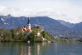
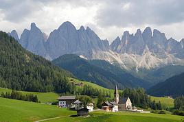
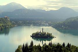
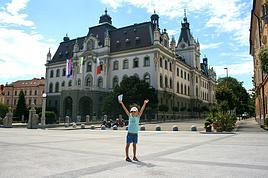
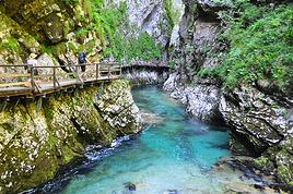
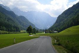
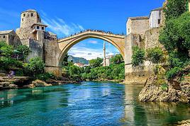
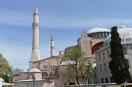
We're planning to cycle through Slovenia on touring bikes from July 14th to August 14th. We're used to camping, but I get the feeling there are large areas without campsites. Is wild camping allowed? If not, is it easy to stay with locals?
Could you tell me about the must-see spots in Slovenia? I'm thinking of finishing in Istria, at a seaside campsite to relax and enjoy the sea. Is it pretty quiet there?
Thanks so much,
Mireille.
Heinz Stucke has passed away.
He never stopped traveling the world since 1962.
So sad.
https://www.facebook.com/heinzstucke
https://www.facebook.com/heinzstucke
Hi there, I’m struggling to get back into hiking and I’m considering tackling the GR5 from Lake Geneva to the Mediterranean shores in August-September.
Since I can’t plan daily distances in advance, I’ll be bringing gear to bivouac.
I’m not familiar with this route and wanted to get an idea of water resupply options before setting off: are sources and streams still flowing easily in late summer on this GR, or should I prepare for long dry stretches? 😐
Since I can’t plan daily distances in advance, I’ll be bringing gear to bivouac.
I’m not familiar with this route and wanted to get an idea of water resupply options before setting off: are sources and streams still flowing easily in late summer on this GR, or should I prepare for long dry stretches? 😐
Hi there,
We’re heading to three islands in March (Paros, Milos, and Sifnos). Given their small size and lack of major elevation, we’d love to explore them by bike. However, I can’t find any bike rental shops on any of these islands. Has anyone done this before and have any recommendations or addresses?
Thanks so much in advance!
Hi everyone,
We’re planning a trip to Cambodia from November 30 to December 21, 2025.
We haven’t decided yet whether we’ll land in Phnom Penh or Siem Reap.
We’re thinking of covering between 800 and 1,000 km by bike, but we’d rather not bring our trusty rides all that way.
Has anyone here already tried buying bikes locally? Do you know if it’s easy to pick one up once we’re there?
We’d love to hear about your experiences and any tips you might have.
Thanks so much, everyone!
Hi,
I’ve browsed the forum but can’t find an answer to my question: Which brand offers bikes suitable for bike touring for an 11-year-old / 140 cm tall? The D4 range is really limited... We’re looking at covering about 50/60 km max per day.
Thanks in advance for your suggestions!
I’ve browsed the forum but can’t find an answer to my question: Which brand offers bikes suitable for bike touring for an 11-year-old / 140 cm tall? The D4 range is really limited... We’re looking at covering about 50/60 km max per day.
Thanks in advance for your suggestions!
Hi everyone,
We’re leaving in 9 days for a two-week trip to Madeira, mainly to hike.
From my research, I’ve found that since last year, access to most trails—and systematically for the most popular ones—is now paid. You have to pay an access fee of 4.50 € per person per classified hike in 2026, and even 10.50 € for the most iconic hike: Pico Arieiro to Pico Ruivo. When paying, you also have to choose a day and a 30-minute time slot for your start time. Of course, this reservation is neither changeable nor refundable, even if the weather that day is terrible.
Personally, given the massive influx of tourists to the island in recent years, I don’t mind paying a fee to help maintain the trails. Similarly, setting a limit on the number of people who can hike them per day is certainly preferable to preserve this priceless heritage.
However, what’s much less fair is that in reality, most of the available spots are reserved: 1/ for Madeira residents (which is normal); 2/ for "economic operators" (meaning local tour operators). For example, if you’re a non-resident (independent tourist), no booking is possible for the Pico Arieiro hike for an early morning start before September! So, unfortunately, we’ll have to skip this hike. It’s the same issue for Ponta de São Lourenço, the 25 Fontes, Pico Ruivo... in short, all the most popular hikes. Oh well, we’ll skip those too!
So my question is: which hikes do you recommend where we won’t face the huge crowds that the others get? And where we can book the day before for the next day, taking the weather into account?
Finally, a quick accommodation question: we’ve booked the first week in Funchal, but I haven’t decided yet for the second week. Do you have any advice on where to stay in the south or north, preferably avoiding overly concrete-heavy and touristy spots?
Thanks in advance for your tips! 🙂
Pascal
We’re leaving in 9 days for a two-week trip to Madeira, mainly to hike.
From my research, I’ve found that since last year, access to most trails—and systematically for the most popular ones—is now paid. You have to pay an access fee of 4.50 € per person per classified hike in 2026, and even 10.50 € for the most iconic hike: Pico Arieiro to Pico Ruivo. When paying, you also have to choose a day and a 30-minute time slot for your start time. Of course, this reservation is neither changeable nor refundable, even if the weather that day is terrible.
Personally, given the massive influx of tourists to the island in recent years, I don’t mind paying a fee to help maintain the trails. Similarly, setting a limit on the number of people who can hike them per day is certainly preferable to preserve this priceless heritage.
However, what’s much less fair is that in reality, most of the available spots are reserved: 1/ for Madeira residents (which is normal); 2/ for "economic operators" (meaning local tour operators). For example, if you’re a non-resident (independent tourist), no booking is possible for the Pico Arieiro hike for an early morning start before September! So, unfortunately, we’ll have to skip this hike. It’s the same issue for Ponta de São Lourenço, the 25 Fontes, Pico Ruivo... in short, all the most popular hikes. Oh well, we’ll skip those too!
So my question is: which hikes do you recommend where we won’t face the huge crowds that the others get? And where we can book the day before for the next day, taking the weather into account?
Finally, a quick accommodation question: we’ve booked the first week in Funchal, but I haven’t decided yet for the second week. Do you have any advice on where to stay in the south or north, preferably avoiding overly concrete-heavy and touristy spots?
Thanks in advance for your tips! 🙂
Pascal
Hi there, I’m planning to stay in Mae Hong Son for 4 days and Pai for 3 or 4 days to explore both towns and their surroundings. I’m not renting a car or scooter—I like to travel at a relaxed pace...
I’d love to know if it’s possible to do quite a few walks on foot from both towns and if it’s easy to find a tuk-tuk for the day to go a bit further.
I’ve heard that biking is really only for brave cyclists, which definitely isn’t me!
Thanks for your tips
I’d love to know if it’s possible to do quite a few walks on foot from both towns and if it’s easy to find a tuk-tuk for the day to go a bit further.
I’ve heard that biking is really only for brave cyclists, which definitely isn’t me!
Thanks for your tips
Hi there,
We’re a family of bike-travelers. Our long journey came to a halt in March 2020 in Ho Chi Minh City due to Covid. We’d been on the road for 8 months—2 in Thailand, 1 in Cambodia, and 1 in Vietnam (from the Mekong Delta up to Ho Chi Minh, where we got stopped). We’re heading back to Vietnam in July-August for 5 weeks to finish what we couldn’t in 2020 (introducing my kids to the country of my roots). We’d originally planned to backpack, figuring it’d be tough to cover the country by bike in such a short time... But the urge to pedal is strong for both parents and kids alike.
We’re thinking of keeping 10 days to explore the North by backpack (since the elevation changes are steep) and saving 3 solid weeks for biking—but we’re not sure where (ideally with minimal elevation gain). We’d love to return to Tam Coc (we visited in 2009 without the kids, thanks to Larsay’s great tips—still so grateful for all the valuable advice!). Logistically, we shipped our bikes 5 years ago, but that seems less doable now. We’re considering either renting (though 5 bikes for 3 weeks would get pricey fast) or buying locally to resell or donate afterward.
Is biking in August unrealistic? Thanks in advance for your insights! !
We’re a family of bike-travelers. Our long journey came to a halt in March 2020 in Ho Chi Minh City due to Covid. We’d been on the road for 8 months—2 in Thailand, 1 in Cambodia, and 1 in Vietnam (from the Mekong Delta up to Ho Chi Minh, where we got stopped). We’re heading back to Vietnam in July-August for 5 weeks to finish what we couldn’t in 2020 (introducing my kids to the country of my roots). We’d originally planned to backpack, figuring it’d be tough to cover the country by bike in such a short time... But the urge to pedal is strong for both parents and kids alike.
We’re thinking of keeping 10 days to explore the North by backpack (since the elevation changes are steep) and saving 3 solid weeks for biking—but we’re not sure where (ideally with minimal elevation gain). We’d love to return to Tam Coc (we visited in 2009 without the kids, thanks to Larsay’s great tips—still so grateful for all the valuable advice!). Logistically, we shipped our bikes 5 years ago, but that seems less doable now. We’re considering either renting (though 5 bikes for 3 weeks would get pricey fast) or buying locally to resell or donate afterward.
Is biking in August unrealistic? Thanks in advance for your insights! !
Hi there,
We’re flying from Montreal to Lyon this August to go hiking in the French Alps. We’ve rented a car and will be staying at campgrounds. We’re planning to do day hikes and want to stay a few days in one spot, do a few hikes, then move on to our next camping spot. Could you share your favorite spots or any recommendations for places to spend a few days with great hikes?
A few details: We arrive in early August and leave in early September. We’re looking for day hikes (or shorter), moderate difficulty, with a cumulative elevation gain of no more than 1000m, and of course, beautiful scenery! We’d prefer not to drive too much—maybe it’s best not to head too far south and deal with unnecessary heat? Along the same lines, if you know of any great campgrounds where we can start our hike directly without needing the car, we’d love to hear your suggestions!
Thanks! :-)
A few details: We arrive in early August and leave in early September. We’re looking for day hikes (or shorter), moderate difficulty, with a cumulative elevation gain of no more than 1000m, and of course, beautiful scenery! We’d prefer not to drive too much—maybe it’s best not to head too far south and deal with unnecessary heat? Along the same lines, if you know of any great campgrounds where we can start our hike directly without needing the car, we’d love to hear your suggestions!
Thanks! :-)
Hi there!
I’m heading out in August for a two-day trek in the Vale do Pati. Do I need proper hiking boots, or will trail-running shoes do the job?
Thanks in advance for your feedback!
😊😃
Hi there,
I’m traveling to Denmark this July with my three boys, aged 12, 14, and 17.
I’d like to plan a little cycling trip and I’m thinking of doing the Copenhagen–Malmö route via Helsingborg.
The idea is to take our time and stop along the way based on points of interest or for a swim if the weather allows.
I have a few questions:
- How many days should we plan for? 2, 3, or 4?
- What are the recommended stopover towns?
- What are the points of interest along the way?
- Do we need to take a ferry for the Helsingør–Helsingborg stretch? Should we book in advance?
If anyone has great tips for accommodation along the route, I’d love to hear them!
Thanks! !
Hello fellow cycle-tourers!
First post on this site for our first big family cycling adventure with our two teens (12 and 16 years old) over 2 months. We're preparing to leave in June/July from Erdeven by bike, then take the train from Auray to Paris, followed by a FlixBus from Paris to Copenhagen with our 4 bikes. After that, we're looking to refine our route: Should we go to Sweden via Helsingborg and then head up to Stockholm along the west or east coast? Maybe passing through the Gotland islands, then via the Åland Islands, why not Turku? Then off to Estonia to Tallinn, ride a bit along the coast, and return by bus if we can find one that takes 4 bikes. :))
Could you share any tips on routes in Sweden: west coast or east coast to prioritize in the south? We’ve heard it’s a shame not to go up to Norway, but we’re worried about the elevation and don’t see how to make a loop work in our 2 months / 1500 km. Any ideas? And the southern Finnish coast: should we go all the way to Helsinki or not? Maybe at the expense of Estonia?
In short, we know choosing means giving something up, but if we can do it with advice from fellow cyclists, that would be amazing! Thanks in advance for your tips! Anne-Sophie and the whole Breton family: David, Axel, and Maude
Could you share any tips on routes in Sweden: west coast or east coast to prioritize in the south? We’ve heard it’s a shame not to go up to Norway, but we’re worried about the elevation and don’t see how to make a loop work in our 2 months / 1500 km. Any ideas? And the southern Finnish coast: should we go all the way to Helsinki or not? Maybe at the expense of Estonia?
In short, we know choosing means giving something up, but if we can do it with advice from fellow cyclists, that would be amazing! Thanks in advance for your tips! Anne-Sophie and the whole Breton family: David, Axel, and Maude
I wanted to share a really beautiful trip we took at the end of October (just the three of us, with my 14-year-old daughter) in southern Tunisia. In particular, we spent four days trekking in the desert starting from Douz, moving from place to place (camels, tents). An unforgettable adventure! The magic of the desert, the sand, the dunes, the changing colors, the sunrises and sunsets. So exotic and relaxing, and it’s less than 3 hours from Paris. Our guide is a camel driver friend who had already taken us twice about twenty years ago. I’d be happy to chat with anyone tempted by this adventure! And if you’d like, I can share our guide’s contact details
Hello,
In mid-November, we’ll be in Mindelo and Santo Antão.
We’ve booked transportation with Kapverden Tours.
One trip is from Porto Novo to Ponta do Sol, including the hike from Corda to Coculi.
What’s the trail like?
Then we’ll be staying in Ponta do Sol,
Here’s what we’re planning: A hike to Fontainhas—what’s the best direction, considering we’re not great with climbs? No problem with flat terrain or descents. Take an aluguer to Ribeira Grande and continue along the coastal road.
With the agency: An excursion to Cruzinha with a short walk. Return to Porto Novo via the path from Cova to… I’m not sure where yet, to pick up the car for Porto Novo, since we’ll be taking the ferry that evening. We’ll have a guide for this hike.
We’d love to spend a day in Tarrafal, but getting back requires a boat or taxi, and it’s really expensive!
We’re a couple, 78 and 76 years old. What do you think of this itinerary?
Here’s what we’re planning: A hike to Fontainhas—what’s the best direction, considering we’re not great with climbs? No problem with flat terrain or descents. Take an aluguer to Ribeira Grande and continue along the coastal road.
With the agency: An excursion to Cruzinha with a short walk. Return to Porto Novo via the path from Cova to… I’m not sure where yet, to pick up the car for Porto Novo, since we’ll be taking the ferry that evening. We’ll have a guide for this hike.
We’d love to spend a day in Tarrafal, but getting back requires a boat or taxi, and it’s really expensive!
We’re a couple, 78 and 76 years old. What do you think of this itinerary?
🇷🇼 Cycling in Rwanda: 4 episodes, an off-the-beaten-path adventure
After 3 weeks and nearly 1,200 km by bike across Rwanda, I made 4 videos to share this adventure in a different way: the landscapes, the encounters, the villages… but above all, all those incredible scenes of everyday life.
The 4 episodes are available here:
👉 https://www.youtube.com/playlist?list=PLGnfbxjccWAg
The 4th episode focuses on rural Rwandan life: simple, authentic, and sometimes surprising scenes that you only truly discover when you take the time to travel by bike.
If you have a few minutes, let yourself be transported to Rwanda…
I'm currently exploring how to create a travel itinerary using AI, specifically ChatGPT.
Question: Bike route from Bordeaux to Paris.
Rough response:
A bike route between Bordeaux and Paris is an incredible adventure, typically around 600 to 650 km depending on the chosen path. Here’s an example of an itinerary with key points:Main Option: La Scandibérique (EuroVelo 3) La Scandibérique is the French section of EuroVelo 3, connecting Bordeaux to Paris through stunning landscapes. This route is well-marked and takes you through small roads and greenways.Main Stages
Bordeaux → Libourne (about 40 km)
Follow the Garonne River, cross the vineyards of Entre-deux-Mers, and reach Libourne, a charming wine town. Greenways available.
Libourne → Périgueux (about 100 km)
Cross the Dordogne with stops in villages like Montpon-Ménestérol. Mix of quiet small roads and trails.
Périgueux → Châteauroux (about 160 km, in several stages)
Through the Parc Naturel Régional de la Brenne. This stage is longer but rich in nature and heritage.
Châteauroux → Orléans (about 110 km)
Reach the banks of the Loire to enjoy the famous Loire à Vélo, a beautiful section with châteaux.
Orléans → Paris (about 140 km)
Pass through the Forêt de Fontainebleau before joining the bike paths along the Seine all the way to Paris.
Question: Bike route from Bordeaux to Paris.
Rough response:
A bike route between Bordeaux and Paris is an incredible adventure, typically around 600 to 650 km depending on the chosen path. Here’s an example of an itinerary with key points:Main Option: La Scandibérique (EuroVelo 3) La Scandibérique is the French section of EuroVelo 3, connecting Bordeaux to Paris through stunning landscapes. This route is well-marked and takes you through small roads and greenways.Main Stages
Bordeaux → Libourne (about 40 km)
Follow the Garonne River, cross the vineyards of Entre-deux-Mers, and reach Libourne, a charming wine town. Greenways available.
Libourne → Périgueux (about 100 km)
Cross the Dordogne with stops in villages like Montpon-Ménestérol. Mix of quiet small roads and trails.
Périgueux → Châteauroux (about 160 km, in several stages)
Through the Parc Naturel Régional de la Brenne. This stage is longer but rich in nature and heritage.
Châteauroux → Orléans (about 110 km)
Reach the banks of the Loire to enjoy the famous Loire à Vélo, a beautiful section with châteaux.
Orléans → Paris (about 140 km)
Pass through the Forêt de Fontainebleau before joining the bike paths along the Seine all the way to Paris.
Hi there,
I’ve got my flight ticket sorted—departing in mid-November and returning in mid-March. I’ll arrive in Santiago and leave from Buenos Aires. I’ve already been to southern Argentina, specifically Torres del Paine National Park, and I’d love to go back to do the full W trek (I only did the shorter version last time). I also want to do some hiking and maybe even tackle a summit. I climb and occasionally do some mountaineering, so I’ll definitely be going with a guide.
I plan to start around Temuco in Chile, with the idea of heading toward the lakes, then taking the Carretera Austral. I’m not sure if I’ll go all the way to Ushuaia—it’s supposed to not be *that* worth it, except for the bragging rights of saying you’ve been to the end of the world.
I saw there are lakes in Argentina too.
I don’t have a precise itinerary, but what I’d love is, once I reach the southernmost point of my trip, to take a mini-cruise to see some wildlife. Any tips for that?
What kind of sleeping bag did you take? Is a 0°C (32°F) one enough? And one last question: white gas stove or can I get by with my gas stove?
Nath
I’ve got my flight ticket sorted—departing in mid-November and returning in mid-March. I’ll arrive in Santiago and leave from Buenos Aires. I’ve already been to southern Argentina, specifically Torres del Paine National Park, and I’d love to go back to do the full W trek (I only did the shorter version last time). I also want to do some hiking and maybe even tackle a summit. I climb and occasionally do some mountaineering, so I’ll definitely be going with a guide.
I plan to start around Temuco in Chile, with the idea of heading toward the lakes, then taking the Carretera Austral. I’m not sure if I’ll go all the way to Ushuaia—it’s supposed to not be *that* worth it, except for the bragging rights of saying you’ve been to the end of the world.
I saw there are lakes in Argentina too.
I don’t have a precise itinerary, but what I’d love is, once I reach the southernmost point of my trip, to take a mini-cruise to see some wildlife. Any tips for that?
What kind of sleeping bag did you take? Is a 0°C (32°F) one enough? And one last question: white gas stove or can I get by with my gas stove?
Nath
Hi,
I’m planning the Switzerland-Paris hike for 2026. If any of you know a route where I can stay with locals or in other lodging (no camping), I’d really appreciate your tips.
Thanks!
M Brunner
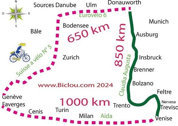
France, Switzerland, Germany, Austria via Claudia Augusta and Italy via the Padana (AIDA) Alta Italia...
http://cbandiera.free.fr/recits/2025-via-augusta/
2024 already done, 2025 in sight
About 2,460 km with the Alps to cross, of course.
Faverges, Annecy, Geneva, Yverdon, Bienne, Bodensee, Danube sources, Ulm, Donauwörth, Augsburg, via Claudia Augusta, Innsbruck, Bolzano, Trento, Nervesa, Treviso, Mestre, Venice; Via AIDA (Alta Italia da attraversare / Padana) Padova, Vicenza, Verona, Brescia, Milan, Novara, Vercelli, Chivasso, Turin, Susa, Mont Cenis Pass, Maurienne, Albertville, Faverges. A fantasy of Glaude’s for n+1 years For 2025? The story is already formatted
To be seen
About 2,460 km with the Alps to cross, of course.
Faverges, Annecy, Geneva, Yverdon, Bienne, Bodensee, Danube sources, Ulm, Donauwörth, Augsburg, via Claudia Augusta, Innsbruck, Bolzano, Trento, Nervesa, Treviso, Mestre, Venice; Via AIDA (Alta Italia da attraversare / Padana) Padova, Vicenza, Verona, Brescia, Milan, Novara, Vercelli, Chivasso, Turin, Susa, Mont Cenis Pass, Maurienne, Albertville, Faverges. A fantasy of Glaude’s for n+1 years For 2025? The story is already formatted
To be seen
Hi there,
I’ve been road cycling for several years, and I’m about to switch to gravel in the next few days—I’m waiting for my bike, which should arrive this week.
I’m planning a bikepacking trip in a few weeks along the Véloroute V81, also known as the Vélosud, from Biarritz to Le Barcarès.
Has anyone here already done this route? Any info is welcome, whether it’s about the route itself, gear, or accommodation. I’ll prioritize staying with locals as much as possible. On that note, I just signed up for the brand-new site *Guidon et Couette* ((www.guidon-et-couette.fr)), which offers free accommodation between cyclists across the country, but there’s almost no one listed along my route!
Thanks in advance.
Laurent.
Hi there,
We’re spending a month in northern Vietnam this coming November and we’d love to do some day hikes around the village of Mu Cang Chai to see the famous spiral terraced rice fields. We’ll most likely be staying in Mu Cang Chai itself and we don’t have a car.
It’s really tough to find a route online. Any tips would be great.
Thanks in advance.
Hi fellow bike-packers,
so I’m heading out solo by bike this spring, like I do every year—around 1,500 to 2,000 km in total.
This time I want to explore the south of France.
I’ll start by meeting up with a buddy in Ariège, and after that the road’s wide open toward the east, aiming for Drôme.
If anyone has route ideas—especially quiet backroads, places I can wild-camp pretty much anywhere, and climbs that aren’t too steep—I’m all ears!
Thanks, and see you around here or on the road.
Take care.
Hi there,
We're thinking of cycling from Lisbon to Vila Real de Santo António in March.
Staying at campsites along the way.
I have two logistics questions:
1) Where to leave the van in Lisbon? Would it be okay to leave it a bit outside Lisbon if needed?
2) Can we take the train back from Vila Real de Santo António to Lisbon with our bikes?
Thanks for any insights!
Momo
Good evening,
I’m planning a solo bike road trip along the EuroVelo 6, starting from Orléans all the way to Budapest, beginning May 1st, 2026!
Question: Have any of you used the Warmshowers site, and if so, I’d love to hear your thoughts on using this app—whether responses to hosting requests are generally satisfying, especially for the different countries I’ll be crossing!
Thanks in advance for your tips!
Philippe
Hi everyone,
I’m heading to Chile this coming November and I’d love to spend a few days cycling from Santiago (Chile) to Mendoza (Argentina).
Has anyone done this route before? If so, do you have any tips (stages, gear, accommodation spots, etc.)?
Also, to avoid carrying too much stuff, I’d like to rent a bike in Santiago. Any recommendations for a good rental shop?
Thanks so much in advance for your help :)
Clément
I’m heading to Chile this coming November and I’d love to spend a few days cycling from Santiago (Chile) to Mendoza (Argentina).
Has anyone done this route before? If so, do you have any tips (stages, gear, accommodation spots, etc.)?
Also, to avoid carrying too much stuff, I’d like to rent a bike in Santiago. Any recommendations for a good rental shop?
Thanks so much in advance for your help :)
Clément
hi,
I'm planning a recumbent bike trip from the Pyrenees to Greece. On the EuroVelo 8 route, it doesn't specify the path through the Alps.
Are there any experienced cyclists here who can tell me where they go to avoid climbing too high?
Also, is there another traveler/bike forum better suited for broadening the responses?
thanks
Hi there,
This August, I hiked the Vosges section (Vosges massif) of the GR5 (Lauterbourg-Wissembourg-gr53-gr5-Belfort) using the TopoGuide "Traversée du Massif des Vosges" (ref 502, April 2024 edition). My experience was partly ruined by a few things I feel I should share here to help others avoid the same pitfalls—or at least disappointments.
Having used "TopoGuide" books before, I’d always trusted them for organizing treks lasting several weeks, or even months.
Beyond the satisfactory mapping (reproductions of IGN 1:25,000 maps), these guides include route descriptions that are usually enough to find your way. On that point, I have no serious criticism of the Vosges crossing guide.
In addition to the route details, the guide provides "average" time estimates for traveling from point A to point B—useful info for gauging effort and planning likely stages. However, I eventually realized I couldn’t rely on these time estimates. I’d assumed they were calculated by the FFRP, considering that 100m of positive elevation gain roughly equals 1km on flat terrain, with an average walking speed of 4km/h. So, I’d recommend anyone using this guide to recalculate all the time estimates to avoid nasty surprises on tight stages. 🤪
Another key feature of the guide, in my opinion, is its info on accommodation options—especially budget-friendly ones suited for long-distance hikers on a tight budget. A section called "préparation des étapes" includes a table with a column meant to highlight "refuges" and "gîtes d'étapes." That column had me feeling optimistic: these budget accommodations were listed as plentiful along the route. After all, we were in the territory of the famous Club Vosgien—it made sense there’d be plenty of hiker-friendly lodging options. The reality on the ground was quite different. The TopoGuide wasn’t really to blame here, except that a serious warning wouldn’t have hurt. First, regarding the "refuges," most were run by associations. With rare exceptions, the volunteers only opened them on weekends. You can’t really blame people for not volunteering on weekdays, but it makes things tricky when the info about weekend-only openings often turns out to be wrong. As for the "gîtes d'étape," I was mostly disappointed when I was told that a place was booked for weeks: the vast majority of what was listed as a "gîte d'étape" turned out to be "gîtes ruraux." The advice here? If you don’t want to—or can’t—camp, double-check all the accommodation details before you set off. It’s time-consuming and tedious, but if you can, camping is still the best option. 😐 On a brighter note, during the first part of my trip, I came across several cabins that offered alternatives to camping. 🙂
P.S.: Even the youth hostel in Saverne was closed in the middle of August... 😕
Having used "TopoGuide" books before, I’d always trusted them for organizing treks lasting several weeks, or even months.
Beyond the satisfactory mapping (reproductions of IGN 1:25,000 maps), these guides include route descriptions that are usually enough to find your way. On that point, I have no serious criticism of the Vosges crossing guide.
In addition to the route details, the guide provides "average" time estimates for traveling from point A to point B—useful info for gauging effort and planning likely stages. However, I eventually realized I couldn’t rely on these time estimates. I’d assumed they were calculated by the FFRP, considering that 100m of positive elevation gain roughly equals 1km on flat terrain, with an average walking speed of 4km/h. So, I’d recommend anyone using this guide to recalculate all the time estimates to avoid nasty surprises on tight stages. 🤪
Another key feature of the guide, in my opinion, is its info on accommodation options—especially budget-friendly ones suited for long-distance hikers on a tight budget. A section called "préparation des étapes" includes a table with a column meant to highlight "refuges" and "gîtes d'étapes." That column had me feeling optimistic: these budget accommodations were listed as plentiful along the route. After all, we were in the territory of the famous Club Vosgien—it made sense there’d be plenty of hiker-friendly lodging options. The reality on the ground was quite different. The TopoGuide wasn’t really to blame here, except that a serious warning wouldn’t have hurt. First, regarding the "refuges," most were run by associations. With rare exceptions, the volunteers only opened them on weekends. You can’t really blame people for not volunteering on weekdays, but it makes things tricky when the info about weekend-only openings often turns out to be wrong. As for the "gîtes d'étape," I was mostly disappointed when I was told that a place was booked for weeks: the vast majority of what was listed as a "gîte d'étape" turned out to be "gîtes ruraux." The advice here? If you don’t want to—or can’t—camp, double-check all the accommodation details before you set off. It’s time-consuming and tedious, but if you can, camping is still the best option. 😐 On a brighter note, during the first part of my trip, I came across several cabins that offered alternatives to camping. 🙂
P.S.: Even the youth hostel in Saverne was closed in the middle of August... 😕
Coming soon:
https://www.Biclou.com/parcours/durance/
Starting from Faverges: 900 km over 9 days
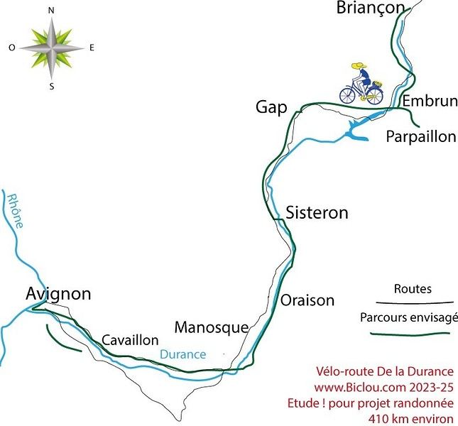
Here’s the detailed Durance route starting from Briançon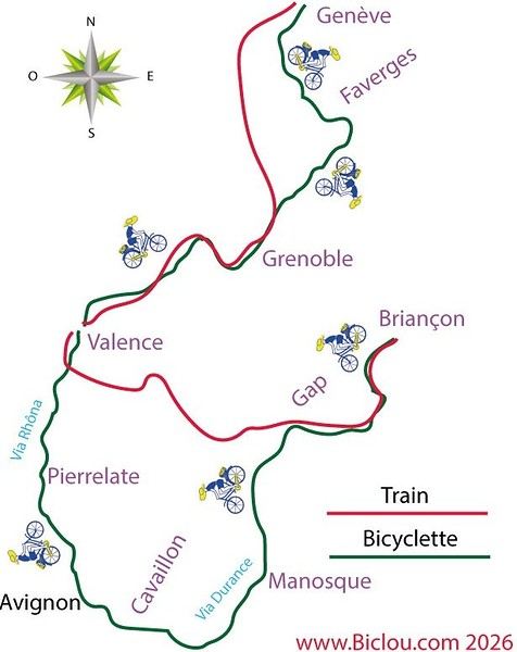
Here’s the detailed Durance route starting from Briançon
Hi there,
I’m looking for route ideas for a 5-day bike trip in the Spanish Basque Country, max 40 km per day and 500 m of elevation gain max per day, preferably on greenways or small roads for August 2025.
I’d also love to hear your thoughts on the weather: does it rain a lot at that time of year?
We cycled along the Finistère coast last summer but managed to dodge the rain 😄.
Thanks in advance for your tips!
I’m looking for route ideas for a 5-day bike trip in the Spanish Basque Country, max 40 km per day and 500 m of elevation gain max per day, preferably on greenways or small roads for August 2025.
I’d also love to hear your thoughts on the weather: does it rain a lot at that time of year?
We cycled along the Finistère coast last summer but managed to dodge the rain 😄.
Thanks in advance for your tips!