Discussions started by Ellememe23
6 results on this page.
More options
Many results are in French, the community’s main language. English translations are added over time.
Search results
Nepal Feedback
NAMASTE NEPAL! PRACTICAL INFO AND EXPERIENCE FEEDBACK
Stay from March 25 to April 16, 2025
· Flight tickets Air India (via Delhi) (via Skyscanner) = 1130 € per person · Planned budget (and respected without too many restrictions and while buying a few small gifts) = 2000 € for the stay for two. Buses, taxis, and entrance fees to various sites represent a budget to consider. Meals are cheap. Drinks like beer/Coke, however, are not cheap and cost the equivalent of a meal. · Exchange rate of the rupee during our stay = 0.0064 € (the exchange rate is almost identical everywhere, including at the airport). · At the airport, purchase of two SIM cards (phone) = 1000 NPR x 2 for 28 days. · Kathmandu: we had booked the hotel upon arrival: Kathmandu Boutique Hotel (+977 015 357 446 – email: booking@kathmanduboutiquehotel.com), very well located in a quiet alley off the street, south of Thamel, a 10-minute walk from Durbar Square. A hotel like Nepal knows how to do, where tall people will have to duck. Night + breakfast = 18 € for two. Very warm welcome, great location, excellent value for money. · Bhaktapur: we had also booked a hotel for the end of our stay because the chance of the year 2025 made the Nepali New Year and Bisket Jatra particularly festive in Bhaktapur: Manju Baha Hotel School (+977 976 7234014 – email: manjubahahotel@gmail.com) located in an old monastery. "A social enterprise transforming an old monastery into a charming hotel, offering professional hospitality training to underprivileged Nepali youth." Night + breakfast = 32 € for two. Beautifully decorated room. Very warm welcome. Don’t miss the Changunarayan site (near Bhaktapur), it’s amazing. And if you’re lucky enough to be in Bhaktapur in mid-April for 3 days, there’s the Bisket Jatra festivities (Newari festival), joyful, noisy, fun, and wild… · Pokhara (hotel recommended by the Kathmandu hotel): Hotel Green Tara, Lakeside, 10th street, set back, quiet (Tel. +977 61 462698 – email: greentara_67@hotmail.com) · Trek permit (Lower Mustang, no need for an agency or guide, permits checked at Ghasa and Jomsom) = 2000 NPR per person (2 ID photos) · Bus Kathmandu/Pokhara and return = 2000 NPR per person · Bus Pokhara/Jomsom, 2 one-way tickets = 2800 NPR. · Taxi: negotiation with a driver we recommend, Vicky (+977 984 075 599). You explain what you want, negotiate the price, and he waits for you during the visit. Very charming, we used him several times. For example: departure from our hotel at 10 AM -> Boudhanath/Pashupatinath/Patan return at 5 PM to the hotel = 6500 NPR – Swayambhunath (round trip) = 1200 NPR · Site prices: https://ntb.gov.np/plan-your-trip/before-you-come/heritage-site-entry-fees o Visitor Pass for Kathmandu Durbar Square (for the duration of the stay, show your visa) = 1000 NPR per person (1 ID photo) o Bhaktapur Durbar Square (old town) = 1800 NPR per person o Patan = 1000 NPR per person o Swayambhu Stupa = 200 NPR per person o Boudha Stupa = 200 NPR per person o Pashupatinath Temple = 1000 NPR per person (interesting to take a guide) o Changunarayan Temple (6 km north of Bhaktapur) = 400 NPR per person o Mountain Museum in Pokhara = 750 NPR per person · E-cigarettes: e-cigarettes are banned in India and confiscated whether they’re in carry-on or checked luggage. On the way there, we had kept them in our carry-on, they were confiscated in Delhi. On the way back, learning from our previous experience, we put them in our checked luggage. Someone came to get us to take them out of our bags and confiscate them… You can find e-cigarettes and products in Kathmandu.
* * *
I’m 74 years old. I went to Nepal in 1982, 1983, and the last time in 1986. I wanted to introduce this beautiful and endearing country to my husband, and it was… now or never. So we decided it was now.
I knew the trek starting from Pokhara: Naudanda/Birethanti/Ghorepani/Tatopani/Kalopani. There was no way I was going to do that trek, especially the 1000-meter staircase to reach Ghorepani… You have to stay humble with age.
Back then, the road didn’t exist. I didn’t consider, with the construction of this road (NH48) along the western bank of the Kali Gandaki, doing a trek along a windy and dusty road. Was there an alternative hiking trail on the eastern bank? No one answered my question on VoyageForum, so I did my research online. And I found this site: "Andrées de Ruiter and Prem Rai - Trekking the Annapurna Circuit, including the new NATT trails that avoid the road - A guide to one of the most beautiful trekking regions in Nepal and the world (2011) - NATT = New Annapurna Trekking Trail".
Phew! A solution was emerging. This circuit from 2011 wasn’t fully marked. The idea was to go from Jomsom to Tatopani, so we needed to make sure the path was well-marked all the way, which we did, and the path exists, marked in red and white!
So, with the walking times information, we built our 8-day circuit:
· Jomsom/Thinigaon · Thinigaon/Chimang · Chimang/Saura · Saura/Kokhetanti · Rest day or, if in good shape: loop to Sekong Lake · Kokhetanti/Jhipra Deurali · Jhipra Deurali/Kopchepani · Kopchepani/Tatopani
It’s a senior trek, after all. So the walking times noted on the sites indicated 3 hours or even 4 hours for the two longest stages. That pace suited us fine.
On March 29, we left Kathmandu (1400m), after visiting the must-see sites, by bus to Pokhara: 200 km and 8.5 hours on a chaotic road under construction. I had a memory of Pokhara where it was the first city where you could see the Himalayan range, especially Machhapuchhare. But the pollution is such, the dust raised by traffic and construction, that no horizon is visible except the first hills around Pokhara.
We stayed 24 hours in Pokhara (820m), and on March 31, we left our luggage at the hotel and set off with our lightest backpacks: change of clothes, toiletries, first aid kit, anti-chafing cream, water bottle, sleeping bag liner, and light shoes for the stages.
We took the bus to Jomsom: 160 km/7.5 hours including stops for bathroom breaks, tea, and lunch. The road is nothing but a chaos of potholes, landslides, construction, dust, rebuilding, and mudslides. In Ghasa, the bus stops, and we’re told we’re at a checkpoint and that the two foreigners in the bus, my husband and I, need to have our permits checked, which takes a few minutes. The driving is rock-and-roll, surprising, and courteous. The drivers have their codes, and on these improbable roads, they’re virtuosos.
We could have chosen the plane, but several reasons dissuaded us: if there’s too much wind, the planes don’t take off; personally, I wasn’t reassured about landing in Jomsom, and this transport has a cost.
We arrived around 2 PM in Jomsom (2720m), and despite the early wake-up, the nearly 8 hours on the bus, and the altitude, we decided to head straight to Thinigaon (2840m). At the Jomsom checkpoint, they told us it was a 30-minute walk. Great! Except we took an hour and a half on an uphill road, bent over to fight a strong wind. But the Himalayan range is there! The Dhaulagiri, the Nilgiri, the Annapurnas as a reward.
In Thinigaon, we found a room at the "Nilgiri View Hotel" run by a didi (big sister in Nepali). From the lodge’s roof, she proudly showed us the different peaks surrounding the village and told us, worried, that it hadn’t snowed here for 3 years. She said there are very few tourists, that the season is rather in September/October/November. It seems there’s not a soul in this village, yet mules pass through the narrow street paved with large flat stones, their bells ringing. We dine at 6 PM and go to bed… Room = 1200 NPR and dinner, breakfast, and drinks = 2560 NPR.
On April 1, we set off at 9 AM, not for Chimang as planned but for Marpha! The didi from the Thinigaon lodge had said it was a 3-hour walk. The first part of this stage is attractive, the mountains are magnificent and imposing, the landscape is superb, there’s no one around, a feeling of being "alone in the world." We follow Dhumbra Tal, this small green lake. The path is a rocky track that climbs steeply. Then, around a hill, we start the big descent that joins the Kali Gandaki. We face the wind head-on, and the violent gusts take our breath away, throw us off balance, and envelop us in dust. We see the road on the other side of the Kali Gandaki. We arrive in the village of Chhairo at 2 PM, completely exhausted and with blistered feet, after 5 hours of walking instead of the planned 3.5 hours.
We’re welcomed by the village nurse, who tells us there’s a lodge in the village. Chhairo is a Tibetan village, a 20-minute walk from Marpha (according to the locals, multiply by 2 or even 3 for us…). We’re going to revise our trek plan and, first of all, spend the night in Chhairo.
The lodge is quite pleasant, and Karma, the hostess, is very friendly. She asks about our plans and suggests we stay in Chhairo the next day, from where we can visit Marpha and also Chimang, a 1-hour walk away, in light mode, meaning without backpacks. She invites us to participate in a village ceremony the next evening.
We immediately accept the proposal, as our feet need rest and the welcome is so warm… Dinner and bed!
We reworked our trek plan, which was too ambitious for our untrained bodies and, let’s face it… no longer in our first youth. In the initial plan, we thought there wouldn’t be too much elevation gain following the Kali Gandaki, but checking the map, we realize there might be significant elevation changes between Sauru and Sirkung. So we plan:
· Tomorrow: visit Marpha (2670m) and Chimang (2744m) · April 3: bus from Chhairo (2700m) to Kalopani (2530m) and continue on foot to Ghasa (2010m) · April 4: Ghasa/Pairataplo (1940m) · April 5: Pairatapla/Gadpar (1580m) · April 6: Gadpar/Narchyang (1510m) · April 7: Narchyang/Tatopani (1190m) · April 8: return to Pokhara.
Normally, it’s all downhill…
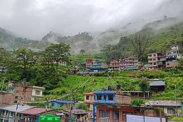
April 2, a rest day then… We set off in the morning to explore Marpha. We have to take a temporary bridge because the suspension bridge is closed due to road construction. We join the road and arrive in Marpha, a village famous for its apple orchards, brandy, cider, and apple juice production. This village is magnificent with its stone houses and monastery clinging to the hillside. The road construction spared it. There are people, but very few Western tourists.
We have lunch in Marpha and go back through Chhairo to take the path to Chimang. We cross a fragrant pine forest and find the rocky path; the landscape is splendid. We walk quietly, passing peaceful buffaloes and cows, and arrive at the foot of a stone staircase… 275 steps (which we counted on the way back) leading us to the village of Chimang. Chimang is an isolated Newari village that seems a bit desolate. Despite the slopes, there are crops on every little bit of land. Thankfully, we changed our initial program because there’s no lodge in this village, contrary to what we saw on a map… We wander through the village, which seems very deserted, have coffee in a house from another world, and then head back to Chhairo.
A rest day? = 5 hours of walking!!
Dinner and village ceremony. From what we understand, this ceremony is in honor of the Dalai Lama. Men, women, and children in traditional costumes gather twice a month; they dance, make, and offer small sweet cakes with Tibetan tea (made from tea, yak butter—often rancid—water, and salt). Surprising for first-timers…
Around 10 PM, we leave the ceremony; tomorrow morning, we need to be on the roadside by 7 AM to catch the bus to Kalopani…
This village of Chhairo is very pleasant and welcoming, no tourists, just two motorcyclists who arrived in the evening, one of whom participated in the ceremony and discreetly poured his Tibetan tea outside.
Lodge: "Norsang Tibetan Guesthouse and Restaurant". Total bill for 2 nights, 2 dinners, 2 breakfasts, and drinks = 8000 NPR.
April 3: bus from Chhairo to Kalopani, about 1.5 hours for the 20 km (200 NPR per person). We descend on the right bank of the Kali Gandaki. We find the red and white markings to resume the trek toward Ghasa. We’re in a fragrant pine forest, the Dhaulagiri on one side and the Annapurnas on the other, magnificent, and the path is pleasant and easy. We get a bit lost in this forest, always looking for the markings. Near Lete, two trekkers pass us, and we meet them again a little further on with two very young children, to whom we give the 2 hard-boiled eggs I didn’t eat this morning. They accepted them without hesitation.
We arrive in a village and ask for directions to Ghasa. The young girls point the way. But we come across a forest being logged, trees cut in all directions. We turn back and ask for confirmation. They confirm… But the two young girls catch up with us and clear the way. We have to step over, go around, and cross the felled trees, with no indication at all. Through this pick-up sticks of felled trees, the girls lead us to the top of a stone staircase, indicating that was the path. It’s the only place where we saw rhododendrons in bloom.
We descend the staircase. At the bottom, to the left, there’s a bridge to go toward Choyo, and to the right, a path to Ghasa. We take the right path and join the road. We should normally find the red and white markings, but we don’t… So we continue on the western bank road of the Kali Gandaki.
A little before the village of Misi, we see fumaroles on the opposite bank that seem to come from the ground. We don’t understand. We stopped to eat in the village of Misi (noodle soup = 600 NPR), but it’s hard to communicate with the elderly people running the guesthouse.
We continued on the road, not finding the marked path parallel to the road. Landslides, both on the left and right banks, seem to have taken over the marked routes. It’s a place where the Kali Gandaki gorge narrows, and on the opposite bank, the mountain smokes more and more, and we now hear the crackling of fire. Across from us, the mountain is burning… Our initial plan had us passing on that burning bank right now…
We arrive in Ghasa at 3:30 PM, a 6.5-hour stage but with a 1-hour stop at noon. We’re at the "Florida Guesthouse and Restaurant." From our room, we see the mountain smoking on the other side of the river, and at night, we see the flames. In this village, posters show Himalayan eagles and vultures that seem to be protected species. Indeed, we saw (and heard) 3 eagles circling today.
April 4 – Today, heading to Pairothapla or Kopchepani depending on our feet, accommodation options, and simply our desires.
No more smoke on the mountain this morning. It’s chilly, 7:45 AM, the sky is clear, just a smell of smoke outside.
Price of the lodge = 1000 NPR for the night + 3580 NPR for meals.
We cross Ghasa, which stretches over more than a kilometer. We have a drink at the last guesthouse in the village, and the didi, when she learns our destination, tells us to be careful because the villages we’re going to aren’t safe. Should we distribute our rupees in different pockets? Nah, we kept going.
At the exit of Ghasa, we find the red and white markings and take the suspension bridge to cross the boiling waters of the Kali Gandaki. The passage is impressive because the river is tumultuous. Lots of climbs and even more descents. We’re back on the eastern bank. It’s hot! On the narrow path, we meet a group of buffaloes. Who has the right of way? We decide to stick as close as possible to the rock wall and move forward calmly. The buffaloes look at us, chewing placidly, with no intention of jumping on us. Phew!
After a 5-hour stage (including stops), we arrive in Pairothapla, with hot feet and firm thighs, and decide we won’t go any further. It’s a good thing because there’s a lodge, the most basic so far, but with a great welcome. We have a meal and a short nap. The buffaloes we met on the way belong to this house. They come to drink at the fountain by the path.
Our host, very pleasant, doesn’t know what to do to please us and is very attentive. He wants to chat. He has two children, a 4-year-old girl and a 7-year-old boy. Where do they go to school? Do they go? He tells us that the fires in the mountain are caused by people, but for what reason? We won’t find out, but it’s illegal. From here, we can still see smoke rising in the distance. The wife is a bit less friendly. Corn kernels dry on a woven straw mat on the ground, and the mom sorts them.
From where we are, we overlook the valley and see the road under construction winding along the mountainside on the other bank.
Dinner on the terrace of the house overlooking the path, windbreaker and fleece on: dal bhat chicken for me and chicken curry for my husband: "organic" products, at least local production. There are small vegetable gardens everywhere with all sorts of vegetables.
April 5 – While we’re having breakfast on the terrace of our lodge, 5 porters, straps on their foreheads, heavily loaded, pass by on the path. A few minutes later, a group of 9 people appears. It must be said that since the beginning of our journey, we’ve met very few hikers. Two backpackers in Chhairo, the two hikers near Lete, two female hikers passed us before Pairothapla, a solo female hiker passed us…
The lodge in Pairothapla is called "Bimala Lodge & Thakali Kitchen" – Price for night + 4 meals + 2 breakfasts = 3000 NPR.
The descent toward the Kali Gandaki involves climbs whose steps we didn’t count. Clearly, the landslides on the mountain cause changes to the official ACAP trek marked in red and white, and the marking updates can’t keep up with the pace of these landslides. It’s almost always by chance that we find the markings. Fortunately, we can follow the power line that guides us somewhat.
Drink stop in Kopchepani, the legs are fine, but the feet don’t like being tightly enclosed. A group of trekkers with porters passes on the path. We met buffaloes that we kindly let pass; the path was wide enough, but it was a staircase going up, and we didn’t want to take any risks.
Across, a view of the magnificent Rupse Waterfall on the other bank of the Kali Gandaki, at the bottom, lots of vehicles and people.
Arrival in Gadpar after crossing a rather unwelcoming small village and cultivated gardens between dry stone walls, each better built than the last.
First lodge spotted, first lodge adopted to answer the call of our feet, and a very warm welcome from the owner. Since we hadn’t eaten at noon, we had Tibetan bread/jam. 6-hour stage including 1 hour of stops. Night + dinner + breakfast + drinks = 5060 NPR
April 6 – Today, heading to Narchyang.
For several days, we’ve seen banana trees with their bunches of fruit and even a prickly pear with large fruits ripening.
This stage is quite peaceful and pleasant. We take a suspension bridge to cross a tributary of the Kali Gandaki. While we’re resting for a moment before crossing the bridge, a couple of porters, a man and a woman, arrive and start across the bridge with their wood load in a basket held by a strap on their forehead, making them bend. We set off too… lighter than them.
On the other side of the bridge… a stone staircase, and it climbs steeply. The porter couple didn’t take this staircase; they went right on the path.
At the top of the staircase, we arrive in Narchyang after a 4-hour stage. A magnificent waterfall overlooks the village. We get lost in this fairly large village looking for a lodge. After wandering around for a while, we ask for directions, and an 84-year-old man takes us through the whole village and accompanies us to a very nice lodge run by a woman.
We chat with our hostess, who asks where we’re from and where we’re going. We explain that we want to reach Tatopani the next day and then return to Pokhara. She tells us there are 4x4s going directly to Pokhara and that it would probably be easier than taking a bus that might be full in Tatopani. After a quick consultation, we decide to return to Pokhara the next day by 4x4. She finds us a 4x4 with 2 seats left, departure at 8 AM – 5 hours on the road and 1500 NPR per person. A charming didi who does everything to be pleasant and helpful.
Narchyang community lodge = night + snacks + dinner + breakfast = 3000 NPR.
There you go, our trek ends tomorrow. Many necessary changes and adaptations to our initial trek, but no regrets, it was superb and a great experience that, for my part, I won’t be able to repeat. Always this encounter with the endearing, welcoming, curious, and very kind Nepali people. It was now or never, and we did it!
* * *
In conclusion, 3 full weeks in Nepal is a duration that allows visiting Kathmandu, Patan, and Bhaktapur, enjoying the various sites, and soaking in the atmosphere and urban Nepali life.
The trek, even revised and corrected, allowed us to get close to the impressive Annapurna and Dhaulagiri peaks. One or two acclimatization days might be necessary to get the body in tune with this magical and extraordinary land.
Stay from March 25 to April 16, 2025
· Flight tickets Air India (via Delhi) (via Skyscanner) = 1130 € per person · Planned budget (and respected without too many restrictions and while buying a few small gifts) = 2000 € for the stay for two. Buses, taxis, and entrance fees to various sites represent a budget to consider. Meals are cheap. Drinks like beer/Coke, however, are not cheap and cost the equivalent of a meal. · Exchange rate of the rupee during our stay = 0.0064 € (the exchange rate is almost identical everywhere, including at the airport). · At the airport, purchase of two SIM cards (phone) = 1000 NPR x 2 for 28 days. · Kathmandu: we had booked the hotel upon arrival: Kathmandu Boutique Hotel (+977 015 357 446 – email: booking@kathmanduboutiquehotel.com), very well located in a quiet alley off the street, south of Thamel, a 10-minute walk from Durbar Square. A hotel like Nepal knows how to do, where tall people will have to duck. Night + breakfast = 18 € for two. Very warm welcome, great location, excellent value for money. · Bhaktapur: we had also booked a hotel for the end of our stay because the chance of the year 2025 made the Nepali New Year and Bisket Jatra particularly festive in Bhaktapur: Manju Baha Hotel School (+977 976 7234014 – email: manjubahahotel@gmail.com) located in an old monastery. "A social enterprise transforming an old monastery into a charming hotel, offering professional hospitality training to underprivileged Nepali youth." Night + breakfast = 32 € for two. Beautifully decorated room. Very warm welcome. Don’t miss the Changunarayan site (near Bhaktapur), it’s amazing. And if you’re lucky enough to be in Bhaktapur in mid-April for 3 days, there’s the Bisket Jatra festivities (Newari festival), joyful, noisy, fun, and wild… · Pokhara (hotel recommended by the Kathmandu hotel): Hotel Green Tara, Lakeside, 10th street, set back, quiet (Tel. +977 61 462698 – email: greentara_67@hotmail.com) · Trek permit (Lower Mustang, no need for an agency or guide, permits checked at Ghasa and Jomsom) = 2000 NPR per person (2 ID photos) · Bus Kathmandu/Pokhara and return = 2000 NPR per person · Bus Pokhara/Jomsom, 2 one-way tickets = 2800 NPR. · Taxi: negotiation with a driver we recommend, Vicky (+977 984 075 599). You explain what you want, negotiate the price, and he waits for you during the visit. Very charming, we used him several times. For example: departure from our hotel at 10 AM -> Boudhanath/Pashupatinath/Patan return at 5 PM to the hotel = 6500 NPR – Swayambhunath (round trip) = 1200 NPR · Site prices: https://ntb.gov.np/plan-your-trip/before-you-come/heritage-site-entry-fees o Visitor Pass for Kathmandu Durbar Square (for the duration of the stay, show your visa) = 1000 NPR per person (1 ID photo) o Bhaktapur Durbar Square (old town) = 1800 NPR per person o Patan = 1000 NPR per person o Swayambhu Stupa = 200 NPR per person o Boudha Stupa = 200 NPR per person o Pashupatinath Temple = 1000 NPR per person (interesting to take a guide) o Changunarayan Temple (6 km north of Bhaktapur) = 400 NPR per person o Mountain Museum in Pokhara = 750 NPR per person · E-cigarettes: e-cigarettes are banned in India and confiscated whether they’re in carry-on or checked luggage. On the way there, we had kept them in our carry-on, they were confiscated in Delhi. On the way back, learning from our previous experience, we put them in our checked luggage. Someone came to get us to take them out of our bags and confiscate them… You can find e-cigarettes and products in Kathmandu.
* * *
I’m 74 years old. I went to Nepal in 1982, 1983, and the last time in 1986. I wanted to introduce this beautiful and endearing country to my husband, and it was… now or never. So we decided it was now.
I knew the trek starting from Pokhara: Naudanda/Birethanti/Ghorepani/Tatopani/Kalopani. There was no way I was going to do that trek, especially the 1000-meter staircase to reach Ghorepani… You have to stay humble with age.
Back then, the road didn’t exist. I didn’t consider, with the construction of this road (NH48) along the western bank of the Kali Gandaki, doing a trek along a windy and dusty road. Was there an alternative hiking trail on the eastern bank? No one answered my question on VoyageForum, so I did my research online. And I found this site: "Andrées de Ruiter and Prem Rai - Trekking the Annapurna Circuit, including the new NATT trails that avoid the road - A guide to one of the most beautiful trekking regions in Nepal and the world (2011) - NATT = New Annapurna Trekking Trail".
Phew! A solution was emerging. This circuit from 2011 wasn’t fully marked. The idea was to go from Jomsom to Tatopani, so we needed to make sure the path was well-marked all the way, which we did, and the path exists, marked in red and white!
So, with the walking times information, we built our 8-day circuit:
· Jomsom/Thinigaon · Thinigaon/Chimang · Chimang/Saura · Saura/Kokhetanti · Rest day or, if in good shape: loop to Sekong Lake · Kokhetanti/Jhipra Deurali · Jhipra Deurali/Kopchepani · Kopchepani/Tatopani
It’s a senior trek, after all. So the walking times noted on the sites indicated 3 hours or even 4 hours for the two longest stages. That pace suited us fine.
On March 29, we left Kathmandu (1400m), after visiting the must-see sites, by bus to Pokhara: 200 km and 8.5 hours on a chaotic road under construction. I had a memory of Pokhara where it was the first city where you could see the Himalayan range, especially Machhapuchhare. But the pollution is such, the dust raised by traffic and construction, that no horizon is visible except the first hills around Pokhara.
We stayed 24 hours in Pokhara (820m), and on March 31, we left our luggage at the hotel and set off with our lightest backpacks: change of clothes, toiletries, first aid kit, anti-chafing cream, water bottle, sleeping bag liner, and light shoes for the stages.
We took the bus to Jomsom: 160 km/7.5 hours including stops for bathroom breaks, tea, and lunch. The road is nothing but a chaos of potholes, landslides, construction, dust, rebuilding, and mudslides. In Ghasa, the bus stops, and we’re told we’re at a checkpoint and that the two foreigners in the bus, my husband and I, need to have our permits checked, which takes a few minutes. The driving is rock-and-roll, surprising, and courteous. The drivers have their codes, and on these improbable roads, they’re virtuosos.
We could have chosen the plane, but several reasons dissuaded us: if there’s too much wind, the planes don’t take off; personally, I wasn’t reassured about landing in Jomsom, and this transport has a cost.
We arrived around 2 PM in Jomsom (2720m), and despite the early wake-up, the nearly 8 hours on the bus, and the altitude, we decided to head straight to Thinigaon (2840m). At the Jomsom checkpoint, they told us it was a 30-minute walk. Great! Except we took an hour and a half on an uphill road, bent over to fight a strong wind. But the Himalayan range is there! The Dhaulagiri, the Nilgiri, the Annapurnas as a reward.
In Thinigaon, we found a room at the "Nilgiri View Hotel" run by a didi (big sister in Nepali). From the lodge’s roof, she proudly showed us the different peaks surrounding the village and told us, worried, that it hadn’t snowed here for 3 years. She said there are very few tourists, that the season is rather in September/October/November. It seems there’s not a soul in this village, yet mules pass through the narrow street paved with large flat stones, their bells ringing. We dine at 6 PM and go to bed… Room = 1200 NPR and dinner, breakfast, and drinks = 2560 NPR.
On April 1, we set off at 9 AM, not for Chimang as planned but for Marpha! The didi from the Thinigaon lodge had said it was a 3-hour walk. The first part of this stage is attractive, the mountains are magnificent and imposing, the landscape is superb, there’s no one around, a feeling of being "alone in the world." We follow Dhumbra Tal, this small green lake. The path is a rocky track that climbs steeply. Then, around a hill, we start the big descent that joins the Kali Gandaki. We face the wind head-on, and the violent gusts take our breath away, throw us off balance, and envelop us in dust. We see the road on the other side of the Kali Gandaki. We arrive in the village of Chhairo at 2 PM, completely exhausted and with blistered feet, after 5 hours of walking instead of the planned 3.5 hours.
We’re welcomed by the village nurse, who tells us there’s a lodge in the village. Chhairo is a Tibetan village, a 20-minute walk from Marpha (according to the locals, multiply by 2 or even 3 for us…). We’re going to revise our trek plan and, first of all, spend the night in Chhairo.
The lodge is quite pleasant, and Karma, the hostess, is very friendly. She asks about our plans and suggests we stay in Chhairo the next day, from where we can visit Marpha and also Chimang, a 1-hour walk away, in light mode, meaning without backpacks. She invites us to participate in a village ceremony the next evening.
We immediately accept the proposal, as our feet need rest and the welcome is so warm… Dinner and bed!
We reworked our trek plan, which was too ambitious for our untrained bodies and, let’s face it… no longer in our first youth. In the initial plan, we thought there wouldn’t be too much elevation gain following the Kali Gandaki, but checking the map, we realize there might be significant elevation changes between Sauru and Sirkung. So we plan:
· Tomorrow: visit Marpha (2670m) and Chimang (2744m) · April 3: bus from Chhairo (2700m) to Kalopani (2530m) and continue on foot to Ghasa (2010m) · April 4: Ghasa/Pairataplo (1940m) · April 5: Pairatapla/Gadpar (1580m) · April 6: Gadpar/Narchyang (1510m) · April 7: Narchyang/Tatopani (1190m) · April 8: return to Pokhara.
Normally, it’s all downhill…
April 2, a rest day then… We set off in the morning to explore Marpha. We have to take a temporary bridge because the suspension bridge is closed due to road construction. We join the road and arrive in Marpha, a village famous for its apple orchards, brandy, cider, and apple juice production. This village is magnificent with its stone houses and monastery clinging to the hillside. The road construction spared it. There are people, but very few Western tourists.
We have lunch in Marpha and go back through Chhairo to take the path to Chimang. We cross a fragrant pine forest and find the rocky path; the landscape is splendid. We walk quietly, passing peaceful buffaloes and cows, and arrive at the foot of a stone staircase… 275 steps (which we counted on the way back) leading us to the village of Chimang. Chimang is an isolated Newari village that seems a bit desolate. Despite the slopes, there are crops on every little bit of land. Thankfully, we changed our initial program because there’s no lodge in this village, contrary to what we saw on a map… We wander through the village, which seems very deserted, have coffee in a house from another world, and then head back to Chhairo.
A rest day? = 5 hours of walking!!
Dinner and village ceremony. From what we understand, this ceremony is in honor of the Dalai Lama. Men, women, and children in traditional costumes gather twice a month; they dance, make, and offer small sweet cakes with Tibetan tea (made from tea, yak butter—often rancid—water, and salt). Surprising for first-timers…
Around 10 PM, we leave the ceremony; tomorrow morning, we need to be on the roadside by 7 AM to catch the bus to Kalopani…
This village of Chhairo is very pleasant and welcoming, no tourists, just two motorcyclists who arrived in the evening, one of whom participated in the ceremony and discreetly poured his Tibetan tea outside.
Lodge: "Norsang Tibetan Guesthouse and Restaurant". Total bill for 2 nights, 2 dinners, 2 breakfasts, and drinks = 8000 NPR.
April 3: bus from Chhairo to Kalopani, about 1.5 hours for the 20 km (200 NPR per person). We descend on the right bank of the Kali Gandaki. We find the red and white markings to resume the trek toward Ghasa. We’re in a fragrant pine forest, the Dhaulagiri on one side and the Annapurnas on the other, magnificent, and the path is pleasant and easy. We get a bit lost in this forest, always looking for the markings. Near Lete, two trekkers pass us, and we meet them again a little further on with two very young children, to whom we give the 2 hard-boiled eggs I didn’t eat this morning. They accepted them without hesitation.
We arrive in a village and ask for directions to Ghasa. The young girls point the way. But we come across a forest being logged, trees cut in all directions. We turn back and ask for confirmation. They confirm… But the two young girls catch up with us and clear the way. We have to step over, go around, and cross the felled trees, with no indication at all. Through this pick-up sticks of felled trees, the girls lead us to the top of a stone staircase, indicating that was the path. It’s the only place where we saw rhododendrons in bloom.
We descend the staircase. At the bottom, to the left, there’s a bridge to go toward Choyo, and to the right, a path to Ghasa. We take the right path and join the road. We should normally find the red and white markings, but we don’t… So we continue on the western bank road of the Kali Gandaki.
A little before the village of Misi, we see fumaroles on the opposite bank that seem to come from the ground. We don’t understand. We stopped to eat in the village of Misi (noodle soup = 600 NPR), but it’s hard to communicate with the elderly people running the guesthouse.
We continued on the road, not finding the marked path parallel to the road. Landslides, both on the left and right banks, seem to have taken over the marked routes. It’s a place where the Kali Gandaki gorge narrows, and on the opposite bank, the mountain smokes more and more, and we now hear the crackling of fire. Across from us, the mountain is burning… Our initial plan had us passing on that burning bank right now…
We arrive in Ghasa at 3:30 PM, a 6.5-hour stage but with a 1-hour stop at noon. We’re at the "Florida Guesthouse and Restaurant." From our room, we see the mountain smoking on the other side of the river, and at night, we see the flames. In this village, posters show Himalayan eagles and vultures that seem to be protected species. Indeed, we saw (and heard) 3 eagles circling today.
April 4 – Today, heading to Pairothapla or Kopchepani depending on our feet, accommodation options, and simply our desires.
No more smoke on the mountain this morning. It’s chilly, 7:45 AM, the sky is clear, just a smell of smoke outside.
Price of the lodge = 1000 NPR for the night + 3580 NPR for meals.
We cross Ghasa, which stretches over more than a kilometer. We have a drink at the last guesthouse in the village, and the didi, when she learns our destination, tells us to be careful because the villages we’re going to aren’t safe. Should we distribute our rupees in different pockets? Nah, we kept going.
At the exit of Ghasa, we find the red and white markings and take the suspension bridge to cross the boiling waters of the Kali Gandaki. The passage is impressive because the river is tumultuous. Lots of climbs and even more descents. We’re back on the eastern bank. It’s hot! On the narrow path, we meet a group of buffaloes. Who has the right of way? We decide to stick as close as possible to the rock wall and move forward calmly. The buffaloes look at us, chewing placidly, with no intention of jumping on us. Phew!
After a 5-hour stage (including stops), we arrive in Pairothapla, with hot feet and firm thighs, and decide we won’t go any further. It’s a good thing because there’s a lodge, the most basic so far, but with a great welcome. We have a meal and a short nap. The buffaloes we met on the way belong to this house. They come to drink at the fountain by the path.
Our host, very pleasant, doesn’t know what to do to please us and is very attentive. He wants to chat. He has two children, a 4-year-old girl and a 7-year-old boy. Where do they go to school? Do they go? He tells us that the fires in the mountain are caused by people, but for what reason? We won’t find out, but it’s illegal. From here, we can still see smoke rising in the distance. The wife is a bit less friendly. Corn kernels dry on a woven straw mat on the ground, and the mom sorts them.
From where we are, we overlook the valley and see the road under construction winding along the mountainside on the other bank.
Dinner on the terrace of the house overlooking the path, windbreaker and fleece on: dal bhat chicken for me and chicken curry for my husband: "organic" products, at least local production. There are small vegetable gardens everywhere with all sorts of vegetables.
April 5 – While we’re having breakfast on the terrace of our lodge, 5 porters, straps on their foreheads, heavily loaded, pass by on the path. A few minutes later, a group of 9 people appears. It must be said that since the beginning of our journey, we’ve met very few hikers. Two backpackers in Chhairo, the two hikers near Lete, two female hikers passed us before Pairothapla, a solo female hiker passed us…
The lodge in Pairothapla is called "Bimala Lodge & Thakali Kitchen" – Price for night + 4 meals + 2 breakfasts = 3000 NPR.
The descent toward the Kali Gandaki involves climbs whose steps we didn’t count. Clearly, the landslides on the mountain cause changes to the official ACAP trek marked in red and white, and the marking updates can’t keep up with the pace of these landslides. It’s almost always by chance that we find the markings. Fortunately, we can follow the power line that guides us somewhat.
Drink stop in Kopchepani, the legs are fine, but the feet don’t like being tightly enclosed. A group of trekkers with porters passes on the path. We met buffaloes that we kindly let pass; the path was wide enough, but it was a staircase going up, and we didn’t want to take any risks.
Across, a view of the magnificent Rupse Waterfall on the other bank of the Kali Gandaki, at the bottom, lots of vehicles and people.
Arrival in Gadpar after crossing a rather unwelcoming small village and cultivated gardens between dry stone walls, each better built than the last.
First lodge spotted, first lodge adopted to answer the call of our feet, and a very warm welcome from the owner. Since we hadn’t eaten at noon, we had Tibetan bread/jam. 6-hour stage including 1 hour of stops. Night + dinner + breakfast + drinks = 5060 NPR
April 6 – Today, heading to Narchyang.
For several days, we’ve seen banana trees with their bunches of fruit and even a prickly pear with large fruits ripening.
This stage is quite peaceful and pleasant. We take a suspension bridge to cross a tributary of the Kali Gandaki. While we’re resting for a moment before crossing the bridge, a couple of porters, a man and a woman, arrive and start across the bridge with their wood load in a basket held by a strap on their forehead, making them bend. We set off too… lighter than them.
On the other side of the bridge… a stone staircase, and it climbs steeply. The porter couple didn’t take this staircase; they went right on the path.
At the top of the staircase, we arrive in Narchyang after a 4-hour stage. A magnificent waterfall overlooks the village. We get lost in this fairly large village looking for a lodge. After wandering around for a while, we ask for directions, and an 84-year-old man takes us through the whole village and accompanies us to a very nice lodge run by a woman.
We chat with our hostess, who asks where we’re from and where we’re going. We explain that we want to reach Tatopani the next day and then return to Pokhara. She tells us there are 4x4s going directly to Pokhara and that it would probably be easier than taking a bus that might be full in Tatopani. After a quick consultation, we decide to return to Pokhara the next day by 4x4. She finds us a 4x4 with 2 seats left, departure at 8 AM – 5 hours on the road and 1500 NPR per person. A charming didi who does everything to be pleasant and helpful.
Narchyang community lodge = night + snacks + dinner + breakfast = 3000 NPR.
There you go, our trek ends tomorrow. Many necessary changes and adaptations to our initial trek, but no regrets, it was superb and a great experience that, for my part, I won’t be able to repeat. Always this encounter with the endearing, welcoming, curious, and very kind Nepali people. It was now or never, and we did it!
* * *
In conclusion, 3 full weeks in Nepal is a duration that allows visiting Kathmandu, Patan, and Bhaktapur, enjoying the various sites, and soaking in the atmosphere and urban Nepali life.
The trek, even revised and corrected, allowed us to get close to the impressive Annapurna and Dhaulagiri peaks. One or two acclimatization days might be necessary to get the body in tune with this magical and extraordinary land.
What's the path from Sekong Lake to Naurikot?
Hi there, we're heading to Nepal in a few weeks and planning a relaxed trek from Jomsom to Tatopani along the left bank of the Kali Gandaki. Starting from Kokhetanti, we'd like to do a day loop to Sekong Lake, then head to Naurikot and return (possibly by road). We’ve found—well, *found* might be a strong word—a path to the lake, but we can’t see any route continuing to Naurikot. Can anyone help us out? Thanks so much! !
Site web du OOR (Oman Off-Road)
Bonjour,
Je vous fais part du site http://askexplorer.com/shop/bestseller/oman-off-road.html qui permet de suivre les routes du OOR sur internet.
Il suffit de cliquer sur "here" de la ligne ci-dessous qui est située sur le site juste au-dessus de la carte, cela déroule toutes les routes de OOR, à vous de sélectionner celles qui vous intéressent !
Do you already own a copy of Explorer’s Oman Off-Road guide? We have implemented some updates, so please navigate to all route starting points here.
Retour d'expérience et infos pratiques Oman décembre 2015/janvier 2016
Bonjour,
Comme annoncé il y a déjà longtemps, voici le compte rendu de notre voyage à Oman. Je reste à votre disposition pour tout renseignement complémentaire que vous souhaiteriez, dans la mesure du possible, évidemment :)
Retour d’expérience et infos pratiques Oman
Du 26 décembre 2015 au 22 janvier 2016. Avant de partir, nous avions réservé : - 4x4 - Hôtel à l’arrivée à Mascate : Al Maha International Hôtel dans le quartier de Ghubrah (30 OMR la nuit pour 2 y/c petit déj) - Chambre d’hôte à Salalah via Airbnb - Hôtel à Sur et à Mascate pour la fin de séjour car nous craignions de rencontrer des difficultés à cause de l’exposition internationale de l’artisanat (pfff nous n’avons pas vu l’expo !!). o A Sur : Sur hôtel (18,5 OMR la nuit pour 2 personnes sans petit déj.), o à Mascate : Naseem hôtel (27 OMR pour 2 personnes + 2 OMR par personne pour petit déj). - Nous avions le oman off road (OOR) 2014. Nous avons vu qu’une nouvelle édition 2015 était vendue : aéroport = 23 OMR ; Nizwa = 19,500 OMR ; Muscat = 23 OMR. - Lonely planet
Commentaires généraux L’accueil des Omanais est très amical. Les routes sont très belles. Très beau temps durant tout le séjour, entre 22 et 30°. Une mini tempête en bord de mer une nuit (nous campions et avons fini la nuit dans la voiture…) Quasiment pas de touristes sauf à Mascate (Mutrah) (bateaux de croisières)
Avons pris la route du désert pour rejoindre Salalah en deux jours (environ 1100km). Une nuit en cours de route au rest-house de Al-Ghaftain, demander Kumar, tél. (00968)99036836 (chambre 25 OMR la double, 2 diners et 2 petits déjeuner : 6.20 OMR). Lieu très sympa au milieu de nulle part, les chambres sont disposées autour d’un patio central.
3 nuits à Salalah. Visite des cultures d’arbres à encens, tombe de Job, paysages magnifiques. Mughsail : trous du souffleur, superbe plage désertique. Balade au-delà de Mughsail : route vertigineuse. Visite du Musée de l’Encens à Salalah.
Nous quittons Salalah pour rejoindre le Nord en plusieurs étapes par la route côtière. Visite de Khor Rori, superbe lieu pour ceux qui aiment les vieilles pierres, belle restauration.
Nous avons fui Duqm, un chantier énorme de construction d’un port qui devrait être le 2e mondial après Singapour.
Magnifique plage désertique de Madrakah qui vaut une nuit de camping et poursuite jusqu’à Filim, nuit en camping en bord de mer.
La route côtière est belle pendant toute une partie en quittant Salalah. La journée suivante de trajet, le paysage n’est pas terrible, monotone, désert de cailloux… Il redevient intéressant après Shana (embarcadère pour l’ile de Madirah où nous ne sommes pas allés) car les dunes de sable font leur apparition.
Nuit en camping sauvage à Wadi Bani Khalid (route OOR n° 24) : superbe endroit : palmeraie, vasques d’eau limpide.
Nous visitons le petit fort de Mintirib et rejoignons Bidiya pour une nuit dans les dunes via Safari Desert Camp : nous recommandons, très bien, 65 OMR la nuit pour deux, y/c diner et petit-déj. Très agréable bungalow avec salle d’eau à ciel ouvert. Accès après 22km dans le sable en « convoi » (nous étions 2 voitures !) et apprendre comment ne pas s’ensabler… Magnifique balade dans les dunes !
Nous quittons le désert de sable pour Ibra. Les paysages sont superbes. Hôtel Ibra Motal (22 OMR la nuit sans petit-dej), très bien. Visite du vieil Ibra (toujours pour ceux qui aiment les pierres…), le lendemain matin, mercredi : souk d’Ibra et son marché des femmes, très grande animation : fruits, légumes, poissons, bestiaux, friperie, tissus vendus par les femmes bédouines masquées.
Route pour Sinaw car le jeudi matin il y a le souk. Avons un peu perdu notre chemin en voulant prendre un raccourci, nous avons été invités par une famille à prendre café (à la cardamone) et dattes, alors que nous demandions notre chemin. Nuit pour 15 OMR à l’hôtel.
Direction Nizwa et son marché aux bestiaux du vendredi matin. Installation dans le Majan Hôtel (42 OMR avec petit déj.)… un peu cher pour la situation. Visite du fort de Nizwa, la restauration et l’exposition des objets sont faites avec goût, vue magnifique de la tour sur les palmiers-dattiers qui entourent Nizwa. Le lendemain matin marché aux bestiaux : beaucoup d’animation dans ce souk restauré.
Après cette visite matinale, départ pour Saiq plateau (route OOR n° 9). Un contrôle de police ne fait passer que les véhicules 4x4. Nous tournons et virons pas mal : OOR comme la carte routière ne sont pas à jour des nouvelles routes et il y a beaucoup de travaux en cours. Nous allons à Sayh Qutnah, Sayq et Ar Ruus, fin de la route spectaculaire, bitumée de bout en bout avec des montées/descentes impressionnantes. Paysages… poustouflants ! Nous redescendons et allons à Wadi al Muaydin pour planter la tente. Balade dans le wadi le lendemain matin en suivant le falaj al Katmeen (système d’irrigation ancestral présent dans tout le Nord du pays) puis direction Jabrin pour la visite du château à ne pas rater : la restauration, les informations, la décoration, rendent la visite très attrayante.
Nous filons pour la visite du fort de Balah. Là encore, la restauration est magnifique et le lieu sur fond de montagnes noires est superbe, toutefois ce fort est énorme et il manque explication et cheminement à travers les dizaines de pièces… Nous partons en direction de Wadi Tanuf (route OOR n° 8) où nous avions envisagé de planter la tente, mais la route est coupée et nous empêche de poursuivre donc demi-tour et allons au Jabreen Hôtel de Balah. L’hôtel est vide, du coup on nous propose une « suite » pour 35 OMR y/c pd : séjour, cuisine, salle d’eau, chambre… inattendu et superbe !
Le lendemain, en route de Jabal Shams(route OOR n° 6). Nous rejoignons Al Hamra (visite du vieux village) qui est le point de départ de plusieurs excursions en montagne et attaquons la montée très raide par une route bitumée (pas de contrôle de police malgré la grimpette très pentue). Paysages époustouflants, spectaculaire faille de plus de 1200m de profondeur ! Ne pas rater la balade dans le magnifique village de Misfat al Aabriyyin OOR route 6, en cours de restauration, possibilité de passer la nuit dans le gîte d’étape restauré.
Redescente pour prendre la route de Balad Saït et Wadi Bani Awf (route OOR n° 13). La route goudronnée se transforme peu à peu en piste, montées et descentes très raides, spectacles époustouflants (encore !). Nous arrivons à Balad Saït de nuit… Nous nous installons donc pour la nuit et visiterons le village le lendemain ! Sur cette piste improbable, au milieu de nulle part, entouré de montagnes : un gazon synthétique vert fluo : c’est un terrain de foot et de jeunes gens jouent sous l’œil bienveillant de leur prof (Ils nous indiqueront le chemin de Balad Saït) : spectacle surréaliste J
La visite à pieds de Balad Saït vaut le détour : plantations en terrasses, falajs, maisons en pierre, superbe.
Nous reprenons la route direction Al Rustaq via le Wadi Bani Awf. Superbe route. Nous avons parcouru à pieds sur quelques centaines de mètres le Snake Canyon, un canyon très étroit. Nous arrivons à Rustaq pour déjeuner et partons à la visite du fort. Très belle restauration à voir.
Direction Seeb sur la côte. Nuit à l’hôtel Al Bahjah (25 OMR/nuit) très correct. Nous suivons la côte en direction de Qurayyat mais la route côtière n’existe que partiellement et sommes obligés de repiquer sur l’autoroute. A Qurayyat avons mangé un délicieux poisson grillé. Villages de Dibbab, Bamah, Fins, Ash Shab. Entre ces deux derniers villages, visite du barrage sur le Wadi Dayqah Dam, à la fois prouesse technologique dans ce pays semi-désertique et lieu de villégiature où les familles se retrouvent pour pique-niquer sous les kiosques aménagés sur le gazon et sous les arbres… Les techniciens du lieu, tout contents de tomber sur des touristes, nous abreuvent d’explications techniques sur la construction de ce barrage. Extrême gentillesse et sympathie.
Nous campons en bord de mer… Très bonne nuit !
Reprenons la route en direction de Sur. Longeons une réserve de gazelles, interdit d’entrer sans autorisation. Allons voir le gardien des lieux. Il nous offre café et dattes et finalement, prend le volant de notre 4x4 pour découvrir les gazelles… Il a l’œil ! Nous, il faut qu’on s’acclimate pour finalement apercevoir ces gracieuses et sautillantes gazelles effarouchées dès qu’on s’approche un peu trop ! Merci monsieur le gardien pour cette visite inattendue.
Sur la route, un jeune homme fait du stop. Nous le prenons. Son parcours nous détourne un peu du nôtre mais bon… nous avons le temps (vers Seimat, avons-nous compris sans être sûrs). Il nous fait prendre une piste… vertigineuse… Non, on a pas regretté, c’était magnifique J.
Retour sur la route direction Wadi Shab. Nous prenons la barque qui permet la traversée du wadi pour la balade sur l’autre rive (2 OMR pour 2 allers et retours). La balade dans la gorge entre les falaises ocres est magnifique, vasques d’eau émeraude.
Le village de Tiwi nous permet de faire nos provisions avant de trouver un endroit où planter la tente aux alentours de Qalhat en bord de mer. Sur la mer les bateaux appelés « dhows » voguent tranquillement : du poisson pour demain midi ? Nous prenons notre pique-nique du soir et au lit presque avec le soleil : plus rien à voir, rien à faire, donc dodo. Mais à 4H du matin, mini tempête, pluie et vent, la tente pas très bien arrimée bouge dans tous les sens… On démonte, trempé et nous réfugions dans la voiture où nous finissons la nuit.
Le lendemain pour atteignons Sur, la ville blanche qui porte bien son nom. (Sur Hotel : 37 OMR pour 2 nuits pour 2 personnes sans petit déj. Très correct). Vendredi, tout est fermé ! C’est la première fois que nous sommes confrontés à cela depuis notre arrivée. Visite de la fabrique de « dhows » (bateaux spécifiques d’Oman). Le château était fermé pour maintenance. L’ambiance dans cette ville est différente de ce que nous avons rencontré, bien que l’accueil soit sympa, nous laisse un peu dubitatifs.
Nous quittons Sur le samedi 16 et rebroussons chemin jusqu’à Shab, direction Quraan/Jaylah, l’objectif est de traverser le Selmah plateau, point de départ de Shab/Fins (OOR n° 20) jusqu’à Ibra. Magnifique piste qui monte raide mais entretenue et suffisamment large pour ne pas être pris de vertige. Nous traversons un premier village et arrivons à Quraan après 2H30 de piste. Là soit nous poursuivons la piste et bouclons pour rejoindre la mer, soit nous prenons une piste sur la gauche pour traverser le plateau. Nous avons dû nous renseigner dans le village car le départ de la piste en question est un wadi très caillouteux sur quelques dizaines de mètres et nous n'avions pas compris qu’il s’agissait du départ de la piste !
Au sommet du plateau, vue fabuleuse sur à 360°. Si la montée sur le plateau est époustouflante, la descente ne l’est pas moins, à chaque virage ce sont de nouveaux spectacles grandioses qui s’ouvrent à nos yeux. Nous longeons les tombes Umm-an-Nar, tours en pierres (2000-2700 av. JC) érigées au sommet des collines. La descente est très pentue et par endroit la piste quelque peu détériorée. Serait-ce la pluie d’il y a 3 jours ?
Nous rejoignons le wadi Tayein et plantons la tente à quelques centaines de mètres du village Al Sharkiah. Le lieu est à couper le souffle. Coucher de soleil splendide, repas pique-nique, nuit fraîche et agréable.
Au réveil, nous avons la visite de dromadaires et d’ânes, plein de brume. Le lever du soleil nettoie la brume et teinte les montagnes de rouge et orange. Nous sommes subjugués par le décor de falaises.
Reprenons la route en suivant le lit du wadi jusqu’à Sumayyan, village situé au milieu du wadi, enfin, village constitué d’un magasin de sport ( !) et d’une laundry J. Renseignements pris, nous devons bien continuer dans le lit du wadi Khabhah. Magnifique parcours car il y a de l’eau dans ce wadi et du coup beaucoup de verdure, palmeraies… Mais une route est en construction le long de ce wadi et bientôt nous ne roulerons plus dans le lit de la rivière !
Cette traversée du plateau Selmah est à recommander pour la diversité des paysages et la facilité du trajet même si le 4x4 tout terrain réel est nécessaire. Nous n’avons rencontré aucun véhicule sur ce trajet. Merci encore à Pichteuk, Garbu et Gilfov pour leurs précieux conseils lors de la préparation de notre voyage et cette traversée en particulier !
Retour à Ibra pour une nuit à l’hôtel et le lendemain, en route pour Mutrah (Mascate), Naseem Hotel, excellent rapport qualité/prix, excellente situation (31 OMR la nuit à 2 y/c petits déj). Nous recommandons le petit resto Cornich Café tenu par un Syrien (prendre l’escalier extérieur sur la corniche à l’entrée du souk) et, beaucoup plus cher (21 OMR pour 2) mais excellent et superbe cadre, le Bait Al Luban.
Visite de la grande mosquée Kaboos, l’Opéra était fermé, beaucoup de temps dans le souk… Voilà, notre voyage s’achève. Nous en avons pris plein les yeux. Les rencontres que nous avons faites ont toujours été très amicales, toujours accueillis par Welcome ! Superbe destination.
Retour d’expérience et infos pratiques Oman
Du 26 décembre 2015 au 22 janvier 2016. Avant de partir, nous avions réservé : - 4x4 - Hôtel à l’arrivée à Mascate : Al Maha International Hôtel dans le quartier de Ghubrah (30 OMR la nuit pour 2 y/c petit déj) - Chambre d’hôte à Salalah via Airbnb - Hôtel à Sur et à Mascate pour la fin de séjour car nous craignions de rencontrer des difficultés à cause de l’exposition internationale de l’artisanat (pfff nous n’avons pas vu l’expo !!). o A Sur : Sur hôtel (18,5 OMR la nuit pour 2 personnes sans petit déj.), o à Mascate : Naseem hôtel (27 OMR pour 2 personnes + 2 OMR par personne pour petit déj). - Nous avions le oman off road (OOR) 2014. Nous avons vu qu’une nouvelle édition 2015 était vendue : aéroport = 23 OMR ; Nizwa = 19,500 OMR ; Muscat = 23 OMR. - Lonely planet
Commentaires généraux L’accueil des Omanais est très amical. Les routes sont très belles. Très beau temps durant tout le séjour, entre 22 et 30°. Une mini tempête en bord de mer une nuit (nous campions et avons fini la nuit dans la voiture…) Quasiment pas de touristes sauf à Mascate (Mutrah) (bateaux de croisières)
Avons pris la route du désert pour rejoindre Salalah en deux jours (environ 1100km). Une nuit en cours de route au rest-house de Al-Ghaftain, demander Kumar, tél. (00968)99036836 (chambre 25 OMR la double, 2 diners et 2 petits déjeuner : 6.20 OMR). Lieu très sympa au milieu de nulle part, les chambres sont disposées autour d’un patio central.
3 nuits à Salalah. Visite des cultures d’arbres à encens, tombe de Job, paysages magnifiques. Mughsail : trous du souffleur, superbe plage désertique. Balade au-delà de Mughsail : route vertigineuse. Visite du Musée de l’Encens à Salalah.
Nous quittons Salalah pour rejoindre le Nord en plusieurs étapes par la route côtière. Visite de Khor Rori, superbe lieu pour ceux qui aiment les vieilles pierres, belle restauration.
Nous avons fui Duqm, un chantier énorme de construction d’un port qui devrait être le 2e mondial après Singapour.
Magnifique plage désertique de Madrakah qui vaut une nuit de camping et poursuite jusqu’à Filim, nuit en camping en bord de mer.
La route côtière est belle pendant toute une partie en quittant Salalah. La journée suivante de trajet, le paysage n’est pas terrible, monotone, désert de cailloux… Il redevient intéressant après Shana (embarcadère pour l’ile de Madirah où nous ne sommes pas allés) car les dunes de sable font leur apparition.
Nuit en camping sauvage à Wadi Bani Khalid (route OOR n° 24) : superbe endroit : palmeraie, vasques d’eau limpide.
Nous visitons le petit fort de Mintirib et rejoignons Bidiya pour une nuit dans les dunes via Safari Desert Camp : nous recommandons, très bien, 65 OMR la nuit pour deux, y/c diner et petit-déj. Très agréable bungalow avec salle d’eau à ciel ouvert. Accès après 22km dans le sable en « convoi » (nous étions 2 voitures !) et apprendre comment ne pas s’ensabler… Magnifique balade dans les dunes !
Nous quittons le désert de sable pour Ibra. Les paysages sont superbes. Hôtel Ibra Motal (22 OMR la nuit sans petit-dej), très bien. Visite du vieil Ibra (toujours pour ceux qui aiment les pierres…), le lendemain matin, mercredi : souk d’Ibra et son marché des femmes, très grande animation : fruits, légumes, poissons, bestiaux, friperie, tissus vendus par les femmes bédouines masquées.
Route pour Sinaw car le jeudi matin il y a le souk. Avons un peu perdu notre chemin en voulant prendre un raccourci, nous avons été invités par une famille à prendre café (à la cardamone) et dattes, alors que nous demandions notre chemin. Nuit pour 15 OMR à l’hôtel.
Direction Nizwa et son marché aux bestiaux du vendredi matin. Installation dans le Majan Hôtel (42 OMR avec petit déj.)… un peu cher pour la situation. Visite du fort de Nizwa, la restauration et l’exposition des objets sont faites avec goût, vue magnifique de la tour sur les palmiers-dattiers qui entourent Nizwa. Le lendemain matin marché aux bestiaux : beaucoup d’animation dans ce souk restauré.
Après cette visite matinale, départ pour Saiq plateau (route OOR n° 9). Un contrôle de police ne fait passer que les véhicules 4x4. Nous tournons et virons pas mal : OOR comme la carte routière ne sont pas à jour des nouvelles routes et il y a beaucoup de travaux en cours. Nous allons à Sayh Qutnah, Sayq et Ar Ruus, fin de la route spectaculaire, bitumée de bout en bout avec des montées/descentes impressionnantes. Paysages… poustouflants ! Nous redescendons et allons à Wadi al Muaydin pour planter la tente. Balade dans le wadi le lendemain matin en suivant le falaj al Katmeen (système d’irrigation ancestral présent dans tout le Nord du pays) puis direction Jabrin pour la visite du château à ne pas rater : la restauration, les informations, la décoration, rendent la visite très attrayante.
Nous filons pour la visite du fort de Balah. Là encore, la restauration est magnifique et le lieu sur fond de montagnes noires est superbe, toutefois ce fort est énorme et il manque explication et cheminement à travers les dizaines de pièces… Nous partons en direction de Wadi Tanuf (route OOR n° 8) où nous avions envisagé de planter la tente, mais la route est coupée et nous empêche de poursuivre donc demi-tour et allons au Jabreen Hôtel de Balah. L’hôtel est vide, du coup on nous propose une « suite » pour 35 OMR y/c pd : séjour, cuisine, salle d’eau, chambre… inattendu et superbe !
Le lendemain, en route de Jabal Shams(route OOR n° 6). Nous rejoignons Al Hamra (visite du vieux village) qui est le point de départ de plusieurs excursions en montagne et attaquons la montée très raide par une route bitumée (pas de contrôle de police malgré la grimpette très pentue). Paysages époustouflants, spectaculaire faille de plus de 1200m de profondeur ! Ne pas rater la balade dans le magnifique village de Misfat al Aabriyyin OOR route 6, en cours de restauration, possibilité de passer la nuit dans le gîte d’étape restauré.
Redescente pour prendre la route de Balad Saït et Wadi Bani Awf (route OOR n° 13). La route goudronnée se transforme peu à peu en piste, montées et descentes très raides, spectacles époustouflants (encore !). Nous arrivons à Balad Saït de nuit… Nous nous installons donc pour la nuit et visiterons le village le lendemain ! Sur cette piste improbable, au milieu de nulle part, entouré de montagnes : un gazon synthétique vert fluo : c’est un terrain de foot et de jeunes gens jouent sous l’œil bienveillant de leur prof (Ils nous indiqueront le chemin de Balad Saït) : spectacle surréaliste J
La visite à pieds de Balad Saït vaut le détour : plantations en terrasses, falajs, maisons en pierre, superbe.
Nous reprenons la route direction Al Rustaq via le Wadi Bani Awf. Superbe route. Nous avons parcouru à pieds sur quelques centaines de mètres le Snake Canyon, un canyon très étroit. Nous arrivons à Rustaq pour déjeuner et partons à la visite du fort. Très belle restauration à voir.
Direction Seeb sur la côte. Nuit à l’hôtel Al Bahjah (25 OMR/nuit) très correct. Nous suivons la côte en direction de Qurayyat mais la route côtière n’existe que partiellement et sommes obligés de repiquer sur l’autoroute. A Qurayyat avons mangé un délicieux poisson grillé. Villages de Dibbab, Bamah, Fins, Ash Shab. Entre ces deux derniers villages, visite du barrage sur le Wadi Dayqah Dam, à la fois prouesse technologique dans ce pays semi-désertique et lieu de villégiature où les familles se retrouvent pour pique-niquer sous les kiosques aménagés sur le gazon et sous les arbres… Les techniciens du lieu, tout contents de tomber sur des touristes, nous abreuvent d’explications techniques sur la construction de ce barrage. Extrême gentillesse et sympathie.
Nous campons en bord de mer… Très bonne nuit !
Reprenons la route en direction de Sur. Longeons une réserve de gazelles, interdit d’entrer sans autorisation. Allons voir le gardien des lieux. Il nous offre café et dattes et finalement, prend le volant de notre 4x4 pour découvrir les gazelles… Il a l’œil ! Nous, il faut qu’on s’acclimate pour finalement apercevoir ces gracieuses et sautillantes gazelles effarouchées dès qu’on s’approche un peu trop ! Merci monsieur le gardien pour cette visite inattendue.
Sur la route, un jeune homme fait du stop. Nous le prenons. Son parcours nous détourne un peu du nôtre mais bon… nous avons le temps (vers Seimat, avons-nous compris sans être sûrs). Il nous fait prendre une piste… vertigineuse… Non, on a pas regretté, c’était magnifique J.
Retour sur la route direction Wadi Shab. Nous prenons la barque qui permet la traversée du wadi pour la balade sur l’autre rive (2 OMR pour 2 allers et retours). La balade dans la gorge entre les falaises ocres est magnifique, vasques d’eau émeraude.
Le village de Tiwi nous permet de faire nos provisions avant de trouver un endroit où planter la tente aux alentours de Qalhat en bord de mer. Sur la mer les bateaux appelés « dhows » voguent tranquillement : du poisson pour demain midi ? Nous prenons notre pique-nique du soir et au lit presque avec le soleil : plus rien à voir, rien à faire, donc dodo. Mais à 4H du matin, mini tempête, pluie et vent, la tente pas très bien arrimée bouge dans tous les sens… On démonte, trempé et nous réfugions dans la voiture où nous finissons la nuit.
Le lendemain pour atteignons Sur, la ville blanche qui porte bien son nom. (Sur Hotel : 37 OMR pour 2 nuits pour 2 personnes sans petit déj. Très correct). Vendredi, tout est fermé ! C’est la première fois que nous sommes confrontés à cela depuis notre arrivée. Visite de la fabrique de « dhows » (bateaux spécifiques d’Oman). Le château était fermé pour maintenance. L’ambiance dans cette ville est différente de ce que nous avons rencontré, bien que l’accueil soit sympa, nous laisse un peu dubitatifs.
Nous quittons Sur le samedi 16 et rebroussons chemin jusqu’à Shab, direction Quraan/Jaylah, l’objectif est de traverser le Selmah plateau, point de départ de Shab/Fins (OOR n° 20) jusqu’à Ibra. Magnifique piste qui monte raide mais entretenue et suffisamment large pour ne pas être pris de vertige. Nous traversons un premier village et arrivons à Quraan après 2H30 de piste. Là soit nous poursuivons la piste et bouclons pour rejoindre la mer, soit nous prenons une piste sur la gauche pour traverser le plateau. Nous avons dû nous renseigner dans le village car le départ de la piste en question est un wadi très caillouteux sur quelques dizaines de mètres et nous n'avions pas compris qu’il s’agissait du départ de la piste !
Au sommet du plateau, vue fabuleuse sur à 360°. Si la montée sur le plateau est époustouflante, la descente ne l’est pas moins, à chaque virage ce sont de nouveaux spectacles grandioses qui s’ouvrent à nos yeux. Nous longeons les tombes Umm-an-Nar, tours en pierres (2000-2700 av. JC) érigées au sommet des collines. La descente est très pentue et par endroit la piste quelque peu détériorée. Serait-ce la pluie d’il y a 3 jours ?
Nous rejoignons le wadi Tayein et plantons la tente à quelques centaines de mètres du village Al Sharkiah. Le lieu est à couper le souffle. Coucher de soleil splendide, repas pique-nique, nuit fraîche et agréable.
Au réveil, nous avons la visite de dromadaires et d’ânes, plein de brume. Le lever du soleil nettoie la brume et teinte les montagnes de rouge et orange. Nous sommes subjugués par le décor de falaises.
Reprenons la route en suivant le lit du wadi jusqu’à Sumayyan, village situé au milieu du wadi, enfin, village constitué d’un magasin de sport ( !) et d’une laundry J. Renseignements pris, nous devons bien continuer dans le lit du wadi Khabhah. Magnifique parcours car il y a de l’eau dans ce wadi et du coup beaucoup de verdure, palmeraies… Mais une route est en construction le long de ce wadi et bientôt nous ne roulerons plus dans le lit de la rivière !
Cette traversée du plateau Selmah est à recommander pour la diversité des paysages et la facilité du trajet même si le 4x4 tout terrain réel est nécessaire. Nous n’avons rencontré aucun véhicule sur ce trajet. Merci encore à Pichteuk, Garbu et Gilfov pour leurs précieux conseils lors de la préparation de notre voyage et cette traversée en particulier !
Retour à Ibra pour une nuit à l’hôtel et le lendemain, en route pour Mutrah (Mascate), Naseem Hotel, excellent rapport qualité/prix, excellente situation (31 OMR la nuit à 2 y/c petits déj). Nous recommandons le petit resto Cornich Café tenu par un Syrien (prendre l’escalier extérieur sur la corniche à l’entrée du souk) et, beaucoup plus cher (21 OMR pour 2) mais excellent et superbe cadre, le Bait Al Luban.
Visite de la grande mosquée Kaboos, l’Opéra était fermé, beaucoup de temps dans le souk… Voilà, notre voyage s’achève. Nous en avons pris plein les yeux. Les rencontres que nous avons faites ont toujours été très amicales, toujours accueillis par Welcome ! Superbe destination.
Route cotière Salalah / Sur (Oman)
Bonsoir,
Une nouvelle question pour peaufiner notre périple.
Je dispose d'une carte routière (www.reiser-know-how) de 2014 assez précise qui indique qu'entre Salalah et Sur une route côtière existe (une route, pas une piste) sauf sur une centaine de km à partir de Shana (face à l'ile Masirah) en direction de Sur. Je dispose d'une autre carte, de 2014 également, qui indique que cette route existe de bout en bout. Gilfov, Pichteuk ou d'autres peut-être, connaissez-vous cette route et est-elle praticable de complètement ? Merci de vos réponses et bonne soirée à tous.
Je dispose d'une carte routière (www.reiser-know-how) de 2014 assez précise qui indique qu'entre Salalah et Sur une route côtière existe (une route, pas une piste) sauf sur une centaine de km à partir de Shana (face à l'ile Masirah) en direction de Sur. Je dispose d'une autre carte, de 2014 également, qui indique que cette route existe de bout en bout. Gilfov, Pichteuk ou d'autres peut-être, connaissez-vous cette route et est-elle praticable de complètement ? Merci de vos réponses et bonne soirée à tous.
Plateau de Salmah en 4x4 (Oman)
Bonjour à toutes et tous,
Nous partons à Oman en fin d'année et travaillons sur certains itinéraires. En particulier l'accès au plateau de Salmah. Gilfov avait conseillé (mars 2013) de ne pas boucler, d'éviter le départ à partir de Fins et de faire l'aller-retour par White Beach. Je souhaiterais savoir si quelqu'un a emprunté la piste 😛 qui, sur cette route 20 de Oman Off Road, part du village de Qurran pour rejoindre Ash Shariq (nord-ouest) pour rejoindre ensuite la route qui va à Ibra. Nous envisageons, bien entendu, de louer un 4x4. J'ai vu cette piste sur une carte routière et souhaiterais savoir dans quelle état elle est et si elle est praticable.
J'attends le plaisir de vous lire.