Langtang – Trekking in the Rain
FR

Translated into English.

Original post
GE
We did the Langtang trek (hike) from September 10th to 17th, with the first and last days being the trip from Kathmandu and back—so 6 days of actual walking. It’s a fairly well-known trek but certainly not as famous or crowded as those in the Annapurna or Everest regions, which is why we chose it.

In theory, it’s mandatory to have a guide for this trek. In reality, it seems there are ways to bypass the regulations: we met at least two people hiking without a guide—a South Korean, a New Zealander, and possibly also a couple of English women and an American couple, though we’re not sure if they had a guide.

The agency we booked with had told us it was an affordable trek for relatively older people in good shape—which is our case (I’m 72 myself). I have to say upfront that we found it quite challenging, maybe because we didn’t have good weather—it was the end of the monsoon season. To be clear, no matter your fitness level, I’d say doing this trek in the middle of the monsoon season would be suicidal.

Day 1 – Journey from Kathmandu to Syapru Besi

On Monday, September 8th, there had been violent protests in Kathmandu against the government, which had, among other things, blocked access to social media and been accused of nepotism and corruption. There were 19 deaths. The situation was very tense on the day of our departure, Wednesday the 10th. The agency warned us that public transport was very unreliable. So, we decided to take a jeep, at an additional cost of $100 ($160 minus what was already budgeted for the bus).

We left a little before 7 a.m. and it took us a good hour just to reach the outskirts of Kathmandu. Along the way, we saw several houses and vehicles set on fire by protesters.

The road to Syapru Besi is only 120 km, but it’s frankly awful. It’s always narrow, winds through endless mountains, and the shoulders range from bad to confusing to nonexistent. Several sections are just dirt tracks. We didn’t regret opting for the jeep, as we could stop several times at our convenience—if only to let Y (my Thai partner) throw up everything she had. She’d taken her usual motion sickness medication, but the constant turns, accelerations, and braking eventually made her terribly carsick.

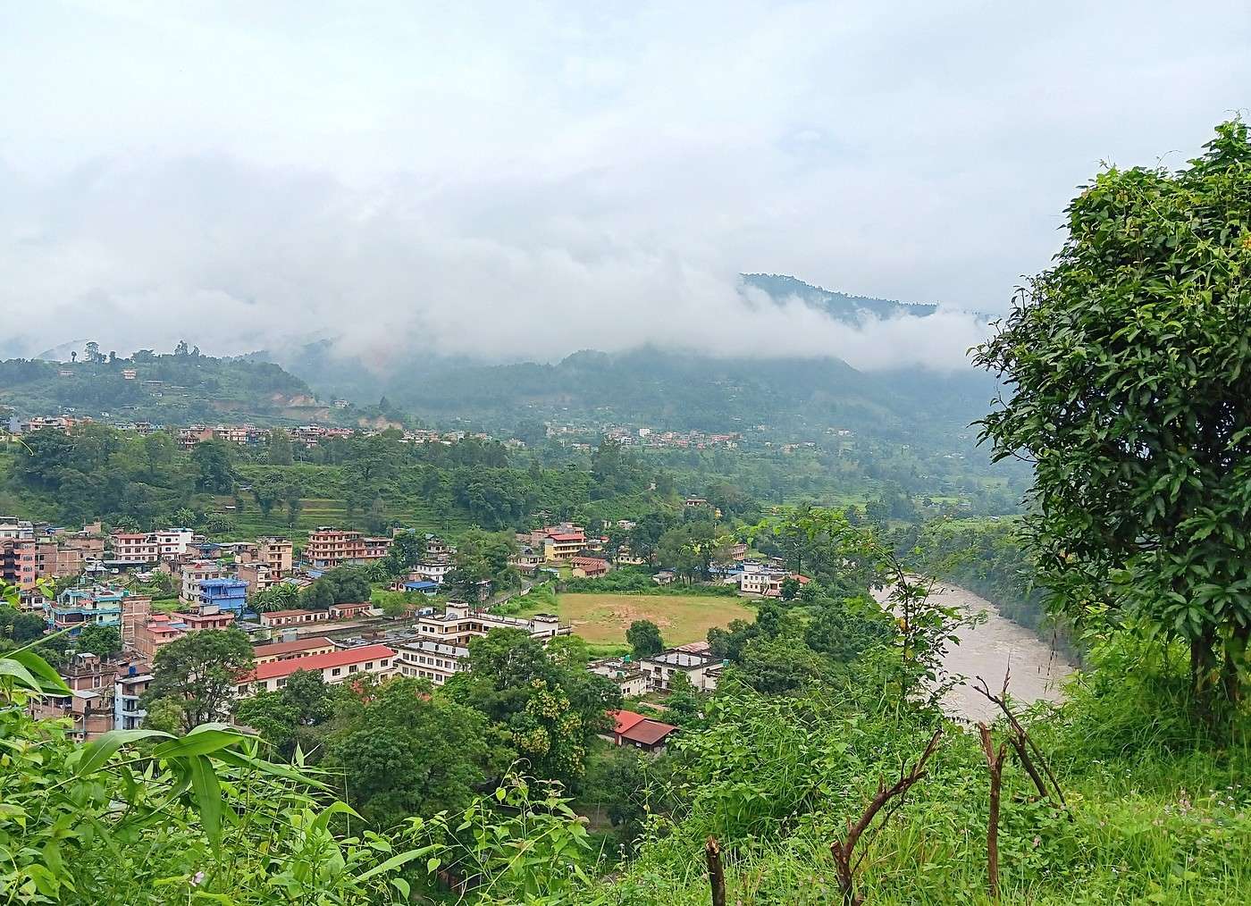
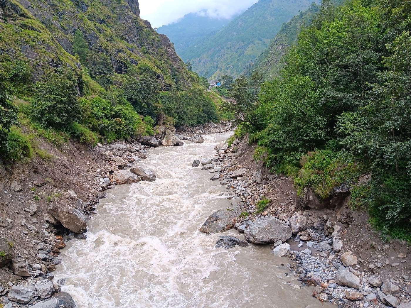
In Nuwakot, we stopped for breakfast at a nice little restaurant, Jimbu. It was around 8:30 a.m., and we’d barely covered 60 km. The restaurant has a lovely garden overlooking the Trishuli Ganga, the river flowing down from Syapru Besi. First photo: the river in the bottom right corner, mist and clouds over the mountain on the other side.

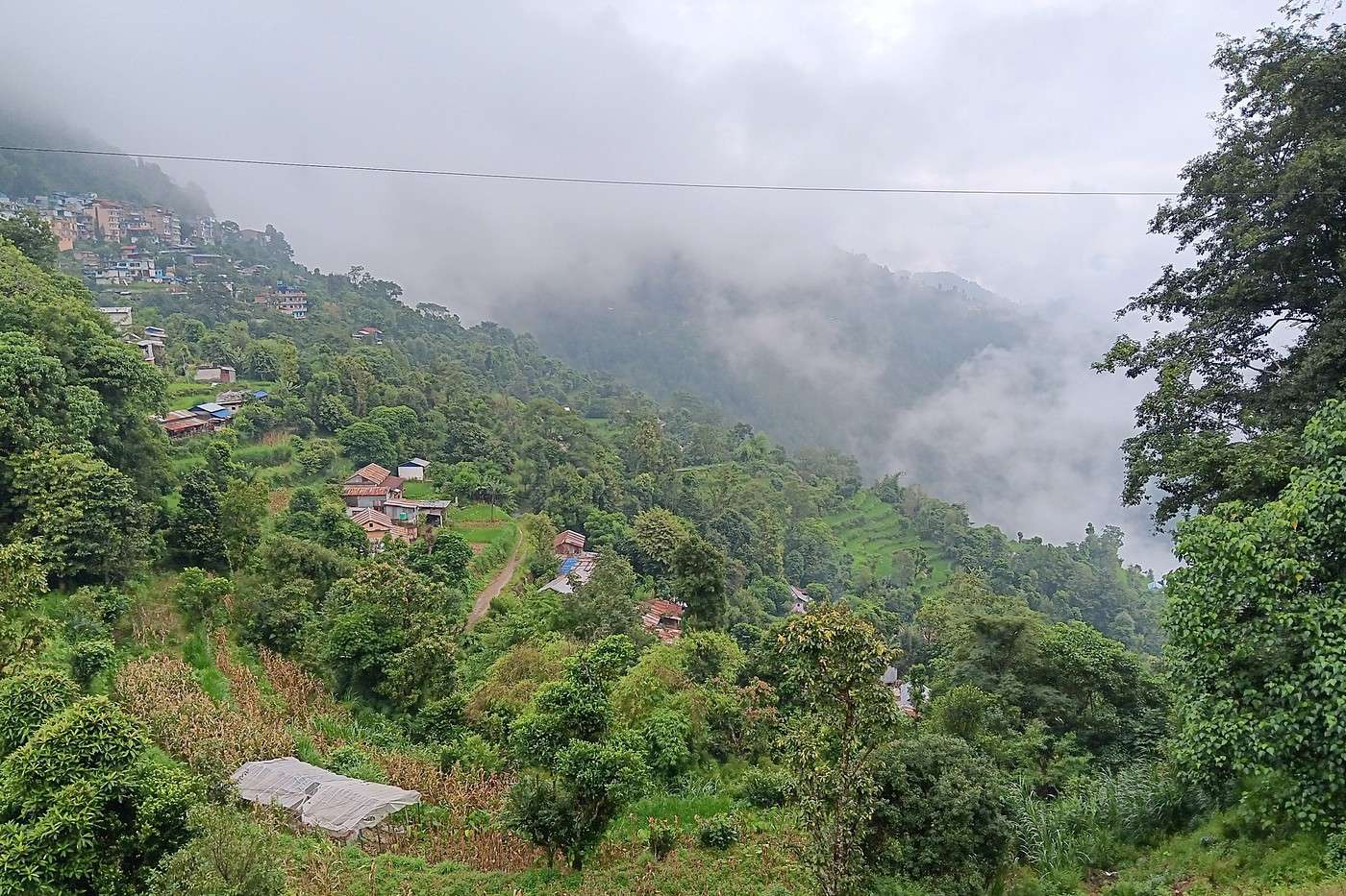
An hour later, my second photo: the hills along the Trishuli Ganga. You can see the different crops—lush green rice paddies in the lower right and corn, already yellowed and likely harvested, in the foreground on the left. And of course, the mist and clouds through which you can glimpse the mountain on the other side of the river.
TE TerryTara ·
You had an amazing experience. However, I think your agency really overcharged you because the Langtang isn’t the most accessible massif—it’s actually quite challenging. Even though the Langtang Valley is the most accessible part, especially at the end of the monsoon season, it can still rain a lot, particularly on the section with frequent landslides between Syabru Besi and Bamboo.

On another note, I think your post got cut off because you only shared Day 1, and based on how you write, I’m guessing you planned to post your experience day by day! 🙂
GE GeorgesOZ Globetrotter ·
You had a great experience. However, I think your agency went too far calling the Langtang trek "accessible"—it’s not the easiest range to reach. In fact, it’s quite challenging, even though the Langtang Valley is the most accessible part. Especially at the end of monsoon season, it can rain a lot, particularly on the section with frequent landslides between Syabru Besi and Bamboo.

I also think your post got cut off because you only shared Day 1, and based on how you write, I’m guessing you planned to post your experience day by day. 🙂

Hi Terry,

Thanks for reposting my thread so quickly! You’re right—I’ll be sharing my story in chunks, so more to come soon!

I completely agree—calling the Langtang trek "accessible" isn’t accurate. Many describe the Langtang Valley as "remote" (in English), meaning isolated/difficult to access, and that matches our experience.

To be honest, this isn’t an easy trek. Less than half the people I know would’ve made it!
TE TerryTara ·
My bad then—I was being impatient! :)

Yeah, some people call the region "accessible" because it’s often chosen as an alternative to the more touristy areas (Sagarmatha & Annapurna) and because it’s relatively easy to reach by road since it’s close to Kathmandu (less than a day’s travel). Even though the journey isn’t that short, especially with this year’s monsoon causing serious damage in the region and on the roads...

I agree with you—many people aren’t physically prepared for it, which is why it’s one of the areas with the most issues related to acute mountain sickness, proportionally to the number of visitors. The distances are short, you gain altitude quickly, and those who need more time to acclimatize can find themselves in trouble. In short, it’s a stunning area but definitely shouldn’t be underestimated! 🙂
DJ Djalma Globetrotter ·
hi,

We did the Langtang trek (hike) from September 10th to 17th, with the first and last days being the trip from Kathmandu and back—so 6 days of actual walking. It’s a fairly well-known trek but definitely not as famous or crowded as those in Annapurna or Everest, which is why we chose it.

What a crazy idea to do that during monsoon season! Didn’t you have any other choice? If you were going to get soaked anyway, you should’ve picked August to go from Syabru Besi to the sacred Gosainkund lakes during the Hindu pilgrimage!

The road to Syapru Besi is only 120 km, but it’s absolutely terrible. It’s always narrow, winds through endless mountains, and the shoulders range from bad to confusing to nonexistent. Several sections are just dirt tracks, etc. We didn’t regret opting for the jeep, since we could stop whenever we wanted—if only to let Y (my Thai girlfriend) throw up everything she could. She’d taken her usual motion sickness meds, but the constant turns, accelerations, and braking eventually gave her awful car sickness.

Well, I see that not much has changed in 20 or 30 years when it comes to "road" improvements. That must’ve been no fun for your girlfriend! You should’ve gone to Langtang via Helambu—it’s not much harder except for the Laurebina Pass, and the starting point is only 30 or 40 km from KTM (Sundarijal). The Langtang Valley must’ve undergone quite a few changes since the 2015 earthquake, which completely destroyed the village of Langtang. Back in the '80s, there was also a massive landslide before Langtang village—the spot is actually labeled "landslide" on trekking maps... Is the cheese factory still open at Kyangjin Gompa? When I was younger, I would’ve recommended doing the return trip via the Ganja La (5,200m)—2 or 3 days without seeing a soul and mandatory camping...
TE TerryTara ·
Cheese production is still going on, yes! :)
DJ Djalma Globetrotter ·
Regarding AMS (Acute Mountain Sickness), I don’t quite agree—we don’t go above 3600 or 3800 at most at Kyangin Gompa, and the ascent is gradual. On the Sagarmatha route (toward Everest Base Camp), you land at 2800 m in Lukla, and on the very first day, you pass 3600 m at Namche Bazaar! I had a bit of a headache there.
GE GeorgesOZ Globetrotter ·
Day 1 – Journey from Kathmandu to Syapru Besi (Continued) Around 11 a.m., bumping along and shaken like proverbial sacks of potatoes in the jeep—which is sturdy, sure, but far from comfortable—we arrive at the checkpoint for entering Langtang National Park, just before Dhunche Bazar, about twenty kilometers from Syapru Besi. There had been one or two checks earlier, I think when crossing from one district to another, but those were just a matter of minutes while our guide registered our passage.

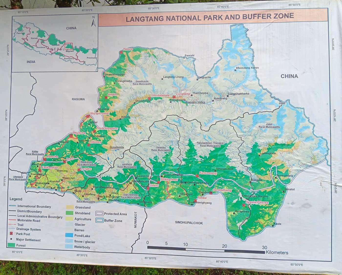
This time, it takes a bit longer. Maybe half an hour? The first photo is of a large sign showing the park map. As someone who loves maps, I’m in heaven—this one is excellent! The location map (top left) shows the region borders China (actually Tibet). "Shyaphrubesi" = Syapru Besi, the trek’s starting point, is in the middle left, at the park’s western edge.

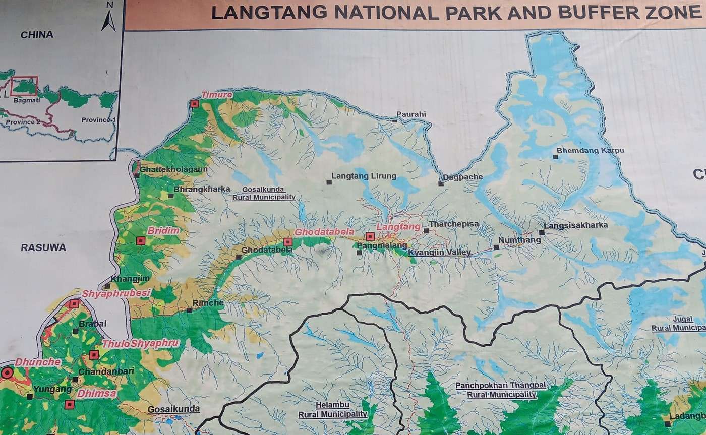
The second photo is a close-up of the trek. The place names are confusing. Our first stop will be at Lama Hotel, which is between Rimche and Ghodatabela (according to the sign), and more precisely at the bend of the Langtang River, where its course changes direction (from west/east to southwest/northeast). The third stop will be at Kyanjing Gompa, just below the red "Langtang" on the map, at the mouth of a glacier descending north/south from Langtang Lirung. Langtang Lirung is the highest point, at 7,227 meters, in a range that runs along the Tibet border.

As for the second stop, at Langtang, it’s between the two. According to the map I got in Kathmandu, it’s probably around Ghodatabela (in red).

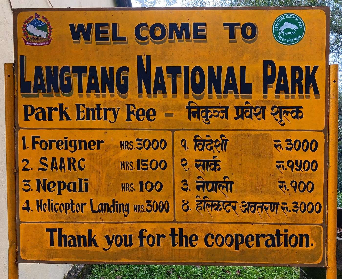
The third photo: the sign showing park entry fees. For foreigners, it’s 3,000 rupees per person, or about 18-20 € or 21-22 $. I’m giving approximate prices, of course—exchange rates change pretty quickly!

We stop around noon at Dhunche Bazar, or is it already Thulo Bharkhu? We’re made to wait a good hour in a restaurant, well past the time we needed for a light meal. We gather there’s a blockage farther up the road, and we have to wait for police clearance to continue. This gives us a chance to meet a group of 5 or 6 Israelis who are also doing the trek. I didn’t recognize them as Israelis at first because they were behaving discreetly and speaking quietly.

Finally, we get the green light from the police, which ends a great discussion I was having with one of the Israelis about our origins and respective dialects (to clarify: I’m not Jewish).

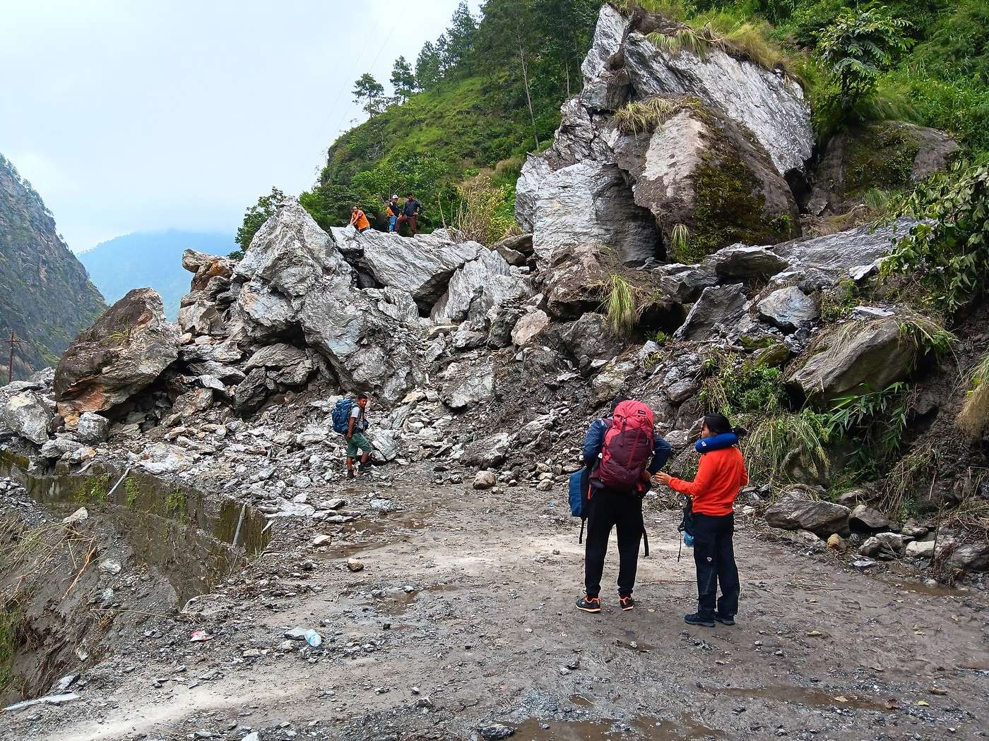
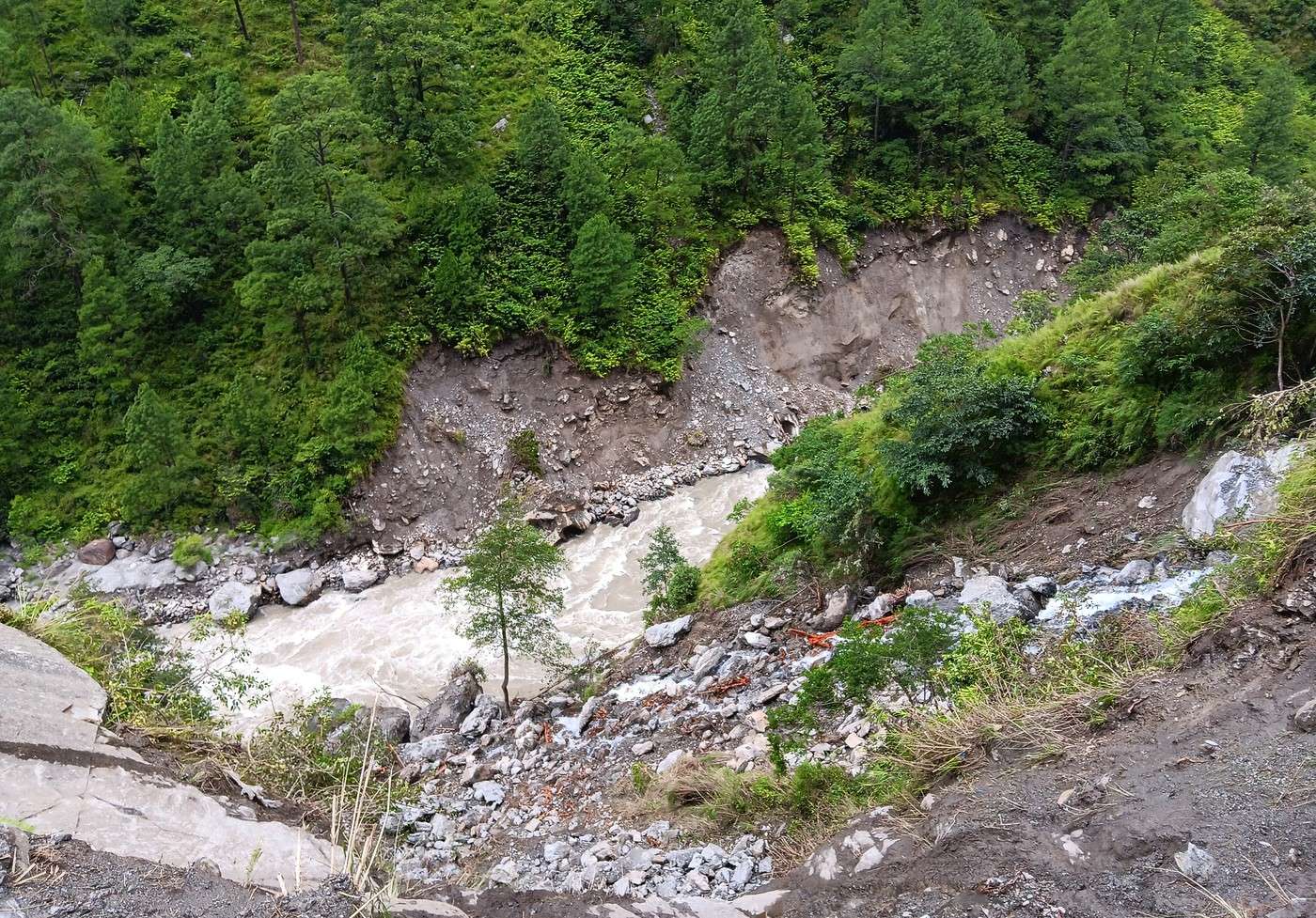
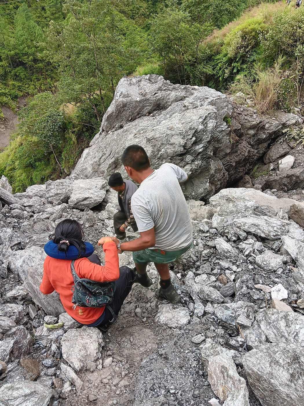
And we arrive at the massive landslide blocking the road. The only road, clinging to the mountainside right above the raging Trishuli Ganga, which flows a good 200 meters below... My fourth photo: Y and our guide H, and just at the foot of the landslide, our porter S. Just look at the size of the rocks that tumbled down and completely cut off the road! (Terry mentioned landslides—he’ll be happy!). On the left of the photo, the smooth concrete reinforcement of the road—from there, you’d fall straight into the river! (Fifth photo). We can only continue on foot, clambering as best we can over the landslide (sixth photo). Okay, I like giving my readers chills: it’s not just the rocks, of all sizes in a terrible jumble, some ready to give way underfoot! There’s also a narrow but furious stream trying to force its way through, pushing the rubble along, and we have to cross that too.

Once we reach the other side, thankfully, we only have 2 kilometers left to walk to Syapru Besi, without any other incidents on the road. The landslide will mark the actual starting point of our trek!

I’ll leave the story with this last photo, taken on the bridge crossing the Trishuli Ganga at the village entrance. It’s 2:30 p.m. It took us about 7 and a half hours to cover the whole distance from Kathmandu.
GE GeorgesOZ Globetrotter ·
....

We did the Langtang trek (hike) from September 10th to 17th, with the first and last days being the trip from Kathmandu and back—so 6 days of actual walking. It’s a fairly well-known trek but definitely not as famous or crowded as those in the Annapurna or Everest regions, which is why we chose it.

What made you decide to do this during monsoon season?! Didn’t you have any other options? ..... The Langtang Valley has undergone quite a few changes since the 2015 earthquake, which completely destroyed the village of Langtang. Back in the 80s, there was also a major landslide before Langtang village; the spot is actually labeled "landslide" on trekking maps... ....

Hi Jean-Michel, Mid-September is right at the end of the monsoon. We could’ve been luckier with the weather....

Yes, the damage from the 2015 earthquake was huge in Langtang itself (and I’ll come back to that later). But you hardly see any traces of it in the buildings now. There’s been so much reconstruction since. It’s also very visible in Kathmandu, Patan, and Bhaktapur, where we went. I was a bit worried I’d be disappointed, but the reconstruction effort has been remarkable!
TE TerryTara ·
For AMS (Acute Mountain Sickness), I don’t quite agree—we don’t go above 3600 or 3800 at most at Kyangin Gompa, and the ascent is gradual... On the Everest route (toward base camp), you land at 2800 m in Lukla, and on the very first day, you pass 3600 m at Namche Bazaar! I had a bit of a headache there.

The Everest area is a special case, in my opinion, because there are a lot of evacuations, partly due to a lucrative business selling fast, cheap itineraries to clients without respecting acclimatization time. This allows agencies to call in helicopters for their clients and make money off insurance—or, in the saddest cases, off the clients themselves if they don’t have insurance. For those arriving by plane, people land in Lukla, but only a minority head straight to Namche on the first day because those who do without being acclimatized aren’t really following safety principles. The vast majority spend the first night in Phakding, Tok Tok, or Monjo—between 2600 and 2900 m—then move on to Namche at around 3450 m (depending on where you sleep in Namche), so the elevation gain is less drastic.

For Langtang, my point was more about the region in general, especially with Gosainkunda, which sees a lot of issues (whether you come from Dhunche or Helambu). Even in the valley, some people struggle because between Lama Hotel and Langtang Village, there’s a 1000 m elevation gain (2480 m vs 3450 m), and many people have a hard time managing that transition. Of course, plenty of trekkers have no issues at all. The same goes for Panch Pokhari (transition from Tupi Danda to Nosyampati) and Tamang Heritage (the night at Nagthali). The Langtang region is very rugged and steep, with fewer intermediate stops than other areas. That’s just my professional perspective based on feedback from clients and fellow guides. I totally get that your experience might be different, and some people will relate more to what you’re saying!)
DJ Djalma Globetrotter ·
Mid-September marks the end of the monsoon. We could’ve been luckier with the weather....

Not really. It’s not recommended to set off before early October, and mid-October is preferable since you often still get lingering monsoon weather in the first half of October. In November, it’s chillier, but the skies are much clearer.

Personally, I went in March... 24 days of trekking: Starting from Sundarijal, 30 km from KTM / crossing Helambu / Laurebina Pass / Gosainkund Lakes / Syabru Besi / heading west toward Gatlang / Tamang Heritage Trail / Langtang Valley Kyangin Gompa / ascent of Tsergo Ri / crossing Ganja La (5,200m) and recrossing Helambu toward Tharkegyang and Sermathang. That was in 2010—I was 15 years younger! Back then, we set off without a guide since it wasn’t mandatory, and we carried our own packs, plus a tent and supplies for 3 nights of bivouacking. 4 days without seeing a soul via Ganja La...

I found a teammate whose wife is Nepali (Tamang) here on VF. We visited all her scattered family from Thulo Syabru to Timure... One of my best trekking memories!

Anyway, kudos for what you’ve done. I couldn’t do it again today.
GE GeorgesOZ Globetrotter ·
Day 1 – Journey from Kathmandu to Syapru Besi (Continued and Concluded) After arriving in Syapru Besi on foot, we’re given a room in one of the guesthouses (GH) by the river. It’s a large room but pretty basic. I take advantage of the last bits of lukewarm water in the bathroom to shower. I mention this because hot showers will be hit-or-miss from here on out!

The "restaurant" only has two tables, which makes it easy to meet other travelers. Across from me, an Australian couple from Melbourne. We strike up a great conversation about Australia and Europe. I speak English fluently, but I’ll admit their accent throws me off a bit—even though I *should* be used to Australians after living in their country for 3 years!

Back to the weather in the "late monsoon" season—a topic Jean-Michel/Djalma and I already covered quite a bit. We only had a few drops of rain on the way from KTM, but a steadier rain starts falling during the night... Nothing major compared to the downpours I’m used to in tropical countries (especially in Asia and particularly Thailand). Let’s hope, let’s hope.....
GE GeorgesOZ Globetrotter ·
..... Personally, I went in March... 24 days of trekking:

...One of my best trekking memories!

I can imagine!
NI Nimou74 Veteran ·
Hi George,

I’m excited to dive into your travel journal .. 🙂 Oh no, this trek isn’t a walk in the park. I still feel the long climb to Laurebina in my legs! It’s rated as less difficult than others because the altitude generally doesn’t exceed 4,000m. There’s the climb up to Kyanjin Ri, around 4,700m if I remember right (gorgeous view, by the way), but overall, the altitude is lower than in other parts of Nepal. That said, like many treks in Nepal, the hiking can still be tough and discouraging. A mix of steep ascents and descents—those infamous "Nepali flat" sections... And when the rain joins the party, it can turn into a nightmare on trails covered in mud and mule/yak droppings...

As for the weather, September is definitely not recommended, and it’s not uncommon for monsoon tails to linger until mid-October. Things have been changing lately. A few years ago, we had amazing weather in March, but last year, we had to cut our Khumbu trek short because of constant bad weather (damp cold, rain, snow, mud, zero visibility...). November has generally given us the best weather. That month is usually ideal for Nepal—except this year, of course...😇
TE TerryTara ·
I see a lot of feedback and opinions about September. I’d like to mention that August and September are truly extraordinary for trekking. Sure, it’s not the classic trails where views might be blocked, but more cultural treks off the beaten path—where when the views clear, it’s a gift because you weren’t even expecting it. The far west with regions like Darchula, Bajhang, and Simikot; the west with Dhorpatan/Rukum-Rolpa/Dolpo; and Annapurna with Nar Phu. These are fantastic times to go because everything is absolutely green—it’s just stunning to see. I know for many the goal is really to have clear views, but I’m dropping this little note to open the door to other discovery possibilities that, far from the classic Sagarmatha/Annapurna/Manaslu/Langtang routes, deserve to be explored despite the access difficulties or unpredictable weather :)

Generally, from mid-August in recent years, the rain is limited to about an hour in the afternoon. Of course, some days it rains more, but if you’re patient, there are amazing experiences to be had during this time of year when very few people dare to explore the hills and mountains. For those familiar with Nepal, I can only recommend it. For first-time visitors to Nepal, it might be a bit too rugged and challenging in these mentioned regions.

Also, I agree with Anne-Claire—the climate change is shifting the seasons, but November remains a safe bet for exceptional skies :)
GE GeorgesOZ Globetrotter ·
Hello George,

I’m really looking forward to joining your travel journal .. 🙂 Oh no, this trek isn’t a walk in the park. I still feel the long climb to Laurebina in my legs! It’s rated as less difficult than others because the altitude generally doesn’t exceed 4,000m. There’s the climb to Kyanjin Ri, around 4,700m if I remember right (gorgeous view, by the way), but overall, the altitude is lower than in other parts of Nepal. That said, like many treks in Nepal, the walking can still be tough and discouraging. A constant mix of uphill and downhill—those infamous "Nepali flat" sections... And when the rain joins the party, it can turn into a nightmare on trails covered in mud and mule and yak droppings...

As for the weather, September is definitely not recommended, and it’s not uncommon for monsoon tails to linger until mid-October. Things have been changing lately. A few years ago, we had great weather in March, but last year, we had to cut our trek in the Khumbu short because of constant bad weather (cold, damp, rain, snow, mud, zero visibility...). November has generally given us the best weather. That month is usually ideal for Nepal. Except this year, of course...😇

Hi Anne-Claire!

Ah yes, the infamous "Nepali flat"! We’ve experienced it firsthand! Endless ups and downs on steps made of rough, uneven stones—often slippery—and animal droppings everywhere! You really have to watch where you step; every move has to be calculated because twisting an ankle or taking a fall far from "civilization" would be a disaster!

Often, a day’s walk to cover just ten kilometers (as the crow flies) ends up feeling like more exercise than hours in a gym!

For the best times of year, we’ve taken note: September is a no-go for us in the future. The downside of "peak season" is that it gets way more crowded.
GE GeorgesOZ Globetrotter ·
Day 2 – Syapru Besi to Lama Hotel – Rivers and Hinduism

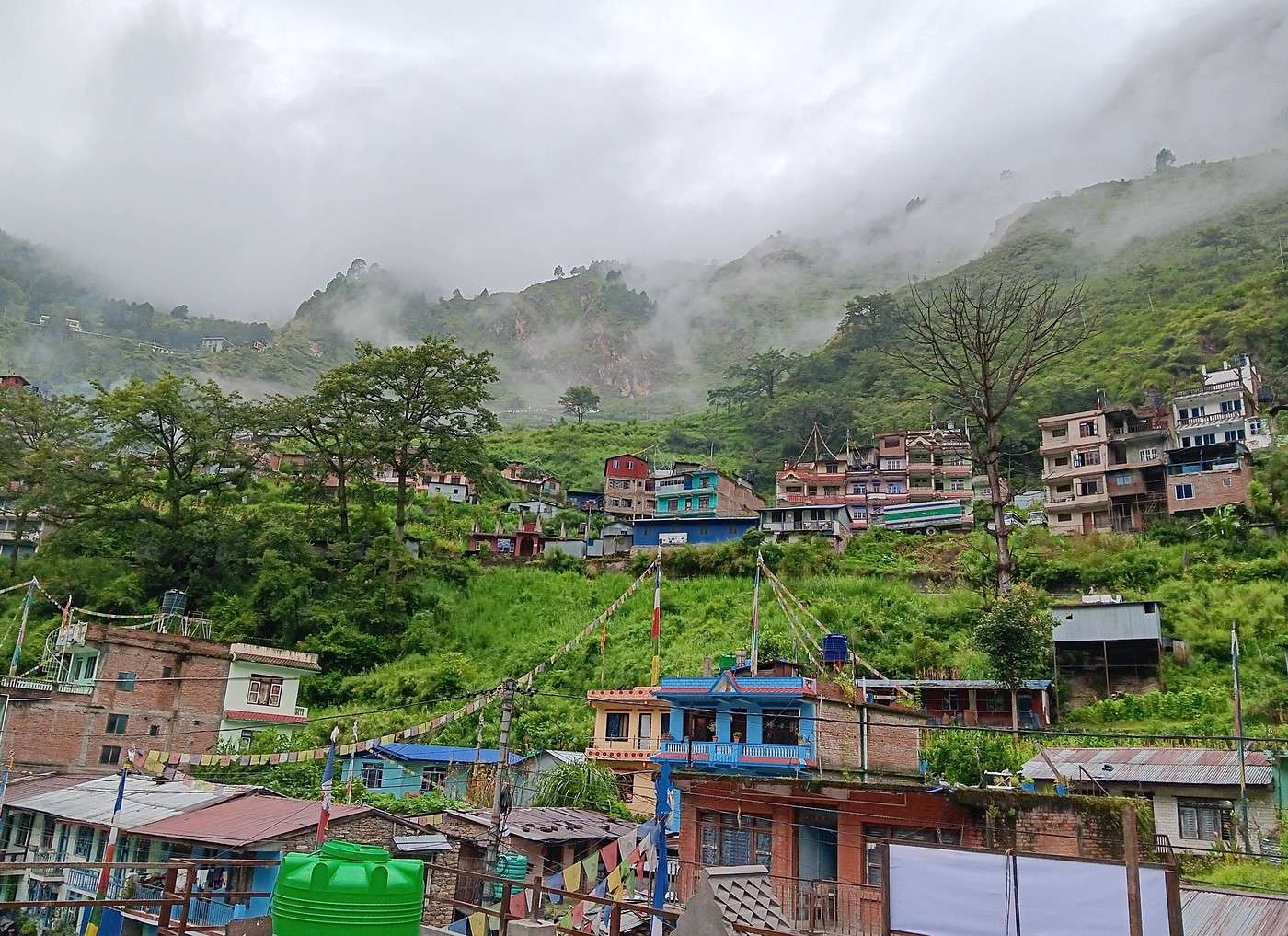
Thursday, September 11th, 6:20 AM, first photo: view of Syapru Besi from our room. Simple breakfast and we hit the road around 7:30 AM. From the bridge spanning the Trishuli Ganga at the village exit, we see the confluence with the Langtang River coming from the east (on the right in the second photo). The Trishuli flows straight down from the Tibetan border, which it crossed 15 km north of Syapru Besi.

I wanted to learn more about the Trishuli Ganga. The term Trishuli is obviously linked to the Hindu god Shiva. "Tri" means three: it refers to the trident he carries. Over half of its basin lies in Tibet. It joins the Gandaki at Devghat, 1 km north of Bharatpur (between Pokhara and Kathmandu).

The Gandaki originates north of the Annapurna massif. Its full name is Kali Gandaki. Though one might associate it with the Hindu god Shiva (Kali/Durga being his shakti), the Kali Gandaki is actually linked to the god Vishnu. In fact, another name for it is Krishna Gandaki, Krishna being one of Vishnu’s two main incarnations (the other being Rama). Finally, the river is also called Narayani up to the Indian border, which inevitably brings to mind Vishnu, also known as Narayan.

The confluence at Devghat is a particularly sacred site for Hindus. "Dev" means "God" and "Ghat" roughly means "riverbank." Since the Krishna Gandaki comes from the west and the Trishuli from the east, their meeting represents the union of Hinduism’s two main gods.

The Gandaki joins the Ganges at Patna, in Bihar.

Before wrapping up, I can’t help but recall that in Hindu mythology, the Ganges flows from the head of Shiva, his hair representing the various rivers descending from the Himalayas. In the Hindu imagination, Shiva receives the river from the goddess Ganga, or the Ganges simply springs from his head. The depiction of rivers flowing from Shiva’s head symbolizes the Ganges, held back by Shiva to control its destructive force and gently guide it to Earth.

I know I might be boring some of you with all this "Hindu salad," but I don’t see travel as just going from A to B, having fun, or marveling at the exotic and unknown while taking pretty photos. I also want to understand—or at least try to understand—the people, their history, language, and culture, etc.
GE GeorgesOZ Globetrotter ·
Day 2 – Syapru Besi to Lama Hotel (Continued)

I know I can be a bit much for some with all my digressions. I’ll admit, I take a bit of mischievous pleasure in it! You could sum up everything I’ve said about rivers and Hinduism in a few simple words: For Hindus, rivers aren’t just rivers. They’re also divine manifestations.

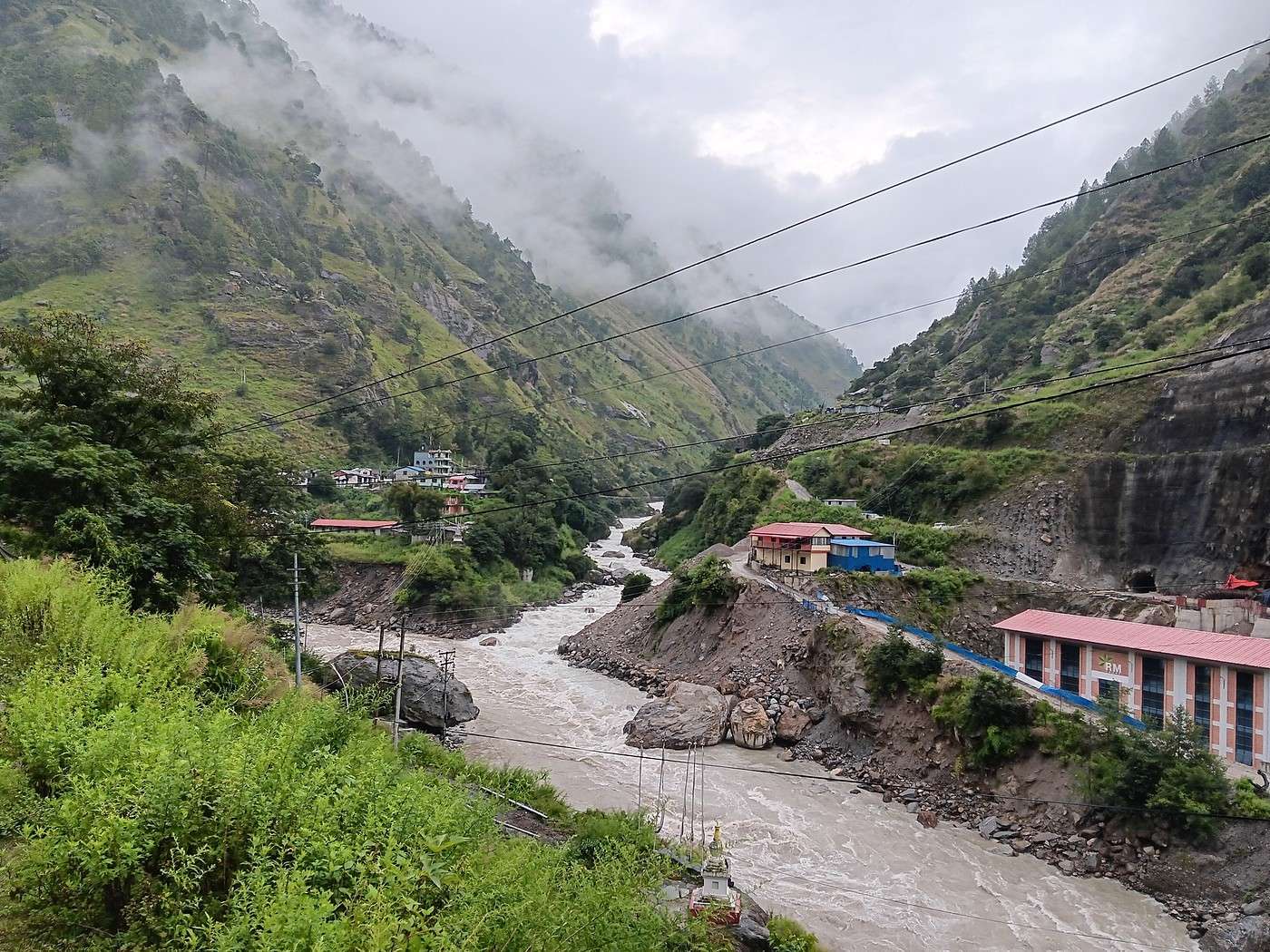
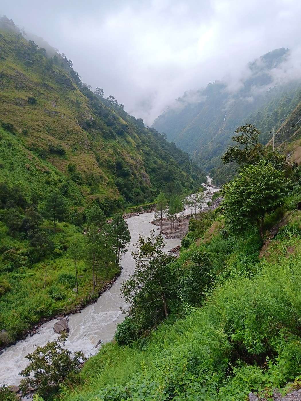
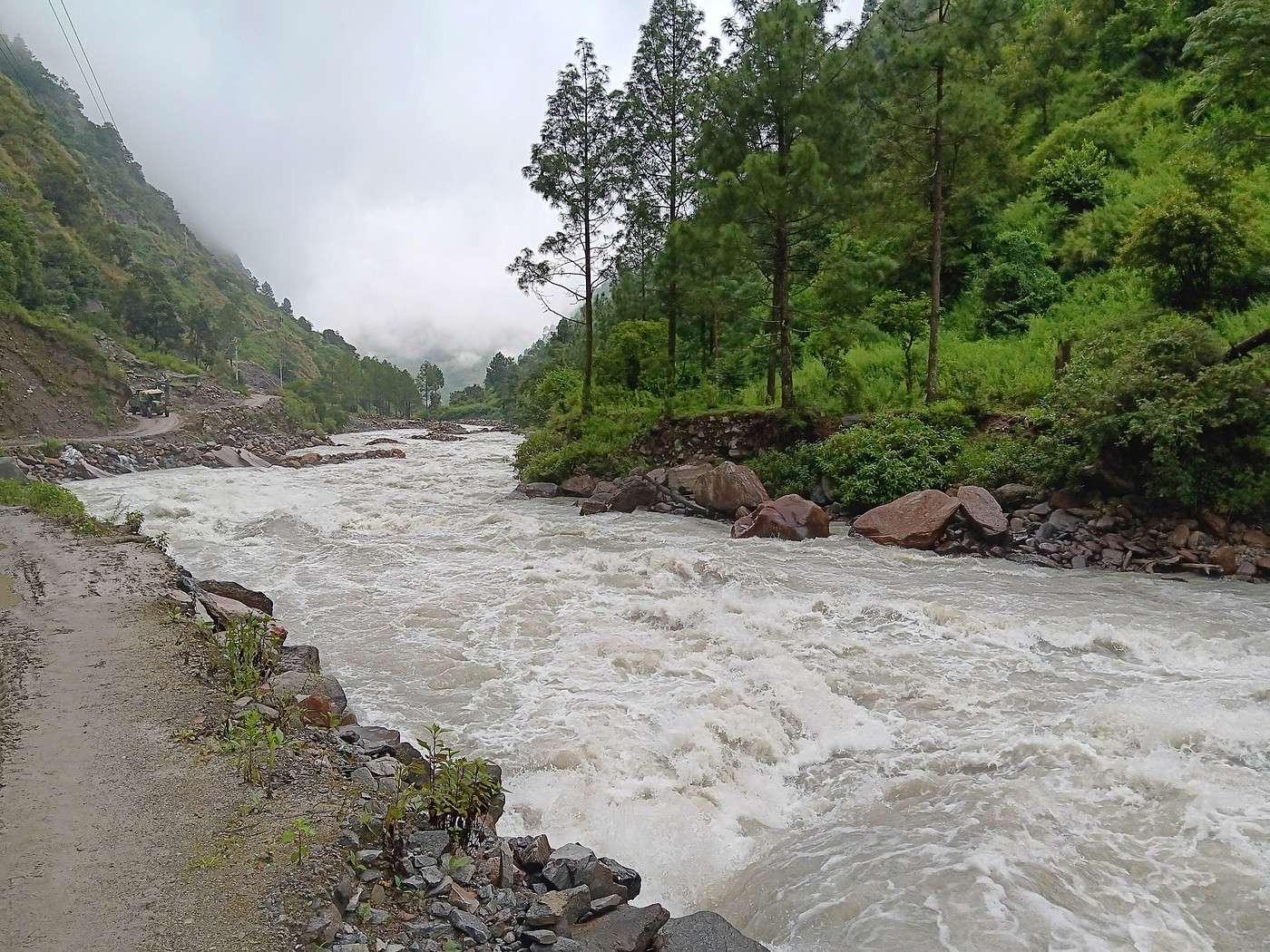
Back to Nepal! We crossed the bridge and saw the entrance to the Langtang Valley ahead of us (1st photo). The first 2 km are a fairly wide track right beside the Langtang River (brrrr!!!), used by the large vehicles serving the construction of a hydroelectric dam. You can see this track clearly in my 2nd photo (on the left, you can even make out one of those big vehicles way in the back). As I mentioned, we’re walking alongside a river that would intimidate even the bravest. I couldn’t post a short video here to give you an idea—what a shame. So I’ll just have to say: I’d challenge the best swimmers to take a dip and come out alive!

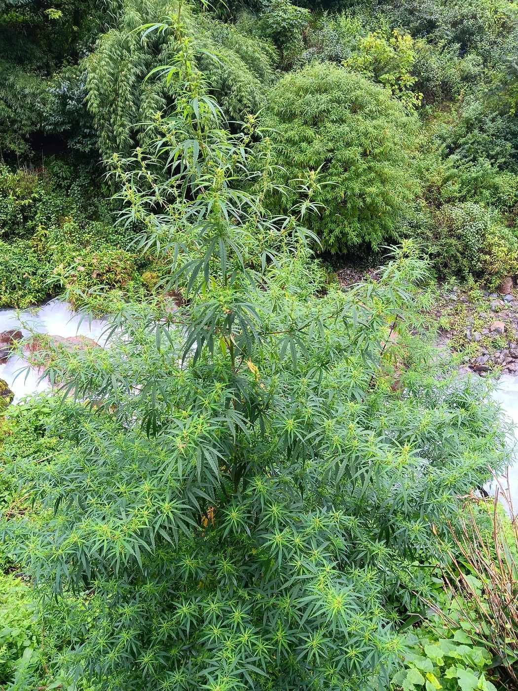
The track ends at the dam under construction. Just past 9 a.m., we head into the forest. We quickly reach a tea house but don’t stop, though I couldn’t resist taking a photo (the 3rd one) of a magnificent cannabis plant about 3 meters tall. The photo, taken from above, only shows the top of the plant. Is it natural or cultivated? I have no idea. I rub a few leaves between my hands—it’s got a pleasantly bitter taste, not all that different from any other green plant.

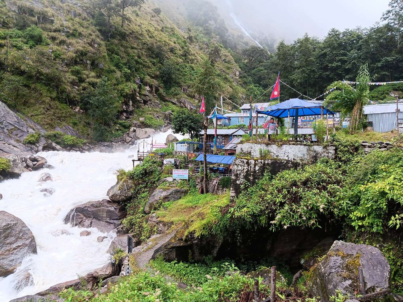
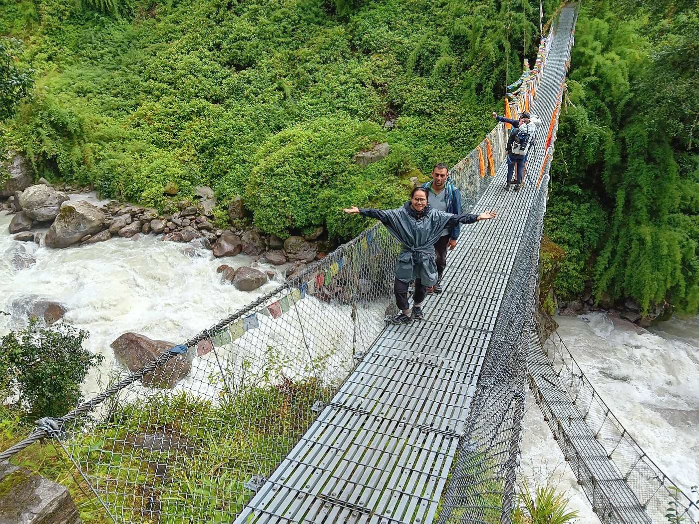
It’s nearly noon when we arrive at the spot called Bamboo (4th photo). We have our lunch there—nothing remarkable, if I remember correctly. Just a little farther, we reach a suspension bridge over the river and cross to the north bank. It’s almost 2 p.m. The 5th photo: the river upstream from the bridge—just look at that chaotic fury!

The bridge deserves a 6th photo. Note the poncho Y tied around her waist—since this morning, we’ve had a light but steady drizzle. It’s not too bad; our guide H doesn’t even bother covering up. Further back, a couple of hikers are heading back “toward civilization”—yes, we’re not the only ones crazy enough to do this trek at the end of monsoon season!

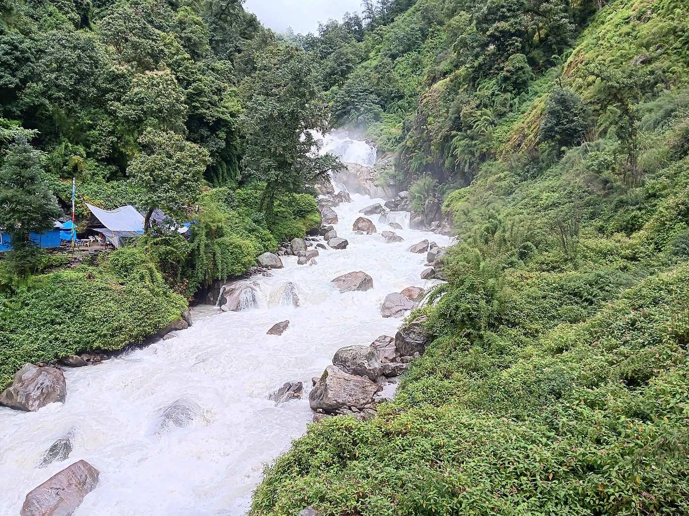
We still have 2 km to go to reach today’s destination, Lama Hotel. But first, just after the bridge, we pass a tiny cluster of houses and a tea house before arriving at one of the scariest spots of the entire trek: a landslide where the already tough path completely disappears. To get across, we cling to the remains of a twisted steel cable sticking out of the rubble like an arrow that’s pierced someone, pulling ourselves up 3 meters. You can’t let go—the ground underfoot is loose and slick from the rain, and there’d be nothing to stop you from plunging into the roaring Langtang just 10 meters below! 🏴‍☠️ Then we face the heart of the landslide. There are only a few meters to cross before reaching slightly more reassuring ground (very relatively), but it’s honestly intimidating. You can barely make out the trace of a path—if you can even call it that—just a foot or two wide, marked in the mud by those who’ve gone before. Y goes first, closely watched by H and S (our guide and porter). Y’s really brave—it’s her first trek, she’s struggling a bit but doesn’t complain. I’ll also say she’s more agile than most her age, and since she’s Thai, I’ll go ahead and say she’s as flexible as a Siamese cat... 😉

My turn, and like an idiot, I try to cross a meter lower—I insist, the “path” was more than subtle, which is why I didn’t follow it exactly. And I start to slip...... 🏴‍☠️ H tries to grab my hand, but I’d rather cling to a big rock jutting out of the landslide—luckily, it holds. I reach out to S on the other side, who helps pull me up to the “path.” I can’t say I was two inches from joining the fish in the Langtang—no fish could live in those currents—but it was close enough!

We arrive exhausted at Lama Hotel. They give us a spartan but adequate room. At least it’s clean, and I’ll add that nowhere in Langtang did we have to deal with critters in the bedding. The toilets and showers are shared. We skip the shower, though.

In the common room of our guesthouse, guests hang their soaked clothes above a wood stove. Y carefully checks her clothes after an unfortunate encounter with the local leeches, the “djouka.” I spot one trying to sneak into her shoe through a lace eyelet. I just manage to grab it by the tail—a tiny, all-black, not-at-all-appetizing thing. It reminds me of a miniature version of the alien from that well-known sci-fi/horror movie.

I meet a couple of Polish hikers heading back to Syapru Besi. Charming and really interesting people. We’re not the only ones doing this trek at the end of the rainy season!

A little note: I mention the people we meet not because it’s particularly relevant to the trek itself, but to preserve the memory through VF (I sometimes reread my posts).
NI Nimou74 Veteran ·
I know I can be a pain for some, with all my digressions. I’ll admit I get a kick out of it!

Why a pain? Not at all—quite the opposite! When you travel, you’re usually interested in the locals’ culture, and I really love your travel journals for that reason. I absolutely loved the one about Mexico.

We arrive exhausted at Lama Hotel.

I remember that lodge well...

She takes great care examining her clothes, having unfortunately made the acquaintance of the local leeches, the “djouka.” I see one trying to slip into one of her shoes through a lace eyelet. I just manage to grab it by the tail.

Oh, that’s horrifying! You’ve confirmed my decision to keep going to Nepal in November. No doubt the green landscapes in summer and early autumn are stunning, but if you’re making such an effort, you might as well enjoy the exceptional views of the peaks—it’s usually clear and dry (but cold 🤪) during that time.

We’ll have to go back... 🙂
GE GeorgesOZ Globetrotter ·
I know I can be a bit much for some people, with all my digressions. I’ll admit I take a bit of mischievous pleasure in it!

Why a bit much? Not at all—quite the opposite! When you travel, you’re usually interested in the locals’ culture, and I really love your travel journals for that reason. I absolutely loved the one about Mexico.

Oh yeah, I remember seeing you in my Mexico journal, just before COVID. I went back there with Y last year: Yucatán (expensive, too crowded, too hot); the area around Guadalajara and Colima (less crowded, amazing). I also went back once with my son to introduce him to this incredible country, and another time on my own. Now that Y has gotten some hiking experience, I’m planning a month between Mexico City (CDMX) and Michoacán, with climbs up two volcanoes (one dormant, one extinct). I’ll have to check about leeches! 😉

Similar discussions

You might also like