Results for "Antoni+|+9+>+206"
4220 results found.
Conseils itinéraire Costa Rica English translation pending
Enfin nous avons notre destination de cet été pour nous 5 (enfants de 14 ans 6 ans et 4 ans) et je commence à préparer l'itinéraire pour 3 semaines et si vous le souhaitez vous pouvez nous aider en nous donnant des conseils.Merci à tous
1ERE nuit à ALAJUELA
puis une semaine dans une maison sur la péninsule d'osa
Quepos
ferry à puntaneras pour rejoindre la péninsule de nicoya :au choix tambor, montezuma cabo blanco
tamarindo
rincon de la vieja
lac arenal et volcan
cote caraibe cahuita puerto viejo et tortuguero
Voilà c'est peu être un peu beaucoup en 3 semaines ?
La péninsule de nicoya et le guanacaste très touristique vaut il le détour ?
Peut on passer sans difficultés de la fortuna à la cote caraibes par la route de puerto viejo?
Pour tortuguero dans les guides tout me semble bien compliqué pour le logement et la location de bateau help svp
Pour la location de voiture j'ai vu la discussion du lyonnais mais nous choisirons quand même le 4x4 merci pour les adresses de loueurs intéréssantes
Merci d'avance bonnes fêtes de noel à tous
1ERE nuit à ALAJUELA
puis une semaine dans une maison sur la péninsule d'osa
Quepos
ferry à puntaneras pour rejoindre la péninsule de nicoya :au choix tambor, montezuma cabo blanco
tamarindo
rincon de la vieja
lac arenal et volcan
cote caraibe cahuita puerto viejo et tortuguero
Voilà c'est peu être un peu beaucoup en 3 semaines ?
La péninsule de nicoya et le guanacaste très touristique vaut il le détour ?
Peut on passer sans difficultés de la fortuna à la cote caraibes par la route de puerto viejo?
Pour tortuguero dans les guides tout me semble bien compliqué pour le logement et la location de bateau help svp
Pour la location de voiture j'ai vu la discussion du lyonnais mais nous choisirons quand même le 4x4 merci pour les adresses de loueurs intéréssantes
Merci d'avance bonnes fêtes de noel à tous
Qui est parti au Costa Rica sac a dos? English translation pending
Salut tout le monde.
Je suis en train de me demander 🤪 où je vais partir dans 3 mois et donc j'ai eu une petite lueure 😎 pour le Costa Rica.
Est-il facile d'y barouder 🏴☠️ ?
Racontez-moi votre émerveillement 😎 . Quels endroits vous ont marqué ? Et dites moi tout ce que vous avez envie de me dire sur ce pays... même les cotés noirs 😠 . C'est toujours intéressant et c'est ce qui fait un pays a part entiere.
MERCI 😛
Je suis en train de me demander 🤪 où je vais partir dans 3 mois et donc j'ai eu une petite lueure 😎 pour le Costa Rica.
Est-il facile d'y barouder 🏴☠️ ?
Racontez-moi votre émerveillement 😎 . Quels endroits vous ont marqué ? Et dites moi tout ce que vous avez envie de me dire sur ce pays... même les cotés noirs 😠 . C'est toujours intéressant et c'est ce qui fait un pays a part entiere.
MERCI 😛
Tour d'Europe de trois mois English translation pending
Bonjour à tous et à toutes,
Pour l'été prochain nous avons un projet de tour d'Europe de trois mois passant par la Belgique, la Hollande, l'Allemagne (Brême, Hambourg), le Danemark, la Suède, la Finlande, la Russie (St Pétersbourg), les pays baltes, la Pologne, la slovaquie, la Hongrie, la Roumanie, Belgrade, la Croatie, la Slovénie, l'Italie du nord, la Suisse (Sion, Lausanne).
Donc si dans ces régions vous pensez qu'il y a des évènements, des lieux a voir absolument n'hésitez pas ) nous répondre.
Guillaud
Guillaud
Moustiques au Costa rica? English translation pending
Mon message peut sembler étrange mais je cherche simplement a mieux comprendre, voila j'ai lu dans un guide anglophone que dans la jungle costaricaine qu'il y a une mouche qui penetre l'épiderme😕 mais il ne parle pas des conséquences et des precautions a prendre???
Frontiere entre le Costa rica et le Panama! English translation pending
Salut je voudrais savoir si c'est compliquer de passer la frontiere entre le costa rica et le panama et quelles sont les complications et délai?
Ensuite j'ai lu que c'était moins cher de reserver un véhicule du québec que sur place surprenant donc j'aimerais bien avoir l'avis de ceux qui ont fais l'expérience et les endroits a éviter?
Je dispose de 3 semaines pleines pour parcourir ces 2 pays esce assez?
Ensuite j'ai lu que c'était moins cher de reserver un véhicule du québec que sur place surprenant donc j'aimerais bien avoir l'avis de ceux qui ont fais l'expérience et les endroits a éviter?
Je dispose de 3 semaines pleines pour parcourir ces 2 pays esce assez?
Chansons de la République Dominicaine English translation pending
Bonjour
Je suis partie cet été en République Dominicaine et je recherche une chanson que j'ai vraiment adoré là bas : c'était sur un rythme un peu rap reggae avec des paroles comme " wazza wazza" ( je ne sais pas comment cela s'écrit).
et les paroles sont en espagnol.
merci
j'espère que vous pourrez m'aider
à bientot
si vous connaissez des musiques connus là bas vous pouvez aussi me les donnez.
SVP
Julie
Je suis partie cet été en République Dominicaine et je recherche une chanson que j'ai vraiment adoré là bas : c'était sur un rythme un peu rap reggae avec des paroles comme " wazza wazza" ( je ne sais pas comment cela s'écrit).
et les paroles sont en espagnol.
merci
j'espère que vous pourrez m'aider
à bientot
si vous connaissez des musiques connus là bas vous pouvez aussi me les donnez.
SVP
Julie
Bons plans au Costa Rica English translation pending
Bonjour à toutes et tous,
Je prevois partir au Costa Rica avec mon copain et mes deux enfants dans la période des fêtes de Noël.
Auriez vous des bons plans à me conseiller/suggérer? (gens/hébergement/activités/culturel)
Je ne connais rien du Costa Rica, hormis mes lectures sur le sujet et des ouï-dires 😕.
Par exemple, on m'a dit que la cote Pacifique était plus intérressante que la cote Caraîbe. Pourquoi????Tout ce que la personne trouvait à me dire était "plus craignos" (sous quel critère, j'en sais rien, je répète je n'y ai jamais mis les pieds).
Alors...HELP...tout renseignement sera bon à prendre.
Merci
Je prevois partir au Costa Rica avec mon copain et mes deux enfants dans la période des fêtes de Noël.
Auriez vous des bons plans à me conseiller/suggérer? (gens/hébergement/activités/culturel)
Je ne connais rien du Costa Rica, hormis mes lectures sur le sujet et des ouï-dires 😕.
Par exemple, on m'a dit que la cote Pacifique était plus intérressante que la cote Caraîbe. Pourquoi????Tout ce que la personne trouvait à me dire était "plus craignos" (sous quel critère, j'en sais rien, je répète je n'y ai jamais mis les pieds).
Alors...HELP...tout renseignement sera bon à prendre.
Merci
Flamenco English translation pending
bonjour à tous,
d'origine espagnole et ayant déjà testé plusieurs styles de danses ( classique évidemment mais aussi jazz, hip-hop, salsa et orientale) j'aimerais savoir si vous connaissez un cours de danse flamenco potable (attention: pas de sévillanes!) sur Paris et pas trop cher tant qu'à faire.
J'essaie d'écouter également de la musique flamenco mais mon répertoire reste limité étant donné que je ne m'y connais pas encore vraiment...
Merci de m'ouvrir musicalement parlant ! 😉
d'origine espagnole et ayant déjà testé plusieurs styles de danses ( classique évidemment mais aussi jazz, hip-hop, salsa et orientale) j'aimerais savoir si vous connaissez un cours de danse flamenco potable (attention: pas de sévillanes!) sur Paris et pas trop cher tant qu'à faire.
J'essaie d'écouter également de la musique flamenco mais mon répertoire reste limité étant donné que je ne m'y connais pas encore vraiment...
Merci de m'ouvrir musicalement parlant ! 😉
Costa Rica: voyage organisé ou individuel? English translation pending
Bonjour 😎 je voudrais partir au costa rica mi juillet pour une durée de 15 jours. J'hésite entre un circuit aventure (15 participants maximum + tour opérator) avec visites des réserves par le biais de différentes activités : marche, VTT, rafting, cheval, parcours à la cime des arbres ... ou partir sans tour opérator et donc trouver un vol abordable + hébergement sur place + déplacement (bus locaux ou location de voiture ?). Nous serions 3 ou 4 personnes à partir mais nous ne parlons pas espagnol. Selon vous quelle est la formule la plus intéressante financièrement parlant ? Dans l'attente de vos conseils. Laurence
Quoi voir au Portugal? English translation pending
Bonjour,
J'envisage de partir au portugal fin juin 2003 pour 10 jours. Si quelqu'un pouvait me conseiller sur les villes qu'il faut voir absolument et me faire profiter de ses expériences à travers ce pays. Merci d'avance
J'envisage de partir au portugal fin juin 2003 pour 10 jours. Si quelqu'un pouvait me conseiller sur les villes qu'il faut voir absolument et me faire profiter de ses expériences à travers ce pays. Merci d'avance
Africa: A Heartfelt Love for a Continent
“When the Whites came to Africa, we had the land and they had the Bible. They taught us to pray with our eyes closed: when we opened them, the Whites had the land and we had the Bible.” Jomo Kenyatta (p.7)
The Maggi cube, an unchallenged hegemony, and so much more
“The hopeless continent,” headlined The Economist, a British magazine, in July 2000 about Africa. Eleven years later, the same magazine headlined “Africa rising” instead. Images of Africa in the prosperous North constantly oscillate between apocalyptic scenarios and enthusiastic projections. A key issue with such images lies in the generalization they entail. If you look at the continent, considerable contrasts emerge depending on space and time. It’s no surprise that a region of the world encompassing such diverse ecological zones, maintaining such varied ties with other continents, comprising nearly fifty nation-states in sub-Saharan Africa alone, and characterized by a great diversity of languages, belief systems, and historical paths, doesn’t share a single destiny.
And yet, for many people outside Africa, as well as for many Africans, the continent constitutes a single entity, defined by criteria such as skin color, a colonial past, poverty, and the art of survival. Until now, these perspectives were generally accompanied by the idea that Africa had to—or should have—followed a single path together, sometimes called development, sometimes modernization, sometimes liberation, then a market economy. None of these paths delivered on their promises.
The two writers Alain Mabanckou and Abdourahman Waberi—one from Congo, the other raised in Djibouti, both long settled in France and now professors at renowned North American universities (Los Angeles, Washington)—have had enough of pessimistic scenarios: “We are aware that Africa is in the world and the world is in Africa. The same goes for all other continents, as our destinies are inextricably linked for better or worse. We refuse to see Africa as a reservoir of misfortunes or a continent cursed by atavistic misfortune and characterized by ethnic conflicts. [...] It’s this passionate flame we wanted to capture in a book [...] a kind of stroll through African cultures, without any demands, each letter of the alphabet leading us to a notion, a practice, a concept, a moment in history, literature, painting, politics, economics, cuisine, etc.” (p.10-11). Africa, they write, is on the verge of “imposing a signature, a style, a way of being in the world and in relation to the rest of the world.” (p.11) To put words to the continent’s diversity and dynamism, the two authors created a “rambling ABC,” a kind of portrait—or more precisely, a mythography—that lets you see and feel the pulse of a vast continent whose cultural power is unfolding before our eyes. Once marginalized or even mocked, the voice and importance of the Continent in global affairs are now undeniable” (p.11), containing over a hundred entries, mostly concise, written in a relaxed and casual style. The optimistic, even exuberant tone is set from the brief introduction. The duo of authors wants to “sing a love song to the cultures of our continent, to its inhabitants past and present, to its exceptional resources and its spectacular globalization despite a certain pollution that still clouds our skies due to the unmatched duration of dictatorships in some of our regions.” (p.12) In doing so, they don’t want to be too distracted by today’s Afewerki-Biya-Bongo-Déby & Co. ...
Of course, you’ll find tributes to great precursors like Frantz Fanon (“[...] it was a love story and admiration that wasn’t dimmed by the four decades separating his birth from ours. Let’s add that we were born while the native of Fort-de-France had left the world’s stage four years earlier, in the prime of life” p.141), Mongo Beti (“You must read and reread Mongo Beti, a genius who used his fame to support often just causes in Africa, like defending oppressed groups. His place is already in History. His oppressors, like the dictators Ahmadou Ahidjo and Paul Biya, can’t compete in the same category” p.64), the Malian Amadou Hampâté Bâ
(“Posterity remembers him mainly as an tireless defender of African cultures. His plea for the collection and preservation of traditional African knowledge remains a major event for all men and women of good will. One day in 1960, at the UNESCO podium, the native of Bandiagara sounded the alarm: ‘[...] Since we’ve admitted that the humanity of each people is the heritage of all humanity, if African traditions aren’t collected in time and written down, they’ll one day be missing from the universal archives of humanity.’” p.51),
Kwame Nkrumah, “one of the founders of Pan-Africanism, father of Ghana’s independence” (p.239), as well as the historian Cheikh Anta Diop, the writer, poet, and politician Aimé Césaire, and the economist and thinker Samir Amin, but also very warm tributes to certain contemporary African intellectuals like Souleymane Bachir Diagne and Achille Mbembe
(“A few years ago, in dominant economic circles, a rumor often resurfaced, usually disguised as a cold and scientifically proven analysis: Africa is useless. It’s a burden for the rest of the human community. With its 2% share in world trade, it would disappear from stock market radars without anyone noticing. So? Maybe it’ll be pulled up by other continents. Wanting to surpass itself is a crazy bet for Africans, they concluded. Arrogant or clueless, President Nicolas Sarkozy declared before an audience of students and teachers at Cheikh Anta Diop University in Dakar: ‘The African man hasn’t entered history enough [...] He only knows the eternal repetition of time marked by the endless repetition of the same gestures and words.’ That was in 2007. For decades, armed only with reason, an intellectual often steps up to debunk prejudices, lazy readings, and dishonest frameworks used as false fronts by those who, like Nicolas Sarkozy or former journalist Stephen Smith, out of ignorance, contempt, or condescension, distort African reality. This intellectual is none other than the historian and political scientist Achille Mbembe. This heir of Frantz Fanon, Amílcar Cabral, Jean-Marc Ela, and Fabien Eboussi-Boulaga was born in 1957 in Cameroon, in the Bassa region. Marked early by the upheavals of a fratricidal war, Achille Mbembe became the guardian of the memory of martyrs. After brilliant studies in Paris, he went on to teach at the best American universities, but the call of the Continent was stronger than anything else. In Dakar, he once directed CODESRIA (Council for the Development of Social Science Research in Africa) before joining the University of the Witwatersrand in Johannesburg, South Africa. Even though the author of *Critique of Black Reason* (Éditions La Découverte, 2015) spends a few months at Duke University in North Carolina, his observation post remains South Africa. From Johannesburg, Achille Mbembe scrutinizes Africa and the whole world. A lucid observer with an elegant and generous pen, Achille Mbembe knows how to blend big and small history: ‘I was born one day in July, as the month was drawing to a close. It was 1957, in that part of Africa recently named ‘Cameroon,’ a memory of the wonder that seized Portuguese sailors in the 15th century when, sailing up the river near Douala, they couldn’t help but note the presence of a multitude of crustaceans, and named it *Rio dos Camarões*, meaning ‘River of Shrimp.’ I grew up in the shadow of this nameless land, since, in a way, the name it bears is only the product of someone else’s astonishment: a lexical mistake, if you will.’ From this mistake or wound, he made leaven, a springboard to compose a rich work, recognized worldwide. To denounce barriers and barbarians too. But that’s not enough. Among his peers in circles of thought and action, Achille Mbembe passionately and consistently defends human dignity and the beauty of the world. In doing so, he fulfills the mission Frantz Fanon entrusted to him.” (p.227-229),
as well as entries dedicated to lesser-known artists and intellectuals, like the French journalist and activist Rokhaya Diallo, daughter of Senegalese and Gambian parents, or the Ethiopian filmmaker Haile Gerima, who has long lived in the United States. Other names from politics, sports, music, art, and literature: Kofi Annan, p.36; Barack Obama, p.243; Thomas Sankara, p.277; Ousmane Sow, p.285; Yambo Ouologuem, p.250; Léopold Sédar Senghor, p.282; Muhammad Ali, p.30; Nuruddin Farah, p.146; Salif Keita, p.203; Ahmadou Kourouma, p.206; Ngũgĩ wa Thiong’o, p.236; Winnie Mandela, p.224; Kylian Mbappé, p.226 ...
The authors, who resolutely commit to a “mythography” (p.11) of Africa, also pay special attention to local social movements, cultural events, and aspects of daily life. *Y’en a marre*, “which also meant ‘we’re fed up with sitting on our hands’” (p.320-321), emerged about a decade ago in Senegal as a citizen movement of peaceful resistance and symbolizes, the authors emphasize, the fact that African youth are increasingly fed up “with the political circus deployed in Africa since independence, as our parents would say, ‘since the White man left’...” (p.321). A full entry is dedicated to the Maggi bouillon cube, which has flooded African markets for about forty years and enjoys immense popularity (“It’s everywhere in Africa, from Dakar to Djibouti, and from Tangier to Cape Town. It’s in every pot, every stew. Little hands put it in every sauce, every local or adapted dish. An unchallenged hegemony! You’ll find it in diasporas too. The culinary strolls in Paris, in the [...] neighborhood” p.90). Critics blame it not only for impoverishing the aromatic diversity of local dishes but also for being harmful to health. And yet, “he poorest Africans, those who eat only once a day, a few spoonfuls of white beans and a ball of *foufou*, for example, are the most fervent users of the magic cube.” (p.92-93)
For *fonio*, “the new trendy cereal. [...] From the millet family, fonio is probably the oldest cereal cultivated in West Africa, and mainly in its sub-Saharan part, for millennia. [...] Easy to grow, water-efficient, fonio grows everywhere except on clay soils. Long neglected because it was considered the poor man’s crop, fonio is now a source of pride for the farmers who cultivate it and cherish it like the apple of their eye” (p.156-157), the authors immediately offer a detailed recipe, letting the reader know that “e can’t resist sharing this fonio with chicken recipe from Mali with you:
Ingredients: 1 chicken 3 large ripe red tomatoes 4 tbsp tomato paste 4 large onions 1 garlic clove 1/2 cup oil 2 Maggi cubes or salt 2 large carrots 1 turnip 1 large cabbage 2 large potatoes 1 celery stalk 1 packet pre-cooked fonio 4 okra (or okra powder) salt, pepper
Preparation: 1. Prepare the sauce: wash and cut the chicken. Peel the onions, garlic, and vegetables. 2. In a pot, fry the chicken pieces. 3. Dice the onions, tomatoes, carrots, and turnip very small and add them to the pot. 4. Add the tomato paste, salt, and pepper. 5. Simmer for 15 min, then add 2 L of water and the cooked chicken pieces. 6. Simmer for 30 min, then add the crushed garlic and celery, plus the cabbage cut into 4 and the potatoes cut in half. 7. Prepare the fonio: cover it with warm water, let it rest for 15 min, and cook it over low heat. 8. In a small pot, boil the okra and crush them. 9. Mix the crushed okra with the cooked fonio, then salt. Serve hot.” (p.158-159)
The comedy *Black Mic Mac*, released in French theaters in 1986 and addressing France’s increasingly restrictive immigration policy at the time, also gets an entry, as do *Tintin in the Congo*, the popular comic, and *Jip’s Café* (“[...] a little Africa in the heart of Paris, with passersby stopping to admire the ‘ambianceurs’ on the dance floor or attend the cultural events offered by the place” (p.194), an African establishment in Paris that Alain Mabanckou already immortalized in one of his novels.
The duo of authors also tackles thorny subjects like jihadism (p.119), the Rwandan genocide (p.272), the CFA franc (p.82), and dictatorship (p.110). While the two strike the right tone here, many entries leave a slightly bitter taste. Two examples: why doesn’t the text on Barack Obama mention the great disappointment of many people in Africa, who expected more from the African policy of the first U.S. president with African roots than just occasional warm words? Why do the comments on Winnie Mandela gloss over the fact that she was a highly controversial icon of the anti-apartheid movement due to her involvement in kidnappings, acts of torture, and murders of alleged apartheid collaborators? Instead, there’s a compassion that brings tears to the eyes: “She was often reduced to a secondary role, the wife of a great man” or “When victory came, she didn’t taste its fruits. Divorced, isolated. She would never be a ‘first lady’ in an evening gown, posing before a bed of chrysanthemums. They’d keep her far from the circles of power” (p.224-225). At this point, I would’ve liked the authors to take a slightly more critical stance...
That said, these “weaknesses” (if you can call them that) shouldn’t overshadow the book as a whole. It remains an informative, sometimes very entertaining, and often even original work in its own way.
Book information (the original French and the German translation):
Alain Mabanckou/Abdourahman Waberi. Dictionnaire enjoué des cultures africaines. Fayard, 2019. Alain Mabanckou/Abdourahman Waberi. Der Puls Afrikas. Eine Liebeserklärung von A bis Z. Reclam, 2022.
Hery
The Maggi cube, an unchallenged hegemony, and so much more
“The hopeless continent,” headlined The Economist, a British magazine, in July 2000 about Africa. Eleven years later, the same magazine headlined “Africa rising” instead. Images of Africa in the prosperous North constantly oscillate between apocalyptic scenarios and enthusiastic projections. A key issue with such images lies in the generalization they entail. If you look at the continent, considerable contrasts emerge depending on space and time. It’s no surprise that a region of the world encompassing such diverse ecological zones, maintaining such varied ties with other continents, comprising nearly fifty nation-states in sub-Saharan Africa alone, and characterized by a great diversity of languages, belief systems, and historical paths, doesn’t share a single destiny.
And yet, for many people outside Africa, as well as for many Africans, the continent constitutes a single entity, defined by criteria such as skin color, a colonial past, poverty, and the art of survival. Until now, these perspectives were generally accompanied by the idea that Africa had to—or should have—followed a single path together, sometimes called development, sometimes modernization, sometimes liberation, then a market economy. None of these paths delivered on their promises.
The two writers Alain Mabanckou and Abdourahman Waberi—one from Congo, the other raised in Djibouti, both long settled in France and now professors at renowned North American universities (Los Angeles, Washington)—have had enough of pessimistic scenarios: “We are aware that Africa is in the world and the world is in Africa. The same goes for all other continents, as our destinies are inextricably linked for better or worse. We refuse to see Africa as a reservoir of misfortunes or a continent cursed by atavistic misfortune and characterized by ethnic conflicts. [...] It’s this passionate flame we wanted to capture in a book [...] a kind of stroll through African cultures, without any demands, each letter of the alphabet leading us to a notion, a practice, a concept, a moment in history, literature, painting, politics, economics, cuisine, etc.” (p.10-11). Africa, they write, is on the verge of “imposing a signature, a style, a way of being in the world and in relation to the rest of the world.” (p.11) To put words to the continent’s diversity and dynamism, the two authors created a “rambling ABC,” a kind of portrait—or more precisely, a mythography—that lets you see and feel the pulse of a vast continent whose cultural power is unfolding before our eyes. Once marginalized or even mocked, the voice and importance of the Continent in global affairs are now undeniable” (p.11), containing over a hundred entries, mostly concise, written in a relaxed and casual style. The optimistic, even exuberant tone is set from the brief introduction. The duo of authors wants to “sing a love song to the cultures of our continent, to its inhabitants past and present, to its exceptional resources and its spectacular globalization despite a certain pollution that still clouds our skies due to the unmatched duration of dictatorships in some of our regions.” (p.12) In doing so, they don’t want to be too distracted by today’s Afewerki-Biya-Bongo-Déby & Co. ...
Of course, you’ll find tributes to great precursors like Frantz Fanon (“[...] it was a love story and admiration that wasn’t dimmed by the four decades separating his birth from ours. Let’s add that we were born while the native of Fort-de-France had left the world’s stage four years earlier, in the prime of life” p.141), Mongo Beti (“You must read and reread Mongo Beti, a genius who used his fame to support often just causes in Africa, like defending oppressed groups. His place is already in History. His oppressors, like the dictators Ahmadou Ahidjo and Paul Biya, can’t compete in the same category” p.64), the Malian Amadou Hampâté Bâ
(“Posterity remembers him mainly as an tireless defender of African cultures. His plea for the collection and preservation of traditional African knowledge remains a major event for all men and women of good will. One day in 1960, at the UNESCO podium, the native of Bandiagara sounded the alarm: ‘[...] Since we’ve admitted that the humanity of each people is the heritage of all humanity, if African traditions aren’t collected in time and written down, they’ll one day be missing from the universal archives of humanity.’” p.51),
Kwame Nkrumah, “one of the founders of Pan-Africanism, father of Ghana’s independence” (p.239), as well as the historian Cheikh Anta Diop, the writer, poet, and politician Aimé Césaire, and the economist and thinker Samir Amin, but also very warm tributes to certain contemporary African intellectuals like Souleymane Bachir Diagne and Achille Mbembe
(“A few years ago, in dominant economic circles, a rumor often resurfaced, usually disguised as a cold and scientifically proven analysis: Africa is useless. It’s a burden for the rest of the human community. With its 2% share in world trade, it would disappear from stock market radars without anyone noticing. So? Maybe it’ll be pulled up by other continents. Wanting to surpass itself is a crazy bet for Africans, they concluded. Arrogant or clueless, President Nicolas Sarkozy declared before an audience of students and teachers at Cheikh Anta Diop University in Dakar: ‘The African man hasn’t entered history enough [...] He only knows the eternal repetition of time marked by the endless repetition of the same gestures and words.’ That was in 2007. For decades, armed only with reason, an intellectual often steps up to debunk prejudices, lazy readings, and dishonest frameworks used as false fronts by those who, like Nicolas Sarkozy or former journalist Stephen Smith, out of ignorance, contempt, or condescension, distort African reality. This intellectual is none other than the historian and political scientist Achille Mbembe. This heir of Frantz Fanon, Amílcar Cabral, Jean-Marc Ela, and Fabien Eboussi-Boulaga was born in 1957 in Cameroon, in the Bassa region. Marked early by the upheavals of a fratricidal war, Achille Mbembe became the guardian of the memory of martyrs. After brilliant studies in Paris, he went on to teach at the best American universities, but the call of the Continent was stronger than anything else. In Dakar, he once directed CODESRIA (Council for the Development of Social Science Research in Africa) before joining the University of the Witwatersrand in Johannesburg, South Africa. Even though the author of *Critique of Black Reason* (Éditions La Découverte, 2015) spends a few months at Duke University in North Carolina, his observation post remains South Africa. From Johannesburg, Achille Mbembe scrutinizes Africa and the whole world. A lucid observer with an elegant and generous pen, Achille Mbembe knows how to blend big and small history: ‘I was born one day in July, as the month was drawing to a close. It was 1957, in that part of Africa recently named ‘Cameroon,’ a memory of the wonder that seized Portuguese sailors in the 15th century when, sailing up the river near Douala, they couldn’t help but note the presence of a multitude of crustaceans, and named it *Rio dos Camarões*, meaning ‘River of Shrimp.’ I grew up in the shadow of this nameless land, since, in a way, the name it bears is only the product of someone else’s astonishment: a lexical mistake, if you will.’ From this mistake or wound, he made leaven, a springboard to compose a rich work, recognized worldwide. To denounce barriers and barbarians too. But that’s not enough. Among his peers in circles of thought and action, Achille Mbembe passionately and consistently defends human dignity and the beauty of the world. In doing so, he fulfills the mission Frantz Fanon entrusted to him.” (p.227-229),
as well as entries dedicated to lesser-known artists and intellectuals, like the French journalist and activist Rokhaya Diallo, daughter of Senegalese and Gambian parents, or the Ethiopian filmmaker Haile Gerima, who has long lived in the United States. Other names from politics, sports, music, art, and literature: Kofi Annan, p.36; Barack Obama, p.243; Thomas Sankara, p.277; Ousmane Sow, p.285; Yambo Ouologuem, p.250; Léopold Sédar Senghor, p.282; Muhammad Ali, p.30; Nuruddin Farah, p.146; Salif Keita, p.203; Ahmadou Kourouma, p.206; Ngũgĩ wa Thiong’o, p.236; Winnie Mandela, p.224; Kylian Mbappé, p.226 ...
The authors, who resolutely commit to a “mythography” (p.11) of Africa, also pay special attention to local social movements, cultural events, and aspects of daily life. *Y’en a marre*, “which also meant ‘we’re fed up with sitting on our hands’” (p.320-321), emerged about a decade ago in Senegal as a citizen movement of peaceful resistance and symbolizes, the authors emphasize, the fact that African youth are increasingly fed up “with the political circus deployed in Africa since independence, as our parents would say, ‘since the White man left’...” (p.321). A full entry is dedicated to the Maggi bouillon cube, which has flooded African markets for about forty years and enjoys immense popularity (“It’s everywhere in Africa, from Dakar to Djibouti, and from Tangier to Cape Town. It’s in every pot, every stew. Little hands put it in every sauce, every local or adapted dish. An unchallenged hegemony! You’ll find it in diasporas too. The culinary strolls in Paris, in the [...] neighborhood” p.90). Critics blame it not only for impoverishing the aromatic diversity of local dishes but also for being harmful to health. And yet, “he poorest Africans, those who eat only once a day, a few spoonfuls of white beans and a ball of *foufou*, for example, are the most fervent users of the magic cube.” (p.92-93)
For *fonio*, “the new trendy cereal. [...] From the millet family, fonio is probably the oldest cereal cultivated in West Africa, and mainly in its sub-Saharan part, for millennia. [...] Easy to grow, water-efficient, fonio grows everywhere except on clay soils. Long neglected because it was considered the poor man’s crop, fonio is now a source of pride for the farmers who cultivate it and cherish it like the apple of their eye” (p.156-157), the authors immediately offer a detailed recipe, letting the reader know that “e can’t resist sharing this fonio with chicken recipe from Mali with you:
Ingredients: 1 chicken 3 large ripe red tomatoes 4 tbsp tomato paste 4 large onions 1 garlic clove 1/2 cup oil 2 Maggi cubes or salt 2 large carrots 1 turnip 1 large cabbage 2 large potatoes 1 celery stalk 1 packet pre-cooked fonio 4 okra (or okra powder) salt, pepper
Preparation: 1. Prepare the sauce: wash and cut the chicken. Peel the onions, garlic, and vegetables. 2. In a pot, fry the chicken pieces. 3. Dice the onions, tomatoes, carrots, and turnip very small and add them to the pot. 4. Add the tomato paste, salt, and pepper. 5. Simmer for 15 min, then add 2 L of water and the cooked chicken pieces. 6. Simmer for 30 min, then add the crushed garlic and celery, plus the cabbage cut into 4 and the potatoes cut in half. 7. Prepare the fonio: cover it with warm water, let it rest for 15 min, and cook it over low heat. 8. In a small pot, boil the okra and crush them. 9. Mix the crushed okra with the cooked fonio, then salt. Serve hot.” (p.158-159)
The comedy *Black Mic Mac*, released in French theaters in 1986 and addressing France’s increasingly restrictive immigration policy at the time, also gets an entry, as do *Tintin in the Congo*, the popular comic, and *Jip’s Café* (“[...] a little Africa in the heart of Paris, with passersby stopping to admire the ‘ambianceurs’ on the dance floor or attend the cultural events offered by the place” (p.194), an African establishment in Paris that Alain Mabanckou already immortalized in one of his novels.
The duo of authors also tackles thorny subjects like jihadism (p.119), the Rwandan genocide (p.272), the CFA franc (p.82), and dictatorship (p.110). While the two strike the right tone here, many entries leave a slightly bitter taste. Two examples: why doesn’t the text on Barack Obama mention the great disappointment of many people in Africa, who expected more from the African policy of the first U.S. president with African roots than just occasional warm words? Why do the comments on Winnie Mandela gloss over the fact that she was a highly controversial icon of the anti-apartheid movement due to her involvement in kidnappings, acts of torture, and murders of alleged apartheid collaborators? Instead, there’s a compassion that brings tears to the eyes: “She was often reduced to a secondary role, the wife of a great man” or “When victory came, she didn’t taste its fruits. Divorced, isolated. She would never be a ‘first lady’ in an evening gown, posing before a bed of chrysanthemums. They’d keep her far from the circles of power” (p.224-225). At this point, I would’ve liked the authors to take a slightly more critical stance...
That said, these “weaknesses” (if you can call them that) shouldn’t overshadow the book as a whole. It remains an informative, sometimes very entertaining, and often even original work in its own way.
Book information (the original French and the German translation):
Alain Mabanckou/Abdourahman Waberi. Dictionnaire enjoué des cultures africaines. Fayard, 2019. Alain Mabanckou/Abdourahman Waberi. Der Puls Afrikas. Eine Liebeserklärung von A bis Z. Reclam, 2022.
Hery
3-Week Itinerary - Santiago, Fogo & Maio - Family of 5
Hello,
We’re a family of 5 (2 adults and 3 kids who’ll be 2, 7, and 10 years old) planning to visit the islands of Santiago, Fogo, and Maio this summer. We’ll have 22 full days on the ground. It’s a shame (financially, logistically, and environmentally speaking!), but we’ll be taking 4 flights: a round-trip from Santiago to Fogo and another from Santiago to Maio. We’d like to position Maio toward the end of our stay since we enjoy ending our trips with a quieter beach phase.
For now, based on flight schedules and dates, we’re thinking of doing: 23/07: Arrival in Santiago 24/07 – 30/07: Fogo (5 full days) 30/07 – 05/08: Santiago (5 full days) 05/08 – 11/08: Maio (5 full days) 11/08 – 15/08: Santiago (3 full days) 15/08: Return to France
FOGO: Of course, we want to visit Cha das Caldeiras, where we’d like to spend 3 nights. We’d love to explore the valley and are also considering hiking the smaller Pico (the taller one seems too ambitious for us with the kids). Do you have any info on that hike? What else do you recommend doing on the other days? Where can we go for other walks? I’ve seen that it’s possible to descend from Cha das Caldeiras to Monteiros, but I’m worried it might still be too challenging. It looks amazing!! But how do we manage with our luggage? Otherwise, the north of the island intrigues me, though we’re not thrilled about São Filipe, even though we know we’ll have to spend at least one night there before returning to Santiago.
On this island, we initially thought about not renting a car, but I’m wondering if that’s a good idea for us with all the luggage. If we do rent one, is it easy to reach Cha das Caldeiras by car? Any advice is welcome!
MAIO: Here, I think renting a car will be essential for us to get around easily. We’d like to do an excursion to observe turtle nesting. I haven’t found much info on this—where and with whom should we go? Otherwise, the plan is to do some snorkeling directly from the beach, independently, since we’ll need to take turns so one adult can stay with our 2-year-old. Any spots you’d recommend?
Which towns would you suggest staying in? All options work for us—we’re fine with settling in one place or splitting our time (e.g., 3 nights in one spot and 3 nights elsewhere).
Basically, I’m open to all tips and recommendations for this little week on Maio (short walks, places to relax, beaches, etc.)!
SANTIAGO: Nothing too original, but for Santiago, we’re considering visiting Cidade Velha, Tarrafal, and Ribeira da Prata (for the black sand beach and natural pools), as well as Serra Malagueta for a hike. There must be so much more to do, especially with the time we have. What else would you recommend?
I’m struggling to figure out how to organize our time there since we’ll have 5 full days first, then 3 more. How would you do it?
Thanks,
For now, based on flight schedules and dates, we’re thinking of doing: 23/07: Arrival in Santiago 24/07 – 30/07: Fogo (5 full days) 30/07 – 05/08: Santiago (5 full days) 05/08 – 11/08: Maio (5 full days) 11/08 – 15/08: Santiago (3 full days) 15/08: Return to France
FOGO: Of course, we want to visit Cha das Caldeiras, where we’d like to spend 3 nights. We’d love to explore the valley and are also considering hiking the smaller Pico (the taller one seems too ambitious for us with the kids). Do you have any info on that hike? What else do you recommend doing on the other days? Where can we go for other walks? I’ve seen that it’s possible to descend from Cha das Caldeiras to Monteiros, but I’m worried it might still be too challenging. It looks amazing!! But how do we manage with our luggage? Otherwise, the north of the island intrigues me, though we’re not thrilled about São Filipe, even though we know we’ll have to spend at least one night there before returning to Santiago.
On this island, we initially thought about not renting a car, but I’m wondering if that’s a good idea for us with all the luggage. If we do rent one, is it easy to reach Cha das Caldeiras by car? Any advice is welcome!
MAIO: Here, I think renting a car will be essential for us to get around easily. We’d like to do an excursion to observe turtle nesting. I haven’t found much info on this—where and with whom should we go? Otherwise, the plan is to do some snorkeling directly from the beach, independently, since we’ll need to take turns so one adult can stay with our 2-year-old. Any spots you’d recommend?
Which towns would you suggest staying in? All options work for us—we’re fine with settling in one place or splitting our time (e.g., 3 nights in one spot and 3 nights elsewhere).
Basically, I’m open to all tips and recommendations for this little week on Maio (short walks, places to relax, beaches, etc.)!
SANTIAGO: Nothing too original, but for Santiago, we’re considering visiting Cidade Velha, Tarrafal, and Ribeira da Prata (for the black sand beach and natural pools), as well as Serra Malagueta for a hike. There must be so much more to do, especially with the time we have. What else would you recommend?
I’m struggling to figure out how to organize our time there since we’ll have 5 full days first, then 3 more. How would you do it?
Thanks,
Costa Rica: The dry season isn't what it used to be!
Introduction:
For years, I’ve heard about Costa Rica, which seems like a country "made for me"—nature, not cities.
I almost went in 2019, but a family issue made me cancel.
Initially, I wanted to spend at least three weeks there, planning to go in our summer despite it being the rainy season. Then I realized what I wanted to do could fit into two weeks, so I ended up going in February.
Plus, January’s weather was so awful that some sunshine should do me good.
I found a flight at a decent price, but with two downsides.
The first is that it leaves from Paris CDG, and the second is that it’s with Air France—a airline I’d sworn off after my misadventures with them back in 2008. We’ll see how it goes!
Need help organizing a trip to Cape Verde during Carnival
Hi everyone,
After a year where I’ve worked way too much and with a house under renovation, it’s become essential to take a breather. My contract ends on 01/30, and I’ll try to find a new client for early March, so overall, let’s go somewhere in February!
I thought Réunion with the full trek around the Mafate cirque for reconnecting with Nature would be perfect, but since it’s cyclone season, it wasn’t such a great idea. Then came the idea that Southeast Asia could fulfill the peace-and-beach vibe, especially Cambodia with its cultural past, but the flight ticket price and a chat with a friend made me change my mind—and boom, Cape Verde popped up, with Santo Antão for hiking and São Vicente for culture and the beach.
So I bought a ticket a week ago, and oh, what a coincidence—it’s during Carnival!
Except now, I don’t know if it’s reality or just exhaustion talking, but I feel like I’m making a mess of things.
I’ve traveled a lot without even booking the first night, but this time, I pre-booked 2 nights in Mindelo (though one of them ended up canceling itself).
But the main issue is that I arrive on Monday, 02/09 at 6 PM and leave on Sunday, 02/22 at 11 AM, and there’s a little hiccup in the logical organization—actually, several hiccups—since I don’t really have any organization right now, and that’s where I need help
Because Carnival is in full swing from 02/15 to 02/17, right in the middle of my trip, so the logic of my visit to Santo Antão isn’t clicking for me. Plus, I just checked, and there’s zero accommodation available in Mindelo from 02/15 to 02/18 😕
So I don’t know: should I skip Carnival, should I forget about planning and just wing it once I’m there, should I stay on São Vicente after Carnival (because I read Montaganrd’s trip report, and he made São Vicente sound like a rock !), or should I keep in mind the option of heading to Santiago afterward and buying a return flight to Paris from Praia?
I need help 🏴☠️
Martine from DD in Arizona and New Mexico
Good evening everyone! 🙂
We’re back from our September 2025 road trip, this time to explore Arizona and New Mexico, and it’s time for me to start my travel journal—especially since everything’s already booked for another trip in September 2026 (to California), and I need to get started on the planning.
I was a little worried this new visit to Uncle Sam’s country might not be as "wow" as the others, but we still discovered some incredible places.
For those who don’t know us, we’re a couple in our seventies who speak very little English, but that didn’t stop us from fully enjoying our stay.
For this 6th road trip in the U.S., we spent 21 nights there, drove 4,160 km by car, and walked nearly 160 km in a loop starting from Phoenix.
We’d been to Arizona before (but not this side) and never to New Mexico. This whole road trip was a huge discovery for us.
In the prices mentioned (some in euros, others in dollars), bank fees and exchange charges are included. The flights, car rental, and parking were all paid for in December 2024 when we booked.
We’d downloaded the MPC (Mobile Passport Control) app, but there wasn’t a dedicated line at Phoenix Airport. Still, we got through quickly with friendly, smiling agents.
I don’t drive at all (I hate it), so the stops were chosen based on activities but also, for some, to limit daily mileage for the sole driver. The kilometers listed in the itinerary are the daily distances.
We traveled from September 9th to 22nd, unfortunately once again without our dear friends Mimi and Maumau.
The itinerary
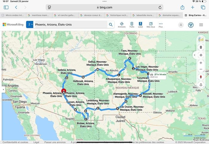
Day 1: Flight Marseille-Paris-Phoenix, then Gold Canyon (133 km) Day 2: Tucson (271 km) Lost Dutchman State Park Day 3: Tucson (155 km) Day 4: Tucson (34 km) Day 5: Bisbee (182 km) Day 6: Lordsburg (345 km) Day 7: Las Cruces (253 km) Day 8: Alamogordo (162 km) Day 9: Roswell (264 km) Day 10: Tucumcari (369 km) Day 11: Las Vegas (281 km) – the one in New Mexico Day 12: Taos (213 km) Day 13: Santa Fe (224 km) Day 14: Albuquerque (123 km) Day 15: Gallup (246 km) Day 16: Holbrook (224 km) Day 17: Flagstaff (179 km) Day 18: Sedona (118 km) Day 19: Sedona (48 km) Day 20: Sedona (41 km) Day 21: Phoenix (256 km) Day 22: Phoenix Airport (35 km)
📊 **Budget**: A little over 7,500 € for both of us, all included. The exchange rate was in our favor (1.17 dollars to 1 €). 📊 **Flights**: Marseille-Paris Charles de Gaulle-Phoenix: 1,787 € for two, with one checked bag each (Air France) 📊 **ESTA**: $42 📊 **America the Beautiful Pass**: $80 📊 **Parking**: 134 € (super eco at Marseille) 📊 **Car rental (Hertz)**: 865 €. Since there were no SUVs left in the reserved category (Nissan Rogue), we got an upgrade (4x4 Ford Explorer). We booked through Air France (15% discount). We’d originally reserved it in December for 1,140 €, but since prices dropped in March, we canceled and rebooked for 865 €. Hertz offers a free Hertz Gold Plus Rewards program, which gives you priority counter service when picking up the car. 📊 **Accommodation**: 2,400 € We stayed in hotels and motels of varying standards (from 60 to 203 € per night, depending on the city), all booked through Booking.com or Hotels.com. Out of 21 nights, only two didn’t include breakfast in the price. Booking.com sometimes offers slightly cheaper rates if you book by phone using the mobile app, and our Genius 3 status on the site also got us some preferential rates. 📊 **Supplementary insurance**: AVA 200 € for medical care if needed 📊 **Cash**: $2,078. We left with 1,000 € exchanged before departure and made two withdrawals of $500. This cash covered: - Evening restaurants and tips - Midday picnics - Gas: $298 for 4,160 km - Museum and private park entries (per person): - Lost Dutchman: $10 - Arizona-Sonora Desert Museum: $28 - Bird Cage Theater: $16 - Tombstone Shootout: $8 - New Mexico Farm & Ranch Museum: $12 - Roswell International UFO Museum: $5 - Billy the Kid Museum: $7 - Rancho de Taos: $22 - West Fork Oak Creek Trail entry: $15 We got a few discounts thanks to our senior age (+65). - Souvenirs and little treats
Like on our previous road trips, we didn’t rent a GPS. We got around using offline GPS apps Here WeGo and Organic Maps, with maps of the states we visited downloaded before we left (on our phones).
❤️❤️❤️ **Highlights** (there are so many!) 📍 Goldfield Ghost Town (even if it’s a reconstruction) 📍 The standing army of Saguaro cacti at Saguaro National Park West 📍 Diving into the cowboy universe of Tombstone 📍 The welcome from Rick and Henry at our guesthouse in Bisbee (Garden at Mile High Ranch) 📍 The tangled rocks of Chiricahua National Monument 📍 The flavored pistachios from Dwayne’s Fresh Jerky and Mac Ginnis Pistachioland 📍 Restaurants: La Posta (Las Cruces), Diner 66 (Albuquerque), and the Haunted Hamburger (Jerome) 📍 The old plazas of New Mexico 📍 The solitude and beauty of the white dunes at White Sands National Park 📍 Stepping back in time at the Billy the Kid Museum (Fort Stanton) 📍 Sections of historic Route 66 and the old motels of Tucumcari, especially at night when all the neon lights are on 📍 Taos Pueblo and diving into Native American culture 📍 After the Rio Grande Bridge, the descent via NM 567 to the very bottom of the Rio Grande Gorge, then the road along the riverbanks to Taos 📍 The tranquility of the Chimayo Sanctuary 📍 Discovering the ingenious native dwellings at Bandelier National Monument and Walnut Canyon National Park 📍 The small towns along the Turquoise Trail 📍 The red rocks of Red Rock Park and the Painted Desert 📍 The extraordinary colors of the petrified trees at Petrified Forest National Park 📍 Sedona, its red rocks, and the reward of the viewpoints at the end of hikes (Devil’s Bridge, The Subway, and West Fork Oak Creek) 📍 The immersion in Mexico when visiting Tlaquepaque 📍 The almost-ghost town of Jerome and its terraced streets 📍 The incredible kindness of Americans, always ready to help and up for a chat ❤️
☹️☹️☹️ **Flops** (there are very few) 📍 Several museums and churches being closed, so we couldn’t visit them 📍 Some museums and visitor centers opening late (10 AM) and closing early (4 PM) 📍 A 64 € phone roaming charge because we got near the Mexican border and picked up their cell tower 📍 The outrageous price ($5.99) for a gallon of gas at the Shell near Phoenix Airport
I hope this helps! Anyway, thanks for reading my long post. Don’t hesitate to reach out, even via PM, if you see I haven’t replied and you’d like more details. Have a great evening, everyone! 🙂
We’re back from our September 2025 road trip, this time to explore Arizona and New Mexico, and it’s time for me to start my travel journal—especially since everything’s already booked for another trip in September 2026 (to California), and I need to get started on the planning.
I was a little worried this new visit to Uncle Sam’s country might not be as "wow" as the others, but we still discovered some incredible places.
For those who don’t know us, we’re a couple in our seventies who speak very little English, but that didn’t stop us from fully enjoying our stay.
For this 6th road trip in the U.S., we spent 21 nights there, drove 4,160 km by car, and walked nearly 160 km in a loop starting from Phoenix.
We’d been to Arizona before (but not this side) and never to New Mexico. This whole road trip was a huge discovery for us.
In the prices mentioned (some in euros, others in dollars), bank fees and exchange charges are included. The flights, car rental, and parking were all paid for in December 2024 when we booked.
We’d downloaded the MPC (Mobile Passport Control) app, but there wasn’t a dedicated line at Phoenix Airport. Still, we got through quickly with friendly, smiling agents.
I don’t drive at all (I hate it), so the stops were chosen based on activities but also, for some, to limit daily mileage for the sole driver. The kilometers listed in the itinerary are the daily distances.
We traveled from September 9th to 22nd, unfortunately once again without our dear friends Mimi and Maumau.
The itinerary
Day 1: Flight Marseille-Paris-Phoenix, then Gold Canyon (133 km) Day 2: Tucson (271 km) Lost Dutchman State Park Day 3: Tucson (155 km) Day 4: Tucson (34 km) Day 5: Bisbee (182 km) Day 6: Lordsburg (345 km) Day 7: Las Cruces (253 km) Day 8: Alamogordo (162 km) Day 9: Roswell (264 km) Day 10: Tucumcari (369 km) Day 11: Las Vegas (281 km) – the one in New Mexico Day 12: Taos (213 km) Day 13: Santa Fe (224 km) Day 14: Albuquerque (123 km) Day 15: Gallup (246 km) Day 16: Holbrook (224 km) Day 17: Flagstaff (179 km) Day 18: Sedona (118 km) Day 19: Sedona (48 km) Day 20: Sedona (41 km) Day 21: Phoenix (256 km) Day 22: Phoenix Airport (35 km)
📊 **Budget**: A little over 7,500 € for both of us, all included. The exchange rate was in our favor (1.17 dollars to 1 €). 📊 **Flights**: Marseille-Paris Charles de Gaulle-Phoenix: 1,787 € for two, with one checked bag each (Air France) 📊 **ESTA**: $42 📊 **America the Beautiful Pass**: $80 📊 **Parking**: 134 € (super eco at Marseille) 📊 **Car rental (Hertz)**: 865 €. Since there were no SUVs left in the reserved category (Nissan Rogue), we got an upgrade (4x4 Ford Explorer). We booked through Air France (15% discount). We’d originally reserved it in December for 1,140 €, but since prices dropped in March, we canceled and rebooked for 865 €. Hertz offers a free Hertz Gold Plus Rewards program, which gives you priority counter service when picking up the car. 📊 **Accommodation**: 2,400 € We stayed in hotels and motels of varying standards (from 60 to 203 € per night, depending on the city), all booked through Booking.com or Hotels.com. Out of 21 nights, only two didn’t include breakfast in the price. Booking.com sometimes offers slightly cheaper rates if you book by phone using the mobile app, and our Genius 3 status on the site also got us some preferential rates. 📊 **Supplementary insurance**: AVA 200 € for medical care if needed 📊 **Cash**: $2,078. We left with 1,000 € exchanged before departure and made two withdrawals of $500. This cash covered: - Evening restaurants and tips - Midday picnics - Gas: $298 for 4,160 km - Museum and private park entries (per person): - Lost Dutchman: $10 - Arizona-Sonora Desert Museum: $28 - Bird Cage Theater: $16 - Tombstone Shootout: $8 - New Mexico Farm & Ranch Museum: $12 - Roswell International UFO Museum: $5 - Billy the Kid Museum: $7 - Rancho de Taos: $22 - West Fork Oak Creek Trail entry: $15 We got a few discounts thanks to our senior age (+65). - Souvenirs and little treats
Like on our previous road trips, we didn’t rent a GPS. We got around using offline GPS apps Here WeGo and Organic Maps, with maps of the states we visited downloaded before we left (on our phones).
❤️❤️❤️ **Highlights** (there are so many!) 📍 Goldfield Ghost Town (even if it’s a reconstruction) 📍 The standing army of Saguaro cacti at Saguaro National Park West 📍 Diving into the cowboy universe of Tombstone 📍 The welcome from Rick and Henry at our guesthouse in Bisbee (Garden at Mile High Ranch) 📍 The tangled rocks of Chiricahua National Monument 📍 The flavored pistachios from Dwayne’s Fresh Jerky and Mac Ginnis Pistachioland 📍 Restaurants: La Posta (Las Cruces), Diner 66 (Albuquerque), and the Haunted Hamburger (Jerome) 📍 The old plazas of New Mexico 📍 The solitude and beauty of the white dunes at White Sands National Park 📍 Stepping back in time at the Billy the Kid Museum (Fort Stanton) 📍 Sections of historic Route 66 and the old motels of Tucumcari, especially at night when all the neon lights are on 📍 Taos Pueblo and diving into Native American culture 📍 After the Rio Grande Bridge, the descent via NM 567 to the very bottom of the Rio Grande Gorge, then the road along the riverbanks to Taos 📍 The tranquility of the Chimayo Sanctuary 📍 Discovering the ingenious native dwellings at Bandelier National Monument and Walnut Canyon National Park 📍 The small towns along the Turquoise Trail 📍 The red rocks of Red Rock Park and the Painted Desert 📍 The extraordinary colors of the petrified trees at Petrified Forest National Park 📍 Sedona, its red rocks, and the reward of the viewpoints at the end of hikes (Devil’s Bridge, The Subway, and West Fork Oak Creek) 📍 The immersion in Mexico when visiting Tlaquepaque 📍 The almost-ghost town of Jerome and its terraced streets 📍 The incredible kindness of Americans, always ready to help and up for a chat ❤️
☹️☹️☹️ **Flops** (there are very few) 📍 Several museums and churches being closed, so we couldn’t visit them 📍 Some museums and visitor centers opening late (10 AM) and closing early (4 PM) 📍 A 64 € phone roaming charge because we got near the Mexican border and picked up their cell tower 📍 The outrageous price ($5.99) for a gallon of gas at the Shell near Phoenix Airport
I hope this helps! Anyway, thanks for reading my long post. Don’t hesitate to reach out, even via PM, if you see I haven’t replied and you’d like more details. Have a great evening, everyone! 🙂
Berlin impressions (live)
Hi there,
I arrived in Berlin last night. In another discussion, I shared how much of a "nightmare" the flights from Nice were.
I’ll be posting some impressions here—what I liked and what I didn’t like as much.
This is my first time in Berlin. I’m staying for two weeks. For now, I’m alone, but I’ll be joined by someone in a few days.
Just to clarify, I won’t be posting any photos because my camera gave up the ghost the day before I left. It refused to read memory cards, and I don’t have a smartphone—just a tablet that I leave at the hotel.
Speaking of photos, a few years ago, at the Ducasse d’Ath in Belgium, I met a retired teacher who wasn’t taking any pictures of the festival. I asked her, "You’re not taking any photos?" She told me that during a trip to Nicaragua, she’d photographed howler monkeys and only noticed when looking at the pictures later that the males had huge testicles—something she hadn’t realized in person. She said, "Since then, I don’t bother with photos anymore!" I’ve thought about that often and wonder if I should do the same and stop taking pictures. Still, I’ll probably get a smartphone since it’s hard to go without one these days.
I arrived in Berlin last night. In another discussion, I shared how much of a "nightmare" the flights from Nice were.
I’ll be posting some impressions here—what I liked and what I didn’t like as much.
This is my first time in Berlin. I’m staying for two weeks. For now, I’m alone, but I’ll be joined by someone in a few days.
Just to clarify, I won’t be posting any photos because my camera gave up the ghost the day before I left. It refused to read memory cards, and I don’t have a smartphone—just a tablet that I leave at the hotel.
Speaking of photos, a few years ago, at the Ducasse d’Ath in Belgium, I met a retired teacher who wasn’t taking any pictures of the festival. I asked her, "You’re not taking any photos?" She told me that during a trip to Nicaragua, she’d photographed howler monkeys and only noticed when looking at the pictures later that the males had huge testicles—something she hadn’t realized in person. She said, "Since then, I don’t bother with photos anymore!" I’ve thought about that often and wonder if I should do the same and stop taking pictures. Still, I’ll probably get a smartphone since it’s hard to go without one these days.
Exchanging Euros in Cape Verde
Hi,
We’re heading to Cape Verde in January. We’re scheduled to arrive in Praia on a Saturday around 11 AM.
I read somewhere that the exchange rate for Euros to Escudos is the same everywhere—110 escudos for 1 euro. Can anyone confirm this? If that’s the case, I assume there’s a currency exchange desk at the airport, and the rate isn’t too bad? So, it’s better to exchange at the airport, right? What do you think? I don’t want to use ATMs.
Otherwise, are banks in town open on Saturdays? I read they close by 3 PM?
Road Trip USA 2023 - Part 2
HIGHWAY 1
Highway 1 runs along the Pacific coast of California from Leggett in the north to Dana Point in the south. It's the longest state route in California, stretching 1,050 km.
It's famous for its breathtaking ocean views. That’s actually why it’s become such a popular route for road trips, with tons of attractions and points of interest all along the way.
After crossing the U.S. interior on our way out (see Road Trip USA 2023 - Part 1), we’re starting our return trip along this route from Leggett.
Videos are embedded throughout the summary. Please click on the image to start the video. To jump to a specific post, here are the appropriate links:
CALIFORNIA:
Scenic Overlooks on Route 1 Between Leggett and Fort Bragg The Pudding Creek Trestle Bridge in Fort Bragg Glass Beach - Fort Bragg Jenner Lookout Point - Highway 1 Goat Rock Beach - Sonoma Coast State Park - Jenner Point Reyes National Seashore - White House Pool Trail Point Reyes National Seashore - Limantour Beach Point Reyes National Seashore - Point Reyes Shipwreck Point Reyes National Seashore - Kehoe Beach Trail Point Reyes National Seashore - McClures Beach Trail Point Reyes National Seashore - Cypress Tree Tunnel Point Reyes National Seashore - Point Reyes Beach North Point Reyes National Seashore - Elephant Seals on Drakes Beach Point Reyes National Seashore - Point Reyes Beach South Point Reyes National Seashore – Elephant Seals Overlooks Point Reyes National Seashore - Chimney Rock Trail Point Reyes National Seashore - Point Reyes Lighthouse Trail Point Reyes National Seashore – Tule Elk Observation Point Bonita Lighthouse Trail - Sausalito Hawk Hill - Sausalito Battery Spencer Trail - Sausalito Rodeo Beach - Sausalito Point Cavallo - Golden Gate View - Sausalito Exploring Downtown Sausalito Visiting Sausalito’s Houseboats Crossing the Golden Gate Bridge - San Francisco Golden Gate Bridge Viewpoints - San Francisco Cruise to Alcatraz Island - San Francisco Visiting Alcatraz Island - San Francisco Civic Center - Downtown San Francisco Market Street & Yerba Buena Gardens - Downtown San Francisco Union Square & Financial District - Downtown San Francisco Fisherman's Wharf, Pier 39 & Embarcadero - San Francisco Sea Lion Observation - Pier 39 - San Francisco Lombard Street & Cable Car - Russian Hill - San Francisco Macondray Lane Historic District - Russian Hill - San Francisco Grace Cathedral & Huntington Park - Nob Hill - San Francisco Telegraph Hill - San Francisco Chinatown - San Francisco Alamo Square & Painted Ladies - Western Addition - San Francisco Palace of Fine Arts - Marina District - San Francisco Presidio of San Francisco California Coastal Trail - Lincoln Park - San Francisco California Palace of the Legion of Honor - Lincoln Park - San Francisco Sutro Baths - Lincoln Park - San Francisco Queen Wilhelmina Garden - Golden Gate Park - San Francisco Bison Paddock - Golden Gate Park - San Francisco Portals of the Past - Golden Gate Park - San Francisco Strawberry Hill - Golden Gate Park – San Francisco Prayerbook Cross & Robin Williams Meadow - Golden Gate Park - San Francisco Hidden Garden Steps & 16th Avenue Tiled Steps - San Francisco Grandview Park - San Francisco Hike - Twin Peaks Three Summits - San Francisco Longboarding Down Twin Peaks Blvd in San Francisco Haight-Ashbury - San Francisco Corona Heights Park - San Francisco Mission Dolores - San Francisco Mural Frescoes (Part 1) - Mission District - San Francisco Mural Frescoes (Part 2) - Mission District - San Francisco Devil's Slide Bunker - Pacifica Mavericks Beach - Half Moon Bay Martins Beach - Half Moon Bay Pigeon Point Lighthouse State Historic Park - Pescadero What to See in Santa Cruz Visiting Capitola What to See in Monterey Carmel-by-the-Sea Lovers Point Park - Pacific Grove Castle Rock, Hurricane Point & Little Sur River Viewpoints Pfeiffer Falls Trail Julia Pfeiffer Burns State Park Vista Point & McWay Falls Highway 1 - Big Sur Viewpoints Salmon Creek Falls San Carpoforo Creek Trail Elephant Seal Vista Point - San Simeon San Simeon Pier Moonstone Beach Boardwalk Shipwreck - Estero Bluffs State Park Surfing Competition in Morro Bay Port San Luis Pier - San Luis Obispo Pismo Beach Monarch Butterfly Grove - Pismo State Beach Nojoqui Falls Park - Solvang Arroyo Hondo Vista Point Solvang, a Charming Danish Town in California Chumash Painted Cave - Santa Barbara Goleta San Marcos Rd & Cachuma Lake Vista Points - Santa Barbara Old Santa Barbara Mission Walking Tour of Santa Barbara’s Historic Downtown West Beach - Santa Barbara What to See in Ventura Paradise Falls - Wildwood Regional Park - Thousand Oaks Sandy Dune & El Matador State Beach - Malibu Point Dume Nature Reserve - Malibu Malibu Pier Road Trip in the Malibu Mountains Los Liones Trail - Santa Monica Santa Monica Pier Rodeo Drive - Beverly Hills Greystone Mansion - Beverly Hills Hollywood Walk of Fame - Los Angeles Griffith Observatory - Los Angeles Hollywood Forever Cemetery - Los Angeles What to See in Venice Beach Venice Beach Skatepark ShoreLine Aquatic Park - Long Beach Alamitos Beach - Long Beach Naples Island - Long Beach Crescent Bay Point Park & Helser Park Kiosk - Laguna Beach Shell Beach at Twin Points - Laguna Beach Prairie Dogs at Agra Vista Point Top Gun House & Oceanside Pier Annie's Canyon Trail - Solana Beach (Via North Rios Trailhead Loop) Old Town San Diego La Jolla Coastal Trail - San Diego Balboa Park - San Diego Pacific Beach - San Diego Mission Beach - San Diego Ocean Beach Tide Pools - San Diego Sunset Cliffs Natural Park - San Diego Tuna Harbor Park - San Diego Seaport Village & Embarcadero Marina Park - San Diego Gaslamp Quarter - Downtown San Diego Coronado Island - San Diego Dead Dolly Lane - Alpine Galleta Meadows Metal Sculptures - Borrego Springs What to See in Palm Springs Robolights - Palm Springs Andreas Canyon Trail - Indian Canyons - Palm Springs Palm Canyon Trail - Indian Canyons - Palm Springs West Fork Falls Trail - Indian Canyons - Palm Springs Tahquitz Canyon Loop Trail - Indian Canyons - Palm Springs Desert Christ Park - Yucca Valley Pioneertown Salvation Mountain - Niland Slab City - Niland
Highway 1 runs along the Pacific coast of California from Leggett in the north to Dana Point in the south. It's the longest state route in California, stretching 1,050 km.
It's famous for its breathtaking ocean views. That’s actually why it’s become such a popular route for road trips, with tons of attractions and points of interest all along the way.
After crossing the U.S. interior on our way out (see Road Trip USA 2023 - Part 1), we’re starting our return trip along this route from Leggett.
Videos are embedded throughout the summary. Please click on the image to start the video. To jump to a specific post, here are the appropriate links:
CALIFORNIA:
Scenic Overlooks on Route 1 Between Leggett and Fort Bragg The Pudding Creek Trestle Bridge in Fort Bragg Glass Beach - Fort Bragg Jenner Lookout Point - Highway 1 Goat Rock Beach - Sonoma Coast State Park - Jenner Point Reyes National Seashore - White House Pool Trail Point Reyes National Seashore - Limantour Beach Point Reyes National Seashore - Point Reyes Shipwreck Point Reyes National Seashore - Kehoe Beach Trail Point Reyes National Seashore - McClures Beach Trail Point Reyes National Seashore - Cypress Tree Tunnel Point Reyes National Seashore - Point Reyes Beach North Point Reyes National Seashore - Elephant Seals on Drakes Beach Point Reyes National Seashore - Point Reyes Beach South Point Reyes National Seashore – Elephant Seals Overlooks Point Reyes National Seashore - Chimney Rock Trail Point Reyes National Seashore - Point Reyes Lighthouse Trail Point Reyes National Seashore – Tule Elk Observation Point Bonita Lighthouse Trail - Sausalito Hawk Hill - Sausalito Battery Spencer Trail - Sausalito Rodeo Beach - Sausalito Point Cavallo - Golden Gate View - Sausalito Exploring Downtown Sausalito Visiting Sausalito’s Houseboats Crossing the Golden Gate Bridge - San Francisco Golden Gate Bridge Viewpoints - San Francisco Cruise to Alcatraz Island - San Francisco Visiting Alcatraz Island - San Francisco Civic Center - Downtown San Francisco Market Street & Yerba Buena Gardens - Downtown San Francisco Union Square & Financial District - Downtown San Francisco Fisherman's Wharf, Pier 39 & Embarcadero - San Francisco Sea Lion Observation - Pier 39 - San Francisco Lombard Street & Cable Car - Russian Hill - San Francisco Macondray Lane Historic District - Russian Hill - San Francisco Grace Cathedral & Huntington Park - Nob Hill - San Francisco Telegraph Hill - San Francisco Chinatown - San Francisco Alamo Square & Painted Ladies - Western Addition - San Francisco Palace of Fine Arts - Marina District - San Francisco Presidio of San Francisco California Coastal Trail - Lincoln Park - San Francisco California Palace of the Legion of Honor - Lincoln Park - San Francisco Sutro Baths - Lincoln Park - San Francisco Queen Wilhelmina Garden - Golden Gate Park - San Francisco Bison Paddock - Golden Gate Park - San Francisco Portals of the Past - Golden Gate Park - San Francisco Strawberry Hill - Golden Gate Park – San Francisco Prayerbook Cross & Robin Williams Meadow - Golden Gate Park - San Francisco Hidden Garden Steps & 16th Avenue Tiled Steps - San Francisco Grandview Park - San Francisco Hike - Twin Peaks Three Summits - San Francisco Longboarding Down Twin Peaks Blvd in San Francisco Haight-Ashbury - San Francisco Corona Heights Park - San Francisco Mission Dolores - San Francisco Mural Frescoes (Part 1) - Mission District - San Francisco Mural Frescoes (Part 2) - Mission District - San Francisco Devil's Slide Bunker - Pacifica Mavericks Beach - Half Moon Bay Martins Beach - Half Moon Bay Pigeon Point Lighthouse State Historic Park - Pescadero What to See in Santa Cruz Visiting Capitola What to See in Monterey Carmel-by-the-Sea Lovers Point Park - Pacific Grove Castle Rock, Hurricane Point & Little Sur River Viewpoints Pfeiffer Falls Trail Julia Pfeiffer Burns State Park Vista Point & McWay Falls Highway 1 - Big Sur Viewpoints Salmon Creek Falls San Carpoforo Creek Trail Elephant Seal Vista Point - San Simeon San Simeon Pier Moonstone Beach Boardwalk Shipwreck - Estero Bluffs State Park Surfing Competition in Morro Bay Port San Luis Pier - San Luis Obispo Pismo Beach Monarch Butterfly Grove - Pismo State Beach Nojoqui Falls Park - Solvang Arroyo Hondo Vista Point Solvang, a Charming Danish Town in California Chumash Painted Cave - Santa Barbara Goleta San Marcos Rd & Cachuma Lake Vista Points - Santa Barbara Old Santa Barbara Mission Walking Tour of Santa Barbara’s Historic Downtown West Beach - Santa Barbara What to See in Ventura Paradise Falls - Wildwood Regional Park - Thousand Oaks Sandy Dune & El Matador State Beach - Malibu Point Dume Nature Reserve - Malibu Malibu Pier Road Trip in the Malibu Mountains Los Liones Trail - Santa Monica Santa Monica Pier Rodeo Drive - Beverly Hills Greystone Mansion - Beverly Hills Hollywood Walk of Fame - Los Angeles Griffith Observatory - Los Angeles Hollywood Forever Cemetery - Los Angeles What to See in Venice Beach Venice Beach Skatepark ShoreLine Aquatic Park - Long Beach Alamitos Beach - Long Beach Naples Island - Long Beach Crescent Bay Point Park & Helser Park Kiosk - Laguna Beach Shell Beach at Twin Points - Laguna Beach Prairie Dogs at Agra Vista Point Top Gun House & Oceanside Pier Annie's Canyon Trail - Solana Beach (Via North Rios Trailhead Loop) Old Town San Diego La Jolla Coastal Trail - San Diego Balboa Park - San Diego Pacific Beach - San Diego Mission Beach - San Diego Ocean Beach Tide Pools - San Diego Sunset Cliffs Natural Park - San Diego Tuna Harbor Park - San Diego Seaport Village & Embarcadero Marina Park - San Diego Gaslamp Quarter - Downtown San Diego Coronado Island - San Diego Dead Dolly Lane - Alpine Galleta Meadows Metal Sculptures - Borrego Springs What to See in Palm Springs Robolights - Palm Springs Andreas Canyon Trail - Indian Canyons - Palm Springs Palm Canyon Trail - Indian Canyons - Palm Springs West Fork Falls Trail - Indian Canyons - Palm Springs Tahquitz Canyon Loop Trail - Indian Canyons - Palm Springs Desert Christ Park - Yucca Valley Pioneertown Salvation Mountain - Niland Slab City - Niland
Backpacking itinerary in Tunisia
Hi there,
I'm urgently planning a trip to Tunisia in November, backpacker-style (no agency, no guide or taxi, public transport, youth hostels or small hotels, local restaurants). I'm not interested in the beach, and I like to take my time at archaeological sites and museums (twice as long as the average visitor). I'm aiming for about two weeks, give or take.
First, I'm trying to roughly outline a route/schedule so I can book my flight as soon as possible (no desert in the south this time—I went there years ago and want to stay independent). I’ve sketched out the following itinerary, knowing that apparently, there are quite a few towns without budget-friendly hotels (even on Airbnb), which means I’ll be staying longer where they’re available. Three questions: 1. Does this seem reasonable overall (time spent in each city)? 2. Should I add other cities, maybe in the northwest? 3. For hotels, in November, is it better to scout options on booking sites first, then book on the spot for cheaper rates (no site commission + possible negotiation)? Also, are hotels not listed online and found randomly on-site much cheaper?
ROUGH ITINERARY (order to be confirmed)
TUNIS 5 days (cheap accommodations: 13 or 19 €) 2 days: Medina, souks, Bardo Museum, Royal Mausoleum of Tourbet El Bey, Zitouna Mosque (exterior) 1 day: Sidi Bou Said 1 day: Carthage 1 day: A-R Dougga (bus to Tebersouk 2h + taxi) – pack a picnic + option: hike to Zaghouan (750m+, 10km round trip) – worth it? Doable alone?
KAIROUAN 2 days (very expensive room: 40-50 €!) Great Mosque, Medina, Three Doors Mosque, medieval cemetery, Sidi Sahbi Mosque...
SOUSSE 3 days (room 15 €) 2 days: Medina, archaeological museum, Port El Kantaoui, the Ribat (fortress), Contemporary Art Museum Dar Am Taïeb, Dar Essid (17th-century traditional house) 1 day: A-R El Jem (60km away) + option: 1 day A-R Monastir? Worth it? + option: 1 day A-R Mahdia (or 2 days sleeping there)?
OPTIONS -> Gabes to mix things up? But is it easy to find cheap lodging and get around/visit alone? -> Other sights or stops to sleep: Sfax, El Kef, others? -> Kerkenna Islands (easy accommodation?)
Thanks for your thoughts and opinions on these options. Once I’ve adjusted the duration, I’ll book my tickets for early November! (By the way, do you think I should arrive and depart from two different airports?)
I'm urgently planning a trip to Tunisia in November, backpacker-style (no agency, no guide or taxi, public transport, youth hostels or small hotels, local restaurants). I'm not interested in the beach, and I like to take my time at archaeological sites and museums (twice as long as the average visitor). I'm aiming for about two weeks, give or take.
First, I'm trying to roughly outline a route/schedule so I can book my flight as soon as possible (no desert in the south this time—I went there years ago and want to stay independent). I’ve sketched out the following itinerary, knowing that apparently, there are quite a few towns without budget-friendly hotels (even on Airbnb), which means I’ll be staying longer where they’re available. Three questions: 1. Does this seem reasonable overall (time spent in each city)? 2. Should I add other cities, maybe in the northwest? 3. For hotels, in November, is it better to scout options on booking sites first, then book on the spot for cheaper rates (no site commission + possible negotiation)? Also, are hotels not listed online and found randomly on-site much cheaper?
ROUGH ITINERARY (order to be confirmed)
TUNIS 5 days (cheap accommodations: 13 or 19 €) 2 days: Medina, souks, Bardo Museum, Royal Mausoleum of Tourbet El Bey, Zitouna Mosque (exterior) 1 day: Sidi Bou Said 1 day: Carthage 1 day: A-R Dougga (bus to Tebersouk 2h + taxi) – pack a picnic + option: hike to Zaghouan (750m+, 10km round trip) – worth it? Doable alone?
KAIROUAN 2 days (very expensive room: 40-50 €!) Great Mosque, Medina, Three Doors Mosque, medieval cemetery, Sidi Sahbi Mosque...
SOUSSE 3 days (room 15 €) 2 days: Medina, archaeological museum, Port El Kantaoui, the Ribat (fortress), Contemporary Art Museum Dar Am Taïeb, Dar Essid (17th-century traditional house) 1 day: A-R El Jem (60km away) + option: 1 day A-R Monastir? Worth it? + option: 1 day A-R Mahdia (or 2 days sleeping there)?
OPTIONS -> Gabes to mix things up? But is it easy to find cheap lodging and get around/visit alone? -> Other sights or stops to sleep: Sfax, El Kef, others? -> Kerkenna Islands (easy accommodation?)
Thanks for your thoughts and opinions on these options. Once I’ve adjusted the duration, I’ll book my tickets for early November! (By the way, do you think I should arrive and depart from two different airports?)
Join me in discovering Gran Canaria
Introduction
We stayed on the island of Gran Canaria during the first three months of 2024. It’s the third Canary Island we’ve visited, after Tenerife and Lanzarote.
We rented an apartment in Temisas. By staying in the same place for such a long period, the total price dropped by 50%.
We also rented a vehicle to make getting around the island easier.
Why the Canary Islands, and Gran Canaria in particular? For its pleasant climate, the nature and diversity of its landscapes, the charming villages, and especially the beauty of its many beaches.
In this travel journal, you’ll find a list of the many activities we did during our stay to explore the different attractions of this island.
These attractions are categorized to make it easier to find what interests you.
Videos are included throughout the summary. Click on the image to start the video.
To jump to a specific post, here are the relevant links:
HIKES:
Roque Nublo Maspalomas Dunes - Part 1 Maspalomas Dunes - Part 2 Los Azulejos de Veneguera Barranco de Las Vacas Ventana del Bentayga (Arco del Aserrador) Caves of the King Ventana de Morro (Ventana de la Ganifa) The Dog of Bentayga Cave of the Four Doors Ventana del Nublo Artenera - Caves of Acusa Seca Temisas - El Gigante Cave Fortress of Ansite Puerto de Las Nieves - Roque de Las Nieves Temisas - Cuevas de la Audiencia Roque Bentayga Guayadeque Ravine (Guayadeque Hermitage) Guayadeque Ravine (Cueva de Bartalo) El Zumacal - Barranco Tauco Casablanca Dam (Los Dolores Dam) Ayagaures - La Angostura Dam & Gambuesa Dam Santa Brígida - Alonso Ravine & Centennial Dragon Tree Pino Santo Hike in the Azuaje Ravine Gáldar - Red Lands of Samarrita Tejeda - Charco de La Paloma Bandama Boiler (Camino Borde de Caldera Bandama) Teror - Alamo Ravine Trail – SL-4 Telde - Calasio Caves Special Natural Reserve of Los Tilos de Moya Los Azulejos - Charco de Las Aneas Fataga Ravine Arinaga Military Battery Trail Maspalomas - Las Fuentes and del Canizo Ravines Mogán - Tauro Mountain Trail Tamabada - Llanos de La Mimbre & Sobre la Cueva Viewpoints Trail Hike to the Coronadero Arch via Barranco Hondo Barranco de Silva - Hike to the Jerez Caves Gáldar - Samson Cave - La Atalaya Peak Agaete - Roque Guayedra and Guayedra Ravine Artenara - Caballero Caves Arucas - Bufadero Salt Flats Barranco de Pino Gordo - Natural Pools Telde - Los Cernícalos Ravine Las Cruces - Toba Caves & Picón Puerto de Las Nieves - Moro Cave Agüimes - Morros de Ávila Caves Juncalillo del Sur - Laguna & Salinas de Abajo Caves of Camino de San Felipe Cruz de Tejeda, Cruz Chico and Degollada Viewpoint Hike on the Patalavaca Circuit Motor Grande - Puerto Rico Arch El Montañón - Los Hornos Dam Seafront Walk - Amadores Beach – Puerto Rico Beach Las Niñas Dam El Hornillo - Omega & Omicron Caves Arteara Necropolis Mogán - El Mulato Dam Las Garzas - El Regante Dam La Plata Route - Cho Flores Dam & El Charco Hondo Vega de Acusa - La Candelaria Dam Candelaria Hermitage – Acusa Seca Viewpoint Valsequillo de Gran Canaria – Roque La Vela Ayagaures Dam – GC-602 Lomo del Palo - Monte Pavón Trail Lugar La Laguna - Levada Fataga Dam & Ravine
BEACHES:
Mogán Beach Taurito Beach Tauro Beach Amadores Beach Puerto Rico Beach Anfi del Mar Beach Patalavaca Beach Meloneras Beach Maspalomas Beach English Beach (Playa del Inglés) Las Burras Beach San Agustin Beach Las Alcaravaneras Beach Las Canteras Beach (La Cicer) Las Canteras Beach (La Puntilla) Las Canteras Beach (Santa Catalina) Aquamarina Beach El Agujero - Bocabarranco Beach Hoya Del Pozo Beach Hoya Del Pozo Beach - Lizard with amputated tail El Cabron Beach Ojos de Garza Beach El Burrero Beach
NATURAL POOLS:
Charco Azul - El Risco Agaete Salt Flats Charco de Los Espejos - Sardina del Norte Natural Pools of Punta de Gáldar Snorkeling in the natural pool of Punta de Gáldar Natural Pool La Furnia o El Clavo - Gáldar Natural Pool of Los Dos Roques Emiliano Natural Pool - El Agujero Natural Pool of El Agujero Natural Pools of Roque Prieto Natural Pool El Altillo Los Charcones de Bañaderos – Arucas Natural Pools of El Charco de Las Palomas – Arucas Natural Pools of La Laja - Las Palmas de Gran Canaria Cueva de la Reina Mora - La Garita Natural Pools of Castillo del Romeral
TOWNS:
Center
Santa Brigida Vega de San Mateo Tejeda Artenara Vallesco Teror
Southwest
Santa Lucia de Tirajana Fataga San Bartolomé de Tirajana Puerto de Mogán La Aldea de San Nicolas
North
Arucas Firgas Moya Santa Maria de Guia Gáldar Agaete Puerto de Las Nieves
East
Vegueta - Las Palmas de Gran Canaria Triana - Las Palmas de Gran Canaria Ciudad Jardin - Las Palmas de Gran Canaria Canteras - Las Palmas de Gran Canaria Telde Valsequillo de Gran Canaria Ingenio Agüimes Temisas
VIEWPOINTS:
GC-60 Route (or nearby) GC-210 Route (or nearby) GC-210 Route between the tunnel and La Aldea de San Nicolás GC-215 & GC-65 Routes (or nearby) GC-200 Route (or nearby) GC-130 Route (or nearby) & GC-605 GC-70 Route (or nearby) & GC-21 Sheep herd on GC-70 Route GC-150, GC-240, GC-305, GC-350 & GC-301 Routes GC-606, GC-295, GC-231 and GC-41 Routes (or nearby) Viewpoints – GC-1 Route (or nearby) Viewpoints - Las Palmas de Gran Canaria Viewpoints - GC-2, GC-21, GC-15, GC-216 and GC-132 Routes (or nearby) Viewpoints - GC-503 & GC-217 Routes Viewpoints - GC-604, GC-505, GC-132, GC-42 and GC-802 Routes
MISCELLANEOUS:
San Rafael Aqueduct - Telde Abandoned San Rafael Estate - La Higuera Cenobio de Valerón La Cesta - Tejeda Puerto de la Aldea Scenic Route GC-671 to El Espinillo Scenic Route GC-607 to El Chorrillo The Galdar Cube (Santiago Quarry) Scenic Route GC-504 to Ayagaures Abandoned seaside resort in the Azuaje Ravine El Bufadero de La Garita – Telde GC-505 Route Abandoned Finca Las Haciendas (Los Mocanes) – Las Vegas de Valsequillo Ruins of San Juan Battery - Las Palmas de Gran Canaria Viera y Clavijo Canarian Botanical Garden - Las Palmas de Gran Canaria Tenefé Salt Flats Los Pérez, Lugarejos & Las Hoyas Dams Monte Pavón, Gran Canaria’s little Ireland Valleseco Lagoon Recreational Area Climbing - Fataga Ravine Surfing – El Agujero El Cairete Restaurant - Carrizal de Tejeda Paragliding flight observation - Los Giles La Cuevita Ayagaures Restaurant Statues and Murals - Cruce de Arinaga Aviation Monument (Las Majoreras) & Murals – Carrizal Artistic recycling by Antonio Peñita - Ojos de Garza Rainbows
We stayed on the island of Gran Canaria during the first three months of 2024. It’s the third Canary Island we’ve visited, after Tenerife and Lanzarote.
We rented an apartment in Temisas. By staying in the same place for such a long period, the total price dropped by 50%.
We also rented a vehicle to make getting around the island easier.
Why the Canary Islands, and Gran Canaria in particular? For its pleasant climate, the nature and diversity of its landscapes, the charming villages, and especially the beauty of its many beaches.
In this travel journal, you’ll find a list of the many activities we did during our stay to explore the different attractions of this island.
These attractions are categorized to make it easier to find what interests you.
Videos are included throughout the summary. Click on the image to start the video.
To jump to a specific post, here are the relevant links:
HIKES:
Roque Nublo Maspalomas Dunes - Part 1 Maspalomas Dunes - Part 2 Los Azulejos de Veneguera Barranco de Las Vacas Ventana del Bentayga (Arco del Aserrador) Caves of the King Ventana de Morro (Ventana de la Ganifa) The Dog of Bentayga Cave of the Four Doors Ventana del Nublo Artenera - Caves of Acusa Seca Temisas - El Gigante Cave Fortress of Ansite Puerto de Las Nieves - Roque de Las Nieves Temisas - Cuevas de la Audiencia Roque Bentayga Guayadeque Ravine (Guayadeque Hermitage) Guayadeque Ravine (Cueva de Bartalo) El Zumacal - Barranco Tauco Casablanca Dam (Los Dolores Dam) Ayagaures - La Angostura Dam & Gambuesa Dam Santa Brígida - Alonso Ravine & Centennial Dragon Tree Pino Santo Hike in the Azuaje Ravine Gáldar - Red Lands of Samarrita Tejeda - Charco de La Paloma Bandama Boiler (Camino Borde de Caldera Bandama) Teror - Alamo Ravine Trail – SL-4 Telde - Calasio Caves Special Natural Reserve of Los Tilos de Moya Los Azulejos - Charco de Las Aneas Fataga Ravine Arinaga Military Battery Trail Maspalomas - Las Fuentes and del Canizo Ravines Mogán - Tauro Mountain Trail Tamabada - Llanos de La Mimbre & Sobre la Cueva Viewpoints Trail Hike to the Coronadero Arch via Barranco Hondo Barranco de Silva - Hike to the Jerez Caves Gáldar - Samson Cave - La Atalaya Peak Agaete - Roque Guayedra and Guayedra Ravine Artenara - Caballero Caves Arucas - Bufadero Salt Flats Barranco de Pino Gordo - Natural Pools Telde - Los Cernícalos Ravine Las Cruces - Toba Caves & Picón Puerto de Las Nieves - Moro Cave Agüimes - Morros de Ávila Caves Juncalillo del Sur - Laguna & Salinas de Abajo Caves of Camino de San Felipe Cruz de Tejeda, Cruz Chico and Degollada Viewpoint Hike on the Patalavaca Circuit Motor Grande - Puerto Rico Arch El Montañón - Los Hornos Dam Seafront Walk - Amadores Beach – Puerto Rico Beach Las Niñas Dam El Hornillo - Omega & Omicron Caves Arteara Necropolis Mogán - El Mulato Dam Las Garzas - El Regante Dam La Plata Route - Cho Flores Dam & El Charco Hondo Vega de Acusa - La Candelaria Dam Candelaria Hermitage – Acusa Seca Viewpoint Valsequillo de Gran Canaria – Roque La Vela Ayagaures Dam – GC-602 Lomo del Palo - Monte Pavón Trail Lugar La Laguna - Levada Fataga Dam & Ravine
BEACHES:
Mogán Beach Taurito Beach Tauro Beach Amadores Beach Puerto Rico Beach Anfi del Mar Beach Patalavaca Beach Meloneras Beach Maspalomas Beach English Beach (Playa del Inglés) Las Burras Beach San Agustin Beach Las Alcaravaneras Beach Las Canteras Beach (La Cicer) Las Canteras Beach (La Puntilla) Las Canteras Beach (Santa Catalina) Aquamarina Beach El Agujero - Bocabarranco Beach Hoya Del Pozo Beach Hoya Del Pozo Beach - Lizard with amputated tail El Cabron Beach Ojos de Garza Beach El Burrero Beach
NATURAL POOLS:
Charco Azul - El Risco Agaete Salt Flats Charco de Los Espejos - Sardina del Norte Natural Pools of Punta de Gáldar Snorkeling in the natural pool of Punta de Gáldar Natural Pool La Furnia o El Clavo - Gáldar Natural Pool of Los Dos Roques Emiliano Natural Pool - El Agujero Natural Pool of El Agujero Natural Pools of Roque Prieto Natural Pool El Altillo Los Charcones de Bañaderos – Arucas Natural Pools of El Charco de Las Palomas – Arucas Natural Pools of La Laja - Las Palmas de Gran Canaria Cueva de la Reina Mora - La Garita Natural Pools of Castillo del Romeral
TOWNS:
Center
Santa Brigida Vega de San Mateo Tejeda Artenara Vallesco Teror
Southwest
Santa Lucia de Tirajana Fataga San Bartolomé de Tirajana Puerto de Mogán La Aldea de San Nicolas
North
Arucas Firgas Moya Santa Maria de Guia Gáldar Agaete Puerto de Las Nieves
East
Vegueta - Las Palmas de Gran Canaria Triana - Las Palmas de Gran Canaria Ciudad Jardin - Las Palmas de Gran Canaria Canteras - Las Palmas de Gran Canaria Telde Valsequillo de Gran Canaria Ingenio Agüimes Temisas
VIEWPOINTS:
GC-60 Route (or nearby) GC-210 Route (or nearby) GC-210 Route between the tunnel and La Aldea de San Nicolás GC-215 & GC-65 Routes (or nearby) GC-200 Route (or nearby) GC-130 Route (or nearby) & GC-605 GC-70 Route (or nearby) & GC-21 Sheep herd on GC-70 Route GC-150, GC-240, GC-305, GC-350 & GC-301 Routes GC-606, GC-295, GC-231 and GC-41 Routes (or nearby) Viewpoints – GC-1 Route (or nearby) Viewpoints - Las Palmas de Gran Canaria Viewpoints - GC-2, GC-21, GC-15, GC-216 and GC-132 Routes (or nearby) Viewpoints - GC-503 & GC-217 Routes Viewpoints - GC-604, GC-505, GC-132, GC-42 and GC-802 Routes
MISCELLANEOUS:
San Rafael Aqueduct - Telde Abandoned San Rafael Estate - La Higuera Cenobio de Valerón La Cesta - Tejeda Puerto de la Aldea Scenic Route GC-671 to El Espinillo Scenic Route GC-607 to El Chorrillo The Galdar Cube (Santiago Quarry) Scenic Route GC-504 to Ayagaures Abandoned seaside resort in the Azuaje Ravine El Bufadero de La Garita – Telde GC-505 Route Abandoned Finca Las Haciendas (Los Mocanes) – Las Vegas de Valsequillo Ruins of San Juan Battery - Las Palmas de Gran Canaria Viera y Clavijo Canarian Botanical Garden - Las Palmas de Gran Canaria Tenefé Salt Flats Los Pérez, Lugarejos & Las Hoyas Dams Monte Pavón, Gran Canaria’s little Ireland Valleseco Lagoon Recreational Area Climbing - Fataga Ravine Surfing – El Agujero El Cairete Restaurant - Carrizal de Tejeda Paragliding flight observation - Los Giles La Cuevita Ayagaures Restaurant Statues and Murals - Cruce de Arinaga Aviation Monument (Las Majoreras) & Murals – Carrizal Artistic recycling by Antonio Peñita - Ojos de Garza Rainbows
Kattegat Tour and Norway’s Majestic Fjords – 32 Days (Denmark, Sweden, Norway)
Kattegat isn’t just the name of the village in the TV series *Vikings*—it’s also the stretch of water separating Denmark from Sweden... the sea, basically! And further north, you’ve got Norway and its fjords!
Originally, I’d planned to just do a loop around Kattegat, with the *Under* restaurant in Lindesnes as our anniversary treat... but along the way, we thought, why not "push" a little further north, keeping an eye on the budget since we’d chosen to travel by car in June 2025 through Scandinavia.
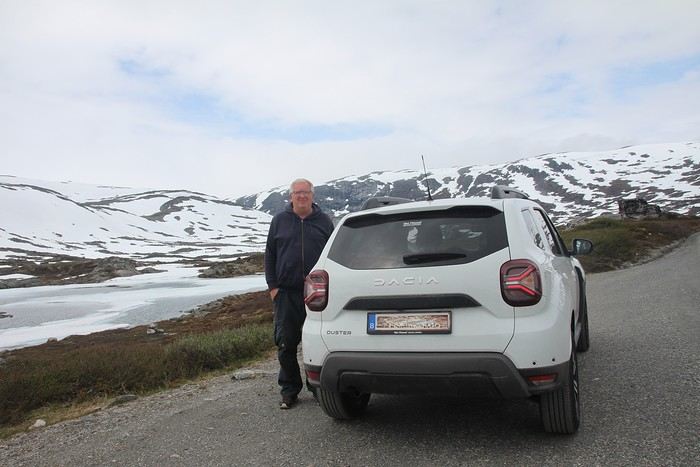
Why by car when most travelers opt for a camper van, while others prefer the comfort of cruises? Well, because we don’t own a camper van, renting one is pricey, and then you’ve got to add fuel costs (those things guzzle gas!), ferry fees, and other "tolls." All things considered, we went for mostly rentals—especially since there were four of us at the start of the trip. We spent the first week in Denmark with our daughter and son-in-law. Then they flew back to Belgium, and we continued our adventure as a couple. For accommodation, we mainly booked Airbnb apartments, which helped keep costs down and, most importantly, let us prepare our own meals (diet, diet!). In this travel journal, you’ll discover (or rediscover, for those who followed my older ones) our unbridled love for theme parks, museums, unique experiences, and—especially in Denmark—Legos! Unfortunately, we didn’t do any hikes this year because the unpredictable weather had made the trails slippery, and since I’d already taken three tumbles during the trip, I didn’t want to risk another! In the end, we traveled for 32 days, covered 6,200 km, and most importantly, discovered the charming country of Denmark, marveled at Norway’s breathtaking fjords—all without suffering the heatwave that hit France and Belgium that June! If you’ve got any questions, don’t hesitate to ask!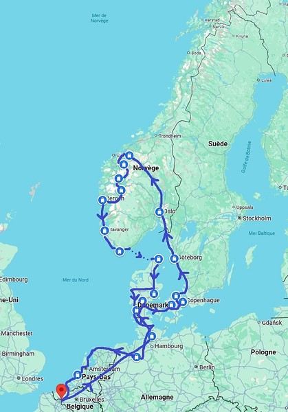
Why by car when most travelers opt for a camper van, while others prefer the comfort of cruises? Well, because we don’t own a camper van, renting one is pricey, and then you’ve got to add fuel costs (those things guzzle gas!), ferry fees, and other "tolls." All things considered, we went for mostly rentals—especially since there were four of us at the start of the trip. We spent the first week in Denmark with our daughter and son-in-law. Then they flew back to Belgium, and we continued our adventure as a couple. For accommodation, we mainly booked Airbnb apartments, which helped keep costs down and, most importantly, let us prepare our own meals (diet, diet!). In this travel journal, you’ll discover (or rediscover, for those who followed my older ones) our unbridled love for theme parks, museums, unique experiences, and—especially in Denmark—Legos! Unfortunately, we didn’t do any hikes this year because the unpredictable weather had made the trails slippery, and since I’d already taken three tumbles during the trip, I didn’t want to risk another! In the end, we traveled for 32 days, covered 6,200 km, and most importantly, discovered the charming country of Denmark, marveled at Norway’s breathtaking fjords—all without suffering the heatwave that hit France and Belgium that June! If you’ve got any questions, don’t hesitate to ask!
USA 2022 Road Trip
During our first road trip across the United States, we covered 23,000 km and crossed 28 states in 53 days.
Originally, we had planned to drive Route 66 all the way to Oatman in Arizona and visit various national parks in the American West over a two-month period.
This itinerary was planned before our departure, and all the relevant information had been gathered to stick to the schedule.
Everything went so smoothly that we finished visiting the national parks well ahead of our planned return date.
It helped that having a bed, a portable toilet, and a cooler in our vehicle gave us some autonomy since we didn’t have to worry about accommodation.
So, we decided to extend our road trip to the cities of Nashville and Memphis in Tennessee.
We then headed to Louisiana to visit Baton Rouge and New Orleans.
We crossed Mississippi and Alabama before driving along Florida’s west coast all the way to Key West.
We returned via Florida’s east coast and then crossed the eastern U.S. states to get back to Quebec through the Jackman border crossing in Maine.
So, I invite you to keep reading this long recap, which will let you discover the different attractions we visited throughout this amazing journey.
Videos are included throughout the recap. Click on the image to start the video.
To jump to a specific post, here are the relevant links:
Route 66 - Illinois & Missouri Route 66 - St. Louis (Missouri) - Gateway Arch National Park Route 66 - Cuba (Missouri) - City Murals Route 66 - Springfield (Missouri) - Fantastic Caverns Route 66 - Kansas & Oklahoma Route 66 - Texas & Arizona Route 66 - Texas - The Stations of the Cross in Groom Route 66 - Texas - Panhandle - VW Slug Bug Ranch Texas - Palo Duro Canyon State Park - Juniper Trails Texas - Palo Duro Canyon State Park - The Lighthouse Trail Route 66 - Texas - Amarillo - Cadillac Ranch Route 66 - New Mexico - Santa Rosa Blue Hole New Mexico - Bandelier National Monument - Alcove House Trail via Main Loop Trail New Mexico - Bandelier National Monument - Tsankawi Ruins Trail New Mexico - White Rock Overlook Route 66 - New Mexico - Albuquerque - Old Town New Mexico - White Sands National Park New Mexico - White Sands National Park - Dune Life Nature Trail New Mexico - White Sands National Park - Playa Trail New Mexico - White Sands National Park - Interdune Boardwalk New Mexico - Gila Cliff Dwellings National Monument New Mexico - Grants - Ice Cave & Bandera Volcano New Mexico - Gallup - Pyramide Rock Trail & Church Rock Trail Arizona - Holbrook - Painted Desert Arizona - Petrified Forest National Park - Puerco Pueblo & Newspaper Rock Viewpoint Arizona - Petrified Forest National Park - Blue Mesa Arizona - Petrified Forest National Park - The Teepees, Agate Bridge & Jasper Forest Overlook Arizona - Petrified Forest National Park - Crystal Forest Trail Arizona - Petrified Forest National Park - Giant Logs Trail Arizona - Winslow - Two Guns Ghost Town Arizona - Cameron - Little Colorado River Gorge Overlooks Arizona - Grand Canyon National Park - Shoshone Point Trail Arizona - Grand Canyon National Park - Desert View Drive Arizona - Grand Canyon National Park - Rim Route (Orange) & Village Route (Blue) Arizona - Grand Canyon National Park - Hermit Route (Red Line) Route 66 - Arizona - Historic Town of Oatman Arizona - Bullhead City Community Park Nevada - Red Rock Canyon - Calico I & II & Sandstone Quarry Nevada - Red Rock Canyon - Willow Springs Nevada - Red Rock Canyon Lookouts Nevada - Valley of Fire State Park - White Domes Trail Nevada - Valley of Fire State Park - Seven Wonders Trail, Pink Canyon, Fire Wave Nevada - Valley of Fire State Park - Rainbow Vista Trail Nevada - Valley of Fire State Park - Mouse's Tank Trail Nevada - Valley of Fire State Park - Rock Formations Nevada - Valley of Fire State Park - Scenic Routes Nevada - Cathedral Gorge State Park - Slot Canyons Nevada - Cathedral Gorge State Park - Eagle Point & Miller Point Utah - Bryce Canyon National Park - Mossy Cave & Tropic Ditch Waterfall Trail Utah - Bryce Canyon National Park - Scenic Drive Utah - Zion National Park - Pa'rus Trail Utah - Zion National Park - Sand Bench Trail Utah - Zion National Park - Emerald Pools Trail Utah - Zion National Park - West Rim Trail (Trail connecting to Angels Landing) Utah - Zion National Park - Riverside Walk Utah - Zion National Park - Court of The Patriarchs & Big Bend Utah - Zion National Park - Mount Carmel Highway Scenic Drive Utah - Kanab - Jackson Flat Reservoir Utah - Toadstools Trail in Grand Staircase-Escalante National Monument Arizona - Page - Glen Canyon Dam Overlook Arizona - Page - Glen Canyon National Recreation Area Arizona - Page - Horseshoe Bend Overlook Arizona - Page - Upper Antelope Canyon Arizona - Page - Navajo Canyon Boat Tour at Lake Powell Arizona - Page - Antelope Canyon X Arizona - Canyon de Chelly National Monument - Chelly Canyon Arizona - Canyon de Chelly National Monument - Canyon del Muerto Arizona - Monument Valley Navajo Tribal Park Utah - Mexican Hat Utah - Mexican Hat - Goosenecks State Park Utah - Mexican Hat - Valley of the Gods Utah - The Moki Dugway Scenic Backway Utah - Blanding - Natural Bridges National Monument Utah - Lake Powell - Hite Crossing Bridge Utah - Lake Powell - Glen Canyon National Recreation Area - Hite Overlook Utah - Capitol Reef National Park - Chimney Rock Loop Trail Utah - Capitol Reef National Park - Hickman Bridge Trail Utah - Capitol Reef National Park - Grand Wash Trail Utah - Capitol Reef National Park - Sunset Point Trail Utah - Capitol Reef National Park - Goosenecks Trail Utah - Capitol Reef National Park - Viewpoints - Fruita Area Utah - Capitol Reef National Park - Viewpoints - Scenic Drive Utah - Capitol Reef National Park - Cassidy Arch Trail Utah - Capitol Reef National Park - On the way to Capitol Gorge Trailhead Utah - Capitol Reef National Park - Capitol Gorge Trailhead Utah - Monroe - Mystic Hot Springs Utah - Scenic Overlooks on UT-24, UT-119 & I-70 Utah - Arches National Park - Park Avenue Trail Utah - Arches National Park - Courthouse Towers Section's Viewpoints Utah - Arches National Park - Balanced Rock, Pothole Arch, Ham Rock & Garden of Eden Utah - Arches National Park - Double Arch Trail, Cove Arch, Cove of Caves & Panorama Point Utah - Arches National Park - Windows Loop & Turret Arch Trail Utah - Arches National Park - Delicate Arch Trail Utah - Arches National Park - Upper Delicate Arch Viewpoint Trail Utah - Arches National Park - Fiery Furnace Section - Viewpoints Utah - Arches National Park - Sand Dune Arch Trail Utah - Arches National Park - Skyline Arch Trail Utah - Arches National Park - Devils Garden Trail Utah - Dead Horse Point State Park - West Rim Trail Utah - Dead Horse Point State Park - East Rim Trail Utah - Moab - Utah State Route 279 (Potash Road) Utah - Moab - Shafer Trail - Potash Evaporation Ponds Utah - Moab - Potash Road Dinosaur Tracks and Petroglyphs Utah - Moab - Potash Road - Corona, Bowtie & Pinto Arches Trail Utah - Moab - Potash Road - Wall Street Climbing Area Utah - Moab - Kane Springs Road Utah - Moab - Kane Springs Road - Side By Side Adventure Utah - Moab - Kane Springs Road to Moab Utah - Canyonlands National Park - Island in the Sky - Mesa Arch Trail Utah - Canyonlands National Park - Island in the Sky - Aztec Butte Trail Utah - Canyonlands National Park - Island in the Sky - Whale Rock Trail Utah - Canyonlands National Park - Island in the Sky - Upheaval Dome Trail Utah - Canyonlands National Park - Island in the Sky - Grand View Point Overlook Trail Utah - Canyonlands National Park - Island in the Sky - White Rim Overlook Trail Utah - Canyonlands National Park - Island in the Sky - Overlooks Utah - Moab - Wilson Arch Utah - Monticello - Newspaper Rock State Historical Monument Utah - Canyonlands National Park - The Needles - Road Side Ruin Trail Utah - Canyonlands National Park - The Needles - Cave Spring Trail Utah - Canyonlands National Park - The Needles - Pothole Point Trail Utah - Canyonlands National Park - The Needles - Big Spring Canyon Overlook Trail Utah - Canyonlands National Park - The Needles - Overlooks Colorado - Mesa Verde National Park - Mesa Top Ruins Road Colorado - Mesa Verde National Park - Chapin Mesa Road Colorado - Mesa Verde National Park - Mesa Top Loop Colorado - Mesa Verde National Park - Wetherill Mesa Road Colorado - Great Sand Dunes National Park Colorado - Mosca - Zapata Falls Colorado - Colorado Springs - Garden of the Gods Colorado - Black Canyon of the Gunnison National Park Colorado - Gunnison - Curecanti National Recreation Area Colorado - Gunnison - Blue Mesa Dam & Reservoir Colorado - Lake Pueblo State Park (Pueblo Reservoir) Kentucky - Mayfield, 5 months after an EF4 tornado Tennessee - Nashville - Downtown Walking Tour Tennessee - Graceland Mansion - Home of Elvis Presley Tennessee - Graceland - Lisa Marie & Hound Dog II Jets Tennessee - Graceland - Elvis Presley Automobile Museum & Exhibits Tennessee - Exploring Memphis Louisiana - Exploring Baton Rouge Louisiana - Exploring Lafayette Louisiana - Exploring Houma Louisiana - New Orleans - French Quarter Tour Louisiana - New Orleans - Garden District Tour Louisiana - New Orleans - Creole Queen Mississippi River Cruise Florida - Clearwater Beach Florida - Sanibel Island - Bowman's Beach Florida - Siesta Key Beach Florida - Captiva Island - Turner Beach Florida - Key Largo - Sunset Florida - Key West - Smathers Beach Florida - Miami Beach - Art Deco District Florida - Miami Beach South Carolina - Myrtle Beach Virginia - Virginia Beach Maine - Scarborough - Pine Point Beach
Originally, we had planned to drive Route 66 all the way to Oatman in Arizona and visit various national parks in the American West over a two-month period.
This itinerary was planned before our departure, and all the relevant information had been gathered to stick to the schedule.
Everything went so smoothly that we finished visiting the national parks well ahead of our planned return date.
It helped that having a bed, a portable toilet, and a cooler in our vehicle gave us some autonomy since we didn’t have to worry about accommodation.
So, we decided to extend our road trip to the cities of Nashville and Memphis in Tennessee.
We then headed to Louisiana to visit Baton Rouge and New Orleans.
We crossed Mississippi and Alabama before driving along Florida’s west coast all the way to Key West.
We returned via Florida’s east coast and then crossed the eastern U.S. states to get back to Quebec through the Jackman border crossing in Maine.
So, I invite you to keep reading this long recap, which will let you discover the different attractions we visited throughout this amazing journey.
Videos are included throughout the recap. Click on the image to start the video.
To jump to a specific post, here are the relevant links:
Route 66 - Illinois & Missouri Route 66 - St. Louis (Missouri) - Gateway Arch National Park Route 66 - Cuba (Missouri) - City Murals Route 66 - Springfield (Missouri) - Fantastic Caverns Route 66 - Kansas & Oklahoma Route 66 - Texas & Arizona Route 66 - Texas - The Stations of the Cross in Groom Route 66 - Texas - Panhandle - VW Slug Bug Ranch Texas - Palo Duro Canyon State Park - Juniper Trails Texas - Palo Duro Canyon State Park - The Lighthouse Trail Route 66 - Texas - Amarillo - Cadillac Ranch Route 66 - New Mexico - Santa Rosa Blue Hole New Mexico - Bandelier National Monument - Alcove House Trail via Main Loop Trail New Mexico - Bandelier National Monument - Tsankawi Ruins Trail New Mexico - White Rock Overlook Route 66 - New Mexico - Albuquerque - Old Town New Mexico - White Sands National Park New Mexico - White Sands National Park - Dune Life Nature Trail New Mexico - White Sands National Park - Playa Trail New Mexico - White Sands National Park - Interdune Boardwalk New Mexico - Gila Cliff Dwellings National Monument New Mexico - Grants - Ice Cave & Bandera Volcano New Mexico - Gallup - Pyramide Rock Trail & Church Rock Trail Arizona - Holbrook - Painted Desert Arizona - Petrified Forest National Park - Puerco Pueblo & Newspaper Rock Viewpoint Arizona - Petrified Forest National Park - Blue Mesa Arizona - Petrified Forest National Park - The Teepees, Agate Bridge & Jasper Forest Overlook Arizona - Petrified Forest National Park - Crystal Forest Trail Arizona - Petrified Forest National Park - Giant Logs Trail Arizona - Winslow - Two Guns Ghost Town Arizona - Cameron - Little Colorado River Gorge Overlooks Arizona - Grand Canyon National Park - Shoshone Point Trail Arizona - Grand Canyon National Park - Desert View Drive Arizona - Grand Canyon National Park - Rim Route (Orange) & Village Route (Blue) Arizona - Grand Canyon National Park - Hermit Route (Red Line) Route 66 - Arizona - Historic Town of Oatman Arizona - Bullhead City Community Park Nevada - Red Rock Canyon - Calico I & II & Sandstone Quarry Nevada - Red Rock Canyon - Willow Springs Nevada - Red Rock Canyon Lookouts Nevada - Valley of Fire State Park - White Domes Trail Nevada - Valley of Fire State Park - Seven Wonders Trail, Pink Canyon, Fire Wave Nevada - Valley of Fire State Park - Rainbow Vista Trail Nevada - Valley of Fire State Park - Mouse's Tank Trail Nevada - Valley of Fire State Park - Rock Formations Nevada - Valley of Fire State Park - Scenic Routes Nevada - Cathedral Gorge State Park - Slot Canyons Nevada - Cathedral Gorge State Park - Eagle Point & Miller Point Utah - Bryce Canyon National Park - Mossy Cave & Tropic Ditch Waterfall Trail Utah - Bryce Canyon National Park - Scenic Drive Utah - Zion National Park - Pa'rus Trail Utah - Zion National Park - Sand Bench Trail Utah - Zion National Park - Emerald Pools Trail Utah - Zion National Park - West Rim Trail (Trail connecting to Angels Landing) Utah - Zion National Park - Riverside Walk Utah - Zion National Park - Court of The Patriarchs & Big Bend Utah - Zion National Park - Mount Carmel Highway Scenic Drive Utah - Kanab - Jackson Flat Reservoir Utah - Toadstools Trail in Grand Staircase-Escalante National Monument Arizona - Page - Glen Canyon Dam Overlook Arizona - Page - Glen Canyon National Recreation Area Arizona - Page - Horseshoe Bend Overlook Arizona - Page - Upper Antelope Canyon Arizona - Page - Navajo Canyon Boat Tour at Lake Powell Arizona - Page - Antelope Canyon X Arizona - Canyon de Chelly National Monument - Chelly Canyon Arizona - Canyon de Chelly National Monument - Canyon del Muerto Arizona - Monument Valley Navajo Tribal Park Utah - Mexican Hat Utah - Mexican Hat - Goosenecks State Park Utah - Mexican Hat - Valley of the Gods Utah - The Moki Dugway Scenic Backway Utah - Blanding - Natural Bridges National Monument Utah - Lake Powell - Hite Crossing Bridge Utah - Lake Powell - Glen Canyon National Recreation Area - Hite Overlook Utah - Capitol Reef National Park - Chimney Rock Loop Trail Utah - Capitol Reef National Park - Hickman Bridge Trail Utah - Capitol Reef National Park - Grand Wash Trail Utah - Capitol Reef National Park - Sunset Point Trail Utah - Capitol Reef National Park - Goosenecks Trail Utah - Capitol Reef National Park - Viewpoints - Fruita Area Utah - Capitol Reef National Park - Viewpoints - Scenic Drive Utah - Capitol Reef National Park - Cassidy Arch Trail Utah - Capitol Reef National Park - On the way to Capitol Gorge Trailhead Utah - Capitol Reef National Park - Capitol Gorge Trailhead Utah - Monroe - Mystic Hot Springs Utah - Scenic Overlooks on UT-24, UT-119 & I-70 Utah - Arches National Park - Park Avenue Trail Utah - Arches National Park - Courthouse Towers Section's Viewpoints Utah - Arches National Park - Balanced Rock, Pothole Arch, Ham Rock & Garden of Eden Utah - Arches National Park - Double Arch Trail, Cove Arch, Cove of Caves & Panorama Point Utah - Arches National Park - Windows Loop & Turret Arch Trail Utah - Arches National Park - Delicate Arch Trail Utah - Arches National Park - Upper Delicate Arch Viewpoint Trail Utah - Arches National Park - Fiery Furnace Section - Viewpoints Utah - Arches National Park - Sand Dune Arch Trail Utah - Arches National Park - Skyline Arch Trail Utah - Arches National Park - Devils Garden Trail Utah - Dead Horse Point State Park - West Rim Trail Utah - Dead Horse Point State Park - East Rim Trail Utah - Moab - Utah State Route 279 (Potash Road) Utah - Moab - Shafer Trail - Potash Evaporation Ponds Utah - Moab - Potash Road Dinosaur Tracks and Petroglyphs Utah - Moab - Potash Road - Corona, Bowtie & Pinto Arches Trail Utah - Moab - Potash Road - Wall Street Climbing Area Utah - Moab - Kane Springs Road Utah - Moab - Kane Springs Road - Side By Side Adventure Utah - Moab - Kane Springs Road to Moab Utah - Canyonlands National Park - Island in the Sky - Mesa Arch Trail Utah - Canyonlands National Park - Island in the Sky - Aztec Butte Trail Utah - Canyonlands National Park - Island in the Sky - Whale Rock Trail Utah - Canyonlands National Park - Island in the Sky - Upheaval Dome Trail Utah - Canyonlands National Park - Island in the Sky - Grand View Point Overlook Trail Utah - Canyonlands National Park - Island in the Sky - White Rim Overlook Trail Utah - Canyonlands National Park - Island in the Sky - Overlooks Utah - Moab - Wilson Arch Utah - Monticello - Newspaper Rock State Historical Monument Utah - Canyonlands National Park - The Needles - Road Side Ruin Trail Utah - Canyonlands National Park - The Needles - Cave Spring Trail Utah - Canyonlands National Park - The Needles - Pothole Point Trail Utah - Canyonlands National Park - The Needles - Big Spring Canyon Overlook Trail Utah - Canyonlands National Park - The Needles - Overlooks Colorado - Mesa Verde National Park - Mesa Top Ruins Road Colorado - Mesa Verde National Park - Chapin Mesa Road Colorado - Mesa Verde National Park - Mesa Top Loop Colorado - Mesa Verde National Park - Wetherill Mesa Road Colorado - Great Sand Dunes National Park Colorado - Mosca - Zapata Falls Colorado - Colorado Springs - Garden of the Gods Colorado - Black Canyon of the Gunnison National Park Colorado - Gunnison - Curecanti National Recreation Area Colorado - Gunnison - Blue Mesa Dam & Reservoir Colorado - Lake Pueblo State Park (Pueblo Reservoir) Kentucky - Mayfield, 5 months after an EF4 tornado Tennessee - Nashville - Downtown Walking Tour Tennessee - Graceland Mansion - Home of Elvis Presley Tennessee - Graceland - Lisa Marie & Hound Dog II Jets Tennessee - Graceland - Elvis Presley Automobile Museum & Exhibits Tennessee - Exploring Memphis Louisiana - Exploring Baton Rouge Louisiana - Exploring Lafayette Louisiana - Exploring Houma Louisiana - New Orleans - French Quarter Tour Louisiana - New Orleans - Garden District Tour Louisiana - New Orleans - Creole Queen Mississippi River Cruise Florida - Clearwater Beach Florida - Sanibel Island - Bowman's Beach Florida - Siesta Key Beach Florida - Captiva Island - Turner Beach Florida - Key Largo - Sunset Florida - Key West - Smathers Beach Florida - Miami Beach - Art Deco District Florida - Miami Beach South Carolina - Myrtle Beach Virginia - Virginia Beach Maine - Scarborough - Pine Point Beach
15 days in Texas in October 2022
Ah! This trip to Texas, postponed so many times because of Covid. I wanted to discover this state, but not in the summer due to the temperatures.
I’ll try to dig into my memories since I didn’t take any notes.
Day 1: Departure
Early morning flight from Lyon to Frankfurt (I often fly with Lufthansa). We only have a 50-minute layover, but I trust German organization—it’s not just talk, since it took us only 30 minutes to get to the boarding gate. Arriving in Houston, we’re excited because it’s been 3 years since we last visited the USA, and we’ve missed it.
Everything goes smoothly with the formalities and the car rental, so 1.5 hours after landing, I park near Sam Houston Park to start our discovery. The park is pretty, clean, and has the unique feature of housing some well-preserved Victorian houses. The sun is shining, and it’s always fun to see old wooden houses surrounded by gleaming skyscrapers. A quick drive to the Rothko Chapel, which is dedicated to all faiths. There are also modern artworks in an annex building and outside. Then we head to Pasadena to reach our hotel and go to bed since we’ve been awake for a while!
Hotel: A classic Days Inn. It’s standard, but the beds are comfortable, and it’s a quiet place. The + of the day: We're back in the USA The -: Nothing
Day 2: NASA and then Galveston
Of course, we wake up super early. A quick trip to the nearby Walmart for the usual small purchases. Surprise—I can’t buy a bottle of California white wine because in Texas, there are set hours for buying alcohol. Talk about a bummer for my apéro! Next, we head to Kemah, a small, hyper-touristy port where everything is kitschy but clean and nice. It’s a bit overdone, but since NASA doesn’t open until 10 AM and it’s still early, we might as well enjoy the good weather in a pleasant spot.
We arrive at the NASA Houston center without any issues. It’s smaller than the one in Florida and organized a bit differently. There are trains that take passengers to the different sites, but you need to get tickets (included in the price), and once you’ve finished visiting one site, you have to return to the center to get a ticket for another. Not very practical.
We choose to visit the training center and the rockets, skipping the control room, which, based on the photos, looks like the one at Cape Canaveral. The training center is a cool place because it’s still in use. Engineers are working on machines and computers. We don’t see any astronauts training, but we see the space chair, the shuttle’s robotic arm, and lots of gadgets—this hangar is like Gyro Gearloose’s or Doc’s domain!
Next, we head to the rocket hangar, featuring the Saturn V, the same one as at Cape Canaveral. Finally, we wrap up our tour by returning to the center, where a Boeing 747 with a shuttle attached to its back dominates the outside. We can visit the shuttle, and we don’t miss the chance.
A few exhibits inside complete the experience and satisfy our thirst for knowledge. I love the space exploration era, and gotta say, the Americans do it right. Then we drive to Galveston, about 100 km away. Why Galveston? It’s by the sea, so swimming in late October isn’t unpleasant, and there’s a neighborhood called East End Historic District filled with stunning Victorian houses, each more beautiful than the last. Plus, it’s Halloween season, so the decorations are over the top! They really go all out!
Madame takes a swim, but I find the water too cold for my taste. Apéro (they didn’t trick me twice—I had time to go back to another Walmart!) Dinner + bedtime
Hotel: A classic Quality Inn. No issues. The +: NASA, even if it’s smaller than Cape Canaveral The -: I would’ve preferred the water in the Gulf of Mexico to be a bit warmer
Day 1: Departure
Early morning flight from Lyon to Frankfurt (I often fly with Lufthansa). We only have a 50-minute layover, but I trust German organization—it’s not just talk, since it took us only 30 minutes to get to the boarding gate. Arriving in Houston, we’re excited because it’s been 3 years since we last visited the USA, and we’ve missed it.
Everything goes smoothly with the formalities and the car rental, so 1.5 hours after landing, I park near Sam Houston Park to start our discovery. The park is pretty, clean, and has the unique feature of housing some well-preserved Victorian houses. The sun is shining, and it’s always fun to see old wooden houses surrounded by gleaming skyscrapers. A quick drive to the Rothko Chapel, which is dedicated to all faiths. There are also modern artworks in an annex building and outside. Then we head to Pasadena to reach our hotel and go to bed since we’ve been awake for a while!
Hotel: A classic Days Inn. It’s standard, but the beds are comfortable, and it’s a quiet place. The + of the day: We're back in the USA The -: Nothing
Day 2: NASA and then Galveston
Of course, we wake up super early. A quick trip to the nearby Walmart for the usual small purchases. Surprise—I can’t buy a bottle of California white wine because in Texas, there are set hours for buying alcohol. Talk about a bummer for my apéro! Next, we head to Kemah, a small, hyper-touristy port where everything is kitschy but clean and nice. It’s a bit overdone, but since NASA doesn’t open until 10 AM and it’s still early, we might as well enjoy the good weather in a pleasant spot.
We arrive at the NASA Houston center without any issues. It’s smaller than the one in Florida and organized a bit differently. There are trains that take passengers to the different sites, but you need to get tickets (included in the price), and once you’ve finished visiting one site, you have to return to the center to get a ticket for another. Not very practical.
We choose to visit the training center and the rockets, skipping the control room, which, based on the photos, looks like the one at Cape Canaveral. The training center is a cool place because it’s still in use. Engineers are working on machines and computers. We don’t see any astronauts training, but we see the space chair, the shuttle’s robotic arm, and lots of gadgets—this hangar is like Gyro Gearloose’s or Doc’s domain!
Next, we head to the rocket hangar, featuring the Saturn V, the same one as at Cape Canaveral. Finally, we wrap up our tour by returning to the center, where a Boeing 747 with a shuttle attached to its back dominates the outside. We can visit the shuttle, and we don’t miss the chance.
A few exhibits inside complete the experience and satisfy our thirst for knowledge. I love the space exploration era, and gotta say, the Americans do it right. Then we drive to Galveston, about 100 km away. Why Galveston? It’s by the sea, so swimming in late October isn’t unpleasant, and there’s a neighborhood called East End Historic District filled with stunning Victorian houses, each more beautiful than the last. Plus, it’s Halloween season, so the decorations are over the top! They really go all out!
Madame takes a swim, but I find the water too cold for my taste. Apéro (they didn’t trick me twice—I had time to go back to another Walmart!) Dinner + bedtime
Hotel: A classic Quality Inn. No issues. The +: NASA, even if it’s smaller than Cape Canaveral The -: I would’ve preferred the water in the Gulf of Mexico to be a bit warmer
3 weeks in Colombia (August 2023)
Why Colombia?
It's quite simple. For the past few years, my daughter has been living with a Colombian from Bogotá. The idea was to discover his country, meet his family, and do part of the trip all four of us together.
We’re heading out first as scouts, then they’ll join us to continue the journey.
The itinerary was shared in another post—now it’s time for the impressions.
No photos, as for me, it’s video and nothing more!
Day 1: The big departure What was planned: A flight from Lyon Saint-Exupéry late morning heading to Frankfurt. Two hours of waiting in Frankfurt (just enough time to eat a pretzel!!) and then off to Bogotá for an arrival around 7 PM local time. I hadn’t done the Check-Mig (to be done 72 hours before the flight). I did it on my phone, giving a fake arrival date in Colombia, and the attendant told me there wouldn’t be any issues in Bogotá. Actually, two hours of delay at departure in Lyon because a sick passenger was on the plane—they had to evacuate him, and the ambulance that was supposed to be there didn’t have permission to come near the plane. Ah, French administrative formalities!!!!! Flight to Frankfurt with Lufthansa went smoothly. A sprint through the airport—very well organized. Connection secured, so we boarded the plane, and two hours later than scheduled, we took off for an 11-hour flight! Arrival in Bogotá, and the immigration process took over an hour and a half because of the crowds. However, no issues with the Check-Mig—they barely glanced at it. Our daughter’s father-in-law ended up waiting over 3 hours at the airport because of this!!! Surprise: No luggage. Luckily, we had packed essentials in our carry-ons! Quick administrative paperwork, and Lufthansa informed me our bags would be on the next flight, so no big deal. Off to our hotel in La Candelaria and a good night’s rest.
The plus: We’re in Bogotá! The minus: Flight delays are becoming more and more common.
Day 1: The big departure What was planned: A flight from Lyon Saint-Exupéry late morning heading to Frankfurt. Two hours of waiting in Frankfurt (just enough time to eat a pretzel!!) and then off to Bogotá for an arrival around 7 PM local time. I hadn’t done the Check-Mig (to be done 72 hours before the flight). I did it on my phone, giving a fake arrival date in Colombia, and the attendant told me there wouldn’t be any issues in Bogotá. Actually, two hours of delay at departure in Lyon because a sick passenger was on the plane—they had to evacuate him, and the ambulance that was supposed to be there didn’t have permission to come near the plane. Ah, French administrative formalities!!!!! Flight to Frankfurt with Lufthansa went smoothly. A sprint through the airport—very well organized. Connection secured, so we boarded the plane, and two hours later than scheduled, we took off for an 11-hour flight! Arrival in Bogotá, and the immigration process took over an hour and a half because of the crowds. However, no issues with the Check-Mig—they barely glanced at it. Our daughter’s father-in-law ended up waiting over 3 hours at the airport because of this!!! Surprise: No luggage. Luckily, we had packed essentials in our carry-ons! Quick administrative paperwork, and Lufthansa informed me our bags would be on the next flight, so no big deal. Off to our hotel in La Candelaria and a good night’s rest.
The plus: We’re in Bogotá! The minus: Flight delays are becoming more and more common.
So where are they and what are they doing?
This catchy and somewhat mysterious title comes from several questions I’ve been asking myself.
VF has been back open for a reasonable number of weeks and months now. The number of visitors overall matches past averages, but the number of members online in the last 24 hours seems relatively lower than what we used to see.
Yet, to my surprise, I’m seeing fewer travel journals, way fewer messages, and way fewer questions. I don’t see many new registered users online, and I notice a number of members who are logged in but either aren’t participating or have stopped participating.
Something’s not adding up for me because, in my opinion, VF is still appealing, and I don’t see which other sites could really compete.
Was there a real break between pre- and post-Covid? Does it just take more time for some people to discover the site or learn that it’s active again? Do people now prefer quick consumption on sites like FB or others I’m not familiar with? Where have the site’s old-timers gone, and what are they doing with their time now? What’s really going on here?
VF has been back open for a reasonable number of weeks and months now. The number of visitors overall matches past averages, but the number of members online in the last 24 hours seems relatively lower than what we used to see.
Yet, to my surprise, I’m seeing fewer travel journals, way fewer messages, and way fewer questions. I don’t see many new registered users online, and I notice a number of members who are logged in but either aren’t participating or have stopped participating.
Something’s not adding up for me because, in my opinion, VF is still appealing, and I don’t see which other sites could really compete.
Was there a real break between pre- and post-Covid? Does it just take more time for some people to discover the site or learn that it’s active again? Do people now prefer quick consumption on sites like FB or others I’m not familiar with? Where have the site’s old-timers gone, and what are they doing with their time now? What’s really going on here?
Tuscany: Arezzo province and the Siena area
So happy the forum reopened last October!!!
I’ve started reading again (posts, travel journals) and chiming in on a few discussions. Now I’m stepping it up by writing a new travel journal—I’ve already posted a few between 2018 and 2020.
My latest trip was to Italy from August 27 to September 26, 2024. As the title says, it was a wander through Tuscany in parts of the region that aren’t the most visited. No Firenze-Siena-Pisa trilogy, no San Gimignano; there’ll be a quick detour into Siena, but I’ll skip the best-known sights. That choice, plus traveling in September, should help dodge overtourism. It worked out—crowds were light, sometimes very light, the whole way. Here’s the practical rundown: - a long trip outside peak season (ah, retirees!) - solo camping (caravan) - a mix of activities (hiking, mountain biking, sightseeing) in places that aren’t always packed with tourists. Still, I don’t feel like I ended up in some hidden-away spots. Not sure if this will draw any readers.
DAY 1: Tuesday, August 27, 2024 The heat was intense on the drive in across the plain; two big storms—more rain and hail than lightning and thunder—threw the weather off, the first near Imola, the second on the four-lane road up the Savio valley. I left the Cesena-Roma four-lane at the Verghereto exit and climbed up to Balze (1,100 meters). The campsite is even higher (1,200 meters), in the forest near the source of the Tevere (Tiber). Staying up here will cut down on driving for the first part of the trip: a route through the Appennino (Apennines) on the border between Toscana and Emilia-Romagna. The temperature was surprisingly mild for the altitude, the air thick with moisture by late afternoon. I drove back down from the campsite to Balze (2 km on the road) to grab groceries (it’s doable) and scout tomorrow’s hike. .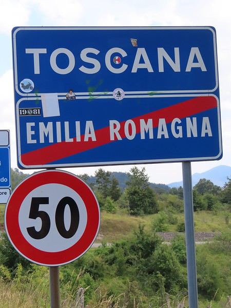
The endpoint of the planned hike is just a few meters from this sign (the trail crosses this road about 3 km from Balze). I realized Balze and the source of the Tevere (Tiber) are actually in Emilia-Romagna, not Toscana. I always thought the Tevere (Tiber), which flows toward Roma (Tyrrhenian side), started in Toscana! I’ll come back to this quirk in Day 3’s write-up.
My latest trip was to Italy from August 27 to September 26, 2024. As the title says, it was a wander through Tuscany in parts of the region that aren’t the most visited. No Firenze-Siena-Pisa trilogy, no San Gimignano; there’ll be a quick detour into Siena, but I’ll skip the best-known sights. That choice, plus traveling in September, should help dodge overtourism. It worked out—crowds were light, sometimes very light, the whole way. Here’s the practical rundown: - a long trip outside peak season (ah, retirees!) - solo camping (caravan) - a mix of activities (hiking, mountain biking, sightseeing) in places that aren’t always packed with tourists. Still, I don’t feel like I ended up in some hidden-away spots. Not sure if this will draw any readers.
DAY 1: Tuesday, August 27, 2024 The heat was intense on the drive in across the plain; two big storms—more rain and hail than lightning and thunder—threw the weather off, the first near Imola, the second on the four-lane road up the Savio valley. I left the Cesena-Roma four-lane at the Verghereto exit and climbed up to Balze (1,100 meters). The campsite is even higher (1,200 meters), in the forest near the source of the Tevere (Tiber). Staying up here will cut down on driving for the first part of the trip: a route through the Appennino (Apennines) on the border between Toscana and Emilia-Romagna. The temperature was surprisingly mild for the altitude, the air thick with moisture by late afternoon. I drove back down from the campsite to Balze (2 km on the road) to grab groceries (it’s doable) and scout tomorrow’s hike. .
The endpoint of the planned hike is just a few meters from this sign (the trail crosses this road about 3 km from Balze). I realized Balze and the source of the Tevere (Tiber) are actually in Emilia-Romagna, not Toscana. I always thought the Tevere (Tiber), which flows toward Roma (Tyrrhenian side), started in Toscana! I’ll come back to this quirk in Day 3’s write-up.
From San Francisco to Los Angeles via Highway 1
Hi everyone,
We traveled between Christmas and New Year’s to visit our son in San Francisco. We’d already seen the parks during a 2008 vacation but hadn’t had time to drive Highway 1 between San Francisco and Los Angeles, so we decided to do it this time. At this time of year, the days are short—it gets dark by 5 PM, which limits sightseeing time. Weather-wise, we had temperatures between 11°C and 20°C (52°F and 68°F) during the week, so it was pretty pleasant. There was a bit of rain one day and some gray skies or fog in the mornings. Financially, California is *very* expensive! Prices listed don’t include tax or tips. Taxes are automatically added to restaurant bills or supermarket receipts, but *you* add the tip. Americans always leave a tip, no matter if they’re happy with the service or not (except at self-service places). The absolute minimum is 15%, but 20% is more common. Here’s how it works: First, the server brings the bill with the tax already added, then takes your card and the bill. They come back after charging your card, leaving you a new bill and a pen. You write down the tip (tips) you want to leave, add it up, and sign. You leave the paper and pen on the table and go. In some restaurants, the server brings the card reader to your table, and there are preset tip percentages to choose from. On your bank statement, the total amount (including tax) shows up as “pending.” A few days later, the transaction is finalized with the tip included. The 9-hour time difference isn’t trivial, especially as we get older 😉. Keep it in mind when planning—don’t overdo it in the first few days.
Here’s our itinerary: 12/25/2024: Flight from Lyon (7 AM) to San Francisco (11:50 AM): 1-hour layover in Amsterdam—way too tight. The airport is huge, and flights to the U.S. are at the far end. You also have to go through customs. We had to run! Luckily, there’s a special line for tight connections, and our flight was delayed! Reunited with our son and walked to the Painted Ladies (Victorian houses) and then through Alamo Square. Return trip via Waymo—a driverless Uber. Surprising, but the ride was super smooth, and we felt safe.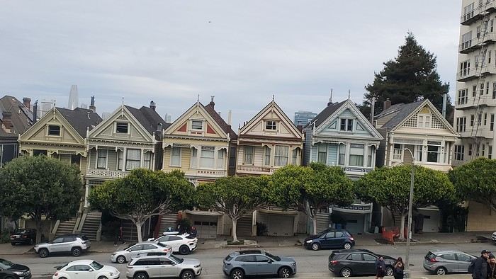
12/26/2024: San Francisco Walking tour of the city: Lombard Street, Pier 39 (sea lions), Coit Tower via the Filbert Steps (great view of the city), Chinatown, and Union Square (ice rink and Christmas tree).
12/27/2024: Monterey It took us about 2.5 hours to drive straight from SF to Monterey (to save time, we skipped the start of Highway 1). The goal for this stop was visiting the aquarium. It’s in an old sardine cannery, and there’s an interesting room showing the machinery and explaining the process. The aquarium features all the local fish and plant species, plus a stunning jellyfish exhibit. We spent about 2.5 hours there. Entry is pricey at $65, and it was packed when we went. For parking, you can use meters or day lots. The cheapest we found was $25 for the day, with in-and-out privileges. We saw some closer lots charging $80, so it’s worth shopping around before parking and walking a bit more. Afterward, we stopped by the Monarch Butterfly Sanctuary—a small, free park where these butterflies land, along with some wild deer. We ended the day at Lover’s Point, a park with an ocean view and surfers. That evening, we tried clam chowder in a sourdough bread bowl. Stayed overnight in Monterey.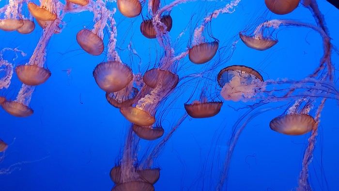
12/28/2024: Big Sur Parks The Big Sur area has many state parks. Entry is $10 per car for the day (valid for any number of parks visited that same day). Pro tip: If you park outside and walk in, you don’t pay. We chose to visit Point Lobos Reserve. We hiked the trails along the ocean. Two must-do (short and easy) trails: “Sea Lion Point,” where massive waves crash onto the rocks, and “Bird Island Lookout,” where you can see thousands of pelicans and cormorants on the rocks, plus a few elephant seals. It’s truly stunning. We spent about 3 hours there. After driving along Garrapata State Park and crossing the famous Bixby Bridge, we went to Pfeiffer Big Sur State Park to do the short Valley View Trail + Pfeiffer Falls hike. It was nice being among the redwoods, but the waterfall was underwhelming. Maybe it’s more impressive in the summer when the river is flowing better. We ended the day at McWay Falls, a waterfall that flows directly into the ocean—super photogenic, especially at sunset. Returned to Monterey for the night.
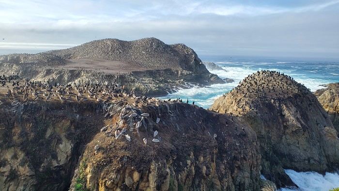
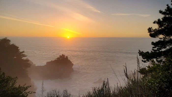
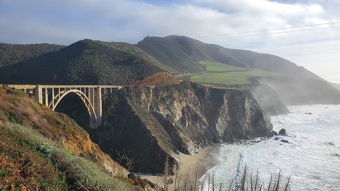
12/29/2024: Drive to Morro Bay Highway 1 is currently closed near Gorda, so we had to take the inland route from Monterey, adding extra miles. It was raining, so we skipped the planned stop at Carmel-by-the-Sea. Instead, we detoured to Mission San Antonio de Padua, the 3rd mission (out of 21) built by the Spanish in 1773 to evangelize the region. It’s less famous than others, so there were fewer people, and it felt more “authentic” (free to visit). With fog adding to the rain, we headed straight to Morro Bay, our stop for the day, instead of continuing up Highway 1 to San Simeon. Took a short evening walk to Morro Rock—saw a few otters in the harbor. Stayed overnight in Morro Bay.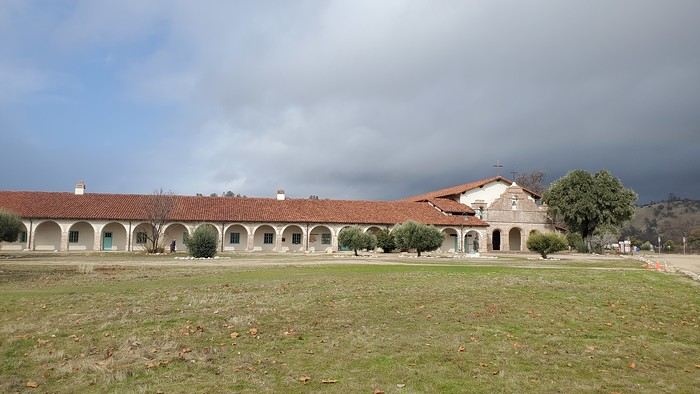
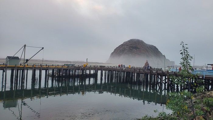
12/30/2024: Elephant Seals at Piedras Blancas The sun came back! We took a quick walk on the pier to see the otters in daylight, then drove back up Highway 1 to Piedras Blancas (near San Simeon), a famous spot for elephant seals. It’s birthing season, so there were lots of pups, plus males fighting for the females’ attention—what a show! We couldn’t get enough. We walked to the Piedras Blancas Lighthouse, with a few viewpoints of beaches where elephant seals were lounging (though far fewer than at the beach near the parking lot). We continued to Santa Barbara, our stop for the day. Stopped in San Luis Obispo for lunch and a quick city tour (Bubblegum Alley, the theater facade, and the mission). Since it was getting late, we skipped Los Alamos and went straight to Solvang, a charming Danish-style town (windmills, typical Danish houses) with lots of holiday lights (it’s their Julefest). Stayed overnight in Santa Barbara.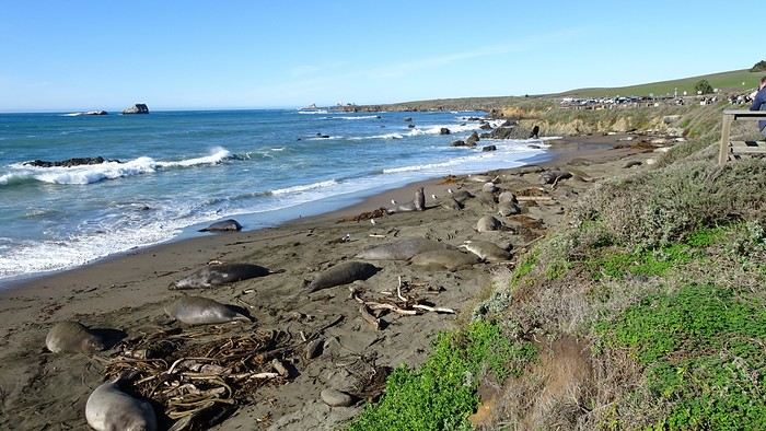
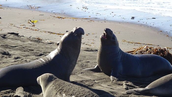
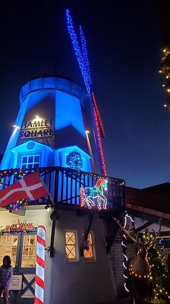
We traveled between Christmas and New Year’s to visit our son in San Francisco. We’d already seen the parks during a 2008 vacation but hadn’t had time to drive Highway 1 between San Francisco and Los Angeles, so we decided to do it this time. At this time of year, the days are short—it gets dark by 5 PM, which limits sightseeing time. Weather-wise, we had temperatures between 11°C and 20°C (52°F and 68°F) during the week, so it was pretty pleasant. There was a bit of rain one day and some gray skies or fog in the mornings. Financially, California is *very* expensive! Prices listed don’t include tax or tips. Taxes are automatically added to restaurant bills or supermarket receipts, but *you* add the tip. Americans always leave a tip, no matter if they’re happy with the service or not (except at self-service places). The absolute minimum is 15%, but 20% is more common. Here’s how it works: First, the server brings the bill with the tax already added, then takes your card and the bill. They come back after charging your card, leaving you a new bill and a pen. You write down the tip (tips) you want to leave, add it up, and sign. You leave the paper and pen on the table and go. In some restaurants, the server brings the card reader to your table, and there are preset tip percentages to choose from. On your bank statement, the total amount (including tax) shows up as “pending.” A few days later, the transaction is finalized with the tip included. The 9-hour time difference isn’t trivial, especially as we get older 😉. Keep it in mind when planning—don’t overdo it in the first few days.
Here’s our itinerary: 12/25/2024: Flight from Lyon (7 AM) to San Francisco (11:50 AM): 1-hour layover in Amsterdam—way too tight. The airport is huge, and flights to the U.S. are at the far end. You also have to go through customs. We had to run! Luckily, there’s a special line for tight connections, and our flight was delayed! Reunited with our son and walked to the Painted Ladies (Victorian houses) and then through Alamo Square. Return trip via Waymo—a driverless Uber. Surprising, but the ride was super smooth, and we felt safe.
12/26/2024: San Francisco Walking tour of the city: Lombard Street, Pier 39 (sea lions), Coit Tower via the Filbert Steps (great view of the city), Chinatown, and Union Square (ice rink and Christmas tree).
12/27/2024: Monterey It took us about 2.5 hours to drive straight from SF to Monterey (to save time, we skipped the start of Highway 1). The goal for this stop was visiting the aquarium. It’s in an old sardine cannery, and there’s an interesting room showing the machinery and explaining the process. The aquarium features all the local fish and plant species, plus a stunning jellyfish exhibit. We spent about 2.5 hours there. Entry is pricey at $65, and it was packed when we went. For parking, you can use meters or day lots. The cheapest we found was $25 for the day, with in-and-out privileges. We saw some closer lots charging $80, so it’s worth shopping around before parking and walking a bit more. Afterward, we stopped by the Monarch Butterfly Sanctuary—a small, free park where these butterflies land, along with some wild deer. We ended the day at Lover’s Point, a park with an ocean view and surfers. That evening, we tried clam chowder in a sourdough bread bowl. Stayed overnight in Monterey.
12/28/2024: Big Sur Parks The Big Sur area has many state parks. Entry is $10 per car for the day (valid for any number of parks visited that same day). Pro tip: If you park outside and walk in, you don’t pay. We chose to visit Point Lobos Reserve. We hiked the trails along the ocean. Two must-do (short and easy) trails: “Sea Lion Point,” where massive waves crash onto the rocks, and “Bird Island Lookout,” where you can see thousands of pelicans and cormorants on the rocks, plus a few elephant seals. It’s truly stunning. We spent about 3 hours there. After driving along Garrapata State Park and crossing the famous Bixby Bridge, we went to Pfeiffer Big Sur State Park to do the short Valley View Trail + Pfeiffer Falls hike. It was nice being among the redwoods, but the waterfall was underwhelming. Maybe it’s more impressive in the summer when the river is flowing better. We ended the day at McWay Falls, a waterfall that flows directly into the ocean—super photogenic, especially at sunset. Returned to Monterey for the night.
12/29/2024: Drive to Morro Bay Highway 1 is currently closed near Gorda, so we had to take the inland route from Monterey, adding extra miles. It was raining, so we skipped the planned stop at Carmel-by-the-Sea. Instead, we detoured to Mission San Antonio de Padua, the 3rd mission (out of 21) built by the Spanish in 1773 to evangelize the region. It’s less famous than others, so there were fewer people, and it felt more “authentic” (free to visit). With fog adding to the rain, we headed straight to Morro Bay, our stop for the day, instead of continuing up Highway 1 to San Simeon. Took a short evening walk to Morro Rock—saw a few otters in the harbor. Stayed overnight in Morro Bay.
12/30/2024: Elephant Seals at Piedras Blancas The sun came back! We took a quick walk on the pier to see the otters in daylight, then drove back up Highway 1 to Piedras Blancas (near San Simeon), a famous spot for elephant seals. It’s birthing season, so there were lots of pups, plus males fighting for the females’ attention—what a show! We couldn’t get enough. We walked to the Piedras Blancas Lighthouse, with a few viewpoints of beaches where elephant seals were lounging (though far fewer than at the beach near the parking lot). We continued to Santa Barbara, our stop for the day. Stopped in San Luis Obispo for lunch and a quick city tour (Bubblegum Alley, the theater facade, and the mission). Since it was getting late, we skipped Los Alamos and went straight to Solvang, a charming Danish-style town (windmills, typical Danish houses) with lots of holiday lights (it’s their Julefest). Stayed overnight in Santa Barbara.
Review of a Mediterranean cruise on the Splendida and 24 hours in Venice – October 2024
Hi everyone,
What a joy to be back here and pick up where we left off after all these months of hiatus.
I hope you’ll enjoy the story of this little trip around the Eastern Mediterranean. This cruise was the perfect way to satisfy our longing to return to Greece and Istanbul. The end of the season, until late November, is the best time to visit the Mediterranean in my opinion—when climate disruptions don’t get in the way.
Departing from Trieste, our stops were Katakolon, Piraeus, Kusadasi, Istanbul, Corfu, and Bari, before returning to Trieste and then Venice, where we planned a very short 24-hour stay.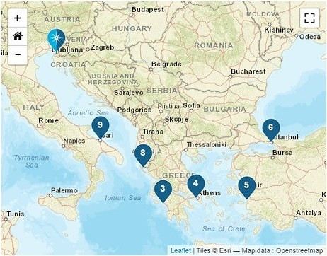
We left home at 6:15 AM—our first cruise departure since moving to Normandy. What I miss most about living in the Gard is how close we were to Marseille Airport. No more hopping over to Marignane in an hour; now we have to plan for a three-hour trip to CDG, even under the best conditions on an early Sunday morning.
It was impossible to book a hotel night before our flight because, starting in April, the Ibis was priced at 450 € per night, and the Mercure was flirting with 800 €—breakfast not included, of course. 😏
I had a feeling there must’ve been a conference or something going on… Turns out, it was just the auto show. They simply adjusted the room prices to match the cost of the cars. 😛
Our flight took us to Venice, where we caught a FlixBus to Trieste. We arrived at Trieste’s train station in the afternoon and walked to our hotel in the city center.
After treating ourselves to an amazing pizza at a restaurant (Di Napoli Maestri Pizzaioli, Via Armando Diaz 10) for a very reasonable price, we enjoyed the mild evening temperature while exploring the stunning buildings of this charming city by night. These magnificent structures are a testament to the city’s past. Trieste became Austrian in 1382 due to its complicated relationship with Venice, and it wasn’t until 1918, at the end of World War I, that it became Italian again. The city’s lighting beautifully highlights the architecture of the buildings.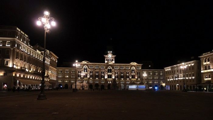
The terraces were lively, and the atmosphere was so warm and inviting that we wanted to stay out even longer.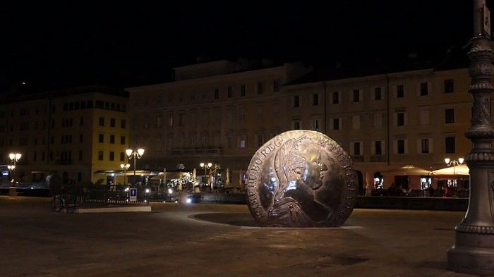
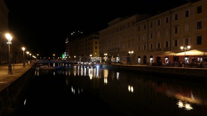
But we’d been up since 4 AM, so we were happy to retreat to the quiet of our hotel, located in the pedestrian center just a few steps from the port (Urban Hotel Design—highly recommended).
More to come soon.
What a joy to be back here and pick up where we left off after all these months of hiatus.
I hope you’ll enjoy the story of this little trip around the Eastern Mediterranean. This cruise was the perfect way to satisfy our longing to return to Greece and Istanbul. The end of the season, until late November, is the best time to visit the Mediterranean in my opinion—when climate disruptions don’t get in the way.
Departing from Trieste, our stops were Katakolon, Piraeus, Kusadasi, Istanbul, Corfu, and Bari, before returning to Trieste and then Venice, where we planned a very short 24-hour stay.
We left home at 6:15 AM—our first cruise departure since moving to Normandy. What I miss most about living in the Gard is how close we were to Marseille Airport. No more hopping over to Marignane in an hour; now we have to plan for a three-hour trip to CDG, even under the best conditions on an early Sunday morning.
It was impossible to book a hotel night before our flight because, starting in April, the Ibis was priced at 450 € per night, and the Mercure was flirting with 800 €—breakfast not included, of course. 😏
I had a feeling there must’ve been a conference or something going on… Turns out, it was just the auto show. They simply adjusted the room prices to match the cost of the cars. 😛
Our flight took us to Venice, where we caught a FlixBus to Trieste. We arrived at Trieste’s train station in the afternoon and walked to our hotel in the city center.
After treating ourselves to an amazing pizza at a restaurant (Di Napoli Maestri Pizzaioli, Via Armando Diaz 10) for a very reasonable price, we enjoyed the mild evening temperature while exploring the stunning buildings of this charming city by night. These magnificent structures are a testament to the city’s past. Trieste became Austrian in 1382 due to its complicated relationship with Venice, and it wasn’t until 1918, at the end of World War I, that it became Italian again. The city’s lighting beautifully highlights the architecture of the buildings.
The terraces were lively, and the atmosphere was so warm and inviting that we wanted to stay out even longer.
But we’d been up since 4 AM, so we were happy to retreat to the quiet of our hotel, located in the pedestrian center just a few steps from the port (Urban Hotel Design—highly recommended).
More to come soon.
21-Day Trip to La Gomera and La Palma
Travel Journal: 21 Days in La Gomera and La Palma
From February 6 to February 26, 2024
Tuesday, February 6 We left around 9 AM with our car, along with Pierre-Paul and Patricia, heading to the Bluepark parking lot in Bartenheim. As expected, we were awaited and left promptly for EuroAirport Basel. Took off at 12:25 PM for a 4-hour-15-minute flight under excellent conditions. Beautiful arrival in Tenerife with Teide in sight under a clear blue sky. Fifteen minutes later, we waited for bus No. 40 to Los Cristianos with quite a few other tourists, but we managed to find four seats. From the bus station, it was a 20-minute walk to our hotel. We checked into a lovely apartment for the four of us, complete with all the comforts. Outside, it was quite warm—at least 25°C! After dropping off our luggage, we went for a stroll. The immediate surroundings of the hotel held no interest for us: a modern, concrete area filled with hotels, bars, tourist agencies, and unappealing restaurants all offering the same bland international cuisine. Pat went to cool off at the pool, unfortunately overrun by loud, drunk English tourists. I took a walk to the paseo maritimo that leads to the port, skirting the seafront. The promenade was pleasant, but it could have been any seaside resort in the world—same old scene: a succession of bars with blaring music where many elderly people sipped cold beers waiting for the sunset, the backdrop a wall of resort-style hotels resembling rabbit hutches! Upon reaching the port, I scouted the route we’d take the next day to the Fred Olsen ferry. Back at the apartment, in the early evening, we looked for a non-touristy restaurant for dinner. Monique stopped a woman to ask her opinion! In this area, she told us, there’s no restaurant that serves Canarian or Spanish cuisine! The only place with decent restaurants is at the port. Off we went to the port, where we sat down at Al Bordo restaurant and ordered a seafood paella for four. Excellent, and at a very reasonable price (36 € for two). We returned to the hotel along the seafront.
Wednesday, February 7
Woke up at 6 AM. Had breakfast in the apartment with what we’d bought the day before at a supermarket. It was still dark when we left on foot toward the port, walking along the calm seafront at this early hour. Forty minutes later, we arrived and waited 10 minutes before the ferry docked. At 9:30 AM, we left the port of Los Cristianos for a 50-minute crossing on a calm sea under a beautiful blue sky. There were quite a few people on this large ferry, but many had no luggage, meaning they were visiting La Gomera for the day and would take the ferry back in the evening. Upon disembarking, we went straight to our rental car agency to pick up the car we’d booked online a few months earlier. It was a nice Peugeot 2008, spacious enough for the four of us and our luggage. We immediately took the beautiful road from San Sebastián that climbs directly into the mountains toward our rental in Vallehermoso. The road was in perfect condition—it seemed brand new, like all the others we’d take on this island later. This side of the island is very arid with little vegetation, and the terrain is particularly rugged, as it is throughout the island. We stopped at our first miradors, which would be followed by many more throughout our Canarian trip. Our first visit was to the small village of Agulo, perched on a promontory above the sea and at the foot of a high cliff. The village features typical Canarian houses with windows flush with the façade and black volcanic stone masonry on white or reddish-brown walls. The first recommended restaurant was already booked for a group, so we settled for the shaded terrace of the excellent El Alameda bar-restaurant. From Agulo, you can access the Abrante viewpoint via a winding road, where the view of Agulo, 600 meters below, is exceptional. A glass ledge over the void lets you test your fear of heights!
We drove to Vallehermoso to do our grocery shopping at the supermarket—a habit that would continue until the end of the trip. Our little house, "Casa rural El Encatadora," is located in a beautiful flower-filled valley a few kilometers west of Vallehermoso. Each of us had a bedroom with an en-suite bathroom, plus a living room, kitchen, and a small terrace overlooking the quiet street at the valley’s end, which didn’t bother us at all.
Thursday, February 8 The good weather seemed to follow us since our arrival in the Canary Islands. This morning, we took the road—still as beautiful and new—toward Arure, high up to the west. The landscape was magnificent, with breathtaking glimpses of the sea far below. In Arure, we parked in front of Conchita’s bar, where a hike (Rother No. 30) starts toward two viewpoints: Alojera, which we reached after 45 minutes on a lovely path. Monique, tired from the first steep climb, stopped at the first viewpoint and hitchhiked back to Arure. Meanwhile, we continued toward the second viewpoint, Los Barranquillos, where the view of the surroundings was partially hidden by misty clouds rising from the sea. The entire mountain is sculpted by ancient, endless terraces climbing until the slope becomes too steep for construction—visible traces of the hard work of past inhabitants trying to survive in a harsh environment. We had a decent lunch at La Conchita bar, then drove to the small seaside town of Puerto la Caleta, sheltered by an immense cliff plunging into the sea. Black sand beach, rough sea—despite our encouragement, Pat didn’t dare to swim! As for the old village of Caleta, it’s perched on the mountainside, and visiting it requires climbing steep, stair-filled alleys to discover a few traditional houses. Back at the casa, dinner in, and card games...
 Vallehermoso
Friday, February 9 This morning, the sky was overcast, and the peaks around us were shrouded in clouds. We took the same road as yesterday to hike Las Creces. Quickly gaining altitude, we entered a thick fog—visibility was very limited. We stopped at the Las Creces parking lot; visibility improved, and the sun wasn’t far off. The hike is entirely within a beautiful laurel forest, with the sun playing hide-and-seek, but it wasn’t cold despite the altitude. After finishing the loop trail, we decided to picnic—not there, as it was too chilly—but on Vallehermoso’s beach, where we found a nice picnic area sheltered by large black rocks. A short digestive walk on the surrounding hill to admire the little beach from above. Back in Vallehermoso, we did some grocery shopping, then tried to return to the casa—only to find ourselves locked out because we’d left the key in the lock inside! After several attempts and with the help of Yéli, a relative of the owner we called for help, we were finally able to get back in!
Saturday, February 10
It rained last night, and the sky remained overcast. Monique decided to rest this morning. PP, Pat, and I set off on the hike that starts from the house toward the Marichal reservoir. The sun wasn’t far off, and by 11 AM, it was fully out. The pleasant hike passed by many flower-filled gardens and orchards—orange, lemon, and mandarin trees in fruit. The path climbed gently toward the reservoir, where the view of the Cano rock dominating the landscape was magnificent. The last part of the climb was a bit tough, overgrown with lush vegetation, and the trail was slippery from last night’s rain. We descended via a different, much more pleasant path and returned to the casa just in time for lunch, prepared by Monique. This valley is rich with its many farmers and market gardeners who’ve cultivated the entire valley, taking advantage of the water flowing down from the mountain, captured upstream and redistributed through countless pipes snaking along the paths. Numerous tanks also store water during dry periods. The houses are scattered across both sides of the valley, and these colorful little homes add a beautiful touch to the landscape. The many palm trees give this valley a distinctly tropical feel—you could almost imagine yourself in the Caribbean. Add to that some salsa music drifting from a hut where farmers were working, and the picture is complete. A well-chilled beer apéro capped off a lovely morning. The afternoon was dedicated to rest, relaxation, reading, and games.
Sunday, February 11 The blue sky returned, though a few clouds still capped the highest peaks. Today, we visited Garajonay National Park, which covers the highest central mountains. Up there, we were above the clouds, and the panoramas from the various viewpoints were stunning: first, Cherelepin, accessible from the Laguna Grande parking lot, then Alto de Garajonay, offering an exceptional view of Teide—over 3,000 meters high—emerging from the clouds on Tenerife, far in the distance. We continued to the Los Roques viewpoints, then stopped for lunch at the Degollada de Peraza restaurant, where the view of the barranco was impressive. We descended toward San Sebastián and checked into our new lodging, La Cabezada, located in the countryside about 3 km above San Sebastián. It’s a small apartment adjacent to the owner’s, with a lovely terrace overlooking the surrounding mountains and surrounded by a beautiful garden. Apéro, then dinner on our beautiful terrace.
Monday, February 12 This morning, we went down to visit San Sebastián de La Gomera: its old tower, main street with some beautiful traditional houses, and the Church of the Assumption. Back at the casa for lunch. In the afternoon, Pat, PP, and I set off on the short hike from San Sebastián beach to La Guancha beach. We drove down and parked on the beach. The path climbs along the hill overlooking San Sebastián, passes by the tall Christ statue dominating the landscape, and roughly follows the coast down to the isolated Guancha beach. A beautiful hike under a hot sun, and a swim was welcome, even if the beach and sea access weren’t very comfortable due to large pebbles and quickly deepening water. Apart from two nudist bathers, there was no one on this beach. We returned the same way.
Tuesday, February 13 Rest day. We went down to town to stroll and do some shopping. I took the opportunity to visit the parador, beautifully situated above the city in a lovely garden overlooking the port and town. Together, we went for a cuba libre at the "Cuba Libre" bar, then had lunch at Breñusca (mediocre paella!). Back at the casa, then we went back down to town to see a carnival parade, a "passacalles," which actually passed an hour earlier than scheduled. Oh well.
Wednesday, February 14 Each to their own program this morning. Pat went swimming at San Sebastián beach, Monique rested at the casa, and PP and I set off on the hike from Playa de Avalos to the Ermita de Guadalupe on Playa del Cangrejo. It wasn’t easy to find the right road or the parking spot, but we managed. The path seemed to have suffered landslides, according to a sign at the trailhead! We decided to check it out, ready to turn back if it seemed too dangerous. In the end, apart from one or two slightly tricky spots where we had to climb a pile of rocks, the trail remained passable, though a bit vertigo-inducing in places. The narrow path clings to very vertical cliffs nearly 300 meters above sea level! But what a magnificent view. At one point, the trail runs alongside a wall of basaltic pipes. We returned via the drivable track that parallels the trail a bit lower. Back at the house for lunch. In the late afternoon, we returned to town to attend the "Entierro de las Sardinas" (Burial of the Sardine), which closes the Canarian carnival festivities. While waiting, we strolled through the parador’s gardens and had mojitos in town. Around 9 PM, we heard the noise and cries of the mourners. The procession advanced, led by a large papier-mâché sardine on a float, surrounded by wailing mourners. The procession headed toward the sea, where the sardine was burned, and a mini fireworks display ended the procession. It was all very good-natured, and everyone had fun. We ended the evening with dinner at a good fish restaurant, El Pajar.
 Entierro de la Sardina in San Sebastián de La Gomera
Thursday, February 15
Woke up at 5:15 AM. The only suitable ferry was at 7 AM, which would get us to La Palma by late morning rather than evening. We packed our bags, had breakfast, then headed to the port, left our rental car, and boarded the ferry to Tenerife, from where we’d continue to La Palma. Calm sea, beautiful sun—by 10:30 AM, we disembarked in La Palma. We picked up our car and immediately headed to our new apartment in Breña Alta. It’s a large apartment with a superb terrace facing the sea, fully equipped and very comfortable. The hosts recommended Casa Goyo restaurant, near the airport and close to us. It’s a restaurant with many small rooms, some of which can be reserved for families. The fish-based cuisine (chipirones, pulpo) was excellent, hearty, and reasonably priced. Since it’s in the airport’s flight path, we occasionally heard planes landing. Quick and efficient service. Afterward, we visited Santa Cruz de La Palma, which reminded us of the historic quarters of La Orotava in Tenerife or the capital of Gran Canaria.
Friday, February 16
Beautiful weather, blue sky. We headed to the San Bartolo viewpoint toward the northeast coast, then to the lovely village of San Andrés, which we explored. From there, we walked along the shore to the natural pools of Charco Azul, where we swam in the cool but "swimmable" sea. Back in San Andrés for lunch at the "San Andrés" restaurant on the beautiful church square. Very good fish-based meal. We got back in the car and continued along the north coast to the port of Espindola and the natural pools of Fajana near the Cumplida lighthouse. A fairly strong wind whipped up beautiful waves crashing onto the rocky coast in bursts of foam. Back in Santa Cruz, we stopped at the Mercadona supermarket to buy fresh shrimp for dinner. San Andrés
Saturday, February 17
Uniform blue sky, even on the heights. We took the beautiful road that winds up to the summit of the Caldera de Taburiente. Several viewpoints offer 360° views of the entire island and beyond: you can make out La Gomera, El Hierro, and, of course, Tenerife with the perfect triangle of Teide. We parked at the Los Andes viewpoint parking lot and started our hike to Pico de la Cruz along a trail following the ridge, offering superb views into the caldera. We got back in the car and passed by the Roque de los Muchachos astronomical complex, composed of numerous observatories, some with very aesthetic mirror telescopes. We hiked from the Roque de los Muchachos parking lot to the various viewpoints, always as impressive. Picnic on site, then back to Santa Cruz. We stopped by our car dealer because the oil warning light came on—better safe than sorry. The representative reassured us but preferred to give us a Fiat Cross SUV instead. The Caldera de Taburiente
Sunday, February 18 The weather was a bit mixed, with cloudy patches. We set off to hike the Barranco de la Cuba de Galga. Unfortunately, the Los Tilos trail had been closed for several months due to a major landslide. The parking lot by the road was already quite full, and indeed, we crossed paths with many hikers along the way—it’s an easy hike with little elevation gain, which is rare here in La Palma! The beautiful path winds through a very narrow, deep gorge covered in lush tropical vegetation—you’d think you were in a Southeast Asian forest, especially with the humidity in the gorge bringing out earthy and floral scents. Halfway through, Monique turned back while the rest of us continued to the Cuba de Galga. A light drizzle accompanied us on the return. For lunch, we went to Chipi Chipi restaurant in the heights of Santa Cruz. The cool air forced us to leave the lovely terrace for the slightly noisy dining room. The meal was very good and hearty. Afternoon spent resting at our house.
 La Cuba de la Galga
Monday, February 19 A few clouds still clung to the nearby mountain peaks. We headed south to Los Canarios. We stopped in front of the small San Antonio Abad church, where a path leads to the viewpoint in 15 minutes. Then we visited the San Antonio Volcano Interpretation Center and climbed to the viewpoint via the trail along the crater’s edge, offering a plunging view into the crater. Then PP, Pat, and I headed toward the Teneguía volcano but turned back given the remaining distance and the intense heat bearing down on us! Plus, the landscape was rather arid and not very interesting. We got back in the car and drove down to the salt flats at the island’s southern tip. The ocean crashes here in large waves, exploding against the volcanic rocks and feeding a "blowhole" carved into the rock. We stopped for drinks at the salt flats restaurant, then headed home. The salt flats in Fuencaliente
Tuesday, February 20 Beautiful weather with a few clouds clinging to the mountains, as usual. A relaxed morning since my parking reservation at La Cumbrecita didn’t start until 1 PM. It takes about 30 minutes from Santa Cruz to reach the valley floor via a beautiful but narrow road toward the end, though there’s very little traffic. Meanwhile, the clouds had disappeared, and the view from the La Cumbrecita viewpoint was superb. We recognized Pico de la Cruz in the distance, where we’d been a few days earlier. We then took the path leading to the Las Chozas viewpoint through a magnificent Canarian pine forest. We picnicked on site, then took the path to the Los Roques viewpoint. We returned the same way since the direct route was closed for construction. Back in Santa Cruz, we visited the Sanctuary of Las Nieves, with its beautiful golden Baroque altar. Hike from La Cumbrecita
Wednesday, February 21 After packing our things and loading the car, we left Santa Cruz under a very blue sky for Los Llanos de Aridane, where we stopped to visit this lovely town. The Church of Nuestra Señora de los Remedios has a beautiful coffered ceiling and an original papier-mâché Christ statue from the 16th century. Around it, colorful old Canarian houses brighten the streets of the town center. We took the opportunity to stroll, do some shopping, and finally sat down at La Pergola restaurant for a mediocre lunch. We got back in the car to check into our new house in Arecida. On the way, we stopped at the Mirador del Time, which once again offered an impressive panorama, allowing us—for the first time—to see the damage caused by the Tajogaite volcano eruption in 2021. You can clearly see the still-smoking crater and the large black lava flow covering the landscape down to the sea. We really liked our new accommodation: a local house that’s been renovated on the heights of Arecida, not far from the Canarian pine forest. From several terraces, we have a 360° view of the sea and mountains. We even have a private pool! There are two beautiful, brand-new bedrooms, each with its own bathroom—the best. Plus, we’re on the GR 131 trail that runs along the Barranco de las Angustias toward the northeast.
 Los Llanos de Aridane
Thursday, February 22 Once again, beautiful weather greeted us when we woke up. We started the GR 131 with the goal of reaching the Torre del Time viewpoint—about 400 meters of elevation gain. The path, quite steep at first, winds through a superb Canarian pine forest. A few viewpoints let you appreciate the sheer drop of the Barranco de las Angustias—watch out for vertigo! At the Torre del Time viewpoint, there’s a nearly 1,000-meter vertical drop. We returned via another path, the PLP1, which meanders first through this beautiful forest, then along lovely flower-filled gardens adjacent to beautiful properties that cascade from the forest down to the road serving these neighborhoods. This afternoon, we tried to get closer to the area devastated by the 2021 lava flows. Several roads are still closed or reserved for residents, while others—brand new—have been rebuilt to open up this densely populated and cultivated region. In some places, the lava flow slightly diverted, sparing some properties that logically should have disappeared. Now, they’re encircled by a massive cooled lava field. In other spots, twisted and charred metal scraps or greenhouse remains protrude from the lava—all that’s left of the former banana plantations. A little higher up, you can see the slightly smoking crater of Tajogaite, responsible for this disaster. Back to Casa Barreros.
 View of Los Llanos and, in the background, the 2021 lava flow
Friday, February 23
Though the sky was still blue, the temperature had dropped due to a chilly wind. By midday, it still rose to 22°C. Today, we headed north, specifically to the town of Tijarafe, where a very narrow road descends to the small port, Porís de Candelaria. The 3.7-kilometer road drops 700 meters in elevation, with gradients up to 30%—it was going to be intense! Indeed, the descent was scary, with the void right next to the very narrow road where passing was impossible except at a few rare spots. Everything went well—there was little traffic at this early hour. From the parking lot at the bottom, a path leads to Porís de Candelaria. It’s surprising to see this small fishing hamlet nestled in the shelter of an immense cave opening onto the sea, which was quite rough today. The sun, at this time of year, would appear late in the cave, which remained in shadow for much of the day. We returned via the same road, strolled through the small town of Puntagorda, and had lunch at El Jardín de los Naranjos restaurant—excellent meal. Fishing hamlet of Candelaria
Saturday, February 24 The air was still cool, but the sun was beautiful. While Monique stayed home to rest, the three of us headed to the village of Las Tricias to hike the Buracas Caves trail. We left the car parked on the LP1 road and took the small paved road down to the sign marking the trail’s start. The signage for all the trails we took here, as in La Gomera, was very well done. The path descended steadily, then more steeply toward the caves where the island’s first inhabitants lived—some petroglyphs are still visible in certain caves. The path then climbed back up, passing magnificent dragon trees and more or less elaborate huts occupied by Germans who’ve lived here for many years. Back at Casa Barreros for some rest.
Sunday, February 25 The weather once again blessed us with a beautiful day. This morning, we visited the local produce market held on weekends in Puntagorda. You’ll find agricultural products, crafts, and food to keep you going. A little further on, there’s a glass viewpoint overlooking the barranco plunging toward the sea, with a view of the thrill-seekers trying the zip line right next to it. Lunch at Naranjos—definitely a good spot—with their shrimp and spice tagliatelle. Back home for an afternoon of relaxation.
Monday, February 26 We left Arecida under a cloudy sky. Driving up from Los Llanos de Aridane toward the east, an enormous cascade of clouds poured from the mountain peaks into the Los Llanos plain—very impressive. Arriving in Santa Cruz, we went for a stroll, did some last-minute shopping, then had a final good-quality paella at La Chalana on the paseo maritimo. We left the car in the parking lot and took the 5 PM Olsen ferry to Tenerife on a slightly choppy sea, but the ferry didn’t rock too much. Arriving at 7:15 PM, we dropped off our things near the port in our reserved apartment and went for dinner at Abordo—rubbery chipirones. A digestive stroll among the ever-increasing number of tourists in Los Cristianos—restaurants were packed to the brim, the season is in full swing here. Gone is the calm of La Gomera and La Palma, and the laid-back tourism of German hikers among whom a few French were hiding!
Tuesday, February 27 To make our homemade breakfast more enjoyable, we went to buy pastries at the local bakery, then took one last walk on the paseo along the beaches, mingling with the many mobility scooters driven by elderly or disabled people, joggers, and tourists. Last apéro near the bus station, then off to the airport. After a smooth 4-hour-30-minute flight, we arrived in Basel-Mulhouse at 10:20 PM.
THE END
Conclusion A fantastic trip to two islands with magnificent and diverse nature, where landscapes range from desert-like to tropical depending on exposure to winds and clouds. Thanks to the many beautiful viewpoints, you can truly appreciate these exceptionally dynamic reliefs. A hiker’s paradise, the trails are all very well marked, though the choice of easy or moderate paths for "casual walkers" is quite limited. Another notable advantage, in our opinion, is that these islands are very lightly developed—you’ll hardly see any of those ugly hotel blocks that spoil the landscapes of some other Canary Islands. It’s true that the beaches on these two islands don’t meet traditional international tourism criteria: they’re small, with black sand, and often difficult to access. Special mention for the quality of the road network (except for a few small local roads), which seems brand new, well-paved, and well-signposted. We also enjoyed exceptional weather for February, with fewer than three days of gray or rainy weather out of 21.
Almost all the accommodations we chose met or exceeded our expectations, often at reasonable prices: an average of 98 € per night for an apartment or house with two bedrooms for four people.
All photos can be viewed by clicking this link: https://photos.app.goo.gl/G44pPk4g9PW1rNzg8
Tuesday, February 6 We left around 9 AM with our car, along with Pierre-Paul and Patricia, heading to the Bluepark parking lot in Bartenheim. As expected, we were awaited and left promptly for EuroAirport Basel. Took off at 12:25 PM for a 4-hour-15-minute flight under excellent conditions. Beautiful arrival in Tenerife with Teide in sight under a clear blue sky. Fifteen minutes later, we waited for bus No. 40 to Los Cristianos with quite a few other tourists, but we managed to find four seats. From the bus station, it was a 20-minute walk to our hotel. We checked into a lovely apartment for the four of us, complete with all the comforts. Outside, it was quite warm—at least 25°C! After dropping off our luggage, we went for a stroll. The immediate surroundings of the hotel held no interest for us: a modern, concrete area filled with hotels, bars, tourist agencies, and unappealing restaurants all offering the same bland international cuisine. Pat went to cool off at the pool, unfortunately overrun by loud, drunk English tourists. I took a walk to the paseo maritimo that leads to the port, skirting the seafront. The promenade was pleasant, but it could have been any seaside resort in the world—same old scene: a succession of bars with blaring music where many elderly people sipped cold beers waiting for the sunset, the backdrop a wall of resort-style hotels resembling rabbit hutches! Upon reaching the port, I scouted the route we’d take the next day to the Fred Olsen ferry. Back at the apartment, in the early evening, we looked for a non-touristy restaurant for dinner. Monique stopped a woman to ask her opinion! In this area, she told us, there’s no restaurant that serves Canarian or Spanish cuisine! The only place with decent restaurants is at the port. Off we went to the port, where we sat down at Al Bordo restaurant and ordered a seafood paella for four. Excellent, and at a very reasonable price (36 € for two). We returned to the hotel along the seafront.
Wednesday, February 7
Woke up at 6 AM. Had breakfast in the apartment with what we’d bought the day before at a supermarket. It was still dark when we left on foot toward the port, walking along the calm seafront at this early hour. Forty minutes later, we arrived and waited 10 minutes before the ferry docked. At 9:30 AM, we left the port of Los Cristianos for a 50-minute crossing on a calm sea under a beautiful blue sky. There were quite a few people on this large ferry, but many had no luggage, meaning they were visiting La Gomera for the day and would take the ferry back in the evening. Upon disembarking, we went straight to our rental car agency to pick up the car we’d booked online a few months earlier. It was a nice Peugeot 2008, spacious enough for the four of us and our luggage. We immediately took the beautiful road from San Sebastián that climbs directly into the mountains toward our rental in Vallehermoso. The road was in perfect condition—it seemed brand new, like all the others we’d take on this island later. This side of the island is very arid with little vegetation, and the terrain is particularly rugged, as it is throughout the island. We stopped at our first miradors, which would be followed by many more throughout our Canarian trip. Our first visit was to the small village of Agulo, perched on a promontory above the sea and at the foot of a high cliff. The village features typical Canarian houses with windows flush with the façade and black volcanic stone masonry on white or reddish-brown walls. The first recommended restaurant was already booked for a group, so we settled for the shaded terrace of the excellent El Alameda bar-restaurant. From Agulo, you can access the Abrante viewpoint via a winding road, where the view of Agulo, 600 meters below, is exceptional. A glass ledge over the void lets you test your fear of heights!
We drove to Vallehermoso to do our grocery shopping at the supermarket—a habit that would continue until the end of the trip. Our little house, "Casa rural El Encatadora," is located in a beautiful flower-filled valley a few kilometers west of Vallehermoso. Each of us had a bedroom with an en-suite bathroom, plus a living room, kitchen, and a small terrace overlooking the quiet street at the valley’s end, which didn’t bother us at all.
Thursday, February 8 The good weather seemed to follow us since our arrival in the Canary Islands. This morning, we took the road—still as beautiful and new—toward Arure, high up to the west. The landscape was magnificent, with breathtaking glimpses of the sea far below. In Arure, we parked in front of Conchita’s bar, where a hike (Rother No. 30) starts toward two viewpoints: Alojera, which we reached after 45 minutes on a lovely path. Monique, tired from the first steep climb, stopped at the first viewpoint and hitchhiked back to Arure. Meanwhile, we continued toward the second viewpoint, Los Barranquillos, where the view of the surroundings was partially hidden by misty clouds rising from the sea. The entire mountain is sculpted by ancient, endless terraces climbing until the slope becomes too steep for construction—visible traces of the hard work of past inhabitants trying to survive in a harsh environment. We had a decent lunch at La Conchita bar, then drove to the small seaside town of Puerto la Caleta, sheltered by an immense cliff plunging into the sea. Black sand beach, rough sea—despite our encouragement, Pat didn’t dare to swim! As for the old village of Caleta, it’s perched on the mountainside, and visiting it requires climbing steep, stair-filled alleys to discover a few traditional houses. Back at the casa, dinner in, and card games...
VallehermosoFriday, February 9 This morning, the sky was overcast, and the peaks around us were shrouded in clouds. We took the same road as yesterday to hike Las Creces. Quickly gaining altitude, we entered a thick fog—visibility was very limited. We stopped at the Las Creces parking lot; visibility improved, and the sun wasn’t far off. The hike is entirely within a beautiful laurel forest, with the sun playing hide-and-seek, but it wasn’t cold despite the altitude. After finishing the loop trail, we decided to picnic—not there, as it was too chilly—but on Vallehermoso’s beach, where we found a nice picnic area sheltered by large black rocks. A short digestive walk on the surrounding hill to admire the little beach from above. Back in Vallehermoso, we did some grocery shopping, then tried to return to the casa—only to find ourselves locked out because we’d left the key in the lock inside! After several attempts and with the help of Yéli, a relative of the owner we called for help, we were finally able to get back in!
Saturday, February 10
It rained last night, and the sky remained overcast. Monique decided to rest this morning. PP, Pat, and I set off on the hike that starts from the house toward the Marichal reservoir. The sun wasn’t far off, and by 11 AM, it was fully out. The pleasant hike passed by many flower-filled gardens and orchards—orange, lemon, and mandarin trees in fruit. The path climbed gently toward the reservoir, where the view of the Cano rock dominating the landscape was magnificent. The last part of the climb was a bit tough, overgrown with lush vegetation, and the trail was slippery from last night’s rain. We descended via a different, much more pleasant path and returned to the casa just in time for lunch, prepared by Monique. This valley is rich with its many farmers and market gardeners who’ve cultivated the entire valley, taking advantage of the water flowing down from the mountain, captured upstream and redistributed through countless pipes snaking along the paths. Numerous tanks also store water during dry periods. The houses are scattered across both sides of the valley, and these colorful little homes add a beautiful touch to the landscape. The many palm trees give this valley a distinctly tropical feel—you could almost imagine yourself in the Caribbean. Add to that some salsa music drifting from a hut where farmers were working, and the picture is complete. A well-chilled beer apéro capped off a lovely morning. The afternoon was dedicated to rest, relaxation, reading, and games.
Sunday, February 11 The blue sky returned, though a few clouds still capped the highest peaks. Today, we visited Garajonay National Park, which covers the highest central mountains. Up there, we were above the clouds, and the panoramas from the various viewpoints were stunning: first, Cherelepin, accessible from the Laguna Grande parking lot, then Alto de Garajonay, offering an exceptional view of Teide—over 3,000 meters high—emerging from the clouds on Tenerife, far in the distance. We continued to the Los Roques viewpoints, then stopped for lunch at the Degollada de Peraza restaurant, where the view of the barranco was impressive. We descended toward San Sebastián and checked into our new lodging, La Cabezada, located in the countryside about 3 km above San Sebastián. It’s a small apartment adjacent to the owner’s, with a lovely terrace overlooking the surrounding mountains and surrounded by a beautiful garden. Apéro, then dinner on our beautiful terrace.
Monday, February 12 This morning, we went down to visit San Sebastián de La Gomera: its old tower, main street with some beautiful traditional houses, and the Church of the Assumption. Back at the casa for lunch. In the afternoon, Pat, PP, and I set off on the short hike from San Sebastián beach to La Guancha beach. We drove down and parked on the beach. The path climbs along the hill overlooking San Sebastián, passes by the tall Christ statue dominating the landscape, and roughly follows the coast down to the isolated Guancha beach. A beautiful hike under a hot sun, and a swim was welcome, even if the beach and sea access weren’t very comfortable due to large pebbles and quickly deepening water. Apart from two nudist bathers, there was no one on this beach. We returned the same way.
Tuesday, February 13 Rest day. We went down to town to stroll and do some shopping. I took the opportunity to visit the parador, beautifully situated above the city in a lovely garden overlooking the port and town. Together, we went for a cuba libre at the "Cuba Libre" bar, then had lunch at Breñusca (mediocre paella!). Back at the casa, then we went back down to town to see a carnival parade, a "passacalles," which actually passed an hour earlier than scheduled. Oh well.
Wednesday, February 14 Each to their own program this morning. Pat went swimming at San Sebastián beach, Monique rested at the casa, and PP and I set off on the hike from Playa de Avalos to the Ermita de Guadalupe on Playa del Cangrejo. It wasn’t easy to find the right road or the parking spot, but we managed. The path seemed to have suffered landslides, according to a sign at the trailhead! We decided to check it out, ready to turn back if it seemed too dangerous. In the end, apart from one or two slightly tricky spots where we had to climb a pile of rocks, the trail remained passable, though a bit vertigo-inducing in places. The narrow path clings to very vertical cliffs nearly 300 meters above sea level! But what a magnificent view. At one point, the trail runs alongside a wall of basaltic pipes. We returned via the drivable track that parallels the trail a bit lower. Back at the house for lunch. In the late afternoon, we returned to town to attend the "Entierro de las Sardinas" (Burial of the Sardine), which closes the Canarian carnival festivities. While waiting, we strolled through the parador’s gardens and had mojitos in town. Around 9 PM, we heard the noise and cries of the mourners. The procession advanced, led by a large papier-mâché sardine on a float, surrounded by wailing mourners. The procession headed toward the sea, where the sardine was burned, and a mini fireworks display ended the procession. It was all very good-natured, and everyone had fun. We ended the evening with dinner at a good fish restaurant, El Pajar.
Entierro de la Sardina in San Sebastián de La GomeraThursday, February 15
Woke up at 5:15 AM. The only suitable ferry was at 7 AM, which would get us to La Palma by late morning rather than evening. We packed our bags, had breakfast, then headed to the port, left our rental car, and boarded the ferry to Tenerife, from where we’d continue to La Palma. Calm sea, beautiful sun—by 10:30 AM, we disembarked in La Palma. We picked up our car and immediately headed to our new apartment in Breña Alta. It’s a large apartment with a superb terrace facing the sea, fully equipped and very comfortable. The hosts recommended Casa Goyo restaurant, near the airport and close to us. It’s a restaurant with many small rooms, some of which can be reserved for families. The fish-based cuisine (chipirones, pulpo) was excellent, hearty, and reasonably priced. Since it’s in the airport’s flight path, we occasionally heard planes landing. Quick and efficient service. Afterward, we visited Santa Cruz de La Palma, which reminded us of the historic quarters of La Orotava in Tenerife or the capital of Gran Canaria.
Friday, February 16
Beautiful weather, blue sky. We headed to the San Bartolo viewpoint toward the northeast coast, then to the lovely village of San Andrés, which we explored. From there, we walked along the shore to the natural pools of Charco Azul, where we swam in the cool but "swimmable" sea. Back in San Andrés for lunch at the "San Andrés" restaurant on the beautiful church square. Very good fish-based meal. We got back in the car and continued along the north coast to the port of Espindola and the natural pools of Fajana near the Cumplida lighthouse. A fairly strong wind whipped up beautiful waves crashing onto the rocky coast in bursts of foam. Back in Santa Cruz, we stopped at the Mercadona supermarket to buy fresh shrimp for dinner.
San AndrésSaturday, February 17
Uniform blue sky, even on the heights. We took the beautiful road that winds up to the summit of the Caldera de Taburiente. Several viewpoints offer 360° views of the entire island and beyond: you can make out La Gomera, El Hierro, and, of course, Tenerife with the perfect triangle of Teide. We parked at the Los Andes viewpoint parking lot and started our hike to Pico de la Cruz along a trail following the ridge, offering superb views into the caldera. We got back in the car and passed by the Roque de los Muchachos astronomical complex, composed of numerous observatories, some with very aesthetic mirror telescopes. We hiked from the Roque de los Muchachos parking lot to the various viewpoints, always as impressive. Picnic on site, then back to Santa Cruz. We stopped by our car dealer because the oil warning light came on—better safe than sorry. The representative reassured us but preferred to give us a Fiat Cross SUV instead.
The Caldera de TaburienteSunday, February 18 The weather was a bit mixed, with cloudy patches. We set off to hike the Barranco de la Cuba de Galga. Unfortunately, the Los Tilos trail had been closed for several months due to a major landslide. The parking lot by the road was already quite full, and indeed, we crossed paths with many hikers along the way—it’s an easy hike with little elevation gain, which is rare here in La Palma! The beautiful path winds through a very narrow, deep gorge covered in lush tropical vegetation—you’d think you were in a Southeast Asian forest, especially with the humidity in the gorge bringing out earthy and floral scents. Halfway through, Monique turned back while the rest of us continued to the Cuba de Galga. A light drizzle accompanied us on the return. For lunch, we went to Chipi Chipi restaurant in the heights of Santa Cruz. The cool air forced us to leave the lovely terrace for the slightly noisy dining room. The meal was very good and hearty. Afternoon spent resting at our house.
La Cuba de la GalgaMonday, February 19 A few clouds still clung to the nearby mountain peaks. We headed south to Los Canarios. We stopped in front of the small San Antonio Abad church, where a path leads to the viewpoint in 15 minutes. Then we visited the San Antonio Volcano Interpretation Center and climbed to the viewpoint via the trail along the crater’s edge, offering a plunging view into the crater. Then PP, Pat, and I headed toward the Teneguía volcano but turned back given the remaining distance and the intense heat bearing down on us! Plus, the landscape was rather arid and not very interesting. We got back in the car and drove down to the salt flats at the island’s southern tip. The ocean crashes here in large waves, exploding against the volcanic rocks and feeding a "blowhole" carved into the rock. We stopped for drinks at the salt flats restaurant, then headed home.
The salt flats in FuencalienteTuesday, February 20 Beautiful weather with a few clouds clinging to the mountains, as usual. A relaxed morning since my parking reservation at La Cumbrecita didn’t start until 1 PM. It takes about 30 minutes from Santa Cruz to reach the valley floor via a beautiful but narrow road toward the end, though there’s very little traffic. Meanwhile, the clouds had disappeared, and the view from the La Cumbrecita viewpoint was superb. We recognized Pico de la Cruz in the distance, where we’d been a few days earlier. We then took the path leading to the Las Chozas viewpoint through a magnificent Canarian pine forest. We picnicked on site, then took the path to the Los Roques viewpoint. We returned the same way since the direct route was closed for construction. Back in Santa Cruz, we visited the Sanctuary of Las Nieves, with its beautiful golden Baroque altar.
Hike from La CumbrecitaWednesday, February 21 After packing our things and loading the car, we left Santa Cruz under a very blue sky for Los Llanos de Aridane, where we stopped to visit this lovely town. The Church of Nuestra Señora de los Remedios has a beautiful coffered ceiling and an original papier-mâché Christ statue from the 16th century. Around it, colorful old Canarian houses brighten the streets of the town center. We took the opportunity to stroll, do some shopping, and finally sat down at La Pergola restaurant for a mediocre lunch. We got back in the car to check into our new house in Arecida. On the way, we stopped at the Mirador del Time, which once again offered an impressive panorama, allowing us—for the first time—to see the damage caused by the Tajogaite volcano eruption in 2021. You can clearly see the still-smoking crater and the large black lava flow covering the landscape down to the sea. We really liked our new accommodation: a local house that’s been renovated on the heights of Arecida, not far from the Canarian pine forest. From several terraces, we have a 360° view of the sea and mountains. We even have a private pool! There are two beautiful, brand-new bedrooms, each with its own bathroom—the best. Plus, we’re on the GR 131 trail that runs along the Barranco de las Angustias toward the northeast.
Los Llanos de AridaneThursday, February 22 Once again, beautiful weather greeted us when we woke up. We started the GR 131 with the goal of reaching the Torre del Time viewpoint—about 400 meters of elevation gain. The path, quite steep at first, winds through a superb Canarian pine forest. A few viewpoints let you appreciate the sheer drop of the Barranco de las Angustias—watch out for vertigo! At the Torre del Time viewpoint, there’s a nearly 1,000-meter vertical drop. We returned via another path, the PLP1, which meanders first through this beautiful forest, then along lovely flower-filled gardens adjacent to beautiful properties that cascade from the forest down to the road serving these neighborhoods. This afternoon, we tried to get closer to the area devastated by the 2021 lava flows. Several roads are still closed or reserved for residents, while others—brand new—have been rebuilt to open up this densely populated and cultivated region. In some places, the lava flow slightly diverted, sparing some properties that logically should have disappeared. Now, they’re encircled by a massive cooled lava field. In other spots, twisted and charred metal scraps or greenhouse remains protrude from the lava—all that’s left of the former banana plantations. A little higher up, you can see the slightly smoking crater of Tajogaite, responsible for this disaster. Back to Casa Barreros.
View of Los Llanos and, in the background, the 2021 lava flowFriday, February 23
Though the sky was still blue, the temperature had dropped due to a chilly wind. By midday, it still rose to 22°C. Today, we headed north, specifically to the town of Tijarafe, where a very narrow road descends to the small port, Porís de Candelaria. The 3.7-kilometer road drops 700 meters in elevation, with gradients up to 30%—it was going to be intense! Indeed, the descent was scary, with the void right next to the very narrow road where passing was impossible except at a few rare spots. Everything went well—there was little traffic at this early hour. From the parking lot at the bottom, a path leads to Porís de Candelaria. It’s surprising to see this small fishing hamlet nestled in the shelter of an immense cave opening onto the sea, which was quite rough today. The sun, at this time of year, would appear late in the cave, which remained in shadow for much of the day. We returned via the same road, strolled through the small town of Puntagorda, and had lunch at El Jardín de los Naranjos restaurant—excellent meal.
Fishing hamlet of CandelariaSaturday, February 24 The air was still cool, but the sun was beautiful. While Monique stayed home to rest, the three of us headed to the village of Las Tricias to hike the Buracas Caves trail. We left the car parked on the LP1 road and took the small paved road down to the sign marking the trail’s start. The signage for all the trails we took here, as in La Gomera, was very well done. The path descended steadily, then more steeply toward the caves where the island’s first inhabitants lived—some petroglyphs are still visible in certain caves. The path then climbed back up, passing magnificent dragon trees and more or less elaborate huts occupied by Germans who’ve lived here for many years. Back at Casa Barreros for some rest.
Sunday, February 25 The weather once again blessed us with a beautiful day. This morning, we visited the local produce market held on weekends in Puntagorda. You’ll find agricultural products, crafts, and food to keep you going. A little further on, there’s a glass viewpoint overlooking the barranco plunging toward the sea, with a view of the thrill-seekers trying the zip line right next to it. Lunch at Naranjos—definitely a good spot—with their shrimp and spice tagliatelle. Back home for an afternoon of relaxation.
Monday, February 26 We left Arecida under a cloudy sky. Driving up from Los Llanos de Aridane toward the east, an enormous cascade of clouds poured from the mountain peaks into the Los Llanos plain—very impressive. Arriving in Santa Cruz, we went for a stroll, did some last-minute shopping, then had a final good-quality paella at La Chalana on the paseo maritimo. We left the car in the parking lot and took the 5 PM Olsen ferry to Tenerife on a slightly choppy sea, but the ferry didn’t rock too much. Arriving at 7:15 PM, we dropped off our things near the port in our reserved apartment and went for dinner at Abordo—rubbery chipirones. A digestive stroll among the ever-increasing number of tourists in Los Cristianos—restaurants were packed to the brim, the season is in full swing here. Gone is the calm of La Gomera and La Palma, and the laid-back tourism of German hikers among whom a few French were hiding!
Tuesday, February 27 To make our homemade breakfast more enjoyable, we went to buy pastries at the local bakery, then took one last walk on the paseo along the beaches, mingling with the many mobility scooters driven by elderly or disabled people, joggers, and tourists. Last apéro near the bus station, then off to the airport. After a smooth 4-hour-30-minute flight, we arrived in Basel-Mulhouse at 10:20 PM.
THE END
Conclusion A fantastic trip to two islands with magnificent and diverse nature, where landscapes range from desert-like to tropical depending on exposure to winds and clouds. Thanks to the many beautiful viewpoints, you can truly appreciate these exceptionally dynamic reliefs. A hiker’s paradise, the trails are all very well marked, though the choice of easy or moderate paths for "casual walkers" is quite limited. Another notable advantage, in our opinion, is that these islands are very lightly developed—you’ll hardly see any of those ugly hotel blocks that spoil the landscapes of some other Canary Islands. It’s true that the beaches on these two islands don’t meet traditional international tourism criteria: they’re small, with black sand, and often difficult to access. Special mention for the quality of the road network (except for a few small local roads), which seems brand new, well-paved, and well-signposted. We also enjoyed exceptional weather for February, with fewer than three days of gray or rainy weather out of 21.
Almost all the accommodations we chose met or exceeded our expectations, often at reasonable prices: an average of 98 € per night for an apartment or house with two bedrooms for four people.
All photos can be viewed by clicking this link: https://photos.app.goo.gl/G44pPk4g9PW1rNzg8
Adventure in Morocco
I’m not going back, the trip is in the past. I’m posting it anyway because the country probably hasn’t changed enough to make the story outdated, and the astonishing beauty of the place deserves to be shared here.
Saturday, May 31, 2014 Mulhouse - Marrakech
A flight that drags on for three and a half hours. Everything goes smoothly until immigration. Like almost everywhere, you have to fill out a little form with your details and arrival address. The problem comes when you hand it to the customs officer with your passport. Right away, you see the lines are way too long for the number of officers working. I steer Dom toward a line further to the left that’s clearly moving faster than the middle ones. Then I firmly pull him to the far left where I think I spotted a new counter opening. Big mistake. Huge. Because that line is notorious for how slowly the security agent checks each person. At 10 minutes per person, with about fifteen ahead of us, we’re looking at two and a half hours. The wait becomes torture. Everyone gets edgy. We watch enviously as people who were way behind us initially zip through the other lines. You feel like complaining. My advice? Don’t. You have no idea how much a pissed-off customs officer can ruin your day! The rule: stay calm and suck it up. Once that hurdle’s over, a taxi and boom, we’re at the Gallia, a no-frills but charming hotel just steps from Jemaa El Fna square. This place is insane! It’s teeming with people. You stick out like a sore thumb with your camera—suddenly, a ton of people want to be your best friend! You’re basically a walking wallet!
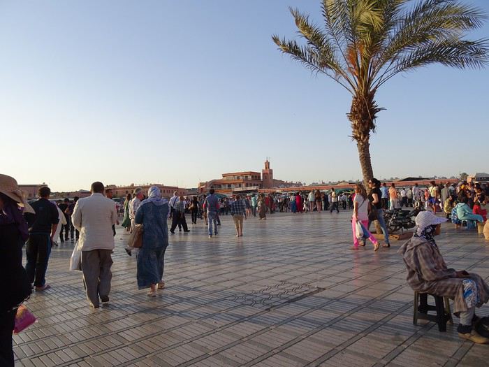
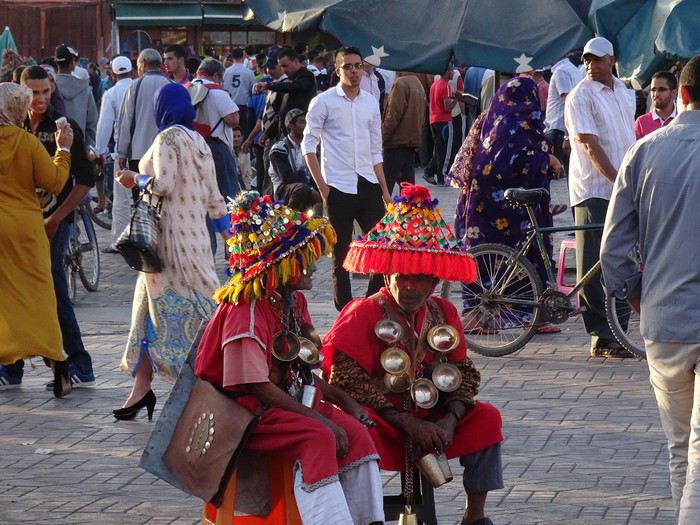
We’ve got a meet-up with friends who are here on a work trip with their company’s social committee.
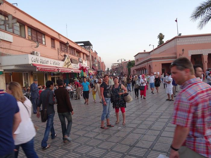
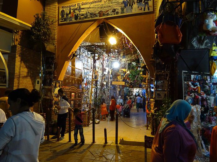
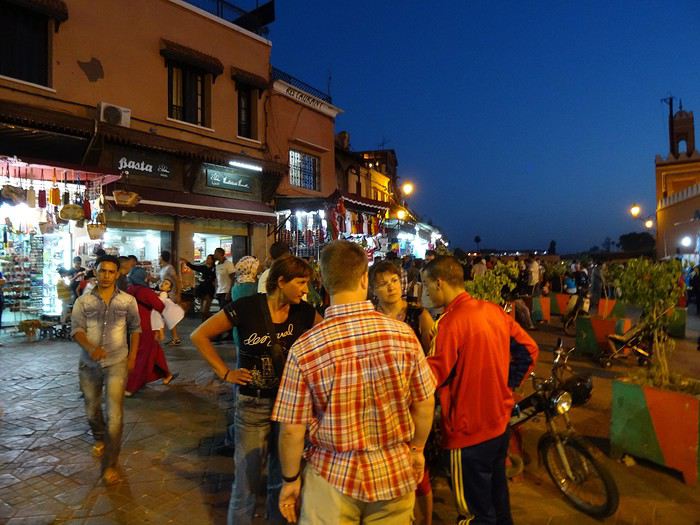
We fully embrace our tourist roles—eating at restaurants made for us, with belly dancers who insist we join in. We go with the flow, we’re not prudes, we have a great evening, no way we’re missing out on the fun...
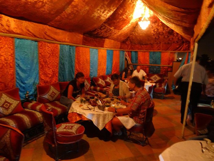
Sunday, June 1, 2014 Marrakech
Super nice breakfast in the hotel’s patio, a real riad, beautifully decorated.
Originally, we’d planned a trip to the Atlas Mountains, but we ended up wandering around the city instead. Before we knew it, we were in the middle of the central souk’s labyrinth. It’s a feast for the eyes, ears, and especially the nose!
Saturday, May 31, 2014 Mulhouse - Marrakech
A flight that drags on for three and a half hours. Everything goes smoothly until immigration. Like almost everywhere, you have to fill out a little form with your details and arrival address. The problem comes when you hand it to the customs officer with your passport. Right away, you see the lines are way too long for the number of officers working. I steer Dom toward a line further to the left that’s clearly moving faster than the middle ones. Then I firmly pull him to the far left where I think I spotted a new counter opening. Big mistake. Huge. Because that line is notorious for how slowly the security agent checks each person. At 10 minutes per person, with about fifteen ahead of us, we’re looking at two and a half hours. The wait becomes torture. Everyone gets edgy. We watch enviously as people who were way behind us initially zip through the other lines. You feel like complaining. My advice? Don’t. You have no idea how much a pissed-off customs officer can ruin your day! The rule: stay calm and suck it up. Once that hurdle’s over, a taxi and boom, we’re at the Gallia, a no-frills but charming hotel just steps from Jemaa El Fna square. This place is insane! It’s teeming with people. You stick out like a sore thumb with your camera—suddenly, a ton of people want to be your best friend! You’re basically a walking wallet!
We’ve got a meet-up with friends who are here on a work trip with their company’s social committee.
We fully embrace our tourist roles—eating at restaurants made for us, with belly dancers who insist we join in. We go with the flow, we’re not prudes, we have a great evening, no way we’re missing out on the fun...
Sunday, June 1, 2014 Marrakech
Super nice breakfast in the hotel’s patio, a real riad, beautifully decorated.
Originally, we’d planned a trip to the Atlas Mountains, but we ended up wandering around the city instead. Before we knew it, we were in the middle of the central souk’s labyrinth. It’s a feast for the eyes, ears, and especially the nose!