Results for "Baume+les+Dames+|+127"
4892 results found.
Et le Pérou en Avril, ça le fait aussi? English translation pending
Pour ma part j'y vais lundi prochain. pour 3 semaines. Objectif principal Pérou Sud et peut-être un bout de Bolivie
Je me demande bien à quoi ressemblera le climat entre une fin de saison des pluies et un début de saison sèche.
y'a quelqu'un qui saurait me dire ça ?
Je me demande bien à quoi ressemblera le climat entre une fin de saison des pluies et un début de saison sèche.
y'a quelqu'un qui saurait me dire ça ?
la louisiane English translation pending
bonjour, j'adore la louisiane, je n'y suis jamais allé mais j'adore, je voudrai savoir comment vous trouvez la louisiane. 😉
puerto plata, punta cana, la romana en RD English translation pending
bonjour
c'est mon premier sejour en RD. que me conseillez vous?
je recherche un hotel 3 ou 4 etoiles au bord de la plage mais qui soit dans un village (et non isolé) avec des choses à visiter pas loin
je recherche de grandes plages
c'est mon premier sejour en RD. que me conseillez vous?
je recherche un hotel 3 ou 4 etoiles au bord de la plage mais qui soit dans un village (et non isolé) avec des choses à visiter pas loin
je recherche de grandes plages
grande traversée des alpes English translation pending
bonjour,
J'envisage la Grande Traversée des alpes dans quelques temps (2007?), et je souhaite echanger avec quelqu'un qui l'a faite.
Mes questions, : meilleurs mois?, bivouac ou gite?, qualité balisage? des passages difficiles?, quelles cartes emporter?
Merci pour les conseils
Jippe
J'envisage la Grande Traversée des alpes dans quelques temps (2007?), et je souhaite echanger avec quelqu'un qui l'a faite.
Mes questions, : meilleurs mois?, bivouac ou gite?, qualité balisage? des passages difficiles?, quelles cartes emporter?
Merci pour les conseils
Jippe
Voyage à Rio, Ilha Grande et Sierra de Bocaina English translation pending
Bonjour
Je pars en Mai pour Rio de Janeiro et compte faire un tour vers Ilha Grande puis remonter sur la Sierra de Bocaina. Ce petit voyage durera 10 jours.
Avez vous déjà visité cette région ? Auriez vous quelques bons plans à me donner ? notamment hotels ou pousaidas ! ........... 🙂
Un grand merci d'avance
Je pars en Mai pour Rio de Janeiro et compte faire un tour vers Ilha Grande puis remonter sur la Sierra de Bocaina. Ce petit voyage durera 10 jours.
Avez vous déjà visité cette région ? Auriez vous quelques bons plans à me donner ? notamment hotels ou pousaidas ! ........... 🙂
Un grand merci d'avance
Budget Japon 3 semaines English translation pending
Bonjour à tous,
Je m'adresse à tous ceux qui sont partis au Japon dernièrement, car j'ai l'intention de partir avec mon ami 3 semaines en mai, mais j'aimerais beaucoup savoir pour ceux qui sont partis, quel a été leur budget pour 3 semaines.
Dans les guides, ils disent de compter 150€/jour, logement+nourriture. Est-ce bien exact ?
Sinon, si je comprends bien, dans des ryokans, le prix est toujours indiqué pour 1 personne, n'est-ce-pas ? donc il faut multiplier par 2 pour une base chambre double. Y-a-t'il des sites internet où l'on puisse réserver son ryokan avant de partir au japon ?
Pour le Rail pass, il est valable à l'intérieur de tout le pays ou seulemement Tokyo et sa périphérie ? Arrive-t'on à reconnaître facilement les lignes JR car si c'est écrit en japonais !!!
Pour l'instant, voici mes principales questions, si vous pouviez m'aider, cela m'éclairerait beaucoup.
Merci
Je m'adresse à tous ceux qui sont partis au Japon dernièrement, car j'ai l'intention de partir avec mon ami 3 semaines en mai, mais j'aimerais beaucoup savoir pour ceux qui sont partis, quel a été leur budget pour 3 semaines.
Dans les guides, ils disent de compter 150€/jour, logement+nourriture. Est-ce bien exact ?
Sinon, si je comprends bien, dans des ryokans, le prix est toujours indiqué pour 1 personne, n'est-ce-pas ? donc il faut multiplier par 2 pour une base chambre double. Y-a-t'il des sites internet où l'on puisse réserver son ryokan avant de partir au japon ?
Pour le Rail pass, il est valable à l'intérieur de tout le pays ou seulemement Tokyo et sa périphérie ? Arrive-t'on à reconnaître facilement les lignes JR car si c'est écrit en japonais !!!
Pour l'instant, voici mes principales questions, si vous pouviez m'aider, cela m'éclairerait beaucoup.
Merci
Machu Pichu en novembre English translation pending
Bonjour,
Est-ce une bonne saison pour aller au machu pichu (je pars le 15 novembre)? Peut-on faire la route de l'inca seul ou faut il un guide ? Comment me renseigner ?
Merci.
Est-ce une bonne saison pour aller au machu pichu (je pars le 15 novembre)? Peut-on faire la route de l'inca seul ou faut il un guide ? Comment me renseigner ?
Merci.
Cherche aide pour une traduction English translation pending
bonjour, je viens de trouver l'existence de ce forum qui va pouvoir m'etre d'un grand secours, j'espère..
voila, j'ai un texte à traduire qui s'appelle Sakura. je ne sais pas à quelle langue cela correspond.
c'est une chanson et étant donné que je ne parle, ni comprends les sonorités des langues asiatiques, je suis bien embéttée pour la traduire.
si quelqun serait apte à traduire cette chanson rien quand l'écoutant, ca me serait d'une aide précieuse.; si qu'elqu'un peut m'aider??
merci
je vais essayer de lamettre en lien ftp
voila, j'ai un texte à traduire qui s'appelle Sakura. je ne sais pas à quelle langue cela correspond.
c'est une chanson et étant donné que je ne parle, ni comprends les sonorités des langues asiatiques, je suis bien embéttée pour la traduire.
si quelqun serait apte à traduire cette chanson rien quand l'écoutant, ca me serait d'une aide précieuse.; si qu'elqu'un peut m'aider??
merci
je vais essayer de lamettre en lien ftp
Sécurité, plages, itinéraires et budget pour le Sri Lanka English translation pending
D'abord merci à tous ceux qui ont eu la générosité de partager tuyaux et recommandations au sujet du Sri Lanka. Ces infos nous seront très utiles pour préparer notre voyage sur place ...sous réserve de maintenir notre voyage dans un mois.
En effet, mon copain et moi venons de poser une option (valable jusqu'à mercredi seulement...aie aie!)sur un A/R pour Colombo, pour un voyage de 16 jours sur place de fin septembre à mi-octobre, déduction faite des journées de vol depuis Paris).
Avant de confirmer notre voyage, les points à éclaircir sont: quels sont les endroits à éviter pour des raisons de sécurité (nord et est d'après le Quai d'Orsay) ou climatiques? Qu'en est il de la Mousson en fin septembre-octobre? où peut-on se baigner en octobre? les plages paradisiaques et non envahies par les touristes semblent dangereuses... Quelles sont vos bonnes adresses sur place? quel itinéraire nous conseillez-vous pour la période (Adam's Peak masqué par la brume?) sachant que nous avons des fortes envies de beaux sites naturels, de spectacles animaliers, de contacts avec la population, que la plupart du temps nous logeons dans des hôtels simples mais sympas, empruntons les transports en commun, mais ne pouvons pas marcher trop longtemps à cause d'un ménisque défaillant... quel est la fourchette de prix pour une chambre double
dans une guest house modeste mais propre, à cette période, dans les endroits dont vous vous êtes épris?
Nous aimerions de temps en temps nous offrir un petit hôtel de charme. A votre avis, dans quelle ville quel hôtel, et à quel prix? Pour quelle partie du pays, à ne pas manquer, pour voir beacoup sans avoir à courir, et compte tenu de la lenteur ou mauvaise liaison en transport commun, il est important de louer un chauffeur?
De manière générale, quels sont vos conseils et bons plans?
Merci d'avance pour vos réponses.
En effet, mon copain et moi venons de poser une option (valable jusqu'à mercredi seulement...aie aie!)sur un A/R pour Colombo, pour un voyage de 16 jours sur place de fin septembre à mi-octobre, déduction faite des journées de vol depuis Paris).
Avant de confirmer notre voyage, les points à éclaircir sont: quels sont les endroits à éviter pour des raisons de sécurité (nord et est d'après le Quai d'Orsay) ou climatiques? Qu'en est il de la Mousson en fin septembre-octobre? où peut-on se baigner en octobre? les plages paradisiaques et non envahies par les touristes semblent dangereuses... Quelles sont vos bonnes adresses sur place? quel itinéraire nous conseillez-vous pour la période (Adam's Peak masqué par la brume?) sachant que nous avons des fortes envies de beaux sites naturels, de spectacles animaliers, de contacts avec la population, que la plupart du temps nous logeons dans des hôtels simples mais sympas, empruntons les transports en commun, mais ne pouvons pas marcher trop longtemps à cause d'un ménisque défaillant... quel est la fourchette de prix pour une chambre double
dans une guest house modeste mais propre, à cette période, dans les endroits dont vous vous êtes épris?
Nous aimerions de temps en temps nous offrir un petit hôtel de charme. A votre avis, dans quelle ville quel hôtel, et à quel prix? Pour quelle partie du pays, à ne pas manquer, pour voir beacoup sans avoir à courir, et compte tenu de la lenteur ou mauvaise liaison en transport commun, il est important de louer un chauffeur?
De manière générale, quels sont vos conseils et bons plans?
Merci d'avance pour vos réponses.
Aéroports... English translation pending
Sur le tarmac, des gros avions, des plus petits, des escaliers, des bagages, des gens et des voyages par l'imagination. Thai, Malaysian Airways, China Airline, Aer Lingus, Ariana Afghan... Des noms qu'on associe a des destinations mythiques, connues ou pas encore decouvertes, qui nous attirent a la folie ou nous laissent indifferents.
Transit, couloirs d'embarquement. Le voyage continue, toujours par les mots, sur les ecrans, sur les billets des voyageurs, sur les etiquettes des sacs. Des noms encore plus etranges et inconnus, ou les placer sur une mappemonde? Almaty, Varna, Nador, Accra, Kazan…
Le voyage encore, par les peuples du monde, jeunes japonais en vadrouille, imposantes familles indiennes, tribus de chinois, opulence des americains.
Je ne fais que un Nice-Frankfort-Dusseldorf, mais j'ai l'impression de faire un tour du monde...
Transit, couloirs d'embarquement. Le voyage continue, toujours par les mots, sur les ecrans, sur les billets des voyageurs, sur les etiquettes des sacs. Des noms encore plus etranges et inconnus, ou les placer sur une mappemonde? Almaty, Varna, Nador, Accra, Kazan…
Le voyage encore, par les peuples du monde, jeunes japonais en vadrouille, imposantes familles indiennes, tribus de chinois, opulence des americains.
Je ne fais que un Nice-Frankfort-Dusseldorf, mais j'ai l'impression de faire un tour du monde...
Nouvelle-Zélande en octobre English translation pending
je souhaite aller en nouvelle zélande et dispose de temps sur octobre / novembre ....
je voudrais savoir si à cette époque c'est déjà possible d'y aller pour faire de la rando et si il y a encore beaucoupde neige dans l'ile du sud à cette époque ?
je voudrais savoir si à cette époque c'est déjà possible d'y aller pour faire de la rando et si il y a encore beaucoupde neige dans l'ile du sud à cette époque ?
Pologne à vélo English translation pending
Bonjour,
Je vais faire un voyage de 15 jours en Pologne à vélo. Nous débarquerons à trois à Katowice (sud) et ne savons pas encore du tout quel circuit faire. On peut faire environ 1500km, on ira sans doute pas jusqu'à la côte donc puisqu'on doit revenir à Katowice.
Je suis preneur de tous conseils, infos, etc sur les beaux coins à visiter dans le sud de la Pologne (éventuellement Tchequie et Slovaquie aussi). Vu d'un point de vue de voyageur cyclotouriste on recherche surtout les belles régions, pas les grosses villes où faire la fête... On compte loger dans des fermes ou chez l'habitant si possible, le mot d'ordre étant: pas cher. On est scout et on n'a pas besoin de confort (pas besoin de lit, douche, etc... vive la débrouillardise).
Merci pour tout ce que vous pourriez me dire, hésitez pas!
Quentin
Je vais faire un voyage de 15 jours en Pologne à vélo. Nous débarquerons à trois à Katowice (sud) et ne savons pas encore du tout quel circuit faire. On peut faire environ 1500km, on ira sans doute pas jusqu'à la côte donc puisqu'on doit revenir à Katowice.
Je suis preneur de tous conseils, infos, etc sur les beaux coins à visiter dans le sud de la Pologne (éventuellement Tchequie et Slovaquie aussi). Vu d'un point de vue de voyageur cyclotouriste on recherche surtout les belles régions, pas les grosses villes où faire la fête... On compte loger dans des fermes ou chez l'habitant si possible, le mot d'ordre étant: pas cher. On est scout et on n'a pas besoin de confort (pas besoin de lit, douche, etc... vive la débrouillardise).
Merci pour tout ce que vous pourriez me dire, hésitez pas!
Quentin
Islande: la peur, l'émotion, le plaisir... (1) English translation pending
« Ís og eldur » … la glace et le feu. C'est la devise de l’Islande, cette île du haut du monde que nous parcourons, en 4x4 et à pied, depuis deux semaines. Les côtes et les fjords somptueux, mais aussi les déserts de l’intérieur, les grandes pistes sauvages, entre volcans et glaciers.
Ce n’est pas notre premier voyage ici : l’Islande est notre pays-passion. Une passion intacte, toujours renouvelée. Chaque jour, l’émotion nous saisit devant ces paysages immenses, sidérants de beauté. Ici tout est pur et vierge, l’air est si cristallin qu’on croit pouvoir toucher les montagnes à cinquante kilomètres.
C’est le mois de juillet : il n’y a pas de nuit. A certaines heures, selon le ciel changeant, la nature se pare de la palette d’un peintre fou : il y a des verts et des bleus qu’on ne différencie plus, des lacs glacés d’un mauve profond, des bassins fumants d’un turquoise irréel, des collines d’un orange incroyable, des mousses jaunes fluo poussant sur des pentes de cendres d’un noir intense.
Silence et humilité … On est « au pays de la création du monde », comme disent les islandais. Ils disent aussi parfois : « Quand Dieu a créé le monde, il a fait des essais de couleurs pour la nature … certains de ces essais, abandonnés, subsistent en Islande ».
Aujourd’hui, nous sommes sur la côte Sud, un peu à l’Est de la lagune glaciaire de Jökulsarlon où les icebergs bleutés dérivent lentement jusqu’à la mer.
C'est le début de l'après-midi, il fait 8 degrés, un ciel assez beau, et nous nous souvenons d’un conseil d'Arní, rencontré à Reykjavík quand nous avons loué notre voiture. Arní est originaire d’un hameau de cette côte. Il nous a dit qu'un peu avant le petit port de pêche de Höfn, on trouverait une piste (la F985, il a mis une croix au stylo sur notre carte) qui permet d’accéder à la langue glaciaire du Skálafellsjökull, puis de remonter jusqu'au bord de l'immense calotte glaciaire du Vatnajökull, 1000 mètres d’épaisseur de glace, vaste comme la Corse.
Il en fallait moins pour nous attirer, Arní : c'est parti !
La langue de glace du Skálafellsjökull (jökull = glacier, en islandais) s’avance jusqu’à la plaine côtière. Juste à côté se trouve la ferme de Smyrlabjörg où une jeune fille nous confirme que nous sommes sur la bonne voie : la piste F985 (réservée aux 4x4) commence tout près d’ici.
Sur les premiers kilomètres, c’est une piste de montagne assez classique. En quelques minutes on s’élève rapidement et on se retrouve sur une arête rocheuse, surplombant le glacier qui coule comme un grand fleuve figé.
La piste longe la rimaye et offre des vues inquiétantes sur cette énorme masse de glace striée de cendres noires, résultat d’éruptions volcaniques anciennes. Pour croiser une voiture, on fait une halte sur un replat. D’habitude, il y a beaucoup d’oiseaux en Islande mais en ce lieu il n’y en a aucun, le silence n’est troublé que par des gargouillis d’eau. Le glacier est assez effrayant, on dirait une bête endormie, prête à tout avaler …
A partir d’ici, la piste a un tracé vraiment inouï ! A vouloir remonter comme ça le long du bord du glacier, il y a maintenant des passages de folie, des pentes incroyables, des précipices béants au détour d’un virage, et bien sûr comme partout en Islande, pas le moindre parapet !
Notre Suzuki Jimny est petite mais elle fait merveille : les quatre roues motrices ne sont pas de trop ! Nous montons très lentement, avec prudence, parfois en seconde mais le plus souvent en 1ère, selon les passages.
Il n’y a qu’une seule voie, bien sûr, mais heureusement personne en face. Ce n’est pas à proprement parler une piste difficile, mais il faut rouler au pas, rester bien concentré et toujours garder une réserve de puissance sous le pied. C’est ce que je m'efforce de faire en me disant à chaque virage, à chaque lacet : « Bon, ça doit sans doute être plus cool après ça … » … et puis le passage suivant révèle encore des surprises … Quant au spectacle, il devient de plus en plus hallucinant ! On se regarde, incrédules … où va-t-on ? !
Avouons qu’à certains moments l’atmosphère est un peu tendue dans la voiture, mais c’est étrange comme la peur est parfois cousine du plaisir …
Le dos bien calé dans mon siège, je me tiens fermement au volant, Marie-Françoise sollicite fortement les poignées de maintien : heureusement qu’elles sont solides ! Aux passages les plus scabreux, le silence se fait ... les dialogues sont remplacés par des onomatopées du genre « Ggggsssss ! » ... « Vvvvvvsssss ! » ... « Pffffffttttt ! ». En plus, avec l’altitude et le contact de l’air avec le glacier, le ciel s’est maintenant chargé de lambeaux de brume qui passent devant nous comme des écharpes blanches, c’est assez fantomatique.
Au bout de vingt minutes de cette piste de folie, tout à coup un replat : nous voici arrivés. C’est la fin de la piste, on se gare devant le refuge de Jöklasel. On est ici à la racine de la langue glaciaire du Skálafellsjökull.
Impression de bout du monde : en effet, trente mètres plus loin, c’est la glace de la calotte du Vatnajökull qui commence, à perte de vue, un monde de glace dont les lointains s’évanouissent dans la brume. Une étendue de glace grande comme la Corse et épaisse de mille mètres ... la troisième calotte de glace de la planète (après celles de l'Antarctique et du Groenland).
On met des chaussures adaptées et on part faire un tour, mais juste sur la marge de ce monde où l’humain n’a guère sa place. C’est très impressionnant ! Humilité, crainte, respect …
Les passages de brume sont de plus en plus importants. En fait, c’est la glace qui passe directement de l’état solide à l’état gazeux, sans fondre, car la température ne le permet pas. Ce phénomène (qui s’appelle la sublimation) est fréquent en Islande, au contact des glaces sous le soleil.
Il fait froid. Retour à la voiture pour se faire sur le camping-gaz deux thés bien chauds + barre de chocolat noir (c’est notre dopage habituel).
Les lambeaux de brume sont maintenant de plus en plus rapprochés. Entre deux passages, le ciel bleu réapparaît … On repense aux précipices et aux pentes de folie qui nous attendent pour redescendre, et on décide de ne pas trop tarder.
Descente lente et ultra-prudente, tout au frein moteur bien sûr, en 4 roues motrices et souvent en première tant la pente est forte. Concentrés mais aussi un peu crispés par moments, avouons-le …
Il y a de nouveau quelques onomatopées, quelques « Ggggsssss ! » ... quelques «Vvvvvvsssss !» et autres «Pffffffttttt !» ... mais bon, ce que nous sommes en train de vivre là, ça ne s’exprime peut-être pas avec des mots normaux …
De nouveau cette sensation étrange à la frontière de la peur et du plaisir … Un peu comme quand on était enfants et qu’on « jouait à se faire peur » en surgissant au coin d’un mur (bouhhhh !) devant l’autre terrifié … mais grisé de plaisir, mêlant un cri d’effroi à un éclat de rire de soulagement !
Nous voici bientôt dans la partie basse de la piste, c'est facile maintenant, les abymes et les lambeaux de brume sont derrière nous. Retour dans un monde où les humains ne sont pas seulement tolérés, mais admis …
Tiens, tiens ! face à nous, sur la piste, voici un 4x4 Suzuki Jimny identique au nôtre qui attaque la montée ! Rencontre improbable !
Croisement et arrêt des deux voitures, vitre baissée contre vitre baissée. Encore plus improbable : c’est un couple de français ! La jeune femme nous demande « si ça passe facilement avec ce 4x4 jusque là-haut ? » … Oubliées les tentatives d’arrachage des poignées de maintien lors de la montée et de la descente, oubliées les onomatopées aspirantes et soufflantes, j’entends Marie-Françoise lui répondre d'un ton assuré et avec un grand sourire « Oui ! oui ! Impeccable ! aucun problème ! »
Et voilà ! Elle est pas belle, la vie ? C’est la magie de la réussite qui gomme les petites difficultés ! Après s’être bien shootés à l’adrénaline, la bienfaisante décompression s’accompagne d’une vague de bonheur … à partager !
On discute deux minutes et on tempère quand même un tout petit peu en leur recommandant de monter très lentement et d’être prudents. On leur signale les lambeaux de brume qui passent là-haut, mais sans les inquiéter. Après tout, c’est vrai que si on reste concentré, si on fait attention, il n'y a pas vraiment de risques, et ça aurait été vraiment dommage de les dissuader !
Si vous allez un jour là-bas, dans l'île de la création du monde, si vous avez l'occasion de monter tout en haut de la piste F985, et si le temps le permet, soyez prudents, bien sûr, mais surtout n'hésitez pas : allez-y, c'est vraiment – vraiment - géant !
L'émotion est au rendez-vous, l’adrénaline est fournie sur place, et la griserie du plaisir est comprise dans la posologie.
Chris.
P.S. : Si vous voulez lire la suite, vous la trouverez : ici
Ce n’est pas notre premier voyage ici : l’Islande est notre pays-passion. Une passion intacte, toujours renouvelée. Chaque jour, l’émotion nous saisit devant ces paysages immenses, sidérants de beauté. Ici tout est pur et vierge, l’air est si cristallin qu’on croit pouvoir toucher les montagnes à cinquante kilomètres.
C’est le mois de juillet : il n’y a pas de nuit. A certaines heures, selon le ciel changeant, la nature se pare de la palette d’un peintre fou : il y a des verts et des bleus qu’on ne différencie plus, des lacs glacés d’un mauve profond, des bassins fumants d’un turquoise irréel, des collines d’un orange incroyable, des mousses jaunes fluo poussant sur des pentes de cendres d’un noir intense.
Silence et humilité … On est « au pays de la création du monde », comme disent les islandais. Ils disent aussi parfois : « Quand Dieu a créé le monde, il a fait des essais de couleurs pour la nature … certains de ces essais, abandonnés, subsistent en Islande ».
Aujourd’hui, nous sommes sur la côte Sud, un peu à l’Est de la lagune glaciaire de Jökulsarlon où les icebergs bleutés dérivent lentement jusqu’à la mer.
C'est le début de l'après-midi, il fait 8 degrés, un ciel assez beau, et nous nous souvenons d’un conseil d'Arní, rencontré à Reykjavík quand nous avons loué notre voiture. Arní est originaire d’un hameau de cette côte. Il nous a dit qu'un peu avant le petit port de pêche de Höfn, on trouverait une piste (la F985, il a mis une croix au stylo sur notre carte) qui permet d’accéder à la langue glaciaire du Skálafellsjökull, puis de remonter jusqu'au bord de l'immense calotte glaciaire du Vatnajökull, 1000 mètres d’épaisseur de glace, vaste comme la Corse.
Il en fallait moins pour nous attirer, Arní : c'est parti !
La langue de glace du Skálafellsjökull (jökull = glacier, en islandais) s’avance jusqu’à la plaine côtière. Juste à côté se trouve la ferme de Smyrlabjörg où une jeune fille nous confirme que nous sommes sur la bonne voie : la piste F985 (réservée aux 4x4) commence tout près d’ici.
Sur les premiers kilomètres, c’est une piste de montagne assez classique. En quelques minutes on s’élève rapidement et on se retrouve sur une arête rocheuse, surplombant le glacier qui coule comme un grand fleuve figé.
La piste longe la rimaye et offre des vues inquiétantes sur cette énorme masse de glace striée de cendres noires, résultat d’éruptions volcaniques anciennes. Pour croiser une voiture, on fait une halte sur un replat. D’habitude, il y a beaucoup d’oiseaux en Islande mais en ce lieu il n’y en a aucun, le silence n’est troublé que par des gargouillis d’eau. Le glacier est assez effrayant, on dirait une bête endormie, prête à tout avaler …
A partir d’ici, la piste a un tracé vraiment inouï ! A vouloir remonter comme ça le long du bord du glacier, il y a maintenant des passages de folie, des pentes incroyables, des précipices béants au détour d’un virage, et bien sûr comme partout en Islande, pas le moindre parapet !
Notre Suzuki Jimny est petite mais elle fait merveille : les quatre roues motrices ne sont pas de trop ! Nous montons très lentement, avec prudence, parfois en seconde mais le plus souvent en 1ère, selon les passages.
Il n’y a qu’une seule voie, bien sûr, mais heureusement personne en face. Ce n’est pas à proprement parler une piste difficile, mais il faut rouler au pas, rester bien concentré et toujours garder une réserve de puissance sous le pied. C’est ce que je m'efforce de faire en me disant à chaque virage, à chaque lacet : « Bon, ça doit sans doute être plus cool après ça … » … et puis le passage suivant révèle encore des surprises … Quant au spectacle, il devient de plus en plus hallucinant ! On se regarde, incrédules … où va-t-on ? !
Avouons qu’à certains moments l’atmosphère est un peu tendue dans la voiture, mais c’est étrange comme la peur est parfois cousine du plaisir …
Le dos bien calé dans mon siège, je me tiens fermement au volant, Marie-Françoise sollicite fortement les poignées de maintien : heureusement qu’elles sont solides ! Aux passages les plus scabreux, le silence se fait ... les dialogues sont remplacés par des onomatopées du genre « Ggggsssss ! » ... « Vvvvvvsssss ! » ... « Pffffffttttt ! ». En plus, avec l’altitude et le contact de l’air avec le glacier, le ciel s’est maintenant chargé de lambeaux de brume qui passent devant nous comme des écharpes blanches, c’est assez fantomatique.
Au bout de vingt minutes de cette piste de folie, tout à coup un replat : nous voici arrivés. C’est la fin de la piste, on se gare devant le refuge de Jöklasel. On est ici à la racine de la langue glaciaire du Skálafellsjökull.
Impression de bout du monde : en effet, trente mètres plus loin, c’est la glace de la calotte du Vatnajökull qui commence, à perte de vue, un monde de glace dont les lointains s’évanouissent dans la brume. Une étendue de glace grande comme la Corse et épaisse de mille mètres ... la troisième calotte de glace de la planète (après celles de l'Antarctique et du Groenland).
On met des chaussures adaptées et on part faire un tour, mais juste sur la marge de ce monde où l’humain n’a guère sa place. C’est très impressionnant ! Humilité, crainte, respect …
Les passages de brume sont de plus en plus importants. En fait, c’est la glace qui passe directement de l’état solide à l’état gazeux, sans fondre, car la température ne le permet pas. Ce phénomène (qui s’appelle la sublimation) est fréquent en Islande, au contact des glaces sous le soleil.
Il fait froid. Retour à la voiture pour se faire sur le camping-gaz deux thés bien chauds + barre de chocolat noir (c’est notre dopage habituel).
Les lambeaux de brume sont maintenant de plus en plus rapprochés. Entre deux passages, le ciel bleu réapparaît … On repense aux précipices et aux pentes de folie qui nous attendent pour redescendre, et on décide de ne pas trop tarder.
Descente lente et ultra-prudente, tout au frein moteur bien sûr, en 4 roues motrices et souvent en première tant la pente est forte. Concentrés mais aussi un peu crispés par moments, avouons-le …
Il y a de nouveau quelques onomatopées, quelques « Ggggsssss ! » ... quelques «Vvvvvvsssss !» et autres «Pffffffttttt !» ... mais bon, ce que nous sommes en train de vivre là, ça ne s’exprime peut-être pas avec des mots normaux …
De nouveau cette sensation étrange à la frontière de la peur et du plaisir … Un peu comme quand on était enfants et qu’on « jouait à se faire peur » en surgissant au coin d’un mur (bouhhhh !) devant l’autre terrifié … mais grisé de plaisir, mêlant un cri d’effroi à un éclat de rire de soulagement !
Nous voici bientôt dans la partie basse de la piste, c'est facile maintenant, les abymes et les lambeaux de brume sont derrière nous. Retour dans un monde où les humains ne sont pas seulement tolérés, mais admis …
Tiens, tiens ! face à nous, sur la piste, voici un 4x4 Suzuki Jimny identique au nôtre qui attaque la montée ! Rencontre improbable !
Croisement et arrêt des deux voitures, vitre baissée contre vitre baissée. Encore plus improbable : c’est un couple de français ! La jeune femme nous demande « si ça passe facilement avec ce 4x4 jusque là-haut ? » … Oubliées les tentatives d’arrachage des poignées de maintien lors de la montée et de la descente, oubliées les onomatopées aspirantes et soufflantes, j’entends Marie-Françoise lui répondre d'un ton assuré et avec un grand sourire « Oui ! oui ! Impeccable ! aucun problème ! »
Et voilà ! Elle est pas belle, la vie ? C’est la magie de la réussite qui gomme les petites difficultés ! Après s’être bien shootés à l’adrénaline, la bienfaisante décompression s’accompagne d’une vague de bonheur … à partager !
On discute deux minutes et on tempère quand même un tout petit peu en leur recommandant de monter très lentement et d’être prudents. On leur signale les lambeaux de brume qui passent là-haut, mais sans les inquiéter. Après tout, c’est vrai que si on reste concentré, si on fait attention, il n'y a pas vraiment de risques, et ça aurait été vraiment dommage de les dissuader !
Si vous allez un jour là-bas, dans l'île de la création du monde, si vous avez l'occasion de monter tout en haut de la piste F985, et si le temps le permet, soyez prudents, bien sûr, mais surtout n'hésitez pas : allez-y, c'est vraiment – vraiment - géant !
L'émotion est au rendez-vous, l’adrénaline est fournie sur place, et la griserie du plaisir est comprise dans la posologie.
Chris.
P.S. : Si vous voulez lire la suite, vous la trouverez : ici
Vacances en France et handicap English translation pending
Bonjour,
J'ai une amie en partie paraplégique depuis 1 an (paralysie du bras droit et difficulté à marcher) qui a fait des démarches auprès d'associations spécialisées en la matière pour partir en vacances en france cet été.
Hélas, on lui demande 1300 euros TTC pour une semaine sur la côte + encore 1300 euros afin de régler les frais de location d'un fauteuil roulant et du bénévole qui doit obligatoirement l'accompagner ! j'ai été très choquée de ce fait, un bénévole par définition même ne reçoit pas de rémunération ..
Donc elle ne pense pas pouvoir partir . j'ai trouvé ça tellement injuste et révoltant que j'ai décider de l'aider à trouver une solution, cette amie à 40 ans seulement et je me dis que ça pourrait nous arriver à tous hélas.. Il suffit d'avoir quelqu'un de proche concerné pour se rendre compte que vraiment rien n'est fait pour aider ces personnes
Donc si vous avez des solutions, je lui transmettrai au + tôt
merci d'avance
a
J'ai une amie en partie paraplégique depuis 1 an (paralysie du bras droit et difficulté à marcher) qui a fait des démarches auprès d'associations spécialisées en la matière pour partir en vacances en france cet été.
Hélas, on lui demande 1300 euros TTC pour une semaine sur la côte + encore 1300 euros afin de régler les frais de location d'un fauteuil roulant et du bénévole qui doit obligatoirement l'accompagner ! j'ai été très choquée de ce fait, un bénévole par définition même ne reçoit pas de rémunération ..
Donc elle ne pense pas pouvoir partir . j'ai trouvé ça tellement injuste et révoltant que j'ai décider de l'aider à trouver une solution, cette amie à 40 ans seulement et je me dis que ça pourrait nous arriver à tous hélas.. Il suffit d'avoir quelqu'un de proche concerné pour se rendre compte que vraiment rien n'est fait pour aider ces personnes
Donc si vous avez des solutions, je lui transmettrai au + tôt
merci d'avance
a
Logement à Dublin en Irlande English translation pending
bonjour!
J'aimerais partir une semaine en Irlande, je n'y suis jamais allée, mais mon budget est assez serré; donc je me demandais si quelqu'un avait des bons plans pour le logement; mais aussi si il existe un réseau de bus permettant de visiter un peu la campagne et les sites alentours (impossible de louer une voiture...😕)...
Merci d'avance!
J'aimerais partir une semaine en Irlande, je n'y suis jamais allée, mais mon budget est assez serré; donc je me demandais si quelqu'un avait des bons plans pour le logement; mais aussi si il existe un réseau de bus permettant de visiter un peu la campagne et les sites alentours (impossible de louer une voiture...😕)...
Merci d'avance!
France: donne infos sur le Finistère en Bretagne English translation pending
salut à tous,
Je suis Breton et connaissant par coeur le finistère(département 29), je pense être utile à ceux qui voudraient s'y rendre...
Au plaisir
yann
Je suis Breton et connaissant par coeur le finistère(département 29), je pense être utile à ceux qui voudraient s'y rendre...
Au plaisir
yann
Scènes de vie d'ailleurs... English translation pending
Salut à tous,
Je pompe l’idée de Trekk sur la diffusion de photos qui semble intéresser quelques un(e)s d’entre nous.
Je propose un sujet sur les scènes de vie qui pourrait être abordé par thèmes… cuisine, transports, famille, fêtes, travail, commerce, nomades, industrie, travaux des champs… que sais-je … à chacun de proposer …
Je commence par le thème : travail de la laine
A vos albums …
Je pompe l’idée de Trekk sur la diffusion de photos qui semble intéresser quelques un(e)s d’entre nous.
Je propose un sujet sur les scènes de vie qui pourrait être abordé par thèmes… cuisine, transports, famille, fêtes, travail, commerce, nomades, industrie, travaux des champs… que sais-je … à chacun de proposer …
Je commence par le thème : travail de la laine
A vos albums …
Sites incontournables d'Indonésie? English translation pending
Salut,
Je pars 3 grosses semaines en Indonésie, j'arriverais sur l'île de Sumatra sur Medan pour m'en aller sur l'île de Java, puis Bali...........
Quels sont les endroits les plus intéressants à visiter d'après vous ?
Je souhaite effectuer des stages de plongées (niveau I voir II si temps nécessaire), sur quel île dois je me rendre pour cela ?, quelqu'un aurrait il un ordre de prix à me communiquer ?
Je vous remercie..........
Je pars 3 grosses semaines en Indonésie, j'arriverais sur l'île de Sumatra sur Medan pour m'en aller sur l'île de Java, puis Bali...........
Quels sont les endroits les plus intéressants à visiter d'après vous ?
Je souhaite effectuer des stages de plongées (niveau I voir II si temps nécessaire), sur quel île dois je me rendre pour cela ?, quelqu'un aurrait il un ordre de prix à me communiquer ?
Je vous remercie..........
Retour de l'Hôtel Amadil Beach (Agadir) English translation pending
Bonjour,
Je suis partie avec dégriftour à Agadir pendant une semaine à l'hôtel Amadil Beach. nous avons payé 260 euros la semaine en demi pension, mais nous n'avons pas été déçus pour les mauvaises surprises !
Nous somme partis à quatre.
Le beau temps était là, mais en ce qui concerne l'hôtel il était en travaux !
Nous avons été derangé par le bruit toute la semaine, mauvaise insonorisation dans les chambres, panne générale d'éléctricité pendant deux heures, la piscine n'était pas chauffée, trous dans la chambre, fils éléctriques pendants dans la salle de bain, soirée orientale sans danseuse orientale...
Pour les détails pour ceux qui partent bientôt, à la demande je pourrai vous faire un résumé !
A bientôt
Je suis partie avec dégriftour à Agadir pendant une semaine à l'hôtel Amadil Beach. nous avons payé 260 euros la semaine en demi pension, mais nous n'avons pas été déçus pour les mauvaises surprises !
Nous somme partis à quatre.
Le beau temps était là, mais en ce qui concerne l'hôtel il était en travaux !
Nous avons été derangé par le bruit toute la semaine, mauvaise insonorisation dans les chambres, panne générale d'éléctricité pendant deux heures, la piscine n'était pas chauffée, trous dans la chambre, fils éléctriques pendants dans la salle de bain, soirée orientale sans danseuse orientale...
Pour les détails pour ceux qui partent bientôt, à la demande je pourrai vous faire un résumé !
A bientôt
Coût de la vie en Chine English translation pending
😉salut,
j'aimerai me rendre en chine et le cout de la vie reste qd meme relativement cher
mon type de voyage est plutot sac a dos, petit budget a savoir que j'aimerai rester plusieurs mois dans ce pays
si vous avez des bons plans concernant le logement(meme sommaire) et alimentation à prix modiques (style dans les marches) .......
j'aimerai ne pas depenser plus de 15€/jr
merci de vos reponses
tony
j'aimerai me rendre en chine et le cout de la vie reste qd meme relativement cher
mon type de voyage est plutot sac a dos, petit budget a savoir que j'aimerai rester plusieurs mois dans ce pays
si vous avez des bons plans concernant le logement(meme sommaire) et alimentation à prix modiques (style dans les marches) .......
j'aimerai ne pas depenser plus de 15€/jr
merci de vos reponses
tony
Premieres impressions - Kathmandou English translation pending
Kathmandou est une ville de fous. Au premier abord, on aurait presque peur de sortir de sa chambre spartiate tant les rues fourmillent de monde, de voitures, de motos, de tchouktchouks, de policiers et militaires (eeeh oui, l'epoque est difficile). On se sent agresse de toutes parts, on se demande un peu ce que l'on fait la, si tout ca est effectivement bien une bonne idee. Puis on se lance, dans le flux etouffant, dans la cohorte. Traverser une rue tient du suicide. Chaque regard est un piege a backchich. Il faut saisir le truc rapidement, eviter de subir l'inimaginable maree humaine, mais tenter de s'y fondre, d'en faire partie.
Kathmandou est aggressif, difficile a apprivoiser. Mais j'ai decide de prendre mon temps...
Aujourd'hui, j'ai vogue au gres de mes envies au coeur du quartier touristique de Thamel. Je suis de plus en plus a l'aise dans ce tumulte de gens, dans ce melanges d'odeurs d'epices et de caniveau nauseabond, dans cette improbable cacophonie de claxons, de sonettes, de tintements de cloche... pour preuve, je ne me suis veritablement perdu qu'une seule fois ce matin. Je m'amuse a m'inventer une vie nouvelle a chaque fois qu'un rabatteur de rue m'interpelle : parfois Parisien nostalgique des seventies, d'autres fois Bruxellois en quete de spiritualite, quelques fois Allemand aventurier, ou Suedois egare (c'est meme dans cette categorie que l'on m'integre directement, avant tout contact plus avance - sans doute plus pour le cote egare que suedois)... De toute facon, quel que soit le pays d'origine, ils en connaissent toujours bien une ville, un quartier, un monument, voire quelques lointains amis dont ils vous demandent fierement des nouvelles ; je m'amuse alors a les confondre, melangeant habilement mes elucubrations pieuses et leurs mensonges opportunistes. Une chose est sure, ca ne fonctionne pas comme je pourrais l'esperer, puisque je suis toujours autant la cible de ces opportunistes pas toujours tres honnetes (je le leur rends bien, d'accord). Quoiqu'il en soit, je continue de penser qu'il vaut mieux preferer une aimable discussion basee sur d'imaginaires affabulations ponctuee de sourires - bien reels ceux-ci - a l'ignorance et au dedain.
Sinon, au programme de demain, theoriquement, je monte jusque Nagarkoth, voir mes premieres montagnes. Je me rejouis tout de meme de sortir un peu le tete de Kathmandou : j'allais finir par croire que c'etait vraiment ca, le Nepal. Mon trek autour des Annapurnas ne commence que Mercredi (si tout va bien) ; il me restera donc 2 journees pour voguer dans la vallee, visiter Bodnath et Bakthapur. Aller-retour en Taxi, ou en bus local. A les voir, j'ai l'impression que cela va etre tout un poeme...
Merci a VoyageForum et au membres qui m'ont aide et conseille dans la preparation de cette jolie balade. Apres le Nepal, je descends vers le Sud et l'Inde. Je n'ai sans doute encore rien vu...
Kathmandou est aggressif, difficile a apprivoiser. Mais j'ai decide de prendre mon temps...
Aujourd'hui, j'ai vogue au gres de mes envies au coeur du quartier touristique de Thamel. Je suis de plus en plus a l'aise dans ce tumulte de gens, dans ce melanges d'odeurs d'epices et de caniveau nauseabond, dans cette improbable cacophonie de claxons, de sonettes, de tintements de cloche... pour preuve, je ne me suis veritablement perdu qu'une seule fois ce matin. Je m'amuse a m'inventer une vie nouvelle a chaque fois qu'un rabatteur de rue m'interpelle : parfois Parisien nostalgique des seventies, d'autres fois Bruxellois en quete de spiritualite, quelques fois Allemand aventurier, ou Suedois egare (c'est meme dans cette categorie que l'on m'integre directement, avant tout contact plus avance - sans doute plus pour le cote egare que suedois)... De toute facon, quel que soit le pays d'origine, ils en connaissent toujours bien une ville, un quartier, un monument, voire quelques lointains amis dont ils vous demandent fierement des nouvelles ; je m'amuse alors a les confondre, melangeant habilement mes elucubrations pieuses et leurs mensonges opportunistes. Une chose est sure, ca ne fonctionne pas comme je pourrais l'esperer, puisque je suis toujours autant la cible de ces opportunistes pas toujours tres honnetes (je le leur rends bien, d'accord). Quoiqu'il en soit, je continue de penser qu'il vaut mieux preferer une aimable discussion basee sur d'imaginaires affabulations ponctuee de sourires - bien reels ceux-ci - a l'ignorance et au dedain.
Sinon, au programme de demain, theoriquement, je monte jusque Nagarkoth, voir mes premieres montagnes. Je me rejouis tout de meme de sortir un peu le tete de Kathmandou : j'allais finir par croire que c'etait vraiment ca, le Nepal. Mon trek autour des Annapurnas ne commence que Mercredi (si tout va bien) ; il me restera donc 2 journees pour voguer dans la vallee, visiter Bodnath et Bakthapur. Aller-retour en Taxi, ou en bus local. A les voir, j'ai l'impression que cela va etre tout un poeme...
Merci a VoyageForum et au membres qui m'ont aide et conseille dans la preparation de cette jolie balade. Apres le Nepal, je descends vers le Sud et l'Inde. Je n'ai sans doute encore rien vu...
Climat à Angkor en août? English translation pending
Bonjour à tous,
Pour des raisons professionnelles, je dois prendre 2 semaines de congés en Août 🤪.
Est-il raisonnable d'envisager un voyage à Angkor à cette période ? La mousson est-elle trop violente pour permettre une visite agréable de ce site ... ou est-ce gérable ?
Aucun guide (déjà soigneusement consulté !) ne me renseignera aussi bien que votre expérience vécue .... 🙂
Merci de votre aide.
Pour des raisons professionnelles, je dois prendre 2 semaines de congés en Août 🤪.
Est-il raisonnable d'envisager un voyage à Angkor à cette période ? La mousson est-elle trop violente pour permettre une visite agréable de ce site ... ou est-ce gérable ?
Aucun guide (déjà soigneusement consulté !) ne me renseignera aussi bien que votre expérience vécue .... 🙂
Merci de votre aide.
Un mois au Vietnam (novembre/décembre 2001) English translation pending
🙂Globalement voici ce que nous pensons du Vietnam, après y avoir séjourné un mois, du 1 Novembre au 1 Décembre 2001.
Généralités
Le paysage est superbe et très varié. Rizières dans les plaines, et en plateaux là où c’est possible. Bords de mer escarpés et plages sablonneuses. Quelques forets de pins et évidemment plusieurs forets tropicales. Les routes sont généralement étroites et leur état très variable. Nous avons souvent du rouler plusieurs kilomètres au milieu de travaux, et il reste encore malheureusement plusieurs chemins de terre plus ou moins carrossables. En ville les rues sont en général acceptables, mais les trottoirs sont affreusement embarrassés de motos, bicyclettes tables de restaurants et il faut toujours se méfier des dénivellations et des canalisations d’égouts sans couvercles. Circuler à pied en ville est très éprouvant et on finit par marcher dans la rue. S’il y a un mur, plus haut que un mètre et si ce n’est pas une bâtisse officielle ou une pagode, on est certains d’y voir des excréments et de sentir une forte odeur d’urine. Très souvent on a vu des hommes et même des femmes uriner devant nous sans aucune gêne.
On ne respecte pratiquement jamais les feux de circulation (Sauf à Saigon peut être). On a même vu aux intersections des compteur a rebours, indiquant aux gens impatients de rouler, les secondes restantes avant le changement de feux. Les villes sont sales. Tout le monde jette tout parterre, on pousse tout a la rue avec des balais a manche court, et le soir les éboueurs ramassent le tout. Et on recommence le lendemain matin avec comme résultat que c’est toujours sale.
Les nouvelles maisons ont trois mètres de façade, et sont assez profondes. Voir plusieurs de ces maisons alignées sur une rue nous rappelle un peu Amsterdam, en plus bas mais surtout plus coloré. A l’intérieur d’un bloc de hautes maisons, il y a souvent des ruelles qui mènent a de plus petites demeures.
Le Delta du Mékong mérite 3 jours de visite. Les organisateurs de tours offrent d’excellents forfaits qui utilisent l’autobus, le bateau et même le tout petit bateau à rames à 4 places. On se promène dans de petits canaux bordés de forets, de champs ou on peut voir les gens travailler aux champs, ou dans leurs échoppes d’artisanat Selon moi, ces îles et ces îlots, représentent vraiment le Vietnam et sont uniques au monde.
La baie de Halong vaut elle aussi le déplacement. On a été très chanceux. Lors de notre trajet vers l’île de Catba on a eu un soleil radieux, et au retour de gros nuages, et de la brume donnaient à ce paysage, déjà fantastique, une allure de repère de pirates hallucinant.
Les Transports
Se déplacer au Vietnam peut être facile ou difficile selon le choix de moyens de transport qu’on fait. Les autobus sont archibondés, 3 par siège, l’allée centrale pleine de monde debout, bagages entassés sur le toit et vitres ouvertes pour éviter de suffoquer. Les terminus sont souvent loin des centres et occasionnent une dépense supplémentaire souvent non négligeable. Le train est relativement confortable, très lent mais surtout très cher pour l’Asie. Les touristes paient 5 fois le prix des locaux et doivent invariablement utiliser le guichet touriste dans les gares.
La très grande majorité des touristes se rabattent donc sur Open Tour (ou ses équivalents) . Leurs prix sont super abordables et ils vous rendent la vie tellement facile que même les routards les plus aguerris finissent pas céder… Ils vous ramassent à votre hôtel, et vous déposent devant leur hôtel, que vous êtes libres de choisir évidemment. Ils s’arrêtent aux deux heures, pour vous restaurer et pour aller aux toilettes, toujours dans un endroit ou vous pourrez, évidemment, choisir un souvenir .
En ville, les cyclo offrent leurs services à 15, 000 dongs l’heure, par personne. On a pas réussi a trouver de cartes pour les routes d’autobus dans les grandes villes. Il y a des taxis avec compteur, la possibilité de louer une moto avec ou sans chauffeur et les vélos. Nous avons opté pour la marche, le meilleur moyen de ne rien manquer.
Nous avons utilisé TM Brothers pour nos tours et avons été très satisfaits. Les tours sont bien équilibrés, ils savent doser les trajets en autobus, les arrêts pauses, les trajets en bateau et même à pied. Il est pratiquement impossible de réaliser ces tours par nos propres moyens. Le coût serait de beaucoup supérieur, et les possibilités de louer des bateaux pour explorer les canaux par exemple, quasi impossible. On nous a dit qu’il était défendu à tout Vietnamien, ne possédant pas un permis du gouvernement, de transiger avec les touristes, donc mieux vaut se résigner. 2 jours d’excursion à la baie d’Halong, incluant l’hôtel, et les repas coûte 15 $US par personne, difficile à battre. Les guides Vietnamiens sont endoctrinés et répondent aux questions trop curieuses par de belles phrases toutes faites qui vantent le bon gouvernement Vietnamien et promettent un avenir meilleur au pays. TM Brothers nous a fait marcher dans des rizières, dans des villages perdus dans les montagnes, prendre le thé dans une maison familiale en plein milieu de la forêt tropicale, visiter des artisans tisserands, faiseurs de nouilles etc.…toujours en douceur et avec le sourire. Les hôtels étaient toujours très propres et là ou les repas étaient inclus, c’était toujours copieux et délicieux. Évidemment tout est orchestré par les Tours Opérators, mais encore une fois, il serait pratiquement impossible d’en voir autant en individuel.
La bouffe
Se nourrir au Vietnam ne coûte pas cher si on mange Vietnamien. Dans les restos touristiques on peut s’attendre à débourser un peu plus, et comme partout ailleurs dans le monde les Hôtels Internationaux peuvent vous arracher la peau des fesses. Dans les restos Vietnamiens, tout tourne autour du plat de riz, un peu de viande et beaucoup de légumes. On assaisonne le tout de sauces fortes ou salées. On s’en tire pour environ 1$ par personne avant breuvages. Les poissons et fruits de mer sont, comme partout, beaucoup plus cher, mais ils sont bien apprêtés et très frais. Le Pho est le plat idéal pour le lunch. La qualité peut varier d’un endroit à l’autre, la meilleure garantie c’est encore l’achalandage de Vietnamiens. Les gargotes sur la rue vont du meilleur au pire . Vous êtes installés sur une mini-chaise ou un mini-tabouret, le nez à la hauteur des échappements des autobus, ou des égouts… Vous enfilez votre repas en moins de dix minutes et ca ne coûte que quelques cents.
Les petits déjeuners sont copieux, Un pain croûté entier par personne, œufs frits, confiture fruits et café Vietnamien. Pour le café il faut être patients, souvent les filtres sont très lents, on rallonge avec l’eau bouillante qu’on vous sert avec le café.
La bière est excellente et pas chère dutout. La locale, 70 a 80 cents, et la Bia Oi (pression) 35 cents le litre. Avec la bière pression les problèmes de constipation dus au riz se règlent très très rapidement. On s’est bien régalés pendant ce mois au Vietnam.
Le logement
Ce qu’on a préféré comme logement, c’est la villa Française à Hué. Grande chambre, grande salle de bain, meubles massifs, belle grande galerie avec les colonnes typiques dans un jardin fleuri et ombragé, c’était super reposant. Ailleurs les chambres sont toujours correctes. Les prix varient de 9$ à 14$ avec ventilateur, TV, et frigo. Dans les villes plus petites, les prix sont autour de 7$. Les tours organisateurs vous déposent devant leurs hôtels, libre à vous de le choisir ou d’en chercher un autre; généralement ils sont très bien. Les prix demandés sont souvent négociables. Les chambres sont bien équipées et fournissent serviettes, draps savon et papier hygiénique et télévision ( TV5 presque partout, Fait étrange les doublages en Vietnamien se font par une seule personne, et tout sur le même ton) Il y a de l’eau chaude partout. L’accueil varie d’un endroit à l’autre selon l’humeur des employés, généralement dans les hôtels familiaux, l’accueils est plus sympathique.
Les Gens
A première vue les Vietnamiens ne sont pas des gens heureux. Ils semblent préoccupés à vivre leur quotidien. Ceux qui ont des contacts avec les touristes, ont le sourire et la gentillesse orientés sur vos dollars. Nous avons souvent constatés un brusque changement d’attitude, lorsqu’ils réalisent qu’il n’y aura pas de `Business`` ou pas de pourboire pour eux. La multitude de vendeurs de rue finit par tomber sur les nerfs. Les cyclos sont carrément accablants. Souvent ils s’y prennent tellement mal qu’il est difficile de garder son sourire quand on leur dit non. ``Where do you go `` Pas de mauvaise volonté mais triste manque de finesse, et même du savoir vivre minimum. Les rabatteurs d’hôtels de restaurants et autres commerces poussent régulièrement trop fort. Ils sont brusques, vous poussent littéralement un manque de respect qui tape royalement sur les nerfs. On voit des enfants quêteurs ou vendeurs dressés par les parents. Ils les transportent à bicyclette dans tous les coins de la ville ou il y a des touristes jusqu’aux petites heures pour vendre leurs produits. Ils vous collent dessus, vous flattent les bras, et sont nettement trop collants à notre goût.
Les gens qui n’ont rien a gagner des touristes sont beaucoup plus plaisants. Ils répondent généreusement aux sourires et incitent les enfants à nous dire Hello.
L’argent
Nous nous sommes déplacés de Hanoi à Saigon. En train de Hanoi à Hué, puis avec Open Tour pour le reste. Nous avons pris 3 tours organisés. Le delta du Mékong, Mai Chau, et la baie de Halong (2 jours chaque tour) Nous avons extrêmement bien mangé et avons étés très bien logés pendant tout le mois de Novembre. Nous avons dépensé une moyenne de 40$ CND par jour pour les deux. Le Vietnam n’est pas un pays cher si on fait juste un petit peu attention. Tout est négociable ( et devrait être négocié) sauf les billets de transports et les restaurants. Au Vietnam il faut être prêts à dire NON . Partout même dans les restaurants on est toujours sollicités Livres, briquets, Lunettes soleil, journaux, cartes postales gomme ça ne s’arrête jamais.
N'hésitez pas à me contacter
Généralités
Le paysage est superbe et très varié. Rizières dans les plaines, et en plateaux là où c’est possible. Bords de mer escarpés et plages sablonneuses. Quelques forets de pins et évidemment plusieurs forets tropicales. Les routes sont généralement étroites et leur état très variable. Nous avons souvent du rouler plusieurs kilomètres au milieu de travaux, et il reste encore malheureusement plusieurs chemins de terre plus ou moins carrossables. En ville les rues sont en général acceptables, mais les trottoirs sont affreusement embarrassés de motos, bicyclettes tables de restaurants et il faut toujours se méfier des dénivellations et des canalisations d’égouts sans couvercles. Circuler à pied en ville est très éprouvant et on finit par marcher dans la rue. S’il y a un mur, plus haut que un mètre et si ce n’est pas une bâtisse officielle ou une pagode, on est certains d’y voir des excréments et de sentir une forte odeur d’urine. Très souvent on a vu des hommes et même des femmes uriner devant nous sans aucune gêne.
On ne respecte pratiquement jamais les feux de circulation (Sauf à Saigon peut être). On a même vu aux intersections des compteur a rebours, indiquant aux gens impatients de rouler, les secondes restantes avant le changement de feux. Les villes sont sales. Tout le monde jette tout parterre, on pousse tout a la rue avec des balais a manche court, et le soir les éboueurs ramassent le tout. Et on recommence le lendemain matin avec comme résultat que c’est toujours sale.
Les nouvelles maisons ont trois mètres de façade, et sont assez profondes. Voir plusieurs de ces maisons alignées sur une rue nous rappelle un peu Amsterdam, en plus bas mais surtout plus coloré. A l’intérieur d’un bloc de hautes maisons, il y a souvent des ruelles qui mènent a de plus petites demeures.
Le Delta du Mékong mérite 3 jours de visite. Les organisateurs de tours offrent d’excellents forfaits qui utilisent l’autobus, le bateau et même le tout petit bateau à rames à 4 places. On se promène dans de petits canaux bordés de forets, de champs ou on peut voir les gens travailler aux champs, ou dans leurs échoppes d’artisanat Selon moi, ces îles et ces îlots, représentent vraiment le Vietnam et sont uniques au monde.
La baie de Halong vaut elle aussi le déplacement. On a été très chanceux. Lors de notre trajet vers l’île de Catba on a eu un soleil radieux, et au retour de gros nuages, et de la brume donnaient à ce paysage, déjà fantastique, une allure de repère de pirates hallucinant.
Les Transports
Se déplacer au Vietnam peut être facile ou difficile selon le choix de moyens de transport qu’on fait. Les autobus sont archibondés, 3 par siège, l’allée centrale pleine de monde debout, bagages entassés sur le toit et vitres ouvertes pour éviter de suffoquer. Les terminus sont souvent loin des centres et occasionnent une dépense supplémentaire souvent non négligeable. Le train est relativement confortable, très lent mais surtout très cher pour l’Asie. Les touristes paient 5 fois le prix des locaux et doivent invariablement utiliser le guichet touriste dans les gares.
La très grande majorité des touristes se rabattent donc sur Open Tour (ou ses équivalents) . Leurs prix sont super abordables et ils vous rendent la vie tellement facile que même les routards les plus aguerris finissent pas céder… Ils vous ramassent à votre hôtel, et vous déposent devant leur hôtel, que vous êtes libres de choisir évidemment. Ils s’arrêtent aux deux heures, pour vous restaurer et pour aller aux toilettes, toujours dans un endroit ou vous pourrez, évidemment, choisir un souvenir .
En ville, les cyclo offrent leurs services à 15, 000 dongs l’heure, par personne. On a pas réussi a trouver de cartes pour les routes d’autobus dans les grandes villes. Il y a des taxis avec compteur, la possibilité de louer une moto avec ou sans chauffeur et les vélos. Nous avons opté pour la marche, le meilleur moyen de ne rien manquer.
Nous avons utilisé TM Brothers pour nos tours et avons été très satisfaits. Les tours sont bien équilibrés, ils savent doser les trajets en autobus, les arrêts pauses, les trajets en bateau et même à pied. Il est pratiquement impossible de réaliser ces tours par nos propres moyens. Le coût serait de beaucoup supérieur, et les possibilités de louer des bateaux pour explorer les canaux par exemple, quasi impossible. On nous a dit qu’il était défendu à tout Vietnamien, ne possédant pas un permis du gouvernement, de transiger avec les touristes, donc mieux vaut se résigner. 2 jours d’excursion à la baie d’Halong, incluant l’hôtel, et les repas coûte 15 $US par personne, difficile à battre. Les guides Vietnamiens sont endoctrinés et répondent aux questions trop curieuses par de belles phrases toutes faites qui vantent le bon gouvernement Vietnamien et promettent un avenir meilleur au pays. TM Brothers nous a fait marcher dans des rizières, dans des villages perdus dans les montagnes, prendre le thé dans une maison familiale en plein milieu de la forêt tropicale, visiter des artisans tisserands, faiseurs de nouilles etc.…toujours en douceur et avec le sourire. Les hôtels étaient toujours très propres et là ou les repas étaient inclus, c’était toujours copieux et délicieux. Évidemment tout est orchestré par les Tours Opérators, mais encore une fois, il serait pratiquement impossible d’en voir autant en individuel.
La bouffe
Se nourrir au Vietnam ne coûte pas cher si on mange Vietnamien. Dans les restos touristiques on peut s’attendre à débourser un peu plus, et comme partout ailleurs dans le monde les Hôtels Internationaux peuvent vous arracher la peau des fesses. Dans les restos Vietnamiens, tout tourne autour du plat de riz, un peu de viande et beaucoup de légumes. On assaisonne le tout de sauces fortes ou salées. On s’en tire pour environ 1$ par personne avant breuvages. Les poissons et fruits de mer sont, comme partout, beaucoup plus cher, mais ils sont bien apprêtés et très frais. Le Pho est le plat idéal pour le lunch. La qualité peut varier d’un endroit à l’autre, la meilleure garantie c’est encore l’achalandage de Vietnamiens. Les gargotes sur la rue vont du meilleur au pire . Vous êtes installés sur une mini-chaise ou un mini-tabouret, le nez à la hauteur des échappements des autobus, ou des égouts… Vous enfilez votre repas en moins de dix minutes et ca ne coûte que quelques cents.
Les petits déjeuners sont copieux, Un pain croûté entier par personne, œufs frits, confiture fruits et café Vietnamien. Pour le café il faut être patients, souvent les filtres sont très lents, on rallonge avec l’eau bouillante qu’on vous sert avec le café.
La bière est excellente et pas chère dutout. La locale, 70 a 80 cents, et la Bia Oi (pression) 35 cents le litre. Avec la bière pression les problèmes de constipation dus au riz se règlent très très rapidement. On s’est bien régalés pendant ce mois au Vietnam.
Le logement
Ce qu’on a préféré comme logement, c’est la villa Française à Hué. Grande chambre, grande salle de bain, meubles massifs, belle grande galerie avec les colonnes typiques dans un jardin fleuri et ombragé, c’était super reposant. Ailleurs les chambres sont toujours correctes. Les prix varient de 9$ à 14$ avec ventilateur, TV, et frigo. Dans les villes plus petites, les prix sont autour de 7$. Les tours organisateurs vous déposent devant leurs hôtels, libre à vous de le choisir ou d’en chercher un autre; généralement ils sont très bien. Les prix demandés sont souvent négociables. Les chambres sont bien équipées et fournissent serviettes, draps savon et papier hygiénique et télévision ( TV5 presque partout, Fait étrange les doublages en Vietnamien se font par une seule personne, et tout sur le même ton) Il y a de l’eau chaude partout. L’accueil varie d’un endroit à l’autre selon l’humeur des employés, généralement dans les hôtels familiaux, l’accueils est plus sympathique.
Les Gens
A première vue les Vietnamiens ne sont pas des gens heureux. Ils semblent préoccupés à vivre leur quotidien. Ceux qui ont des contacts avec les touristes, ont le sourire et la gentillesse orientés sur vos dollars. Nous avons souvent constatés un brusque changement d’attitude, lorsqu’ils réalisent qu’il n’y aura pas de `Business`` ou pas de pourboire pour eux. La multitude de vendeurs de rue finit par tomber sur les nerfs. Les cyclos sont carrément accablants. Souvent ils s’y prennent tellement mal qu’il est difficile de garder son sourire quand on leur dit non. ``Where do you go `` Pas de mauvaise volonté mais triste manque de finesse, et même du savoir vivre minimum. Les rabatteurs d’hôtels de restaurants et autres commerces poussent régulièrement trop fort. Ils sont brusques, vous poussent littéralement un manque de respect qui tape royalement sur les nerfs. On voit des enfants quêteurs ou vendeurs dressés par les parents. Ils les transportent à bicyclette dans tous les coins de la ville ou il y a des touristes jusqu’aux petites heures pour vendre leurs produits. Ils vous collent dessus, vous flattent les bras, et sont nettement trop collants à notre goût.
Les gens qui n’ont rien a gagner des touristes sont beaucoup plus plaisants. Ils répondent généreusement aux sourires et incitent les enfants à nous dire Hello.
L’argent
Nous nous sommes déplacés de Hanoi à Saigon. En train de Hanoi à Hué, puis avec Open Tour pour le reste. Nous avons pris 3 tours organisés. Le delta du Mékong, Mai Chau, et la baie de Halong (2 jours chaque tour) Nous avons extrêmement bien mangé et avons étés très bien logés pendant tout le mois de Novembre. Nous avons dépensé une moyenne de 40$ CND par jour pour les deux. Le Vietnam n’est pas un pays cher si on fait juste un petit peu attention. Tout est négociable ( et devrait être négocié) sauf les billets de transports et les restaurants. Au Vietnam il faut être prêts à dire NON . Partout même dans les restaurants on est toujours sollicités Livres, briquets, Lunettes soleil, journaux, cartes postales gomme ça ne s’arrête jamais.
N'hésitez pas à me contacter
A Brief A to Z of Peru
Foreword
This text has been proofread many times.
Sorry if some points in this A to Z have already been covered on this forum.
Text and drawings by the author.
Peru is still a very vast country, with so much to see, and obviously this text can't list all the attractions of the country.
*Abiseo (River) A national park that's very hard to access and doesn’t seem open to visitors. Includes the Gran Pajaten site (see below). Personally, it really sparks my imagination (not visited personally)
*Aguas Calientes the town next to Machu Picchu, more precisely below the archaeological site. As far as I know, you can only get there by train. Reminds me of the market where stalls line both sides of the tracks near Bangkok. I love it
*Altiplano: somewhere the "heart" of the Andes. I was able to trek across it on foot, starting from Caracollo in Bolivia, and of course, it’s vast plains to explore. This is where people live in a very rural way. Andean populations are quite austere compared to those in the lowlands or on the coast. You really have to appreciate the harshness of life to live there. Life is anything but superficial. I set a compass heading and found myself walking west toward the expanse of water near a place called La Joya. For pitching the tent, the nights were still chilly
*Canyon del Colca One of the deepest canyons in the world. Personally, I hiked down and back up on foot. The toughest stretch I’ve ever covered in my life.
*Ceviche More or less the national dish. A marinade of fish, shellfish, and lime. But you can find it in some restaurants in Europe, France, and certainly in Belgium or Switzerland. In the small restaurants of Pisco, you can eat excellent ceviche
*Cerro Sechín: Mostly bas-reliefs. A site little known to travelers in the Casma province. The first vestiges of a pre-Inca civilization with iconography similar to that of Chavín (not visited personally)
*Chan Chan A large city of the Chimú civilization and relatively vast to visit. You can see adobe walls with bas-reliefs. Visit from Trujillo, take a colectivo. Plan for the whole day
*Charango: a small guitar widely used in Andean music
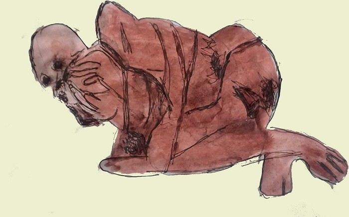
*Chauchilla A necropolis near Nazca where you can see mummies exposed on the ground. YouTubers can do paranormal experiments there. And for anyone wondering about the fate of the soul and body after death, here’s the answer: the body remains after death. You can imagine your own flesh and body exposed to the winds of the Pampa and before eternity... (not visited personally)
*Chavín de Huántar (Lanzón) The site’s appeal lies in its mountainous surroundings, the Lanzón stela, and the sculpted heads on the façades. What few people know is that the Chavín civilization began its expansion centuries before the Incas. Unfortunately, you can’t get too close to see the Lanzón—the day I was there, it was protected by grilles. To get there: minibus from Huaraz or trek from Olleros. Then cross a high pass (over 5,000m). If you do it solo on foot, be careful—the path isn’t obvious from Olleros
*Chullpa: funerary tower, notably at Sillustani in the Lake Titicaca region
*Chimú: pre-Inca civilization whose center was Chan Chan.
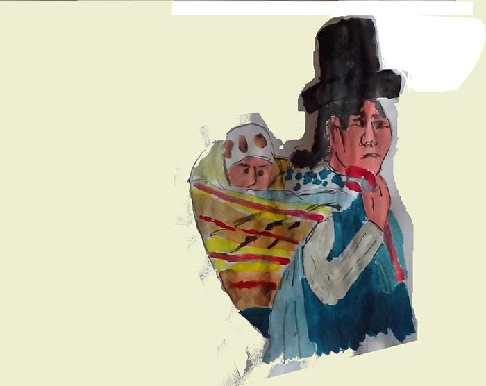
*Chola/Cholitas (Bolivia): typical clothing style of women from the Andean plateaus
*Chompa: pronounce it *Chompaaa!* A common term for a wool sweater with vicuña patterns, often knitted from alpaca wool. If you dress like this, it’s a bit kitschy around the edges
*Cuy That one isn’t a guinea pig like in Guyana but an actual guinea pig. During a trip to Peru, I was hiking near a village north of Quillabamba (the terminus of the train line that passes through Aguas Calientes), and I was invited to stay in a house. The family raised a few of these pets. Apparently, the locals eat them. Since I’m not much of a meat-eater, it doesn’t really tempt me. How about you?
*Pacific Coast or how to talk about a place you haven’t visited? Except for the coast near Pisco and San Andrés, I haven’t visited any coastal cities. But that doesn’t mean these places lack interest or poetry. For fans of clichéd images, pelicans, seabirds, and fishing boats appear by the sea.
*Gran Pajaten: also closed to the public. Features anthropomorphic bas-reliefs. (not visited personally)
*Huaca. Visit the Huaca del Sol and Huaca de la Luna, especially near Trujillo. However, you can skip them—Chan Chan is still more interesting. Don’t forget to spend time visiting Chan Chan
*Huacachina A small oasis in the desert near Ica. Yes, we’re talking about an oasis because for those who’ve never traveled to Peru, the coastal strip along the Pacific is almost entirely desert, from north to south. Peru is territorially made up of three different regions: the desert coast, the Altiplano stretching north to south with mountain ranges (the Cordilleras), and the Amazon basin to the east. (not visited personally)
*Inca Kola It’s neither Coca-Cola nor Pepsi but a unique cola with a slightly orange color. Tastes like bubble gum
*Intiwatana: a carved rock shaped like a parallelepiped. Is it a sundial?
*Ballestas Islands: a highlight in Peru, though very touristy. You can only get there by boat from the port of San Andrés, a few kilometers from Pisco. It’s a surreal place to me—actually islets with cavities where sea lions and fur seals live. Since it’s a protected area, you’re not allowed to disembark. Guano is harvested there, which can be used as fertilizer.
*Kuelap: a fortress built by the Chachapoyas people. Rarely visited by travelers. (not visited personally)
*Larco Museum: an iconic museum in Lima with a large collection of pieces from archaeological and pre-Columbian sites. From what I remember, it has many pieces from the Moche civilization. As for the Moche statuettes, the prudish might look away. Probably a veneration of the god Priapus without knowing it.
*Nazca Lines Discovered by German archaeologist Maria Reiche, they stretch for kilometers. The designs in the desert around Nazca depict animals and cabalistic signs. The question I ask myself is why the creators of these lines represented a monkey and a hummingbird—species endemic to the tropical forest, not the desert plains around Nazca.
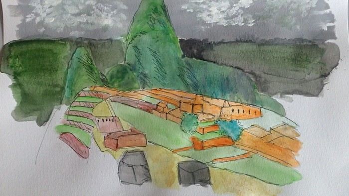
*Machu Picchu: means "old mountain" in Quechua. There’s also Wayna Picchu. The ruins of the site emerge from a sort of small plateau above Aguas Calientes. When the mist rises above the site and the bend of the Urubamba River, it’s truly magical... Also the starting point of the Inca Trail.
*Coca tea A decoction/infusion of the coca plant, meant to ease altitude sickness or *soroche*
*Chullo A rough translation would be a Peruvian wool hat.
*Moche: a civilization established in the Moche Valley, hence the term *Mochica*. What characterizes this civilization are the distinctive clay pieces representing faces and erotic statuettes
*Papa a la Huancaína A local potato dish
*Pisac: a typical market near Cusco
*Pisco Sour: perhaps the Peruvian equivalent of the *caipirinha* you drink in Brazil.
*Puya Raimondii A Bromeliaceae that still looks like a cactus, endemic to the Altiplano
*Quechua The language spoken by the indigenous people of the high plateaus (as well as Aymara in Bolivia)
*Quipu A knotted string used for counting. Widely used by the Inca administration.
*Sacsayhuamán (Q’enqo, Inca Bath) From Cusco’s Plaza de Armas, take the streets that climb above the city. Sacsayhuamán is called a fortress and is made up of large stone blocks. You wonder how the Incas could cut such huge blocks to assemble them—just like some streets in Cusco. The Q’enqo block is enigmatic; no one really knows what it represents.
*Savia Andina An Andean folk group.
*Tambo (=> Ollantaytambo) The Inca emperor (Atahualpa, Manco Capac) had the mission of controlling a vast empire. An empire that was still very extensive. Hence the importance of these *tambos* or relay stations. Napoleon created the civil code; the Incas invented the *tambos* and *quipus*.
*Tawantinsuyu: the Inca Empire
*Tinku: a warrior dance practiced mainly in Bolivia
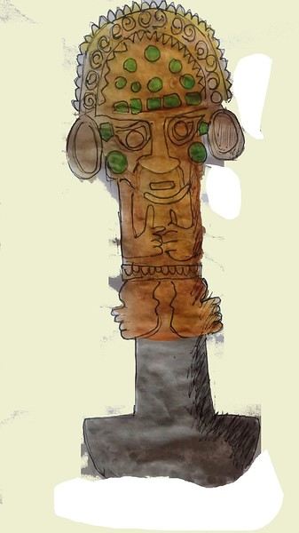
*Golden Tumi: a sacrificial weapon. Often featured in Peru travel guides. See illustration
*Terra X: a documentary series from the German TV channel that aired on Arte. Some episodes focused on pre-Inca and Inca Peru. I must have some old recording tapes. In memory of Gottfried Kirchner as a source of inspiration.
*Uros: I checked—it actually refers to the people who live on these floating islands. Even if it’s touristy, it’s a must-visit because it’s incredible how people can live on islets made from nothing. Take the boat from Puno
*Vicuña, llama, guanaco: camelids characteristic of the Altiplano
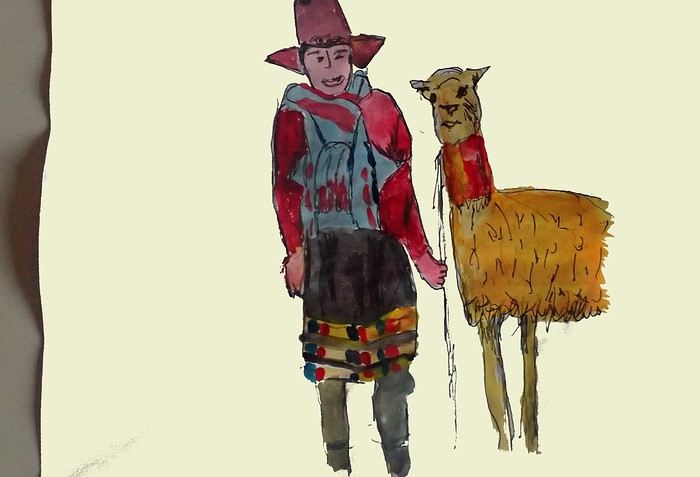
*Wayna Picchu The young Picchu mountain. In the first minutes of *Aguirre, the Wrath of God*, you see Klaus Kinski—well, Aguirre—making his way along the Inca Trail. Werner Herzog must have broken his back filming those sequences.
*Zampoña: pan flute
Peru is still a very vast country, with so much to see, and obviously this text can't list all the attractions of the country.
*Abiseo (River) A national park that's very hard to access and doesn’t seem open to visitors. Includes the Gran Pajaten site (see below). Personally, it really sparks my imagination (not visited personally)
*Aguas Calientes the town next to Machu Picchu, more precisely below the archaeological site. As far as I know, you can only get there by train. Reminds me of the market where stalls line both sides of the tracks near Bangkok. I love it
*Altiplano: somewhere the "heart" of the Andes. I was able to trek across it on foot, starting from Caracollo in Bolivia, and of course, it’s vast plains to explore. This is where people live in a very rural way. Andean populations are quite austere compared to those in the lowlands or on the coast. You really have to appreciate the harshness of life to live there. Life is anything but superficial. I set a compass heading and found myself walking west toward the expanse of water near a place called La Joya. For pitching the tent, the nights were still chilly
*Canyon del Colca One of the deepest canyons in the world. Personally, I hiked down and back up on foot. The toughest stretch I’ve ever covered in my life.
*Ceviche More or less the national dish. A marinade of fish, shellfish, and lime. But you can find it in some restaurants in Europe, France, and certainly in Belgium or Switzerland. In the small restaurants of Pisco, you can eat excellent ceviche
*Cerro Sechín: Mostly bas-reliefs. A site little known to travelers in the Casma province. The first vestiges of a pre-Inca civilization with iconography similar to that of Chavín (not visited personally)
*Chan Chan A large city of the Chimú civilization and relatively vast to visit. You can see adobe walls with bas-reliefs. Visit from Trujillo, take a colectivo. Plan for the whole day
*Charango: a small guitar widely used in Andean music
*Chauchilla A necropolis near Nazca where you can see mummies exposed on the ground. YouTubers can do paranormal experiments there. And for anyone wondering about the fate of the soul and body after death, here’s the answer: the body remains after death. You can imagine your own flesh and body exposed to the winds of the Pampa and before eternity... (not visited personally)
*Chavín de Huántar (Lanzón) The site’s appeal lies in its mountainous surroundings, the Lanzón stela, and the sculpted heads on the façades. What few people know is that the Chavín civilization began its expansion centuries before the Incas. Unfortunately, you can’t get too close to see the Lanzón—the day I was there, it was protected by grilles. To get there: minibus from Huaraz or trek from Olleros. Then cross a high pass (over 5,000m). If you do it solo on foot, be careful—the path isn’t obvious from Olleros
*Chullpa: funerary tower, notably at Sillustani in the Lake Titicaca region
*Chimú: pre-Inca civilization whose center was Chan Chan.
*Chola/Cholitas (Bolivia): typical clothing style of women from the Andean plateaus
*Chompa: pronounce it *Chompaaa!* A common term for a wool sweater with vicuña patterns, often knitted from alpaca wool. If you dress like this, it’s a bit kitschy around the edges
*Cuy That one isn’t a guinea pig like in Guyana but an actual guinea pig. During a trip to Peru, I was hiking near a village north of Quillabamba (the terminus of the train line that passes through Aguas Calientes), and I was invited to stay in a house. The family raised a few of these pets. Apparently, the locals eat them. Since I’m not much of a meat-eater, it doesn’t really tempt me. How about you?
*Pacific Coast or how to talk about a place you haven’t visited? Except for the coast near Pisco and San Andrés, I haven’t visited any coastal cities. But that doesn’t mean these places lack interest or poetry. For fans of clichéd images, pelicans, seabirds, and fishing boats appear by the sea.
*Gran Pajaten: also closed to the public. Features anthropomorphic bas-reliefs. (not visited personally)
*Huaca. Visit the Huaca del Sol and Huaca de la Luna, especially near Trujillo. However, you can skip them—Chan Chan is still more interesting. Don’t forget to spend time visiting Chan Chan
*Huacachina A small oasis in the desert near Ica. Yes, we’re talking about an oasis because for those who’ve never traveled to Peru, the coastal strip along the Pacific is almost entirely desert, from north to south. Peru is territorially made up of three different regions: the desert coast, the Altiplano stretching north to south with mountain ranges (the Cordilleras), and the Amazon basin to the east. (not visited personally)
*Inca Kola It’s neither Coca-Cola nor Pepsi but a unique cola with a slightly orange color. Tastes like bubble gum
*Intiwatana: a carved rock shaped like a parallelepiped. Is it a sundial?
*Ballestas Islands: a highlight in Peru, though very touristy. You can only get there by boat from the port of San Andrés, a few kilometers from Pisco. It’s a surreal place to me—actually islets with cavities where sea lions and fur seals live. Since it’s a protected area, you’re not allowed to disembark. Guano is harvested there, which can be used as fertilizer.
*Kuelap: a fortress built by the Chachapoyas people. Rarely visited by travelers. (not visited personally)
*Larco Museum: an iconic museum in Lima with a large collection of pieces from archaeological and pre-Columbian sites. From what I remember, it has many pieces from the Moche civilization. As for the Moche statuettes, the prudish might look away. Probably a veneration of the god Priapus without knowing it.
*Nazca Lines Discovered by German archaeologist Maria Reiche, they stretch for kilometers. The designs in the desert around Nazca depict animals and cabalistic signs. The question I ask myself is why the creators of these lines represented a monkey and a hummingbird—species endemic to the tropical forest, not the desert plains around Nazca.
*Machu Picchu: means "old mountain" in Quechua. There’s also Wayna Picchu. The ruins of the site emerge from a sort of small plateau above Aguas Calientes. When the mist rises above the site and the bend of the Urubamba River, it’s truly magical... Also the starting point of the Inca Trail.
*Coca tea A decoction/infusion of the coca plant, meant to ease altitude sickness or *soroche*
*Chullo A rough translation would be a Peruvian wool hat.
*Moche: a civilization established in the Moche Valley, hence the term *Mochica*. What characterizes this civilization are the distinctive clay pieces representing faces and erotic statuettes
*Papa a la Huancaína A local potato dish
*Pisac: a typical market near Cusco
*Pisco Sour: perhaps the Peruvian equivalent of the *caipirinha* you drink in Brazil.
*Puya Raimondii A Bromeliaceae that still looks like a cactus, endemic to the Altiplano
*Quechua The language spoken by the indigenous people of the high plateaus (as well as Aymara in Bolivia)
*Quipu A knotted string used for counting. Widely used by the Inca administration.
*Sacsayhuamán (Q’enqo, Inca Bath) From Cusco’s Plaza de Armas, take the streets that climb above the city. Sacsayhuamán is called a fortress and is made up of large stone blocks. You wonder how the Incas could cut such huge blocks to assemble them—just like some streets in Cusco. The Q’enqo block is enigmatic; no one really knows what it represents.
*Savia Andina An Andean folk group.
*Tambo (=> Ollantaytambo) The Inca emperor (Atahualpa, Manco Capac) had the mission of controlling a vast empire. An empire that was still very extensive. Hence the importance of these *tambos* or relay stations. Napoleon created the civil code; the Incas invented the *tambos* and *quipus*.
*Tawantinsuyu: the Inca Empire
*Tinku: a warrior dance practiced mainly in Bolivia
*Golden Tumi: a sacrificial weapon. Often featured in Peru travel guides. See illustration
*Terra X: a documentary series from the German TV channel that aired on Arte. Some episodes focused on pre-Inca and Inca Peru. I must have some old recording tapes. In memory of Gottfried Kirchner as a source of inspiration.
*Uros: I checked—it actually refers to the people who live on these floating islands. Even if it’s touristy, it’s a must-visit because it’s incredible how people can live on islets made from nothing. Take the boat from Puno
*Vicuña, llama, guanaco: camelids characteristic of the Altiplano
*Wayna Picchu The young Picchu mountain. In the first minutes of *Aguirre, the Wrath of God*, you see Klaus Kinski—well, Aguirre—making his way along the Inca Trail. Werner Herzog must have broken his back filming those sequences.
*Zampoña: pan flute
Four days in Doha in January 2026
Hi everyone,
This short stay in Doha is part of a longer trip. It lets us break up a flight to the Seychelles.
Friday, January 16, The Corniche
Despite the adventures we had the day before (read about it here), we just can’t get up later than 8 a.m. Our minds are a bit clearer and a bit more positive after some sleep.
View of the Corniche from the 12th floor.
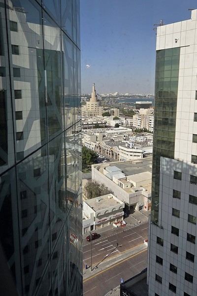
Breakfast is sumptuous—it really lifts our spirits.
On this Friday morning, almost everything is closed, so we head out to explore the Corniche, which is just a few hundred meters from our hotel in Old Doha.
A marathon is happening today on the Corniche, so the road is closed and empty, making it easy to cross. The palm-shaped streetlights are gorgeous when they’re lit up at night.
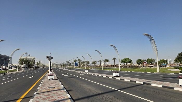
A little reminder of Qatar’s once-thriving pearl trade.
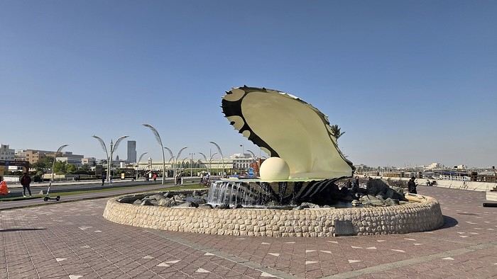
A memory of a much more recent past.
The sun is shining, but it’s not very warm—just 19°C at the hottest part of the day. Tough luck, last week it was 24°C.
The walk along the crescent-shaped Corniche is pretty long. From the old town to the modern center, where massive Dubai-style towers rise, it’s a 6 km promenade along the waterfront.
Many dhows are docked, waiting for tourists to take a little cruise in the bay, but visitors are scarce.
The skyscrapers are so stunning, you can’t help but admire them.
to be continued...
This short stay in Doha is part of a longer trip. It lets us break up a flight to the Seychelles.
Friday, January 16, The Corniche
Despite the adventures we had the day before (read about it here), we just can’t get up later than 8 a.m. Our minds are a bit clearer and a bit more positive after some sleep.
View of the Corniche from the 12th floor.
Breakfast is sumptuous—it really lifts our spirits.
On this Friday morning, almost everything is closed, so we head out to explore the Corniche, which is just a few hundred meters from our hotel in Old Doha.
A marathon is happening today on the Corniche, so the road is closed and empty, making it easy to cross. The palm-shaped streetlights are gorgeous when they’re lit up at night.
A little reminder of Qatar’s once-thriving pearl trade.
A memory of a much more recent past.
The sun is shining, but it’s not very warm—just 19°C at the hottest part of the day. Tough luck, last week it was 24°C.
The walk along the crescent-shaped Corniche is pretty long. From the old town to the modern center, where massive Dubai-style towers rise, it’s a 6 km promenade along the waterfront.
Many dhows are docked, waiting for tourists to take a little cruise in the bay, but visitors are scarce.
The skyscrapers are so stunning, you can’t help but admire them.
to be continued...
Nepal Feedback
NAMASTE NEPAL! PRACTICAL INFO AND EXPERIENCE FEEDBACK
Stay from March 25 to April 16, 2025
· Flight tickets Air India (via Delhi) (via Skyscanner) = 1130 € per person · Planned budget (and respected without too many restrictions and while buying a few small gifts) = 2000 € for the stay for two. Buses, taxis, and entrance fees to various sites represent a budget to consider. Meals are cheap. Drinks like beer/Coke, however, are not cheap and cost the equivalent of a meal. · Exchange rate of the rupee during our stay = 0.0064 € (the exchange rate is almost identical everywhere, including at the airport). · At the airport, purchase of two SIM cards (phone) = 1000 NPR x 2 for 28 days. · Kathmandu: we had booked the hotel upon arrival: Kathmandu Boutique Hotel (+977 015 357 446 – email: booking@kathmanduboutiquehotel.com), very well located in a quiet alley off the street, south of Thamel, a 10-minute walk from Durbar Square. A hotel like Nepal knows how to do, where tall people will have to duck. Night + breakfast = 18 € for two. Very warm welcome, great location, excellent value for money. · Bhaktapur: we had also booked a hotel for the end of our stay because the chance of the year 2025 made the Nepali New Year and Bisket Jatra particularly festive in Bhaktapur: Manju Baha Hotel School (+977 976 7234014 – email: manjubahahotel@gmail.com) located in an old monastery. "A social enterprise transforming an old monastery into a charming hotel, offering professional hospitality training to underprivileged Nepali youth." Night + breakfast = 32 € for two. Beautifully decorated room. Very warm welcome. Don’t miss the Changunarayan site (near Bhaktapur), it’s amazing. And if you’re lucky enough to be in Bhaktapur in mid-April for 3 days, there’s the Bisket Jatra festivities (Newari festival), joyful, noisy, fun, and wild… · Pokhara (hotel recommended by the Kathmandu hotel): Hotel Green Tara, Lakeside, 10th street, set back, quiet (Tel. +977 61 462698 – email: greentara_67@hotmail.com) · Trek permit (Lower Mustang, no need for an agency or guide, permits checked at Ghasa and Jomsom) = 2000 NPR per person (2 ID photos) · Bus Kathmandu/Pokhara and return = 2000 NPR per person · Bus Pokhara/Jomsom, 2 one-way tickets = 2800 NPR. · Taxi: negotiation with a driver we recommend, Vicky (+977 984 075 599). You explain what you want, negotiate the price, and he waits for you during the visit. Very charming, we used him several times. For example: departure from our hotel at 10 AM -> Boudhanath/Pashupatinath/Patan return at 5 PM to the hotel = 6500 NPR – Swayambhunath (round trip) = 1200 NPR · Site prices: https://ntb.gov.np/plan-your-trip/before-you-come/heritage-site-entry-fees o Visitor Pass for Kathmandu Durbar Square (for the duration of the stay, show your visa) = 1000 NPR per person (1 ID photo) o Bhaktapur Durbar Square (old town) = 1800 NPR per person o Patan = 1000 NPR per person o Swayambhu Stupa = 200 NPR per person o Boudha Stupa = 200 NPR per person o Pashupatinath Temple = 1000 NPR per person (interesting to take a guide) o Changunarayan Temple (6 km north of Bhaktapur) = 400 NPR per person o Mountain Museum in Pokhara = 750 NPR per person · E-cigarettes: e-cigarettes are banned in India and confiscated whether they’re in carry-on or checked luggage. On the way there, we had kept them in our carry-on, they were confiscated in Delhi. On the way back, learning from our previous experience, we put them in our checked luggage. Someone came to get us to take them out of our bags and confiscate them… You can find e-cigarettes and products in Kathmandu.
* * *
I’m 74 years old. I went to Nepal in 1982, 1983, and the last time in 1986. I wanted to introduce this beautiful and endearing country to my husband, and it was… now or never. So we decided it was now.
I knew the trek starting from Pokhara: Naudanda/Birethanti/Ghorepani/Tatopani/Kalopani. There was no way I was going to do that trek, especially the 1000-meter staircase to reach Ghorepani… You have to stay humble with age.
Back then, the road didn’t exist. I didn’t consider, with the construction of this road (NH48) along the western bank of the Kali Gandaki, doing a trek along a windy and dusty road. Was there an alternative hiking trail on the eastern bank? No one answered my question on VoyageForum, so I did my research online. And I found this site: "Andrées de Ruiter and Prem Rai - Trekking the Annapurna Circuit, including the new NATT trails that avoid the road - A guide to one of the most beautiful trekking regions in Nepal and the world (2011) - NATT = New Annapurna Trekking Trail".
Phew! A solution was emerging. This circuit from 2011 wasn’t fully marked. The idea was to go from Jomsom to Tatopani, so we needed to make sure the path was well-marked all the way, which we did, and the path exists, marked in red and white!
So, with the walking times information, we built our 8-day circuit:
· Jomsom/Thinigaon · Thinigaon/Chimang · Chimang/Saura · Saura/Kokhetanti · Rest day or, if in good shape: loop to Sekong Lake · Kokhetanti/Jhipra Deurali · Jhipra Deurali/Kopchepani · Kopchepani/Tatopani
It’s a senior trek, after all. So the walking times noted on the sites indicated 3 hours or even 4 hours for the two longest stages. That pace suited us fine.
On March 29, we left Kathmandu (1400m), after visiting the must-see sites, by bus to Pokhara: 200 km and 8.5 hours on a chaotic road under construction. I had a memory of Pokhara where it was the first city where you could see the Himalayan range, especially Machhapuchhare. But the pollution is such, the dust raised by traffic and construction, that no horizon is visible except the first hills around Pokhara.
We stayed 24 hours in Pokhara (820m), and on March 31, we left our luggage at the hotel and set off with our lightest backpacks: change of clothes, toiletries, first aid kit, anti-chafing cream, water bottle, sleeping bag liner, and light shoes for the stages.
We took the bus to Jomsom: 160 km/7.5 hours including stops for bathroom breaks, tea, and lunch. The road is nothing but a chaos of potholes, landslides, construction, dust, rebuilding, and mudslides. In Ghasa, the bus stops, and we’re told we’re at a checkpoint and that the two foreigners in the bus, my husband and I, need to have our permits checked, which takes a few minutes. The driving is rock-and-roll, surprising, and courteous. The drivers have their codes, and on these improbable roads, they’re virtuosos.
We could have chosen the plane, but several reasons dissuaded us: if there’s too much wind, the planes don’t take off; personally, I wasn’t reassured about landing in Jomsom, and this transport has a cost.
We arrived around 2 PM in Jomsom (2720m), and despite the early wake-up, the nearly 8 hours on the bus, and the altitude, we decided to head straight to Thinigaon (2840m). At the Jomsom checkpoint, they told us it was a 30-minute walk. Great! Except we took an hour and a half on an uphill road, bent over to fight a strong wind. But the Himalayan range is there! The Dhaulagiri, the Nilgiri, the Annapurnas as a reward.
In Thinigaon, we found a room at the "Nilgiri View Hotel" run by a didi (big sister in Nepali). From the lodge’s roof, she proudly showed us the different peaks surrounding the village and told us, worried, that it hadn’t snowed here for 3 years. She said there are very few tourists, that the season is rather in September/October/November. It seems there’s not a soul in this village, yet mules pass through the narrow street paved with large flat stones, their bells ringing. We dine at 6 PM and go to bed… Room = 1200 NPR and dinner, breakfast, and drinks = 2560 NPR.
On April 1, we set off at 9 AM, not for Chimang as planned but for Marpha! The didi from the Thinigaon lodge had said it was a 3-hour walk. The first part of this stage is attractive, the mountains are magnificent and imposing, the landscape is superb, there’s no one around, a feeling of being "alone in the world." We follow Dhumbra Tal, this small green lake. The path is a rocky track that climbs steeply. Then, around a hill, we start the big descent that joins the Kali Gandaki. We face the wind head-on, and the violent gusts take our breath away, throw us off balance, and envelop us in dust. We see the road on the other side of the Kali Gandaki. We arrive in the village of Chhairo at 2 PM, completely exhausted and with blistered feet, after 5 hours of walking instead of the planned 3.5 hours.
We’re welcomed by the village nurse, who tells us there’s a lodge in the village. Chhairo is a Tibetan village, a 20-minute walk from Marpha (according to the locals, multiply by 2 or even 3 for us…). We’re going to revise our trek plan and, first of all, spend the night in Chhairo.
The lodge is quite pleasant, and Karma, the hostess, is very friendly. She asks about our plans and suggests we stay in Chhairo the next day, from where we can visit Marpha and also Chimang, a 1-hour walk away, in light mode, meaning without backpacks. She invites us to participate in a village ceremony the next evening.
We immediately accept the proposal, as our feet need rest and the welcome is so warm… Dinner and bed!
We reworked our trek plan, which was too ambitious for our untrained bodies and, let’s face it… no longer in our first youth. In the initial plan, we thought there wouldn’t be too much elevation gain following the Kali Gandaki, but checking the map, we realize there might be significant elevation changes between Sauru and Sirkung. So we plan:
· Tomorrow: visit Marpha (2670m) and Chimang (2744m) · April 3: bus from Chhairo (2700m) to Kalopani (2530m) and continue on foot to Ghasa (2010m) · April 4: Ghasa/Pairataplo (1940m) · April 5: Pairatapla/Gadpar (1580m) · April 6: Gadpar/Narchyang (1510m) · April 7: Narchyang/Tatopani (1190m) · April 8: return to Pokhara.
Normally, it’s all downhill…
April 2, a rest day then… We set off in the morning to explore Marpha. We have to take a temporary bridge because the suspension bridge is closed due to road construction. We join the road and arrive in Marpha, a village famous for its apple orchards, brandy, cider, and apple juice production. This village is magnificent with its stone houses and monastery clinging to the hillside. The road construction spared it. There are people, but very few Western tourists.
We have lunch in Marpha and go back through Chhairo to take the path to Chimang. We cross a fragrant pine forest and find the rocky path; the landscape is splendid. We walk quietly, passing peaceful buffaloes and cows, and arrive at the foot of a stone staircase… 275 steps (which we counted on the way back) leading us to the village of Chimang. Chimang is an isolated Newari village that seems a bit desolate. Despite the slopes, there are crops on every little bit of land. Thankfully, we changed our initial program because there’s no lodge in this village, contrary to what we saw on a map… We wander through the village, which seems very deserted, have coffee in a house from another world, and then head back to Chhairo.
A rest day? = 5 hours of walking!!
Dinner and village ceremony. From what we understand, this ceremony is in honor of the Dalai Lama. Men, women, and children in traditional costumes gather twice a month; they dance, make, and offer small sweet cakes with Tibetan tea (made from tea, yak butter—often rancid—water, and salt). Surprising for first-timers…
Around 10 PM, we leave the ceremony; tomorrow morning, we need to be on the roadside by 7 AM to catch the bus to Kalopani…
This village of Chhairo is very pleasant and welcoming, no tourists, just two motorcyclists who arrived in the evening, one of whom participated in the ceremony and discreetly poured his Tibetan tea outside.
Lodge: "Norsang Tibetan Guesthouse and Restaurant". Total bill for 2 nights, 2 dinners, 2 breakfasts, and drinks = 8000 NPR.
April 3: bus from Chhairo to Kalopani, about 1.5 hours for the 20 km (200 NPR per person). We descend on the right bank of the Kali Gandaki. We find the red and white markings to resume the trek toward Ghasa. We’re in a fragrant pine forest, the Dhaulagiri on one side and the Annapurnas on the other, magnificent, and the path is pleasant and easy. We get a bit lost in this forest, always looking for the markings. Near Lete, two trekkers pass us, and we meet them again a little further on with two very young children, to whom we give the 2 hard-boiled eggs I didn’t eat this morning. They accepted them without hesitation.
We arrive in a village and ask for directions to Ghasa. The young girls point the way. But we come across a forest being logged, trees cut in all directions. We turn back and ask for confirmation. They confirm… But the two young girls catch up with us and clear the way. We have to step over, go around, and cross the felled trees, with no indication at all. Through this pick-up sticks of felled trees, the girls lead us to the top of a stone staircase, indicating that was the path. It’s the only place where we saw rhododendrons in bloom.
We descend the staircase. At the bottom, to the left, there’s a bridge to go toward Choyo, and to the right, a path to Ghasa. We take the right path and join the road. We should normally find the red and white markings, but we don’t… So we continue on the western bank road of the Kali Gandaki.
A little before the village of Misi, we see fumaroles on the opposite bank that seem to come from the ground. We don’t understand. We stopped to eat in the village of Misi (noodle soup = 600 NPR), but it’s hard to communicate with the elderly people running the guesthouse.
We continued on the road, not finding the marked path parallel to the road. Landslides, both on the left and right banks, seem to have taken over the marked routes. It’s a place where the Kali Gandaki gorge narrows, and on the opposite bank, the mountain smokes more and more, and we now hear the crackling of fire. Across from us, the mountain is burning… Our initial plan had us passing on that burning bank right now…
We arrive in Ghasa at 3:30 PM, a 6.5-hour stage but with a 1-hour stop at noon. We’re at the "Florida Guesthouse and Restaurant." From our room, we see the mountain smoking on the other side of the river, and at night, we see the flames. In this village, posters show Himalayan eagles and vultures that seem to be protected species. Indeed, we saw (and heard) 3 eagles circling today.
April 4 – Today, heading to Pairothapla or Kopchepani depending on our feet, accommodation options, and simply our desires.
No more smoke on the mountain this morning. It’s chilly, 7:45 AM, the sky is clear, just a smell of smoke outside.
Price of the lodge = 1000 NPR for the night + 3580 NPR for meals.
We cross Ghasa, which stretches over more than a kilometer. We have a drink at the last guesthouse in the village, and the didi, when she learns our destination, tells us to be careful because the villages we’re going to aren’t safe. Should we distribute our rupees in different pockets? Nah, we kept going.
At the exit of Ghasa, we find the red and white markings and take the suspension bridge to cross the boiling waters of the Kali Gandaki. The passage is impressive because the river is tumultuous. Lots of climbs and even more descents. We’re back on the eastern bank. It’s hot! On the narrow path, we meet a group of buffaloes. Who has the right of way? We decide to stick as close as possible to the rock wall and move forward calmly. The buffaloes look at us, chewing placidly, with no intention of jumping on us. Phew!
After a 5-hour stage (including stops), we arrive in Pairothapla, with hot feet and firm thighs, and decide we won’t go any further. It’s a good thing because there’s a lodge, the most basic so far, but with a great welcome. We have a meal and a short nap. The buffaloes we met on the way belong to this house. They come to drink at the fountain by the path.
Our host, very pleasant, doesn’t know what to do to please us and is very attentive. He wants to chat. He has two children, a 4-year-old girl and a 7-year-old boy. Where do they go to school? Do they go? He tells us that the fires in the mountain are caused by people, but for what reason? We won’t find out, but it’s illegal. From here, we can still see smoke rising in the distance. The wife is a bit less friendly. Corn kernels dry on a woven straw mat on the ground, and the mom sorts them.
From where we are, we overlook the valley and see the road under construction winding along the mountainside on the other bank.
Dinner on the terrace of the house overlooking the path, windbreaker and fleece on: dal bhat chicken for me and chicken curry for my husband: "organic" products, at least local production. There are small vegetable gardens everywhere with all sorts of vegetables.
April 5 – While we’re having breakfast on the terrace of our lodge, 5 porters, straps on their foreheads, heavily loaded, pass by on the path. A few minutes later, a group of 9 people appears. It must be said that since the beginning of our journey, we’ve met very few hikers. Two backpackers in Chhairo, the two hikers near Lete, two female hikers passed us before Pairothapla, a solo female hiker passed us…
The lodge in Pairothapla is called "Bimala Lodge & Thakali Kitchen" – Price for night + 4 meals + 2 breakfasts = 3000 NPR.
The descent toward the Kali Gandaki involves climbs whose steps we didn’t count. Clearly, the landslides on the mountain cause changes to the official ACAP trek marked in red and white, and the marking updates can’t keep up with the pace of these landslides. It’s almost always by chance that we find the markings. Fortunately, we can follow the power line that guides us somewhat.
Drink stop in Kopchepani, the legs are fine, but the feet don’t like being tightly enclosed. A group of trekkers with porters passes on the path. We met buffaloes that we kindly let pass; the path was wide enough, but it was a staircase going up, and we didn’t want to take any risks.
Across, a view of the magnificent Rupse Waterfall on the other bank of the Kali Gandaki, at the bottom, lots of vehicles and people.
Arrival in Gadpar after crossing a rather unwelcoming small village and cultivated gardens between dry stone walls, each better built than the last.
First lodge spotted, first lodge adopted to answer the call of our feet, and a very warm welcome from the owner. Since we hadn’t eaten at noon, we had Tibetan bread/jam. 6-hour stage including 1 hour of stops. Night + dinner + breakfast + drinks = 5060 NPR
April 6 – Today, heading to Narchyang.
For several days, we’ve seen banana trees with their bunches of fruit and even a prickly pear with large fruits ripening.
This stage is quite peaceful and pleasant. We take a suspension bridge to cross a tributary of the Kali Gandaki. While we’re resting for a moment before crossing the bridge, a couple of porters, a man and a woman, arrive and start across the bridge with their wood load in a basket held by a strap on their forehead, making them bend. We set off too… lighter than them.
On the other side of the bridge… a stone staircase, and it climbs steeply. The porter couple didn’t take this staircase; they went right on the path.
At the top of the staircase, we arrive in Narchyang after a 4-hour stage. A magnificent waterfall overlooks the village. We get lost in this fairly large village looking for a lodge. After wandering around for a while, we ask for directions, and an 84-year-old man takes us through the whole village and accompanies us to a very nice lodge run by a woman.
We chat with our hostess, who asks where we’re from and where we’re going. We explain that we want to reach Tatopani the next day and then return to Pokhara. She tells us there are 4x4s going directly to Pokhara and that it would probably be easier than taking a bus that might be full in Tatopani. After a quick consultation, we decide to return to Pokhara the next day by 4x4. She finds us a 4x4 with 2 seats left, departure at 8 AM – 5 hours on the road and 1500 NPR per person. A charming didi who does everything to be pleasant and helpful.
Narchyang community lodge = night + snacks + dinner + breakfast = 3000 NPR.
There you go, our trek ends tomorrow. Many necessary changes and adaptations to our initial trek, but no regrets, it was superb and a great experience that, for my part, I won’t be able to repeat. Always this encounter with the endearing, welcoming, curious, and very kind Nepali people. It was now or never, and we did it!
* * *
In conclusion, 3 full weeks in Nepal is a duration that allows visiting Kathmandu, Patan, and Bhaktapur, enjoying the various sites, and soaking in the atmosphere and urban Nepali life.
The trek, even revised and corrected, allowed us to get close to the impressive Annapurna and Dhaulagiri peaks. One or two acclimatization days might be necessary to get the body in tune with this magical and extraordinary land.
Stay from March 25 to April 16, 2025
· Flight tickets Air India (via Delhi) (via Skyscanner) = 1130 € per person · Planned budget (and respected without too many restrictions and while buying a few small gifts) = 2000 € for the stay for two. Buses, taxis, and entrance fees to various sites represent a budget to consider. Meals are cheap. Drinks like beer/Coke, however, are not cheap and cost the equivalent of a meal. · Exchange rate of the rupee during our stay = 0.0064 € (the exchange rate is almost identical everywhere, including at the airport). · At the airport, purchase of two SIM cards (phone) = 1000 NPR x 2 for 28 days. · Kathmandu: we had booked the hotel upon arrival: Kathmandu Boutique Hotel (+977 015 357 446 – email: booking@kathmanduboutiquehotel.com), very well located in a quiet alley off the street, south of Thamel, a 10-minute walk from Durbar Square. A hotel like Nepal knows how to do, where tall people will have to duck. Night + breakfast = 18 € for two. Very warm welcome, great location, excellent value for money. · Bhaktapur: we had also booked a hotel for the end of our stay because the chance of the year 2025 made the Nepali New Year and Bisket Jatra particularly festive in Bhaktapur: Manju Baha Hotel School (+977 976 7234014 – email: manjubahahotel@gmail.com) located in an old monastery. "A social enterprise transforming an old monastery into a charming hotel, offering professional hospitality training to underprivileged Nepali youth." Night + breakfast = 32 € for two. Beautifully decorated room. Very warm welcome. Don’t miss the Changunarayan site (near Bhaktapur), it’s amazing. And if you’re lucky enough to be in Bhaktapur in mid-April for 3 days, there’s the Bisket Jatra festivities (Newari festival), joyful, noisy, fun, and wild… · Pokhara (hotel recommended by the Kathmandu hotel): Hotel Green Tara, Lakeside, 10th street, set back, quiet (Tel. +977 61 462698 – email: greentara_67@hotmail.com) · Trek permit (Lower Mustang, no need for an agency or guide, permits checked at Ghasa and Jomsom) = 2000 NPR per person (2 ID photos) · Bus Kathmandu/Pokhara and return = 2000 NPR per person · Bus Pokhara/Jomsom, 2 one-way tickets = 2800 NPR. · Taxi: negotiation with a driver we recommend, Vicky (+977 984 075 599). You explain what you want, negotiate the price, and he waits for you during the visit. Very charming, we used him several times. For example: departure from our hotel at 10 AM -> Boudhanath/Pashupatinath/Patan return at 5 PM to the hotel = 6500 NPR – Swayambhunath (round trip) = 1200 NPR · Site prices: https://ntb.gov.np/plan-your-trip/before-you-come/heritage-site-entry-fees o Visitor Pass for Kathmandu Durbar Square (for the duration of the stay, show your visa) = 1000 NPR per person (1 ID photo) o Bhaktapur Durbar Square (old town) = 1800 NPR per person o Patan = 1000 NPR per person o Swayambhu Stupa = 200 NPR per person o Boudha Stupa = 200 NPR per person o Pashupatinath Temple = 1000 NPR per person (interesting to take a guide) o Changunarayan Temple (6 km north of Bhaktapur) = 400 NPR per person o Mountain Museum in Pokhara = 750 NPR per person · E-cigarettes: e-cigarettes are banned in India and confiscated whether they’re in carry-on or checked luggage. On the way there, we had kept them in our carry-on, they were confiscated in Delhi. On the way back, learning from our previous experience, we put them in our checked luggage. Someone came to get us to take them out of our bags and confiscate them… You can find e-cigarettes and products in Kathmandu.
* * *
I’m 74 years old. I went to Nepal in 1982, 1983, and the last time in 1986. I wanted to introduce this beautiful and endearing country to my husband, and it was… now or never. So we decided it was now.
I knew the trek starting from Pokhara: Naudanda/Birethanti/Ghorepani/Tatopani/Kalopani. There was no way I was going to do that trek, especially the 1000-meter staircase to reach Ghorepani… You have to stay humble with age.
Back then, the road didn’t exist. I didn’t consider, with the construction of this road (NH48) along the western bank of the Kali Gandaki, doing a trek along a windy and dusty road. Was there an alternative hiking trail on the eastern bank? No one answered my question on VoyageForum, so I did my research online. And I found this site: "Andrées de Ruiter and Prem Rai - Trekking the Annapurna Circuit, including the new NATT trails that avoid the road - A guide to one of the most beautiful trekking regions in Nepal and the world (2011) - NATT = New Annapurna Trekking Trail".
Phew! A solution was emerging. This circuit from 2011 wasn’t fully marked. The idea was to go from Jomsom to Tatopani, so we needed to make sure the path was well-marked all the way, which we did, and the path exists, marked in red and white!
So, with the walking times information, we built our 8-day circuit:
· Jomsom/Thinigaon · Thinigaon/Chimang · Chimang/Saura · Saura/Kokhetanti · Rest day or, if in good shape: loop to Sekong Lake · Kokhetanti/Jhipra Deurali · Jhipra Deurali/Kopchepani · Kopchepani/Tatopani
It’s a senior trek, after all. So the walking times noted on the sites indicated 3 hours or even 4 hours for the two longest stages. That pace suited us fine.
On March 29, we left Kathmandu (1400m), after visiting the must-see sites, by bus to Pokhara: 200 km and 8.5 hours on a chaotic road under construction. I had a memory of Pokhara where it was the first city where you could see the Himalayan range, especially Machhapuchhare. But the pollution is such, the dust raised by traffic and construction, that no horizon is visible except the first hills around Pokhara.
We stayed 24 hours in Pokhara (820m), and on March 31, we left our luggage at the hotel and set off with our lightest backpacks: change of clothes, toiletries, first aid kit, anti-chafing cream, water bottle, sleeping bag liner, and light shoes for the stages.
We took the bus to Jomsom: 160 km/7.5 hours including stops for bathroom breaks, tea, and lunch. The road is nothing but a chaos of potholes, landslides, construction, dust, rebuilding, and mudslides. In Ghasa, the bus stops, and we’re told we’re at a checkpoint and that the two foreigners in the bus, my husband and I, need to have our permits checked, which takes a few minutes. The driving is rock-and-roll, surprising, and courteous. The drivers have their codes, and on these improbable roads, they’re virtuosos.
We could have chosen the plane, but several reasons dissuaded us: if there’s too much wind, the planes don’t take off; personally, I wasn’t reassured about landing in Jomsom, and this transport has a cost.
We arrived around 2 PM in Jomsom (2720m), and despite the early wake-up, the nearly 8 hours on the bus, and the altitude, we decided to head straight to Thinigaon (2840m). At the Jomsom checkpoint, they told us it was a 30-minute walk. Great! Except we took an hour and a half on an uphill road, bent over to fight a strong wind. But the Himalayan range is there! The Dhaulagiri, the Nilgiri, the Annapurnas as a reward.
In Thinigaon, we found a room at the "Nilgiri View Hotel" run by a didi (big sister in Nepali). From the lodge’s roof, she proudly showed us the different peaks surrounding the village and told us, worried, that it hadn’t snowed here for 3 years. She said there are very few tourists, that the season is rather in September/October/November. It seems there’s not a soul in this village, yet mules pass through the narrow street paved with large flat stones, their bells ringing. We dine at 6 PM and go to bed… Room = 1200 NPR and dinner, breakfast, and drinks = 2560 NPR.
On April 1, we set off at 9 AM, not for Chimang as planned but for Marpha! The didi from the Thinigaon lodge had said it was a 3-hour walk. The first part of this stage is attractive, the mountains are magnificent and imposing, the landscape is superb, there’s no one around, a feeling of being "alone in the world." We follow Dhumbra Tal, this small green lake. The path is a rocky track that climbs steeply. Then, around a hill, we start the big descent that joins the Kali Gandaki. We face the wind head-on, and the violent gusts take our breath away, throw us off balance, and envelop us in dust. We see the road on the other side of the Kali Gandaki. We arrive in the village of Chhairo at 2 PM, completely exhausted and with blistered feet, after 5 hours of walking instead of the planned 3.5 hours.
We’re welcomed by the village nurse, who tells us there’s a lodge in the village. Chhairo is a Tibetan village, a 20-minute walk from Marpha (according to the locals, multiply by 2 or even 3 for us…). We’re going to revise our trek plan and, first of all, spend the night in Chhairo.
The lodge is quite pleasant, and Karma, the hostess, is very friendly. She asks about our plans and suggests we stay in Chhairo the next day, from where we can visit Marpha and also Chimang, a 1-hour walk away, in light mode, meaning without backpacks. She invites us to participate in a village ceremony the next evening.
We immediately accept the proposal, as our feet need rest and the welcome is so warm… Dinner and bed!
We reworked our trek plan, which was too ambitious for our untrained bodies and, let’s face it… no longer in our first youth. In the initial plan, we thought there wouldn’t be too much elevation gain following the Kali Gandaki, but checking the map, we realize there might be significant elevation changes between Sauru and Sirkung. So we plan:
· Tomorrow: visit Marpha (2670m) and Chimang (2744m) · April 3: bus from Chhairo (2700m) to Kalopani (2530m) and continue on foot to Ghasa (2010m) · April 4: Ghasa/Pairataplo (1940m) · April 5: Pairatapla/Gadpar (1580m) · April 6: Gadpar/Narchyang (1510m) · April 7: Narchyang/Tatopani (1190m) · April 8: return to Pokhara.
Normally, it’s all downhill…
April 2, a rest day then… We set off in the morning to explore Marpha. We have to take a temporary bridge because the suspension bridge is closed due to road construction. We join the road and arrive in Marpha, a village famous for its apple orchards, brandy, cider, and apple juice production. This village is magnificent with its stone houses and monastery clinging to the hillside. The road construction spared it. There are people, but very few Western tourists.
We have lunch in Marpha and go back through Chhairo to take the path to Chimang. We cross a fragrant pine forest and find the rocky path; the landscape is splendid. We walk quietly, passing peaceful buffaloes and cows, and arrive at the foot of a stone staircase… 275 steps (which we counted on the way back) leading us to the village of Chimang. Chimang is an isolated Newari village that seems a bit desolate. Despite the slopes, there are crops on every little bit of land. Thankfully, we changed our initial program because there’s no lodge in this village, contrary to what we saw on a map… We wander through the village, which seems very deserted, have coffee in a house from another world, and then head back to Chhairo.
A rest day? = 5 hours of walking!!
Dinner and village ceremony. From what we understand, this ceremony is in honor of the Dalai Lama. Men, women, and children in traditional costumes gather twice a month; they dance, make, and offer small sweet cakes with Tibetan tea (made from tea, yak butter—often rancid—water, and salt). Surprising for first-timers…
Around 10 PM, we leave the ceremony; tomorrow morning, we need to be on the roadside by 7 AM to catch the bus to Kalopani…
This village of Chhairo is very pleasant and welcoming, no tourists, just two motorcyclists who arrived in the evening, one of whom participated in the ceremony and discreetly poured his Tibetan tea outside.
Lodge: "Norsang Tibetan Guesthouse and Restaurant". Total bill for 2 nights, 2 dinners, 2 breakfasts, and drinks = 8000 NPR.
April 3: bus from Chhairo to Kalopani, about 1.5 hours for the 20 km (200 NPR per person). We descend on the right bank of the Kali Gandaki. We find the red and white markings to resume the trek toward Ghasa. We’re in a fragrant pine forest, the Dhaulagiri on one side and the Annapurnas on the other, magnificent, and the path is pleasant and easy. We get a bit lost in this forest, always looking for the markings. Near Lete, two trekkers pass us, and we meet them again a little further on with two very young children, to whom we give the 2 hard-boiled eggs I didn’t eat this morning. They accepted them without hesitation.
We arrive in a village and ask for directions to Ghasa. The young girls point the way. But we come across a forest being logged, trees cut in all directions. We turn back and ask for confirmation. They confirm… But the two young girls catch up with us and clear the way. We have to step over, go around, and cross the felled trees, with no indication at all. Through this pick-up sticks of felled trees, the girls lead us to the top of a stone staircase, indicating that was the path. It’s the only place where we saw rhododendrons in bloom.
We descend the staircase. At the bottom, to the left, there’s a bridge to go toward Choyo, and to the right, a path to Ghasa. We take the right path and join the road. We should normally find the red and white markings, but we don’t… So we continue on the western bank road of the Kali Gandaki.
A little before the village of Misi, we see fumaroles on the opposite bank that seem to come from the ground. We don’t understand. We stopped to eat in the village of Misi (noodle soup = 600 NPR), but it’s hard to communicate with the elderly people running the guesthouse.
We continued on the road, not finding the marked path parallel to the road. Landslides, both on the left and right banks, seem to have taken over the marked routes. It’s a place where the Kali Gandaki gorge narrows, and on the opposite bank, the mountain smokes more and more, and we now hear the crackling of fire. Across from us, the mountain is burning… Our initial plan had us passing on that burning bank right now…
We arrive in Ghasa at 3:30 PM, a 6.5-hour stage but with a 1-hour stop at noon. We’re at the "Florida Guesthouse and Restaurant." From our room, we see the mountain smoking on the other side of the river, and at night, we see the flames. In this village, posters show Himalayan eagles and vultures that seem to be protected species. Indeed, we saw (and heard) 3 eagles circling today.
April 4 – Today, heading to Pairothapla or Kopchepani depending on our feet, accommodation options, and simply our desires.
No more smoke on the mountain this morning. It’s chilly, 7:45 AM, the sky is clear, just a smell of smoke outside.
Price of the lodge = 1000 NPR for the night + 3580 NPR for meals.
We cross Ghasa, which stretches over more than a kilometer. We have a drink at the last guesthouse in the village, and the didi, when she learns our destination, tells us to be careful because the villages we’re going to aren’t safe. Should we distribute our rupees in different pockets? Nah, we kept going.
At the exit of Ghasa, we find the red and white markings and take the suspension bridge to cross the boiling waters of the Kali Gandaki. The passage is impressive because the river is tumultuous. Lots of climbs and even more descents. We’re back on the eastern bank. It’s hot! On the narrow path, we meet a group of buffaloes. Who has the right of way? We decide to stick as close as possible to the rock wall and move forward calmly. The buffaloes look at us, chewing placidly, with no intention of jumping on us. Phew!
After a 5-hour stage (including stops), we arrive in Pairothapla, with hot feet and firm thighs, and decide we won’t go any further. It’s a good thing because there’s a lodge, the most basic so far, but with a great welcome. We have a meal and a short nap. The buffaloes we met on the way belong to this house. They come to drink at the fountain by the path.
Our host, very pleasant, doesn’t know what to do to please us and is very attentive. He wants to chat. He has two children, a 4-year-old girl and a 7-year-old boy. Where do they go to school? Do they go? He tells us that the fires in the mountain are caused by people, but for what reason? We won’t find out, but it’s illegal. From here, we can still see smoke rising in the distance. The wife is a bit less friendly. Corn kernels dry on a woven straw mat on the ground, and the mom sorts them.
From where we are, we overlook the valley and see the road under construction winding along the mountainside on the other bank.
Dinner on the terrace of the house overlooking the path, windbreaker and fleece on: dal bhat chicken for me and chicken curry for my husband: "organic" products, at least local production. There are small vegetable gardens everywhere with all sorts of vegetables.
April 5 – While we’re having breakfast on the terrace of our lodge, 5 porters, straps on their foreheads, heavily loaded, pass by on the path. A few minutes later, a group of 9 people appears. It must be said that since the beginning of our journey, we’ve met very few hikers. Two backpackers in Chhairo, the two hikers near Lete, two female hikers passed us before Pairothapla, a solo female hiker passed us…
The lodge in Pairothapla is called "Bimala Lodge & Thakali Kitchen" – Price for night + 4 meals + 2 breakfasts = 3000 NPR.
The descent toward the Kali Gandaki involves climbs whose steps we didn’t count. Clearly, the landslides on the mountain cause changes to the official ACAP trek marked in red and white, and the marking updates can’t keep up with the pace of these landslides. It’s almost always by chance that we find the markings. Fortunately, we can follow the power line that guides us somewhat.
Drink stop in Kopchepani, the legs are fine, but the feet don’t like being tightly enclosed. A group of trekkers with porters passes on the path. We met buffaloes that we kindly let pass; the path was wide enough, but it was a staircase going up, and we didn’t want to take any risks.
Across, a view of the magnificent Rupse Waterfall on the other bank of the Kali Gandaki, at the bottom, lots of vehicles and people.
Arrival in Gadpar after crossing a rather unwelcoming small village and cultivated gardens between dry stone walls, each better built than the last.
First lodge spotted, first lodge adopted to answer the call of our feet, and a very warm welcome from the owner. Since we hadn’t eaten at noon, we had Tibetan bread/jam. 6-hour stage including 1 hour of stops. Night + dinner + breakfast + drinks = 5060 NPR
April 6 – Today, heading to Narchyang.
For several days, we’ve seen banana trees with their bunches of fruit and even a prickly pear with large fruits ripening.
This stage is quite peaceful and pleasant. We take a suspension bridge to cross a tributary of the Kali Gandaki. While we’re resting for a moment before crossing the bridge, a couple of porters, a man and a woman, arrive and start across the bridge with their wood load in a basket held by a strap on their forehead, making them bend. We set off too… lighter than them.
On the other side of the bridge… a stone staircase, and it climbs steeply. The porter couple didn’t take this staircase; they went right on the path.
At the top of the staircase, we arrive in Narchyang after a 4-hour stage. A magnificent waterfall overlooks the village. We get lost in this fairly large village looking for a lodge. After wandering around for a while, we ask for directions, and an 84-year-old man takes us through the whole village and accompanies us to a very nice lodge run by a woman.
We chat with our hostess, who asks where we’re from and where we’re going. We explain that we want to reach Tatopani the next day and then return to Pokhara. She tells us there are 4x4s going directly to Pokhara and that it would probably be easier than taking a bus that might be full in Tatopani. After a quick consultation, we decide to return to Pokhara the next day by 4x4. She finds us a 4x4 with 2 seats left, departure at 8 AM – 5 hours on the road and 1500 NPR per person. A charming didi who does everything to be pleasant and helpful.
Narchyang community lodge = night + snacks + dinner + breakfast = 3000 NPR.
There you go, our trek ends tomorrow. Many necessary changes and adaptations to our initial trek, but no regrets, it was superb and a great experience that, for my part, I won’t be able to repeat. Always this encounter with the endearing, welcoming, curious, and very kind Nepali people. It was now or never, and we did it!
* * *
In conclusion, 3 full weeks in Nepal is a duration that allows visiting Kathmandu, Patan, and Bhaktapur, enjoying the various sites, and soaking in the atmosphere and urban Nepali life.
The trek, even revised and corrected, allowed us to get close to the impressive Annapurna and Dhaulagiri peaks. One or two acclimatization days might be necessary to get the body in tune with this magical and extraordinary land.
KLM: rerouted without notice!
Hi there,
This afternoon I had a flight at 5:10 PM to Amsterdam from Nice (final destination: Berlin). I arrived at the airport a little before 3:00 PM and saw that the flight was now leaving at 6:30 PM. I went to the counter to point out that I wouldn’t have time to make my connection, and they told me I’d be spending the night in Amsterdam.
When the agent checked her computer, she saw that I’d been put on a flight with another airline and asked if I hadn’t received an email.
In the end, I had to change terminals and leave at 7:05 PM with Swiss Airlines, then Air Baltic.
Just to clarify, I checked in less than 24 hours ago for both KLM flights (Nice-Amsterdam and Amsterdam-Berlin) where I had seats assigned. I checked my emails carefully, and I was never notified!
Luckily, the Swiss Airlines flight left later—otherwise, at 3:00 PM, I wouldn’t have had time to check in (I have a checked bag), and I don’t know how I would’ve proven I never got an email. Also, thankfully, I went to the counter much earlier than planned for the 6:30 PM departure.
In the end, I was lucky because with KLM, I would’ve lost a whole day. And it’s a good thing I always travel for at least two full weeks because I’ve often lost a day due to delays—I wouldn’t do that for a week or a weekend getaway...
This is the first time this has happened to me, but there’s a first time for everything!
This afternoon I had a flight at 5:10 PM to Amsterdam from Nice (final destination: Berlin). I arrived at the airport a little before 3:00 PM and saw that the flight was now leaving at 6:30 PM. I went to the counter to point out that I wouldn’t have time to make my connection, and they told me I’d be spending the night in Amsterdam.
When the agent checked her computer, she saw that I’d been put on a flight with another airline and asked if I hadn’t received an email.
In the end, I had to change terminals and leave at 7:05 PM with Swiss Airlines, then Air Baltic.
Just to clarify, I checked in less than 24 hours ago for both KLM flights (Nice-Amsterdam and Amsterdam-Berlin) where I had seats assigned. I checked my emails carefully, and I was never notified!
Luckily, the Swiss Airlines flight left later—otherwise, at 3:00 PM, I wouldn’t have had time to check in (I have a checked bag), and I don’t know how I would’ve proven I never got an email. Also, thankfully, I went to the counter much earlier than planned for the 6:30 PM departure.
In the end, I was lucky because with KLM, I would’ve lost a whole day. And it’s a good thing I always travel for at least two full weeks because I’ve often lost a day due to delays—I wouldn’t do that for a week or a weekend getaway...
This is the first time this has happened to me, but there’s a first time for everything!
Trip report: Our South Africa journey in July
Hi there,
We’re back from our 3-week trip to South Africa in July. It was a family trip with our four grown-up kids (ages 18 to 25).
First off, I’d like to thank everyone on this forum for their great tips—they really helped us plan this trip!
The trip: We spent 15 days between Port Elizabeth and Cape Town, then a week around Kruger (including Blyde River Canyon). We found South Africans to be welcoming and always ready to help. We never felt unsafe (just followed basic safety rules). The police are very visible, especially on the roads.
Logistics: We’d booked our accommodations in advance but made a few changes on the spot based on how we felt at the time. We rented two vehicles from Firefly (Hertz). No complaints—recent cars, quick returns, and the deposit wasn’t charged. We’d gotten our international driver’s permits... which stayed in France! Luckily, no one asked for them. Driving on the left wasn’t an issue (it wasn’t our first time). The roads we took were in good, even great, condition. Only a few tracks to lodges or parks were rough and required extra caution. Lots of pedestrians on the sides of roads, even highways. And plenty of very slow trucks. But they pull over to let you pass. It’s also common for cars to cross into the opposite lane to overtake, even with white lines. We took two domestic flights: one early in the morning (Johannesburg to Port Elizabeth) and one in the late afternoon (Cape Town to Johannesburg) to save time.
We had some highlights and a few disappointments—all part of the journey! More details coming soon.
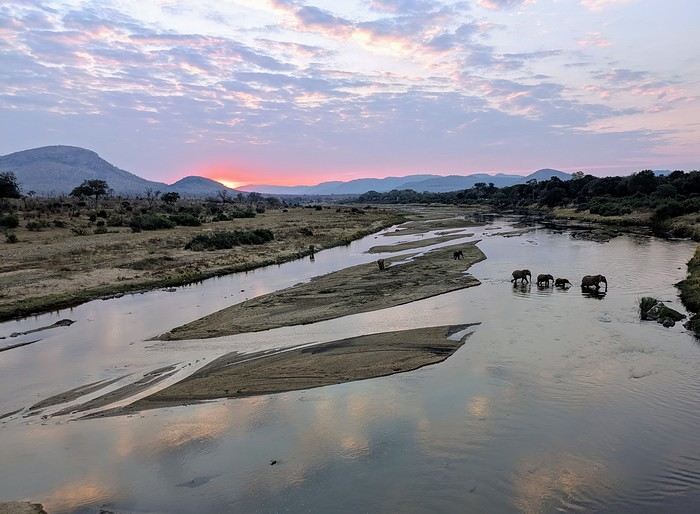
We’re back from our 3-week trip to South Africa in July. It was a family trip with our four grown-up kids (ages 18 to 25).
First off, I’d like to thank everyone on this forum for their great tips—they really helped us plan this trip!
The trip: We spent 15 days between Port Elizabeth and Cape Town, then a week around Kruger (including Blyde River Canyon). We found South Africans to be welcoming and always ready to help. We never felt unsafe (just followed basic safety rules). The police are very visible, especially on the roads.
Logistics: We’d booked our accommodations in advance but made a few changes on the spot based on how we felt at the time. We rented two vehicles from Firefly (Hertz). No complaints—recent cars, quick returns, and the deposit wasn’t charged. We’d gotten our international driver’s permits... which stayed in France! Luckily, no one asked for them. Driving on the left wasn’t an issue (it wasn’t our first time). The roads we took were in good, even great, condition. Only a few tracks to lodges or parks were rough and required extra caution. Lots of pedestrians on the sides of roads, even highways. And plenty of very slow trucks. But they pull over to let you pass. It’s also common for cars to cross into the opposite lane to overtake, even with white lines. We took two domestic flights: one early in the morning (Johannesburg to Port Elizabeth) and one in the late afternoon (Cape Town to Johannesburg) to save time.
We had some highlights and a few disappointments—all part of the journey! More details coming soon.
Mice in Switzerland, the Other Cheese Country!
I'm starting my first travel journal since VF reopened!
This will mostly be to share my impressions and some photos, with a few days' delay, but I'm starting this journal while I'm still here.
First, I'd like to thank those who helped me prepare for this trip.
I was able to organize this stay in one of the most expensive countries in the world thanks to the home-exchange principle. Not necessarily a direct swap, but through a points system, which is more practical for choosing where you want to go without it having to be a reciprocal exchange.
For this trip, there will already be two different accommodations. We'll see how it goes after that.
The first place is near Yverdon-les-Bains, close to Lake Neuchâtel.
So, we're going to explore this area!
We arrived under capricious weather that won’t leave us for the next few days!
We had dinner at a pizzeria recommended by *Le Routard* in Yverdon, then took a little nighttime stroll through the town center before heading inland to settle into our accommodation.
We discovered a very large, quiet house—and especially the cat that stayed behind! Funny for a couple of mice! He’ll be sleeping with us 😹
This will mostly be to share my impressions and some photos, with a few days' delay, but I'm starting this journal while I'm still here.
First, I'd like to thank those who helped me prepare for this trip.
I was able to organize this stay in one of the most expensive countries in the world thanks to the home-exchange principle. Not necessarily a direct swap, but through a points system, which is more practical for choosing where you want to go without it having to be a reciprocal exchange.
For this trip, there will already be two different accommodations. We'll see how it goes after that.
The first place is near Yverdon-les-Bains, close to Lake Neuchâtel.
So, we're going to explore this area!
We arrived under capricious weather that won’t leave us for the next few days!
We had dinner at a pizzeria recommended by *Le Routard* in Yverdon, then took a little nighttime stroll through the town center before heading inland to settle into our accommodation.
We discovered a very large, quiet house—and especially the cat that stayed behind! Funny for a couple of mice! He’ll be sleeping with us 😹
Your tips for exploring Tuscany's natural side in late August
Hi, I'm looking for info on Tuscany with the idea of taking a family vacation at the end of August, but we're not into cities or crowds. We're more into wild nature, beaches, and hiking... I've heard about southern Tuscany—is it too urbanized? Where else should we look? Thanks so much