Results for "colline+ou+Pnyx+|+123+>+211"
11047 results found.
Récit d'un vol au dessus d'un petit coin de Paradis English translation pending
Voici un récit écrit récemment sur une navigation Paris - Chambéry réalisée en mai dernier. Cette fois-ci, je n'ai pas fait trop de rencontres humaines, ou même animales, mais j'ai pu m'émerveiller sur la beauté de la Terre (en France, en plus!).
30 avril au soir et 1er mai 2003 au matin.
Ca commence toujours pareil.
Un trait sur la carte, le plus droit possible, en fonction des espaces aériens et du relief. Quelques indications notées sur une feuille de papier viendront compléter cette préparation.
Ensuite, régler le réveil pour trop tôt demain matin. Toujours trop tôt. Je n’ai jamais aimé me lever tôt, même pour aller rejoindre des amis à l’autre bout de la France, même si cette jonction se fera par la voie des airs.
Une dernière check de la météo sur internet. Pas terrible. Je sens que mon réveil va aller se faire voir demain matin, ce qui, d’un autre côté, est dommage, parce que ce voyage, je l’attends depuis longtemps. Comme toujours, on verra bien, en attendant, il faut dormir, pour être en forme demain, il est déjà une heure.
Non, il est déjà six heures et demie. Encore un peu. Ah, comme tout est plus facile le soir. Allez, il est sept heures moins le quart. Je ne peux pas me permettre de combler mon retard en prenant un petit déjeuner allégé. Pas cette fois-ci. Je ne vais pas au travail. Cette fois-ci, c’est une histoire plus sérieuse. Il n’y a pas de croissanteries entre les cumulus.
Allumer l’ordinateur, lancer internet, se connecter à Météo France. Rubrique aéronautique. Le temps ? Mouais. Vraiment moyen. Juste le temps intermédiaire où on ne peut pas se replonger sous la couette en disant « super, je dors encore, maintenant, c’est sûr, pas moyen d’aller voler », et où on ne peut pas non plus se dire : « Ca va être une super navigation, du gateau ! Je suis sûr d’être à destination à l’heure prévue ». Dans ces cas là, une seule chose à faire : déjà, aller au terrain. Ensuite, voir comment ça évolue.
Je prends mon petit déjeuner et mes affaires, puis descend à la voiture. Périf, A4, Lognes, ciel bas et gris, sol humide, essuis-glace intermittents. Le trajet habituel, maintes et maintes fois effectué.
Je passe à la tour prendre les dernière nouvelles officielles concernant la réglementation et les éventuels évènements exceptionnels sur le trajet prévu (ces formalités s’appellent les NOTAM). Rien des spécial, à part une balise en rade sur la route. Je ferai sans. Si je décolle. Pour le moment, le plafond n’a pas l’air très haut, et on sent qu’il va bientôt pleuvoir. Il y a du vent qui souffle assez fort. La visibilité est moyenne.
Comme je m’y attendais, personne au club. Tout est fermé. Les hangars aussi. Heureusement, quelqu’un arrive. Un mécano. J’entre avec lui. J’ouvre les portes du hangar, je sors le Piper. Je le prépare. Le temps reste toujours le même. Je ferai comme d’habitude : « Just go and see. », comme on dit outre-Atlantique. Le plafond est au moins suffisant pour faire des tours de piste. De plus, selon la météo plus nationale, sur la route, il fait beau. L’incertitude réside au départ, et à l’arrivée. Là bas, il y a aussi des nuages. On verra bien. Les jauges sont pleines, et je calcule qu’il me restera deux heures et demie d’autonomie à l’arrivée, de quoi rentrer à Lognes, dans la pire des extrémités. Je décide de la tenter.
Démarrage. Contact radio. Roulage. Alignement. Décollage. Huit heures. La visibilité est effectivement limite, mais je connais la région, et vers le sud, ça a l’air de se dégager. Je prends mon cap, corrigé de dix degrés à cause du vent. Pour le moment, je baisse la tête pour ne pas me cogner aux nuages au dessus de moi. Je suis à 1300 pieds. Je passe entre les deux étangs qui marquent en quelque sorte la porte de sortie de l’espace de Lognes. Je contacte Melun. Jour férié, personne, normal. Un autre avion passe sur ma droite, à la même hauteur, pas très loin. Ce sera la seule créature ailée croisée durant toute cette navigation matinale.
A Melun, le plafond nuageux monte d’un cran, je le suis. La visibilité devient meilleure. Je décide de continuer. Au moins jusqu’à Auxerre. Je quitte Melun, ciao, merci pour la compagnie à la radio, j’étais le seul à me parler, sympa.
Je passe la forêt de Fontainebleau, un peu triste dans cette grisaille. Mais toujours plus au sud, ça se dégage. Je peux encore monter. Je monte. Un peu plus loin, un peu avant Auxerre, c’est l’éclaircie. Le front est passé, il est derrière moi, et devant, c’est un ciel dorénavant totalement bleu. La visibilité est dingue. Je vois très loin. Le survol du Morvan commence. Il restera parmi mes plus beaux souvenirs aéronautiques. On s’imagine tous que le top du top, ce doit être de voler au dessus de paysages grandioses, comme le Sahara ou de hautes montagnes. Certes, certes. Cependant, moi, je ne l’ai pas fait, mais je peux dores et déjà affirmer que le top du top du top, par définition, c’est le survol du Paradis. J’ai survolé, ce matin là, un bout de planète qui n’avait plus rien de terrestre. J’avais la sensation d’être arrivé au Ciel avec mon avion (ce qui n’est pas si choquant, somme toute). Je m’explique : la visibilité et les couleurs étaient telles que l’horizon prenait des allures inhabituelles. Toutes ces magnifiques collines s’enchevêtraient jusqu’à la limite de la courbure de la Terre, tout au sud-est, jusqu’à disparaître au niveau d’une ligne d’horizon qui me paraissait à la fois toute proche et très lointaine. Et surtout, cette sensation que juste derrière, il n’y a plus rien. L’impression d’être sur une sorte de bosse plate, couverte d’une ondulation de verdure printanière (on était le premier mai, il était neuf heures du matin), parcourue de magnifiques cours d’eau, parsemée de vieilles constructions romaines ou moyenageuses, de fermes séculaires, de vergers antiques, de vertes prairies. L’harmonie totale entre l’homme et la nature, des images surgies d’un autre temps. Celui d’avant l’époque où on pouvait aller dans le ciel pour les voir. Où que mon regard se portait, je voyais distinctement, quelque soit la distance. Je sursautai presque quand je vis au loin, dépassant de derrière cette limite du paradis terrestre, un gâteau à la chantilly, sur mes dix heures. Oui, bon, c’est bon, on t’a vu, inutile de te cacher, de toute façon, tu es trop gros, Mont Blanc. Je ne m’attendais pas à te voir déjà, d’autant plus que j’étais redescendu au niveau des collines, pour aller les chatouiller de plus près. Je m’émerveille de longues minutes sur ce cadeau que m’offrent ensemble la nature, la firme qui construit les Piper et Total (à Lognes, c’est Total qui nourrit nos machines). C’est étrange de voir un si beau spectacle de l’harmonie entre la Terre et ses bipèdes habitants grâce à un de ses plus actifs ennemis.
J’envoie un texto à Olivier, qui devra m’attendre au terrain, pour lui dire que tout va bien. Je passe le Morvan. Au revoir. Et merci. J’en ai presque les larmes aux yeux, mais je les retiens, pour ne pas maculer une telle visibilité. Je passe Autun, Montceau-lès-Mines, puis encore quelques collines, et c’est le grand plongeon sur la vallée de la Saône. Je frôle la zone de Saint-Exupéry, à Lyon, par le Nord. Je me branche sur leur fréquence. Je fais bien, les arrivées des gros machins se font par le Nord, je suis légèrement sous leur trajectoire. Je ne les vois pas, mais à les écouter parler, tantôt en anglais, tantôt en français, je devine leur position, et je garde les yeux dehors. Devant moi, s’étale toute la chaîne des Alpes. J’ai repris de l’altitude, environ 3500 pieds. Juste devant, légèrement à ma gauche, la barrière du Jura finissant. En dessous de moi, je repère le terrain de Bourg-en-Bresse. Sous mon aile droite, le Bugey. Au loin, le Rhône avance paresseusement vers la capitale des Gaules. Tout au fond de ce panorama hallucinant, je reconnais certains de mes amis : Le Pic de L’étendard, les aiguilles d’Arves, La Meije, La Grande Casse qui a été un jour bien sympa avec moi, les glaciers de la Vanoise, Toute la bande de Belledonne, Les Aravis, et plein d’autres copains, jamais vus sous cet angle.
A la radio, ça n’arrête pas une seule seconde. J’ai manifestement passé l’axe, maintenant, je n’ai plus besoin d’eux, je veux retrouver le calme du Morvan. Je m’avance toujours vers les hautes collines du Jura. Pour la première fois, je vole à côté de reliefs aussi élevés. Cela fait drôle, il m’arrive de lever la tête pour regarder le sol. Pourtant, je ne suis pas sur le dos, je vole bien sur le ventre, et le PA 28 Archer 2 n’est pas un avion de voltige. Je dois penser sérieusement à l’approche. J’ai un peu trop rêvé. Je me rends compte que derrière le Jura, que je laisse juste à quelques centaines de mètres à gauche de mon aile gauche, les conditions météo donnent raison à la météo: sous moi, s'étend une magnifique mer de nuage. Les Bauges au loin, les Aravis plus loin sont autant de massifs surgis de cette nuée, c’est certes très beau, mais la question n’est plus là. Je dois d’une part trouver mon chemin à travers ces massifs qui, malgré le fait qu’ils me sont familiers, sont vus sous un angle inhabituel, et d’autre part, il faudra tôt ou tard que je traverse la couche, ce qui n’est absolument pas envisageable si elle est totalement soudée. Je dois donc trouver un trou, m’y engouffrer en spiralant dedans pour ne pas m’éclater les tympans, et continuer sous la grisaille au dessus de ce qui devra être le lac du Bourget jusqu’à Chambéry-Aix-Les-Bains, point final de ma destination. Je contacte Chambéry, me signale, signale mon arrivée, et demande la météo sur le terrain. Réponse : quelques nuages bas en voie de dissipation. A tenter.
Pour l’instant, je ne sais pas où se trouve le lac, je me trompe même de vallée à un moment. Je m’en rends compte rapidement, je vire vers la bonne vallée. Un collègue dans la zone me contacte directement pour me dire que les trous existent, lui en a trouvé un au dessus du lac. En effet, j’en repère un en dessous de moi. Je descends donc. Je fais plusieurs circonvolutions pour limiter la vitesse verticale, je suis sensible des oreilles. En dessous, je reconnais le Rhône, qui croise ma route et descend vers Lyon. Je passe finalement sous la couche, et je reste juste en dessous du plafond. Je remonte un peu le fleuve, puis vire à droite, plein sud. J’apperçois alors le lac du Bourget, immense, et tout au bout, je sais qu’il y a Chambéry. J’ai l’impression de pénétrer dans une immense caverne, dont le sol est recouvert d’un lac souterrain géant, éclairée par une lumière diffuse, légèrement grise, bordée de parois presque verticales des deux côtés. L’eau du lac a des couleurs sinistres, parsemées par endroits d'éclats argentés résultants de trous dans le plafond de cette caverne géante, c’est très impressionnant. Je signale ma position, à savoir au nord du lac du Bourget. Ils me demandent de rappeler lorsque j’aurais passé Aix les Bains. Je distingue déjà la ville en question, sur une inflexion de la rive est, devant moi. Au bout de deux minutes, je laisse ce point d'entrée sous mon aile gauche, et me prépare pour intégrer le tour de piste, par la vent arrière. La piste en service est en effet malheureusement la 36, je dois donc faire le tour du circuit de piste. Or, la limite de survol est de 1300 pieds sol, si bien qu’au niveau de la petite colline qui borde le terrain et qu’il faut frôler, à cause du plafond qui baisse au fur et à mesure que je me rapproche du terrain, ça risque de ne pas passer. Et effectivement, je passe la rive du lac, et me voilà en vent arrière, je dois encore descendre si je ne veux pas me retrouver dans la couche, et mon altimètre indique que je suis clairement plus bas que la limite autorisée. J’essaye malgré tout d’éviter les zones d’habitations, il est encore tôt, et on est un jour férié, que diable. Les Chambériens ont bien le droit au repos, eux aussi. Je passe la colline, les nuages sont d’un seul coup plus épars. Je sors les volets, vire plein ouest. J’ai maintenant la piste à ma droite. Je suis presque dans l’axe. Je descends, vire encore de 90 degrés, et rejoins la finale. Maintenant, j’ai la 36 en face de moi, elle est immense. Je n’ai pas l’habitude de me poser sur un véritable aéroport. Mon dernier doit remonter à l’année dernière, à Nantes. Derrière la piste, en fond de paysage, le lac, jusqu’à l’horizon. Un dernier cran de volets, 130 km/h. La radio me donne le vent, quasiment nul, je m’approche encore, courte finale, 125 km/h. La piste arrive. Le seuil de piste défile sous moi, je descends encore, je suis trop haut, j’ai mal pris mes repères, trompé par la largeur de cette piste, sur laquelle on pourrait presque se poser en perpendiculaire tant elle est surdimensionnée. La piste continue de défiler et de s’agrandir sous moi, je finis pas arrondir, et tchouff, le bruit caractéristique du touché des pneus arrière en caoutchouc sur le béton vient symboliser la fin de cette échappée céleste, je retouche l’écorce terrestre. La roue avant tombe d’elle même sous l’effet de la perte de vitesse, puis je freine doucement, et vire à droite sur le taxiway latéral. Mon pote Olivier m’attend là bas, près de la Tour. Il est dis heures et quart, il fait super beau, une belle promenade dans les Bauges nous attend. Et dire qu’il y a un peu plus de deux heures, j’étais à Lognes, dans la grisaille parisienne, et qu’il y a une heure, je survolais le paradis. Etrange, tout ça. Bien étrange.
30 avril au soir et 1er mai 2003 au matin.
Ca commence toujours pareil.
Un trait sur la carte, le plus droit possible, en fonction des espaces aériens et du relief. Quelques indications notées sur une feuille de papier viendront compléter cette préparation.
Ensuite, régler le réveil pour trop tôt demain matin. Toujours trop tôt. Je n’ai jamais aimé me lever tôt, même pour aller rejoindre des amis à l’autre bout de la France, même si cette jonction se fera par la voie des airs.
Une dernière check de la météo sur internet. Pas terrible. Je sens que mon réveil va aller se faire voir demain matin, ce qui, d’un autre côté, est dommage, parce que ce voyage, je l’attends depuis longtemps. Comme toujours, on verra bien, en attendant, il faut dormir, pour être en forme demain, il est déjà une heure.
Non, il est déjà six heures et demie. Encore un peu. Ah, comme tout est plus facile le soir. Allez, il est sept heures moins le quart. Je ne peux pas me permettre de combler mon retard en prenant un petit déjeuner allégé. Pas cette fois-ci. Je ne vais pas au travail. Cette fois-ci, c’est une histoire plus sérieuse. Il n’y a pas de croissanteries entre les cumulus.
Allumer l’ordinateur, lancer internet, se connecter à Météo France. Rubrique aéronautique. Le temps ? Mouais. Vraiment moyen. Juste le temps intermédiaire où on ne peut pas se replonger sous la couette en disant « super, je dors encore, maintenant, c’est sûr, pas moyen d’aller voler », et où on ne peut pas non plus se dire : « Ca va être une super navigation, du gateau ! Je suis sûr d’être à destination à l’heure prévue ». Dans ces cas là, une seule chose à faire : déjà, aller au terrain. Ensuite, voir comment ça évolue.
Je prends mon petit déjeuner et mes affaires, puis descend à la voiture. Périf, A4, Lognes, ciel bas et gris, sol humide, essuis-glace intermittents. Le trajet habituel, maintes et maintes fois effectué.
Je passe à la tour prendre les dernière nouvelles officielles concernant la réglementation et les éventuels évènements exceptionnels sur le trajet prévu (ces formalités s’appellent les NOTAM). Rien des spécial, à part une balise en rade sur la route. Je ferai sans. Si je décolle. Pour le moment, le plafond n’a pas l’air très haut, et on sent qu’il va bientôt pleuvoir. Il y a du vent qui souffle assez fort. La visibilité est moyenne.
Comme je m’y attendais, personne au club. Tout est fermé. Les hangars aussi. Heureusement, quelqu’un arrive. Un mécano. J’entre avec lui. J’ouvre les portes du hangar, je sors le Piper. Je le prépare. Le temps reste toujours le même. Je ferai comme d’habitude : « Just go and see. », comme on dit outre-Atlantique. Le plafond est au moins suffisant pour faire des tours de piste. De plus, selon la météo plus nationale, sur la route, il fait beau. L’incertitude réside au départ, et à l’arrivée. Là bas, il y a aussi des nuages. On verra bien. Les jauges sont pleines, et je calcule qu’il me restera deux heures et demie d’autonomie à l’arrivée, de quoi rentrer à Lognes, dans la pire des extrémités. Je décide de la tenter.
Démarrage. Contact radio. Roulage. Alignement. Décollage. Huit heures. La visibilité est effectivement limite, mais je connais la région, et vers le sud, ça a l’air de se dégager. Je prends mon cap, corrigé de dix degrés à cause du vent. Pour le moment, je baisse la tête pour ne pas me cogner aux nuages au dessus de moi. Je suis à 1300 pieds. Je passe entre les deux étangs qui marquent en quelque sorte la porte de sortie de l’espace de Lognes. Je contacte Melun. Jour férié, personne, normal. Un autre avion passe sur ma droite, à la même hauteur, pas très loin. Ce sera la seule créature ailée croisée durant toute cette navigation matinale.
A Melun, le plafond nuageux monte d’un cran, je le suis. La visibilité devient meilleure. Je décide de continuer. Au moins jusqu’à Auxerre. Je quitte Melun, ciao, merci pour la compagnie à la radio, j’étais le seul à me parler, sympa.
Je passe la forêt de Fontainebleau, un peu triste dans cette grisaille. Mais toujours plus au sud, ça se dégage. Je peux encore monter. Je monte. Un peu plus loin, un peu avant Auxerre, c’est l’éclaircie. Le front est passé, il est derrière moi, et devant, c’est un ciel dorénavant totalement bleu. La visibilité est dingue. Je vois très loin. Le survol du Morvan commence. Il restera parmi mes plus beaux souvenirs aéronautiques. On s’imagine tous que le top du top, ce doit être de voler au dessus de paysages grandioses, comme le Sahara ou de hautes montagnes. Certes, certes. Cependant, moi, je ne l’ai pas fait, mais je peux dores et déjà affirmer que le top du top du top, par définition, c’est le survol du Paradis. J’ai survolé, ce matin là, un bout de planète qui n’avait plus rien de terrestre. J’avais la sensation d’être arrivé au Ciel avec mon avion (ce qui n’est pas si choquant, somme toute). Je m’explique : la visibilité et les couleurs étaient telles que l’horizon prenait des allures inhabituelles. Toutes ces magnifiques collines s’enchevêtraient jusqu’à la limite de la courbure de la Terre, tout au sud-est, jusqu’à disparaître au niveau d’une ligne d’horizon qui me paraissait à la fois toute proche et très lointaine. Et surtout, cette sensation que juste derrière, il n’y a plus rien. L’impression d’être sur une sorte de bosse plate, couverte d’une ondulation de verdure printanière (on était le premier mai, il était neuf heures du matin), parcourue de magnifiques cours d’eau, parsemée de vieilles constructions romaines ou moyenageuses, de fermes séculaires, de vergers antiques, de vertes prairies. L’harmonie totale entre l’homme et la nature, des images surgies d’un autre temps. Celui d’avant l’époque où on pouvait aller dans le ciel pour les voir. Où que mon regard se portait, je voyais distinctement, quelque soit la distance. Je sursautai presque quand je vis au loin, dépassant de derrière cette limite du paradis terrestre, un gâteau à la chantilly, sur mes dix heures. Oui, bon, c’est bon, on t’a vu, inutile de te cacher, de toute façon, tu es trop gros, Mont Blanc. Je ne m’attendais pas à te voir déjà, d’autant plus que j’étais redescendu au niveau des collines, pour aller les chatouiller de plus près. Je m’émerveille de longues minutes sur ce cadeau que m’offrent ensemble la nature, la firme qui construit les Piper et Total (à Lognes, c’est Total qui nourrit nos machines). C’est étrange de voir un si beau spectacle de l’harmonie entre la Terre et ses bipèdes habitants grâce à un de ses plus actifs ennemis.
J’envoie un texto à Olivier, qui devra m’attendre au terrain, pour lui dire que tout va bien. Je passe le Morvan. Au revoir. Et merci. J’en ai presque les larmes aux yeux, mais je les retiens, pour ne pas maculer une telle visibilité. Je passe Autun, Montceau-lès-Mines, puis encore quelques collines, et c’est le grand plongeon sur la vallée de la Saône. Je frôle la zone de Saint-Exupéry, à Lyon, par le Nord. Je me branche sur leur fréquence. Je fais bien, les arrivées des gros machins se font par le Nord, je suis légèrement sous leur trajectoire. Je ne les vois pas, mais à les écouter parler, tantôt en anglais, tantôt en français, je devine leur position, et je garde les yeux dehors. Devant moi, s’étale toute la chaîne des Alpes. J’ai repris de l’altitude, environ 3500 pieds. Juste devant, légèrement à ma gauche, la barrière du Jura finissant. En dessous de moi, je repère le terrain de Bourg-en-Bresse. Sous mon aile droite, le Bugey. Au loin, le Rhône avance paresseusement vers la capitale des Gaules. Tout au fond de ce panorama hallucinant, je reconnais certains de mes amis : Le Pic de L’étendard, les aiguilles d’Arves, La Meije, La Grande Casse qui a été un jour bien sympa avec moi, les glaciers de la Vanoise, Toute la bande de Belledonne, Les Aravis, et plein d’autres copains, jamais vus sous cet angle.
A la radio, ça n’arrête pas une seule seconde. J’ai manifestement passé l’axe, maintenant, je n’ai plus besoin d’eux, je veux retrouver le calme du Morvan. Je m’avance toujours vers les hautes collines du Jura. Pour la première fois, je vole à côté de reliefs aussi élevés. Cela fait drôle, il m’arrive de lever la tête pour regarder le sol. Pourtant, je ne suis pas sur le dos, je vole bien sur le ventre, et le PA 28 Archer 2 n’est pas un avion de voltige. Je dois penser sérieusement à l’approche. J’ai un peu trop rêvé. Je me rends compte que derrière le Jura, que je laisse juste à quelques centaines de mètres à gauche de mon aile gauche, les conditions météo donnent raison à la météo: sous moi, s'étend une magnifique mer de nuage. Les Bauges au loin, les Aravis plus loin sont autant de massifs surgis de cette nuée, c’est certes très beau, mais la question n’est plus là. Je dois d’une part trouver mon chemin à travers ces massifs qui, malgré le fait qu’ils me sont familiers, sont vus sous un angle inhabituel, et d’autre part, il faudra tôt ou tard que je traverse la couche, ce qui n’est absolument pas envisageable si elle est totalement soudée. Je dois donc trouver un trou, m’y engouffrer en spiralant dedans pour ne pas m’éclater les tympans, et continuer sous la grisaille au dessus de ce qui devra être le lac du Bourget jusqu’à Chambéry-Aix-Les-Bains, point final de ma destination. Je contacte Chambéry, me signale, signale mon arrivée, et demande la météo sur le terrain. Réponse : quelques nuages bas en voie de dissipation. A tenter.
Pour l’instant, je ne sais pas où se trouve le lac, je me trompe même de vallée à un moment. Je m’en rends compte rapidement, je vire vers la bonne vallée. Un collègue dans la zone me contacte directement pour me dire que les trous existent, lui en a trouvé un au dessus du lac. En effet, j’en repère un en dessous de moi. Je descends donc. Je fais plusieurs circonvolutions pour limiter la vitesse verticale, je suis sensible des oreilles. En dessous, je reconnais le Rhône, qui croise ma route et descend vers Lyon. Je passe finalement sous la couche, et je reste juste en dessous du plafond. Je remonte un peu le fleuve, puis vire à droite, plein sud. J’apperçois alors le lac du Bourget, immense, et tout au bout, je sais qu’il y a Chambéry. J’ai l’impression de pénétrer dans une immense caverne, dont le sol est recouvert d’un lac souterrain géant, éclairée par une lumière diffuse, légèrement grise, bordée de parois presque verticales des deux côtés. L’eau du lac a des couleurs sinistres, parsemées par endroits d'éclats argentés résultants de trous dans le plafond de cette caverne géante, c’est très impressionnant. Je signale ma position, à savoir au nord du lac du Bourget. Ils me demandent de rappeler lorsque j’aurais passé Aix les Bains. Je distingue déjà la ville en question, sur une inflexion de la rive est, devant moi. Au bout de deux minutes, je laisse ce point d'entrée sous mon aile gauche, et me prépare pour intégrer le tour de piste, par la vent arrière. La piste en service est en effet malheureusement la 36, je dois donc faire le tour du circuit de piste. Or, la limite de survol est de 1300 pieds sol, si bien qu’au niveau de la petite colline qui borde le terrain et qu’il faut frôler, à cause du plafond qui baisse au fur et à mesure que je me rapproche du terrain, ça risque de ne pas passer. Et effectivement, je passe la rive du lac, et me voilà en vent arrière, je dois encore descendre si je ne veux pas me retrouver dans la couche, et mon altimètre indique que je suis clairement plus bas que la limite autorisée. J’essaye malgré tout d’éviter les zones d’habitations, il est encore tôt, et on est un jour férié, que diable. Les Chambériens ont bien le droit au repos, eux aussi. Je passe la colline, les nuages sont d’un seul coup plus épars. Je sors les volets, vire plein ouest. J’ai maintenant la piste à ma droite. Je suis presque dans l’axe. Je descends, vire encore de 90 degrés, et rejoins la finale. Maintenant, j’ai la 36 en face de moi, elle est immense. Je n’ai pas l’habitude de me poser sur un véritable aéroport. Mon dernier doit remonter à l’année dernière, à Nantes. Derrière la piste, en fond de paysage, le lac, jusqu’à l’horizon. Un dernier cran de volets, 130 km/h. La radio me donne le vent, quasiment nul, je m’approche encore, courte finale, 125 km/h. La piste arrive. Le seuil de piste défile sous moi, je descends encore, je suis trop haut, j’ai mal pris mes repères, trompé par la largeur de cette piste, sur laquelle on pourrait presque se poser en perpendiculaire tant elle est surdimensionnée. La piste continue de défiler et de s’agrandir sous moi, je finis pas arrondir, et tchouff, le bruit caractéristique du touché des pneus arrière en caoutchouc sur le béton vient symboliser la fin de cette échappée céleste, je retouche l’écorce terrestre. La roue avant tombe d’elle même sous l’effet de la perte de vitesse, puis je freine doucement, et vire à droite sur le taxiway latéral. Mon pote Olivier m’attend là bas, près de la Tour. Il est dis heures et quart, il fait super beau, une belle promenade dans les Bauges nous attend. Et dire qu’il y a un peu plus de deux heures, j’étais à Lognes, dans la grisaille parisienne, et qu’il y a une heure, je survolais le paradis. Etrange, tout ça. Bien étrange.
grand playa turquesa a cuba English translation pending
Bonjours a tous!!!
Je suis un petit nouveau sur le site. Je vousdrais des informations sur playa turquesa a cuba je voudrais y aller fin janvier.
J'ai entendu dire qu'il y avait beaucoup de moustique ma question est la suivante (pour ceux qui sont aller) c'est tu quand même bien ou vous me déconseillé ce club car j'ai vu des photos et il me semble vraiment super beau.
Je voudrai savoir votre opinion.
Merci a tous.😉
Je suis un petit nouveau sur le site. Je vousdrais des informations sur playa turquesa a cuba je voudrais y aller fin janvier.
J'ai entendu dire qu'il y avait beaucoup de moustique ma question est la suivante (pour ceux qui sont aller) c'est tu quand même bien ou vous me déconseillé ce club car j'ai vu des photos et il me semble vraiment super beau.
Je voudrai savoir votre opinion.
Merci a tous.😉
Coût de la vie en Chine English translation pending
😉salut,
j'aimerai me rendre en chine et le cout de la vie reste qd meme relativement cher
mon type de voyage est plutot sac a dos, petit budget a savoir que j'aimerai rester plusieurs mois dans ce pays
si vous avez des bons plans concernant le logement(meme sommaire) et alimentation à prix modiques (style dans les marches) .......
j'aimerai ne pas depenser plus de 15€/jr
merci de vos reponses
tony
j'aimerai me rendre en chine et le cout de la vie reste qd meme relativement cher
mon type de voyage est plutot sac a dos, petit budget a savoir que j'aimerai rester plusieurs mois dans ce pays
si vous avez des bons plans concernant le logement(meme sommaire) et alimentation à prix modiques (style dans les marches) .......
j'aimerai ne pas depenser plus de 15€/jr
merci de vos reponses
tony
Pourquoi aller en Irak et Afghanistan? English translation pending
Je suis toujours partante pour découvrir de nouveaux horizons, mais je ne comprends pas très bien l'envie de certains de se rendre dans des zones à hauts risques comme l'Irak ou l'Afghanistan... Quel est l'intérêt de partir en voyage dans des endroits où on risque de se faire tirer dessus ou de marcher sur une mine anti-personnelle? J'avoue que ça me laisse perplexe!!! Y-a-t-il des amateurs de ce genre de trips qui pourraient m'éclairer sur ce sujet?
De l'Alaska vers le Yukon: durée et budget English translation pending
Bonsoir à tous,
je voudrais aller en Alaska et dans le Yukon. Pourriez vous me donner quelques conseils ? Par exemple, une idée du prix, les lieux à ne pas manquer, le nombre de jours nécessaires pour profiter pleinement du séjour.
Merci d'avance,
W.J.
je voudrais aller en Alaska et dans le Yukon. Pourriez vous me donner quelques conseils ? Par exemple, une idée du prix, les lieux à ne pas manquer, le nombre de jours nécessaires pour profiter pleinement du séjour.
Merci d'avance,
W.J.
Le Portugal en feu English translation pending
Salut à tous,
On a tous des amis qui ont souffert des incendies ces jours derniers...mais une pensée pour un pays cher à mon coeur, le Portugal, et qui a déjà 25 000 ha de forêts qui viennent de disparaitre dans les flammes dans le centre du pays et plus précisément prés de Castelo Branco, détruisant de nombreuses maisons....😕
Quant on sait que ce pays avait une couverture forestière représentant un tiers de la surface de son territoire, on se rend compte du désarroi que doit engendrer ce sinistre et des mauvais jours qui vont suivre.....
Ce pays vient de demander l'aide de ses collègues européens, en ce qui concerne les canadairs, mais malheureusement lorsque l'on sait que tous les pays d'Europe du sud sont concernés par les incendies actuels, on ne peut qu'imaginer le désastre écologique qui va suivre....
Une pensée également pour la Croatie qui vient de voir disparaitre sous les flammes deux de ses plus belles îles et la moitié d'un de ses plus beaux parcs nationaux......ou vivent plus de 300 ours.....et la Slovénie qui lutte également contre les flammes....
Quand la nature prend sa revanche contre l'inconstance de l'espèce humaine....
A bientôt,
On a tous des amis qui ont souffert des incendies ces jours derniers...mais une pensée pour un pays cher à mon coeur, le Portugal, et qui a déjà 25 000 ha de forêts qui viennent de disparaitre dans les flammes dans le centre du pays et plus précisément prés de Castelo Branco, détruisant de nombreuses maisons....😕
Quant on sait que ce pays avait une couverture forestière représentant un tiers de la surface de son territoire, on se rend compte du désarroi que doit engendrer ce sinistre et des mauvais jours qui vont suivre.....
Ce pays vient de demander l'aide de ses collègues européens, en ce qui concerne les canadairs, mais malheureusement lorsque l'on sait que tous les pays d'Europe du sud sont concernés par les incendies actuels, on ne peut qu'imaginer le désastre écologique qui va suivre....
Une pensée également pour la Croatie qui vient de voir disparaitre sous les flammes deux de ses plus belles îles et la moitié d'un de ses plus beaux parcs nationaux......ou vivent plus de 300 ours.....et la Slovénie qui lutte également contre les flammes....
Quand la nature prend sa revanche contre l'inconstance de l'espèce humaine....
A bientôt,
Passeport contre location en Thailande? English translation pending
quelq'un peus t'il me renseigné :, quand on loue une mobylette en Thailande, es t'il normale que le locateur demande en échange son passport ? n'y as t'il pas un autre moyen comme garantie ?, que ce passerai t'il si il disparaissai ? serai je bloqué dans le pays ?
Ce moyen de garantie me parais un peu dangereux, dois t'on faire confiance ou le risque es majeur.
Es t'il possible de contracté une assurance a la location et quel peut etre le prix pour une petite cylindree?, car le risque d'e faire des dégats es toujours possible vu la circulation à gauche et le non-respect du code de la route. merci d'avance 🏴☠️
Es t'il possible de contracté une assurance a la location et quel peut etre le prix pour une petite cylindree?, car le risque d'e faire des dégats es toujours possible vu la circulation à gauche et le non-respect du code de la route. merci d'avance 🏴☠️
Quoi voir au Portugal? English translation pending
Bonjour,
J'envisage de partir au portugal fin juin 2003 pour 10 jours. Si quelqu'un pouvait me conseiller sur les villes qu'il faut voir absolument et me faire profiter de ses expériences à travers ce pays. Merci d'avance
J'envisage de partir au portugal fin juin 2003 pour 10 jours. Si quelqu'un pouvait me conseiller sur les villes qu'il faut voir absolument et me faire profiter de ses expériences à travers ce pays. Merci d'avance
Accommodation in Pokhara
Hi everyone!
I’m planning a short visit to Pokhara around mid-February 2027 (it’ll be my 4th time in Nepal 😊, over 40 years!). I’d like to book a room in advance rather than looking when I arrive. I’ve checked a bit on Bxxking.com and see lots of options. I’m used to scoping out the surroundings of places listed, just to avoid ending up in areas that are either unappealing or far from everything.
So, I see quite a few offers around the lake (Lakeside?), but every time I check what it looks like, the streets seem really uninviting. It’s kind of like a construction site with buildings everywhere… Nothing like Bhaktapur (for example) or even Thamel, where the streets seem way more pleasant.
Could anyone give me some advice?
Also, I don’t really get the impression that Pokhara is worth a visit of several days. The lake, sure, but once you’ve seen it—what else is there?
I’m planning a short visit to Pokhara around mid-February 2027 (it’ll be my 4th time in Nepal 😊, over 40 years!). I’d like to book a room in advance rather than looking when I arrive. I’ve checked a bit on Bxxking.com and see lots of options. I’m used to scoping out the surroundings of places listed, just to avoid ending up in areas that are either unappealing or far from everything.
So, I see quite a few offers around the lake (Lakeside?), but every time I check what it looks like, the streets seem really uninviting. It’s kind of like a construction site with buildings everywhere… Nothing like Bhaktapur (for example) or even Thamel, where the streets seem way more pleasant.
Could anyone give me some advice?
Also, I don’t really get the impression that Pokhara is worth a visit of several days. The lake, sure, but once you’ve seen it—what else is there?
Argentine and Chilean Patagonia from El Calafate to Ushuaia
This travel journal summarizes a trip I took in March to Argentine and Chilean Patagonia. It starts in El Calafate and ends in Ushuaia. During my planning, I considered looking into the Australis cruise from Punta Arenas to Ushuaia, as well as the W trek in Torres del Paine National Park. In both cases, I was put off by the prices. Instead of the cruise, I found two interesting wildlife excursions from Punta Arenas: whale watching in the Strait of Magellan and observing king penguins in Tierra del Fuego. The journey to Ushuaia was by bus. For Torres del Paine, things were a bit confusing, so I reached out to two agencies. In the end, I went with a rental car option, overnight stays on-site, and day hikes. I shared my full itinerary with the agency and ended up being taken care of by a local Argentine agency and a Chilean one.
So, here we go...
Getting from Kratie to Kampong Thom
Hi there,
We’ll be arriving in Phnom Penh this coming January and we’re thinking of starting our trip with a stop in Kampong Cham, then Kratie.
After Kratie, we’re considering heading toward Siem Reap with a stop in Kampong Thom.
That said, I’m not really sure how long the Kratie–Kampong Thom journey might take or how complicated it is.
Does this stop on the way to Siem Reap seem like a good idea to you? If we don’t visit the Sambor Prei Kuk site, are there still any walks or sights worth checking out in Kampong Thom?
Thanks in advance for your help.
We’ll be arriving in Phnom Penh this coming January and we’re thinking of starting our trip with a stop in Kampong Cham, then Kratie.
After Kratie, we’re considering heading toward Siem Reap with a stop in Kampong Thom.
That said, I’m not really sure how long the Kratie–Kampong Thom journey might take or how complicated it is.
Does this stop on the way to Siem Reap seem like a good idea to you? If we don’t visit the Sambor Prei Kuk site, are there still any walks or sights worth checking out in Kampong Thom?
Thanks in advance for your help.
Off to explore Egypt!
February 9 - Day 1
"So, my little wanderers, back at the decks? What’s this mystery destination you’ve got in store for us at the start of the year?"
Yes, the schoolyard bell’s ringing again! We’re hitting the road... or rather, the skies! At first glance, our destination might surprise more than a few. First off, simply because I was here exactly twenty years ago, and I don’t usually like retracing my own footsteps. Secondly, because the name of this place screams mass tourism—basically the opposite of what Flo and I look for.
Despite that, in this land of backsheesh, I’d promised myself I’d come back one day to experience it my way. And since Flo told me, during our wanderer chats, that this destination straddling Africa and the Middle East was in her top 2 travel dreams, the stars aligned for this roots-style trip to quickly make it onto our pharaonic festivities program! Unless you’re totally clueless in general knowledge, you’ve probably guessed by now—we’re off to Egypt! Of course, a few classics will be on our itinerary, but above all, we want to soak up a culture that can’t be appreciated in four-star resorts or on a Nile cruise boat. And let’s be clear, these next two weeks won’t be a walk in the park—neither for our two daughters who are joining us, nor for our bodies!
And that’s clear from the get-go: after our first flight, eight hours of trying (and failing) to sleep on Milan airport’s metal seats, our second flight, landing, passport stamps, our Uber ride, and our first Cairo kilometers, we finally drop our exhaustion at the little guesthouse we booked in Giza. Doesn’t all that energy deserve a little reward?
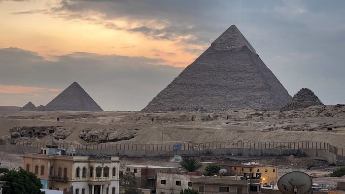
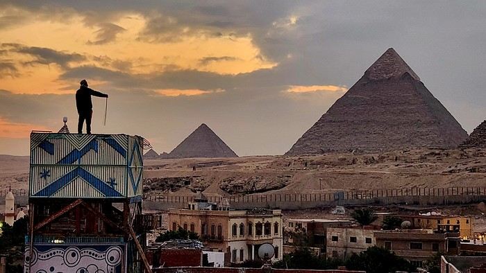
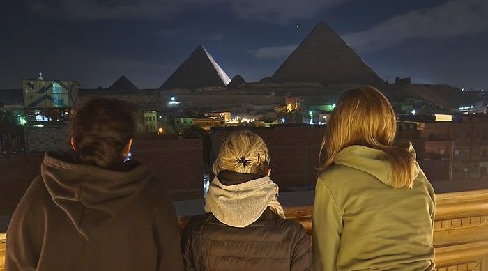
Oh, absolutely! And here it is: a full-on slap in the face for everyone! But just look at this view from our hotel terrace? For 20 € a night for four, even with this incredible view, I figured the room must be pretty shabby, right? Nope... Is the staff rude, then? Nope... Okay, so what’s the catch? You’re gonna tell me breakfast is included too? Well, yes! Honestly, this Egypt trip is off to a great start.
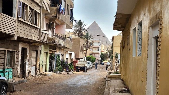
And the rest of the afternoon, spent rubbing shoulders with locals, only confirmed this vibe. After digesting our pyramid view, we dove into the hustle and bustle of our neighborhood with the goal of exchanging money, eating at street stalls, and testing the hospitality of the locals. Ten out of ten!
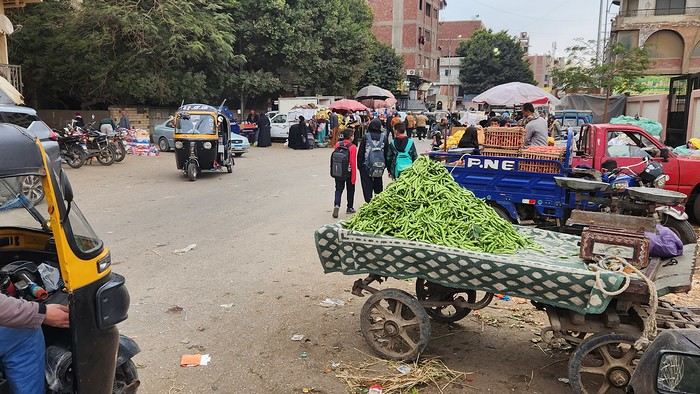
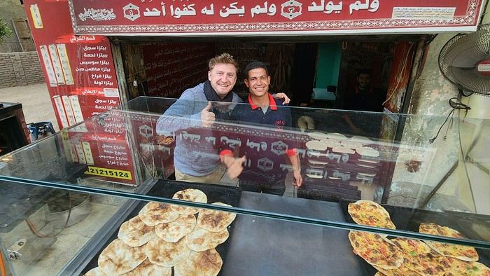
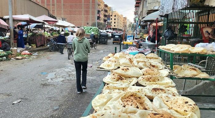
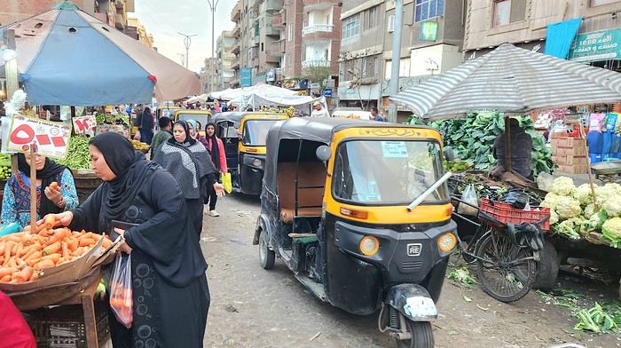
Eight little sun breads with baba ganoush and falafel? 80 pounds, or 1.5 €. A dozen Middle Eastern pastries? Same! 80 pounds! Two hawawshis, those little pita breads stuffed with meat and spices? 10 pounds each, or about twenty cents! Not to mention all those smiles and free "welcomes" left and right!!!
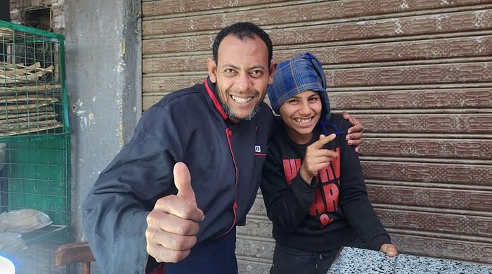
What a welcome! We end this first day with a sunset over the three sisters of Giza—where we’ll obviously be gawking tomorrow...
https://voyageforum.com/images/posts/small/1789072399-cCyLDYuFwPLAZTY.jpg
"So, my little wanderers, back at the decks? What’s this mystery destination you’ve got in store for us at the start of the year?"
Yes, the schoolyard bell’s ringing again! We’re hitting the road... or rather, the skies! At first glance, our destination might surprise more than a few. First off, simply because I was here exactly twenty years ago, and I don’t usually like retracing my own footsteps. Secondly, because the name of this place screams mass tourism—basically the opposite of what Flo and I look for.
Despite that, in this land of backsheesh, I’d promised myself I’d come back one day to experience it my way. And since Flo told me, during our wanderer chats, that this destination straddling Africa and the Middle East was in her top 2 travel dreams, the stars aligned for this roots-style trip to quickly make it onto our pharaonic festivities program! Unless you’re totally clueless in general knowledge, you’ve probably guessed by now—we’re off to Egypt! Of course, a few classics will be on our itinerary, but above all, we want to soak up a culture that can’t be appreciated in four-star resorts or on a Nile cruise boat. And let’s be clear, these next two weeks won’t be a walk in the park—neither for our two daughters who are joining us, nor for our bodies!
And that’s clear from the get-go: after our first flight, eight hours of trying (and failing) to sleep on Milan airport’s metal seats, our second flight, landing, passport stamps, our Uber ride, and our first Cairo kilometers, we finally drop our exhaustion at the little guesthouse we booked in Giza. Doesn’t all that energy deserve a little reward?
Oh, absolutely! And here it is: a full-on slap in the face for everyone! But just look at this view from our hotel terrace? For 20 € a night for four, even with this incredible view, I figured the room must be pretty shabby, right? Nope... Is the staff rude, then? Nope... Okay, so what’s the catch? You’re gonna tell me breakfast is included too? Well, yes! Honestly, this Egypt trip is off to a great start.
And the rest of the afternoon, spent rubbing shoulders with locals, only confirmed this vibe. After digesting our pyramid view, we dove into the hustle and bustle of our neighborhood with the goal of exchanging money, eating at street stalls, and testing the hospitality of the locals. Ten out of ten!
Eight little sun breads with baba ganoush and falafel? 80 pounds, or 1.5 €. A dozen Middle Eastern pastries? Same! 80 pounds! Two hawawshis, those little pita breads stuffed with meat and spices? 10 pounds each, or about twenty cents! Not to mention all those smiles and free "welcomes" left and right!!!
What a welcome! We end this first day with a sunset over the three sisters of Giza—where we’ll obviously be gawking tomorrow...
https://voyageforum.com/images/posts/small/1789072399-cCyLDYuFwPLAZTY.jpg
Two weeks under the Puglia sun
After a pretty disastrous weather-wise trip to Gran Canaria, we’re hoping this time the sun will shine in Puglia.
It’s not a sure thing, though—the weather’s been awful all over Europe in early May.
For those who’d like to (re)read the story without the digressions, it’s here.
Saturday, May 16: This time we’re flying out of Charleroi (Brussels South): the ticket prices, flight times, and proximity all worked for us. The airport (Ryanair) was recently renovated... but it’s still not very well organized. There are hardly any seats in the boarding areas, and... the restrooms cost money!!! The flight goes smoothly, though, and we land in Bari a little late.
We quickly pick up our rental car, a very local-looking Pandina (even more so than the Fiat 500 in this region), and hit the Italian roads... and their unique driving quirks (like the fact that the countless road signs along the streets and in towns are purely decorative 😏, and that Italian cars don’t have turn signals 😮... except for rental cars).
About an hour later, we arrive at our first accommodation, right in the middle of the countryside near Monopoli. The owner isn’t there, but they’ve left us a ton of info via messages and even turned on the space heater, which is a nice touch. We explore the property:

And the next morning before breakfast, its immediate surroundings:


Sunday, May 17: After our "seaside" experience in Gran Canaria last weekend (packed with people and locals), we decide to start inland. After a hearty breakfast,

we head toward Alberobello, a super touristy village famous for its trulli—those stone houses with conical roofs. We easily find a free parking spot on a street near the Aia Piccola district, where some trulli are still lived in year-round.


We almost immediately come across the Trullo Sovrano (the only two-story one), which you can visit (but we skip it—it’s opening time, and there’s already a line).

From there, we head down toward the Basilica of Cosma e Damiano... but we don’t go in because there’s a mass.

Now we’re on the main Piazza del Popolo, which connects the two districts of Alberobello: Rione Aia Piccola and Rione Monti, the more touristy one.
For those who’d like to (re)read the story without the digressions, it’s here.
Saturday, May 16: This time we’re flying out of Charleroi (Brussels South): the ticket prices, flight times, and proximity all worked for us. The airport (Ryanair) was recently renovated... but it’s still not very well organized. There are hardly any seats in the boarding areas, and... the restrooms cost money!!! The flight goes smoothly, though, and we land in Bari a little late.
We quickly pick up our rental car, a very local-looking Pandina (even more so than the Fiat 500 in this region), and hit the Italian roads... and their unique driving quirks (like the fact that the countless road signs along the streets and in towns are purely decorative 😏, and that Italian cars don’t have turn signals 😮... except for rental cars).
About an hour later, we arrive at our first accommodation, right in the middle of the countryside near Monopoli. The owner isn’t there, but they’ve left us a ton of info via messages and even turned on the space heater, which is a nice touch. We explore the property:
And the next morning before breakfast, its immediate surroundings:
Sunday, May 17: After our "seaside" experience in Gran Canaria last weekend (packed with people and locals), we decide to start inland. After a hearty breakfast,
we head toward Alberobello, a super touristy village famous for its trulli—those stone houses with conical roofs. We easily find a free parking spot on a street near the Aia Piccola district, where some trulli are still lived in year-round.
We almost immediately come across the Trullo Sovrano (the only two-story one), which you can visit (but we skip it—it’s opening time, and there’s already a line).
From there, we head down toward the Basilica of Cosma e Damiano... but we don’t go in because there’s a mass.
Now we’re on the main Piazza del Popolo, which connects the two districts of Alberobello: Rione Aia Piccola and Rione Monti, the more touristy one.
Draw Me Your Japan...
Hi there!
 I’m inviting you on a stroll through my drawings—a completely subjective, far from exhaustive, and totally personal take, since it’s based on my own sketches. I put this travel journal together after returning in late 2024, mostly using felt-tip pens and pencils, with a few collages thrown in. I worked from our personal photos.
Let’s start with the shotengai...

Our first "wow" moment came as we stepped out of the subway in Asakusa, the Tokyo neighborhood where we’d booked our hotel for our first five nights. Exhausted after our long flight, we finally arrived and took an exit that led straight into a shotengai—one of those covered shopping streets that pop up in city centers and flourished between the 1950s and 1980s.
It was an instant aesthetic shock, like a close encounter of the third kind between the modern city, a typical Asian market with its street stalls, the vintage vibe of the arcade, the sheer abundance of goods, and the bustling crowd—a mix of tourists, pilgrims (thanks to nearby Senso-ji Temple), and locals (it’s a very working-class area). In the end, it set the tone for a feeling we’d experience throughout the trip. Wherever we went, shotengai turned out to be fantastic spots for finding little restaurants, shops, or even fresh produce. Some are like real mazes, like in Kyoto, where we spent ages trying to relocate a restaurant we’d loved ;-)
In Kanazawa, the Omicho Market: And in Kyoto, Nishiki Market:

To be continued...
I’m inviting you on a stroll through my drawings—a completely subjective, far from exhaustive, and totally personal take, since it’s based on my own sketches. I put this travel journal together after returning in late 2024, mostly using felt-tip pens and pencils, with a few collages thrown in. I worked from our personal photos.Let’s start with the shotengai...
Our first "wow" moment came as we stepped out of the subway in Asakusa, the Tokyo neighborhood where we’d booked our hotel for our first five nights. Exhausted after our long flight, we finally arrived and took an exit that led straight into a shotengai—one of those covered shopping streets that pop up in city centers and flourished between the 1950s and 1980s.
It was an instant aesthetic shock, like a close encounter of the third kind between the modern city, a typical Asian market with its street stalls, the vintage vibe of the arcade, the sheer abundance of goods, and the bustling crowd—a mix of tourists, pilgrims (thanks to nearby Senso-ji Temple), and locals (it’s a very working-class area). In the end, it set the tone for a feeling we’d experience throughout the trip. Wherever we went, shotengai turned out to be fantastic spots for finding little restaurants, shops, or even fresh produce. Some are like real mazes, like in Kyoto, where we spent ages trying to relocate a restaurant we’d loved ;-)
In Kanazawa, the Omicho Market:
And in Kyoto, Nishiki Market:
To be continued...
June 2026 Theme Thread: Such a Beautiful Landscape
This is where we chat.
Discussion thread on the May 2026 theme: Staircases
If you’ve already posted your three photos in the contest thread Staircases: May 2026 Photo Contest Theme and a fourth one comes to mind, you can ease your staircase obsession here.
A few examples of staircases:
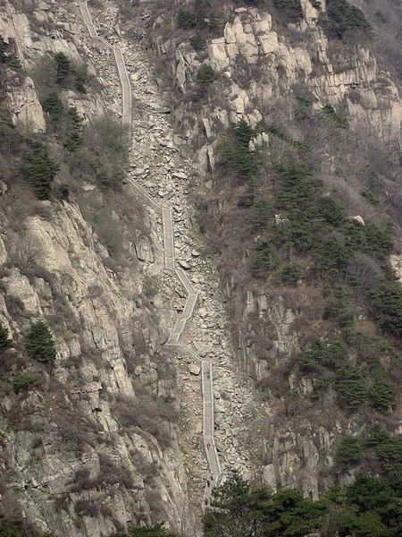
Some of the 6,600 steps on the staircase leading to the summit of Jade Emperor Peak at 1,545 meters.
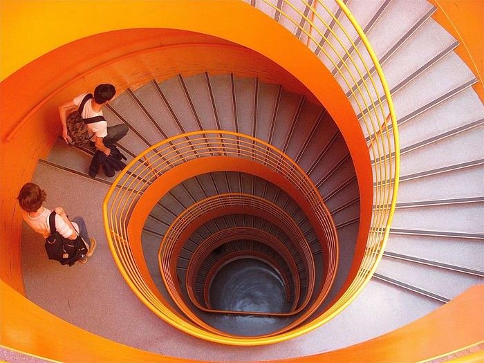
Emergency staircase at the Orléans library (France).
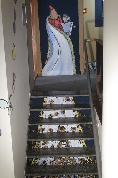
Brussels street artist Créons incorporates the staircase into the dress design of his character.
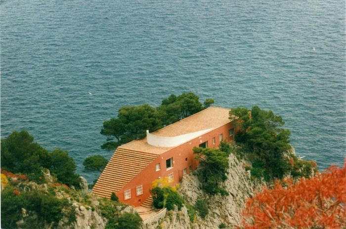
The staircase is part of the roof of Villa Malaparte (Adalberto Libera) on the island of Capri (Italy).
A few examples of staircases:
Some of the 6,600 steps on the staircase leading to the summit of Jade Emperor Peak at 1,545 meters.
Emergency staircase at the Orléans library (France).
Brussels street artist Créons incorporates the staircase into the dress design of his character.
The staircase is part of the roof of Villa Malaparte (Adalberto Libera) on the island of Capri (Italy).
Off on an adventure in Sri Lanka
Day 1 – December 6
Our decision is our decision. And it’s firm and final. Next winter, our plane will spread its great wings toward the island of Ceylon! "Wait a minute... Ceylon... Ceylon... that name rings a bell, but I can’t quite place it on the globe Grandma gave me for Christmas! Ceylon... Oh right, I’ve got it: Ceylon is the name of my tea!" Exactly. But the name on your pretty tea box is also the one used until 1972 for this island nation, a speck on the Indian Ocean at the southern tip of the Indian subcontinent: Sri Lanka!
For this new adventure, I’m exceptionally leaving my Flo behind, cowardly replaced by a double dose of testosterone. To write the book of this journey with me, I’m bringing along my brother, who’s used to this kind of thing, and... a guest star: My model of resilience. My dad! All aboard! Or rather, all aboard our tuk-tuk! Yes, you read that right: A real tuk-tuk, a little colorful rolling box that putters along at two miles an hour. The idea? Well, Sri Lanka and its winding roads overlooking the vastness of lush nature are tailor-made for this kind of vehicle. And since it’s one of only two countries in the world that allow foreigners to rent and drive these mini speedsters, we’ll be crisscrossing the island in our two-square-meter rolling box. Plus, adopting this mode of transport is a surefire way to connect directly with the locals, who’ll surely be curious to see a foreigner driving their iconic vehicle. Not to mention the... let’s say... spicy anecdotes it might generate. I mean, heading into a subtropical zone with my jet-black dad and his unpredictable digestive flora while deliberately choosing the tuk-tuk as our *only* means of transport? That’s the winning combo for an unforgettable adventure! "More seriously, Dad, Sullivan, I’m already loving the idea of living this adventure together, the three of us—brothers and father..."
So, does the intro to this new adventure get your salivary glands going? Yes? Too bad. Because unfortunately, the program handed out by the lady at the entrance has been slightly... let’s say *crumpled*. Some might even say "scrunched up and nearly tossed in the trash." First, six days ago, as the countdown echoed in us like a call to adventure, Cyclone Ditwah grabbed Sri Lanka, played with it like a rag doll, and left it battered on the ground. The toll is devastating: over a thousand dead, thousands of homes wiped out by relentless rains, roads and railways swallowed by massive mudslides. A country wounded once again, after the civil war, the 2004 tsunami, and the post-Covid economic crisis.
But as if this weather disaster wasn’t enough to shake our unbreakable adventurer spirit, fate decided to mess with us further by cutting our trio down to two. The victim? My brother, violently turned away because of a simple date on his passport that didn’t match the border officials’ expectations. Return to sender!
So now it’s just the two of us allowed to board the Qatar Airways Airbus A380 for this trip. If he were here, Denis Brognart would say, "And in the end, only one remains!" Except I know you’ll be with us, following our adventures! Right?
Our decision is our decision. And it’s firm and final. Next winter, our plane will spread its great wings toward the island of Ceylon! "Wait a minute... Ceylon... Ceylon... that name rings a bell, but I can’t quite place it on the globe Grandma gave me for Christmas! Ceylon... Oh right, I’ve got it: Ceylon is the name of my tea!" Exactly. But the name on your pretty tea box is also the one used until 1972 for this island nation, a speck on the Indian Ocean at the southern tip of the Indian subcontinent: Sri Lanka!
For this new adventure, I’m exceptionally leaving my Flo behind, cowardly replaced by a double dose of testosterone. To write the book of this journey with me, I’m bringing along my brother, who’s used to this kind of thing, and... a guest star: My model of resilience. My dad! All aboard! Or rather, all aboard our tuk-tuk! Yes, you read that right: A real tuk-tuk, a little colorful rolling box that putters along at two miles an hour. The idea? Well, Sri Lanka and its winding roads overlooking the vastness of lush nature are tailor-made for this kind of vehicle. And since it’s one of only two countries in the world that allow foreigners to rent and drive these mini speedsters, we’ll be crisscrossing the island in our two-square-meter rolling box. Plus, adopting this mode of transport is a surefire way to connect directly with the locals, who’ll surely be curious to see a foreigner driving their iconic vehicle. Not to mention the... let’s say... spicy anecdotes it might generate. I mean, heading into a subtropical zone with my jet-black dad and his unpredictable digestive flora while deliberately choosing the tuk-tuk as our *only* means of transport? That’s the winning combo for an unforgettable adventure! "More seriously, Dad, Sullivan, I’m already loving the idea of living this adventure together, the three of us—brothers and father..."
So, does the intro to this new adventure get your salivary glands going? Yes? Too bad. Because unfortunately, the program handed out by the lady at the entrance has been slightly... let’s say *crumpled*. Some might even say "scrunched up and nearly tossed in the trash." First, six days ago, as the countdown echoed in us like a call to adventure, Cyclone Ditwah grabbed Sri Lanka, played with it like a rag doll, and left it battered on the ground. The toll is devastating: over a thousand dead, thousands of homes wiped out by relentless rains, roads and railways swallowed by massive mudslides. A country wounded once again, after the civil war, the 2004 tsunami, and the post-Covid economic crisis.
But as if this weather disaster wasn’t enough to shake our unbreakable adventurer spirit, fate decided to mess with us further by cutting our trio down to two. The victim? My brother, violently turned away because of a simple date on his passport that didn’t match the border officials’ expectations. Return to sender!
So now it’s just the two of us allowed to board the Qatar Airways Airbus A380 for this trip. If he were here, Denis Brognart would say, "And in the end, only one remains!" Except I know you’ll be with us, following our adventures! Right?
Costa Rica: The dry season isn't what it used to be!
Introduction:
For years, I’ve heard about Costa Rica, which seems like a country "made for me"—nature, not cities.
I almost went in 2019, but a family issue made me cancel.
Initially, I wanted to spend at least three weeks there, planning to go in our summer despite it being the rainy season. Then I realized what I wanted to do could fit into two weeks, so I ended up going in February.
Plus, January’s weather was so awful that some sunshine should do me good.
I found a flight at a decent price, but with two downsides.
The first is that it leaves from Paris CDG, and the second is that it’s with Air France—a airline I’d sworn off after my misadventures with them back in 2008. We’ll see how it goes!
Ideas for a one-week Andalusia itinerary
Hi everyone,
I’m sharing my draft itinerary with you because I just booked our flight tickets, and I feel like it’s quite late in the season. So, I’d like to be sure about my stops before reserving the hotels. I’ll be traveling alone with my two adult children. We want to prioritize outdoor walks, avoid too many indoor visits (both for budget and preference), and not spend too much time on the road.
D1: Arrival at 9 AM in Malaga, day in Malaga and overnight stay D2: Head straight to Nerja (1-hour drive) and spend the night there D3: Head straight to Granada (1.5-hour drive), spend the day and night there D4: Granada. Visit the Alhambra (Nasrid Palaces tour at 5 PM) and spend the night D5: Head to Ronda (2.5-hour drive) and spend the night D6: White Villages and overnight in Ronda D7: Head straight to the Costa del Sol (e.g., Estepona), spend the day and night there D8: Return to Malaga to catch our flight
There you go! This itinerary takes into account that we’d like to do a circuit starting from Seville in a few years. That said, it’d be a shame to miss something doable from Malaga.
Questions: Since the Alhambra visit is only at 5 PM, and we’d already have the day to explore Granada, would arriving the day before be a mistake? Or should we skip this day and dedicate it elsewhere (Costa del Sol? Head toward Tabernas?)? The old town appeals to me, but maybe the Sacromonte neighborhood isn’t essential... Same question for Ronda: should we dedicate a full day to it, or combine Ronda and the White Villages in one day? Note that we love wandering around villages outside, so that might answer my question! :)
Final question: Is it better to rent the car at Malaga Airport or in the city? If we rent at the airport, we’d need a hotel with parking, which doesn’t seem easy. Or stay outside the city and park for free near the center if possible? I’ve read comments about taking a taxi to Malaga and then picking up the rental car at the airport the next morning. The taxi would really need to be affordable...
Thanks so much for your feedback and suggestions for visits during this little circuit. Have a great day, everyone! Christine
D1: Arrival at 9 AM in Malaga, day in Malaga and overnight stay D2: Head straight to Nerja (1-hour drive) and spend the night there D3: Head straight to Granada (1.5-hour drive), spend the day and night there D4: Granada. Visit the Alhambra (Nasrid Palaces tour at 5 PM) and spend the night D5: Head to Ronda (2.5-hour drive) and spend the night D6: White Villages and overnight in Ronda D7: Head straight to the Costa del Sol (e.g., Estepona), spend the day and night there D8: Return to Malaga to catch our flight
There you go! This itinerary takes into account that we’d like to do a circuit starting from Seville in a few years. That said, it’d be a shame to miss something doable from Malaga.
Questions: Since the Alhambra visit is only at 5 PM, and we’d already have the day to explore Granada, would arriving the day before be a mistake? Or should we skip this day and dedicate it elsewhere (Costa del Sol? Head toward Tabernas?)? The old town appeals to me, but maybe the Sacromonte neighborhood isn’t essential... Same question for Ronda: should we dedicate a full day to it, or combine Ronda and the White Villages in one day? Note that we love wandering around villages outside, so that might answer my question! :)
Final question: Is it better to rent the car at Malaga Airport or in the city? If we rent at the airport, we’d need a hotel with parking, which doesn’t seem easy. Or stay outside the city and park for free near the center if possible? I’ve read comments about taking a taxi to Malaga and then picking up the rental car at the airport the next morning. The taxi would really need to be affordable...
Thanks so much for your feedback and suggestions for visits during this little circuit. Have a great day, everyone! Christine
Nepal Feedback
NAMASTE NEPAL! PRACTICAL INFO AND EXPERIENCE FEEDBACK
Stay from March 25 to April 16, 2025
· Flight tickets Air India (via Delhi) (via Skyscanner) = 1130 € per person · Planned budget (and respected without too many restrictions and while buying a few small gifts) = 2000 € for the stay for two. Buses, taxis, and entrance fees to various sites represent a budget to consider. Meals are cheap. Drinks like beer/Coke, however, are not cheap and cost the equivalent of a meal. · Exchange rate of the rupee during our stay = 0.0064 € (the exchange rate is almost identical everywhere, including at the airport). · At the airport, purchase of two SIM cards (phone) = 1000 NPR x 2 for 28 days. · Kathmandu: we had booked the hotel upon arrival: Kathmandu Boutique Hotel (+977 015 357 446 – email: booking@kathmanduboutiquehotel.com), very well located in a quiet alley off the street, south of Thamel, a 10-minute walk from Durbar Square. A hotel like Nepal knows how to do, where tall people will have to duck. Night + breakfast = 18 € for two. Very warm welcome, great location, excellent value for money. · Bhaktapur: we had also booked a hotel for the end of our stay because the chance of the year 2025 made the Nepali New Year and Bisket Jatra particularly festive in Bhaktapur: Manju Baha Hotel School (+977 976 7234014 – email: manjubahahotel@gmail.com) located in an old monastery. "A social enterprise transforming an old monastery into a charming hotel, offering professional hospitality training to underprivileged Nepali youth." Night + breakfast = 32 € for two. Beautifully decorated room. Very warm welcome. Don’t miss the Changunarayan site (near Bhaktapur), it’s amazing. And if you’re lucky enough to be in Bhaktapur in mid-April for 3 days, there’s the Bisket Jatra festivities (Newari festival), joyful, noisy, fun, and wild… · Pokhara (hotel recommended by the Kathmandu hotel): Hotel Green Tara, Lakeside, 10th street, set back, quiet (Tel. +977 61 462698 – email: greentara_67@hotmail.com) · Trek permit (Lower Mustang, no need for an agency or guide, permits checked at Ghasa and Jomsom) = 2000 NPR per person (2 ID photos) · Bus Kathmandu/Pokhara and return = 2000 NPR per person · Bus Pokhara/Jomsom, 2 one-way tickets = 2800 NPR. · Taxi: negotiation with a driver we recommend, Vicky (+977 984 075 599). You explain what you want, negotiate the price, and he waits for you during the visit. Very charming, we used him several times. For example: departure from our hotel at 10 AM -> Boudhanath/Pashupatinath/Patan return at 5 PM to the hotel = 6500 NPR – Swayambhunath (round trip) = 1200 NPR · Site prices: https://ntb.gov.np/plan-your-trip/before-you-come/heritage-site-entry-fees o Visitor Pass for Kathmandu Durbar Square (for the duration of the stay, show your visa) = 1000 NPR per person (1 ID photo) o Bhaktapur Durbar Square (old town) = 1800 NPR per person o Patan = 1000 NPR per person o Swayambhu Stupa = 200 NPR per person o Boudha Stupa = 200 NPR per person o Pashupatinath Temple = 1000 NPR per person (interesting to take a guide) o Changunarayan Temple (6 km north of Bhaktapur) = 400 NPR per person o Mountain Museum in Pokhara = 750 NPR per person · E-cigarettes: e-cigarettes are banned in India and confiscated whether they’re in carry-on or checked luggage. On the way there, we had kept them in our carry-on, they were confiscated in Delhi. On the way back, learning from our previous experience, we put them in our checked luggage. Someone came to get us to take them out of our bags and confiscate them… You can find e-cigarettes and products in Kathmandu.
* * *
I’m 74 years old. I went to Nepal in 1982, 1983, and the last time in 1986. I wanted to introduce this beautiful and endearing country to my husband, and it was… now or never. So we decided it was now.
I knew the trek starting from Pokhara: Naudanda/Birethanti/Ghorepani/Tatopani/Kalopani. There was no way I was going to do that trek, especially the 1000-meter staircase to reach Ghorepani… You have to stay humble with age.
Back then, the road didn’t exist. I didn’t consider, with the construction of this road (NH48) along the western bank of the Kali Gandaki, doing a trek along a windy and dusty road. Was there an alternative hiking trail on the eastern bank? No one answered my question on VoyageForum, so I did my research online. And I found this site: "Andrées de Ruiter and Prem Rai - Trekking the Annapurna Circuit, including the new NATT trails that avoid the road - A guide to one of the most beautiful trekking regions in Nepal and the world (2011) - NATT = New Annapurna Trekking Trail".
Phew! A solution was emerging. This circuit from 2011 wasn’t fully marked. The idea was to go from Jomsom to Tatopani, so we needed to make sure the path was well-marked all the way, which we did, and the path exists, marked in red and white!
So, with the walking times information, we built our 8-day circuit:
· Jomsom/Thinigaon · Thinigaon/Chimang · Chimang/Saura · Saura/Kokhetanti · Rest day or, if in good shape: loop to Sekong Lake · Kokhetanti/Jhipra Deurali · Jhipra Deurali/Kopchepani · Kopchepani/Tatopani
It’s a senior trek, after all. So the walking times noted on the sites indicated 3 hours or even 4 hours for the two longest stages. That pace suited us fine.
On March 29, we left Kathmandu (1400m), after visiting the must-see sites, by bus to Pokhara: 200 km and 8.5 hours on a chaotic road under construction. I had a memory of Pokhara where it was the first city where you could see the Himalayan range, especially Machhapuchhare. But the pollution is such, the dust raised by traffic and construction, that no horizon is visible except the first hills around Pokhara.
We stayed 24 hours in Pokhara (820m), and on March 31, we left our luggage at the hotel and set off with our lightest backpacks: change of clothes, toiletries, first aid kit, anti-chafing cream, water bottle, sleeping bag liner, and light shoes for the stages.
We took the bus to Jomsom: 160 km/7.5 hours including stops for bathroom breaks, tea, and lunch. The road is nothing but a chaos of potholes, landslides, construction, dust, rebuilding, and mudslides. In Ghasa, the bus stops, and we’re told we’re at a checkpoint and that the two foreigners in the bus, my husband and I, need to have our permits checked, which takes a few minutes. The driving is rock-and-roll, surprising, and courteous. The drivers have their codes, and on these improbable roads, they’re virtuosos.
We could have chosen the plane, but several reasons dissuaded us: if there’s too much wind, the planes don’t take off; personally, I wasn’t reassured about landing in Jomsom, and this transport has a cost.
We arrived around 2 PM in Jomsom (2720m), and despite the early wake-up, the nearly 8 hours on the bus, and the altitude, we decided to head straight to Thinigaon (2840m). At the Jomsom checkpoint, they told us it was a 30-minute walk. Great! Except we took an hour and a half on an uphill road, bent over to fight a strong wind. But the Himalayan range is there! The Dhaulagiri, the Nilgiri, the Annapurnas as a reward.
In Thinigaon, we found a room at the "Nilgiri View Hotel" run by a didi (big sister in Nepali). From the lodge’s roof, she proudly showed us the different peaks surrounding the village and told us, worried, that it hadn’t snowed here for 3 years. She said there are very few tourists, that the season is rather in September/October/November. It seems there’s not a soul in this village, yet mules pass through the narrow street paved with large flat stones, their bells ringing. We dine at 6 PM and go to bed… Room = 1200 NPR and dinner, breakfast, and drinks = 2560 NPR.
On April 1, we set off at 9 AM, not for Chimang as planned but for Marpha! The didi from the Thinigaon lodge had said it was a 3-hour walk. The first part of this stage is attractive, the mountains are magnificent and imposing, the landscape is superb, there’s no one around, a feeling of being "alone in the world." We follow Dhumbra Tal, this small green lake. The path is a rocky track that climbs steeply. Then, around a hill, we start the big descent that joins the Kali Gandaki. We face the wind head-on, and the violent gusts take our breath away, throw us off balance, and envelop us in dust. We see the road on the other side of the Kali Gandaki. We arrive in the village of Chhairo at 2 PM, completely exhausted and with blistered feet, after 5 hours of walking instead of the planned 3.5 hours.
We’re welcomed by the village nurse, who tells us there’s a lodge in the village. Chhairo is a Tibetan village, a 20-minute walk from Marpha (according to the locals, multiply by 2 or even 3 for us…). We’re going to revise our trek plan and, first of all, spend the night in Chhairo.
The lodge is quite pleasant, and Karma, the hostess, is very friendly. She asks about our plans and suggests we stay in Chhairo the next day, from where we can visit Marpha and also Chimang, a 1-hour walk away, in light mode, meaning without backpacks. She invites us to participate in a village ceremony the next evening.
We immediately accept the proposal, as our feet need rest and the welcome is so warm… Dinner and bed!
We reworked our trek plan, which was too ambitious for our untrained bodies and, let’s face it… no longer in our first youth. In the initial plan, we thought there wouldn’t be too much elevation gain following the Kali Gandaki, but checking the map, we realize there might be significant elevation changes between Sauru and Sirkung. So we plan:
· Tomorrow: visit Marpha (2670m) and Chimang (2744m) · April 3: bus from Chhairo (2700m) to Kalopani (2530m) and continue on foot to Ghasa (2010m) · April 4: Ghasa/Pairataplo (1940m) · April 5: Pairatapla/Gadpar (1580m) · April 6: Gadpar/Narchyang (1510m) · April 7: Narchyang/Tatopani (1190m) · April 8: return to Pokhara.
Normally, it’s all downhill…
April 2, a rest day then… We set off in the morning to explore Marpha. We have to take a temporary bridge because the suspension bridge is closed due to road construction. We join the road and arrive in Marpha, a village famous for its apple orchards, brandy, cider, and apple juice production. This village is magnificent with its stone houses and monastery clinging to the hillside. The road construction spared it. There are people, but very few Western tourists.
We have lunch in Marpha and go back through Chhairo to take the path to Chimang. We cross a fragrant pine forest and find the rocky path; the landscape is splendid. We walk quietly, passing peaceful buffaloes and cows, and arrive at the foot of a stone staircase… 275 steps (which we counted on the way back) leading us to the village of Chimang. Chimang is an isolated Newari village that seems a bit desolate. Despite the slopes, there are crops on every little bit of land. Thankfully, we changed our initial program because there’s no lodge in this village, contrary to what we saw on a map… We wander through the village, which seems very deserted, have coffee in a house from another world, and then head back to Chhairo.
A rest day? = 5 hours of walking!!
Dinner and village ceremony. From what we understand, this ceremony is in honor of the Dalai Lama. Men, women, and children in traditional costumes gather twice a month; they dance, make, and offer small sweet cakes with Tibetan tea (made from tea, yak butter—often rancid—water, and salt). Surprising for first-timers…
Around 10 PM, we leave the ceremony; tomorrow morning, we need to be on the roadside by 7 AM to catch the bus to Kalopani…
This village of Chhairo is very pleasant and welcoming, no tourists, just two motorcyclists who arrived in the evening, one of whom participated in the ceremony and discreetly poured his Tibetan tea outside.
Lodge: "Norsang Tibetan Guesthouse and Restaurant". Total bill for 2 nights, 2 dinners, 2 breakfasts, and drinks = 8000 NPR.
April 3: bus from Chhairo to Kalopani, about 1.5 hours for the 20 km (200 NPR per person). We descend on the right bank of the Kali Gandaki. We find the red and white markings to resume the trek toward Ghasa. We’re in a fragrant pine forest, the Dhaulagiri on one side and the Annapurnas on the other, magnificent, and the path is pleasant and easy. We get a bit lost in this forest, always looking for the markings. Near Lete, two trekkers pass us, and we meet them again a little further on with two very young children, to whom we give the 2 hard-boiled eggs I didn’t eat this morning. They accepted them without hesitation.
We arrive in a village and ask for directions to Ghasa. The young girls point the way. But we come across a forest being logged, trees cut in all directions. We turn back and ask for confirmation. They confirm… But the two young girls catch up with us and clear the way. We have to step over, go around, and cross the felled trees, with no indication at all. Through this pick-up sticks of felled trees, the girls lead us to the top of a stone staircase, indicating that was the path. It’s the only place where we saw rhododendrons in bloom.
We descend the staircase. At the bottom, to the left, there’s a bridge to go toward Choyo, and to the right, a path to Ghasa. We take the right path and join the road. We should normally find the red and white markings, but we don’t… So we continue on the western bank road of the Kali Gandaki.
A little before the village of Misi, we see fumaroles on the opposite bank that seem to come from the ground. We don’t understand. We stopped to eat in the village of Misi (noodle soup = 600 NPR), but it’s hard to communicate with the elderly people running the guesthouse.
We continued on the road, not finding the marked path parallel to the road. Landslides, both on the left and right banks, seem to have taken over the marked routes. It’s a place where the Kali Gandaki gorge narrows, and on the opposite bank, the mountain smokes more and more, and we now hear the crackling of fire. Across from us, the mountain is burning… Our initial plan had us passing on that burning bank right now…
We arrive in Ghasa at 3:30 PM, a 6.5-hour stage but with a 1-hour stop at noon. We’re at the "Florida Guesthouse and Restaurant." From our room, we see the mountain smoking on the other side of the river, and at night, we see the flames. In this village, posters show Himalayan eagles and vultures that seem to be protected species. Indeed, we saw (and heard) 3 eagles circling today.
April 4 – Today, heading to Pairothapla or Kopchepani depending on our feet, accommodation options, and simply our desires.
No more smoke on the mountain this morning. It’s chilly, 7:45 AM, the sky is clear, just a smell of smoke outside.
Price of the lodge = 1000 NPR for the night + 3580 NPR for meals.
We cross Ghasa, which stretches over more than a kilometer. We have a drink at the last guesthouse in the village, and the didi, when she learns our destination, tells us to be careful because the villages we’re going to aren’t safe. Should we distribute our rupees in different pockets? Nah, we kept going.
At the exit of Ghasa, we find the red and white markings and take the suspension bridge to cross the boiling waters of the Kali Gandaki. The passage is impressive because the river is tumultuous. Lots of climbs and even more descents. We’re back on the eastern bank. It’s hot! On the narrow path, we meet a group of buffaloes. Who has the right of way? We decide to stick as close as possible to the rock wall and move forward calmly. The buffaloes look at us, chewing placidly, with no intention of jumping on us. Phew!
After a 5-hour stage (including stops), we arrive in Pairothapla, with hot feet and firm thighs, and decide we won’t go any further. It’s a good thing because there’s a lodge, the most basic so far, but with a great welcome. We have a meal and a short nap. The buffaloes we met on the way belong to this house. They come to drink at the fountain by the path.
Our host, very pleasant, doesn’t know what to do to please us and is very attentive. He wants to chat. He has two children, a 4-year-old girl and a 7-year-old boy. Where do they go to school? Do they go? He tells us that the fires in the mountain are caused by people, but for what reason? We won’t find out, but it’s illegal. From here, we can still see smoke rising in the distance. The wife is a bit less friendly. Corn kernels dry on a woven straw mat on the ground, and the mom sorts them.
From where we are, we overlook the valley and see the road under construction winding along the mountainside on the other bank.
Dinner on the terrace of the house overlooking the path, windbreaker and fleece on: dal bhat chicken for me and chicken curry for my husband: "organic" products, at least local production. There are small vegetable gardens everywhere with all sorts of vegetables.
April 5 – While we’re having breakfast on the terrace of our lodge, 5 porters, straps on their foreheads, heavily loaded, pass by on the path. A few minutes later, a group of 9 people appears. It must be said that since the beginning of our journey, we’ve met very few hikers. Two backpackers in Chhairo, the two hikers near Lete, two female hikers passed us before Pairothapla, a solo female hiker passed us…
The lodge in Pairothapla is called "Bimala Lodge & Thakali Kitchen" – Price for night + 4 meals + 2 breakfasts = 3000 NPR.
The descent toward the Kali Gandaki involves climbs whose steps we didn’t count. Clearly, the landslides on the mountain cause changes to the official ACAP trek marked in red and white, and the marking updates can’t keep up with the pace of these landslides. It’s almost always by chance that we find the markings. Fortunately, we can follow the power line that guides us somewhat.
Drink stop in Kopchepani, the legs are fine, but the feet don’t like being tightly enclosed. A group of trekkers with porters passes on the path. We met buffaloes that we kindly let pass; the path was wide enough, but it was a staircase going up, and we didn’t want to take any risks.
Across, a view of the magnificent Rupse Waterfall on the other bank of the Kali Gandaki, at the bottom, lots of vehicles and people.
Arrival in Gadpar after crossing a rather unwelcoming small village and cultivated gardens between dry stone walls, each better built than the last.
First lodge spotted, first lodge adopted to answer the call of our feet, and a very warm welcome from the owner. Since we hadn’t eaten at noon, we had Tibetan bread/jam. 6-hour stage including 1 hour of stops. Night + dinner + breakfast + drinks = 5060 NPR
April 6 – Today, heading to Narchyang.
For several days, we’ve seen banana trees with their bunches of fruit and even a prickly pear with large fruits ripening.
This stage is quite peaceful and pleasant. We take a suspension bridge to cross a tributary of the Kali Gandaki. While we’re resting for a moment before crossing the bridge, a couple of porters, a man and a woman, arrive and start across the bridge with their wood load in a basket held by a strap on their forehead, making them bend. We set off too… lighter than them.
On the other side of the bridge… a stone staircase, and it climbs steeply. The porter couple didn’t take this staircase; they went right on the path.
At the top of the staircase, we arrive in Narchyang after a 4-hour stage. A magnificent waterfall overlooks the village. We get lost in this fairly large village looking for a lodge. After wandering around for a while, we ask for directions, and an 84-year-old man takes us through the whole village and accompanies us to a very nice lodge run by a woman.
We chat with our hostess, who asks where we’re from and where we’re going. We explain that we want to reach Tatopani the next day and then return to Pokhara. She tells us there are 4x4s going directly to Pokhara and that it would probably be easier than taking a bus that might be full in Tatopani. After a quick consultation, we decide to return to Pokhara the next day by 4x4. She finds us a 4x4 with 2 seats left, departure at 8 AM – 5 hours on the road and 1500 NPR per person. A charming didi who does everything to be pleasant and helpful.
Narchyang community lodge = night + snacks + dinner + breakfast = 3000 NPR.
There you go, our trek ends tomorrow. Many necessary changes and adaptations to our initial trek, but no regrets, it was superb and a great experience that, for my part, I won’t be able to repeat. Always this encounter with the endearing, welcoming, curious, and very kind Nepali people. It was now or never, and we did it!
* * *
In conclusion, 3 full weeks in Nepal is a duration that allows visiting Kathmandu, Patan, and Bhaktapur, enjoying the various sites, and soaking in the atmosphere and urban Nepali life.
The trek, even revised and corrected, allowed us to get close to the impressive Annapurna and Dhaulagiri peaks. One or two acclimatization days might be necessary to get the body in tune with this magical and extraordinary land.
Stay from March 25 to April 16, 2025
· Flight tickets Air India (via Delhi) (via Skyscanner) = 1130 € per person · Planned budget (and respected without too many restrictions and while buying a few small gifts) = 2000 € for the stay for two. Buses, taxis, and entrance fees to various sites represent a budget to consider. Meals are cheap. Drinks like beer/Coke, however, are not cheap and cost the equivalent of a meal. · Exchange rate of the rupee during our stay = 0.0064 € (the exchange rate is almost identical everywhere, including at the airport). · At the airport, purchase of two SIM cards (phone) = 1000 NPR x 2 for 28 days. · Kathmandu: we had booked the hotel upon arrival: Kathmandu Boutique Hotel (+977 015 357 446 – email: booking@kathmanduboutiquehotel.com), very well located in a quiet alley off the street, south of Thamel, a 10-minute walk from Durbar Square. A hotel like Nepal knows how to do, where tall people will have to duck. Night + breakfast = 18 € for two. Very warm welcome, great location, excellent value for money. · Bhaktapur: we had also booked a hotel for the end of our stay because the chance of the year 2025 made the Nepali New Year and Bisket Jatra particularly festive in Bhaktapur: Manju Baha Hotel School (+977 976 7234014 – email: manjubahahotel@gmail.com) located in an old monastery. "A social enterprise transforming an old monastery into a charming hotel, offering professional hospitality training to underprivileged Nepali youth." Night + breakfast = 32 € for two. Beautifully decorated room. Very warm welcome. Don’t miss the Changunarayan site (near Bhaktapur), it’s amazing. And if you’re lucky enough to be in Bhaktapur in mid-April for 3 days, there’s the Bisket Jatra festivities (Newari festival), joyful, noisy, fun, and wild… · Pokhara (hotel recommended by the Kathmandu hotel): Hotel Green Tara, Lakeside, 10th street, set back, quiet (Tel. +977 61 462698 – email: greentara_67@hotmail.com) · Trek permit (Lower Mustang, no need for an agency or guide, permits checked at Ghasa and Jomsom) = 2000 NPR per person (2 ID photos) · Bus Kathmandu/Pokhara and return = 2000 NPR per person · Bus Pokhara/Jomsom, 2 one-way tickets = 2800 NPR. · Taxi: negotiation with a driver we recommend, Vicky (+977 984 075 599). You explain what you want, negotiate the price, and he waits for you during the visit. Very charming, we used him several times. For example: departure from our hotel at 10 AM -> Boudhanath/Pashupatinath/Patan return at 5 PM to the hotel = 6500 NPR – Swayambhunath (round trip) = 1200 NPR · Site prices: https://ntb.gov.np/plan-your-trip/before-you-come/heritage-site-entry-fees o Visitor Pass for Kathmandu Durbar Square (for the duration of the stay, show your visa) = 1000 NPR per person (1 ID photo) o Bhaktapur Durbar Square (old town) = 1800 NPR per person o Patan = 1000 NPR per person o Swayambhu Stupa = 200 NPR per person o Boudha Stupa = 200 NPR per person o Pashupatinath Temple = 1000 NPR per person (interesting to take a guide) o Changunarayan Temple (6 km north of Bhaktapur) = 400 NPR per person o Mountain Museum in Pokhara = 750 NPR per person · E-cigarettes: e-cigarettes are banned in India and confiscated whether they’re in carry-on or checked luggage. On the way there, we had kept them in our carry-on, they were confiscated in Delhi. On the way back, learning from our previous experience, we put them in our checked luggage. Someone came to get us to take them out of our bags and confiscate them… You can find e-cigarettes and products in Kathmandu.
* * *
I’m 74 years old. I went to Nepal in 1982, 1983, and the last time in 1986. I wanted to introduce this beautiful and endearing country to my husband, and it was… now or never. So we decided it was now.
I knew the trek starting from Pokhara: Naudanda/Birethanti/Ghorepani/Tatopani/Kalopani. There was no way I was going to do that trek, especially the 1000-meter staircase to reach Ghorepani… You have to stay humble with age.
Back then, the road didn’t exist. I didn’t consider, with the construction of this road (NH48) along the western bank of the Kali Gandaki, doing a trek along a windy and dusty road. Was there an alternative hiking trail on the eastern bank? No one answered my question on VoyageForum, so I did my research online. And I found this site: "Andrées de Ruiter and Prem Rai - Trekking the Annapurna Circuit, including the new NATT trails that avoid the road - A guide to one of the most beautiful trekking regions in Nepal and the world (2011) - NATT = New Annapurna Trekking Trail".
Phew! A solution was emerging. This circuit from 2011 wasn’t fully marked. The idea was to go from Jomsom to Tatopani, so we needed to make sure the path was well-marked all the way, which we did, and the path exists, marked in red and white!
So, with the walking times information, we built our 8-day circuit:
· Jomsom/Thinigaon · Thinigaon/Chimang · Chimang/Saura · Saura/Kokhetanti · Rest day or, if in good shape: loop to Sekong Lake · Kokhetanti/Jhipra Deurali · Jhipra Deurali/Kopchepani · Kopchepani/Tatopani
It’s a senior trek, after all. So the walking times noted on the sites indicated 3 hours or even 4 hours for the two longest stages. That pace suited us fine.
On March 29, we left Kathmandu (1400m), after visiting the must-see sites, by bus to Pokhara: 200 km and 8.5 hours on a chaotic road under construction. I had a memory of Pokhara where it was the first city where you could see the Himalayan range, especially Machhapuchhare. But the pollution is such, the dust raised by traffic and construction, that no horizon is visible except the first hills around Pokhara.
We stayed 24 hours in Pokhara (820m), and on March 31, we left our luggage at the hotel and set off with our lightest backpacks: change of clothes, toiletries, first aid kit, anti-chafing cream, water bottle, sleeping bag liner, and light shoes for the stages.
We took the bus to Jomsom: 160 km/7.5 hours including stops for bathroom breaks, tea, and lunch. The road is nothing but a chaos of potholes, landslides, construction, dust, rebuilding, and mudslides. In Ghasa, the bus stops, and we’re told we’re at a checkpoint and that the two foreigners in the bus, my husband and I, need to have our permits checked, which takes a few minutes. The driving is rock-and-roll, surprising, and courteous. The drivers have their codes, and on these improbable roads, they’re virtuosos.
We could have chosen the plane, but several reasons dissuaded us: if there’s too much wind, the planes don’t take off; personally, I wasn’t reassured about landing in Jomsom, and this transport has a cost.
We arrived around 2 PM in Jomsom (2720m), and despite the early wake-up, the nearly 8 hours on the bus, and the altitude, we decided to head straight to Thinigaon (2840m). At the Jomsom checkpoint, they told us it was a 30-minute walk. Great! Except we took an hour and a half on an uphill road, bent over to fight a strong wind. But the Himalayan range is there! The Dhaulagiri, the Nilgiri, the Annapurnas as a reward.
In Thinigaon, we found a room at the "Nilgiri View Hotel" run by a didi (big sister in Nepali). From the lodge’s roof, she proudly showed us the different peaks surrounding the village and told us, worried, that it hadn’t snowed here for 3 years. She said there are very few tourists, that the season is rather in September/October/November. It seems there’s not a soul in this village, yet mules pass through the narrow street paved with large flat stones, their bells ringing. We dine at 6 PM and go to bed… Room = 1200 NPR and dinner, breakfast, and drinks = 2560 NPR.
On April 1, we set off at 9 AM, not for Chimang as planned but for Marpha! The didi from the Thinigaon lodge had said it was a 3-hour walk. The first part of this stage is attractive, the mountains are magnificent and imposing, the landscape is superb, there’s no one around, a feeling of being "alone in the world." We follow Dhumbra Tal, this small green lake. The path is a rocky track that climbs steeply. Then, around a hill, we start the big descent that joins the Kali Gandaki. We face the wind head-on, and the violent gusts take our breath away, throw us off balance, and envelop us in dust. We see the road on the other side of the Kali Gandaki. We arrive in the village of Chhairo at 2 PM, completely exhausted and with blistered feet, after 5 hours of walking instead of the planned 3.5 hours.
We’re welcomed by the village nurse, who tells us there’s a lodge in the village. Chhairo is a Tibetan village, a 20-minute walk from Marpha (according to the locals, multiply by 2 or even 3 for us…). We’re going to revise our trek plan and, first of all, spend the night in Chhairo.
The lodge is quite pleasant, and Karma, the hostess, is very friendly. She asks about our plans and suggests we stay in Chhairo the next day, from where we can visit Marpha and also Chimang, a 1-hour walk away, in light mode, meaning without backpacks. She invites us to participate in a village ceremony the next evening.
We immediately accept the proposal, as our feet need rest and the welcome is so warm… Dinner and bed!
We reworked our trek plan, which was too ambitious for our untrained bodies and, let’s face it… no longer in our first youth. In the initial plan, we thought there wouldn’t be too much elevation gain following the Kali Gandaki, but checking the map, we realize there might be significant elevation changes between Sauru and Sirkung. So we plan:
· Tomorrow: visit Marpha (2670m) and Chimang (2744m) · April 3: bus from Chhairo (2700m) to Kalopani (2530m) and continue on foot to Ghasa (2010m) · April 4: Ghasa/Pairataplo (1940m) · April 5: Pairatapla/Gadpar (1580m) · April 6: Gadpar/Narchyang (1510m) · April 7: Narchyang/Tatopani (1190m) · April 8: return to Pokhara.
Normally, it’s all downhill…
April 2, a rest day then… We set off in the morning to explore Marpha. We have to take a temporary bridge because the suspension bridge is closed due to road construction. We join the road and arrive in Marpha, a village famous for its apple orchards, brandy, cider, and apple juice production. This village is magnificent with its stone houses and monastery clinging to the hillside. The road construction spared it. There are people, but very few Western tourists.
We have lunch in Marpha and go back through Chhairo to take the path to Chimang. We cross a fragrant pine forest and find the rocky path; the landscape is splendid. We walk quietly, passing peaceful buffaloes and cows, and arrive at the foot of a stone staircase… 275 steps (which we counted on the way back) leading us to the village of Chimang. Chimang is an isolated Newari village that seems a bit desolate. Despite the slopes, there are crops on every little bit of land. Thankfully, we changed our initial program because there’s no lodge in this village, contrary to what we saw on a map… We wander through the village, which seems very deserted, have coffee in a house from another world, and then head back to Chhairo.
A rest day? = 5 hours of walking!!
Dinner and village ceremony. From what we understand, this ceremony is in honor of the Dalai Lama. Men, women, and children in traditional costumes gather twice a month; they dance, make, and offer small sweet cakes with Tibetan tea (made from tea, yak butter—often rancid—water, and salt). Surprising for first-timers…
Around 10 PM, we leave the ceremony; tomorrow morning, we need to be on the roadside by 7 AM to catch the bus to Kalopani…
This village of Chhairo is very pleasant and welcoming, no tourists, just two motorcyclists who arrived in the evening, one of whom participated in the ceremony and discreetly poured his Tibetan tea outside.
Lodge: "Norsang Tibetan Guesthouse and Restaurant". Total bill for 2 nights, 2 dinners, 2 breakfasts, and drinks = 8000 NPR.
April 3: bus from Chhairo to Kalopani, about 1.5 hours for the 20 km (200 NPR per person). We descend on the right bank of the Kali Gandaki. We find the red and white markings to resume the trek toward Ghasa. We’re in a fragrant pine forest, the Dhaulagiri on one side and the Annapurnas on the other, magnificent, and the path is pleasant and easy. We get a bit lost in this forest, always looking for the markings. Near Lete, two trekkers pass us, and we meet them again a little further on with two very young children, to whom we give the 2 hard-boiled eggs I didn’t eat this morning. They accepted them without hesitation.
We arrive in a village and ask for directions to Ghasa. The young girls point the way. But we come across a forest being logged, trees cut in all directions. We turn back and ask for confirmation. They confirm… But the two young girls catch up with us and clear the way. We have to step over, go around, and cross the felled trees, with no indication at all. Through this pick-up sticks of felled trees, the girls lead us to the top of a stone staircase, indicating that was the path. It’s the only place where we saw rhododendrons in bloom.
We descend the staircase. At the bottom, to the left, there’s a bridge to go toward Choyo, and to the right, a path to Ghasa. We take the right path and join the road. We should normally find the red and white markings, but we don’t… So we continue on the western bank road of the Kali Gandaki.
A little before the village of Misi, we see fumaroles on the opposite bank that seem to come from the ground. We don’t understand. We stopped to eat in the village of Misi (noodle soup = 600 NPR), but it’s hard to communicate with the elderly people running the guesthouse.
We continued on the road, not finding the marked path parallel to the road. Landslides, both on the left and right banks, seem to have taken over the marked routes. It’s a place where the Kali Gandaki gorge narrows, and on the opposite bank, the mountain smokes more and more, and we now hear the crackling of fire. Across from us, the mountain is burning… Our initial plan had us passing on that burning bank right now…
We arrive in Ghasa at 3:30 PM, a 6.5-hour stage but with a 1-hour stop at noon. We’re at the "Florida Guesthouse and Restaurant." From our room, we see the mountain smoking on the other side of the river, and at night, we see the flames. In this village, posters show Himalayan eagles and vultures that seem to be protected species. Indeed, we saw (and heard) 3 eagles circling today.
April 4 – Today, heading to Pairothapla or Kopchepani depending on our feet, accommodation options, and simply our desires.
No more smoke on the mountain this morning. It’s chilly, 7:45 AM, the sky is clear, just a smell of smoke outside.
Price of the lodge = 1000 NPR for the night + 3580 NPR for meals.
We cross Ghasa, which stretches over more than a kilometer. We have a drink at the last guesthouse in the village, and the didi, when she learns our destination, tells us to be careful because the villages we’re going to aren’t safe. Should we distribute our rupees in different pockets? Nah, we kept going.
At the exit of Ghasa, we find the red and white markings and take the suspension bridge to cross the boiling waters of the Kali Gandaki. The passage is impressive because the river is tumultuous. Lots of climbs and even more descents. We’re back on the eastern bank. It’s hot! On the narrow path, we meet a group of buffaloes. Who has the right of way? We decide to stick as close as possible to the rock wall and move forward calmly. The buffaloes look at us, chewing placidly, with no intention of jumping on us. Phew!
After a 5-hour stage (including stops), we arrive in Pairothapla, with hot feet and firm thighs, and decide we won’t go any further. It’s a good thing because there’s a lodge, the most basic so far, but with a great welcome. We have a meal and a short nap. The buffaloes we met on the way belong to this house. They come to drink at the fountain by the path.
Our host, very pleasant, doesn’t know what to do to please us and is very attentive. He wants to chat. He has two children, a 4-year-old girl and a 7-year-old boy. Where do they go to school? Do they go? He tells us that the fires in the mountain are caused by people, but for what reason? We won’t find out, but it’s illegal. From here, we can still see smoke rising in the distance. The wife is a bit less friendly. Corn kernels dry on a woven straw mat on the ground, and the mom sorts them.
From where we are, we overlook the valley and see the road under construction winding along the mountainside on the other bank.
Dinner on the terrace of the house overlooking the path, windbreaker and fleece on: dal bhat chicken for me and chicken curry for my husband: "organic" products, at least local production. There are small vegetable gardens everywhere with all sorts of vegetables.
April 5 – While we’re having breakfast on the terrace of our lodge, 5 porters, straps on their foreheads, heavily loaded, pass by on the path. A few minutes later, a group of 9 people appears. It must be said that since the beginning of our journey, we’ve met very few hikers. Two backpackers in Chhairo, the two hikers near Lete, two female hikers passed us before Pairothapla, a solo female hiker passed us…
The lodge in Pairothapla is called "Bimala Lodge & Thakali Kitchen" – Price for night + 4 meals + 2 breakfasts = 3000 NPR.
The descent toward the Kali Gandaki involves climbs whose steps we didn’t count. Clearly, the landslides on the mountain cause changes to the official ACAP trek marked in red and white, and the marking updates can’t keep up with the pace of these landslides. It’s almost always by chance that we find the markings. Fortunately, we can follow the power line that guides us somewhat.
Drink stop in Kopchepani, the legs are fine, but the feet don’t like being tightly enclosed. A group of trekkers with porters passes on the path. We met buffaloes that we kindly let pass; the path was wide enough, but it was a staircase going up, and we didn’t want to take any risks.
Across, a view of the magnificent Rupse Waterfall on the other bank of the Kali Gandaki, at the bottom, lots of vehicles and people.
Arrival in Gadpar after crossing a rather unwelcoming small village and cultivated gardens between dry stone walls, each better built than the last.
First lodge spotted, first lodge adopted to answer the call of our feet, and a very warm welcome from the owner. Since we hadn’t eaten at noon, we had Tibetan bread/jam. 6-hour stage including 1 hour of stops. Night + dinner + breakfast + drinks = 5060 NPR
April 6 – Today, heading to Narchyang.
For several days, we’ve seen banana trees with their bunches of fruit and even a prickly pear with large fruits ripening.
This stage is quite peaceful and pleasant. We take a suspension bridge to cross a tributary of the Kali Gandaki. While we’re resting for a moment before crossing the bridge, a couple of porters, a man and a woman, arrive and start across the bridge with their wood load in a basket held by a strap on their forehead, making them bend. We set off too… lighter than them.
On the other side of the bridge… a stone staircase, and it climbs steeply. The porter couple didn’t take this staircase; they went right on the path.
At the top of the staircase, we arrive in Narchyang after a 4-hour stage. A magnificent waterfall overlooks the village. We get lost in this fairly large village looking for a lodge. After wandering around for a while, we ask for directions, and an 84-year-old man takes us through the whole village and accompanies us to a very nice lodge run by a woman.
We chat with our hostess, who asks where we’re from and where we’re going. We explain that we want to reach Tatopani the next day and then return to Pokhara. She tells us there are 4x4s going directly to Pokhara and that it would probably be easier than taking a bus that might be full in Tatopani. After a quick consultation, we decide to return to Pokhara the next day by 4x4. She finds us a 4x4 with 2 seats left, departure at 8 AM – 5 hours on the road and 1500 NPR per person. A charming didi who does everything to be pleasant and helpful.
Narchyang community lodge = night + snacks + dinner + breakfast = 3000 NPR.
There you go, our trek ends tomorrow. Many necessary changes and adaptations to our initial trek, but no regrets, it was superb and a great experience that, for my part, I won’t be able to repeat. Always this encounter with the endearing, welcoming, curious, and very kind Nepali people. It was now or never, and we did it!
* * *
In conclusion, 3 full weeks in Nepal is a duration that allows visiting Kathmandu, Patan, and Bhaktapur, enjoying the various sites, and soaking in the atmosphere and urban Nepali life.
The trek, even revised and corrected, allowed us to get close to the impressive Annapurna and Dhaulagiri peaks. One or two acclimatization days might be necessary to get the body in tune with this magical and extraordinary land.
In the midst of Kenya's wildlife, October 2025
Hello everyone,
After sharing some safari photos from southern Tanzania, I’d like to show you those from our latest safari in Kenya in October 2025.
First, I’d like to thank Sylvie56, whose previous travel journals about this country inspired our trip choices. Thanks also for the info you sent us via PM. THANK YOU!
The following account is from a simple wildlife enthusiast. You won’t find anything here but images of landscapes, mammals, and birds. The stated purpose of this trip was purely and solely wildlife-focused. (It was in no way a discovery of the country or its people).
This stay/safari began (and ended) in Nairobi, with flights between France and Kenya operated by Qatar Airways departing from Nice.
Over two weeks, we first visited the reserves of Tsavo West and Tsavo East, then after a long road trip, the two reserves of Buffalo Springs and Samburu.
= Please wait until the end of the journal to ask any specific questions (or send them via PM) to keep the story flowing without interruptions or off-topic comments.
Thanks for your understanding.
...
Previous Kenya safari trip in 2017, here:
http://www.image-nature.com/forum/viewtopic.php?f=162&t=61119
...
After sharing some safari photos from southern Tanzania, I’d like to show you those from our latest safari in Kenya in October 2025.
First, I’d like to thank Sylvie56, whose previous travel journals about this country inspired our trip choices. Thanks also for the info you sent us via PM. THANK YOU!
The following account is from a simple wildlife enthusiast. You won’t find anything here but images of landscapes, mammals, and birds. The stated purpose of this trip was purely and solely wildlife-focused. (It was in no way a discovery of the country or its people).
This stay/safari began (and ended) in Nairobi, with flights between France and Kenya operated by Qatar Airways departing from Nice.
Over two weeks, we first visited the reserves of Tsavo West and Tsavo East, then after a long road trip, the two reserves of Buffalo Springs and Samburu.
= Please wait until the end of the journal to ask any specific questions (or send them via PM) to keep the story flowing without interruptions or off-topic comments.
Thanks for your understanding.
...
Previous Kenya safari trip in 2017, here:
http://www.image-nature.com/forum/viewtopic.php?f=162&t=61119
...
Question about travel time for a 2-week Egypt itinerary
Hi there,
I’ve finally decided to make my childhood dream come true—and at the same time, fulfill my two boys’ dreams (ages 9 and 13). Just to give you some context, we’re used to "backpacker" vacations—the little one even crossed Malaysia on my back. But now I’ve got a teenager, so if I pack too much, he complains, and I’m getting older, so I’m more tired 😉.
I’ve put together this itinerary trying not to rush, based on a felucca trip with a small local agency that has a solid reputation.
Day 1: Late arrival in Cairo Day 2: Cairo - Flight to Aswan (11:20 PM)? Day 3: Aswan? Cairo? Day 4: Aswan Day 5: Sail Day 1 Day 6: Sail Day 2 (camel market + Kom Ombo) Day 7: Sail Day 3 (Jabal El Silsila) Day 8: Sail Day 4 Edfu - transfer to Luxor - arriving at 2 PM Day 9: Luxor (Valley of the Kings) Day 10: Luxor (Karnak) Day 11: Luxor / Cairo? Day 12: Cairo: Giza Day 13: Cairo Giza again - Flight home at 11 PM
My main question is about how much time to allocate in Aswan, Luxor, and Cairo to avoid missing out but without feeling rushed. We definitely have: - 3 full days in Cairo - 2.5 days in Luxor - 1 day in Aswan
I can adjust a bit: - By adding 1 day in Aswan or Cairo - By adding a half-day in Cairo or Luxor.
What would you recommend and why?
Thanks in advance!
Catherine, back on VoyageForum—what a joy.
I’ve finally decided to make my childhood dream come true—and at the same time, fulfill my two boys’ dreams (ages 9 and 13). Just to give you some context, we’re used to "backpacker" vacations—the little one even crossed Malaysia on my back. But now I’ve got a teenager, so if I pack too much, he complains, and I’m getting older, so I’m more tired 😉.
I’ve put together this itinerary trying not to rush, based on a felucca trip with a small local agency that has a solid reputation.
Day 1: Late arrival in Cairo Day 2: Cairo - Flight to Aswan (11:20 PM)? Day 3: Aswan? Cairo? Day 4: Aswan Day 5: Sail Day 1 Day 6: Sail Day 2 (camel market + Kom Ombo) Day 7: Sail Day 3 (Jabal El Silsila) Day 8: Sail Day 4 Edfu - transfer to Luxor - arriving at 2 PM Day 9: Luxor (Valley of the Kings) Day 10: Luxor (Karnak) Day 11: Luxor / Cairo? Day 12: Cairo: Giza Day 13: Cairo Giza again - Flight home at 11 PM
My main question is about how much time to allocate in Aswan, Luxor, and Cairo to avoid missing out but without feeling rushed. We definitely have: - 3 full days in Cairo - 2.5 days in Luxor - 1 day in Aswan
I can adjust a bit: - By adding 1 day in Aswan or Cairo - By adding a half-day in Cairo or Luxor.
What would you recommend and why?
Thanks in advance!
Catherine, back on VoyageForum—what a joy.
Three beautiful weeks during the Japanese autumn
I’m sharing our three-week trip to Japan from late October to mid-November 2025. There were four of us—my partner and a couple of friends.
I’ve traveled often with my friend Christian (Bolivia, Argentina, Costa Rica, Namibia, Laos), but this time our partners joined us.
The rough itinerary:
Arrival in Tokyo. Visiting Shinjuku/Shibuya districts + day trip to Kamakura
5 days in the Japanese Alps, from Matsumoto to Kanazawa (via Kamikochi, Hirayu Onsen, and Takayama)
5 days in Kyoto
Nara, Osaka, Koyasan
Return to Tokyo (Asakusa district), with a day trip to Nikko
We booked our flights well in advance (9 months ahead): the flight cost 1086 € per person. Compared to over 2000 € if we’d booked for the same dates just 3 months prior.
For accommodations, we mostly used Booking.com. The onsen was booked via Japanican, and in Kyoto, we stayed in an Airbnb.
We also made 5 train reservations a month in advance on Klook or directly on the train’s website.
Day 1: Departure from Brussels (October 24, 2025) Early morning takeoff at 6 AM to Munich (1.5-hour layover) with Lufthansa, then a 12-hour flight with ANA, arriving the next morning at 7 AM at Tokyo Haneda.
Day 2: Arrival in Tokyo Airport formalities were quick. The eSIM we bought before leaving activated as soon as we landed (10 GB plan with Saily—more than enough for our mobile internet needs, mainly Google Maps and Google Translate). We’d received 4 ICOCA cards from our neighbors, which we loaded with 15000 ¥ each. We took the Keihin train, then the Yamanote Line. It’s easy to navigate since everything is in English, and each station is announced on scrolling displays in English too.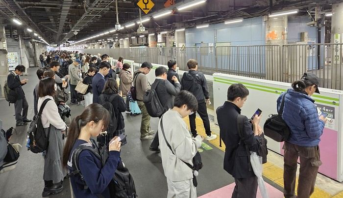
We got off the Yamanote Line at the station just after Shinjuku because it’s easier to exit that massive station with our luggage. So we ended up in Shin-Okubo, right in the Korean district. A 10-minute walk took us to Villa Fontaine Hotel. A great hotel, well-located north of the Kabukichō district. The room even seemed bigger than we’d expected.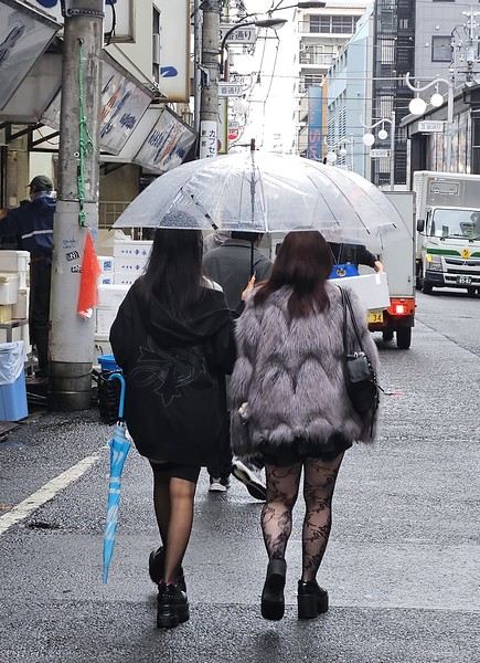
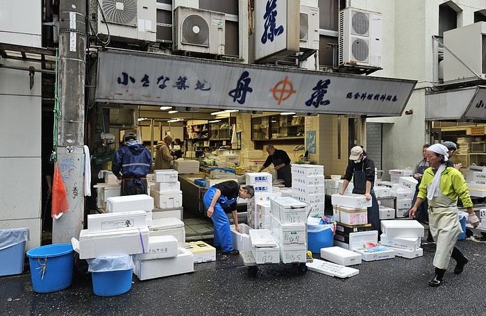 It was 15°C, but it rained—and kept raining on and off all day. Belgian weather, basically.
We went for a walk in Shinjuku Gyoen Park. Not as pretty in the rain, but the big greenhouse was interesting.
It was 15°C, but it rained—and kept raining on and off all day. Belgian weather, basically.
We went for a walk in Shinjuku Gyoen Park. Not as pretty in the rain, but the big greenhouse was interesting.
Then our first ramen (hearty and for 1000 ¥—pretty much the price of all our ramen during the trip). We headed back to the hotel since check-in was after 3 PM. Shower and relax before going out for dinner. Dinner was barbecue at Shichirin Yakiniku Anan (1700 ¥ each—good and cheap). Ordering via tablet wasn’t easy, but luckily it was in English.
We ended the evening with a stroll through Kabukichō before a well-deserved sleep.
Day 1: Departure from Brussels (October 24, 2025) Early morning takeoff at 6 AM to Munich (1.5-hour layover) with Lufthansa, then a 12-hour flight with ANA, arriving the next morning at 7 AM at Tokyo Haneda.
Day 2: Arrival in Tokyo Airport formalities were quick. The eSIM we bought before leaving activated as soon as we landed (10 GB plan with Saily—more than enough for our mobile internet needs, mainly Google Maps and Google Translate). We’d received 4 ICOCA cards from our neighbors, which we loaded with 15000 ¥ each. We took the Keihin train, then the Yamanote Line. It’s easy to navigate since everything is in English, and each station is announced on scrolling displays in English too.
We got off the Yamanote Line at the station just after Shinjuku because it’s easier to exit that massive station with our luggage. So we ended up in Shin-Okubo, right in the Korean district. A 10-minute walk took us to Villa Fontaine Hotel. A great hotel, well-located north of the Kabukichō district. The room even seemed bigger than we’d expected.
It was 15°C, but it rained—and kept raining on and off all day. Belgian weather, basically.
We went for a walk in Shinjuku Gyoen Park. Not as pretty in the rain, but the big greenhouse was interesting.
Then our first ramen (hearty and for 1000 ¥—pretty much the price of all our ramen during the trip). We headed back to the hotel since check-in was after 3 PM. Shower and relax before going out for dinner. Dinner was barbecue at Shichirin Yakiniku Anan (1700 ¥ each—good and cheap). Ordering via tablet wasn’t easy, but luckily it was in English.
We ended the evening with a stroll through Kabukichō before a well-deserved sleep.
Looking for a beach spot near Bangkok
Hi there,
I’m looking for a beach spot within 3 hours max of Bangkok for the end of my trip (January). I know full well I won’t find that postcard-perfect vibe of the more remote islands! But I don’t have a choice. If you’ve got any ideas... no high-rises, obviously not Pattaya, somewhere quiet, swimming possible, a hotel right on the beach (and not too dirty, the beach itself!) I’ve looked at hotels around Ko Samet or, across from it, on the mainland. I spotted the Bann Pae Cabana. But nothing really exciting on either side. New ideas welcome! 🙂
I’m looking for a beach spot within 3 hours max of Bangkok for the end of my trip (January). I know full well I won’t find that postcard-perfect vibe of the more remote islands! But I don’t have a choice. If you’ve got any ideas... no high-rises, obviously not Pattaya, somewhere quiet, swimming possible, a hotel right on the beach (and not too dirty, the beach itself!) I’ve looked at hotels around Ko Samet or, across from it, on the mainland. I spotted the Bann Pae Cabana. But nothing really exciting on either side. New ideas welcome! 🙂
Review of an Aegean Sea cruise on Ponant's Bougainville from November 1-8, 2025
Hello everyone,
If you'd like, I invite you to join me for a week-long cruise to northern Greece, visiting ports that are often less crowded with cruise ships.
Itinerary: Athens, Skiathos, Volos, Thessaloniki, Kavala, Limnos, Hydra, Athens
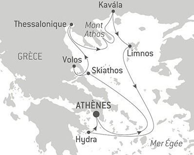
If you'd like, I invite you to join me for a week-long cruise to northern Greece, visiting ports that are often less crowded with cruise ships.
Itinerary: Athens, Skiathos, Volos, Thessaloniki, Kavala, Limnos, Hydra, Athens
Hiking, camping, and snorkeling on Madagascar's east coast
Hello,
I’m continuing the Antalaha–Maroantsetra discussion but for some info in the other direction, specifically about hiking from Maroantsetra to Antalaha.
In mid-December, I plan to take it easy from Tamatave to Antalaha. I’m thinking of making a few stops, like Nosy Atafana—has anyone snorkeled there? Is it nice? Can you find bush taxis on the Soniera–Ivongo / Maroantsetra stretch?
After that, I’m considering walking from Maroantsetra to Antalaha and figuring things out as I go, since the path seems well-used, so I’m not planning on a guide. Good idea or totally foolish? Should I bring a tent and some camping gear, or, as I’ve read multiple times, are there several villages with lodging and food options along the way? Any spots worth stopping at or nothing special to see?
In Antalaha, I saw the recommendation for Villa Malaza in the previous discussion, so I’m keeping that in mind. If there’s space, I’ll plan to stay there. In Antalaha itself, are there any places to visit, things to see, or activities you’d recommend?
Thanks in advance to everyone for any tips—they’ll be really helpful!
In mid-December, I plan to take it easy from Tamatave to Antalaha. I’m thinking of making a few stops, like Nosy Atafana—has anyone snorkeled there? Is it nice? Can you find bush taxis on the Soniera–Ivongo / Maroantsetra stretch?
After that, I’m considering walking from Maroantsetra to Antalaha and figuring things out as I go, since the path seems well-used, so I’m not planning on a guide. Good idea or totally foolish? Should I bring a tent and some camping gear, or, as I’ve read multiple times, are there several villages with lodging and food options along the way? Any spots worth stopping at or nothing special to see?
In Antalaha, I saw the recommendation for Villa Malaza in the previous discussion, so I’m keeping that in mind. If there’s space, I’ll plan to stay there. In Antalaha itself, are there any places to visit, things to see, or activities you’d recommend?
Thanks in advance to everyone for any tips—they’ll be really helpful!
Mauritian Ti' Punch
The recipe for the cocktail: endless beaches, a dazzling palette of colors, some breathtaking hikes, and excellent cuisine...
For the tasting, follow along in the pages of this travel journal! 😉
Don’t forget your hiking shoes, a swimsuit, sunscreen, but also a sweater, your driver’s license, and your credit card...
Just over 11 hours of flight, and we’ll be setting foot on Mauritian soil!
For the tasting, follow along in the pages of this travel journal! 😉
Don’t forget your hiking shoes, a swimsuit, sunscreen, but also a sweater, your driver’s license, and your credit card...
Just over 11 hours of flight, and we’ll be setting foot on Mauritian soil!
Off on an adventure to Java (and a bit of Bali)
Hey there, community! Back this weekend, below is my travel journal from my adventure in Indonesia. Enjoy the read!!!
Day 1 - August 10, 2025 New life downloading for three weeks! And for that, Flo and I launched a public tender... A public tender? What’s that got to do with a travel journal???... Well, when you think about it, few destinations tick all the boxes for an August adventure: Meaning, finding a place that’s exotic in the middle of August, not too expensive, not too packed with tourists, warm but not *too* warm, with postcard-perfect landscapes, dreamy beaches, tasty cuisine with a hint of exoticism, friendly and welcoming locals, where you’re free to sleep under the stars among the mosquitos, take transport surrounded by chickens, and even eat from a pig trough if you feel like it—well, turns out it’s not that easy to find! I’d even say, given how thick the list of requirements is, there’s a big risk the tender could be declared unsuccessful for failing to meet just one criterion. Let’s just say the candidates better submit a rock-solid proposal!
After reviewing all the responses and presentations from the candidates, the obvious choice for us is... Indonesia! Except that trying to explore a country as vast as Indonesia and its 17,504 islands in less than five years is a bit like reading the summary of a Proust novel without taking the time to savor each of its 950 pages! Don’t worry, I won’t name them all here. Besides, do they even all have names? No! Only 7,870 have been named—their parents clearly ran out of ideas for the rest. Anyway, our society, which worships the "work more to earn more" mantra, unfortunately limits our adventure time. So we’ll only get to see a small part of Indonesia, and we’ll have to make a tough choice to head for the best of the best in this archipelago of over seventeen thousand islands. Each one has its own selling points: Sumatra, Sulawesi, Java, the Celebes, Bali, Borneo, Papua, Timor, the Moluccas... So many names that smell of adventure... Another tender, another list of requirements, another review of proposals... Drumroll... Splash splash... And the lucky winner is... Ta-da... Java, Bali’s big sister, where I’ve already been eight years ago... Java the programming language. The Java of Broadway. We’re gonna *do* the Java. Java the coffee. And yes, Java is also an island!
This island, four times smaller than France, is home to 136 million people, making it the most populated island in the world! Fun fact: Indonesia, with its 260 million inhabitants, is just shy of the podium for the world’s most populated countries, after the winning trio of India, China, and the United States. And it’s on this island of Java that you’ll find Jakarta, the (soon-to-be-former) capital and main airport of the country, where we’ll soon land after our nineteen-hour flight! Yep, nineteen hours! I mean, Indonesia in general—and Java in particular—is a *tad* farther than going on vacation to Grandma Yoyo’s! Not sure where it is? Easy. Grab a map. Plant your finger on the big island at the bottom right—aka Australia for those who struggle with geography—move it up two centimeters, and bam, welcome to Indonesia!
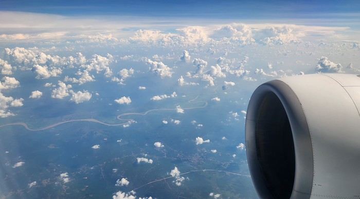
Nice transition, right? Because "Welcome to Indonesia" is exactly what the friendly flight attendant just said to me as we got off the plane! That’s it, our chakras are open, we’ve arrived at our (air)port. Time for rest, pool, cocktails, and a beach with our toes spread out... Wait, if you bought that, you clearly don’t know us yet! Since we still have energy to burn and need to adjust to the flight and time difference, we tackle the long administrative formalities to enter Indonesia, just to earn the right to hop in a 45-minute Grab taxi to the train station. The train station? What train station?... What do you usually do at a train station? Take a train, of course! Off we go for a three-hour train ride to Bandung, where we’ll officially start our adventure tomorrow after our first Indonesian night...
Unfortunately, we were a bit slow off the mark, which meant we missed the 6:25 PM train by two minutes. Oh well, we’ll have to wait until 11 PM. We take the opportunity to stretch our legs in Jakarta, soak up the atmosphere, and enjoy the delicious smells wafting from the *warungs*—those little typical street restaurants. A quick stop at the National Monument, a detour to a night market to devour our first *kwetiaw goreng* and *teh manis* for 60,000 rupiahs (that’s 3 € for two), and just like that, our penalty is lifted, and we’re allowed to hit the road again. Off to Bandung, where we arrive at 2 AM for... a *very* short night...
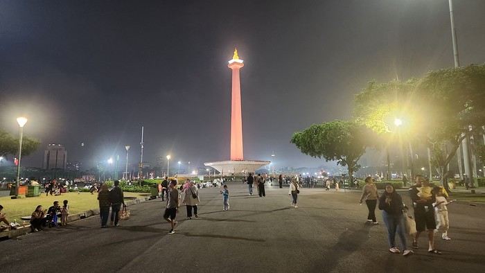
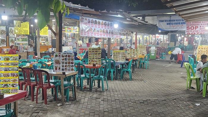
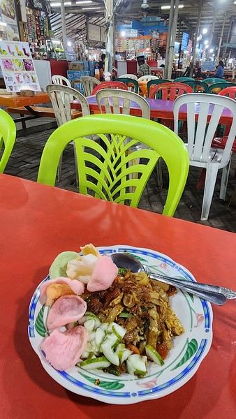
Day 1 - August 10, 2025 New life downloading for three weeks! And for that, Flo and I launched a public tender... A public tender? What’s that got to do with a travel journal???... Well, when you think about it, few destinations tick all the boxes for an August adventure: Meaning, finding a place that’s exotic in the middle of August, not too expensive, not too packed with tourists, warm but not *too* warm, with postcard-perfect landscapes, dreamy beaches, tasty cuisine with a hint of exoticism, friendly and welcoming locals, where you’re free to sleep under the stars among the mosquitos, take transport surrounded by chickens, and even eat from a pig trough if you feel like it—well, turns out it’s not that easy to find! I’d even say, given how thick the list of requirements is, there’s a big risk the tender could be declared unsuccessful for failing to meet just one criterion. Let’s just say the candidates better submit a rock-solid proposal!
After reviewing all the responses and presentations from the candidates, the obvious choice for us is... Indonesia! Except that trying to explore a country as vast as Indonesia and its 17,504 islands in less than five years is a bit like reading the summary of a Proust novel without taking the time to savor each of its 950 pages! Don’t worry, I won’t name them all here. Besides, do they even all have names? No! Only 7,870 have been named—their parents clearly ran out of ideas for the rest. Anyway, our society, which worships the "work more to earn more" mantra, unfortunately limits our adventure time. So we’ll only get to see a small part of Indonesia, and we’ll have to make a tough choice to head for the best of the best in this archipelago of over seventeen thousand islands. Each one has its own selling points: Sumatra, Sulawesi, Java, the Celebes, Bali, Borneo, Papua, Timor, the Moluccas... So many names that smell of adventure... Another tender, another list of requirements, another review of proposals... Drumroll... Splash splash... And the lucky winner is... Ta-da... Java, Bali’s big sister, where I’ve already been eight years ago... Java the programming language. The Java of Broadway. We’re gonna *do* the Java. Java the coffee. And yes, Java is also an island!
This island, four times smaller than France, is home to 136 million people, making it the most populated island in the world! Fun fact: Indonesia, with its 260 million inhabitants, is just shy of the podium for the world’s most populated countries, after the winning trio of India, China, and the United States. And it’s on this island of Java that you’ll find Jakarta, the (soon-to-be-former) capital and main airport of the country, where we’ll soon land after our nineteen-hour flight! Yep, nineteen hours! I mean, Indonesia in general—and Java in particular—is a *tad* farther than going on vacation to Grandma Yoyo’s! Not sure where it is? Easy. Grab a map. Plant your finger on the big island at the bottom right—aka Australia for those who struggle with geography—move it up two centimeters, and bam, welcome to Indonesia!
Nice transition, right? Because "Welcome to Indonesia" is exactly what the friendly flight attendant just said to me as we got off the plane! That’s it, our chakras are open, we’ve arrived at our (air)port. Time for rest, pool, cocktails, and a beach with our toes spread out... Wait, if you bought that, you clearly don’t know us yet! Since we still have energy to burn and need to adjust to the flight and time difference, we tackle the long administrative formalities to enter Indonesia, just to earn the right to hop in a 45-minute Grab taxi to the train station. The train station? What train station?... What do you usually do at a train station? Take a train, of course! Off we go for a three-hour train ride to Bandung, where we’ll officially start our adventure tomorrow after our first Indonesian night...
Unfortunately, we were a bit slow off the mark, which meant we missed the 6:25 PM train by two minutes. Oh well, we’ll have to wait until 11 PM. We take the opportunity to stretch our legs in Jakarta, soak up the atmosphere, and enjoy the delicious smells wafting from the *warungs*—those little typical street restaurants. A quick stop at the National Monument, a detour to a night market to devour our first *kwetiaw goreng* and *teh manis* for 60,000 rupiahs (that’s 3 € for two), and just like that, our penalty is lifted, and we’re allowed to hit the road again. Off to Bandung, where we arrive at 2 AM for... a *very* short night...
From Southern Shikoku, between land and sea, to the blue waters of Miyakojima and finally the Tokyo metropolis
From Southern Shikoku, between land and sea, to the blue waters of Miyakojima and finally Tokyo’s megacity
Hi everyone,
I have to admit, I really hesitated before deciding to write this travel journal... Writing one takes a lot of time and energy, and since this is my 4th trip, I wondered if it would actually interest anyone other than myself (both for the discovery and the writing). But after a few "Are you going to write a journal?" requests and especially the renewed pleasure from reading other travelers’ travel journals about Japan or elsewhere on this forum or elsewhere, I’ve decided to share this 4th installment in the Land of the Rising Sun here.
The itinerary: 27 full days, from late May to late June 2025, right in the middle of the rainy season, including:
-->13 days in Shikoku, from Kochi (Kochi Prefecture) to Matsuyama (Ehime Prefecture)

-->7 days in Miyakojima (Okinawa Prefecture)

-->7 days in Tokyo

The trip was decided on fairly last-minute this year, as usual.
I regularly check flight prices to track fluctuations for this destination, even without concrete plans. Finding a slightly cheaper direct flight (900 €) than what I’d seen in previous months (around 1,200–1,400 € on average) for a Paris-Tokyo route with Japanese airline ANA was too tempting to resist the urge to return to this enchanting country. After long hesitations between exploring the San’in region (Matsue, Tottori, Yamaguchi) and southern Shikoku, the decision was made—I took the plunge! The tickets are booked: Paris to Kochi with a layover in Tokyo, all with ANA, the airline I’d been dreaming of... for 1,120 € per person. Okay, it’s not cheap, but it’s still better than in 2023.
We leave in 2 weeks!! Now it’s just a matter of getting everything ready!
Intense work ahead in these 2 weeks to:
finalize a more precise itinerary and reach an agreement—yep, because even though we both love Japan, our preferences differ slightly, and we have to choose between exploring new places or taking time to revisit beloved spots... decide how much time to spend in each selected area without rushing while still exploring research places that might interest us and watch videos about Japan book accommodations: yes, it’s possible to do this on the spot as we go, but last year, we noticed that last-minute options were pretty expensive, so we’re booking ahead—even if it means keeping a few options open while we decide or see if better deals pop up later reserve rental cars order yen check the weather regularly and wonder if choosing the *tsuyu* (rainy season) was really a good idea—and whether we’ll be stuck in non-stop rain???
What a tough job, right? Traveling to Japan for a month—such a hard life! Despite this being my 4th trip, the excitement is just as intense as the first time.
The only small downside is that when we booked the flight tickets, there were only a few seats left, so we’re only sitting together on the international return flight. Plus, on the outbound flight, we’ve got the middle seats. Another lingering question: what French-language films will be available? According to the internet, the selection seems limited. Oh well, these are just minor details—it’s almost time to fly!
PS: I’ll be posting slowly and irregularly... so for those interested, be patient or maybe set an alert...
Hi everyone,
I have to admit, I really hesitated before deciding to write this travel journal... Writing one takes a lot of time and energy, and since this is my 4th trip, I wondered if it would actually interest anyone other than myself (both for the discovery and the writing). But after a few "Are you going to write a journal?" requests and especially the renewed pleasure from reading other travelers’ travel journals about Japan or elsewhere on this forum or elsewhere, I’ve decided to share this 4th installment in the Land of the Rising Sun here.
The itinerary: 27 full days, from late May to late June 2025, right in the middle of the rainy season, including:
-->13 days in Shikoku, from Kochi (Kochi Prefecture) to Matsuyama (Ehime Prefecture)
-->7 days in Miyakojima (Okinawa Prefecture)
-->7 days in Tokyo
The trip was decided on fairly last-minute this year, as usual.
I regularly check flight prices to track fluctuations for this destination, even without concrete plans. Finding a slightly cheaper direct flight (900 €) than what I’d seen in previous months (around 1,200–1,400 € on average) for a Paris-Tokyo route with Japanese airline ANA was too tempting to resist the urge to return to this enchanting country. After long hesitations between exploring the San’in region (Matsue, Tottori, Yamaguchi) and southern Shikoku, the decision was made—I took the plunge! The tickets are booked: Paris to Kochi with a layover in Tokyo, all with ANA, the airline I’d been dreaming of... for 1,120 € per person. Okay, it’s not cheap, but it’s still better than in 2023.
We leave in 2 weeks!! Now it’s just a matter of getting everything ready!
Intense work ahead in these 2 weeks to:
finalize a more precise itinerary and reach an agreement—yep, because even though we both love Japan, our preferences differ slightly, and we have to choose between exploring new places or taking time to revisit beloved spots... decide how much time to spend in each selected area without rushing while still exploring research places that might interest us and watch videos about Japan book accommodations: yes, it’s possible to do this on the spot as we go, but last year, we noticed that last-minute options were pretty expensive, so we’re booking ahead—even if it means keeping a few options open while we decide or see if better deals pop up later reserve rental cars order yen check the weather regularly and wonder if choosing the *tsuyu* (rainy season) was really a good idea—and whether we’ll be stuck in non-stop rain???
What a tough job, right? Traveling to Japan for a month—such a hard life! Despite this being my 4th trip, the excitement is just as intense as the first time.
The only small downside is that when we booked the flight tickets, there were only a few seats left, so we’re only sitting together on the international return flight. Plus, on the outbound flight, we’ve got the middle seats. Another lingering question: what French-language films will be available? According to the internet, the selection seems limited. Oh well, these are just minor details—it’s almost time to fly!
PS: I’ll be posting slowly and irregularly... so for those interested, be patient or maybe set an alert...
Trip report: Our South Africa journey in July
Hi there,
We’re back from our 3-week trip to South Africa in July. It was a family trip with our four grown-up kids (ages 18 to 25).
First off, I’d like to thank everyone on this forum for their great tips—they really helped us plan this trip!
The trip: We spent 15 days between Port Elizabeth and Cape Town, then a week around Kruger (including Blyde River Canyon). We found South Africans to be welcoming and always ready to help. We never felt unsafe (just followed basic safety rules). The police are very visible, especially on the roads.
Logistics: We’d booked our accommodations in advance but made a few changes on the spot based on how we felt at the time. We rented two vehicles from Firefly (Hertz). No complaints—recent cars, quick returns, and the deposit wasn’t charged. We’d gotten our international driver’s permits... which stayed in France! Luckily, no one asked for them. Driving on the left wasn’t an issue (it wasn’t our first time). The roads we took were in good, even great, condition. Only a few tracks to lodges or parks were rough and required extra caution. Lots of pedestrians on the sides of roads, even highways. And plenty of very slow trucks. But they pull over to let you pass. It’s also common for cars to cross into the opposite lane to overtake, even with white lines. We took two domestic flights: one early in the morning (Johannesburg to Port Elizabeth) and one in the late afternoon (Cape Town to Johannesburg) to save time.
We had some highlights and a few disappointments—all part of the journey! More details coming soon.
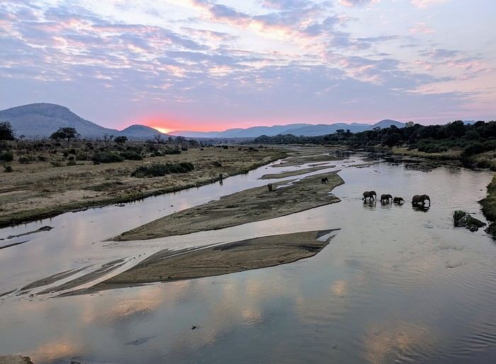
We’re back from our 3-week trip to South Africa in July. It was a family trip with our four grown-up kids (ages 18 to 25).
First off, I’d like to thank everyone on this forum for their great tips—they really helped us plan this trip!
The trip: We spent 15 days between Port Elizabeth and Cape Town, then a week around Kruger (including Blyde River Canyon). We found South Africans to be welcoming and always ready to help. We never felt unsafe (just followed basic safety rules). The police are very visible, especially on the roads.
Logistics: We’d booked our accommodations in advance but made a few changes on the spot based on how we felt at the time. We rented two vehicles from Firefly (Hertz). No complaints—recent cars, quick returns, and the deposit wasn’t charged. We’d gotten our international driver’s permits... which stayed in France! Luckily, no one asked for them. Driving on the left wasn’t an issue (it wasn’t our first time). The roads we took were in good, even great, condition. Only a few tracks to lodges or parks were rough and required extra caution. Lots of pedestrians on the sides of roads, even highways. And plenty of very slow trucks. But they pull over to let you pass. It’s also common for cars to cross into the opposite lane to overtake, even with white lines. We took two domestic flights: one early in the morning (Johannesburg to Port Elizabeth) and one in the late afternoon (Cape Town to Johannesburg) to save time.
We had some highlights and a few disappointments—all part of the journey! More details coming soon.