Results for "Londe-les-Maures+|+127"
12617 results found.
Bangkok: bus between SAM station and Khao San Road
Between Siam and Khao San Road (Democracy Monument): which buses are available?
Thanks in advance!
Preparing for Quebec: 1 month with the family
Hello everyone,
We’ve decided to head to Quebec next year—it’s been a dream for the whole family (after watching so many travel shows and the like...). There’ll be five of us: 2 adults, 2 teens (16 and 13), and a child (8 years old). We’re all pretty good walkers, though maybe the teens a little less so—it’s just that age, you know? 😊 That said, they’ve got no problem doing 15 km hikes, just not every single day.
We’re planning to go from July 23 to August 14, arriving and departing from Montreal, so almost 3 weeks. I’ve started looking into logistics and accommodation prices, but before I dive into bookings, I’d love some advice on the itinerary. I’ve read a few threads here and there. Our idea is to visit between 3 and 5 different places over the 3 weeks, so that means the same number of accommodations. The goal is to optimize travel as much as possible—I’ve realized that getting around can take a long time. I think the first two days will be in Montreal to adjust to the time difference, and the last two in Quebec City, though that’s not set in stone.
Anyway, I’m not really sure about the route. I’ve got time to plan everything, but I know the longer we wait, the more expensive and scarce accommodations will get. Same goes for budget—we’ve set aside a mid-range budget, flights included: 3k per person (1k for the flight). So if you’ve got any great tips or advice, we’re all ears!
I was thinking of going up the St. Lawrence River, but I’m not sure how long that takes or where to stop. Maybe there are other places worth visiting farther away...
Anyway, thanks for reading this far! If you’ve got any questions, don’t hesitate.
Thanks, everyone.
We’re planning to go from July 23 to August 14, arriving and departing from Montreal, so almost 3 weeks. I’ve started looking into logistics and accommodation prices, but before I dive into bookings, I’d love some advice on the itinerary. I’ve read a few threads here and there. Our idea is to visit between 3 and 5 different places over the 3 weeks, so that means the same number of accommodations. The goal is to optimize travel as much as possible—I’ve realized that getting around can take a long time. I think the first two days will be in Montreal to adjust to the time difference, and the last two in Quebec City, though that’s not set in stone.
Anyway, I’m not really sure about the route. I’ve got time to plan everything, but I know the longer we wait, the more expensive and scarce accommodations will get. Same goes for budget—we’ve set aside a mid-range budget, flights included: 3k per person (1k for the flight). So if you’ve got any great tips or advice, we’re all ears!
I was thinking of going up the St. Lawrence River, but I’m not sure how long that takes or where to stop. Maybe there are other places worth visiting farther away...
Anyway, thanks for reading this far! If you’ve got any questions, don’t hesitate.
Thanks, everyone.
USA Road Trip 2023 - Part 1
In January 2023, we started our second road trip across the United States. We stayed from January to mid-March, which gave us plenty of time to visit several cities, attractions, and parks in multiple states.
This travel journal will be split into two parts due to the considerable number of places we visited.
This first journal covers the following states: Ohio, Indiana, Missouri, Oklahoma, Texas, New Mexico, Arizona, Nevada, and California, and takes you through the outbound leg of our road trip.
The second journal will showcase the attractions we visited on the return trip, which mainly follows the famous Highway 1 along the Pacific coast.
So, I invite you to keep reading this first journal, which serves as a long recap to help you discover the various attractions we explored throughout this road trip.
Videos are included throughout the recap. Please click on the image to start the video.
Here are the links to jump to a specific post:
OHIO:
WinterLand - Christmas Lights at Cleveland Public Square Lake View Cemetery - Cleveland - Part 1 Lake View Cemetery - Cleveland - Part 2 Stroll through Columbus Upper Falls to Lower Falls via Buckeye Trail - Hocking Hills State Park – Logan Cedar Falls & Whispering Falls Hiking Trail - Hocking Hills State Park – Logan Ash Cave Hiking Trail - Hocking Hills State Park – Logan Exploring Cincinnati
INDIANA:
Visiting Indianapolis
MISSOURI:
Exploring St. Louis
OKLAHOMA:
Catoosa Blue Whale Discovering Tulsa Exploring Oklahoma City
TEXAS:
Exploring Shamrock Discovering McLean Exploring Amarillo
NEW MEXICO:
Ancestral Sites Trail - Pecos National Historical Park Discovering Santa Fe The Santuario de Chimayó Stroll through Los Cerrillos Walk through the village of Madrid San Francisco de Asis Catholic Church & The Bottle House - Golden Albuquerque Murals 66 Diner - Albuquerque Stroll through Old Town (Albuquerque) Rinconada Canyon Trail - Petroglyph National Monument Mesa Point Trail - Boca Negra Canyon - Petroglyph National Monument Macaw Trail - Boca Negra Canyon - Petroglyph National Monument Cliff Base Trail - Boca Negra Canyon - Petroglyph National Monument Piedras Marcadas Canyon - Petroglyph National Monument Sandstone Bluffs & Ventana Natural Arch - El Malpais National Monument
ARIZONA:
Stewart's Petrified Wood Shop – Holbrook Stroll through Holbrook Discovering Joseph City Exploring Winslow Grand Falls (The "Chocolate Falls") – Leupp Island Trail - Walnut Canyon National Monument Rim Trail - Walnut Canyon National Monument Wukoki Pueblo Trail – Wupatki National Monument Wupatki Pueblo Trail – Wupatki National Monument Doney Mountain Trail – Wupatki National Monument Citadel & Nalakihu Pueblos Trail – Wupatki National Monument Lomaki & Box Canyon Pueblos Trail – Wupatki National Monument Discovering Flagstaff On the way to Sedona Slide Rock State Park – Sedona Midgley Bridge Trail – Wilson Canyon – Sedona Tlaquepaque Arts & Shopping Village Walking Tour - Sedona Chapel of the Holy Cross - Sedona Hiking at Cathedral Rock - Sedona Hiking the Bell Rock Trail - Sedona Hiking the Airport Loop Trail - Sedona Amitabha Stupa and Peace Park - Sedona Hiking the Boynton Canyon Vortex Trail - Sedona Hiking the Devil's Bridge Trail - Sedona Hiking the Birthing Cave Trail - Sedona Bell Rock Inn - Sedona On the roads of Sedona - Part 1 On the roads of Sedona - Part 2 Keyhole Sink Hiking Trail - Kaibab National Forest Discovering Williams Exploring Ash Fork Discovering Kingman Ramada by Wyndham Kingman Davis Camp Park - Bullhead City Discovering Yucca Lake Havasu Boardwalk Tour A duck catches a lobster – Lake Havasu Boardwalk
CALIFORNIA:
Exploring Needles Discovering Goffs Discovering Amboy Visiting the famous Bagdad Cafe - Newberry Springs Exploring Barstow Vehicles from Hell (Mad Max Cars) - Barstow Peggy Sue's 50's Diner - Yermo Liberty Sculpture Park - Yermo Lake Dolores Water Park - Newberry Springs ZZYZX Road - Mojave National Preserve Alien Fresh Jerky - Baker Kelso Dunes Trail - Mojave National Preserve Hole-in-the-Wall Rings Trail - Mojave National Preserve Visiting Mitchell Caverns - Mojave National Preserve Dante's View - Death Valley National Park Zabriskie Point - Death Valley National Park Golden Canyon - Death Valley National Park Artists Drive & Artists Palette - Death Valley National Park Devil's Golf Course - Death Valley National Park Natural Bridge Trail - Death Valley National Park Badwater Basin - Death Valley National Park Harmony Borax Works - Death Valley National Park Devil's Cornfield - Death Valley National Park Mesquite Flat Sand Dunes - Death Valley National Park Mosaic Canyon Trail - Death Valley National Park On the road - Death Valley National Park
NEVADA:
Cleveland Clinic Lou Ruvo Center for Brain Health - Las Vegas Exploring Downtown Las Vegas SlotZilla Zipline - Fremont Street Experience – Downtown Las Vegas Viva Vision Light Show 1 - Fremont Street Experience - Downtown Las Vegas Viva Vision Light Show 2 - Fremont Street Experience - Downtown Las Vegas Viva Vision Light Show 3 - Fremont Street Experience - Downtown Las Vegas Viva Vision Light Show 4 - Fremont Street Experience - Downtown Las Vegas Free Live Music – Fremont Street Experience - Downtown Las Vegas Chucky – Fremont Street Experience - Downtown Las Vegas Las Vegas Strip - Part 1 Las Vegas Strip - Part 2 Las Vegas Strip - Part 3 Las Vegas Strip - Part 4 Las Vegas Strip - Part 5 Tom Devlin's Monster Museum - Boulder City Hoover Dam Lake Mead - Lakeview Overlook - Boulder City Nelson Ghost Town - Searchlight
CALIFORNIA:
Scenic Route through Joshua Tree National Park via the North Entrance Hidden Valley Trail - Joshua Tree National Park Barker Dam Trail - Joshua Tree National Park Cap Rock Trail - Joshua Tree National Park Keys View Trail - Joshua Tree National Park Hall of Horrors Trail - Joshua Tree National Park Skull Rock Trail - Joshua Tree National Park Arch Rock Trail - Joshua Tree National Park Cholla Cactus Garden Trail - Joshua Tree National Park Lone Pine - Owens Valley Miss Alabama & Shark Fin - Alabama Hills - Owens Valley Lone Ranger Canyon - Alabama Hills - Owens Valley Mobius Arch Loop Trail (Heart Arch & Lathe Arch) - Alabama Hills - Owens Valley Eye of the Alabama Hills Arch - Alabama Hills - Owens Valley Boot & Cyclops Arches - Alabama Hills - Owens Valley One Mile Arch, Bowling Ball and Pins & Gunga Din Area - Alabama Hills - Owens Valley Whitney Portal Arch Trailhead - Alabama Hills - Owens Valley Fish Rocks & Trona Pinnacles - Mojave Desert Red Cliffs Trail - Red Rock Canyon State Park Hagen Canyon Nature Trail - Red Rock Canyon State Park Tour of Historic Downtown Tehachapi View of the Tehachapi Loop – Monolith César E. Chávez National Monument – Keene Discovering Bakersfield Kern County Museum – Bakersfield Bravo Farms, Tree House & Petting Zoo - Traver Walking Tour of Kingsburg Exploring Fresno Simonian Farms & Soul Consoling Japanese Internment Tower - Fresno Duncan Ceramic Products (iLoveToCreate) - Fresno Walking Tour of Modesto Wat Dhammararam Buddhist Temple - Stockton Walking Tour of Stockton Discovering Stockton University of the Pacific - Stockton Visiting Lodi Sutter's Fort State Historic Park - Sacramento California State Capitol - Sacramento Walking Tour - Sacramento Walking Tour - Winters Walking Tour - Napa The Chandelier Tree In Drive-Thru Tree Park - Leggett One Log House - Garberville Grandfather Tree - Piercy The Living Chimney Tree - Avenue of the Giants Stephens Grove Loop Trail - Avenue of the Giants Gould Grove Nature Loop Trail - Avenue of the Giants Fleishmann Grove Trail - Avenue of the Giants Mahan Plaque Trail - Avenue of the Giants Founders Grove Nature Loop Trail - Avenue of the Giants Eternal Tree House & Immortal Tree - Avenue of the Giants Drury-Chaney Loop Trail - Avenue of the Giants Walking Tour - Redcrest
COMING UP NEXT:
USA Road Trip 2023 - Part 2
This travel journal will be split into two parts due to the considerable number of places we visited.
This first journal covers the following states: Ohio, Indiana, Missouri, Oklahoma, Texas, New Mexico, Arizona, Nevada, and California, and takes you through the outbound leg of our road trip.
The second journal will showcase the attractions we visited on the return trip, which mainly follows the famous Highway 1 along the Pacific coast.
So, I invite you to keep reading this first journal, which serves as a long recap to help you discover the various attractions we explored throughout this road trip.
Videos are included throughout the recap. Please click on the image to start the video.
Here are the links to jump to a specific post:
OHIO:
WinterLand - Christmas Lights at Cleveland Public Square Lake View Cemetery - Cleveland - Part 1 Lake View Cemetery - Cleveland - Part 2 Stroll through Columbus Upper Falls to Lower Falls via Buckeye Trail - Hocking Hills State Park – Logan Cedar Falls & Whispering Falls Hiking Trail - Hocking Hills State Park – Logan Ash Cave Hiking Trail - Hocking Hills State Park – Logan Exploring Cincinnati
INDIANA:
Visiting Indianapolis
MISSOURI:
Exploring St. Louis
OKLAHOMA:
Catoosa Blue Whale Discovering Tulsa Exploring Oklahoma City
TEXAS:
Exploring Shamrock Discovering McLean Exploring Amarillo
NEW MEXICO:
Ancestral Sites Trail - Pecos National Historical Park Discovering Santa Fe The Santuario de Chimayó Stroll through Los Cerrillos Walk through the village of Madrid San Francisco de Asis Catholic Church & The Bottle House - Golden Albuquerque Murals 66 Diner - Albuquerque Stroll through Old Town (Albuquerque) Rinconada Canyon Trail - Petroglyph National Monument Mesa Point Trail - Boca Negra Canyon - Petroglyph National Monument Macaw Trail - Boca Negra Canyon - Petroglyph National Monument Cliff Base Trail - Boca Negra Canyon - Petroglyph National Monument Piedras Marcadas Canyon - Petroglyph National Monument Sandstone Bluffs & Ventana Natural Arch - El Malpais National Monument
ARIZONA:
Stewart's Petrified Wood Shop – Holbrook Stroll through Holbrook Discovering Joseph City Exploring Winslow Grand Falls (The "Chocolate Falls") – Leupp Island Trail - Walnut Canyon National Monument Rim Trail - Walnut Canyon National Monument Wukoki Pueblo Trail – Wupatki National Monument Wupatki Pueblo Trail – Wupatki National Monument Doney Mountain Trail – Wupatki National Monument Citadel & Nalakihu Pueblos Trail – Wupatki National Monument Lomaki & Box Canyon Pueblos Trail – Wupatki National Monument Discovering Flagstaff On the way to Sedona Slide Rock State Park – Sedona Midgley Bridge Trail – Wilson Canyon – Sedona Tlaquepaque Arts & Shopping Village Walking Tour - Sedona Chapel of the Holy Cross - Sedona Hiking at Cathedral Rock - Sedona Hiking the Bell Rock Trail - Sedona Hiking the Airport Loop Trail - Sedona Amitabha Stupa and Peace Park - Sedona Hiking the Boynton Canyon Vortex Trail - Sedona Hiking the Devil's Bridge Trail - Sedona Hiking the Birthing Cave Trail - Sedona Bell Rock Inn - Sedona On the roads of Sedona - Part 1 On the roads of Sedona - Part 2 Keyhole Sink Hiking Trail - Kaibab National Forest Discovering Williams Exploring Ash Fork Discovering Kingman Ramada by Wyndham Kingman Davis Camp Park - Bullhead City Discovering Yucca Lake Havasu Boardwalk Tour A duck catches a lobster – Lake Havasu Boardwalk
CALIFORNIA:
Exploring Needles Discovering Goffs Discovering Amboy Visiting the famous Bagdad Cafe - Newberry Springs Exploring Barstow Vehicles from Hell (Mad Max Cars) - Barstow Peggy Sue's 50's Diner - Yermo Liberty Sculpture Park - Yermo Lake Dolores Water Park - Newberry Springs ZZYZX Road - Mojave National Preserve Alien Fresh Jerky - Baker Kelso Dunes Trail - Mojave National Preserve Hole-in-the-Wall Rings Trail - Mojave National Preserve Visiting Mitchell Caverns - Mojave National Preserve Dante's View - Death Valley National Park Zabriskie Point - Death Valley National Park Golden Canyon - Death Valley National Park Artists Drive & Artists Palette - Death Valley National Park Devil's Golf Course - Death Valley National Park Natural Bridge Trail - Death Valley National Park Badwater Basin - Death Valley National Park Harmony Borax Works - Death Valley National Park Devil's Cornfield - Death Valley National Park Mesquite Flat Sand Dunes - Death Valley National Park Mosaic Canyon Trail - Death Valley National Park On the road - Death Valley National Park
NEVADA:
Cleveland Clinic Lou Ruvo Center for Brain Health - Las Vegas Exploring Downtown Las Vegas SlotZilla Zipline - Fremont Street Experience – Downtown Las Vegas Viva Vision Light Show 1 - Fremont Street Experience - Downtown Las Vegas Viva Vision Light Show 2 - Fremont Street Experience - Downtown Las Vegas Viva Vision Light Show 3 - Fremont Street Experience - Downtown Las Vegas Viva Vision Light Show 4 - Fremont Street Experience - Downtown Las Vegas Free Live Music – Fremont Street Experience - Downtown Las Vegas Chucky – Fremont Street Experience - Downtown Las Vegas Las Vegas Strip - Part 1 Las Vegas Strip - Part 2 Las Vegas Strip - Part 3 Las Vegas Strip - Part 4 Las Vegas Strip - Part 5 Tom Devlin's Monster Museum - Boulder City Hoover Dam Lake Mead - Lakeview Overlook - Boulder City Nelson Ghost Town - Searchlight
CALIFORNIA:
Scenic Route through Joshua Tree National Park via the North Entrance Hidden Valley Trail - Joshua Tree National Park Barker Dam Trail - Joshua Tree National Park Cap Rock Trail - Joshua Tree National Park Keys View Trail - Joshua Tree National Park Hall of Horrors Trail - Joshua Tree National Park Skull Rock Trail - Joshua Tree National Park Arch Rock Trail - Joshua Tree National Park Cholla Cactus Garden Trail - Joshua Tree National Park Lone Pine - Owens Valley Miss Alabama & Shark Fin - Alabama Hills - Owens Valley Lone Ranger Canyon - Alabama Hills - Owens Valley Mobius Arch Loop Trail (Heart Arch & Lathe Arch) - Alabama Hills - Owens Valley Eye of the Alabama Hills Arch - Alabama Hills - Owens Valley Boot & Cyclops Arches - Alabama Hills - Owens Valley One Mile Arch, Bowling Ball and Pins & Gunga Din Area - Alabama Hills - Owens Valley Whitney Portal Arch Trailhead - Alabama Hills - Owens Valley Fish Rocks & Trona Pinnacles - Mojave Desert Red Cliffs Trail - Red Rock Canyon State Park Hagen Canyon Nature Trail - Red Rock Canyon State Park Tour of Historic Downtown Tehachapi View of the Tehachapi Loop – Monolith César E. Chávez National Monument – Keene Discovering Bakersfield Kern County Museum – Bakersfield Bravo Farms, Tree House & Petting Zoo - Traver Walking Tour of Kingsburg Exploring Fresno Simonian Farms & Soul Consoling Japanese Internment Tower - Fresno Duncan Ceramic Products (iLoveToCreate) - Fresno Walking Tour of Modesto Wat Dhammararam Buddhist Temple - Stockton Walking Tour of Stockton Discovering Stockton University of the Pacific - Stockton Visiting Lodi Sutter's Fort State Historic Park - Sacramento California State Capitol - Sacramento Walking Tour - Sacramento Walking Tour - Winters Walking Tour - Napa The Chandelier Tree In Drive-Thru Tree Park - Leggett One Log House - Garberville Grandfather Tree - Piercy The Living Chimney Tree - Avenue of the Giants Stephens Grove Loop Trail - Avenue of the Giants Gould Grove Nature Loop Trail - Avenue of the Giants Fleishmann Grove Trail - Avenue of the Giants Mahan Plaque Trail - Avenue of the Giants Founders Grove Nature Loop Trail - Avenue of the Giants Eternal Tree House & Immortal Tree - Avenue of the Giants Drury-Chaney Loop Trail - Avenue of the Giants Walking Tour - Redcrest
COMING UP NEXT:
USA Road Trip 2023 - Part 2
First trip to Sardinia from 04/12/24 to 04/21/24
I just got back from Sardinia 2 and wanted to share my little recap with you.
It’s a stunning country, and the people are so welcoming.
We were lucky to see it at the end of April—I wouldn’t go in July or August because it gets overcrowded and loses its charm!!!
SARDINIA 2: 10 days
-Departure from Geneva to Olbia on Friday, 04/12/24 with EasyJet: 1h30 flight -Return from Cagliari to Geneva on Sunday, 04/21/24 with EasyJet: 1h40 flight (Round-trip price: 314 €) -Car rental with Locauto: 250 €, including 51 € for "full" insurance + 87 € (drop-off at a different airport) -Accommodation every night via Booking 13: room + kitchen *OLBIA: Arrival at the airport… wasted time at Locauto because there was only one person at the desk (you can check in online and send the driver’s license and ID, but it was impossible to do!) Headed to our lodging. *COSTA SMERALDA: The part we liked the least… everything feels artificial since the billionaires moved in (Porto Rotondo, Porto Cervo, Baia di Sardinia). We regret not stopping at Golfo Aranci to see its underwater art museum, Mumart. *ARZACHENA and its archaeological park (Tomba dei Giganti: Coddu Ecchju, Li Muri, Nuraghe la Prisgiona) to see in beautiful nature. Coastal road toward Palau (lagoons with lots of birds). *PALAU: Ferries to La Maddalena Island every 15/30 minutes (37 € for 2 people + 1 car). *** La Maddalena is part of an archipelago with 7 large islands and small islets… absolutely stunning… views of Corsica! *** -La Maddalena: A charming little town with narrow streets. -Follow the scenic coastal road that loops around the island for 21 km (gorgeous). -On the east side of the island, take a 600m bridge to Caprera Island (lots of great hiking trails). -Lots of beaches with granite rocks and wild coves. -Return by ferry to Palau. *SANTA TERESA GALLURA: Departure for Bonifacio 2, 4 km to Capo Testa (cape with a lighthouse… granite rocks). Here, there were Roman quarries. *Drive down a beautiful road along the Costa Paradiso (red trachyte). *CASTELSARDO: A fortified hilltop town worth seeing. *PORTO TORRES: Visit the Basilica San Gavino. *STINTINO and its beaches, including La Pelosa with its Genoese tower… too crowded for us! *Viewpoint at Capo Falcone with a view of Parco dell’Asinara (we didn’t have time to go, but it’s a must). *Drive down to Argentiera via small coastal roads (old lead, zinc, and silver mines). A "ghost town" with a museum that’s apparently only open on weekends at this time of year. *Small road (with stunning sea views) toward Grotta di Nettuno (you get there by a long staircase, but it was too windy and closed!). Capo Caccia. *Drive down (along lagoons with birds, including pink flamingos) toward Alghero (historic center: ramparts, bell tower, churches). The city of coral and lobsters! *Drive along the sea to Bosa, a colorful little town (Malvasia vineyards) between the Temo River and the sea. *Road to Montiferru Castle on a volcanic massif—ruins of the castle with a beautiful panorama of rolling hills (cork oak forests, chestnut trees, oaks) and cultivated plots. *** Cuglieri: Olive oil museum *** *Santa Caterina di Pittinuri, S’Archittu (many beaches with limestone cliffs) (many archaeological sites). *SINIS PENINSULA: Cabras and its lagoons with lots of pink flamingos. Archaeological museum with its Nuragic giants. *Archaeological site of Tharros. *ORISTANO: Not much visited, but it has some beautiful buildings. A traditional Sardinian pastry shop—an absolute delight (DELIGIA, Via Figoli 61). *Road surrounded by marshes, along the coast with beautiful little beaches. *Arrival at Costa Verde: The Piscinas dunes and beaches are stunning. Miniera Montevecchio and the surrounding old mines (Iglesiente road) (Naracauli, Ingurtosu). *** Near Guspini, in the mountains, visit the village of Arbus, where many Sardinian knife makers are based. But make the detour to meet Paolo Pusceddu, the master knife maker who opens his workshop and created the *Museo del Coltello Sardo* Via Roma, 15 · +39 349 053 7765. Absolutely fascinating and super interesting… he also sells his knives at very reasonable prices. *Masua (mines) then Pan di Zucchero. *Porto Flavia: Transport of minerals from a port carved into the cliff with two 600m tunnels… the visit is a must. *IGLESIAS: Worth visiting. *ISOLA DI SANT’ANTIOCO: A bridge connects it to Sardinia 2. Drive around the island via small roads. Calasetta (white and blue houses), Nido del Passeri, Cala Lunga, Capo Sperone, Turri. Beautiful beaches and stunning views. *Road to Teulada, then Chia (see the small road from Chia to Tuerredda). *PULA: Archaeological site of Nora. *CAPOTERRA: We ended our trip with a night at an agriturismo in the middle of olive groves, "Azienda Agricola Corte degli Ulivi" (Pixina Sa Murta, Marco: +39 347 246 2361). Unforgettable welcome, eco-friendly place (wooden house with water and electricity self-sufficiency). *Cagliari airport. In total, 1000 km, and we still didn’t finish exploring (the area south of Olbia and the interior are still on the list). The Sardinians are very welcoming. Sardinia 2 is diverse (beaches, countryside, towns, archaeological sites…). We were lucky to visit at the end of April—summer must be awful with the heat and tourist crowds! Easy to visit with kids.
-Departure from Geneva to Olbia on Friday, 04/12/24 with EasyJet: 1h30 flight -Return from Cagliari to Geneva on Sunday, 04/21/24 with EasyJet: 1h40 flight (Round-trip price: 314 €) -Car rental with Locauto: 250 €, including 51 € for "full" insurance + 87 € (drop-off at a different airport) -Accommodation every night via Booking 13: room + kitchen *OLBIA: Arrival at the airport… wasted time at Locauto because there was only one person at the desk (you can check in online and send the driver’s license and ID, but it was impossible to do!) Headed to our lodging. *COSTA SMERALDA: The part we liked the least… everything feels artificial since the billionaires moved in (Porto Rotondo, Porto Cervo, Baia di Sardinia). We regret not stopping at Golfo Aranci to see its underwater art museum, Mumart. *ARZACHENA and its archaeological park (Tomba dei Giganti: Coddu Ecchju, Li Muri, Nuraghe la Prisgiona) to see in beautiful nature. Coastal road toward Palau (lagoons with lots of birds). *PALAU: Ferries to La Maddalena Island every 15/30 minutes (37 € for 2 people + 1 car). *** La Maddalena is part of an archipelago with 7 large islands and small islets… absolutely stunning… views of Corsica! *** -La Maddalena: A charming little town with narrow streets. -Follow the scenic coastal road that loops around the island for 21 km (gorgeous). -On the east side of the island, take a 600m bridge to Caprera Island (lots of great hiking trails). -Lots of beaches with granite rocks and wild coves. -Return by ferry to Palau. *SANTA TERESA GALLURA: Departure for Bonifacio 2, 4 km to Capo Testa (cape with a lighthouse… granite rocks). Here, there were Roman quarries. *Drive down a beautiful road along the Costa Paradiso (red trachyte). *CASTELSARDO: A fortified hilltop town worth seeing. *PORTO TORRES: Visit the Basilica San Gavino. *STINTINO and its beaches, including La Pelosa with its Genoese tower… too crowded for us! *Viewpoint at Capo Falcone with a view of Parco dell’Asinara (we didn’t have time to go, but it’s a must). *Drive down to Argentiera via small coastal roads (old lead, zinc, and silver mines). A "ghost town" with a museum that’s apparently only open on weekends at this time of year. *Small road (with stunning sea views) toward Grotta di Nettuno (you get there by a long staircase, but it was too windy and closed!). Capo Caccia. *Drive down (along lagoons with birds, including pink flamingos) toward Alghero (historic center: ramparts, bell tower, churches). The city of coral and lobsters! *Drive along the sea to Bosa, a colorful little town (Malvasia vineyards) between the Temo River and the sea. *Road to Montiferru Castle on a volcanic massif—ruins of the castle with a beautiful panorama of rolling hills (cork oak forests, chestnut trees, oaks) and cultivated plots. *** Cuglieri: Olive oil museum *** *Santa Caterina di Pittinuri, S’Archittu (many beaches with limestone cliffs) (many archaeological sites). *SINIS PENINSULA: Cabras and its lagoons with lots of pink flamingos. Archaeological museum with its Nuragic giants. *Archaeological site of Tharros. *ORISTANO: Not much visited, but it has some beautiful buildings. A traditional Sardinian pastry shop—an absolute delight (DELIGIA, Via Figoli 61). *Road surrounded by marshes, along the coast with beautiful little beaches. *Arrival at Costa Verde: The Piscinas dunes and beaches are stunning. Miniera Montevecchio and the surrounding old mines (Iglesiente road) (Naracauli, Ingurtosu). *** Near Guspini, in the mountains, visit the village of Arbus, where many Sardinian knife makers are based. But make the detour to meet Paolo Pusceddu, the master knife maker who opens his workshop and created the *Museo del Coltello Sardo* Via Roma, 15 · +39 349 053 7765. Absolutely fascinating and super interesting… he also sells his knives at very reasonable prices. *Masua (mines) then Pan di Zucchero. *Porto Flavia: Transport of minerals from a port carved into the cliff with two 600m tunnels… the visit is a must. *IGLESIAS: Worth visiting. *ISOLA DI SANT’ANTIOCO: A bridge connects it to Sardinia 2. Drive around the island via small roads. Calasetta (white and blue houses), Nido del Passeri, Cala Lunga, Capo Sperone, Turri. Beautiful beaches and stunning views. *Road to Teulada, then Chia (see the small road from Chia to Tuerredda). *PULA: Archaeological site of Nora. *CAPOTERRA: We ended our trip with a night at an agriturismo in the middle of olive groves, "Azienda Agricola Corte degli Ulivi" (Pixina Sa Murta, Marco: +39 347 246 2361). Unforgettable welcome, eco-friendly place (wooden house with water and electricity self-sufficiency). *Cagliari airport. In total, 1000 km, and we still didn’t finish exploring (the area south of Olbia and the interior are still on the list). The Sardinians are very welcoming. Sardinia 2 is diverse (beaches, countryside, towns, archaeological sites…). We were lucky to visit at the end of April—summer must be awful with the heat and tourist crowds! Easy to visit with kids.
Newfoundland - Hikes in the Eastern Part of the Island
The Eastern region is a landscape of protected coasts and bays, charming little fishing villages, exceptional scenic routes, and hiking trails in the heart of preserved habitats where many migratory bird species live, including puffins.
Stretching from Cape Bonavista in the north, where John Cabot landed in 1497, to Fortune and Grand Bank in the south, this part of Newfoundland was the first to be discovered and settled.
Visiting this region is like stepping back in time and discovering the cultural and artistic richness of this province, all at a more relaxed pace.
Source: https://www.exploretnl.ca/region-est
Videos are embedded throughout the summary. Please click on the image to start the video.
Bonavista Peninsula - Trinity - Gun Hill Trail Bonavista Peninsula - Trinity East - Skerwink Trail Bonavista Peninsula - Elliston - Puffin viewing site Bonavista Peninsula - Elliston - Spillars Cove (Cable John Cove) Bonavista - Dungeon Provincial Park Bonavista - John Cabot Municipal Park Bonavista Peninsula - Cape Bonavista Lighthouse St. Lawrence - Cape Chapeau Rouge Trail
Stretching from Cape Bonavista in the north, where John Cabot landed in 1497, to Fortune and Grand Bank in the south, this part of Newfoundland was the first to be discovered and settled.
Visiting this region is like stepping back in time and discovering the cultural and artistic richness of this province, all at a more relaxed pace.
Source: https://www.exploretnl.ca/region-est
Videos are embedded throughout the summary. Please click on the image to start the video.
Bonavista Peninsula - Trinity - Gun Hill Trail Bonavista Peninsula - Trinity East - Skerwink Trail Bonavista Peninsula - Elliston - Puffin viewing site Bonavista Peninsula - Elliston - Spillars Cove (Cable John Cove) Bonavista - Dungeon Provincial Park Bonavista - John Cabot Municipal Park Bonavista Peninsula - Cape Bonavista Lighthouse St. Lawrence - Cape Chapeau Rouge Trail
The Cedar Forest and the Carpentras Canal
Good evening everyone,
Since the forum came back, it's been a bit quiet—no one's sharing their adventures yet. I know it's the start of the season, so let's hope it picks up!
Last Saturday, my buddy Jean Paul (who’ll be 84 next month) and I rode through the cedar forest between Cavaillon and Bonnieux—I highly recommend it! I already knew the area. We started from Pont Royal: me on my latest women’s FUN RIDE SOLO mountain bike (kept it as simple as possible), and him on a road bike with gravel tires. The road starting near Cheval Blanc, called the Vidauque route, is paved but completely wrecked—full of potholes, abandoned for ages, and technically off-limits to cars (though 4x4s still use it). The views over the Cavaillon plain are stunning, but we had to push our bikes a few times. After that, we did 10 km through the gorgeous cedar forest, followed by all downhill and flat terrain through the Lourmarin valley, then Cadenet, before heading toward La Roque-d'Anthéron. From there, we tackled the dirt paths of Provence by bike—beautiful trails—and made our way back to Mallemort and Pont Royal. A great loop: 81.51 km with 908 m of elevation gain. And Jean Paul? Fresh as a daisy at the finish—what an impressive guy!
Now, the real reason for this post: At the start, we followed the Carpentras Canal, which runs from Mallemort to Travaillan (69 km total). I’ve seen some photos on Komoot, and it looks amazing—apparently, there’s always a towpath.
**HAS ANYONE DONE THIS BY BIKE BEFORE? COULD YOU SHARE YOUR EXPERIENCE? THANKS IN ADVANCE!** Serge
Since the forum came back, it's been a bit quiet—no one's sharing their adventures yet. I know it's the start of the season, so let's hope it picks up!
Last Saturday, my buddy Jean Paul (who’ll be 84 next month) and I rode through the cedar forest between Cavaillon and Bonnieux—I highly recommend it! I already knew the area. We started from Pont Royal: me on my latest women’s FUN RIDE SOLO mountain bike (kept it as simple as possible), and him on a road bike with gravel tires. The road starting near Cheval Blanc, called the Vidauque route, is paved but completely wrecked—full of potholes, abandoned for ages, and technically off-limits to cars (though 4x4s still use it). The views over the Cavaillon plain are stunning, but we had to push our bikes a few times. After that, we did 10 km through the gorgeous cedar forest, followed by all downhill and flat terrain through the Lourmarin valley, then Cadenet, before heading toward La Roque-d'Anthéron. From there, we tackled the dirt paths of Provence by bike—beautiful trails—and made our way back to Mallemort and Pont Royal. A great loop: 81.51 km with 908 m of elevation gain. And Jean Paul? Fresh as a daisy at the finish—what an impressive guy!
Now, the real reason for this post: At the start, we followed the Carpentras Canal, which runs from Mallemort to Travaillan (69 km total). I’ve seen some photos on Komoot, and it looks amazing—apparently, there’s always a towpath.
**HAS ANYONE DONE THIS BY BIKE BEFORE? COULD YOU SHARE YOUR EXPERIENCE? THANKS IN ADVANCE!** Serge
Campervan Road Trips: Freedom and Adventure in New Zealand
Ah! New Zealand, the ultimate road trip destination. If you've been dreaming of trying out a campervan adventure, it's definitely one of the best places in the world to take the plunge. With its diverse landscapes—white sand beaches, volcanoes, glaciers, fjords, and glacial lakes—the country also boasts top-notch infrastructure for campers, making it ideal for campervan circuits, even for beginners!
Why is New Zealand the perfect country for your first campervan trip?
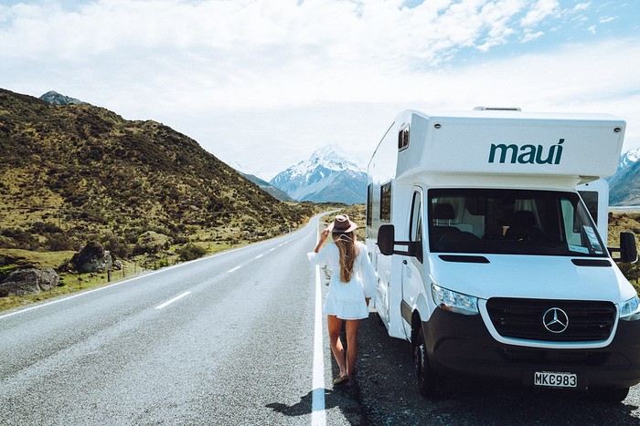
Safe and Scenic Roads
New Zealand offers a well-maintained road network, usually not too busy outside major cities. This is a huge plus if you're new to driving a campervan. The routes often feature spectacular viewpoints. You'll also find a vast network of campgrounds, and while freedom camping is regulated, there are still plenty of spots where you can sleep for free. Speed limits are reasonable, and the driving culture is pretty relaxed.
Adapted Infrastructure
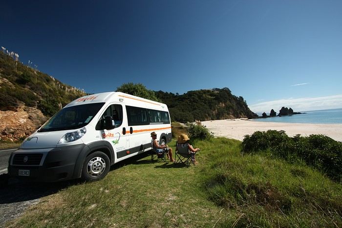
There are plenty of campervan rental companies offering different models, from converted vans to large family motorhomes. You'll find rental depots in major cities (Auckland, Christchurch, Queenstown), along with shuttle services between the airport and the depot. Campgrounds in New Zealand, whether private or managed by the Department of Conservation (DOC), are easy to find and well-marked. Plus, since New Zealand is a country of campers, you'll often get helpful tips from the locals.
Diverse and Accessible Landscapes
Beaches, volcanoes, deep fjords, or subtropical forests—you can experience a completely different setting in just a few hours of driving. No need to be a 4x4 expert: most roads leading to these stunning sites are campervan-friendly. This variety of landscapes, combined with easy access, makes New Zealand a top choice for a first road trip experience.
The Most Beautiful Places to Discover in a Campervan
To give you an idea, here’s a selection of must-see spots to inspire your next adventure.
1. The Coromandel Peninsula (North Island)
Just a few hours from Auckland, the Coromandel Peninsula is famous for its white sand beaches, hot springs, and lush vegetation. Hot Water Beach is a must-visit—dig your own "thermal bath" on the shore at low tide. You’ll easily find campgrounds by the ocean, perfect for your first taste of campervan life.
2. Rotorua and the Geothermal Wonders (North Island)
A little further south, Rotorua is the geothermal heart of New Zealand. Geysers, bubbling pools, and sulfur lakes with amazing colors—there’s no shortage of things to do. It’s also a major hub for Māori culture. Take the time to visit a traditional village or watch a haka performance. In the evening, relax at a campground with natural hot pools.
3. Tongariro National Park (North Island)
A UNESCO World Heritage site, this volcanic park is a paradise for hikers, especially with the famous Tongariro Alpine Crossing. Even if you're not an experienced hiker, you can enjoy stunning views from the roads or short marked trails. The campgrounds in the area will immerse you in a postcard-worthy setting.
4. Abel Tasman, Coastal Gem (South Island)
After taking the ferry from Wellington to Picton, head to Abel Tasman National Park. Its golden beaches, crystal-clear waters, and coastal trails are perfect for unwinding. One of the perks of a campervan is exploring at your own pace, choosing spots near the beaches or deeper in the forest.
5. Punakaiki and the Pancake Rocks (South Island)
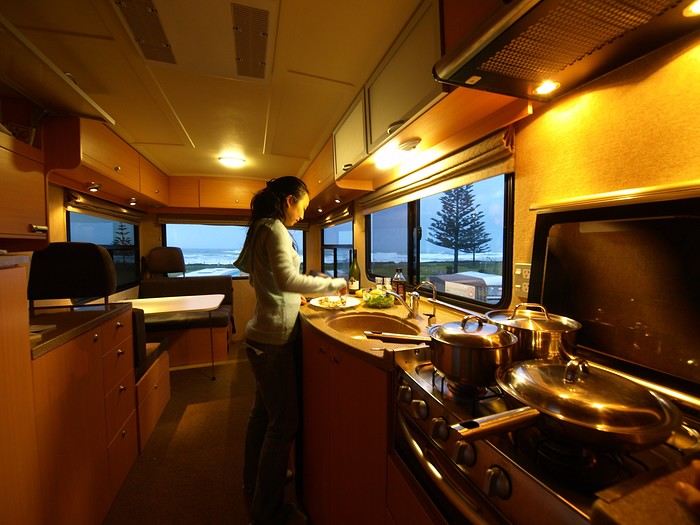
As you drive along the West Coast’s thick rainforests and wild beaches, stop at Punakaiki to see the Pancake Rocks—surprising rock formations that look like stacks of pancakes. A marked trail runs along the coast, letting you watch waves crash into the "blowholes" (marine geysers). Spending the night at a seaside campground, lulled by the sound of waves, is an experience not to be missed.
6. The Franz Josef and Fox Glaciers (South Island)
Further south, the glacier region is a must for lovers of breathtaking landscapes. You can admire the icy giants from a distance on an easy trail or take a helicopter to fly over them—or even walk on them. The campgrounds in Franz Josef or Fox Glacier let you wake up in an alpine atmosphere, contrasting with the lush vegetation around you.
7. Queenstown and Wanaka (South Island)
Queenstown, on the shore of a sparkling lake surrounded by majestic peaks, is known as the adventure capital: bungee jumping, paragliding, rafting—anything’s possible. If you prefer a quieter vibe, Wanaka is just as charming, with its beautiful lake and accessible walks. The road between these two towns is stunning, with plenty of perfect spots for a picnic stop.
8. Te Anau and Milford Sound (South Island)
New Zealand’s fjords are world-famous. Te Anau is the gateway to exploring Milford Sound or, for something wilder, Doubtful Sound. A cruise through these deep fjords, surrounded by towering cliffs, is one of the highlights of any trip to New Zealand. Staying overnight in a campervan in Te Anau saves you a long round trip in a day and lets you set off at dawn for more adventures.
9. Lake Tekapo and Mount Cook (South Island)
In the heart of the Southern Alps, Lake Tekapo charms with its unique turquoise color and its picturesque church by the water. The area is known for its starry skies (it’s an International Dark Sky Reserve). Mount Cook, the country’s highest peak, stands majestically in the background. Several campgrounds offer views of these mountains.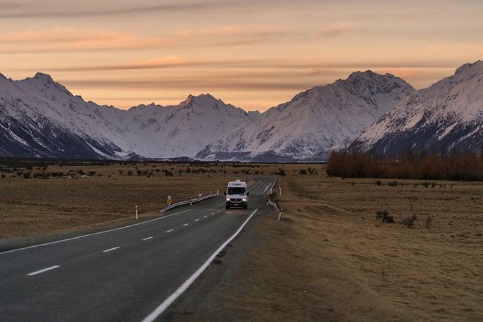
Practical Tips for a Successful Campervan Road Trip
Where to start? Between choosing the right vehicle, the best time to go, parking rules, and tips for where to sleep, here are our practical tips to plan your road trip stress-free.
Duration and Itinerary Choices
Less than 15 days: Focus on one island to avoid spending too much time on the road.
More than 15 days: Consider a North-South combo with a one-way trip (e.g., Auckland to Christchurch).
Book Early
In peak season (November to March), demand is high, especially for family-sized vehicles. Book your campervan ideally 6 to 8 months in advance.
Opt for full insurance to avoid high excess fees and hassles in case of issues. Standard bank insurance rarely covers campervans.
Choosing the Right Vehicle
Watch out for campervans over 3 years old—they can be "tired" in terms of both equipment and driving. If your budget allows, go for a newer model for better reliability and comfort.
Check the depot’s opening hours for pick-up. If you arrive late or after a long trip, it’s better to spend the first night in accommodation rather than driving straight away.
Where to Spend the Night
Freedom camping: Allowed in some remote areas but heavily regulated. Fines for breaking the rules can reach $200. Use comprehensive apps to identify legal spots and avoid penalties!
Basic campsites / DOC: Basic facilities but often in idyllic settings. These are campgrounds managed by the Department of Conservation, perfect for getting close to nature.
Private campgrounds: More expensive but offer hot showers, electricity, playgrounds for kids, pools, and laundry. Ideal for recharging—both your campervan’s batteries and your own.
Respect Nature
New Zealand is known for its pristine landscapes. Manage your waste, use designated dumping areas, and follow local signage. New Zealanders care deeply about keeping their environment clean and warmly welcome responsible tourists. For support, consider a local French-speaking agency like Frogs, which can help with administrative steps, planning your itinerary, and of course, renting a campervan.
Why is New Zealand the perfect country for your first campervan trip?
Safe and Scenic Roads
New Zealand offers a well-maintained road network, usually not too busy outside major cities. This is a huge plus if you're new to driving a campervan. The routes often feature spectacular viewpoints. You'll also find a vast network of campgrounds, and while freedom camping is regulated, there are still plenty of spots where you can sleep for free. Speed limits are reasonable, and the driving culture is pretty relaxed.
Adapted Infrastructure
There are plenty of campervan rental companies offering different models, from converted vans to large family motorhomes. You'll find rental depots in major cities (Auckland, Christchurch, Queenstown), along with shuttle services between the airport and the depot. Campgrounds in New Zealand, whether private or managed by the Department of Conservation (DOC), are easy to find and well-marked. Plus, since New Zealand is a country of campers, you'll often get helpful tips from the locals.
Diverse and Accessible Landscapes
Beaches, volcanoes, deep fjords, or subtropical forests—you can experience a completely different setting in just a few hours of driving. No need to be a 4x4 expert: most roads leading to these stunning sites are campervan-friendly. This variety of landscapes, combined with easy access, makes New Zealand a top choice for a first road trip experience.
The Most Beautiful Places to Discover in a Campervan
To give you an idea, here’s a selection of must-see spots to inspire your next adventure.
1. The Coromandel Peninsula (North Island)
Just a few hours from Auckland, the Coromandel Peninsula is famous for its white sand beaches, hot springs, and lush vegetation. Hot Water Beach is a must-visit—dig your own "thermal bath" on the shore at low tide. You’ll easily find campgrounds by the ocean, perfect for your first taste of campervan life.
2. Rotorua and the Geothermal Wonders (North Island)
A little further south, Rotorua is the geothermal heart of New Zealand. Geysers, bubbling pools, and sulfur lakes with amazing colors—there’s no shortage of things to do. It’s also a major hub for Māori culture. Take the time to visit a traditional village or watch a haka performance. In the evening, relax at a campground with natural hot pools.
3. Tongariro National Park (North Island)
A UNESCO World Heritage site, this volcanic park is a paradise for hikers, especially with the famous Tongariro Alpine Crossing. Even if you're not an experienced hiker, you can enjoy stunning views from the roads or short marked trails. The campgrounds in the area will immerse you in a postcard-worthy setting.
4. Abel Tasman, Coastal Gem (South Island)
After taking the ferry from Wellington to Picton, head to Abel Tasman National Park. Its golden beaches, crystal-clear waters, and coastal trails are perfect for unwinding. One of the perks of a campervan is exploring at your own pace, choosing spots near the beaches or deeper in the forest.
5. Punakaiki and the Pancake Rocks (South Island)
As you drive along the West Coast’s thick rainforests and wild beaches, stop at Punakaiki to see the Pancake Rocks—surprising rock formations that look like stacks of pancakes. A marked trail runs along the coast, letting you watch waves crash into the "blowholes" (marine geysers). Spending the night at a seaside campground, lulled by the sound of waves, is an experience not to be missed.
6. The Franz Josef and Fox Glaciers (South Island)
Further south, the glacier region is a must for lovers of breathtaking landscapes. You can admire the icy giants from a distance on an easy trail or take a helicopter to fly over them—or even walk on them. The campgrounds in Franz Josef or Fox Glacier let you wake up in an alpine atmosphere, contrasting with the lush vegetation around you.
7. Queenstown and Wanaka (South Island)
Queenstown, on the shore of a sparkling lake surrounded by majestic peaks, is known as the adventure capital: bungee jumping, paragliding, rafting—anything’s possible. If you prefer a quieter vibe, Wanaka is just as charming, with its beautiful lake and accessible walks. The road between these two towns is stunning, with plenty of perfect spots for a picnic stop.
8. Te Anau and Milford Sound (South Island)
New Zealand’s fjords are world-famous. Te Anau is the gateway to exploring Milford Sound or, for something wilder, Doubtful Sound. A cruise through these deep fjords, surrounded by towering cliffs, is one of the highlights of any trip to New Zealand. Staying overnight in a campervan in Te Anau saves you a long round trip in a day and lets you set off at dawn for more adventures.
9. Lake Tekapo and Mount Cook (South Island)
In the heart of the Southern Alps, Lake Tekapo charms with its unique turquoise color and its picturesque church by the water. The area is known for its starry skies (it’s an International Dark Sky Reserve). Mount Cook, the country’s highest peak, stands majestically in the background. Several campgrounds offer views of these mountains.
Practical Tips for a Successful Campervan Road Trip
Where to start? Between choosing the right vehicle, the best time to go, parking rules, and tips for where to sleep, here are our practical tips to plan your road trip stress-free.
Duration and Itinerary Choices
Less than 15 days: Focus on one island to avoid spending too much time on the road.
More than 15 days: Consider a North-South combo with a one-way trip (e.g., Auckland to Christchurch).
Book Early
In peak season (November to March), demand is high, especially for family-sized vehicles. Book your campervan ideally 6 to 8 months in advance.
Opt for full insurance to avoid high excess fees and hassles in case of issues. Standard bank insurance rarely covers campervans.
Choosing the Right Vehicle
Watch out for campervans over 3 years old—they can be "tired" in terms of both equipment and driving. If your budget allows, go for a newer model for better reliability and comfort.
Check the depot’s opening hours for pick-up. If you arrive late or after a long trip, it’s better to spend the first night in accommodation rather than driving straight away.
Where to Spend the Night
Freedom camping: Allowed in some remote areas but heavily regulated. Fines for breaking the rules can reach $200. Use comprehensive apps to identify legal spots and avoid penalties!
Basic campsites / DOC: Basic facilities but often in idyllic settings. These are campgrounds managed by the Department of Conservation, perfect for getting close to nature.
Private campgrounds: More expensive but offer hot showers, electricity, playgrounds for kids, pools, and laundry. Ideal for recharging—both your campervan’s batteries and your own.
Respect Nature
New Zealand is known for its pristine landscapes. Manage your waste, use designated dumping areas, and follow local signage. New Zealanders care deeply about keeping their environment clean and warmly welcome responsible tourists. For support, consider a local French-speaking agency like Frogs, which can help with administrative steps, planning your itinerary, and of course, renting a campervan.
Who has already done the "Great Southern Loop": Antarctic Peninsula-Falklands-South Georgia?
Hello,
My current dream for a potential (last?) big trip during our winter of 2026 is mentioned in the title.
I’m particularly interested in the ship "Exploris One" (17 nights on board in January-February 2026), operated by the French company EXPLORIS (founded by former Ponant team members), and it seems to be a fully French-speaking experience with a maximum of 120 passengers. The most competitive offer I’ve found so far is through "Croisierenet.com".
So far, we’ve only sailed and landed as far as Cape Horn (with Australis), but beyond the Antarctic Peninsula itself, it’s especially South Georgia and the richness of its wildlife colonies that appeal to me the most (and the least appealing part, of course, is the price! 🤪)
For those of you who’ve sailed along and set foot on these lands—were you truly won over and did you feel, in plain terms, that "you got your money’s worth"? If by any chance you know Exploris, what can you say about it? Same for the reliability and seriousness of Croisierenet.
Given the sums involved, is it wise to wait a few more months before deciding, hoping for bigger discounts as the departure date approaches, while counting on cabin availability in my preferred category? Currently, Exploris is offering discounts of -35% off the listed catalog prices for 2025 cruises and only -25% for 2026... On the other hand, could international flights from Paris to Buenos Aires become more expensive in the meantime? (But it seems the clientele for these cruises is marginal for this international flight, and January-February also appears to be significantly cheaper than November, especially for direct round-trip flights with Air France.)
Thanks for your feedback and any other wise advice! 😉
So far, we’ve only sailed and landed as far as Cape Horn (with Australis), but beyond the Antarctic Peninsula itself, it’s especially South Georgia and the richness of its wildlife colonies that appeal to me the most (and the least appealing part, of course, is the price! 🤪)
For those of you who’ve sailed along and set foot on these lands—were you truly won over and did you feel, in plain terms, that "you got your money’s worth"? If by any chance you know Exploris, what can you say about it? Same for the reliability and seriousness of Croisierenet.
Given the sums involved, is it wise to wait a few more months before deciding, hoping for bigger discounts as the departure date approaches, while counting on cabin availability in my preferred category? Currently, Exploris is offering discounts of -35% off the listed catalog prices for 2025 cruises and only -25% for 2026... On the other hand, could international flights from Paris to Buenos Aires become more expensive in the meantime? (But it seems the clientele for these cruises is marginal for this international flight, and January-February also appears to be significantly cheaper than November, especially for direct round-trip flights with Air France.)
Thanks for your feedback and any other wise advice! 😉
New Walks from Jodhpur to Narnaul (Feb 24)
I’ve been busy—here’s another travel journal on Rajasthan, with some new discoveries as always.
Thursday, January 25: I left home at 4:30 AM and headed to Barcelona airport. The roads weren’t blocked by farmers yet, so I made the trip without any issues. I arrived at the airport at 7:10 AM, called Parkvia, and someone picked up my car 15 minutes later. All that was left was to check in my luggage. My Etihad flight was at 10:25 AM, which gave me time for breakfast. We landed in Abu Dhabi at 7:30 PM. The flight to Delhi was at 10:15 PM, the transfer went smoothly without any stress, and we arrived in Delhi at 3:00 AM. I couldn’t waste any time upon arrival because I had a flight to Jodhpur at 6:55 AM. I got to customs, and what a nice surprise—the hall was empty. I went through immediately, had my passport and visa checked, and everything was fine. I grabbed my bag quickly and looked for the transfer to T2, which is outside. You have to walk along the taxi parking lot and take the long corridors—it’s well signposted, and the transfer took 10 minutes. At first, I was a little stressed, not knowing how long customs would take, but in the end, I was early for my 6:55 AM flight. I’m even glad I booked this one, as it got me to Jodhpur at 8:20 AM.
When I arrived, I took an auto-rickshaw to Jodhpur Palace GH, which I’d booked on Booking. The welcome was nice, and I was given a room right away. I was hoping to rest a bit, but unfortunately, it was very noisy. I settled in, took a shower, and was ready to go out and explore the city. The owner stopped me as I was leaving and told me I had to change rooms—I had to repack my bag before heading out. He showed me the way to the clock tower, which is about a 15-minute walk away.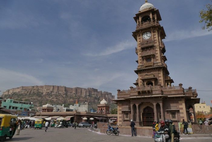
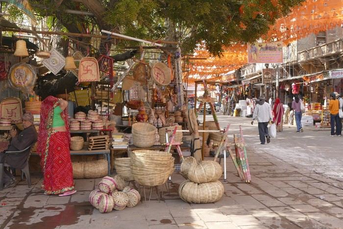
A market lines the street leading to the tower, and the traffic is intense.
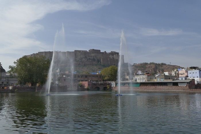
I set off in search of the stepwells and Gulab Sagar, a large basin with three water jets and a great view of Mehrangarh Fort. And yes, more baoris!
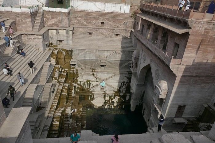
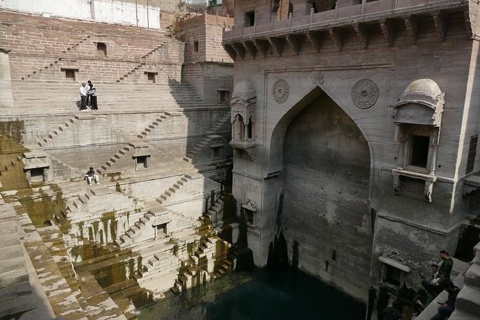
Toorji Ka Jhalra Bawdi isn’t far away. It’s a meet-up spot for tourists, with restaurants and terraces lining the area. The place is nice.
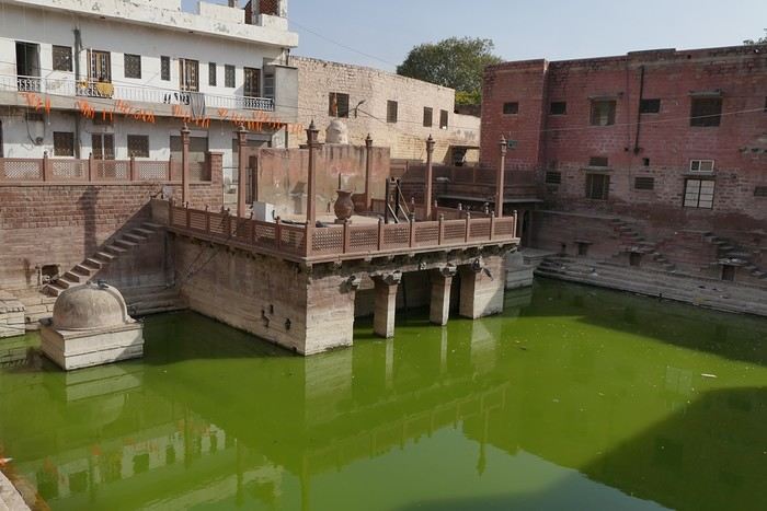
I looked for Mahila Bagh Ka Jhalra, went around in circles a bit, and finally found it right across from Gulab Sagar, where I’d already been. It’s not in good condition—it’s a shame it hasn’t been restored.
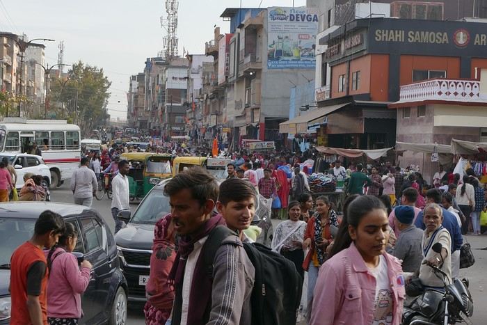
I went back through the clock tower area, found a currency exchange with a good rate, and booked my train tickets for the whole trip. The street was lively, with heavy traffic.

I was tired and headed back to the guesthouse. When I got there, I realized my phone wasn’t showing the right time, which gave me a chance to rest before going out for dinner. The Indigo restaurant is nearby and will be perfect.
Thursday, January 25: I left home at 4:30 AM and headed to Barcelona airport. The roads weren’t blocked by farmers yet, so I made the trip without any issues. I arrived at the airport at 7:10 AM, called Parkvia, and someone picked up my car 15 minutes later. All that was left was to check in my luggage. My Etihad flight was at 10:25 AM, which gave me time for breakfast. We landed in Abu Dhabi at 7:30 PM. The flight to Delhi was at 10:15 PM, the transfer went smoothly without any stress, and we arrived in Delhi at 3:00 AM. I couldn’t waste any time upon arrival because I had a flight to Jodhpur at 6:55 AM. I got to customs, and what a nice surprise—the hall was empty. I went through immediately, had my passport and visa checked, and everything was fine. I grabbed my bag quickly and looked for the transfer to T2, which is outside. You have to walk along the taxi parking lot and take the long corridors—it’s well signposted, and the transfer took 10 minutes. At first, I was a little stressed, not knowing how long customs would take, but in the end, I was early for my 6:55 AM flight. I’m even glad I booked this one, as it got me to Jodhpur at 8:20 AM.
When I arrived, I took an auto-rickshaw to Jodhpur Palace GH, which I’d booked on Booking. The welcome was nice, and I was given a room right away. I was hoping to rest a bit, but unfortunately, it was very noisy. I settled in, took a shower, and was ready to go out and explore the city. The owner stopped me as I was leaving and told me I had to change rooms—I had to repack my bag before heading out. He showed me the way to the clock tower, which is about a 15-minute walk away.
A market lines the street leading to the tower, and the traffic is intense.
I set off in search of the stepwells and Gulab Sagar, a large basin with three water jets and a great view of Mehrangarh Fort. And yes, more baoris!
Toorji Ka Jhalra Bawdi isn’t far away. It’s a meet-up spot for tourists, with restaurants and terraces lining the area. The place is nice.
I looked for Mahila Bagh Ka Jhalra, went around in circles a bit, and finally found it right across from Gulab Sagar, where I’d already been. It’s not in good condition—it’s a shame it hasn’t been restored.
I went back through the clock tower area, found a currency exchange with a good rate, and booked my train tickets for the whole trip. The street was lively, with heavy traffic.
I was tired and headed back to the guesthouse. When I got there, I realized my phone wasn’t showing the right time, which gave me a chance to rest before going out for dinner. The Indigo restaurant is nearby and will be perfect.
Have you considered Reunion Island as a destination?
Reunion Island, a French island located in the Indian Ocean, is characterized by remarkable geographical and cultural diversity. This island offers an immersive experience that harmoniously blends wild nature and human heritage, between active volcanoes, mountainous cirques, impressive waterfalls, and charming villages. This report explores the must-see spots, from the lunar landscapes of Piton de la Fournaise to the mountainous trails of the Mafate cirque, not forgetting the natural pools and tropical gardens. Each section highlights a distinct aspect of this vibrant island, supported by geological and historical information, as well as accounts from those who have visited.
Piton de la Fournaise, which reaches a height of 2,632 meters, is one of the most active volcanoes on our planet. Its frequent eruptions constantly shape the landscape, offering a natural spectacle where burning lava meets the ocean. The trail leading to the Dolomieu crater, though difficult to access, is open to hikers and rewards them with a panorama of vast expanses of solidified lava and volcanic gas emissions. It’s usually best to visit at this time of day to avoid clouds and enjoy the low light that enhances the lunar reliefs.
Volcanic activity has also given rise to unique structures, such as the lava tunnels of Grand Brûlé, where tourists can walk along cooled lava flows. For geology enthusiasts, the site of Cassé de la Rivière de l'Est reveals incredible basaltic organ pipes, testifying to ancient eruptions.
Despite its inactivity, Piton des Neiges (3,071 m) remains the island’s highest peak. Its ascent, via the GR R2 trail, passes through virgin forests before reaching rocky landscapes where sunrise offers a 360° panoramic view of the three cirques. This extinct volcano symbolizes Reunion Island’s geological history, characterized by successive collapses that gave birth to the surrounding cirques.
A UNESCO World Heritage site, the Salazie cirque charms with its lush greenery and hamlets clinging to cliffs. Hell-Bourg, listed among France’s most beautiful villages, delights with its brightly colored Creole houses and picturesque cobblestone streets. The trek to Voile de la Mariée, a famous waterfall, winds through bamboo groves and natural pools perfect for a swim.
Mafate, a preserved haven of tranquility, is accessible only on foot or by helicopter. Places like La Nouvelle or Marla, small villages called "îlets," offer a glimpse into traditional life on Reunion Island. The GR R1 trail, which circles Piton des Neiges, immerses hikers in breathtaking landscapes, alternating between rocky ridges and narrow valleys.
Known for its lentils and wines, Cilaos combines culinary delights with stunning scenery. The healing properties of the thermal springs at Bras-Rouge are highlighted by the trails leading to them, which also offer panoramas like the Col du Taïbit, a privileged access point to Mafate.
This unique spot features pebble beaches, waterfalls by the sea, and a palm forest. Picnickers enjoy its peaceful atmosphere, while local fishermen maintain ancient traditions. Nearby, the Garden of Perfumes and Spices cultivates vanilla, cloves, and turmeric, offering an olfactory experience at the heart of Reunionese agriculture.
Bassin Boeuf, famous for its turquoise waters, is a popular swimming spot, framed by volcanic formations. Further south, the Langevin River creates a series of waterfalls and natural pools, including the famous Trou de Fer, a 300-meter-deep canyon where water cascades in a shimmering curtain.
The island’s capital blends colonial heritage with modernity. The Léon Dierx Museum showcases modern art, while the Grand Marché draws visitors with its spices and local crafts. The Barachois promenade, along the sea, evokes the city’s maritime past with its 18th-century cannons.
The Domaine de Villèle, once a colonial plantation, now houses a museum dedicated to the history of slavery and a geranium distillery. The Chapelle Pointue, with its neo-Gothic style, offers a striking contrast to the brightly colored Tamil temples surrounding it.
The GR R1 and R2 trails are popular with experienced hikers, but more accessible routes like the Piton Maido (2,200 m) are suitable for beginners. The latter offers an unparalleled view of the Mafate cirque at dawn.
The coast of Saint-Gilles offers activities like diving, surfing, and paddleboarding, while ULM flights provide an impressive aerial view of Piton de la Fournaise.
Reunion Island presents itself as a microcosm where every landscape tells a story—geological, cultural, or human. Between the fury of volcanoes and the calm of cirques, between the bustle of markets and the tranquility of natural pools, this destination offers a diverse experience. Travelers are encouraged to mix their activities: morning hikes, cultural visits during the day, and moments of relaxation at dusk. Preserving these wonders relies on responsible tourism, respectful of fragile ecosystems and local communities.
Piton de la Fournaise, which reaches a height of 2,632 meters, is one of the most active volcanoes on our planet. Its frequent eruptions constantly shape the landscape, offering a natural spectacle where burning lava meets the ocean. The trail leading to the Dolomieu crater, though difficult to access, is open to hikers and rewards them with a panorama of vast expanses of solidified lava and volcanic gas emissions. It’s usually best to visit at this time of day to avoid clouds and enjoy the low light that enhances the lunar reliefs.
Volcanic activity has also given rise to unique structures, such as the lava tunnels of Grand Brûlé, where tourists can walk along cooled lava flows. For geology enthusiasts, the site of Cassé de la Rivière de l'Est reveals incredible basaltic organ pipes, testifying to ancient eruptions.
Despite its inactivity, Piton des Neiges (3,071 m) remains the island’s highest peak. Its ascent, via the GR R2 trail, passes through virgin forests before reaching rocky landscapes where sunrise offers a 360° panoramic view of the three cirques. This extinct volcano symbolizes Reunion Island’s geological history, characterized by successive collapses that gave birth to the surrounding cirques.
A UNESCO World Heritage site, the Salazie cirque charms with its lush greenery and hamlets clinging to cliffs. Hell-Bourg, listed among France’s most beautiful villages, delights with its brightly colored Creole houses and picturesque cobblestone streets. The trek to Voile de la Mariée, a famous waterfall, winds through bamboo groves and natural pools perfect for a swim.
Mafate, a preserved haven of tranquility, is accessible only on foot or by helicopter. Places like La Nouvelle or Marla, small villages called "îlets," offer a glimpse into traditional life on Reunion Island. The GR R1 trail, which circles Piton des Neiges, immerses hikers in breathtaking landscapes, alternating between rocky ridges and narrow valleys.
Known for its lentils and wines, Cilaos combines culinary delights with stunning scenery. The healing properties of the thermal springs at Bras-Rouge are highlighted by the trails leading to them, which also offer panoramas like the Col du Taïbit, a privileged access point to Mafate.
This unique spot features pebble beaches, waterfalls by the sea, and a palm forest. Picnickers enjoy its peaceful atmosphere, while local fishermen maintain ancient traditions. Nearby, the Garden of Perfumes and Spices cultivates vanilla, cloves, and turmeric, offering an olfactory experience at the heart of Reunionese agriculture.
Bassin Boeuf, famous for its turquoise waters, is a popular swimming spot, framed by volcanic formations. Further south, the Langevin River creates a series of waterfalls and natural pools, including the famous Trou de Fer, a 300-meter-deep canyon where water cascades in a shimmering curtain.
The island’s capital blends colonial heritage with modernity. The Léon Dierx Museum showcases modern art, while the Grand Marché draws visitors with its spices and local crafts. The Barachois promenade, along the sea, evokes the city’s maritime past with its 18th-century cannons.
The Domaine de Villèle, once a colonial plantation, now houses a museum dedicated to the history of slavery and a geranium distillery. The Chapelle Pointue, with its neo-Gothic style, offers a striking contrast to the brightly colored Tamil temples surrounding it.
The GR R1 and R2 trails are popular with experienced hikers, but more accessible routes like the Piton Maido (2,200 m) are suitable for beginners. The latter offers an unparalleled view of the Mafate cirque at dawn.
The coast of Saint-Gilles offers activities like diving, surfing, and paddleboarding, while ULM flights provide an impressive aerial view of Piton de la Fournaise.
Reunion Island presents itself as a microcosm where every landscape tells a story—geological, cultural, or human. Between the fury of volcanoes and the calm of cirques, between the bustle of markets and the tranquility of natural pools, this destination offers a diverse experience. Travelers are encouraged to mix their activities: morning hikes, cultural visits during the day, and moments of relaxation at dusk. Preserving these wonders relies on responsible tourism, respectful of fragile ecosystems and local communities.
From San Francisco to Los Angeles via Highway 1
Hi everyone,
We traveled between Christmas and New Year’s to visit our son in San Francisco. We’d already seen the parks during a 2008 vacation but hadn’t had time to drive Highway 1 between San Francisco and Los Angeles, so we decided to do it this time. At this time of year, the days are short—it gets dark by 5 PM, which limits sightseeing time. Weather-wise, we had temperatures between 11°C and 20°C (52°F and 68°F) during the week, so it was pretty pleasant. There was a bit of rain one day and some gray skies or fog in the mornings. Financially, California is *very* expensive! Prices listed don’t include tax or tips. Taxes are automatically added to restaurant bills or supermarket receipts, but *you* add the tip. Americans always leave a tip, no matter if they’re happy with the service or not (except at self-service places). The absolute minimum is 15%, but 20% is more common. Here’s how it works: First, the server brings the bill with the tax already added, then takes your card and the bill. They come back after charging your card, leaving you a new bill and a pen. You write down the tip (tips) you want to leave, add it up, and sign. You leave the paper and pen on the table and go. In some restaurants, the server brings the card reader to your table, and there are preset tip percentages to choose from. On your bank statement, the total amount (including tax) shows up as “pending.” A few days later, the transaction is finalized with the tip included. The 9-hour time difference isn’t trivial, especially as we get older 😉. Keep it in mind when planning—don’t overdo it in the first few days.
Here’s our itinerary: 12/25/2024: Flight from Lyon (7 AM) to San Francisco (11:50 AM): 1-hour layover in Amsterdam—way too tight. The airport is huge, and flights to the U.S. are at the far end. You also have to go through customs. We had to run! Luckily, there’s a special line for tight connections, and our flight was delayed! Reunited with our son and walked to the Painted Ladies (Victorian houses) and then through Alamo Square. Return trip via Waymo—a driverless Uber. Surprising, but the ride was super smooth, and we felt safe.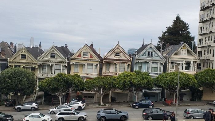
12/26/2024: San Francisco Walking tour of the city: Lombard Street, Pier 39 (sea lions), Coit Tower via the Filbert Steps (great view of the city), Chinatown, and Union Square (ice rink and Christmas tree).
12/27/2024: Monterey It took us about 2.5 hours to drive straight from SF to Monterey (to save time, we skipped the start of Highway 1). The goal for this stop was visiting the aquarium. It’s in an old sardine cannery, and there’s an interesting room showing the machinery and explaining the process. The aquarium features all the local fish and plant species, plus a stunning jellyfish exhibit. We spent about 2.5 hours there. Entry is pricey at $65, and it was packed when we went. For parking, you can use meters or day lots. The cheapest we found was $25 for the day, with in-and-out privileges. We saw some closer lots charging $80, so it’s worth shopping around before parking and walking a bit more. Afterward, we stopped by the Monarch Butterfly Sanctuary—a small, free park where these butterflies land, along with some wild deer. We ended the day at Lover’s Point, a park with an ocean view and surfers. That evening, we tried clam chowder in a sourdough bread bowl. Stayed overnight in Monterey.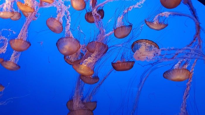
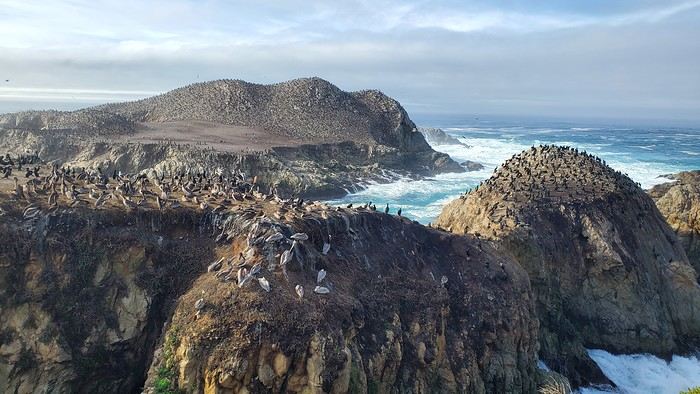
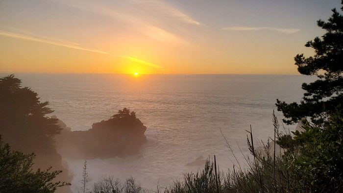
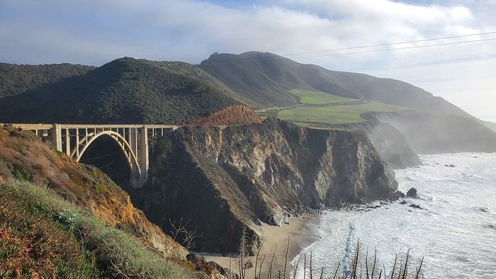
12/28/2024: Big Sur Parks The Big Sur area has many state parks. Entry is $10 per car for the day (valid for any number of parks visited that same day). Pro tip: If you park outside and walk in, you don’t pay. We chose to visit Point Lobos Reserve. We hiked the trails along the ocean. Two must-do (short and easy) trails: “Sea Lion Point,” where massive waves crash onto the rocks, and “Bird Island Lookout,” where you can see thousands of pelicans and cormorants on the rocks, plus a few elephant seals. It’s truly stunning. We spent about 3 hours there. After driving along Garrapata State Park and crossing the famous Bixby Bridge, we went to Pfeiffer Big Sur State Park to do the short Valley View Trail + Pfeiffer Falls hike. It was nice being among the redwoods, but the waterfall was underwhelming. Maybe it’s more impressive in the summer when the river is flowing better. We ended the day at McWay Falls, a waterfall that flows directly into the ocean—super photogenic, especially at sunset. Returned to Monterey for the night.
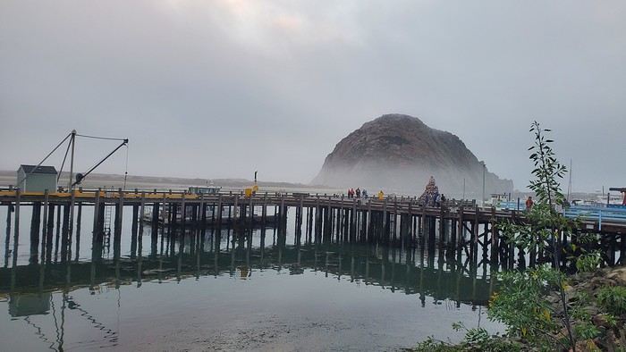
12/29/2024: Drive to Morro Bay Highway 1 is currently closed near Gorda, so we had to take the inland route from Monterey, adding extra miles. It was raining, so we skipped the planned stop at Carmel-by-the-Sea. Instead, we detoured to Mission San Antonio de Padua, the 3rd mission (out of 21) built by the Spanish in 1773 to evangelize the region. It’s less famous than others, so there were fewer people, and it felt more “authentic” (free to visit). With fog adding to the rain, we headed straight to Morro Bay, our stop for the day, instead of continuing up Highway 1 to San Simeon. Took a short evening walk to Morro Rock—saw a few otters in the harbor. Stayed overnight in Morro Bay.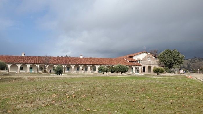
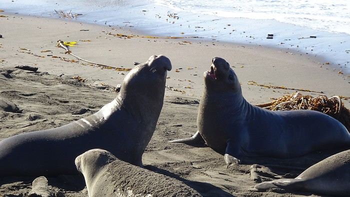
12/30/2024: Elephant Seals at Piedras Blancas The sun came back! We took a quick walk on the pier to see the otters in daylight, then drove back up Highway 1 to Piedras Blancas (near San Simeon), a famous spot for elephant seals. It’s birthing season, so there were lots of pups, plus males fighting for the females’ attention—what a show! We couldn’t get enough. We walked to the Piedras Blancas Lighthouse, with a few viewpoints of beaches where elephant seals were lounging (though far fewer than at the beach near the parking lot). We continued to Santa Barbara, our stop for the day. Stopped in San Luis Obispo for lunch and a quick city tour (Bubblegum Alley, the theater facade, and the mission). Since it was getting late, we skipped Los Alamos and went straight to Solvang, a charming Danish-style town (windmills, typical Danish houses) with lots of holiday lights (it’s their Julefest). Stayed overnight in Santa Barbara.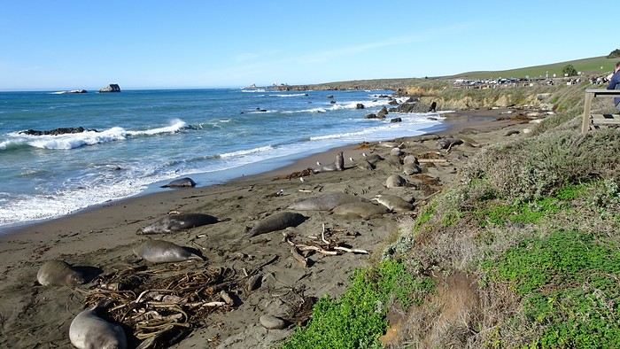
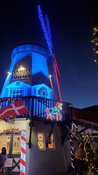
We traveled between Christmas and New Year’s to visit our son in San Francisco. We’d already seen the parks during a 2008 vacation but hadn’t had time to drive Highway 1 between San Francisco and Los Angeles, so we decided to do it this time. At this time of year, the days are short—it gets dark by 5 PM, which limits sightseeing time. Weather-wise, we had temperatures between 11°C and 20°C (52°F and 68°F) during the week, so it was pretty pleasant. There was a bit of rain one day and some gray skies or fog in the mornings. Financially, California is *very* expensive! Prices listed don’t include tax or tips. Taxes are automatically added to restaurant bills or supermarket receipts, but *you* add the tip. Americans always leave a tip, no matter if they’re happy with the service or not (except at self-service places). The absolute minimum is 15%, but 20% is more common. Here’s how it works: First, the server brings the bill with the tax already added, then takes your card and the bill. They come back after charging your card, leaving you a new bill and a pen. You write down the tip (tips) you want to leave, add it up, and sign. You leave the paper and pen on the table and go. In some restaurants, the server brings the card reader to your table, and there are preset tip percentages to choose from. On your bank statement, the total amount (including tax) shows up as “pending.” A few days later, the transaction is finalized with the tip included. The 9-hour time difference isn’t trivial, especially as we get older 😉. Keep it in mind when planning—don’t overdo it in the first few days.
Here’s our itinerary: 12/25/2024: Flight from Lyon (7 AM) to San Francisco (11:50 AM): 1-hour layover in Amsterdam—way too tight. The airport is huge, and flights to the U.S. are at the far end. You also have to go through customs. We had to run! Luckily, there’s a special line for tight connections, and our flight was delayed! Reunited with our son and walked to the Painted Ladies (Victorian houses) and then through Alamo Square. Return trip via Waymo—a driverless Uber. Surprising, but the ride was super smooth, and we felt safe.
12/26/2024: San Francisco Walking tour of the city: Lombard Street, Pier 39 (sea lions), Coit Tower via the Filbert Steps (great view of the city), Chinatown, and Union Square (ice rink and Christmas tree).
12/27/2024: Monterey It took us about 2.5 hours to drive straight from SF to Monterey (to save time, we skipped the start of Highway 1). The goal for this stop was visiting the aquarium. It’s in an old sardine cannery, and there’s an interesting room showing the machinery and explaining the process. The aquarium features all the local fish and plant species, plus a stunning jellyfish exhibit. We spent about 2.5 hours there. Entry is pricey at $65, and it was packed when we went. For parking, you can use meters or day lots. The cheapest we found was $25 for the day, with in-and-out privileges. We saw some closer lots charging $80, so it’s worth shopping around before parking and walking a bit more. Afterward, we stopped by the Monarch Butterfly Sanctuary—a small, free park where these butterflies land, along with some wild deer. We ended the day at Lover’s Point, a park with an ocean view and surfers. That evening, we tried clam chowder in a sourdough bread bowl. Stayed overnight in Monterey.
12/28/2024: Big Sur Parks The Big Sur area has many state parks. Entry is $10 per car for the day (valid for any number of parks visited that same day). Pro tip: If you park outside and walk in, you don’t pay. We chose to visit Point Lobos Reserve. We hiked the trails along the ocean. Two must-do (short and easy) trails: “Sea Lion Point,” where massive waves crash onto the rocks, and “Bird Island Lookout,” where you can see thousands of pelicans and cormorants on the rocks, plus a few elephant seals. It’s truly stunning. We spent about 3 hours there. After driving along Garrapata State Park and crossing the famous Bixby Bridge, we went to Pfeiffer Big Sur State Park to do the short Valley View Trail + Pfeiffer Falls hike. It was nice being among the redwoods, but the waterfall was underwhelming. Maybe it’s more impressive in the summer when the river is flowing better. We ended the day at McWay Falls, a waterfall that flows directly into the ocean—super photogenic, especially at sunset. Returned to Monterey for the night.
12/29/2024: Drive to Morro Bay Highway 1 is currently closed near Gorda, so we had to take the inland route from Monterey, adding extra miles. It was raining, so we skipped the planned stop at Carmel-by-the-Sea. Instead, we detoured to Mission San Antonio de Padua, the 3rd mission (out of 21) built by the Spanish in 1773 to evangelize the region. It’s less famous than others, so there were fewer people, and it felt more “authentic” (free to visit). With fog adding to the rain, we headed straight to Morro Bay, our stop for the day, instead of continuing up Highway 1 to San Simeon. Took a short evening walk to Morro Rock—saw a few otters in the harbor. Stayed overnight in Morro Bay.
12/30/2024: Elephant Seals at Piedras Blancas The sun came back! We took a quick walk on the pier to see the otters in daylight, then drove back up Highway 1 to Piedras Blancas (near San Simeon), a famous spot for elephant seals. It’s birthing season, so there were lots of pups, plus males fighting for the females’ attention—what a show! We couldn’t get enough. We walked to the Piedras Blancas Lighthouse, with a few viewpoints of beaches where elephant seals were lounging (though far fewer than at the beach near the parking lot). We continued to Santa Barbara, our stop for the day. Stopped in San Luis Obispo for lunch and a quick city tour (Bubblegum Alley, the theater facade, and the mission). Since it was getting late, we skipped Los Alamos and went straight to Solvang, a charming Danish-style town (windmills, typical Danish houses) with lots of holiday lights (it’s their Julefest). Stayed overnight in Santa Barbara.
Cities to see in the Isan region (Thailand)
Hi there,
I’m about to take a trip around the region in March. According to the "experts," which cities are really worth the detour? My key criteria: a slightly lively downtown + walkable. I’ve already been to the region a few years ago, but my memories are pretty mixed (Ubon Ratchathani, Udon Thani, Khon Kaen).
Thanks😎
I’m about to take a trip around the region in March. According to the "experts," which cities are really worth the detour? My key criteria: a slightly lively downtown + walkable. I’ve already been to the region a few years ago, but my memories are pretty mixed (Ubon Ratchathani, Udon Thani, Khon Kaen).
Thanks😎
Bangkok - Chiang Mai - Koh Samui in summer
Hi everyone, I’ve spent two solid months reading the Lonely Planet and pretty much every post about Thailand here, plus French and English blogs. Now I’d love to get your expert opinions on our itinerary.
We’re heading off in August 2025 with our 7-year-old daughter. We only have a maximum of three weeks off, and I’m keeping an eye on flight prices before booking (1400 € per person really stings 😕).
So here’s what I’ve planned—let me know if you spot any major issues or if I’ve been way too "optimistic."
D1 - Arrival in Bangkok / rest, quick visit, overnight stay D2 - More temple visits, etc. D3 - Morning flight to Chiang Mai D4 - More Chiang Mai sightseeing D5 - Day trip to Chiang Rai (guided tour to book: blue and white temple), return to Chiang Mai late in the evening D6 - More Chiang Mai visits / Elephant Nature Park in the afternoon D7 - Morning flight to Koh Samui, sightseeing D8 to D10 - More Koh Samui visits D11 to D13 - Ferry to Koh Phangan D14 to D15 - Ferry to Koh Tao D16 - Return to Koh Samui, then flight to Bangkok D17 - Day trip to Ayutthaya, return to Bangkok in the evening D18 - Flight back to France :(
I know a lot of you recommend heading straight to Chiang Mai to recover from the international flight, but my partner and I NEVER sleep on planes (personally, I’ve been flying to Taiwan since I was little and have never slept more than an hour on a 14-hour flight...), so it’s essential for us to rest upon arrival . That’s also why I opted for domestic flights instead of the sleeper train—I know we’d lose over 10 hours and wouldn’t be able to rest properly in those conditions. And I’m sure you’ll also say BKK > North > South is too much for three weeks, but I really want to see as much as possible. Given how much the flights will cost, I’m not sure when we’ll be able to come back 🏴☠️.
So, questions: 1. Since we’ll only be in Bangkok for a maximum of two nights and need to easily reach the airport with luggage (and a child), which neighborhood should we prioritize? We’d love to experience the evening vibe of Asian night markets, ideally within walking distance of the hotel or just a few metro stops away. I’ve looked at Chinatown, but the BTS seems far... Should we go for somewhere near BTS Saphan Taksin or BTS Krungthonburi? But is the area lively in the evening with food courts, etc.? We’d also like to treat ourselves to a hotel with a pool.
2. Have we planned too many days in the south? Should I skip Koh Tao and just do Koh Samui + Koh Phangan? My partner and daughter aren’t strong swimmers, so we’re looking for beautiful beaches without too much current. Crowded beaches don’t bother us—we just want stunning turquoise waters without killer waves . Going all the way to Koh Tao and then back to Koh Samui to catch the flight to Bangkok seems too stressful. Is it still possible these days (I haven’t seen any recent posts on this) to head to Koh Samui in August and decide on the spot how many nights to spend in Koh Phangan or Koh Tao based on how we feel, booking hotels as we go? Or is that too risky?
If you have any better suggestions for fitting all this in while reducing internal flights, I’m all ears for your great tips
D1 - Arrival in Bangkok / rest, quick visit, overnight stay D2 - More temple visits, etc. D3 - Morning flight to Chiang Mai D4 - More Chiang Mai sightseeing D5 - Day trip to Chiang Rai (guided tour to book: blue and white temple), return to Chiang Mai late in the evening D6 - More Chiang Mai visits / Elephant Nature Park in the afternoon D7 - Morning flight to Koh Samui, sightseeing D8 to D10 - More Koh Samui visits D11 to D13 - Ferry to Koh Phangan D14 to D15 - Ferry to Koh Tao D16 - Return to Koh Samui, then flight to Bangkok D17 - Day trip to Ayutthaya, return to Bangkok in the evening D18 - Flight back to France :(
I know a lot of you recommend heading straight to Chiang Mai to recover from the international flight, but my partner and I NEVER sleep on planes (personally, I’ve been flying to Taiwan since I was little and have never slept more than an hour on a 14-hour flight...), so it’s essential for us to rest upon arrival . That’s also why I opted for domestic flights instead of the sleeper train—I know we’d lose over 10 hours and wouldn’t be able to rest properly in those conditions. And I’m sure you’ll also say BKK > North > South is too much for three weeks, but I really want to see as much as possible. Given how much the flights will cost, I’m not sure when we’ll be able to come back 🏴☠️.
So, questions: 1. Since we’ll only be in Bangkok for a maximum of two nights and need to easily reach the airport with luggage (and a child), which neighborhood should we prioritize? We’d love to experience the evening vibe of Asian night markets, ideally within walking distance of the hotel or just a few metro stops away. I’ve looked at Chinatown, but the BTS seems far... Should we go for somewhere near BTS Saphan Taksin or BTS Krungthonburi? But is the area lively in the evening with food courts, etc.? We’d also like to treat ourselves to a hotel with a pool.
2. Have we planned too many days in the south? Should I skip Koh Tao and just do Koh Samui + Koh Phangan? My partner and daughter aren’t strong swimmers, so we’re looking for beautiful beaches without too much current. Crowded beaches don’t bother us—we just want stunning turquoise waters without killer waves . Going all the way to Koh Tao and then back to Koh Samui to catch the flight to Bangkok seems too stressful. Is it still possible these days (I haven’t seen any recent posts on this) to head to Koh Samui in August and decide on the spot how many nights to spend in Koh Phangan or Koh Tao based on how we feel, booking hotels as we go? Or is that too risky?
If you have any better suggestions for fitting all this in while reducing internal flights, I’m all ears for your great tips
Recap of 6 weeks in Sumatra April-May 2024
Sumatra at a leisurely pace, from mid-April to the end of May—pure bliss!
Outbound/inbound flight to Kuala Lumpur to reach Medan, then our stops: Medan - Berastaggi - Toba / Ambarita - Ketambe - Pulau Nias / Teluk Dalam - Bukittinggi - Harau Valley - Padang / Rimba.
A journey shaped by the ethnic groups: the Bataks around Berastaggi and Toba, the Ono Niha on Nias Island, and the Minangkabaus starting from Bukittinggi. Christians in the north and Muslims in a matrilineal society at the end of the trip. Rare animals in their natural habitat, orangutans in the canopy and hawksbill turtles within snorkeling distance.
Though Sumatra isn’t a hotspot for Western tourists, it’s incredibly easy to explore Indonesia’s largest island.
Since there were four of us and the journeys are very long (avg. 30 km/h), we opted for taxis between regions and rented scooters on-site; 3 days trekking in the primary forest of Gunung Leuser and guesthouses for accommodation the rest of the time, meals at local warungs.
As I struggled to find info on Nias Island before our trip (thanks to Filemich for reassuring me about this stop), I’ll focus on this destination!
We took an overnight ferry (https://www.wjl-line.com) from Sibolga to Teluk Dalam, in a 4-person cabin, and stayed at Taman Baloho Indah guesthouse, a bit outside the town and by the Indian Ocean—I highly recommend it. You can reach Erwin, the owner (a name from Dutch colonization), via WhatsApp at +62 812 6074 2874. He rents scooters and can also take you fishing if you ask, then you get to enjoy the fish cooked by his wife.
Thanks to our guide Nitra (WhatsApp: +62 822 1383 9300), a young woman passionate about her history, we explored the east coast to visit a megalithic site, then crisscrossed the island’s interior for several days, from village to village, all still very traditional. She lives in Bawomataluo, the most famous of them. She was our gateway to her world, its rituals, and customs. We spent a week on the island—absolute heaven!
Don’t hesitate to ask me about places, accommodations, or contacts for taxis or guides from our long stay—I’d be happy to answer!
14-Day Trip Report to Milos and Kimolos in September-October 2021
14-Day Trip Report to Milos and Kimolos in September-October 2021
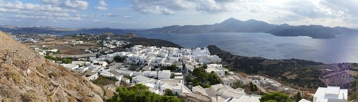
The village of Plaka in Milos
It was with great pleasure that we finally reconnected with our old habits as inveterate travelers! Greece, and more specifically the Greek islands, was the natural choice for us. After having already visited many Greek islands during around 18 trips, we decided to revisit islands we had seen over 40 years ago, like Milos, where our memories were extremely hazy. Our route was well-planned and familiar: a low-cost flight from Basel-Mulhouse to Athens, then a traditional ferry from Piraeus to Milos. Taking a speedboat, which is faster, would have forced us to spend a night in Piraeus. Plus, we felt that the traditional ferry was part of the journey, and with good weather, spending eight hours on deck wasn’t unpleasant at all. Watching the docking maneuvers with the comings and goings of trucks and cars, observing the passengers, reading a book, or admiring the scenery—all of that is part of the travel experience. Milos Island: Accommodation in Adamas We arrived quite late, around 11 PM, in Adamas, the port of Milos. No worries—the friendly couple managing the apartment was waiting for us, and it was just a 10-minute walk from the port. The first two days were spent unwinding, with swimming at the nearby beach, strolling through Adamas, and relaxing.
Discovering Plaka On the third day, we took the path along the small beach west of town toward a French military cemetery! A historical reminder of our presence here during the Crimean War, among others. The path climbs toward a beacon perched on top of a hill before disappearing into the scrubland. We returned to Adamas for lunch on our terrace.
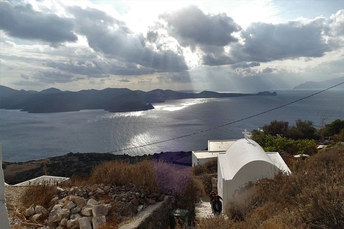
In the afternoon, we visited the hilltop village of Plaka by bus from Adamas. Plaka is the original old town, dominated by a church and, even higher up, the ruins of the Kastro. The view is magnificent. We stopped at a pastry shop in the village to enjoy excellent orange cakes and baklavas. Back in Adamas, we checked out car rental agencies to be more mobile, though the bus network seemed quite extensive. It costs around 40 € per day, plus 8 € if you want to significantly reduce the deductible. Port of Klima.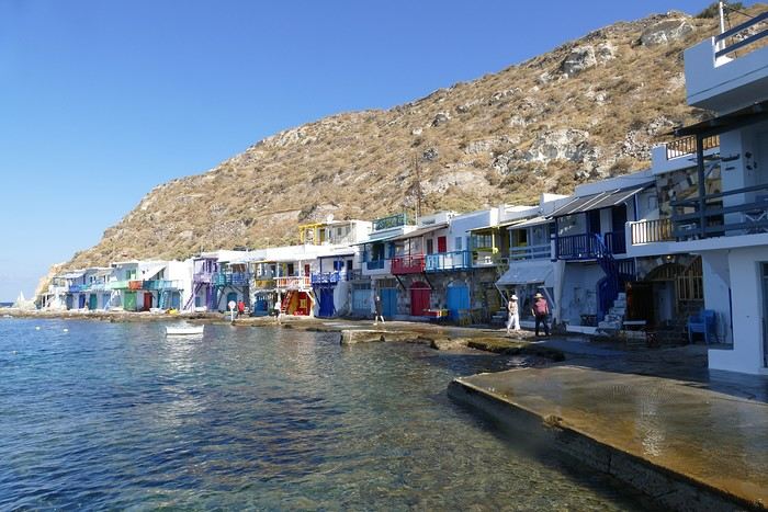
Yesterday’s weather was quite mixed with lots of clouds, but today the sun is shining again. We drove to the small port of Klima, famous for its boat garages called "sirmatas." It’s true that in the morning sun, these boat garages carved into the volcanic tuff are beautifully lit, turning the village into a colorful mosaic. Above the village, a path climbs directly to the magnificent Roman theater overlooking the surroundings and the sea.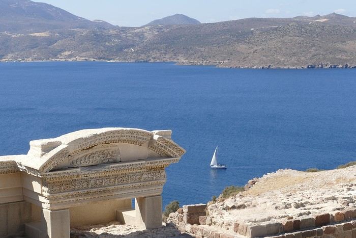 Following the well-marked path, we reached the road leading 200 meters down to the catacombs. It’s an impressive complex of 3rd and 4th-century catacombs, though only a small part is open to visitors—it’s still very moving. In the mid-afternoon, we got back in the car to visit the tiny ports of Firopotamos and Mandraki, which also have their colorful sirmatas. We took the opportunity to swim at the small beach in Mandraki, where the water was warm and calm.
Mandraki Port. We had a decent dinner at a seaside restaurant in Adamas, though you have to be selective—we had a bad experience at Kynigos on the second night!
Moving to Polonia in Eastern Milos, Sarakiniko Site
Following the well-marked path, we reached the road leading 200 meters down to the catacombs. It’s an impressive complex of 3rd and 4th-century catacombs, though only a small part is open to visitors—it’s still very moving. In the mid-afternoon, we got back in the car to visit the tiny ports of Firopotamos and Mandraki, which also have their colorful sirmatas. We took the opportunity to swim at the small beach in Mandraki, where the water was warm and calm.
Mandraki Port. We had a decent dinner at a seaside restaurant in Adamas, though you have to be selective—we had a bad experience at Kynigos on the second night!
Moving to Polonia in Eastern Milos, Sarakiniko Site
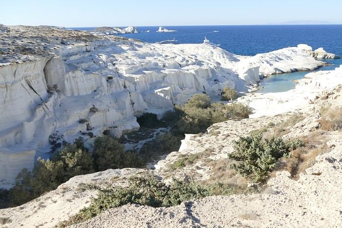
The Sarakiniko site We left Adamas for a second stay on Milos, this time in Polonia. The rental Panda was packed with the four of us and our luggage! Our apartment was in a beautiful house surrounded by a grove, so our lovely terrace was well-shaded. Luckily, there was a small beach nearby, and we went for a swim right away. Apart from us, there were only three other swimmers—definitely the end of the season!
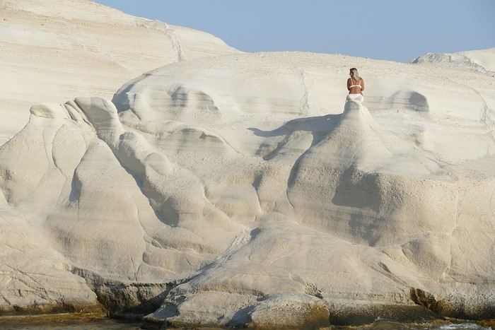
"Fairy chimney"! In the afternoon, we visited the famous Sarakiniko site, Milos’ emblematic spot. Judging by the number of cars in the parking lot, we wouldn’t be alone. As we approached, we heard an indefinable rock/punk/metal music: some young people had brought a sound system and a foghorn and were having fun diving off a fairly high cliff to impress the crowd. It definitely spoiled the visit. Most spots were taken by couples busy taking selfies, so getting photos of the site without tourists was impossible. Still, the site is magnificent, with its white cliffs looking like they’re covered in whipped cream! The sun was still very bright, reflecting strongly off the cliffs, making photography difficult due to the excessive brightness. We had a fish dinner in Polonia at the Enalion restaurant: while the octopus and squid were good, the fish soup tasted more like vegetable soup with a few fish crumbs—too bad.
Sunset in Polonia
Ports of Papafranga and Mytikos We continued our exploration of Milos with the Papafranga gorge, a narrow and deep gorge that opens to the sea, where the water is a stunning color. Access via an unstable and dangerous path is prohibited, but that didn’t stop a couple of tourists in flip-flops from venturing in!!! We then swam in the tiny, calm, and sheltered cove of the small port of Mytikos. We returned to Polonia for lunch at Alkis: excellent moussaka. In the late afternoon, Pat and I went out to take some photos just before sunset near the Agios Nikolaos chapel, the beacon, and the new Petakoudia neighborhood next to Polonia to the north.
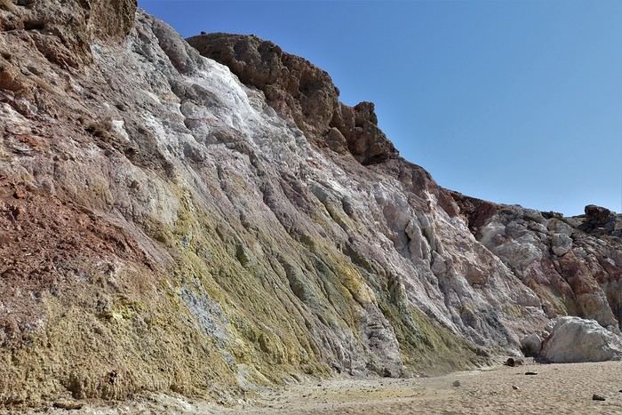
Paleochori Beach
Toward the Multicolored Beach of Paleochori Another sunny day: we still had to discover Paleochori Beach in the south of the island. It was 10:30 AM, and the beach was almost deserted! The water was pleasant, though a bit chilly when we first entered. The beach is bordered by a cliff that, in some places, displays a beautiful multicolored palette. We returned to Polonia in the late afternoon, and Pat and I headed toward Vouddhia Beach south of Polonia—bad choice. The beach is surrounded by a huge mining site served by a dusty road where lines of trucks loaded with ore cross paths. It’s the other side of the coin, and Greece still has progress to make in this area. Dinner at Alki’s was just as good as always. Return to the Sarakiniko Site Early this morning, Pat and I went back to the Sarakiniko site, hoping to take photos in better conditions. While there were fewer people, the parking lot was still full because sunrise is a must in Milos. Still, the conditions were good, and the sunrise spectators left quickly once the sun had risen above the horizon. During the day, an increasingly strong wind cooled the atmosphere, making swimming less enjoyable. Departure for Kimolos Island We changed islands and left Milos for Kimolos, a nearby island—just a 30-minute trip from Polonia’s port. Our apartment was at the entrance of the hilltop village. It’s a village with typical Cycladic architecture, featuring the remains of an old kastro, a few old churches, and windmill towers perched on the hill. We dined in a tiny tavern where the small outdoor tables were squeezed against the walls to let passersby through! As soon as the sun disappeared, it got cold, especially because of the wind. Ports of Kara and Goupa This morning, we explored the small hamlets of Kara and Goupa by Rema Beach, east of the main port. There, we found the sirmatas again—those boat garages partly carved into the volcanic tuff. The path winds between several sirmatas before climbing back up to the Praça road to return to the apartment.
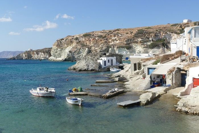
Ports of Kara and Goupa
In the afternoon, we strolled through town, and Pat and I climbed the hill overlooking the village to get a closer look at the few more or less ruined windmills dotting the ridge. Only one mill still had its complete mechanism in place under the roof; the others were empty. The view over the village, port, and sea was beautiful. That evening, we tried another restaurant in the village center, Kali Kardia Bohoris, which was well-frequented by locals, and we didn’t regret it: delicious food, efficient and friendly service, and reasonable prices.
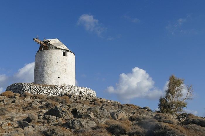
The Kastro Mill
Toward Aliki Beach We walked to Aliki Beach, west of the main village. It’s a large sandy beach shaded by tamarisk trees, but the strong wind prevented us from enjoying it. In the afternoon, I set off on a hike toward the fairy chimney at Skiadi (1.5 hours one way). The paths were very well-marked with signs indicating the trail number and the time to reach the destination. The countryside was beautiful but very dry at this time of year, and as always in Greece, many white chapels dotted the landscape. The numerous dry stone walls testify to the immense labor done by the island’s inhabitants over the centuries! For our last day in Kimolos, we decided to visit the beautiful Praça Beach, one of the most beautiful according to the guides! To get there, we took a path through the interior before joining the paved road near a large dump overflowing with various waste. It’s the flip side of the scenery, and Greece still has progress to make in this area. In the end, Praça Beach left us underwhelmed. The environment, marred by mining operations, detracts from the charm of the beautiful sandy beach. End of the Trip, Return to Piraeus and France And that’s it—we took the Zanteferries ferry back to Piraeus, arriving after a calm and sunny 10-hour journey. We had dinner at Souvlaki Street on the port and spent a good night at the Faros I Hotel in Piraeus—a great spot, close to the port, very clean, and reasonably priced. We flew from Athens to Basel-Mulhouse EuroAirport without any issues. N.B. Budget: around 1850 € all included for 14 days per couple The photo album is available by clicking this link: https://photos.app.goo.gl/wRpxRipg4erpzGj99
The village of Plaka in Milos
It was with great pleasure that we finally reconnected with our old habits as inveterate travelers! Greece, and more specifically the Greek islands, was the natural choice for us. After having already visited many Greek islands during around 18 trips, we decided to revisit islands we had seen over 40 years ago, like Milos, where our memories were extremely hazy. Our route was well-planned and familiar: a low-cost flight from Basel-Mulhouse to Athens, then a traditional ferry from Piraeus to Milos. Taking a speedboat, which is faster, would have forced us to spend a night in Piraeus. Plus, we felt that the traditional ferry was part of the journey, and with good weather, spending eight hours on deck wasn’t unpleasant at all. Watching the docking maneuvers with the comings and goings of trucks and cars, observing the passengers, reading a book, or admiring the scenery—all of that is part of the travel experience. Milos Island: Accommodation in Adamas We arrived quite late, around 11 PM, in Adamas, the port of Milos. No worries—the friendly couple managing the apartment was waiting for us, and it was just a 10-minute walk from the port. The first two days were spent unwinding, with swimming at the nearby beach, strolling through Adamas, and relaxing.
Discovering Plaka On the third day, we took the path along the small beach west of town toward a French military cemetery! A historical reminder of our presence here during the Crimean War, among others. The path climbs toward a beacon perched on top of a hill before disappearing into the scrubland. We returned to Adamas for lunch on our terrace.
In the afternoon, we visited the hilltop village of Plaka by bus from Adamas. Plaka is the original old town, dominated by a church and, even higher up, the ruins of the Kastro. The view is magnificent. We stopped at a pastry shop in the village to enjoy excellent orange cakes and baklavas. Back in Adamas, we checked out car rental agencies to be more mobile, though the bus network seemed quite extensive. It costs around 40 € per day, plus 8 € if you want to significantly reduce the deductible. Port of Klima.
Yesterday’s weather was quite mixed with lots of clouds, but today the sun is shining again. We drove to the small port of Klima, famous for its boat garages called "sirmatas." It’s true that in the morning sun, these boat garages carved into the volcanic tuff are beautifully lit, turning the village into a colorful mosaic. Above the village, a path climbs directly to the magnificent Roman theater overlooking the surroundings and the sea.
Following the well-marked path, we reached the road leading 200 meters down to the catacombs. It’s an impressive complex of 3rd and 4th-century catacombs, though only a small part is open to visitors—it’s still very moving. In the mid-afternoon, we got back in the car to visit the tiny ports of Firopotamos and Mandraki, which also have their colorful sirmatas. We took the opportunity to swim at the small beach in Mandraki, where the water was warm and calm.
Mandraki Port. We had a decent dinner at a seaside restaurant in Adamas, though you have to be selective—we had a bad experience at Kynigos on the second night!
Moving to Polonia in Eastern Milos, Sarakiniko SiteThe Sarakiniko site We left Adamas for a second stay on Milos, this time in Polonia. The rental Panda was packed with the four of us and our luggage! Our apartment was in a beautiful house surrounded by a grove, so our lovely terrace was well-shaded. Luckily, there was a small beach nearby, and we went for a swim right away. Apart from us, there were only three other swimmers—definitely the end of the season!
"Fairy chimney"! In the afternoon, we visited the famous Sarakiniko site, Milos’ emblematic spot. Judging by the number of cars in the parking lot, we wouldn’t be alone. As we approached, we heard an indefinable rock/punk/metal music: some young people had brought a sound system and a foghorn and were having fun diving off a fairly high cliff to impress the crowd. It definitely spoiled the visit. Most spots were taken by couples busy taking selfies, so getting photos of the site without tourists was impossible. Still, the site is magnificent, with its white cliffs looking like they’re covered in whipped cream! The sun was still very bright, reflecting strongly off the cliffs, making photography difficult due to the excessive brightness. We had a fish dinner in Polonia at the Enalion restaurant: while the octopus and squid were good, the fish soup tasted more like vegetable soup with a few fish crumbs—too bad.
Sunset in Polonia
Ports of Papafranga and Mytikos We continued our exploration of Milos with the Papafranga gorge, a narrow and deep gorge that opens to the sea, where the water is a stunning color. Access via an unstable and dangerous path is prohibited, but that didn’t stop a couple of tourists in flip-flops from venturing in!!! We then swam in the tiny, calm, and sheltered cove of the small port of Mytikos. We returned to Polonia for lunch at Alkis: excellent moussaka. In the late afternoon, Pat and I went out to take some photos just before sunset near the Agios Nikolaos chapel, the beacon, and the new Petakoudia neighborhood next to Polonia to the north.
Paleochori Beach
Toward the Multicolored Beach of Paleochori Another sunny day: we still had to discover Paleochori Beach in the south of the island. It was 10:30 AM, and the beach was almost deserted! The water was pleasant, though a bit chilly when we first entered. The beach is bordered by a cliff that, in some places, displays a beautiful multicolored palette. We returned to Polonia in the late afternoon, and Pat and I headed toward Vouddhia Beach south of Polonia—bad choice. The beach is surrounded by a huge mining site served by a dusty road where lines of trucks loaded with ore cross paths. It’s the other side of the coin, and Greece still has progress to make in this area. Dinner at Alki’s was just as good as always. Return to the Sarakiniko Site Early this morning, Pat and I went back to the Sarakiniko site, hoping to take photos in better conditions. While there were fewer people, the parking lot was still full because sunrise is a must in Milos. Still, the conditions were good, and the sunrise spectators left quickly once the sun had risen above the horizon. During the day, an increasingly strong wind cooled the atmosphere, making swimming less enjoyable. Departure for Kimolos Island We changed islands and left Milos for Kimolos, a nearby island—just a 30-minute trip from Polonia’s port. Our apartment was at the entrance of the hilltop village. It’s a village with typical Cycladic architecture, featuring the remains of an old kastro, a few old churches, and windmill towers perched on the hill. We dined in a tiny tavern where the small outdoor tables were squeezed against the walls to let passersby through! As soon as the sun disappeared, it got cold, especially because of the wind. Ports of Kara and Goupa This morning, we explored the small hamlets of Kara and Goupa by Rema Beach, east of the main port. There, we found the sirmatas again—those boat garages partly carved into the volcanic tuff. The path winds between several sirmatas before climbing back up to the Praça road to return to the apartment.
Ports of Kara and Goupa
In the afternoon, we strolled through town, and Pat and I climbed the hill overlooking the village to get a closer look at the few more or less ruined windmills dotting the ridge. Only one mill still had its complete mechanism in place under the roof; the others were empty. The view over the village, port, and sea was beautiful. That evening, we tried another restaurant in the village center, Kali Kardia Bohoris, which was well-frequented by locals, and we didn’t regret it: delicious food, efficient and friendly service, and reasonable prices.
The Kastro Mill
Toward Aliki Beach We walked to Aliki Beach, west of the main village. It’s a large sandy beach shaded by tamarisk trees, but the strong wind prevented us from enjoying it. In the afternoon, I set off on a hike toward the fairy chimney at Skiadi (1.5 hours one way). The paths were very well-marked with signs indicating the trail number and the time to reach the destination. The countryside was beautiful but very dry at this time of year, and as always in Greece, many white chapels dotted the landscape. The numerous dry stone walls testify to the immense labor done by the island’s inhabitants over the centuries! For our last day in Kimolos, we decided to visit the beautiful Praça Beach, one of the most beautiful according to the guides! To get there, we took a path through the interior before joining the paved road near a large dump overflowing with various waste. It’s the flip side of the scenery, and Greece still has progress to make in this area. In the end, Praça Beach left us underwhelmed. The environment, marred by mining operations, detracts from the charm of the beautiful sandy beach. End of the Trip, Return to Piraeus and France And that’s it—we took the Zanteferries ferry back to Piraeus, arriving after a calm and sunny 10-hour journey. We had dinner at Souvlaki Street on the port and spent a good night at the Faros I Hotel in Piraeus—a great spot, close to the port, very clean, and reasonably priced. We flew from Athens to Basel-Mulhouse EuroAirport without any issues. N.B. Budget: around 1850 € all included for 14 days per couple The photo album is available by clicking this link: https://photos.app.goo.gl/wRpxRipg4erpzGj99
Holiday in Brittany with 3 kids (5 months, 4 and 7 years old)
I’m starting to plan our summer 2025 holiday.
Yes, I know, I’m getting a head start 😄, but since I’m pregnant, I’d rather have as much ready as possible before baby arrives at the end of March 👶.
We’re a family of 5, and this year, we’d like to visit Brittany (not too hot—perfect for us! 🌡️). We already know the southern area a bit, as well as the Saint-Malo region, but this time, we’d like to explore the north of Finistère. We’re looking for an area that’s still quite wild, away from the crowds.
We’d also like to find some fun activities to keep our two older kids (4 and 7) busy 👧🧒.
We’re good walkers, and we’ll have a baby carrier for the youngest.
Which area would you recommend? Any ideas for places to visit, beaches, or family-friendly activities?
Thanks in advance for your recommendations! 🙏
Elise
Is Corcovado National Park in Costa Rica a must-see?
My partner and I are planning our 18-day trip to Costa Rica, and we’re thinking of renting a car. After reading so much about Costa Rica, we’re feeling a bit overwhelmed with information. We love hiking and wildlife but aren’t big fans of crowds. Corcovado Park seems like a stunning and less crowded spot, but it’s not the easiest to access. Is it worth going all that way to visit, and if so, do you have any recommendations for where to stay and which entrance to use? Thanks so much!
Dominique
Dominique
Une semaine au départ de San Francisco English translation pending
Bonjour , nous somme une famille de 4 : parents et 2 enfants de 13 et 9 ans. Théoriquement nous irons à San Francisco fin avril. Nous avons avons de la famille sur place ( les enfants sont plus jeunes). Premier séjour aux États-Unis. Pour cause professionnelle la durée sur place est limitée.
les vols sont achetés aux horaires qui nous conviennent:
arrivée à SF dimanche 13h35 , départ le mardi 23h00. Après un road trip Nous souhaitons être de retour à SF le samedi soir: visites avec les 2 familles le dimanche, puis entre nous le lundi et mardi
j'envisage cet esquisse de programme:
dimanche soir :nuit à Midpines
Lundi visite de Yosemite park , nuit à Fresno
mardi visite de Sequoia park nuit à Three Rivers
mercredi route et visite de Trona Pinnacles nuit à Ridgecrest
jeudi visite Death Valley Furnace Creek nuit à Las Végas
pour le vendredi : le Grand Canyon donne vraiment envie d''être visité , nuit au Grand Canyon?
samedi retour vers Las Vegas puis vol vers SF en fin d’après-midi ( je ne prends pas le risque de réserver ce vol plusieurs semaines à l'avance) ou route toute la journée vers SF.
votre avis trop chargé , je supprime soit Death Valley , soit le Grand Canyon , les 2 ?
j'ai regardé pour arriver directement à Las Vegas plutôt que San Francisco le premier jour mais il faut ajouté presque 600€ ( j'ai eu les 4 aller-retour Paris SF à 1240€). Si le premier jour je vais à LV en avion en partant de SF quelle marge prendre entre le départ du 2eme vol et l'arrivée du premier? Pour les hébergements j'essaie de trouver sur hotel.com car j'ai un programme fidélité lors de mes déplacements pro. Merci pour vos conseils William
j'ai regardé pour arriver directement à Las Vegas plutôt que San Francisco le premier jour mais il faut ajouté presque 600€ ( j'ai eu les 4 aller-retour Paris SF à 1240€). Si le premier jour je vais à LV en avion en partant de SF quelle marge prendre entre le départ du 2eme vol et l'arrivée du premier? Pour les hébergements j'essaie de trouver sur hotel.com car j'ai un programme fidélité lors de mes déplacements pro. Merci pour vos conseils William
République Dominicaine: au fil de la route... et autres souvenirs English translation pending
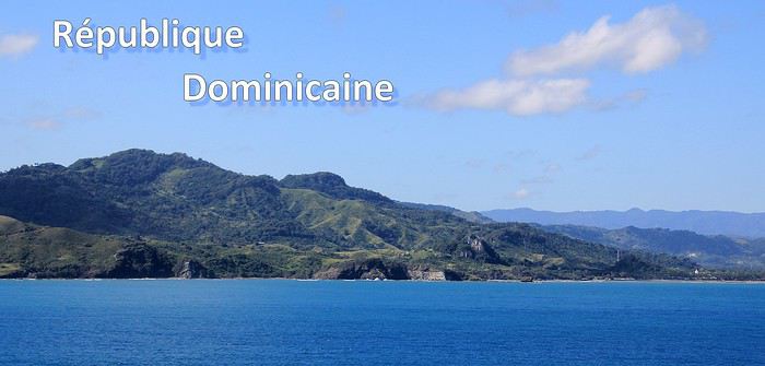
Ce sont mes derniers souvenirs de voyage à l'étranger, c'était avant … avant que la pandémie de la Covid-19 ne s'abatte sur notre planète et contrarie (en autre !) nos désirs de voyages loin de chez nous. Un récit à propos d'une dernière escale dans les Caraïbes, elle date du début mars et c'était donc en République Dominicaine. Ce carnet aborde principalement le souvenir d'une échappée le long d'une « route » hors des sentiers battus, dans le nord de l'île. Une région bien moins fréquentée et donc moins connue que les très courus sites balnéaires de cette grande île tropicale. Un récit qui est également l'occasion pour moi de partager dans une seconde partie quelques autres souvenirs de voyage en Rep. Dom. Ils sont un peu plus anciens et concernent quelques uns des incontournables sites à visiter de la destination.
--
L'escale approche. Peu à peu, la côte se fait plus nette, le soleil a fait disparaître la nébulosité et la plage d'Amber Cove apparaît dans toute sa beauté.
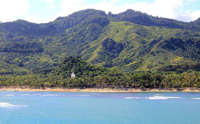
Le trio qui fait le charme des îles tropicales est bien présent sous nos yeux : des eaux bleues, du sable clair bordé d'une palmeraie et un versant verdoyant qui en impose en surplomb du rivage. Un coquet clocher aux tonalités jaune et rose bonbon émerge au-dessus de cette étendue de palmes. Pour afficher la nationalité de l'île, les couleurs sont hissées haut. On reconnaît les carrés rouge et bleu séparés d'une croix blanche du drapeau de la République Dominicaine.
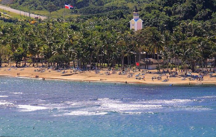
Nous sommes précisément sur la côte nord de l'île, dans la région de l'ancienne ville coloniale espagnole de Puerto Plata.
Un dernier coup d’œil sur la jolie baie encadrée de promontoires rocheux en fond de décor et bordée d'une langue de terre au vert lumineux qui défile juste sous nos yeux.
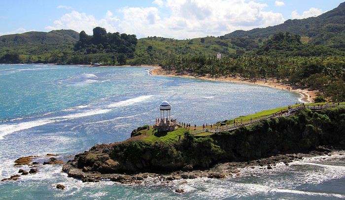
A peine débarqués du navire, on embarque à nouveau … mais sur un tout autre moyen de transport, finie la navigation, on prend place maintenant sur un drôle de véhicule hybride. Un genre de machine à grosses roues, dans un style intermédiaire entre camion et bus d'aventures tout-terrain. De simples banquettes font offices de sièges, quant aux dossiers et aux montants métalliques, ils sont tous rembourrés et capitonnés … On le comprend vite, la route, enfin la piste qui s'annonce pour cette virée risque d'être chaotique. Pas de doute, il ne doit pas s'agir d'un long ruban de bitume très tranquille !
Pour l'instant nous traversons la paisible petite ville de Maimon. Une agglomération sans grand intérêt si ce n'est d'avoir un aperçu de la vie quotidienne locale. Des enfants bruyants jouent dans la cour de l'école et quelques habitantes font leurs achats dans les boutiques, la plupart sont de simples maisons/cases comme d'ailleurs beaucoup d'habitations. En voici deux exemples assez représentatifs du style de l'habitat local. Une simple maison recouverte de tôles ondulées mais dont les murs extérieurs sont agrémentés d'une teinte bleutée. C'est un aspect des plus courants dans la petite cité.
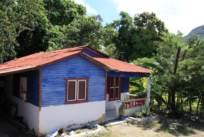
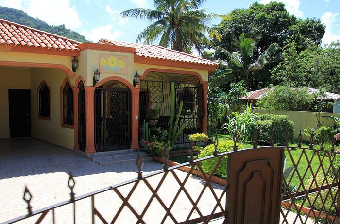
Plus loin, nous passons devant une maison un peu plus cossue : un propret jardinet et des grilles ouvragées entourent cette demeure plus élaborée et dont on imagine le meilleur confort intérieur.
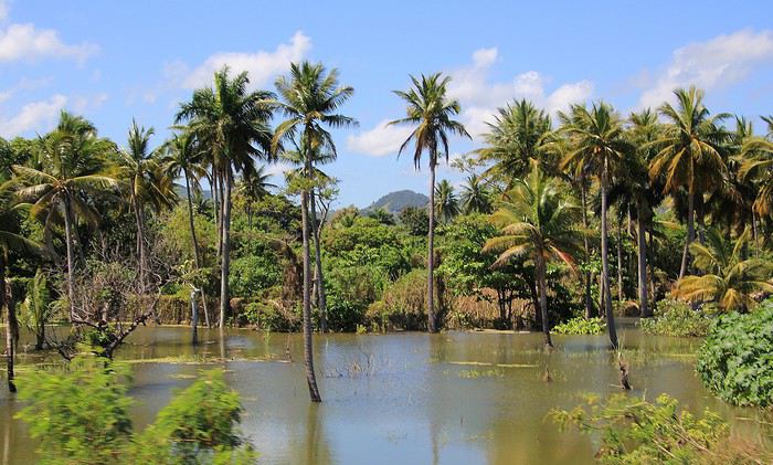
Passons la périphérie urbaine, place à la campagne. On le constate dès le début du trajet, les terrains aux abords de la voie sont détrempés voire inondés. Le chauffeur, sympa, nous informe que de récentes et fortes intempéries ont quelque peu endommagé la piste que nous devons emprunter … Au fond de cette baie, le courant et les torrents ont charrié des quantités de branchages, certains sont encore là, amassés au bord du rivage bordé de mangrove.
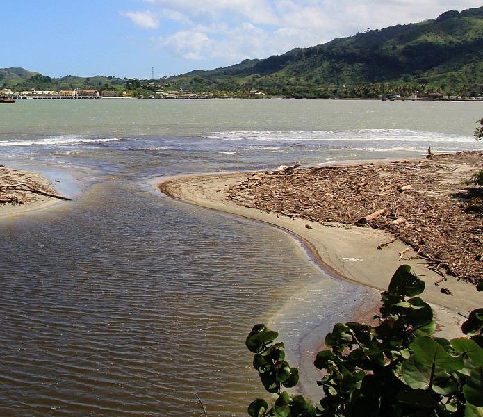
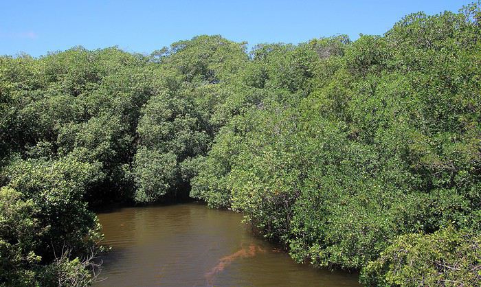
Sur ce tronçon, un torrent a emporté une partie de la route, le passage se fait désormais sur une seule voie constituée de terre battue.
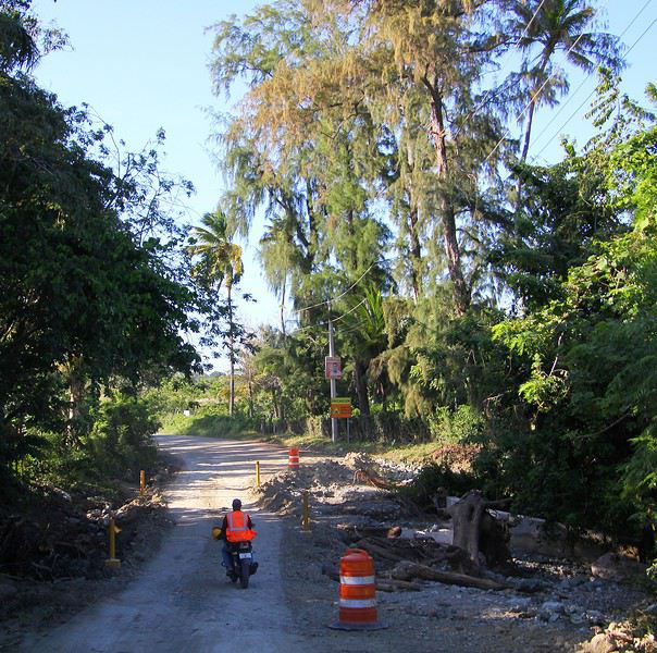
Three weeks in Quebec at the start of summer 2018, on a "semi-organized" trip
I’ve been putting off posting my Quebec travel experience for a long time. Two years later, I’ve finally decided to share it. The memories are still vivid. I hope this gives you the urge to visit this beautiful region, which I literally fell in love with.
We’re traveling as four adults: my brother Guy, my sister-in-law Martine, my friend Pascal, and myself (Christian).
We entrusted the flight, hotel, and car reservations to the travel agency Amplitudes in Toulouse. Planning the day-to-day activities was up to us. We scheduled a few must-see visits, but for the rest, we’d figure it out on the spot.
Our itinerary: Quebec City / Rimouski / Carleton-sur-Mer / Percé / Sainte-Anne-des-Monts / Matane / Tadoussac / Sainte-Rose-du-Nord / Chambord / Saint-Alexis-des-Monts / Montreal
06/25 Here we are at Roissy Charles de Gaulle for the usual pre-flight formalities. Everything goes smoothly and quickly. The hardest part is waiting for takeoff. After an uneventful flight on an Air Canada Boeing 777-300ER, we land at Montréal-Pierre Elliott Trudeau Airport (YUL) in the early afternoon.
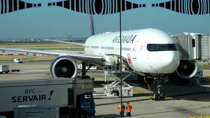
At customs, a surprise—no grumpy officer, but a smiling customs agent who jokingly asks me to name three tourist spots in Quebec, or else he won’t let me in. I pass the test easily and enter Quebec!
We head to the Alamo counter at Trudeau Airport to pick up our car: a Ford Escape with only 300 kilometers on the odometer.
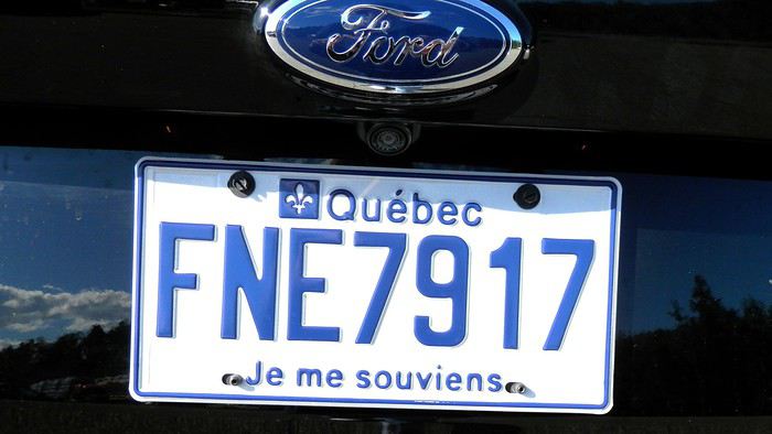
We decided to head straight to Quebec City, saving Montreal for the end of the trip. Pascal takes the wheel and gets on the Trans-Canada Highway E20 for a 255 km drive, taking about 2 hours and 45 minutes. With the time difference, we’re already feeling hungry, so we stop for our first poutine at a highway restaurant.

When we arrive in Quebec City, we go straight to the Clarendon Hotel, located right in the heart of Old Quebec. We’ll be staying there for three nights. Tonight, no restaurant—just a short walk around the hotel before bed. We discover a square with pretty colored water fountains near the city hall.
 It’s only 9 PM, but our body clocks say it’s 3 AM.
We’re traveling as four adults: my brother Guy, my sister-in-law Martine, my friend Pascal, and myself (Christian).
We entrusted the flight, hotel, and car reservations to the travel agency Amplitudes in Toulouse. Planning the day-to-day activities was up to us. We scheduled a few must-see visits, but for the rest, we’d figure it out on the spot.
Our itinerary: Quebec City / Rimouski / Carleton-sur-Mer / Percé / Sainte-Anne-des-Monts / Matane / Tadoussac / Sainte-Rose-du-Nord / Chambord / Saint-Alexis-des-Monts / Montreal
06/25 Here we are at Roissy Charles de Gaulle for the usual pre-flight formalities. Everything goes smoothly and quickly. The hardest part is waiting for takeoff. After an uneventful flight on an Air Canada Boeing 777-300ER, we land at Montréal-Pierre Elliott Trudeau Airport (YUL) in the early afternoon.
At customs, a surprise—no grumpy officer, but a smiling customs agent who jokingly asks me to name three tourist spots in Quebec, or else he won’t let me in. I pass the test easily and enter Quebec!
We head to the Alamo counter at Trudeau Airport to pick up our car: a Ford Escape with only 300 kilometers on the odometer.
We decided to head straight to Quebec City, saving Montreal for the end of the trip. Pascal takes the wheel and gets on the Trans-Canada Highway E20 for a 255 km drive, taking about 2 hours and 45 minutes. With the time difference, we’re already feeling hungry, so we stop for our first poutine at a highway restaurant.
When we arrive in Quebec City, we go straight to the Clarendon Hotel, located right in the heart of Old Quebec. We’ll be staying there for three nights. Tonight, no restaurant—just a short walk around the hotel before bed. We discover a square with pretty colored water fountains near the city hall.
It’s only 9 PM, but our body clocks say it’s 3 AM.Petites randonnées en Corse juin 2020 English translation pending
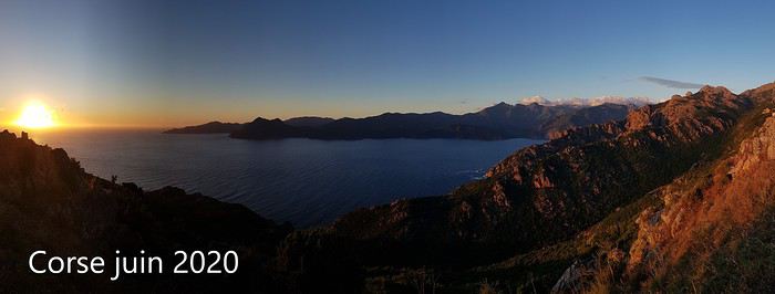 Bonjour à tous,
Encore un p'tit carnet sur la Corse, où nous sommes allés mi-juin dans des conditions qui ne se reproduiront sans doute jamais : météo parfaite et pas un chat!
Pour une fois, je ne donne pas beaucoup de détails pratiques (mais tout de même les traces wikiloc) très faciles à trouver en quelques clics.
Le but premier du voyage était d'apporter quelques affaires à notre fille Marion mais sevrés de voyages depuis l'irruption d'un certain virus nous en avons profité pour randonner un peu.
Le récit en images est là : clic!
Bonne lecture! Marie
Texte seul :
Corse Juin 2020 Petite virée en Corse, où vit désormais notre fille Marion. Voyage reporté 2 fois en raison de la Covid 19…
Finalement nous partons en fourgon car nous avons pas mal de fourbi en plus des chiens. Mi-juin, la limitation des 100 km est enfin levée et après avoir une traversée très tranquille au départ de Toulon, nous débarquons de bonne heure à Ajaccio : au programme, bricolage et randonnées !
Les chiens nous accompagnent, Corsica Ferries propose des cabines « spéciales chiens » sans moquette. Plein de chiens sur ce bateau, tous très pacifiques…Malheureusement le pont supérieur où un espace leur serait réservé est fermé. Environ 14h de voyage (en comptant les temps d’embarquement/débarquement), les vessies ont tenu le choc ! Tous les passagers sont masqués et ravis de retrouver un peu de liberté !
DI 14/06/20 Arrivée en Corse L’air est doux, le ciel est pur (gros orage et grosses inondations quelques jours avant notre arrivée), la météo s’annonce idéale pour la semaine à venir. Je craignais la chaleur en Juin, mais finalement nous n’aurons jamais plus de 24°C en bord de mer, supportable donc… Retrouvailles et bricolage, puis nous faisons une petite balade vespérale vers l’anse de Minaccia. Pas la foule pour un dimanche…
LU 15/06/20 Lac de Melo Marion et Yoan se sont libérés pour nous accompagner et leur aide sera indispensable pour pousser/hisser/tirer les chiens (30 et 40 kg) qui eurent bien du mal à franchir 2 ressauts équipés d’échelles verticales (le 1er se franchit facilement par la droite et le 2ème par la gauche, c’est plus scabreux). Tout est très vert, très fleuri, on se régale. On bulle un long moment près du lac (les chiens plus tout jeunes sont crevés tellement ils ont été crispés par ce franchissement) tandis que les jeunes grimpent plus haut dans la montagne. Nous redescendons en rive droite de la cascade (sans échelle !) Jolie balade, pour moi un peu gâchée par la peine qu’ont eue mes chiens chéris… https://fr.wikiloc.com/itineraires-randonnee/lac-de-melo-15-juin-51095645
MA 16/06/20 Bergeries des Pozzi Départ avec Marion de la station de Val D’Eze : on longe d’abord un tire-fesse (pas glop) puis la balade devient magnifique ! Quelques vaches et chevaux nous accueillent en haut de la grimpette. Vue sur le village de Bastelica et au fond sur la baie d’Ajaccio. On longe une très jolie crête et au bout de celle-ci on découvre d’un coup le vallon et ses pozzines. On adore ce type de paysage, les chiens aussi ! On passe ensuite à proximité de la bergerie avant de traverser une grande forêt de hêtres tortueux sillonnée de quelques ruisseaux : parfait pour les chiens ! On a adoré cette balade ! https://fr.wikiloc.com/itineraires-randonnee/pozzis-depuis-val-d-ese-pozzi-5002592
Marion rentre sur Ajaccio (elle travaille demain) tandis que nous allons au départ de la rando prévue demain, au-dessus de Soccia.
ME 17/06/20 Lac de Creno Nous avons dormi sur le parking (désert) en dessous du petit resto situé au départ de cette randonnée. Itoo a encore trouvé quelques forces pour jouer avec le p’tit chien du coin. Nous partons de bonne heure (fraicheur, belle lumière, personne) sur un joli sentier fleuri. C’est tellement vert qu’on se croirait en Ecosse ! Nous voici au seul lac boisé de Corse, certains pins sont énormes ! Très belle vue sur les montagnes qui cernent le lac de Melo où nous étions avant-hier. On monte ensuite vers la Chapelle San’t Eliseu dans un sous-bois profondément labouré par les sangliers (le mieux est de monter par la crête qui commence juste derrière la maison forestière, il n’y a pas vraiment de sentier…ou nous ne l’avons pas trouvé) Vue à 360° magnifiée par les nuages ! Nous descendons ensuite par une crête si joliment fleurie qu’on se croirait dans un jardin. Le sentier est assez mal tracé, il faut être attentif. https://fr.wikiloc.com/itineraires-randonnee/lac-de-creno-et-chapelle-sant-eliseu-17-juin-56206520
Déjeuner au resto du parking, quasi désert : les locaux se lamentent, nous compatissons mais jubilons intérieurement d’avoir les chemins de randonnée presque pour nous tous seuls. Autre avantage, service rapide et très aimable : nous qui n’allons que très rarement au restaurant en vacances car nous n’aimons pas attendre des plombes le bon vouloir d’un service débordé allons changer nos habitudes. Au moins pendant qq jours !
Gorges de Spelunca Nous reprenons la route vers les Gorges de Spelunca, qui m’ont un peu déçue. La route d’approche par l’est est très belle mais les gorges m’ont semblé assez banales. Nous longeons la rivière (que l’on voit finalement assez peu du fait de la végétation) en aller-retour jusqu’au vieux pont. Peu de possibilité de baignade pour les chiens… https://fr.wikiloc.com/itineraires-randonnee/gorges-de-spelunca-56206499
Fin de journée au départ de la rando du lendemain, près des calanques de Piana et du Capo Rosso.
JE 18/06/20 Capo Rosso On démarre de bonne heure car je crains la chaleur au niveau de la mer. Belle vue vers la côte et ses tours génoises. On aperçoit le parking. Plus on descend, plus il fait chaud et plus je pense à la remontée…je m’inquiète pour les chiens qui tirent déjà la langue. Arrivés à cette jolie cabane en pierre, nous abandonnons Fred qui monte en vitesse jusqu’à la tour et faisons tranquillement demi-tour : retour facile finalement. https://fr.wikiloc.com/itineraires-randonnee/capu-rossu-en-boucle-41682629
Calanches de Piana On enchaîne avec une petite balade dans les Calanches de Piana, sur le Chemin du Château Fort : la lumière est dure et blanche, il est midi… https://fr.wikiloc.com/itineraires-randonnee/piana-18-juin-56206514 Pause resto sur la plage de Busaglia, où nous sommes encore une fois les seuls clients : service attentionné, les chiens ont eu chacun une gamelle d’eau !
Vallée du Fango On décide ensuite de pousser jusqu’à la vallée du Fango, pour les rafraichir un peu. Très joli coin, qui doit être habituellement bondé à en juger par les panneaux d’interdiction de stationner et la taille des parkings : on a vu en tout 4 personnes ! Après cette baignade les chiens sont définitivement épuisés par ces quelques jours de rando ! https://fr.wikiloc.com/itineraires-randonnee/vallee-du-fango-56206546 Demain, croisière… Retour vers Porto et nuit près de la plage de Gradelle.
VE 19/06/20 Scandola Départ de Porto à 10h, le bateau de Via Mare est plein à 10%, c’est cool ! (pour nous…) J’avais d’abord contacté le Passe Partout qui nous avait gentiment conseillé de prendre un bateau plus grand pour le confort des chiens car il y a un peu de houle : sympa ! (Marion et Yoan ont fait le tour avec eux qq jours plus tard et ça leur a bien plu) Il fonce vers la réserve de Scandola, puis navigue pendant quelques dizaines de minutes en rasant les roches volcaniques : 2 nids de balbuzards ( ?) vides, très peu d’oiseaux. Mais de jolies couleurs et des commentaires intéressants. Petite pause au retour au village de Girolata (pas d’accès routier) avec une petite baignade pour les chiens -à bonne distance des vaches ! Tour sympa et reposant ! Retour sur Porto en milieu de journée puis sur Ajaccio.
SA 20/06/20 Pointe de la Parata Nous reprenons le ferry ce soir. Petite balade de l’Anse de Minaccia jusqu’à la pointe de la Parata, personne sur cette rando non plus (on est à 20 mn d’Ajaccio un samedi !) https://fr.wikiloc.com/itineraires-randonnee/la-parata-20-juin-56206489 Parking immense quasi vide. Quelques personnes tout de même près de la pointe, il faut dire que la vue sur les îles Sanguinaires est magnifique ! Bon déjeuner à la brasserie de la pointe (à nous 4 on double l’effectif des clients !) Appareillage vers 20h00, alors que le soleil descend sur l’horizon… Quel plaisir de naviguer de nuit et d’arriver frais et dispo le lendemain matin !
Vélo en septembre de Toulouse à Nice English translation pending
Bonjour à tous et à toutes ,
J’ai comme projet de partir avec mon chien en itinérance vélo en Septembre de Toulouse à nice . Je souhaite passer par montpelier puis marseille puis destination finale. J’ai un peu étudié l’itinéraire et je pensais prendre le canal de Toulouse jusqu’à Sète. Première question connaissez vous le chemin le plus sécurisé pour rejoindre montpelier depuis Sète ? Je vais tirer mon chien grâce à une remorque enfant et donc je souhaiterais éviter le plus possible les routes avec beaucoup de passages. En-suite je voulais savoir si quelqu’un l’avait déjà fait ? Puis de montpelier à Nice je pensais emprunter l’eurovelo 08 . Je voulais savoir si quelqu’un connaissais une meilleure option car je souhaite vraiment m’arrêter à Marseille et cette route longe mais n’y passe pas tout à fait. Dernièrement je suis en train de préparer le voyage et j’ai la remorque pour chien mais je compte investir dans un vélo solide , en vue de ce projet et des futures projets sachant que j’ai le poids d’un chien de 24 Kg a tirer. je me suis renseignée et chaque site propose une marque et un vélo différent dit performant et il y en a tellement et tellement de marques. Je n’ai pas non plus un énorme budget sachant que je compte acheter tout le matériel qui’il faut avec mais je comptes quand même investir un peu dans le vélo . Alors avez vous des conseils pour le vélo , la marque et le matériel que ce du matériel de bikepacking et toutes autres conseils que vous poubez me donner ?
Merci Clara
J’ai comme projet de partir avec mon chien en itinérance vélo en Septembre de Toulouse à nice . Je souhaite passer par montpelier puis marseille puis destination finale. J’ai un peu étudié l’itinéraire et je pensais prendre le canal de Toulouse jusqu’à Sète. Première question connaissez vous le chemin le plus sécurisé pour rejoindre montpelier depuis Sète ? Je vais tirer mon chien grâce à une remorque enfant et donc je souhaiterais éviter le plus possible les routes avec beaucoup de passages. En-suite je voulais savoir si quelqu’un l’avait déjà fait ? Puis de montpelier à Nice je pensais emprunter l’eurovelo 08 . Je voulais savoir si quelqu’un connaissais une meilleure option car je souhaite vraiment m’arrêter à Marseille et cette route longe mais n’y passe pas tout à fait. Dernièrement je suis en train de préparer le voyage et j’ai la remorque pour chien mais je compte investir dans un vélo solide , en vue de ce projet et des futures projets sachant que j’ai le poids d’un chien de 24 Kg a tirer. je me suis renseignée et chaque site propose une marque et un vélo différent dit performant et il y en a tellement et tellement de marques. Je n’ai pas non plus un énorme budget sachant que je compte acheter tout le matériel qui’il faut avec mais je comptes quand même investir un peu dans le vélo . Alors avez vous des conseils pour le vélo , la marque et le matériel que ce du matériel de bikepacking et toutes autres conseils que vous poubez me donner ?
Merci Clara
Petit tour à vélo dans des départements du bout du monde août 2020 English translation pending
Le voyage pourquoi ? Chacun sa définition en fonction de ses envies et de ses aspirations. Le plaisir, le bonheur de la découverte, aller regarder les grandes merveilles du monde, dont on nous dit qu’il faut les avoir vues dans sa vie au moins une fois, un peu à la manière de la Rolex de Séguéla. Certes, au cours d’une interview plusieurs années plus tard, il a répondu que ce jour-là, il avait dit la plus grosse connerie de sa vie !
Le cyclo-voyageur ajoute une dimension particulière au voyage. En quelque sorte son déplacement constitue son voyage. Il ne se rend pas en un lieu pour le visiter, il pérégrine en recherchant les routes, les chemins ou les pistes les moins courues, et il en fait son voyage. L’itinéraire, lorsqu’on le parcourt à la force de ses mollets, on change l’esprit du déplacement. Bien sûr l’idée de challenge est toujours, plus ou moins, sous-jacente.
Ce type de réflexion, tout naturellement m’a conduit à envisager de partir à la découverte de la France profonde à travers les départements suivants, la Haute-Marne, la Meuse et la Meurthe-et-Moselle. Bien évidemment, nous sommes nombreux à y être passés, mais en voiture dans nos traversées browniennes, où l’on ne souffre pas le moindre retard, les yeux rivés sur le compteur, en essayant d’être toujours un peu au-dessus de la limite, à l’orée de déclencher les radars. Entre le compteur optimiste et la petite tolérance, sur route 90 affiché au compteur et 140 sur autoroute, généralement tout se passe bien. Mais les grands axes sont devenus une jungle, où toute notre attention est absorbée. Donc, même si nous avons traversé ces départements 52, 55 ou 54 que connaissons nous des campagnes profondes qui s’y cachent ? C’est justement à leur découverte, hors des voies habituelles du tourisme, que je veux m’aventurer quelques jours. Certes, les départements agricoles j’en ai une petite idée, ayant habité en Haute-Saône et ayant beaucoup parcouru à pied tout le sud-ouest de la France, en particulier le département du Gers, très impressionnant par ses moutonnements de terres cultivées qui se succèdent jusqu’à l’infini. Mais voilà, tous les départements ne se ressemblant pas, c’est donc plein de curiosité et aussi d’attentes que je me lance dans un « petit tour » de 400 kilomètres à partir de chez moi.
Je vais renouer avec le bikepacking, terme barbare qui signifie que l’on part avec un matériel allégé, avec des sacoches au look futuriste qui n’ont pas besoin de porte-bagages pour être accrochées. Bien évidemment la contenance en est moindre. Mais on se déplace toujours avec beaucoup trop d’affaires, qu’il s’agisse d’habits ou d’appareils électroniques en tous genres, sans parler des matériels de bivouac trop volumineux. Evidemment, ces derniers il en existe de poids et volume réduits, mais il faut oser passer le pas et mettre au rebus un équipement que l’on considère toujours efficace. Et puis, il faut s’adapter aux saisons et aux lieux. Cela conduit à avoir une tente pour l’été en Europe, une pour l’hiver, éventuellement celle de l’été suffit, mais pour les voyages lointains dans des pays au climat très hostile, là pas le choix du très costaud s’impose. Le voyage à vélo, afin de s’équiper de façon optimale selon les différentes options demande des moyens financiers.
Comme à chaque fois, que je pars pour un voyage engagé de longue durée sur un autre continent ou pour un petit tour de côté de chez moi, alors l’appel de la route s’impose. J’ai perdu l’habitude (à vrai dire je ne l’ai jamais eue) d’organiser mes affaires en bikepacking, il s’agit seulement de ma deuxième expérience, et de plus je pars dans l’euphorie de la première. En effet, j’avais effectué le premier jour 230 kilomètres, alors j’envisage avec un esprit tranquille mon étape initiale de 130 kilomètres. Quelle erreur ! 6h30, je prends la piste cyclable direction Remiremont. Les 25 premiers kilomètres sont rapidement expédiés. Les bosses apparaissent dès la sortie ouest de la ville et elles vont être nombreuses. Je ne serai pas en mesure d’en faire la somme des dénivelés cumulés, mon compteur va me lâcher aux environs des 80 kilomètres. Je prends la direction de Bains-les -Bains. Tout va bien, la forme semble bonne, la circulation est peu dense. Je me fais doubler au moment où je m’arrête par un couple de voyageurs équipés de vélos électriques. Evidemment je ne les rattraperai pas.
Pause-café, plutôt capuccino à Bains-les -Bains. Sur la terrasse on est autorisé à s’installer sans porter le masque. Sur mon vélo au milieu de la campagne déserte j’oublie rapidement la présence de la pandémie, mais dès que je pénètre dans une agglomération, les visages masqués me rappellent la situation que nous subissons à l’échelle mondiale. Sur cette terrasse, un homme m’aborde et me pose quelques questions sur mon périple. Il me donne une information intéressante concernant la piste cyclable qui longe le canal de l’est et qui passe à proximité. Je ne le savais pas et ma carte Michelin au 1/150 000ème couvrant les départements Haute-Saône et Vosges ne la mentionne pas.
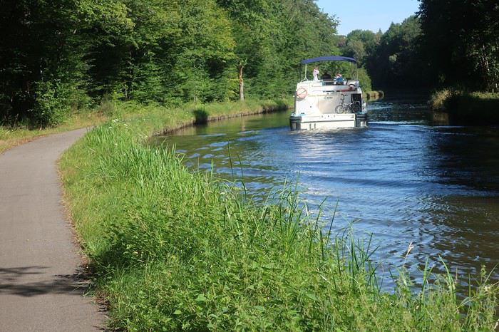
Je vais la suivre une dizaine de kilomètres, parcours très agréable où je croise plusieurs voyageurs à vélo, dont deux familles lourdement équipées. Je rencontre aussi plusieurs bateaux, certains dans mon sens donc je les dépasse. J’éprouve toujours un grand plaisir à suivre les berges d’un cours d’eau ou d’un canal. Ce dernier insuffle la sérénité. Parfois la piste est cernée par l’eau. Mais tout a une fin, je reprends la route au village de Selle. En traversant des villages du bout du monde ou presque, tels que Regnévelle, Godoncourt ou Ainville je me dirige vers mon point de chute la ville de Montigny-le-Roy.
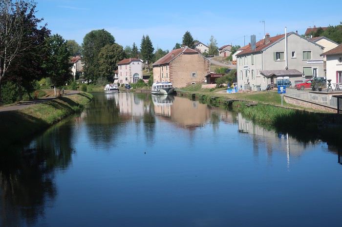
A vélo on passe rapidement de tout va bien à rien ne va plus. Mais il y a une explication à toutes choses. Sans doute l’absence d’entraînement depuis 18 mois, mais je ne me suis jamais entraîné avant de partir en balade. Peut-être l’âge ? mais plus probablement un mixte entre grosse chaleur et une très mauvaise gestion boisson nourriture. Il faut dire que dans ces coins durant les cinq jours de mon périple je ne rencontrerai quasiment aucun commerce ni bistrot. On a beau avoir une longue expérience en matière de voyage à vélo, les conneries de base on les fait encore parfois. Eh oui, cette idée de faire « seulement » 130 kilomètres m’a mis dans un état d’imprévoyance, m’imaginant que cela serait facile, et boum le coup de barre.
Je m’arrête dans un village asphyxié sous une chappe de chaleur, et à l’abri d’un mur, installé sur un petit carré de pelouse grillée je mange les deux œufs durs que j’ai pris la précaution d’emmener, ainsi que l’une des deux bananes que je possède. Je remplis mes bidons au magnifique lavoir.
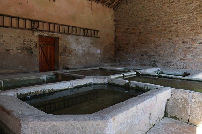
Je sens la déshydratation assécher mon corps. En France, je n’avais jamais ressenti cela. Je ne crains pas le soleil, sans doute du fait de mon atavisme du sud de la Méditerranée, mais aujourd’hui je me sentirais presque en danger. Il me reste une trentaine de kilomètres pour boucler mon étape prévue. Généralement, je ne suis pas à cheval quant au respect de la planification, je peux sortir ma tente et m’installer dans le premier bosquet un peu à l’abri des regards. Mais aujourd’hui j’ai l’impression de cuire et je crains que sous la tente ce soit l’enfer. Donc je vais m’astreindre à rejoindre la ville afin de chercher un hôtel, en quête d’un peu de fraîcheur. Les derniers kilomètres sont un calvaire comme je n’en avais jamais connu. Les ultimes côtes, même pas très raides, je suis dans l’obligation de pousser mon vélo, bien qu’il soit en carbone et hyper léger, et même de m’arrêter sur le bas-côté et me vautrer dans l’herbe du talus à l’abri de l’ombre d’un arbre.
Cette première journée me laisse un peu dubitatif. J’ai eu l’impression de pédaler dans quelque pays exotique. Les jours à venir ne seront pas plus cléments, les prévisions météorologiques annoncent des pics de chaleur encore plus importants. Bon, nous verrons bien. Première mesure essayer de continuer à rouler très tôt et puis limiter les étapes à 70 kilomètres. Voilà il faut s’adapter, le corps commande et surtout rester à son écoute, ce que je n’ai pas vraiment fait aujourd’hui.
J’ai plusieurs amis qui sont des spécialistes du déplacement à vélo de nuit, en particulier au moment de la pleine lune, ils en parlent avec des trémolos dans la voix. Ce serait bien le moment d’essayer, la configuration actuelle de notre satellite s’y prête. Mais dans un premier temps j’aspire à une bonne nuit et, surtout à réhydrater mon corps. Ma devise « toujours pisser blanc » est mise à mal, mes urines sont d’un jaune plus que prononcé malgré les 4 litres d’eau de la journée. Je ne me souviens pas avoir subi de telles difficultés à avancer, conjonction d’erreurs et de canicule. Toujours très intéressant d’aller assez prêt de ses limites physiques, je me rends compte qu’il ne faut pas grand-chose pour dérègler la machine.
De la terrasse de l’hôtel, je regarde vers le nord, tout est jaune, desséché. Cela est presque inquiétant, on pourrait se croire quelque part au sud de l’Espagne, mais non il s’agit bien de la Haute-Marne. Demain je vais me contenter d’une étape de 60 kilomètres en rejoignant Neufchâteau, qui se trouve dans le département des Vosges.

Après une nuit correcte, au réveil je constate que la journée d’hier a laissé quelques traces et, contrairement à mon habitude, je ne démarre pas au lever du jour mais vers les 9 heures du matin. Très vite, la ville située sur une bosse est quittée et devant moi s’ouvrent à l’infini des prairies et des terres agricoles grillées par la sécheresse et les rayons ardents du soleil. Prendre une carte IGN ou Michelin, qu’elle soit au 1/100 00, 1/150 000 ou 1/175 000 -ème et y tracer son itinéraire le long de départementales matérialisées par un trait blanc bordé de deux lignes noires, alors vous êtes certain du résultat. Vous vous lancez dans une belle aventure loin des voitures, mais proche d’une nature et d’une vie locale que l’on a tendance à ne plus voir. Cette incursion dans le département 52, va me conduire de minuscule village en minuscule village, qui s’égrènent, de bosses en creux, tout au long d’une terre ondulante. Je ne vais y voir pratiquement aucun des êtres vivants que l’on s’attend à rencontrer, ni homme, ni chien, ni chat. Si, une fois, dans l’un de ces hameaux apparemment abandonnés, je vais croiser un homme seul, et il me rappelle que nous sommes en pandémie car il porte le masque, le fameux masque qui fait couler tant d’encre et de salive chez les Gaulois récalcitrants.
A vrai dire je vais côtoyer de nombreuses vaches, qui lorsqu’elles le peuvent s’agglutinent à l’ombre d’un arbre de leur pâture. Elles sont comme de gros points blancs dans cet environnement couleur blond, couleur paille. Les ondulations permanentes de cette terre procurent des contrastes du plus bel effet entre le doré du sol et le bleu du ciel. L’une et l’autre des couleurs ne se mélangent pas comme sur une aquarelle, au contraire elles se maintiennent bien séparées par une ligne horizontale sans accroc. Cette matinée me fait une impression étrange. Ce décor de villages déserts alanguis dans un autre temps, de champs, de vaches, d’odeur de purin et de présence de traces de bouses un peu partout me remémore ma traversée de la Pologne par ses grandes plaines, il y a maintenant une dizaine d’années. Certes, en Pologne l’environnement, les habitations les matériels agricoles étaient plus vétustes, mais je m’y vois presque dans ces immenses plaines où les Allemands livrèrent de dures batailles avant de reculer devant le rouleau compresseur soviétique. D’ailleurs, ironie du sort dans ces hameaux de Haute-Marne, la présence humaine est surtout représentée par les monuments aux morts rappelant les soldats tombés au champ d’honneur pour la France.
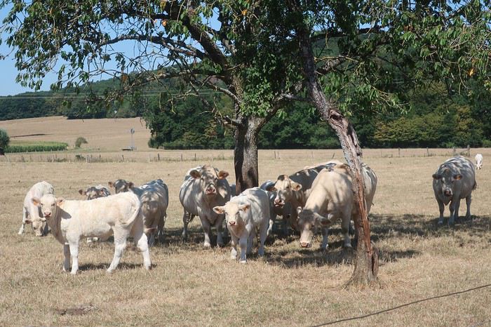
Au village de Pompierre je m’arrête vers midi, la température a déjà largement dépassé les 30 degrés, et cela va continuer à monter jusque vers 15 heures. Allongé au bout d’un pont à l’ombre d’un arbre je savoure la brise très ténue créée par le cours d’eau pas encore asséché, mais qui cependant a des airs de moribond qui ne devrait pas tarder à rendre les armes. Un coureur, plus très jeune, passe à trois reprises, suant et harassé sous le soleil vertical le dardant sans pitié. Au troisième passage je l’interroge. Il me répond qu’il vient d’effectuer par 3 fois un parcours de 2,5 kilomètres. Chapeau, car à part l’ombre de mon arbre son circuit se déroule en plein champ. Il me donnerait presque de la vaillance. Après trois quarts d’heure de station allongée, je prends à deux mains, sinon mon courage, du moins mon guidon et j’accomplis les 11 derniers kilomètres qui me séparent de Neufchâteau.
L’ambiance dans les villes est quand même un peu étrange, tout le monde ou presque est masqué. Dès que je descends de vélo je dégaine le mien. Il fait tellement chaud que je n’ai même pas faim. Je me force cependant à ingurgiter les différents éléments du menu que fort gentiment le propriétaire de l’hôtel me propose alors qu’il est déjà 14 heures. En ce troisième jour je compte rejoindre la ville de Commercy dans la Meuse, encore un département très agricole. Vu les conditions de forme pas au top et les conditions météorologiques par contre au top de la chaleur, ce sera le point le plus haut de mon parcours pour une sortie de 5 jours. Dans mon euphorie initiale je me serais bien vu monter au moins jusqu’à la frontière du Luxembourg. Mais voilà, entre ce que l’on désirerait et la réalité, cette dernière gagne généralement.
Comme hier, la même campagne assoiffée se déroule de part et d’autre de mon chemin. Je traverse le village natal de Jeanne-d ’Arc, Domremy-la -Pucelle. Il n’a pas de privilège particulier, lui aussi crie à boire. Puis je traverse une route plus importante et reprends mon itinérance au gré de départementales confidentielles. Je vais croiser quelques voyageurs à vélo, deux solitaires et un couple à vélo électrique. Généralement lorsque je croise d’autres adeptes du voyage à vélo je les intercepte pour discuter. Mais aujourd’hui non, d’ailleurs le bikepacker, bien qu’il se traîne, est-il considéré comme faisant partie de la même tribu ? Le deuxième solitaire rencontré est terriblement chargé, quatre énormes sacoches. Où va-t-il donc, quelle est la durée de son périple ? Tel que je suis équipé, je pourrais continuer beaucoup plus que les cinq jours prévus. J’ai tout pour être autonome, même 250 grammes de riz en cas de bivouac improvisé à la dernière extrémité. Apprendre à être minimaliste n’est pas facile. Je garde en mémoire les conseils d’un camarade spécialiste des grandes traversées en courant, du style Australie ou autre immenses étendues hostiles. Son slogan « si tu oublies quelque chose tu t’en passes ». Je me souviens aussi de ce Chamoniard rencontré au nord de la Thaïlande, qui roulait depuis 7 mois avec deux petites sacoches. Nous avions fait route ensemble quelques centaines de kilomètres et j’avais pu observer son fonctionnement. J’avais beaucoup appris en quelques jours.

En fin de parcours je traverse la Meuse à plusieurs reprises. Non seulement la végétation manque d’eau, mais la rivière aussi souffre de la sécheresse. Son débit est faible, partout affleurent de grands bancs d’algues aux couleurs diverses, mais son eau reste claire. Des différents ponts sur lesquels je m’arrête j’observe des multitudes de poissons. Je n’avais jamais vu une rivière aussi poissonneuse. A mon regard se dévoilent des chevennes, gardons et autres ablettes. Mais s’ils sont si nombreux, à n’en pas douter les carnassiers, comme brochets, sandres ou perches voire truites sont tapis quelque part en attente de les dévorer.

Avant d’atteindre mon but je me perds et fais des détours dans le village de Sorcy-Saint-Martin qui me permettent quelques contacts intéressants avec les rares personnes qui osent affronter le soleil de tout début d’après-midi. Commercy, petite ville avec un centre qui rappelle la place Stanislas de Nancy. Ce soir va s’y dérouler un concert en l’honneur de Johnny. Le chanteur est très bon, on s’y croirait tout à fait. Le contrôle de la police sera effectif en matière de distanciation. En ce quatrième jour je pars à huit heures du matin. Après un kilomètre je passe devant une pharmacie, déjà 28 degrés, il faut s’attendre encore une fois à une grosse attaque de la canicule. Pour le moment il est très agréable de pédaler. Aujourd’hui encore l’eau reste présente sur mon itinéraire. Entre le canal et la Meuse j’ai tout loisir d’observer l’eau et bien évidemment j’y vois des poissons de toutes tailles. Mes lunettes de soleil polarisantes m’aident grandement du fait qu’elles font disparaître les reflets. Je suis comme un intrus voyeur, j’adore ! Les trois premières heures sont un véritable plaisir. J’effectue une cinquantaine de kilomètres. Puis vers les 11 heures la chape de plomb comme les jours précédents s’abat. La moyenne tombe, les efforts deviennent pénibles. Je ne passe pas très loin de la colline de Sion « la colline inspirée » de Maurice Barrès. Le détour à vélo, agrémenté d’une belle côte par une température frisant les 40 degrés, me semble surhumain. Je vais rejoindre rapidement et au plus court la petite ville de Charmes et aller me planquer au frais dans un hôtel un peu au sud. Le soir, discussion sur la terrasse d’une pizzeria avec une Hollandaise qui parcourt à vélo l’itinéraire d’Achern aux Saintes-Maries-de-la Mer. Elle effectue de courtes étapes de l’ordre de 30 à 40 kilomètres, mais elle affronte le bivouac, ce que je n’ai pas le courage de faire.
En ce cinquième et dernier jour, une matinée plus propice au vélo, car un ciel légèrement voilé protège un peu du soleil, par la route au plus court je rejoins Remiremont. De là par la piste cyclable empruntant l’ancienne voie ferrée en 25 kilomètres je remonte la vallée de la Moselotte. Au cours de ce périple qui avoisine les 400 kilomètres les bistrots auront pratiquement été absents du bord de la route. Pour me rattraper, alors que je ne suis plus qu’à 6 kilomètres de chez moi, je m’arrête à l’ancienne gare de Saulxures, transformée en bar-restaurant et je déguste deux panachés. Ce coin m’est particulièrement familier, car souvent j’y laisse ma voiture pour partir assouvir l’une de mes passions la pêche à la mouche.
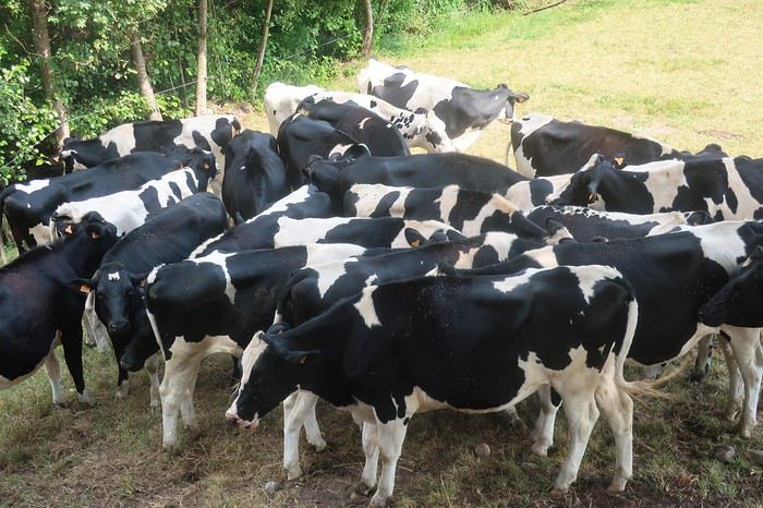 Belle brochette de vaches vosgiennes en remontant la vallée de la Moselotte, retour chez moi
Cinq jours sur la route, j’ai beaucoup apprécié de me déplacer sur ces routes hors des axes de circulation et aussi un peu hors du temps, ma curiosité toujours aiguisée par ces coins de France déserts. Mais malheureusement, je n’ai pratiquement jamais eu l’impression de me sentir à l’aise, le grand plaisir des kilomètres qui défilent comme si je volais. J’ai toujours ressenti cette impression de forcer excessivement comparativement aux distances accomplies. Espérons qu’il ne s’agisse que de l’effet de la canicule !
Le cyclo-voyageur ajoute une dimension particulière au voyage. En quelque sorte son déplacement constitue son voyage. Il ne se rend pas en un lieu pour le visiter, il pérégrine en recherchant les routes, les chemins ou les pistes les moins courues, et il en fait son voyage. L’itinéraire, lorsqu’on le parcourt à la force de ses mollets, on change l’esprit du déplacement. Bien sûr l’idée de challenge est toujours, plus ou moins, sous-jacente.
Ce type de réflexion, tout naturellement m’a conduit à envisager de partir à la découverte de la France profonde à travers les départements suivants, la Haute-Marne, la Meuse et la Meurthe-et-Moselle. Bien évidemment, nous sommes nombreux à y être passés, mais en voiture dans nos traversées browniennes, où l’on ne souffre pas le moindre retard, les yeux rivés sur le compteur, en essayant d’être toujours un peu au-dessus de la limite, à l’orée de déclencher les radars. Entre le compteur optimiste et la petite tolérance, sur route 90 affiché au compteur et 140 sur autoroute, généralement tout se passe bien. Mais les grands axes sont devenus une jungle, où toute notre attention est absorbée. Donc, même si nous avons traversé ces départements 52, 55 ou 54 que connaissons nous des campagnes profondes qui s’y cachent ? C’est justement à leur découverte, hors des voies habituelles du tourisme, que je veux m’aventurer quelques jours. Certes, les départements agricoles j’en ai une petite idée, ayant habité en Haute-Saône et ayant beaucoup parcouru à pied tout le sud-ouest de la France, en particulier le département du Gers, très impressionnant par ses moutonnements de terres cultivées qui se succèdent jusqu’à l’infini. Mais voilà, tous les départements ne se ressemblant pas, c’est donc plein de curiosité et aussi d’attentes que je me lance dans un « petit tour » de 400 kilomètres à partir de chez moi.
Je vais renouer avec le bikepacking, terme barbare qui signifie que l’on part avec un matériel allégé, avec des sacoches au look futuriste qui n’ont pas besoin de porte-bagages pour être accrochées. Bien évidemment la contenance en est moindre. Mais on se déplace toujours avec beaucoup trop d’affaires, qu’il s’agisse d’habits ou d’appareils électroniques en tous genres, sans parler des matériels de bivouac trop volumineux. Evidemment, ces derniers il en existe de poids et volume réduits, mais il faut oser passer le pas et mettre au rebus un équipement que l’on considère toujours efficace. Et puis, il faut s’adapter aux saisons et aux lieux. Cela conduit à avoir une tente pour l’été en Europe, une pour l’hiver, éventuellement celle de l’été suffit, mais pour les voyages lointains dans des pays au climat très hostile, là pas le choix du très costaud s’impose. Le voyage à vélo, afin de s’équiper de façon optimale selon les différentes options demande des moyens financiers.
Comme à chaque fois, que je pars pour un voyage engagé de longue durée sur un autre continent ou pour un petit tour de côté de chez moi, alors l’appel de la route s’impose. J’ai perdu l’habitude (à vrai dire je ne l’ai jamais eue) d’organiser mes affaires en bikepacking, il s’agit seulement de ma deuxième expérience, et de plus je pars dans l’euphorie de la première. En effet, j’avais effectué le premier jour 230 kilomètres, alors j’envisage avec un esprit tranquille mon étape initiale de 130 kilomètres. Quelle erreur ! 6h30, je prends la piste cyclable direction Remiremont. Les 25 premiers kilomètres sont rapidement expédiés. Les bosses apparaissent dès la sortie ouest de la ville et elles vont être nombreuses. Je ne serai pas en mesure d’en faire la somme des dénivelés cumulés, mon compteur va me lâcher aux environs des 80 kilomètres. Je prends la direction de Bains-les -Bains. Tout va bien, la forme semble bonne, la circulation est peu dense. Je me fais doubler au moment où je m’arrête par un couple de voyageurs équipés de vélos électriques. Evidemment je ne les rattraperai pas.
Pause-café, plutôt capuccino à Bains-les -Bains. Sur la terrasse on est autorisé à s’installer sans porter le masque. Sur mon vélo au milieu de la campagne déserte j’oublie rapidement la présence de la pandémie, mais dès que je pénètre dans une agglomération, les visages masqués me rappellent la situation que nous subissons à l’échelle mondiale. Sur cette terrasse, un homme m’aborde et me pose quelques questions sur mon périple. Il me donne une information intéressante concernant la piste cyclable qui longe le canal de l’est et qui passe à proximité. Je ne le savais pas et ma carte Michelin au 1/150 000ème couvrant les départements Haute-Saône et Vosges ne la mentionne pas.
Je vais la suivre une dizaine de kilomètres, parcours très agréable où je croise plusieurs voyageurs à vélo, dont deux familles lourdement équipées. Je rencontre aussi plusieurs bateaux, certains dans mon sens donc je les dépasse. J’éprouve toujours un grand plaisir à suivre les berges d’un cours d’eau ou d’un canal. Ce dernier insuffle la sérénité. Parfois la piste est cernée par l’eau. Mais tout a une fin, je reprends la route au village de Selle. En traversant des villages du bout du monde ou presque, tels que Regnévelle, Godoncourt ou Ainville je me dirige vers mon point de chute la ville de Montigny-le-Roy.
A vélo on passe rapidement de tout va bien à rien ne va plus. Mais il y a une explication à toutes choses. Sans doute l’absence d’entraînement depuis 18 mois, mais je ne me suis jamais entraîné avant de partir en balade. Peut-être l’âge ? mais plus probablement un mixte entre grosse chaleur et une très mauvaise gestion boisson nourriture. Il faut dire que dans ces coins durant les cinq jours de mon périple je ne rencontrerai quasiment aucun commerce ni bistrot. On a beau avoir une longue expérience en matière de voyage à vélo, les conneries de base on les fait encore parfois. Eh oui, cette idée de faire « seulement » 130 kilomètres m’a mis dans un état d’imprévoyance, m’imaginant que cela serait facile, et boum le coup de barre.
Je m’arrête dans un village asphyxié sous une chappe de chaleur, et à l’abri d’un mur, installé sur un petit carré de pelouse grillée je mange les deux œufs durs que j’ai pris la précaution d’emmener, ainsi que l’une des deux bananes que je possède. Je remplis mes bidons au magnifique lavoir.
Je sens la déshydratation assécher mon corps. En France, je n’avais jamais ressenti cela. Je ne crains pas le soleil, sans doute du fait de mon atavisme du sud de la Méditerranée, mais aujourd’hui je me sentirais presque en danger. Il me reste une trentaine de kilomètres pour boucler mon étape prévue. Généralement, je ne suis pas à cheval quant au respect de la planification, je peux sortir ma tente et m’installer dans le premier bosquet un peu à l’abri des regards. Mais aujourd’hui j’ai l’impression de cuire et je crains que sous la tente ce soit l’enfer. Donc je vais m’astreindre à rejoindre la ville afin de chercher un hôtel, en quête d’un peu de fraîcheur. Les derniers kilomètres sont un calvaire comme je n’en avais jamais connu. Les ultimes côtes, même pas très raides, je suis dans l’obligation de pousser mon vélo, bien qu’il soit en carbone et hyper léger, et même de m’arrêter sur le bas-côté et me vautrer dans l’herbe du talus à l’abri de l’ombre d’un arbre.
Cette première journée me laisse un peu dubitatif. J’ai eu l’impression de pédaler dans quelque pays exotique. Les jours à venir ne seront pas plus cléments, les prévisions météorologiques annoncent des pics de chaleur encore plus importants. Bon, nous verrons bien. Première mesure essayer de continuer à rouler très tôt et puis limiter les étapes à 70 kilomètres. Voilà il faut s’adapter, le corps commande et surtout rester à son écoute, ce que je n’ai pas vraiment fait aujourd’hui.
J’ai plusieurs amis qui sont des spécialistes du déplacement à vélo de nuit, en particulier au moment de la pleine lune, ils en parlent avec des trémolos dans la voix. Ce serait bien le moment d’essayer, la configuration actuelle de notre satellite s’y prête. Mais dans un premier temps j’aspire à une bonne nuit et, surtout à réhydrater mon corps. Ma devise « toujours pisser blanc » est mise à mal, mes urines sont d’un jaune plus que prononcé malgré les 4 litres d’eau de la journée. Je ne me souviens pas avoir subi de telles difficultés à avancer, conjonction d’erreurs et de canicule. Toujours très intéressant d’aller assez prêt de ses limites physiques, je me rends compte qu’il ne faut pas grand-chose pour dérègler la machine.
De la terrasse de l’hôtel, je regarde vers le nord, tout est jaune, desséché. Cela est presque inquiétant, on pourrait se croire quelque part au sud de l’Espagne, mais non il s’agit bien de la Haute-Marne. Demain je vais me contenter d’une étape de 60 kilomètres en rejoignant Neufchâteau, qui se trouve dans le département des Vosges.
Après une nuit correcte, au réveil je constate que la journée d’hier a laissé quelques traces et, contrairement à mon habitude, je ne démarre pas au lever du jour mais vers les 9 heures du matin. Très vite, la ville située sur une bosse est quittée et devant moi s’ouvrent à l’infini des prairies et des terres agricoles grillées par la sécheresse et les rayons ardents du soleil. Prendre une carte IGN ou Michelin, qu’elle soit au 1/100 00, 1/150 000 ou 1/175 000 -ème et y tracer son itinéraire le long de départementales matérialisées par un trait blanc bordé de deux lignes noires, alors vous êtes certain du résultat. Vous vous lancez dans une belle aventure loin des voitures, mais proche d’une nature et d’une vie locale que l’on a tendance à ne plus voir. Cette incursion dans le département 52, va me conduire de minuscule village en minuscule village, qui s’égrènent, de bosses en creux, tout au long d’une terre ondulante. Je ne vais y voir pratiquement aucun des êtres vivants que l’on s’attend à rencontrer, ni homme, ni chien, ni chat. Si, une fois, dans l’un de ces hameaux apparemment abandonnés, je vais croiser un homme seul, et il me rappelle que nous sommes en pandémie car il porte le masque, le fameux masque qui fait couler tant d’encre et de salive chez les Gaulois récalcitrants.
A vrai dire je vais côtoyer de nombreuses vaches, qui lorsqu’elles le peuvent s’agglutinent à l’ombre d’un arbre de leur pâture. Elles sont comme de gros points blancs dans cet environnement couleur blond, couleur paille. Les ondulations permanentes de cette terre procurent des contrastes du plus bel effet entre le doré du sol et le bleu du ciel. L’une et l’autre des couleurs ne se mélangent pas comme sur une aquarelle, au contraire elles se maintiennent bien séparées par une ligne horizontale sans accroc. Cette matinée me fait une impression étrange. Ce décor de villages déserts alanguis dans un autre temps, de champs, de vaches, d’odeur de purin et de présence de traces de bouses un peu partout me remémore ma traversée de la Pologne par ses grandes plaines, il y a maintenant une dizaine d’années. Certes, en Pologne l’environnement, les habitations les matériels agricoles étaient plus vétustes, mais je m’y vois presque dans ces immenses plaines où les Allemands livrèrent de dures batailles avant de reculer devant le rouleau compresseur soviétique. D’ailleurs, ironie du sort dans ces hameaux de Haute-Marne, la présence humaine est surtout représentée par les monuments aux morts rappelant les soldats tombés au champ d’honneur pour la France.
Au village de Pompierre je m’arrête vers midi, la température a déjà largement dépassé les 30 degrés, et cela va continuer à monter jusque vers 15 heures. Allongé au bout d’un pont à l’ombre d’un arbre je savoure la brise très ténue créée par le cours d’eau pas encore asséché, mais qui cependant a des airs de moribond qui ne devrait pas tarder à rendre les armes. Un coureur, plus très jeune, passe à trois reprises, suant et harassé sous le soleil vertical le dardant sans pitié. Au troisième passage je l’interroge. Il me répond qu’il vient d’effectuer par 3 fois un parcours de 2,5 kilomètres. Chapeau, car à part l’ombre de mon arbre son circuit se déroule en plein champ. Il me donnerait presque de la vaillance. Après trois quarts d’heure de station allongée, je prends à deux mains, sinon mon courage, du moins mon guidon et j’accomplis les 11 derniers kilomètres qui me séparent de Neufchâteau.
L’ambiance dans les villes est quand même un peu étrange, tout le monde ou presque est masqué. Dès que je descends de vélo je dégaine le mien. Il fait tellement chaud que je n’ai même pas faim. Je me force cependant à ingurgiter les différents éléments du menu que fort gentiment le propriétaire de l’hôtel me propose alors qu’il est déjà 14 heures. En ce troisième jour je compte rejoindre la ville de Commercy dans la Meuse, encore un département très agricole. Vu les conditions de forme pas au top et les conditions météorologiques par contre au top de la chaleur, ce sera le point le plus haut de mon parcours pour une sortie de 5 jours. Dans mon euphorie initiale je me serais bien vu monter au moins jusqu’à la frontière du Luxembourg. Mais voilà, entre ce que l’on désirerait et la réalité, cette dernière gagne généralement.
Comme hier, la même campagne assoiffée se déroule de part et d’autre de mon chemin. Je traverse le village natal de Jeanne-d ’Arc, Domremy-la -Pucelle. Il n’a pas de privilège particulier, lui aussi crie à boire. Puis je traverse une route plus importante et reprends mon itinérance au gré de départementales confidentielles. Je vais croiser quelques voyageurs à vélo, deux solitaires et un couple à vélo électrique. Généralement lorsque je croise d’autres adeptes du voyage à vélo je les intercepte pour discuter. Mais aujourd’hui non, d’ailleurs le bikepacker, bien qu’il se traîne, est-il considéré comme faisant partie de la même tribu ? Le deuxième solitaire rencontré est terriblement chargé, quatre énormes sacoches. Où va-t-il donc, quelle est la durée de son périple ? Tel que je suis équipé, je pourrais continuer beaucoup plus que les cinq jours prévus. J’ai tout pour être autonome, même 250 grammes de riz en cas de bivouac improvisé à la dernière extrémité. Apprendre à être minimaliste n’est pas facile. Je garde en mémoire les conseils d’un camarade spécialiste des grandes traversées en courant, du style Australie ou autre immenses étendues hostiles. Son slogan « si tu oublies quelque chose tu t’en passes ». Je me souviens aussi de ce Chamoniard rencontré au nord de la Thaïlande, qui roulait depuis 7 mois avec deux petites sacoches. Nous avions fait route ensemble quelques centaines de kilomètres et j’avais pu observer son fonctionnement. J’avais beaucoup appris en quelques jours.
En fin de parcours je traverse la Meuse à plusieurs reprises. Non seulement la végétation manque d’eau, mais la rivière aussi souffre de la sécheresse. Son débit est faible, partout affleurent de grands bancs d’algues aux couleurs diverses, mais son eau reste claire. Des différents ponts sur lesquels je m’arrête j’observe des multitudes de poissons. Je n’avais jamais vu une rivière aussi poissonneuse. A mon regard se dévoilent des chevennes, gardons et autres ablettes. Mais s’ils sont si nombreux, à n’en pas douter les carnassiers, comme brochets, sandres ou perches voire truites sont tapis quelque part en attente de les dévorer.
Avant d’atteindre mon but je me perds et fais des détours dans le village de Sorcy-Saint-Martin qui me permettent quelques contacts intéressants avec les rares personnes qui osent affronter le soleil de tout début d’après-midi. Commercy, petite ville avec un centre qui rappelle la place Stanislas de Nancy. Ce soir va s’y dérouler un concert en l’honneur de Johnny. Le chanteur est très bon, on s’y croirait tout à fait. Le contrôle de la police sera effectif en matière de distanciation. En ce quatrième jour je pars à huit heures du matin. Après un kilomètre je passe devant une pharmacie, déjà 28 degrés, il faut s’attendre encore une fois à une grosse attaque de la canicule. Pour le moment il est très agréable de pédaler. Aujourd’hui encore l’eau reste présente sur mon itinéraire. Entre le canal et la Meuse j’ai tout loisir d’observer l’eau et bien évidemment j’y vois des poissons de toutes tailles. Mes lunettes de soleil polarisantes m’aident grandement du fait qu’elles font disparaître les reflets. Je suis comme un intrus voyeur, j’adore ! Les trois premières heures sont un véritable plaisir. J’effectue une cinquantaine de kilomètres. Puis vers les 11 heures la chape de plomb comme les jours précédents s’abat. La moyenne tombe, les efforts deviennent pénibles. Je ne passe pas très loin de la colline de Sion « la colline inspirée » de Maurice Barrès. Le détour à vélo, agrémenté d’une belle côte par une température frisant les 40 degrés, me semble surhumain. Je vais rejoindre rapidement et au plus court la petite ville de Charmes et aller me planquer au frais dans un hôtel un peu au sud. Le soir, discussion sur la terrasse d’une pizzeria avec une Hollandaise qui parcourt à vélo l’itinéraire d’Achern aux Saintes-Maries-de-la Mer. Elle effectue de courtes étapes de l’ordre de 30 à 40 kilomètres, mais elle affronte le bivouac, ce que je n’ai pas le courage de faire.
En ce cinquième et dernier jour, une matinée plus propice au vélo, car un ciel légèrement voilé protège un peu du soleil, par la route au plus court je rejoins Remiremont. De là par la piste cyclable empruntant l’ancienne voie ferrée en 25 kilomètres je remonte la vallée de la Moselotte. Au cours de ce périple qui avoisine les 400 kilomètres les bistrots auront pratiquement été absents du bord de la route. Pour me rattraper, alors que je ne suis plus qu’à 6 kilomètres de chez moi, je m’arrête à l’ancienne gare de Saulxures, transformée en bar-restaurant et je déguste deux panachés. Ce coin m’est particulièrement familier, car souvent j’y laisse ma voiture pour partir assouvir l’une de mes passions la pêche à la mouche.
Belle brochette de vaches vosgiennes en remontant la vallée de la Moselotte, retour chez moiCinq jours sur la route, j’ai beaucoup apprécié de me déplacer sur ces routes hors des axes de circulation et aussi un peu hors du temps, ma curiosité toujours aiguisée par ces coins de France déserts. Mais malheureusement, je n’ai pratiquement jamais eu l’impression de me sentir à l’aise, le grand plaisir des kilomètres qui défilent comme si je volais. J’ai toujours ressenti cette impression de forcer excessivement comparativement aux distances accomplies. Espérons qu’il ne s’agisse que de l’effet de la canicule !
Retour Amsterdam-Dunkerque en train avec vélos English translation pending
Bonjour à tous, nous projetons de partir 15 jours à deux avec une petite fille de 3ans, de Dunkerque à Amsterdam en vélo, en laissant notre voiture à Dunkerque, seulement voilà pour le retour il semblerait que ce soit compliqué. Soit énormément de changement et en plus les vélos sont apparemment pas les bienvenus. Avez vous une idée ?
Quelles plages sur la côte atlantique de l'Argentine? English translation pending
Bonjour,
Mon amie et moi avons pour projet de faire la côte atlantique de l'Argentine du Nord au Sud. Nous prévoyons ce voyage pour janvier/février 2021.
Notre but est de faire un itinéraire "only beach", de passer de plage en plages, mais pas n'importe lesquelles. Nous aimerions découvrir des plages "tranquilles", mais de qualité. Les plages dans les villes ne nous intéressent pas trop car on pense qu'elles sont surement trop bondées.
Avez-vous des idées de plages ? en connaissez-vous qui répondraient à nos critère ?
Merci pour vos infos et suggestions. Cela nous permettra d'avancer dans la constitution de notre itinéraire.
😎😎
Mon amie et moi avons pour projet de faire la côte atlantique de l'Argentine du Nord au Sud. Nous prévoyons ce voyage pour janvier/février 2021.
Notre but est de faire un itinéraire "only beach", de passer de plage en plages, mais pas n'importe lesquelles. Nous aimerions découvrir des plages "tranquilles", mais de qualité. Les plages dans les villes ne nous intéressent pas trop car on pense qu'elles sont surement trop bondées.
Avez-vous des idées de plages ? en connaissez-vous qui répondraient à nos critère ?
Merci pour vos infos et suggestions. Cela nous permettra d'avancer dans la constitution de notre itinéraire.
😎😎
Itinéraire Lorient - Bretagne nord à vélo mi-août English translation pending
Bonsoir à toutes et tous,
Nous prévoyons avec mon copain un petit voyage à vélo cet été en Bretagne et serions preneurs de conseils pour déterminer un itinéraire adapté à notre niveau et au temps dont on dispose !
Voici les infos de base : - Départ : Lorient (nous arrivons là en train et y séjournerons quelques jours avant de partir à vélo) - Retour : à déterminer ! (retour en train vers Paris depuis notre dernière étape) - Durée disponible : environ 2 semaines (~ 12-26 août) - Expérience : quelques courts voyages à vélo (Loire à vélo et balades à la journée), déplacements à vélo au quotidien depuis quelques mois - Forme : plutôt bonne, 29 & 30 ans, on est actif sans être de grands sportifs - Nous aurons nos propres vélos et une tente
Nous envisageons un itinéraire qui fasse globalement Lorient -> Pontivy -> côte Nord puis Eurovélo 4 vers l'est ou vers l'ouest, pour (re)découvrir le nord de la Bretagne et ses superbes paysages, un peu plus sauvages qu'au sud.
En regardant les voies cyclables sur https://www.francevelotourisme.com/itineraire, nous hésitons entre plusieurs options à partir de Pontivy : - Option 1: récupérer la Velodyssée jusqu'à Morlaix puis la voie 5 direction Brest - Option 2 : idem mais à partir de Morlaix, voie 5 direction St Brieuc / St Malo - Option 3 : de Pontivy, continuer droit vers le nord jusqu'à St Brieuc puis Velodyssée jusqu'à St Malo
L'objectif est avant tout de profiter des paysages et de la gastronomie locale :), de faire des pauses baignade ou culture, etc, donc pas d'engranger du kilomètre. Environ 40 à 50km par jour nous semble pas mal. Nous nous interrogeons principalement sur : 1/ la difficulté du parcours de la Vélodyssée sur ce tronçon nord-Bretagne (beaucoup de tronçons notés "j'ai l'habitude" avec pas mal de dénivelé, d'après France Vélo Tourisme) 2/ l'intérêt de chaque tronçon (Pontivy-Morlaix VS Pontivy-St Brieuc, Brest-Morlaix VS Morlaix-St Brieuc VS St Brieuc-St Malo) : y a-t-il une partie à privilégier au vu du temps dont on dispose ?
Tout retour d'expérience sur ces différents aspects nous sera très utile ! Merci beaucoup d'avance ! :)
Marion
Nous prévoyons avec mon copain un petit voyage à vélo cet été en Bretagne et serions preneurs de conseils pour déterminer un itinéraire adapté à notre niveau et au temps dont on dispose !
Voici les infos de base : - Départ : Lorient (nous arrivons là en train et y séjournerons quelques jours avant de partir à vélo) - Retour : à déterminer ! (retour en train vers Paris depuis notre dernière étape) - Durée disponible : environ 2 semaines (~ 12-26 août) - Expérience : quelques courts voyages à vélo (Loire à vélo et balades à la journée), déplacements à vélo au quotidien depuis quelques mois - Forme : plutôt bonne, 29 & 30 ans, on est actif sans être de grands sportifs - Nous aurons nos propres vélos et une tente
Nous envisageons un itinéraire qui fasse globalement Lorient -> Pontivy -> côte Nord puis Eurovélo 4 vers l'est ou vers l'ouest, pour (re)découvrir le nord de la Bretagne et ses superbes paysages, un peu plus sauvages qu'au sud.
En regardant les voies cyclables sur https://www.francevelotourisme.com/itineraire, nous hésitons entre plusieurs options à partir de Pontivy : - Option 1: récupérer la Velodyssée jusqu'à Morlaix puis la voie 5 direction Brest - Option 2 : idem mais à partir de Morlaix, voie 5 direction St Brieuc / St Malo - Option 3 : de Pontivy, continuer droit vers le nord jusqu'à St Brieuc puis Velodyssée jusqu'à St Malo
L'objectif est avant tout de profiter des paysages et de la gastronomie locale :), de faire des pauses baignade ou culture, etc, donc pas d'engranger du kilomètre. Environ 40 à 50km par jour nous semble pas mal. Nous nous interrogeons principalement sur : 1/ la difficulté du parcours de la Vélodyssée sur ce tronçon nord-Bretagne (beaucoup de tronçons notés "j'ai l'habitude" avec pas mal de dénivelé, d'après France Vélo Tourisme) 2/ l'intérêt de chaque tronçon (Pontivy-Morlaix VS Pontivy-St Brieuc, Brest-Morlaix VS Morlaix-St Brieuc VS St Brieuc-St Malo) : y a-t-il une partie à privilégier au vu du temps dont on dispose ?
Tout retour d'expérience sur ces différents aspects nous sera très utile ! Merci beaucoup d'avance ! :)
Marion
Quelle ville choisir en Angleterre pour une année? English translation pending
Bonjour tout le monde, je viens de finir mes études et j'ai décider de prendre une année sabbatique pour voyager et bonifier mon anglais avant de VRAIMENT commencer à travailler. Depuis que je suis au secondaire que j'économise pour cette année. J'aimerais aller habiter en Angleterre pendant un année, mais je ne sais pas quelle ville choisir. Moi et mon amie allons surement chercher une colocation ou un appartement pour deux, mais j'ai remarqué que pour certaine ville c'est (très) cher. Je n'ai pas l'intention d'aller habiter à londre, mais plutôt dans une ville où il y a des emplois disponible et où ce n'est pas excessivement mouvementé. Dans le fond, je chercher une ville où il y a des emplois disponible et des appartement pas trop cher ainsi que pas trop situer en ville (du genre de bournemouth : pour les plages, etc.), mais pas trop campagne non plus. Si vous pourriez me conseiller, ce serait très gentil et merci d'avance si vous le faites...
Trajet de Mae Sariang à Sukothaï en bus? English translation pending
Bonjour
Qui l'aurait fait directement sans repasser par Chiang Mai ou saurait me dire si c'est possible et comment ? En 1jour sinon quelle étape ?
Et si vous avez des hôtels à me conseiller sur ces villes à 600 bath maximum
Merci d'avance
Au sud d'Essaouira au départ de Marrakech et visites intéressantes English translation pending
Actuellement nous manquons cruellement de soleil dans l'ouest atlantique. Aussi avons nous décidé de mettre le cap sur le Maroc, toujours sur l'Atlantique, au sud d'Essaouira. Atterrissage prévu à Marrakech et départ aussitôt pour Essaouira pour profiter de la mer et descendre tranquillement le long de la côte. Lézarder au soleil, traîner en terrasse prendre le temps de savourer chaque instant. Si vous avez des idées de visites intéressantes à faire et de découvertes à partager, on est preneurs. On compte sur vous. Merci beaucoup.
Snorkeling et plages à Naples English translation pending
Bonjour
Pour nos vacances en juillet 2020, j'aimerais emmener ma petite famille (2 ados de 15 et 13 ans et mon mari) en Italie du côté de Naples.
Nous aimons les visites culturelles mais aussi la plage et surtout le snorkeling. Est-il possible d'en faire dans ces coins la. Comment sont les plages du côté de Naples ? Sont-elles a ce point la bondées en juillet?
Merci de m'éclairer car J ai déjà parcouru plusieurs discussions sur Naples et l'aspect plages est peu évoqué. Si ce n'est vraiment pas propice à ce genre d'activites. Dans quel coin de l'Italie est-ce possible car nous serons mobiles.