Results for "frontière+|+127"
51250 results found.
Road conditions in Angola
Hi,
I’m heading to Angola for two weeks starting mid-April and I’d like to rent a car to explore the country, but not a 4x4 to keep my budget in check. I plan to mostly stay in the western part and go as far as the Namibian border. Is it possible to drive in Iona Park without a 4x4, or to get to Kalendula or Piedra Negras? Also, is the Lubango–Huambo–Kuito–Malanje route doable in a city car? Lastly, do gas stations accept Visa?
Thanks for your feedback and tips!
Tips for Beijing to Ulaanbaatar by bike
Hello,
I’m 72 years old and I’m flying to Beijing from Rome on March 26th. My return is planned for May 11th from Ulaanbaatar to Frankfurt. I’m thinking of buying a cheap bike in Beijing and riding to Hohhot, stopping to see the Great Wall of China along the way. From Hohhot, I’ll take the train to cross the border and get off at Sainshand in Mongolia, then continue to Ulaanbaatar. Can anyone give me some tips? Thanks!
Gérald
Silk Road from France by 4x4 with camper cell
Good evening,
We’re a couple in our fifties thinking about heading to Asia from France in a 4x4 with a camper cell (duration not set yet).
Is this doable or totally unrealistic given the current situation?
The route isn’t finalized yet, but it’d look something like this:
Crossing Europe / Turkey - Georgia - Azerbaijan (Baku / Alat) - Caspian Sea ferry Baku - Aktau (Kazakhstan) - crossing Kazakhstan - Kazakhstan-China border (Khorgos / Dostyk) - Central Asia / China, then continuing to Vietnam, Laos, and Cambodia.
First, I’m just looking for info before fully committing to the project. I’ve found some trip reports from a few years back, but nothing recent… Thanks for your help! Nathalie
First, I’m just looking for info before fully committing to the project. I’ve found some trip reports from a few years back, but nothing recent… Thanks for your help! Nathalie
Safety in Chanthaburi - Trat and Ko Kood
Hi,
Does anyone know if it's still advised against traveling to Chanthaburi, Trat, Ko Chang, and Ko Kood?
On thailande.gouv, they recommend staying more than 10 km away from the borders with Cambodia.
I don’t know if that’s a good idea.
But on TripAdvisor, it seems to be discouraged.
Travel companions for Laos and Cambodia in late November
Hi there,
I’m heading off for 3 weeks around 15–20/11/2025 to Laos and then Cambodia (I’ve already done Vietnam, Thailand, Malaysia… so the countries won’t change 😄).
I’ve already got a rough itinerary in mind (the must-sees), including a land border crossing between the two countries after the 4000 Islands.
I’m used to traveling light with a backpack, no stress, and I love walking/hiking.
If anyone fancies joining me, feel free to reply! !
Renting a car in Dubai and crossing into Oman
Hi there,
We’re traveling from 12/23/2025 to 1/9/2025 in Oman.
However, our flight lands in Dubai.
So I’m looking for a car rental company that allows crossing the border into the Sultanate of Oman.
Thanks for your recommendations!
I think I saw there’s also the option of vehicles with rooftop tents…
I think I saw there’s also the option of vehicles with rooftop tents…
16-hour layover in Shanghai: Is it worth leaving the airport?
Hi there!
I’m heading to Hanoi next week and we’ve got a 16-hour layover in Shanghai. Is it worth leaving the airport? We’re Belgian, so no visa required.
Thanks! !
I’m heading to Hanoi next week and we’ve got a 16-hour layover in Shanghai. Is it worth leaving the airport? We’re Belgian, so no visa required.
Thanks! !
Comprehensive travel insurance for camper van in Mauritania and Senegal
Hi,
With a camper van that's less than 3 years old, we're heading from France to Senegal via Mauritania.
Our comprehensive insurance covers us for Morocco. However:
For Mauritania:
- How can we get insurance for 1 week in Mauritania?
- Where and which reliable agency should we contact in Morocco? (Not the "guide" at the border) - Darkhla or elsewhere? Please, do you have any contact details?
- Is it possible to take out comprehensive insurance, not just third-party liability?
- Please, do you have any idea of the rates?
For Senegal:
- Can we take out comprehensive insurance in Diama or St Louis for 3 weeks or 1 month?
- Which reliable agency or company? Please, do you have any contact details?
- Please, do you have any idea of the rates?
Thanks so much
Transport from Dakhla to Nouadhibou
Hi there,
I’m looking for recent info on buses or shared taxis between Dakhla and Nouadhibou.
Schedules, fares, great tips...
Thanks
Thailand and TDAC: How does it work?
Hello to all the Thailand regulars.
I’ve been to Thailand several times, but it was about 20 years ago…
There’s a new system in place now, it seems.
TDAC – Thailand Digital Arrival Card.
Before arriving, I apply for a TDAC, okay. If during my stay I cross the border to spend a few days in Malaysia and then re-enter Thailand, do I need to submit a new TDAC application? Do I use the same TDAC as when I first entered the country?
Or do I initially have to pay for a Thai multi-entry visa?
Thanks in advance for your insights—I can’t find the answer online.
Pierre
I’ve been to Thailand several times, but it was about 20 years ago…
There’s a new system in place now, it seems.
TDAC – Thailand Digital Arrival Card.
Before arriving, I apply for a TDAC, okay. If during my stay I cross the border to spend a few days in Malaysia and then re-enter Thailand, do I need to submit a new TDAC application? Do I use the same TDAC as when I first entered the country?
Or do I initially have to pay for a Thai multi-entry visa?
Thanks in advance for your insights—I can’t find the answer online.
Pierre
Looking for two travel companions for Central Asia in July
Hi there,
For our upcoming trip to Central Asia starting on July 7th, we have two spots available in our car with a French-speaking driver.
We’ll depart from Almaty in Kazakhstan, visiting the Charyn Canyon, then the Kolsay and Kayindy lakes. After crossing the border into Kyrgyzstan, our itinerary in this nomadic country includes Karakol, Djety Oguz, and the southern shore of Lake Issyk-Kul: Skazka Canyon, Barskoon Gorges... all the way to Lake Song-Kul, where we’ll take a rest day to enjoy the surroundings. We’ll return to Bishkek via Kyzyl-Oi and the Suusamyr Valley on July 16th.
Two people can join us for this part of our journey from Almaty to Bishkek.
DM us if you're interested.
Best,
Marie
Road Trip NAM BOT 25
Hi everyone,
We're heading out again for a little road trip through South Africa, Botswana, and Namibia.
Quick question: we're leaving from Midrand, taking the N14 to Vryburg, then heading toward the McCarthy's Border crossing. After that, we want to reach the Mabuasehube Gate.
The question is, how long does it take to get from Midrand to the Mabuasehube Gate?
We plan to make one stop near Vryburg to fill up on drinks and snacks.
Thanks in advance for your replies, especially if anyone's done this route before!
JP M
Sharing a Central Asia trip - July 2025
I’m giving it another shot to share a trip I’ve planned for next July. My itinerary starts in Almaty, Kazakhstan, with hikes around Lake Kaindy and Lake Kolsay, then the Charyn Canyon. After crossing the border into Kyrgyzstan, we’ll head to the southern shore of Lake Issyk-Kul and finally to Lake Song Kul. There’ll be walks at Fairy Tale Canyon, Seven Bulls, and Barskoon Gorge...
After a flight from Bishkek to Tashkent, we’ll visit the cities of Uzbekistan: Samarkand, Bukhara, and Khiva.
Transport will be by car with a driver.
We’re a couple in our sixties and would love to share this trip with another couple or two solo travelers.
If you have any questions, feel free to get in touch.
After a flight from Bishkek to Tashkent, we’ll visit the cities of Uzbekistan: Samarkand, Bukhara, and Khiva.
Transport will be by car with a driver.
We’re a couple in our sixties and would love to share this trip with another couple or two solo travelers.
If you have any questions, feel free to get in touch.
Traveling in the Altai Mountains in Mongolia: staying with a nomadic family and taking the Trans-Siberian
Hi there,
I’m planning to spend two months in Mongolia, and I’d love to be welcomed by a nomadic or semi-nomadic family in the Altai Mountains. I can work and, of course, contribute money for my stay! Has anyone already had this experience? Also, is it still possible today to take the Trans-Siberian to Novosibirsk and then cross the Russia-Mongolia border at Tashanta?
Looking forward to your replies!
Thanks
St. Lucia and iSimangaliso: Stories from Different Trips
Hello there,

As mentioned in the title, this is a travel journal focused on St. Lucia and iSimangaliso ("this place is miraculous" in Zulu) over various trips spanning about twenty years.
The Elephant Coast stretches from Hluhluwe Umfolozi, through St. Lucia and iSimangaliso, all the way to the Mozambique border near Kosi Bay and Tembe. This region was conquered by the Zulus (for context, in the 19th century, the Zulus were just one Bantu group among many—it was a local Napoleon, Shaka, who was both cruel and inventive, conquering and subjugating all other groups to form the Zulu nation). The Tonga were the big losers in this area, and a certain "animosity" is still very noticeable... With our two guides (one Zulu and the other Tonga), we ran into some Tonga folks—definitely not a warm atmosphere. The Tonga were pushed back into the marshes. Fish traps are their main source of wealth. (iSimangaliso is a lagoon and marshland area with several interconnected lakes—it used to be called Vetland Park, and for good reason.) So, lakes, fishing with fish traps...
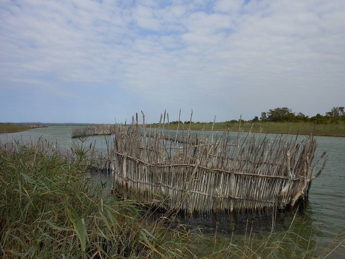
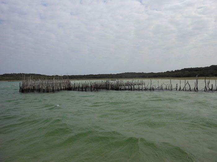
Traditionally done with raffia boats
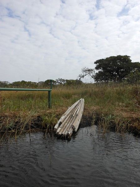
Made from forest raffia
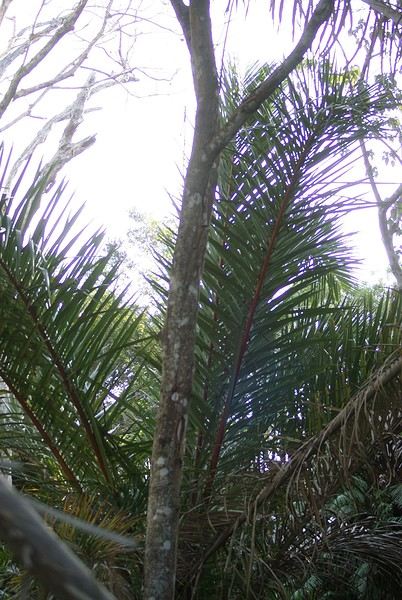
Where we spotted a particularly rare and endemic bird (whose name I can’t remember... and I can’t be bothered to dig through my notes)
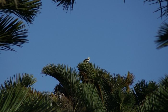 Here, those are eagles
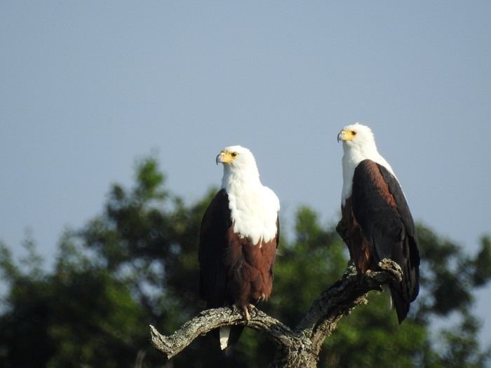
And they’re pretty brave because... they’re not far away...
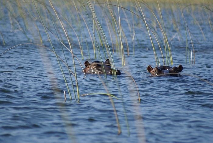
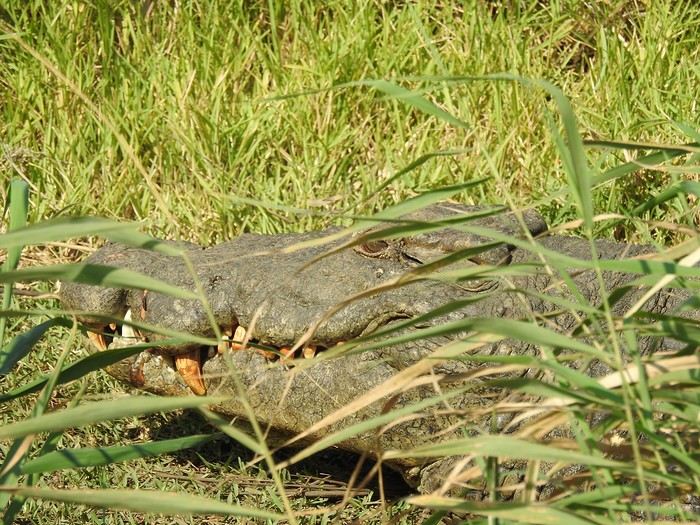
Yet we still swim there... with supervision...
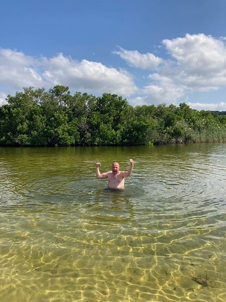
So, between St. Lucia and Mozambique, you’ll find marshes, lagoons, lakes, and coastline, with our Tonga friends, Zulu friends, and—just a bit further up—the Tembe... and their king. (I’m showing off a bit because I got to see a king up close, ate in the same room as him, and even talked to him!)
Originally, the Boers tried to farm there... including sugarcane...
But... between the hippos, snakes, crocs, and malaria-carrying mosquitoes... They lost count of the deaths and disappearances.
The story goes that when Madiba (Mandela) came to power, he passed through the area and convinced them to turn it into a natural space that would attract tourists—and that’s when the big change happened.
And it’s pretty incredible to see how this place has evolved, going from extreme poverty to a certain level of gentrification... How this once "chaotic" area saw shops, roads, and housing spring up (I’m mainly talking about Mtubatuba, the nearby Black town). In fact, in St. Lucia now, the homes that aren’t tourist accommodations can be counted on one hand.
St. Lucia has become a "seaside resort"... very busy during school holidays and certain weekends, increasingly cosmopolitan (20 years ago, speaking French was exotic—now it’s completely ordinary).
As mentioned in the title, this is a travel journal focused on St. Lucia and iSimangaliso ("this place is miraculous" in Zulu) over various trips spanning about twenty years.
The Elephant Coast stretches from Hluhluwe Umfolozi, through St. Lucia and iSimangaliso, all the way to the Mozambique border near Kosi Bay and Tembe. This region was conquered by the Zulus (for context, in the 19th century, the Zulus were just one Bantu group among many—it was a local Napoleon, Shaka, who was both cruel and inventive, conquering and subjugating all other groups to form the Zulu nation). The Tonga were the big losers in this area, and a certain "animosity" is still very noticeable... With our two guides (one Zulu and the other Tonga), we ran into some Tonga folks—definitely not a warm atmosphere. The Tonga were pushed back into the marshes. Fish traps are their main source of wealth. (iSimangaliso is a lagoon and marshland area with several interconnected lakes—it used to be called Vetland Park, and for good reason.) So, lakes, fishing with fish traps...
Traditionally done with raffia boats
Made from forest raffia
Where we spotted a particularly rare and endemic bird (whose name I can’t remember... and I can’t be bothered to dig through my notes)
Here, those are eagles
And they’re pretty brave because... they’re not far away...
Yet we still swim there... with supervision...
So, between St. Lucia and Mozambique, you’ll find marshes, lagoons, lakes, and coastline, with our Tonga friends, Zulu friends, and—just a bit further up—the Tembe... and their king. (I’m showing off a bit because I got to see a king up close, ate in the same room as him, and even talked to him!)
Originally, the Boers tried to farm there... including sugarcane...
But... between the hippos, snakes, crocs, and malaria-carrying mosquitoes... They lost count of the deaths and disappearances.
The story goes that when Madiba (Mandela) came to power, he passed through the area and convinced them to turn it into a natural space that would attract tourists—and that’s when the big change happened.
And it’s pretty incredible to see how this place has evolved, going from extreme poverty to a certain level of gentrification... How this once "chaotic" area saw shops, roads, and housing spring up (I’m mainly talking about Mtubatuba, the nearby Black town). In fact, in St. Lucia now, the homes that aren’t tourist accommodations can be counted on one hand.
St. Lucia has become a "seaside resort"... very busy during school holidays and certain weekends, increasingly cosmopolitan (20 years ago, speaking French was exotic—now it’s completely ordinary).
Entering Mexico without a return ticket
Hi, does anyone know if it’s necessary to have a return ticket to go to Mexico? I’d like to go there—I’ve bought a one-way ticket and plan to cross the border by bus to Guatemala. I’m worried they won’t let me board the plane if I don’t have a return ticket.
Ed
North Korea unveils its first international beach resort
North Korea is diving into tourism development with the planned opening of its first international beach resort on the east coast, as part of the Wonsan-Kalma project. This hotel complex, overseen by Kim Jong Un, marks a step in the country's economic opening, according to North Korean state media. After reopening its borders in 2023, the country is targeting both North Korean and international tourists, particularly Russians, with whom relations have recently strengthened. While tourism remains restricted, this project highlights the regime's growing interest in the tourism industry. Read more...
Mexico-Guatemala trip: which transport to choose?
Hi, I’m planning to leave around 25/01 for Mexico: Oaxaca first, then Chiapas, and then heading to Guatemala, starting with Panajachel. I’ve read a lot about how borders and transport can be dangerous. So, I’ve decided to travel with assistance and take a shuttle/minivan door-to-door from San Cristóbal de las Casas to Panajachel. There are lots of companies, and many have a bad reputation. Has anyone here had any experience with this? I’d love to hear any tips or advice. Thanks!
Ed
Travel: A Right for All? Reflections on Global Freedoms and Inequalities
Hello fellow travel enthusiasts! 🌍
As a traveler and blogger, I’ve often been struck by the huge inequalities tied to freedom of movement. While some cross borders with ease, others face major obstacles due to their nationality, background, or the restrictive policies of certain countries.
On the occasion of International Human Rights Day, I wrote an article reflecting on this issue: 📖 Travelers' Rights: A Reflection on Freedom of Movement and Global Inequalities
In this article, I cover topics like:
Inequalities between passports ("strong" vs. "weak" passports). The specific challenges faced by travelers from marginalized communities. How to take action to promote more inclusive and equitable travel.
I’d love to hear your thoughts! 😊 Have you ever experienced these inequalities while traveling? How do you think we could raise more awareness about this issue? Feel free to share your experiences or ask questions in this thread. I can’t wait to discuss this with you!
Travel is also about building bridges between cultures. So let’s make sure it becomes a reality for everyone. ✈️🌎 Thanks for reading, and I look forward to exchanging ideas with you!
On the occasion of International Human Rights Day, I wrote an article reflecting on this issue: 📖 Travelers' Rights: A Reflection on Freedom of Movement and Global Inequalities
In this article, I cover topics like:
Inequalities between passports ("strong" vs. "weak" passports). The specific challenges faced by travelers from marginalized communities. How to take action to promote more inclusive and equitable travel.
I’d love to hear your thoughts! 😊 Have you ever experienced these inequalities while traveling? How do you think we could raise more awareness about this issue? Feel free to share your experiences or ask questions in this thread. I can’t wait to discuss this with you!
Travel is also about building bridges between cultures. So let’s make sure it becomes a reality for everyone. ✈️🌎 Thanks for reading, and I look forward to exchanging ideas with you!
Travel companion for France-Bamako in a Mercedes Sprinter
Hello,
I’m planning to leave for Bamako in three to six months.
Here’s my itinerary: Toulouse (France) via Barcelona, Tangier, crossing Morocco to GUERGUERAT, entering Mauritania, Nouakchott up to the GOGUI border (Mali), and arriving in Bamako. I might go through Algeciras depending on costs.
I plan to stop for a week in Nouakchott with family.
I’ll be traveling in a half-loaded Mercedes Sprinter.
For this reason, I’m looking for a travel companion due to my age and health.
I’ve made this crossing several times, including two round trips in 2018.
I’m open to any serious proposals.
Many thanks for this site, which has been a great source of information.
France-Benin Trip via Senegal
Hello fellow travelers,
I've made the France-Benin trip several times via the Mali "Route de l'Espoir," and the last journey was pretty tense—2013, 🥵🔥 military convoys and all the chaos in Mali from the border to Bamako. 😅
So, I’m planning to take the route again but this time via Senegal and Côte d'Ivoire, with a good old J9 (the mayor’s vehicles I used to travel in… 😎. Though the Mercedes 308 wasn’t bad either).
Has anyone done this recently?
A friend of mine did it 4 years ago, but things can change pretty quickly.
If you’d like to share your latest experiences, I’m all ears! 😊 Have a great weekend! 👋
The "Must-Sees" of the American West
This adventure began during Covid... Yep, Covid turned a lot of things upside down, but most of all, it kept us cooped up for a few months and stopped us from traveling for a while—even longer for a die-hard fan of the American West like me.
While borders were closed, I started imagining what an ideal itinerary might look like—one that would string together all the Southwest must-sees in just two weeks, during the best time of year: September and October. When the U.S. announced in September 2021 that borders would reopen in the coming weeks, I regained hope and began scouting flight tickets for a departure in September 2022.
But here’s the thing: tackling solo hikes, each one tougher than the last, right in the heart of the Wilderness, could be a risky—even reckless—endeavor for a father of three. After a quick chat with some virtual friends who are just as passionate about the Southwest as I am, with good physical condition and nearly the same list of must-visit spots, Franck and his brother Sullivan were in! 🙂
In November, we snagged flight tickets from Nice to San Francisco for the modest sum of 400 €, and a few days later, I booked a Toyota Tacoma pickup for 840 € !
It’s not cheap for just 15 days, and a pickup isn’t exactly ideal for luggage, but the prices for full-size 4x4s have become totally outrageous! Due to border closures, rental companies had to offload a lot of these big 4x4s, which tourists love. Then, supply and demand did the rest !
Franck and I spent the winter and spring trying to cram the equivalent of three weeks of hikes into two. But even with physical limits, we had to stay reasonable! Three to four months before departure, we entered the lotteries for different must-see spots: The Subway, Coyote Buttes North (home to the famous Wave), and Coyote Buttes South (CBS).
The Wave is the holy grail for any Southwest enthusiast. Since 2015, we’ve tried our luck with the online and on-site lotteries about ten times, but the spots are unfortunately limited: just 20 per day. A glimmer of hope, though—since early 2022, that number has increased to 64 people allowed per day, with 48 spots awarded via the online lottery.
After all three of us tried our luck for The Wave, on June 1st at exactly 5 PM, I got an email that started with, "Congratulations! You were successful in the Coyote Buttes North (The Wave) September 2022 Permit Lottery at Coyote Buttes North (The Wave)...". At 5:01 PM, I called Franck, whose dream it’s been for over 20 years—ever since the first photos were published in a travel magazine! He didn’t believe me when I told him, and I had to forward the email for him to finally accept the unbelievable: we were going to The Wave and all the incredible spots scattered across the protected area of Coyote Buttes North.
I’ve already been to Coyote Buttes South twice, but there are areas I couldn’t explore in the middle of summer because they were too remote. So, I had no trouble letting my buddies convince me to go back for a third time. Plus, given how hard it is to access, we had no trouble securing a permit online as long as we logged in at exactly 8 PM on the dot!
For The Subway, all three of us struck out. No big deal—we won at CBN and CBS!
Among the sites to visit, there are two that I’m particularly attached to because I know my chances of wanting to see them again are slim. The first is Angel Arch, one of the most legendary arches in the Southwest, due to its remoteness from any trace of civilization. To get there, the recommended hike is Upper Salt Creek, and you’re looking at a 50 km round-trip in an area with no water (in September) and populated by bears.
The second site is the Hopi Salt Trail, in Navajo land, which, after a very tough hike, lets you marvel at the turquoise-blue waters of the Little Colorado before it meets the Colorado River. The Hopi Salt Trail is, like The Wave, the holy grail for any Southwest enthusiast, and the windows of opportunity to see the water in that magical color are very short each year. For this, you have to monitor the Little Colorado’s gauges downstream from Cameron: if the level stays at its lowest for 10 consecutive days—meaning no rain—you can hope for turquoise water. The ideal period rarely exceeds 30 days a year, and it’s usually in June that all the stars align.
But unfortunately, one month before departure, while the flow rate at Cameron looked promising, several storms in September dashed our hopes of doing the Hopi Salt Trail, even at the end of the road trip.
We still had two consolation prizes, though:
After a last-minute cancellation, while keeping an eye out for available spots for The Subway, it turned out that three spots opened up exactly on the day we’d planned to go—so we rushed to grab them!! Regarding the 4x4 rental, the prices for full-size models dropped by several hundred dollars, and we ended up finding a Chevrolet Tahoe for less than $1000. A steal and a serious boost in comfort, so we could store all our gear and food without worry!
Here’s the initial plan in a perfect world: D1 The White Domes - Camping D2 Sunrise at The White Domes - The Subway D3 Coyote Buttes North D4 Coyote Buttes South - White Pocket D5 Wahweap Hoodoos - Sidestep Canyon - Colourful Canyon - White Rocks - Sunset at Yellow Rock D6 Broken Bow Arch - Reflection Canyon D7 Coyote Gulch D8 The Volcano (or The Oasis - Zebra Slot Canyon if the weather’s good) - North Caineville Mesa D9 The Needles: Squaw Canyon - Lost Canyon combo - Druid Arch - Chesler Park D10 Upper Salt Creek Day 1 - Camping D11 Upper Salt Creek Day 2 D12 Hopi-Navajo Territory: Ha Ho No Geh Canyon, Coal Mine Canyon, Bends of the Little Colorado D13 Grand Canyon: South Kaibab Trail and Bright Angel Trail D14 Upper East Zion: East Temple Loop, Jughandle Arch, Center of the Universe, and Checkerboard Mesa Summit And several backup options in case of bad weather, including Spencer Trail, West Cove, and Buffington Pockets.
Enough talking—time for action!
While borders were closed, I started imagining what an ideal itinerary might look like—one that would string together all the Southwest must-sees in just two weeks, during the best time of year: September and October. When the U.S. announced in September 2021 that borders would reopen in the coming weeks, I regained hope and began scouting flight tickets for a departure in September 2022.
But here’s the thing: tackling solo hikes, each one tougher than the last, right in the heart of the Wilderness, could be a risky—even reckless—endeavor for a father of three. After a quick chat with some virtual friends who are just as passionate about the Southwest as I am, with good physical condition and nearly the same list of must-visit spots, Franck and his brother Sullivan were in! 🙂
In November, we snagged flight tickets from Nice to San Francisco for the modest sum of 400 €, and a few days later, I booked a Toyota Tacoma pickup for 840 € !
It’s not cheap for just 15 days, and a pickup isn’t exactly ideal for luggage, but the prices for full-size 4x4s have become totally outrageous! Due to border closures, rental companies had to offload a lot of these big 4x4s, which tourists love. Then, supply and demand did the rest !
Franck and I spent the winter and spring trying to cram the equivalent of three weeks of hikes into two. But even with physical limits, we had to stay reasonable! Three to four months before departure, we entered the lotteries for different must-see spots: The Subway, Coyote Buttes North (home to the famous Wave), and Coyote Buttes South (CBS).
The Wave is the holy grail for any Southwest enthusiast. Since 2015, we’ve tried our luck with the online and on-site lotteries about ten times, but the spots are unfortunately limited: just 20 per day. A glimmer of hope, though—since early 2022, that number has increased to 64 people allowed per day, with 48 spots awarded via the online lottery.
After all three of us tried our luck for The Wave, on June 1st at exactly 5 PM, I got an email that started with, "Congratulations! You were successful in the Coyote Buttes North (The Wave) September 2022 Permit Lottery at Coyote Buttes North (The Wave)...". At 5:01 PM, I called Franck, whose dream it’s been for over 20 years—ever since the first photos were published in a travel magazine! He didn’t believe me when I told him, and I had to forward the email for him to finally accept the unbelievable: we were going to The Wave and all the incredible spots scattered across the protected area of Coyote Buttes North.
I’ve already been to Coyote Buttes South twice, but there are areas I couldn’t explore in the middle of summer because they were too remote. So, I had no trouble letting my buddies convince me to go back for a third time. Plus, given how hard it is to access, we had no trouble securing a permit online as long as we logged in at exactly 8 PM on the dot!
For The Subway, all three of us struck out. No big deal—we won at CBN and CBS!
Among the sites to visit, there are two that I’m particularly attached to because I know my chances of wanting to see them again are slim. The first is Angel Arch, one of the most legendary arches in the Southwest, due to its remoteness from any trace of civilization. To get there, the recommended hike is Upper Salt Creek, and you’re looking at a 50 km round-trip in an area with no water (in September) and populated by bears.
The second site is the Hopi Salt Trail, in Navajo land, which, after a very tough hike, lets you marvel at the turquoise-blue waters of the Little Colorado before it meets the Colorado River. The Hopi Salt Trail is, like The Wave, the holy grail for any Southwest enthusiast, and the windows of opportunity to see the water in that magical color are very short each year. For this, you have to monitor the Little Colorado’s gauges downstream from Cameron: if the level stays at its lowest for 10 consecutive days—meaning no rain—you can hope for turquoise water. The ideal period rarely exceeds 30 days a year, and it’s usually in June that all the stars align.
But unfortunately, one month before departure, while the flow rate at Cameron looked promising, several storms in September dashed our hopes of doing the Hopi Salt Trail, even at the end of the road trip.
We still had two consolation prizes, though:
After a last-minute cancellation, while keeping an eye out for available spots for The Subway, it turned out that three spots opened up exactly on the day we’d planned to go—so we rushed to grab them!! Regarding the 4x4 rental, the prices for full-size models dropped by several hundred dollars, and we ended up finding a Chevrolet Tahoe for less than $1000. A steal and a serious boost in comfort, so we could store all our gear and food without worry!
Here’s the initial plan in a perfect world: D1 The White Domes - Camping D2 Sunrise at The White Domes - The Subway D3 Coyote Buttes North D4 Coyote Buttes South - White Pocket D5 Wahweap Hoodoos - Sidestep Canyon - Colourful Canyon - White Rocks - Sunset at Yellow Rock D6 Broken Bow Arch - Reflection Canyon D7 Coyote Gulch D8 The Volcano (or The Oasis - Zebra Slot Canyon if the weather’s good) - North Caineville Mesa D9 The Needles: Squaw Canyon - Lost Canyon combo - Druid Arch - Chesler Park D10 Upper Salt Creek Day 1 - Camping D11 Upper Salt Creek Day 2 D12 Hopi-Navajo Territory: Ha Ho No Geh Canyon, Coal Mine Canyon, Bends of the Little Colorado D13 Grand Canyon: South Kaibab Trail and Bright Angel Trail D14 Upper East Zion: East Temple Loop, Jughandle Arch, Center of the Universe, and Checkerboard Mesa Summit And several backup options in case of bad weather, including Spencer Trail, West Cove, and Buffington Pockets.
Enough talking—time for action!
Où et comment demander un e-visa pour l'Azerbaïdjan? English translation pending
Bonjour,
J'aimerais savoir ou et comment demander un e-visa pour aller à Azerbaïdjan.
Dans quel lien il faut aller pour faire les démarches de demande?
Merci d'avance!
To the Top West End
In this time of general travel-journal scarcity, I’m stepping up to tell you about a far-too-short getaway to the Top West End, a local term for the very northern part of Western Australia, right on the border ( ;) ) with the Northern Territory.
As usual, I didn’t manage to keep it short, but this time I’ve got photos to go with it!
August 2020. Since the opportunities to explore the world are extremely limited right now, all we (R&X) can do is explore our own island! Well, just a part of it, because with the state borders still closed, we’re stuck in Western Australia (WA).
Luckily, we’re pretty fortunate because this state is huge: over 2.5 million km² (that’s more than four times the size of France or 1.5 times Quebec). What’s more, stretching over 20 degrees of latitude between the Antarctic Ocean and the Timor Sea, you’ll find climates ranging from Mediterranean to arid to tropical. That’s actually why we decided to head as far north as possible. Sick of the endless rainy winter in Perth, bring on the heat of the Kimberley... way up Nooorth!
Friday. At the airport, the main terminal was closed (not enough flights), so we ended up in the annex (where flights to the various mines usually depart from). There was no crowd at the gate, and in this huge, single departure lounge, empty seats were plentiful. Only three flights were listed on the screens for the rest of the morning: the first to Coondewanna (?), the second to Darwin, and ours to Kununurra (code KNX).
A cool breeze swept through the half-open corridors along the runways. At the top of the walkway leading to the Fokker 100 (the Airbuses and Boeings are now parked!), a flight attendant greeted us with a basket full of sanitary masks. We were actually the only masked passengers (the staff weren’t wearing them either). With zero Covid-19 cases in WA at the time, the only rule was to maintain social distancing—something pretty hard to do on a full plane!
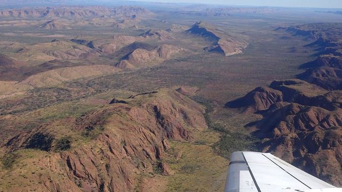
It was also my first time wearing a mask—it felt weird, pretty uncomfortable, and after a while, painful behind the ears. I really feel for those who have to wear one all day, every day. The flight lasted three long hours, but luckily, I had a good book. From the window, I watched an endless expanse of salt lakes in all shapes and sizes—round, elongated, gray, white, sometimes blue and green—and an infinity of winding, capricious meanders, along with long straight lines that led nowhere. The last half-hour got more interesting as rocky, swollen formations and long, sloping plateaus appeared. Against the vast ochre landscape, green patches became more frequent.
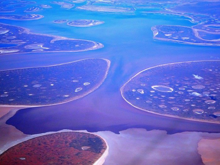
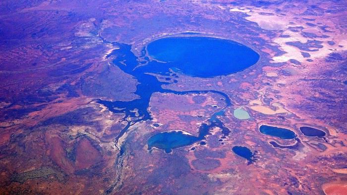
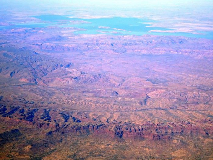
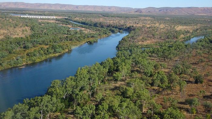
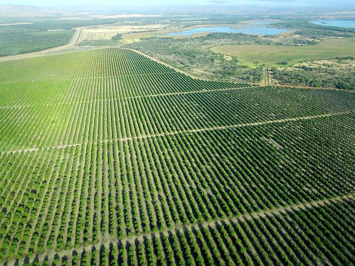
Just before landing, rows of green fields briefly appeared, along with an surprisingly wide river—but we were already rolling down the tarmac. A few hangars, a myriad of small, stationary planes, and a tiny terminal topped with a sign: “Welcome to Kununurra.”
We wanted heat, and here it was—34°C the moment we stepped off the plane! We felt alive again and totally ridiculous in our jeans and sweaters. We quickly grabbed our suitcase and picked up the 4x4 we’d rented—more out of necessity, since only that type of vehicle can access the national parks we planned to visit.
Just four kilometers separated us from Kununurra, a town of 5,000 people founded in 1961 during the construction of the Lake Argyle Dam and the development of the Ord River Irrigation Area Scheme (more on that later). On the horizon, mountain ranges (a bit of an exaggeration, since we know Mt. Meharry, WA’s highest ‘mountain,’ doesn’t even reach 1,250 meters!) and closer to the road, a few irrigation canals cutting through stretches of bush, then a huge park overlooking a small lake lined with reeds.
A row of baobabs (yes, there are baobabs in Australia too!), a series of motels with immaculate lawns, a gas station, and there’s the main street leading to the town center—that is, the parking lots of the two supermarkets, the bottleshop, the pub, the Town Hall, the municipal pool, and the Tourist Office (already closed!), and at the next roundabout, another park, the Presbyterian church, and a few other shops. In short, two or three green blocks that you can explore in no time.
One road leads to the small industrial area and one of the town’s three or four campgrounds, while another heads toward the residential neighborhoods, which look just like the typical suburbs you find in any Australian city—except with tropical vegetation. We stocked up at Coles, an identical copy of the one near our place, and—surprise—the prices were practically the same.
We checked into one of the motels. The receptionist listed the town’s three or four restaurants, insisting that it’s always better to book a table. She recommended the Pump House, a bit outside town on the lake’s edge. “Best spot to watch the sunset, but hurry up.” she told us. It was only 5:00 PM!
When we got there half an hour later, the place was packed, and the sun had already disappeared behind a row of trees! Sure enough, we’d see a few days later that the sunset can be a stunning spectacle—if you wait a bit for the sky (especially if it’s cloudy) to blaze and reflect in the lake’s calm waters. A little disappointed, we headed back into town, where we easily found the other lively spot in town: the pub (nothing like an old English pub). Above the long L-shaped bar, several giant screens (thankfully muted) were broadcasting live footy, rugby league, etc. In one corner, players circled the pool table, while in another, customers were digging into plates of the day’s special. Instead of rooms, there were various patios where groups of friends and coworkers (easily recognizable by the fluoro vests they were still wearing) were gathered. We found a table under a mango tree—unfortunately, a little too close to the guitarist strumming his entire Country Music repertoire, complete with Keith Urban-style tremolos. Guaranteed culture shock!
Since it’s the custom here, we called the Country Club to book a table before the kitchen closed! The CC is the town’s—and even the region’s—fancy spot. Dark decor, modern furniture, dim lighting, and the air conditioning blasting. The twenty or so customers had taken refuge on the vast terrace, lit by torches. The view of the tall eucalyptus trees, illuminated by spotlights shifting from red to blue, was breathtaking.
The menu was minimal, but the grilled salmon was excellent, and the Pavlova (the meringue dessert Kiwis and Aussies have been arguing over since 1906) with melon and watermelon was absolutely divine.
It wasn’t even 9:00 PM, and we were already in bed. Had we already adopted the Top West End’s chicken schedule?!
To be continued... Journal dedicated to Attila
As usual, I didn’t manage to keep it short, but this time I’ve got photos to go with it!
August 2020. Since the opportunities to explore the world are extremely limited right now, all we (R&X) can do is explore our own island! Well, just a part of it, because with the state borders still closed, we’re stuck in Western Australia (WA).
Luckily, we’re pretty fortunate because this state is huge: over 2.5 million km² (that’s more than four times the size of France or 1.5 times Quebec). What’s more, stretching over 20 degrees of latitude between the Antarctic Ocean and the Timor Sea, you’ll find climates ranging from Mediterranean to arid to tropical. That’s actually why we decided to head as far north as possible. Sick of the endless rainy winter in Perth, bring on the heat of the Kimberley... way up Nooorth!
Friday. At the airport, the main terminal was closed (not enough flights), so we ended up in the annex (where flights to the various mines usually depart from). There was no crowd at the gate, and in this huge, single departure lounge, empty seats were plentiful. Only three flights were listed on the screens for the rest of the morning: the first to Coondewanna (?), the second to Darwin, and ours to Kununurra (code KNX).
A cool breeze swept through the half-open corridors along the runways. At the top of the walkway leading to the Fokker 100 (the Airbuses and Boeings are now parked!), a flight attendant greeted us with a basket full of sanitary masks. We were actually the only masked passengers (the staff weren’t wearing them either). With zero Covid-19 cases in WA at the time, the only rule was to maintain social distancing—something pretty hard to do on a full plane!
It was also my first time wearing a mask—it felt weird, pretty uncomfortable, and after a while, painful behind the ears. I really feel for those who have to wear one all day, every day. The flight lasted three long hours, but luckily, I had a good book. From the window, I watched an endless expanse of salt lakes in all shapes and sizes—round, elongated, gray, white, sometimes blue and green—and an infinity of winding, capricious meanders, along with long straight lines that led nowhere. The last half-hour got more interesting as rocky, swollen formations and long, sloping plateaus appeared. Against the vast ochre landscape, green patches became more frequent.
Just before landing, rows of green fields briefly appeared, along with an surprisingly wide river—but we were already rolling down the tarmac. A few hangars, a myriad of small, stationary planes, and a tiny terminal topped with a sign: “Welcome to Kununurra.”
We wanted heat, and here it was—34°C the moment we stepped off the plane! We felt alive again and totally ridiculous in our jeans and sweaters. We quickly grabbed our suitcase and picked up the 4x4 we’d rented—more out of necessity, since only that type of vehicle can access the national parks we planned to visit.
Just four kilometers separated us from Kununurra, a town of 5,000 people founded in 1961 during the construction of the Lake Argyle Dam and the development of the Ord River Irrigation Area Scheme (more on that later). On the horizon, mountain ranges (a bit of an exaggeration, since we know Mt. Meharry, WA’s highest ‘mountain,’ doesn’t even reach 1,250 meters!) and closer to the road, a few irrigation canals cutting through stretches of bush, then a huge park overlooking a small lake lined with reeds.
A row of baobabs (yes, there are baobabs in Australia too!), a series of motels with immaculate lawns, a gas station, and there’s the main street leading to the town center—that is, the parking lots of the two supermarkets, the bottleshop, the pub, the Town Hall, the municipal pool, and the Tourist Office (already closed!), and at the next roundabout, another park, the Presbyterian church, and a few other shops. In short, two or three green blocks that you can explore in no time.
One road leads to the small industrial area and one of the town’s three or four campgrounds, while another heads toward the residential neighborhoods, which look just like the typical suburbs you find in any Australian city—except with tropical vegetation. We stocked up at Coles, an identical copy of the one near our place, and—surprise—the prices were practically the same.
We checked into one of the motels. The receptionist listed the town’s three or four restaurants, insisting that it’s always better to book a table. She recommended the Pump House, a bit outside town on the lake’s edge. “Best spot to watch the sunset, but hurry up.” she told us. It was only 5:00 PM!
When we got there half an hour later, the place was packed, and the sun had already disappeared behind a row of trees! Sure enough, we’d see a few days later that the sunset can be a stunning spectacle—if you wait a bit for the sky (especially if it’s cloudy) to blaze and reflect in the lake’s calm waters. A little disappointed, we headed back into town, where we easily found the other lively spot in town: the pub (nothing like an old English pub). Above the long L-shaped bar, several giant screens (thankfully muted) were broadcasting live footy, rugby league, etc. In one corner, players circled the pool table, while in another, customers were digging into plates of the day’s special. Instead of rooms, there were various patios where groups of friends and coworkers (easily recognizable by the fluoro vests they were still wearing) were gathered. We found a table under a mango tree—unfortunately, a little too close to the guitarist strumming his entire Country Music repertoire, complete with Keith Urban-style tremolos. Guaranteed culture shock!
Since it’s the custom here, we called the Country Club to book a table before the kitchen closed! The CC is the town’s—and even the region’s—fancy spot. Dark decor, modern furniture, dim lighting, and the air conditioning blasting. The twenty or so customers had taken refuge on the vast terrace, lit by torches. The view of the tall eucalyptus trees, illuminated by spotlights shifting from red to blue, was breathtaking.
The menu was minimal, but the grilled salmon was excellent, and the Pavlova (the meringue dessert Kiwis and Aussies have been arguing over since 1906) with melon and watermelon was absolutely divine.
It wasn’t even 9:00 PM, and we were already in bed. Had we already adopted the Top West End’s chicken schedule?!
To be continued... Journal dedicated to Attila
Voyage en famille aux Amériques English translation pending
Bonjour à tous,
Avec mon épouse et mes 3 garçons nous envisageons un très long voyage aux Amériques. Notre objectif est d'arriver au canada et de descendre jusqu'au sud sud. Pour cela et pour l'instant nous envisageons de descendre en hymer S660 de 84. Pour ceux qui ont déjà passé ces frontières, quels sont les problèmes que nous pouvons rencontrer au douanes. Par exemple, les permis de conduire B (francais et international) sont ils ok pour conduire des cc la bas? Le poids du véhicule est il problématiques (risque de surcharge).
Une autre option que nous envisageons est d'acheter un CC la bas directement. Mais j'ai peur que les problèmes de frontières soient plus importantes avec un CC canadien en amérique du sud.
Avez vous des expériences à partager ? Tous vos conseils sont les bienvenues.
Avec mon épouse et mes 3 garçons nous envisageons un très long voyage aux Amériques. Notre objectif est d'arriver au canada et de descendre jusqu'au sud sud. Pour cela et pour l'instant nous envisageons de descendre en hymer S660 de 84. Pour ceux qui ont déjà passé ces frontières, quels sont les problèmes que nous pouvons rencontrer au douanes. Par exemple, les permis de conduire B (francais et international) sont ils ok pour conduire des cc la bas? Le poids du véhicule est il problématiques (risque de surcharge).
Une autre option que nous envisageons est d'acheter un CC la bas directement. Mais j'ai peur que les problèmes de frontières soient plus importantes avec un CC canadien en amérique du sud.
Avez vous des expériences à partager ? Tous vos conseils sont les bienvenues.
Retour vers le futur... Afrique de l'Ouest English translation pending
Bonjour,
Après un mois passé en Mauritanie (février), nous sommes bloqués depuis 6 mois au Sénégal avec notre camion (4 mois à Diembering en Casamance et 2 mois à côté de St Louis depuis). Toutes les frontières sont bien fermées et non négociables (pour qui connait Rosso......c'est dire).
Donc pour les prétendants à un prochain départ il vaut mieux viser 2021 !
Globalement la situation sur place est loin d'être catastrophique et les mesures préconisées sont respectées à.....l'africaine (ce n'est pas pire qu'ailleurs....les chiffres l'expriment assez bien). Bon, la Téranga est un peu en sommeil et le Sénégal version "Échappée Belle" il faut l'oublier pour l'instant.
Le Ministère de l'Intérieur Mauritanien délivre, au coup par coup, des autorisations pour entrer en Mauritanie (avec un test covid de moins de 72h); mais il faut que la demande soit initiée par le Consulat dont dépend le ressortissant. Or là, les autorités françaises font un blocage ! (je bataille depuis 2 mois). Elles sont intervenues pour les rapatriements aériens mais pas pour le rapatriement des voyageurs motorisés. Les autorités espagnoles sont plus réactives et ont réussi à faire entrer leurs ressortissants (la procédure est la même pour entrer au Maroc !!!).
Donc futurs voyageurs en Afrique de l'Ouest..........patience !!
Cordialement
Alain
Alain
Destination le Mali par la route de l'espoir English translation pending
Bonjour
J'aurais voulu avoir des renseignements pour partir de la France à Bamako (Mali).
Ces renseignements portent sur l'état de la route de l'espoir et surtout le parcours Nioro du sahel à Bamako.
Qu'en est les possibilités de traverser l'Espagne, le Maroc, la Mauritanie et le Mali 'Frontieres ouvertes depuis le coup d'état avec le coronavirus.
Cordialement
Sortir du Maroc avec seulement un passeport marocain English translation pending
Salut,
Quelqu’un m’a demandé et je n’ai pas pu lui répondre.
Concrètement il demande s’il peut venir Et SURTOUT QUITTER -en tant que binational- le Maroc avec seulement son passeport marocain et sa carte d’identité française ?
Le hic c’est qu’apparemment au moment de sortir du territoire marocain, la police aux frontières demande -paraît-il- à voir un passeport européen ou un visa schengen, et par conséquent il ne pourra pas quitter le territoire marocain sans passeport français.
Je trouve cela bizarre, car depuis quand la police aux frontières (au moment de sortir) s’occupent des droits d’entrée des pays extérieur et depuis quand elle s’occupe des destinations des gens ?! C’est la compagnie aérienne et le pays de destination qui refoule ou non.
Bref : à la sortie, pour un binational, peut-il sortir du Maroc avec seulement deux documents : le passport marocain (ayant servi pour entrer) et sa carte d’identité française (pour rentrer en Europe) ?
Ps: hors COVID-19
Quelqu’un m’a demandé et je n’ai pas pu lui répondre.
Concrètement il demande s’il peut venir Et SURTOUT QUITTER -en tant que binational- le Maroc avec seulement son passeport marocain et sa carte d’identité française ?
Le hic c’est qu’apparemment au moment de sortir du territoire marocain, la police aux frontières demande -paraît-il- à voir un passeport européen ou un visa schengen, et par conséquent il ne pourra pas quitter le territoire marocain sans passeport français.
Je trouve cela bizarre, car depuis quand la police aux frontières (au moment de sortir) s’occupent des droits d’entrée des pays extérieur et depuis quand elle s’occupe des destinations des gens ?! C’est la compagnie aérienne et le pays de destination qui refoule ou non.
Bref : à la sortie, pour un binational, peut-il sortir du Maroc avec seulement deux documents : le passport marocain (ayant servi pour entrer) et sa carte d’identité française (pour rentrer en Europe) ?
Ps: hors COVID-19
Anticipiation, annulation, modification d'un vol Lufthansa pour la Thaïlande? English translation pending
Bonjour à tous,
J'avais des billets d'avions (achetés bien avant la crise sanitaire) pour partir en Thaïlande. Je devais partir le 15 Novembre pour y rester plusieurs mois.
Au vue de la situation actuelle, je doute fortement qu'en Novembre les frontières thaïlandaises seront ouvertes alors je me demande ce qui est le plus sûr pour éviter de perdre mes billets :
- Modifier mes dates de réservations ? - Attendre que la compagnie annule mon vol elle-même ?
Qu'en pensez-vous ?
Bonne journée
J'avais des billets d'avions (achetés bien avant la crise sanitaire) pour partir en Thaïlande. Je devais partir le 15 Novembre pour y rester plusieurs mois.
Au vue de la situation actuelle, je doute fortement qu'en Novembre les frontières thaïlandaises seront ouvertes alors je me demande ce qui est le plus sûr pour éviter de perdre mes billets :
- Modifier mes dates de réservations ? - Attendre que la compagnie annule mon vol elle-même ?
Qu'en pensez-vous ?
Bonne journée
Visa et zone de transit à l'aéroport English translation pending
bonjour
je renouvelle ma question , avons nous la possibilité HORS COVID d'arriver par un vol internationnale dans un aeroport et reprendre un autre vol avec une autre compagnie , tout en restant dans la zone sans franchir la frontiere du pays sans visa
merci