Results for "Lagoa+|+9+>+225"
6371 results found.
Where to stay quietly in Zanzibar for Christmas?
Hi everyone,
We have the opportunity to spend about ten days somewhere for Christmas, and I’m really tempted by Zanzibar. I’ve been dreaming for a long time about the Spice Island, Stone Town, diving...
Which hotels could you recommend? Not a big "resort"—we’re more into "boutique hotels" or even an Airbnb house. Somewhere quiet (we’re not party animals).
I’m thinking of staying the first few nights in Stone Town and then moving to a beach, preferably one where we can swim regardless of the tides, without ending up in seaweed and mud at low tide.
I’m a bit lost with all the beaches because apparently, the north is very crowded, the south is very windy, and the east has some good and some not-so-good spots, with big tides or not... HELP! 🤪
I’d like to limit myself to a maximum of 2 different places to stay over the 10 days.
Thanks in advance! 😉
We have the opportunity to spend about ten days somewhere for Christmas, and I’m really tempted by Zanzibar. I’ve been dreaming for a long time about the Spice Island, Stone Town, diving...
Which hotels could you recommend? Not a big "resort"—we’re more into "boutique hotels" or even an Airbnb house. Somewhere quiet (we’re not party animals).
I’m thinking of staying the first few nights in Stone Town and then moving to a beach, preferably one where we can swim regardless of the tides, without ending up in seaweed and mud at low tide.
I’m a bit lost with all the beaches because apparently, the north is very crowded, the south is very windy, and the east has some good and some not-so-good spots, with big tides or not... HELP! 🤪
I’d like to limit myself to a maximum of 2 different places to stay over the 10 days.
Thanks in advance! 😉
Your recommendations for a nice spot in southern Goa
Hello,
My husband and I usually spend a month in January/February in southern India. We end our trip in Gokarna and fly back from Vasco de Gama Airport in Dabolim. So, it might make sense to spend a few days in a nice, quiet spot in southern Goa. Do you have any recommendations?
Thanks
Spitsbergen – A Night with the Walruses on Lågøya
Spitsbergen, 80° North latitude. A lost archipelago on the edge of the world, northeast of Greenland, the last lands before the pole. I’m aboard the *Grigoriy Mikheev*, a Russian ship from the Murmansk Polar Research Institute. Russian flag, Russian crew. Chartered by OceanWide Expeditions.
Last night, we were stuck in drifting pack ice in the long Hinlopen Strait. This incident led to an unforgettable barbecue and party on the ship’s foredeck, but we had to abandon our plan to head south and circle Spitsbergen. This summer, there’s too much ice in the strait, and it’s too thick. At dawn, the tide turned, allowing us to break free and head north again. The ship is now moving slowly through sea ice density that satellite maps estimate at around five-tenths. Our progress is punctuated by dull thuds: the ship’s bow constantly shoves and fractures enormous ice floes.
At breakfast, Tarik, our expedition leader, informs us that our program will be significantly altered. Since we can’t cross the strait, we’ll turn back and head north. To kick off our Plan B, Tarik plans a landing tonight on the small island of Låg (Lågøya), at 80°10' North. Last summer, he saw a large walrus colony there and hopes we’ll find them again. The weather is perfect—glorious sunshine—and walruses are truly addicted to sunbathing on the beaches.
We’ve now exited the strait and are sailing far from the coast. In case the walrus colony is there, we don’t want the ship’s approach to scare them into the water before we even see them. So, we scan the shore methodically with binoculars. We pass several bays, round a cape, and examine several shorelines littered with driftwood, but no walruses in sight. Several times, clusters of large rounded rocks trigger false alarms… but no, they’re just rocks…
Suddenly, Tarik spots them through his binoculars! On an isolated peninsula, our expedition leader’s highly trained eye has picked out, among those brown masses, the shape and white color of the enormous tusks of what he calls "the heavyweights of the Arctic!" Now, fifteen or twenty pairs of binoculars are pointed in the indicated direction… Sure enough, I see them now! They’re there, huge, sprawled in the sun on the beach. Without Tarik’s sharp eye, we might have missed them. They’re so tightly packed together that they really look like a mass of brown rocks. Only the white, saber-shaped tusks and the occasional furtive movements hint that they’re animals.
It’s 11 PM, and on the deck of the *Grigoriy Mikheev*, as you can imagine, excitement has ramped up several notches. Several of us have already rushed to our cabins to gear up, pulling on boots and life jackets in anticipation of a landing that promises to be absolutely amazing. Tarik reins in our enthusiasm a bit: Okay, so we were lucky to find them, but now we need to think about how to approach them. Not that they’re dangerous—at least not on land… Their enormous bulk and their pseudo-feet (flippers) only allow for very limited mobility. But when they feel threatened, their first instinct is to head for the water, where their perfect ease keeps them safe. So, the challenge will be not to scare them off, to avoid them bolting into the water in the first few seconds! That’s exactly what would happen if we arrived by Zodiac right in front of them.
So, Tarik decides we’ll make a wide detour to land on the other side of the peninsula where they are. From there, we’ll leave the Zodiacs on the beach and cross the peninsula on foot, about a kilometer and a half. That way, we’ll approach the herd from behind. This approach will also keep us downwind of them. There you go—with a few precautions, they shouldn’t hear us coming or catch our scent.
Everyone is geared up now and practically bursting with impatience… While the Zodiacs are being lowered into the water, Tarik and Delphine recap the approach rules: absolute silence, communication only by signs, no dragging feet on the rocks, watch your step, and strict coordination with slow movements.
Here we go… we’re off now! Spray flying from the Zodiac’s bow, icy air whipping our faces, gloves gripping the side ropes, freezing splashes, pure emotion… Ahh, I love this! We describe a wide curve offshore to round the peninsula. Ahead of us, the magnificent landscape of this intensely blue sea unfolds, with the hills of Lågøya and, in the distance, the ice-covered mountains of Nordaustlandet under the sun. It’s midnight now. In July, at 80 degrees North, the sun is just like midday.
This navigation takes us far from the walruses, on the other side of the cape. Easy landing on a shoreline of large pebbles covered in giant seaweed brought in by the currents. They look like long strips of plastic—sometimes translucent, sometimes white, beige, or orange. In places, there are huge tangled layers of it. Our boots sink into this material, which gives off a strong iodine smell. Unfortunately, there’s also some plastic waste—fishing floats and net debris. Seeing this here is crazy… A little farther on, in a cove, tides and storms have piled up numerous tree trunks from Siberia.
We begin crossing the peninsula on foot, staying close together. We’re walking on a nearly deserted polar tundra. We’re only ten degrees of latitude from the North Pole here. The violent winds and extreme temperatures that dominate this island for nine months of the year allow only a few rare plants to grow, close to the ground, between the rocks. In places, rocks are covered with large patches of black lichen.
Gérard, rifle slung over his shoulder, constantly scans the terrain. Tarik and Delphine are also very vigilant. We know no one ever lands here, and although this environment isn’t ideal for bears, you never know—better to be cautious. The terrain is mostly flat, but whenever a small rise blocks our view, Gérard moves ahead and only signals us to proceed when he’s sure there’s no "big man in fur" (tradition dictates we don’t name the polar bear).
After a few hundred meters, we find an enormous whale vertebra. Judging by the state of the bone, it’s likely a relic from the whaling era that ravaged this area in the 17th century and all over northern Spitsbergen. A little farther on, the remains of a grave catch our attention. The only human trace on this remote island, this burial is surely very old, also likely dating from the whalers’ time. But this whaler’s final resting place didn’t shelter him for long—there’s not much left, just a piece of skull and a few broken bones. Due to the permafrost, the body could only be buried a few dozen centimeters deep, between some planks held in place by large stones. This makeshift grave was probably ravaged by a bear shortly after the burial. Several stone blocks are overturned, the planks are broken open. We only linger for a minute to pay our respects to this whaler, whose poor remains now merge with the mineral landscape.
A slight rise bulges in the center of the peninsula, and here we are at the highest point. If our orientation is correct, we’re heading straight for the walrus colony. A moment of emotion… my heart’s pounding. Yes, they’re there, about three hundred meters ahead of us! They haven’t moved since we spotted them from the *Grigoriy Mikheev*’s deck. They’re sprawled in a heap, packed tightly together in the sun, on the shingle beach. The light breeze blowing in our faces confirms we’re on the right track—not to be sniffed out from afar by the big beasts.
By signs, Tarik tells us we’ll approach slowly, in stages, moving about thirty meters at a time, making as little noise as possible with our boots, then freezing completely for a minute or two, crouching down to let them forget us. This strategy proves excellent. We’re now less than a hundred meters away, and it doesn’t seem like our presence is perceived as a threat by the "heavyweights of the Arctic." At this distance, let’s not kid ourselves: we’re certainly spotted, but our way of approaching must seem reassuring—or at least manageable—since they’re only a few meters from the water and know they could dash into it in seconds if they felt the need.
We now advance in shorter stages—twenty meters at a time, then just ten, crouching, then freezing like statues, our breathing nearly held from emotion and concentration. We’re now thirty meters from the mastodons. Our presence must be starting to stress them because they’re moving more. While still sprawled against each other, some suddenly rear up on their flipper-feet, grunting and snorting like monstrous pigs. Their head shakes make their two enormous ivory sabers sway. They jab them into the fat of their neighbors, who in turn stir and emit irritated snorts.
At Tarik’s signal, we move a few more meters, "on velvet paws"… We’re right there now. I hold my breath, throat tight… Intense emotion, a fantastic spectacle—these enormous Arctic animals sprawled in the sun, with the magnificent backdrop of snow-covered mountains across the sound. I think to myself: *I’m here… this can’t be real!* It’s nearly 2 AM now, the air is crystal clear, and the Arctic sun bathes this scene in what might be the most beautiful light I’ve ever seen. We’re about fifteen meters away now. Tarik signals that we won’t go any closer. The walruses are still lying down, but occasionally, our close presence and the clicking of cameras trigger bouts of agitation that ripple through the herd, causing some jostling. They’re so tightly packed and tangled that it’s a bit hard to count them. In the end, we tally sixteen, plus one "little one," half-crushed in the general mass.
Seen from here, they’re truly impressive! The "sumo wrestlers of the Arctic!" According to Tarik, they must weigh about a ton—slightly more for the males than the females—and the "little one" must already be around 200 kg. When the weather’s nice like today, they love sprawling on the beaches to soak up the sun.
Walruses are marvels of Arctic adaptation. They can modify their blood circulation depending on thermal conditions. They withstand extreme cold by directing most of their circulation to vital organs (heart, lungs) and minimizing peripheral blood flow (skin and limbs) to prevent heat loss. Conversely, when they sunbathe, they direct most of their blood flow to the skin, turning themselves into true solar collectors.
At this latitude, there’s practically no difference in sunlight between day and night. Noon or midnight, the sun’s angle barely changes. Walruses make the most of these fair-weather phases by sprawling in the sun 23 hours out of 24… Enough to make siesta lovers dream, right? Twenty-three hours of lounging… and the twenty-fourth for eating!
And when we say "eating," what a feast! The proverb *"Who sleeps dines"* is fully justified here: when a walrus decides to feed, it gulps down between 50 and 60 kg of shellfish in an hour! Its food consists of large bivalve mollusks, which it tears from the seabed with its tusks and sucks up nonstop! A 50 kg meal certainly justifies a 23-hour nap for digestion, right? And speaking of digestion—it’s what the "big guys" in front of us are doing right now! You might wonder how we know this… Well, I’ll tell you: if you were here, downwind (or should I say *down the winds!*) of these marine giants, you’d have no doubt! Pfft… what flatulence! I can confirm that today’s scent is called *"Morsanus, from the North"* (*"Because I’m worth it!"*). Mmm, yeah… Tarik, you had a great idea putting us upwind… at least *they* can’t smell us, but we sure can!
But… heepp! Delphine discreetly signals to get our attention—she’s just spotted something: in the smooth water of the bay, a small V-shaped ripple runs along the beach, then turns toward the shore… So the colony wasn’t complete on the beach… Here’s an 800 kg bather stepping ashore now, right before our astonished eyes! She lifts her head and stays like that for a long moment, her enormous tusks half out of the water. She looks exhausted, resting a bit before coming out. Or more likely, she’s hesitating to climb onto the beach because she’s seen us… The shapeless head stays still for a moment, then violently snorts like a clogged drain! A misshapen head where you can’t make out anything that usually makes a head! No eyes, no ears, no mouth… A sort of monstrous cabbage! But the temptation to join the warmth of the "sunbathers" is too strong! Here’s our pachyderm bather climbing the few meters of the shore and sprawling right in the middle of her companions, who greet her with jostling, grunts, and tusk jabs! Then everything settles back into order—800 kg of fat and flesh added to the fifteen or so tons of local biomass. Welcome to the club!
It seems the walruses have gotten a bit used to us now. They’re moving and grunting much less. I realize it wasn’t obvious to approach them like this without scaring them into the water… It’s thanks to Tarik and Delphine’s advice that we managed it. It’s also, let’s be honest, because we’re all passionate here, and there’s been total discipline and cohesion from the start of this approach.
It’s past 2 AM now—time to head back… We’ll leave them to their wild world, to their life at the beginning of the world. We’re happy to have disturbed them as little as possible and not to have disrupted their nap too much. We leave stealthily, first backing up a few meters, then turning around and crossing the peninsula again, walking slowly, avoiding making noise with our boots as long as we’re still close.
We find the Zodiacs on the shoreline with the giant kelp. The sea is like a lake—easy boarding. We make another wide loop to round the cape, passing offshore. The sharp cold stings my cheeks and ears again—I put my hat back on. The cold—I hadn’t thought about it at all during our encounter with the walruses. In the Zodiac, with the engine noise, no one speaks. The faces and smiles are those of men and women who’ve just crossed an inner frontier—the one that separates dream from reality. But tonight, that frontier was porous, and the dream entered reality.
We return to the *Grigoriy Mikheev*, waiting at anchor. It’s past 3 AM, but I don’t feel any fatigue. A few minutes later, I’m in my bunk, rocked by a gentle swell and the hum of the engines. In the soft warmth of the blanket, a strange sleep overtakes me… A sleep filled with luminous, icy landscapes, with large beasts bearing saber-like tusks. Large beasts that sleep, snore, snort, grunt, and jostle in their sleep… in *my* sleep. An unforgettable memory. It was July 2004, in Spitsbergen.
Chris51.
Last night, we were stuck in drifting pack ice in the long Hinlopen Strait. This incident led to an unforgettable barbecue and party on the ship’s foredeck, but we had to abandon our plan to head south and circle Spitsbergen. This summer, there’s too much ice in the strait, and it’s too thick. At dawn, the tide turned, allowing us to break free and head north again. The ship is now moving slowly through sea ice density that satellite maps estimate at around five-tenths. Our progress is punctuated by dull thuds: the ship’s bow constantly shoves and fractures enormous ice floes.
At breakfast, Tarik, our expedition leader, informs us that our program will be significantly altered. Since we can’t cross the strait, we’ll turn back and head north. To kick off our Plan B, Tarik plans a landing tonight on the small island of Låg (Lågøya), at 80°10' North. Last summer, he saw a large walrus colony there and hopes we’ll find them again. The weather is perfect—glorious sunshine—and walruses are truly addicted to sunbathing on the beaches.
We’ve now exited the strait and are sailing far from the coast. In case the walrus colony is there, we don’t want the ship’s approach to scare them into the water before we even see them. So, we scan the shore methodically with binoculars. We pass several bays, round a cape, and examine several shorelines littered with driftwood, but no walruses in sight. Several times, clusters of large rounded rocks trigger false alarms… but no, they’re just rocks…
Suddenly, Tarik spots them through his binoculars! On an isolated peninsula, our expedition leader’s highly trained eye has picked out, among those brown masses, the shape and white color of the enormous tusks of what he calls "the heavyweights of the Arctic!" Now, fifteen or twenty pairs of binoculars are pointed in the indicated direction… Sure enough, I see them now! They’re there, huge, sprawled in the sun on the beach. Without Tarik’s sharp eye, we might have missed them. They’re so tightly packed together that they really look like a mass of brown rocks. Only the white, saber-shaped tusks and the occasional furtive movements hint that they’re animals.
It’s 11 PM, and on the deck of the *Grigoriy Mikheev*, as you can imagine, excitement has ramped up several notches. Several of us have already rushed to our cabins to gear up, pulling on boots and life jackets in anticipation of a landing that promises to be absolutely amazing. Tarik reins in our enthusiasm a bit: Okay, so we were lucky to find them, but now we need to think about how to approach them. Not that they’re dangerous—at least not on land… Their enormous bulk and their pseudo-feet (flippers) only allow for very limited mobility. But when they feel threatened, their first instinct is to head for the water, where their perfect ease keeps them safe. So, the challenge will be not to scare them off, to avoid them bolting into the water in the first few seconds! That’s exactly what would happen if we arrived by Zodiac right in front of them.
So, Tarik decides we’ll make a wide detour to land on the other side of the peninsula where they are. From there, we’ll leave the Zodiacs on the beach and cross the peninsula on foot, about a kilometer and a half. That way, we’ll approach the herd from behind. This approach will also keep us downwind of them. There you go—with a few precautions, they shouldn’t hear us coming or catch our scent.
Everyone is geared up now and practically bursting with impatience… While the Zodiacs are being lowered into the water, Tarik and Delphine recap the approach rules: absolute silence, communication only by signs, no dragging feet on the rocks, watch your step, and strict coordination with slow movements.
Here we go… we’re off now! Spray flying from the Zodiac’s bow, icy air whipping our faces, gloves gripping the side ropes, freezing splashes, pure emotion… Ahh, I love this! We describe a wide curve offshore to round the peninsula. Ahead of us, the magnificent landscape of this intensely blue sea unfolds, with the hills of Lågøya and, in the distance, the ice-covered mountains of Nordaustlandet under the sun. It’s midnight now. In July, at 80 degrees North, the sun is just like midday.
This navigation takes us far from the walruses, on the other side of the cape. Easy landing on a shoreline of large pebbles covered in giant seaweed brought in by the currents. They look like long strips of plastic—sometimes translucent, sometimes white, beige, or orange. In places, there are huge tangled layers of it. Our boots sink into this material, which gives off a strong iodine smell. Unfortunately, there’s also some plastic waste—fishing floats and net debris. Seeing this here is crazy… A little farther on, in a cove, tides and storms have piled up numerous tree trunks from Siberia.
We begin crossing the peninsula on foot, staying close together. We’re walking on a nearly deserted polar tundra. We’re only ten degrees of latitude from the North Pole here. The violent winds and extreme temperatures that dominate this island for nine months of the year allow only a few rare plants to grow, close to the ground, between the rocks. In places, rocks are covered with large patches of black lichen.
Gérard, rifle slung over his shoulder, constantly scans the terrain. Tarik and Delphine are also very vigilant. We know no one ever lands here, and although this environment isn’t ideal for bears, you never know—better to be cautious. The terrain is mostly flat, but whenever a small rise blocks our view, Gérard moves ahead and only signals us to proceed when he’s sure there’s no "big man in fur" (tradition dictates we don’t name the polar bear).
After a few hundred meters, we find an enormous whale vertebra. Judging by the state of the bone, it’s likely a relic from the whaling era that ravaged this area in the 17th century and all over northern Spitsbergen. A little farther on, the remains of a grave catch our attention. The only human trace on this remote island, this burial is surely very old, also likely dating from the whalers’ time. But this whaler’s final resting place didn’t shelter him for long—there’s not much left, just a piece of skull and a few broken bones. Due to the permafrost, the body could only be buried a few dozen centimeters deep, between some planks held in place by large stones. This makeshift grave was probably ravaged by a bear shortly after the burial. Several stone blocks are overturned, the planks are broken open. We only linger for a minute to pay our respects to this whaler, whose poor remains now merge with the mineral landscape.
A slight rise bulges in the center of the peninsula, and here we are at the highest point. If our orientation is correct, we’re heading straight for the walrus colony. A moment of emotion… my heart’s pounding. Yes, they’re there, about three hundred meters ahead of us! They haven’t moved since we spotted them from the *Grigoriy Mikheev*’s deck. They’re sprawled in a heap, packed tightly together in the sun, on the shingle beach. The light breeze blowing in our faces confirms we’re on the right track—not to be sniffed out from afar by the big beasts.
By signs, Tarik tells us we’ll approach slowly, in stages, moving about thirty meters at a time, making as little noise as possible with our boots, then freezing completely for a minute or two, crouching down to let them forget us. This strategy proves excellent. We’re now less than a hundred meters away, and it doesn’t seem like our presence is perceived as a threat by the "heavyweights of the Arctic." At this distance, let’s not kid ourselves: we’re certainly spotted, but our way of approaching must seem reassuring—or at least manageable—since they’re only a few meters from the water and know they could dash into it in seconds if they felt the need.
We now advance in shorter stages—twenty meters at a time, then just ten, crouching, then freezing like statues, our breathing nearly held from emotion and concentration. We’re now thirty meters from the mastodons. Our presence must be starting to stress them because they’re moving more. While still sprawled against each other, some suddenly rear up on their flipper-feet, grunting and snorting like monstrous pigs. Their head shakes make their two enormous ivory sabers sway. They jab them into the fat of their neighbors, who in turn stir and emit irritated snorts.
At Tarik’s signal, we move a few more meters, "on velvet paws"… We’re right there now. I hold my breath, throat tight… Intense emotion, a fantastic spectacle—these enormous Arctic animals sprawled in the sun, with the magnificent backdrop of snow-covered mountains across the sound. I think to myself: *I’m here… this can’t be real!* It’s nearly 2 AM now, the air is crystal clear, and the Arctic sun bathes this scene in what might be the most beautiful light I’ve ever seen. We’re about fifteen meters away now. Tarik signals that we won’t go any closer. The walruses are still lying down, but occasionally, our close presence and the clicking of cameras trigger bouts of agitation that ripple through the herd, causing some jostling. They’re so tightly packed and tangled that it’s a bit hard to count them. In the end, we tally sixteen, plus one "little one," half-crushed in the general mass.
Seen from here, they’re truly impressive! The "sumo wrestlers of the Arctic!" According to Tarik, they must weigh about a ton—slightly more for the males than the females—and the "little one" must already be around 200 kg. When the weather’s nice like today, they love sprawling on the beaches to soak up the sun.
Walruses are marvels of Arctic adaptation. They can modify their blood circulation depending on thermal conditions. They withstand extreme cold by directing most of their circulation to vital organs (heart, lungs) and minimizing peripheral blood flow (skin and limbs) to prevent heat loss. Conversely, when they sunbathe, they direct most of their blood flow to the skin, turning themselves into true solar collectors.
At this latitude, there’s practically no difference in sunlight between day and night. Noon or midnight, the sun’s angle barely changes. Walruses make the most of these fair-weather phases by sprawling in the sun 23 hours out of 24… Enough to make siesta lovers dream, right? Twenty-three hours of lounging… and the twenty-fourth for eating!
And when we say "eating," what a feast! The proverb *"Who sleeps dines"* is fully justified here: when a walrus decides to feed, it gulps down between 50 and 60 kg of shellfish in an hour! Its food consists of large bivalve mollusks, which it tears from the seabed with its tusks and sucks up nonstop! A 50 kg meal certainly justifies a 23-hour nap for digestion, right? And speaking of digestion—it’s what the "big guys" in front of us are doing right now! You might wonder how we know this… Well, I’ll tell you: if you were here, downwind (or should I say *down the winds!*) of these marine giants, you’d have no doubt! Pfft… what flatulence! I can confirm that today’s scent is called *"Morsanus, from the North"* (*"Because I’m worth it!"*). Mmm, yeah… Tarik, you had a great idea putting us upwind… at least *they* can’t smell us, but we sure can!
But… heepp! Delphine discreetly signals to get our attention—she’s just spotted something: in the smooth water of the bay, a small V-shaped ripple runs along the beach, then turns toward the shore… So the colony wasn’t complete on the beach… Here’s an 800 kg bather stepping ashore now, right before our astonished eyes! She lifts her head and stays like that for a long moment, her enormous tusks half out of the water. She looks exhausted, resting a bit before coming out. Or more likely, she’s hesitating to climb onto the beach because she’s seen us… The shapeless head stays still for a moment, then violently snorts like a clogged drain! A misshapen head where you can’t make out anything that usually makes a head! No eyes, no ears, no mouth… A sort of monstrous cabbage! But the temptation to join the warmth of the "sunbathers" is too strong! Here’s our pachyderm bather climbing the few meters of the shore and sprawling right in the middle of her companions, who greet her with jostling, grunts, and tusk jabs! Then everything settles back into order—800 kg of fat and flesh added to the fifteen or so tons of local biomass. Welcome to the club!
It seems the walruses have gotten a bit used to us now. They’re moving and grunting much less. I realize it wasn’t obvious to approach them like this without scaring them into the water… It’s thanks to Tarik and Delphine’s advice that we managed it. It’s also, let’s be honest, because we’re all passionate here, and there’s been total discipline and cohesion from the start of this approach.
It’s past 2 AM now—time to head back… We’ll leave them to their wild world, to their life at the beginning of the world. We’re happy to have disturbed them as little as possible and not to have disrupted their nap too much. We leave stealthily, first backing up a few meters, then turning around and crossing the peninsula again, walking slowly, avoiding making noise with our boots as long as we’re still close.
We find the Zodiacs on the shoreline with the giant kelp. The sea is like a lake—easy boarding. We make another wide loop to round the cape, passing offshore. The sharp cold stings my cheeks and ears again—I put my hat back on. The cold—I hadn’t thought about it at all during our encounter with the walruses. In the Zodiac, with the engine noise, no one speaks. The faces and smiles are those of men and women who’ve just crossed an inner frontier—the one that separates dream from reality. But tonight, that frontier was porous, and the dream entered reality.
We return to the *Grigoriy Mikheev*, waiting at anchor. It’s past 3 AM, but I don’t feel any fatigue. A few minutes later, I’m in my bunk, rocked by a gentle swell and the hum of the engines. In the soft warmth of the blanket, a strange sleep overtakes me… A sleep filled with luminous, icy landscapes, with large beasts bearing saber-like tusks. Large beasts that sleep, snore, snort, grunt, and jostle in their sleep… in *my* sleep. An unforgettable memory. It was July 2004, in Spitsbergen.
Chris51.
What are some itinerary ideas for 15 days starting from Faro?
Hi! I’m looking for ideas, tips, and great deals for a 15-day road trip around Portugal starting and ending in Faro. Thanks in advance for your suggestions!
Madagascar - June 2025
Five years of an unintended break... The closure of VF, COVID... What a joy to rediscover the pleasure of sharing!
I’ve stayed true to my habits: the following account is a collection of practical tips rather than a travel journal...
Madagascar is as big as France and Belgium combined. In three weeks, choices have to be made! It was the Great Tsingy that inspired our trip. We decided to focus on the southwest and the RN7. We skipped the Deep South and the North. Oh well...
OUR ITINERARY IN 3 WEEKS:
Fri 6 June – Direct AF flight to Tana – Flight arrives at 10:30 PM – Tana Sat – Antsirabe Sun – Miandrivazo Mon – Drive to the Masiakampy pier – Descent of the Tsiribihina River by pirogue - Bivouac Tue – Descent of the Tsiribihina River by pirogue - Bivouac Wed – Descent of the Tsiribihina River by pirogue – Bekopaka Thu – Pirogue on the Manambolo River and Small Tsingy of Bemaraha – Bekopaka Fri – Great Tsingy of Bemaraha – Bekopaka Sat – Avenue of the Baobabs – Morondava Sun – Belo sur Mer Mon – Free day – Belo sur Mer Tue – Manja Wed – Andavadoaka Thu – Free day – Andavadoaka Fri – Salary Lagoon – Mangily Sat – Ranohira Sun – Isalo National Park - Ranohira Mon – Anja Reserve - Ambalavao - Fianarantsoa Tue – FCE train canceled – Visit to a Tanala village - Manakara Wed – Pirogue on the Pangalanes Canal – Ranomafana Thu – Ranomafana NP – Ranomafana Fri – Ambositra – Antsirabe Sat 28 June – AF flight to Paris – Flight departs at 11:55 PM
TRIP ORGANIZATION: I prepared my trip using the usual guides (LP and Rough Guide), the internet, and the Freytag & Berndt map (1:1,000,000). I’m old-school—I still love visualizing my route on a paper map, even though in Madagascar, it’s misleading because some National Roads are only national in name!...
The agency: Since we couldn’t deal directly with a driver-guide (we lacked reliable info to take the plunge), we went through an agency to organize the logistics of our trip. We didn’t feel like using bush taxis (not enough time) or driving a 4x4 ourselves (neither the skills nor the boldness). The French agency connected us with a local agency, to whom I sent my detailed itinerary by email. A few exchanges via email and WhatsApp calls allowed us to finalize everything quickly after some adjustments. As you’ve gathered... we multiplied the commissions, which inflated the budget. That said, in the end, we were thrilled with our decision and our choice. Our trip was booked by the end of 2024, and reservations were made immediately. No bad surprises: the bookings in the planned hotels were honored, often with one of the best rooms. On our last day in Tana, before departure, we were lucky enough to meet the director I’d been communicating with, who helped build and validate our circuit. A very warm debriefing.
The driver-guide: The agency assigned us Faly, 33, a driver-guide for over 10 years. He stayed with us from start to finish: he picked us up at the airport on arrival and dropped us off 23 days later. A very experienced driver (which is important here), an open and cultured guide, reliable, punctual, and a great companion. And a provider of good advice throughout the trip. We made the most of the long stretches on dirt roads or highways to listen to him talk about daily life, rituals, wildlife, and flora... No time wasted! With a great playlist in the background, we combined business with pleasure! Faly’s accommodation and meals were included (quite often, hotels offer free lodging and meals to driver-guides who bring clients), as was the fuel. That didn’t stop us from inviting Faly to share a beer or our evening meal sometimes. He didn’t always accept, wanting to let us "enjoy our romantic evenings," as he put it. Present without being intrusive! Faly is fully capable of organizing a tailor-made trip directly. I recommend him without any hesitation—we were delighted with his service. I’ll gladly share his contact details via PM to anyone who asks.
Local guides: It’s the national guide’s prerogative to choose the local guides (mandatory in the parks). Thanks to his experience, Faly always booked us amazing, competent, and interesting local guides.
Hotels: I told the agency I wanted charming, comfortable accommodations, without falling into flashy luxury. We loved all the hotels (except the Hôtel Kanto in Manja). The rooms, mostly bungalows, were always spacious and clean. Unfortunately, I can’t give the prices—I didn’t get the details. Breakfast is always included, usually fresh and hearty. Very often, a small bottle of water is provided in the room.
Tana Hôtel Les 3 Métis Power cuts are common (!) in Tana. Bring a headlamp.
Antsirabe Ecolodge – Les chambres du voyageur Maybe our favorite! A few bungalows, beautifully arranged in a splendid tropical garden. The dog Kodak welcomes us warmly.
Miandrivazo Hôtel Princesse Tsiribihina Magnificent view of the valley.
Bekopaka Hôtel Orchidée du Bemaraha 2 (yes, 2) beautiful pools, a large open common room.
Morondava Hôtel Baobab Café Brand new or at least, according to Faly, just renovated. Very comfortable but without much charm (international style).
Belo sur Mer Ecolodge du Menabe The bungalows, all made of wood, bamboo, and thatch, are set on the beach. Very spacious and fully equipped! Large open-air restaurant by the sea. No hot water from the tap—it’s available in plastic bottles heated by the sun in front of each bungalow. Actually, we never used it... Another very, very beautiful spot.
Manja Hôtel Kanto The only hotel on this leg of the journey, so no choice. The owner knows it and, as a result, doesn’t bother. It’s a real dive! Tiny, dark room, a sordid bathroom with only a trickle of water—we skipped the shower! Clean sheets, though. Obviously, no Wi-Fi. The only place where I didn’t leave a tip. We were well warned about the discomfort of this stop, both by the agency and Faly. We weren’t surprised, and it even became a running joke during the trip. On the other hand, we found a nice little market in town.
Andavadoaka Manga Lodge What bliss! Especially after the horrible Hôtel Kanto. A paradise-like spot, overlooking three beautiful deserted white-sand beaches. Meals are served on the terrace facing the sea. Stunning sunset. We loved spending a day lounging here! We were the only guests and were pampered.
Mangily (Ifaty) Mangily is the "suburb" of Ifaty. Hôtel Vovo Telo A large beachfront bungalow complex. More touristy but pleasant—we spent a lovely evening there with our feet in the sand.
Ranohira Le Relais de la Reine A splendid resort built by a Frenchman, at the foot of the rocks, very well integrated into the environment. Beautiful marked trail starting from the garden.
Fianarantsoa Villa Sylvestre Contrary to what its name suggests, it’s a hotel right in the city center. Quite decent, though.
Manakara Parthenay Club Pretty bungalows in a large garden by the sea, but swimming isn’t safe—the water is too dangerous and rough.
Ranomafana Hôtel Thermal Very spacious rooms.
Meals: Not all our meals were included. It’s really not expensive. 1 meat or fish dish: around 35,000 Ar 1 full menu (starter, main, dessert): around 70,000 Ar 1 large THB beer (65 cl): between 8,000 and 12,000 Ar 1 piña colada: 15,000 Ar 1 flavored rum: 6,000 Ar (sometimes free) 1 glass of baobab juice (!): 5,000 Ar
We always ate very well. Rice is everywhere, served in large quantities. Zebu meat is quite good if not overcooked. Personally, I prefer fish, and I feasted: grouper, captain, crab, small lobsters...
We happily discovered baobab juice (especially in Belo, on the west coast). And of course, flavored rums!
We bought 2 packs of 6 bottles of mineral water at Carrefour (!) (about 5,000 Ar per large bottle) at the start of our trip. That was enough, especially since we often got water in the bungalows.
We had a few picnics included in our trip. Instead of picking up the hotel’s lunchbox, Faly prepared delicious, fresh, and varied picnics for us: tuna pasta salad, fried rice with eggs, grilled vegetables, and avocado...
An exceptional address not to miss: Mad Zébu – Belo sur Tsiribihina A highly reputed restaurant, a favorite of LP and Rough Guide, and rightly so! Gourmet cuisine, refined and elegant. Barely more expensive than elsewhere, and it’s worth it. We stopped there on our way up to Bekopaka and the Tsingy NP. Fully booked! So Faly reserved for our return, three days later. We’re still thanking him! What a treat!
THE BUDGET: Ariary exchange rate: 5,000 Ar = 1 €
Pre-trip expenses: Direct Air France flights: 930 € per person round trip Cost of the circuit with the agency: 2,880 € per person
The visa: Issued on arrival, very quickly. 35 € per person for a stay under 30 days. Super simple. Super fast.
On-site expenses: As soon as we arrived at the airport (it was nearly midnight), Faly advised us to exchange our euros for all our needs. There are few opportunities on our route to find an ATM or an open bank with a good rate. To be more comfortable, he took us to a small office under military protection just outside the airport. I exchanged 1,200 € (I had asked the agency for advice on the amount to bring) at a rate of 4,750 Ar and became a millionaire. Faly recounted all the stacks. That covered all our expenses (meals, drinks, tips) without ever feeling deprived. Personal purchases were made at the end of the trip. Convenient—it served as an adjustment variable. We spent our last million (200 €) on marquetry and vanilla. Tip: We asked for 200,000 Ar in 5,000 Ar bills for tips. That wasn’t too much—I even ran short of small bills in the last two days.
Tips: Madagascar is a poor country where every service deserves a small reward. While not mandatory, it’s customary. But no one ever demanded or expected it openly. On the contrary, I sometimes had to remind a porter to give them my small bill. We never carried our luggage—porters were always present when the car arrived or waiting at our door to watch for our departure. I gave each of them 5,000 Ar. In restaurants, I rounded up to the nearest ten and left the change. Local guides also expect a tip: I gave around 20,000 Ar per day for the two of us. Finally, the national guide also expects a gratuity. I had read online to budget 5 € per day per person. I added more since we were so happy with his services. The tip was given at the end of the trip, in euros, outside the budget.
Total budget all included (excluding personal purchases): 8,690 € Clearly, Madagascar is a country where life isn’t expensive, but travel costs add up quickly due to the need to rent a 4x4 with a driver.
HIGHLIGHTS:
· The dirt roads Yes, I’m listing them among the highlights! We loved those long hours spent driving at 20 km/h on rocky, muddy, white, red, or gray sand tracks... surrounded by tropical vegetation, palm trees, pandanus, mango trees... The experiences were sometimes thrilling: crossing a river on a ferry (just planks of wood fixed on two motorized pirogues side by side) or crossing a river without a ferry, with just a kid running ahead of the 4x4 to show the way; soft sand where the 4x4 easily gets stuck... The tracks are quite narrow, and crossing paths with a bush taxi, a zebu cart, or a herd of goats is always epic. So many beautiful images, so many beautiful photos! Much more beautiful than on asphalt. So yes, we loved those long stretches on dirt roads. For us, it was clearly part of the journey. Faly was particularly careful, and the 4x4 was comfortable. No injuries, no fatigue, even after 7 or 8 hours on rough tracks. The national roads (including the famous RN7) are badly damaged by cyclones, huge trucks, and lack of maintenance. Potholes have turned into ostrich nests, and we didn’t drive much faster than on the dirt roads.
· The landscapes, villages, encounters... We crossed a variety of stunning landscapes: mountains with slopes covered in terraced crops, rice fields from apple green to emerald green, sugarcane fields, then tropical forests, baobab forests (they deserve a special paragraph below), traveler’s tree forests. And then coastlines with white sand dunes against a backdrop of blue hues!... Magical! We also passed through many villages with houses whose architecture varied by region. The Betsileo houses display beautiful decorative brick reliefs. On the west coast, the houses are more precarious, made of bamboo with palm-thatched roofs. In the Highlands region, we found solid houses with pastel plaster. Each region has its own landscape, crops, habitat, and clothing. Zebu carts are often the only means of transport in remote villages. We saw them very frequently. Again, the cart’s decoration depends on the region. And then, we met many villagers coming out of the bush and walking to the next market, carrying their crops on their heads or shoulders. More beautiful photos!
· The descent of the Tsiribihina River We boarded around 9 AM in a long pirogue with Gana, the local guide, and two pirogue men. So, five of us. The pirogue is long but narrow, about 65 cm wide. We sat one behind the other at the front on seats padded with what would become our mattresses during the bivouacs. We only took the bare essentials for two nights. A little goodbye to Faly, whom we’d see again in three days! Don’t forget us! The river is silty—meaning orange, opaque but clean. We glided along silently. Gana showed us the trees, birds, crocodiles (we saw five—apparently, we were lucky). The pirogue men rowed to get us as close as possible to these crocs sunbathing on the roots of big trees. Yeah, right!... as soon as we got too close, *splash*, they disappeared into the water. We marveled at the mini rice fields lining the river. Every tiny plot, no matter how small, is cultivated. Above them, banana fields. And on the water, a whole life of fishermen and villagers living with and from the river. Gana warned us we’d eat on the pirogue because the journey was long. So, I expected chips... But no—fried rice and zebu steak, cooked right in the pirogue!! Incredible! In the middle of the afternoon, we reached a small beach where we disembarked. Gana led us about a hundred meters to a sublime waterfall. We were alone there. We had time to swim. We’d brought our swimsuits and a towel (bought at the Carrefour in Antsirabe on Faly’s wise advice!). This swim in this paradise-like spot remains one of our best memories. We found our pirogue again and set off until our first bivouac. We’d sailed for 7 hours today. The tents were set up on a wide beach, without a single tree. A moment of solitude... Uh, where can we go to the bathroom?... Especially since it was a full moon, so we felt like we were in the spotlight. Anyway... we did as everyone else—walked away, dug a hole, and the others turned their backs. A hearty meal on the beach before a comfortable and silent night. The next day, same program, with slightly different landscapes. The gorges widened, the trees were different. But still many colorful birds. Again, we ate on the pirogue: grilled chicken and vegetables. 9 hours of sailing. A similar bivouac. This time, we got it. On the third day, we finished the descent with 5 hours of sailing. So, 7 hours, 9 hours, 5 hours... doing nothing. It might sound boring... but it wasn’t. Like the dirt roads, these were contemplative moments. It glides, it’s calm, relaxing, and there’s a lot of life on this river, animal and human. Contemplation. Suspended time. On arrival, we disembarked at a sort of joyful, bustling river port. Of course, Faly was already there to pick us up.
· The Tsingy de Bemaraha NP (Small and Great) I have vertigo. During my research, several agencies advised me against visiting the Great Tsingy. "Stick to the Small ones," they said. Grrr, no, not what I wanted—we’ve dreamed of this for years! The agency we chose also warned me but didn’t discourage me. So we started with the Small Tsingy, quite close to Bekopaka, guided by Alisha. This forest of sharp limestone rocks is impressive. No vertigo issues here. The day was completed with a short pirogue ride on the Manambolo River and a visit to two caves with pretty formations. The next day, Faly and Alisha drove us to the Great Tsingy (a good hour on a terrible track). Arriving at the park entrance, Alisha equipped us with harnesses, carabiners, and gave us some safety instructions. Faly was also equipped. Wait? He’s coming with us? I quickly understood he was there for me—if I got stuck, he could go back with me, and Philippe could continue with Alisha. A wise precaution that delighted and reassured me. In the end, it was unnecessary since the famous bridge crossing was fully secured by the harness and carabiners. 18 meters on planks, one by one, it didn’t sway too much—I walked looking straight ahead, not a glance down. I even managed to smile in the middle of the crossing—I have a photo to prove it! I was overjoyed! The circuit in the Great Tsingy is a loop, so we didn’t have to cross the bridge again. We climbed to viewpoints offering breathtaking panoramic views. It’s extraordinary, unique, incredible. All this to say that if you have vertigo, don’t hesitate! It’s doable! It’s completely safe and really worth pushing your limits a bit! For those who’ve done treetop adventure courses, it’s similar. Also, no need to be a great athlete—just a bit of agility to climb a few ladders and high steps. Don’t censor yourself! I even had a small regret—the loop was a bit short (about 2 hours). I would’ve liked to continue or even redo it, with less apprehension. Tip: Do the Small Tsingy before the Great ones, or not at all. And if you can only do one, do the Great ones without hesitation.
· Canoeing in the Belo mangrove The Belo sur Mer ecolodge lends small individual canoes for free to go to the mangrove. We left at high tide, paddled for about twenty minutes to reach a fairly sparse forest where we could easily venture in. Very shallow water, crystal clear—we could see the roots of all these trees, schools of tiny fish... It was quite surprising. Until then, I only knew impenetrable, tangled mangroves. Here, nothing like that—we walked through an aquatic forest. We loved this adventure so much we left a bit late. The tide had gone out, and we had to carry our canoes for the last few meters... Of course, the staff came to help (probably laughing silently!). The lodge owners gave all the necessary explanations and lent a waterproof bag for the phone (because yes, it’s worth taking photos!). A very useful precaution—the canoes are small, low in the water, and paddling quickly soaks you. Again, this isn’t just for Tony Estanguet! It didn’t cause us any problems, not even sore muscles the next day. A great experience. It’ll take about 2 hours.
· Isalo NP Big surprise when we saw this huge rocky massif appear on the RN7! A massif of colored sandstone, carved with crevasses giving it a ruined look. Le Relais de la Reine is a little gem cleverly nestled in the heart of these rocks. A small marked trail starts from the garden. We picked up the description at reception and set off. Without a guide, alone following the markers, it took us 2 hours to complete this magnificent little trail, giving us a first glimpse of the massif before the hike the next day. And we enjoyed being completely alone for this walk. It’s free, easy, and well-signposted. Don’t miss it. In the evening, Faly took us to the so-called Isalo Window site—a hole in a wall through which we could see the sunset. We met all the tourists in the area here. We weren’t blown away by the show... The next day, we left early to reach the start of the hike. We met Zozoly at the guides’ office in the small town of Ranohira. During this hike, we climbed through the rocks to a viewpoint offering stunning 360° views of the massif. Then we reached a site called the "natural pool," breathtakingly beautiful, especially since we were alone again. A sort of oasis, a cascading waterfall, palm trees and tree ferns, fine sand, all nestled at the bottom of a small canyon. Paradise-like. We resisted swimming, but it was really tempting. A long walk on the plateaus then led us to a well-equipped picnic site where a local team prepared grills. Concrete tables were tiered in a spacious, shady clearing where a whole family of ring-tailed lemurs frolicked. They knew the tourists’ habits and tried to snatch food. Playful and not very shy, they amused us with their antics! We had to resist not luring them with a piece of banana!! Thousands of photos!! After the meal, we set off again with Zozoly for another landscape. This time, we were by a small river at the bottom of a canyon with high walls covered in vegetation. The trail was narrow and slippery, on a ledge of the wall. We progressed carefully. No danger, though. We first reached the Blue Pool, which only turns blue in photos (surprise!), then the Black Pool fed by a shower of waterfalls. Two magnificent spots that showed us a completely different aspect of the massif.
· Anja Reserve This ficus forest is home to many groups of lemurs. Used to humans, whom they don’t fear, they move around us, ignoring us completely. It’s almost annoying... The best place on our trip to see lemurs.
· The FCE train To the great regret of Manakara’s inhabitants, the FCE train hasn’t reached here for over a year and a half. As a result, there are far fewer tourists—the train was part of the experience. We drove there and didn’t regret coming to this port on the east coast.
· Visit to a Tanala village This visit wasn’t part of our program—it was added by the agency to compensate for the train not running. Which was the case. Not big fans of this kind of visit, where we feel like we’re at a zoo, voyeuristic, lacking authenticity, we followed the local guide with some skepticism and exchanged dubious looks. And yet... the guide’s explanations about village life and the warm, smiling welcome from the villagers charmed us and dispelled all our concerns. We learned a lot, met smiling families, and were able to enter these beautiful bamboo houses. A very pleasant surprise, rich in lessons.
· The Pangalanes Canal Arriving in Manakara, we crossed a bridge overlooking the Pangalanes Canal. A cry of surprise: the water is turquoise! We took a short pirogue ride with a team of three pirogue men and Joël, a local guide who explained the drama caused by the train’s halt. We stopped in a fishing village where Joël bought fish for the barbecue. We ended up on a beach where the team prepared the meal while we went to watch the fishermen return on the nearby beach. We admired the fishermen’s dexterity in untangling their nets, sorting their fish, cleaning their gear. On our return, we found a small table set up on the beach, in the shade of palm trees and casuarinas. Lobsters, captain fish, grilled vegetables, sautéed potatoes. A real feast (included in the trip cost).
· Ranomafana NP A 4-5 hour hike (some climbing) in a dense secondary forest to look for lemurs. As usual, we were accompanied by a local guide who, while waiting to find our furry friends, gave us lots of info on the vegetation, birds, and Tanala ethnic rituals. In the forest, we met 4 or 5 trackers, armed with radios to alert guides of their findings. In the end, we saw several lemurs of different types. Quite far, quite high... A nice complement to our lemur encounters in Isalo. Here, it rains 200 days a year. We started the hike in thick fog, but the forest’s density protected us from the humidity. Be careful—it can be a bit frustrating to see the lemurs so far away, so high. Nothing like the Anja Reserve or Isalo NP. Here, what’s fun is the hunt.
· The baobabs We were captivated by these kings of the forest, noble, imposing, majestic. We spotted them from very far away, towering over the rest of the vegetation. Alone, in small groups, or in forests, our trip allowed us to see hundreds of them! Mainly on the west coast. All different—bald, hairy, shaggy, short and stout, tall and thin, like Laurel and Hardy. Philippe took to naming them. Respectfully!
OUR FAVORITES: · The variety of landscapes. · The Tsingy NP.
OUR DISAPPOINTMENTS: · The Avenue of the Baobabs, very overrated and the only place where we saw crowds. We saw many other "forests" of baobabs that were much more impressive. · It’s hard to approach the population calmly as swarms of children run up as soon as we arrive, asking for sweets. Without any aggression, their smiles and laughter quickly made us forget this small inconvenience. We never gave out candy, clothes, or money. We left pens at a school and clothes with Faly.
IF WE WERE TO DO IT AGAIN: · Same period, same duration, same pace, same itinerary, but if we were to do it again today, I’d go through Faly directly! · Maybe we should’ve stayed in Ambalavao instead of Fianarantsoa. · Plan a longer loop in the Great Tsingy—it felt a bit too short.
MISCELLANEOUS: The welcome: ‘Samala Vazaha,’ there are many, many kids, sometimes overwhelming, never aggressive. We were impressed by the villagers’ smiles and good humor, towards us or even among themselves—laughter was everywhere. Safety: No problems. Out of (excessive?) caution, we spread all our money across several bags that we padlocked whenever we left the hotel. Bribes: We were stopped several times on the road by police or gendarmes. They checked our papers, sometimes our passports. Faly was perfectly in order. No discussion, no bribes, a cordial greeting from the officers. However, several times we found ourselves at small "tolls" on the tracks for villagers who had leveled the road or filled a hole, or for the young guy who ran through the river to show the way... Faly complied without discussion: every service deserves a small bill. Language: French is still widely spoken. Credit card: Unused. Cash: You need it! The climate at this time: Ideal—blue skies, sunshine, and mild temperatures (20-25°C) throughout our trip. Temperatures started to drop by our departure—winter was setting in. Clothing: T-shirt or polo and a vest sometimes in the evening, sandals on our feet, hiking shoes for all the hikes. Tip: We left a bag in the car (completely safe) with things we didn’t need daily and dirty laundry. The two bags to take out at each stop were much lighter. Before leaving, we left several polos and T-shirts with Faly, which, once washed, will make a few people happy. Tourist crowds at this time: Low—we were sometimes the only guests at the hotel. Faly explained that at the Isalo picnic site, in high season, you have to queue for a table, whereas we had our pick. Photos: Lots! Too many! That’s the problem with digital—we take so many! Health issues: Nothing serious, just the usual mild traveler’s diarrhea. Mosquitoes: They’re voracious. We took anti-malaria treatment. I’m still not sure if it was the right thing to do... I’m always very skeptical about such precautions. Internet: Free Wi-Fi at the lodges’ reception (except at Hôtel Kanto!), sometimes (rarely) in the bungalows. Phone: We didn’t try to get a local SIM card—the evening Wi-Fi was enough for us to make calls and send messages via WhatsApp. Make sure to turn off mobile data and switch to airplane mode (I activated it a bit late—received calls, spam ones at that, were charged...). Electricity: French plugs. Personal purchases: Beautiful wooden objects (sculptures and marquetry) or zebu horn items in Ambositra. 1 kg of vanilla (400,000 Ar – 80 € per kg) in Tana.
IN CONCLUSION: A trip of contemplation. A pause for admiration, as our local guide in Isalo NP said. Nothing else to do but walk, look, and enjoy. Here, there are no old stones, no museums—it’s a trip where nature reigns supreme. And what nature!
I’ve stayed true to my habits: the following account is a collection of practical tips rather than a travel journal...
Madagascar is as big as France and Belgium combined. In three weeks, choices have to be made! It was the Great Tsingy that inspired our trip. We decided to focus on the southwest and the RN7. We skipped the Deep South and the North. Oh well...
OUR ITINERARY IN 3 WEEKS:
Fri 6 June – Direct AF flight to Tana – Flight arrives at 10:30 PM – Tana Sat – Antsirabe Sun – Miandrivazo Mon – Drive to the Masiakampy pier – Descent of the Tsiribihina River by pirogue - Bivouac Tue – Descent of the Tsiribihina River by pirogue - Bivouac Wed – Descent of the Tsiribihina River by pirogue – Bekopaka Thu – Pirogue on the Manambolo River and Small Tsingy of Bemaraha – Bekopaka Fri – Great Tsingy of Bemaraha – Bekopaka Sat – Avenue of the Baobabs – Morondava Sun – Belo sur Mer Mon – Free day – Belo sur Mer Tue – Manja Wed – Andavadoaka Thu – Free day – Andavadoaka Fri – Salary Lagoon – Mangily Sat – Ranohira Sun – Isalo National Park - Ranohira Mon – Anja Reserve - Ambalavao - Fianarantsoa Tue – FCE train canceled – Visit to a Tanala village - Manakara Wed – Pirogue on the Pangalanes Canal – Ranomafana Thu – Ranomafana NP – Ranomafana Fri – Ambositra – Antsirabe Sat 28 June – AF flight to Paris – Flight departs at 11:55 PM
TRIP ORGANIZATION: I prepared my trip using the usual guides (LP and Rough Guide), the internet, and the Freytag & Berndt map (1:1,000,000). I’m old-school—I still love visualizing my route on a paper map, even though in Madagascar, it’s misleading because some National Roads are only national in name!...
The agency: Since we couldn’t deal directly with a driver-guide (we lacked reliable info to take the plunge), we went through an agency to organize the logistics of our trip. We didn’t feel like using bush taxis (not enough time) or driving a 4x4 ourselves (neither the skills nor the boldness). The French agency connected us with a local agency, to whom I sent my detailed itinerary by email. A few exchanges via email and WhatsApp calls allowed us to finalize everything quickly after some adjustments. As you’ve gathered... we multiplied the commissions, which inflated the budget. That said, in the end, we were thrilled with our decision and our choice. Our trip was booked by the end of 2024, and reservations were made immediately. No bad surprises: the bookings in the planned hotels were honored, often with one of the best rooms. On our last day in Tana, before departure, we were lucky enough to meet the director I’d been communicating with, who helped build and validate our circuit. A very warm debriefing.
The driver-guide: The agency assigned us Faly, 33, a driver-guide for over 10 years. He stayed with us from start to finish: he picked us up at the airport on arrival and dropped us off 23 days later. A very experienced driver (which is important here), an open and cultured guide, reliable, punctual, and a great companion. And a provider of good advice throughout the trip. We made the most of the long stretches on dirt roads or highways to listen to him talk about daily life, rituals, wildlife, and flora... No time wasted! With a great playlist in the background, we combined business with pleasure! Faly’s accommodation and meals were included (quite often, hotels offer free lodging and meals to driver-guides who bring clients), as was the fuel. That didn’t stop us from inviting Faly to share a beer or our evening meal sometimes. He didn’t always accept, wanting to let us "enjoy our romantic evenings," as he put it. Present without being intrusive! Faly is fully capable of organizing a tailor-made trip directly. I recommend him without any hesitation—we were delighted with his service. I’ll gladly share his contact details via PM to anyone who asks.
Local guides: It’s the national guide’s prerogative to choose the local guides (mandatory in the parks). Thanks to his experience, Faly always booked us amazing, competent, and interesting local guides.
Hotels: I told the agency I wanted charming, comfortable accommodations, without falling into flashy luxury. We loved all the hotels (except the Hôtel Kanto in Manja). The rooms, mostly bungalows, were always spacious and clean. Unfortunately, I can’t give the prices—I didn’t get the details. Breakfast is always included, usually fresh and hearty. Very often, a small bottle of water is provided in the room.
Tana Hôtel Les 3 Métis Power cuts are common (!) in Tana. Bring a headlamp.
Antsirabe Ecolodge – Les chambres du voyageur Maybe our favorite! A few bungalows, beautifully arranged in a splendid tropical garden. The dog Kodak welcomes us warmly.
Miandrivazo Hôtel Princesse Tsiribihina Magnificent view of the valley.
Bekopaka Hôtel Orchidée du Bemaraha 2 (yes, 2) beautiful pools, a large open common room.
Morondava Hôtel Baobab Café Brand new or at least, according to Faly, just renovated. Very comfortable but without much charm (international style).
Belo sur Mer Ecolodge du Menabe The bungalows, all made of wood, bamboo, and thatch, are set on the beach. Very spacious and fully equipped! Large open-air restaurant by the sea. No hot water from the tap—it’s available in plastic bottles heated by the sun in front of each bungalow. Actually, we never used it... Another very, very beautiful spot.
Manja Hôtel Kanto The only hotel on this leg of the journey, so no choice. The owner knows it and, as a result, doesn’t bother. It’s a real dive! Tiny, dark room, a sordid bathroom with only a trickle of water—we skipped the shower! Clean sheets, though. Obviously, no Wi-Fi. The only place where I didn’t leave a tip. We were well warned about the discomfort of this stop, both by the agency and Faly. We weren’t surprised, and it even became a running joke during the trip. On the other hand, we found a nice little market in town.
Andavadoaka Manga Lodge What bliss! Especially after the horrible Hôtel Kanto. A paradise-like spot, overlooking three beautiful deserted white-sand beaches. Meals are served on the terrace facing the sea. Stunning sunset. We loved spending a day lounging here! We were the only guests and were pampered.
Mangily (Ifaty) Mangily is the "suburb" of Ifaty. Hôtel Vovo Telo A large beachfront bungalow complex. More touristy but pleasant—we spent a lovely evening there with our feet in the sand.
Ranohira Le Relais de la Reine A splendid resort built by a Frenchman, at the foot of the rocks, very well integrated into the environment. Beautiful marked trail starting from the garden.
Fianarantsoa Villa Sylvestre Contrary to what its name suggests, it’s a hotel right in the city center. Quite decent, though.
Manakara Parthenay Club Pretty bungalows in a large garden by the sea, but swimming isn’t safe—the water is too dangerous and rough.
Ranomafana Hôtel Thermal Very spacious rooms.
Meals: Not all our meals were included. It’s really not expensive. 1 meat or fish dish: around 35,000 Ar 1 full menu (starter, main, dessert): around 70,000 Ar 1 large THB beer (65 cl): between 8,000 and 12,000 Ar 1 piña colada: 15,000 Ar 1 flavored rum: 6,000 Ar (sometimes free) 1 glass of baobab juice (!): 5,000 Ar
We always ate very well. Rice is everywhere, served in large quantities. Zebu meat is quite good if not overcooked. Personally, I prefer fish, and I feasted: grouper, captain, crab, small lobsters...
We happily discovered baobab juice (especially in Belo, on the west coast). And of course, flavored rums!
We bought 2 packs of 6 bottles of mineral water at Carrefour (!) (about 5,000 Ar per large bottle) at the start of our trip. That was enough, especially since we often got water in the bungalows.
We had a few picnics included in our trip. Instead of picking up the hotel’s lunchbox, Faly prepared delicious, fresh, and varied picnics for us: tuna pasta salad, fried rice with eggs, grilled vegetables, and avocado...
An exceptional address not to miss: Mad Zébu – Belo sur Tsiribihina A highly reputed restaurant, a favorite of LP and Rough Guide, and rightly so! Gourmet cuisine, refined and elegant. Barely more expensive than elsewhere, and it’s worth it. We stopped there on our way up to Bekopaka and the Tsingy NP. Fully booked! So Faly reserved for our return, three days later. We’re still thanking him! What a treat!
THE BUDGET: Ariary exchange rate: 5,000 Ar = 1 €
Pre-trip expenses: Direct Air France flights: 930 € per person round trip Cost of the circuit with the agency: 2,880 € per person
The visa: Issued on arrival, very quickly. 35 € per person for a stay under 30 days. Super simple. Super fast.
On-site expenses: As soon as we arrived at the airport (it was nearly midnight), Faly advised us to exchange our euros for all our needs. There are few opportunities on our route to find an ATM or an open bank with a good rate. To be more comfortable, he took us to a small office under military protection just outside the airport. I exchanged 1,200 € (I had asked the agency for advice on the amount to bring) at a rate of 4,750 Ar and became a millionaire. Faly recounted all the stacks. That covered all our expenses (meals, drinks, tips) without ever feeling deprived. Personal purchases were made at the end of the trip. Convenient—it served as an adjustment variable. We spent our last million (200 €) on marquetry and vanilla. Tip: We asked for 200,000 Ar in 5,000 Ar bills for tips. That wasn’t too much—I even ran short of small bills in the last two days.
Tips: Madagascar is a poor country where every service deserves a small reward. While not mandatory, it’s customary. But no one ever demanded or expected it openly. On the contrary, I sometimes had to remind a porter to give them my small bill. We never carried our luggage—porters were always present when the car arrived or waiting at our door to watch for our departure. I gave each of them 5,000 Ar. In restaurants, I rounded up to the nearest ten and left the change. Local guides also expect a tip: I gave around 20,000 Ar per day for the two of us. Finally, the national guide also expects a gratuity. I had read online to budget 5 € per day per person. I added more since we were so happy with his services. The tip was given at the end of the trip, in euros, outside the budget.
Total budget all included (excluding personal purchases): 8,690 € Clearly, Madagascar is a country where life isn’t expensive, but travel costs add up quickly due to the need to rent a 4x4 with a driver.
HIGHLIGHTS:
· The dirt roads Yes, I’m listing them among the highlights! We loved those long hours spent driving at 20 km/h on rocky, muddy, white, red, or gray sand tracks... surrounded by tropical vegetation, palm trees, pandanus, mango trees... The experiences were sometimes thrilling: crossing a river on a ferry (just planks of wood fixed on two motorized pirogues side by side) or crossing a river without a ferry, with just a kid running ahead of the 4x4 to show the way; soft sand where the 4x4 easily gets stuck... The tracks are quite narrow, and crossing paths with a bush taxi, a zebu cart, or a herd of goats is always epic. So many beautiful images, so many beautiful photos! Much more beautiful than on asphalt. So yes, we loved those long stretches on dirt roads. For us, it was clearly part of the journey. Faly was particularly careful, and the 4x4 was comfortable. No injuries, no fatigue, even after 7 or 8 hours on rough tracks. The national roads (including the famous RN7) are badly damaged by cyclones, huge trucks, and lack of maintenance. Potholes have turned into ostrich nests, and we didn’t drive much faster than on the dirt roads.
· The landscapes, villages, encounters... We crossed a variety of stunning landscapes: mountains with slopes covered in terraced crops, rice fields from apple green to emerald green, sugarcane fields, then tropical forests, baobab forests (they deserve a special paragraph below), traveler’s tree forests. And then coastlines with white sand dunes against a backdrop of blue hues!... Magical! We also passed through many villages with houses whose architecture varied by region. The Betsileo houses display beautiful decorative brick reliefs. On the west coast, the houses are more precarious, made of bamboo with palm-thatched roofs. In the Highlands region, we found solid houses with pastel plaster. Each region has its own landscape, crops, habitat, and clothing. Zebu carts are often the only means of transport in remote villages. We saw them very frequently. Again, the cart’s decoration depends on the region. And then, we met many villagers coming out of the bush and walking to the next market, carrying their crops on their heads or shoulders. More beautiful photos!
· The descent of the Tsiribihina River We boarded around 9 AM in a long pirogue with Gana, the local guide, and two pirogue men. So, five of us. The pirogue is long but narrow, about 65 cm wide. We sat one behind the other at the front on seats padded with what would become our mattresses during the bivouacs. We only took the bare essentials for two nights. A little goodbye to Faly, whom we’d see again in three days! Don’t forget us! The river is silty—meaning orange, opaque but clean. We glided along silently. Gana showed us the trees, birds, crocodiles (we saw five—apparently, we were lucky). The pirogue men rowed to get us as close as possible to these crocs sunbathing on the roots of big trees. Yeah, right!... as soon as we got too close, *splash*, they disappeared into the water. We marveled at the mini rice fields lining the river. Every tiny plot, no matter how small, is cultivated. Above them, banana fields. And on the water, a whole life of fishermen and villagers living with and from the river. Gana warned us we’d eat on the pirogue because the journey was long. So, I expected chips... But no—fried rice and zebu steak, cooked right in the pirogue!! Incredible! In the middle of the afternoon, we reached a small beach where we disembarked. Gana led us about a hundred meters to a sublime waterfall. We were alone there. We had time to swim. We’d brought our swimsuits and a towel (bought at the Carrefour in Antsirabe on Faly’s wise advice!). This swim in this paradise-like spot remains one of our best memories. We found our pirogue again and set off until our first bivouac. We’d sailed for 7 hours today. The tents were set up on a wide beach, without a single tree. A moment of solitude... Uh, where can we go to the bathroom?... Especially since it was a full moon, so we felt like we were in the spotlight. Anyway... we did as everyone else—walked away, dug a hole, and the others turned their backs. A hearty meal on the beach before a comfortable and silent night. The next day, same program, with slightly different landscapes. The gorges widened, the trees were different. But still many colorful birds. Again, we ate on the pirogue: grilled chicken and vegetables. 9 hours of sailing. A similar bivouac. This time, we got it. On the third day, we finished the descent with 5 hours of sailing. So, 7 hours, 9 hours, 5 hours... doing nothing. It might sound boring... but it wasn’t. Like the dirt roads, these were contemplative moments. It glides, it’s calm, relaxing, and there’s a lot of life on this river, animal and human. Contemplation. Suspended time. On arrival, we disembarked at a sort of joyful, bustling river port. Of course, Faly was already there to pick us up.
· The Tsingy de Bemaraha NP (Small and Great) I have vertigo. During my research, several agencies advised me against visiting the Great Tsingy. "Stick to the Small ones," they said. Grrr, no, not what I wanted—we’ve dreamed of this for years! The agency we chose also warned me but didn’t discourage me. So we started with the Small Tsingy, quite close to Bekopaka, guided by Alisha. This forest of sharp limestone rocks is impressive. No vertigo issues here. The day was completed with a short pirogue ride on the Manambolo River and a visit to two caves with pretty formations. The next day, Faly and Alisha drove us to the Great Tsingy (a good hour on a terrible track). Arriving at the park entrance, Alisha equipped us with harnesses, carabiners, and gave us some safety instructions. Faly was also equipped. Wait? He’s coming with us? I quickly understood he was there for me—if I got stuck, he could go back with me, and Philippe could continue with Alisha. A wise precaution that delighted and reassured me. In the end, it was unnecessary since the famous bridge crossing was fully secured by the harness and carabiners. 18 meters on planks, one by one, it didn’t sway too much—I walked looking straight ahead, not a glance down. I even managed to smile in the middle of the crossing—I have a photo to prove it! I was overjoyed! The circuit in the Great Tsingy is a loop, so we didn’t have to cross the bridge again. We climbed to viewpoints offering breathtaking panoramic views. It’s extraordinary, unique, incredible. All this to say that if you have vertigo, don’t hesitate! It’s doable! It’s completely safe and really worth pushing your limits a bit! For those who’ve done treetop adventure courses, it’s similar. Also, no need to be a great athlete—just a bit of agility to climb a few ladders and high steps. Don’t censor yourself! I even had a small regret—the loop was a bit short (about 2 hours). I would’ve liked to continue or even redo it, with less apprehension. Tip: Do the Small Tsingy before the Great ones, or not at all. And if you can only do one, do the Great ones without hesitation.
· Canoeing in the Belo mangrove The Belo sur Mer ecolodge lends small individual canoes for free to go to the mangrove. We left at high tide, paddled for about twenty minutes to reach a fairly sparse forest where we could easily venture in. Very shallow water, crystal clear—we could see the roots of all these trees, schools of tiny fish... It was quite surprising. Until then, I only knew impenetrable, tangled mangroves. Here, nothing like that—we walked through an aquatic forest. We loved this adventure so much we left a bit late. The tide had gone out, and we had to carry our canoes for the last few meters... Of course, the staff came to help (probably laughing silently!). The lodge owners gave all the necessary explanations and lent a waterproof bag for the phone (because yes, it’s worth taking photos!). A very useful precaution—the canoes are small, low in the water, and paddling quickly soaks you. Again, this isn’t just for Tony Estanguet! It didn’t cause us any problems, not even sore muscles the next day. A great experience. It’ll take about 2 hours.
· Isalo NP Big surprise when we saw this huge rocky massif appear on the RN7! A massif of colored sandstone, carved with crevasses giving it a ruined look. Le Relais de la Reine is a little gem cleverly nestled in the heart of these rocks. A small marked trail starts from the garden. We picked up the description at reception and set off. Without a guide, alone following the markers, it took us 2 hours to complete this magnificent little trail, giving us a first glimpse of the massif before the hike the next day. And we enjoyed being completely alone for this walk. It’s free, easy, and well-signposted. Don’t miss it. In the evening, Faly took us to the so-called Isalo Window site—a hole in a wall through which we could see the sunset. We met all the tourists in the area here. We weren’t blown away by the show... The next day, we left early to reach the start of the hike. We met Zozoly at the guides’ office in the small town of Ranohira. During this hike, we climbed through the rocks to a viewpoint offering stunning 360° views of the massif. Then we reached a site called the "natural pool," breathtakingly beautiful, especially since we were alone again. A sort of oasis, a cascading waterfall, palm trees and tree ferns, fine sand, all nestled at the bottom of a small canyon. Paradise-like. We resisted swimming, but it was really tempting. A long walk on the plateaus then led us to a well-equipped picnic site where a local team prepared grills. Concrete tables were tiered in a spacious, shady clearing where a whole family of ring-tailed lemurs frolicked. They knew the tourists’ habits and tried to snatch food. Playful and not very shy, they amused us with their antics! We had to resist not luring them with a piece of banana!! Thousands of photos!! After the meal, we set off again with Zozoly for another landscape. This time, we were by a small river at the bottom of a canyon with high walls covered in vegetation. The trail was narrow and slippery, on a ledge of the wall. We progressed carefully. No danger, though. We first reached the Blue Pool, which only turns blue in photos (surprise!), then the Black Pool fed by a shower of waterfalls. Two magnificent spots that showed us a completely different aspect of the massif.
· Anja Reserve This ficus forest is home to many groups of lemurs. Used to humans, whom they don’t fear, they move around us, ignoring us completely. It’s almost annoying... The best place on our trip to see lemurs.
· The FCE train To the great regret of Manakara’s inhabitants, the FCE train hasn’t reached here for over a year and a half. As a result, there are far fewer tourists—the train was part of the experience. We drove there and didn’t regret coming to this port on the east coast.
· Visit to a Tanala village This visit wasn’t part of our program—it was added by the agency to compensate for the train not running. Which was the case. Not big fans of this kind of visit, where we feel like we’re at a zoo, voyeuristic, lacking authenticity, we followed the local guide with some skepticism and exchanged dubious looks. And yet... the guide’s explanations about village life and the warm, smiling welcome from the villagers charmed us and dispelled all our concerns. We learned a lot, met smiling families, and were able to enter these beautiful bamboo houses. A very pleasant surprise, rich in lessons.
· The Pangalanes Canal Arriving in Manakara, we crossed a bridge overlooking the Pangalanes Canal. A cry of surprise: the water is turquoise! We took a short pirogue ride with a team of three pirogue men and Joël, a local guide who explained the drama caused by the train’s halt. We stopped in a fishing village where Joël bought fish for the barbecue. We ended up on a beach where the team prepared the meal while we went to watch the fishermen return on the nearby beach. We admired the fishermen’s dexterity in untangling their nets, sorting their fish, cleaning their gear. On our return, we found a small table set up on the beach, in the shade of palm trees and casuarinas. Lobsters, captain fish, grilled vegetables, sautéed potatoes. A real feast (included in the trip cost).
· Ranomafana NP A 4-5 hour hike (some climbing) in a dense secondary forest to look for lemurs. As usual, we were accompanied by a local guide who, while waiting to find our furry friends, gave us lots of info on the vegetation, birds, and Tanala ethnic rituals. In the forest, we met 4 or 5 trackers, armed with radios to alert guides of their findings. In the end, we saw several lemurs of different types. Quite far, quite high... A nice complement to our lemur encounters in Isalo. Here, it rains 200 days a year. We started the hike in thick fog, but the forest’s density protected us from the humidity. Be careful—it can be a bit frustrating to see the lemurs so far away, so high. Nothing like the Anja Reserve or Isalo NP. Here, what’s fun is the hunt.
· The baobabs We were captivated by these kings of the forest, noble, imposing, majestic. We spotted them from very far away, towering over the rest of the vegetation. Alone, in small groups, or in forests, our trip allowed us to see hundreds of them! Mainly on the west coast. All different—bald, hairy, shaggy, short and stout, tall and thin, like Laurel and Hardy. Philippe took to naming them. Respectfully!
OUR FAVORITES: · The variety of landscapes. · The Tsingy NP.
OUR DISAPPOINTMENTS: · The Avenue of the Baobabs, very overrated and the only place where we saw crowds. We saw many other "forests" of baobabs that were much more impressive. · It’s hard to approach the population calmly as swarms of children run up as soon as we arrive, asking for sweets. Without any aggression, their smiles and laughter quickly made us forget this small inconvenience. We never gave out candy, clothes, or money. We left pens at a school and clothes with Faly.
IF WE WERE TO DO IT AGAIN: · Same period, same duration, same pace, same itinerary, but if we were to do it again today, I’d go through Faly directly! · Maybe we should’ve stayed in Ambalavao instead of Fianarantsoa. · Plan a longer loop in the Great Tsingy—it felt a bit too short.
MISCELLANEOUS: The welcome: ‘Samala Vazaha,’ there are many, many kids, sometimes overwhelming, never aggressive. We were impressed by the villagers’ smiles and good humor, towards us or even among themselves—laughter was everywhere. Safety: No problems. Out of (excessive?) caution, we spread all our money across several bags that we padlocked whenever we left the hotel. Bribes: We were stopped several times on the road by police or gendarmes. They checked our papers, sometimes our passports. Faly was perfectly in order. No discussion, no bribes, a cordial greeting from the officers. However, several times we found ourselves at small "tolls" on the tracks for villagers who had leveled the road or filled a hole, or for the young guy who ran through the river to show the way... Faly complied without discussion: every service deserves a small bill. Language: French is still widely spoken. Credit card: Unused. Cash: You need it! The climate at this time: Ideal—blue skies, sunshine, and mild temperatures (20-25°C) throughout our trip. Temperatures started to drop by our departure—winter was setting in. Clothing: T-shirt or polo and a vest sometimes in the evening, sandals on our feet, hiking shoes for all the hikes. Tip: We left a bag in the car (completely safe) with things we didn’t need daily and dirty laundry. The two bags to take out at each stop were much lighter. Before leaving, we left several polos and T-shirts with Faly, which, once washed, will make a few people happy. Tourist crowds at this time: Low—we were sometimes the only guests at the hotel. Faly explained that at the Isalo picnic site, in high season, you have to queue for a table, whereas we had our pick. Photos: Lots! Too many! That’s the problem with digital—we take so many! Health issues: Nothing serious, just the usual mild traveler’s diarrhea. Mosquitoes: They’re voracious. We took anti-malaria treatment. I’m still not sure if it was the right thing to do... I’m always very skeptical about such precautions. Internet: Free Wi-Fi at the lodges’ reception (except at Hôtel Kanto!), sometimes (rarely) in the bungalows. Phone: We didn’t try to get a local SIM card—the evening Wi-Fi was enough for us to make calls and send messages via WhatsApp. Make sure to turn off mobile data and switch to airplane mode (I activated it a bit late—received calls, spam ones at that, were charged...). Electricity: French plugs. Personal purchases: Beautiful wooden objects (sculptures and marquetry) or zebu horn items in Ambositra. 1 kg of vanilla (400,000 Ar – 80 € per kg) in Tana.
IN CONCLUSION: A trip of contemplation. A pause for admiration, as our local guide in Isalo NP said. Nothing else to do but walk, look, and enjoy. Here, there are no old stones, no museums—it’s a trip where nature reigns supreme. And what nature!
Invitation for a VIP Trip to Turkey by Habitat VIP Travel – Scam or Legit?
Hi,
My mom received an invitation for a free stay (though of course it comes with visits to carpet shops, jewelry stores, and other boutiques). She bought a carpet in Turkey about 10 years ago, and it was that carpet shop in Istanbul that sent this invitation. The whole thing is organized by a travel agency called "Habitat VIP Travel." Has anyone here heard of this agency and their "commercial tourism" practices? I’m not against the idea in principle—I just want to make sure it’s legit and not dangerous (I really don’t want to get kidnapped with my nearly 90-year-old mom!). Thanks for your feedback
My mom received an invitation for a free stay (though of course it comes with visits to carpet shops, jewelry stores, and other boutiques). She bought a carpet in Turkey about 10 years ago, and it was that carpet shop in Istanbul that sent this invitation. The whole thing is organized by a travel agency called "Habitat VIP Travel." Has anyone here heard of this agency and their "commercial tourism" practices? I’m not against the idea in principle—I just want to make sure it’s legit and not dangerous (I really don’t want to get kidnapped with my nearly 90-year-old mom!). Thanks for your feedback
Back to Sainte-Marie: great tips and updates
It’s been 15 years since I last went to Sainte-Marie. I used to stay at the Hôtel Les Baleines—it was pretty basic, but I get the feeling things have improved since then.
If anyone has good recommendations for hotels, rentals, scooters, or tuk-tuks, I’m all ears!
What to see and do in the Dolomites and when?
Hi everyone,
The last time we saw the Dolomites—briefly—was back in 1982. Obviously, things have changed dramatically since then, as few Italian tourist spots are spared from crowds these days.
So, I have two questions:
1) When? Which period offers relatively good weather and moderate crowds? I was thinking October, but are the cable cars still running then? And what about accommodations?
2) Where? Which "must-see" spots should we skip? On the other hand, which places should we prioritize?
We’d like to do a few hikes—moderate in terms of time, distance, and elevation gain.
Thanks for your tips!
The last time we saw the Dolomites—briefly—was back in 1982. Obviously, things have changed dramatically since then, as few Italian tourist spots are spared from crowds these days.
So, I have two questions:
1) When? Which period offers relatively good weather and moderate crowds? I was thinking October, but are the cable cars still running then? And what about accommodations?
2) Where? Which "must-see" spots should we skip? On the other hand, which places should we prioritize?
We’d like to do a few hikes—moderate in terms of time, distance, and elevation gain.
Thanks for your tips!
Back from 3 weeks in Guatemala – self-drive trip
Hi everyone.
I wanted to share a little feedback from our trip to Guatemala—we got back a month ago, and I really appreciated the well-commented posts here that helped us out. So, in turn, I wanted to share our own little recap.
We’ve traveled quite a bit together (we’re 38 and 42), and Guatemala had been on our radar for a while. But with so much info out there, it was hard to sort through it all—especially since we only had 3 weeks on the ground and didn’t want to waste time.
Here’s the itinerary we followed: Antigua, the Pacific coast, Lake Atitlán, a private coffee and bird reserve, Chichicastenango, Sayaxché, El Remate, Río Dulce, and Lake Izabal.
We rented a 4x4, which was essential given the state of some roads.
Our highlights: * **Pacific coast**: So authentic and preserved. We met sea turtles, cooked and baked coconut bread with a women’s community—such a meaningful exchange—and kayaked through a pristine mangrove full of birds. * **Lake Atitlán**: Even though we were worried it might feel too touristy, a private tour let us discover local crafts, hidden workshops (weaving, pottery), and the stunning views from the boat. * **Sayaxché**: The starting point for the Aguateca and Dos Pilas sites—one of our favorite outings. The site is breathtaking: walking through the canyon and jungle-covered ruins with almost no one around. We stayed in a little bungalow on an island, totally off the grid. * **In Petén**, we met an Itza Maya tribe—an unforgettable day sharing a meal and plant-based healing rituals. Wow. This tribe resisted the conquistadors and still lives traditionally. We also took a tour on Lake Petén and swam at hidden little beaches. Tikal was nice, but we preferred Yaxhá. * **Río Dulce**: A day at a private cocoa plantation—an adventure in a buggy with the owner himself. We harvested cocoa and ate the chocolate paste afterward, then swam in a waterfall on the property. Since it’s private, there was no one else around. A real privilege. * **Boat tour on the Río Dulce**: For us, the highlight. We visited a school where they’re committed to giving kids a solid education while blending Maya rituals. * **Lake Izabal**: A peaceful end to the trip in a magical setting. We visited Quiriguá.
We went through an organizer who knows the country really well. We weren’t initially planning on that, but thanks to her, we had experiences we never would’ve found on our own. On top of that, we actually paid less for the trip overall because of her local rates. I’m not getting anything out of this—I just think it could help other travelers. Her business is Secretplaceincostarica (she also does Costa Rica, which we’re now eager to explore).
On the ground, we felt completely safe. The people are lovely, the roads can be a little chaotic at times, but we loved every minute of it.
Happy travels to all! Marie
I wanted to share a little feedback from our trip to Guatemala—we got back a month ago, and I really appreciated the well-commented posts here that helped us out. So, in turn, I wanted to share our own little recap.
We’ve traveled quite a bit together (we’re 38 and 42), and Guatemala had been on our radar for a while. But with so much info out there, it was hard to sort through it all—especially since we only had 3 weeks on the ground and didn’t want to waste time.
Here’s the itinerary we followed: Antigua, the Pacific coast, Lake Atitlán, a private coffee and bird reserve, Chichicastenango, Sayaxché, El Remate, Río Dulce, and Lake Izabal.
We rented a 4x4, which was essential given the state of some roads.
Our highlights: * **Pacific coast**: So authentic and preserved. We met sea turtles, cooked and baked coconut bread with a women’s community—such a meaningful exchange—and kayaked through a pristine mangrove full of birds. * **Lake Atitlán**: Even though we were worried it might feel too touristy, a private tour let us discover local crafts, hidden workshops (weaving, pottery), and the stunning views from the boat. * **Sayaxché**: The starting point for the Aguateca and Dos Pilas sites—one of our favorite outings. The site is breathtaking: walking through the canyon and jungle-covered ruins with almost no one around. We stayed in a little bungalow on an island, totally off the grid. * **In Petén**, we met an Itza Maya tribe—an unforgettable day sharing a meal and plant-based healing rituals. Wow. This tribe resisted the conquistadors and still lives traditionally. We also took a tour on Lake Petén and swam at hidden little beaches. Tikal was nice, but we preferred Yaxhá. * **Río Dulce**: A day at a private cocoa plantation—an adventure in a buggy with the owner himself. We harvested cocoa and ate the chocolate paste afterward, then swam in a waterfall on the property. Since it’s private, there was no one else around. A real privilege. * **Boat tour on the Río Dulce**: For us, the highlight. We visited a school where they’re committed to giving kids a solid education while blending Maya rituals. * **Lake Izabal**: A peaceful end to the trip in a magical setting. We visited Quiriguá.
We went through an organizer who knows the country really well. We weren’t initially planning on that, but thanks to her, we had experiences we never would’ve found on our own. On top of that, we actually paid less for the trip overall because of her local rates. I’m not getting anything out of this—I just think it could help other travelers. Her business is Secretplaceincostarica (she also does Costa Rica, which we’re now eager to explore).
On the ground, we felt completely safe. The people are lovely, the roads can be a little chaotic at times, but we loved every minute of it.
Happy travels to all! Marie
Snorkeling à Zanzibar, Mafia, Pemba fin septembre/octobre 2020 English translation pending
Bonjour,
notre voyage en Indonésie étant annulé, et notre agence nous déconseillant l'Egypte, nous sommes à la recherche d'un lieu où nous pourrons faire du snorkeling depuis la plage (et en excursion bateau). Je connais un peu Zanzibar pour y être allé il y a plus de 10 ans, ainsi que Pemba (mais les prix ont explosé), et je me tourne aussi vers Mafia. Est ce propice au snorkeling , des resorts ont ils des house reef où l'on peut voir des choses intéressantes (je ne m'attends pas non plus au niveau de la Sulawesi ou des Raja). Merci d'avance pour toute info.
notre voyage en Indonésie étant annulé, et notre agence nous déconseillant l'Egypte, nous sommes à la recherche d'un lieu où nous pourrons faire du snorkeling depuis la plage (et en excursion bateau). Je connais un peu Zanzibar pour y être allé il y a plus de 10 ans, ainsi que Pemba (mais les prix ont explosé), et je me tourne aussi vers Mafia. Est ce propice au snorkeling , des resorts ont ils des house reef où l'on peut voir des choses intéressantes (je ne m'attends pas non plus au niveau de la Sulawesi ou des Raja). Merci d'avance pour toute info.
Caraïbes: escales aux Îles Vierges English translation pending
Place au rêve, à l'évasion et au dépaysement … ce sont trois escales dans les Îles des Caraïbes que je vous propose de découvrir avec ce récit de voyage.
Des îles éparpillées dans le nord de l'arc antillais qui finalement ne sont pas totalement vierges, elles possèdent toutes un charme fou.
Des îles diverses, par leurs paysages mais aussi par leur histoire ou leur nationalités.
A « Grand Turk », nous serons en territoire britannique au milieu d'un camaïeu de bleu. Quant à « Saint Thomas », la seconde escale, l'île à tout d'un petit paradis … des USA ! après avoir été à une époque, terre d'un royaume scandinave . Et enfin, nous terminerons le périple à « Virgin Gorda », un île de la Grande Bretagne d'outremer dont on ne peut oublier les plages de rêve parsemées d'impressionnants rochers. Que d'agréables souvenirs !
--__
Grand Turk, entre bleu lagon et or blanc
Voilà la vision tant attendue lorsqu'on débarque sur une île des Caraïbes ... A Grand Turk, ce décor de rêve est bien au rendez-vous : des plages de sable blanc et un horizon marin aux fascinantes nuances de bleu, et il y en a tout autour de l'île. Certes, la photo est un peu cliché mais avouons que contempler un tel paysage fait du bien, surtout en cette période où la moindre idée de voyage à l'étranger est à oublier … du moins pour un certain temps ! Sur votre écran, vous avez l'image, à vous de la compléter en imaginant l'environnement sonore. Entendez-vous maintenant le doux bruit des vaguelettes venant lécher ce rivage ?
Comme lors de tout voyage, il y a un temps pour des moments de contemplation et d'autres consacrés à la découverte … à nous à présent, la balade sur Grand Turk.
L'archipel de Grand Turk et Caïcos est situé au nord des Antilles, c'est un chapelet d'îles et d'îlots dans le prolongement des Bahamas et séparé de quelques 160 kilomètres, à vol d'oiseau (marin), du nord de Haïti.
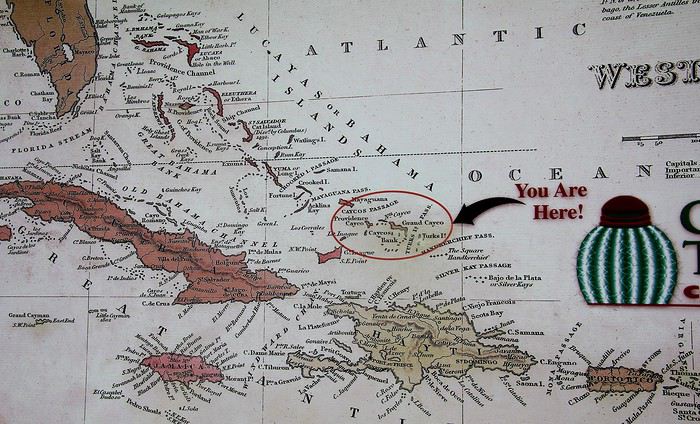
Cette carte apposée sur un mur du port de débarquement permet de mieux localiser l'archipel au milieu d'une myriade d'îles caribéennes. Donc nous voici « Here », facile à repérer notre situation avec ce cercle et cette patine bistre : que de doigts de visiteurs ont du pointer l'archipel ! Une trentaine d'îles dont huit seulement sont habitées constitue Grand Turk & Caïcos. Quant à Grand Turk, l'île n'a de grand que le nom. L'île ne mesure qu'une dizaine de kilomètres pour à peine deux/trois de large, mais c'est sur son territoire qu'est située la capitale du petit État : Cockburn Town.
En bonne place sur cette carte ainsi que sur les drapeaux flottants au vent, on le constate, le cactus est mis en avant. Cette plante a été choisie comme emblème de l'archipel.
Avec toutes ses épines, on ne peut pas dire que l'aspect de ce cactus local soit particulièrement accueillant ... mais si ! il a quand même belle allure avec son drôle de pompon rouge.
Nommé melocactus, ça fait savant, ou plus simplement Turk 's head in english, cette « Tête de Turc » végétale serait à l'origine du nom de l'archipel des Turks & Caïcos, enfin paraît-il ! Au sujet du drapeau, bien sûr on retrouve l'Union Jack, mère patrie oblige mais à côté figure aussi des armoiries aux couleurs plus locales : une conque, une langouste ainsi que l'incontournable cactus.
Quitté les environs du port, c'est à dire le sud de l'île, la route nous fait passer près de l'aéroport international de Grand Turk, il relie le territoire au reste du monde. Un aéroport à la taille modeste, on pouvait s'en douter, dont la piste est tracée sur une des seules parties parfaitement planes de l'île.
Mc Cartney Airport ? Non, ce n'est pas un hommage au célèbre Paul … des Beatles. JJAGS Mc Carney était un homme politique qui a marqué les T&C. Élu à la tête du territoire insulaire à l'âge de 31 ans, il a enthousiasmé les habitants par son charisme et son souhait d'autonomie pour l’administration de ses îles … mais le destin en a voulu autrement. En 1981 et à seulement 34 ans, l'homme trouva la mort lors d'un crash aérien.
Restons dans le domaine aérien et même bien au-delà … Au carrefour de l'aéroport, trône une ancienne capsule spatiale.
Sur l'île, on est très fier d'évoquer ce souvenir des débuts de la conquête spatiale. En 1962, c'est au large de Grand Turk que l'astronaute John Glenn a effectué son «splashdown », c'est à dire son amerrissage. A bord de Mercury, il venait de faire trois révolutions autour de la terre devenant ainsi le premier américain a effectué un vol en orbite. A l'époque, sur Grand Turk, il y avait une base militaire transformée pour l'occasion en mini NASA. Ainsi les Américains avec cette première avaient rattrapé les Russes dans la course à l'espace … des Russes qui avec Youri Gagarine les avaient devancé dans l'espace dix mois plutôt.
Bienvenue à Cockburn Town, la capitale officielle depuis 1766 des Turks & Caïcos Une capitale de poche avec seulement 3700 habitants sur les quelques 5000 que compte l'ensemble de l'île. Dans la ville, qui s'étire le long du littoral, on y trouve bien entendu quelques bâtiments administratifs. Celui-ci, sur la photo ci-dessous, regroupe dans une même construction la plupart des services administratifs : financiers, juridiques et sans doute encore quelques autres ...
Dans cette capitale-bourgade, on voit surtout des résidences individuelles, un peu dans le style d'un lotissement balnéaire. De simples maisons toutes parées de couleurs aux infinies nuances, les tonalités vont du rose au bleu en passant par le vert …
Sur le front de mer, quelques coquettes villas coloniales semblent particulièrement accueillantes. Leur style architectural est le plus souvent inspiré des maisons bahaméennes.
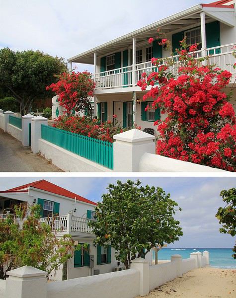
Si plusieurs ont été rénovées et sont ornées d'une profusion de bougainvilliers d'autres semblent presque à l'abandon, celle-ci par exemple.
Cette ancienne bâtisse Miramar, autrefois le siège de bureaux est proposée à la vente. A bon entendeur, sachez qu'elle est idéalement située en face de la plage cependant, côté remise en état, bon courage pour le budget des travaux à prévoir !
A « Grand Turk », nous serons en territoire britannique au milieu d'un camaïeu de bleu. Quant à « Saint Thomas », la seconde escale, l'île à tout d'un petit paradis … des USA ! après avoir été à une époque, terre d'un royaume scandinave . Et enfin, nous terminerons le périple à « Virgin Gorda », un île de la Grande Bretagne d'outremer dont on ne peut oublier les plages de rêve parsemées d'impressionnants rochers. Que d'agréables souvenirs !
--__
Grand Turk, entre bleu lagon et or blanc
Voilà la vision tant attendue lorsqu'on débarque sur une île des Caraïbes ... A Grand Turk, ce décor de rêve est bien au rendez-vous : des plages de sable blanc et un horizon marin aux fascinantes nuances de bleu, et il y en a tout autour de l'île. Certes, la photo est un peu cliché mais avouons que contempler un tel paysage fait du bien, surtout en cette période où la moindre idée de voyage à l'étranger est à oublier … du moins pour un certain temps ! Sur votre écran, vous avez l'image, à vous de la compléter en imaginant l'environnement sonore. Entendez-vous maintenant le doux bruit des vaguelettes venant lécher ce rivage ?
Comme lors de tout voyage, il y a un temps pour des moments de contemplation et d'autres consacrés à la découverte … à nous à présent, la balade sur Grand Turk.
L'archipel de Grand Turk et Caïcos est situé au nord des Antilles, c'est un chapelet d'îles et d'îlots dans le prolongement des Bahamas et séparé de quelques 160 kilomètres, à vol d'oiseau (marin), du nord de Haïti.
Cette carte apposée sur un mur du port de débarquement permet de mieux localiser l'archipel au milieu d'une myriade d'îles caribéennes. Donc nous voici « Here », facile à repérer notre situation avec ce cercle et cette patine bistre : que de doigts de visiteurs ont du pointer l'archipel ! Une trentaine d'îles dont huit seulement sont habitées constitue Grand Turk & Caïcos. Quant à Grand Turk, l'île n'a de grand que le nom. L'île ne mesure qu'une dizaine de kilomètres pour à peine deux/trois de large, mais c'est sur son territoire qu'est située la capitale du petit État : Cockburn Town.
En bonne place sur cette carte ainsi que sur les drapeaux flottants au vent, on le constate, le cactus est mis en avant. Cette plante a été choisie comme emblème de l'archipel.
Avec toutes ses épines, on ne peut pas dire que l'aspect de ce cactus local soit particulièrement accueillant ... mais si ! il a quand même belle allure avec son drôle de pompon rouge.
Nommé melocactus, ça fait savant, ou plus simplement Turk 's head in english, cette « Tête de Turc » végétale serait à l'origine du nom de l'archipel des Turks & Caïcos, enfin paraît-il ! Au sujet du drapeau, bien sûr on retrouve l'Union Jack, mère patrie oblige mais à côté figure aussi des armoiries aux couleurs plus locales : une conque, une langouste ainsi que l'incontournable cactus.
Quitté les environs du port, c'est à dire le sud de l'île, la route nous fait passer près de l'aéroport international de Grand Turk, il relie le territoire au reste du monde. Un aéroport à la taille modeste, on pouvait s'en douter, dont la piste est tracée sur une des seules parties parfaitement planes de l'île.
Mc Cartney Airport ? Non, ce n'est pas un hommage au célèbre Paul … des Beatles. JJAGS Mc Carney était un homme politique qui a marqué les T&C. Élu à la tête du territoire insulaire à l'âge de 31 ans, il a enthousiasmé les habitants par son charisme et son souhait d'autonomie pour l’administration de ses îles … mais le destin en a voulu autrement. En 1981 et à seulement 34 ans, l'homme trouva la mort lors d'un crash aérien.
Restons dans le domaine aérien et même bien au-delà … Au carrefour de l'aéroport, trône une ancienne capsule spatiale.
Sur l'île, on est très fier d'évoquer ce souvenir des débuts de la conquête spatiale. En 1962, c'est au large de Grand Turk que l'astronaute John Glenn a effectué son «splashdown », c'est à dire son amerrissage. A bord de Mercury, il venait de faire trois révolutions autour de la terre devenant ainsi le premier américain a effectué un vol en orbite. A l'époque, sur Grand Turk, il y avait une base militaire transformée pour l'occasion en mini NASA. Ainsi les Américains avec cette première avaient rattrapé les Russes dans la course à l'espace … des Russes qui avec Youri Gagarine les avaient devancé dans l'espace dix mois plutôt.
Bienvenue à Cockburn Town, la capitale officielle depuis 1766 des Turks & Caïcos Une capitale de poche avec seulement 3700 habitants sur les quelques 5000 que compte l'ensemble de l'île. Dans la ville, qui s'étire le long du littoral, on y trouve bien entendu quelques bâtiments administratifs. Celui-ci, sur la photo ci-dessous, regroupe dans une même construction la plupart des services administratifs : financiers, juridiques et sans doute encore quelques autres ...
Dans cette capitale-bourgade, on voit surtout des résidences individuelles, un peu dans le style d'un lotissement balnéaire. De simples maisons toutes parées de couleurs aux infinies nuances, les tonalités vont du rose au bleu en passant par le vert …
Sur le front de mer, quelques coquettes villas coloniales semblent particulièrement accueillantes. Leur style architectural est le plus souvent inspiré des maisons bahaméennes.
Si plusieurs ont été rénovées et sont ornées d'une profusion de bougainvilliers d'autres semblent presque à l'abandon, celle-ci par exemple.
Cette ancienne bâtisse Miramar, autrefois le siège de bureaux est proposée à la vente. A bon entendeur, sachez qu'elle est idéalement située en face de la plage cependant, côté remise en état, bon courage pour le budget des travaux à prévoir !
Sélectionner les activités à faire à la Réunion English translation pending
Bonjour à tous,
Je pars à la Réunion en janvier 2021 (oui je suis en avance). J'ai pris mes billets d'avion avec Air France, ma voiture de location chez jumbo car et pense prendre plusieurs airbnb répartis sur le territoire.
Je sais qu'il y a 1000 choses à faire mais je ne sais pas par où commencer... Le Piton des Neiges c'est sûr mais quoi d'autres ? Des idées de randonnées qui sortent un peu de l'ordinaire mais plutôt cool ?
Sinon je suis fan fan fan de plongée et aimerait beaucoup plonger là-bas, avec des requins si possible. Avez-vous des clubs à recommander ? J'ai déjà des plongées requin à mon actif je n'y vais pas à l'aveugle. Après si c'est déconseillé vivement, je n'irais pas :)
Autre chose qui sort des sentiers battus ? Bref toutes les recommandations sont bonnes à prendre merci !
Bonne journée :)
Je pars à la Réunion en janvier 2021 (oui je suis en avance). J'ai pris mes billets d'avion avec Air France, ma voiture de location chez jumbo car et pense prendre plusieurs airbnb répartis sur le territoire.
Je sais qu'il y a 1000 choses à faire mais je ne sais pas par où commencer... Le Piton des Neiges c'est sûr mais quoi d'autres ? Des idées de randonnées qui sortent un peu de l'ordinaire mais plutôt cool ?
Sinon je suis fan fan fan de plongée et aimerait beaucoup plonger là-bas, avec des requins si possible. Avez-vous des clubs à recommander ? J'ai déjà des plongées requin à mon actif je n'y vais pas à l'aveugle. Après si c'est déconseillé vivement, je n'irais pas :)
Autre chose qui sort des sentiers battus ? Bref toutes les recommandations sont bonnes à prendre merci !
Bonne journée :)
Tony Allen, batteur et pionnier de l’afrobeat, est mort English translation pending
Atoll de Fakarava (Polynésie Française) English translation pending
Bonjour,
Je n'arrête pas de changer d'avis mais comme je veux rester 3 semaines au même endroit, il faut que je vise juste.
J'étais restée sur le choix de Hiva Oa mais ce qui m'embête c'est d'une part le prix du vol Papeeti-Hiva Oa et le fait que cette île n'est pas propice à la baignade. Or, aller dans ces sublimes lagons sans pouvoir se baigner.... J'en serais frustrée. Je ne pratique pas la plongée.
Deux d'entre vous qui avez échangé m'ont poussée à retourner voir dans mes guides. Il s'agit de Fakarava. Là bas, ça semble l'idéal pour nager. Plages plages et plages....
Une pension me fait de l'oeil, vaiama village. Si certains d'entre vous y sont allés quelques jours, j'aimerais bien avoir un retour. Je suis allée sur trip advisor. A priori, les critiques sont très bonnes.
Y a t-il des randos à faire à Fakarava ?
Vous remerciant de votre patience.
Nathalie
Je n'arrête pas de changer d'avis mais comme je veux rester 3 semaines au même endroit, il faut que je vise juste.
J'étais restée sur le choix de Hiva Oa mais ce qui m'embête c'est d'une part le prix du vol Papeeti-Hiva Oa et le fait que cette île n'est pas propice à la baignade. Or, aller dans ces sublimes lagons sans pouvoir se baigner.... J'en serais frustrée. Je ne pratique pas la plongée.
Deux d'entre vous qui avez échangé m'ont poussée à retourner voir dans mes guides. Il s'agit de Fakarava. Là bas, ça semble l'idéal pour nager. Plages plages et plages....
Une pension me fait de l'oeil, vaiama village. Si certains d'entre vous y sont allés quelques jours, j'aimerais bien avoir un retour. Je suis allée sur trip advisor. A priori, les critiques sont très bonnes.
Y a t-il des randos à faire à Fakarava ?
Vous remerciant de votre patience.
Nathalie
Préparation d'un voyage de 6 semaines en Équateur et transports English translation pending
Bonjour,
Je prépare un voyage en Equateur de 6 semaines (voyage compris) en sept-oct 2020 pour mon mari et moi. Je n'ai pas pris encore mes billets vu la conjoncture actuelle mais mes dates devraient être du 6 sept au 17 octobre.
J'envisage d'utiliser les bus locaux le plus possible avec éventuellement quelques taxis à la journée ou location de voiture ponctuelle.
Pour l'instant mon programme serait le suivant mais j'ai besoin d'aide pour certains points, principalement pour les transports :
3 jours à Quito,
3 jours à Otavalo avec le marché du samedi + Cotacachi et le lago Cuicocha + les lagunas de Mojanda et ascension de Fuya Fuya
2 jours pour Mindo
2 jours pour le PN Cotopaxi
Là pour Otavalo/Mindo et Mindo / Cotopaxi (en fait Chasqui à l’entrée Sud) je me pose la question de la faisabilité en bus. Je sais que c’est possible mais qu’il y aura des changements (on a des valises, pas grandes mais...). Alors est-ce facile ? Combien de temps ? Je ne voudrais pas mettre la journée…
3 jours pour la boucle de Quilotoa, Trek de 2 jours seulement je pense (sans la 1ère étape qui part de Sighos) de Isinlivi à Chugchilan puis Chugchilan à Quilotoa puis 1/2J à Quilotoa avant de prendre le bus pour Banos
On aimerait éviter de passer une nuit à Latacunga, juste y passer pour laisser puis reprendre les bagages. Y a-t-il des hôtels à qui on peut les laisser en toute confiance, qui acceptent ?
Autre question, on m’a dit - Léon pour ne pas le nommer que je remercie chaleureusement pour son aide – que les bus Latacunga / Isinlivi partaient très tôt, à 3 et 5h du matin ! J’avoue que cela ne me tente pas trop. N’Y a-t-il pas d’autres bus ? Ou en taxi est-ce possible ? A combien cela reviendrait-il ?
2 ou 3 jours à Banos
2 jours à Riobamba. J’aurais aiméprendre le Treno del Hielo mais j’ai du mal à le caler sur un samedi ou un dimanche.
Du coup je me rabattrai peut-être sur le train La Nariz del Diablo à partir d’Alausi qui serait encore plus touristique. Avez-vous pris l’un ou l’autre? Et qu’en pensez-vous ?
Avec un jour pour le Chimborazo : aller >> refuge Whymper + descente en VTT. Cela vaut-il le coup et le coût (combien?) et est-ce difficile ?Nous sommes sportifs mais avons quand même 67 et 73 ans
Sur la route de Riobamba ou d’Alausi à Cuenca, on voudrait faire un arrêt à Ingapirca le temps de la visite du site. Peut-on laisser les bagages à l’entrée du site et y-a-t-il des bus fréquemment qui font Ingapirca/Cuenca ?
3 jours à Cuenca
Route pour Guayaquil. Donc seulement 1/J dans la ville est-ce suffisant ?
Galapagos 10 jours pour les 3 îles
Puis retour à Guayaquil + bus pour Puerto Lopez. 2 jours dont 1J pour le Parc Machalilla.
Retour Quito en bus de nuit ? Départ et arrivée à quelle heure ? Y a-t-il une consigne à l’aéroport ou à la gare routière ou mieux encore quelque part à mi-chemin pour éviter trop de transfert ? Car notre avion n’est qu’à 20h. On aurait donc une journée pour se balader encore dans Quito.
J'ai volontairement laissé de côté l'Amazonie car on y a fait un séjour lors d'un voyage précédent au Pérou et on revient d'un voyage en Malaisie.
Voilà. Qu’ai-je oublié ? Ou qu’y a-t-il de superflu ?
D'avance merci pour tous vos conseils.
Cordialement
Michèle
Vols Air France pour rapatriement English translation pending
Vol AF165 du 30 mars 2020 au départ de Bangkok à 11h30
Vol AF4142 du 30 mars 2020 au départ de Tunis à 15h00
Vol AF4145 du 30 mars 2020 au départ d'Oran à 16h30
Vol AF4081 du 31 mars 2020 au départ de Buenos Aires à 14h20
Vol AF982 du 31 mars 2020 au départ de Yaoundé à 09h00 et au départ de Douala à 11h00
Vol AF225A du 31 mars 2020 au départ de New Delhi à 01h05
Vol AF655A du 01 avril 2020 au départ de Dubaï à 17h20
Vol AF4147 du 02 avril 2020 au départ de Kinshasa à 08h30
Vol AF986 du 02 avril 2020 au départ de Cotonou à 08h45 et au départ de Lagos à 10h50
Vol AF4151 du 02 avril 2020 au départ de Bamako à 13h25
Renseignements sur l'organisation d'un voyage en Polynésie en mai-juin 2021 English translation pending
Bonjour à tous!
Avec mon conjoint et notre fils, Nous aimerions partir en mai/juin 2021 en Polynésie.
Je commence donc à regarder pour organiser ce voyage. Sur internet je ne trouve aucun hôtel disponible (sur pilotis ) pour au moins 1 nuit. De plus il semble y avoir très peu d’offre d’hôtel. Je me demande donc si c’est parceque les réservations ne sont pas encore ouvertes, ou c’est déjà complet mais dans ce cas il faut s’y prendre combien de temps à l’avance? Où il y a très peu d’hôtel?
Merci pour les infos.
Itinéraire Simikot - Charka Bhot dans le Haut Dolpo (Népal) English translation pending
Bonjour,
En préparation d'un trek dans le Haut Dolpo en Oct./Nov. 2020 (traversée Simikot ==> Jomsom), je cherche des infos:
1/ Sur le tronçon Pho- Chharka Bhot: Il y plusieurs options possibles (par Saldang et le nord, par Shey Gompa et Dho Tarap plus au sud, etc..). Lequel vous nous conseillez ?
2/ Sur le tronçon Simikot- Lac Rara: Est-il possible d'éviter la piste qui descend vers le sud ? si, oui: quel itinéraire ?
Merci pour vos recommandations et conseils.
cdt
En préparation d'un trek dans le Haut Dolpo en Oct./Nov. 2020 (traversée Simikot ==> Jomsom), je cherche des infos:
1/ Sur le tronçon Pho- Chharka Bhot: Il y plusieurs options possibles (par Saldang et le nord, par Shey Gompa et Dho Tarap plus au sud, etc..). Lequel vous nous conseillez ?
2/ Sur le tronçon Simikot- Lac Rara: Est-il possible d'éviter la piste qui descend vers le sud ? si, oui: quel itinéraire ?
Merci pour vos recommandations et conseils.
cdt
Idée itinéraire 15 jours au Portugal en septembre English translation pending
Bonjour
Nous souhaitons partir 15j debut septembre au Portugal.
Que pensez vous de cet itinéraire qui reste à affiner.
J1> Arrivée à Porto
J2> Visite d eporto
J3> Braga et Guimares avec nuit sur Porto
J4> Averio et viseu> nuit à Viseu
J5> Coimbra > Nuit à Coimbra
J6> Fatima, Obidos, Péniche Nuit à Obidos
J7/8/9 > Lisbonne et les environs
J10 à J14 > Région de l'argarve. Lieu pour dormir à définir
J15 > Départ
.
Merci pour vos retour.
Merci pour vos retour.
Itinéraire 14 jours au Yucatan et 12 jours Chiapas et Mexico English translation pending
Bonjour !
Je prévois un gros voyage au Mexique et souhaitais avoir vos avis quant à l'itinéraire et les endroits qui remportent le coup de cœur de la communauté des voyageurs !
Alors il a y a 14j dans le Yucatan (déjà organisés) puis il reste 12j que je pensais passer entre le Chiapas et Mexico pour reprendre le vol retour vers la France !
Voici le plan: - 2 jours pour faire de la plongée et se reposer (Cancún ? Isla Mujeres ? Playa del Carmen? Cozumel? Autre ? Sachant que il faut repartir avec un bus pour Palenque) Quel endroit recommanderiez-vous ? - 1 j trajet pour rallier Palenque en bus - 1 j de visite pour Palenque et si le temps le permet Agua Azules/Miso-Ha - 1 j trajet pour rallier San Cristóbal de las Casas - 2 j ??? pour San Cristóbal et les villages environnants - 1 ou 2j ??? pour les Lagos de Montebello - 1j pour le Cañón del Sumidero
Ce qui laisse 2 jours pleins pour México avant de rentrer...
A vos avis et conseils !!! Merci par avance ! ;)
Je prévois un gros voyage au Mexique et souhaitais avoir vos avis quant à l'itinéraire et les endroits qui remportent le coup de cœur de la communauté des voyageurs !
Alors il a y a 14j dans le Yucatan (déjà organisés) puis il reste 12j que je pensais passer entre le Chiapas et Mexico pour reprendre le vol retour vers la France !
Voici le plan: - 2 jours pour faire de la plongée et se reposer (Cancún ? Isla Mujeres ? Playa del Carmen? Cozumel? Autre ? Sachant que il faut repartir avec un bus pour Palenque) Quel endroit recommanderiez-vous ? - 1 j trajet pour rallier Palenque en bus - 1 j de visite pour Palenque et si le temps le permet Agua Azules/Miso-Ha - 1 j trajet pour rallier San Cristóbal de las Casas - 2 j ??? pour San Cristóbal et les villages environnants - 1 ou 2j ??? pour les Lagos de Montebello - 1j pour le Cañón del Sumidero
Ce qui laisse 2 jours pleins pour México avant de rentrer...
A vos avis et conseils !!! Merci par avance ! ;)
Voir des raies manta et des tortues en snorkeling à Moorea ou Bora Bora English translation pending
Bonjour,
Est il possible de voir des raies manta et des tortues uniquement en snorkling à Moorea ou Bora ? Nous ne faisons pas de plongee.
Merci
Hébergement à l'île de Malenge aux îles Togian English translation pending
Bonjour,
je projette un voyage aux îles Togian avec ma fille de 16 ans et après quelques jours au Poki Poki on vise l'île de Malenge.
en essayant de sélectionner notre hébergement je me perds complètement. et je me disais que des expériences récentes pourraient sans doute m'aider. entre Sera Beach, Sandy Bay, Malenge Indah, Lestari (j'ai lu que ce dernier venait de changer de propriétaire est-ce exact?)... sur ces endroits je lis un peu tout et son contraire alors pas évident de me faire une idée... par ailleurs je me demande quels pourraient être les avantages et inconvénients d'être plutôt au nord ou au sud...? proche ou loin du petit village... et d'ailleurs est-ce qu'on peut relier à pied Pulau Papan depuis Sandy, Sera etc?
merci beaucoup pour vos réponses qui m'aideront j'espère dans ma décision!
Annina
je projette un voyage aux îles Togian avec ma fille de 16 ans et après quelques jours au Poki Poki on vise l'île de Malenge.
en essayant de sélectionner notre hébergement je me perds complètement. et je me disais que des expériences récentes pourraient sans doute m'aider. entre Sera Beach, Sandy Bay, Malenge Indah, Lestari (j'ai lu que ce dernier venait de changer de propriétaire est-ce exact?)... sur ces endroits je lis un peu tout et son contraire alors pas évident de me faire une idée... par ailleurs je me demande quels pourraient être les avantages et inconvénients d'être plutôt au nord ou au sud...? proche ou loin du petit village... et d'ailleurs est-ce qu'on peut relier à pied Pulau Papan depuis Sandy, Sera etc?
merci beaucoup pour vos réponses qui m'aideront j'espère dans ma décision!
Annina
Hôtels sympathiques, lieux à visiter et randonnées entre Santiago et Puerto Mont fin février English translation pending
Hello, je pars au Chili fin février pour 18 jours. On descend dans le Sud. Je suis à la recherche de bonnes adresses d'hôtel sympa, de lieux à visiter entre Santiago et Puerto Mont. On est plutot sportifs donc petites randos d'un jour ici et là ...
Quelqu'un a loué une voiture au Chili ? Si oui combien ?
Merci les amis !
Notre trip en Afrique du Sud, destination Le Cap English translation pending
Nous entamons notre troisième jour. Passage obligé à la banque, il faut se remplir les poches et les vider d'une partie pour la location. Pas simple de se faire comprendre, car nous ne parlons que très peu l'anglais. Le distributeur ne veut pas nous délivrer 3000 rands, mais à force de mots et de gestes, nous sommes parvenus au guichet à faire le retrait, sympa la fille (nous avons compris par la suite qu'il fallait faire 2 retraits de petites sommes) des petits tracas sans importance. C 'est parti pour la côte Ouest, le littoral est sauvage et magnifique. Les eaux froides de l'Atlantique 14° ne se prêtent pas à la baignade, mais le courant froid du Bengula offre des langoustes à profusion et d'excellents poissons.
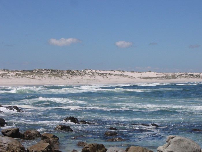
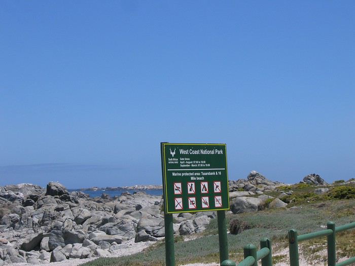 Nous pénétrons dans "West Coast National Park" 27600 hec. Le Namaqualand, jardin extraordinaire connaît en Afrique du Sud le même succès que l'arrivée du Beaujolais nouveau à Paris...
 Il mérite le nom de paradis floral: le sol aride, reconnaissant des quelques gouttes de pluie que lui accorde la nature uns fois par an, se couvre, d'un bout à l'autre de l'horizon, d'un tapis de fleurs aux couleurs éclatantes. Dommage, nous arrivons à la fin de cette merveilleuse transformation.
 La pureté du Lagon de Langebaan avec ses îlots accueillent chaque printemps des milliers d'oiseaux migrateurs. Nous pique-niquons face à cette beauté de la nature.
 Il nous faut reprendre la route en direction de Vredenburg, où nous cherchons un concessionnaire Nissan, depuis la prise de la voiture, il y a un bruit à l'avant. Après un contrôle, il s'agit d'un élément sous le moteur a peine vissé! (erreur d'usine, la voiture est neuve, comme quoi, il ne faut pas se fier à l'aspect de la voiture). Nous avons eu un accueil remarquable, le mécano est allé avec mon mari tester la voiture pendant que l'on m'offrait thé et petits gâteaux. L a réparation a été faite gratuitement!! Pourboire de 300 rands, ça les valait bien.
 Enfin, nous découvrons au bout de 16km de route aride, à l'horizon, un halo blanc baigné de soleil "Paternoster" petit village de pêche typique avec ses maisons aux murs blanchis comme en Grèce, incroyable! Selon la légende, il occupe le site où des naufragés portugais récitèrent le Notre Père pour rendre grâce à leur survie.
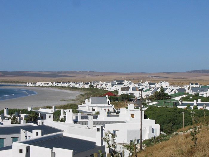 Comme nous avons coutume de le faire, un tour de village s'impose pour se donner une idée de l'ambiance, repérer les restaurants et les guest houses.
 Au bout du village en bord de plage, Baywatch B&B, nous fait un clin d’œil. Nous demandons à voir la chambre et là, c'est magnifique... d'un excellent niveau: 680 rands pour deux.
 Pieds dans le sable en sortant du B&B, "A little taste of heaven on earth"
 Nous demandons à voir la chambre et là, c'est magnifique... d'un excellent niveau: 680 rands pour deux.
 Nous sommes accueillis chaleureusement, je demande où trouver une cabine téléphonique, voilà qu'elle nous tend son cellulaire pour que nous appelions la France, ce que nous refusons, alors, elle nous propose Internet! C'est extraordinaire de rencontrer des personnes qui vous sont étrangères, qui ne parlent pas la même langue, qui sont accueillantes, super sympathiques et prêtent à tout pour vous faciliter la vie!
 Sur ce, il est temps d'aller dîner, nous avons repéré un resto qui ne paie pas trop de mine, mais où le menu a l'air bien alléchant, quelle bonne idée nous avons eu de le choisir. L'intérieur est typiquement hollandais et le repas n'en parlons pas! des steaks de calamars de 500gr, délicieusement bons, un seul aurait suffit pour deux. Pour terminer, une glace que nous avons demandé très petite, nous avions vu la taille réelle, la serveuse n'en revenait pas! Cassé le ventre. Il ne nous reste plus qu'à se glisser sous les draps et à se laisser bercer par le bruit des vagues. GOOD NIGHT
Nous pénétrons dans "West Coast National Park" 27600 hec. Le Namaqualand, jardin extraordinaire connaît en Afrique du Sud le même succès que l'arrivée du Beaujolais nouveau à Paris...
Il mérite le nom de paradis floral: le sol aride, reconnaissant des quelques gouttes de pluie que lui accorde la nature uns fois par an, se couvre, d'un bout à l'autre de l'horizon, d'un tapis de fleurs aux couleurs éclatantes. Dommage, nous arrivons à la fin de cette merveilleuse transformation.
La pureté du Lagon de Langebaan avec ses îlots accueillent chaque printemps des milliers d'oiseaux migrateurs. Nous pique-niquons face à cette beauté de la nature.
Il nous faut reprendre la route en direction de Vredenburg, où nous cherchons un concessionnaire Nissan, depuis la prise de la voiture, il y a un bruit à l'avant. Après un contrôle, il s'agit d'un élément sous le moteur a peine vissé! (erreur d'usine, la voiture est neuve, comme quoi, il ne faut pas se fier à l'aspect de la voiture). Nous avons eu un accueil remarquable, le mécano est allé avec mon mari tester la voiture pendant que l'on m'offrait thé et petits gâteaux. L a réparation a été faite gratuitement!! Pourboire de 300 rands, ça les valait bien.
Enfin, nous découvrons au bout de 16km de route aride, à l'horizon, un halo blanc baigné de soleil "Paternoster" petit village de pêche typique avec ses maisons aux murs blanchis comme en Grèce, incroyable! Selon la légende, il occupe le site où des naufragés portugais récitèrent le Notre Père pour rendre grâce à leur survie.
Comme nous avons coutume de le faire, un tour de village s'impose pour se donner une idée de l'ambiance, repérer les restaurants et les guest houses.
Au bout du village en bord de plage, Baywatch B&B, nous fait un clin d’œil. Nous demandons à voir la chambre et là, c'est magnifique... d'un excellent niveau: 680 rands pour deux.
Pieds dans le sable en sortant du B&B, "A little taste of heaven on earth"
Nous demandons à voir la chambre et là, c'est magnifique... d'un excellent niveau: 680 rands pour deux.
Nous sommes accueillis chaleureusement, je demande où trouver une cabine téléphonique, voilà qu'elle nous tend son cellulaire pour que nous appelions la France, ce que nous refusons, alors, elle nous propose Internet! C'est extraordinaire de rencontrer des personnes qui vous sont étrangères, qui ne parlent pas la même langue, qui sont accueillantes, super sympathiques et prêtent à tout pour vous faciliter la vie!
Sur ce, il est temps d'aller dîner, nous avons repéré un resto qui ne paie pas trop de mine, mais où le menu a l'air bien alléchant, quelle bonne idée nous avons eu de le choisir. L'intérieur est typiquement hollandais et le repas n'en parlons pas! des steaks de calamars de 500gr, délicieusement bons, un seul aurait suffit pour deux. Pour terminer, une glace que nous avons demandé très petite, nous avions vu la taille réelle, la serveuse n'en revenait pas! Cassé le ventre. Il ne nous reste plus qu'à se glisser sous les draps et à se laisser bercer par le bruit des vagues. GOOD NIGHTItinéraire du Cap à Port Elisabeth avec 2 enfants de 1 an et 3 ans English translation pending
Bonjour,
Nous partons découvrir l' Afrique du sud en février. Nous sommes un couple avec 2 enfants de 1 an et 3 ans. Pour la partie "sud" de notre voyage nous allons rester 7 nuits à Camps Bay près du Cap. Le but étant de se poser un peu car nous aurons pas mal bougé dans la première partie du voyage. Ensuite pouvez vous me faire un retour sur la cohérence du circuit ? - 2 Nuits à Oudtshoorn - 3 nuits à Plettenberg bay Puis restitution voiture et vol interne vers Johannesbourg.
Est ce que nous devrions un peu raccourcir le temps passé au cap pour par exemple rajouter deux nuits à Addo elephant ? Cette réserve est elle vraiment un must à ne pas louper sachant que nous voyageons avec des enfants et il n'est peut être pas idéal de rester une journée entière dans les transports.
Merci par avance pour vos commentaires et conseils.
Nicolas et Sarah
Nous partons découvrir l' Afrique du sud en février. Nous sommes un couple avec 2 enfants de 1 an et 3 ans. Pour la partie "sud" de notre voyage nous allons rester 7 nuits à Camps Bay près du Cap. Le but étant de se poser un peu car nous aurons pas mal bougé dans la première partie du voyage. Ensuite pouvez vous me faire un retour sur la cohérence du circuit ? - 2 Nuits à Oudtshoorn - 3 nuits à Plettenberg bay Puis restitution voiture et vol interne vers Johannesbourg.
Est ce que nous devrions un peu raccourcir le temps passé au cap pour par exemple rajouter deux nuits à Addo elephant ? Cette réserve est elle vraiment un must à ne pas louper sachant que nous voyageons avec des enfants et il n'est peut être pas idéal de rester une journée entière dans les transports.
Merci par avance pour vos commentaires et conseils.
Nicolas et Sarah
Premier voyage (deux semaines) à Madagascar et plongée masque et tuba English translation pending
Habitué à voyage sac à dos je demande de renseignements qua visiter et en sachant que je vaudrais aussi faire du plonger masc et tuba merci
Visite d'une ferme maraîchère en Andalousie English translation pending
Bonjour,
Je planifie un voyage en Espagne vers la fin février avec mes parents. Nous arriverons à Madrid puis prendrons une voiture pour visiter l'Andalousie (Cordoue, Grenade, Malaga, Séville) avant de remonter sur Madrid. Mes parents sont agriculteurs et ils aimeraient visiter une ferme pendant leur séjour afin de voir la réalité des producteurs dans un autre pays. Idéalement, il s'agirait d'une ferme de pommes de terres ou de céréales et où quelqu'un parle français ou anglais. J'ai fait quelques recherches, mais je ne trouve rien sur notre trajet. Avez-vous des suggestions ou des contacts qui pourraient m'aider dans ma recherche?
Merci! Myriam
Je planifie un voyage en Espagne vers la fin février avec mes parents. Nous arriverons à Madrid puis prendrons une voiture pour visiter l'Andalousie (Cordoue, Grenade, Malaga, Séville) avant de remonter sur Madrid. Mes parents sont agriculteurs et ils aimeraient visiter une ferme pendant leur séjour afin de voir la réalité des producteurs dans un autre pays. Idéalement, il s'agirait d'une ferme de pommes de terres ou de céréales et où quelqu'un parle français ou anglais. J'ai fait quelques recherches, mais je ne trouve rien sur notre trajet. Avez-vous des suggestions ou des contacts qui pourraient m'aider dans ma recherche?
Merci! Myriam
Où aller hors sentiers battus deux semaines en itinérant en Crète? English translation pending
Bonjour les amis voyageurs,
nous partons en crête début octobre 2020, les billets sont pris. on y sera donc hors saison en espérant éviter les foules, les grosses chaleurs tout en ayant une météo clémente et une eau encore assez chaude... 🤪
On prévoie de louer un véhicule 4X4 ou peut être un camping car mais ce n'est pas le même budget ni la même conduite. Le choix dépendra de notre itinéraire. Et c'est la que j'ai besoin de vous....
Nous sommes plutôt du genre "solitaire-nature-rando-piste-canyon-petite crique-village perdus" un peu moins "culture-monasteres-restaurant" et surtout pas "Grandes villes - foules de touristes -parasols -tours organisés"
Voila maintenant que notre profil est dressé je fait appel a vos conseils pour dénicher - les petites criques perdues pour lesquelles il faut marcher, - les pistes caillouteuses qui passent au travers des gorges ou a flan de montagne - les sentier de rando sympa - les trésors crétois
En sachant que nous n'avons pas peur de sortir des sentier battus, bien au contraire. N'hesitez pas a me parler du lagon de Balos ou des gorges de Samaria, même si c'est connu vos avis m’intéressent
Merci d'avance
nous partons en crête début octobre 2020, les billets sont pris. on y sera donc hors saison en espérant éviter les foules, les grosses chaleurs tout en ayant une météo clémente et une eau encore assez chaude... 🤪
On prévoie de louer un véhicule 4X4 ou peut être un camping car mais ce n'est pas le même budget ni la même conduite. Le choix dépendra de notre itinéraire. Et c'est la que j'ai besoin de vous....
Nous sommes plutôt du genre "solitaire-nature-rando-piste-canyon-petite crique-village perdus" un peu moins "culture-monasteres-restaurant" et surtout pas "Grandes villes - foules de touristes -parasols -tours organisés"
Voila maintenant que notre profil est dressé je fait appel a vos conseils pour dénicher - les petites criques perdues pour lesquelles il faut marcher, - les pistes caillouteuses qui passent au travers des gorges ou a flan de montagne - les sentier de rando sympa - les trésors crétois
En sachant que nous n'avons pas peur de sortir des sentier battus, bien au contraire. N'hesitez pas a me parler du lagon de Balos ou des gorges de Samaria, même si c'est connu vos avis m’intéressent
Merci d'avance
Excursion d'un jour à La Réunion English translation pending
Bonjour,
J'y vais prochainement pendant 2 jours, j'aurais besoin d'un conseil.
J'ai réservé un vol en hélico le 2ème jour : piton Maïdo, cirques de Cilaos, Mafate et Salazie, canyon Trou de Fer, piton de la fournaise.
Le premier jour, comme on ne peut pas tout voir et que je pars du port à 25 km de st Denis, j'hésite entre visiter
le sud : Saint Philippe, Grand Brûlé, piton de la fournaise, tunnels de lave, cap Méchant le nord : St Denis, cirque de Salazie, voile de la Mariée, Hell Bourg
si l'un de vous y est déjà allé ... Merci
le sud : Saint Philippe, Grand Brûlé, piton de la fournaise, tunnels de lave, cap Méchant le nord : St Denis, cirque de Salazie, voile de la Mariée, Hell Bourg
si l'un de vous y est déjà allé ... Merci
Circuit Guatemala - Belize et trajets en shuttle ou bus English translation pending
Bonjour,
nous préparons un voyage en couple pour l'été prochain en circuit au Guatemala et au Belize.
Nous prévoyons d'effectuer les trajets en shuttle même si c'est un peu plus cher que les bus classiques. Toutefois si certains trajets peuvent être réalisés simplement en bus de ligne, nous sommes preneurs.
Le circuit que nous envisageons est le suivant, pourriez-vous nous donner votre avis ?
Jour Nuitée : où J1 Vol Toulouse – Madrid – Guatemala City → Antigua Antigua J2 Visite Antigua Antigua J3 Excursion Volcan Pacaya Antigua J4 Visite Antigua Antigua J5 Transfert vers Chichicastenango Chichicastenango J6 Marché Chichicastenango / Bus Panajachel et Lancha pour San Pedro / San Juan → réservation shuttle pour Lanquin pour J9 San Juan J7 Lago Atitlan / Marché Santiago + Visite San Pedro – San Juan - Marché Solola ? San Juan J8 Lago Atitlan / Treck de Indian Nose San Juan J9 Transfert vers Lanquin -> 12:00 de route Lanquin J10 Excursion Semuc Champey Lanquin J11 Transfert shuttle vers El Remate (temps de trajet 6:00) El Remate (Tikal) J12 Visite Site Maya de Tikal El Remate (Tikal?) J13 El Remate -> Belize -> Arrêt San Igniacio → Orange Walk (temps de trajet 4:00) Orange Walk J14 Visite Site Maya de Lamanai Orange Walk J15 Transfert vers Belize City (2:00) puis Caye Caulker (0:30, dernier départ 17:30) Caye Caulker J16 Caye Caulker -> Hol chan Caye Caulker J17 Caye Caulker Caye Caulker J18 Caye Caulker Caye Caulker J19 Transfert vers Punta Gorda Punta Gorda J20 Punta Gorda : Blue creek cave ou Sapodilla Cayes Punta Gorda J21 Tranfert pour Livingstone. Bateaux mardi et vendredi. 1:00 de traversée. Livingston J22 Livingstone, Cueva del Tigre (jungle, Rio Dulce). Livingston J23 Livingstone → Rio Dulce. Livingston J24 (Livingston →) Puerto Barrios → Rio Hondo (direct Guatemala City) → Chiquimula → El Forido (frontière)→ Copan (temps de trajet estimé 12:00) Copan J25 Visite Site Maya de Copan Copan J26 Copan → Guatemala City Gua. City J27 Vol Guatemala City – Madrid – Toulouse
Nous sommes conscients d'avoir 3 longues journées de trajet en J9, J11 et J24. Peut-être que nous prévoyons un peu trop de nuits dans certaines étapes... Nous vous remercions d'avance pour vos avis éclairés 😉 A très bientôt de vous lire
Jour Nuitée : où J1 Vol Toulouse – Madrid – Guatemala City → Antigua Antigua J2 Visite Antigua Antigua J3 Excursion Volcan Pacaya Antigua J4 Visite Antigua Antigua J5 Transfert vers Chichicastenango Chichicastenango J6 Marché Chichicastenango / Bus Panajachel et Lancha pour San Pedro / San Juan → réservation shuttle pour Lanquin pour J9 San Juan J7 Lago Atitlan / Marché Santiago + Visite San Pedro – San Juan - Marché Solola ? San Juan J8 Lago Atitlan / Treck de Indian Nose San Juan J9 Transfert vers Lanquin -> 12:00 de route Lanquin J10 Excursion Semuc Champey Lanquin J11 Transfert shuttle vers El Remate (temps de trajet 6:00) El Remate (Tikal) J12 Visite Site Maya de Tikal El Remate (Tikal?) J13 El Remate -> Belize -> Arrêt San Igniacio → Orange Walk (temps de trajet 4:00) Orange Walk J14 Visite Site Maya de Lamanai Orange Walk J15 Transfert vers Belize City (2:00) puis Caye Caulker (0:30, dernier départ 17:30) Caye Caulker J16 Caye Caulker -> Hol chan Caye Caulker J17 Caye Caulker Caye Caulker J18 Caye Caulker Caye Caulker J19 Transfert vers Punta Gorda Punta Gorda J20 Punta Gorda : Blue creek cave ou Sapodilla Cayes Punta Gorda J21 Tranfert pour Livingstone. Bateaux mardi et vendredi. 1:00 de traversée. Livingston J22 Livingstone, Cueva del Tigre (jungle, Rio Dulce). Livingston J23 Livingstone → Rio Dulce. Livingston J24 (Livingston →) Puerto Barrios → Rio Hondo (direct Guatemala City) → Chiquimula → El Forido (frontière)→ Copan (temps de trajet estimé 12:00) Copan J25 Visite Site Maya de Copan Copan J26 Copan → Guatemala City Gua. City J27 Vol Guatemala City – Madrid – Toulouse
Nous sommes conscients d'avoir 3 longues journées de trajet en J9, J11 et J24. Peut-être que nous prévoyons un peu trop de nuits dans certaines étapes... Nous vous remercions d'avance pour vos avis éclairés 😉 A très bientôt de vous lire