Results for "Saint-Amans+|+127"
82299 results found.
De retour de Malte English translation pending
Bonjour toutes et tous,
Je reviens de passer 8 jours à Malte ou j'ai circulé en bus et en voiture de location.
J'ai vu pas mal de choses alors si vous pensez que je peut répondre à certaines de vos questions, ce sera bien volontiers.
Cordialement
Jean-Michel
Découvrir à vélo une Bretagne qu'on ne trouve pas dans les guides touristiques? English translation pending
Bonjour
J'envisage de faire une boucle d'un mois en Bretagne.
Je veux visiter la Bretagne touristique avec les immanquables mais aussi, et c'est le but de ma demande, de découvrir une Bretagne qu'on ne trouve pas dans les guides touristiques, des endroits secrets en quelque sorte, seulement connus des locaux.
Pour information, les dénivelés ne me font pas peur et pour dormir je bivouaque dans la nature ou j'utilise les réseaux d'hospitalité. Merci d'avance pour les infos.
david
Meilleur itinéraire pour faire Paris - Porto (Portugal) à vélo? English translation pending
Bonjour,
j'ai pour projet d'aller de Paris à Porto au Portugal en vélo par le chemin le plus court car j'ai peur d'avoir des pannes de mollets.
Avez vous déjà tenté l"experience sur une partie de la distance ou la totalité ?
Je suis à la recherche du meilleur itinéraire (sans route nationale...) En auriez vous un à me suggérer ?
Quels conseils pourriez vous me donner ?
merci à tous de vos réponses
j'ai pour projet d'aller de Paris à Porto au Portugal en vélo par le chemin le plus court car j'ai peur d'avoir des pannes de mollets.
Avez vous déjà tenté l"experience sur une partie de la distance ou la totalité ?
Je suis à la recherche du meilleur itinéraire (sans route nationale...) En auriez vous un à me suggérer ?
Quels conseils pourriez vous me donner ?
merci à tous de vos réponses
Que pensez-vous de mon itinéraire de seize jours au Québec? English translation pending
Bonjour à tous amoureux du Québec!
Voici un premier jet d'itinéraire pour notre premier voyage au Québec cet été.
Qu'en pensez-vous?
N'hésitez pas à me conseiller des visites, des B&B (bien et pas cher évidemment :-) ) et des petites resto ou on mange super bien!...
Pour anticiper, nous finissons par 3 nuits à Montréal car mon frère habite là-bas et qu'il faut bien que j'aille lui dire bonjour dans sa grosse mégalopole...
D'avance merci pour vos précieux conseils.
Jour 1 (S7) - Montréal - Québec 230 km (3 heures) Arrivée à l’aéroport de Montréal et prise en charge du véhicule de location. Direction Québec via Trois Rivières Nuit à Québec
Jour 2 (D8) - Québec Visite de la ville Nuit à Québec
Jour 3 (L9) - Québec - Parc du Bic – 285 km (3h30) Parc côtier du Bic Nuit à Bic ou aux alentours
Jour 4 (M10) - Bic - Carleton 250 km (3h) Parc côtier du Bic Rimouski Les Jardins de Métis Nuit à Carleton
Jour 5 (M11) – Carleton – Percé 191 km (2h30) Mont St-Joseph à Carleton Parc national de Miguasha Nuit à Percé
Jour 6 (J12) - Percé Crosière au rocher Percé et à l’île Bonaventure Nuit à Percé
Jour 7 (V13) - Percé – Gaspé 60km Direction Parc National Forillon Nuit à Gaspé
Jour 8 (S14) - Gaspé Parc du Forillon Nuit à Gaspé
Jour 9 (D15) - Gaspé - Sainte Anne des Monts 190 km (2h30) Nuit à Sainte-Anne-des-Monts ou aux alentours
Jour 10 (L16) - Parc de la Gaspésie Mont-Albert Monts Chic-Chocs Nuit à Sainte-Anne-des-Monts ou aux alentours
Jour 11 (M17) - Sainte-Anne-des-Monts – Les Escoumins 270 km (4h) Traversier Trois pistoles / Escoumins Nuit à Escoumins
Jour 12 (M18) - Escoumins – Baie Saint Paul 160 km (2h30) Zodiac pour partir observer les baleines Nuit à Baie Saint Paul ou région proche
Jour 13 (J19) Baie Saint Paul - Montréal 350 km (4h30) Arrêt à Québec pour le déjeuner Nuit à Montréal
Jour 14 (V20) Montréal Jour 15 (S21) Montréal Jour 16 (D22) Montréal – New York
Jour 1 (S7) - Montréal - Québec 230 km (3 heures) Arrivée à l’aéroport de Montréal et prise en charge du véhicule de location. Direction Québec via Trois Rivières Nuit à Québec
Jour 2 (D8) - Québec Visite de la ville Nuit à Québec
Jour 3 (L9) - Québec - Parc du Bic – 285 km (3h30) Parc côtier du Bic Nuit à Bic ou aux alentours
Jour 4 (M10) - Bic - Carleton 250 km (3h) Parc côtier du Bic Rimouski Les Jardins de Métis Nuit à Carleton
Jour 5 (M11) – Carleton – Percé 191 km (2h30) Mont St-Joseph à Carleton Parc national de Miguasha Nuit à Percé
Jour 6 (J12) - Percé Crosière au rocher Percé et à l’île Bonaventure Nuit à Percé
Jour 7 (V13) - Percé – Gaspé 60km Direction Parc National Forillon Nuit à Gaspé
Jour 8 (S14) - Gaspé Parc du Forillon Nuit à Gaspé
Jour 9 (D15) - Gaspé - Sainte Anne des Monts 190 km (2h30) Nuit à Sainte-Anne-des-Monts ou aux alentours
Jour 10 (L16) - Parc de la Gaspésie Mont-Albert Monts Chic-Chocs Nuit à Sainte-Anne-des-Monts ou aux alentours
Jour 11 (M17) - Sainte-Anne-des-Monts – Les Escoumins 270 km (4h) Traversier Trois pistoles / Escoumins Nuit à Escoumins
Jour 12 (M18) - Escoumins – Baie Saint Paul 160 km (2h30) Zodiac pour partir observer les baleines Nuit à Baie Saint Paul ou région proche
Jour 13 (J19) Baie Saint Paul - Montréal 350 km (4h30) Arrêt à Québec pour le déjeuner Nuit à Montréal
Jour 14 (V20) Montréal Jour 15 (S21) Montréal Jour 16 (D22) Montréal – New York
Quatre semaines à vélo au Sénégal en janvier 2010 English translation pending
Bonjour,
Je prépare un voyage à vélo au Sénégal pour quatre semaines, départ prévu début janvier de Dakar. Ce sera mon premier voyage à vélo hors du territoire français 🙂 J'ai un contact à Dakar, donc je ne serai pas totalement paumée en arrivant. en lisant les quelques messages à ce sujet, j'ai saisi qu'il vaut mieux sortir de Dakar en évitant d'avoir deja enfourché son vélo... Je vais voyager seule et j'aimerais éviter les zones touristiques. en ce qui concerne l'équipement, je vais acheter un vélo à Dakar à mon arrivée. Je suis à la recherche de conseils, zones à éviter ou à ne pas manquer sachant que je dispose d'un mois environ? pour l'hébergement, mieux vaut demander l'hospitalité ou camper ne pose pas de soucis? de formation agricole, j'aimerais aussi profiter de ce voyage pour découvrir l'agriculture sénégalaise que j'imagine plutot vivrière (à combiner avec mon envie de dormir sous l'oeil protecteur de l'habitant?). Je suis prenneuse de toutes remarques et conseils, et dans la mesure du possible encourageantes 😉 parce que pour le moment, mon entourage ne m'encourage pas dans ce sens! Merci
Je prépare un voyage à vélo au Sénégal pour quatre semaines, départ prévu début janvier de Dakar. Ce sera mon premier voyage à vélo hors du territoire français 🙂 J'ai un contact à Dakar, donc je ne serai pas totalement paumée en arrivant. en lisant les quelques messages à ce sujet, j'ai saisi qu'il vaut mieux sortir de Dakar en évitant d'avoir deja enfourché son vélo... Je vais voyager seule et j'aimerais éviter les zones touristiques. en ce qui concerne l'équipement, je vais acheter un vélo à Dakar à mon arrivée. Je suis à la recherche de conseils, zones à éviter ou à ne pas manquer sachant que je dispose d'un mois environ? pour l'hébergement, mieux vaut demander l'hospitalité ou camper ne pose pas de soucis? de formation agricole, j'aimerais aussi profiter de ce voyage pour découvrir l'agriculture sénégalaise que j'imagine plutot vivrière (à combiner avec mon envie de dormir sous l'oeil protecteur de l'habitant?). Je suis prenneuse de toutes remarques et conseils, et dans la mesure du possible encourageantes 😉 parce que pour le moment, mon entourage ne m'encourage pas dans ce sens! Merci
Carnet de bord d'une croisière sur le Costa Serena du 15 au 22 novembre 2009 English translation pending
😎Ah ! Ouf ! Nous y voilà ! Voilà enfin mon carnet de bord de ma croisière "Dernière Minute" sur le Costa SERENA du 15 au 22 novembre 2009.
Je vous précise que je connaissais toutes les escales. Pour certaines j'ai approfondi mes connaissances des lieux pour d'autres et bien je n'ai rien fait.
Je vous donnerai quand même quelques détails sur des excursions que j'ai effectuées les fois précédentes (en vous le précisant) celà pouvant aider des futures croisièristes.
Le 14/11/09 : INGWILLER/PADOUE
607 prête au départ, vignette Suisse sur le pare brise, valises chargées dans le coffre (tout juste assez grand !) et 4 poids lourds dans l'habitacle, et oui au retour ce sera pire !!!! Pauvre voiture !
7 heures ! Départ d'Ingwiller en Alsace. Le soleil se lève à l'Est, et bien c'est vrai, superbe !
Direction Strasbourg, l'autoroute avec tous les camions traversant l'Alsace, pour la majorité des étrangers qui évitent l'Allemagne et sa taxe camion. Mulhouse/Bale et son aéroport international franco/suisse . La frontière, ce cher douanier regarde si nous avons bien la vignette, sinon ...stop ! Ah, j'ai oublié, le conducteur : Bernard, pas le mien , non mon gendre, pas simple le même prénom. Et bien il connait très bien la route et c'est sans encombre que nous apercevons les premiers sommets suisses recouverts de neige.
Nous longeons le lac des 4 Cantons avec Luzern.
Nous nous arrêtons comme d'habitude juste avant le Tunnel du St Gothard, pour prendre un café et faire la pause technique comme disent les conducteurs de bus .
Il fait un vent incroyable mais il ne fait pas froid. De nombreux camions sont en attente pour passer le tunnel qui fait 17 kms de long. Voilà 1 mois nous étions passés par le col lors de notre retour de Croatie et bien là "Fermé". Le Tunnel est gratuit.
La traversée du Tunnel se fait sans encombre et à Airolo, il pleut.....
Prendre cette route qui traverse la Suisse est toujours un plaisir pour moi. Il y a des paysages superbes mais de nombreux tunnels et des travaux assez fréquents. Nous passons près de Bellinzona et ses 4 chateaux imposants. Un peu plus loin nous apercevons Locarno et le bout du Lac Majeur (un superbe écrin pour les iles Borromées !) et voilà Lugano !
Nous sommes attendus à l'hotel restaurant "El Delfino".
Pourquoi, ici ? Et bien c'est ici que Christelle fait descendre ses groupes lors de leurs passages sur Lugano. Un bel hotel avec une belle vue sur le lac mais pas facile d'accès surtout pour les bus. Nous visitons des chambres. Et on nous invite à passer à table. Le patron vient nous rejoindre. Christelle et lui discutent de "boulot". Pas de soucis pour le repas qui est très bien.
Nous repartons en longeant le lac de Lugano (très beau) et prenons la direction de l'Italie. La frontière à Chiasso est passée sans formalité et nous apercevons le lac de Come. La circulation est fluide et pour une fois les camions sont peu nombreux. Nous continuons notre route : Bergame, Monza, Brescia, Sirmione et le lac de Garde, puis Vérone, célèbre pour ses amants, Roméo et Juliette. Les panneaux autoroutiers nous indiquent le but de notre voyage terrestre : VENISE !
Mais ce soir nous nous arrêterons à PADOUE. Effectivement nous allons être hébergés au "Grand Hotel Italia" à Padoue. Un superbe édifice sur la place de la gare de cette ville italienne connue pour son..... Saint Antoine ! Nous prenons possession de nos chambres : 2 superbes suites ! Encore grace aux connaissances de Christelle et en plus un panier de fruits frais, une bouteille de "champagne italien" et des petits fours secs ! Enfin un avant gout à notre croisière ! Nous partons à la découverte de la ville. Il y a beaucoup de monde de toutes les nationalités dans ce secteur de la gare. Nous allons à pieds à la recherche de .....Saint Antoine et nous le trouvons !
Magnifique édifice, nous entrons il y a un office et l'église est pleine de monde ! L'intérieur est très très beau, mais impossible de faire une seule photo, il y a des gardes partout. Nous repasserons demain avant de partir pour faire des photos de l'extérieur. Maintenant Saint-Antoine, un restaurant SVP !! On trouve ! Miracle ! Des pizzas ! Ma foi fort bonnes et le petit rosé qui vas avec ....aussi.
Nous rentrons à l'hotel. Il est 22 h 30 . Une baignoire avec jets nous tend les bras et plouf !!!
Demain départ vers 9 h 30 car il y a environ 40 kms pour aller à Venise.
Bonne nuit !
Capucine18
1 2 Lever du jour sur l'Alsace
3 4 Montagnes enneigées en Suisse
5 Arrêt technique
6 Entrée du Tunnel du ST Gothard
7 Directions
8 Lugano
9 10 11 L'hotel à Padoue
12 la place de la Gare à Padoue
13 14 c'est typiquement italien : jambon et pates
15 16 et ça aussi !!!!
Ne vous en faite pas la croisière c'est pour demain 😏😏😏
Je vous précise que je connaissais toutes les escales. Pour certaines j'ai approfondi mes connaissances des lieux pour d'autres et bien je n'ai rien fait.
Je vous donnerai quand même quelques détails sur des excursions que j'ai effectuées les fois précédentes (en vous le précisant) celà pouvant aider des futures croisièristes.
Le 14/11/09 : INGWILLER/PADOUE
607 prête au départ, vignette Suisse sur le pare brise, valises chargées dans le coffre (tout juste assez grand !) et 4 poids lourds dans l'habitacle, et oui au retour ce sera pire !!!! Pauvre voiture !
7 heures ! Départ d'Ingwiller en Alsace. Le soleil se lève à l'Est, et bien c'est vrai, superbe !
Direction Strasbourg, l'autoroute avec tous les camions traversant l'Alsace, pour la majorité des étrangers qui évitent l'Allemagne et sa taxe camion. Mulhouse/Bale et son aéroport international franco/suisse . La frontière, ce cher douanier regarde si nous avons bien la vignette, sinon ...stop ! Ah, j'ai oublié, le conducteur : Bernard, pas le mien , non mon gendre, pas simple le même prénom. Et bien il connait très bien la route et c'est sans encombre que nous apercevons les premiers sommets suisses recouverts de neige.
Nous longeons le lac des 4 Cantons avec Luzern.
Nous nous arrêtons comme d'habitude juste avant le Tunnel du St Gothard, pour prendre un café et faire la pause technique comme disent les conducteurs de bus .
Il fait un vent incroyable mais il ne fait pas froid. De nombreux camions sont en attente pour passer le tunnel qui fait 17 kms de long. Voilà 1 mois nous étions passés par le col lors de notre retour de Croatie et bien là "Fermé". Le Tunnel est gratuit.
La traversée du Tunnel se fait sans encombre et à Airolo, il pleut.....
Prendre cette route qui traverse la Suisse est toujours un plaisir pour moi. Il y a des paysages superbes mais de nombreux tunnels et des travaux assez fréquents. Nous passons près de Bellinzona et ses 4 chateaux imposants. Un peu plus loin nous apercevons Locarno et le bout du Lac Majeur (un superbe écrin pour les iles Borromées !) et voilà Lugano !
Nous sommes attendus à l'hotel restaurant "El Delfino".
Pourquoi, ici ? Et bien c'est ici que Christelle fait descendre ses groupes lors de leurs passages sur Lugano. Un bel hotel avec une belle vue sur le lac mais pas facile d'accès surtout pour les bus. Nous visitons des chambres. Et on nous invite à passer à table. Le patron vient nous rejoindre. Christelle et lui discutent de "boulot". Pas de soucis pour le repas qui est très bien.
Nous repartons en longeant le lac de Lugano (très beau) et prenons la direction de l'Italie. La frontière à Chiasso est passée sans formalité et nous apercevons le lac de Come. La circulation est fluide et pour une fois les camions sont peu nombreux. Nous continuons notre route : Bergame, Monza, Brescia, Sirmione et le lac de Garde, puis Vérone, célèbre pour ses amants, Roméo et Juliette. Les panneaux autoroutiers nous indiquent le but de notre voyage terrestre : VENISE !
Mais ce soir nous nous arrêterons à PADOUE. Effectivement nous allons être hébergés au "Grand Hotel Italia" à Padoue. Un superbe édifice sur la place de la gare de cette ville italienne connue pour son..... Saint Antoine ! Nous prenons possession de nos chambres : 2 superbes suites ! Encore grace aux connaissances de Christelle et en plus un panier de fruits frais, une bouteille de "champagne italien" et des petits fours secs ! Enfin un avant gout à notre croisière ! Nous partons à la découverte de la ville. Il y a beaucoup de monde de toutes les nationalités dans ce secteur de la gare. Nous allons à pieds à la recherche de .....Saint Antoine et nous le trouvons !
Magnifique édifice, nous entrons il y a un office et l'église est pleine de monde ! L'intérieur est très très beau, mais impossible de faire une seule photo, il y a des gardes partout. Nous repasserons demain avant de partir pour faire des photos de l'extérieur. Maintenant Saint-Antoine, un restaurant SVP !! On trouve ! Miracle ! Des pizzas ! Ma foi fort bonnes et le petit rosé qui vas avec ....aussi.
Nous rentrons à l'hotel. Il est 22 h 30 . Une baignoire avec jets nous tend les bras et plouf !!!
Demain départ vers 9 h 30 car il y a environ 40 kms pour aller à Venise.
Bonne nuit !
Capucine18
1 2 Lever du jour sur l'Alsace
3 4 Montagnes enneigées en Suisse
5 Arrêt technique
6 Entrée du Tunnel du ST Gothard
7 Directions
8 Lugano
9 10 11 L'hotel à Padoue
12 la place de la Gare à Padoue
13 14 c'est typiquement italien : jambon et pates
15 16 et ça aussi !!!!
Ne vous en faite pas la croisière c'est pour demain 😏😏😏
Tour de la Bretagne: endroits à visiter? English translation pending
Bonjour,
Je part un week-end en Bretagne afin d'un découvrir cette région que je ne connais pas du tout.
Quelqu'un pourrait il m'indiquer les endroit à visiter absolument ? afin que je passe un super week-end de découverte!!
:)
:)
Récit d'un circuit dans l'Utah, Wyoming, sud Dakota English translation pending
Ci-dessous vous trouverez le circuit que nous avons fait en juin 2008 en 2 semaines à partir de salt lake city, les grands axes étant : moab, denver, rapid city, cheyenne, cody, jackson hole, yellowstone.
1er jour : arrivée à salt lake city à 19h30, réception de notre voiture chez avis (300€ pour 3 conducteurs, catégorie B), et dodo à l’airport inn hotel (62€ la nuit avec ptit dej : œufs, saucisse, toast) tout près de l’aéroport avec une petite piscine qui fut la bienvenue après ce long trajet en avion, et pc avec internet.
2e jour : départ à 8h pour la visite du capitol, temple square lieu saint des mormons du monde entier, la cathédrale de la madeleine, petite balade dans la rue principale mais tout est fermé c’est dimanche, les jardins sont très fleuris. Ensuite, courses dans un supermarché bio, ouille ouille ouille les prix pour pique nique puis petite balade au bord du lac salé (plein de sel sur la plage, et d’oiseaux morts !!!). 14h départ pour moab (377 kms, 5h de route). 21h dîner chez moab brewery, endroit sympa mais beaucoup de monde, il faut patienter pour avoir une table (bière faite maison). Notre motel le inca inn (46€ la chambre) simple mais correct avec une mini piscine froide malgré les 35° !!!! & ptit déj inclus (céréales, fruit, toast).
3e jour : 6h30 courses au city market pour pique nique du midi dans les arches. 8h30 visite des arches toute la journée soit 24 kms à pied sous 29° il faut vraiment prévoir les 2l d’eau par personne même pour des personnes ne buvant pas habituellement (heureusement qu’il y a quelque point d’eau dans le parc pour remplir de nouveau les bouteilles). Et petite précision aussi, à l’entrée de tous les parcs il y a des wc en général toujours propre et avec du papier !!!!
au programme : Desert Nature Trail, 300 mètres autour du Visitor Center n'existe plus, c'est un parking maintenant. Park Avenue, un sentier en sens unique, de 1.5 Km en descente (98 m de dénivelé) dans un canyon spectaculaire, cette première balade nous met tout de suite dans le bain pour la remontée de la pente. Petrified Dune View point, point de vue sur des dunes de sable pétrifiées. Balanced Rock, 500 mètres autour du rocher du même nom (rocher en équilibre). Double Arch, 800 mètre jusqu'au pied de Double Arch.The Windows, 3.2 Km autour 3 arches, north window, south window et Turret Arch, la seule arche double du parc.Delicate Arch 1474m, 5 Km aller-retour, 150 mètres de dénivelé, arche de 14m et large de 11m, sentier à flanc de falaise avant l'arrivée, la plus célèbre puis arrêt au point de vue en voiture (alors là très très dure la montée sous un soleil de plomb, mais ca en vaut la peine). La sal mountains est en arrière plan, splendide. Skyline Arch, 600 mètres aller-retour pour voir cette arche qui a doublé de taille en 1940. Landscape Arch, 3.2 Km aller-retour vers cette spectaculaire arche de 89 mètres de large et 30 m de hauteur, la plus grande arche du monde. Pine Tree Arch, Double O Arch et partition arch. dîner au moad dinner où l'on se croit dans American graffiti, endroit typique où les glaces sont énormes et très bonnes et on mange bien pour pas trop cher. Nous avons voulu allé boire une bière dans un café à côté mais là surprise dans l’utah il faut manger pour pouvoir boire de l’alcool, donc dommage nous sommes repartis. Fin de la journée 80 kms au total.
4e jour : après les courses, départ à 8h pour visite de canyonlands 73 kms au total de la journée (14kms à pied). Près du Visitor Center de Island in the sky, Neck Spring Trail, boucle de 8Kms qui passe près de sources (asséchées!!!) et d'anciens ranchs (entendre prairies!!!) 90 m de dénivelé, 2h30 de marche qui n’en valent pas le coup, mieux vaut faire autre chose, car tout le long c le même paysage et rien d’extraordinaire. Upheaval Dome : 1756m un peu plus au Nord se trouve un cratère d'origine incertaine (volcanique ou extraterrestre), 1, 6 Km à pied aller-retour jusqu'au bord de la falaise, 30 mn pour le 1er point de vue, le double de tps et de kms pour le 2ème point de vue. White Rim Overlook, point de vue sur la vallée où se trouve la piste du même nom. 2, 4 Km aller-retour, 1h => pas de route pour y aller donc choux blanc. visite en voiture pour se rendre à green river overlook pour voir la green river 600m en bas du canyon => pas de route pour y aller donc juste arrêt photo. Grand View Point, 1853m offre une vue sur le parc sur plus de 100 Km à la ronde. Dead horse point, petite balade pour voir les différents points de vue. 17h retour à moab, pas le temps de faire les needles, trop loin. dîner sur la terrasse dans un fast food japonais en face du city market, bon repas pour un prix raisonnable.
5e jour : 7h30 départ pour le promotoire des needles, environ 80 kms, gazelles sur le bord de la route. retour vers moab, avec un arrêt au magasin « rock » dans le rocher que l’on voit de la route, super sympa (animaux, boutique dans la roche), sculptures…) puis courses pour pique-nique le long du colorado. départ de moab pour cisco (on dirait un village abandonné) 75 kms, 1h10 de route via la scenic road du parc de colorado superbe UT 128. départ pour georgetown 405 kms, 3h40 de route et première rencontre avec la neige !!!!! visite de georgetown petit village western typique sous un vent glacial (prévoir une petite heure) puis arrivé à denver après 75kms 1h de route. Arrivée à 20h à l’hotel knighs inn (35€ la chambre bien situé mais moquette vraiment sale et le matin juste café & gâteaux si il en reste !!! superbe piscine dommage vu la météo) puis recherche d'un resto dans le city center, mais tout ferme à 21h donc merci au mac do d’être ouvert !!!! eh oui heureusement qu’il y en a partout !!!! bon nous avions regardé la météo sur le net avant de partir qui nous prévoyait 15 jours de beau temps et donc là quelle ne fut pas notre surprise de trouver de la neige et d’être pris sous une tempête de neige notamment. Effectivement nous n’avions pas fait attention durant nos préparatifs de voyage aux altitudes et au relief que nous allions faire….
6e jour : Denver 13° réveil sous la pluie donc au lieu de faire la visite d’un parc comme prévu, nous trouvons une fabrique traditionnelle de sucre candy à visiter durant 1h et en fait cela a été très sympa car on voit les ouvriers travailler derrière une vitre avec un guide pour nous expliquer (en anglais bien sûr) tout le process de la fabrication à l’emballe avec dégustation à la fin. Ensuite nous avons visité la brasserie la + grande au monde « the coors brewing ». Là on se gare sur le parking et une navette nous emmène à l’usine où l’on fait un petit circuit mais en fait on se voit pas grand-chose. Le plus intéressant de la visite c’est l’emballage des canettes en carton. Dégustation à la fin puis passage dans la boutique. Par contre la rue principale de cette petite ville est sympa. En repartant nous passons devant un wall mart, donc nous nous arrêtons pour faire des courses pour un pique nique mais là en fait il n’y avait pas de rayon alimentaire. Donc nous finissons au subway qu’il y avait juste à la sortie du magasin. La pluie étant toujours au rdv à 14h30 nous partons visiter le musée nature & science, qui est sympa (expo sur l’or, vitrines retraçant les milieux d’habitations des animaux, animaux grandeurs natures reconstitués, grandes vitrines de minéraux…). Mais à 17h on nous met à la porte, le musée ferme alors qu’on a pas tout vu dommage !!!! surprise le soleil est enfin là, donc nous décidons d’aller faire le jardin botanic et après 15mn de détour pour trouver l’entrée, nous voyons une file immense de gens, et sur le parking une personne nous apprend que le parc est fermé car il y a un concert le soir !!!! 18h nous partons pour faire le quartier larimer, les vielles rues de denver et jusqu’au capitol. Nous prenons pour remonter toute la rue le bus électrique au city center qui est gratuit pour le fun. A 20h30 nous sommes à la recherche d’un resto car comme la veille on voit à travers les vitrines que les employés font le ménage. On arrive à trouver une petite taverne sympa qui fait mexicain et là attention aux sauces qui arrachent !!!!! 13 kms à pied aujourd’hui tout de même !!!
7e jour : 7h40 départ pour Estes park (102 kms 1h40 de route), parc magnifique et petite ville sympa que nous n’aurons à mon grand regret pas le temps de nous arrêter pour faire du shopping. A notre arrivée, arrêt au visitor center qui nous explique sur la carte le circuit à faire et nous précise que des routes sont fermées car il y a eu de la neige dans la nuit !!! ca faisait longtemps !!!! Nous trouvons un petit supermarché à côté pour les courses du midi. Et nous voilà partis pour le circuit de rocky mountain, le temps s’est refroidi 12° (en bas !!!! donc prévoir un pull !!!) mais il fait beau heureusement. Nous voyons sur les côtés des rennes, des écureuils, de magnifiques oiseaux, marmottes, pika, les paysages sont somptueux, donc pas mal d’arrêt photos et premiers cars de touristes. Durant tout notre périple nous aurons eu de la chance car nous sommes surpris d’être souvent seul et c bien appréciable pour les photos !!!! Au retour nous nous arrêtons au dick’s rock (490 moraine route), pour les amoureux des minéraux, cet arrêt est obligatoire, un choix impressionnant à tous les prix. On ne peut pas le louper de la route, on voit des amas de pierres de toutes sortes. A 15h nous prenons la route pour cheyenne (2h de route 143 kms). Petit arrêt devant le capitol de cheyenne où nous retrouvons les 25°, puis devant une vieille locomotive à l’entrée d’un parc. C’est la fête du village dans le centre ville, orchestre à côté d’un magasin wangler (pour les adeptes de la country). A 18h nous partons pour lusk ville étape pour dormir (256 kms, cela devient interminable !!!). A 21h nous arrivons enfin au rawhide motel (31€), bon rapport qualité prix.
Heureusement au bout de la rue il y a un routier à côté d’une station service, ambiance très familiale. Au passage nous prenons des gâteaux à la station pour le ptit déj car juste un café à la réception le lendemain matin.
8e jour : 7h45 départ pour keystone (214kms 3h de route). On s’arrête dans la petite ville très sympa de Custer pour faire les courses. Puis nous faisons le circuit de 29 kms de Custer park route 16 A (12$). Rencontre de nos 1er bisons, gazelles, ânes, pintade sauvage et végétations agréables. Par contre en bon français que nous sommes, nous nous arrêtions comme nous pouvions sur la route pour prendre des photos (car nous étions là encore peu nombreux), lorsqu’une voiture de police s’est arrêtée en nous disant que nous n’avions pas le droit de nous arrêter !!!! il fallait considérer la route comme une autoroute !!! sympa !!! évidemment nous n’avons pas respecté cette recommandation mais nous sommes restés très vigilent !!! 13h40 visite du mont rushmore (10$), là par contre beaucoup de monde et nous n’avons pas vu de parking gratuit comme on avait pu le voir sur le net dans les forums. On a juste fait un arrêt photo, on n’a pas jugé utile de faire la petite marche qui amène en bas des têtes. Par contre nous n’avons pas pris la peine de nous arrêter à keystone et finalement nous aurions dû pour le shopping car pas mal de boutiques qui avaient l’air bien sympa contrairement à rapid city qui est sans grand intérêt. En route pour rapid city (33kms) où il y a des statues grandeur réelles des présidents des us, et visite gratuite du musée de géologie (petit mais complet, avec des vitrines de minéraux et de fossiles). 17h arrivée à Deadwood (66kms, 1h de route), ville western avec des casinos partout. Nous sommes allés jusqu’au cimetière pour voir la tombe de Calamity jane (rien d’extraordinaire c vraiment histoire de dire qu’on l’a fait !!!), et de là on a un beau point de vue sur la ville. Après shopping et dîner dans un petit saloon en centre ville. Des casinos proposent l’option buffet à volonté pour 15$ mais faut réserver donc un conseil réserver dès votre arrivée !!!! Installation à la sortie de la ville au super 8 motel 60€ la chambre (navette payante pour retourner en ville) avec petite piscine et jacuzzi mais ca ferme à 22h et là aussi des machines à sous dans le motel. Par contre pour la restauration au motel, faut aimer le bruit car quelques tables juste à côté des machines et le choix est restreint : pizza. Par contre bon ptit déj d’inclus le matin dans une autre salle. Dans deadwood toutes les places de voiture sont payantes pour la petite info.
9e jour : 7h40 départ pour sheridan (3h de route 338 kms) en faisant un détour pour voir la devil’s tower. Prévoir du temps pour petite balade si vous pouvez car nous nous n’en avons pas eu le temps à regret. Plein de chien de prairies juste avant cette tour, trop mignon. 2/3 boutiques avant d’arrivée à cette tour. Sur la route (on voit bien la cabane depuis la route) il y a un tailleur de bois qui sculpte les fameux ours en bois que vous pourrez voir un peu partout, nous n’avons pas eu de chance nous c’était fermé. A midi à hauteur de sheridan nous finissons dans une station service à la sortie de l’autoroute pour le plein d’essence et là il y a un subway pour déjeuner. Départ à 13h pour cody (227 kms 4h15 de route) et encore une fois nous ne nous attendions pas à retomber dans une vraie tempête de neige en se demandant si on allait pouvoir arriver à bon port car il n’y a que 2 routes pour passer la montagne et la 2ème est à la même altitude donc pas la peine de faire demi-tour. Nous avions mis l’option sur cette route pour s’arrêter voir la medecine wheel bighorn mountains, mais là la route fut fermée sous au moins 1m de neige !!!! Et pour avancer on ne voyait pas à 1m sans mentir c’était l’enfer et bien sûr toujours tout seul sur la route, ce n’est qu’après le col que nous avons retrouvé le soleil et que la neige a cessé de tomber, le soulagement !!!! 16h30 enfin nous voilà arrivé à cody, ville créé par buffalo bill. Nous comptions faire du shopping mais là aussi, dimanche oblige tout est pratiquement fermé. A sortie de la ville il y a le « old train town », en fait ce sont d’anciennes maisons en bois gardées à l’identique, mais l’entrée est bien sûr payante, mais on peut se faire une idée à l’entrée et faire vite fait des photos, car la gardienne vient à votre rencontre si vous tardez de trop !!! Nous avons dormi au sunrise motor inn (63€ la chambre avec café/fruit/muffin à la réception) bon rapport qualité prix et dîner dans un petit saloon sportif (écran tv partout avec retransmission de match) dans le centre ville. Le soir il y avait des rodéos d’organisés à la sortie de la ville pour les courageux car il faisait frais.
10e jour : courses de bonne heure chez wall mart à la sortie de la ville (superbes cartes postales pas chères à l’intérieur et quelques souvenirs à bon prix également dans le magasin) pour le déjeuner et en route pour yellowstone, 1er parc avec plein de touristes partout cela nous change, on comprend mieux pourquoi il faut réserver l’hôtel minimum 6 mois à l’avance !!! (85 kms 1h30 de route). A l’arrivée de l’entrée du parc, les rangers nous informent que des routes sont barrées dûes à la neige !!!! eh oui encore !!!!! au fur et à mesure qu’on avance effectivement la neige apparaît sur les bas côtés et la température est bien descendue avec un vent glacial (on ira de -3° à 6° durant notre séjour dans ce parc et forcément nous n’étions pas équipé pour, heureusement qu’on avait tout de même un kway un peu moltonné et un pull mais cela a été l’enfer tout de même à certains moments). Voici le programme de la journée au vu du changement de nos prévisions vu les routes barrées : steamboat point & mary bay, fumerolles près du lac de yellowstone. mud vulcano, petits cônes volcaniques (9m sur 9) crachant de la boue, petite balade à pied sur chemin balisé. inspiration point road mène à plusieurs point de vue => route fermée. artist's point offre la plus belle vue sur lower haute de 94m & upper fall 33m et le canyon long de 30 kms et allant de 250 à 400m de profondeur. Ses couleurs viennent du fer qui s'est oxydé, produisant des nuances de jaune, orange, rouge et brun. uncle tom's trail descend un escalier métallique abrupt => sans intérêt donc pas fait (eh puis c impossible de tout faire en 2 jours !!!). route bloquée, obligé de faire un détour. On apercevra 2 ours au loin dans un espace verdoyant, et un coyote un peu plus loin. Sinon beaucoup de bisons partout dans le parc. roaring mountain, geyser. golden gate, geyserbalade de 2 kms à mammoth hot springs, terrasses de dépôts de calcairedes passerelles en planches permettent de gravir et descendre les couléessculptées de Main Terrace & Minerva springs canary spring un des + beaux endroits. undine falls, cascade. tower falls, cascade de 40m entourée de colonne 1911m. petrified tree, bout de tronc de sequoia pétrifié haut de 2m, il y a 50 millions d'années, une coulée de lave avala cet arbre et du coup il est devenu en pierre. Nous passons notre 1ère nuit à gardiner (275 kms au total de cette journée, 11kms à pied) au super 8 motel un peu à la sortie du centre ville (59€ la chambre ptit déj inclus, viennoiserie & céréales bon rapport qualité/prix, et petite piscine dedans). Dîner dans un saloon avec comme spécialité steak de bison cuit au barbecue, sympa. 3/ 4 boutiques pour le shopping.
11e jour : 7h départ pour notre 2e jour de visite (150 kms au total 17kms à pied). Programme de la journée : obsidian cliff, falaise d'obsidienne 2250m => chemin fermé.balade écourtée à norris geyser, 2281mcar giboulée de grêle au début de la balade.steamboat geyser, est le geyser le plus haut du monde, ses grandes éruptions pouvant aller jusqu'à 120m de haut sont assez rares. gibbon & firehole falls, 20m de haut les gibbon. fountain paint pot, jolies eaux cristallines, bassin de boue bouillonnante aux teintes rosées, geysers. great fountain geyser. midway geyser basin, la plus grande source chaude du parc et la 2e du monde, près de 100m de diamètre. old faithful (vieux fidèle) est un des plus hauts et des plus spectaculaires geysers. Nommé ainsi en raison de sa régularité, il crache pendant 2 à 5 minutes, et ce en moyenne toutes les 63 minutes. En réalité, l'intervalle des éruptions peut aller de 30 à 120 minutes. Le geyser peut atteindre des hauteurs de 30 à 55 mètres et crache jusqu'à 28.500 litres d'eau. castle geyser : probablement un des plus vieux geysers de Yellowstone avec une circonférence de cône d'environ 36 mètres. Il jaillit pendant 3 minutes ou crache de la vapeur pendant 1 heure. riverside geyser : il jaillit toutes les 8h sur les bords de la rivière Firehole pendant environ 20 minutes et atteint environ 23 mètres de haut. Sa température atteint les 94 degrés. morning glory pool une des + belles sources chaudes du parc. biscuit basin.
west thumb geyser basin, grands bassins thermaux avec de belles couleurs près du lac. Nous passons la nuit au grant village (103€ la chambre eh oui nous sommes dans le parc les prix grimpent !!!). Nous sommes allés dîner au bord du lac, self service, beaucoup de monde et la neige s’est remise à tomber pendant le dîner !!!
12e jour : 7h réveil sous la neige !!! nous déneigeons la voiture avec nos bras !!!! et là un ranger s’arrête en nous disant que toutes les routes étaient fermées et qu’il fallait patienter !!!! Nous allons donc prendre notre ptit déj au grill de grant village et prendre notre mal en patiente. Au bout d’un moment nous sommes allés au visitor center pour avoir des nouvelles et ce n’est qu’à 9h45 que nous avons eu le feu vert pour reprendre la route !!!doncdépart pour le parc grand teton, entre 2100 et 4200m (48kms), la route est bien dégagée mais plein de neige sur les bas côtés et brouillard !!! donc nous ne verrons rien du grand teton, mais rien de rien !!!! on aura tout de même la chance de voir un ours d’assez près mais sous une averse de neige et là un car de touriste s’arrête et vu la discrétion l’ours est parti…nous avions prévu de faire : letour de swan lake en traversant la forêt Oxbow Bend mais pas possible vu la météosinon à 35 Km au Nord de Jackson Hole, accessible par le Highway 191 ou la Teton Park Road (un peu plus long) un bon endroit pour voir des animaux sauvages. Bons points de vue le long de route => un seul point d'observation, nous on n’a rien vu mais bon vu le temps !!!. Signal Mountain. une route de 8 Km débute au Signal Mountain Lodge et vous emmène au sommet de la colline Signal Mountain, à 250 m au-dessus de la vallée. Super point de vue panoramique sur la chaîne des Teton, le lac Jackson Lake => route fermée. 30 dollars par pers. 1h de ballon au dessus du parc, passer par moose et moran junction, et prendre la moose-wilson rd entre grand teton village et moose => dommage vu la météo pas possible. Nous nous arrêtons déjeuner dans un resto au jenny lake (super cadre au bord du lac).De là nous continuons jusqu’à la"chapel of transfiguration" petite chapelle en bois puis traçons jusqu’à jackson hole où la neige aura laissé la place à la pluie (au total de la journée 150kms). Petite ville western, pas mal de boutiques pour le shopping. Nous dînerons au million dollar cowboy bar, hot dog frite devant un concert de country (les chaises du bar ce sont des selles, cadre très sympa). Nuit au el rancho motel (54€ la chambre, café à la réception, pomme et muffin pour le ptit déj).
13e jour : réveil sous la pluie donc nous abandonnons l’idée de faire le parc du grand teton à notre grand regret. Nous prenons laroute teton pass mais celle-ci s’avère inaccessible sans chaîne donc demi-tour pour prendre l’alpine !!!!pique nique en cours de route après pocatello après s’être arrêté dans une station service pour les courses.Nous arrivons sur salt lake de bonne heure donc nous décidons d’aller faire dushopping à park city dans un outlet à 20mn de salt lake, au pied d’une montagne, paysage magnifique et enfin le soleil. Nous passerons la nuit à l’america’s best inn (43€ la chambre), très belle chambre mais dégoûté la piscine est vide !!!!!! ptit déj = céréales, fruit, viennoiserie à la réception (pc avec internet). L’hotel est éloigné de tout, donc nous dînons dans le restaurant d’un hotel assez class à 10mn à pied en haut de la même rue. (550 kms au total).
14e jour : 9h30 (eh oui grasse mat le dernier jour) dernier shopping à gateway dans le centre de salt lake, puis balade et pique nique dans le riverside park (courses dans un petit supermarché style lidl près du parc) 13h30 départ pour l’aéroport et restitution de la voiture et sniff les vacances sont finies…
J’espère que mon récit vous aura servit, si vous avez besoin plus d’info n’hésitez car moi-même je suis bien contente que ce site soit alimenté et vive les voyages !!!! j'ajoute quelques photos mais c très dur de sélectionner parmis les 1000 qui ont été prises !!!!
1er jour : arrivée à salt lake city à 19h30, réception de notre voiture chez avis (300€ pour 3 conducteurs, catégorie B), et dodo à l’airport inn hotel (62€ la nuit avec ptit dej : œufs, saucisse, toast) tout près de l’aéroport avec une petite piscine qui fut la bienvenue après ce long trajet en avion, et pc avec internet.
2e jour : départ à 8h pour la visite du capitol, temple square lieu saint des mormons du monde entier, la cathédrale de la madeleine, petite balade dans la rue principale mais tout est fermé c’est dimanche, les jardins sont très fleuris. Ensuite, courses dans un supermarché bio, ouille ouille ouille les prix pour pique nique puis petite balade au bord du lac salé (plein de sel sur la plage, et d’oiseaux morts !!!). 14h départ pour moab (377 kms, 5h de route). 21h dîner chez moab brewery, endroit sympa mais beaucoup de monde, il faut patienter pour avoir une table (bière faite maison). Notre motel le inca inn (46€ la chambre) simple mais correct avec une mini piscine froide malgré les 35° !!!! & ptit déj inclus (céréales, fruit, toast).
3e jour : 6h30 courses au city market pour pique nique du midi dans les arches. 8h30 visite des arches toute la journée soit 24 kms à pied sous 29° il faut vraiment prévoir les 2l d’eau par personne même pour des personnes ne buvant pas habituellement (heureusement qu’il y a quelque point d’eau dans le parc pour remplir de nouveau les bouteilles). Et petite précision aussi, à l’entrée de tous les parcs il y a des wc en général toujours propre et avec du papier !!!!
au programme : Desert Nature Trail, 300 mètres autour du Visitor Center n'existe plus, c'est un parking maintenant. Park Avenue, un sentier en sens unique, de 1.5 Km en descente (98 m de dénivelé) dans un canyon spectaculaire, cette première balade nous met tout de suite dans le bain pour la remontée de la pente. Petrified Dune View point, point de vue sur des dunes de sable pétrifiées. Balanced Rock, 500 mètres autour du rocher du même nom (rocher en équilibre). Double Arch, 800 mètre jusqu'au pied de Double Arch.The Windows, 3.2 Km autour 3 arches, north window, south window et Turret Arch, la seule arche double du parc.Delicate Arch 1474m, 5 Km aller-retour, 150 mètres de dénivelé, arche de 14m et large de 11m, sentier à flanc de falaise avant l'arrivée, la plus célèbre puis arrêt au point de vue en voiture (alors là très très dure la montée sous un soleil de plomb, mais ca en vaut la peine). La sal mountains est en arrière plan, splendide. Skyline Arch, 600 mètres aller-retour pour voir cette arche qui a doublé de taille en 1940. Landscape Arch, 3.2 Km aller-retour vers cette spectaculaire arche de 89 mètres de large et 30 m de hauteur, la plus grande arche du monde. Pine Tree Arch, Double O Arch et partition arch. dîner au moad dinner où l'on se croit dans American graffiti, endroit typique où les glaces sont énormes et très bonnes et on mange bien pour pas trop cher. Nous avons voulu allé boire une bière dans un café à côté mais là surprise dans l’utah il faut manger pour pouvoir boire de l’alcool, donc dommage nous sommes repartis. Fin de la journée 80 kms au total.
4e jour : après les courses, départ à 8h pour visite de canyonlands 73 kms au total de la journée (14kms à pied). Près du Visitor Center de Island in the sky, Neck Spring Trail, boucle de 8Kms qui passe près de sources (asséchées!!!) et d'anciens ranchs (entendre prairies!!!) 90 m de dénivelé, 2h30 de marche qui n’en valent pas le coup, mieux vaut faire autre chose, car tout le long c le même paysage et rien d’extraordinaire. Upheaval Dome : 1756m un peu plus au Nord se trouve un cratère d'origine incertaine (volcanique ou extraterrestre), 1, 6 Km à pied aller-retour jusqu'au bord de la falaise, 30 mn pour le 1er point de vue, le double de tps et de kms pour le 2ème point de vue. White Rim Overlook, point de vue sur la vallée où se trouve la piste du même nom. 2, 4 Km aller-retour, 1h => pas de route pour y aller donc choux blanc. visite en voiture pour se rendre à green river overlook pour voir la green river 600m en bas du canyon => pas de route pour y aller donc juste arrêt photo. Grand View Point, 1853m offre une vue sur le parc sur plus de 100 Km à la ronde. Dead horse point, petite balade pour voir les différents points de vue. 17h retour à moab, pas le temps de faire les needles, trop loin. dîner sur la terrasse dans un fast food japonais en face du city market, bon repas pour un prix raisonnable.
5e jour : 7h30 départ pour le promotoire des needles, environ 80 kms, gazelles sur le bord de la route. retour vers moab, avec un arrêt au magasin « rock » dans le rocher que l’on voit de la route, super sympa (animaux, boutique dans la roche), sculptures…) puis courses pour pique-nique le long du colorado. départ de moab pour cisco (on dirait un village abandonné) 75 kms, 1h10 de route via la scenic road du parc de colorado superbe UT 128. départ pour georgetown 405 kms, 3h40 de route et première rencontre avec la neige !!!!! visite de georgetown petit village western typique sous un vent glacial (prévoir une petite heure) puis arrivé à denver après 75kms 1h de route. Arrivée à 20h à l’hotel knighs inn (35€ la chambre bien situé mais moquette vraiment sale et le matin juste café & gâteaux si il en reste !!! superbe piscine dommage vu la météo) puis recherche d'un resto dans le city center, mais tout ferme à 21h donc merci au mac do d’être ouvert !!!! eh oui heureusement qu’il y en a partout !!!! bon nous avions regardé la météo sur le net avant de partir qui nous prévoyait 15 jours de beau temps et donc là quelle ne fut pas notre surprise de trouver de la neige et d’être pris sous une tempête de neige notamment. Effectivement nous n’avions pas fait attention durant nos préparatifs de voyage aux altitudes et au relief que nous allions faire….
6e jour : Denver 13° réveil sous la pluie donc au lieu de faire la visite d’un parc comme prévu, nous trouvons une fabrique traditionnelle de sucre candy à visiter durant 1h et en fait cela a été très sympa car on voit les ouvriers travailler derrière une vitre avec un guide pour nous expliquer (en anglais bien sûr) tout le process de la fabrication à l’emballe avec dégustation à la fin. Ensuite nous avons visité la brasserie la + grande au monde « the coors brewing ». Là on se gare sur le parking et une navette nous emmène à l’usine où l’on fait un petit circuit mais en fait on se voit pas grand-chose. Le plus intéressant de la visite c’est l’emballage des canettes en carton. Dégustation à la fin puis passage dans la boutique. Par contre la rue principale de cette petite ville est sympa. En repartant nous passons devant un wall mart, donc nous nous arrêtons pour faire des courses pour un pique nique mais là en fait il n’y avait pas de rayon alimentaire. Donc nous finissons au subway qu’il y avait juste à la sortie du magasin. La pluie étant toujours au rdv à 14h30 nous partons visiter le musée nature & science, qui est sympa (expo sur l’or, vitrines retraçant les milieux d’habitations des animaux, animaux grandeurs natures reconstitués, grandes vitrines de minéraux…). Mais à 17h on nous met à la porte, le musée ferme alors qu’on a pas tout vu dommage !!!! surprise le soleil est enfin là, donc nous décidons d’aller faire le jardin botanic et après 15mn de détour pour trouver l’entrée, nous voyons une file immense de gens, et sur le parking une personne nous apprend que le parc est fermé car il y a un concert le soir !!!! 18h nous partons pour faire le quartier larimer, les vielles rues de denver et jusqu’au capitol. Nous prenons pour remonter toute la rue le bus électrique au city center qui est gratuit pour le fun. A 20h30 nous sommes à la recherche d’un resto car comme la veille on voit à travers les vitrines que les employés font le ménage. On arrive à trouver une petite taverne sympa qui fait mexicain et là attention aux sauces qui arrachent !!!!! 13 kms à pied aujourd’hui tout de même !!!
7e jour : 7h40 départ pour Estes park (102 kms 1h40 de route), parc magnifique et petite ville sympa que nous n’aurons à mon grand regret pas le temps de nous arrêter pour faire du shopping. A notre arrivée, arrêt au visitor center qui nous explique sur la carte le circuit à faire et nous précise que des routes sont fermées car il y a eu de la neige dans la nuit !!! ca faisait longtemps !!!! Nous trouvons un petit supermarché à côté pour les courses du midi. Et nous voilà partis pour le circuit de rocky mountain, le temps s’est refroidi 12° (en bas !!!! donc prévoir un pull !!!) mais il fait beau heureusement. Nous voyons sur les côtés des rennes, des écureuils, de magnifiques oiseaux, marmottes, pika, les paysages sont somptueux, donc pas mal d’arrêt photos et premiers cars de touristes. Durant tout notre périple nous aurons eu de la chance car nous sommes surpris d’être souvent seul et c bien appréciable pour les photos !!!! Au retour nous nous arrêtons au dick’s rock (490 moraine route), pour les amoureux des minéraux, cet arrêt est obligatoire, un choix impressionnant à tous les prix. On ne peut pas le louper de la route, on voit des amas de pierres de toutes sortes. A 15h nous prenons la route pour cheyenne (2h de route 143 kms). Petit arrêt devant le capitol de cheyenne où nous retrouvons les 25°, puis devant une vieille locomotive à l’entrée d’un parc. C’est la fête du village dans le centre ville, orchestre à côté d’un magasin wangler (pour les adeptes de la country). A 18h nous partons pour lusk ville étape pour dormir (256 kms, cela devient interminable !!!). A 21h nous arrivons enfin au rawhide motel (31€), bon rapport qualité prix.
Heureusement au bout de la rue il y a un routier à côté d’une station service, ambiance très familiale. Au passage nous prenons des gâteaux à la station pour le ptit déj car juste un café à la réception le lendemain matin.
8e jour : 7h45 départ pour keystone (214kms 3h de route). On s’arrête dans la petite ville très sympa de Custer pour faire les courses. Puis nous faisons le circuit de 29 kms de Custer park route 16 A (12$). Rencontre de nos 1er bisons, gazelles, ânes, pintade sauvage et végétations agréables. Par contre en bon français que nous sommes, nous nous arrêtions comme nous pouvions sur la route pour prendre des photos (car nous étions là encore peu nombreux), lorsqu’une voiture de police s’est arrêtée en nous disant que nous n’avions pas le droit de nous arrêter !!!! il fallait considérer la route comme une autoroute !!! sympa !!! évidemment nous n’avons pas respecté cette recommandation mais nous sommes restés très vigilent !!! 13h40 visite du mont rushmore (10$), là par contre beaucoup de monde et nous n’avons pas vu de parking gratuit comme on avait pu le voir sur le net dans les forums. On a juste fait un arrêt photo, on n’a pas jugé utile de faire la petite marche qui amène en bas des têtes. Par contre nous n’avons pas pris la peine de nous arrêter à keystone et finalement nous aurions dû pour le shopping car pas mal de boutiques qui avaient l’air bien sympa contrairement à rapid city qui est sans grand intérêt. En route pour rapid city (33kms) où il y a des statues grandeur réelles des présidents des us, et visite gratuite du musée de géologie (petit mais complet, avec des vitrines de minéraux et de fossiles). 17h arrivée à Deadwood (66kms, 1h de route), ville western avec des casinos partout. Nous sommes allés jusqu’au cimetière pour voir la tombe de Calamity jane (rien d’extraordinaire c vraiment histoire de dire qu’on l’a fait !!!), et de là on a un beau point de vue sur la ville. Après shopping et dîner dans un petit saloon en centre ville. Des casinos proposent l’option buffet à volonté pour 15$ mais faut réserver donc un conseil réserver dès votre arrivée !!!! Installation à la sortie de la ville au super 8 motel 60€ la chambre (navette payante pour retourner en ville) avec petite piscine et jacuzzi mais ca ferme à 22h et là aussi des machines à sous dans le motel. Par contre pour la restauration au motel, faut aimer le bruit car quelques tables juste à côté des machines et le choix est restreint : pizza. Par contre bon ptit déj d’inclus le matin dans une autre salle. Dans deadwood toutes les places de voiture sont payantes pour la petite info.
9e jour : 7h40 départ pour sheridan (3h de route 338 kms) en faisant un détour pour voir la devil’s tower. Prévoir du temps pour petite balade si vous pouvez car nous nous n’en avons pas eu le temps à regret. Plein de chien de prairies juste avant cette tour, trop mignon. 2/3 boutiques avant d’arrivée à cette tour. Sur la route (on voit bien la cabane depuis la route) il y a un tailleur de bois qui sculpte les fameux ours en bois que vous pourrez voir un peu partout, nous n’avons pas eu de chance nous c’était fermé. A midi à hauteur de sheridan nous finissons dans une station service à la sortie de l’autoroute pour le plein d’essence et là il y a un subway pour déjeuner. Départ à 13h pour cody (227 kms 4h15 de route) et encore une fois nous ne nous attendions pas à retomber dans une vraie tempête de neige en se demandant si on allait pouvoir arriver à bon port car il n’y a que 2 routes pour passer la montagne et la 2ème est à la même altitude donc pas la peine de faire demi-tour. Nous avions mis l’option sur cette route pour s’arrêter voir la medecine wheel bighorn mountains, mais là la route fut fermée sous au moins 1m de neige !!!! Et pour avancer on ne voyait pas à 1m sans mentir c’était l’enfer et bien sûr toujours tout seul sur la route, ce n’est qu’après le col que nous avons retrouvé le soleil et que la neige a cessé de tomber, le soulagement !!!! 16h30 enfin nous voilà arrivé à cody, ville créé par buffalo bill. Nous comptions faire du shopping mais là aussi, dimanche oblige tout est pratiquement fermé. A sortie de la ville il y a le « old train town », en fait ce sont d’anciennes maisons en bois gardées à l’identique, mais l’entrée est bien sûr payante, mais on peut se faire une idée à l’entrée et faire vite fait des photos, car la gardienne vient à votre rencontre si vous tardez de trop !!! Nous avons dormi au sunrise motor inn (63€ la chambre avec café/fruit/muffin à la réception) bon rapport qualité prix et dîner dans un petit saloon sportif (écran tv partout avec retransmission de match) dans le centre ville. Le soir il y avait des rodéos d’organisés à la sortie de la ville pour les courageux car il faisait frais.
10e jour : courses de bonne heure chez wall mart à la sortie de la ville (superbes cartes postales pas chères à l’intérieur et quelques souvenirs à bon prix également dans le magasin) pour le déjeuner et en route pour yellowstone, 1er parc avec plein de touristes partout cela nous change, on comprend mieux pourquoi il faut réserver l’hôtel minimum 6 mois à l’avance !!! (85 kms 1h30 de route). A l’arrivée de l’entrée du parc, les rangers nous informent que des routes sont barrées dûes à la neige !!!! eh oui encore !!!!! au fur et à mesure qu’on avance effectivement la neige apparaît sur les bas côtés et la température est bien descendue avec un vent glacial (on ira de -3° à 6° durant notre séjour dans ce parc et forcément nous n’étions pas équipé pour, heureusement qu’on avait tout de même un kway un peu moltonné et un pull mais cela a été l’enfer tout de même à certains moments). Voici le programme de la journée au vu du changement de nos prévisions vu les routes barrées : steamboat point & mary bay, fumerolles près du lac de yellowstone. mud vulcano, petits cônes volcaniques (9m sur 9) crachant de la boue, petite balade à pied sur chemin balisé. inspiration point road mène à plusieurs point de vue => route fermée. artist's point offre la plus belle vue sur lower haute de 94m & upper fall 33m et le canyon long de 30 kms et allant de 250 à 400m de profondeur. Ses couleurs viennent du fer qui s'est oxydé, produisant des nuances de jaune, orange, rouge et brun. uncle tom's trail descend un escalier métallique abrupt => sans intérêt donc pas fait (eh puis c impossible de tout faire en 2 jours !!!). route bloquée, obligé de faire un détour. On apercevra 2 ours au loin dans un espace verdoyant, et un coyote un peu plus loin. Sinon beaucoup de bisons partout dans le parc. roaring mountain, geyser. golden gate, geyserbalade de 2 kms à mammoth hot springs, terrasses de dépôts de calcairedes passerelles en planches permettent de gravir et descendre les couléessculptées de Main Terrace & Minerva springs canary spring un des + beaux endroits. undine falls, cascade. tower falls, cascade de 40m entourée de colonne 1911m. petrified tree, bout de tronc de sequoia pétrifié haut de 2m, il y a 50 millions d'années, une coulée de lave avala cet arbre et du coup il est devenu en pierre. Nous passons notre 1ère nuit à gardiner (275 kms au total de cette journée, 11kms à pied) au super 8 motel un peu à la sortie du centre ville (59€ la chambre ptit déj inclus, viennoiserie & céréales bon rapport qualité/prix, et petite piscine dedans). Dîner dans un saloon avec comme spécialité steak de bison cuit au barbecue, sympa. 3/ 4 boutiques pour le shopping.
11e jour : 7h départ pour notre 2e jour de visite (150 kms au total 17kms à pied). Programme de la journée : obsidian cliff, falaise d'obsidienne 2250m => chemin fermé.balade écourtée à norris geyser, 2281mcar giboulée de grêle au début de la balade.steamboat geyser, est le geyser le plus haut du monde, ses grandes éruptions pouvant aller jusqu'à 120m de haut sont assez rares. gibbon & firehole falls, 20m de haut les gibbon. fountain paint pot, jolies eaux cristallines, bassin de boue bouillonnante aux teintes rosées, geysers. great fountain geyser. midway geyser basin, la plus grande source chaude du parc et la 2e du monde, près de 100m de diamètre. old faithful (vieux fidèle) est un des plus hauts et des plus spectaculaires geysers. Nommé ainsi en raison de sa régularité, il crache pendant 2 à 5 minutes, et ce en moyenne toutes les 63 minutes. En réalité, l'intervalle des éruptions peut aller de 30 à 120 minutes. Le geyser peut atteindre des hauteurs de 30 à 55 mètres et crache jusqu'à 28.500 litres d'eau. castle geyser : probablement un des plus vieux geysers de Yellowstone avec une circonférence de cône d'environ 36 mètres. Il jaillit pendant 3 minutes ou crache de la vapeur pendant 1 heure. riverside geyser : il jaillit toutes les 8h sur les bords de la rivière Firehole pendant environ 20 minutes et atteint environ 23 mètres de haut. Sa température atteint les 94 degrés. morning glory pool une des + belles sources chaudes du parc. biscuit basin.
west thumb geyser basin, grands bassins thermaux avec de belles couleurs près du lac. Nous passons la nuit au grant village (103€ la chambre eh oui nous sommes dans le parc les prix grimpent !!!). Nous sommes allés dîner au bord du lac, self service, beaucoup de monde et la neige s’est remise à tomber pendant le dîner !!!
12e jour : 7h réveil sous la neige !!! nous déneigeons la voiture avec nos bras !!!! et là un ranger s’arrête en nous disant que toutes les routes étaient fermées et qu’il fallait patienter !!!! Nous allons donc prendre notre ptit déj au grill de grant village et prendre notre mal en patiente. Au bout d’un moment nous sommes allés au visitor center pour avoir des nouvelles et ce n’est qu’à 9h45 que nous avons eu le feu vert pour reprendre la route !!!doncdépart pour le parc grand teton, entre 2100 et 4200m (48kms), la route est bien dégagée mais plein de neige sur les bas côtés et brouillard !!! donc nous ne verrons rien du grand teton, mais rien de rien !!!! on aura tout de même la chance de voir un ours d’assez près mais sous une averse de neige et là un car de touriste s’arrête et vu la discrétion l’ours est parti…nous avions prévu de faire : letour de swan lake en traversant la forêt Oxbow Bend mais pas possible vu la météosinon à 35 Km au Nord de Jackson Hole, accessible par le Highway 191 ou la Teton Park Road (un peu plus long) un bon endroit pour voir des animaux sauvages. Bons points de vue le long de route => un seul point d'observation, nous on n’a rien vu mais bon vu le temps !!!. Signal Mountain. une route de 8 Km débute au Signal Mountain Lodge et vous emmène au sommet de la colline Signal Mountain, à 250 m au-dessus de la vallée. Super point de vue panoramique sur la chaîne des Teton, le lac Jackson Lake => route fermée. 30 dollars par pers. 1h de ballon au dessus du parc, passer par moose et moran junction, et prendre la moose-wilson rd entre grand teton village et moose => dommage vu la météo pas possible. Nous nous arrêtons déjeuner dans un resto au jenny lake (super cadre au bord du lac).De là nous continuons jusqu’à la"chapel of transfiguration" petite chapelle en bois puis traçons jusqu’à jackson hole où la neige aura laissé la place à la pluie (au total de la journée 150kms). Petite ville western, pas mal de boutiques pour le shopping. Nous dînerons au million dollar cowboy bar, hot dog frite devant un concert de country (les chaises du bar ce sont des selles, cadre très sympa). Nuit au el rancho motel (54€ la chambre, café à la réception, pomme et muffin pour le ptit déj).
13e jour : réveil sous la pluie donc nous abandonnons l’idée de faire le parc du grand teton à notre grand regret. Nous prenons laroute teton pass mais celle-ci s’avère inaccessible sans chaîne donc demi-tour pour prendre l’alpine !!!!pique nique en cours de route après pocatello après s’être arrêté dans une station service pour les courses.Nous arrivons sur salt lake de bonne heure donc nous décidons d’aller faire dushopping à park city dans un outlet à 20mn de salt lake, au pied d’une montagne, paysage magnifique et enfin le soleil. Nous passerons la nuit à l’america’s best inn (43€ la chambre), très belle chambre mais dégoûté la piscine est vide !!!!!! ptit déj = céréales, fruit, viennoiserie à la réception (pc avec internet). L’hotel est éloigné de tout, donc nous dînons dans le restaurant d’un hotel assez class à 10mn à pied en haut de la même rue. (550 kms au total).
14e jour : 9h30 (eh oui grasse mat le dernier jour) dernier shopping à gateway dans le centre de salt lake, puis balade et pique nique dans le riverside park (courses dans un petit supermarché style lidl près du parc) 13h30 départ pour l’aéroport et restitution de la voiture et sniff les vacances sont finies…
J’espère que mon récit vous aura servit, si vous avez besoin plus d’info n’hésitez car moi-même je suis bien contente que ce site soit alimenté et vive les voyages !!!! j'ajoute quelques photos mais c très dur de sélectionner parmis les 1000 qui ont été prises !!!!
Auvergne à moto en deux jours: itinéraire? English translation pending
Bonjour,
Je voudrais pour un weekend faire un ptit tour dans ma belle au Auvergne mais je sais pas trop part ou commencé ^^
Je part ou plutôt on part(avec melle😉 ) sur 2 jours donc avc un petit Hôtel restaurant sur le chemin.
Je part de l'allier et je voudrais faire cantal et puy de dôme en parcours... je suis en train de réfléchir à un trassé mais quelques aides peuvent et seront les bienvenues!
Alors amis motard! j'attends de vos nouvelles merci!
Ps:Je fait la route sur ma CB1000R!!!😏
Je voudrais pour un weekend faire un ptit tour dans ma belle au Auvergne mais je sais pas trop part ou commencé ^^
Je part ou plutôt on part(avec melle😉 ) sur 2 jours donc avc un petit Hôtel restaurant sur le chemin.
Je part de l'allier et je voudrais faire cantal et puy de dôme en parcours... je suis en train de réfléchir à un trassé mais quelques aides peuvent et seront les bienvenues!
Alors amis motard! j'attends de vos nouvelles merci!
Ps:Je fait la route sur ma CB1000R!!!😏
Excursions à recommander à l'hôtel Catalonia Dominicus de La Romana? English translation pending
Bonjour à tous, 😊😊😊
Nous partons à l'automne pour un voyage ¨de filles¨ au Catalonia Dominicus. Quelqu'un pourrait-il nous recommander des excursions et s'il est possible d'en faire sans passer par l'Hôtel? nous voulons une certaine sécurité alors j'aimerais avoir votre avis avant de prendre des excursions d'un peu partout...
Si quelqu'un a fait des excursions à partir de l'hôtel, quels sont vos commentaires?
merci à l'avance des réponses et vive les vacances!!!
😏😏😏😏😏😏😏
Nous partons à l'automne pour un voyage ¨de filles¨ au Catalonia Dominicus. Quelqu'un pourrait-il nous recommander des excursions et s'il est possible d'en faire sans passer par l'Hôtel? nous voulons une certaine sécurité alors j'aimerais avoir votre avis avant de prendre des excursions d'un peu partout...
Si quelqu'un a fait des excursions à partir de l'hôtel, quels sont vos commentaires?
merci à l'avance des réponses et vive les vacances!!!
😏😏😏😏😏😏😏
Où aller se poser en arrivant en soirée à Katmandou? English translation pending
Bonsoir à tous,
Je pars fin juillet pour 3 semaines au Népal et, ne connaissant pas le moins du monde Katmandou, où je débarquerai vraisemblablement à 18H heure locale, sans visa, j'hésite à débarquer sans avoir au préalable réservé une chambre à l'aéroport ou du moins à proximité. Avez-vous une suggestion de guest house à me faire ? Connaissez-vous une pension facile à trouver ou toute proche de l'aéroport ?
Pour le reste du séjour, je ne me fais aucun souci, car je bouge selon mes envies, au fil des rencontres, sans me soucier trop de savoir à l'avance où je vais me fixer pour la nuit, mais là, j'avoue que pour l'arrivée, l'entrée en matière... je préfèrerais avoir votre sentiment et profitez de vos conseils avisés.
D'avance merci à tous ceux qui voudront bien éclairer ma lanterne ! 🙂 Isabelle
PS : vous qui connaissez peut-être..., que pensez-vous de la Sheshen Guest House ?
Je pars fin juillet pour 3 semaines au Népal et, ne connaissant pas le moins du monde Katmandou, où je débarquerai vraisemblablement à 18H heure locale, sans visa, j'hésite à débarquer sans avoir au préalable réservé une chambre à l'aéroport ou du moins à proximité. Avez-vous une suggestion de guest house à me faire ? Connaissez-vous une pension facile à trouver ou toute proche de l'aéroport ?
Pour le reste du séjour, je ne me fais aucun souci, car je bouge selon mes envies, au fil des rencontres, sans me soucier trop de savoir à l'avance où je vais me fixer pour la nuit, mais là, j'avoue que pour l'arrivée, l'entrée en matière... je préfèrerais avoir votre sentiment et profitez de vos conseils avisés.
D'avance merci à tous ceux qui voudront bien éclairer ma lanterne ! 🙂 Isabelle
PS : vous qui connaissez peut-être..., que pensez-vous de la Sheshen Guest House ?
Circuit de huit jours en camping-car en Normandie English translation pending
Bonjour,
Je cherche des conseils pour un circuit de 8 jours début Juillet en Normandie.
Nous sommes plutôt des « sauvages » et cherchons souvent un coin au bord de l’eau pour passer la nuit. Nous ne dormons jamais dans des campings.
Petits tuyaux pour trouver de l’eau sont les bienvenus, ou bien des bornes payantes.
Des infos de tout genre, exemple petit Restau, Ballade en bateau etc…
Pour mieux nous présenter, nous sommes des anciens camping-cariste, et ne louons que de temps à autre… donc nos guides papiers ne sont plus à jour.
Merci de votre aide.
😉
Je cherche des conseils pour un circuit de 8 jours début Juillet en Normandie.
Nous sommes plutôt des « sauvages » et cherchons souvent un coin au bord de l’eau pour passer la nuit. Nous ne dormons jamais dans des campings.
Petits tuyaux pour trouver de l’eau sont les bienvenus, ou bien des bornes payantes.
Des infos de tout genre, exemple petit Restau, Ballade en bateau etc…
Pour mieux nous présenter, nous sommes des anciens camping-cariste, et ne louons que de temps à autre… donc nos guides papiers ne sont plus à jour.
Merci de votre aide.
😉
Livres sur l'Indochine? English translation pending
Bonjour!
Pourriez-vous me conseiller des romans sur cette partie de l'Asie? Mis à part l'ouvrage de Pierre Loti sur Angkor...
Merci!
Fabrice
Pourriez-vous me conseiller des romans sur cette partie de l'Asie? Mis à part l'ouvrage de Pierre Loti sur Angkor...
Merci!
Fabrice
Rouen-Paris à vélo English translation pending
Bonjour.
Avec un ami je vais partir pendant 2 semaines en vélo du coté de la Normandie, et pour le retour, on voudrait passer par Paris avant de revenir dans le nord.
On s'est donc dit qu'a partir de Rouen, on prendrait la direction de Paris. Connaissez vous des routes agréables, adaptées au vélo, qui relient Rouen et Paris?
Et aussi, est ce que c'est possible ( et facile ) de rentrer dans Paris qd on est en vélo ? Parce que généralement on s'y rend souvent par les grands axes, et dc pas question d'y passer en vélo. Une fois a Paris, connaissez vous des endroits adaptés aux cyclotouristes, comme des camping pour qu'on puisse se poser et passer la nuit. On prévoit de dormir dans une tente, mais ca devrait être difficile a Paris...
Si vous avez des conseils a propos de ca, merci de nous aider!
++ 🙂
Avec un ami je vais partir pendant 2 semaines en vélo du coté de la Normandie, et pour le retour, on voudrait passer par Paris avant de revenir dans le nord.
On s'est donc dit qu'a partir de Rouen, on prendrait la direction de Paris. Connaissez vous des routes agréables, adaptées au vélo, qui relient Rouen et Paris?
Et aussi, est ce que c'est possible ( et facile ) de rentrer dans Paris qd on est en vélo ? Parce que généralement on s'y rend souvent par les grands axes, et dc pas question d'y passer en vélo. Une fois a Paris, connaissez vous des endroits adaptés aux cyclotouristes, comme des camping pour qu'on puisse se poser et passer la nuit. On prévoit de dormir dans une tente, mais ca devrait être difficile a Paris...
Si vous avez des conseils a propos de ca, merci de nous aider!
++ 🙂
Suggestions d'excursions autour de Paris? English translation pending
Bonjour à tous,
Ma conjointe et moi serons à Paris pour deux semaines en juillet du 18 au 1er août. Jusqu'à maintenant nous prévoyons rester dans Paris durant cette période à l'exception d'une excursion à Versailles. Nous nous demandions, si jamais l'envie nous prenait de rayonner un peu autour de Paris, si vous auriez quelques suggestions à nous faire de petites sorties pas trop loin de Paris que l'on pourrait faire en une journée aller-retour. Nous n'avons pas l'intention de louer d'automobile, donc idéalement cela devrait pouvoir se faire en train ou en bus.
En vous remerciant à l'avance,
PS. Une seule chose qui ne nous intéresse pas vraiment c'est DisneyWord (ou est-ce Disneyland?). Nous avons visité la version "États-Uniennes" quelques fois déjà et pour le moment on n'a pas vraiment envie de remettre ça.
Ma conjointe et moi serons à Paris pour deux semaines en juillet du 18 au 1er août. Jusqu'à maintenant nous prévoyons rester dans Paris durant cette période à l'exception d'une excursion à Versailles. Nous nous demandions, si jamais l'envie nous prenait de rayonner un peu autour de Paris, si vous auriez quelques suggestions à nous faire de petites sorties pas trop loin de Paris que l'on pourrait faire en une journée aller-retour. Nous n'avons pas l'intention de louer d'automobile, donc idéalement cela devrait pouvoir se faire en train ou en bus.
En vous remerciant à l'avance,
PS. Une seule chose qui ne nous intéresse pas vraiment c'est DisneyWord (ou est-ce Disneyland?). Nous avons visité la version "États-Uniennes" quelques fois déjà et pour le moment on n'a pas vraiment envie de remettre ça.
Eté 2008: Seattle-Yellowstone-San Francisco-Los Angeles English translation pending
Bonjour,
Après avoir mûrement réflechi, consulté les fils de VF et échangé avec qq forumeurs, nous projettons cet été (mi-juillet à aout) 2008 de faire le Nord-Ouest Pacifique des USA. Nous disposons d'environ 30 jours et avons opté pour la solution en Camping-car (2 adultes et 2 enfants de 8 ans). Afin d'éviter les chaleurs de l'Utah, nous évitons les célèbres canyons. Le circuit prévu : Seattle - Glacier NP (Montana) - Yellowstone NP (Idaho) - Gran Teton NP - Salt Lake City - Reno - San Francisco - Yosemite NP - Sequoia Park - et enfin Los Angeles après bien sûr être passé par la côte et visité Carmel, Monterey. Le choix du camping-car nous permet de rester plus longtemps si l'endroit nous plaît ou d'en filer vite dans le cas contraire. On souhaite prendre le temps, même si les 4000 km font une sacré distance, mais là-bas.... tout est grand ! Je pense réserver via CruiseAmerica ou ElMonteRV le camping-car.
1- Conseil circuit : le passage par Yellowstone est-il vraiment recommandé au vu des kms, ne vaut-il pas mieux faire plutôt la côte pacifique ? (Mont rainier, Mont Saint Hélène, Eureka, Oregon... jusqu'à SFO ?)
2- Conseil bivouac : connaissez-vous un site répertoriant les bivouacs sympas et gratuits pour le Camping-car ?
3- Conseil visite : les must-see sur le parcours initial (hors SFO et LA bien sûr...) ? Je crains notamment la portion Salt Lake City à Reno : y a-t-il qqchose à voir en cours de route ?
Merci pour vos conseils.
Berny
Après avoir mûrement réflechi, consulté les fils de VF et échangé avec qq forumeurs, nous projettons cet été (mi-juillet à aout) 2008 de faire le Nord-Ouest Pacifique des USA. Nous disposons d'environ 30 jours et avons opté pour la solution en Camping-car (2 adultes et 2 enfants de 8 ans). Afin d'éviter les chaleurs de l'Utah, nous évitons les célèbres canyons. Le circuit prévu : Seattle - Glacier NP (Montana) - Yellowstone NP (Idaho) - Gran Teton NP - Salt Lake City - Reno - San Francisco - Yosemite NP - Sequoia Park - et enfin Los Angeles après bien sûr être passé par la côte et visité Carmel, Monterey. Le choix du camping-car nous permet de rester plus longtemps si l'endroit nous plaît ou d'en filer vite dans le cas contraire. On souhaite prendre le temps, même si les 4000 km font une sacré distance, mais là-bas.... tout est grand ! Je pense réserver via CruiseAmerica ou ElMonteRV le camping-car.
1- Conseil circuit : le passage par Yellowstone est-il vraiment recommandé au vu des kms, ne vaut-il pas mieux faire plutôt la côte pacifique ? (Mont rainier, Mont Saint Hélène, Eureka, Oregon... jusqu'à SFO ?)
2- Conseil bivouac : connaissez-vous un site répertoriant les bivouacs sympas et gratuits pour le Camping-car ?
3- Conseil visite : les must-see sur le parcours initial (hors SFO et LA bien sûr...) ? Je crains notamment la portion Salt Lake City à Reno : y a-t-il qqchose à voir en cours de route ?
Merci pour vos conseils.
Berny
Pyrénées: GR10 et un tour du Mont-Perdu (Espagne) English translation pending
Bonjour,
J'envisage de partir cet été dans les Pyrénées, afin de faire un peu de randonnée. Je pensais dans un premier temps faire la portion Arrens - Melles du GR10. Puis je me suis rendu compte que le GR10 ne passe pas très loin de Gavarnie, et que le Mont perdu est encore un peu plus bas.
J'aimerais savoir s'il est possible de faire la chose suivante :
prendre le GR10 à partir de Cauterets, descendre, puis quitter le GR10 pour se diriger vers Gavarnie, faire le tour du Mont perdu (simplement le tour, pas l'escalader !), et reprendre ensuite le GR10 là où on l'avait quitté, et terminer la randonnée par exemple à Bagnères-de-Luchon ?
La partie délicate étant, je suppose, la connexion GR10 - Gavarnie - Mont perdu?
Merci ! 🙂
J'envisage de partir cet été dans les Pyrénées, afin de faire un peu de randonnée. Je pensais dans un premier temps faire la portion Arrens - Melles du GR10. Puis je me suis rendu compte que le GR10 ne passe pas très loin de Gavarnie, et que le Mont perdu est encore un peu plus bas.
J'aimerais savoir s'il est possible de faire la chose suivante :
prendre le GR10 à partir de Cauterets, descendre, puis quitter le GR10 pour se diriger vers Gavarnie, faire le tour du Mont perdu (simplement le tour, pas l'escalader !), et reprendre ensuite le GR10 là où on l'avait quitté, et terminer la randonnée par exemple à Bagnères-de-Luchon ?
La partie délicate étant, je suppose, la connexion GR10 - Gavarnie - Mont perdu?
Merci ! 🙂
Itinéraire pour quatre jours en Bretagne? English translation pending
Bonjour,
j'habite en Alsace et je projète de passer 4 jours en bretagne avant le festival "les vieilles charrues".
Je n'y connais pas grand chose à la Bretagne mais j'entend de partout que c'est magnifique, et je suis impatient d'y jeter un coup d'oeil! Donc que me conseillerez vous comme itinérair en bretagne sachant que je serais en voiture ( avec la tante ) et que je n'est que 4 jours donc je ne pence pas pouvoir faire le tour de la bretagne surtout à cause de l'escence... Quelles sont les belles plages et les lieux à visiter!
Si qqn connait un site avec ce qu'il ne faut pas rater de la bretagne je suis prenneur! 😉
Merci d'avance
Romain
Je n'y connais pas grand chose à la Bretagne mais j'entend de partout que c'est magnifique, et je suis impatient d'y jeter un coup d'oeil! Donc que me conseillerez vous comme itinérair en bretagne sachant que je serais en voiture ( avec la tante ) et que je n'est que 4 jours donc je ne pence pas pouvoir faire le tour de la bretagne surtout à cause de l'escence... Quelles sont les belles plages et les lieux à visiter!
Si qqn connait un site avec ce qu'il ne faut pas rater de la bretagne je suis prenneur! 😉
Merci d'avance
Romain
Circuit de quinze jours au Québec English translation pending
J'envisage de passer qq jours à Québec du 31 juillet au 13 août.
Afin d'optimiser mon temps sur place et voir le maximum de choses, je recherche des conseils et des avis sur la meilleure manière d'organiser ce périple. Privilégiant plutôt le contact avec la nature et je souhaiterai pouvoir approcher les baleines (si possible en kayak), randonner en forêt (1-2 jours), voir les chutes Niagara, ou tout autre site incontournable. Je n'ai aucune notion des distances qui séparent ces différents sites, et s'il est possible de prévoir tout ça en 15 jours. Je suis également à la preneur des bons tuyaux (logement sympa pas cher, loueur de voiture aux meilleurs prix🤪 activités locales, festivals, etc.) le tout pour un budget qui n'est pas élastique !
Merci d'avance pour toutes les infos que vous pourriez m'apporter.😉
Site de voyages ou site de rencontres? English translation pending
salut,
Par curiosité, j'aimerais savoir si, d'après votre expérience et votre impression, ce site est souvent confondu avec un site de rencontres romantiques...
Messieurs, vous a t-on déjà fait des avances ? Je ne dis pas mesdames car la réponse est évidente...😇
Quelq'un est-il déjà sorti avec un membre de VF au cours des Rencontres VF ou en partant en voyage ensemble en tant que ''compagnons''...
Cette question paraitra indiscrète à certains, mais les annonces de ''Recheche compagnons de voyage '' ressemblent souvent tant à des annonces tout court !!
Je ne vous demande pas de citer le pseudo de vos amants VF 😎, mais je pense que vos témoignages, anonymant vos ''conquêtes'', intéresseront beaucoup de personnes de Vf qui doivent se poser les mêmes questions que moi.
Si vous avez eu des expériences et que vous n'êtes pas des névrosés du coeur, des pseudos vierges effarouchées, que vous ne vous embarassés pas de fausses pruderies, mais que tout simplement vous assumez vos sentiments, allez-y !
Par curiosité, j'aimerais savoir si, d'après votre expérience et votre impression, ce site est souvent confondu avec un site de rencontres romantiques...
Messieurs, vous a t-on déjà fait des avances ? Je ne dis pas mesdames car la réponse est évidente...😇
Quelq'un est-il déjà sorti avec un membre de VF au cours des Rencontres VF ou en partant en voyage ensemble en tant que ''compagnons''...
Cette question paraitra indiscrète à certains, mais les annonces de ''Recheche compagnons de voyage '' ressemblent souvent tant à des annonces tout court !!
Je ne vous demande pas de citer le pseudo de vos amants VF 😎, mais je pense que vos témoignages, anonymant vos ''conquêtes'', intéresseront beaucoup de personnes de Vf qui doivent se poser les mêmes questions que moi.
Si vous avez eu des expériences et que vous n'êtes pas des névrosés du coeur, des pseudos vierges effarouchées, que vous ne vous embarassés pas de fausses pruderies, mais que tout simplement vous assumez vos sentiments, allez-y !
France: tour de Bretagne à vélo - commentaires English translation pending
Bonjour, parti le 8 aout 2005 de Morlaix (finistere) avec un ami et nos vélos respectifs avec un chargement de 25 kilos par vélo, comprenant tente, récho et affaires. Partis dans l'optique de découvrir la Bretagne et de s'arréter où bon nous semble. Contrainte de temps de 3 semaines maximum ( 2 semaines au bout du compte, dégradation de la météo). Donc, 2 semaines de vélo en partant de Morlaix et arrivée à Morlaix (magnifique baie). Route vers Carentec et St pol de Léon en passant par l'ile Callot et avant la marée. Route cotière vers la baie de Kernic. Le périple continua vers l'ouest mais en plongeant à l'intérieur vers Lesneven voulant atteindre au plus rapidement la route des Abers. Passage par Plouider, Guissény Plougerneau. Arrivé à l'Aber Wrac'h en fin de soirée.Le lendemain traversée des différents Abers (Benoit, Ildut) pour arriver au Conquet et prendre le Bateau pour l'ile de Ouessant. Jusqu'à maintenant, aucun probleme avec les voitures, des paysages de reve, vraiment magnifique et non innondés de monde, un certain calme reignant. Les Bretons et les touristes étaient tres accueillant et tres respectueux des courageux du vélo. J'ai meme l'impression que les gens ont énormément de respect pour les voyageurs. Beaucoup s'arretent, interrogent, se rappellent de leur jeunesse. C'est un plaisir de discuter. 24 h sur l'ile de ouessant et retour sur la terre ferme au conquet. Contournement de Brest par St Renan, bourg Blanc, Plabennec, Landerneau et arret à Daoulas. Déja 5 jours d'écoulés. Repos des jambes. 3 jours à se reposer au festival du monde qui cela dit en passant est tres sympathique. Reprise le mardi vers le sud Bretagne - idée générale : beaucoup de monde contrairement au sud sur les routes et dans les villes. Départ de daoulas ce mardi pour Audierne en passant par le parc Régional D'Armorique et le Menez Hom... Quellemontée à 14 km/h. Direction vers Douarnenez.. ouille les jambes. l'arrivée est difficile mais magnifique. Apres petite collation au port, départ pour Audierne. Pas si fantastique comme ville. Probleme technique des vélos, chargement obligera a l'avenir des jantes double parois - roue completement voilée par les nies de poule. Difficulté de trouver un champ ou une plage pour dormir tellement la cote est habitée. Ensuite direction, le sud vers Pont l'abbé, Benodet, Concarneau la région des parisiens... enfin beaucoup de plaques d'immatriculation 75 92 etc ..... Région plus prospere que celle du nord finistere mais bien moins agréable pour les voyageurs, routes surempreintées, pas beaucoup de choix de route. Grande route avec piste cyclable. Ce qui nous sauve sur la route. La seule fois où l'on pouvait rouler a deux de fronts sans géner personne alors que la circulation était dense. Magnifiques villes bretonnes ayant son charme mais ne ressemblant en rien au nord beaucoup plus sauvage. Arrivé à Pont Avent, le lendemain petit arret à Nizon à la creperie (bonnes crepes, vraiment pas cheres, bonne ambiance, patron super sympathique, décoration et cadre agréable; boulangère tres souriante et le pain au sègle est bon - les galettes bretonnes penven sur la route de nizon sont tres bonnes situées juste a coté des galettes de Pont aven plus commerciales, un détour a faire). Ensuite pont aven où il y a trop de monde, juste le temps d'acheter un bon Kouig Amann (surement faute d'orthographe) et de reparti vers Quimperlé. Une ville carrefour.Direction le Faouet pour entrer dans le morbihan. Choix entre retour direct par Morlaix ou bien passage en cote d'armor. Ciel bleu, envie tres tranquille sur la route alors prolongation du chemin par les montagnes noires dans le Poher. Région vide, petit choc avec 50 km plus au sud. Passage par Rostrenen, Plougonver par les rébines, personne sur la route, un plaisir. Le décor était splendide avec les montagnes, les forets, les nuages. Dur pour les jambes avec le vent de nord ouest. Le désir de retrouver la mer se faisant ressentir alors direction les cotes d'armor apres une étape à Belle isle en terre. Direction Treguier: magnifique ville bretonne et route vers la cote. Longeant toutes la cote : quel décor magnifique; un corse rencontré sur la route disait la bretagne serait parfaite avec 3 degrés de plus et la corse avec 3 degrés de moins. C vrai mais entre 11 et 19h, la température nous permet de vivre contrairement au sud. Arrivé sur Perros Guirrec (ressemblant à la baule (loire atlantique) par son standing). Visite de Trebeurden, de lannion, charmant et retour sur Morlaix par saint jean du Doigt pointe de primel, le diben...
850 Km parcourus en 11 jours purs de vélo et environ 48 heures de vélo.. Un parcours a refaire....
Bonne alimentation. Le vélo, un tres bon moyen pour visiter. La Bretagne est vraiment plate .... lol Le vélo c génial quand il fait chaud, on prend l'air. et puis vivre quinze jours coupés du monde, quel plaisir!!!
A bientot
850 Km parcourus en 11 jours purs de vélo et environ 48 heures de vélo.. Un parcours a refaire....
Bonne alimentation. Le vélo, un tres bon moyen pour visiter. La Bretagne est vraiment plate .... lol Le vélo c génial quand il fait chaud, on prend l'air. et puis vivre quinze jours coupés du monde, quel plaisir!!!
A bientot
Argent, hôtel à Amman et conseils sur la Jordanie English translation pending
bonjour à tous,
Voilà j'arrive à Amman dans la nuit (00:20). Le temps de prendre le visa, d'échanger de l'argent, je ne sais pas à quelle heure je vais sortir de l'aeroport. Y a t-il encore des taxis ou un bus (quels sont les prix d'une course de nuit) qui va jusqu'à Amman. Je compte réserver une chambre au Canary hotel. Il me propose de venir me chercher mais le service est un peu cher. A propos connaissez vous cet hotel et les prix qu'il pratique. Comme je compte réserver par mail, c'est plus difficile pour négocier!!!
Autre question: Avec combien de liquide dois-je partir? et est-ce qu'il vaut mieux changer à l'aeroport ou en ville.
Ensuite, savez-vous combien y a t-il de bus au départ d'Amman pour Aqaba et à quelle fréquence?
Enfin je prends toutes infos concernant la Jordanie. Sites à voir (autres que les classique que je vais faire bien entendu), hotel et resto conseillé ou à l'inverse à ne surtout pas faire. Trucs et astuces....
Merci à tous
Stéphanie
Voilà j'arrive à Amman dans la nuit (00:20). Le temps de prendre le visa, d'échanger de l'argent, je ne sais pas à quelle heure je vais sortir de l'aeroport. Y a t-il encore des taxis ou un bus (quels sont les prix d'une course de nuit) qui va jusqu'à Amman. Je compte réserver une chambre au Canary hotel. Il me propose de venir me chercher mais le service est un peu cher. A propos connaissez vous cet hotel et les prix qu'il pratique. Comme je compte réserver par mail, c'est plus difficile pour négocier!!!
Autre question: Avec combien de liquide dois-je partir? et est-ce qu'il vaut mieux changer à l'aeroport ou en ville.
Ensuite, savez-vous combien y a t-il de bus au départ d'Amman pour Aqaba et à quelle fréquence?
Enfin je prends toutes infos concernant la Jordanie. Sites à voir (autres que les classique que je vais faire bien entendu), hotel et resto conseillé ou à l'inverse à ne surtout pas faire. Trucs et astuces....
Merci à tous
Stéphanie
Page by Page on the Assisi Way – 1,200 km on Foot
Preamble
June 2024. While hiking with my brother on the GR 36 Tour du Morvan, I catch sight now and then of strange rectangular markers fixed to tree trunks. Against a bright orange background, a deep black Greek tau topped with a white dove. My first encounter with the Assisi Way. The Way of St. Francis: a pilgrimage route linking Vézelay in Burgundy to Assisi in Italy, covering nearly 1,800 km. It felt like an obvious next step—I immediately knew I’d take it on, attempt the adventure solo.
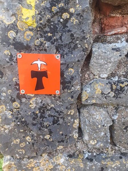
In the months that followed, I talked about my project to everyone—family, friends, my partner. An avalanche of comments, more or less the same but varying depending on each person’s character and life experiences. But deep down, it all boiled down to one legitimate question: why?
And the answers? Hesitant, awkward, partial, even confused. I quickly realized they weren’t so easy to find. It was as if my project seemed more like a whim, a kind of intimate caprice, rather than a well-thought-out plan. Of course, I knew the reasons that pushed me to leave—you always have to give some. Loved ones need to understand to feel reassured, and that’s understandable. But I fear that when I list them, they’ll sound like the same old checklist anyone embarking on this kind of journey might give. Of all the reasons I could mention, I’ll highlight just one here: the call of the road, the solo adventure that brings a powerful sense of freedom. A bit like Monsieur Seguin’s goat, who from her comfortable pen gazes longingly at the unconstrained horizon of the mountain. But if I’m being honest, I think I didn’t really know what I was looking for—or, more importantly, what I’d find. Deep down, when I reflect on it, one word keeps coming up that explains nothing and everything at once: desire.
Now well past sixty, I know that when I ask myself who I am or where I’m going, two things bring me fully back to myself: hiking and writing. And my intention was also to anchor this adventure through words, day by day. Writing down my feelings, emotions, discoveries, and reflections each evening. The famous travel journal that grounds the daily experience in reality. When I discovered the app "Polarstep," which was initially just meant to keep my loved ones updated and reassured, inform them of my progress, and maintain a connection, I found an opportunity to do it a little differently than usual. No retrospective notes polished up after returning, but spontaneous writing—recounting everything that crossed my mind during the day and publishing it immediately. A journey lived in real time.
This text is the exact transcription of my daily writings. Rereading them, I didn’t change a thing—just corrected a few mistakes and tweaked some awkward phrasing here and there. Short texts, fitting the format imposed by this kind of app. Writing as if addressing others.
Now, all that was left was to walk. April 18, 2026 – Vézelay.
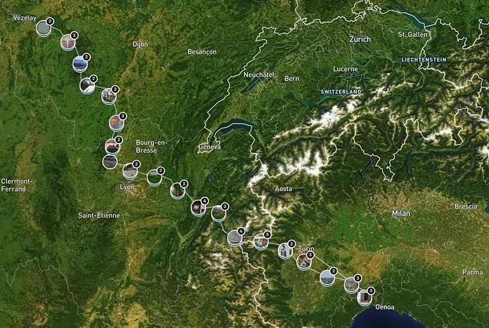
June 2024. While hiking with my brother on the GR 36 Tour du Morvan, I catch sight now and then of strange rectangular markers fixed to tree trunks. Against a bright orange background, a deep black Greek tau topped with a white dove. My first encounter with the Assisi Way. The Way of St. Francis: a pilgrimage route linking Vézelay in Burgundy to Assisi in Italy, covering nearly 1,800 km. It felt like an obvious next step—I immediately knew I’d take it on, attempt the adventure solo.
In the months that followed, I talked about my project to everyone—family, friends, my partner. An avalanche of comments, more or less the same but varying depending on each person’s character and life experiences. But deep down, it all boiled down to one legitimate question: why?
And the answers? Hesitant, awkward, partial, even confused. I quickly realized they weren’t so easy to find. It was as if my project seemed more like a whim, a kind of intimate caprice, rather than a well-thought-out plan. Of course, I knew the reasons that pushed me to leave—you always have to give some. Loved ones need to understand to feel reassured, and that’s understandable. But I fear that when I list them, they’ll sound like the same old checklist anyone embarking on this kind of journey might give. Of all the reasons I could mention, I’ll highlight just one here: the call of the road, the solo adventure that brings a powerful sense of freedom. A bit like Monsieur Seguin’s goat, who from her comfortable pen gazes longingly at the unconstrained horizon of the mountain. But if I’m being honest, I think I didn’t really know what I was looking for—or, more importantly, what I’d find. Deep down, when I reflect on it, one word keeps coming up that explains nothing and everything at once: desire.
Now well past sixty, I know that when I ask myself who I am or where I’m going, two things bring me fully back to myself: hiking and writing. And my intention was also to anchor this adventure through words, day by day. Writing down my feelings, emotions, discoveries, and reflections each evening. The famous travel journal that grounds the daily experience in reality. When I discovered the app "Polarstep," which was initially just meant to keep my loved ones updated and reassured, inform them of my progress, and maintain a connection, I found an opportunity to do it a little differently than usual. No retrospective notes polished up after returning, but spontaneous writing—recounting everything that crossed my mind during the day and publishing it immediately. A journey lived in real time.
This text is the exact transcription of my daily writings. Rereading them, I didn’t change a thing—just corrected a few mistakes and tweaked some awkward phrasing here and there. Short texts, fitting the format imposed by this kind of app. Writing as if addressing others.
Now, all that was left was to walk. April 18, 2026 – Vézelay.
Namibia Travel Journal: May 2025 - Trip Review
NAMIBIA TRIP 2025: April 24 to May 20: Feel free to comment or ask us any questions about this amazing journey.
>> Find all our photos and videos for each day on our website here: www.montagne-aventure.net
**DAY 1: Thursday, April 24, 2025: Outbound Flights from Lyon to Windhoek via Munich - Visit to Munich:**

Off we go on a new adventure. The alarm rings at 6:30 AM, the travel bags are packed, and we head to Lyon Airport. We booked our flight tickets with Lufthansa. The first leg to Munich, Germany, is operated by AirBaltic. Departure at 1:05 PM for a 1-hour and 20-minute flight. We arrive at 2:30 PM.
**We now have a 7-hour layover, so we take the opportunity to get some fresh air and explore Munich.** We quickly exit Terminal 2 of the airport and head towards the subway. We buy a group day ticket "Airport-city Day Zone M-5," valid for 2 to 5 people at a price of 30.50 € (instead of 16.30 € per person). We take the S8 line to **Marienplatz** in 35 minutes. **This is the heart of the city.** The weather is overcast, quite cool, but dry. Perfect for a little city trip between two flights while leaving our large luggage in transit at the airport. **Munich is the third-largest German city after Berlin and Hamburg, in the Bavaria region.** **The center has a lot of charm and brings together several religious buildings, easy to explore on foot.** We are impressed by the number of people enjoying these 100% pedestrian streets, which are very pleasant. After Marienplatz, the most famous square with the town hall, we head to the Cathedral of Our Lady, a Gothic church, then continue to **Karlsplatz** and move on to **the food market offering a wide selection of high-end food products in an atmosphere where a certain art of living prevails.** We also visit St. Peter's Church before grabbing a bite to eat. Two good hours were enough for this 10 km city walk. It's time to take the subway back: by 6:30 PM, we are back at the airport. Now, it's time for a bit of waiting and rest. Our second flight is scheduled for 9:35 PM for a 9-hour and 30-minute journey to our final destination in Namibia: **Windhoek.**
> Round-trip flight tickets with Lufthansa from Lyon: 2029 €, or 1,014.50 € per person.
> Lyon Airport parking: 120 €
> Today's expenses: 7 € for 2 pizzas in France / 14 € for the restaurant in Munich / 30.50 € for the daily subway ticket in Munich.
**DAY 2: Friday, April 25, 2024: Arrival in Windhoek, Visit to the Namibian Capital:**
After a 9-hour and 30-minute overnight flight with Discover Airlines, we finally land on Namibian soil just before 7:30 AM. The day is breaking, and the colors are already stunning. We are eager despite the usual fatigue from the flight. The airline was punctual, with friendly staff and good meals, though a bit light. We are the first flight of the day to land, with no more than 15 flights per day here, from 7 AM to 8 PM. We disembark on the tarmac at this airport located in the middle of nowhere, **I finally set foot on African soil for the first time.** We exit among the first from the aircraft to go through the long formalities at the front of the line, as the wait can quickly become endless. Allow at least 5 minutes per person for e-visas. We still wait 45 minutes despite only about twenty people ahead of us. Phew, it's done. We collect our luggage and then withdraw money from an ATM. We make 4 withdrawals of the maximum amount, 2000 NAD $ per withdrawal, for a total of 380 €, or 95.33 € per withdrawal.
Our driver arrives at the same time, perfect timing, we were quick.
We leave the airport at 8:45 AM. By 9:30 AM, we arrive at the **Gracious Whisp vehicle rental agency**, located at the entrance of Windhoek, small and human-sized with a fleet of recent vehicles. More formalities, then a short wait as our vehicle is not yet ready. Time to decompress, catch our breath, and enjoy the very pleasant morning temperature. Not a cloud in sight. Next, a briefing on the vehicle, always with a bit of apprehension due to our approximate English. Allow 45 minutes of explanations, including setting up the roof tent, camping equipment, technical information in case of a flat tire, driving tips in Namibia, and a tour of the 4x4. We have all the necessary equipment for camping: mattresses, sleeping bags, pillows, table, chairs, gas stove, BBQ grill... as well as 2 spare tires, a compressor, a dual tank, and accessories for removing wheels. Off we go, it's time to muster our courage and get behind the wheel. **Heading to SuperSpar Maerua**, fortunately located less than 10 minutes away. We park with the help of a parking attendant; it's very crowded, the space is narrow, but everything goes well despite the cursed right-hand drive. Today's new mission: stock up on groceries. The store is well-stocked with local and imported products, catering to all tastes. We spend 114 € on groceries, from pasta to meat, BBQ lighters to dishwashing products. Two people load our groceries into two carts and transfer them to our vehicle; we feel compelled to leave a tip, 50 NAD $, as we don't have change yet. Now, we head to the hotel, 15 minutes away. Traffic is difficult at a complicated intersection; this will likely be the only traffic jam in Namibia. **We arrive at Kate's Nest Guesthouse & Backpackers around 1:15 PM, quite tired.** We take some well-deserved rest at this recent establishment, quite calm with secure private parking. After a short nap, we enjoy the quiet by the hotel pool. Night falls between 6:30 PM and 7 PM. We eat quietly in our room tonight before starting this long 4x4 road trip in camping mode in the heart of Namibia.
> Today's grocery expenses: 114 € at Super Spar Marua (2395.21 NAD $).
> Round-trip flight tickets with Lufthansa from Lyon: 2029 €, or 1,014.50 € per person.
> Vehicle rental: 4x4 Toyota with roof tent for 24 days: Gracious Whisp Car Rentals: 2,638 € (N$50,640) or **1,319 €** per person - (https://gwcarrentals.com/)
> Distance driven today: 15 km.
> Accommodation: Kate's Nest Guesthouse & Backpackers - 4 Aristotles Street Academia, 9000 Windhoek - 36 € for two for one night.
> Windhoek International Airport website: (https://www.airports.com.na/)
**DAY 3: Saturday, April 26, 2025: Windhoek to Hardap: Mariental Region - Kalahari Desert:**
After a good, restful night, we wake up leisurely around 7 AM. We enjoy the comfort provided by this first and last hotel before 24 nights under the tent.
**We leave Kate's Nest Guesthouse at 8:30 AM to tackle the Namibian roads.** We quickly leave the capital; in just 30 minutes, we find ourselves almost alone in the world. The landscape is dotted with small domes. We leave the **paved B1** quickly to turn left onto the **C15**. **From there, we won't see more than 10 vehicles all day.** After passing through the few houses of **Lekkerwaterpoort**, we tackle our first gravel road. These road sections are limited to 100 km/h, but even at 70 km/h, I find it already challenging. However, I quickly get used to it and gradually pick up speed to reach my cruising speed of around 80 to 90 km/h. **We are on immense straight lines crossing wild expanses as far as the eye can see.** **We come across two baboons, a few ostriches, and numerous cattle and sheep farms.** We pass through the charming village of **Uhlenhorst** with its typical houses and children with broad smiles waving at us. Life here is already very different from Windhoek. **The thermometer rises quickly from 16°C at 8:30 AM to over 28°C in the early afternoon.**
**We arrive at the Hardap Dam reserve at 2 PM.** We stop at the toll booth at the park entrance to pay the entrance fee: 250 NAD $ for 2 people and 1 vehicle. We continue to the dam and then the camp entrance, located a bit further. We had booked in advance, but this place remains little frequented by foreigners.
We take advantage of the hottest hours to rest by the large pool overlooking the immense lake, a very enjoyable moment. Would this be a bit of a vacation?
Around 4:30 PM, we head to the campsite. We overlook this vast water reserve. We arrive first; we will be only 3 vehicles spending the night here. It's time to get to work and set up our equipment for the first time. It takes us a good 20 minutes to set everything up, with a slight apprehension about unfolding the tent. Once this task is done, which we will have to repeat for almost a month, we will become much more efficient over time. Time for rest and contemplation in total silence. The sun gradually sets, and the heat quickly becomes bearable again. Bliss! **This dam is located 20 km northwest of Mariental in an area dotted with conical hills topped with dolerite buttons (Hardap means "hillock" in Nama). It captures the Fish River, which flows south, creating a large lake in the middle of an arid environment. The contrast is striking.** We enjoy our first sunset facing this 360° otherworldly landscape.
Around 7 PM, we start our first BBQ, or "braai" as it's called here. The temperature is perfect. The sun sets, giving way to a star-filled sky of incredible beauty thanks to the absence of any light pollution. The Milky Way will lull us throughout the evening. After some good sausages and potatoes on the BBQ, we head to our roof tent around 9:30 PM with a complete change of scenery in just 24 hours. France already seems so far away...
This campsite has shared showers and toilets, quite clean and functional, as well as a central area with several BBQs and tables. The sites are arranged in a semicircle, each with an electrical outlet. The sites are close to each other but spacious, some slightly shaded. We are only three vehicles tonight, so it's perfectly comfortable and quiet. Not to mention the large pool near the restaurant. Our trip is off to a great start.
> Today's road itinerary: Windhoek > Head south on the B1 to Rehoboth > Turn left onto the C25 then C15 to Stampriet > C20 to Hardap > Full north on the B1 > Then turn left onto the M93 - 5 hours of driving.
> Distance driven today: 354 km.
> Accommodation: Hardap Recreation Resort - 23.3 € for two - Large pool - GR6W+3M2, Hardap Game Reserve, Mariental, Namibia - (http://www.nwr.com.na/resorts/hardap-resort/)
**DAY 4: Sunday, April 27, 2025: Hardap - Brukkaros Volcano - Keetmanshoop - Quivertree Forest Rest Camp**
Our first night under the tent was very pleasant; the little wind quickly calmed down, giving way to absolute silence. The mattress is decent, more comfortable than some nights in Nepal. The length and width give us enough space for maximum comfort, despite my height (1.91 m). We wake up a little before 7 AM as the sun rises, and the lights dazzle us from the start of the day. We pack up the equipment in 30 minutes, quite easily. Then we enjoy the sun, which warms up quickly while we keep our light fleece on.
At 8:30 AM, **we hit the road again, heading south** to our first stop in **Mariental**. We want to do some shopping at SuperSpar, but once we arrive in the parking lot, a young local is fighting with the supermarket security guards and then threatens to throw stones. We don't want to take any risks right at the start, so despite the baton blows he receives, he doesn't stop. We leave empty-handed but fill up with fuel at the Shell station 1 km further. The price per liter is 21.33 NAD $, we fill our 107-liter tank for 107 €. In Namibia, you get served, and they bring the card machine to the window to pay. It's then customary to leave a tip.
We then take the B1 heading due south on a recently renovated road. Around 11:30 AM, we leave it on our right to take **a wild gravel road, the M98**. Just before **Berseba**, we turn right onto a small track, the **D3904 towards Brukkaros Crater up to a camp at 1588 m altitude**. The track then becomes too bumpy. We stop on the counter-slopes where **a wide panorama unfolds over these immense plains as far as the eye can see**. It's 12:15 PM, time for us to eat a rice and tuna salad facing this landscape.
**We are alone in the world until a vehicle arrives and parks next to us.** A bit of apprehension, 4 men head towards us. It turns out to be 4 shepherds looking for a lost foal. The conversation is pleasant, lost in the middle of nowhere. We find ourselves alone again in this absolute silence. **The heat becomes stifling with a good 30°C**. We get back on the road around 1 PM. Back on the B1, **we continue due south to Keetmanshoop**, which we reach around 3 PM. We stop there to do some shopping for 262 NAD $ (12 eggs, a can of tuna, a can of corn, bread, a soda, and a 5-liter water container), or 12.48 €. Two quite insistent children ask us for money or candy at the store exit, yet we give them a small tip, but they continue to cling to the car. Locals parked next to us tell them to leave us alone. Anyway, we finish the trip to **Quivertree Forest**, 15 km away. We will spend the night in this **pleasant farm run by a German**. Upon arrival, as the day before, and as I suppose in the future, we dive straight into the cool pool to relax after all these kilometers. A bliss. Then we take our 4x4 and choose a spot near these famous trees. After the 33°C this afternoon, once 4 PM passed, the temperature drops again and becomes very pleasant. **We are in the middle of the Kokerboom, one of the most interesting and characteristic plants of hot and arid regions. It's not really a tree but a variant of the aloe plant whose botanical name is Aloe Dichotoma. This Kokerboom has a smooth and thick trunk reaching up to 1 m in thickness and 9 m in height. They bloom for the first time at the age of 20 to 30 years.** The flowers are yellow and reach about thirty centimeters during the season between June and July. **They grow mainly in an environment with a high concentration of black rocks absorbing a large amount of heat (38°C). The rocks also serve to anchor the tree with its tentacle-like roots. It also resists frost. Each is between 200 and 300 years old.**
Around 5 PM, we walk to the farm reception to watch the feeding of **two cheetahs**. Magnificent carnivores taking their time to savor their piece of meat. **Then we return near our campsite to enjoy the sunset among these trees. The colors are sublime, as every evening apparently. A magnificent spectacle with colors evolving from yellow to orange then to pink, before giving way once again to a sky filled with thousands of stars.** Our campsite at Quiver Tree Forest Camp is very comfortable; we have a water supply, a stone table, a small lamp, an electrical outlet, a small tree for shade, and a BBQ that we won't use tonight; we'll cook on gas. The sites are far apart, with some shared facilities scattered around, a very beautiful setting. No reservation possible, no need, just show up directly. **The campsite accommodation for 2 people costs 28 €, including the reserve entrance fee of 5 €**. We finish this second bivouac evening around 9:30 PM, time for some reading and sleep in peaceful silence without wind.
> Today's road itinerary: Mariental > B1 heading south to Brukkaros > At Tses turn right towards Berseba via the M98 > Turn right onto the D3904 > 8 km > Brukkaros Volcano (stop at the lower camp as the track is difficult for 1 hour) > Keetmanshoop > Turn left onto the M29 > Quivertree Forest - 4 hours of driving.
> Distance driven today: 371 km.
> Distance walked today: 6 km.
> Today's expenses: Groceries for 12.48 € (262 NAD $) / Fuel for 107 € (1 liter of diesel for 21.33 NAD $).
> Accommodation: Quivertree Forest Rest Camp, P.O. Box 262, Keetmanshoop, Namibia - BBQ, hot showers, toilets, and electricity - No reservation - Pool - 18 €/Person (N$ 340.00 with park entrance) - (http://www.quivertreeforest.com/)
**DAY 5: Monday, April 28, 2025: Quivertree Forest Rest Camp - Giant's Playground - Keetmanshoop - Fish River Canyon - Canyon Roadhouse:**
After an excellent start to the night, we are woken up by the wind shortly before 6 AM, but the sunrise is not far off. We get up at 6:30 AM to enjoy it. The atmosphere is a bit cooler this morning, but the reward is already here.
The adventure continues. At 7:45 AM, we head towards **Giant's Playground**, 4 km away. We take a 3-kilometer walk through this expanse of blocks and igneous rocks.
We continue south at 8:45 AM, passing through Keetmanshoop again where we do some shopping for 25 €, a big stock-up for a good part of the trip: meats, canned goods, pasta, fruits... At 9:30 AM, we take the B4 to Fish River Canyon.
At 11:30 AM, we arrive at the entrance to the NWR park (350 NAD $ entrance for 2 people and 1 vehicle). The track becomes bumpy immediately upon entering the park. After about ten kilometers, we come upon this landscape carved by nature. In the end, it's well worth the detour. We were at the Grand Canyon in the USA exactly (https://www.montagne-aventure.net/2024/04/29/j21-3-juin-2024-grand-canyon-et-lac-powell/) and can thus confirm that this Fish River Canyon is comparable. We make several stops along the southern flank. **Here, nothing is developed; nature is almost in the wild state.** **With 160 km in length, up to 27 km in width, and a depth of 150 m, it is indeed the second-largest canyon in the world.** The history of the canyon is apparent in its different earth layers and stratification: the antiquity of the place is tangible, and the absence of vegetation is surprising. **It consists of two nested canyons, formed at distinct periods. The first distinct layer of schist, sandstone, and eruptive material surrounding the canyon was formed a few two billion years ago, then transformed due to heat and pressure into more solid rock such as gneiss. The inner canyon, carved more recently by the Fish River, has a depth of 270 m.**
We have a picnic once again alone in the world facing this grand panorama at the **Sulphur Spring View Point**. This is where the hiking trail begins, plunging into this narrow canyon, but it is forbidden to venture there alone without a guide. It's 30°C, but a slight wind makes the atmosphere bearable. At 1 PM, we retrace our steps and continue to the **Main View Point** then to the **Hikers View Point**.
In the south of Namibia, the Fish River Canyon, 160 km long, is a true geological wonder: a canyon nested within another canyon, one of the largest in the world. The first sedimentary layers formed two billion years ago; 500 million years ago, a period of tectonic activity caused these layers to crack and tilt, opening a vast canyon in the Earth's crust. The second canyon, with a depth of 270 m, was carved over time by the passage of the Fish River in this new valley.
At 3 PM, we arrive at our very charming camp for the evening, the **Canyon Road House**. We fill up with fuel right away because tomorrow we have a long day of isolated driving: 55 liters for 1240 NAD $. Then we settle into the campsite we had previously reserved in France. We are assigned site 2, very well set up under a tree with its BBQ and stone table just steps from the pool. We quickly set up the tent and jump straight into the pool for the relaxation moment of the day. As usual, the water is quite cool, but it's a real pleasure. Then we stroll around this Canyon Road House, which recreates the atmosphere of the roadside inns of the 1950s with old car wrecks and vintage gas pumps in a bygone era. **Around 5:45 PM, we start a short walk leading us to the top of a hill overlooking the wide plateau where we are to watch the sunset.**
And finally, to end this beautiful day, it's time for the braai, with grilled sausages and white beans on the evening menu.
> Park entrance: 150 DN/person + 50 DN/vehicle (18 € for two). It is possible to enter at two access points: Hobas in the north and Ai-Ais in the south.
> Today's road itinerary: M29 > Keetmanshoop > B1 > B4 > C12 (track) > After Holoog turn right onto the D601 (C37 track) > Accommodation on our right (stop just to check in before 6 PM) > Continue 30 km (30 minutes of track) to the viewpoints after Hobas where you must pay the entrance fee. Sunset View Point to the left > Return before sunset as the park closes (best lights at sunrise). 3 hours.
> Distance driven today: 228 km.
> Distance walked today: 10 km.
> Today's expenses: 25 € for groceries / 17 € for the Fish River Canyon park entrance / 58 € for fuel.
> Accommodation: Canyon Roadhouse, Gondwana Collection Namibia – 34.4 € for two - Pool - Near Hobas - (http://www.gondwana-collection.com/fr/accommodation/canyon-road-campsite)
**DAY 6: Tuesday, April 29, 2025: Canyon Roadhouse - Orange River - South African Border - Vista Trail - Gondwana Sperrgebiet Park - Aus:**
The night was excellent in this very comfortable campsite. **We wake up to the sound of birds** before the alarm at 6:45 AM. Our little morning routine starts as the sun rises. **A big day of driving awaits us to the South African border. This will be the southernmost point of our journey.** We hit the road at 8 AM via the C37, pass through **Hobas**, then turn onto the D207 to **Aussenkehr.** **We cross a mountainous barrier with some high peaks and perfect cones. The rock varies from orange to pink to black.**
We then cross a lunar desert as far as the eye can see on a giant dome; the track winds through nowhere without meeting anyone for hours. The landscapes are surprising. **We spot several ostriches and a gemsbok.** In the middle of this endless expanse, we come to an improbable intersection and continue right onto the D278.
In the middle of these arid lands, we come across a green zone: a vast vineyard. At 10:30 AM, **we come across a "Road closed" sign, fortunately, a local resident waves us to continue; a bit stressed, we proceed.** We start to follow the beautiful Orange River. On the other side of the bank, just a few meters away, South Africa is there. It is the second-longest river in Southern Africa, after the Zambezi. It flows over 2,000 km to the Atlantic. After passing through narrow gorges, we regain altitude before starting the descent, gently heading back north.
**We now cross and follow the Fish River, which joins the Orange River further south** **along this gorge dating back millennia.** At exactly noon, we take a lunch break by the Fish River, still without meeting a soul in this landscape between greenery and aridity. The temperature here is cooler with a pleasant 23°C on the banks, the perfect spot. **We continue on the track to Rosh Pinah**, where we find a paved road again. **The section along the Orange River and the Fish River was officially closed, but we were able to pass without any issues, avoiding a detour of at least 3 hours.** Phew. We now drive at high speed (limited to 120 km/h) through these vast spaces. We come across many ostriches after the **dozens of monkeys along the Fish River**. Around 3 PM, 3 km after the very small town of **Aus**, we reach **our campsite for the evening at Klein Aus Vista**. A new **small peaceful haven very well set up**. As usual, after checking in at reception, we jump straight into the beautiful pool to get our well-deserved dose of coolness, another good thermal shock that our bodies appreciate. Once this moment of relaxation is over, we take our 4x4 to reach the campsite located a bit higher, set apart at the foot of a hill that overlooks us.
After setting up, **around 5 PM, we head to the Vista Trail to climb to the top of a mountain overlooking the vast plain that surrounds us at 360°**. It takes about 30 minutes to climb. The place is just magical, **the perfect viewpoint to admire the sunset**. **We fully savor the moment. We also spot one of the few wild horses in the world capable of living in the desert.** Their numbers have decreased in recent years due to predation and drought (around 100 to 150). At 7 PM, we return to the camp, time for the braai and preparing the meal in this peaceful little camp.
In the south of Namibia, the Fish River Canyon, 160 km long, is a true geological wonder: a canyon nested within another canyon, one of the largest in the world. The first sedimentary layers formed two billion years ago; 500 million years ago, a period of tectonic activity caused these layers to crack and tilt, opening a vast canyon in the Earth's crust. The second canyon, with a depth of 270 m, was carved over time by the passage of the Fish River in this new valley.
> Today's road itinerary: 5 hours of driving: D324 heading south (track) > turn right onto the C10 (track) > D316 heading south > turn right onto the C13 > In Aus turn left onto the B4 > Campsite via a track on the left.
> Fuel station: Solitaire or Aus.
> Distance driven today: 398 km.
> Distance walked today: 7 km.
> Accommodation: Klein-Aus Vista Desert Horse Campsite - Farm Klein-Aus No 8 on the B4 main road to Luederitz Aus 9000, Aus, Namibia - (http://www.klein-aus-vista.com/accommodation/desert-horse-campsite/) 17908 420 DN - Water + Shared shower (hot water). No electricity.
**DAY 7: Wednesday, April 30, 2025: Aus - Kolmanskop - Diaz Point - Luderitz - Kanaan Desert:**
We wake up around 6:45 AM, with partly cloudy weather for once; we feel the ocean's influence gradually. But the sun isn't far off. At 7 AM, we leave the campsite heading west towards Luderitz via the B4. **First stop of the day: Kolmanskop, the ghost town we reach at 8:30 AM**, entry costs 180 NAD $ per person. We discover this **timeless place** in 1.5 hours, moving from building to building amidst violent sand-laden gusts of wind. There's a lot of charm in these different living spaces. **The sand quickly reclaimed the place after this mining town was abandoned.** This was once the headquarters of Consolidated Diamond Mines. It's hard to believe that this former town, where the diamond industry once flourished, had a hospital, a bowling alley, and a theater. The decline in diamond sales after World War II and the discovery of richer deposits put an end to this golden age. By 1956, the town was already completely deserted, and the sand had reclaimed its rights. **These dilapidated buildings swallowed by shifting dunes have something surreal about them.**
At 10:15 AM, we hit the road again **heading to Luderitz, 22 km away**, and first to **Diaz Point** **facing the Atlantic Ocean**. It's a wind-swept peninsula with its characteristic red and white lighthouse. There's a campsite and a coffee shop on site, but the place doesn't inspire rest without shade or shelter from the wind. We return to the city via the D701 track that runs along the ocean, be careful at low tide. We come across **a few fishermen and a fox as well as flamingos.**
We walk through the few streets of the city, much smaller than I imagined, then climb to the **famous little Lutheran church that overlooks the city, the Felsenkirchr.** **The wind blows very strongly here, and the sand is omnipresent, surrounded by the Namib Desert and the southern Atlantic coast.** **A German colonial relic barely touched by the 21st century, Luderitz seems frozen in the past, giving it both a gloomy and a certain charm. In short, it's certainly one of the most incongruous places in Africa.**
At 1:15 PM, just before leaving Luderitz, we do some shopping for 20.50 € and fill up with fuel: 61.50 €, 1290 NAD $ for 61 liters (21.18 $ per liter).
**We return via the B4 to Aus** (paved), **then via rougher tracks**, the C13 then the D707, magnificent as it runs along a mountain range with multiple colors on our right and an endless flat desert on the other side.
To access our campsite for the evening, we must take a **narrow private track for 7 km** on our right to emerge, in this total vastness, at the **isolated Kanaan Desert Retreat on a small hill**. I don't have time today to jump into the pool near the reception; we arrive at 5 PM at 8 small, isolated, and unique sites with a small kitchen, a shower, and a private toilet under a small tarp shelter. **A crazy charm with a unique view...** **This will be my favorite accommodation of this trip. The photos speak for themselves.** We jump into the outdoor shower while savoring the landscape, then prepare our evening braai while enjoying the colors fading, facing this plateau with bushes turning a vivid orange. **A moment that will remain etched for life.** **Savanna atmosphere under a thin emerging moon. Every minute offers different colors. Facing our meal, we have a natural giant screen.**
We end this day contemplating the stars and admire this thin orange moon setting on the horizon (8:42 PM).
**Ghost town just before Luderitz: Kolmanskop** (open from 8 AM to 3 PM - N$ 180 p.p – 9 €). Once, Kolmanskoppe was organized around diamond mining. After finding new, more prolific spots, the town was abandoned and is now a ghost town. The sand and dunes have reclaimed their rights and buried everything humans had built. Houses, train station, bakery, everything has been covered by sand, which passes through the windows, even though they are 1 meter high.
> Today's road itinerary: 5h30: B4 to Luderitz (paved) > Round trip > Kolmanskop on the left > Return via the previous campsite > Then C13 (track) > Turn left D707 (track) > Then track to the right to the campsite.
> Distance driven today: 438 km.
> Distance walked today: 8 km.
> Today's expenses: Groceries at the Spar in Luderitz for 20.50 € / Fuel fill-up in Luderitz for 61.50 €.
> Official Kolmanskop website: (https://kolmanskuppe.com) (open from 8 AM to 1 PM - N$ 180 p.p – 9 €).
> Accommodation: Night at the south of the Namibrand Nature Reserve: Kanaan Desert Retreat – 26.5 € for two - (http://www.kanaannamibia.com/) - Farm 104 Karas 9000 - Sanitary facilities + BBQ + Water + Pool - No electricity - My favorite accommodation of this trip.
**DAY 8: Thursday, May 1, 2025: Kanaan Desert Retreat - Namib Desert - Crossing the Namibrand Nature Reserve – Sesriem Canyon - Elim Dune - Little Sossus Lodge**
After a cooler night than the previous ones with about 10°C, we wake up around 7 AM. We admire, as usual, the sunrise between the desert and the mountains. **The spot from last night was truly perfect, isolated from the world, in total serenity, with a wake-up call to the sound of birds.**
We hit the road a little after 8 AM, heading north via the D707 to Spes Bona, then the gravel road C27 via Betta to Sesriem. **The landscapes roll by and dazzle us.** **We are right in the heart of the Namibrand reserve**, coming across numerous **zebras**, **impalas**, **ruminants that reproduce in large numbers**, and **gemsboks**. At noon, we stop in the shade of a tree to eat. The spot is so romantic facing orange arid mountains and a vast green plateau. **A landscape full of contrasts, timeless and silent.**
**The Namib Desert is the oldest on the planet; its name means "vast arid plain," and it also gave its name to the entire country: Namibia.** The majority of these arid and semi-arid lands dotted with viewpoints are part of the Namib-Naukluft National Park, which covers 23,000 km².
At 1 PM, we enter the Sossusvlei park. We start with the **Sesriem Canyon**, which is 3 km long and 30 m deep. We enter it with a short 1-hour hike into its depths. **It was carved by the Tsauchab River in an agglomerate of sand and pebbles over 15 million years old.** We retrace our steps back to Sesriem, which means "six belts," referring to the number of leather belts (from ox wagons) needed to draw water from the canyon. This remote locality is mainly the gateway to Sossusvlei but offers a gas station and some accommodations. For our part, we sleep 40 km away tonight.
**We then move on to Elim Dune.** It takes about 45 minutes of walking to reach its summit, and the climb is very breath-taking as we progress in the sand where we almost slide back with each step. **A first grand 360° panorama unfolds. The ochre color of the sand contrasts completely with the yellow plain and the brown and black mountains in the distance.**
At 3:15 PM, we start the descent facing Sesriem. We were completely alone once again on this dune. **These Namib dunes are composed of colored quartzite sand, presenting hues ranging from cream to orange and from red to purple. Unlike the ancient dunes of the Kalahari, these move with the wind and adopt distinct, ever-changing shapes.** Star dunes resemble stars seen from above, while transverse dunes, like those on the coast south of Walvis Bay, stand perpendicular to the prevailing southwest wind. The most stable dunes, which thus have the most vegetation, are parabolic dunes, due to the variability of the winds. Longitudinal (seif) dunes measure up to 100 m in height, while barchan dunes, crescent-shaped and predominant at the extreme north of the Skeleton Coast and south of Luderitz, are the most mobile, created by unidirectional winds.
**We get back on the road for 45 minutes to our campsite for the evening, Little Sossus, which we reach at 5 PM**, via C27 then right onto C19. As often upon our arrival, I jump into the cool pool to relax after all this driving, then we proceed to set up the camp. As the day before, the campsite consists of 10 fairly distant sites, with private sanitary facilities and a small roof. We are delighted with this crazy charm. The hot water for our shower is wood-heated: a Namibian lights it every evening around 5 PM.
For a change, or not, the menu features a small BBQ with pork ribs and pasta, facing another sunset, this time with partial cloud cover giving equally splendid colors. Time for a well-deserved rest after long corrugated tracks covered in our 4x4 today.
> Today's road itinerary: 4h45 of driving: Find the D707 and head north (track) > At Spesbona turn left onto the C27 (track) > At Sesriem after entering the park, turn left following View Point Sesriem > Continue 4.5 km to the Sesriem Canyon Parking > Return then head towards Elim Dune > Exit the park then take the D826 > Turn right onto the C19 heading SE > Turn right facing the D854 to the campsite (campsite closes at 7 PM).
> Distance driven today: 272 km.
> Distance walked today: 8 km.
> Today's expenses: Entry to the Sossusvlei Namib-Naukluft Park: 17 € for two (with one car).
> Accommodation: Little Sossus Lodge – 35 € for two - At the junction of the C19 and D854 roads Maltahohe 9000, Maltahohe, Namibia - (http://www.littlesossus.net/) - Pool + Private bathroom + Hot water + Electricity + BBQ + Grocery store (bread to order the day before).
**DAY 9: Friday, May 2, 2025: Little Sossus Lodge - Namib-Naukluft National Park – Sesriem - Sossusvlei - Big Daddy – Deadvlei - Tsauchab River Camp**
Today we start the day early to tackle **the famous dunes of Sossusvlei at first light**. The alarm goes off at 6 AM to leave the camp at 6:45 AM. The wind is blowing quite strongly in gusts this morning, but it only woke us up a quarter of an hour before sunrise. The park opens at 7:15 AM. We start with a small encounter: a friendly **jackal lounging by the roadside.**
We first have to cover the 40 km of track to Sesriem, pay the entrance fee (350 NAD $), and drive 65 km on a paved road this time to reach the **vast salt pan (a lake whose sediments are made of salts) of Sossusvlei**. **It appears amidst the gigantic red dunes that rise on either side. The wind constantly changes the shape of the dunes, as well as their colors, which vary with the light. The setting is breathtaking, giving an impression of immensity and timeless grandeur.**
The paved road ends; the last 4 kilometers become technical and are reserved for 4x4s. Phew, I pass without any problems, though not without stress, switching to L4 mode. **We start the ascent to Big Daddy at 8:45 AM, 325 m of elevation gain in the sand nonetheless.** We climb at an excellent speed despite the strong wind, in exactly 1 hour. At 9:45 AM, we are at the summit of what will remain etched for a long time. The 360° view is simply unimaginable; you have to experience it to believe it. The wind blows violently up there, **it feels like being in the high mountains, on a snow ridge, with a strong transport of sand. The atmosphere is magical.** We start the descent running barefoot in the steep sand.
**We then move on to its neighbor, Deadvlei.** **Here, petrified trees stand in the "vlei" (basin) with their dried branches casting desolate shadows on the white ground. The juxtaposition of the deep blue sky and the towering dunes is captivating.**
We return to the 4x4 parking at 11 AM, the stress rises again for the sandy track passage. We retrace our steps and stop at **Dune 45**.
At noon, we take the opportunity to picnic at the foot of **the beautiful Dune 40**, where there is already no one left. We enjoy the quiet again, well, almost, as the wind remains omnipresent.
At 1 PM, we return to **Sesriem**, where we fill up with fuel (21.15 NAD $ per liter), totaling 1630 for 77 liters (78 €), and do some shopping for 245 NAD $ (two nice pieces of pork, 2 cans, 2 sandwiches for tomorrow, and 1 soda), which is 12.48 €. It's 27°C. We hit the road again, heading to a new destination at 2 PM. We take the C19 back to Little Sossus where we spent the night, then turn left onto the gravel road D854 for about 40 km to **Tsauchab River camp**. Finally, we won't be sleeping here; we are redirected 7 km downstream to **Naukluft View Camp**, which also belongs to Tsauchab River Camp.
We arrive at 4 PM, and thankfully, the fatigue was starting to set in. **Our campsite is located under a small forest, providing some protection from the wind that blew strongly all day. The calm does us a world of good. Once again, a lot of charm**, with very spaced-out sites without any visibility. We can't wait to take our shower. It will be possible from 5 PM with, as the day before, water heated by a wood fire. Time to prepare the campsite for the night. And on the menu, a braai with two superb pieces of pork bought in Sesriem and fries!!!!
**The Namib Desert**
An impressive coastal desert stretching from the Atlantic to a high plateau inland, the narrow Namib Desert runs along the southwest African coast for about 1,300 km. **Considered one of the oldest deserts in the world**, it is bordered to the north by the Kaokoland Desert, which extends into Angola, and to the south by South Africa's Karoo. The narrow Namib is mostly less than 160 km wide. Despite this, it is considered to consist of three sections: the coastal strip influenced by the Atlantic; the Outer Namib, occupying what remains of the western half; and the Inner Namib, comprising the eastern half of the desert. Generally called the Skeleton Coast, the coastal Namib receives almost no rain and depends on regular marine fogs for moisture. From sea level, the terrain rises to 900 m, where the desert meets the base of the Great Escarpment to the east. In the Inner Namib, average annual rainfall is only about 50 mm.
The dryness is such a characteristic of the Namib that it is thought to have been in this arid state for at least 55 million years. It is all the more surprising to learn that animals such as vipers, geckos, zebras, and elephants live in this desert. Some areas of the Namib are also rich in flora, including Welwitschia mirabilis, which grows near the ground with seemingly exhausted leaves, extracting moisture from marine fogs and can live over 1,000 years. In the southern Namib, some dunes are up to 32 km long and 240 m high.
**The frequent fog of the Skeleton Coast:** Driving north along the coast of Namibia, the cold Benguela Current in the Atlantic cools the moist air above the ocean, which, upon meeting the warm desert air, leads to the formation of thick fog banks that drift up to 100 km into the center of the Namib before evaporating under the sun.
> Today's road itinerary: 4 hours of driving: C19 towards Sesriem (track) > D826 (paved) > Foot of Big Daddy via a technical sandy track > Return via the same route > D854 to Tsauchab.
> Gas station: Sesriem.
> Distance driven today: 254 km.
> Distance walked today: 12 km.
> Today's expenses: Park entry at Sesriem for 2 people: 17 € / Fuel fill-up: 78 € / Groceries at Sesriem gas station: 12 € (245 NAD $).
> Accommodation: Tsauchab River Camp - Naukluft View Camp - D054 & D850 GPS: S24 26' 37" E16 10' 11" Sossusvlei 22007, Maltahohe, Namibia - BBQ + Private sanitary facilities + Water - www.tsauchab.com
**DAY 10: Saturday, May 3, 2025: Tsauchab River Camp - Naukluft National Park - Olive Trail Hike (10 km) - Ababis Guest Farm**
We pack up the camp at 8 AM and continue our road trip north via the D854, a bumpy track with many corrugated sections. It's cool this morning, 12°C.
**We enter the Naukluft massif, discovering landscapes with very different terrain than before.** We first need to check in at the campsite, 13 km from the entrance at the end of the track: 350 NAD $ for 2 people and 1 vehicle, then return 4 km back. **On the agenda is the lovely Olive Trail, a 10 km hiking loop that starts 4 km northwest of the park office**, along the D854 that we follow. At 9:45 AM, the hike begins with a fairly steep ascent (about 45 minutes) among the **wild olive trees** from which the trail gets its name. **At the summit, we enjoy a view that embraces the Naukluft Valley.** We then turn east and gradually descend into a deep valley, passing over sometimes slippery rocks. We have a snack around 11:30 AM in these small gorges. **Further on, to cross the wall of a canyon in front of us, some chains are fixed to the rock to help us pass.** We finish this superb loop clockwise at 1:15 PM, taking 3.5 hours including 30 minutes of breaks. We only crossed a small group of 3 people on this wild adventure far from everything. At 1:45 PM, we exit the park and take the **D854 track north to Bullsport**. From there, we turn left and take the C14, which **runs along the bed of the Tsondab River.**
**We arrive at our campsite for the evening, Ababis Guest Farm, at 3 PM.** Quite early for once, allowing us to rest a bit in this peaceful farm where many sheep wander around us. We also enjoy the pool under a magnificent sun, less hot than the previous days, it's 22°C. The camp has only 4 spaced-out sites around shared sanitary facilities. **We are in the middle of a vast plain facing the Naukluft massif mountains.** We will have another beautiful sunset on these mountains. For the first time on this trip, **we will be completely alone at this campsite.** **We haven't encountered many people today**, just 3 during the hike and fewer than 10 vehicles all day.
> Today's road itinerary: Head north on the D854 (track) > Turn left to enter the Naukfluft National Park > Continue on the track then turn right to the Olive Trail hike parking lot (1 hour for 45 km). Return to the D854 and continue north > At Bullsport turn left onto the C14 to Ababis (still a track) > The camp is located on the left facing the D1261 (1 hour for 60 km from Olive Trail). Total: 2 hours of driving for 100 km.
> Gas station: No gas station on the route, except in Solitaire.
> Distance driven today: 115 km.
> Distance walked today: 13 km.
> Accommodation: Ababis Gaestefarm - Night booked by email – payment on site: (https://www.ababis-gaestefarm.de/) - P.O.Box 1004, Maltahöhe - N$ 300.00 per person
**DAY 11: Sunday, May 4, 2025: Ababis Gaestefarm - Namib-Naukluft National Park – Solitaire - Gaub Pass - Kuiseb Canyon - Moon Landscape - Walvis Bay**
The night was, for the first time since the start of this road trip, quite difficult. A strong wind accompanied us all night, making the tent flap constantly. A racket that drove us crazy. We still managed to sleep a few hours. The morning sun brings back our smiles. We hit the road for this new stage a little before 7:45 AM.
We start the day with a first stop less than 15 km away **on the C14 in Solitaire** at 8:15 AM. **This town is lost in the middle of nowhere with its small gas station with a western atmosphere adorned with rusted and sand-covered car wrecks.** After a quick supply stop: 86 NAD $, or 4 € for 1 water container and a box of cookies, we continue north still on the C14, **crossing the Tropic of Capricorn** then devouring this **magnificent track up to Gaub Pass**. **A succession of narrow gorges, turns, climbs, and descents breaking the monotony of the previous long straight lines.** We are right in the heart of no man's land for 200 km. We then start the descent to the **Kuiseb Canyon. It houses the wide bed of the eponymous river, dry almost all year.** Even when it flows for 2 to 3 weeks during the rainy season, it doesn't go beyond Gobabeb and then seeps into the sand. **The drinking water that supplies Walvis Bay is pumped at Rooibank from this underground water table.** **We now cross the Kuiseb Desert where impressive dunes roll down.** We make a short stop at a **natural rock arch** reminding us of our (https://www.montagne-aventure.net/2024/04/29/j19-1-juin-2024-canyonlands-national-park-et-arches-national-park/). Then we gradually descend towards **Walvis Bay** where we will spend the night. At noon, we enter the **Dorob National Park**. The thermometer drops 10°C in 10 minutes as we get closer to the Atlantic Ocean.
At 12:45 PM, much earlier than initially planned, we arrive at the **Moon Landscape** (View Point 4, free) to have a snack, via a very recent surprising dual carriageway in the middle of nowhere, then via the C28. We are again in the hinterlands, the temperature has soared: 30°C without a bit of shade. Even if the colors and the panorama must be exceptional at sunrise or sunset, the detour for this 360° panorama is still worth it. Extreme aridity as far as the eye can see. The place lives up to its name; it really feels like being on the moon. We get back on the road at 1:30 PM via the D1991, C28, then again the A2, which is very new. The latter runs along the beautiful dunes up to the **Dune 7**, where we make another stop.
Then we head towards our final destination of the day, **Walvis Bay. Its port is sheltered by a sand spit, a natural breakwater that protects the city from the powerful assaults of the ocean. Its port was long a strategic place: claimed by the Cape Colony in 1795, it was officially annexed by the British in 1878 to counter Germany's ambitions in the region. A colony of fur seals, pelicans, flamingos, and whale terns have made it their home.**
We do a big grocery shopping at the Spar located in the center for 66 €; it's very easy to park there. Then we fill up with fuel at an Engen station right across for 1117 NAD $ for 54 liters (20.6 NAD $ per liter), which is 54 €. We then **enjoy the seaside in the Lagoon neighborhood**, where it's also easy to park. After kilometers in the desert, **this cool break is more than welcome. The outside temperature is 22°C. In the distance, we can clearly see the clouds lingering over Swakopmund.**
We take the 4x4 one last time to the **Lagoon Chalets where we will spend the night**. The spot is well set up and surprising in the heart of a residential neighborhood. The sites are quite large, separated by fences around very comfortable shared sanitary facilities. BBQ, electricity, and shaded area. We settle in quietly before going out on foot to watch the **sunset over the Pacific Ocean along Lagoon Promenade Road**. We can still see this impressive persistent mist in the distance. The neighborhood is very peaceful, certainly without much charm, but with a very well-developed seafront that inspires relaxation after kilometers without meeting anyone in inhospitable lands. We end the day with our traditional braai: grilled chicken thighs and sautéed potatoes in the coolness of a starry sky.
> Today's road itinerary: 5h30 of driving (or 3h30 of driving for 250 km without the Moon Landscape): Head north on the C14 > Cross the Tropic of Capricorn > Gaub Pass > Kuiseb Canyon on our left in a round trip > Continue to Green Valley and leave the C14 to the right on the D1984 > Turn right on the C28 > Then left D1991 to Moon Landscape D1991 View Point 4 > Return via the same road and stop at Dune 7 for sunset > Walvis Bay.
> Gas station: Solitaire or Walvis Bay.
> Distance driven today: 372 km.
> Distance walked today: 5 km.
> Today's expenses: Fuel fill-up for 54 € + Groceries for 66 € at Spar.
> Accommodation: Walvis Bay: Lagoon Chalets – 36.6 € for two - (http://www.lagoonchaletswb.com/) - 8th Road West, Meersig Meersig 9000, Walvis Bay, Namibia - BBQ – Electricity – Shared sanitary facilities.

**DAY 12: Monday, May 5, 2025: Walvis Bay - Swakopmund - Round Trip to Cape Cross (seals) - Wreck of the Zeila en route - Henties Bay - Spitzkoppe Tented Camp & Campsite**
After an excellent night, a bit cooler and more humid than usual, we wake up around 7 AM and leave the camp at 7:45 AM to **follow the Atlantic coast heading north**. We thus leave **Walvis Bay**, a very pleasant stopover town, and follow the ocean via the B2. **We enter the mist and Swakopmund** at 8:40 AM, parking **near the lighthouse**. The atmosphere is very quiet, the streets seem dead with large empty parking lots and very little traffic, but the few open shops are filled with expatriates enjoying their breakfasts, French bakeries, cafes, travel agencies... **We are in this Benguela Current, a fast cold ocean current that flows from South Africa, up the coasts of Namibia and Angola, towards the northwest to join a warm equatorial current. Hence the supply of very fish-rich waters and this tenacious mist depending on the seasons. In the northern part of the Namib Desert, fogs are frequent during the southern winter. It's almost the only source of moisture since the city of Swakopmund receives, on average, only 11 liters of water per m² in December and January.**
**Swakopmund is wedged between the dunes and the Atlantic rollers. It is the Namibian capital of adventure activities and has a ghostly colonial remnant. With its German architecture, its seaside promenade, it resembles a seaside town of the North Sea or the Baltic.** It is also a bustling African city. **Nearly two-thirds of Swakopmund's population live in Mondesa, a township created during apartheid, northeast of the city center, a legacy of the South African mandate.** The heart of the city is located in the area of the pier, at the foot of the lighthouse, better known as the Mole. During the South African occupation of Swakopmund, the port took a back seat to Walvis Bay.
Continuing on this C34, sometimes on salt, we come across the famous **wreck of the Zeila, stranded in 2008**, on our left. We can see it through the thick fog, being very close to the beach. It's 10:15 AM. Further on, Henties Bay is a bay that attracts many fishermen; it's teeming with vehicles equipped with fishing rods. Besides its fish-rich waters, it enjoys a relaxed atmosphere and a large beach suitable for walks.
We continue further north, heading to Cape Cross, this time a round trip because we will turn off later here in Henties Bay to reach Spitzkoppe via good gravel roads that are quiet alternatives to the very busy paved B2 further south. **Henties Bay is part of the Dorob National Park, a multi-purpose park protecting coastal ecosystems and hosting the many renowned recreational activities of the region. The part of the coast north of Swakopmund up to the Ugab is particularly popular with fishermen who come in droves to fish for saltwater fish.** The small concrete buildings spaced at regular intervals are actually toilets for fishermen and campers. The coastline is also dotted with world-renowned surf spots.
Even before arriving, we can already smell it before we come across thousands of seals (population in 2021: 1.5 million). **The Cape Cross Seal Reserve, the most renowned on the Namibian coast, is home to the most famous breeding colony of fur seals, which seems to take full advantage of the high concentrations of fish present in the icy waters of the Benguela Current. We are impressed by the sight of these 100,000 pinnipeds lounging on the beach and frolicking in the waves.** We have a picnic a little away from the smells facing the ocean in the sun.
At 12:45 PM, it's time to hit the road again. We retrace our steps back to Henties Bay. We stop there to do another big grocery run before not encountering any big cities for many days. We will only buy fresh items day by day until the end of the trip; we have 23 € worth. **In the space of 30 minutes, we go from 15 to 36°C. The thermal shock with an amplitude of more than 20°C.** At 1:45 PM, we hit the road again via the D1918, then we try a very small track on our left, the D1925. It becomes narrow and rough; I have a bit of apprehension. We arrive at a gate to open in the middle of nowhere, then young children run up to us asking for water or food... We then drive to **Spitzkoppe. The arrival right in front of the mountains is majestic, off the beaten path. This mountain appears in the distance like a mirage above the dusty plains of southern Damaraland.** We come across a second gate held by a guard. We enter the "Community Camp" campsite without realizing it through the west entrance. We are given a small paper, then we go to the reception passing **at the foot of these gigantic, magnificent rocks.** Once at the reception, we are informed that this is not the camp we had booked. Ours is located just a little further, and in the end, it's better because the latter was packed. We were able to cross the park very close to these rocks without paying. We exit through the main entrance; 5 Himba children cling to our doors and trunk asking for bread and food again. We continue despite them staying attached, worried about hurting them. Phew, more fear than harm. We cross the few houses and arrive at the right camp at 4:30 PM, the Spitzkoppe Tented & Campsite. The spot is much quieter and well set up. We have site C12, cozy to perfection with its sink, a private shower and toilet, as well as electricity, under the shade of a tree and facing the mountains. The sunset and sunrise will be perfect. We set up the tent and, without delay, head to the pool for a big dose of coolness. Then it's time to prepare the BBQ and **contemplate the fading lights on the Spitzkoppe massif.**
> Today's road itinerary: 5 hours of driving: Head north on the B2 (paved) along the ocean > Swakopmund > C34 (paved) still heading north > On the left, the wreck of the Zeila before Henties Bay > Cape Cross round trip > Henties Bay > D1916 heading east (track) > Turn left onto D3716 > Turn left to the campsite.
> Gas station: Swakopmund or Henties Bay.
> Distance driven today: 344 km.
> Distance walked today: 6 km.
> Today's expenses: Groceries in Henties Bay: 23 € + Cape Cross park entry: 17 €.
> Accommodation: Spitzkoppe Tented Camp & Campsite - Spitzkoppe River Valley 00000, Spitzkoppe river valley, Namibia - (http://spitzkoppemountaincamp.com/) - 26 € - Pool - BBQ - Shower and toilet.
**DAY 13: Tuesday, May 6, 2025: Spitzkoppe - Rock Pools - Uis**
It's 6:45 AM, **we wake up at the foot of one of the most emblematic landscapes of the country, Spitzkoppe, which towers over the valley at 1,728 m.** **The Spitzkoppe massif, "pointed hat" in Afrikaans, is actually a set of three rock formations: Big Spitzkoppe, the granite domes of the Pontok Mountains that surround it, and Little Spitzkoppe, to the southwest. It was first climbed in 1946 and has never stopped attracting experienced climbers; it remains one of the most challenging ascents in the country. The climate in the region is hot**, so try to visit during the cooler months, as it can quickly reach 36°C in the sun in the afternoon. **Spitzkoppe is particularly striking at dusk, as it was last night, and at dawn this morning when the low light sets the rocks ablaze with red and orange hues. The spectacle is unique.**
We re-enter the park managed by the local community (160 NAD $ per person), then start with the **arch sector**. We quietly enjoy all the viewpoints under perfect orange colors. We leave this magnificent spot, reminding us of (https://www.montagne-aventure.net/2024/04/29/j19-1-juin-2024-canyonlands-national-park-et-arches-national-park/), but with much less crowding here. Around 10 AM, we head closer to these mythical peaks, including the main one nicknamed the Matterhorn of Namibia. Then we finish with the **ascent of the rock above Rock Pool. The 360° view of the park is a must-see. Small natural pools carved into the rock bring a bit of water to this arid and rocky landscape.** The wind blows strongly up there, and during a photo shoot with a tripod, it falls forward right onto the lens glass, cracking it... Frustration and shouts, these will be the last quality photos of this trip, and a new bill to pay when we return to replace it... Disgusted.
We continue to **Bushmans Paradise**, have a lunch break in the shade of a rock before hitting the road again around 12:30 PM after thoroughly exploring the park, feeling weakened and sad about my passion: photography...
We fill up with fuel as soon as we arrive in Uis at the price of 21 NAD $ per liter, a total of 1021 NAD $ for 50 liters (52 € by card). **Uis is a former mining town. Tin mining ceased in the early 1990s, but the high white mountain where the ore was dumped is clearly visible. The region is rich in amethysts, Brandberg crystals, and other semi-precious stones; we come across many vendors on the roadside.**
We then head to our final destination of the day, the **Daureb Isib Restcamp**. We arrive quite early for once at 2:45 PM in the heat, but the camp is just perfectly set up, surely the most upscale we will have during this trip. We are in a fortunately shaded area under palm leaves, with a table, chairs with cushions, a sink, a hot shower, toilets, a beautiful pool, and of course our private BBQ. Perfect for regaining a bit of a smile after the fall of my DSLR camera. **We are facing the Brandberg massif, the "fire mountain" in Afrikaans, dominated by Königstein (2,573 m), the highest peak in Namibia.** **The Brandberg owes its name to the reddish-orange glow that forms on its slopes at dawn and dusk, when the sun's rays awaken its red granite faces studded with crystals. It also hides a real treasure inside, as it contains an exceptional concentration of prehistoric rock art**, mainly paintings and some petroglyphs, including the most famous of them, the **White Lady in the Tsisab Gorge**. There are over 43,000 in total, dating back 2,000 to 4,000 years, scattered in hundreds of crevices around the mountain.
Time for the usual swim, laundry, and evening cooking. On the braai menu, local sausages with cheese pasta and leftovers for a good salad the next day.
> Today's road itinerary: 1h45: Head north on the D3716 > Then D1930 (gravel and sand track) to Uis.
> Gas station: Uis.
> Distance driven today: 113 km.
> Distance walked today: 6 km.
> Today's expenses: Fuel fill-up in Uis for 52 € (1,021 NAD $).

> Accommodation: Daureb Isib Restcamp - Erf 672 C/O 3rd & 4th Avenue Uis 9000, Uis, Namibia - (http://www.daurebisib.com/) – 31 € - Pool. Comfort with private bathroom + electricity + Wi-Fi at the restaurant. Clear sky for a beautiful starry night.
**DAY 14: Wednesday, May 7, 2025: Brandberg (Namibia's Highest Mountain) - Damaraland:**
**The Brandberg massif is an isolated, dome-shaped mountain, an inselberg, that towers over the gravel plains scorched by the sun of the Namib Desert to the northwest. It measures 23 km long and 20 km wide. It is the highest point in Namibia at 2,573 meters.**
This massif formed about 130 million years ago when a gigantic viscous mass of magma from deep within the Earth's crust rose through the surrounding rock layers before solidifying. Later, the granite mass was exposed by the erosion of the surrounding rocks.
**The Brandberg is the highest mountain in Namibia, peaking at an altitude of 2,573 m. The indigenous San people call it the "burning mountain," as it appears to glow with a red light at sunset. With its considerable height and width, this massif influences the local climate, attracting more rain on its slopes than the desert below.** The rain seeps through the springs. Unique animal and plant species thrive in this high-altitude environment, and prehistoric paintings adorn the rock faces hidden in the ravines around the base of the mountain.
The first night was also hot since the start of this trip, the thermometer did not drop below 20°C. We wake up gently around 8 AM, a pleasant sleep-in, the sun is already out. After a quick morning cleanup of the 4x4, we have time today, we hit the road at 9:30 AM, getting lost in the Brandberg massif. We are now in the **Damaraland, which stretches from the majestic rock formations of the Brandberg in the south, where we are today, to the bushy expanses at the foot of the rugged mountains of Sesfontein in the north, where we will be tomorrow. It is the perfect destination for wildlife and flora observation.**
We take the track heading towards the **White Lady**, but we want an alternative to this guided visit only. So, just before arriving, we turn right towards a viewpoint named on Google Maps **Rastplatz**. We come across **small Himba villages, living in extreme poverty with no natural resources; the inhabitants ask for water with every passing vehicle...** A bit further, we encounter about ten **ostriches** in the middle of the track, magnificent, as we get closer to the mountains in the background, and a few meters further, **a herd of Oryx**. Then we approach the **bed of the Ugab River**. We then go back and have a snack in the middle of nowhere, under the shade of our 4x4, facing the mountainous massif. We get back on the road around noon, while the temperature is at its peak in this very hot region, 35°C on the gauge with very dry air. We go up the C35 slightly then turn left onto the small track D2319 until we reach the Ugab bed again. Back to Uis in the mid-afternoon.
We did not book the same campsite as the previous night; today we are at the Brandberg Rest Camp. Unfortunately, the camp is not at the same level as the previous one, which was perfect. But the price is also much lower. The sites are next to each other, separated by small fences behind the main building. But it will do just fine. We have our BBQ and electricity, the shared sanitary facilities are decent. We then lounge in the large pool. We will then buy some water for 10 € at the supermarket located right across.
> Gas station: Uis.
> Distance driven today: 118 km.
> Today's expenses: Groceries in Uis: 10 €.
> Accommodation: Brandberg Rest Camp Uis - No 3 Uis Street Namibia 9000, Damaraland, Namibia - (http://www.brandbergrestcamp.com/) - Large pool – Shower – Electricity
**DAY 15: Thursday, May 8, 2025: Damaraland: Petrified Forest - Ugab Valley - Palmwag**
The night was excellent and slightly cooler than the previous one. We wake up around 7 AM and hit the road just before 7:45 AM heading to a new destination as we continue this Namibian road trip. **We cross Damaraland today from south to north.** First via the C35 to **Khorixas**, then turning left onto the C39. **We come across some villagers walking kilometers under the scorching sun with only a small water container in their hand... What a tough life, light-years away from ours.** About 40 km west of this town, we arrive at the **Petrified Forest National Monument**. It is a vast expanse of veld (open vegetation area), dotted with petrified tree trunks that can reach 34 m in length and 6 m in circumference, estimated to be over 260 million years old. These trees belonged to the Gymnospermae family, conifers among which we find today's cycads and welwitschias. The absence of roots and branches suggests that the trunks were deposited here during a significant flood. The site has about fifty trees, some half-buried in sandstone, others perfectly petrified in silica with their bark and growth rings. A guide is mandatory at the entrance to visit the site.
We then continue on this C39 due west to the junction of the D2612. We make a round trip to the south to **Twyfelfontein, which means "uncertain spring" or "bubbling spring" in Damara**. The site is a UNESCO World Heritage site, located at the entrance of the grassy Aba Huab Valley and houses one of the largest collections of rock art on the continent. More than **2,500 petroglyphs** have been discovered on over 200 stones, as well as some rock paintings. They date back about 6,000 years and others 2,500 years. Many engravings depict species that have since disappeared from the region, such as elephants, rhinoceroses, giraffes, and lions. The presence of a seal attests to the existence of links with the coastline at the time, now over 100 km away. It is here, as well as at Brandberg, that the human history of Namibia began with these testimonies of ritual and economic practices among hunter-gatherer peoples.
We continue a bit further south on the D3214 then D3254 to visit the **Organ Pipes, "organ pipes"**. The entrance is also paid, much to our regret... 500 NAD $ for two. We take a well-marked trail leading to a small gorge containing dolerite (coarse-grained basalt) columns 4 m high and aligned on an astonishing 100 m long wall. We are in a volcanic chain stretching over a dozen kilometers, a pile of scoria that seems to have been exposed to fire, the Burnt Mountain "burnt mountain" stands in a bleak and desolate landscape where almost nothing grows.
We head back north and return to the C39 then the C43 to **Palmwag where we will spend the night**. **This concession, covering an area of 5,500 km², is a region of red hills and plains, remarkable for its rolling landscapes as well as its rich fauna and flora**. The region serves as a **buffer zone between Etosha and the Skeleton Coast**. We have a good chance of encountering black rhinos, desert elephants, and lions, as well as spotted hyenas, giraffes, gemsboks, and other antelopes.
We pass the sanitary control barrier at 4 PM, just before entering Palmwag. In our direction, from south to north, we are simply asked about our future destinations and to present my French driver's license. A few meters further, there is a small gas station, then on our left our final destination of the day: the Palmwag Lodge Campsites. We are happy to arrive after this long journey. The welcome is very pleasant, and the site is very comfortable with a real brick shelter housing our shower and toilet, as well as water and electricity. We always have a BBQ available, but today we unfortunately no longer have meat due to concerns about the sanitary control, but we were not sure if it was rather in the other direction that the transport of fresh meat and dairy products is prohibited. We now cross our fingers to be able to observe some different animals, as the place is renowned for elephants, giraffes, and rhinos. We first take some time to relax in the pool before going for a walk around the reserve, without encountering anything unfortunately this evening, but the wake-up will be up to par... Time for the sunset, which is always one of the highlights of the day.
> Today's road itinerary: 5h30 of driving: C35 heading north > Then turn left onto the C39 > Petrified Forest > Go down on the D3612 in a round trip to Twyfelfontain (rock paintings and Organ Pipes) > Go back up on the C39 then C43 to Palmwag > Round trip on the C40 to Mount Grootberg Pass.
For info on the C43, there is a sanitary control at the entrance and exit (transporting raw meat is prohibited).
Palmwag: black rhinos (guided or free visit? at sunrise or sunset).
> Gas station: Twyfelfontain or Palmwag (07:00 – 19:00) – Tire repair in Palmwag.
> Distance driven today: 349 km.
> Distance walked today: km.
> Accommodation: North of Palmwag Lodge Campsites - GPS Coordinates -19.88556°, 13.93694° - Pool – Water and electricity – 34 € - (https://gondwana-collection.com/accommodation/palmwag-campsite?LodgeName=PALMWAG%20CAMPSITE)
**DAY 16: Friday, May 9, 2025: Palmwag - Sesfontein - Entry into Kaokoland - Opuwo**
This morning, we take our time watching for wildlife. We can finally observe our first **kudus** as the sun begins to illuminate the plain in front of us (see video and time-lapse of the day). A few minutes later, we also spot **a couple of giraffes with their calf**, moving calmly and serenely.
**We leave Palmwag** at 9 AM, heading to the northernmost point of Damaraland via the C43 to Sesfontein.
A few kilometers on the track, and we come across **a herd of zebras**, 11 to be exact, in the middle of green hills. Even further, it's more than twenty that cross right in front of us, a treat for our eyes. Their gait is majestic; they are very sensitive to noise. Some are more curious than others and don't hesitate to stay close if we remain quiet. We then cross numerous rough riverbeds. We must always stay very attentive at the wheel because we can drive at over 80 km/h on straight lines and then suddenly have to brake to cross these small streams, usually already dry at this time of year. Many antelopes are still present by the side of the track; the heat is already rising, and they are often lying on the ground at this hour.
**We arrive in Sesfontein at 11:15 AM**, just as the children are leaving school. Transportation is done by donkey-drawn carts. The villagers spend their time in the shade of the trees and in front of the few small shops. The atmosphere of its streets is dusty with a laid-back pace; this town has the feel of an oasis located **by the Hoanib River**, the town of six springs from which it gets its name. Founded in 1896, it was a military outpost built after a cattle plague epidemic. This page of its history is reflected in Fort Sesfontein, erected in 1905 to fight cattle diseases, arms smuggling, and poaching.
We take a lunch break at the exit of the village around 11:30 AM in the shade of a tree, so peaceful, it's 32°C. We continue further north, away from the usual tourist routes, and **enter the Kunene region, also called Kaokoland**. The track becomes narrower and more winding. **These are now vast solitary spaces largely devoid of roads, simply crossed by sandy tracks opened by the South African army just a few decades ago.** The fauna and flora have managed to adapt to this harsh and dry environment, like the desert elephant, an endangered species whose slender legs are perfectly suited to the long journeys the animal must make to find water, a rare resource. This region is also the territory of the Himba people, emblematic of the country. Its name comes from the Kunene River, which marks a narrow belt of vegetation at the Angolan border.
**We arrive in Opuwo at 3 PM**, **this town is the capital of the Kunene region**. Its name means "the end" in the Herero language, a fitting term for this dusty collection of commercial buildings surrounded by traditional huts with round thatched roofs.
**Opuwo is a strong cultural moment of this trip in Himba territory, this semi-nomadic people traditionally settles in an onganda (small village), moving if necessary to find access to water. Himba women are known for their ochre-colored cream, otjize, a mixture of butterfat and ochre powder, applied to protect and moisturize the skin and hair. Fire and smoke play an important role in their culture.** Smoke, often scented with herbs, is used by women for purification. It can also convey prayers to the supreme being, Muluru. In traditional celebrations, there is always a sacred fire that remains lit between the main hut and the animal enclosure, to maintain ties with the ancestors.
Right upon arrival, we fill up with fuel at the Shell station at the price of 21.48 NAD $ per liter, or 67 liters for 1454 NAD $ (72 €) by card. We then quickly stock up on meat at the Spar **where Himba women with bare breasts mix with us, the only white people shopping in the aisles**. **Since the beginning of this trip, this is where life is most bustling**. There are many people on these dusty streets, after kilometers without seeing anyone, the shock is brutal. There are small markets, poverty but also wealth. The town is quite spread out. There are no white people left, **we finally discover the true, harsh African life.**
We arrive at the **Opuwo Country Lodge at 3:30 PM**, located slightly on the heights. We have site 9 at the end of the property for maximum isolation as we like. Once again, we have private sanitary facilities, a BBQ, and electricity. Once settled, we walk 10 minutes to the reception where the pool is located to cool off. An infinity pool that is just magnificent facing the vast landscape before us. But this contrast between this little comfort and the town below makes us uneasy. The employees walk back down. A guard is present at the entrance of the lodge to ensure security; the park where we are is fenced. We enjoy a good braai, then enjoy the few lights of the town gradually lighting up. The night will be quite noisy for once with very loud music rising from a party below until 2:30 AM... And yet it comes from far away... Maybe a bar? In any case, we rule out what we thought was just a party during our visit here on Friday.
> Today's road itinerary: 4 hours of track: Return via the C43 heading south to Opuwo.
> Gas station: Okangwati or Opuwo
> Distance driven today: 261 km.
> Today's expenses: Fuel fill-up in Opuwo for 72 € + Groceries in Opuwo for 21 €.
> Accommodation: Opuwo Country Hotel - Opuwo Hilltop Opuwo 9000, Opuwo, Namibia - -18.044682 / 13.833861 - (http://www.opuwolodge.com/) - N$600.00 - Pool / Water / Private sanitary facilities / Electricity / BBQ.
**DAY 17: Saturday, May 10, 2025: Opuwo to Epupa Falls:**
We take our time this morning by the **Kunene River**, then we hit the road at 8:45 AM. This is our return trip to Opuwo.
After 4 good hours of driving, **we return to the bustling life of Opuwo**. We refill with fuel at the Shell station (21.48 NAD $ per liter) 820 NAD $ (40 €) for 38 liters and do a quick grocery run at the Spar for 488 NAD $ (24 €). We don't take any meat because we have the **sanitary barrier** to cross tomorrow before entering Etosha Park. We pay for these two expenses in cash for the first time; until now, the credit card was always accepted, so we now have to use the cash we withdrew at the airport. Then we head back to the Opuwo Country Lodge, arriving at the campsite at 2 PM. We are the first to arrive, we rest for a moment before heading to the pool and then end the day around our traditional BBQ with sausages and sautéed potatoes. The full moon accompanies us, perfect for nighttime observations in Etosha starting tomorrow.
The campsite's location should be avoided because we again have infernal music that gets louder from 7 PM to 2:30 AM... And yet it comes from far away... Maybe a bar? In any case, we eliminate what we thought was just a party during our visit here on Friday.
> Today's road itinerary: 4 hours of track: Return via the C43 heading south to Opuwo.
> Gas station: Okangwati or Opuwo
> Distance driven today: 180 km.
> Accommodation: Opuwo Country Hotel - Opuwo Hilltop Opuwo 9000, Opuwo, Namibia - -18.044682 / 13.833861 - (http://www.opuwolodge.com/) - N$600.00 - Pool / Water / Electricity / BBQ
**DAY 18: Sunday, May 11, 2025: Epupa Falls:**
Time for a "vacation" day; we wake up leisurely at 8 AM and take our time this morning. Breakfast and even coffee. The night was good, lulled by the sound of the waterfalls.
In the late morning, we head out on the small path along the banks of the Kunene River, which offers magnificent landscapes. We have a beautiful view of Angola from the opposite bank. The falls extend over about 1.5 km and flow over a series of promontories, the highest of which reaches 37 m.
At noon, we return to our campsite to eat in the shade of the palm trees. On the menu: fried eggs and pasta. We take advantage of this afternoon to rest before the last part of this road trip, with reading, writing, and pool time on the agenda.
In the late afternoon, we return to one of the viewpoints overlooking Epupa Falls to once again enjoy the sunset colors from a different angle. We are over the moon; our thoughts wander in all directions. We discuss future trips, adventures, reminisce about our memories, and think about the world around us... We savor the luck of being here. On the way back, a Himba woman asks if we can give her a ride in our 4x4 to Opuwo tomorrow.
Tonight, we dine on our traditional braai with white beans by the Kunene River. We are lulled by the sound of this powerful river flowing under the song of insects. The coolness sets in, and we fall asleep under the stars.
> Distance driven today: 0 km.
> Distance walked today: 10 km.
> Accommodation: Omarunga Lodge Campsites - 68 € for two nights - Site by the river - (https://gondwana-collection.com/fr/accommodation/omarunga-epupa-falls-campsite?LodgeName=OMARUNGA%20EPUPA-FALLS%20CAMPSITE&hsLang=en)

**DAY 19: Monday, May 12, 2025: Epupa to Opuwo**
We enjoy the morning a bit more by the **Kunene River**, then we hit the road at 8:45 AM. This is our return trip to Opuwo.
After 4 good hours on the road, **we return to the bustling life of Opuwo**. We refill with fuel at the Shell station (21.48 NAD $ per liter) for 820 NAD $ (40 €) for 38 liters and do a quick grocery run at the Spar for 488 NAD $ (24 €). We don't take any meat because we have the **sanitary barrier** to cross tomorrow before entering Etosha Park. We pay in cash for these two expenses for the first time; until now, the credit card was always accepted, so we have to use the cash we withdrew at the airport. Then we head back to the Opuwo Country Lodge, arriving at the campsite at 2:30 PM. We are the first to arrive, rest for a moment before heading to the pool, and then end the day with our traditional BBQ: sausages and sautéed potatoes. The full moon accompanies us, perfect for nighttime observations in Etosha starting tomorrow.
The campsite's location should be avoided, as we again have loud music until 2:30 AM... And it comes from far away... Maybe a bar? In any case, we rule out what we thought was just a party during our visit here on Friday.
> Today's road itinerary: 4 hours of track: Return via the C43 heading south to Opuwo.
> Gas station: Okangwati or Opuwo
> Distance driven today: 180 km.
> Accommodation: Opuwo Country Hotel - Opuwo Hilltop Opuwo 9000, Opuwo, Namibia - -18.044682 / 13.833861 - (http://www.opuwolodge.com/) - N$600.00 - Pool / Water / Private sanitary facilities / Electricity / BBQ
**DAY 20: Tuesday, May 13, 2025: Opuwo – Etosha - Olifantsrus**
We wake up before dawn around 6:30 AM. We pack up the camp at 7:15 AM heading to a first waterhole to watch the sunrise and start our day of observations and discoveries. It's 11°C, and as soon as we leave the campsite, we come across numerous zebras, foxes, and springboks with the sun rising on the horizon. Magnificent images.
**At 8:30 AM, we are still alone**, we witness **one of the most beautiful scenes of this trip: 3 lionesses hunting springboks**. It's thanks to the latter, slowing down, that we manage to spot 4 lionesses' heads barely above the tall grass. They hide, stand up, move slowly... We wait without moving. This is their perfect terrain for camouflage. **We are on the lookout and try to be discreet during this hunting scene**. We leave the area to let them finish their remarkable work and continue the track towards the East. The terrain becomes completely flat. It's now been 3 hours since we left the campsite without noticing the time passing, and especially without meeting anyone. Around 10 AM, near a waterhole, we come across a solitary elephant mixed with zebras, buffaloes, and springboks.
Around 11 AM, we take a lunch break; here, it's us who are enclosed in enclosures. Whether in the campsites or the few small equipped areas, we are fenced in by a gate. The animals are free on their territory. The wind has picked up again, just like the sun. We eat alone in absolute calm in the heart of this incredible, unique park; there are no words to describe what nature offers us here, far from any human activity. We start to see some safari vehicles arriving, but the attendance remains much lower than I had imagined. At most, a total of fifteen throughout the day.
Etosha is also a wonderful reserve of vegetation; you can find multiple mopane groves. But also acacias and other trees appreciated by ruminants. The south and east of the park have the most waterholes, which is where most animals gather. In the West, the vegetation is denser, and the wildlife is harder to spot, but it is well present, especially the black-faced impala and Hartmann's mountain zebra, which are found almost nowhere else. The area being less frequented, the bush feeling is more pronounced.
30 minutes of track after eating, **we come across a solitary male lion. The build compared to the females this morning is noticeable from afar**, even though this one is quite far from us unfortunately, unlike this morning when they were right on top of us.
**Etosha is the preferred habitat of lions in Namibia, with about 330 individuals roaming the park's plains, nearly half of the country's wild lions.** The big cats rest under the trees near waterholes, especially the one at Okaukuejo where we arrive today, but it's also a good spot for elephants and rhinos.
We then enter the territory of buffaloes, which we come across by the dozens now. Wow, the encounters keep coming. Then around 2 PM, we follow this immense **Etosha Pan** for the first time, which we will follow for a good part of tomorrow's day.
We arrive at our campsite at 3:30 PM after more than 8 hours of self-safari filled with discoveries. We sleep tonight at the **Olifantsrus Camp**, which we had previously booked in France. We had to wait and click several times for a spot to open up, as the camp has very few sites, and that's a good thing. It is located in one of the wildest areas of Etosha and has a practical observation tower overlooking a waterhole, offering us great opportunities to spot wildlife after nightfall (see photos). **The sunset is once again memorable.** In the guestbook at the reception, where each visitor can note their observations, 3 lions were seen the day before just a few steps from here (1 male, 1 female, and their cub), on a part of the track we didn't cover today; it will be on tomorrow morning's program. We cross our fingers for these predators.
> Today's road itinerary: 6 hours of driving: Leave Opuwo via the C41 (paved road) > Turn right onto the C35 (paved road) to the Galton Gate > Enter Etosha Park.
> Gas station: Opuwo.
> Distance driven today: 369 km.
> Accommodation: Olifantsrus Camping site - 53.4 € for two – Shared sanitary facilities – Electricity – BBQ – No grocery store - (https://www.etoshanationalpark.org/fr/accommodation/olifantsrus-camp)

**DAY 21: Wednesday, May 14, 2025: Etosha National Park: From Olifantsrus to Okaukuejo:**
We wake up before dawn around 6:30 AM. We pack up the camp at 7:15 AM as the gates open, heading to a first waterhole to watch the sunrise and start our day of observations. It's 11°C, and just outside the campsite, we come across numerous zebras, foxes, and springboks with the sun rising on the horizon. Magnificent scenes.
**At 8:30 AM, we are still alone**, and we witness **one of the most beautiful moments of this trip: three lionesses hunting springboks**. Thanks to the springboks slowing down, we manage to spot four lionesses' heads barely above the tall grass. They hide, stand up, and move slowly... We wait without moving. This is their perfect terrain for camouflage. **We stay alert and try to be discreet during this hunting scene**. We leave the area to let them finish their remarkable work and continue the track towards the east. The terrain becomes completely flat. It's been 3 hours since we left the campsite without noticing the time, and especially without meeting anyone. Around 10 AM, near a waterhole, we come across a solitary elephant mixed with zebras, buffaloes, and springboks.
Around 11 AM, we take a lunch break; here, it's us who are enclosed in enclosures. Whether in the campsites or the few small equipped areas, we are fenced in by a gate. The animals are free on their territory. The wind has picked up again, just like the sun. We eat alone in absolute calm in the heart of this incredible, unique park; there are no words to describe what nature offers us here, far from any human activity. We start to see some safari vehicles arriving, but the attendance remains much lower than I had imagined. At most, a total of fifteen throughout the day.
Etosha is also a wonderful reserve of vegetation; you can find multiple mopane groves. But also acacias and other trees appreciated by ruminants. The south and east of the park have the most waterholes, which is where most animals gather. In the west, the vegetation is denser, and the wildlife is harder to spot, but it is well present, especially the black-faced impala and Hartmann's mountain zebra, which are found almost nowhere else. The area being less frequented, the bush feeling is more pronounced.
Thirty minutes of track after eating, **we come across a solitary male lion. The build compared to the females this morning is noticeable from afar**, even though this one is quite far from us unfortunately, unlike this morning when they were right on top of us.
**Etosha is the preferred habitat of lions in Namibia, with about 330 individuals roaming the park's plains, nearly half of the country's wild lions.** The big cats rest under the trees near waterholes, especially the one at Okaukuejo where we arrive today, but it's also a good spot for elephants and rhinos.
We then enter the territory of buffaloes, which we come across by the dozens now. Wow, the encounters keep coming. Then around 2 PM, we follow this immense **Etosha Pan** for the first time, which we will follow for a good part of tomorrow's day.
We arrive at our campsite at 3:30 PM after more than 8 hours of self-safari filled with discoveries. We sleep tonight at the **Okaukuejo Resort**. Upon arrival, this impression of a small town in the middle of hundreds of kilometers without infrastructure remains shocking. **The atmosphere is quite different from last night in our small wild campsite**. However, even though the attendance is higher, we are lucky to get a site in a corner (number 46). **The lit waterhole will also be a reward**. After checking in, we take advantage of the small grocery store to buy two meats for our next BBQs in the park, 3 pork chops and sausages, as well as a cold drink for 252 NAD $. This locality also offers a gas station, a restaurant, and a nice pool, but our goal during this park stay remains focused on the wildlife, so I won't give in this time. Time to set up, followed by a short rest, then our toilette before heading to the "waterhole" for the sunset around 6 PM. **A new grand spectacle unfolds before us, a hundred zebras come to hydrate right before our eyes at the water reserve facing the sunset in a cloud of dust. Then a couple of lions approach stealthily without managing to fill their stomachs. A third guest arrives, a second male lion also comes to drink. The waterhole now becomes the territory of the lions... We are speechless facing what nature offers us, we savor for over an hour scrutinizing the smallest details. What an intense day, images that will remain forever etched in our minds.** It's our turn to have our meal with three beautiful pork chops on the BBQ accompanied by curry vegetables.
At 9 PM, we decide to return to the waterhole, a wonderful idea because we find **an elephant and two black rhinos courting in the water. The male has a hard time seducing his sweetheart and eventually leaves, but a third rhino appears out of nowhere to join her. The scenes unfold under the spotlights** accompanied by a sky full of stars. We eventually go to bed. Looking forward to the rest of the story tomorrow.
> Today's road itinerary: Camp Olifantsrus > Camp Okaukuejo.
> Gas station: Okaukuejo camp.
> Distance driven today: 229 km. > Today's expenses: Groceries for 12 €.
> Accommodation: Okaukuejo Camping Site - 48.12 € for two - Pool - Gas station - Lit waterhole - Grocery store - (https://www.etoshanationalpark.org/fr/accommodation/okaukuejo)

**DAY 22: Thursday, May 15, 2025: Etosha National Park: From Okaukuejo to Halali:**
We wake up around 5:30 AM to a strange noise getting closer, a few thunderclaps, then heavy rain pours down on us! The first since the start of this trip, we had forgotten its sound and smell. We leave the campsite quickly at 7:13 AM as the gates open, the rain stops just in time!
We are right in the heart of the park today. We arrive at the Etosha Pan, an immense flat salt desert that, a few days a year, transforms into a shallow expanse teeming with flamingos and pelicans. At the end of the dry season, everything, from elephants to grasslands, is covered in the white, chalky dust of Etosha.
Around noon, at the Riedfontein waterhole, we spot two male lions in this picturesque savannah. As we've noticed, the females hunt while the males protect the territory. The males and cubs will benefit first.
The day was less emotional than the previous one. We encounter far fewer animals, often at a greater distance. Is it because of the stormy rain we had at dawn this morning, or is it the area? The tracks were also more exhausting, especially the Rhino Drive without meeting a soul. But the view over the immense salt pan as far as the eye can see is worth seeing. Maybe the waterhole at the campsite will surprise us tonight as it did yesterday?
We arrive at 4 PM at the Halali Resort for our last night in the park. We still have a lit waterhole, more intimate than yesterday's, and we can walk around the park thanks to a hiking trail. The sanitary facilities are shared and quite recent, with each site offering its own BBQ and electrical outlet. After setting up and a quick wash, we head on foot to the Halali waterhole for sunset. Tonight's menu features local sausages (beef and pork) with curry pasta.
> Today's road itinerary: Camp Okaukuejo > Camp Halali.
> Gas station: Halali Camp.
> Distance driven today: 242 km.
> Accommodation: Halali Camping Site - 48.12 € for two - Pool - Gas station - Lit waterhole - Grocery store - (https://www.nwr.com.na/resorts/halali-resort/)

**DAY 23: Friday, May 16, 2025: Etosha National Park: From Halali to Namutoni - Waterberg Park:**
We pack up the camp at 7:15 AM as the gates open. It's 17°C, and the sun is out as usual. **We follow the Etosha Pan, still quite wet at this time of year.** The small track offers different viewpoints under a sun gradually rising higher.
The further east we go, the more we encounter gnus, kudus, and impalas. **We are once again spoiled and delighted by everything we discover this morning.** A majestic **giraffe** appears before our eyes just before arriving at **Namutoni** around 9:45 AM, quickly followed by 4 other companions. From there, we change plans, do the **Fischer's Pan** loop, and then decide to exit through the northern gate, allowing us to cover the entire park. Our last encounters will be with these tallest animals, the giraffes, and what a spectacle to see them spread their legs to hydrate, followed by gnus.
Just before the exit, we take a lunch break at an equipped area at 11:30 AM.
**We leave Etosha National Park with a touch of nostalgia through the King Nehale Iya Mpingana gate** at 12:30 PM. We find the beautiful paved B1 road, which is a great relief. Cows and goats take over; driving at 120 km/h on these single-lane, two-way roads with these animals we brush past requires constant vigilance. We fill up with fuel at 1:30 PM in **Oshivelo** (21.33 $ per liter), 93 liters for 99 € by card. Since we hadn't planned to go so far north out of Etosha, we are surprised to go through a **sanitary check** at the exit of the town, but it turns out to be even quicker than the previous one, a simple glance in the fridge by very smiling women, much more pleasant than the staff at the Etosha entrances and exits.
We pass **near Lake Otjikoto** ("deep hole" in Herero), which is **one of the only two natural lakes in Namibia along with its neighbor Lake Guinas**. In 1851, explorers Charles Andersson and Francis Galton came across this karst lake occupying a limestone cauldron 100 m long, 150 m wide, and 55 m deep. Its steep walls, about 20 m high, are the result of the collapse of the rock roof of the sinkhole under water pressure. This lake is also known for the large quantity of weapons and ammunition found in its depths. Remnants of the region's violent past, they were dumped there in 1915 by the retreating German army, refusing to let South African troops get their hands on them. Unfortunately, it's paid entry, and given the late hour, we continue on our way. To our great surprise, there is a lot of traffic on this B1, including many trucks, the first time we've seen so many people in this country. The landscapes change; we even discover deciduous trees taking on their autumn colors.
We pass through **Tsumeb**, and the road continues to **Otjiwarongo**, which means "pleasant place" in the Herero language, and the town lives up to its name. Prosperous and peaceful, with wide avenues and a relaxed atmosphere, we stop there to do some shopping. We buy some local meat to treat ourselves during these last two remaining camping nights: skewers, pork, and sausages, as well as biscuits, a last water tank, and yogurt for Mimi; 388 NAD $ - 20 €. We get back on the road heading south via the B1 for 15 minutes, then turn left onto the C42, still paved, for 30 minutes and 41 km, then left again onto the D2512, a wavy sandy track for 15 minutes.
**We enter the Waterberg National Park this evening.** The arrival facing this mountainous massif in the middle of the plains under the end-of-day lights of a deep red makes us even more eager to discover it. **Composed of impressive sandstone cliffs, tangles of vines, a canopy teeming with birds, elusive wildlife, and improbable dinosaur footprints. The Waterberg occupies a large sandstone plateau 50 km long and 16 km wide, at an altitude of 150 m above the plain.** It is possible to encounter elands, black wildebeests, roan antelopes, buffaloes, and red hartebeests, and with luck, leopards, as well as 200 identified bird species.
We arrive at the NWR campsite at 6 PM, the first time we arrive so late, just before nightfall. It's from here that various hiking trails start for tomorrow's day, including the **Mountain View Trail** that climbs to the edge of the plateau. We quickly settle into this peaceful camp where calm reigns, no more than 5 vehicles tonight. The place is shaded, with fairly recent shared sanitary facilities, electricity, and a BBQ for each. We savor our second-to-last braai under the stars, hearing our plane that brought us to Frankfurt fly over, every day at the same time over the Waterberg then Etosha. Very rare, as there are very few flights that land or fly over Namibian skies.
> Today's road itinerary: 10 hours of driving: B1 then C42 then D2512.
> Gas station: Exit of Etosha Park, Tsumeb, Otavi, or Waterberg Park.
> Distance driven today: 616 km.
> Accommodation: NWR Waterberg Camping Site - Pool - Water - 45 € for two - (https://www.nwr.com.na/resorts/waterberg-resort/#1577510913112-8f243e49-35a647e7-1997)

**DAY 24: Saturday, May 17, 2025: Waterberg Park - Otjiwa:**
We wake up around 7 AM after a very cool night.
**At sunrise, the cliffs appear even redder, and the cries of baboons echo around us.** We come across about thirty of them. We start the hike around 8:15 AM. **The Mountain View Trail will take us to the Waterberg Plateau.** The temperature is pleasant for walking. **The trail starts in a thick forest where the song of birds resonates.** The path is little frequented, so progress is slow and irregular; we regularly have to duck, step over, and climb rocks. However, in 35 minutes, we reach the top of the plateau. We are once again alone in the world in this Namibian nature. **The 360° panorama extends over a wide plain of green shrubs below, then over these steep red cliffs** giving access to this suspended plateau of the Waterberg. To enter, unfortunately, a special permit is required, and you must be accompanied by a guide. We savor the moment under the already hot sun at 9 AM. After an hour reminiscing about our journey on our rocky promontory, we start the descent at 10 AM, completing a loop back to our starting point. **At 10:30 AM, we pass by the small cemetery of German fighters who died in 1904**, then we hit the road back to the B1. We take a lunch break at noon at one of the tables scattered regularly along the paved roads. We are watched by **baboons** perched in their tree. We then decide to make a **detour through the town of Otjiwarongo**, which we didn't have time to explore properly yesterday. **A quick visit to the train station is a must to see locomotive No. 41, built in 1912 by the German company Henschel. It was transported to Namibia to carry ore between the mines of Tsumeb and the port of Swakopmund before being decommissioned in 1960 when the tracks were modified.**
We return to do some shopping and bring back some souvenirs for 300 NAD $ (14 €). We then take the road south on the B1. I start to feel the end of this immense loop through Namibia. Morale is gradually dropping. But we still have plenty of beautiful things to discover. We arrive at 3 PM at the **Otjiwa Safari Lodge. This will be our last night camping after 22 nights sleeping in the wild to the sound of animals.** The nostalgia is palpable. We enter this high-end private park; we don't really feel at home upon arrival. The reception, the pool, the restaurant, everything is very upscale, unlike anything we've experienced during this road trip. However, the reserve has its charm; we come across our beautiful antelopes again. The 10 sites are very comfortable, spaced apart under some bushes. Each has, of course, its BBQ, electricity, lighting, and sink. Before enjoying our last evening, we need to do a thorough dusting of the 4x4 and a good cleaning and organizing of our belongings. Then it's time for our last perfect braai: chicken and pork skewers, as well as tomato-flavored white beans.
> Today's road itinerary: 1h30 of driving: Waterberg > Otjiwarongo > Okonjima wildlife reserve - D2512 then C22 then B1 then turn right onto a 3 km track.
> Gas station: Waterberg Park.
> Distance driven today: 135 km.
> Distance walked today: 6 km.
> Today's expenses: Souvenirs for 14 €.
> Accommodation: Otjiwa Safari Lodge - B1 main road, west side Otjiwarongo 12001, Otjiwarongo, Namibia - (http://www.otjiwa.com.na/) – 40 € for two – From 3 PM.
**DAY 25: Sunday, May 18, 2025: Otjiwa - Windhoek:**
For this last leg of our Namibian journey, we complete the loop back to our starting point, Windhoek. We leave our last campsite at Otjiwa, later than usual, at 10 AM. We head due south on the B1 in less than 3 hours to the country's capital, not without a touch of nostalgia after all these kilometers traveled through Namibia. The landscapes roll by with a lot of melancholy. We make a stop 60 km north, in Okahandja. We take the opportunity to fill up with fuel (21.10 $ per liter), 500 NAD $ for 23 liters; the card machine wasn't working, so we had to withdraw from an ATM at the next gas station. A local was quite insistent at my window, asking for food or money. Anyway, after 15 minutes, we get back on the road.
From here, we take the new A1, a 2x2 lane highway limited, like the previous roads, to 120 km/h. Then we gradually see some of the country's industries before entering the capital in the blink of an eye. We arrive at 1:45 PM at Chameleon Backpackers. It's a small hostel-style hotel with a central pool, a shared kitchen, secure indoor parking, and a restaurant. They also organize tours (3 Day Express, 3 Day Link, 4 Days Etosha, 7 Day Norbert Adventure), very different from everything we've encountered so far, a kind of atmosphere like in Thailand. There are dormitories, rooms with shared bathrooms, and our little cocoon, the Love Bird, a room located alone on the upper floor with its small balcony, a swing, its bathroom, and its large bed with a thatched roof. A lot of charm while overlooking the pool. We eat before setting off to explore the capital.
Windhoek is a modern and well-maintained city, contrasting completely with the rest of the country. It is heavily influenced by its German colonial heritage, still very present in some streets of the capital. The architecture is colorful and surprising. The skyline is shared between the spires of a neo-baroque cathedral, the unusual silhouette of three castles from the German colonial era, and glass and steel skyscrapers. Office workers head to Zoo Park at lunchtime.
We enjoy the smell of grills at some street corners lined with small single-story houses with zinc roofs.
We first head to Windhoek's emblematic monument, its unofficial symbol: Christuskirche, just a 10-minute walk away. This German Lutheran church rises above the traffic at the center of an intersection. Built in 1907 with local sandstone. The roof and other elements were imported from Europe. The result evokes a gingerbread house.
We then walk along the pedestrian shopping street of **Post Street Mall** to admire African crafts, but on this Sunday, most shops are closed; we'll come back tomorrow. We return via the Wernhil shopping center.
> Today's road itinerary: Return to Windhoek in 3 hours via the B1 then the A1. In the capital, turn left onto Florence Nightingale, then right onto Beethoven Street then C28 then B6, then Bismarck Street. Take Church Street and Trift Street towards Voight Street.
> Gas station: Okahandja or Windhoek.
> Distance driven today: 245 km.
> Accommodation: Chameleon Backpackers & Guesthouse – 49 € for two - 5-7 Voigt St, North Windhoek Central, 9000 Windhoek
**DAY 26: Monday, May 19, 2025: Windhoek, Visit to the Namibian Capital:**
Our last sleep in Namibia... The wake-up is a bit sad; we still enjoy this return to comfort in a real bed. After a hearty breakfast, we check out of our little cocoon at 10 AM. We leave our vehicle in the secure parking lot and return for a walk in the center of Windhoek. On this Monday, the center is immediately livelier while still remaining extremely calm for a capital. The pace of life is slow; employees move slowly without rushing, each task is performed with a slowness that is almost surprising. A few skyscrapers further on, we quickly leave the hyper-center. We retrace our steps to the shopping gallery where we linger for a while. We eat around noon with African music in the background, making us even more nostalgic. Then the trip will gradually come to an end, unfortunately, until the moment when we will have to, not without regret, return our rental vehicle around 3 PM... We stop by the hotel again and then head to the rental agency and then to the airport by shuttle, included in our contract.
At 4:20 PM, we are back at the airport. We see ourselves upon arrival as if it were yesterday... Tears are not far off; we wait, the formalities are much quicker than upon arrival. **We board by walking across the tarmac on foot, escorted by about fifteen Namibians, facing the sunset. It will be there until the end, beautifully drawn on the horizon, to say goodbye to Namibia...**
> Round-trip flight tickets with Lufthansa from Lyon: 2029 €, or **1,014.50 €** per person.
> Vehicle rental: 4x4 Toyota with roof tent for 24 days: Gracious Whisp Car Rentals: 2,638 € (N$50,640) or **1,319 €** per person - (https://gwcarrentals.com/)
**DAY 27: Tuesday, May 20, 2025:** Flight FRA 8:15 AM -> 9:35 AM LYS (Air Dolomite No. 1074)
Total expenses including flight tickets + vehicle rental + visa + Lyon parking + food + fuel:
Cost per person: 3467 € Cost for two: 6935 €
>> All our photos and videos for each day on our website here: (https://www.montagne-aventure.net/voyages-découvertes/namibie-2025/)
>> Find all our photos and videos for each day on our website here: www.montagne-aventure.net
**DAY 1: Thursday, April 24, 2025: Outbound Flights from Lyon to Windhoek via Munich - Visit to Munich:**
Off we go on a new adventure. The alarm rings at 6:30 AM, the travel bags are packed, and we head to Lyon Airport. We booked our flight tickets with Lufthansa. The first leg to Munich, Germany, is operated by AirBaltic. Departure at 1:05 PM for a 1-hour and 20-minute flight. We arrive at 2:30 PM.
**We now have a 7-hour layover, so we take the opportunity to get some fresh air and explore Munich.** We quickly exit Terminal 2 of the airport and head towards the subway. We buy a group day ticket "Airport-city Day Zone M-5," valid for 2 to 5 people at a price of 30.50 € (instead of 16.30 € per person). We take the S8 line to **Marienplatz** in 35 minutes. **This is the heart of the city.** The weather is overcast, quite cool, but dry. Perfect for a little city trip between two flights while leaving our large luggage in transit at the airport. **Munich is the third-largest German city after Berlin and Hamburg, in the Bavaria region.** **The center has a lot of charm and brings together several religious buildings, easy to explore on foot.** We are impressed by the number of people enjoying these 100% pedestrian streets, which are very pleasant. After Marienplatz, the most famous square with the town hall, we head to the Cathedral of Our Lady, a Gothic church, then continue to **Karlsplatz** and move on to **the food market offering a wide selection of high-end food products in an atmosphere where a certain art of living prevails.** We also visit St. Peter's Church before grabbing a bite to eat. Two good hours were enough for this 10 km city walk. It's time to take the subway back: by 6:30 PM, we are back at the airport. Now, it's time for a bit of waiting and rest. Our second flight is scheduled for 9:35 PM for a 9-hour and 30-minute journey to our final destination in Namibia: **Windhoek.**
> Round-trip flight tickets with Lufthansa from Lyon: 2029 €, or 1,014.50 € per person.
> Lyon Airport parking: 120 €
> Today's expenses: 7 € for 2 pizzas in France / 14 € for the restaurant in Munich / 30.50 € for the daily subway ticket in Munich.
**DAY 2: Friday, April 25, 2024: Arrival in Windhoek, Visit to the Namibian Capital:**
After a 9-hour and 30-minute overnight flight with Discover Airlines, we finally land on Namibian soil just before 7:30 AM. The day is breaking, and the colors are already stunning. We are eager despite the usual fatigue from the flight. The airline was punctual, with friendly staff and good meals, though a bit light. We are the first flight of the day to land, with no more than 15 flights per day here, from 7 AM to 8 PM. We disembark on the tarmac at this airport located in the middle of nowhere, **I finally set foot on African soil for the first time.** We exit among the first from the aircraft to go through the long formalities at the front of the line, as the wait can quickly become endless. Allow at least 5 minutes per person for e-visas. We still wait 45 minutes despite only about twenty people ahead of us. Phew, it's done. We collect our luggage and then withdraw money from an ATM. We make 4 withdrawals of the maximum amount, 2000 NAD $ per withdrawal, for a total of 380 €, or 95.33 € per withdrawal.
Our driver arrives at the same time, perfect timing, we were quick.
We leave the airport at 8:45 AM. By 9:30 AM, we arrive at the **Gracious Whisp vehicle rental agency**, located at the entrance of Windhoek, small and human-sized with a fleet of recent vehicles. More formalities, then a short wait as our vehicle is not yet ready. Time to decompress, catch our breath, and enjoy the very pleasant morning temperature. Not a cloud in sight. Next, a briefing on the vehicle, always with a bit of apprehension due to our approximate English. Allow 45 minutes of explanations, including setting up the roof tent, camping equipment, technical information in case of a flat tire, driving tips in Namibia, and a tour of the 4x4. We have all the necessary equipment for camping: mattresses, sleeping bags, pillows, table, chairs, gas stove, BBQ grill... as well as 2 spare tires, a compressor, a dual tank, and accessories for removing wheels. Off we go, it's time to muster our courage and get behind the wheel. **Heading to SuperSpar Maerua**, fortunately located less than 10 minutes away. We park with the help of a parking attendant; it's very crowded, the space is narrow, but everything goes well despite the cursed right-hand drive. Today's new mission: stock up on groceries. The store is well-stocked with local and imported products, catering to all tastes. We spend 114 € on groceries, from pasta to meat, BBQ lighters to dishwashing products. Two people load our groceries into two carts and transfer them to our vehicle; we feel compelled to leave a tip, 50 NAD $, as we don't have change yet. Now, we head to the hotel, 15 minutes away. Traffic is difficult at a complicated intersection; this will likely be the only traffic jam in Namibia. **We arrive at Kate's Nest Guesthouse & Backpackers around 1:15 PM, quite tired.** We take some well-deserved rest at this recent establishment, quite calm with secure private parking. After a short nap, we enjoy the quiet by the hotel pool. Night falls between 6:30 PM and 7 PM. We eat quietly in our room tonight before starting this long 4x4 road trip in camping mode in the heart of Namibia.
> Today's grocery expenses: 114 € at Super Spar Marua (2395.21 NAD $).
> Round-trip flight tickets with Lufthansa from Lyon: 2029 €, or 1,014.50 € per person.
> Vehicle rental: 4x4 Toyota with roof tent for 24 days: Gracious Whisp Car Rentals: 2,638 € (N$50,640) or **1,319 €** per person - (https://gwcarrentals.com/)
> Distance driven today: 15 km.
> Accommodation: Kate's Nest Guesthouse & Backpackers - 4 Aristotles Street Academia, 9000 Windhoek - 36 € for two for one night.
> Windhoek International Airport website: (https://www.airports.com.na/)
**DAY 3: Saturday, April 26, 2025: Windhoek to Hardap: Mariental Region - Kalahari Desert:**
After a good, restful night, we wake up leisurely around 7 AM. We enjoy the comfort provided by this first and last hotel before 24 nights under the tent.
**We leave Kate's Nest Guesthouse at 8:30 AM to tackle the Namibian roads.** We quickly leave the capital; in just 30 minutes, we find ourselves almost alone in the world. The landscape is dotted with small domes. We leave the **paved B1** quickly to turn left onto the **C15**. **From there, we won't see more than 10 vehicles all day.** After passing through the few houses of **Lekkerwaterpoort**, we tackle our first gravel road. These road sections are limited to 100 km/h, but even at 70 km/h, I find it already challenging. However, I quickly get used to it and gradually pick up speed to reach my cruising speed of around 80 to 90 km/h. **We are on immense straight lines crossing wild expanses as far as the eye can see.** **We come across two baboons, a few ostriches, and numerous cattle and sheep farms.** We pass through the charming village of **Uhlenhorst** with its typical houses and children with broad smiles waving at us. Life here is already very different from Windhoek. **The thermometer rises quickly from 16°C at 8:30 AM to over 28°C in the early afternoon.**
**We arrive at the Hardap Dam reserve at 2 PM.** We stop at the toll booth at the park entrance to pay the entrance fee: 250 NAD $ for 2 people and 1 vehicle. We continue to the dam and then the camp entrance, located a bit further. We had booked in advance, but this place remains little frequented by foreigners.
We take advantage of the hottest hours to rest by the large pool overlooking the immense lake, a very enjoyable moment. Would this be a bit of a vacation?
Around 4:30 PM, we head to the campsite. We overlook this vast water reserve. We arrive first; we will be only 3 vehicles spending the night here. It's time to get to work and set up our equipment for the first time. It takes us a good 20 minutes to set everything up, with a slight apprehension about unfolding the tent. Once this task is done, which we will have to repeat for almost a month, we will become much more efficient over time. Time for rest and contemplation in total silence. The sun gradually sets, and the heat quickly becomes bearable again. Bliss! **This dam is located 20 km northwest of Mariental in an area dotted with conical hills topped with dolerite buttons (Hardap means "hillock" in Nama). It captures the Fish River, which flows south, creating a large lake in the middle of an arid environment. The contrast is striking.** We enjoy our first sunset facing this 360° otherworldly landscape.
Around 7 PM, we start our first BBQ, or "braai" as it's called here. The temperature is perfect. The sun sets, giving way to a star-filled sky of incredible beauty thanks to the absence of any light pollution. The Milky Way will lull us throughout the evening. After some good sausages and potatoes on the BBQ, we head to our roof tent around 9:30 PM with a complete change of scenery in just 24 hours. France already seems so far away...
This campsite has shared showers and toilets, quite clean and functional, as well as a central area with several BBQs and tables. The sites are arranged in a semicircle, each with an electrical outlet. The sites are close to each other but spacious, some slightly shaded. We are only three vehicles tonight, so it's perfectly comfortable and quiet. Not to mention the large pool near the restaurant. Our trip is off to a great start.
> Today's road itinerary: Windhoek > Head south on the B1 to Rehoboth > Turn left onto the C25 then C15 to Stampriet > C20 to Hardap > Full north on the B1 > Then turn left onto the M93 - 5 hours of driving.
> Distance driven today: 354 km.
> Accommodation: Hardap Recreation Resort - 23.3 € for two - Large pool - GR6W+3M2, Hardap Game Reserve, Mariental, Namibia - (http://www.nwr.com.na/resorts/hardap-resort/)
**DAY 4: Sunday, April 27, 2025: Hardap - Brukkaros Volcano - Keetmanshoop - Quivertree Forest Rest Camp**
Our first night under the tent was very pleasant; the little wind quickly calmed down, giving way to absolute silence. The mattress is decent, more comfortable than some nights in Nepal. The length and width give us enough space for maximum comfort, despite my height (1.91 m). We wake up a little before 7 AM as the sun rises, and the lights dazzle us from the start of the day. We pack up the equipment in 30 minutes, quite easily. Then we enjoy the sun, which warms up quickly while we keep our light fleece on.
At 8:30 AM, **we hit the road again, heading south** to our first stop in **Mariental**. We want to do some shopping at SuperSpar, but once we arrive in the parking lot, a young local is fighting with the supermarket security guards and then threatens to throw stones. We don't want to take any risks right at the start, so despite the baton blows he receives, he doesn't stop. We leave empty-handed but fill up with fuel at the Shell station 1 km further. The price per liter is 21.33 NAD $, we fill our 107-liter tank for 107 €. In Namibia, you get served, and they bring the card machine to the window to pay. It's then customary to leave a tip.
We then take the B1 heading due south on a recently renovated road. Around 11:30 AM, we leave it on our right to take **a wild gravel road, the M98**. Just before **Berseba**, we turn right onto a small track, the **D3904 towards Brukkaros Crater up to a camp at 1588 m altitude**. The track then becomes too bumpy. We stop on the counter-slopes where **a wide panorama unfolds over these immense plains as far as the eye can see**. It's 12:15 PM, time for us to eat a rice and tuna salad facing this landscape.
**We are alone in the world until a vehicle arrives and parks next to us.** A bit of apprehension, 4 men head towards us. It turns out to be 4 shepherds looking for a lost foal. The conversation is pleasant, lost in the middle of nowhere. We find ourselves alone again in this absolute silence. **The heat becomes stifling with a good 30°C**. We get back on the road around 1 PM. Back on the B1, **we continue due south to Keetmanshoop**, which we reach around 3 PM. We stop there to do some shopping for 262 NAD $ (12 eggs, a can of tuna, a can of corn, bread, a soda, and a 5-liter water container), or 12.48 €. Two quite insistent children ask us for money or candy at the store exit, yet we give them a small tip, but they continue to cling to the car. Locals parked next to us tell them to leave us alone. Anyway, we finish the trip to **Quivertree Forest**, 15 km away. We will spend the night in this **pleasant farm run by a German**. Upon arrival, as the day before, and as I suppose in the future, we dive straight into the cool pool to relax after all these kilometers. A bliss. Then we take our 4x4 and choose a spot near these famous trees. After the 33°C this afternoon, once 4 PM passed, the temperature drops again and becomes very pleasant. **We are in the middle of the Kokerboom, one of the most interesting and characteristic plants of hot and arid regions. It's not really a tree but a variant of the aloe plant whose botanical name is Aloe Dichotoma. This Kokerboom has a smooth and thick trunk reaching up to 1 m in thickness and 9 m in height. They bloom for the first time at the age of 20 to 30 years.** The flowers are yellow and reach about thirty centimeters during the season between June and July. **They grow mainly in an environment with a high concentration of black rocks absorbing a large amount of heat (38°C). The rocks also serve to anchor the tree with its tentacle-like roots. It also resists frost. Each is between 200 and 300 years old.**
Around 5 PM, we walk to the farm reception to watch the feeding of **two cheetahs**. Magnificent carnivores taking their time to savor their piece of meat. **Then we return near our campsite to enjoy the sunset among these trees. The colors are sublime, as every evening apparently. A magnificent spectacle with colors evolving from yellow to orange then to pink, before giving way once again to a sky filled with thousands of stars.** Our campsite at Quiver Tree Forest Camp is very comfortable; we have a water supply, a stone table, a small lamp, an electrical outlet, a small tree for shade, and a BBQ that we won't use tonight; we'll cook on gas. The sites are far apart, with some shared facilities scattered around, a very beautiful setting. No reservation possible, no need, just show up directly. **The campsite accommodation for 2 people costs 28 €, including the reserve entrance fee of 5 €**. We finish this second bivouac evening around 9:30 PM, time for some reading and sleep in peaceful silence without wind.
> Today's road itinerary: Mariental > B1 heading south to Brukkaros > At Tses turn right towards Berseba via the M98 > Turn right onto the D3904 > 8 km > Brukkaros Volcano (stop at the lower camp as the track is difficult for 1 hour) > Keetmanshoop > Turn left onto the M29 > Quivertree Forest - 4 hours of driving.
> Distance driven today: 371 km.
> Distance walked today: 6 km.
> Today's expenses: Groceries for 12.48 € (262 NAD $) / Fuel for 107 € (1 liter of diesel for 21.33 NAD $).
> Accommodation: Quivertree Forest Rest Camp, P.O. Box 262, Keetmanshoop, Namibia - BBQ, hot showers, toilets, and electricity - No reservation - Pool - 18 €/Person (N$ 340.00 with park entrance) - (http://www.quivertreeforest.com/)
**DAY 5: Monday, April 28, 2025: Quivertree Forest Rest Camp - Giant's Playground - Keetmanshoop - Fish River Canyon - Canyon Roadhouse:**
After an excellent start to the night, we are woken up by the wind shortly before 6 AM, but the sunrise is not far off. We get up at 6:30 AM to enjoy it. The atmosphere is a bit cooler this morning, but the reward is already here.
The adventure continues. At 7:45 AM, we head towards **Giant's Playground**, 4 km away. We take a 3-kilometer walk through this expanse of blocks and igneous rocks.
We continue south at 8:45 AM, passing through Keetmanshoop again where we do some shopping for 25 €, a big stock-up for a good part of the trip: meats, canned goods, pasta, fruits... At 9:30 AM, we take the B4 to Fish River Canyon.
At 11:30 AM, we arrive at the entrance to the NWR park (350 NAD $ entrance for 2 people and 1 vehicle). The track becomes bumpy immediately upon entering the park. After about ten kilometers, we come upon this landscape carved by nature. In the end, it's well worth the detour. We were at the Grand Canyon in the USA exactly (https://www.montagne-aventure.net/2024/04/29/j21-3-juin-2024-grand-canyon-et-lac-powell/) and can thus confirm that this Fish River Canyon is comparable. We make several stops along the southern flank. **Here, nothing is developed; nature is almost in the wild state.** **With 160 km in length, up to 27 km in width, and a depth of 150 m, it is indeed the second-largest canyon in the world.** The history of the canyon is apparent in its different earth layers and stratification: the antiquity of the place is tangible, and the absence of vegetation is surprising. **It consists of two nested canyons, formed at distinct periods. The first distinct layer of schist, sandstone, and eruptive material surrounding the canyon was formed a few two billion years ago, then transformed due to heat and pressure into more solid rock such as gneiss. The inner canyon, carved more recently by the Fish River, has a depth of 270 m.**
We have a picnic once again alone in the world facing this grand panorama at the **Sulphur Spring View Point**. This is where the hiking trail begins, plunging into this narrow canyon, but it is forbidden to venture there alone without a guide. It's 30°C, but a slight wind makes the atmosphere bearable. At 1 PM, we retrace our steps and continue to the **Main View Point** then to the **Hikers View Point**.
In the south of Namibia, the Fish River Canyon, 160 km long, is a true geological wonder: a canyon nested within another canyon, one of the largest in the world. The first sedimentary layers formed two billion years ago; 500 million years ago, a period of tectonic activity caused these layers to crack and tilt, opening a vast canyon in the Earth's crust. The second canyon, with a depth of 270 m, was carved over time by the passage of the Fish River in this new valley.
At 3 PM, we arrive at our very charming camp for the evening, the **Canyon Road House**. We fill up with fuel right away because tomorrow we have a long day of isolated driving: 55 liters for 1240 NAD $. Then we settle into the campsite we had previously reserved in France. We are assigned site 2, very well set up under a tree with its BBQ and stone table just steps from the pool. We quickly set up the tent and jump straight into the pool for the relaxation moment of the day. As usual, the water is quite cool, but it's a real pleasure. Then we stroll around this Canyon Road House, which recreates the atmosphere of the roadside inns of the 1950s with old car wrecks and vintage gas pumps in a bygone era. **Around 5:45 PM, we start a short walk leading us to the top of a hill overlooking the wide plateau where we are to watch the sunset.**
And finally, to end this beautiful day, it's time for the braai, with grilled sausages and white beans on the evening menu.
> Park entrance: 150 DN/person + 50 DN/vehicle (18 € for two). It is possible to enter at two access points: Hobas in the north and Ai-Ais in the south.
> Today's road itinerary: M29 > Keetmanshoop > B1 > B4 > C12 (track) > After Holoog turn right onto the D601 (C37 track) > Accommodation on our right (stop just to check in before 6 PM) > Continue 30 km (30 minutes of track) to the viewpoints after Hobas where you must pay the entrance fee. Sunset View Point to the left > Return before sunset as the park closes (best lights at sunrise). 3 hours.
> Distance driven today: 228 km.
> Distance walked today: 10 km.
> Today's expenses: 25 € for groceries / 17 € for the Fish River Canyon park entrance / 58 € for fuel.
> Accommodation: Canyon Roadhouse, Gondwana Collection Namibia – 34.4 € for two - Pool - Near Hobas - (http://www.gondwana-collection.com/fr/accommodation/canyon-road-campsite)
**DAY 6: Tuesday, April 29, 2025: Canyon Roadhouse - Orange River - South African Border - Vista Trail - Gondwana Sperrgebiet Park - Aus:**
The night was excellent in this very comfortable campsite. **We wake up to the sound of birds** before the alarm at 6:45 AM. Our little morning routine starts as the sun rises. **A big day of driving awaits us to the South African border. This will be the southernmost point of our journey.** We hit the road at 8 AM via the C37, pass through **Hobas**, then turn onto the D207 to **Aussenkehr.** **We cross a mountainous barrier with some high peaks and perfect cones. The rock varies from orange to pink to black.**
We then cross a lunar desert as far as the eye can see on a giant dome; the track winds through nowhere without meeting anyone for hours. The landscapes are surprising. **We spot several ostriches and a gemsbok.** In the middle of this endless expanse, we come to an improbable intersection and continue right onto the D278.
In the middle of these arid lands, we come across a green zone: a vast vineyard. At 10:30 AM, **we come across a "Road closed" sign, fortunately, a local resident waves us to continue; a bit stressed, we proceed.** We start to follow the beautiful Orange River. On the other side of the bank, just a few meters away, South Africa is there. It is the second-longest river in Southern Africa, after the Zambezi. It flows over 2,000 km to the Atlantic. After passing through narrow gorges, we regain altitude before starting the descent, gently heading back north.
**We now cross and follow the Fish River, which joins the Orange River further south** **along this gorge dating back millennia.** At exactly noon, we take a lunch break by the Fish River, still without meeting a soul in this landscape between greenery and aridity. The temperature here is cooler with a pleasant 23°C on the banks, the perfect spot. **We continue on the track to Rosh Pinah**, where we find a paved road again. **The section along the Orange River and the Fish River was officially closed, but we were able to pass without any issues, avoiding a detour of at least 3 hours.** Phew. We now drive at high speed (limited to 120 km/h) through these vast spaces. We come across many ostriches after the **dozens of monkeys along the Fish River**. Around 3 PM, 3 km after the very small town of **Aus**, we reach **our campsite for the evening at Klein Aus Vista**. A new **small peaceful haven very well set up**. As usual, after checking in at reception, we jump straight into the beautiful pool to get our well-deserved dose of coolness, another good thermal shock that our bodies appreciate. Once this moment of relaxation is over, we take our 4x4 to reach the campsite located a bit higher, set apart at the foot of a hill that overlooks us.
After setting up, **around 5 PM, we head to the Vista Trail to climb to the top of a mountain overlooking the vast plain that surrounds us at 360°**. It takes about 30 minutes to climb. The place is just magical, **the perfect viewpoint to admire the sunset**. **We fully savor the moment. We also spot one of the few wild horses in the world capable of living in the desert.** Their numbers have decreased in recent years due to predation and drought (around 100 to 150). At 7 PM, we return to the camp, time for the braai and preparing the meal in this peaceful little camp.
In the south of Namibia, the Fish River Canyon, 160 km long, is a true geological wonder: a canyon nested within another canyon, one of the largest in the world. The first sedimentary layers formed two billion years ago; 500 million years ago, a period of tectonic activity caused these layers to crack and tilt, opening a vast canyon in the Earth's crust. The second canyon, with a depth of 270 m, was carved over time by the passage of the Fish River in this new valley.
> Today's road itinerary: 5 hours of driving: D324 heading south (track) > turn right onto the C10 (track) > D316 heading south > turn right onto the C13 > In Aus turn left onto the B4 > Campsite via a track on the left.
> Fuel station: Solitaire or Aus.
> Distance driven today: 398 km.
> Distance walked today: 7 km.
> Accommodation: Klein-Aus Vista Desert Horse Campsite - Farm Klein-Aus No 8 on the B4 main road to Luederitz Aus 9000, Aus, Namibia - (http://www.klein-aus-vista.com/accommodation/desert-horse-campsite/) 17908 420 DN - Water + Shared shower (hot water). No electricity.
**DAY 7: Wednesday, April 30, 2025: Aus - Kolmanskop - Diaz Point - Luderitz - Kanaan Desert:**
We wake up around 6:45 AM, with partly cloudy weather for once; we feel the ocean's influence gradually. But the sun isn't far off. At 7 AM, we leave the campsite heading west towards Luderitz via the B4. **First stop of the day: Kolmanskop, the ghost town we reach at 8:30 AM**, entry costs 180 NAD $ per person. We discover this **timeless place** in 1.5 hours, moving from building to building amidst violent sand-laden gusts of wind. There's a lot of charm in these different living spaces. **The sand quickly reclaimed the place after this mining town was abandoned.** This was once the headquarters of Consolidated Diamond Mines. It's hard to believe that this former town, where the diamond industry once flourished, had a hospital, a bowling alley, and a theater. The decline in diamond sales after World War II and the discovery of richer deposits put an end to this golden age. By 1956, the town was already completely deserted, and the sand had reclaimed its rights. **These dilapidated buildings swallowed by shifting dunes have something surreal about them.**
At 10:15 AM, we hit the road again **heading to Luderitz, 22 km away**, and first to **Diaz Point** **facing the Atlantic Ocean**. It's a wind-swept peninsula with its characteristic red and white lighthouse. There's a campsite and a coffee shop on site, but the place doesn't inspire rest without shade or shelter from the wind. We return to the city via the D701 track that runs along the ocean, be careful at low tide. We come across **a few fishermen and a fox as well as flamingos.**
We walk through the few streets of the city, much smaller than I imagined, then climb to the **famous little Lutheran church that overlooks the city, the Felsenkirchr.** **The wind blows very strongly here, and the sand is omnipresent, surrounded by the Namib Desert and the southern Atlantic coast.** **A German colonial relic barely touched by the 21st century, Luderitz seems frozen in the past, giving it both a gloomy and a certain charm. In short, it's certainly one of the most incongruous places in Africa.**
At 1:15 PM, just before leaving Luderitz, we do some shopping for 20.50 € and fill up with fuel: 61.50 €, 1290 NAD $ for 61 liters (21.18 $ per liter).
**We return via the B4 to Aus** (paved), **then via rougher tracks**, the C13 then the D707, magnificent as it runs along a mountain range with multiple colors on our right and an endless flat desert on the other side.
To access our campsite for the evening, we must take a **narrow private track for 7 km** on our right to emerge, in this total vastness, at the **isolated Kanaan Desert Retreat on a small hill**. I don't have time today to jump into the pool near the reception; we arrive at 5 PM at 8 small, isolated, and unique sites with a small kitchen, a shower, and a private toilet under a small tarp shelter. **A crazy charm with a unique view...** **This will be my favorite accommodation of this trip. The photos speak for themselves.** We jump into the outdoor shower while savoring the landscape, then prepare our evening braai while enjoying the colors fading, facing this plateau with bushes turning a vivid orange. **A moment that will remain etched for life.** **Savanna atmosphere under a thin emerging moon. Every minute offers different colors. Facing our meal, we have a natural giant screen.**
We end this day contemplating the stars and admire this thin orange moon setting on the horizon (8:42 PM).
**Ghost town just before Luderitz: Kolmanskop** (open from 8 AM to 3 PM - N$ 180 p.p – 9 €). Once, Kolmanskoppe was organized around diamond mining. After finding new, more prolific spots, the town was abandoned and is now a ghost town. The sand and dunes have reclaimed their rights and buried everything humans had built. Houses, train station, bakery, everything has been covered by sand, which passes through the windows, even though they are 1 meter high.
> Today's road itinerary: 5h30: B4 to Luderitz (paved) > Round trip > Kolmanskop on the left > Return via the previous campsite > Then C13 (track) > Turn left D707 (track) > Then track to the right to the campsite.
> Distance driven today: 438 km.
> Distance walked today: 8 km.
> Today's expenses: Groceries at the Spar in Luderitz for 20.50 € / Fuel fill-up in Luderitz for 61.50 €.
> Official Kolmanskop website: (https://kolmanskuppe.com) (open from 8 AM to 1 PM - N$ 180 p.p – 9 €).
> Accommodation: Night at the south of the Namibrand Nature Reserve: Kanaan Desert Retreat – 26.5 € for two - (http://www.kanaannamibia.com/) - Farm 104 Karas 9000 - Sanitary facilities + BBQ + Water + Pool - No electricity - My favorite accommodation of this trip.
**DAY 8: Thursday, May 1, 2025: Kanaan Desert Retreat - Namib Desert - Crossing the Namibrand Nature Reserve – Sesriem Canyon - Elim Dune - Little Sossus Lodge**
After a cooler night than the previous ones with about 10°C, we wake up around 7 AM. We admire, as usual, the sunrise between the desert and the mountains. **The spot from last night was truly perfect, isolated from the world, in total serenity, with a wake-up call to the sound of birds.**
We hit the road a little after 8 AM, heading north via the D707 to Spes Bona, then the gravel road C27 via Betta to Sesriem. **The landscapes roll by and dazzle us.** **We are right in the heart of the Namibrand reserve**, coming across numerous **zebras**, **impalas**, **ruminants that reproduce in large numbers**, and **gemsboks**. At noon, we stop in the shade of a tree to eat. The spot is so romantic facing orange arid mountains and a vast green plateau. **A landscape full of contrasts, timeless and silent.**
**The Namib Desert is the oldest on the planet; its name means "vast arid plain," and it also gave its name to the entire country: Namibia.** The majority of these arid and semi-arid lands dotted with viewpoints are part of the Namib-Naukluft National Park, which covers 23,000 km².
At 1 PM, we enter the Sossusvlei park. We start with the **Sesriem Canyon**, which is 3 km long and 30 m deep. We enter it with a short 1-hour hike into its depths. **It was carved by the Tsauchab River in an agglomerate of sand and pebbles over 15 million years old.** We retrace our steps back to Sesriem, which means "six belts," referring to the number of leather belts (from ox wagons) needed to draw water from the canyon. This remote locality is mainly the gateway to Sossusvlei but offers a gas station and some accommodations. For our part, we sleep 40 km away tonight.
**We then move on to Elim Dune.** It takes about 45 minutes of walking to reach its summit, and the climb is very breath-taking as we progress in the sand where we almost slide back with each step. **A first grand 360° panorama unfolds. The ochre color of the sand contrasts completely with the yellow plain and the brown and black mountains in the distance.**
At 3:15 PM, we start the descent facing Sesriem. We were completely alone once again on this dune. **These Namib dunes are composed of colored quartzite sand, presenting hues ranging from cream to orange and from red to purple. Unlike the ancient dunes of the Kalahari, these move with the wind and adopt distinct, ever-changing shapes.** Star dunes resemble stars seen from above, while transverse dunes, like those on the coast south of Walvis Bay, stand perpendicular to the prevailing southwest wind. The most stable dunes, which thus have the most vegetation, are parabolic dunes, due to the variability of the winds. Longitudinal (seif) dunes measure up to 100 m in height, while barchan dunes, crescent-shaped and predominant at the extreme north of the Skeleton Coast and south of Luderitz, are the most mobile, created by unidirectional winds.
**We get back on the road for 45 minutes to our campsite for the evening, Little Sossus, which we reach at 5 PM**, via C27 then right onto C19. As often upon our arrival, I jump into the cool pool to relax after all this driving, then we proceed to set up the camp. As the day before, the campsite consists of 10 fairly distant sites, with private sanitary facilities and a small roof. We are delighted with this crazy charm. The hot water for our shower is wood-heated: a Namibian lights it every evening around 5 PM.
For a change, or not, the menu features a small BBQ with pork ribs and pasta, facing another sunset, this time with partial cloud cover giving equally splendid colors. Time for a well-deserved rest after long corrugated tracks covered in our 4x4 today.
> Today's road itinerary: 4h45 of driving: Find the D707 and head north (track) > At Spesbona turn left onto the C27 (track) > At Sesriem after entering the park, turn left following View Point Sesriem > Continue 4.5 km to the Sesriem Canyon Parking > Return then head towards Elim Dune > Exit the park then take the D826 > Turn right onto the C19 heading SE > Turn right facing the D854 to the campsite (campsite closes at 7 PM).
> Distance driven today: 272 km.
> Distance walked today: 8 km.
> Today's expenses: Entry to the Sossusvlei Namib-Naukluft Park: 17 € for two (with one car).
> Accommodation: Little Sossus Lodge – 35 € for two - At the junction of the C19 and D854 roads Maltahohe 9000, Maltahohe, Namibia - (http://www.littlesossus.net/) - Pool + Private bathroom + Hot water + Electricity + BBQ + Grocery store (bread to order the day before).
**DAY 9: Friday, May 2, 2025: Little Sossus Lodge - Namib-Naukluft National Park – Sesriem - Sossusvlei - Big Daddy – Deadvlei - Tsauchab River Camp**
Today we start the day early to tackle **the famous dunes of Sossusvlei at first light**. The alarm goes off at 6 AM to leave the camp at 6:45 AM. The wind is blowing quite strongly in gusts this morning, but it only woke us up a quarter of an hour before sunrise. The park opens at 7:15 AM. We start with a small encounter: a friendly **jackal lounging by the roadside.**
We first have to cover the 40 km of track to Sesriem, pay the entrance fee (350 NAD $), and drive 65 km on a paved road this time to reach the **vast salt pan (a lake whose sediments are made of salts) of Sossusvlei**. **It appears amidst the gigantic red dunes that rise on either side. The wind constantly changes the shape of the dunes, as well as their colors, which vary with the light. The setting is breathtaking, giving an impression of immensity and timeless grandeur.**
The paved road ends; the last 4 kilometers become technical and are reserved for 4x4s. Phew, I pass without any problems, though not without stress, switching to L4 mode. **We start the ascent to Big Daddy at 8:45 AM, 325 m of elevation gain in the sand nonetheless.** We climb at an excellent speed despite the strong wind, in exactly 1 hour. At 9:45 AM, we are at the summit of what will remain etched for a long time. The 360° view is simply unimaginable; you have to experience it to believe it. The wind blows violently up there, **it feels like being in the high mountains, on a snow ridge, with a strong transport of sand. The atmosphere is magical.** We start the descent running barefoot in the steep sand.
**We then move on to its neighbor, Deadvlei.** **Here, petrified trees stand in the "vlei" (basin) with their dried branches casting desolate shadows on the white ground. The juxtaposition of the deep blue sky and the towering dunes is captivating.**
We return to the 4x4 parking at 11 AM, the stress rises again for the sandy track passage. We retrace our steps and stop at **Dune 45**.
At noon, we take the opportunity to picnic at the foot of **the beautiful Dune 40**, where there is already no one left. We enjoy the quiet again, well, almost, as the wind remains omnipresent.
At 1 PM, we return to **Sesriem**, where we fill up with fuel (21.15 NAD $ per liter), totaling 1630 for 77 liters (78 €), and do some shopping for 245 NAD $ (two nice pieces of pork, 2 cans, 2 sandwiches for tomorrow, and 1 soda), which is 12.48 €. It's 27°C. We hit the road again, heading to a new destination at 2 PM. We take the C19 back to Little Sossus where we spent the night, then turn left onto the gravel road D854 for about 40 km to **Tsauchab River camp**. Finally, we won't be sleeping here; we are redirected 7 km downstream to **Naukluft View Camp**, which also belongs to Tsauchab River Camp.
We arrive at 4 PM, and thankfully, the fatigue was starting to set in. **Our campsite is located under a small forest, providing some protection from the wind that blew strongly all day. The calm does us a world of good. Once again, a lot of charm**, with very spaced-out sites without any visibility. We can't wait to take our shower. It will be possible from 5 PM with, as the day before, water heated by a wood fire. Time to prepare the campsite for the night. And on the menu, a braai with two superb pieces of pork bought in Sesriem and fries!!!!
**The Namib Desert**
An impressive coastal desert stretching from the Atlantic to a high plateau inland, the narrow Namib Desert runs along the southwest African coast for about 1,300 km. **Considered one of the oldest deserts in the world**, it is bordered to the north by the Kaokoland Desert, which extends into Angola, and to the south by South Africa's Karoo. The narrow Namib is mostly less than 160 km wide. Despite this, it is considered to consist of three sections: the coastal strip influenced by the Atlantic; the Outer Namib, occupying what remains of the western half; and the Inner Namib, comprising the eastern half of the desert. Generally called the Skeleton Coast, the coastal Namib receives almost no rain and depends on regular marine fogs for moisture. From sea level, the terrain rises to 900 m, where the desert meets the base of the Great Escarpment to the east. In the Inner Namib, average annual rainfall is only about 50 mm.
The dryness is such a characteristic of the Namib that it is thought to have been in this arid state for at least 55 million years. It is all the more surprising to learn that animals such as vipers, geckos, zebras, and elephants live in this desert. Some areas of the Namib are also rich in flora, including Welwitschia mirabilis, which grows near the ground with seemingly exhausted leaves, extracting moisture from marine fogs and can live over 1,000 years. In the southern Namib, some dunes are up to 32 km long and 240 m high.
**The frequent fog of the Skeleton Coast:** Driving north along the coast of Namibia, the cold Benguela Current in the Atlantic cools the moist air above the ocean, which, upon meeting the warm desert air, leads to the formation of thick fog banks that drift up to 100 km into the center of the Namib before evaporating under the sun.
> Today's road itinerary: 4 hours of driving: C19 towards Sesriem (track) > D826 (paved) > Foot of Big Daddy via a technical sandy track > Return via the same route > D854 to Tsauchab.
> Gas station: Sesriem.
> Distance driven today: 254 km.
> Distance walked today: 12 km.
> Today's expenses: Park entry at Sesriem for 2 people: 17 € / Fuel fill-up: 78 € / Groceries at Sesriem gas station: 12 € (245 NAD $).
> Accommodation: Tsauchab River Camp - Naukluft View Camp - D054 & D850 GPS: S24 26' 37" E16 10' 11" Sossusvlei 22007, Maltahohe, Namibia - BBQ + Private sanitary facilities + Water - www.tsauchab.com
**DAY 10: Saturday, May 3, 2025: Tsauchab River Camp - Naukluft National Park - Olive Trail Hike (10 km) - Ababis Guest Farm**
We pack up the camp at 8 AM and continue our road trip north via the D854, a bumpy track with many corrugated sections. It's cool this morning, 12°C.
**We enter the Naukluft massif, discovering landscapes with very different terrain than before.** We first need to check in at the campsite, 13 km from the entrance at the end of the track: 350 NAD $ for 2 people and 1 vehicle, then return 4 km back. **On the agenda is the lovely Olive Trail, a 10 km hiking loop that starts 4 km northwest of the park office**, along the D854 that we follow. At 9:45 AM, the hike begins with a fairly steep ascent (about 45 minutes) among the **wild olive trees** from which the trail gets its name. **At the summit, we enjoy a view that embraces the Naukluft Valley.** We then turn east and gradually descend into a deep valley, passing over sometimes slippery rocks. We have a snack around 11:30 AM in these small gorges. **Further on, to cross the wall of a canyon in front of us, some chains are fixed to the rock to help us pass.** We finish this superb loop clockwise at 1:15 PM, taking 3.5 hours including 30 minutes of breaks. We only crossed a small group of 3 people on this wild adventure far from everything. At 1:45 PM, we exit the park and take the **D854 track north to Bullsport**. From there, we turn left and take the C14, which **runs along the bed of the Tsondab River.**
**We arrive at our campsite for the evening, Ababis Guest Farm, at 3 PM.** Quite early for once, allowing us to rest a bit in this peaceful farm where many sheep wander around us. We also enjoy the pool under a magnificent sun, less hot than the previous days, it's 22°C. The camp has only 4 spaced-out sites around shared sanitary facilities. **We are in the middle of a vast plain facing the Naukluft massif mountains.** We will have another beautiful sunset on these mountains. For the first time on this trip, **we will be completely alone at this campsite.** **We haven't encountered many people today**, just 3 during the hike and fewer than 10 vehicles all day.
> Today's road itinerary: Head north on the D854 (track) > Turn left to enter the Naukfluft National Park > Continue on the track then turn right to the Olive Trail hike parking lot (1 hour for 45 km). Return to the D854 and continue north > At Bullsport turn left onto the C14 to Ababis (still a track) > The camp is located on the left facing the D1261 (1 hour for 60 km from Olive Trail). Total: 2 hours of driving for 100 km.
> Gas station: No gas station on the route, except in Solitaire.
> Distance driven today: 115 km.
> Distance walked today: 13 km.
> Accommodation: Ababis Gaestefarm - Night booked by email – payment on site: (https://www.ababis-gaestefarm.de/) - P.O.Box 1004, Maltahöhe - N$ 300.00 per person
**DAY 11: Sunday, May 4, 2025: Ababis Gaestefarm - Namib-Naukluft National Park – Solitaire - Gaub Pass - Kuiseb Canyon - Moon Landscape - Walvis Bay**
The night was, for the first time since the start of this road trip, quite difficult. A strong wind accompanied us all night, making the tent flap constantly. A racket that drove us crazy. We still managed to sleep a few hours. The morning sun brings back our smiles. We hit the road for this new stage a little before 7:45 AM.
We start the day with a first stop less than 15 km away **on the C14 in Solitaire** at 8:15 AM. **This town is lost in the middle of nowhere with its small gas station with a western atmosphere adorned with rusted and sand-covered car wrecks.** After a quick supply stop: 86 NAD $, or 4 € for 1 water container and a box of cookies, we continue north still on the C14, **crossing the Tropic of Capricorn** then devouring this **magnificent track up to Gaub Pass**. **A succession of narrow gorges, turns, climbs, and descents breaking the monotony of the previous long straight lines.** We are right in the heart of no man's land for 200 km. We then start the descent to the **Kuiseb Canyon. It houses the wide bed of the eponymous river, dry almost all year.** Even when it flows for 2 to 3 weeks during the rainy season, it doesn't go beyond Gobabeb and then seeps into the sand. **The drinking water that supplies Walvis Bay is pumped at Rooibank from this underground water table.** **We now cross the Kuiseb Desert where impressive dunes roll down.** We make a short stop at a **natural rock arch** reminding us of our (https://www.montagne-aventure.net/2024/04/29/j19-1-juin-2024-canyonlands-national-park-et-arches-national-park/). Then we gradually descend towards **Walvis Bay** where we will spend the night. At noon, we enter the **Dorob National Park**. The thermometer drops 10°C in 10 minutes as we get closer to the Atlantic Ocean.
At 12:45 PM, much earlier than initially planned, we arrive at the **Moon Landscape** (View Point 4, free) to have a snack, via a very recent surprising dual carriageway in the middle of nowhere, then via the C28. We are again in the hinterlands, the temperature has soared: 30°C without a bit of shade. Even if the colors and the panorama must be exceptional at sunrise or sunset, the detour for this 360° panorama is still worth it. Extreme aridity as far as the eye can see. The place lives up to its name; it really feels like being on the moon. We get back on the road at 1:30 PM via the D1991, C28, then again the A2, which is very new. The latter runs along the beautiful dunes up to the **Dune 7**, where we make another stop.
Then we head towards our final destination of the day, **Walvis Bay. Its port is sheltered by a sand spit, a natural breakwater that protects the city from the powerful assaults of the ocean. Its port was long a strategic place: claimed by the Cape Colony in 1795, it was officially annexed by the British in 1878 to counter Germany's ambitions in the region. A colony of fur seals, pelicans, flamingos, and whale terns have made it their home.**
We do a big grocery shopping at the Spar located in the center for 66 €; it's very easy to park there. Then we fill up with fuel at an Engen station right across for 1117 NAD $ for 54 liters (20.6 NAD $ per liter), which is 54 €. We then **enjoy the seaside in the Lagoon neighborhood**, where it's also easy to park. After kilometers in the desert, **this cool break is more than welcome. The outside temperature is 22°C. In the distance, we can clearly see the clouds lingering over Swakopmund.**
We take the 4x4 one last time to the **Lagoon Chalets where we will spend the night**. The spot is well set up and surprising in the heart of a residential neighborhood. The sites are quite large, separated by fences around very comfortable shared sanitary facilities. BBQ, electricity, and shaded area. We settle in quietly before going out on foot to watch the **sunset over the Pacific Ocean along Lagoon Promenade Road**. We can still see this impressive persistent mist in the distance. The neighborhood is very peaceful, certainly without much charm, but with a very well-developed seafront that inspires relaxation after kilometers without meeting anyone in inhospitable lands. We end the day with our traditional braai: grilled chicken thighs and sautéed potatoes in the coolness of a starry sky.
> Today's road itinerary: 5h30 of driving (or 3h30 of driving for 250 km without the Moon Landscape): Head north on the C14 > Cross the Tropic of Capricorn > Gaub Pass > Kuiseb Canyon on our left in a round trip > Continue to Green Valley and leave the C14 to the right on the D1984 > Turn right on the C28 > Then left D1991 to Moon Landscape D1991 View Point 4 > Return via the same road and stop at Dune 7 for sunset > Walvis Bay.
> Gas station: Solitaire or Walvis Bay.
> Distance driven today: 372 km.
> Distance walked today: 5 km.
> Today's expenses: Fuel fill-up for 54 € + Groceries for 66 € at Spar.
> Accommodation: Walvis Bay: Lagoon Chalets – 36.6 € for two - (http://www.lagoonchaletswb.com/) - 8th Road West, Meersig Meersig 9000, Walvis Bay, Namibia - BBQ – Electricity – Shared sanitary facilities.
**DAY 12: Monday, May 5, 2025: Walvis Bay - Swakopmund - Round Trip to Cape Cross (seals) - Wreck of the Zeila en route - Henties Bay - Spitzkoppe Tented Camp & Campsite**
After an excellent night, a bit cooler and more humid than usual, we wake up around 7 AM and leave the camp at 7:45 AM to **follow the Atlantic coast heading north**. We thus leave **Walvis Bay**, a very pleasant stopover town, and follow the ocean via the B2. **We enter the mist and Swakopmund** at 8:40 AM, parking **near the lighthouse**. The atmosphere is very quiet, the streets seem dead with large empty parking lots and very little traffic, but the few open shops are filled with expatriates enjoying their breakfasts, French bakeries, cafes, travel agencies... **We are in this Benguela Current, a fast cold ocean current that flows from South Africa, up the coasts of Namibia and Angola, towards the northwest to join a warm equatorial current. Hence the supply of very fish-rich waters and this tenacious mist depending on the seasons. In the northern part of the Namib Desert, fogs are frequent during the southern winter. It's almost the only source of moisture since the city of Swakopmund receives, on average, only 11 liters of water per m² in December and January.**
**Swakopmund is wedged between the dunes and the Atlantic rollers. It is the Namibian capital of adventure activities and has a ghostly colonial remnant. With its German architecture, its seaside promenade, it resembles a seaside town of the North Sea or the Baltic.** It is also a bustling African city. **Nearly two-thirds of Swakopmund's population live in Mondesa, a township created during apartheid, northeast of the city center, a legacy of the South African mandate.** The heart of the city is located in the area of the pier, at the foot of the lighthouse, better known as the Mole. During the South African occupation of Swakopmund, the port took a back seat to Walvis Bay.
Continuing on this C34, sometimes on salt, we come across the famous **wreck of the Zeila, stranded in 2008**, on our left. We can see it through the thick fog, being very close to the beach. It's 10:15 AM. Further on, Henties Bay is a bay that attracts many fishermen; it's teeming with vehicles equipped with fishing rods. Besides its fish-rich waters, it enjoys a relaxed atmosphere and a large beach suitable for walks.
We continue further north, heading to Cape Cross, this time a round trip because we will turn off later here in Henties Bay to reach Spitzkoppe via good gravel roads that are quiet alternatives to the very busy paved B2 further south. **Henties Bay is part of the Dorob National Park, a multi-purpose park protecting coastal ecosystems and hosting the many renowned recreational activities of the region. The part of the coast north of Swakopmund up to the Ugab is particularly popular with fishermen who come in droves to fish for saltwater fish.** The small concrete buildings spaced at regular intervals are actually toilets for fishermen and campers. The coastline is also dotted with world-renowned surf spots.
Even before arriving, we can already smell it before we come across thousands of seals (population in 2021: 1.5 million). **The Cape Cross Seal Reserve, the most renowned on the Namibian coast, is home to the most famous breeding colony of fur seals, which seems to take full advantage of the high concentrations of fish present in the icy waters of the Benguela Current. We are impressed by the sight of these 100,000 pinnipeds lounging on the beach and frolicking in the waves.** We have a picnic a little away from the smells facing the ocean in the sun.
At 12:45 PM, it's time to hit the road again. We retrace our steps back to Henties Bay. We stop there to do another big grocery run before not encountering any big cities for many days. We will only buy fresh items day by day until the end of the trip; we have 23 € worth. **In the space of 30 minutes, we go from 15 to 36°C. The thermal shock with an amplitude of more than 20°C.** At 1:45 PM, we hit the road again via the D1918, then we try a very small track on our left, the D1925. It becomes narrow and rough; I have a bit of apprehension. We arrive at a gate to open in the middle of nowhere, then young children run up to us asking for water or food... We then drive to **Spitzkoppe. The arrival right in front of the mountains is majestic, off the beaten path. This mountain appears in the distance like a mirage above the dusty plains of southern Damaraland.** We come across a second gate held by a guard. We enter the "Community Camp" campsite without realizing it through the west entrance. We are given a small paper, then we go to the reception passing **at the foot of these gigantic, magnificent rocks.** Once at the reception, we are informed that this is not the camp we had booked. Ours is located just a little further, and in the end, it's better because the latter was packed. We were able to cross the park very close to these rocks without paying. We exit through the main entrance; 5 Himba children cling to our doors and trunk asking for bread and food again. We continue despite them staying attached, worried about hurting them. Phew, more fear than harm. We cross the few houses and arrive at the right camp at 4:30 PM, the Spitzkoppe Tented & Campsite. The spot is much quieter and well set up. We have site C12, cozy to perfection with its sink, a private shower and toilet, as well as electricity, under the shade of a tree and facing the mountains. The sunset and sunrise will be perfect. We set up the tent and, without delay, head to the pool for a big dose of coolness. Then it's time to prepare the BBQ and **contemplate the fading lights on the Spitzkoppe massif.**
> Today's road itinerary: 5 hours of driving: Head north on the B2 (paved) along the ocean > Swakopmund > C34 (paved) still heading north > On the left, the wreck of the Zeila before Henties Bay > Cape Cross round trip > Henties Bay > D1916 heading east (track) > Turn left onto D3716 > Turn left to the campsite.
> Gas station: Swakopmund or Henties Bay.
> Distance driven today: 344 km.
> Distance walked today: 6 km.
> Today's expenses: Groceries in Henties Bay: 23 € + Cape Cross park entry: 17 €.
> Accommodation: Spitzkoppe Tented Camp & Campsite - Spitzkoppe River Valley 00000, Spitzkoppe river valley, Namibia - (http://spitzkoppemountaincamp.com/) - 26 € - Pool - BBQ - Shower and toilet.
**DAY 13: Tuesday, May 6, 2025: Spitzkoppe - Rock Pools - Uis**
It's 6:45 AM, **we wake up at the foot of one of the most emblematic landscapes of the country, Spitzkoppe, which towers over the valley at 1,728 m.** **The Spitzkoppe massif, "pointed hat" in Afrikaans, is actually a set of three rock formations: Big Spitzkoppe, the granite domes of the Pontok Mountains that surround it, and Little Spitzkoppe, to the southwest. It was first climbed in 1946 and has never stopped attracting experienced climbers; it remains one of the most challenging ascents in the country. The climate in the region is hot**, so try to visit during the cooler months, as it can quickly reach 36°C in the sun in the afternoon. **Spitzkoppe is particularly striking at dusk, as it was last night, and at dawn this morning when the low light sets the rocks ablaze with red and orange hues. The spectacle is unique.**
We re-enter the park managed by the local community (160 NAD $ per person), then start with the **arch sector**. We quietly enjoy all the viewpoints under perfect orange colors. We leave this magnificent spot, reminding us of (https://www.montagne-aventure.net/2024/04/29/j19-1-juin-2024-canyonlands-national-park-et-arches-national-park/), but with much less crowding here. Around 10 AM, we head closer to these mythical peaks, including the main one nicknamed the Matterhorn of Namibia. Then we finish with the **ascent of the rock above Rock Pool. The 360° view of the park is a must-see. Small natural pools carved into the rock bring a bit of water to this arid and rocky landscape.** The wind blows strongly up there, and during a photo shoot with a tripod, it falls forward right onto the lens glass, cracking it... Frustration and shouts, these will be the last quality photos of this trip, and a new bill to pay when we return to replace it... Disgusted.
We continue to **Bushmans Paradise**, have a lunch break in the shade of a rock before hitting the road again around 12:30 PM after thoroughly exploring the park, feeling weakened and sad about my passion: photography...
We fill up with fuel as soon as we arrive in Uis at the price of 21 NAD $ per liter, a total of 1021 NAD $ for 50 liters (52 € by card). **Uis is a former mining town. Tin mining ceased in the early 1990s, but the high white mountain where the ore was dumped is clearly visible. The region is rich in amethysts, Brandberg crystals, and other semi-precious stones; we come across many vendors on the roadside.**
We then head to our final destination of the day, the **Daureb Isib Restcamp**. We arrive quite early for once at 2:45 PM in the heat, but the camp is just perfectly set up, surely the most upscale we will have during this trip. We are in a fortunately shaded area under palm leaves, with a table, chairs with cushions, a sink, a hot shower, toilets, a beautiful pool, and of course our private BBQ. Perfect for regaining a bit of a smile after the fall of my DSLR camera. **We are facing the Brandberg massif, the "fire mountain" in Afrikaans, dominated by Königstein (2,573 m), the highest peak in Namibia.** **The Brandberg owes its name to the reddish-orange glow that forms on its slopes at dawn and dusk, when the sun's rays awaken its red granite faces studded with crystals. It also hides a real treasure inside, as it contains an exceptional concentration of prehistoric rock art**, mainly paintings and some petroglyphs, including the most famous of them, the **White Lady in the Tsisab Gorge**. There are over 43,000 in total, dating back 2,000 to 4,000 years, scattered in hundreds of crevices around the mountain.
Time for the usual swim, laundry, and evening cooking. On the braai menu, local sausages with cheese pasta and leftovers for a good salad the next day.
> Today's road itinerary: 1h45: Head north on the D3716 > Then D1930 (gravel and sand track) to Uis.
> Gas station: Uis.
> Distance driven today: 113 km.
> Distance walked today: 6 km.
> Today's expenses: Fuel fill-up in Uis for 52 € (1,021 NAD $).
> Accommodation: Daureb Isib Restcamp - Erf 672 C/O 3rd & 4th Avenue Uis 9000, Uis, Namibia - (http://www.daurebisib.com/) – 31 € - Pool. Comfort with private bathroom + electricity + Wi-Fi at the restaurant. Clear sky for a beautiful starry night.
**DAY 14: Wednesday, May 7, 2025: Brandberg (Namibia's Highest Mountain) - Damaraland:**
**The Brandberg massif is an isolated, dome-shaped mountain, an inselberg, that towers over the gravel plains scorched by the sun of the Namib Desert to the northwest. It measures 23 km long and 20 km wide. It is the highest point in Namibia at 2,573 meters.**
This massif formed about 130 million years ago when a gigantic viscous mass of magma from deep within the Earth's crust rose through the surrounding rock layers before solidifying. Later, the granite mass was exposed by the erosion of the surrounding rocks.
**The Brandberg is the highest mountain in Namibia, peaking at an altitude of 2,573 m. The indigenous San people call it the "burning mountain," as it appears to glow with a red light at sunset. With its considerable height and width, this massif influences the local climate, attracting more rain on its slopes than the desert below.** The rain seeps through the springs. Unique animal and plant species thrive in this high-altitude environment, and prehistoric paintings adorn the rock faces hidden in the ravines around the base of the mountain.
The first night was also hot since the start of this trip, the thermometer did not drop below 20°C. We wake up gently around 8 AM, a pleasant sleep-in, the sun is already out. After a quick morning cleanup of the 4x4, we have time today, we hit the road at 9:30 AM, getting lost in the Brandberg massif. We are now in the **Damaraland, which stretches from the majestic rock formations of the Brandberg in the south, where we are today, to the bushy expanses at the foot of the rugged mountains of Sesfontein in the north, where we will be tomorrow. It is the perfect destination for wildlife and flora observation.**
We take the track heading towards the **White Lady**, but we want an alternative to this guided visit only. So, just before arriving, we turn right towards a viewpoint named on Google Maps **Rastplatz**. We come across **small Himba villages, living in extreme poverty with no natural resources; the inhabitants ask for water with every passing vehicle...** A bit further, we encounter about ten **ostriches** in the middle of the track, magnificent, as we get closer to the mountains in the background, and a few meters further, **a herd of Oryx**. Then we approach the **bed of the Ugab River**. We then go back and have a snack in the middle of nowhere, under the shade of our 4x4, facing the mountainous massif. We get back on the road around noon, while the temperature is at its peak in this very hot region, 35°C on the gauge with very dry air. We go up the C35 slightly then turn left onto the small track D2319 until we reach the Ugab bed again. Back to Uis in the mid-afternoon.
We did not book the same campsite as the previous night; today we are at the Brandberg Rest Camp. Unfortunately, the camp is not at the same level as the previous one, which was perfect. But the price is also much lower. The sites are next to each other, separated by small fences behind the main building. But it will do just fine. We have our BBQ and electricity, the shared sanitary facilities are decent. We then lounge in the large pool. We will then buy some water for 10 € at the supermarket located right across.
> Gas station: Uis.
> Distance driven today: 118 km.
> Today's expenses: Groceries in Uis: 10 €.
> Accommodation: Brandberg Rest Camp Uis - No 3 Uis Street Namibia 9000, Damaraland, Namibia - (http://www.brandbergrestcamp.com/) - Large pool – Shower – Electricity
**DAY 15: Thursday, May 8, 2025: Damaraland: Petrified Forest - Ugab Valley - Palmwag**
The night was excellent and slightly cooler than the previous one. We wake up around 7 AM and hit the road just before 7:45 AM heading to a new destination as we continue this Namibian road trip. **We cross Damaraland today from south to north.** First via the C35 to **Khorixas**, then turning left onto the C39. **We come across some villagers walking kilometers under the scorching sun with only a small water container in their hand... What a tough life, light-years away from ours.** About 40 km west of this town, we arrive at the **Petrified Forest National Monument**. It is a vast expanse of veld (open vegetation area), dotted with petrified tree trunks that can reach 34 m in length and 6 m in circumference, estimated to be over 260 million years old. These trees belonged to the Gymnospermae family, conifers among which we find today's cycads and welwitschias. The absence of roots and branches suggests that the trunks were deposited here during a significant flood. The site has about fifty trees, some half-buried in sandstone, others perfectly petrified in silica with their bark and growth rings. A guide is mandatory at the entrance to visit the site.
We then continue on this C39 due west to the junction of the D2612. We make a round trip to the south to **Twyfelfontein, which means "uncertain spring" or "bubbling spring" in Damara**. The site is a UNESCO World Heritage site, located at the entrance of the grassy Aba Huab Valley and houses one of the largest collections of rock art on the continent. More than **2,500 petroglyphs** have been discovered on over 200 stones, as well as some rock paintings. They date back about 6,000 years and others 2,500 years. Many engravings depict species that have since disappeared from the region, such as elephants, rhinoceroses, giraffes, and lions. The presence of a seal attests to the existence of links with the coastline at the time, now over 100 km away. It is here, as well as at Brandberg, that the human history of Namibia began with these testimonies of ritual and economic practices among hunter-gatherer peoples.
We continue a bit further south on the D3214 then D3254 to visit the **Organ Pipes, "organ pipes"**. The entrance is also paid, much to our regret... 500 NAD $ for two. We take a well-marked trail leading to a small gorge containing dolerite (coarse-grained basalt) columns 4 m high and aligned on an astonishing 100 m long wall. We are in a volcanic chain stretching over a dozen kilometers, a pile of scoria that seems to have been exposed to fire, the Burnt Mountain "burnt mountain" stands in a bleak and desolate landscape where almost nothing grows.
We head back north and return to the C39 then the C43 to **Palmwag where we will spend the night**. **This concession, covering an area of 5,500 km², is a region of red hills and plains, remarkable for its rolling landscapes as well as its rich fauna and flora**. The region serves as a **buffer zone between Etosha and the Skeleton Coast**. We have a good chance of encountering black rhinos, desert elephants, and lions, as well as spotted hyenas, giraffes, gemsboks, and other antelopes.
We pass the sanitary control barrier at 4 PM, just before entering Palmwag. In our direction, from south to north, we are simply asked about our future destinations and to present my French driver's license. A few meters further, there is a small gas station, then on our left our final destination of the day: the Palmwag Lodge Campsites. We are happy to arrive after this long journey. The welcome is very pleasant, and the site is very comfortable with a real brick shelter housing our shower and toilet, as well as water and electricity. We always have a BBQ available, but today we unfortunately no longer have meat due to concerns about the sanitary control, but we were not sure if it was rather in the other direction that the transport of fresh meat and dairy products is prohibited. We now cross our fingers to be able to observe some different animals, as the place is renowned for elephants, giraffes, and rhinos. We first take some time to relax in the pool before going for a walk around the reserve, without encountering anything unfortunately this evening, but the wake-up will be up to par... Time for the sunset, which is always one of the highlights of the day.
> Today's road itinerary: 5h30 of driving: C35 heading north > Then turn left onto the C39 > Petrified Forest > Go down on the D3612 in a round trip to Twyfelfontain (rock paintings and Organ Pipes) > Go back up on the C39 then C43 to Palmwag > Round trip on the C40 to Mount Grootberg Pass.
For info on the C43, there is a sanitary control at the entrance and exit (transporting raw meat is prohibited).
Palmwag: black rhinos (guided or free visit? at sunrise or sunset).
> Gas station: Twyfelfontain or Palmwag (07:00 – 19:00) – Tire repair in Palmwag.
> Distance driven today: 349 km.
> Distance walked today: km.
> Accommodation: North of Palmwag Lodge Campsites - GPS Coordinates -19.88556°, 13.93694° - Pool – Water and electricity – 34 € - (https://gondwana-collection.com/accommodation/palmwag-campsite?LodgeName=PALMWAG%20CAMPSITE)
**DAY 16: Friday, May 9, 2025: Palmwag - Sesfontein - Entry into Kaokoland - Opuwo**
This morning, we take our time watching for wildlife. We can finally observe our first **kudus** as the sun begins to illuminate the plain in front of us (see video and time-lapse of the day). A few minutes later, we also spot **a couple of giraffes with their calf**, moving calmly and serenely.
**We leave Palmwag** at 9 AM, heading to the northernmost point of Damaraland via the C43 to Sesfontein.
A few kilometers on the track, and we come across **a herd of zebras**, 11 to be exact, in the middle of green hills. Even further, it's more than twenty that cross right in front of us, a treat for our eyes. Their gait is majestic; they are very sensitive to noise. Some are more curious than others and don't hesitate to stay close if we remain quiet. We then cross numerous rough riverbeds. We must always stay very attentive at the wheel because we can drive at over 80 km/h on straight lines and then suddenly have to brake to cross these small streams, usually already dry at this time of year. Many antelopes are still present by the side of the track; the heat is already rising, and they are often lying on the ground at this hour.
**We arrive in Sesfontein at 11:15 AM**, just as the children are leaving school. Transportation is done by donkey-drawn carts. The villagers spend their time in the shade of the trees and in front of the few small shops. The atmosphere of its streets is dusty with a laid-back pace; this town has the feel of an oasis located **by the Hoanib River**, the town of six springs from which it gets its name. Founded in 1896, it was a military outpost built after a cattle plague epidemic. This page of its history is reflected in Fort Sesfontein, erected in 1905 to fight cattle diseases, arms smuggling, and poaching.
We take a lunch break at the exit of the village around 11:30 AM in the shade of a tree, so peaceful, it's 32°C. We continue further north, away from the usual tourist routes, and **enter the Kunene region, also called Kaokoland**. The track becomes narrower and more winding. **These are now vast solitary spaces largely devoid of roads, simply crossed by sandy tracks opened by the South African army just a few decades ago.** The fauna and flora have managed to adapt to this harsh and dry environment, like the desert elephant, an endangered species whose slender legs are perfectly suited to the long journeys the animal must make to find water, a rare resource. This region is also the territory of the Himba people, emblematic of the country. Its name comes from the Kunene River, which marks a narrow belt of vegetation at the Angolan border.
**We arrive in Opuwo at 3 PM**, **this town is the capital of the Kunene region**. Its name means "the end" in the Herero language, a fitting term for this dusty collection of commercial buildings surrounded by traditional huts with round thatched roofs.
**Opuwo is a strong cultural moment of this trip in Himba territory, this semi-nomadic people traditionally settles in an onganda (small village), moving if necessary to find access to water. Himba women are known for their ochre-colored cream, otjize, a mixture of butterfat and ochre powder, applied to protect and moisturize the skin and hair. Fire and smoke play an important role in their culture.** Smoke, often scented with herbs, is used by women for purification. It can also convey prayers to the supreme being, Muluru. In traditional celebrations, there is always a sacred fire that remains lit between the main hut and the animal enclosure, to maintain ties with the ancestors.
Right upon arrival, we fill up with fuel at the Shell station at the price of 21.48 NAD $ per liter, or 67 liters for 1454 NAD $ (72 €) by card. We then quickly stock up on meat at the Spar **where Himba women with bare breasts mix with us, the only white people shopping in the aisles**. **Since the beginning of this trip, this is where life is most bustling**. There are many people on these dusty streets, after kilometers without seeing anyone, the shock is brutal. There are small markets, poverty but also wealth. The town is quite spread out. There are no white people left, **we finally discover the true, harsh African life.**
We arrive at the **Opuwo Country Lodge at 3:30 PM**, located slightly on the heights. We have site 9 at the end of the property for maximum isolation as we like. Once again, we have private sanitary facilities, a BBQ, and electricity. Once settled, we walk 10 minutes to the reception where the pool is located to cool off. An infinity pool that is just magnificent facing the vast landscape before us. But this contrast between this little comfort and the town below makes us uneasy. The employees walk back down. A guard is present at the entrance of the lodge to ensure security; the park where we are is fenced. We enjoy a good braai, then enjoy the few lights of the town gradually lighting up. The night will be quite noisy for once with very loud music rising from a party below until 2:30 AM... And yet it comes from far away... Maybe a bar? In any case, we rule out what we thought was just a party during our visit here on Friday.
> Today's road itinerary: 4 hours of track: Return via the C43 heading south to Opuwo.
> Gas station: Okangwati or Opuwo
> Distance driven today: 261 km.
> Today's expenses: Fuel fill-up in Opuwo for 72 € + Groceries in Opuwo for 21 €.
> Accommodation: Opuwo Country Hotel - Opuwo Hilltop Opuwo 9000, Opuwo, Namibia - -18.044682 / 13.833861 - (http://www.opuwolodge.com/) - N$600.00 - Pool / Water / Private sanitary facilities / Electricity / BBQ.
**DAY 17: Saturday, May 10, 2025: Opuwo to Epupa Falls:**
We take our time this morning by the **Kunene River**, then we hit the road at 8:45 AM. This is our return trip to Opuwo.
After 4 good hours of driving, **we return to the bustling life of Opuwo**. We refill with fuel at the Shell station (21.48 NAD $ per liter) 820 NAD $ (40 €) for 38 liters and do a quick grocery run at the Spar for 488 NAD $ (24 €). We don't take any meat because we have the **sanitary barrier** to cross tomorrow before entering Etosha Park. We pay for these two expenses in cash for the first time; until now, the credit card was always accepted, so we now have to use the cash we withdrew at the airport. Then we head back to the Opuwo Country Lodge, arriving at the campsite at 2 PM. We are the first to arrive, we rest for a moment before heading to the pool and then end the day around our traditional BBQ with sausages and sautéed potatoes. The full moon accompanies us, perfect for nighttime observations in Etosha starting tomorrow.
The campsite's location should be avoided because we again have infernal music that gets louder from 7 PM to 2:30 AM... And yet it comes from far away... Maybe a bar? In any case, we eliminate what we thought was just a party during our visit here on Friday.
> Today's road itinerary: 4 hours of track: Return via the C43 heading south to Opuwo.
> Gas station: Okangwati or Opuwo
> Distance driven today: 180 km.
> Accommodation: Opuwo Country Hotel - Opuwo Hilltop Opuwo 9000, Opuwo, Namibia - -18.044682 / 13.833861 - (http://www.opuwolodge.com/) - N$600.00 - Pool / Water / Electricity / BBQ
**DAY 18: Sunday, May 11, 2025: Epupa Falls:**
Time for a "vacation" day; we wake up leisurely at 8 AM and take our time this morning. Breakfast and even coffee. The night was good, lulled by the sound of the waterfalls.
In the late morning, we head out on the small path along the banks of the Kunene River, which offers magnificent landscapes. We have a beautiful view of Angola from the opposite bank. The falls extend over about 1.5 km and flow over a series of promontories, the highest of which reaches 37 m.
At noon, we return to our campsite to eat in the shade of the palm trees. On the menu: fried eggs and pasta. We take advantage of this afternoon to rest before the last part of this road trip, with reading, writing, and pool time on the agenda.
In the late afternoon, we return to one of the viewpoints overlooking Epupa Falls to once again enjoy the sunset colors from a different angle. We are over the moon; our thoughts wander in all directions. We discuss future trips, adventures, reminisce about our memories, and think about the world around us... We savor the luck of being here. On the way back, a Himba woman asks if we can give her a ride in our 4x4 to Opuwo tomorrow.
Tonight, we dine on our traditional braai with white beans by the Kunene River. We are lulled by the sound of this powerful river flowing under the song of insects. The coolness sets in, and we fall asleep under the stars.
> Distance driven today: 0 km.
> Distance walked today: 10 km.
> Accommodation: Omarunga Lodge Campsites - 68 € for two nights - Site by the river - (https://gondwana-collection.com/fr/accommodation/omarunga-epupa-falls-campsite?LodgeName=OMARUNGA%20EPUPA-FALLS%20CAMPSITE&hsLang=en)
**DAY 19: Monday, May 12, 2025: Epupa to Opuwo**
We enjoy the morning a bit more by the **Kunene River**, then we hit the road at 8:45 AM. This is our return trip to Opuwo.
After 4 good hours on the road, **we return to the bustling life of Opuwo**. We refill with fuel at the Shell station (21.48 NAD $ per liter) for 820 NAD $ (40 €) for 38 liters and do a quick grocery run at the Spar for 488 NAD $ (24 €). We don't take any meat because we have the **sanitary barrier** to cross tomorrow before entering Etosha Park. We pay in cash for these two expenses for the first time; until now, the credit card was always accepted, so we have to use the cash we withdrew at the airport. Then we head back to the Opuwo Country Lodge, arriving at the campsite at 2:30 PM. We are the first to arrive, rest for a moment before heading to the pool, and then end the day with our traditional BBQ: sausages and sautéed potatoes. The full moon accompanies us, perfect for nighttime observations in Etosha starting tomorrow.
The campsite's location should be avoided, as we again have loud music until 2:30 AM... And it comes from far away... Maybe a bar? In any case, we rule out what we thought was just a party during our visit here on Friday.
> Today's road itinerary: 4 hours of track: Return via the C43 heading south to Opuwo.
> Gas station: Okangwati or Opuwo
> Distance driven today: 180 km.
> Accommodation: Opuwo Country Hotel - Opuwo Hilltop Opuwo 9000, Opuwo, Namibia - -18.044682 / 13.833861 - (http://www.opuwolodge.com/) - N$600.00 - Pool / Water / Private sanitary facilities / Electricity / BBQ
**DAY 20: Tuesday, May 13, 2025: Opuwo – Etosha - Olifantsrus**
We wake up before dawn around 6:30 AM. We pack up the camp at 7:15 AM heading to a first waterhole to watch the sunrise and start our day of observations and discoveries. It's 11°C, and as soon as we leave the campsite, we come across numerous zebras, foxes, and springboks with the sun rising on the horizon. Magnificent images.
**At 8:30 AM, we are still alone**, we witness **one of the most beautiful scenes of this trip: 3 lionesses hunting springboks**. It's thanks to the latter, slowing down, that we manage to spot 4 lionesses' heads barely above the tall grass. They hide, stand up, move slowly... We wait without moving. This is their perfect terrain for camouflage. **We are on the lookout and try to be discreet during this hunting scene**. We leave the area to let them finish their remarkable work and continue the track towards the East. The terrain becomes completely flat. It's now been 3 hours since we left the campsite without noticing the time passing, and especially without meeting anyone. Around 10 AM, near a waterhole, we come across a solitary elephant mixed with zebras, buffaloes, and springboks.
Around 11 AM, we take a lunch break; here, it's us who are enclosed in enclosures. Whether in the campsites or the few small equipped areas, we are fenced in by a gate. The animals are free on their territory. The wind has picked up again, just like the sun. We eat alone in absolute calm in the heart of this incredible, unique park; there are no words to describe what nature offers us here, far from any human activity. We start to see some safari vehicles arriving, but the attendance remains much lower than I had imagined. At most, a total of fifteen throughout the day.
Etosha is also a wonderful reserve of vegetation; you can find multiple mopane groves. But also acacias and other trees appreciated by ruminants. The south and east of the park have the most waterholes, which is where most animals gather. In the West, the vegetation is denser, and the wildlife is harder to spot, but it is well present, especially the black-faced impala and Hartmann's mountain zebra, which are found almost nowhere else. The area being less frequented, the bush feeling is more pronounced.
30 minutes of track after eating, **we come across a solitary male lion. The build compared to the females this morning is noticeable from afar**, even though this one is quite far from us unfortunately, unlike this morning when they were right on top of us.
**Etosha is the preferred habitat of lions in Namibia, with about 330 individuals roaming the park's plains, nearly half of the country's wild lions.** The big cats rest under the trees near waterholes, especially the one at Okaukuejo where we arrive today, but it's also a good spot for elephants and rhinos.
We then enter the territory of buffaloes, which we come across by the dozens now. Wow, the encounters keep coming. Then around 2 PM, we follow this immense **Etosha Pan** for the first time, which we will follow for a good part of tomorrow's day.
We arrive at our campsite at 3:30 PM after more than 8 hours of self-safari filled with discoveries. We sleep tonight at the **Olifantsrus Camp**, which we had previously booked in France. We had to wait and click several times for a spot to open up, as the camp has very few sites, and that's a good thing. It is located in one of the wildest areas of Etosha and has a practical observation tower overlooking a waterhole, offering us great opportunities to spot wildlife after nightfall (see photos). **The sunset is once again memorable.** In the guestbook at the reception, where each visitor can note their observations, 3 lions were seen the day before just a few steps from here (1 male, 1 female, and their cub), on a part of the track we didn't cover today; it will be on tomorrow morning's program. We cross our fingers for these predators.
> Today's road itinerary: 6 hours of driving: Leave Opuwo via the C41 (paved road) > Turn right onto the C35 (paved road) to the Galton Gate > Enter Etosha Park.
> Gas station: Opuwo.
> Distance driven today: 369 km.
> Accommodation: Olifantsrus Camping site - 53.4 € for two – Shared sanitary facilities – Electricity – BBQ – No grocery store - (https://www.etoshanationalpark.org/fr/accommodation/olifantsrus-camp)
**DAY 21: Wednesday, May 14, 2025: Etosha National Park: From Olifantsrus to Okaukuejo:**
We wake up before dawn around 6:30 AM. We pack up the camp at 7:15 AM as the gates open, heading to a first waterhole to watch the sunrise and start our day of observations. It's 11°C, and just outside the campsite, we come across numerous zebras, foxes, and springboks with the sun rising on the horizon. Magnificent scenes.
**At 8:30 AM, we are still alone**, and we witness **one of the most beautiful moments of this trip: three lionesses hunting springboks**. Thanks to the springboks slowing down, we manage to spot four lionesses' heads barely above the tall grass. They hide, stand up, and move slowly... We wait without moving. This is their perfect terrain for camouflage. **We stay alert and try to be discreet during this hunting scene**. We leave the area to let them finish their remarkable work and continue the track towards the east. The terrain becomes completely flat. It's been 3 hours since we left the campsite without noticing the time, and especially without meeting anyone. Around 10 AM, near a waterhole, we come across a solitary elephant mixed with zebras, buffaloes, and springboks.
Around 11 AM, we take a lunch break; here, it's us who are enclosed in enclosures. Whether in the campsites or the few small equipped areas, we are fenced in by a gate. The animals are free on their territory. The wind has picked up again, just like the sun. We eat alone in absolute calm in the heart of this incredible, unique park; there are no words to describe what nature offers us here, far from any human activity. We start to see some safari vehicles arriving, but the attendance remains much lower than I had imagined. At most, a total of fifteen throughout the day.
Etosha is also a wonderful reserve of vegetation; you can find multiple mopane groves. But also acacias and other trees appreciated by ruminants. The south and east of the park have the most waterholes, which is where most animals gather. In the west, the vegetation is denser, and the wildlife is harder to spot, but it is well present, especially the black-faced impala and Hartmann's mountain zebra, which are found almost nowhere else. The area being less frequented, the bush feeling is more pronounced.
Thirty minutes of track after eating, **we come across a solitary male lion. The build compared to the females this morning is noticeable from afar**, even though this one is quite far from us unfortunately, unlike this morning when they were right on top of us.
**Etosha is the preferred habitat of lions in Namibia, with about 330 individuals roaming the park's plains, nearly half of the country's wild lions.** The big cats rest under the trees near waterholes, especially the one at Okaukuejo where we arrive today, but it's also a good spot for elephants and rhinos.
We then enter the territory of buffaloes, which we come across by the dozens now. Wow, the encounters keep coming. Then around 2 PM, we follow this immense **Etosha Pan** for the first time, which we will follow for a good part of tomorrow's day.
We arrive at our campsite at 3:30 PM after more than 8 hours of self-safari filled with discoveries. We sleep tonight at the **Okaukuejo Resort**. Upon arrival, this impression of a small town in the middle of hundreds of kilometers without infrastructure remains shocking. **The atmosphere is quite different from last night in our small wild campsite**. However, even though the attendance is higher, we are lucky to get a site in a corner (number 46). **The lit waterhole will also be a reward**. After checking in, we take advantage of the small grocery store to buy two meats for our next BBQs in the park, 3 pork chops and sausages, as well as a cold drink for 252 NAD $. This locality also offers a gas station, a restaurant, and a nice pool, but our goal during this park stay remains focused on the wildlife, so I won't give in this time. Time to set up, followed by a short rest, then our toilette before heading to the "waterhole" for the sunset around 6 PM. **A new grand spectacle unfolds before us, a hundred zebras come to hydrate right before our eyes at the water reserve facing the sunset in a cloud of dust. Then a couple of lions approach stealthily without managing to fill their stomachs. A third guest arrives, a second male lion also comes to drink. The waterhole now becomes the territory of the lions... We are speechless facing what nature offers us, we savor for over an hour scrutinizing the smallest details. What an intense day, images that will remain forever etched in our minds.** It's our turn to have our meal with three beautiful pork chops on the BBQ accompanied by curry vegetables.
At 9 PM, we decide to return to the waterhole, a wonderful idea because we find **an elephant and two black rhinos courting in the water. The male has a hard time seducing his sweetheart and eventually leaves, but a third rhino appears out of nowhere to join her. The scenes unfold under the spotlights** accompanied by a sky full of stars. We eventually go to bed. Looking forward to the rest of the story tomorrow.
> Today's road itinerary: Camp Olifantsrus > Camp Okaukuejo.
> Gas station: Okaukuejo camp.
> Distance driven today: 229 km. > Today's expenses: Groceries for 12 €.
> Accommodation: Okaukuejo Camping Site - 48.12 € for two - Pool - Gas station - Lit waterhole - Grocery store - (https://www.etoshanationalpark.org/fr/accommodation/okaukuejo)
**DAY 22: Thursday, May 15, 2025: Etosha National Park: From Okaukuejo to Halali:**
We wake up around 5:30 AM to a strange noise getting closer, a few thunderclaps, then heavy rain pours down on us! The first since the start of this trip, we had forgotten its sound and smell. We leave the campsite quickly at 7:13 AM as the gates open, the rain stops just in time!
We are right in the heart of the park today. We arrive at the Etosha Pan, an immense flat salt desert that, a few days a year, transforms into a shallow expanse teeming with flamingos and pelicans. At the end of the dry season, everything, from elephants to grasslands, is covered in the white, chalky dust of Etosha.
Around noon, at the Riedfontein waterhole, we spot two male lions in this picturesque savannah. As we've noticed, the females hunt while the males protect the territory. The males and cubs will benefit first.
The day was less emotional than the previous one. We encounter far fewer animals, often at a greater distance. Is it because of the stormy rain we had at dawn this morning, or is it the area? The tracks were also more exhausting, especially the Rhino Drive without meeting a soul. But the view over the immense salt pan as far as the eye can see is worth seeing. Maybe the waterhole at the campsite will surprise us tonight as it did yesterday?
We arrive at 4 PM at the Halali Resort for our last night in the park. We still have a lit waterhole, more intimate than yesterday's, and we can walk around the park thanks to a hiking trail. The sanitary facilities are shared and quite recent, with each site offering its own BBQ and electrical outlet. After setting up and a quick wash, we head on foot to the Halali waterhole for sunset. Tonight's menu features local sausages (beef and pork) with curry pasta.
> Today's road itinerary: Camp Okaukuejo > Camp Halali.
> Gas station: Halali Camp.
> Distance driven today: 242 km.
> Accommodation: Halali Camping Site - 48.12 € for two - Pool - Gas station - Lit waterhole - Grocery store - (https://www.nwr.com.na/resorts/halali-resort/)
**DAY 23: Friday, May 16, 2025: Etosha National Park: From Halali to Namutoni - Waterberg Park:**
We pack up the camp at 7:15 AM as the gates open. It's 17°C, and the sun is out as usual. **We follow the Etosha Pan, still quite wet at this time of year.** The small track offers different viewpoints under a sun gradually rising higher.
The further east we go, the more we encounter gnus, kudus, and impalas. **We are once again spoiled and delighted by everything we discover this morning.** A majestic **giraffe** appears before our eyes just before arriving at **Namutoni** around 9:45 AM, quickly followed by 4 other companions. From there, we change plans, do the **Fischer's Pan** loop, and then decide to exit through the northern gate, allowing us to cover the entire park. Our last encounters will be with these tallest animals, the giraffes, and what a spectacle to see them spread their legs to hydrate, followed by gnus.
Just before the exit, we take a lunch break at an equipped area at 11:30 AM.
**We leave Etosha National Park with a touch of nostalgia through the King Nehale Iya Mpingana gate** at 12:30 PM. We find the beautiful paved B1 road, which is a great relief. Cows and goats take over; driving at 120 km/h on these single-lane, two-way roads with these animals we brush past requires constant vigilance. We fill up with fuel at 1:30 PM in **Oshivelo** (21.33 $ per liter), 93 liters for 99 € by card. Since we hadn't planned to go so far north out of Etosha, we are surprised to go through a **sanitary check** at the exit of the town, but it turns out to be even quicker than the previous one, a simple glance in the fridge by very smiling women, much more pleasant than the staff at the Etosha entrances and exits.
We pass **near Lake Otjikoto** ("deep hole" in Herero), which is **one of the only two natural lakes in Namibia along with its neighbor Lake Guinas**. In 1851, explorers Charles Andersson and Francis Galton came across this karst lake occupying a limestone cauldron 100 m long, 150 m wide, and 55 m deep. Its steep walls, about 20 m high, are the result of the collapse of the rock roof of the sinkhole under water pressure. This lake is also known for the large quantity of weapons and ammunition found in its depths. Remnants of the region's violent past, they were dumped there in 1915 by the retreating German army, refusing to let South African troops get their hands on them. Unfortunately, it's paid entry, and given the late hour, we continue on our way. To our great surprise, there is a lot of traffic on this B1, including many trucks, the first time we've seen so many people in this country. The landscapes change; we even discover deciduous trees taking on their autumn colors.
We pass through **Tsumeb**, and the road continues to **Otjiwarongo**, which means "pleasant place" in the Herero language, and the town lives up to its name. Prosperous and peaceful, with wide avenues and a relaxed atmosphere, we stop there to do some shopping. We buy some local meat to treat ourselves during these last two remaining camping nights: skewers, pork, and sausages, as well as biscuits, a last water tank, and yogurt for Mimi; 388 NAD $ - 20 €. We get back on the road heading south via the B1 for 15 minutes, then turn left onto the C42, still paved, for 30 minutes and 41 km, then left again onto the D2512, a wavy sandy track for 15 minutes.
**We enter the Waterberg National Park this evening.** The arrival facing this mountainous massif in the middle of the plains under the end-of-day lights of a deep red makes us even more eager to discover it. **Composed of impressive sandstone cliffs, tangles of vines, a canopy teeming with birds, elusive wildlife, and improbable dinosaur footprints. The Waterberg occupies a large sandstone plateau 50 km long and 16 km wide, at an altitude of 150 m above the plain.** It is possible to encounter elands, black wildebeests, roan antelopes, buffaloes, and red hartebeests, and with luck, leopards, as well as 200 identified bird species.
We arrive at the NWR campsite at 6 PM, the first time we arrive so late, just before nightfall. It's from here that various hiking trails start for tomorrow's day, including the **Mountain View Trail** that climbs to the edge of the plateau. We quickly settle into this peaceful camp where calm reigns, no more than 5 vehicles tonight. The place is shaded, with fairly recent shared sanitary facilities, electricity, and a BBQ for each. We savor our second-to-last braai under the stars, hearing our plane that brought us to Frankfurt fly over, every day at the same time over the Waterberg then Etosha. Very rare, as there are very few flights that land or fly over Namibian skies.
> Today's road itinerary: 10 hours of driving: B1 then C42 then D2512.
> Gas station: Exit of Etosha Park, Tsumeb, Otavi, or Waterberg Park.
> Distance driven today: 616 km.
> Accommodation: NWR Waterberg Camping Site - Pool - Water - 45 € for two - (https://www.nwr.com.na/resorts/waterberg-resort/#1577510913112-8f243e49-35a647e7-1997)
**DAY 24: Saturday, May 17, 2025: Waterberg Park - Otjiwa:**
We wake up around 7 AM after a very cool night.
**At sunrise, the cliffs appear even redder, and the cries of baboons echo around us.** We come across about thirty of them. We start the hike around 8:15 AM. **The Mountain View Trail will take us to the Waterberg Plateau.** The temperature is pleasant for walking. **The trail starts in a thick forest where the song of birds resonates.** The path is little frequented, so progress is slow and irregular; we regularly have to duck, step over, and climb rocks. However, in 35 minutes, we reach the top of the plateau. We are once again alone in the world in this Namibian nature. **The 360° panorama extends over a wide plain of green shrubs below, then over these steep red cliffs** giving access to this suspended plateau of the Waterberg. To enter, unfortunately, a special permit is required, and you must be accompanied by a guide. We savor the moment under the already hot sun at 9 AM. After an hour reminiscing about our journey on our rocky promontory, we start the descent at 10 AM, completing a loop back to our starting point. **At 10:30 AM, we pass by the small cemetery of German fighters who died in 1904**, then we hit the road back to the B1. We take a lunch break at noon at one of the tables scattered regularly along the paved roads. We are watched by **baboons** perched in their tree. We then decide to make a **detour through the town of Otjiwarongo**, which we didn't have time to explore properly yesterday. **A quick visit to the train station is a must to see locomotive No. 41, built in 1912 by the German company Henschel. It was transported to Namibia to carry ore between the mines of Tsumeb and the port of Swakopmund before being decommissioned in 1960 when the tracks were modified.**
We return to do some shopping and bring back some souvenirs for 300 NAD $ (14 €). We then take the road south on the B1. I start to feel the end of this immense loop through Namibia. Morale is gradually dropping. But we still have plenty of beautiful things to discover. We arrive at 3 PM at the **Otjiwa Safari Lodge. This will be our last night camping after 22 nights sleeping in the wild to the sound of animals.** The nostalgia is palpable. We enter this high-end private park; we don't really feel at home upon arrival. The reception, the pool, the restaurant, everything is very upscale, unlike anything we've experienced during this road trip. However, the reserve has its charm; we come across our beautiful antelopes again. The 10 sites are very comfortable, spaced apart under some bushes. Each has, of course, its BBQ, electricity, lighting, and sink. Before enjoying our last evening, we need to do a thorough dusting of the 4x4 and a good cleaning and organizing of our belongings. Then it's time for our last perfect braai: chicken and pork skewers, as well as tomato-flavored white beans.
> Today's road itinerary: 1h30 of driving: Waterberg > Otjiwarongo > Okonjima wildlife reserve - D2512 then C22 then B1 then turn right onto a 3 km track.
> Gas station: Waterberg Park.
> Distance driven today: 135 km.
> Distance walked today: 6 km.
> Today's expenses: Souvenirs for 14 €.
> Accommodation: Otjiwa Safari Lodge - B1 main road, west side Otjiwarongo 12001, Otjiwarongo, Namibia - (http://www.otjiwa.com.na/) – 40 € for two – From 3 PM.
**DAY 25: Sunday, May 18, 2025: Otjiwa - Windhoek:**
For this last leg of our Namibian journey, we complete the loop back to our starting point, Windhoek. We leave our last campsite at Otjiwa, later than usual, at 10 AM. We head due south on the B1 in less than 3 hours to the country's capital, not without a touch of nostalgia after all these kilometers traveled through Namibia. The landscapes roll by with a lot of melancholy. We make a stop 60 km north, in Okahandja. We take the opportunity to fill up with fuel (21.10 $ per liter), 500 NAD $ for 23 liters; the card machine wasn't working, so we had to withdraw from an ATM at the next gas station. A local was quite insistent at my window, asking for food or money. Anyway, after 15 minutes, we get back on the road.
From here, we take the new A1, a 2x2 lane highway limited, like the previous roads, to 120 km/h. Then we gradually see some of the country's industries before entering the capital in the blink of an eye. We arrive at 1:45 PM at Chameleon Backpackers. It's a small hostel-style hotel with a central pool, a shared kitchen, secure indoor parking, and a restaurant. They also organize tours (3 Day Express, 3 Day Link, 4 Days Etosha, 7 Day Norbert Adventure), very different from everything we've encountered so far, a kind of atmosphere like in Thailand. There are dormitories, rooms with shared bathrooms, and our little cocoon, the Love Bird, a room located alone on the upper floor with its small balcony, a swing, its bathroom, and its large bed with a thatched roof. A lot of charm while overlooking the pool. We eat before setting off to explore the capital.
Windhoek is a modern and well-maintained city, contrasting completely with the rest of the country. It is heavily influenced by its German colonial heritage, still very present in some streets of the capital. The architecture is colorful and surprising. The skyline is shared between the spires of a neo-baroque cathedral, the unusual silhouette of three castles from the German colonial era, and glass and steel skyscrapers. Office workers head to Zoo Park at lunchtime.
We enjoy the smell of grills at some street corners lined with small single-story houses with zinc roofs.
We first head to Windhoek's emblematic monument, its unofficial symbol: Christuskirche, just a 10-minute walk away. This German Lutheran church rises above the traffic at the center of an intersection. Built in 1907 with local sandstone. The roof and other elements were imported from Europe. The result evokes a gingerbread house.
We then walk along the pedestrian shopping street of **Post Street Mall** to admire African crafts, but on this Sunday, most shops are closed; we'll come back tomorrow. We return via the Wernhil shopping center.
> Today's road itinerary: Return to Windhoek in 3 hours via the B1 then the A1. In the capital, turn left onto Florence Nightingale, then right onto Beethoven Street then C28 then B6, then Bismarck Street. Take Church Street and Trift Street towards Voight Street.
> Gas station: Okahandja or Windhoek.
> Distance driven today: 245 km.
> Accommodation: Chameleon Backpackers & Guesthouse – 49 € for two - 5-7 Voigt St, North Windhoek Central, 9000 Windhoek
**DAY 26: Monday, May 19, 2025: Windhoek, Visit to the Namibian Capital:**
Our last sleep in Namibia... The wake-up is a bit sad; we still enjoy this return to comfort in a real bed. After a hearty breakfast, we check out of our little cocoon at 10 AM. We leave our vehicle in the secure parking lot and return for a walk in the center of Windhoek. On this Monday, the center is immediately livelier while still remaining extremely calm for a capital. The pace of life is slow; employees move slowly without rushing, each task is performed with a slowness that is almost surprising. A few skyscrapers further on, we quickly leave the hyper-center. We retrace our steps to the shopping gallery where we linger for a while. We eat around noon with African music in the background, making us even more nostalgic. Then the trip will gradually come to an end, unfortunately, until the moment when we will have to, not without regret, return our rental vehicle around 3 PM... We stop by the hotel again and then head to the rental agency and then to the airport by shuttle, included in our contract.
At 4:20 PM, we are back at the airport. We see ourselves upon arrival as if it were yesterday... Tears are not far off; we wait, the formalities are much quicker than upon arrival. **We board by walking across the tarmac on foot, escorted by about fifteen Namibians, facing the sunset. It will be there until the end, beautifully drawn on the horizon, to say goodbye to Namibia...**
> Round-trip flight tickets with Lufthansa from Lyon: 2029 €, or **1,014.50 €** per person.
> Vehicle rental: 4x4 Toyota with roof tent for 24 days: Gracious Whisp Car Rentals: 2,638 € (N$50,640) or **1,319 €** per person - (https://gwcarrentals.com/)
**DAY 27: Tuesday, May 20, 2025:** Flight FRA 8:15 AM -> 9:35 AM LYS (Air Dolomite No. 1074)
Total expenses including flight tickets + vehicle rental + visa + Lyon parking + food + fuel:
Cost per person: 3467 € Cost for two: 6935 €
>> All our photos and videos for each day on our website here: (https://www.montagne-aventure.net/voyages-découvertes/namibie-2025/)
L'hiver au pays des merveilles (Maroc) English translation pending
Bonjour,
Je crains que le forum ne soit morose dans les mois à venir , alors pourquoi ne pas faire un nouveau carnet de voyage . J'ai eu la chance de rentrer du Maroc 2 jours avant la suspension des vols et me retrouve donc, comme vous sans doute , en mode confinement total, chez moi, en Basse-Bretagne , avec quelques centaines de photos de mon dernier séjour à sélectionner, recadrer, retravailler .... On s'occupe comme on peut, alors pourquoi ne pas en faire profiter les Forumeurs ?
Je suis resté au Maroc un mois et j'avais organisé un circuit de 10 nuits / 11 jours pour ma plus jeune fille ( 17 ans ) , mon épouse et la grand- mère, ma chère belle-mère, Mina . Ça correspond aux vacances de février en France .
J'avais donc prévu un voyage " simple" sur le papier, mais qui chaque jour et comme toujours allait nous réserver son lot de découvertes, d'émerveillements, de rencontres, de surprises ....
Au programme :
- Départ de Rabat - 2 nuits à Ouarzazate - 2 nuits à N'kob - 2 nuits à Foum Zguid, avec une longue journée 4X4 au plus profond du désert - 4 nuits à Icht / Borj Biramane et retour sur Rabat
Je vais donc essayer d'éviter des redites avec mes précédents carnets, mais le Maroc a tant de richesses à montrer.....
Rabat est une de mes balades urbaines préférées au Maroc . Je découvre toujours de nouveaux endroits, de jolis détails, des points de vue .... Je vais donc m'y balader avec toujours un plaisir renouvelé
Ma première surprise se passe en médina où je découvre avec étonnement que les autorités ont fait le ménage . Tout ce qui encombrait les rues ( déballages sauvages, marchands de tortues et autres lézards, empiétements sur les trottoirs, la rue , etc.... ) a disparu . Plus rien . Même les commerces " en dur " sont "rentrés dans leurs murs" : plus rien sur la voie publique, pas même une chaise.... Une première au Maroc ?
Si le résultat est plutôt agréable dans la rue des consuls ( rue de l'artisanat ) et la rue Souika ( commerces vestimentaires surtout ) , le boulevard Mohamed V, où régnaient les petits restaurants et gargotes , est désormais mort . Ils ont perdu la quasi-totalité de leur ancienne surface commerciale et ne peuvent plus accueillir que quelques clients à la fois . La rue est tuée et il ne me reste plus qu'à chercher un autre endroit où casser la croûte dans la ville . Ce qui est bénéfique dans une rue ( on peut enfin flâner tranquillement ) est catastrophique dans l'autre ( le commerce est mort et le charme est parti ) . A suivre ....
Bon. C'est comme çà . Ici, dans la rue Souika ( à l'heure de la prière ) . Il y a même des poubelles en plastique positionnées dans la rue !
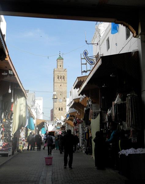
Une autre artère de la médina est la rue Sidi Fatah . Elle donne sur la rue Souika . Une magnifique mosquée y a été restaurée . Si j'en crois mon plan, il s'agit de la mosquée Moulay El Mekki . La porte principale est couverte et on trouve sur chacun des côtés 2 très belles portes ( 4 au total ) . Le minaret octogonal est remarquable . L'ensemble est complété par plusieurs marabout et un peu plus loin se trouve une importante zaouia . C'est vraiment très joli .
L'entrée principale est somptueuse . Le grand art de la peinture sur bois.
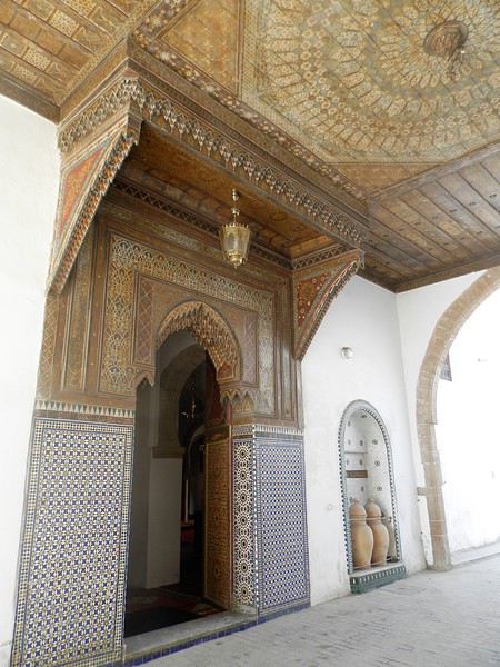
Quelques portes latérales
C'est vraiment très agréable de se balader sur la côte atlantique en cette saison ( mi-février ) . Il fait entre 18 et 22 degrés . Temps lumineux . Je n'aurai d'ailleurs pas de pluie pendant un mois ( après avoir eu de la pluie à peu près tous les jours les 5 derniers mois ) : que du bonheur donc ....
Le minaret octogonal
et la rue Sidi Fatah
La rénovation des monuments de la médina est presque terminée . La rue des consuls reprend vie, même si les nombreux fondouks de cette rue sont toujours en travaux . J'ai hâte de les revoir . Je déambule dans les ruelles tranquilles , toujours à l’affût de ces détails qui en font le charme .
Une belle oeuvre de street-art accroche mon œil ....
et cette fenêtre a un charme fou .
Cette fois , mes pas me portent vers les quais ( on pourrait presque dire le port ) de Rabat . Je quitte la médina par un jolie porte : l'ensemble , également restauré, est charmant . J'arrive directement sur l'Oued Bou Regreg .
Au cœur de la capitale subsiste un coin " pêche " . Un petit navire est devenu un restaurant-Lounge , plutôt luxueux ( menu à 790 dirhams pour 2 en cette Saint Valentin ) .
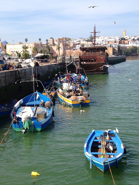
Rabat se donne des airs de petite Essaouira avec ses mouettes, ses bateaux, sa médina au fond, ses filets de pêche .... Le même site à l'horizontale .
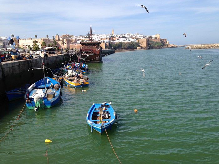
Au fond, Les Oudayas
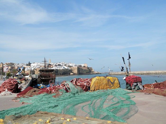
Un " pêche promenade ", me passe sous le nez . C'est mignon . On a envie de le faire la prochaine fois . Il y avait une activité de passeurs entre Rabat et Salé . Mais avec les ponts, le tramway, ..... Certains se sont adaptés , même si çà se fait toujours, plutôt en été ( la plage de Salé est toute proche ) .
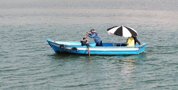
Quelques barques rentrent , les unes après les autres et s'amarrent au ponton, côté Salé . Surement les lointains descendants des redoutables corsaires de Salé . Leur univers a été " explosé" ces dernières années avec l'immense projet d'aménagement de l'oued Bou Regreg . Il leur reste un petit ponton , ..... et juste après, on a construit une grande marina pour accueillir les nouveaux jouets de l'aristocratie locale .
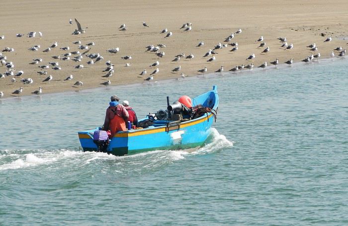
et une autre
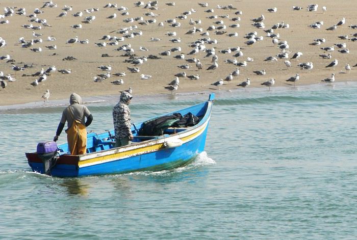
Tout ceci fait un curieux mélange entre une architecture ancestrale et la plus grande modernité ....
Ci-après, à gauche, le médina sur sa falaise, au fond le toit blanc du nouveau " Grand Théâtre de Rabat ), à côté duquel commence à sortir la future tour Mohamed VI qui sera la plus haute d' Afrique , et à droite la marina côté Salé .
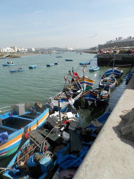
Mais la Kasbah veille toujours sur la capitale
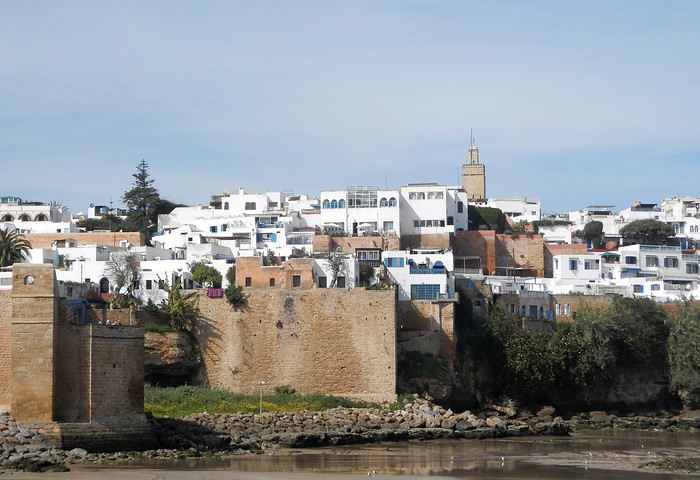
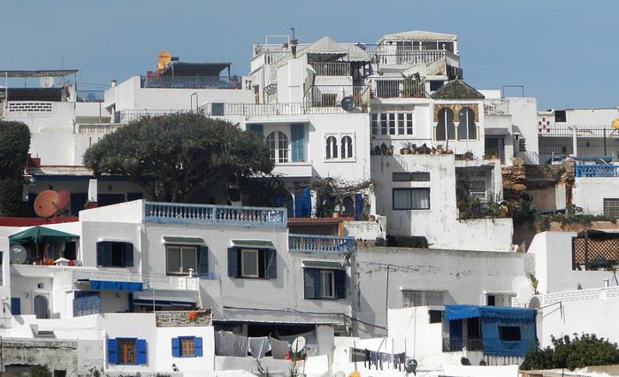
Un dernier regard ...
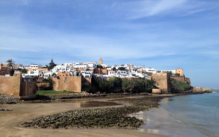
Voila pour ce nouveau coup de projecteur sur la capitale . Faites le détour et surprenez- vous
Demain, j'enfourche ma bonne Dacia Sandero et nous partons à l'assaut de l'Atlas .
Je crains que le forum ne soit morose dans les mois à venir , alors pourquoi ne pas faire un nouveau carnet de voyage . J'ai eu la chance de rentrer du Maroc 2 jours avant la suspension des vols et me retrouve donc, comme vous sans doute , en mode confinement total, chez moi, en Basse-Bretagne , avec quelques centaines de photos de mon dernier séjour à sélectionner, recadrer, retravailler .... On s'occupe comme on peut, alors pourquoi ne pas en faire profiter les Forumeurs ?
Je suis resté au Maroc un mois et j'avais organisé un circuit de 10 nuits / 11 jours pour ma plus jeune fille ( 17 ans ) , mon épouse et la grand- mère, ma chère belle-mère, Mina . Ça correspond aux vacances de février en France .
J'avais donc prévu un voyage " simple" sur le papier, mais qui chaque jour et comme toujours allait nous réserver son lot de découvertes, d'émerveillements, de rencontres, de surprises ....
Au programme :
- Départ de Rabat - 2 nuits à Ouarzazate - 2 nuits à N'kob - 2 nuits à Foum Zguid, avec une longue journée 4X4 au plus profond du désert - 4 nuits à Icht / Borj Biramane et retour sur Rabat
Je vais donc essayer d'éviter des redites avec mes précédents carnets, mais le Maroc a tant de richesses à montrer.....
Rabat est une de mes balades urbaines préférées au Maroc . Je découvre toujours de nouveaux endroits, de jolis détails, des points de vue .... Je vais donc m'y balader avec toujours un plaisir renouvelé
Ma première surprise se passe en médina où je découvre avec étonnement que les autorités ont fait le ménage . Tout ce qui encombrait les rues ( déballages sauvages, marchands de tortues et autres lézards, empiétements sur les trottoirs, la rue , etc.... ) a disparu . Plus rien . Même les commerces " en dur " sont "rentrés dans leurs murs" : plus rien sur la voie publique, pas même une chaise.... Une première au Maroc ?
Si le résultat est plutôt agréable dans la rue des consuls ( rue de l'artisanat ) et la rue Souika ( commerces vestimentaires surtout ) , le boulevard Mohamed V, où régnaient les petits restaurants et gargotes , est désormais mort . Ils ont perdu la quasi-totalité de leur ancienne surface commerciale et ne peuvent plus accueillir que quelques clients à la fois . La rue est tuée et il ne me reste plus qu'à chercher un autre endroit où casser la croûte dans la ville . Ce qui est bénéfique dans une rue ( on peut enfin flâner tranquillement ) est catastrophique dans l'autre ( le commerce est mort et le charme est parti ) . A suivre ....
Bon. C'est comme çà . Ici, dans la rue Souika ( à l'heure de la prière ) . Il y a même des poubelles en plastique positionnées dans la rue !
Une autre artère de la médina est la rue Sidi Fatah . Elle donne sur la rue Souika . Une magnifique mosquée y a été restaurée . Si j'en crois mon plan, il s'agit de la mosquée Moulay El Mekki . La porte principale est couverte et on trouve sur chacun des côtés 2 très belles portes ( 4 au total ) . Le minaret octogonal est remarquable . L'ensemble est complété par plusieurs marabout et un peu plus loin se trouve une importante zaouia . C'est vraiment très joli .
L'entrée principale est somptueuse . Le grand art de la peinture sur bois.
Quelques portes latérales
C'est vraiment très agréable de se balader sur la côte atlantique en cette saison ( mi-février ) . Il fait entre 18 et 22 degrés . Temps lumineux . Je n'aurai d'ailleurs pas de pluie pendant un mois ( après avoir eu de la pluie à peu près tous les jours les 5 derniers mois ) : que du bonheur donc ....
Le minaret octogonal
et la rue Sidi Fatah
La rénovation des monuments de la médina est presque terminée . La rue des consuls reprend vie, même si les nombreux fondouks de cette rue sont toujours en travaux . J'ai hâte de les revoir . Je déambule dans les ruelles tranquilles , toujours à l’affût de ces détails qui en font le charme .
Une belle oeuvre de street-art accroche mon œil ....
et cette fenêtre a un charme fou .
Cette fois , mes pas me portent vers les quais ( on pourrait presque dire le port ) de Rabat . Je quitte la médina par un jolie porte : l'ensemble , également restauré, est charmant . J'arrive directement sur l'Oued Bou Regreg .
Au cœur de la capitale subsiste un coin " pêche " . Un petit navire est devenu un restaurant-Lounge , plutôt luxueux ( menu à 790 dirhams pour 2 en cette Saint Valentin ) .
Rabat se donne des airs de petite Essaouira avec ses mouettes, ses bateaux, sa médina au fond, ses filets de pêche .... Le même site à l'horizontale .
Au fond, Les Oudayas
Un " pêche promenade ", me passe sous le nez . C'est mignon . On a envie de le faire la prochaine fois . Il y avait une activité de passeurs entre Rabat et Salé . Mais avec les ponts, le tramway, ..... Certains se sont adaptés , même si çà se fait toujours, plutôt en été ( la plage de Salé est toute proche ) .
Quelques barques rentrent , les unes après les autres et s'amarrent au ponton, côté Salé . Surement les lointains descendants des redoutables corsaires de Salé . Leur univers a été " explosé" ces dernières années avec l'immense projet d'aménagement de l'oued Bou Regreg . Il leur reste un petit ponton , ..... et juste après, on a construit une grande marina pour accueillir les nouveaux jouets de l'aristocratie locale .
et une autre
Tout ceci fait un curieux mélange entre une architecture ancestrale et la plus grande modernité ....
Ci-après, à gauche, le médina sur sa falaise, au fond le toit blanc du nouveau " Grand Théâtre de Rabat ), à côté duquel commence à sortir la future tour Mohamed VI qui sera la plus haute d' Afrique , et à droite la marina côté Salé .
Mais la Kasbah veille toujours sur la capitale
Un dernier regard ...
Voila pour ce nouveau coup de projecteur sur la capitale . Faites le détour et surprenez- vous
Demain, j'enfourche ma bonne Dacia Sandero et nous partons à l'assaut de l'Atlas .
Visiter le Père-Lachaise et d'autres cimetières parisiens English translation pending
Un conseil pour ceux qui souhaitent découvrir le Père-Lachaise mais aussi le cimetière du Montparnasse, Montmartre : ne vous trompez pas de guide!
Depuis que j'ai écouté un entretien avec Bertrand Beyern sur Europe 1 (il est très présent sur les médias, il suffit de taper son nom sur google, youtube...) j'a suivi plusieurs de ses visites thématiques et je le suis sur Twitter également. Si vous cherchez à vous cultiver et à passer un moment agréable, avec un guide qui est très drôle et érudit à la fois, et dans des groupes à taille raisonnable (ce point est essentiel), c'est lui qu'il faut choisir : un régal!
Vacances en Bretagne à 2 (étudiants) English translation pending
Bonjour tout le monde
Moi et mon copain , voulions partir une semaine et-demi en bretagne .
Nous sommes étudiants et un peu faucher 😄
Nous avons des petites astuce , mes parents possède un vito Mercedes (une fourgonnette ) qui est a demi aménager mais pour les camping , ce n'est pas aménager . bref , nous allons passé nos nuit dedans , donc pas besoins de tente . donc une petite économie sur le camping !
bon pour revenir a nos moutons , ou peut on aller en une semaine et-demis , sachant que nous ferrons de l'itinéraire (on ne veut pas stagné dans les campings , on veut se balader un max).
Nous partirons de Nantes et nous voudrions faire une boucle vers le nord ( genre de la baie de st brieuc passant par les cotes de granit rose puis Brest pour revenir a Quimper , puis Nantes ).
Avez -vous de petit endroits a ne pas louper ? Sinon quel activité a faire ? vélo , rando..sachant que mon copain est pas fan pour se bouger le derrière 🙁
Avez-vous des petit resto sympa ?
Merci beaucoup
Nous avons des petites astuce , mes parents possède un vito Mercedes (une fourgonnette ) qui est a demi aménager mais pour les camping , ce n'est pas aménager . bref , nous allons passé nos nuit dedans , donc pas besoins de tente . donc une petite économie sur le camping !
bon pour revenir a nos moutons , ou peut on aller en une semaine et-demis , sachant que nous ferrons de l'itinéraire (on ne veut pas stagné dans les campings , on veut se balader un max).
Nous partirons de Nantes et nous voudrions faire une boucle vers le nord ( genre de la baie de st brieuc passant par les cotes de granit rose puis Brest pour revenir a Quimper , puis Nantes ).
Avez -vous de petit endroits a ne pas louper ? Sinon quel activité a faire ? vélo , rando..sachant que mon copain est pas fan pour se bouger le derrière 🙁
Avez-vous des petit resto sympa ?
Merci beaucoup
Catharsis en Pologne English translation pending
CATHARSIS EN POLOGNE
J’écris ce petit récit pour tous ceux qui redoutent de visiter ce lieu terrible : Auschwitz-Birkenau. C’est une invitation à y aller pour trouver la paix avec soi même et bien sûr communier avec les victimes.
Les récits de voyage, les romans, les articles de journaux et de magazines ou les émissions TV, me fournissent autant d’invitations au voyage. Ainsi un reportage dans une revue Photo sur les statues de glace m’a conduit à Harbin en Mandchourie ou un carnet à l’humour irrésistible de Yangguizi sur VF me fait faire un voyage improbable à Pyongyang. L’excitation se relâche, lorsqu’enfin le voyage commence : La voiture sort du jardin et se dirige vers la destination tant fantasmée ou alors c’est une compagnie aérienne qui fournit un tapis volant : l’arrivée au comptoir d’enregistrement est un instant si attendu, c’est le meilleur du voyage, sauf si la compagnie gâche le plaisir en soumettant votre bagage à l’Inquisition, ou si elle vous joint au troupeau de voyageurs attendant de longs moments debout, sans même vous donner d’herbe à brouter! Ce peut être la même compagnie qui transforme son personnel en esclaves volants, à tel point que les hôtesses conservent, en vol, un masque figé de résignation. Plus rarement le bateau est de la partie; et c’est lui qui assure le plaisir le plus accompli : Avant d’atteindre la destination on se promène nonchalamment dans le bateau qui offre de menues distractions tout est fait pour vous faire dépenser et ainsi rattraper le prix trop réduit demandé pour le passage. La côte se profile. Ce peut être de nuit, c’est encore plus magique : Des faisceaux puissants balayant le ciel de très loin, signalent une présence humaine, nichée au cœur de l’obscurité : J’ai en tête l’approche mystérieuse de l’Irlande sur le Belem. Comme l’atterrissage est lent, on a le temps de se faire à l’idée d’aborder un monde nouveau. Des habitants à terre, peuvent agiter les bras en signe de bienvenue. Ce n’est pas la douche froide que l’on éprouve à l’arrivée dans un aéroport d’un pays exotique, où il faut réorganiser ses pensées instantanément, attraper les nouveaux codes qui vous sont projetés sans recul. Une nouvelle langue, ou un alphabet inconnu peuvent vous déstabiliser un temps, ou des prestataires affamés vont se jeter sur vous et proposer leurs services, à vous qui représentez pour eux une succursale ambulante du Crédit Suisse. Ce jour de 2004, je n’étais pas encore reparti. Les voisins et connaissances me demandent toujours en guise de nouvelles : « Quand repartez vous ? » ou la voisine dit à son mari : « Ils sont encore barrés !», comme si nous étions des professionnels de la ballade. Dès que je reste un peu trop longtemps à la maison, des voix sans cesse m’appellent au voyage, des photos et reportages m’aguichent : Gauguin et Jacques Brel me réclament. Je dois aller à Longwood-St Hélène, à l’Ile de Pâques, en Nouvelle Zélande, au Macchu Pichu, et dans la folle mégapole de Shanghai, que sais je ?...... Les sollicitations sont sans fin ! Comment peut on se tenir longtemps, à l’écart de la sublime Italie. Se ressourcer à sa fontaine de beauté est une exigence impérieuse, c’est l’addiction d’une vie l’âme de la Russie me convoque et m’enjoint de m’imprégner sans cesse de sa mystique et de son humanité. Loin de la Russie je dépéris, les piqures de rappel se multiplient pour le junkie. Dans mon imaginaire, à coté de ces images de sirènes des Mers du Sud, de flashs enchanteurs, de montagnes vertes ou blanches et vertigineuses, de déserts blancs, une interrogation triste et silencieuse persiste en arrière fond; elle ne racole pas avec des images tapageuses elle ne me quitte pas. Au long des années elle ne se lasse pas elle revient sans cesse à la charge, mais sans fracas. Oui ! Elle gâche la fête du voyage et le désir insatiable de connaître l’inconnu, de voir une autre humanité. Je la laisse enfin parler, elle m’a vaincu ce jour là de guerre lasse, mais je crains son discours : « Vas voir ce que des hommes ont fait à d’autres hommes, vas te rendre compte par toi même tel Saint Thomas mettant ses doigts sur les plaies du Christ, vas voir ce que l’écrivain de fiction le plus fêlé n’aurait pu imaginer dans son pire délire, dans sa transgression la plus osée, vas voir l’impensable : UN ABATTOIR HUMAIN ; un endroit fou où le crime a été perpétré mille fois à l’heure vas voir ce crime industriel, rationnel et froid. Vas voir cette immense cave de Birkenau où l’on a tué la multitude à l’abri des regards. Viens voir l’Holocauste organisé par des petits fonctionnaires zélés, « banals », par des exécutants butés, indifférents à la souffrance d’autrui et sans remords parmi lesquels émergent quelques êtres cruels et sadiques. Vois les traces de cet Holocauste qui est un blasphème au Créateur, car il sous-entend que sa création était imparfaite, une fraction de l’Humanité devant être détruite pour non conformité. Quoique les idéologues du 3ème Reich n’en avait cure, tout à leurs délires raciaux et à la recherche d’un bouc émissaire. La petite voix a gagné, je cède à l’appel, et nous commençons un chemin de croix moral vers Oswiecim.
LE VOYAGE
Nous arrivons à Tillé dans la banlieue de Beauvais nous laissons la voiture à la fermière, complice de nos escapades. Son jardin sert de parking à une cinquantaine de voitures elle se plaint de ne plus en avoir la jouissance! Nous partons à pied vers l’aéroport, situé en bordure de ce bourg de campagne. Les habitants s’habituent ils aux rugissements continuels des réacteurs ? Le lieu est un peu décalé, avec les avions d’un coté et les tracteurs et le foin de l’autre. Nous confions nos personnes à la compagnie Hongroise à bas coût WIZZ AIR qui nous achemine à Katowice. La Compagnie aérienne est sympathique les hôtesses sont jolies et ne font pas la gueule. Un bus nous emmène vers la belle ville de Cracovie, et nous nous rendons à notre petit appartement de location. La nuit tombe vite car en Europe centrale, nous sommes sur le même fuseau horaire que Paris l’obscurité arrive plus vite, l’ambiance de veillée funèbre convient bien au pèlerinage de demain.
EN ROUTE VERS AUSCHWITZ
Le réveil a la cruauté de sonner : il est des jours que l’on souhaiterait éviter comme ceux où l’on doit aller à un enterrement, subir une opération lourde, visiter un ami mourant…ou aller à Auschwitz ! Aujourd’hui nous allons vers un des endroits les pires sur Terre, et rien ne nous y oblige. Le petit déjeuner est réduit à sa plus simple expression. Le petit matin est aussi lugubre que le soir, les rues sont mal éclairées le froid et la pluie ont été convoqués pour renforcer l’ambiance! Nous avons une boule dans le ventre, et l’hostilité de l’environnement nous enfonce un peu plus le moral. Un temps nous avions pensé aller à Oswiecim en train, mais ce terrible symbole nous y fait renoncer. Nous ferons finalement les 80 km de Cracovie à Oswiecim en minibus. Celui ci nous lâche dans une zone de HLM pas de Camp en vue ! D’ailleurs nous apprenons vite qu’ici, on ne parle pas de Camp, ou de Mémorial mais de « Muzeum ». En changeant les mots on se distancie de l’horreur. A Dachau les Allemands escamotent carrément l’horreur en ripolinant la petite chambre à gaz « qui aurait à peine servi » et les bâtiments, en disposant des barbelés tout neufs, bien galvanisés, et en aménageant des chemins tout nets, bien engravillonnés. Par contre au Struthof, en Alsace, tout est resté en l’état, avec la potence qui glace les os, au milieu de l’ « Appelplatz ». Ce Camp présente une symbolique effroyable : Dans un magnifique cirque montagneux des Vosges, le Camp s’étage en plusieurs plans avec le crématoire tout en bas. Le déporté mesure la progression de sa déchéance au fur et à mesure qu’il change de niveau et se rapproche du puits où l’on jette les cendres. Revenons à Auschwitz : La traversée de la zone de HLM, image familière, donne un court répit à notre angoisse nous avançons et toujours pas de « Muzeum » en vue la situation est un peu surréaliste, celle de rechercher un des sites les plus monstrueux sur Terre et de se balader dans un décor banal de HLM. Si on parle de HLM, c’est donc qu’il y a des habitants ces personnes ne sont elles pas gênées de vivre à coté d’un lieu aussi tragique ? L’homme s’habitue à tout, semble-t-il ! Cette situation n’a rien à envier à la boutique Sephora logée dans l’Usine de tracteurs de Stalingrad. Nous demandons la direction du « Muzeum » puisqu’il faut l’appeler ainsi. Au détour d’un grand immeuble apparaît enfin la célèbre porte d’entrée, avec le poste de garde et la cynique maxime « ARBEIT MACHT FREI ». La maxime devait être volée bien après notre visite mais heureusement retrouvée et réinstallée. Peut on voir la célèbre maxime en prenant son café du matin depuis sa cuisine ? Je n’en suis pas tout à fait sûr, mais les lieux d’habitations en sont assez proches. Quel slogan réconfortant à contempler en buvant son café, avant d’aller travailler le matin ! « Patron, j’ai lu que le travail libère » ! (Par les temps qui courent, il aliènerait plutôt) La Pologne est un pourtant un pays très étendu où il y a de la place, alors pourquoi coller des HLM à ce camp. De même j’ai vu sur une émission TV des habitants d’Oswiecim insultant des visiteurs près de la « Rampe de sélection », car les bus de tourisme gênaient leur stationnement résidentiel ! (Je ne sais pas où elle se trouve en tous cas il ne s’agit pas de celle de Birkenau). Je trouve le comportement de beaucoup d’habitants en Pologne indécent vis à vis des Juifs on pourrait penser qu’au minimum une attitude neutre vis à vis du site d’Auschwitz, de son Histoire tragique et de la communauté juive serait souhaitable. L’indécence consiste aussi à avoir voulu capter la mort tragique des Juifs et des Tziganes pour installer un Carmel de Religieuses. Heureusement elles ont plié bagage. Par contre on verra que les Autorités de Conservation ont laissé le Camp en l’état, sans aucune plaque ou symbole religieux commémoratifs qui auraient pu distraire la vue, l’imagination ou le recueillement. Seul un Monument aux victimes a été construit à Birkenau, il s’intègre bien à l’ensemble et n’est pas intrusif. Je demande à une cohorte d’écrivains de m’accompagner dans la visite : Primo Levi, Jean Samuel, William Styron, Marcelline Loridan-Ivens, aussi un cinéaste talentueux Claude Lanzmann qui sans utiliser une seule bande d’actualité a réussi à raconter l’Holocauste en filmant les lieux tels qu’ils nous sont parvenus et en cherchant des vérités et des émotions dans ses multiples interviews de victimes et de bourreaux. Et puis Alain Resnais, Roman Polanski.
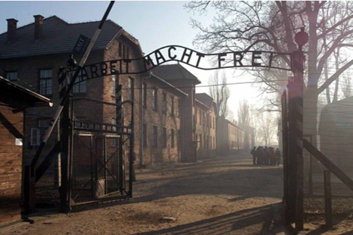
Une nation européenne a financé la rénovation le poste de garde en bois. Par contre l’outrage du temps, on le verra, a été sévère dans le Camp même, au risque de le faire disparaître. A cette entrée, les gardiens SS exposaient les corps des fuyards repris pour édifier les Kommandos de détenus qui sortaient ou rentraient au Camp à l’occasion de leurs corvées à l’extérieur.
Devant le camp se trouve pleins de cars de tourisme et beaucoup de gens en sortent. La visite prend un aspect cirque, mais pourquoi s’en étonner : Si vous réunissez beaucoup de monde, il y a bien évidemment un bruit de foule. Comme les écoles européennes veulent édifier leurs élèves par la visite du Camp, cette jeunesse rassemblée ici est naturellement turbulente. La solution pour avoir une certaine dignité serait elle d’adopter la méthode que les autorités chinoises avaient adopté pour la visite du Mausolée de Mao Tsé Toung ? : Poster des gardes devant la file et engueuler copieusement les visiteurs. Les Chinois sont assez criards, les gardes obtiennent pourtant rapidement silence penaud. J’ai revu Mao récemment, on ne se fait plus engueuler au préalable dans la file. A Pyong Yang pour Kim Il Sung, il n’est pas nécessaire de demander le silence à la foule, car elle sait parfaitement à quoi s’en tenir si elle élevait le ton.
Mais nous nous trouvons à Auschwitz, pas à Beijing, ni à Pyong -Yang, le calme ne peut être obtenu autoritairement. Ce sera l’horreur suscitée par la visite qui plongera les visiteurs dans le désarroi et le silence. Des Israéliens sont nombreux à être venus, comme en témoigne la présence de leurs avions stationnés à l’aéroport, et beaucoup de lycéens. La visite doit sans doute être salutaire pour ces jeunes gens, si elle est bien encadrée et bien commentée. Autant à Auschwitz 1, Camp aux dimensions réduites, la présence des visiteurs est prégnante, autant à Auschwitz 2 – Birkenau l’immensité de ce camp dilue l’affluence touristique. Nous sommes venus sans appareil photo par pudeur pour les victimes je pense que ce fut une erreur, car qui dit photo, dit regard personnel sur une chose. Enfin il reste les souvenirs matérialisés par ce petit récit. Nous sommes arrivés trop tôt pour débuter une visite avec un guide nous prenons donc un café dans la buvette très discrète du Camp ce café et la viennoiserie ont du mal à passer. On déglutit difficilement à Auschwitz ! En attendant le tour fixé à 10 heures, nous faisons un premier tour dans le camp : C’est le Camp Auschwitz 1, installé par les Allemands dans une caserne de l’armée polonaise. Avant ce voyage je n’avais jamais bien compris comment s’articulaient ces Camps : Auschwitz 1, 2, 3 et leurs fonctions.
Auschwitz 1 est le premier Camp du complexe concentrationnaire. Auschwitz 2, appelé aussi Birkenau est un camp d’extermination énorme. (Simone Veil y était prisonnière) Auschwitz 3 est le site de l’Usine de caoutchouc synthétique, qui n’a jamais produit un seul kg de produit. (Primo Levi y travaillait) Auschwitz 1 comporte deux parties : La première est le siège de la police chargée de la répression de la Résistance polonaise locale, avec un centre de détention et un site d’exécution par fusillade (On l’appelle « le mur »); la deuxième partie est un centre d’emprisonnement de déportés venus de toute l’Europe. Il comporte en activité annexe, un centre d’extermination expérimental avec une petite chambre à gaz d’une capacité de quelques centaines de victimes avec crématoire attenant. Un centre « d’expérimentation médicale » se trouve aussi dans l’enceinte d’Auschwitz 1. Je frémis en passant devant cette baraque que l’on ne visite à priori pas, et j’imagine que ses pensionnaires ont du réclamer une mort libératoire de souffrance indicibles.
Les différents bâtiments en brique résistent bien au temps ils sont dévolus à des nations européennes ayant souffert de la déportation de leurs ressortissants chaque nation a organisé une exposition en propre : Ainsi la France a son pavillon la Hongrie ayant le triste record avec la Pologne du plus grand nombre de victimes ont aussi leurs pavillons… Des pavillons ont pour fonction d’abriter le musée expliquant la déportation et l’extermination des Juifs et Tziganes. Nous pénétrons dans le musée principal; à un tournant de l’escalier, on fait face sans crier gare à un grand mur de verre : Derrière se trouvent une multitude de……béquilles ! Le choc est terrible je vais pour une fois sacrifier à l’usage des poncifs : C’est une gifle. L’émotion pour moi est intense, et les larmes s’écoulent ! A un autre tournant un nouveau mur de verre retient une centaine de bidons vides avec écrit dessus « Zyclon B **» avec la mention « Gift » (Ce n’est pas le « Cadeau » anglais, mais c’est le : « Poison » allemand). Ce deuxième choc finit de m’anéantir! A ce moment précis, dans mon esprit la représentation que je me suis construit depuis des années par un flot ininterrompu de récits ou de mentions de l’Holocauste se superpose avec la réalité, représentée par ces bidons devant moi. Des mots me viennent alors à l’esprit: « C’est vrai, ils l’ont fait ! ».
Pourtant mes yeux étaient secs en observant le squelette du « Palais d’exposition industrielle à Hiroshima ». (Un total de 300 000 victimes ?) Pour moi le drame n’était pas palpable à Hiroshima, pourquoi ? Peut être ce du au fait que nous n’ayons pu visiter le Musée, ou que nous avons une exposition au drame seulement une fois par an, à l’anniversaire du 6 Aout. La suite de l’exposition ne pourra me faire tomber plus bas dans mon désarroi : Les montagnes de cheveux dans telle vitrine, de lunettes, dans une autre et des valises avec des étiquettes comportant des adresses dans toute l’Europe. Qu’elles sont émouvantes ces valises, faites sans doute à la hâte, viatiques pour un voyage à la destination inconnue. Valises d’un petit peuple modeste. Une autre vitrine montre des grands châles de prière rabbiniques blancs à bandes noires.…Au rez de chaussée du bâtiment se trouve une très grande urne en verre, remplie de cendres grisâtres Je m’imagine qu’Irène Némérovski y a trouvé son dernier repos. Des gendarmes français, nos gentils gendarmes de notre folklore ont prêté la main pour la conduire à cette urne. Heureusement pour l’honneur de la Police et de la Gendarmerie, tous n’ont pas eu cette conduite. Une liste de « personnalités » ayant été tuées ici, est affichée. Les Camondo sont oubliés dans la liste on ne trouve non plus les noms « de-banquiers-juifs-qui-nous-ont-fait-perdre-la-guerre-de 14-18 » catégorie qui serait à l’origine de la détestation des Nazis pour les Juifs. Mon impression est que c’est une partie du petit peuple d’Europe Centrale qui a disparue ici, en particulier les ressortissants de Hongrie et de Pologne. Depuis la fin de la WW2, nous vivons avec l’Holocauste la presse, les livres le cinéma abordent ce thème. Nous avons un rappel permanent de ces actes monstrueux. Notre imaginaire se construit d’une multitude de petites touches de cet évènement; ce n’est pas innocent pour notre sérénité, car l’évènement est monstrueux. Aussi qu’on le veuille ou non les actes de quelques hommes nous ont tous éclaboussés en tant qu’êtres humains. Les souffrances morales endurées par la communauté Juive et Tzigane sont bien sûr sans commune mesure. Des personnes sont terrorisées à l’idée de mettre le pied à Auschwitz, nous même n’en menions pas large. J’ai continué ma visite, j’ai accumulé la vision d’horreurs plus monstrueuses les unes que les autres. Puis vint la visite d’Auschwitz 2- Birkenau l’après midi. Et pourtant j’étais étrangement calme. J’ai beaucoup réfléchi à l’épisode de la vision de la vitrine de boites de Zyklon B : Je pense, sans vouloir jouer au psychologue improvisé, que j’ai atteint la catharsis s’agissant de l’Holocauste : Les souvenirs agressifs ont été comme siphonnés par ce déclic émotionnel devant ce mur. Je crois que j’ai fait mon deuil de l’Holocauste; pour moi il est rentré dans l’Histoire et il ne m’est plus contemporain. Nous continuons dehors : Dans une allée du camp se trouvait un portique qui servait à pendre court les indisciplinés. Devant ce portique se trouve une guérite fermée à une place où un gardien pouvait se mettre à l’abri pendant les longs moments consacrés aux appels ou regarder les agonies au sec. Un autre portique identique se trouve devant les bâtiments de l’Administration; l’ancien directeur du camp Höss y sera pendu court.
Les jeunes gens présents, d’habitude si bavards et si turbulents en groupe, sont totalement muets. Il est temps de rejoindre le Tour que nous avons réservé à 10 :00.
Chambre à gaz d’Auschwitz 1
Une jeune Polonaise conduit notre Tour. Nous abordons la section spécifique à la répression anti terroriste :
LES BLOCS DE POLICE
Dans les couloirs des Blocs de cette section, sont affichées les photos des victimes elles font l’objet d’un culte du souvenir sans doute de la part de familles de la région. Beaucoup de photos sont fleuries : le souvenir de la des défunts est encore présent. Si l’on se situe face au mur des fusillades, à droite se trouve un bloc comprenant une salle meublée d’une grande table, avec nappe, entourée de chaises. Des dossiers sont encore en place devant chaque chaise. C’est le « Tribunal ». Dans une salle attenante les condamnés à mort viennent de connaître la sentence, toujours la même j’imagine ils doivent se déshabiller puis descendre nus pour aller se tenir devant le mur. Ils sont mis à mort par un gardien muni d’une carabine à faible détonation. L’obsession permanente des autorités du camp est de ne pas éveiller les craintes et l’affolement des déportés et ne pas risquer une révolte de masse. Le gardien exécuteur est changé chaque jour. Les corps ensuite sont emmenés vers l’autre partie du camp où se trouve un petit crématoire.
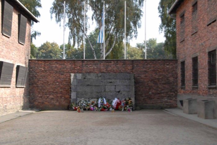
Du coté gauche du mur se trouvent le bloc des cellules. Dans l’une d’elle, le Père Maximilien KOLBE a été achevé par une piqure de Phénol après avoir survécu à la faim : il avait pris la place d’un père de famille qui venait d’être sélectionné avec 9 autres pour mourir de faim, en représailles à la suite de l’évasion d’un prisonnier. Jean Paul II a déposé un hommage, toujours présent dans la cellule et l’a canonisé. Le sous-sol a servi d « expérimentation » pour mettre au point la mort par gazage. Pour cela une centaine de soldats russes ont servi de cobayes. Le Commandant du Camp Höss était passionné par la question et menait des expérimentations de son propre chef ses supérieurs en ont beaucoup apprécié les résultats et s’en sont inspirés pour mettre au point leur procédé d’abattage industriel. Höss était pourtant un cœur sensible, comme Himmler, il ne supportait pas les spectacles violents Höss déclarait : « Je dois admettre que ce gazage a un effet apaisant sur moi. J’ai toujours été horrifié par les exécutions par fusillades. Je suis soulagé que maintenant on puisse éviter ces bains de sang ». Pourtant il ne pouvait ignorer que le gazage au Zyklon B était un supplice bien plus éprouvant qu’une fusillade. Le soulagement était pour lui, pas pour les victimes. On visite dans ce même bloc, des cellules « aménagées » : Leurs entrées d’air sont quasiment obstruées, on se doute des effets sur les détenus. Toujours ce souci permanent de nuire !
LE COMMANDANT DU CAMP ET SA MAISON
Nous sommes toujours dans Auschwitz 1 et nous souhaitons aller voir où était la maison du Chef du Camp, Höss. Les barbelés forment une barrière infranchissable et menaçante, déjà nous sommes dans cette enceinte fermée depuis deux heures, et c’est pesant. La barrière de barbelés a certes vieilli, les ampoules des lampes sont intactes, les miradors en place et en bon état, on a l’impression qu’il faudrait un mot pour rendre opérationnel le camp, en allumant les lumières et en faisant monter des gardes dans les miradors. Je me mets vite dans la peau d’un détenu, c’est mon coté caméléon quand je visite un lieu. Soudain à un endroit l’enceinte est percée pour l’aménagement d’un passage vers l’extérieur sans passer par la porte d’entrée principale « Arbeit macht Frei » Nous avons l’impression de nous évader du Camp! L’intérêt de visiter un lieu célèbre est de remettre les choses à leur vraie place. J’avais lu ou entendu que « le Commandant du Camp, ses officiers et leurs familles passaient des soirées délicieuses en écoutant des concerts en merveilleux mélomanes allemands dans un salon éclairé de lampes à abas jour faits de peau humaine. Une réunion de sadiques esthètes quoi ! La maison du camp devait être assez éloignée du camp pour permettre au Commandant du Camp de faire la coupure, et d’éviter à sa famille de penser aux choses sinistres qui se passaient à côté, ou même d’en découvrir la vraie nature. Ceci n’est qu’invention : En fait la maison du commandant est collée au camp, à faible distance de la chambre à gaz/crématoire. Certainement la famille a du sentir la chair brulée certains après midi ! Cette maison que l’on ne visite pas, me rappelle « Le choix de Sophie » livre et film avec la délicate Meryl Streep : Sophie est dactylo dans cette maison ce qui lui permet d’allonger son espérance de vie…. La malheureuse est soumise à un choix pervers et cruel du type de ceux que les SS savourent : La vie sauve pour son fils ou pour sa fille. Elle marquée à vie, et cherche l’oubli dans une sexualité exacerbée. A Auschwitz, un détenu subissant le régime commun meurt automatiquement au bout de quelques mois. Avant de mourir, étant épuisé physiquement et moralement, il est appelé Muselmann (de Musulman) par les codétenus allez savoir pourquoi ? Sophie, le personnage de William Styron, ou Primo Levi, employé comme technicien de laboratoire ont pu échapper à la mort certaine grâce au fait d’avoir été retirés du régime général. Un poste d’employé aux écritures était aussi recherché pour cette raison. Je rappellerai une anecdote survenue à Buchenwald à Jorge Semprun : Il passe dans le bureau des effectifs à son arrivée l’employé lui demande son métier répond il « Ecrivain » ? L’employé écrit « Stukator », ouvrier stucqueur, et ainsi sauve la vie de Semprun qui n’ira pas s’épuiser à des taches inhumaines. La particularité d’Auschwitz par rapport aux Camps d’Extermination ou de Concentration, est le tatouage : Un déporté ayant numéro tatoué sur l’avant bras est passée nécessairement par Auschwitz. Les Autorités du Camp avaient remarqué qu’un détenu devenait méconnaissable d’après sa photo après six mois.
A suivre : Birkenau
À la poursuite d’Indiana Jones en Jordanie English translation pending
Ah! Oui, les films classiques qui nous appellent vers la Jordanie. Après Lawrence d’Arabie dans le désert, Indiana Jones a fait parler de lui à Petra. Mon mari rêve d’y aller depuis et voilà nous y sommes...🙂
Lorsque nous avons réservé nos vacances en Jordanie, mon mari était très fatigué. Donc pour éviter un stress supplémentaire, une fois n’est pas coutume, nous n’avons pas louer de voiture pour réaliser notre circuit mais avons utilisé les services d’un chauffeur. Pour cela, nous sommes passés par l’agence locale Enjoy Jordan. Cette agence a un très bon commentaire dans le guide PF. Hossam, avec qui j’étais en contact lors de la préparation, parle très bien français, ce qui est un véritable plus. Nous avons donc établi le circuit suivant, du 100% classique pour une première fois dans ce beau pays.
Jour 1: Vols Lyon/Francfort/Amman Jour 2: Amman - Châteaux du désert Jour 3: Jerash - Ajlun Jour 4: Madaba - Route des rois - Kerak Jour 5: Petra Jour 6: Petra - Little Petra Jour 7: Wadi Rum Jour 8: Mer morte - Amman Jour 9: Vols Amman/Francfort/Lyon
Lorsque mon mari a émis l’idée de la Jordanie comme destination de voyage, je suis tombée sur le carnet de Pboulard qui m’a définitivement conquis. D’autres carnets comme celui de Grisemote, Citronate, ... n’ont fait que de me conforter dans l’idée que ce pays a beaucoup à offrir. Pour moi, la Jordanie se résumait à Petra, eh bien non, il nous a même manqué de jour pour réaliser tout ce que je souhaitais voir. Tant pis, nous reviendrons...😉
Pour vous donner un peu envie de nous suivre, je ne résiste pas à vous montrer nos deux coups de cœur de ce voyage : Petra et le Wadi Rum
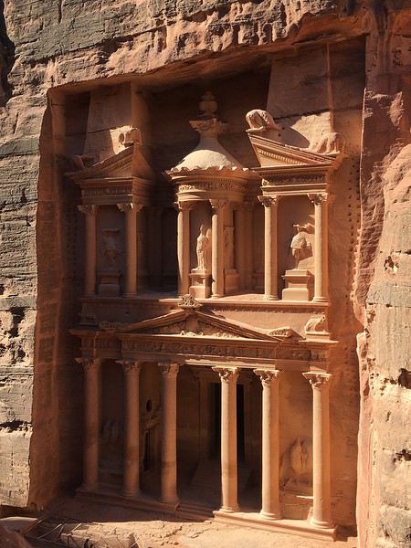
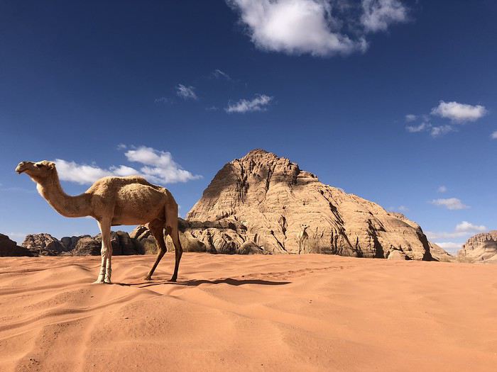
Samedi 27 Octobre : Lyon - Amman
Ce jour de départ, il fait gris et il pleut sur Grenoble, un vrai temps d’automne mais cela ne nous mine pas le moral car nous finissons de boucler les valises et partons de la maison à 10h30 pour l’aéroport de Lyon Saint Exupéry. Le parking de l’aéroport de Lyon est très pratique car il est possible de réserver jusqu’à 3 mois avant le départ sa place à un tarif réduit. L’entrée est très facile, il suffit d'indiquer sa plaque d’immatriculation lors de la réservation et hop ! lorsqu’on arrive les barrières s’ouvrent devant nous. De plus, une place disponible est garantie même lorsque le parking est complet comme lors des vacances d’été 😎.
A midi trente, nous avons déjà passé la sécurité et prenons un petit repas dans le nouveau terminal 1 de l’aéroport. Aucun vol direct de Lyon pour Amman, nous prenons la compagnie Lufthansa et avons donc un stop à Francfort. L’avion part avec 20 minutes de retard, pas de stress car nous avons 5h d’attente à Francfort.
Il est tout juste 16h que la longue attente à Frankfort pour Amman débute. Nous trouvons, au terminal 1B, un endroit calme et sympa avec des fauteuils où on peut s’allonger. Mon mari en profite pour travailler car accès wifi gratuit et il peut recharger son PC.
Décollage pour Amman à 21h arrivée à 1h30, c’est cool, il n’y a pas de décalage horaire. A l’aéroport nous sommes attendu par un agent de l’agence Enjoy Jordan, il s’occupe des formalités pour le visa. Nous retirons de l’argent et achetons un carte SIM car mon mari a besoin de se connecter en journée pour son travail. Pour 16 dinar, on a 10 Go de data avec l’opérateur @zaïn.
Les formalités ont été très rapides et il est 2h lorsque nous sortons de l’aéroport et rejoignons notre voiture et monsieur Logan, notre chauffeur qui nous promènera toute la semaine.
Nous somnolons dans la voiture qui nous amène au Larsa Hôtel où nous resterons pour 3 nuits. Il est situé à 45 km au nord de l’aéroport dans la périphérie de Amman.
Nous arrivons donc bien fatigué et posons nos valises pour nous retrouver aussitôt dans les bras de Morphée 😉.
Le Larsa Hôtel est tout à fait correct, les chambres sont spacieuses, mais les sanitaires manquent un peu de nettoyage. Par contre, le cadre de l’hôtel est vraiment sympa et les repas buffet que ce soit petit déjeuner ou dîner sont très bons.
Sinon au niveau de la situation, ce n’est pas le top, pas de restaurant à côté, il est situé dans une zone d’habitation, rien à visiter aux alentours. Chaque matin à 4h, l’appel à la prière de la mosquée, sert de réveil.
Pour ne pas avoir à lire toutes les discussions... La suite ici
Lorsque nous avons réservé nos vacances en Jordanie, mon mari était très fatigué. Donc pour éviter un stress supplémentaire, une fois n’est pas coutume, nous n’avons pas louer de voiture pour réaliser notre circuit mais avons utilisé les services d’un chauffeur. Pour cela, nous sommes passés par l’agence locale Enjoy Jordan. Cette agence a un très bon commentaire dans le guide PF. Hossam, avec qui j’étais en contact lors de la préparation, parle très bien français, ce qui est un véritable plus. Nous avons donc établi le circuit suivant, du 100% classique pour une première fois dans ce beau pays.
Jour 1: Vols Lyon/Francfort/Amman Jour 2: Amman - Châteaux du désert Jour 3: Jerash - Ajlun Jour 4: Madaba - Route des rois - Kerak Jour 5: Petra Jour 6: Petra - Little Petra Jour 7: Wadi Rum Jour 8: Mer morte - Amman Jour 9: Vols Amman/Francfort/Lyon
Lorsque mon mari a émis l’idée de la Jordanie comme destination de voyage, je suis tombée sur le carnet de Pboulard qui m’a définitivement conquis. D’autres carnets comme celui de Grisemote, Citronate, ... n’ont fait que de me conforter dans l’idée que ce pays a beaucoup à offrir. Pour moi, la Jordanie se résumait à Petra, eh bien non, il nous a même manqué de jour pour réaliser tout ce que je souhaitais voir. Tant pis, nous reviendrons...😉
Pour vous donner un peu envie de nous suivre, je ne résiste pas à vous montrer nos deux coups de cœur de ce voyage : Petra et le Wadi Rum
Samedi 27 Octobre : Lyon - Amman
Ce jour de départ, il fait gris et il pleut sur Grenoble, un vrai temps d’automne mais cela ne nous mine pas le moral car nous finissons de boucler les valises et partons de la maison à 10h30 pour l’aéroport de Lyon Saint Exupéry. Le parking de l’aéroport de Lyon est très pratique car il est possible de réserver jusqu’à 3 mois avant le départ sa place à un tarif réduit. L’entrée est très facile, il suffit d'indiquer sa plaque d’immatriculation lors de la réservation et hop ! lorsqu’on arrive les barrières s’ouvrent devant nous. De plus, une place disponible est garantie même lorsque le parking est complet comme lors des vacances d’été 😎.
A midi trente, nous avons déjà passé la sécurité et prenons un petit repas dans le nouveau terminal 1 de l’aéroport. Aucun vol direct de Lyon pour Amman, nous prenons la compagnie Lufthansa et avons donc un stop à Francfort. L’avion part avec 20 minutes de retard, pas de stress car nous avons 5h d’attente à Francfort.
Il est tout juste 16h que la longue attente à Frankfort pour Amman débute. Nous trouvons, au terminal 1B, un endroit calme et sympa avec des fauteuils où on peut s’allonger. Mon mari en profite pour travailler car accès wifi gratuit et il peut recharger son PC.
Décollage pour Amman à 21h arrivée à 1h30, c’est cool, il n’y a pas de décalage horaire. A l’aéroport nous sommes attendu par un agent de l’agence Enjoy Jordan, il s’occupe des formalités pour le visa. Nous retirons de l’argent et achetons un carte SIM car mon mari a besoin de se connecter en journée pour son travail. Pour 16 dinar, on a 10 Go de data avec l’opérateur @zaïn.
Les formalités ont été très rapides et il est 2h lorsque nous sortons de l’aéroport et rejoignons notre voiture et monsieur Logan, notre chauffeur qui nous promènera toute la semaine.
Nous somnolons dans la voiture qui nous amène au Larsa Hôtel où nous resterons pour 3 nuits. Il est situé à 45 km au nord de l’aéroport dans la périphérie de Amman.
Nous arrivons donc bien fatigué et posons nos valises pour nous retrouver aussitôt dans les bras de Morphée 😉.
Le Larsa Hôtel est tout à fait correct, les chambres sont spacieuses, mais les sanitaires manquent un peu de nettoyage. Par contre, le cadre de l’hôtel est vraiment sympa et les repas buffet que ce soit petit déjeuner ou dîner sont très bons.
Sinon au niveau de la situation, ce n’est pas le top, pas de restaurant à côté, il est situé dans une zone d’habitation, rien à visiter aux alentours. Chaque matin à 4h, l’appel à la prière de la mosquée, sert de réveil.
Pour ne pas avoir à lire toutes les discussions... La suite ici
20 jours dans le Tamil Nadu (Inde du Sud): carnet (presque) en direct English translation pending
Bonjour à tous,
Me voilà depuis 3 jours dans la région Tamil Nadu, en solo et en indépendant: sac à dos (enfin petite valise cabine + petit sac à dos), transports publics, etc... Il s'agit de mon neuvième voyage en Inde.
Je publie ce carnet pour donner des renseignements pratiques et des impressions subjectives pour aider ceux qui envisagent un voyage dans la région, car il n'est pas facile de trouver des carnets précis très récents. Je décide aussi de le faire presque en direct, à mes heures perdues, pour donner des informations à chaud, parce qu'à chaque fois que j'ai voulu me lancer dans un carnet, les souvenirs et les détails étaient devenus flous, et avec le temps, on oublie plein de choses... Cette formule me paraît intéressante, même si j'écris avec peu de recul, à part celui de mon expérience passée de l'Inde.
Je n'ai pas vraiment d'itinéraire fixé et je décide de mes étapes au gré du voyage, même si j'ai une idée vague du circuit que je vais faire.
Je remercie tout particulièrement les membres du forum qui m'ont donné des informations précieuses et continuent à m'en donner: Marcomarco, Fabgreg, Aleph, Raggamuffin et Marien (désolé si j'en ai oublié, je les ajouterai plus tard). Je suis parti un peu à la dernière minute, sans vraiment préparer mon voyage, et leur aide me fait gagner beaucoup de temps.
Avant de commencer, quelques infos générales sur mon voyage: - Séjour de 20 jours dans le Tamil Nadu, mon premier vrai voyage en Inde du Sud à part un assez court passage dans le nord du Karnataka et à Goa en 2010. - Vol Air France/Jet Airways Toulouse-Paris-Chennai et Chennai-Mumbai-Paris-Toulouse: 622€ (réservé sur le site Jetcost une dizaine de jours avant le départ). À noter que le même vol depuis Paris, donc avec deux voyages en moins Toulouse-Paris et Paris-Toulouse, coûtait plus de 150€ en plus. Allez comprendre... Ça tombe bien, je devais me rendre à Toulouse! - e-tourist visa en ligne, qui a bien augmenté il y a quelque jours: j'ai oublié le prix exact, mais autour de 80€: abusif mais toujours plus avantageux que le visa de 6 mois si on part peu de temps. - J'ai investi dans la dernière version du Lonely Planet "Inde du Sud" qui est très décevante: de moins en moins de renseignements fiables et précis, des adresses de plus en plus chères, des cartes en moins... À 27€, c'est une arnaque. Je ne suis pas sûr qu'il existe encore des guides papiers vraiment utiles. Une époque révolue? Vive les forums!
Allez c'est parti!
Me voilà depuis 3 jours dans la région Tamil Nadu, en solo et en indépendant: sac à dos (enfin petite valise cabine + petit sac à dos), transports publics, etc... Il s'agit de mon neuvième voyage en Inde.
Je publie ce carnet pour donner des renseignements pratiques et des impressions subjectives pour aider ceux qui envisagent un voyage dans la région, car il n'est pas facile de trouver des carnets précis très récents. Je décide aussi de le faire presque en direct, à mes heures perdues, pour donner des informations à chaud, parce qu'à chaque fois que j'ai voulu me lancer dans un carnet, les souvenirs et les détails étaient devenus flous, et avec le temps, on oublie plein de choses... Cette formule me paraît intéressante, même si j'écris avec peu de recul, à part celui de mon expérience passée de l'Inde.
Je n'ai pas vraiment d'itinéraire fixé et je décide de mes étapes au gré du voyage, même si j'ai une idée vague du circuit que je vais faire.
Je remercie tout particulièrement les membres du forum qui m'ont donné des informations précieuses et continuent à m'en donner: Marcomarco, Fabgreg, Aleph, Raggamuffin et Marien (désolé si j'en ai oublié, je les ajouterai plus tard). Je suis parti un peu à la dernière minute, sans vraiment préparer mon voyage, et leur aide me fait gagner beaucoup de temps.
Avant de commencer, quelques infos générales sur mon voyage: - Séjour de 20 jours dans le Tamil Nadu, mon premier vrai voyage en Inde du Sud à part un assez court passage dans le nord du Karnataka et à Goa en 2010. - Vol Air France/Jet Airways Toulouse-Paris-Chennai et Chennai-Mumbai-Paris-Toulouse: 622€ (réservé sur le site Jetcost une dizaine de jours avant le départ). À noter que le même vol depuis Paris, donc avec deux voyages en moins Toulouse-Paris et Paris-Toulouse, coûtait plus de 150€ en plus. Allez comprendre... Ça tombe bien, je devais me rendre à Toulouse! - e-tourist visa en ligne, qui a bien augmenté il y a quelque jours: j'ai oublié le prix exact, mais autour de 80€: abusif mais toujours plus avantageux que le visa de 6 mois si on part peu de temps. - J'ai investi dans la dernière version du Lonely Planet "Inde du Sud" qui est très décevante: de moins en moins de renseignements fiables et précis, des adresses de plus en plus chères, des cartes en moins... À 27€, c'est une arnaque. Je ne suis pas sûr qu'il existe encore des guides papiers vraiment utiles. Une époque révolue? Vive les forums!
Allez c'est parti!